


Bikepacking the Americas / Altiplano & Salars (Video)


Hans de Neve’s latest short video in the “Bikepacking the Americas” series finds him and his partner Silke amid the stunning high-elevation plateaus and otherworldly salt flats of Bolivia. Follow their journey across the Altiplano, iconic Salar de Uyuni, and further south toward the storied Ruta de Los Seis Miles here…
PUBLISHED Nov 11, 2023
Words, photos, and video by Hans de Neve (@deneve.hans)
Spanning the borders of Bolivia, Chile, and Peru, the Altiplano is a high-altitude plateau renowned for its breathtaking landscapes and distinctive geographical features. With an average elevation of approximately 3,750 meters and covering 168,000 square kilometers, it claims the title as the world’s second-highest plateau. The region is characterized by its majestic mountain ranges, expansive plains, and captivating salt flats, including the world’s largest salt flat, the iconic Salar de Uyuni.


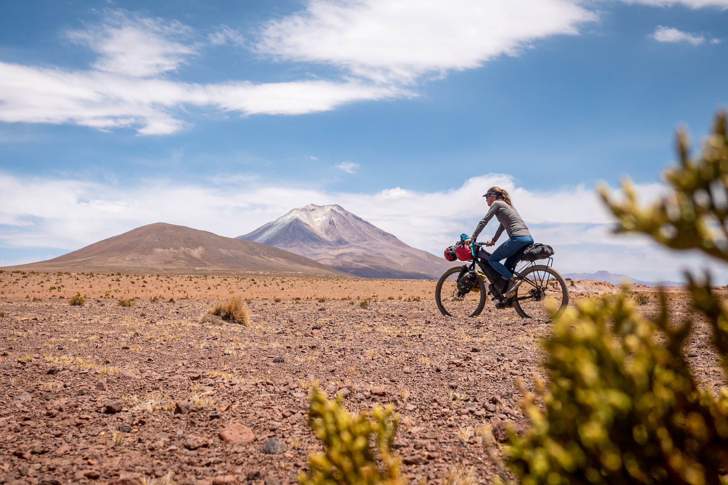
After having spent some time in La Paz and climbing in the Cordillera Real and Sajama, we were eager to get back on our bikes and explore this extensive plateau. Departing Sajama with four or five days’ worth of supplies, we headed towards the Chilean/Bolivian border for the Ruta de las Vicunas. This relatively straightforward route through Las Vicunas National Park boasts flamingos, volcanoes, natural hot springs, and, of course, numerous herds of Vicunas. Jesuit mission settlements, marked by bright white churches, provided a sharp contrast to the desolate Altiplano environment.


Crossing back into Bolivia near Colchane, we made our way to Coipasa, camping on the shores of the spectacular Salar de Coipasa, Bolivia’s second-largest salt flat. As we enjoyed a memorable sunset and engaged in some star-gazing, our anticipation grew for the upcoming salt flat crossings. We opted for the most direct line across our map, plotting a compass bearing as a guide to not deviate too far off track. Despite their name, “salt flats”, the terrain wasn’t exactly that as the combination of a mild rainy season and drastic temperature swings transformed most of Bolivia’s salt flats into a challenging and lumpy surface.
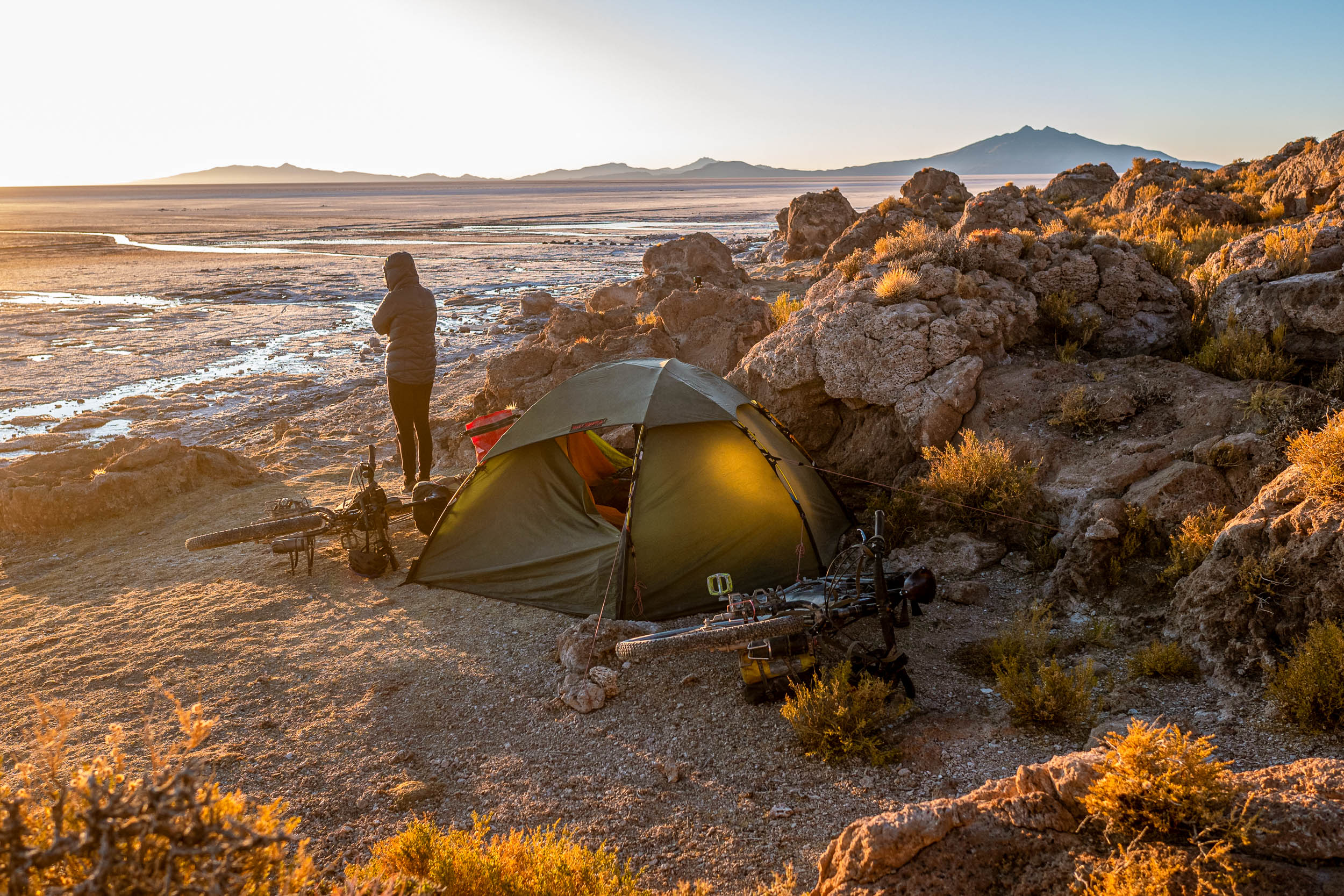
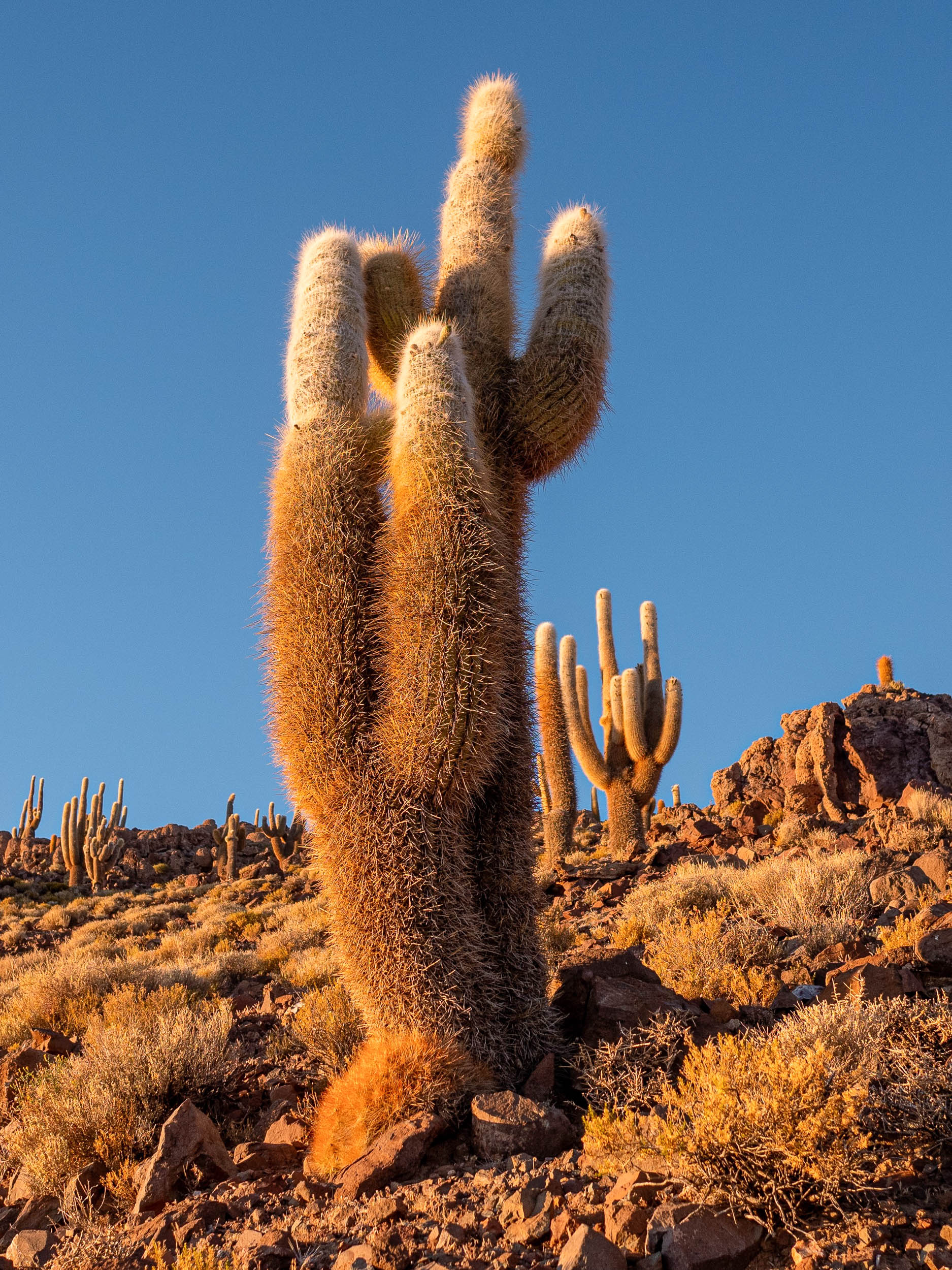
Navigating the Salar de Coipasa was just an introduction to the 130-kilometer crossing of Salar de Uyuni. On the first day, we cycled to its heart, camping on one of the many “islands,” Isla del Pescado. At dawn, the wind was howling, but this didn’t keep us from ascending up the hill between impressive cacti to catch a spectacular sunrise. Fortunately, the wind subsided as we packed up camp and prepared for the crossing ahead. The only navigation to be done was “90 kilometers, due to east,” emphasizing the vastness of the Salar de Uyuni. Traversing it is truly an exceptional experience. It’s difficult to explain and comprehend the sheer expanse of the horizon, the color of the sky, and the profound emptiness. However, it’s no surprise that the actual riding experience isn’t that interesting, and we were more than happy to reach the town of Uyuni in time to enjoy a well-earned pizza with some fellow bicycle travelers.


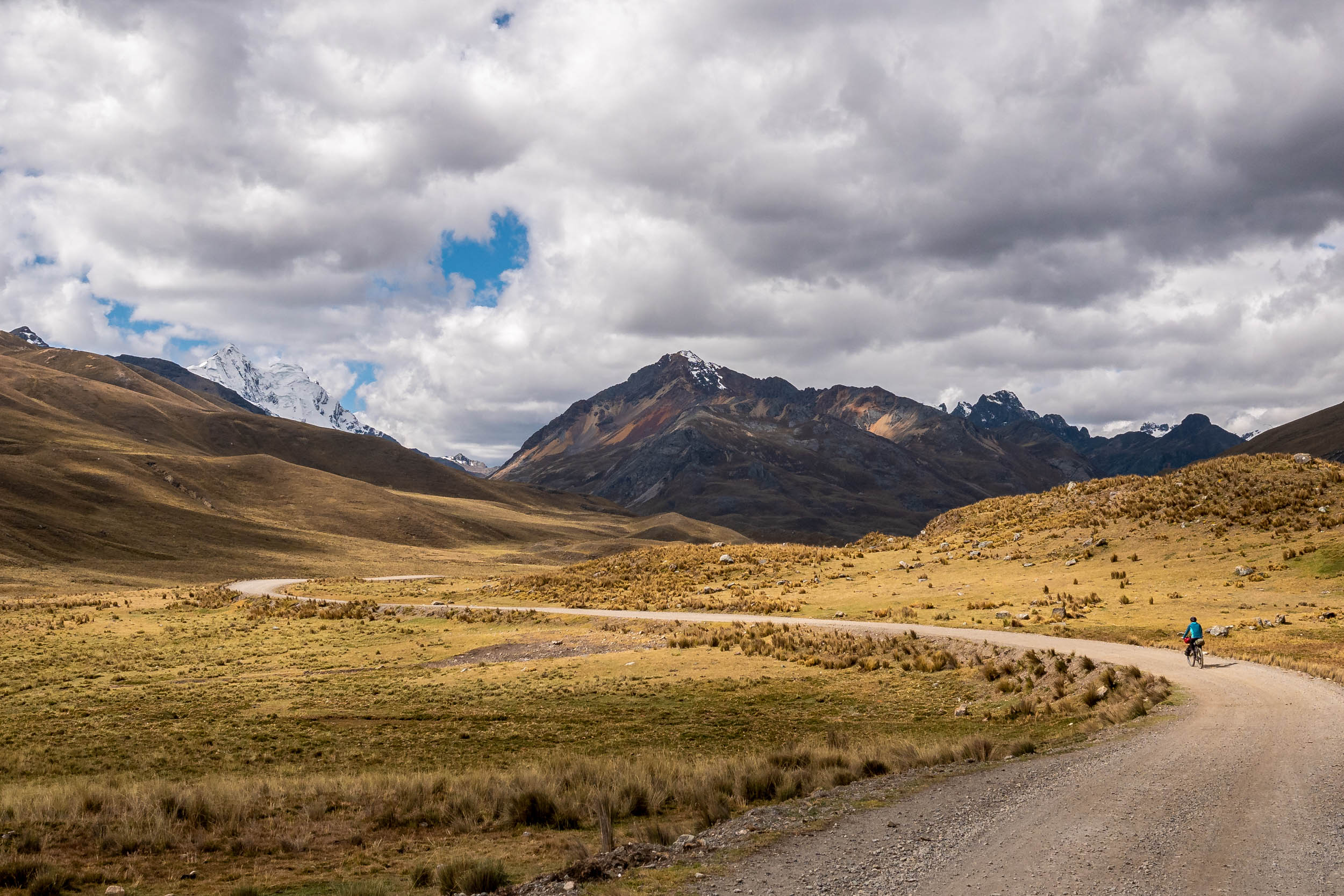
After spending a few days refueling and organizing the shipment of our climbing gear to San Pedro de Atacama, we left Uyuni with a week’s worth of supplies for the final stretch in Bolivia. We traversed some lesser-known salt flats and dirt roads before joining the iconic Ruta de las Lagunas, nestled in Bolivia’s southernmost region, Sur Lipez. This high-altitude region is recognized for its stunning lagoons, flocks of flamingos, towering rock formations, and imposing volcanoes, which makes it favored by many tourist groups and 4×4 adventurers. However, the route’s popularity among motorized vehicles comes at a cost for cyclists. The extensive sandy and washboard roads are a direct consequence of the constant 4×4 traffic. Prepared for the worst, we were surprised to be able to ride most of it without too many issues. Big Tyres 1, Altiplano 0!

After spending the last few months above 3,500 meters, San Pedro de Atacama—situated at a mere 2,600 meters—felt blistering hot compared to the Puna and Altiplano. We’d grown accustomed to wearing our big down jackets as soon as we stopped riding and snuggling into our sleeping bag as night temperatures plummeted to -15°C. Despite being overwhelmed by the daytime temperatures, it was a pleasure spending evenings outside in a breezy T-shirt and shorts. Our plan was to stay a couple of days in San Pedro de Atacama, preparing for what could be our most epic ride to date: the Ruta de Los Seis Miles, and climbing Llullaillaco along the way. Every route we had ridden in the past few months shared some common features, be it isolation, scarcity of water or supplies, high altitude, or challenging terrain. The Ruta de Los Seis Miles combines them all, but more about that story next time…


The Route
Further Reading
Make sure to dig into these related articles for more info...
Please keep the conversation civil, constructive, and inclusive, or your comment will be removed.