


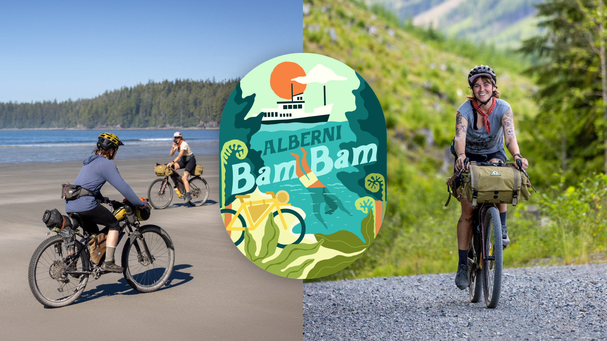
Alberni Bam Bam
Distance
272 Mi.
(438 KM)Days
8
% Unpaved
70%
% Singletrack
2%
% Rideable (time)
98%
Total Ascent
27,030'
(8,239 M)High Point
2,345'
(715 M)Difficulty (1-10)
5?
- 6Climbing Scale Moderate99 FT/MI (19 M/KM)
- 3Technical Difficulty Fair
- 6Physical Demand Moderate
- 4Resupply & Logistics Fair
Contributed By
Miles Arbour
Associate Editor & Events Manager
Route badge and illustrations by Lisa Curtis
Public land access on the lower half of Vancouver Island has been hindered by private lands and tenures associated with the logging industry. Compared to the north half of the island, which is home to the Tree to Sea Loop, taking advantage of the forest service roads is becoming increasingly difficult due to the amount of logging, drier conditions, and the likelihood of forest fires. Complicating things further, some of the last remaining old-growth forests on Vancouver Island are located on these lands, and they aren’t being protected. According to Sierra Club BC, 35 percent of the productive old-growth rainforests that stood on Vancouver Island in 1993 have been destroyed in the last 30 years, and most of what remains isn’t officially protected from logging.
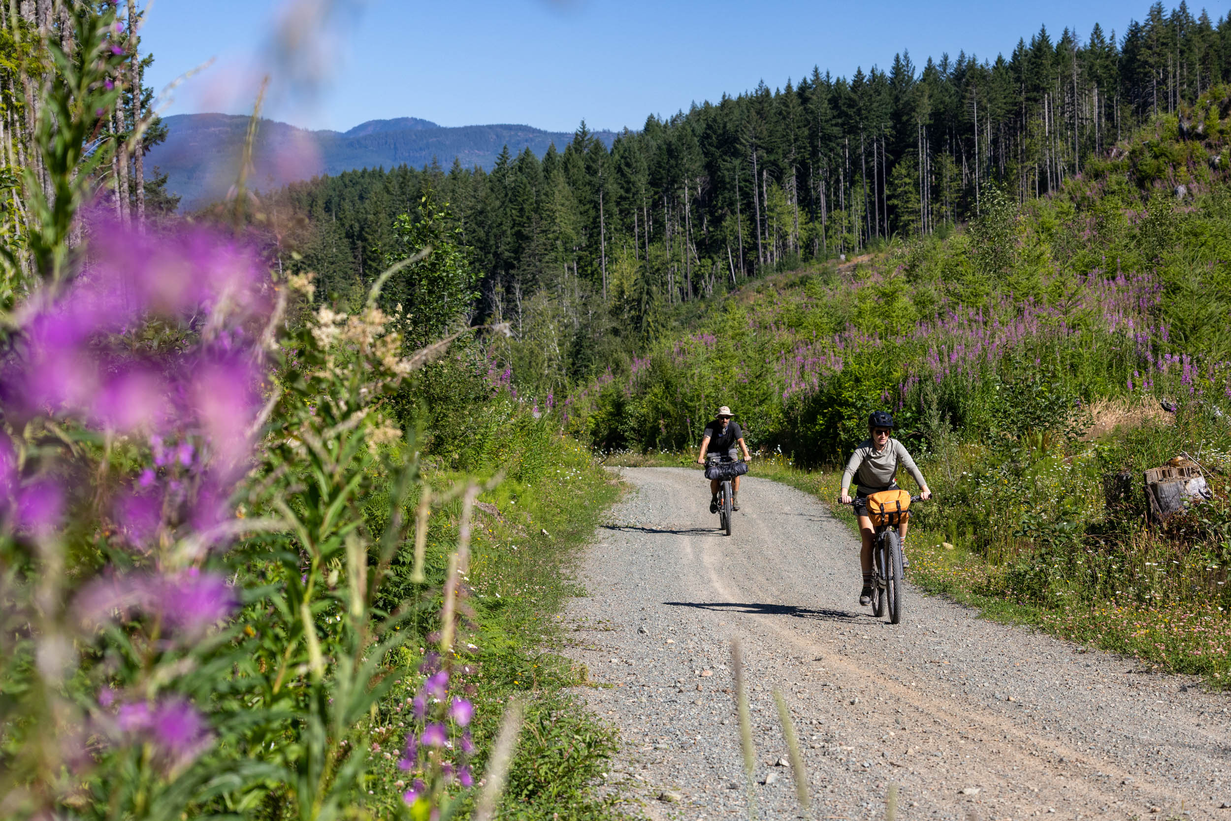
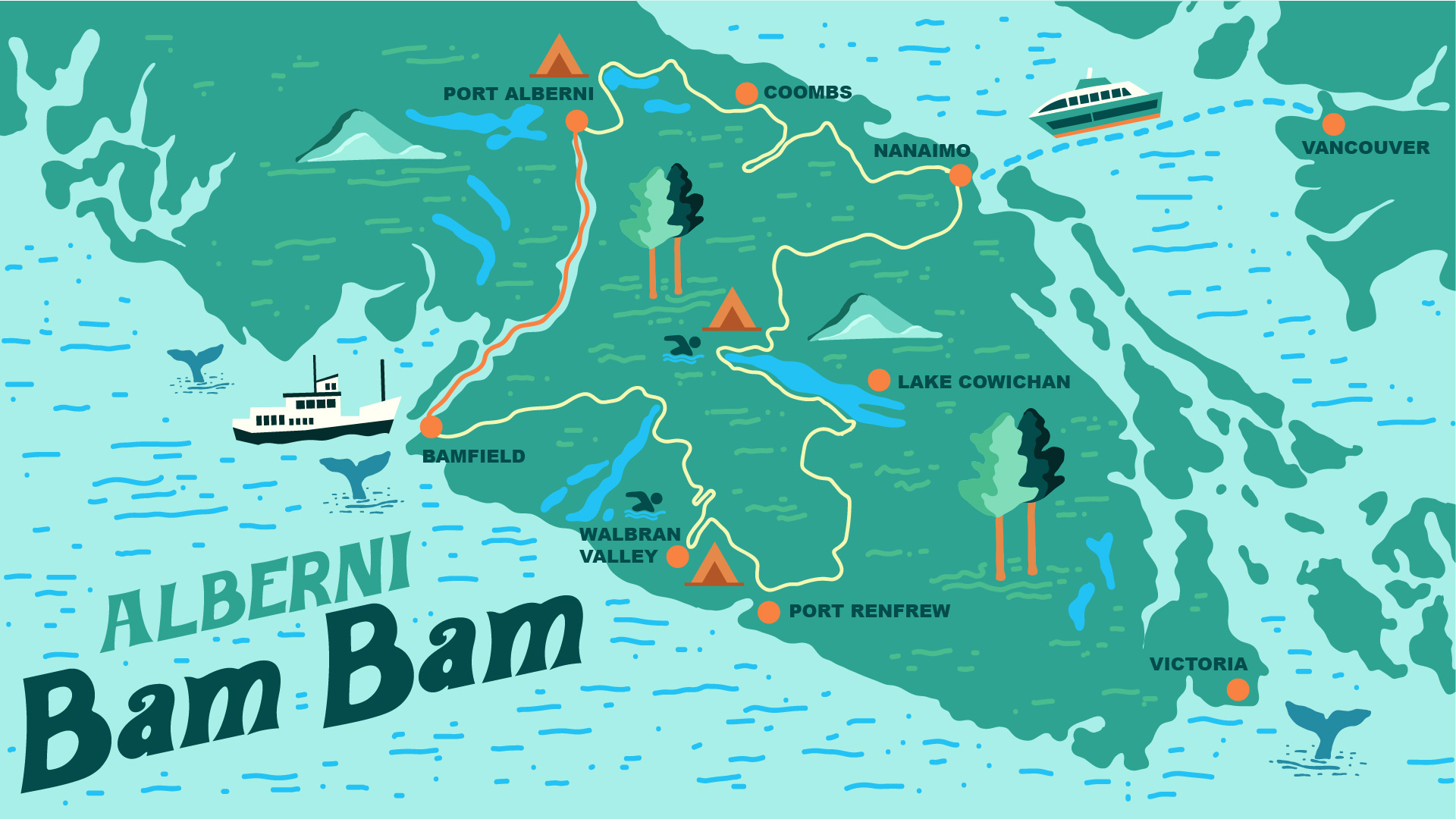
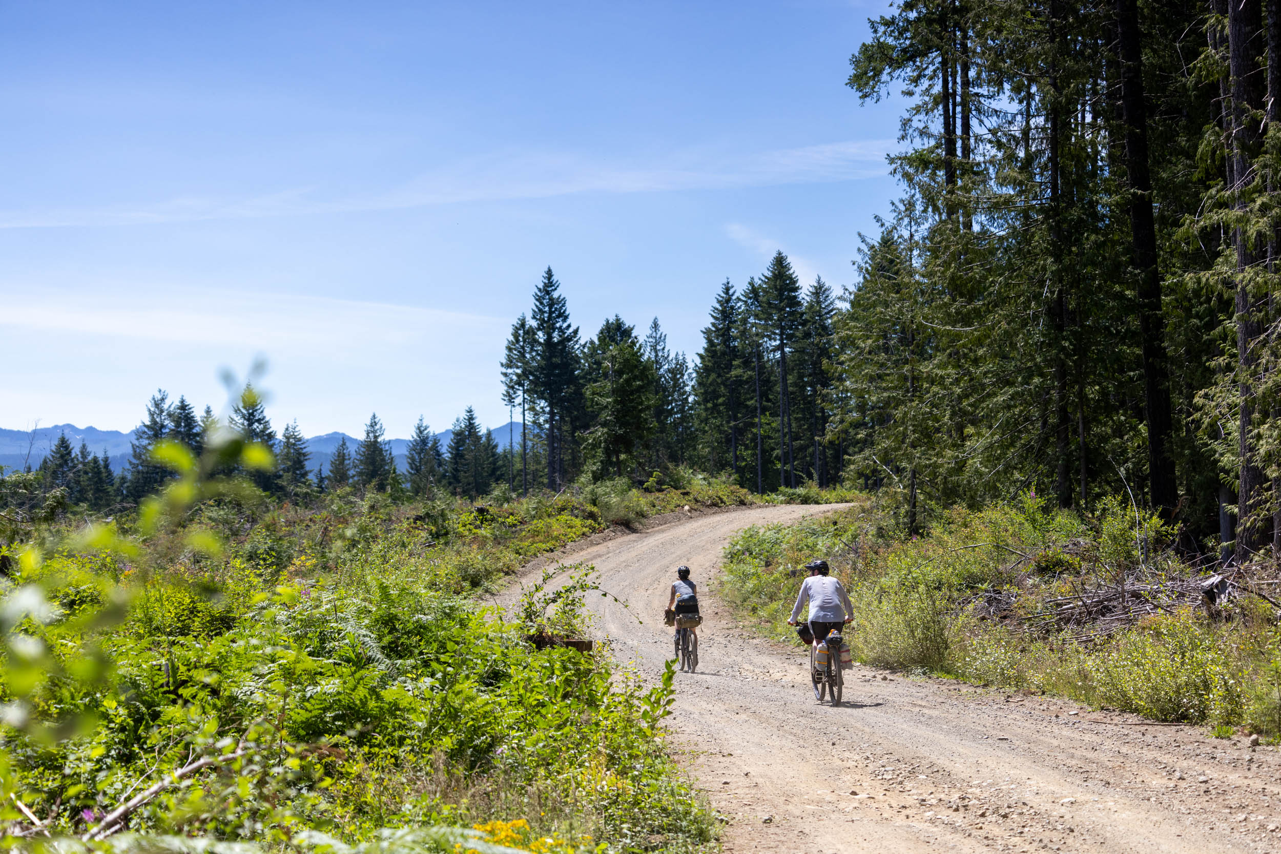
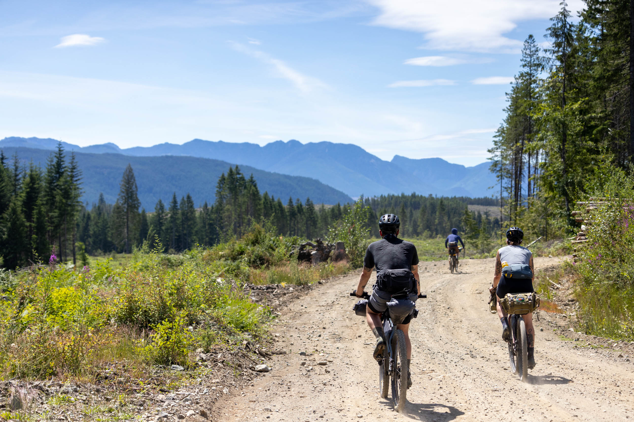
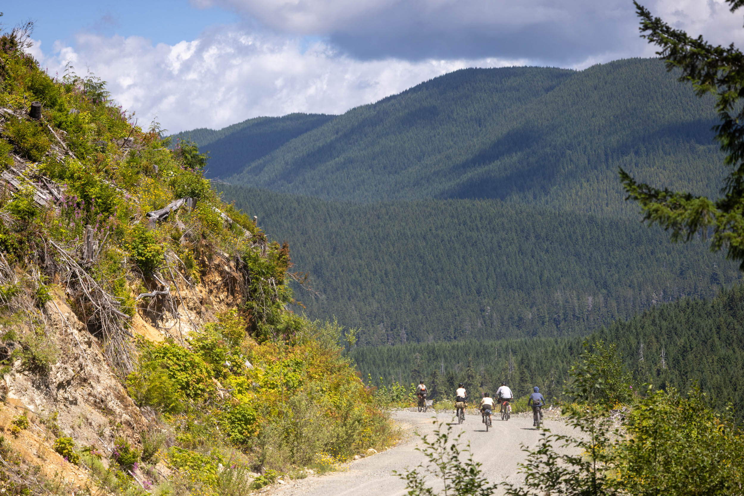
The Alberni Bam Bam forms a loop on the south end of Vancouver Island via forest service roads, old access roads, and occasional stretches of doubletrack. The route prioritizes scenic gravel roads and stunning swimming spots in lakes, rivers, and the ocean. It passes by rainforests that have been at the forefront of the fight against old-growth logging: the Central Walbran Valley and Fairy Creek. The 450-kilometer loop starts and ends in Nanaimo, providing easy access from Vancouver. It cuts through the center of the island via the Cowichan Valley and links Bamfield to Port Alberni via the Alberni Inlet by boat.


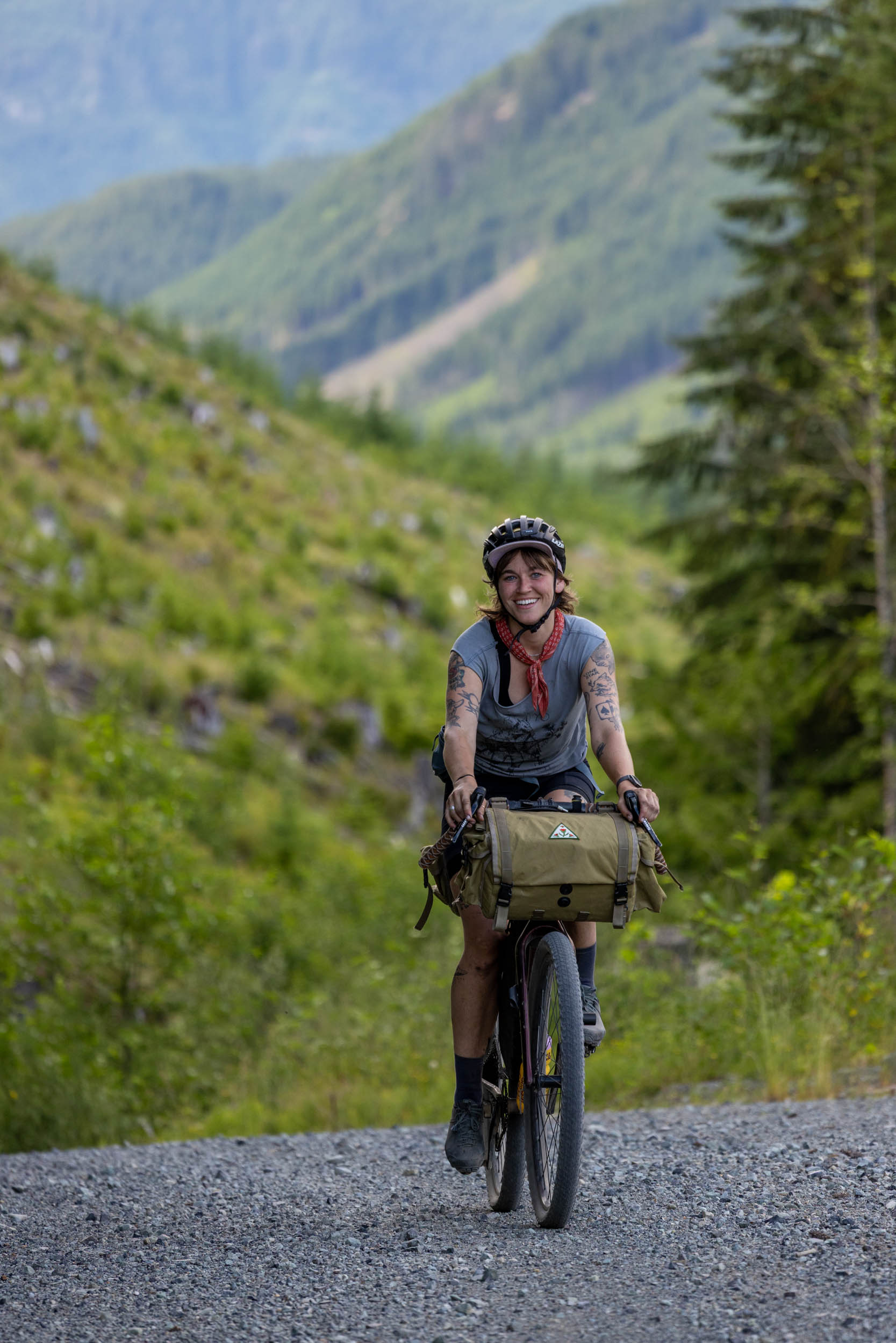
Specifically designed for easy access from the city and mainland, the Alberni Bam Bam starts at the Departure Bay BC Ferries Terminal just outside of Nanaimo. The goal was to create a challenging but logistically straightforward route that doesn’t require the use of a car to access, so Nanaimo was the obvious choice. The route primarily follows forest service roads, and it also includes decommissioned logging roads and doubletrack that are most comfortable on a rigid mountain bike or drop-bar mountain bike. There are also some shorter sections of smooth gravel roads and pavement; this is all-terrain bikepacking at its finest.
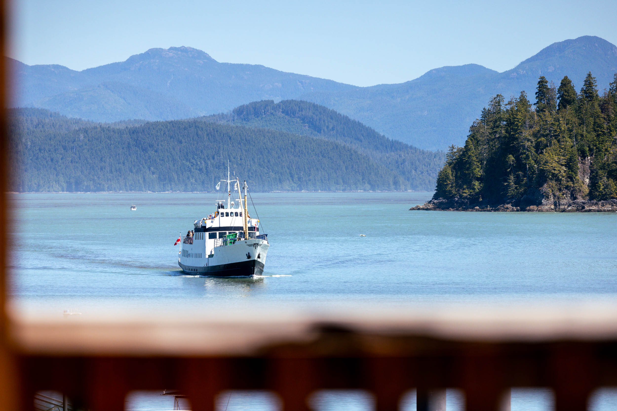
From Nanaimo, the route heads south into the Cowichan Valley to Port Renfrew on the southwest corner of Vancouver Island before arriving at the Walbran Valley, marking the halfway point of the route. From there, riders skirt along the northern tip of Carmanah Walbran Park to Nitinat Lake and Balaats’adt (Nitinaht Village). As presented, the route heads into Bamfield on Barkley Sound, where riders will board the MV Frances Barkley, a 65-year-old heritage ship originating in Norway, inland up the Alberni Inlet to Port Alberni. There is a paved (chip seal) alternative for those who prefer to travel on two wheels. The final 100 kilometers of the route follow logging roads and doubletrack just inland from the East Coast of the island, passing through Little Qualicum Falls, Englishman River Falls, and ending with a pinch of singletrack and rail trail back to the ferry terminal.
Privatized Logging Roads on Vancouver Island
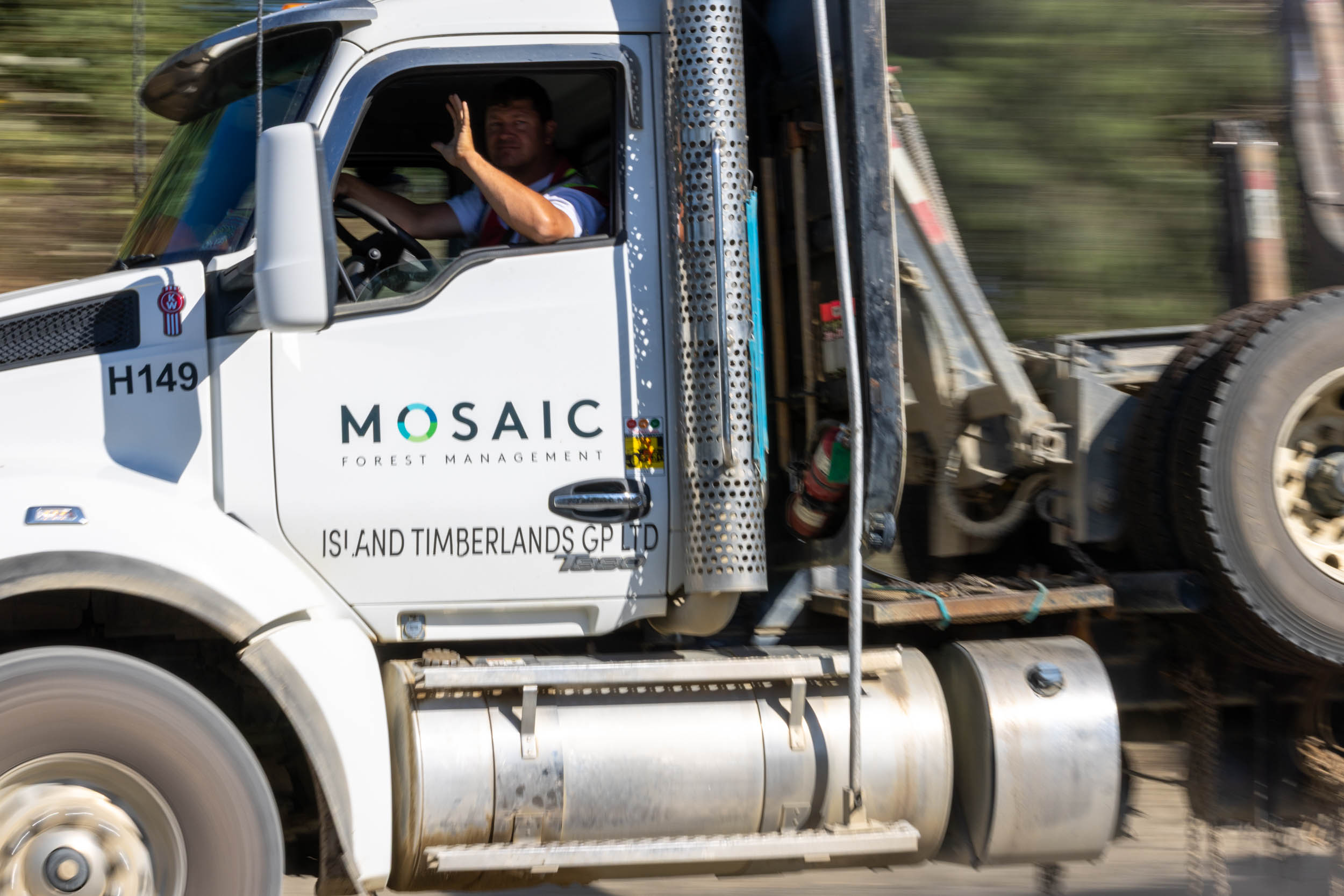
Public land access on Vancouver Island is a contentious issue right now, and the real story has a complex history. The short version is the corridor of land under discussion that runs between Victoria and Campbell River was given to E&N Company to build a railway, and the province of BC gifted the land and the mineral/resource rights as part of the deal. By 1887, half of the proposed railway had been completed, from Esquimalt to Nanaimo, so E&N began selling off the land and its assets. Right up until 2011, the land was privately owned, with the most recent owner being TimberWest, a forestry company. In 2011, TimberWest was acquired by a group of Canadian Pension Fund organizations, which are led by the Government of British Columbia, not Mosaic Forest Management, as the locked gates might lead you to believe. Mosaic is a private contractor that the pension funds hired to manage the ongoing day-to-day forestry activities, and they are responsible for the increase in locked gates and restricted access. Read more at OpenTheGates.ca.
First Nations of Vancouver Island
The First Nations of BC refer to those people who can trace their ancestry to the aboriginal people that inhabited the land prior to the arrival of Europeans and Americans in the late 18th century. There are more than 50 different First Nations on Vancouver Island, located in three distinct tribal regions: Coast Salish, Nuu chah nulth, and Kwakwaka’wakw. This route travels through several First Nation communities and 19 separate Indigenous nations and traditional territories. These Nations account for almost 20 percent of First Nations in all of British Columbia. Before riding the route, we strongly suggest taking some time to learn more about the history of the land and the people where it travels. Head to the British Columbia Assembly of First Nations website to start.
Difficulty
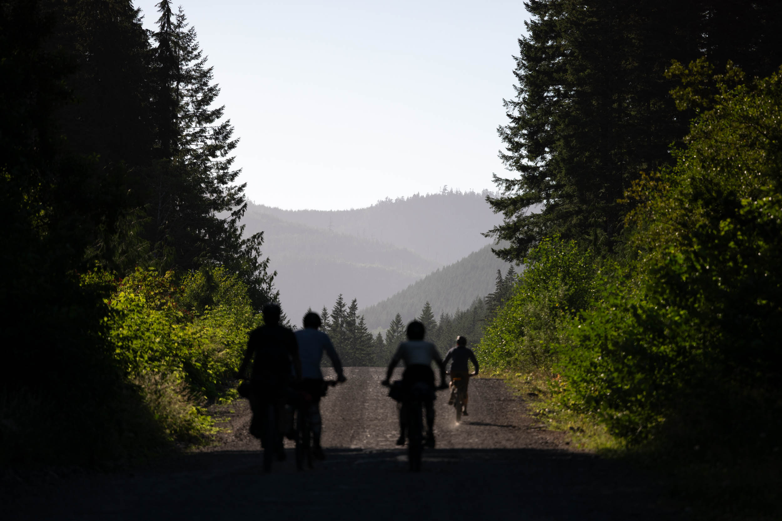
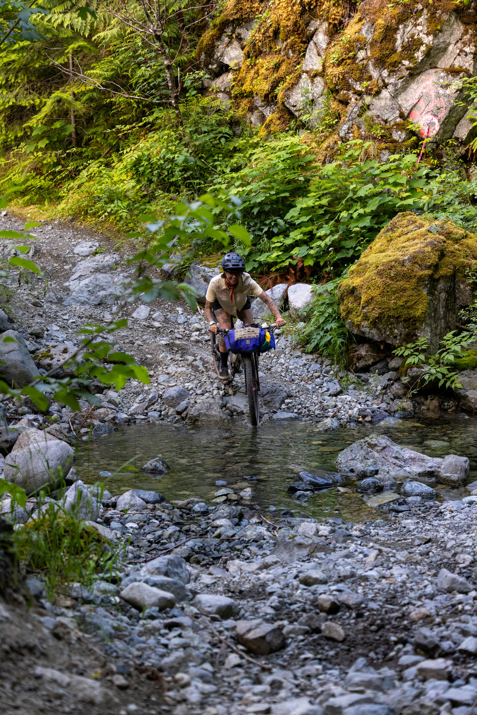
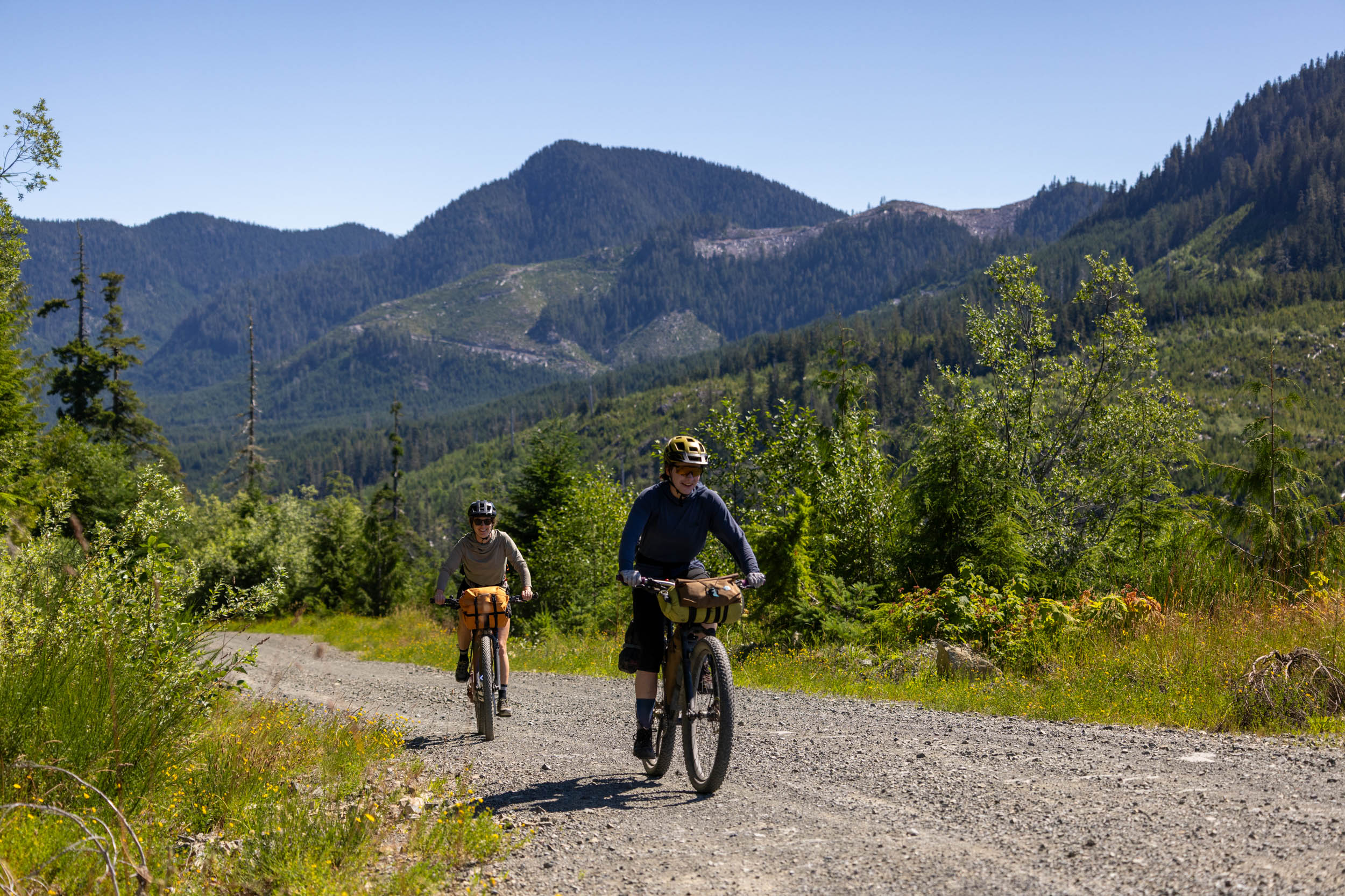
It is always difficult to be sure how challenging bikepacking can be on British Columbia’s West Coast and Vancouver Island. The weather is unpredictable, with a lot of precipitation in the spring and fall, and scorching highs in the heat of the summer. You could be blessed with flowing streams and tolerable temperatures or challenged by dusty roads, full campgrounds, and logging trucks. There are lengthy stretches without resupply or shelter, and riders must be self-sufficient in all conditions. Cellular coverage is limited along much of the route, and a mechanical could turn hazardous for the ill-prepared. Do your research and don’t skimp on the right gear. The route follows gravel roads and doubletrack, with some less-maintained stretches with chunky, riverbed-style descents that may slow your progress. While there’s lots of climbing and steep descents on the route, there are only a few shorter ultra-steep climbs that some may need to push up. Otherwise, the route is almost entirely rideable.
Route Development: I’ve been scheming the potential for a south island alternative to the Tree to Sea Loop since it was published. A common complaint is that getting to the North Island isn’t easy for some, so having a multi-day route that starts and ends in Nanaimo was key. Of course, locked gates make planning a bikepacking route on this part of Vancouver Island very difficult, so to limit the number of gates on the route, I worked with as many locals as possible before scouting the route with friends in July 2025. A special thanks goes out to Nik Kay and Jeremy Robson from the Jumping Slug Community Cyclery in Port Alberni, Jake (aka The Jake Popper), Jude Rich, Stephen Page, and others. Finally, the route scouting trip wouldn’t have been nearly as fun without the company of Skyler Des Roches, Panthea Read, Erin Carolan, Noah Wilcox, Georgia Mingay, and Emily. Additional support by Tourism Cowichan.


Submit Route Alert
As the leading creator and publisher of bikepacking routes, BIKEPACKING.com endeavors to maintain, improve, and advocate for our growing network of bikepacking routes all over the world. As such, our editorial team, route creators, and Route Stewards serve as mediators for route improvements and opportunities for connectivity, conservation, and community growth around these routes. To facilitate these efforts, we rely on our Bikepacking Collective and the greater bikepacking community to call attention to critical issues and opportunities that are discovered while riding these routes. If you have a vital issue or opportunity regarding this route that pertains to one of the subjects below, please let us know:
Highlights
Must Know
Camping
Food/H2O
Trail Notes
 Be sure to watch the video that our friend Tom Powell put together from the scouting trip for an inside look at what to expect from the loop. Tom put a lot of work into the video, and he did an excellent job at capturing the essence of the ride. A special thanks goes out to Tourism Cowichan for supporting this project.
- Visit several small coastal communities, linked together by gravel roads and doubletrack. You’ll get to know the local general stores on an intimate level, and most will be excited by a proper grocery store or sit-down restaurant when they present themselves.
- Numerous BC Recreation campsites are directly on route. Some of our favourites are included on the route map, but there are others. See the Camping and Lodging section for more details.
- The boat ride from Bamfield to Port Alberni is a truly unique experience. The boat makes the trip (both ways) on Tuesdays, Thursdays, and Saturdays year-round, and can be pre-booked by emailing folks at Lady Rose Marine. The four-hour charter provides unforgettable views of Barkley Sound and the Alberni Inlet.
- The multiple long climbs between the east coast and the west coast and back again provide fantastic views of the surrounding mountain ranges and finish with long, grin-inducing descents.
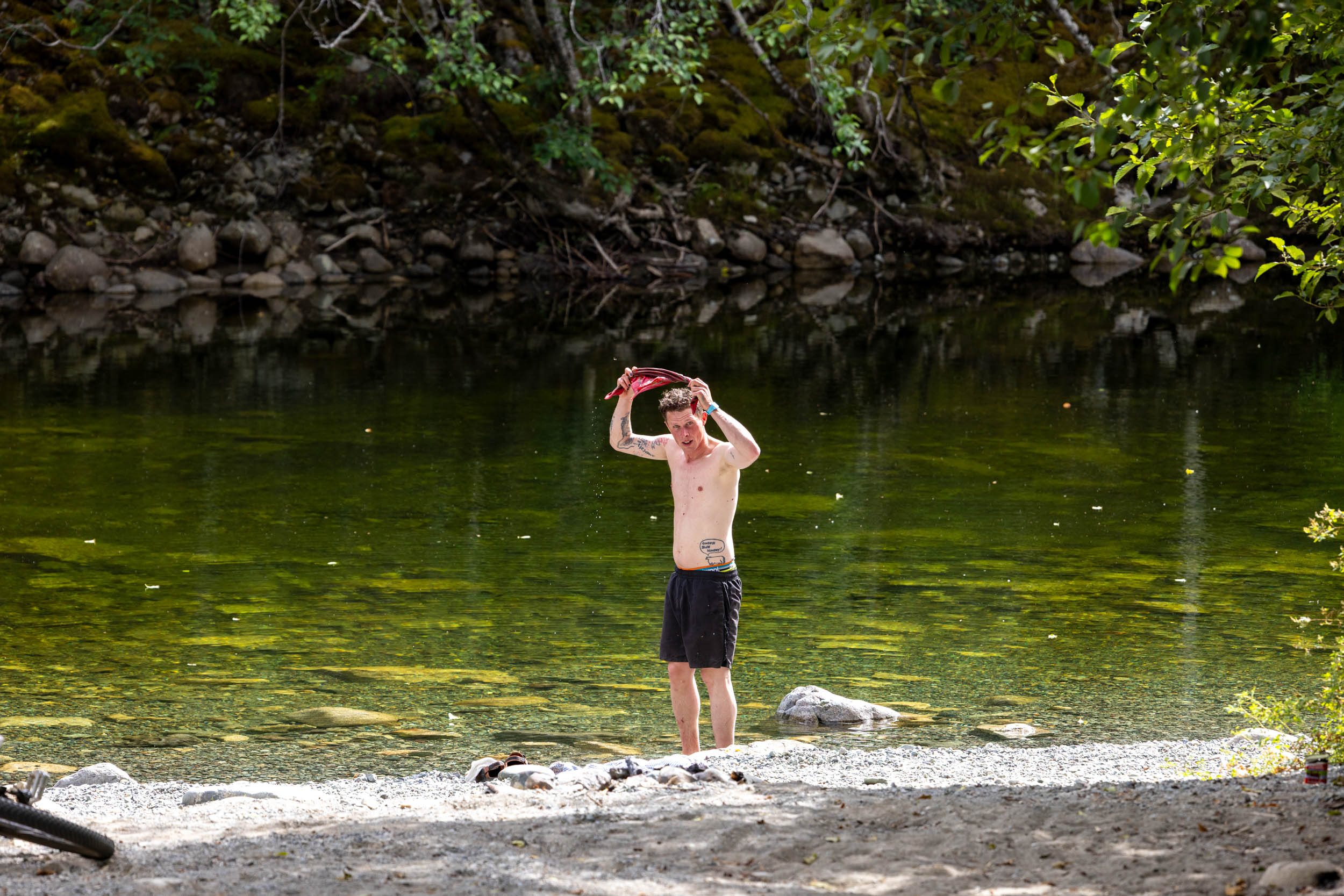
- Some of the best swimming on Vancouver Island, including the Emerald Pools in the Walbran Valley, countless rivers, and the Pacific Ocean, if you’re up for it.
- Options for rest days in Port Renfrew or Bamfield for some much-deserved time off the bike.
- Easy access from Vancouver using the Horseshoe Bay to Departure Bay ferry.
- Ideal bike: A rigid mountain bike or drop-bar mountain bike with at least 2.2″ tires is recommended, but a hardtail with front suspension wouldn’t be overkill. Our scouting group was on a mix of bikes, but most used 29 x 2.4″ tires and were quite happy with our choice. A reliable wide-range drivetrain is beneficial for some of the steeper climbs, and durable tires set up tubeless is a good idea. There aren’t many bike shops along the route, so a reliable setup is crucial. Bring a good repair kit and know how to use it.
- When to ride: The route is best ridden between May and September, as the majority of general stores and resupply points operate during these months. Spring and fall are best for lower daily temperatures but also bring on higher chances for rain and cold nights. Expect rain and sudden weather changes whenever you decide to ride. Spring has a higher chance for winter blowdown and unfavorable/unrideable road conditions, so be prepared to reroute if necessary. It’s best to avoid the heat of the summer (late July/early August), as sometimes the privately managed logging roads close for public access. Find out which gates are closed and when they open here.
- Route direction: The route is best ridden clockwise, as presented, mainly because there are some steep descents that would be less enjoyable to climb up. However, it can be ridden in either direction. Those with a vehicle could theoretically start the route anywhere along the loop, or connect it using the Cowichan Valley 8 route from Victoria.
- Getting Here: Nanaimo is easily accessed via ferry from Vancouver by bike or with a vehicle. For those coming from elsewhere on the island, BC Transit has routes that run between Victoria and Nanaimo, and most bikes can be accommodated. Call ahead to confirm. Air Canada and West Jet have flights into the Nanaimo Airport, departing from Calgary, Vancouver, and Kelowna.
- Hullo Ferry is a fast, walk-on only option between Vancouver and Nanaimo, and as of September, 2025, they also allow bicycles. Bikes cost an additional $30 (one way) and need to be reserved when booking your ticket.
- Parking: There is paid long-term parking available at the Departure Bay ferry terminal and at the Nanaimo Airport.
- Long-term access: As with most routes that follow forest service roads, some sections are susceptible to public closure without much notice. For continued access, we strongly suggest everyone spread the word of the route during your ride, or better yet, tell the local government, Ministry of Tourism, and Ministry of Forests about the route and the benefits that bikepackers can bring to these small communities.
- Large off-road logging trucks use these roads and will not get out of your way. It’s your responsiblity to get off the road to let them pass safely. Don’t wear ear buds, and be aware at all times. There is the chance that you’ll pass through active logging areas, so follow all signage and be prepared for potential detours. Most importantly, be friendly and wave. Check the Mosaic access map before heading out to see what gates are closed and when./li>
- This area contains habitat for many wild animals, including bears, cougars, and wolves. Be bear and cougar aware, always carry bear spray, and hang your food at night. While riding, talk loudly and make noise. It is far too easy to come around a corner and startle a wild animal, and unnecessary interactions should be avoided.
- A boat ride between Bamfield and Port Alberni is designed into the route, but it is not mandatory. Boat charters cost $47.50 + $15 for bikes, and the boat travels between the two communities three times a week, all year long. Learn more and book your sailing at LadyRoseMarine.com. For those who don’t want to take the boat, you can take Bamfield Road to Franklin River Road to rejoin in Port Alberni. This section is just under 60 kilometers, with 800 meters of elevation. It is paved (chip seal) and often busy with tourist traffic.
- Cell service is spotty along most of the route. Telus seems to offer better coverage. Most libraries and some coffee shops/restaurants will have public wifi. It’s a good idea to bring a satellite communication device like a SPOT or Garmin inReach just in case.
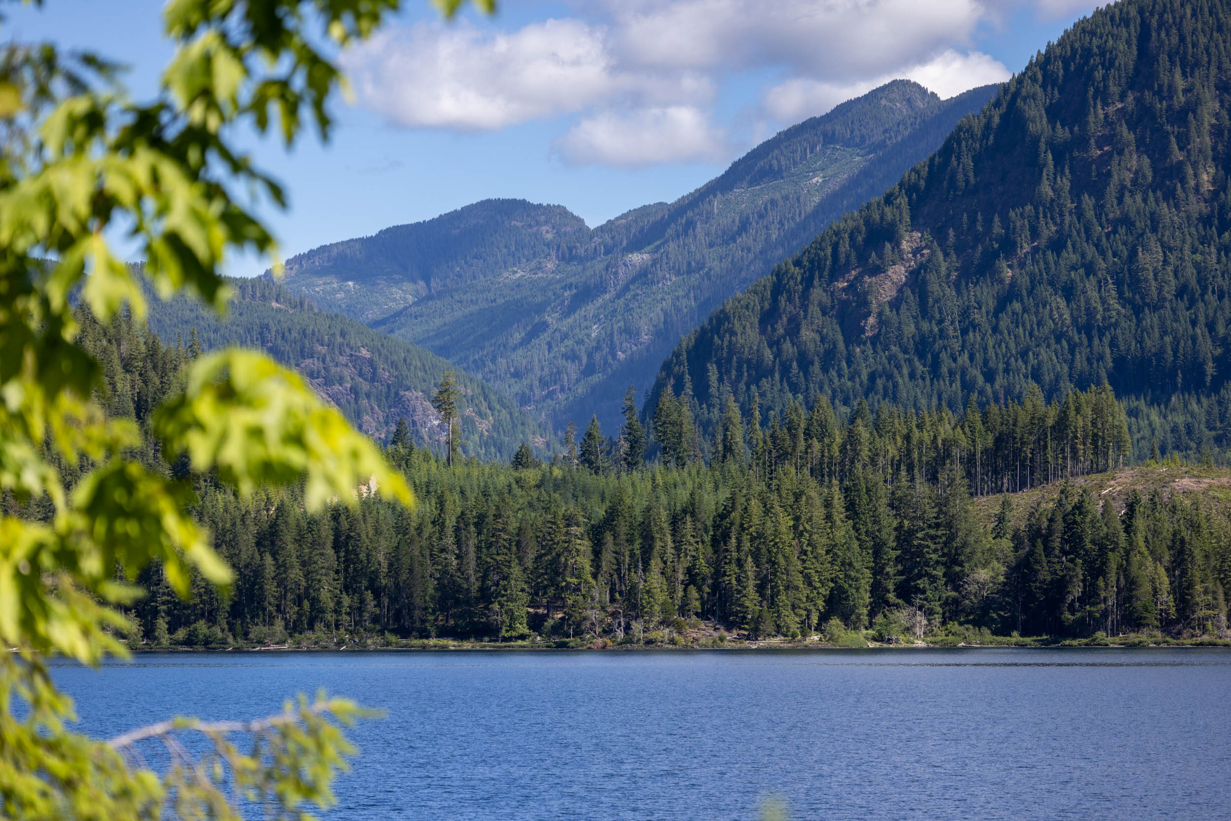
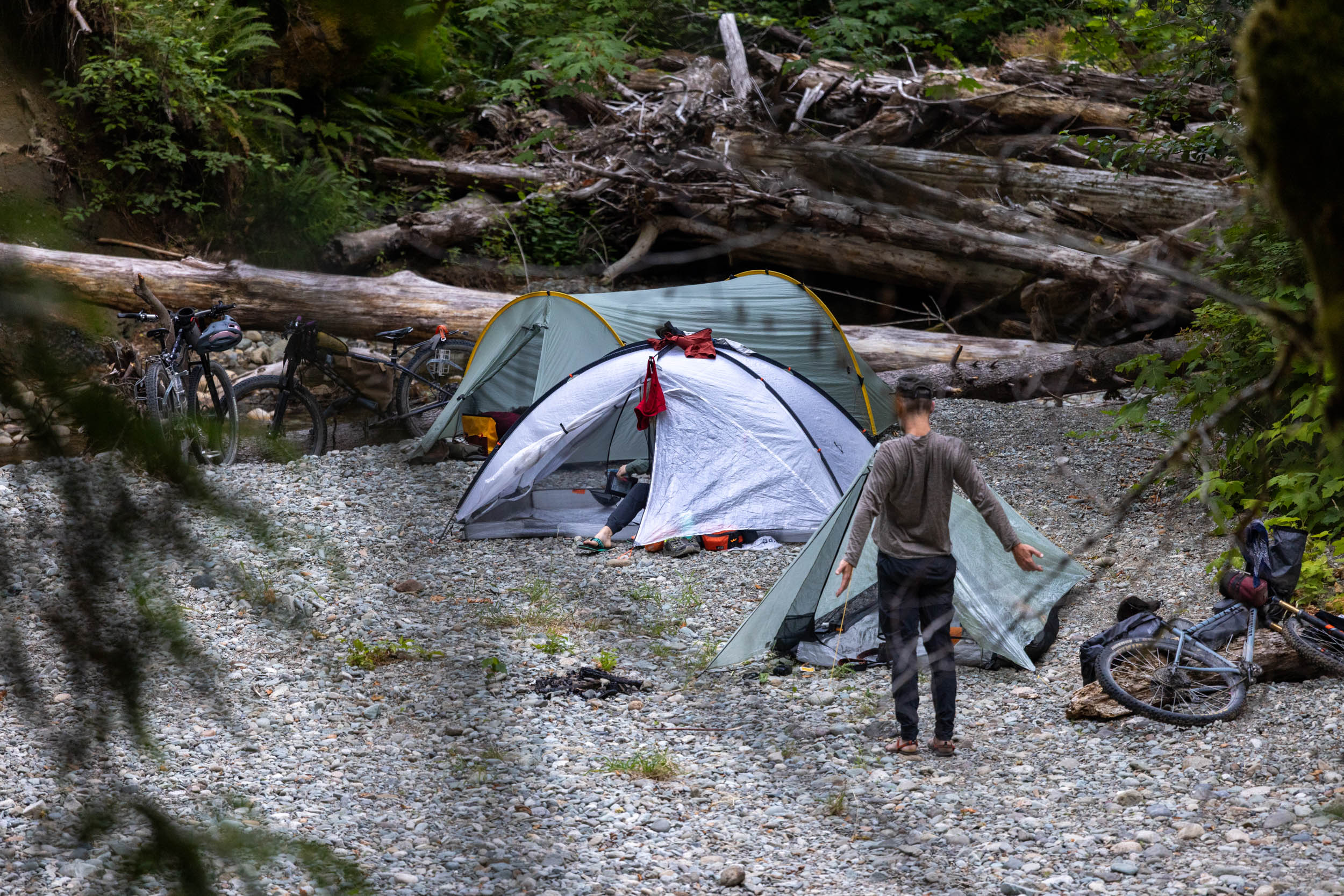
- There are tons of BC Recreation Sites and established campgrounds along the route for camping, the majority of which have fire rings, pit toilets, and picnic tables, as well as beautiful lake access for swimming and fishing. Some of our favourites include the handful on Cowichan Lake, Lizard Lake, the Walbran Valley, Flora Lake, Pachena Campground in Bamfield, and Horne Lake. Most established campsites are added to the route map, but there are many others.
- While the majority of campsites are free, some require a small cash-only fee of $10 to $20. It’s a good idea to bring some extra cash with you as ATMs are few and far between.
- There are a few resorts and cabin rentals available in most communities on the route, including Lake Cowichan, Port Renfrew, Bamfield, Port Alberni, and Nanaimo.
- The larger established campgrounds and Provincial Parks accept reservations and normally fill up early. They often won’t make space for cyclists if you show up late, so you’ll need to make friends with another camper or get creative.
- A good portion of the route travels on privately managed logging land, and while wild camping is possible, it’s not necessarily legal. Stick to designated campsites if possible. No matter where you camp, remember to #LeaveNoTrace.
- There are basic resupply points every one to two days, depending on daily mileage. Almost every community has a general store or little grocery store, and most have small restaurants and hot food available. Call ahead or plan accordingly if you’re unsure.
- Freshwater lakes, streams, and rivers are abundant. Bring a filter and expect to carry at least two liters at all times, maybe more in summer. Some coastal campsites won’t have access to fresh water, so bring extra to camp if you’re unsure.
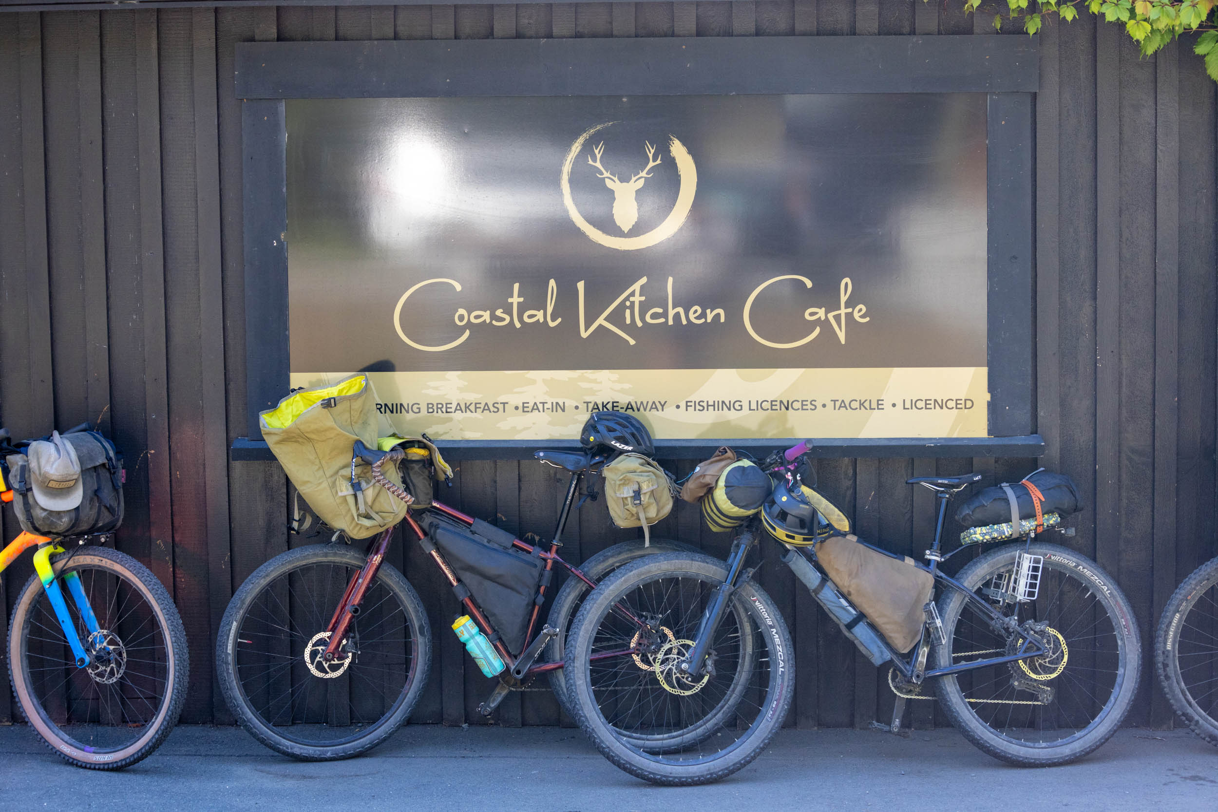
- Some favorite food stops include the Honeymoon Bay General Store, Coastal Kitchen Cafe (Port Renfrew), Nitinaht Gas Station and Cafe, Flora’s (Bamfield), and the Coombs Country Market.
- There aren’t many camping stores that sell pressurized fuel canisters or liquid camp stove fuel, so stock up in Nanaimo at Valhalla Pure or Mountain Warehouse before heading out.
A Sample Eight-Day Itinerary
Here is a sample eight-day itinerary, based on an attainable daily mileage, lazy mornings, and spending lots of time exploring caves, taking photos, and time in towns. A rest afternoon and morning is also built in before the boat ride from Bamfield and afterwards in Port Alberni. Depending on your fitness level, time of year, weather, and preferences, the route is easily rideable in eight days or under or expanded into a 10+ day trip with rest days and side trips. The distances below are approximate.
- Day 1: Nanaimo to Cowichan Lake (70km + 1,300m)
- Day 2: Lizard Lake (80km + 1,600m)
- Day 3: Walbran Valley (60km + 1,400m)
- Day 4: Flora Lake (65km + 1,600m)
- Day 5: Bamfield (40km + 600m)
- Day 6: Afternoon Boat Ride to Port Alberni + Accommodations or Wild Camp (10km)
- Day 7: Englishman River Provincial Park (65km + 800m)
- Day 8: Finish in Nanaimo (60km + 700m)
Route Details
Nanaimo to Cowichan Lake
The route starts at the Departure Bay BC Ferries terminal in Nanaimo to make it easy for folks coming from Vancouver to access the route. You’ll follow a mix of bike paths and quiet paved roads south, gradually escaping the hustle and bustle of the city. The first taste of gravel is on a lesser-used forest service road on the way to Nanaimo Lakes, climbing nearly 500 meters to get there. Before Fourth Lake, the route heads south for the final climb of the day before a fantastic gravel descent toward Cowichan Lake. There are some wild camping options around the lake, as well as popular reservable campsites on the lake. Little Shaw is walk-in only and run by Mosaic, and Nixon Creek has 24 first-come-first-serve campsites and 35 reservable spots.
Cowichan Lake to Lizard Lake
The route follows the south shore of Cowichan Lake to Honeymoon Bay and the route’s first resupply stop, the Honeymoon Bay General Store! Stock up on snacks and keep moving, or if you have time, order hot food to enjoy some time off the bike. If you’re lucky, the farmer’s market will be going on across the street. You’ll leave the valley via Gordon River Road before crossing over to Pacific Marine Rd. This section of the route is one of the busiest, with plenty of tourist traffic heading south to Port Renfrew. Ride single-file, stop at some of the roadside points of interest, and cross your fingers for a spot at Lizard Lake Rec Site. There are walk-in sites at the north end of the lake, a day-use area in the middle, and the normal campground is on the other side.
Lizard Lake to the Walbran Valley
It’s a leisurely 20-kilometer cruise into Port Renfrew, the next community and resupply point of the route. Port Renfrew is the northwestern tip of the Juan de Fuca wilderness hiking trail, so expect to see some backpackers hanging around the general store and local cafes. There are also hiker huts available to rent, if the weather calls for some proper accommodations; otherwise, it’s time to head north into the Walbran Valley. You’ll pass by several neat roadside attractions, including Avatar Grove and Big Lonely Doug. There’s a short mandatory hike-a-bike on a decommissioned road to continue on Bugaboo Main, which leads to a lovely descent into the Walbran Valley. Find a spot to camp (there are some truly wonderful spots across the bridge and down by the river on the right), walk to the Emerald Pools for a dip, and if you have energy for a hike, go check out some of the last remaining old-growth forests. Give yourself a high-five, you’re practically halfway there!
Walbran Valley to Flora Lake
You might be dreading the climb out of the valley, but I promise you it’s not nearly as challenging as you’d expect. After rejoining the main loop, the route continues to climb, serving up incredible views of the valleys to the west. It’s a fast 20-kilometer descent to Nitinaht Village, the Nitinat Campground, and the local gas station, which has a small coffee shop, a kitchen with hot food, and all the standard snacks you’ll likely be craving. The current hours show the gas station closed on the weekends, so plan ahead or call to make sure they’re open when you’re coming through. Want to take a day off? Nitinaht is one of the best kiteboarding locations in Canada because of its steady and consistent winds. Elevation Kiteboarding offers lessons for beginners! Heading north, there are options to push on to the Flora Lake Rec Site or wild camp just off Carmanah Main by the river.
This would also be a good time to check your reservation time for the boat between Bamfield and Port Alberni, because you’ll be in Bamfield the next day. For those who prefer to ride to Port Alberni, the turnoff is marked on the map, which takes Bamfield Road to Franklin River Road, linking back up with the route at the tip of the Alberni Inlet. However, we recommend taking the boat as the road is busy with tourist traffic, hilly, and there is no shoulder for much of the ride.
Flora Lake to Bamfield
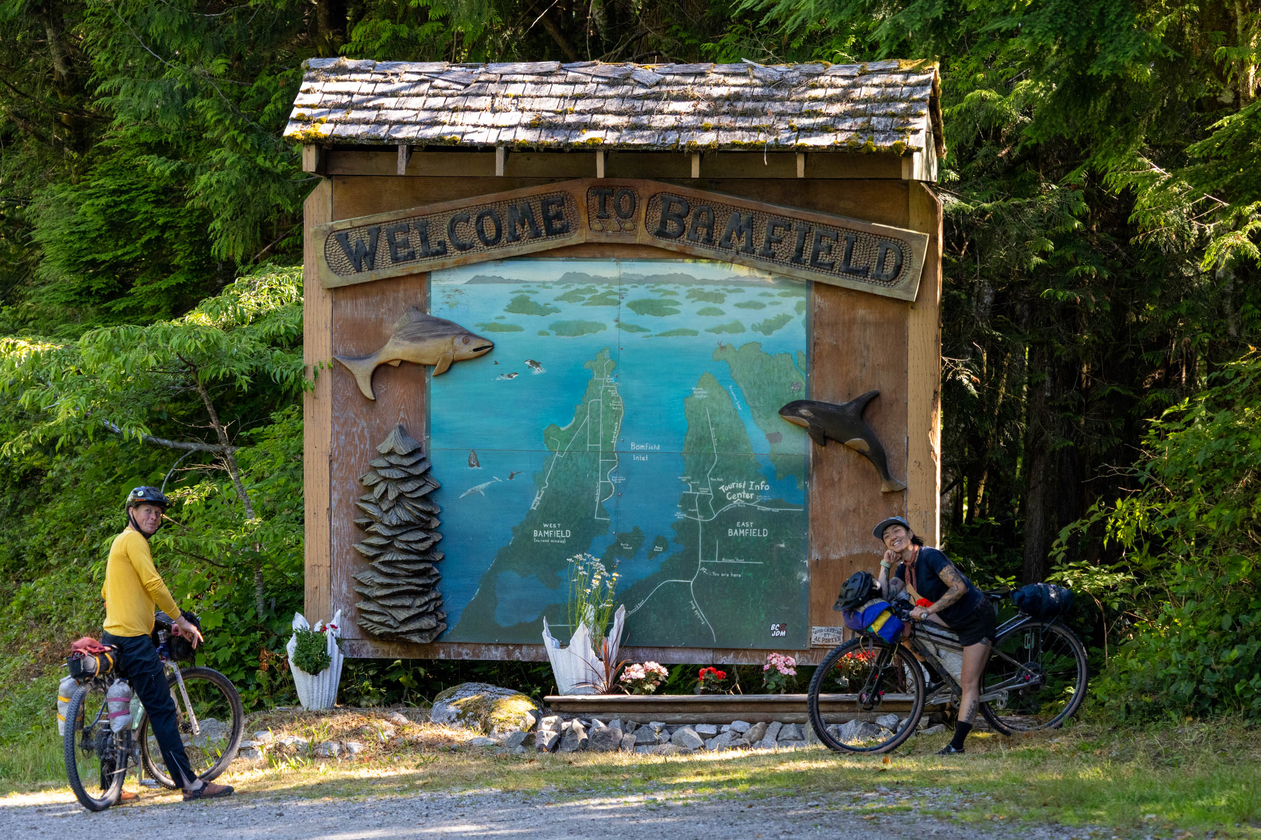
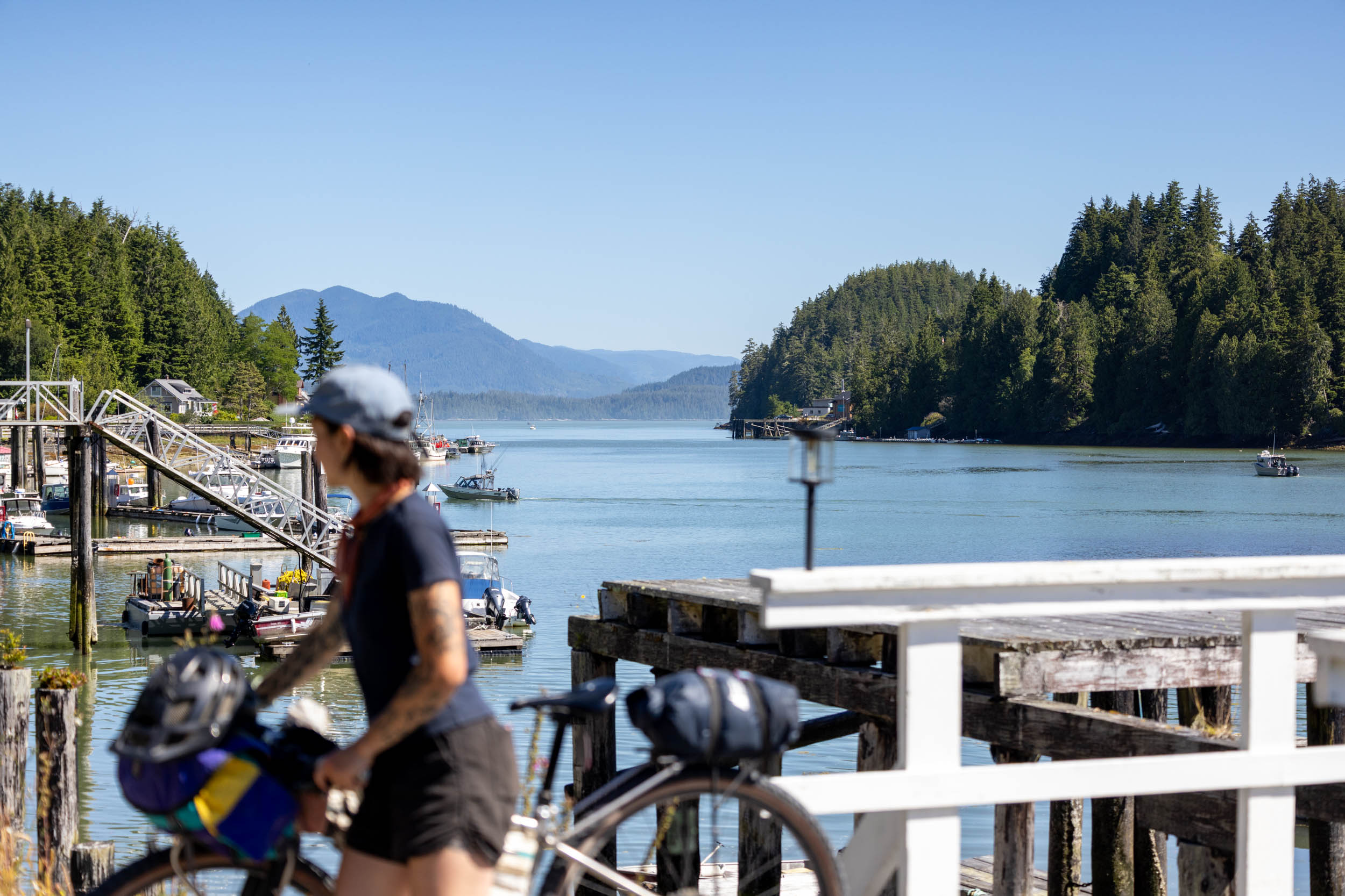
It’s a short 40-kilometer ride to Bamfield, which could either be tackled in the morning before the boat leaves or worked into a rest day in Bamfield. Pachena Campground is a lovely but popular spot on Pachena Bay, and it’s a good place to camp or rest on the beach before getting into town. In town, the west side of Bamfield isn’t connected by roads to the east side, so you’ll need to pay for a water taxi to get across. It’s worth the ride over, as two fantastic restaurants are on the west side: Bamfield Wreckage and Flora’s, and Brady’s Beach is also worth leaving some time to explore. It was a highlight of the trip for our group. There’s a local campground, motels, and inns available. For those continuing on, the MV Frances Barkley to Port Alberni picks up on both the East and West sides of town. Show up to the dock early, listen to the employees, and enjoy the ride.
Bamfield to Port Alberni
The rest day continues with a four-hour boat ride on the MV Frances Barkley up the Alberni Inlet. The boat is a 65-year-old heritage ship originating in Norway. After trekking through the Atlantic Ocean to Vancouver Island, she started her current route in 1990 and now travels between Port Alberni and Bamfield three times a week, all year long. The boat has a small kitchen, cold drinks, toilets, charging outlets, and indoor/outdoor seating. You’ll arrive in the evening in Port Alberni, which is a good chance to continue relaxing with paid accommodation, a stop at the grocery store, or a bite to eat. There’s a nice wild camping spot on a rocky riverbed by a creek marked on the route map for an easy camp spot close-ish to town.
Port Alberni to Englishman River Provincial Park
If you’re having bike troubles, the only bike shop on the route is in Port Alberni, so head into The Jumping Slug Cyclery. You’ll tackle a fairly steep climb out of the valley toward Horne Lake, passing by the Horne Lake Caves and Horne Lake Regional Park campground. It’s worth stopping at the Spider Lake picnic area for a snack or swim before pushing on toward the exposed hydro-line trail to Little Qualicum Falls. After the falls, the route follows a mix of paved back roads and ATV trails east toward the Englishman River. It’s well worth the short detour to Coombs, where several tourist-trapping stores and restaurants await. You’ll ride a paved road south to Englishman River Provincial Park. If the campground is full, try to make a friend or head down to the Hammerfest MTB trailhead off Errington Road to wild camp.
Englishman River to Nanaimo
After looping around the Englishman River to access a bridge, the route follows some well-used logging roads with frequent logging truck traffic back toward Nanaimo. This section of the route is dry and dusty in the summer months, so make sure you fill up on water and snacks before the final stretch. Right before town, the route passes by the Dumont Trails and includes the Fine China flow trail. The trail has loads of berms, isn’t steep, and is rideable on any type of bike, but it’s easily avoided by continuing on the road into town. You’ll wind your way around the Island Highway using the E&N Railtrail before ending back at the Departure Bay Ferry Terminal. Congratulations, you just completed the Alberni Bam Bam!

Terms of Use: As with each bikepacking route guide published on BIKEPACKING.com, should you choose to cycle this route, do so at your own risk. Prior to setting out check current local weather, conditions, and land/road closures. While riding, obey all public and private land use restrictions and rules, carry proper safety and navigational equipment, and of course, follow the #leavenotrace guidelines. The information found herein is simply a planning resource to be used as a point of inspiration in conjunction with your own due-diligence. In spite of the fact that this route, associated GPS track (GPX and maps), and all route guidelines were prepared under diligent research by the specified contributor and/or contributors, the accuracy of such and judgement of the author is not guaranteed. BIKEPACKING.com LLC, its partners, associates, and contributors are in no way liable for personal injury, damage to personal property, or any other such situation that might happen to individual riders cycling or following this route.
Please keep the conversation civil, constructive, and inclusive, or your comment will be removed.