


Around the Babines
Distance
68 Mi.
(109 KM)Days
2-3
% Unpaved
95%
% Singletrack
10%
% Rideable (time)
98%
Total Ascent
6,914'
(2,107 M)High Point
5,971'
(1,820 M)Difficulty (1-10)
5?
- 7Climbing Scale Strenuous102 FT/MI (19 M/KM)
- 6Technical Difficulty Moderate
- 6Physical Demand Moderate
- 4Resupply & Logistics Fair
Contributed By
Miles Arbour
Associate Editor & Events Manager
Additional insight and photos by Aly Winkler
Unlike most of the bikepacking routes I’ve published, which involve a good amount of research and planning beforehand, Around the Babines sort of fell into my lap. This spring, Emily and I took a week off from work to ride mountain bikes in northern British Columbia, and we heard from some folks that we should check out the area east of Smithers for some stunning gravel riding. One look at Trailforks revealed two bike-friendly trails located within Babine Mountains Park: Cronin Trail and Silver King Basin. Being adverse to out-and-backs, I quickly traced out a loop connecting both trails via surrounding gravel roads, and Around the Babines was born. Emily and I rode it as a massive day ride, and a few weeks later, Aly Winkler tackled it as a three-day bikepacking trip.
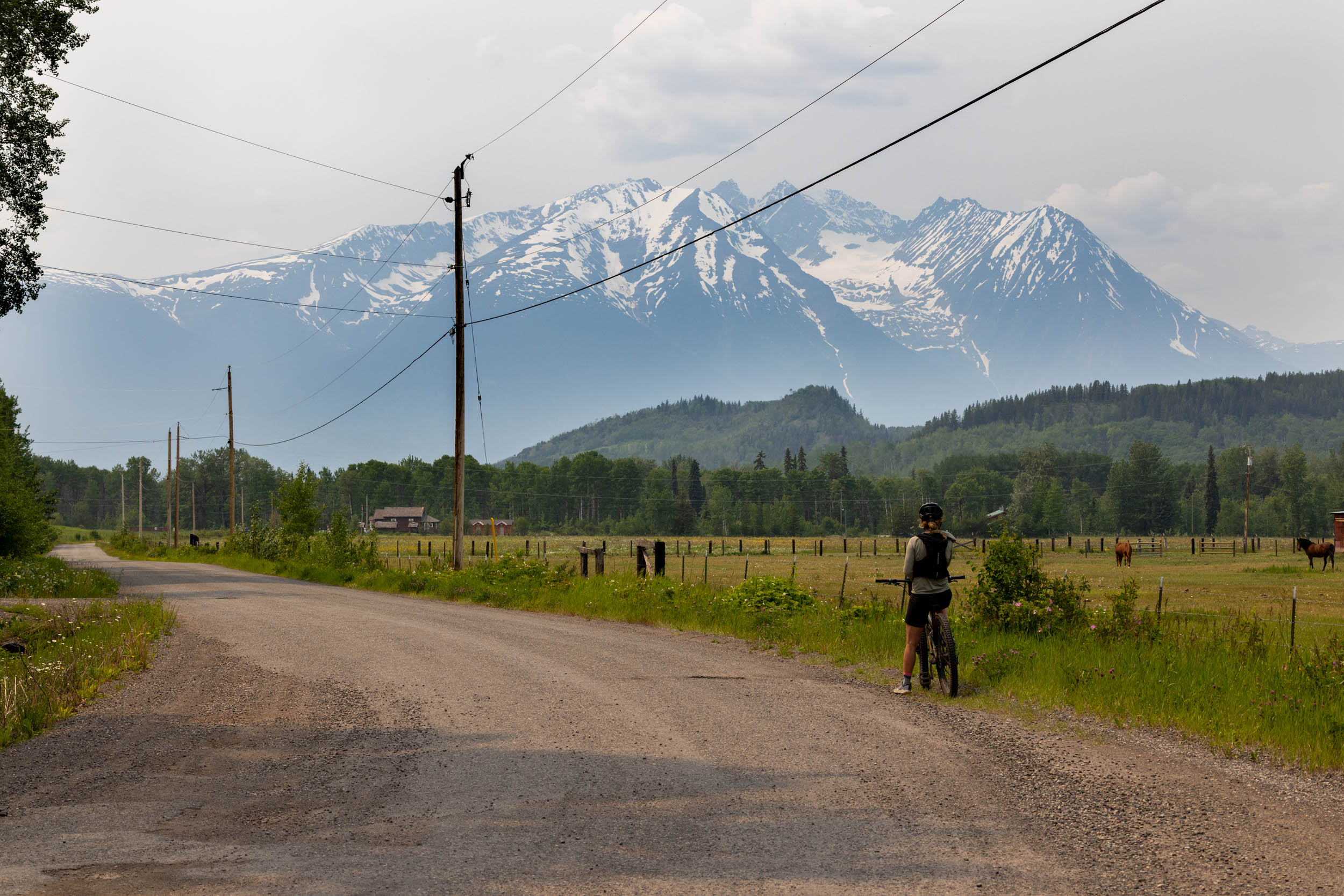
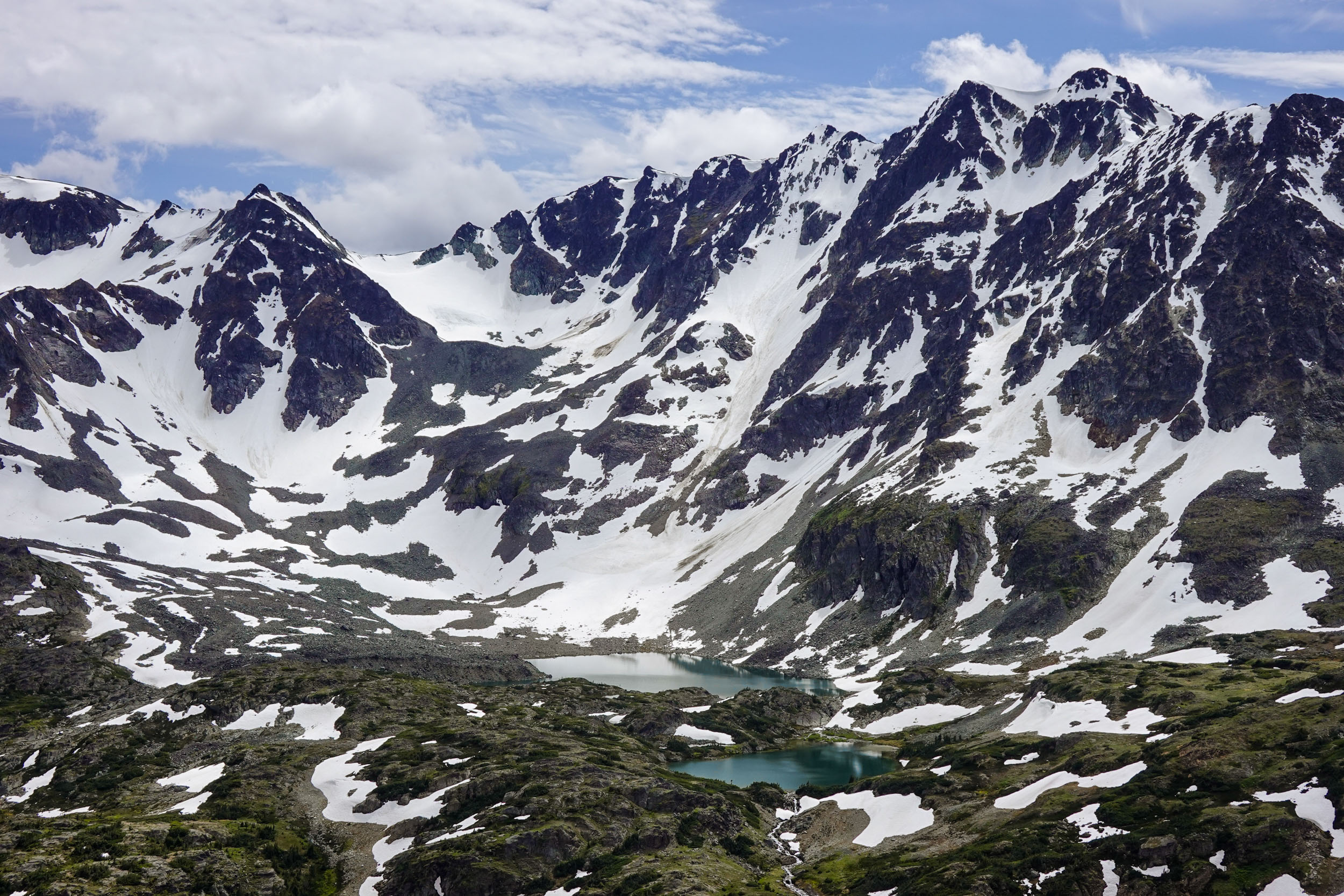
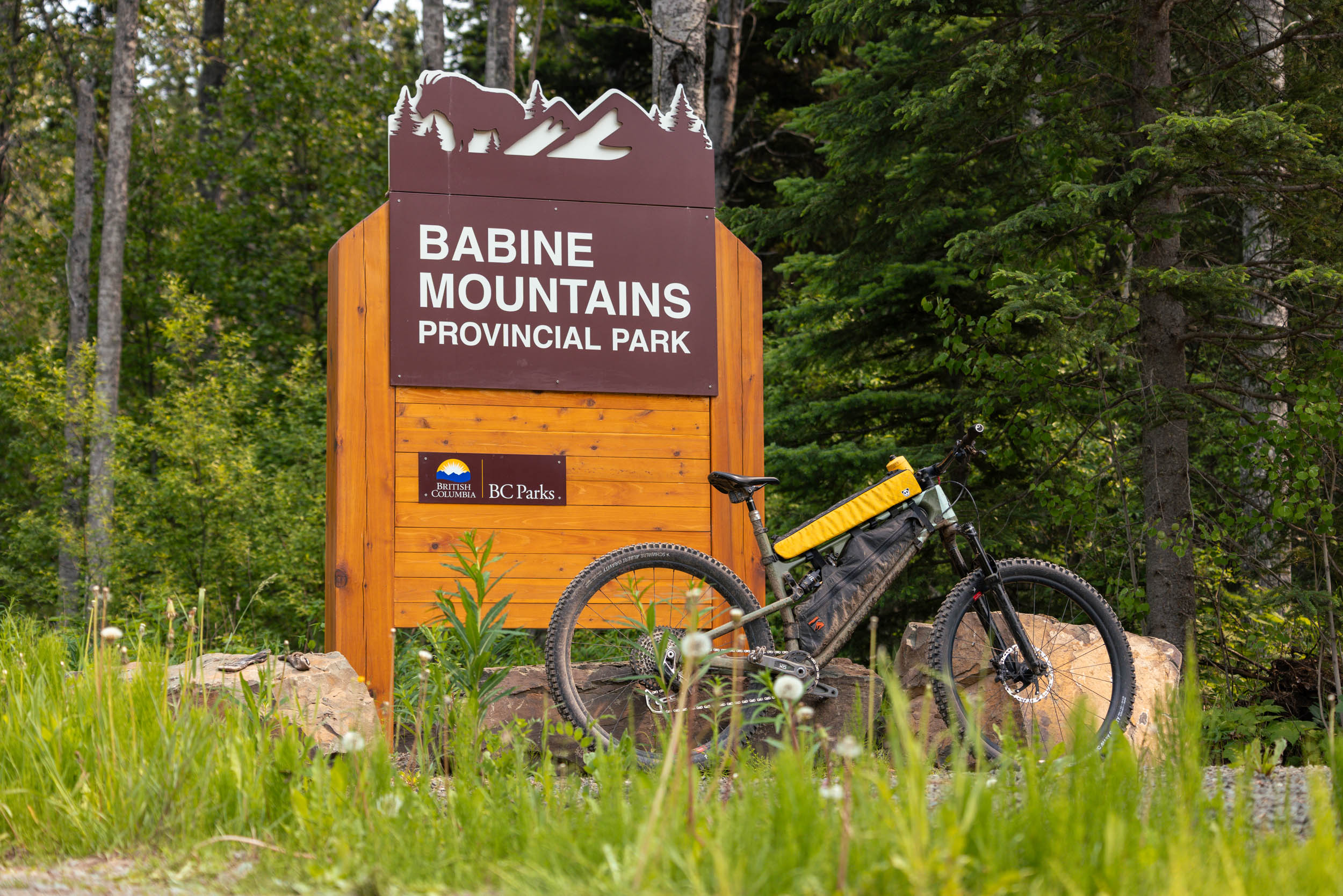
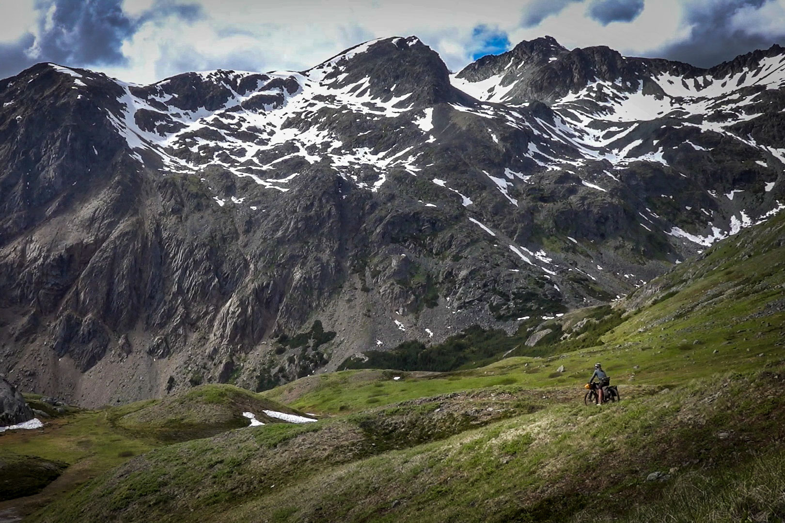
Babine Mountains Park is a provincial park located between the town of Smithers to the west and Babine Lake to the east. It is approximately 31,465 hectares (77,750 acres) in size and is renowned for its magnificent combination of dramatic mountains, icy-cold lakes, and rolling alpine meadows. During the summer months, the extensive alpine is perfect for camping and hiking, while winter’s snow attracts skiers, snowshoers, and snowmobilers. Cyclists aren’t the primary users of the park, but that’s not for a lack of rideable terrain. Although there are just two bike-friendly trails, the park is surrounded by gravel roads and forest service roads that extend like tenticles into the surrounding wilderness.
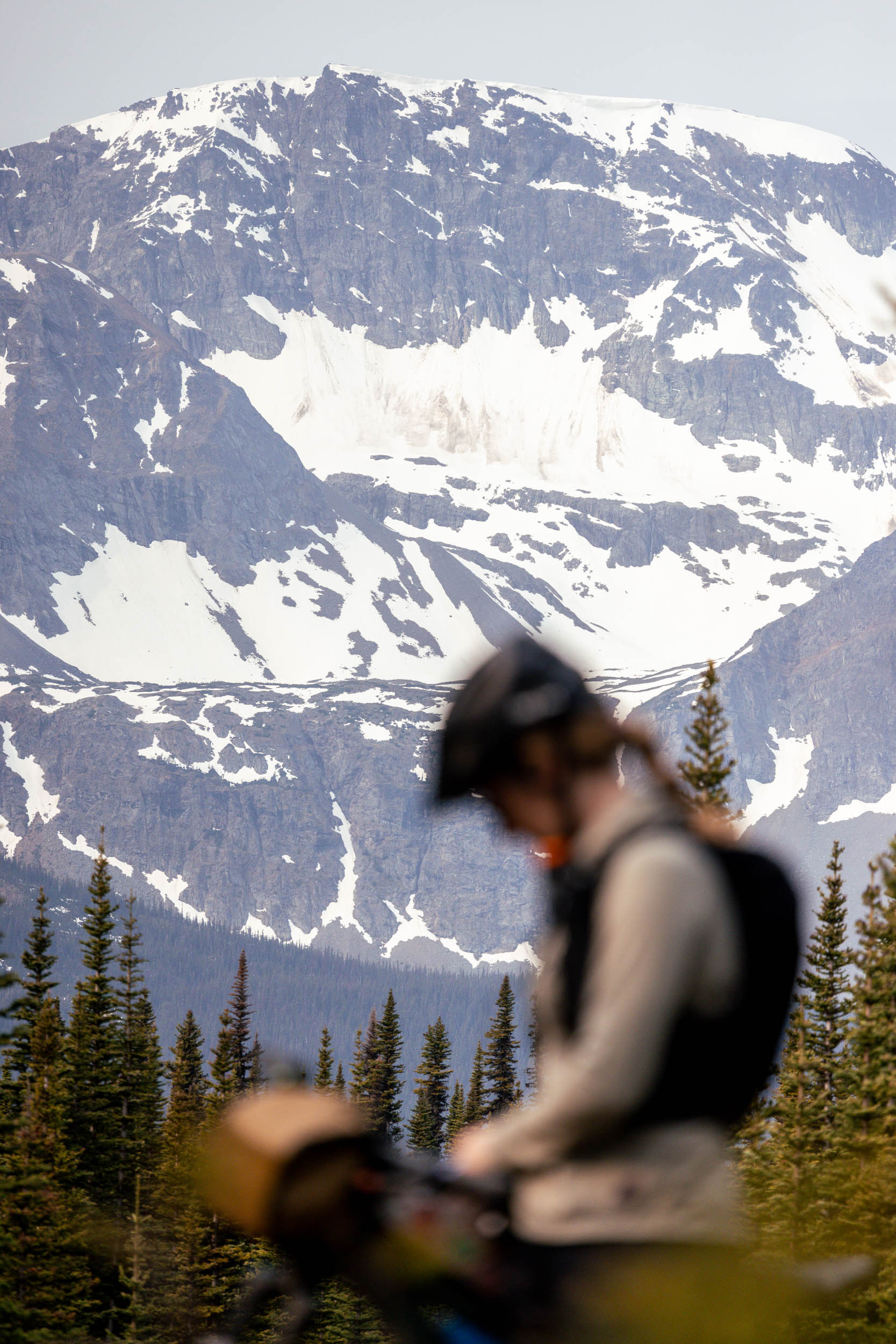
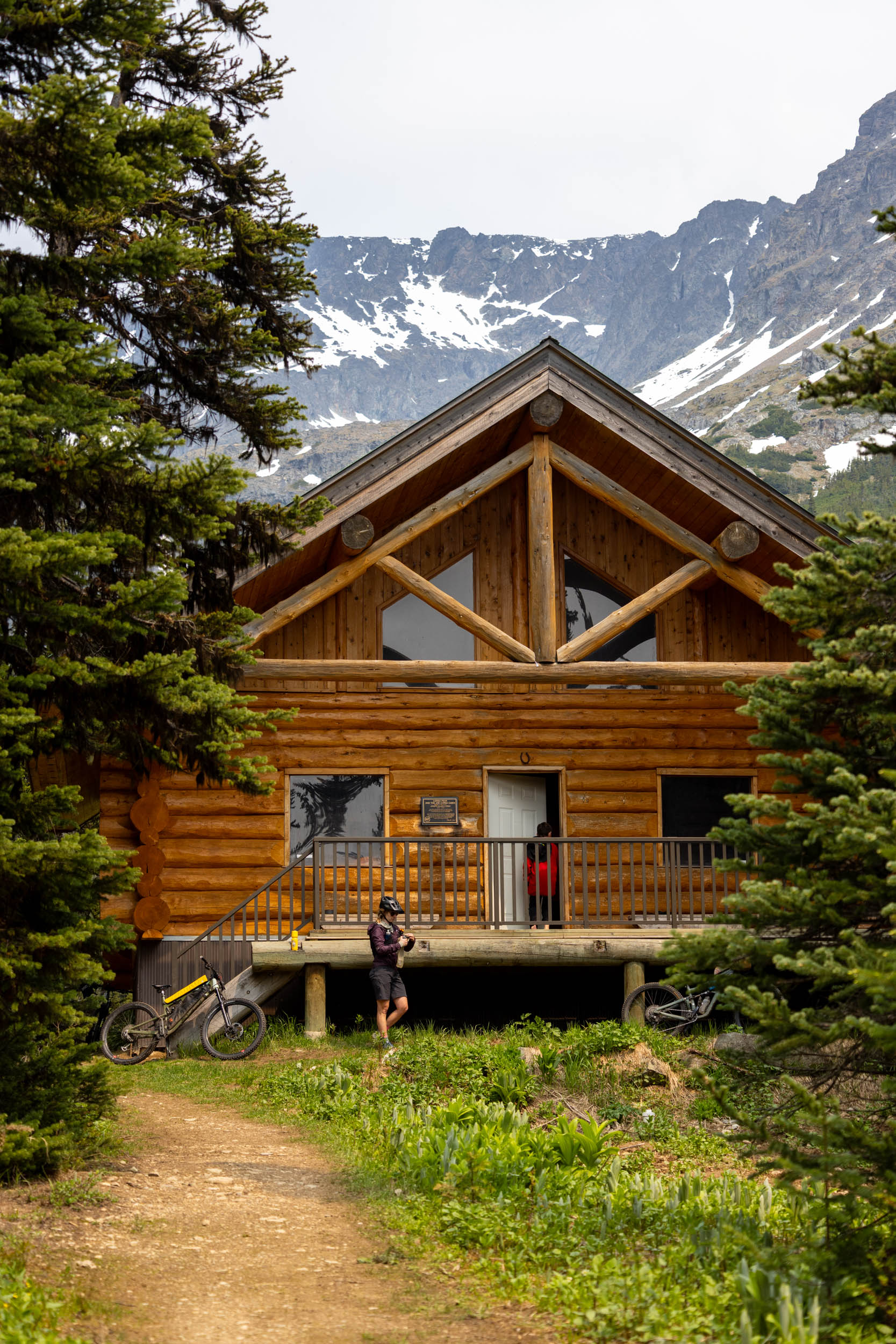
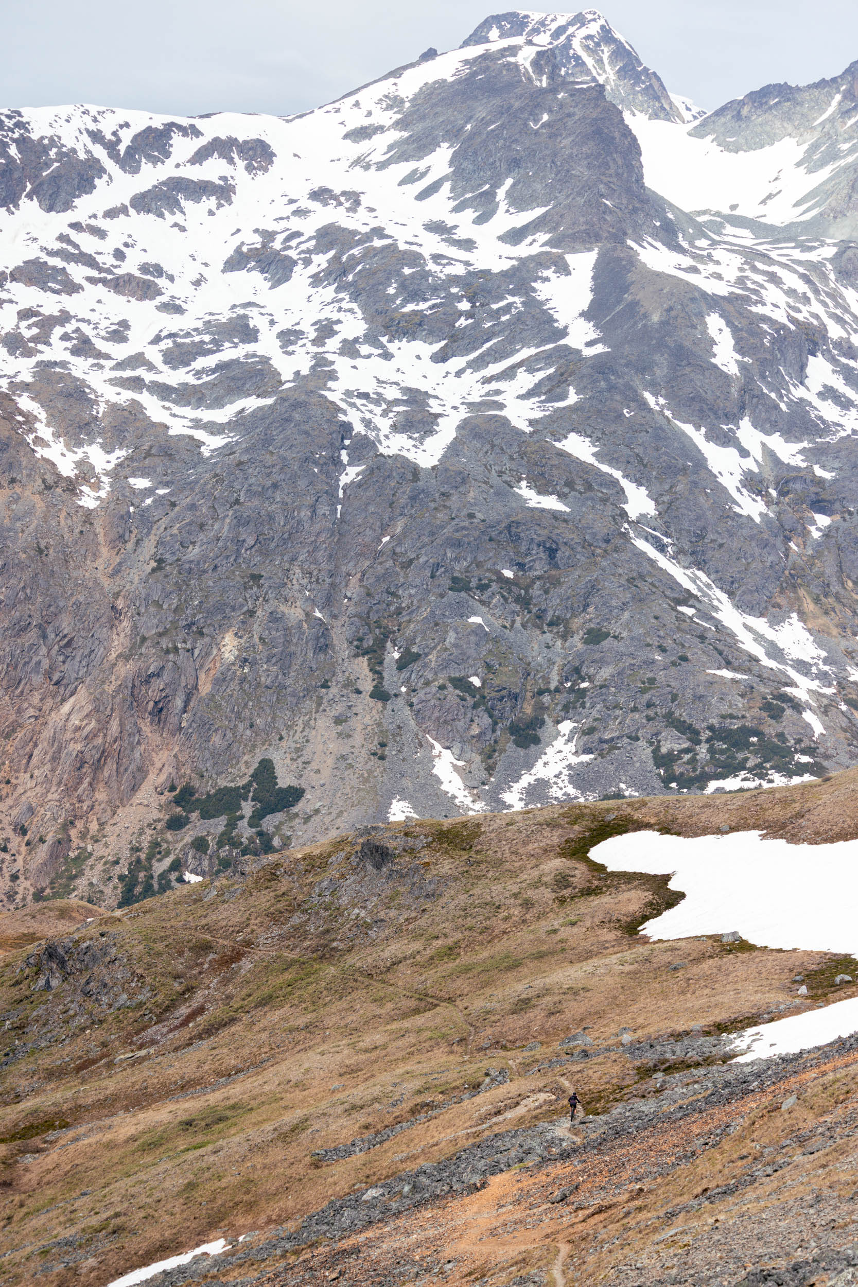
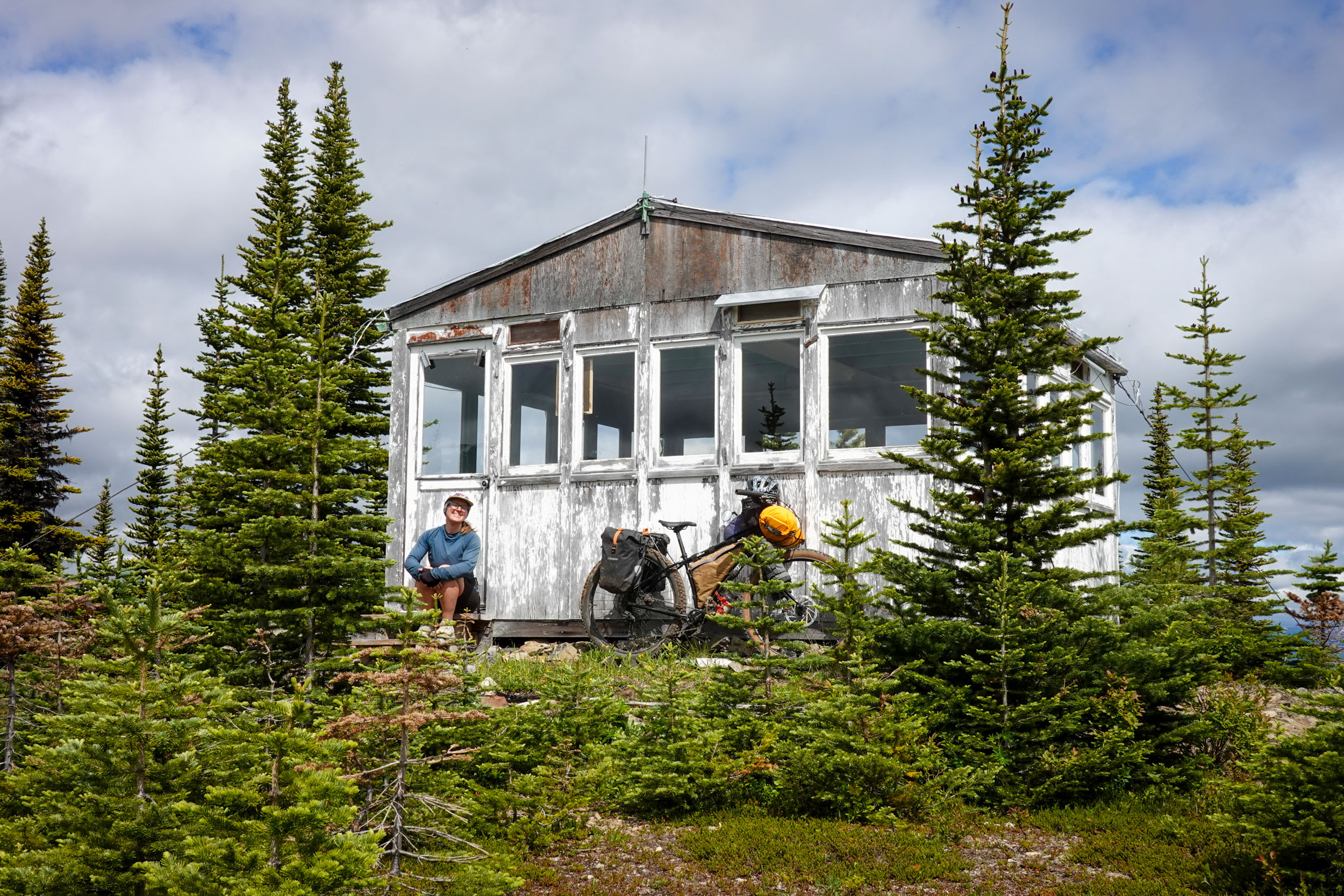
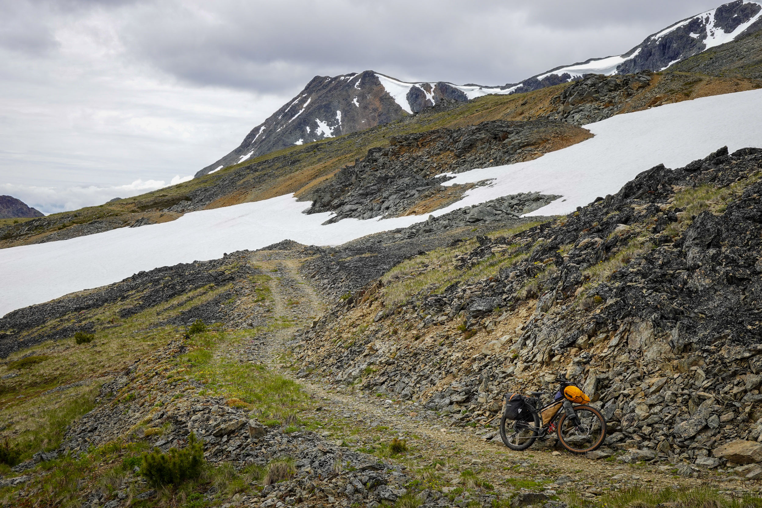
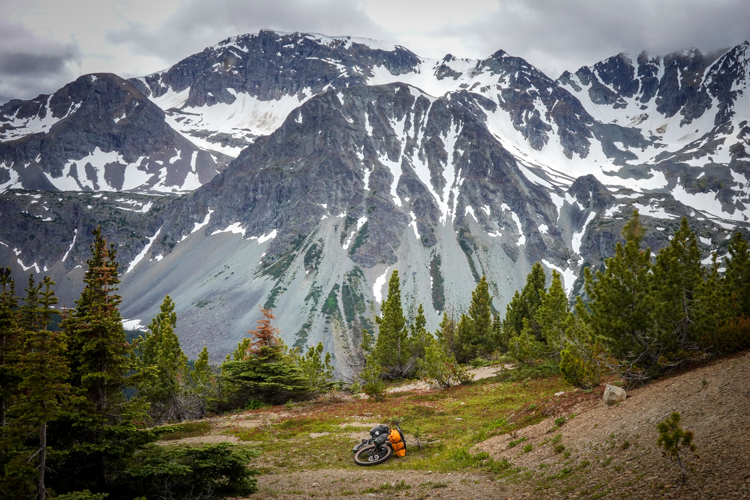
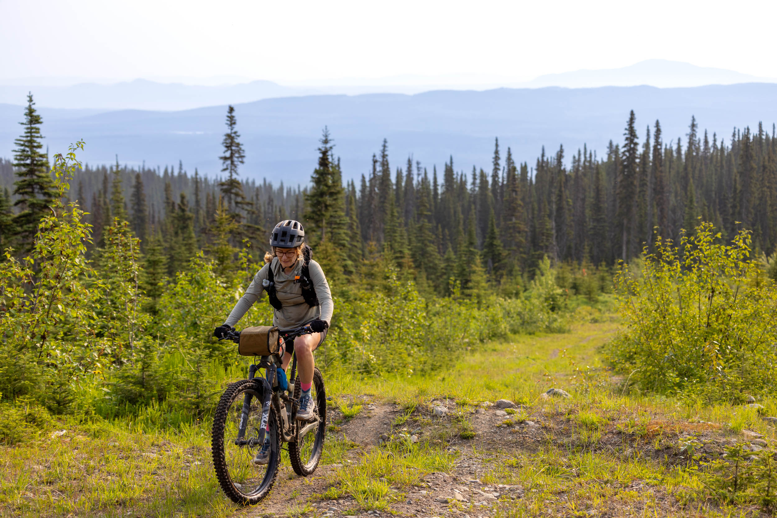
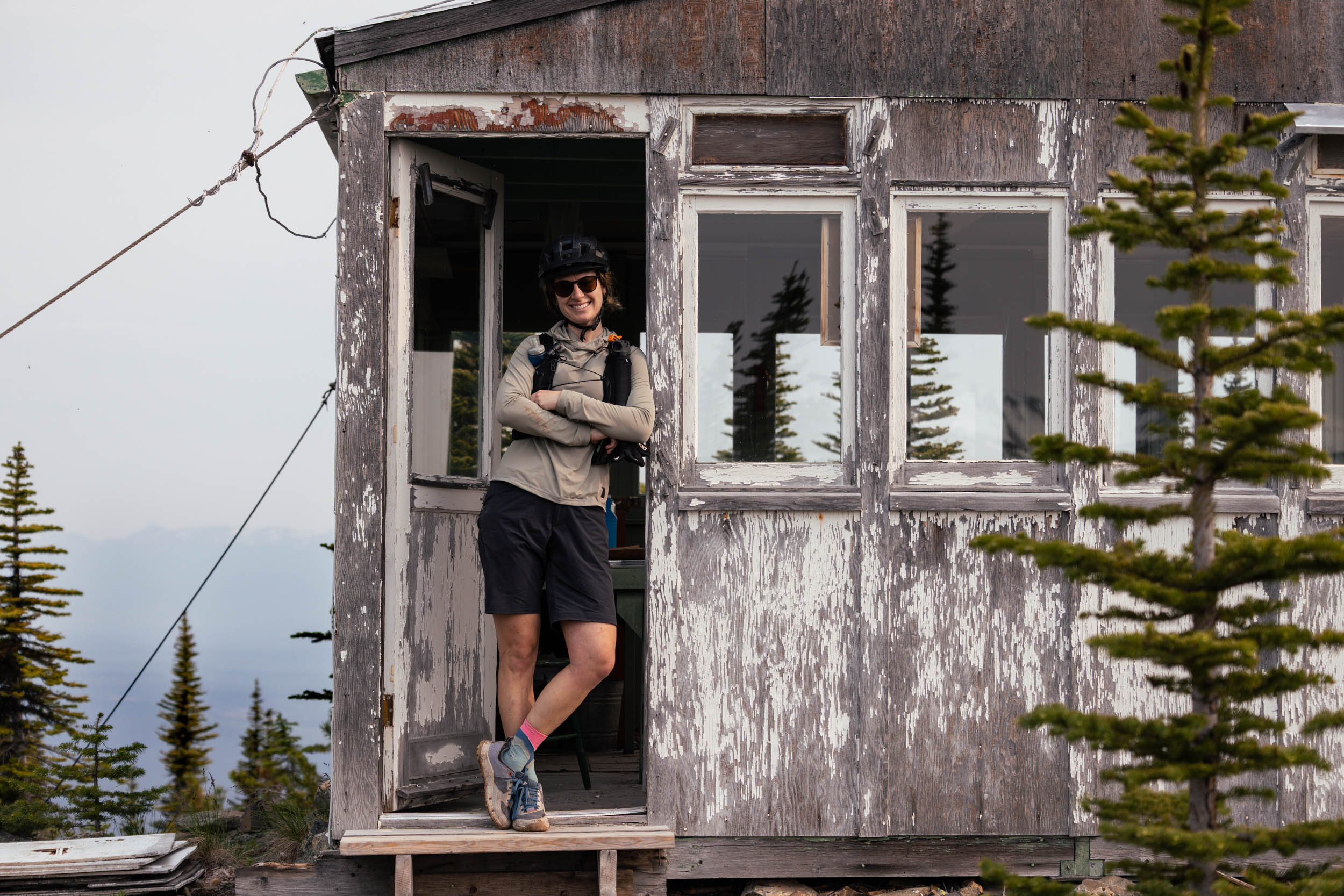
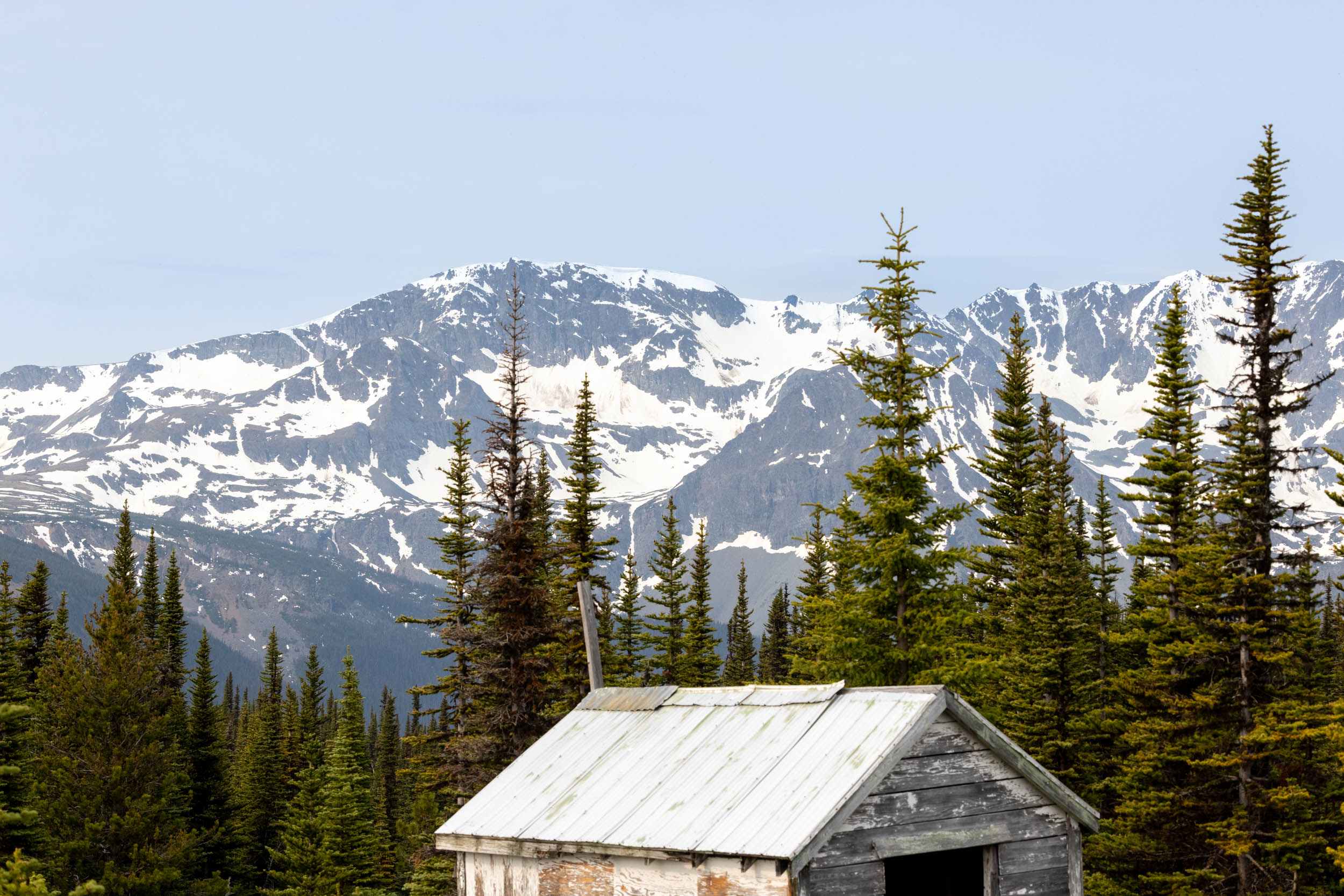
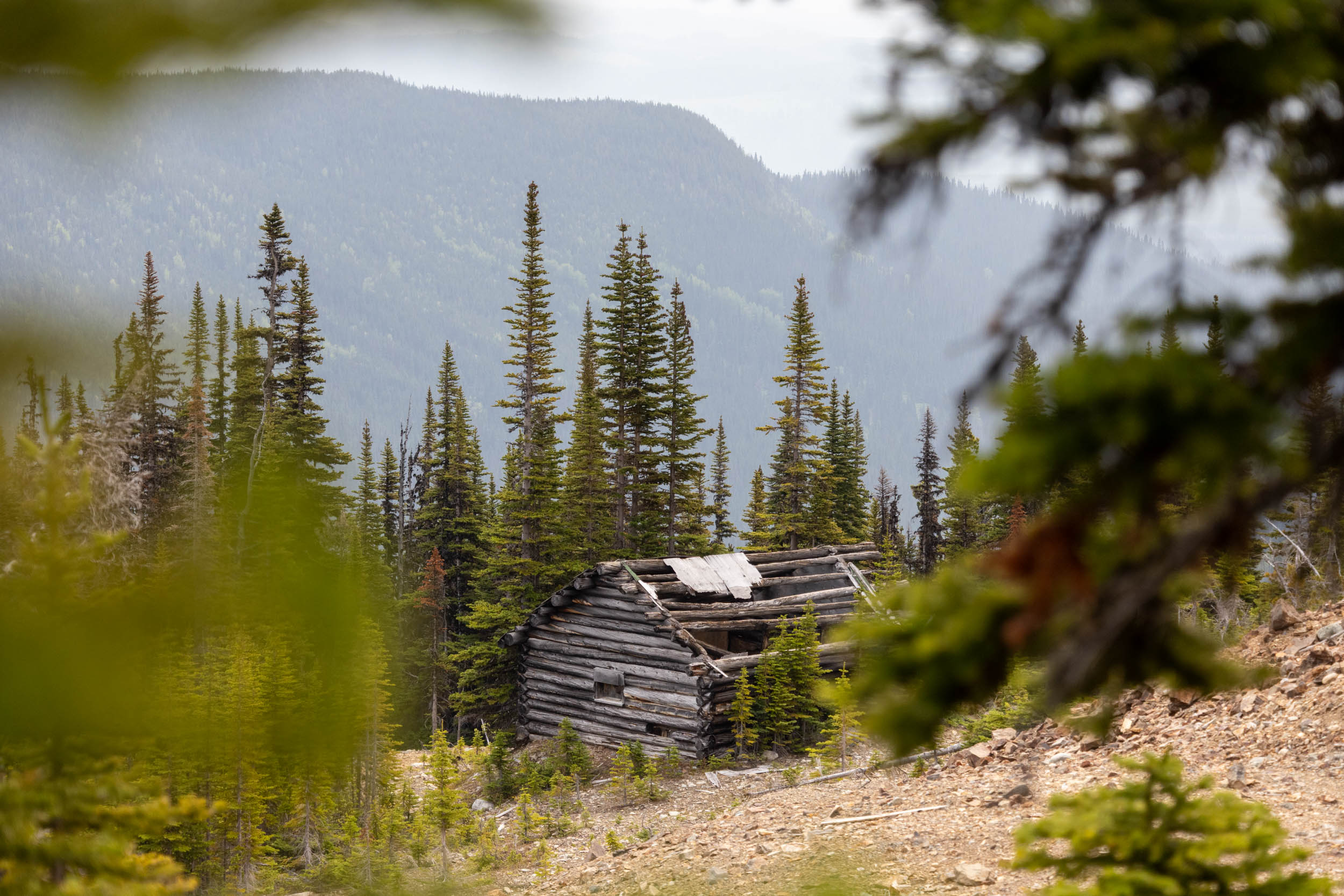
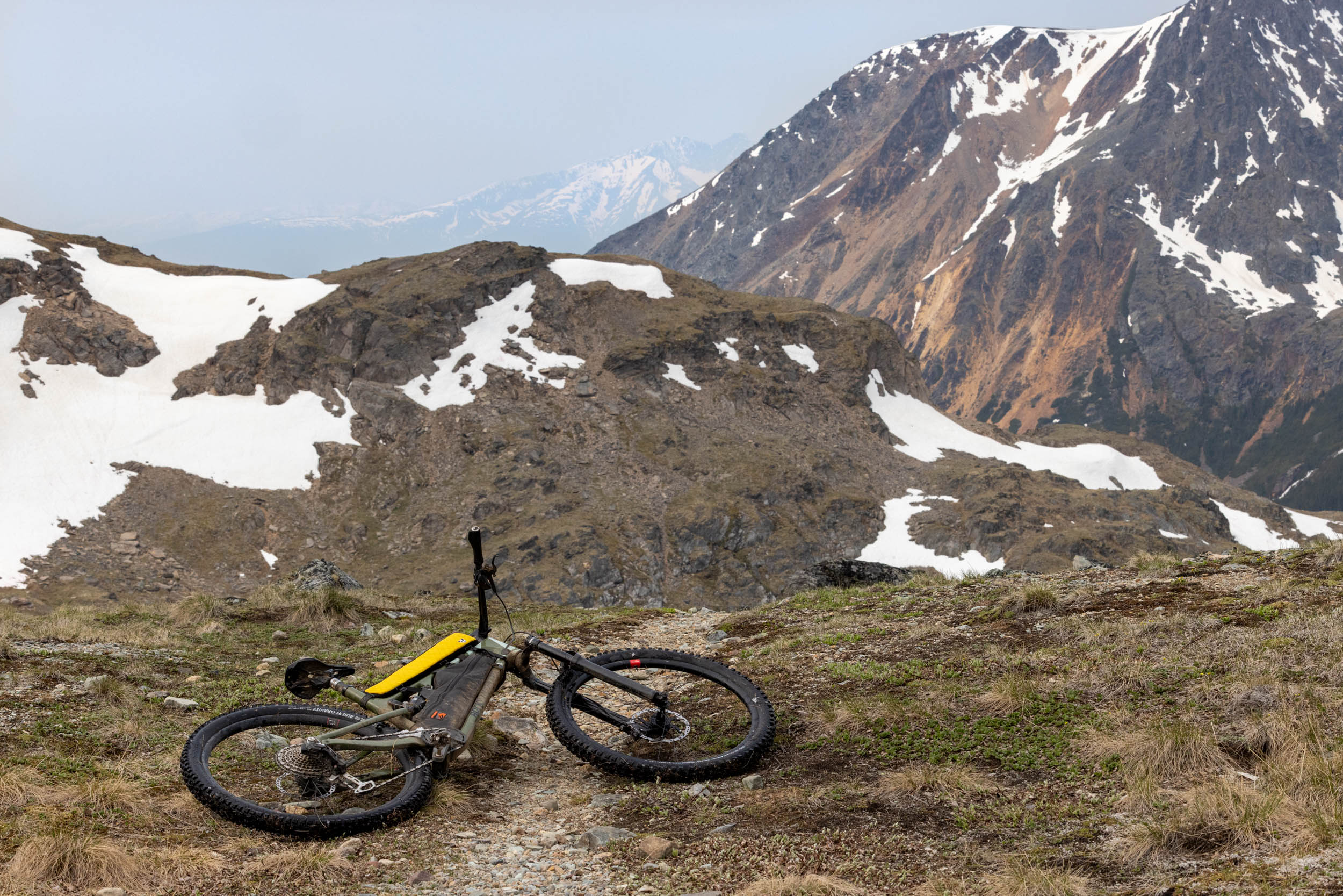
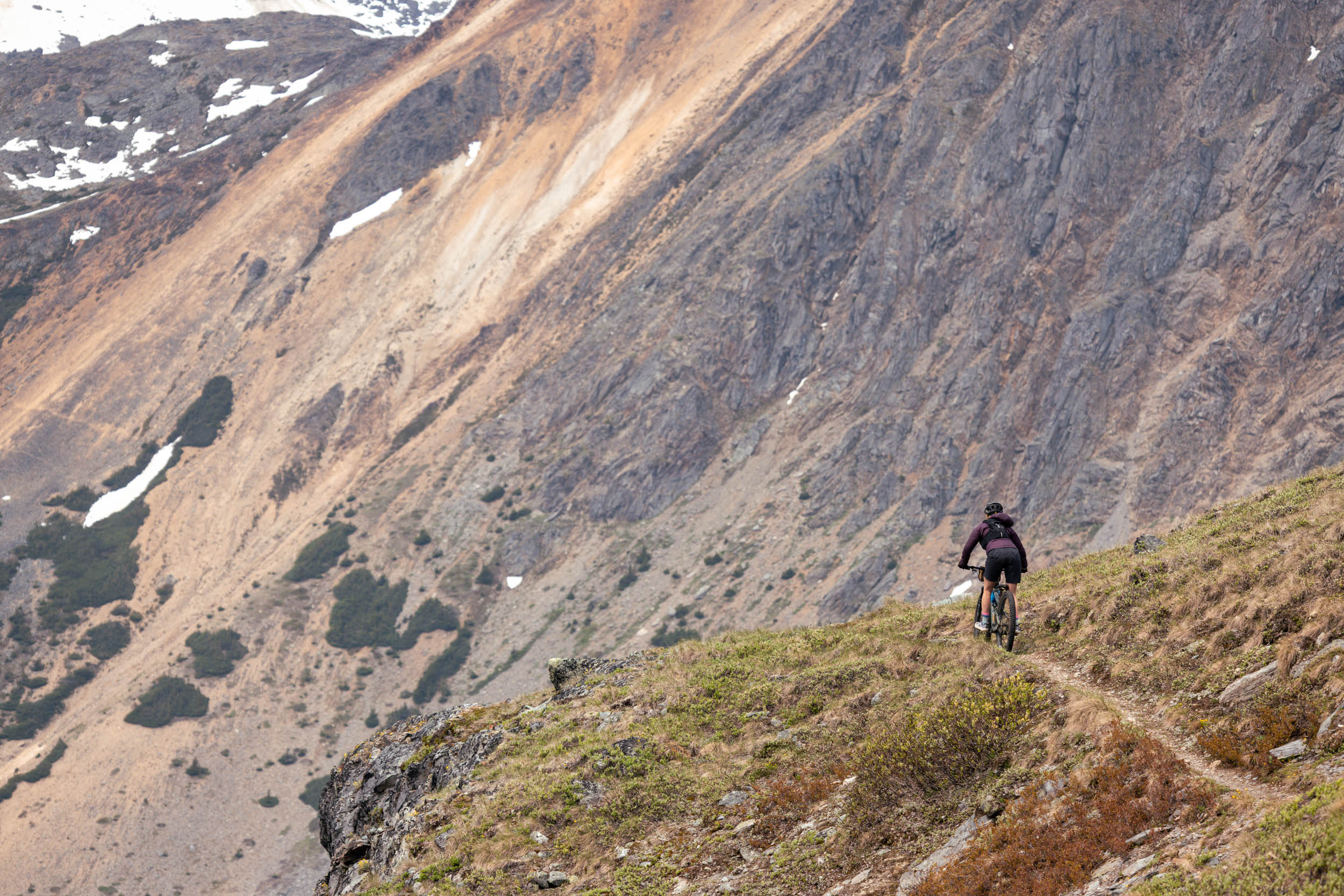
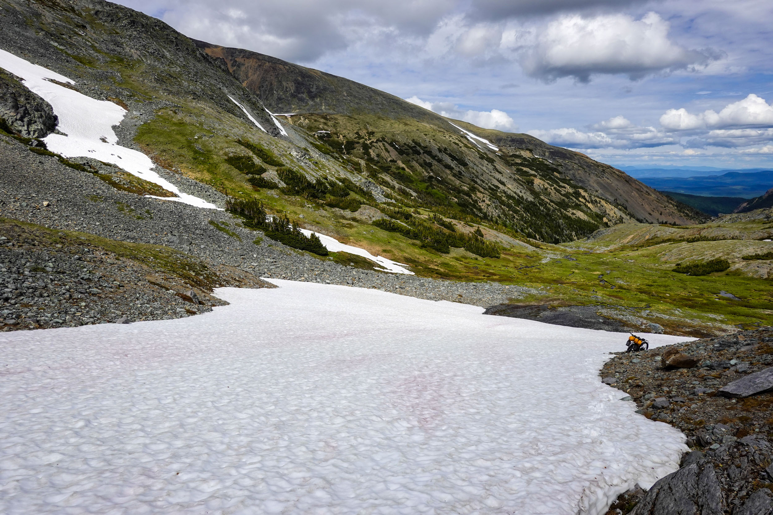
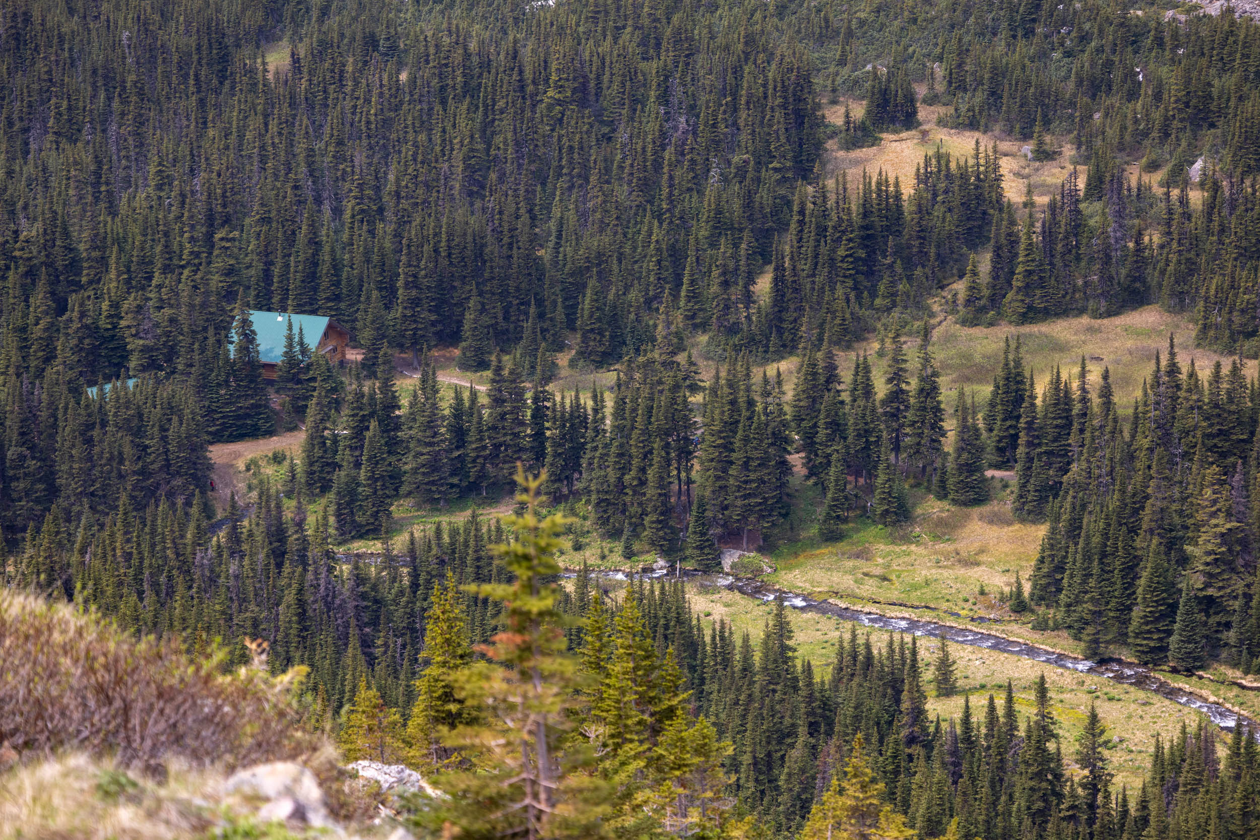
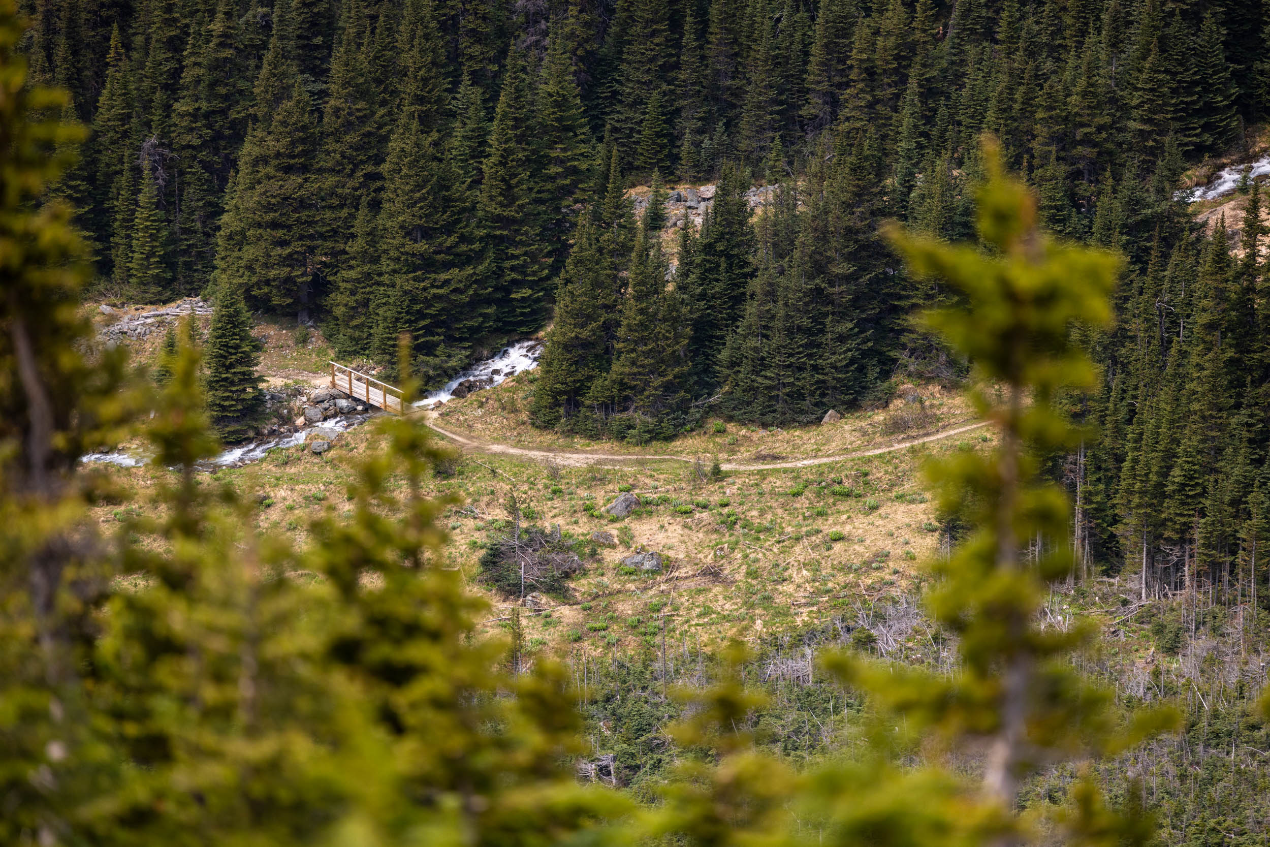
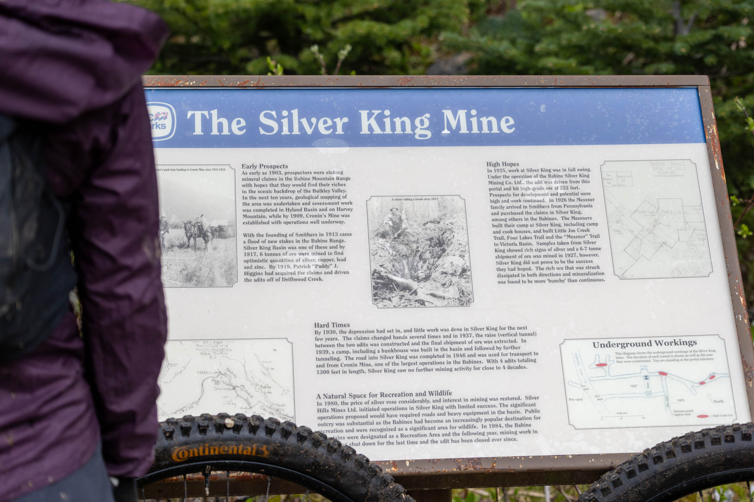
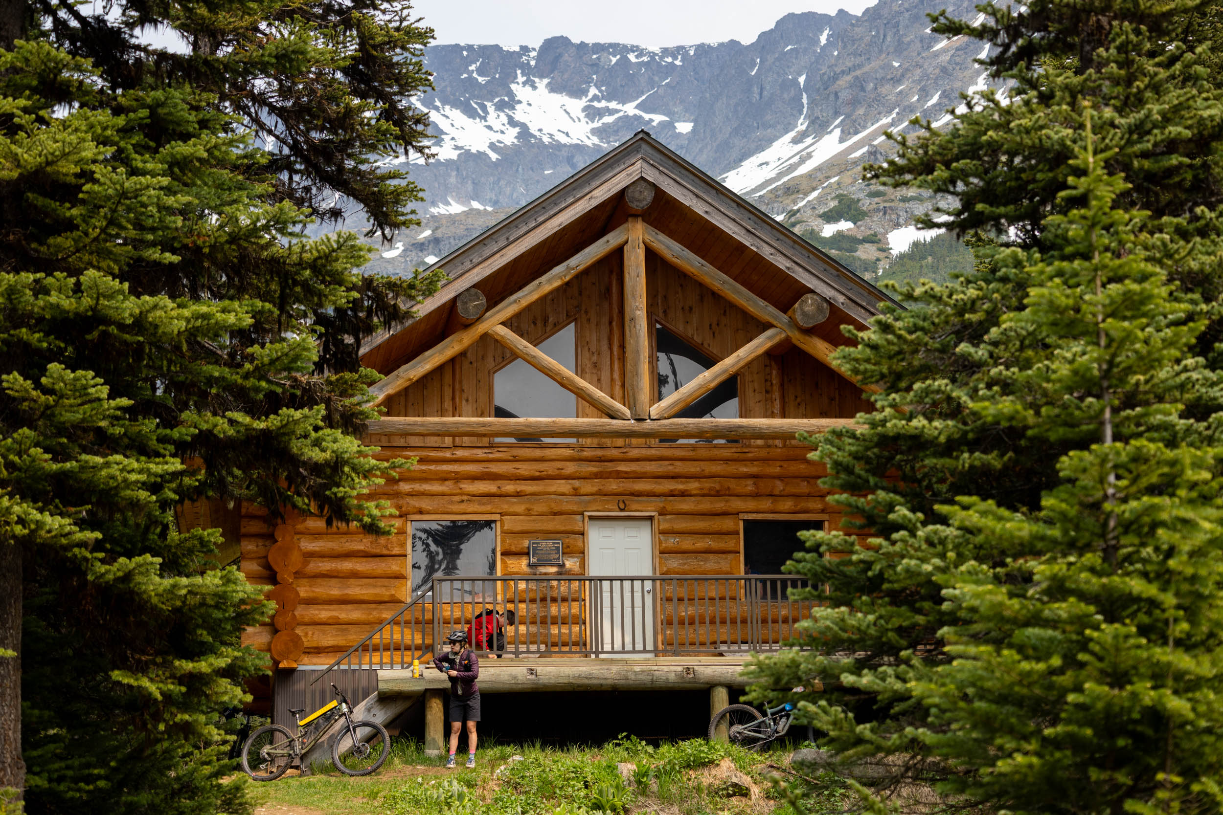
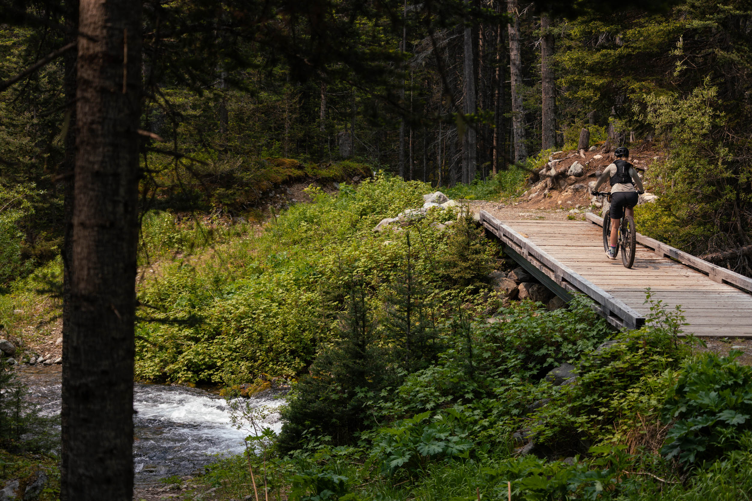
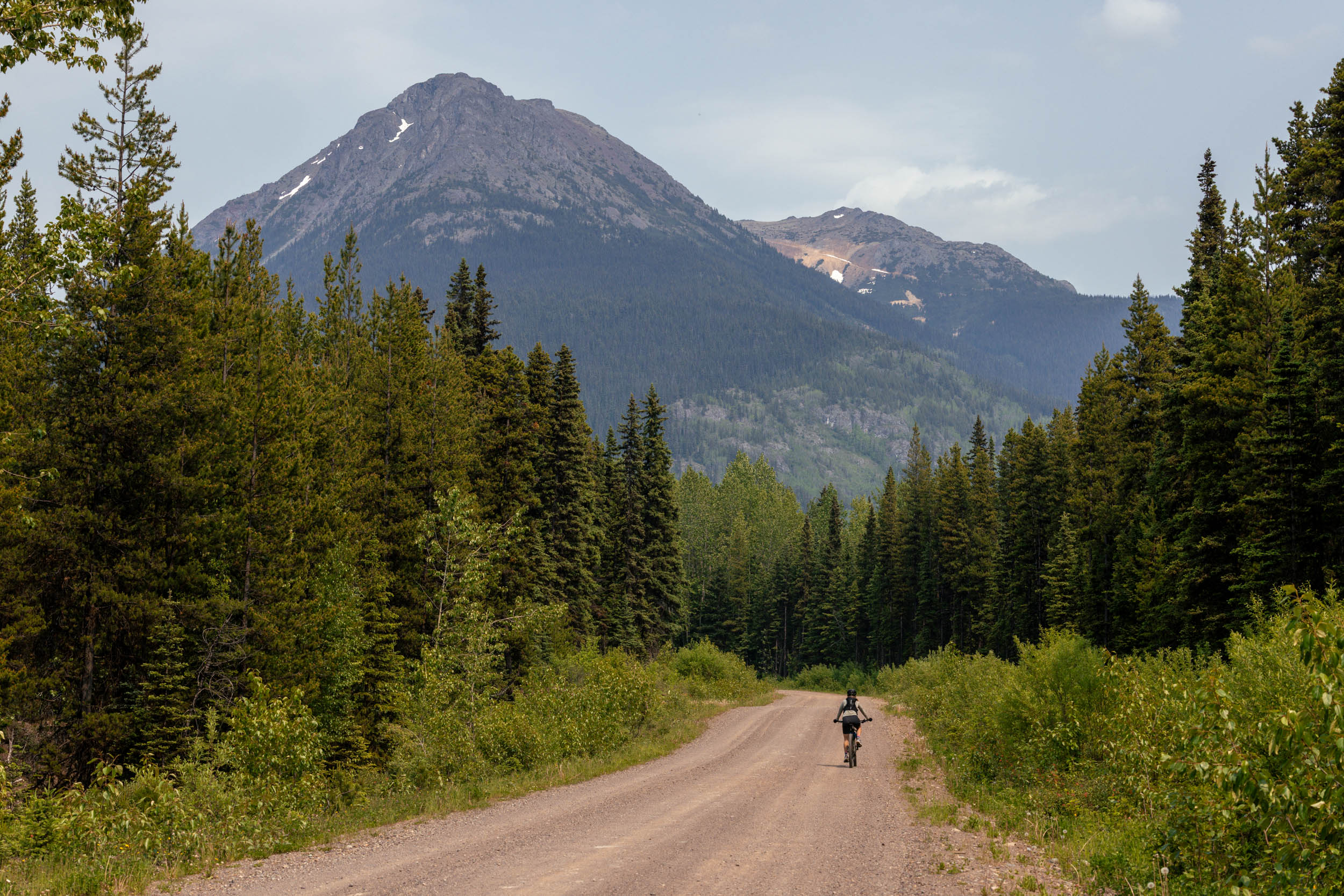
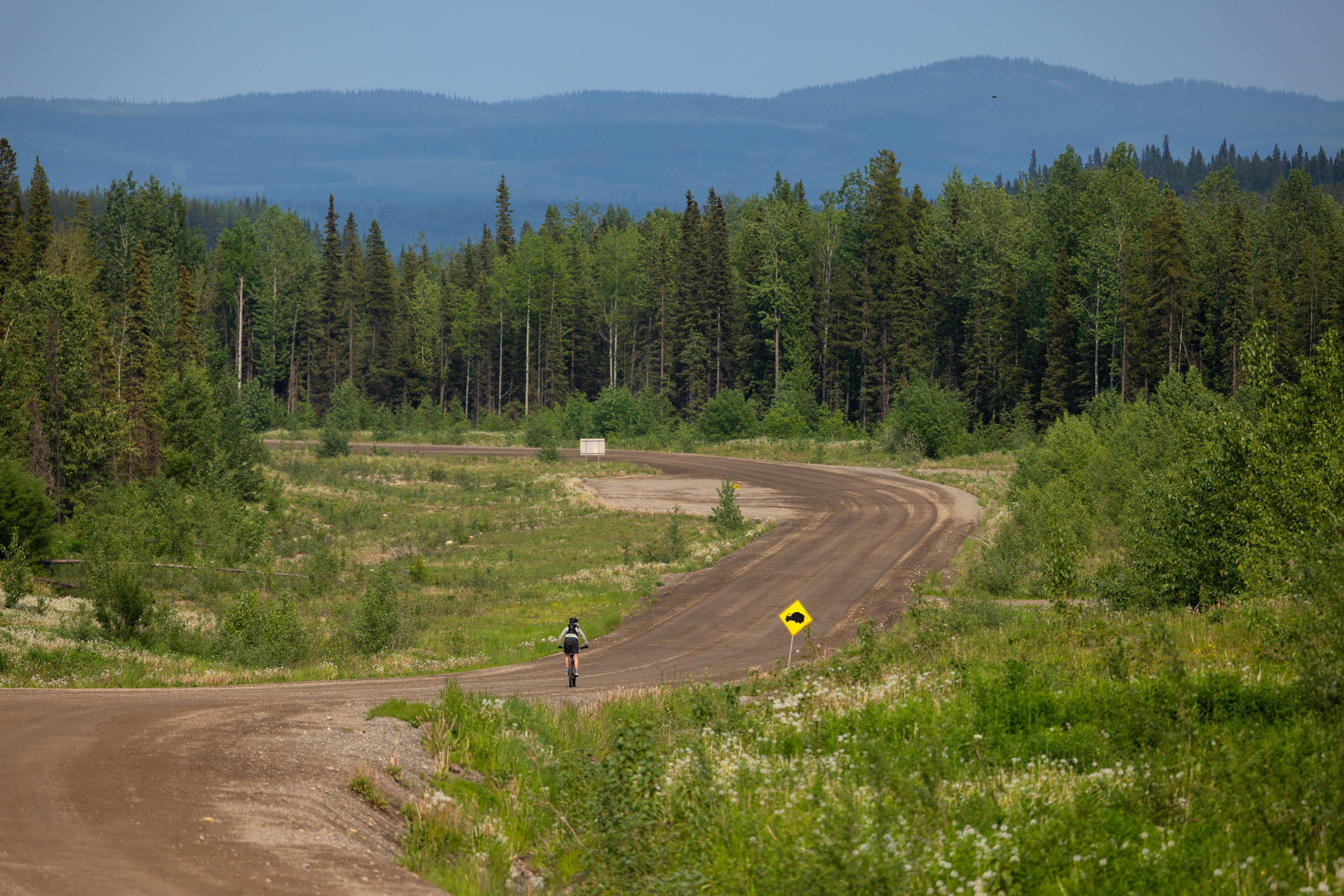
Around the Babines is a 110-kilometer (68-mile) mixed-terrain route that starts and ends in Smithers, British Columbia. The route leaves from town, following 60 kilometers of scenic rolling gravel roads around the south and east edges of the park, looping back to Chapman Lake and eventually the Cronin Trail trailhead. The route continues onto Cronin Trail, following doubletrack up through the dense forest before transitioning to a stunning purpose-built singletrack climb trail through coniferous forest, topping out at the old Cronin Fire Lookout, dishing up incredible views of the valley below. From there, the route merges with a historic mining road that climbs further into the alpine, up and over Hyland Pass, and past the abandoned Silver King Mine. A drool-worthy 23-kilometer descent follows, connecting onto the Silver King Basin trail and the incredible Joe L’Orsa Cabin, a great spot to spend the night. An easy gravel descent brings you back into Smithers at a reasonable hour, just in time for brunch and a few celebratory beverages.
Difficulty
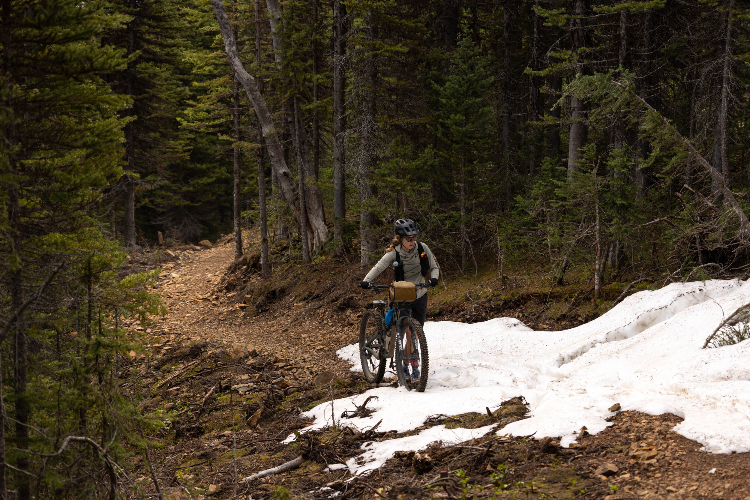
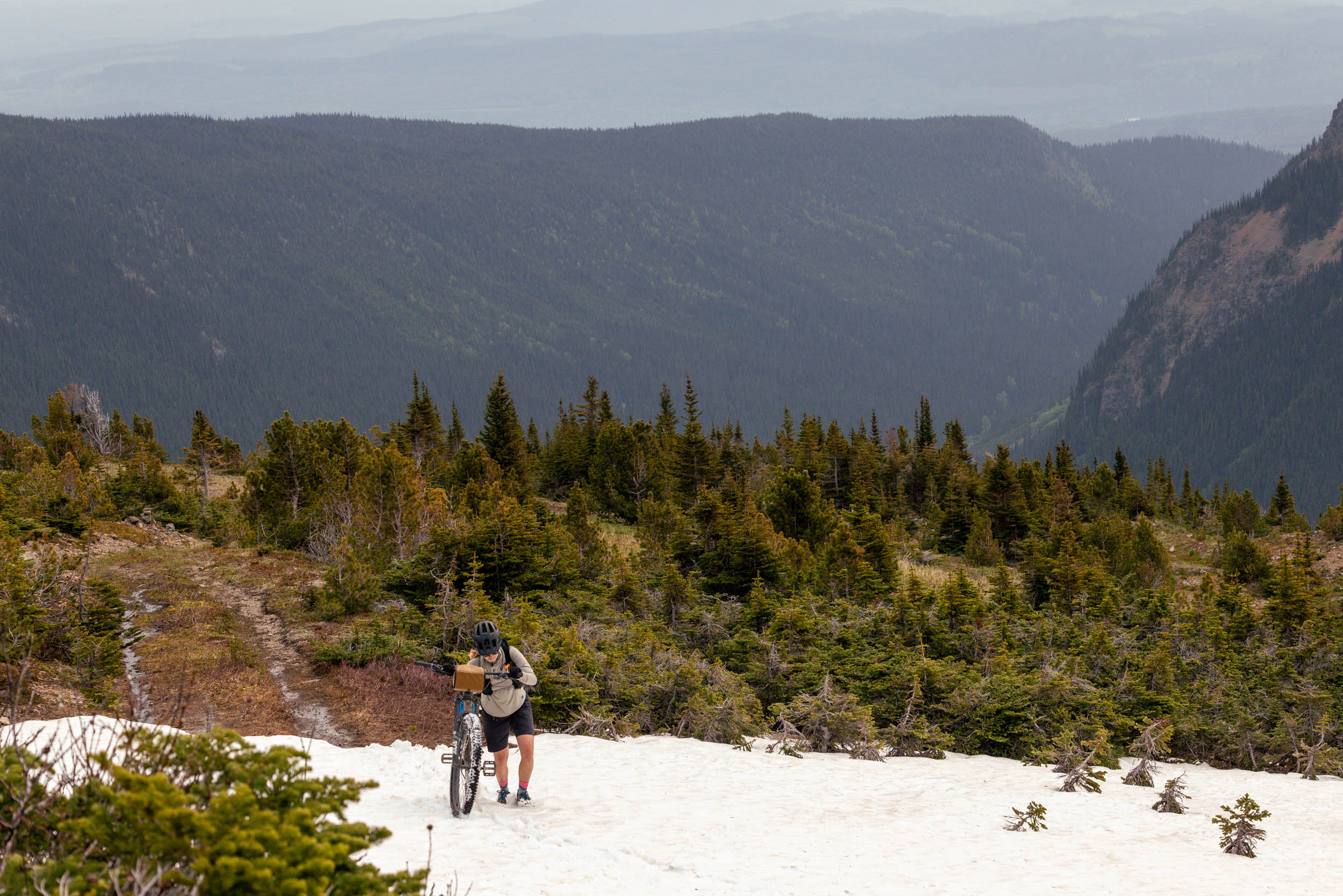
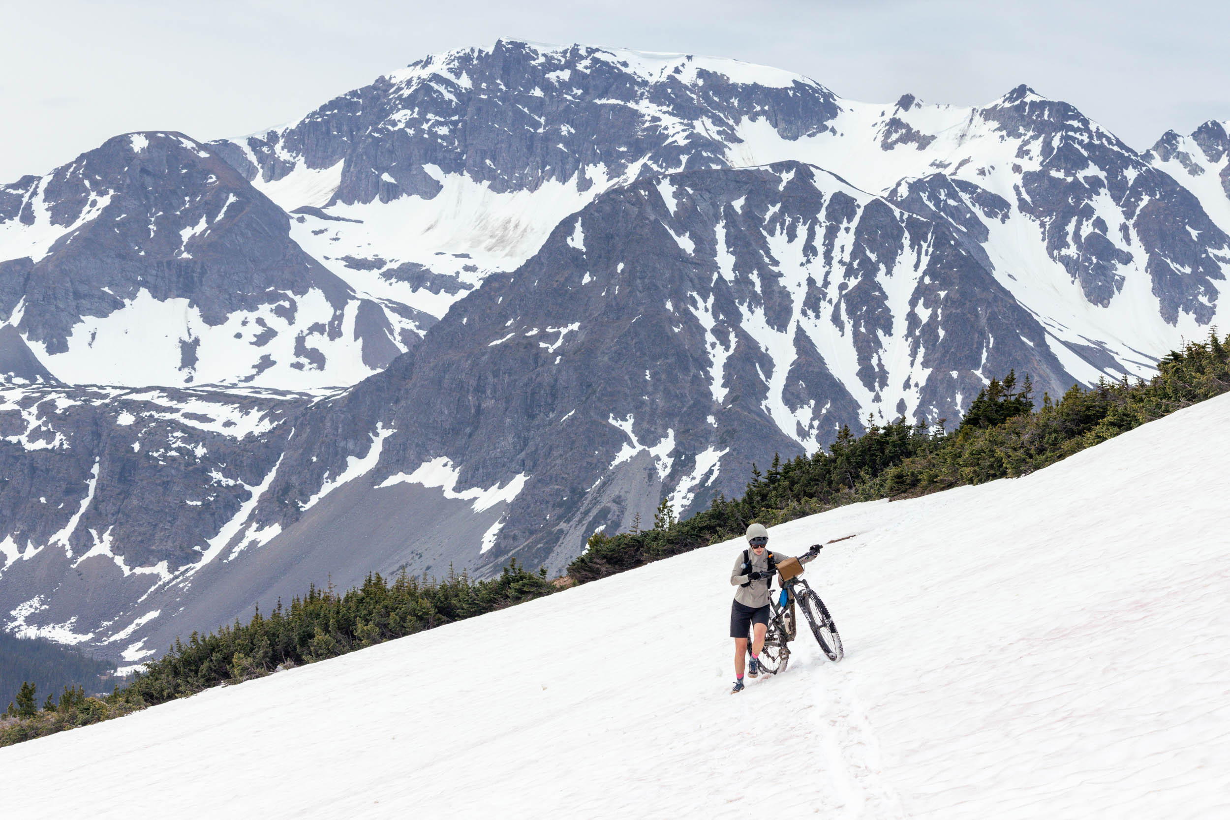
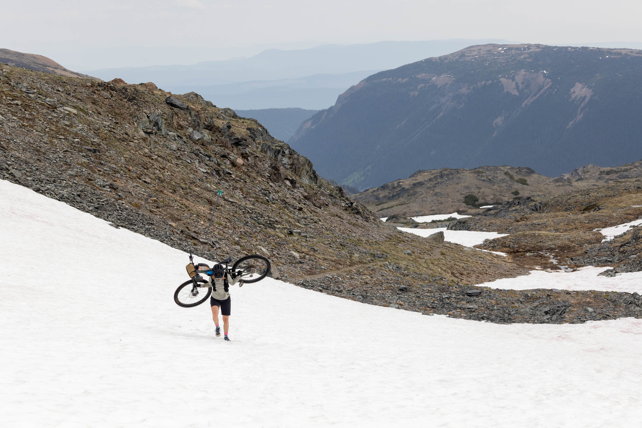
Although over half the route follows smooth gravel roads, the remainder of the route is spent climbing on steep doubletrack, traversing alpine singletrack, or descending back down into the valley on steep trails, so it’s a bit of a mixed bag. Early in the summer, around the time Emily and I rode the route, you can expect to encounter snow, which can feel pretty exposed on some of the larger slopes. The climbs are steep, the bugs can be bad, and there are a few rocky and technical sections of trails that require some mountain bike skills to ride confidently. The alpine environments are remote and difficult to access if something goes wrong, so it’s important for anyone giving the route a shot to be prepared for high-elevation mountain travel, with proper layers, rain gear, tools and spares, and plenty of food for two to three days. Logistically, the route works well as a three-day, two-night route, with Chapman Lake as the first campsite and the stunning Joe L’Orsa Cabin for night two. There are no resupply points along the route, so carry everything you need.
Route Development: As mentioned, Emily and I stumbled upon the route and at first didn’t think we were scouting a bikepacking route, but during our massive day ride, we started thinking we should have brought some camping gear. A big thank-you goes to the folks at McBike Bike Shop in Smithers, who answered some questions about the route and tried to convince us to avoid the alpine riding so early in the season. After our ride, I shared the route with Aly Winkler, who then bikepacked the route over three days, which is how we’ve presented the route. It’s also realistic to ride it in two days for those pressed for time.


Submit Route Alert
As the leading creator and publisher of bikepacking routes, BIKEPACKING.com endeavors to maintain, improve, and advocate for our growing network of bikepacking routes all over the world. As such, our editorial team, route creators, and Route Stewards serve as mediators for route improvements and opportunities for connectivity, conservation, and community growth around these routes. To facilitate these efforts, we rely on our Bikepacking Collective and the greater bikepacking community to call attention to critical issues and opportunities that are discovered while riding these routes. If you have a vital issue or opportunity regarding this route that pertains to one of the subjects below, please let us know:
Highlights
Must Know
Camping
Food/H2O
Trail Notes
- World-class alpine singletrack high up in Babine Mountains Provincial Park, dishing up incredible views of towering mountains, deep valleys, and alpine lakes.
- Start and end in Smithers, British Columbia, a cute mountain town with a brewery, lots of great restaurants, and a bike shop for a pre-ride tuneup.
- The newly rebuilt Cronin Trail, which transitions from doubletrack to smooth, machine-built singletrack as it climbs up into the alpine.
- Visit the old Cronin Fire Tire lookout and remnants of the Silver King Mine.
- Camping at the incredible Joe L’Orsa Cabin, tucked into lovely meadow in the Silver King Basin.
- When to ride: Due to the amount of high-elevation riding, hitting snow too early in the season is a real risk. July is about as early as you can expect to make it over the pass, and it will remain clear until snow starts to fall in late September or mid-October. Fall might be the best time to ride, with the potential for fewer bugs, as they were plentiful in the spring. It’s worth checking in with Peter and the folks at McBike Shop for current conditions.
- What bike: The route can be comfortably ridden on a full-suspension mountain bike, hardtail, or a rigid mountain bike with plus-sized tires, depending on how comfortable you are riding singletrack. There’s a good amount of gravel on the loop, but the alpine singletrack and rough descents are ultimately what should determine your bike choice. Proper climbing gears are essential due to the amount of elevation gain and steep climbs. Bring a full repair kit and know how to fix your gear/bike in an emergency. The route is remote, and there’s no easy way out once you’re in the mountains.
- Getting there: Smithers is about a 12-hour drive from Vancouver, British Columbia, but there are also Air Canada flights from Vancouver International Airport directly to Smithers for a reasonable price. The drive is about the same distance from Edmonton, Alberta, for those coming from the east.
- Terrace, to the west, has a larger airport, and it’s about a two-hour drive to Smithers. There’s also a train route through Via Rail Canada between Terrace and Smithers, starting at around $27 one-way, and bicycles are permitted as checked luggage.
- Wildlife: Northern British Columbia is home to all sorts of wildlife, including bears, moose, wolves, and cougars. It’s important to be aware, carry bear spray, and always hang or store your food/scented items at night away from your camp to avoid interactions. Be prepared with a dry bag and rope, make noise, and don’t take any chances.
- There are two established camping options on the route that set riders up for an enjoyable two or three-day ride.
- The Chapman Lake Rec Site is a free, no-service rec site with picnic tables and lake access.
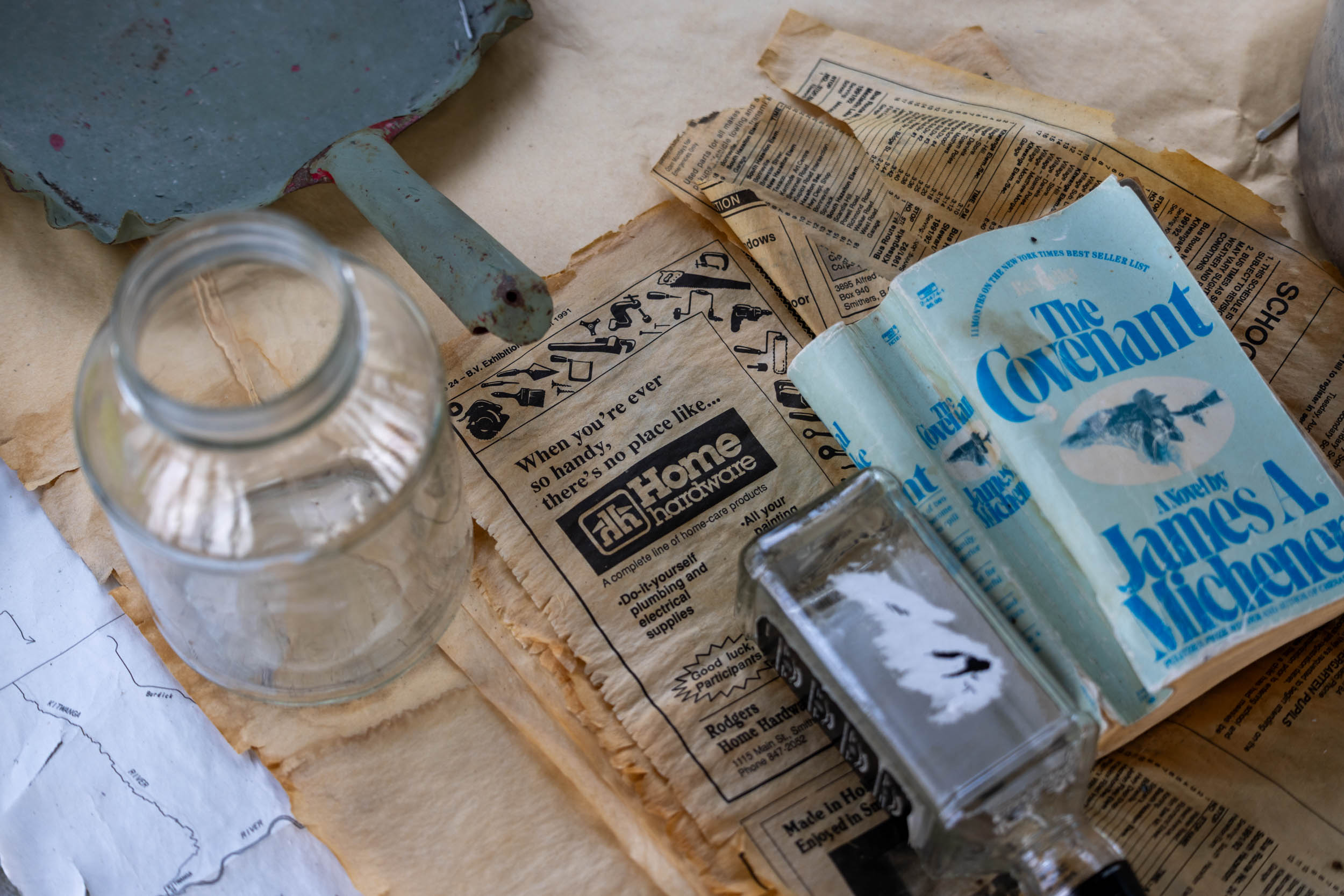
- The Joe L’Orsa Cabin, after the alpine singletrack riding, is a stunning wilderness cabin (more like a lodge) that costs just $10 per adult/night. It sleeps 15 to 20 people, and is available on a first-come, first-served basis. Be prepared to sleep outside if the cabin is full. There are sleeping bunks, pit toilets, and a wood stove inside. Bring a camp stove and water filter to prepare meals.
- Wild camping is also possible along most of the route, but it’s less ideal.
- There is limited water along the drier gravel road sections of the route until reaching Chapman Lake, but you can expect to pass by small creeks and runoff once you reach the mountains.
- There is a small creek outside of Joe L’Orsa Cabin, but like any natural watersource, you’ll want to filter it.
- The only resupply point is in Smithers, at the beginning of the route, so stock up with everything you’ll need.
- Riders should expect to carry three days’ worth of food and at least 3L of water per person. Bring a water filter and some extra snacks, just in case.
A Sample Three-Day Itinerary
Day 1: Smithers to Chapman Lake Rec Site (50km + 798m)
While it can be ridden in two days or less, Around the Babines is set up perfectly for an enjoyable three-day loop to really soak in everything the park has to offer. From Smithers, the route jumps on the highway for a short section before linking up to Old Babine Lake Road and Babine Lake Road around the south side of Babine Mountains Park. It’s a gradual but fairly leisurely climb up to Chapman Lake Rec Site, serving as a great warm-up for day two, which has almost twice the amount of elevation.
Day 2: Joe L’Orsa Cabin (28km + 1,257m)
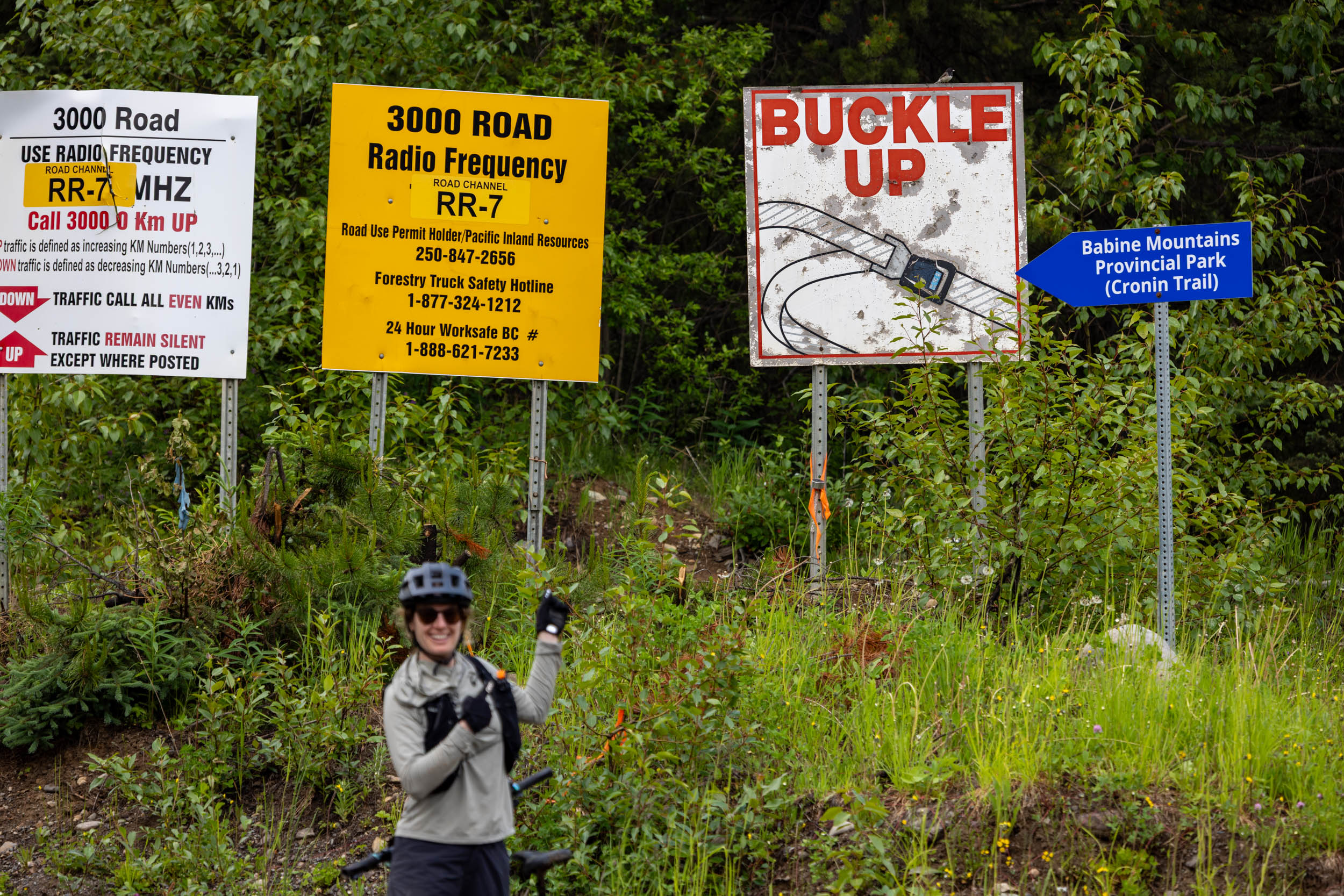
Day two starts with a short section of gravel road, leading to the new Cronin Trail trailhead. The trailhead can also be used as a staging or start/finish area, which is what Emily and I did for our big scouting ride. The climb begins with some doubletrack, eventually transitioning to a superb section of new machine-built climb trail as it ascends toward the alpine. Near the top, a short detour brings you up to the old Cronin Fire Lookout and 360-degree views of surrounding valleys and mountains. Don’t miss it. The route follows a mix of old high-elevation mining roads and rough doubletrack along Cronin Trail to Hyland Pass, eventually following a stunning ribbon of trail before a steep switchback descent into the Silver King Basin. Hikers like to use the section of trail, so stay in control and call out so you don’t surprise anyone. Day two ends at the iconic Joe L’Orsa Cabin. Even if you have the energy to push on, you’ll be happy to spend the night tucked inside the cabin or camped outside nearby. It’s a special place.
Day 3: Smithers (32km + 78m)
Day three is purposefully designed to have little distance and limited elevation gain so folks can spend the morning at the cabin or cruise into town for a late breakfast or brunch in Smithers. Make sure to pop by McBike Shop to give them an update on the trail conditions, and if it’s available to you, make a donation to the Smithers Mountain Bike Association or purchase a membership.


Terms of Use: As with each bikepacking route guide published on BIKEPACKING.com, should you choose to cycle this route, do so at your own risk. Prior to setting out check current local weather, conditions, and land/road closures. While riding, obey all public and private land use restrictions and rules, carry proper safety and navigational equipment, and of course, follow the #leavenotrace guidelines. The information found herein is simply a planning resource to be used as a point of inspiration in conjunction with your own due-diligence. In spite of the fact that this route, associated GPS track (GPX and maps), and all route guidelines were prepared under diligent research by the specified contributor and/or contributors, the accuracy of such and judgement of the author is not guaranteed. BIKEPACKING.com LLC, its partners, associates, and contributors are in no way liable for personal injury, damage to personal property, or any other such situation that might happen to individual riders cycling or following this route.
Please keep the conversation civil, constructive, and inclusive, or your comment will be removed.