


Ausangate Traverse, Peru
Distance
45 Mi.
(72 KM)Days
2-3
% Unpaved
60%
% Singletrack
40%
% Rideable (time)
85%
Total Ascent
7,000'
(2,134 M)High Point
16,076'
(4,900 M)Difficulty (1-10)
8?
- 10Climbing Scale Very Strenuous156 FT/MI (29 M/KM)
- -Technical Difficulty
- -Physical Demand
- -Resupply & Logistics
Contributed By

Cass Gilbert
Contributing Editor
See Ruta de las Tres Cordilleras for a more recent version of this route.
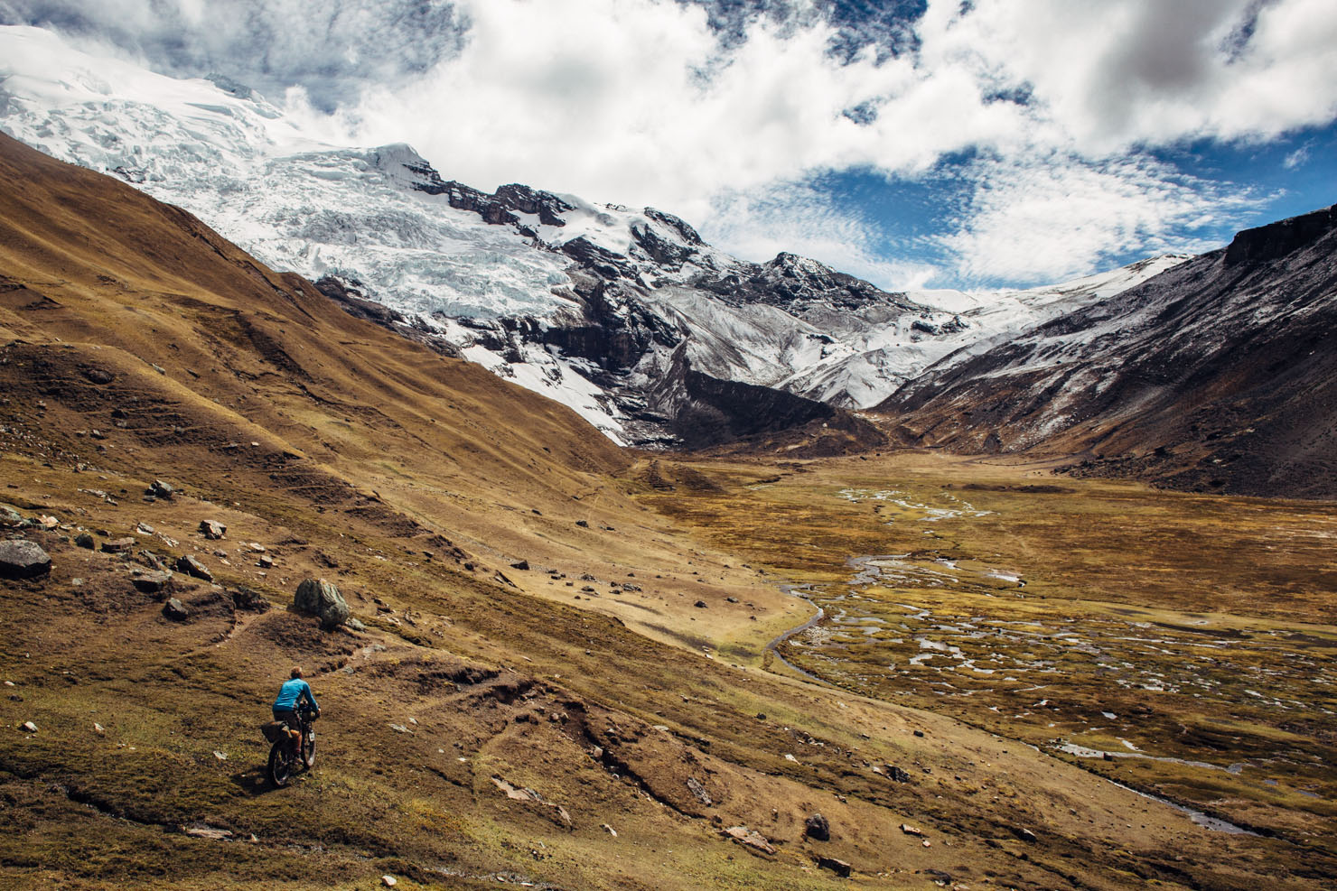
If there’s a name synonymous with Peru, it’s Machu Picchu, the mega-ruins lost in a swathe of forest and a swirl of mist for half a millennium, until stumbled upon in 1911. Often overlooked but no less majestic is the region’s highest peak, Nevedo Ausangate, poking high above the clouds at a lofty 6372m (20905 ft), and just a century ride to the east. Both are steeped in Incan mythology. Machu Picchu is thought to have been an upmarket royal retreat, while the Incans considered snow-capped Ausangate a big-time Apu – a mountain spirit, and one of the holiest in the land.
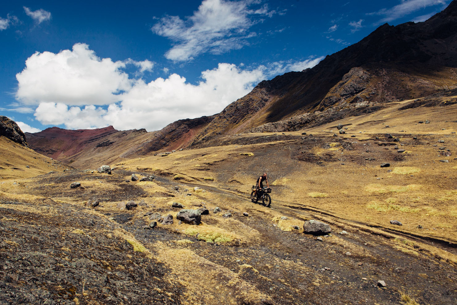
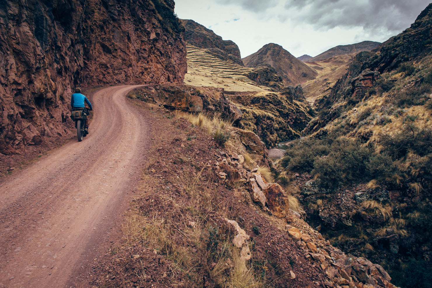
Ausangate’s reputation precedes it amongst westerners too. It’s the headline attraction of the Willkanuta Mountains, an Andean sub range 130km south east of Cusco, and the hike that encircles this 6384m peak is considered on par with the very best of the Cordillera Blanca and the Huayhuash.
Given its short distance, the Ausangate Traverse can either be worked into a longer crossing between Peru and Bolivia, assuming you’re running a relatively lightweight setup. Or, it would make the perfect treat at the end of a week of trail riding and bikepacking in Cusco’s Sacred Valley.
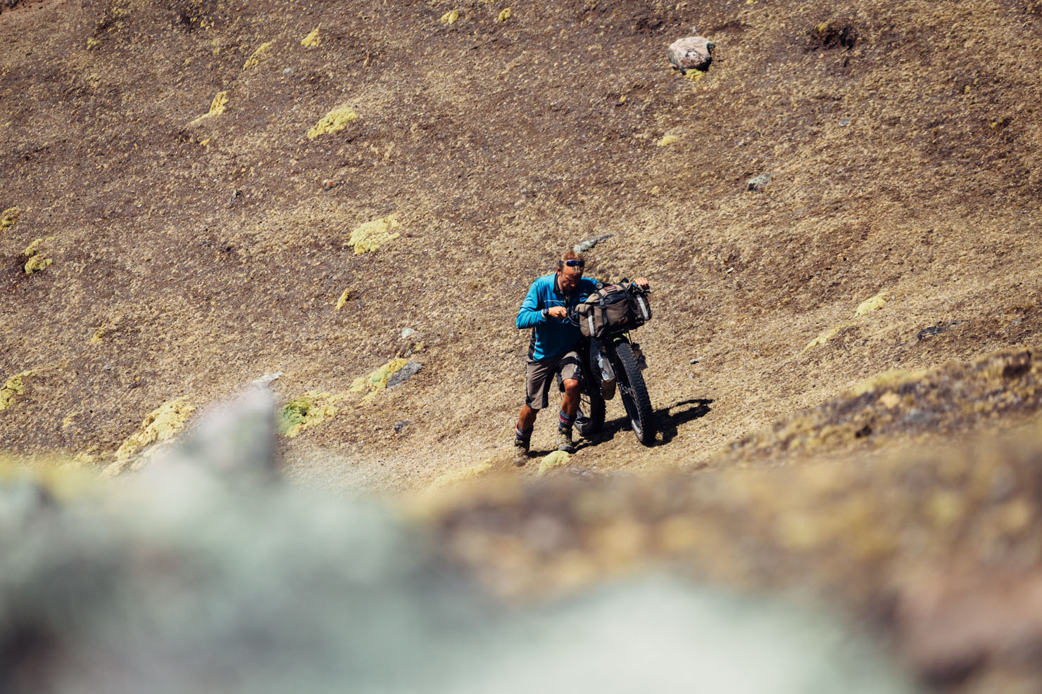
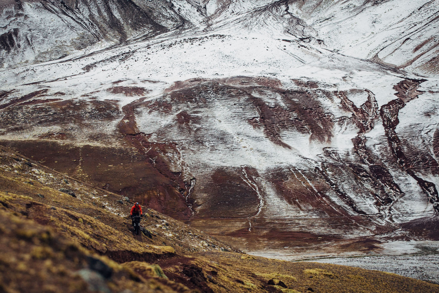
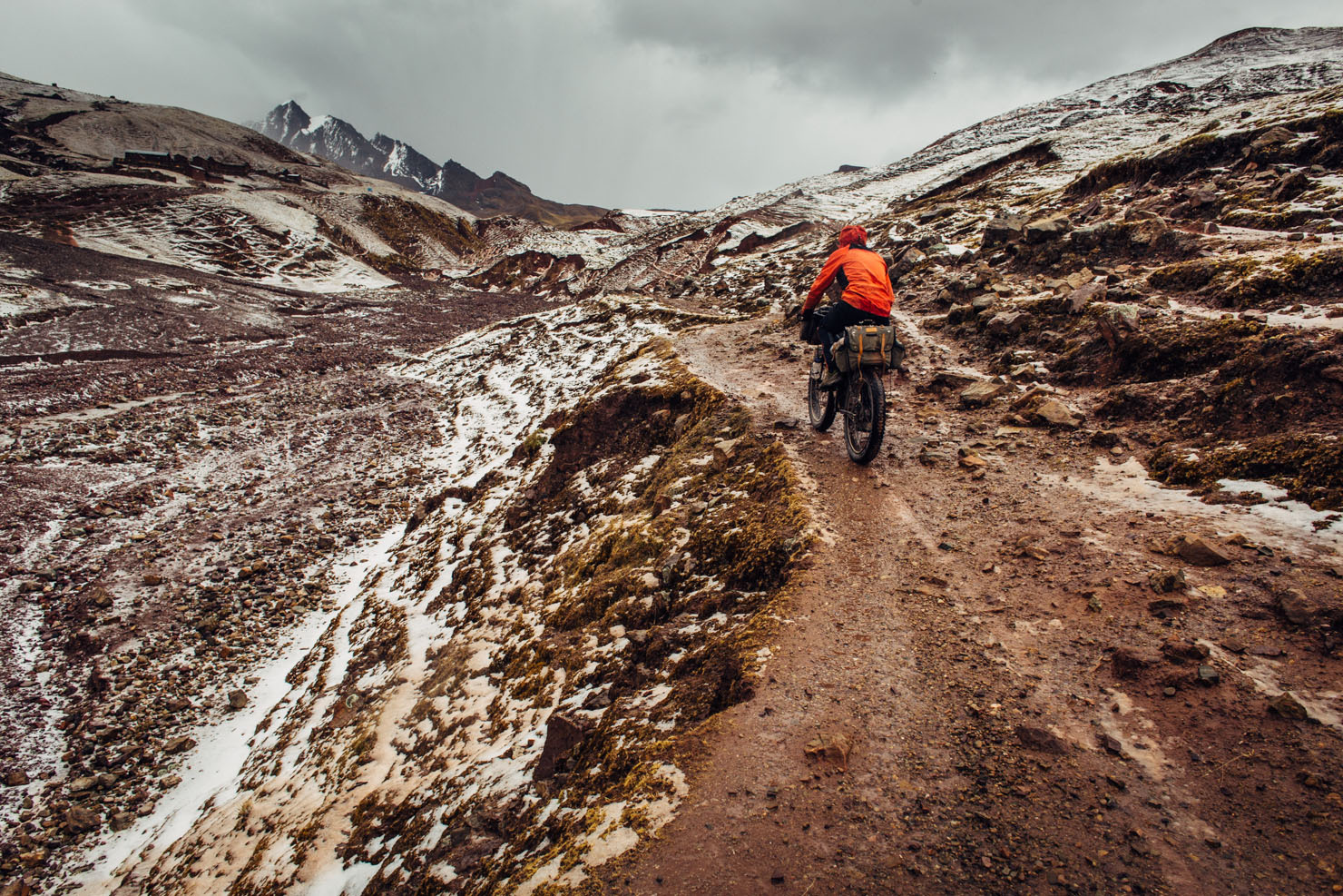
Just don’t let its diminutive size lull you into a false sense of over confidence. This is a challenging undertaking, with a massive climb, two high passes to contend with, and its fair share of ‘hike a bikes’. It’s also subject to the vagaries of mountain weather at any time of the year. And, as ever in the Andes, bear in mind that you’ll need to be well acclimatised to tackle it safely.
2016 Update
Having ridden around Ausangate for a second time, as part of the Tres Cordilleras route, I’d strongly recommend riding the complete loop in an anti-clockwise direction, using its more recent gpx file. It’s well worth the toils!


Submit Route Alert
As the leading creator and publisher of bikepacking routes, BIKEPACKING.com endeavors to maintain, improve, and advocate for our growing network of bikepacking routes all over the world. As such, our editorial team, route creators, and Route Stewards serve as mediators for route improvements and opportunities for connectivity, conservation, and community growth around these routes. To facilitate these efforts, we rely on our Bikepacking Collective and the greater bikepacking community to call attention to critical issues and opportunities that are discovered while riding these routes. If you have a vital issue or opportunity regarding this route that pertains to one of the subjects below, please let us know:
Highlights
Must Know
Camping
Food/H2O
Resources
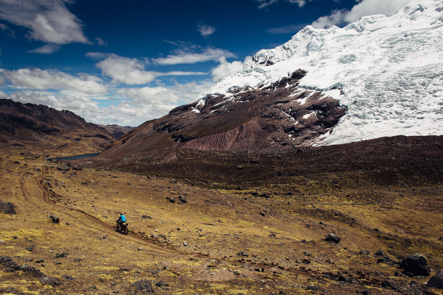
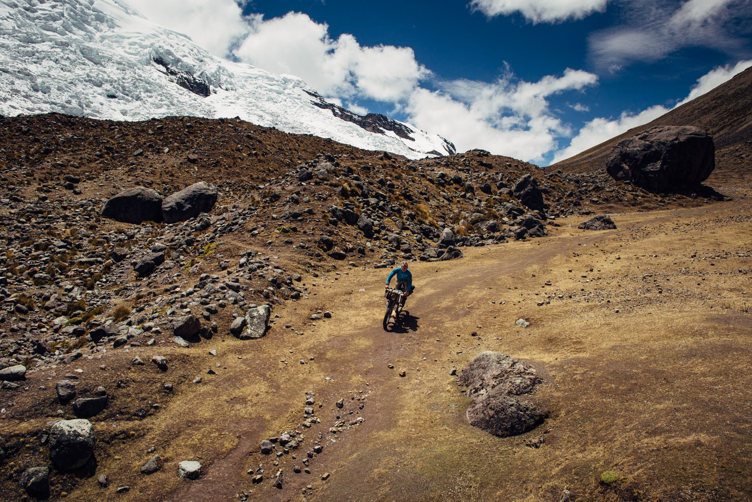
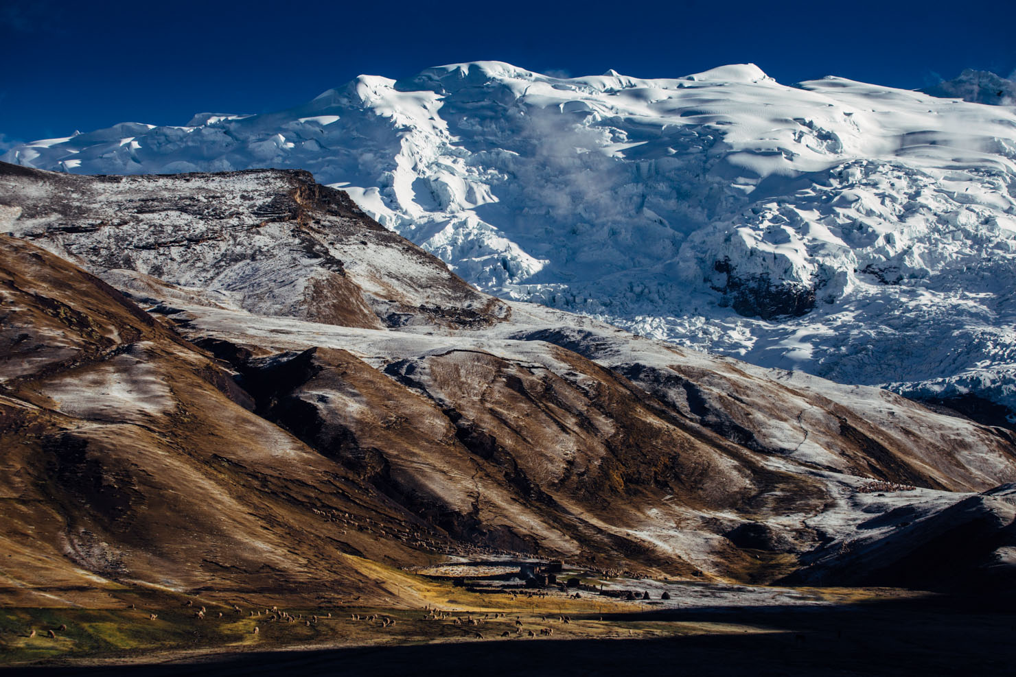
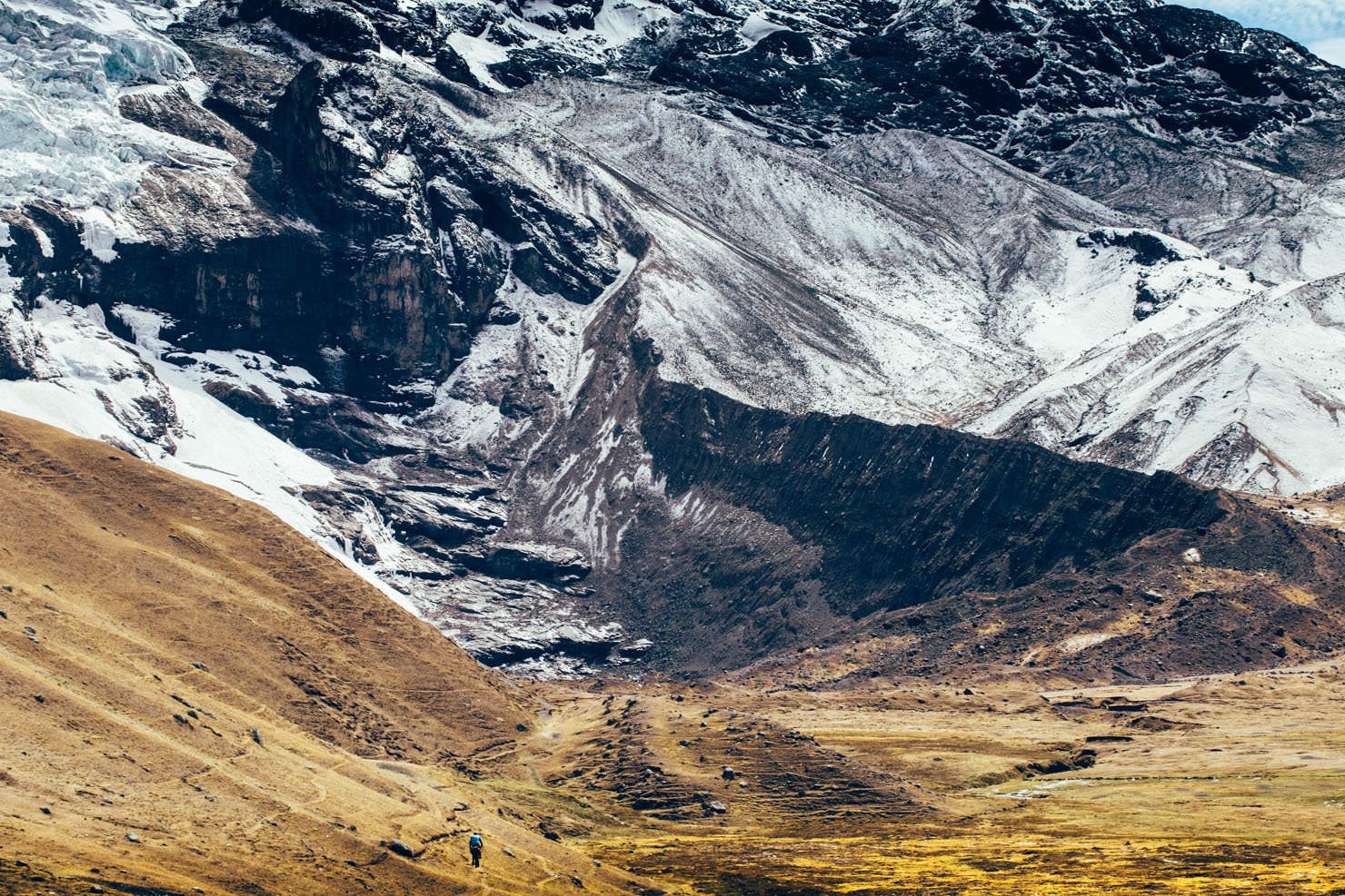
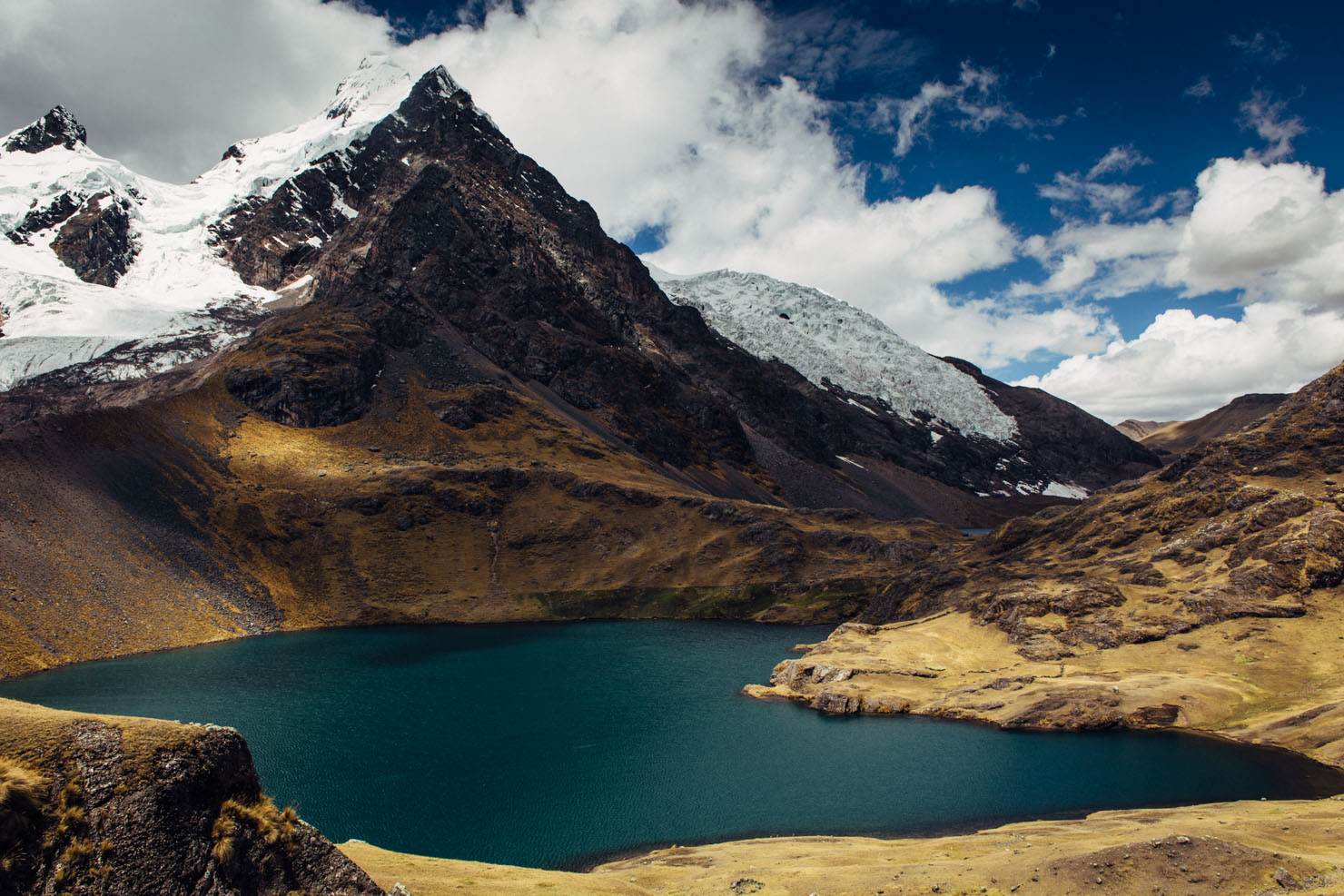
- Stunning, up close views of Nevado Ausangate and its towering wall of glaciers.
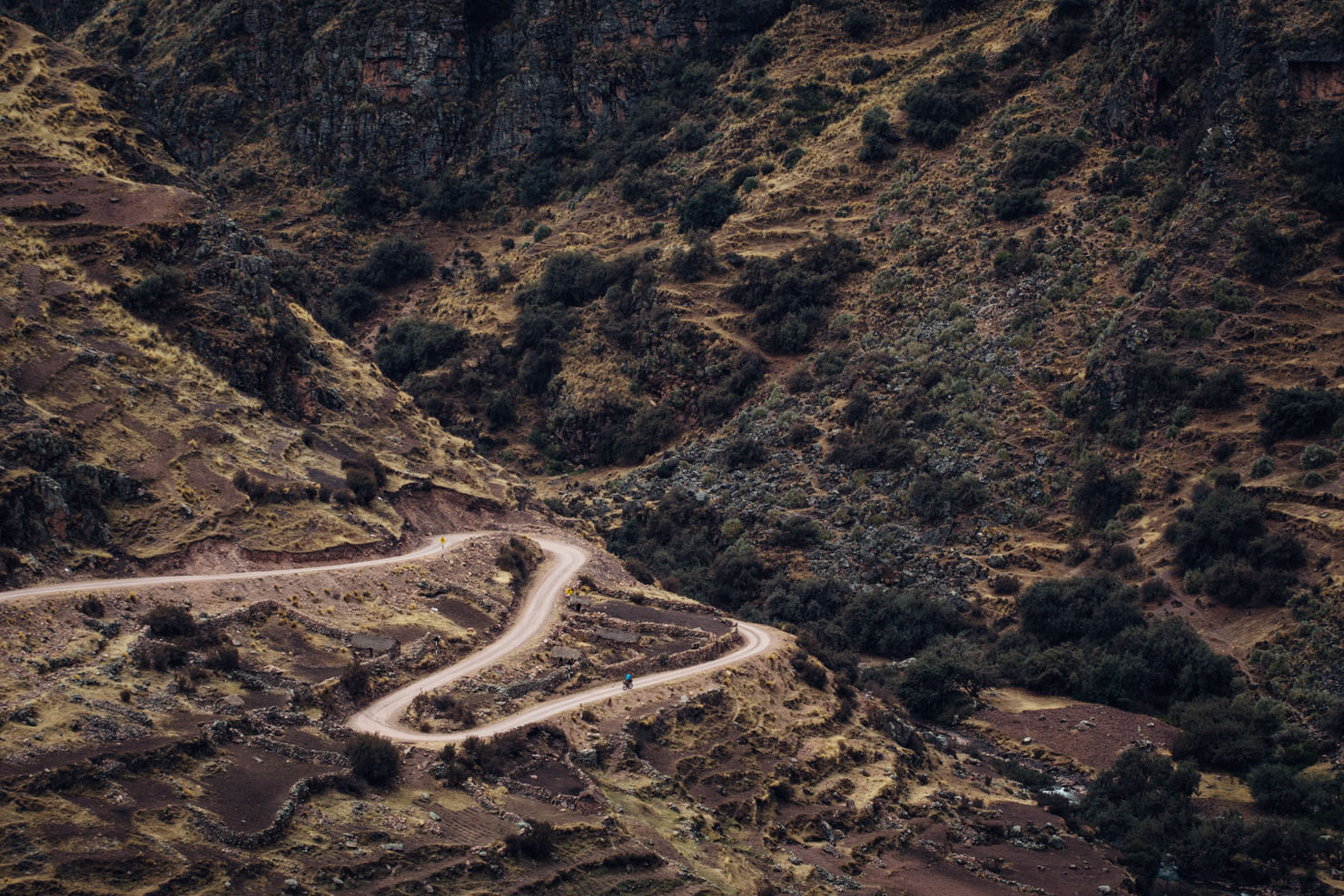
- Incredibly remote and scenic singletrack.
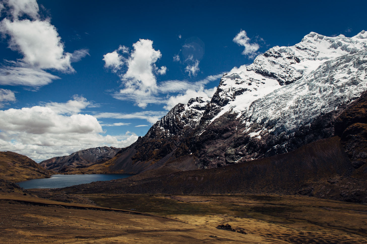
- Circumnavigating a series of turquoise, high altitude lakes.
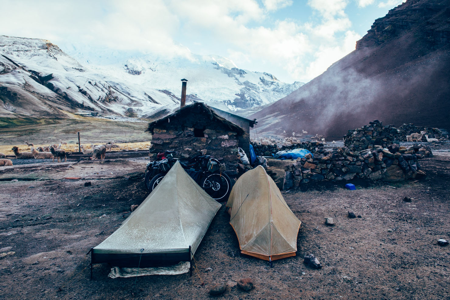
- Sublime camping.
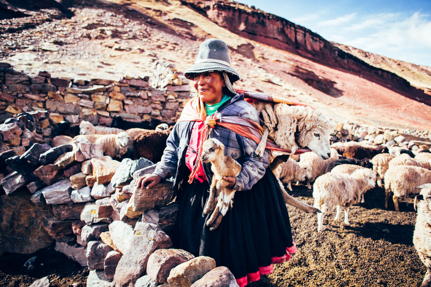
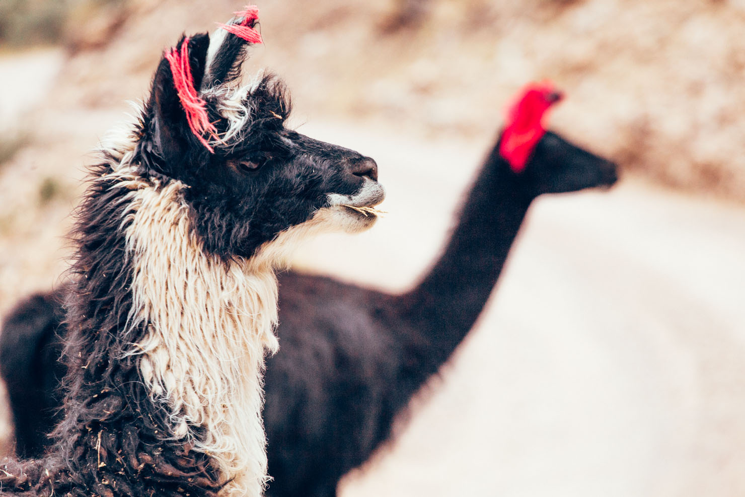
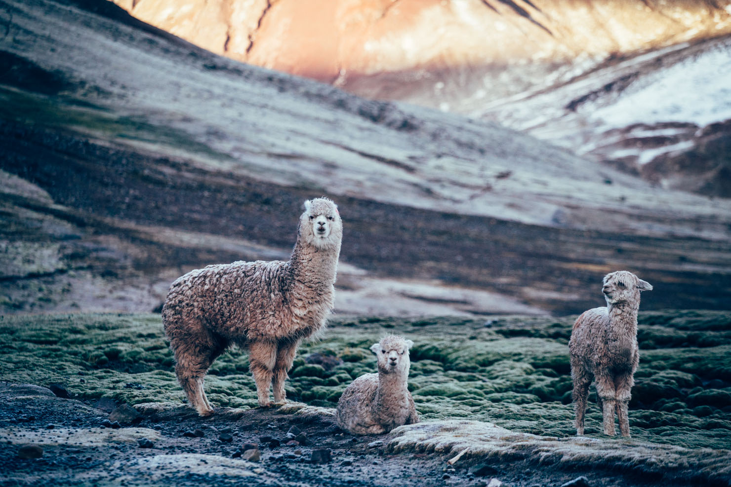
- Hanging out with fluffy, fuzz ball alpacas.
- Trekkers tackling this route do so between May and late September. Outside the height of the dry season, expect afternoon storms. This weather pattern will likely demand early starts and early campspots – though even if it’s clear, you’ll probably want to camp early to soak up those views! Carry food for 3 days just in case.
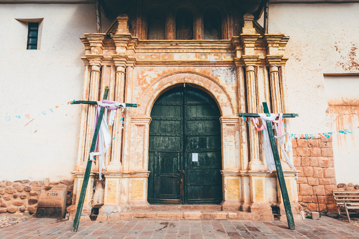
- Getting there from Cusco will require a long day of pavement riding, or a few hours on a bus. There are bus connections from Pitumarca and Tinki.
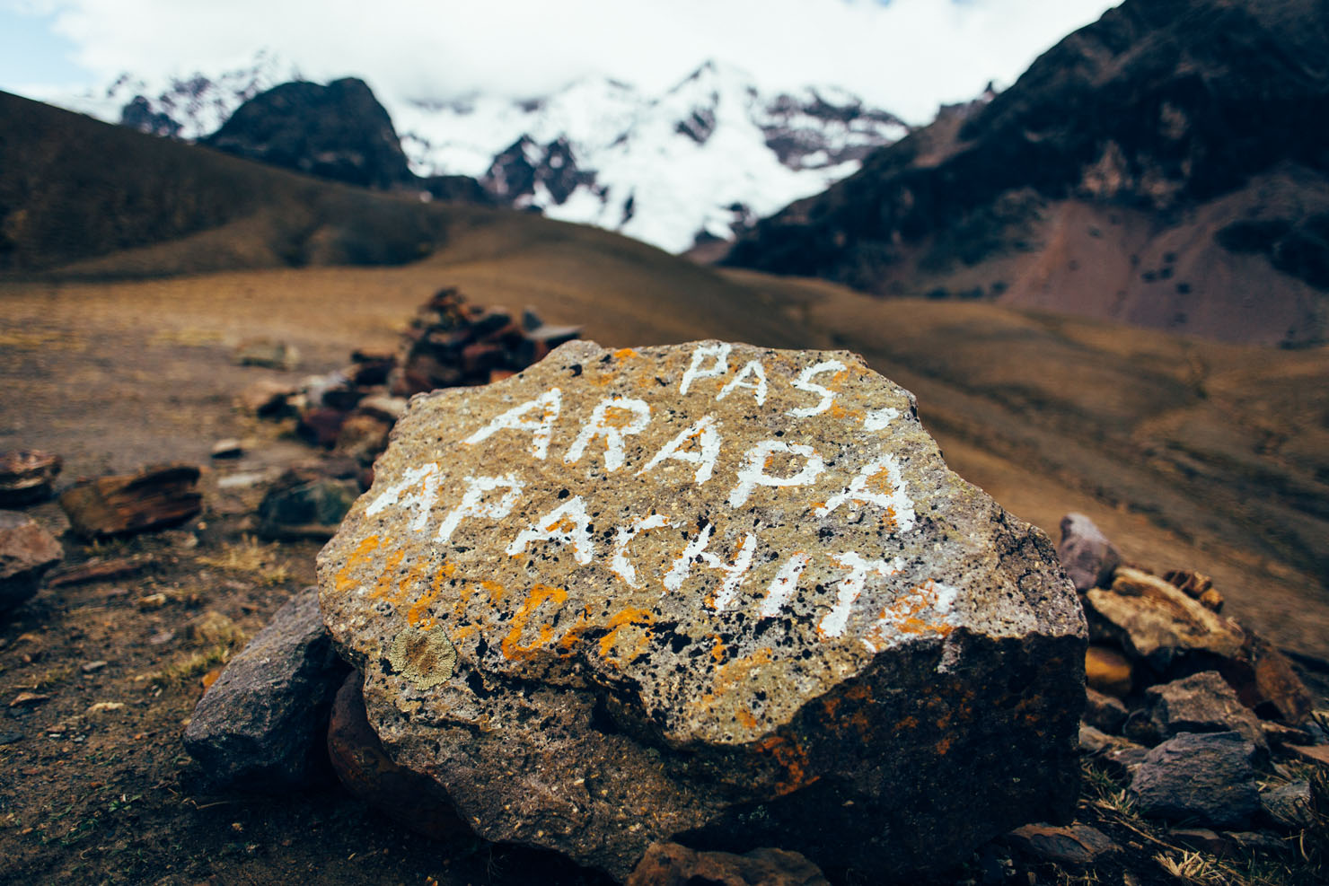
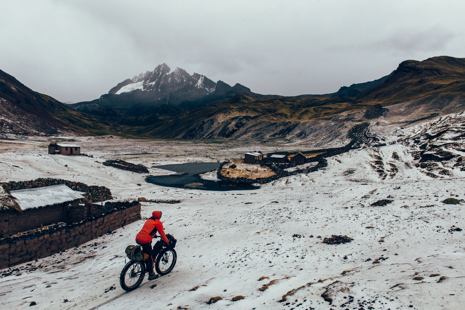
- There are two high passes to contend with: Arapa and Apuchata. In between, lies a series of stunning, turquoise lakes, like Jatun Cocha and Jatun Puka Cocha.
- Given that we had crossed the border from Bolivia, we rode from Pitumarca to Tinki – making for a particularly memorable descent from the first high pass down to the lakes. Considering the more gentle climb into the mountains, I’d say this is the better direction. But I expect it would be fun either way.
- Navigation can be a little awkward at times, as there’s a network of paths used by trekkers and alpaca herders, some of which make for better riding than others.
- There is a dirt road being built between Tinki and Upis, approx 15km.
- If you’re coming from Cusco, Ocongate makes a good base to spend the night, with plenty of accommodation options, places to eat, stores and a market. If you’re coming from Juliaca, Pitumarca has everything you’ll need.
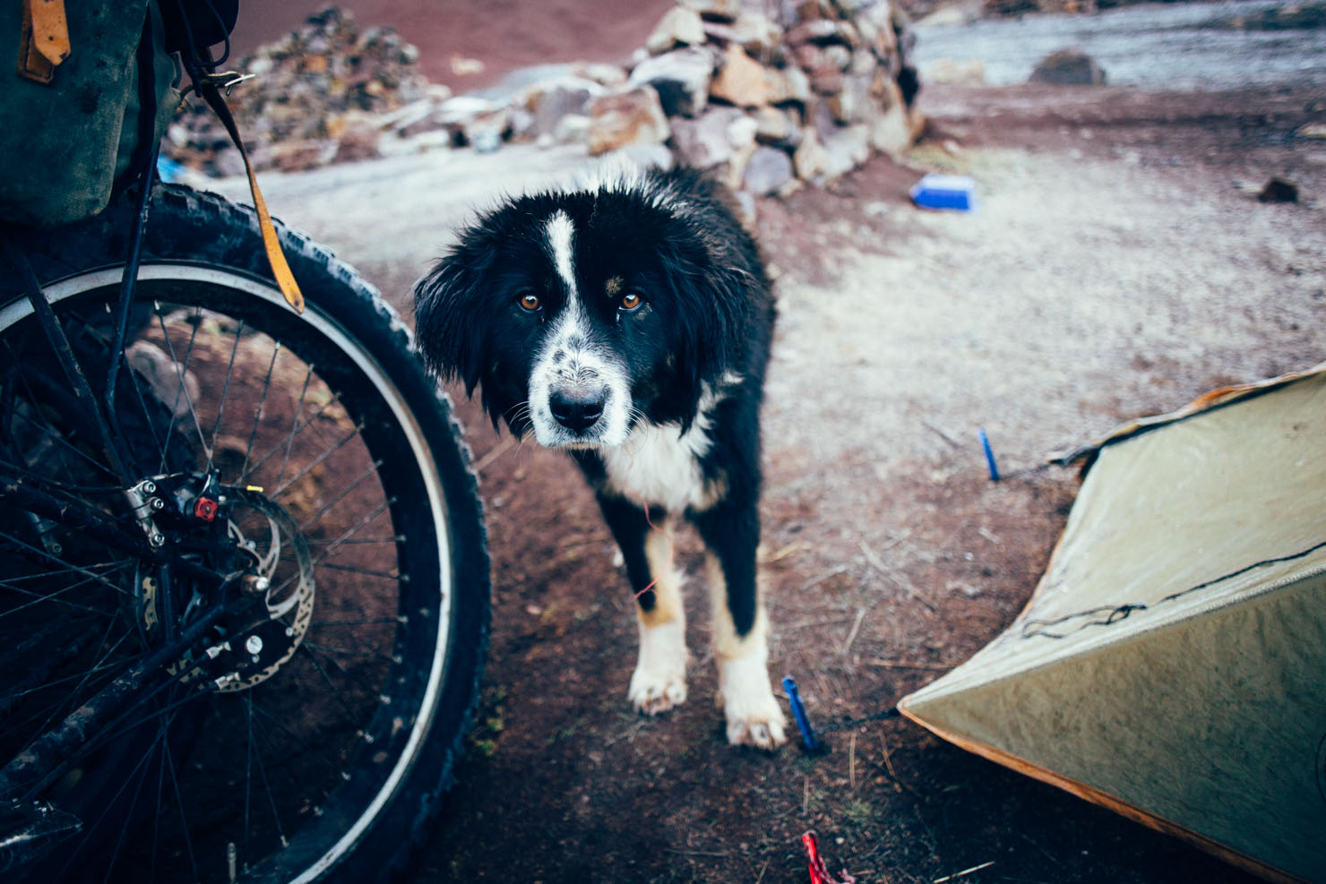
- Although we didn’t have any issues ourselves, be especially vigilant with your gear, and don’t leave anything outside your tent, or in the porch. There have been numerous cases of theft.
- The ride reaches over 4900m (16100ft) in altitude, so make sure you are acclimatised.
- Culturally, the high pastures are inhabited by the Q’eros people, who trade alpacas and llamas with communities in the lower elevations. In fact, the relationship between land, man and animal that’s felt throughout Peru is especially strong here given Incan legend. It’s said that Ausangate’s daughter takes care of the llamas and alpacas of the world, and it’s from these lakes that they emerge to serve the Quechuan people. For this reason, Ausangate ensures they be treated with due care and respect.
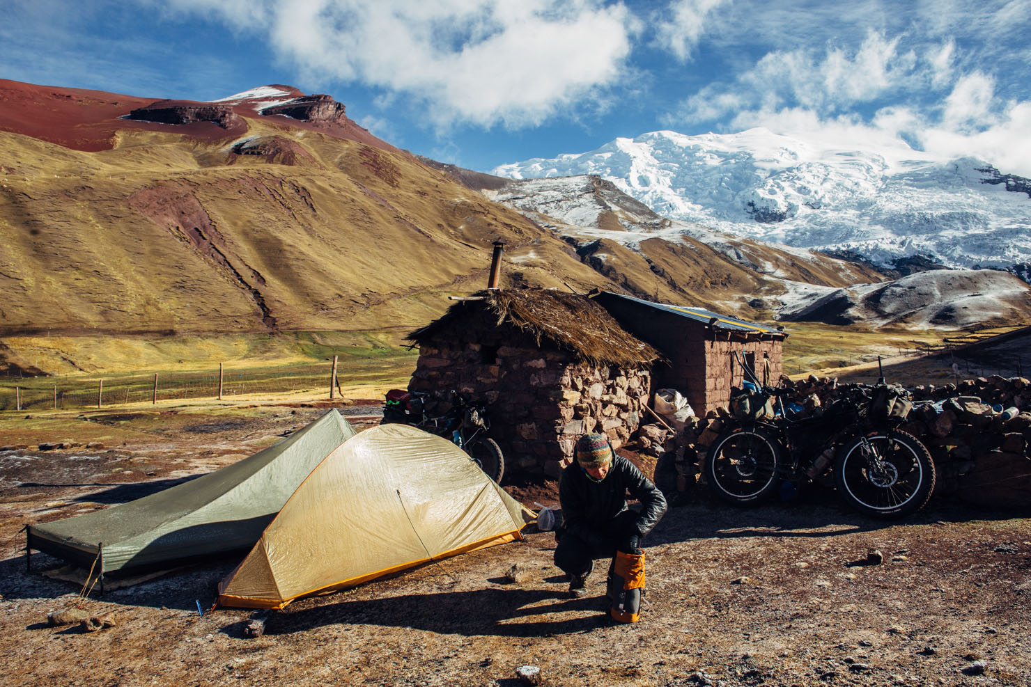
- Camping opportunities abound – just be careful with your gear, as noted in Need to Know.
- Anywhere around the lakes, like Puma Cocha, would be especially scenic.
- We hunkered down behind a stone house in the tiny settlement of Ausangante to avoid a storm.
- There are hot springs at Upis (4450m), where many people trekkers pitch their tents.
- Stock up in Ocongate or Pitumarca – both have stores as well as cheap restaurants to carbo load before the ascent. Tinke, at the turnoff to the route, is also well served by cheap restaurants.
- Water is abundant throughout the ride.
Additional Resources
- My original trip report, riding north, can be found here.
- I also wrote a feature about Ausangate and the surrounding region for the first issue of Cranked Mountain Bike magazine.
- Mike, who I rode with, tells his side of the tale here.
- And Paul Griffiths’ account, riding south, can be found here. Incidentally, Paul had his bike stolen en route, but thankfully managed to retrieve it!
- The guidebook Hiking and Biking in the Sacred Valley includes this route in its cycling chapter, though the details themselves are hazy, and even inaccurate at times. This said, it’s an excellent source of inspiration for mountain biking and bikepacking in the area.
- Thanks to the inimitable Kurt for the inspiration!


Terms of Use: As with each bikepacking route guide published on BIKEPACKING.com, should you choose to cycle this route, do so at your own risk. Prior to setting out check current local weather, conditions, and land/road closures. While riding, obey all public and private land use restrictions and rules, carry proper safety and navigational equipment, and of course, follow the #leavenotrace guidelines. The information found herein is simply a planning resource to be used as a point of inspiration in conjunction with your own due-diligence. In spite of the fact that this route, associated GPS track (GPX and maps), and all route guidelines were prepared under diligent research by the specified contributor and/or contributors, the accuracy of such and judgement of the author is not guaranteed. BIKEPACKING.com LLC, its partners, associates, and contributors are in no way liable for personal injury, damage to personal property, or any other such situation that might happen to individual riders cycling or following this route.
Please keep the conversation civil, constructive, and inclusive, or your comment will be removed.