


Ruta de Las Tres Cordilleras, Bolivia and Peru
Distance
493 Mi.
(793 KM)Days
16
% Unpaved
98%
% Singletrack
15%
% Rideable (time)
95%
Total Ascent
57,735'
(17,598 M)High Point
16,700'
(5,090 M)Difficulty (1-10)
9?
- 8Climbing Scale Strenuous117 FT/MI (22 M/KM)
- -Technical Difficulty
- -Physical Demand
- -Resupply & Logistics
Contributed By

Cass Gilbert
Contributing Editor
Note that the original route features an unmanned border that promises beguilingly remote riding, but creates some logistical visa hurdles to overcome. An alternative section that avoids detours around this part of the Apolobamba range makes use of a newly opened immigration office on the Peruvian side, allowing for a more straightforward connection. The current alternative can be found here, if you’re not able to procure a Bolivian exit visa in La Paz to cross via Suches Lake.
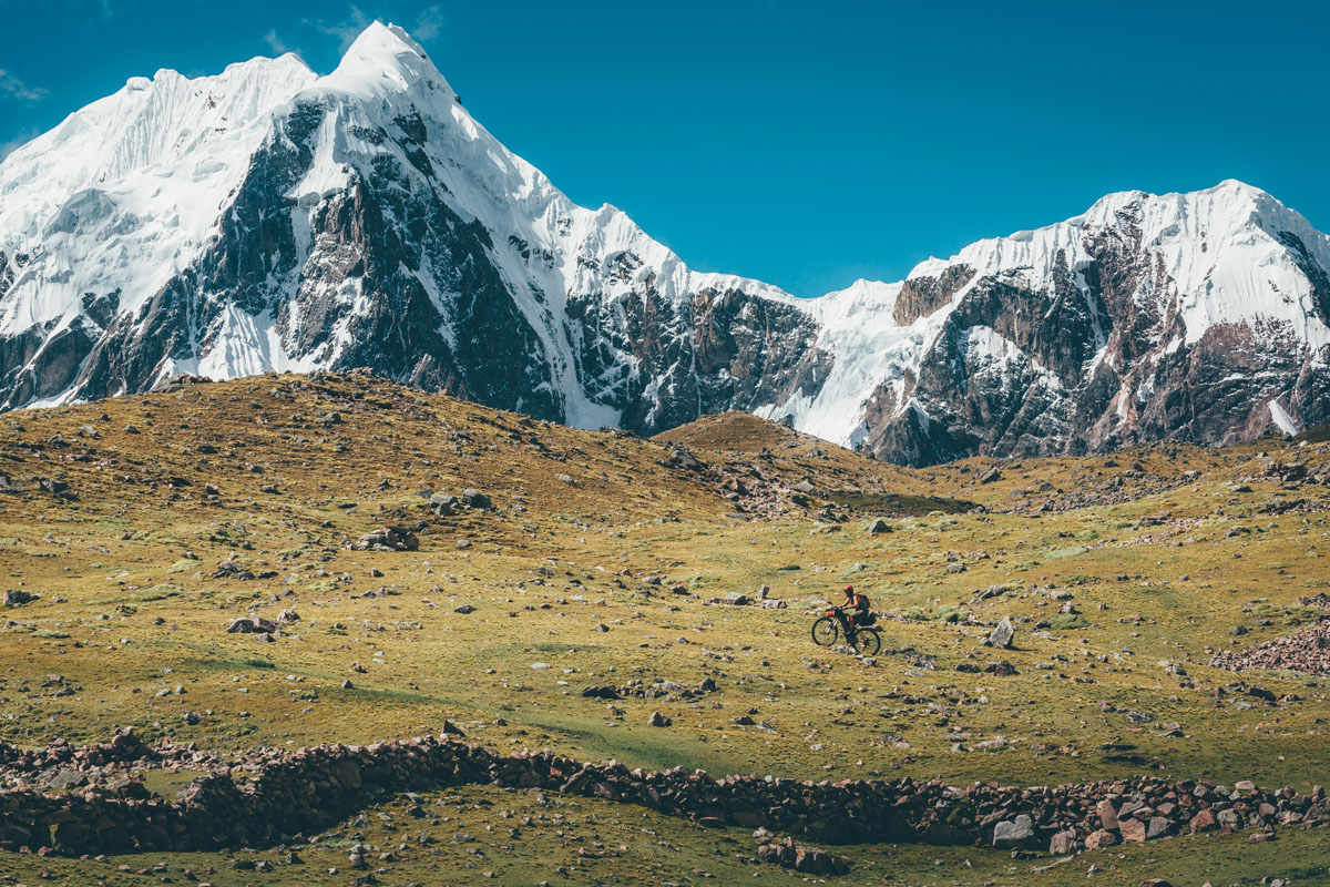
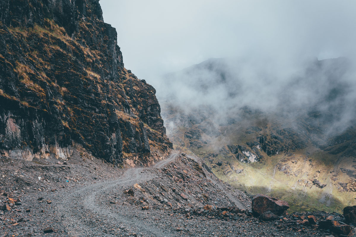
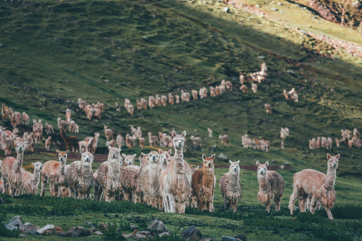
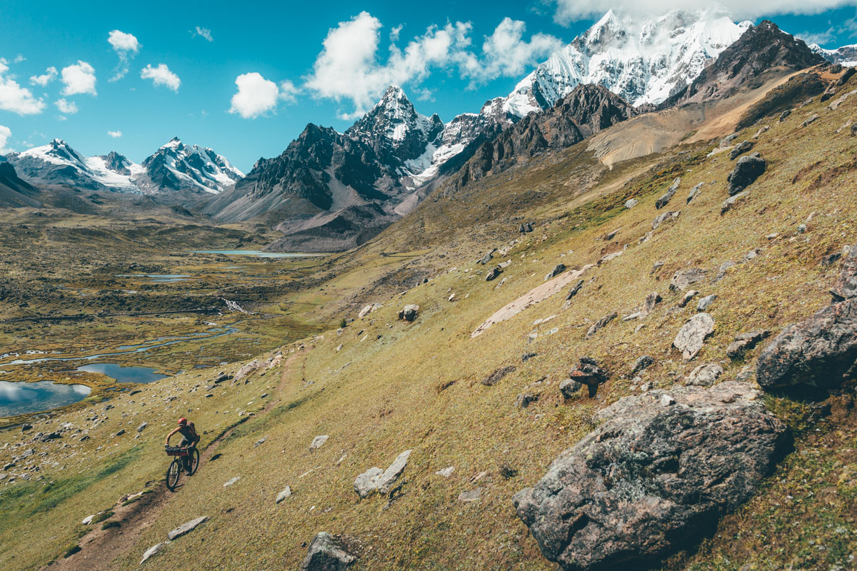
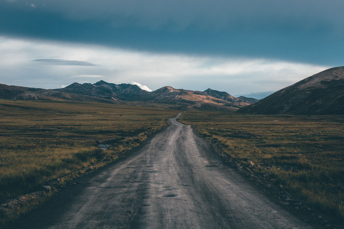
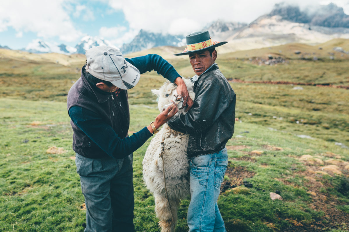
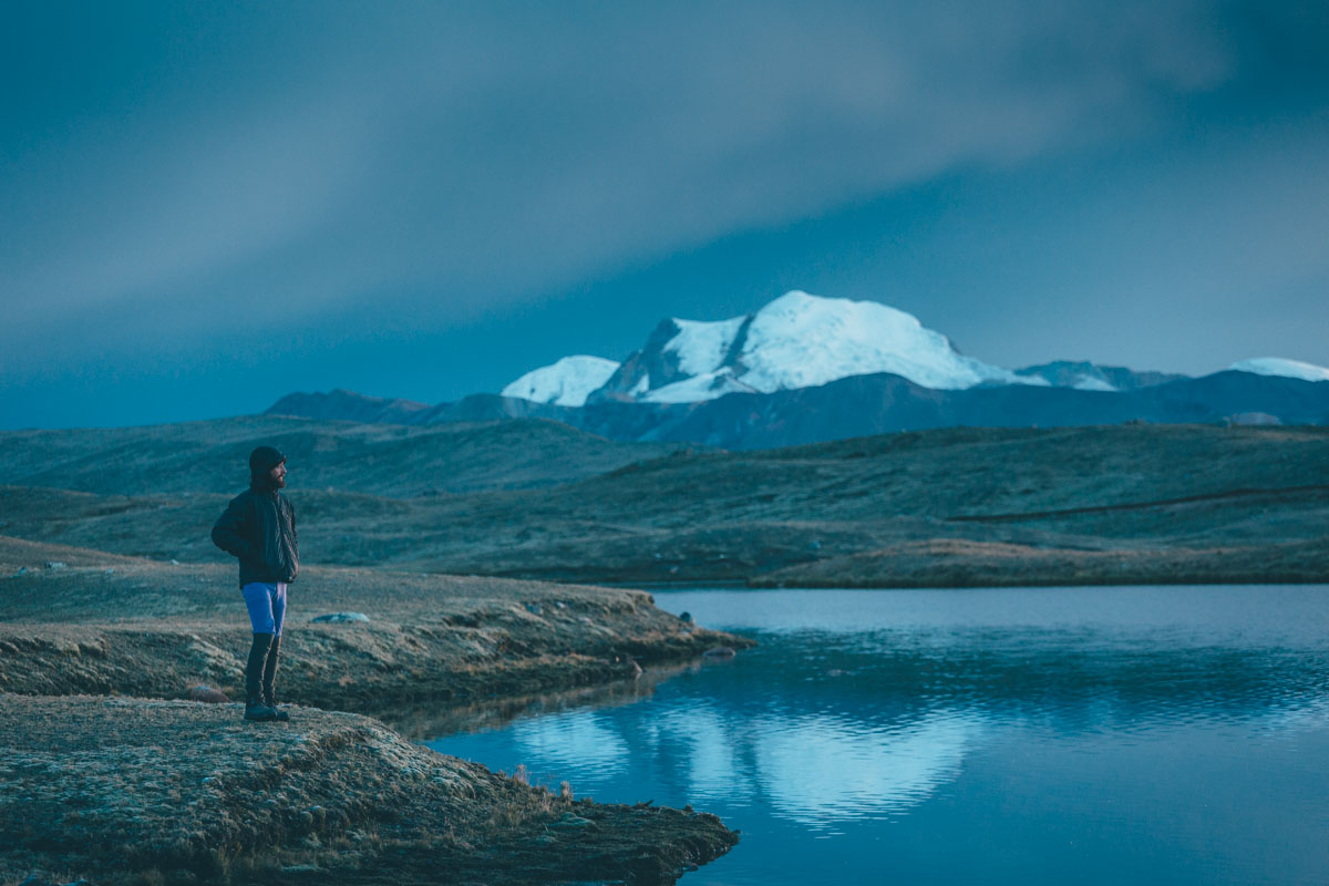
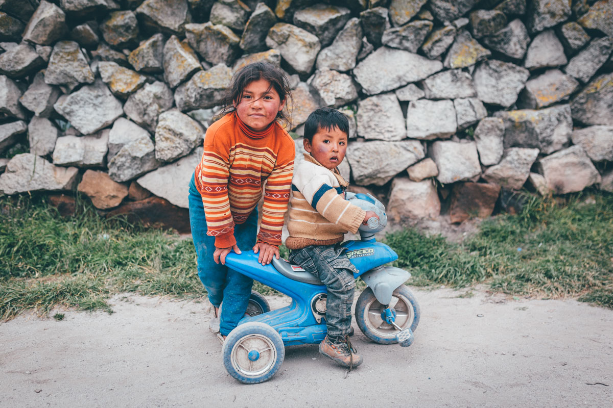
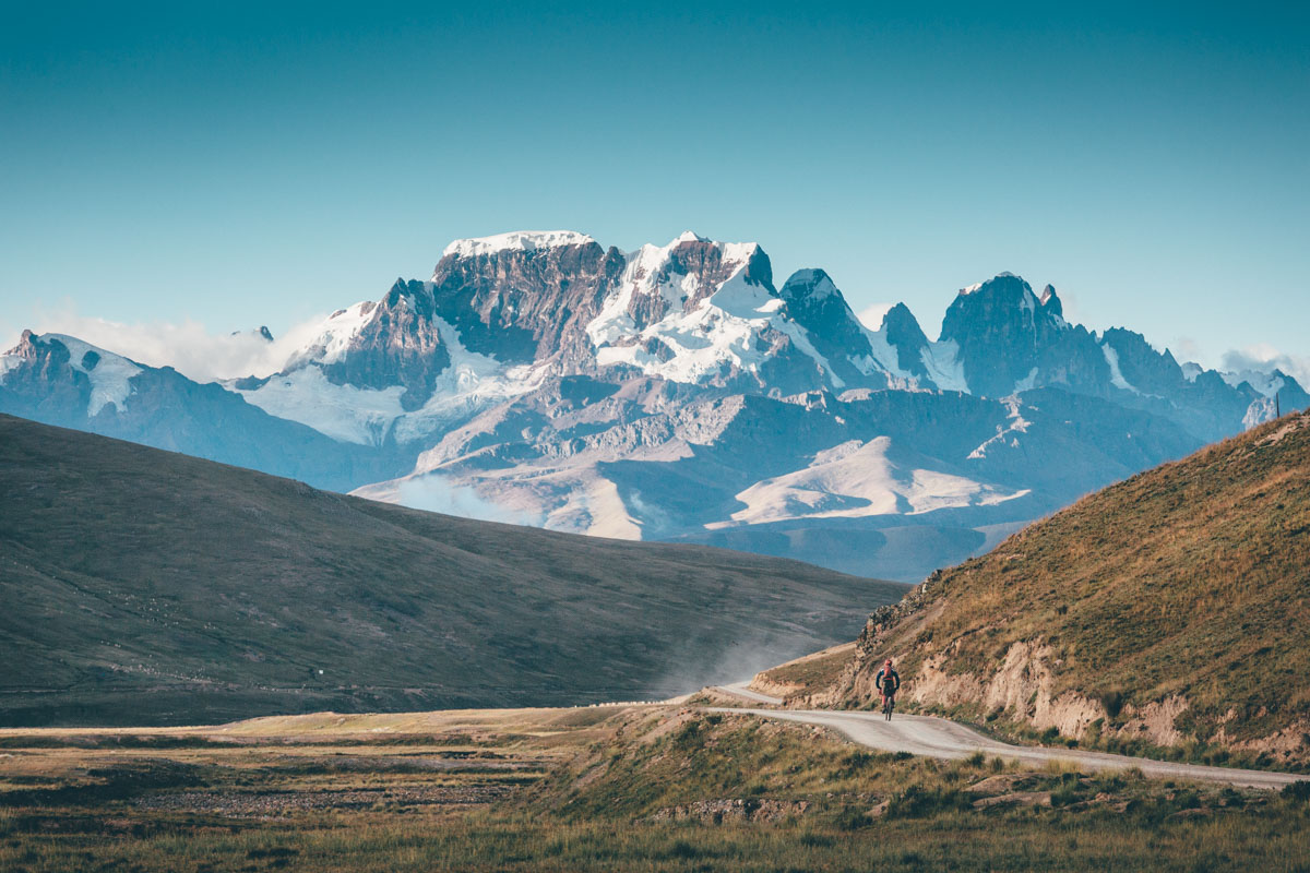
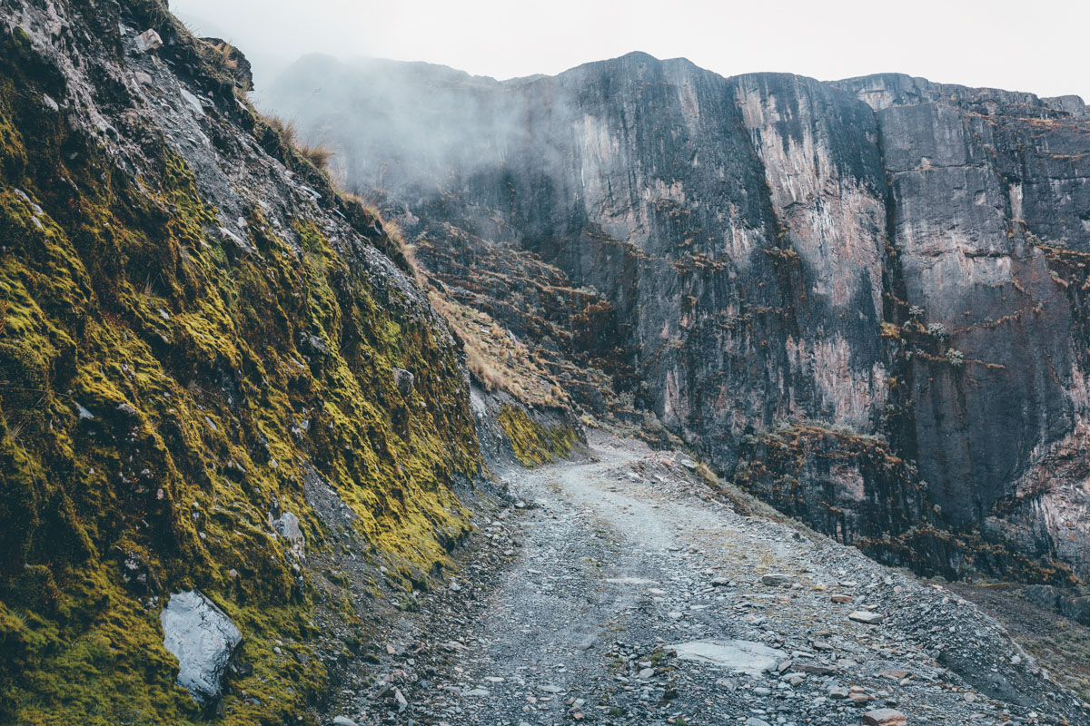
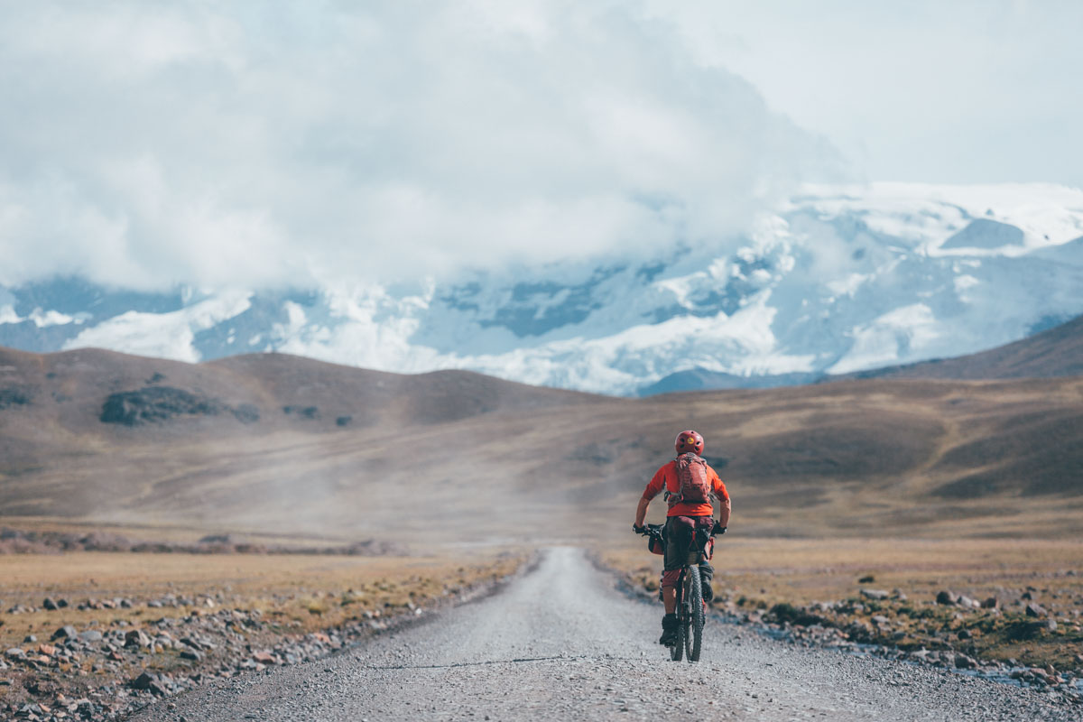
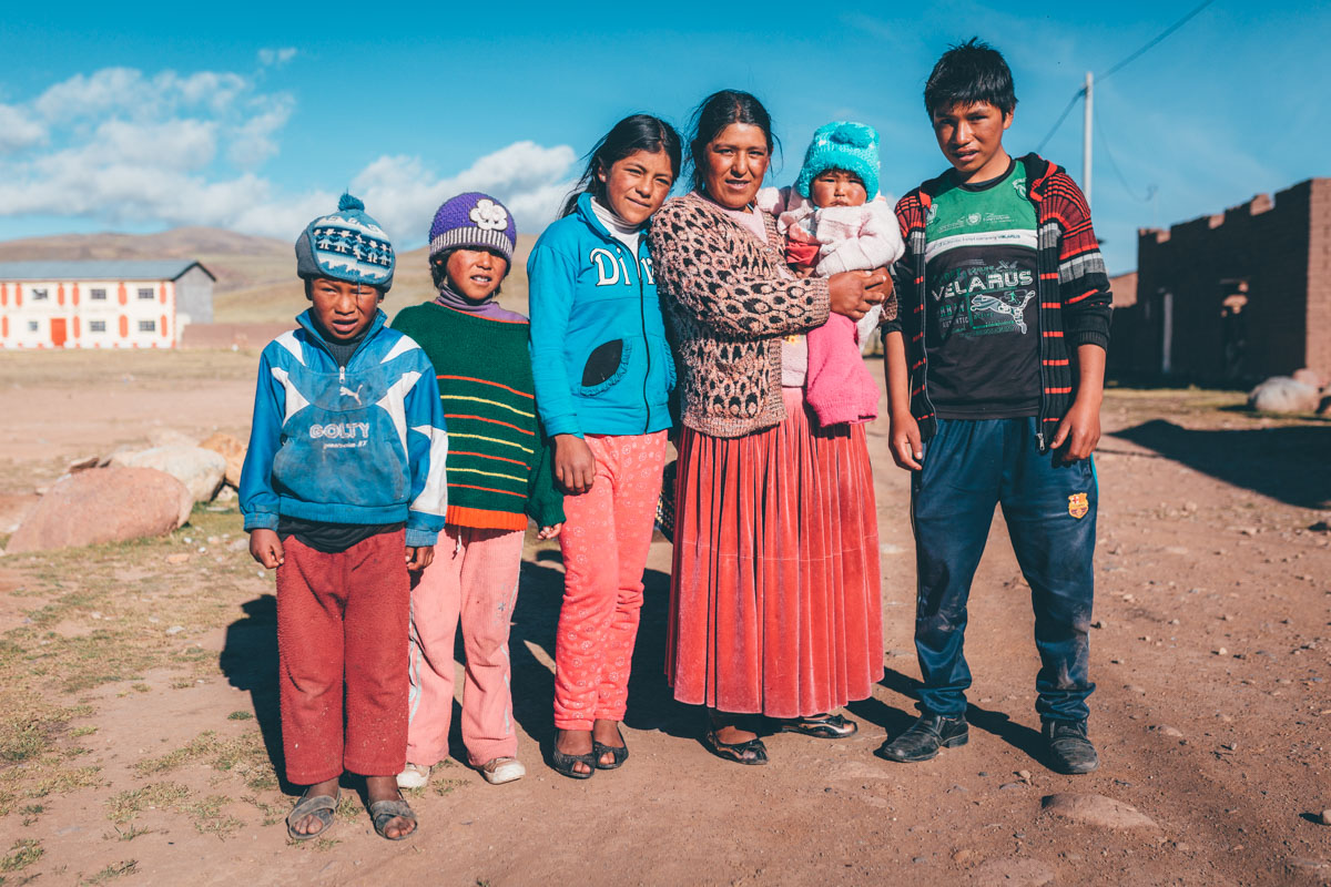
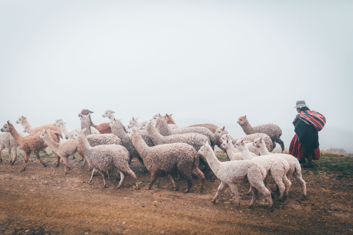
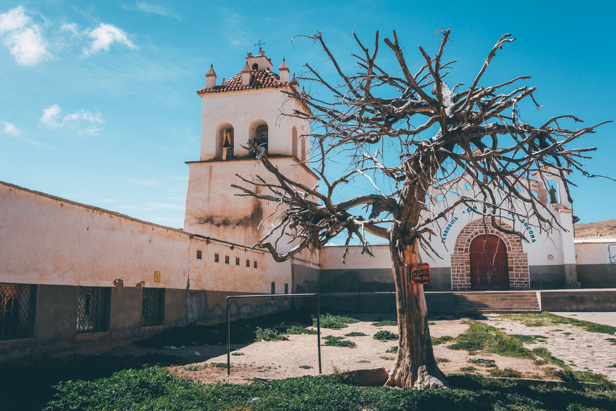
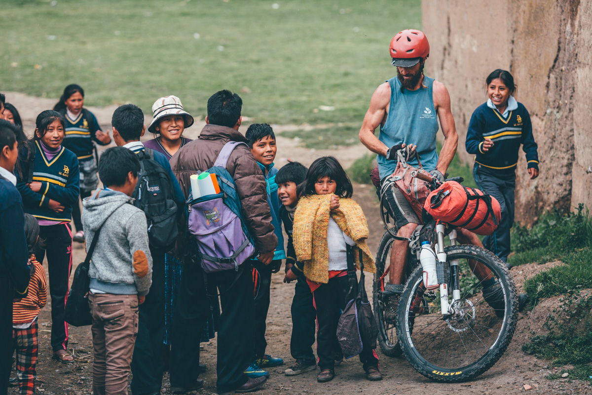
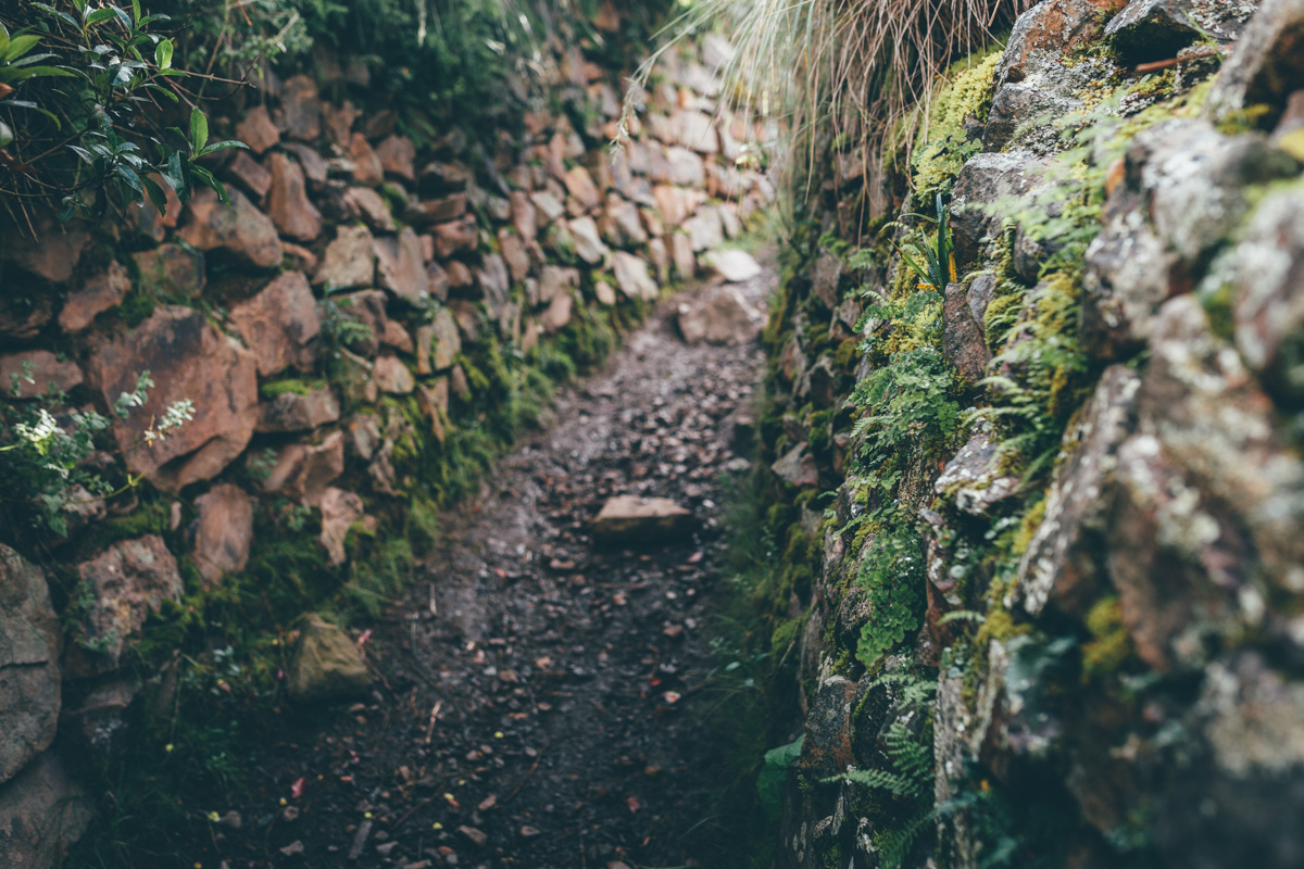
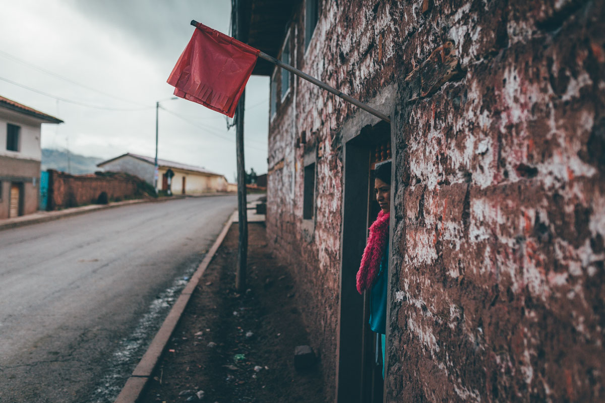
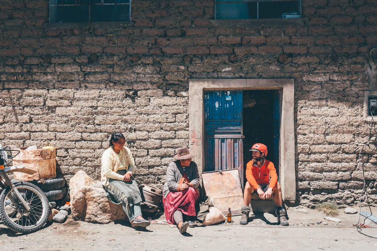
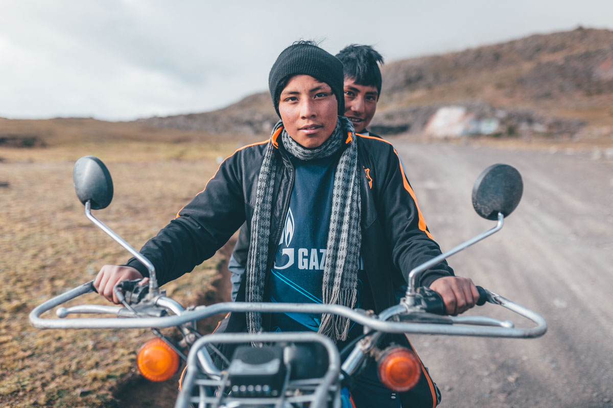
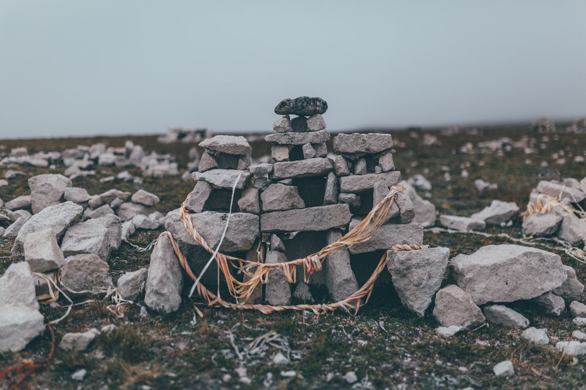
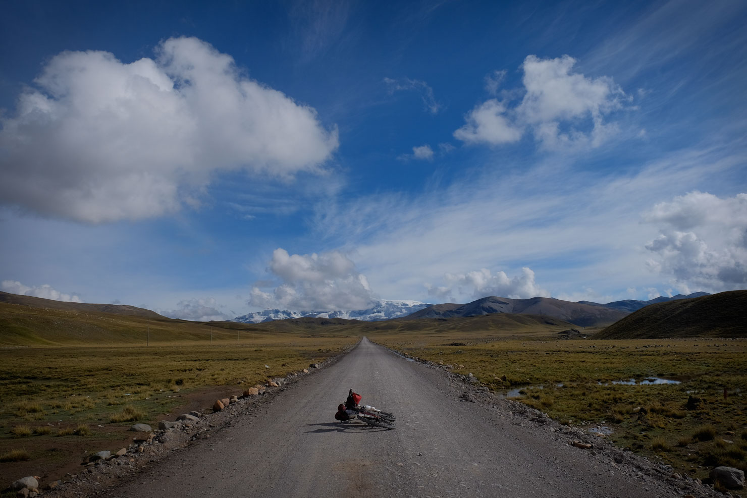
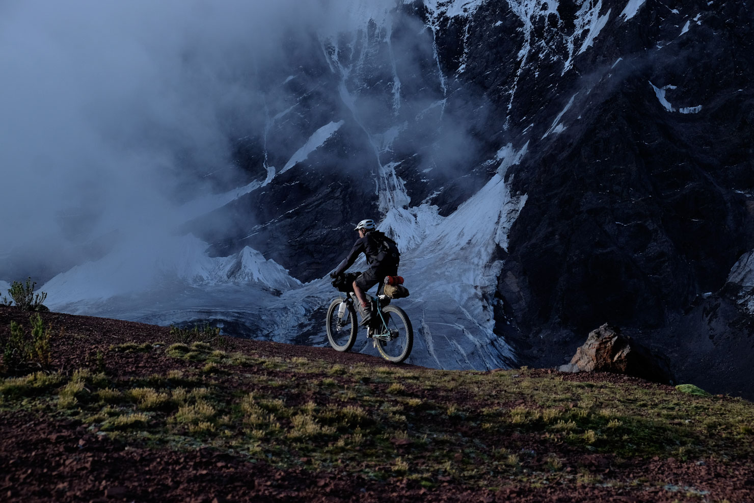
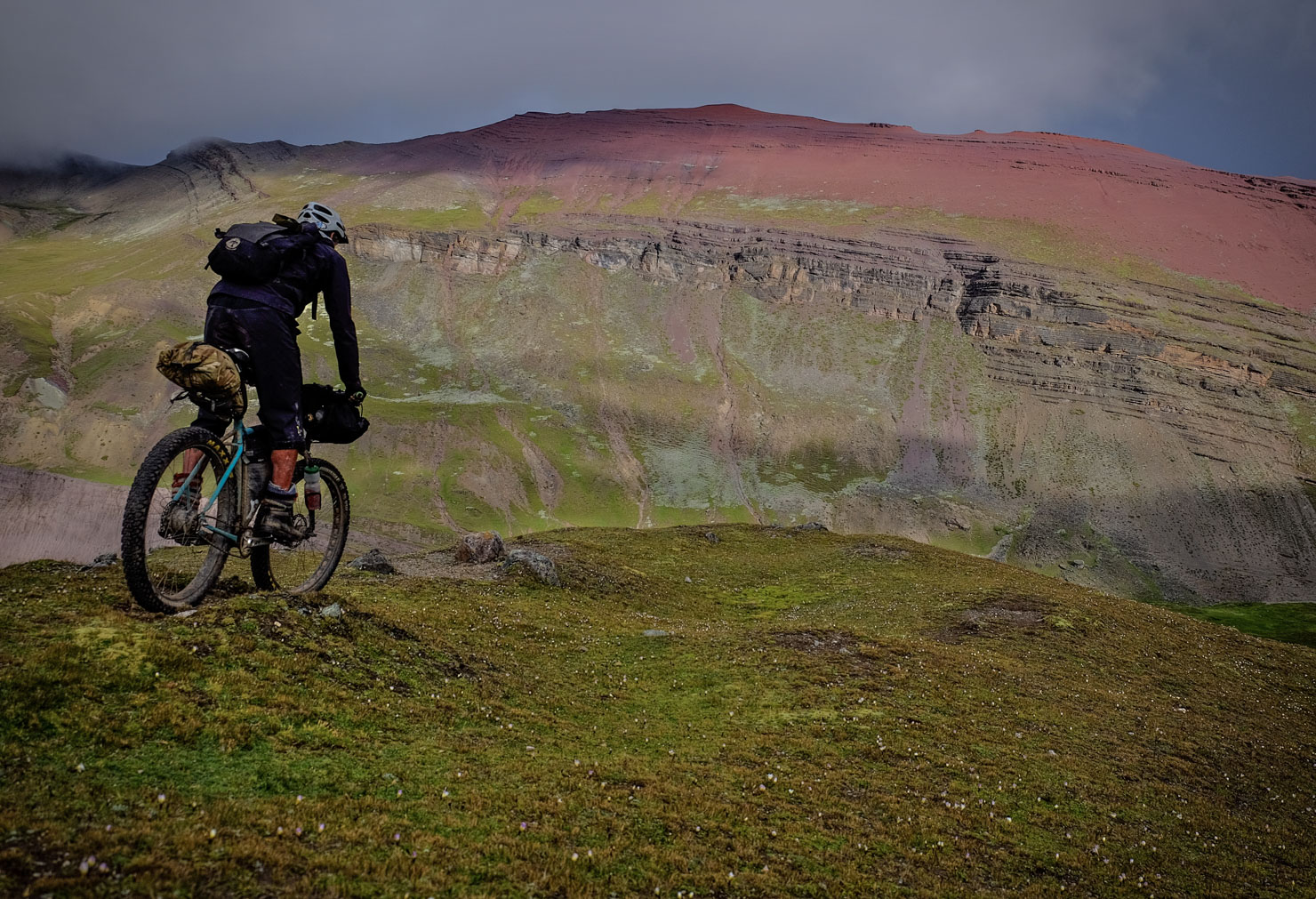
Beginning in Sorata, in the Cordillera Real, the Ruta de las Tres Cordilleras picks its way along forgotten footpaths, old Incan trails, jeep tracks, and low traffic tertiary roads, linking together a string of tiny Bolivian villages en route to the Peruvian border. And what a border crossing it is; bereft of a control post, passing from one country to the next involves little more than fording a river and following singletrack across a treeless plateaux, to the backdrop of the mighty Apolobamba range. Hopscotching from mining settlement to mining settlement, the Ruta passes just a stone’s throw from La Rinconada, the largest mine in the area and at 5100m, the highest permanent settlement in the world.


Route Development
The Ruta de las Tres Cordilleras is a part of the greater Andes Traverse, an ongoing project to build a long distance route that runs along the spine of the Andes, between Colombia and Chile. This section of the route is the brainchild of Michael Dammer, Ecuadorian climber and bikepacker extraordinaire. If you’re familiar the Dammer Brothers, you’ll know their bold routes – like the Trans Ecuador Mountain Bike Ride (TEMBR) – are never less than challenging, so expect the same. Thanks to Justin Barnes for his valuable updates and insights, after a traverse that was completed in late May 2018. Thanks too to Mark Watson for suggesting an alternate route (updated in August 29019), neatly avoiding the border shenanigans and by dropping down to beautiful Lake Titicaca…
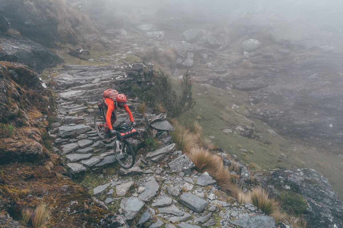
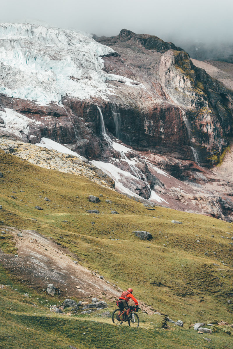
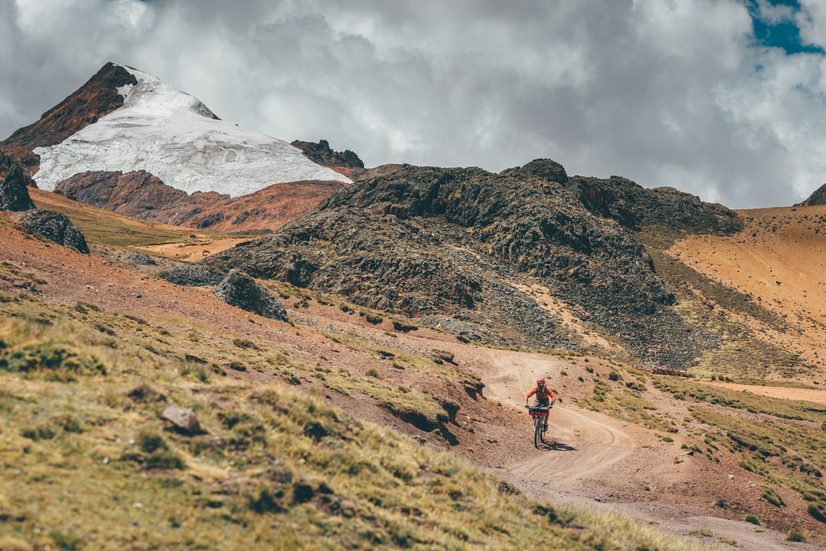
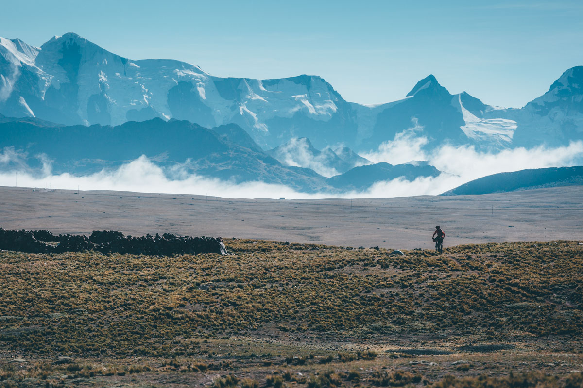
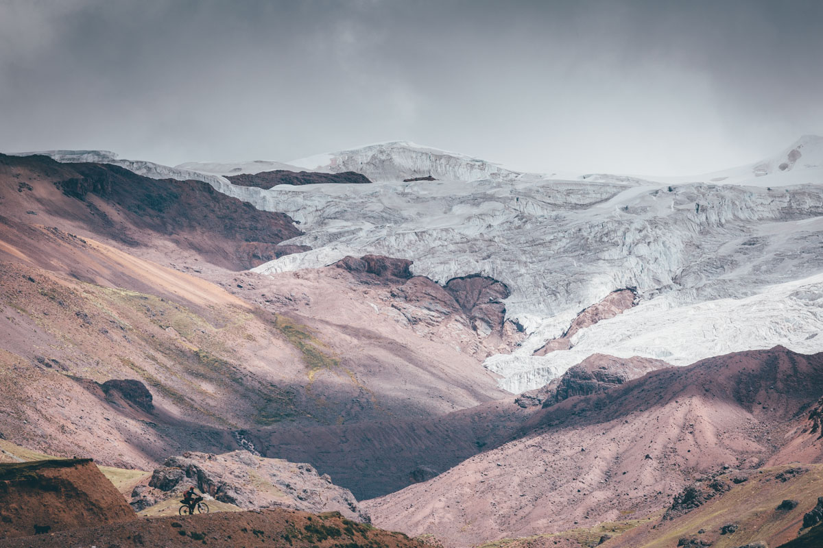
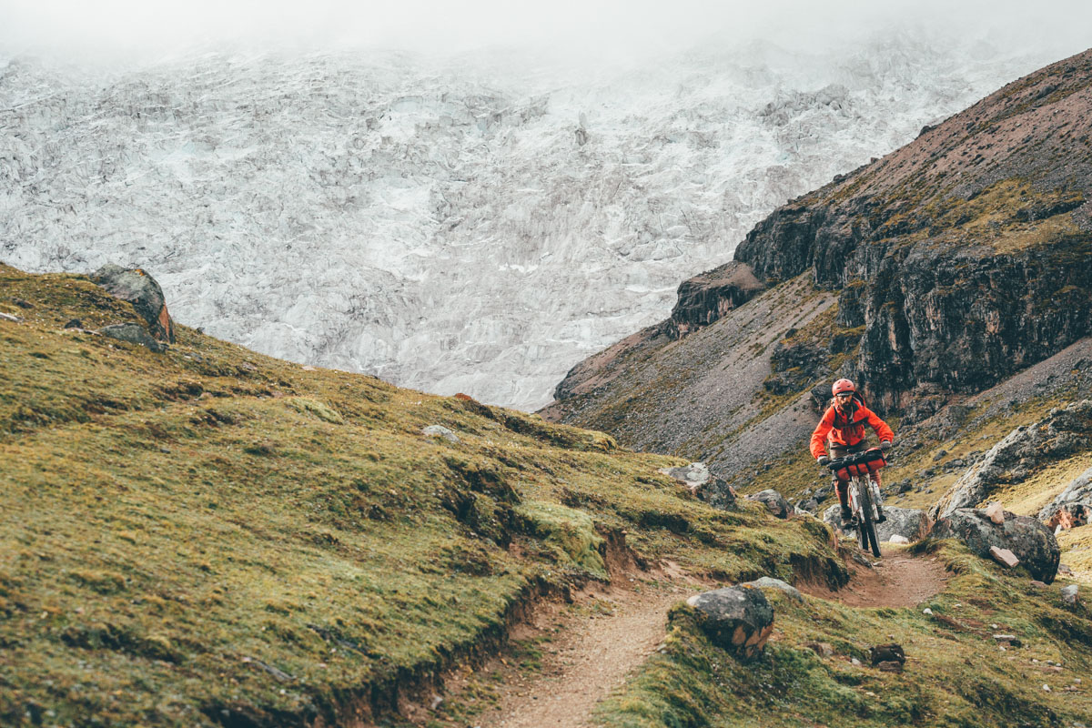
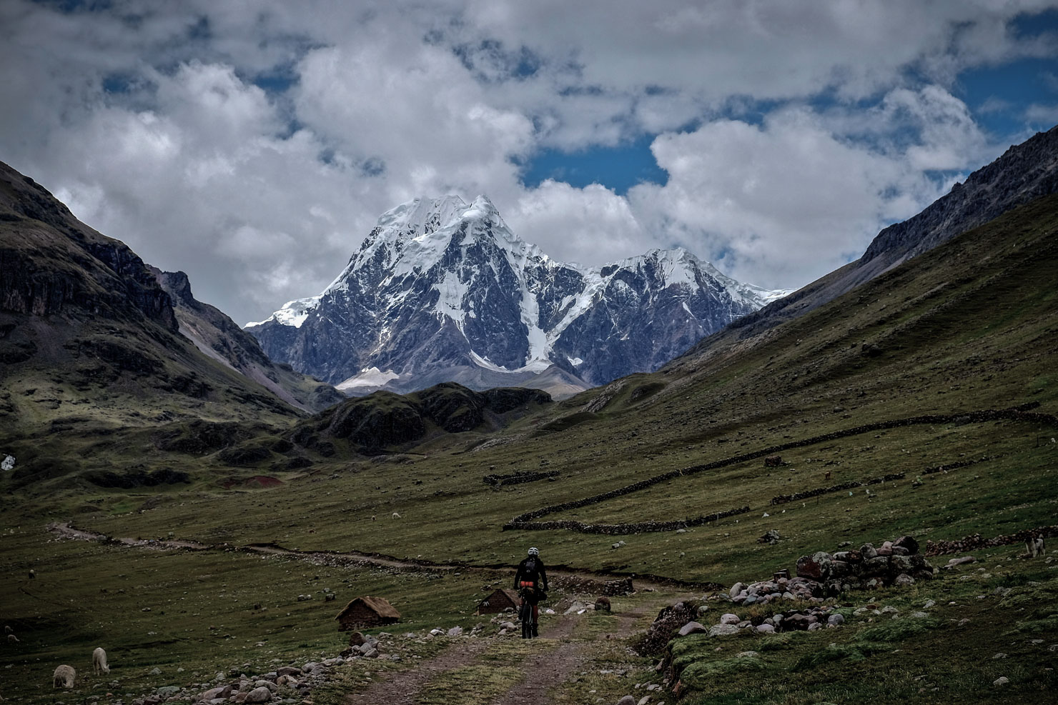
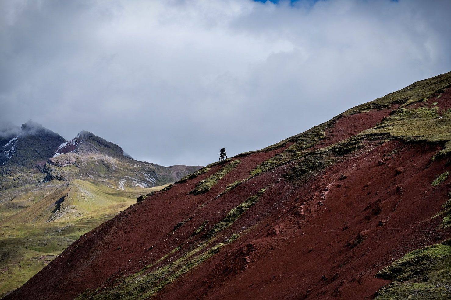
After restocking in Ananea, it’s time for more challenging singletrack and an intense, exposed hike-a-bike to Cuyo Cuyo, a petite spa town rich in tradition, evident in the extensive Incan farming terraces that mottle its hillsides, and its impressive stone dwellings that are still in use today. Past an expansive stone forest near Corani, the highest pass on the route still lies ahead. It’s tackled via a recently hewn dirt road that passes beneath the impressive Quelccaya Ice Cap, the largest glaciated area in the tropics, spanning an area of 44 square kilometres.
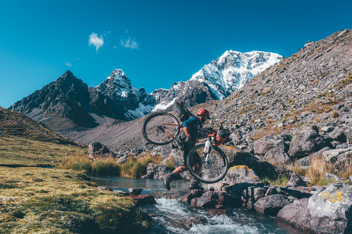
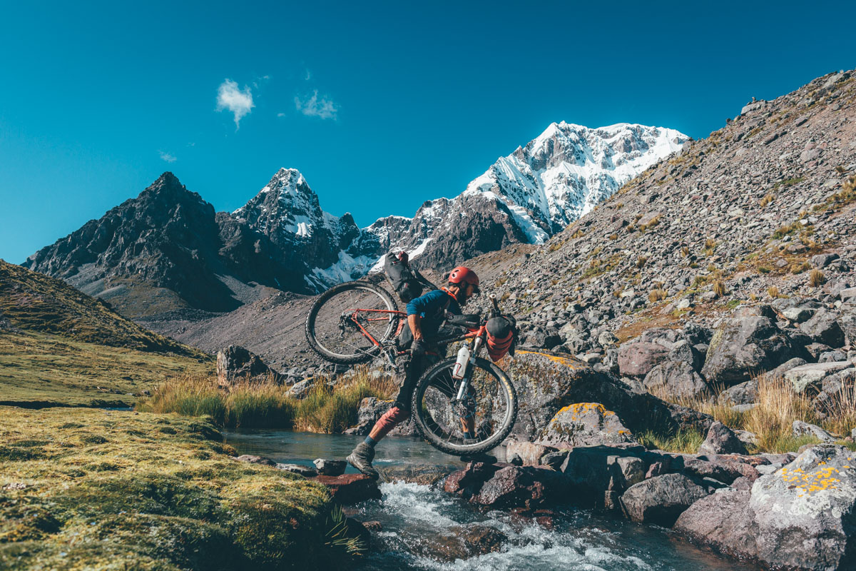
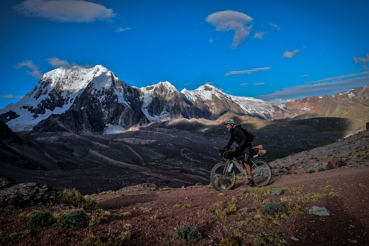
As impressive as the views are throughout, the journey just gets better and better, culminating with an almost complete, anti-clockwise loop around the stunning Ausangate massif (6384m), jewel of the Vilnacota range – part of which we’ve posted previously as the Ausangate Traverse.
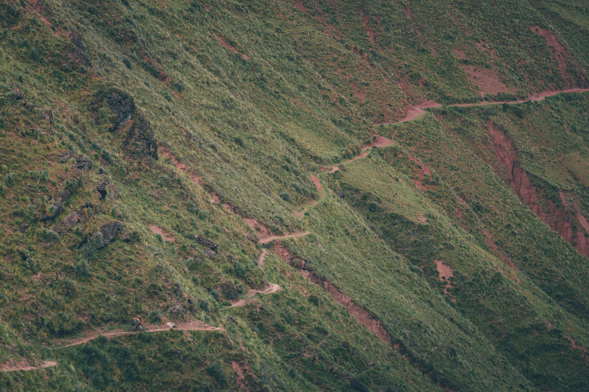
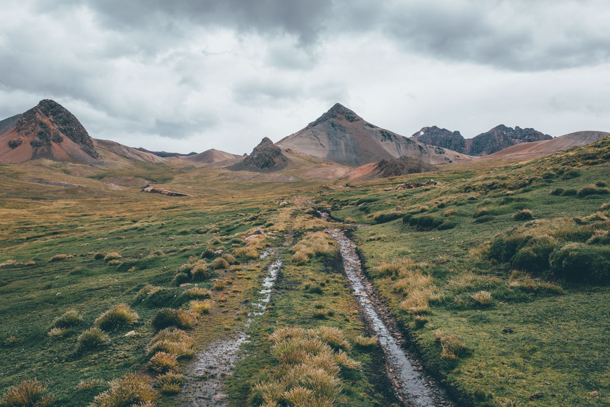
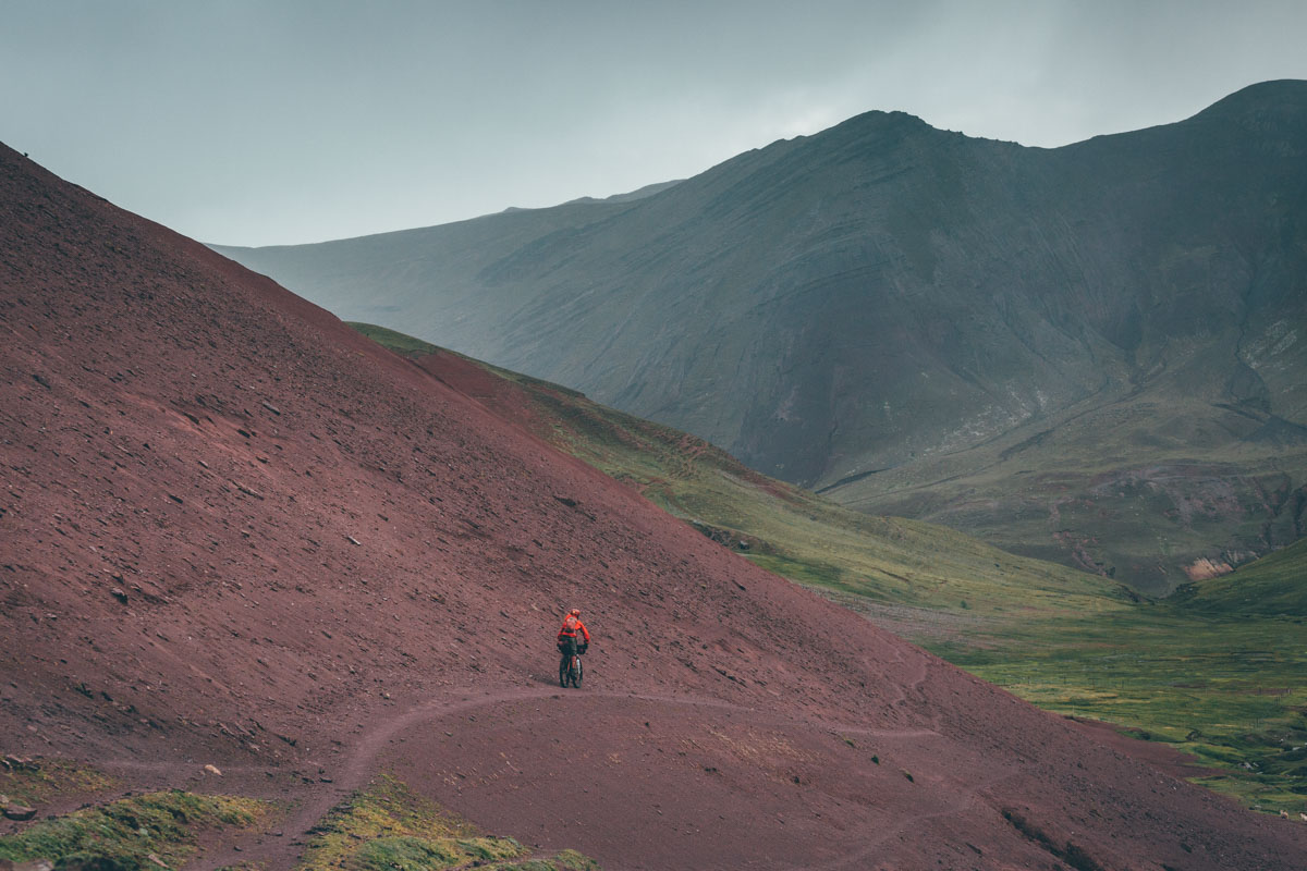
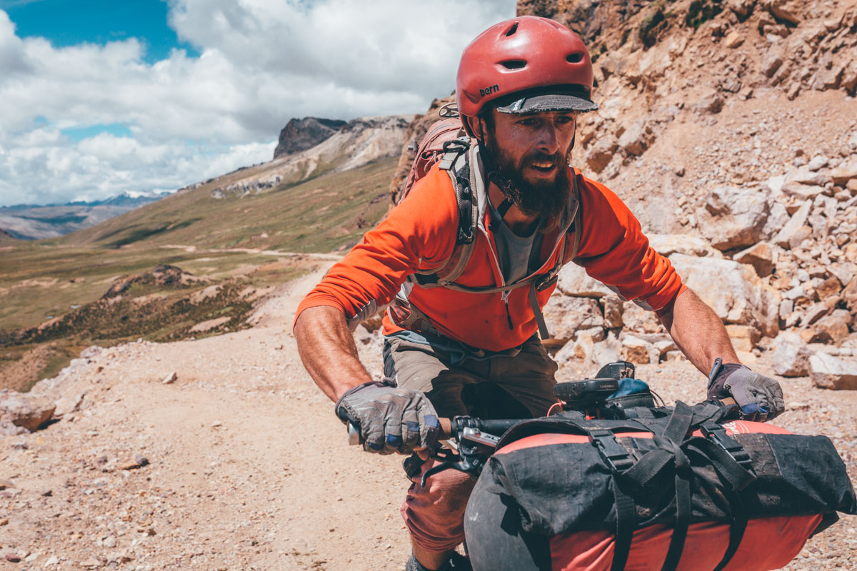
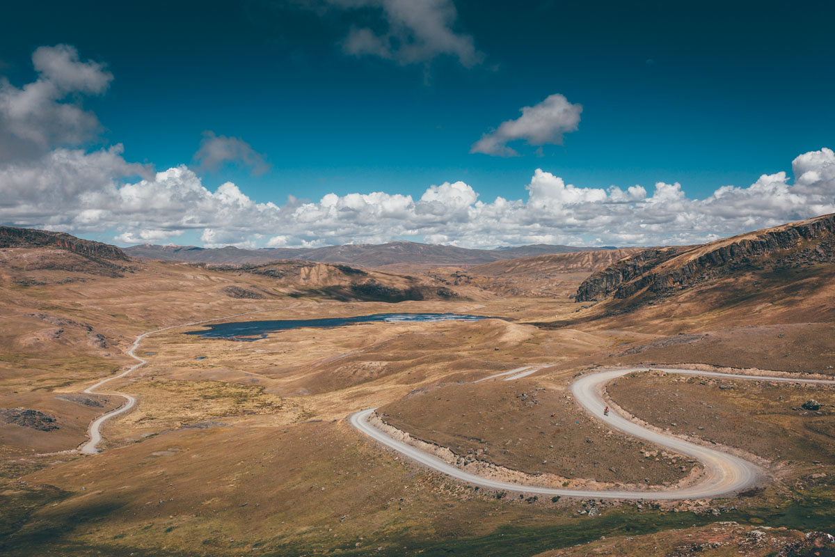
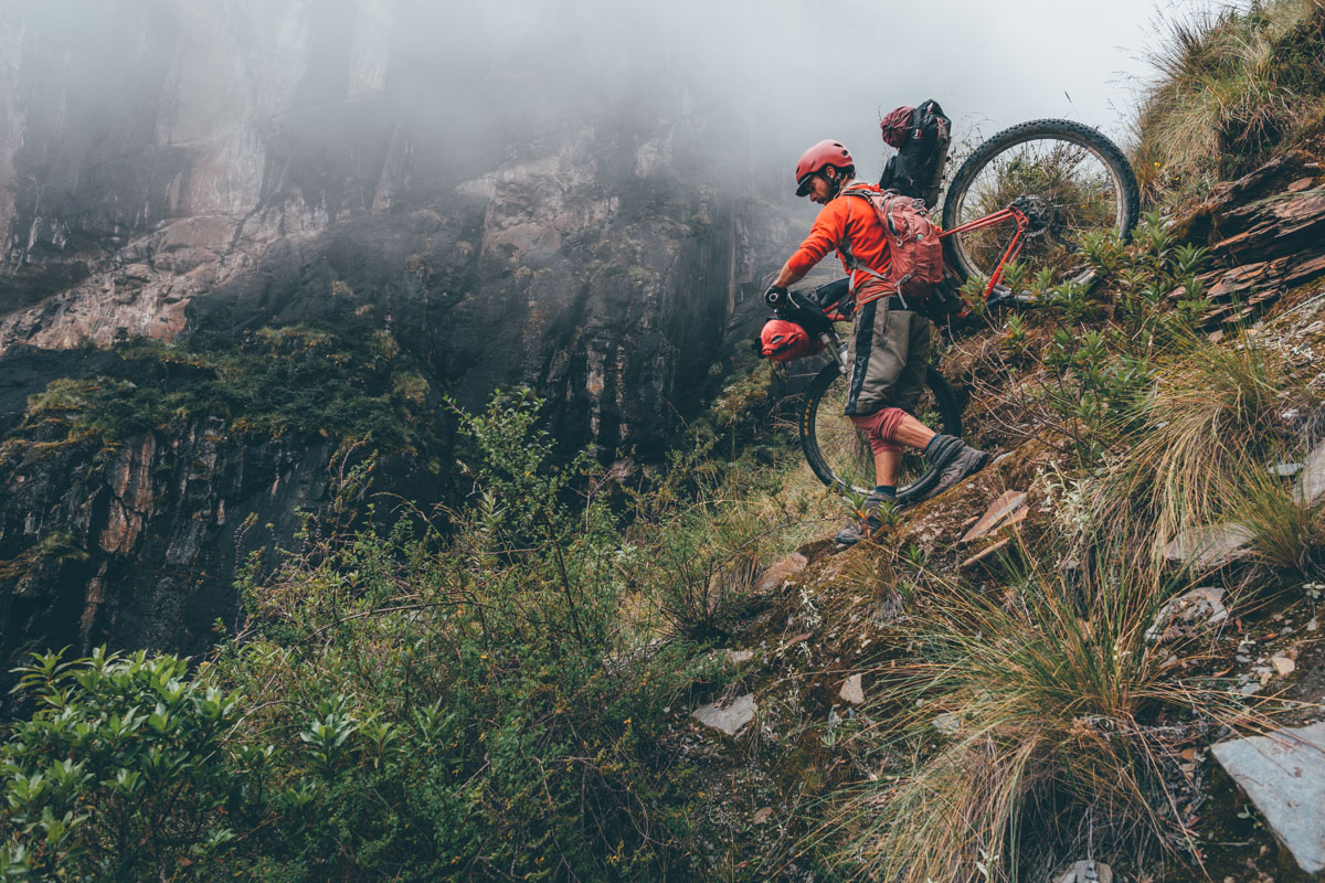
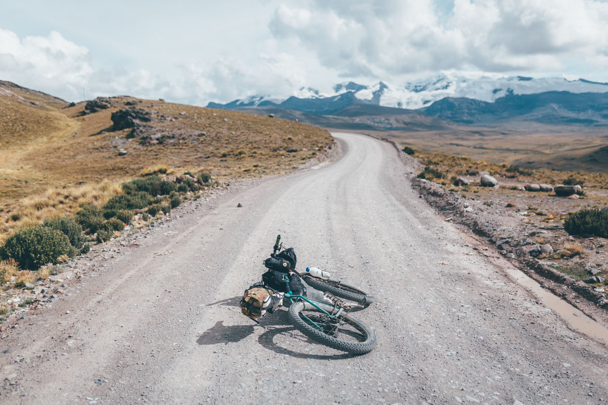
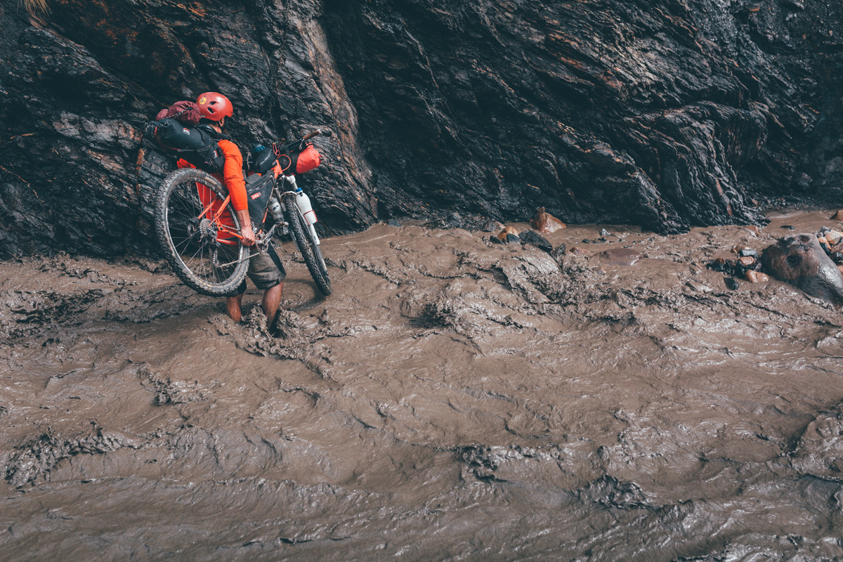
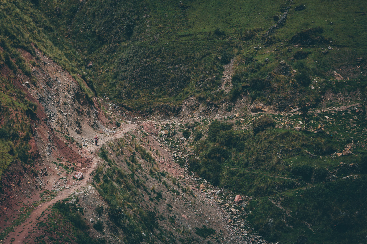
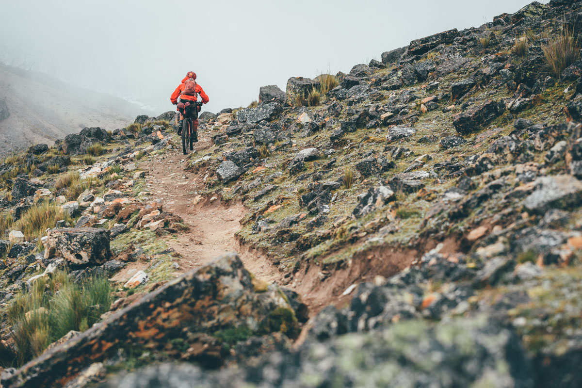
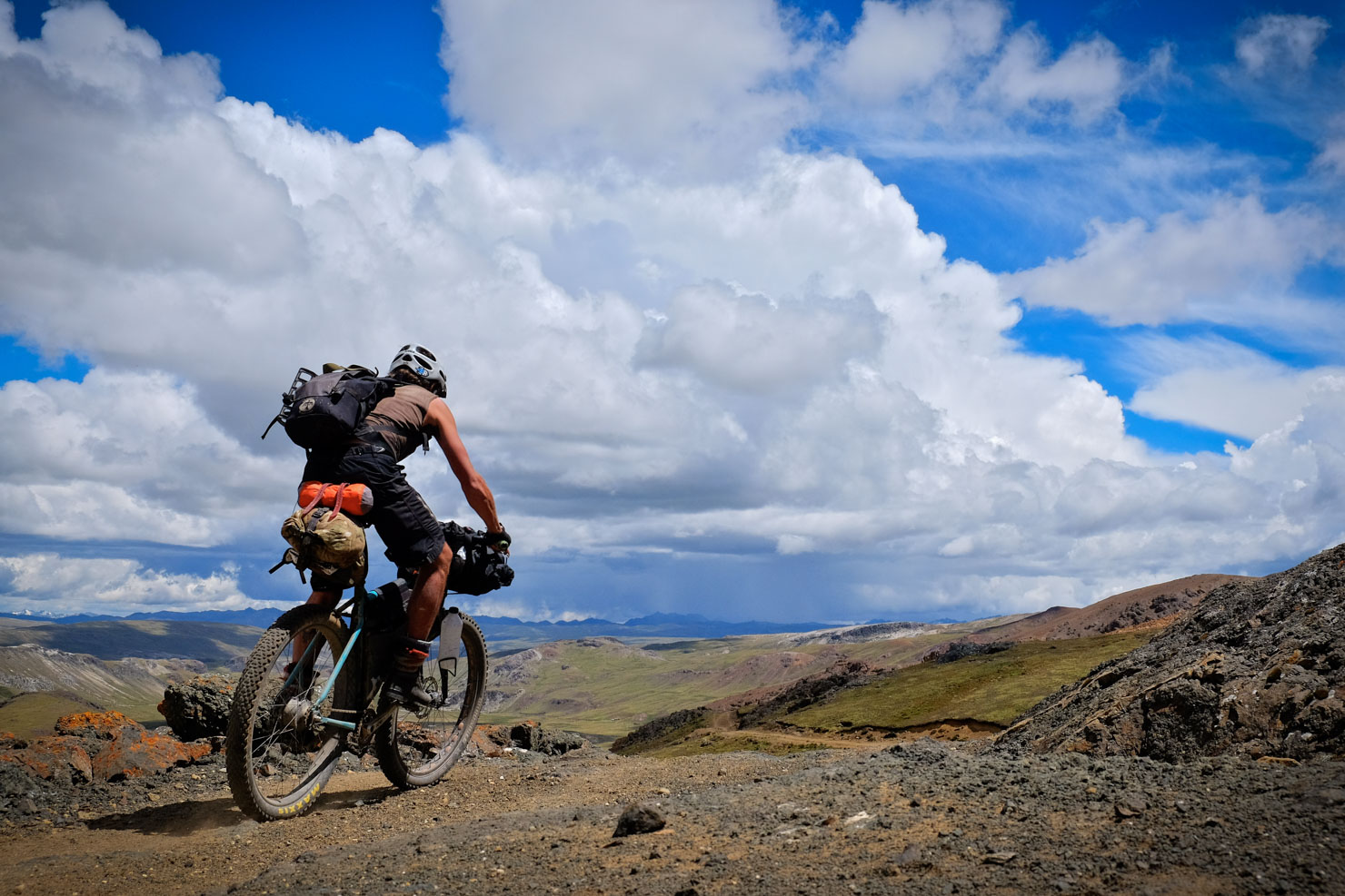
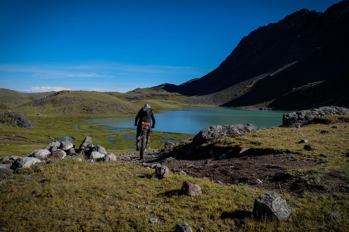
For the most part, the Ruta de Las Tres Cordilleras follows dirt roads – some are well surfaced, others are cut roughly into the mountainside. The majority of the singletrack is concentrated at the beginning and end of the ride, though there are sections peppered throughout, including several challenging hike-a-bikes. In short, this is a tough journey, with considerable elevation gains each day.

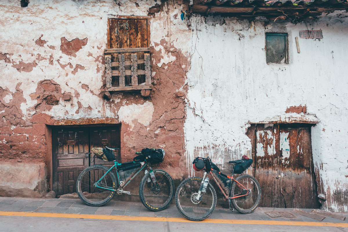
Note that the ride starts in Sorata (Bolivia) and ends in Pitumarca (Peru). With a few extras days, you could easily extend it on either side to link the popular hubs of La Paz and Cusco. Check out Trail Notes for an idea of how to break up the trip and a low traffic route to Cusco.
Border Shenanigans
To complete this route in its entirety, there’s a paperwork shuffle to negotiate. Given that the Ruta de las Tres Cordilleras links Bolivia and Peru via an unmanned border crossing at Suches Lake, you’ll need to sweet talk La Paz’s Bolivian immigration officials into post-dating an exit stamp in your passport, then take a day off the saddle to negotiate visa formalities in Puno – see the Need to Know section for more details. If your Spanish and powers of persuasion are up to it, the hassle is worth the effort; doing so allows access to a wild, semi-lawless area that is almost completely untravelled by anyone bar adventurous bikepackers and climbers. Alternatively, we’ve also included a more straightforward alternative route that makes use of the recently opened Peruvian immigration office in Tilali, offering a chance to drop down to the beautiful shores of Lake Titicaca. Details can be found here.
The caveat: As beautiful as it is, the Ruta de Las Tres Cordilleras is also a sobering insight into the destruction wreaked upon these mountains (and the water they provide) by what appears to be often unregulated mining; a poignant reminder to consume less and ride more… For more info on La Rinconada, the highest gold mine in the world, watch this informative documentary. Riding through this zone can be deeply disturbing… expect a grey latticework of contaminated moraine lakes and ugly tailings. You may need to micro navigate through these every shifting mining zones, and even hop on the back of a mining truck if need be.

Difficulty This route has been awarded a solid 9 and is not to be undertaken lightly. Challenges include sourcing food, prolonged stretches at high elevation, a general sense of remoteness, challenging hike-a-bikes. A grasp of Spanish is useful and being attuned to cultural sensitivity is key, especially when riding through small communities that see few foreigners, some of which often associate those who pass through with mining interests. Micro terrain management and on the cuff decision-making are also required, due to how unconventional this route can be in places; minor reroutes may be needed as the situation changes on the ground, given expanding mining enterprises in the area. Be sure to have good basemaps loaded into your navigation device and be prepared to adapt if need be.
Images by Cass Gilbert and Michael Dammer.


Submit Route Alert
As the leading creator and publisher of bikepacking routes, BIKEPACKING.com endeavors to maintain, improve, and advocate for our growing network of bikepacking routes all over the world. As such, our editorial team, route creators, and Route Stewards serve as mediators for route improvements and opportunities for connectivity, conservation, and community growth around these routes. To facilitate these efforts, we rely on our Bikepacking Collective and the greater bikepacking community to call attention to critical issues and opportunities that are discovered while riding these routes. If you have a vital issue or opportunity regarding this route that pertains to one of the subjects below, please let us know:
Highlights
Must Know
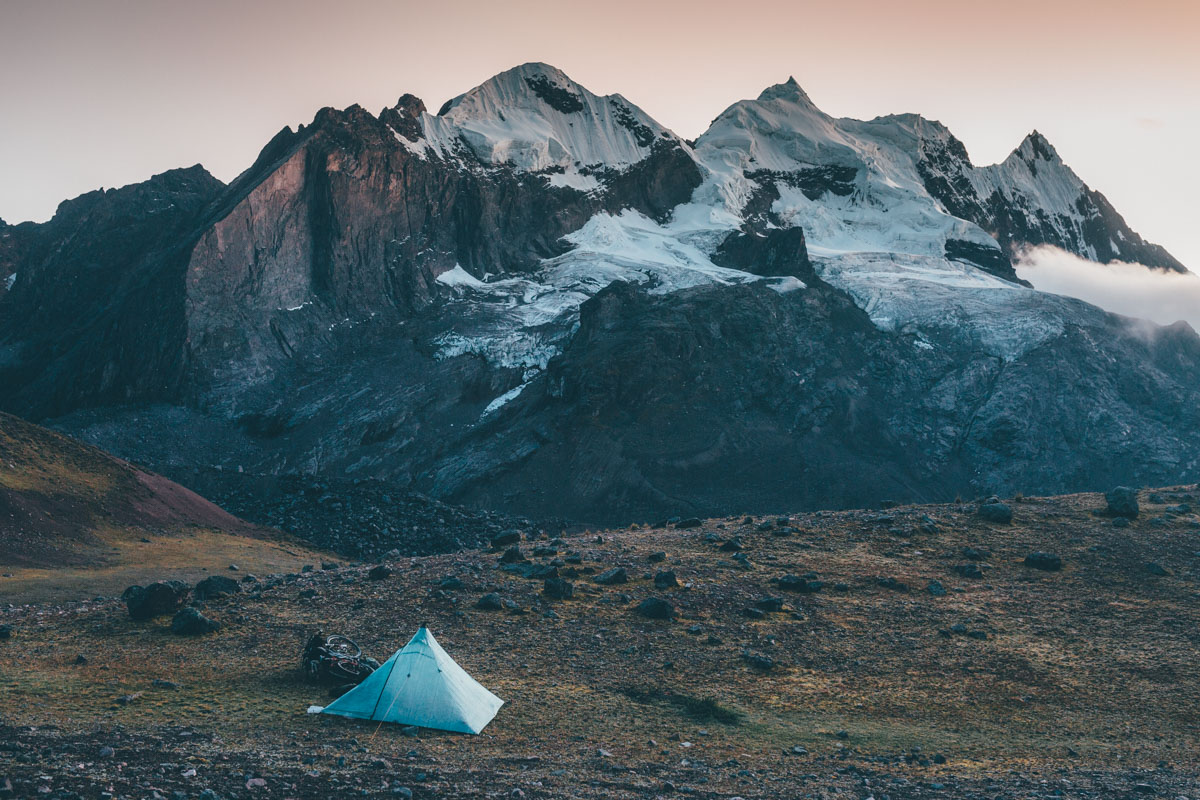
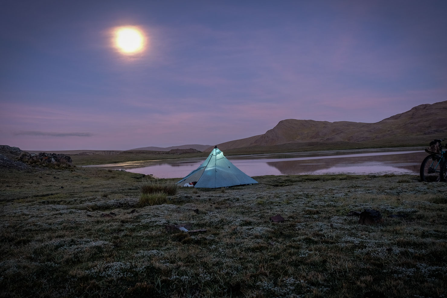
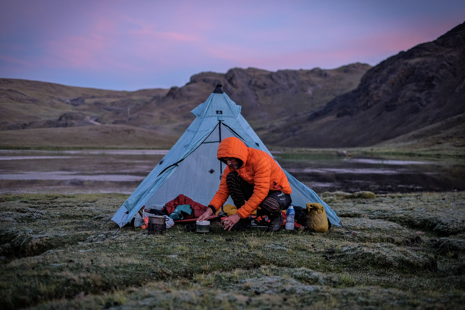
Camping
Food/H2O
Trail Notes
Resources
- Truly remote riding across a region of Bolivia and Peru that sees almost zero tourists.
- Finishes with an almost complete loop of Ausangate, one of the bikepacking jewels of Peru.
- A chance to see a vast complex of working terraced fields and stone structures, just as the Incans built them, completely tourist free.
- Great views of Quelccaya Ice Cap, the largest glaciated area in the tropics.
- A very low traffic dirt road route with bouts of challenging singletrack – there’s only 40km of pavement in total.
- If you want to tackle the original route, here’s how to negotiate the visa shuffle and keep things legal. If coming from Bolivia, you can either visit the immigration office in La Paz (open Monday-Friday, 09:00-17:00(), closed for lunch 12:30-14:30, 1433 Avenida Camacho, between Loyaza and Bueno) and convince them to give you an exit stamp in your passport, as we did (post dated by 5 days ideally). You’ll likely need to furnish them with a letter explaining your names and passport numbers, intentions, the dates required, along with photocopies of anything of relevance – passport, visa entry stamp, immigration docket. Photocopy that letter too. Approval reached, you’re good to go. Upon reaching Ananea, leave bikes at one of the guesthouses in town and bus to Puno to procure your entry visa to Peru. There are regular direct minibuses to Juliaca (20 Sol, 3.5 hours), from where you can hop on a quick shuttle to Puno itself (30 mins, 3.5 Sol). We used the journey as a chance to rest, spending a night in Puno to enjoy some fine dining, before returning to our bikes the next day. Resupply at the same time – the market is vast and has everything. If coming from the other direction, you’ll need to bus to Puno for your exit visa and ideally have it post dated too. Then, to save rushing to La Paz for your entry stamp, your best bet is to drop down to Puerto Acosta once you’ve crossed the border, which is just a short bus/shared taxi ride away from the route – see map. Check locally for updates – and let us know if the situation changes!
- If you want to make use of a newly opened border crossing in Peru and drop down to Lago Titicaca, follows this alternate route between Tajani and Ananea.
- If 2+ hour hike-a-bikes aren’t your style, you may want to find a reroute on dirt roads to avoid the Cuyo Cuyo to Ananea segment. It’s especially challenging heading east. We recommend attempting it if you can, as it reveals a stunning, rarely travelled valley and impressive Incan terraces.
- Take breaks, even a half day here and there. This is a long and arduous ride.
- If riding from Cusco, we’d still be tempted to ride Ausangate anti-clockwise.
- If you’d like to visit the fabled Rainbow Valley en route to Pitumarca, Brian Mulder has these notes from his recent trip there: (1) From marked km 27 in Hanchipachi walk, across the soccer field and you’ll see the trail leading up along the north edge of the valley. You’ll come around a corner and see a small pueblo in the valley to the left. Walk straight across towards a stone pen on the opposite edge of the valley. This serves as the 10 Sol payment point and where you’ll pick up the main tourist trail. (2) The more frequented tourist trailhead is about 10 km up the road from Hanchipachi. Rather than continuing around the hairpin turn to Chillca, take a left and roughly 2km up the road you’ll see where all the tourist white minivans are parked. The trail is very well marked from here.
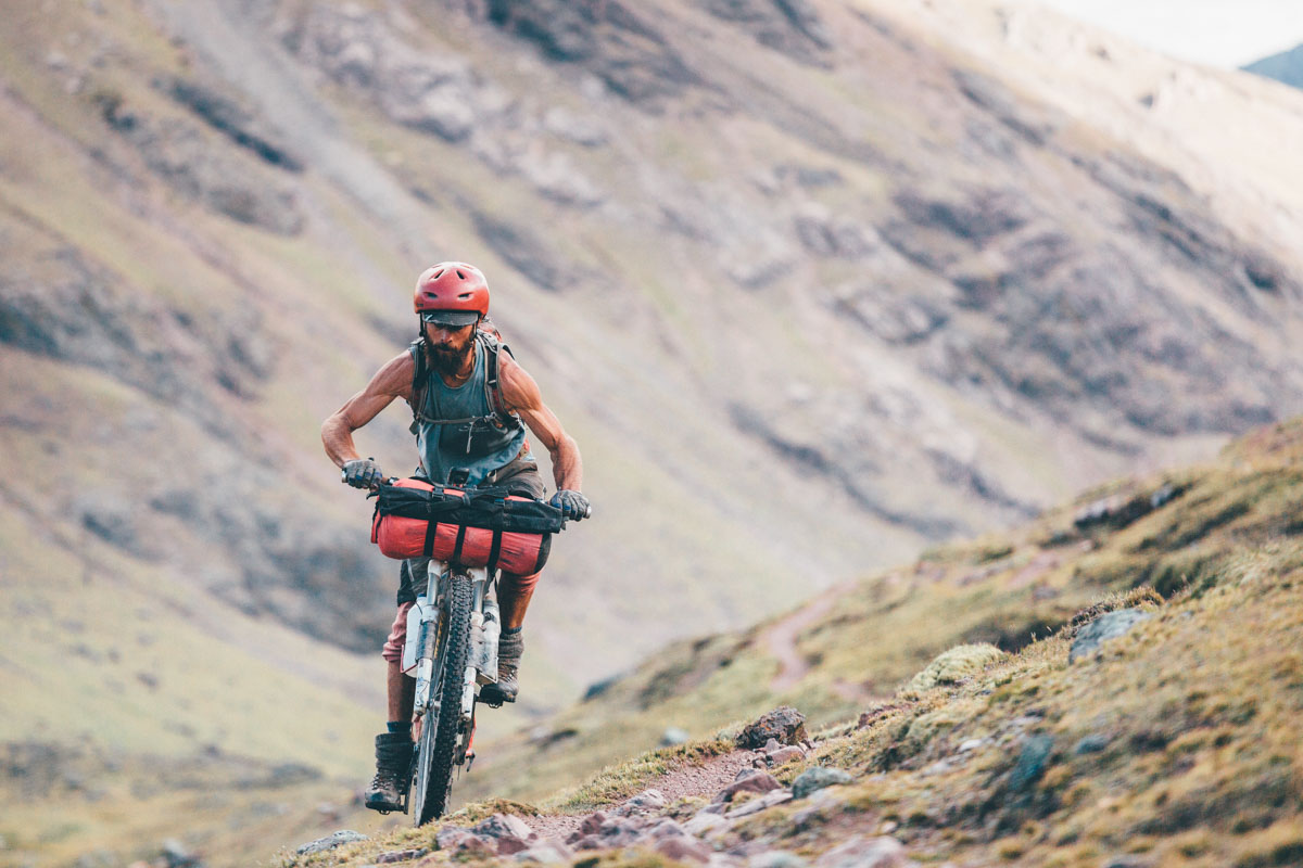
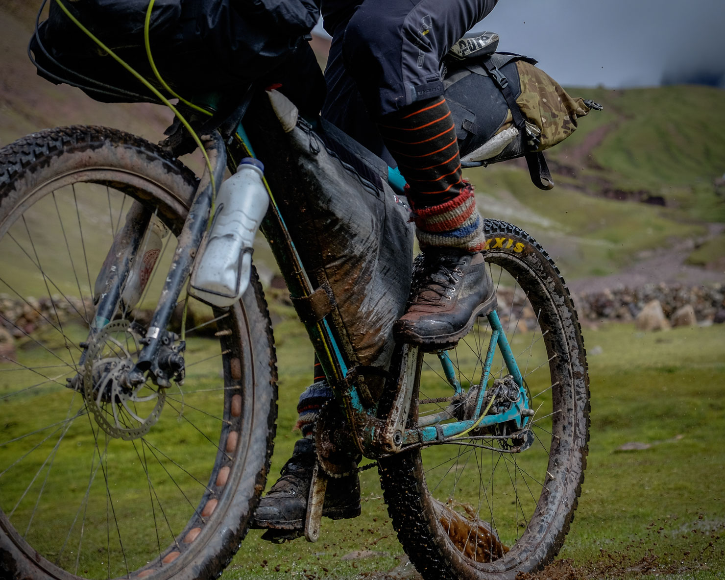
- Pack light. Although hike-a-bikes are relatively short, the Ruta de Las Tres Cordilleras is not a ride suited to a traditional 4 pannier setup, unless you trim off some of the most intriguing riding, like the section out of Sorata and the loop around the Ausangate. The hike-a-bike to Cuyo Cuyo will be very slow going, as will some of the trails through the border region. As long as it’s not valuable, you can have gear sent from La Paz to Cusco with one of the encomienda services at the bus station.
- Citizens of most countries can travel through Bolivia and Peru with visas procured at the relevant border. US citizens need to apply for a Bolivian visa in advance or at the airport; expect to be stung for $135.
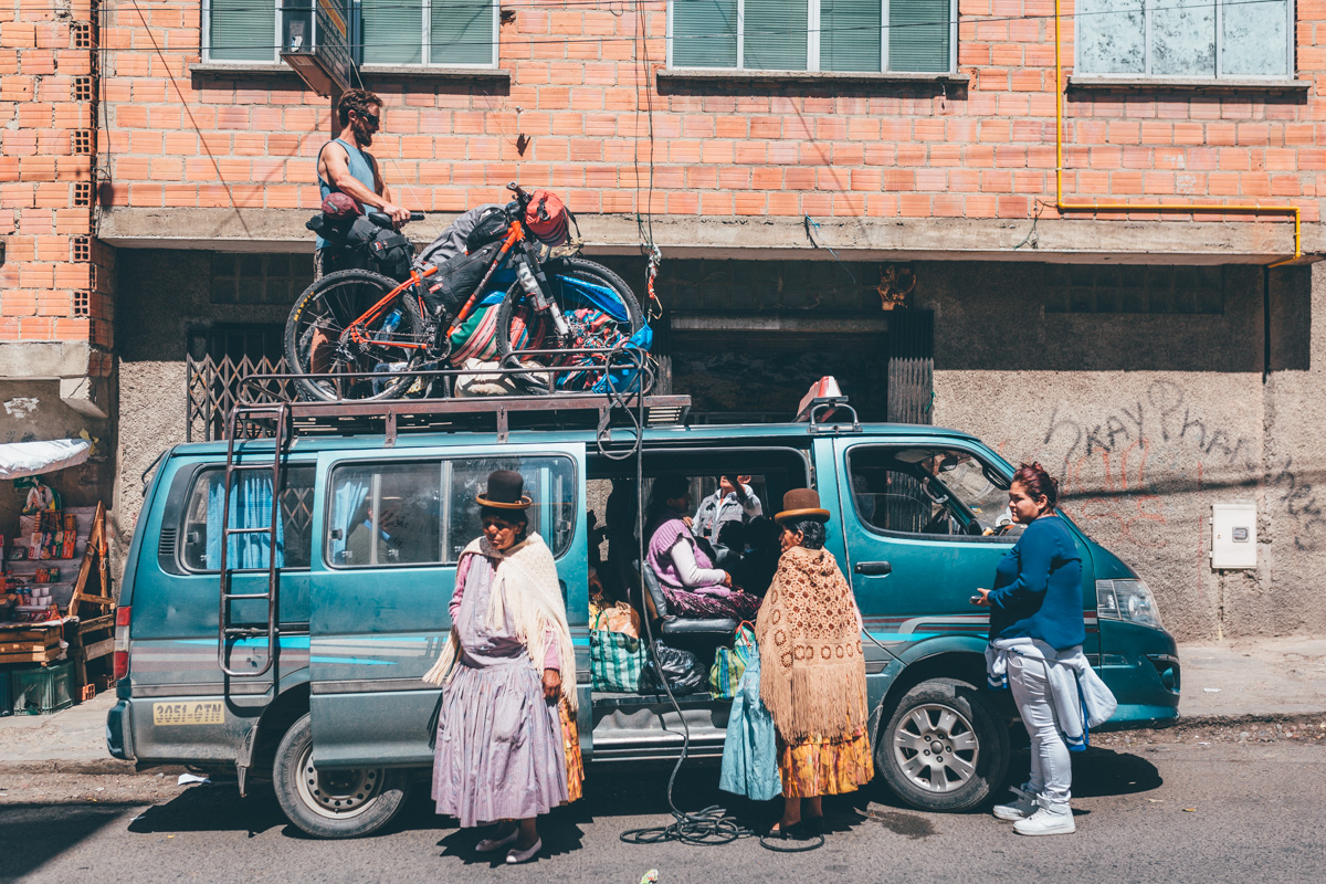
- Minibuses to Sorata leave from near La Paz’ cemetery. The journey takes 2.5 hours. Bikes can be tied to the roof. The cost is 20 Bolivianos, along with whatever you negotiate for your steed.
- This is a high elevation journey. Allow at least a few days to acclimatise if flying in from a low lying region. Drink lots of water and take it easy when you arrive in La Paz or Cusco.
- Plan on 20 days for the ride, allowing time for visa logistics and some downtime.
- Bring food: Although food is available throughout the ride, for variety, energy and nutrition, we recommend bringing dehydrated meals to supplement local fare. Even a big bag of vegetables to add to quinoa soups will make a big difference.
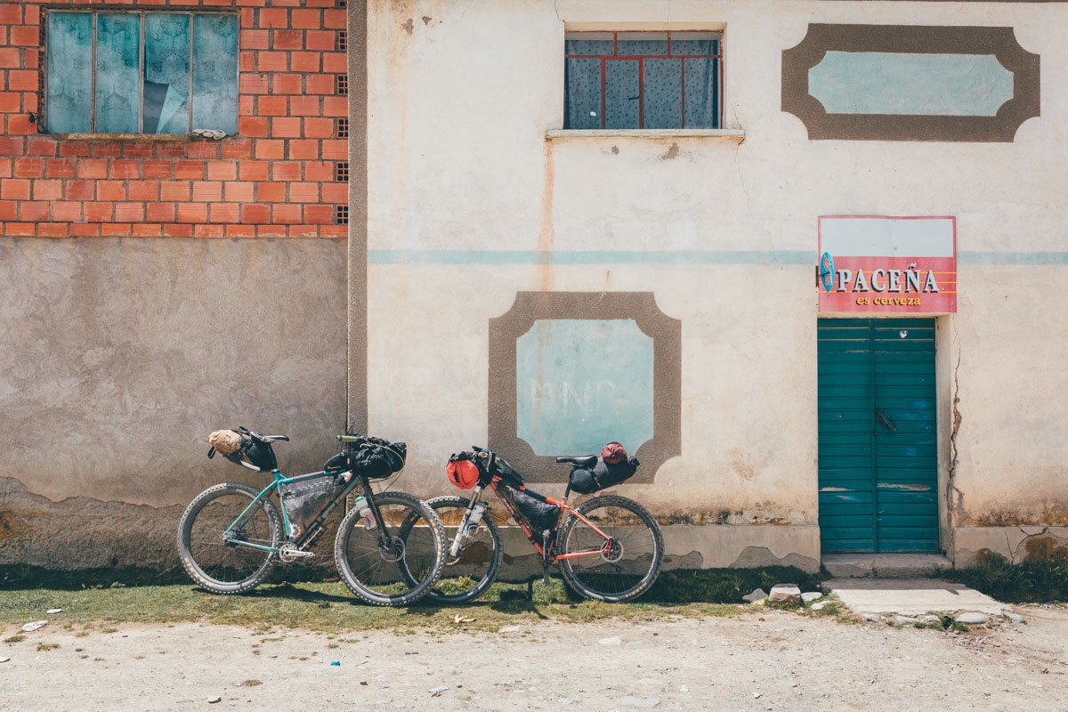
- Bikes: Michael rode his Salsa El Mariachi with front suspension and 2.4 Maxxis Ardents. I rode my Tumbleweed Prospector with a rigid fork and 3in Maxxis Chronicle tires. Both setups worked well. Front suspension will be welcome on non-plus/fat bike rigs, especially around Ausangate.
- This route is best tackled in the dry season, between mid/late May and early September.
- We used a denatured alcohol stove, as the fuel is easy to find in markets or hardware stores (ask for alcohol pura or ron de quemar). Pressured gas canisters are available in La Paz.
- There have been some reports of thefts in the area around Ausangate. Make sure you’re belongings are stowed in your tent when sleeping, and your bikes secure. Other than that, we didn’t feel or notice any security issues. People are extremely kind, curious and welcoming.
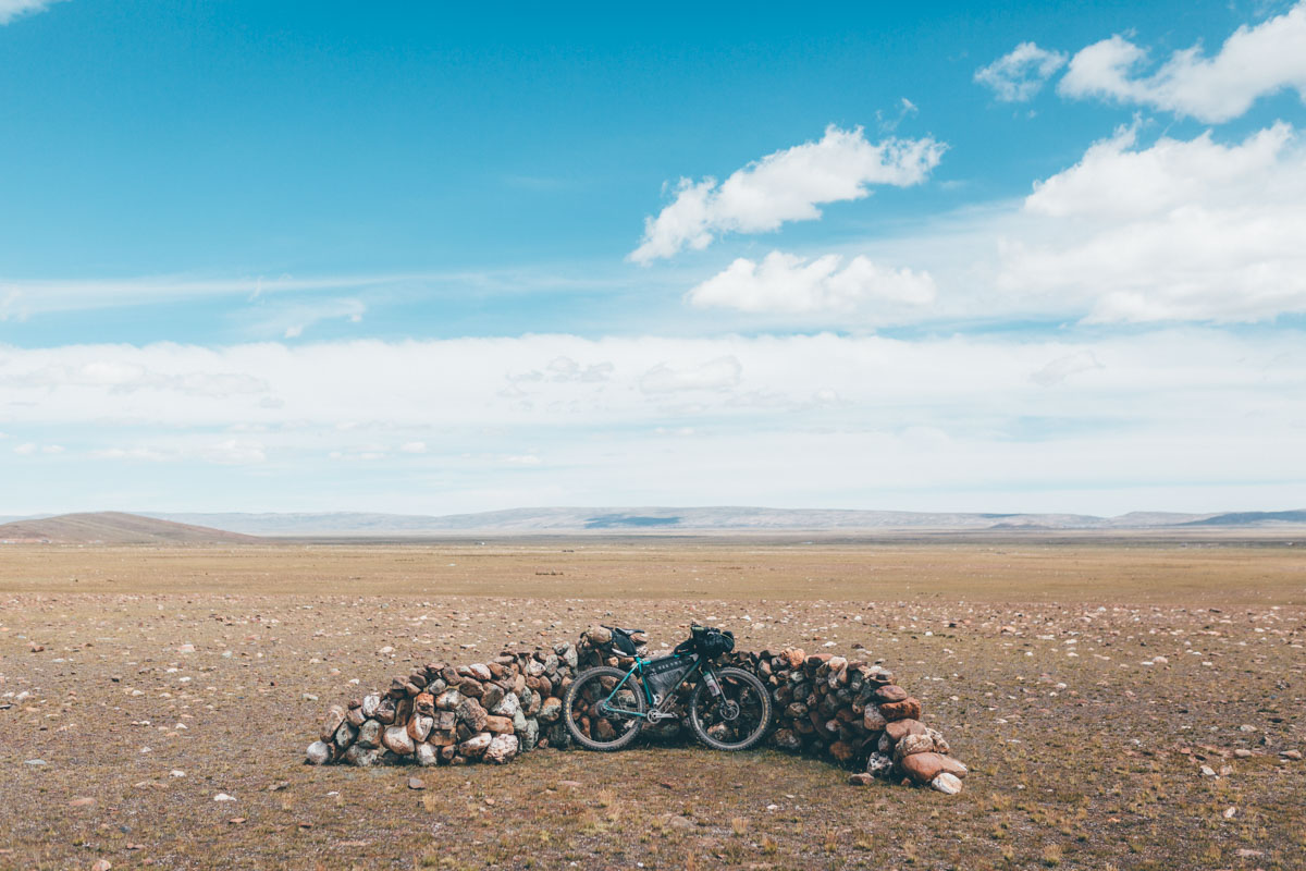
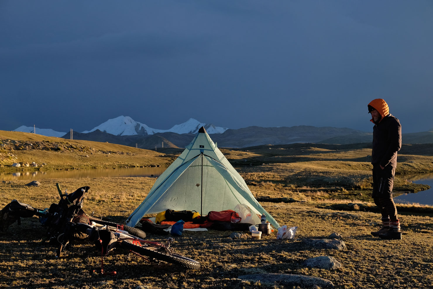
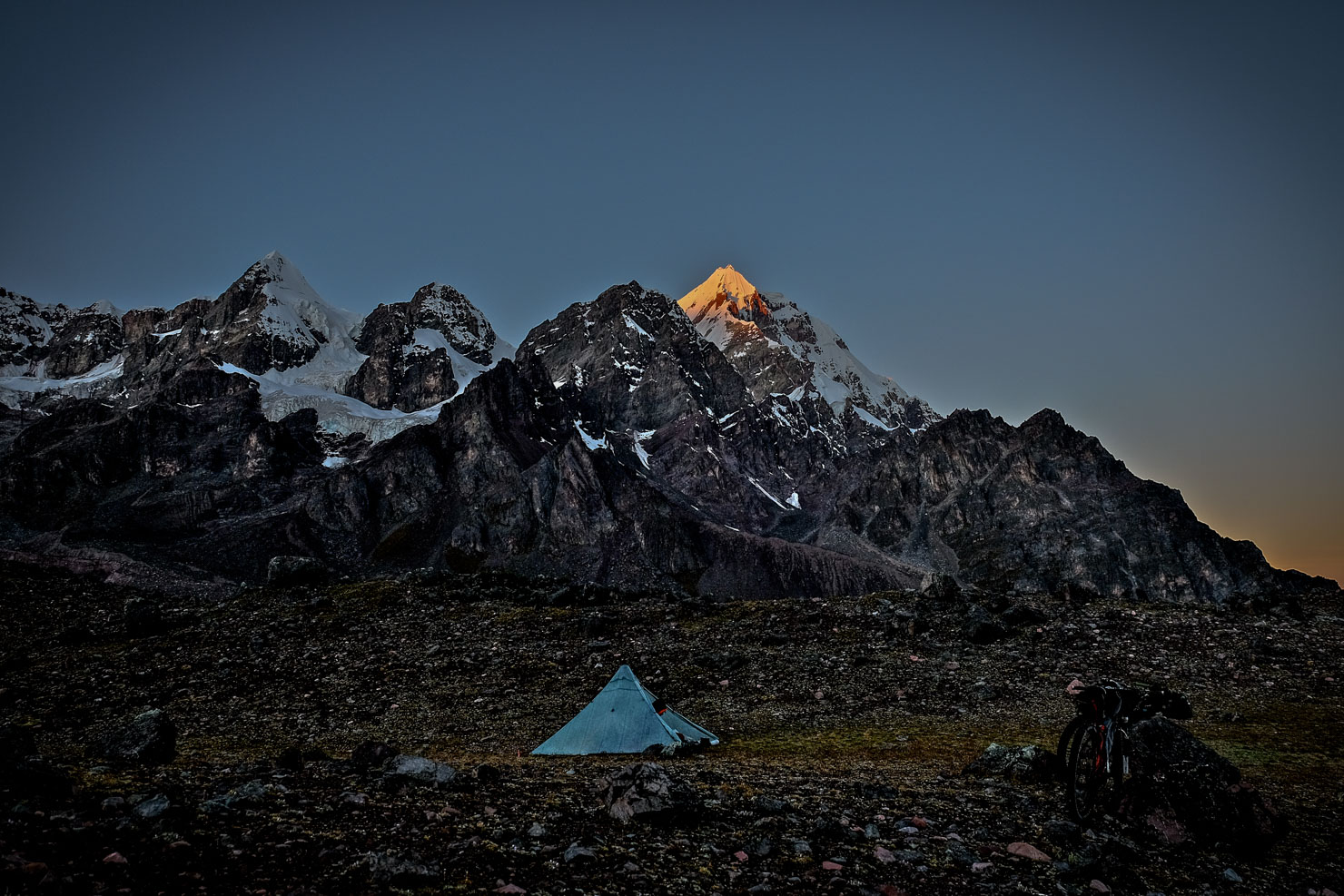
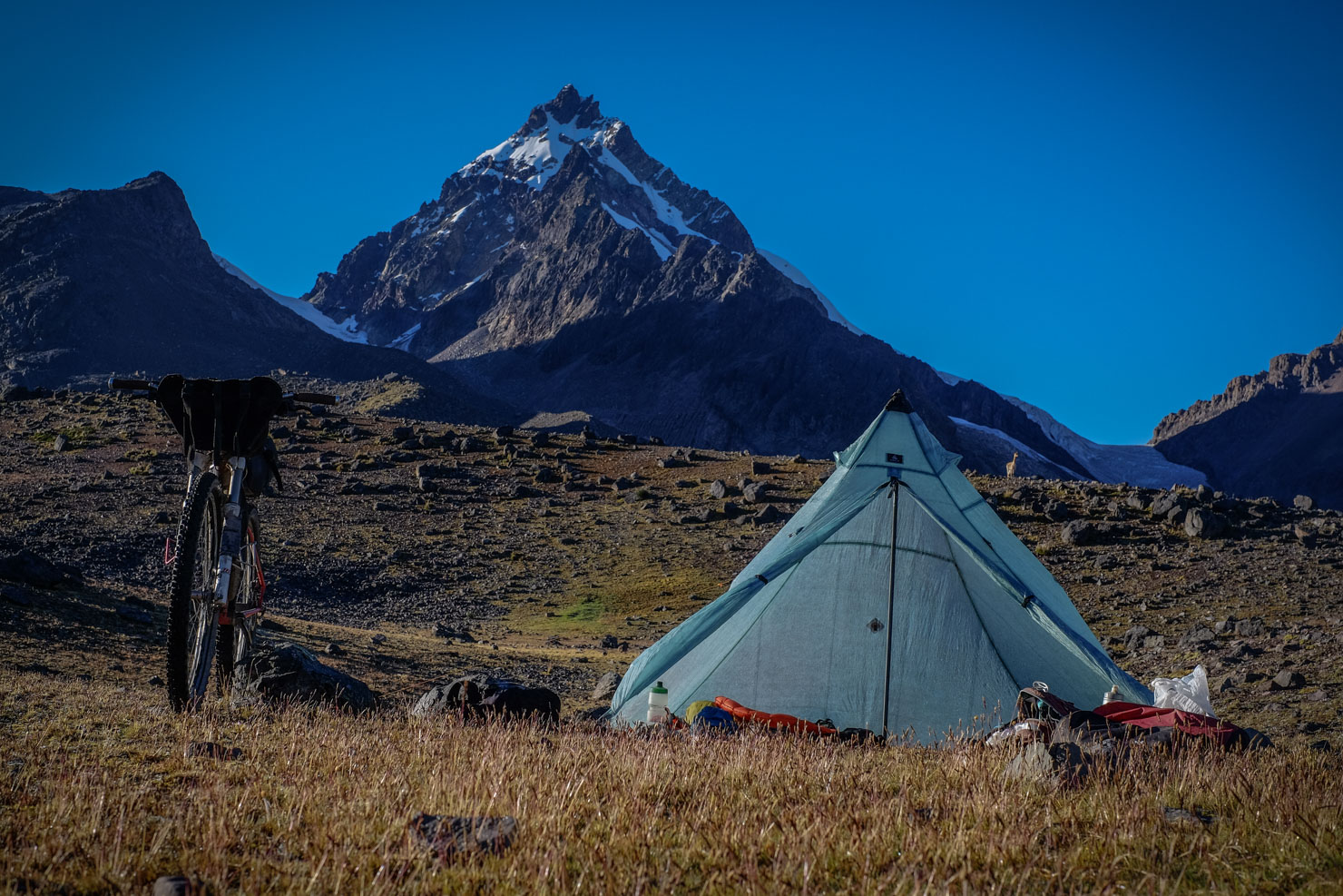
- This rides abounds in good camping opportunities. Always aim to camp out of eyeshot of any roads. And if there are communities nearby, check first. People aren’t always used to foreigners passing through and may sometimes be fearful.
- Larger settlements have basic lodging. Note that these can be noisy so good sleep isn’t always guaranteed, water can be intermittent, and don’t expect luxuries like wifi.
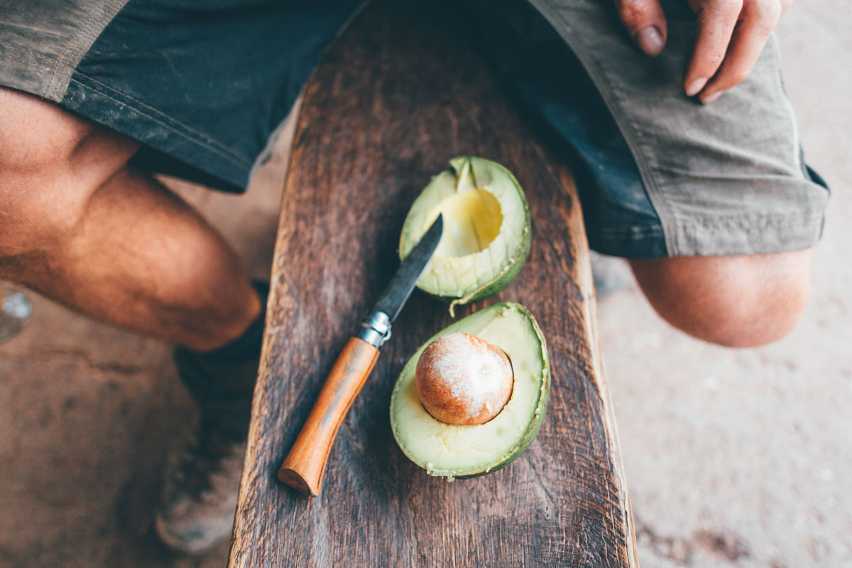
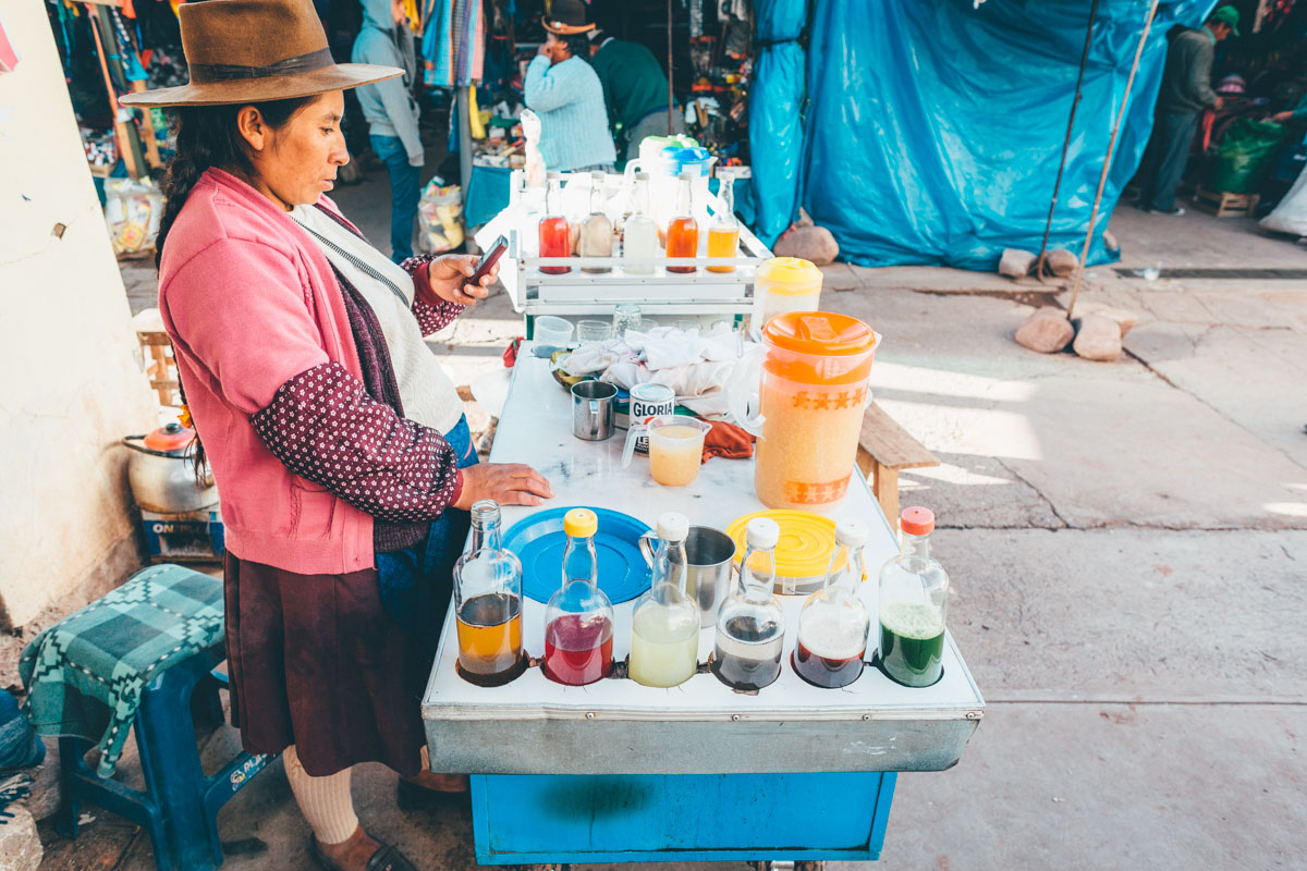
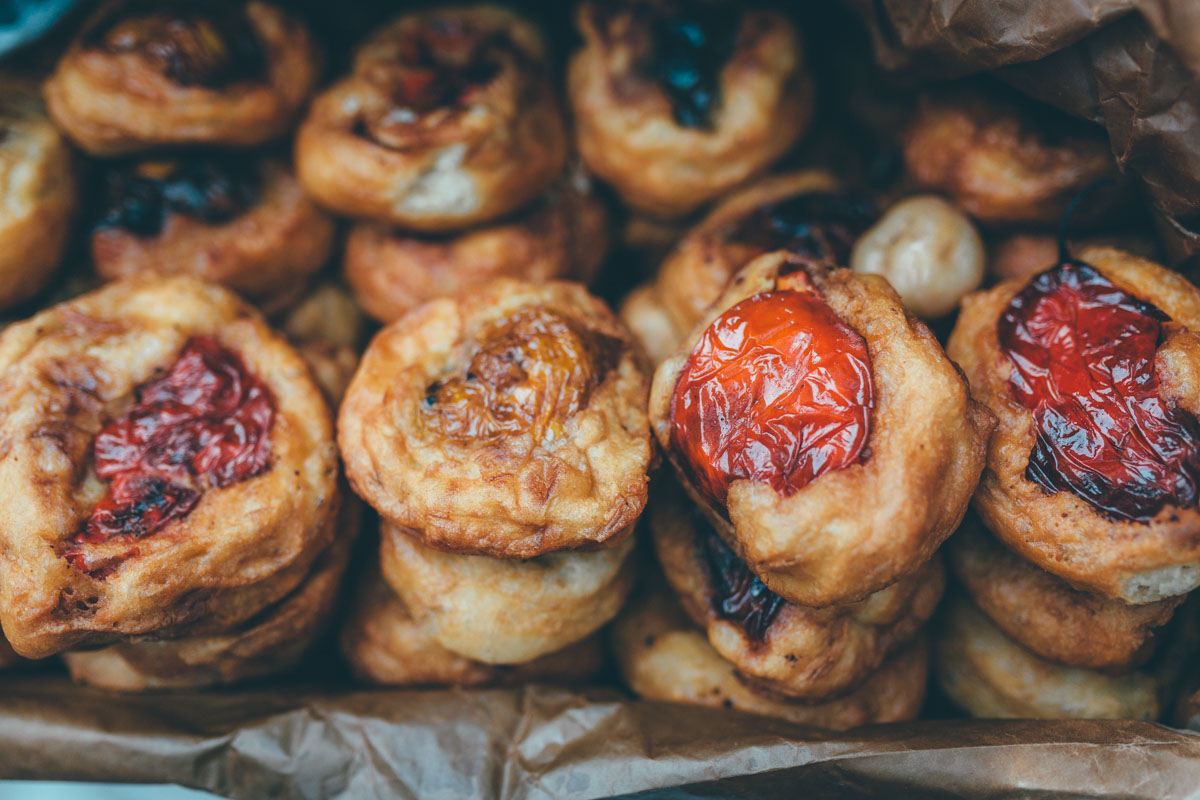
- Expect to find basic stores in almost every settlement for on-the-go resupplies. Many stores will be able to rustle up a ‘caldo’, a hearty mountain soup. Rice and eggs is an easy request to make and we also asked for boiled potatoes to add to our picnics. Larger villages and towns will have restaurants too; the set menu is the way to go. We camped out on quinoa soups loaded with vegetables we’d already dehydrated – bring a stash of your own dehydrated food if you can to provide a more rounded diet. Lunches were often bread and cheese we picked up en route (with salami we bought in La Paz); we resupplied on basics like porridge oats as we went. Llamai jerky (charki) can sometimes be acquired en route, if you ask round.
- Water is never an issue; just be aware that the groundwater around mines will likely be contaminated so choose your spot wisely. Two bottles of water should be plenty to carry during the day. Pack a filter too, to make sure you stay healthy.
Here are the trail notes we took during our intial route finding ride in April 2016. Be sure to take into account the altitude, trail conditions and the vagaries of mountain weather. Be aware that conditions change, so take these as a guide rather than gospel.
La Ruta de las Tres Cordilleras
Day 1
From/To: Sorata (2680m) to Sorejaya woodpile (3520m)
Distance: 36km
Climbing: 1611m
Cumulative climbing: 1611m
Notes: Chejje, Huaycho (school children), river crossing, abandoned road climb, Cuchipata, pre-Incan corridors, traverse to Sorejaya (could have taken road to Combaya and crossed there, but no bridge).
Range: Cordillera Real
Day 2
From/To: Sorejaya (3520m) to Lake Campsite tucked behind road (4330m)
Distance: 47km
Climbing: 1939m
Notes: Steep morning climb and coffee with lady, trail at second river, to semi abandoned road where we fixed BB again with tape, up to lake, then descent into valley where we met Arnaldo, continued down, potatoes and dried alpaca, then dirt road climb to pass, then down valley to junction – big bread and beer – then dirt road towards Timusi. Ignored fork, then lake camp.
Range: Cordillera Real
Day 3
From/To: Lake campsite (3520m) to Tarajani (3828m)
Distance: 68km
Climbing: 828m
Cumulative climbing: 4378m
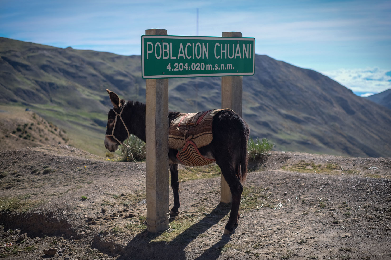
Notes: Left camp, Poblacion Chuani, left turn, down to river, then back up – views of Illampu – and fast descent to Tarajani
Range: Cordillera Real
Day 4
From/To: Tajani to Vila Cala (4244m) to Peruvian border (4310m)
Distance: 74km
Climbing: 1697m
Cumulative climbing: 6075m
Notes: From Vila Cala, misty and rainy, climbed up, strange light, Pumasani – apacheta – long slow section, little singletracks, abandoned towns with motorbike riders following us, crossed river to Peruvan village. Slept in medical room on floor.
Range: Crossed Munecas – secondary range. Views of Apolobamba.
Day 5
From/To: Peruvian border (4310m) to Viluyo, riverside camp past mine (4551m)
Distance: 69km
Climbing: 926m
Cumulative climbing: 7001m
Notes: Trails across pampa, avoiding Ulla Ulla and main dirt road road, then dropped down, took fork to right, good views of Apolobamba, towards Suches Alto, through mine complex, bought water there, it rained, and we camped by river.
Range: Cordillera Apolobamba
Day 6
From/To: Viluyo, riverside camp past mine (4551m) to Ananea (4700m)
Distance: 24km (half day)
Climbing: 497m
Cumulative climbing: 7498m
Afternoon bus to Juliaca (20 Sol, 3.5 hours) then microbus to Puno (3.5 Sol, 30 mins)
Notes: Climbed a few hundred metres, views of Rinconada (and at night) plus Cerro Ananea (highest in Apolobamba), then descent/traverse to Ananea. Left bikes in cafe yard.
Range: Cordillera Apolobamba
Day 7
Visa paperwork in the morning, rest, then afternoon bus back to Ananea , snow.
Day 8
From/To: Ananea to Patambuco (3508m)
Distance: 75km
Climbing: 1450m
Cumulative climbing: 8945m
Notes: Morning circled back round, then turned off dirt road, followed singletrack along old water canal, then descent to mine, shouted at, scramble across, rocky singletrack descent, into inca road to Kuyo Kuyo (town with rock houses and spring and terraces). Paved climbed 12km, turned off onto loose rocky mtb climb, crested pass and back down to Patambuco – punctures. Arrived late, slept in shared room, invited to tea and tools.
Range: Cordillera Carabaya (subrange)
Day 9
From/To: Patambuco (3508m) to Huasacorral waterfall camp spot (4331m)
Distance: 58km
Climbing: 1745m
Cumulative climbing: 10690m
Notes: Climbed back out valley, long climb, then descent to small settlement where we stopped for lunch – then shortly after, turned off to right on old road to climb to reservoir. Then instead of dropping to Centro Poblado, singletrack across valley, heading towards Valle Hermoso, climbed up to pass, and misty descent on other side with waterfall campsite.
Range: Cordillera Carabaya (subrange)
Day 10
From/To: Huasacorral waterfall campsite (4311m) to lake below pass campsite (4676m)
Distance: 594.5km/42km
Climbing: 1612m
Cumulative climbing: 12302m
Notes: Dropped down to Oscoroche (left hand turn, after talking to family). Breakfast, then continued down valley. Dead end at Tiobamba – trail across valley. Back up. Rain, potatoes with mum and child. Then up pass, turned down a lift, got to the top, camped on the other side.
Range: Cordillera Carabaya (subrange)
Day 11
From/To: Lake below pass campsite (4676m) to Macusani (4303m)
Distance: 688km 93km
Climbing: 833m
Cumulative climbing: 13135m
Notes: Dropped down in morning to Crucero. Then ciclovia trails with alpaca, then corrugated road to paved road, demonstration in village. Lunch outside school, negotiations to get out due to demonstration! Then dirt road to Macusani – overcast. Turned right, views of Allin Capaq, late afternoon light.
Range: Cordillera Carabaya (subrange) – Allin Capaq is the biggest mountain in range.
Day 12
From/To: Macusani (4303m) to camping before Aymana campsite (4100m)
Distance: 742km 54km
Climbing: 905m
Cumulative climbing: 14040m
Notes: Paved for 25km to bridge turnoff, misty climb to Organic Potato Capital, then descent to Corani through stone forest and Aymana camp.
Range: Macusani River forms border with Cordillera Vilcanota.
Day 13
From/To: Aymana campsite (4100m) camping to Sivina Cocha (4880m)
Distance: 805km 63km
Climbing: 1620m|
Cumulative climbing: 15660m
Notes: Amazing breakfast for 10 sol – soup and snacks – climbed up on new jeep road to highest point. Then road deteriorated, stayed on right side of valley. Views of Ice Cap, long traverse to Phinaya. Trucha for lunch, and up to lake Sibina Cocha to camp.
Range: Cordillera Vilcanota
Day 14
From/To: Sibina Cocha to Ausangate Camp 1 (4850m)
Distance: 874km 69km
Climbing: 1400m
Cumulative climbing: 17056m
Notes: Cold morning, then loop round – ignored potential shortcut to pass (worth investigating) – instead took old, fun road via Marcapata to right, and intersected. Up to Abra Jahuaycate (5070m), then descent on resurfaced dirt road to intersection. Lunch by river, then began climb, grassy, steep but rideable terrain to Kampa Pass (5100m). Descent to campsite.
Range: Cordillera Vilcanota
Day 15
From/To: Ausangate camp 1 (4850m) to Ausangate Camp 2 behind house (4570m)
Distance: 906km 32km
Climbing: 990m
Cumulative climbing: 18042m
Range: Cordillera Vilcanota
Day 16
From/To: Ausangate Camp 2 (4570m) to Acomayo (3220m)
Distance: 996km 90km
Climbing: 833m
Cumulative climbing: 18875m
Range: Cordillera Vilcanota
Notes: The route and gpx file end in Pitmarca, where you can find a place to stay, a market, various eateries, and regular buses to Cusco. We pushed on Acomayo – a very picturesque town – and rode back to Cusco.
(Extra Day 17)
From/To: Acomayo (3220m) to Cusco (3300m)
Distance: 110km
Climbing: 2465m
Cumulative climbing: 21340m
Notes: Backroads, mainly paved. Dirt for the last segment into La Paz. Acomayo— Rondocan (don’t go to Papres at the fork after Corma, stay up high on the right hand road)—San Juan de Quihuares (dirt begins)— After San Juan, take a left up high close to the pass and follow dirt road to Puna Cancha and eventually Cusco.


Terms of Use: As with each bikepacking route guide published on BIKEPACKING.com, should you choose to cycle this route, do so at your own risk. Prior to setting out check current local weather, conditions, and land/road closures. While riding, obey all public and private land use restrictions and rules, carry proper safety and navigational equipment, and of course, follow the #leavenotrace guidelines. The information found herein is simply a planning resource to be used as a point of inspiration in conjunction with your own due-diligence. In spite of the fact that this route, associated GPS track (GPX and maps), and all route guidelines were prepared under diligent research by the specified contributor and/or contributors, the accuracy of such and judgement of the author is not guaranteed. BIKEPACKING.com LLC, its partners, associates, and contributors are in no way liable for personal injury, damage to personal property, or any other such situation that might happen to individual riders cycling or following this route.
Please keep the conversation civil, constructive, and inclusive, or your comment will be removed.