


The Colorado Trail, Denver to Durango
Distance
539 Mi.
(867 KM)Days
13
% Unpaved
80%
% Singletrack
55%
% Rideable (time)
92%
Total Ascent
72,500'
(22,098 M)High Point
13,270'
(4,045 M)Difficulty (1-10)
9?
- 9Climbing Scale Very Strenuous135 FT/MI (25 M/KM)
- -Technical Difficulty
- -Physical Demand
- -Resupply & Logistics
Contributed By

Devon Balet
Death By Singlespeed
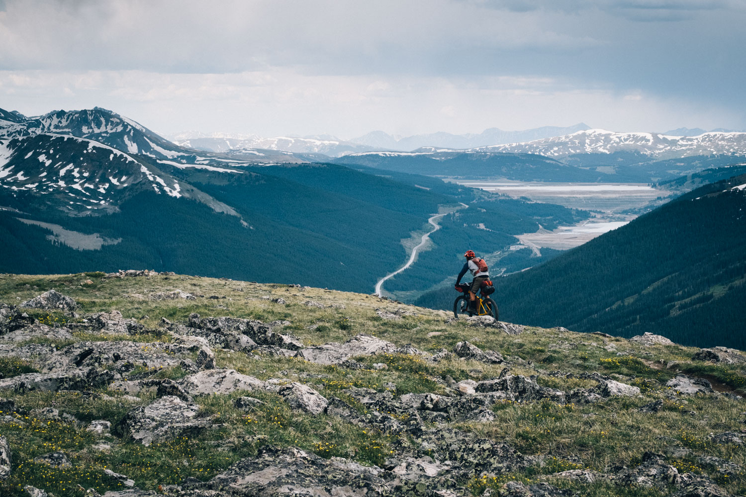
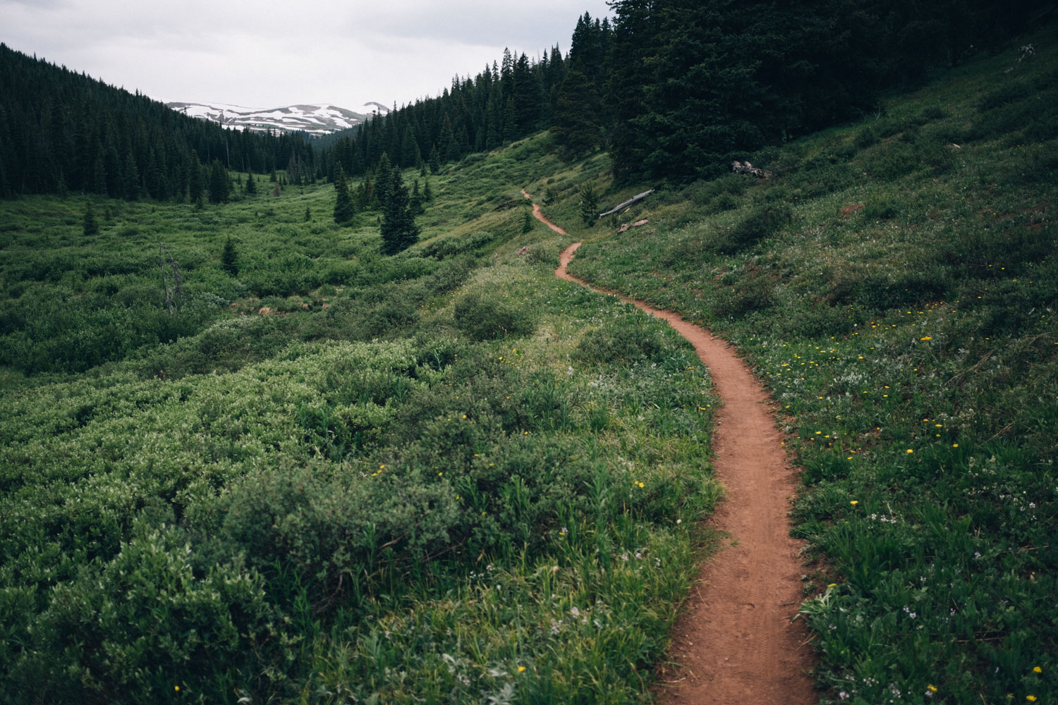
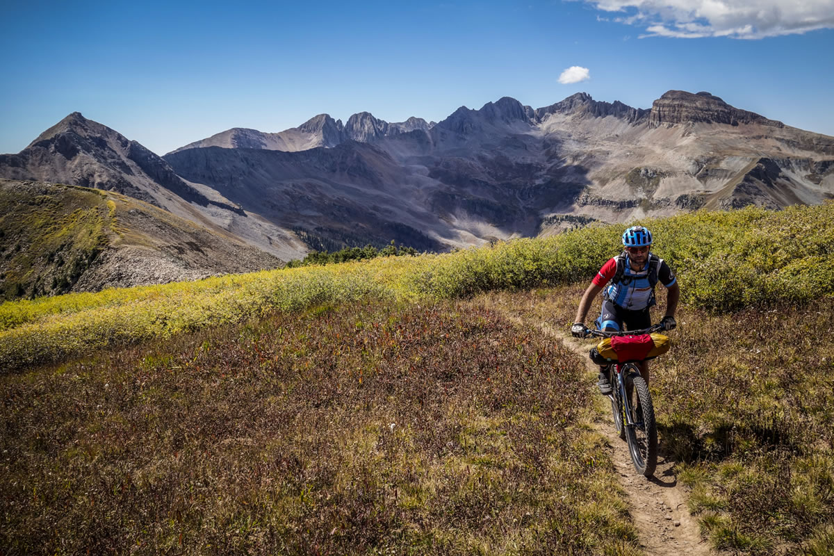
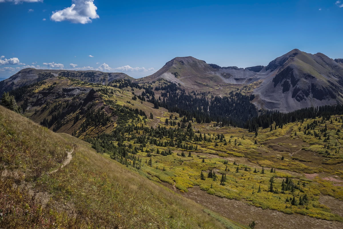
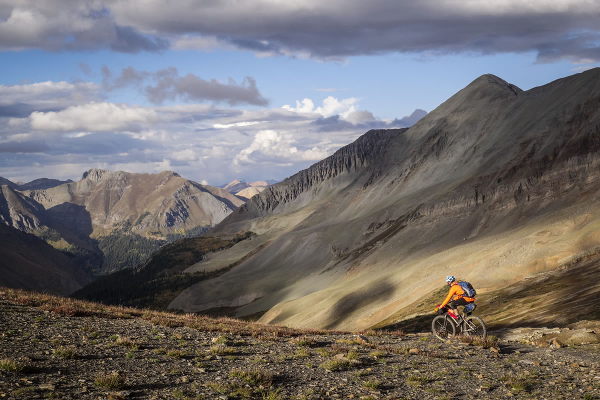
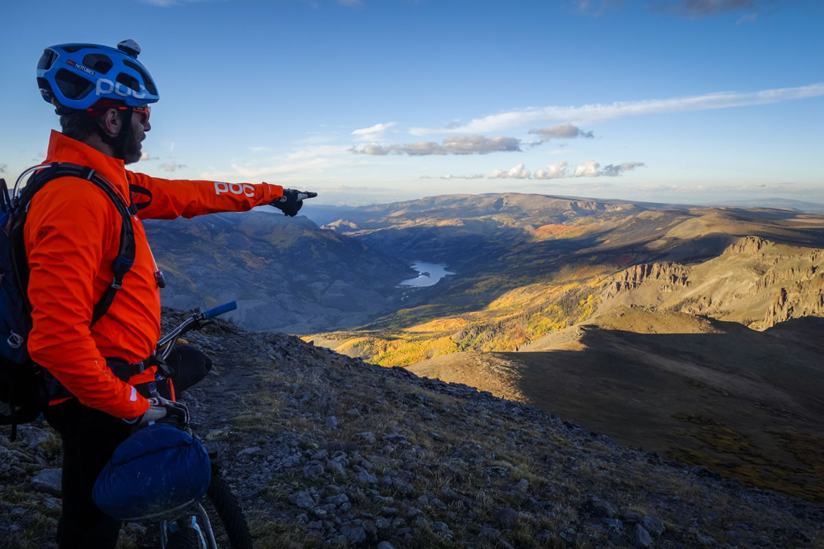
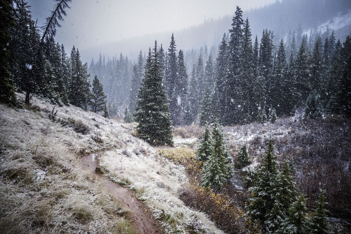
The Colorado Trail is one of the premier, long distance bikepacking trails in the US. It travels through the incredible Colorado Rocky Mountains amongst peaks, glacial lakes, creeks, and a spectacular array of ecosystems. The trail dramatically rises and falls with an average elevation of 10,000 feet (3,048 meters) and tops out above 13,000 feet (3,962 meters), just below Coney Summit. It is a through route, or point-to-point, stretching almost 500 miles from the dusty southern Colorado town of Durango, to Denver (Littleton to be exact). It is commonly ridden in the opposite direction, however the 2015 Colorado Trail Race used the south to north course.
The Colorado Trail flows through eight mountain ranges, six wilderness areas, five major river systems, and six National Forests. Bicycles are prohibited in each of the six Wilderness Areas; it is against federal regulations. Thru-cyclists are required to detour around each of the Wilderness areas.
Difficulty
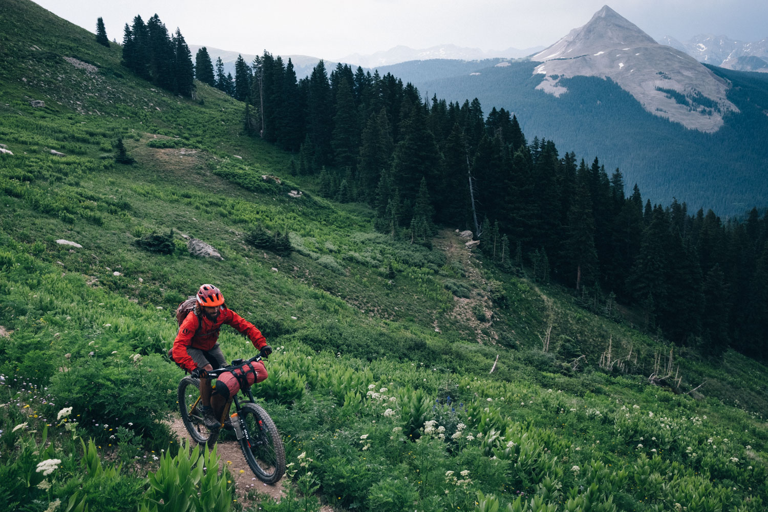
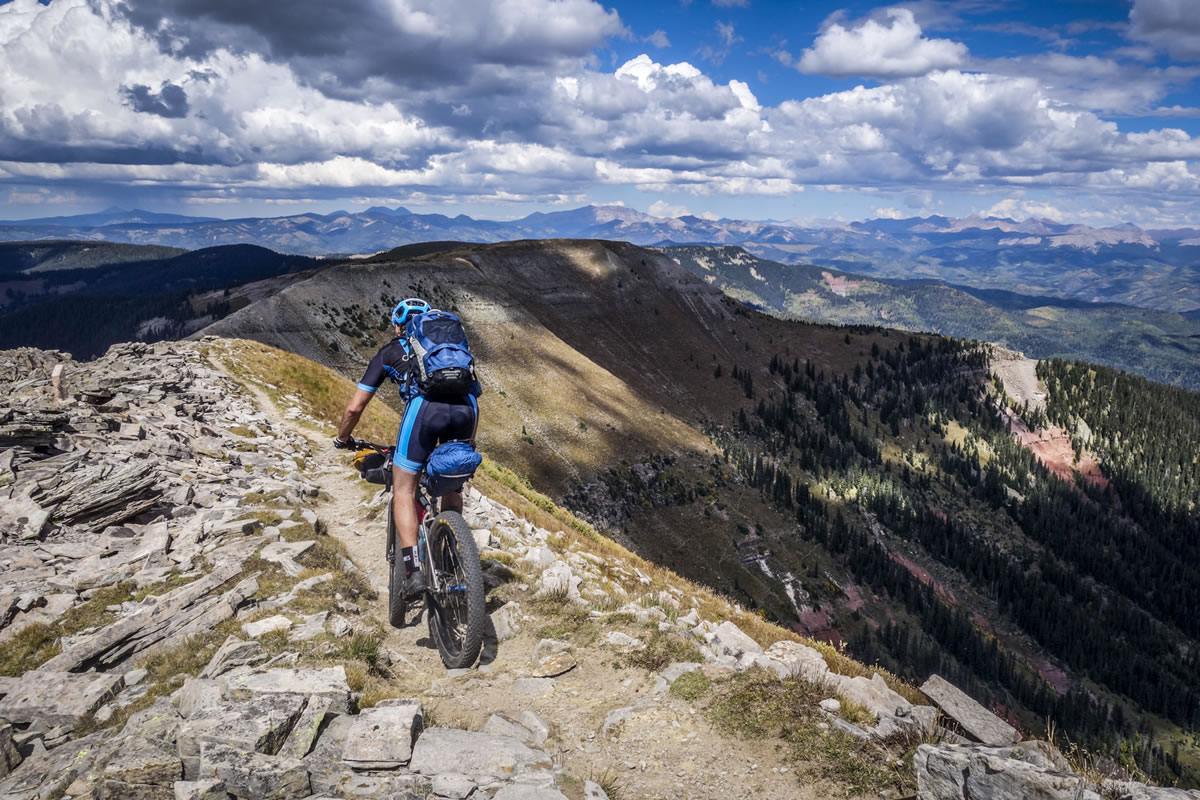
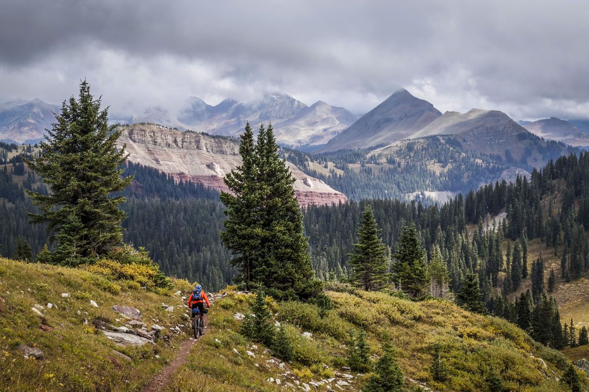
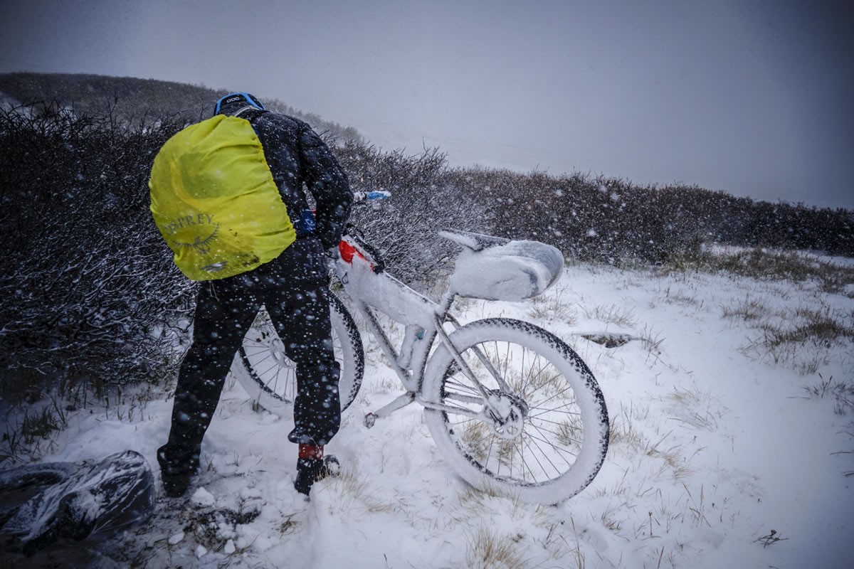
We’ve awarded this route a 9 as it’s undoubtedly one of the harder long distance bikepacking routes on the site. Trail conditions are often technical, with steep, rocky, rooty climbs and numerous thrilling, babyhead strewn or staircase-like descents. Elsewhere, the going is easier; much of the route is characterised by flowy singletrack and gravel roads. Although resupply points are well endowed, the journey between them is often extremely remote. There’s altitude to contend with and storms in the summer monsoon season; the latter requires strategic planning and an understanding of the terrain ahead. Depending on the time of year, water is relatively easily sourced, which takes one logistical piece out of the puzzle.
Allow between 8-18 days for the trip, depending on your pace and skill level. Given that the most popular time to ride the Colorado Trail is during the summer – home to the monsoon season – pace will often be dictated by afternoon storms, so factor this into your timing and make sure you’re below treeline when one hits. This is particularly the case in the second half of the ride – from Spring Creek to Durango,where the weather tends to be most variable and there are long sections of above treeline exposure. Allocating two weeks to complete the ride provides a buffer for inclement weather, the opportunity to sample the products of the many breweries along the way, take some half days off, enjoy a good campspot, swim in rivers, and maybe even pause to fish along the way. More rest makes for fresher legs… which results in the trail being more rideable and enjoyable than it might otherwise be! At the other end of the spectrum, there are those who ride the CT straight through, with barely a break… the fastest of whom finish in under 4 days.
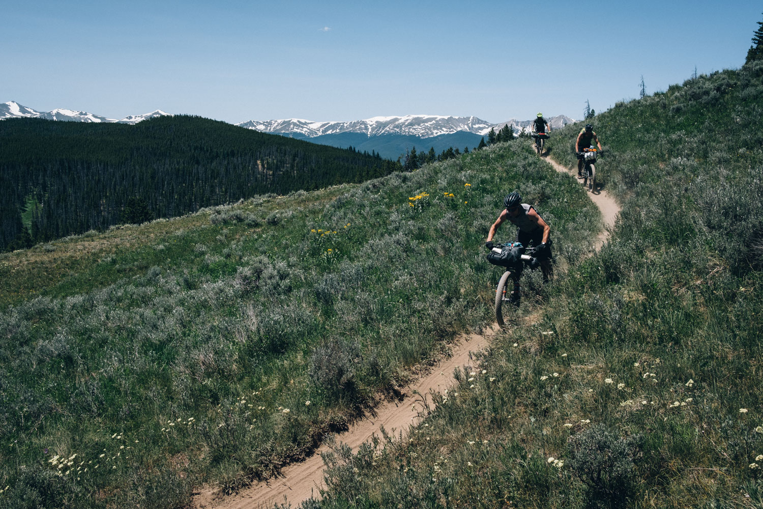
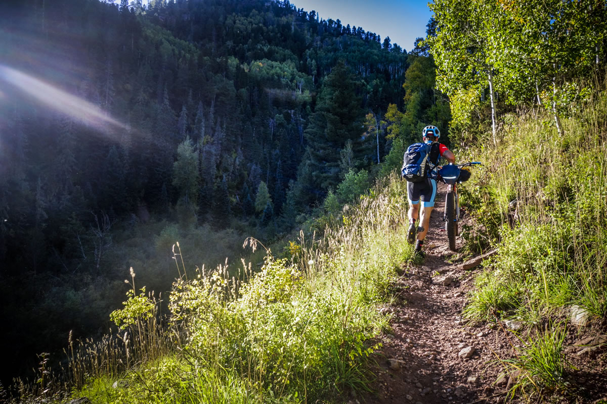
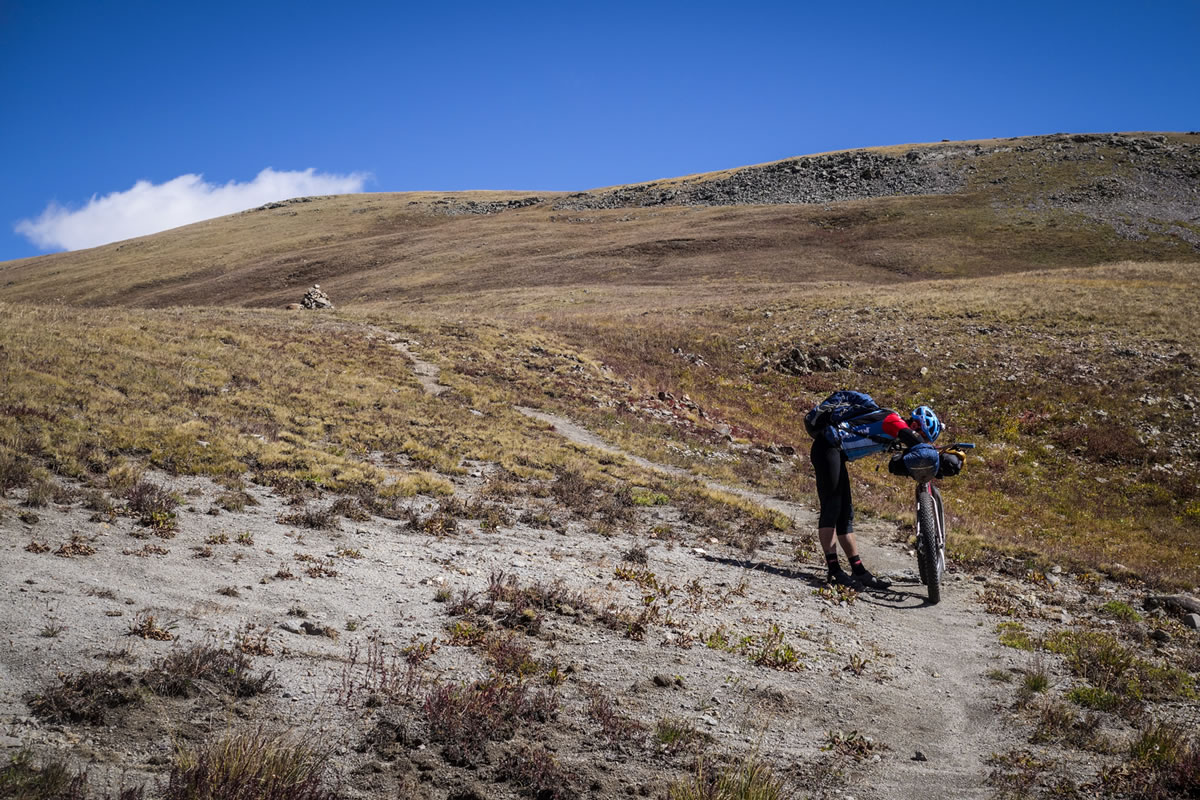
Hike-a-bikes
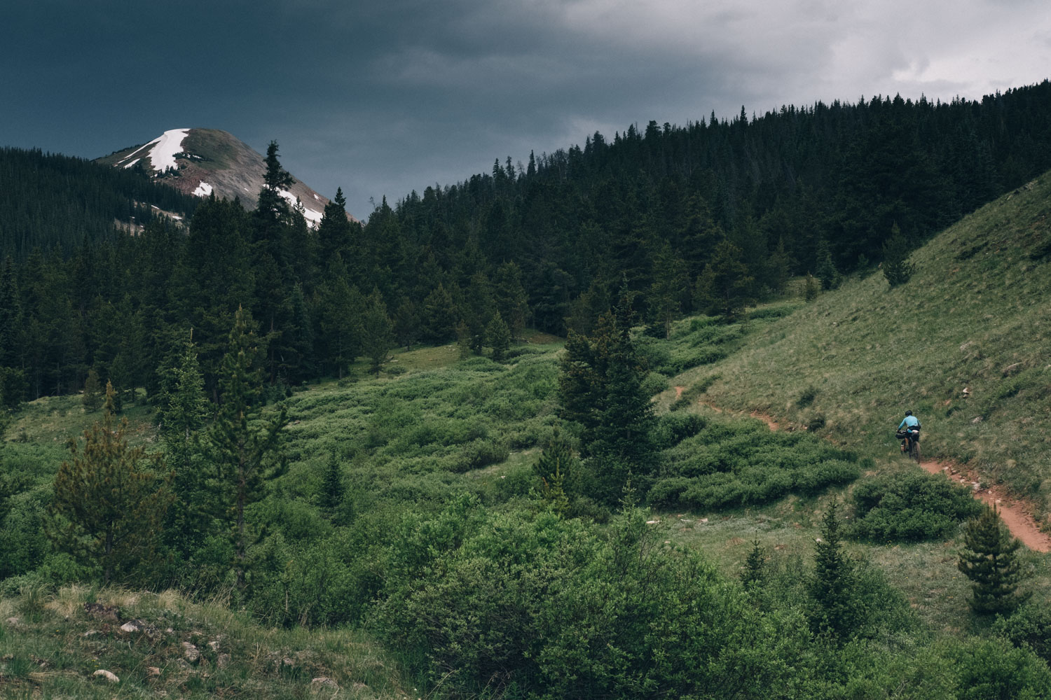
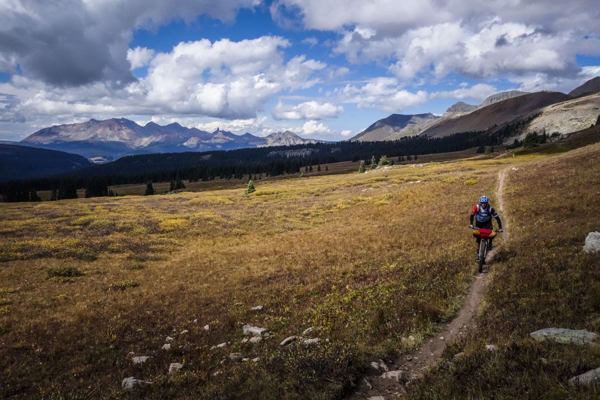
Hike-a-bikes are part and parcel of the Colorado Trail experience. As a rough approximation, we consider the trail to be over 90 per cent rideable – note that this is in time, rather than mileage. But appreciate that this will vary greatly between riders, depending on their skillset, how much gear they are carrying, the freshness of their legs, the weather, and how well acclimatised they are (see comments below). Although numerous, for the most part hike-a-bikes on the CT are relatively short, though there are a number of longer stretches to contend with too – be comfortable pushing or carrying your bike. Heading in a westerly direction, the second half of the ride, from Buena Vista to Durango, broadly speaking features more challenging terrain, with riding that becomes increasingly rocky and more technical. But it’s easy to let the mind dwell on what’s not rideable… just remember that for the vast majority of the time, the Colorado Trail’s singletrack is incredibly flowy, fast, rambunctious, and fun!
See Trail Notes for an overview of each section between resupply points. Note that the Ride With GPS map below includes main resupply points and some key water sources along the way. However, The Colorado Trail Databook is well worth carrying, as it breaks the ride down in manageable segments, listing resupply points, water access, campsites, and passes.
Post updated by Cass Gilbert in July 2017.


Submit Route Alert
As the leading creator and publisher of bikepacking routes, BIKEPACKING.com endeavors to maintain, improve, and advocate for our growing network of bikepacking routes all over the world. As such, our editorial team, route creators, and Route Stewards serve as mediators for route improvements and opportunities for connectivity, conservation, and community growth around these routes. To facilitate these efforts, we rely on our Bikepacking Collective and the greater bikepacking community to call attention to critical issues and opportunities that are discovered while riding these routes. If you have a vital issue or opportunity regarding this route that pertains to one of the subjects below, please let us know:
Highlights
Must Know
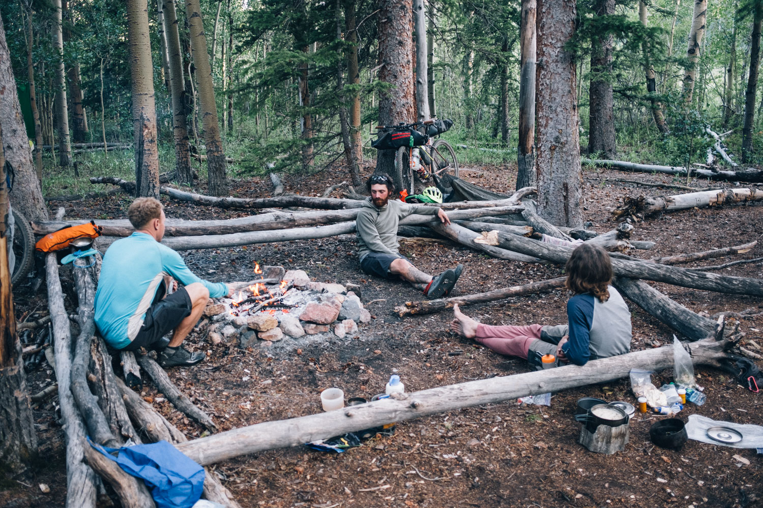
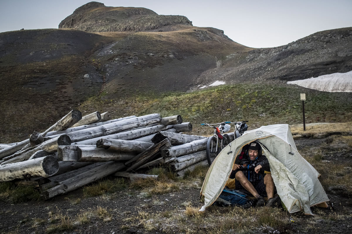
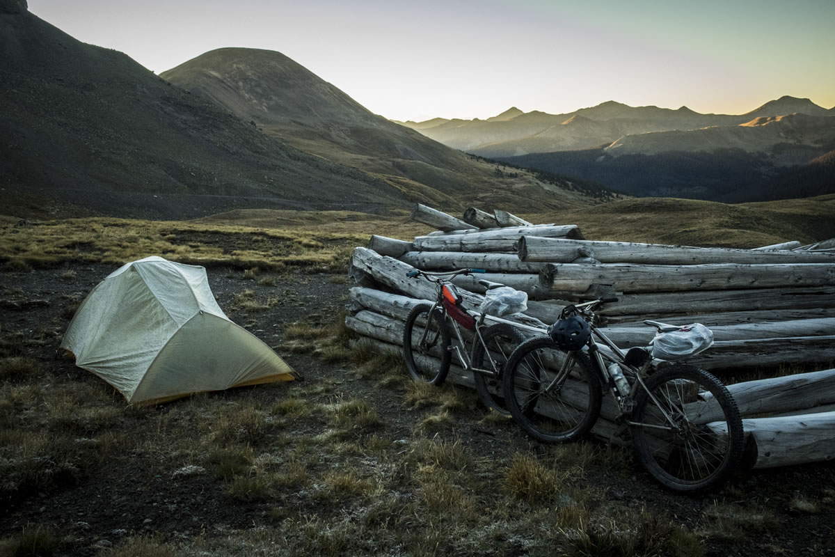
Camping
Food/H2O
Trail Notes
Resources
- Unmatched, pristine, high-altitude singletrack. And miles and miles of it!
- Dazzling displays of wildflowers in the spring and early summer. Insane fall colors in late Sept.
- Traversing a rich diversity of alpine scenery, high desert, grasslands, and interesting mountain towns.
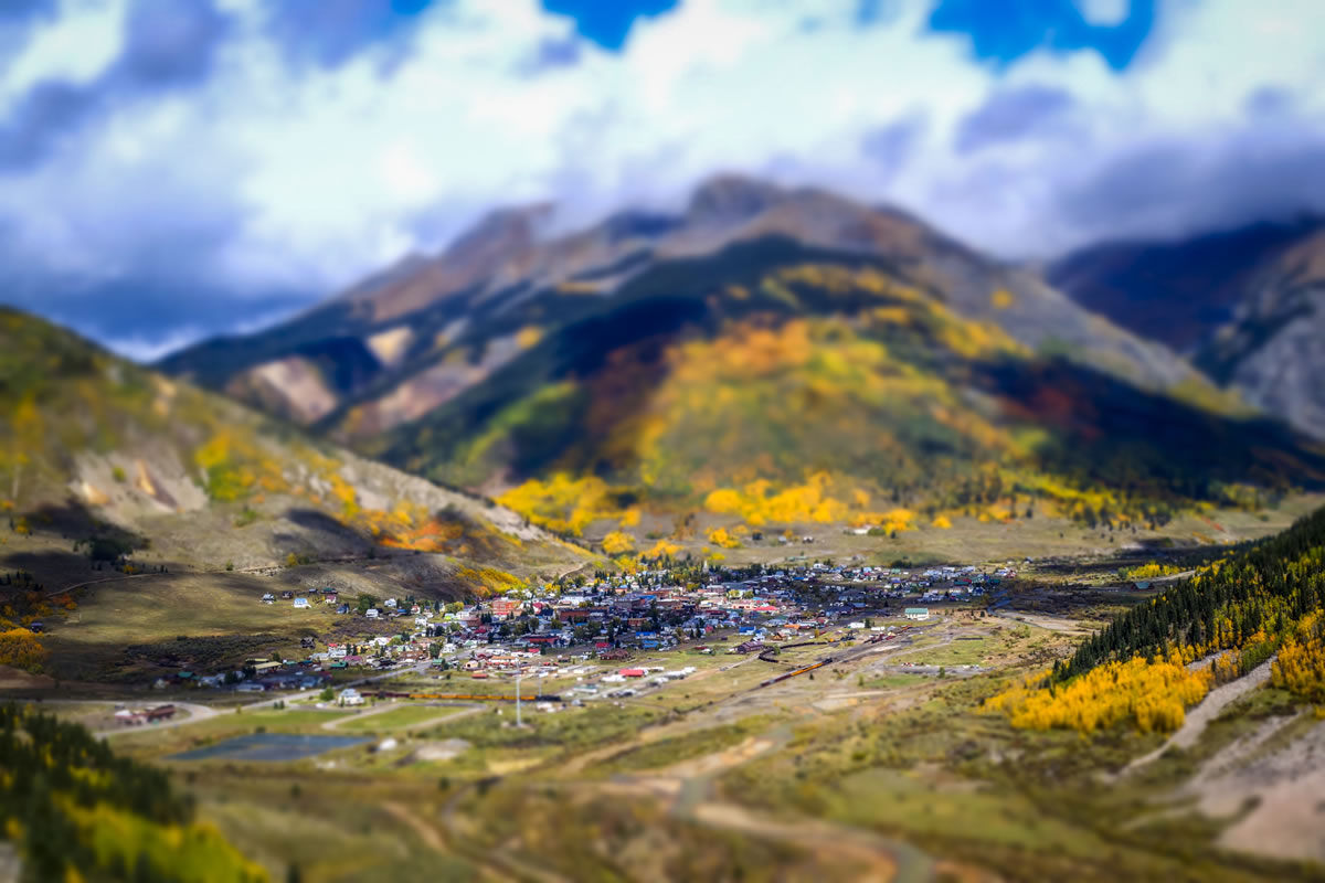
- Fun, quirky, and history-rich resupply points, like Leadville and Silverton.
- Beautiful campspots and rivers to cool off in.
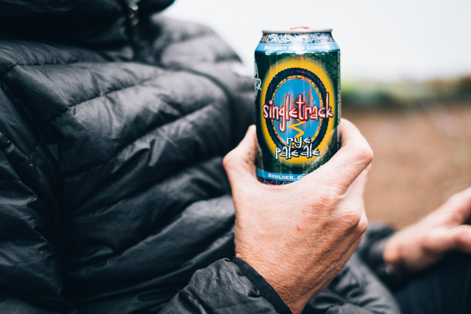
- Visiting breweries along the way – the CT isn’t just about riding!
Colorado Trail Race Records
The Colorado Trail is perhaps best known through ultra-endurance racers who strive to tackle the annual Colorado Trail Race (CTR). Each year, the race alternates its start and direction. As it stands, the current records are (updated December, 2020):
M’s Overall – 3d:20h:44m – Jesse Jakomait, 2015, Durango Start
M’s Overall – 3d:19h:40m – Neil Beltchenko, 2016, Denver Start
W’s Overall – 5d:15h:36m – Jeannie Dreyer, 2015, Durango Start
W’s Overall – 6d:14h:33m – Ashley Carelock, 2018, Denver Start
W’s Singlespeed – 6d:01h:34m – Alexandera Houchin, 2018, Durango Start
- Snow is the biggest factor on deciding when to attempt the CT. Most years the snow has melted by early July making it possible to pass in its entirety from July-September. However, it is not uncommon to experience a stray snow early or late in the season. Expect lingering snow fields if riding at the beginning of the season.
- Weather is another major consideration. During the prime riding season, it is also monsoon season and it’s fairly common to experience rain, hail, and severe lightening. Prepare accordingly. Plan to be off high passes and below treeline by mid afternoon.
- Temperatures can take a dramatic swing at higher elevations. Prepare for chilly temps at night, especially in late September. A 24 degree (-5c) bag is not a bad idea. The less your body works to stay warm at night the better rest you will get.
- Bear in mind that as the days go on, fatigue is likely to set in – so plan for your food and distances accordingly.
- The Colorado Trail has an average elevation of over 10,000 feet (3,048 meters), which shouldn’t be taken lightly. Plan ahead and if you are traveling from a location at a lower altitude – if headed east, take a few day rides from Durango to help acclimatise.
- There is a high amount of daily elevation gain, coupled with hike-a-bikes (generally short but sometimes extended), so running a light rig will really help
- The Colorado Trail is well signposted. However, it’s extremely important to carry a GPS/paper maps of some kind, to help navigate the Wilderness Detours, and to offer bail-out options in the event of accidents or emergencies.
- Mosquitos can be an issue in some areas. If using a meshless tarp, bring some mosquito spray.
- The Colorado Trail Databook is highly recommended, both to support work on the Colorado Trail and to provide in depth information relating to passes, water points, and camping spot.
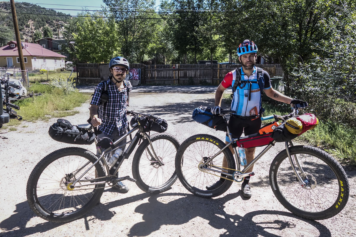
- Recommended bike: The train can be extremely rocky and demanding in places. Given its length, a front suspension is highly recommended, along with the widest tires you can fit. Both full suspension and a Plus-sized hardtail makes ideal options for riding Colorado Trail bike; the latter is especially appealing as it offers framebag space, comfort, and is extremely capable over challenging terrain – all requirements in a bike for enjoying the CT.
- Given the steep climbs and number of hike-a-bikes, running a light rig is key, as is appropriate gearing to help with the high altitude riding. It’s probably best not to carry a water bottle under the downtube, to make portaging easier.
- Wondering what to take? See this post for a suggested packlist.
- Although resupply points are relatively frequent, there are several remote and challenging sections, including the moto trail through Sargeant’s Mesa and the alpine trails to Silverton. Make sure you carry enough food.
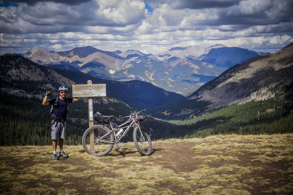
- Consider hopping onto the paved climb to Monarch Pass if you want to ride the entire Monarch Crest Trail (amazing singletrack). The other bonus is that you will miss the hike-a-bike along Fooses Creek Trail and have the opportunity to eat at the cafe at the top of Monarch Pass.
- It’s a good idea to wear bright colors if traveling later in the year, as hunting season begins.
- There is both a multitude of wild camping options and designated campsites available throughout the route. The Colorado Trail Databook has each campground noted, and most are maintained by the Colorado Trail Foundation.
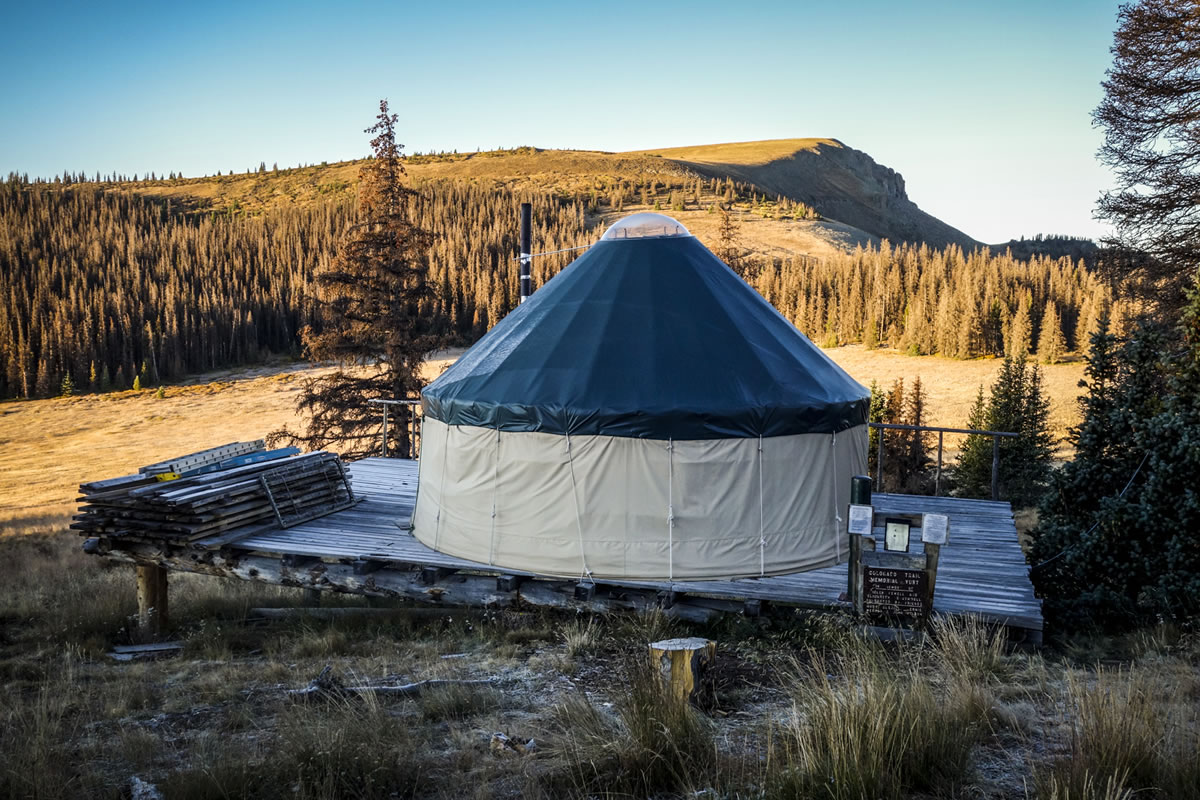
- There is also lodging available in most of the towns passed along the way, from hostels to motels – in Silverton Blair Street Hostel comes recommended as does the Hinsdale Yurt ($20 in the summer) en route to Silverton.
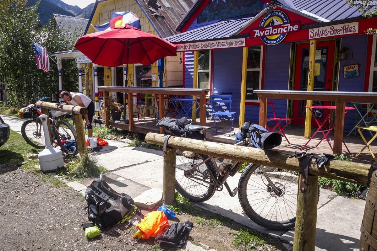
- The main resupply points on route are Breckenridge/Frisco, Leadville, Buena Vista, and Silverton. Brekenridge is slightly closer to the trail but Frisco offers a wider selection of options, including Natural Grocers and Wholefoods. For riders aiming to complete the route in around two weeks, there will be maximum of 3-4 days between resupplies, the longest being between Waterford TH and Brek/Frisco, and Buena Vista and Silverton.
- The Stagestop Saloon – serving burgers and beer (there’s a small convenience store attached) makes a welcome bonus resupply point on the long stint between Denver and Breckenridge/Frisco.
- If you’re dodging a storm, Copper Mountain’s resort has a decent grocery store, plus coffee/donuts.
- If you’re headed from Durango to Denver, note that Princeton Hot Springs has a very well stocked market, which will be the first chance to resupply since Silverton.
- Additional, smaller resupply towns are Teryall, Copper, and Princeton Hot Springs. Do proper research as to what is available and when.
- The hardest stretch without resupply is between Buena Vista and Silverton. It includes both the challenging Sargeants Mesa segment and extended high alpine terrain leading to the highest point of the ride. Pack smart!
- Water is readily available for most of the route, but there are some legs and times of the year where this may be more challenging, such as the Lost Creek detour, which is relatively hot and dry. As a general rule of thumb, study the data book or your topo map, keep a sharp eye out for creeks and springs, and bring a filtration system. For the most part, 2-3 bottles will be sufficient on a day to day basis – in the wetter, San Juans, less – with the capacity (eg a spare bladder) to carry more when required.
- Possible water strategy: Carry a Steripen as a means of quickly purifying your primary and secondary water bottle as necessary. Drink a bottle at each creek that you’re thirsty at, and refill immediately. Fill your third bottle for when distances are longer between creeks. This will save considerable weight and ensure you stay hydrated.
Trail Notes for riding from Denver to Durango, unless otherwise notes.
Waterton TH to Breck/Frisco
- Georgia Pass has excellent views. Great riding in both directions. Avoid highway 285 (via Bailey) if traveling east to west as there’s heavy vehicular traffic and no shoulder. The recommended Lost Creek Wilderness Detour involves a lengthy pavement stretch, but it’s quiet and scenic. This detour and be hot and dry. Although Breck is a popular resupply point, Frisco offers a wider variety of food, including healthy options like Natural Grocers and Whole Foods. From there, the trail can be rejoined via the steep and rocky Miners Creek Road. Note that you can also begin in Denver and ride a bike path all the way to the TH at Waterton TH. There are no major hike-a-bikes in this section, just occasional pushes.
Breck/Frisco to Leadville
- The main hike-a-bike in this section is up to the scenic Gold Hill, which features steep sections and is likely tro trap late snow, and the ensuing 10 Mile Range. There are further smaller hike a bikes en route to Searle and Kokomo passes.
Leadville to Buena Vista
- Easy, mostly dirt roads with a section of pavement. Singletrack sections around Twin Lakes are a blast! Both these towns offer good breweries, a mountain vibe, and plenty of food. No major hike-a-bikes.
BV to Silverton
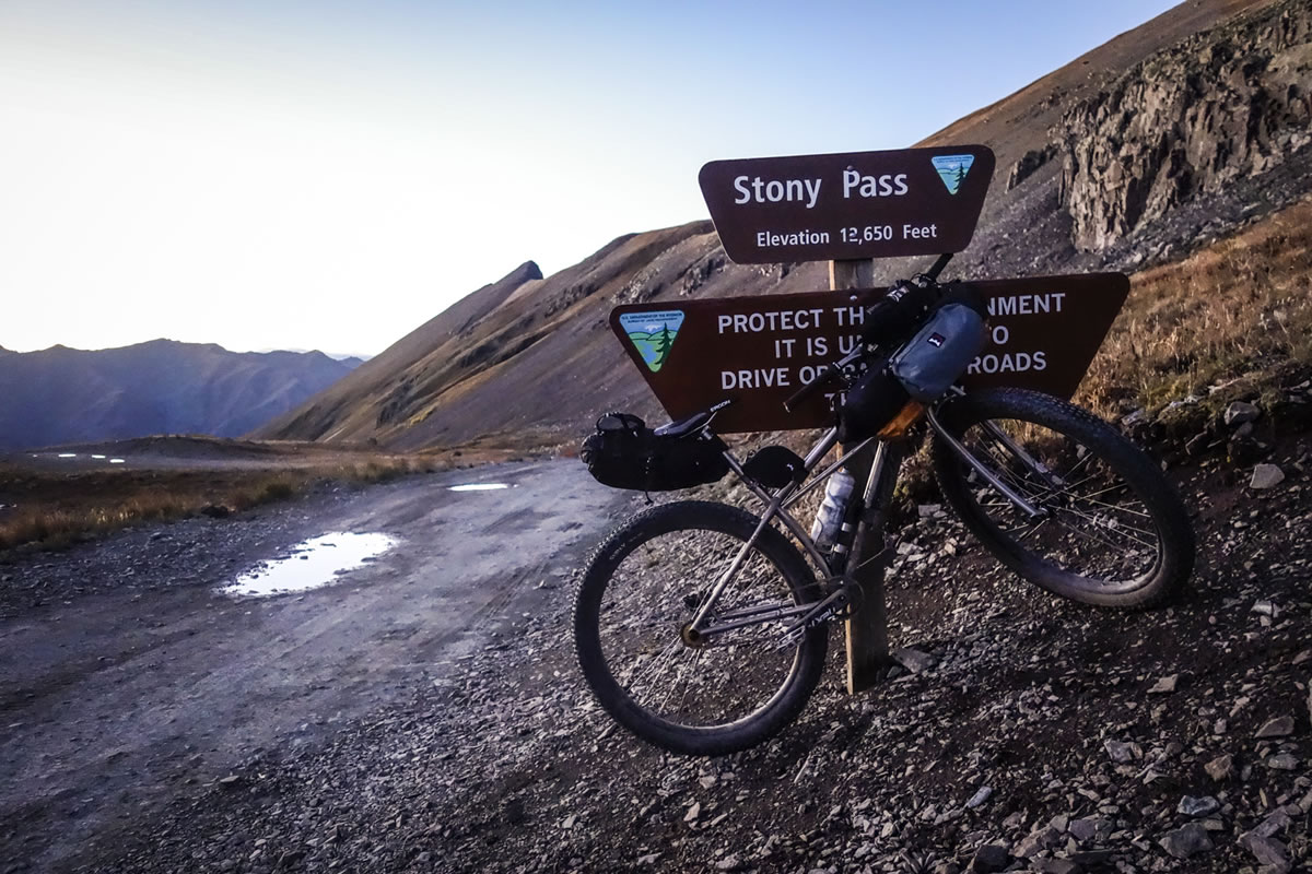
- Hardest section by far, so plan your food wisely. There is a tough hike-a-bike to Foose Creek (possible detour up to Monarch Pass, see Need to Know) and Sargeants Mesa, after Marshal Pass can be hot and slow going, following a rough moto trail. Later, the La Garita Wilderness detour can be relatively dry. The high alpine traverse to Silverton is beautiful but challenging, and involves numerous hike-a-bikes of different lengths -the most hike-a-bikes of the entire CT is in this segment. For rideability purposes, an easier alternative involves dropping down to Pole Creek and then climbing up Stony Pass – the old CT route. Although this misses out some fantastic views, it avoids many of the hike-a-bikes, with a similar amount of overall climbing.
Silverton to Durango
- Arguably the best views of the route. Amazing descent into Durango – Indian Ridge is the highlight of the segment. A few short, chunky hike-a-bikes to contend with but largely rideable.
Overall
- For the most part, the Colorado Trail is very well marked. However, The Trailside Databook is a must-have for a breakdown of each segment with mileages, elevations, water spots and camp spots. Note – data book gives directions for Denver to Durango, requiring extra brain power going opposite direction. And it doesn’t cover the Wilderness detours, so you’ll need a map/navigation app or GPS for this.


Terms of Use: As with each bikepacking route guide published on BIKEPACKING.com, should you choose to cycle this route, do so at your own risk. Prior to setting out check current local weather, conditions, and land/road closures. While riding, obey all public and private land use restrictions and rules, carry proper safety and navigational equipment, and of course, follow the #leavenotrace guidelines. The information found herein is simply a planning resource to be used as a point of inspiration in conjunction with your own due-diligence. In spite of the fact that this route, associated GPS track (GPX and maps), and all route guidelines were prepared under diligent research by the specified contributor and/or contributors, the accuracy of such and judgement of the author is not guaranteed. BIKEPACKING.com LLC, its partners, associates, and contributors are in no way liable for personal injury, damage to personal property, or any other such situation that might happen to individual riders cycling or following this route.
Please keep the conversation civil, constructive, and inclusive, or your comment will be removed.