


Bikerafting Alaska’s Lost Coast, Yakutat-Glacier Bay
Distance
225 Mi.
(362 KM)Days
10
% Unpaved
99%
% Singletrack
0%
Difficulty (1-10)
10?
- 1Climbing Scale Easy0 FT/MI (0 M/KM)
- -Technical Difficulty
- -Physical Demand
- -Resupply & Logistics
Contributed By
Mike Curiak
LaceMine29
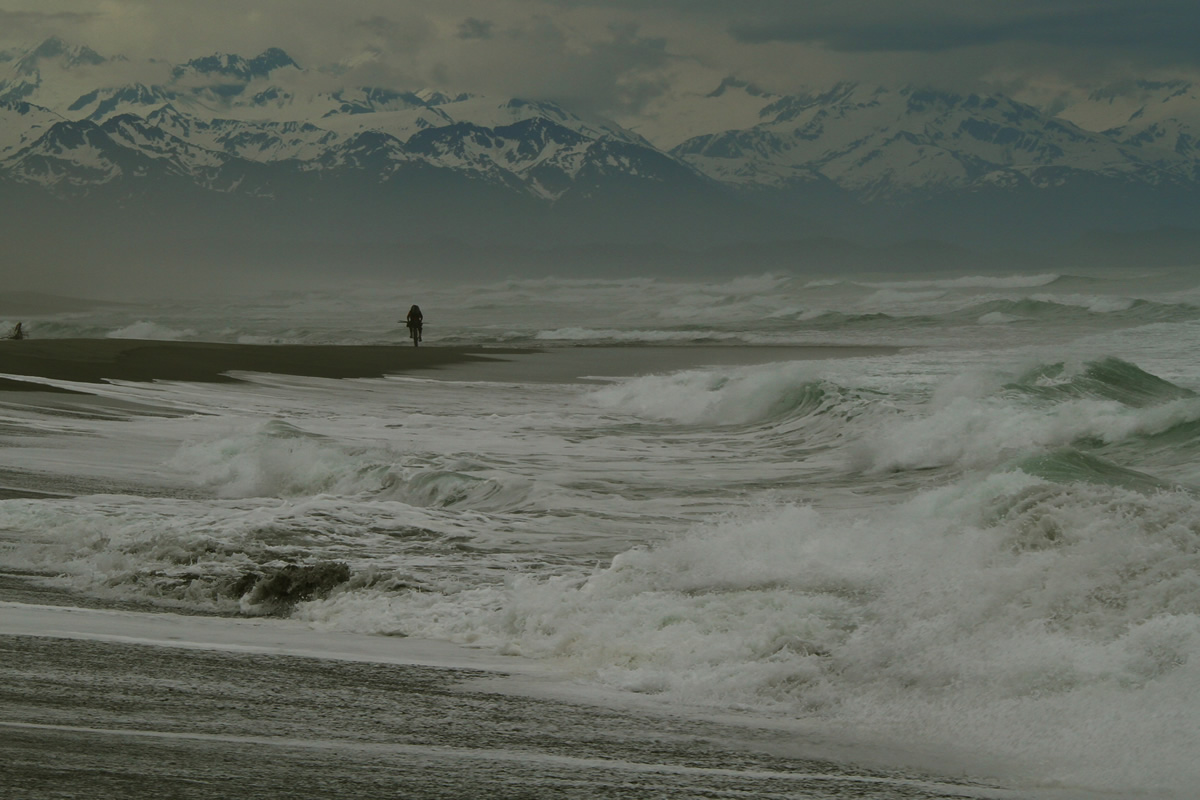
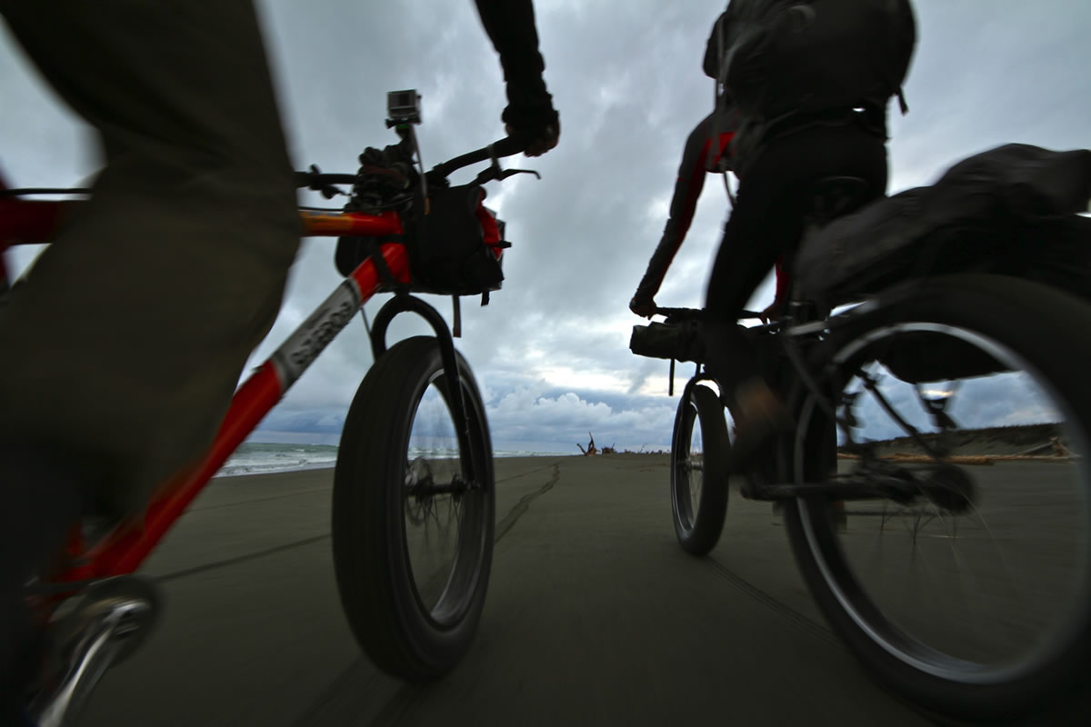
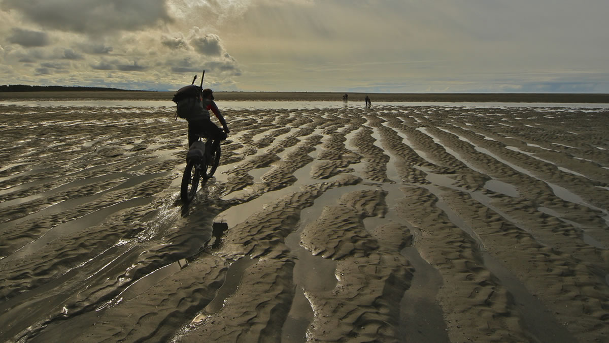
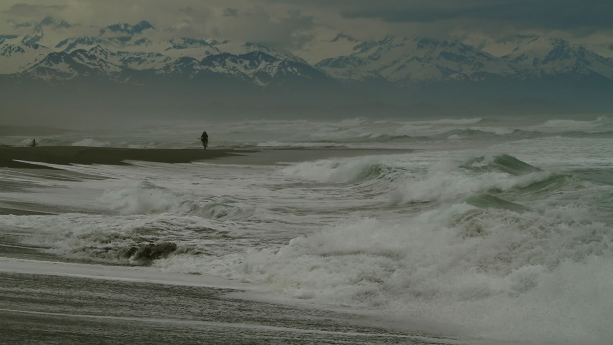
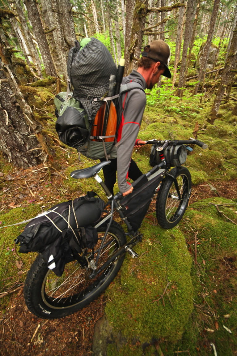
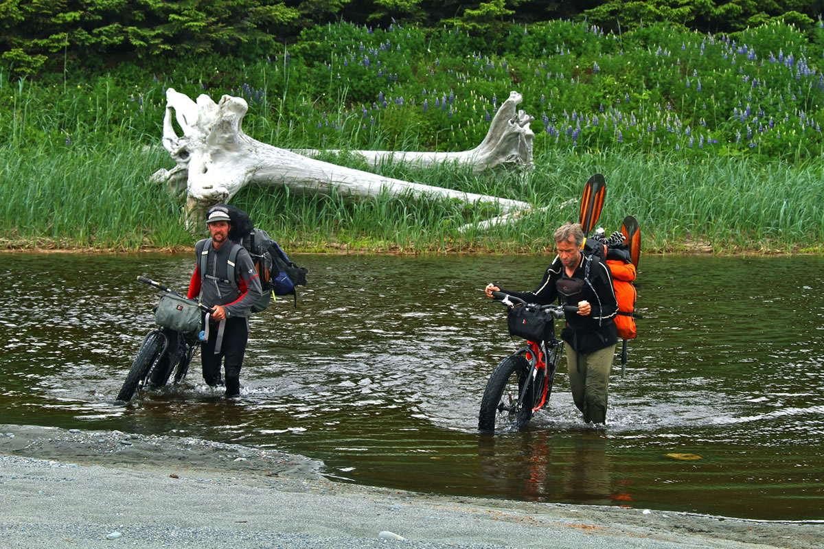
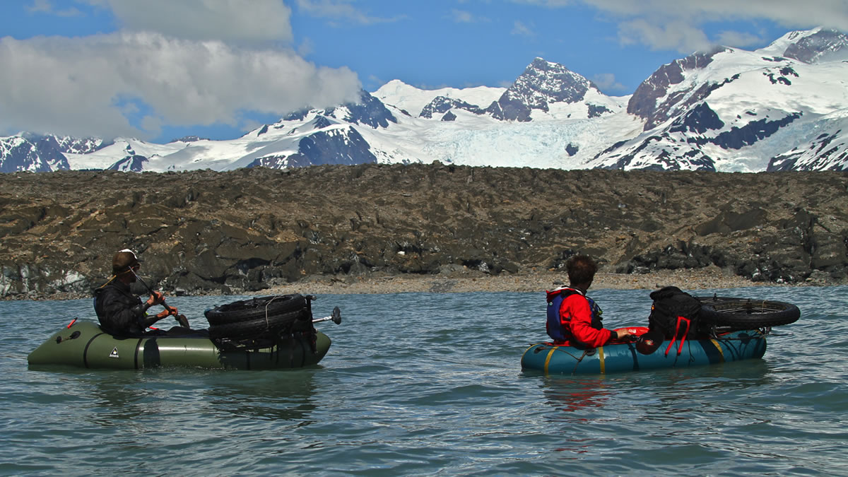
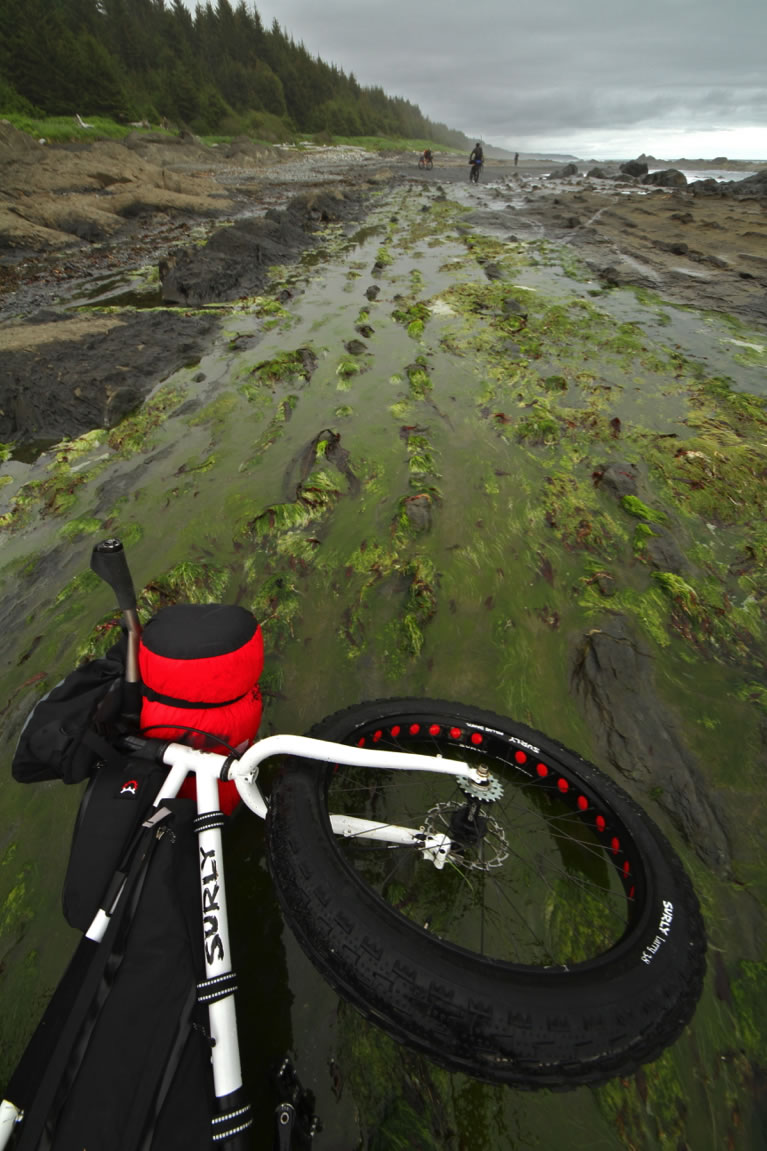
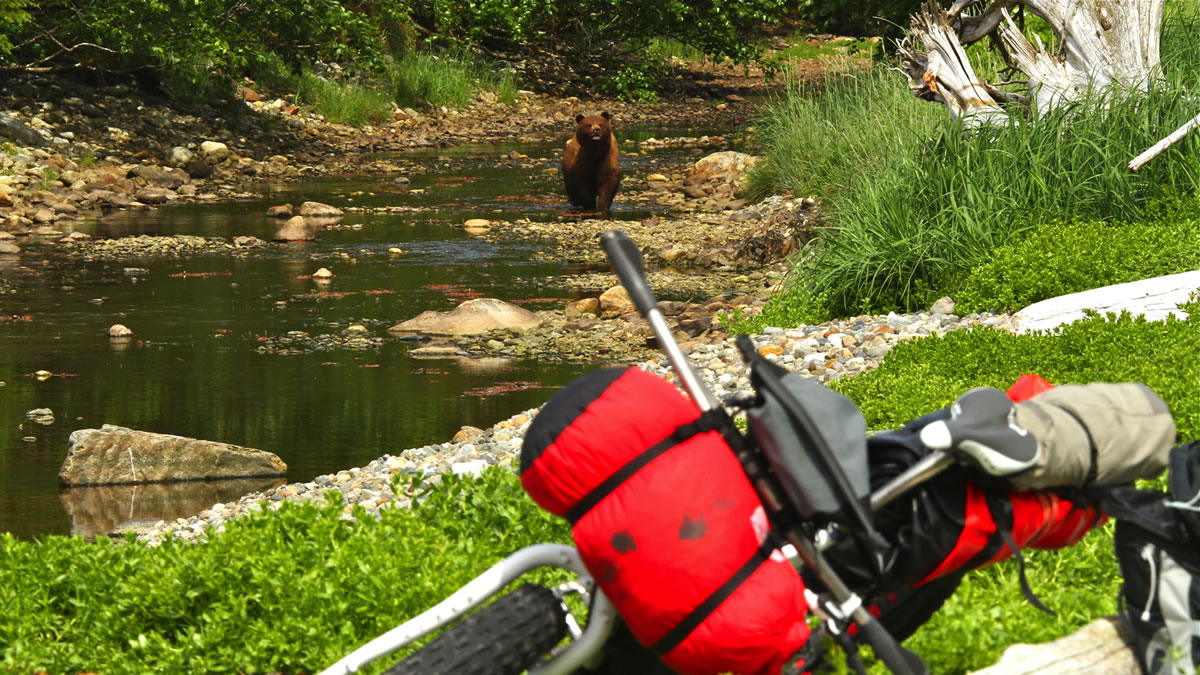
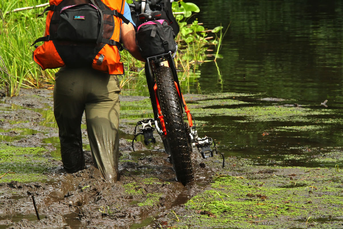
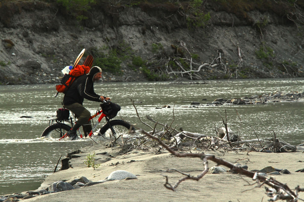
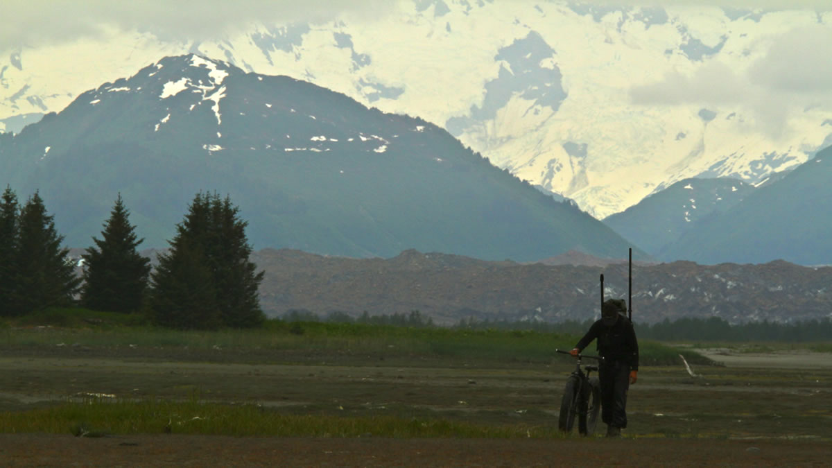
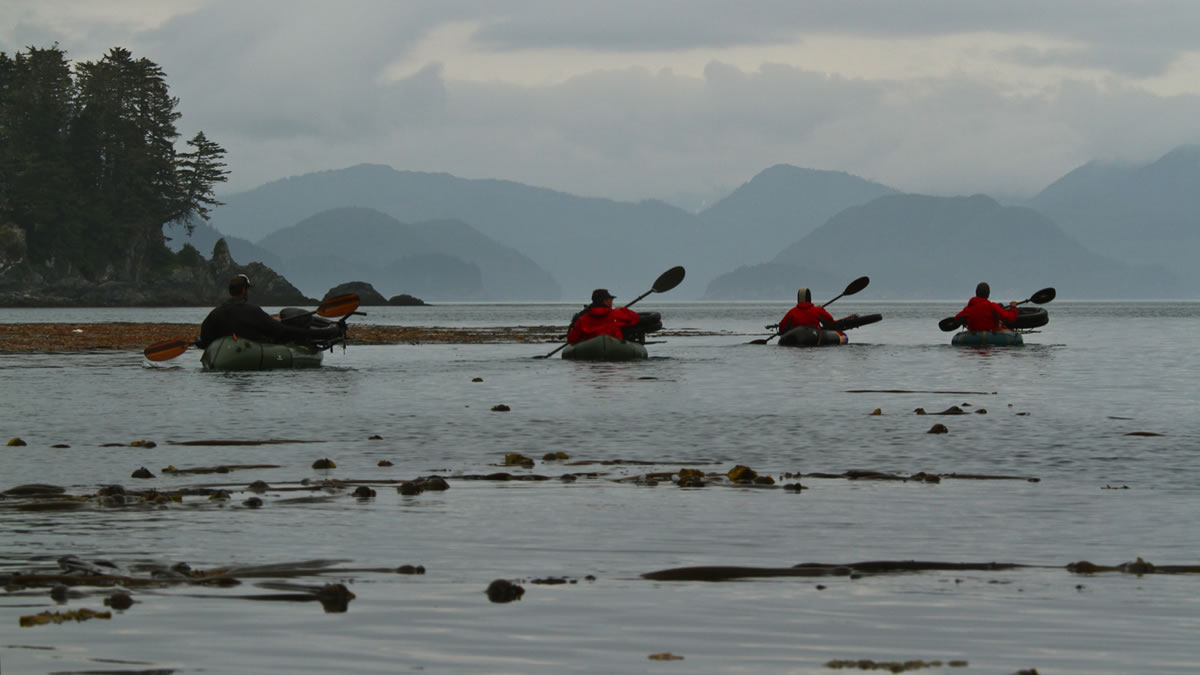
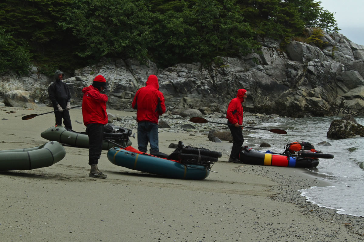
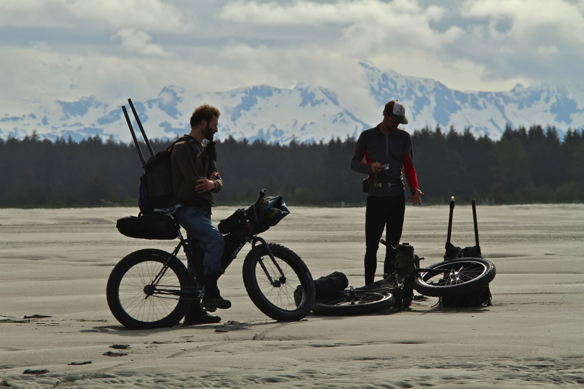
The Lost Coast stretches between the villages of Yakutat and Gustavus in Southeast Alaska. It is one of the wildest pieces of coastline or terrain that I have ever witnessed, period. We saw no people and little evidence of them for 10 days out, but had the constant company of eagles, whales, bears, moose, seals and sea lions. Both a fatbike and a packraft are needed for this trip. Riding would be impossible without fat tires, crossing miles and miles of water impossible without the boat.
- 225 miles (402 km)
- 99% unpaved–maybe a mile or two of pavement as you leave the start, and again as you roll into the finish.
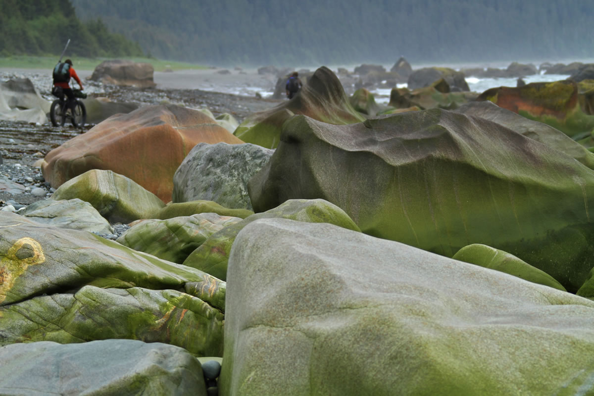
- 97% no trail at all. A few hundred meters of random bear trails here and there, but these weren’t rideable, they were merely easier to push through than the alternatives.
- 135 miles (217 km) riding every sort of beach sediment you can imagine.
- 65 miles paddling lakes, rivers, streams, ponds, sloughs, oceans, bays, fiords — we used our boats 25 times.
- 25 miles of mostly stumblef*cking.
We averaged 3.3 mph on bike (including rest breaks), 0.6 mph stumblef*cking on the boulders or f*cksticked bear trails, and 2.3 mph on the paddling stretches. That’s with the fatbikes on board.
Difficulty is subjective on this route. If you have all of the needed gear, and experience using it, and you get good weather, and your group is solid, this could be a 6 (out of 10). If you have to acquire a fatbike and a packraft (and paddle and PFD and repair kit and…), and learn to use them, and if you’ve never navigated trail-less country, and if the bears are at the mouths of the streams eating salmon, while the wind drives the rain into your face every day, or a glacier surges and blocks your path… then it could be somewhere between a 10 and impossible.
There is very little climbing on the route, but that is made up for by the soft surfaces and lack of trail. You will earn every inch of progress, just not in the same way that you may be accustomed to.
So if you’re keeping track, this route has no trail, little climbing or descending, no services, and little chance for resupply. Why, then, would anyone want to go there?

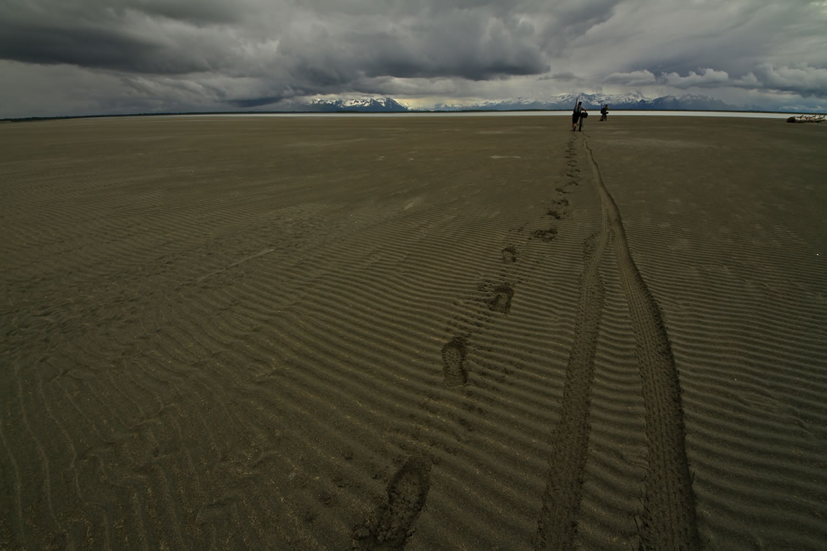


GPX file: I don't have one, and would be reluctant to share it if I did. Navigation of this route has little to do with map work (most of which are inaccurate compared to what is on the ground, due to active glaciation and isostatic rebound from glacial retreat) and everything to do with keeping your head up and paying attention. I'd take USGS topos for reference.
Highlights
Must Know
Camping
Food/H2O
Resources
- Incredible scenery with mountains crashing into surf and surf crashing back, with fragile little us caught somewhere in between, and often dancing delicately right on the edge.
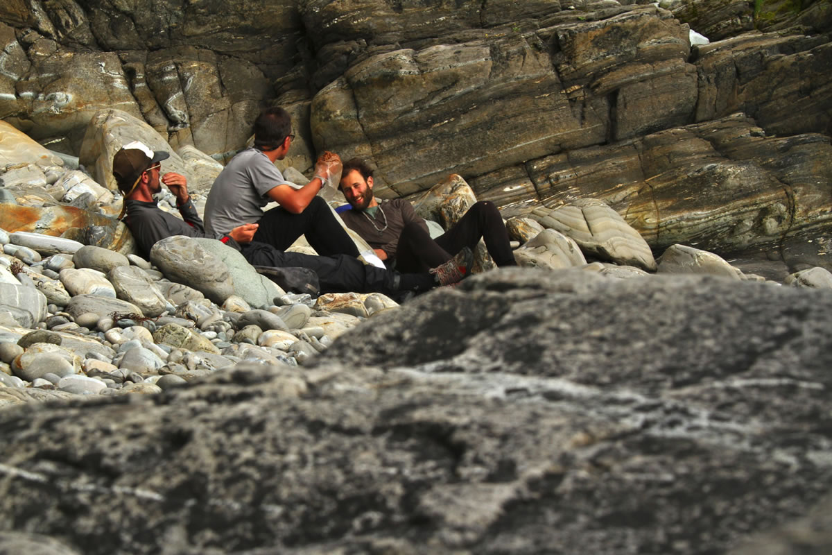
- The camaraderie that develops when a trip is more difficult than any one person could handle alone, causing the group to adapt and evolve. This route pushed us, and brought out the best in each of us.
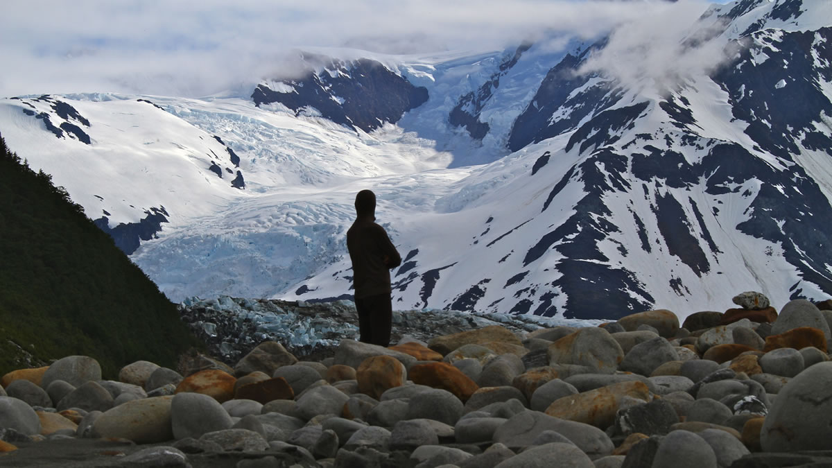
- Paddling the berg-choked lagoon at the foot of the Grand Plateau Glacier, in the gloomy twilight of a cloudy midnight.
- A sleepless night spent on the beach of that same lagoon, listening to the calvings of the glacier, and constantly expecting tsunamis that never came.
- Abundant megafauna.
- Truly wild riding.
- Paddling into Glacier Bay with whale escorts.
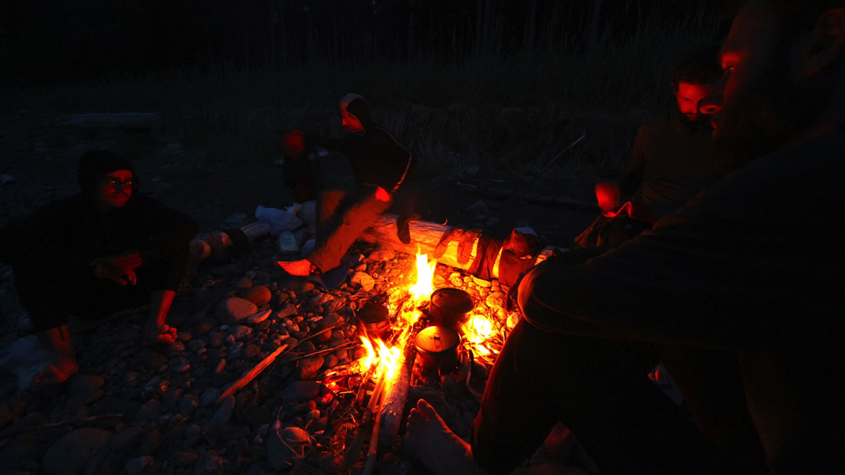
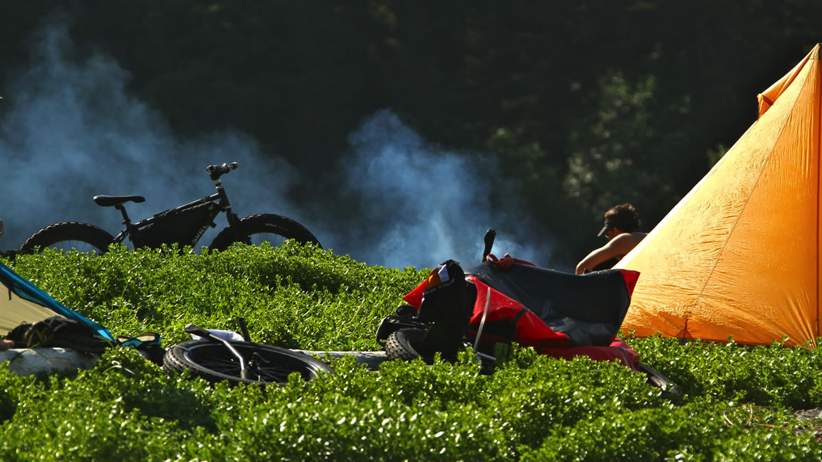
- Timing depends on you, and what sort of trip you want. I think this could be doable year-round, but I personally wouldn’t want to camp and travel here in winter. We went over the summer solstice, which gave us looooooong days with lots of light, minimal bugs, minimal bear encounters, warm temps, and dry wood on the beaches, over which we cooked our meals.
- This route is remote in a way that few other bikepacking routes are or can be. There are no services, the only way out is to go forward to Gustavus, or back to Yakutat. You are hemmed in by mountains on your left and ocean on your right 98% of the time. The mountains are steep, with active glaciers, no trails or roads, no towns, no people, and are bisected by cold and often steep rivers and streams. Often the streams are too fast or steep to cross with boats, and the breakers crashing into the coast are much, much, much too big to penetrate with a bike-laden packraft. But you have to get across…
- Getting to the start alone can be challenging. Flying into Anchorage works, but often direct flights to Yakutat can be had from the Lower 48. Once in Gustavus we hopped to Juneau and then back to Anchorage.
- Bears need to be considered and planned around.
- Flying with bear spray and stove fuel are strictly regulated–find out well in advance what the airlines want you to do, keeping in mind that the smaller carriers and bush pilots are much more lax about these items.
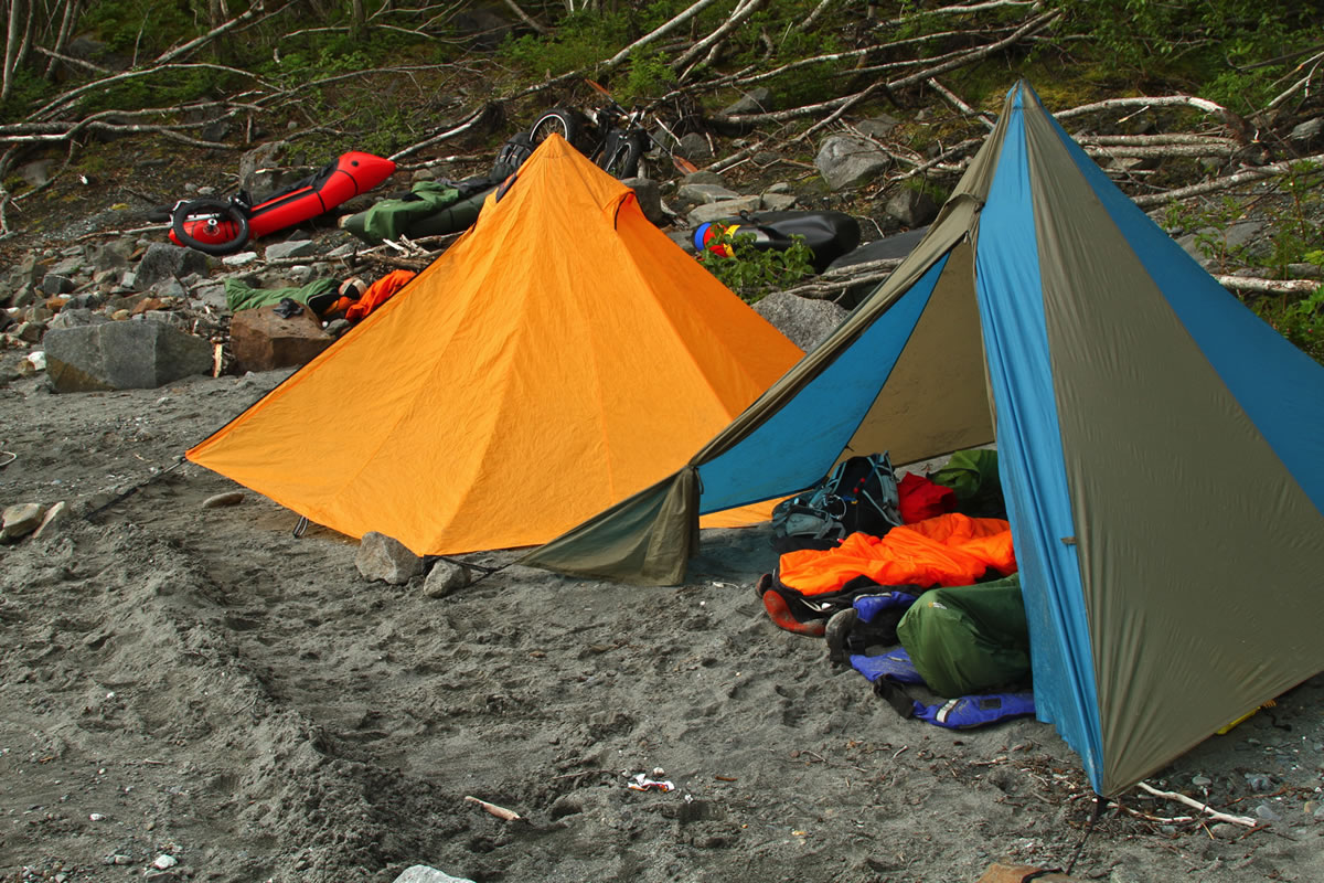
- There are no campgrounds or lodges. So you sleep where you fall, preferably somewhere dry. We largely slept in the grass, well above the high tide line, which is also where the most mosquitoes were. I liked it better when we slept on the sand, because there were fewer bugs. I’ll gladly deal with sand in my undies and toothbrush instead of the drone and bite of mosquitoes all night long.
- Water is everywhere, flowing off of the Fairweather Range and into the ocean. We drank it straight from the streams whenever we crossed them. A 1L bottle or drom is plenty for this trip–just dip as needed, no need to ever carry more.
- Resupply is possible if you have deep pockets: Hire one of many bush pilots in Yakutat or Haines or Juneau and have them drop whatever you need on a prearranged stretch of beach along the way. We carried 10+ days worth of food and fuel. It was heavy at the start, but not unmanageable, and removed the need, cost, and hassle of arranging a resupply.


Terms of Use: As with each bikepacking route guide published on BIKEPACKING.com, should you choose to cycle this route, do so at your own risk. Prior to setting out check current local weather, conditions, and land/road closures. While riding, obey all public and private land use restrictions and rules, carry proper safety and navigational equipment, and of course, follow the #leavenotrace guidelines. The information found herein is simply a planning resource to be used as a point of inspiration in conjunction with your own due-diligence. In spite of the fact that this route, associated GPS track (GPX and maps), and all route guidelines were prepared under diligent research by the specified contributor and/or contributors, the accuracy of such and judgement of the author is not guaranteed. BIKEPACKING.com LLC, its partners, associates, and contributors are in no way liable for personal injury, damage to personal property, or any other such situation that might happen to individual riders cycling or following this route.
Please keep the conversation civil, constructive, and inclusive, or your comment will be removed.