


The Brandenburg Odyssee
Distance
802 Mi.
(1,291 KM)Days
14
% Unpaved
73%
% Singletrack
10%
% Rideable (time)
97%
Total Ascent
14,757'
(4,498 M)High Point
500'
(152 M)Difficulty (1-10)
5?
- 1Climbing Scale Easy18 FT/MI (3 M/KM)
- 5Technical Difficulty Moderate
- 6Physical Demand Moderate
- 2Resupply & Logistics Easy
Contributed By
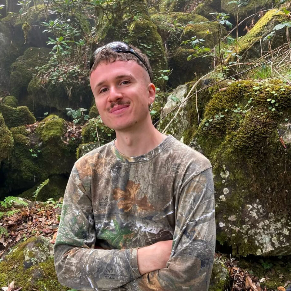
Samuel Kuhn
Guest Contributor
Samu was born and raised in and around Berlin and Brandenburg and currently works as a social worker in Berlin while trying to push the pedals as much as possible, preferably in remote parts of the world on off-road adventures. Find Samu on Instagram @samu.kuhn.
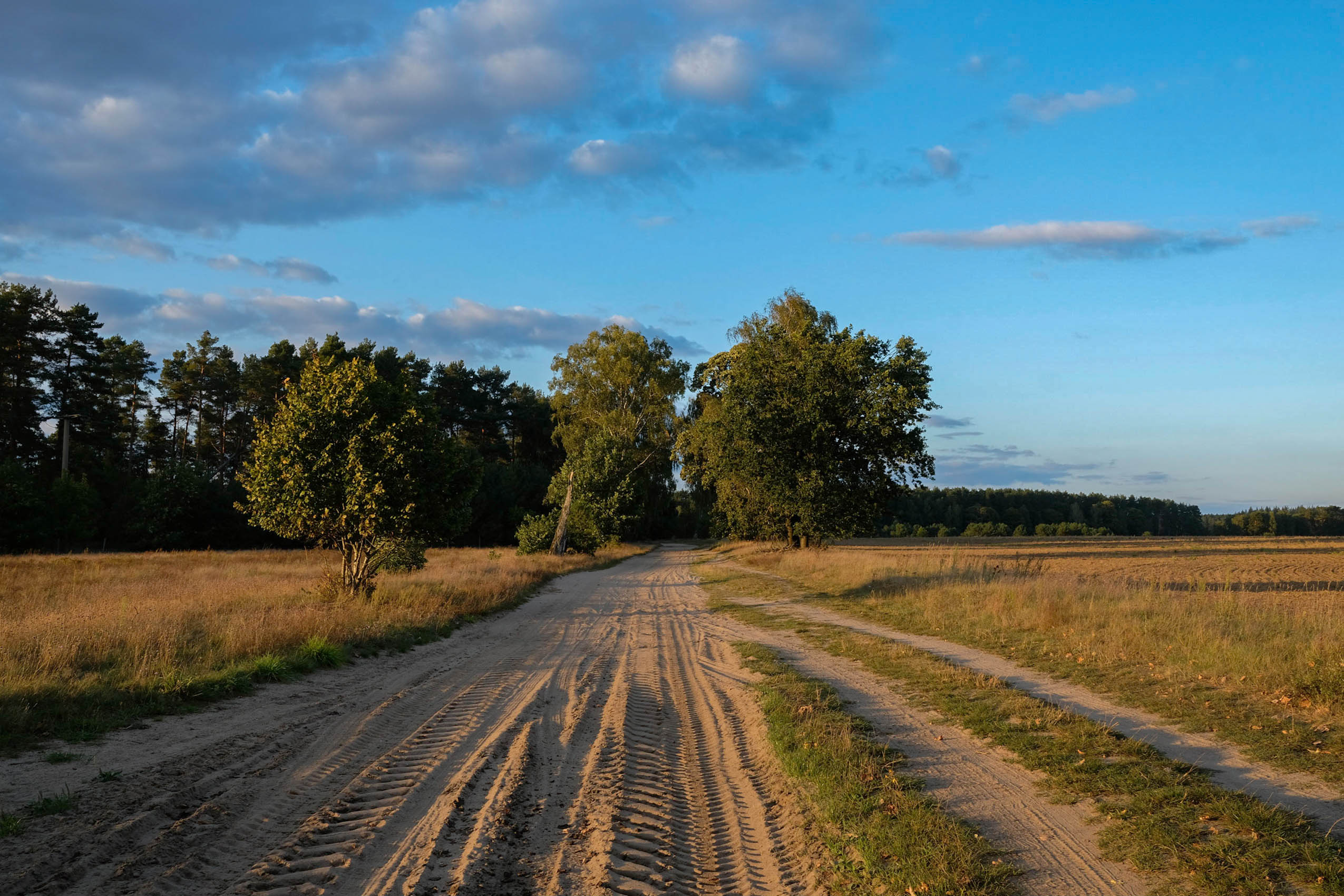
This 1,330-kilometer, state-spanning off-road adventure was created with the goal of getting the local cycling community from in and around Berlin out there, exploring well beyond the Berlin border.
The Brandenburg Odyssee gives riders the flexibility to tackle each of its segments (see Trail Notes) as a weekend overnighter or take on the entire route at once, allowing for an ever-changing ride through a surprisingly varied landscape, which is not what one typically expects when thinking of the quiet state of Brandenburg.
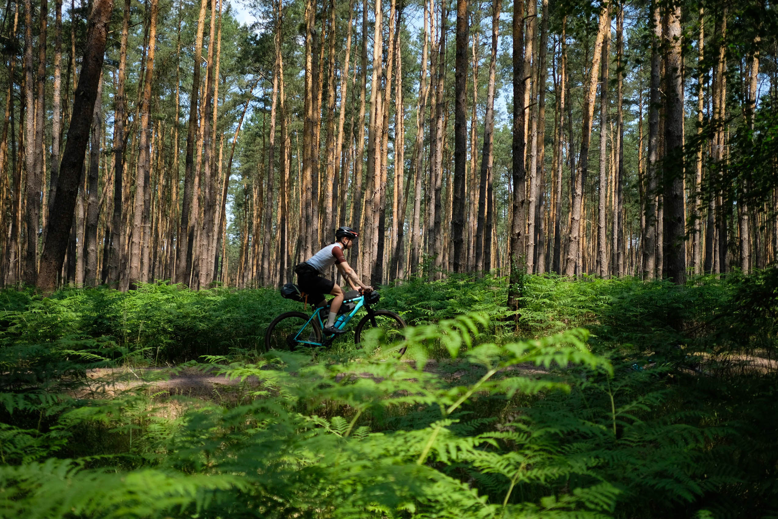
While riding the route, you will encounter hilly nature reserves with steep climbs, mountain views, and twisty trails, as well as heathlands, lush pine forests, flat plains, and, most notably, countless lakes and rivers.
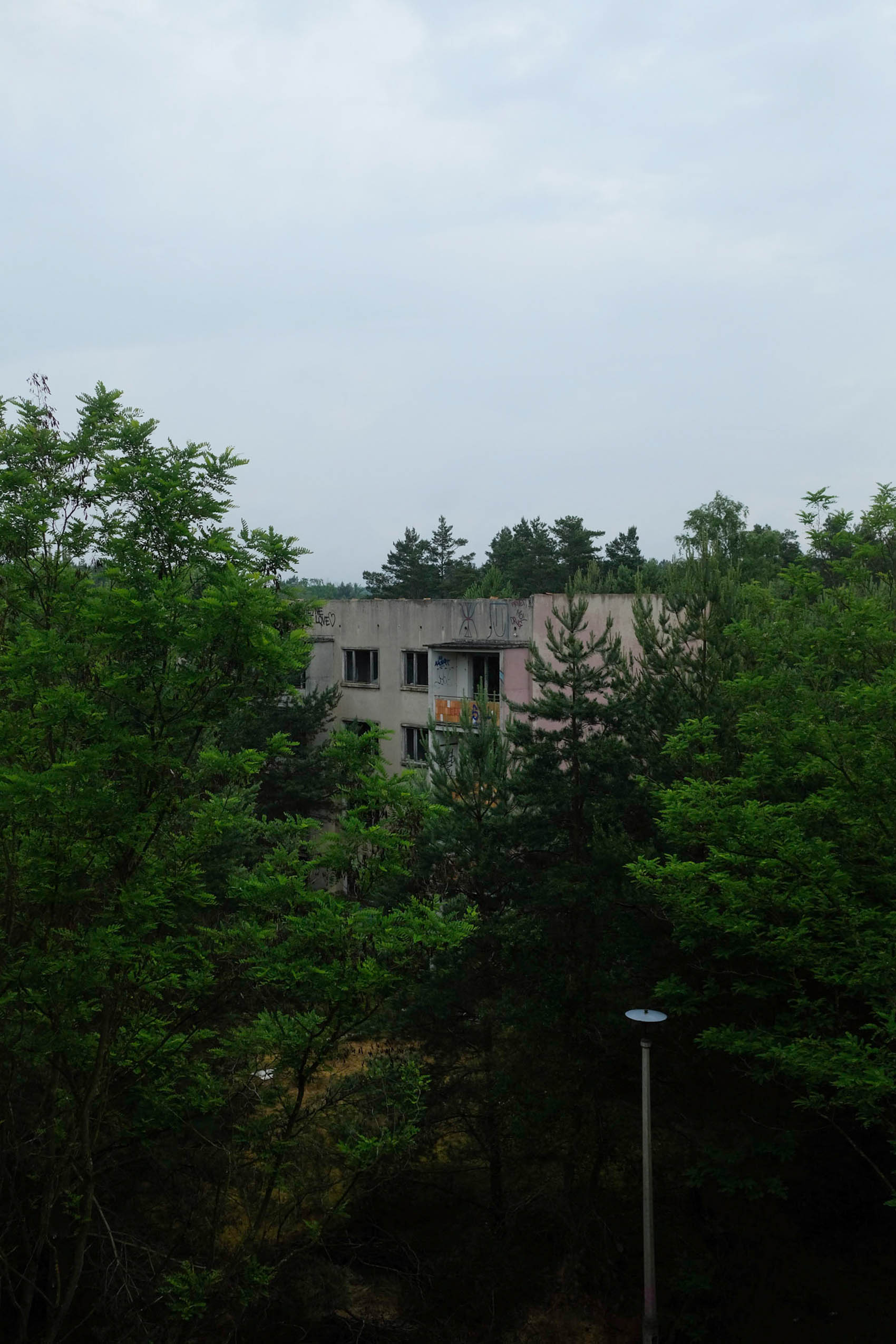
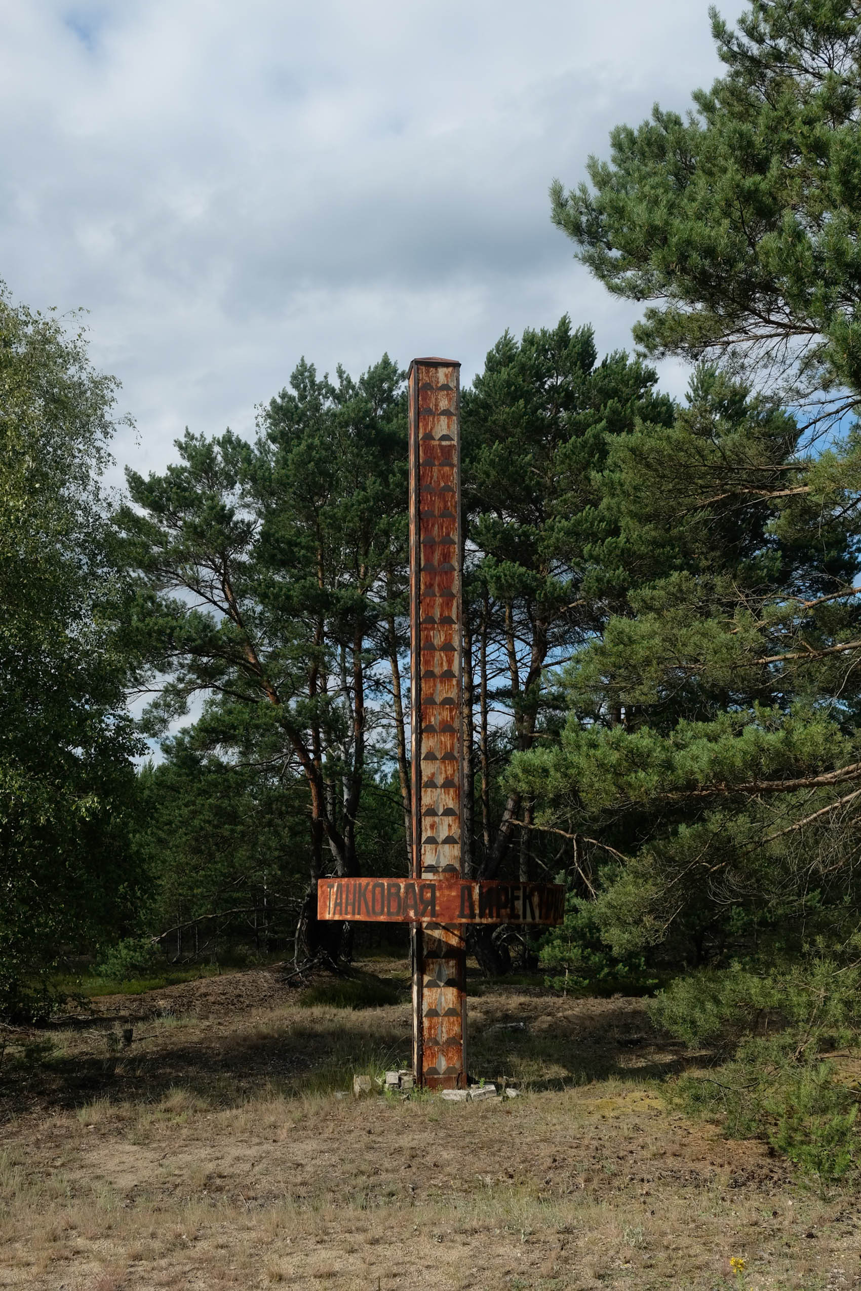
Brandenburg is rich in history, with former coal mining sites that have turned into vast lakes and nature reserves, countless remnants of Germany’s past (including abandoned military infrastructure, lost villages, and other remnants of history) all adding a unique historical dimension to the journey that waits to be experienced.


As you venture deeper into rural Brandenburg, traversing stretches of endless forest riding, sparsely populated areas, wetlands, and even desert-like landscapes, the Odyssee can feel increasingly remote and adventurous. Whether you’re seeking solitude in the expansive forests or pushing yourself through the challenges of the terrain, the Odyssee offers an escape from the city buzz, a deep connection to nature, and a true sense of exploration. It’s a route that promises both a physical challenge and a sense of discovery and freedom.
Route Difficulty
I tried my best to plan this route as remote as possible, but the track doesn’t ever venture off too far from civilization, and resupply points and easy options for resting overnight come frequently. The route is accessible by train every 100 to 150 kilometers without major detours, and mergency services are available everywhere.
Taking all this into account, the difficulty rating of the route is mainly a testament to the physical demands, which is why I decided to rate it 5 out of 10 as a whole. It’s a 6–8 out of 10 for physical difficulty. If you ride the route in one go, it will be very demanding as it is not only long, but some sections are heavy with singletrack and segments of sand. Other sections can sometimes be more than 50 kilometers of “gravel autobahn,” which means easy and fast riding.
The route is a solid 4–6 out of 10 for the technical challenge. This too depends on the part of the route you are riding as it varies a lot between sections. Everything can be ridden on a gravel bike. However, I wouldn’t recommend a tire choice smaller than 45mm. Trails, rugged logging roads, and sandy bits make up for the easier sections of fast-rolling gravel. Finally I’d give it 1–2 out of 10 for the route’s straightforward logistics and accessibility. In the end, all of the above is very much dependent on your riding skills and expertise.
Route development: I created this route out of a desire to connect adventurous off-road riding with nature’s most rewarding places in Brandenburg. I also felt that the local bike community was missing a route to get back to for either individual overnight adventures or a longer journey to venture further from Berlin’s border than they are used to and to learn more about the state surrounding the German capital. The project took me almost two years of very slow but rewarding work of scouting and could not have been done without the help of friends and the Berlin cycling community. Thank you! For more information about the route and upcoming events, feel free to visit Brandenburg-Odyssee.com (still work in progress) or @brandenburg.odyssee on Instagram.


Submit Route Alert
As the leading creator and publisher of bikepacking routes, BIKEPACKING.com endeavors to maintain, improve, and advocate for our growing network of bikepacking routes all over the world. As such, our editorial team, route creators, and Route Stewards serve as mediators for route improvements and opportunities for connectivity, conservation, and community growth around these routes. To facilitate these efforts, we rely on our Bikepacking Collective and the greater bikepacking community to call attention to critical issues and opportunities that are discovered while riding these routes. If you have a vital issue or opportunity regarding this route that pertains to one of the subjects below, please let us know:
Highlights
Must Know
Camping
Food/H2O
Trail Notes
Resources
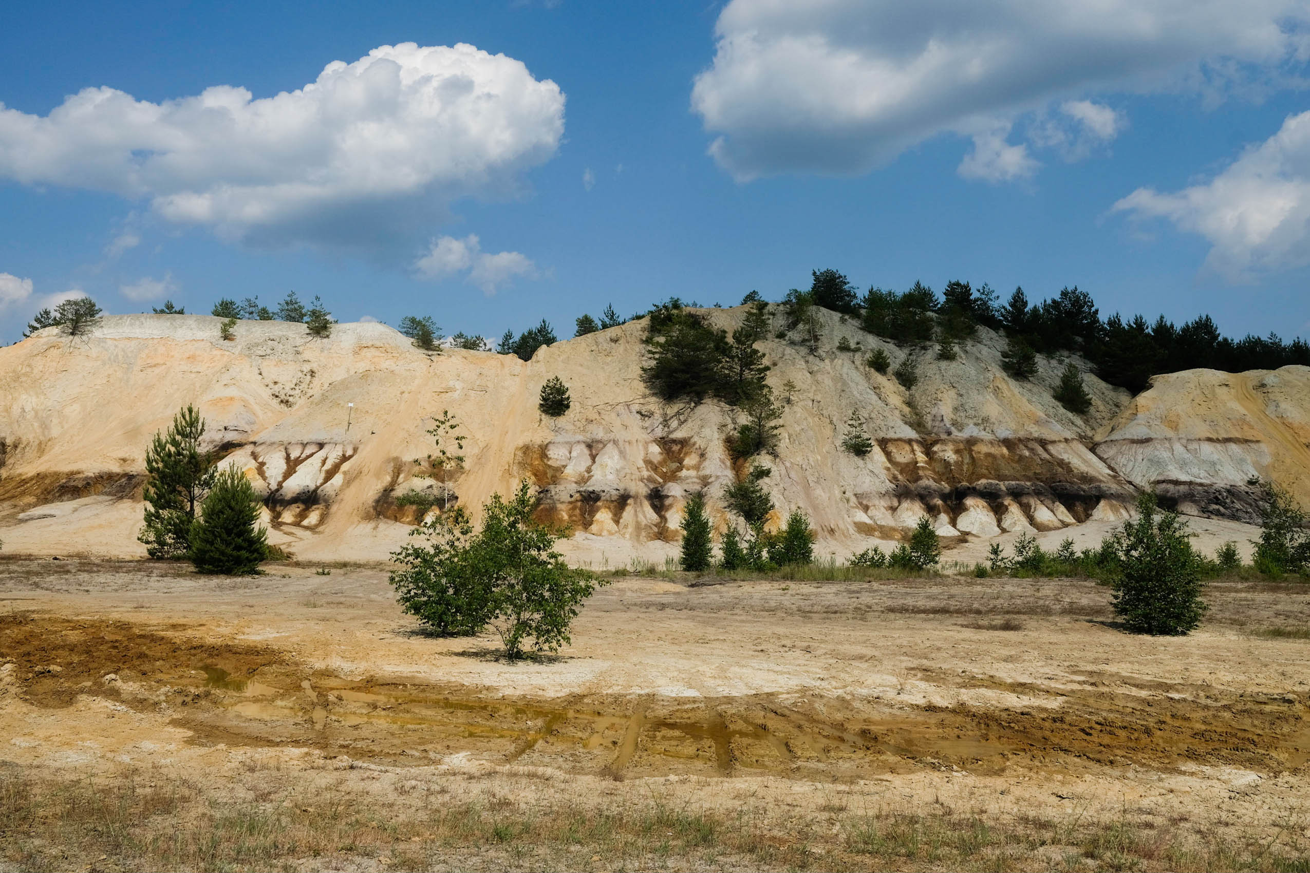
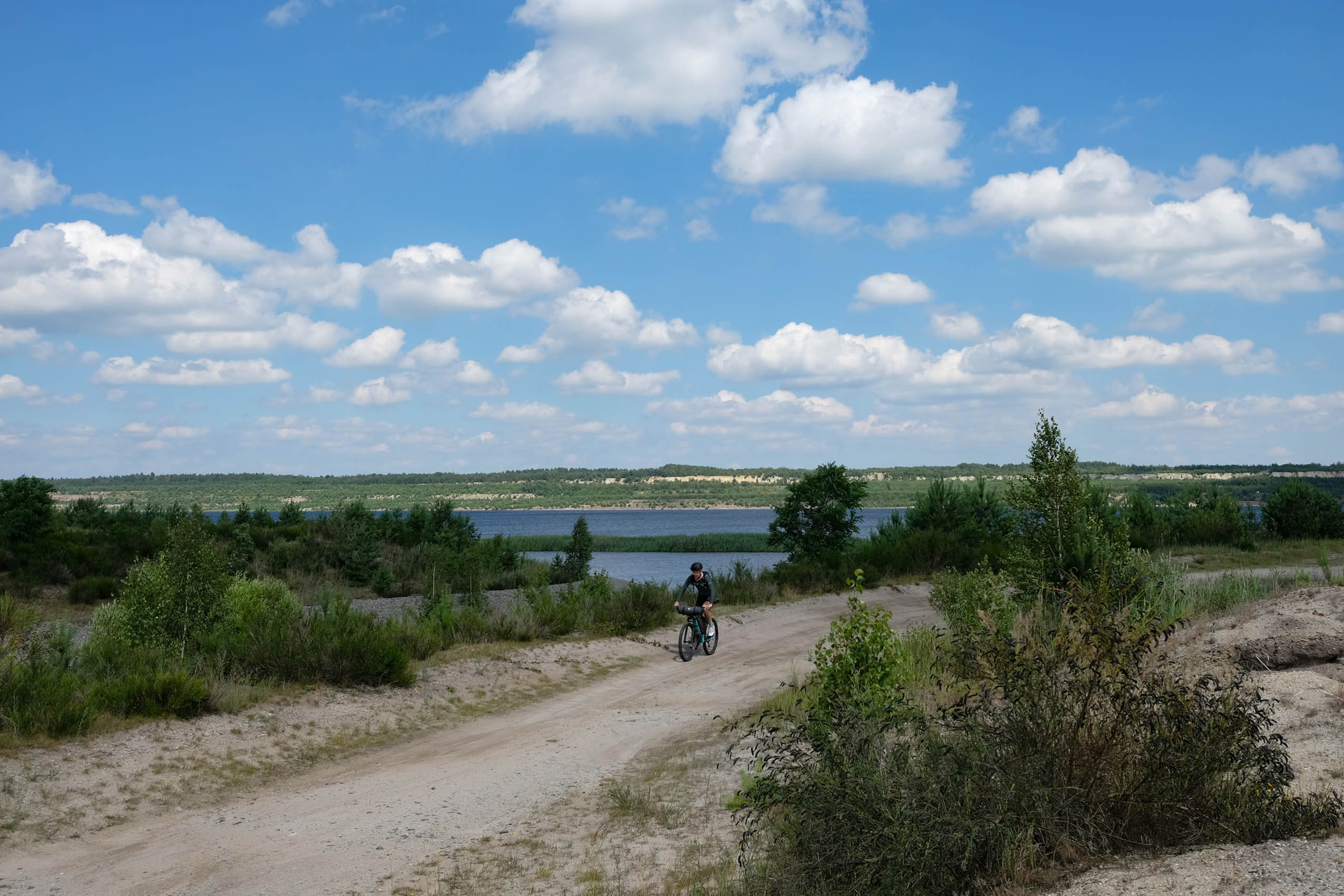
- The Lausitz Region: This is a true highlight, thanks to its unique combination of history and nature. Former open-mining areas have been transformed into vast lakes and heathlands, offering serene views and a variety of wildlife reclaiming the once-destroyed terrain. The landscape is vast, sparsely populated, and dotted with striking geological formations, adding to the area’s wild charm.
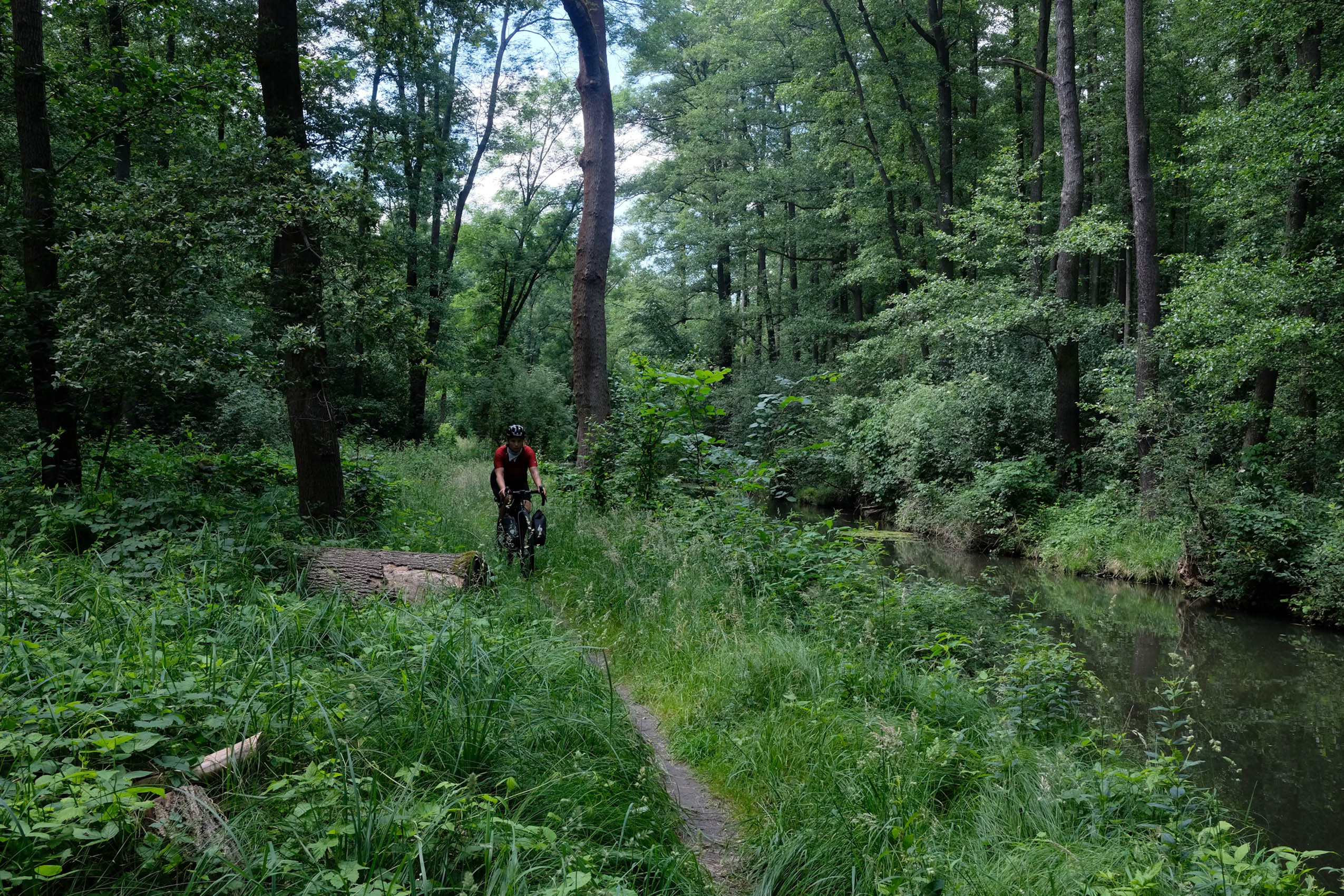
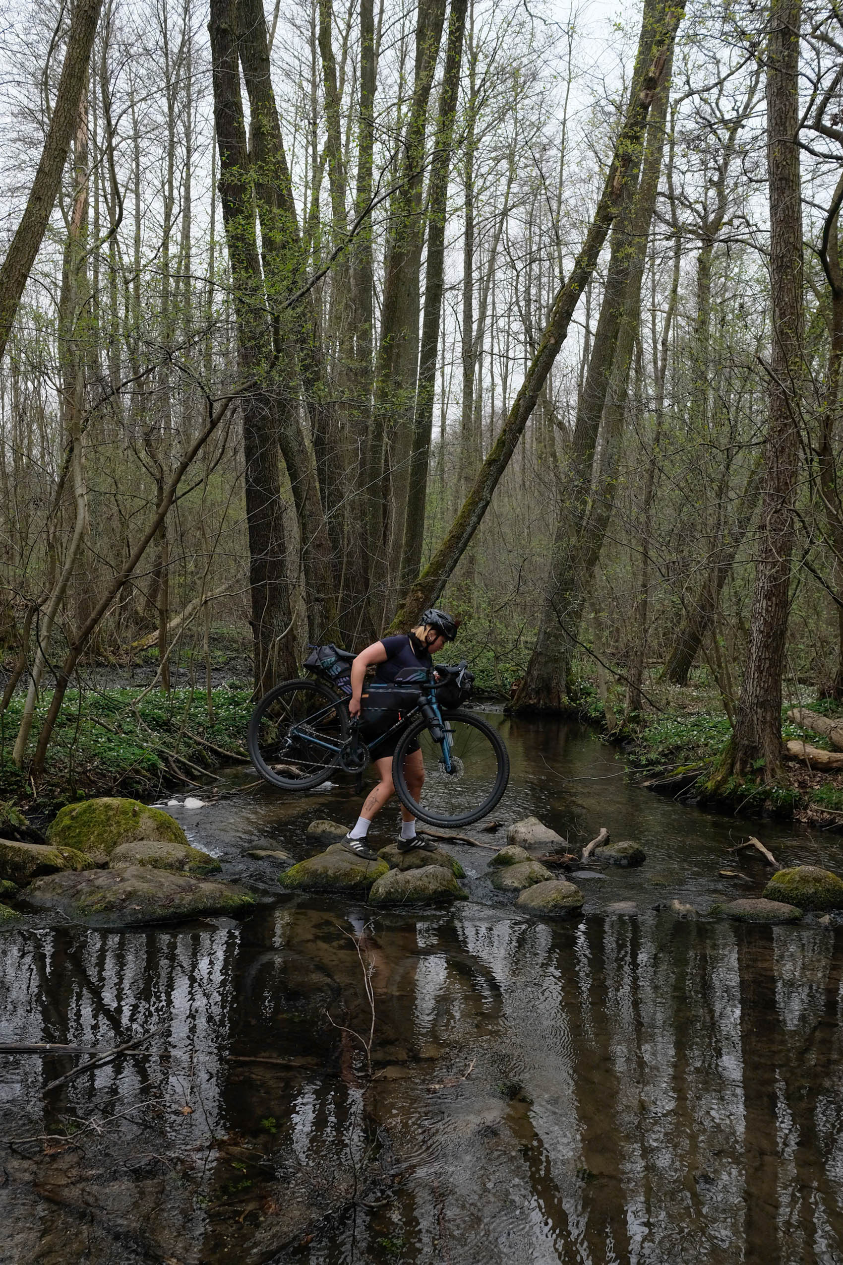
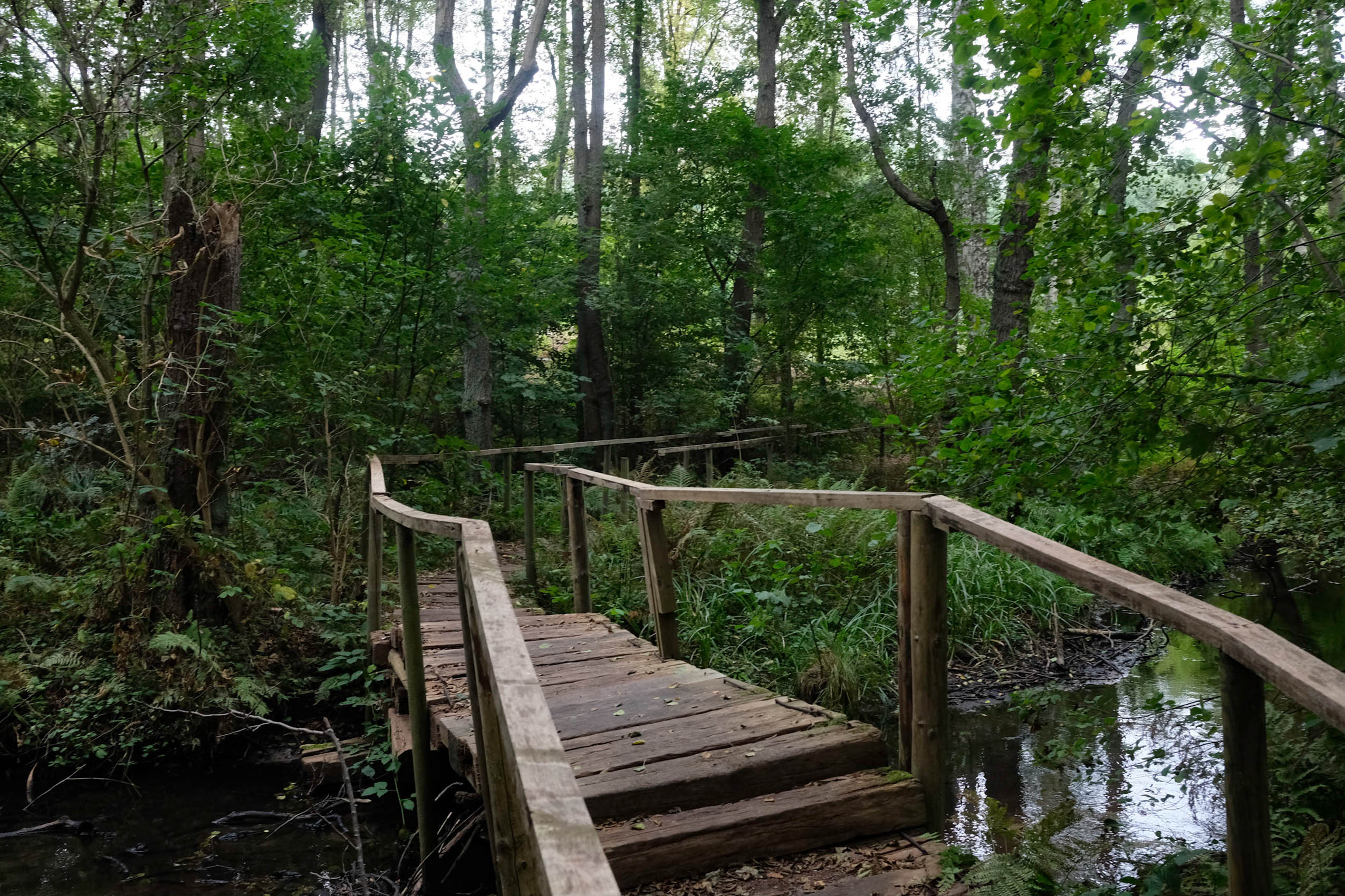
- The Spreewald: This UNESCO Biosphere Reserve is known for its extensive network of waterways, which stretch over nearly 300 kilometers, along with swamps and fenlands found throughout the region. The area is renowned for its dense, jungle-like vegetation and winding rivers, making it a popular destination for nature lovers and canoeists. This tranquil landscape, with its rich biodiversity, offers a unique glimpse into a carefully preserved natural environment.
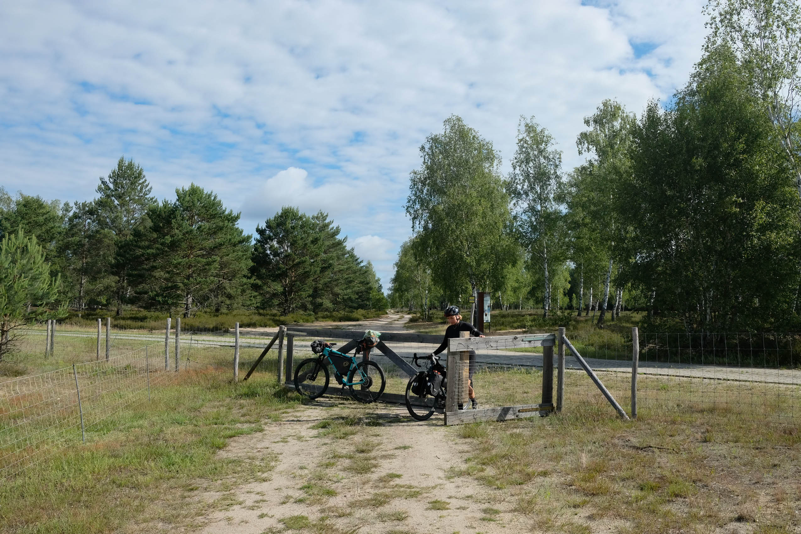
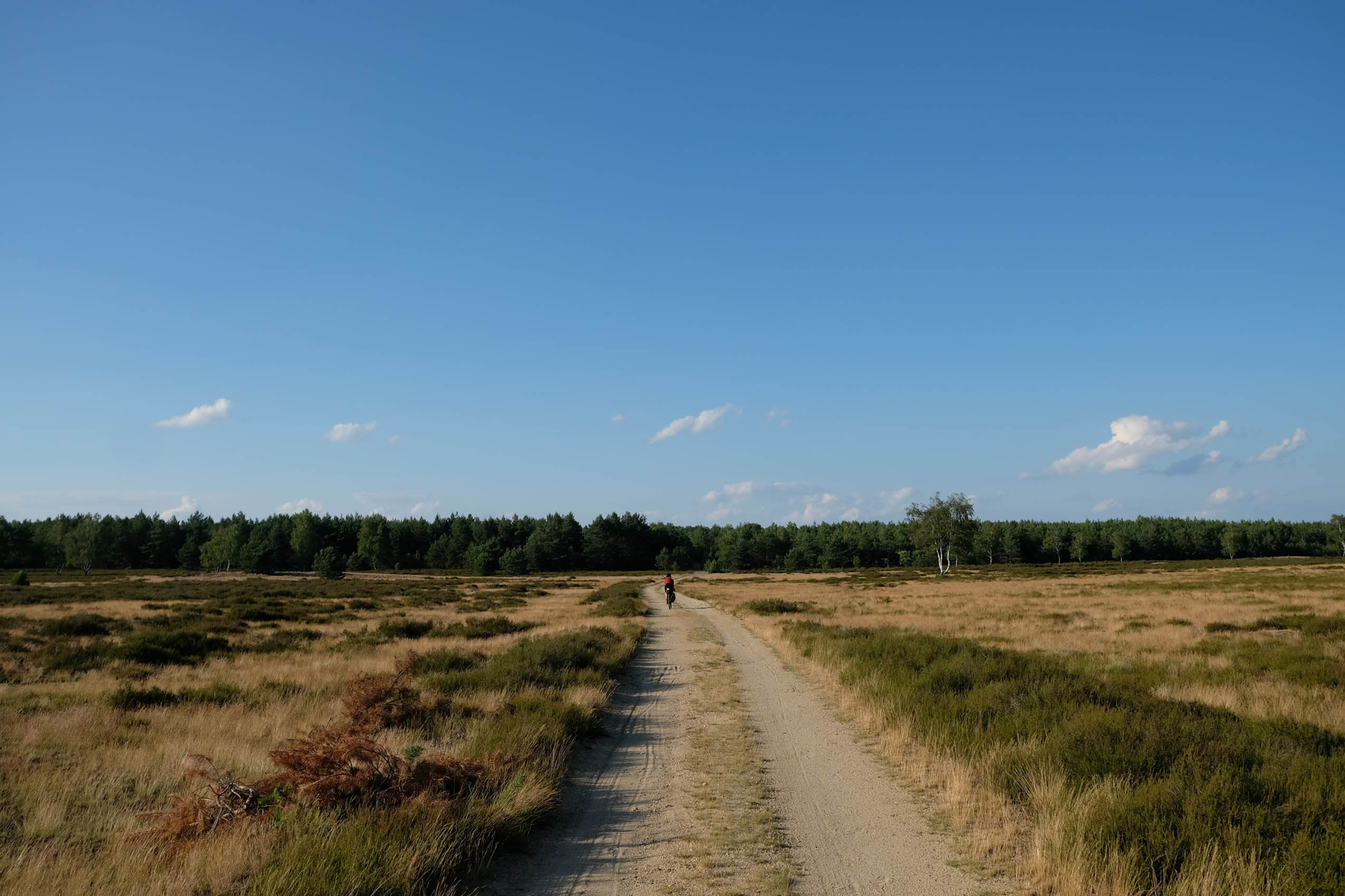
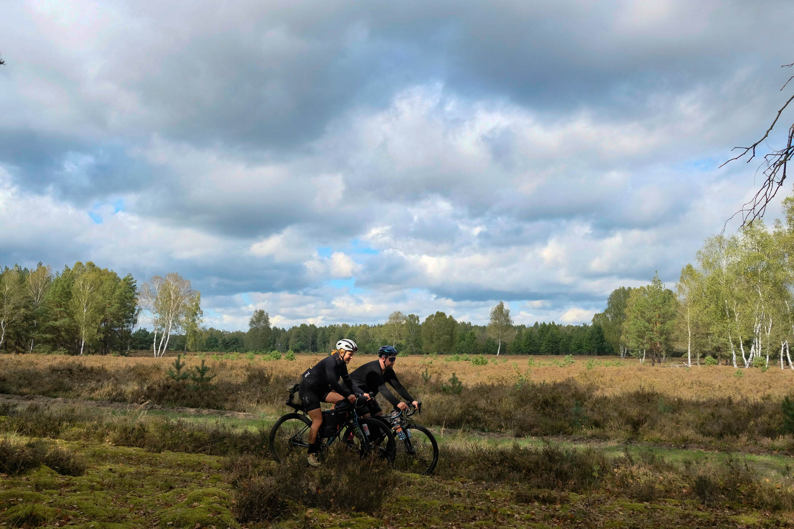
- Heathlands and nearby lost places: The many heathlands along the Brandenburg Odyssee, characterized by vast stretches of open land, offer a peaceful, refreshing change from the many forested sections of the route. These areas are rich in history, with numerous remnants of military infrastructure, lost villages, and traces of Germany’s past. As you ride through these quiet, expansive regions, you are likely to spot wolf tracks, a testament to the fauna that thrives here. The smooth gravel paths throughout provide a relaxing ride, while the contrast of the flat terrain and occasional historical sites adds depth to these remarkable sections of the route.
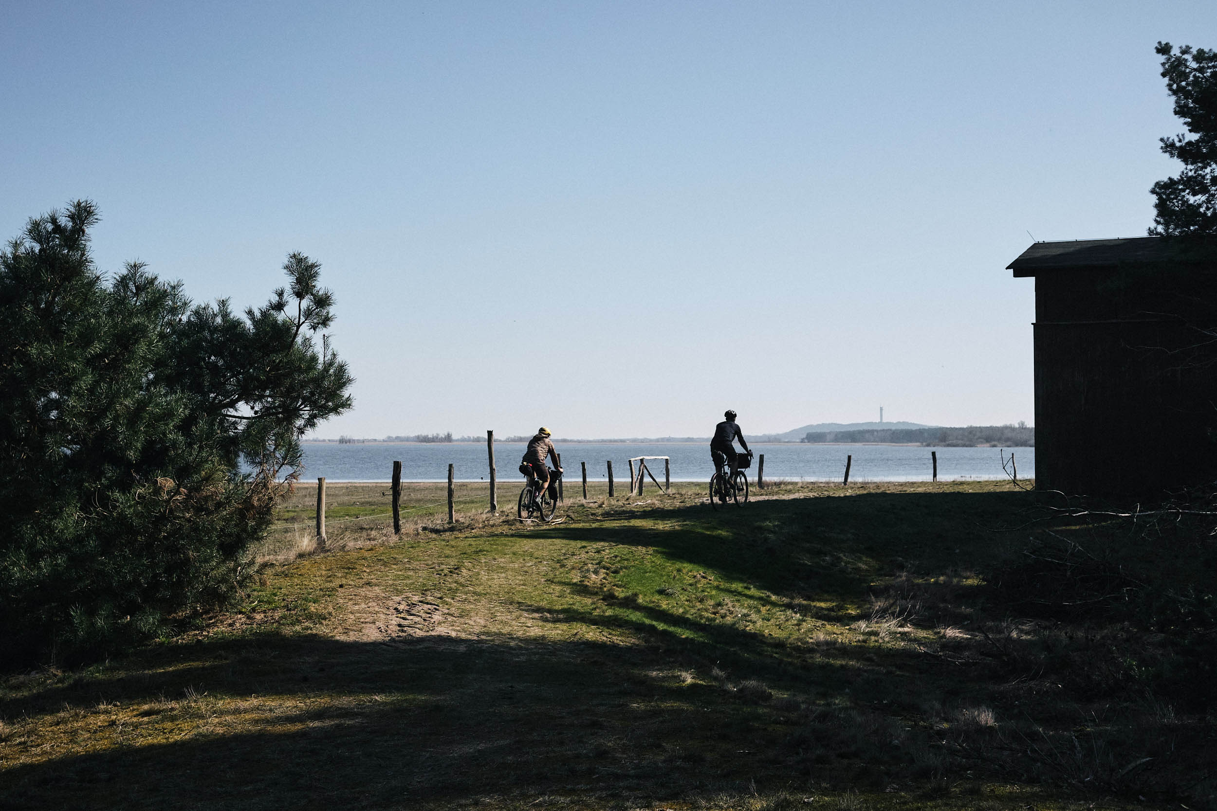
- The Naturpark Westhavelland: This is one of Brandenburg’s most important natural areas, known for its vast wetlands that provide a crucial stopover for migrating birds. It is Germany’s darkest place and offers exceptional stargazing opportunities, especially on clear nights. The park’s serene landscape is a birdwatcher’s paradise and a peaceful retreat for everyone seeking a quiet escape from the city buzz.
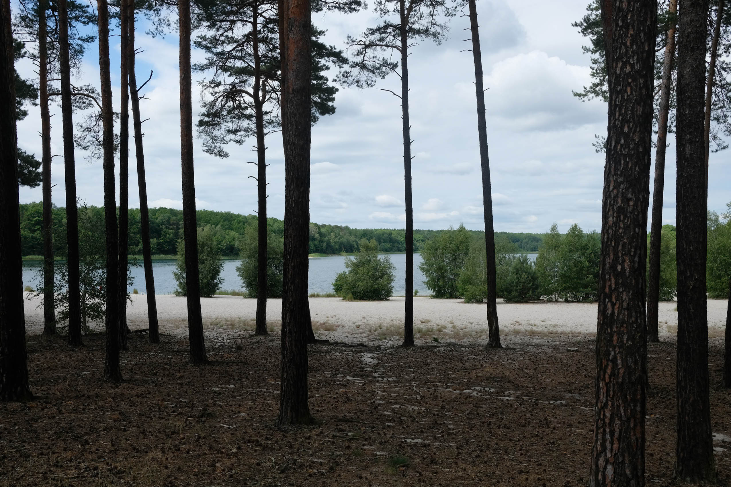
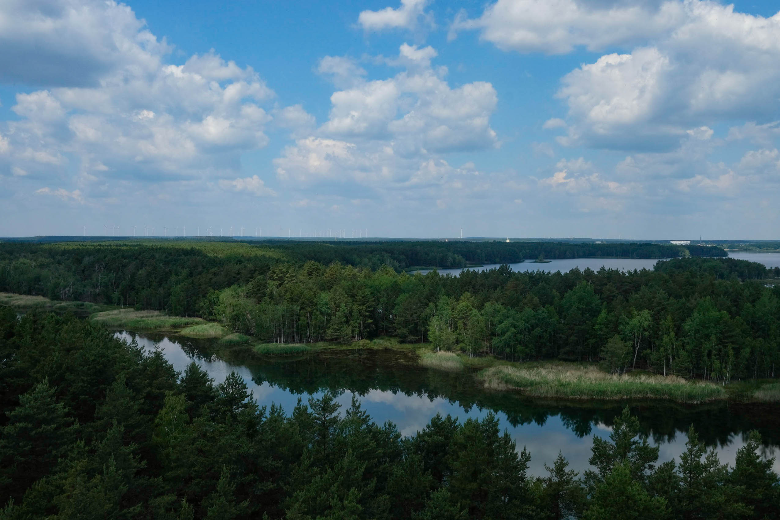
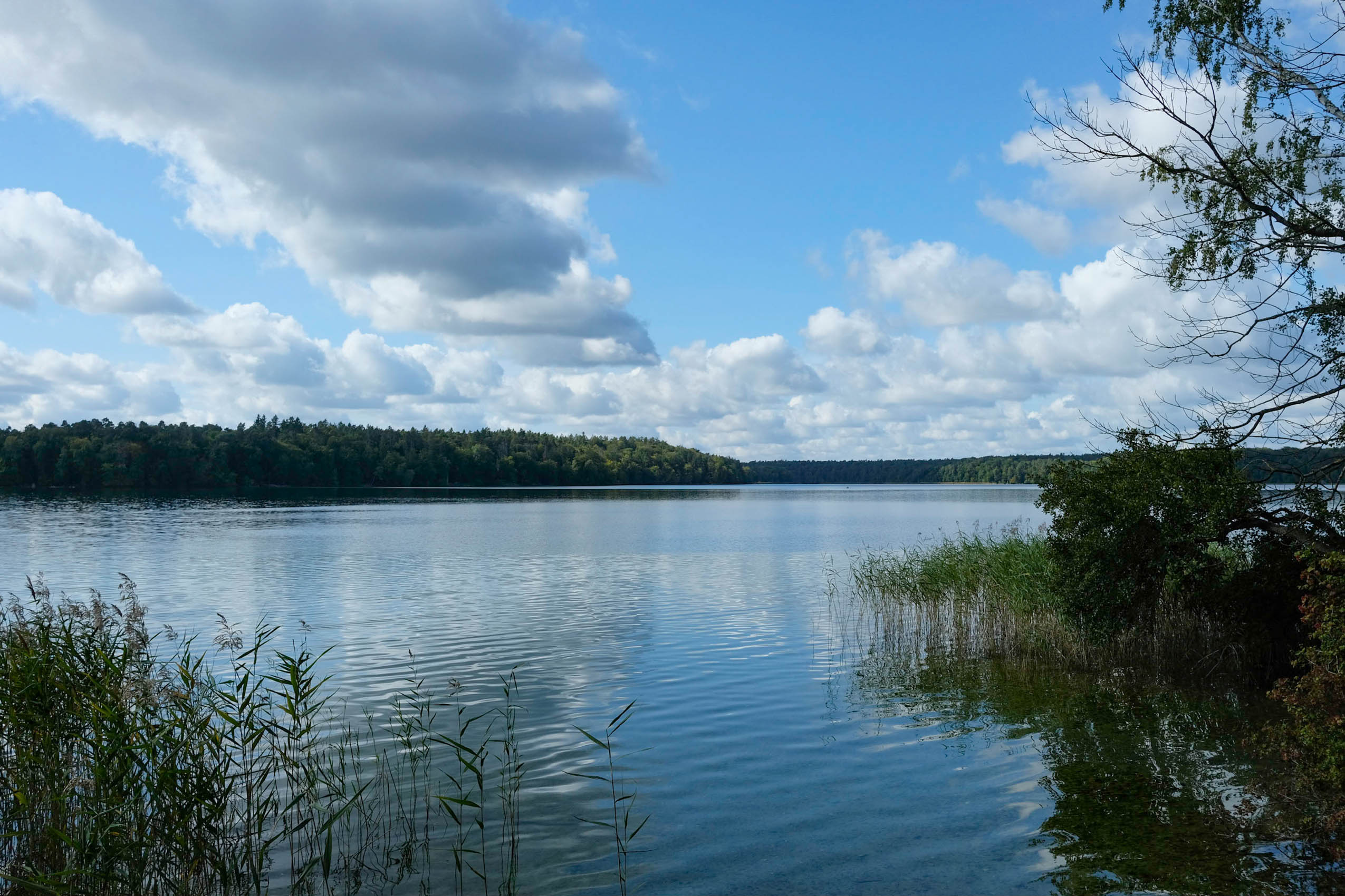
- All the pretty lakes: Cycling through Brandenburg in spring and summer is a special experience, partly because of its countless lakes, which create the perfect backdrop for long rides. The route follows over 100 rivers and lakes, where dips are possible almost everywhere. Highlights like the large Stechlinsee, known for its crystal-clear waters and unspoiled nature, along with many small forest lakes and former open-cast mines that have been transformed into beautiful lakes, add to the region’s charm. Immersing yourself in shimmering water after riding all day makes cycling here especially rewarding.
- The Märkische Schweiz: Brandenburg’s smallest and oldest nature park offers a unique cycling experience through its hilly terrain, featuring steep valleys known locally as “Kehlen.” This area presents the most challenging climbs of the route, but the effort is rewarded with rare mountain views. The region boasts an extensive network of trails, with some sections requiring riders to navigate hike-a-bike segments, adding variety and excitement to the journey.
When to go?
From spring to fall, everything will be greener, the forest will be most alive, and you will see more wildlife. The ability to take a bath in the many lakes is a must for me, and sleeping outside is more enjoyable without a tent. Taking this into account, I recommend riding the route from May (at the earliest) until the end of September.
Political Situation
As right-wing parties and politics are on the rise in the whole of Germany, specifically in the east, our nature as well as a democratic and multicultural population is under threat. Taking this into consideration, please inform yourself via the additional resources and consider a donation. If you see fascist stickers along the way, remember you can get stickers of the Brandenburg Odyssee via Instagram!
Logistics
- Getting there: If you want to start the route from the border of Berlin (the original starting point), you can get there easily by taking the S-Bahn from any station in Berlin. If you arrive by car, it’s also possible to park your car around there for a longer period of time.
- In general, most of the route is easily accessible by regional trains from Berlin or other parts of Germany. Train stations come frequently, with many more in reach by taking small detours.
What bike to take?
For me, this is more about tire choice. The route can be done on both gravel or mountain bikes. You are fine if your tires are wider than 45mm! If you are limited to 45mm and don’t have any kind of suspension, the route will, at times, be demanding and rugged but still mostly rideable!
- Legal campsites are regularly available everywhere along the route.
- Wild camping is a grey zone in Brandenburg, so please inform yourself before you go out, and stick to local regulations; and of course, Leave No Trace.
- Food won’t be a big issue as resupply points come frequently alongside the track, and all the big ones are marked on the GPX map.
- Water can be sparse on some parts of the route, so pack more than you think, especially on section 2, after the city of Eisenhüttenstadt.
- In summer, pack more water than you think you’ll need. Brandenburg can be hot and dry.
- Graveyards are your best friend, as they usually have tap water to refill your bottles!
location Berlin – Fürstenwalde
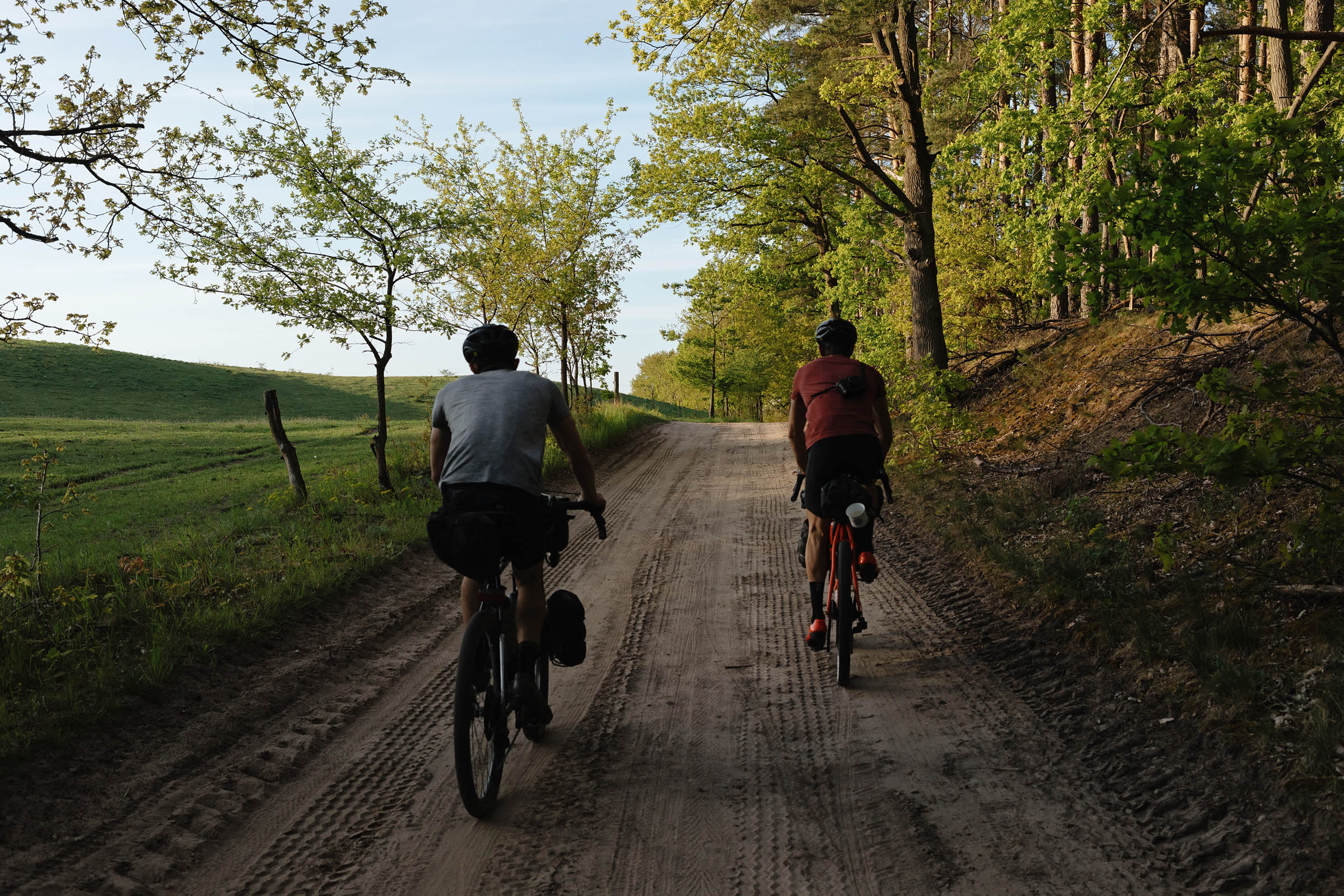
Section 1 (218km +1,280m)
Starting at Berlin’s border, this section leads through northern classics such as the Biesenthaler Becken and Finowtal, where you will be flying on prestige gravel until entering the Nonnenfließtal, from where on it gets more traily, toward Bad Freienwalde. After that, it’s a mix of gravel, rugged trails, and logging roads until you enter the Hohlwegschlucht, which marks the beginning of the Märkische Schweiz. This hilly nature reserve makes up the most climbing of the route but will reward you with rare mountain views. Once you roll into Fürstenwalde at kilometer 215, you have completed one of the tougher sections!
location Fürstenwalde – Byhleguhre
Section 2 (196km +718m)
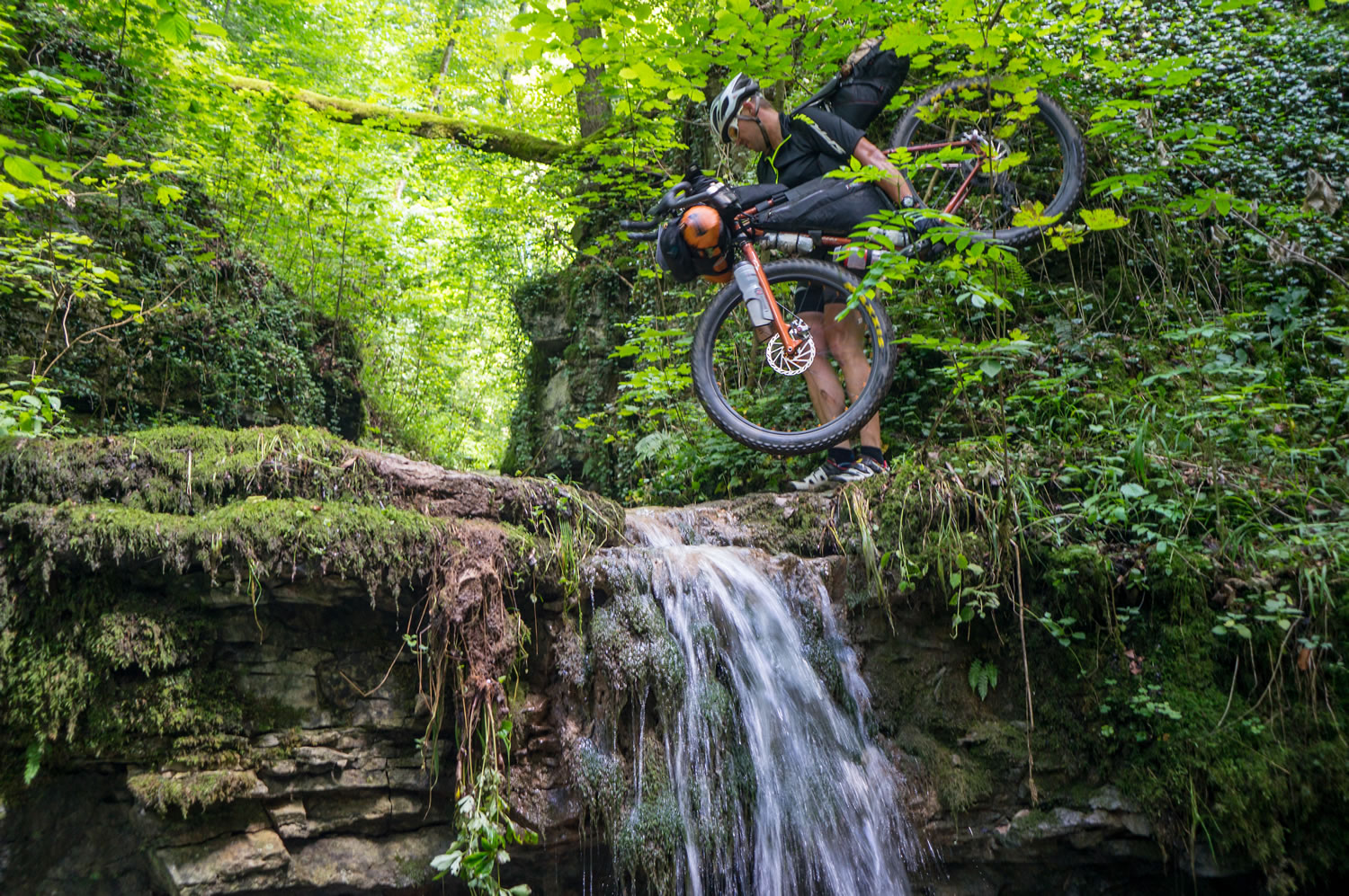
After stocking up and a last glance back from the Rauener Berge, you head east, mostly on gravel and refreshing bike paths toward the Oder River near Poland. Entering Eisenhüttenstadt, remnants of ore and coal mining, along with signs of life from the former GDR, begin to appear. They’re impressions that will accompany you across the majority of the eastern part of the route. Heading south, you pass through Schlaubetal, one of Brandenburg’s most scenic creek valleys. The Schlaubetal links wetlands and creeks with the neighboring Lieberoser Heide, Endmoräne, and Germany’s largest desert. These areas, rich in diverse flora and fauna, remain largely unexplored by tourists due to the presence of remaining ammunition. As such, they serve as prime territory for multiple wolf packs that roam the region. After the traily Schlaubetal, the ride features fast gravel mixed with logging roads.
location Byhleguhre – Raddusch
Section 3 (113km +212m)
Following dryer stretches and sparse water resupplies, Bhyleghure marks the beginning of the Błota (Sorbian: “the swamps”) and the Sorbian settlement area, home to the remaining Sorbs, a Slavic ethnic group inhabiting parts of Lusatia (Lausitz). Although Sorbian culture and language are dying out in the region, you may notice the second language written on street signs. Entering the Spreewald biosphere reserve, everywhere you look are swamps, fenlands, and nearly 300 kilometers of waterways, which are of national importance because of their positive impact on the climate and the number of species and plants it is home to. Known for its jungle-like flora and branching rivers, it’s also a popular attraction for nature lovers and canoeists. Here, you’ll ride fast on smooth gravel with occasional slab paths in between and bridges to cross over the canals.
location Raddusch – Doberlug-Kirchhain
Section 4 (177km +622m)
Section 4 highlights the vast nature reserves of the Niederlausitz. In the 19th century, open coal mining took over the region, damaging soil and nature. As of today, the Niederlausitz is undergoing a massive structural change and positive turnaround toward climate justice and nature conservation. Years of political changes have shown their impact: home to many species, the protection of these areas has allowed natural inhabitants to come back and settle here again. Mines have been filled with water, creating lakes and stunning formations. This blend of history and newly founded nature reserves offers glimpses into small natural wonders, leaving hope for nature’s resilience and recovery. Riding here is smooth, mostly on well-maintained gravel roads.
location Doberlug-Kirchhain – Brandenburg an der Havel
Section 5 (212km +810m)
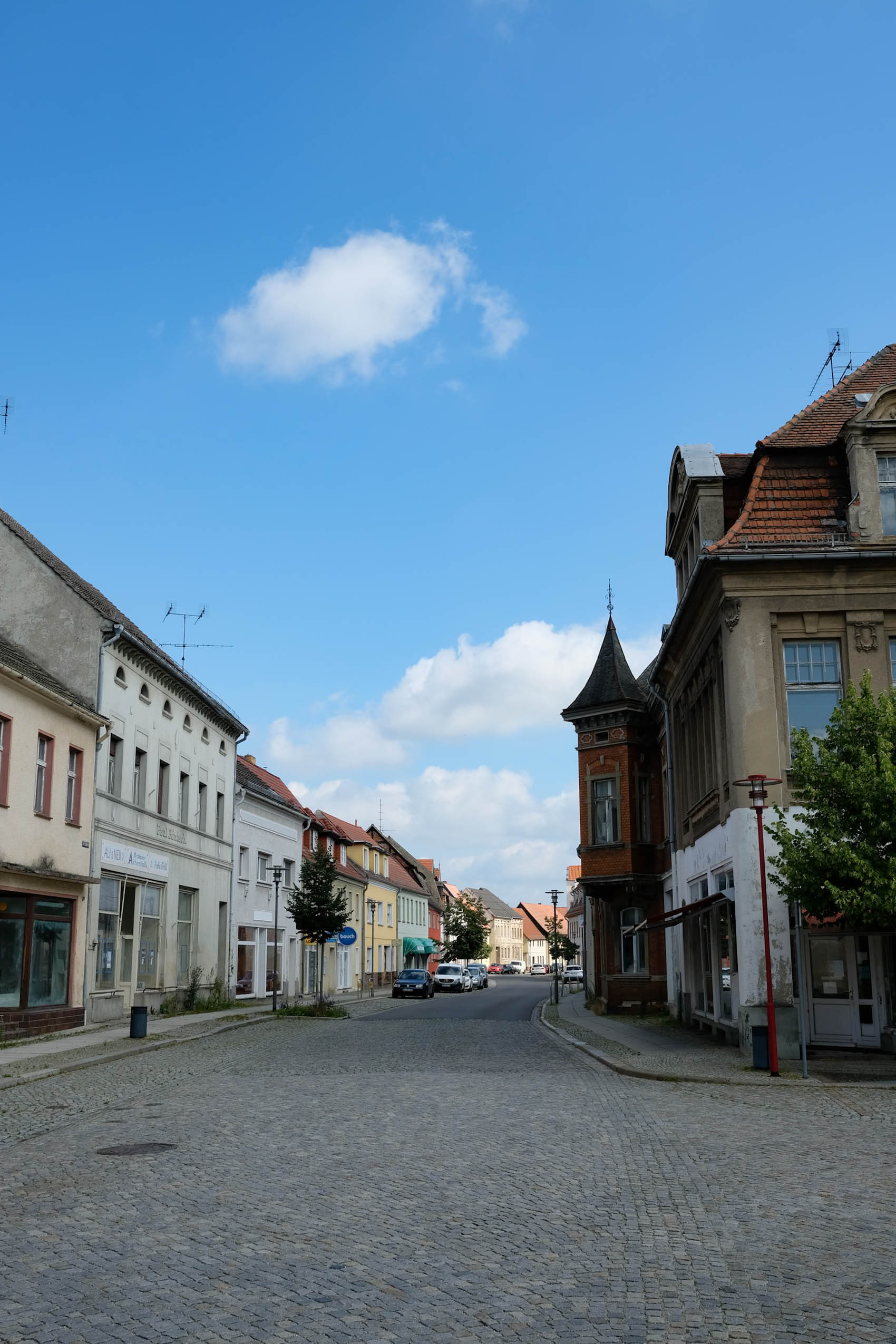
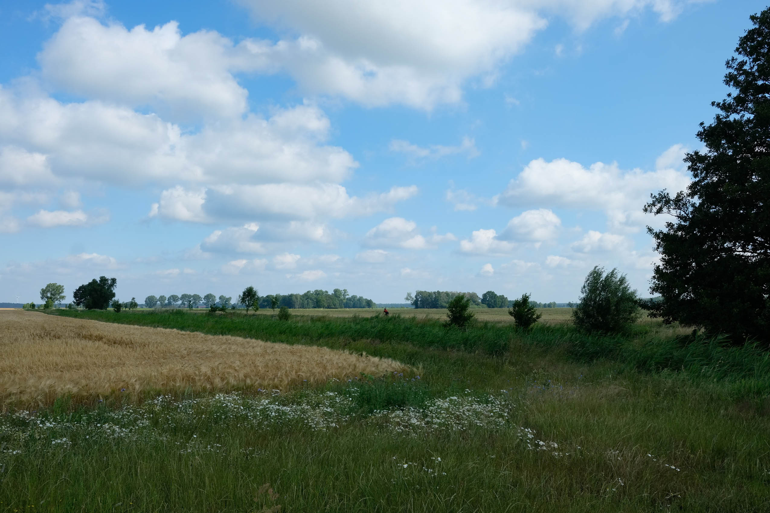
This section mainly features heathlands and pine forests all around. Scattered alongside the route you can explore traces of Germany’s fascist past and the GDR in the form of military infrastructure, airports, and even entire lost villages. Enjoy relaxed gravel riding through dense forest, peaceful heathlands, and fields. Watch out for wolf tracks—perhaps you can spot one! From Treuenbrietzen on, the surroundings get more plain, while fitting in with Brandenburg’s stereotype (flat and dull landscape) the best. Throughout, you’ll have an easy ride through flat agricultural fields and pine forests before opening a new chapter after the city of Brandenburg.
location Brandenburg an der Havel – Fürstenberg
Section 6 (248km +437m)
Leaving Brandenburg city alongside myriad lakes, section 6 again reveals the diversity of Brandenburg state. Taking you from the west to the northernmost point of the Odyssee, highlights include the Westhavelland, Brandenburg’s biggest protected area and, literally speaking, Germany’s darkest place, which is ideal for stargazing. Make sure to pass by on a clear night sky! Westhaveland’s vast and unpopulated wetlands are of great importance for Europe’s migrating birds, which is why the EU has declared it one of its most valuable bird sanctuaries. Further north, Kyritz-Ruppin’s heathlands and the crystal-clear Stechlinsee are must-see stops. Expect sandy paths mixed with fast-rolling gravel and exciting trails here and there.
location Fürstenberg – Berlin
Section 7 (127km +360m)
Slowly heading back to Berlin, the last 150 kilometers will remind you of Brandenburg’s diverse landscapes and rich history. While riding through the Schorfheide, one of the most famous and beautiful heathlands of Brandenburg, you will pass lakes, wetlands, endless forests, and yet another abandoned airport with its openly accessible hangars. River crossings, twisty trails, and more than 60 kilometers of straight, fast-rolling gravel make up for an entertaining finish stretch that will leave lasting impressions of Brandenburg.
Additional Resources
- natur-brandenburg.de: Read about nature conservation and development as well as the diversity of flora and fauna throughout the route.
- brandenburg.de: Inform yourself about the political situation as well as general information about the state.
- aktionsbuendnis-brandenburg.de: This is a political action alliance with multiple projects that fight right-wing extremism and violence in Brandenburg.
- politische-bildung-brandenburg.de: Here, you can inform yourself and learn more deeply about the political situation and history of Brandenburg.
- brandenburg.nabu.de: The NABU is Brandenburg’s biggest NGO, strongly committed to the fight for nature conservation and preservation of biodiversity. Please consider a donation!
- bund-brandenburg.de: The Bund-Brandenburg does similar things to the NABU and is especially committed to the preservation of the growing wolf population and general biodiversity. Please consider a donation!


Terms of Use: As with each bikepacking route guide published on BIKEPACKING.com, should you choose to cycle this route, do so at your own risk. Prior to setting out check current local weather, conditions, and land/road closures. While riding, obey all public and private land use restrictions and rules, carry proper safety and navigational equipment, and of course, follow the #leavenotrace guidelines. The information found herein is simply a planning resource to be used as a point of inspiration in conjunction with your own due-diligence. In spite of the fact that this route, associated GPS track (GPX and maps), and all route guidelines were prepared under diligent research by the specified contributor and/or contributors, the accuracy of such and judgement of the author is not guaranteed. BIKEPACKING.com LLC, its partners, associates, and contributors are in no way liable for personal injury, damage to personal property, or any other such situation that might happen to individual riders cycling or following this route.
Further Riding and Reading
Here are some connected/nearby routes and related reports...
Please keep the conversation civil, constructive, and inclusive, or your comment will be removed.