


Cattle Calls and Canyon Walls
Distance
225 Mi.
(362 KM)Days
3-5
% Unpaved
69%
% Singletrack
3%
% Rideable (time)
97%
Total Ascent
18,123'
(5,524 M)High Point
8,316'
(2,535 M)Difficulty (1-10)
6?
- 5Climbing Scale Moderate81 FT/MI (15 M/KM)
- 6Technical Difficulty Moderate
- 5Physical Demand Moderate
- 6Resupply & Logistics Moderate
Contributed By
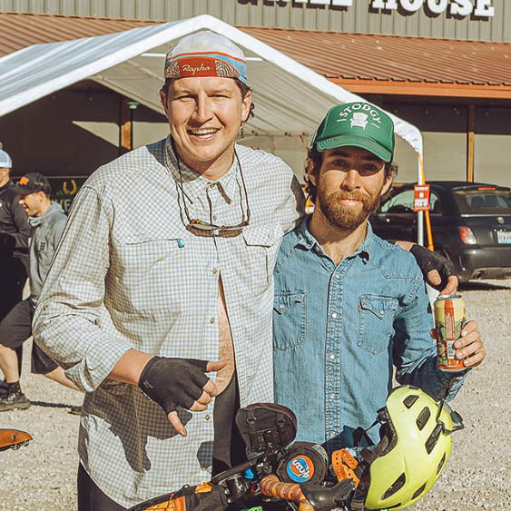
Kyle Aldridge and Jake Bleggi
Guest Contributor
Kyle Aldridge and Jake Bleggi worked together in the Flaming Gorge National Recreation Area back in 2016 and developed a strong bond with the area. These days, Kyle keeps busy enjoying all manner of human-powered activities, and Jake can be found riding around the mountains and prairies with his camera. Find them on Instagram @airtimealdridge and @jake_bleggi.
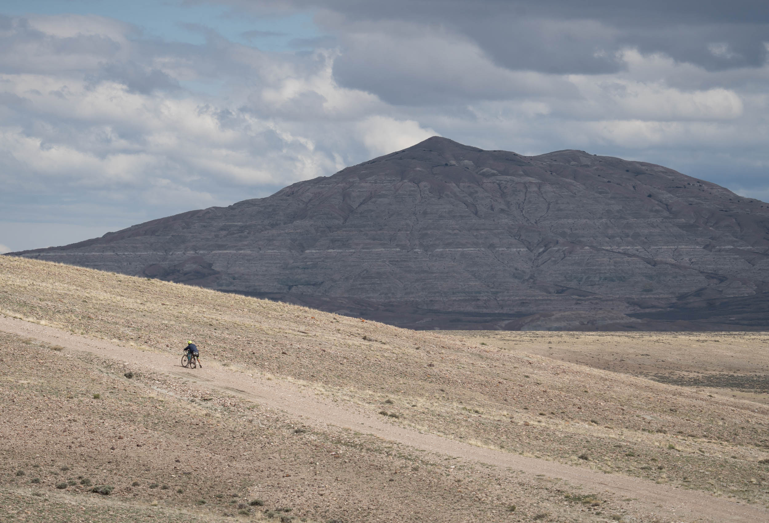
This route encapsulates the incredible countryside of northeast Utah and southwest Wyoming. This region is often overlooked because of its proximity to Utah’s national parks and Jackson Hole, Wyoming. Why would you go to the barren wasteland of Flaming Gorge National Recreation Area instead? Well, there are a handful of reasons, but one of them is that it’s where the people aren’t. The other reason is the wild contrast in terrain and scenery.
On May 24, 1869, John Wesley Powell and company set out for an extensive, treacherous, and now legendary expedition. Their goal was to document the American West’s great rivers: the Green River and the Colorado. Two days and 60 miles into their trek, the party arrived at a great canyon. Powell himself described it like this: “The river is running to the south; the mountains have an easterly and westerly trend directly athwart its course, yet it glides on in a quiet way as if it thought a mountain range no formidable obstruction. It enters the range by a flaring, brilliant red gorge. We name it Flaming Gorge.”
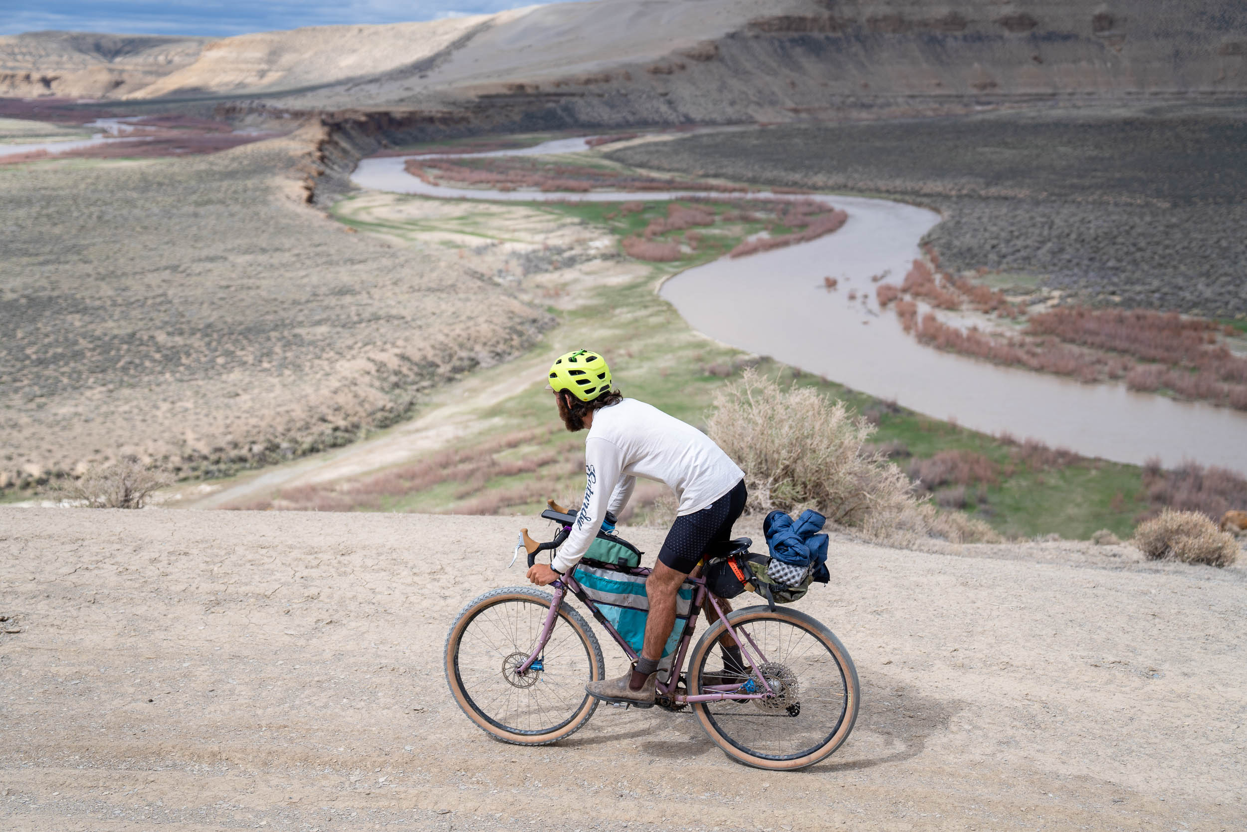
Almost a century later, the Green River was dammed, and a massive reservoir was produced that created a paradise for boaters, fishers, and other tourists. Most know the area for its world-class fly fishing. Riders have the opportunity to see the area in as intimately and simply as possible. Following the exact reverse of Powell and his team, you will start from Flaming Gorge and go up to Green River, Wyoming, where their expedition began. Coming back down the river from the west side, you’ll get breathtaking views of the great gorge, and the route will take you right over the great 502-foot Flaming Gorge Dam.
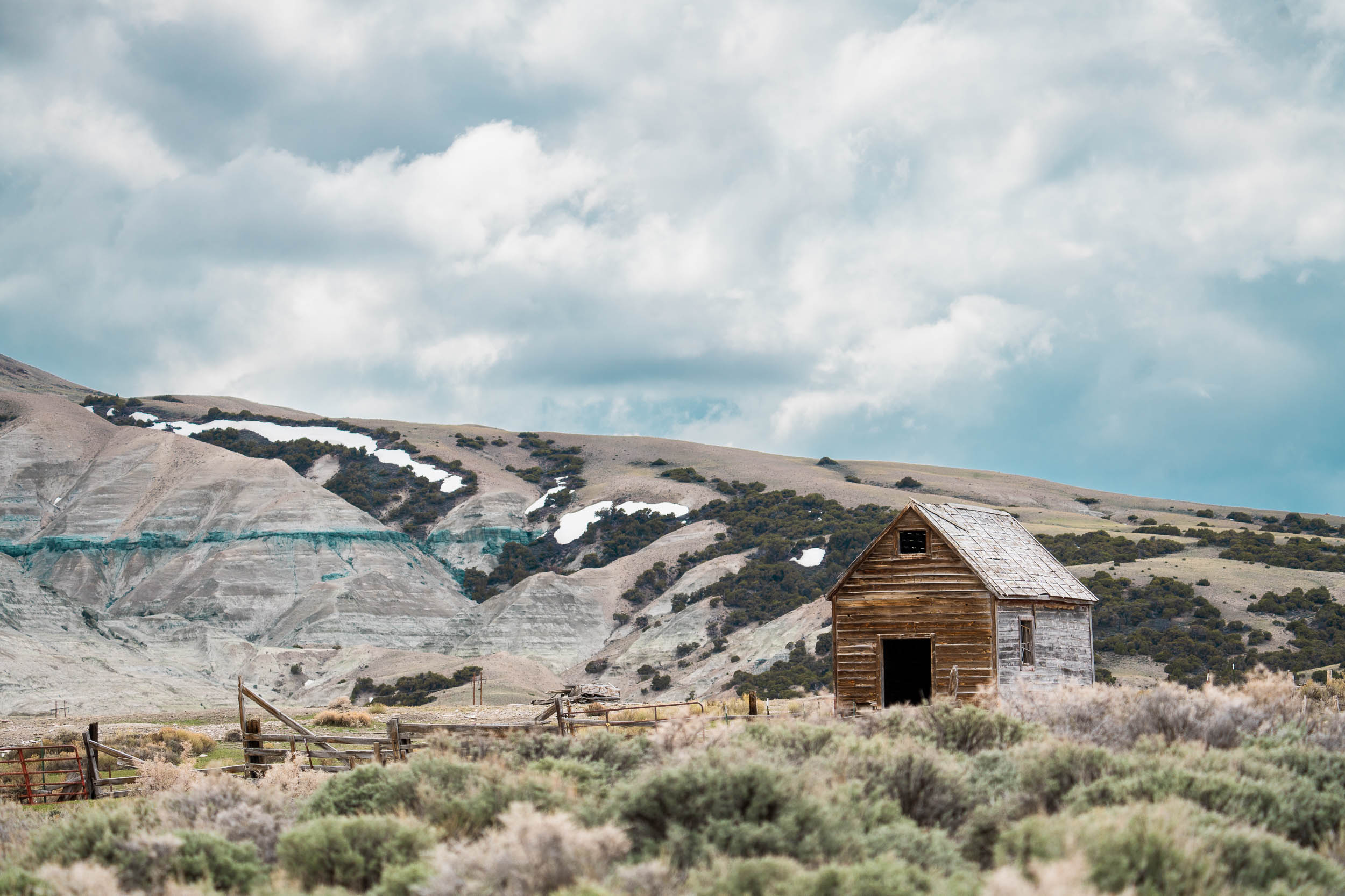
Elsewhere, riders will see the setting close to how it was in 1869. Much of the area remains untouched beyond the light paths you will use to travel. The area is rich in both Indigenous and settler history and teeming with wildlife.
Starting from the fly shops in Dutch John, Utah, where the air is filled with anticipation, you’ll be treated to a delicious breakfast, setting the perfect tone for an unforgettable trip. From here, the route sets off on Highway 181, briefly touching the edges of civilization before veering away to embrace the rugged landscapes that lie ahead.
As the highway gives way to red rock valleys and towering walls, you’ll find yourself transported to the heart of the west. These untamed landscapes inspire a feeling of being lost in a bygone era. Embrace the enchanting views of Flaming Gorge Lake, where shimmering waters mirror the surrounding beauty.
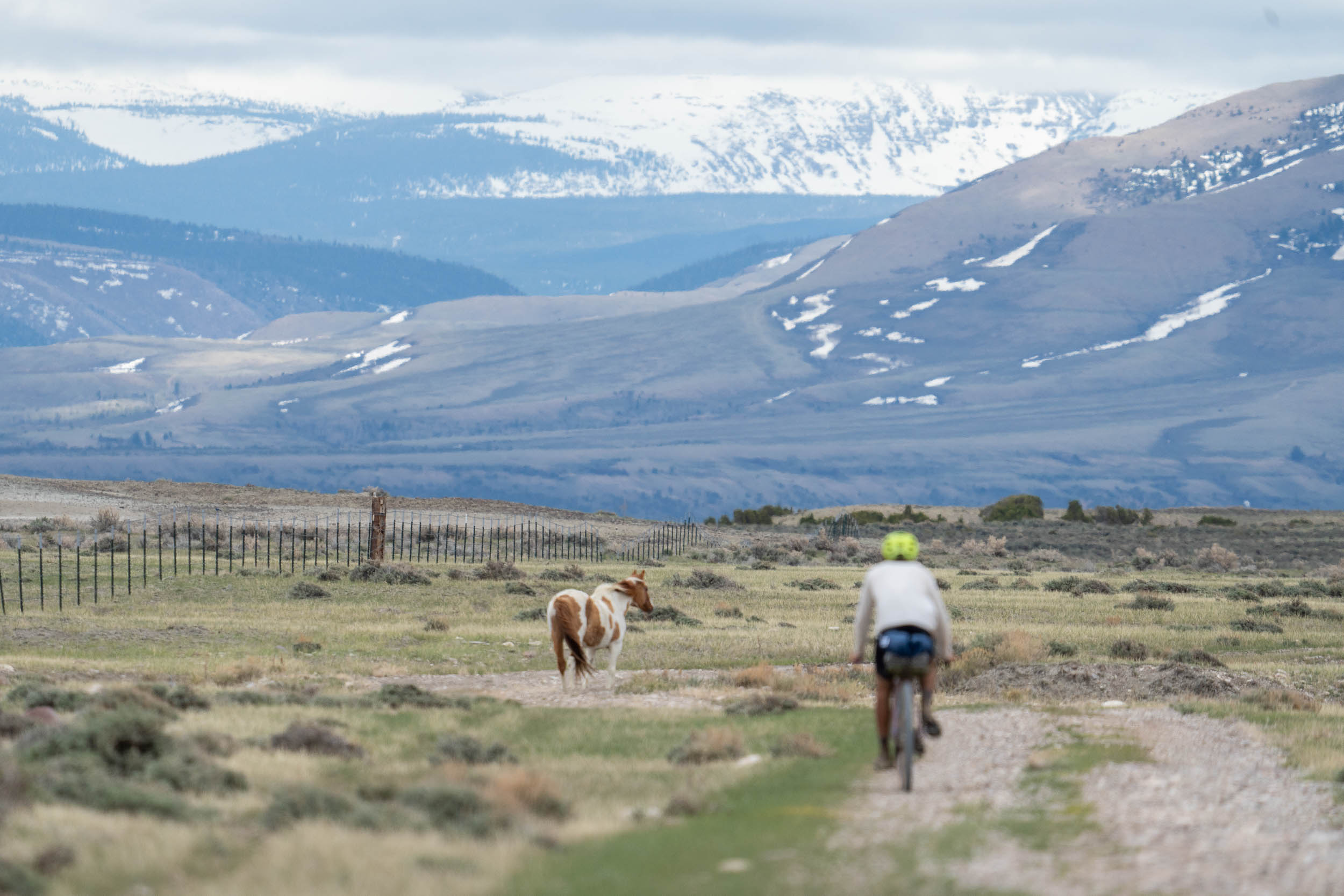
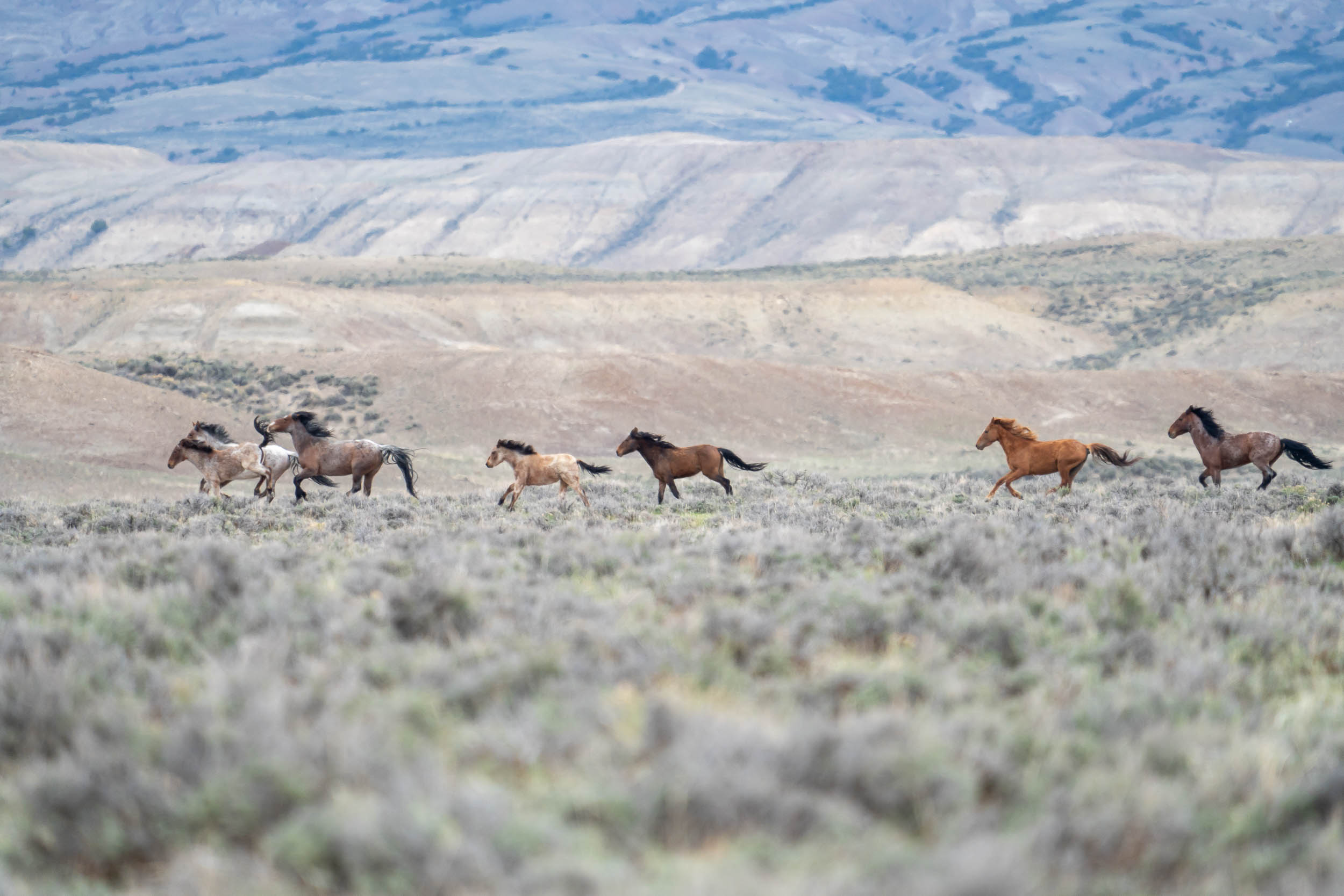
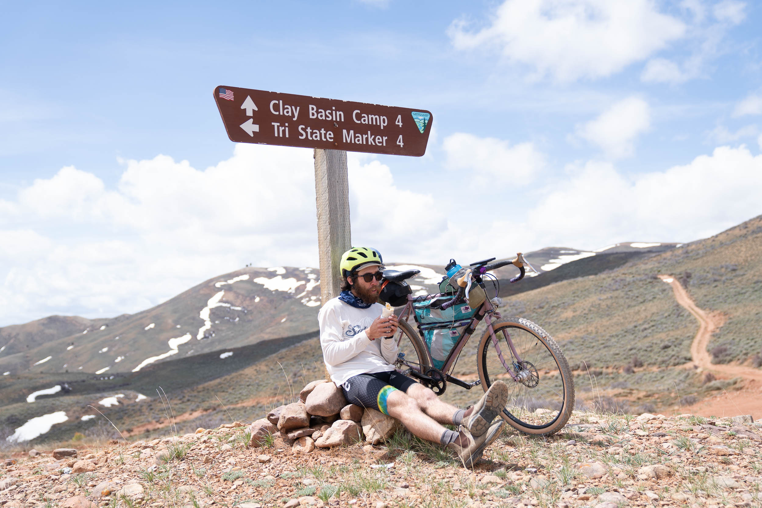
Leaving the paved roads behind, you cross the Utah/Wyoming state line and venture into Browns Park, an area rich with history. The Three Corners Road becomes your guide, leading you into a realm where pavement becomes a rarity. As you bid farewell to its smooth embrace, the route unfolds, revealing a tapestry of landscapes: vast plains dotted with sagebrush and the graceful presence of wild horses, towering pine trees, and alpine environments. Every turn reveals a new vista, inviting you to pause and drink in the panoramic beauty that stretches as far as the eye can see.
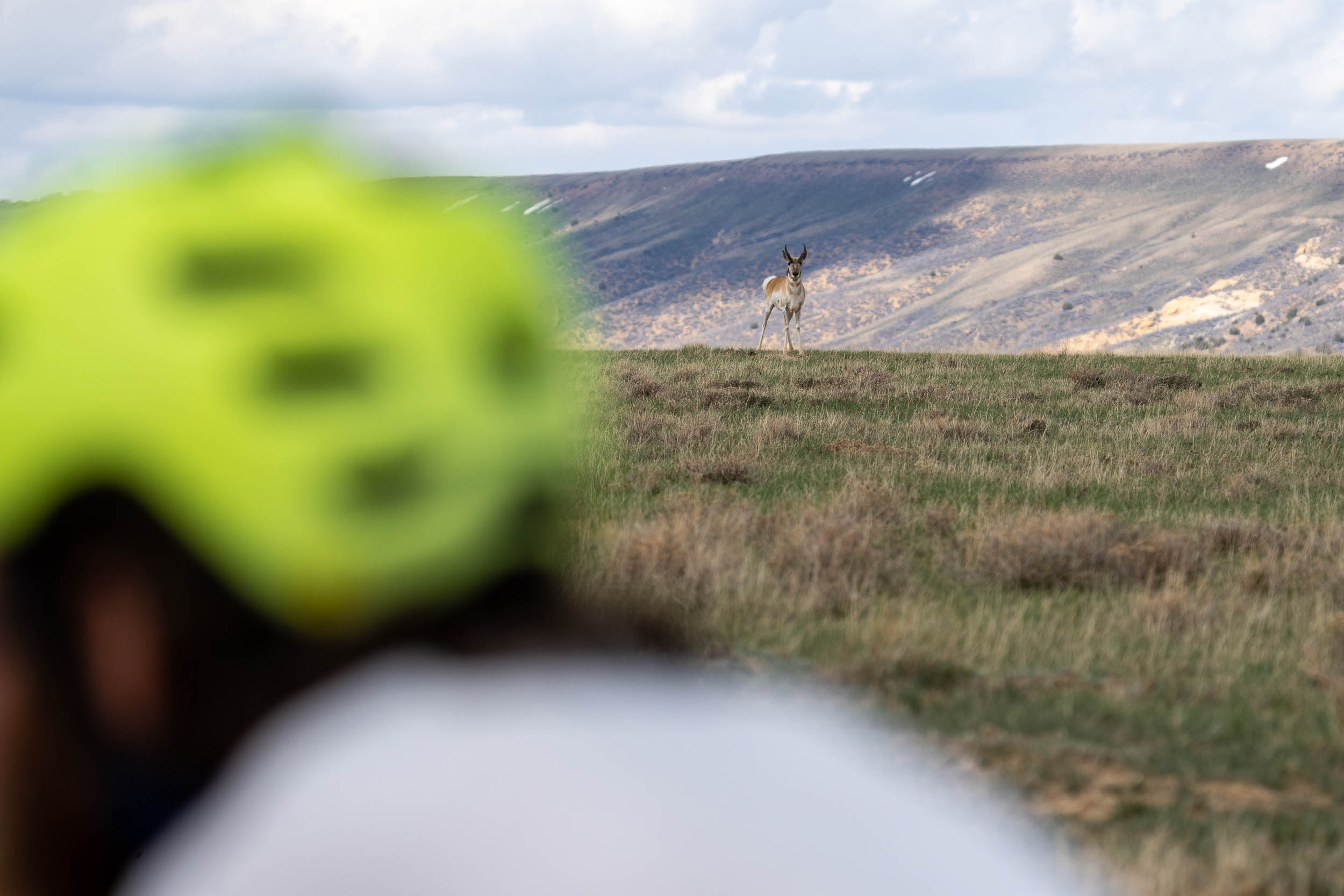
Memorable moments await around every bend as you ride side by side with wild horses and antelope. Small river crossings punctuate the journey, connecting you intimately with the natural elements and immersing you in its raw beauty. The challenges of the route are seamlessly interwoven, ensuring a balance between adventure and accessibility. Within this ebb and flow, it beckons you to rise to the occasion and discover the depths of your own strength and resilience.
As you cross back into Utah, the small town of Manila welcomes you with open arms. Here, amid the warm hospitality and tantalizing aromas of small-town cuisine, you’ll find a place to rest and replenish your spirit. Brownings, a personal favorite, embodies the essence of this welcoming community and offers a refuge to soothe weary bodies and nourish hungry souls.
In the final leg of your expedition, you’ll be captivated by the breathtaking Sheep Creek geological loop. Its stunning rock formations serve as a testament to nature’s artistry. A punchy climb guides you into the tranquil embrace of the high pines of the Uintas, where beautiful mountain brooks and babbling streams accompany you. Whether you seek the solitude of primitive campgrounds or the comforts of established ones, this remarkable terrain caters to your every need. And as the route reaches its peaks, an awe-inspiring overlook awaits, rewarding you with a glimpse of the landscape’s grandeur. The journey concludes with a thrilling six-mile section of technical singletrack, an exhilarating finale that leaves you breathless and wanting more.
Route Difficulty
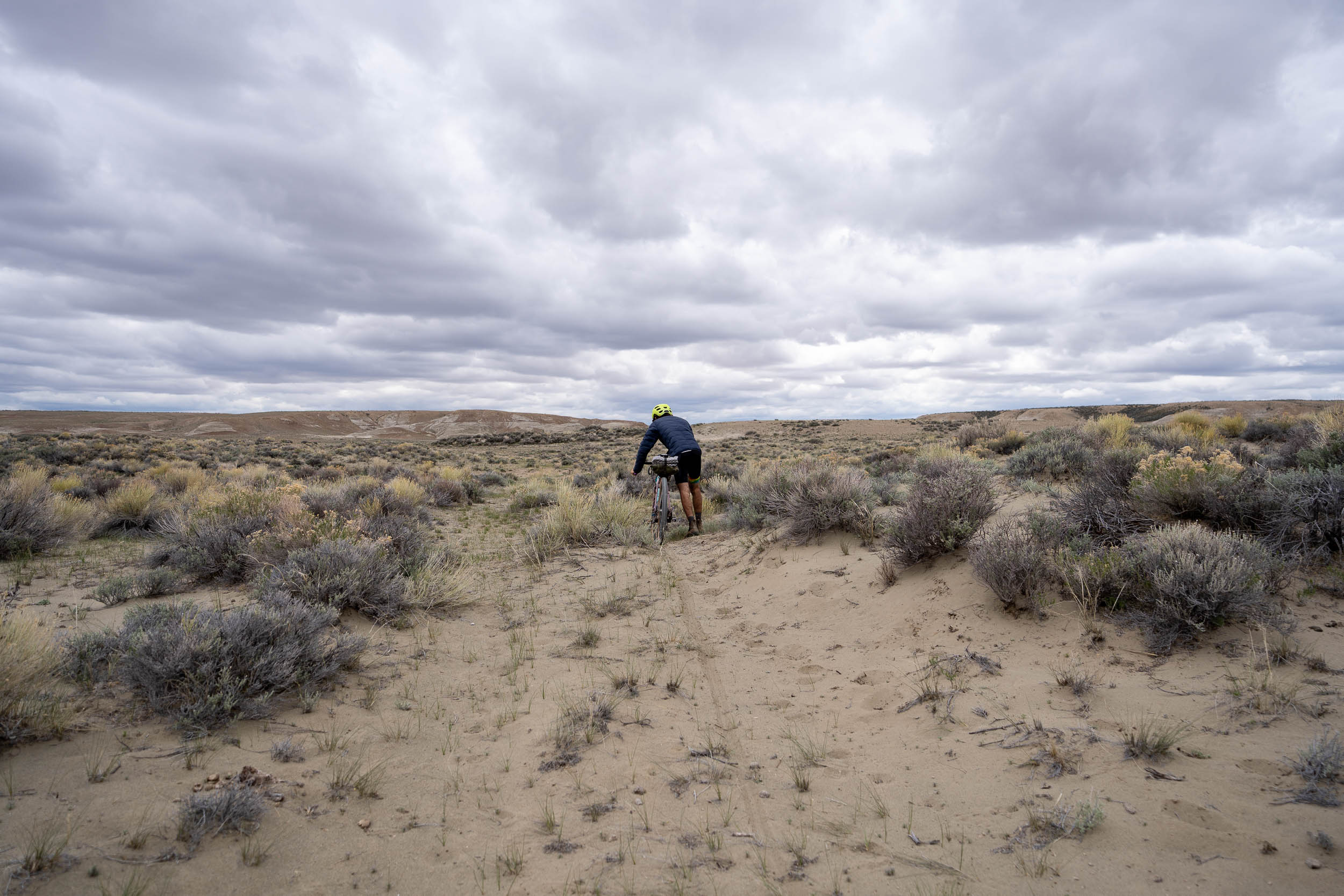
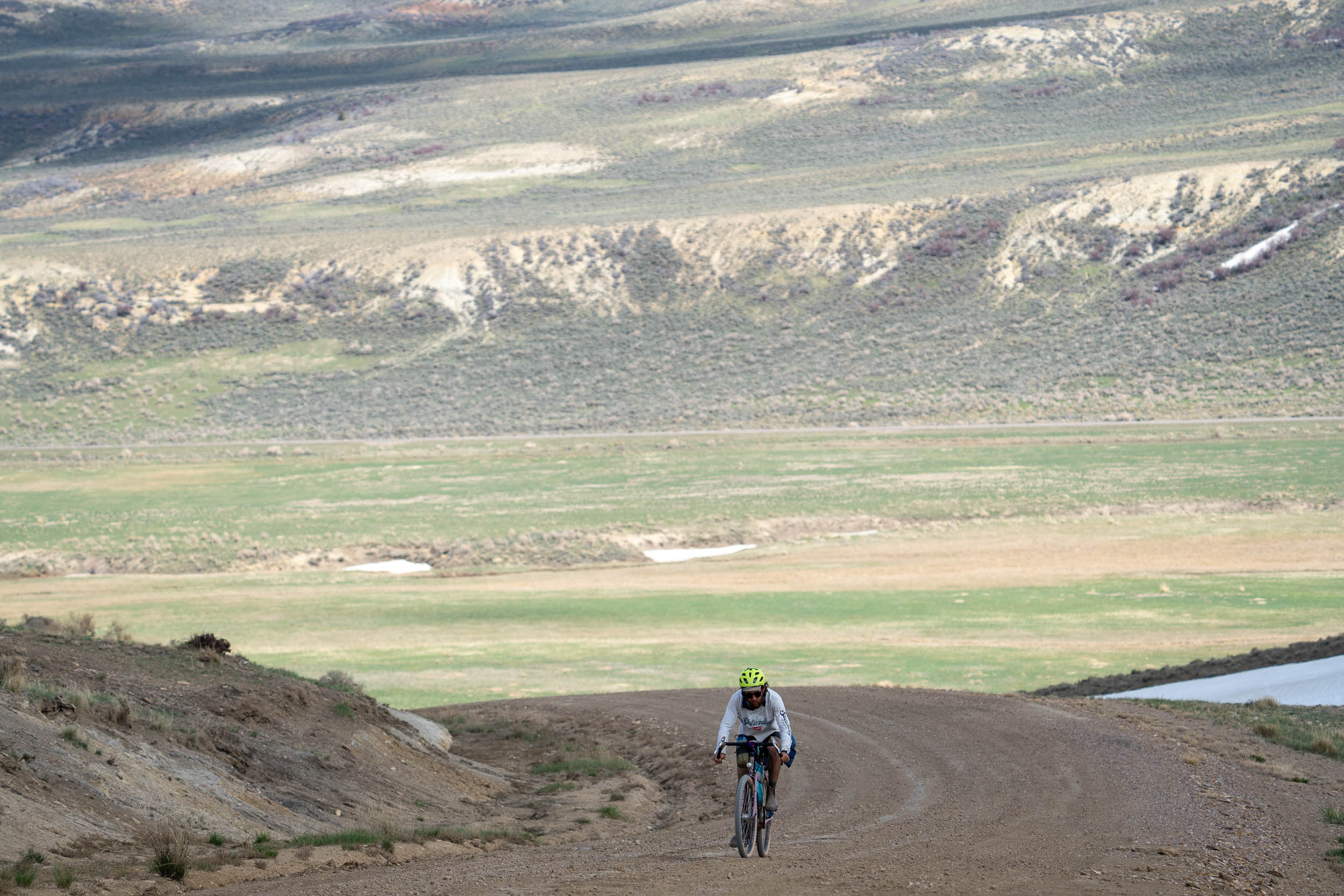
Cattle Calls and Canyon Walls offers a moderate difficulty level, with smooth dirt roads and two tracks making up the majority of the route. However, there are hike-a-bike sections, sandy areas, and singletrack to navigate. It is not advisable to ride in rainy conditions as the clay and silt roads can become treacherous.
While the route is remote, it doesn’t push your physical limits as much as other routes. With three major resupply points along the way, you can keep your bike light. Water sources are available for filtering, and since it’s a loop, logistics mainly involve preparing for long stretches of solitude.
The route can take you away from civilization for up to 100 miles at a time, so be prepared for that aspect. Overall, this bike ride presents a moderate challenge, with a mix of terrain and the need for self-sufficiency during extended periods of isolation.
The physical difficulty of this route is not a major part of its challenge. Like most routes, the faster you try to complete it, the more physically demanding it becomes. This route includes some very punch and long climbs that will push you. Weather is the largest variable. You also have to take into account the time of year because some streams that run in the spring become dry in the summer and fall.
Route Development: In 2016, both of us moved to the Flaming Gorge National Recreation Area for work and quickly fell in love with the area. We have since moved away but find ourselves being drawn back. We decided that it was because we needed to share the area with more people. As our interests moved from fly fishing to cycling, we decided we would create a bikepacking route that navigates the diverse and beautiful landscape that makes up Flaming Gorge.


Submit Route Alert
As the leading creator and publisher of bikepacking routes, BIKEPACKING.com endeavors to maintain, improve, and advocate for our growing network of bikepacking routes all over the world. As such, our editorial team, route creators, and Route Stewards serve as mediators for route improvements and opportunities for connectivity, conservation, and community growth around these routes. To facilitate these efforts, we rely on our Bikepacking Collective and the greater bikepacking community to call attention to critical issues and opportunities that are discovered while riding these routes. If you have a vital issue or opportunity regarding this route that pertains to one of the subjects below, please let us know:
Highlights
Must Know
Camping
Food/H2O
Trail Notes
Resources
- Panoramic views: with multiple climbs that take you up high, the panoramic views are plentiful and beautiful.
- Red rock canyons: if you’ve never experienced the red sandstone of the west, you’re in for a treat. A third of this route ebbs and flows through incredible red rock canyons and valleys.
- Wild horses: while there’s no guarantee, the odds are pretty high that you will see wild horses roaming the western Wyoming side of this route.
- Cattle: money-back guarantee you’ll see ’em.
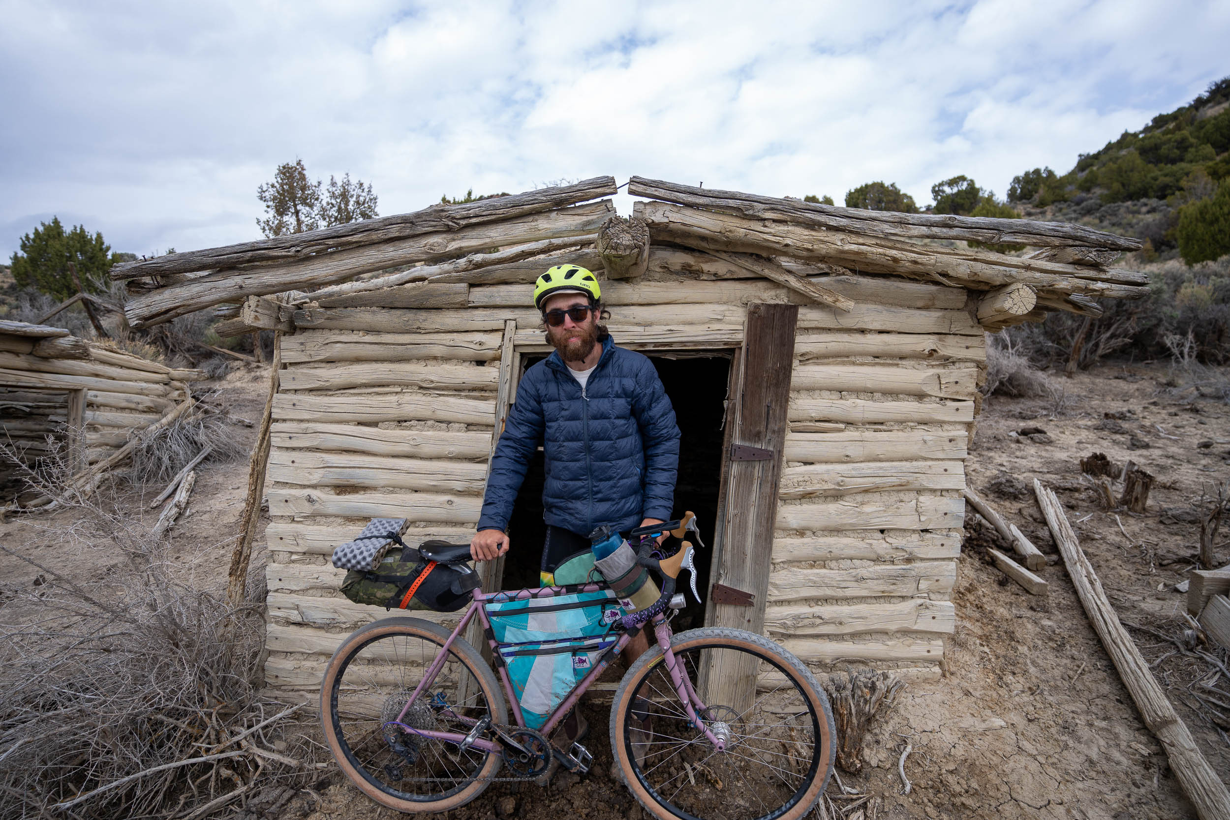
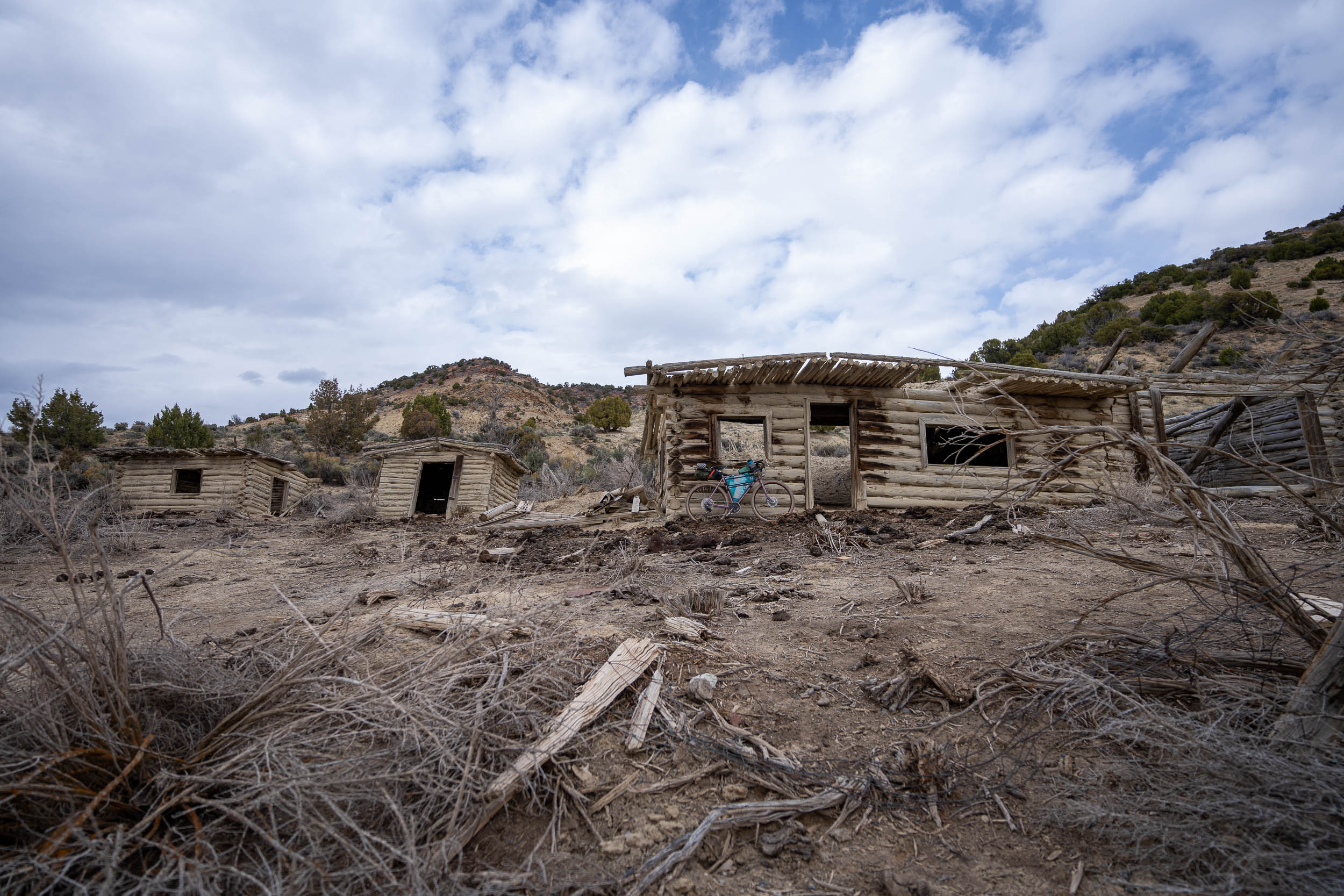
- Settler homes: many homes from the early 1900s are still scattered across these parts.
- Incredible rivers: you’ll experience the Green River, Black Forks River, and many runoff streams.
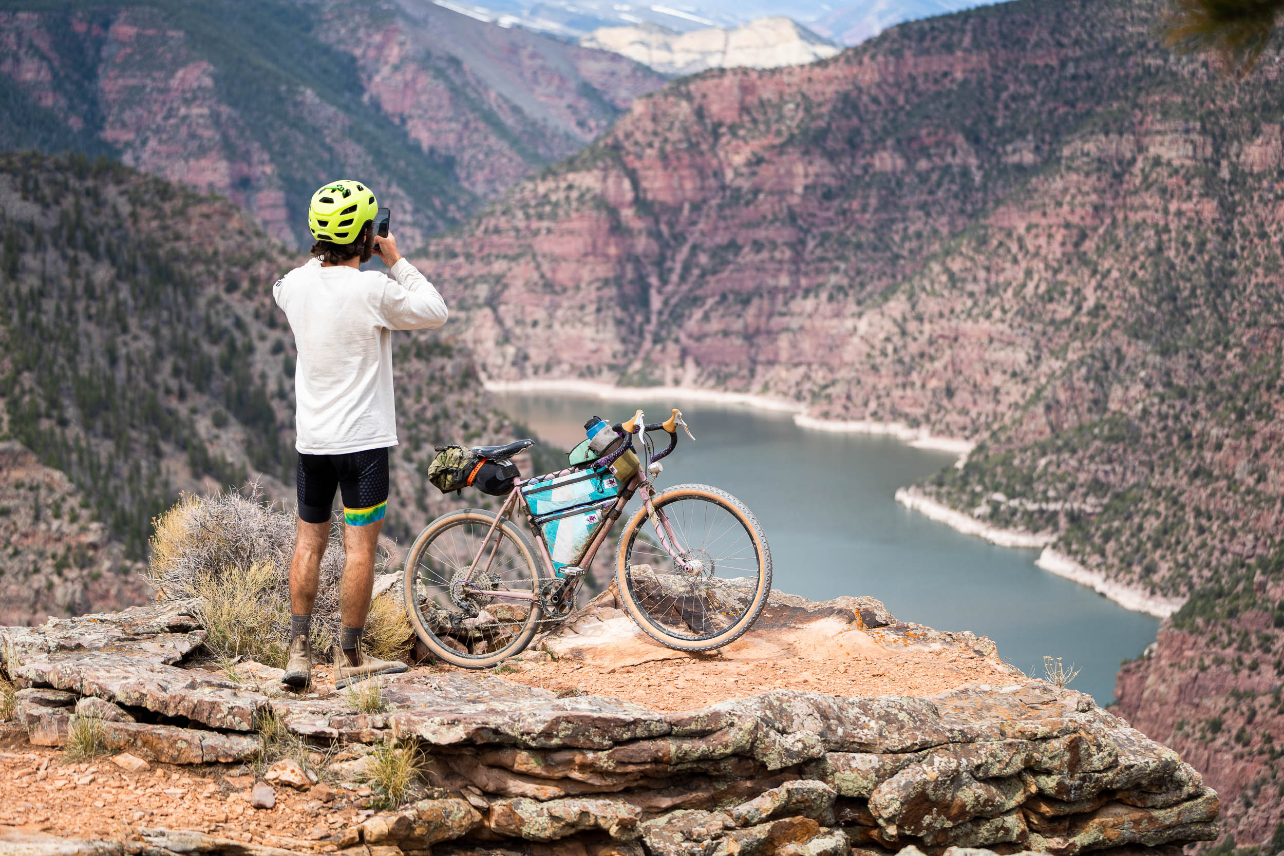
- Flaming Gorge Reservoir: you’ll understand why this is a highlight when youre standing 2,000 feet above the reservoir at Red Canyon Visitors’ Center.
- Geological Loop: Sheep Creek Geological Loop is a geologist’s dream.
- Flaming Gorge Dam: if you’ve never ridden your bike across a 502-foot-tall dam, here’s your chance!
- The route is best ridden in the spring or fall.
- It’s best to download the route due to the lack of service in the area and because it can be overgrown depending on the season, and you will likely have to reference it regularly.
- This is a high desert environment, so please pay attention to temperature fluctuations between day and night.
- The majority of the route is clay and silt, so don’t ride in the rain.
- There are multiple river crossings. Have a plan for them!
- Please pay attention to the weather, as it can make or break your experience out on the route.
- The ideal bike to ride this on would be a gravel bike with 2.25″ tires or a hardtail with good climbing gears.
- Around 90% of the route is on Bureau of Land Management (BLM) land.
- There are some large chain hotels to stay in Green River.
- Brownings offers both food and lodging in Manila, Utah.
- Trout Creek Flies and Flaming Gorge Resort both offer food and lodging in Dutch John, Utah.
- The route is filled with primitive and paid campsites.
- Make sure you fill your water bottles at Trout Creek. The water resupply spots for Dutch John to Green River are sparse and unreliable.
- Green River is a moderate-sized town, so there are plenty of resupply resources there.
- Brownings in Manila is a must.
- Red Canyon Lodge offers high-class dining and live music with outdoor seating.
- Flaming Gorge Resort is a good place for a beer and a bite to eat when starting or finishing the route, and it also makes for a great starting point.
locationDutch John to Green River
Section 1
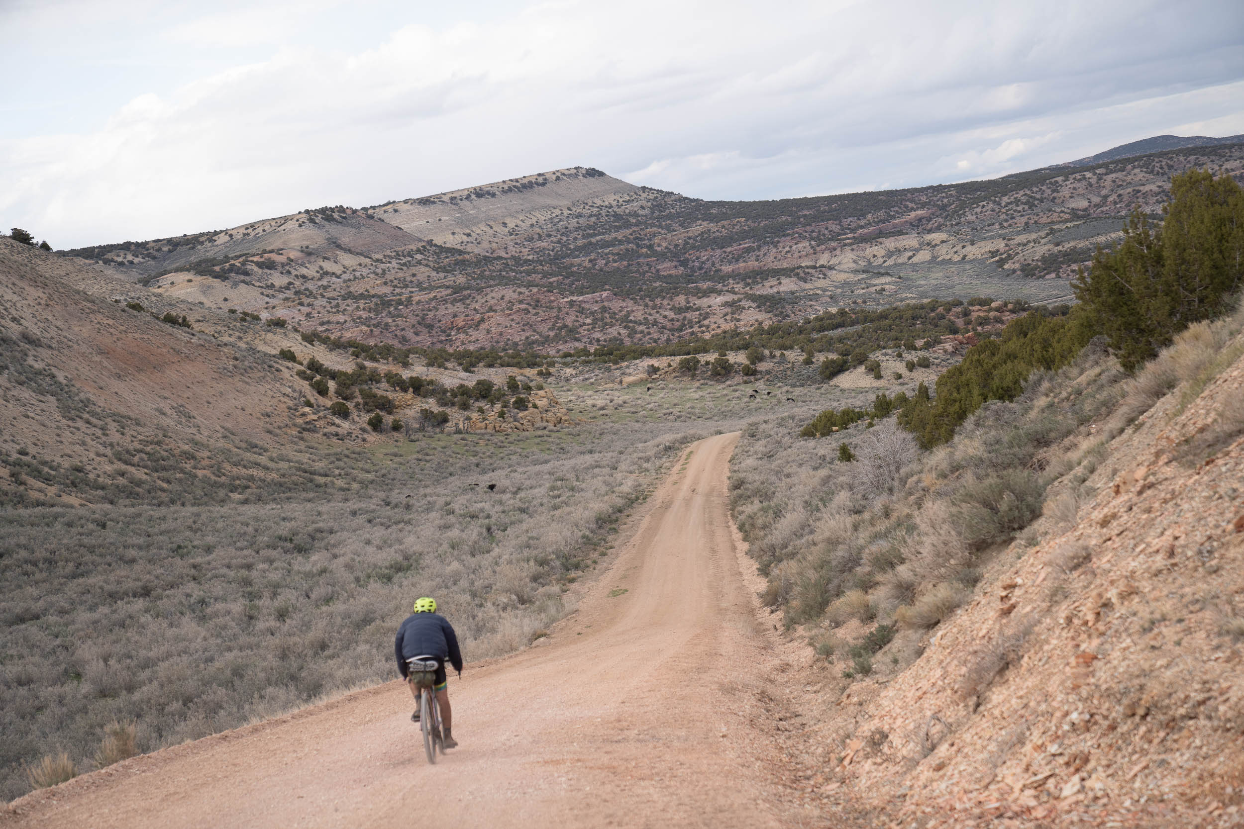
This section of the route is the longest stretch between water and resources. Despite the absence of regular water stops, the dirt roads in this area are exceptionally well-maintained and provide a pleasurable and smooth riding experience.
To begin this section, you will start your day with a stint on the highway. Although not a major highway, it can become busy during the peak summer season. After riding on the highway for a while, you will divert off onto a section of two-track road. This portion can be skipped if you’re running short on time or prefer to stick to paved roads.
Upon returning to the highway briefly, you will soon turn off onto Browns Park Road. From here, you will remain on this road until reaching the Three Corners Road. Along the Three Corners Road, there will be limited stretches of paved roads until you reach Green River. Expect mostly dirt roads as you make your way through this section.
During your ride, you will encounter a handful of streams that you need to cross. The flow of these streams will depend on the time of year. In some cases, they may be completely dry, while at other times, they could be running with water. These crossings add an element of adventure and may require careful navigation.
It’s important to note that this section entails the most elevation gain of the entire route. However, despite the elevation changes, the riding itself remains relatively smooth and easy.
locationGreen River, Wyoming, to Manila, Utah
Section 2
This section presents the greatest technical challenges along the route, involving multiple river crossings and rough two-track roads that have often been untouched for years. It is essential to have your GPS file downloaded for this section, as the sparse landscape can make it difficult to follow the road at times.
Early on in the day, you will come across State Road 530, which offers a faster and paved alternative to Manila. We highly recommend against skipping this section, as it showcases one of the most beautiful parts of the route with its abundance of wild horses and artifacts. Later in the day, you can shorten your dirt road mileage by taking the McKinnon Road. If you’re feeling tired or worn out, this is an excellent place to cut through and enjoy some smooth pavement, as the upcoming dirt road is far from smooth.
locationManila to Dutch John
Section 3
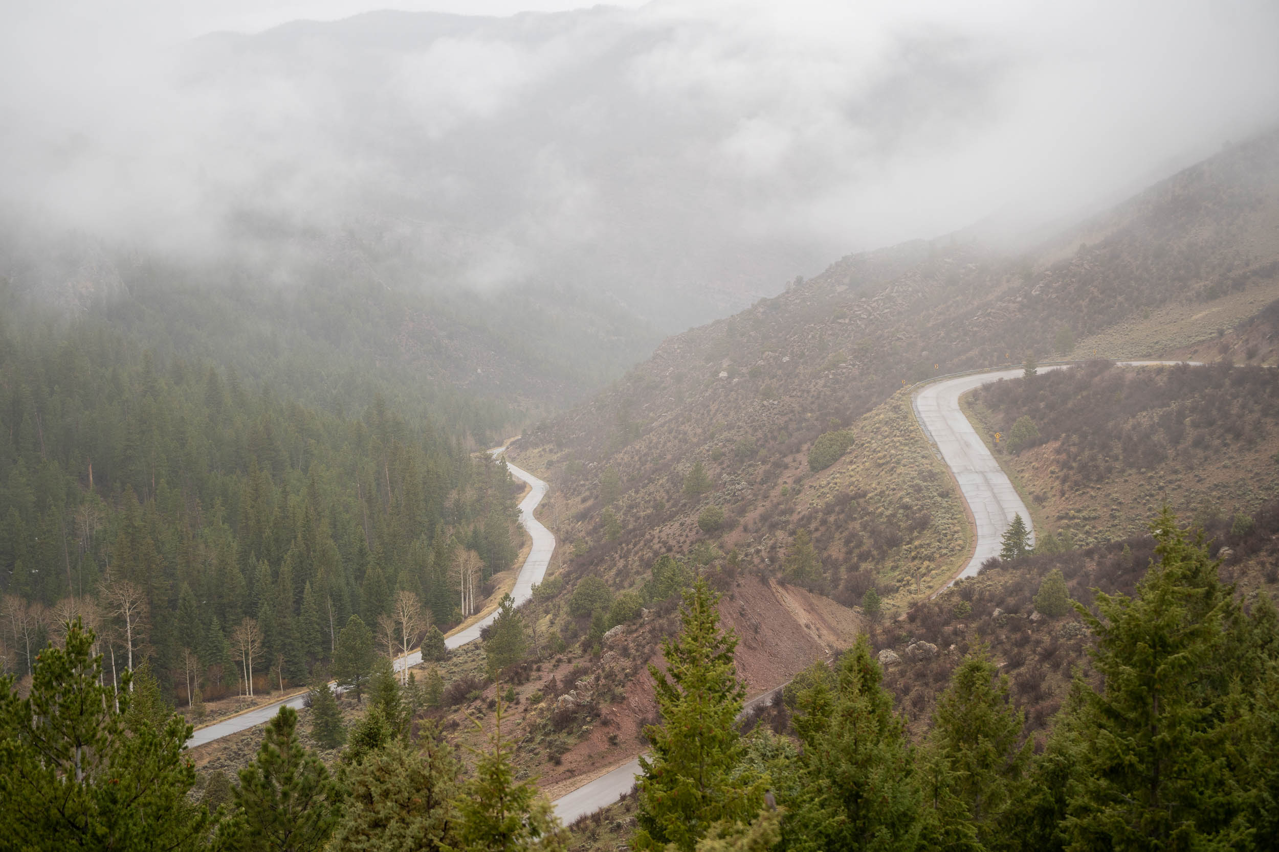
This incredibly scenic section of the route is also the most paved section. You’ll find yourself on asphalt roads for most of it. You’ll start the section by climbing out of Manila on State Road 44 until you hit the Sheep Creek Geological Loop turnoff. There’s an abundance of water in this section and a dramatic change in landscape as you’ll encounter the tall pines of the Uinta National Forest. There are plenty of campgrounds in this section too.
Once you reach the top of the Sheep Creek climb, you’ll descend to Deep Creek Road. There, you’ll find beautiful mountain landscapes, rivers full of fish, and smooth dirt roads. After you leave Deep Creek, you’ll continue on the highway until you reach the Red Canyon Visitor Center. You could stay on the highway and skip the singletrack and the incredible views this section has to offer, but don’t. Once you reach the overlook, you’ll have one of the best views that the state of Utah has to offer. Go to the left of the visitor center for a lesser-known but more scenic overlook.
An eight-mile section of singletrack will bring you back onto the highway, and then it’s all downhill to the Flaming Gorge Dam. Depending on where you started the route, you’ll either end before or after the dam crossing, and that will conclude your ride!


Terms of Use: As with each bikepacking route guide published on BIKEPACKING.com, should you choose to cycle this route, do so at your own risk. Prior to setting out check current local weather, conditions, and land/road closures. While riding, obey all public and private land use restrictions and rules, carry proper safety and navigational equipment, and of course, follow the #leavenotrace guidelines. The information found herein is simply a planning resource to be used as a point of inspiration in conjunction with your own due-diligence. In spite of the fact that this route, associated GPS track (GPX and maps), and all route guidelines were prepared under diligent research by the specified contributor and/or contributors, the accuracy of such and judgement of the author is not guaranteed. BIKEPACKING.com LLC, its partners, associates, and contributors are in no way liable for personal injury, damage to personal property, or any other such situation that might happen to individual riders cycling or following this route.
Please keep the conversation civil, constructive, and inclusive, or your comment will be removed.