


Cross-Washington Mountain Bike Route (XWA)
Distance
690 Mi.
(1,110 KM)Days
10
% Unpaved
90%
% Singletrack
10%
% Rideable (time)
99%
Total Ascent
48,697'
(14,843 M)High Point
6,000'
(1,829 M)Difficulty (1-10)
7?
- 5Climbing Scale Moderate71 FT/MI (13 M/KM)
- -Technical Difficulty
- -Physical Demand
- -Resupply & Logistics
Contributed By

Troy Hopwood
Guest Contributor
As a Northwest native, Troy has spent most of his life exploring the vast forests that surround his home. In recent years, Troy discovered a passion for multi-day adventures deep in the mountains. Whether a solo effort or sharing the physical and emotional journey with others, Troy is most at home on a bike.
*On Quileute, Coast Salish, S’Klallam, Suquamish, Skokomish, Tulalip, Stillaguamish, Snoqualmie, Yakama, Colville, Spokane, Schitsu’umsh, & Ktunaxa Land
Updated May 2025
The Cross-Washington Mountain Bike Route traverses some of Washington’s most interesting geography on double track, gravel roads, singletrack and some pavement. The route travels through scenic remote areas, however, there are many resupply opportunities available.
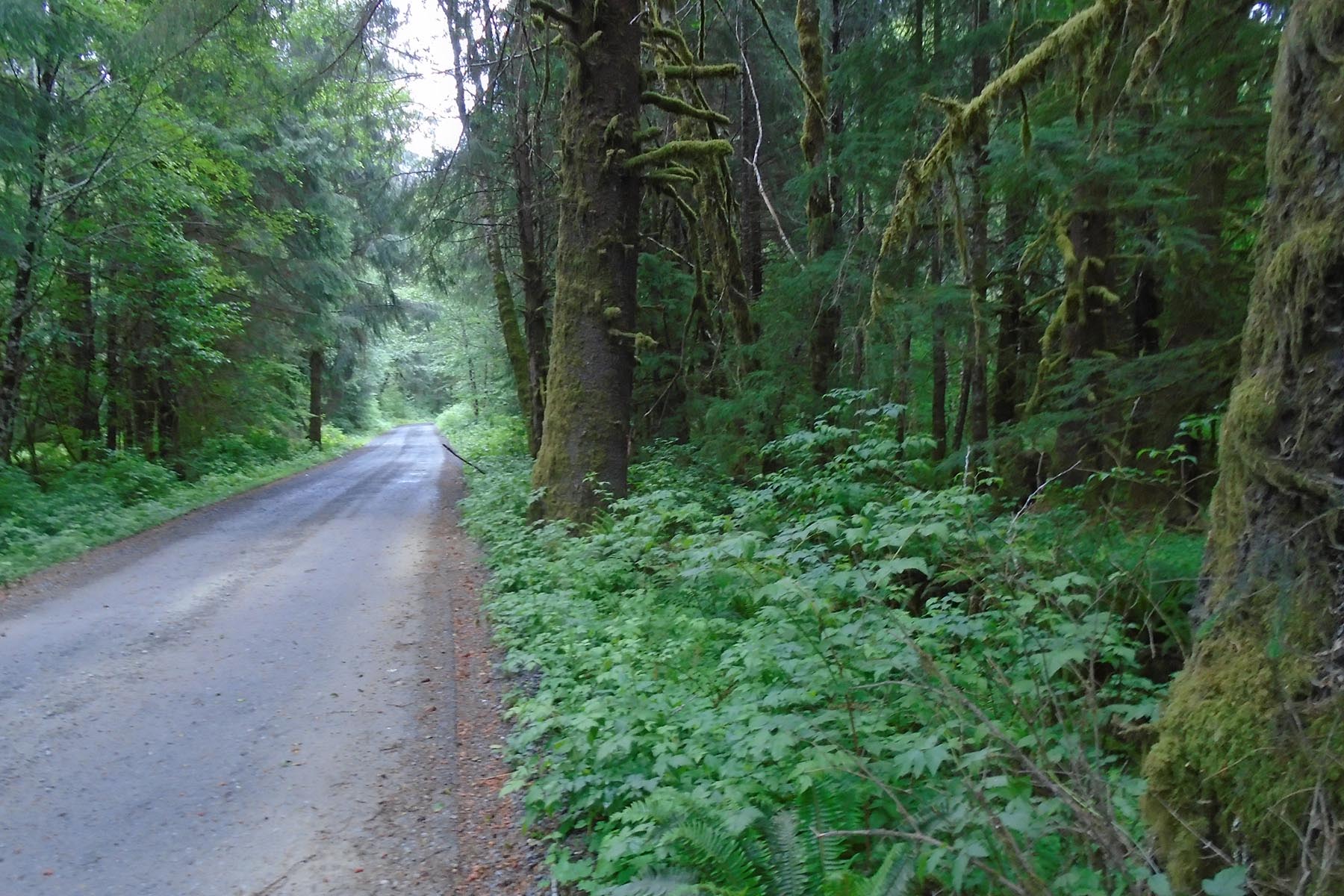
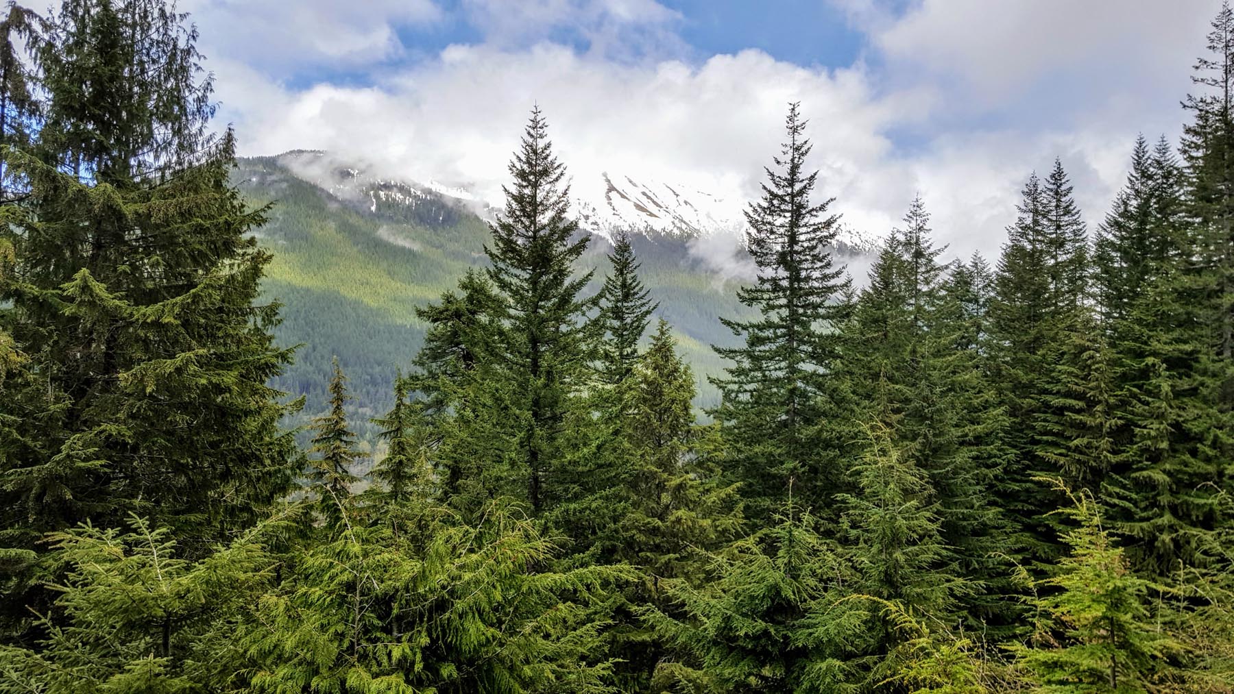
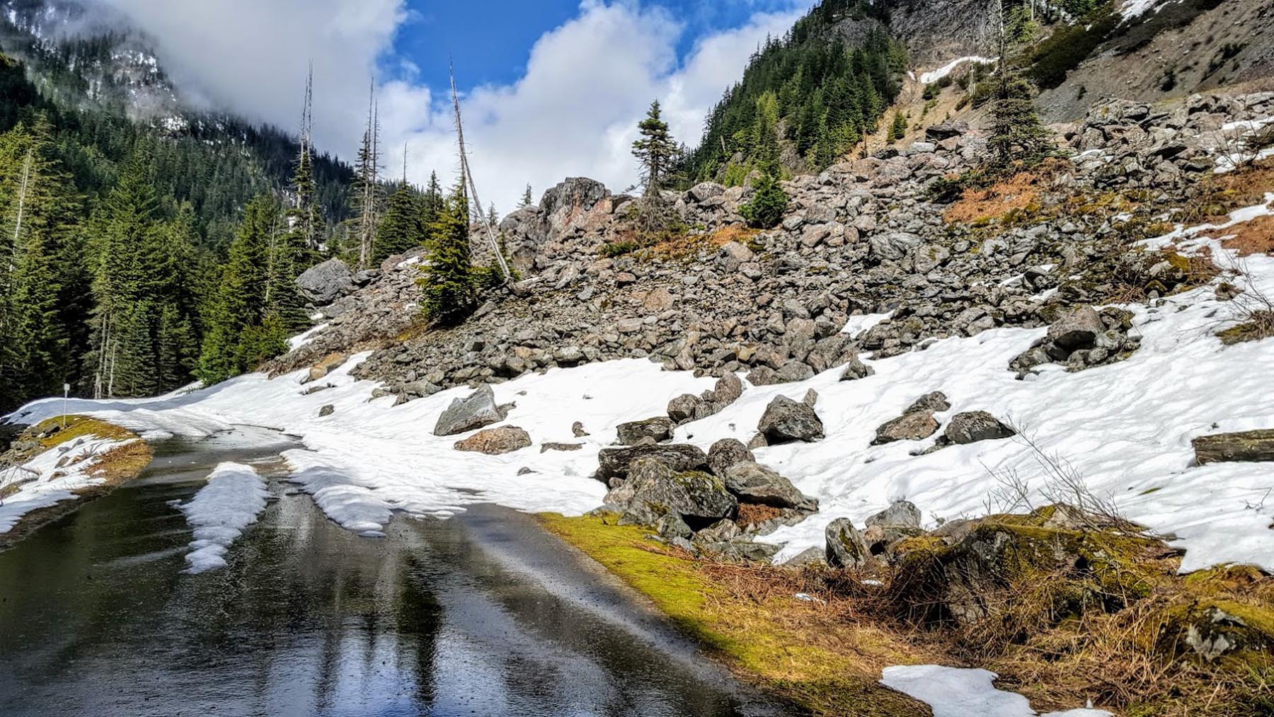
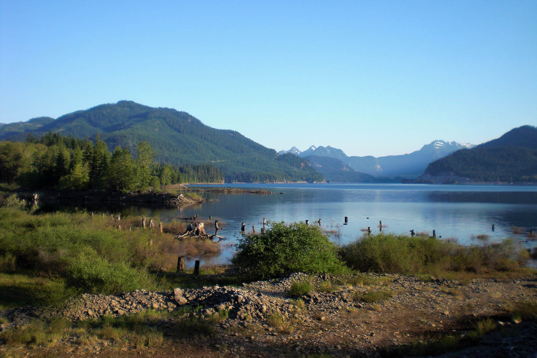
Travelers along the route experience a variety of diverse landscapes and ecosystems. From one of the largest temperate rainforests full of moss-covered trees, to harsh landscapes from the glacial aftermath in the desert scablands, to urban route-finding at its best, the XWA has a little bit of everything. There are long climbs and grin-inducing descents, as well as epic mellow rail trails with ancient trestles… all accompanied by spectacular vistas at every corner.
The route features a collection of popular mountain bike trails, historic rail trails, and scenic dirt roads all combined with a heavy dose of creativity to make Washington’s only cross-state trail.
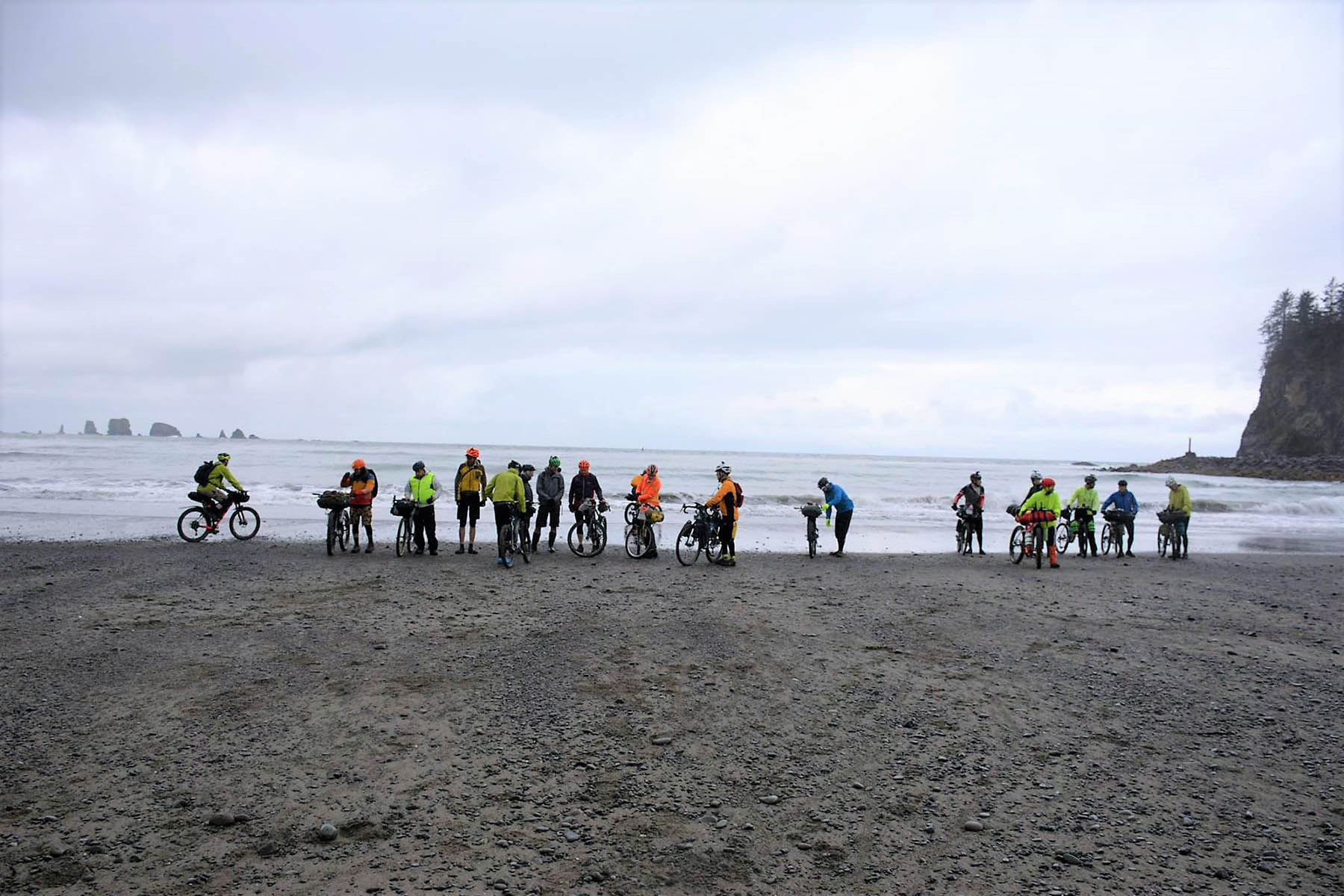
Each year in late May, bikepackers from around the world converge in La Push for a grand depart as they all take on the route together.
Route Difficulty
Difficulty is all relative, but this can certainly has its challenges – the biggest being the climbs. The route includes almost 50,000 feet of climbing and most of it occurs in the first 400 miles. The Olympic Discovery Adventure Route and the Tolt Pipeline Trail feature some extremely steep grades that are extra challenging on a loaded bike. While the last 300 miles offer much less climbing, the effort is constant as the trail conditions can be fairly rough and overgrown at times.
The majority of the route is rated pretty easy from a technical perspective, but there are a few very challenging sections. All singletrack is rated as intermediate but there are a few steep rocky descents that have caught riders off guard.
Route Development: The primary reason for the route’s existence is to promote more usage on some of the more remote sections of the John Wayne Pioneer Trail. The eastern portions of the John Wayne trail have been and continue to be at risk. Driving more usage is the best hope for ensuring the trail’s future. Many people call the John Wayne Trail a “cross-state” trail even though it covers just over half the state. As such, other existing dirt roads and trails were combined to make a true cross-state trail. Also, find additional information and updates at the official XWA website.


Highlights
Must Know
Camping
Food/H2O
Trail Notes
Resources
- Moss covered trees and diverse landscapes
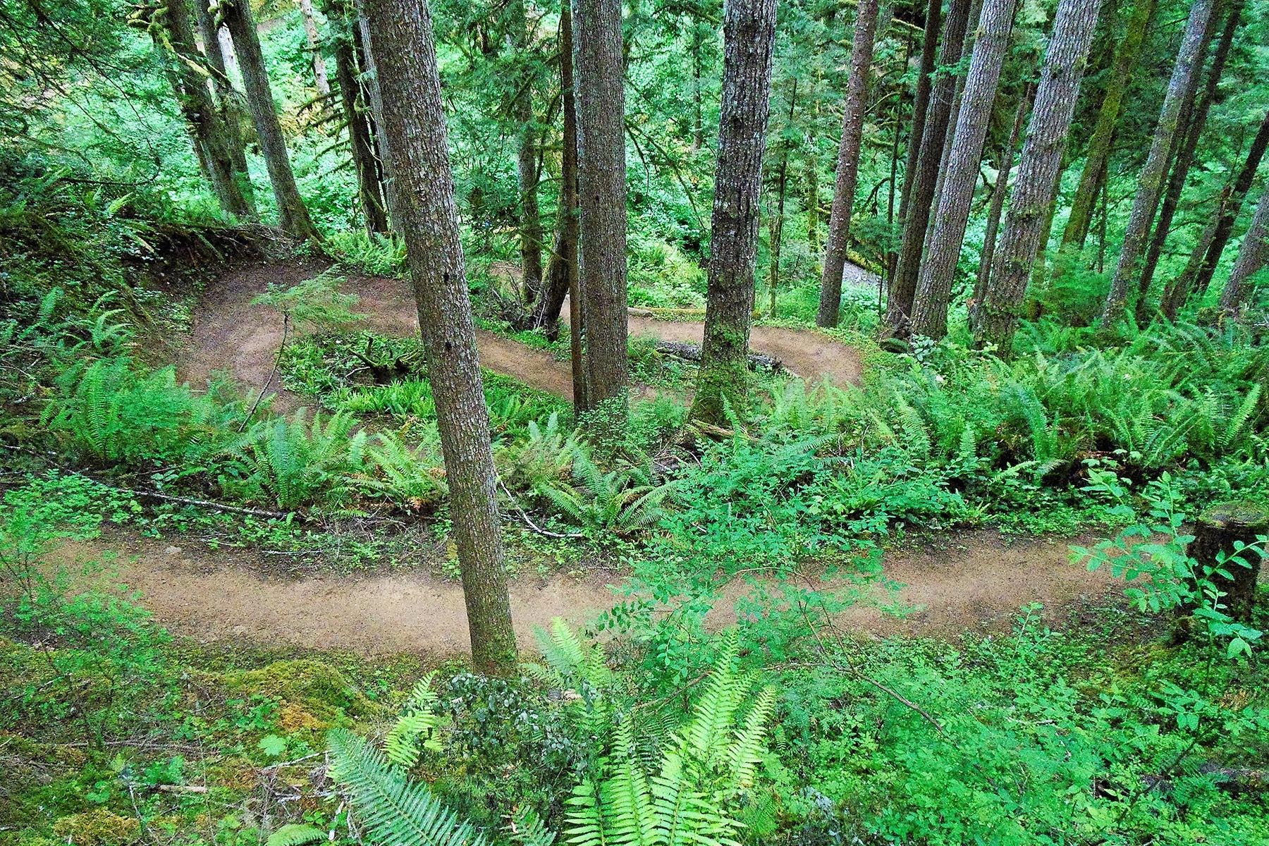
- 25 miles of amazing singletrack on the Olympic Discovery Trail
- Lower Big Quilcene trail
- Crossing the Hood Canal bridge and historic Port Gamble
- The ferry ride from Kingston to Edmonds
- Rail trails such as the Snoqualmie Valley trail and the John Wayne Pioneer Trail, one of the longest rail trail conversions in the country
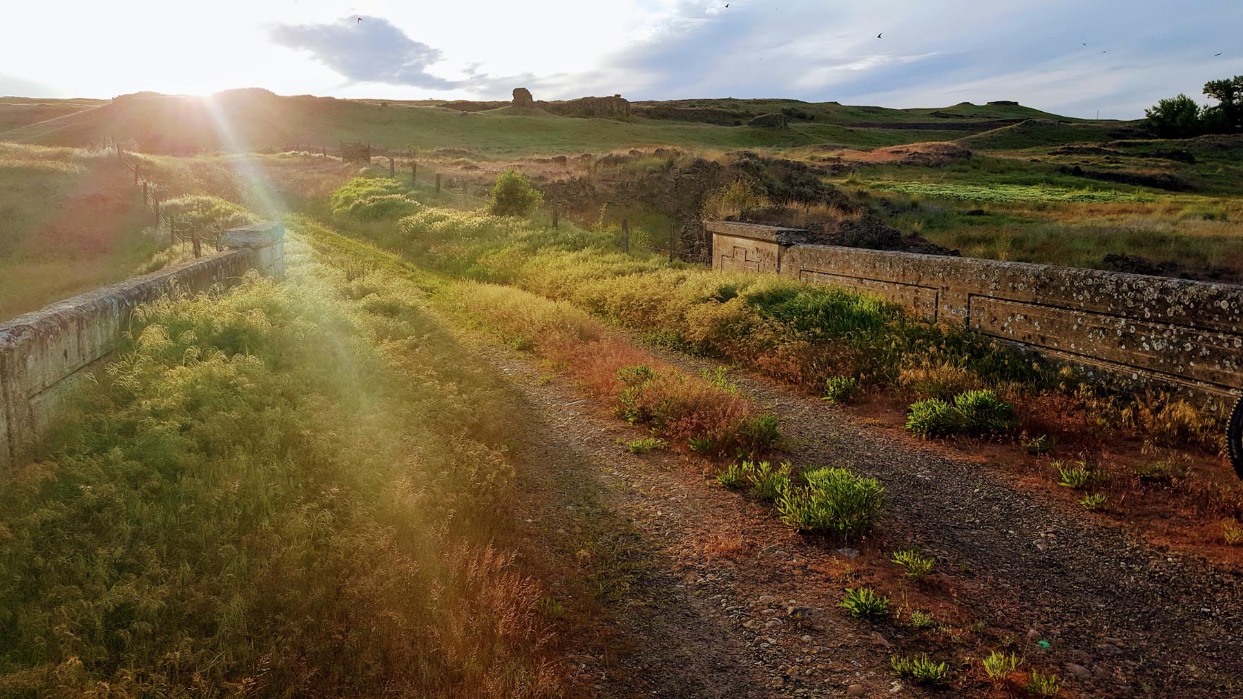
- Scenic trestles with amazing views
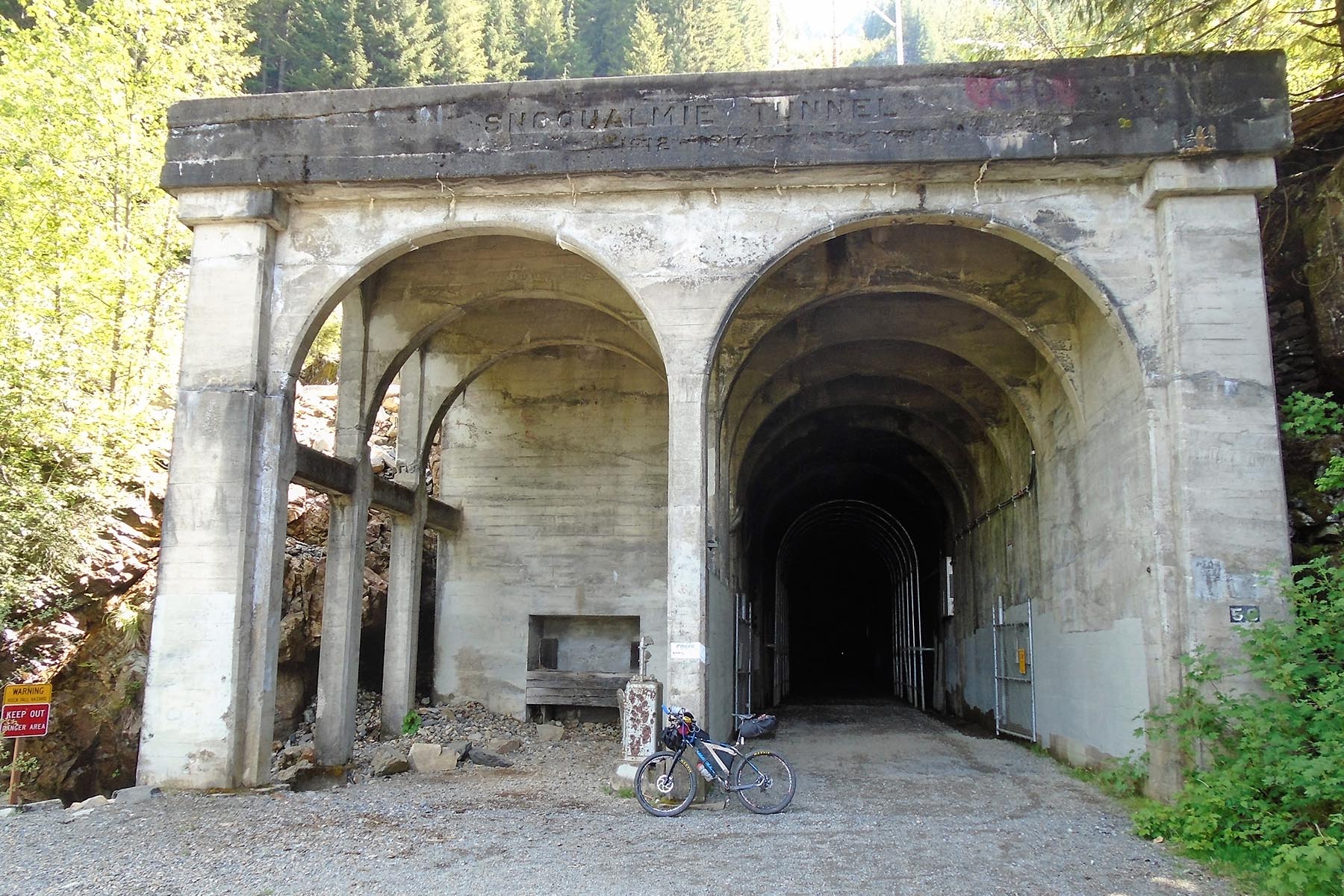
- 3-mile tunnel under Snoqualmie Pass
- Mission Ridge is the highpoint of the route at just over 6,000 feet
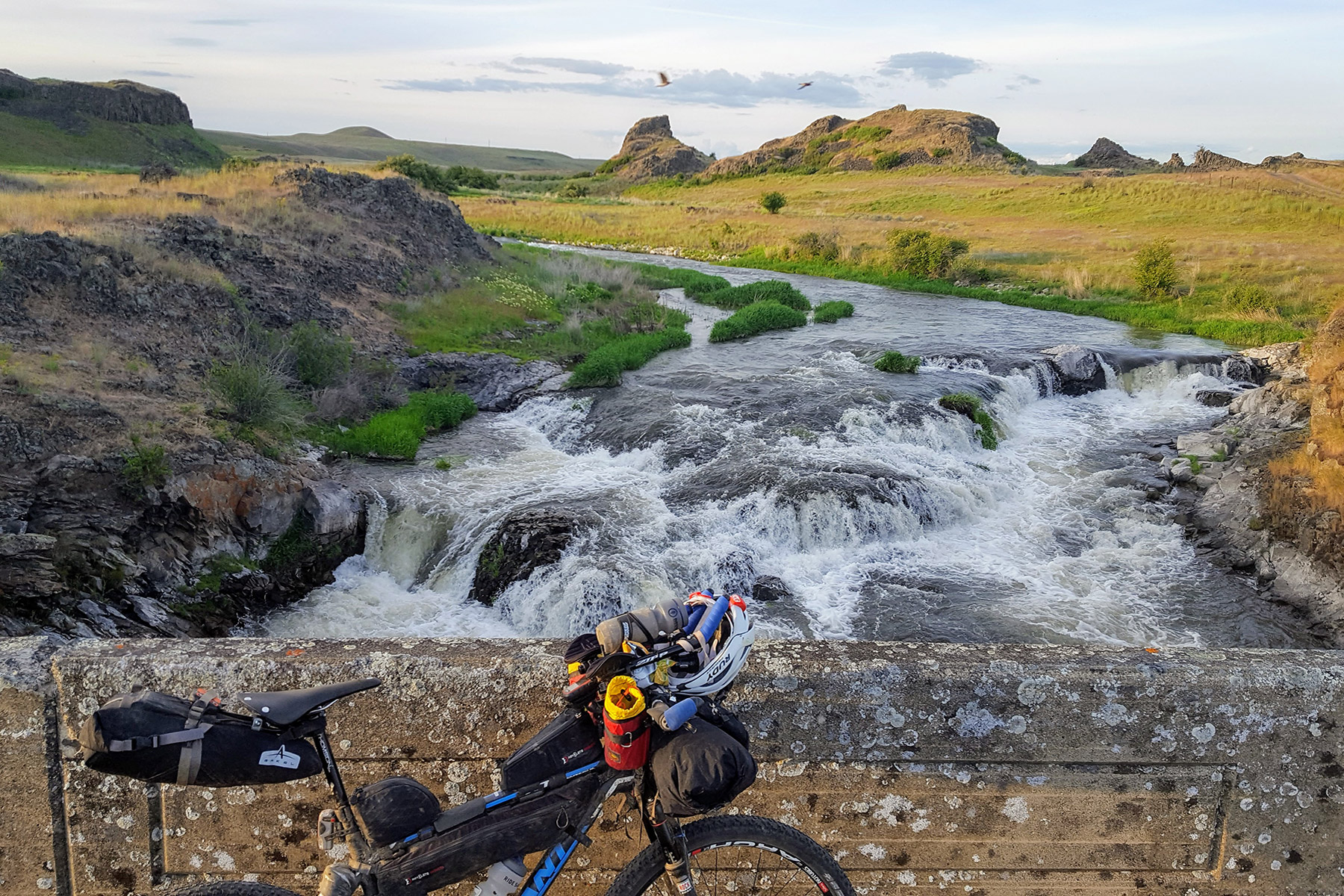
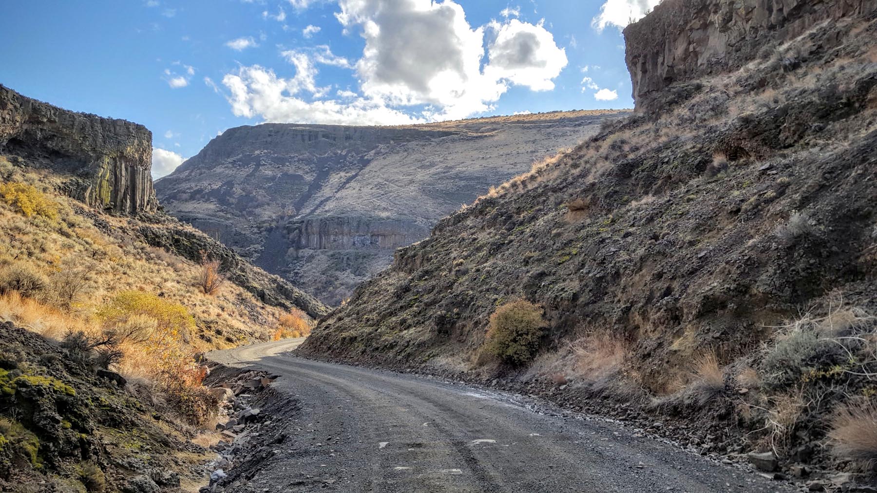
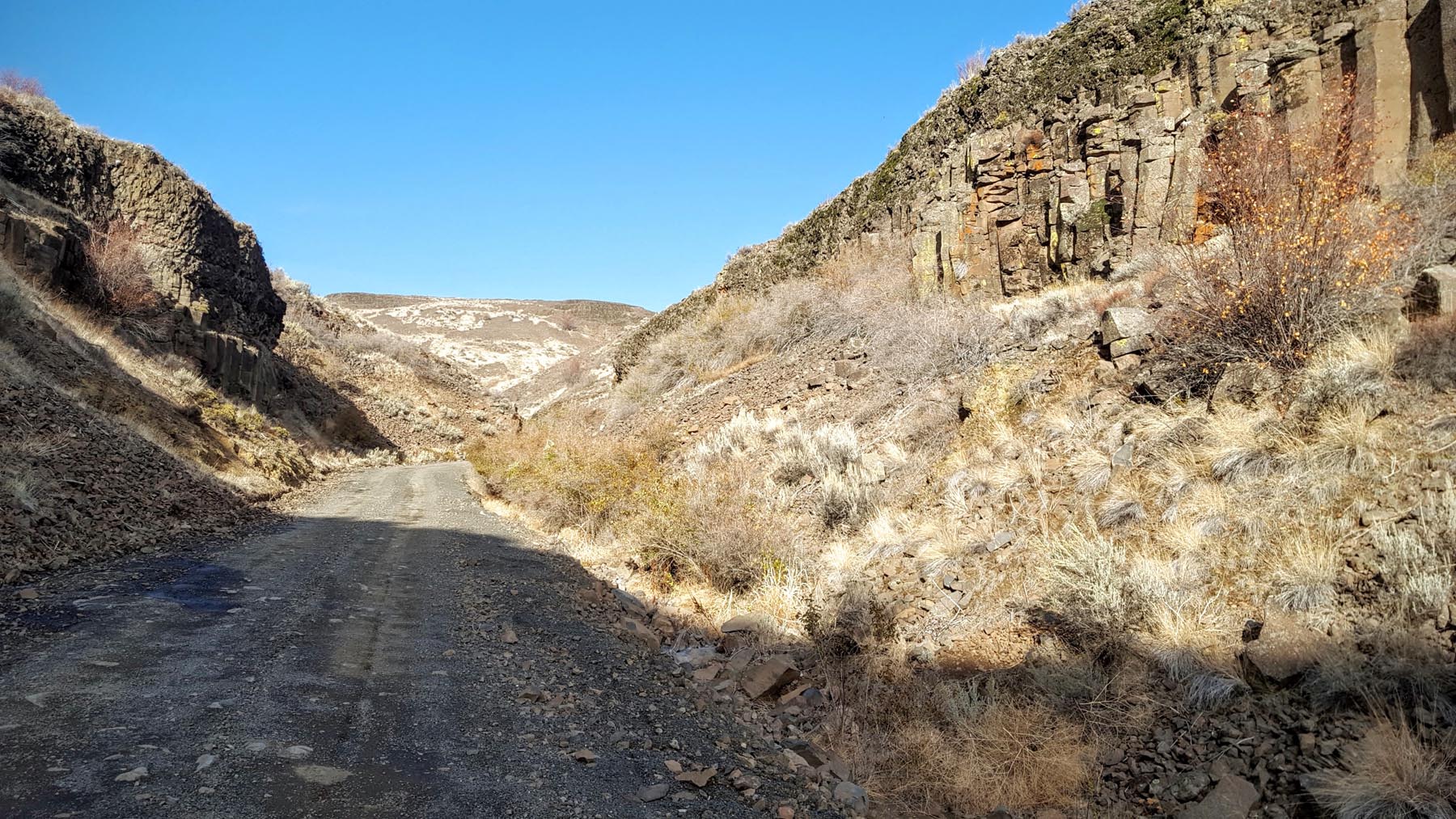
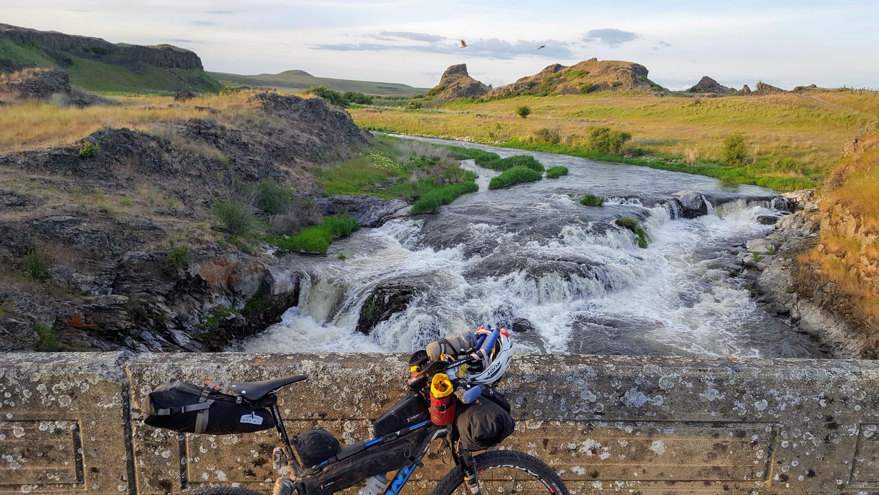
- The descent down Douglas Creek through it’s steep rocky canyon into Moses Coulee
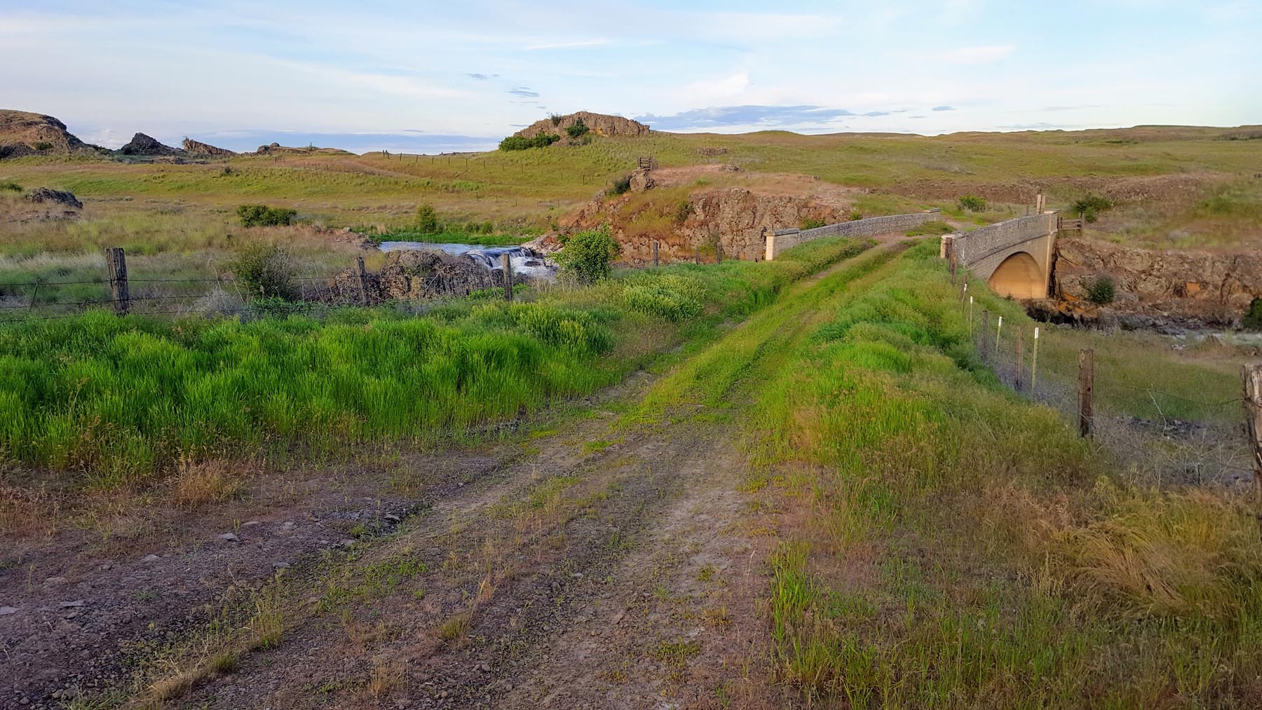
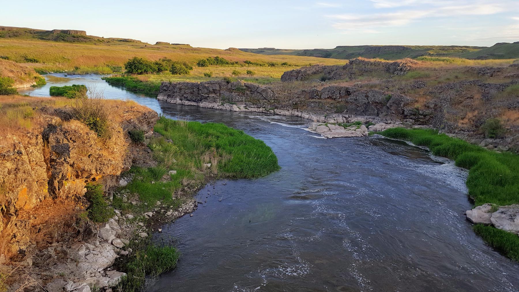
- The scablands around Escure Ranch and the falls along Rock Creek
- The hospitality in Tekoa
- The best time to ride the Cross-washington is late May to early October. Mission ridge could still have snow as late as July. Eastern Washington starts to get hot in June.
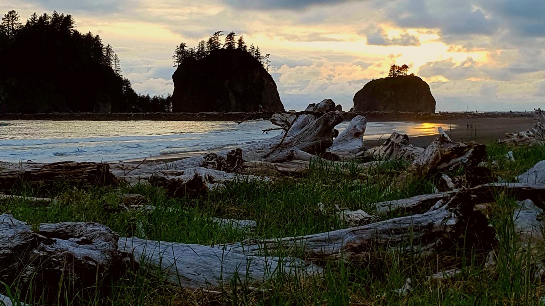
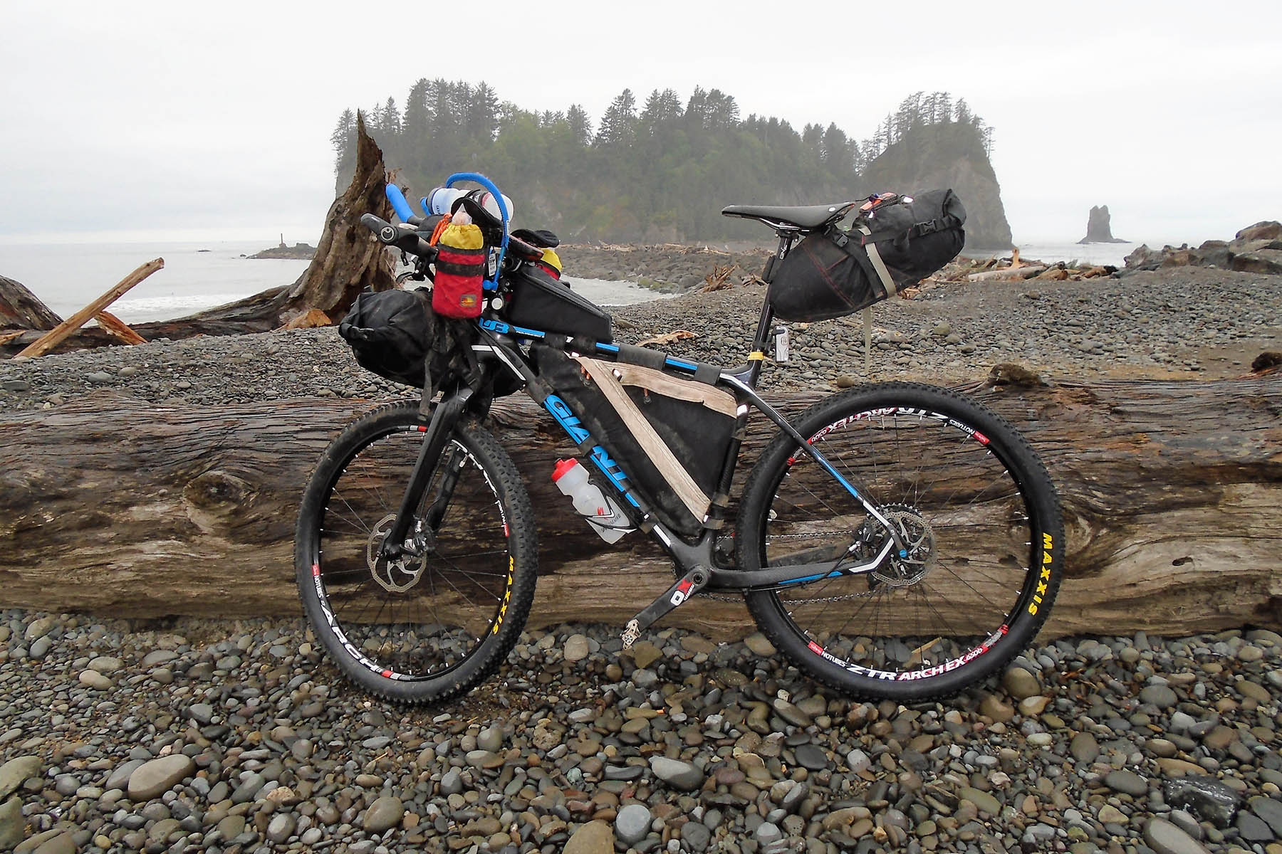
- The route is best ridden West to East and starts on First Beach in the small town of La Push.
- Both ends of the route are remote and getting to the start line or from the finish line can be challenging.
- If you can’t get a ride to the start, your next best option is a series of busses. Dungeness Line provides bus service from SeaTac Airport and the Amtrak train station in downtown Seattle to Port Angeles. Reservations are highly recommended. Be sure to tell them you have a bike so they can provide you options. Once you’re in Port Angeles, the next step is to take the county bus to La Push. This is via Clallam Transit.
- Permits are required for the eastern portion of the John Wayne Pioneer Trail. These permits are free and have no limits. A DNR permit is required for the segment from Warden to Lind. A Washington State Park Permit is required from Lind to the Idaho border. In exchange, The DNR and State Park officials will give you combinations to some of the gates across the trail. This is much easier than lifting a fully-loaded bike over these formidable gates.
- The Tekoa Trails and Trestle Association is a great resource to learn more and coordinate logistics at the end of the route.
- The eastern portion of the John Wayne trail is a political hot spot. Please help ensure its future by staying on the trail and being a good ambassador for cycling.
- At the route start, motel and cabin rentals are available in La Push at Quileute Oceanside Resort.
- Multiple campgrounds along or near the route on the Olympic Peninsula. Wild camping is generally available as well.
- The suburban segment from Edmonds to Carnation has no camping opportunities. Motels are available in Edmonds and Bothell.
- Multiple campsites along the western portion of the John Wayne Pioneer Trail.
- The eastern portion of the John Wayne Pioneer Trail has no camping. The only camping options are in city parks in Ralston and Malden.
- Wild camping generally allowed between Roslyn and Wenatchee. There is one official campground in the Teanaway valley on route as well.
- At the finish, Tekoa offers camping behind the arena in town. There are also cabin rentals. Call (509) 284-2080 for information.
- At the start in La Push, there is the River’s Edge restaurant and Lonesome Creek store. Lonesome Creek Store and Resort has a small grocery. A similar store is available at 3-Rivers Resort along with a basic menu consisting mostly of burgers. The 3-Rivers Resort is 6 miles from the start. More options are 15 miles away in Forks.
- Resupply on the eastern half of the state can be more sparse but most riders will never go more than a day without encountering signs of civilization.
- Riding the route West to East, you will hit the longest stretch between resupply points right out of the gate. The next town is Port Angeles approximately 100 miles from the start. There are ample rivers and streams though for filtering water if needed.
- There are other resupply points and water stops noted on the map above.
- At the finish in Tekoa, there are several restaurants: The Feeding Station Café (509-284-3141), C&D’s Bar and Grill (509-284-3200), Tekoa Market (509-284-3291), Eclair’s Coffee Shop (509-284-3040)
The XWA route is best ridden West to East and starts on First Beach in the small town of La Push. Riding west to east, the route is broken into four segments based on their geographic diversity, as follows:
Olympic Peninsula Segment (La Push to Kingston)
217 miles (349 km)
La Push provides a picturesque way to start an adventure. On your way out of town you will pass trails for the creatively named Second and Third beaches which are well worth the diversion.
The Twilight series of books took place in this area. You are riding in prime vampire territory. The predominantly gray days make it quickly apparent why those who shy away from the sun may find this area attractive. But when the sun does come out, there is nothing more beautiful.
Right out of the gates you hit the longest stretch between resupply points. The next town is Port Angeles 100 miles from the start. There is no shortage of rivers and streams to refill water, but make sure you have the food needed to complete this leg of the journey.
The ride starts very gently with smooth rolling asphalt. After a few miles you get your first taste of dirt as you turn onto a logging road. The route continues to be kind flat roads until around mile 20. This is where the climbing begins.
After crossing Sitkum and Sol Duc passes the route joins the Olympic Discovery Trail Adventure Route which is 25 miles of amazing singletrack leading most of the way to Port Angeles.
Port Angeles is your first opportunity to resupply and offers bike shops, a brewery, motels and everything else a weary traveler could want.
The Olympic Discovery trail continues all the way to Port Townsend via a paved trail but the route deviates off the trail in Sequim to head back into the Olympic mountains to take on Bon Jon and Big Quilcene passes.
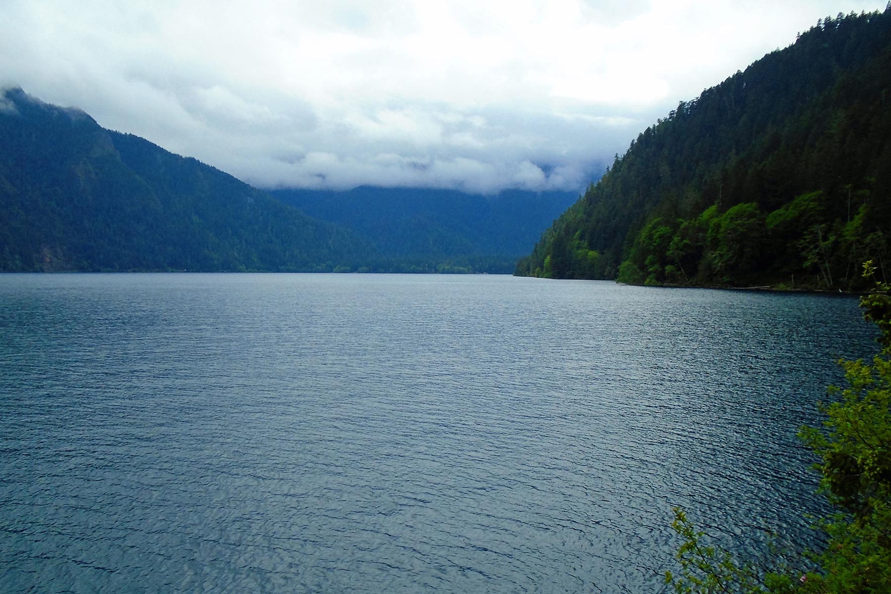
Quilcene is the next resupply. Stop and grab a beer at th 101 brewery and reminisce about the singletrack descent into town along the Lower Big Quilcene River Trail. From here, it’s a mixture of dirt and paved roads and a bit more singletrack as you work your way to the ferry in Kingston 50 miles away. Crossing the Hood Canal bridge and historic Port Gamble are two of the highlights in this section.
Note: Traveling east, the ferry is free. However, westbound travelers will need to pay. Either way, enjoy the easy miles as you cross the Puget Sound.
Suburban Segment (Edmonds to North Bend)
47 miles (76 km)
The suburban segment skirts around the Seattle suburbs. Despite passing through the suburbs of Seattle, resupply is sparse. Be sure to grab what you need for the next few hours in Edmonds. The Salish Sea Brewing Company is a small brew pub directly on the route and is a great way to carbo load before taking on the short but steep climb out of town.
Route-finding through the early portions of the suburban segment can be challenging. The route strings together commuter trails, small parks, and a water pipeline to maximize the dirt opportunities. The pipeline trail has many steep up and downs so do not underestimate the effort needed here.
The route drops down a short hill to Kenmore where there is a chance to stock up on supplies and refuel at 192 Brewing.
From Kenmore, the route follows a short stint on the Burke Gilman trail. This is an extremely popular paved pedestrian path. On a sunny weekend this trail can get insanely busy.
After the challenges of the pipeline trail, you are rewarded with a chance to relax along the Snoqualmie Valley trail. This is a rail trail conversion so, while the climb is steady, it is a very gentle grade. This will take you through Carnation to the town of Snoqualmie.
The trail then picks up again just after town and continues to the town of North Bend. When in North Bend, there are two recommended stops. First, there’s Twede’s Cafe which was made famous by the TV show “Twin Peaks.” Stop in at Twede’s for a piece of their famous Twin Peaks cherry pie. Their breakfasts are amazing as well. Another icon in town is Scott’s Dairy Freeze for some greasy burgers and frozen treats.
Cascades Segment (North Bend to Wenatchee)
142 miles (229 km)
The entirety of this segment is spent navigating the Cascade mountain range as the route transitions from Western to Eastern Washington.
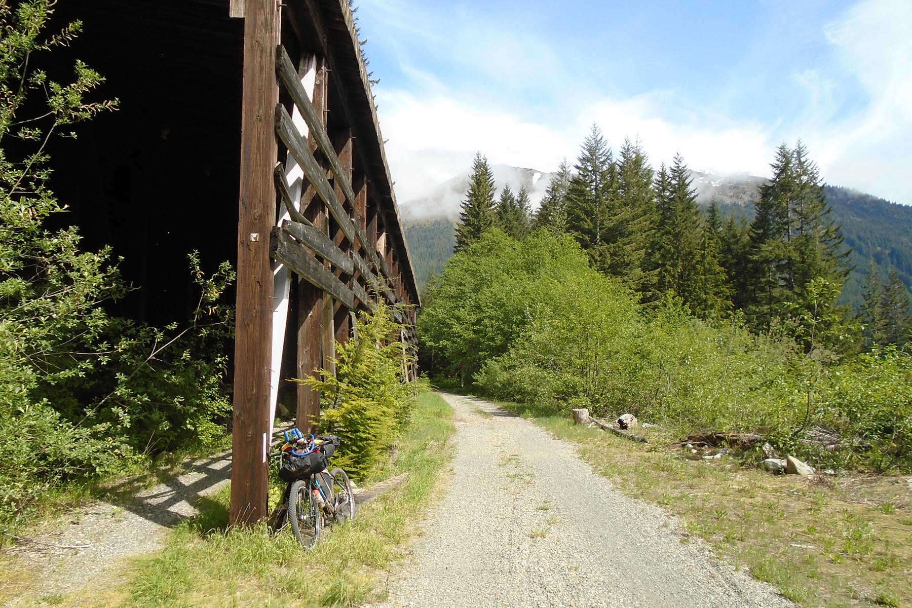
Shortly after North Bend you’ll hit Rattlesnake lake where the trail transitions to Iron Horse State Park/John Wayne Pioneer Trail. This is one of the longest rail trail conversions in the country. The trail crosses many scenic trestles with amazing views for the Snoqualmie Valley and surrounding peaks. The trail also passes through a 3-mile tunnel under Snoqualmie Pass. This trail heads all the way to the finish at the Idaho border. However, because there is no safe way for cyclists to cross the Columbia river, the route deviates significantly.
It’s a long, but gentle climb up to the Snoqualmie tunnel from Rattlesnake lake. You will pass some waterfalls, restored trestles, and a popular area for rock climbing.
The route leaves the gentle grades of the John Wayne trail in Cle Elum but not until after passing Smokey’s Bar-B-Que for another recommended stop. Fuel up as it’s about to get much harder.
From Cle-Elum, the route follows the Coal Mines Trail to Roslyn. If you remember the TV show “Northern Exposure” it was filmed in this town. From Roslyn, the route heads straight up. There’s no easy way over Cle Elum Ridge and into the Teanaway Valley.
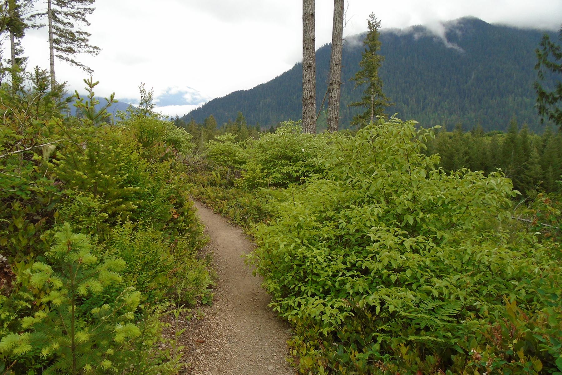
The Teanaway valley is a very popular mountain biking destination. This is worth a trip on its own. From the valley, the route starts climbing in earnest. The route crosses over Teanaway Ridge and then drops down to Highway 97. The route then crosses Highway 97 and works its way up and over Mission Ridge to get to Wenatchee. Mission Ridge is the highpoint of the route at just about 6,000 feet. The climbing through this portion can be relentless, but the views are beyond compare.
Wenatchee is over 5,000 feet below at this point. Hold on tight as you enjoy 10 miles of high-speed grin-inducing descending into town.
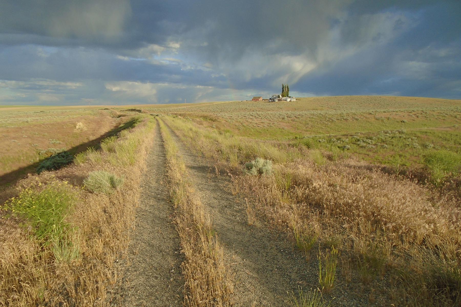
Scablands Segment (Wenatchee to Idaho)
272 miles (438 km)
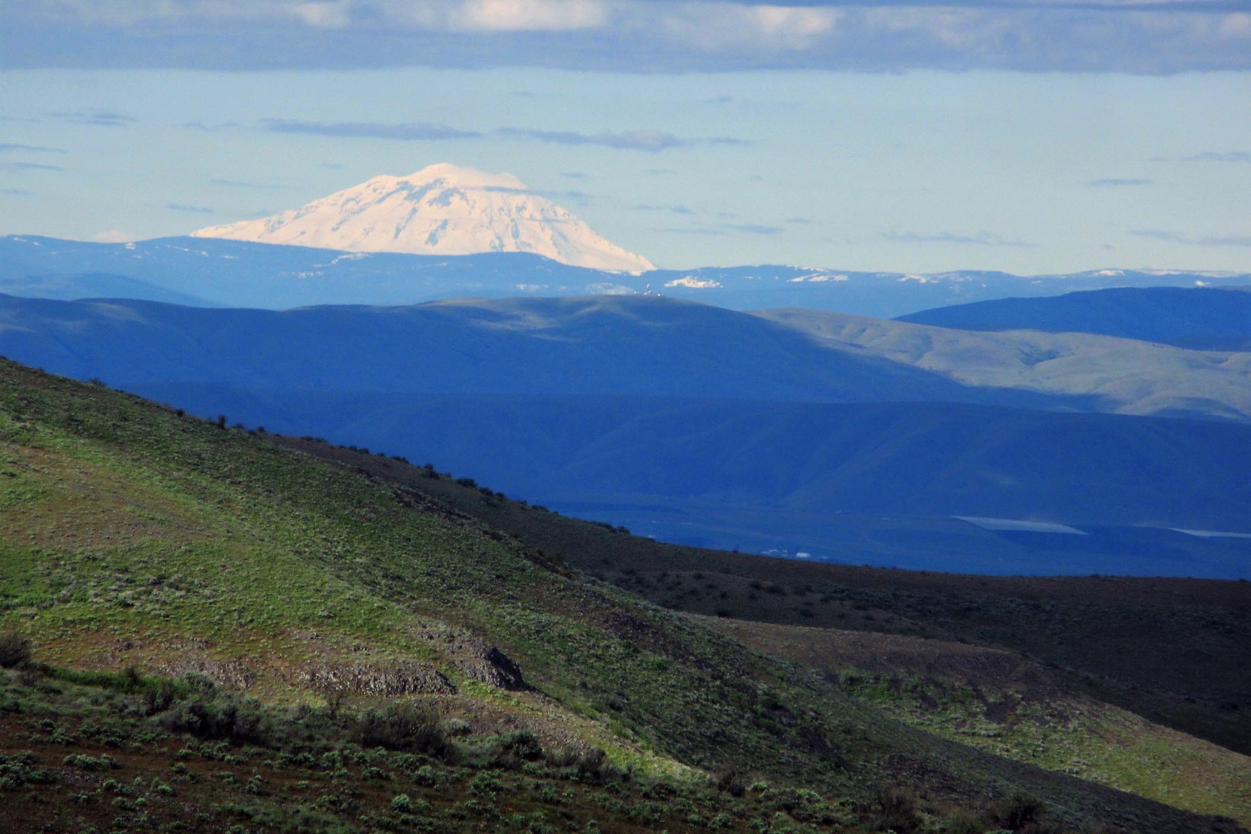
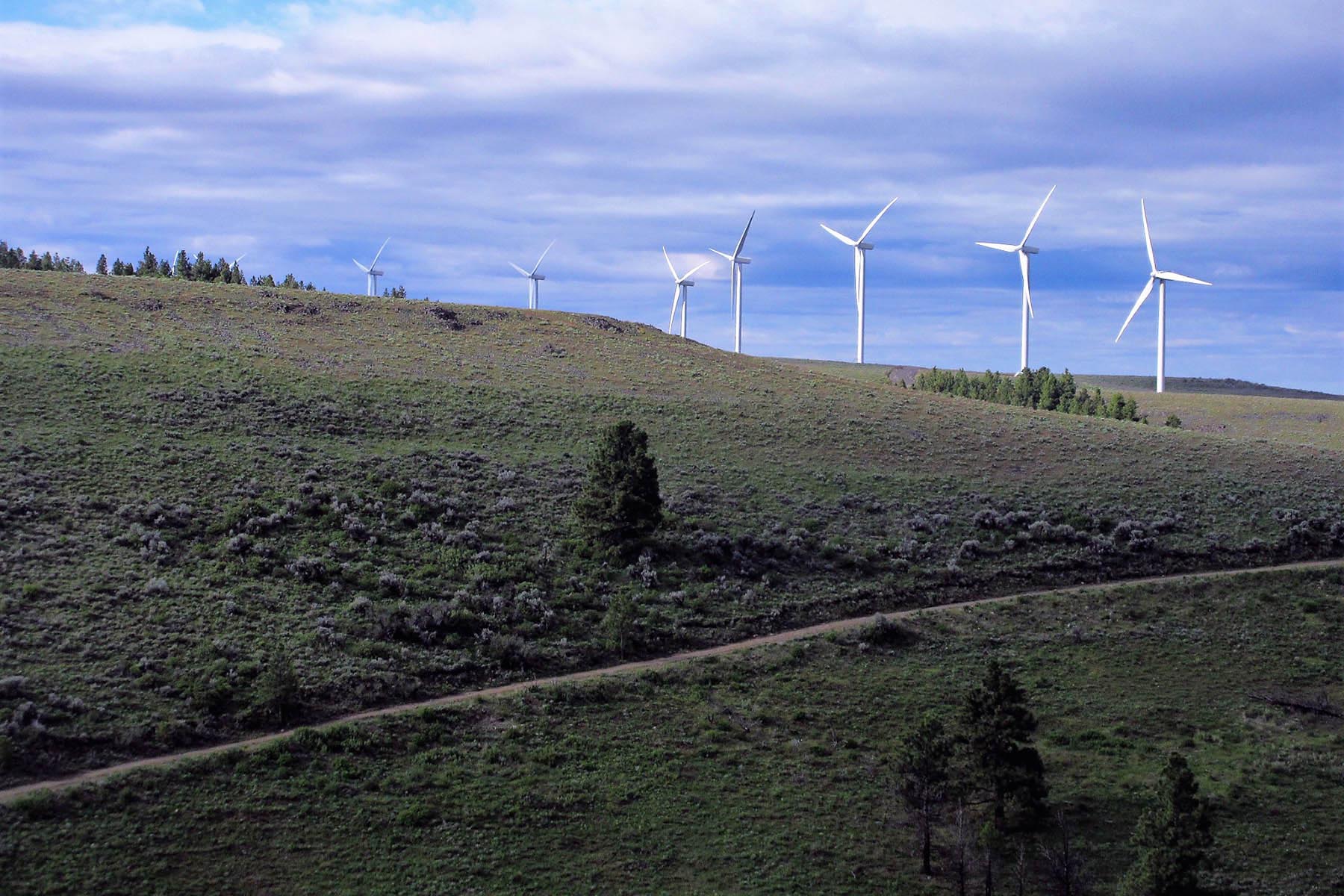
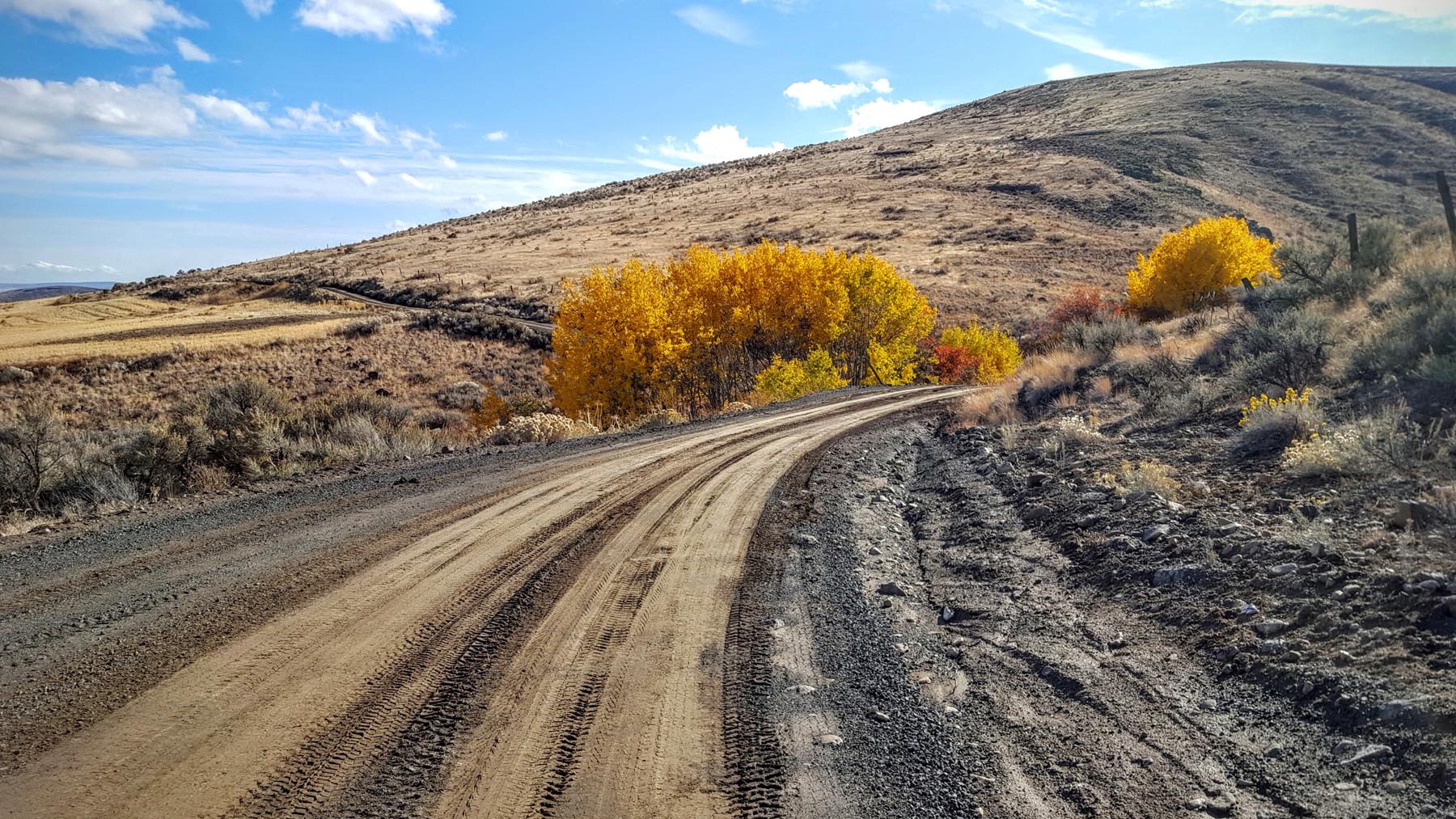
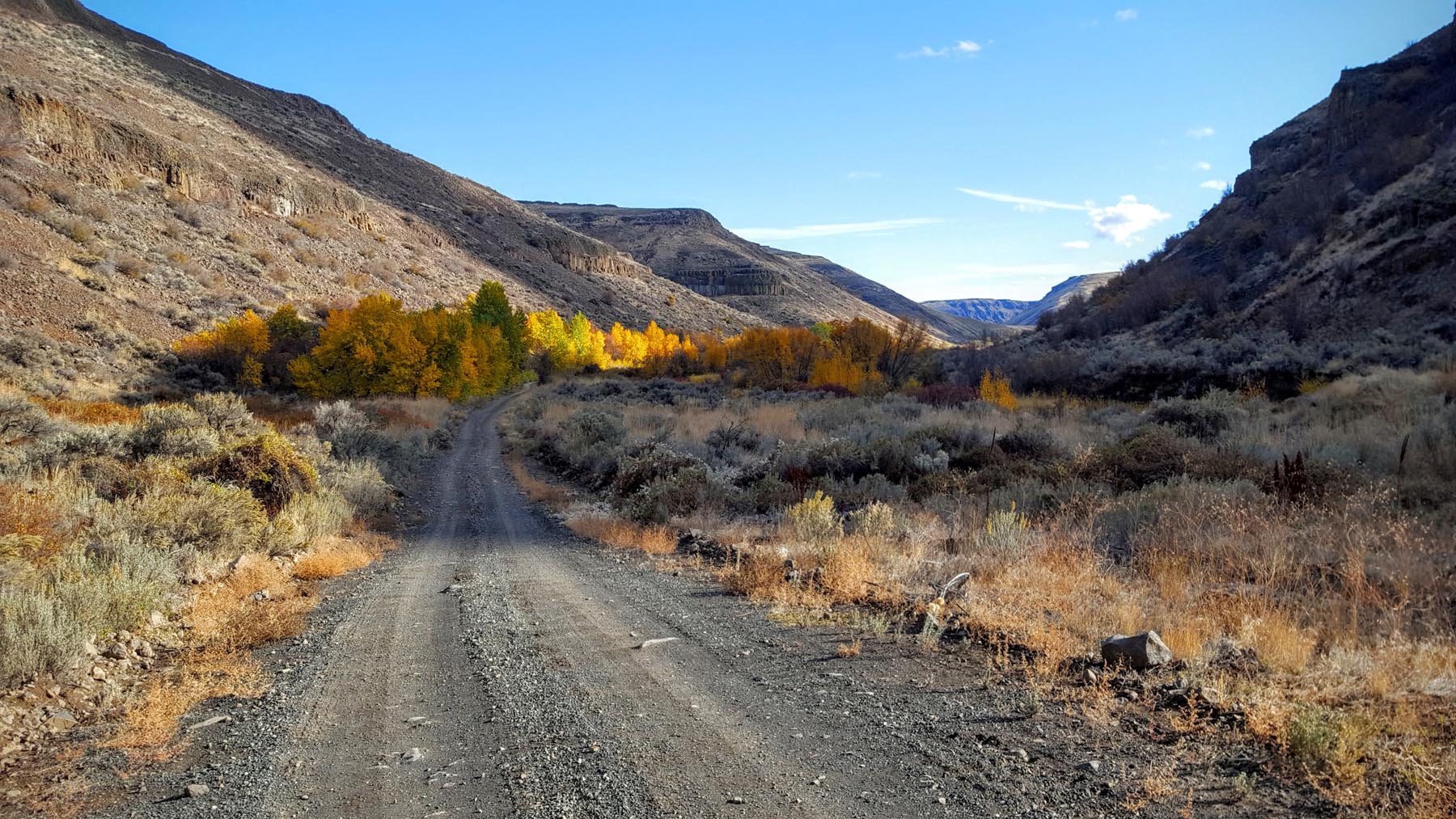
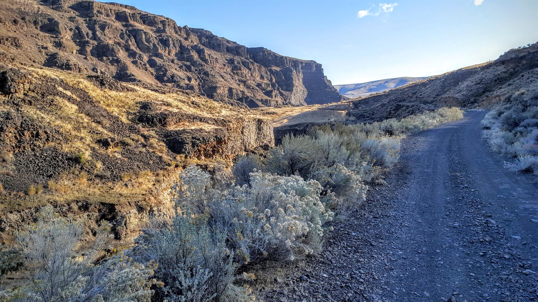
The scablands segment is where the scenery completely changes. The trees and cool mountain air are replaced by rock formations, endless vistas, and warm desert air.
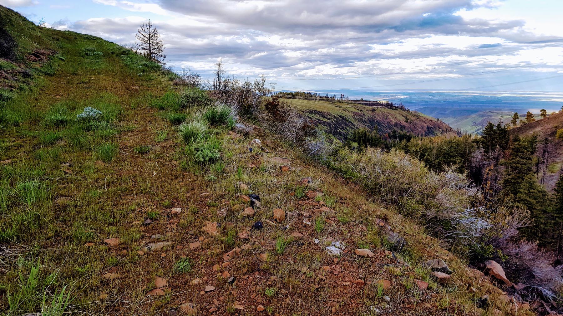
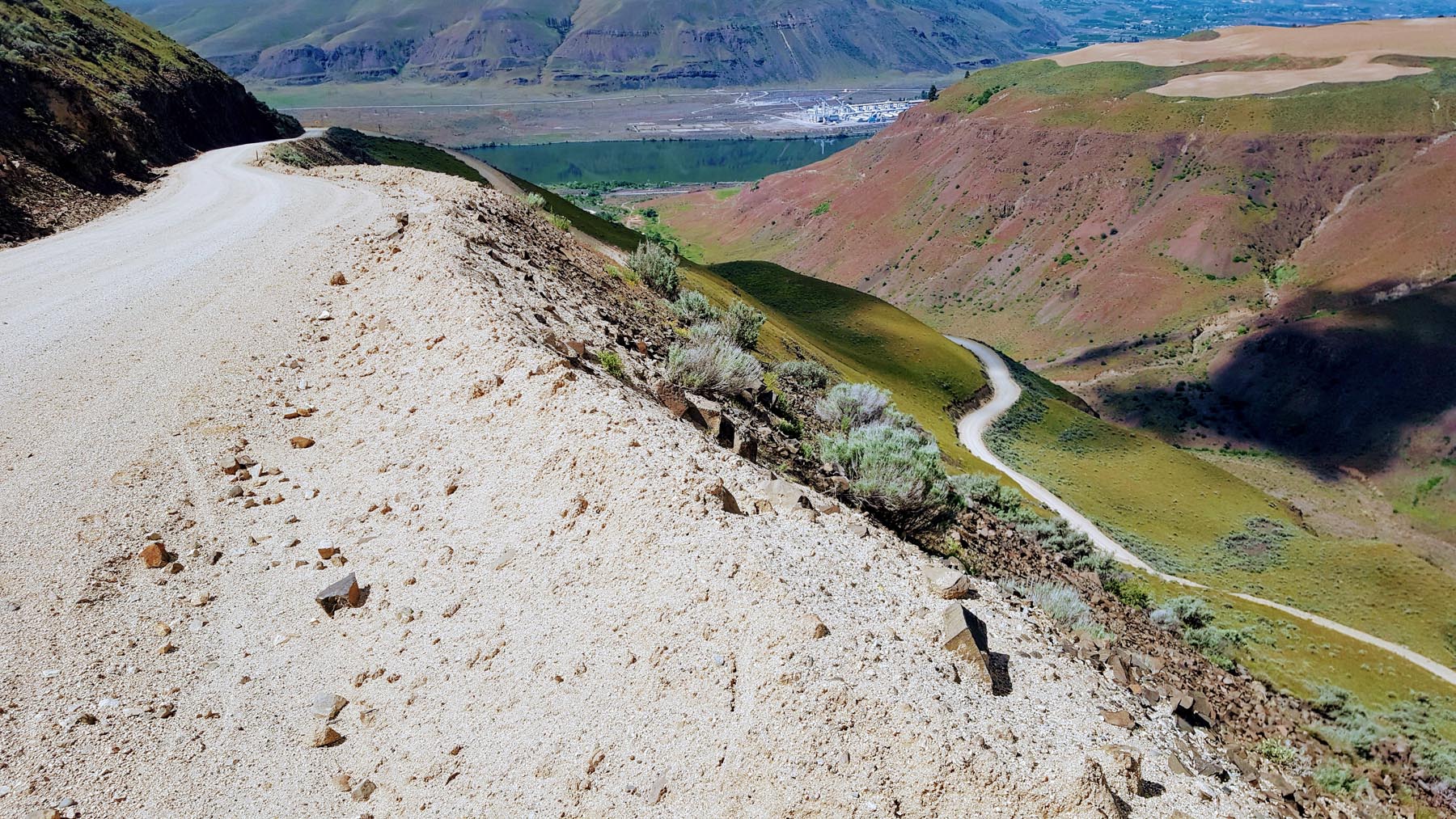
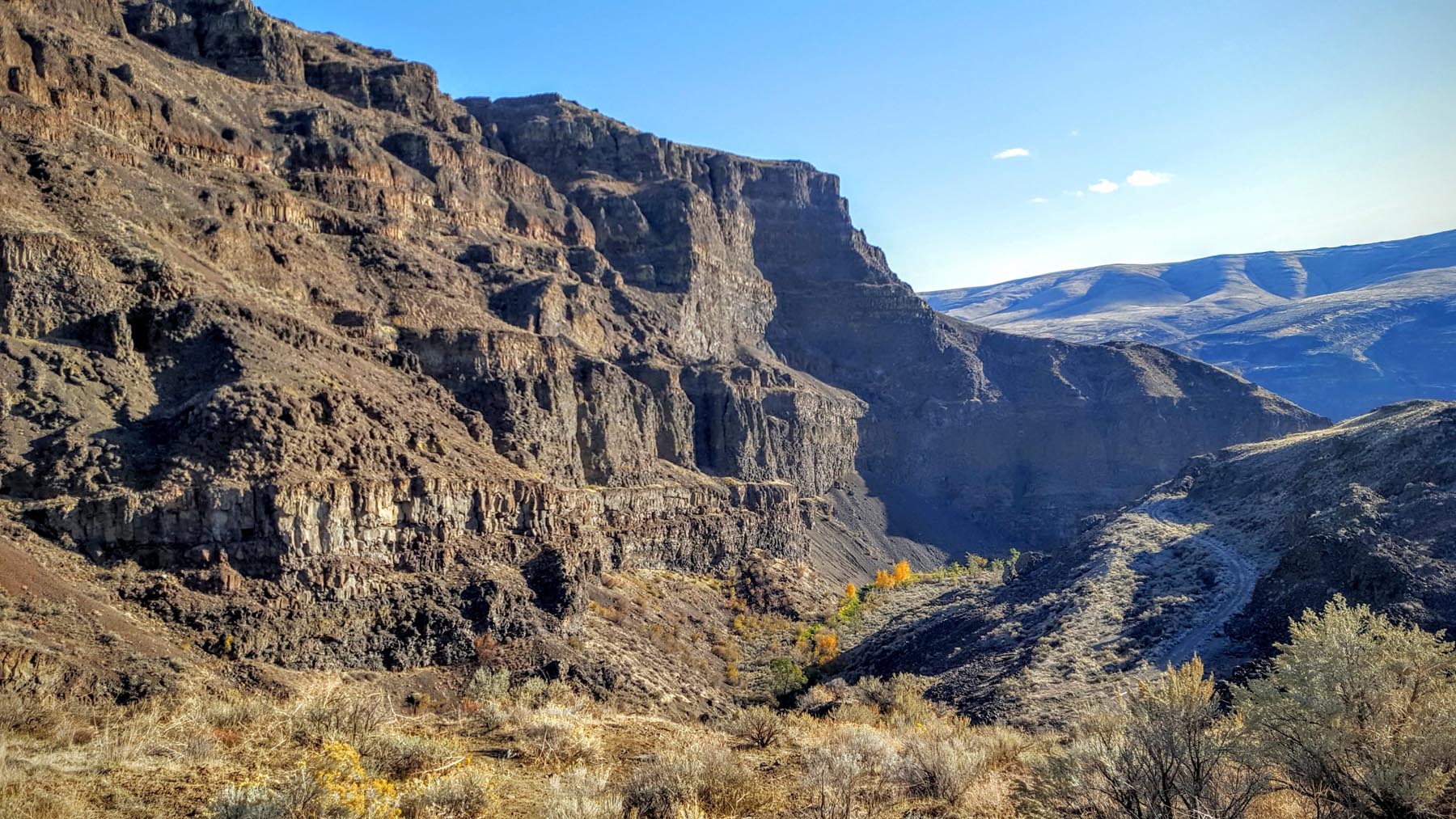
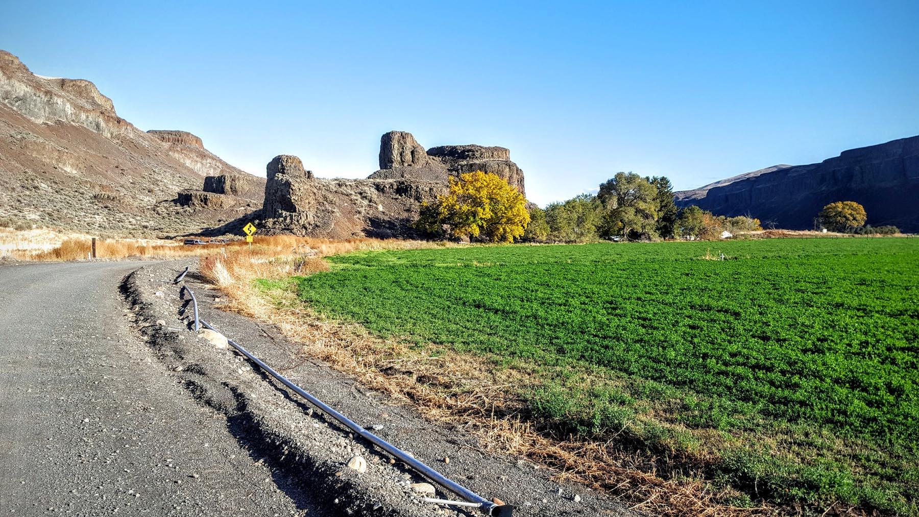
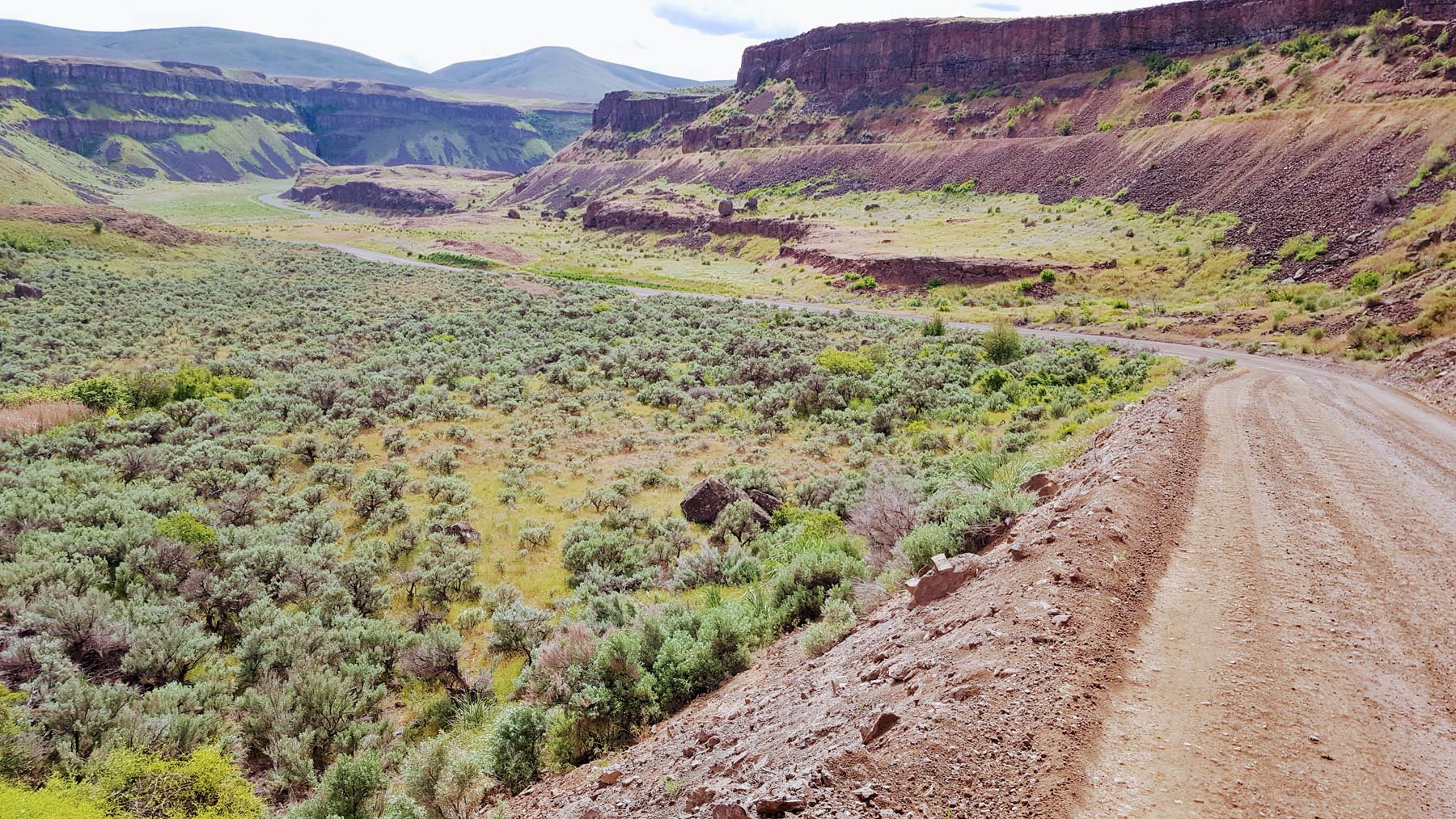
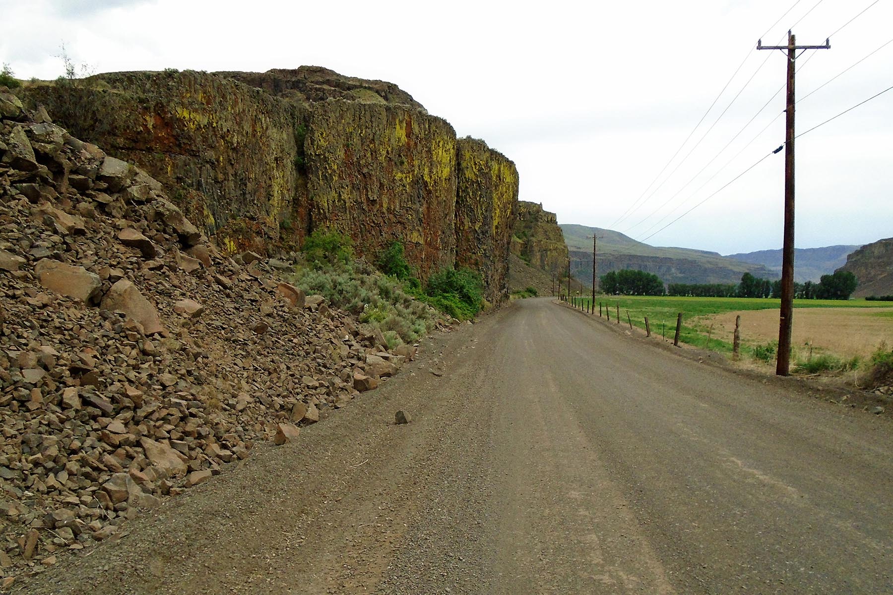
In Wenatchee, the route crosses the Columbia River and then climbs back out of the Wenatchee valley by ascending the Rock Island Grade up to Badger Mountain. The descent down Douglas Creek through it’s steep rocky canyon into Moses Coulee is an amazing transition from the prairies at the top of Badger Mountain.
The steep climb up the Three Devils will get you out of Moses Coulee and up onto Sagebrush Flat. After traversing Sagebrush Flat (not flat) the route descends Davis Canyon into Ephrata.
From Ephrata, the route follows the Hiawatha Valley to Moses Lake where the route passes through the Sand Dunes. The main road through the dunes is generally rideable. But if you venture off the main road, you will quickly get bogged down in the never-ending deep sand.
The route then works its way south to pass through the Columbia National Wildlife Refuge before rejoining the John Wayne Pioneer Trail just past Warden.
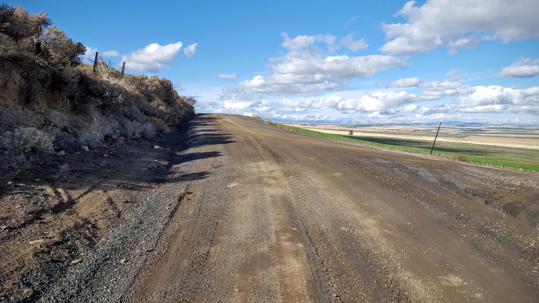
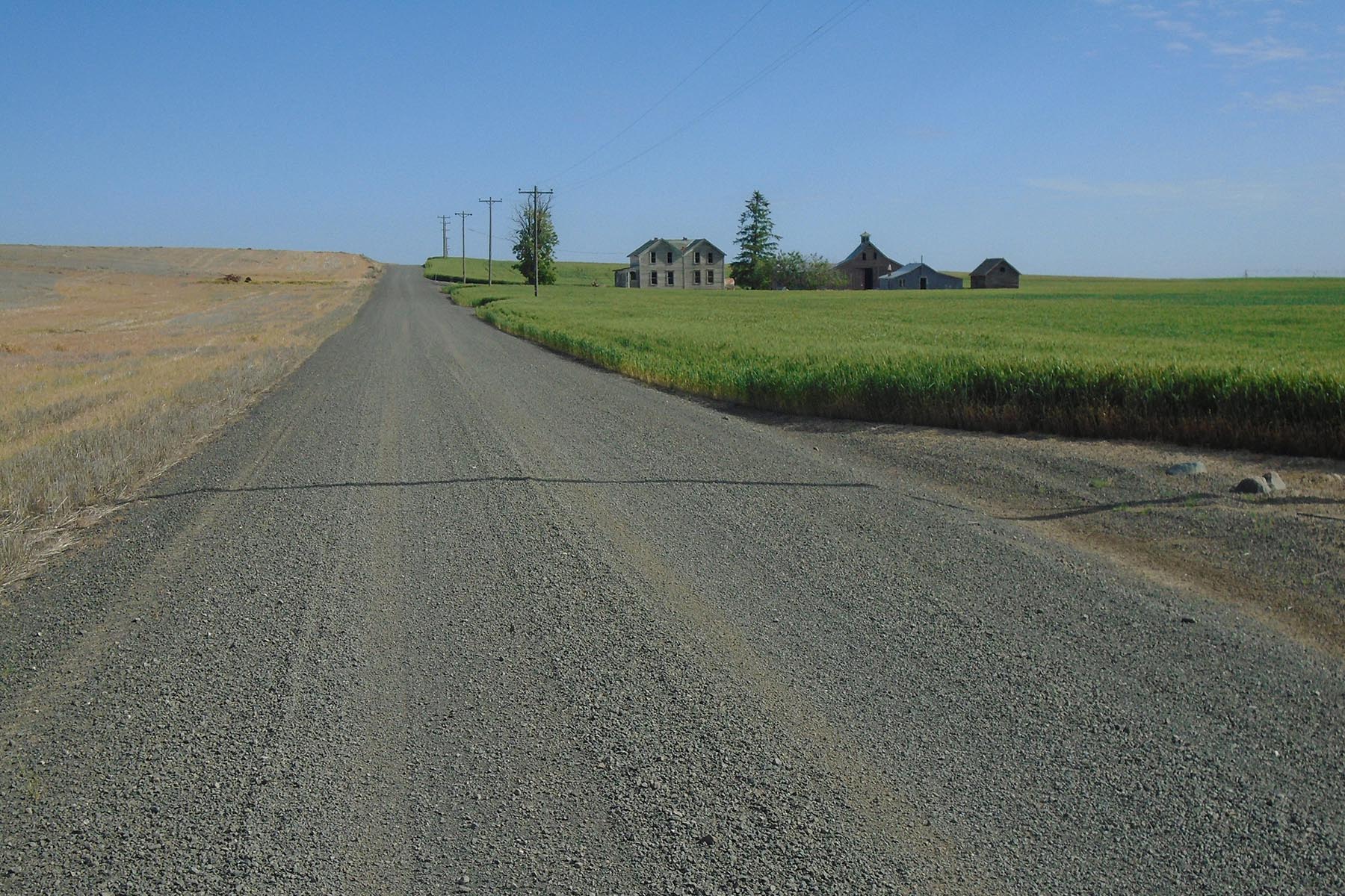
Just past Ralston, there is a gap in the trail requiring a detour north through Ritzville. From Ritzville to Malden is 60 miles. This stretch is usually quite hot and dry so be sure to stock up. There is no water available anywhere on this stretch of theo route. And even Malden is a bit of a question mark. There is a soda machine at the city park. There is a new store in town so if you catch them while open, you can get some supplies as well. Otherwise, pushing on to Rosalia and Tekoa are your only options.
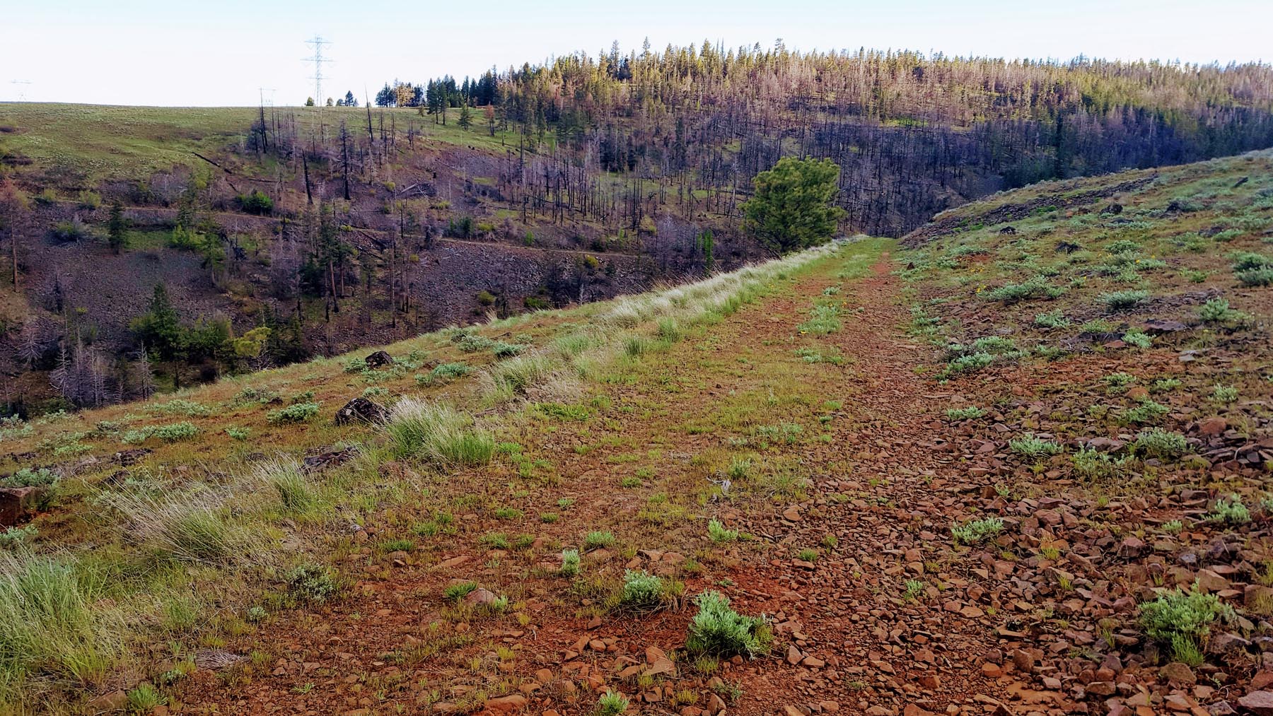
The John Wayne trail picks up again 15 miles after Ritzville. After another 10-15 miles, the you will leave the trail again. The route will pass through scenic Escure Ranch taking dirt roads through the hills before rejoining the John Wayne trail for the last time just before Malden.
From here, the trail will take you through Rosalia and Tekoa before finishing in the middle of nowhere 8 miles past Tekoa at the Idaho border.
Tekoa is a great town and beyond supportive of anyone who comes to town via the John Wayne trail. Stop in at the restaurant or bar and tell them what you just did. I guarantee you instant friends.


Terms of Use: As with each bikepacking route guide published on BIKEPACKING.com, should you choose to cycle this route, do so at your own risk. Prior to setting out check current local weather, conditions, and land/road closures. While riding, obey all public and private land use restrictions and rules, carry proper safety and navigational equipment, and of course, follow the #leavenotrace guidelines. The information found herein is simply a planning resource to be used as a point of inspiration in conjunction with your own due-diligence. In spite of the fact that this route, associated GPS track (GPX and maps), and all route guidelines were prepared under diligent research by the specified contributor and/or contributors, the accuracy of such and judgement of the author is not guaranteed. BIKEPACKING.com LLC, its partners, associates, and contributors are in no way liable for personal injury, damage to personal property, or any other such situation that might happen to individual riders cycling or following this route.
Please keep the conversation civil, constructive, and inclusive, or your comment will be removed.