


Exmoor Explorer Overnighter
Distance
52 Mi.
(84 KM)Days
2
% Unpaved
58%
% Singletrack
28%
% Rideable (time)
100%
Total Ascent
5,184'
(1,580 M)High Point
1,673'
(510 M)Difficulty (1-10)
6?
- 7Climbing Scale Strenuous100 FT/MI (19 M/KM)
- 6Technical Difficulty Moderate
- 7Physical Demand Difficult
- 5Resupply & Logistics Moderate
Contributed By

Alan Danby and Britt Walker
Guest Contributor
Alan and Britt are two creatives from the South West of England. Alan is based in North Devon, and Britt is in Bristol. They love nothing more than exploring their local areas or adventuring further afield to see a new part of the world by bicycle.
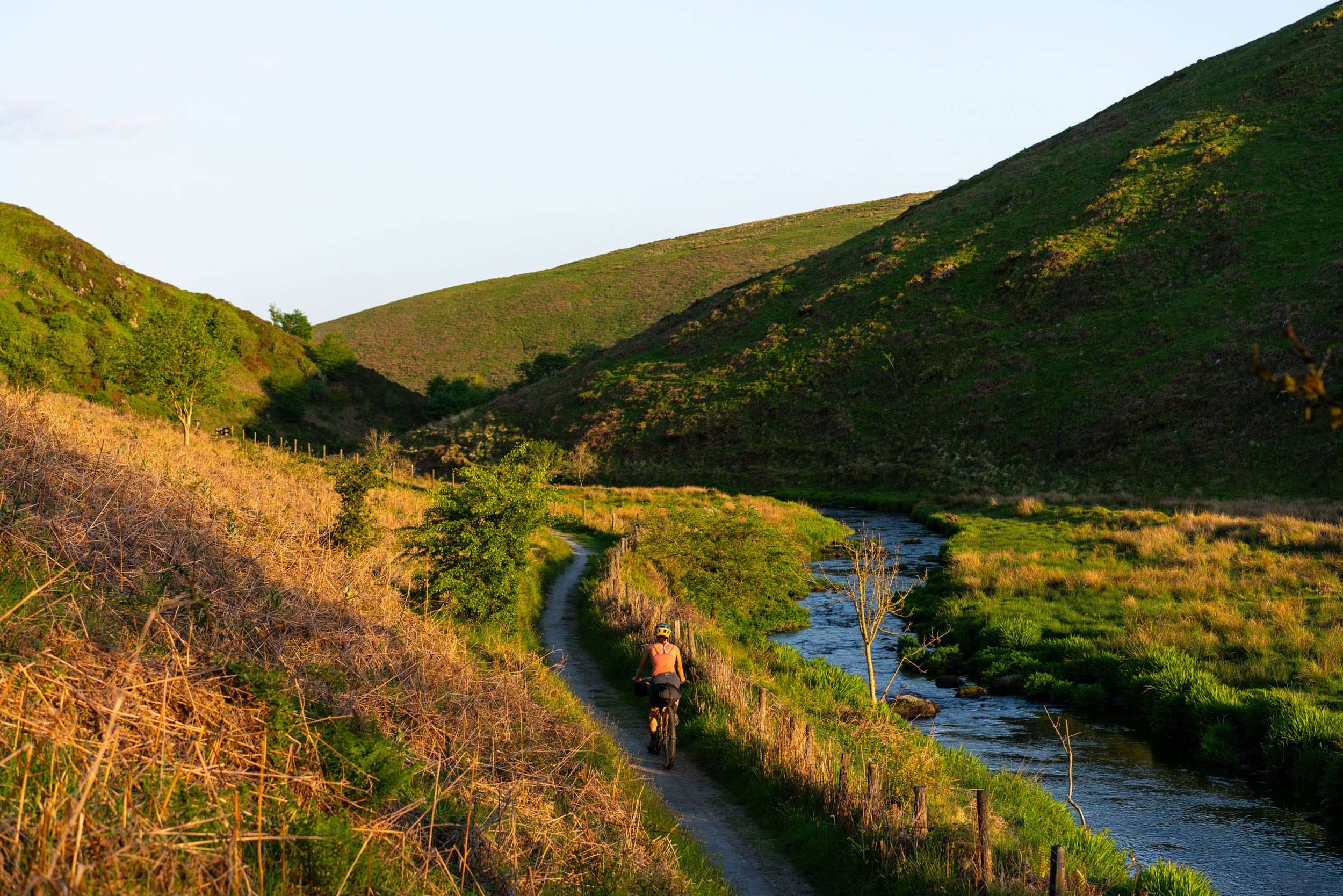
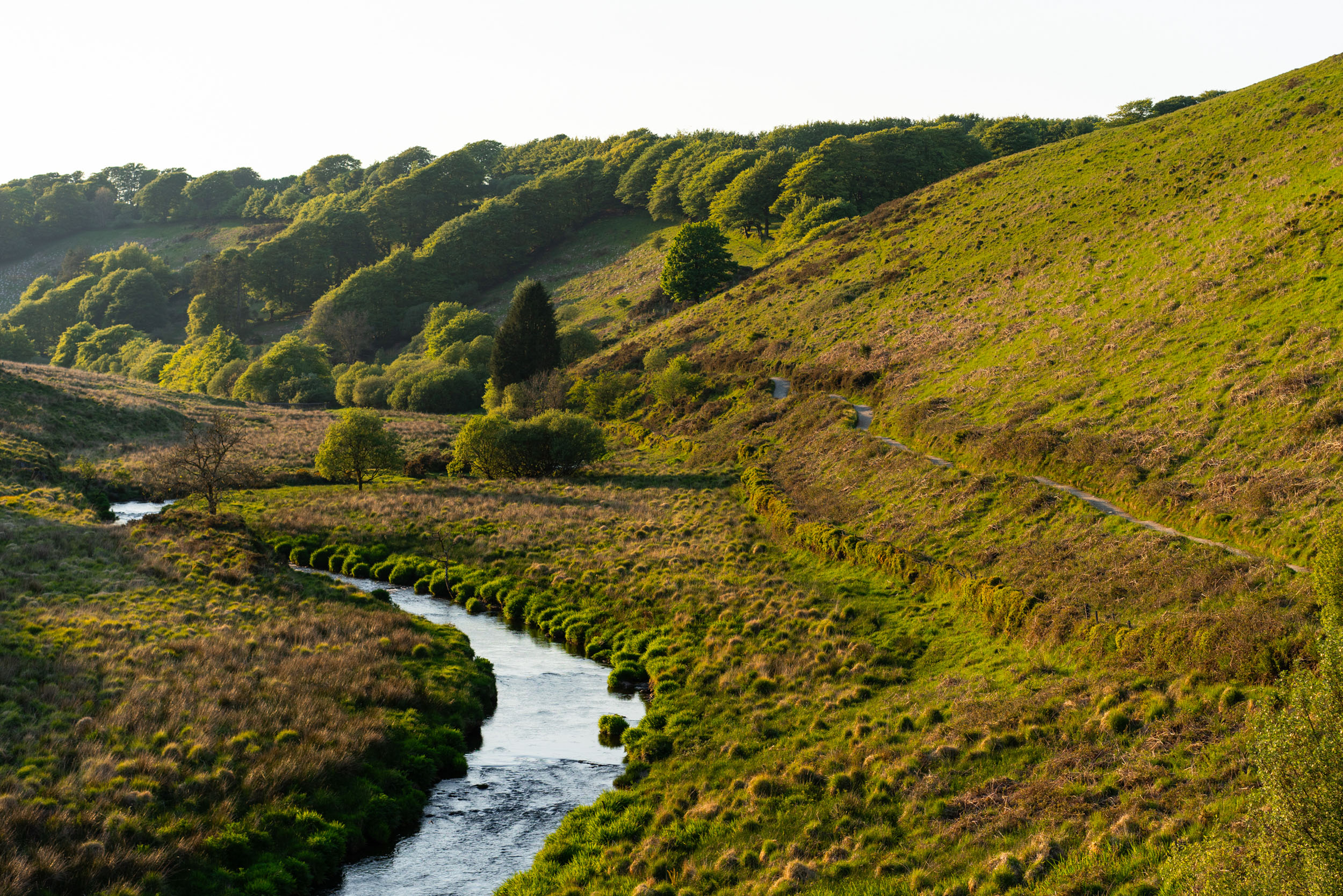
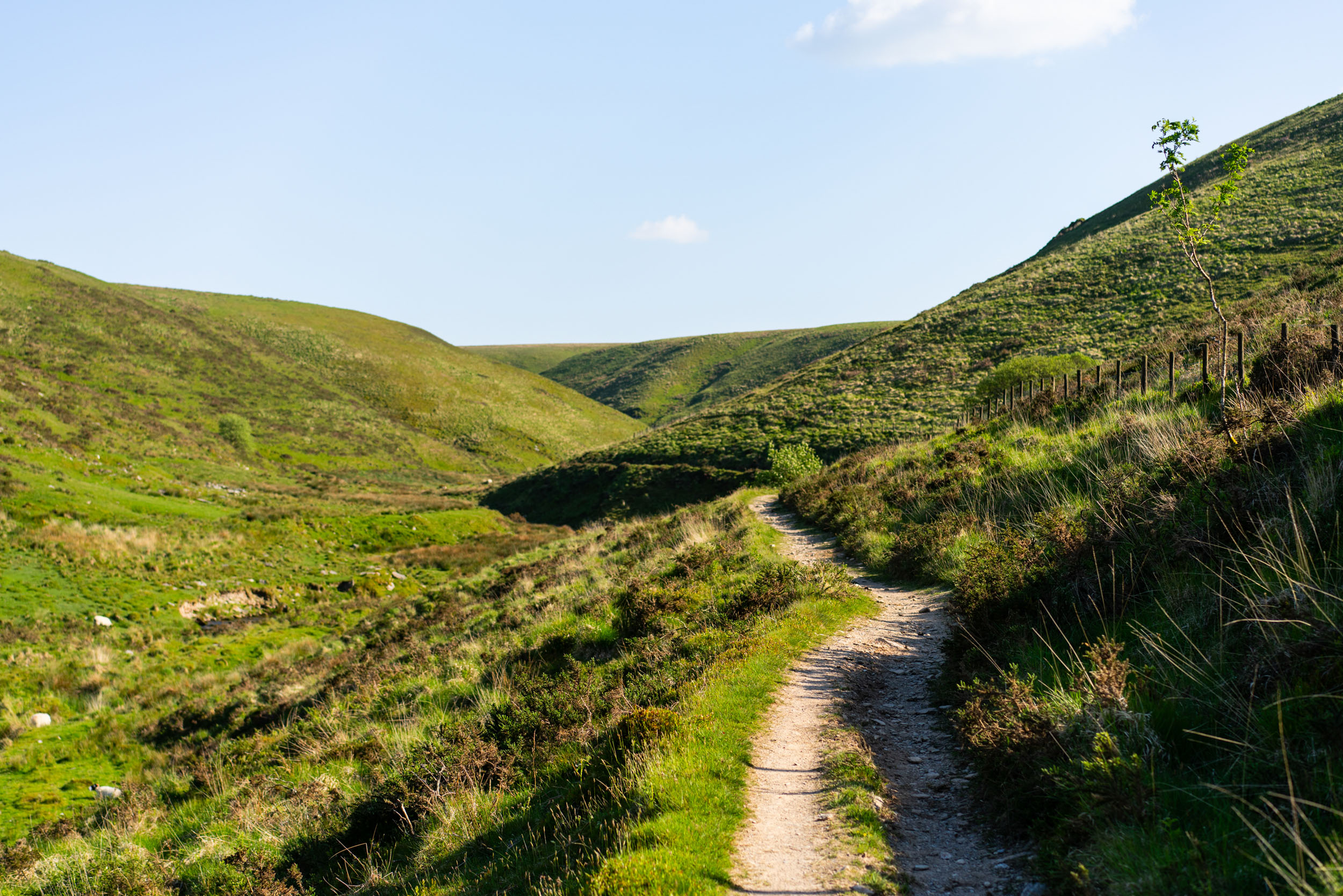
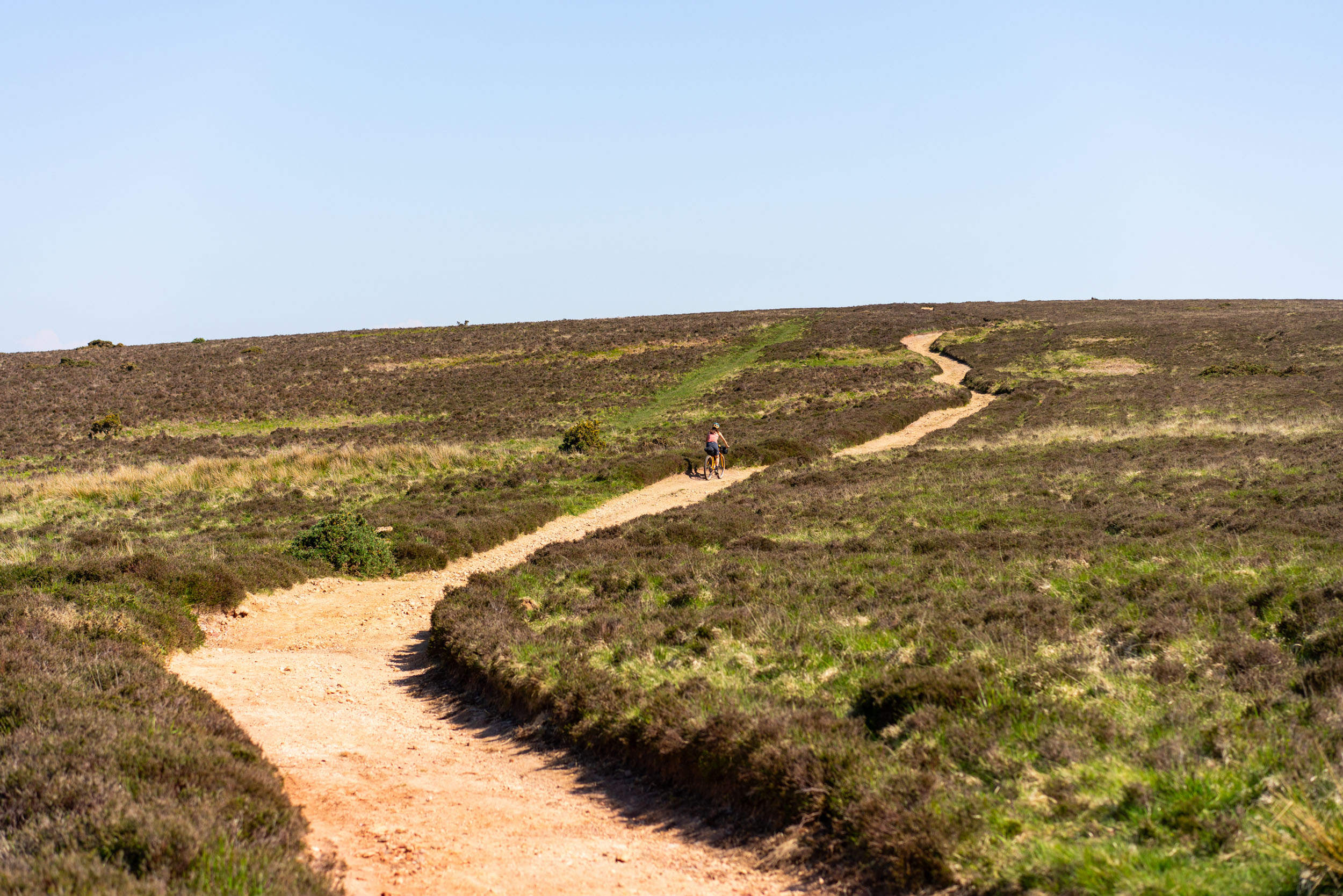
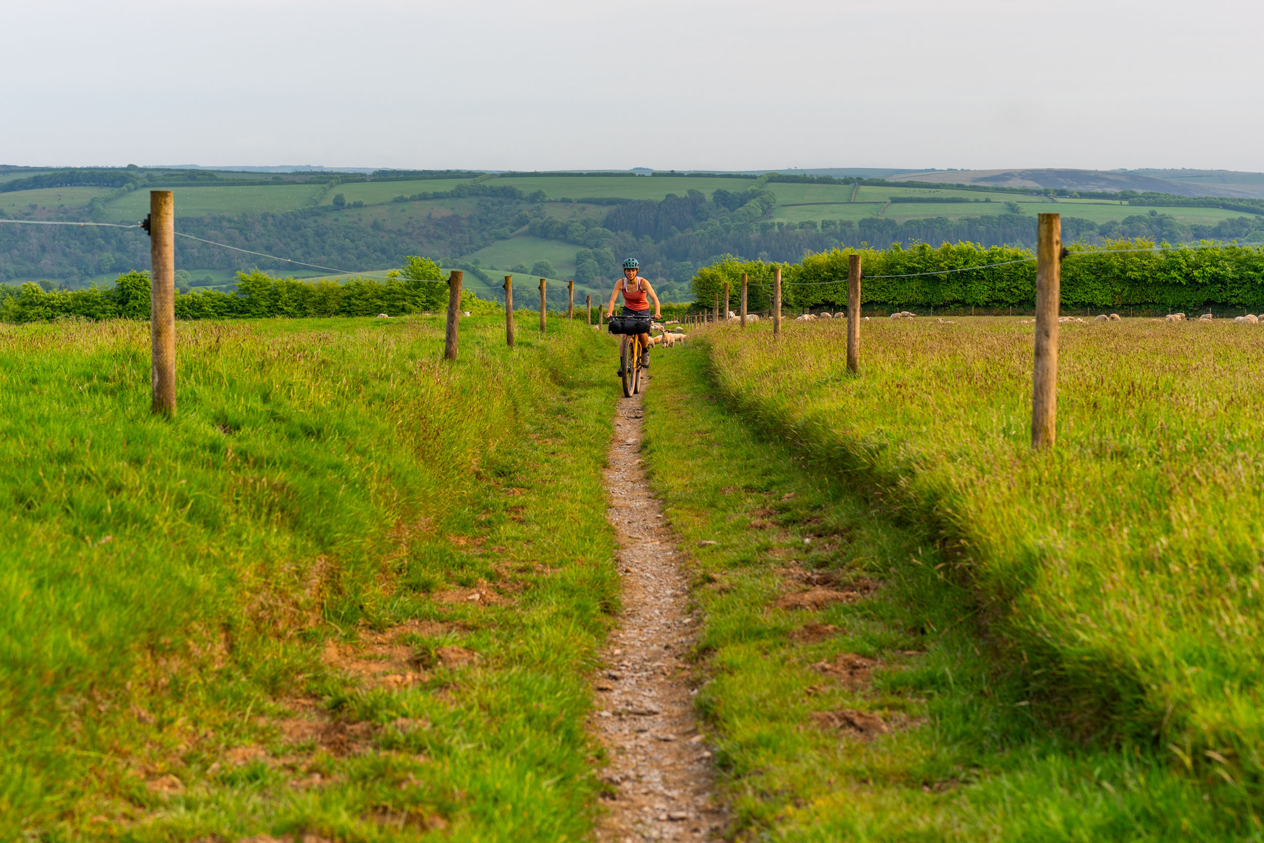
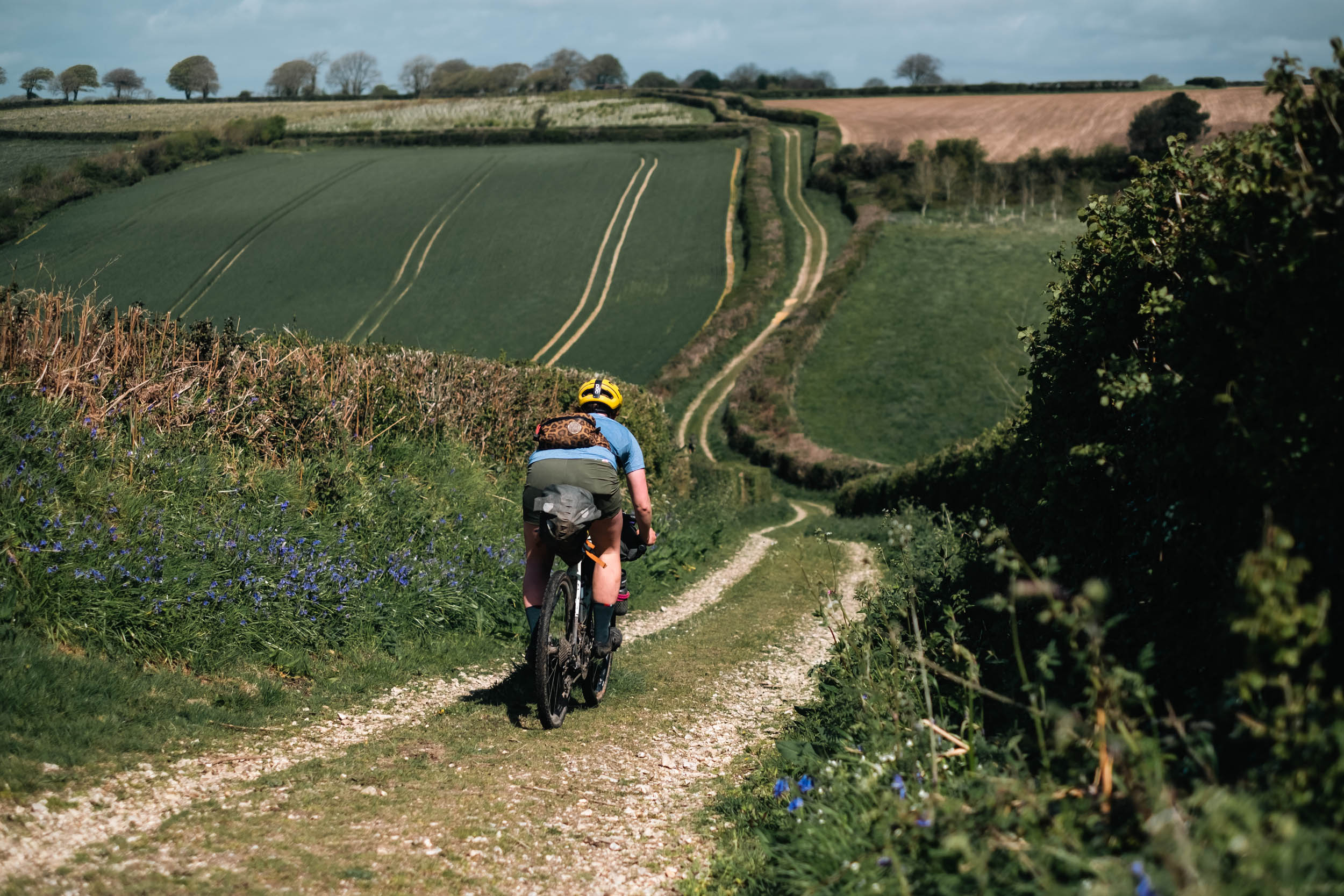
Exmoor National Park is a wild and rugged region that sits across North Devon and West Somerset. It’s best known for its open moorland, wooded valleys, dramatic coastline, and strong sense of remoteness. The area is deeply shaped by human history. Ancient drovers’ roads, packhorse tracks, and estate paths form much of the route, linking small settlements that still cater well to passing travellers. These ancient routes now offer incredibly diverse terrain to ride and enjoy. You will find yourself pedalling over untracked grassland, down mellow mud paths, and on loose, rocky singletrack. The route might seem short, but there will be very few moments when you are not climbing or descending. Luckily, each small village and town has a host of pubs and tearooms, making resupply straightforward and adding to the route’s relaxed, social feel. Make sure to have a local ale or tuck into a Devonshire cream tea, but remember: go cream first, then jam, or you may get some funny looks from the locals.
The route can be ridden as a big day out, but it’s best enjoyed as a slow overnighter, with plenty of time for swims, cafe stops, and simply allowing yourself time to take in the tranquillity of Exmoor. Even though there are plenty of settlements along the route, in between, you’ll find plenty of quiet areas with not a soul in sight. It feels peaceful and undisturbed, offering a calming sense of seclusion. Wildlife is abundant throughout, with red deer, Exmoor ponies, and ground-nesting birds commonly seen on the high ground. If you take your time, you will be rewarded with plenty of animal interactions, and if you camp, be sure to listen for the early-morning birdsong. Exmoor was also designated as Europe’s first International Dark Sky Reserve due to minimal light pollution, so don’t forget to peek out of the tent as night draws in to see the stars above!

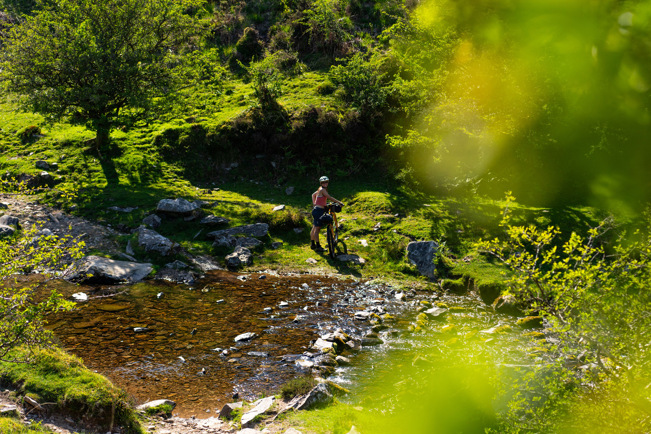
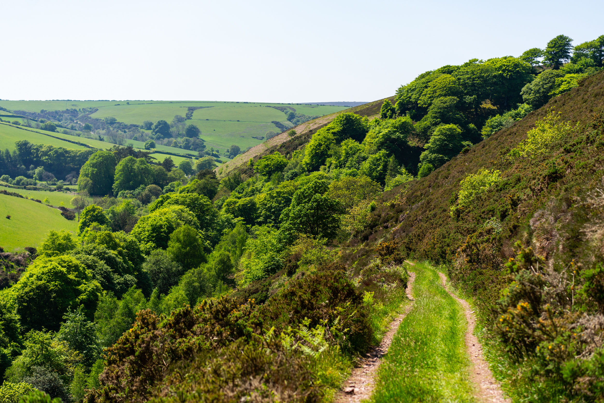
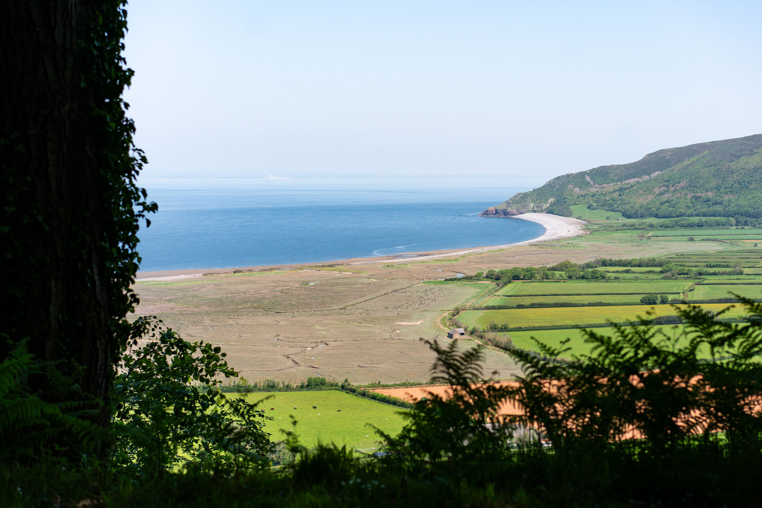
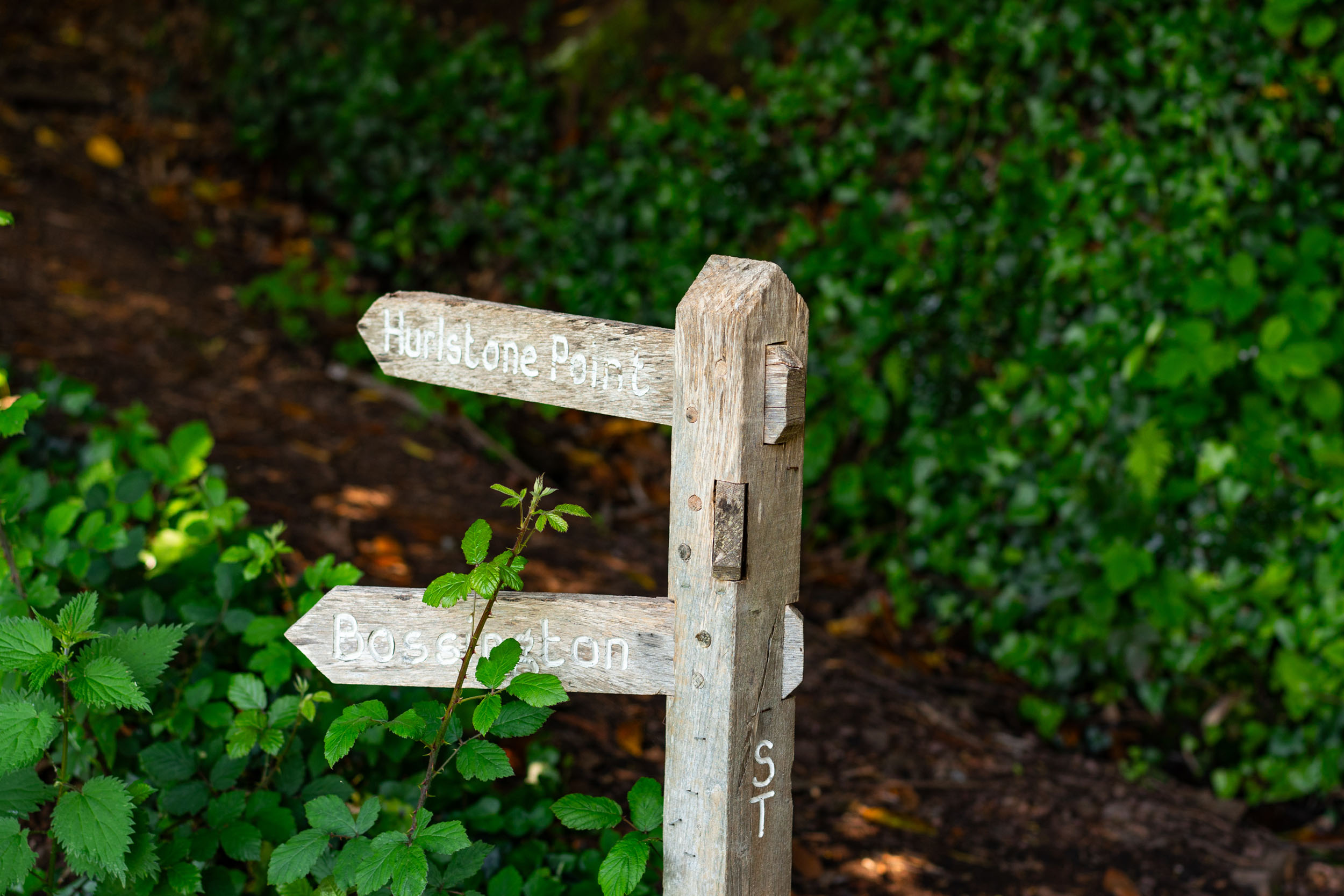
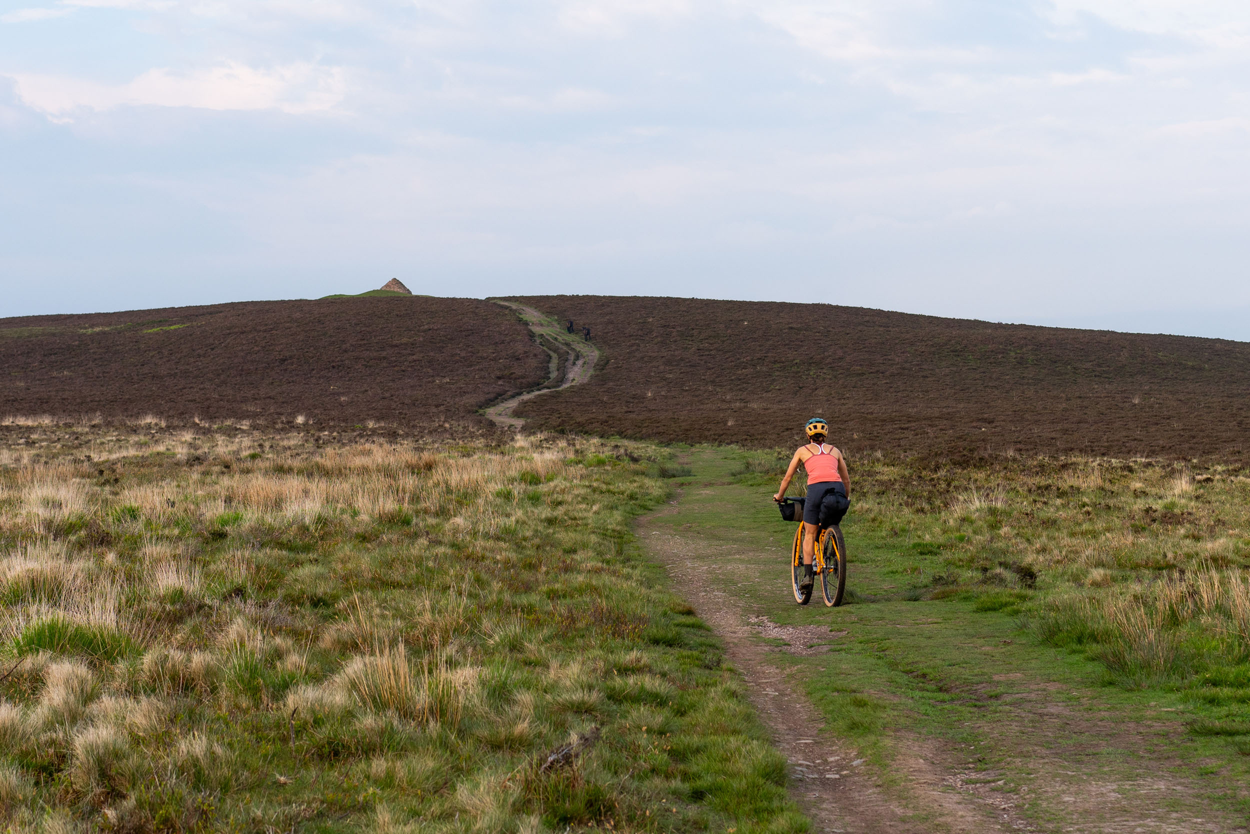
The high points of the route come at Dunkery Beacon, Exmoor’s highest summit, and Selworthy Beacon, both offering expansive views across the rolling moorland, patchwork farmland, and the Bristol Channel. Clear days can stretch the horizon far into Wales. Water is a defining feature of this route. In the summer, the route naturally links river pools and sea dipping spots, making it ideal for warm-weather riding, with plenty of opportunities to cool off. Rivers such as the Barle, Lyn, and Horner cut deep into the valleys and offer deep pools right through the summer. Porlock Bay is a beautiful bay with Bossington Beach at one end and Porlock Weir at the other. It is known for its vast shingle ridge, salt marshes, and unique geology, formed by the River Horner and the sea’s powerful tides. The picture-perfect village of Porlock sits just inland, and its history dates back to Saxon times; its name means “locked port,” referring to its historic harbour at Porlock Weir, a significant trading spot used for over a thousand years and potentially even visited by Vikings.
The coastal section between Porlock and Lynmouth is often referred to as the “Little Switzerland of England,” a nickname coined by Victorian tourists impressed by the steep, wooded valleys and rugged shoreline. The contrast between open moor, dense woodland, and exposed coast will make you feel as if you have ridden through multiple regions all within one ride. This is one of Exmoor’s defining characteristics and a definite highlight of the route.
For those looking to extend the adventure, this route also pairs well with the Exmoor & Quantock route, creating the option for a longer, more challenging loop.
Route Difficulty
This route might be short, but it will test you. Most of the trails are relatively flowy, but some are steep and technical, with loose rocks and streams. The climbs are challenging at times, with some hike-a-bike sections, but the views will make up for it.
There are plenty of options for camping and resupply, making it accessible, with shops, pubs, and cafes all within close distance. That said, the majority are on the section from Simonsbath to Porlock. After that, there is just one cafe in Malmsmead, so check the opening times if you are aiming to resupply there.
To get to the start in Simonsbath, you will require a car; there is no public transport to these remote parts of the moor. Another good place to start would be Minehead, as there are plenty of services here. If you require transport, your best bet would be to get a train to Taunton and either ride or take a taxi to Minehead, or make this a longer ride by adding the Quantocks route.
Route Development: This route was created after many adventures onto the moors to find the best flowing trails that Exmoor has to offer. We then set about connecting our favourite sections to make a loop we could head out on for a big day on the bikes or a nice slow overnighter, depending on the mood or the group. We have enjoyed both and always look forward to the next time we have this route pencilled into our diaries.


Submit Route Alert
As the leading creator and publisher of bikepacking routes, BIKEPACKING.com endeavors to maintain, improve, and advocate for our growing network of bikepacking routes all over the world. As such, our editorial team, route creators, and Route Stewards serve as mediators for route improvements and opportunities for connectivity, conservation, and community growth around these routes. To facilitate these efforts, we rely on our Bikepacking Collective and the greater bikepacking community to call attention to critical issues and opportunities that are discovered while riding these routes. If you have a vital issue or opportunity regarding this route that pertains to one of the subjects below, please let us know:
Highlights
Must Know
Camping
Food/H2O
Trail Notes
Resources
- Exmoor hosts some of the best natural trail riding in the country; most of the route is flowing and fun. One of the best sections runs from the start in Simonsbath along to Lanacre.
- The viewpoints from the top of Dunkery Beacon and Selworthy Beacon offer stunning vistas across the moors and sea. Even better, you can gaze at the scenes as you fly down some super fun singletrack.
- There are plenty of delightful swimming spots. If you choose a nice summer day, you’ll have an abundance of sea and rivers to cool off in.
- Bossington Beach at Porlock offers the best spot for a sea dip. If you fancy taking the route slowly and relaxing, on Fridays, there is a sauna right next to the ocean at Porlock Weir.
- “Little Switzerland of England” was coined by Victorian visitors for the coastline between Porlock and Lynmouth, due to the area’s dramatic, steep, wooded valleys and rugged coastal scenery that reminded them of the Swiss Alps.
- Pubs & Pies. What a combo! There is no end to quaint pubs along the route, giving plenty of opportunity to refresh yourself with a local beverage.
- Try a traditional Devonshire cream tea. Make sure to go cream first.
- This could be called the tearoom tour. There are many cosy cafes to tuck into for tea and cake along the way. This may not be a route you lose weight on.
- The tranquility of Exmoor will make you want to come back for more. Take in the scenes and listen to the wildlife.
- If you’re taking this route slow and camping, sunrise and sunset can be really special. The birds will be singing, and if you choose a high point to sleep, you should be able to see the sun set and rise again in the morning across the horizon.
When to go
- If you want to see this route in its best light, the best time to ride is through spring and summer when it’s lovely and warm. The trails will be drier, and all the amenities will be open. We love grabbing an ice cream in Porlock and eating it by the sea.
- However, this route is rideable all year round if you enjoy getting out in all weather conditions and temperatures. If you ride it in the winter, the camp sites will be closed; be sure to check the opening times of refuel points.
Logistics
- We choose Simonsbath as the start for our rides as it is our closest settlement, which just so happens to have a lovely pub to enjoy a bite and drink afterwards.
- There are plenty of other good locations. Porlock and Minehead could work as well. If you are doing it as an overnighter, Simonsbath works well, as the halfway point would be on the top of Selworthy Beacon, which is a great little spot for a wild camp.
- To get to the start in Simonsbath you will require a car; there is no public transport to these remote parts of the moor. Once in Simonsbath, there is a paid Exmoor National Park car park just up the hill from the Exmoor Forest Inn pub. You can find the location here.
- If you don’t have a vehicle, Minehead would be the best place to start, as there are plenty of services here. If you require transport, your best bet would be to get a train to Taunton and either ride or taxi to Minehead, or you could make this a bigger ride by adding this Quantocks route in.
- There are a few shops and repair workshops on the route. There is P&B Bike store in Minehead, Exmoor Bike sales in Porlock, and Tuned Cycles Repair shop on the outskirts of Minehead.
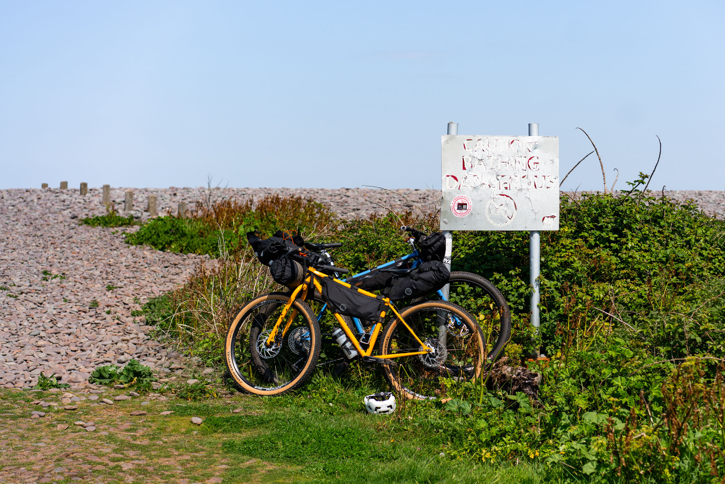
Dangers and Annoyances
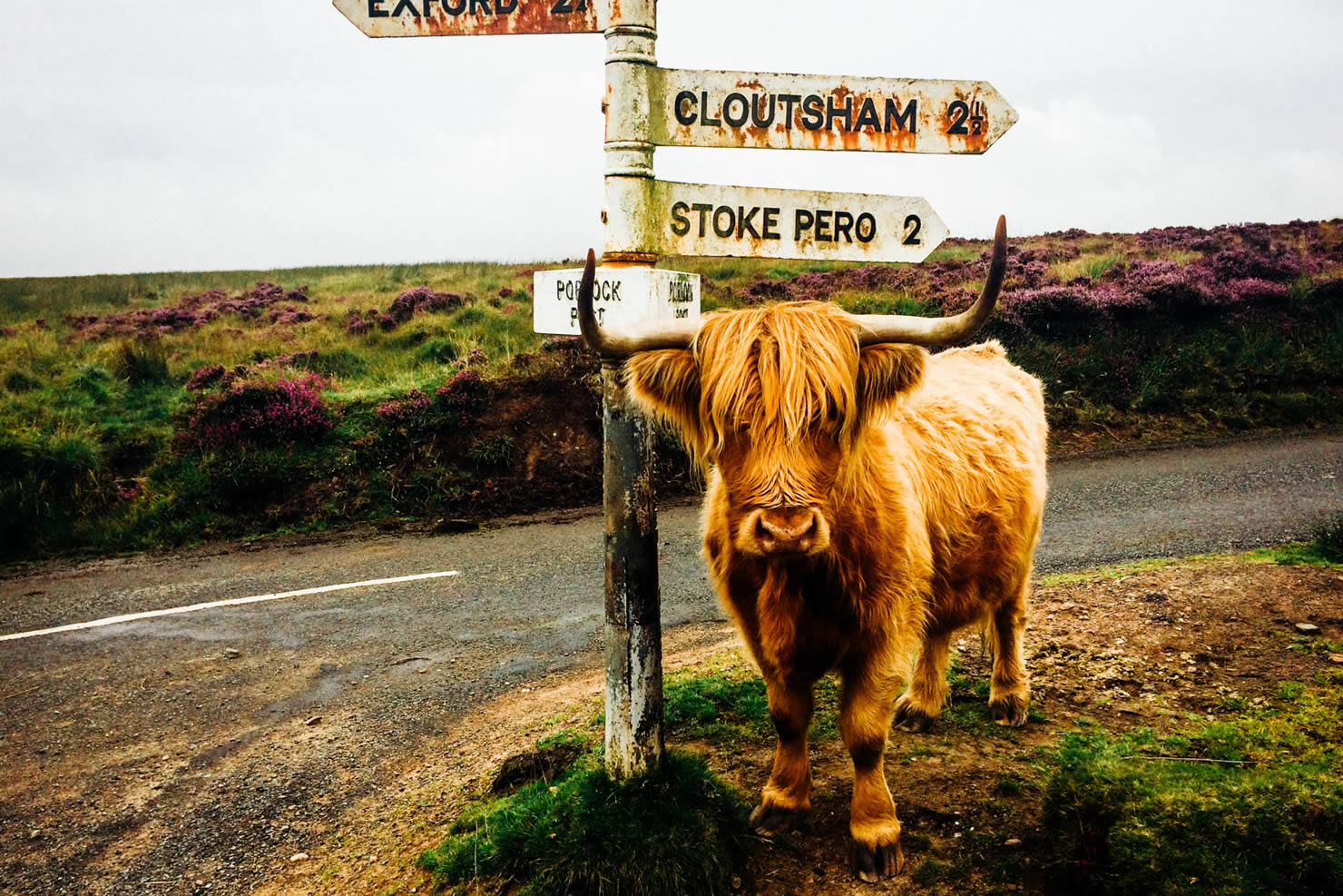
- Some of the trails go through farmland, so just be aware of any livestock that are around and always keep your distance from anyone on horseback.
Travel basics
- Minehead will be the biggest town and hub you will go through, which will have the best transport links and supply points. Exford and Porlock have plenty of amenities to refuel, but have no public transport links.
What bike?
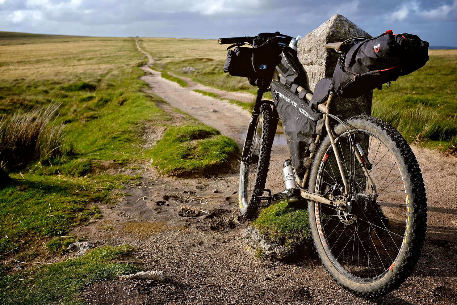
- We normally take our rigid 29er Brother Big Bro’s or full-suspension MTB’s out on this route.
- We would recommend anything with 2” plus tires. To have a little more fun on the descents, a hardtail or full-suspension bike would be the best.
- Having a decent amount of gears will also come in handy; you’ll definitely want something that lets you spin up steep climbs.
- However, if you have a gravel bike, don’t let the above put you off. It’s doable for the most part, it might just be difficult and loose on some of the more rocky descents.
- There are plenty of campsites to stay in along the way. If you want to wild camp, it is tolerated, but just make sure you are not on private land and that you leave no trace. Let’s keep these places accessible for all in the future.
- When starting in Simonbath, it means Porlock is perfectly halfway along the route, and luckily, it has some great camping spots. Burrowhayes Farm is a good option near the town, and Pool Bridge Campsite is a more natural setting further up the valley. Another secluded campsite is Cloud Farm campsite up the Lorna Doone valley. If you want to wild camp, there are some really special spots with views across the moors and sea. The tops of Dunkery Beacon and Selworthy Beacon tick both of these boxes.
- There are two affordable YHA hostels (Exford and Minehead); this provides a good backup plan if the weather is poor.
- If you’re after something nicer, there are plenty of B&B, hotels, and pubs to stay in with a comfy bed and other luxuries.
- There are plenty of refill spots along the way. Any of the villages will have a cafe or pub that will be happy to top up any water bottles. If you have a filter, there are plenty of streams and rivers. The longest sections without water are from Malmsmead to Simonsbath and from Exford to Minehead.
- Exford, Minehead, and Porlock are the biggest locations on the route and all have a variety of places to restock, including cafes, pubs, and small shops. Minehead and Porlock have larger supermarkets and plenty of amenity options.
- If you love a quaint little cafe for a cup of tea and cake, then this route is for you. A few favourite spots are Withypool Tearooms, Blenheim Gardens in Minehead, Piggy in the Middle in Porlock, and Buttery Cafe in Malsmead. Any one of those will fix your sweet cravings.
- There are plenty of cozy pubs along the way. The bonus of ending in Simonsbath means you can celebrate ending the ride with a cold beverage from the Exmoor Forest Inn. If you’re after a local ale on the ride, pop into The Ship in Porlock.
- There are plenty of good places to try some local delicacies. When riding in the South West, it is a must to have a cream tea somewhere along the route. The Buttery Cafe and Riverside Gardens in Malmsmead sits next to a lovely river and makes for the perfect spot to tuck into a cream tea and have a breather. If you’re after a local pie, Piggy in the Middle in Porklock is the spot.
location Simonsbath to Dunkery
Beacon Starting in the sleepy settlement of Simonsbath, the route begins to meander along the River Barle. The trail is fun and flowy to start, before getting a little technical as you head up and over a steep, grassy climb to Withypool. Exford is next and is the last refuel stop until Minehead. From Minehead, the route steadily climbs up the Dunkery Beacon on a mix of quiet roads and rocky trails. Make sure to take in the view at the top.
location Dunkery Beacon to Selworthy Beacon
All the climbing up to Dunkery Beacon is totally worth it. After enjoying the views over the Bristol Channel, start to flow down. The top section is generally pretty smooth. After you cross the road, the trail turns into singletrack, which can be fairly rocky and loose if there has been recent rain. The top half is in open moorland, and the second half is in the lush green trees of Horner Wood. A few quiet lanes will take you from here into Minehead. This is the biggest town on the route and the best place to resupply or get any bike issues fixed. After leaving the hustle and bustle, you’ll get straight back onto the trails as you climb up to the top of Selworthy Beacon on a beautiful stretch of paths that starts in dense woodland and sees you top out with stunning sea views. The moorland at the top of this headland is perfectly halfway along the route and is our recommended spot to wild camp. There are plenty of quiet areas with panoramic views across the sea and Exmoor.
location Selworthy to Malmsmead
The section from the top of Selworthy Beacon down to Porlock is a real highlight. You’ll start 500 metres up and end up right next to the sea at Bossington Beach. The trail is super fun and is a gentle gradient, so you can really take in the sights as you ride down to the shoreline and then onto Porlock. The village is quaint, picturesque, and has tons of character. There are plenty of cosy pubs, cafes, and convenience stores to restock in. This is the last place to guarantee some supplies before Simonsbath. From here, you’ll take the toll road up through a forest that overlooks the coastline. It is long but gentle, offering great views back to Porlock and Selworthy Beacon. Once at the top, the route sticks to the main road for a short time before dropping into an old dirt track, which is fast and fun. Once down in the valley, you’ll take a quiet road along the River Oare to Malmsmead.
location Malmsmead to Simonsbath
Malmsmead is a little settlement at the bottom of Lorna Doone Valley. There is a National Trust cafe here and a campsite a stone’s throw away. If you’re looking for a nice, quiet campsite, this is the spot. This section back to Simonsbath is probably the toughest and will be the most remote. The first climb is on the road, but it is super steep. After this, you’ll climb further on an old dirt road, which is relatively smooth and gentle. At the top, you’ll cross the road and take a grassy descent down into a valley. Here, you’ll have a short river crossing before a steep hike-a-bike section brings you back up onto open moorland.
From here, you’ll turn back towards Simonsbath and head south. The trail fades away into some open grassy terrain, which is relatively easy to follow, but keep an eye on the map to make sure you don’t follow any sheep tracks. Depending on the time of year, this section can be really difficult after heavy rain, when the ground is soft and muddy. If it has been warm and dry, this section will be hard and flowing. After riding for about two miles, you’ll drop back down into another valley and cross a small bridge, which takes you up to a random piece of singletrack that feels quite out of place. That needn’t matter, as the hard work to get to this spot is rewarded with some glorious riding along a nice little stream. After weaving along the valley, the route climbs up to one last high point. This is where you’ll leave the singletrack behind and take a grassy descent back down to Simonsbath for a well-earned drink and some food in the pub.
Additional Resources


Terms of Use: As with each bikepacking route guide published on BIKEPACKING.com, should you choose to cycle this route, do so at your own risk. Prior to setting out check current local weather, conditions, and land/road closures. While riding, obey all public and private land use restrictions and rules, carry proper safety and navigational equipment, and of course, follow the #leavenotrace guidelines. The information found herein is simply a planning resource to be used as a point of inspiration in conjunction with your own due-diligence. In spite of the fact that this route, associated GPS track (GPX and maps), and all route guidelines were prepared under diligent research by the specified contributor and/or contributors, the accuracy of such and judgement of the author is not guaranteed. BIKEPACKING.com LLC, its partners, associates, and contributors are in no way liable for personal injury, damage to personal property, or any other such situation that might happen to individual riders cycling or following this route.
Further Riding and Reading
Here are some connected/nearby routes and related reports...
Please keep the conversation civil, constructive, and inclusive, or your comment will be removed.