


Bikepacking the Westcountry Way: Across the Moors
Distance
130 Mi.
(209 KM)Days
3
% Unpaved
55%
% Singletrack
35%
% Rideable (time)
100%
Total Ascent
13,800'
(4,206 M)High Point
1,590'
(485 M)Difficulty (1-10)
5?
- 7Climbing Scale Strenuous106 FT/MI (20 M/KM)
- -Technical Difficulty
- -Physical Demand
- -Resupply & Logistics
Contributed By
Chris Goodman
(Un)Inspired Rambler
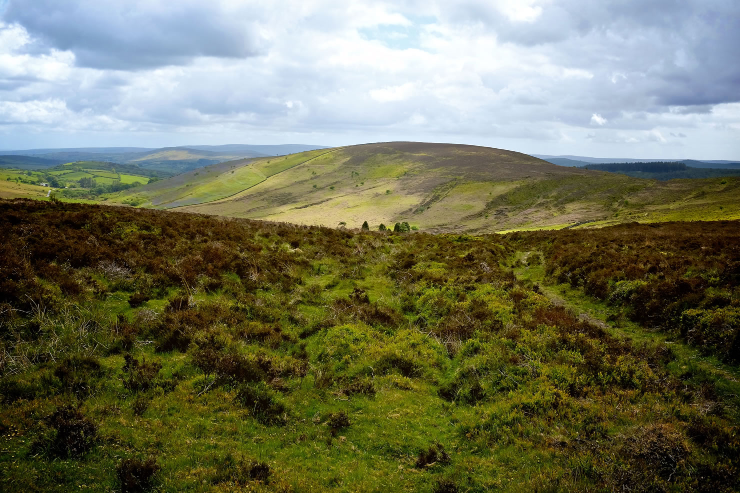
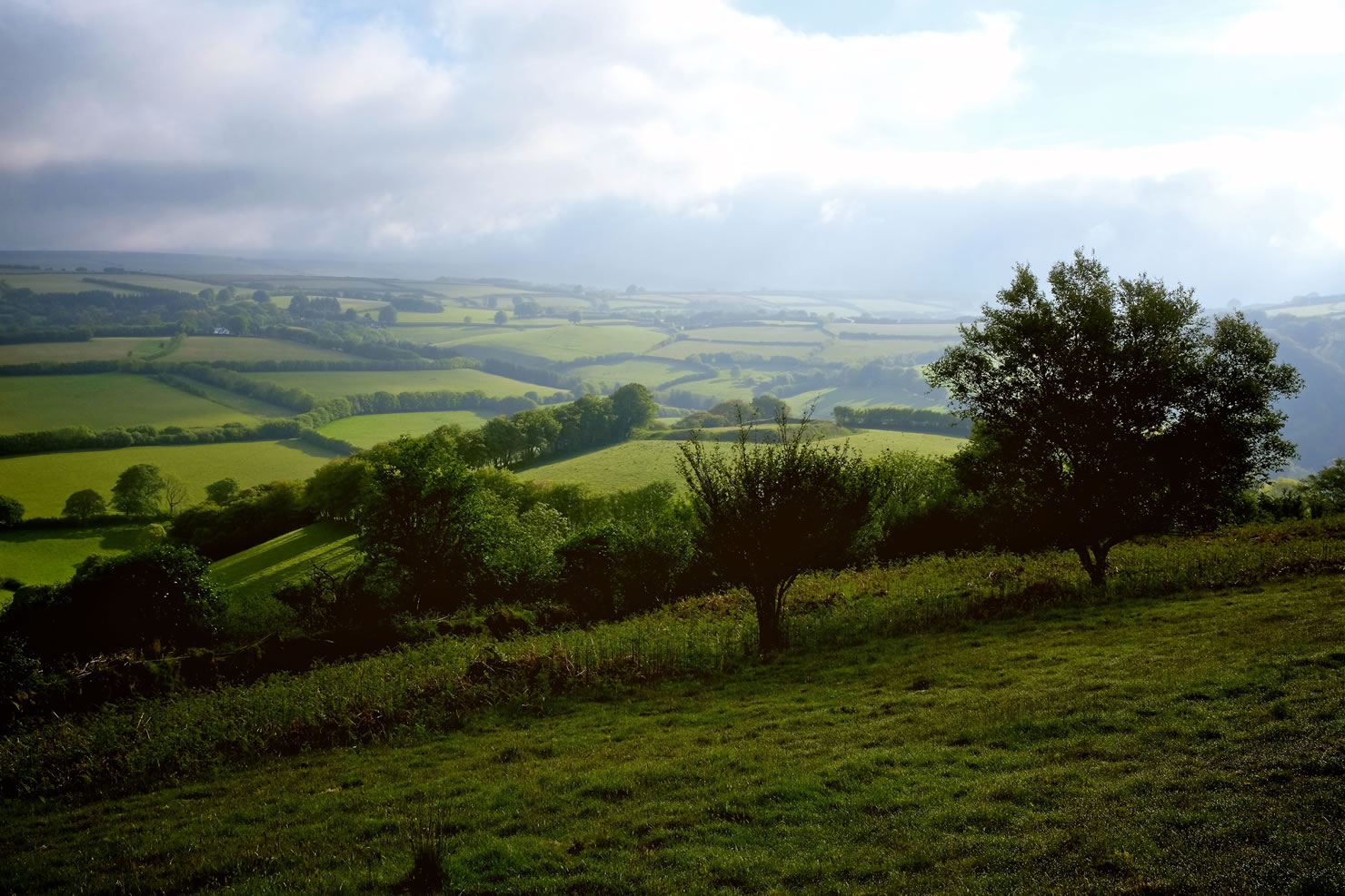
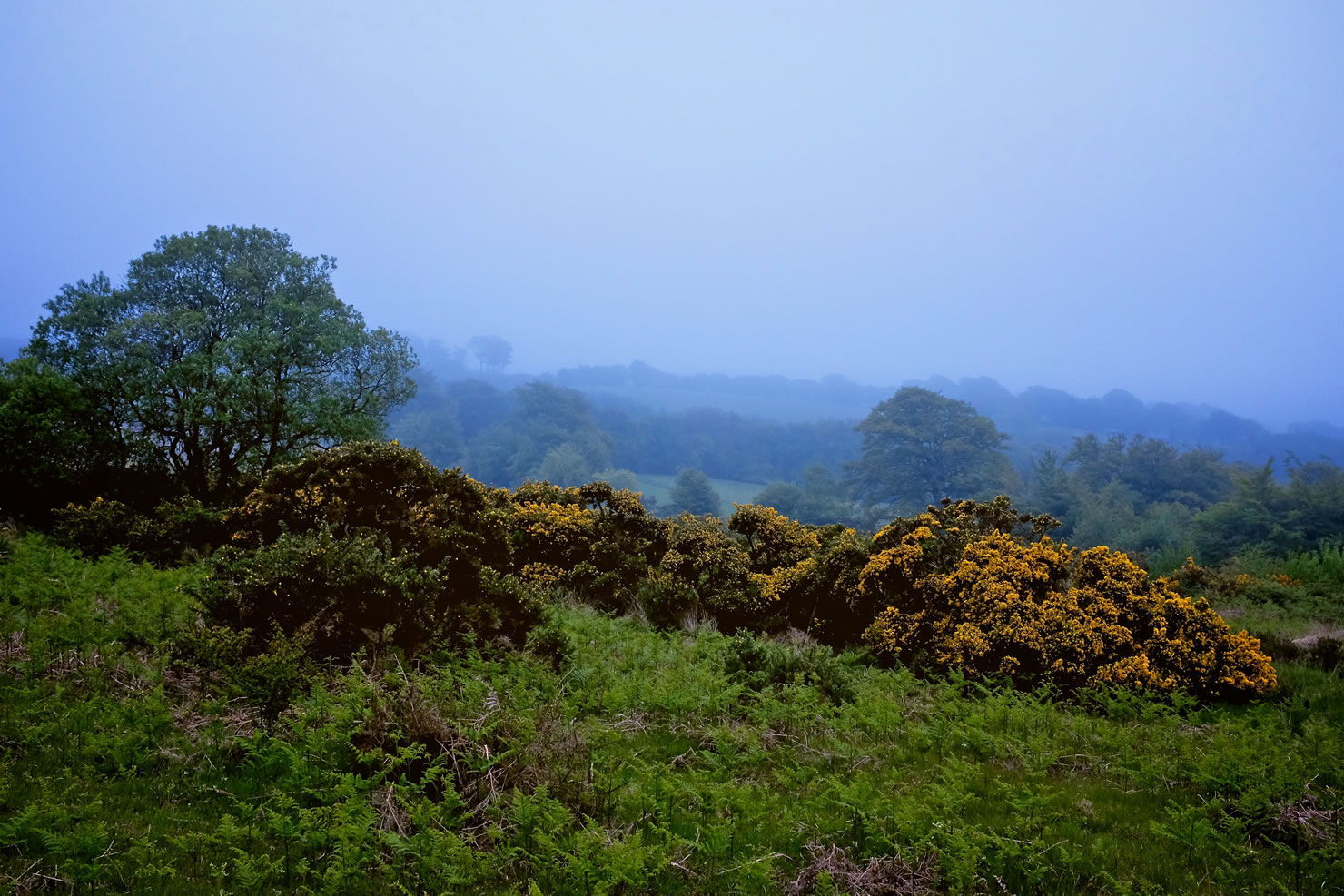
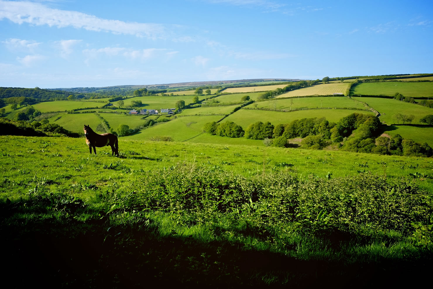
This part of the country is an evocative place, with a history rich in folklore. Dartmoor, with its open moorland, forests, rivers, wetlands and imposing granite tors, is home to Sir Arthur Conan Doyle’s The Hound of the Baskervilles, probably Sherlock Holmes’ most famous adventure. Exmoor has a similarly foreboding, although more intimate, atmosphere and its own legends including the Beast of Exmoor, a large predatory cat said to roam the moors through the 1970s and 80s.
The journey from Plymouth on the south coast to Minehead in the north can be completed comfortably in three full days, although there are ample camping and bunkhouses options if you want to break up the ride into smaller chunks and add an extra day or two. It’s also possible to complete the journey in two long days. This route crosses the Exmoor and Quantock Hills route. A combination of both routes would provide ample options for a longer trip.


Submit Route Alert
As the leading creator and publisher of bikepacking routes, BIKEPACKING.com endeavors to maintain, improve, and advocate for our growing network of bikepacking routes all over the world. As such, our editorial team, route creators, and Route Stewards serve as mediators for route improvements and opportunities for connectivity, conservation, and community growth around these routes. To facilitate these efforts, we rely on our Bikepacking Collective and the greater bikepacking community to call attention to critical issues and opportunities that are discovered while riding these routes. If you have a vital issue or opportunity regarding this route that pertains to one of the subjects below, please let us know:
Highlights
Must Know
Camping
Food/H2O
Trail Notes
Resources
- A coast-to-coast crossing of one of the most atmospheric areas of ancient countryside in the UK.
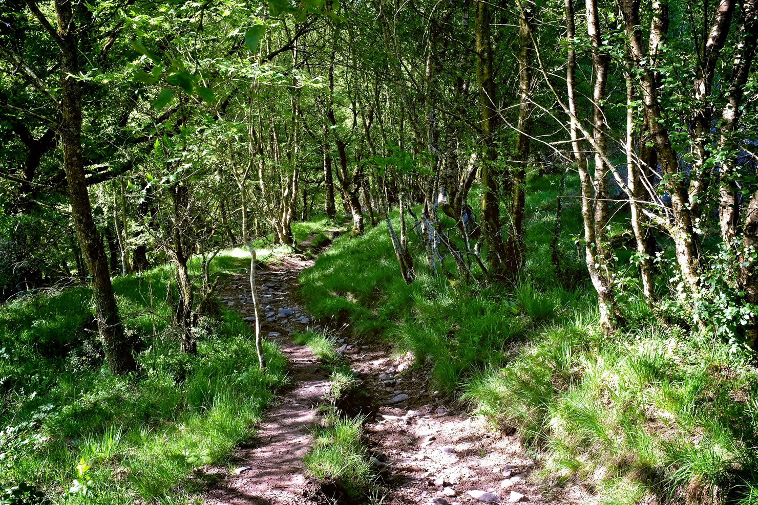
- A beautiful mix of natural singletrack, ancient trails, intimate woodland and big skies.
- The satisfaction of wild camping on Dartmoor without the usually ever-present fear (in England and Wales) of being discovered by the landowner and told to move on…
- Blacks Delicatessen in Chagford, where I could have quite happily spent a(nother) couple of hours.
- Great panoramic views of the Bristol Channel from Dunkery Beacon.
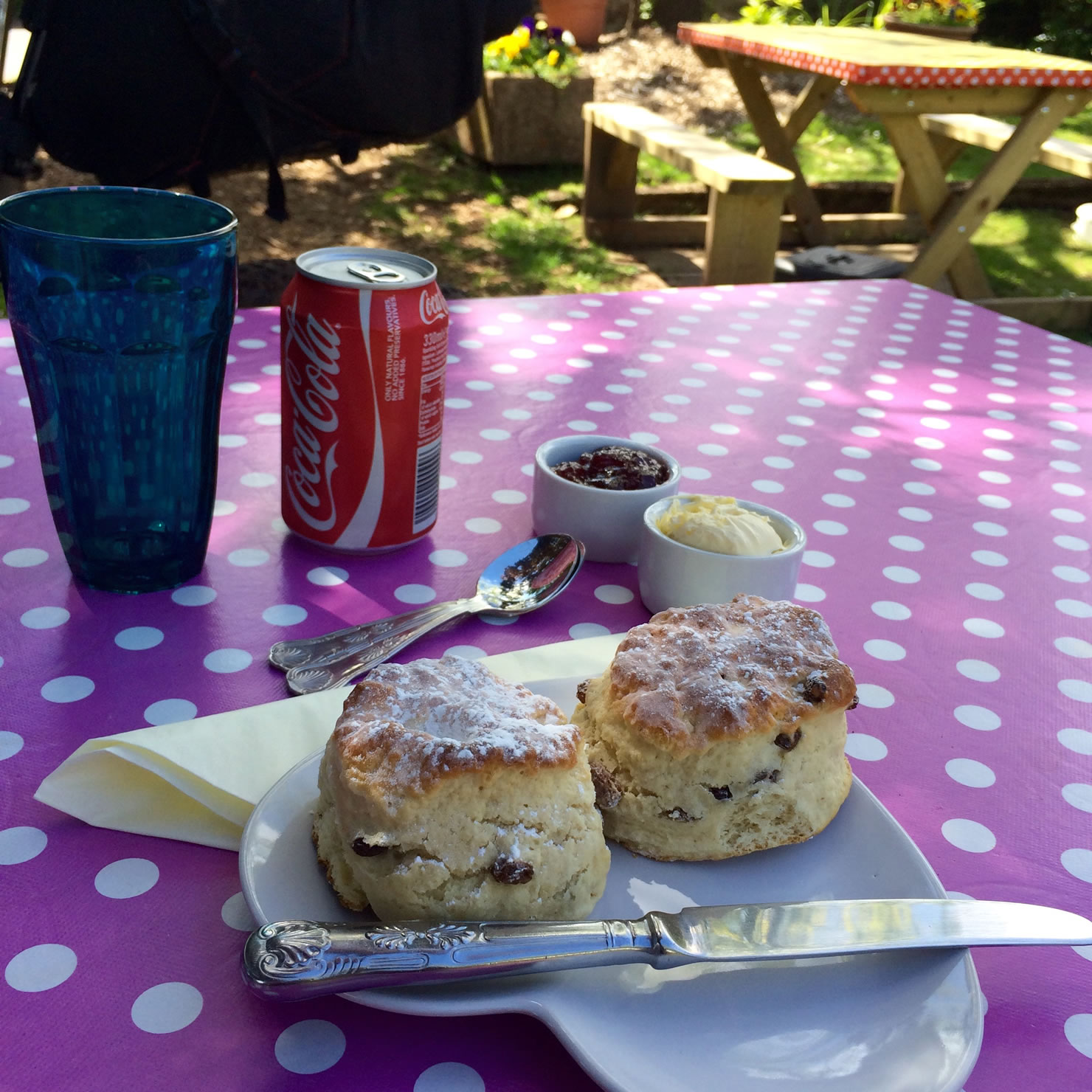
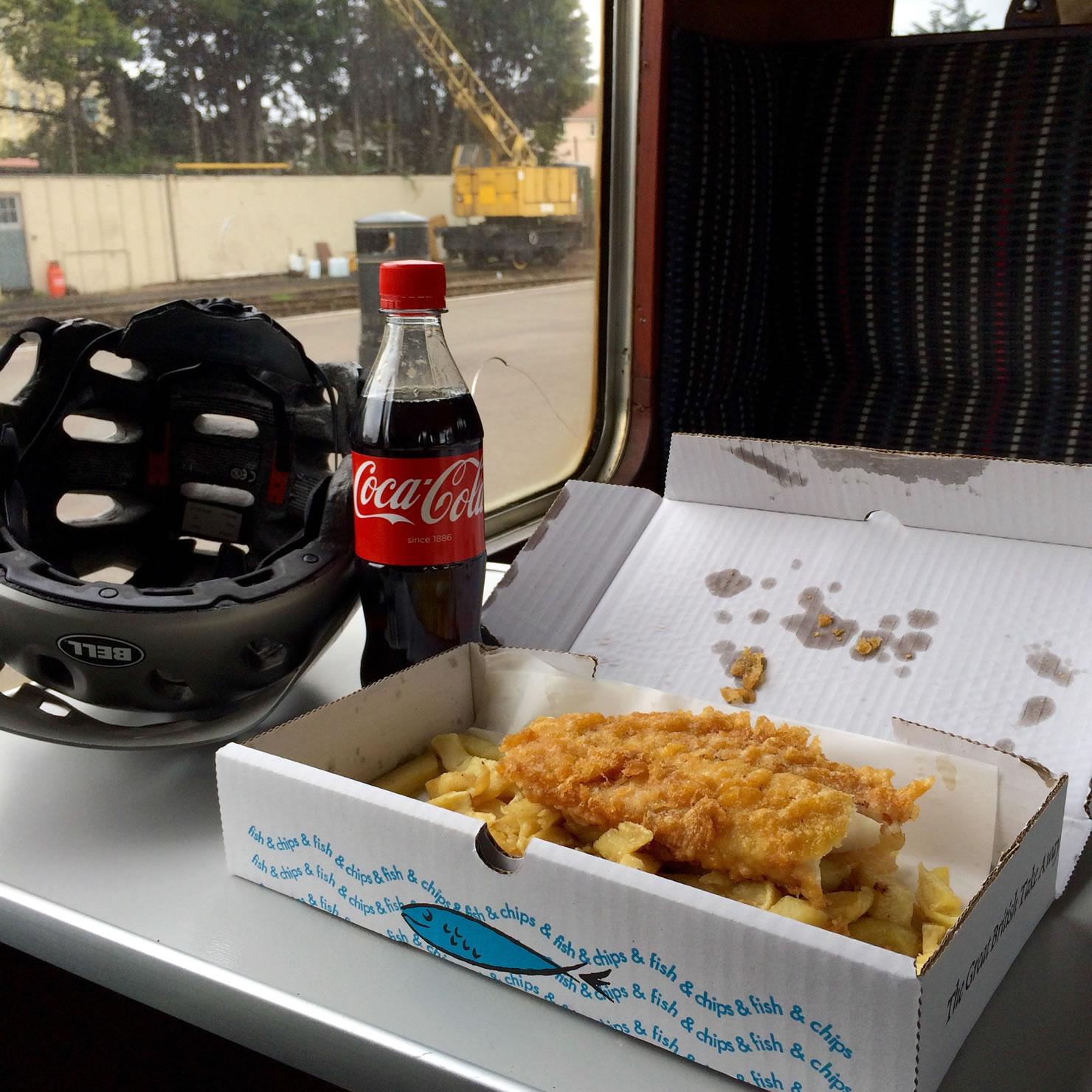
- A Devon cream tea in Selworthy, or one of the many other options along the route. Note that in Devon, you should spread the clotted cream on the scone first, followed by the jam (in Cornwall, you should do the reverse). A well deserved fish and chips upon arrival in Minehead.
- A comprehensive guide for this route, including information on logistics and accommodation, and containing detailed route instructions, is available from MBRUK here.
- Plymouth has a mainline train station with a connection to London taking around 3. 5 hours. Minehead has a private rail link via the West Somerset Railway, which runs a mixture of classic steam and diesel engines, to Bishops Lydeard, just 4 miles from Taunton. Alternatively, you can ride a 30 mile extension of the route over the Quantock Hills to Taunton (described in the MBRUK Guide and included in the Bikepacking Exmoor and the Quantock Hills route. From Taunton, London is 2-3 hours away by train. Bikes are allowed on the trains for free, but it’s best to reserve a space in advance as only a few bikes are allowed on some trains.
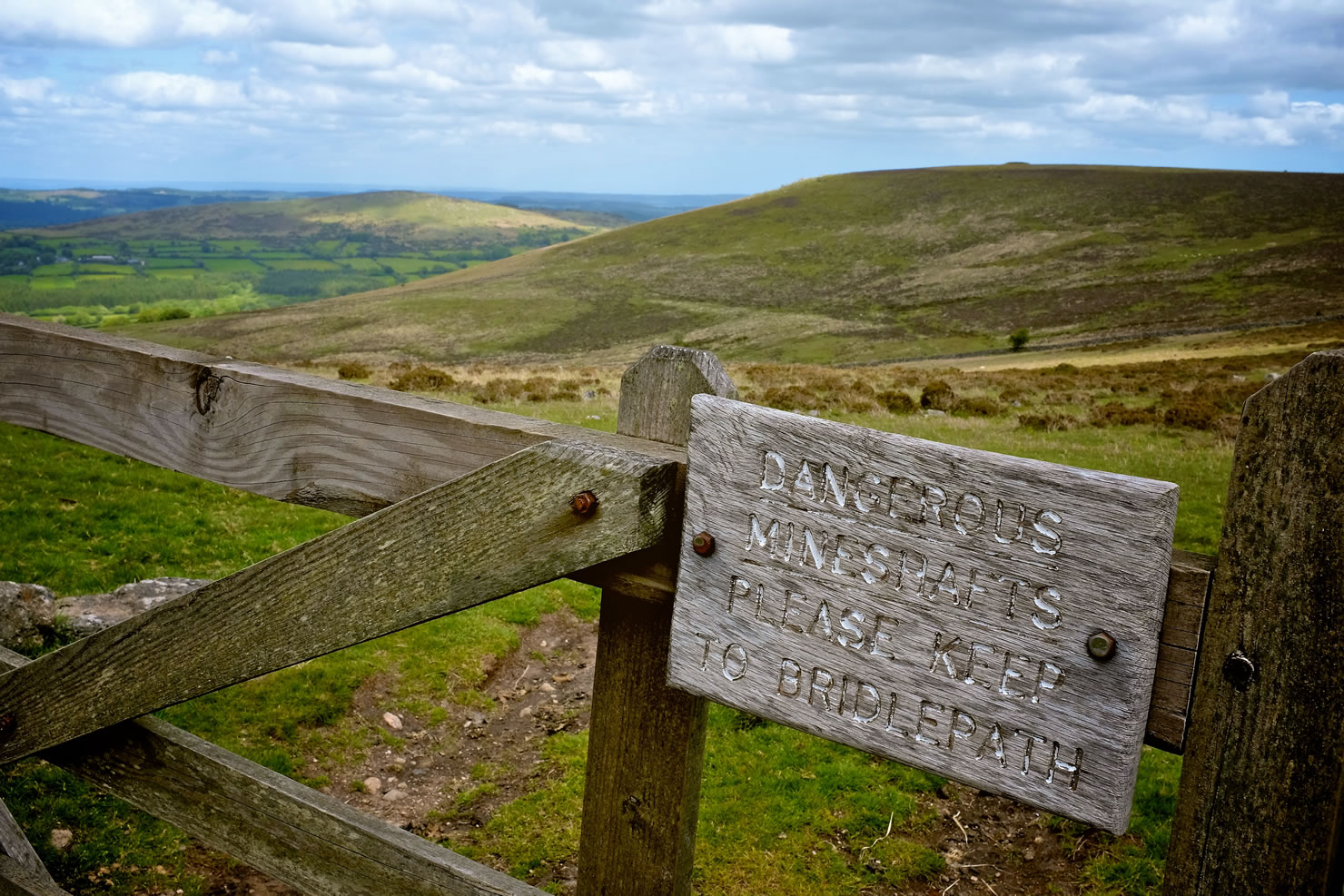
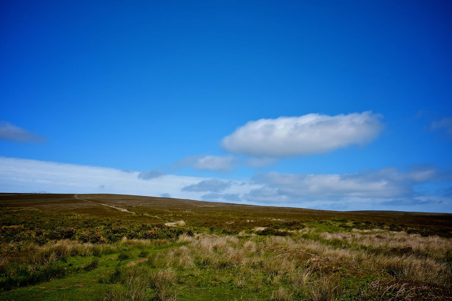
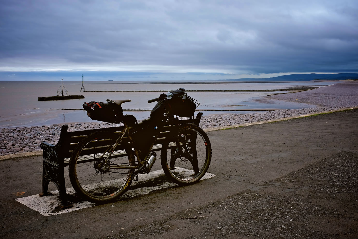
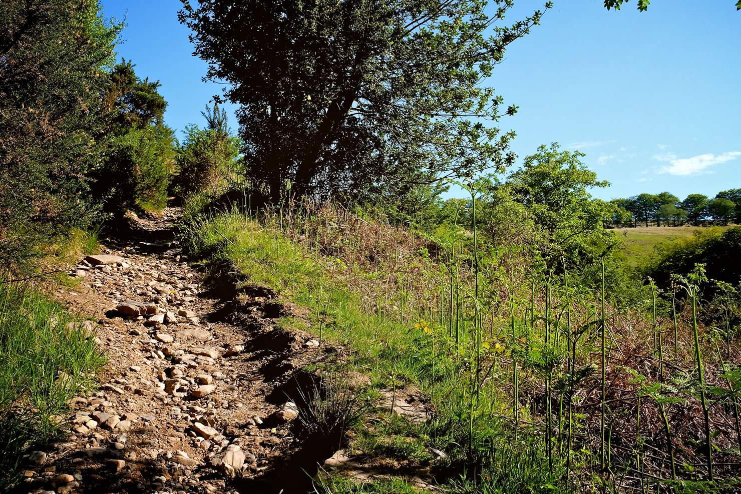
- British weather is notoriously variable, and the moors are particularly exposed to wind and rain. Whatever the season, go prepared for cold, wet, windy weather. The moors are also covered in a nice layer of dark peat, which holds water so well that after wet weather, even high ground can remain waterlogged for days. A lot of the off-road route is on bridleways, which are also used by walkers and horseriders and can be churned up in wet weather.
- Crossing the East Dart River can be tricky when the water is high. I ended up wading across by the stepping-stones with the water unexpectedly up to my waist. A detour is available if you see that the West Dart River looks high when you cross it by bridge.
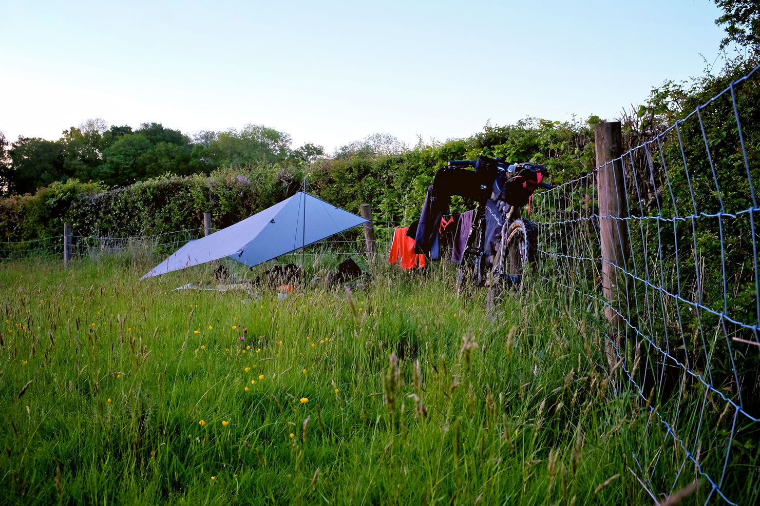
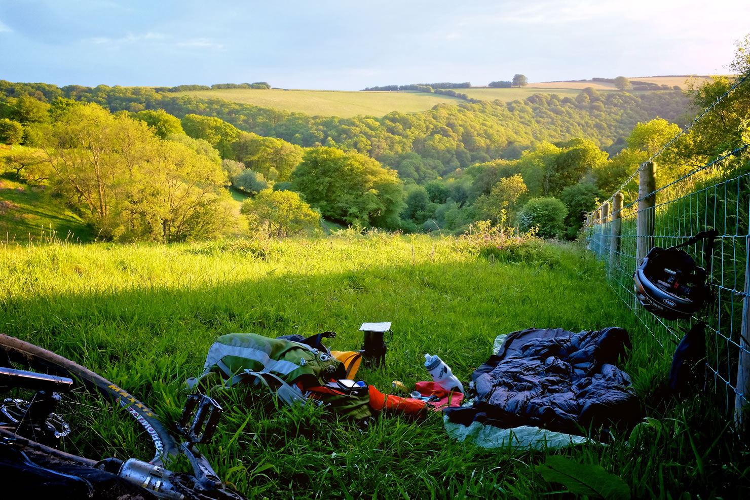
- Wild camping is technically not allowed in England and Wales without permission from the landowner, but Dartmoor National Park is one of a few areas where it is actually encouraged.
- This guide shows where wild camping is allowed, as well as formal campsites, camping barns, bunkhouses and youth hostels.
- I camped at the Plume of Feathers pub in Princetown due to the strong winds on Dartmoor, and then in two empty, unlocked, farmer’s fields – one between the moors and the second on Exmoor. Wild camping is tolerated within Exmoor National Park so long as you are not visible from the trails or roads, you move on each day and don’t hop fences when near private land.
- There are numerous pubs, teashops and stores in the towns and villages along the route.
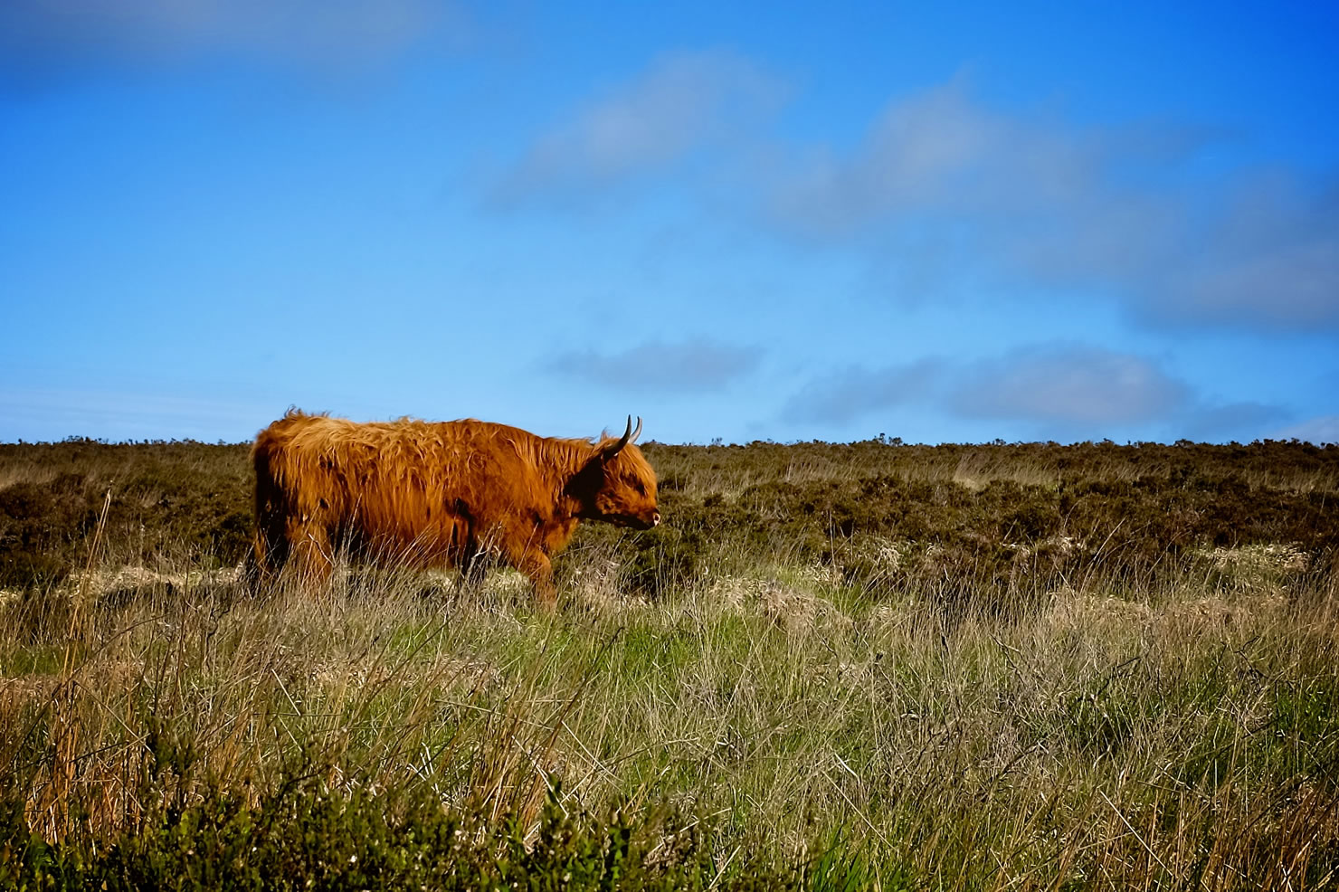
- There is water everywhere, but so are the cows, sheep and ponies, so any water you get from natural sources will need to be treated before drinking.
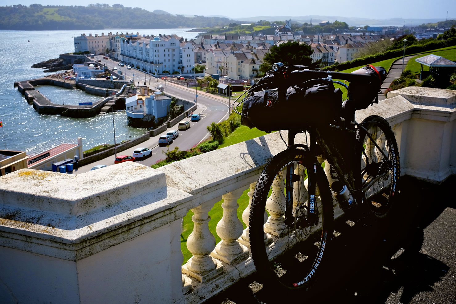
- The trail starts from Plymouth Hoe, where Sir Francis Drake is said to have played bowls whilst waiting for the tide to change to allow him to sail out with the English fleet to engage with the Spanish Armada in 1588.
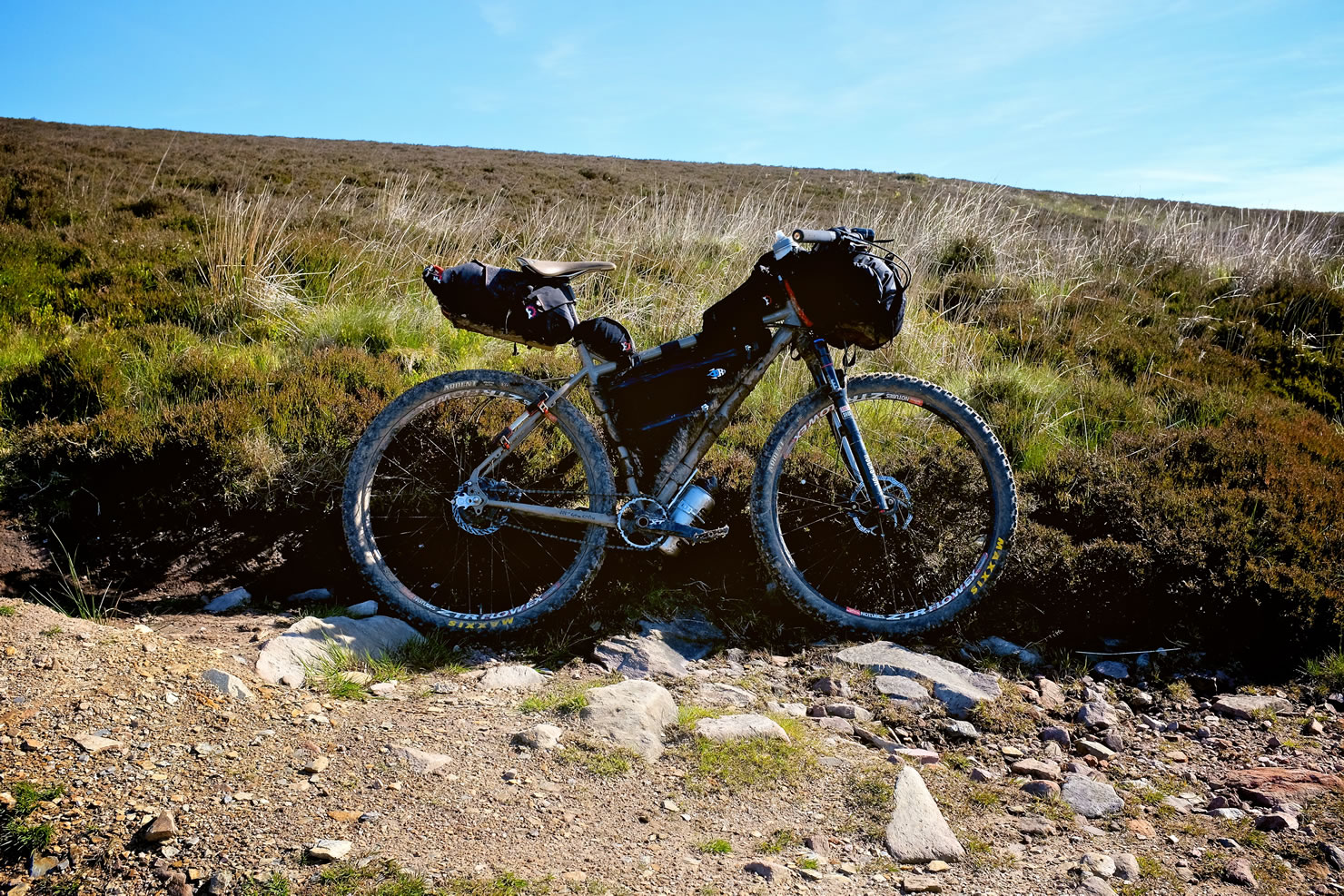
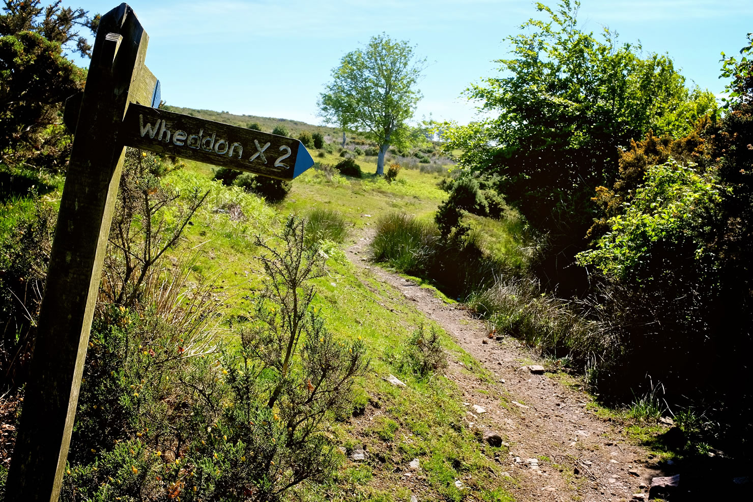
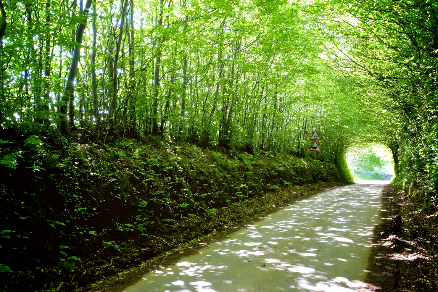
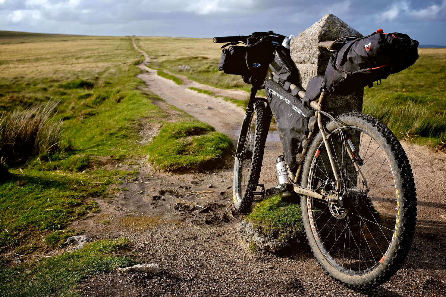
- Following an old railway line along the Plym valley you soon climb stony singletrack up Eylesborrow and on to Dartmoor. Passing through Princetown, home to the notorious Dartmoor Prison, where a pub and camping field is available if the weather on the moor is too inhospitable, you make your way over the middle of Dartmoor on trails that alternate between wide, sandy braids, narrow winding tarmac, and barely visible ribbons of green, snaking over the hills.
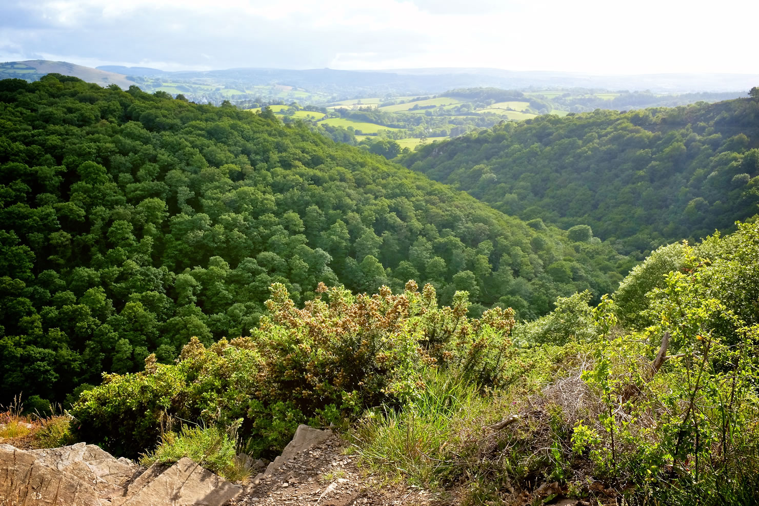
- After crossing the West and East Dart Rivers (by bridge and stepping stones/ wading respectively) the trail descends into the town of Chagford to resupply. Much of the route between Dartmoor and Exmoor is on small country roads and green lanes.
- You slowly climb onto Exmoor, dipping back down into the Little Dart valley, Dane Brook ravine and then to the River Barle, which you cross on the Tarr Steps, a traditional ‘clapper’ bridge made of stone slabs weighing between one and two tons each, possibly dating from around 1000 BC. There is a myth that the Devil built the bridge to win a bet, and still has sunbathing rights on its stones. He swore that he would kill anyone who tried to cross his bridge. A cat was sent over but disappeared in a puff of smoke. The terrified locals then got the parson to try. He set off and met the Devil half way across the bridge. The Devil swore at him and tried to intimidate him but the parson reciprocated equally and finally the Devil conceded to let people pass, except when he wants to sunbathe.
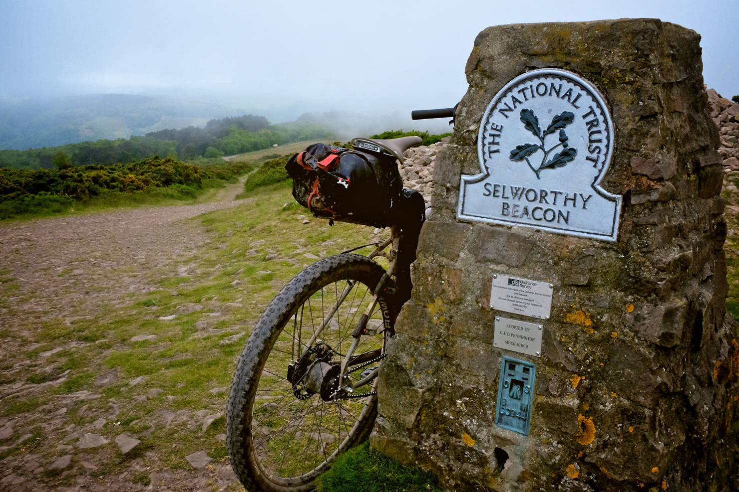
- Picking your way through Exmoor’s twisting trails, by way of Dunkery Hill and then Luccombe Hill, the Bristol Channel eventually comes into sight. The final climb up Selworthy Beacon leads to a mile or two of downhill along the coastal trail right into the town of Minehead.
Additional Resources


Terms of Use: As with each bikepacking route guide published on BIKEPACKING.com, should you choose to cycle this route, do so at your own risk. Prior to setting out check current local weather, conditions, and land/road closures. While riding, obey all public and private land use restrictions and rules, carry proper safety and navigational equipment, and of course, follow the #leavenotrace guidelines. The information found herein is simply a planning resource to be used as a point of inspiration in conjunction with your own due-diligence. In spite of the fact that this route, associated GPS track (GPX and maps), and all route guidelines were prepared under diligent research by the specified contributor and/or contributors, the accuracy of such and judgement of the author is not guaranteed. BIKEPACKING.com LLC, its partners, associates, and contributors are in no way liable for personal injury, damage to personal property, or any other such situation that might happen to individual riders cycling or following this route.
Please keep the conversation civil, constructive, and inclusive, or your comment will be removed.