


Expedition Alay
Distance
290 Mi.
(467 KM)Days
8
% Unpaved
85%
% Singletrack
5%
% Rideable (time)
95%
Total Ascent
24,846'
(7,573 M)High Point
13,615'
(4,150 M)Difficulty (1-10)
8?
- 6Climbing Scale Moderate86 FT/MI (16 M/KM)
- 7Technical Difficulty Difficult
- 8Physical Demand Difficult
- 8Resupply & Logistics Strenuous
Contributed By
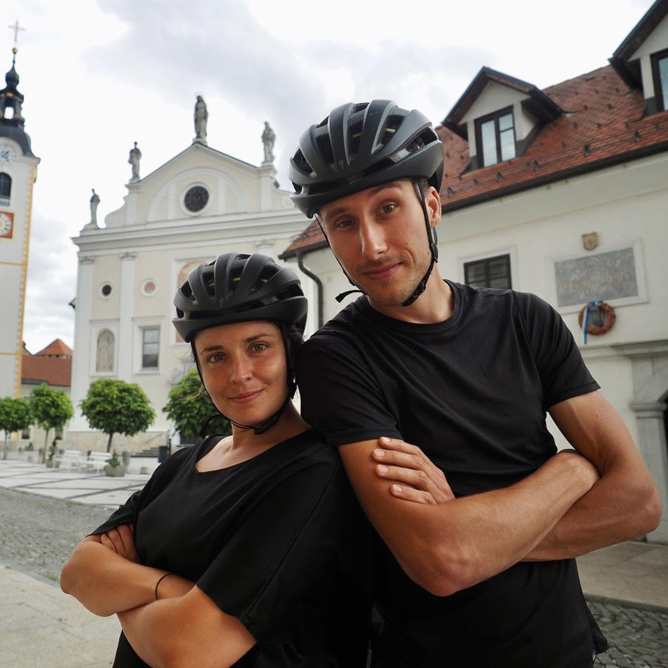
Belen Castello and Tristan Bogaard
Guest Contributor
Belén Castelló and Tristan Bogaard are an adventure cyclist couple with a taste for mountainous riding, wild camping, and ridable trails. Originally from Spain, Belén is the data-driven guide behind all of their rides, while Tristan, originally from the Netherlands, has become a bikepacking photographer through nearly ten years of bike travel. They’re the co-authors of Bike Life and 50 Ways to Cycle the World, and you can find their online work on @belletoscan and @tristanbogaard.
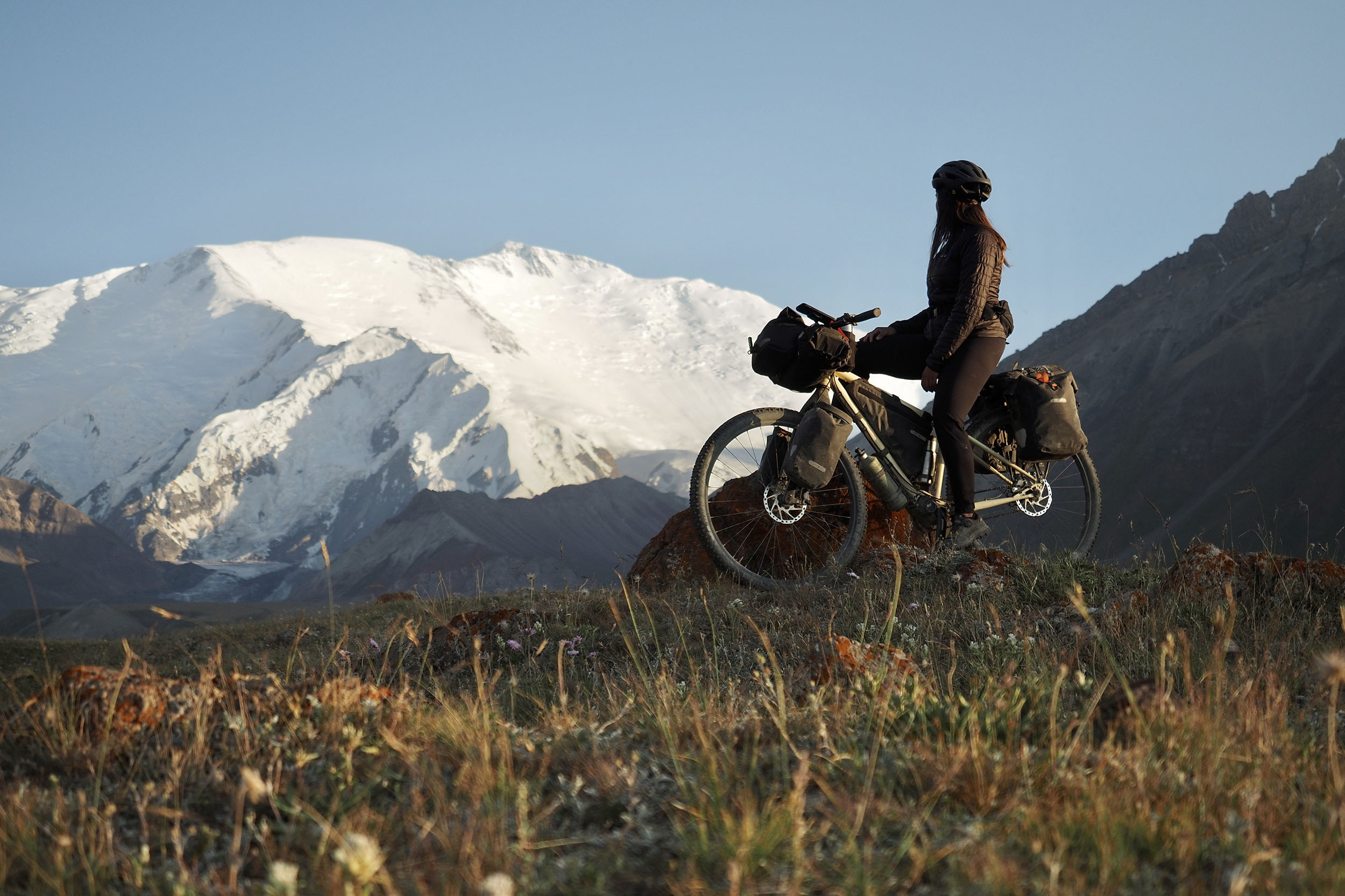
Belén and I have spent four summer seasons in Kyrgyzstan both guiding group trips and riding our bikes around. And we’ve never been more compelled to come back to a particular section as when we cycled in the Alay region. If there’s one place bikepackers should see in Kyrgyzstan, it is Alay!
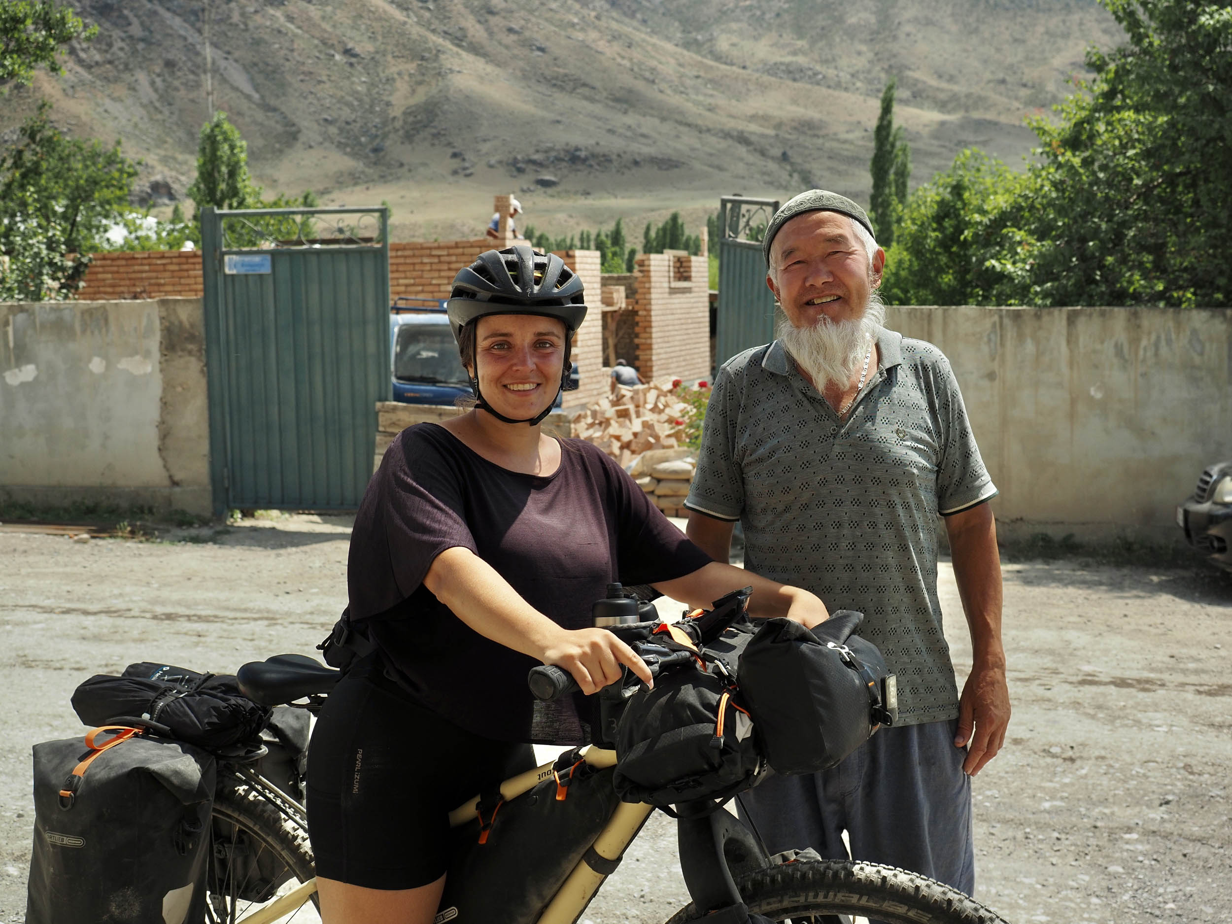
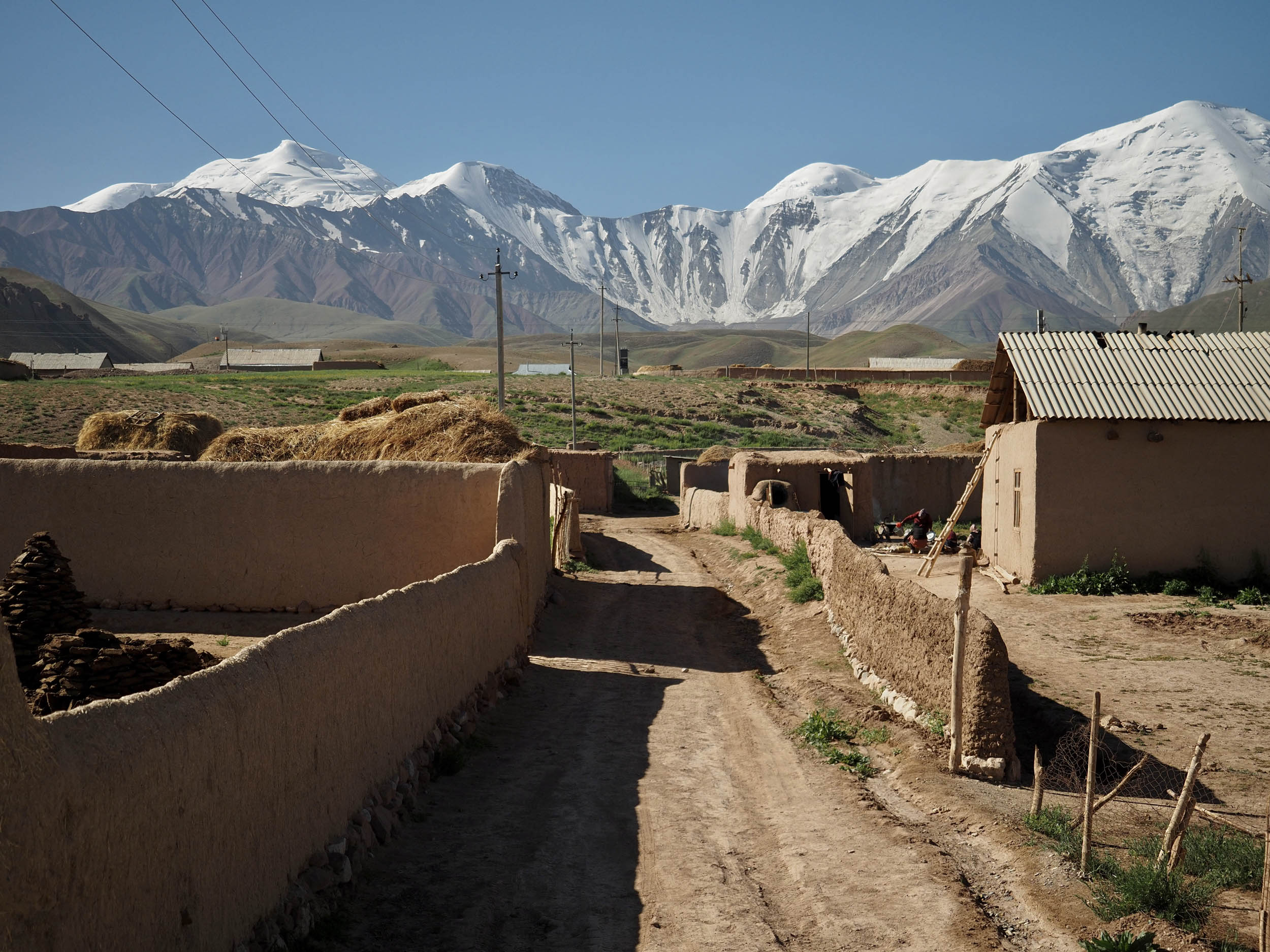
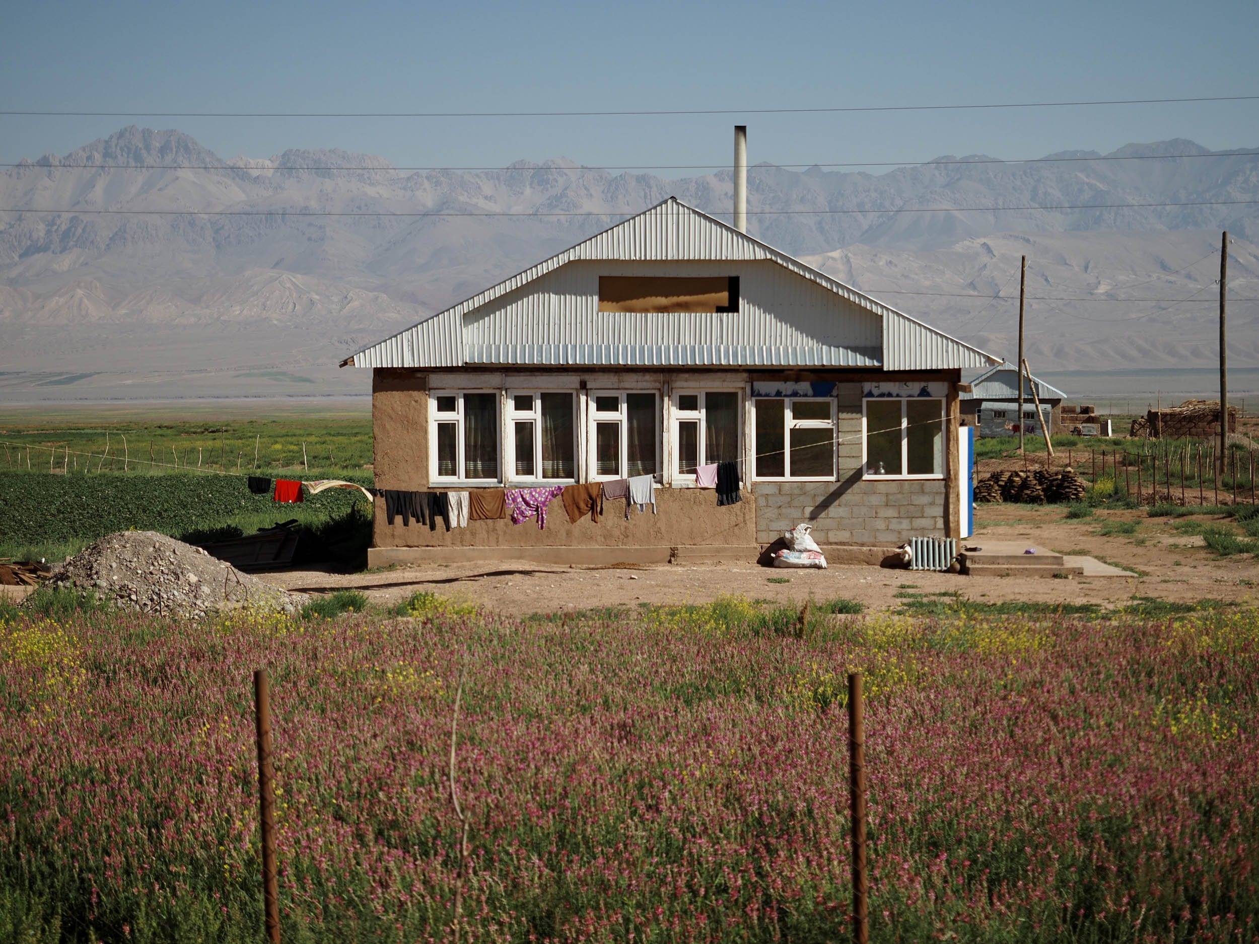
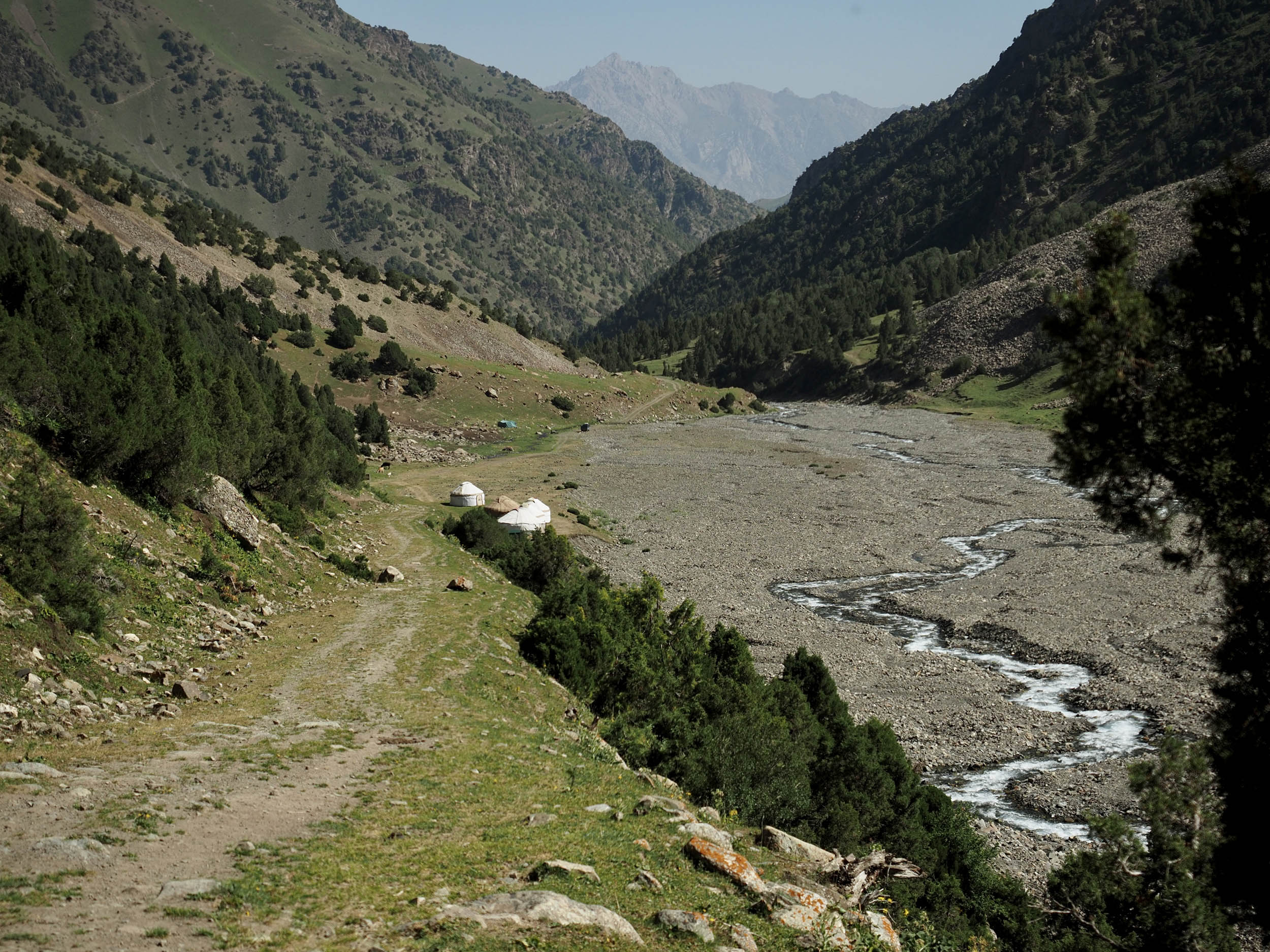
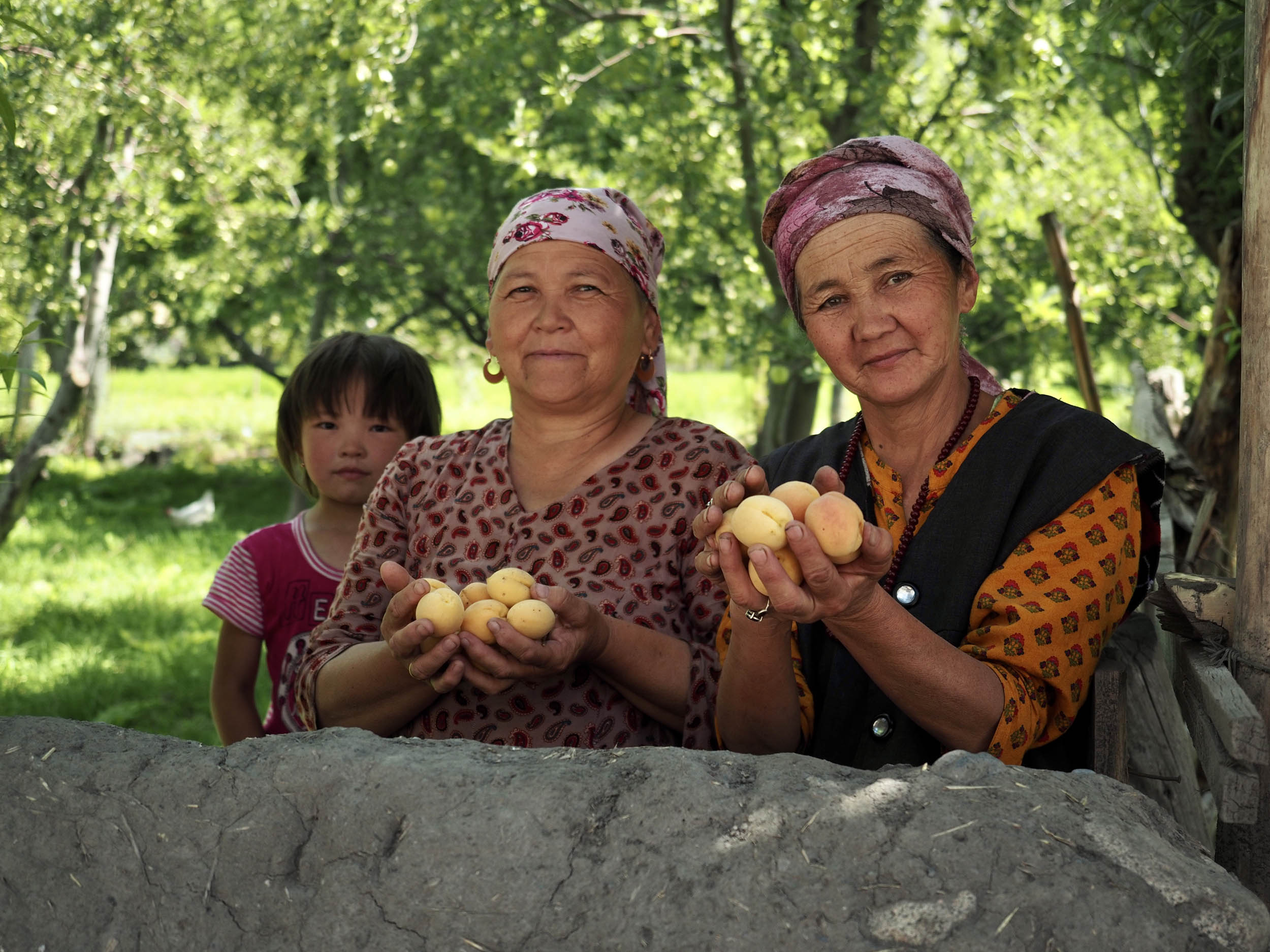
Learning about Kyrgyzstan’s history will help you understand why this region is special. The country comes from a nomadic herding past, but it was strongly developed during the Soviet Union. The Alay region remained practically untouched, and it’s home to only a few settlements that are mostly inhabited by semi-nomadic families. Tourism is only starting to grow in this area in the shape of commercial yurt camps and guesthouses, which means locals aren’t so used to seeing cyclists passing through and can be exceptionally friendly. We were offered food, tea, and hospitality by many along the way. Up in the valley, just a single paved road connects the region with neighboring China and Tajikistan for trade purposes with little traffic between towns. To say it appears frozen in time would probably be an accurate description.
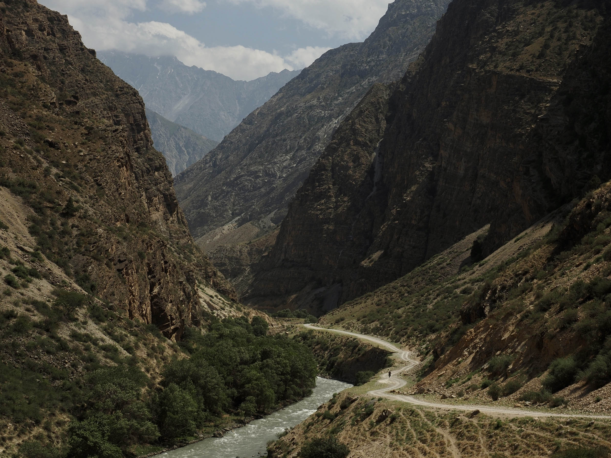
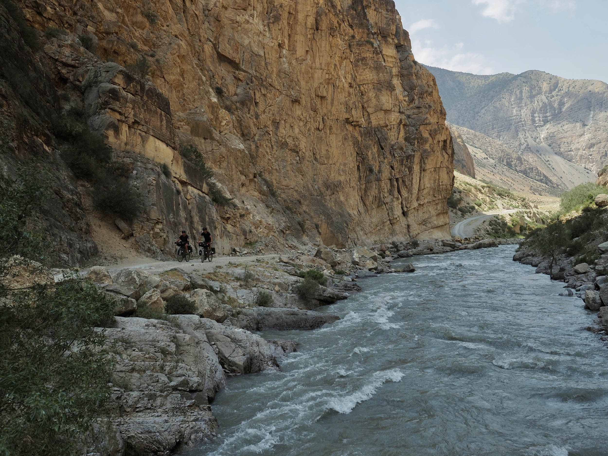
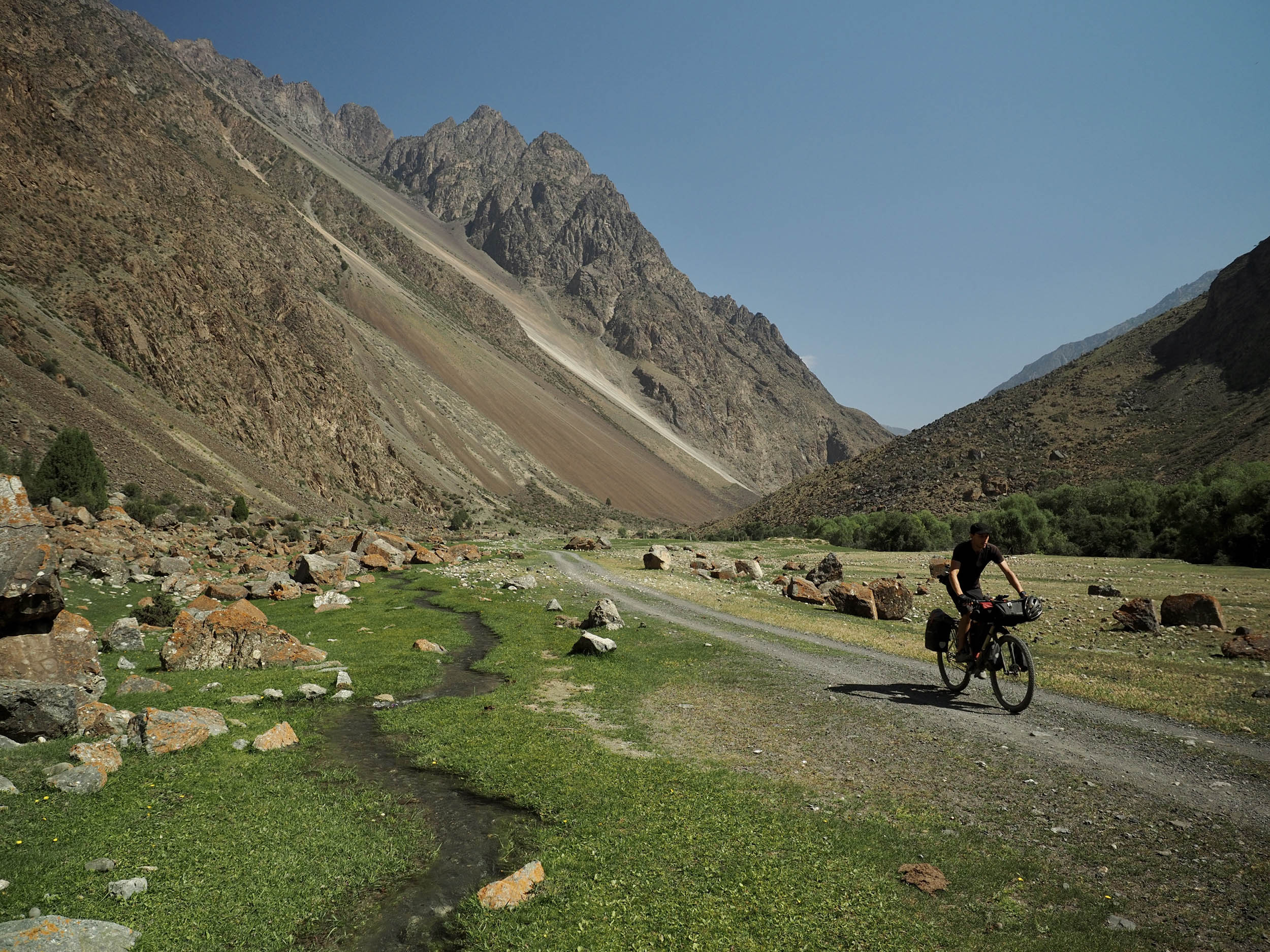
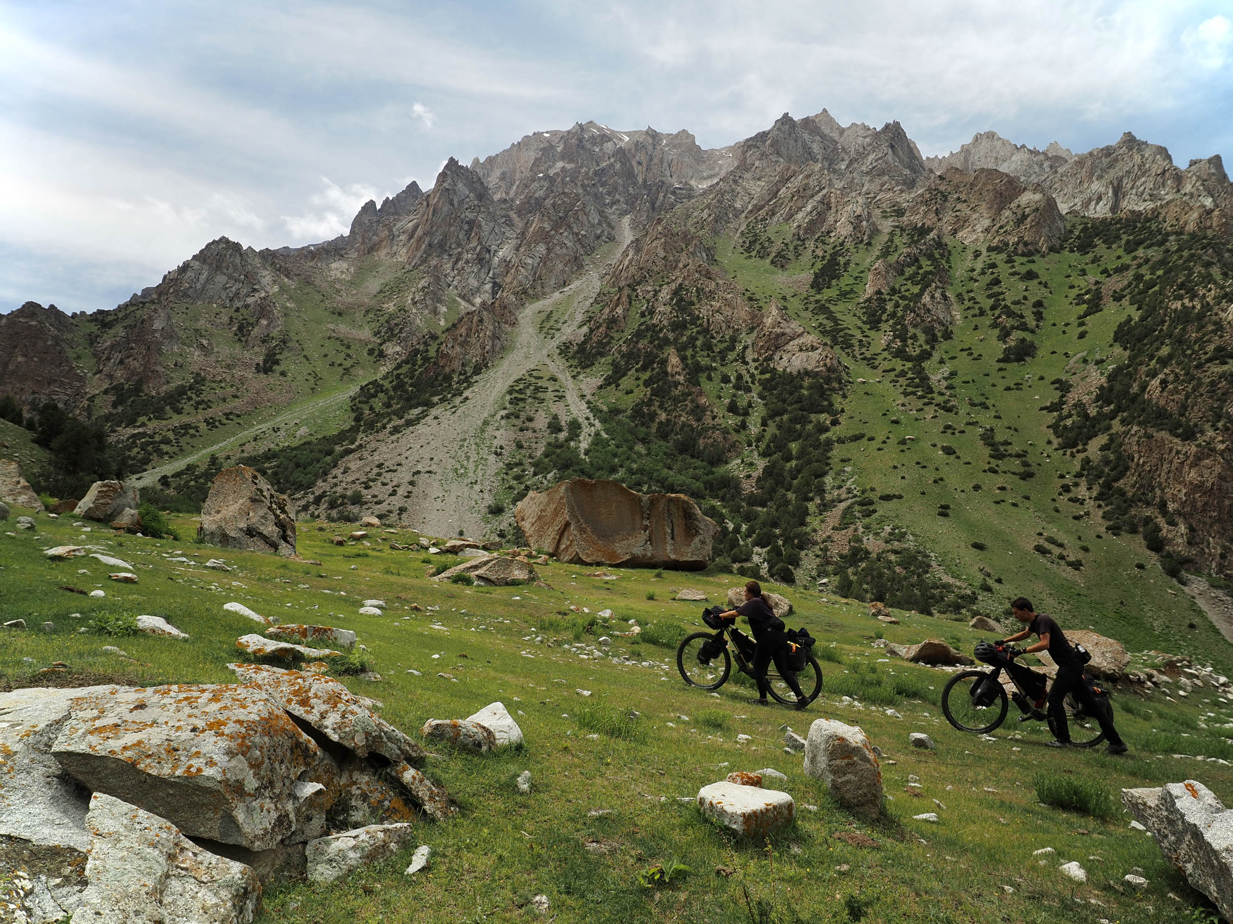
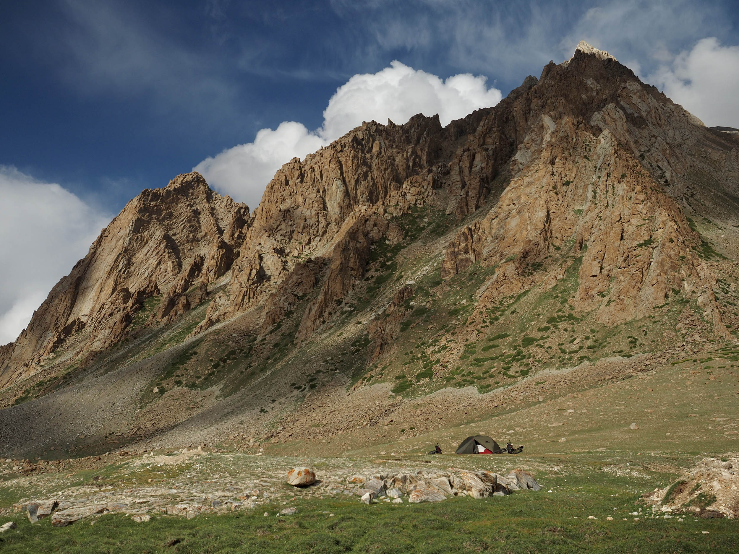
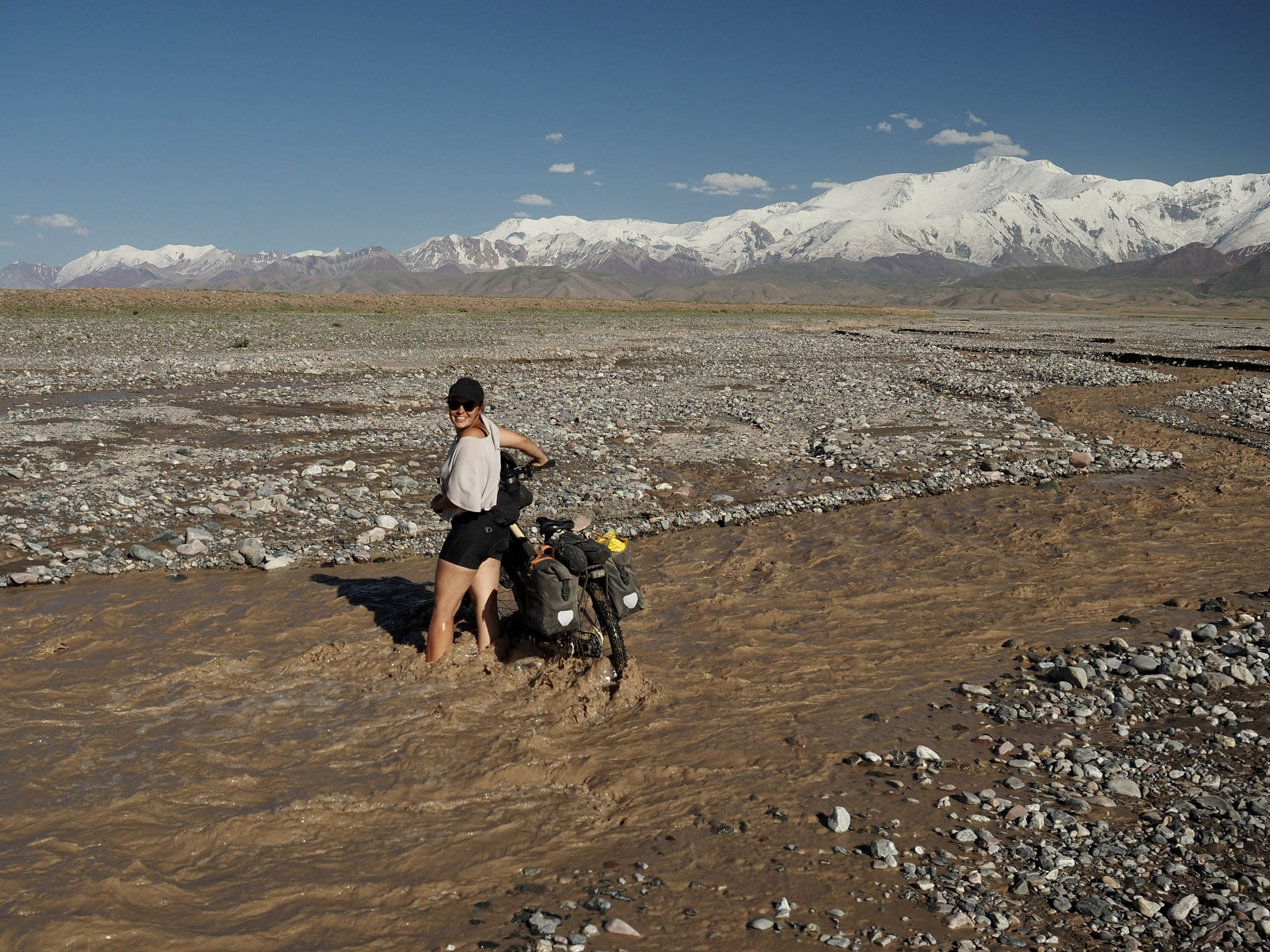
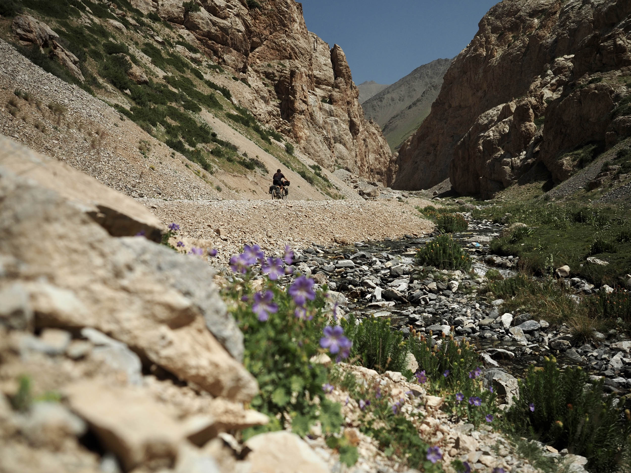
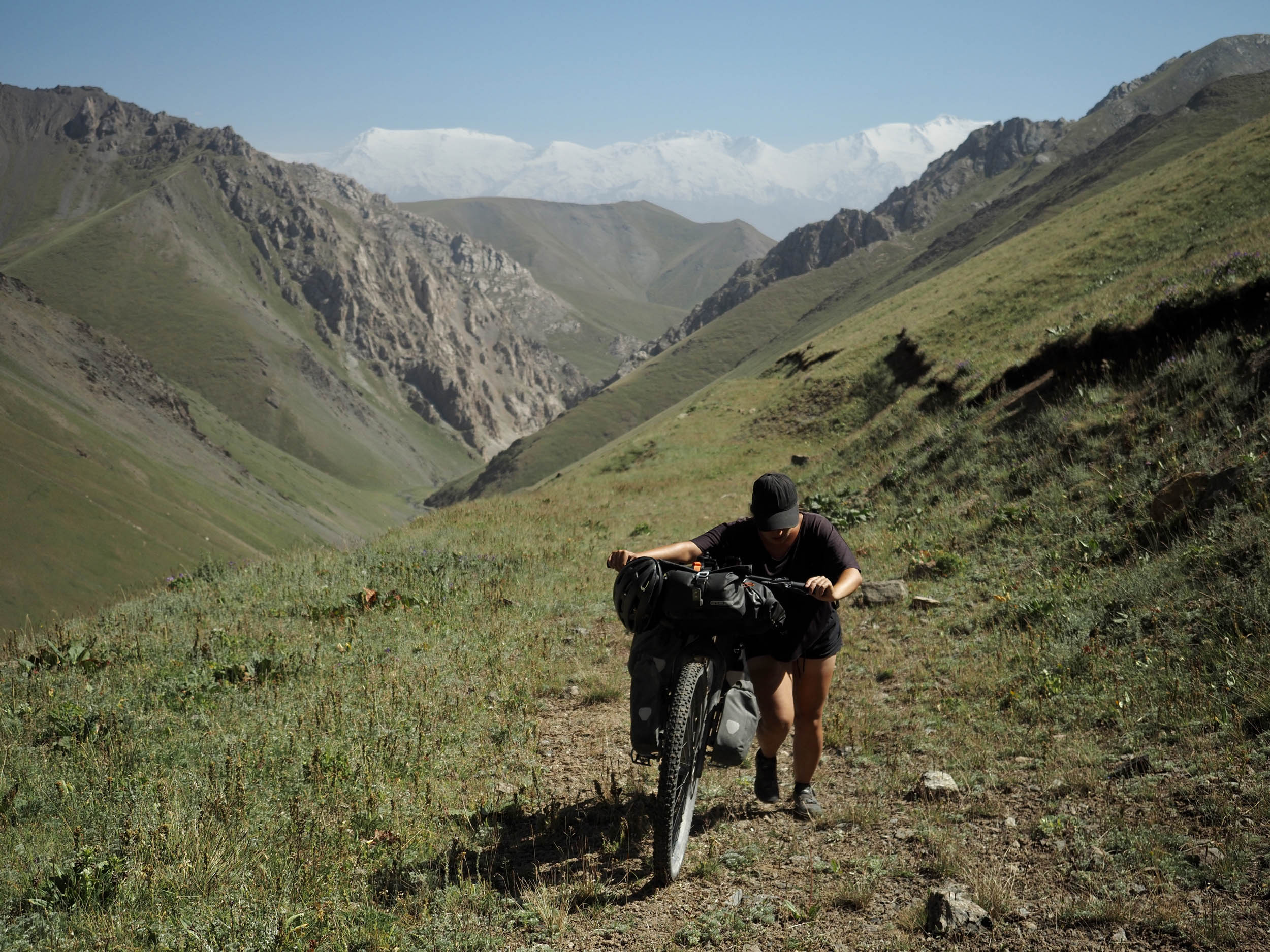
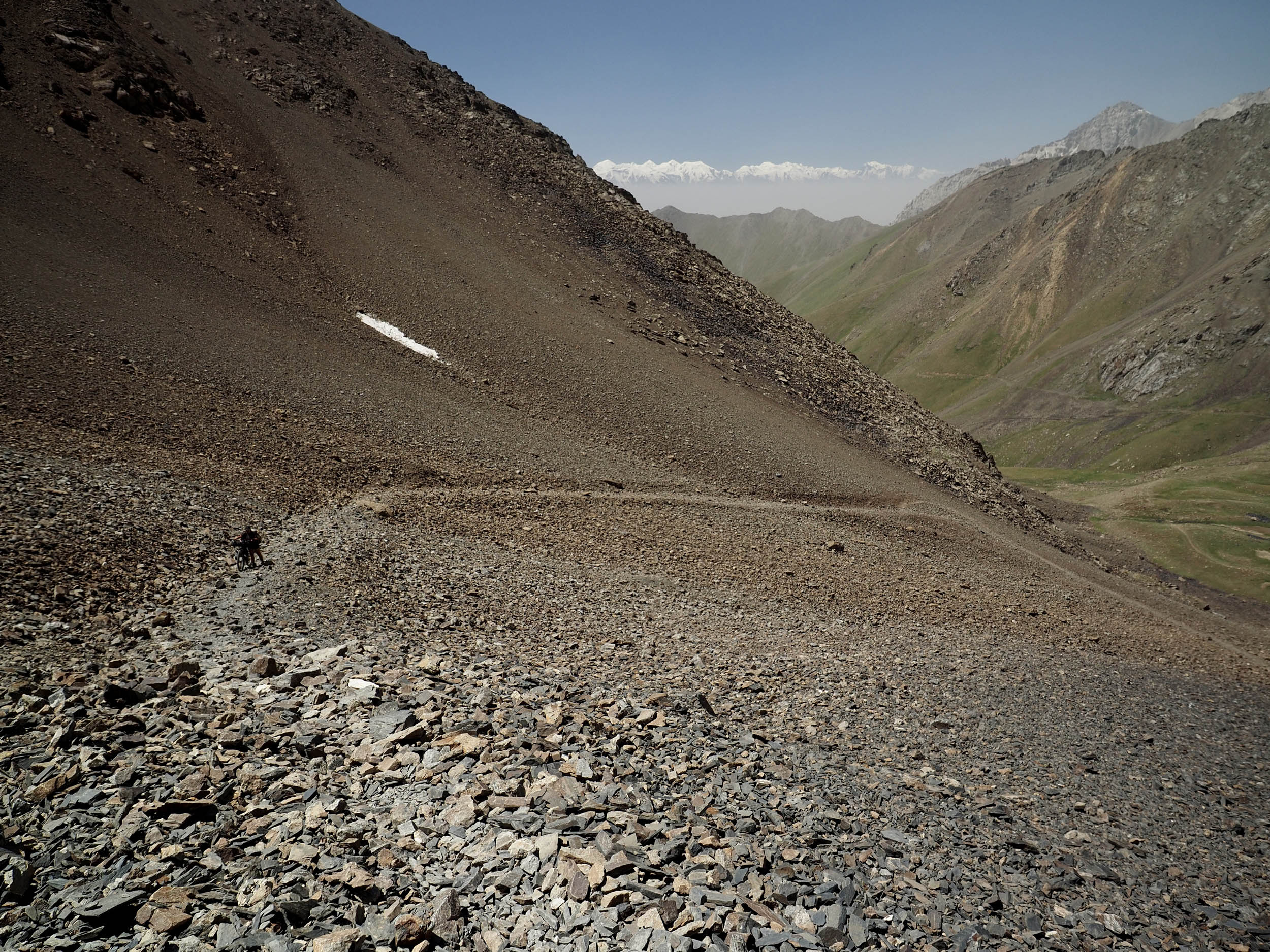
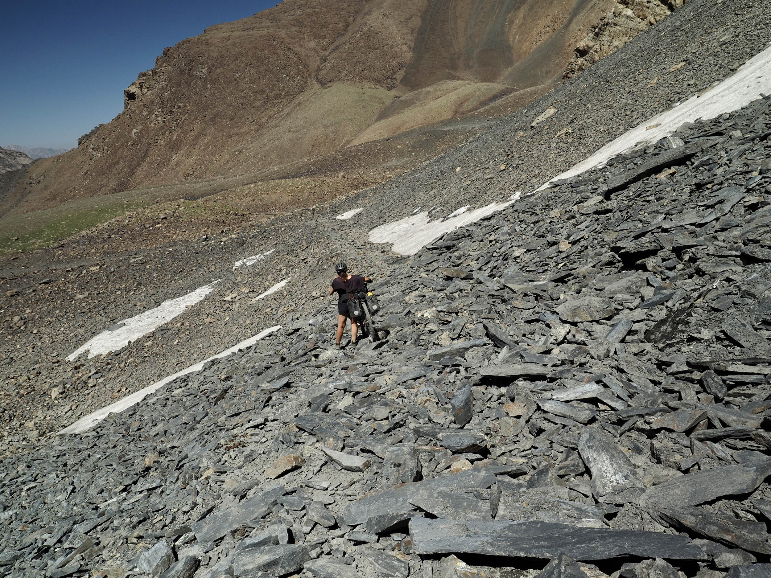
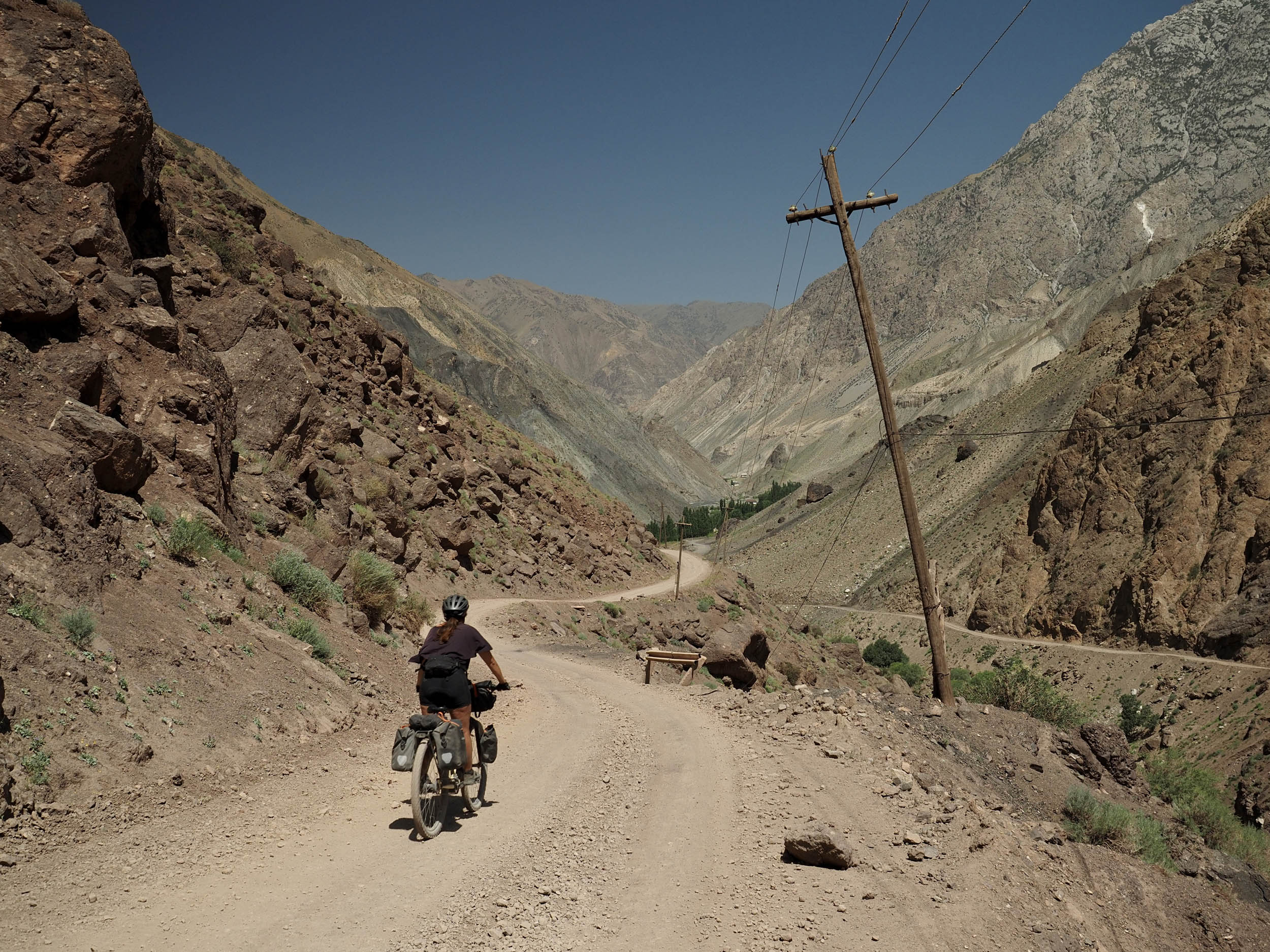
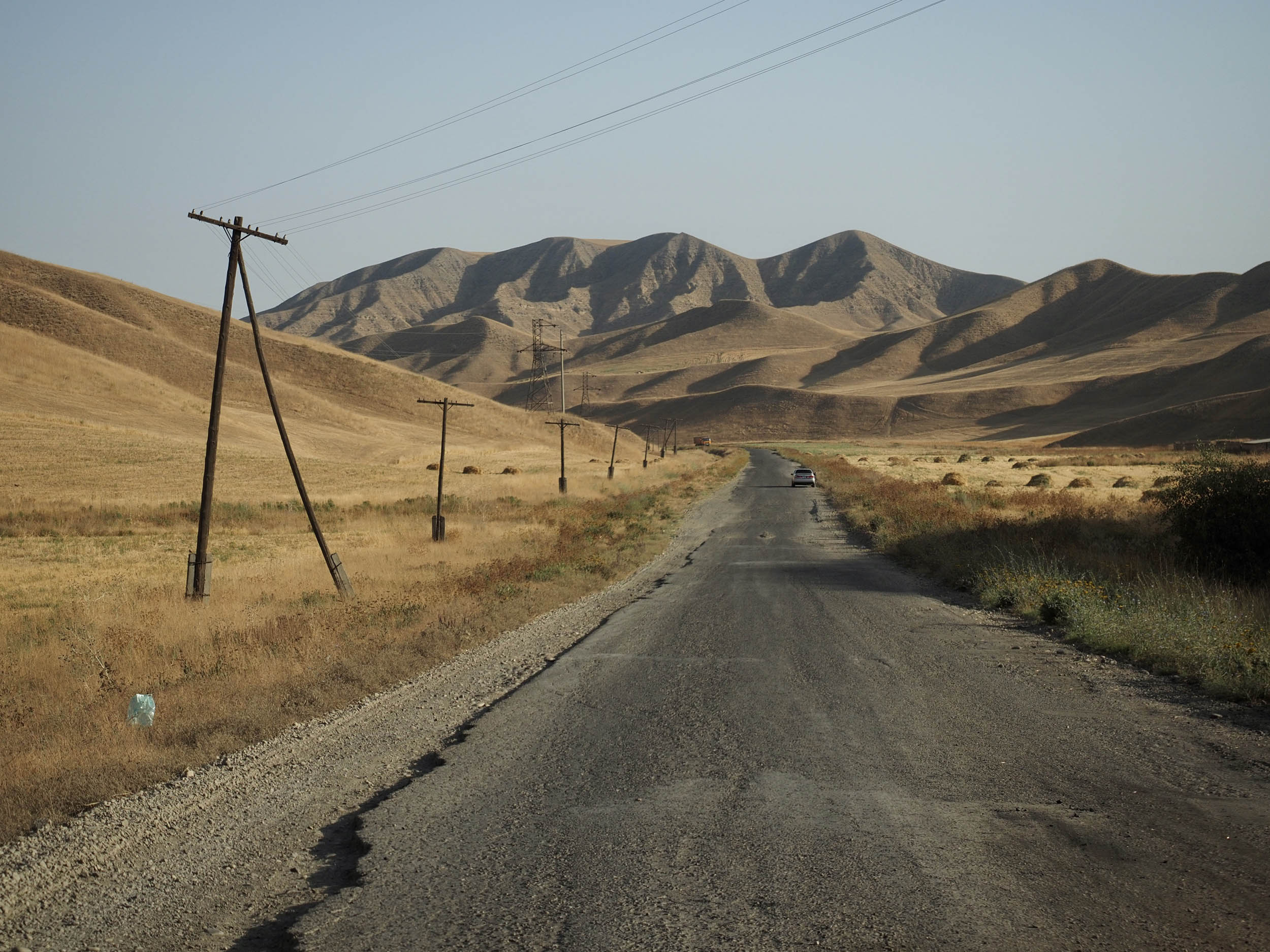
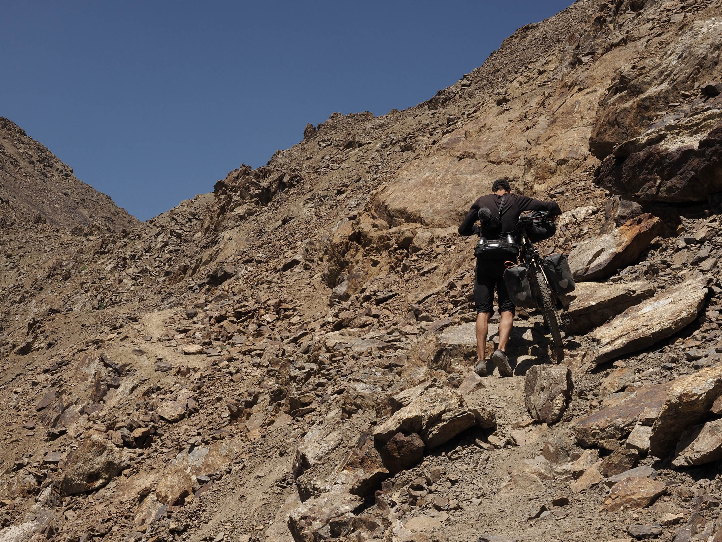
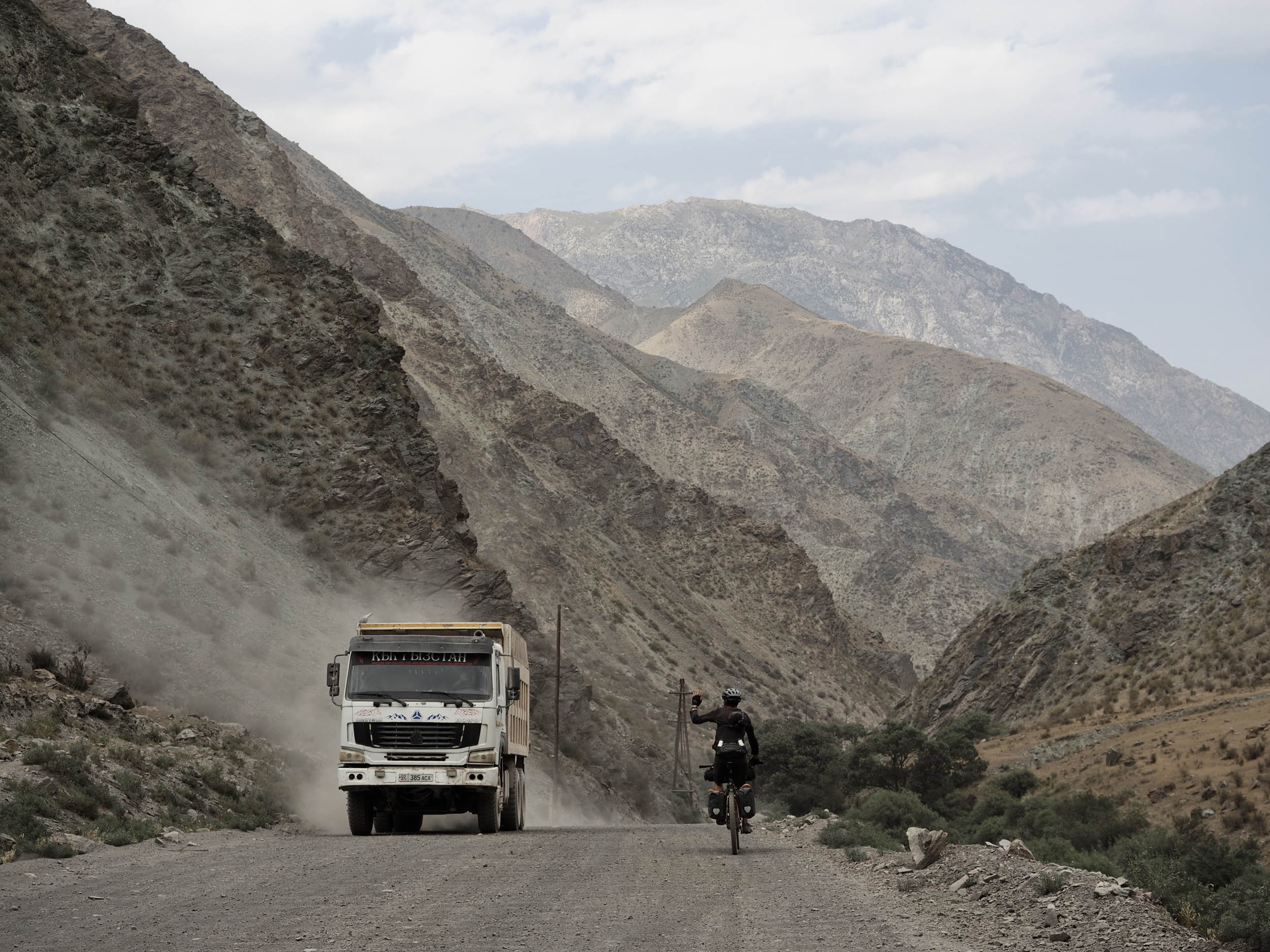
The surfaces you’ll ride while looping from Osh to this mesmerizing valley and back are a balanced blend of compact gravel and dirt, some asphalt near and in towns, smaller amounts of washboard on roads connecting towns or used by coal trucks, and rocky singletrack trails in the higher elevations. The western passage up to Koi Jol Pass (3,810 meters) has a short, five-kilometer stretch of hike-a-bike, making the valley non-traversable for vehicles—a nice touch in keeping things quiet. The eastern passage, over Jiptik Pass (4,185 meters), is a narrow path leading up and over the top, covered in slippery slate, forcing you to hike your bike once more, again for a section of about five kilometers.
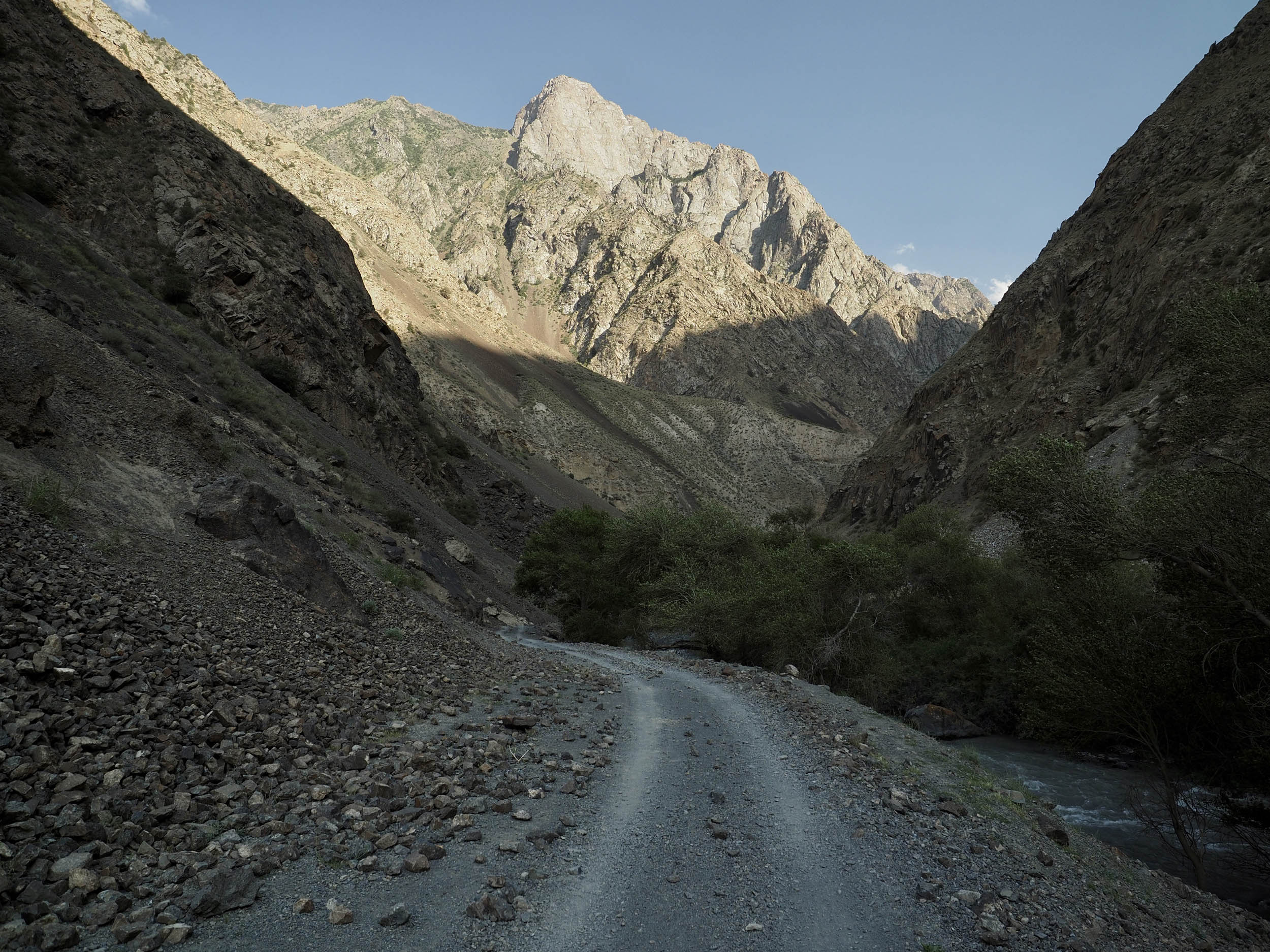
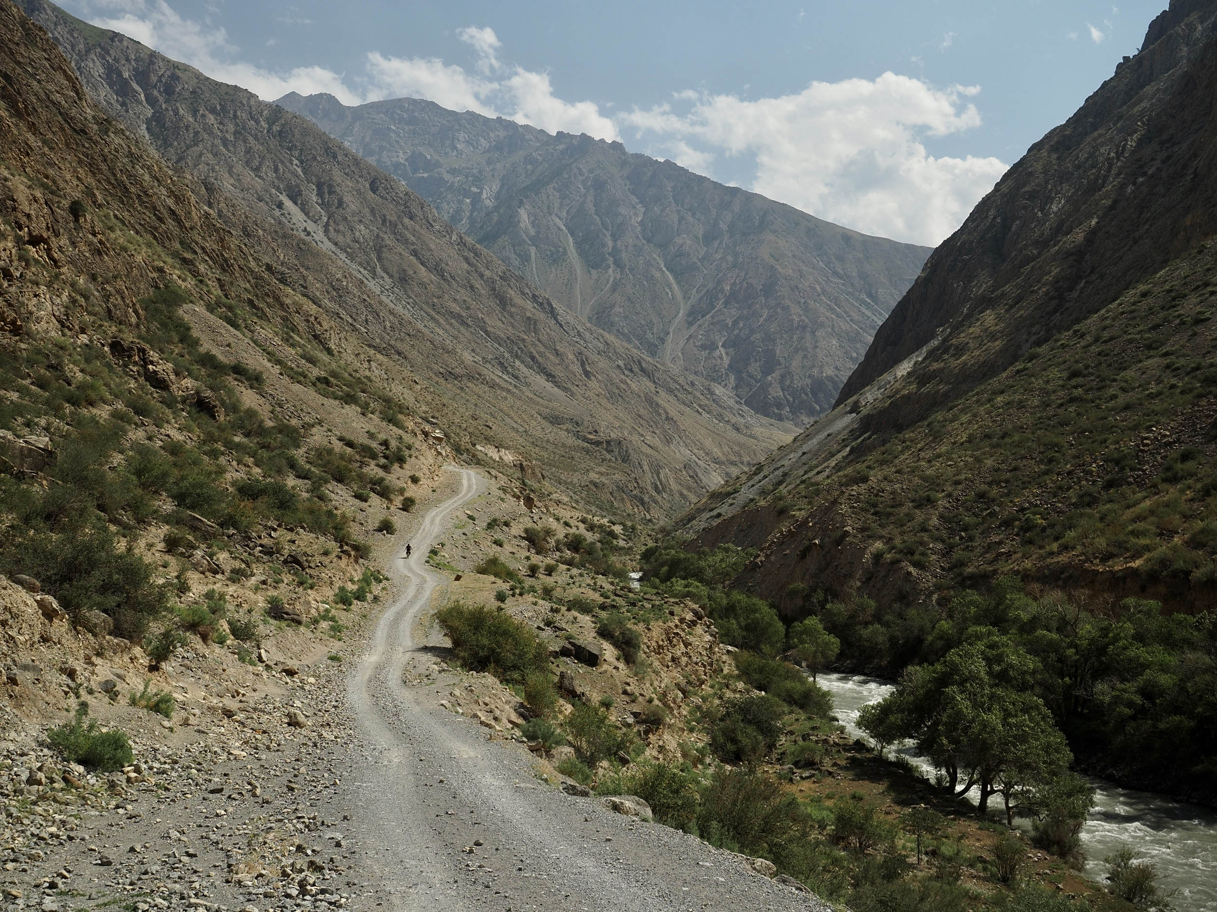
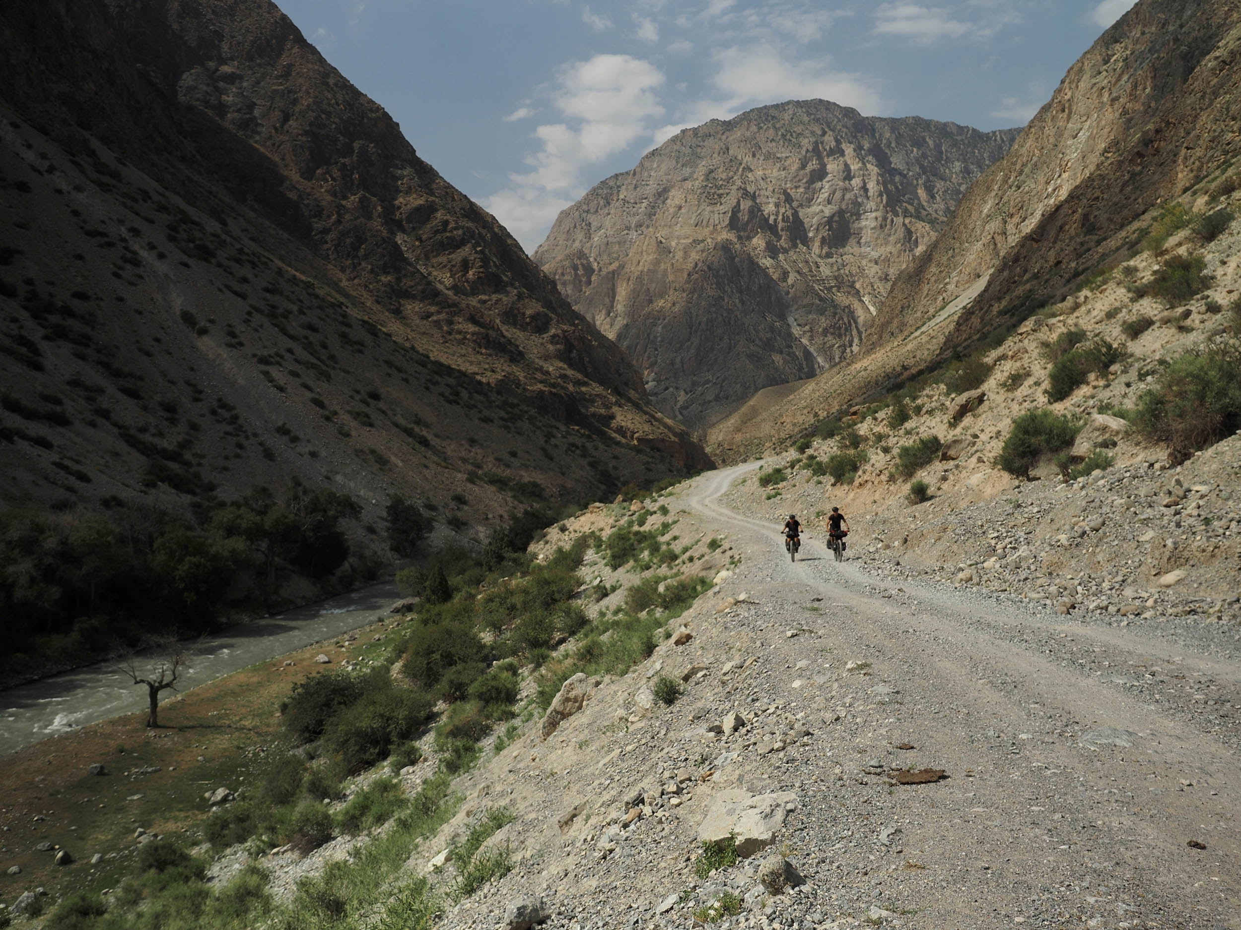
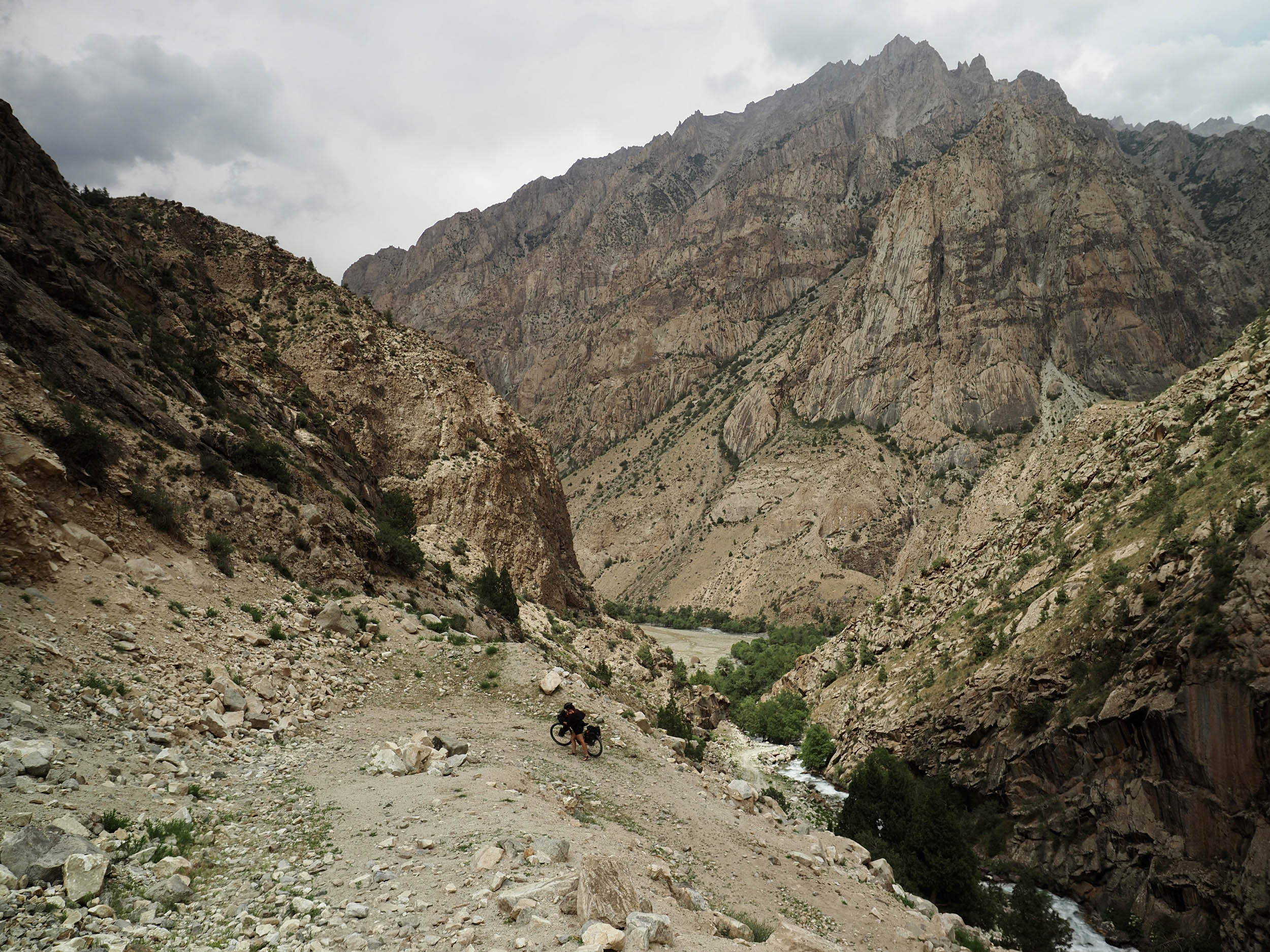
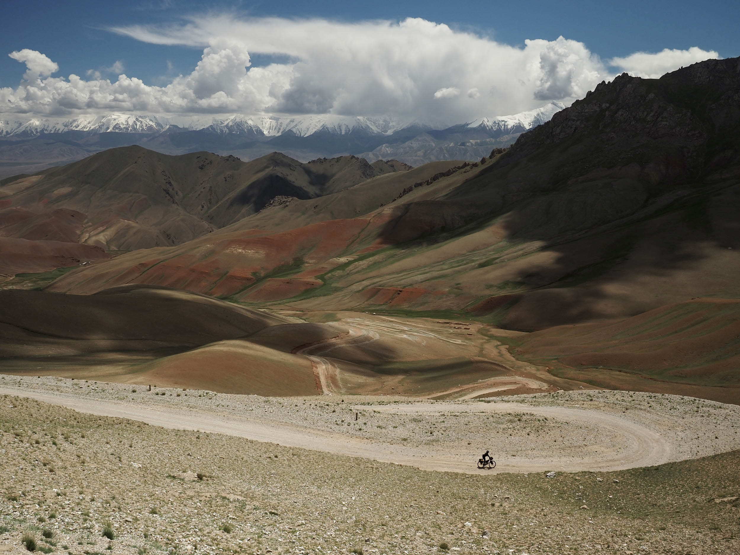
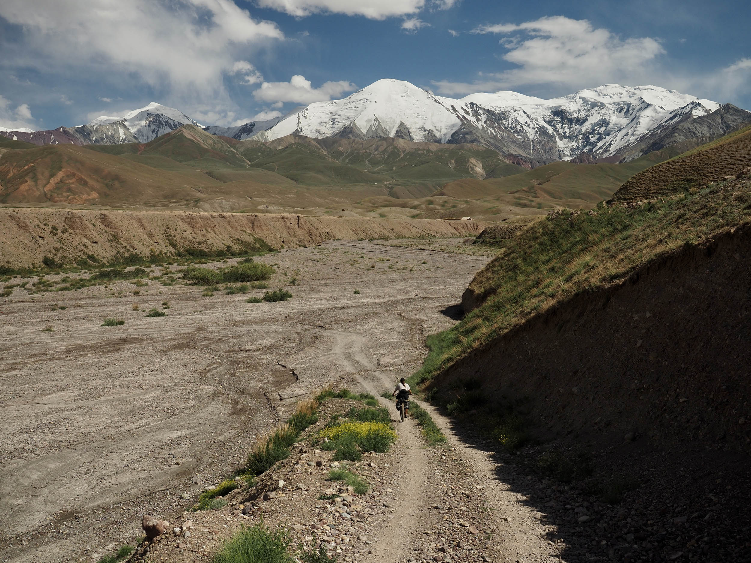
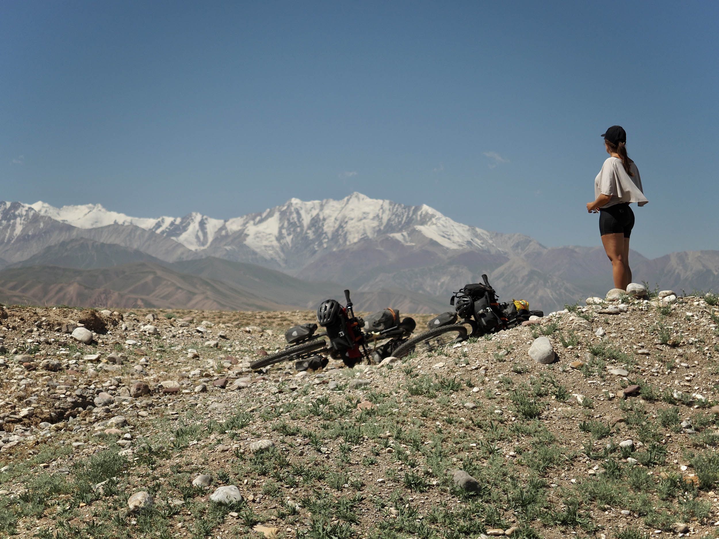
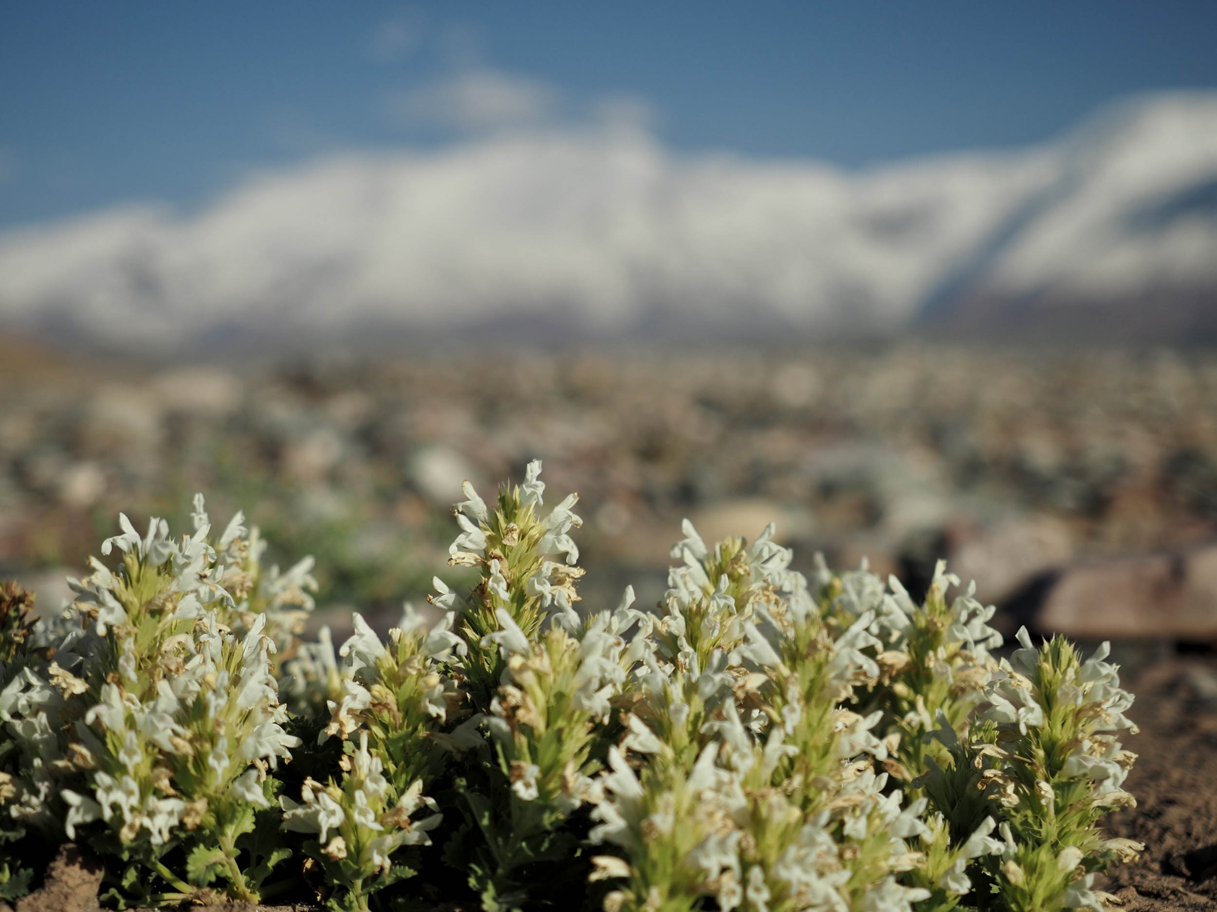
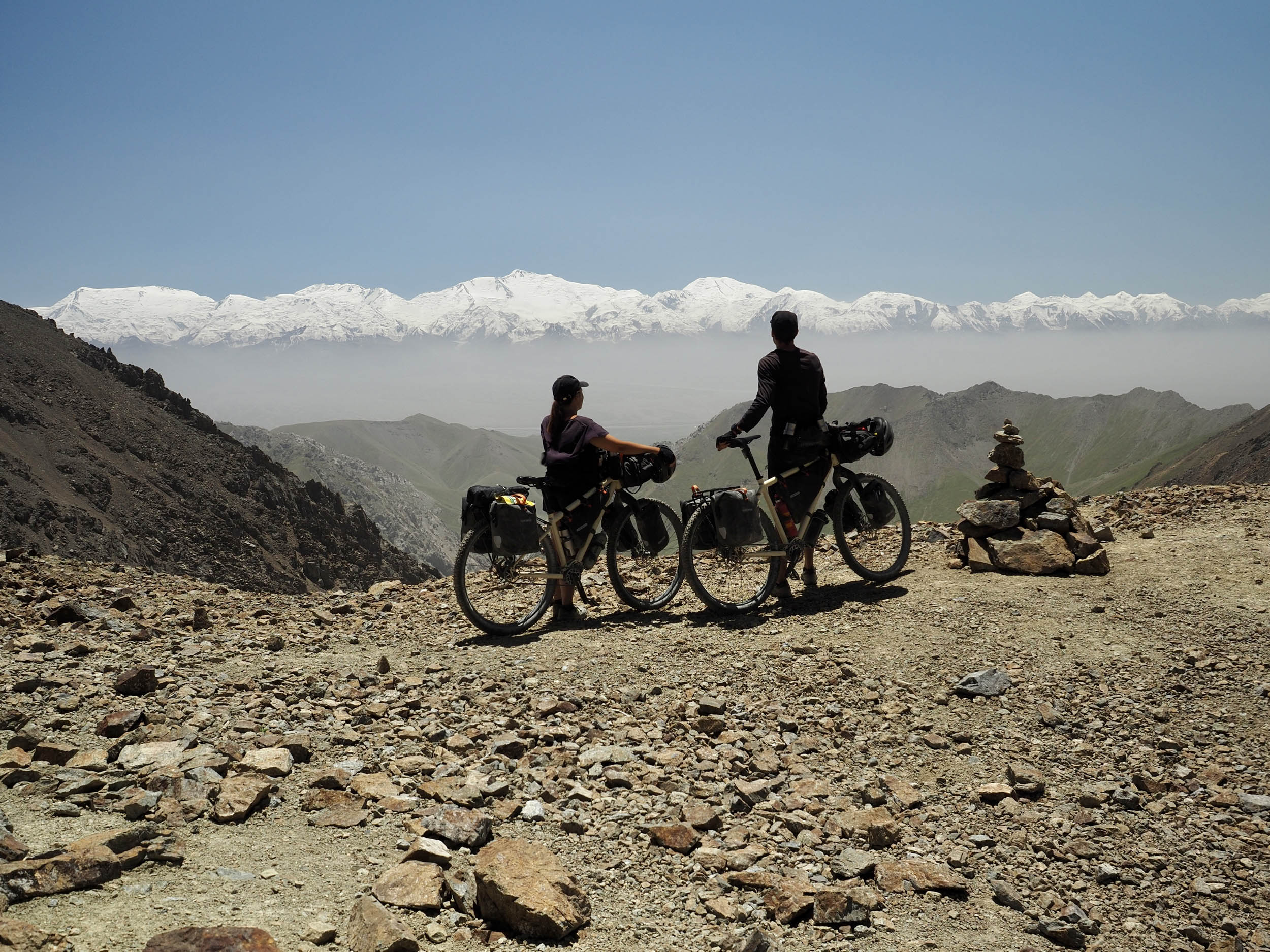
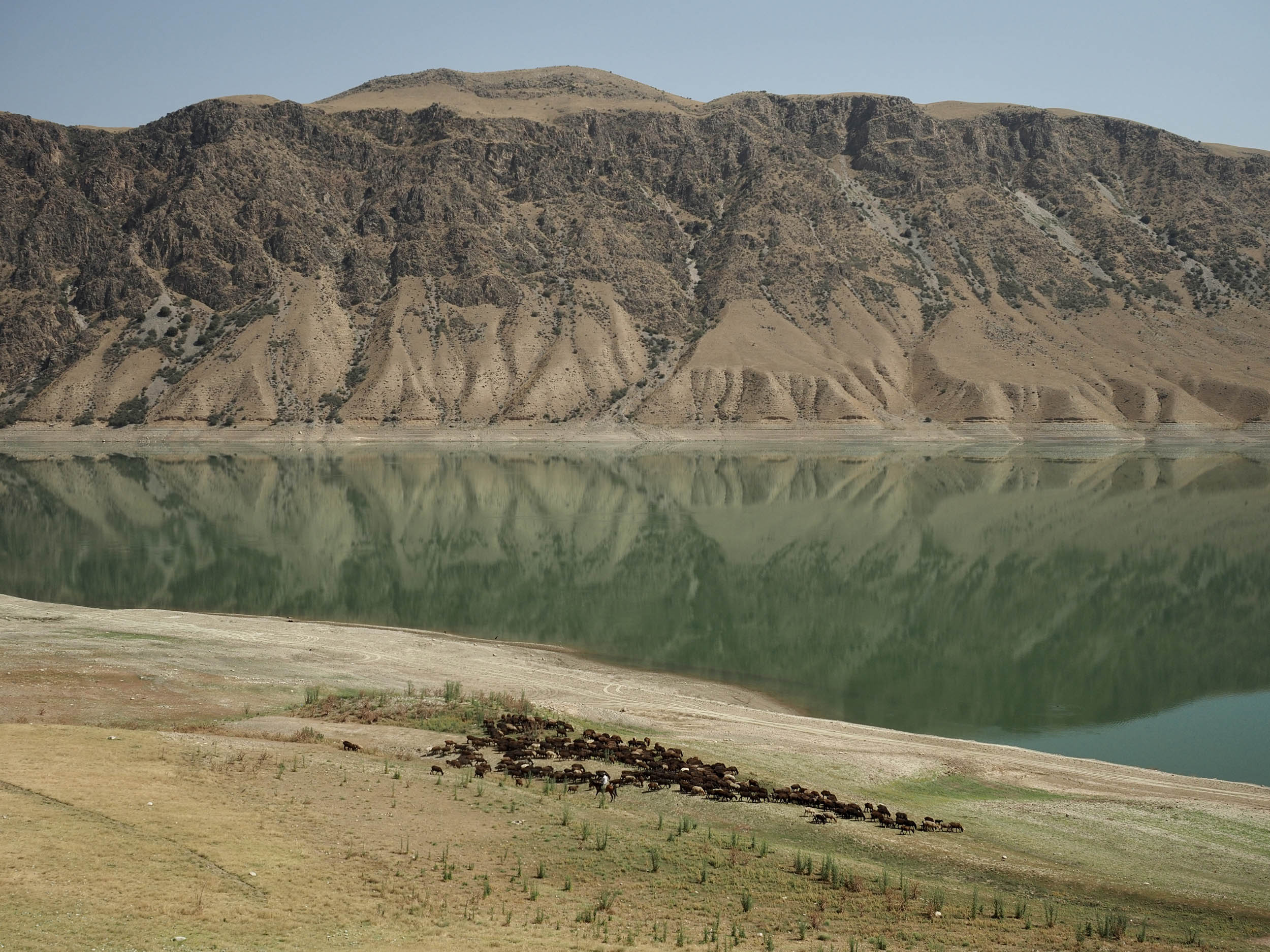
Throughout the whole route, there’s an abundance of different landscapes to behold. From the dry, desertic plains of the Fergana Valley, you’ll see spectacular and gigantic walls of rock along a continuously narrowing river gorge in the west with lush alpine meadows along its banks. On each pass, you’ll see a spectacle of multicolored sediment layers down below, not to mention the wall of six and seven-thousand-meter peaks of the Pamir Mountains that stretch across the southern side of the basin. On the eastern side of the loop, the landscape is more arid, with oasis-like human settlements along your way. From glacial Jiptik, you’ll descend almost 3,300 meters, transitioning through alpine scenery, to red rock, dustier depths, and eventually the arid steppe outside of Osh. All this in just over 100 kilometers!
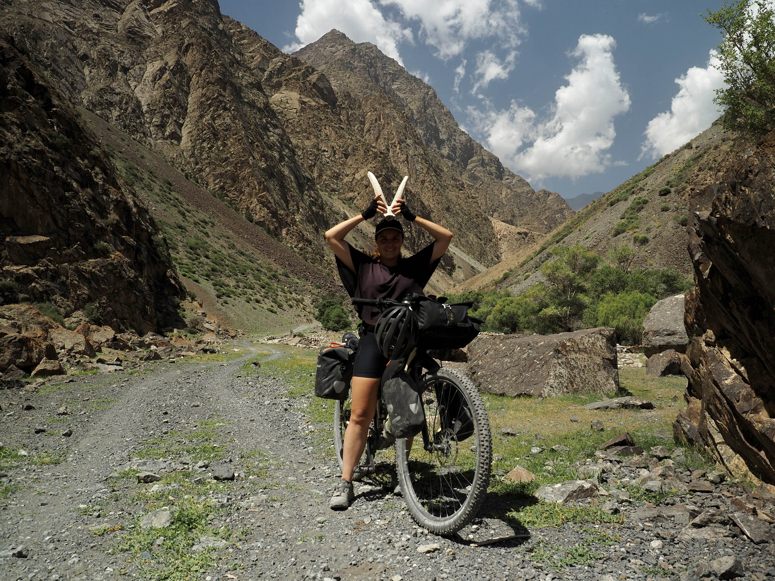
Between Uch-Korgon and Daroot Korgon is a section of preserved nature that denotes the territory of protected animals such as the highly endangered snow leopard, Marco Polo sheep, and ibexes. There’s a very small chance you’ll see any of these along your way, although one animal you will certainly hear is the Kyrgyz marmot. These funny rodents scout their surroundings standing upright and exclaim a high-pitched noise once they spot you, after which they’ll run to their underground lairs as fast as they can.
Route Difficulty
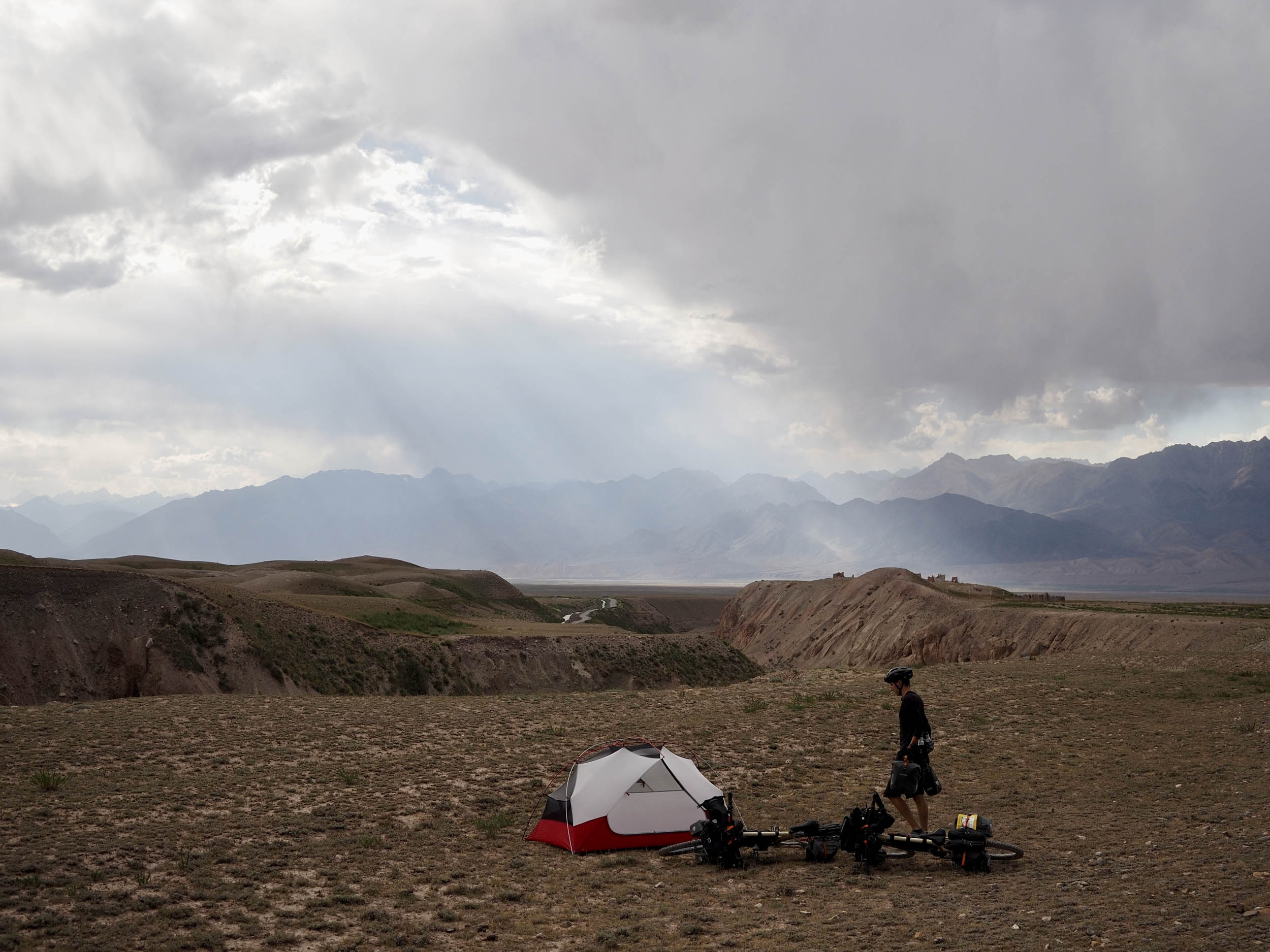
If you’re at all familiar with bikepacking in Kyrgyzstan, you’ll know of the many challenges and rewards in riding there. While it has an inexhaustible amount of ever-changing, spectacular natural environments up on offer, in the process of seeing them, you’ll probably also exhaust yourself. With that in mind, the Expedition Alay route will provide memories for a lifetime, but it’s also an exceptionally difficult undertaking if you don’t come prepared. Weather, terrain, and trip logistics all require local knowledge, reliable gear, a capable yet lightweight setup, and most importantly, your ability to face any issue that might arise in areas with zero cell service, road infrastructure, or even people around. Kyrgyzstan’s notorious afternoon storms, many river crossings, high altitude, and rural setting are a potent concoction for accidents, so prepare yourself well by reading through the logistics and info section of this route and watch a few of our videos on our scouting trip to see what you may encounter.
Route Development: Ever since we first passed through the Alay region in 2018, we wondered if an unpaved way existed between Osh and the Alay Valley. After returning to Kyrgyzstan for a third time in 2022, we finally felt prepared enough to give our first route draft a go and scout the area. At this point, the way up to Koi Jol Pass between Uch-Korgon and Daroot-Korgon had no reliable mapping data, so we took the risk in ascending it to find out if it was crossable by bike. The same was true for the gravel sections of the Alay Valley, as these had only partly been mapped, with broken OSM data and only satellite imagery as a reliable source. As for Jiptik Pass, the year we pushed up it was also the Silk Road Mountain Race’s first dip into southwestern Kyrgyzstan, but whereas racers had to undertake a brutal ascent from Osh southward, we opted to descend it, resulting in a much more rewarding ride down to Osh. On a last note, we did attempt the road to Murdash, which had previously been mapped by Ryan Wilson, but with a near-constant 13% gradient, we found it far too steep and dusty to include in Expedition Alay.

Submit Route Alert
As the leading creator and publisher of bikepacking routes, BIKEPACKING.com endeavors to maintain, improve, and advocate for our growing network of bikepacking routes all over the world. As such, our editorial team, route creators, and Route Stewards serve as mediators for route improvements and opportunities for connectivity, conservation, and community growth around these routes. To facilitate these efforts, we rely on our Bikepacking Collective and the greater bikepacking community to call attention to critical issues and opportunities that are discovered while riding these routes. If you have a vital issue or opportunity regarding this route that pertains to one of the subjects below, please let us know:
Highlights
Must Know
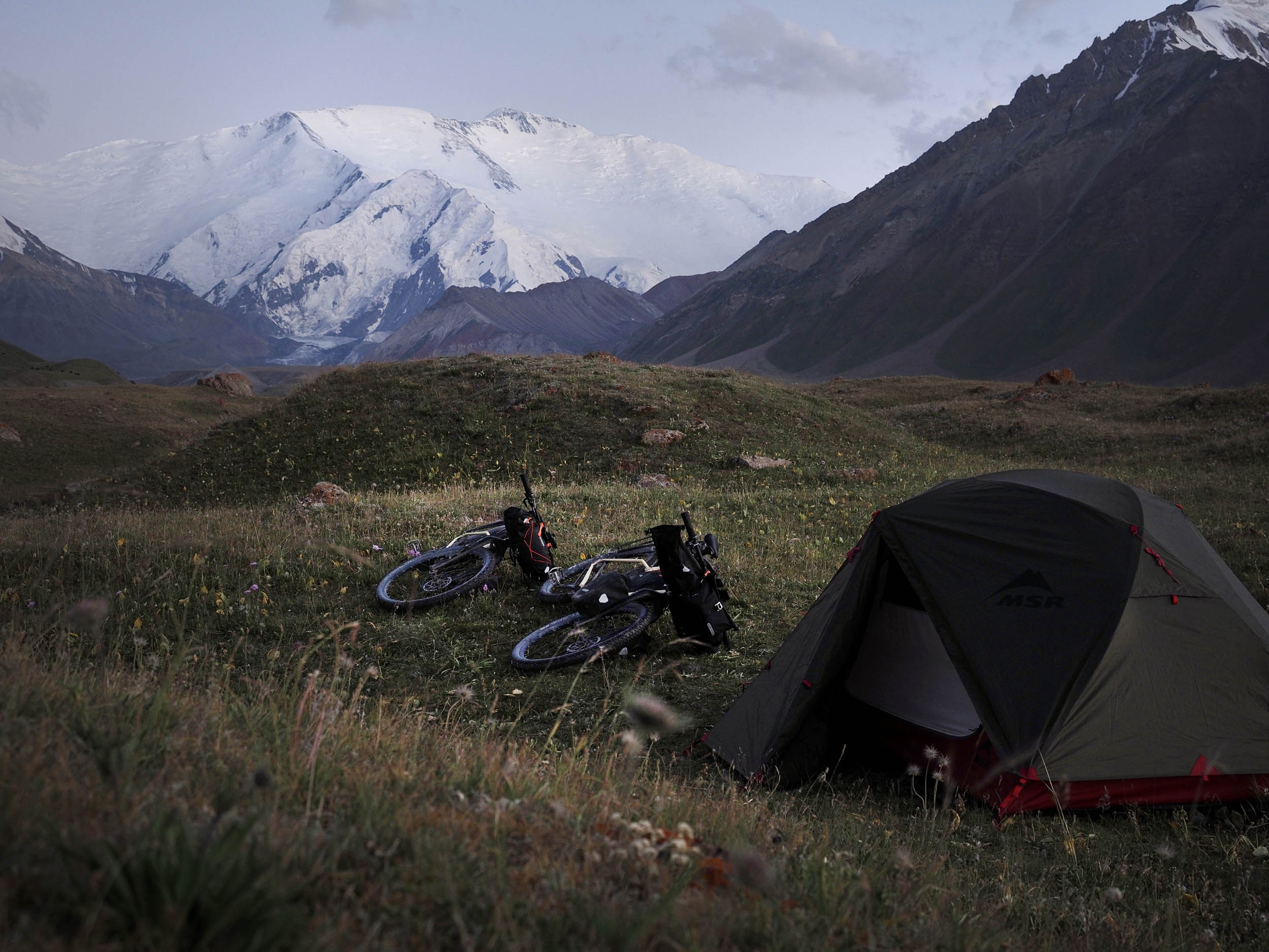
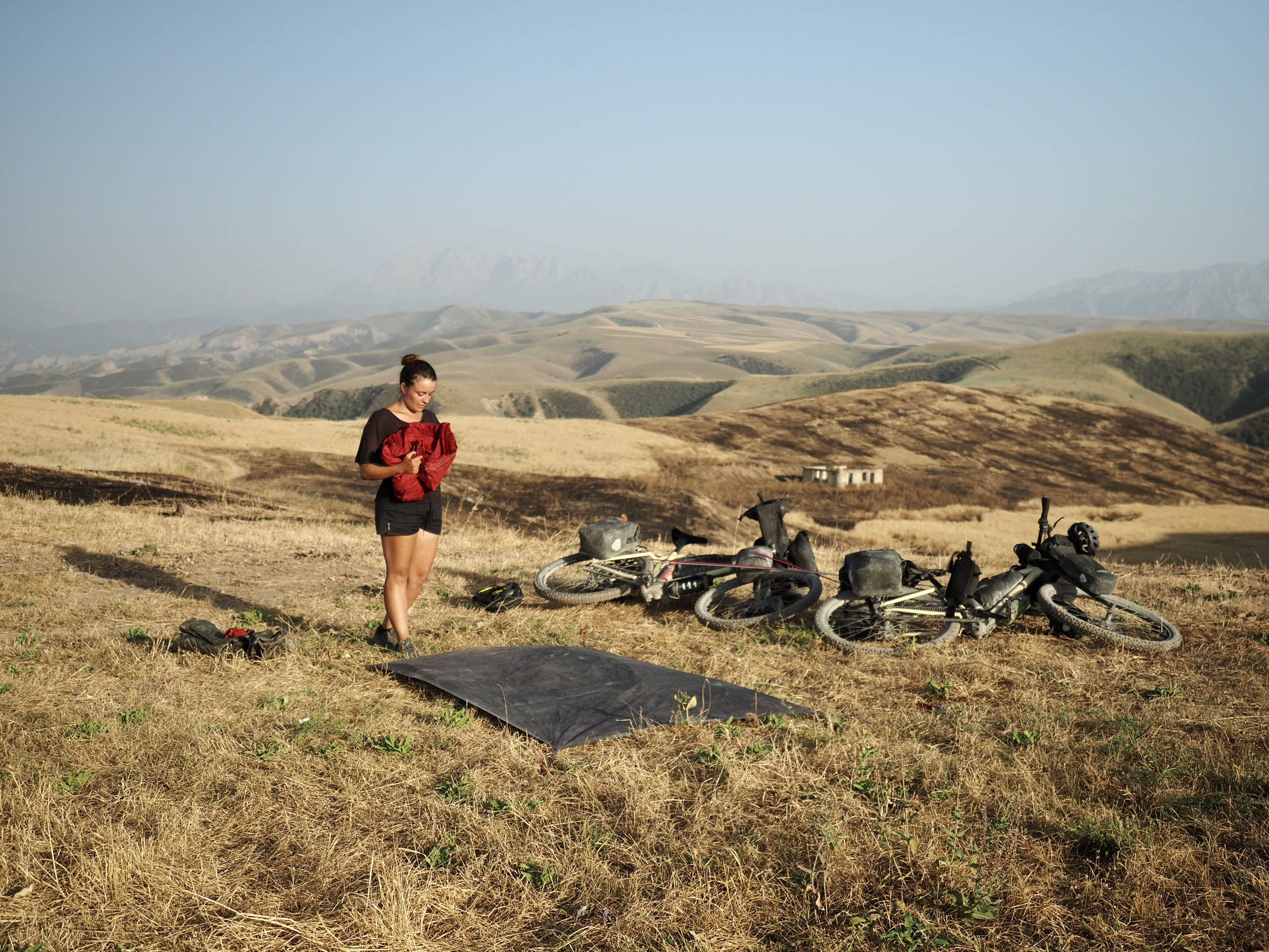
Camping
Food/H2O
Trail Notes
Resources
- Wandering around the old Silk Road city of Osh.
- The ascent to Koi Jol Pass through the cavernous river valley.
- Near complete solitude, zero cell service, and having the wild, imposing natural environment all to yourself.
- Seeing millions of stars at night with zero light pollution.
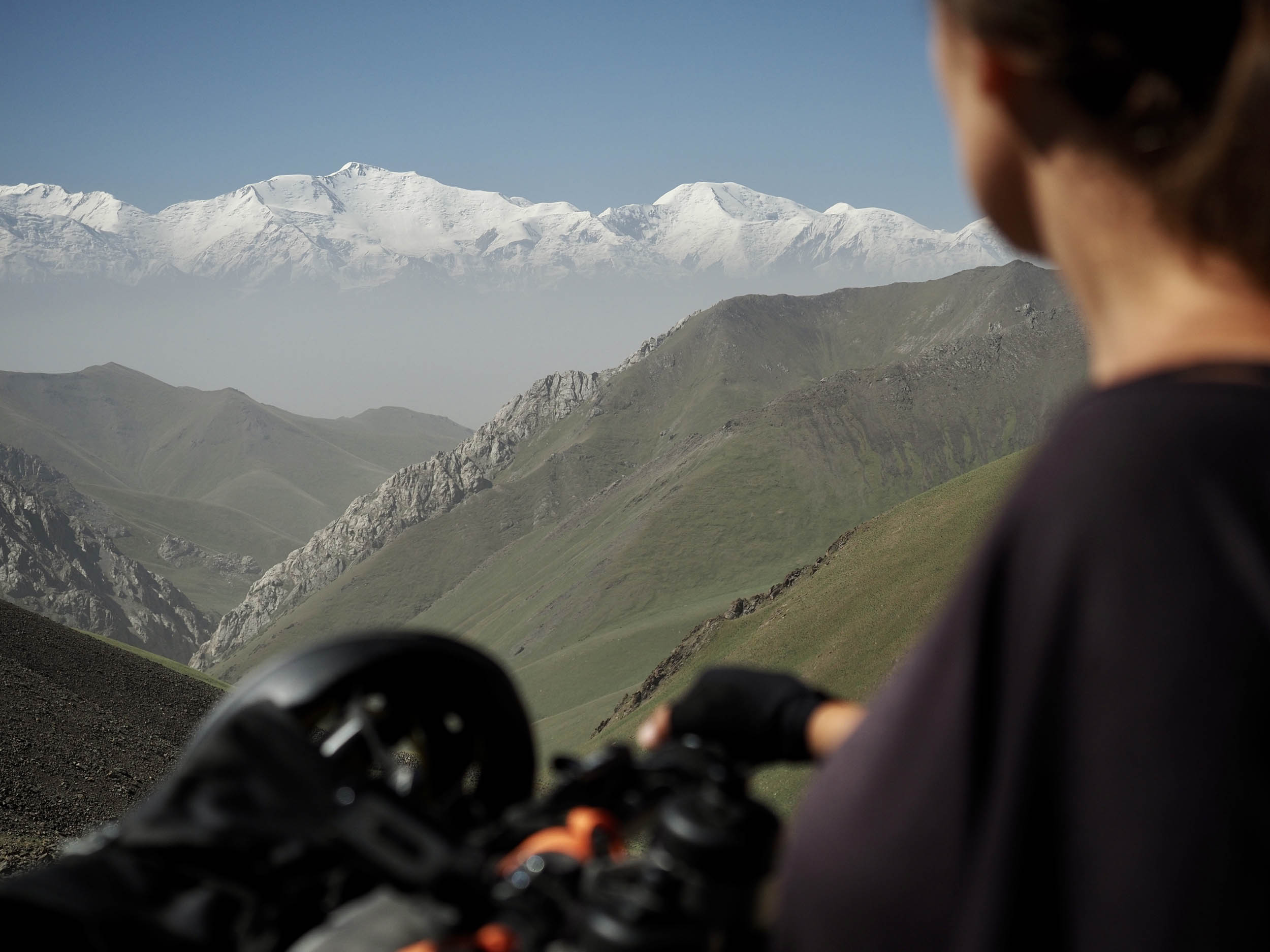
- Witnessing the wall of six- and seven-thousand-meter Pamir Mountains after summiting Koi Jol Pass.
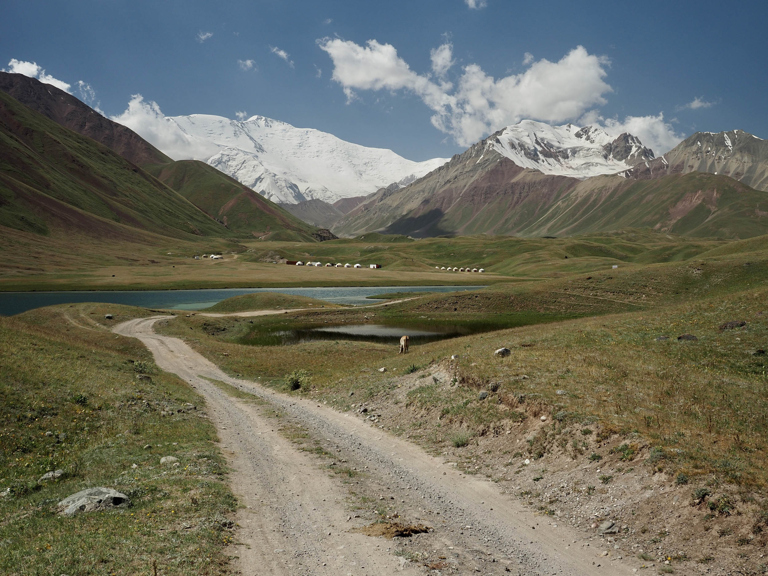
- Staying at one of the yurt camps at Tulparkul and exploring the local area covered in hills and dozens of little lakes between them.
- Learning about Kyrgyzstan’s past nomadic culture, migrational patterns, shepherding practices, and yurt building that still exist today.
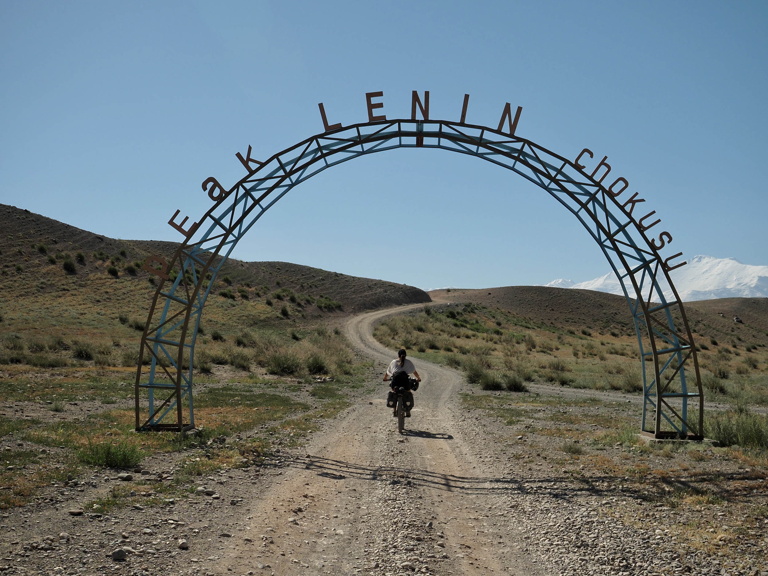
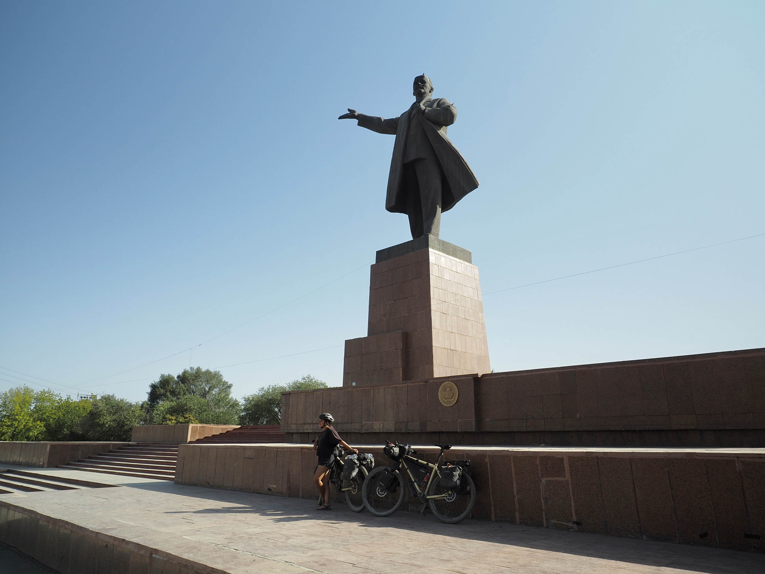
- Cycling between two points of Soviet history: from the Lenin statue at the northernmost point of the loop to the view of Peak Lenin (7,134 meters) at the southernmost point.
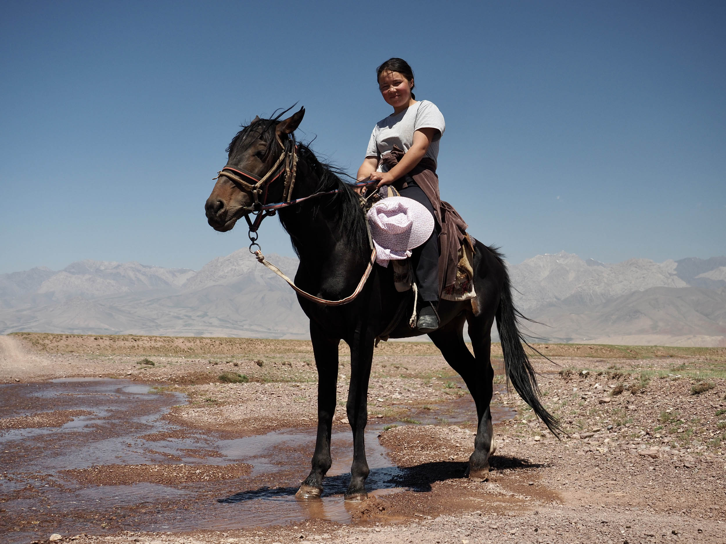
- Seeing how local semi-nomadic families live in their yurts during the summer months.
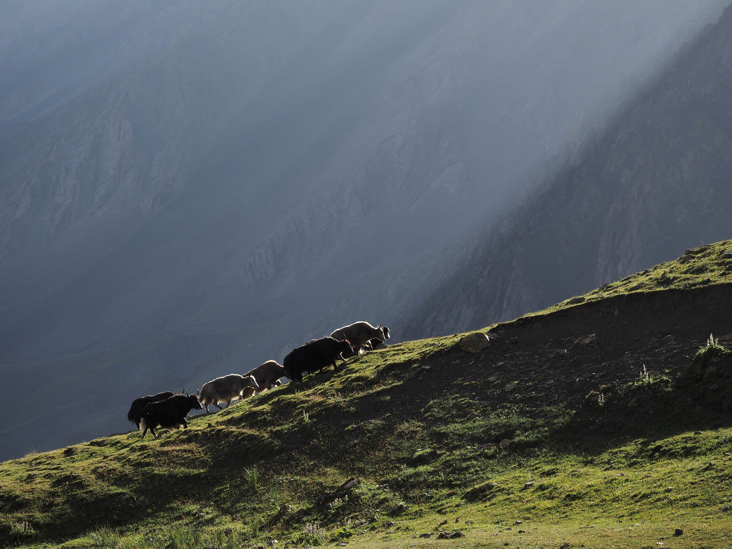
- Spotting yaks, marmots, vultures, and herds of horses.
- Climbing the 4,185-meter Jiptik Pass by bicycle, a completely foolish but amazing feat of physical and mental endurance, with one last rewarding view of the Pamirs.
- The long and rewarding descent between Jiptik Pass and Osh, transitioning through a multitude of different landscapes.
- Serious enjoyment in washing your clothes, eating fresh foods, and drinking real coffee upon your return to society in Osh’s city centre.
- When to go: we recommend riding Expedition Alay in the prime summer season of July and August. There will be more glacial melt filling the rivers, but aside from this, temperatures at high altitude aren’t that cold, snow on the passes will have melted, and there’s life out in the villages. If you’d like to try the shoulder months of June or September, you’ll be more dependent on the weather and possibly subject to freezing temperatures at night. On the upside, the rivers in the Alay Valley may have a weaker current and might be easier to ford.
- What bike: we recommend using a hardtail or fully rigid rig, preferably with a steel frame in case you’ll need to have it welded. Suspension will make your ride a lot more comfortable, but isn’t strictly necessary. Tire size should not be less than 45mm, with a sweet spot between 2.25” and 2.8” on a rugged set of tires. Tubeless is strongly advisable. Our bikes use a gearbox and belt, which need much less maintenance and are resistant to the elements, but if you’re using a more conventional drivetrain, make sure you have enough gears to climb 8-10% gradients comfortably.
- Travel basics: Kyrgyzstan has a 60-day visa-free policy for 69 countries around the world; you can check yours here. Money wise, they use the som currency. You can withdraw som and exchange dollars and euros only in the major cities, but make sure the bills don’t have any marks or tears as they will be rejected. Outside of Osh, forget payments by card and focus only on cash; it’ll save you the risk!
- Permit requirements: even though the route grazes the (unclear) line of the Tajikistan border permit area in the Alay Valley, you won’t need this permit unless you decide to stay in the Peak Lenin basecamp area and roam around from there. Military controls are rare but can happen. You can physically obtain this permit through any tourism organization in the country, but you’ll need to do so at least a week in advance. We recommend doing it digitally before your trip here.
- How to get to the start: there are shared and private taxis, as well as marshrutkas (shared sprinter van) driving between Bishkek and Osh all day long, and the drive is between 10-14 hours. You’ll most likely have to negotiate a price for your bicycle, but most drivers with a big car don’t have any issues carrying it and will find creative ways of doing so. A fast option between Bishkek and Osh is to fly with a domestic airline such as TezJet. Tickets ca be obtained online (in Russian) or directly at the airport. Lastly, you could cycle to Osh, although the faster main road options aren’t that great due to notoriously polluted and dangerous driving standards.
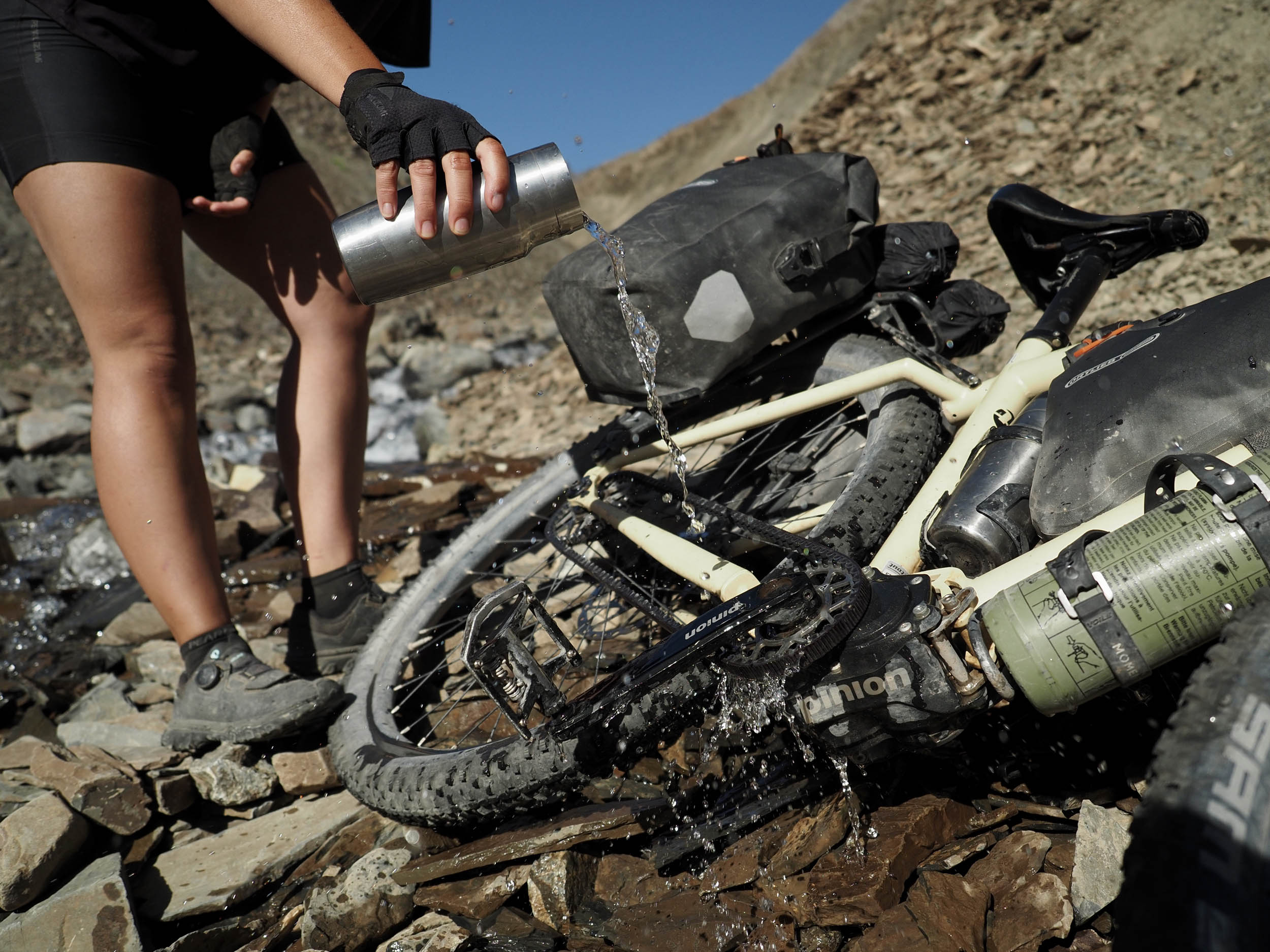
- Water filter: there’s one thing that’s absolutely plenty along this route: water! However, we highly recommend using a filter (such as the Katadine BeFree) to keep out sediment and any bugs/viruses as you never know if there’s a sheep’s carcass laying in the river upstream.
- Cooking: Most people use a petrol stove while traveling in Central Asia, as petrol stations are plenty. For cooking on butane gas, you’ll find canisters sold at tourist organizations in the main cities. For alcohol stoves, you can find small bottles of ethanol in some pharmacies. White gas or isopropyl are sold in select shops, but these usually burn pretty dirty.
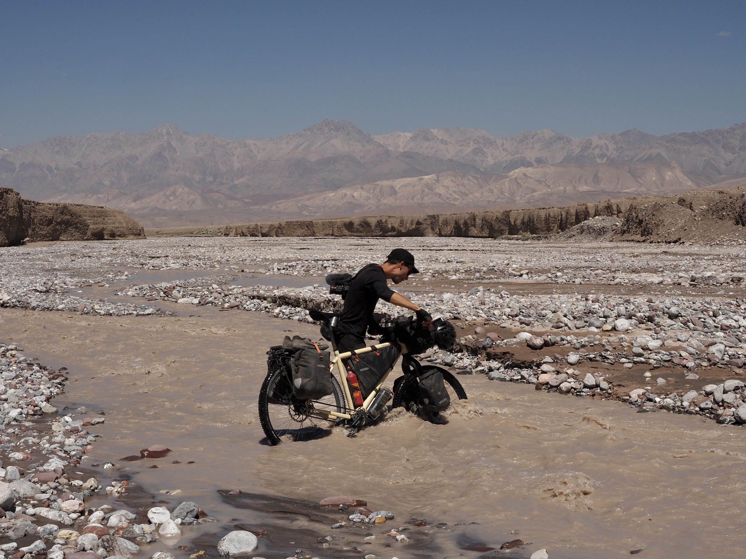
- River crossings: these are frequent in the Alay Valley, with varying current strengths and depth, depending on how much glacial melt they’re carrying downstream. If you come through in July or August, chances are you’ll have to carry your bike and bags through separately as some rivers can be knee-deep. In June or September, the rivers are most likely much shallower but also colder.
- Weather conditions: Kyrgyzstan enjoys an enormous amount of sun each year, with hot, dry temperatures in the lower elevations and colder but still dry above 2,000 meters. It is normal for clouds to start forming at noon, culminating in afternoon storms that can impede your progress. The country is 93% mountainous, all with their own microclimates, so weather can change fast. It can snow at higher elevations (even in midsummer), so be prepared with sufficient waterproof and warm layers as well as a reliable shelter such as a tent or waterproof bivvy.
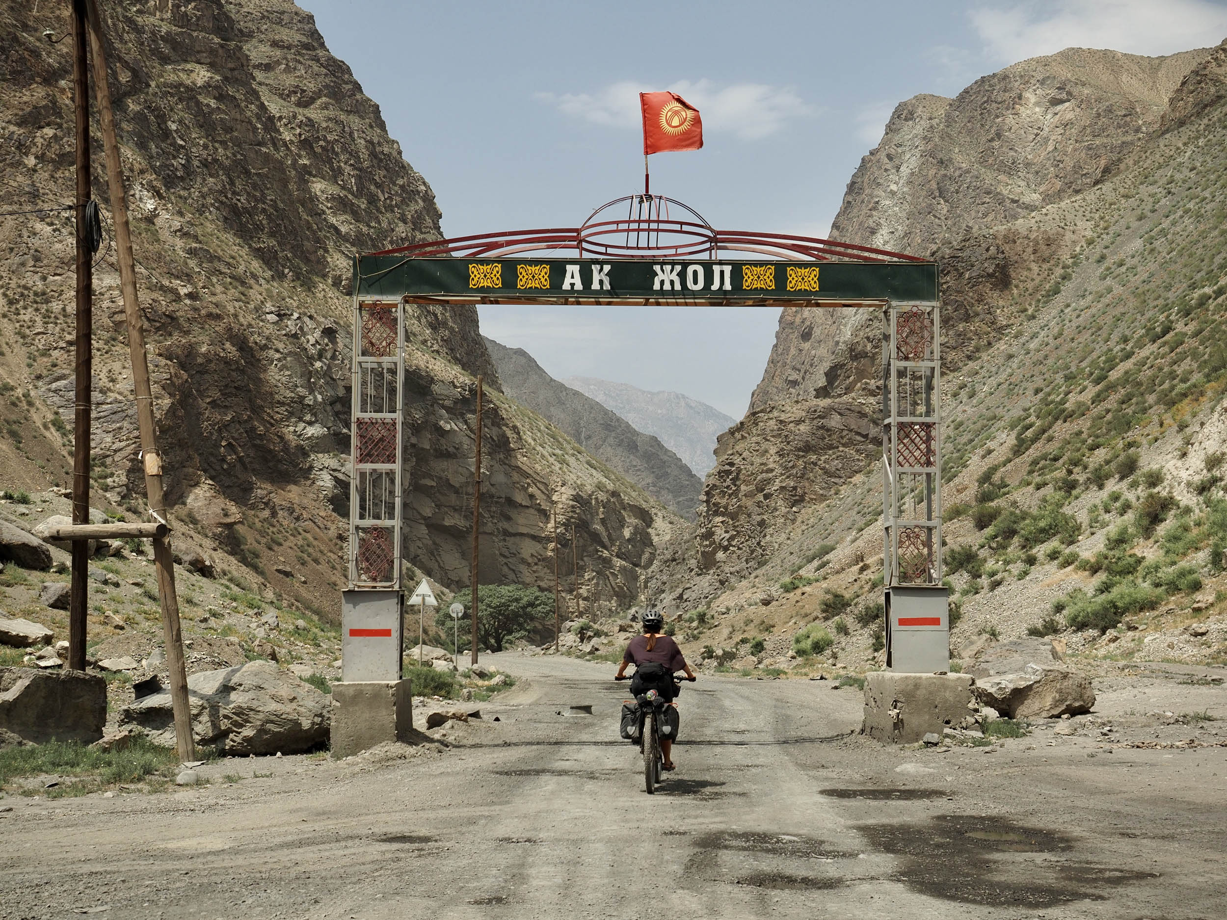
- Barriers: the only existing gate on this route is positioned near kilometer 134, an entry point into a protected nature reserve. It is passable for bicycles through an opening in the fence on its western side. To this date, there is no permit required here, and nobody who’s come after us has had any issues passing through.
- Hike-a-bike alert: the track over Jiptik Pass is not to be underestimated because of the loose scree and narrow paths on either side of the pass. Watch your step with serious caution!
- Resupply alert (1): you will not find any shops between Austan (Аустан) and Kyzyl-Eshme (Кызыл-Эшме), and since you’ll be climbing, we recommend you keep weight to a minimum while carrying dry meals as a backup in case you get stuck or delayed.
- Resupply alert (2): you will not find any reliable resupply points either between Sary-Moghol and Papan (Папан). We grossly miscalculated our supplies due to maps showing shop icons in Kojo-Keleng (Кожо-Келен) but found no shop on arrival. Two women called us from their garden and gave us bread, apricots and candy, but you might not be so lucky! Also, keep in mind that carrying too much food from Sary-Moghol will slow you down on the hike-a-bike over Jiptik Pass, so dry meals are recommended.
- Wild camping is completely allowed and respected in Kyrgyzstan, with no shortage of gorgeous places to do so. Stay away from the roads and out of sight unless you don’t mind curious visitors, and follow Leave No Trace principles, especially since trash is a real problem in the country.
- If you need budget-friendly lodging, stay at Ak-Bata in Daroot-Korgon and the CBT guesthouse in Sary-Moghol. Both should cost you around $15 a night and come with a (shared) shower and (possibly) a washing machine, as well as meals. The standard is not high, but they’re basically the only option.
- Try out a night in a traditional yurt on the shore of Tulparkul Lake below Peak Lenin. It also costs around $15 with breakfast and dinner included, and the landscape around here is not to be missed, especially around sunset and sunrise.
- When in Osh, stay at the more affordable TES Hotel (you can also camp in the garden) or at the Rayan Hotel. Both have AC and a great breakfast included.
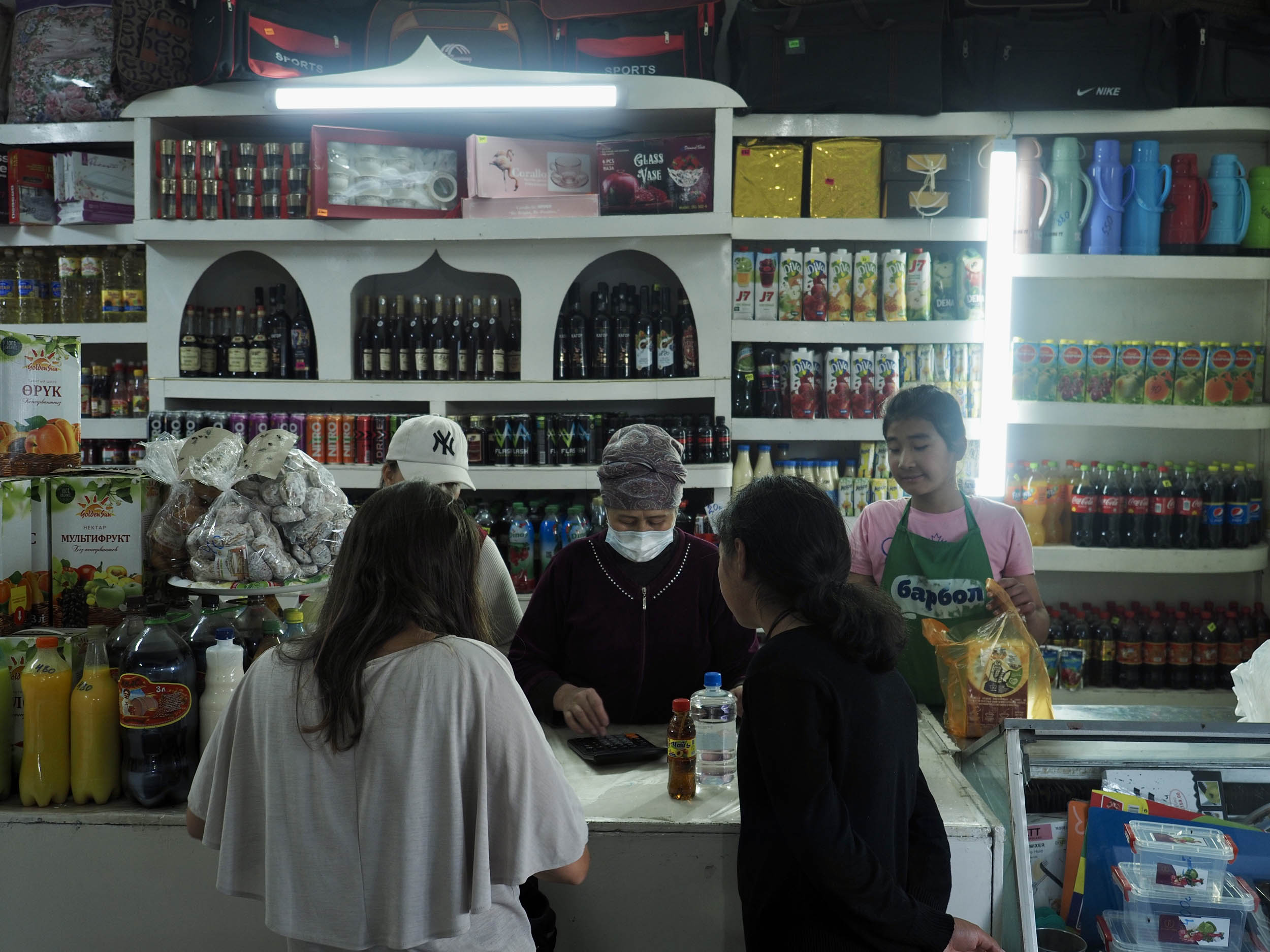
- Food is perhaps the least attractive feature of Kyrgyzstan, as the second you leave Osh, it’s down to the bare basics. You’ll be able to find some bread, vegetables, fruits, and legumes in shops, but it’ll mostly come down to soft drinks, candy, and ice cream.
- There are many water sources along this route, and as long as you carry a filter, you’ll be fine. You won’t need a ton of water storage, but to be on the safe side, we recommend carrying around 3-5L and topping up when you get the chance.
- As a tip, cook your own buckwheat (гречиха – pronounced gretsh-ka) with fried onion and potato for dinner. It is our go-to meal in the Kyrgyz mountains.
- For breakfast, you’ll be able to find oats and dried fruits in most shops, but it’s best to stock up for a few days when you do.
- When in Osh, enjoy the more international cuisine and drinks at Ethno Restaurant. And make sure to visit Brio Cafe for real coffee, fast food, and lemonades at a very affordable price!
You can find the daily segments of our scouting trip (far slower than you’ll ride it), including photos, detailed storytelling, and route highlights on this page.
Route Alternatives
- Main Road Alay Valley: once you arrive in Daroot-Korgon, you have the option to head east on the valley’s single paved road until Kashka-Suu to cut out the gravel tracks and river crossings yet still include the track to Peak Lenin basecamp. Alternatively, you could even continue straight to Sary-Moghol, from where you’d still have the option to ride to Tulparkul Lake.
- M41 Highway: if you’d prefer to skip Jiptik Pass, you can opt to ride the M41 main road between Sary-Tash and and Osh instead. This road is fully paved and carves through some gorgeous landscapes, so you’re by no means missing out. Keep in mind that this road has a flow of small vehicle and truck traffic that intensifies between Gulcha and Osh.
- Murdash Valley: if following the M41 down to Osh, this valley provides a way to stitch back into the Expedition Alay route. It’s a 75-kilometer ride with about 2,600 meters of climbing up a mountain pass and a pretty degraded, dusty road on the descent. Find the track here.
- Connection to the Pamir Highway: if you’re on course for the Pamir Highway from Osh, we recommend using the Expedition Alay route as a “backdoor” into the Alay Valley, rather than using the busy M41 main road. Follow the route through Uch-Korgon, climb to Koi Jol, and make your way to Sary-Moghol. From here, you can connect to the Pamir Highway heading into Tajikistan.


Terms of Use: As with each bikepacking route guide published on BIKEPACKING.com, should you choose to cycle this route, do so at your own risk. Prior to setting out check current local weather, conditions, and land/road closures. While riding, obey all public and private land use restrictions and rules, carry proper safety and navigational equipment, and of course, follow the #leavenotrace guidelines. The information found herein is simply a planning resource to be used as a point of inspiration in conjunction with your own due-diligence. In spite of the fact that this route, associated GPS track (GPX and maps), and all route guidelines were prepared under diligent research by the specified contributor and/or contributors, the accuracy of such and judgement of the author is not guaranteed. BIKEPACKING.com LLC, its partners, associates, and contributors are in no way liable for personal injury, damage to personal property, or any other such situation that might happen to individual riders cycling or following this route.
Please keep the conversation civil, constructive, and inclusive, or your comment will be removed.