


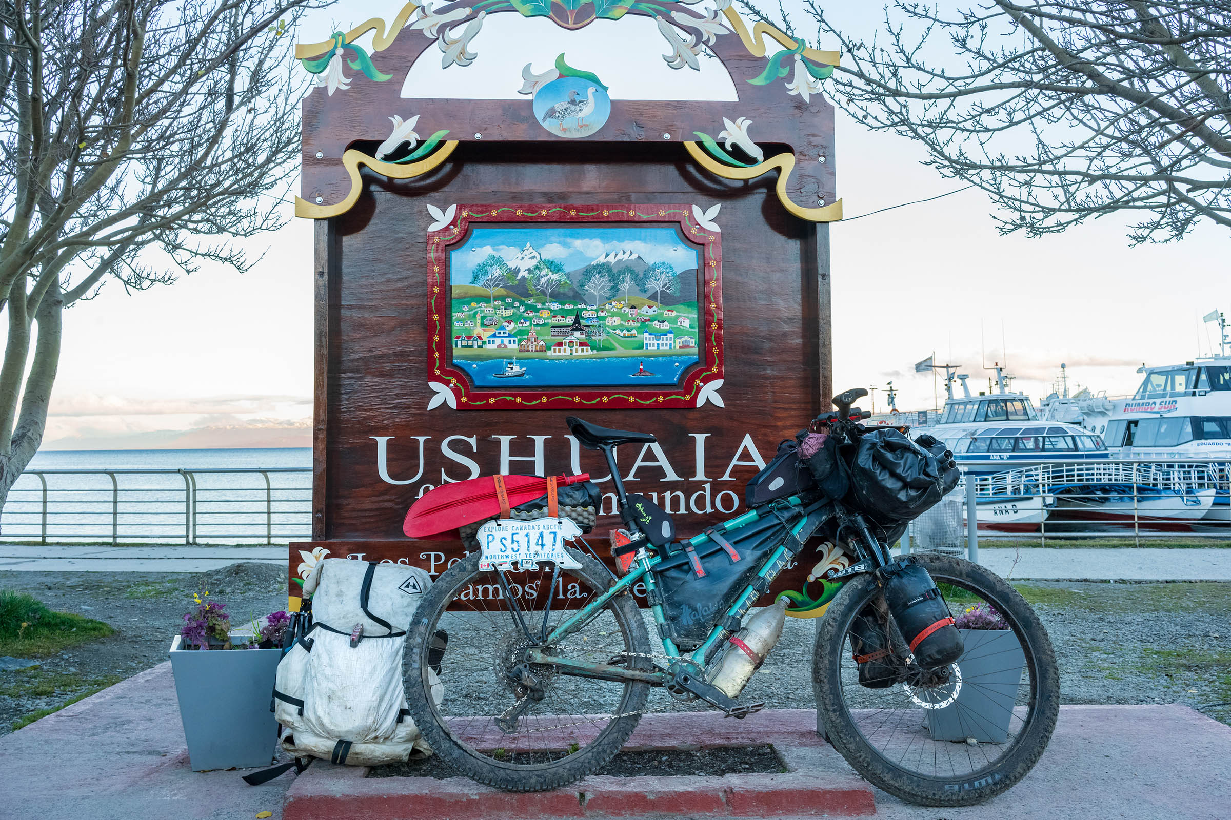
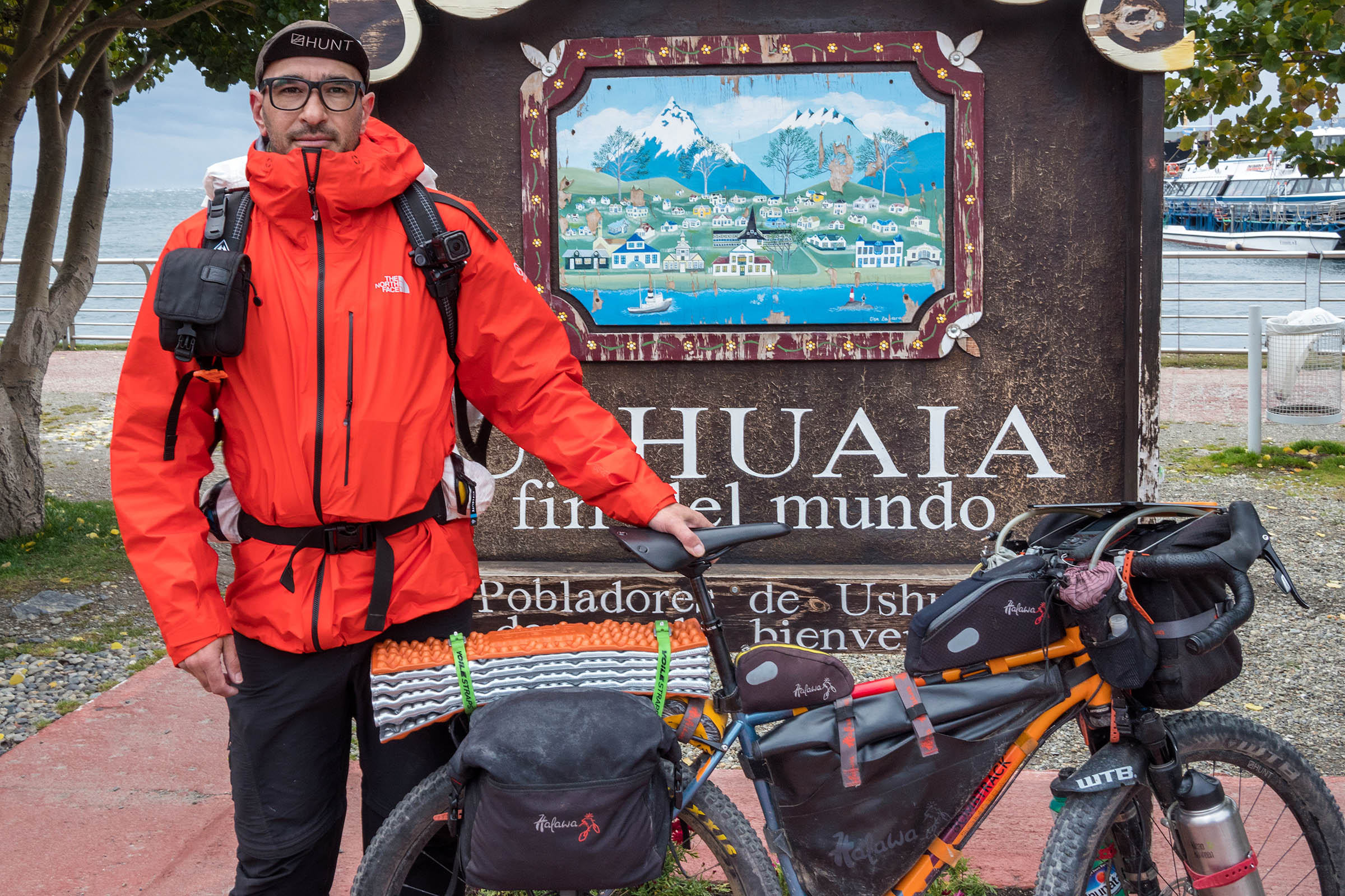
Fin del Mundo Overnighter
Distance
84 Mi.
(135 KM)Days
2
% Unpaved
65%
% Singletrack
20%
% Rideable (time)
90%
Total Ascent
5,803'
(1,769 M)High Point
1,043'
(318 M)Difficulty (1-10)
7?
- 4Climbing Scale Fair69 FT/MI (13 M/KM)
- 6Technical Difficulty Moderate
- 8Physical Demand Difficult
- 7Resupply & Logistics Strenuous
Contributed By

Federico Cabrera
Guest Contributor
Federico Cabrera is a photographer based in Buenos Aires, running “Their Only Portrait,” a personal project where he cycles through beautiful but impoverished remote areas, in order to make, print, and give away portraits to families who might not otherwise ever have a family photograph. He also donates water filters and solar lights to those who need them most. He has ridden 45,000km through South America in the last eight years, giving away more than 500 portraits and donating 350 solar lamps and water filters. Find more on Fede @theironlyportrait.
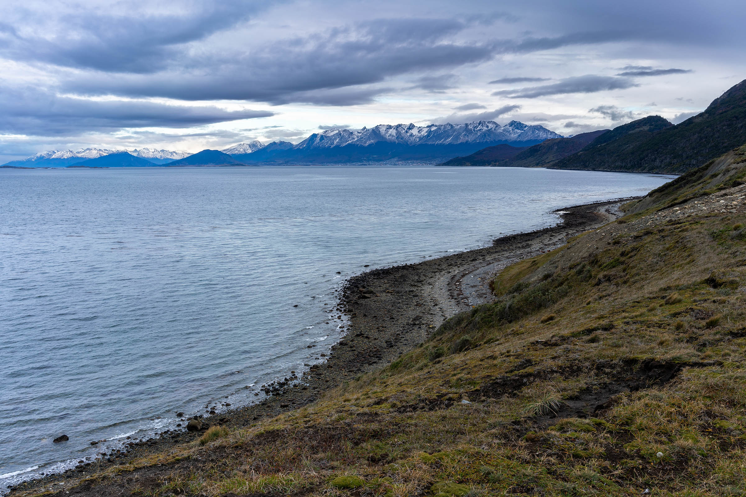
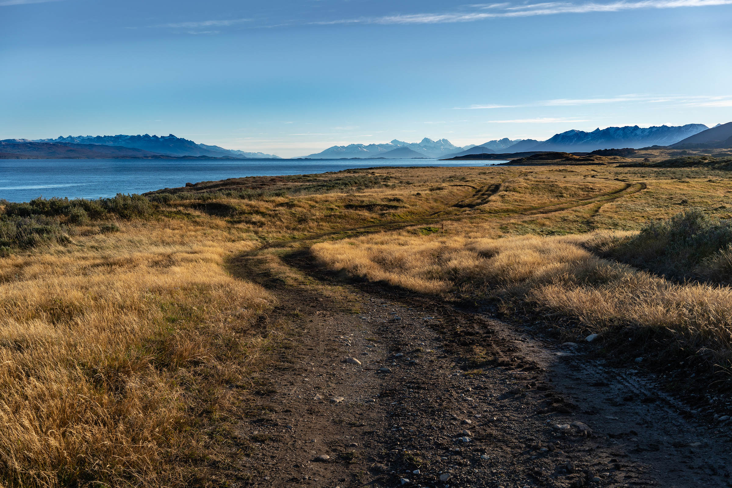
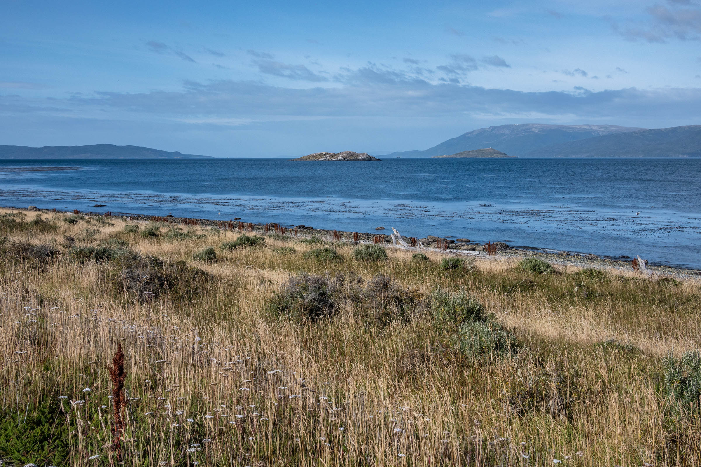
Tierra del Fuego is located at the far end of South America, and Ushuaia is usually the finishing point for those riding along the Pan-American Highway (or the beginning for those who don’t mind the headwind). This remote island was inhabited by Yaghan people for thousands of years and used to have the only navigable passage between the Pacific and the Atlantic Oceans, which attracted renowned explorers and adventurers such as Magellan, Darwin, Shackelton, Chatwin, and Bridges.
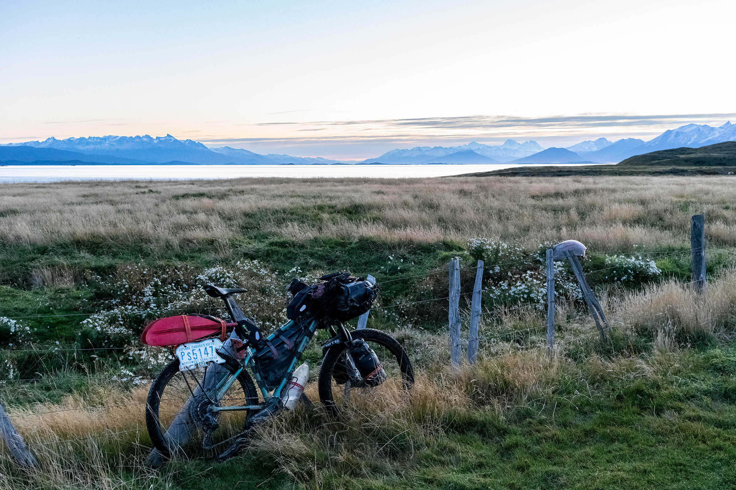
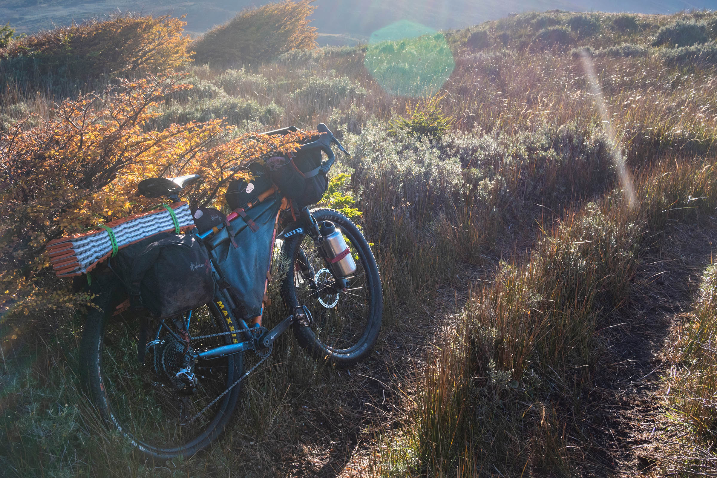
The route starts in Ushuaia, the southernmost city in the world, located between the Beagle Channel to the south and the mountains to the north. It goes through a very remote area, and it’s going to be a little tough at the beginning (especially with a heavy bike), but the reward will be interacting with a pristine environment, crossing archeological sites, and visiting some of the first settlements.
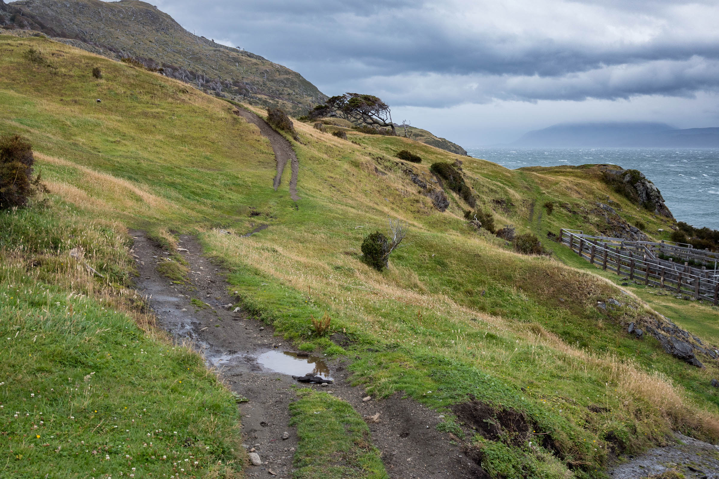
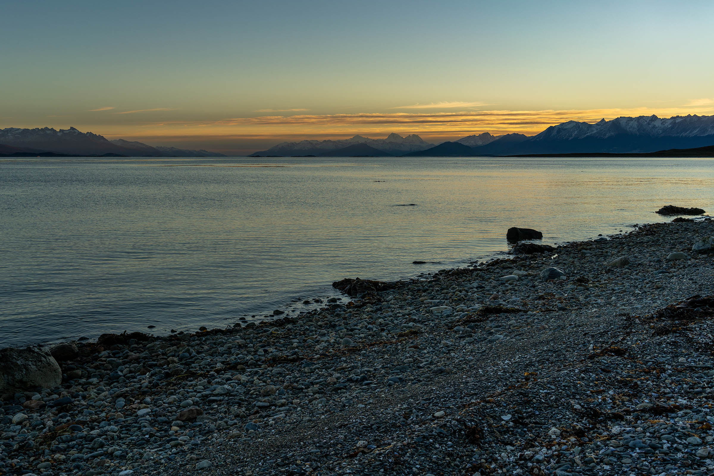
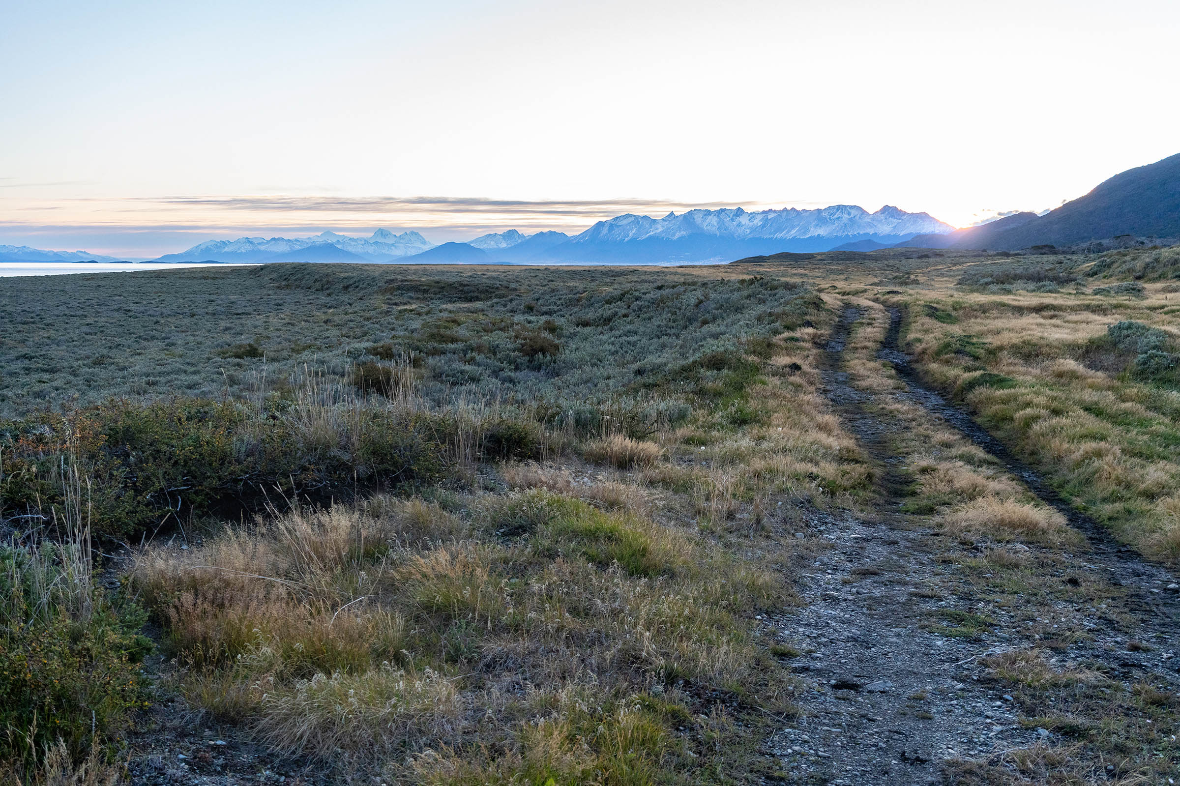
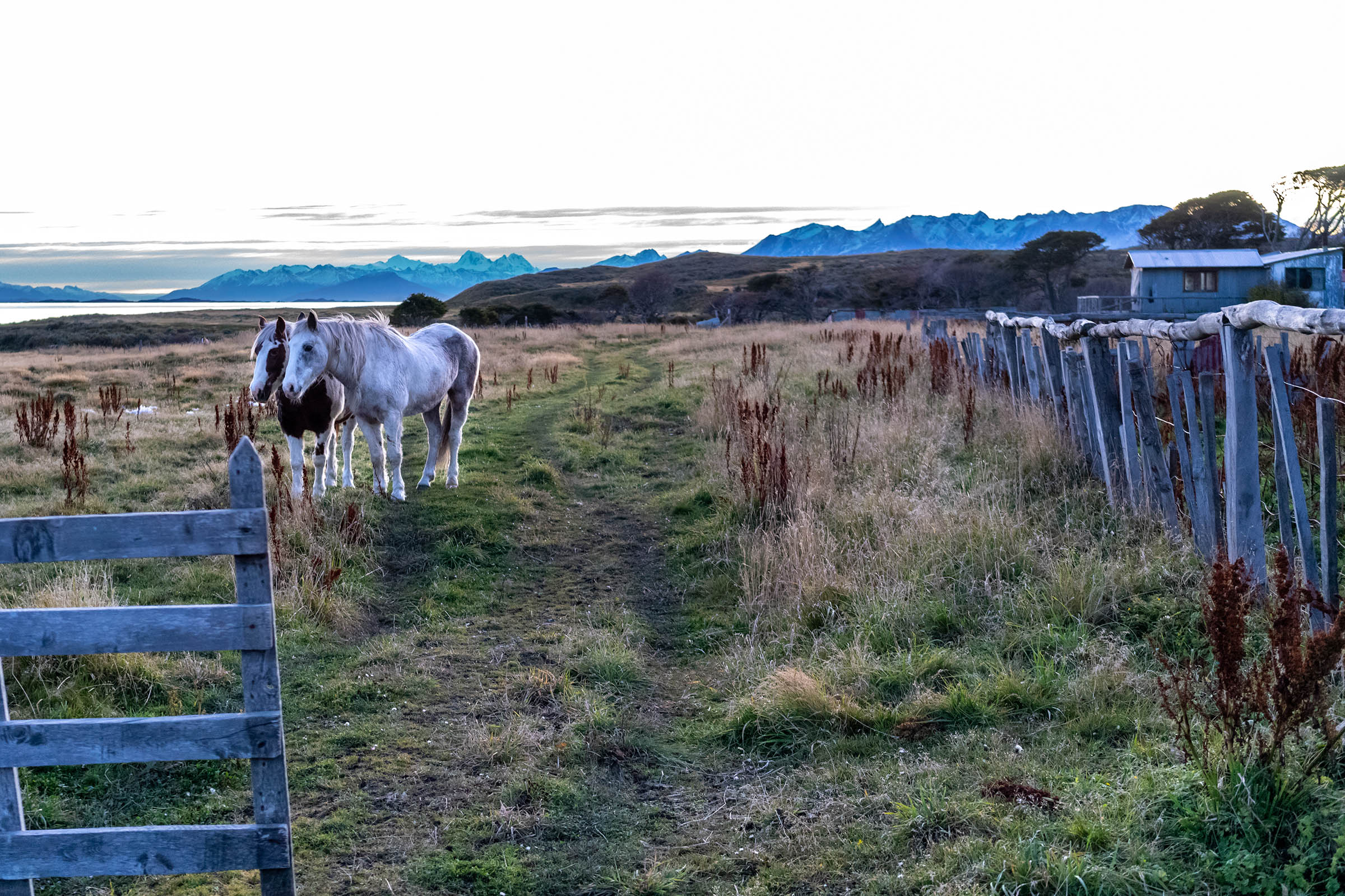
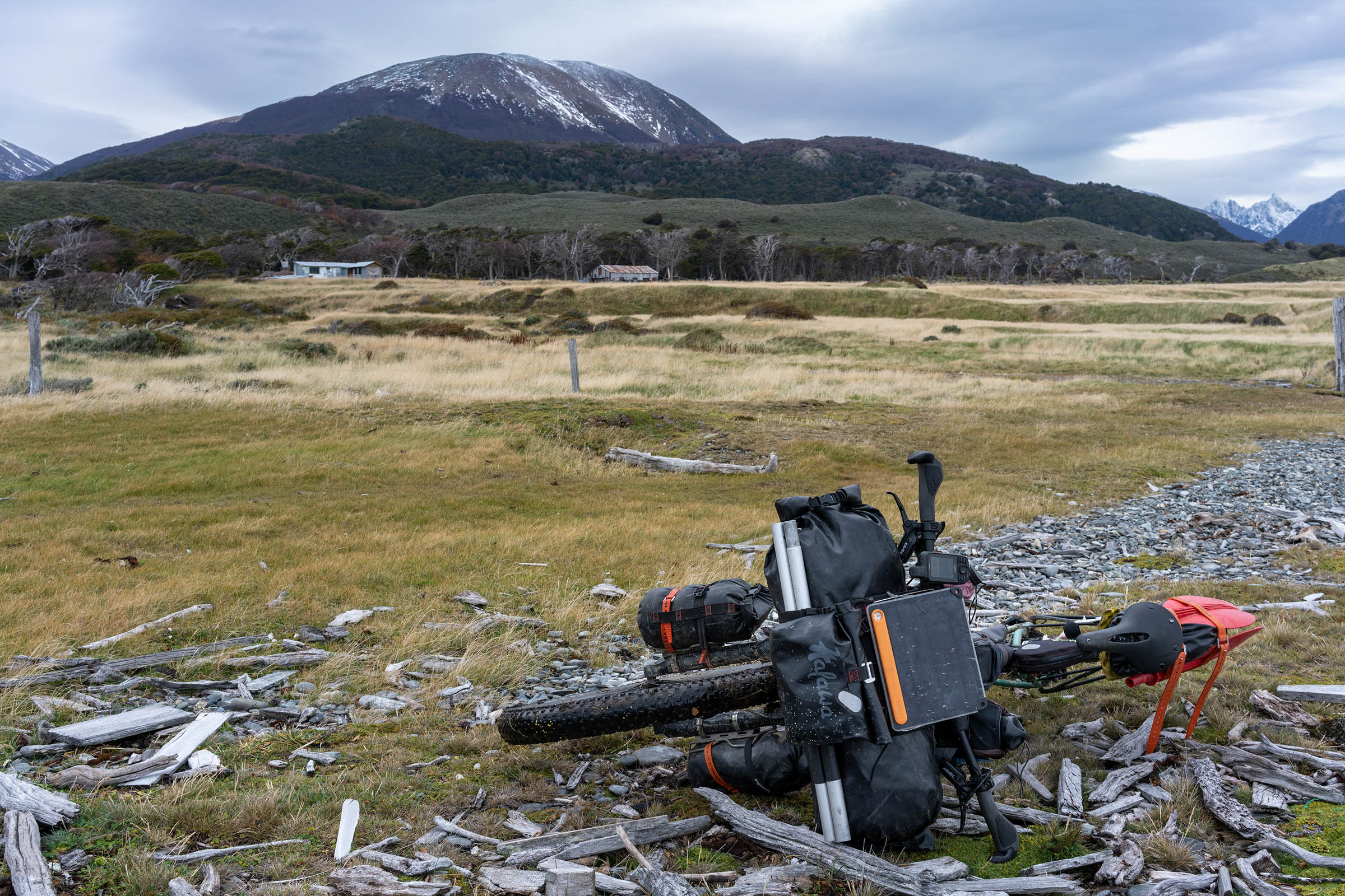
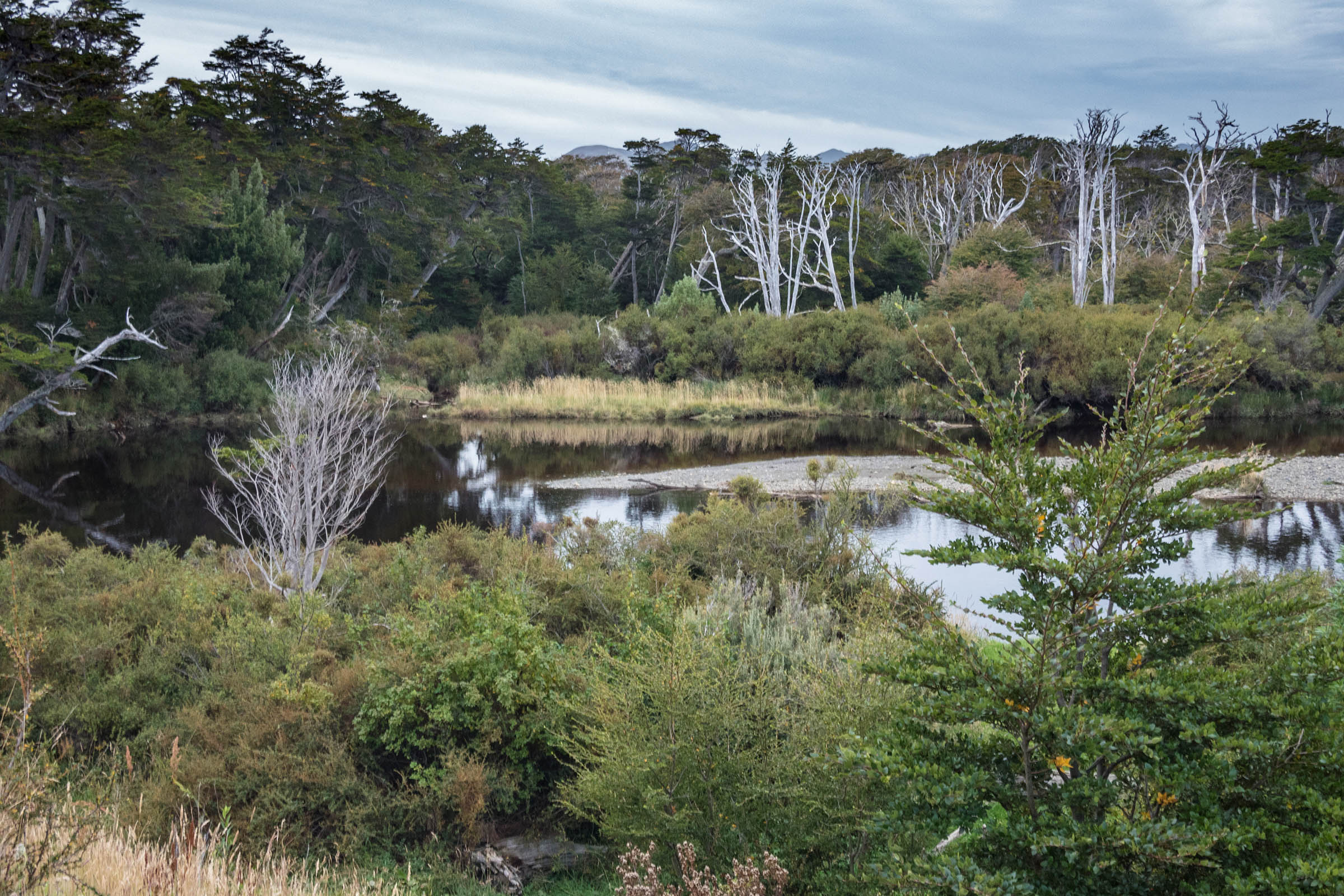
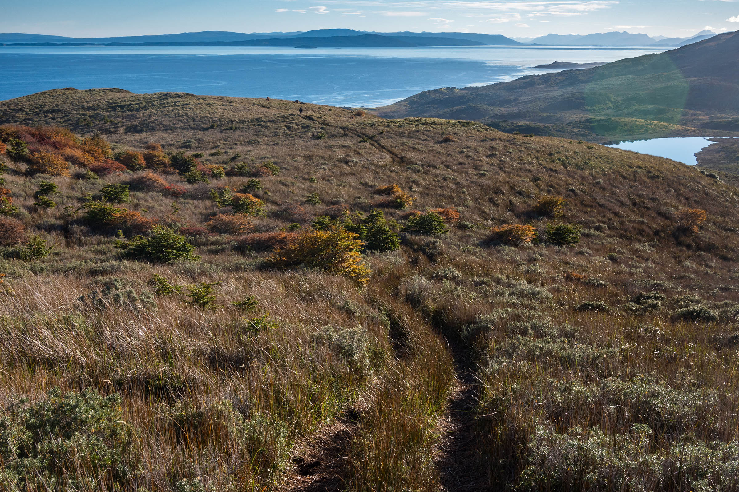
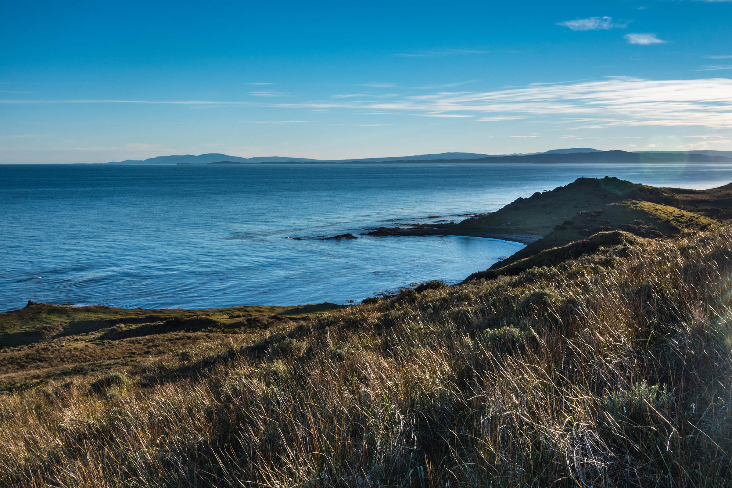
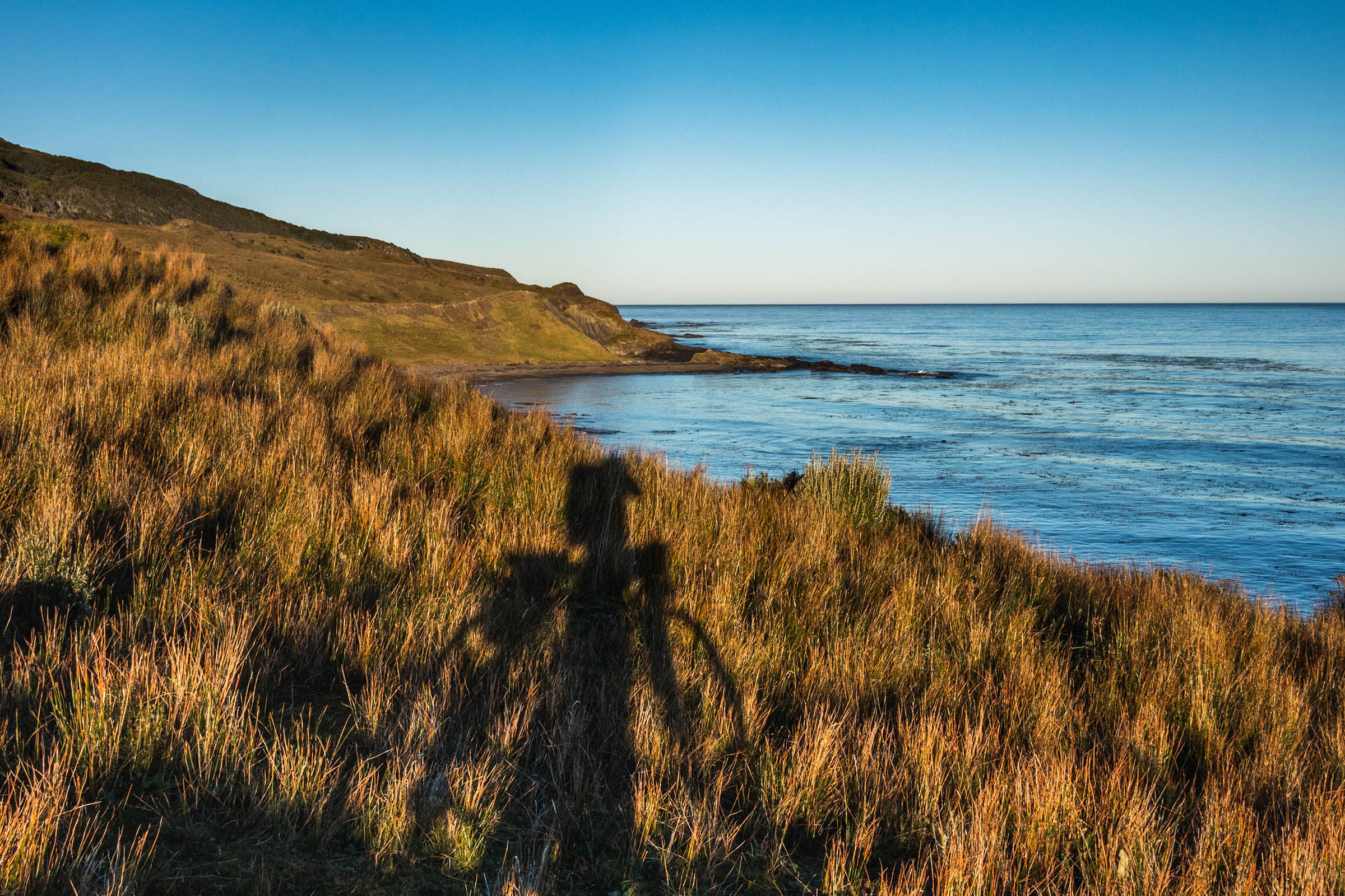
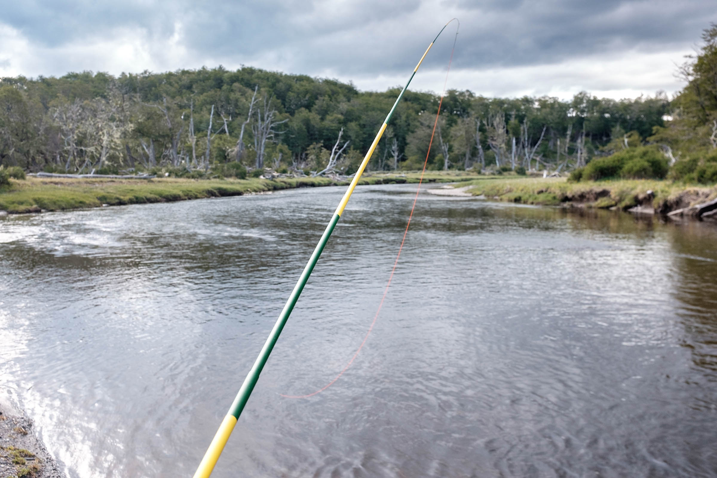
You’ll be riding on rolling grassy hills with barely a soul in sight, wadding wild rivers full of trout, pushing your bike through an ancient forest (type 2 fun) and pebble beaches, passing old shipwrecks and abandoned Estancias, having glorious sunsets over the Beagle Channel, wild camping, and probably hearing whales from your tent.
Eventually, the track will morph into a gravel road, and you’ll return to civilization at Puerto Almanza with several stores, restaurants, and wifi. You’ll also have an intersection to detour to Estancia Haberton (Founded in 1886 by the Anglican missionary Thomas Bridges, the first white man to live in Tierra del Fuego) or continue on “Ruta J” until your reach pavement (Ruta 3) to return to Ushuaia. May you all experience tailwinds and beautiful vistas. Muy buenas rutas!
Route Difficulty
The route features a significantly ocean-moderate mild tundra climate (bordering a subpolar oceanic climate) where summer tend to be cloudy and windy with maximum temperatures averaging 57ºF (14ºC) during the day and about 41ºF (5ºC) at night, but you should be prepared to experience all seasons in one day and snowstorms in the middle of the summer. You can also experience the “roaring forties” and “furious fifties” with brutal winds up to 100 miles per hour.
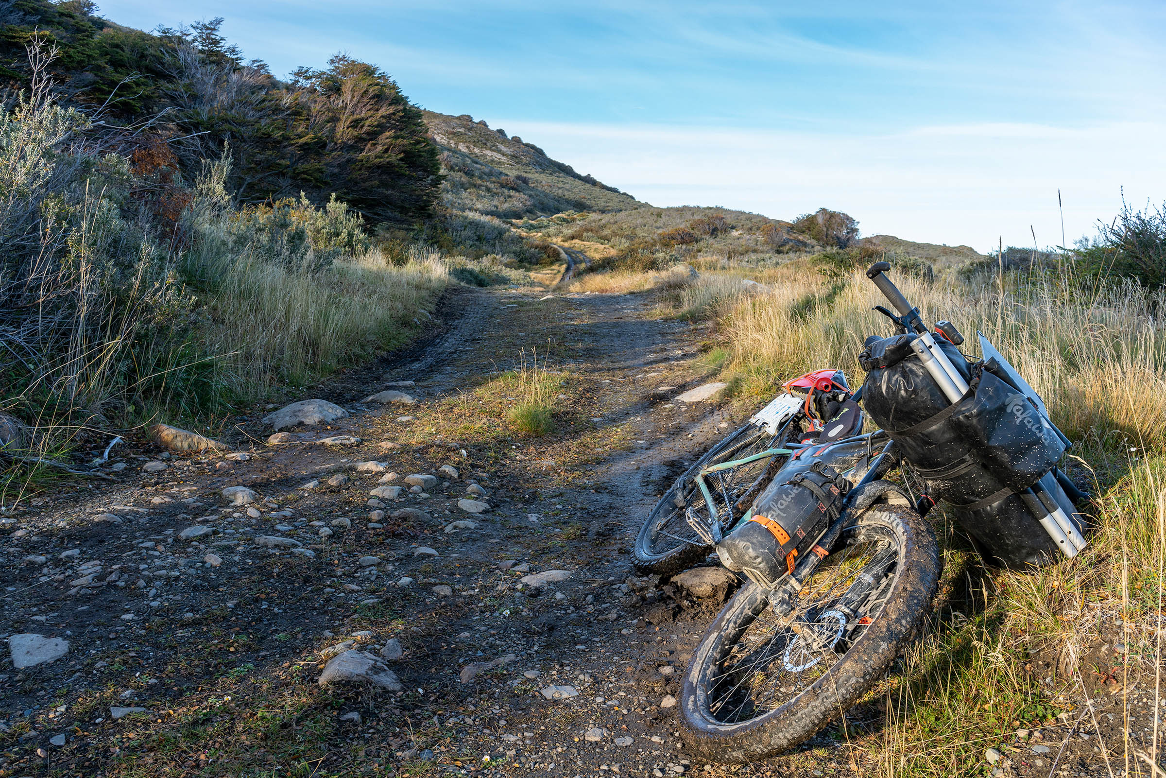
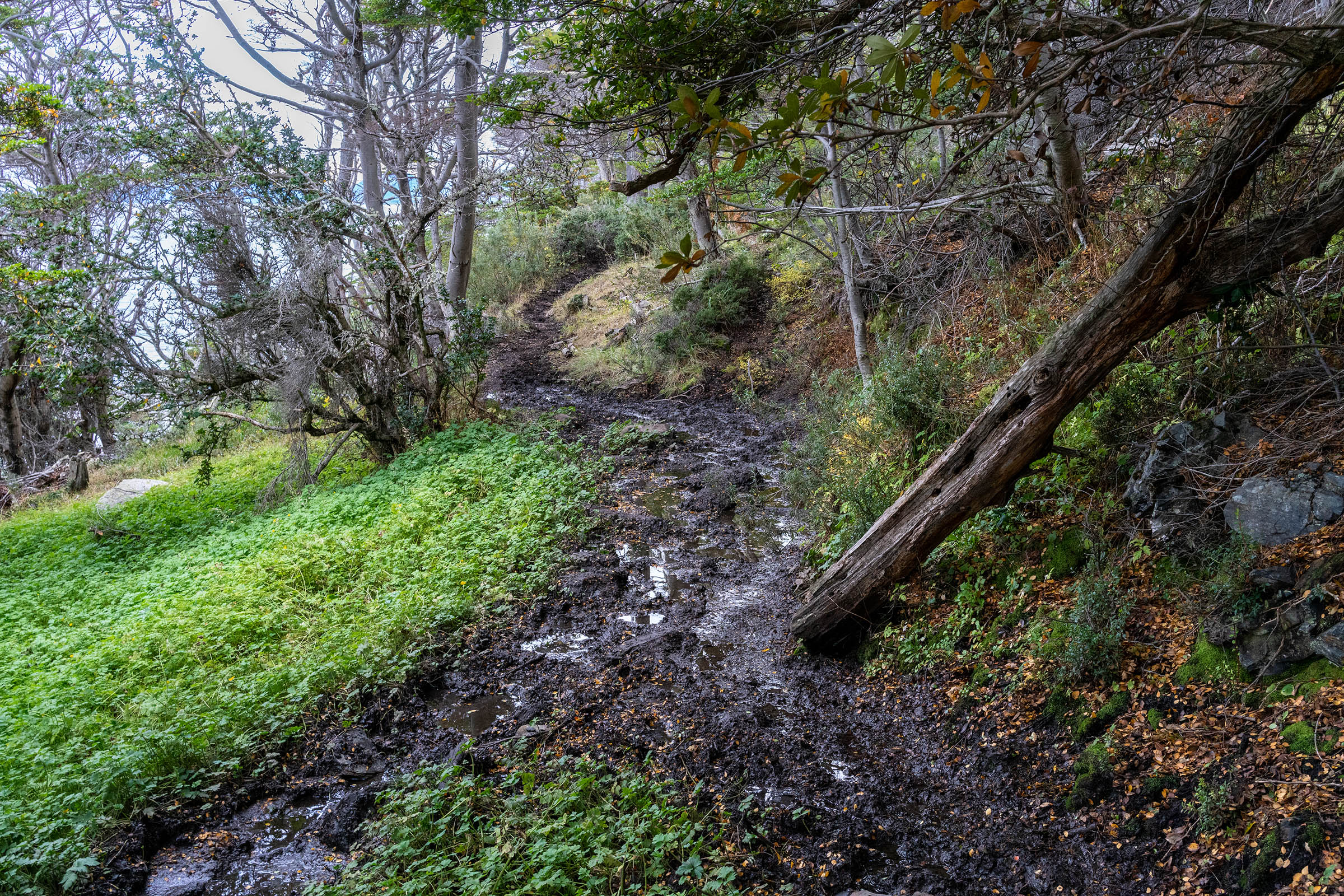
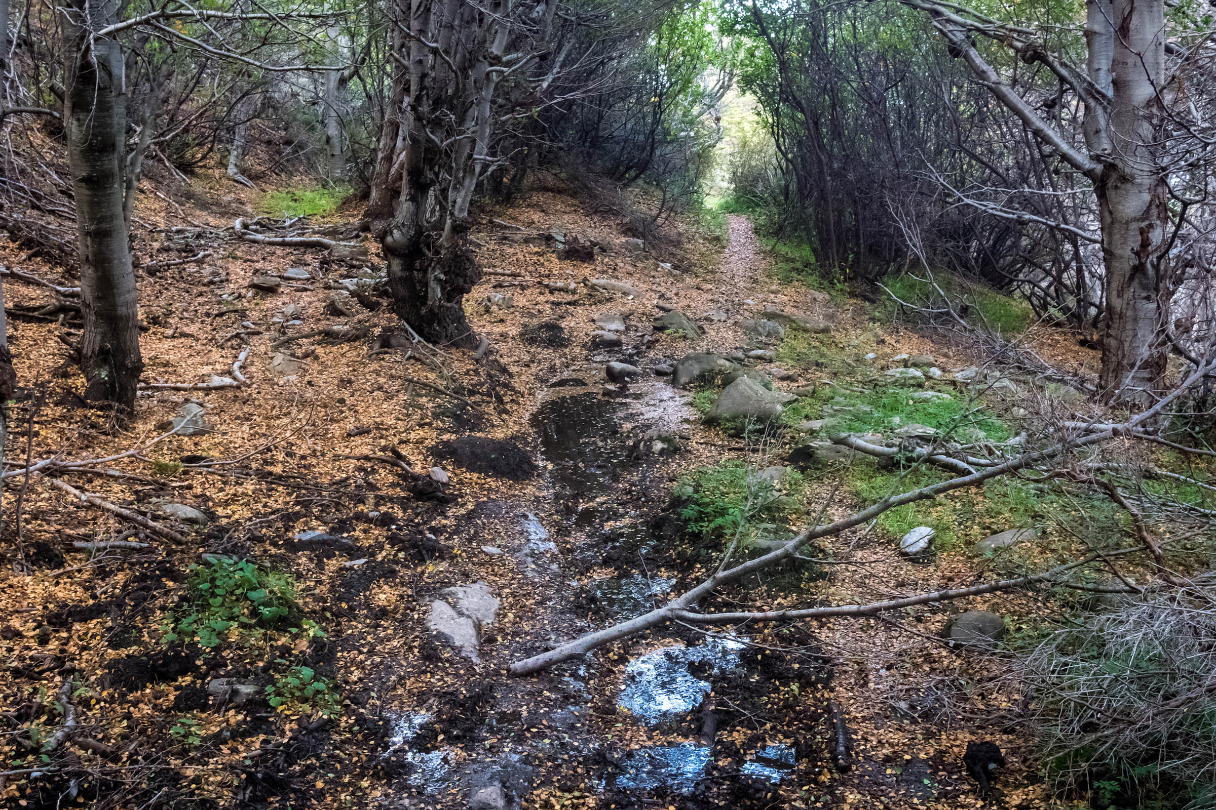
Close to Ushuaia, there is a 4-6 hour section where you’ll need to push and drag your bike on a narrow overgrown muddy trail. This section will be physically demanding or a nightmare depending on the weather conditions and your bike’s weight. There’s no cellphone coverage, resupply options, or assistance in half the route.
Route Development: A portion of this route was shared among many hardy bikepackers—including Cass Gilbert and Skyler des Roches—during the last decade but it became popular after Taneli Roininen added it to the site’s routes in the thru-ride called Fin del Mundo. This overnighter uses the last part of the route and forms a loop in and out of Ushuaia.


Submit Route Alert
As the leading creator and publisher of bikepacking routes, BIKEPACKING.com endeavors to maintain, improve, and advocate for our growing network of bikepacking routes all over the world. As such, our editorial team, route creators, and Route Stewards serve as mediators for route improvements and opportunities for connectivity, conservation, and community growth around these routes. To facilitate these efforts, we rely on our Bikepacking Collective and the greater bikepacking community to call attention to critical issues and opportunities that are discovered while riding these routes. If you have a vital issue or opportunity regarding this route that pertains to one of the subjects below, please let us know:
Highlights
Must Know
Camping
Food/H2O
Trail Notes
- Riding along the Beagle Channel
- Wildlife and sealife along the route (guanacos, condors, hawks, foxes, beavers, penguins, dolphins, and whales may be spotted)
- Riding through ancient primary forests
- Riding the doubletrack and singletrack before a road is finally constructed
- Wild camping and listening to whales until you fall asleep
- Short detour to Estancia Haberton (when it’s open to the public)
- When to go: Late October to early May (late spring to early autumn).
- Logistics: Loop from Ushuaia (endless markets) but no more resupply points until the middle of the route (Puerto Almanza).
- No phone service in most of the route (wifi available at Puerto Almanza).
- The route crosses a rarely used military area, which was deserted in May 2022 and the front gate was wide open, but if you detect any activity, do NOT cross.
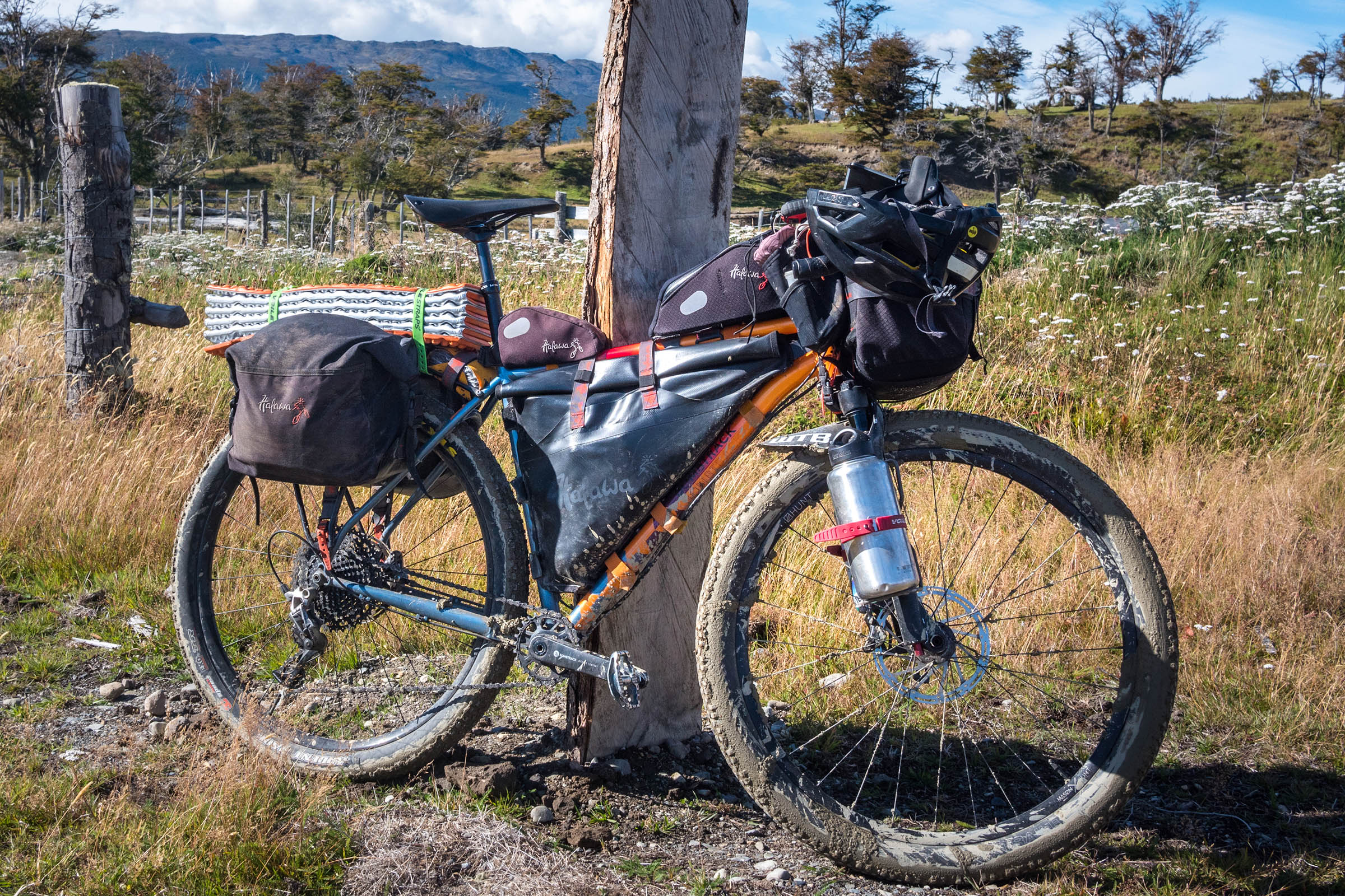
- A 4-6 hours of hike-a-biking close to Ushuaia is extremely demanding, the lighter your setup the better!
- It’s easy to find water but it needs to be filtered or boiled (Giardia).
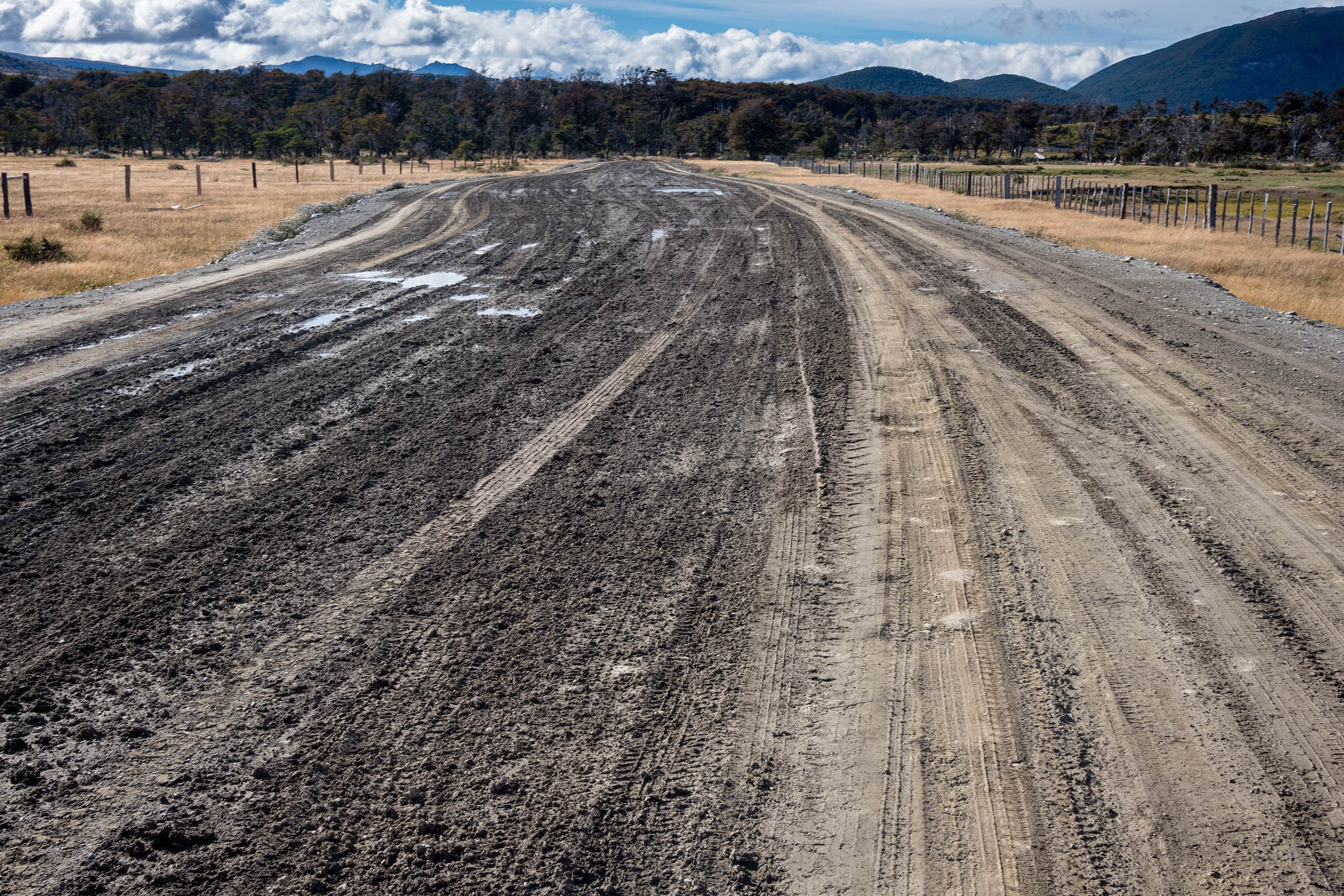
- With rain/snow/frost the roads turn to mud and will slow you down significantly.
- Strong winds can be dangerous and it may be better to camp until they end.
- Additional info: blue market exchange rates are almost double than the official rates, so it’s way more expensive to use cards than to pay in cash.
- The best camping spots are marked on the map, but there are endless wild camping options.
- Abandoned Estancias/Puestos need to be carefully inspected in the warmer months, due to mice (Hantavirus).
- Always hang your food when camping (mice and foxes).
- Take your time to select a good camping spot, be very careful not to camp under/next to dead trees as branches/trees usually fall during the night with the brutal winds.
- Food can be stocked up only in Ushuaia and Puerto Almanza.
- Water is easily available, but it needs to be filtered or boiled before consumption (Giardia).
- There are a couple of roadside restaurants at Puerto Almanza and along Ruta 3.
- During the high season, there might also be a couple of small stores (snacks and beverages) open along Ruta J.
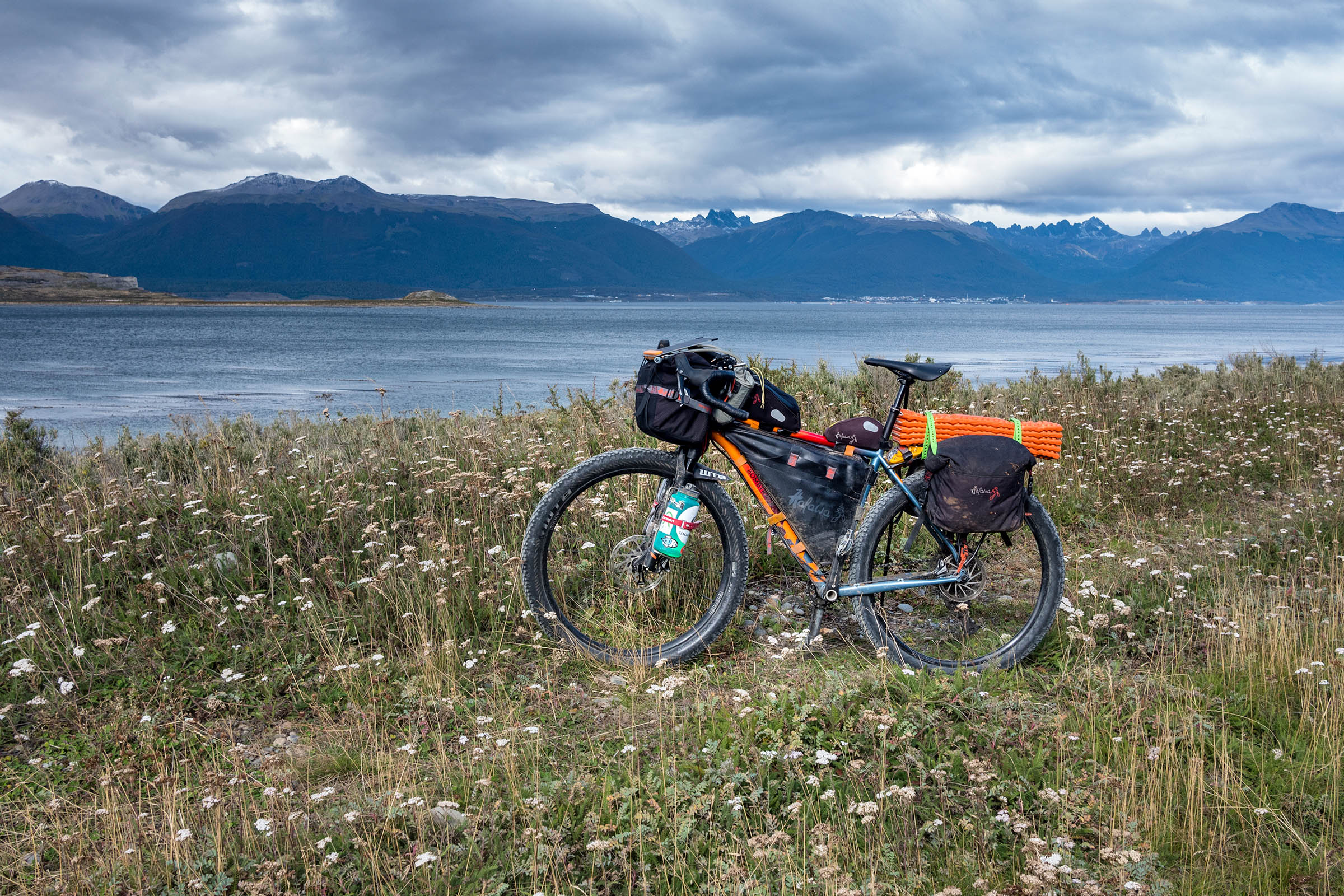
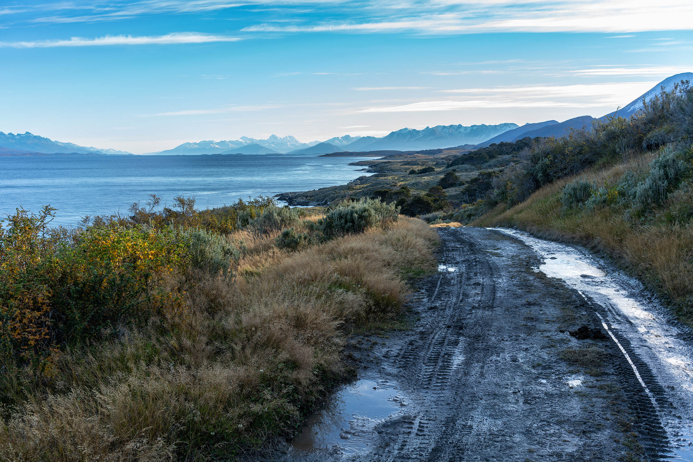
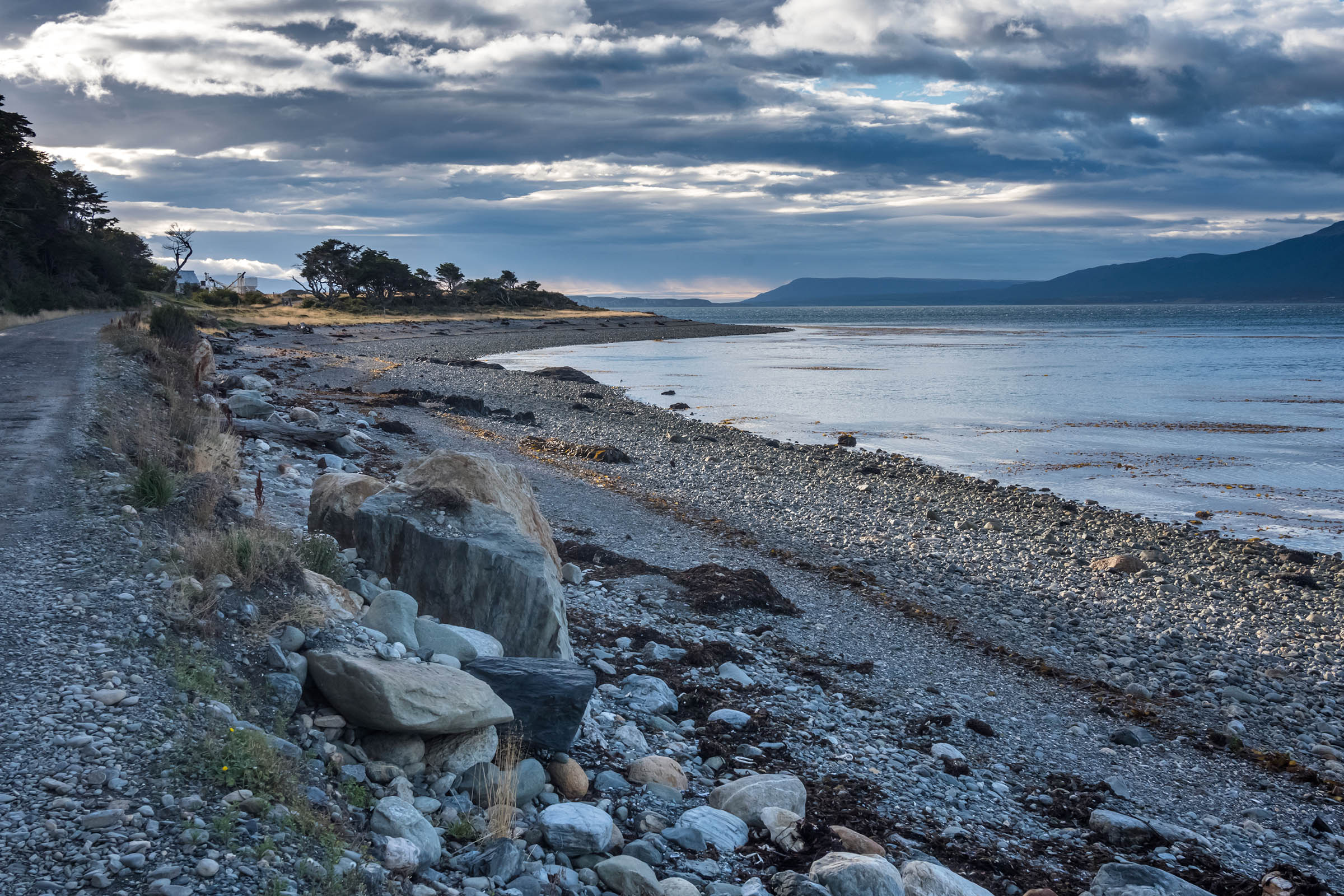
The route leaves the city along the Beagle Canal, usually with a tailwind, first reaching Playa Larga, a Natural Reserve with archeological sites.
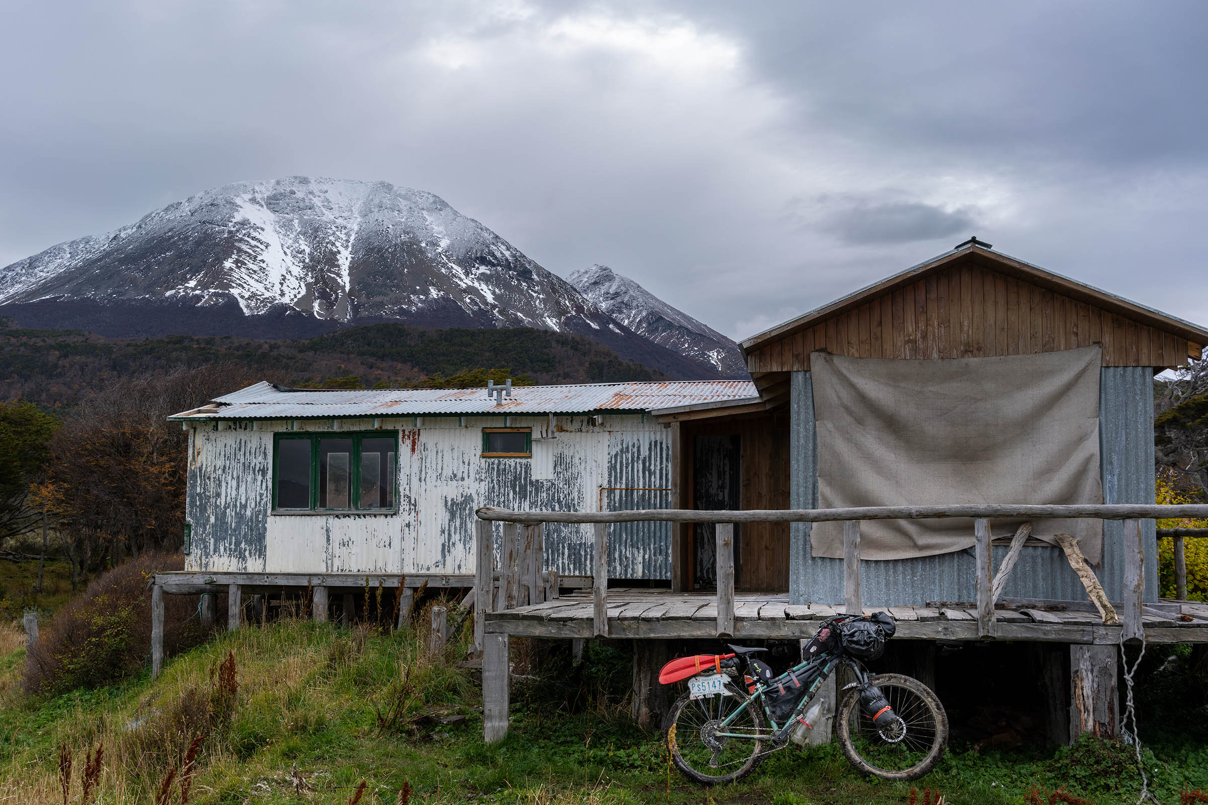
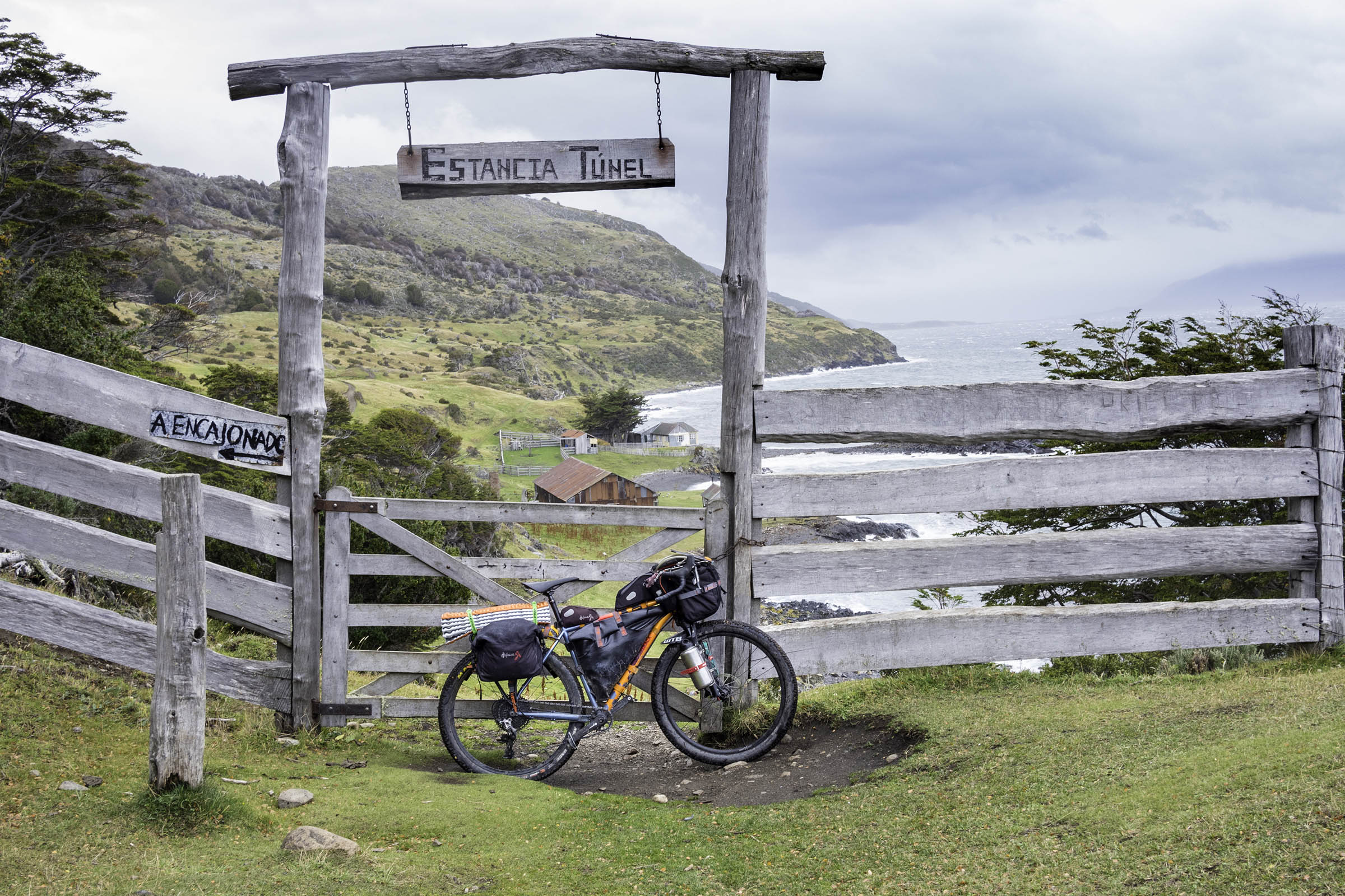
After Baliza Escarpados (beacon), the trail starts and the cell phone coverage ends, mainly for the rest of the route. After two miles, you’ll reach Estancia Tunel, one of the oldest settlements in Tierra del Fuego. A few kilometers later, you’ll have to wade Rio Encajonado (usually the water level is below the knee), the biggest of the handful of water crosses along the route and deal with a demanding five-mile hike-a-bike which can take up to 4-6 hours with a light setup.
Two kilometers after the hike-a-bike ends, you’ll reach Punta Segunda and a couple abandoned shelters that aren’t recommended in summer due to mice (not an issue in early spring/autumn), but if needed, you can shelter from the wind next to the buildings. You can refill your water bottles at the river behind the buildings, but always filter or boil your water in Tierra del Fuego to prevent Giardia.
A few miles and water crossings later, you’ll cross Rio Remolino and the beginning of a wide gravel road. This property was used by the Navy for training, and if you detect any military activity, do NOT cross!
Riders used to avoid the gates using a hole in the fence, but when I crossed the last time (May 2022), the gate was wide open and the place was deserted. There’re a few basic shelters inside this property where you’ll be protected from the wind and rain.
The beautiful gravel road along the Beagle Canal will take you through several restaurants, small markets, and cottages to Bahia Almanza. There’s a great campsite next to Rio Almanza and free wifi at the local school’s entrance.
A few kilometers later, there’s a crossroad and you need to turn left to go inland (looping to Ushuaia), but if you keep going straight, you’ll reach Estancia Haberton which might be worth the detour (if open to the public).
You may experience head/sidewinds along Ruta J, but you’re usually protected by vegetation. You’ll also find several small houses along the road and some may sell snacks and beverages in high season. After 12 miles, you’ll find a beautiful place to rest/lunch at Laguna Victoria, and six kilometers later, you’ll reach pavement (Ruta 3).
You’ll need to ride 18 miles on pavement to Ushuaia’s entrance (half downhill), but due the dangerous sidewinds and sometimes heavy traffic on Ruta 3, I just rode on the side of the route (gravel shoulder).
You’ll cross a few restaurants with wifi along the route and 12 kilometers later, you’ll reach Cerro Castor Ski Resort (restaurant and accommodations), where you’ll finally find cell phone coverage again.
If you’re not in a hurry, three miles before Ushuaia’s entrance, there’s a beautiful campsite at Rio Olivia (which is very popular among locals on weekends) before reaching the end of this route.


Terms of Use: As with each bikepacking route guide published on BIKEPACKING.com, should you choose to cycle this route, do so at your own risk. Prior to setting out check current local weather, conditions, and land/road closures. While riding, obey all public and private land use restrictions and rules, carry proper safety and navigational equipment, and of course, follow the #leavenotrace guidelines. The information found herein is simply a planning resource to be used as a point of inspiration in conjunction with your own due-diligence. In spite of the fact that this route, associated GPS track (GPX and maps), and all route guidelines were prepared under diligent research by the specified contributor and/or contributors, the accuracy of such and judgement of the author is not guaranteed. BIKEPACKING.com LLC, its partners, associates, and contributors are in no way liable for personal injury, damage to personal property, or any other such situation that might happen to individual riders cycling or following this route.
Please keep the conversation civil, constructive, and inclusive, or your comment will be removed.