


Hidden in Plain Sight
Distance
104 Mi.
(167 KM)Days
2-3
% Unpaved
75%
% Singletrack
60%
% Rideable (time)
90%
Total Ascent
13,846'
(4,220 M)High Point
3,091'
(942 M)Difficulty (1-10)
7.5?
- 9Climbing Scale Very Strenuous133 FT/MI (25 M/KM)
- 7Technical Difficulty Difficult
- 8Physical Demand Difficult
- 6Resupply & Logistics Moderate
Contributed By

Gregg Dunham
Guest Contributor
Gregg Dunham is a filmmaker, director/producer, and ultra-endurance cyclist. Born with spina bifida, he turned to cycling as a way to reclaim movement and push past physical limits. Since then, he’s tackled some of the toughest bikepacking events in the West—including the Colorado Trail Race, AZT300, Stagecoach 400, and Grand Loop—and co-created the notoriously demanding Escape LA route. When he’s not behind a camera, he’s likely behind handlebars. For more, follow Gregg on Instagram: @gregg_sees_the_world.
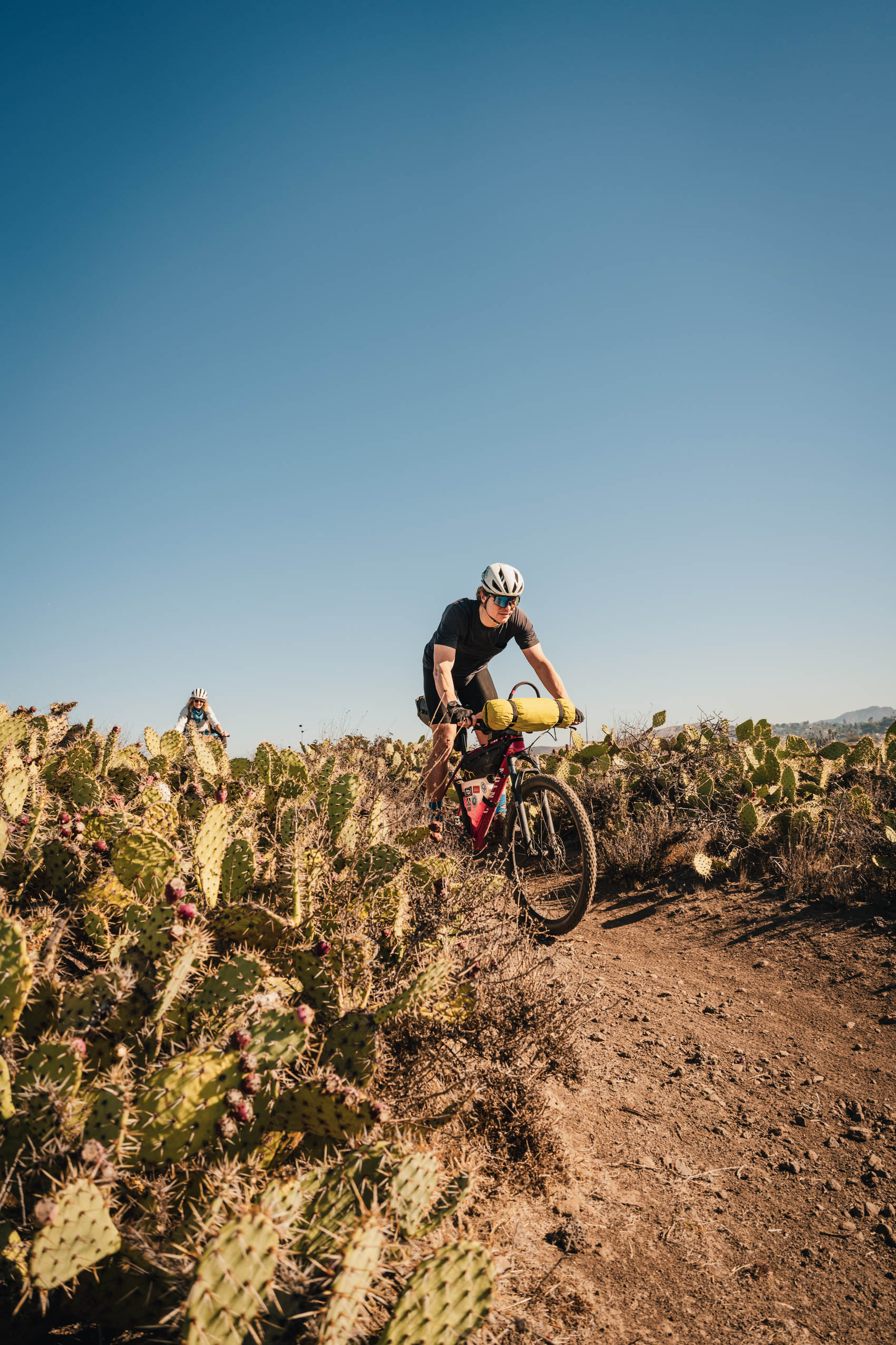
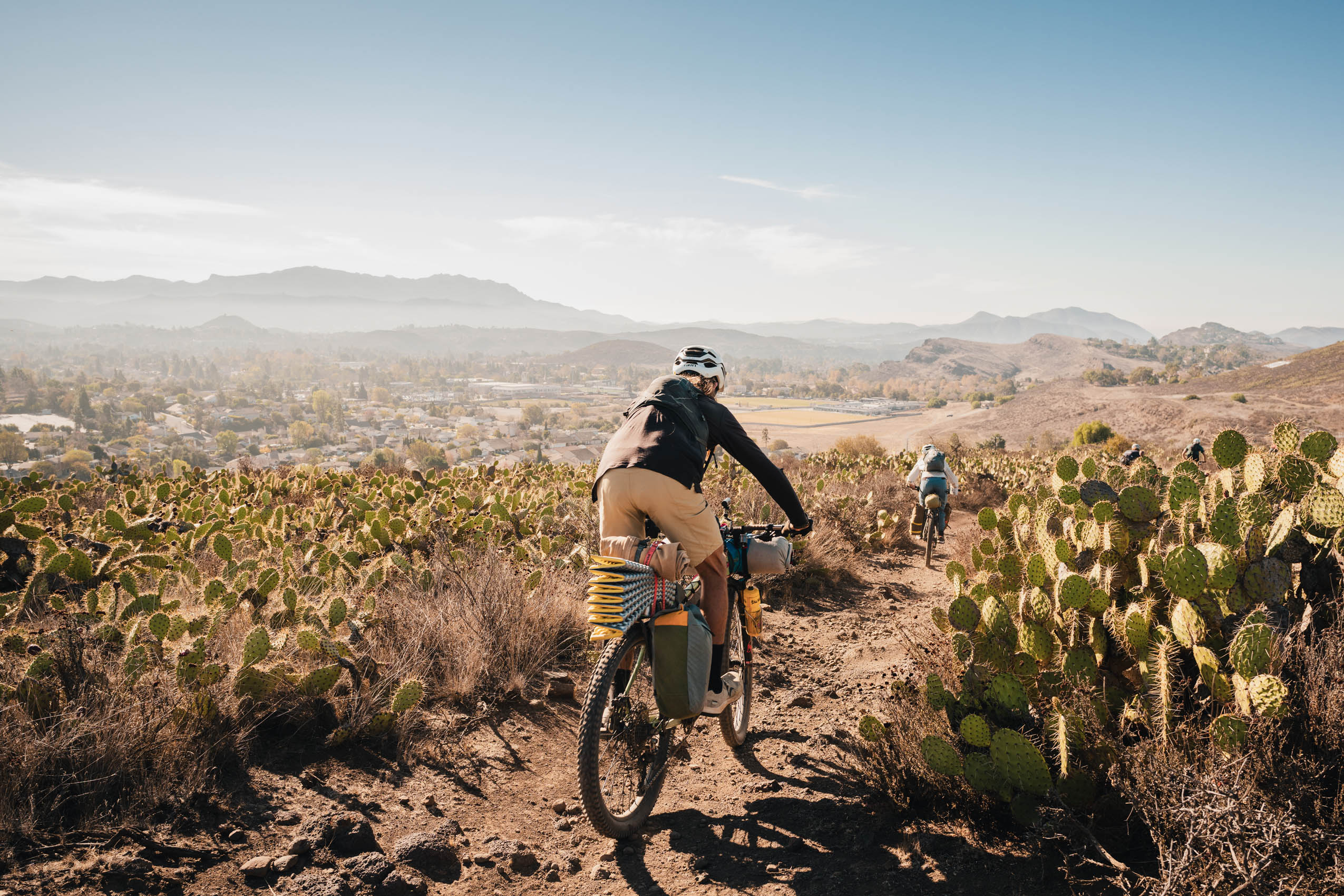
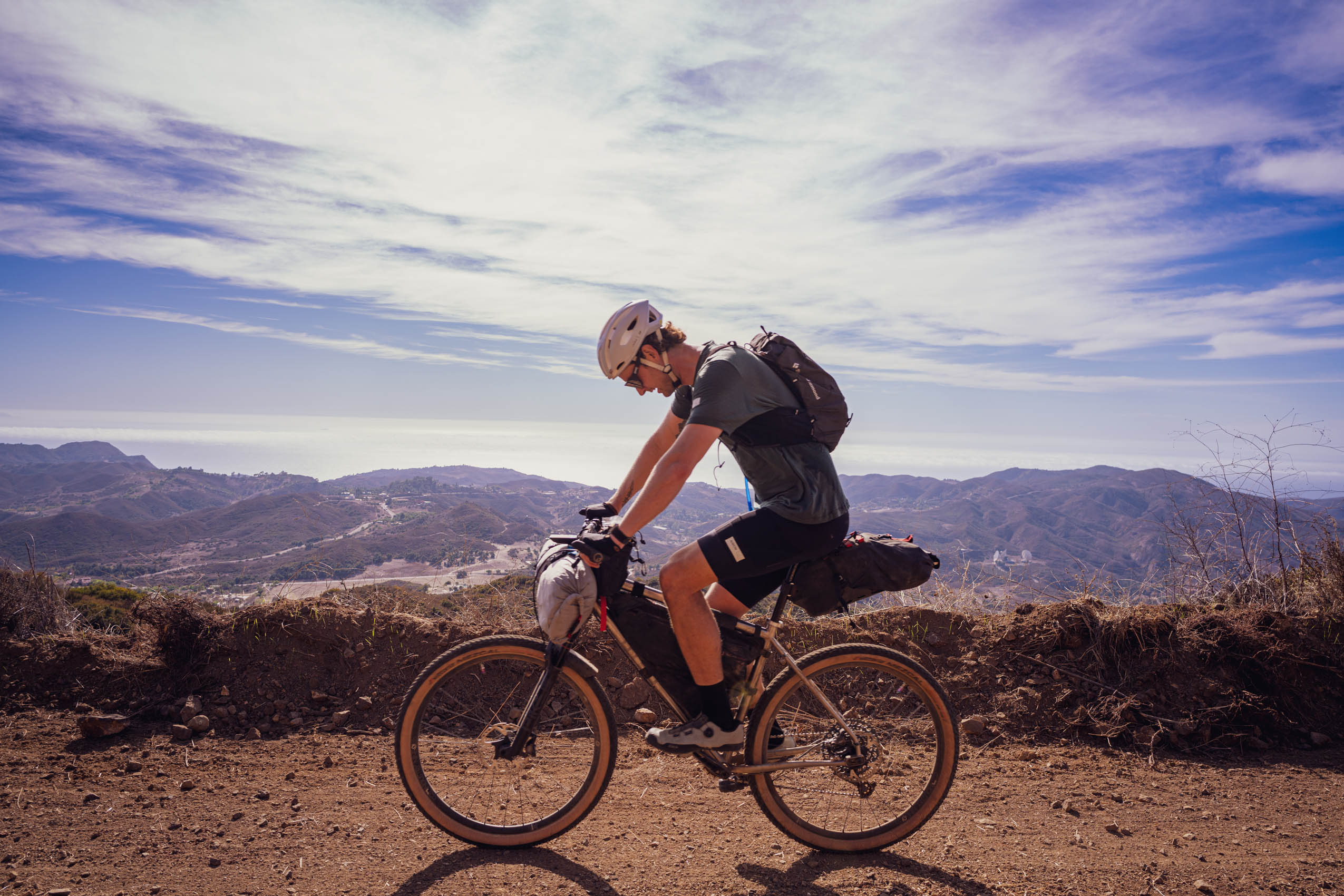
Tucked within the mountains that rise just beyond the sprawl of Los Angeles lies a route that defies the expectations of its urban proximity. The Hidden in Plain Sight route is a two-day bikepacking journey through the Santa Monica Mountains—an undulating coastal range etched with dirt fire roads, singletrack trails, and oak-lined canyons. It’s a route that tests riders’s legs, invites reflection, and rewards every effort with sweeping ocean views and surprising solitude.
From the start, the route makes its character clear: this is not a polished, flowy escape. It’s raw and exposed—gritty in both terrain and emotional tone. Riders will navigate steep climbs, loose descents, and long stretches without services, requiring thoughtful preparation and physical commitment. But with that challenge comes something rare: a visceral connection to the land and a deeper appreciation for the untamed pockets of wilderness that still exist just beyond one of the largest metropolitan areas in the world.


The route meanders through some of the most iconic and historic terrain in Southern California. Riders traverse ancient Chumash land, territory once crisscrossed by footpaths connecting coastal villages with inland oak groves. In fact, part of the ride passes near cultural sites still sacred to the Chumash people. Echoes of that history are woven into the canyons and ridgelines, and respectful travel through this landscape means recognizing that this is, and always has been, Indigenous land.
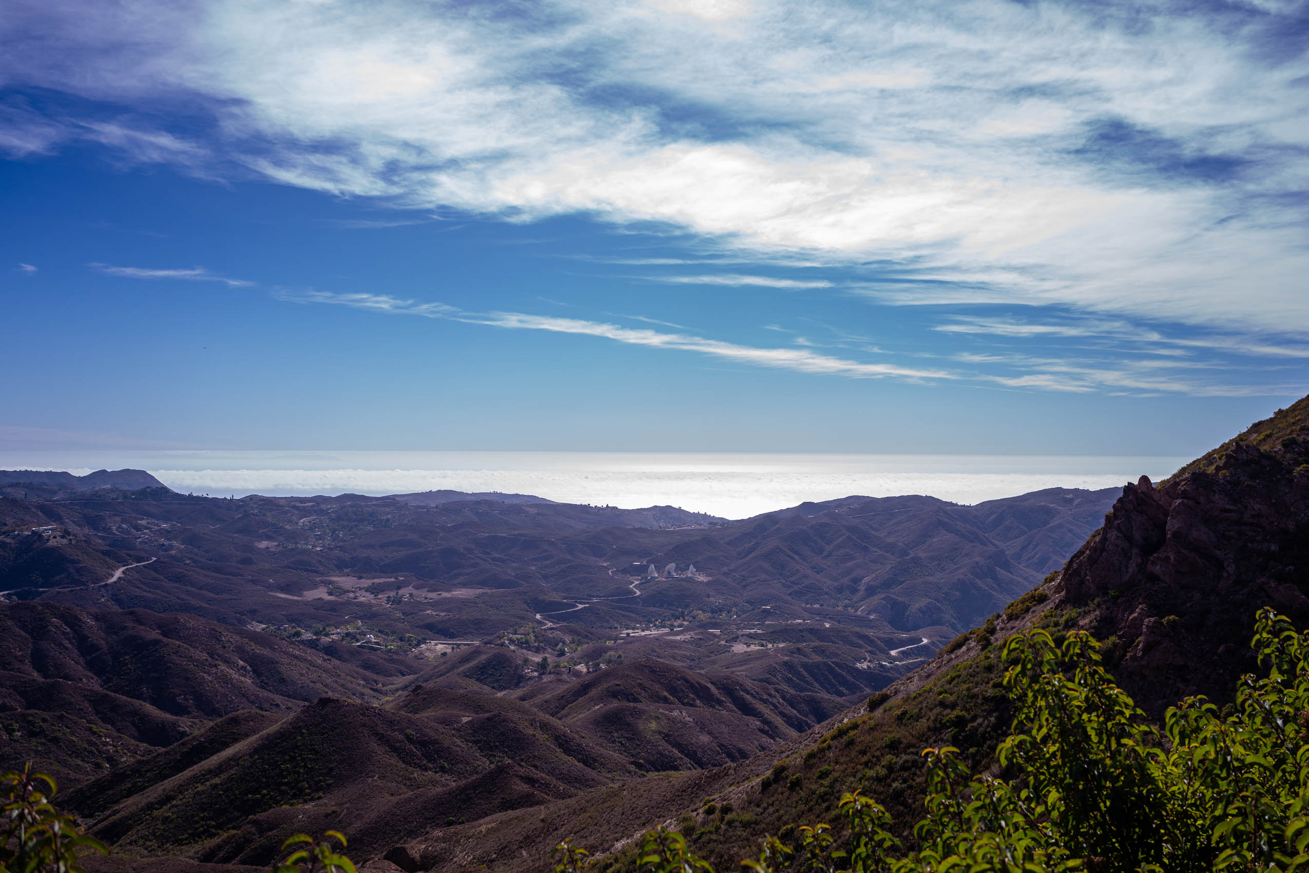
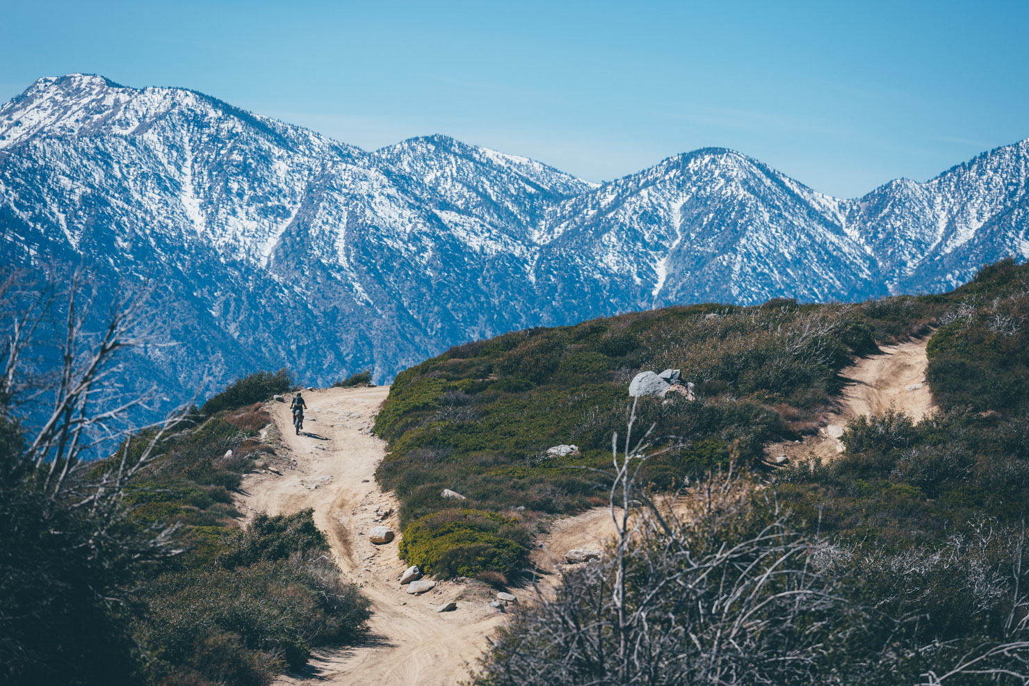
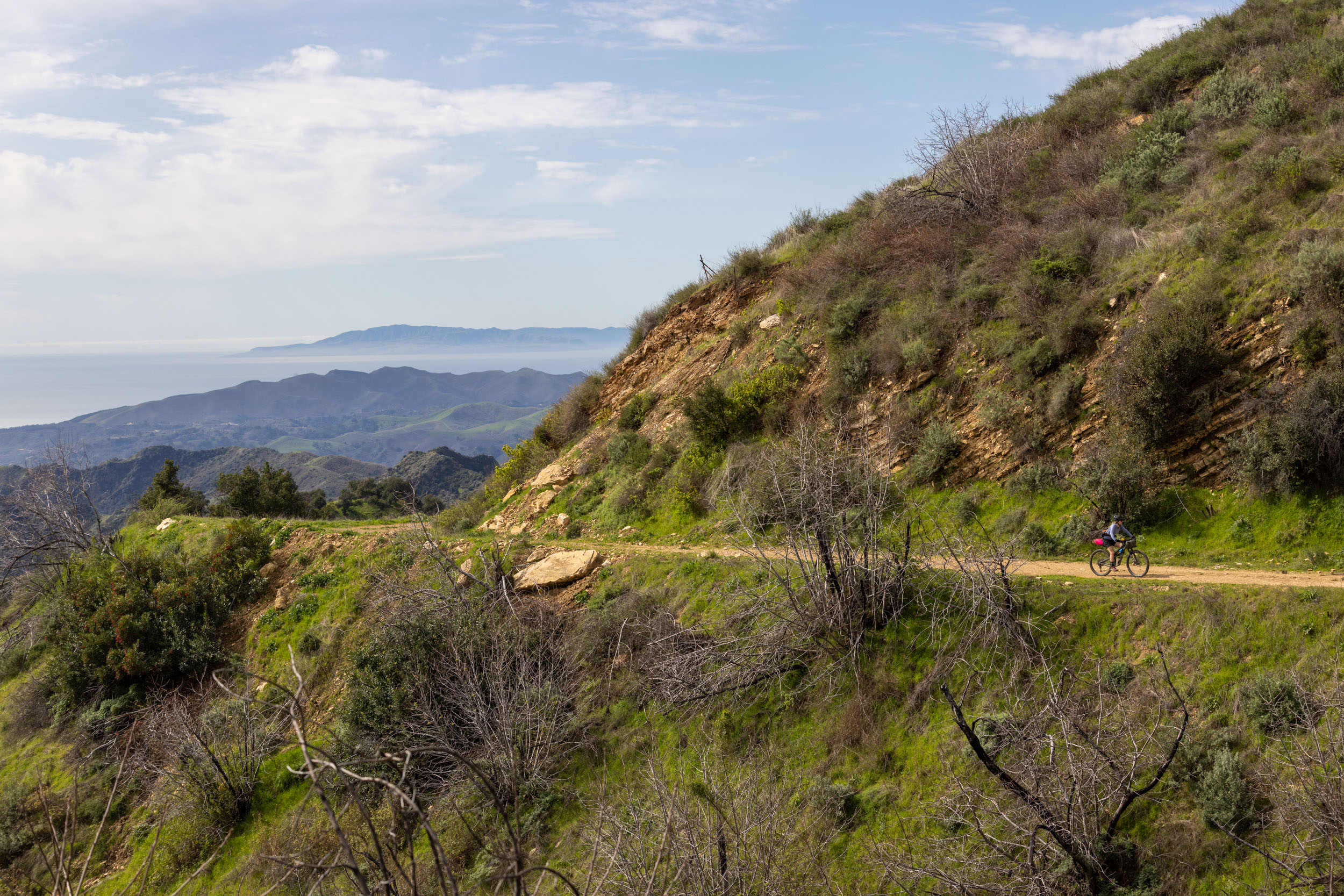
Geographically, the Santa Monica Mountains are a unique coastal transverse range, running east to west rather than the typical north-south orientation of California’s mountains. This unusual alignment creates dramatic ridgelines and a dynamic clash of ecosystems. Over the course of the route, riders will pass through sunbaked chaparral, shaded sycamore and oak groves, and wind-swept coastal bluffs. In winter and early spring, the hills burst into color with wildflowers—mariposa lilies, lupine, and the famed California poppy. Wildlife sightings are common: deer, bobcats, hawks, and the occasional rattlesnake make these trails their home.
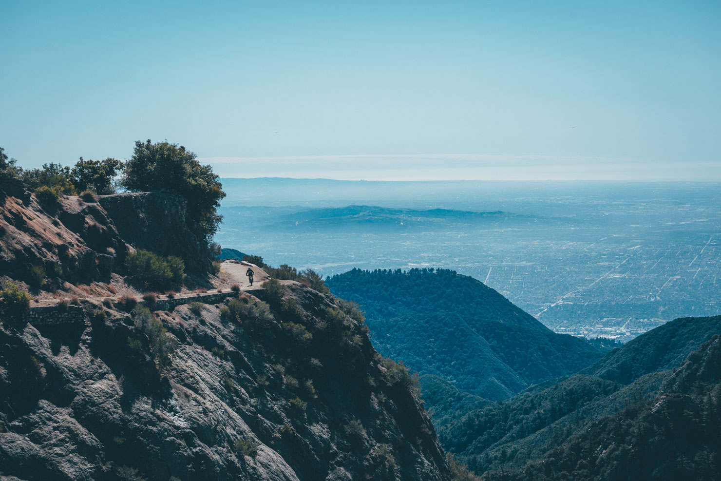
But what makes this ride truly special is the contrast. From the top of a fire road climb, riders can look in one direction and see downtown LA and the San Gabriel Mountains in the distance. In the other direction is a horizonless view of the Pacific. In the quiet moments of camp or the breathless pauses on a climb, it becomes clear that this route isn’t just about distance or elevation—it’s about perspective. That juxtaposition of urban density and natural wildness is what gives the Hidden in Plain Sight route its soul.
The route was born from a desire to slow down and go deep—not just into the mountains but into ourselves. That ethos shaped the accompanying documentary film, Hidden in Plain Sight, which follows a small crew of riders as they move through this landscape and uncover stories of loss, resilience, and renewal. The film highlights the lived experiences of the riders and local community members—ranging from wildfire survivors to a Chumash elder—who reveal what these mountains mean to those who call them home.
This route isn’t just a ride; it’s an invitation. To disconnect from the noise, reconnect with the land, and discover the beauty, challenge, and healing that can be found just beyond the edge of the city. Whether you’re a seasoned bikepacker or someone craving meaningful miles, the Hidden in Plain Sight route offers a uniquely Southern Californian adventure—one that feels far away and deeply personal yet always within reach.
Route Difficulty
The Hidden in Plain Sight route presents a demanding but deeply rewarding ride through the Santa Monica Mountains. Technically, it features a mix of terrain, from uneven dirt fire roads to off-camber singletrack and occasional hike-a-bike sections. Riders will encounter a variety of surfaces, including some rocky and rutted trails that require confident handling and solid bike control. It’s not relentlessly technical, but the trail’s character shifts frequently and includes enough challenges to keep even experienced riders engaged.
Physically, this route is relentless. The climbing starts early and never really lets up, with steep grades and punchy ascents scattered throughout both days. Riders should come prepared for a consistent physical effort and be ready for long, sustained climbs with limited shade and exposure to the elements. On a 1–10 climbing scale, this route ranks around a 9.
Resupply and logistics are manageable, but not without planning. The looped nature of the route makes it easily accessible from multiple points in the Conejo Valley area. Day one includes several resupply opportunities—ideal for topping off snacks and water before heading into a much more remote and exposed day two. There are little to no services available on day two, so riders must carry adequate water and nutrition to get through a long, dry, and challenging stretch.
Altogether, Hidden in Plain Sight scores a 7.5 out of 10 on the difficulty scale, especially when tackled at a challenging overnight pace that requires around 7,000 feet of climbing per day—something not to be taken lightly. Find alternatives to extend it to three or four days under Trail Notes Tab. The route’s steep, rugged terrain and limited resupply make it best suited for bikepackers who are comfortable managing technical features, sustained climbs, and variable conditions in a setting close to—but worlds apart from—the Los Angeles metro area.
ROUTE DEVELOPMENT
The Hidden in Plain Sight route was developed by filmmaker and bikepacker Gregg Dunham, who set out to create a two-day loop that would capture the physical beauty, cultural depth, and emotional resonance of the Santa Monica Mountains. The route was shaped through local knowledge, personal riding experience, and extensive scouting to balance challenge with accessibility. Drawing on insights from Indigenous elders, fire captains, and fellow cyclists, Gregg curated a ride that highlights the intersection of natural landscape, history, and personal transformation. While the trails utilize a network of public lands, state park systems, and segments popular among local riders, the final route was intentionally crafted with storytelling in mind.


Submit Route Alert
As the leading creator and publisher of bikepacking routes, BIKEPACKING.com endeavors to maintain, improve, and advocate for our growing network of bikepacking routes all over the world. As such, our editorial team, route creators, and Route Stewards serve as mediators for route improvements and opportunities for connectivity, conservation, and community growth around these routes. To facilitate these efforts, we rely on our Bikepacking Collective and the greater bikepacking community to call attention to critical issues and opportunities that are discovered while riding these routes. If you have a vital issue or opportunity regarding this route that pertains to one of the subjects below, please let us know:
Highlights
Must Know
Camping
Food/H2O
Trail Notes
Resources
- Don’t miss the Wildwood area. Many Westerns were filmed here.
- Get great Mexican food in Thousand Oaks.
- Ride the Space Mountain Singletrack.
- See Boney Peak, a sacred mountain to the Chumash people.
- Jump into the Pacific. Watch out, it’s cold!
- Climb to the top of Sandstone Peak.
- Ride the Backbone Trail!
- See the M*A*S*H filming site.
- The route is best ridden from October through June. The Summer months can get very hot in the hills.
- No permits are required.
- There is free public parking at the start.
- Dispersed camping is restricted.
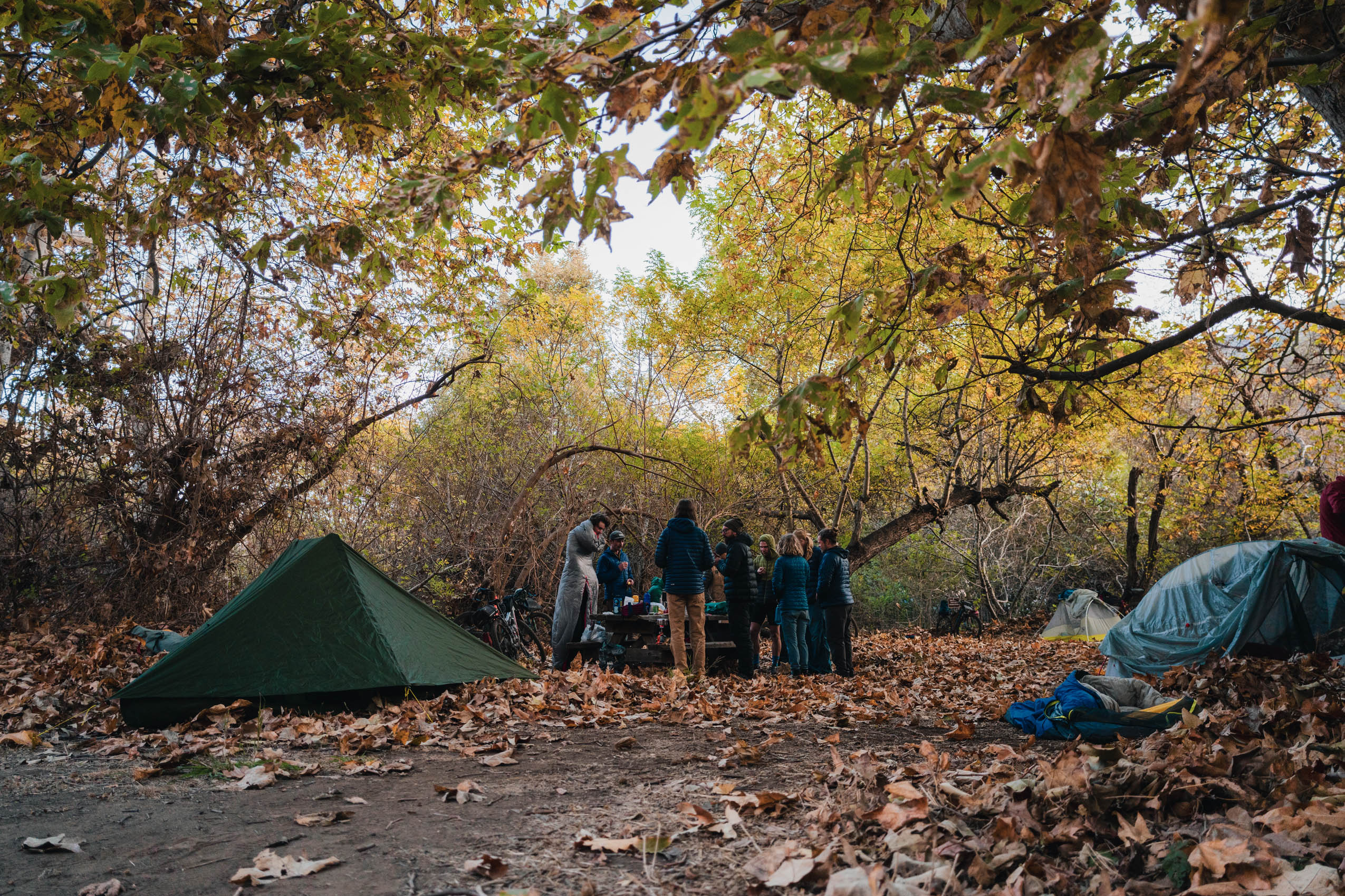
- Legal camping is allowed in Sycamore Canyon Campground at the hike/bike site for $10. No reservation needed.
- Malibu Creek State Park has campsites available for reservation.
- A mountain bike with front suspension and at least 2.3-inch tires is recommended.
- Dispersed camping is restricted.
- Legal camping is allowed in Sycamore Canyon campground at the hike/bike site for $10. No reservation needed.
- You can purchase firewood and have a legal fire in the Sycamore Canyon campground.
- Malibu Creek State Park has campsites available for reservation.
- Water is available along the route. See POIs for more information
- No filter needed, but you might want to bring one for added peace of mind.
- You must resupply in Thousand Oaks (mile 35/kilometer 56) for the remainder of the route.
- Recommend dining: Badass Tacos and La Esquina.
- Sycamore Canyon campsite has water, toilets, and showers.
- Neptune’s Net is an iconic spot on the PCH (Pacific Coast Highway). Fish, burgers, and beer are served at picnic tables overlooking the ocean. Limited hours.
- Fill up water at Circle X Ranch for the long traverse of the Backbone Trail.
Two-day Itinerary
For an alternative 3-4 day itinerary scroll to the bottom of this tab…
location From Suburb to Seaside
Day 1 (57.4 mi +6,723 ft)
The journey begins on the fringe of the vast Los Angeles sprawl, with free and abundant parking along Las Virgenes Road near the trailhead. From there, you’ll climb into the soft, chaparral-covered folds of Cheeseboro and Palo Comado Canyons, gaining elevation as you work your way toward the summit of Albertson Fire Road. From the top, pause to take in sweeping views of Conejo Valley, a rewarding moment early in the ride.
Winding westward through rugged community trails and protected open spaces, the terrain shifts beneath your tires: from fast-rolling ridgelines to gritty connectors. Make sure to take full advantage of a key resupply opportunity in Thousand Oaks, where classic California Mexican fare and well-stocked gas stations line the boulevard. This will be your last significant stop before camp.
After refueling, the route dips into the golden hills of Los Robles Open Space, gradually ushering you toward the dramatic drop into Sycamore Canyon. But before you descend, take a moment at Satwiwa to soak in views of Boney Peak—sacred land with a powerful presence. Camp awaits at the hike/bike site tucked within Sycamore Canyon ($5/night), just a short ride from the Pacific. Don’t miss the chance to visit Sycamore Cove Beach before settling in. Welcome to Malibu.
location Spine of the Mountains
Day 2 (46.9 mi +7,228 ft)
Wake to the scent of salt air and the sound of waves as you roll out from Sycamore Canyon and trace the Pacific Coast Highway toward the legendary Yerba Buena climb, a winding ribbon of tarmac that delivers you deep into the beating heart of the Santa Monica Mountains.
Top off your water at Circle X Ranch before tackling the optional side quest to Sandstone Peak, the highest point in the range. From there, the route weaves along quiet mountain roads until it drops you onto the iconic Backbone Trail, a crown jewel of Southern California singletrack. This stretch is raw and rewarding: rugged, loose, and technical terrain etched into the very spine of the mountains with panoramic views that seem to stretch forever.
Replenish at the fire station near Encinal Road; this is a critical water stop before the final push. The trail climbs toward Corral Canyon, offering glimpses of Malibu Creek State Park before sending you down the steep, exposed descent of Bulldog Motorway. You’ll ride past the old M*A*S*H film set, ride through the rubble of the “Creek of Doom,” and traverse volcanic rock gorges, unexpected redwoods, and tranquil pools carved into the canyon walls.
From there, spin your way back toward Las Virgenes Road. Celebrate your journey with a well-earned slice from the local pizza spot—or raise a toast from the nearby liquor store. You’ve just completed one of the most striking and soulful loops in Southern California.
Alternative Itinerary (3–4 Days)
For those looking to experience the route at a slower pace or with more time to explore, Hidden in Plain Sight can easily be stretched into a rewarding 3- to 4-day ride. One option is to break up the first day by getting a hotel in the Thousand Oaks area. On Day 2, continue through Los Robles and into Sycamore Canyon, camping at the state park’s hike/bike site. From there, riders can split the final stretch into two shorter days: one ending near Encinal Canyon or Corral Canyon (note: no formal legal camping, but some riders opt for dispersed or stealth options), and another wrapping up the descent through Malibu Creek State Park and returning to Las Virgenes.
Alternatively, riders can go further up the PCH to Leo Carrillo State Park, which also offers a hike/bike site and a chance to explore more of coastal Malibu. Those wanting a guaranteed spot near the end of the route can also reserve a site at Malibu Creek State Park.
This route is featured in the award-winning documentary Hidden in Plain Sight, a powerful exploration of resilience, community, and the rugged beauty of the Santa Monica Mountains. Watch the full film now and experience the story behind the miles.


Terms of Use: As with each bikepacking route guide published on BIKEPACKING.com, should you choose to cycle this route, do so at your own risk. Prior to setting out check current local weather, conditions, and land/road closures. While riding, obey all public and private land use restrictions and rules, carry proper safety and navigational equipment, and of course, follow the #leavenotrace guidelines. The information found herein is simply a planning resource to be used as a point of inspiration in conjunction with your own due-diligence. In spite of the fact that this route, associated GPS track (GPX and maps), and all route guidelines were prepared under diligent research by the specified contributor and/or contributors, the accuracy of such and judgement of the author is not guaranteed. BIKEPACKING.com LLC, its partners, associates, and contributors are in no way liable for personal injury, damage to personal property, or any other such situation that might happen to individual riders cycling or following this route.
Further Riding and Reading
Here are some connected/nearby routes and related reports...

Please keep the conversation civil, constructive, and inclusive, or your comment will be removed.