


Iceland Fjallabak Track
Distance
182 Mi.
(293 KM)Days
5
% Unpaved
95%
% Singletrack
4%
% Rideable (time)
99%
Total Ascent
15,257'
(4,650 M)High Point
2,876'
(877 M)Difficulty (1-10)
6?
- 5Climbing Scale Moderate84 FT/MI (16 M/KM)
- 5Technical Difficulty Moderate
- 8Physical Demand Difficult
- 5Resupply & Logistics Moderate
Contributed By
Emily Bei Cheng
Alpinemily
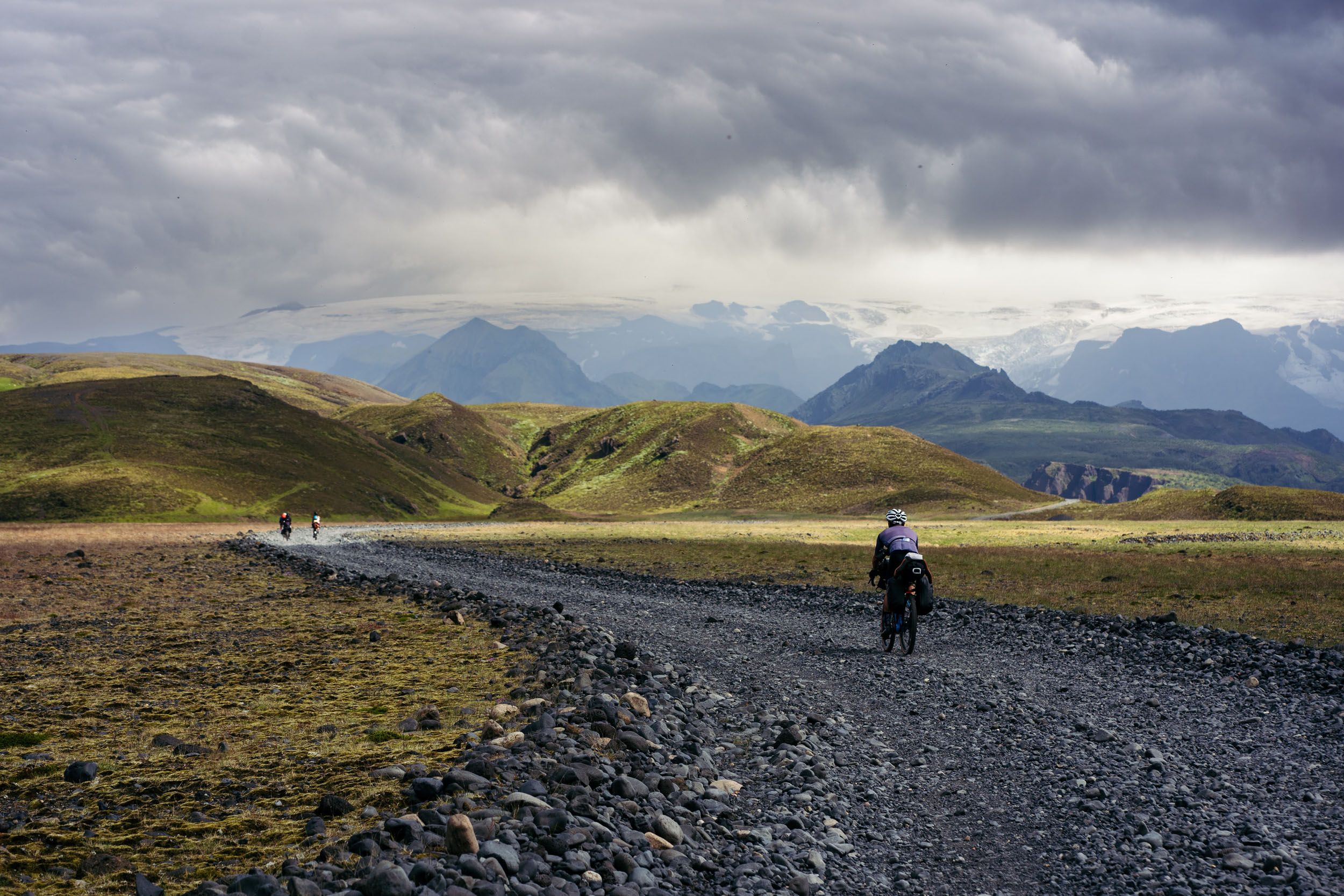
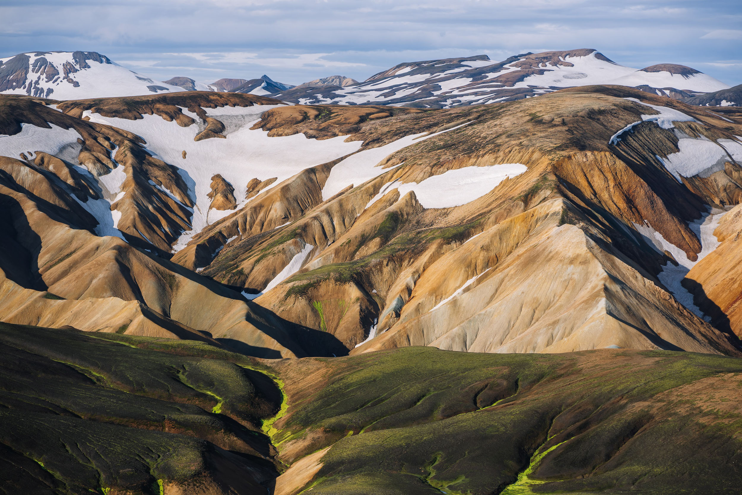
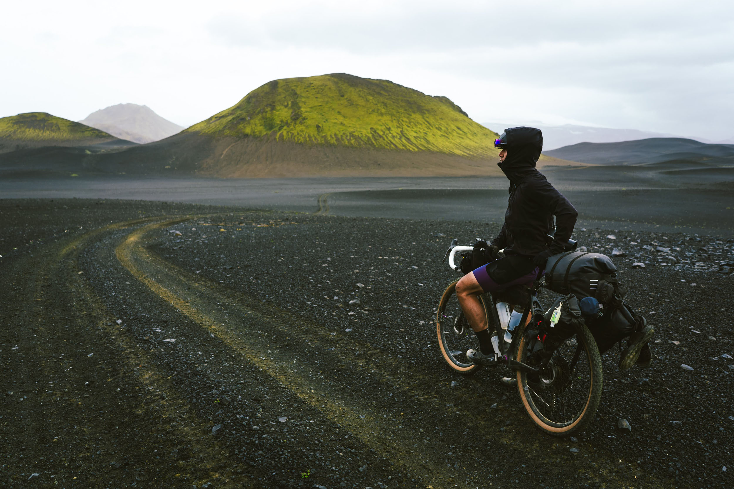
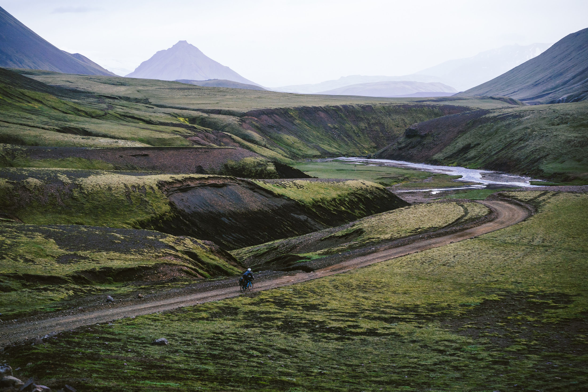
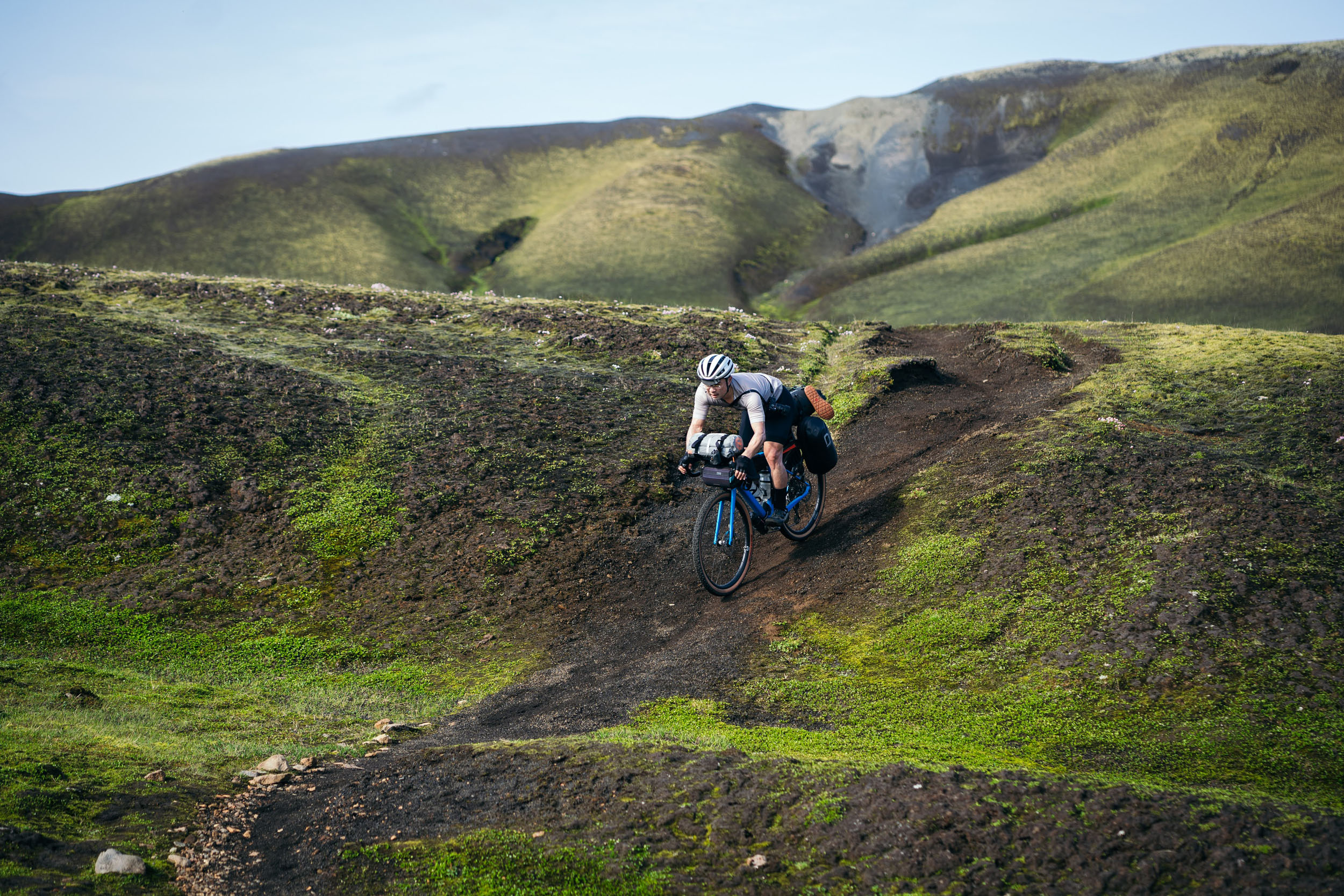
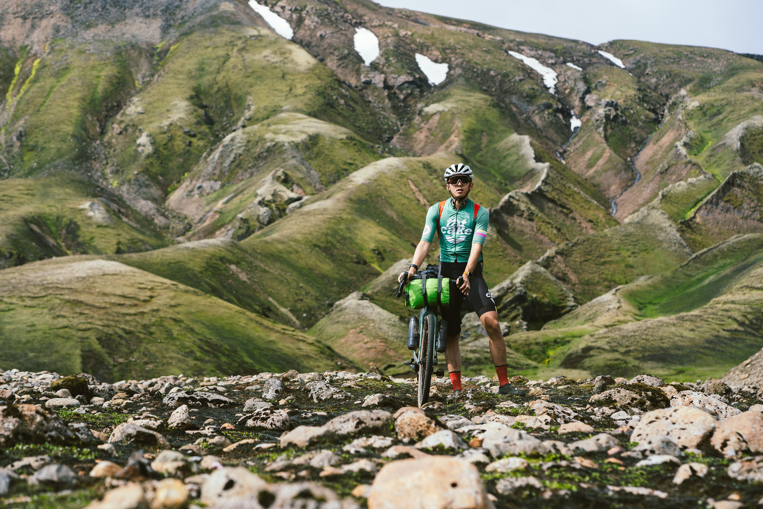
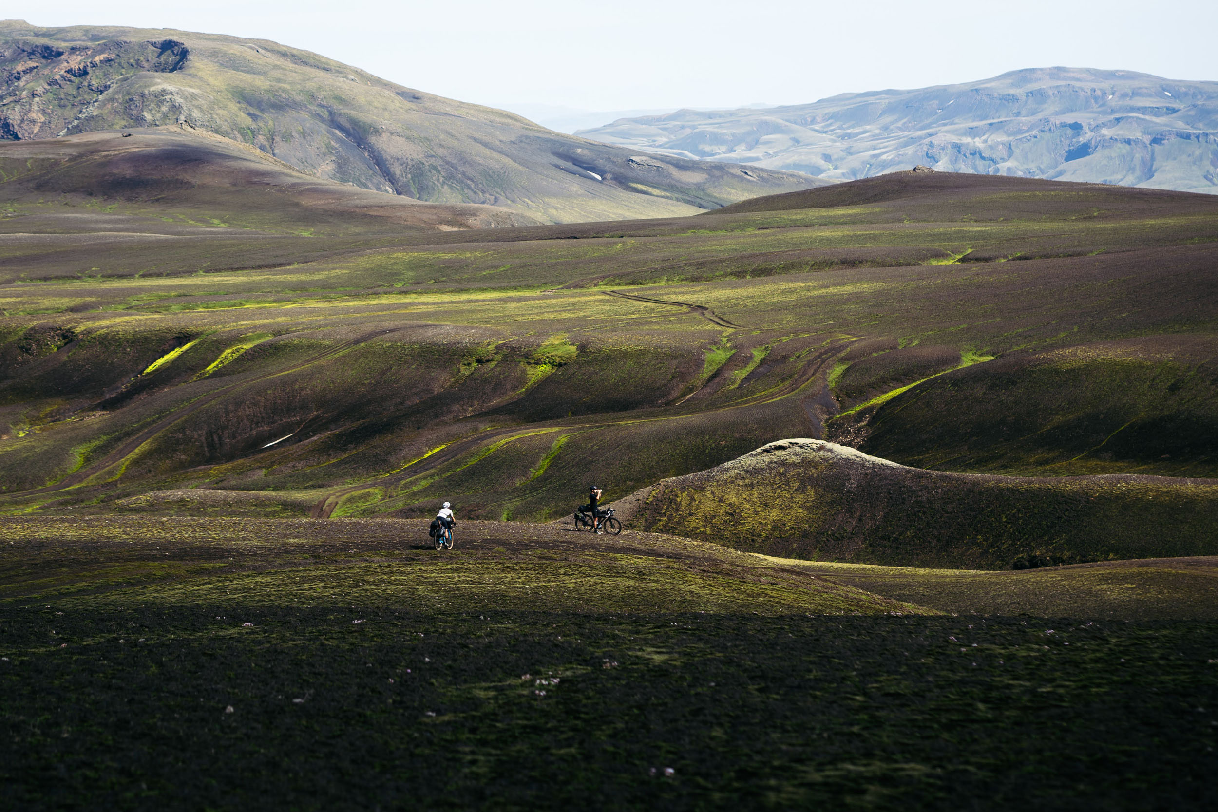
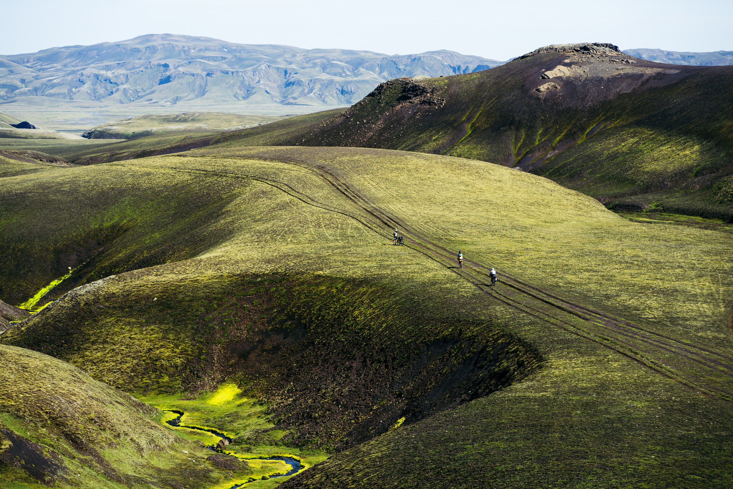
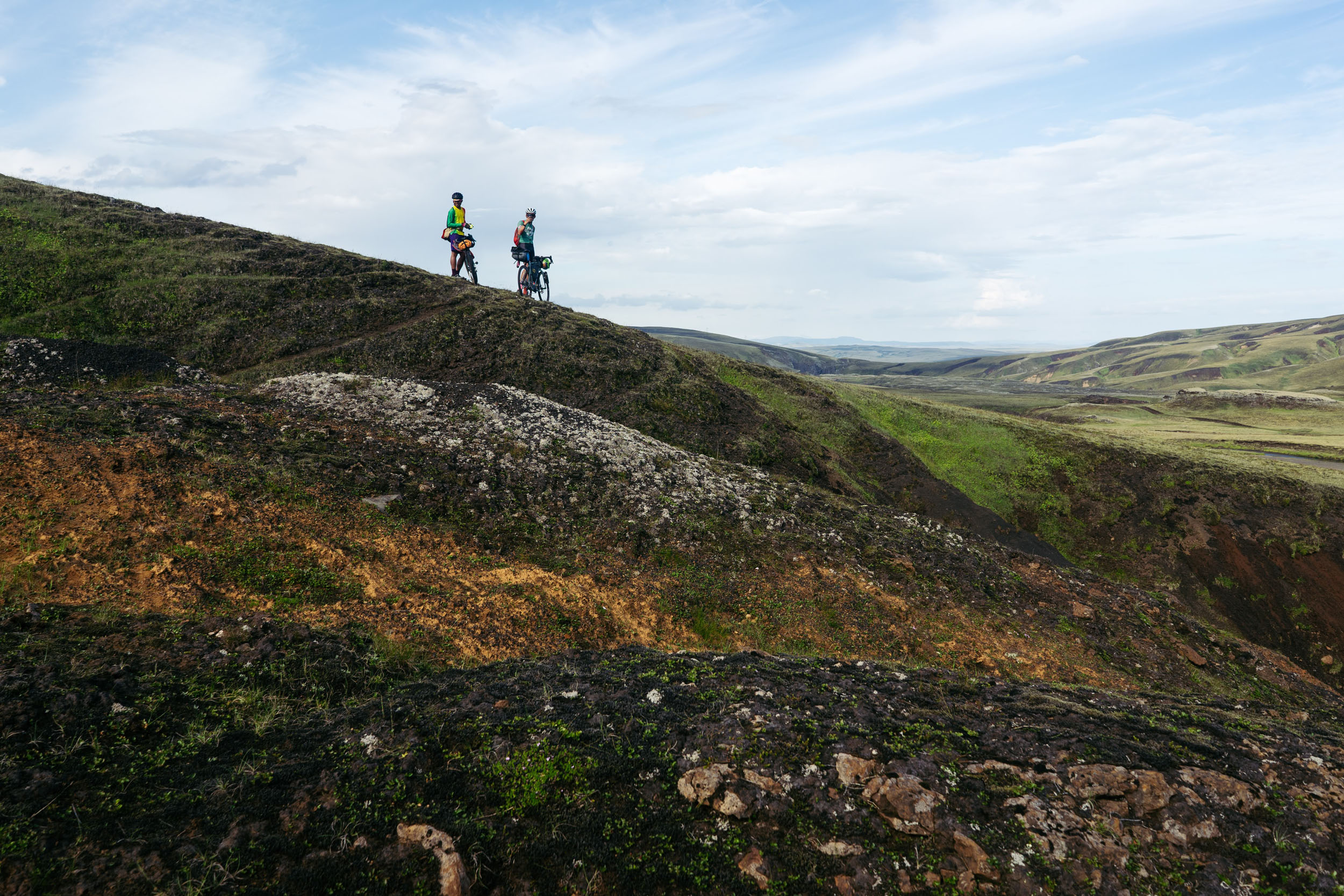
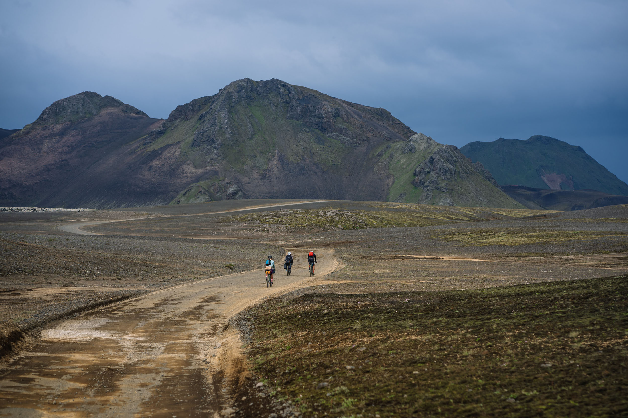
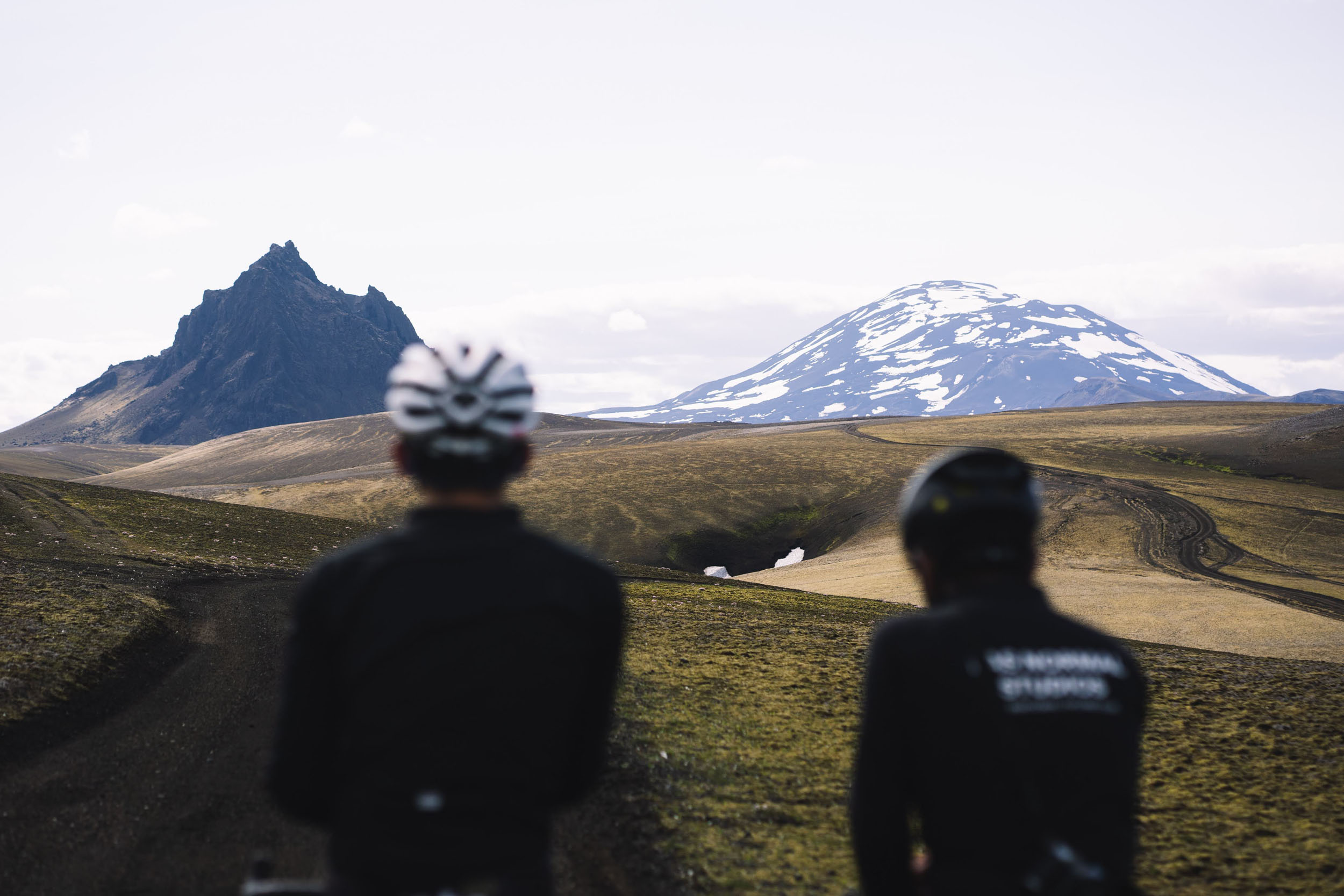
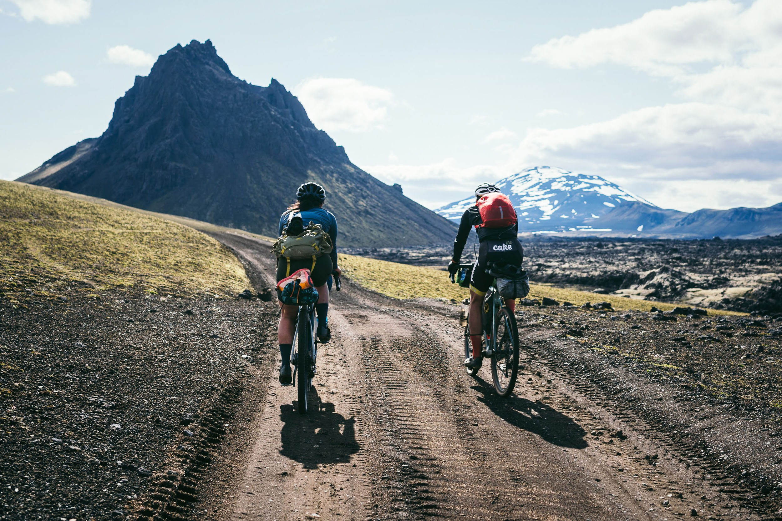
Fjallabak, pronounced “fee-at-lah-bahk”, means “mountain back” in Icelandic. The route’s namesake is the Fjallabak Nature Reserve, which was established in 1979 and is described as “mountainous, sculptured by volcanoes and geothermal activity, covered by lavas, sands, rivers and lakes.” Indeed, the Iceland Fjallabak Track is an ode to the distinctive mountain-flanked terrain of the Highlands that inspires so many.
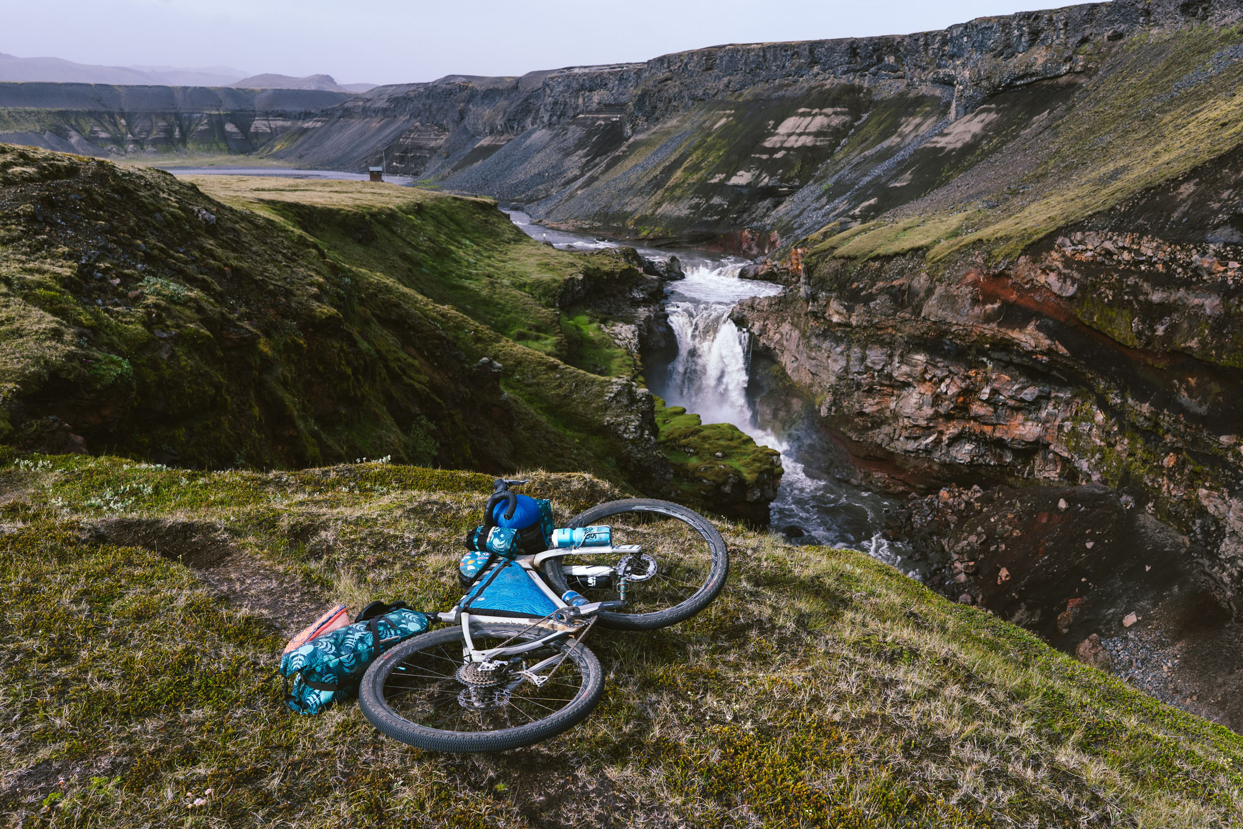
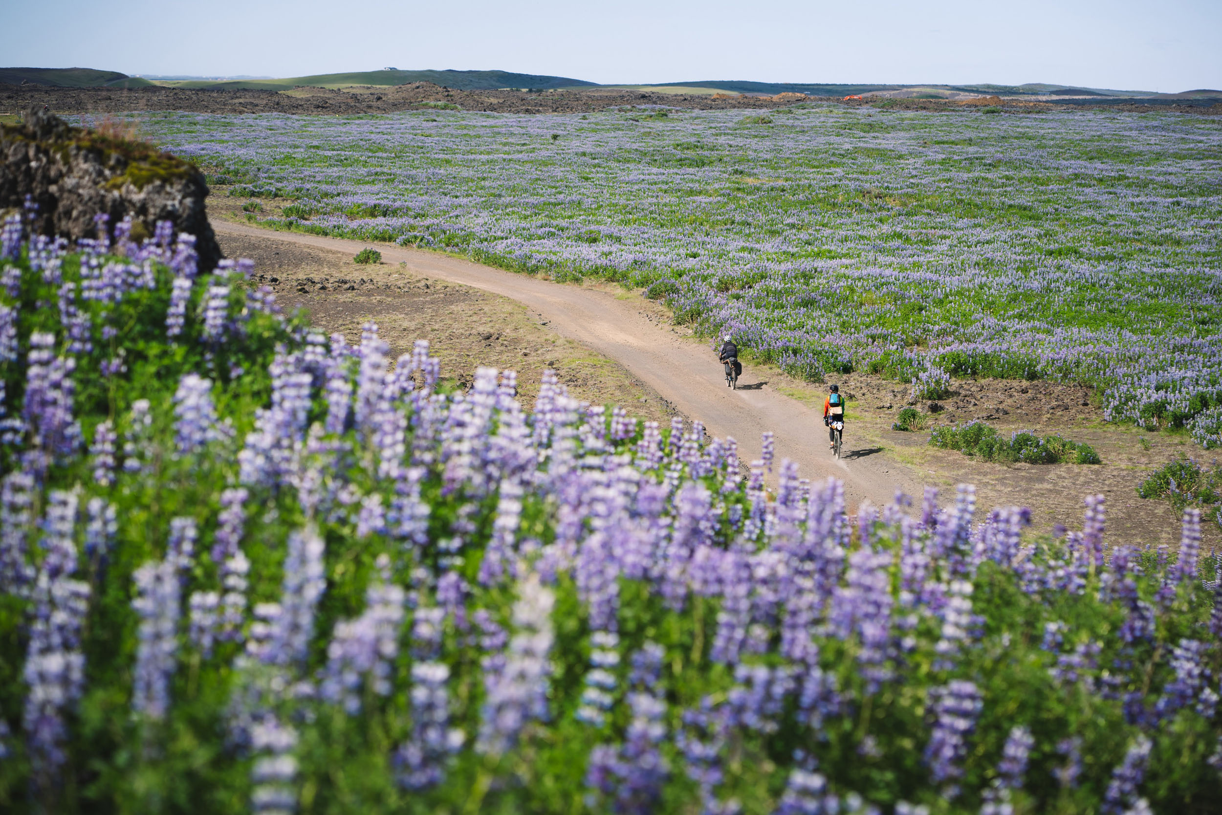
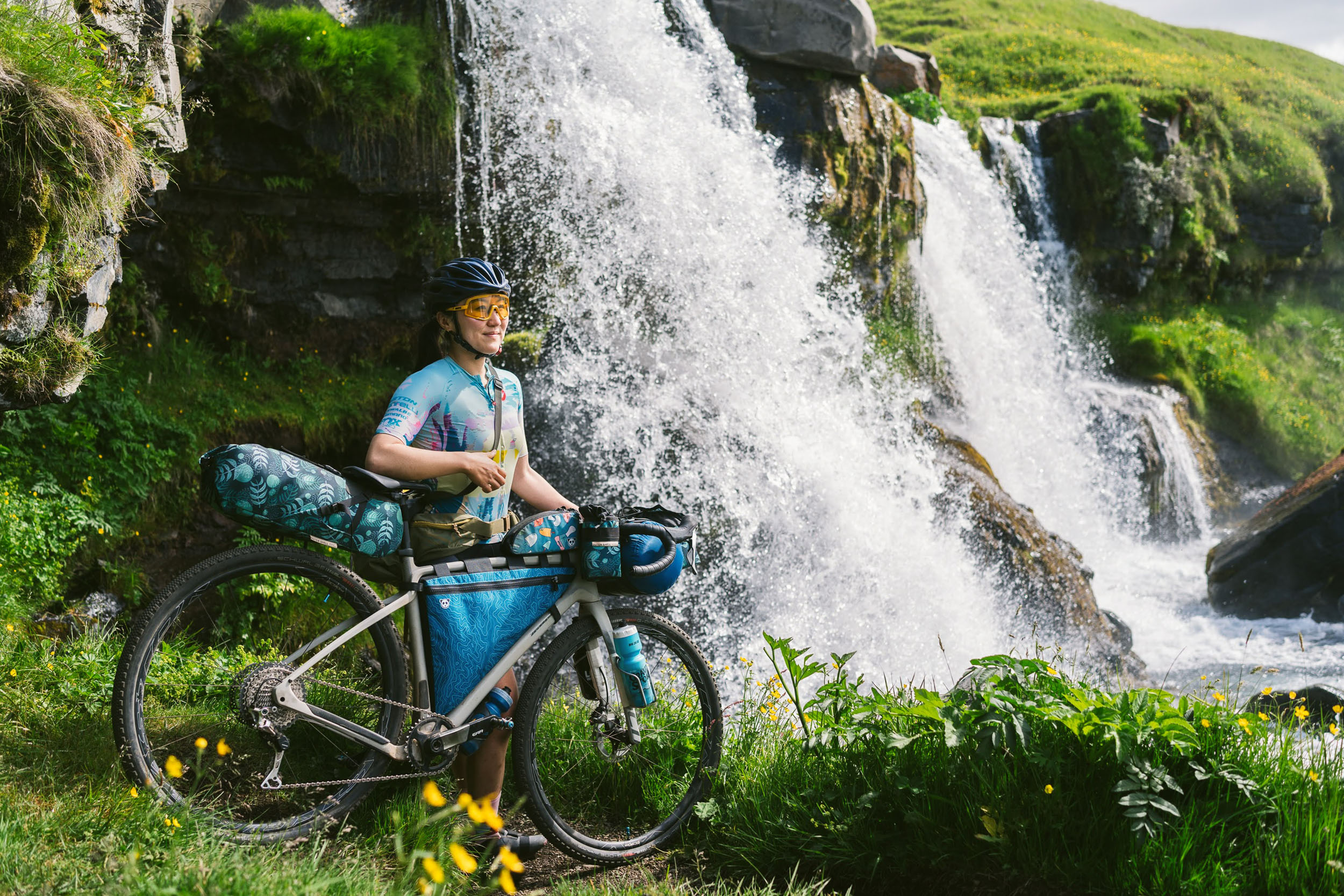
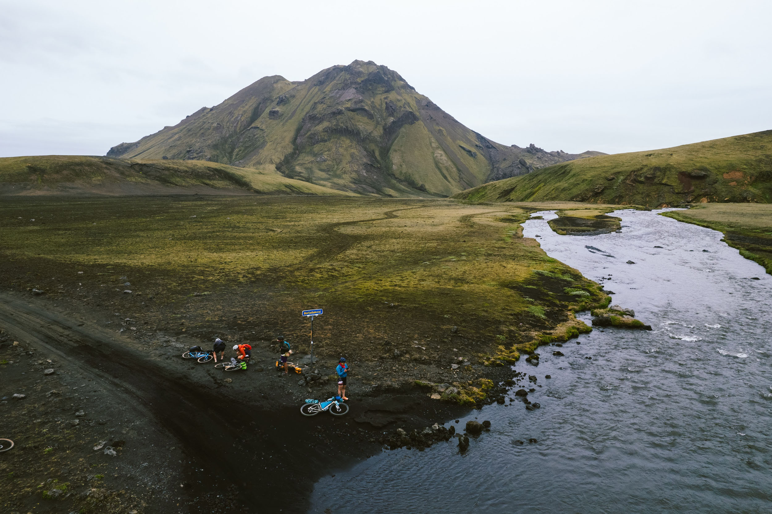
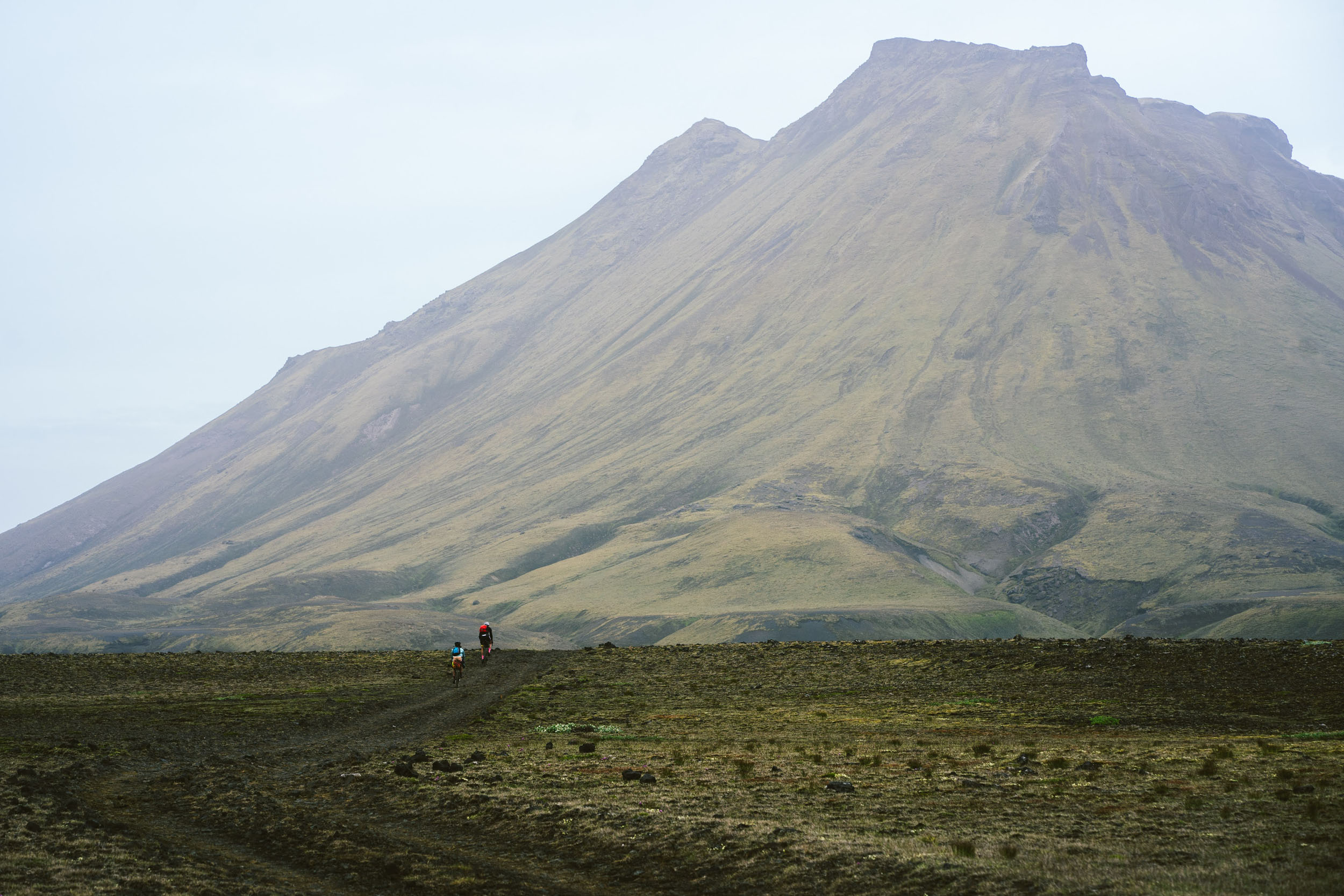
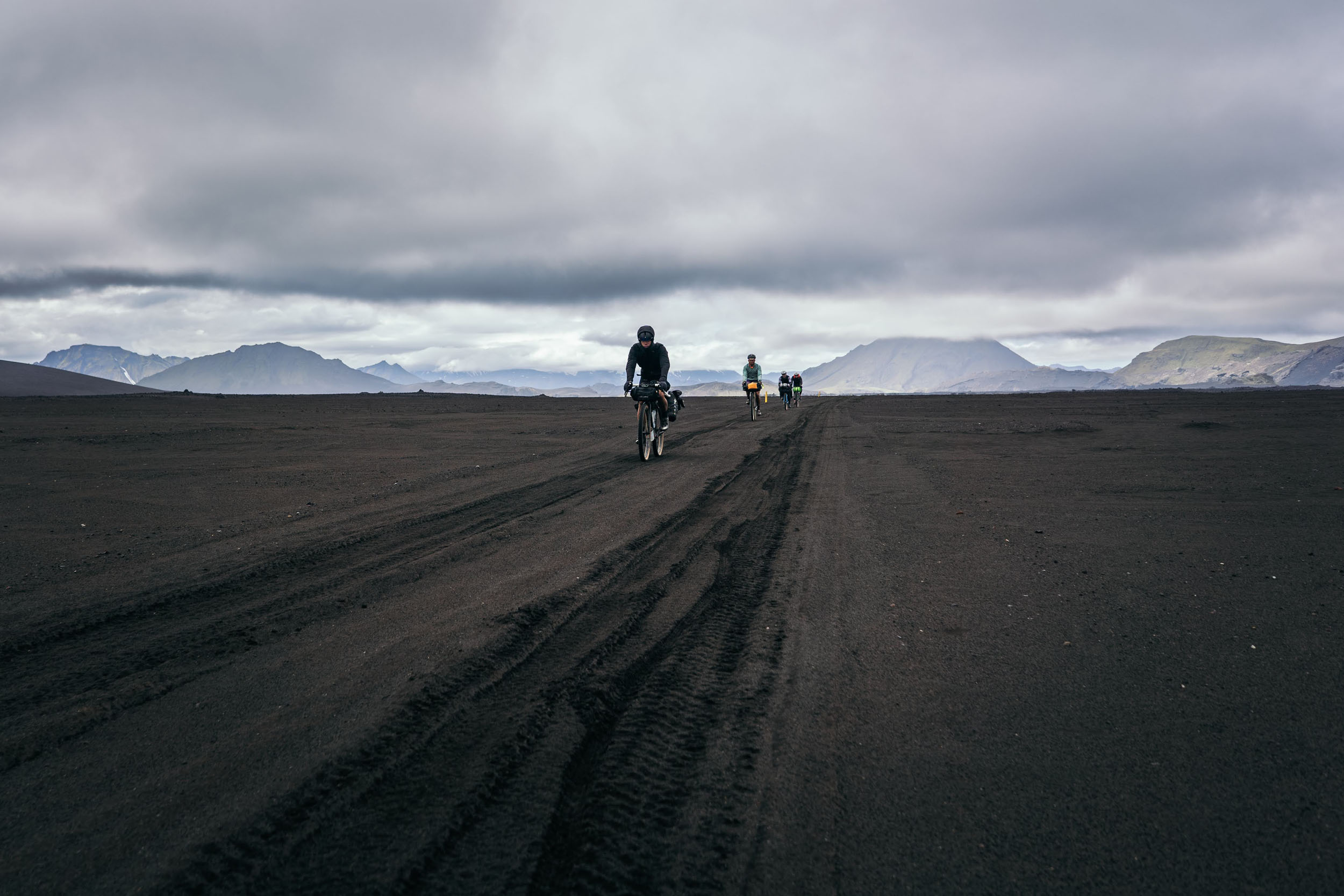
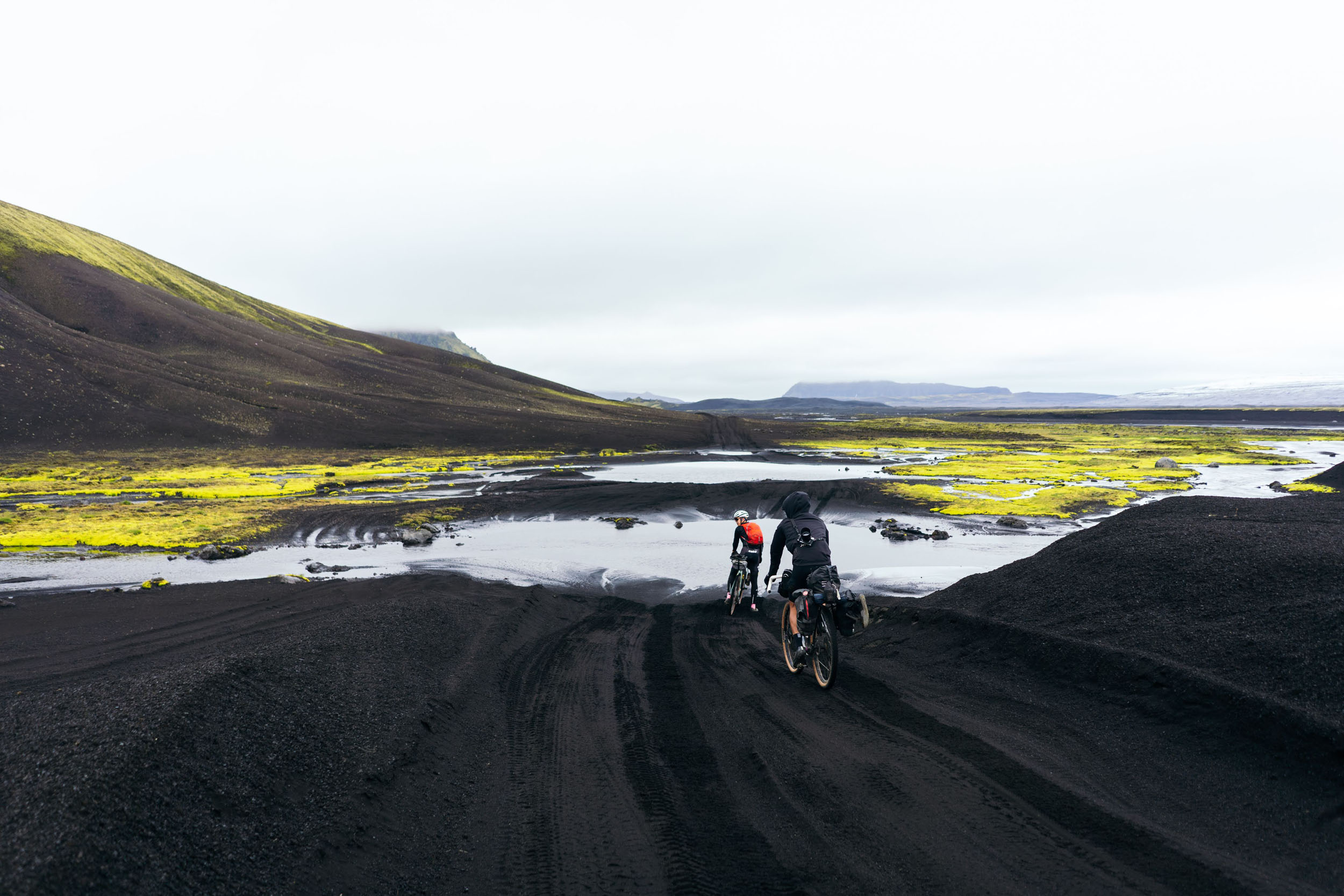
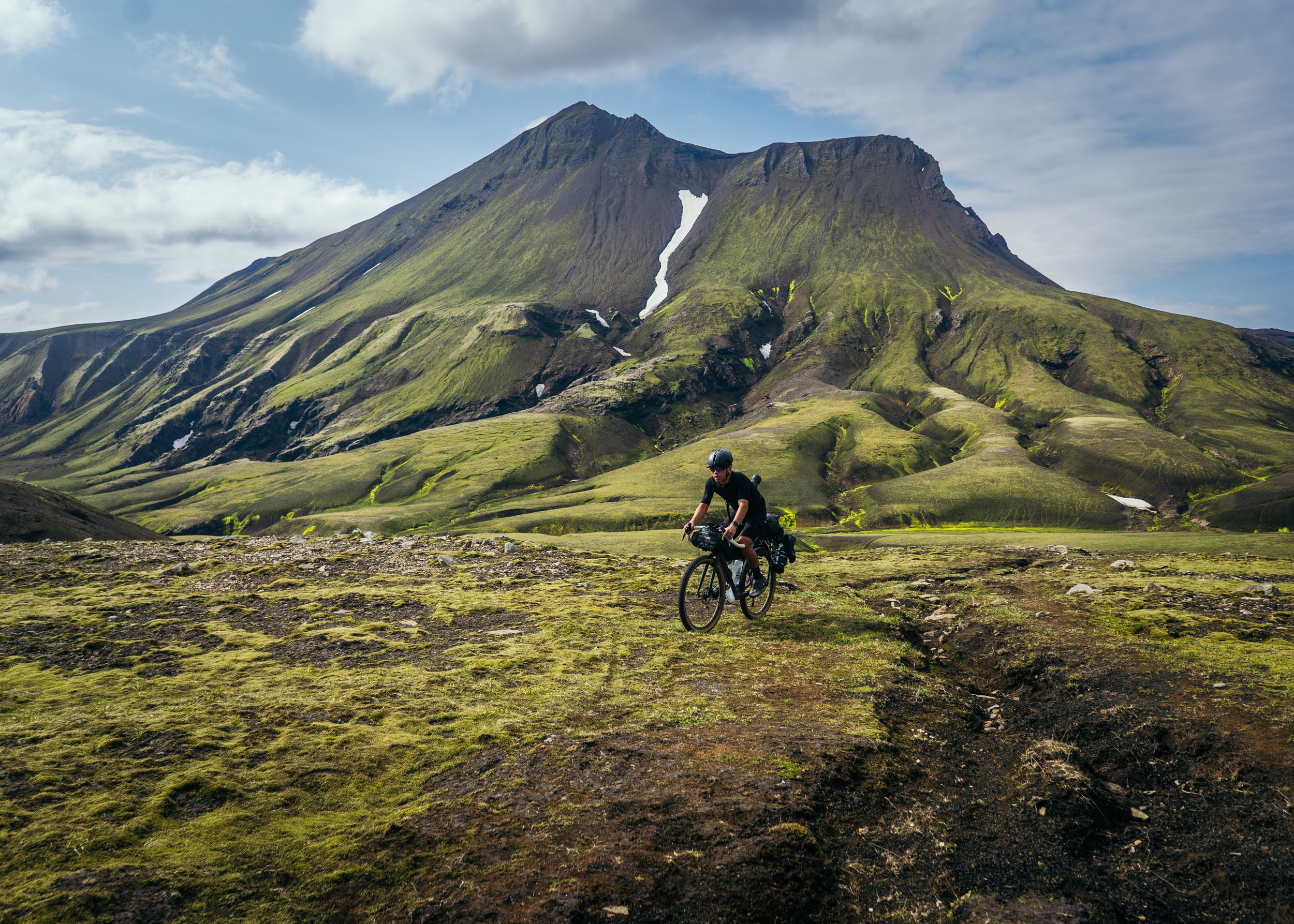
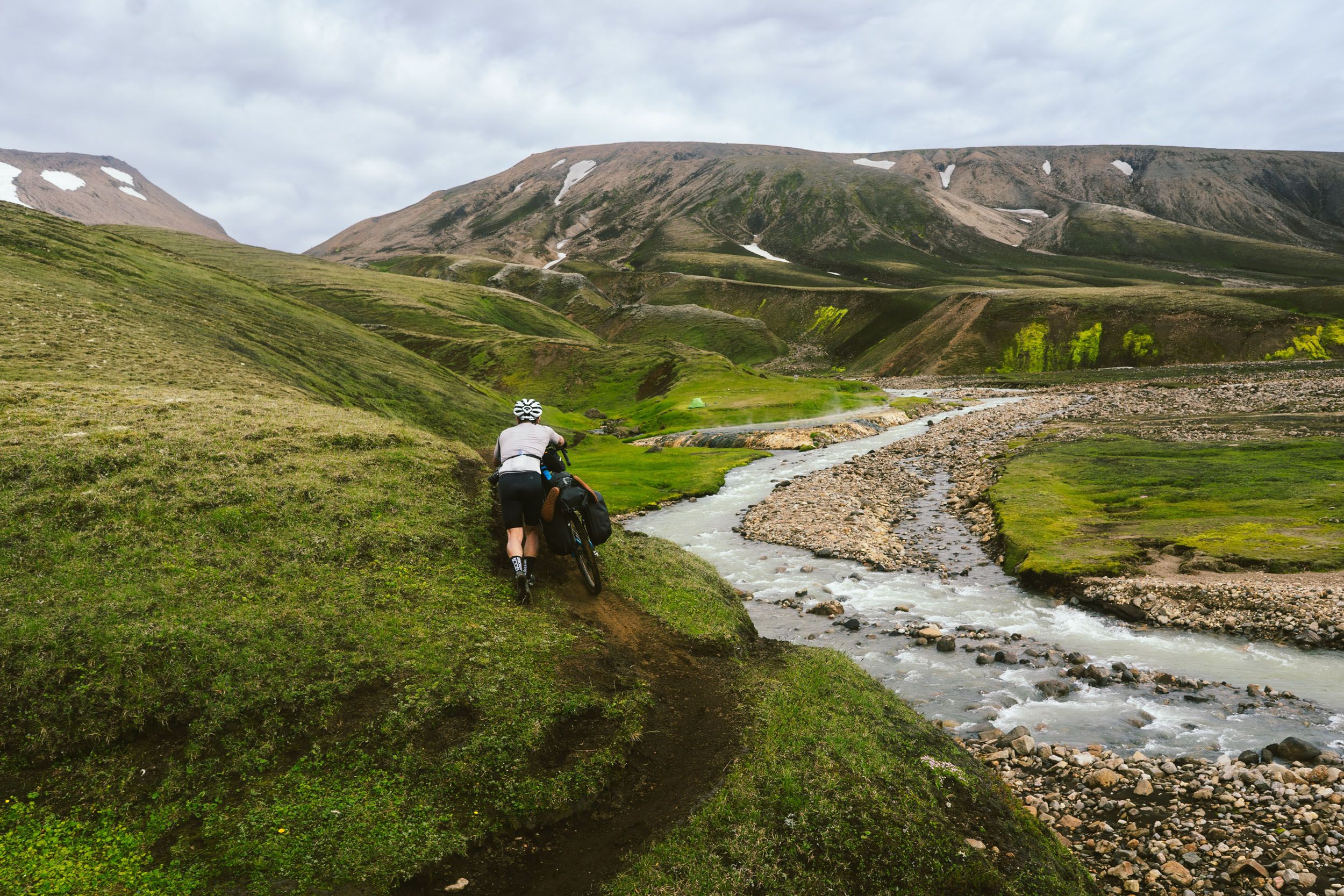
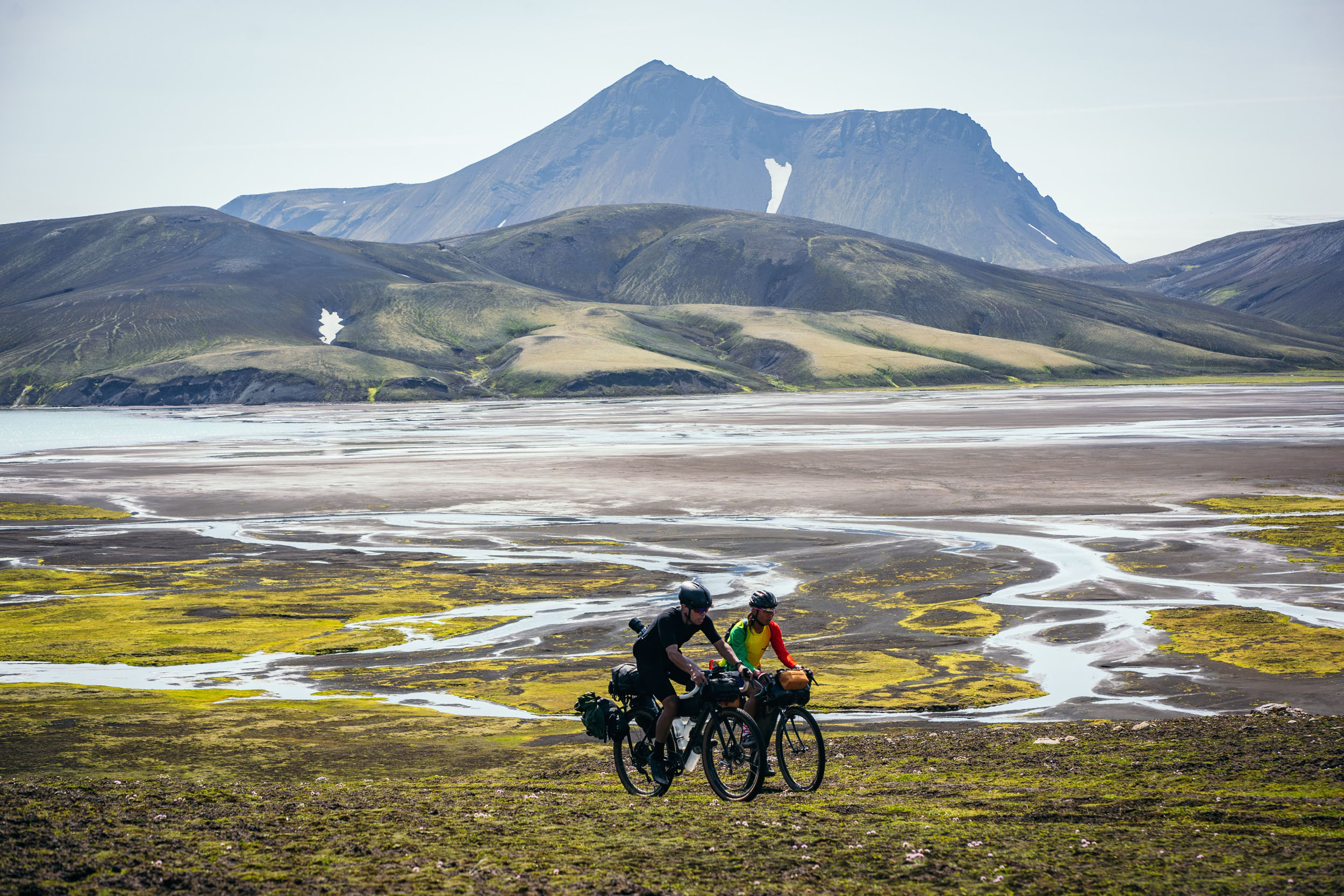
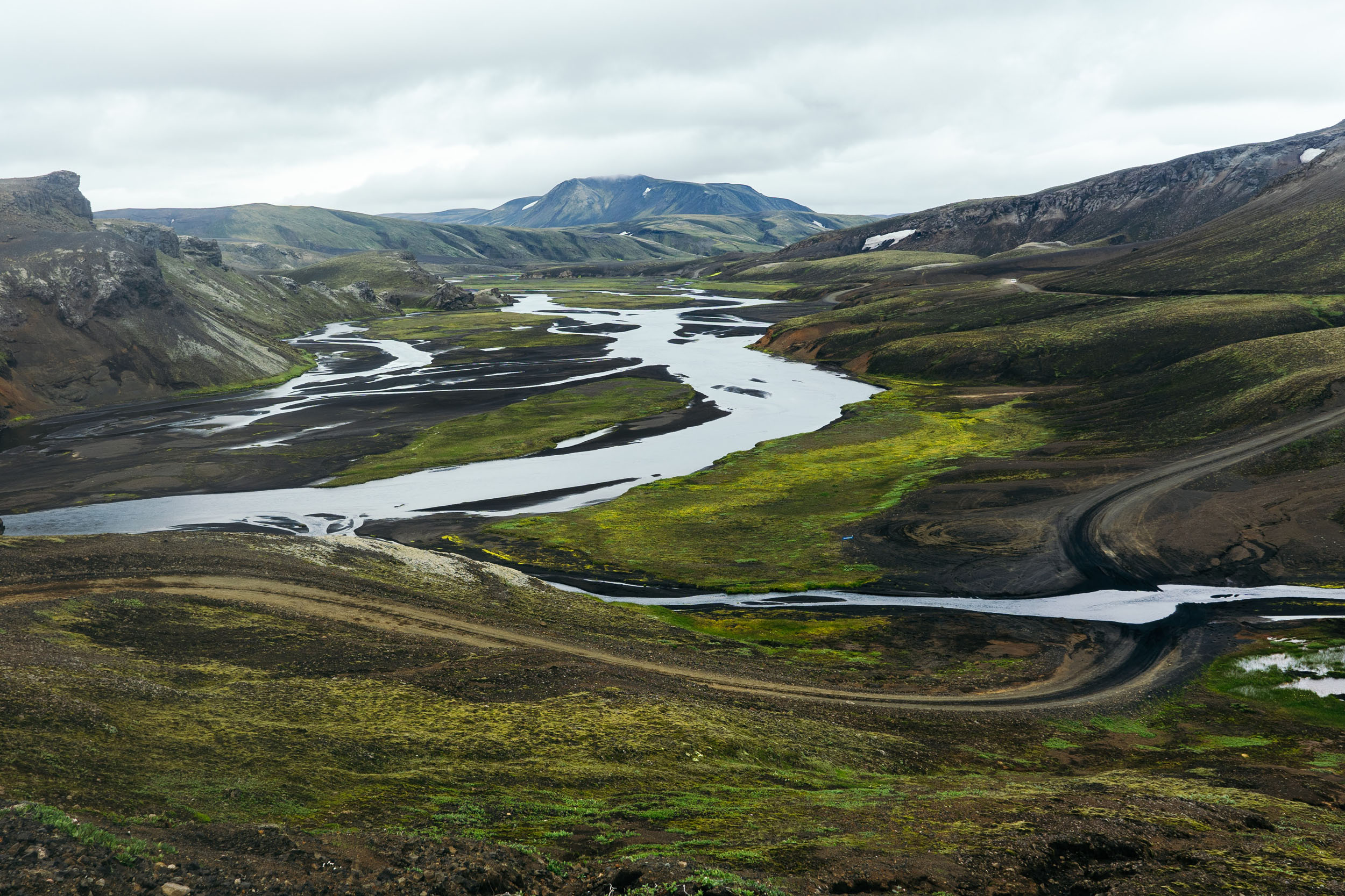
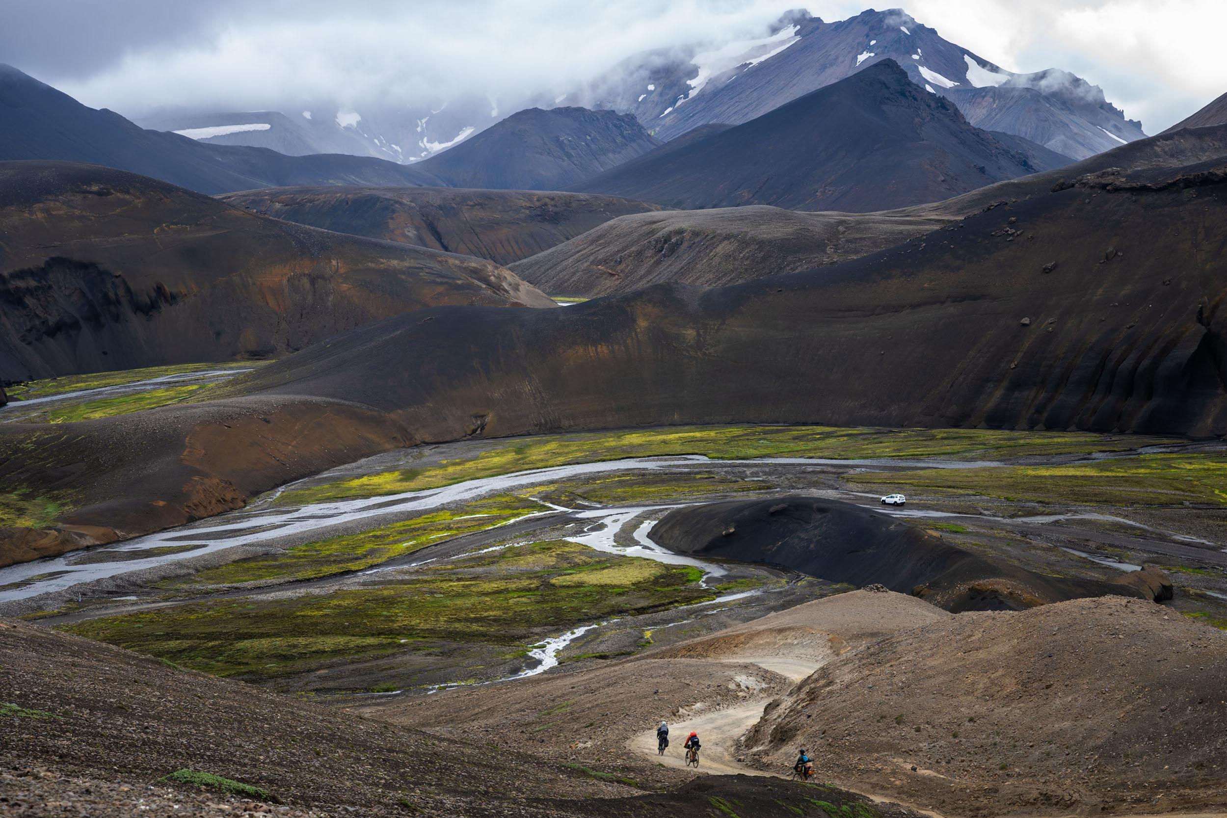
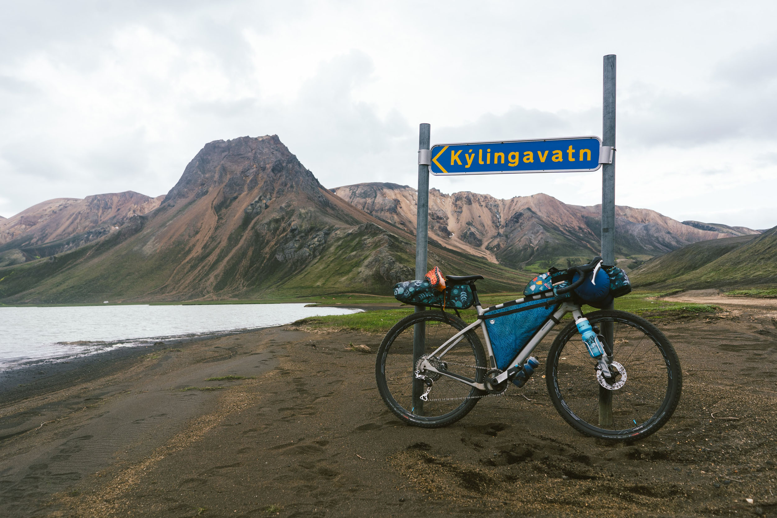
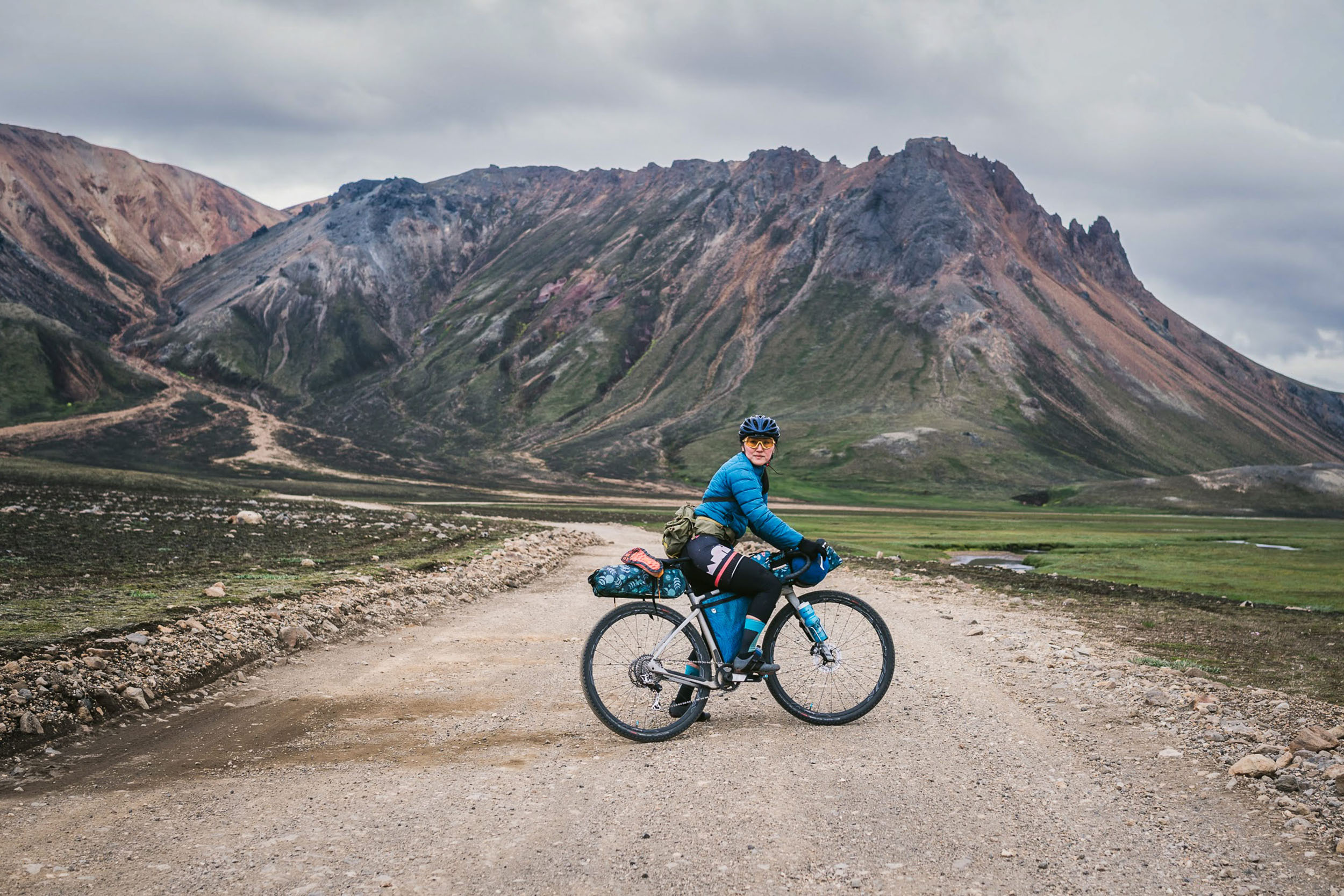
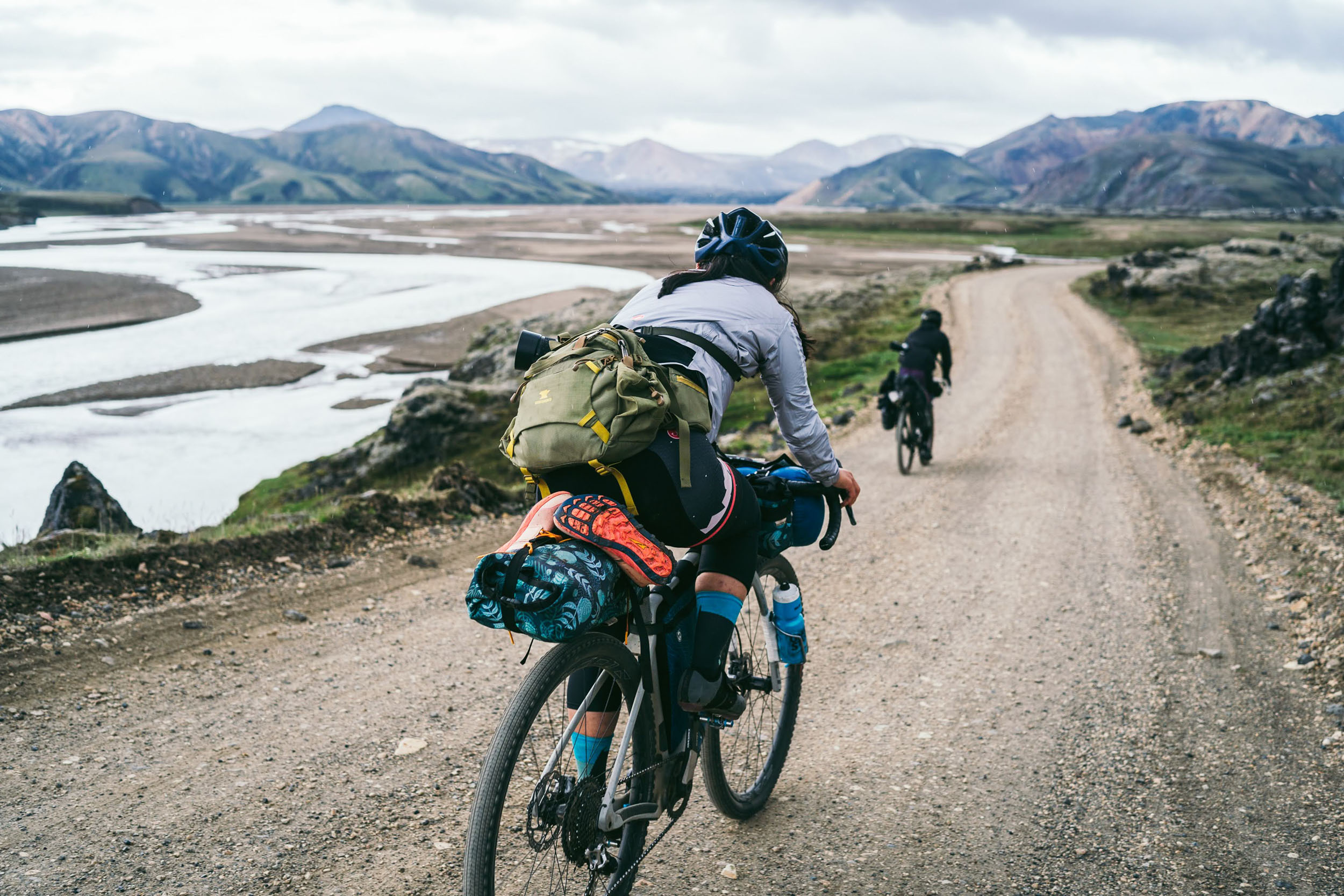
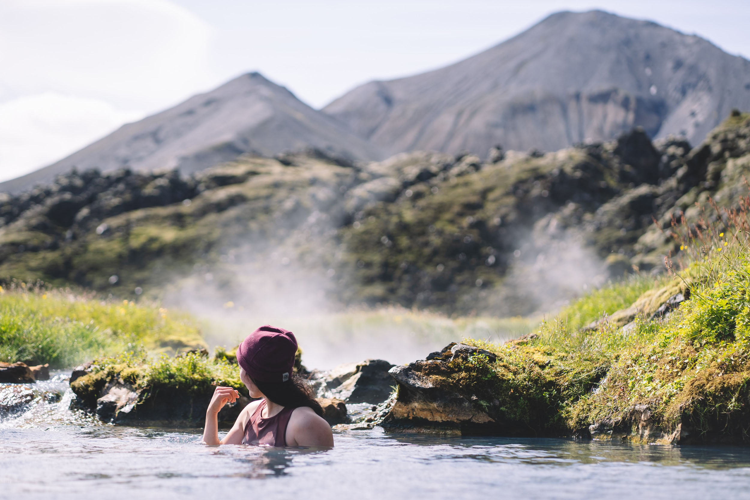
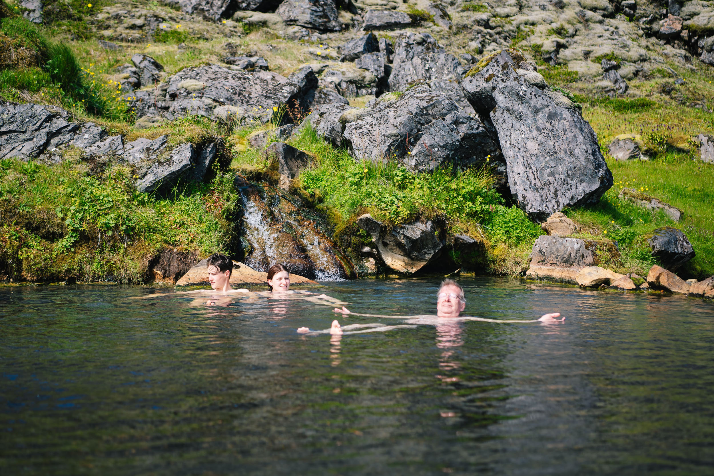
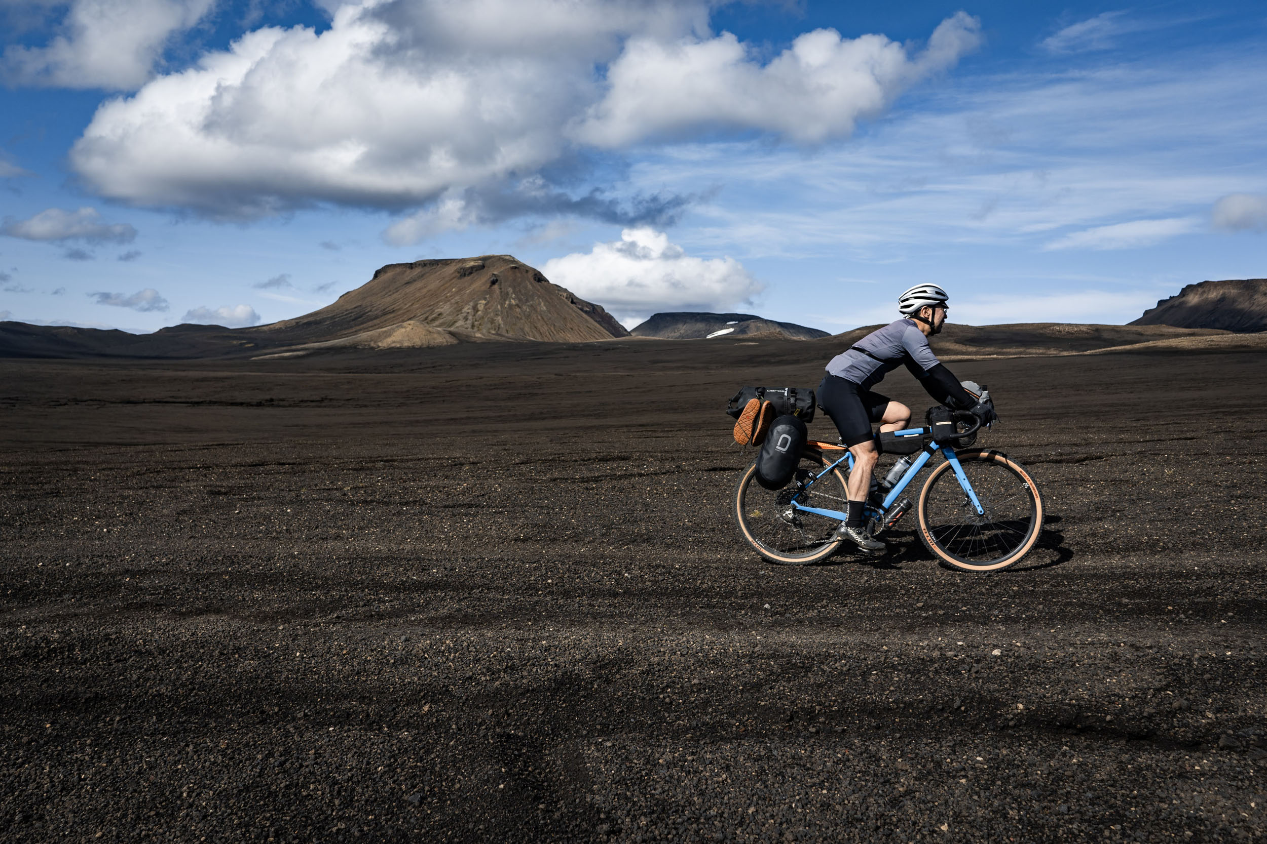
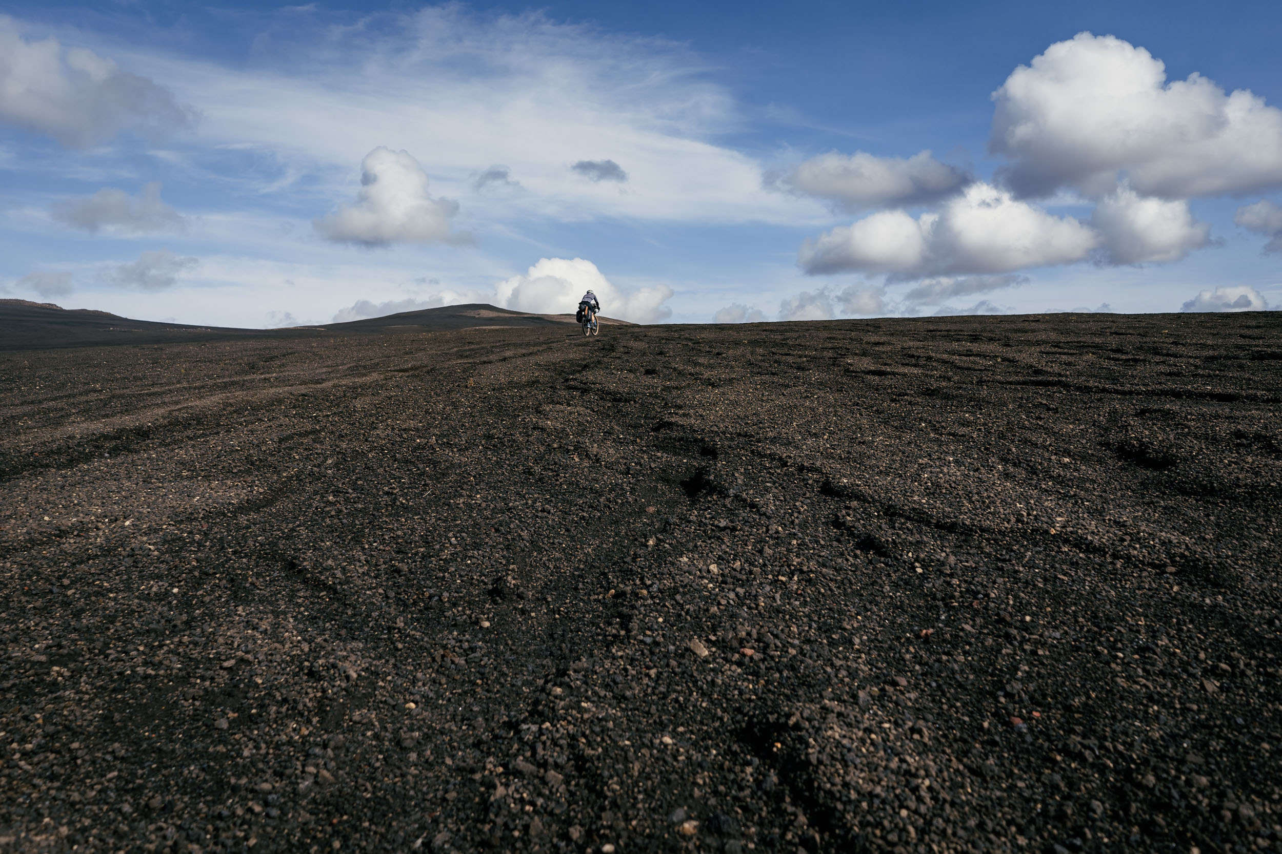
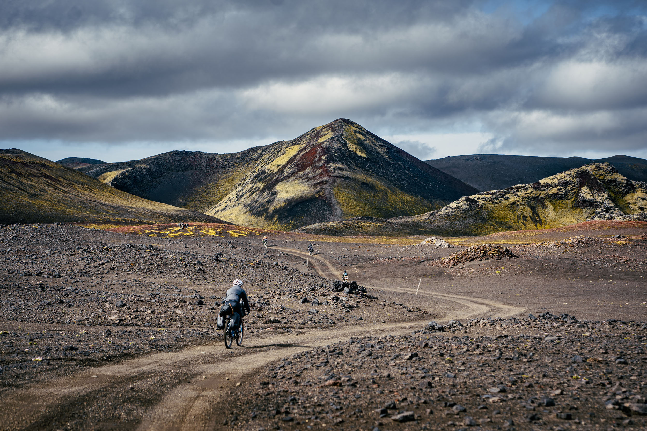
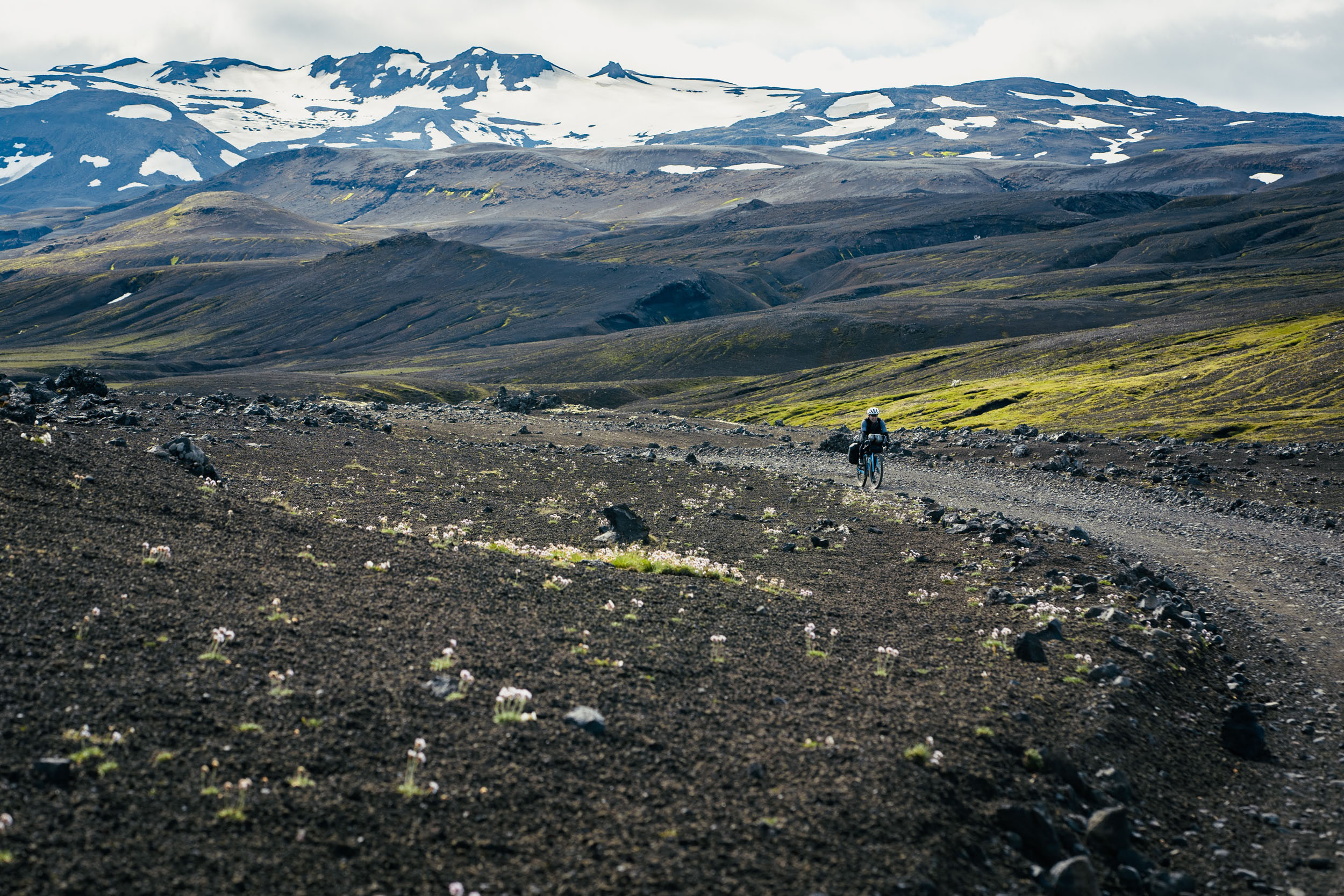
The route approaches the Highlands on the F-210 road, also known as the Fjallabaksleið syðri. The doubletrack cuts through basalt canyons and immense glacial plains to arrive at the green valleys around Lake Álftavatn. On day two, the green transitions back into black glacial sand plains from which mountains like Mælifell rise up like giants. The dominating colors of the Icelandic Highlands are black and green, but there are many hues weaved throughout—the golden-yellow of rhyolite, the purple of lupine blooms, the deep blue of glacial lakes, and the orange of sulfur deposits around geothermal areas. Along the route are two geothermal pools (called “hot pots” by Icelanders) to look forward to: the rarely visited Strútslaug and the popular Landmannalaugar hot pot.
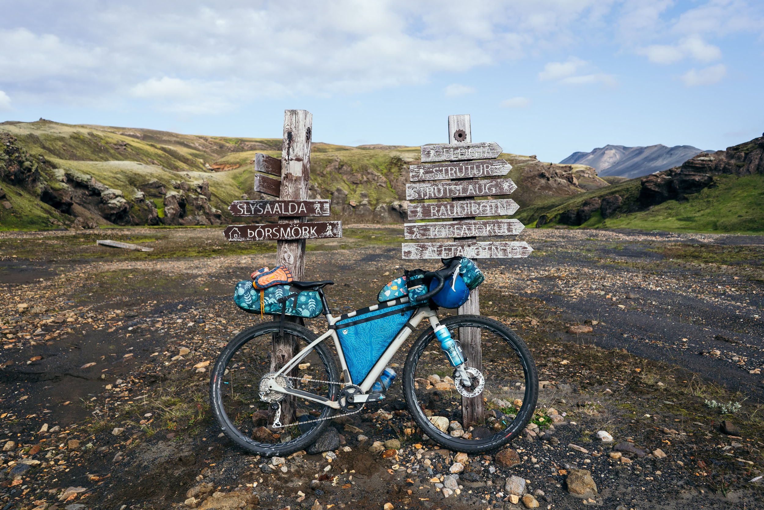
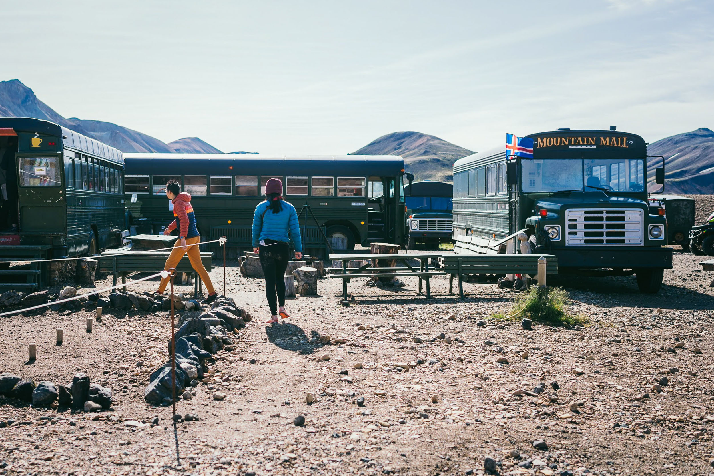
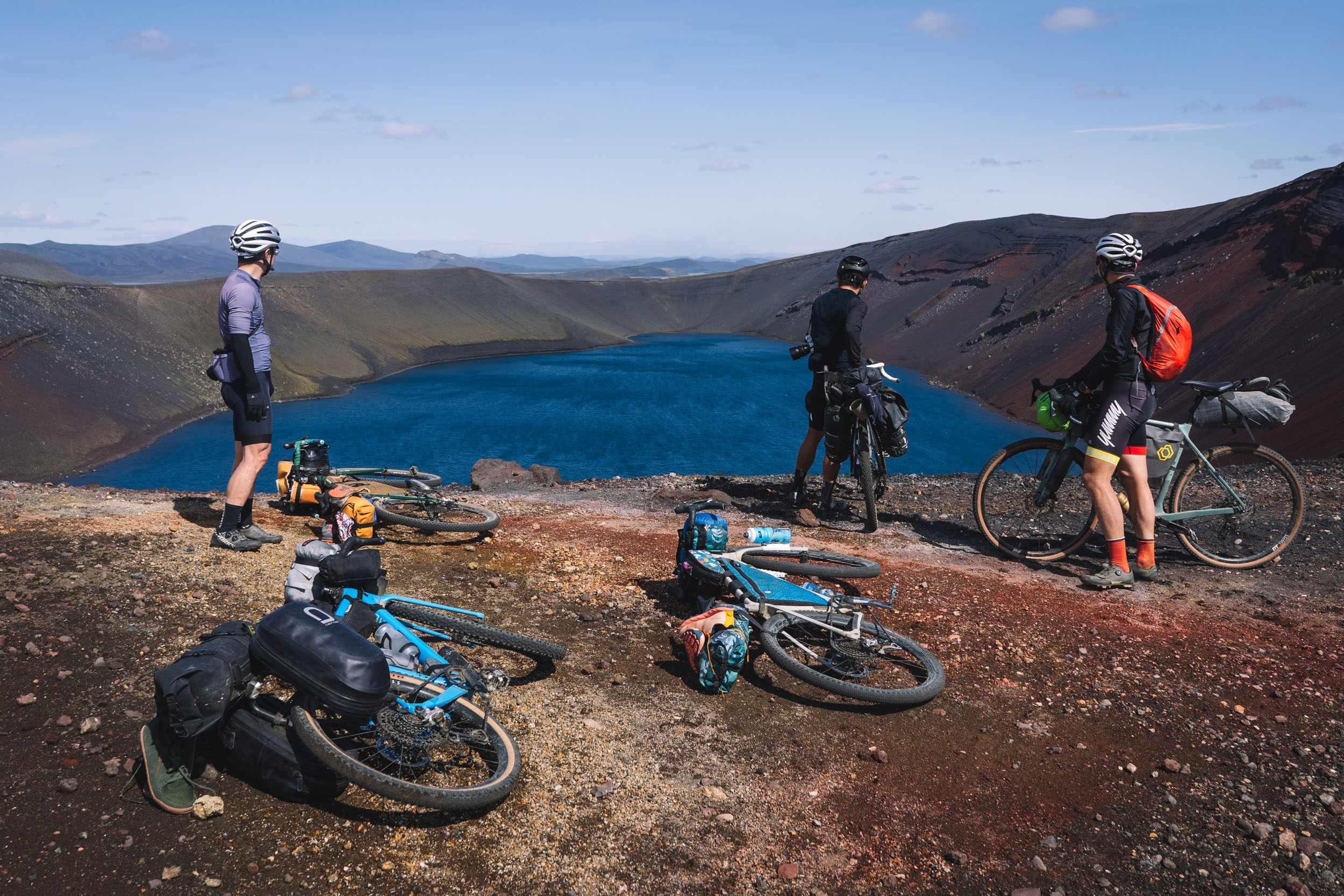
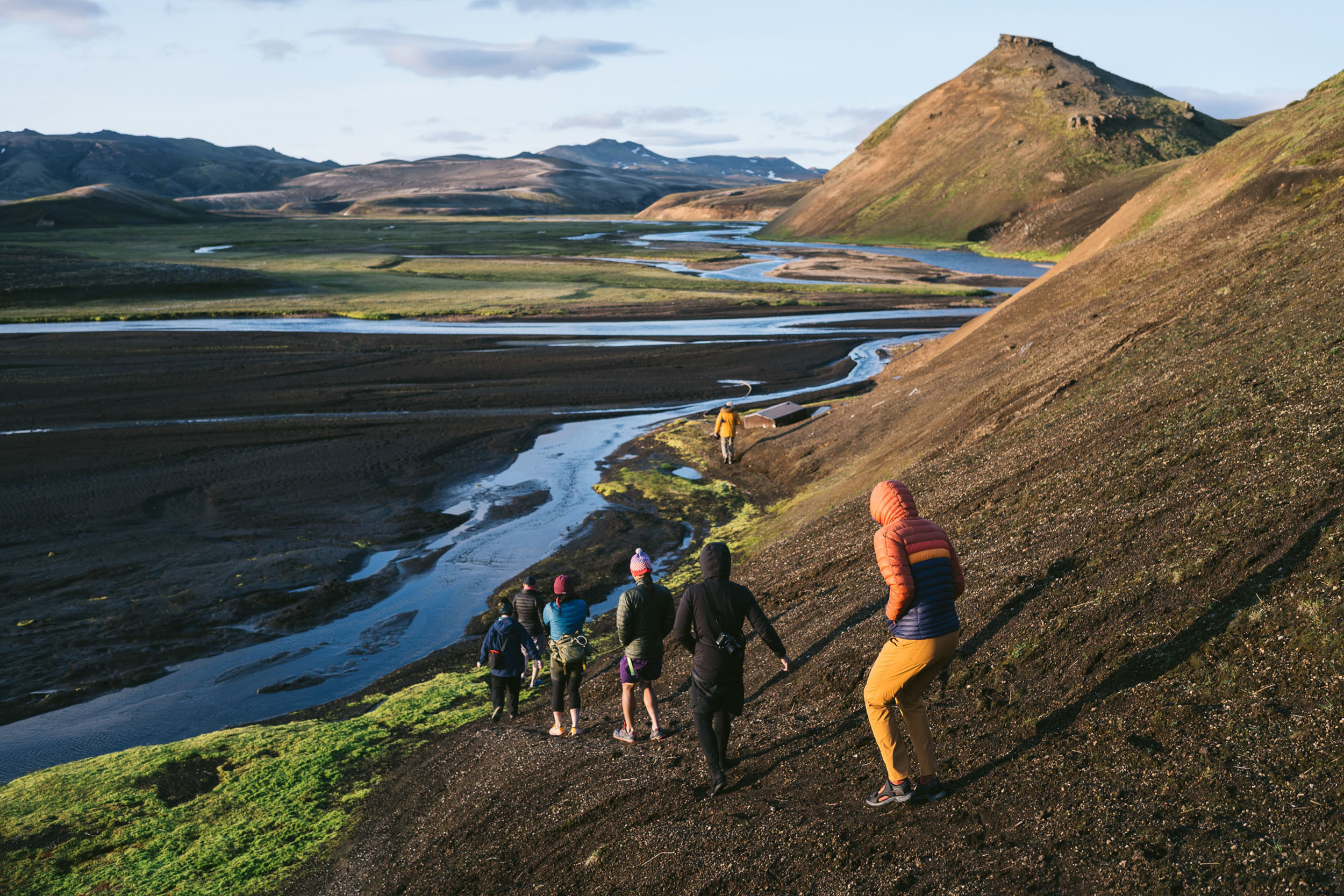
The midpoint of the route enters the Fjallabak Nature Reserve. The famous rhyolite mountains of Landmannalaugar are the confluence of backpackers, 4×4 overlanders, and occasional cyclists. It’s worth taking a rest day to hike to the summit of Mt. Bláhnúkur and Mt. Brennisteinsalda for a bird’s eye view of the highlands. Landmannalaugar, meaning “people’s pools” in Icelandic, is also an active geothermal area. Here, you can buy warm soup and a hot dog, then take a moment’s pause to soak in the hot pot. Ahh… for a moment, it almost feels like a real vacation, far from the harsher realities of bikepacking Icelandic terrain.
The Iceland Fjallabak Track curates a route that captures the diverse vistas of the Southern Highlands, but it is by no means the only path to experience the area. There is an expansive network of F-roads in Iceland that can be tacked on to modify or extend the route. As presented, this bikepacking loop is vetted to be not too long, not too short, with some hike-a-bike, but not overly challenging. It is less committing than a North-South or East-West Iceland crossing but still feels untamed. As such, it’s a great choice for those seeking balance between solitude and support and predictability and the unknown.
Route Difficulty
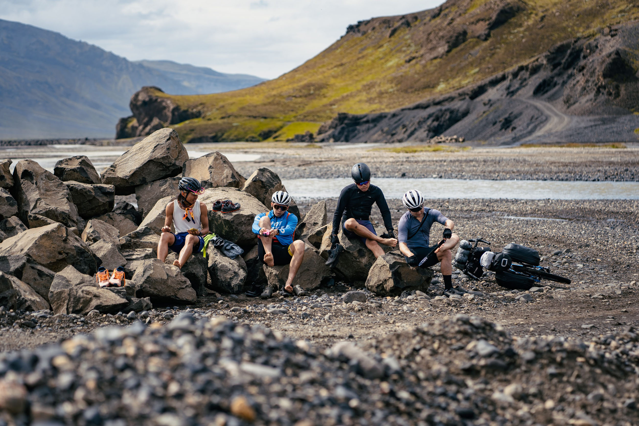
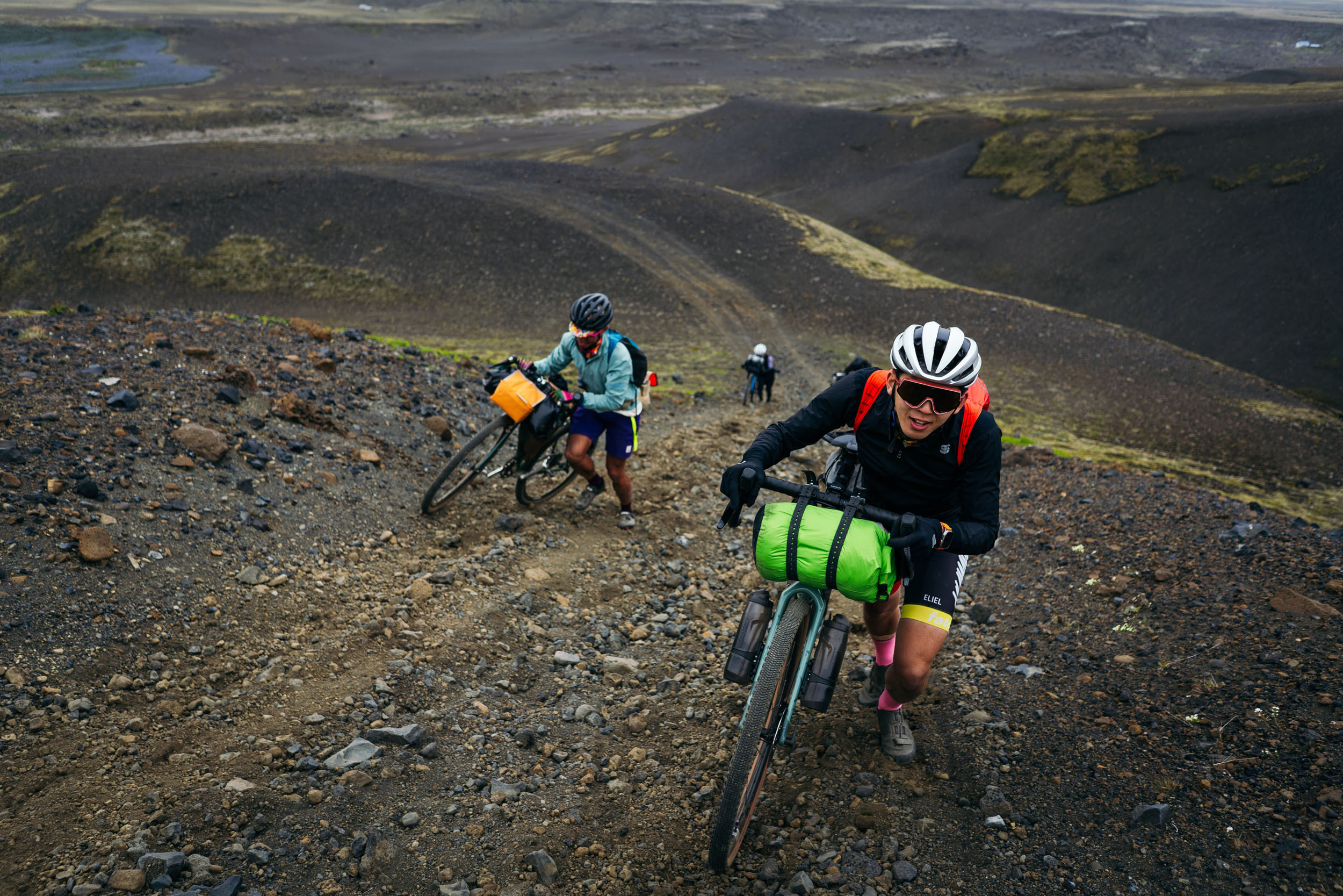
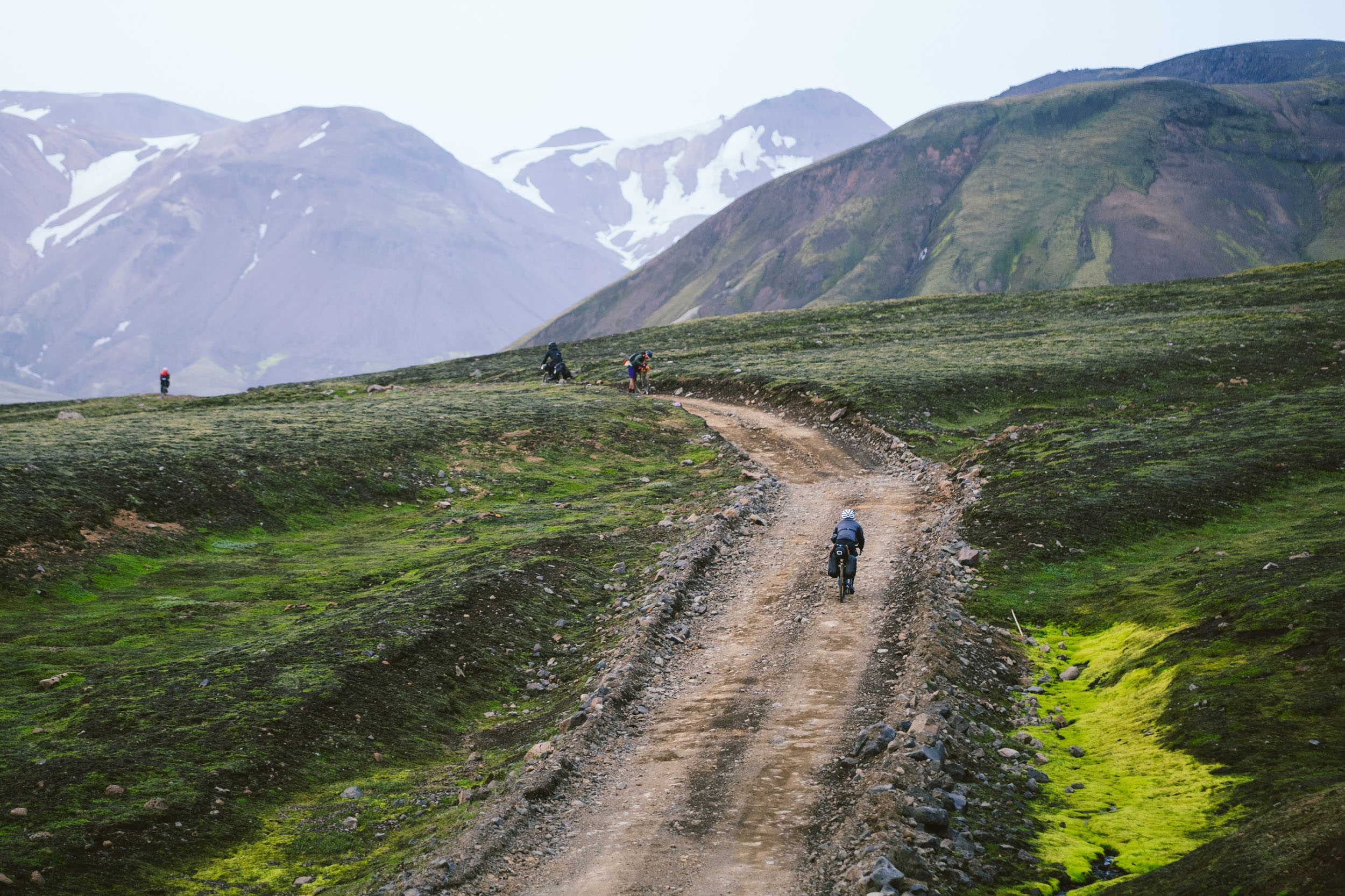
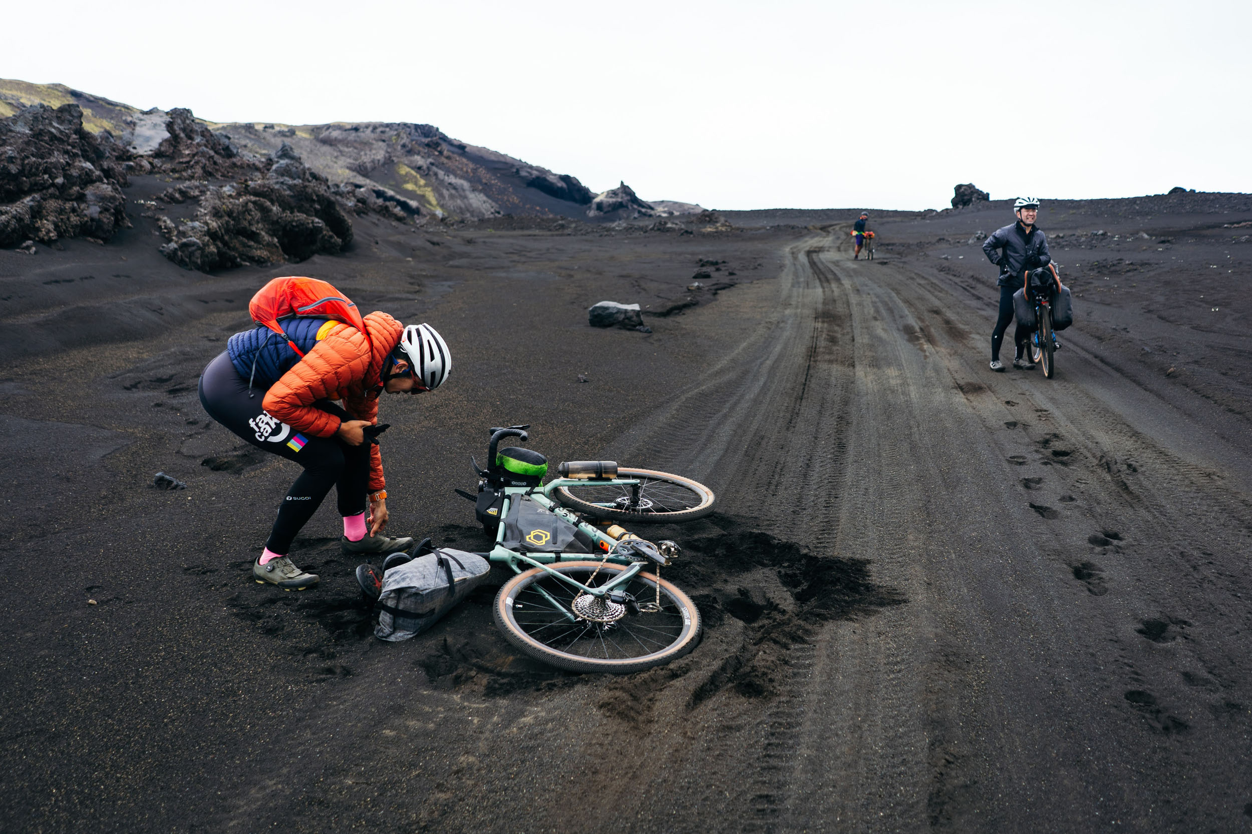
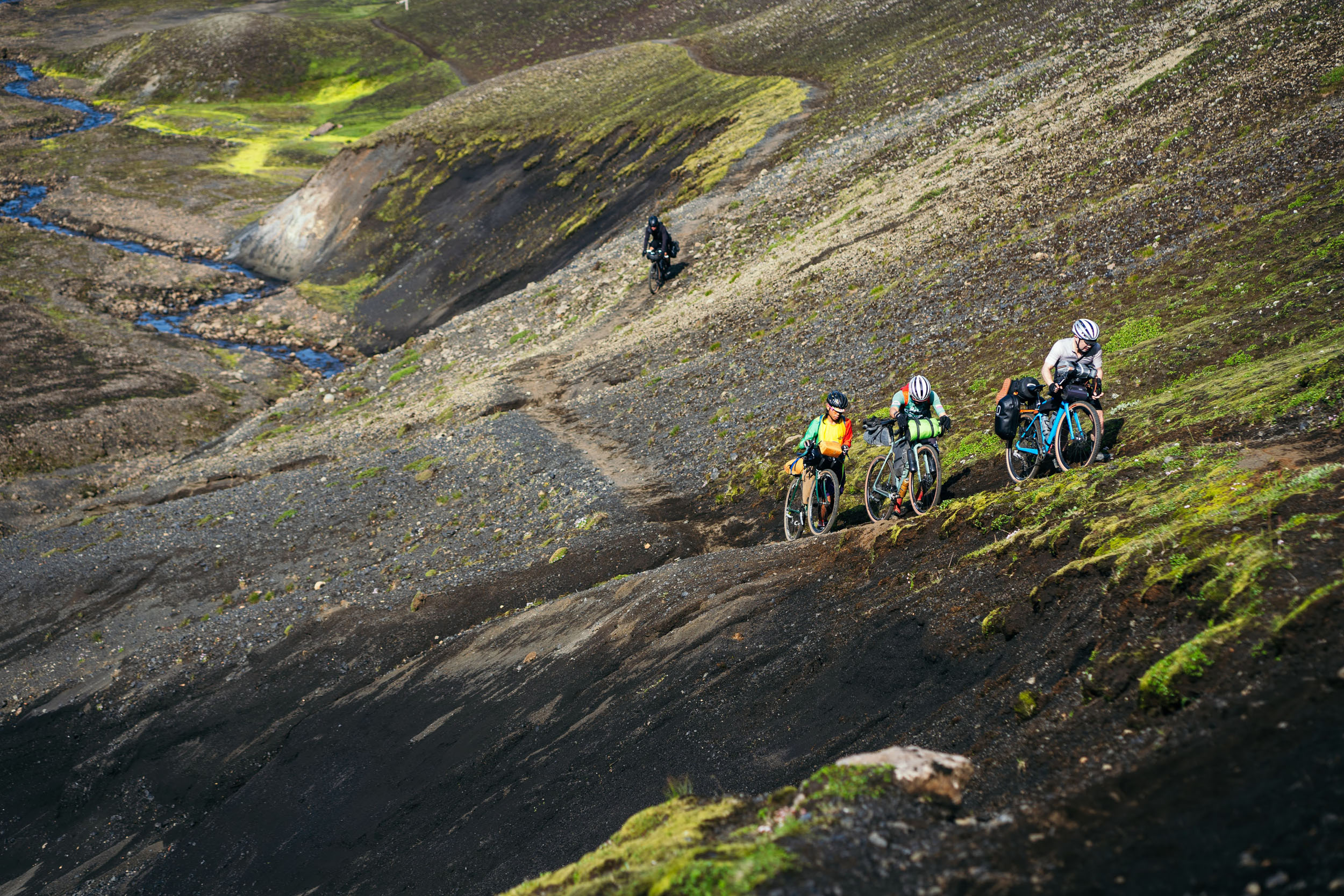
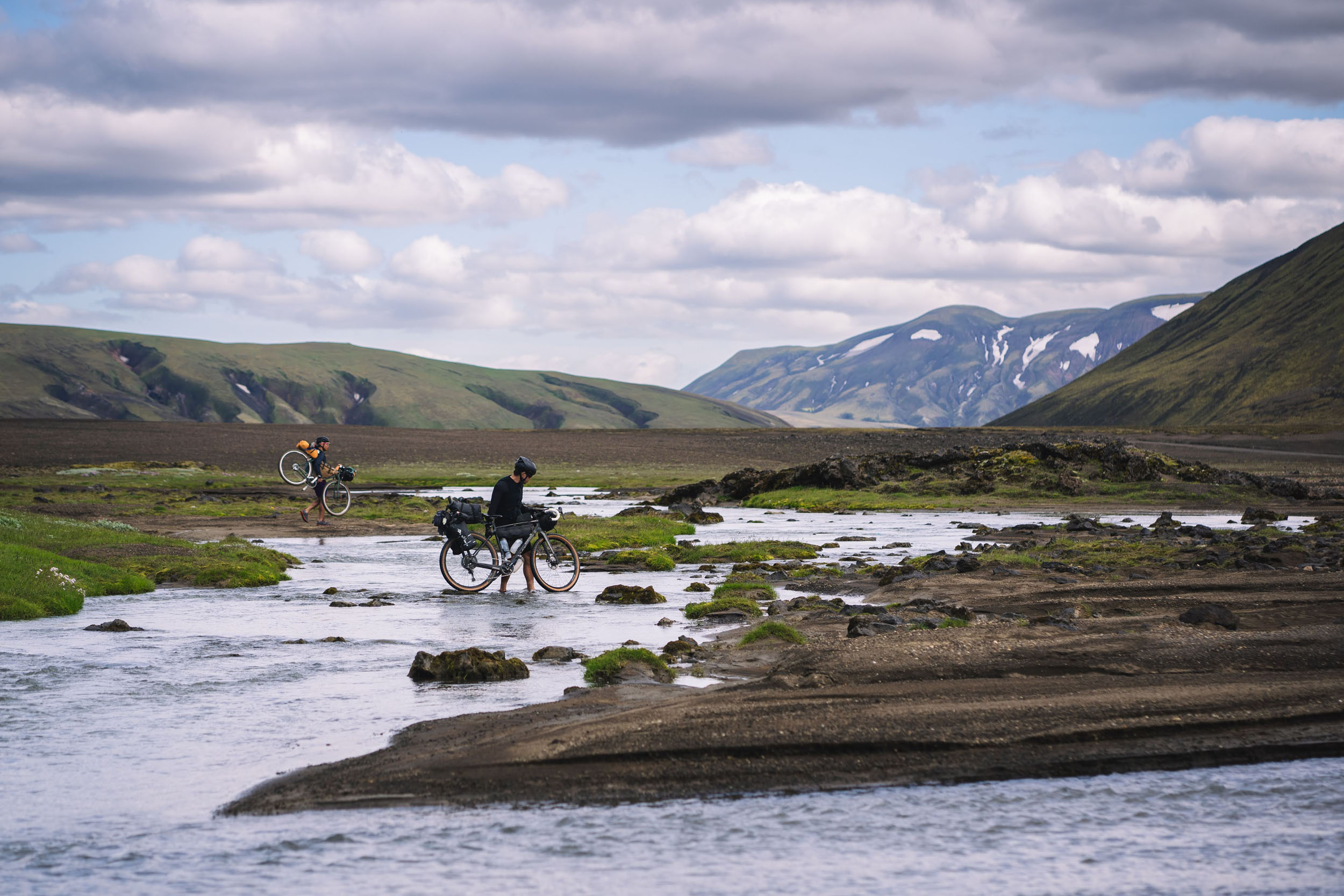
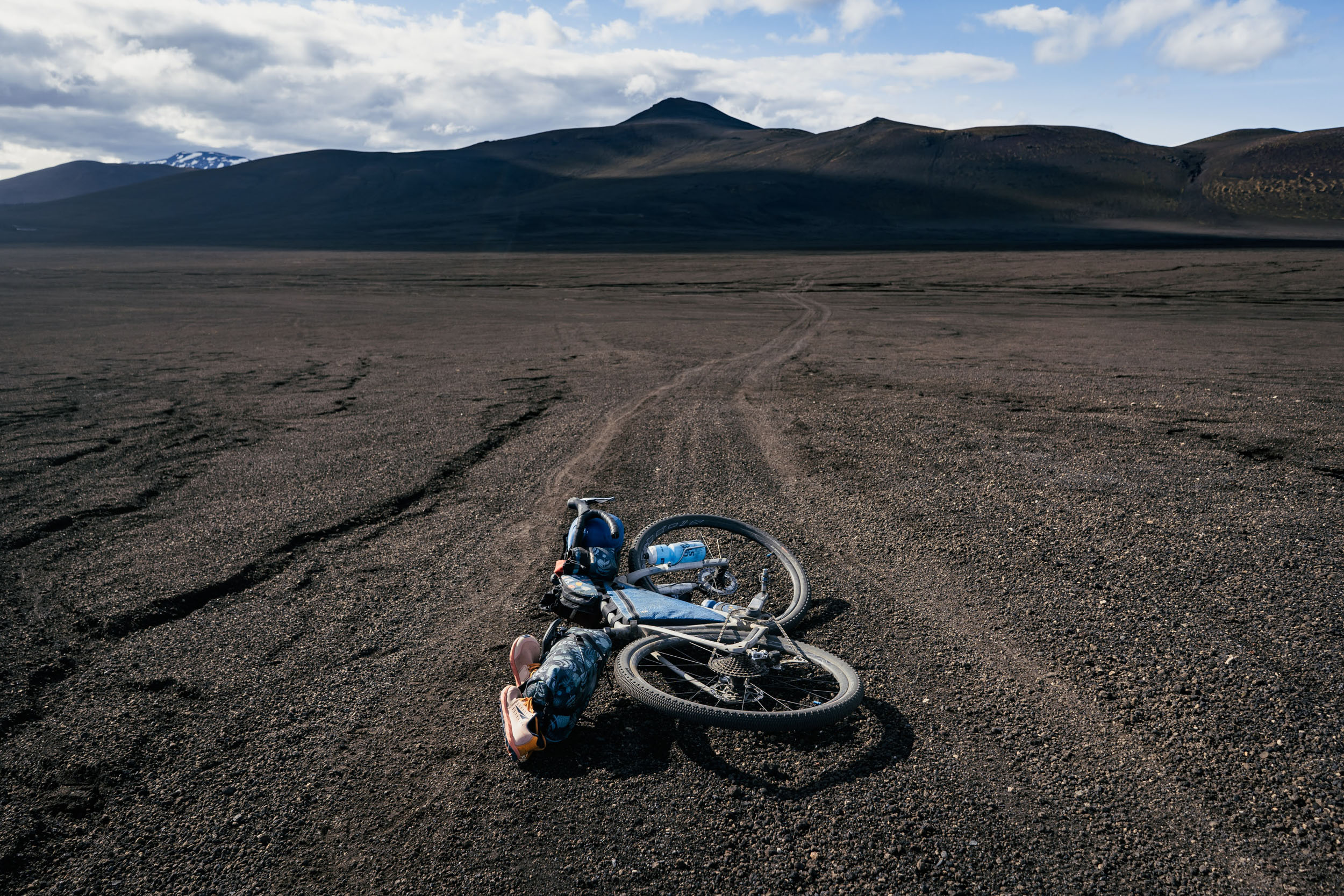
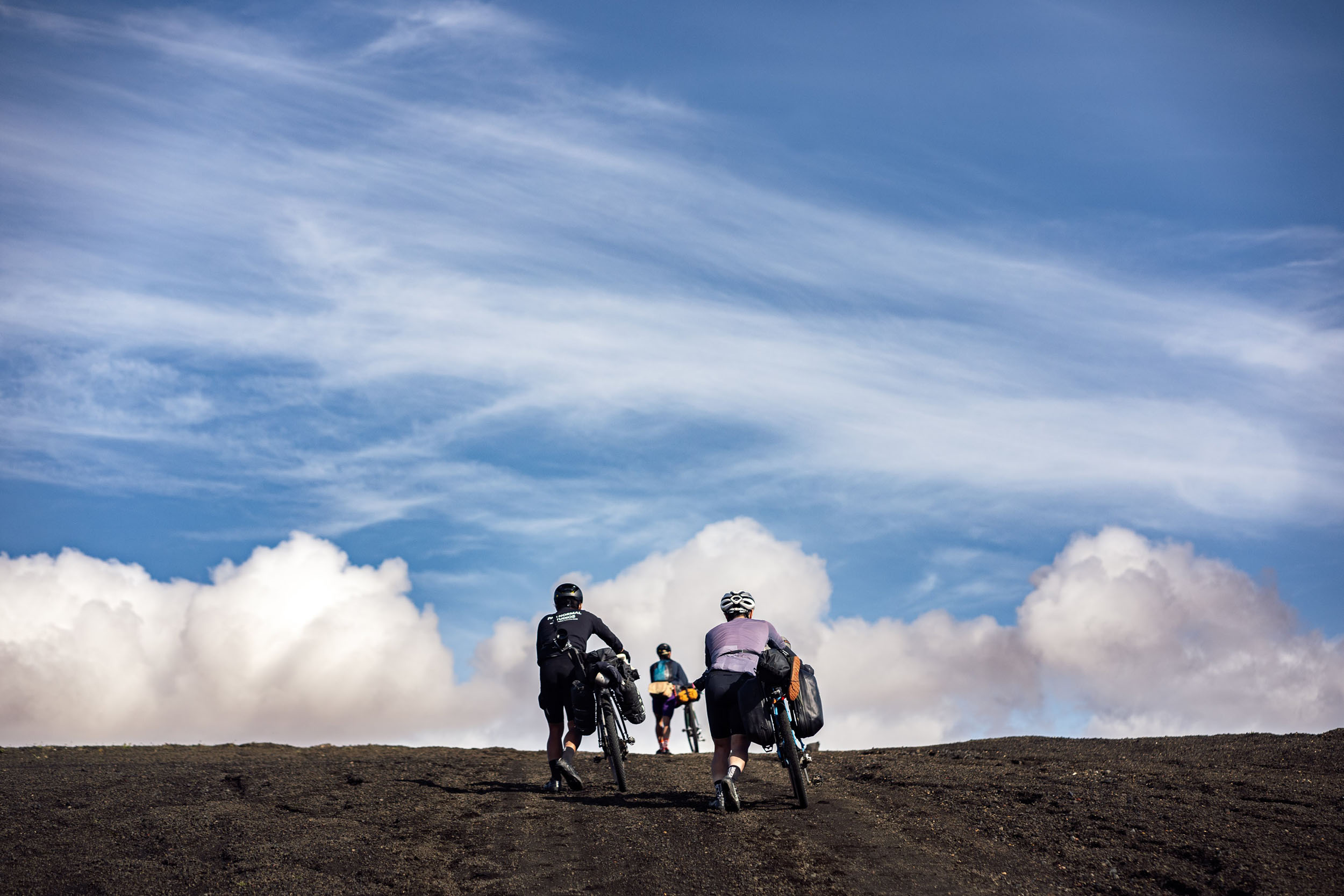
The route is rated a 6/10 overall. The occasional stretch of sand, singletrack, or chunky terrain contributes to the technical difficulty of 5/10 on a gravel bike (with 45mm tires). Suspension or wider tires will make these sections more forgiving. Breaking up the harder segments on this route are stretches of F-roads that are buttery smooth to ride. The 8/10 rating for Physical Demand is a warning not to throw caution to the wind—literally. The wind and precipitation in Iceland can make for challenging conditions if you’re unlucky. Some of the climbing comes in steep pitches. The sections of hike a bike and the water crossings make it an upper body workout too. The rating for Resupply and Logistics is 5/10 as there are many huts along this route, allowing for flexibility in itinerary if you need to cut a day’s ride shorter than planned, or stretch a day longer. The huts offer plentiful water refills in addition to other amenities you can pay for: fuel, snacks, shower, shelter. Being in the Highlands, however, means there are few bail out points, no towns, and no bike shops, so come prepared carrying everything you need for bike repair.
Route Development: This route is the result of three bikepacking trips I took in the Icelandic highlands from 2021-2023. My goal was to create a route that was an awe-inspiring tour of Iceland’s landscapes but was also not too long, not too short, and didn’t impose too much hike-a-bike—a kind of Goldilocks route. I wanted to put together a resource for a route that was shorter than The Iceland Divide and was less difficult than the Landmanalauger to Skogar route. The Fjallabak Track also completely avoids riding on the busy Ring Road.

Submit Route Alert
As the leading creator and publisher of bikepacking routes, BIKEPACKING.com endeavors to maintain, improve, and advocate for our growing network of bikepacking routes all over the world. As such, our editorial team, route creators, and Route Stewards serve as mediators for route improvements and opportunities for connectivity, conservation, and community growth around these routes. To facilitate these efforts, we rely on our Bikepacking Collective and the greater bikepacking community to call attention to critical issues and opportunities that are discovered while riding these routes. If you have a vital issue or opportunity regarding this route that pertains to one of the subjects below, please let us know:
Highlights
Must Know
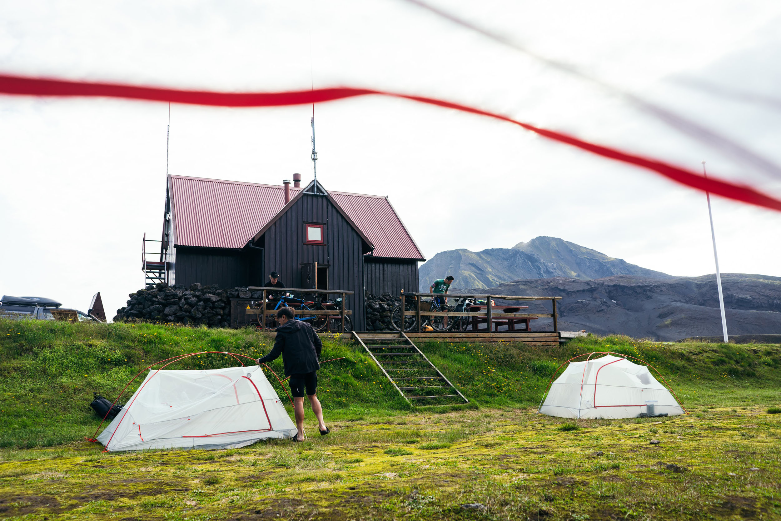
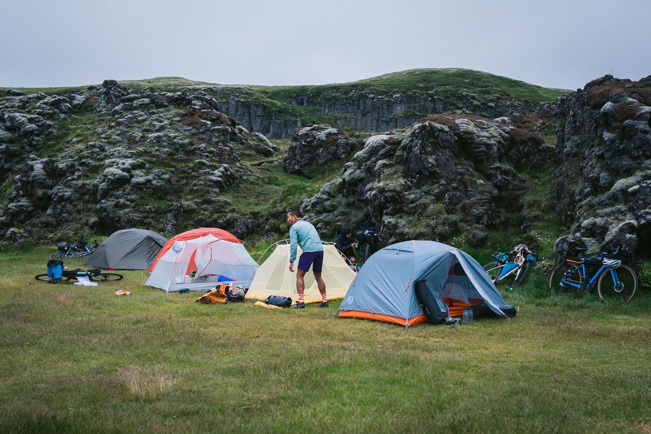
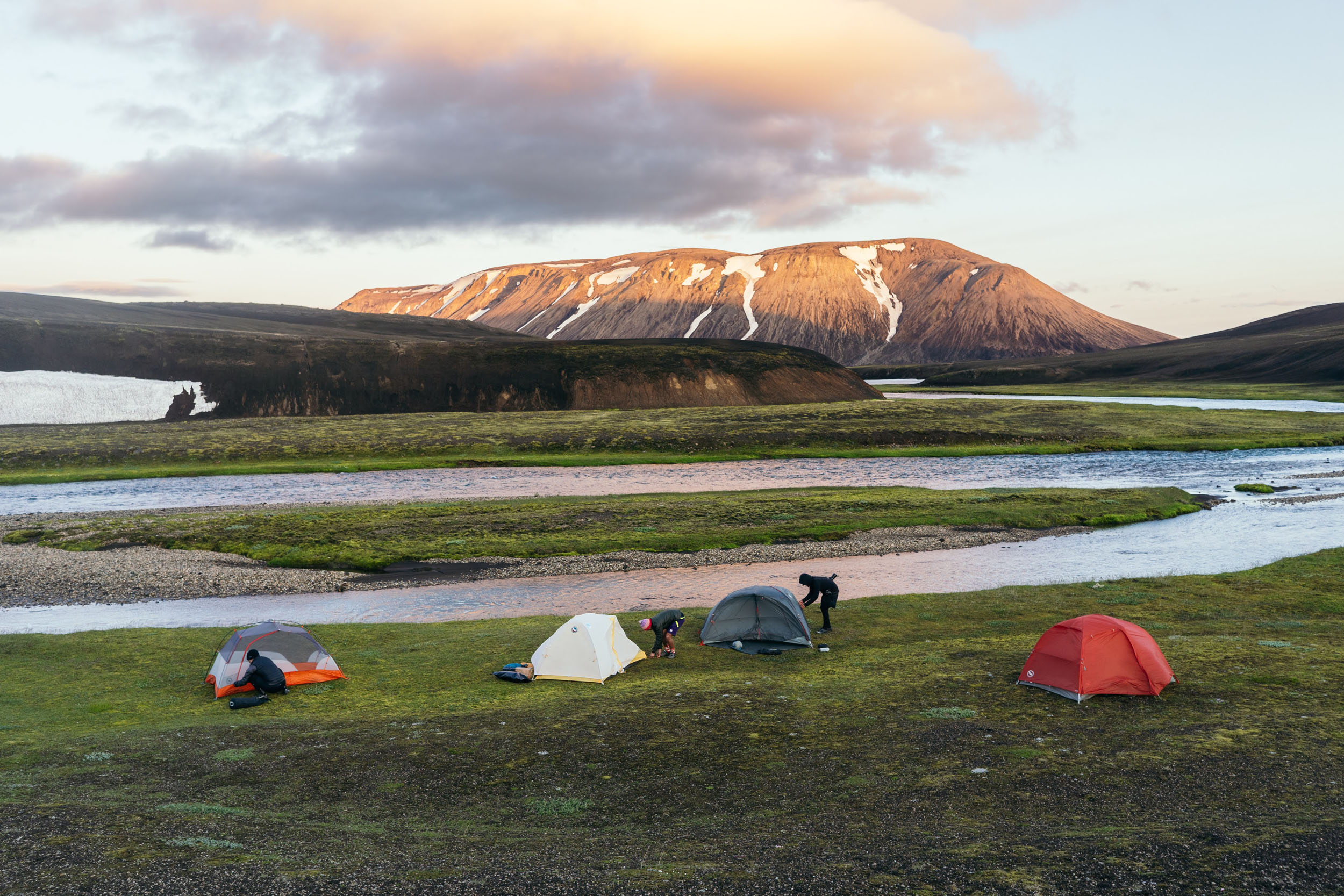
Camping
Food/H2O
Trail Notes
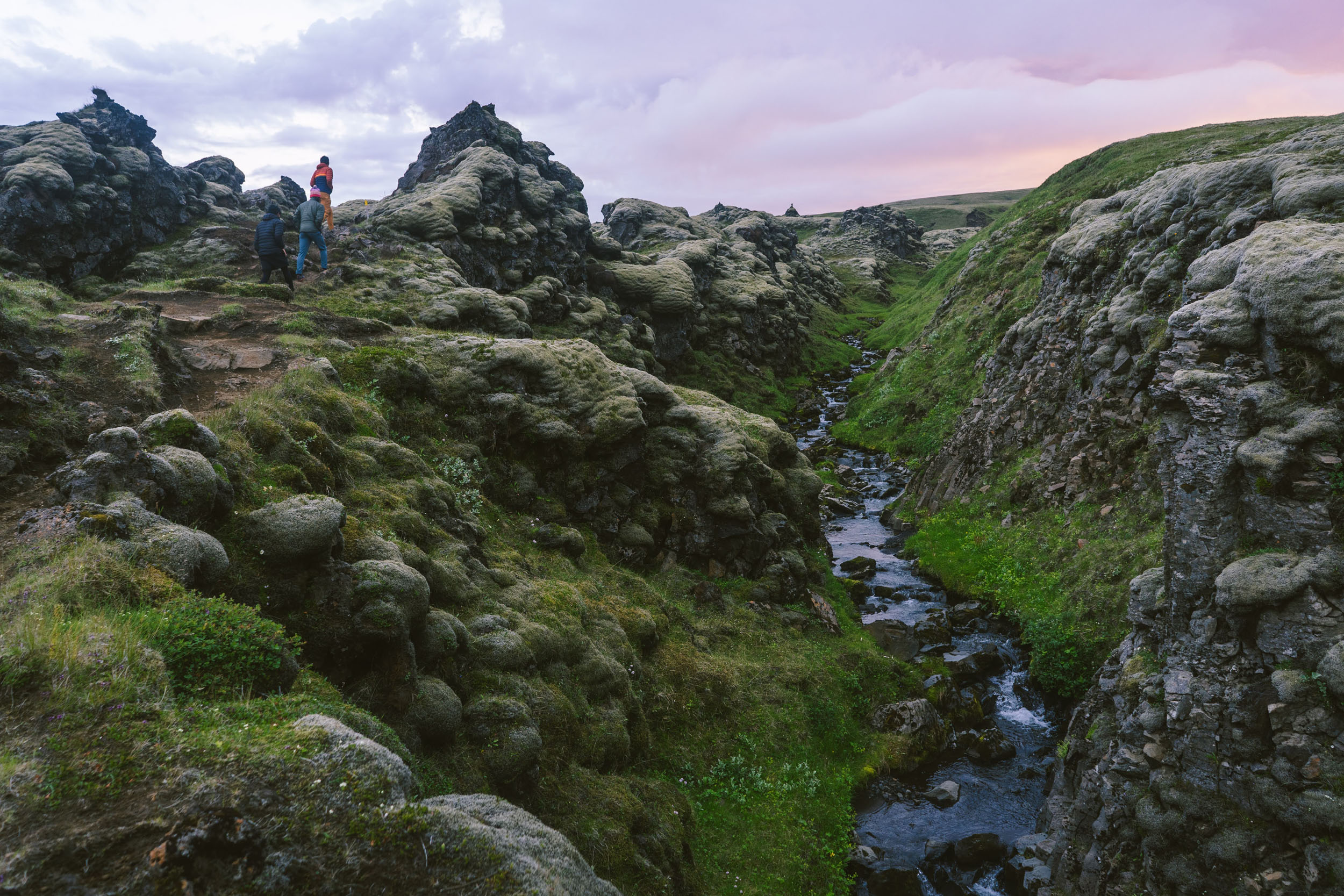
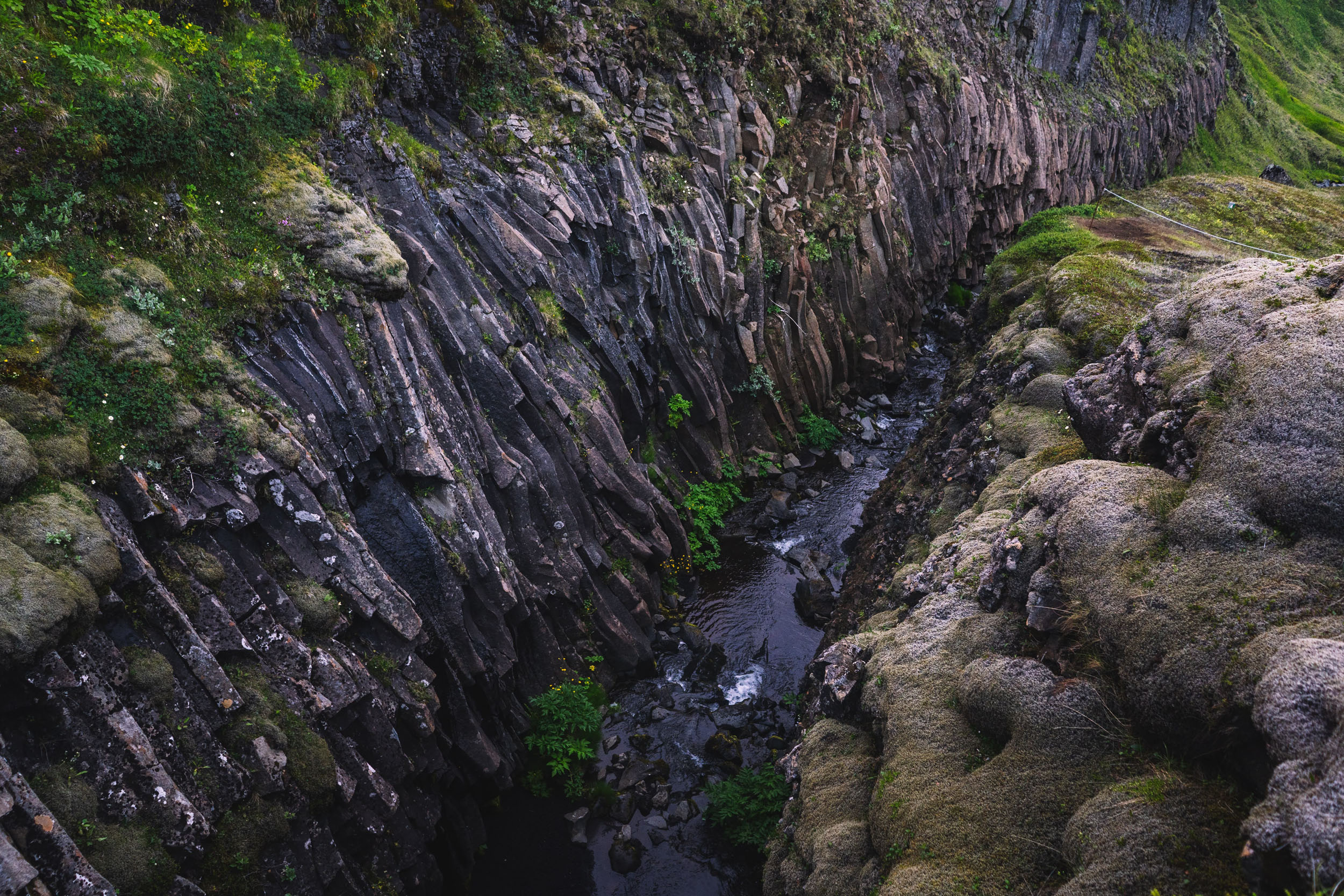
- Markarfljótsgljúfur Canyon with its waterfalls cutting walls down to 650 feet deep
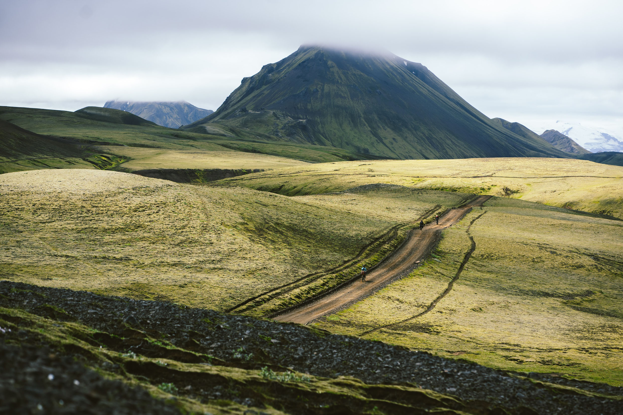
- Striking scenery of the Highlands, including the mountains Mælifell and Hattafell
- Endless sandy glacial plains of Mælifellssandur with views of Mýrdalsjökull, Iceland’s fourth-largest glacier
- Sleep among the lava rocks of the Langviu Lava Field by spending a night at Hvanngil Hut
- Landscapes that are a photographer’s delight on the path toward Lake Álftavatn
- Ride by Strútur mountain and dip your feet into the picturesque and rarely visited Strútslaug hot pot
- The peaceful scenic section of riding between Strútur Hut and Álftavötn Hut, where you’re most likely to have the Highlands all to yourself
- Basalt columns and Silfurfoss waterfall at Hólaskjól Hut
- Explore the famous rhyolite mountains of Landmannalaugar and soak in the hot pot of this geothermal area
- Take a rest day to hike to the summit of Mt. Bláhnúkur and Mt. Brennisteinsalda for excellent views
- Lupine flower superblooms in the summer months
- Ljótipollur Crater with its bright blue lake at the center
- Views of Sléttafell and Krakatindur mountains
- July and August are the best months to ride this route. Shoulder season in June or September is also doable, but keep in mind not all the huts will be open then.
- There is no need to book campsites in advance. Beds might be available for walk-ins, too, but it’s best to reserve those in advance if you want to guarantee shelter inside the hut. See Camping and Lodging for details.
- The minimum recommended tire width is 45mm. This route is suitable for gravel bikes, but is probably most comfortable on a hardtail.
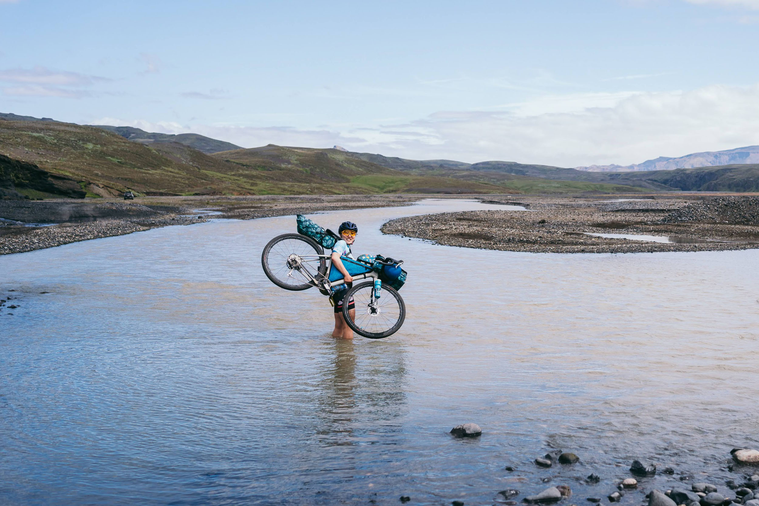
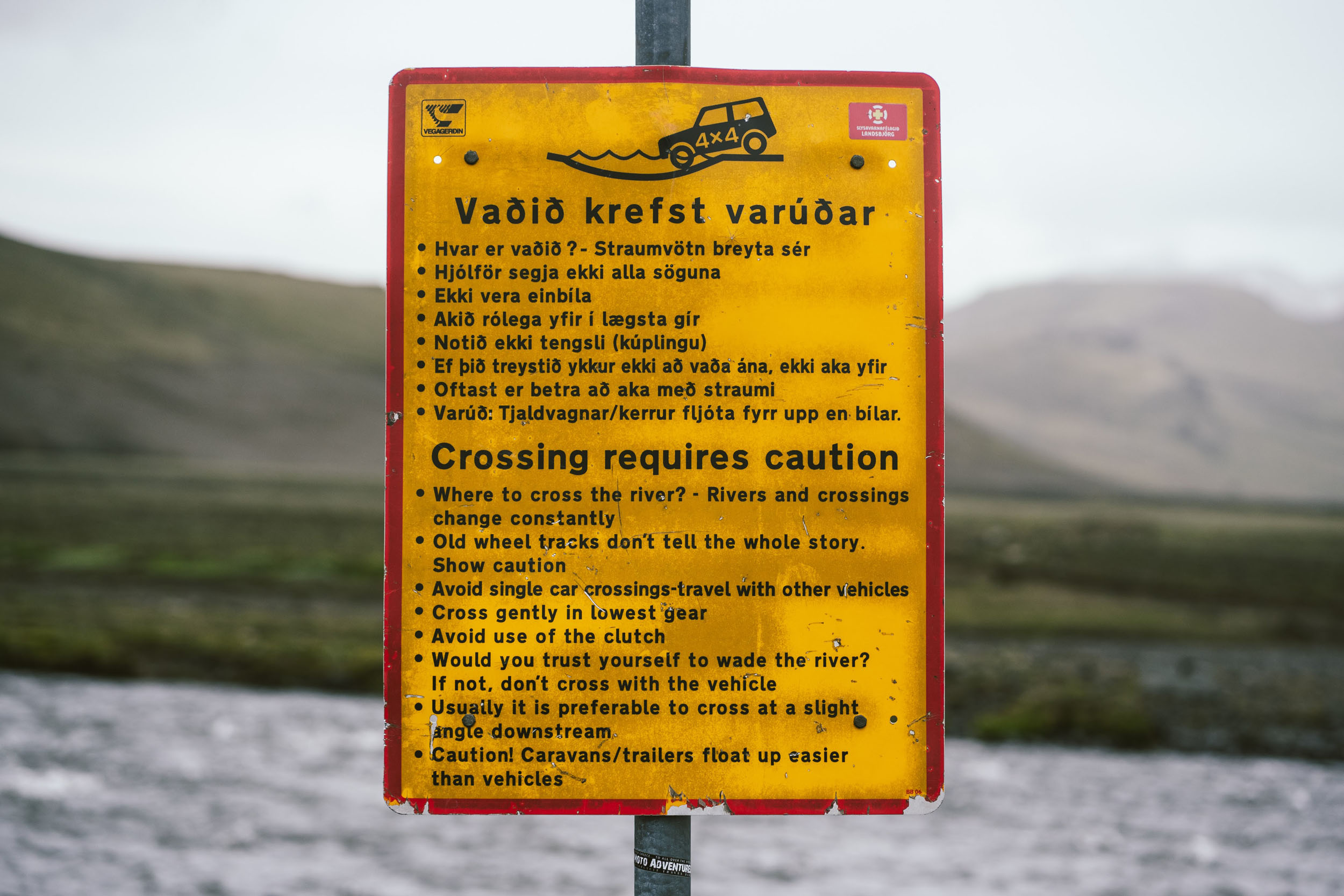
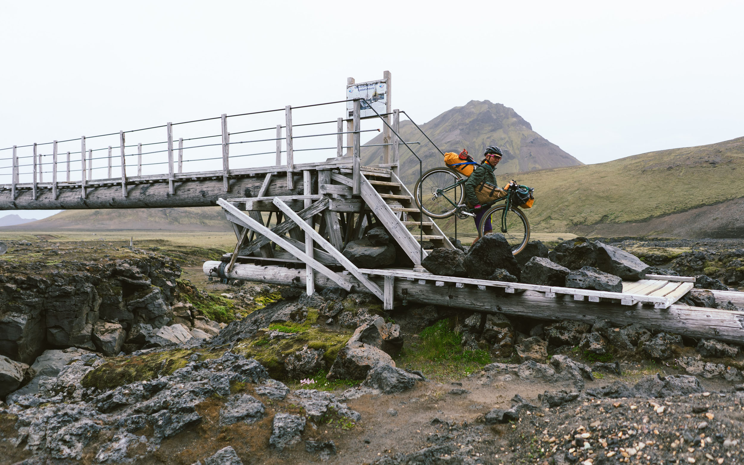
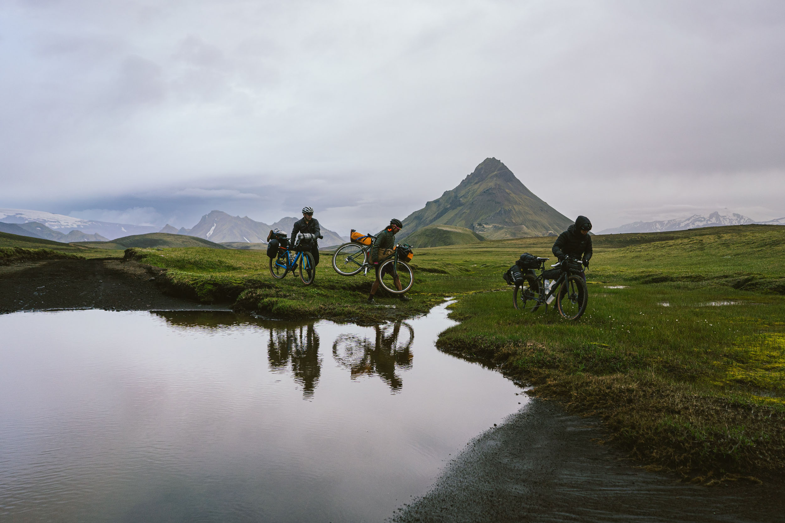
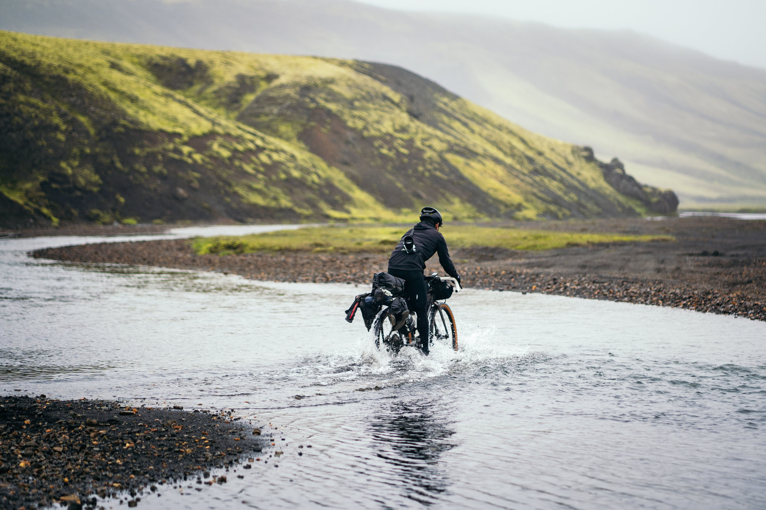
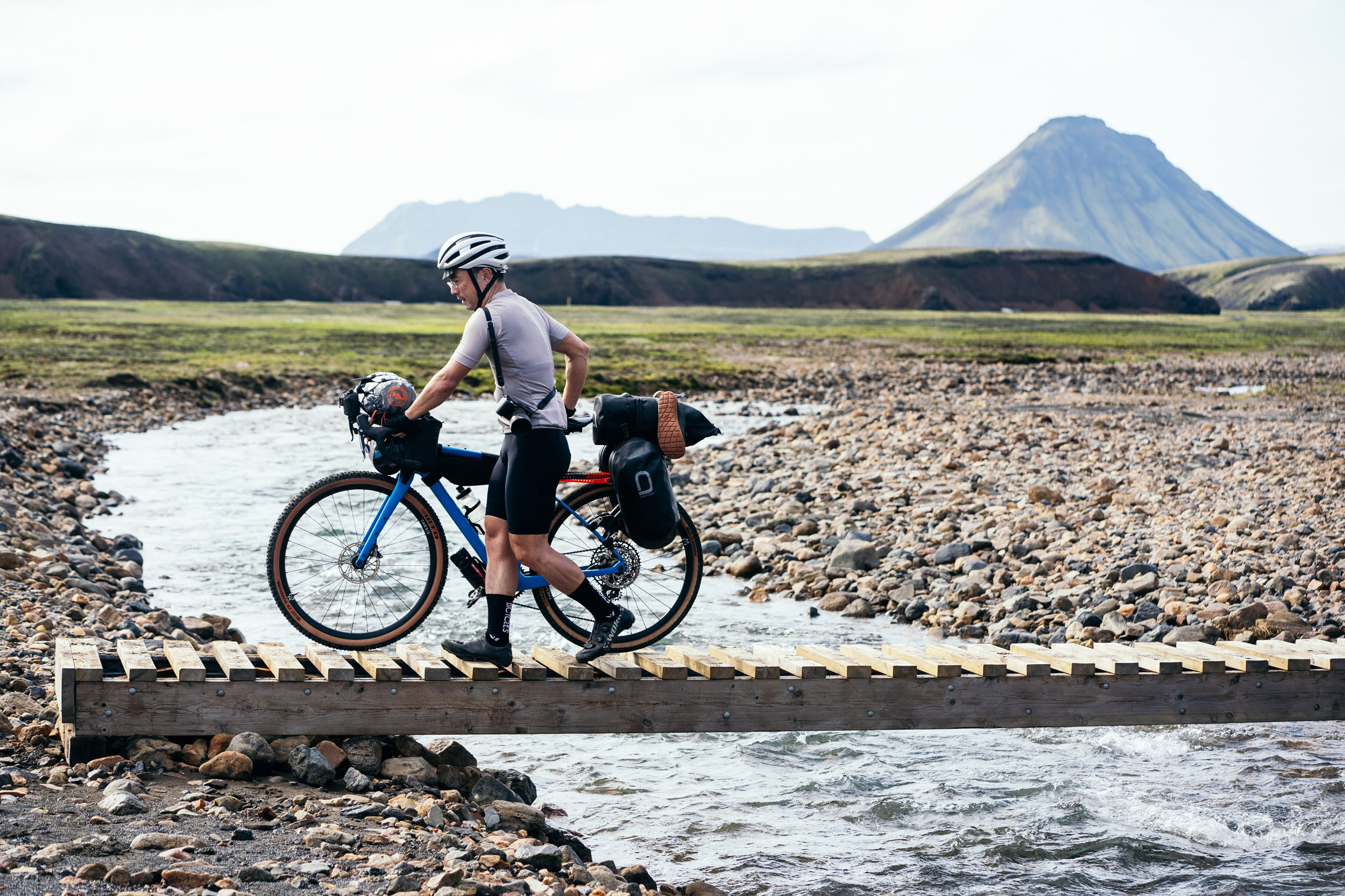
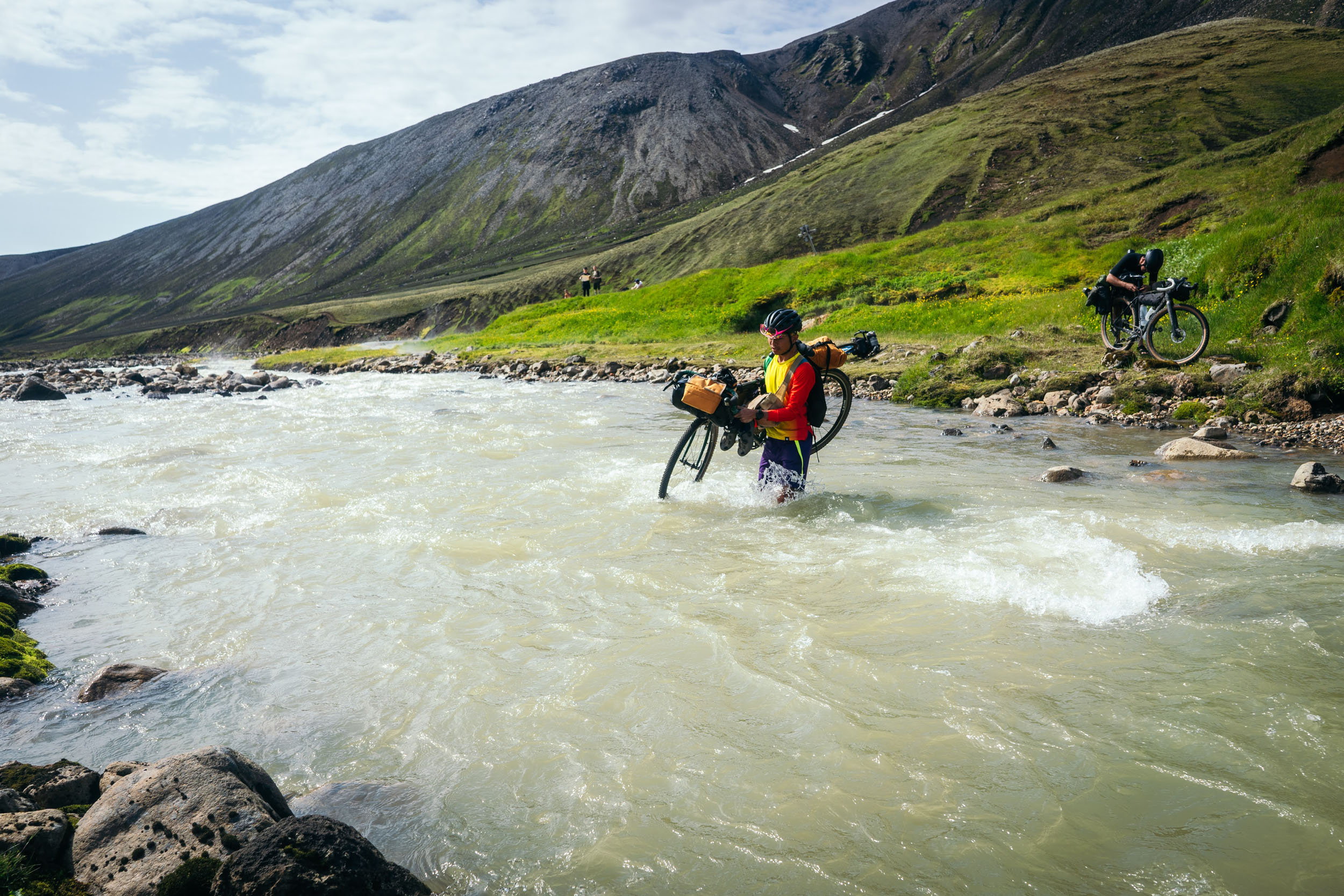
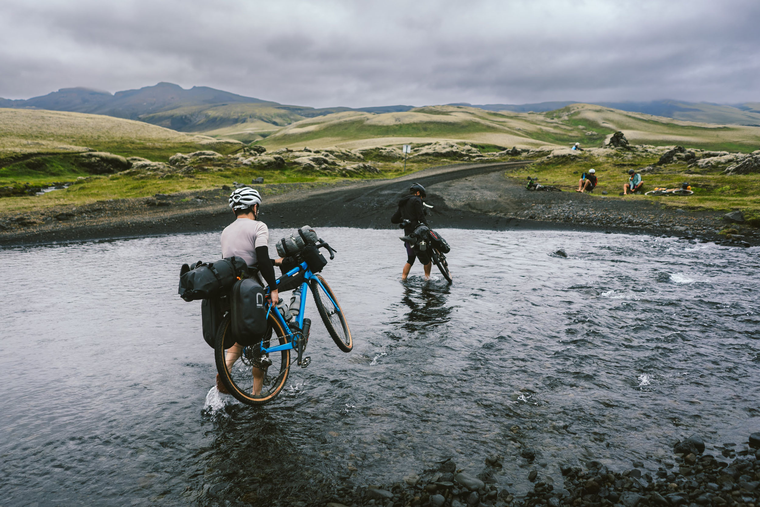
- There are a lot of water crossings—more than 40 if you count the small ones—but many can be ridden through, most are below the knee, and only one water ford is above the knee (but below waist). Note that this of course varies depending on season and precipitation.
- Bringing shoes for the water crossings is a must on this trip. The recommendation is to bring a pair of hiking sandals or lightweight trail runners that double as hiking shoes for rest days, such as hiking at Landmannalaugar.
- The Icelandic Meteorological Office has the most detailed and accurate information about the weather, hands down. The link for the area that includes this route can be found here. There are separate tabs where you can find the hourly breakdown for wind, temperature, and precipitation, predicted seven days in advance.
- Aiming to ride 30-40 miles (50-65 kilometers) a day is a good ballpark for bikepacking in the Highlands. Riders may be tempted to ride longer distances per day, but remember that the terrain is likely much more slow-going than the gravel back home. And most importantly, you’ll want to take time to enjoy the scenery.
- There is no need to rent a car to get to this bikepacking route. The suggested transit is to take an airport shuttle from Keflavik airport to Reykjavík, then take a Strætó bus to Hvolsvöllur.
- If you have a bike bag you need to store during the bikepacking trip, you can store it at a bike bag storage facility in Reykjavík or nearby. A good option is Bike Rent Iceland. To do this, you can take the Airport Direct shuttle (website: airportdirect.is) from Keflavik airport to Hamraborg Bus Stop, which is near the Bike Rent Iceland storage. A different option is to ask if a guesthouse or Airbnb host can store your bike bags in exchange for a tip.
- To get to the start of the route, you can take the Strætó bus (route 52 or 51) from the Mjódd bus station in Reykjavík to Hvolsvöllur for approx 4,000 ISK one way. You can take the same bus line to get back to Reykjavík on the return. The bus will have a bike rack that fits 2-3 bikes. Otherwise, the bus conductor will allow bikes to be placed in the bottom luggage compartment of the bus. Timetables are listed on the Strateo website.
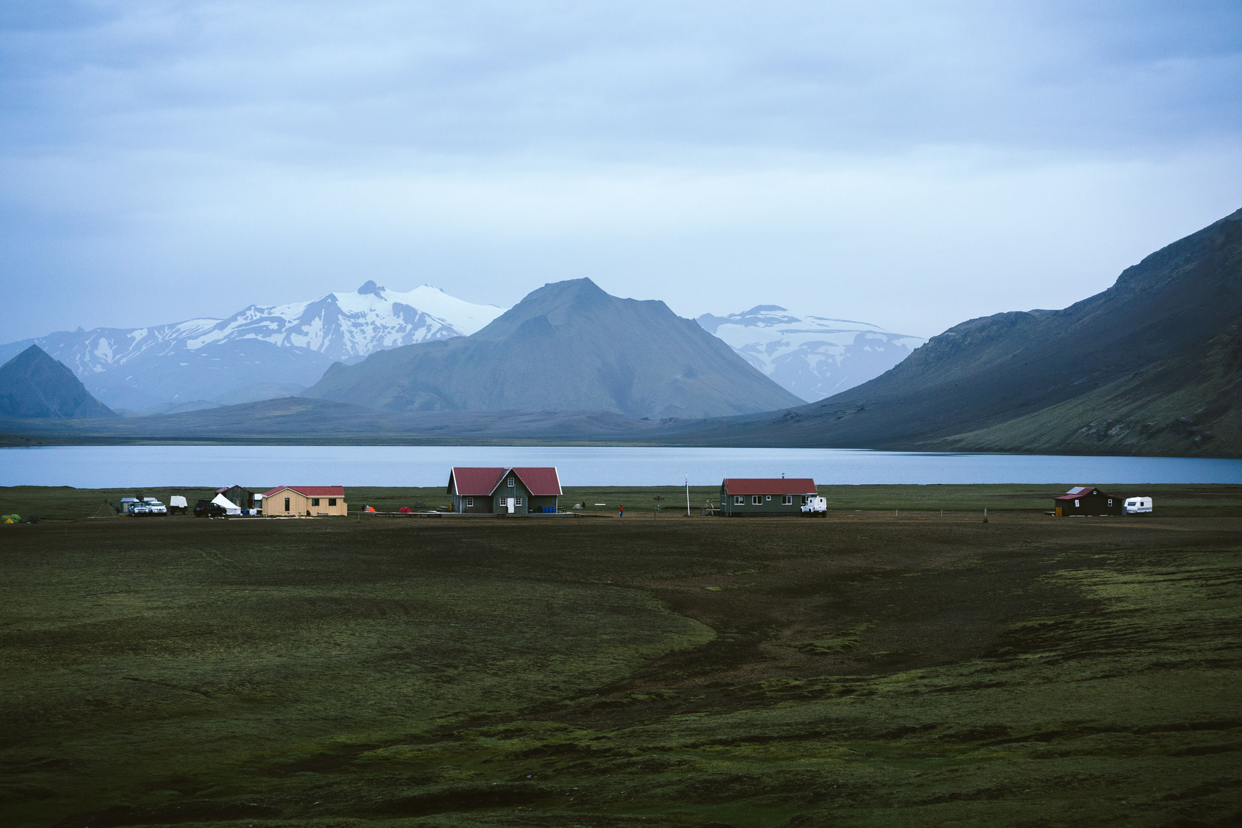
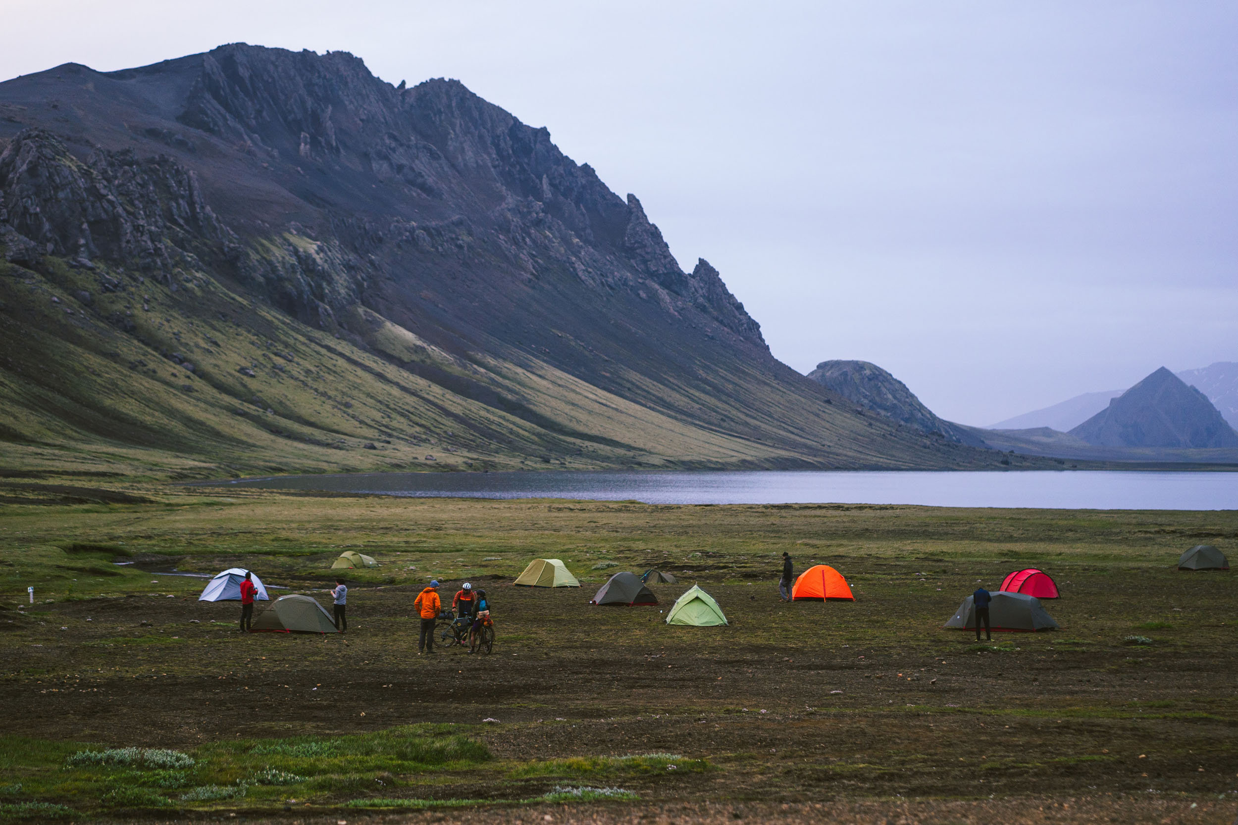
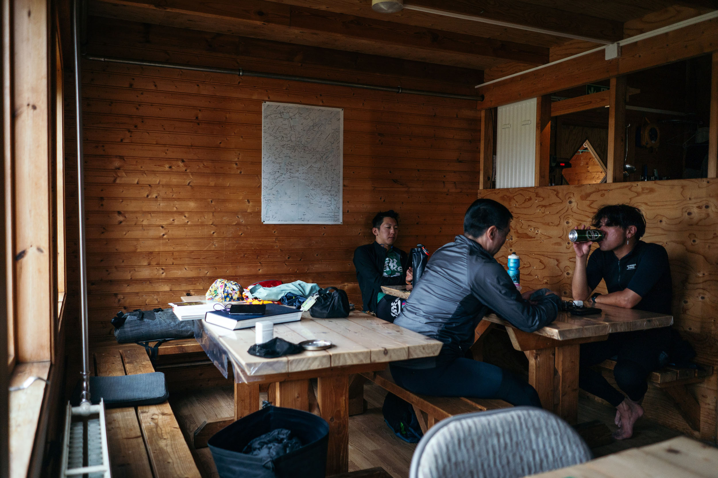
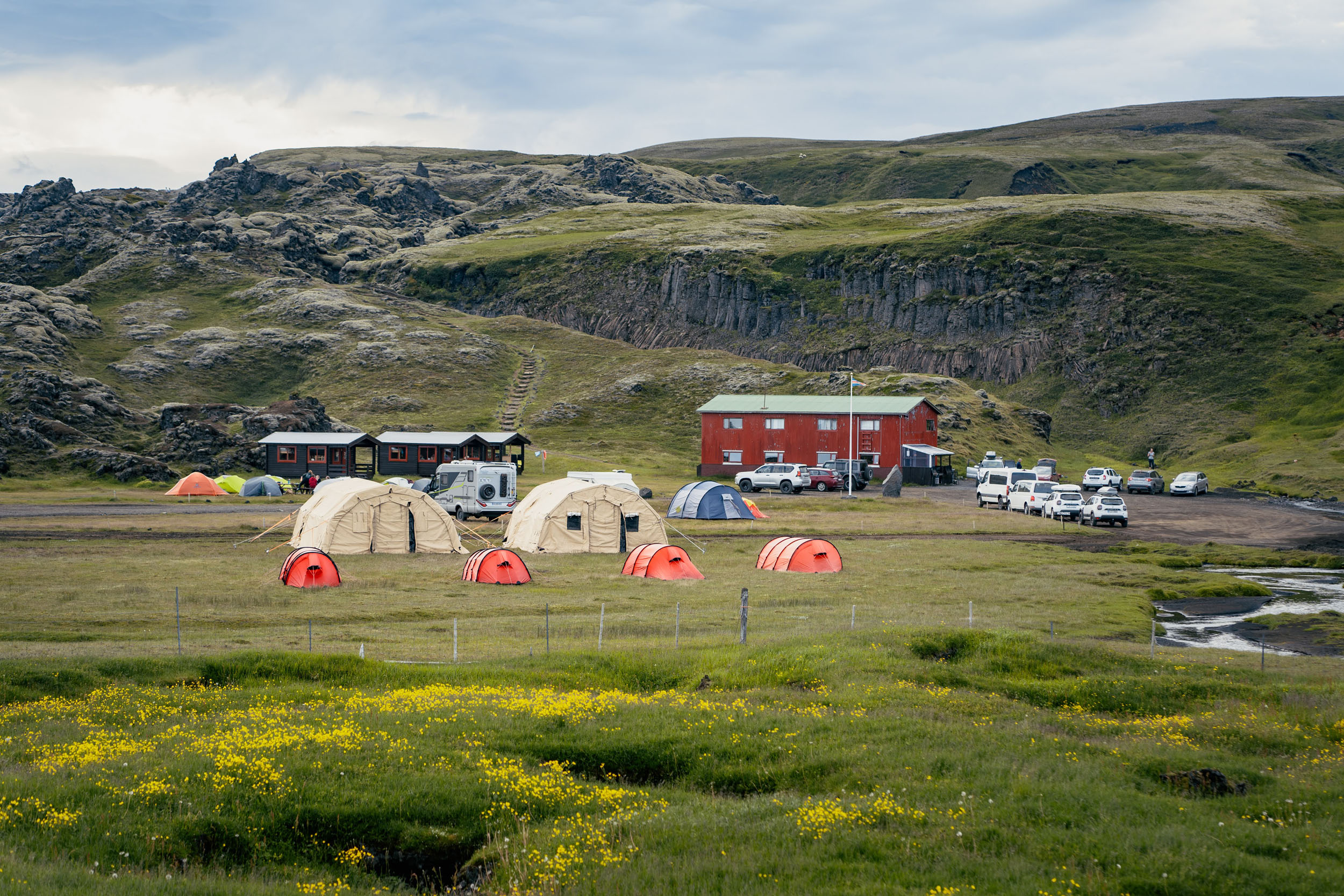
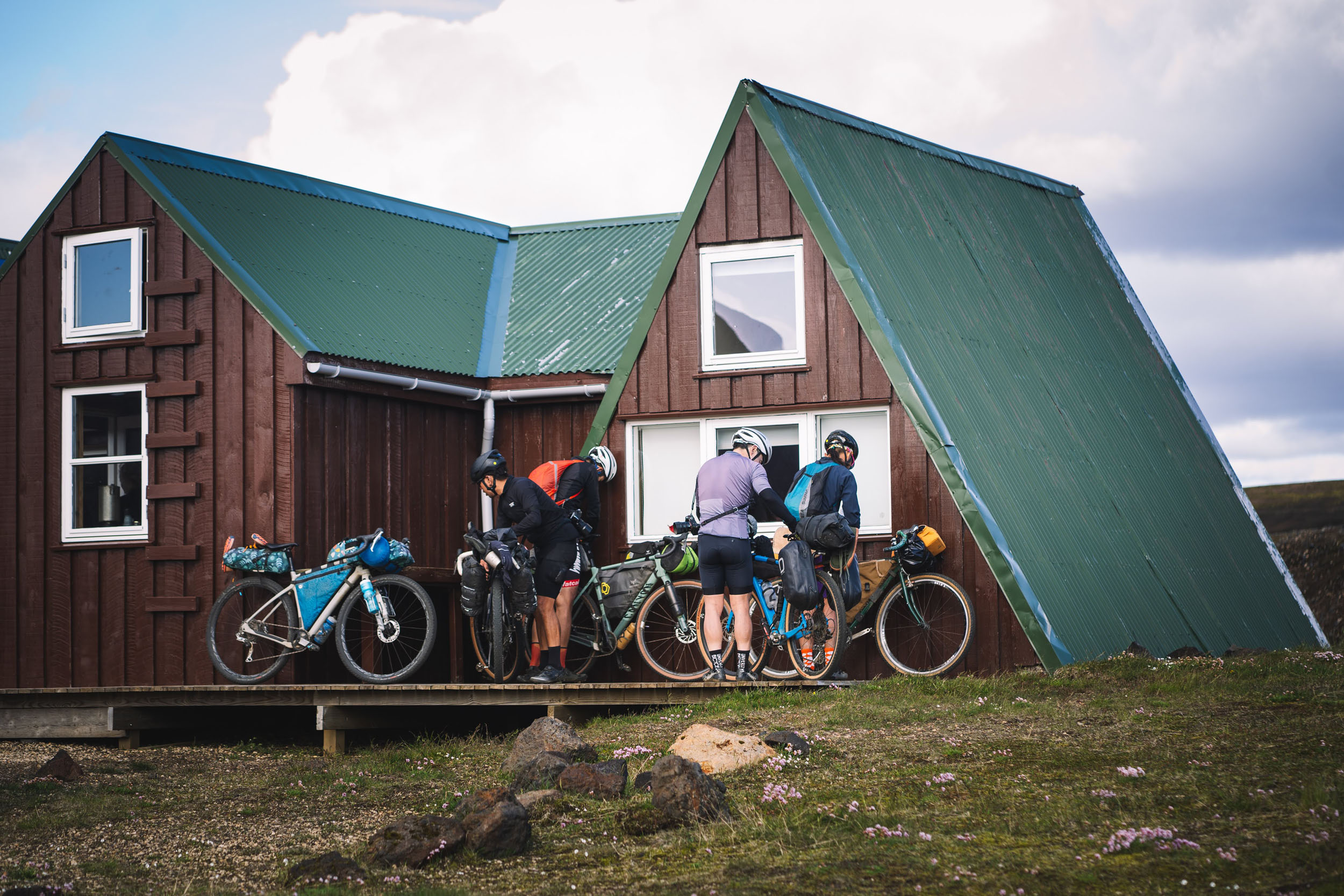
- Iceland’s mountain hut network offers both campsites and beds during the summer season. A list of mountain huts can be found here.
- Their website states that “the opening season of the huts depends on when the Icelandic Road Authority opens the road and that in turn depends on snow conditions and general conditions of the road itself. On average one can assume that the huts are open from June 25 until September 17.” Some of the smaller huts close on August 31. It may also be possible to access a hut on the off season; you need to inquire to reserve in advance.
- There is no need to book campsites in advance. Beds might be available for walk-ins, but it’s best to reserve those in advance if you want to guarantee a bed at one of the smaller huts such as Dalakofinn, Álftavötn, or Strútur Hut.
- The approximate price is 2,500 ISK per person to camp or 10,200 ISK for a bed in the hut.
- Each hut has a credit card reader, so you don’t need much cash on hand.
- Most huts have kitchens and the option to shower—included in the price for hut stays, or for a fee for those camping.
- For those taking a day zero, there are guesthouses in Hvolsvöllur. Midgard Base Camp and Guesthouse Húsið are two solid options. Book this in advance.
- There is a water tap at each hut. Some huts even keep a pot of boiled water for guests to use.
- There is no need to bring extra fuel canisters for cooking. Most huts carry isopro fuel canisters for sale.
- The majority of huts sell snacks, think: candy, chips, and soda. The larger huts also carry dehydrated meal options.
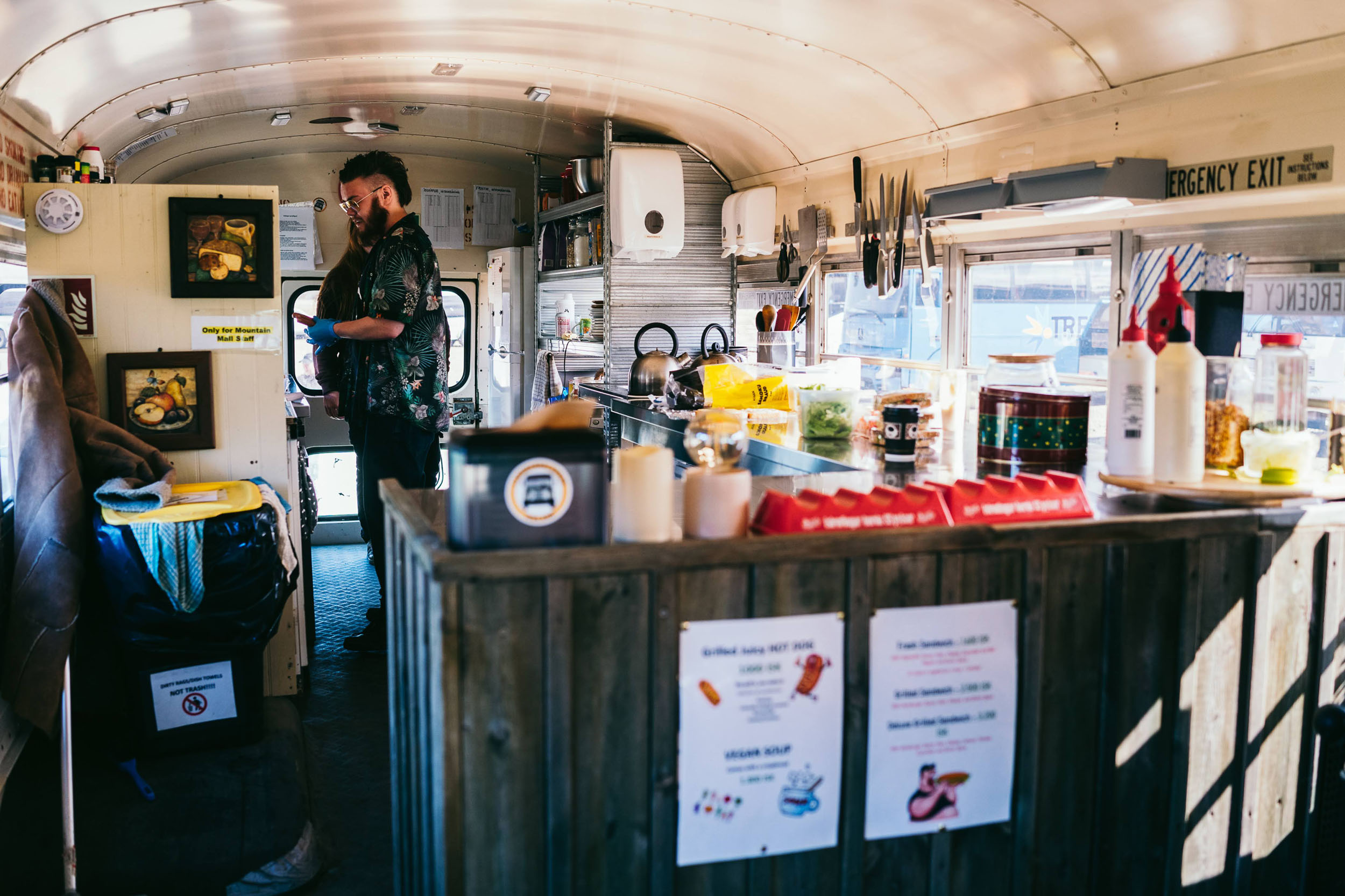
- Some huts sell hot food, but the price is steep. A sample of the Álftavatn Hut menu has a bowl of chili or lentil curry for 4,500 ISK. The “Mountain Mall” at Landmannalaugar’s sells pylsur (the classic Icelandic hot dog) and other warm food options, too.
- For stocking up on food before the trip, Hvolsvöllur has a Krónan, one of the grocery store chains in Iceland. Most gas stations in Iceland sell fuel canisters for camping stoves.
Three important things to note:
- Some sections of day one may feel a bit burly for gravel bikes. Persevere, and the terrain gets less bumpy after day two.
- Miles 61 to 75 (between Strútur Hut to Álftavötn Hut) are slow-going due to singletrack, several steep pitches that require hike-a-bike and water crossings. It is also one of the more peaceful and beautiful sections of the route that you’ll likely get all to yourself, which is why it’s included in the route. If hike-a-bike isn’t your style, you can detour by continuing East on the F-210 instead of North at mile 57 (indicated on the map). Then, connect to the F-233 and head North until Álftavötn Hut, where the detour rejoins the main route.
- Highly recommend taking a half-day or full rest day at Landmannalaugar to enjoy the special area.
This route can be adapted to different itineraries and riding paces. Below are two examples to use as a template.
Sample itinerary
- Day 1: Hvolsvöllur to Álftavatn Hut (44.5 mi). This is a fairly long day so start early and if needed, stop at an earlier hut like Hvanngil Hut.
- Day 2: Álftavatn Hut to Hólaskjól Hut (37.5 mi). Don’t underestimate the day based off the mileage alone. It will be slow. The sections of hike a bike between miles 61 and 75 and the plentiful water crossings make for a lot of stop-and-go on this day. If you’re running short on time you can stop earlier at Álftavötn hut (not to be confused with Álftavatn hut).
- Day 3: Hólaskjól Hut to Landmannalaugar Hut (24 mi)
- Day 3 bonus: Half rest day at Landmannalaugar to hike and relax in the hot pot
- Day 4: Landmannalaugar Hut to Dalakofinn Hut (36 mi). There is a section hike a bike to get to Ljótipollur crater. To skip the hike-a-bike, stay left on the F-208 at mile 109.
- Day 5: Dalakofinn Hut to Hvolsvöllur (40 mi). This day is relatively quick because the route trends downhill. You can even make it back into town in time to catch the bus back to Reykjavík.
Alternative itinerary
This shortens the hardest days and avoids a majority of the hike a bike:
- Day 1: Hvolsvöllur to Hvanngil Hut (41 mi). The first 10 miles are easy and relatively flat.
- Day 2 bonus: Scenic out and back from Hvanngil Hut to Lake Álftavatn on unloaded bikes (6.5 mi)
- Day 2: Hvanngil Hut to Strútur Hut (13 mi)
- Day 3 bonus: Scenic out and back from Strútur Hut to Strútslaug hot pot on unloaded bikes (7.5 mi)
- Day 3: Strútur Hut to Hólaskjól Hut via the F-210 and F-233 detour (24.5 mi)
- Day 4: Hólaskjól Hut to Landmannalaugar (24 mi)
- Day 4 bonus: Half rest day at Landmannalaugar
- Day 5: Landmannalaugar Hut to Dalakofinn Hut (36 mi)
- Day 6: Dalakofinn Hut to Hvolsvöllur (40 mi)


Terms of Use: As with each bikepacking route guide published on BIKEPACKING.com, should you choose to cycle this route, do so at your own risk. Prior to setting out check current local weather, conditions, and land/road closures. While riding, obey all public and private land use restrictions and rules, carry proper safety and navigational equipment, and of course, follow the #leavenotrace guidelines. The information found herein is simply a planning resource to be used as a point of inspiration in conjunction with your own due-diligence. In spite of the fact that this route, associated GPS track (GPX and maps), and all route guidelines were prepared under diligent research by the specified contributor and/or contributors, the accuracy of such and judgement of the author is not guaranteed. BIKEPACKING.com LLC, its partners, associates, and contributors are in no way liable for personal injury, damage to personal property, or any other such situation that might happen to individual riders cycling or following this route.
Please keep the conversation civil, constructive, and inclusive, or your comment will be removed.