


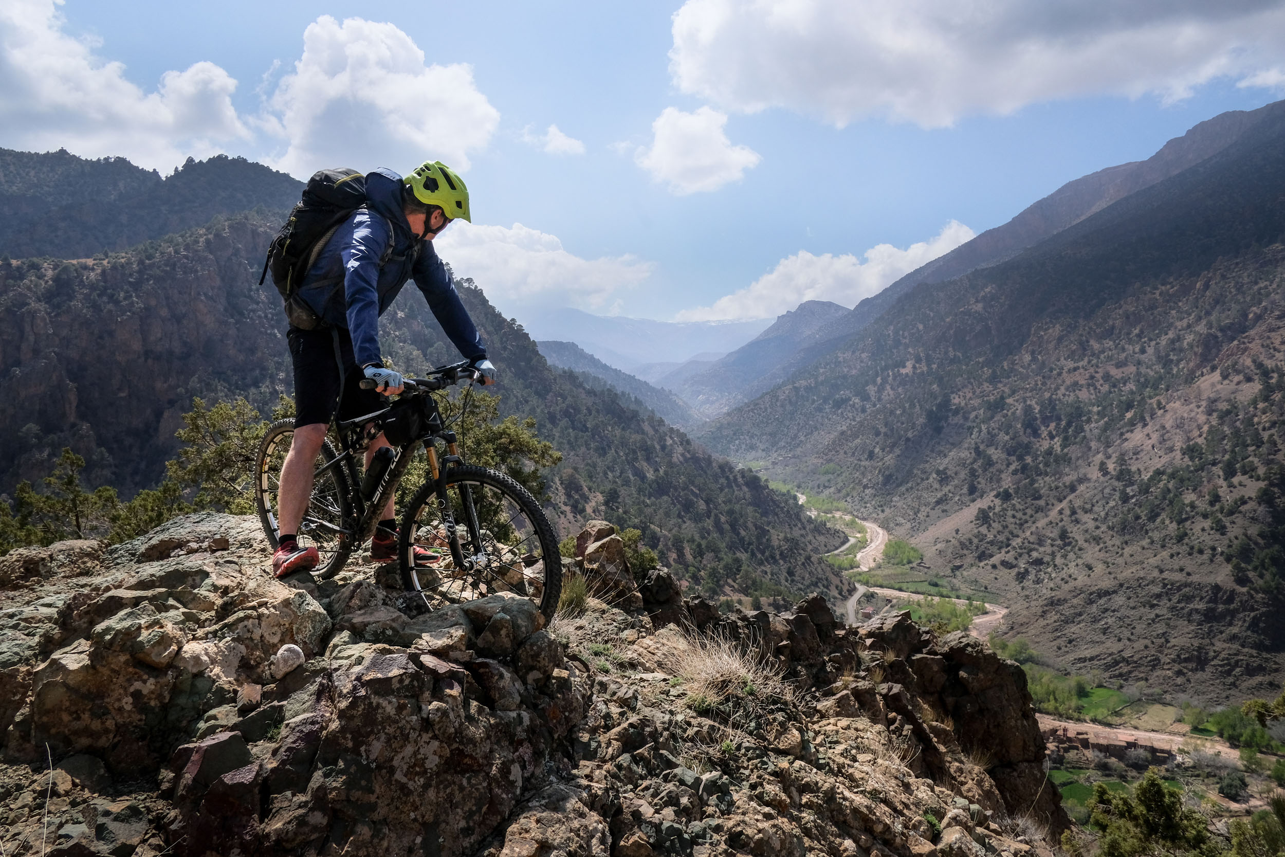
Kings of the Atlas
Distance
192 Mi.
(309 KM)Days
7
% Unpaved
60%
% Singletrack
20%
% Rideable (time)
90%
Total Ascent
26,519'
(8,083 M)High Point
9,646'
(2,940 M)Difficulty (1-10)
7?
- 9Climbing Scale Very Strenuous138 FT/MI (26 M/KM)
- 8Technical Difficulty Difficult
- 7Physical Demand Difficult
- 6Resupply & Logistics Moderate
Contributed By

Jakob Fircks and Anselm Duchrow
Guest Contributor
Jakob has long explored mountains around the world on bike, foot, and skis. Extended journeys on the MTB led him through the Alps, the Andes, the Sinai, and, for the last eight years, the Atlas Mountains of Morocco. Anselm is an adventure enthusiast and would probably have become an explorer if he’d lived in the times of Ernest Shackleton. He grew up trekking and skiing around Mont Blanc, and later his career brought him to the most remote places, from Mozambique to the Brazilian rainforest. Learn more about Jakob and Anselm and their broader community projects and routes at Atlas Mountain Trails.
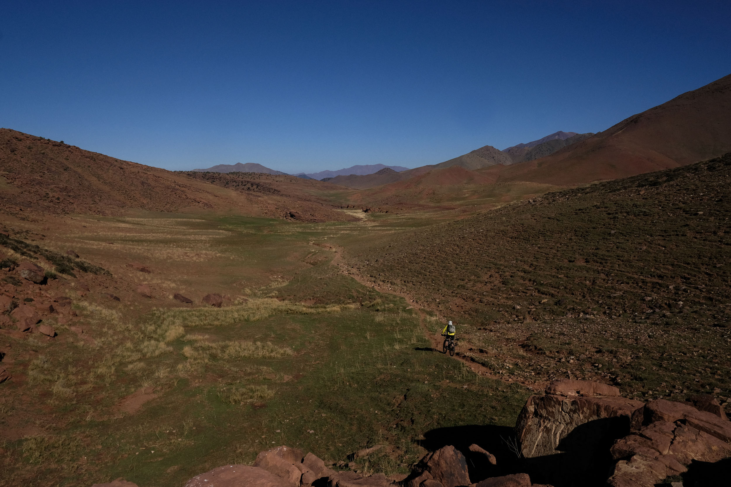
Starting in the shadow of Mt. Mgoun, the tour quickly dives into the geographical and spiritual heart of the Atlas Mountains, riding through the famous valley of Aït Bouguemez. The High Tessaout Valley, which was simply marked as “zone without information” on the maps of the French colonial power until 1920, remains a well-hidden secret and a veritable treasure of Amazigh culture. The ancient high culture of the Amazigh is readily apparent and present in the valleys and plains of this tour.
The trail also connects the two most important water sources of the Atlas: the Tessaout and the Tensift rivers, which carry water all year long and are sources for centuries-old irrigation systems, terraces, and fortified collective granaries. Further west, the valley of Anmiter provided the background for the famous French painter, Majorelle, in the first half of the 20th century, and established Morocco’s image through his portrait of local architecture and customs. The Kasbah of the Glaoui or the salt mines in the city of Talouet tell a hundred stories of the more recent history of economic development and resistance during the late colonial period. The grand finale of the tour takes us over the high-altitude plains of the Yagour Plateau, where ancient stone inscriptions provide testimony to a high culture more than 2,000 years ago.
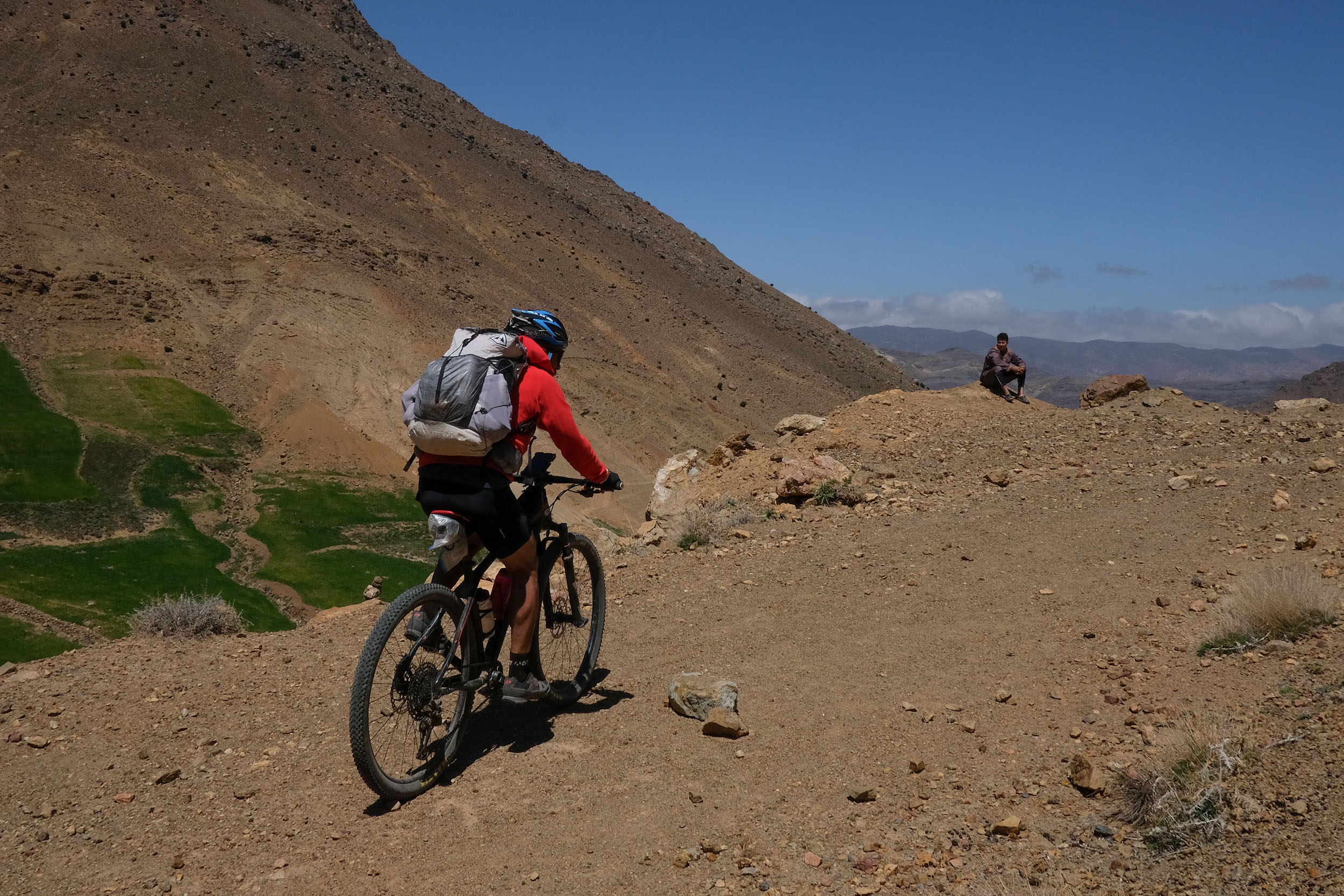
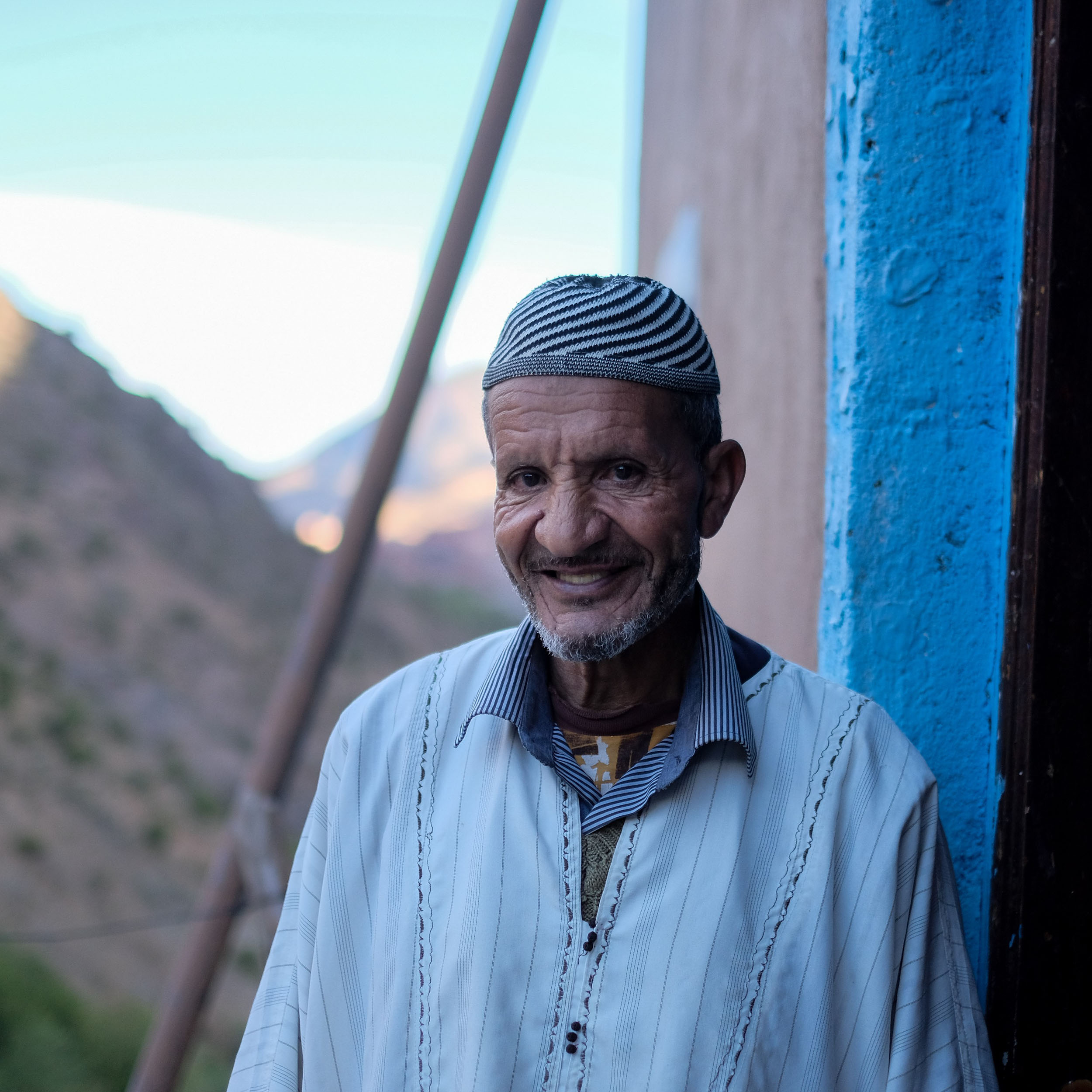
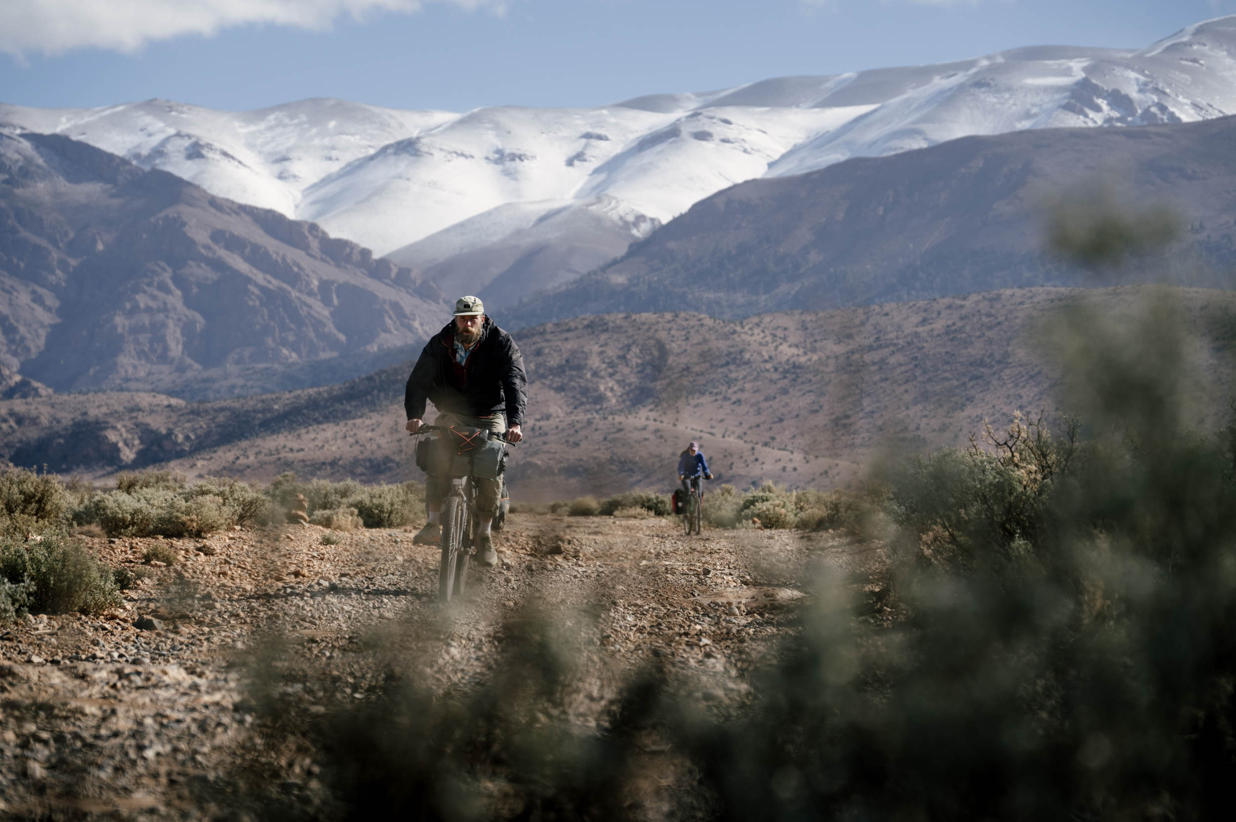
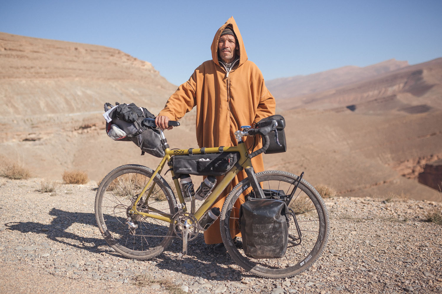
The further the trail delves into the High Atlas, the less you can rely on tourist infrastructure. We passed entire days without encountering other mountain travelers and spent two nights of the tour “chez l’habitant” with a local family we luckily found upon arrival. The reward was a warm welcome and a few mattresses put together in the living room, or, in one case, in the very basic annex of the animal shelter, which did the job. The simple living conditions are quickly forgotten thanks to the incredible hospitality and excellent food.
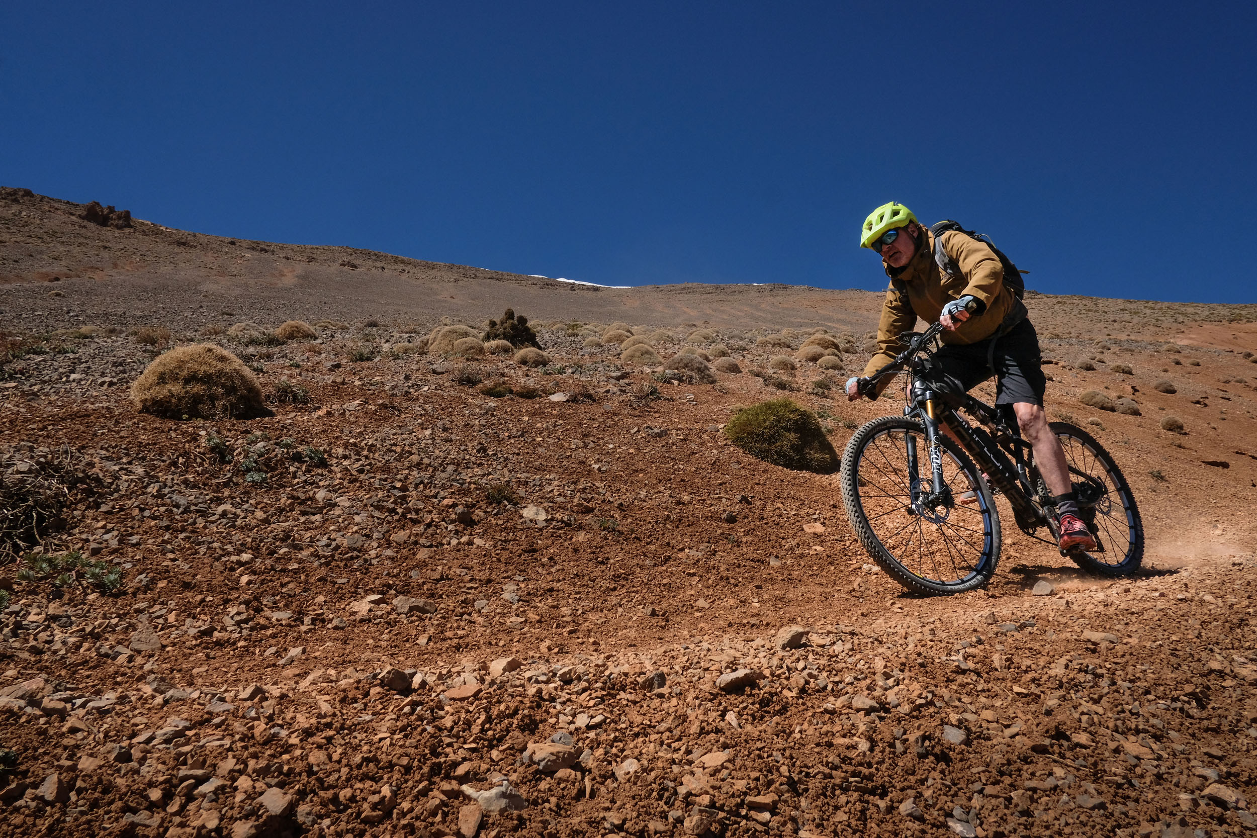
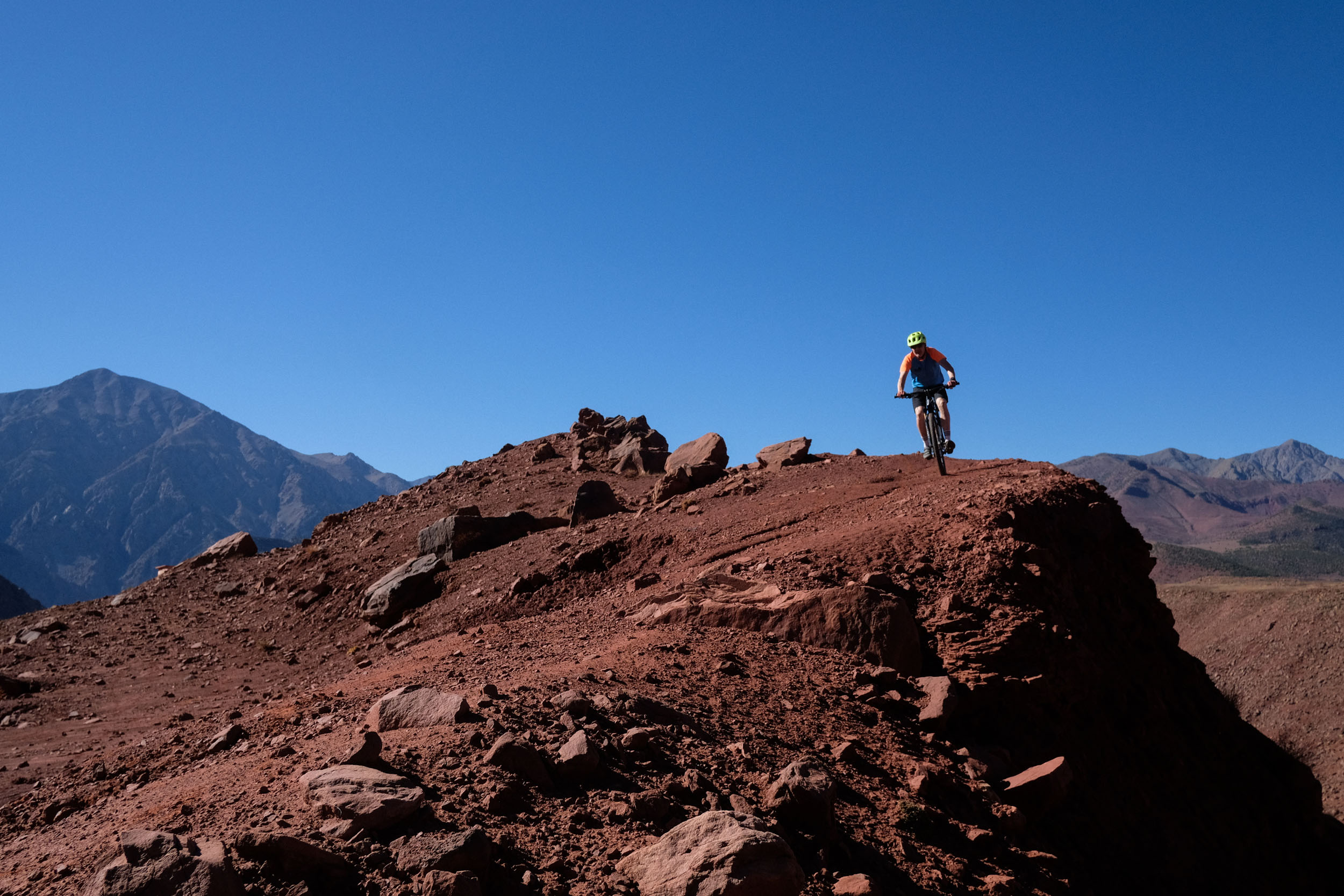
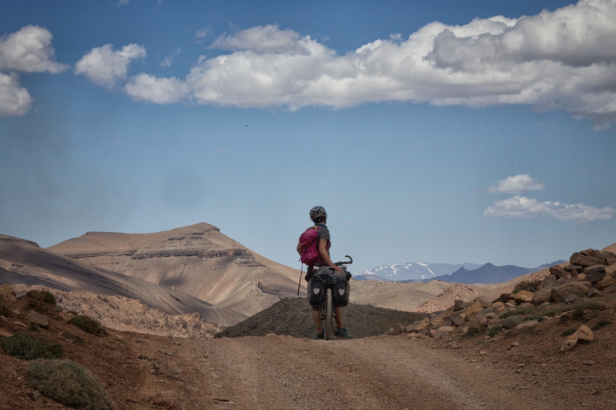
Overall, the Kings of the Atlas tour deserves its name and, compared to the other segments of the Atlas Mountain Trail, is distinguished by its spectacular high mountain landscapes and the quality of the many singletrack trail segments.
Route Development
The “Kings of the Atlas” route was designed and conceived as part of the Atlas Mountain Trails initiative in 2024. This vision was created by two Morocco-based MTB enthusiasts, Anselm Duchrow and Jakob Fircks, that have been riding the Moroccan mountain chains for the last decade. Antoine Ansart and Sebastian Fletcher also contributed to the Kings of the Atlas section.
Atlas Mountain Trails saw the light in 2024, aiming to establish the first long-distance MTB trail of the Atlas Mountains. The trail currently includes over 1,500 kilometers and is organized into six trail segments. The project follows a community-based approach that aims to connect riders with a network of local tourism professionals and innovators from the different regions of the Atlas Mountains. The Atlas Mountain Trails Community will help you to get updated information on trails, organize accommodation, and discover the unique Amazigh culture of Morocco. A special thanks goes to Ahmed Ashou and Mohamed Hanini, who advised us on broader route development.
Route Difficulty
The King of the Atlas tour is aimed at well-trained and experienced mountain bikers. Regarding the physical demand, although some days are less demanding than others, the route is trail-oriented, and you will have to cope with steep uphill segments, sometimes at altitude. On two days, we had extended hike-a-bike segments. To climb the Tizi n’Rouguelt Pass at 3,000 meters, we chartered mules to help us carry our bikes for the 11-kilometer hike up to the highest point of the tour. But even hiking alongside the mules was demanding. On the shorter ascent to Tizi’n’Telouet, we decided to carry our bikes for about five kilometers while climbing 500 meters. These challenges, combined with wind, altitude, and the energy needed for technical tracks, drain a considerable amount of energy. Overall, we ranked the physical demand at 7 (if completed in a week).
From a technical point of view, there are also quite a few difficult segments. Particularly long, steep, and exposed downhill tracks are frequent on days 3, 4, 6, and 7. You will have to cope with all kinds of terrain, particularly with rocky trails with boulders and debris of all shapes and sizes. In general, the Atlas is characterized by steep and rocky hillsides, gorges, and deep valleys.
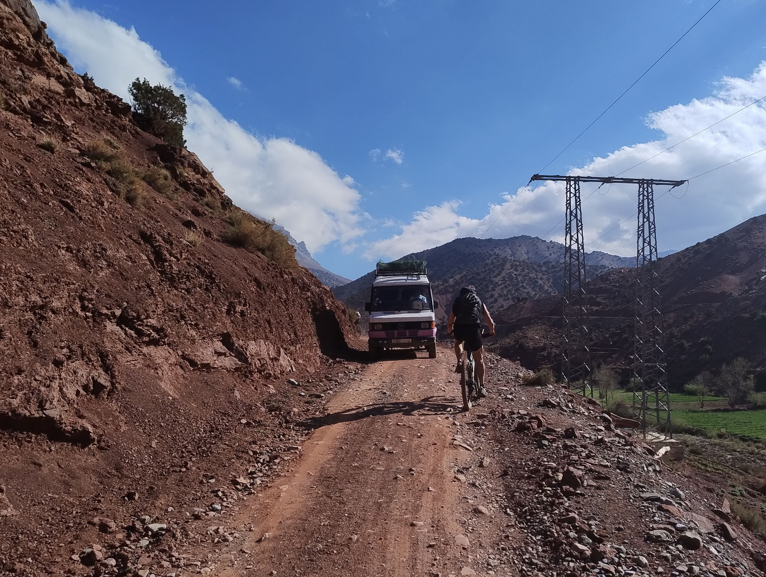
Most people will also find the logistics quite challenging. The good news is that you can count on plenty of villages along the trail in which you can find either a simple mountain guesthouse or a family that will give you shelter (see accommodation notes). However, the supplies are basic. Do not expect much choice or convenience food in the village “hanouts” (simple grocery stores). Often, you’ll have to get along with a can of tuna, a piece of cheese, and dates. Moreover, to arrange your shelter, you will have to find a way to communicate with the locals who often hardly speak any French or English.


Submit Route Alert
As the leading creator and publisher of bikepacking routes, BIKEPACKING.com endeavors to maintain, improve, and advocate for our growing network of bikepacking routes all over the world. As such, our editorial team, route creators, and Route Stewards serve as mediators for route improvements and opportunities for connectivity, conservation, and community growth around these routes. To facilitate these efforts, we rely on our Bikepacking Collective and the greater bikepacking community to call attention to critical issues and opportunities that are discovered while riding these routes. If you have a vital issue or opportunity regarding this route that pertains to one of the subjects below, please let us know:
Highlights
Whereabouts
Must Know
Camping
Food/H2O
Trail Notes
- Crossing the windy Tizi n’Aït Imi with the stunning views of Mgoun.
- Rolling down the Ait Boughemez valley conjures images of the fictional Shire land of the Hobbits, with generous spring vegetation and the abundant water everywhere. Take your time when you ride through this scenery and plan for a picnic somewhere around the Sidi Moussa hill.
- Summiting Rouguelt pass (3,000 meters) after several hours of hiking in breathtaking canyon landscapes and the singletrack downhill ride to Tasgawait into the High Tessaout.
- Rolling through the contrasted landscapes and forgotten villages between Taliouine and Anmiter feels like a time travel to the Amazigh empires.
- Feel the underground freshness in the salt cave mines of Telouet.
- Hang out in the village of Talouet, enjoy the cafés and terrasse restaurants, and visit the Glaoui Kasbah ruins .
- The different views you will catch up on the Tizi’n’Telouet pass (2,600 meters) into the rugged valley of Tensift River are one of the scenic highlights of the tour.
- Ride word-class singletrack on the downhill trail to the village of Assads.
- Crossing the magic plateau of Yagourt, enjoying the high plains with grazing horses and mules and the countless Azib built from stone.
- Crossing the long and exposed singletrack trail above the villages of Anguerd and Tizi-n-Oucheg and then rumbling down the steep rocky track to your last destination on this tour.
location Toubkal & Mgoun
The Two Kings or the Sacred Peaks of the Atlas
For the Amazigh communities of the High Atlas, Mount Toubkal (4,167 meters) and Mount Mgoun (4,071 meters) are far more than trekking destinations. They are sacred giants, woven into the region’s traditions and spiritual beliefs. Mt. Toubkal, the highest peak in North Africa, is often seen as a mountain of spirits, home to powerful jinn and ancestral energies. Climbers are urged to act with humility and respect, especially near the summit, where offerings have historically been made to honor the spirits. Mt. Mgoun, quieter but no less revered, is known among villagers in the Aït Bouguemez valley as the “People’s Mountain.” Legends speak of a sleeping giant who protects the land. The mountain is associated with fertility, weather, and protection, and it’s a symbol of balance between humans and nature. Even today, many Amazigh maintain a deep spiritual relationship with these peaks, rooted in centuries of storytelling, seasonal rituals, and an enduring respect for the unseen forces of the land.
locationAït Bouguemez
The “Happy Valley” of the Atlas
Tucked into the folds of the Central High Atlas Mountains, the Aït Bouguemez Valley is often called “La Vallée Heureuse,” the Happy Valley, for good reason. With its lush fields, terraced farms, and red-earth villages backed by towering peaks, it offers one of the most serene and culturally rich experiences in Morocco.
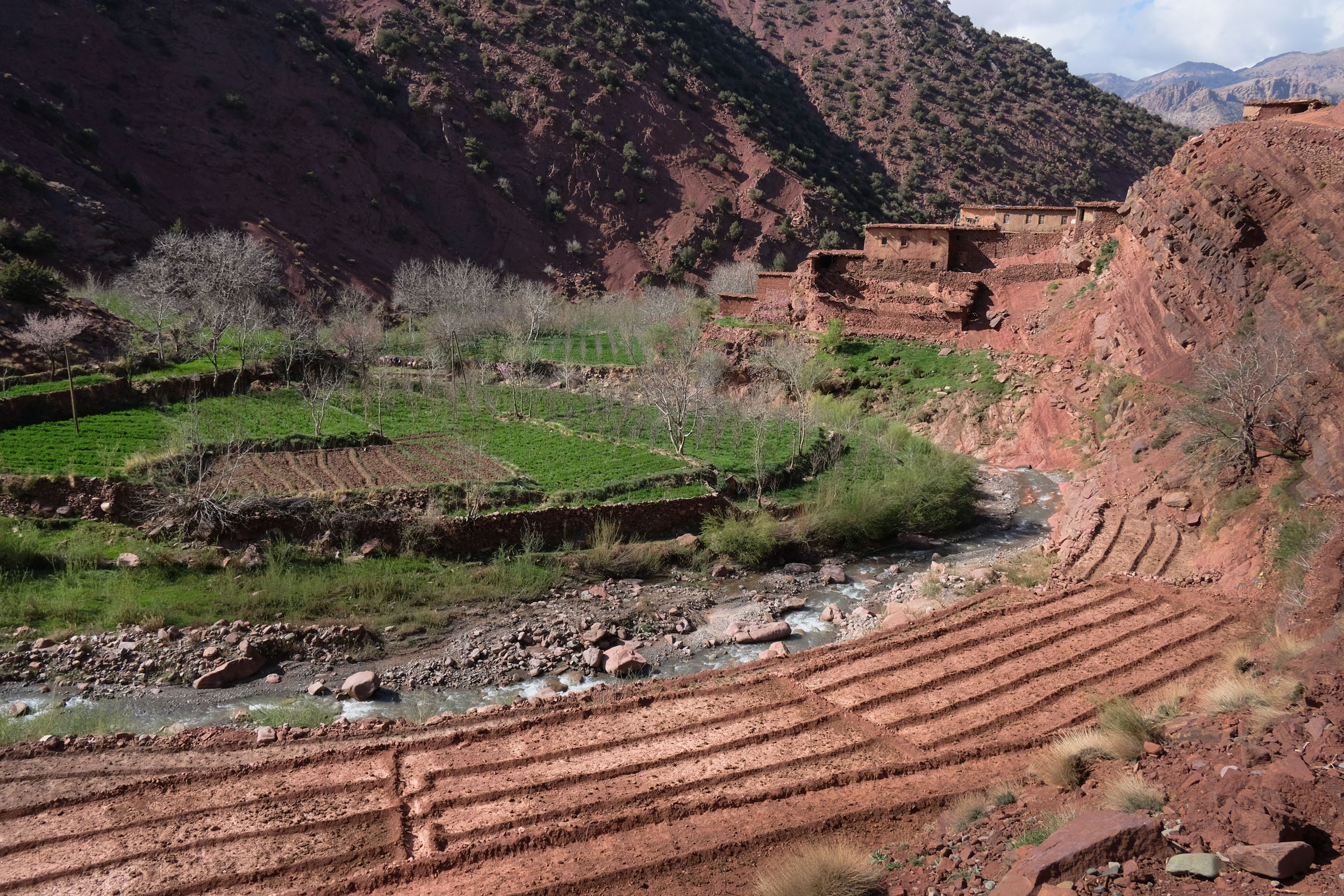
The valley sits between 1,800 and 2,200 meters, framed by high ridges and overlooked by Mt. Mgoun (4,071 meters). Seasonal rivers feed the fertile land, where villagers cultivate wheat, apples, walnuts, and alfalfa. In the center of the valley, the Sidi Moussa Marabout, a dramatic, egg-shaped granary shrine, is perched on a hilltop, blending spirituality with communal function. Spring brings a green explosion; autumn, a golden calm. Throughout the year, it’s a paradise for hikers, mountain bikers, and nature lovers.
Aït Bouguemez is home to Amazigh communities, whose way of life remains closely tied to the rhythms of land and season. Adobe homes, stone granaries, and ancient irrigation systems dot the landscape. Markets, music, and oral storytelling still play key roles in village life.
Despite all happiness, the social conditions are harsh as in most of the Atlas, and on the 9th of July 2025, the population decided to organize a march for better living conditions. Around 1,000 inhabitants marched the 77 kilometers to the regional capital, Azilal, denouncing marginalization and neglect and exposing the structural inequalities faced by mountain communities. They rallied for better infrastructure like roads, access to basic services, staffing of health services, potable water, education, and irrigation.
locationTessaout Valley
The Legend of Mririda
One of the most important water sources of the Atlas Mountains, the Tessaout River transforms into a raging torrent during the springtime snowmelt. Two sources originating from the peaks of Mt. Mgoun and Mt. Rat together form the Tessaout, which feeds into the largest river in Morocco, the Oum Rabia. Until the 1920s, the region of the Tessaout was marked in the French maps only as a “grey zone without information,” and it was only thanks to the work of Réné Euloge and his research and publications that the region became known to the Western world. Around 1928, he met the poet and rebel Mirida, a young Amazigh woman from Magdaz. Rene Euloge, who spoke the Amazigh language perfectly, quickly understood the importance of her songs and poetry in a region where oral transmission is the sole heritage of Amazigh culture. After several trips to Tassaout to meet the poetess, he began transcribing her poems and songs, before translating them into French in a book entitled Les chants de la Tassaout.
“The most faithful translation cannot fully restore the flavour of such poetry,” writes Euloge in the preface to Les Chants de la Tassaout, which contains around 120 poems by Mirida. “As I listened to her sing of mountains and valleys, of daily village life, of family dramas, of joys and sorrows, I became convinced that at those moments she reached the highest elevation of thought and feeling, and that at the height of her lyrical flights, a kind of intoxication transfigured her, relieving her of earthly miseries.”
locationPlateau de Yagour
A Prehistoric Sanctuary in the Shadow of Toubkal
Nestled in the High Atlas Mountains not far from Mt. Toubkal, the Plateau Yagour is a place where time feels suspended. Stretching across a vast high-altitude tableland at around 2,400 meters, this plateau is not only a scenic wonder but also one of Morocco’s most important prehistoric sites. Yagour is a wide-open alpine plateau, dotted with seasonal lakes, grassy pastures, and rugged rock outcrops. In spring and summer, it becomes a vibrant transhumance zone, where Amazigh herders bring their livestock to graze on rich summer pastures. The views stretch far across the Atlas, with distant peaks, including Toubkal, rising on the horizon. Yagour is most famous for its thousands of petroglyphs, etched into flat slabs and boulders scattered across the plateau. These carvings, some estimated to be up to 8,000 years old, depict humans and animals (notably cattle, antelope, and elephants, hunting scenes, and geometric symbols. These images offer a rare glimpse into the lives, beliefs, and environment of Morocco’s early inhabitants and make Yagour one of the largest open-air rock art galleries in North Africa.
Today, Yagour is still a sacred and living landscape. Many local Amazigh families visit seasonally, and there are numerous marabouts (saints’ shrines) and traditional campsites. The plateau is a place of memory and continuity, linking prehistoric, Islamic, and Amazigh traditions.
locationTelouet & the Kasbah of the Glaoui
Power and Decline
Perched high in the High Atlas Mountains, the village of Telouet lies on the ancient caravan route connecting Marrakesh with the Sahara. Its most famous landmark is the crumbling yet majestic Kasbah of Telouet, once the palatial stronghold of the powerful Glaoui family. The Glaoui clan, of Amazigh origin, rose to power in the 19th century, controlling key mountain passes and amassing wealth through trade, taxes, and alliances with French colonial rulers. Their most famous figure, Thami El Glaoui, became Pasha of Marrakesh under the French Protectorate and ruled with near-feudal authority from 1912 to 1956.
Construction of the Kasbah of Telouet began in the 1860s and expanded into a labyrinth of rooms, courtyards, and salons filled with zellij tilework, cedar wood carvings, and painted ceilings. Though parts are now in ruins, the kasbah still offers a glimpse into the opulence and ambition of a family that once rivaled the Moroccan monarchy. After Moroccan independence in 1956, the Glaoui were stripped of their power, and the kasbah fell into neglect. Today, it stands as a haunting and beautiful relic—a symbol of both collaboration and resistance, admired for its artistry and the dramatic history it holds.
locationOuarzazate
Noor Solar Power Complex
The Noor Solar Power Complex near Ouarzazate, Morocco, is one of the largest concentrated solar power (CSP) projects in the world and a flagship of Morocco’s renewable energy strategy. Located at the edge of the Sahara Desert, the Noor complex spans over 3,000 hectares and has a total capacity of about 580 megawatts, supplying clean energy to over 1.3 million people. One of the key innovations at Noor is its thermal energy storage system using molten salts, allowing it to continue generating electricity after sunset. This makes Noor one of the few large-scale solar plants in the world with nighttime generation capacity. Despite some technical setbacks—such as a temporary shutdown at Noor III—the project remains a landmark in global renewable energy efforts.
Logistics
- International travel: fly into Marrakesh or Casablanca. Most major airlines accept bikes as checked luggage. Air Maroc charges you around 50 EUR for domestic flights, 70 EUR from and to Europe, and 150 EUR from and to the US.
- Point of departure: Ait Mhamed (Alternative Azilal). You will find easy access to Azilal via public transportation in around three hours from Marrakesh or four hours from Casablanca. If you arrive in Azilal by public transportation, you might need to change and charter a “grand taxi” in the direction of Ait Boumgez. They all pass by Ait Mhamed. You can also start riding in Azilal. Take the regional road RR317, which is unremarkable but has little traffic. Plan for an additional 1.5 hours for the 20 kilometers and 500 meters of climbing to Ait Mhamed.
- Point of Arrival: Ourika Valley. From the Ourika valley, a good hour’s drive brings you back to Marrakesh. There are plenty of transport options. For bike transport, check contacts on Atlas Mountain Trails.
- Connection: Phone and 4G connection are surprisingly good, almost throughout the whole trip.
What Bike and Gear
- Bike: We recommend a lightweight yet rugged mountain bike, like a cross‑country (XC) or downcountry bike that is capable of handling long climbs, technical descents, and unpredictable weather. For tires, we recommend a size between 2.2 and 2.4 inches. Think about the weight of your bike setup as well. The route includes several technical singletrack passages and two extended hike-a-bike sections. Whatever bike and equipment you bring, you need to be able to carry it.
- Packing and Gear: try to be as light as possible. Even if there are some genuinely clever ways to store tools and stuff on your bike, you will need an old-fashioned MTB backpack for your Atlas tour. Choose one with storage space sectioned in various pockets for best organization and room for water. In our experience, a 42-liter backpack with space for a 2.5 to 3-liter hydration bladder, plus small tool bags and bottle holders on the bike, are the best combination. Heavier bike bags will considerably limit your fun on the singletrack and be very challenging during hiking and carrying passages.
- What to wear: Be prepared for big changes in temperature during your trip, from very hot to very cold. Even in spring, you should bring clothes for cold weather and proper rain protection, even if most of the time you will be able to ride with shorts and a short-sleeved bike jersey.
When to go
- The best time of the year is spring (April to the beginning of June) when the temperatures are less extreme and the valleys are green after the winter rains. Expect temperatures between 15 to 25°C during the day, depending on the region and the altitude. Nights can still get quite cold (5 to 15°C), depending on the altitude. Rain and some snow on the peaks is not unusual, particularly in March and April.
- Late Autumn (September to the beginning of December) is also recommended, but water can be scarce and the vegetation in the valleys is less green.
Dangers and Annoyances
- Do not underestimate the Atlas. You are in a high mountain environment with perils such as sudden weather changes, rockfall, water scarcity, and difficult navigation. The sun might be violent, and in some plateaus and rocky stretches, you might simply not find a drop of water.
- Know your ways: Make sure you have studied and understood the terrain on the maps to avoid being trapped between steep slopes or even crevasses or other difficult situations.
- Along the route, there is no bike repair service. Be prepared with skills and spare parts. In major cities, you can find almost all kinds of support. Particularly in Marrakesh, there is a range of professional bike services. You also might find solutions to send needed spare parts deep into the mountains in case of a technical problem during the trip, through a chain of local buses and taxis. You can find updated contacts here.
- Be prepared that a damaged bike you can’t repair by yourself on the spot is possibly the end of the tour.
- The Atlas Mountains are wild, and you cannot expect professional support in case of an emergency or technical problems. Always plan enough time in case something goes wrong on the way.
- If you are sensitive to insect bites, be particularly aware in the spring season, and watch out for beehives. Bring along antihistamine medicine or epinephrine if you are allergic.
- After rain showers, some parts can become difficult to pass with very sticky clay!
- Sheep flocks are always accompanied by a few Pyrenean Mountain dogs to scare off wolves. When passing a flock, get off your bike and walk quietly past.
- Mosquitoes can be a nuisance, so bring a good mosquito repellent.
- Some campsites open very late (May) or close very early (September).
- The sun is strong in this region, so remember to bring good sunscreen.
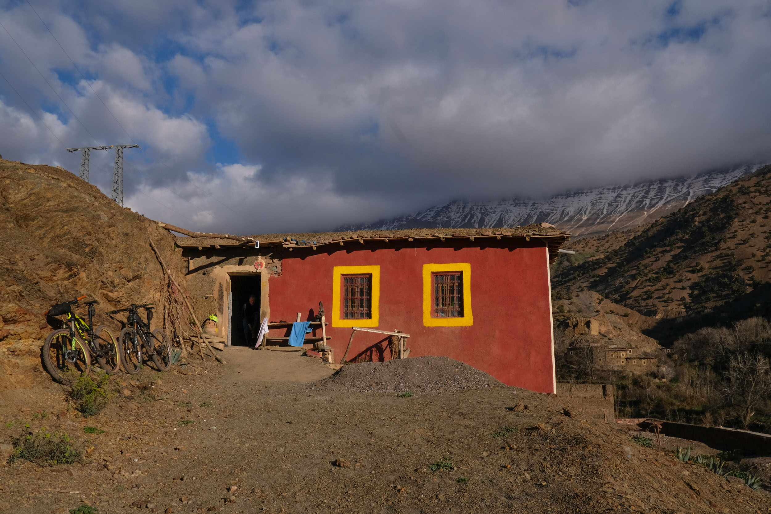
The trail can be ridden while fully relying on mountain hostels or homestays along the way. You will find plenty of options on Day 1, all through the valley of Ait Bougmez, as well as in Telouat (Day 5). Other than this, the options are very scarce and reduce the flexibility on how to organize daily stages. Absolute highlights are the mountain hostels of Gite Rogoult and the Gite Ifoulou Tessaout (Days 2 and 3).
In the villages of Anmiter (Day 4) and Azgour (Day 6), no official accommodations exist, but it is possible to stay “chez l’habitant” at a local family’s house. In Azgour, the whole family of three generations welcomed us with a big smile to make our stay as comfortable as possible and served the best tagine of the trip. Be aware of the simplicity of the living conditions when planning your trip.
There are no established campgrounds, but spectacular wild camping spots can be found along the route. Even in excluded mountain areas, you will always find people herding the goats or working the fields. Approach locals when preparing your campground, explaining your presence. Locals will welcome you and, with a bit of luck, invite you for a tea and snack.
Below are some recommended lodging options:
- Valley of Ait Bougemez (Day 1): Gite Marabou located at the beginning of the valley of Ait Bougmez (Vallée Heureuse), this mountain hostel is made for bikers and hikers exploring the Mgoun area. Food is generous, and all basic facilities are available. Great view over the valley.
- Rouguelt (Day 2): Gite Rogoult is a charming little mountain hostel with two large rooms fitting six mattresses each and one large living room. It is colourfully decorated with cosy carpets and pillows everywhere. The owner sleeps in the village and serves tea and food together with his wife and daughters. Tel +212 637378811.
- Ifoulou (Day 3): Gite Ifoulou Tassaout fantastic mountain hostel right at the untamed waters of the Tessaout river. It is run by a member of the Atlas Mountain Community, Mohamed Hanini, and his wife. One of the tourism pioneers in the valley and in constant progress. Only very basic French, but rather good Spanish communication. Tel +212 668572781.
- Anmiter (Day 4): We arrived at night and had a hard time finding a place to sleep. Luckily, Mohamed from the Café Majorelle hosted us and served a wonderful tagine. The place has several generous rooms with Majorelle posters and original photos on the walls. From the terrace, you have a splendid view over the gardens and historic places of the village. Tel +212 653807787. An alternative place in Anmiter is Chez el Yasid. Tel +212 639-198700.
- Telouet (Day 5): We spent our recovery day in the Lion d’Or, a small hotel next to the famous Kasbah Glaoui. The managers are very friendly and service-oriented. There is a small “penthouse” apartment that fits four bikers, which we can highly recommend.
- Azgour (Day 6): Azgour is a small village on the river Zat with no official accommodation. The brothers Bougma and Brahim organise trips and are used to hosting travelers in a very basic room, sharing the house with the cows’ stable. The whole family of three generations welcomed us with a big smile to make our stay as comfortable as possible and served the best tagine of the trip. Be aware of the simplicity of the living conditions when planning your trip. Tel Brahim: +212 668-317555, Bougma +212 613-541739.
- Setti Fatma (Destination): Setti Fatma is one of the main little towns in the Ourika Valley, the place where Marrakchis refresh on hot summer weekends. If you want to stay in the Ourika Valley, there are plenty of pensions along the river.
- Reliable drinking water sources are scarce and not easy to find. Rely on bottled water in the local shops, called “hanut.” In almost every village along the way, you will find these shops. Make sure to refill. Also see the Trail Notes for further details on the daily stages. Alternatively, ask for water (“maha” in Arabic or “aman” in Tamazight) in the houses on the way.
- Food in the hostels along the trail is great and clean. Mainly, you will be served “Tagine” for dinner, a delicious local dish containing either meat, chicken, or vegetables, and breakfast the next day. During the day, there are almost no eating options (except in Ait Bougmez or Telouat). We relied mainly on sandwiches and hard-boiled eggs we asked for in the accommodation, as well as trail mixes baked with local nuts and dates.
- For breakfast, ask for “amlou,” a delicious paste of argan oil, almonds, and honey. It is pure energy that also makes for a great snack along the trail.
Check out this video for a sample of what you might experience along the routes put together by Atlas Mountain Trails:
Find a seven-day itinerary for this route below, and discover further segments of the Atlas Mountain Trails and the project.
Seven-day Itinerary
location Ait M’Hamed to Zawyat Oulmzi
Day 1 (39.6 km +1,190 m)
This thrilling route from Aït M’Hamed (1,800 meters) to Zawyat Oulmzi (1,700 meters) takes you across one of Morocco’s most scenic high-altitude corridors, offering medium climbs, fast descents, and constant views of the Central High Atlas. It’s a journey through landscapes carved by time and shaped by Amazigh tradition. An alternative starting point is the little town of Azilal, the provincial capital, and easier to access with public transportation, adding a few kilometres to the leg.
From Aït M’Hamed to the pass Tizi n’Aït Imi (2,900 meters), the route begins with a long uphill ride of 29 kilometers on a dirt road. Expect a few switchbacks and some steep segments, but it’s all rideable until to the top. The Tizi n’Aït Imi is a wild, windy pass with jaw-dropping 360° views.
As the slopes were still partly covered in snow during our tour at the beginning of April, we decided not to take the singletrack option, which would have descended into the Aït Bouguemez Valley (“Vallée Heureuse”), and instead stayed on the main road. The regular road is a fun ride through terraced fields, walnut groves, and Amazigh villages.
The last stretch across the valley to Zawyat Oulmzi is smooth and rolling, following the valley. The scenery remains stunning: ochre cliffs, snow-capped peaks in the distance, and warm welcomes in villages like Ikhf n’Ighir or Timit before reaching Zawyat Oulmzi.
location Zawyat Oulmzi to Rouguelt
Day 2 (47.9 km +960 m)
This leg is a bit longer than the first day, but also rather easy, rolling through scenic landscapes of the Ait Bouguemez valley in the shadow of Mt. Mgoun. Until the village of Ifrane, the trail follows the river, meandering through lush orchards and terraced fields. This section offers a gentle ride, with possibilities to join the road when water, mud, or vegetation take over. In Ifrane, choose the path towards the foothills of Jbel Rbat, leaving the busy valley. The panoramic views of the surrounding valleys and peaks are the reward for the five-kilometer climb.
Descending from Jbel Rbat, the trail leads again in the Aït Bouguemez valley, into the flowering apple and walnut plantations until eventually arriving in the small town of Tabant, the capital of the valley and a good place to load up on water and other supplies before leaving the Vallée Heureuse. At kilometer 32, you will cross the Assif Boughemez river and follow the breathtaking Oued Lakhdar (Green River) upstream. The final leg from Aït Bouguemez to Rouguelt is a 15-kilometer gentle climb with 400 meters of elevation gain on a small dirt road winding up the mountains through serene villages while the valley is getting narrower. Rouguelt (or Ghougoult) and Tiziatine, on the opposite side of the river, mark the end of the road.
location Rouguelt to Ifoulou
Day 3 (46.7 km +1,450 m)
This is the first challenging day of the tour and leads you deep into the heart of the mountains, off the beaten trails. Starting in Tiziatine/Rouguelt, we chartered two mules to carry our bikes on the 11-kilometer hike up to the Tizi n’Rouguelt pass at almost 3,000 meters altitude. The path follows the beautiful river of Assif n’Tifira, which at this time of the year was a powerful creek with rapids and smaller waterfalls. The ascent took us about four hours, but it is worth the hike. The landscape gradually became more rocky and arid. The view from the pass offers breathtaking views into the High Tessaout Valley, one of the most important water streams of the central Atlas. From the descent, you can easily spot the mountain road from Amezri crossing Tizi n’Oulaoun (2,767 meters), which is part of the Atlas Mountain Trail segment “Central Atlas Crossing.”
The descent to the village of Tasgawait is a playground for downhill fans, with about four kilometers of demanding singletrack trails and a mix of rocky and playful sections. It’s fully rideable for experienced mountain bikers. You will enjoy surfing alongside sandy hills and natural slalom slides. Tasgawait is a busy mountain village with a large market. In spring, hundreds of small lambs and goats are transported here to be grazed on the high mountain pastures.
After Tasgawait, the descent continues on a gravel road, reaching Amezri and the Tessaout River. Following the Tessaout downstream, the mainly paved road rolls gently through the villages of Imi n’Ikis and Ichbaken. In Ishbaken, we took the newly built and oversized road that climbs steeply up the canyon, providing scenic views of the valley before descending again to Ait Hamza. You can also choose to stay in the Tessaout river bed, but depending on the season and water level, expect wet shoes and countless crossings. From Ait Ali n’Ito, the road continues on asphalt. If you still have some juice left and enough time, consider a quick detour to visit the breathtaking village of Magdaz, crossing the river and climbing up the road for four kilometers.
Continuing on the track, follow the main road for another six kilometers downstream on the paved road, passing Fakhour and finally arriving at our destination of the day, Ifoulou.
location Ifoulou to Anmiter
Day 4 (72 km +1,810 m)
Be prepared for a long day with radical changes in landscapes and temperatures. From Ifoulou, we followed the Tassaout river downhill until we reached the N23 in Aît Alla, where we turned left. This road connects Ouarzarzate and Demnate, crossing the main Atlas mountain chain. Luckily, there is almost no traffic, and you can concentrate on the riding and the changing landscape. The first 15 kilometers uphill are a great warm-up until reaching the Tizi n’Fadghat pass at 2,232 meters in the shade of the Jbel Toudja. From there, enjoy the windy road rolling down south through a landscape of stones in all shades of ochre. Don’t miss the turn to the right (kilometer 24) on a sandy road, towards the village of Tighuerte n’Igwane, which is worth a stop. Take the road by the school that contrasts the soft landscape with flashy colours. On the next hill, you’ll spot the Noor Solar Plant in the southern plains of Ouarzazate. From afar, it looks like a UFO that just landed in the Sahara Desert.
The next village on the route, Taliouine, implies a small detour which is absolutely worth it. It feels like a desert town, although still at 2,000 meters with beautiful Amazigh architecture. Except for a modern and surprisingly well-maintained palace that towers over the village, time has stood still here. The lush oasis surrounding the village and tree plantations is a great picnic spot.
From Taliouine, the road takes us through a dry desertic no man’s land. Don’t miss the turn to the right at kilometer 47, the lowest point of today’s tour (1,600 meters). At kilometer 54, you’ll cross a tiny village with a beautiful oasis, followed by two nasty climbs on a rocky and sandy road before reaching a savannah-type plateau with outstanding views. Finally, a short and back-breaking serpentine road brings you to the riverbed of the Oued Ounila, through which you reach today’s destination of Anmitar. This busy town is surrounded by green gardens and plantations, famous through the paintings of the French painter Majorelle, who lived in the oasis in the early 20th century.
location Anmiter to Telouet
Day 5 (13.9 km +230 m)
Following the endurance ride and a long and tiring search for accommodation in Anmiter at night, we decided on a rest day, with just 14 kilometers on the provincial road P1506 to Telouet. Enough to warm up the muscles and enjoy the colourful but arid landscape leading back to the Central Atlas high plains. We are back on a well-frequented axis of the High Atlas as the road connects the Tizi-n-Tichka Pass with the famous Unesco World Heritage Site Ait Ben Haddou. On the Tizi m’Tanbdout (1,960 meters), we have reached the highest point of today’s little tour. Just before the pass (kilometer 4) a small path on the right-hand side of the road leads into a narrow canyon to the salt mines of Telouet, which is worth the detour.
The mine is still being exploited, and the guardian is happy to show you around for a small contribution. The exploitation today is done with small dynamite explosions. Inside the mine, several pools in different colours and shapes reveal impressive salt crystals. The mine lies along the old caravan route Marrakech-Ouarzazate, and in its high times, local Jewish families were given the concessions to exploit salt and trade the valuable resource.
The small town of Telouet lies in a vast high mountain valley at 1,800 meters and is a busy hub for local trade and tourism. Quite a contrast after the last days deep in the mountains. You’ll find all the amenities for a rest day, such as restaurants, souvenirs, and grocery shops.
The Kasbah of the Glaoui has been closed to the public since the earthquake of 2023, but if you insist, you might be lucky and find the gatekeeper at the Léon d’Or Atlas Hotel opposite the Kasbah. He will be happy to show you around and share the history of this jewel of Amazigh heritage.
location Telouat – Azgour
Day 6 (51.6 km +1,570 m)
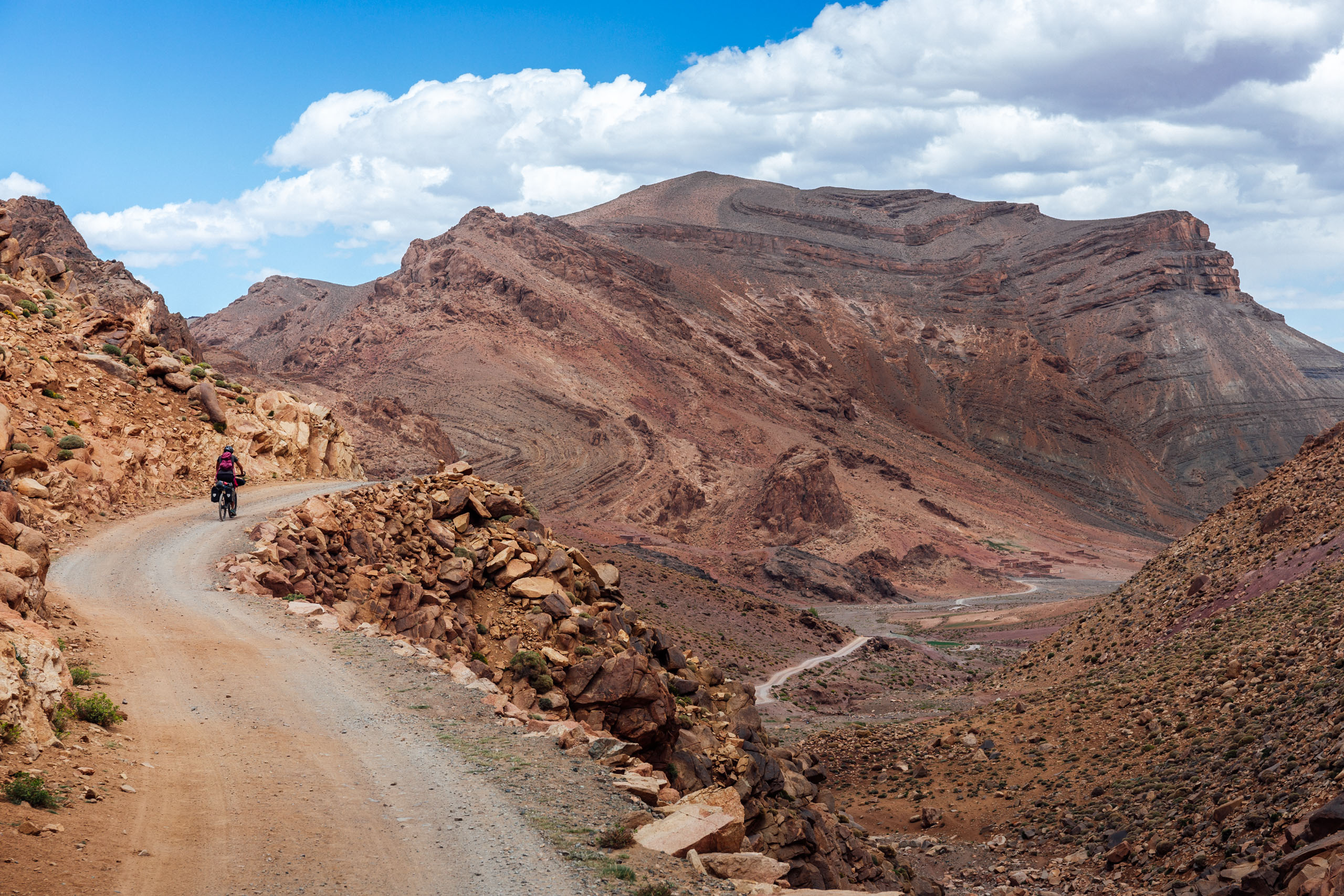
Leave the provincial road in the centre of Telouet, direction Timjoujte (4 kilometers). The smooth uphill ride is a nice warm-up until the village at the foot of Tizi’n’Telouet. The pass and the first big challenge of the day are already well visible from Telouet, clearly marked by the electric power poles. Shortly after the village, the singletrack trail starts on a steep climb that will force you to hike and carry your bike most of the way until the pass of Tizi’n’Telouet (2,600 meters). The views from the pass are breathtaking, and we are looking into the valley that feeds the spring of the Tensift River, the main water source for Marrakesh, and one of the most important water sources of the Atlas with a total length of 260 kilometers until reaching the Atlantic Ocean between Essaouira and Safi.
A road has been carved in the mountain from the north side of the pass and winds down through countless serpentines. Take your time enjoying this bizarre downhill. At some points, the old mule trail crosses the new road, and you have the choice between the road and some remaining bits of a very steep singletrack trail.
At kilometer 20, leave the main road towards the west, crossing the Tensift River and passing through the little village of Titdri (1,800 meters). From there, the rocky road climbs steeply through terraces as well as juniper and pine forests until a beautiful mountain pass at 2,100 meters. This is a great spot for a picnic.
From here, the trail leads 500 meters downhill to the Tizi-n-Tichka Road RN9 where you find a couple of tourist shops and cafés ideal to fill up on food and water. Take the Tishka road south for about a kilometer before turning right on a steep, uphill dirt road (kilometer 33.7). This is the last climb of the day. It’s about 300 meters without major challenges. Don’t be tricked! The tour is far from done. The remaining 13 kilometers downhill is one of the highlights of the tour but includes several very technical and steep passages that will need full concentration.
After three kilometers, the main road crosses the river, but instead of taking the bridge, you have to follow a small singletrack trail just before the bridge, following the river on the right side. Several passages are very exposed, and trail finding can be difficult. After only one kilometer on the small trail, the way marked on the map was overgrown by vegetation, and we found a mule path that climbs on the right mountain flank and then steep down back to the river and eventually crosses the river on the left-hand side (kilometer 43.5).
What comes now is one of the best singletrack trail rides of the Atlas Mountain Trail. A mix of fast flow trail and technical passages, often quite exposed with breathtaking views and quickly changing up and down stretches.
From the village of Açat (or Assads), a gravel road leads through a beautiful narrow canyon, rolling down the last few kilometers to the final destination, Azgour, in the Oued Zat Valley. Entering the village, the kids will welcome you at the bridge and show you the way to the house of Boujma and Brahim, where we spent the night.
location Azgour to Setti Fatma
Day 7 (32 km +1,200 m)
The last day of the tour leads you over the plateau Yagour, famous for its ancient stone carvings and high-altitude pastures in the shade of the holy Mt. Meltsene. In terms of statistics, the tour seems rather relaxed, but there’s a big climb up to the plateau, followed by over 20 kilometers of technical singletrack at high altitude. Don’t underestimate it.
Leave Azgour on the paved main road downhill for almost one kilometer and turn sharp left on the very steep dirt road starting a 10-kilometer ascent to the plateau. After climbing 2,000 meters, we reach the first pastures and villages, and the road transforms slowly into a trail, continuing uphill. We reach the beautiful village of Adarza (kilometer 14) with its solid stone houses, right on a small river.
We are now rolling on the plateau between terraces and the pastures, reaching a first pass (kilometer 17) at 2,320 meters. After a short and flat passage, we pass another Azib on the foot of Mt. Meltsen (3,560 meters), which serves as a base for the four-hour hike to the impressive summit. A few hundred meters upstream, you can find a fresh water source with drinking water.
After almost 20 kilometers, you reach the highest point of the day (2,385 meters) with the view of Mt. Angour, which is part of the Toubkal chain and the Ourika valley in the west. The singletrack trail descends through spectacular landscapes, with several rocky passages that will force most bikers to walk a few meters. Just before the trail splits at kilometer 24, look out for a small waterfall a few meters right of the track, which makes for a great refreshment and picnic spot.
Leave the main trail that descends very steeply to the big villages of Anguerd and Tizi n’Oucheg and take instead the well-visible trail on the left-hand side that crosses the steep mountain flank in a straight line. The next two kilometers are world-class singlertrack trail riding, contouring at the same elevation with several exposed sections. Be alert.
After reaching a small pass, the vegetation and trail changes drastically, and it descends steeply into the Ourika Valley through countless switchbacks. Singletrack trail lovers will get rewarded, but if steep, rocky, and exposed switchbacks are not your favorite terrain, be ready to walk your bike down.
The trail ends in the village of Ouigrene (1,750 meters) and continues on a gravel road marking the last four kilometers of this crossing until finally reaching the Ourika Valley. Once the river crossed, the paved road, restaurants, and tourist hustle are a clear change from the idyllic Plateau Yagour and wild mountain sceneries of the last days. Ourika is one of the mass tourism hotspots for the Marrakchis and international day trippers, who have transformed the valley into a small amusement park. We opted for a straight transport back to our departure accommodation away from the tourist circus to rest the tired legs and process the incredible impressions of the last week.


Terms of Use: As with each bikepacking route guide published on BIKEPACKING.com, should you choose to cycle this route, do so at your own risk. Prior to setting out check current local weather, conditions, and land/road closures. While riding, obey all public and private land use restrictions and rules, carry proper safety and navigational equipment, and of course, follow the #leavenotrace guidelines. The information found herein is simply a planning resource to be used as a point of inspiration in conjunction with your own due-diligence. In spite of the fact that this route, associated GPS track (GPX and maps), and all route guidelines were prepared under diligent research by the specified contributor and/or contributors, the accuracy of such and judgement of the author is not guaranteed. BIKEPACKING.com LLC, its partners, associates, and contributors are in no way liable for personal injury, damage to personal property, or any other such situation that might happen to individual riders cycling or following this route.
Further Riding and Reading
Here are some connected/nearby routes and related reports...
Please keep the conversation civil, constructive, and inclusive, or your comment will be removed.