


La Vuelta de Citlaltepetl
Distance
160 Mi.
(257 KM)Days
6
% Unpaved
60%
% Singletrack
2%
% Rideable (time)
97%
Total Ascent
22,000'
(6,706 M)High Point
14,950'
(4,557 M)Difficulty (1-10)
8?
- 9Climbing Scale Very Strenuous138 FT/MI (26 M/KM)
- 7Technical Difficulty Difficult
- 8Physical Demand Difficult
- 6Resupply & Logistics Moderate
Contributed By

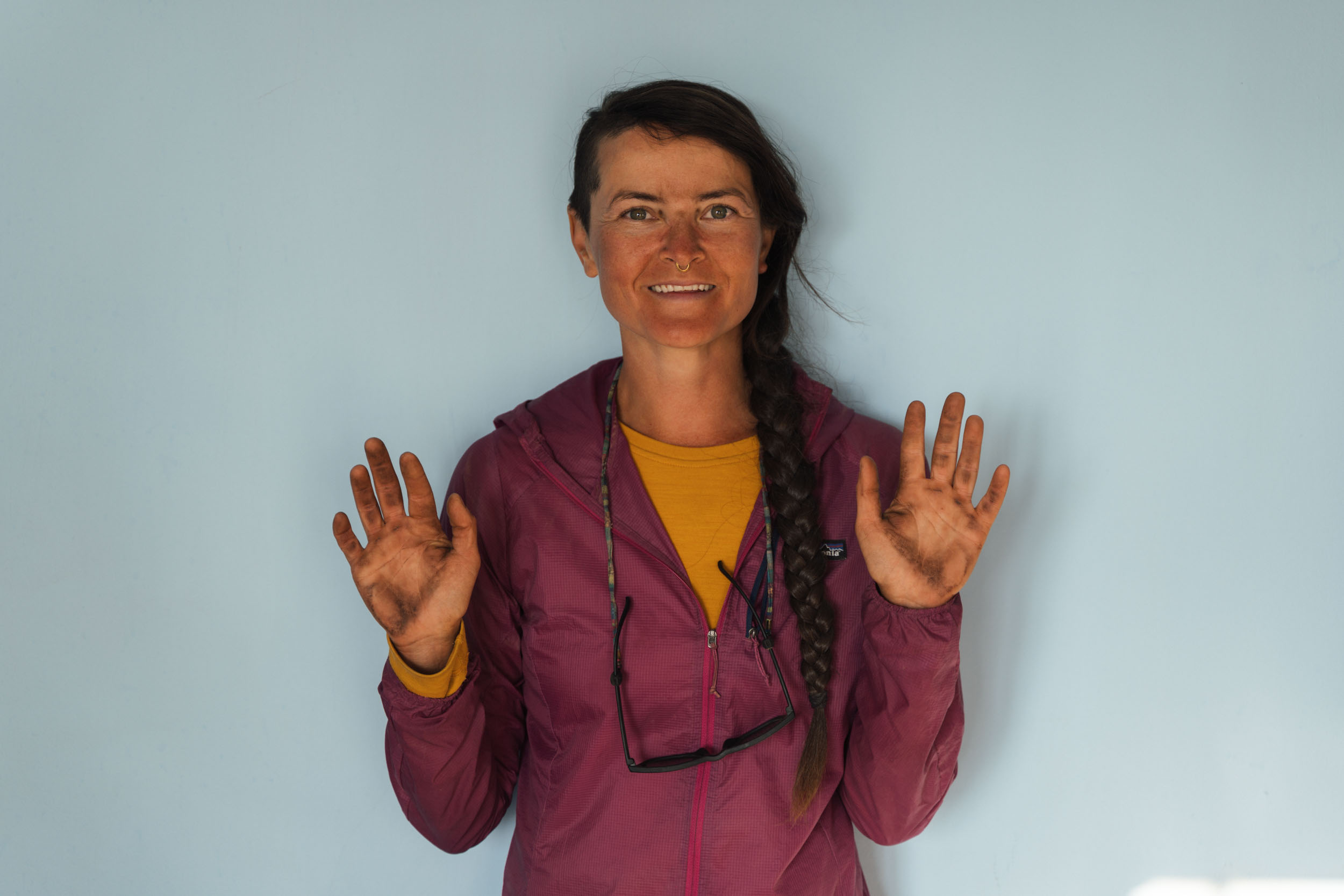
Cass Gilbert
Contributing Editor
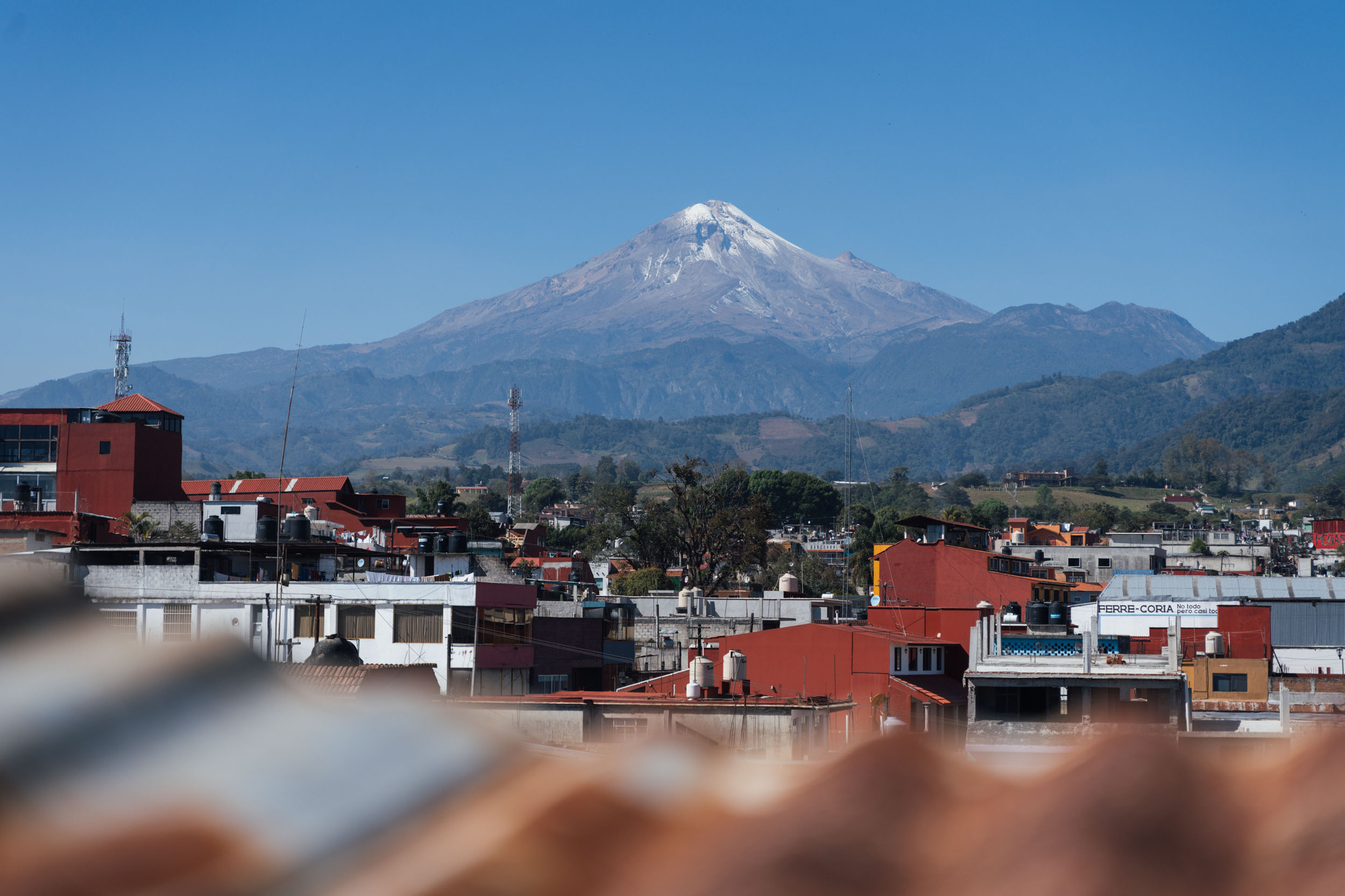
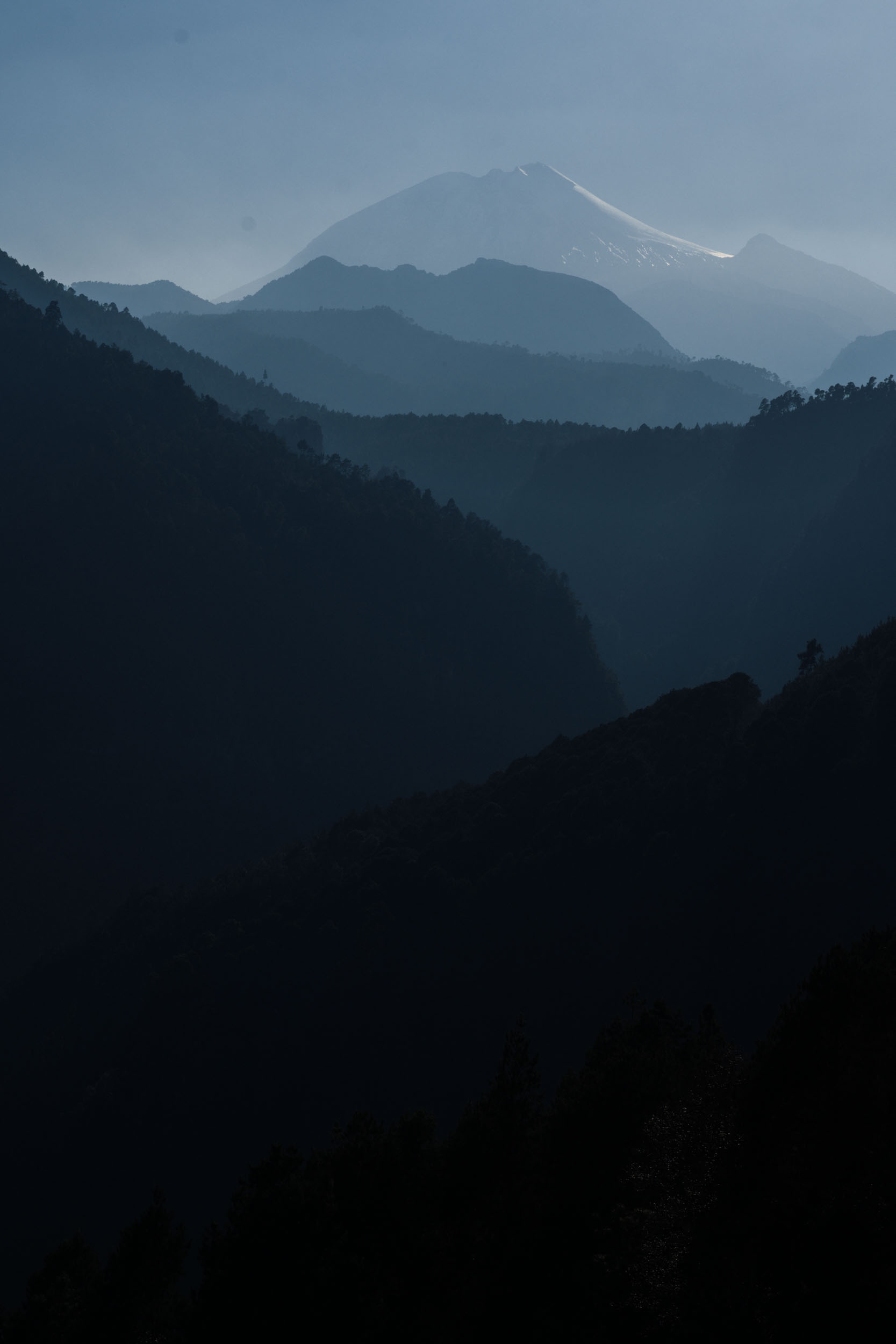
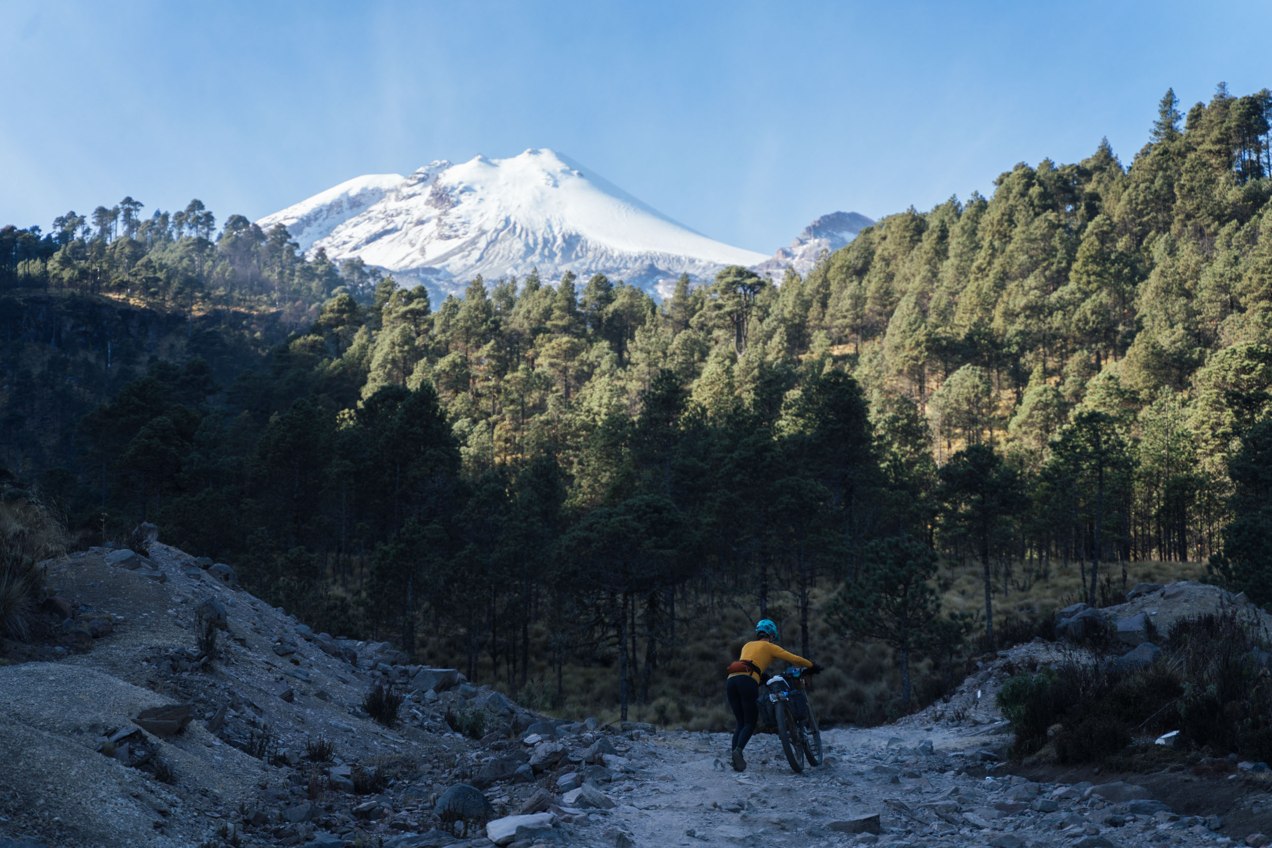
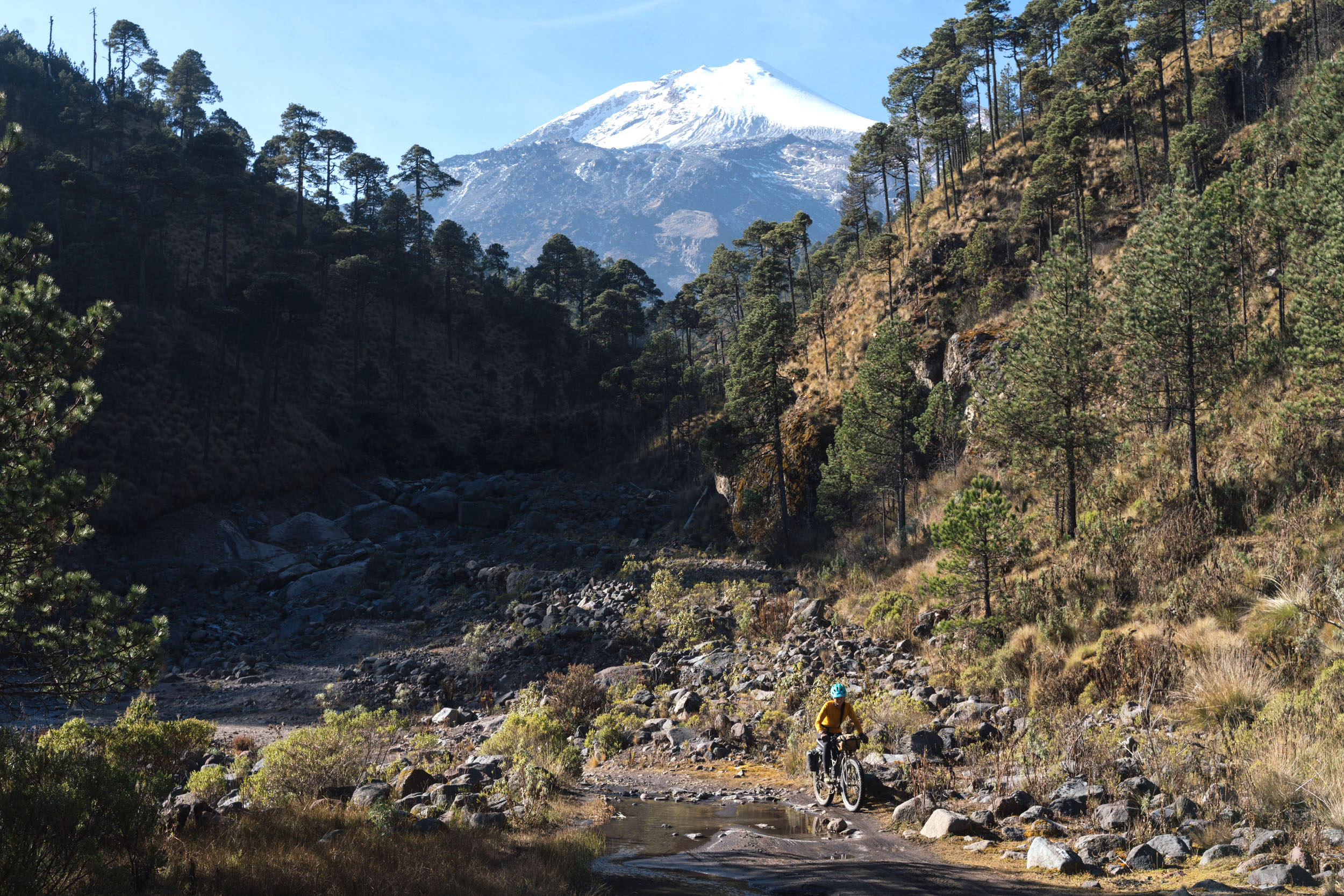
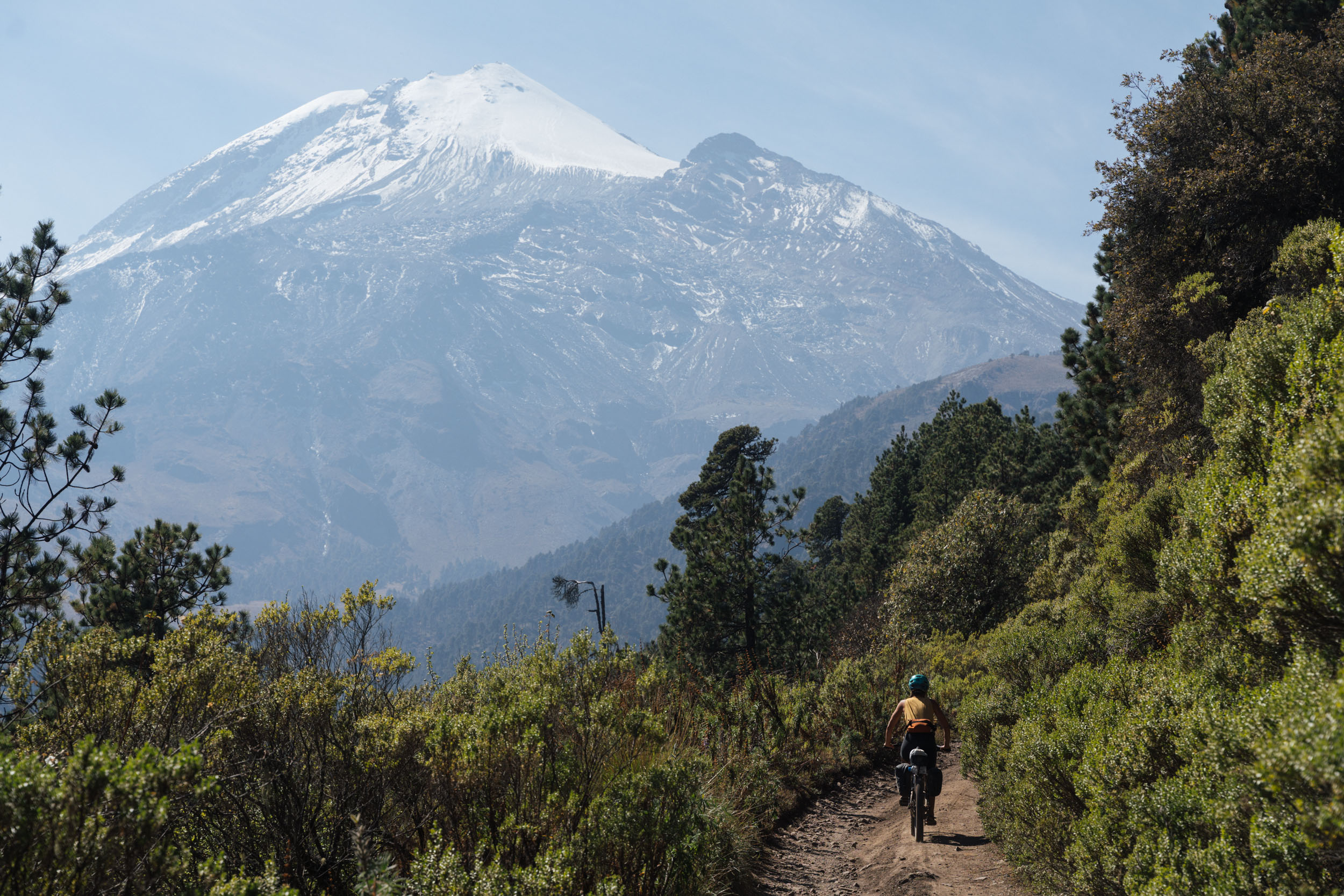
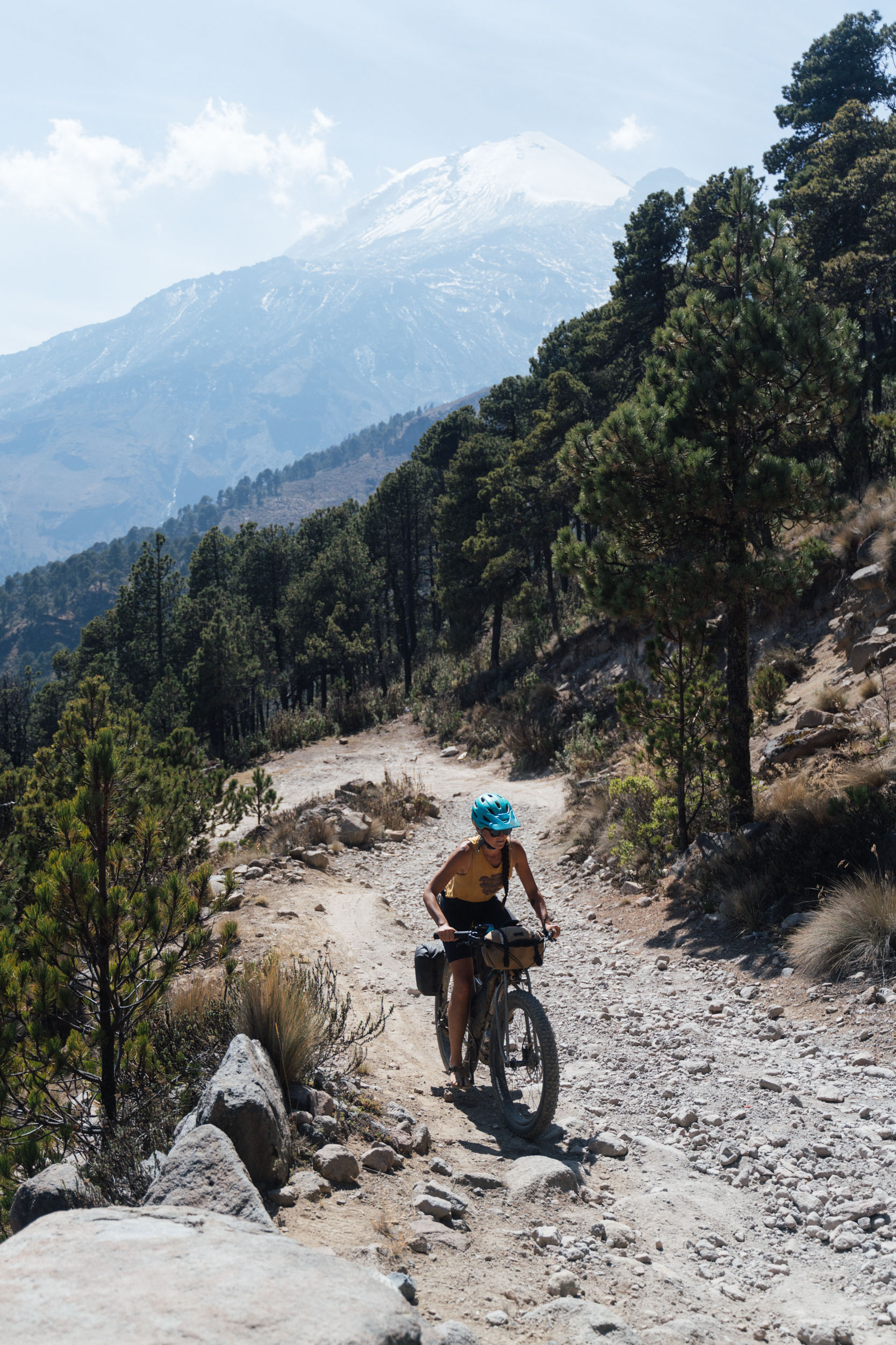
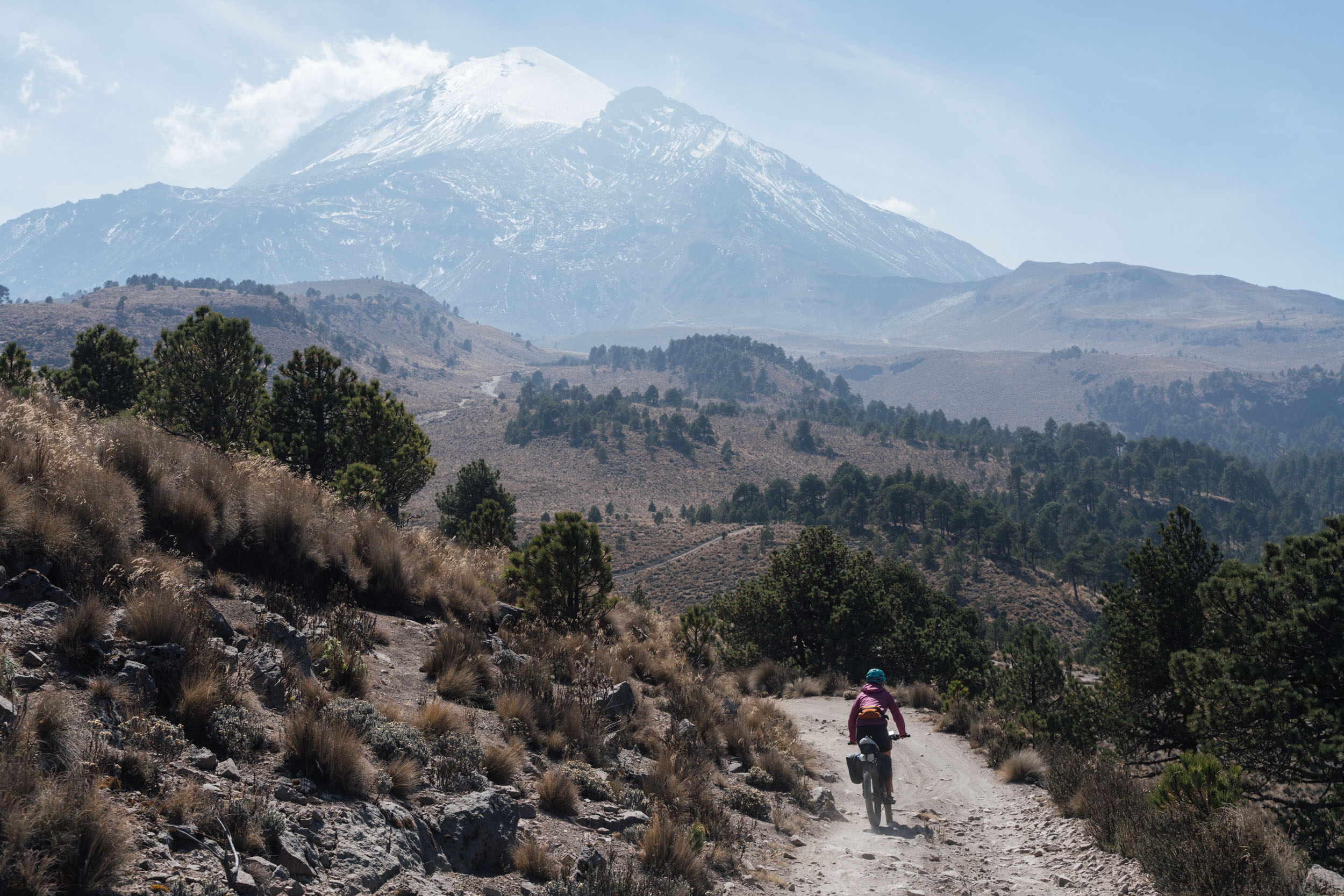
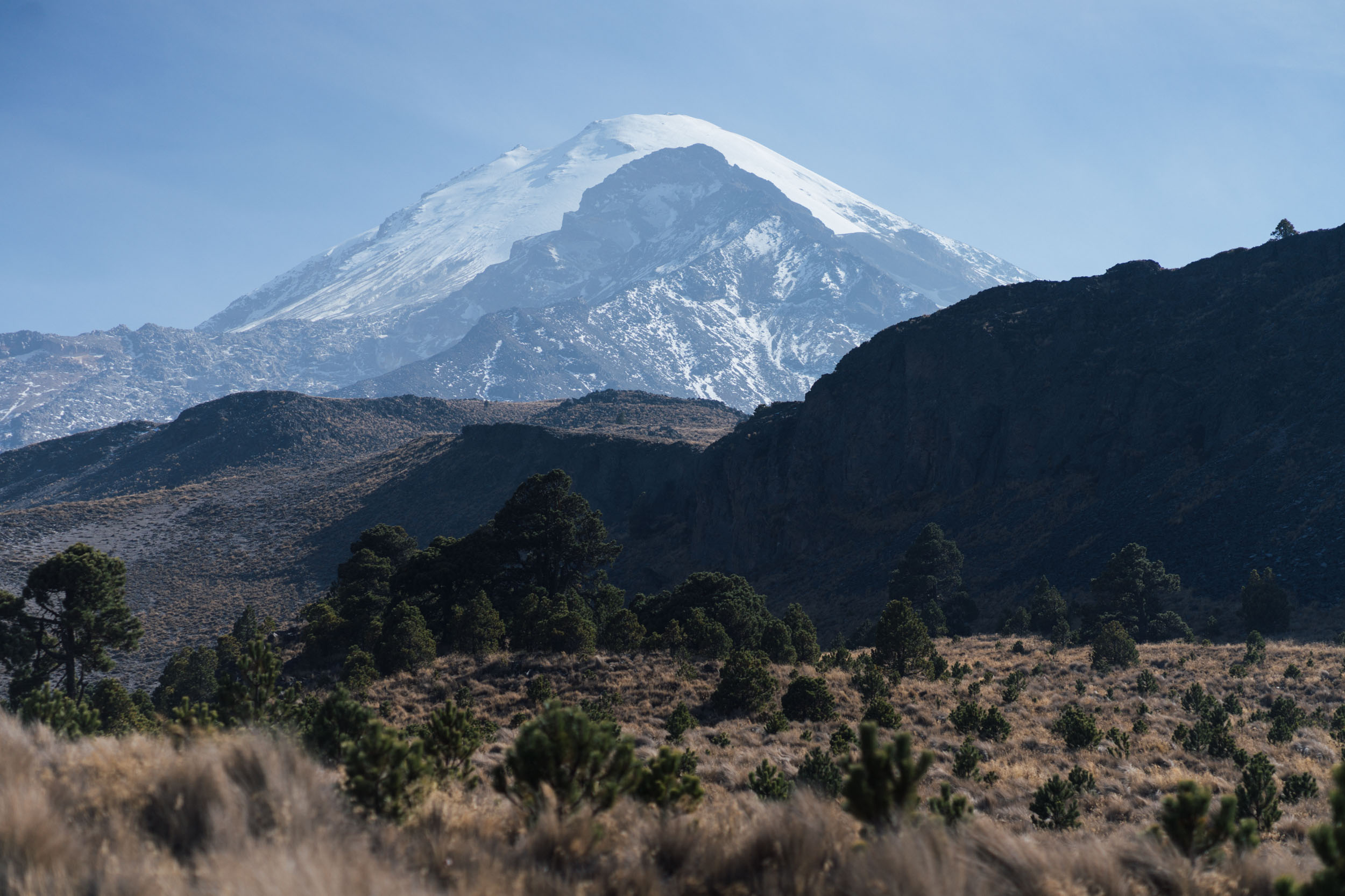
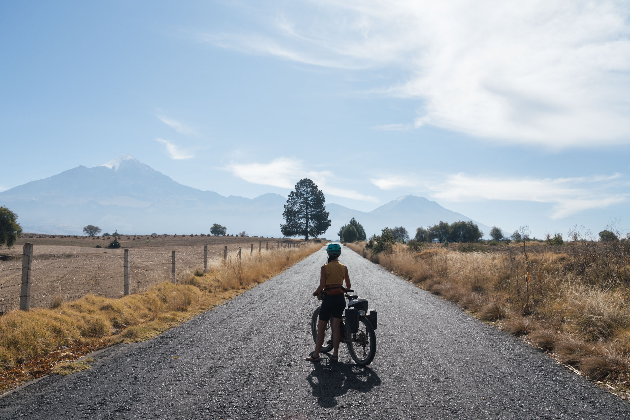
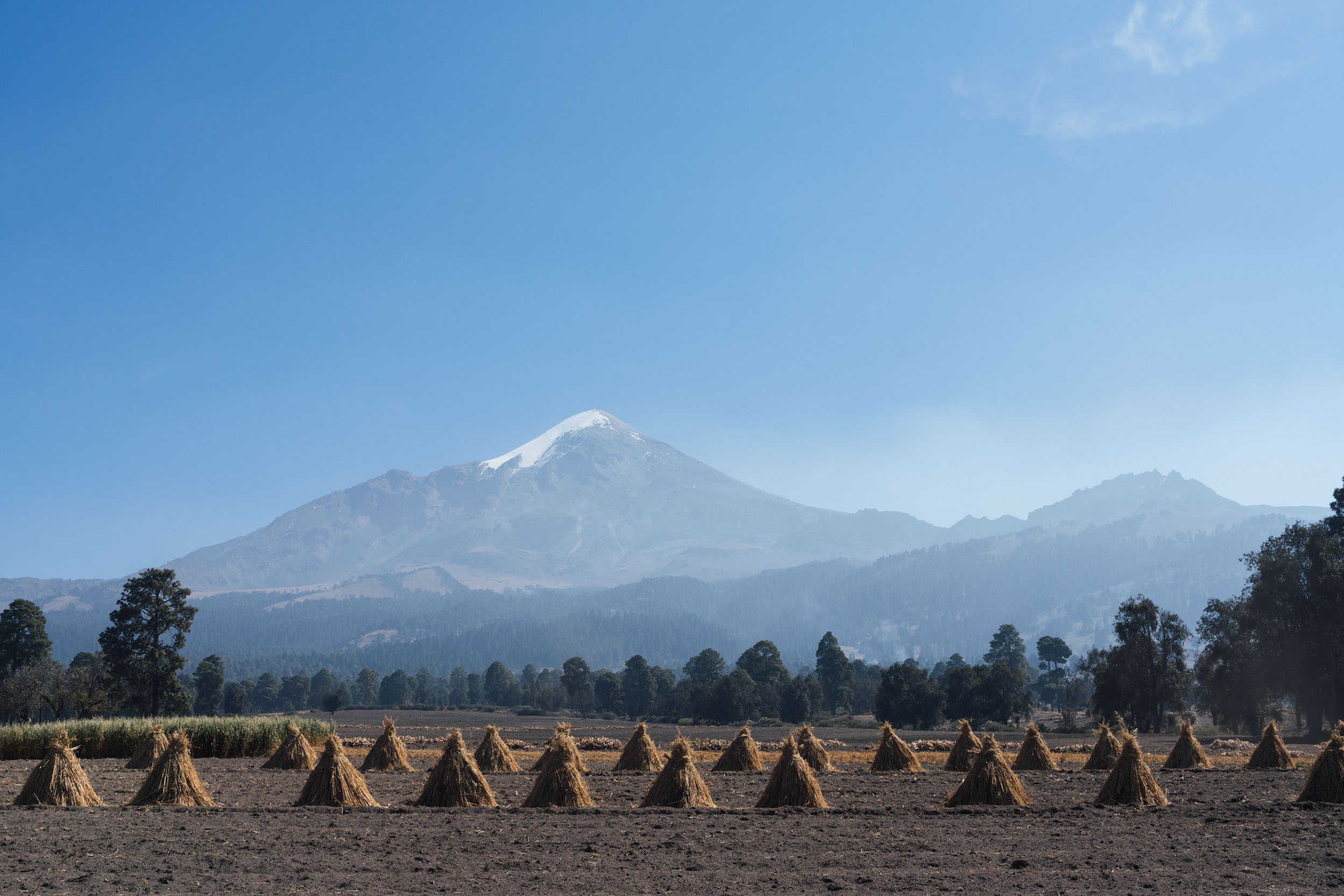
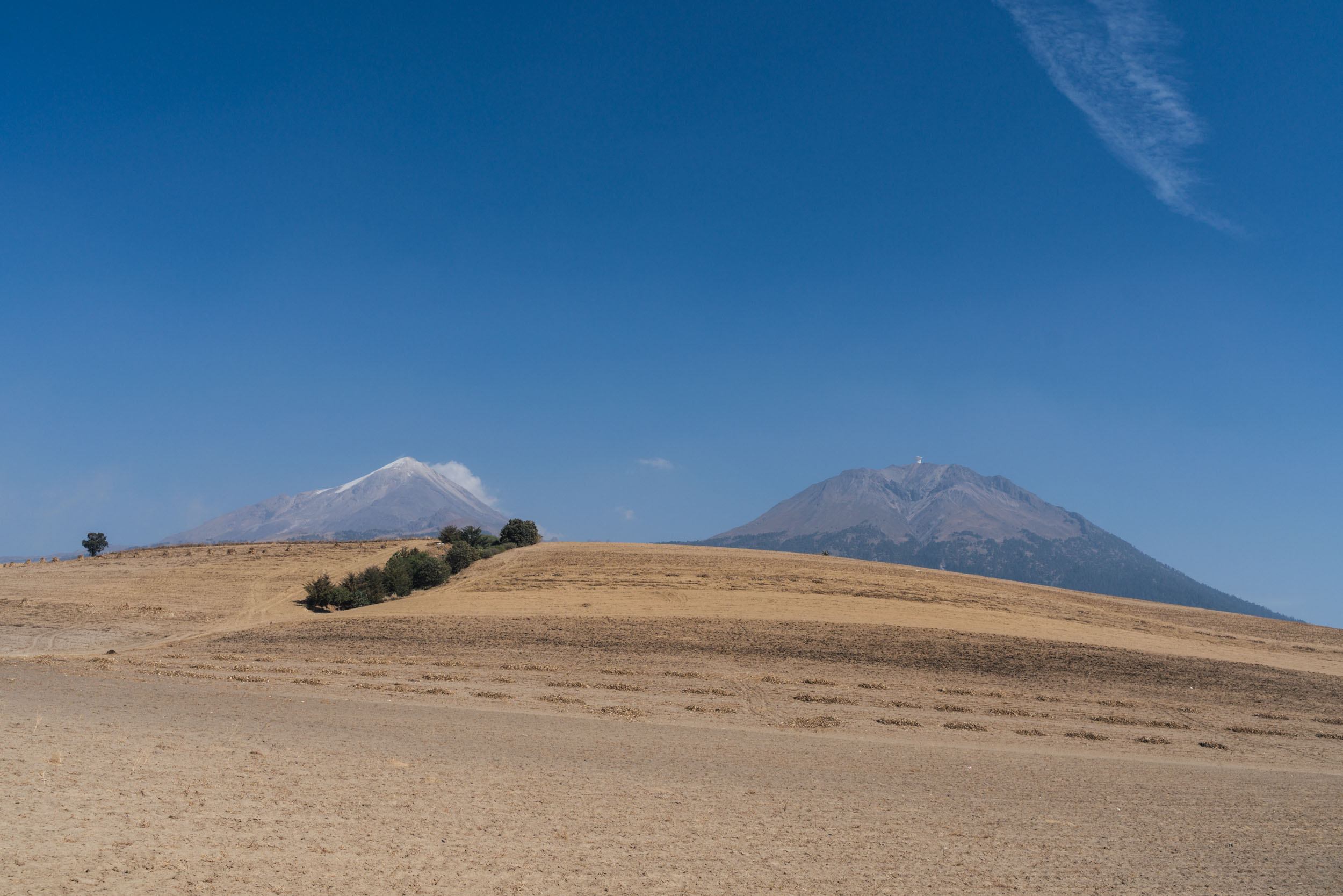
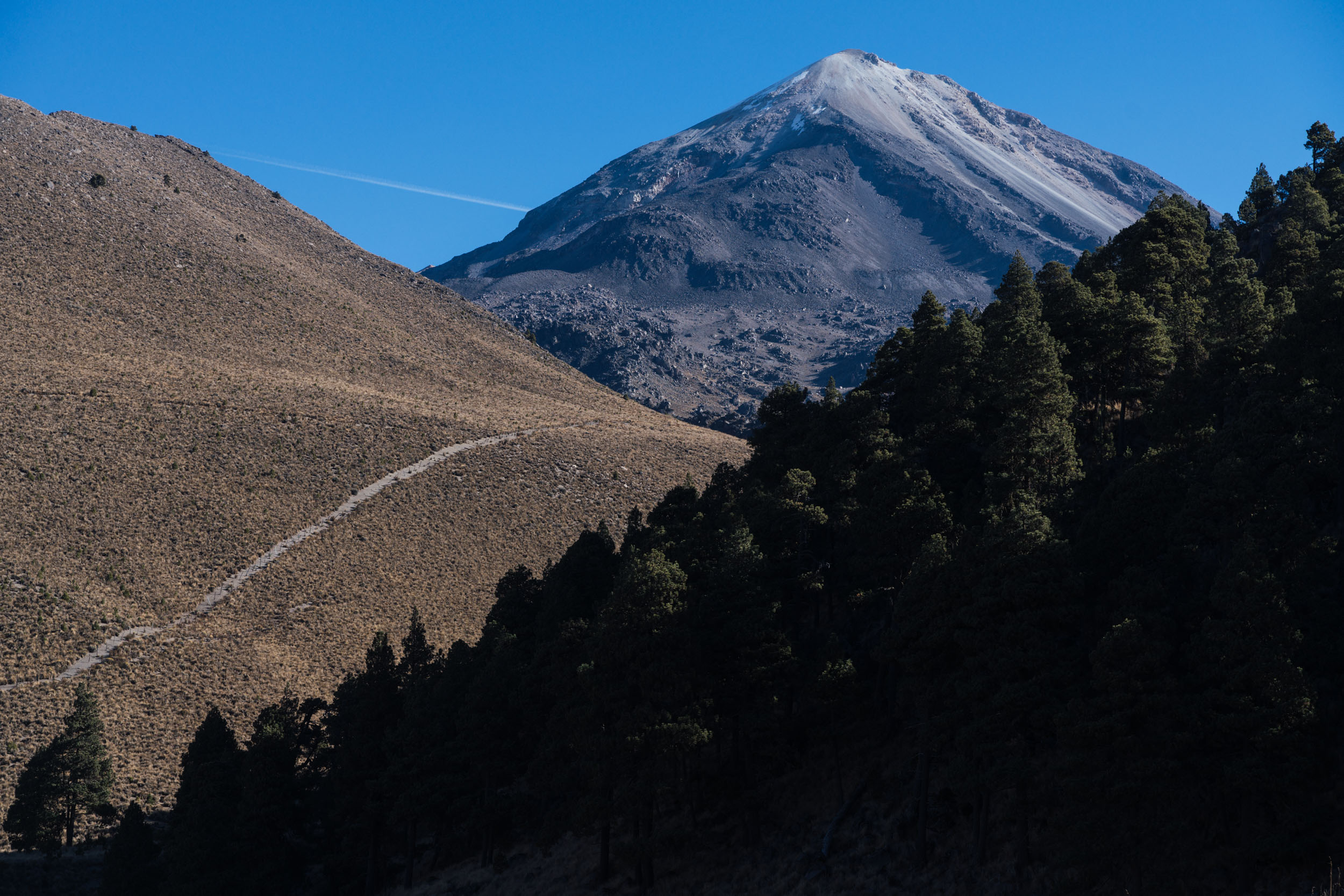
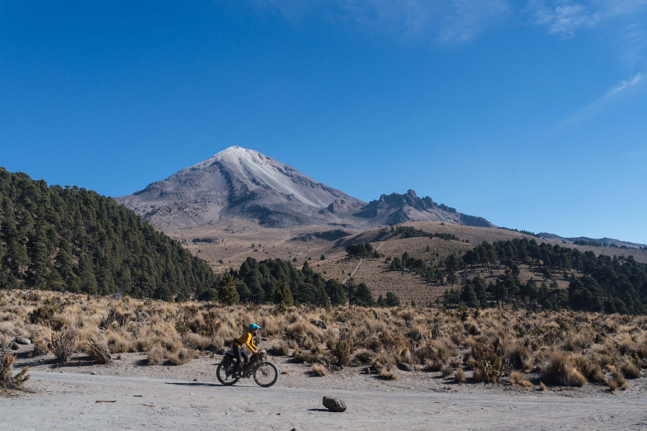
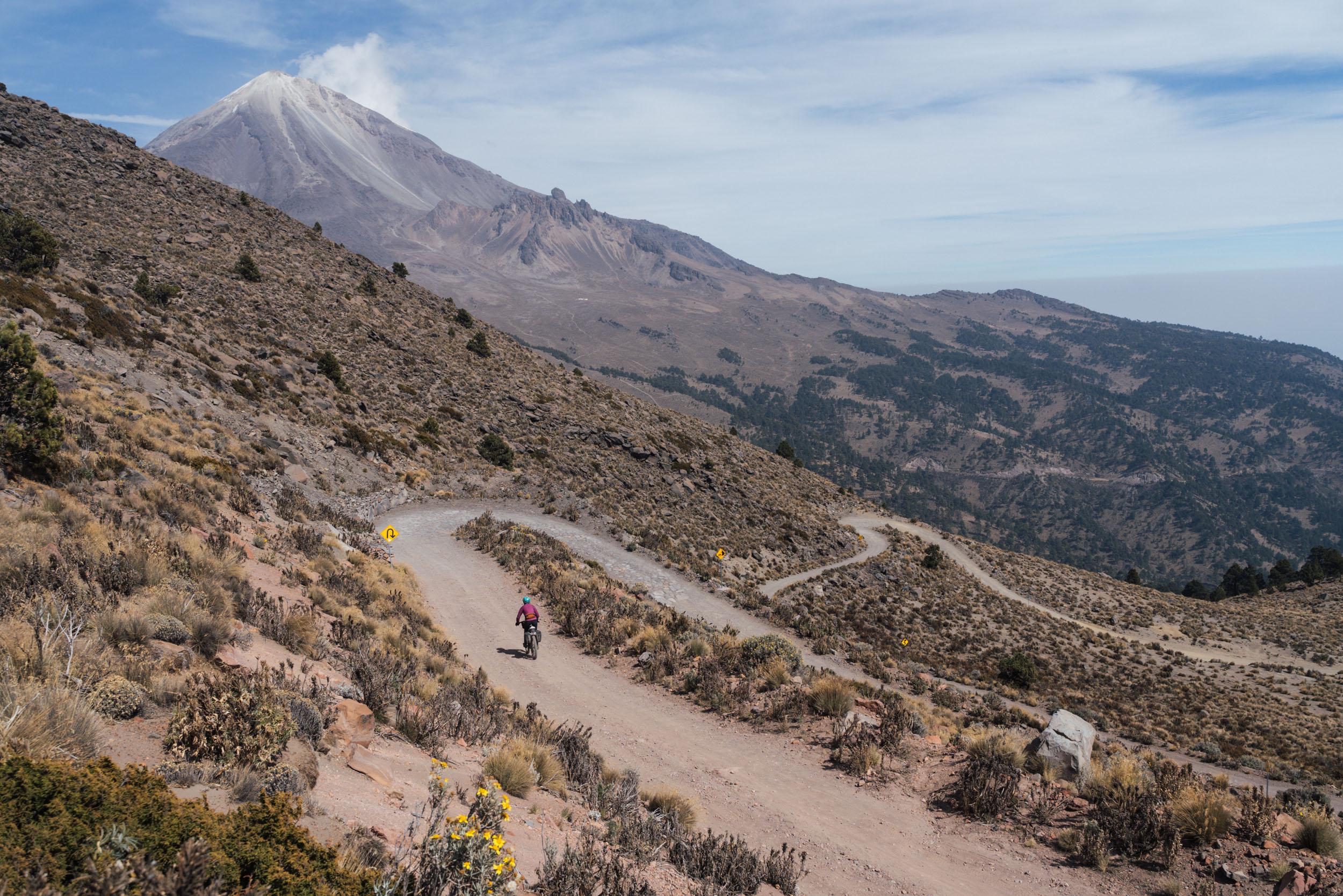
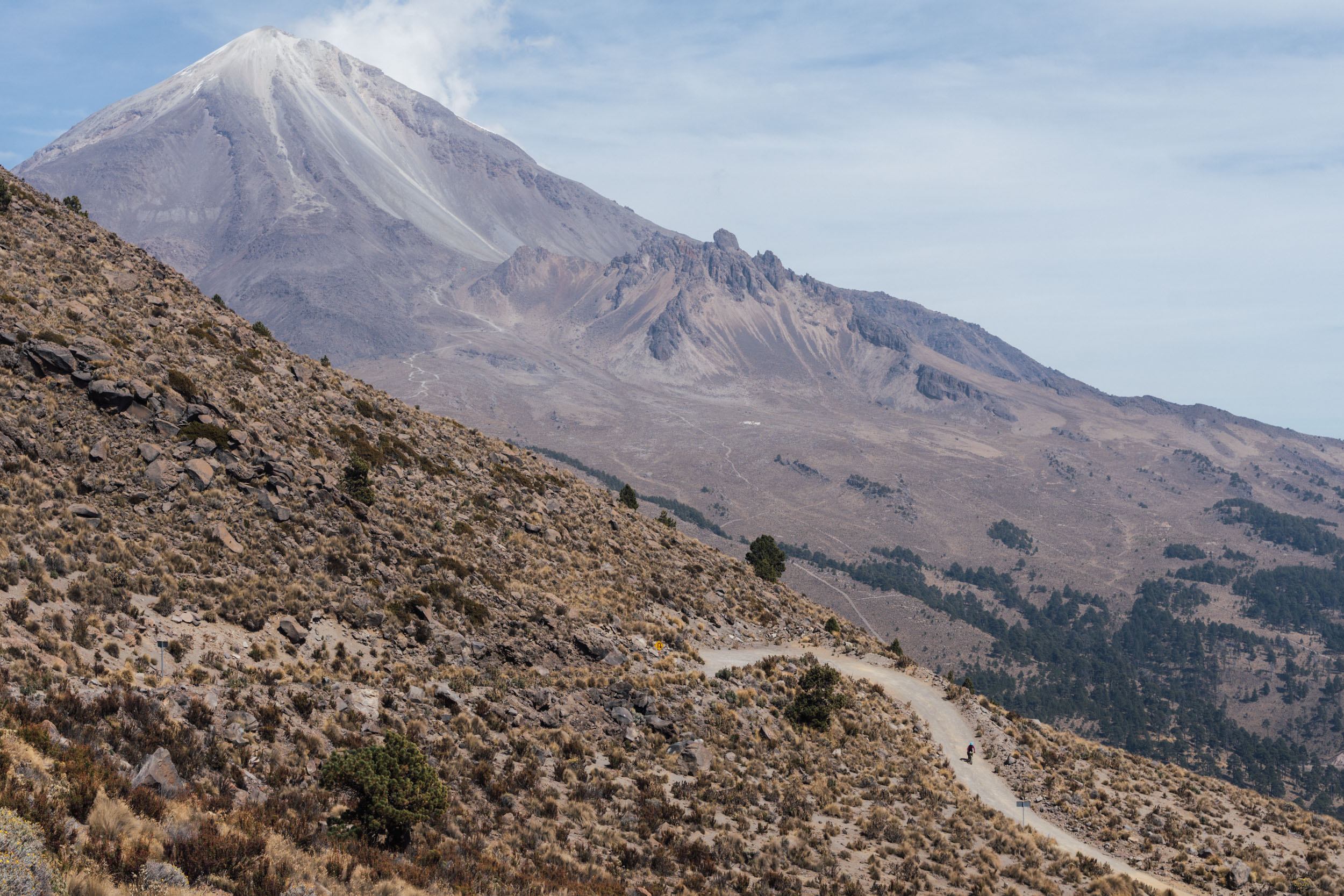
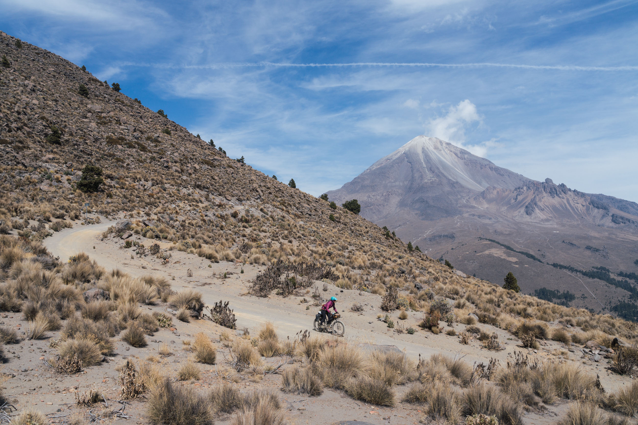
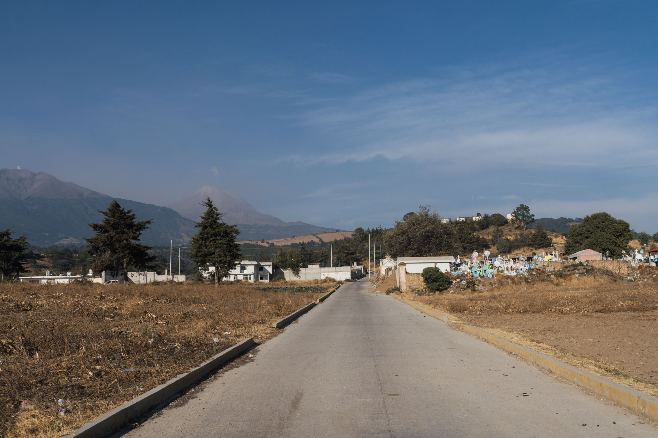
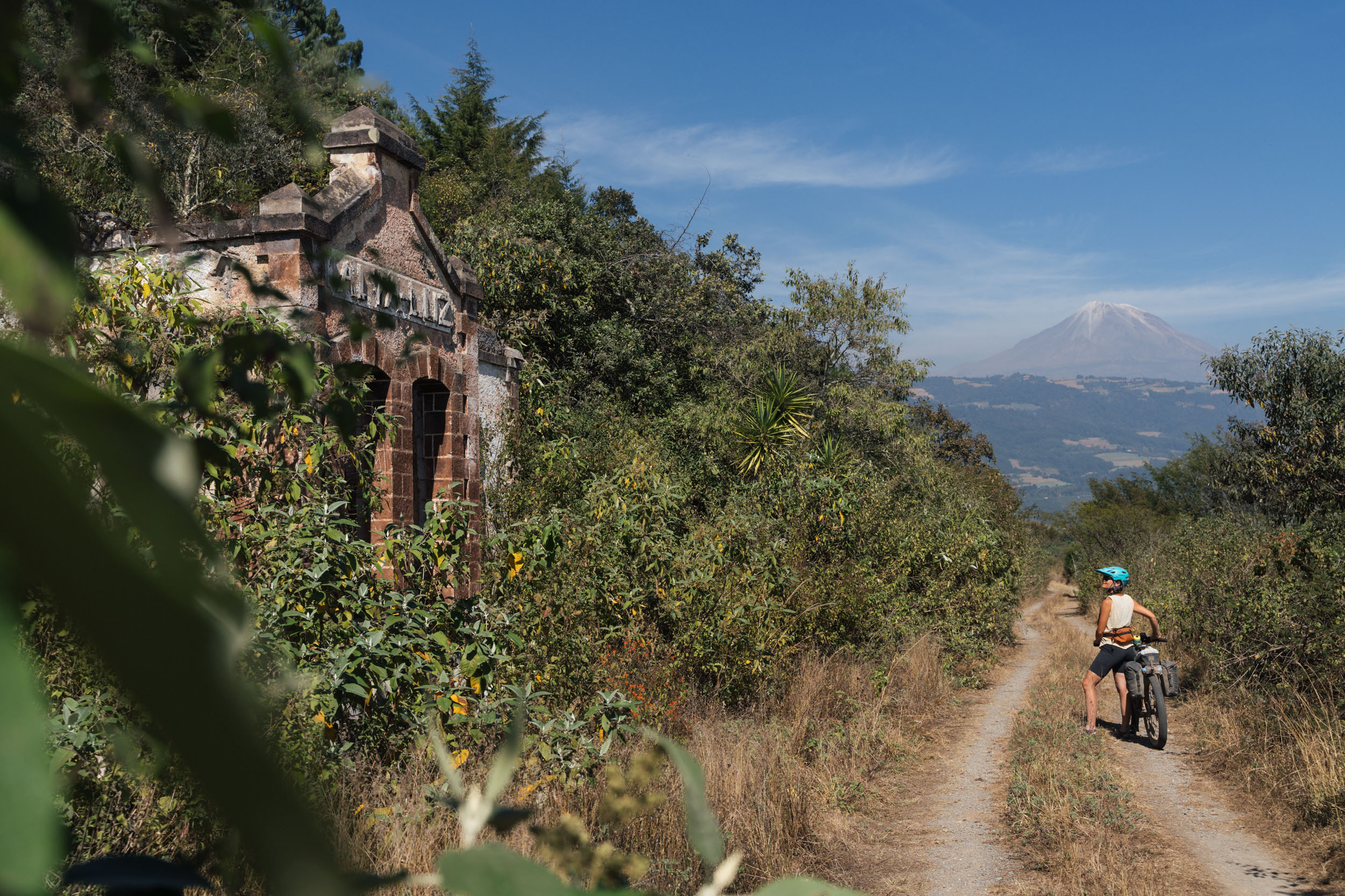
Let’s get the headlines out of the way first! La Vuelta de Citlaltépetl encircles the 5,636-metre, glacier-topped Pico de Orizaba – or Citlaltépetl, “the mountain of the stars”, as it’s called in Nahuatl. It’s a peak that’s noted for being the highest in Mexico, the third highest in North America, and the loftiest volcanic summit in the Northern Hemisphere. The route also climbs to the very top of the highest motorable road in the country!
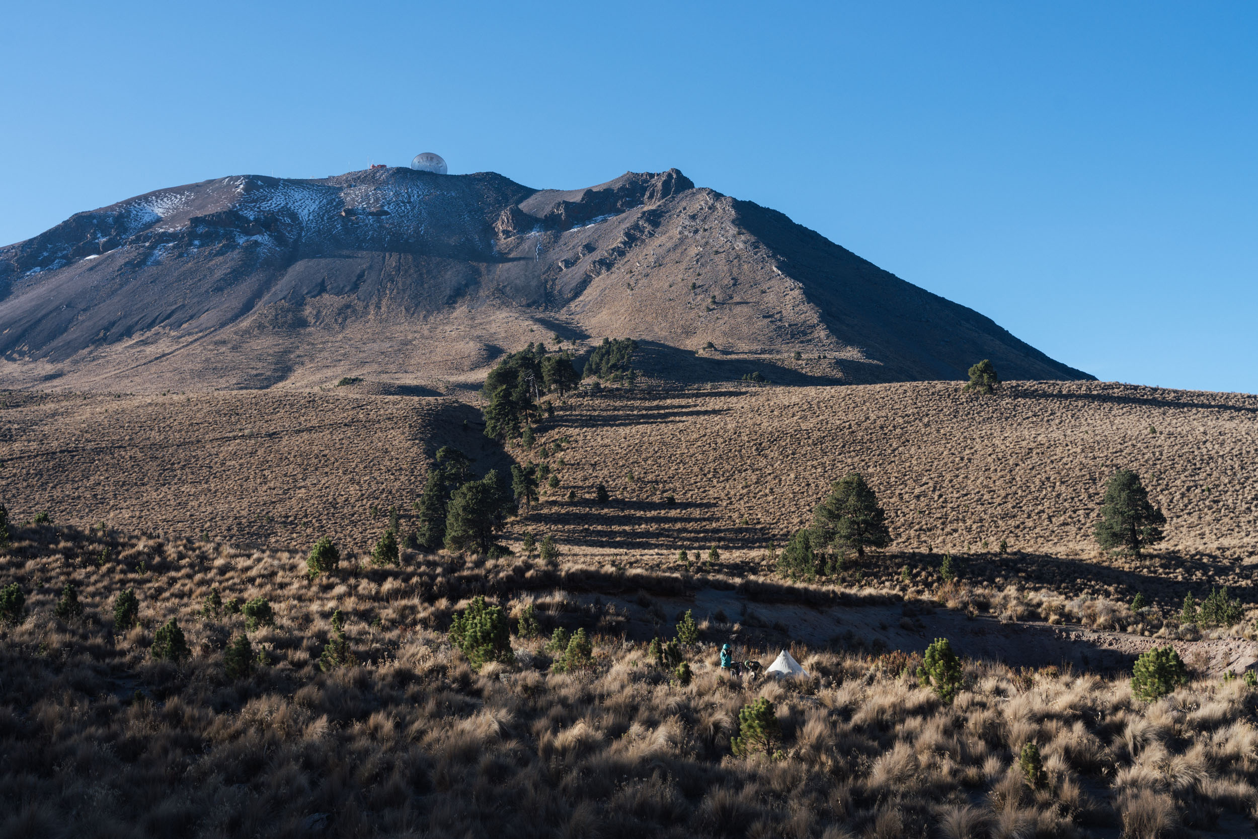
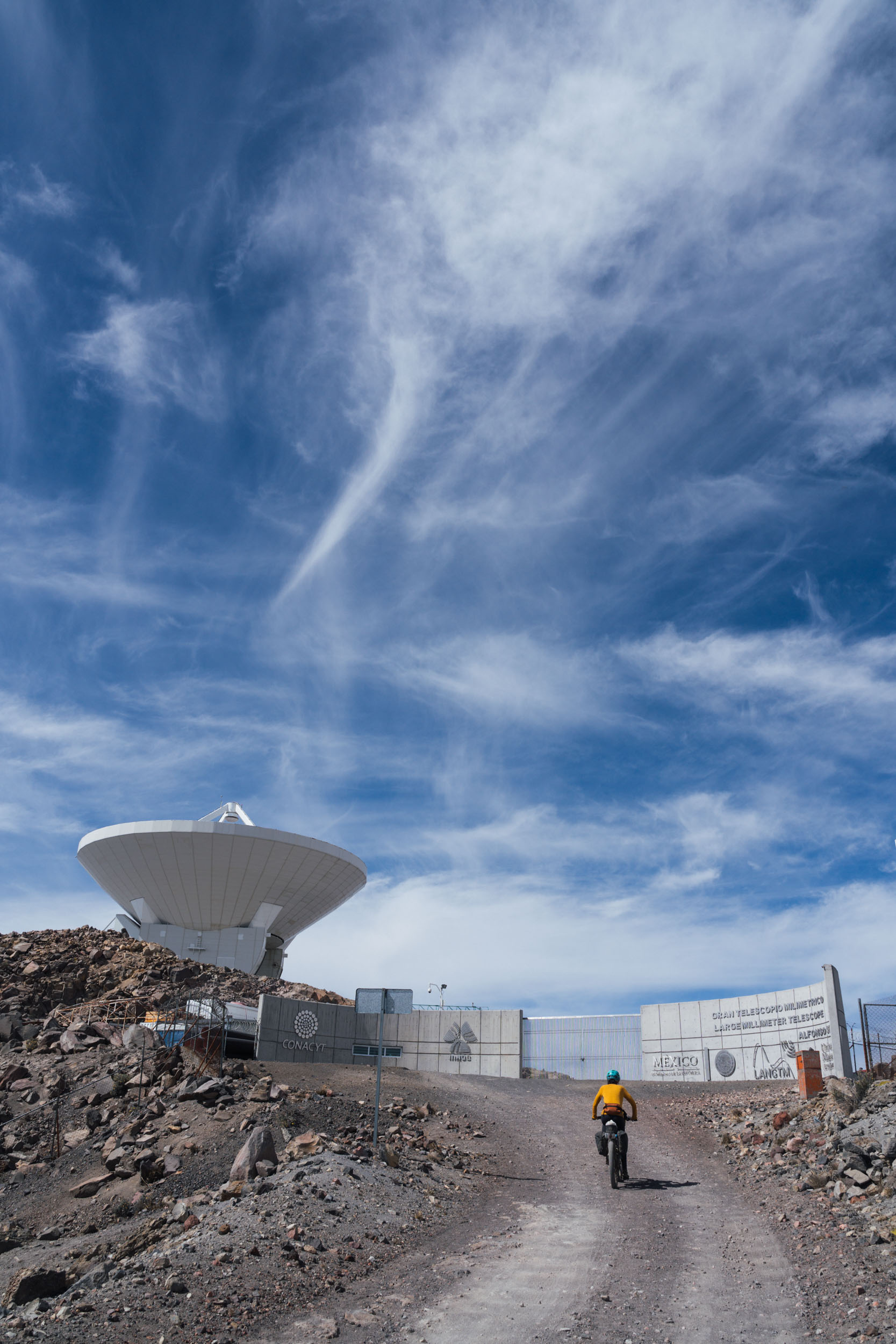
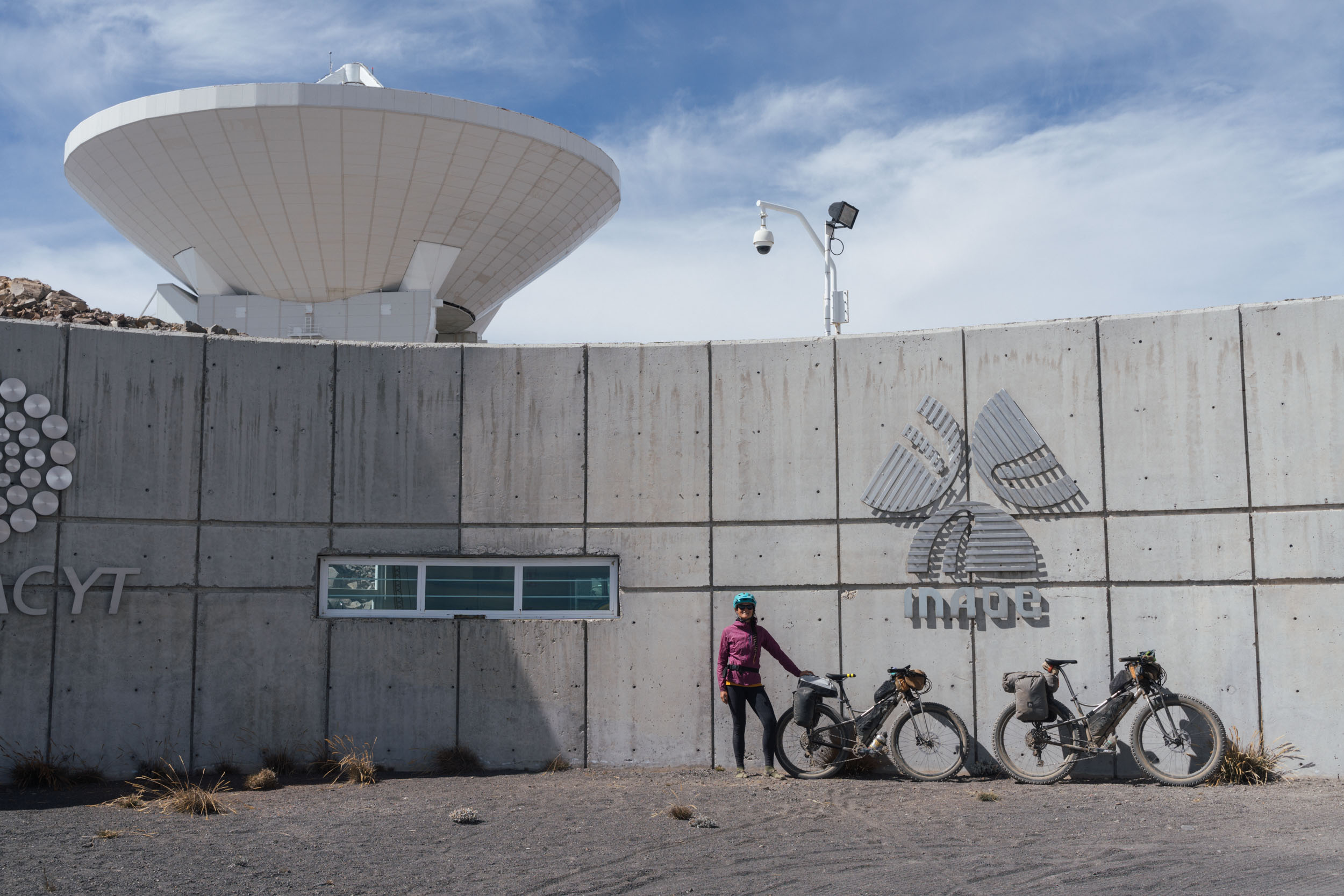
Set within the states of Veracruz and Puebla, this is a loop that sees a remarkable range of terrain in a relatively short distance, climbing from just 900 metres at its lowest point to almost 4,600 metres at its highest, en route to the Large Millimeter Telescope. This Mexican-US project is the biggest telescope of its kind and sits probing deep space atop the neighbouring and older Volcán Sierra Negra – or Tliltépetl, “the black mountain”, to use the Nahuatl again. Citlaltépetl and Tliltépetl are part of the “Faja Volcanica Transmexicana”, lying at the end of a series of volcanic chains in the 2km high plateau of Central Mexico.
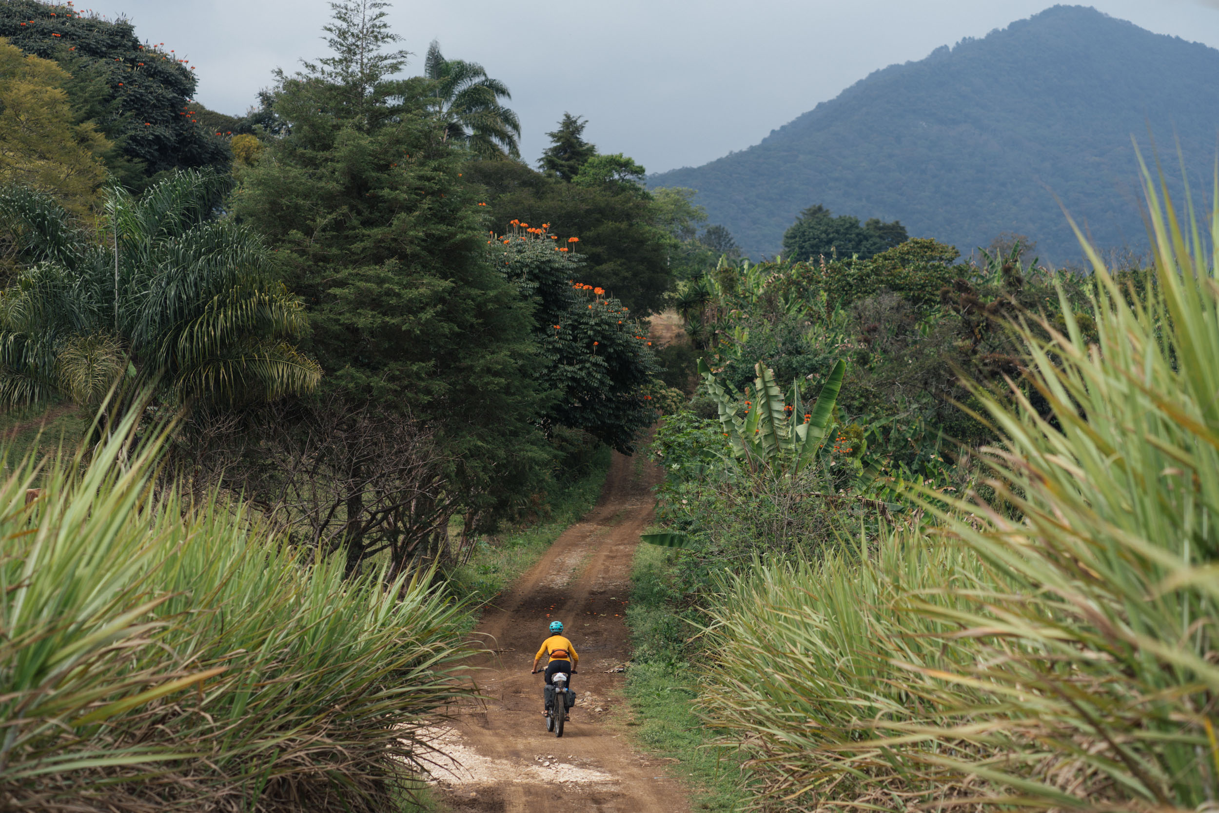
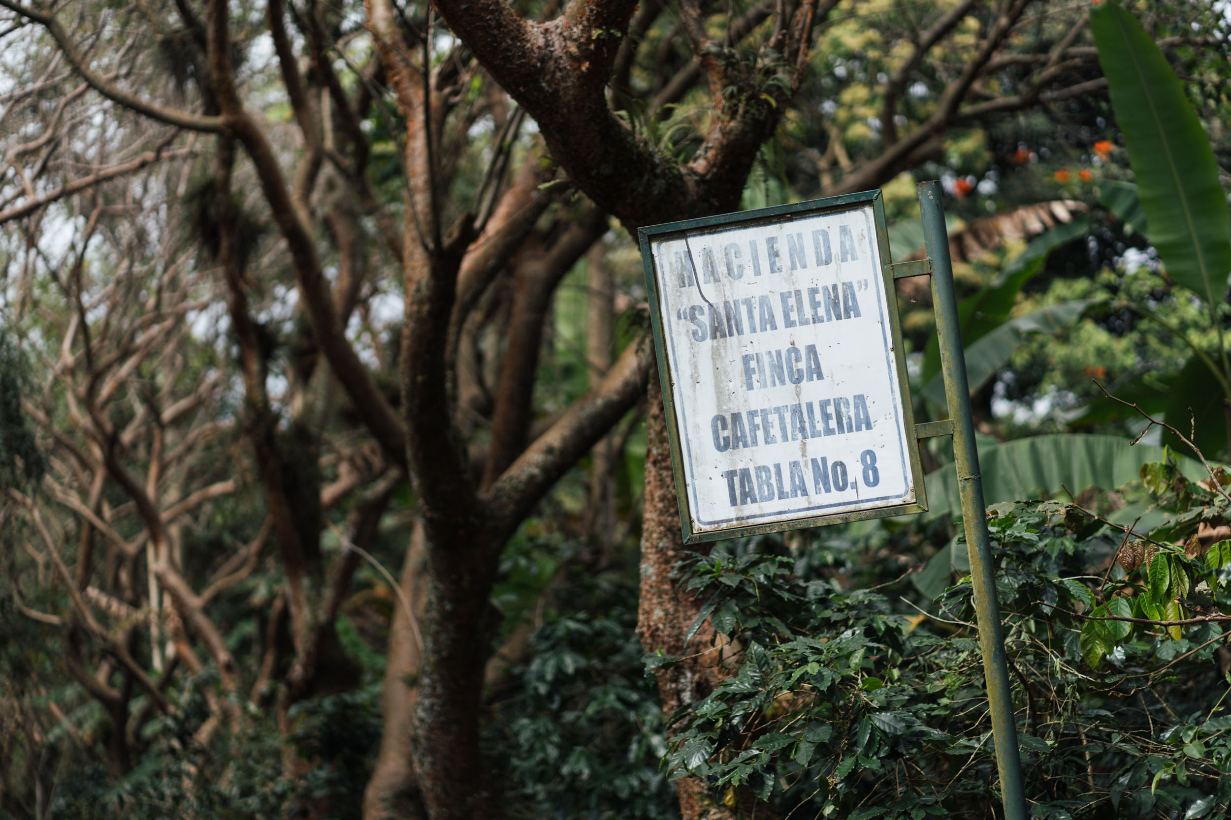
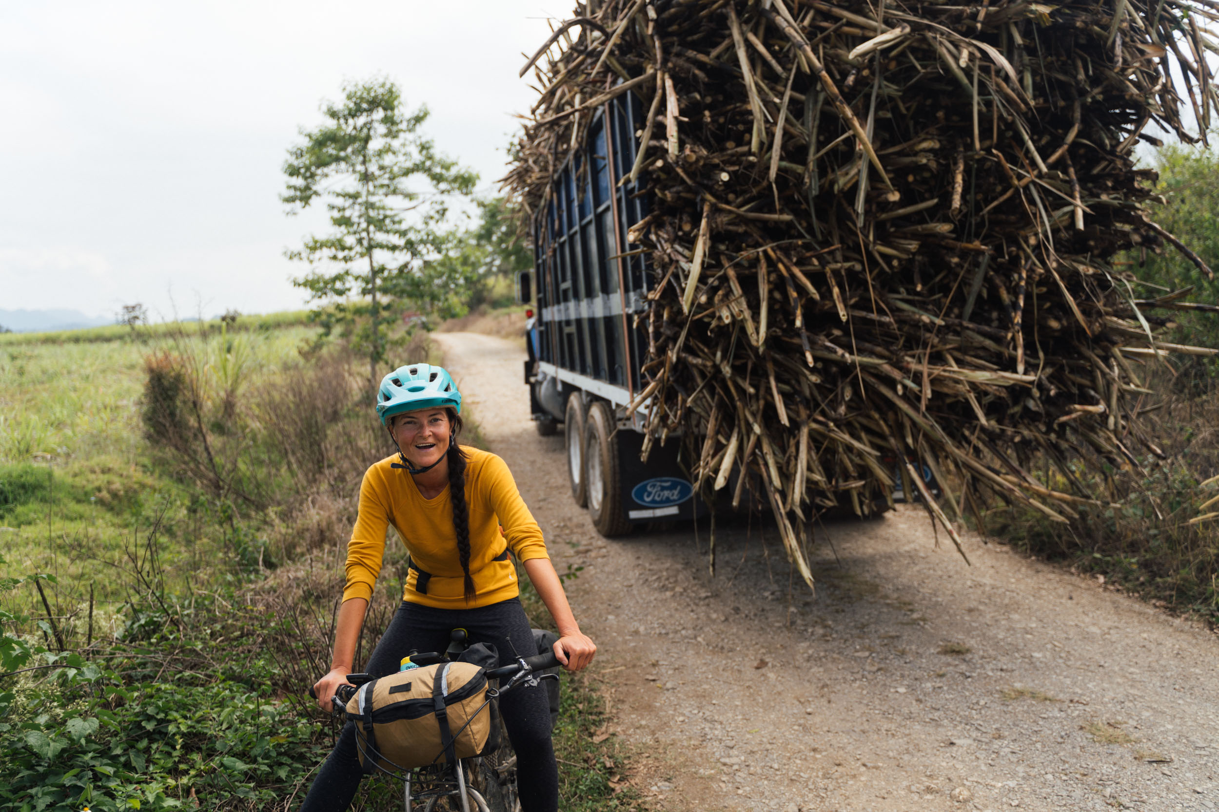
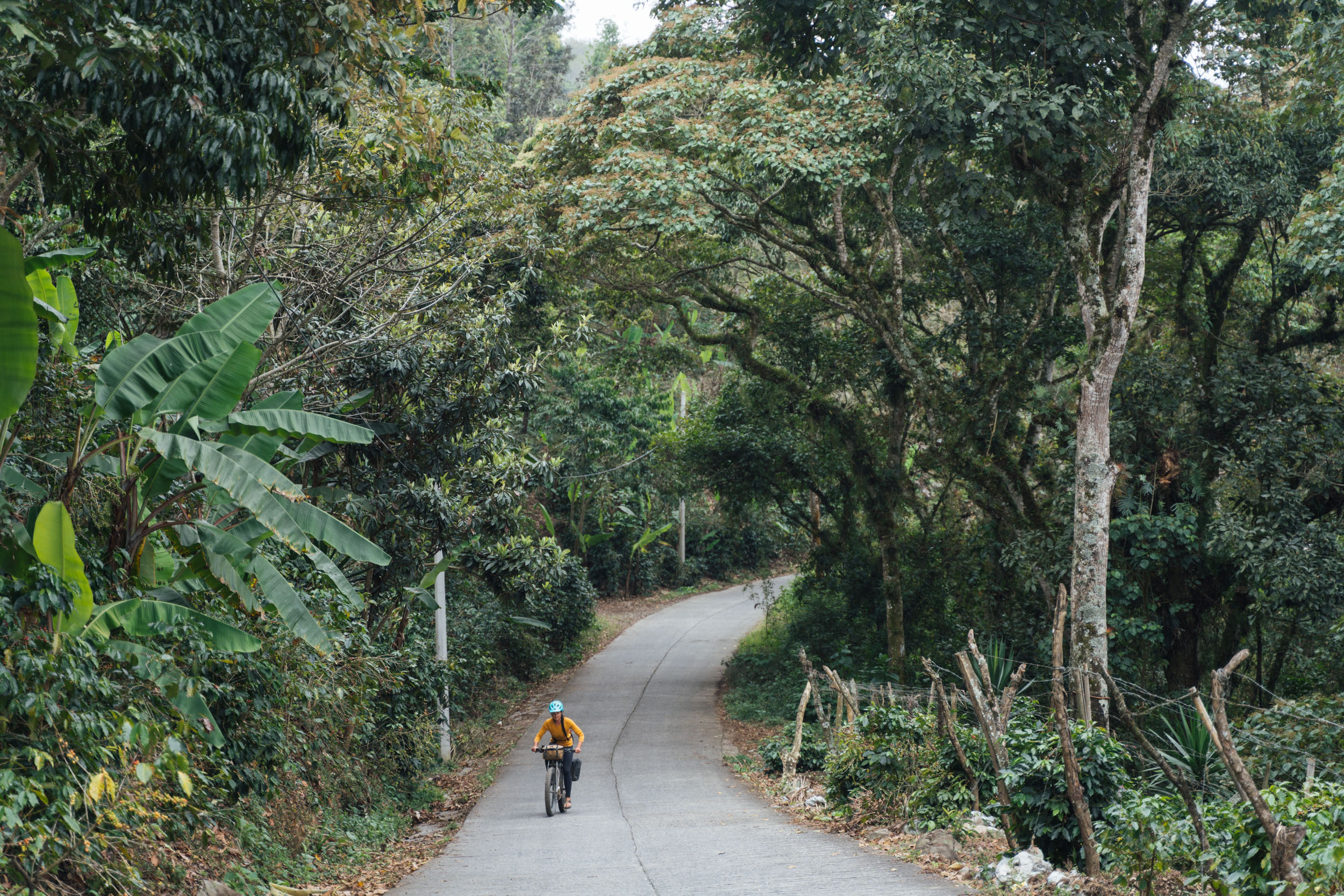
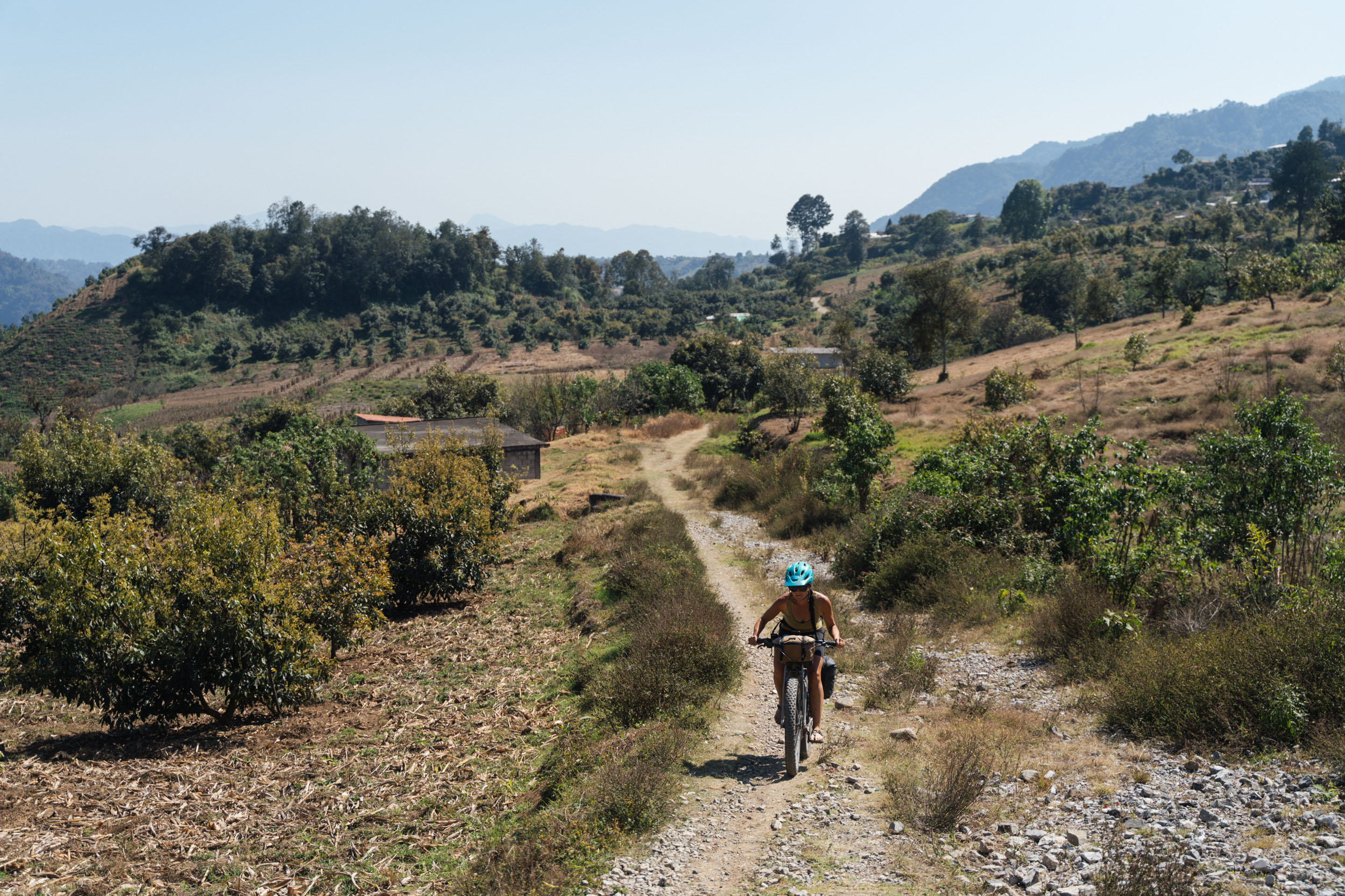
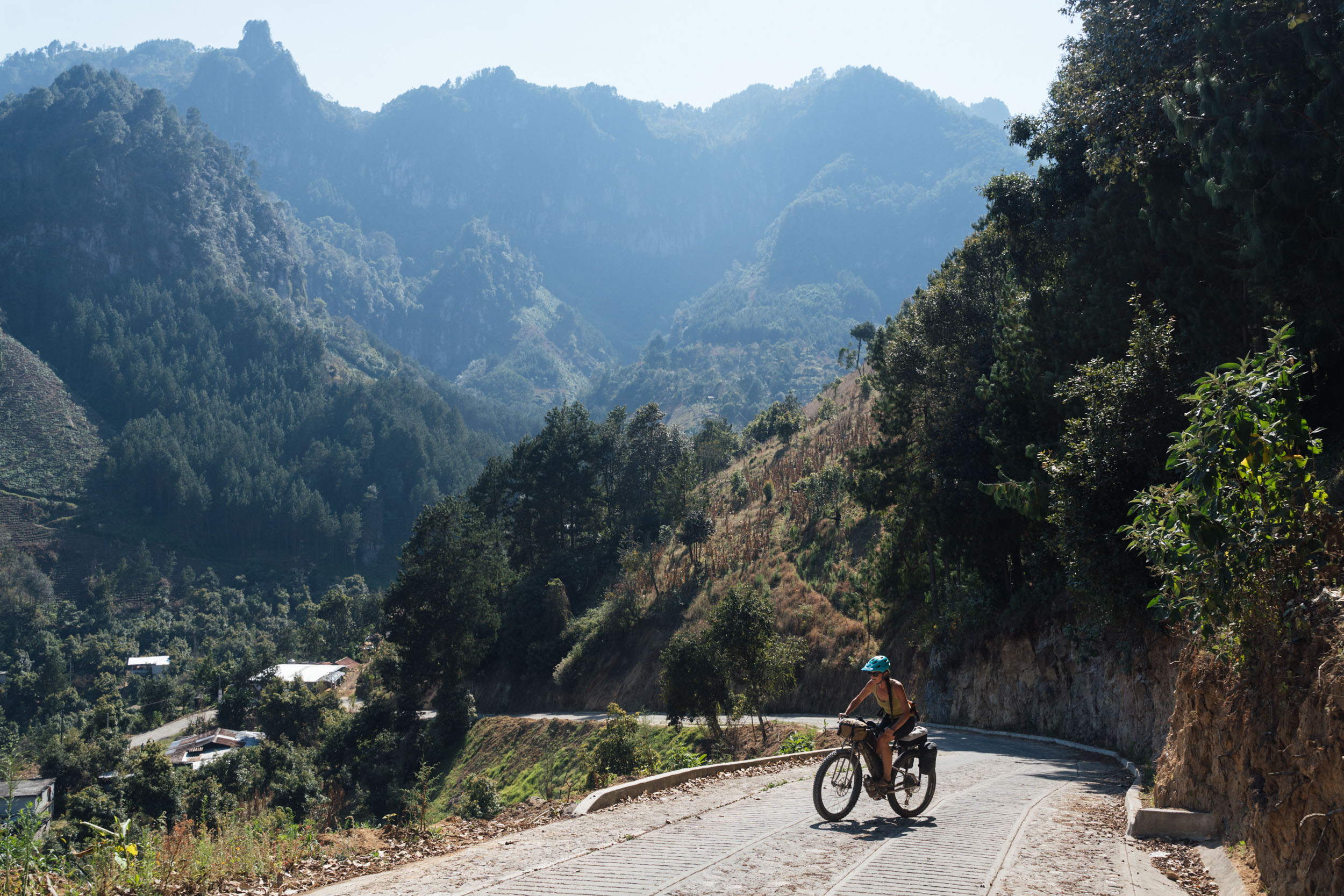
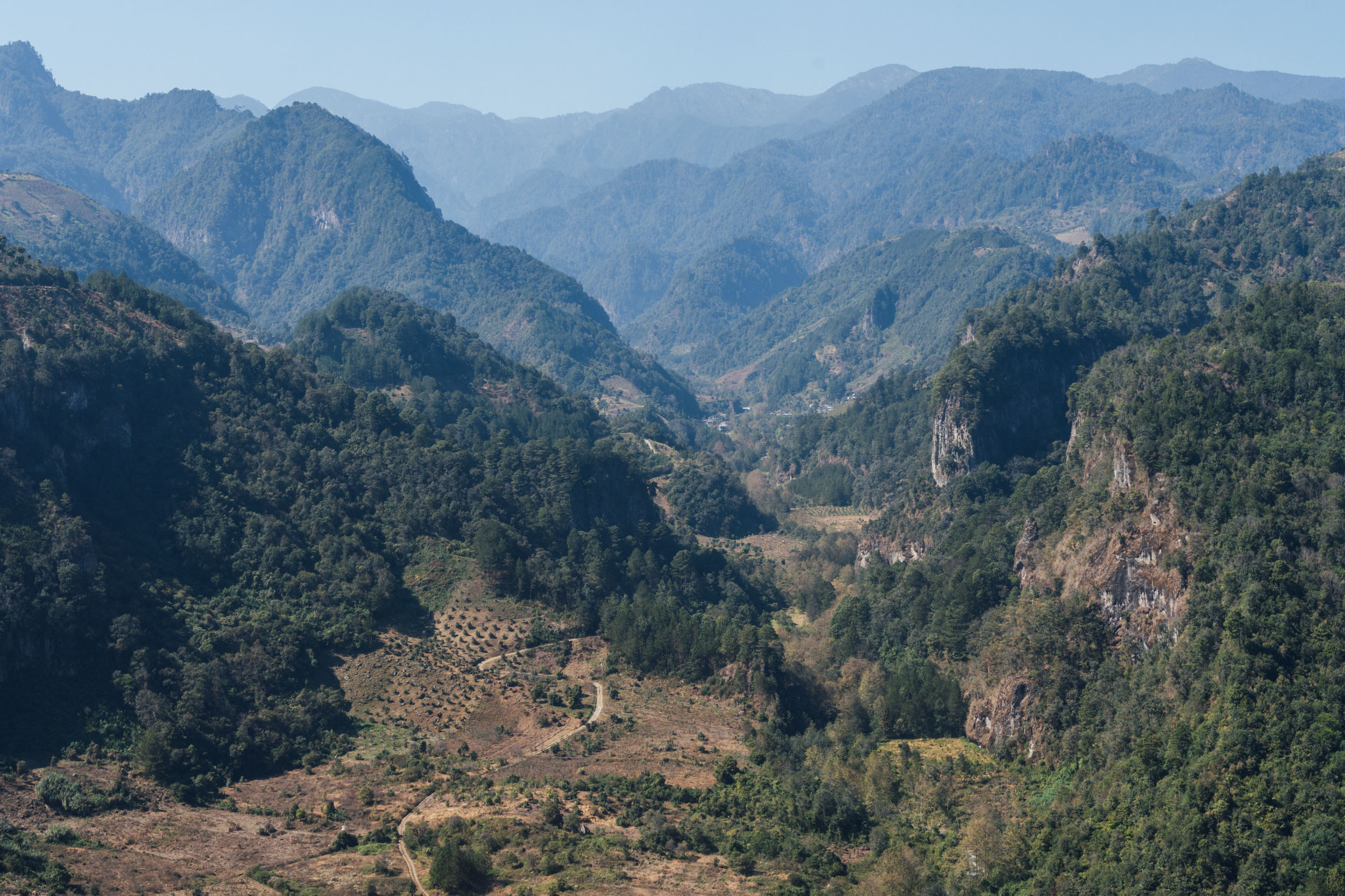
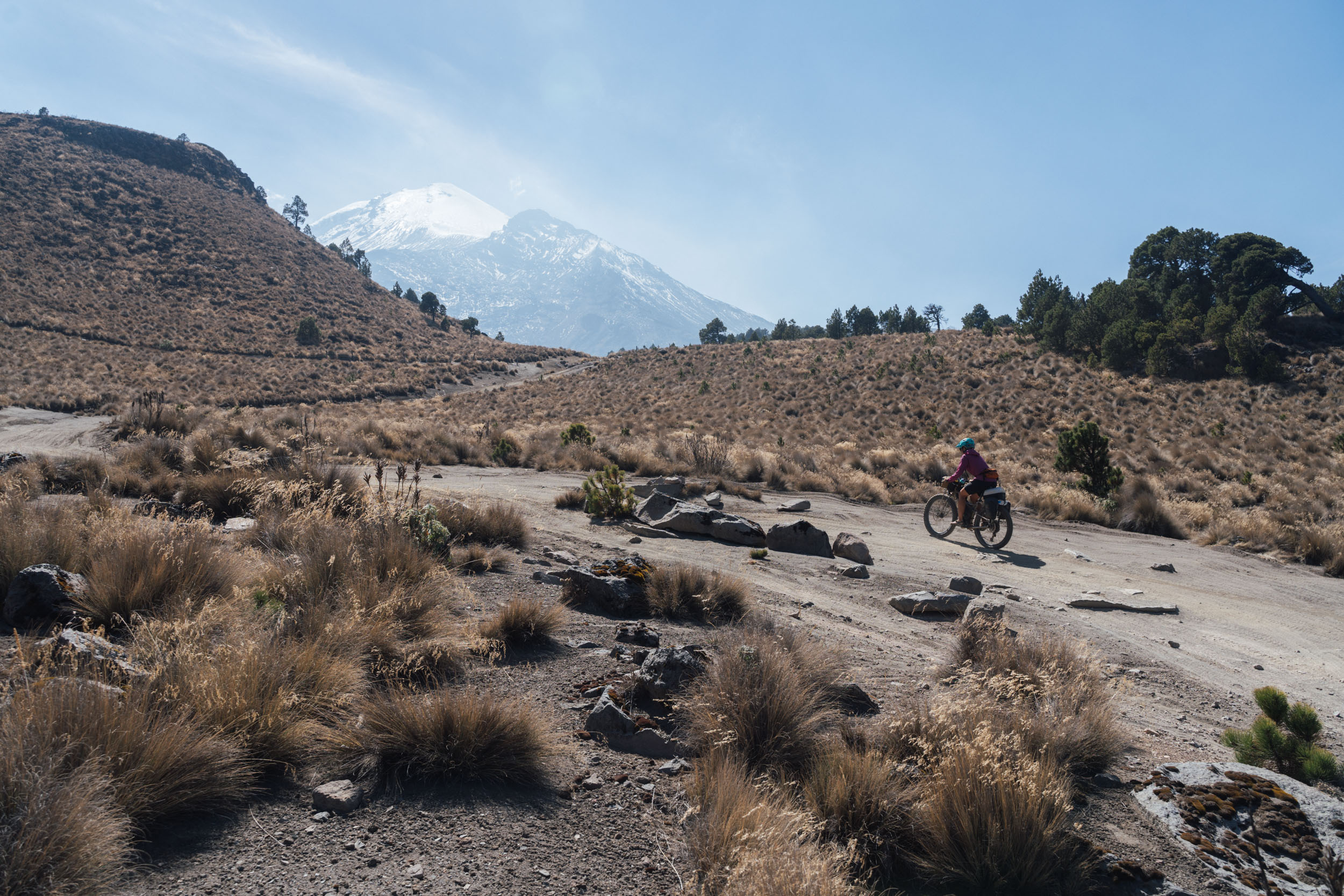
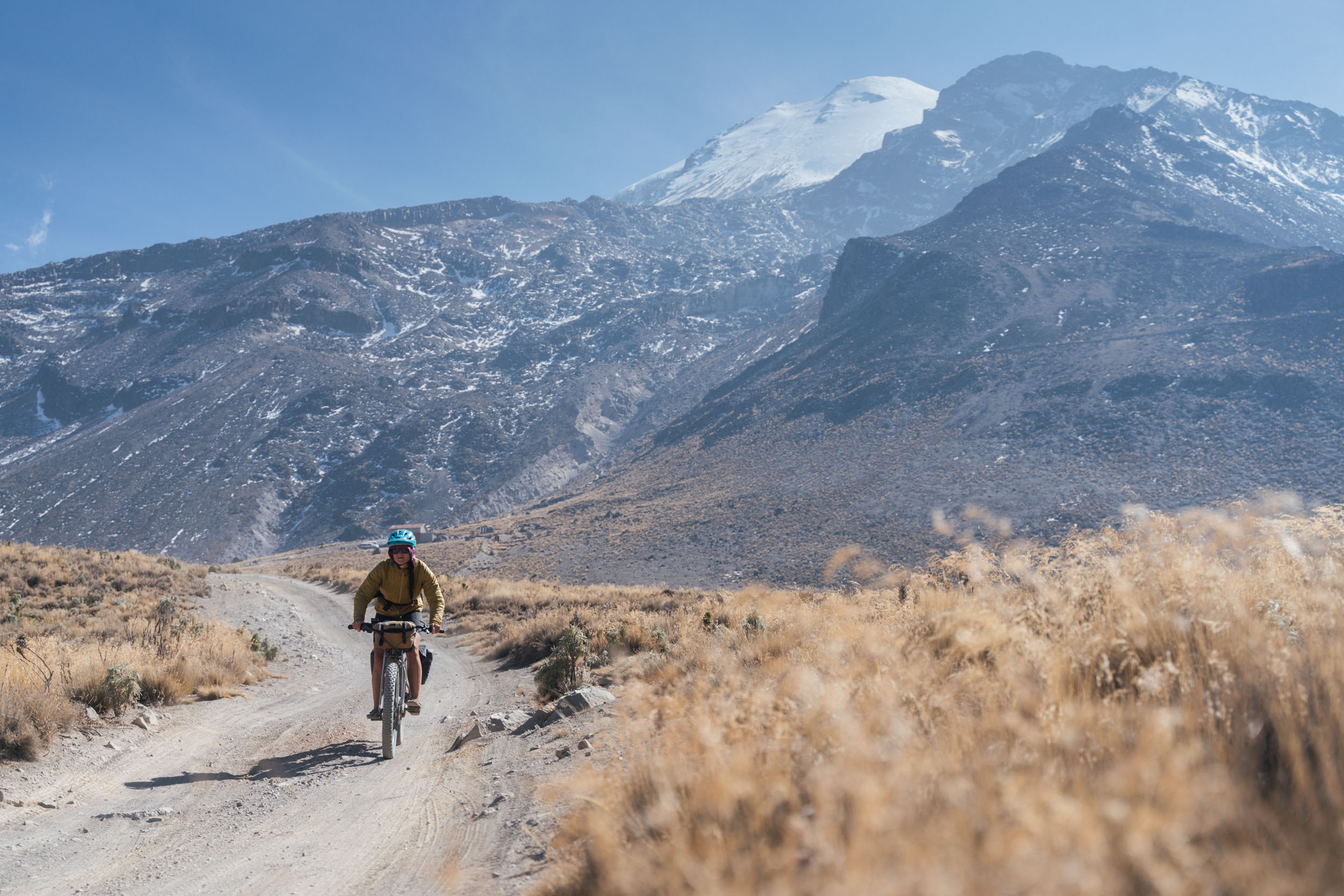
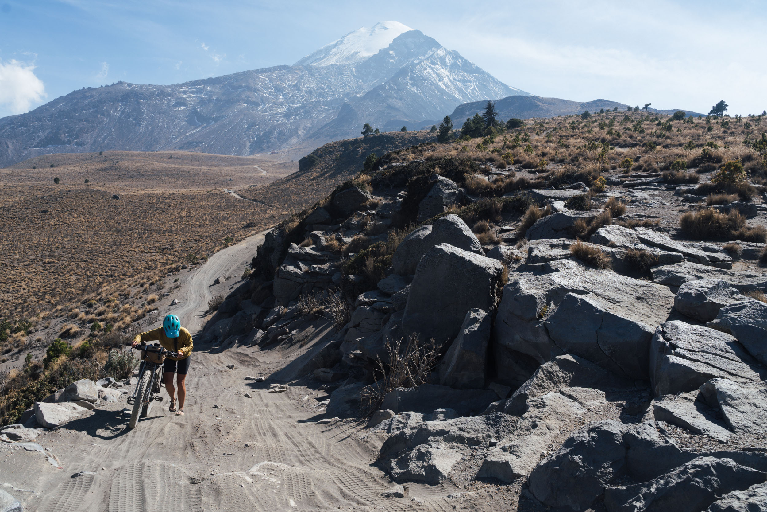
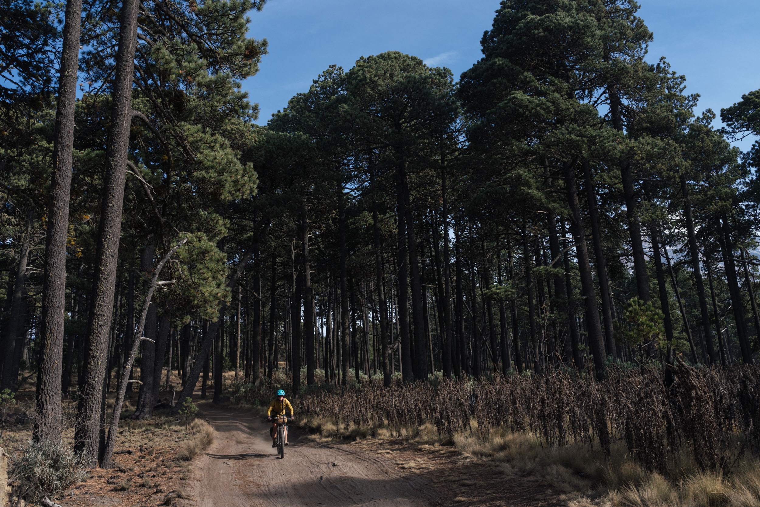
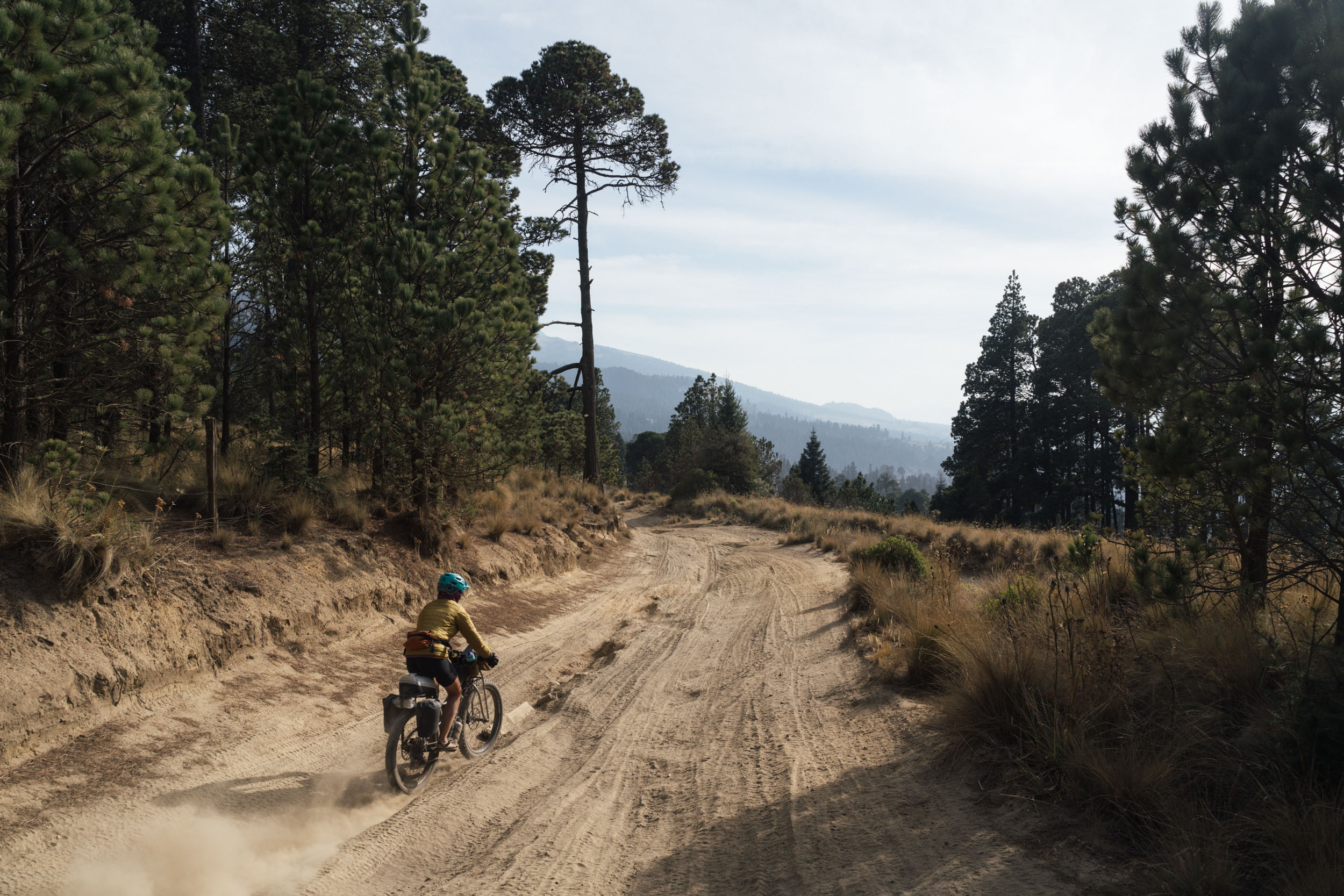
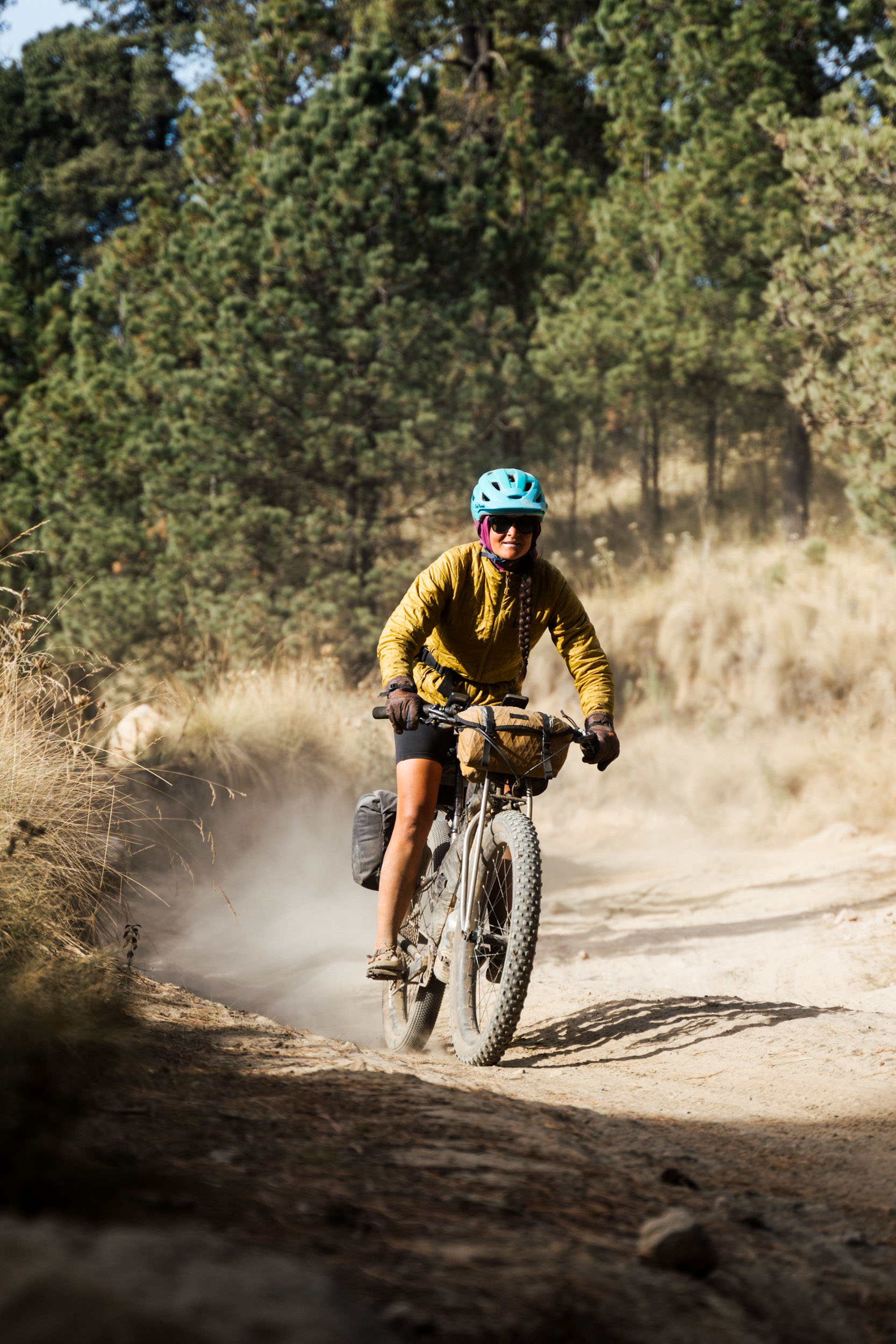
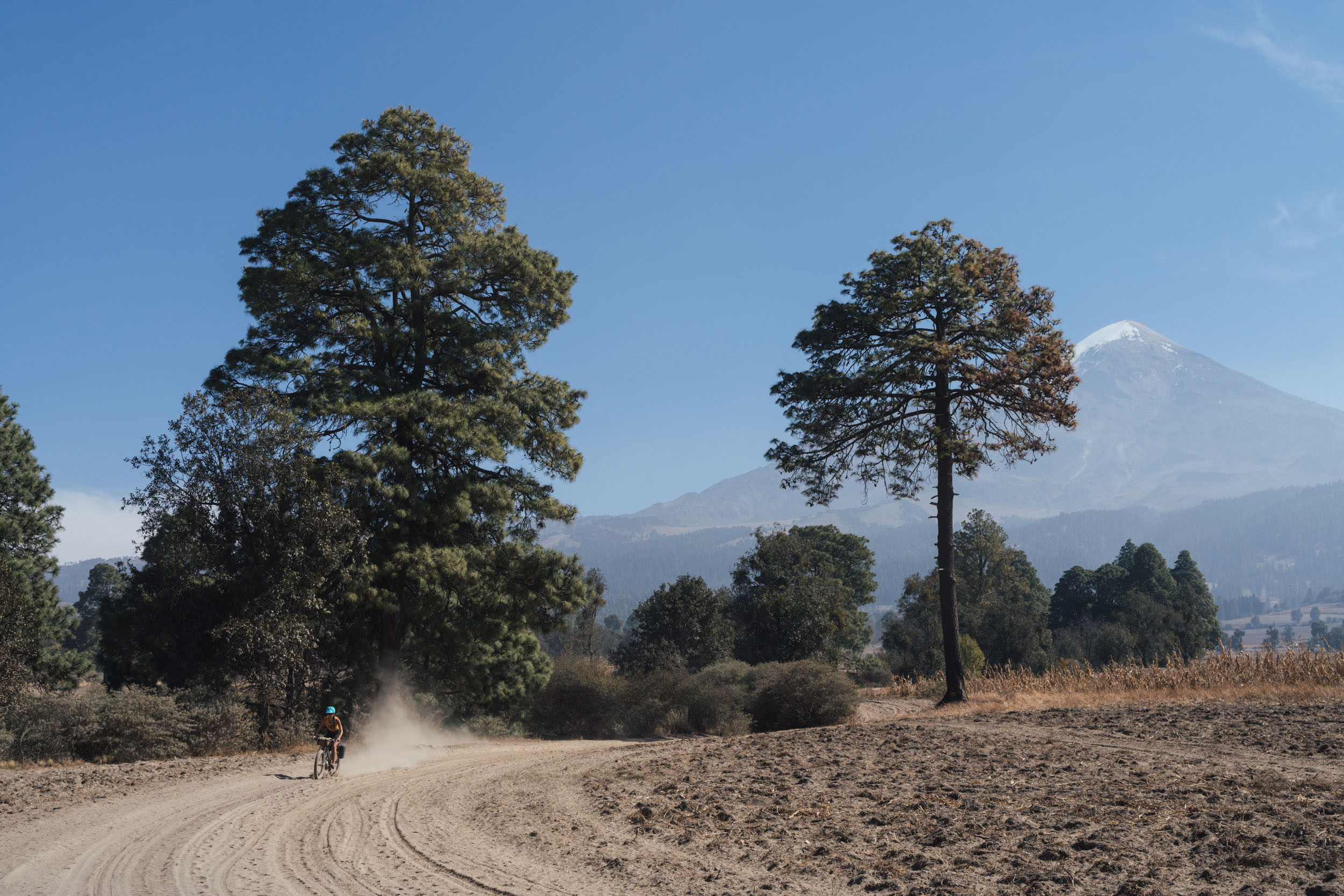
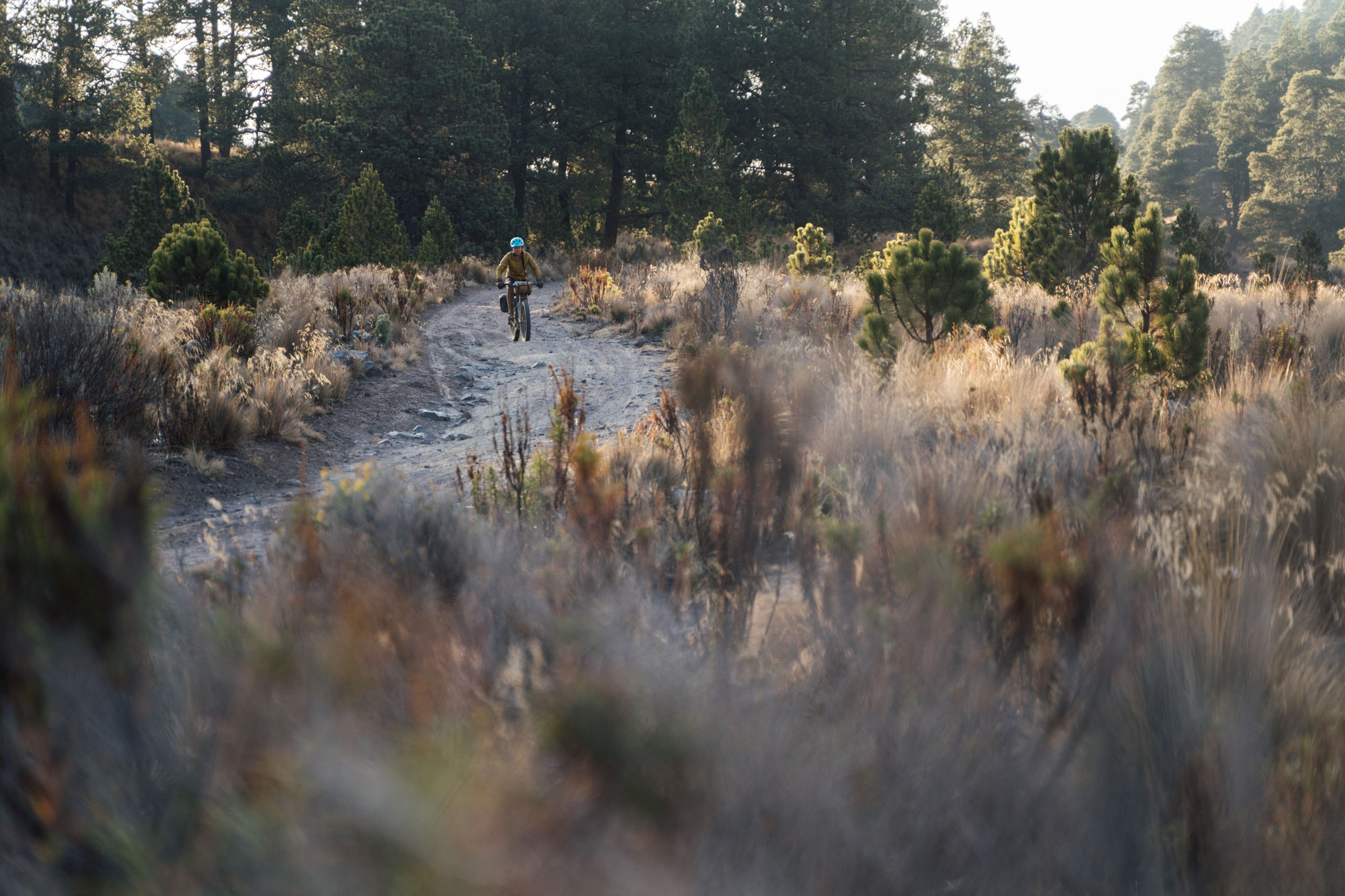
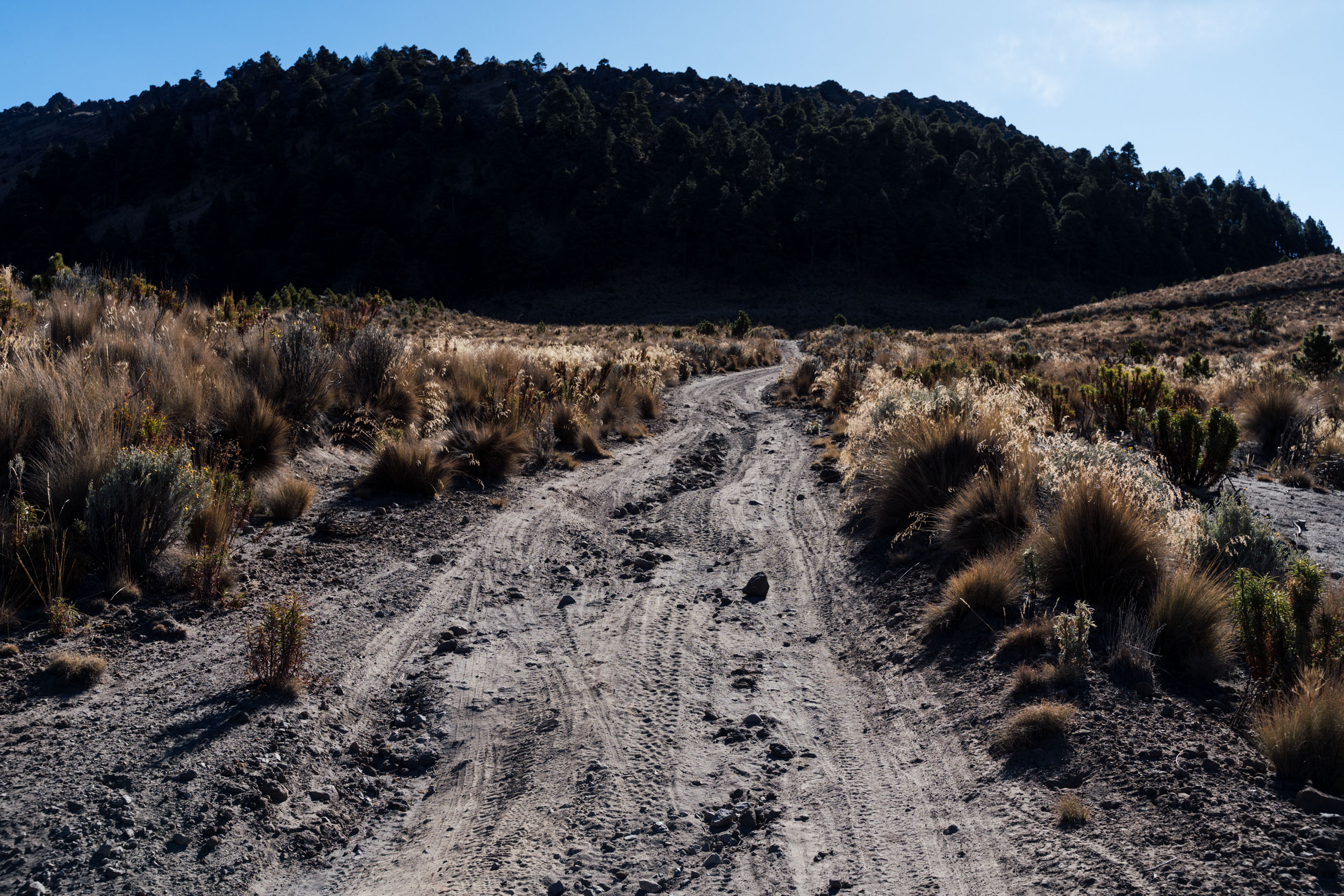
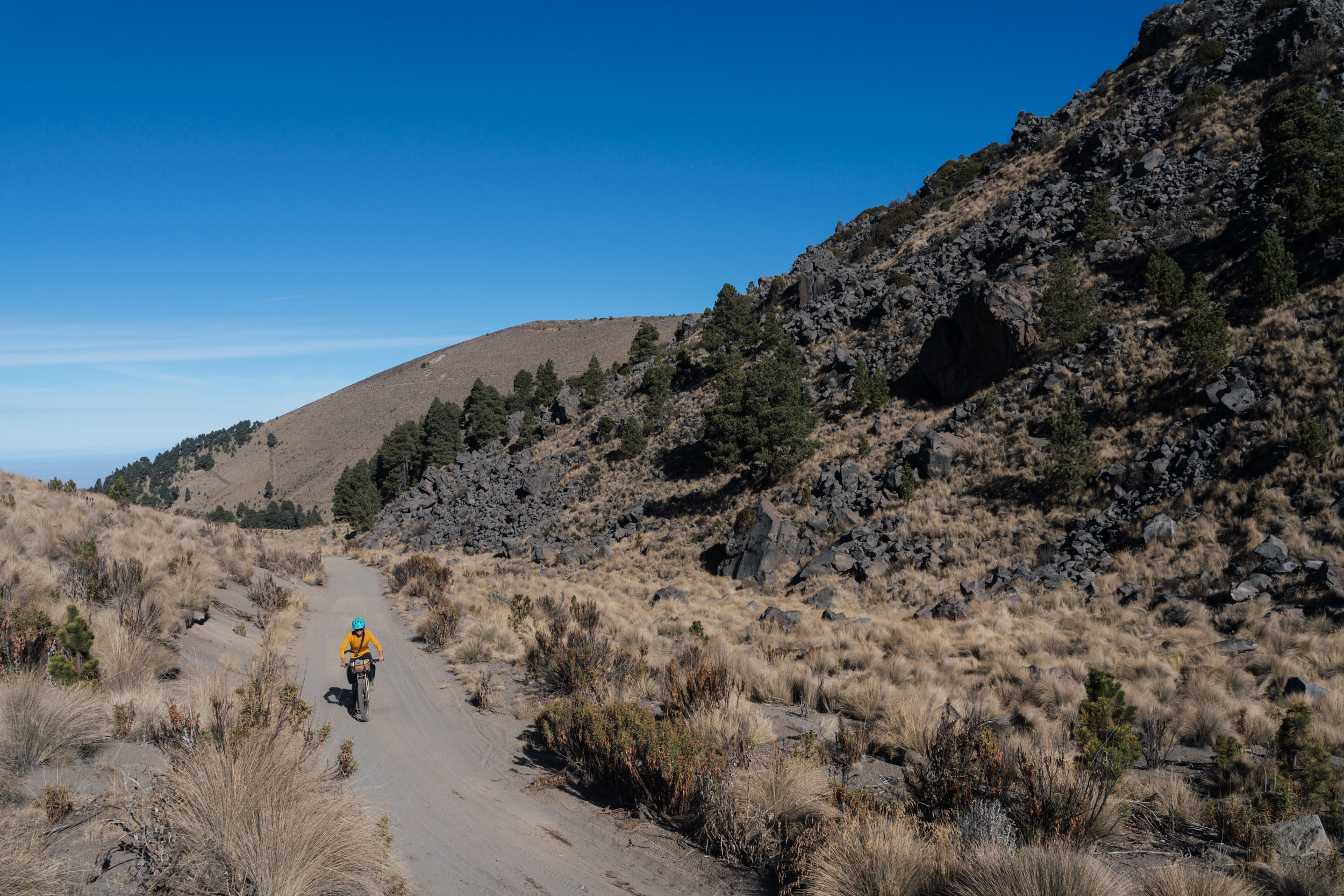
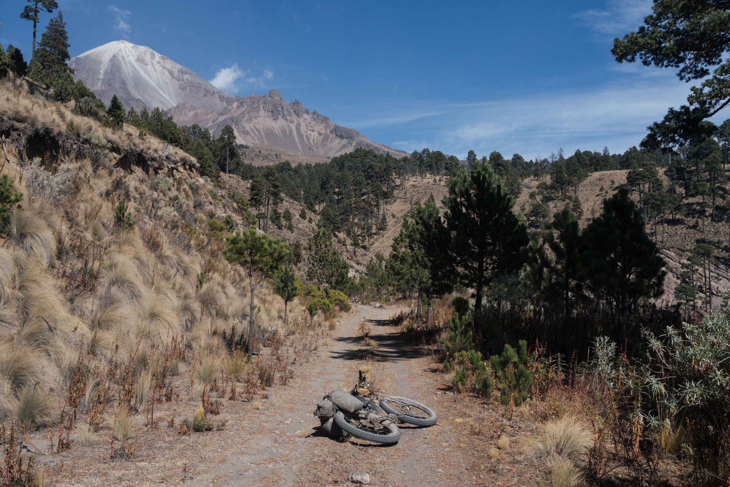
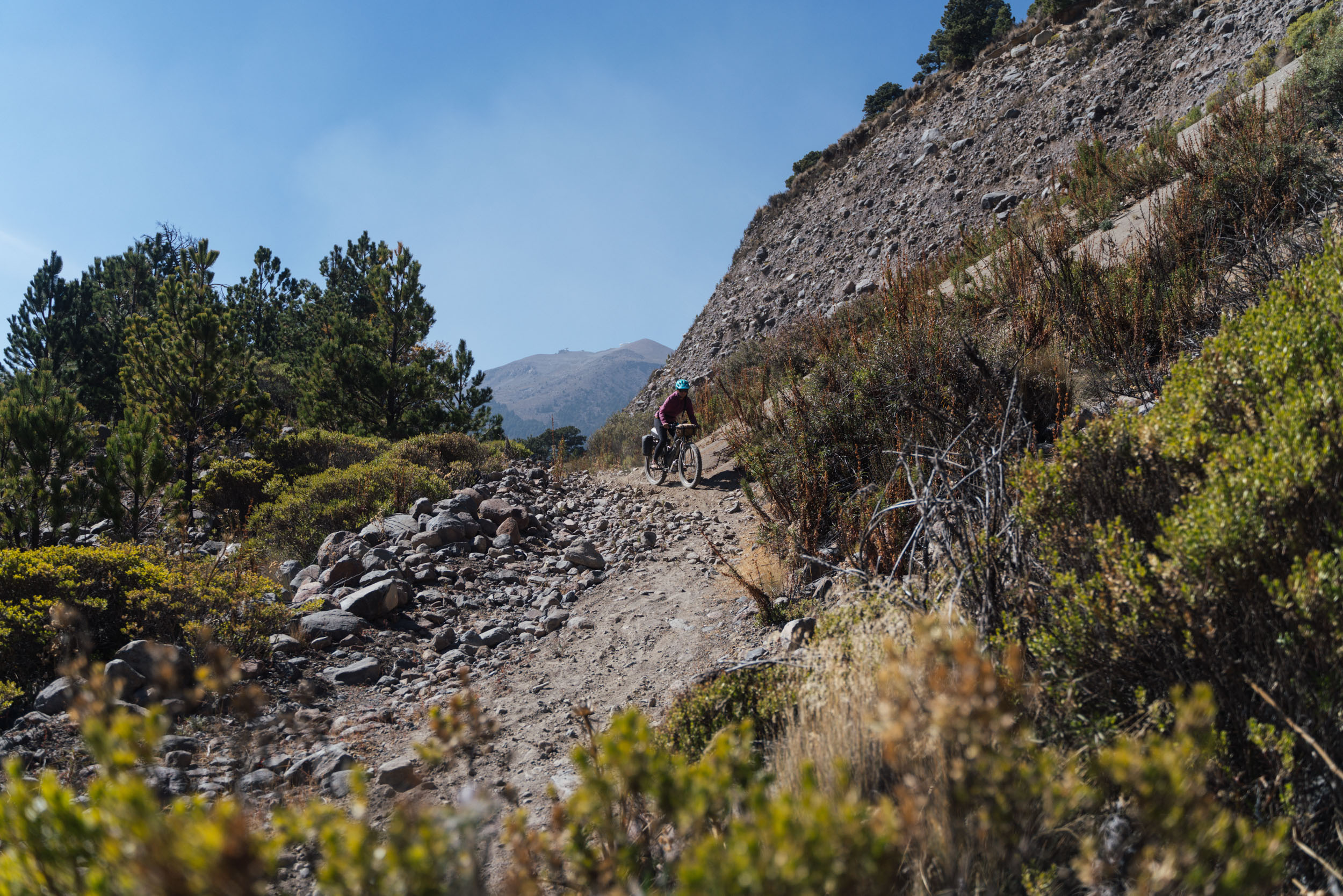
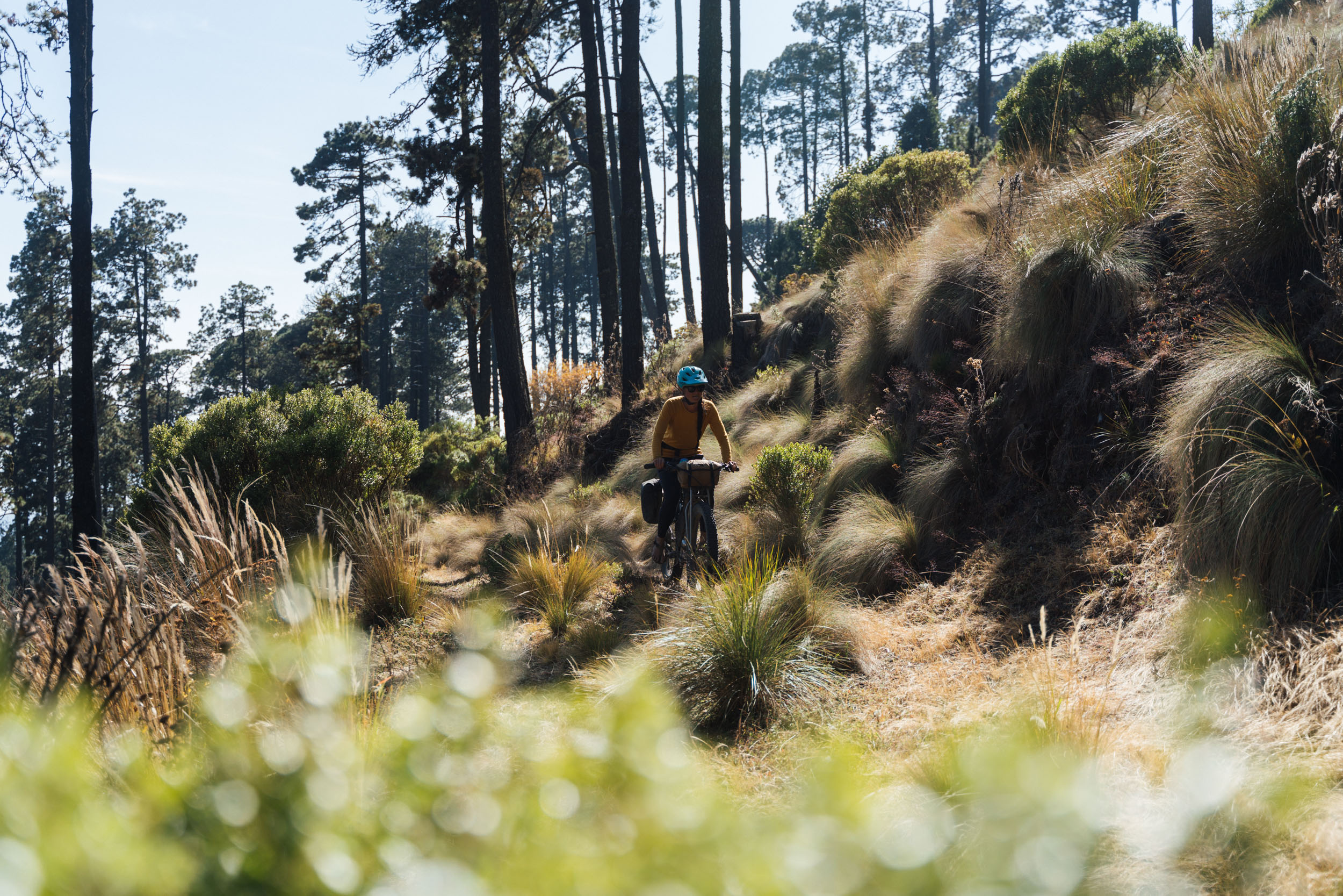
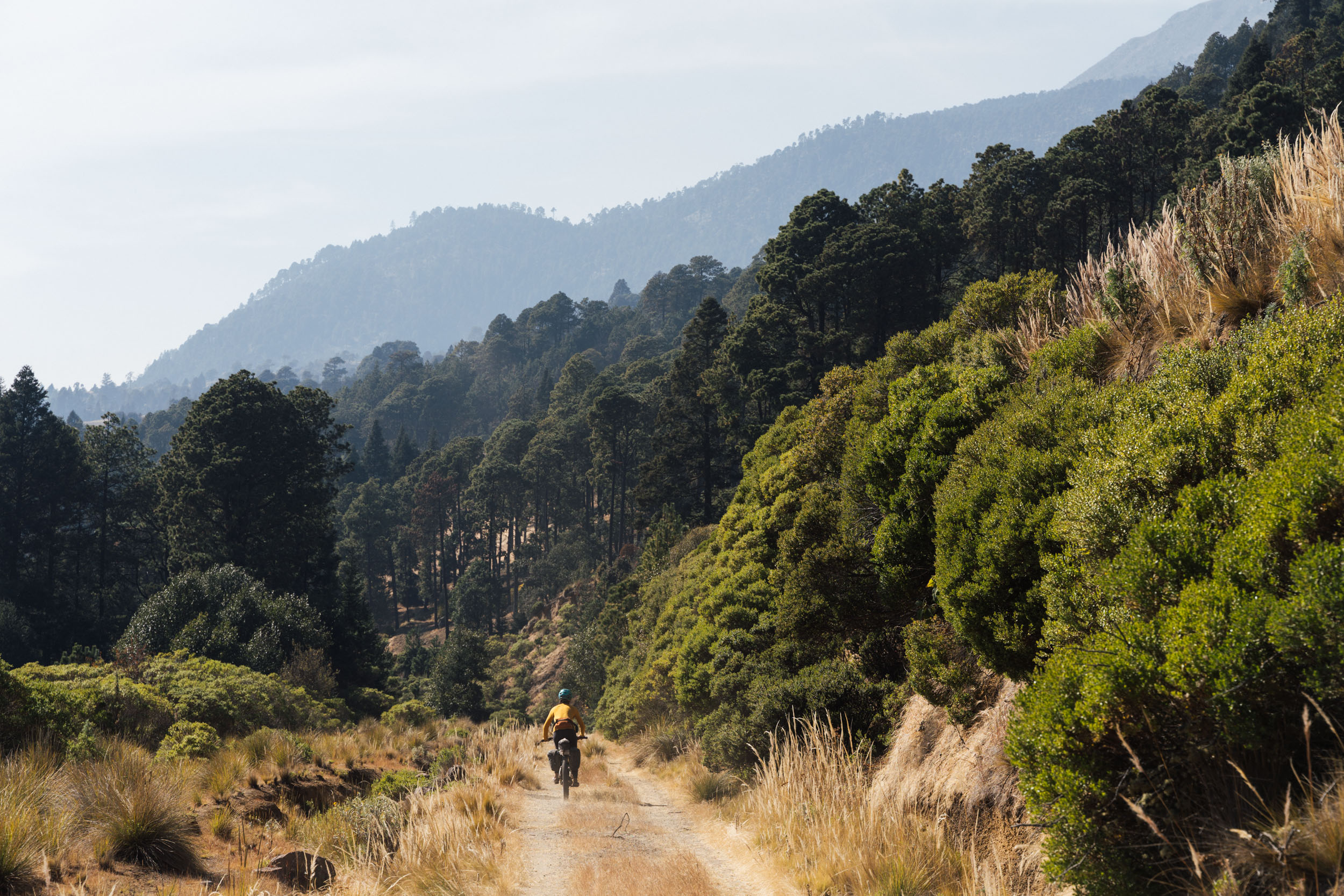
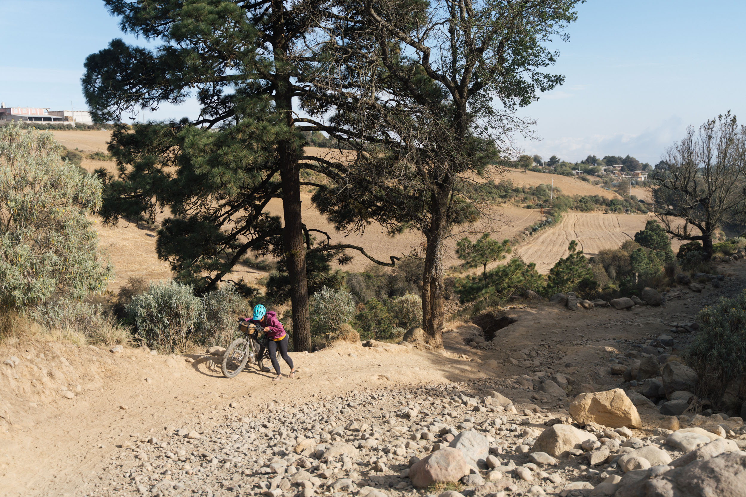
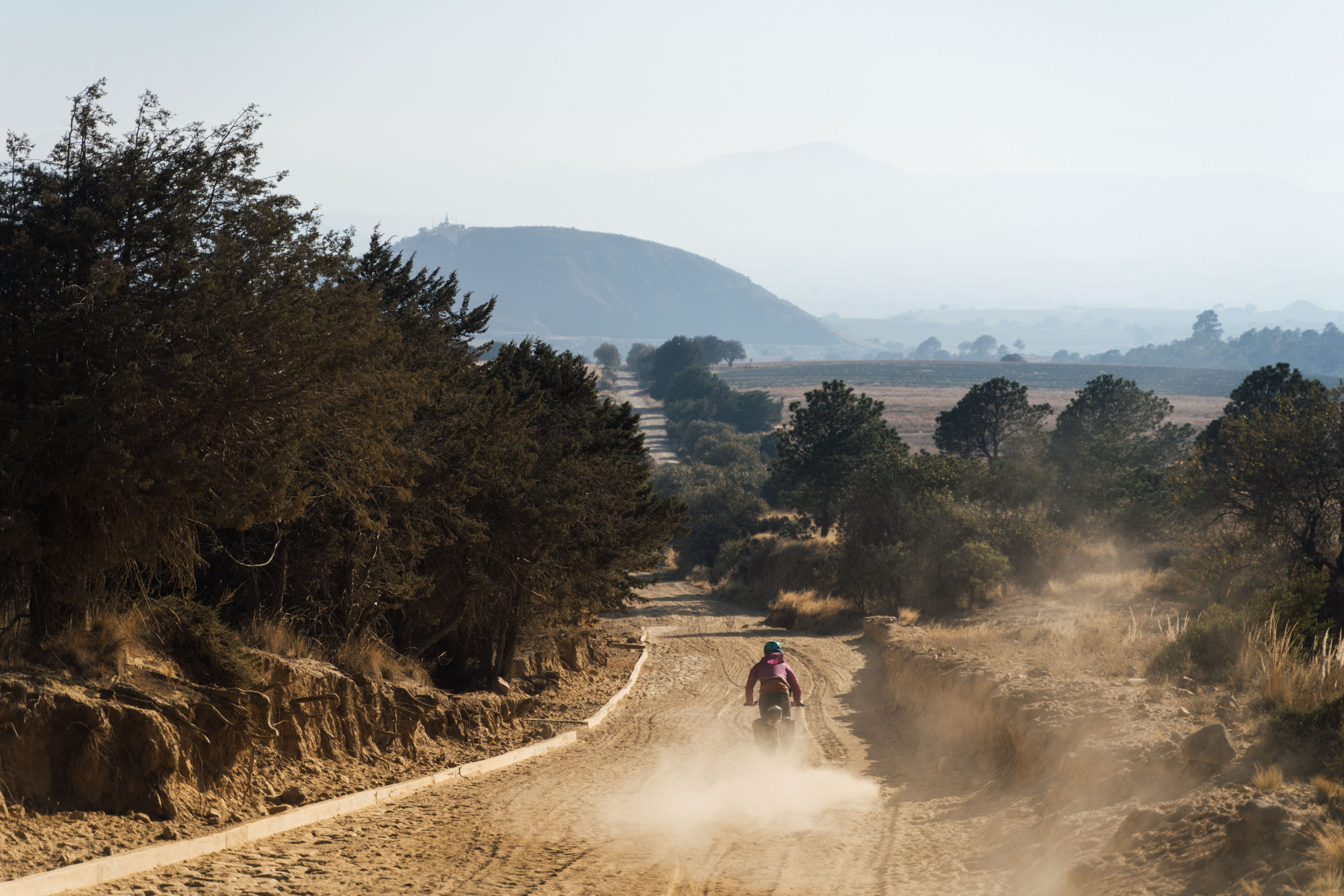
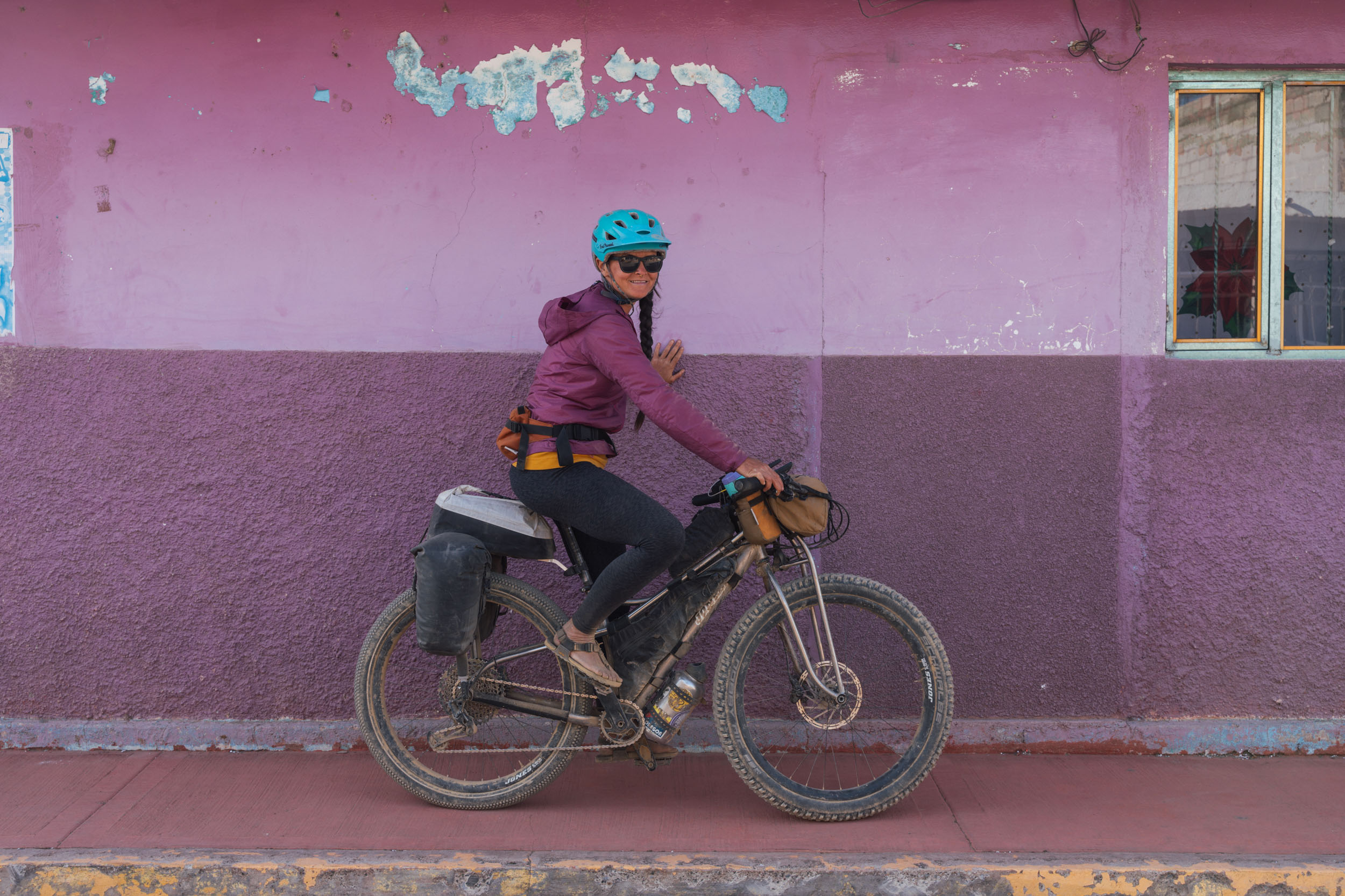
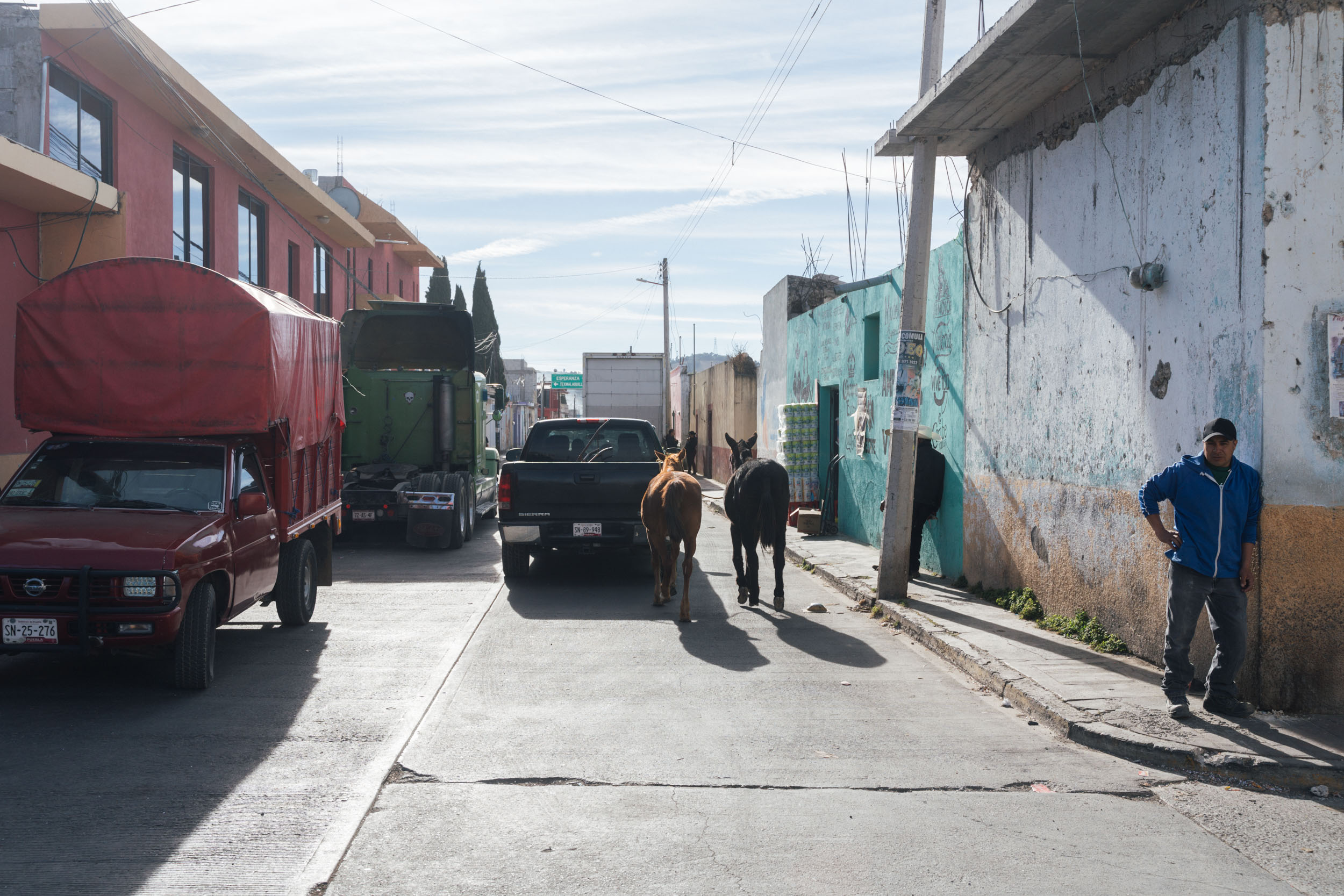
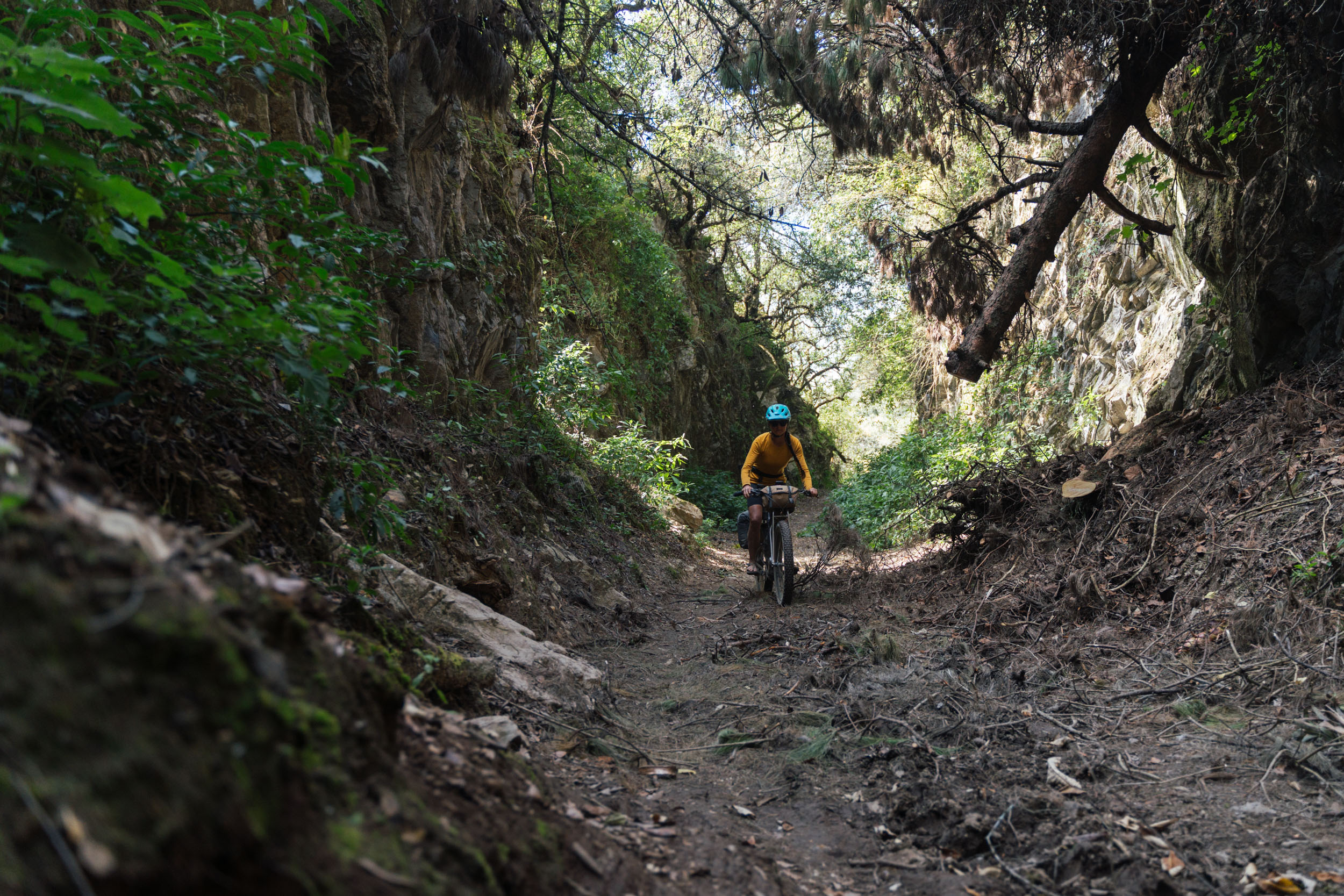
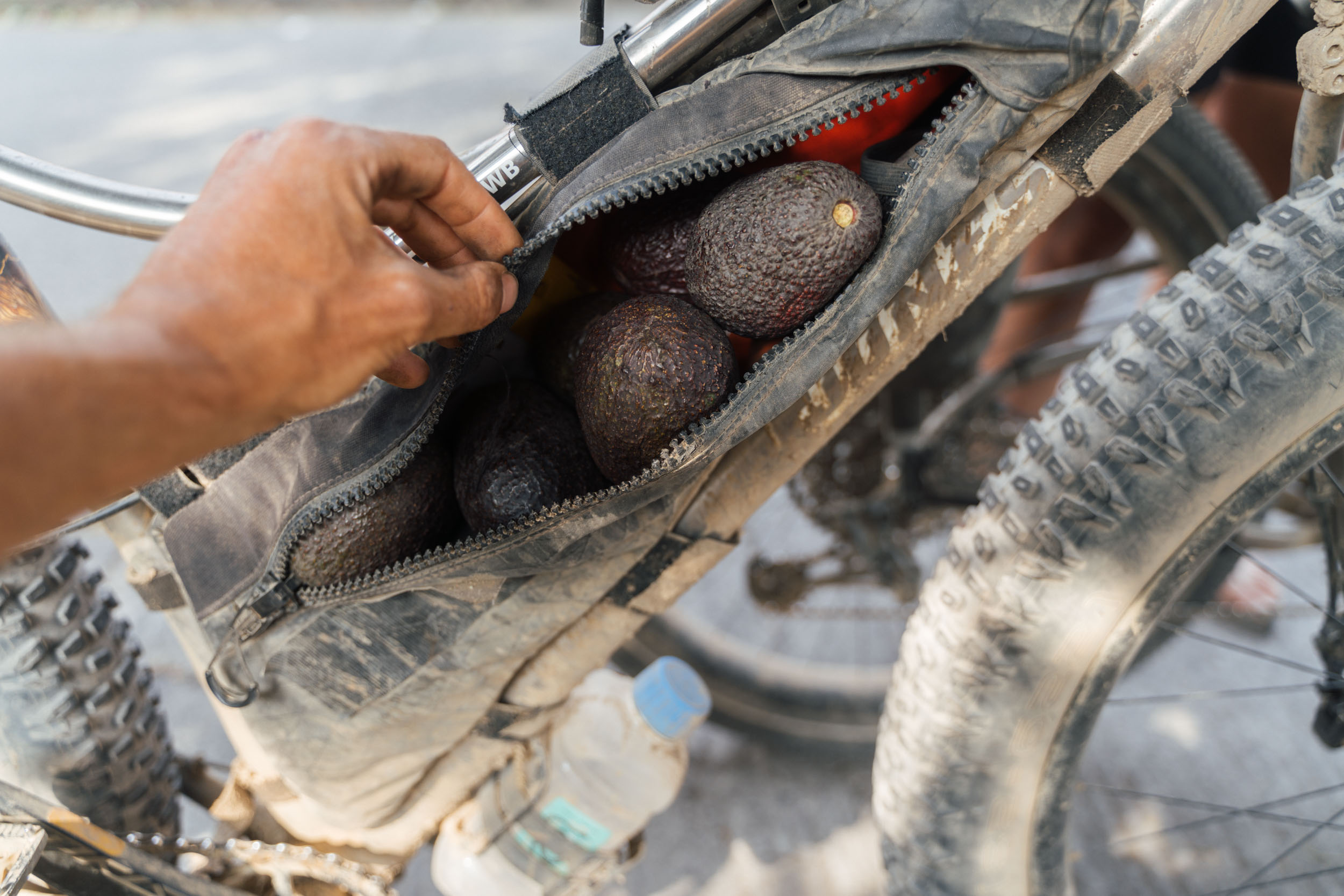
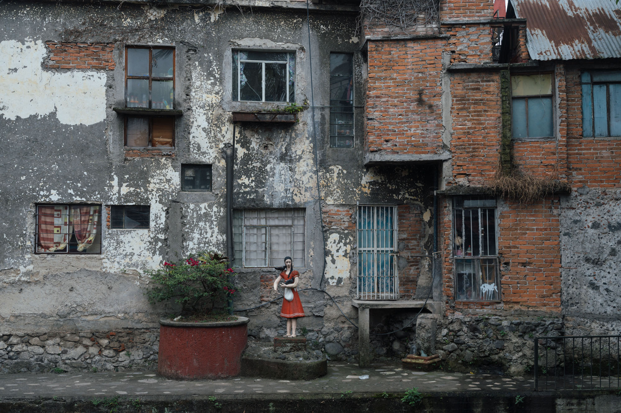
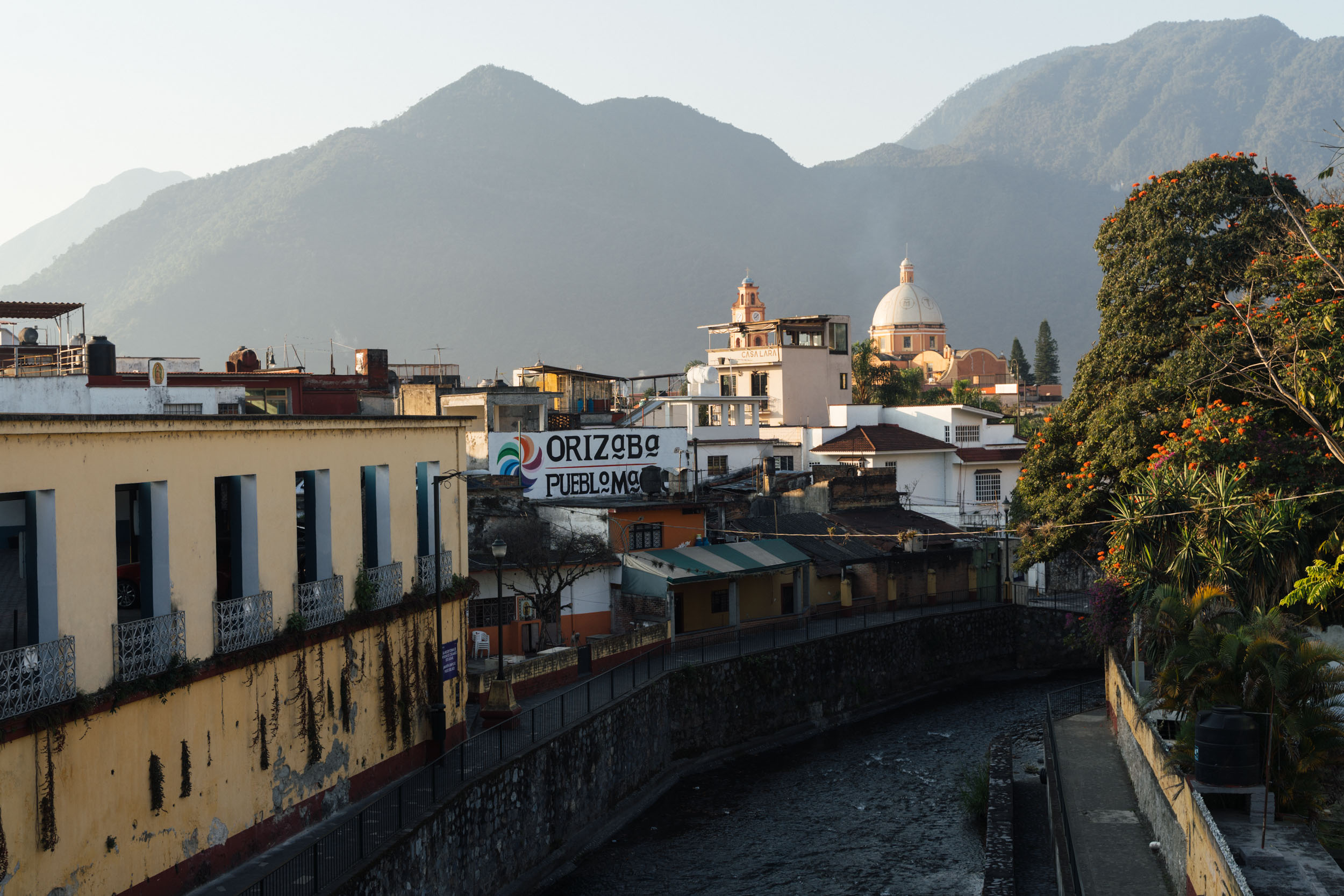
La Vuelta de Citlaltépetl begins and ends in the Veracruz settlement of Orizaba, a picturesque Pueblo Mágico, and a great spot to hang out and wander pre and post trip. Along the way, it climbs through coffee and sugar cane plantations, chayote fields, avocado orchards, subalpine forests, and high-elevation grassland, finally emerging above tree line in a sparse, oxygen-depleted volcanic landscape that could almost be the Ecuadorian Andes, a reflection of how truly diverse this country is. And, given such a broad range of elevations, expect an equally wide gamut of temperatures – from balmy lowland days amongst banana trees to barren, sub-freezing nights – and varied riding conditions. These include quiet paved roads, rugged dirt roads, sandy chutes, overgrown and abandoned railway singletrack, and a number of stiff bike-pushes too.
The route is marked by two significant ascents – one en route to Puebla and one on your return to Veracruz. Both pass by mountain refugios that are used to climb Citlaltépetl, be it from its northeastern side, home to the clearly visible Jamapa Glacier, or its drier, sparser southwestern flank, rising above the grasslands of the Valle del Encuentro. It’s on this second climb that riders can choose to challenge themselves further by continuing ever upwards, all the way to the enormous single dish telescope that’s visible from the valley far below. On a clear day, you can see Iztaccihuatl, Popocatépetl, la Malinche, and Cofre de Perote volcanos too.
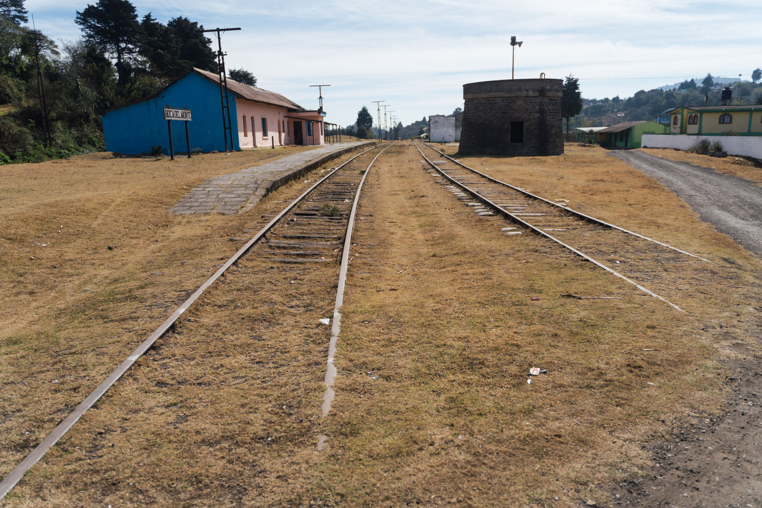
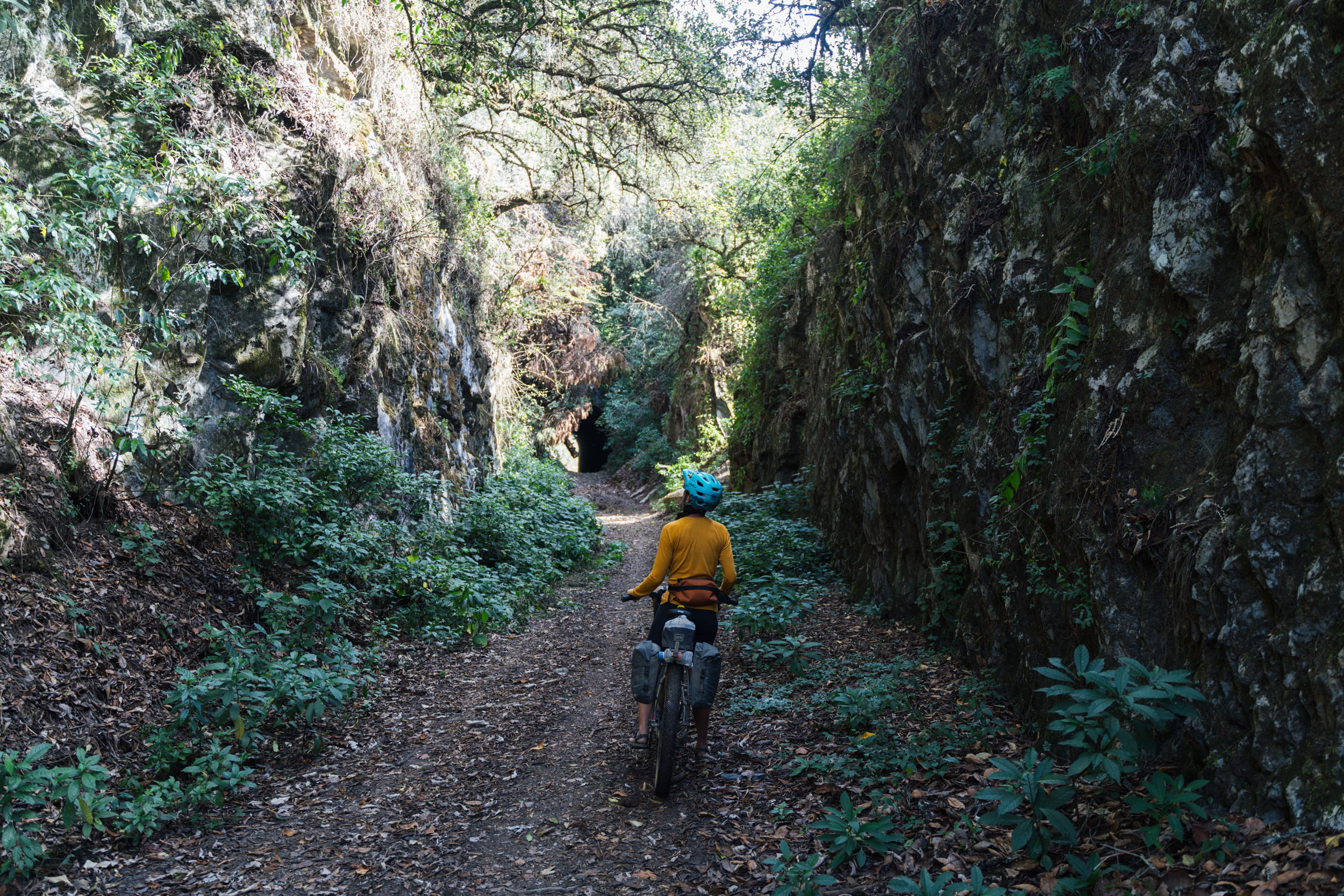
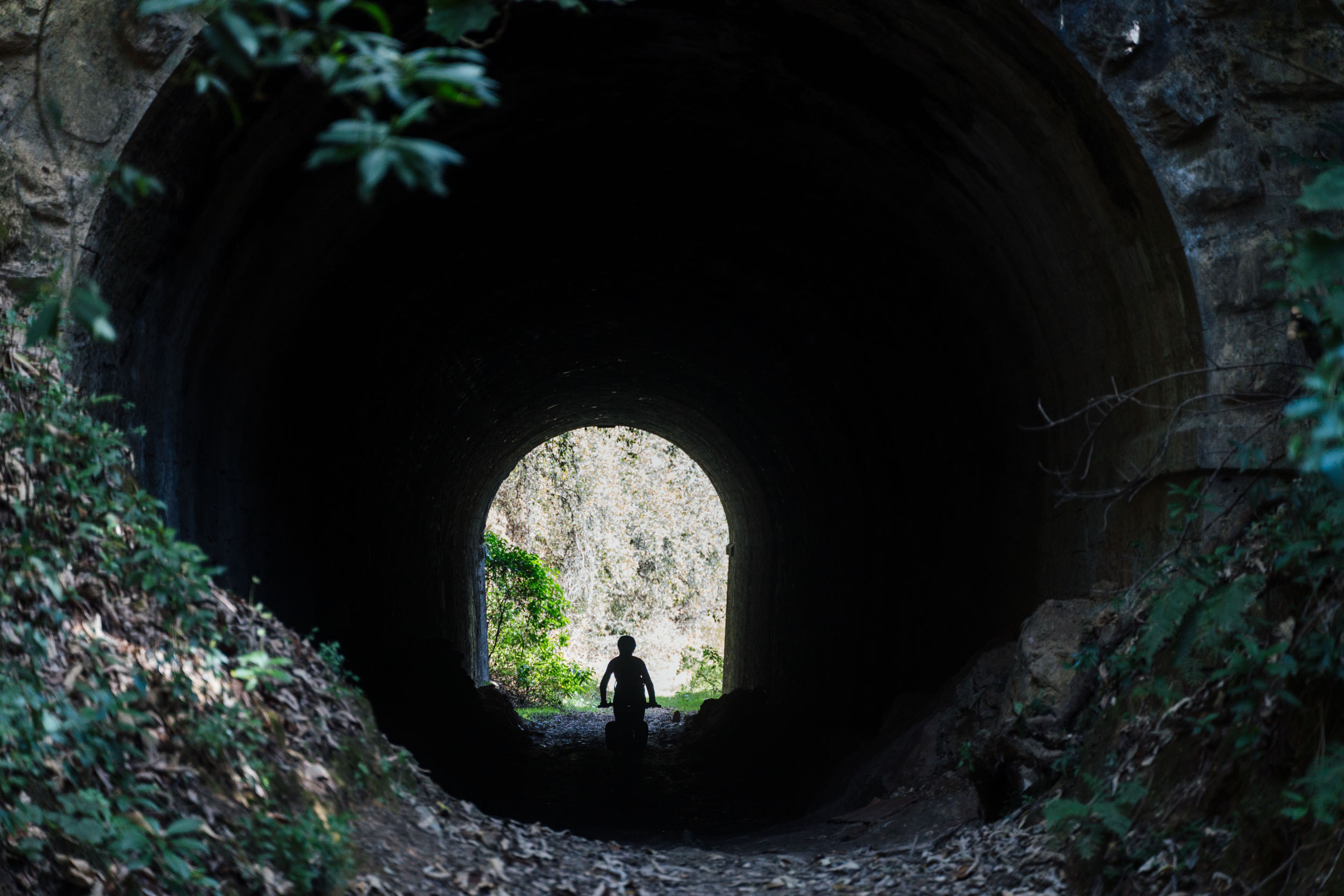
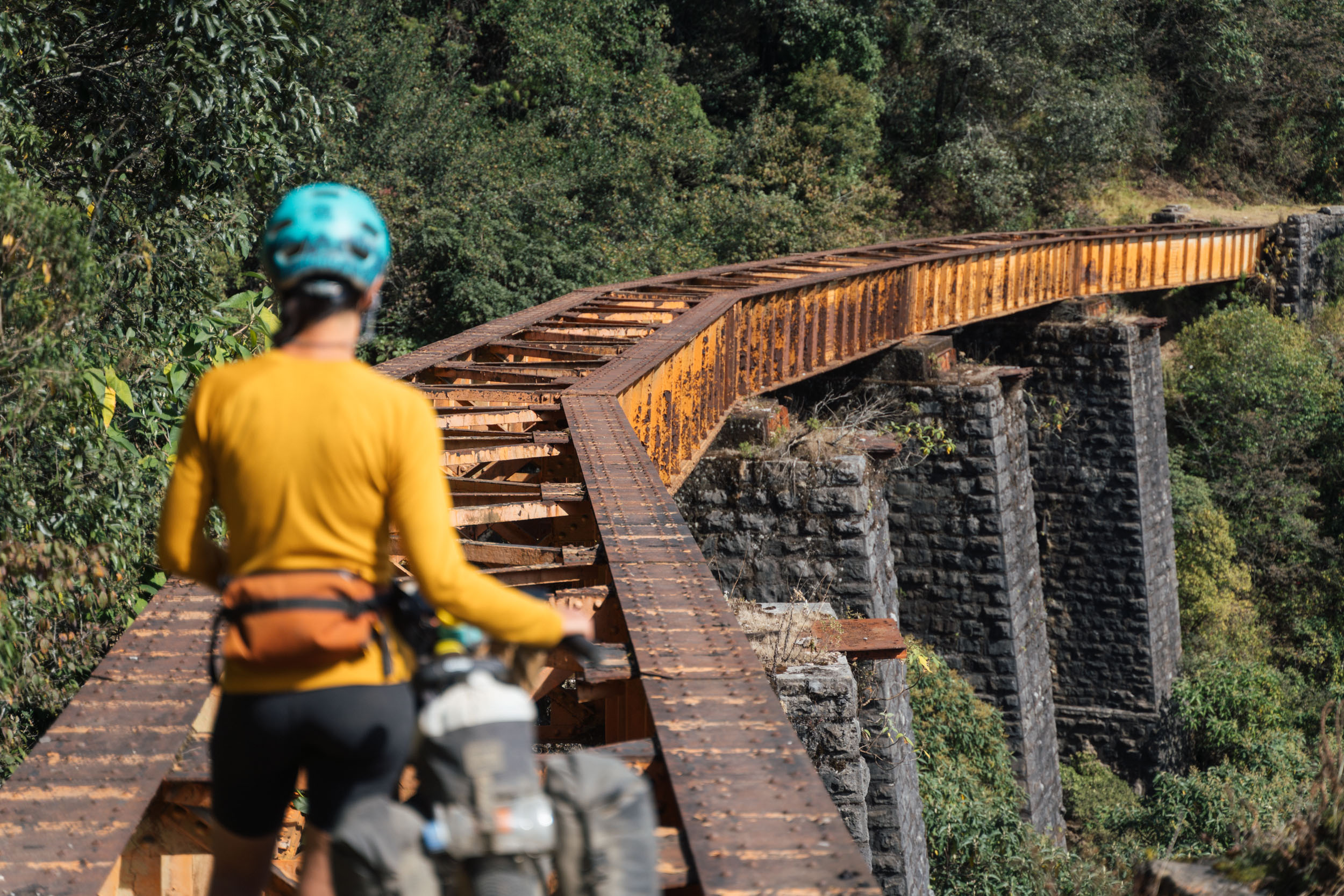
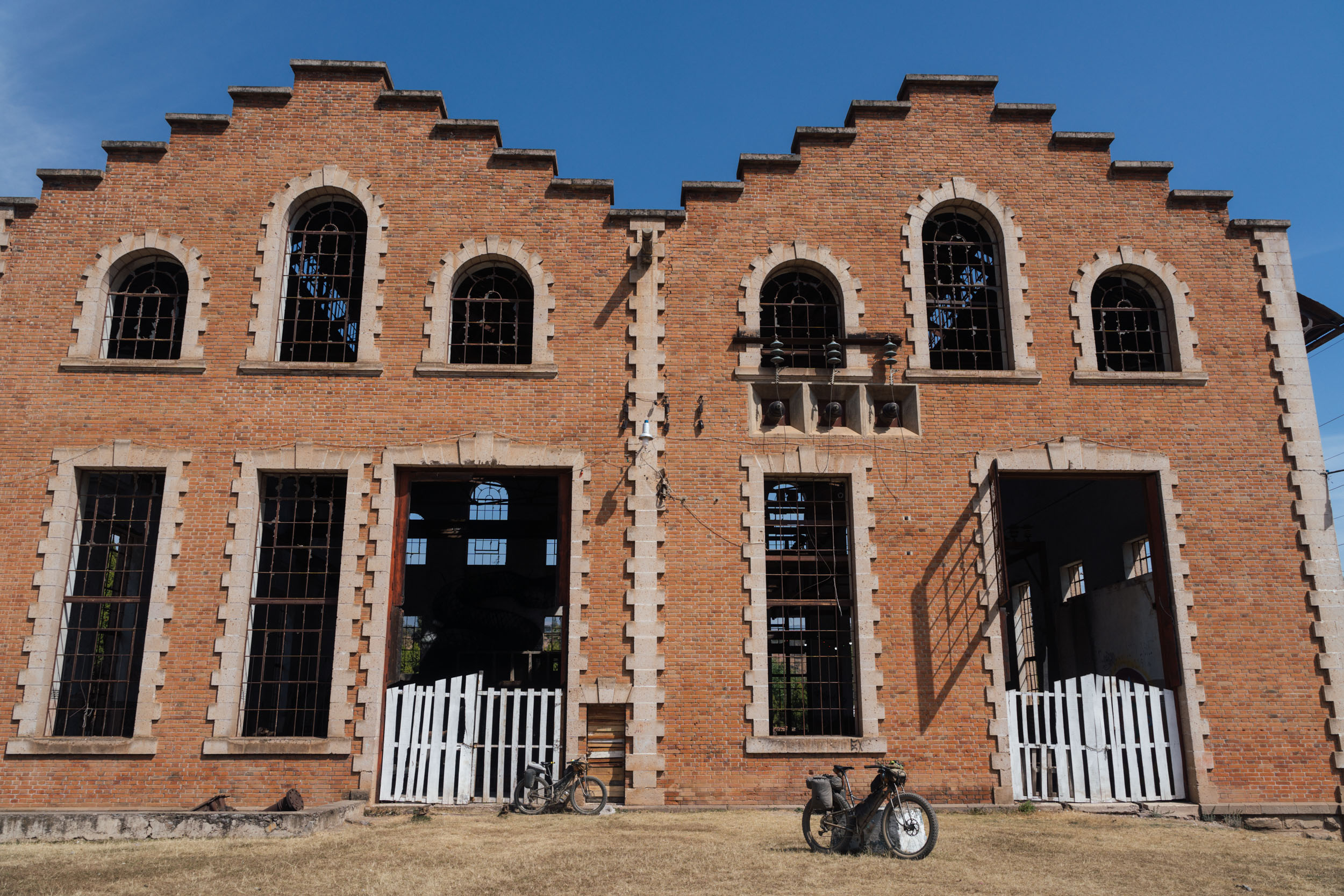
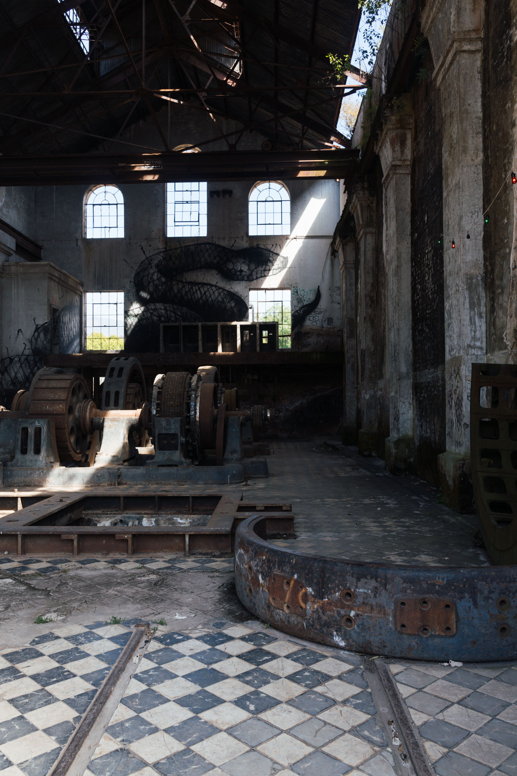
The most immediately impressive parts of the ride are set within the protected Parque Nacional Pico de Orizaba, which it crosses on two occasions. But there’s some great riding outside of the park too, with sweeping views of volcanos throughout. An altenative highlight, the route also traces sections of an abandoned railway line that once ran between Mexico City and Veracruz, dating back to 1873, that’s complete with derelict train stations, tunnels, sketchy bridges, and enormous substation machinery. In terms of accommodation, it’s just as varied, with bikepackers calling upon beautiful and remote camping spots, the option of mountain refugios, and small hotels to break up their journeys. Check out the Trail Notes tab for a possible itinerary.
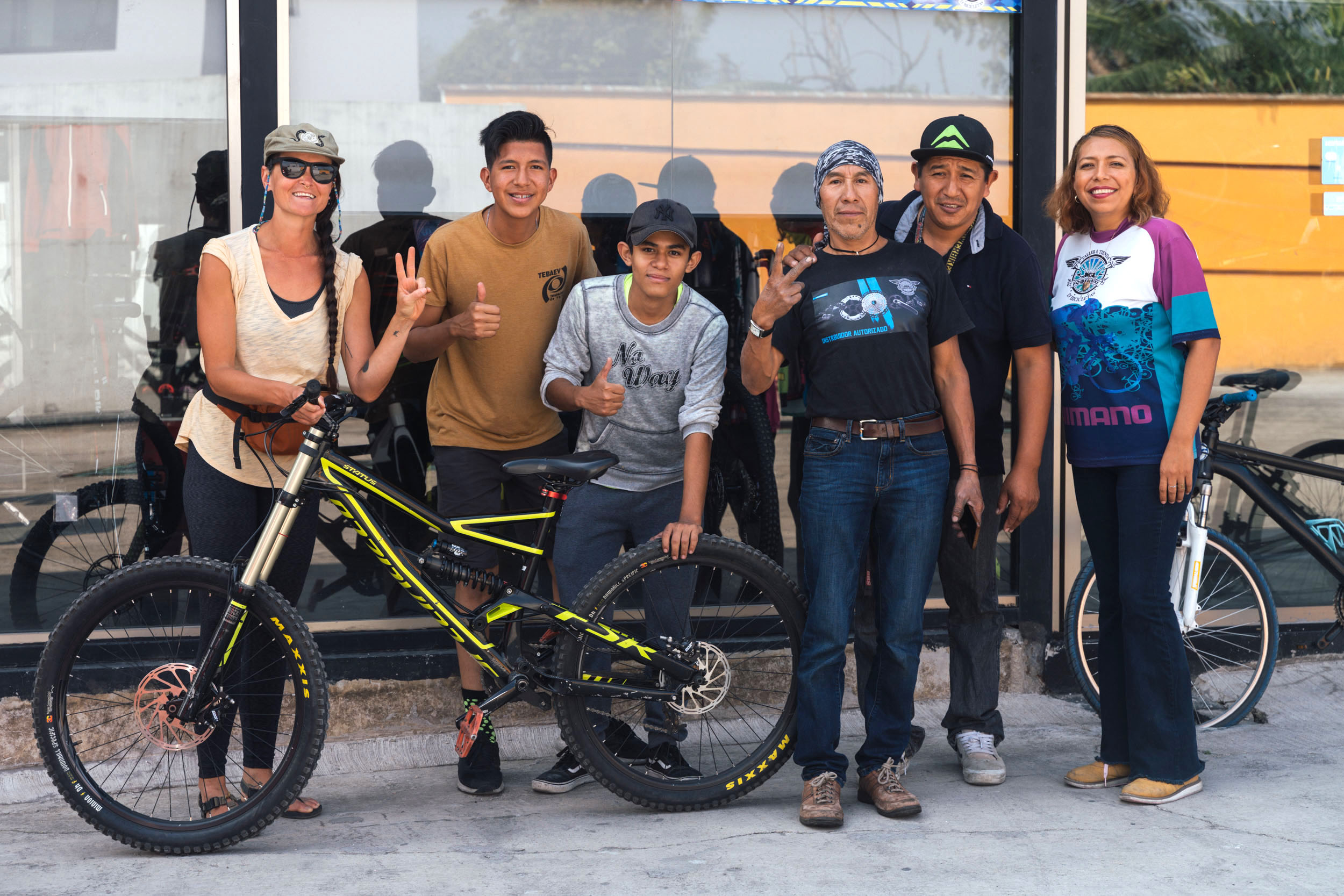
Route Development: Many thanks are due to Alain for the inspiration to explore this area and ride up to the tippy top of Volcán Sierra Negra (Tliltépetl) in the first place, and to Javier at Stoned Riders for his invaluable help, checking through the initial route and sharing many alternatives and improvements. Krampus-riding Javier has a bike shop in Fortín de las Flores, is a mountain biking/backcountry enduro guide, and is also a keen bikepacker. He can be contacted via his website or his Instagram stonedridersmx.

Highlights
Must Know
Camping
Food/H2O
Trail Notes
- Riding all the way from coffee plantations at 900 metres to above treeline at almost 4,600 metres, highlighting Mexico’s incredible diversity. This is a route with a real sense of journey to it, and packs a lot into its short distance. Prepare yourself for a wild ride!
- Admiring Mexico’s highest peak from all its angles, complete with impressive glaciers – it’s also the highest volcano on the continent.
- Spending the afternoon in Coscomatepec de Bravo, sipping coffee and admiring the volcano view.
- Tracing sections of an abandoned railway line that once ran between Mexico City and Veracruz, dating back to 1873, that’s complete with derelict train stations, tunnels, sketchy bridges, and enormous substation machinery.
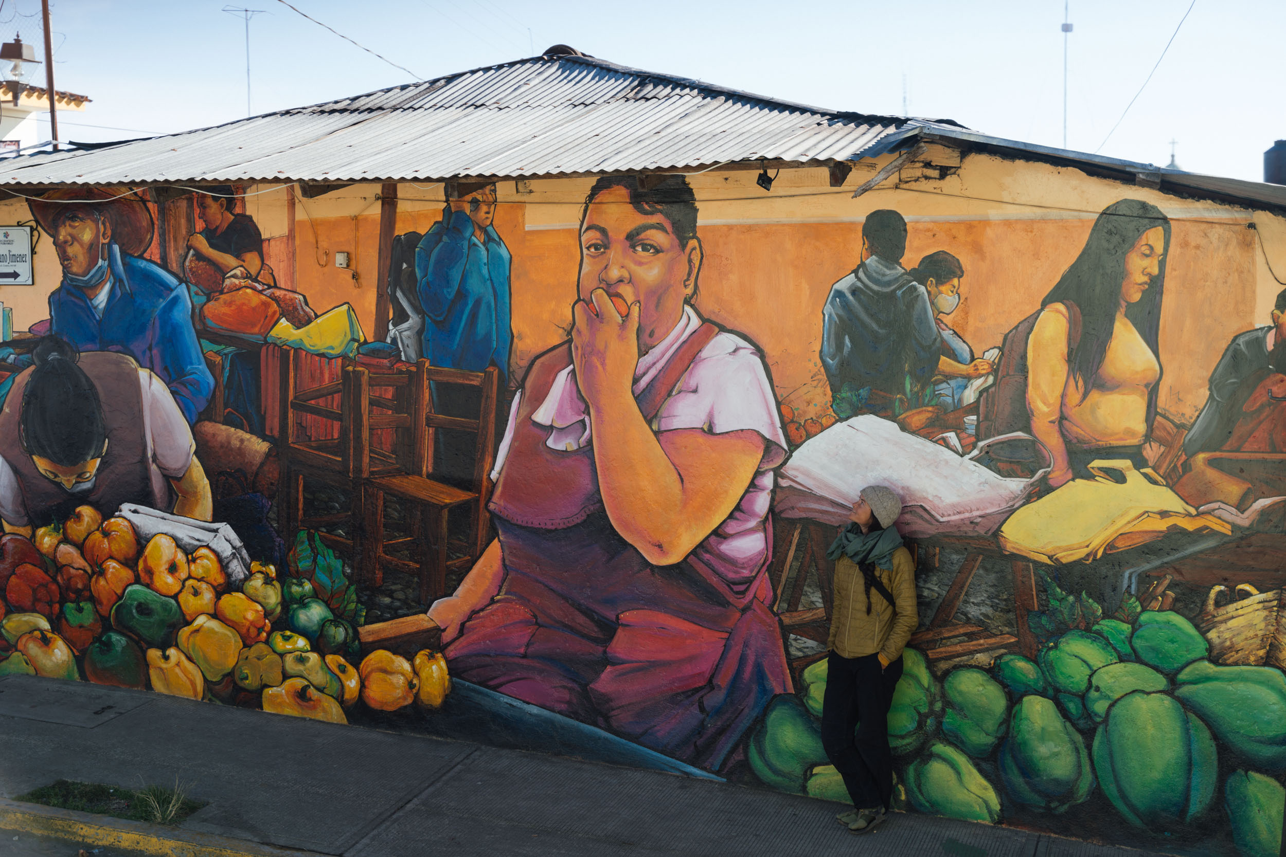
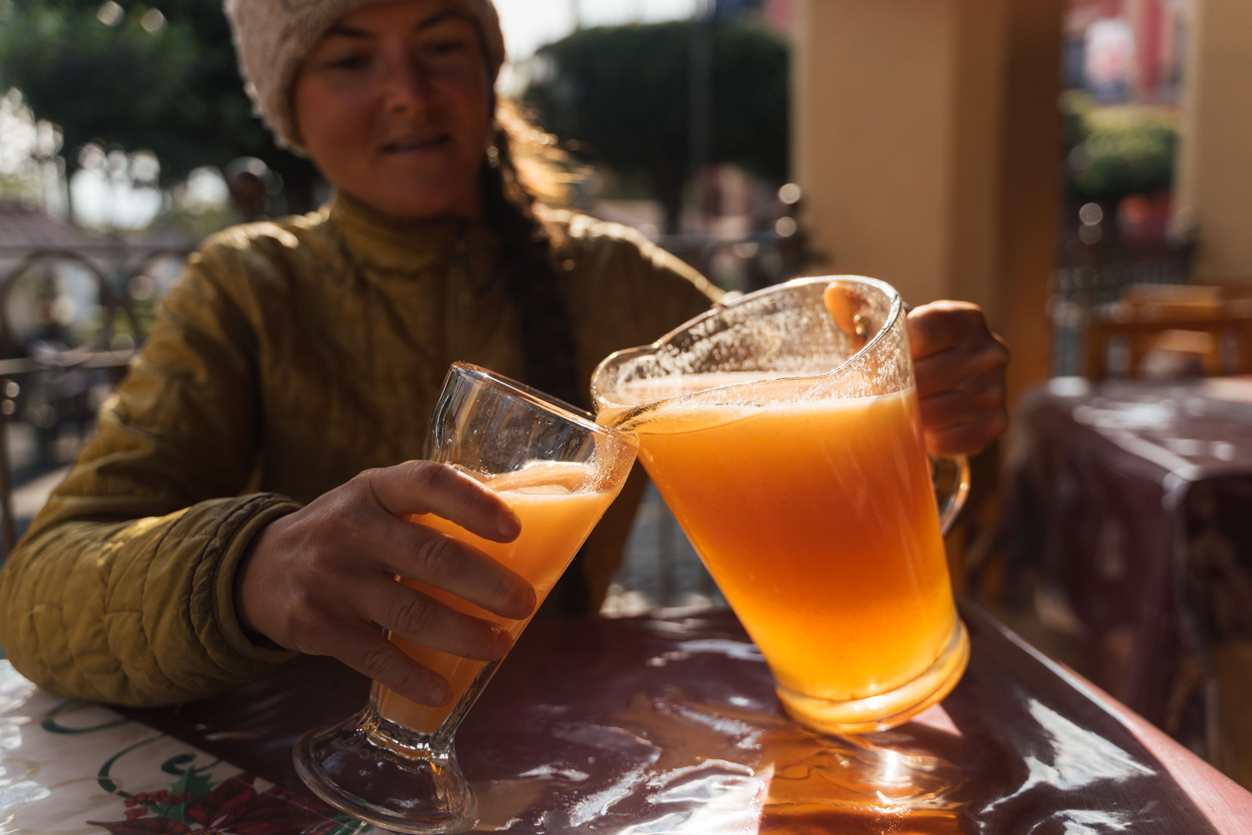
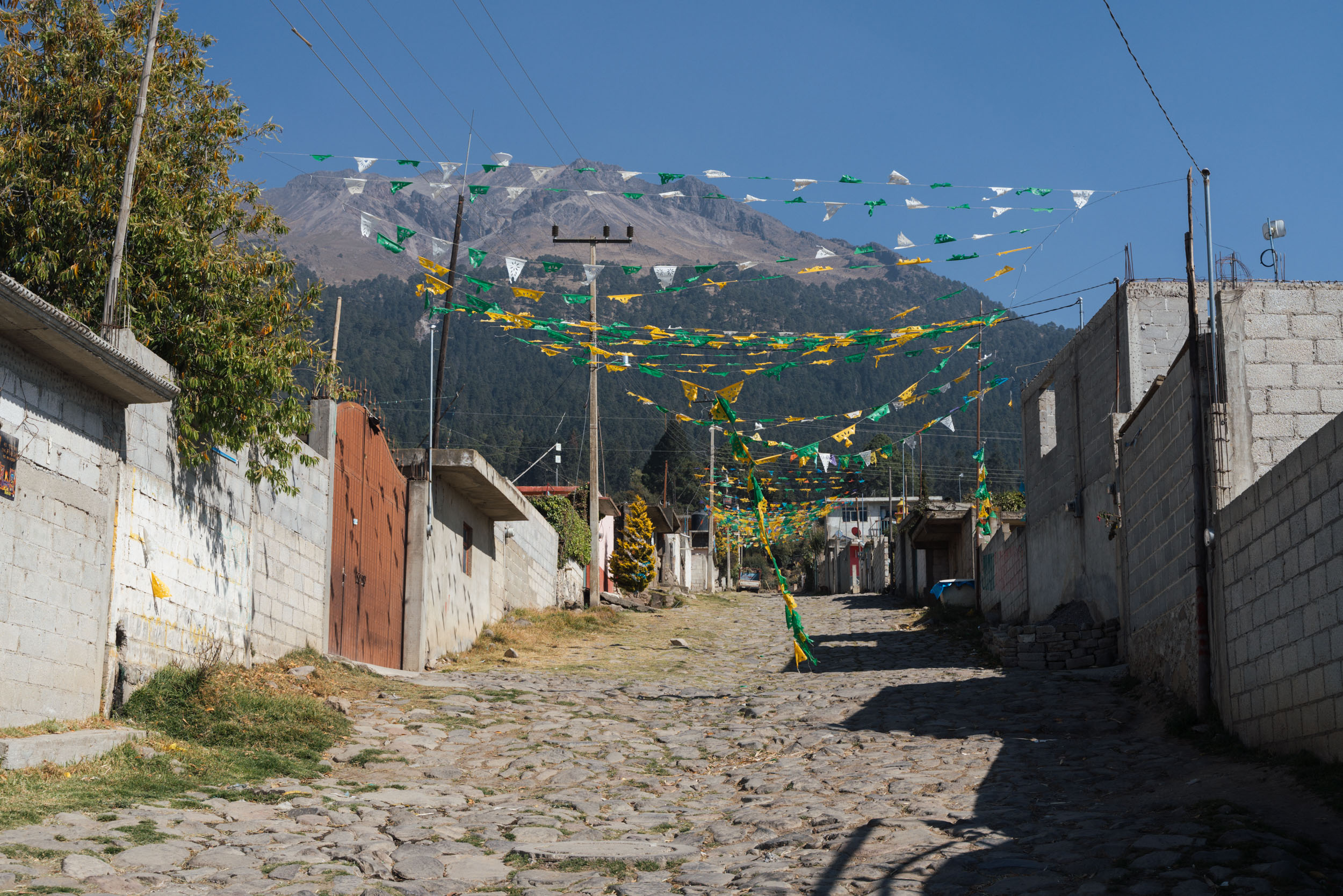
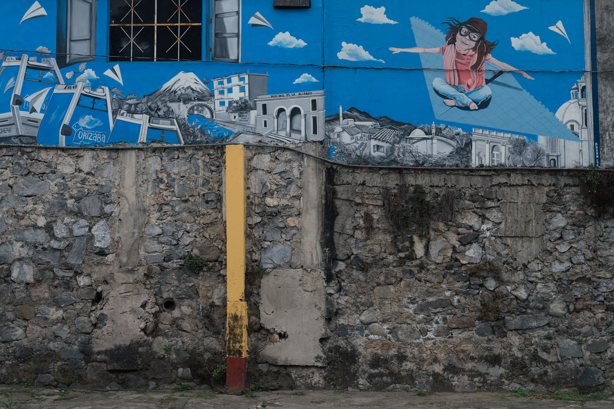
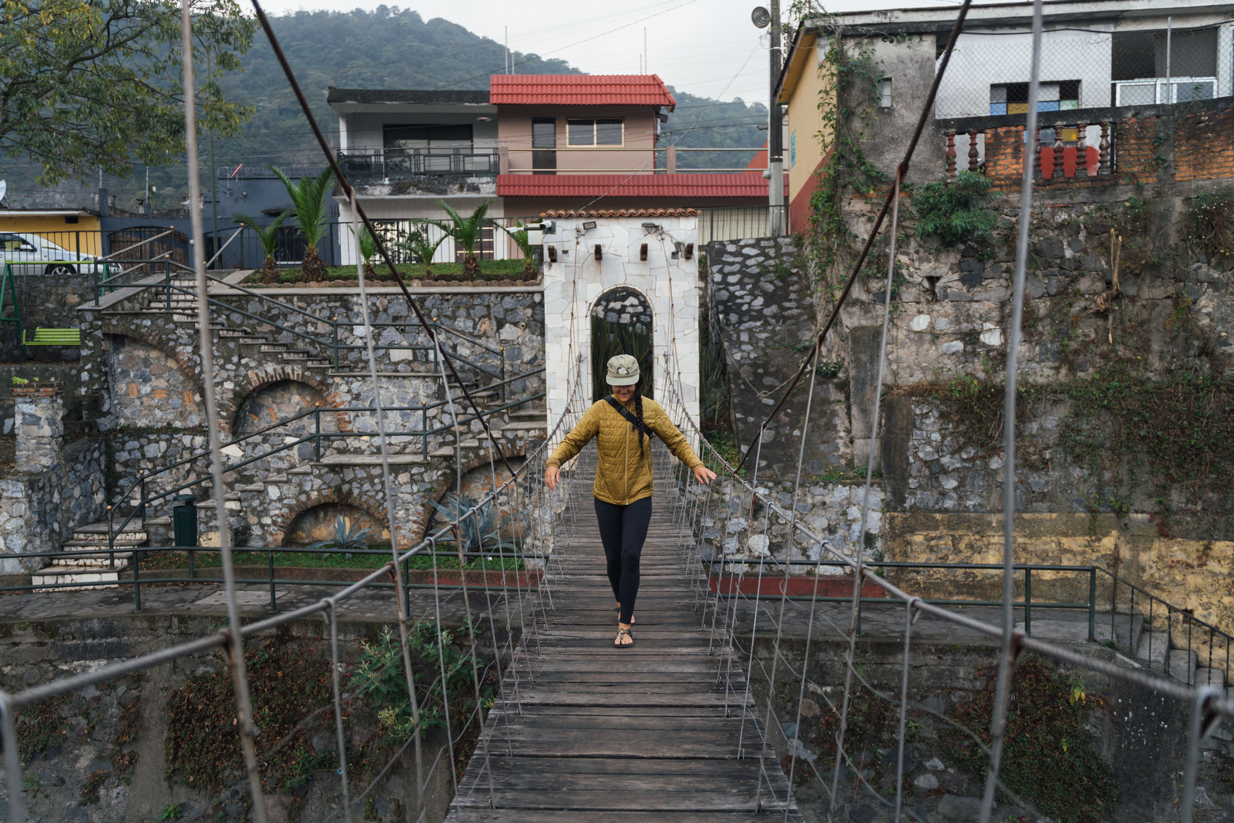
- Enjoying Orizaba, a low-key Pueblo Mágico with excellent coffee, regional cuisine, squawking parrots, sycamore-lined riverside rambles, and a cool mural scene.
- Saying hi to climbers from around the world, gathered at the two mountain refugios in preparation for their attempts on the peak.
- Best time of year: This ride is best in the dry season, which starts in October and ends in March/April, give or take yearly variations. It’s too muddy in the rainy season – the heaviest rains being from May to August. The main climbing season is December-January, when the weather tends to be most stable.
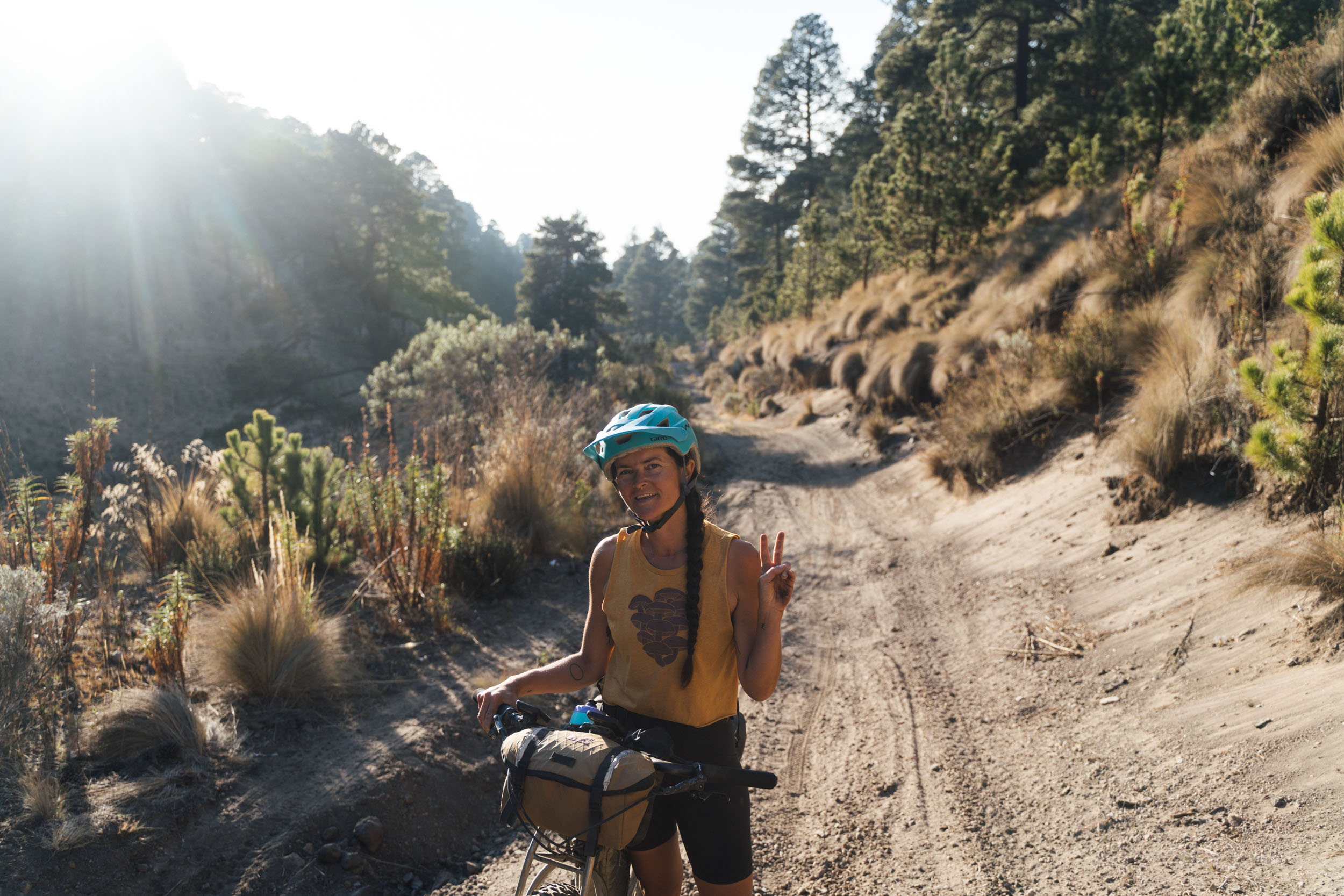
- Best bike: Given the challenging terrain and steep grades, a hardtail is ideal for this route, or a rigid mountain bike with generously-sized tyres. Packing light and running low gearing is also important – and even then, expect to push in places. I definitely wouldn’t recommend a gravel bike… but I’m sure that won’t deter some people! See the Trail Notes tab for more details on the varied terrain on this route.
- Terrain: You can expect a bit of everything on this route, from pavement to rutted dirt roads, rocky trails, and volcanic sand – the latter will be especially prevalent at the end of the season.
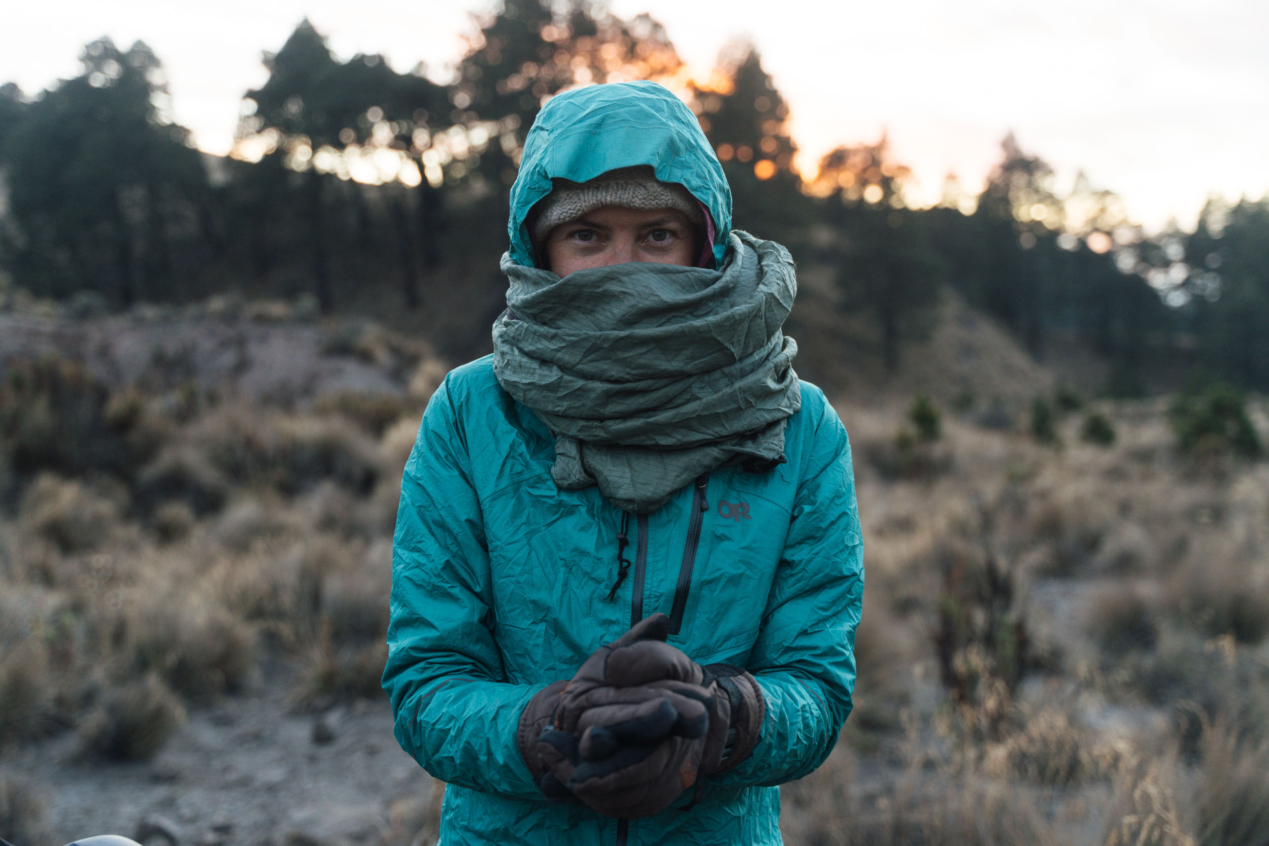
- Temperatures: Although much of the route is shorts and t-shirt weather, don’t forget to pack your gloves, thermals, and a good sleeping bag, as temperatures can drop below freezing when above treeline for much of the riding season. Expect to be adding and subtracting layers as you go up and down!
- Altitude: This is a high elevation route, so it’s important to spend some time at altitude beforehand, ideally sleeping a few nights at 2000m or more. Mexico City is at 2240m, for instance, so makes a good staging post. As a rule of thumb, take it easy, ride slowly, drink regularly, and always drop down in elevation if you’re feeling unwell.
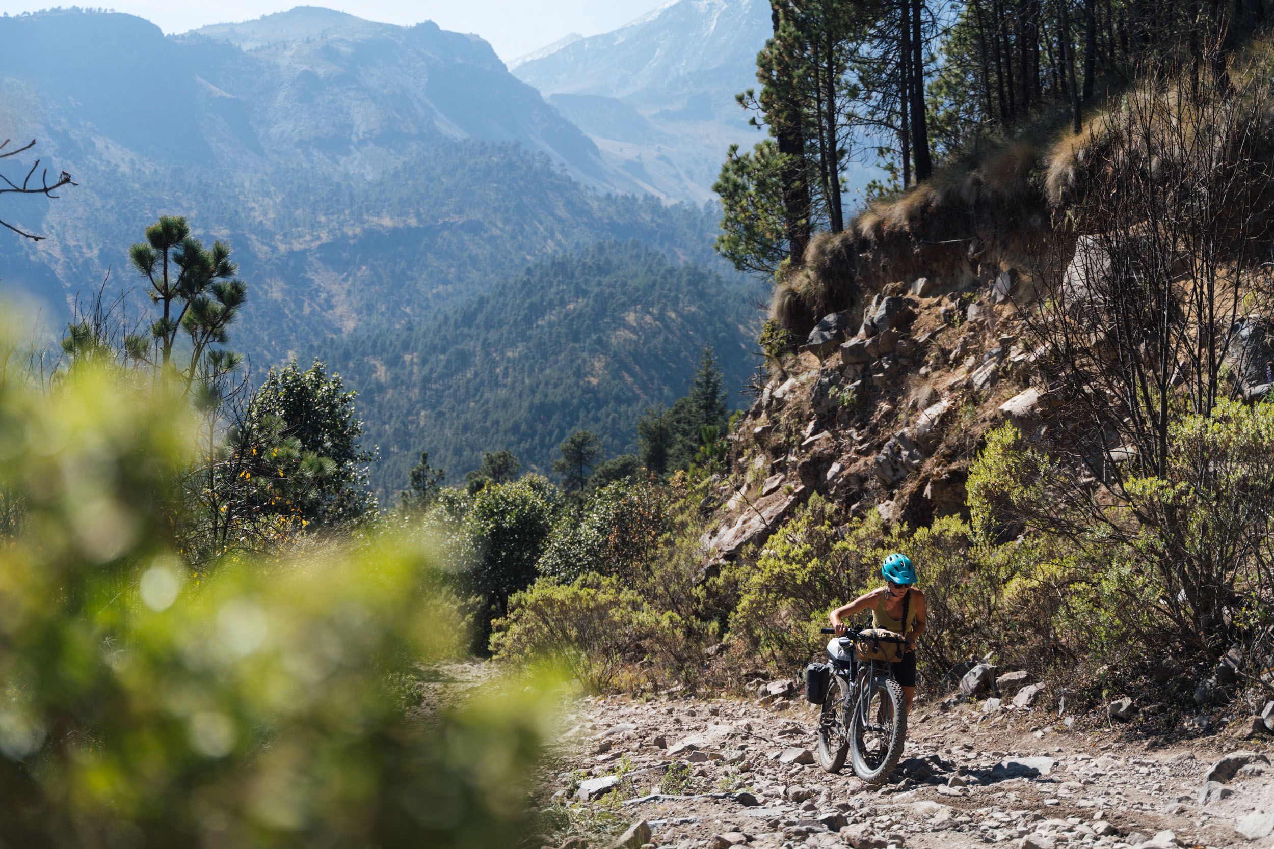
- Hike-a-bikes: For the most part, this route is very rideable on an appropriate bike (see above). But prepare yourself for some extended pushing too, as the state of the road through the National Park which can vary throughout the year, and trails can be overgrown after the rainy season. In short, prepare yourself for an adventure, on and off the bike!
- Bike shops: There are a number of good bike shops in Orizaba where you’ll find everything you’ll need, thanks to a thriving the local downhill and enduro scene. In the middle of town, Black Bike Center has plenty of high-end gear in stock, including a range of tyres, sealant, and Shimano parts. We were recommended Power Bike, and the folks there were super friendly, stoked about the trip, and bled my brakes straight away for me.
- Guiding and logistical support: Javier at Stoned Riders – who helped put together this route – can offer logistical support if needed, and can be contacted directly via his website. He can also provide trail and enduro guiding, and he has a shop in Fortín de las Flores too.
- It gets dusty in the dry season! Bring extra chain lube and a rag, as parts of the descents are mind-bogglingly dusty – it can be ankle-deep in places.
- Large Millimeter Telescope at Volcán Sierra Negra: The legality of riding up to the top of the volcano is something of a grey area – it’s permitted to hike the telescope without a permit, but one is required if you drive. Local practice suggests cyclists push their bikes up the hiking trail initially, to avoid passing through the security checkpoint, and then join the main dirt road. From what we were told, guards and personnel are on board with this – we were passed by a couple of work vehicles without any issues.
- The legend of Citlaltépetl: The Aztecs believed that the divine fire from Orizaba’s crater consumed a great winged serpent, Quetzalcoatl. Then Quetzalcoatl, the god of learning and the priesthood, took the form of a man and sailed across the sea, swearing to return and seek vengeance on the Aztec nation. Source, HG High Guiding.
- Getting there: We took the ADO bus from Oaxaca, which cost around 700 pesos. It left at midnight and arrived at 5am. There are ADO services from Mexico City and Puebla too. The front wheel of your bike and your bags generally need to be removed. We drop our saddles to make the bikes as compact as possible, allowing them to sit upright with the belly of the bus.
- Safety and security: Security in this area has been an issue in the past and illegal logging continues to be a problem at lower elevations within the national park, especially the forested areas above Maltrata. It’s also recommended not to linger near the highway just north of Boca del Monte, which the route crosses very briefly, as vehicles have been stopped and robbed along this stretch of highway. It’s highly recommended that cyclists avoid riding at dusk or at night – for this reason, the itinerary within the Trail Notes tab allows plenty of time to reach your daily destination by early afternoon, with accepted areas to camp or hotels to sleep in. As ever in many parts of Mexico, riding in a group is preferable to riding alone. Weekends are always a better time to travel, too, as there are more people around.
- That sketchy bridge: No, you don’t have to cross it! There’s some less sketchy singletrack that skirts around the mountainside…
- Orizaba, a Pueblo Mágico, makes a great base for this loop, and we’ve marked a good, central hotel, the Orizaba Inn, in which to stay. However, there are plenty more options – booking.com is the place to find them.
- Thanks to an enormous first climb, it makes sense to start the trip with a short day and overnight in Coscomatepec, also a Pueblo Mágico – there’s a couple of hotel options marked on the map.
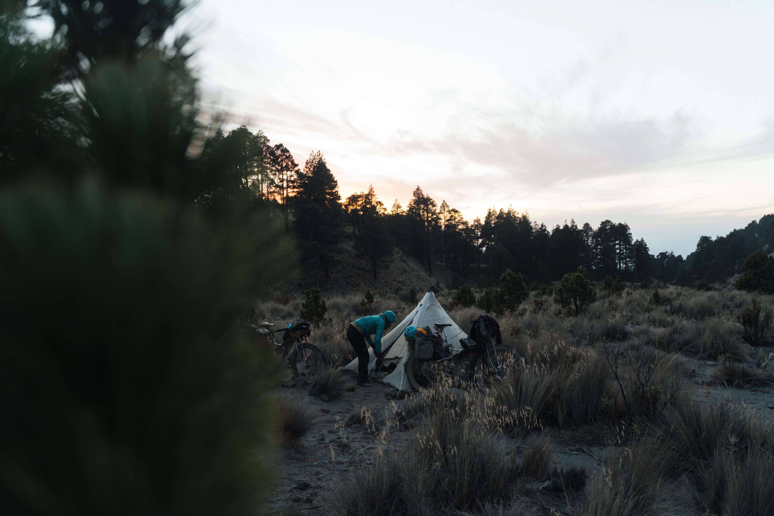
- You can camp in the Pico de Orizaba National Park – there can be a 60 peso access fee to pay, though it depends on whether the entrances are manned or anyone comes around to collect it.
- There are also two mountain refugios within the park. They can be busy with climbers, but you can always camp outside. Bring water and food.
- There are a couple of small hotels on the Puebla-side descent – see map for details. You’ll want to contact them in advance though, to make sure they’re open, and because they get busy with climbers. Otherwise, there are plenty of options in the settlement of Tlachichuca, a little off route but a good spot to resupply.
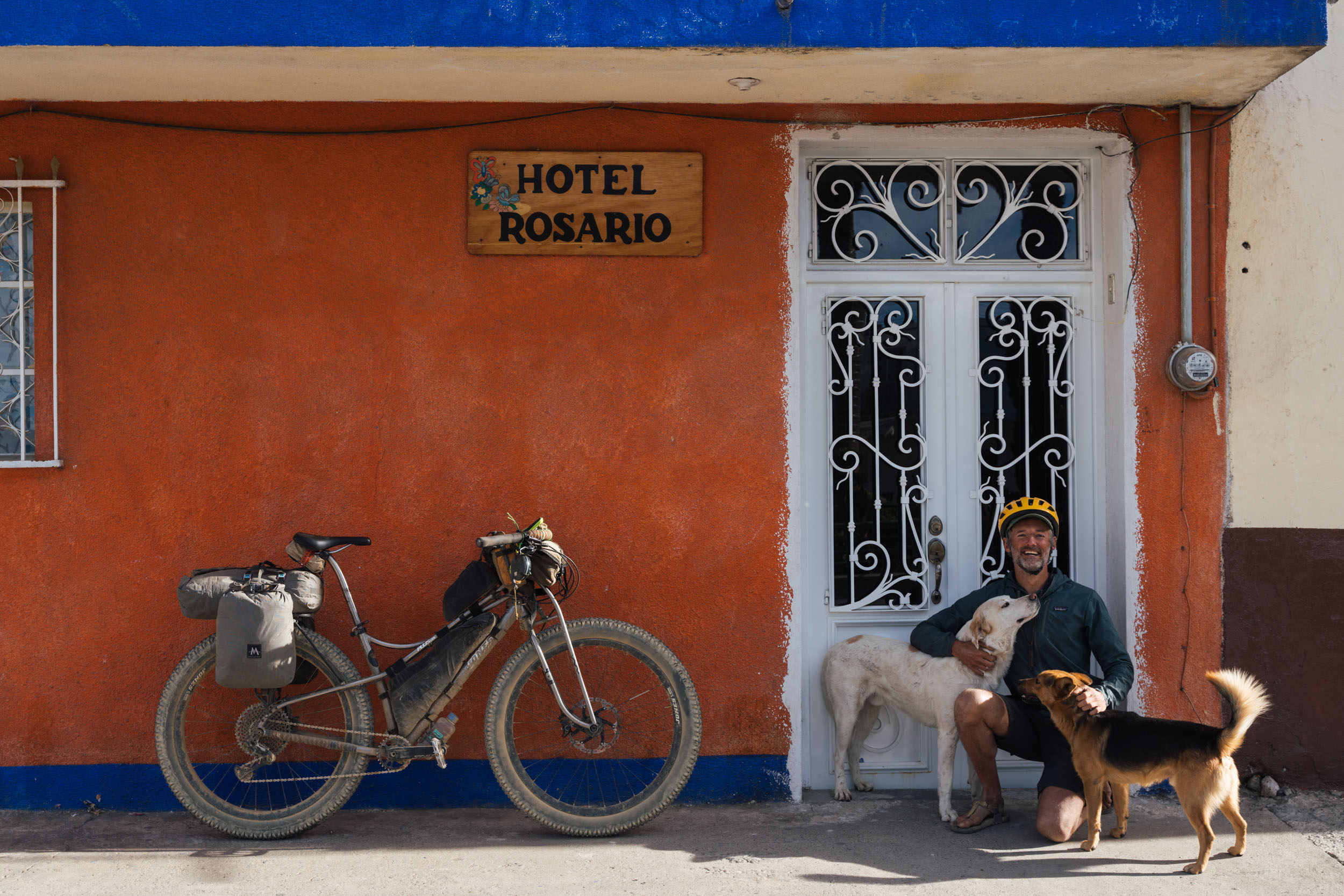
- Hotel El Rosario in Atzitzintla is a good place to break up the epic descent to Maltrata – see map – so you don’t need to rush back to Orizaba on the same day, or ride at night.
- We’ve marked most of the places to eat and resupply on the map.
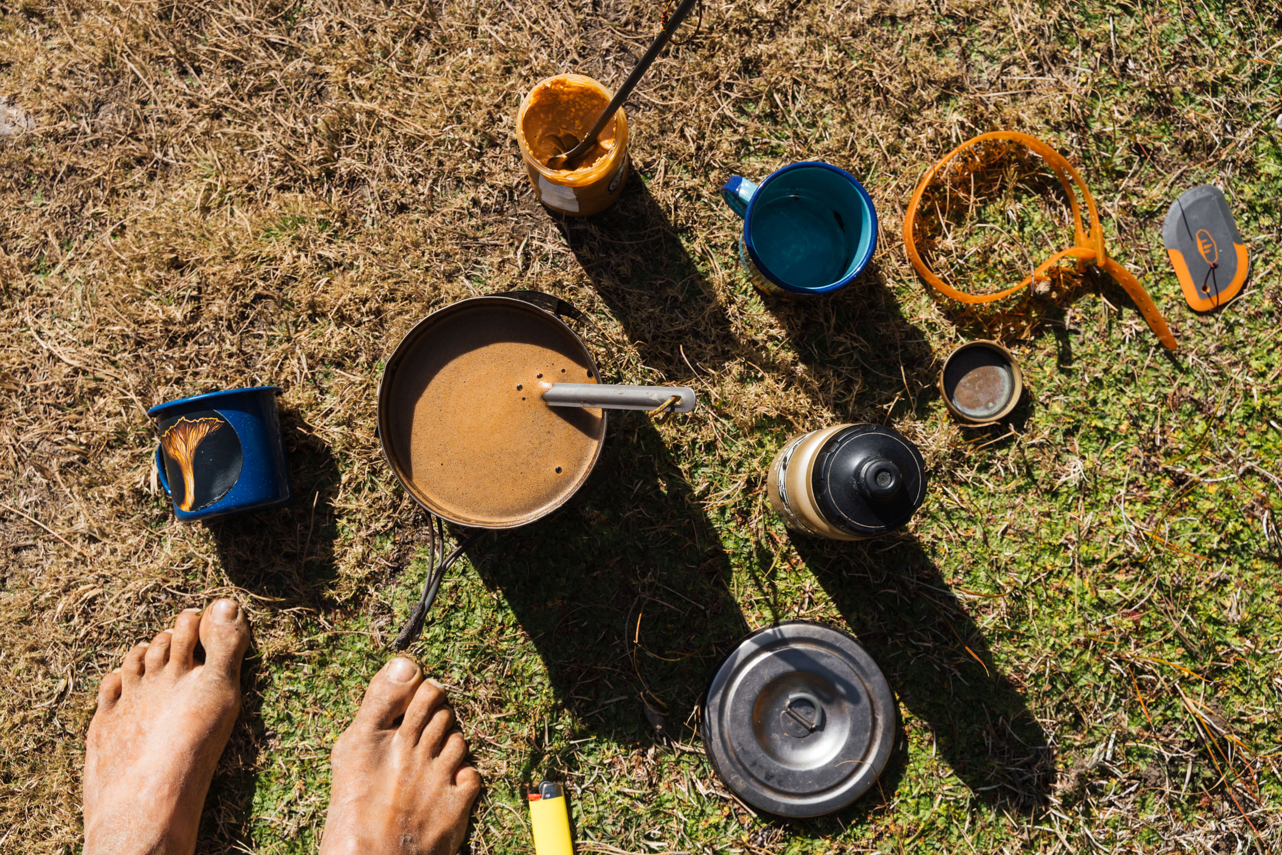
- The north-eastern side of the volcano is well watered, so all you’ll likely need is a couple of litres on your bike, and a filter. The south western side is much drier, however, so it’s best to haul 4+ litres on the climb out of San Francisco Cuautlancingo. There’s also a couple of small tiendas in San Isidro, but they were shut when we went through.
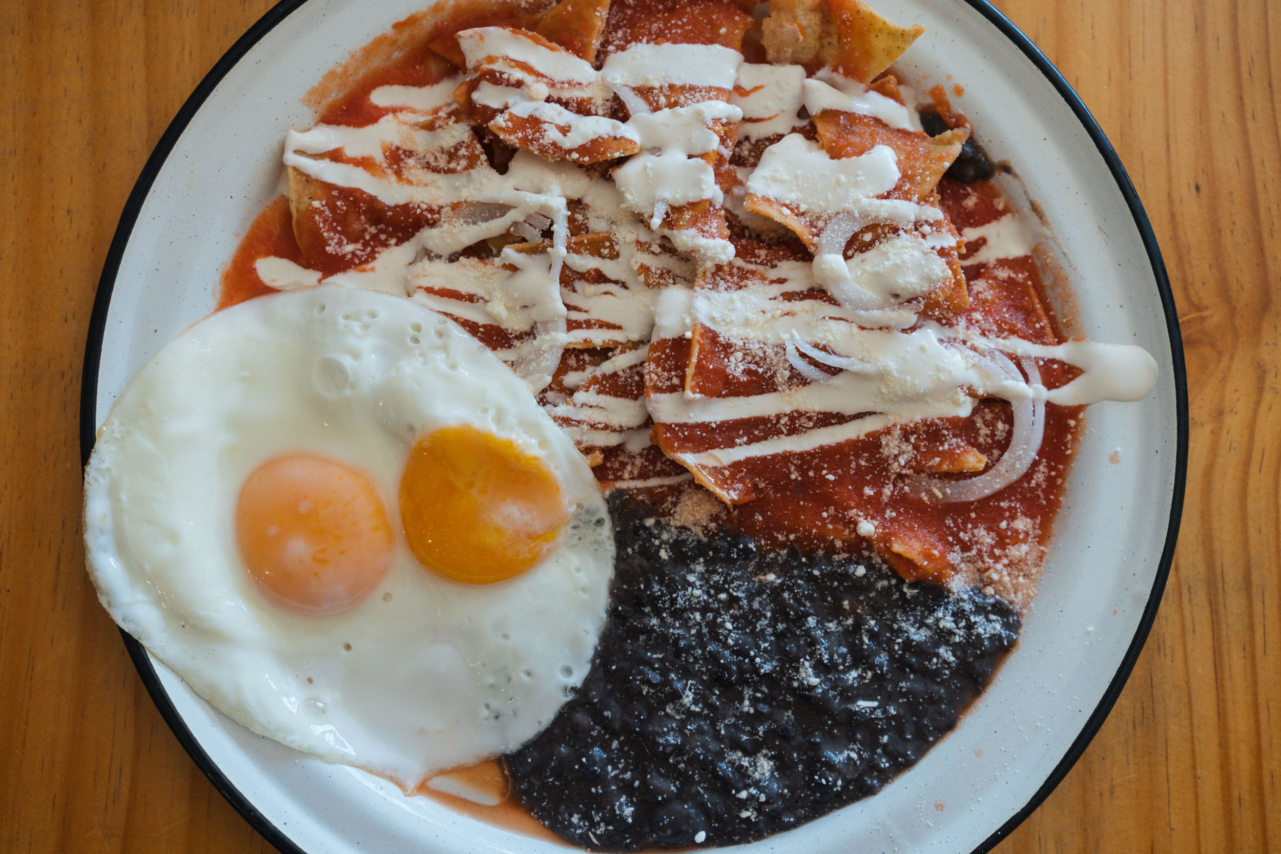
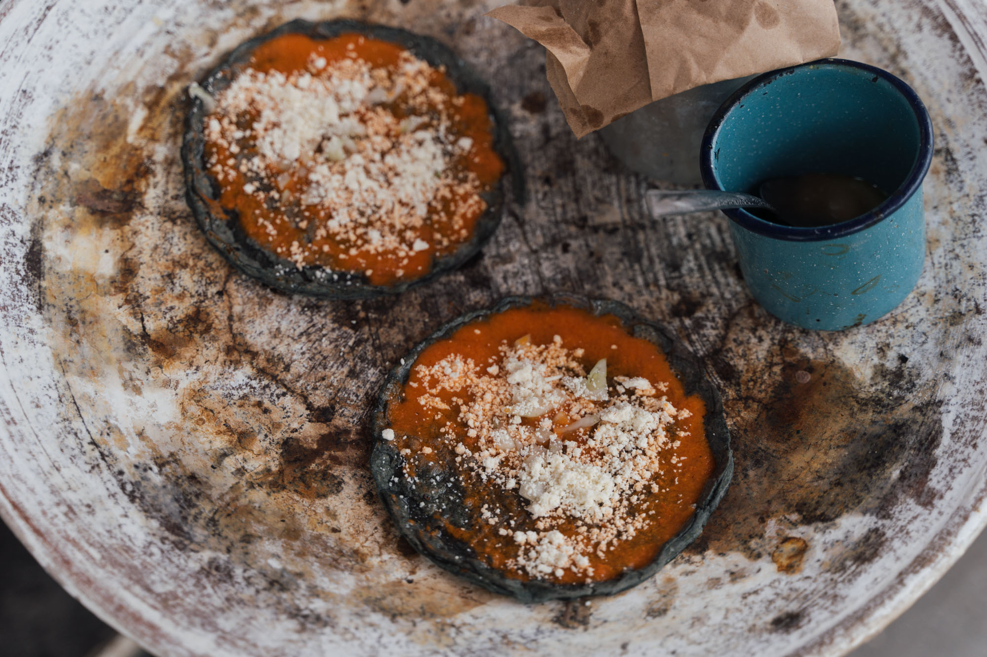
- Orizaba is a great place to eat, and the evenings are very social too. Places that we liked included Tortas Mellado (great ‘n crispy tacos dorados and homemade ice cream), characteful Jugos California and Cafeteria California, and the iconic La Gran Cafe de Orizaba. Coffee? There are plenty of good places, but the one we honed in on as our favourite is Breve Cafe. For more ideas, see my blog post here.
- If you’re loading up with supplies in Orizaba, Rovianda Plus Madera has granola, good quality pasta, gnocchi, bakery goods, and lots of other tasty delights.
The fact that camping options are limited in some areas, it’s advisable not to ride into the night in this area, and much of the terrain is at high elevation, means that this route lends itself well to a relatively relaxed 6 day itinerary. That said, you can certainly ride it in less if you’re acclimatised and happy to be more ad hoc with where you spend your nights. Just note that when I say ‘relaxed’, it’s still very challenging in places, with tough climbs, bike pushes, and some very mixed terrain! Here’s how we broke it up – all of these spots are marked in the map above.
location 47 km, 965m up, 3:30hr riding time
Day 1
(shortish day, afternoon visiting Coscomatepec)
Day 1 initially has a stint on the highway between Orizaba and Fortín de las Flores, but it’s mostly downhill, so goes by quickly. Javier from Stoned Riders joined us for part of the ride to Coscomatepec, taking us on dirt roads that wended through coffee plantations. We were happy to arrive early and have some time to explore this Pueblo Mágico!
location 38km, 2080m up, 4:20hr riding time
Day 2
(almost all climbing, camping in national park)
Day 2 is all about climbing! Technically, it’s mostly paved, but we found enough sections of dirt to break it up, so it didn’t feel like too much of a chore. If you want to make it to the national park, which is what I’d recommend, you’ll need to leave early, as you can expect close to 2000m of climbing. Camping here sets you up well for the next day, which is considerably steeper and more challenging, and is best ridden on fresh legs!
location 37 km, 1,120m up, 3:35hr riding time
Day 3
(dropped down to Tlachichuca for the night)
Day 3 is fantastic. It starts with a sizeable climb (and push) on a rough and rutted dirt road, all the way up to the Refugio Piedra Grande. It passes by some lovely picnic spots and a river for water. Expect this climb to take a few hours, whether you’re riding or pushing. The views here are epic, the scale is vast, and we were reminded of the Ecuadorian Andes once above treeline. We didn’t plan to drop down all the way to Tlachichuca (I’ve marked places to stay in Miguel Hidalgo and San Miguel Zoapan that were closed or booked when we went through, and a possible campspot in a forest before San Jose Llano Grande). But doing so ended up working out for us, as it’s a good spot for a resupply and it was a welcome respite from the cold temperatures the night before. Expect very mixed conditions on this stretch of the route, depending on the time of year you’re riding it.
location 39.6 km, 1,630m up, 4:15 riding time
Day 4
(camping near refugio)
Day 4 was really dusty for one section when we rode it, so we deviated from our initial planned route as it looked especially bad – see map. As such, the day involves a few stints on pavement, and lots of dirt road climbing (small sections of which are dusty) to a sublime camping spot, though you could also stay in the nearby refugio if you want to get a bit higher. Expect temperatures to drop below freezing. Also, carry lots of water (4L or more) for this segment, to tide you through the night and the climb on Day 5, as this side of the volcano is completely dry.
location 39.5 km, 875m up, 3:35hr riding time
Day 5
(2033m down! El Rosario hotel)
Day 5 started with the climb up to Volcan Sierra Negra (as we were camping, we had to wait a while for the sun to hit and warm us up), then a fantastic, unconventional, at times technical descent that Javier shared with us. This descent was definitely a highlight of the trip! Just be prepared for it to be slow going in places – if you’re not on a mountain bike, consider dropping down on the main dirt road. We wondered if we might make it all the way back to Orizaba that day, but we soon realised it would be too much of a rush, and we’d likely end up riding at dusk or into the night which isn’t recommended. Instead, we stayed in Atzitzintla, as there’s a friendly, economical hotel there.
location 51.4 km, 183m up, 3:0hr riding time
Day 6
(1535m down! hotel in Orizaba)
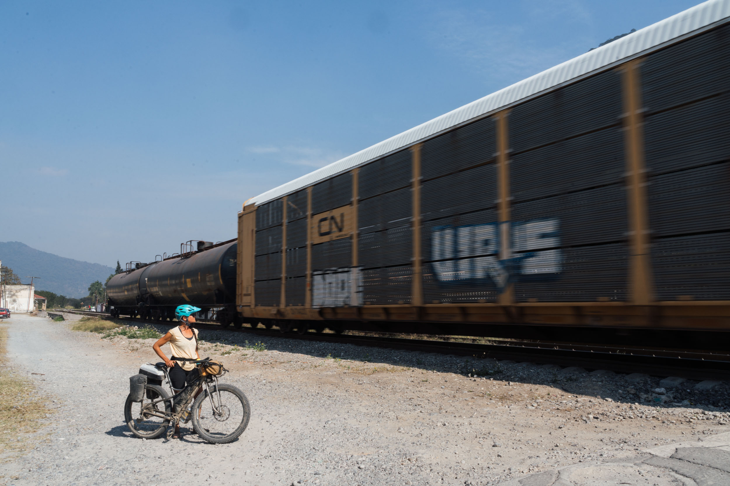
Still, this meant we could really enjoy Day 6, meandering along the old railway line to Maltrata, and following the train tracks all the way into Orizaba, arriving there a little after lunch. This part of the route is also very unconventional – expect overgrown singletrack, tunnels, and bridges. Orizaba is a great place to hang out and wander, and the evenings are very social too. Note that you can also hop on the camino nacional for the last downward stint, if you’re in a hurry to get to Orizaba for a bus. Otherwise, it’s fun to trace the railway for as long as possible!
Be sure to familiarise yourself with the Safety and Security notes in the Must Know tab. And, you can read our blog post of this journey here.


Terms of Use: As with each bikepacking route guide published on BIKEPACKING.com, should you choose to cycle this route, do so at your own risk. Prior to setting out check current local weather, conditions, and land/road closures. While riding, obey all public and private land use restrictions and rules, carry proper safety and navigational equipment, and of course, follow the #leavenotrace guidelines. The information found herein is simply a planning resource to be used as a point of inspiration in conjunction with your own due-diligence. In spite of the fact that this route, associated GPS track (GPX and maps), and all route guidelines were prepared under diligent research by the specified contributor and/or contributors, the accuracy of such and judgement of the author is not guaranteed. BIKEPACKING.com LLC, its partners, associates, and contributors are in no way liable for personal injury, damage to personal property, or any other such situation that might happen to individual riders cycling or following this route.
Please keep the conversation civil, constructive, and inclusive, or your comment will be removed.