


London Escape to Surrey Hills
Distance
98 Mi.
(158 KM)Days
2
% Unpaved
70%
% Singletrack
40%
% Rideable (time)
99%
Total Ascent
6,387'
(1,947 M)High Point
912'
(278 M)Difficulty (1-10)
4?
- 4Climbing Scale Fair65 FT/MI (12 M/KM)
- 5Technical Difficulty Moderate
- 5Physical Demand Moderate
- 2Resupply & Logistics Easy
Contributed By

Laurence Tennant
Guest Contributor
Laurence sees himself as a “rambler on wheels.” His favourite hobby was hiking until he realised he could cover three times the distance and have more fun on a mountain bike. He is a big fan of craft ale after a long ride. He is based in London and trying to start a YouTube channel about cycling @hyperreality303.
What makes this route special is that it starts near the edge of Greater London yet takes you through gorgeous spots that feel a world away from the crowded capital city. For Londoners, this is the perfect escapist weekend adventure. The route is not just for locals, though. Surrey has the most tree cover in the UK, a dense network of bridleways, and a large number of points of interest in a small area.
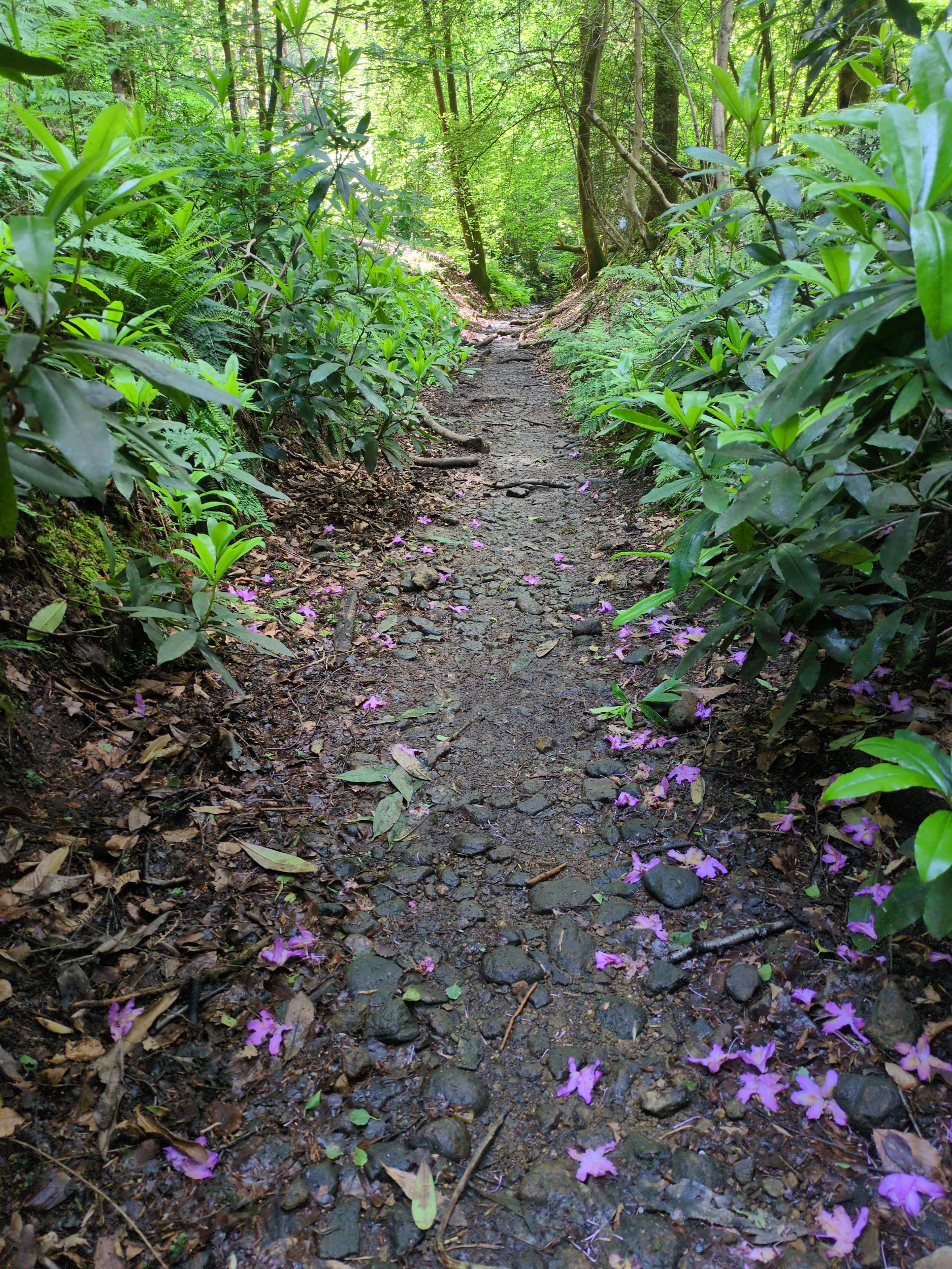
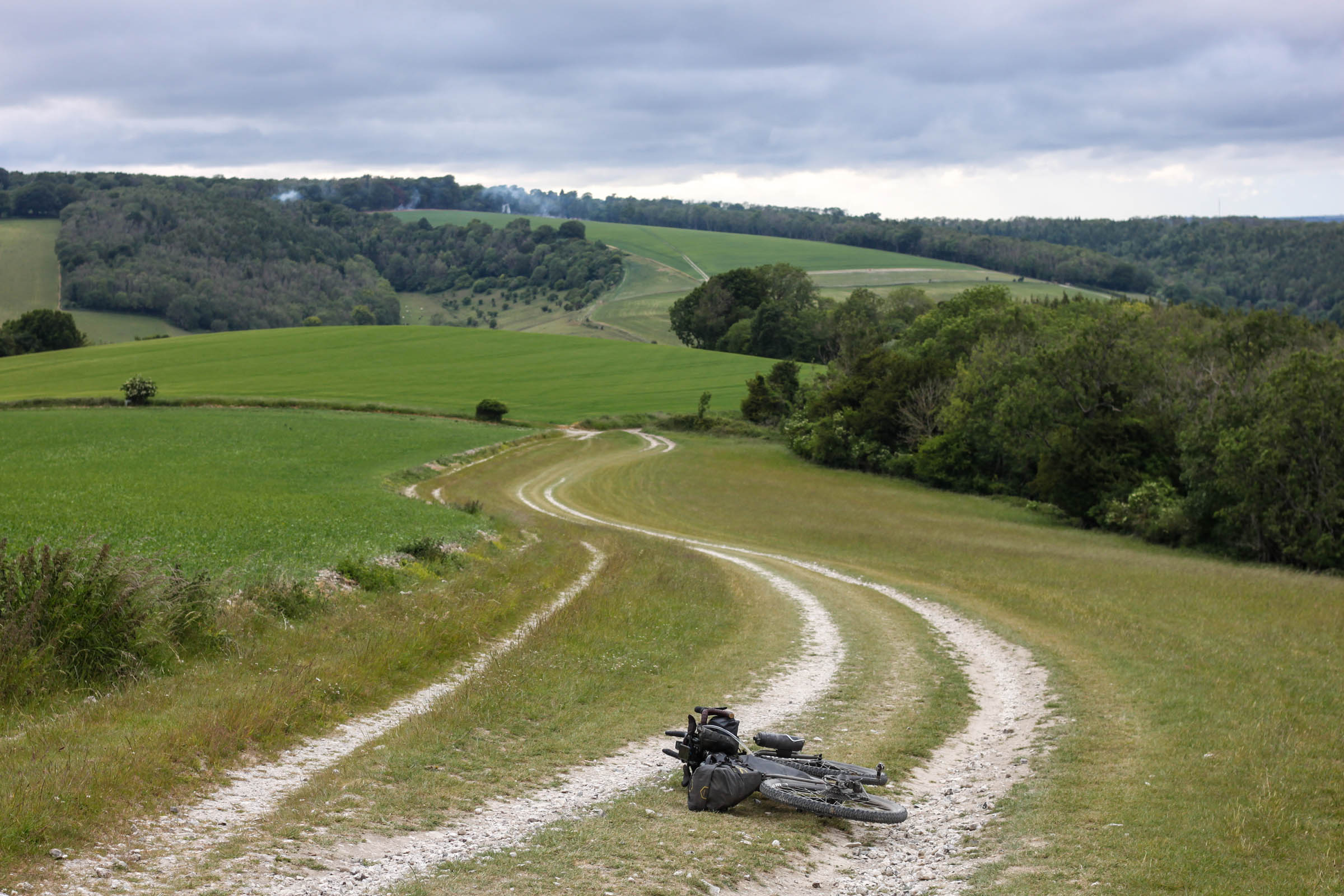
The opening miles have a relaxed feel, with mostly smooth gravel and woodland tracks that seem more remote than their location suggests. The terrain soon shifts to chalk, leading to a series of fun, non-technical descents that weave between farmland, stables, and golf courses.
As the route pushes deeper into Surrey, the landscape becomes more varied and dramatic. The Surrey Hills bring long climbs, open viewpoints, and a mix of historic estates, sunken lanes, and bridleways that range from smooth and loamy to rooty and rugged. Leith Hill, Holmbury Hill, and Pitch Hill are an off-road cyclist’s paradise, with mazes of singletrack snaking down the hillsides.
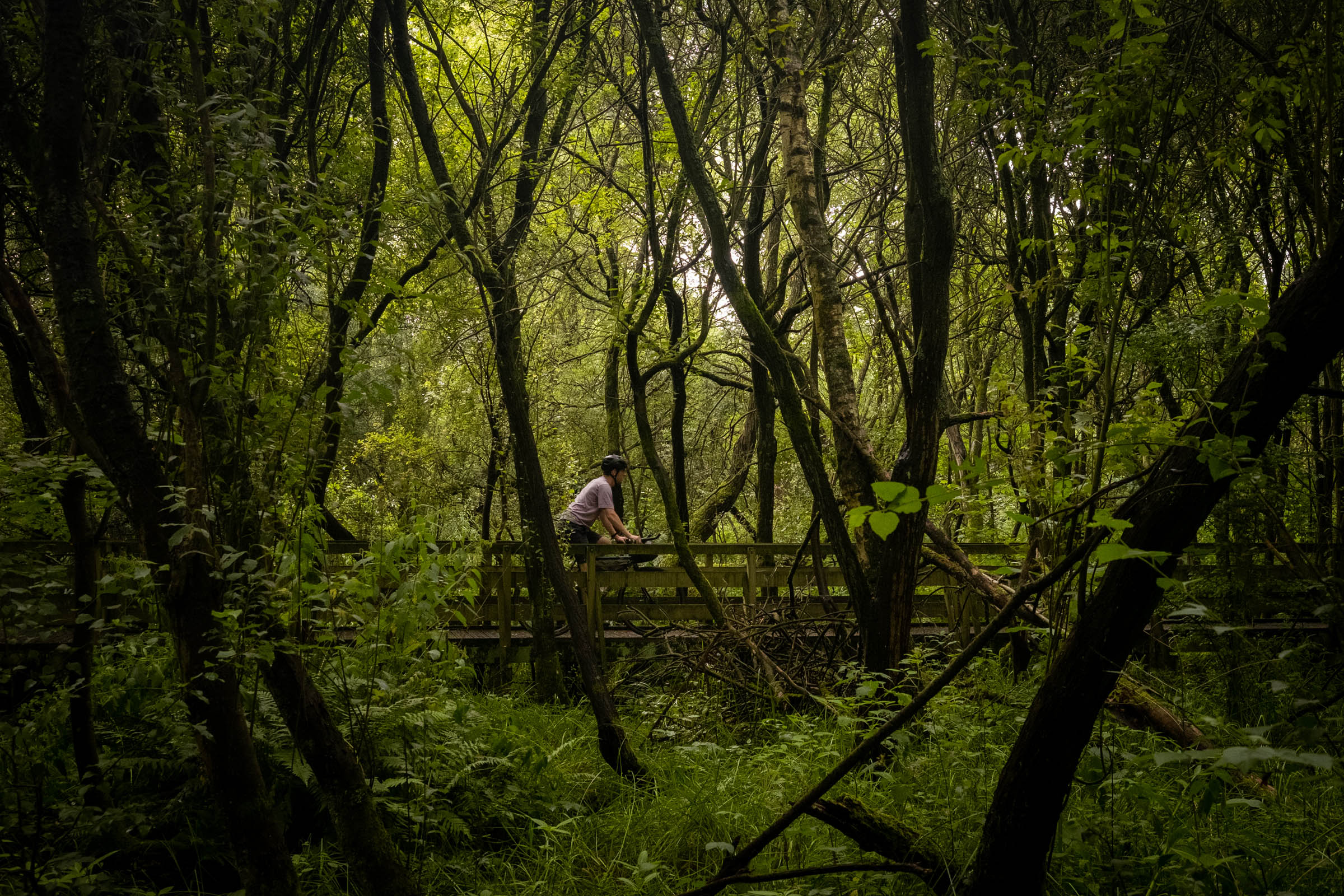
The southern part of the route crosses farm gravel tracks and woodland on a clay surface, heading towards the iconic Devil’s Punchbowl. The western section’s commons showcase lowland heathland, one of the rarer landscapes in Europe. In places, the sand is loose and requires a light touch, but the reward is unique vistas used in famous films, as well as pretty villages with tempting pubs.
After the climb and fast descent from St Martha’s Church, there is one final climb back onto the chalk ridge before the ride softens in profile. The hills give way to a long downhill sweep through quiet lanes, dropping into the calm of the Wey Navigation towpath. The route then follows the Thames Path for a gentle run back towards London. The shift to riverside leisure marks the end of a journey that ranges from the suburban fringe to the deep countryside and back again.
Route Difficulty
In a few places, the route can be technical on gravel bikes, due to rutted chalk, rooty singletrack, and loose sand, which demand adaptability and bike-handling confidence, though nothing is extreme. Physical demand is moderate due to the distance and elevation covered over two days, but if you are concerned, the route can be done comfortably over three days. Resupply and logistics don’t get much easier as the route passes through or very close to numerous villages, cafes, and shops, and the start and end points are quickly reached by train from central London.
Route Development: This route was developed by Laurence Tennant over the course of exploring the bridleways of Surrey. Credit is due to Cycling UK for the southwestern section, based on parts of the “Surrey Hills Loop” and “North Down’s Way Rider’s Route” that they created. The first part of the route is a remix of Maddy Nutt’s top London gravel routes (see the resources section).


Submit Route Alert
As the leading creator and publisher of bikepacking routes, BIKEPACKING.com endeavors to maintain, improve, and advocate for our growing network of bikepacking routes all over the world. As such, our editorial team, route creators, and Route Stewards serve as mediators for route improvements and opportunities for connectivity, conservation, and community growth around these routes. To facilitate these efforts, we rely on our Bikepacking Collective and the greater bikepacking community to call attention to critical issues and opportunities that are discovered while riding these routes. If you have a vital issue or opportunity regarding this route that pertains to one of the subjects below, please let us know:
Highlights
Must Know
Camping
Food/H2O
Trail Notes
Resources
- Polesden Lacey National Trust estate with its unusual thatched bridge
- Leith Hill Tower is the highest point in South East England, with spectacular views back to London
- Barry Knows Best and other well-known MTB trails just off the route
- Hascombe water fountain offers a grand way to rehydrate
- Devil’s Punchbowl is a huge natural amphitheatre-shaped valley
- Hankley Common is stunning sandy heathland that was used in James Bond films
- Beautiful riverside houses along the Wey Navigation and Thames towpaths
- Ice cream outside Hampton Court Palace
- When to go: Due to the chalk on the northern part of the route, and thick clay in various places, it’s recommended to ride during a drier period, usually April-October in the UK.
- Getting there: Esher Station is less than 30 minutes by train from Clapham Junction or Waterloo in central London. You don’t need to reserve bike space (there’s usually room), but check the train operator’s website for the times when you’re allowed to take a bicycle on board.
- What Bike: There is a large range of surfaces on this route, from rutted chalk to soft sand, and a fair amount of climbing. An XC mountain bike is ideal, but a wide-tired gravel bike (at least 45mm) is also suitable.
- If riding after rain, be particularly wary of exposed chalk surfaces. On the other hand, the looser sandy sections in the western part of the route can be easier to ride when damp.
- Rarely, parts of Hankley Common are closed by the Ministry of Defence for military training. There doesn’t seem to be an authoritative website that lists these dates, so Google “Hankley Common closed,” which should bring up any upcoming closures on local news websites.
- We have avoided technical descents as much as possible, although there is the option to enjoy the trails around Peaslake as you pass through.
- There is a kissing gate on entry to Prince’s Covert, which requires maneuvering your bike onto its rear wheel.
- YHA Tanner’s Hatch is in a beautiful, remote spot, but it’s a little early in the route.
- There is a good campsite at Etherley Farm below Leith Hill, although you’ll have to climb up half the hill again.
- The Hurtwood Hostel at Holmbury St Mary, which used to be a YHA, has recently opened a campsite.
- In the latter part of the route, Waggoners Campsite near Puttenham is a good quiet spot.
- There are a couple of inns located centrally in the route: The Devil’s Punchbowl Hotel in Hindhead and The Richard Onslow in Cranleigh, suiting a balanced two-day itinerary.
- There are ample tea rooms, cafes, and village shops either close to or directly on the route in Headley, Bockett’s Farm, Coldharbour, Peaslake, Witley, Hindhead, Tilford, Puttenham, and Ripley.
- Great coffee at The Barn KT9, in a farm next to Ashtead Common.
- Don’t miss the chance to refill your water from the fountain at Hascombe.
- Leith Hill Tower has a cafe inside it.
location Esher to Gibbet Hill
Day 1 (56.6 mi, 4,775′)
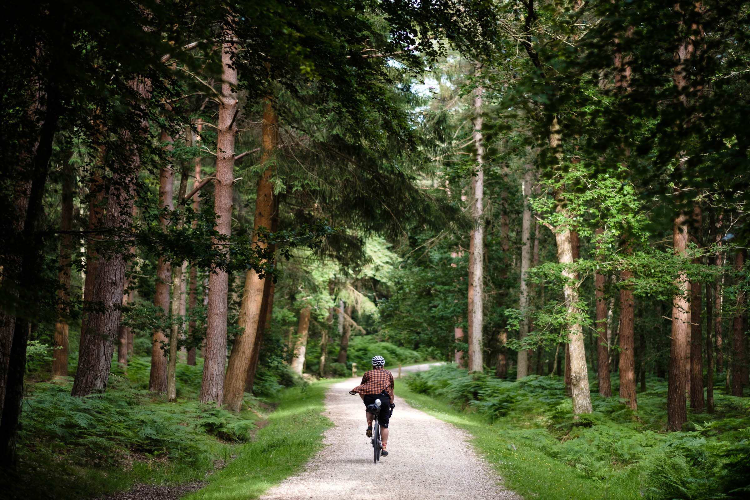
Beginning at Esher station near the London-Surrey border, we are almost immediately off-road on a series of gravel stretches through Littleworth Common, Esher Common, Prince’s Coverts, Ashtead Common, Epsom Common, and Ashtead Park. The woodland and farmland make these areas feel more remote than they are, despite the hum of major roads like the A3 and M25.
Around Ashtead, the riding starts to change character as we get onto chalk subsurface. A series of enjoyable non-technical descents follows as we skirt around the horse-riding centre of Epsom Downs. Each descent is longer and more fun than the last, culminating in “Alsatian,” a rapid woodland trail alongside a golf course, named after an angry dog who used to guard the house at the bottom. After crossing the busy Leatherhead bypass, we take a back entrance to the exclusive Downs Lane, where the actor Michael Caine used to live.
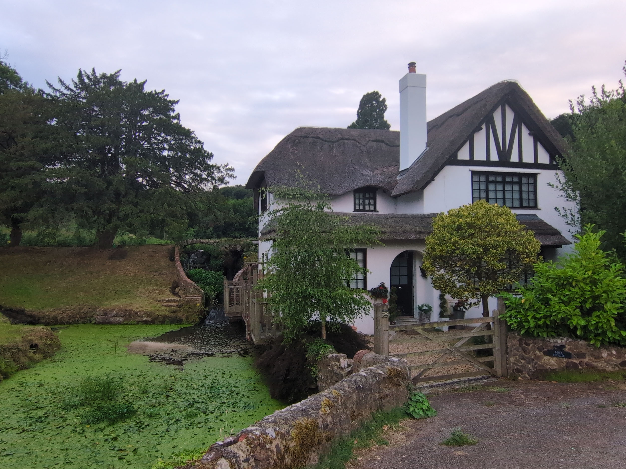
We are officially in the Surrey Hills National Landscape now, with a gravel track through Norbury Park and Fetcham Downs, leading through the National Trust Polesden Lacey estate. It’s a treat to descend the sunken lane underneath an unusual thatched bridge (although look out for pedestrians and the rutted bridleway at the bottom). After this is a quiet climb up to Ranmore Common, where we’re rewarded with some tight singletrack, a WWII pillbox, and a view down to Dorking before a chalky descent to beautiful farmland below.
The surface turns loamy and sandy in the long, steady climb up a byway called Wolven’s Lane. Wolven’s Lane used to be a BOAT (byway open to all traffic), meaning off-road vehicles could ride up it, but it has recently been resurfaced and closed to four-wheel traffic, making it a great, quiet off-road climb. This brings us to the highest point in South East England, Leith Hill Tower, with fantastic views over to the South Downs in one direction and back to London on the other.
Holmbury Hill and Peaslake is a MTB honeypot. If you have the energy, don’t miss the opportunity to enjoy the singletrack here before continuing on the route. The popular Barry Knows Best trail can be ridden as an alternative to descending Radnor Road. After Holmbury, we skirt around an atmospheric pine forest on natural trails. We eventually emerge back onto roads and briefly leave the “Area of Outstanding Natural Beauty” as we cross the Wey and Arun Junction Canal, where the route criss-crosses the Downs Link.
Now we follow some rolling gravel sections through the grounds of a farm and hotel called Gate Street. A fast descent leads down to the village of Hascombe, which has a public spring water fountain. We climb over the lesser-known heathland hills of Holloway’s Heath and Hydon’s Ball before dropping down into the village of Witley and then Witley and Milford Commons. The woodland is lovely, and it’s easy to ignore the proximity to the A3, which is virtually a motorway at this point, that we cross six times during the route.
A quick blast through Rodborough Common leads to the edge of the sandy heathland of Thursley Common. Soon, we begin the climb up to the Devil’s Punchbowl along a quiet lane called Boundless Road, which rises over the Hindhead Tunnel, the longest underland road tunnel in Britain. Gibbet’s Hill is the second-highest point in Surrey, and the views at the top are stunning.
location Gibbet Hill to Hampton Court
Day 2 (42.7 mi, 1,625′)
A fun off-road descent drops us down from the Devil’s Punchbowl to Hankley Common. This sandy heathland, with its sharp hills and forests, has a unique feeling, and several James Bond scenes were filmed here. However, the sand can suck your wheel away, especially in very dry conditions. The trick is to shift into an easier gear, stay loose on the pedals and handlebars, with only gentle steering inputs. We pass by a crumbling replica of Nazi Germany’s Atlantic Wall, which was constructed by Canadian soldiers to practice for the D-Day landing.
While riding through the pretty village of Tilford, we cross over the River Wey, whose towpath we will be following later. A series of bridleways brings us to the edge of Puttenham Common, which we avoid cutting across since it tends to be overgrown with bracken. We’re soon on the North Downs Way, with a sandy path taking us near to Guildford, with fields rising up on the left. We avoid Guildford to cross the Wey at Shalford Meadows, and begin a stiff climb up to St Martha’s Hill, with its amazingly located church. The next major viewpoint is Newland’s Corner, which can get very busy.
The last leg of the journey starts with a fast descent down Staple Lane, offering spectacular views towards Woking and London. Quiet lanes and farmland access tracks take us to the village of Ripley, an important place in cycling history, the most popular destination for London weekend cyclists in the 1870s. We are now on the Wey Navigation, a tranquil towpath with a view of the poet John Donne’s summerhouse. Eventually, the Wey flows into the Thames, where we take a brief diversion on some residential streets in Weybridge. The final glorious stretch on the Thames Path delivers us back to Greater London at Hampton Court Bridge just in time for an ice cream and a pint or two.
Options to Extend
This route can be connected up to existing ones to build a truly epic Southern adventure. Want to head into the South Downs? Link up with the Downs Overnighter. Want to extend the glorious Surrey section of the King Alfred’s Way? The routes overlap in the southwest section. Want to set off from inner London? Richmond Park, Bushy Park, the Thames Path, and the Barge Walk opposite Kingston can be used to reach the start, largely traffic-free.


Terms of Use: As with each bikepacking route guide published on BIKEPACKING.com, should you choose to cycle this route, do so at your own risk. Prior to setting out check current local weather, conditions, and land/road closures. While riding, obey all public and private land use restrictions and rules, carry proper safety and navigational equipment, and of course, follow the #leavenotrace guidelines. The information found herein is simply a planning resource to be used as a point of inspiration in conjunction with your own due-diligence. In spite of the fact that this route, associated GPS track (GPX and maps), and all route guidelines were prepared under diligent research by the specified contributor and/or contributors, the accuracy of such and judgement of the author is not guaranteed. BIKEPACKING.com LLC, its partners, associates, and contributors are in no way liable for personal injury, damage to personal property, or any other such situation that might happen to individual riders cycling or following this route.
Further Riding and Reading
Here are some connected/nearby routes and related reports...

Please keep the conversation civil, constructive, and inclusive, or your comment will be removed.