


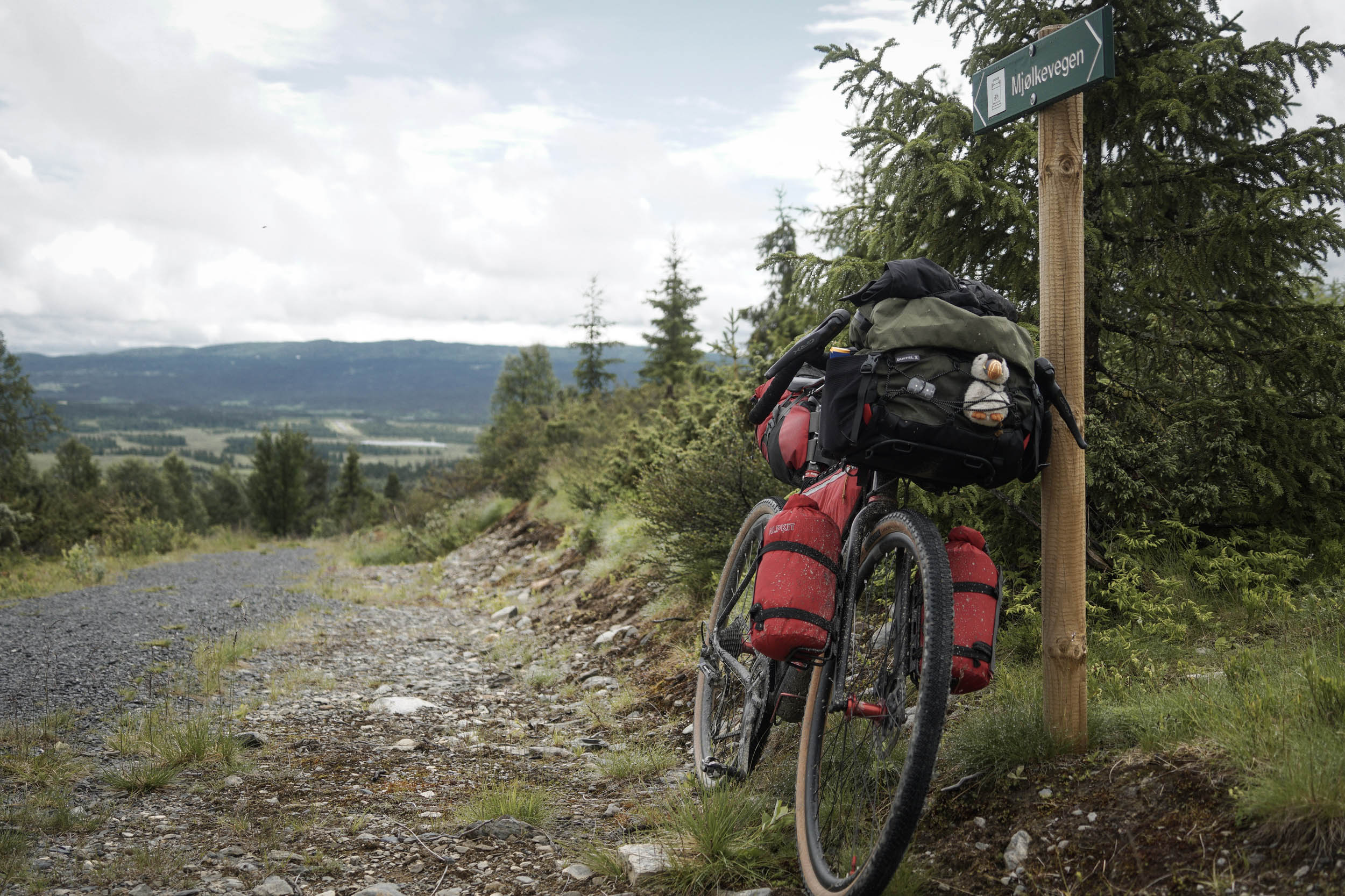
Of Milk and Navvies (Mjolkevegen and Rallarvegen)
Distance
238 Mi.
(383 KM)Days
5-7
% Unpaved
71%
% Singletrack
5%
% Rideable (time)
99%
Total Ascent
23,891'
(7,282 M)High Point
4,336'
(1,322 M)Difficulty (1-10)
5?
- 7Climbing Scale Strenuous100 FT/MI (19 M/KM)
- 2Technical Difficulty Easy
- 7Physical Demand Difficult
- 3Resupply & Logistics Fair
Contributed By

Matt Bark
Guest Contributor
Matt is a programmer with passions for cycling, snowboarding and his pets Kota and Widget. He started bikepacking on short overnighters, spent a 3-month trip exploring the UK by bike and is now steadily travelling further afield, whenever he can get away, in his search for beautiful routes. See his Fairlight Secan here and more of his photos on Instagram @matt_brk
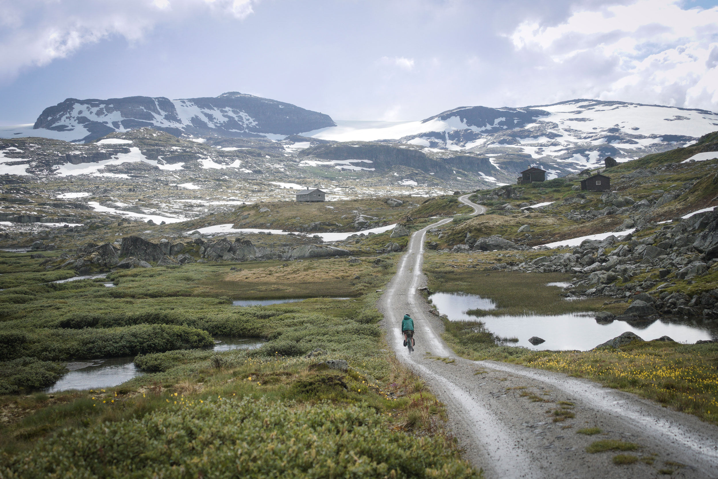
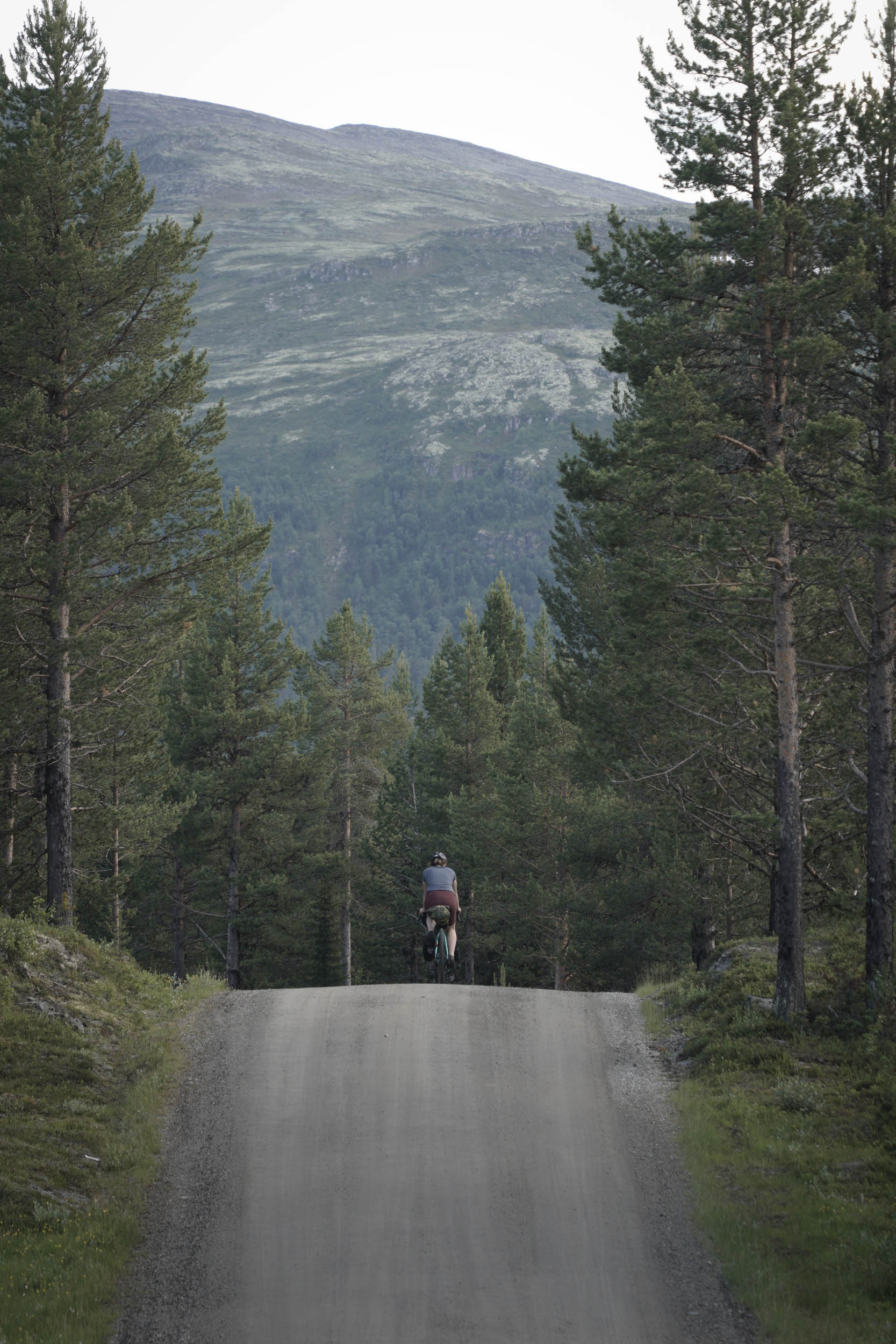
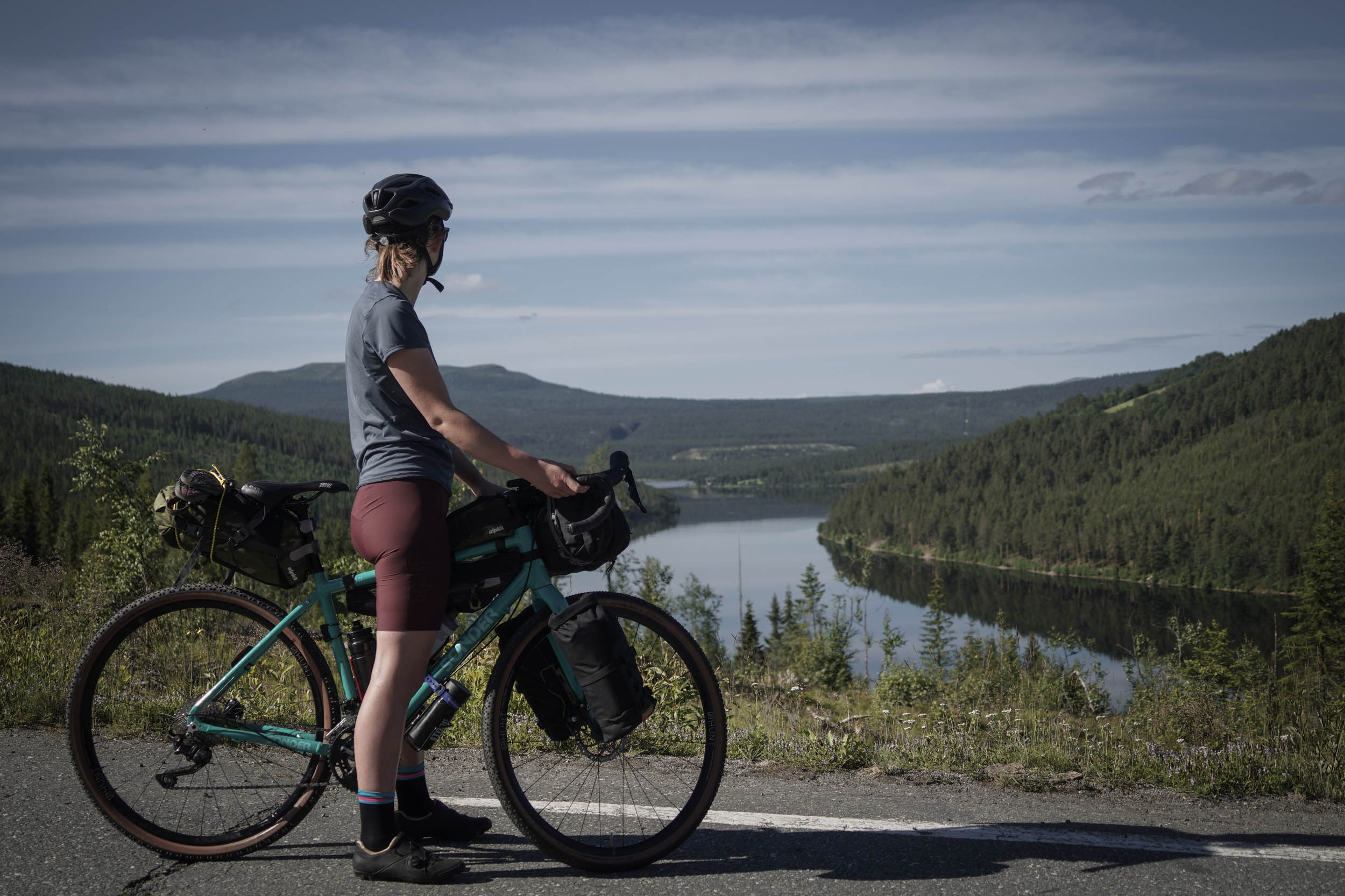
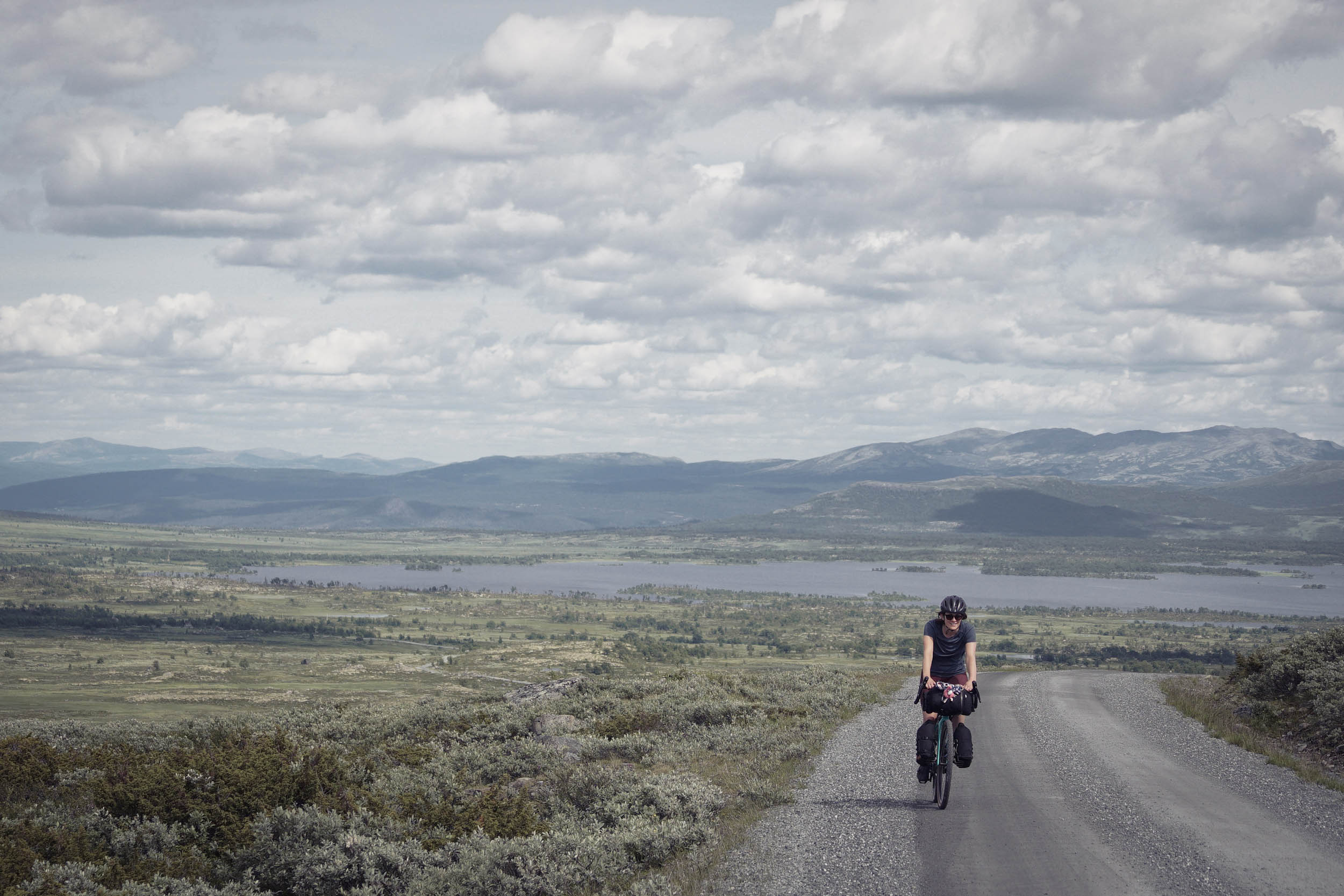
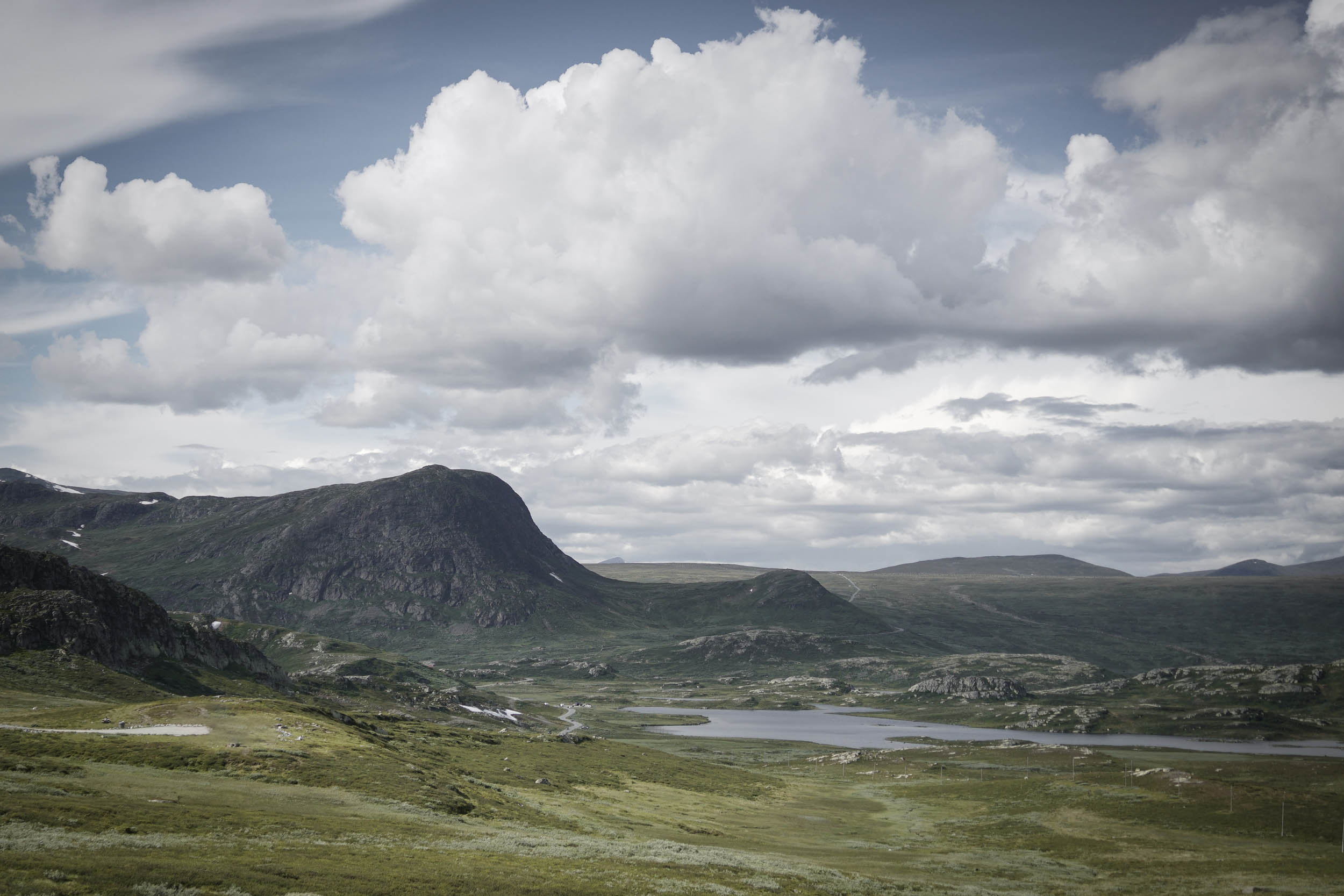
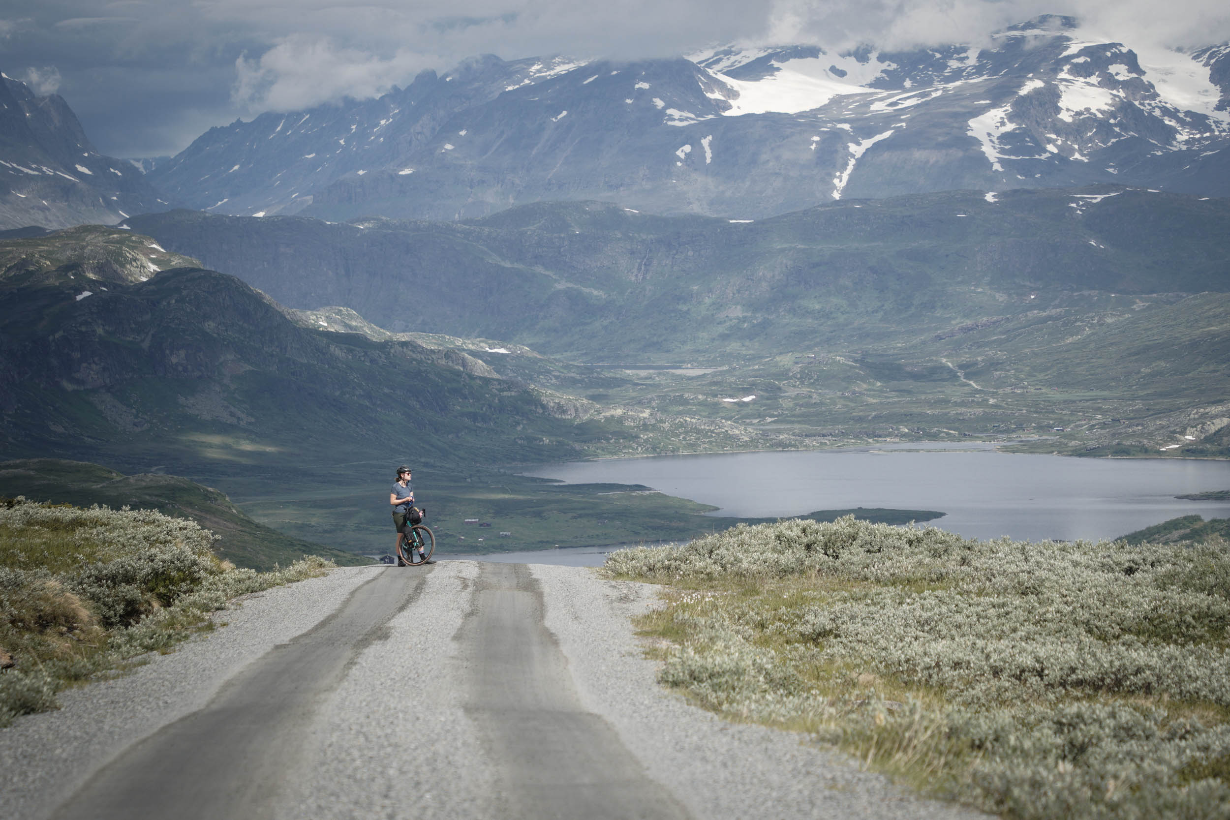
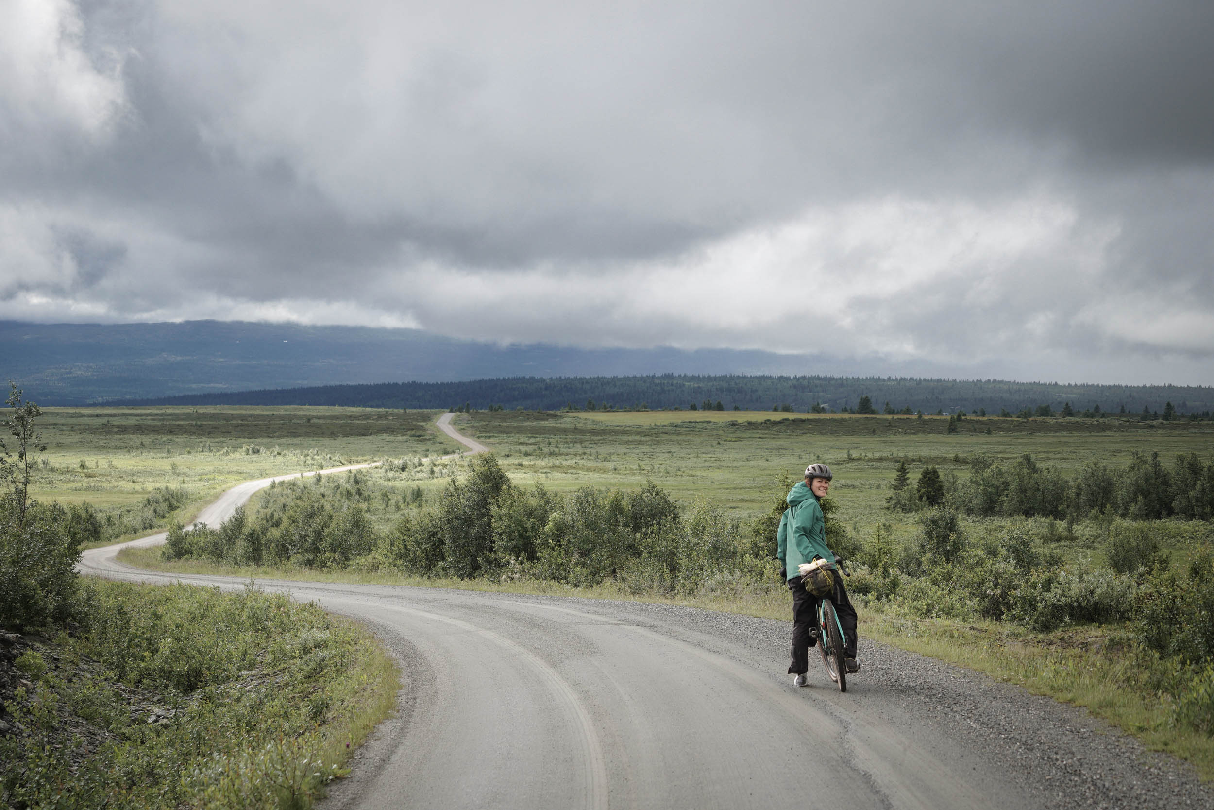
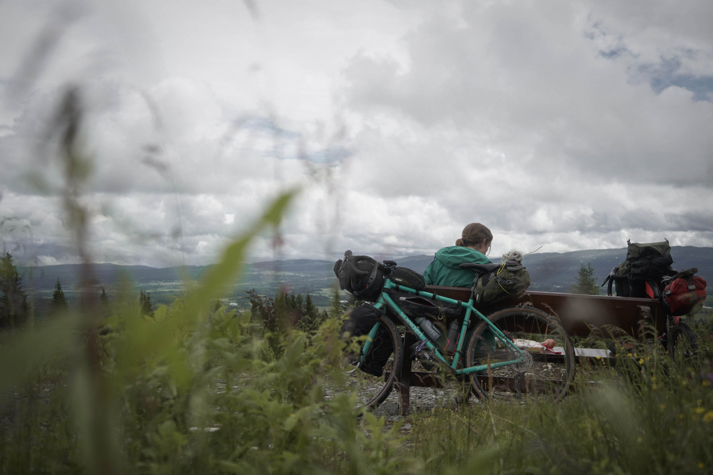
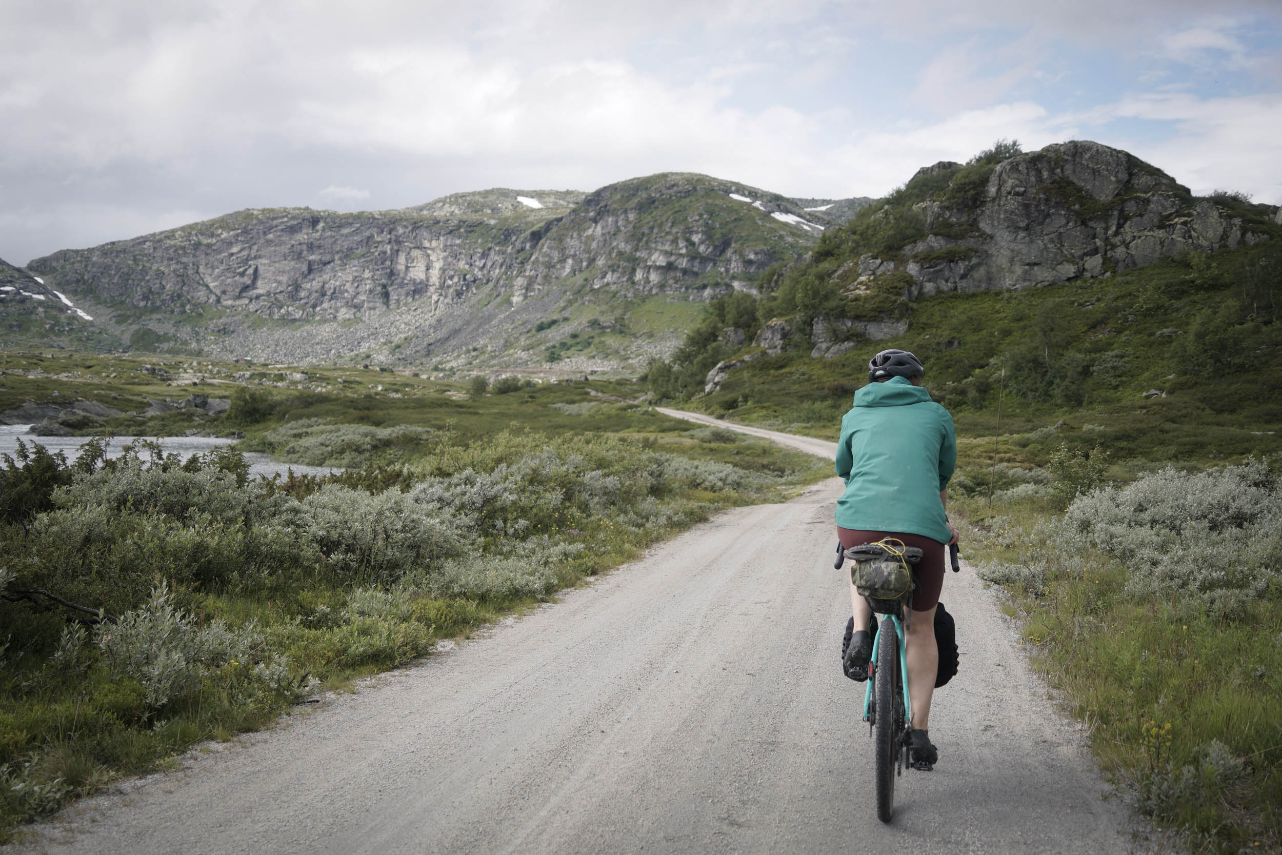
For many, the first thing that springs to mind for Norway will be the fjords and their epic scenery of incomprehensibly huge walls of rock dropping down into vast expanses of water below. Whilst this route does indeed end at one of these fjords (the longest in Norway at over 200 kilometres long), the route is also about exploring the high plateaus, verdant valleys, and miles of gravel roads across the heart of the country. It is a 383-kilometre (238-mile) journey that links up two well established cycling routes, the Mjølkevegen and the Rallarvegen.
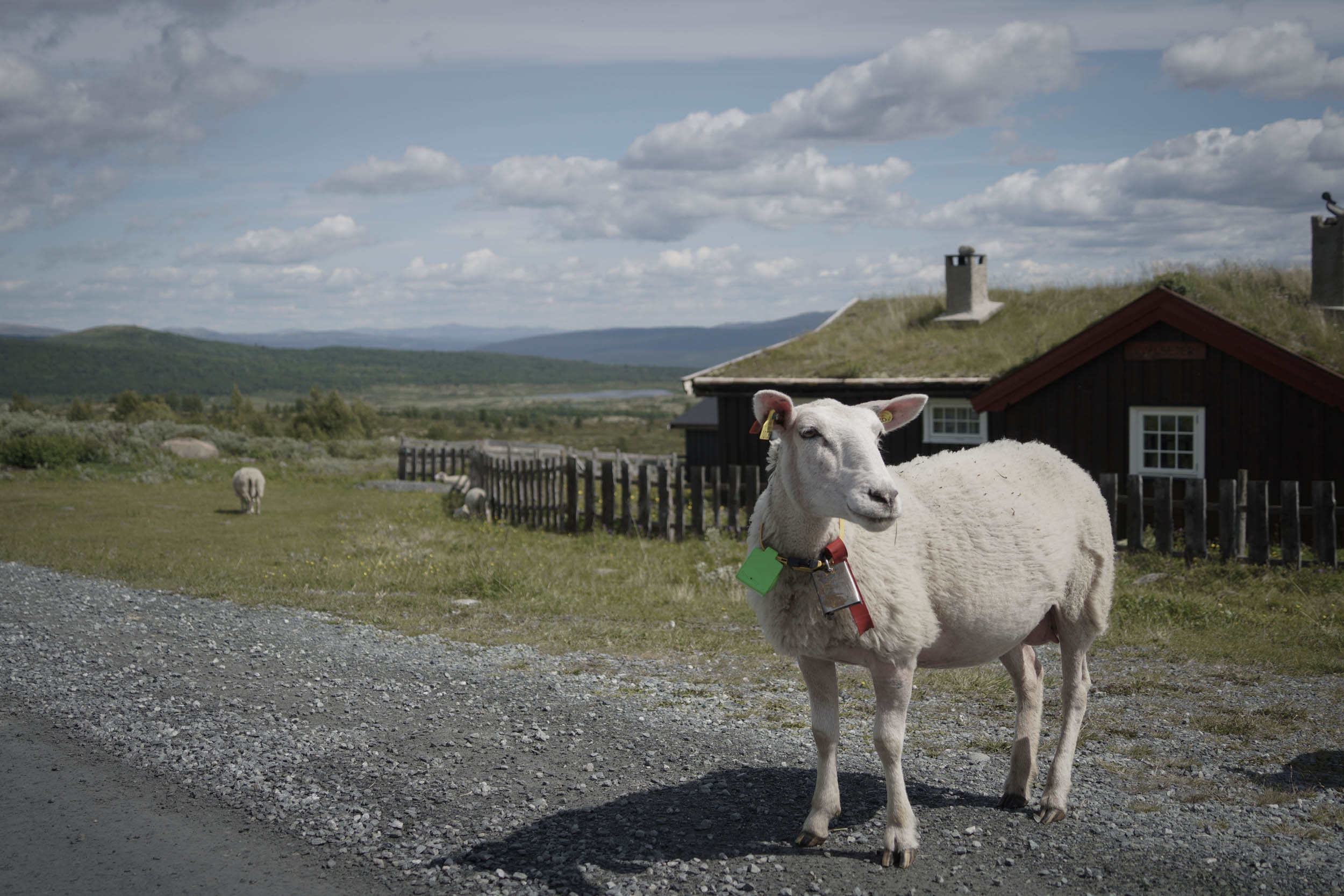
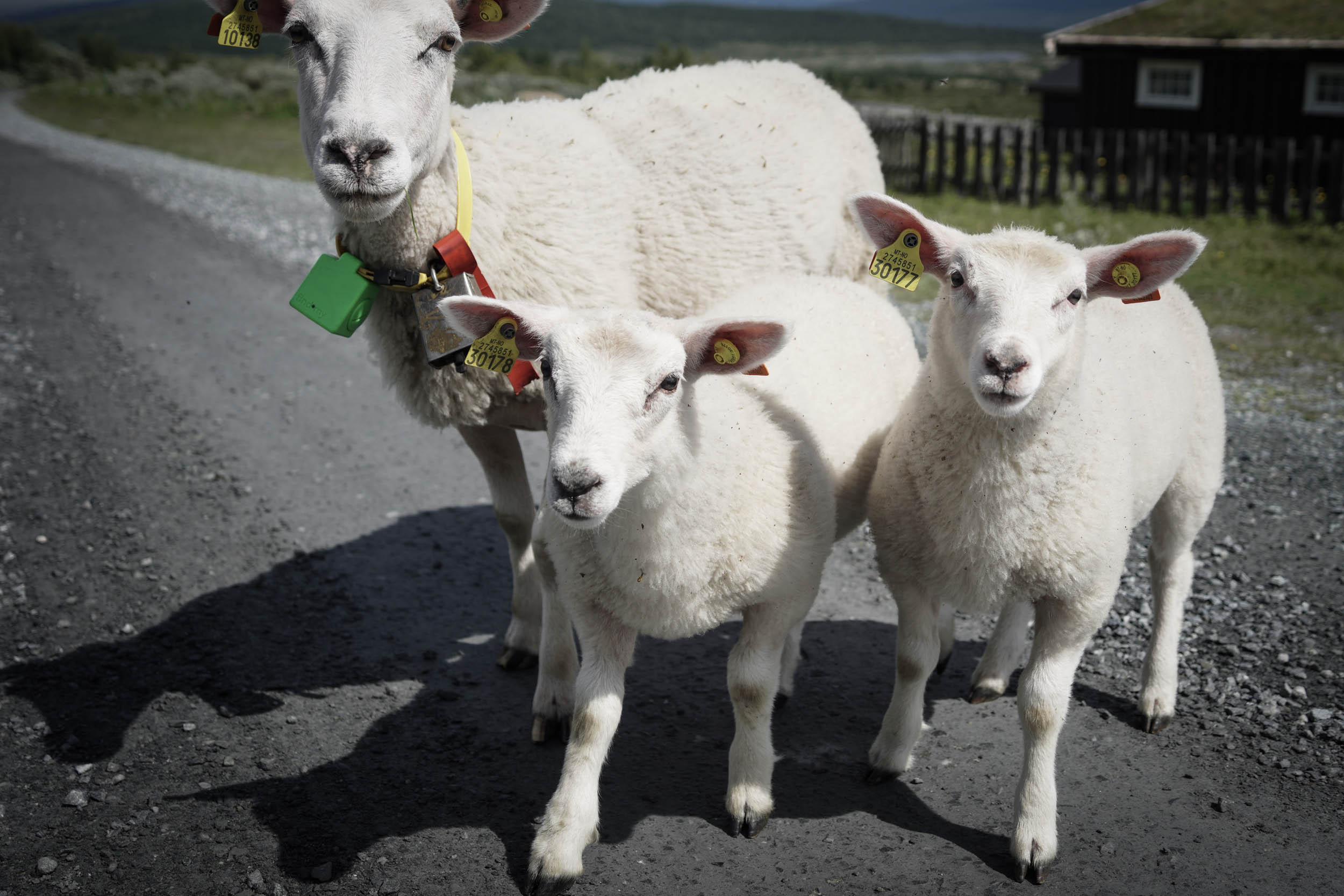
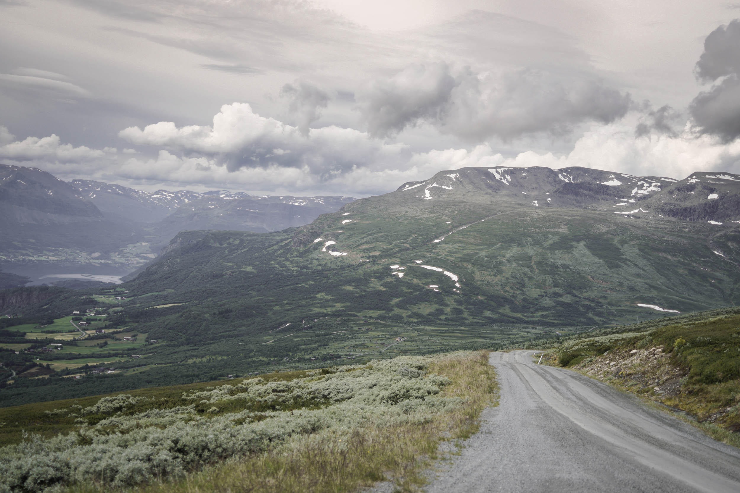
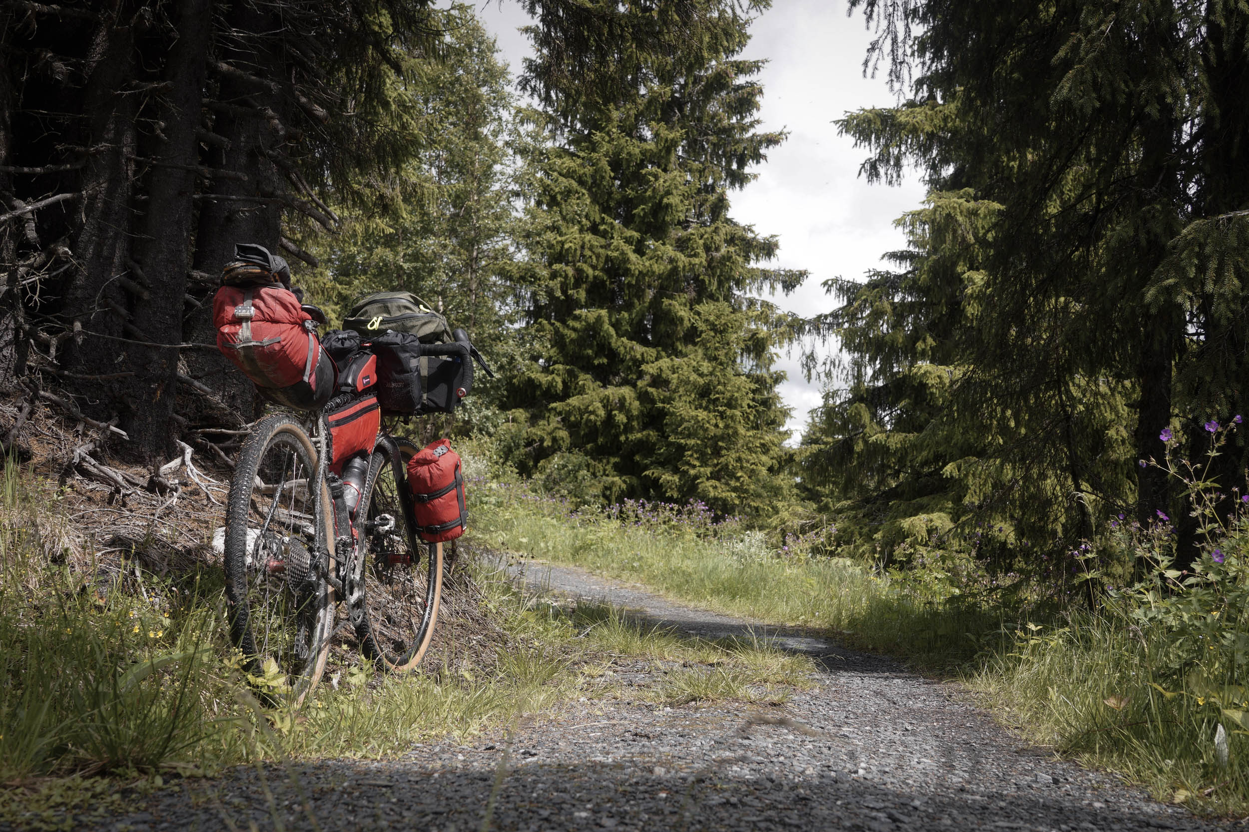
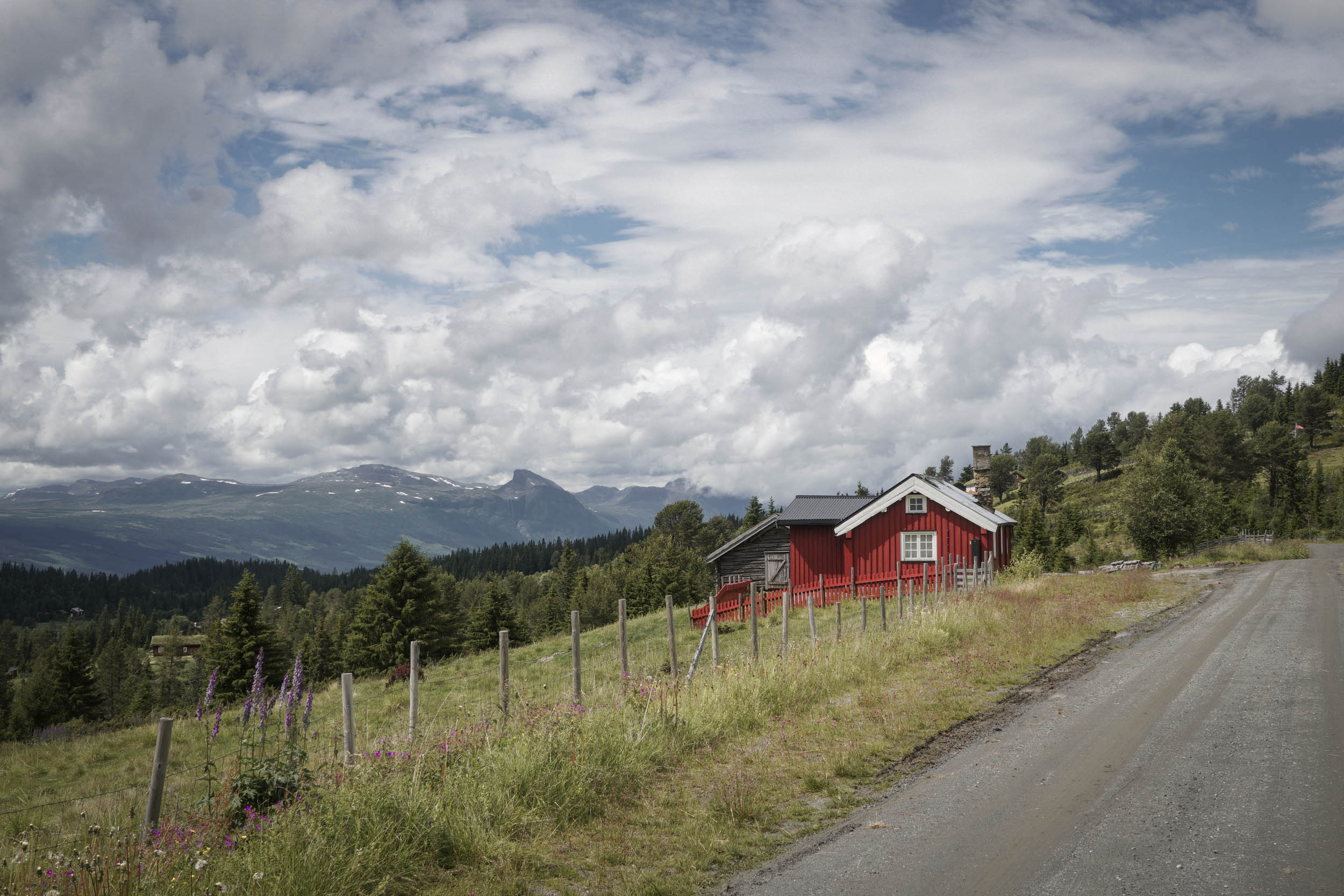
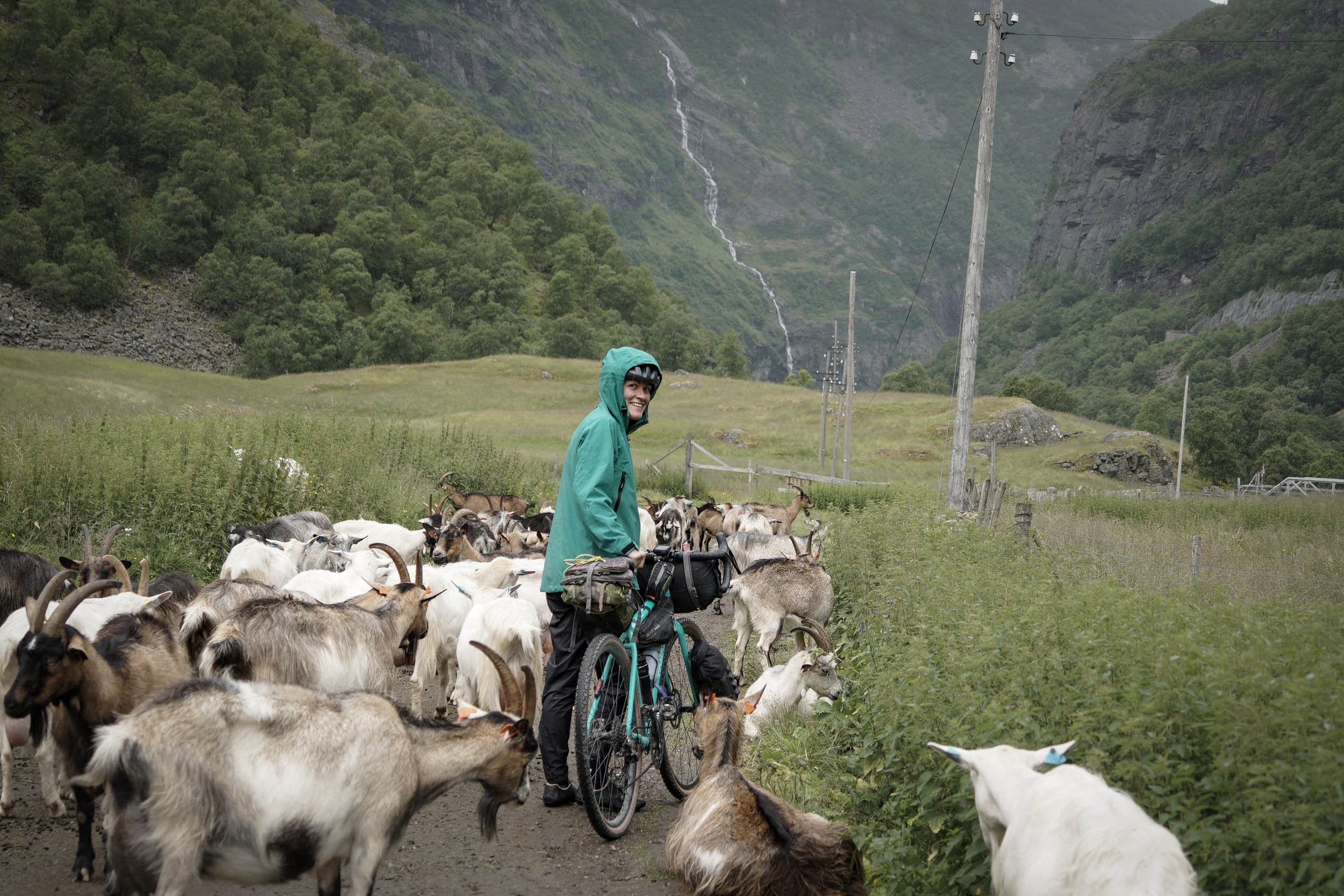
The name Mjølkevegen translates to “the Milk Road,” a name born from the roads used to transport milk down into the valleys from the high mountain summer-farms. Once winter snows have subsided, cattle are still moved up to graze upon these rich high pastures today. As such, expect to see cows, sheep, and goats roaming freely around as you pedal through. The route follows gravel toll roads and a few bits of singletrack as it crosses the high pastures, with expansive views dotted with small cabins and farms. In between each of the high pastures the route re-joins tarmac to drop down into a lush valley, passing through a small town before climbing back up the other side.
Initially, the Mjølkevegen cycling route was developed in the early 2000s by a cycling tour operator that’s now called Discover Norway. By the 2010s, the local tourist agency, Visit Valdres, saw potential and began working alongside local tourism businesses on further development of the route, including signposting, information boards, and branding.
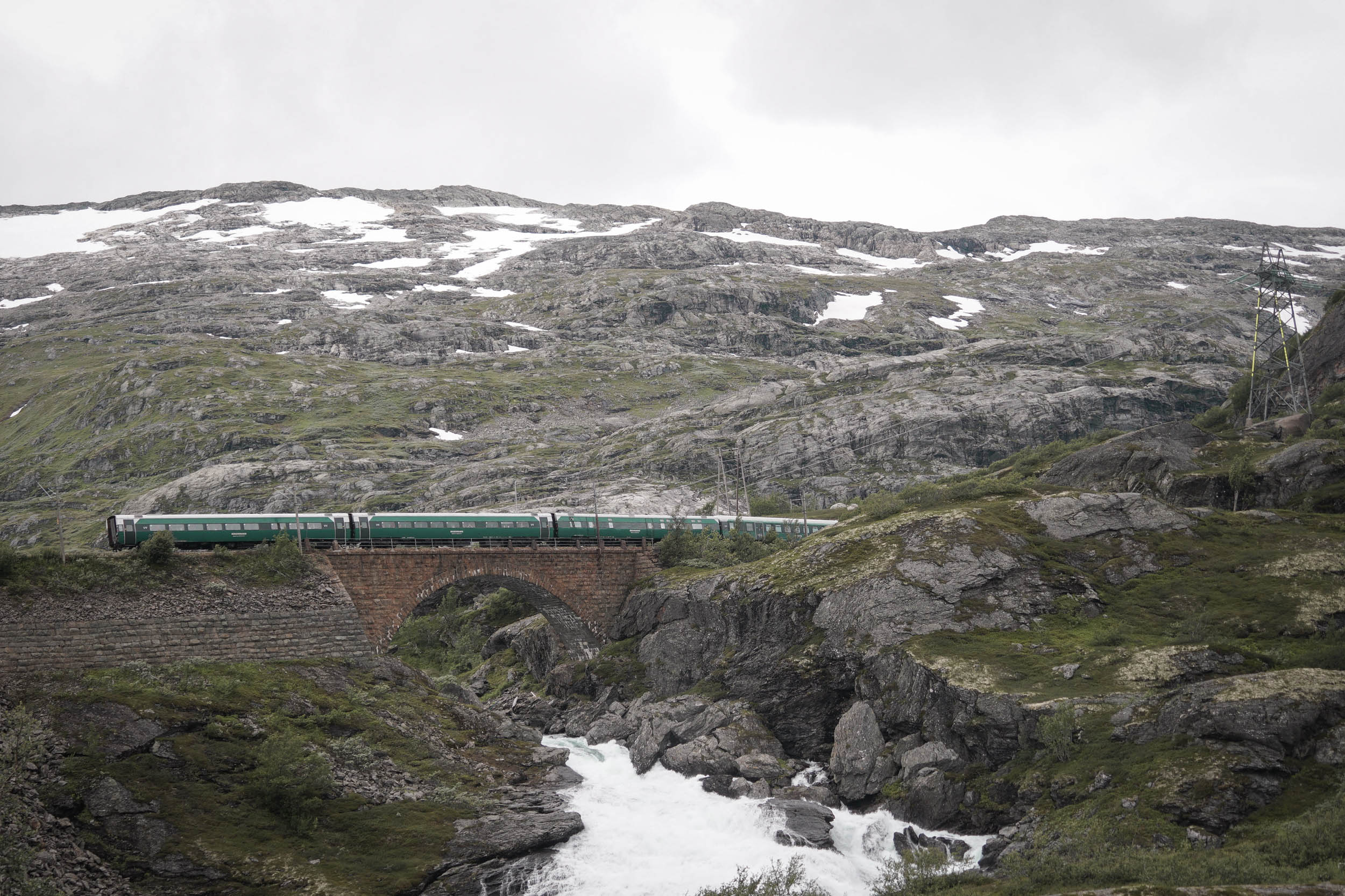
After riders reach the end of the Mjølkevegen, the route latches on to the Bergen to Oslo railway (the Bergensbanen) along the Hallingdal Valley. The floor of this green valley is speckled with small towns and pockets of industry. The steep, densely forested sides (home to many moose) lead to some of Norway’s top alpine ski resorts and many hiking trails.
The Bergensbanen railway was conceived in the late 1800s to connect Norway’s two biggest cities, Bergen and Oslo (named Kristiania at the time). A gravel track was built in the early 1900s to facilitate the railway construction where a local road network did not already exist. “Rallar” is an old Norwegian term for “Navvies,” travelling construction workers who would have used the track when building the railway, and it is from this that the route takes its name. There is a museum on the route at Finse dedicated to the Rallar and the construction of the railway. The road itself survived as a service route until, in the 1970s, an initiative to create a cycle path along it was led by the head of the Norwegian Youth Hostels, Odd Strand. From humble beginnings of a few hundred cyclists per year, it is now one of the most popular cycling routes in Norway, with more than 20,000 cyclists visiting it each summer.
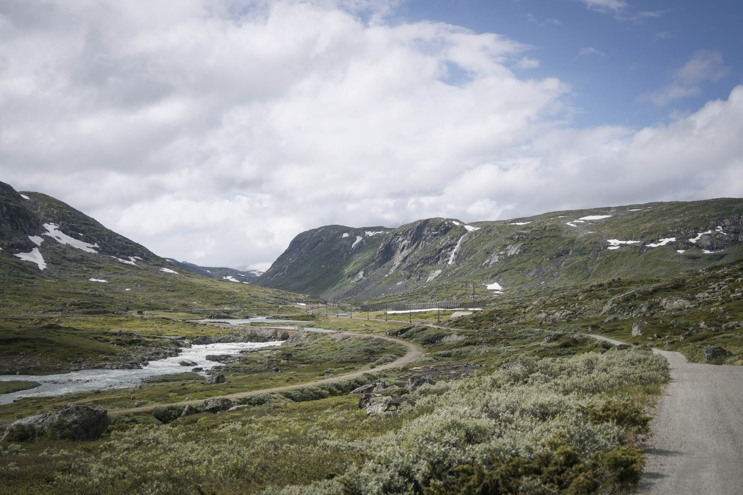
The track twists and turns with the dramatic landscape, following the railway route as it steadily climbs towards Norway’s highest railway station at Finse (1,222 metres/4,009 feet). At times, the railway disappears into a dark tunnel through the mountains, emerging out into the brightness again shortly after. In many places, an old winding track bed can be seen where sections of slow corners and areas prone to regular heavy snow falls were replaced with direct underground options.
At Myrdal, the railway plunges into the mountain for one final time along the route as it heads underground for more than five kilometres in the Gravhalsen Tunnel, and there is no simple route for a cyclist around this one (though it is possible to get a train through and continue cycling the other side). Instead, our route follows one of the steepest standard-gauge railways in the world. The Flåm mountain railway climbs 867 metres (2,844 feet) at gradients above 5% from the small waters-edge town of Flåm on the Aurlandsfjord. The steep-sided valley here is a rich green, and waterfalls crash down hundreds of metres to the floor below as you freewheel your way to the end of a stunning journey.
Route Difficulty
A large proportion of the route follows wide gravel roads whose surface can be well compacted by traffic through the summer. However, the official opening of many of these roads is carried out in spring once snow begins to clear. As such, surface conditions can vary if repairs have been recently carried out. This is intended as a summer route; the technicality would be far higher if attempted before the roads have been officially opened.
Whilst the surfaces are generally good, the route is rarely flat. In some places, climbs sit over 8% for several miles and peak at over 15%. The demand of distance (and therefore climbing) per day can be tailored to suit the rider.
Resupply is straightforward, with small supermarkets usually spaced every 20-35 miles, except for the sections at each end where 50-65 miles separates any shops. Cafés and restaurants can be found in towns and some villages along the route. Fresh water is readily available from the many rivers in the mountains. Logistics for the route are good, and Norwegian transit systems are excellent, but they do require some forward planning as the route starts and ends in very different locations.
Route Development: This route was put together to facilitate a longstanding personal desire to travel on the Bergen to Oslo railway, supposedly one of the most beautiful train journeys in the world. An idea of bikepacking one way then catching the train back the other way led to researching routes. I’d found the Rallarvegen online when first thinking of the trip, then Georgie found the Mjølkevegen when we realised we needed to add some miles in order to fill our vacation. We then simply linked the two. They are both well-developed routes that are extensively documented online.
Submit Route Alert
As the leading creator and publisher of bikepacking routes, BIKEPACKING.com endeavors to maintain, improve, and advocate for our growing network of bikepacking routes all over the world. As such, our editorial team, route creators, and Route Stewards serve as mediators for route improvements and opportunities for connectivity, conservation, and community growth around these routes. To facilitate these efforts, we rely on our Bikepacking Collective and the greater bikepacking community to call attention to critical issues and opportunities that are discovered while riding these routes. If you have a vital issue or opportunity regarding this route that pertains to one of the subjects below, please let us know:
Highlights
Must Know
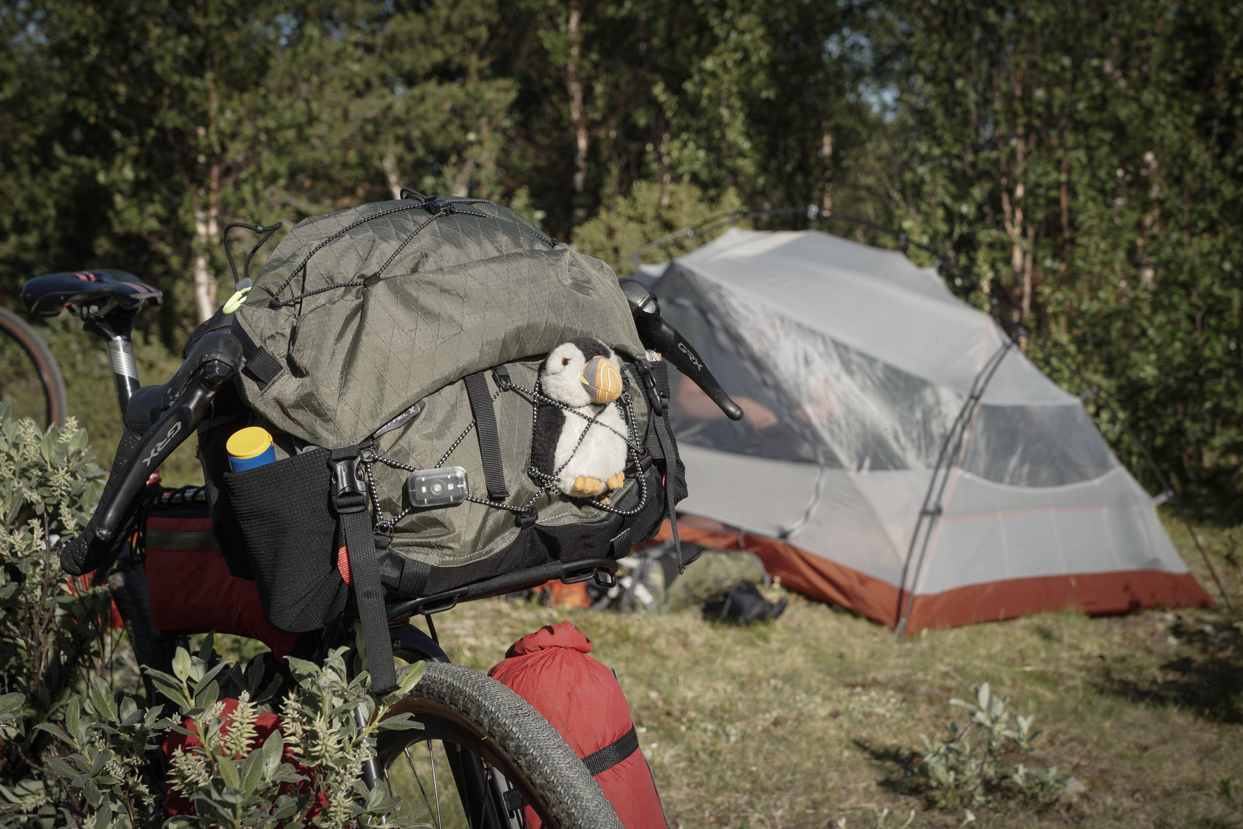
Camping
Food/H2O
Trail Notes
Resources
- Wild swimming in Olstappen Lake. The route skirts the southern tip and then runs along the western shore, where there are plenty of opportunities to wander down and take a dip with majestic hills rising all around.
- Climbing the Slettefjellvegen. The views back over your shoulder are probably the most spectacular of the entire journey.
- Waffles and hot chocolate from the Syndinstøga canteen. The back room here is beautifully well heated, perfect if temperatures have started to drop.
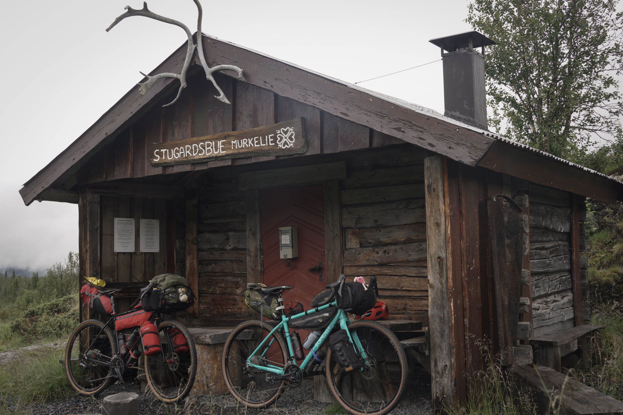
- Stugardsbue in the village of Murkelie, a small community shelter for cross-country skiing where we slept for one night warmed by burning logs in the small stove.
- A few of the supermarkets we stopped at had a small seating area with a free coffee machine for customers. Whilst never the best quality coffee in the world, its warmth was always welcomed on rainy days!
- Riding through snow drifts on the Rallarvegen, at one point over six feet tall.
- Hotel Finse 1222 can provide a much-needed night of luxury in an amazing setting. Room prices for the night include dinner, breakfast, and a packed lunch, and the views from the restaurant are exceptional.
- The descent towards Myrdal, where water has cut a deep path through the rocks, the track criss-crossing on wooden bridges over the sound of water roaring below.
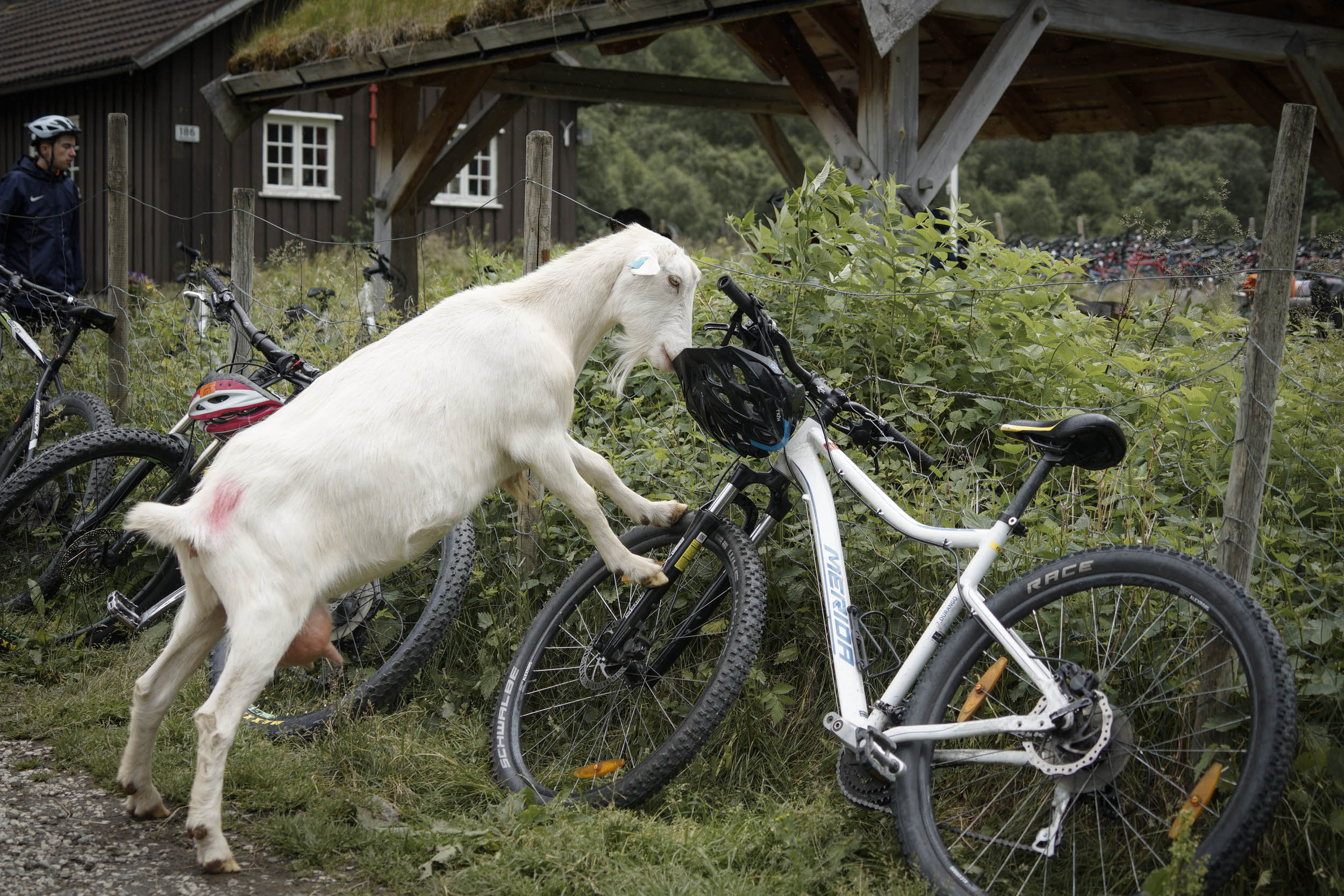
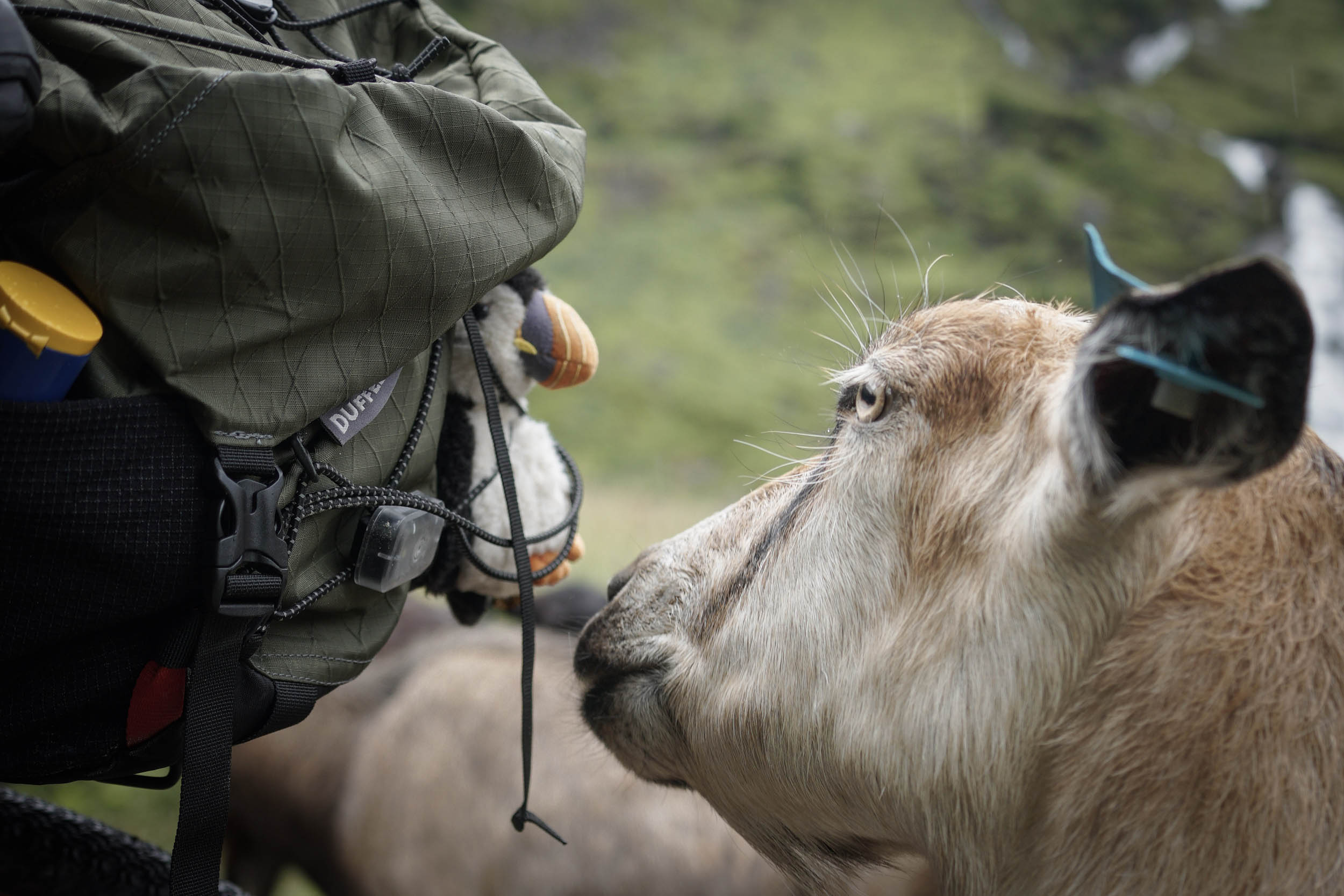
- A herd of goats on the track at the bottom of the Flåm zipline are completely unbothered by humans and will happily pose for photos whilst sniffing your bike (or licking your helmet if you leave it hanging from a handlebar).
- Taking a rest day to hire paddle boards on the fjord at Flåm.
- When to go: This route is intended as a summer route, with many of the roads closed through the winter. The Mjølkevegen officially opens in late June each year and the Rallarvegen in July. The routes remain open through the summer, closing again in September or October. Even in late July, after a weeklong heatwave, snow was still present next to the route at the higher altitudes.
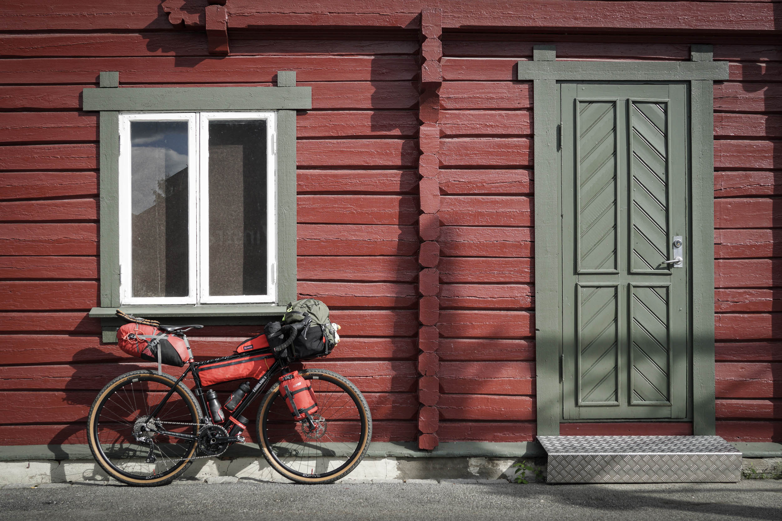
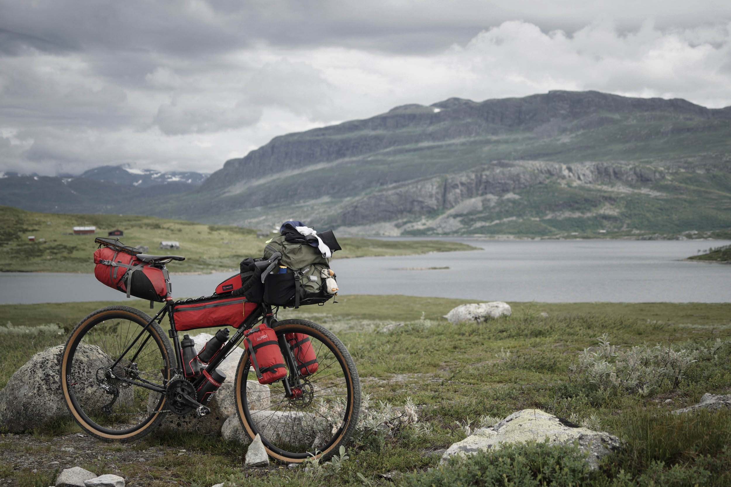
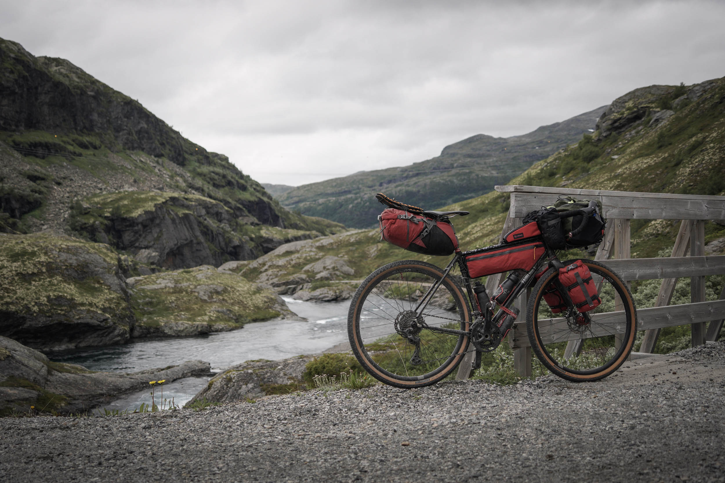
- What type of bike: This route is perfectly suited to a gravel bike, but nearly any capable bike could work. There is little realistic need for suspension beyond comfort and personal preference. On some looser sections, tyres narrower than 35mm might struggle.
- Dangers: For 14 miles, the route follows the road Rv7. Whilst not busy by metropolitan standards, it is fast, and some drivers don’t give as much space as those on the quieter mountain roads. If desired, riders could plan to take the train between Geilo and Haugastøl to cut this section out. This would require planning of tickets and times in advance.
- Animals: Norway does have a small number of bears, but at the time of writing, the nearest has been tracked to the next valley North of the start point so is very unlikely to feature. In researching for our trip, we discovered that Norwegian bears are also very shy and pose little worry for outdoor activities. The route passes through a large amount of open pasture, and cows should be treated with care, especially if they are with calves. Look out for errant cattle on fast descents, and know that sheep can suddenly appear from bushes as if by magic. Mosquitos, midges, and horseflies can also be an annoyance, so bring insect repellent and good bite-soothing cream!
- Direction: The route can be ridden in either direction, however the seemingly obvious choice is from north to south as this gives less overall climbing. In the reverse direction the first climb is 30 miles long, peaks at over 25%, and climbs over 4,300 feet of ascent… all before you’ve even got your legs warmed up!
- Travel Essentials: For a short stay, travelling from many countries presents no visa requirements beyond ensuring your passport is valid for a number of months beyond your intended trip. However, be sure to understand the requirements for your country. The national currency is the Norwegian Krone. We used a bank card that allows foreign transactions and had little use for physical cash, though it is always useful to carry some just in case. The official language of Norway is Norwegian, with Bokmål Norsk being the most common dialect, however everyone we met spoke excellent English.
- Getting to Norway: International airports are available at Oslo, Bergen, and Trondheim. Ferry services from Denmark and Germany can also be used to reach various locations in Norway.
- Vinstra: The train station at the northern end of the route sits approximately 3 hours and 20 minutes from Oslo on the Trondheim line, with around five daily services. Bike spaces are limited and must be booked at the time of booking the train. See www.entur.no.
- Flåm, at the western end of the route, sits with both sea and rail links. An express foot ferry operates once per day from Flåm to Bergen and takes 5.5 hours but is worth the experience of the journey by boat amongst the towering fjords. See norled.no. From Bergen, it is possible to take a train back to Oslo, which is often cited as one of the most beautiful railway journeys in the world. Although expensive, it is a worthy journey to relive some views of the route you have just ridden (and so many that you have not!) from a different perspective. It is a popular train and bike spaces must be booked in advance. See www.vy.no.
- Alternatively, the Flåm mountain railway follows the route back up the final descent to Myrdal, from where trains can be taken to Bergen or Oslo.
- We actually took the ferry a short way from Flåm, along the fjord, then followed a tarmac-based tour over a few days along the west coast down to Bergen. If you’re considering this approach, be careful with route planning to check whether cyclists are banned from tunnels on the way. This map is an excellent resource for such planning.
- If splitting the route up, any selection of stations including Gol, Ål, Geilo, Ustaoset, Haugastøl, Finse, Hallingskeid, or Myrdal could be used as the route follows the railway line here for 85 miles.
- Some hotels along the Mjølkevegen provide shuttle services from local transit hubs for guests.
- Access to the outdoors is very important in Norway. It is enshrined in Norwegian law as allemannsretten (or “every-man’s right”) within the Outdoor Recreation Act. You may camp for up to two nights in open country, on “uncultivated land,” so long as you are more than 150 metres (500 feet) away from the nearest inhabited house or cabin for up to two nights. However, much of the route passes through open pasture, so be aware of animals when pitching.
- We found many grassy spots at the higher altitudes to be wet and boggy following snowmelt and rain. Spots that were not wet were often plagued by ants or rocks or both. However, wild camping was possible in many spots along the route.
- Campsites are available within a few miles of the route at Skåbu, Beitostølen, Hålimo, Valset, and Flåm, with many campsite options available on the section between Gol and Haugastøl. Expect to pitch on smaller grass areas amongst permanent caravans and wooden cabins. Showers and kitchen facilities were well maintained at all the sites we visited, though showers were generally not included in the price of the night.
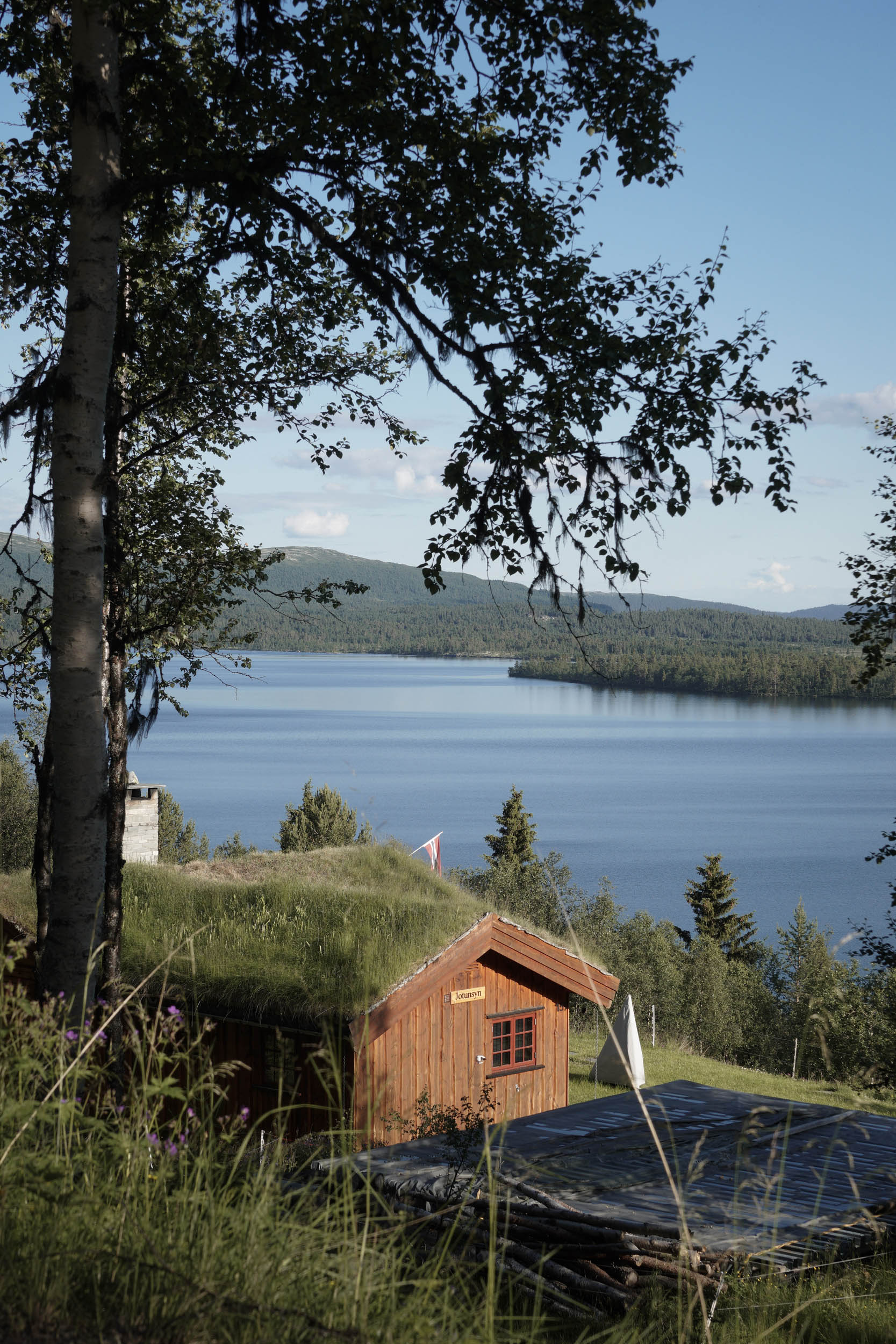
- Many of the campsites also offer small wooden cabins, sometimes as basic inside as a couple of bunk beds and a table, but these can feel like a saviour if the weather has been poor all day.
- As the route passes through many small towns and villages, there are plenty of options for indoor accommodation should you wish.
- In the higher sections, many of the mountain hotels are well prepared for adventurous travellers. They often have facilities such as drying rooms and nightly prices that include dinner, breakfast, and a packed lunch. Although far more expensive than pitching your tent in the wilderness, the Hotel Finse 1222 provided us a night of relative luxury with magnificent views and a stunning restaurant that is well worth incorporating into your trip. Also, check out some of the Star Wars memorabilia—Finse was the filming location for the ice planet Hoth in The Empire Strikes Back.
- Food is available at regular intervals along the route, either from cafés and restaurants in towns and some villages or from small supermarkets spaced every 20-35 miles, except for the sections at either end where 50-65 miles separates shops.
- More specialised sporting shops, with dehydrated meals and other camping equipment, can be found in the larger towns of Gol and Geilo. Some smaller shops may have some bits and pieces, but don’t rely on this. Otherwise, supplies can be picked up in Oslo or Bergen if travelling through these cities before the ride.
- Allergies and dietary requirements are exceedingly well handled; every café had extremely good signage of ingredients for everything being sold. When following a gluten-free diet, this made light work of understanding what was available.
- Be prepared that Norway is not the cheapest country to purchase food and drink in relation to some other European countries. Buying items to make lunches was sometimes costing upward of £15/$19 a day, a one-course meal for two with an alcoholic drink each was around £60/$75, a 500ml beer may cost anything from £8/$10 up.
- Alcohol sales are also controlled, and only drinks below 4.7% can be purchased in a supermarket and only before 8 p.m. (6 p.m. on Saturdays and not at all on Sundays). Stronger alcohol can only be purchased at bars, restaurants, or the state-run alcohol stores.
- Fresh water is readily available from rivers in the mountains. When discussing water purification at an outdoor store in Oslo, we were met with comments of, “Our mountain water is really really good; I’ve drunk it all my life without tablets or anything like that.” We carried a Sawyer filter to be sure and boiled water for dinners without any issues.
The route is split up here into sections that can roughly be translated into days. Obviously, time of arrival at the start location and choice of overnighting locations will affect these.
location Vinstra to Ruten
Stage 1 (20 miles / 32 kilometres, 3,500 feet climbing)
The route starts assuming the rider has arrived by train at Vinstra Station. After crossing the river by a pedestrian/cycle bridge and passing by the motorway services, the route immediately begins climbing, steeply in places, on the small, paved Fv243 towards the first ski resort of Fefor. With views back over your shoulder of the valley opening up behind you until, after 8 miles (13 kilometres), the tarmac eventually gives way to the first gravel of the trip and views backwards are forgotten in favour of the forest around you. As the route continues climbing and winding through the forest, it passes small lakes, where a quick swim is appealing to cool down from the long climb. In several spots, small picnic benches beside the road can be ideal for a snack and sit down.
Although the worst of the climbing is done by 9 miles (14.5 kilometres) in, the route continues to gently rise and fall, eventually peaking at 3,366 feet (1,025 metres) after 17 miles (27 kilometres). It passes through little villages and small fields of crops or cattle, and several spots towards the peak of the climb provide ideal camping stops if you started the day late, some with a picnic bench included.
Beyond here, the route steadily drops towards Ruten, still on gravel, with views opening out to snow-capped mountains in the distance and a sense of what this trip will deliver becoming apparent. At Ruten, the route re-joins paved surfaces where paid accommodation options are available at Ruten Fjellstue or Dalsetter Fjellhotel. Otherwise, a short and fast tarmac descent down to Olstappen Lake can provide some idyllic waterside camping spots.
location Ruten to Beitostølen
Stage 2 (45 miles / 72 kilometres, 3,972 feet climbing)
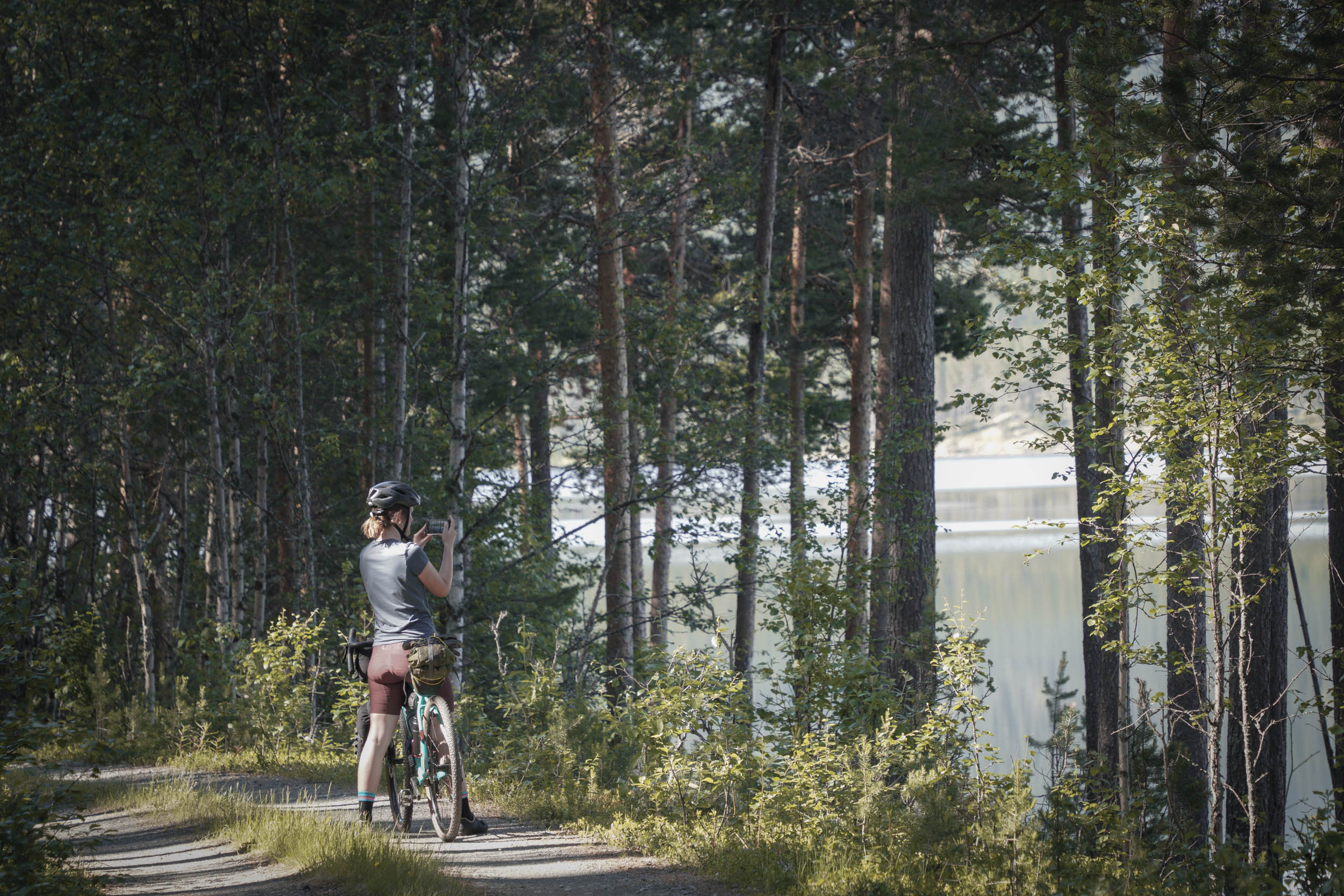
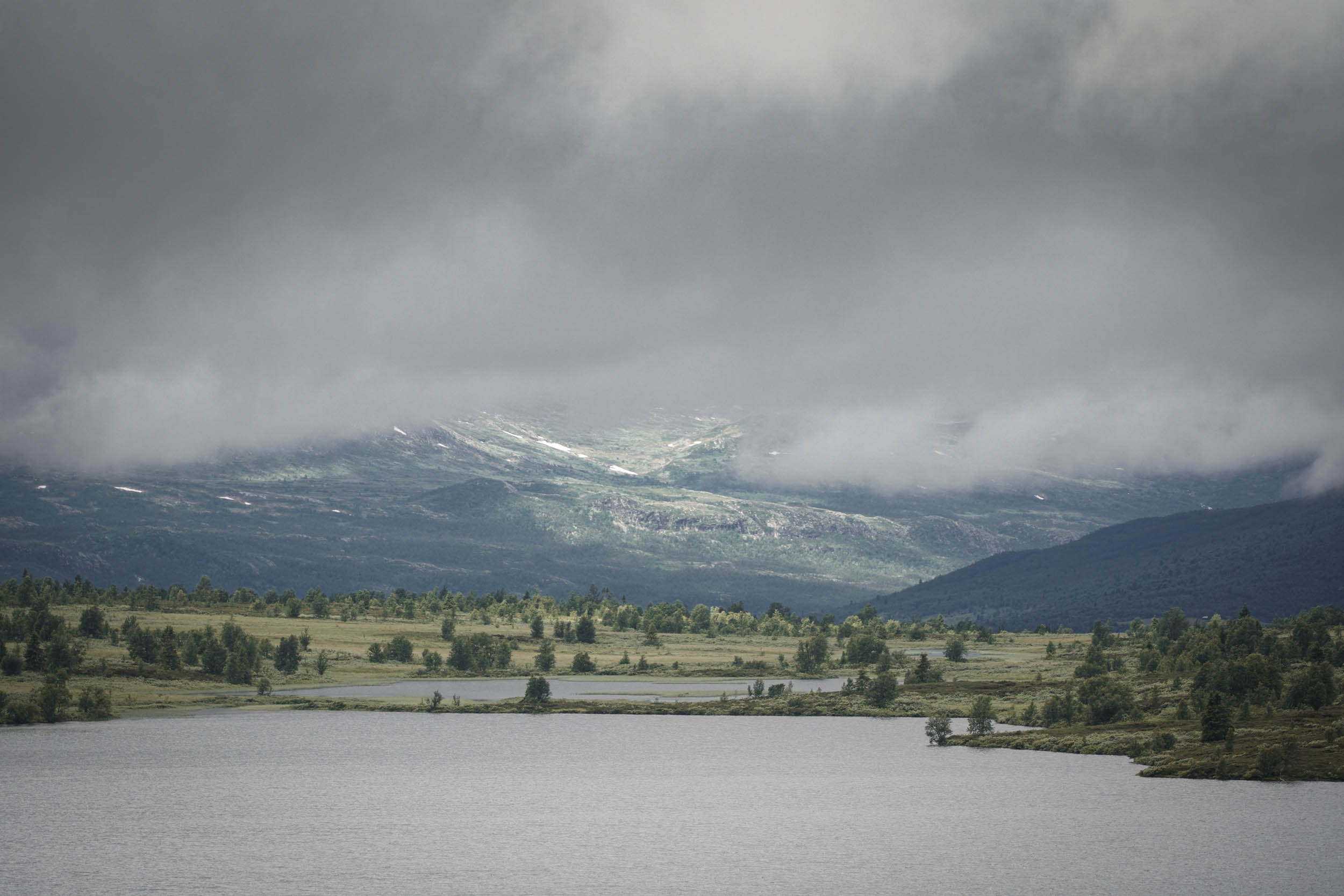
Shortly after Ruten, you will find the first of many green “Mjølkevegen” signs pointing you along the gravel track alongside Olstappen Lake. If you are tempted to go for a swim here, wait for the southern tip or along the western shore for the best spots. It is even more tempting to pitch up for two nights and spend time enjoying the water and tranquility.
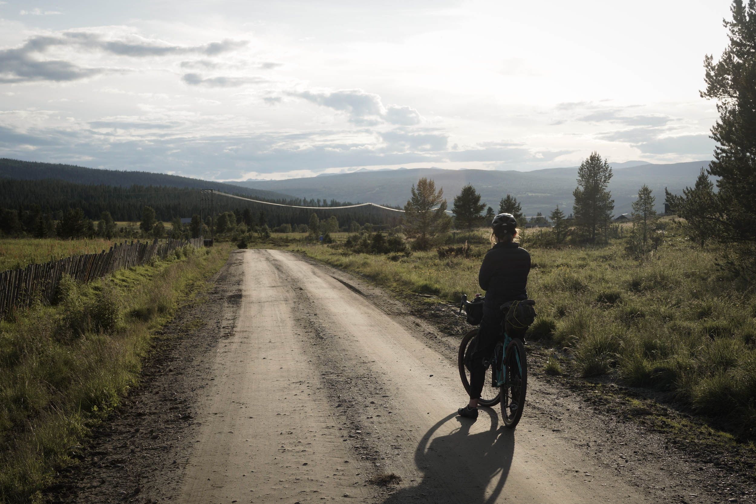
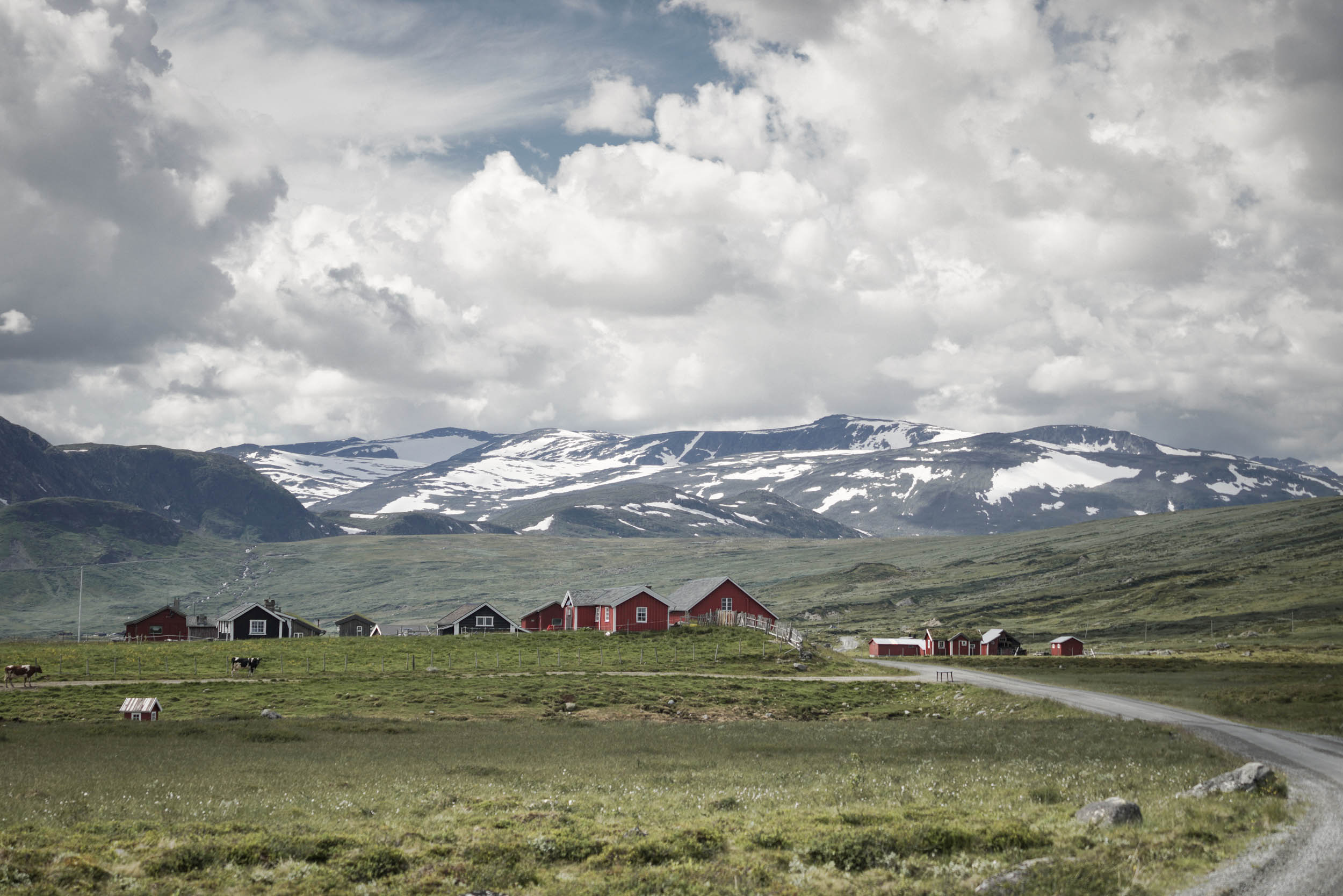
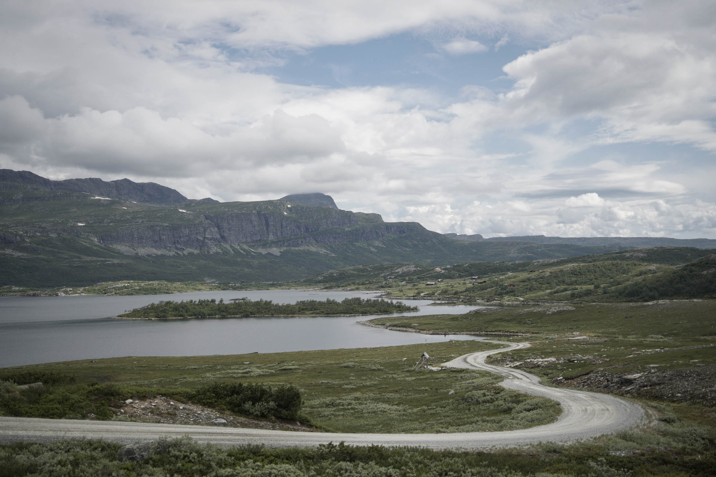
Once you have pried yourself away from the lake, the gravel track points upwards on the Jotunheimvegen, a gravel toll road that climbs steadily for 12 miles (19.5 kilometres). Although this is a public road, traffic is sparse and rarely moves fast. With views across far-reaching plateaus and high lakes, the snow-capped mountains can be seen inching steadily closer. Wood-clad cabins in shades of red, white, blue, and mustard dot the landscape and occasionally cluster together to form small villages.
The end of the Jotunheimvegen deposits riders at Bygdin, where another Fjellhotel can be found beneath the imposing peak of Bitihorn. It also provides a handy café for fueling up before the final climb of the stage. An alternative route can be taken from here, crossing lake Bygdin by historic boat before looping back around to Ryfoss, though this does mean skipping one of the most beautiful (in my opinion!) sections of the whole route across the Slettefjell.
The road climb from Bygdin past the Bitihorn is steady and soon opens to views down into the next valley. A fast, sweeping tarmac descent then rapidly brings the route into the ski resort of Beitostølen, announcing itself via two chair lift bottom-stations at the roadside. Here, several restaurant, shopping, and accommodation (including a campsite) options are available.
location Beitostølen to Vaset
Stage 3 (41 miles / 65 kilometres, 5,254 feet climbing)
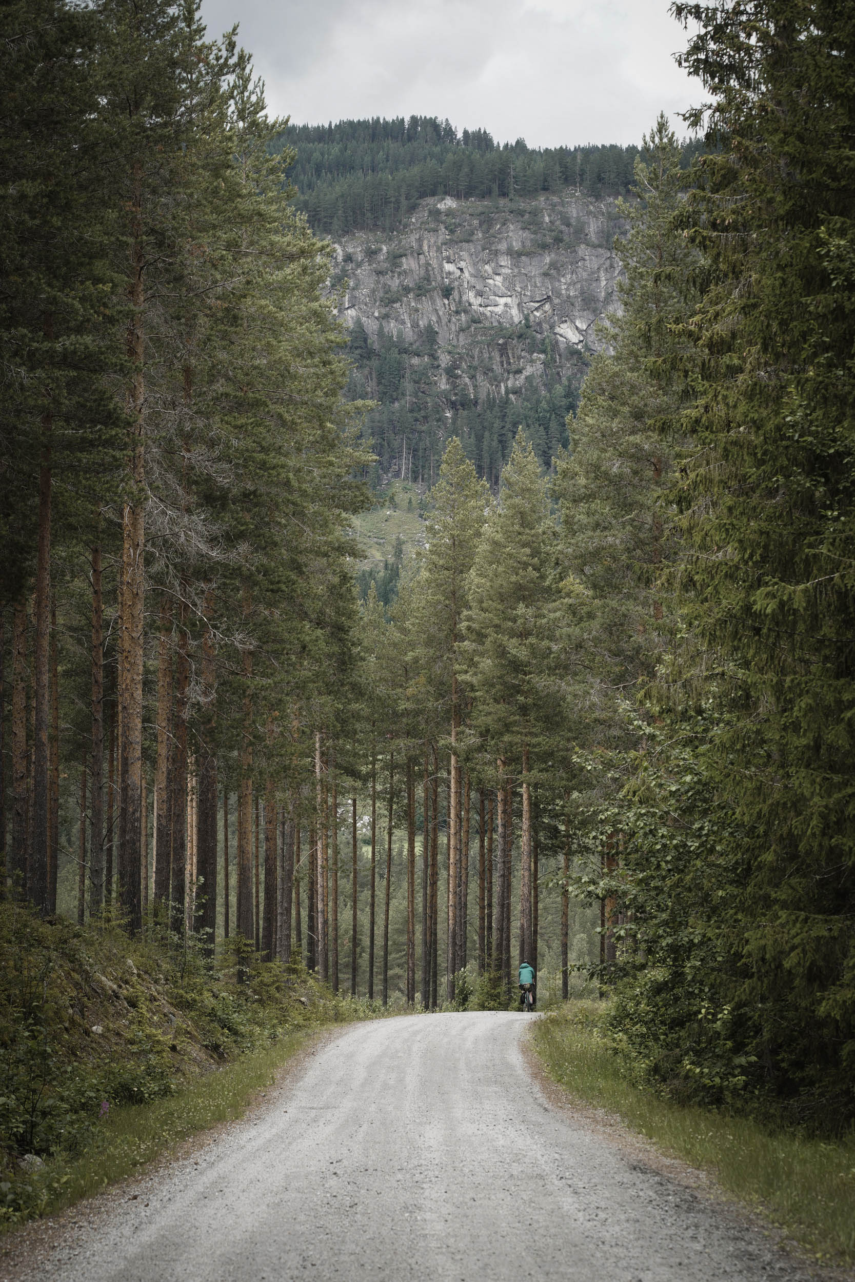
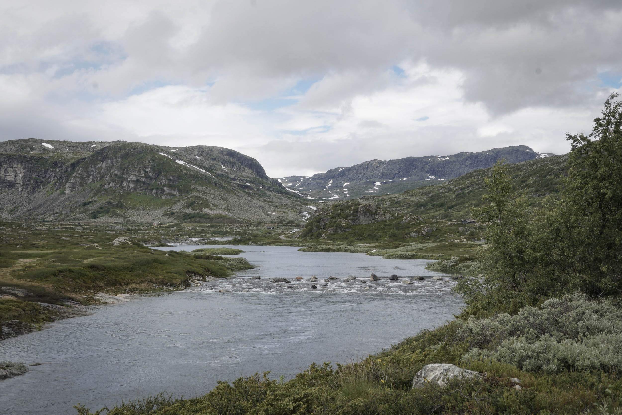
From Beitostølen, the tarmac continues down a descent, up over another climb, and down again. You can begin to feel a bit short-changed at the lack of unpaved surfaces, but have patience; they are coming and are worth the wait. After passing the quarry and power station, the tarmac ends, the gravel returns, and the climb of the Slettefjellvegen begins. For 5 miles (8 kilometres), the gravel road—once again a quiet toll road—steadily gains height at a fairly consistent 5-8% grade, passing lakes, rivers, and patches of snow yet to melt. Take time to stop and look behind you as you head up; the views on this section are some of the most memorable of the entire trip.
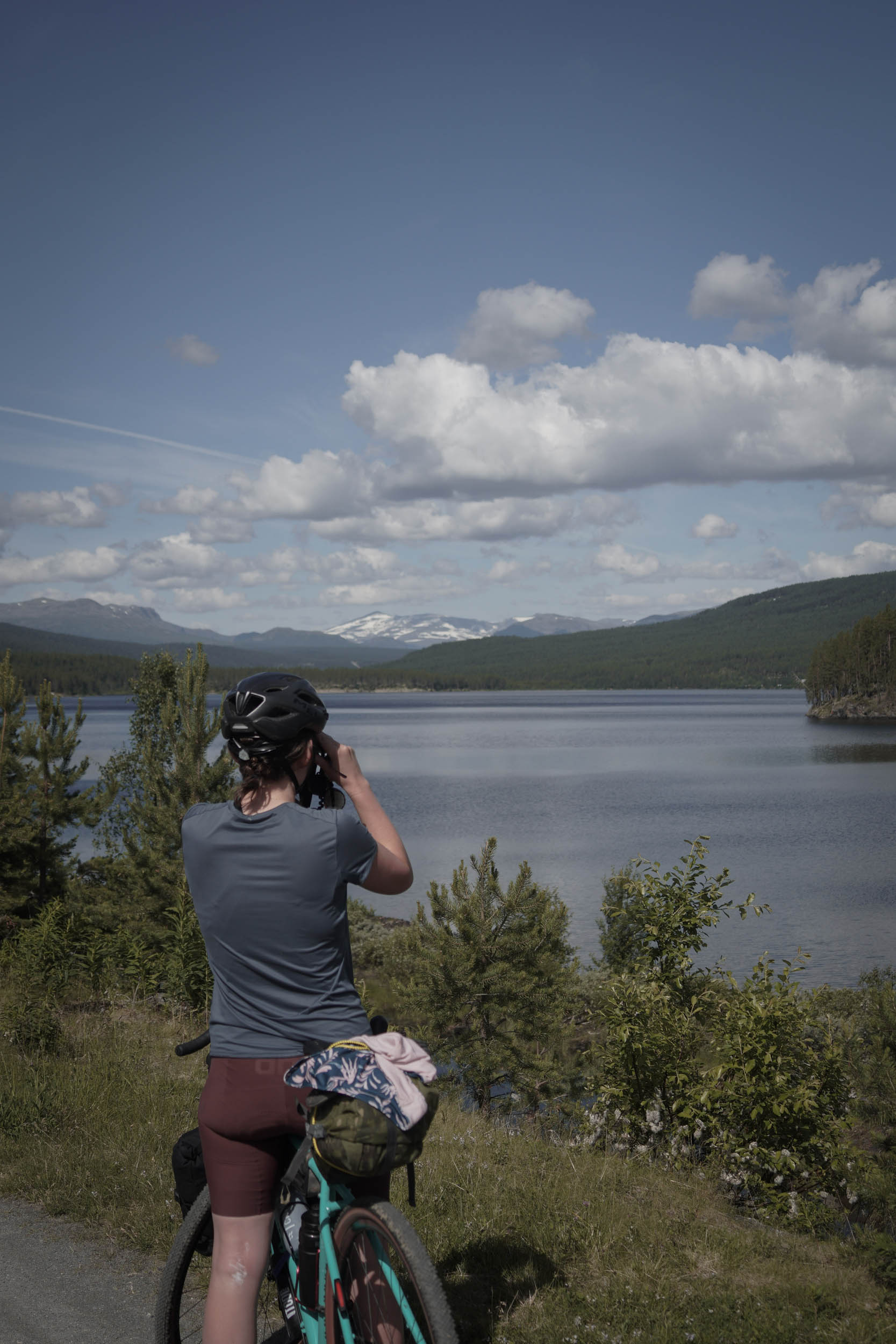
The very top of the climb, at 4,251 feet (1,295 metres), is a large plateau, so the views are surprisingly limited in comparison to what you have just looked back over. As soon as you drop off the other side, however, the views once again open up of a gravel track descending 2,000 feet (610 metres) in 4 miles (6.5 kilometres) down into the next valley.
The village of Ryfoss gives a chance to refuel before heading up again to the next summer grazing area of Syndisfjellet. Once again, the initially tarmacked climb gives way to gravel road amongst the towering forest. At the top, be sure to visit the Syndinstøga canteen for a hot chocolate and waffle. It has décor that had me thinking I was back in a French ski chalet in the alps on a snowboarding holiday (albeit without the massive queues or a small child poking me in the side with an errant ski pole).
From here, the gravel road continues to wind through small villages and grazing lands criss-crossed by cross-country ski tracks onto a section of singletrack for a few miles before ending in the ski village of Vaset, where a supermarket, campsite, and other accommodation options are available.
A few miles before this, in the village of Murkelie, you can veer off the course and find the small community hut “Stugardsbue.” Created to provide a shelter for cross-country skiing in the winter, it has space outside, a pile of logs, a couple of fire pits, benches, and a small wood burner inside—perfect for a break if temperatures have dropped. With the weather deteriorating, we contacted Ole, whose phone number is posted outside, and he was happy for us to take shelter inside for the night. There was just enough room for two of us to sleep, with the log burner providing some welcome warmth.
location Vaset to Gol
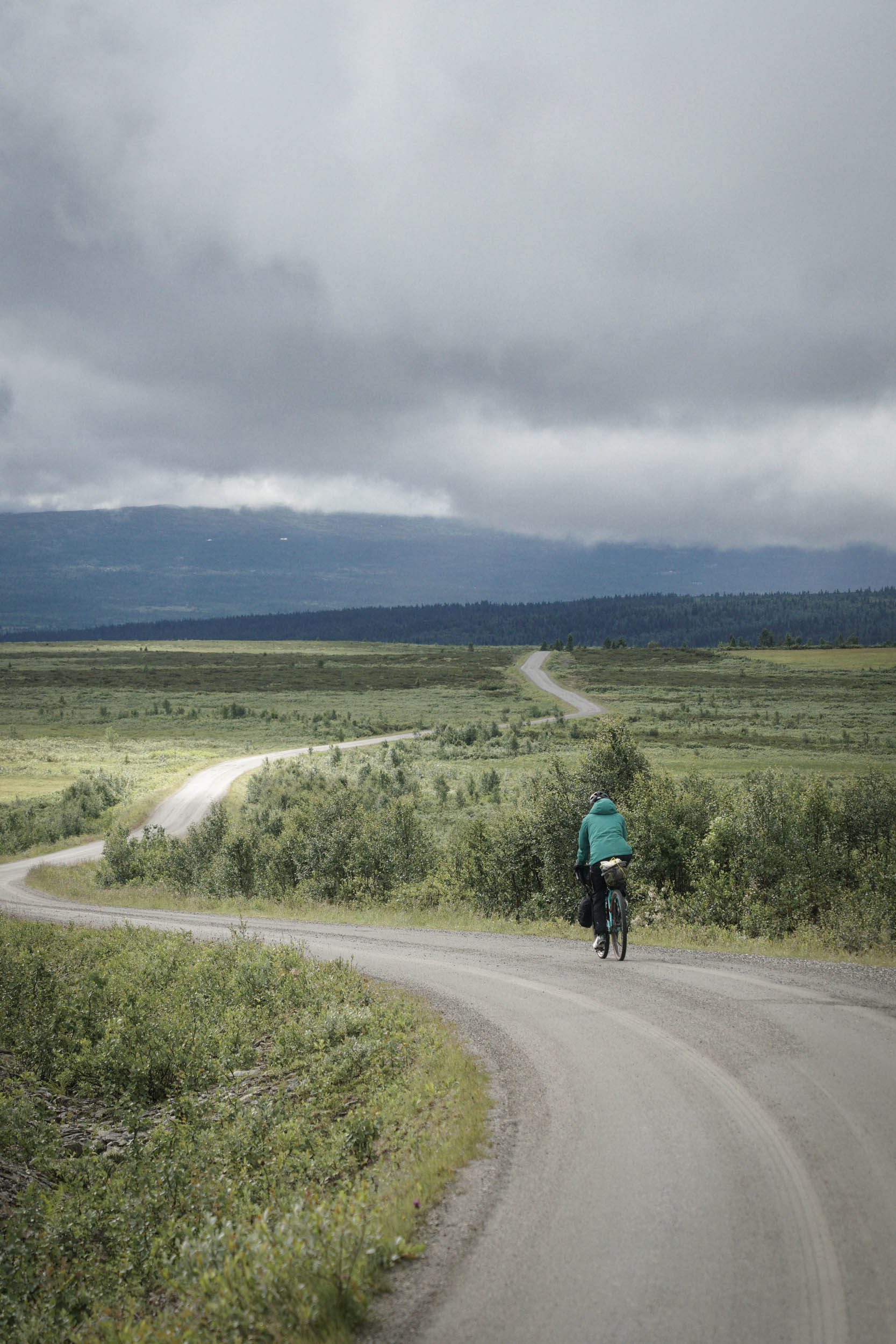
Stage 4 (32 miles / 51 kilometres, 2,508 feet climbing)
A very short tarmac section in Vaset leads directly onto another gravel road up and across the open landscape of the next plateau. Expansive views here are dotted with lakes and reservoirs. The route passes across the top of one dam, after which the waterside café provides a nice stopping place before beginning climbing past the next ski resort of Golsfjellet. Soon after, the route veers off the wide gravel road for a series of wide singletrack segments, a pleasant mixture of short punchy climbs, and idyllic rolling sections through pine forests. A bench halfway up this section provides a beautiful spot to sit and eat lunch if the timing is right.
After passing yet another ski resort at Storefjell, the singletrack soon continues and begins the final descent of the Mjølkevegen. The singletrack quickly gives way to gravel road that slowly widens until abruptly becoming a tarmac surface again. You are descending rapidly here and would be forgiven for thinking the Mjølkevegen gravel is finished as you rush down the valley towards Gol. But in a small village, the course suddenly darts off to the left and turns once more to a gravel track, following the crashing river below all the way to the outskirts of Gol.
Gol marks the end of the Mjølkevegen, and here the senses feel almost assaulted, after more than 135 miles (217 kilometres) of peaceful mountainscape, it suddenly seems impossibly bustling. Cafés, bars, restaurants, and shops sit either side of a busy high street. There are many accommodation options available in or just after Gol, including several campsites dotted along the valley for the next section of the route.
location Gol to Haugastol
Stage 5 (50 miles / 80 kilometres, 4,890 feet climbing)
After Gol, the route can seem very different as it follows National Cycle Route 4, initially a tarmac cycle path alongside the main road. But it soon turns off and becomes a gravel track on the south side of the river. Here, you soon see the Bergen to Oslo railway line, which the route will now follow until reaching Myrdal. Entwined with each other, the route and rail cross over and under each other repeatedly for the next 85 miles (137 kilometres).
Along this section, the route regularly crosses back over the river to join the road into villages before returning to the quieter southern side. This provides ample opportunity for accommodation and resupply if required. Paved sections are generally short and in the speed-restricted villages, and the gravel tracks on the south side are surprisingly peaceful.
Upon reaching the ski resort of Geilo, the route does, unfortunately, join the main road without a dedicated cycle path. For 14 miles (22.5 kilometres) the route follows the road Rv7. Whilst not busy by metropolitan standards, it is fast and some drivers don’t give as much space as those on the quieter mountain roads. If desired, riders could plan to take the train between Geilo and Haugastøl to cut this section out. This would require planning of tickets and times in advance.
location Haugastøl to Flåm
Stage 6 (51 miles / 82 kilometres, 3,921 feet climbing)
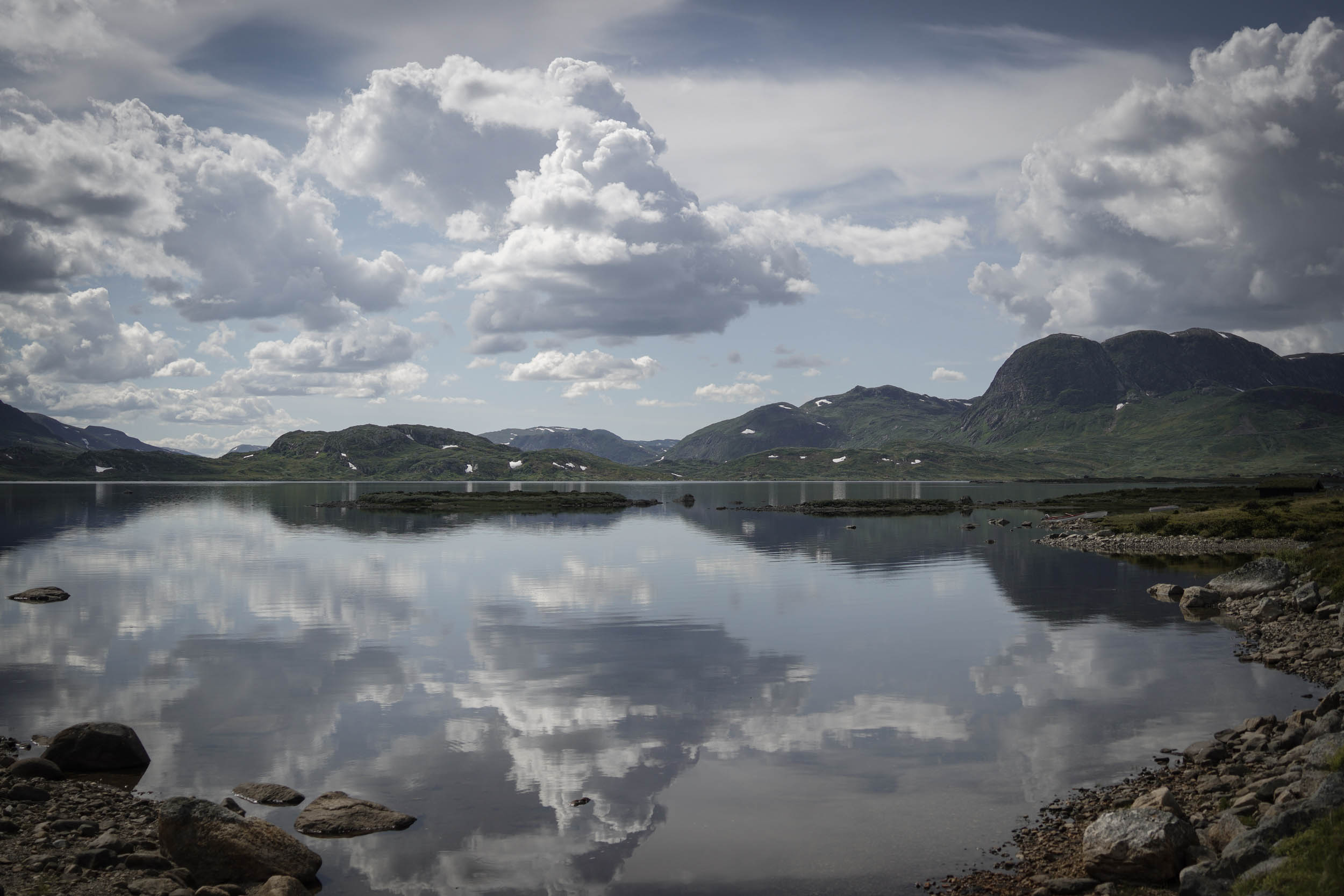
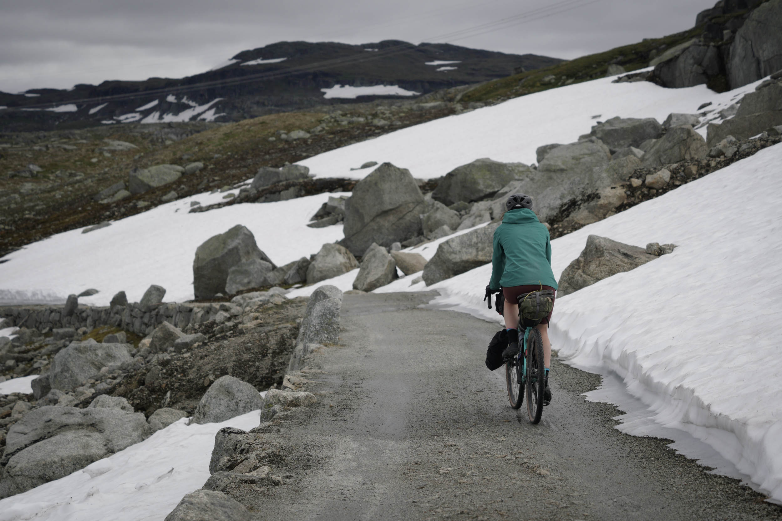
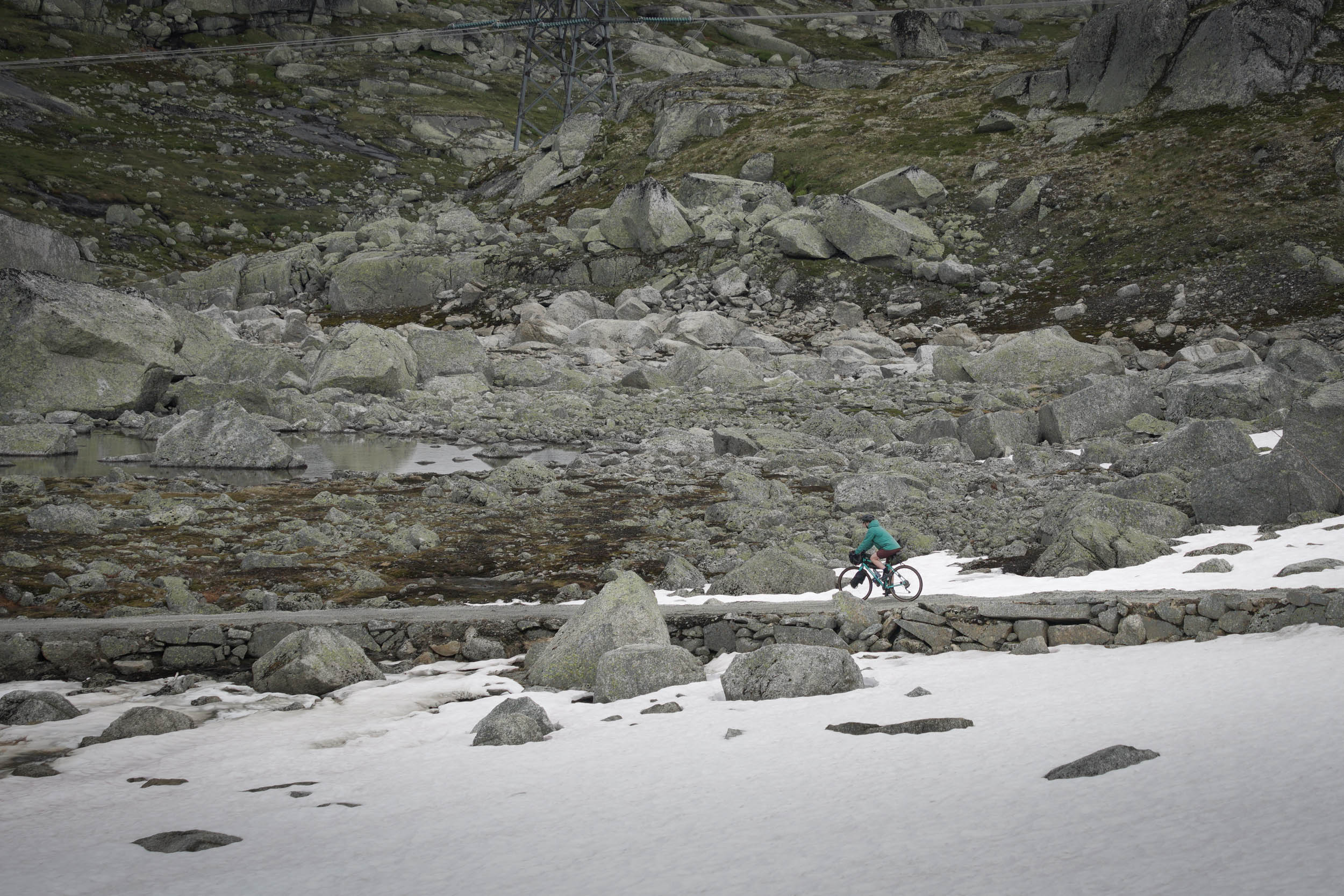
At Haugastøl, riders leave tarmac behind once more and begin the Rallarvegen. The route is a very popular tourist cycling route, which is immediately clear with the rows upon rows upon rows of hire bikes available at the hotel at the start. It is entirely traffic-free after the first few kilometres, except for the odd tractor or service vehicle. The views are stunning and vast, with snowy mountains rising either side of the track and turquoise water rushing down waterfalls to fill lakes beside the path. The rail route is ever present. However, modern improvements have seen many sections historically prone to snow blockage replaced by tunnels through the mountains.
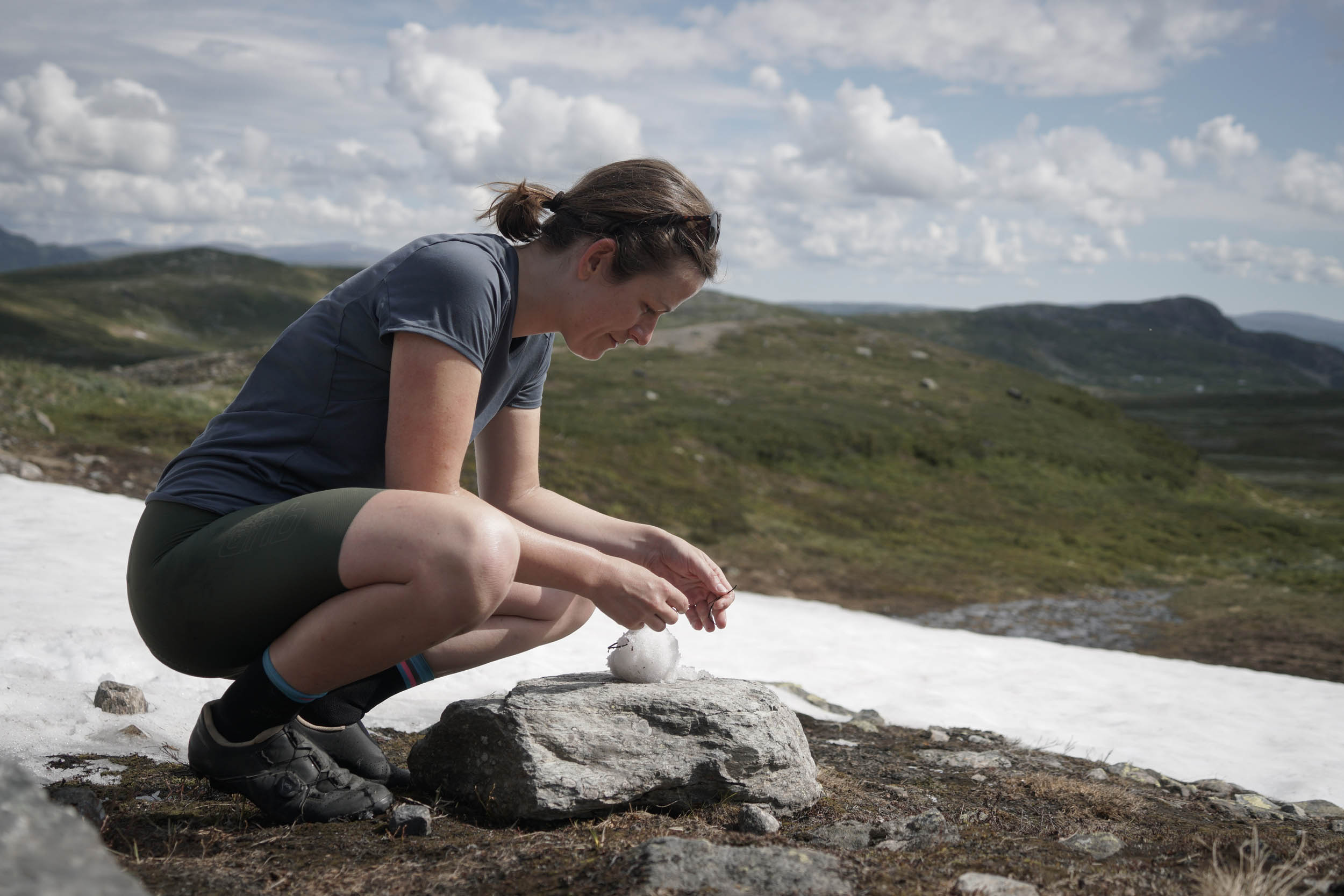
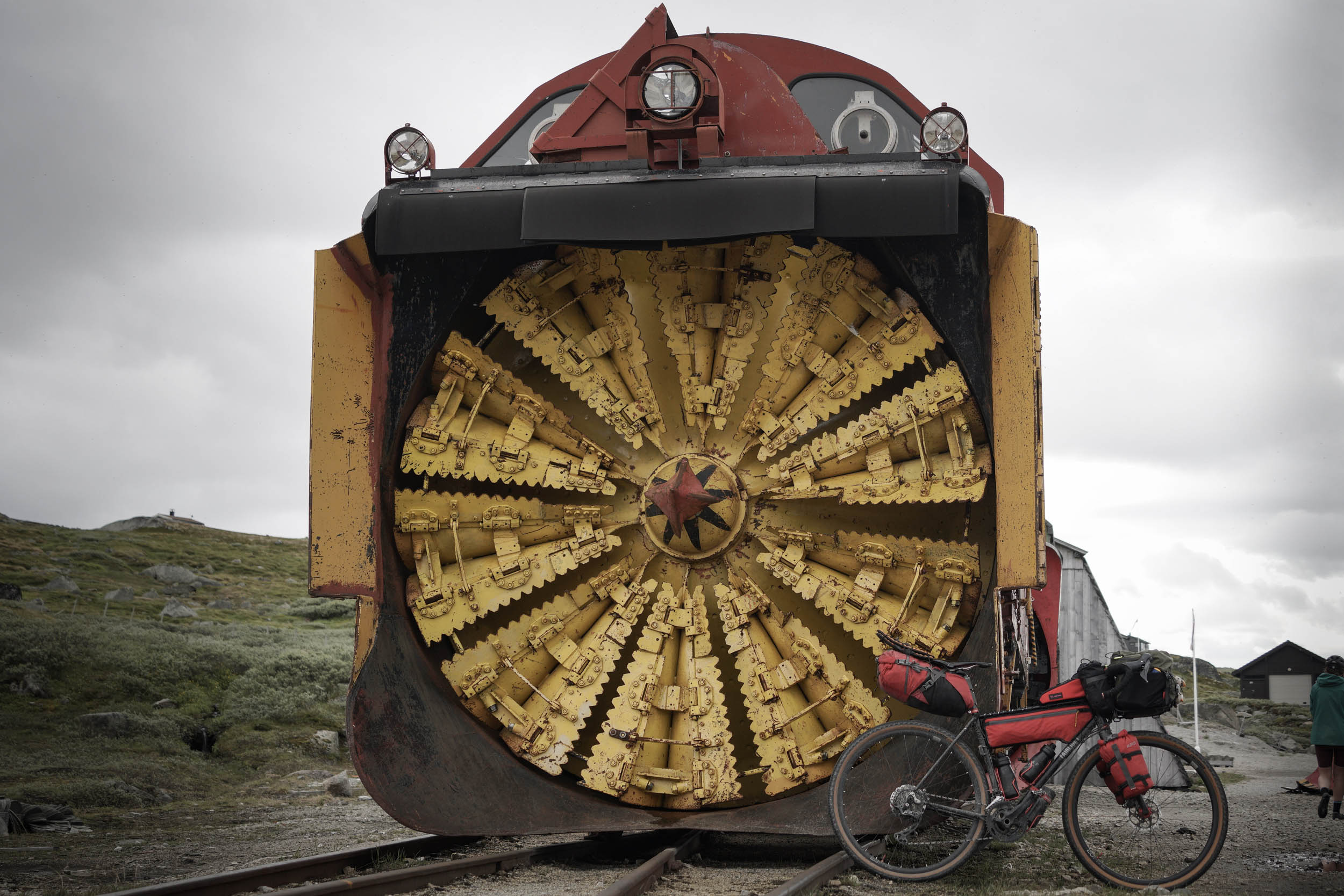
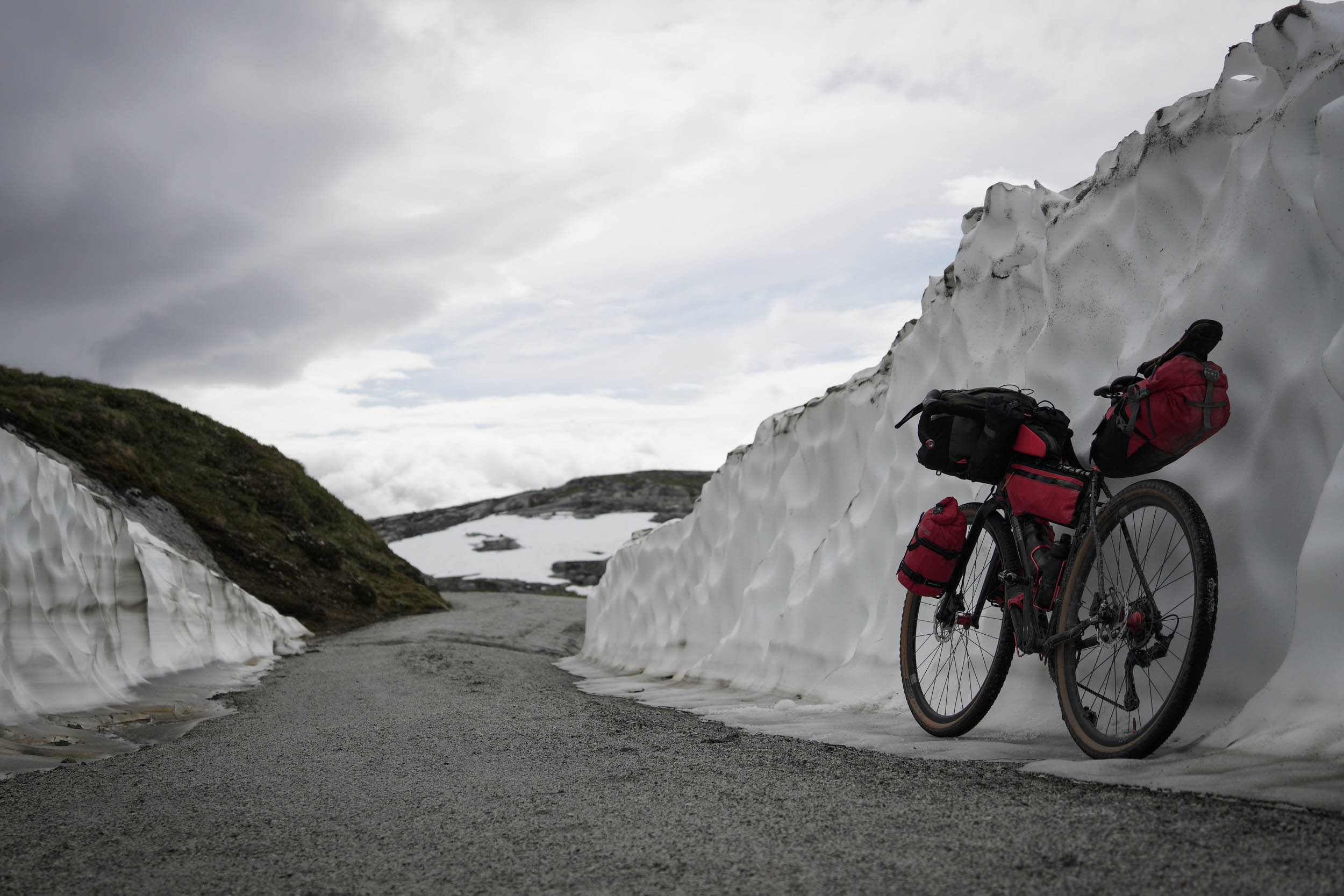
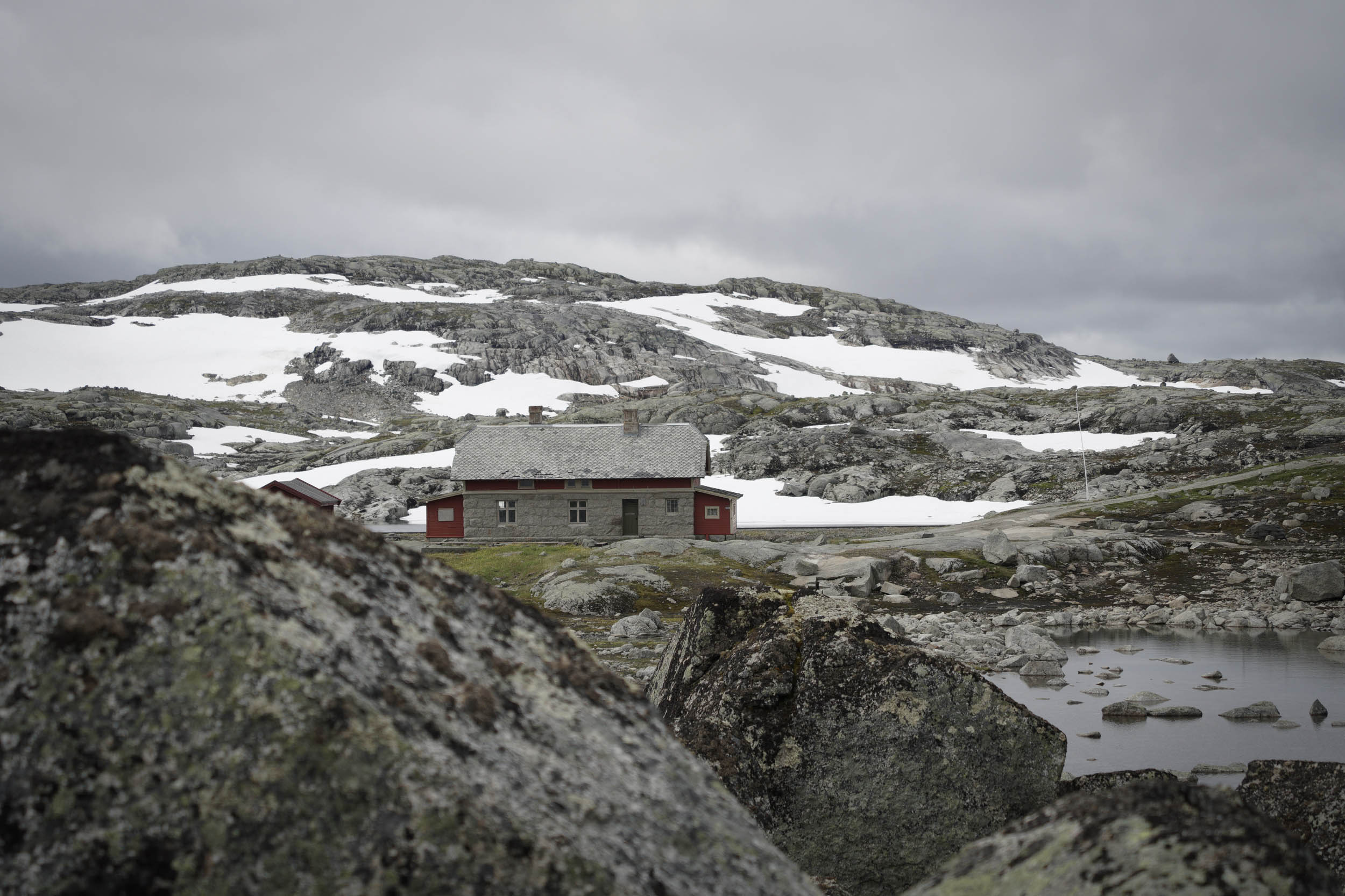
The route passes through the village of Finse, home to Norway’s highest train station at 4,009 feet (1,222 metres), a museum dedicated to the railway construction, and the filming location for the ice planet Hoth in The Empire Strikes Back. Beyond this, the route continues to climb on a progressively narrower trail until reaching the peak of the route at 4,336 feet (1,321 metres). Here, snow persisted in late July, even after a weeklong heatwave, although the trail itself was mostly cleared. Be prepared that you may have to cross some snow early in the season, especially after a harsh winter.
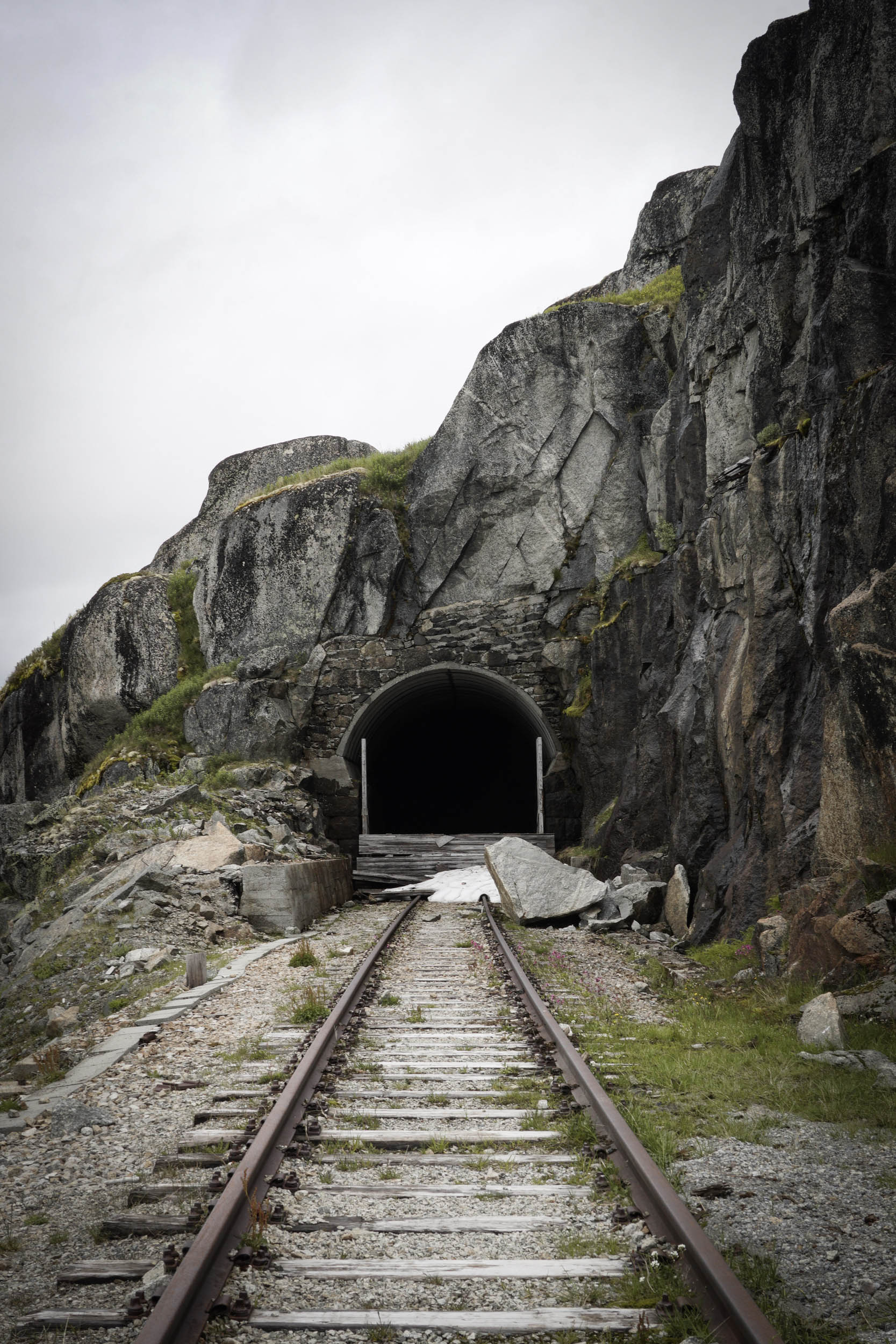
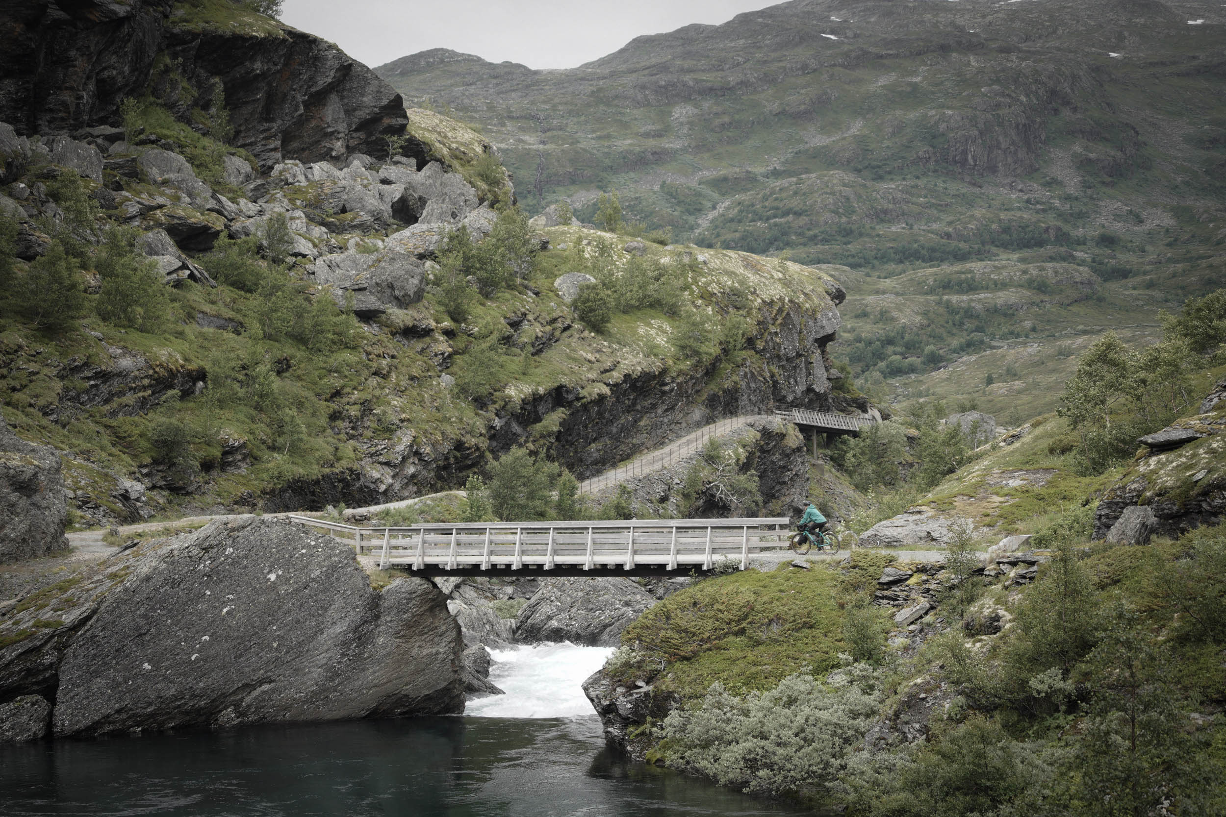
After this, a 30-mile (48-kilometre) descent takes you all the way down to sea level. Water thunders down the mountainside next to the trail, which criss-crosses back and forth on small wooden bridges. At Myrdal, the mainline enters the Gravhalstunnelen under the mountain, and our route veers off to follow the Flåm mountain railway instead. The first section of this descent is very steep and consists of switchback hairpin turns, dropping 1,000 feet in only a mile. Alternatively, you can pay to use the zipline that can send your bike down after you.
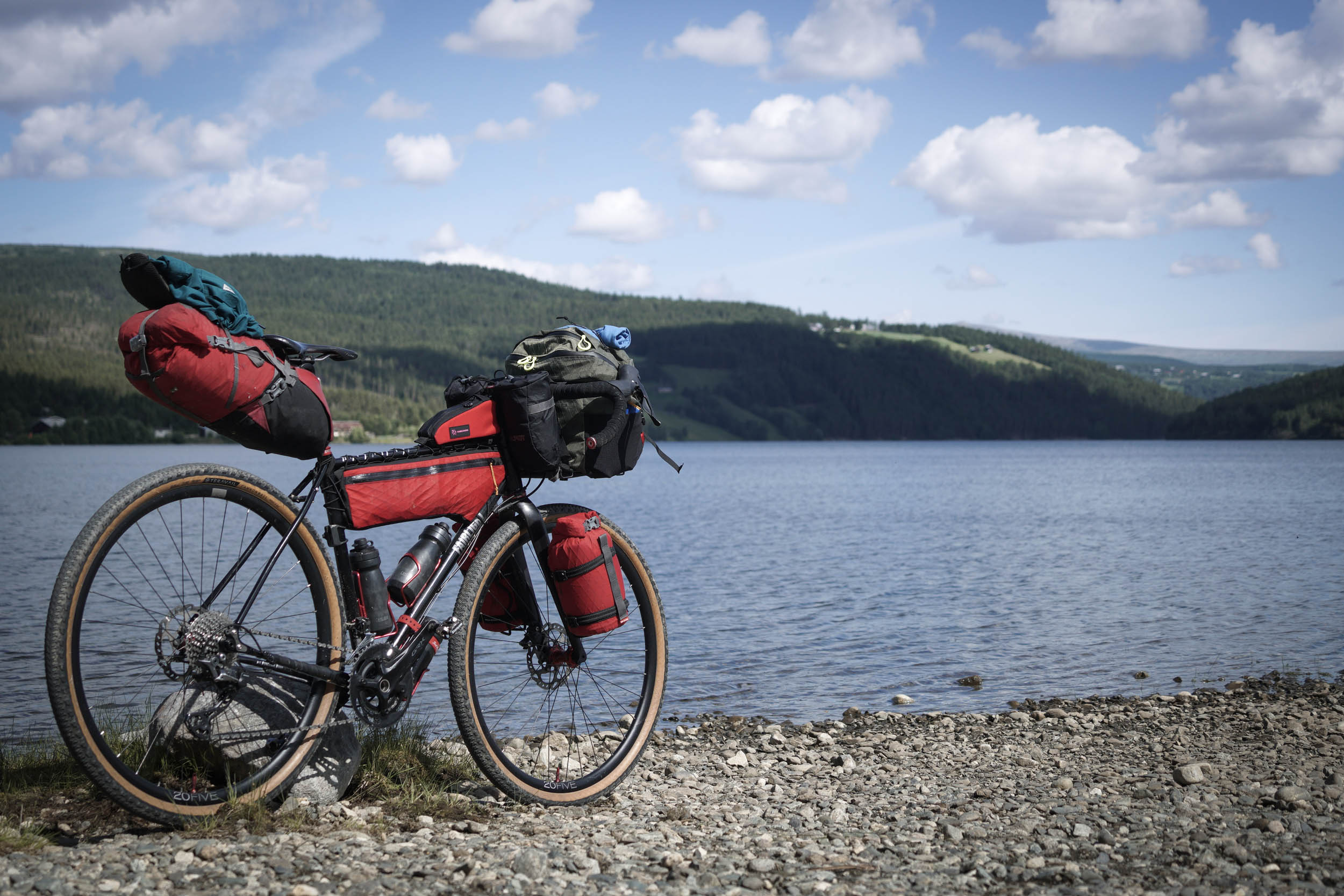
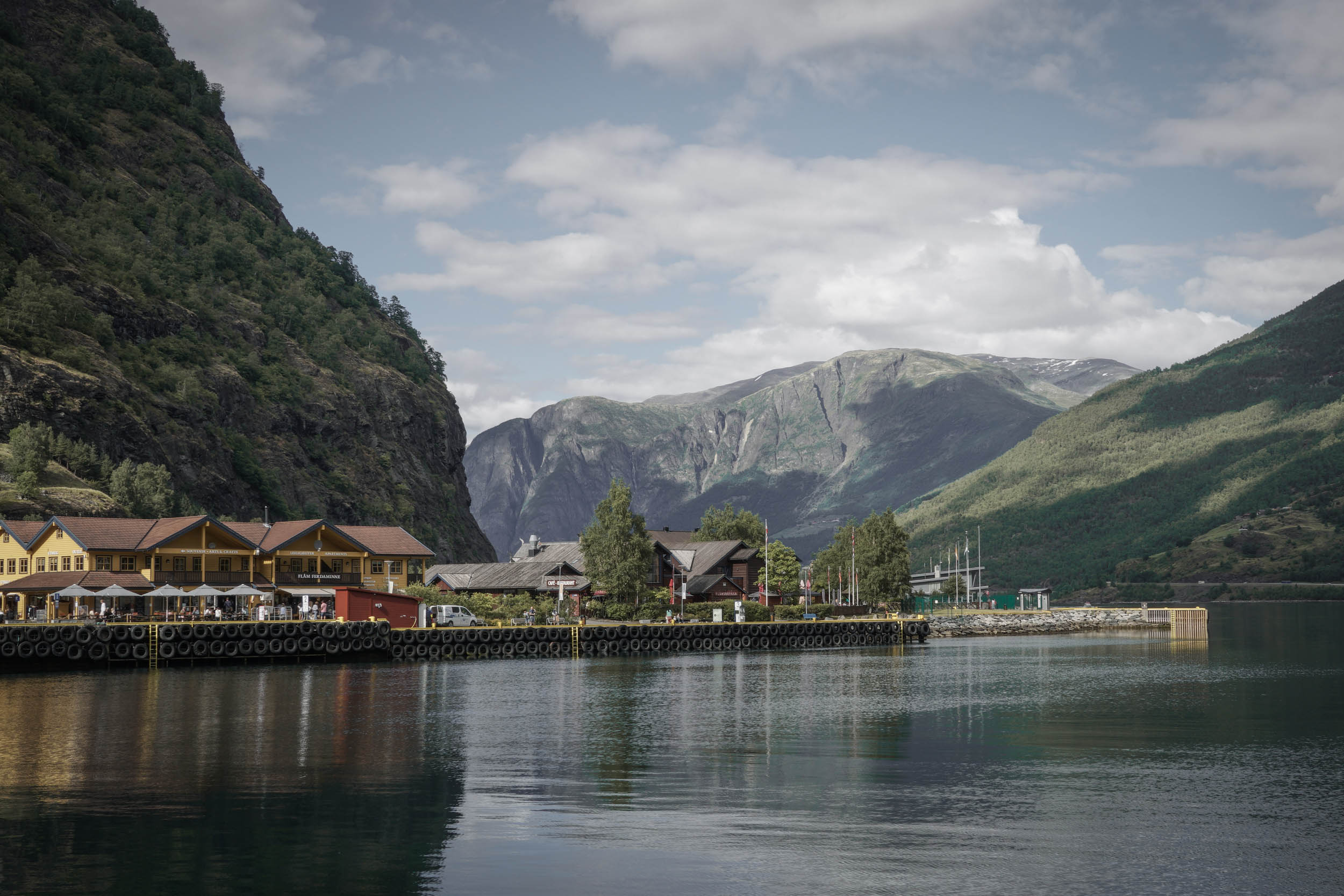
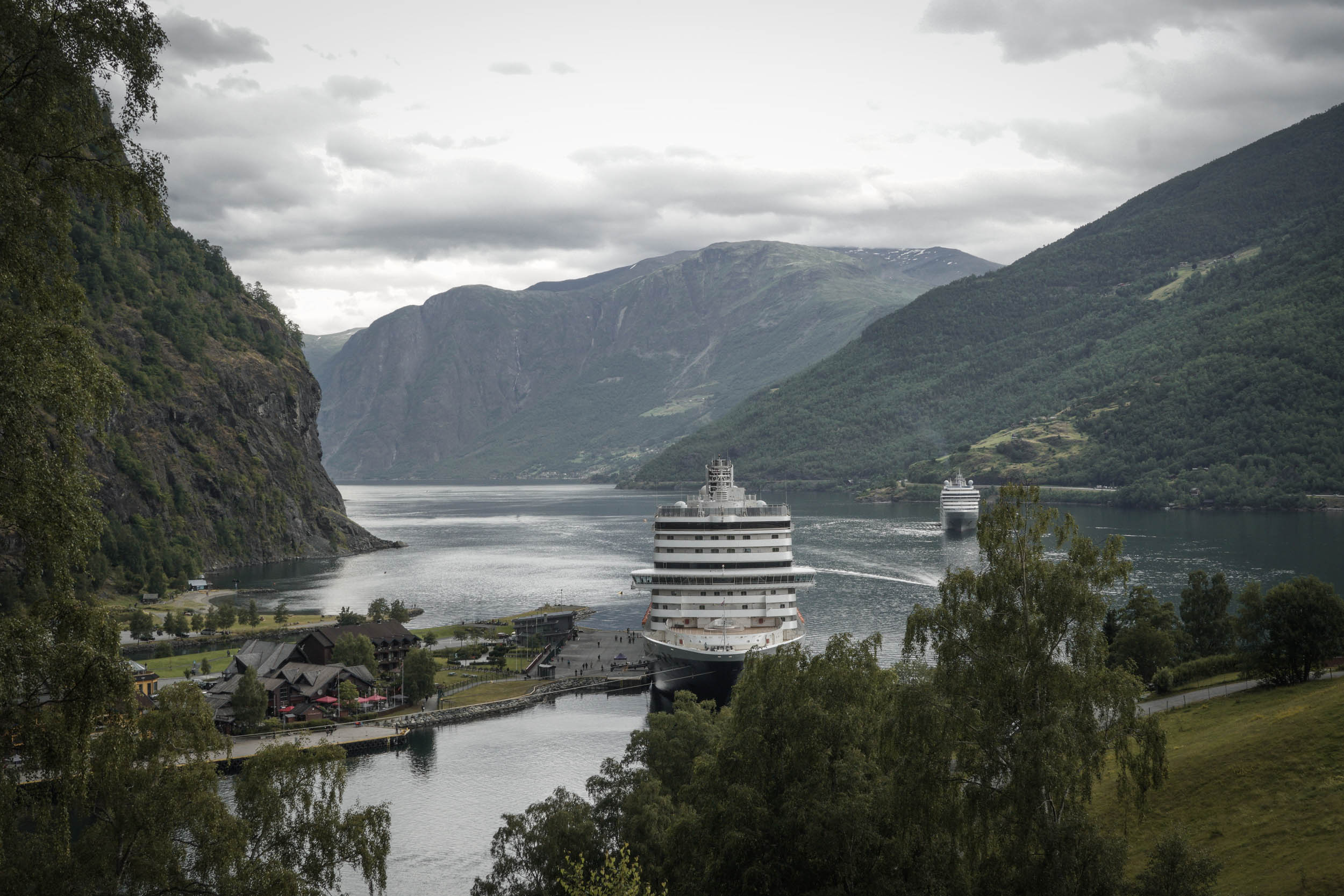
As the gradient finally lessens, you return to asphalt as waterfalls crash down to the valley floor on either side. You enter the village of Flåm with its small population of around 500 people, but rounding the final corner, be prepared for the possible sight of a huge cruise ship sitting in dock. We spent a number of days in Flåm and a different cruise ship arrived each day, the biggest having a capacity of more than 6,000 passengers. The tourist effect is clear to see; you could be excused for thinking you had wandered into Disney World as you push your bike past the souvenir shop and stalls in the centre of the village. The campsite here is very good and worth booking in advance as it can get very busy. Also, be sure to check out the café Bakkastova to escape the crowds or hire a paddleboard or kayak to get away completely.
From Flåm, it is possible to get a foot ferry all the way to Bergen (5.5 hours, departs mid-afternoon) or take the train back up to Myrdal, which sits on the mainline between Bergen and Oslo. We took the ferry about halfway along the Sognefjord before doing some pavement touring along the west coast. If taking a similar option of riding onwards, be sure to check out this map to find tunnels that bikes are banned from using, as this will influence which direction you might decide to head.
Additional Resources
- Travel companies include Entur, VY, and Norled
- Map of Norwegian Tunnels for cyclists
- Valdres Tourism (for Mjølkevegen)
- Norway Tourism (for Rallarvegen)


Terms of Use: As with each bikepacking route guide published on BIKEPACKING.com, should you choose to cycle this route, do so at your own risk. Prior to setting out check current local weather, conditions, and land/road closures. While riding, obey all public and private land use restrictions and rules, carry proper safety and navigational equipment, and of course, follow the #leavenotrace guidelines. The information found herein is simply a planning resource to be used as a point of inspiration in conjunction with your own due-diligence. In spite of the fact that this route, associated GPS track (GPX and maps), and all route guidelines were prepared under diligent research by the specified contributor and/or contributors, the accuracy of such and judgement of the author is not guaranteed. BIKEPACKING.com LLC, its partners, associates, and contributors are in no way liable for personal injury, damage to personal property, or any other such situation that might happen to individual riders cycling or following this route.
Please keep the conversation civil, constructive, and inclusive, or your comment will be removed.