


Oregon Cascades Volcanic Arc (OCVA)
Distance
410 Mi.
(660 KM)Days
6
% Unpaved
50%
% Singletrack
15%
% Rideable (time)
100%
Total Ascent
30,146'
(9,189 M)High Point
7,635'
(2,327 M)Difficulty (1-10)
4?
- 5Climbing Scale Moderate74 FT/MI (14 M/KM)
- 3Technical Difficulty Fair
- 4Physical Demand Fair
- 2Resupply & Logistics Easy
Contributed By

Ryan Francesconi and Ron Lewis
Guest Contributor
Ryan Francesconi is a creative route maker, approaching bikes through art as opposed to sport. Ryan’s deep route catalog has helped define Oregon’s adventure cycling heatmap and community. He creates and shares routes under the names Unpaved and OMTM.
Ron Lewis is a writer, photographer, and backcountry wayfinder who creates and shares adventure cycling routes across the PNW under the name OMTM.CC.
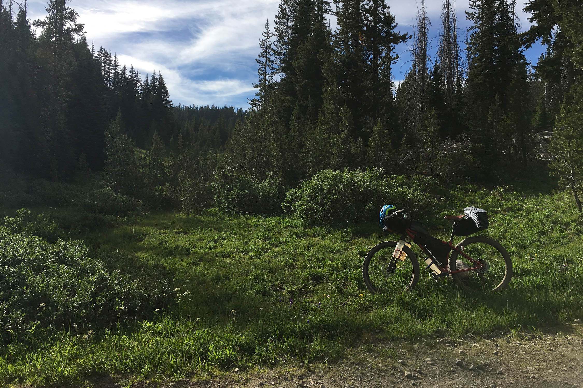
As a route, the OCVA follows the volcanic peaks as signposts, tracing the Oregon Cascades from south to north. Less a dedicated gravel, mountain bike, or conventional bikepacking route and more a modular combination of the three, OCVA is designed with transit accessibility in mind, removing cars from the equation altogether. For riders looking to travel light, it can easily be fastpacked in three to five days with ample accommodations along the way. Four national forests, one massive national park, and multiple hot springs offer a distinctly Oregonian array of camping opportunities for those who prefer a more leisurely pace.
In a sense the OCVA could be considered an overview of Oregon’s most definitive landscapes—a broad sampling of the state’s volcanic ecosystems, challenging topography, rushing spring water, and raw primeval forests in varying stages of post-burn recovery. From the Fremont-Winema’s blazing red cinder roads to the rim of Crater Lake to the McKenzie River headwaters and onward to Breitenbush Hot Springs, the route interweaves and often crosses the Pacific Crest Trail (PCT) at high elevations to descend deep into low-lying river valleys below. The goal here isn’t so much to traverse the state exclusively via singletrack or gravel but rather to curate the best progression overall between Oregon’s full slate of geographical focal points and stunning reveals.


A CASCADIAN PRIMER
The Oregon Cascades stretch roughly 260 miles from the border of California to the Columbia River Gorge, forming the volcanic spine of the state. Home to iconic peaks like Mount Hood, Three Sisters, and Mount Jefferson, the range is part of the larger Cascade Volcanic Arc, which includes Mounts Meager, Baker, Rainier, St Helens, and Adams to the north and Lassen Peak and Mount Shasta to the south. It’s a wide-ranging hotspot of geothermal and seismic activity—a region characterized by dense evergreen, red volcanic cinder, alpine wildflower meadows, and glacial lakes. Additionally, the Cascades act as a climatic divide, separating Oregon’s lush western temperate rainforest from the arid high desert landscapes to the east.
ANCESTRAL TRAILS
Trails along the Clackamas, Molalla, and McKenzie River watersheds have existed for millennia as part of a sprawling circuit of trade routes and seasonal foraging encampments used by Northern Molalla, Crooked Finger Molalla, and Santiam Band peoples. Kindred spirits with the Klamath peoples, the Molalla and Santiam seasonal highways connected their homelands in the Willamette Valley to the Western Cascadian high country and beyond to Warm Springs and south to the McKenzie River drainage.


2020 WILDFIRES
In August of 2020, at the peak of a brutal summer heatwave, lightning ignited a wildfire in the heart of the remote and rugged Opal Creek Wilderness, home to the largest stretch of unlogged, old-growth forest remaining in Oregon. Accelerated by a historic windstorm, the Beachie Creek fire raced explosively up and down the canyons, tearing through wilderness and timberland alike, burning nearly 200,000 acres before merging with the massive Lionshead Fire to create the Santiam Fire complex, which ultimately exceeded 400,000 acres before being contained in December of 2020.
As with many of the 2020 Oregon wildfire zones, affected areas were closed to public entry through 2022 and have only recently reopened. The OCVA route traverses the sprawling Santiam and Riverside Fire zones, the charred ghost forests of Breitenbush, Clackamas, McKenzie, and Molalla River corridors imprinted with smoke, ash, and scorched earth—a hard truth of wildfire reality in the West.
Route Development
The OCVA was a conceptual evolution several years in the making. After riding the Oregon Outback in 2014, we felt compelled to push deeper into the lush, temperate, more deeply forested western Cascades rather than the Outback’s arid central high desert. In a sense, the OCVA was a way to understand the full spectrum of Oregon itself by connecting the regions and waypoints we found most engaging.


Submit Route Alert
As the leading creator and publisher of bikepacking routes, BIKEPACKING.com endeavors to maintain, improve, and advocate for our growing network of bikepacking routes all over the world. As such, our editorial team, route creators, and Route Stewards serve as mediators for route improvements and opportunities for connectivity, conservation, and community growth around these routes. To facilitate these efforts, we rely on our Bikepacking Collective and the greater bikepacking community to call attention to critical issues and opportunities that are discovered while riding these routes. If you have a vital issue or opportunity regarding this route that pertains to one of the subjects below, please let us know:
Highlights
Must Know
Camping
Food/H2O
Trail Notes
Resources
- Four National Forests: Fremont-Winema, Umpqua, Willamette, Mount Hood
- Crater Lake National Park: The deepest lake in the USA and one of the most pristine on Earth
- Oakridge, Oregon: Huge array of mountain bike trails and side options
- Terwilliger Hot Springs: Six natural pools on route
- Aufderheide (paved) state scenic bikeway
- McKenzie River Trail, Blue Pool, Clear Lake: Spring-fed and quintessential northwest river trail
- Breitenbush Hot Springs: An intentional community and hot springs set on the western edge of the Mount Jefferson wilderness
Logistics
Resupply and overall logistics are fairly accessible for regions so remote. Similar to the Oregon Outback, the conventional approach is to take the Amtrak from Portland to Klamath Falls and ride back, point A to point B. The train arrives around 10 p.m., and most people will start the following morning after a motel stay overnight. The route can be segmented based on riding style and intentions: everything from fast and light to slow and fully loaded will work well. If riding the route at the end of June, the main concern is the snow level at Crater Lake and whether the park has officially opened for the season. As the ride has historically run on summer solstice (~June 21st), this is always a close call. While there are potential options to bypass Crater Lake, it is one of the route’s marquee features and is highly recommended.
MUST KNOW
- Ideal timing: Late June to October. Since 2019, the route has historically been run on the summer solstice as a non-competitive open-invite event.
- Weather and conditions can vary drastically in the high Cascades, particularly early and late season, with summer temps in the valleys and snow over the passes.
- Start: Accessible via Amtrak. One train daily from Portland to Klamath Falls.
- Bike: Gravel/adventure with modern adventure gearing (36t w/ 11-52t) highly recommended.
- Tires: Minimum 40mm with emphasis on sizing up. Recommend 48mm or 2” plus.
- Bike shops: Portland, Klamath Falls, and Oakridge.
The ride can be fastpacked with periodic motel options, or there are many camping opportunities available. In addition to designated campgrounds, the route primarily travels through National Forest, where riders will find an abundance of dispersed camping potential—a fire ring being the only requirement for dispersed campsites.
- Maverick Motel, Klamath Falls
- Diamond Lake Resort
- Oakridge, various options
- Harbick’s Country Inn, McKenzie Bridge
- Breitenbush Hot Springs, Detroit
There is plenty of water on route to filter, so specifics aren’t necessary. In terms of food resupply, these are the main stops:
- Crater Lake: Rim Village Cafe
- Diamond Lake: Two convenience stores and two restaurants in addition to the motel
- Oakridge, Oregon: Full services
- McKenzie Bridge, Oregon: McKenzie General Store & Obsidian Grill
- Detroit, Oregon: Convenience store
- Breitenbush Hot Springs: Full meals if you are staying there—a day pass and small store is also on site, but the grounds are private unless you have a reservation
- Estacada, Oregon: Full services
location Klamath Falls → Modoc Rim → Fremont-Winema NF → Sun Pass State Forest → Crater Lake
Part 1 (93 mi +8,100 ft)
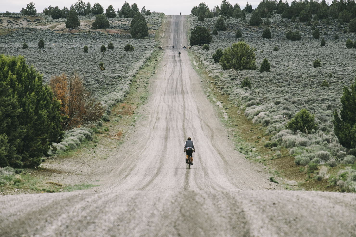
The OCVA departs northward from Klamath Falls and climbs up the wall of Modoc Rim. Leaving Klamath Lake, you have views to the south of Mt. Shasta and Mt. McLoughlin to the west. The red cinder road turns to sandy doubletrack after crossing the Sprague River. Larger tires and careful handling are a big benefit as you make your way up to Crater Lake.
A long, gradual gravel climb brings you to the backdoor entrance to the national park—closed to cars but open to non-motorized travel. Views of the Sand Pinnacles are down in Sand Canyon before continuing your climb past the Lost Creek Campground and Grayback Road. Crater Lake’s paved Rim Drive offers close-up views and access to the lake itself, with a welcome stop at the cafe. This crosses the Cascade crest with a 13-mile paved drop to the park’s north entrance. Fast and scenic, the Pumice Desert rushes by as you descend the western slope. From here, it’s a short ride to Diamond Lake.
location Diamond Lake → Umpqua NF → Middle Fork Willamette River → Oakridge
Part 2 (69 mi +3,200 ft)
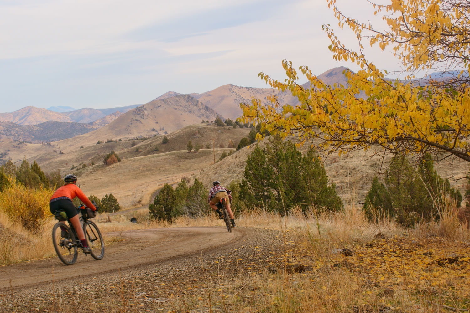
Diamond Lake is a typical overnight, with a small store, various accommodations and plenty of food. It’s a nice swim after a hot dusty day. From here, sandy singletrack connects to the climb up and over the flank of Sawtooth Mountain. Be sure to look behind you as the iconic and craggy Mt. Thielsen can be seen looming on the horizon. Descending into the mountain bike hub of Oakridge, there are two primary options: smooth pavement or the circuitous Middlefork River Trail. Both are lovely in their own way, depending on your schedule. Oakridge is a possible overnight stop, with plenty of bike shops and resupply options.
For those on a more open-ended timeline, we recommend exploring Oakridge’s sprawling trail networks. Despite the amount of accessible singletrack, it makes sense to ride the paved Aufderheide Scenic Byway (NF 19) to McKenzie Bridge. It’s a lovely road, very smooth, and worth riding. Don’t miss Terwilliger Hot Springs just off the road if you have time to spare.
location Mckenzie River Trail → Willamette NF → Detroit
Part 3 (130 mi +11,000 ft)
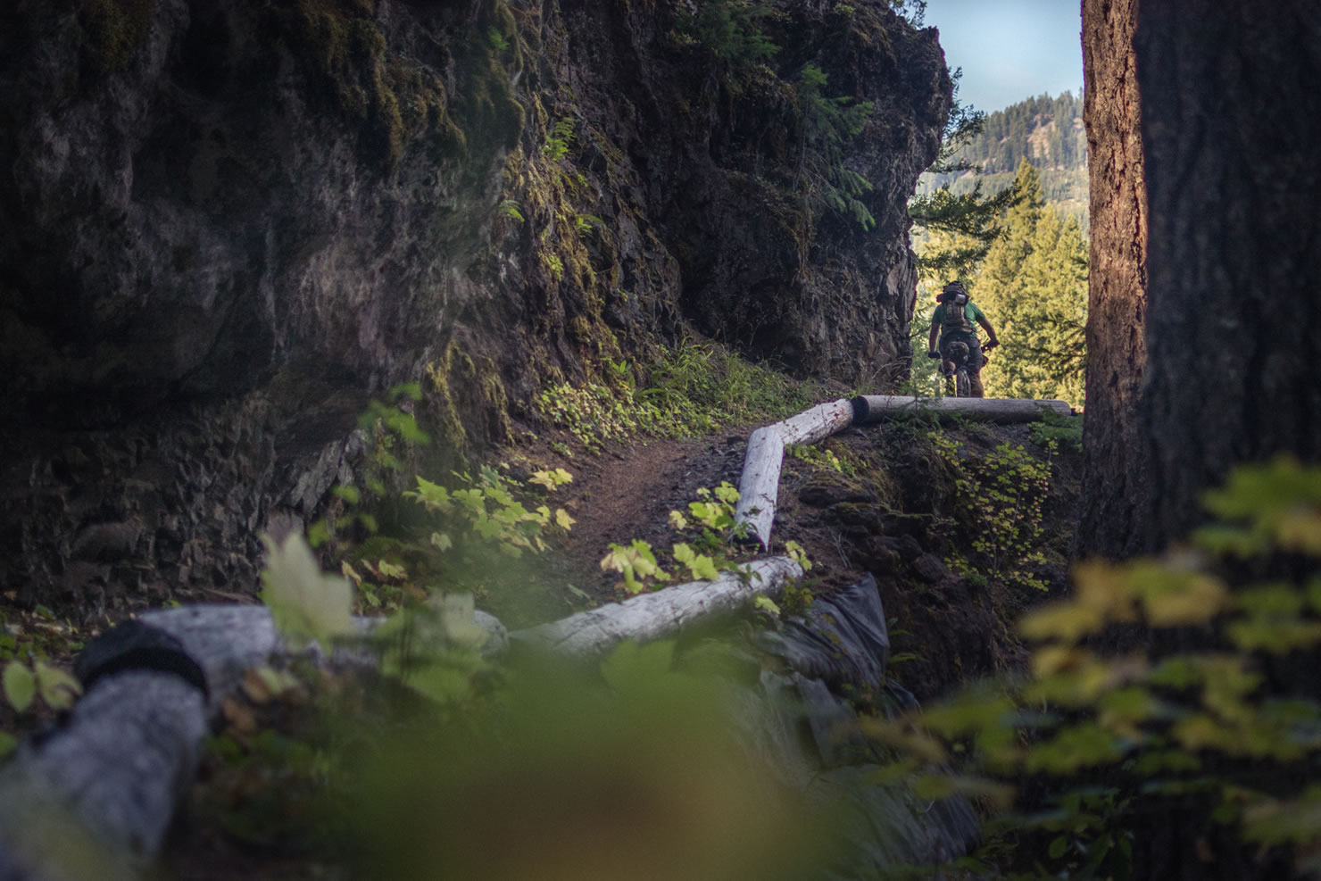
McKenzie Bridge has an excellent store and restaurant where you can sit in the backyard and relax and restock. Just outside of the tiny town is the McKenzie River Trail, which is smooth enough for drop bars and loaded bikes insofar as this routing is concerned. Despite skipping the famous spring-fed Blue Pool, it’s wise to leave the trail as routed to avoid the steep climb and potential for wrong-way bike traffic. You’ll be connecting to the Clear Lake Trail, which is a buttery smooth namesake for the lake as well as the headwaters for the McKenzie River. Expect plentiful natural flowing spring water for refill. In addition, the cafe at the lake has an equally impressive abundance of french fries.
location Breitenbush Hot Springs → Rhododendron Ridge → Clackamas River → Mt. Hood NF → Portland
Part 4 (119 mi +8,200 ft)
It’s hard to discuss this section without considering the 2020 fires and what has been lost. Despite the staggering changes to the landscape, the beauty remains and the hot springs of Breitenbush are not to be missed on any variation of this route. You could consider an extra rest day at the eco-resort to recharge in the pools and feast on the vegetarian buffet.
From here, you’ll leave the Willamette National Forest and cross into the Mount Hood NF, cresting Rhododendron Ridge and dropping down into the Clackamas River watershed, which flows north toward Portland. Clackamas Canyon was devastated by fire in 2020 as well, the barren hills a stark reminder of the loss and fragility of this backcountry region. From Estacada, the final stretch utilizes relatively quiet backroads to finish in Portland proper.
Additional Resources


Terms of Use: As with each bikepacking route guide published on BIKEPACKING.com, should you choose to cycle this route, do so at your own risk. Prior to setting out check current local weather, conditions, and land/road closures. While riding, obey all public and private land use restrictions and rules, carry proper safety and navigational equipment, and of course, follow the #leavenotrace guidelines. The information found herein is simply a planning resource to be used as a point of inspiration in conjunction with your own due-diligence. In spite of the fact that this route, associated GPS track (GPX and maps), and all route guidelines were prepared under diligent research by the specified contributor and/or contributors, the accuracy of such and judgement of the author is not guaranteed. BIKEPACKING.com LLC, its partners, associates, and contributors are in no way liable for personal injury, damage to personal property, or any other such situation that might happen to individual riders cycling or following this route.
Further Riding and Reading
Here are some connected/nearby routes and related reports...

Please keep the conversation civil, constructive, and inclusive, or your comment will be removed.