


Ruta del Capitan Lemos
Distance
190 Mi.
(306 KM)Days
5-7
% Unpaved
85%
% Singletrack
40%
% Rideable (time)
80%
Total Ascent
19,259'
(5,870 M)High Point
14,239'
(4,340 M)Difficulty (1-10)
9?
- 7Climbing Scale Strenuous101 FT/MI (19 M/KM)
- -Technical Difficulty
- -Physical Demand
- -Resupply & Logistics
Contributed By
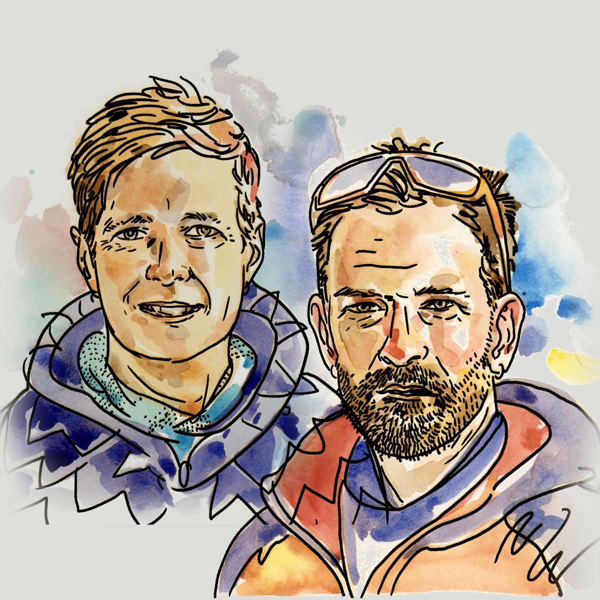
Mark and Hana
Highluxphoto / BeingHana
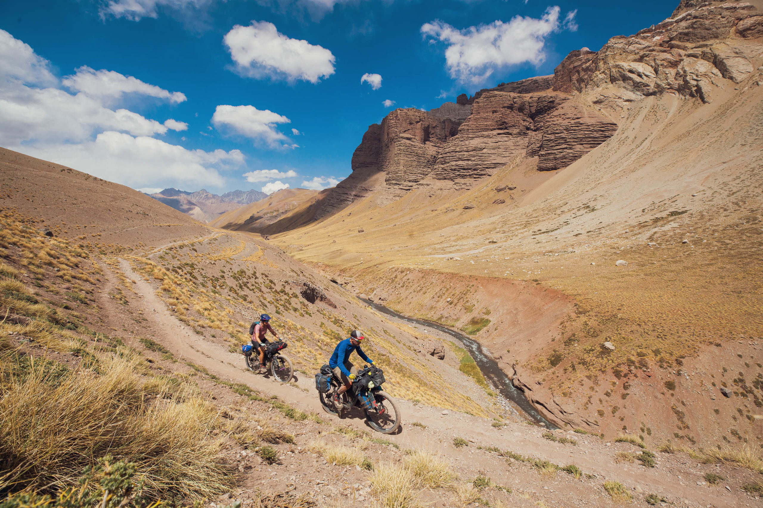
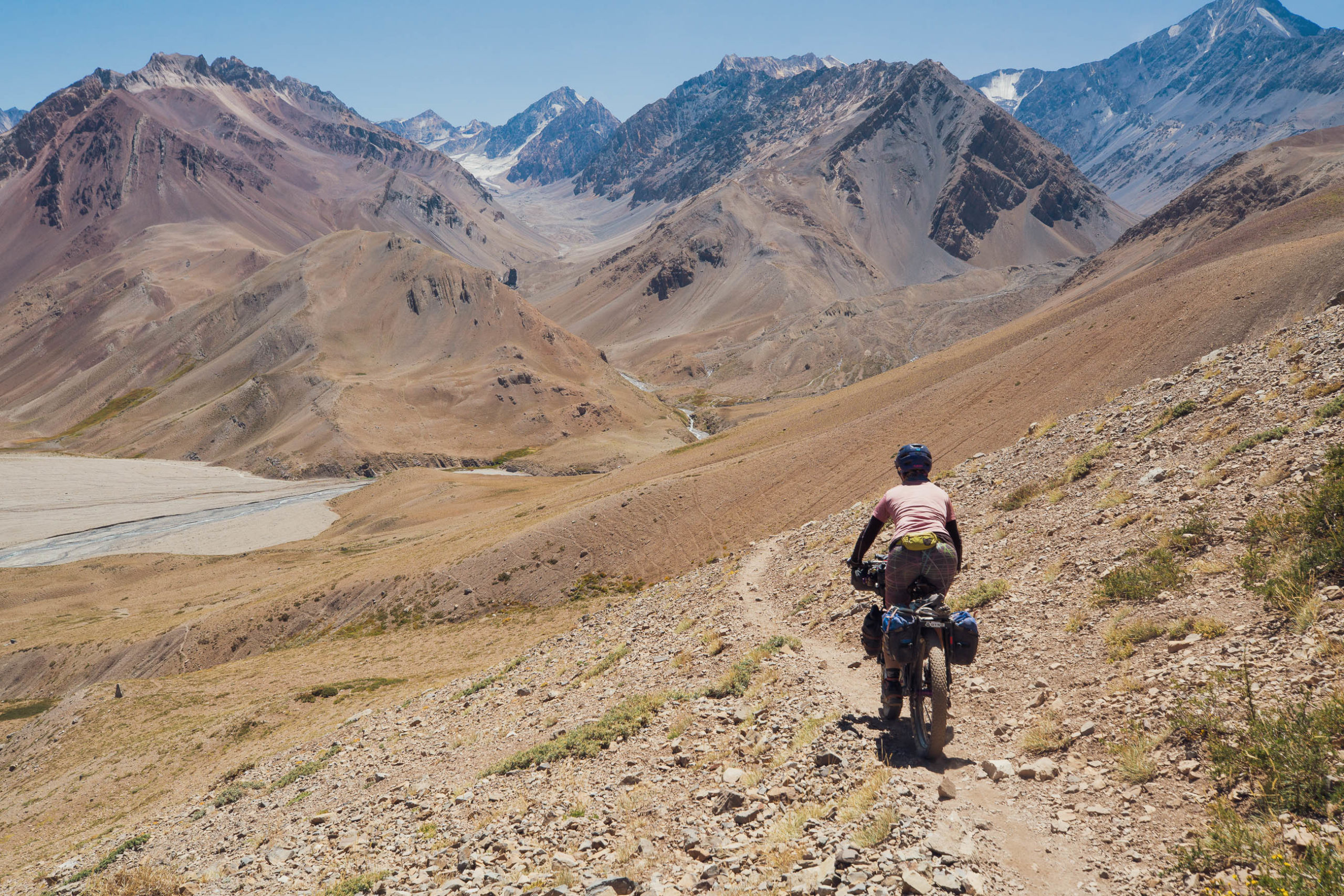
For bikepackers looking to cross the Andes between the Argentine city of Mendoza and the Chilean megalopolis of Santiago (or vice versa) the Ruta del Capitan Lemos offers a unique passage and a memorable mountain experience. If you’re a rider of at least moderate technical ability, are acclimatized, and don’t mind pushing your bike for up to a few hours, then you’ll get to feast on a singletrack smorgasbord and experience the essence of remote cross country bike travel.
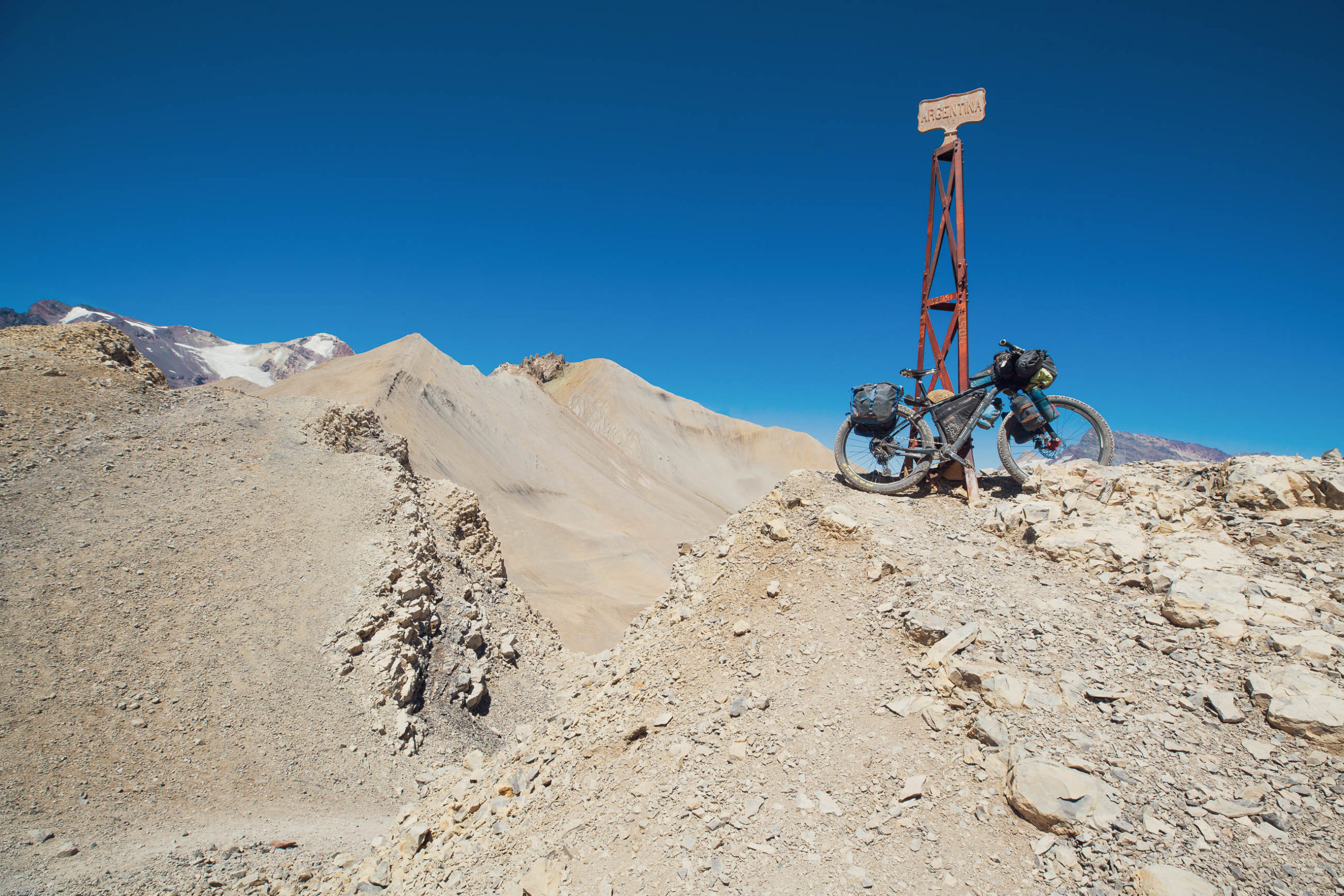
This route goes by several names and has been used as a mountain crossing by indigenous people since long before the Spanish colonial era, but is sometimes referred to as the Ruta del Capitan Lemos, Cruce de los Andes, or Ruta de San Martin, although the latter two refer to several different routes collectively. It’s also sometimes called Portillo de Piuquenes, which is the title of the Continental Divide pass it crosses, but the route actually crosses two high passes, the other being Paso Argentino, the highest on the route.
Captain Lemos was one of several military commanders who led more than 6000 troops over different passes of the Andes in a large surprise invasion – Cruce de los Andes – of Santiago in 1817. The ensuing battle of Chacabuco helped attain independence from Spain for both Chile and Argentina.
As a relatively direct connection between the cities of Mendoza and Santiago, the route offers a compelling option for riders looking to continue the themes of Ruta de los Seis Miles and Cerros de Mendoza as they head southbound, an optional link in the Andes Traverse, an entry point to Argentina and the aforementioned routes from the west, or as a classic standalone mountain bike adventure.
Make sure to read the full Trail Notes below for an overall itinerary.
Difficulty
Even for seasoned, lightly loaded bikepackers, this is a tough route, hence the grade 9 designation. There is mandatory bike pushing or carrying over moraine and scree and steep pushing up horse tracks. The route can be done in either direction, but is recommended from east to west (Mendoza to Santiago) because the climbing is more rideable, you get to ride more singletrack downhill and some of the most difficult hike-a-bike will be done going downhill. However, if you are capable of pushing a loaded bike uphill at high altitude for hours, eastbound riders will also be rewarded with a very good singletrack descent from Portillo de Piuquenes to Rio Tunuyan. For these reasons, the route is a solid 10 if you travel eastbound. Either direction, the ratio of rideable to unrideable terrain will vary depending on your technical ability, bike/tyre choice and load.
Route Development: Google reveals that very few cycling parties cross this pass per year (probably only 1-3 documented parties PA), at least for the past decade or so, along with the odd hiker and many guided horse trekking groups. Credit must go to the handful of other cyclists whose route information we referred to: Trip Advisor (supported 2013 crossing with Don Romulo, a Tupungato based guide/outfitter), The Ride South, Nathan North and Monteadentro.


Submit Route Alert
As the leading creator and publisher of bikepacking routes, BIKEPACKING.com endeavors to maintain, improve, and advocate for our growing network of bikepacking routes all over the world. As such, our editorial team, route creators, and Route Stewards serve as mediators for route improvements and opportunities for connectivity, conservation, and community growth around these routes. To facilitate these efforts, we rely on our Bikepacking Collective and the greater bikepacking community to call attention to critical issues and opportunities that are discovered while riding these routes. If you have a vital issue or opportunity regarding this route that pertains to one of the subjects below, please let us know:
Highlights
Must Know
Camping
Food/H2O
Trail Notes
Resources
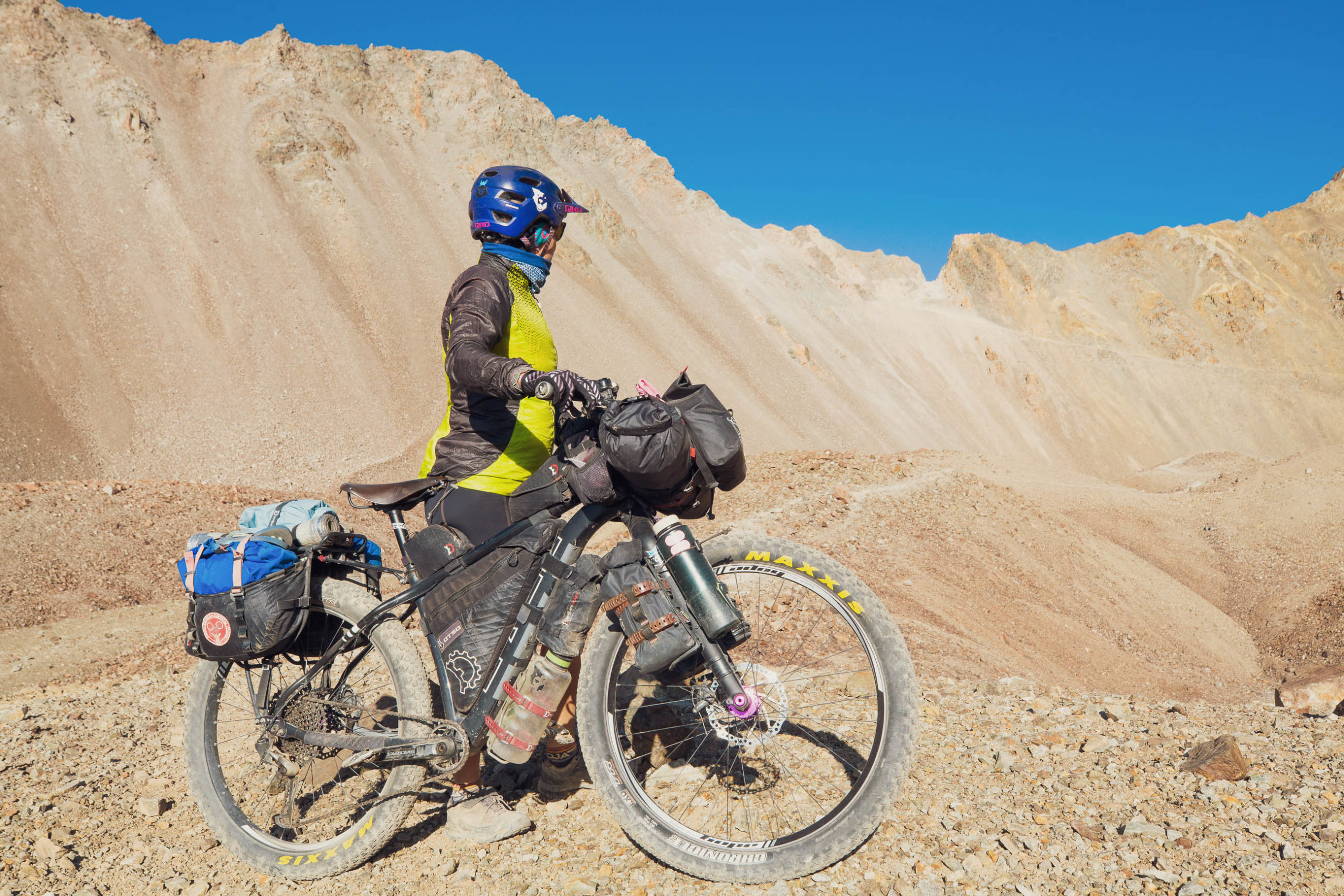
- Singletrack riding through spectacular and rugged high altitude mountains
- The charming city of Mendoza with its leafy streets, tasty and abundant food and world famous wine
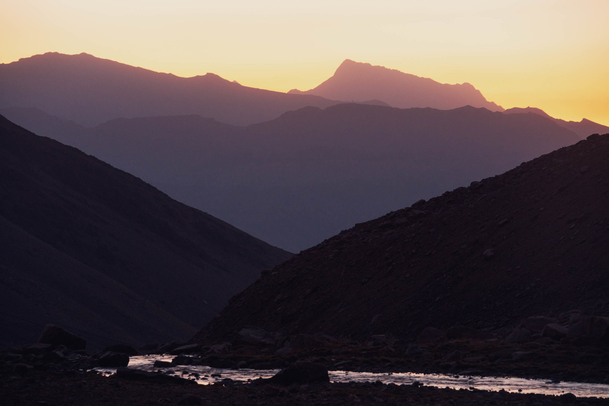
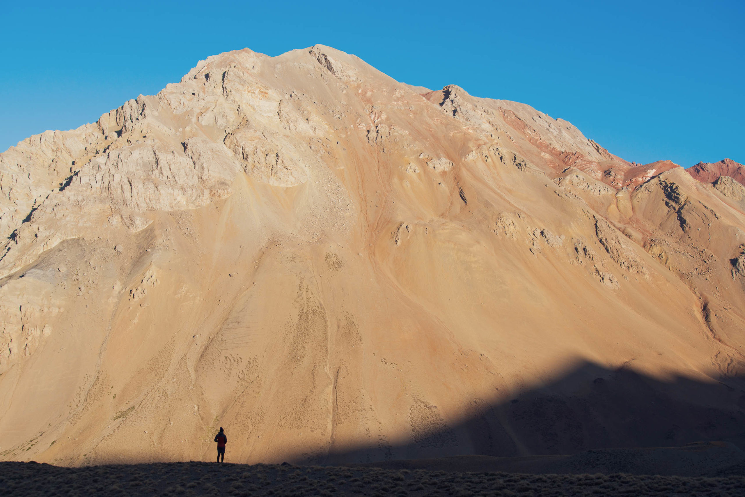
- Experiencing the beautiful but barren southern edge of the Dry Andes and views of Volcan Tupungato (6570m), among other Andean peaks
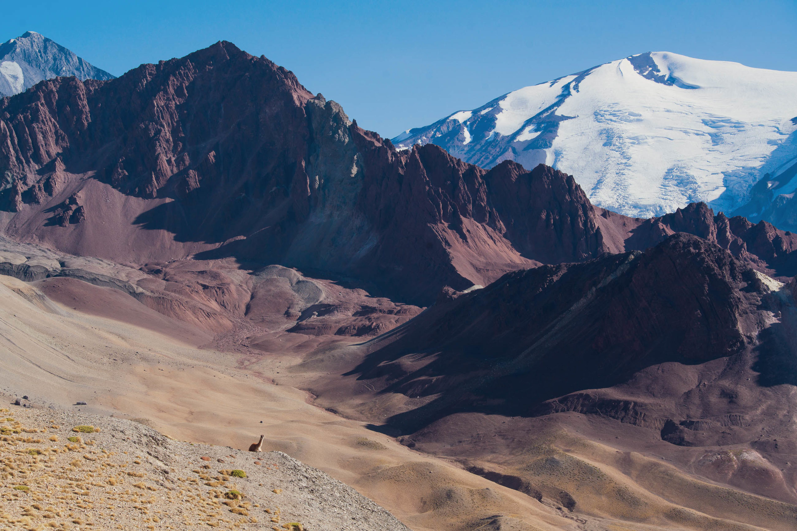
- Glimpses of condors and guanacos, the latter being a wild camelid and ancestor of the llama
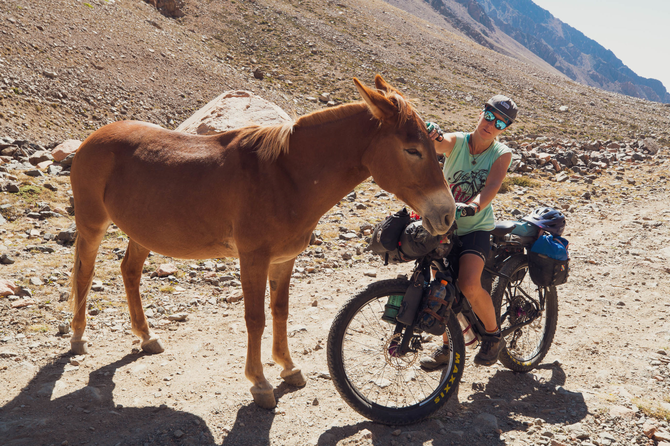
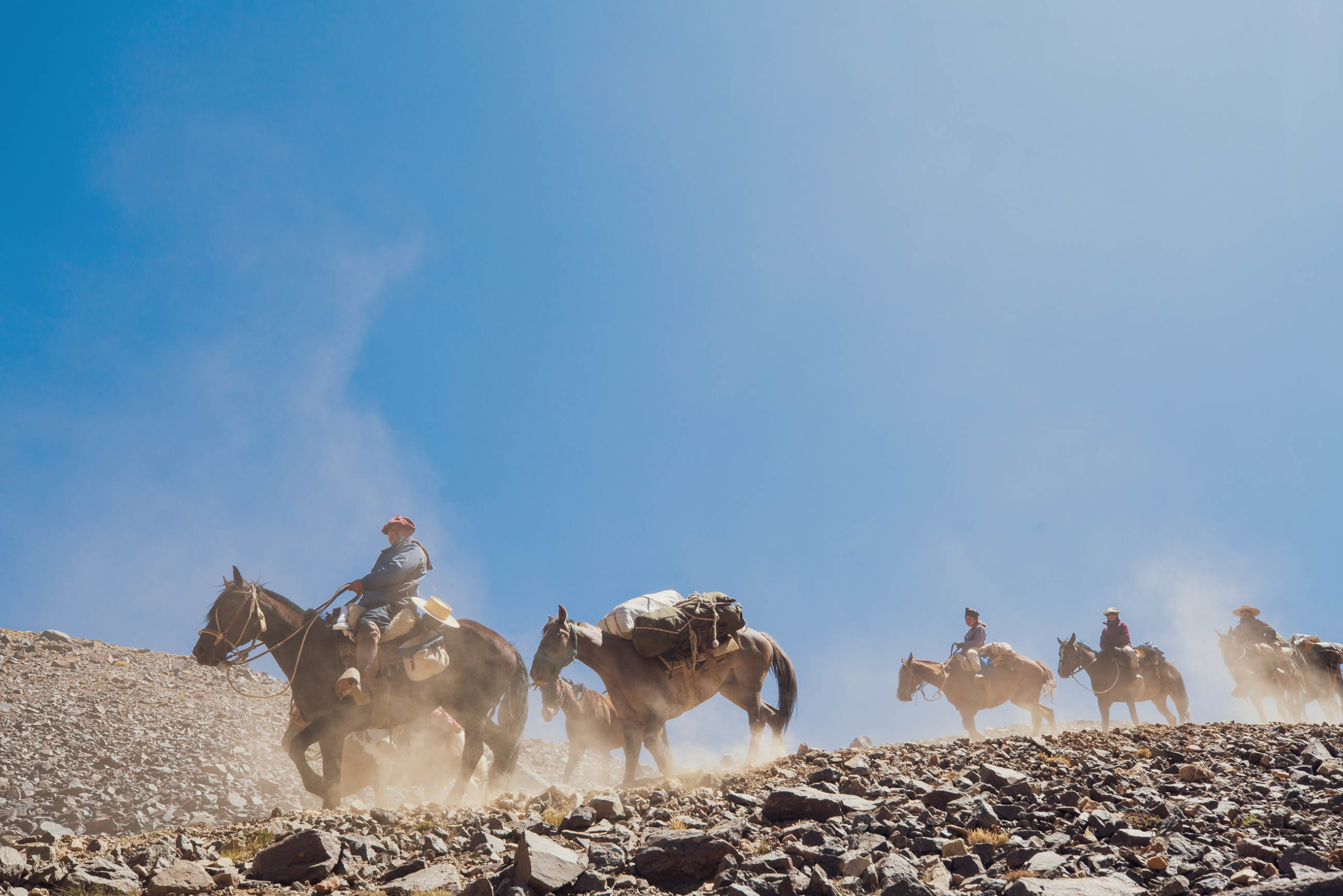
- Steeped in history, this symbolic crossing of the Andes is frequented by horse trekking groups guided by local gauchos, you’ll likely encounter groups and have a chance to see some Andean cowboy culture
- Hot pools at Termas de Plomo
- Season: November to April. Late season, when the snows have melted, is best for low water levels in the river. Be prepared for thunderstorms, nights close to or below freezing and possible snowfall.
- You will need to stop at the Argentine Migraciones after Manzano Historico to get your exit stamp (see POI). As there is no immigration office on the Chilean side you will need to have prearranged your entry into Chile by communicating with the PDI (Chilean police and immigration – see link in Resources). They will meet you at the Carabineros in San Gabriel at a pre-arranged time to stamp your passport. If you do not do this be prepared for some extra hassles and waiting around in San Gabriel. If starting in Santiago get your exit stamp from the PDI office before leaving the city.
- This route crosses two high mountain passes up to 4340m where acclimatisation to altitude is essential. If you are not coming from another high route such as Cerros de Mendoza first you will need to allow an extra couple of days to adjust en route.
- The route is possible in reverse but the hike-a-bike to both passes is more arduous making it a grade 10. Allow an extra day or two and be prepared to carry your bike on the ascent to Paso Argentino.
- This is a remote alpine crossing. Ensure you have a reliable navigation system with back up (second device or paper map and compass). Carrying an emergency locator beacon or satellite communication device is also advisable.
- To make the most of the riding potential and enjoyment, a plus bike is recommended, but it could be done comfortably with a minimum tyre size of 2.4”. Tubeless is also advisable due to some thorny sections and an abundance of rock.
- Pack as light as possible: there is some tough hike-a-bike on this route including large rocks, steep passes and high altitude.
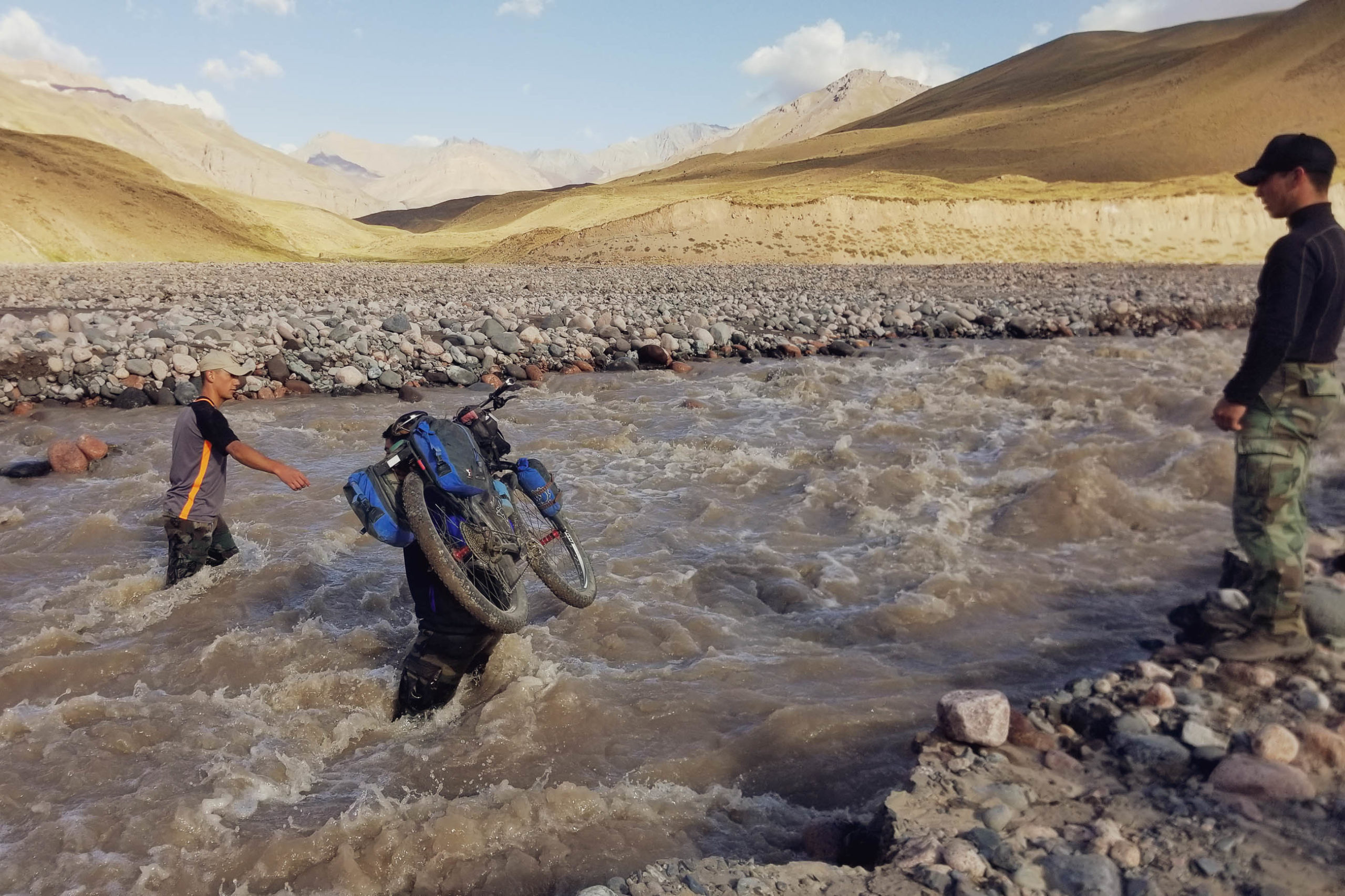
- Crossing the Rio Tunuyán with a bike can be difficult, dangerous and sometimes impossible. Make sure you carry extra food to wait for the water level to drop, or until you can arrange help crossing the river from one of the horse trekking groups or the military. They will expect to be well tipped.
- Some of the suburbs around Mendoza and Santiago have a very high crime rate. Be wary when leaving or entering the city.
- Mendoza and Santiago are both serviced by major airports and bus stations.
- Make sure to change some pesos before starting out so you have cash in both currencies.
- Mendoza and Santiago have many hostels, hotels and Airbnb options at all levels.
- The wine growing region of Mendoza is world renown with many vineyards between Mendoza and Manzano Historico offering accommodation and wine tasting if you want to splash out. Tupungato has several hostels and Airbnb options plus camping outside town. We stayed at Hostería Don Romulo. The friendly owner has a lot of knowledge and experience guiding on the crossing.
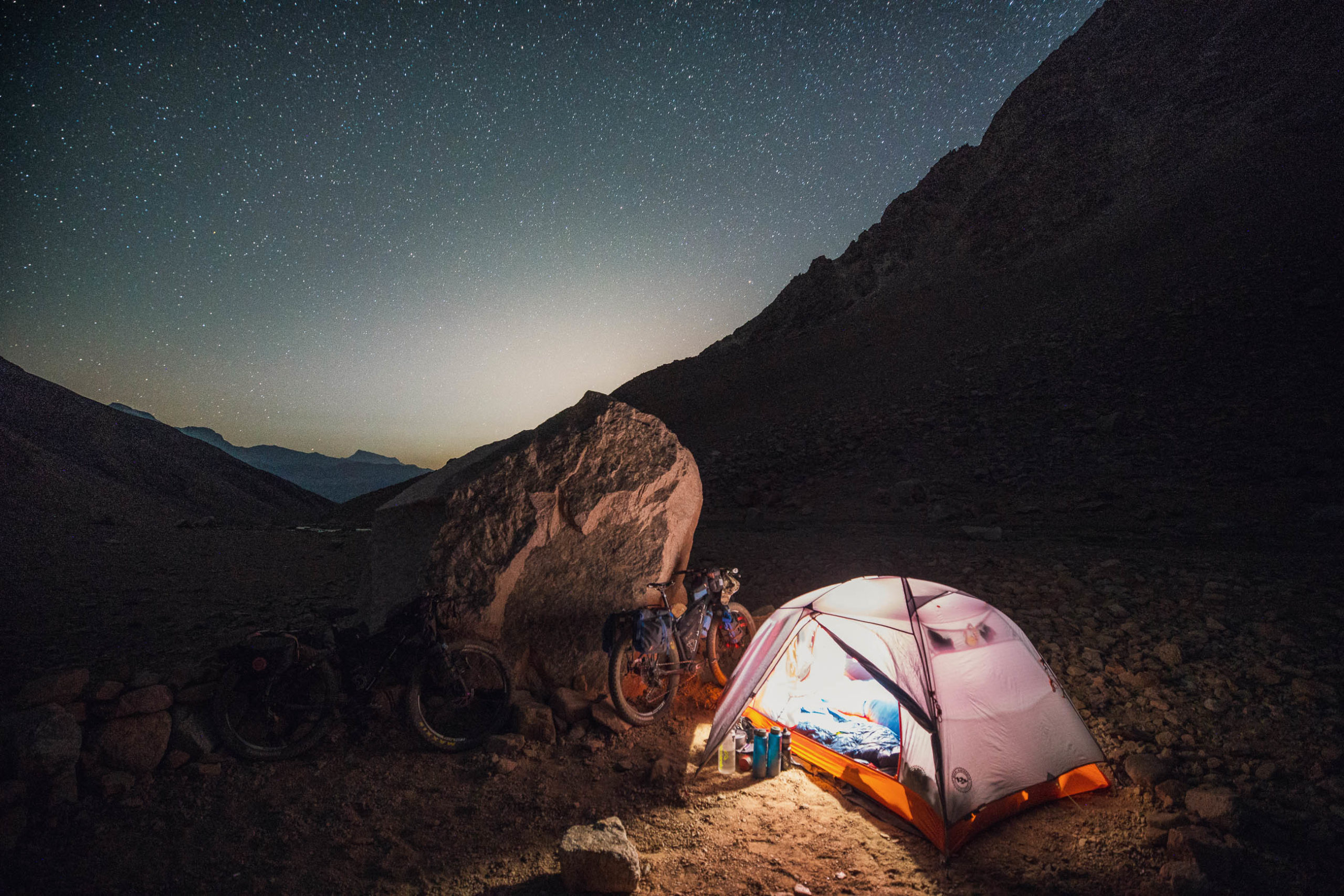
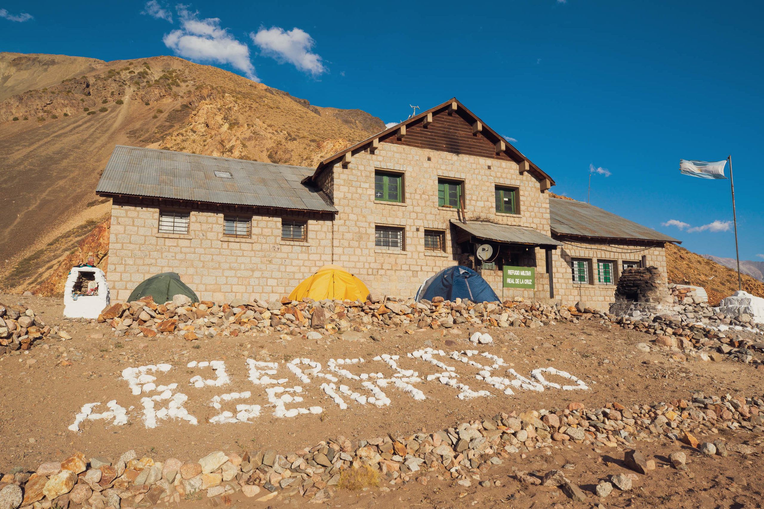
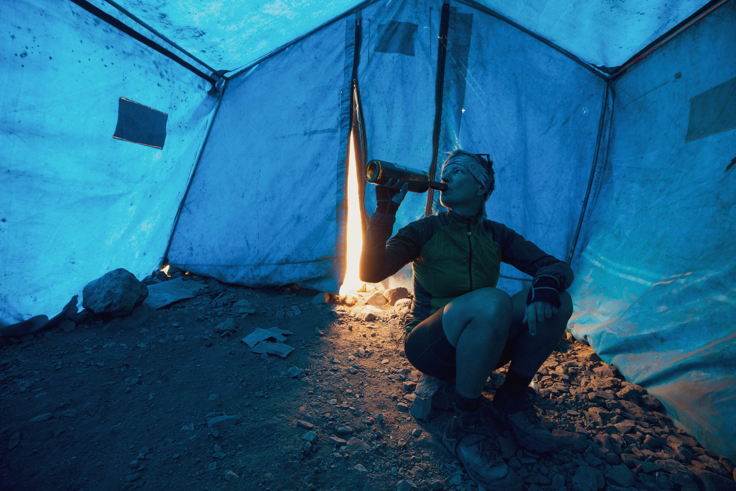
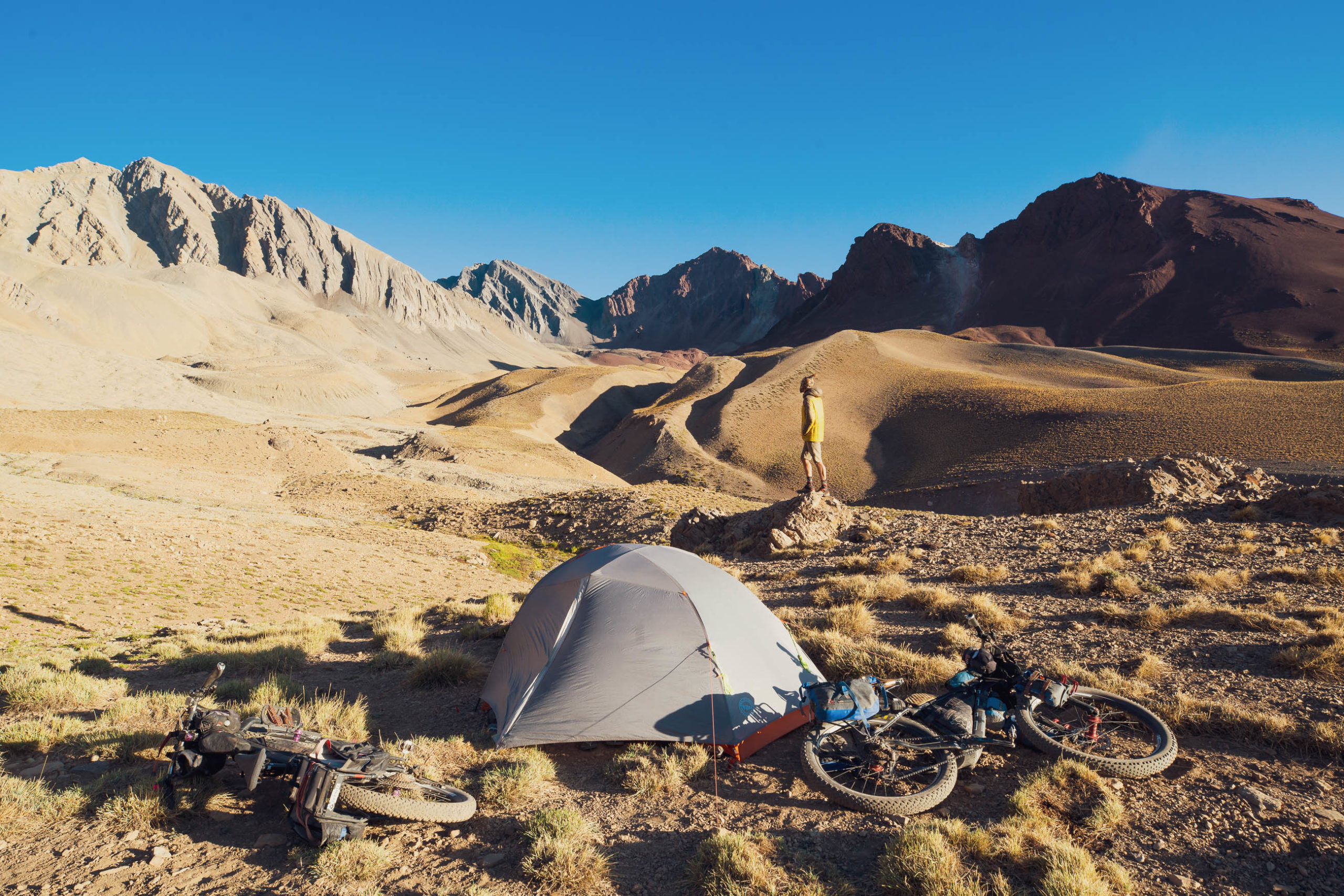
- There are several commercial campsites in Manzano Historico. This is a very popular spot for locals to get away from the city so it can get pretty busy on weekends and holidays. Beyond here you enter a managed reserve area with some marked camping and refugio options. Camping outside these areas is not permitted until you are at or beyond the Argentine immigration post. We camped at the climber’s camp at Cajon de Arenales at 2660m. Wild camping is possible between here and San Gabriel, which has several campsites alongside a very refreshing river. There is also an Argentine military outpost (Refugio de la Cruz) between the passes with basic accommodation (for a fee) and camping. Be aware of your surroundings (rivers, people, wildlife) and always leave no trace.
- Mendoza is the best place to find everything you might need, including bike shops. Treat yourself to some fine dining and local wine at a very reasonable price before hitting the road. Tupungato has a supermarket and places to eat while Manzano Historico has a small convenience store and cafe. Between here and San Gabriel (which has some small stores) in Chile you will need to cater for yourself.
- Water is not always readily available. Make sure you carry a sufficient amount to get you over the passes as groundwater is unavailable up high. It is advisable to treat or filter water from rivers, but town supplies are generally ok.
*The route from Mendoza to Santiago mapped here entails some pavement riding at each end, however nearly all of it is on quiet rural roads. For reasons of clarity, the stats for rideable time, dirt vs pavement and singletrack are taken from the ‘main’ section of the ride, being the 127km crossing between Manzano Historico at the start of the dirt in Argentina and San Gabriel in Chile shortly after the pavement begins again. Mendoza – Manzano Historico 107km paved; San Gabriel – Santiago 71km paved.
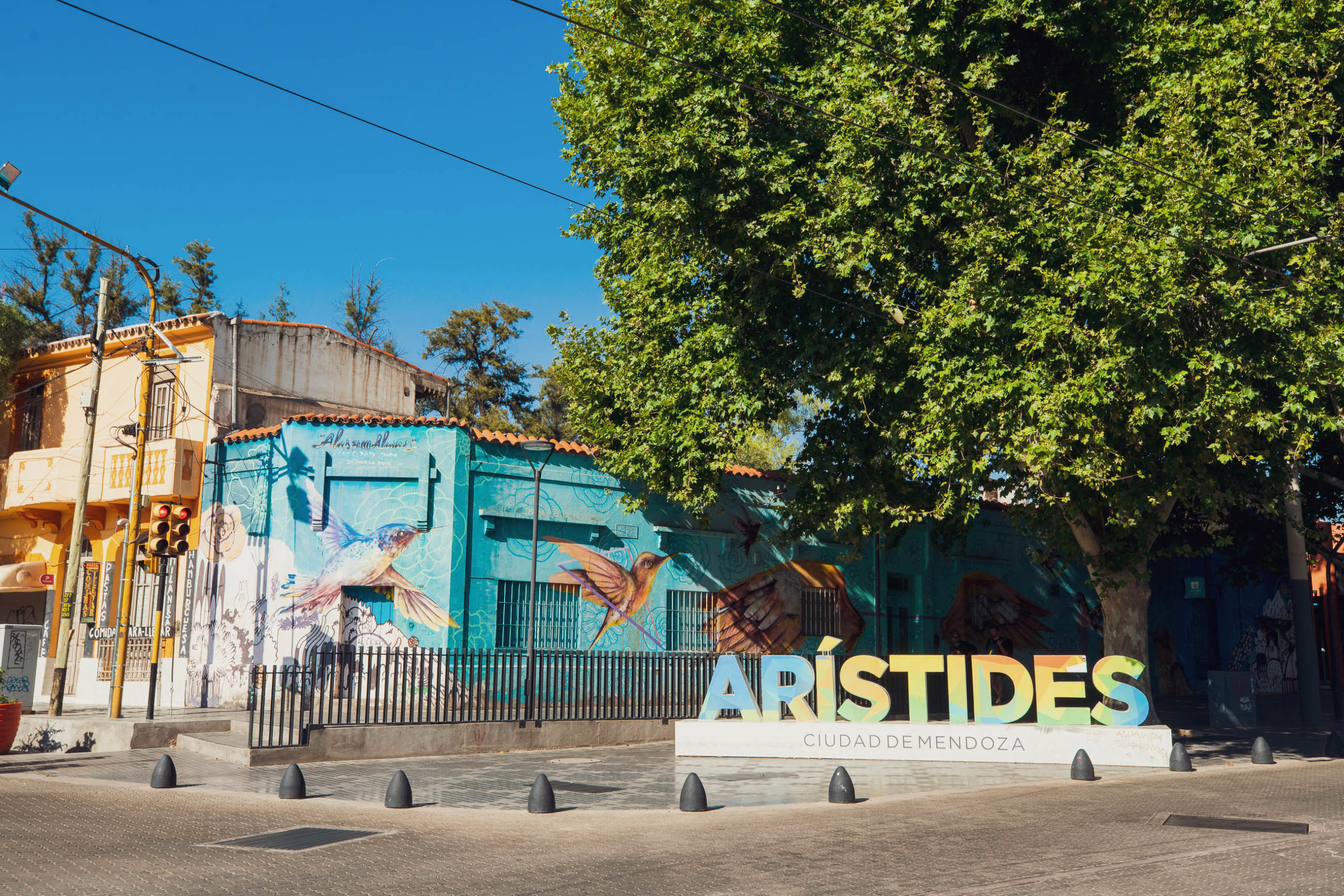
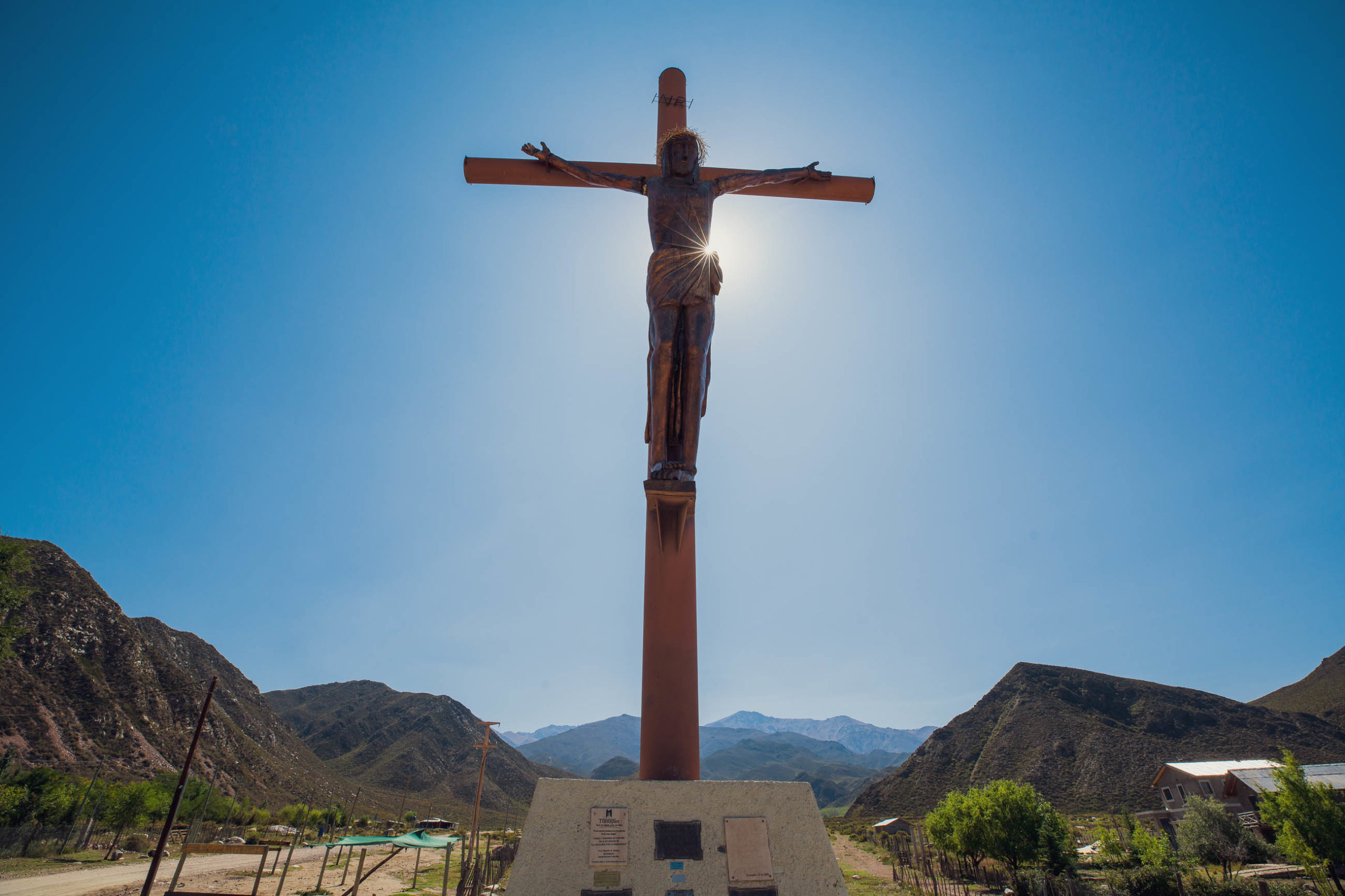
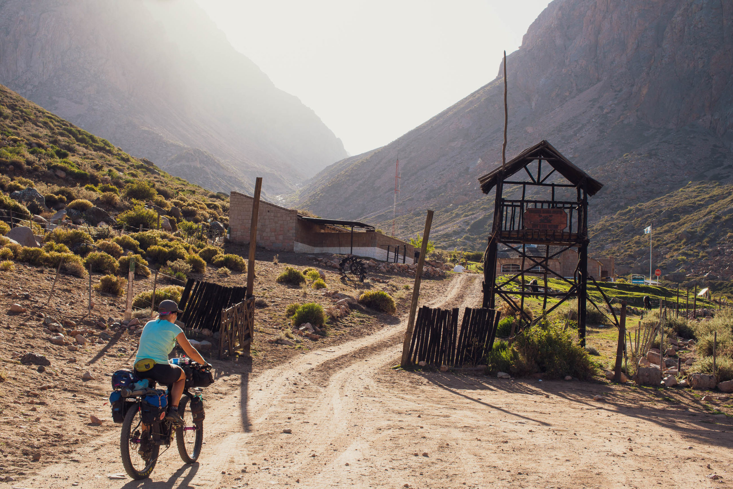
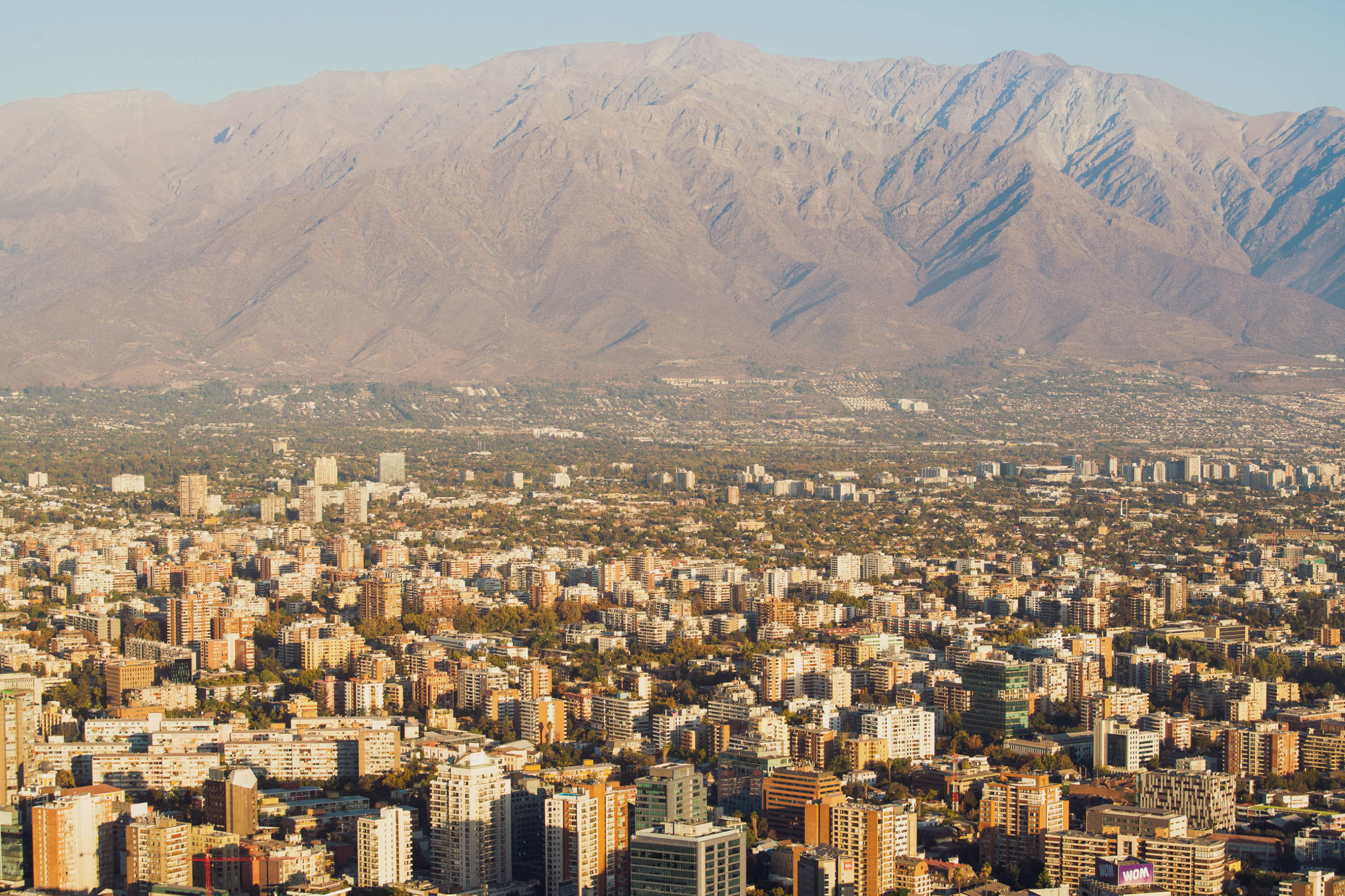
The route departs central Mendoza following bike paths where possible until it reaches the city limits where the ride begins to climb gently and then descend into Tupungato which is a pleasant small town in the heart of some of Mendoza’s most famous vineyards. It’s a good place to have a meal, resupply or sleep if you’ve left Mendoza late. Beyond Tupungato the climbing is gentle but continuous on peaceful rural roads until you reach the village of Manzano Historico, which is a popular weekend getaway spot for city people. There’s basic tiendas, camping, coffee and ice cream.
Beyond Manzano Historico the route climbs on a reasonable dirt road away from the margin of the Argentine plain and into the Andes, following the Arroyo Grande river. The climbing is steady to Refugio Alférez Portinari where you must check in with the gendarmerie and collect your exit stamp from immigration. There is informal camping here. Just under 2km further up the road there is another informal camping area at Cajon de Arenales which is used by climbers. At weekends you might struggle to find a spot, but it’s a lovely area surrounded by massive cliffs.
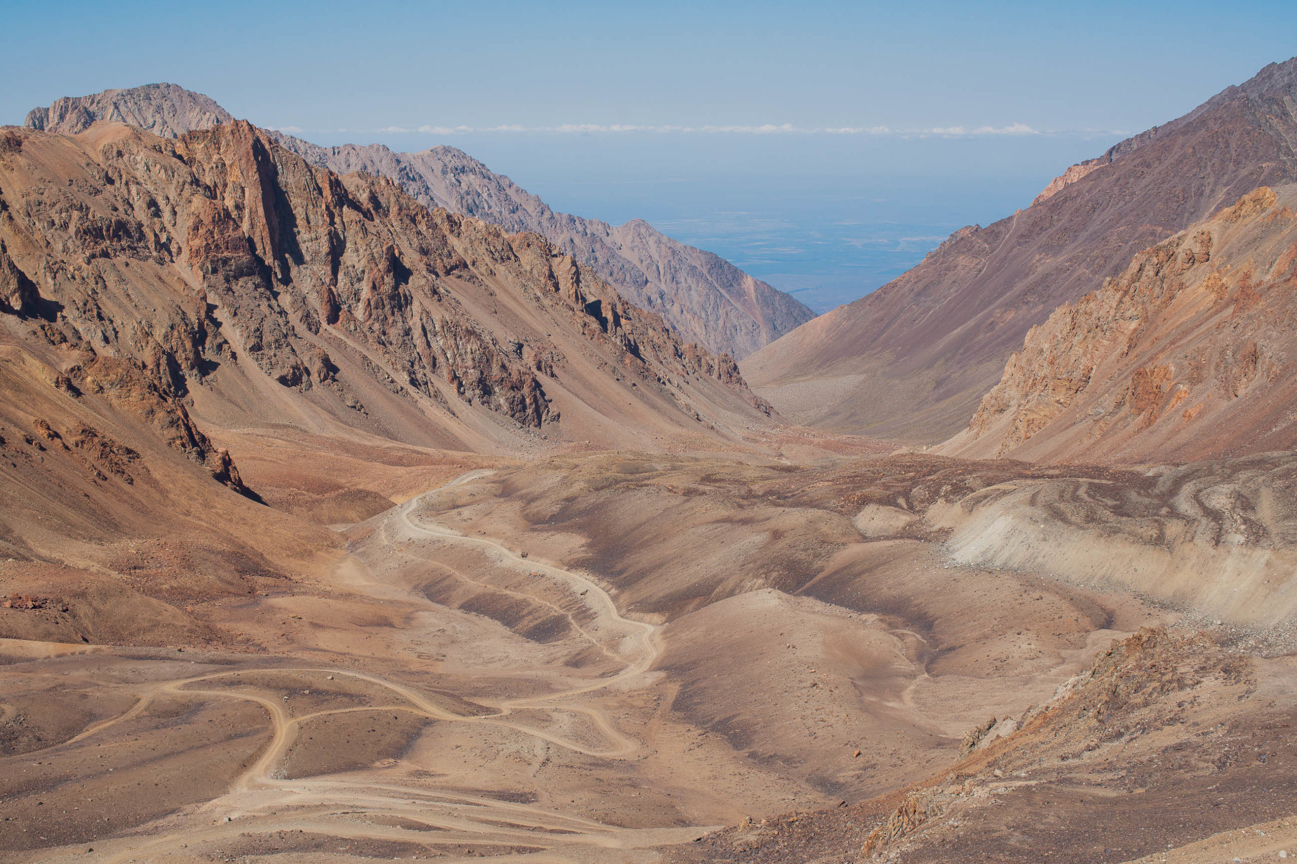
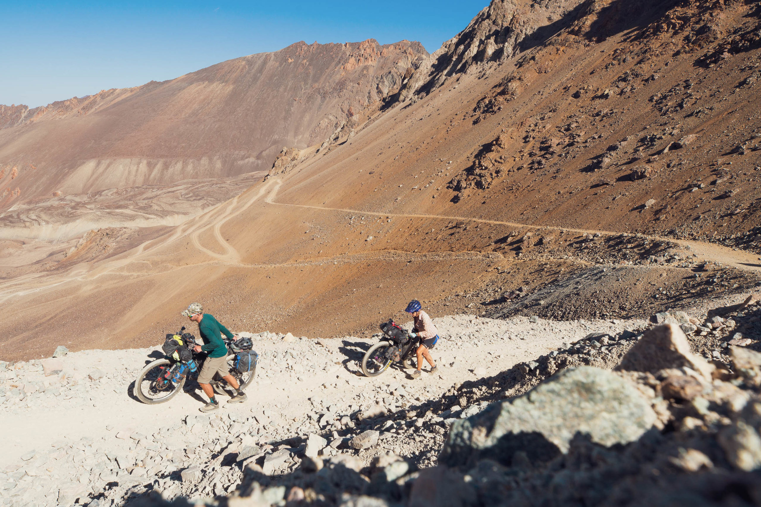
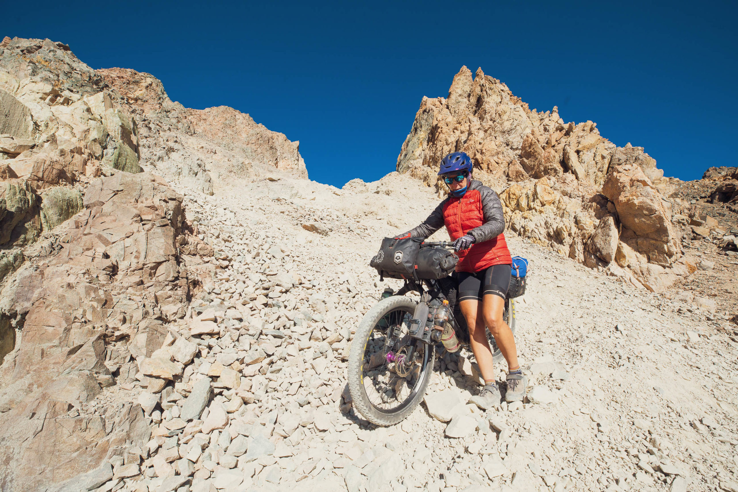
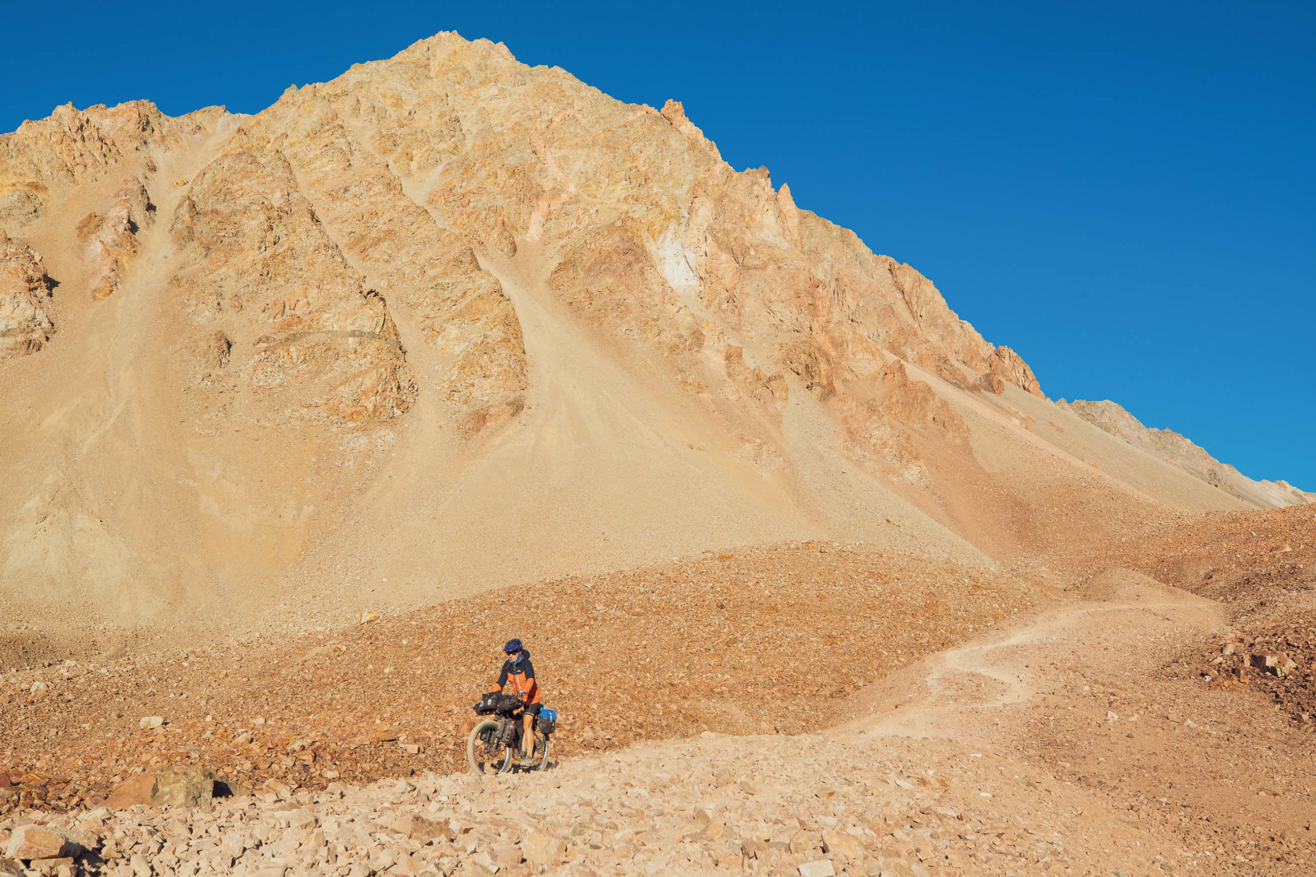
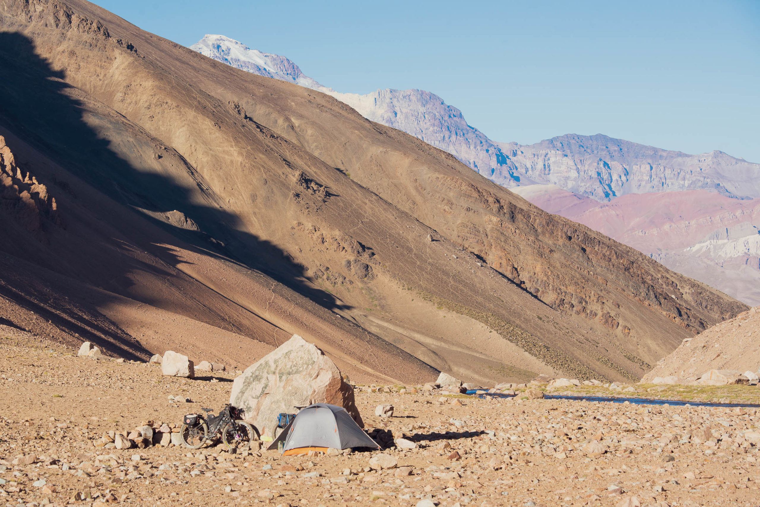
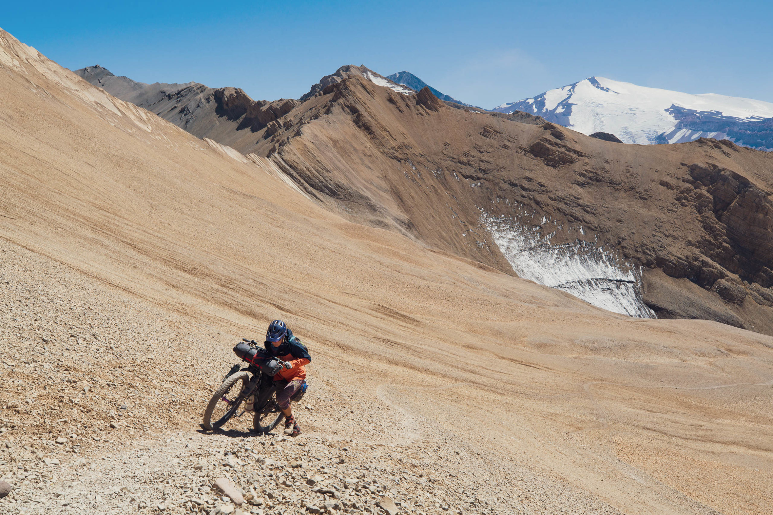
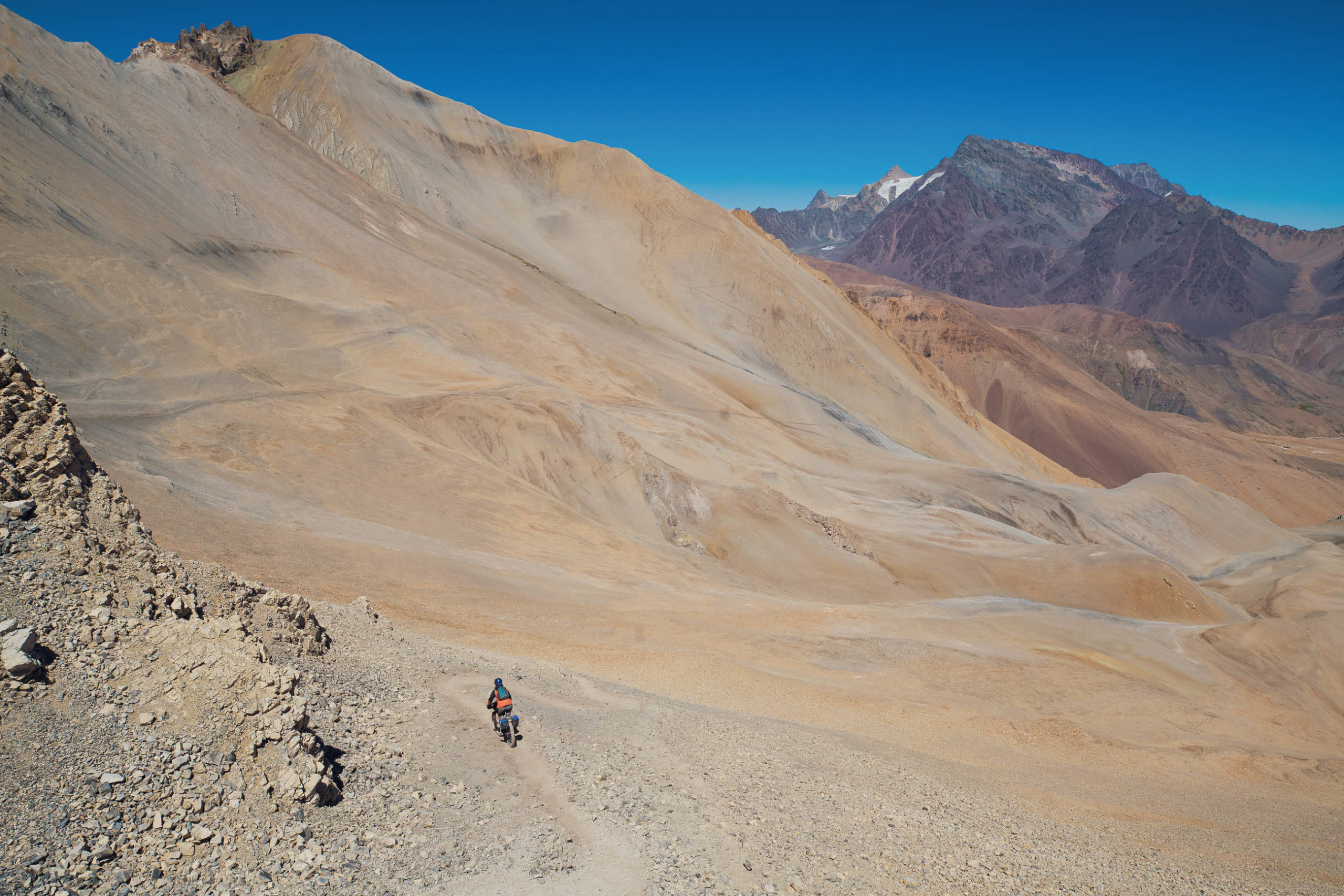
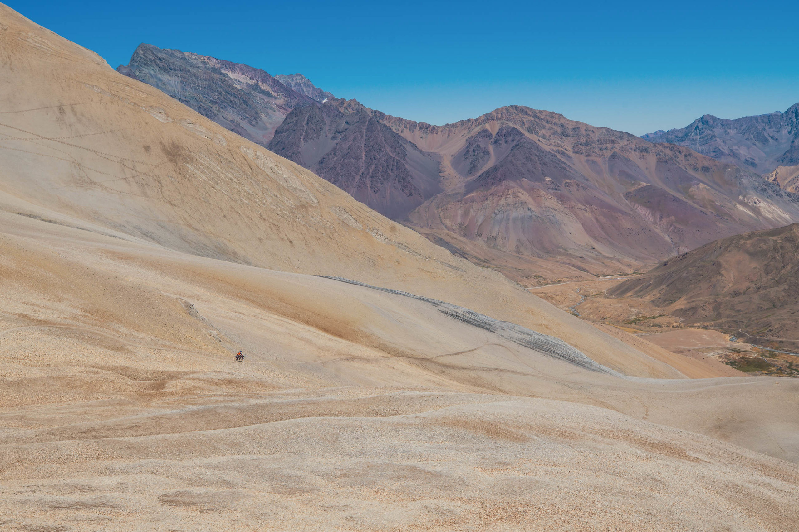
Beyond Cajon de Arenales the road is generally rougher and sometimes steeper as it makes the long climb to Paso Argentino (high point of route at 4340m). Make sure you collect water from the last spring before the pass. Right before the pass the road has collapsed so you’ll have to push your bike up a steep rocky gully to gain the pass, which is cut into a deep notch in the ridge. The views out both sides from here are amazing.
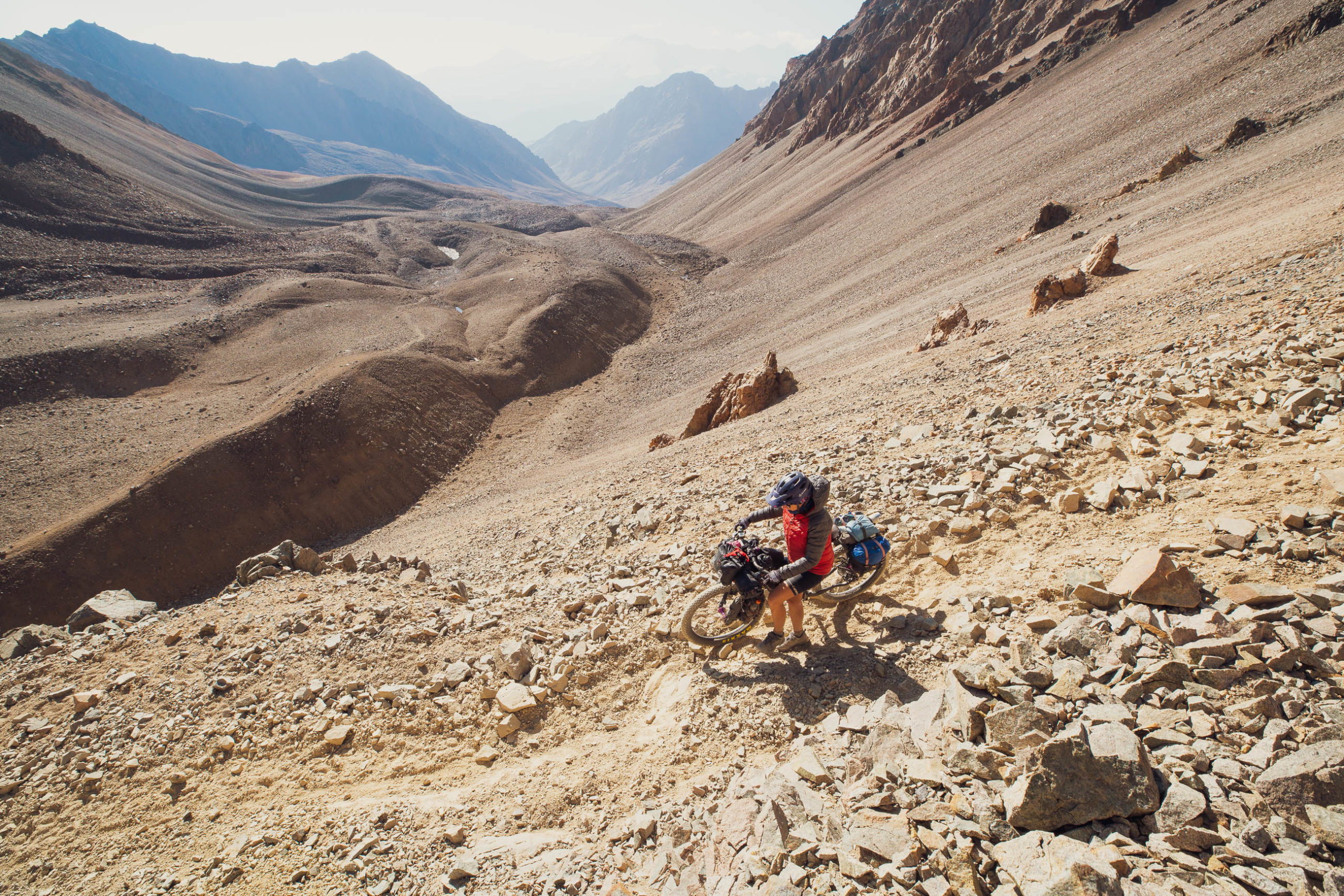
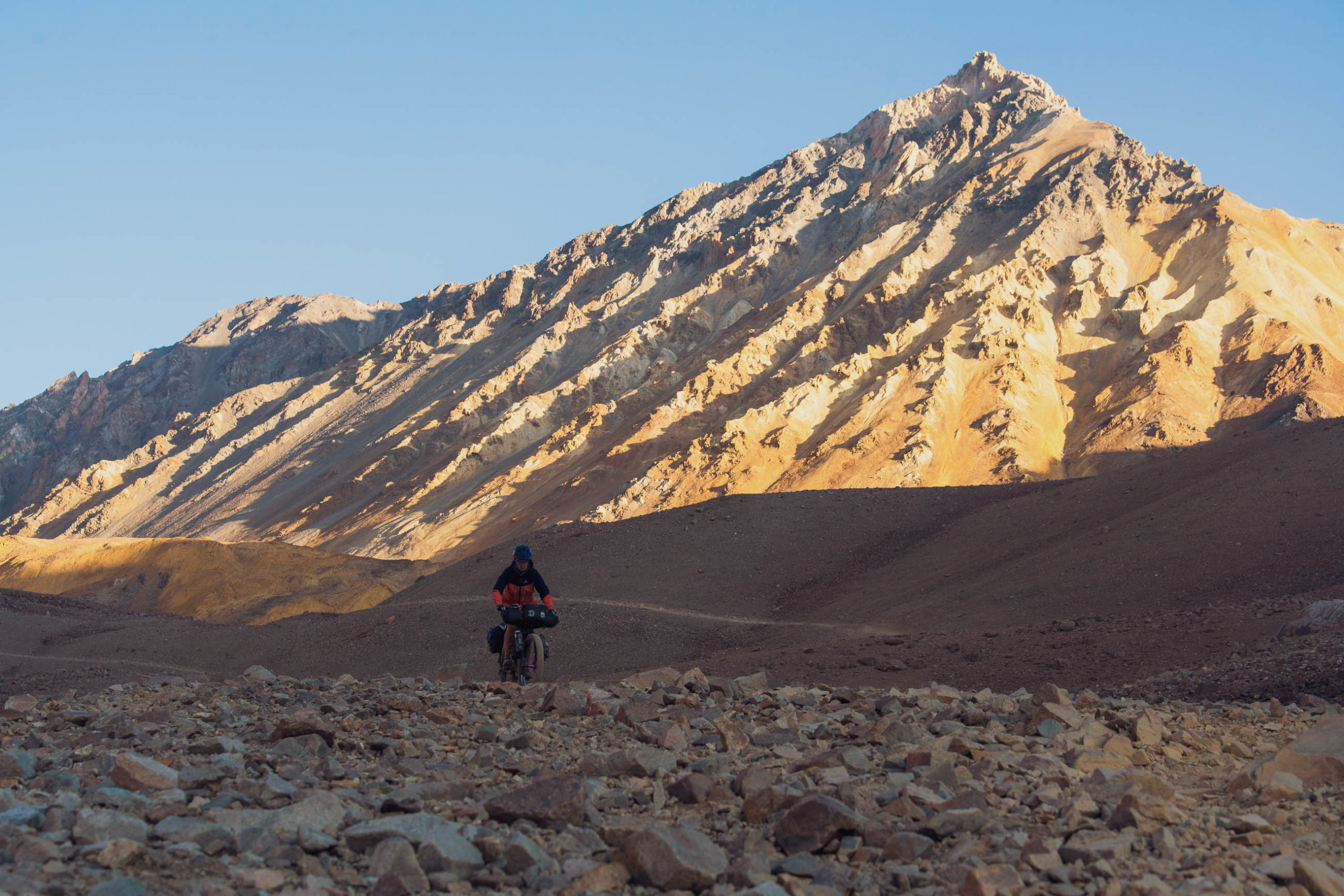
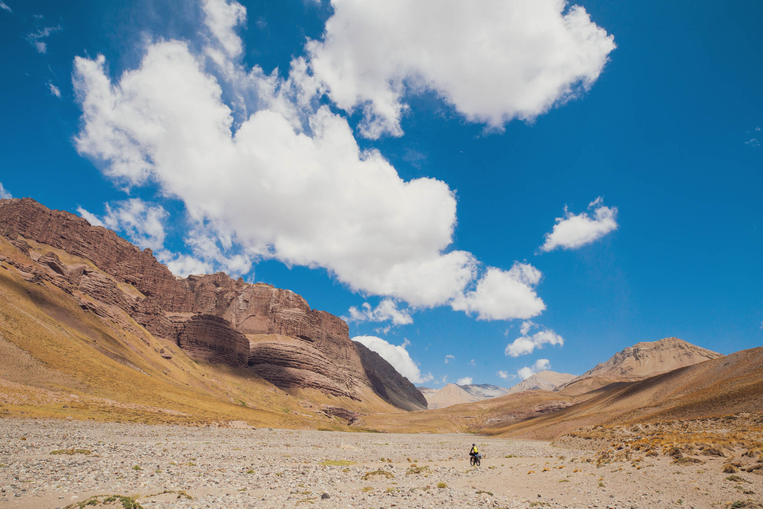
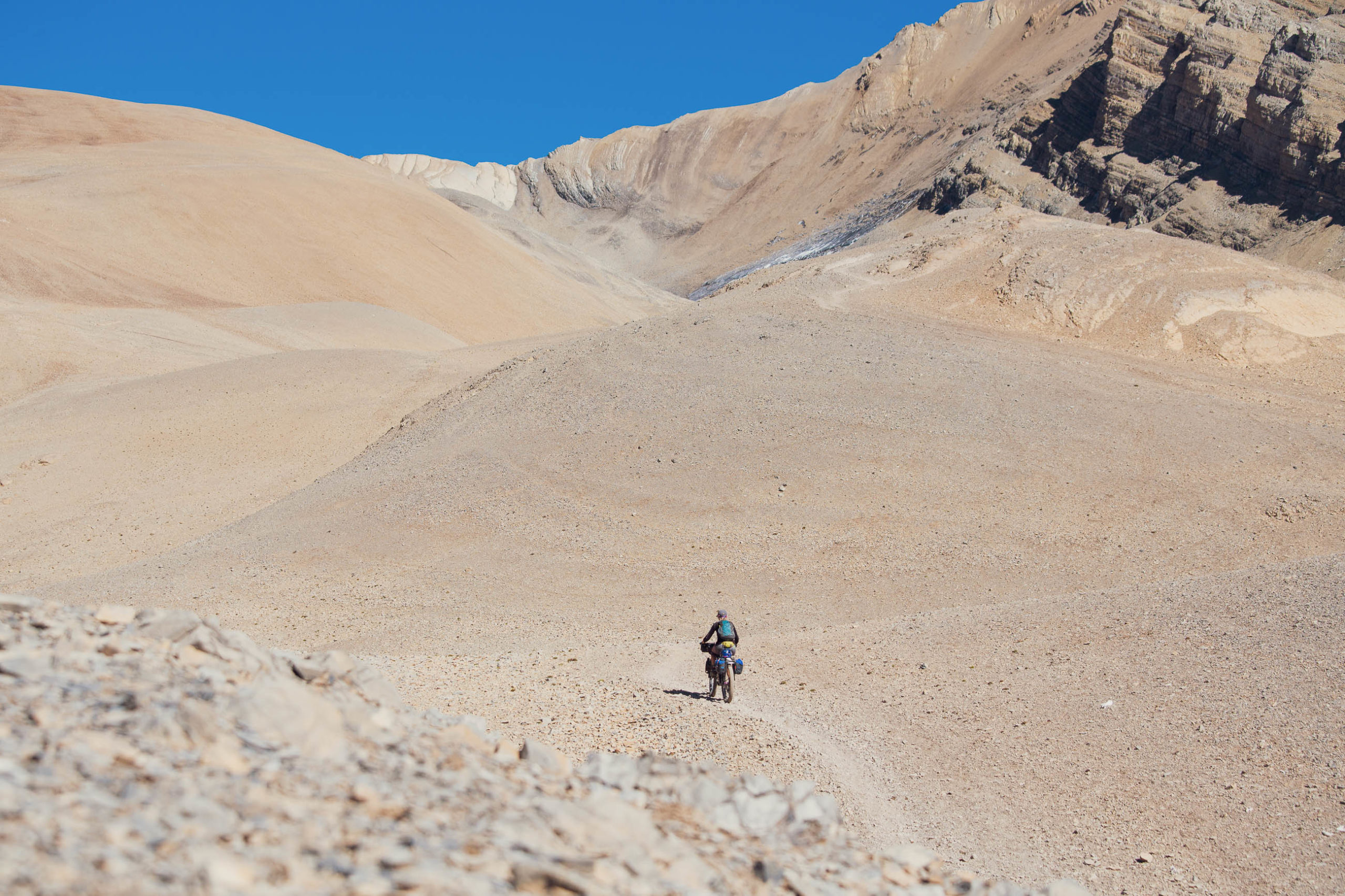
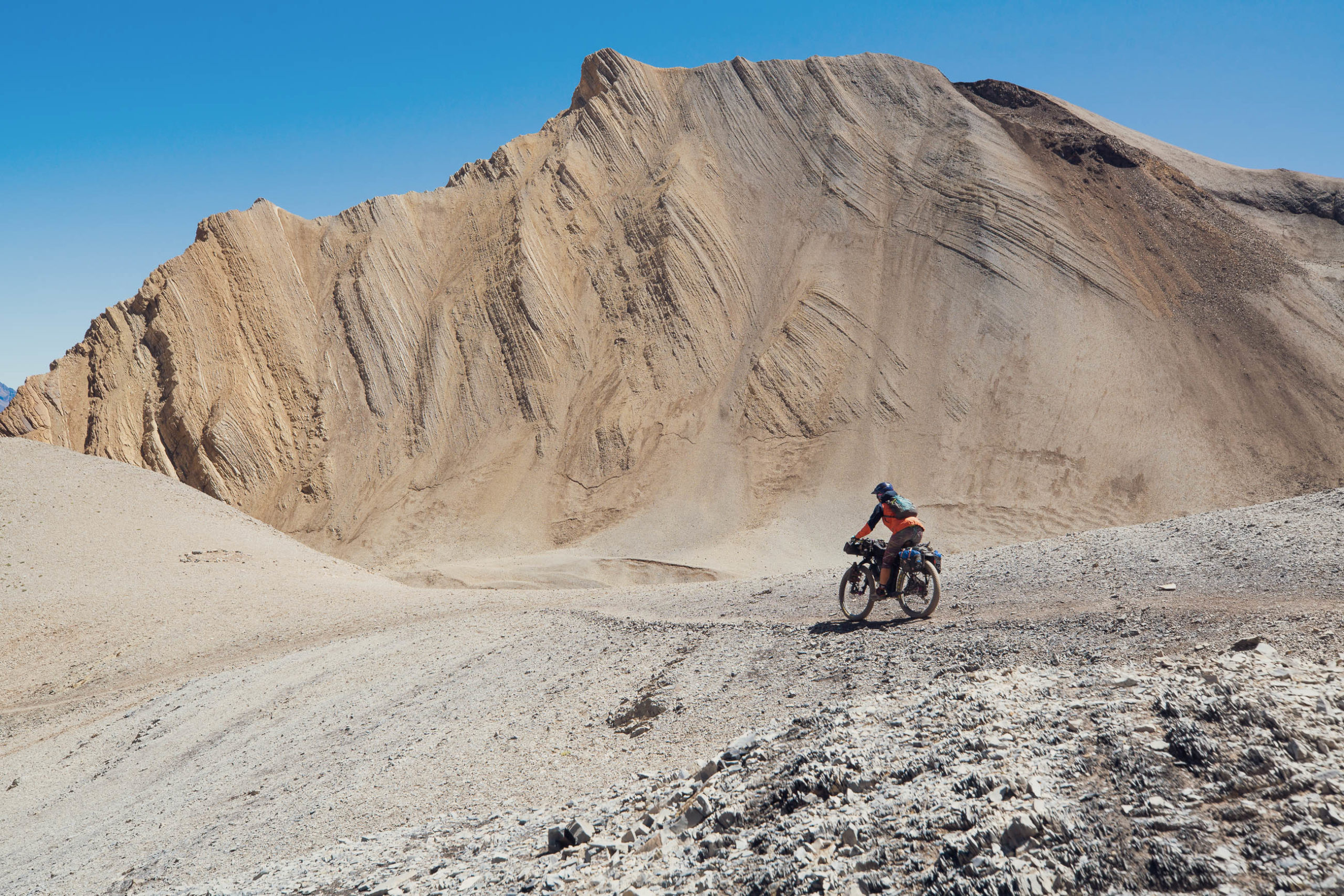
The following 40km is singletrack, but is sometimes comprised of moraine, scree slopes and riverbed. At first the track sidles steeply down into the moraines of a tributary of the Tunuyan Valley. The upper valley is a stark and spectacular place, and is littered with the bleached white bones of mules and horses that have died over the years. Between the pass and the campsite at 3641m, most riders will be pushing their bikes a lot, but the more skilled will enjoy attempting to navigate the minefield of rocks with as few dabs as possible.
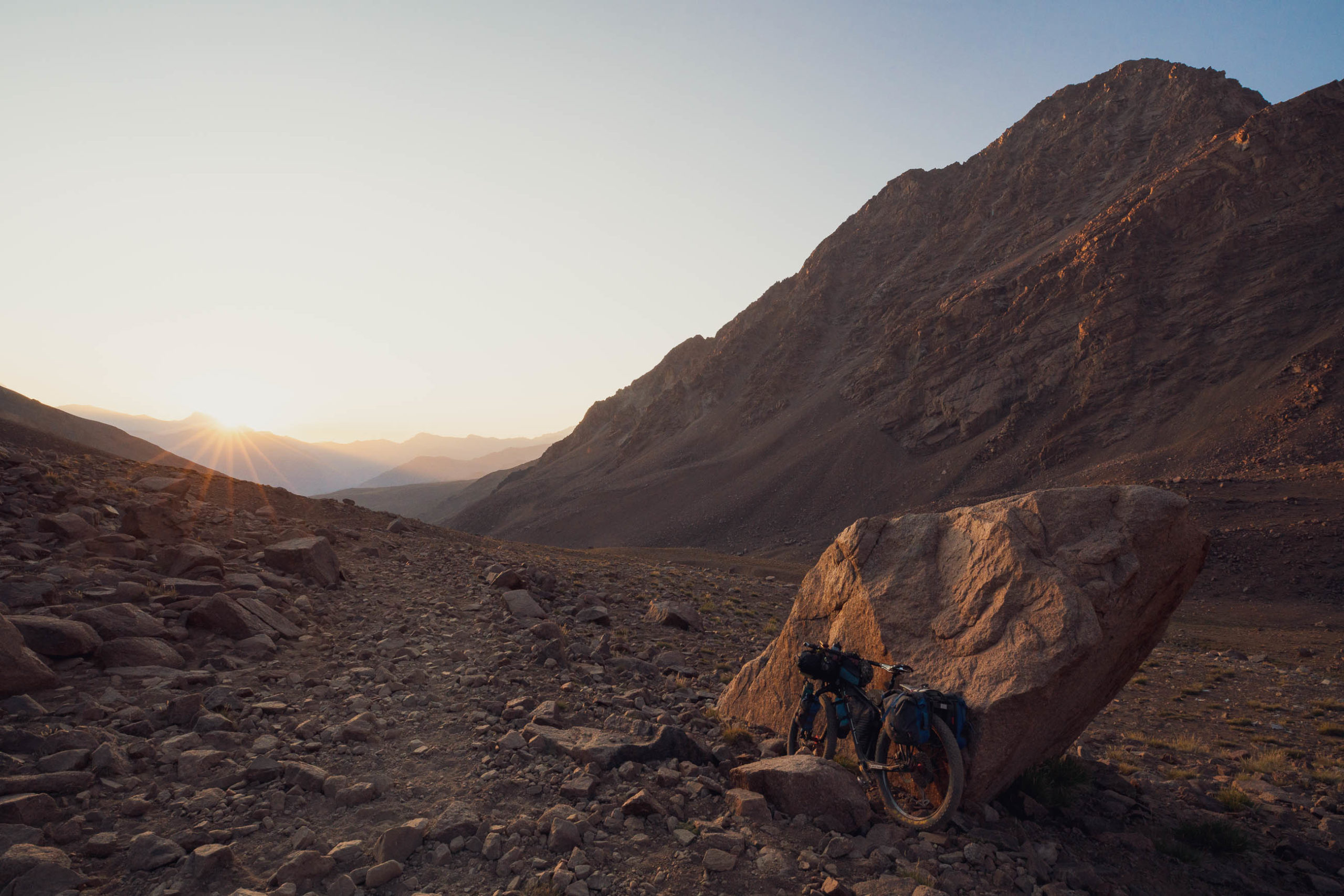
The waypointed campsite is the first reasonable site after the pass (there are more lower down), has fresh water and a modicum of wind shelter behind a boulder. Beyond there until you reach Refugio de la Cruz down in the Tunuyan the travel becomes increasingly less rocky and more rideable, until the fun final descent to the refugio.
The refugio used to be a military outpost but these days, while still run by the military, is usually open to the public and guided groups for basic accommodation during the summer months. Don’t assume you can stay there and please check in with the soldiers in attendance when you arrive. There is also camping space around the building. Staying here offers a good opportunity for some camaraderie with trekking groups and their arrieros. If you need help to cross the Rio Tunuyan (and most people do), this is the place to ask for it.
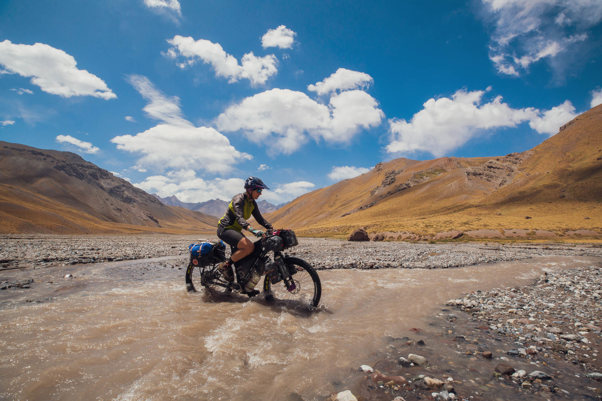
The first obstacle to contend with beyond the refugio is the Rio Tunuyan, which is a cold, fast flowing melt-fed river. It’s unbridged and can be a serious river crossing for hikers and cyclists. It is possible to cross safely, solo, if you pick your spot carefully and cross in times of low-flow. Early morning, before 8am, is best as this is when melt is at its slowest on the glaciers that feed the river. At least one cyclist has lost their bike and equipment in this river, so if you have any doubt at all as to your ability to cross safely, seek help. You should expect to pay a tip if someone assists you. People report having variously crossed safely alone, or with help either from trekking groups (via horseback) or soldiers. Ask, be smart and factor this into your food allowance and timing. Consider the possibility that you might not be able to cross at all in your planning.
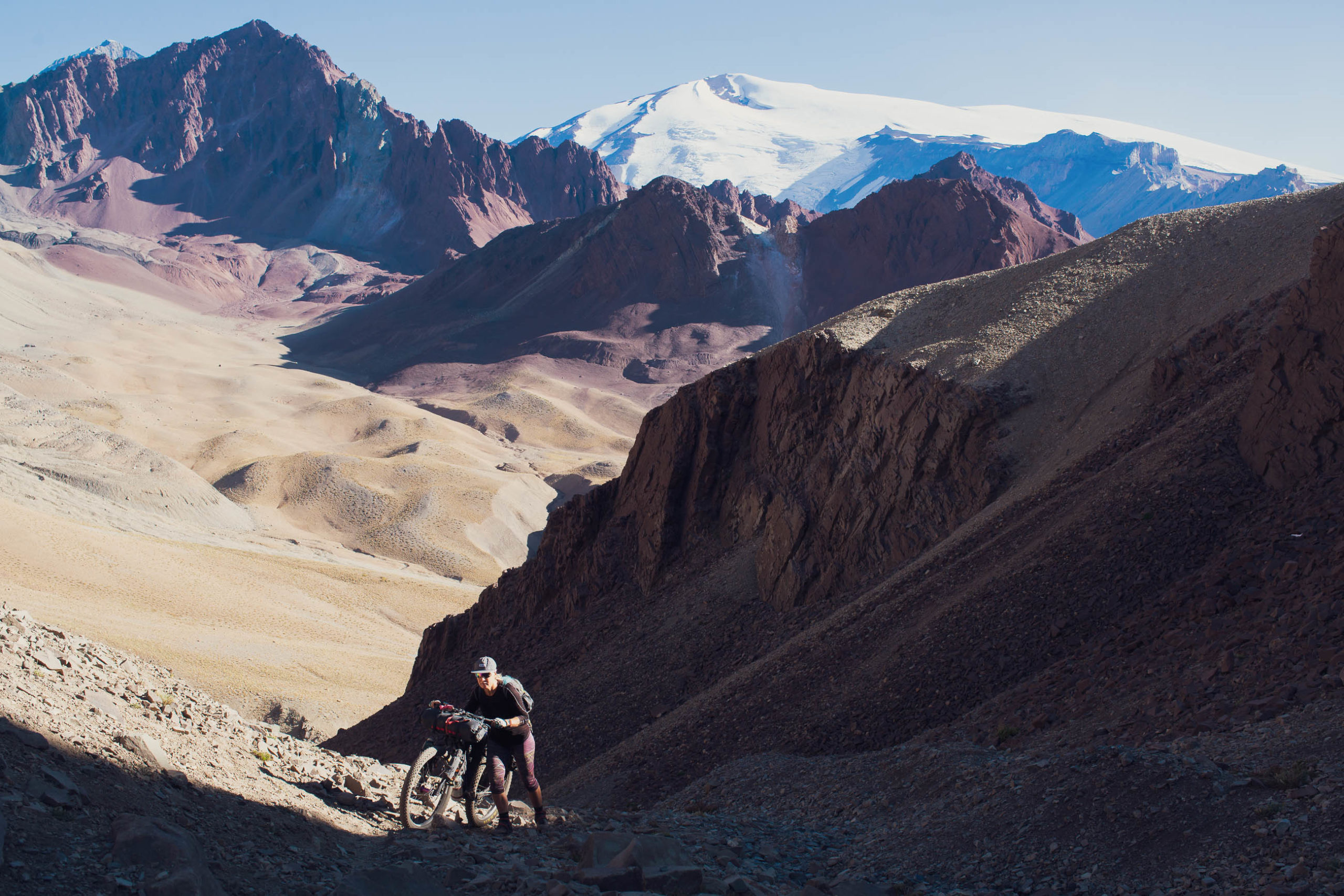
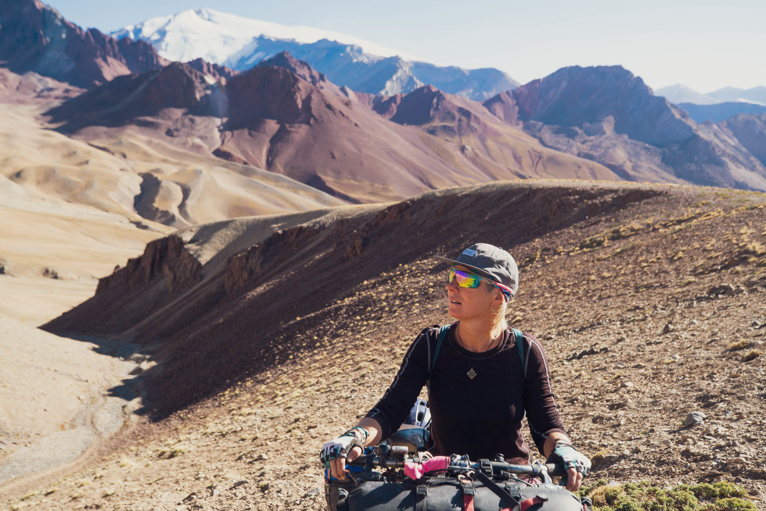
With the river behind you, the route begins a long and gradual singletrack climb to the Portillo de Piuquenes. Between the Tunuyan and roughly 3170m the route is mostly rideable and very pleasant at times as it passes beneath dramatic rock formations. After 3170m the travel is on/off riding and pushing but most people will be pushing a lot and sometimes for sustained sections as you approach the pass. It is only really steep in a couple of spots.
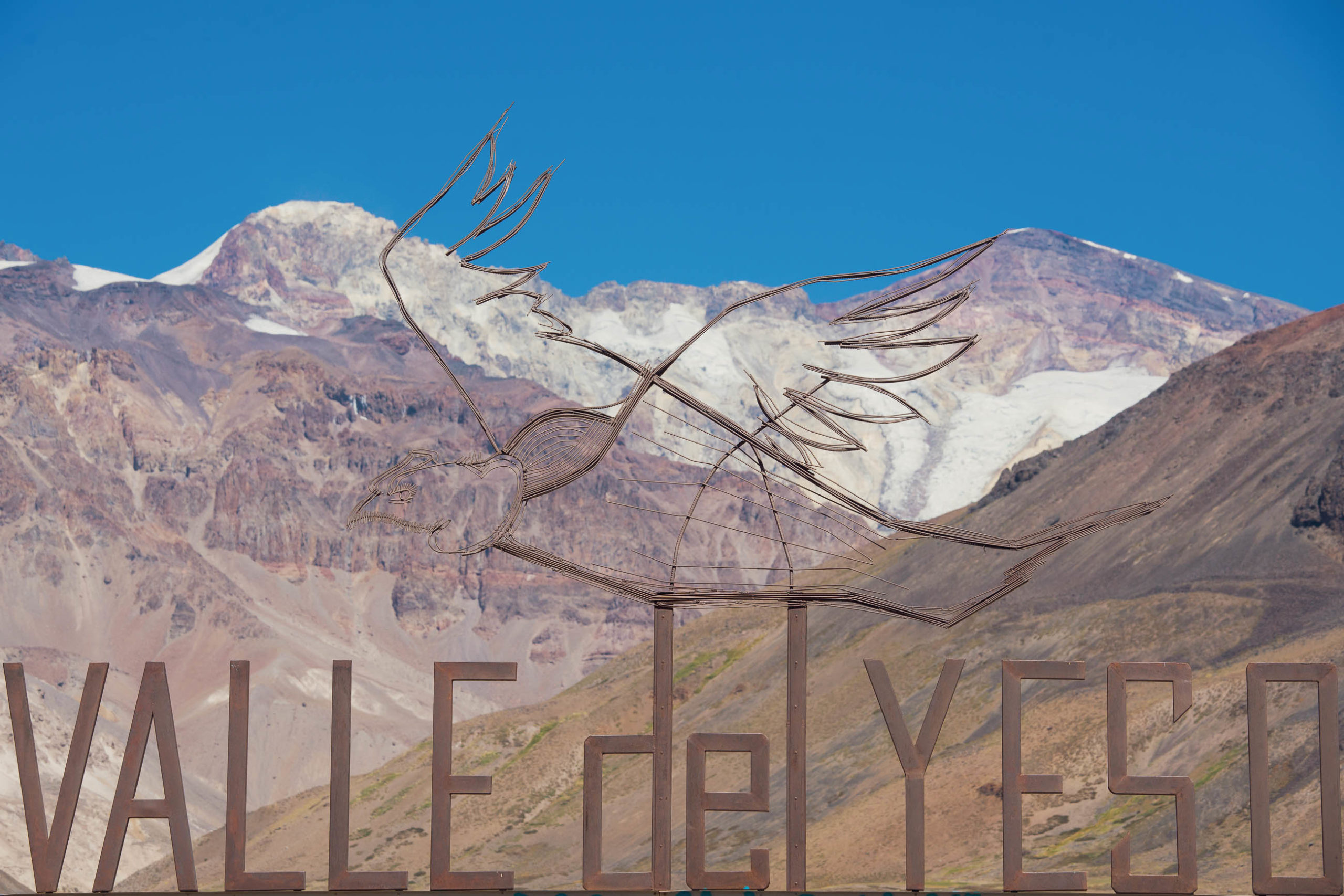
As you gain the pass the views really open up with mountains in all directions, some of them over 6000 metres. Soak it all in and take a few deep breaths before you begin the epic shred down into the Rio Yeso catchment. What a way to arrive in a new country! The descent is steep on occasion but the fine scree and well worn horse path make it entirely rideable for confident riders.
There’s a river crossing, free hot pools, informal camping and a gravel road at the bottom of the descent. The river is smaller than the Tunuyan and is not usually a problem, but because you’re most likely to arrive there in the afternoon when the flow is up, take time to assess it. It is sometimes difficult or impossible to cross until flow subsides.
It’s a straightforward ride on gravel at first and then pavement down to San Gabriel where there’s paid camping, swimming, food and supplies and the Chilean carabineros, who you must check in with so the PDI can stamp your passport. From here the route continues on pavement to Santiago.
Additional Resources
- Highlux Photography blog: highlux.co.nz
- Cerros de Mendoza route: Route Guide
- The Ride South: Bikepacking To Argentina
- Nathan North: hnathannorth.wordpress.com
- Monteadentro (in Spanish): monteadentro.cc
- Link to PDI Chile for immigration: pdichile.cl


Terms of Use: As with each bikepacking route guide published on BIKEPACKING.com, should you choose to cycle this route, do so at your own risk. Prior to setting out check current local weather, conditions, and land/road closures. While riding, obey all public and private land use restrictions and rules, carry proper safety and navigational equipment, and of course, follow the #leavenotrace guidelines. The information found herein is simply a planning resource to be used as a point of inspiration in conjunction with your own due-diligence. In spite of the fact that this route, associated GPS track (GPX and maps), and all route guidelines were prepared under diligent research by the specified contributor and/or contributors, the accuracy of such and judgement of the author is not guaranteed. BIKEPACKING.com LLC, its partners, associates, and contributors are in no way liable for personal injury, damage to personal property, or any other such situation that might happen to individual riders cycling or following this route.
Please keep the conversation civil, constructive, and inclusive, or your comment will be removed.