


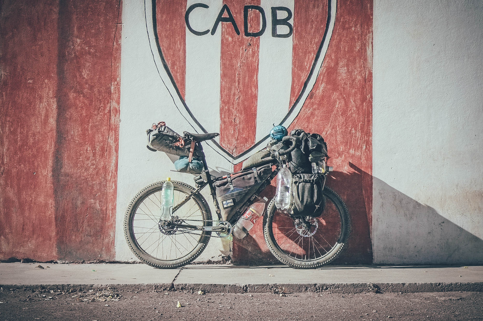
Cerros de Mendoza, Argentina
Distance
130 Mi.
(209 KM)Days
5
% Unpaved
100%
% Singletrack
5%
% Rideable (time)
95%
Total Ascent
13,268'
(4,044 M)High Point
10,760'
(3,280 M)Difficulty (1-10)
8?
- 7Climbing Scale Strenuous102 FT/MI (19 M/KM)
- -Technical Difficulty
- -Physical Demand
- -Resupply & Logistics
Contributed By
Taneli Roininen
Gone Bikefishing
Cerros de Mendoza is a 211km and 5-day remote feeling desert route connecting Mendoza and Barreal on the edge of the wine capital of Latin America. It is a gateway into or out of the city over the dry mountains, or part of a 3-4 day loop if combined with a visit to the hot springs of Termas de Villavicencio – taking a partly paved road back to the city.
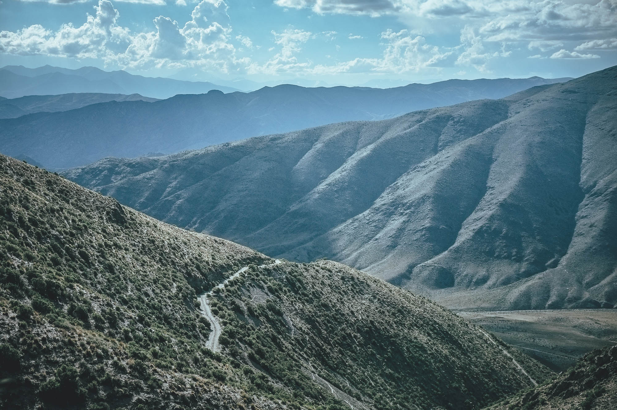
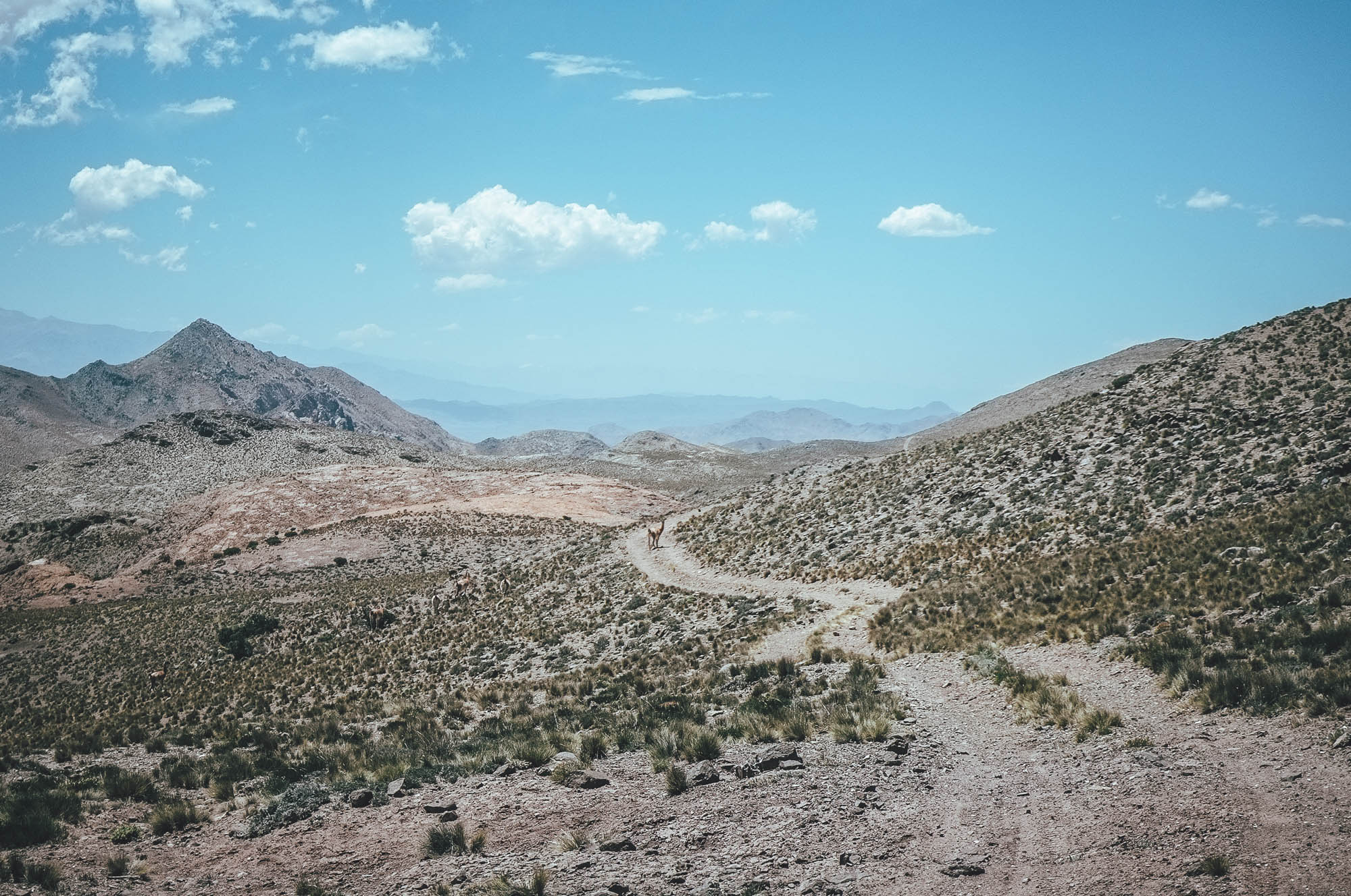
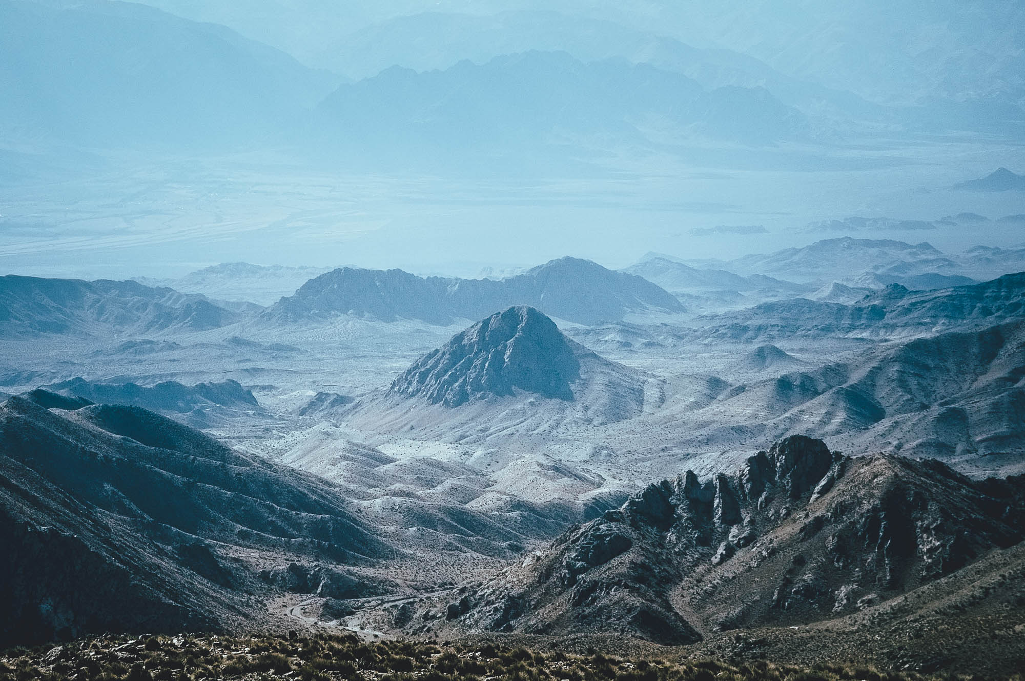
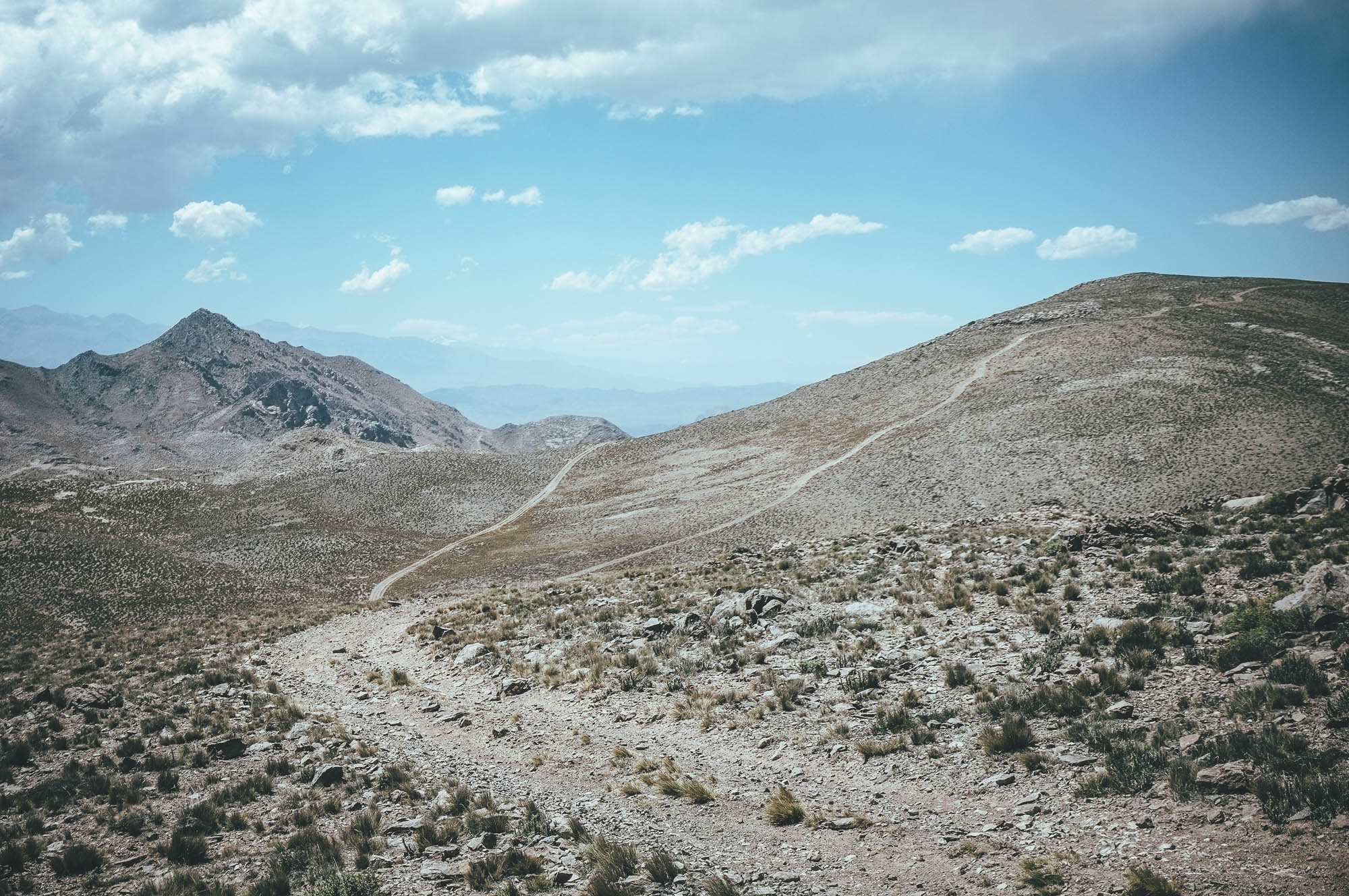
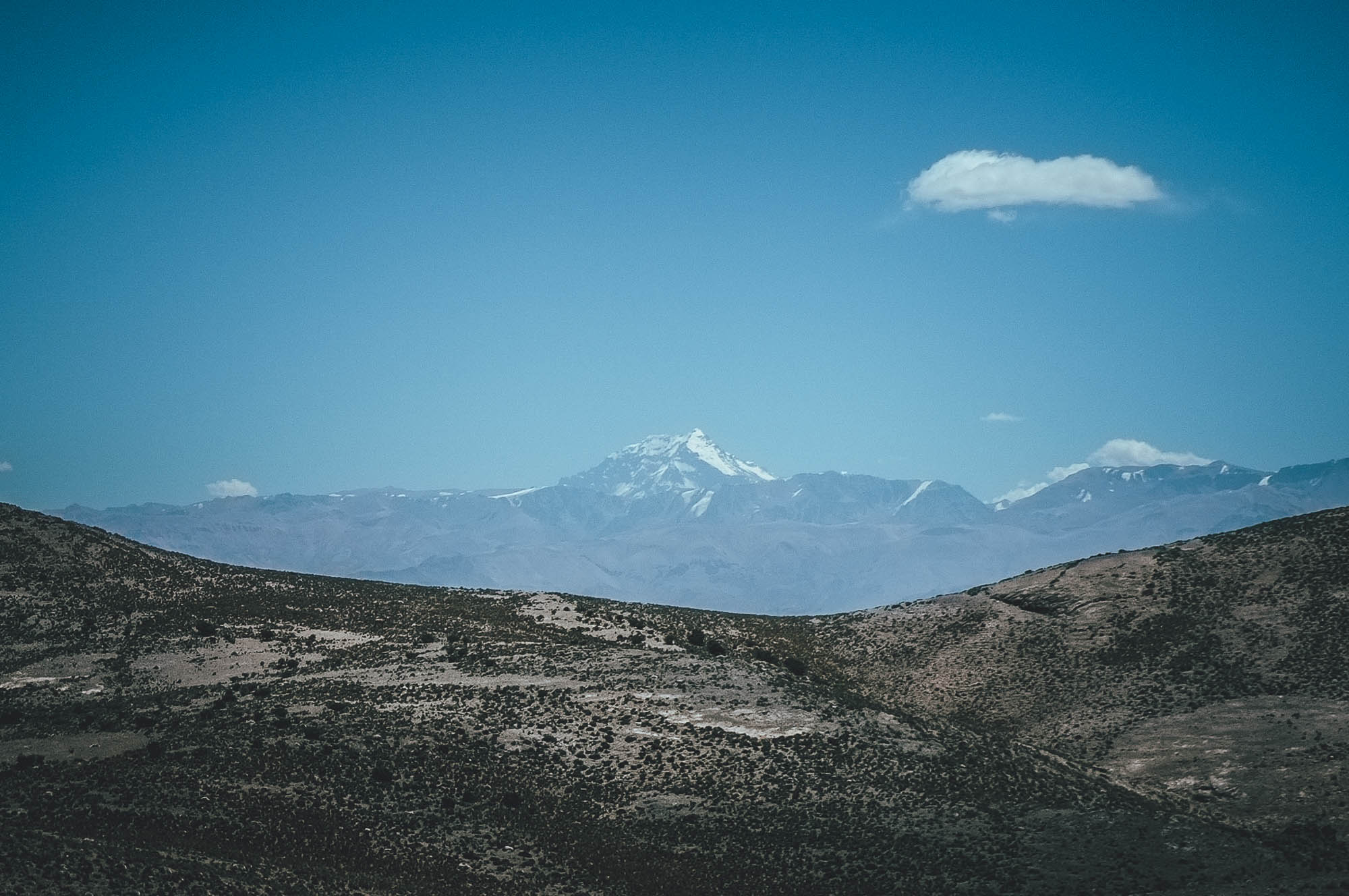
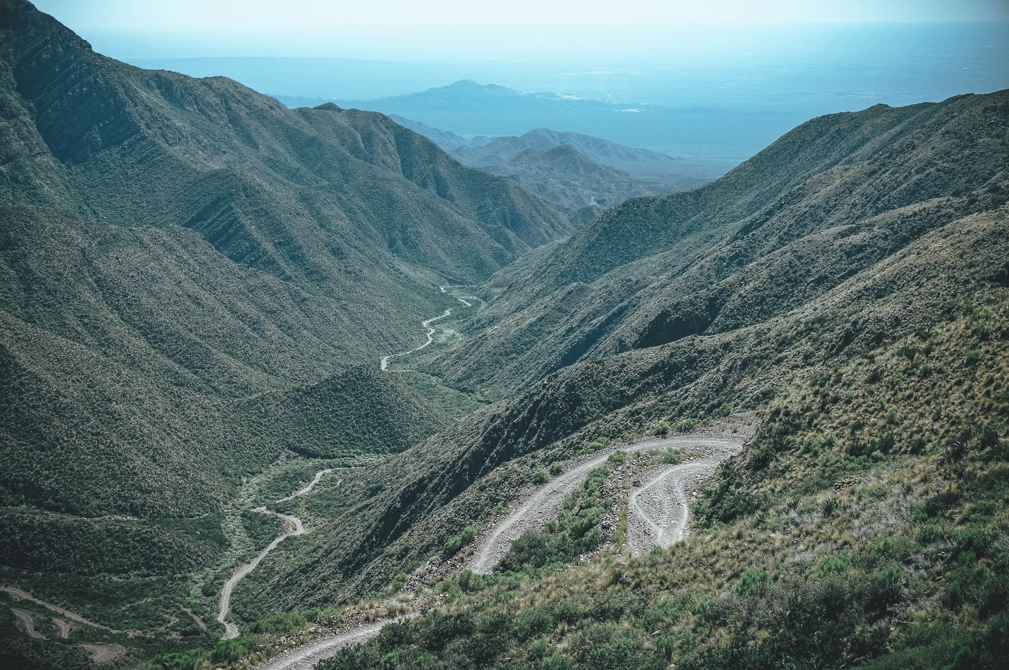
Hot summer temperatures, burning sun, and occasionally sandy or rocky riding surfaces make this ride demanding, despite the highest point of the route being only 3280m. Especially if you ride the route south to north in the summer, the 2400m climb out of Mendoza is one of the hardest anywhere. As a reward, enjoy solitary desert riding between dry giants… with views east to the Mount Aconcagua, the highest mountain in South America, and west to the vast Argentinian steppe, 2000m lower. If you are heading north toward the Ruta de Los Seis Miles, this route gives you a hint of what the Puna region has to offer.
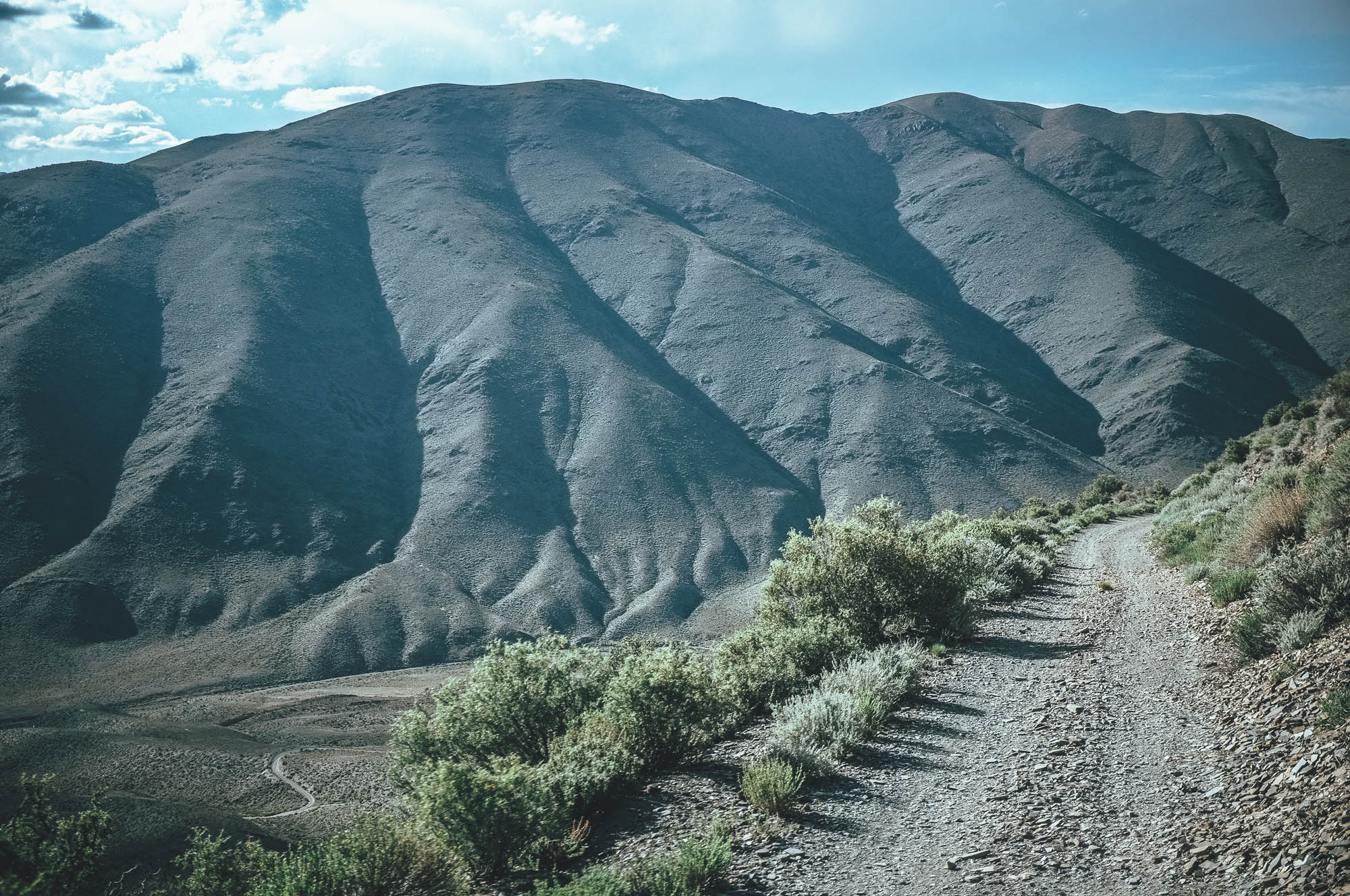
The central Cordillera de Los Andes stops most of the humidity of the Pacific crossing to Argentina, making the eastern side of the mountain range mostly dry and arid. The climate makes producing wines favourable; today Mendoza is the biggest wine-producing region in Latin America and the fifth-biggest in the world. The combination of the climate and location at the foothills of the Andes creates a landscape more familiar to those of the northern Himalayas. If you were fascinated by the scenery in the movie of The Seven Years in Tibet, head to the hills of Mendoza, because the movie was filmed there.
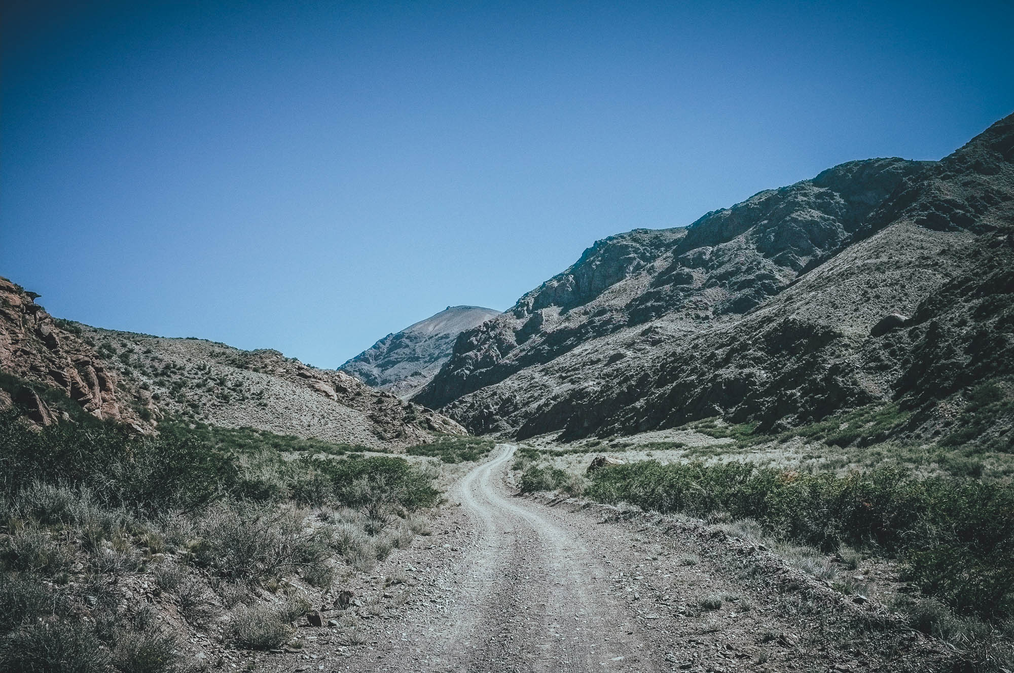
Riding wise, the Cerros de Mendoza continues the series of dry Central Andean desert routes of the Ruta de Los Seis Miles, Sur and the Ruta de Los Seis Miles, Norte, though in a friendlier form. There is no need to haul multiple weeks of food and multiple days of water – you get away with 5 days of food and just one day’s drinking water. Also, you are a maximum of two days ride away from a famous Argentinian asado and a glass of world-class red wine, if it comes down to it!
Still, Cerros de Mendoza will give you a taste of true remoteness, via some barely rideable double tracks across arid landscapes, offset by idyllic camping beside small, oasis-like freshwater sources. In true desert mountain desert style, you’ll learn to savour every shadow, wind cover and drop of the liquid of life, especially if tackled in the summer…
For a more detailed route description, see Trail Notes below…
Difficulty
Riding direction and time of the year define the difficulty of this route. Between November and March (summer), day time temperatures can sore up to 40 Celcius at low altitude, more than doubling your daily water carrying needs. Combine this with partly soft and steep 2,400 meter climb out of Mendoza, and you have a recipe for possibly the hardest climb of your life; it’s best tackled early morning or at night. In contrast, if you are riding the route from north, and outside the hot summer months, it will be fairly easy and progress should be fast, especially if have big tires to help you float over the long sandy sections. Considering all above, expect the difficulty of the route to lean towards a 7 if ridden from north to south in the fall, spring or winter, with a minimum of 2.8 inch tires. Or closer to a 9+ if tackled from south to north in mid-summer, with 2.4 inch tires.


Submit Route Alert
As the leading creator and publisher of bikepacking routes, BIKEPACKING.com endeavors to maintain, improve, and advocate for our growing network of bikepacking routes all over the world. As such, our editorial team, route creators, and Route Stewards serve as mediators for route improvements and opportunities for connectivity, conservation, and community growth around these routes. To facilitate these efforts, we rely on our Bikepacking Collective and the greater bikepacking community to call attention to critical issues and opportunities that are discovered while riding these routes. If you have a vital issue or opportunity regarding this route that pertains to one of the subjects below, please let us know:
Highlights
Must Know
Camping
Food/H2O
Trail Notes
Resources
- Solitary mountain desert riding starting from (or ending at) the edge of the wine capital of Latin America
- Unforgettable challenging 2400m uphill out of / downhill into Mendoza
- Riding on the hilltops with views to the higher Los Andes, Mt. Aconcagua and the vast Argentinian lowlands
- Camping by the rare oasis-like fresh water sources in the region
- The difficulty of the route depends on the time of the year and riding direction. It is far easier outside the hot summer months from November to March and if ridden from north to south, avoiding the extremely challenging 2400m climb out of Mendoza. Still, the route can be ridden from both directions and full year round.
- Tire size of 2.4 inches in minimum is recommended, but it is a little faster and comfortable to ride with 2.8-3.0 inch tires.
- Total hike-a-biking is depends on your tire size, expect up to half a day in total with 2.4 inch mountain bike tires. Though there are a couple of extremely steep short climbs, which require you to push your bike anyway, whatever rubber you are rolling on.
- There are some thorny plants in the hills, so riding tubeless is highly recommended.
- There are zero services on the route, so you need to carry everything you need for 5 days.
- There is no phone signal up in the mountains and the route has nearly no traffic at all.
- Going as light as possible is recommended to maximize the floatation in soft section and make the few demanding climbs/ hike-a-bikes easier.
- Mendoza is one of the most dangerous cities in Argentina, avoid moving outdoors after dark and consult with your hospedaje in town for the safest route to the start of the route on the edge of city.
- You can make a fantastic 3-4 day loop by combining the southern part of the route with a visit to the Termas de Villavicencio and taking the Ruta 52 back to Mendoza.
- All the recommended camping spots are near a water source, though if you can carry water for the night, there are plenty of opportunities to camp.
- Some campsites have a good wind protection, some are more exposed. A tent that can handle moderate wind is necessary.
- In the northern resupply point of the route, Barreal, there are multiple sleeping options, starting from USD10, but the organised Municipal camping with its swimming pool is a good and affordable choice. Ice cold beer at the reception available as well.
- Full range of sleeping options available in Mendoza, prices starting from USD8 per person.
- In the summer, night time sleeping temperatures drop rarely below 5 celsius even on the highest parts of the route. In the mid winter though, the coldest nights at 3000m could reach -5 Celsius. Choose your sleeping system accordingly.
- Despite the cold temperatures at 3000m in the winter, it is usually dry and hence getting snow in the area is rare.
- You need to be able to carry at least one full riding days water, which can be up to 5 litres in the summer.
- To avoid the very long 74km day in the end/begin of the route close to Barreal, you should carry two days and one nights drinking water, minimum 10 littres recommended, or use the emergency water well treated half way to cut the distance for two riding days.
- If you are making a loop from Mendoza, you need to carry food for 3-4 days.
Below the trail notes from south to north, from Mendoza to Barreal. Ridden in the mid-summer during the warmest time of the year.
Day 1
Mendoza to the camp at 1700m (20 km, 900 vertical meters of climbing)
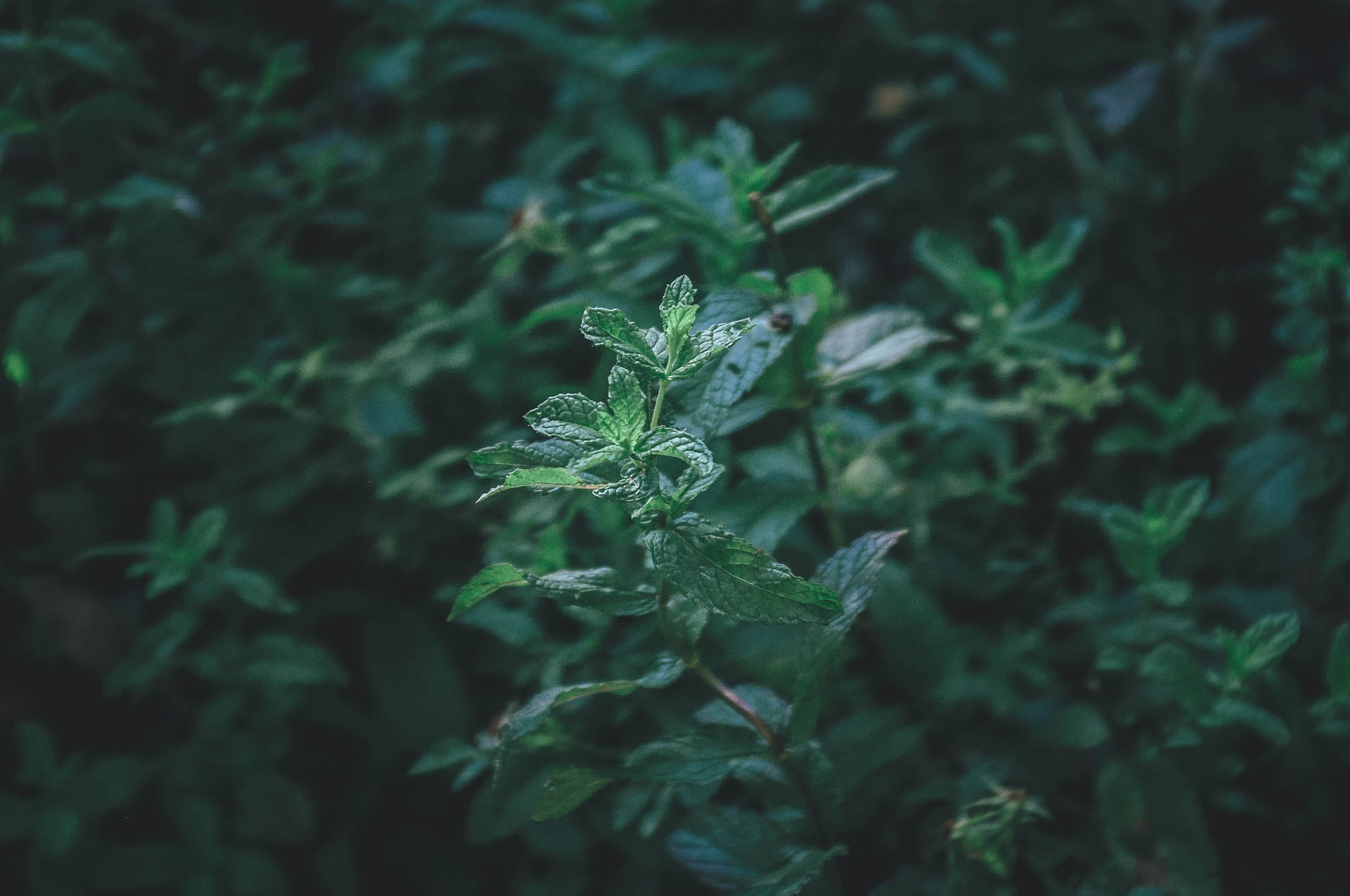
Rocky gravel road looks flat, but it is a steady continuous climb toward the start of the steeper part of the 2400m uphill, which continuous the second day as well. In the summer, when the temperatures can be up to 40 celsius, tackling the climb needs good planning ahead. The temperatures are the lowest during the early morning hours, so optimally the climb is attacked a couple of hours before sunrise, though riding out of Mendoza in the dark should be avoided for safety concerns. Therefore, the best tactic could be to start the route an hour after sunrise and climb until the soaring temperature forces you to call it a day and look for rescue in some of the rare shadows by a spring on the way up. Don’t underestimate how much you will consume water if riding during the warmer parts of the day. The day one is clearly the hardest along the whole route, you are a winner if you make it from a shadow to another, manage to stay hydrated and can avoid a heat stroke. 20km is a good day in the summer. Note, that there is plenty of wild mint by the springs, to flavour your brew.
Day 2
From the mid-climb to the Laguna de Cangrejos (35km, 1400 vertical meters of climbing)
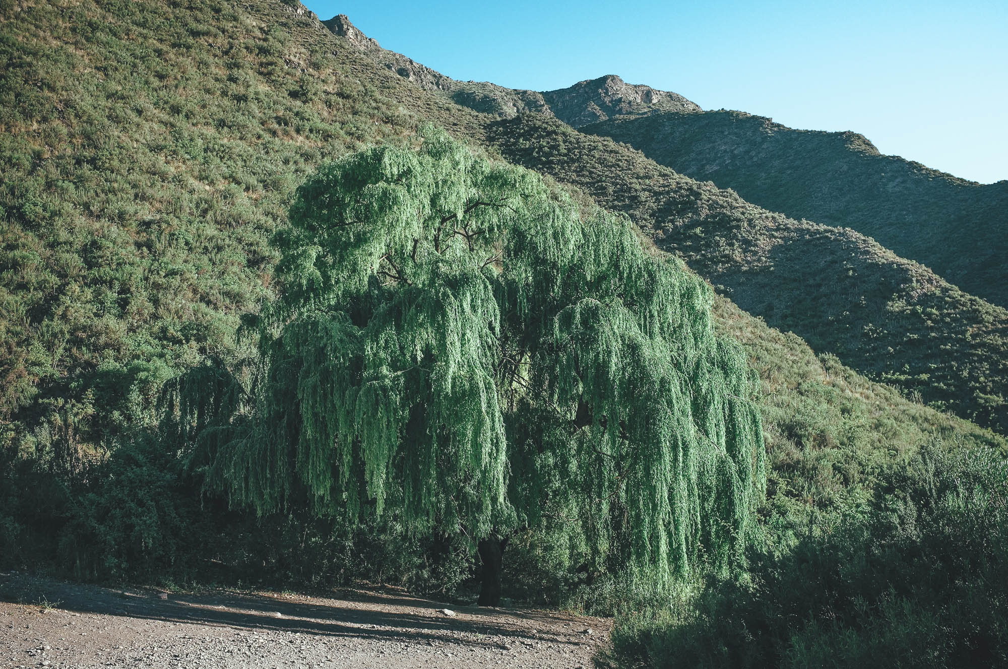
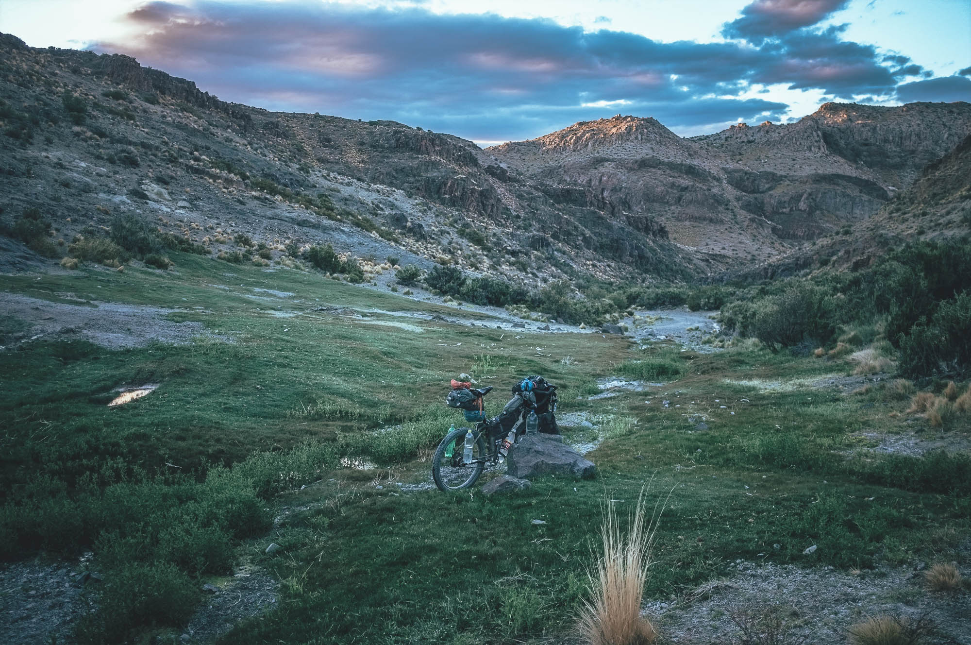
Temperatures get more tolerable hour by hour, when you get toward the 3107m pass. 12km and 850m downhill is great fun in the soft sand of the valley floor and the views to the surrounding hills and higher Andes reward the long climb as well. Laguna de Cangrejos at 2470m has a comfortable nighttime temperatures even in the midsummer and great quality freshwater. Big trees give you shadow in the morning, unless you decide to camp on a nice green patch 100m south of the pond. There are interesting little crabs living in the spring water pond, as the name suggests. There is a farm nearby, so on this short stretch of road a couple of cars or horses might pass your camp in the morning.
Day 3
Laguna de Cangrejos to the Tourist office of Minas de Paramillo (38km, 1130 vertical meters of climbing)
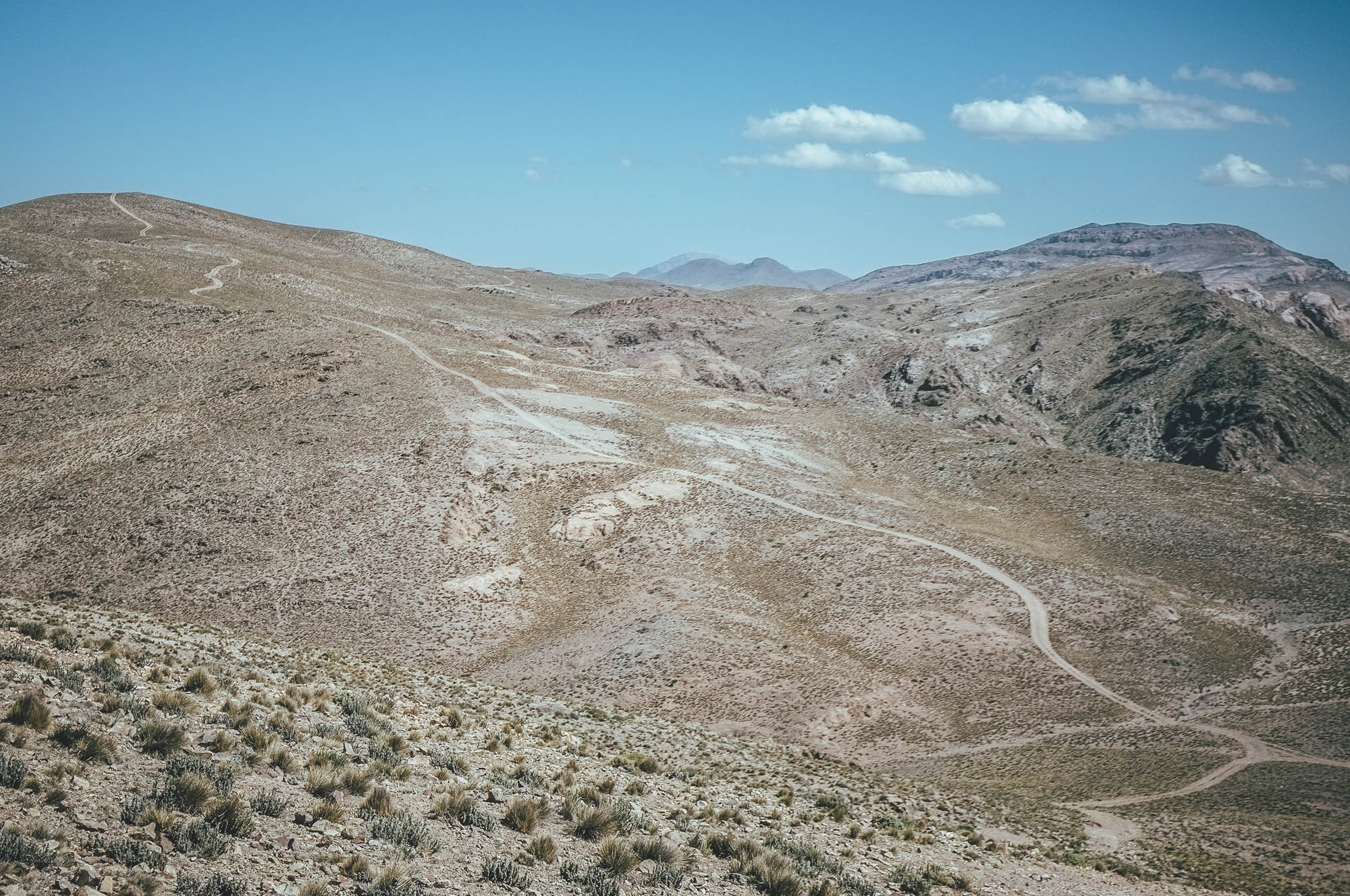
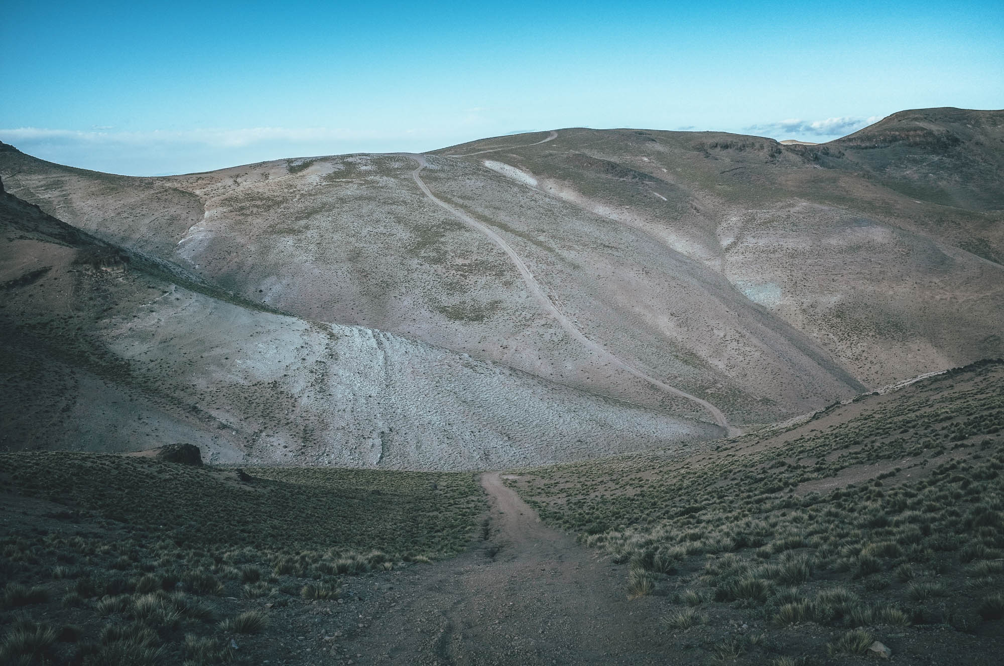
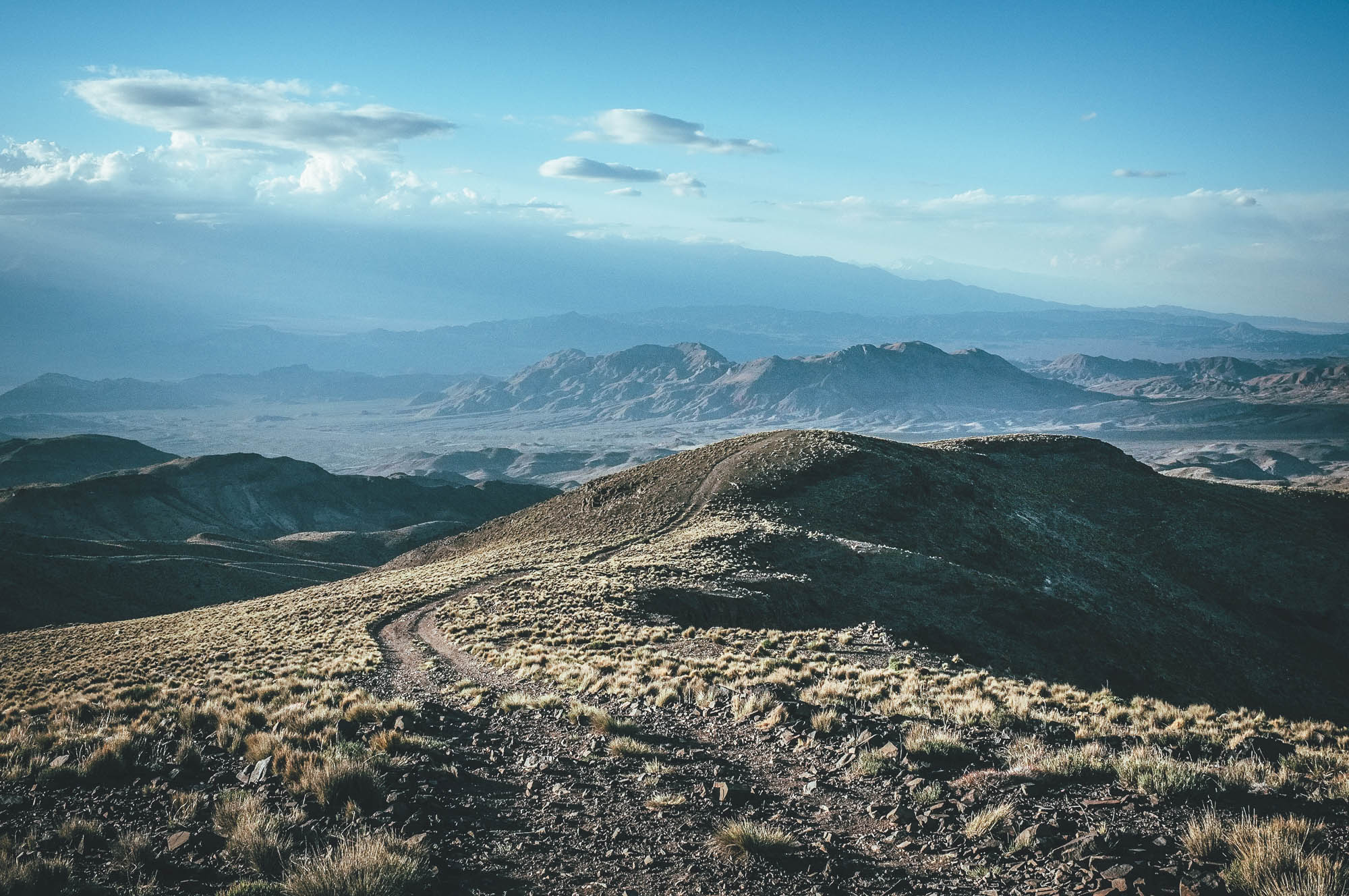
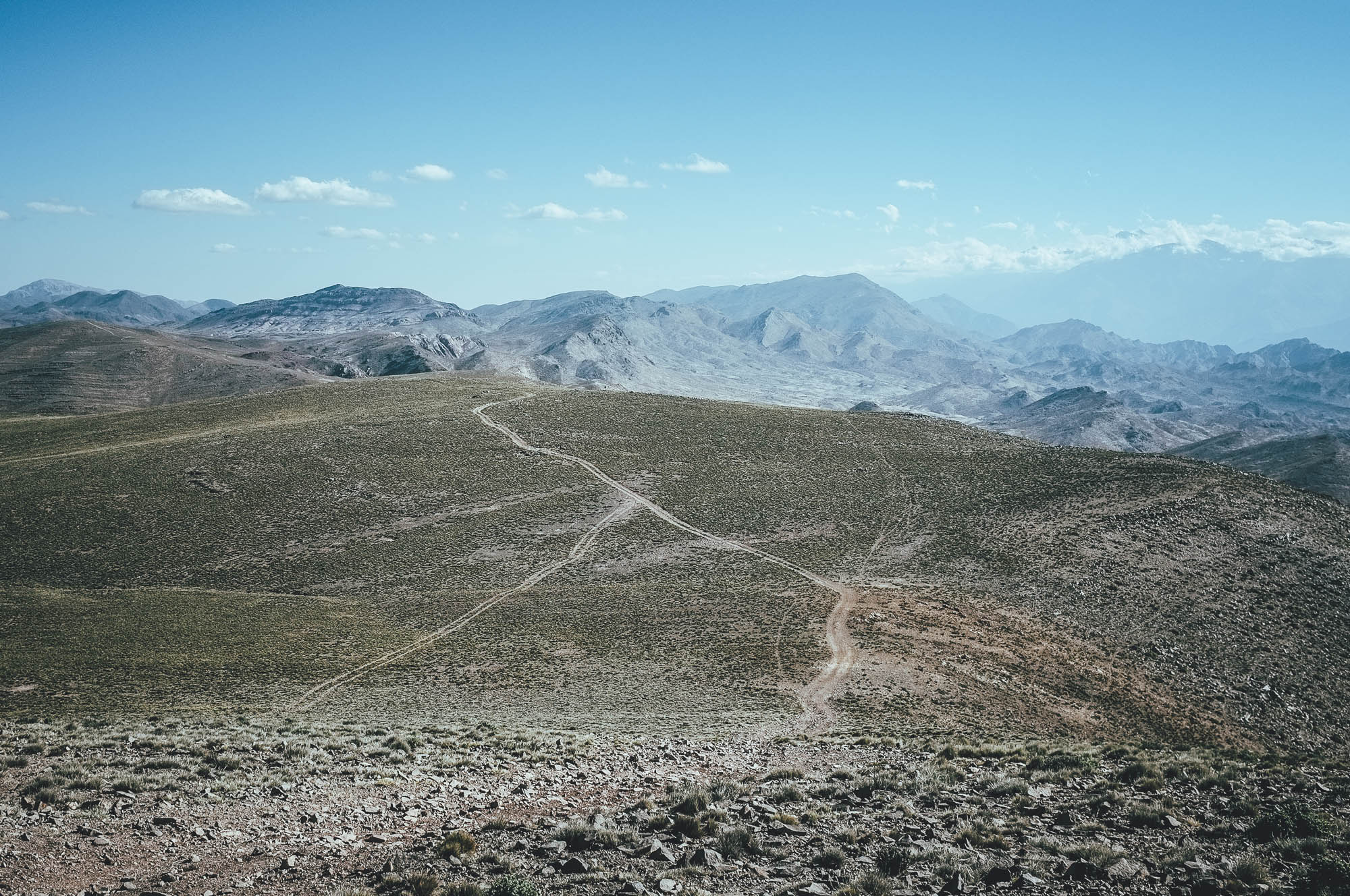
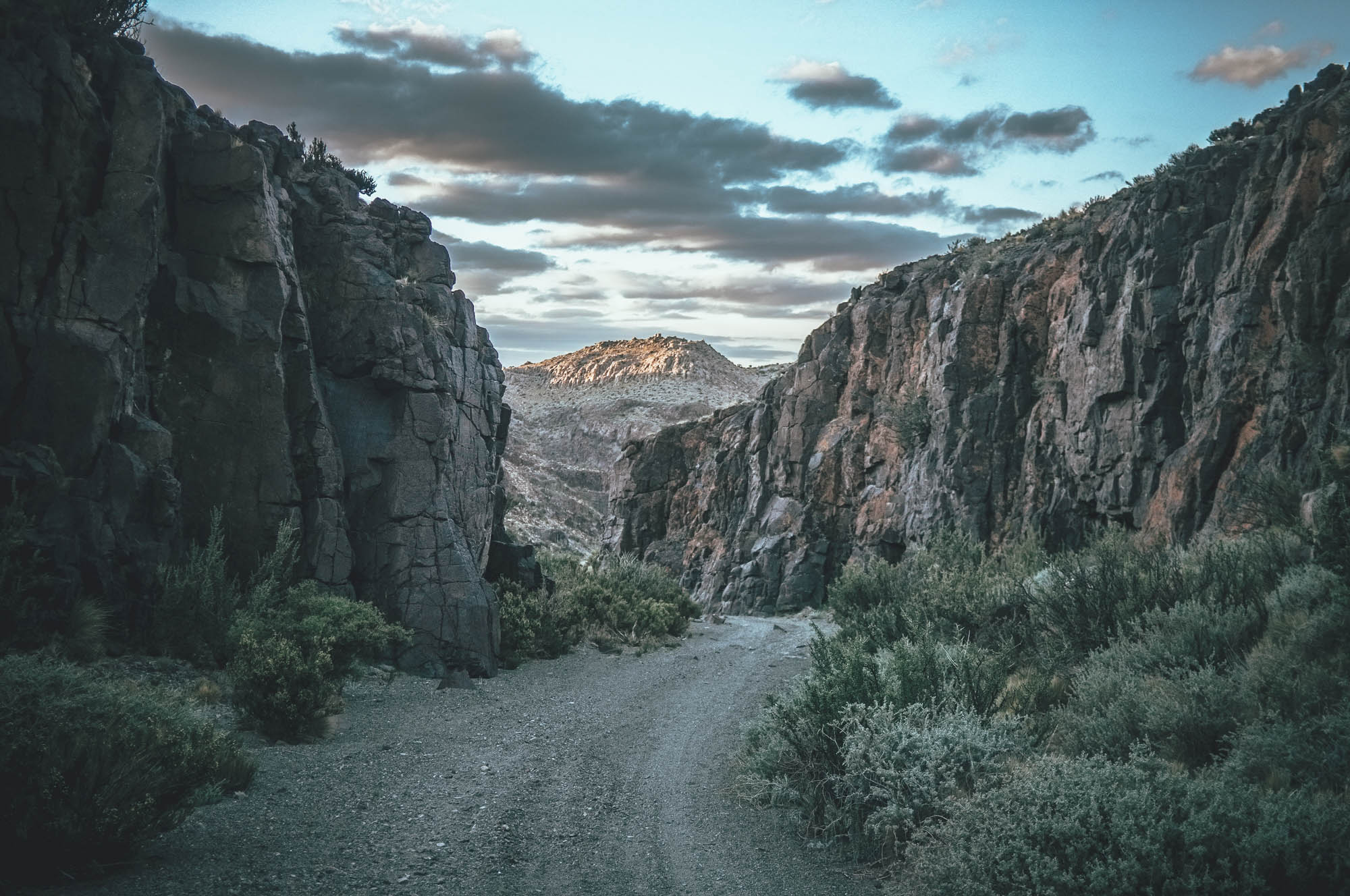
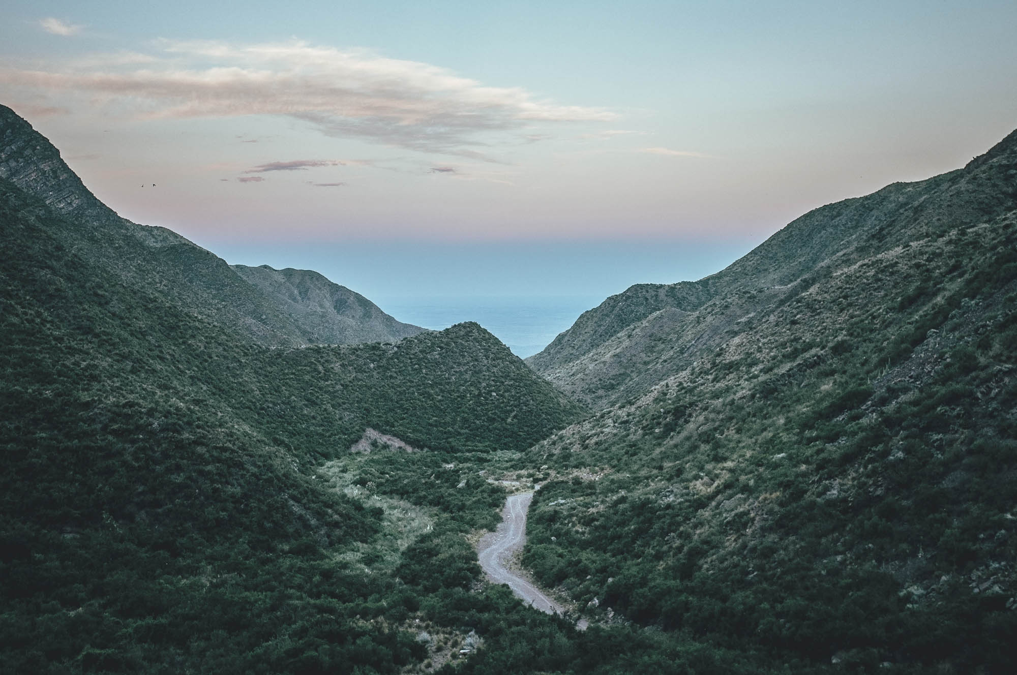
The route continues on a peaceful gravel road to the lands of Reserca Villa Vicencio and toward a small plateau at 3000m before climbing to a soft shaped ridge with views west to the high Andes and the dry valley before it, and occasionally to the east all the way down to the Argentinian lowlands. Before the hilltops the mostly hard gravel road is an easy ride. On the soft ridge through the double track is sometimes rocky and there are many short, but incredibly steep climbs and downhills that might force you to push your bike. Mount Aconcagua rises high over the other peaks around it on your left. Occasional vicunas spot the summits of the surrounding hills and with some luck you might see a condor as well, especially on a windier day. The temperature on the windy ridge can be 25 Celsius lower than in Mendoza and despite the blazing sun extra layers are likely to be needed. After the two 3280m passes, separated by ridiculously steep, but short uphill and downhill, a 7km downhill on soft surface in a small reddish canyon start to the Tourist Office of Minas de Paramillo. The worker in the tourist office is likely to let you camp under some trees next to the office and you get tasty spring water from the toilet tap.
If you are making a loop back to Mendoza, this is where you will continue east on Ruta 52. On the route back to the city, a bigger gravel road climbs firs back to 2960m, before a continuous 74km downhill, first on good gravel road then on pavement, takes you back to the world of wines. Termas de Villavicencio at 1800m 26km into the descent, helps you to wash off the dust of the previous days. Again, arrival to Mendoza at night is not advised due to safety concerns, so make sure you make the 80km day from the Tourist Office of Minas de Paramillo to the city before sunset, or ask permission to camp on the premises of the hot spring to cut the distance for two riding days.
Day 4
Tourist office of Minas de Paramillo to camp near the paved road (74km, 545m vertical meters of climbing)
If you can carry water for two days (10 litres in the summer), or if you are comfortable filtering water from a spring water used by animals, you can cut this day into two sections. Otherwise you need to suck it up and hit the pedals 74km all the way to the end of the route, where the last camp and a better quality freshwater source is located.
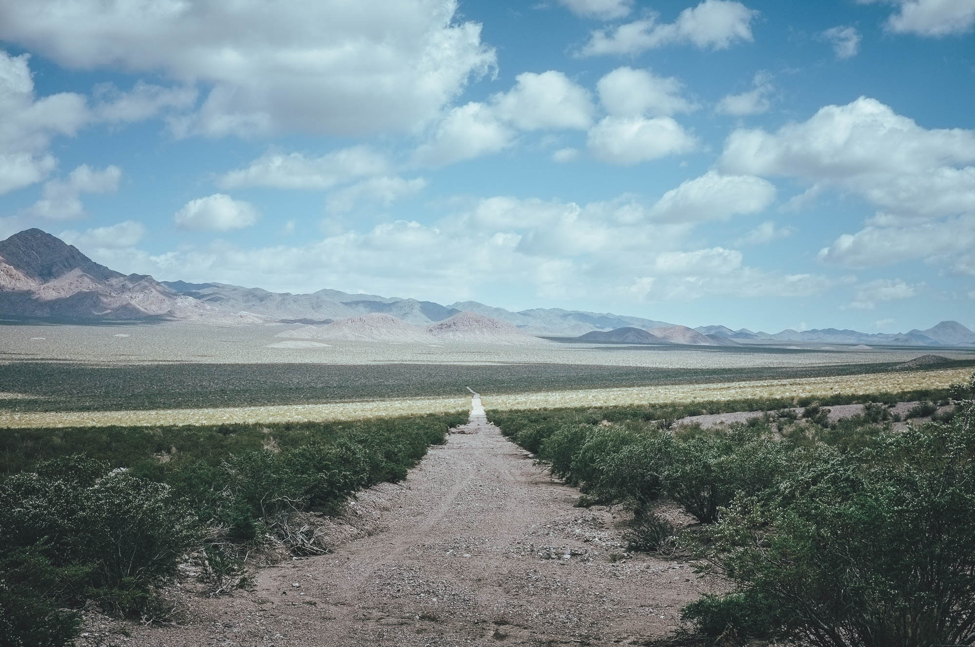
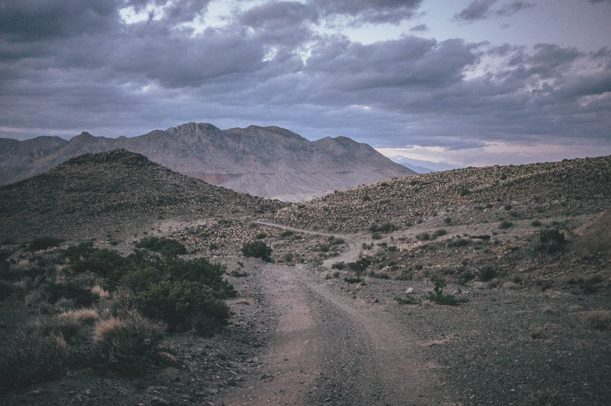
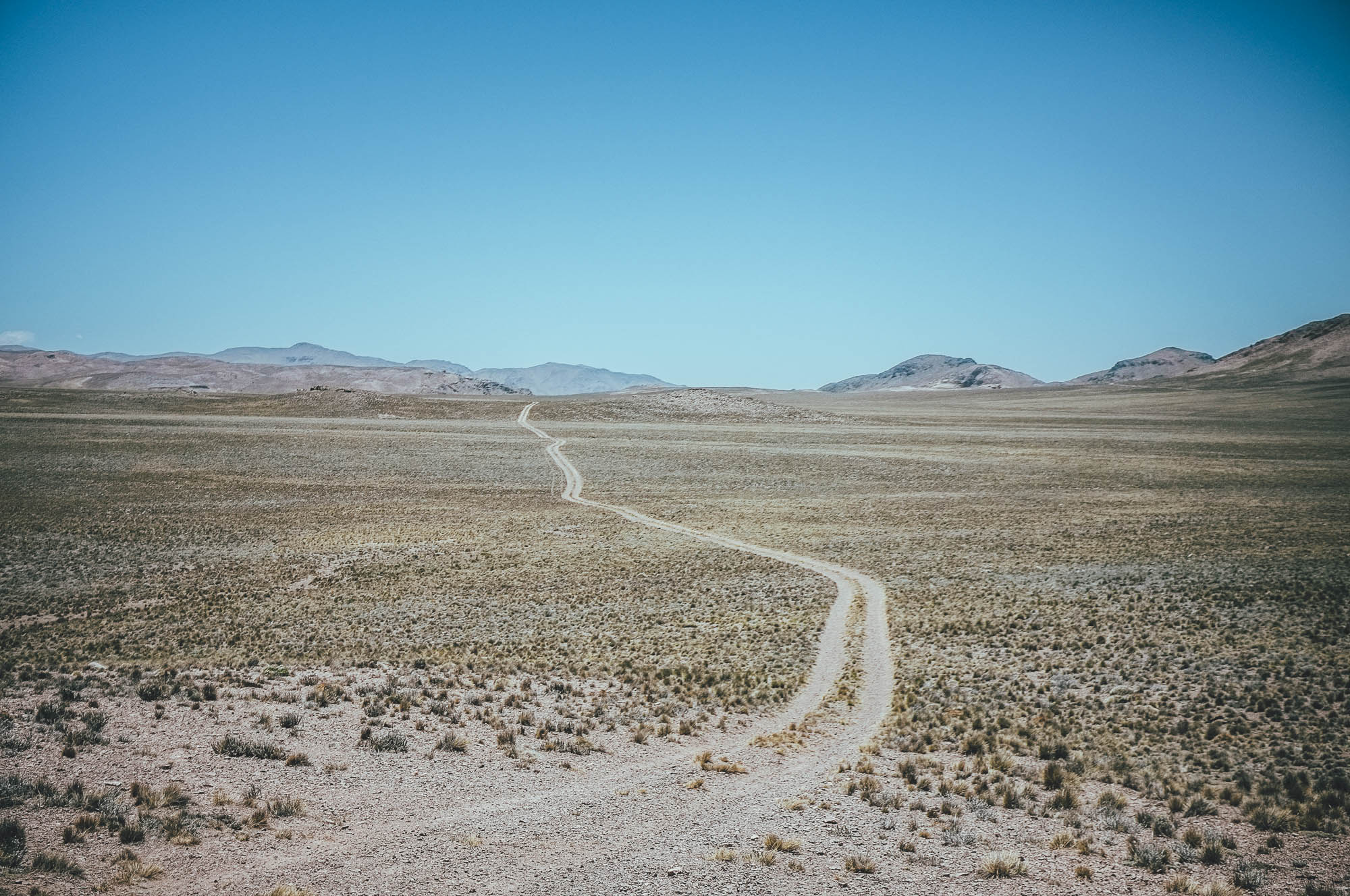
The day starts with an 8km downhill on more used gravel road to 2350m, from where a rarely used and therefore soft and sandy double track north starts in an open desertic valley. The soft 25km section is mostly rideable with 2.8 inch tires, but includes short sections of pushing as well, before joining a bigger and much faster gravel road for the last 27km to the next campsite and water source. The spring is the only one around, so vicunas and other animals visit the spot through the day and night. Therefore, again plenty of animal thesis around make finding a cleaner spring hard. The coordinates to a tiny, better quality creek, should be precise. The trees do not give much wind cover, but at least there is a little shadow from the morning sun.
Day 5
From the last camp to the village of Barreal on pavement (50km, no climbing at all)
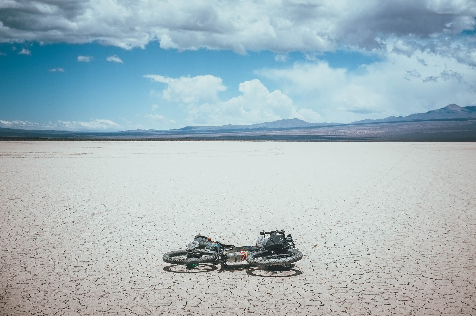
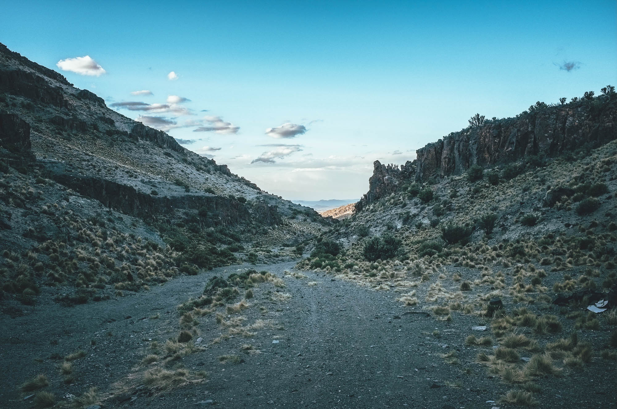
If you are lucky with the wind, you don’t need to pedal to reach Barreal 50km away. Halfway through the downhill stop to ask water from a Gendarmeria checkpoint, before riding across the northern part of the Salar de Leoncito, right next to the road. The small, but beautiful salar fills with water a couple times a year, even though the region does not get much rain annually at all. With some bad luck, the Salar is wet once you get here. Barreal is an oasis in the mountain desert with thick green trees and a Municipal camping with a swimming pool and cold beer. A couple of decent mercados and small restaurants guarantee a comfortable rest.
Additional information
- The route is a very attractive detour if you are heading to or coming from Chile via Uspallata. The riding time on Ruta 13 from Uspallata to the official route is 5-6 hours with a bit more than 1000m of climbing.
- Don’t miss riding across the small, but beautiful Salar de Leoncito, just off the road halfway up/down the paved section close to Barreal.
- There are multiple flights a day from Buenos Aires to Mendoza. There is a daily bus connection between Mendoza and Santiago as well.
Again since late 2017, there has been high volatility in the value of the Argentinian Peso. The value of the peso has decreased significantly, while simultaneously inflation has rocketed as well. In November 2018, it seems that Argentina is still cheaper to visit than for a very long time, but the situation seems to be unpredictable. Compare the Blue Market Exchange Rate (link: https://www.cotizacion-dolar.com.ar/dolar-blue.php) and the Official one (link: https://www.xe.com/currencyconverter/convert/?Amount=1&From=USD&To=ARS) to figure out if you are better off with flying in with bunch of cash, or just getting cash locally from ATM’s in the country. If the Blue market exchange shows much higher value than the official, then exchanging money locally (using the Blue Market exchange rate) gives you more Argentinian pesos.


Terms of Use: As with each bikepacking route guide published on BIKEPACKING.com, should you choose to cycle this route, do so at your own risk. Prior to setting out check current local weather, conditions, and land/road closures. While riding, obey all public and private land use restrictions and rules, carry proper safety and navigational equipment, and of course, follow the #leavenotrace guidelines. The information found herein is simply a planning resource to be used as a point of inspiration in conjunction with your own due-diligence. In spite of the fact that this route, associated GPS track (GPX and maps), and all route guidelines were prepared under diligent research by the specified contributor and/or contributors, the accuracy of such and judgement of the author is not guaranteed. BIKEPACKING.com LLC, its partners, associates, and contributors are in no way liable for personal injury, damage to personal property, or any other such situation that might happen to individual riders cycling or following this route.
Please keep the conversation civil, constructive, and inclusive, or your comment will be removed.