


Stone House Lands Loop
Distance
201 Mi.
(323 KM)Days
4-6
% Unpaved
95%
% Singletrack
5%
% Rideable (time)
99%
Total Ascent
14,572'
(4,442 M)High Point
7,205'
(2,196 M)Difficulty (1-10)
6.5?
- 5Climbing Scale Moderate72 FT/MI (14 M/KM)
- -Technical Difficulty
- -Physical Demand
- -Resupply & Logistics
Contributed By
Seth Kruckenberg
Guest Contributor
Raised in Wyoming, Seth has been exploring the landscapes of the West for the majority of his life. Riding throughout the Rocky Mountains from an early age, he gained an appreciation for public lands, outdoor recreation, and geology. Now based in MA, Seth is a geologist, educator, and general cycling enthusiast who posts on Instagram as @tipsyrider.
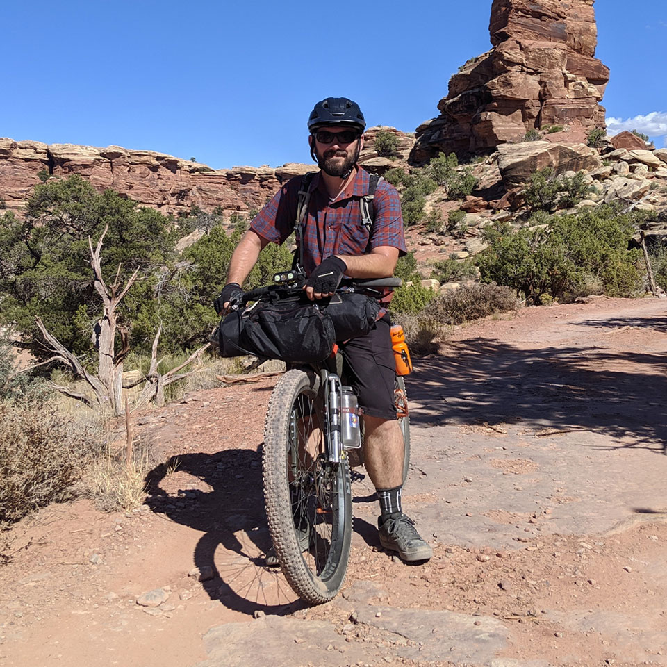
Contributed by Seth Kruckenberg (@tipsyrider). Route designed, scouted, and photographed by Seth Kruckenberg, Patrick Hendry, and Neil and Lindsay Beltchenko.
Just a short drive west of Green River, Utah, on Interstate 70, away from the popular national parks and world-class mountain bike trails surrounding nearby Moab, UT, and Fruita, CO, that are frequented by tourists, mountain bikers, and adventure cyclists alike, is a lesser-known paradise for bikepackers: the San Rafael Swell. Situated within the Colorado Plateau, the San Rafael Swell is a giant geological dome over 40 miles wide and 75 miles long that rises some 1,500 feet above the surrounding landscape. It is a remote, high desert region formed by the faulting, folding, uplift, and erosion of sedimentary layers that began over 60 million years ago during the Laramide orogeny – the mountain-building event responsible for the formation of many of the ranges and intervening basins that characterize the landscapes of the Rocky Mountain West.
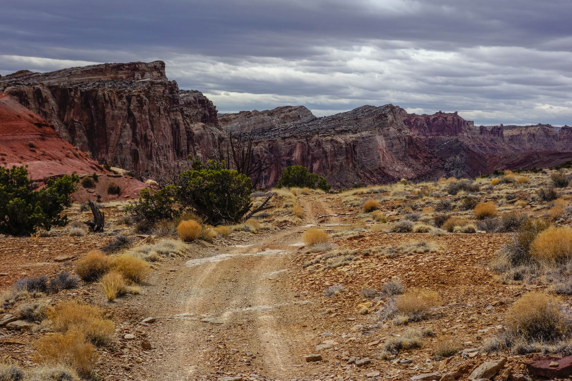
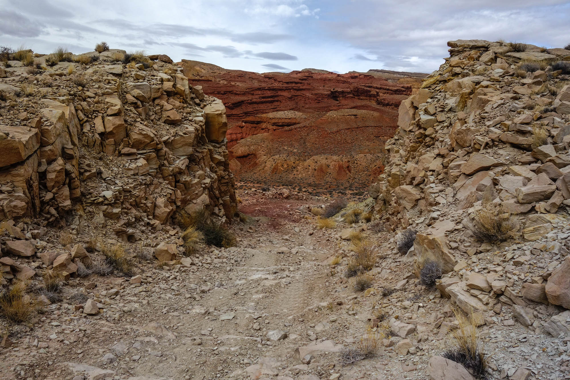
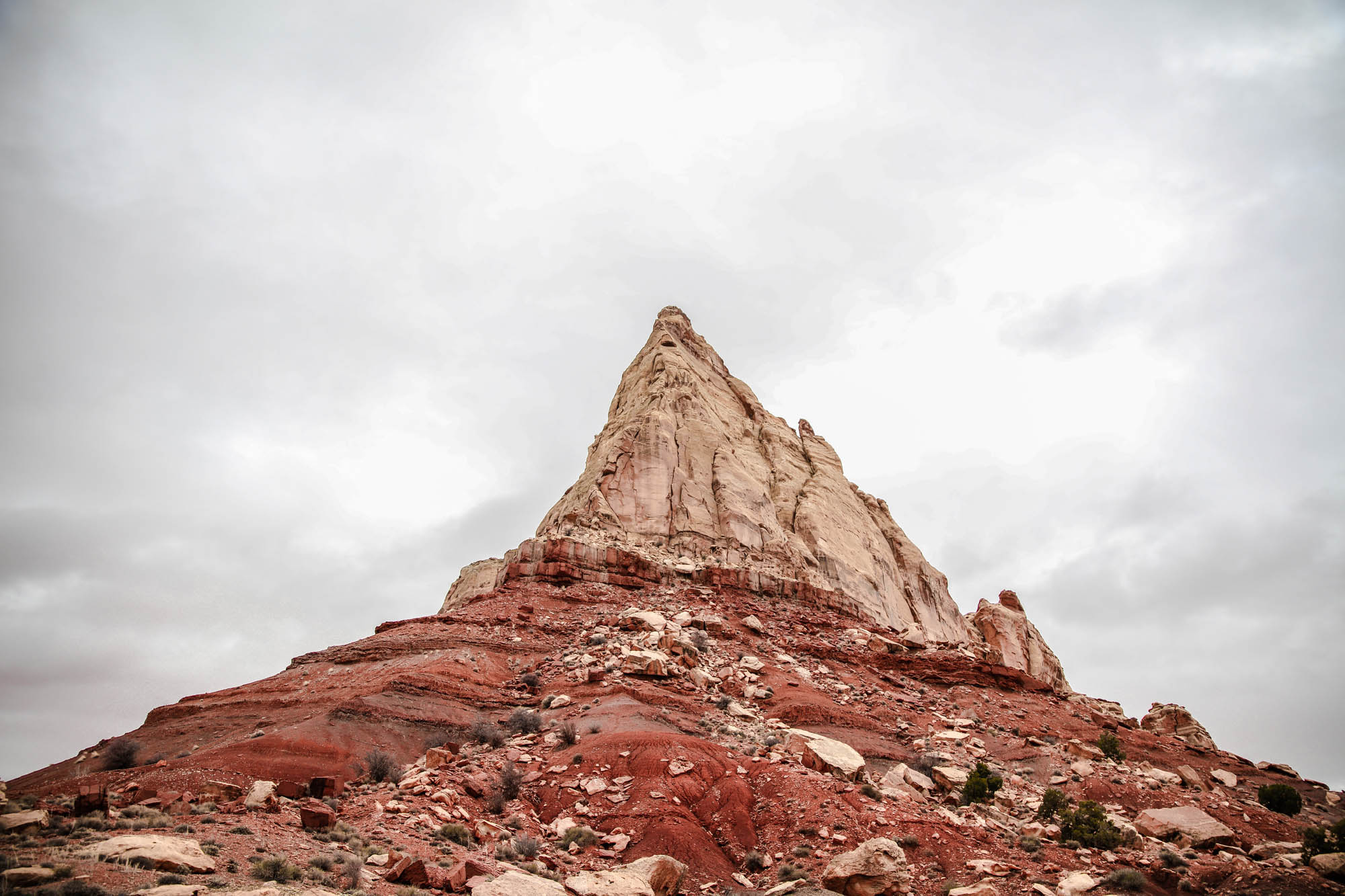
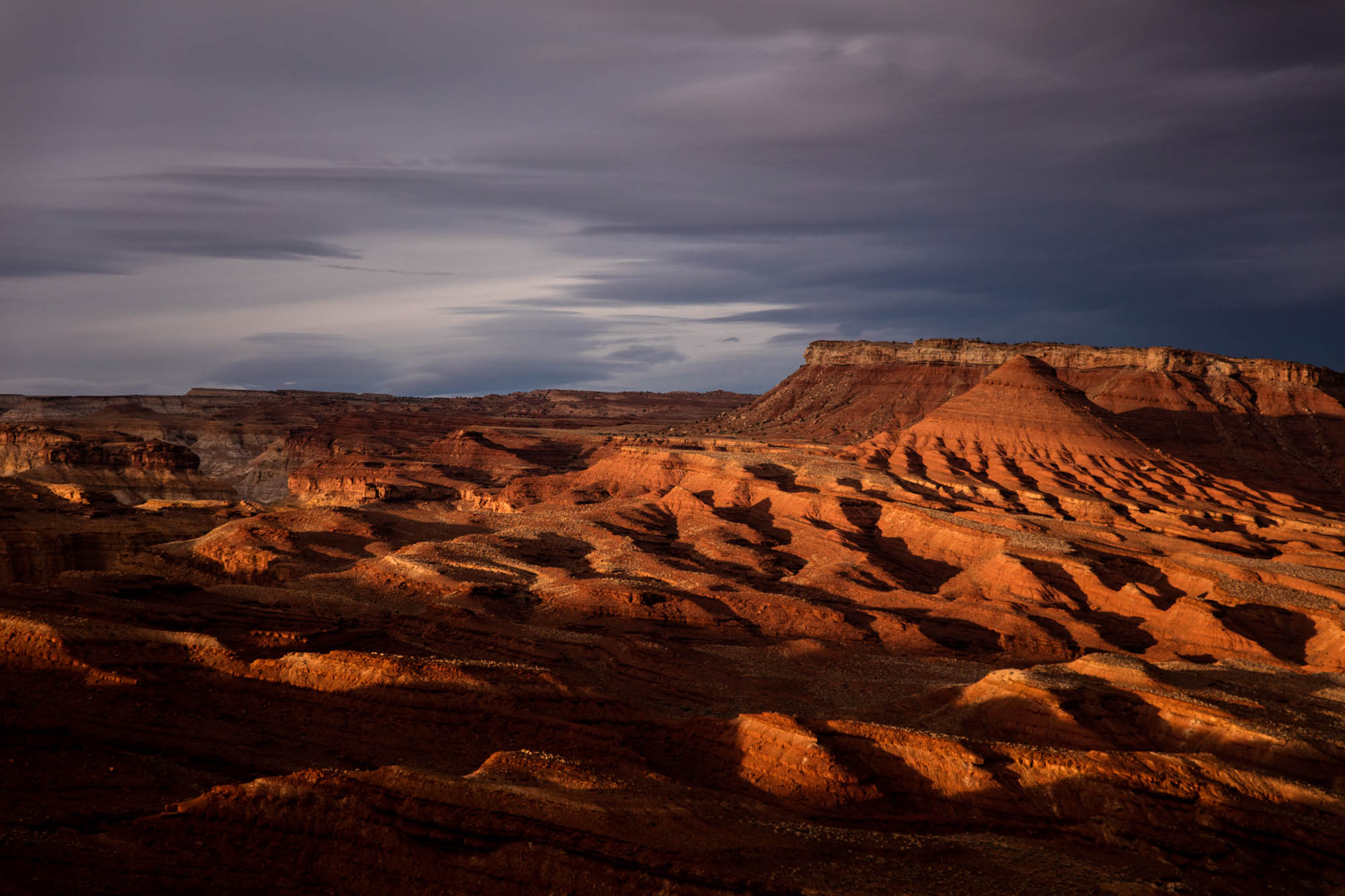
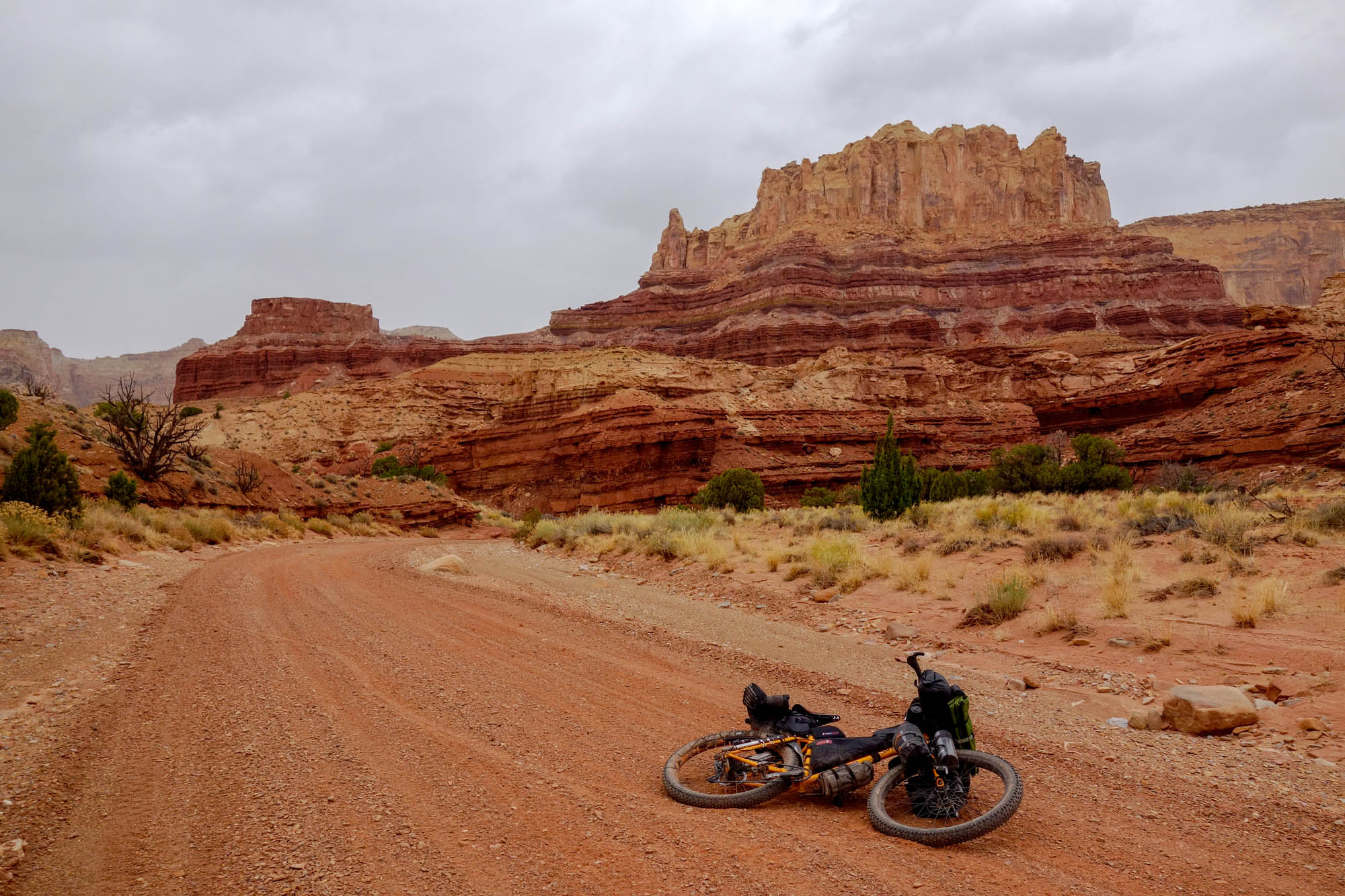
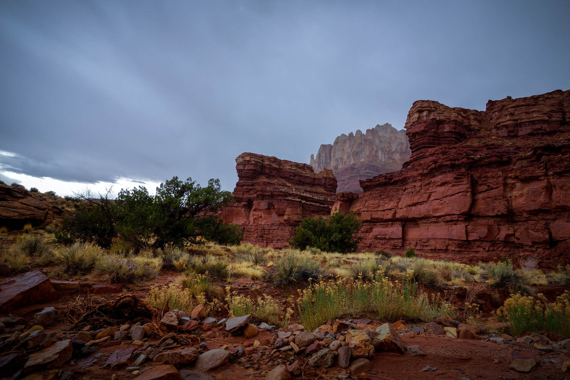
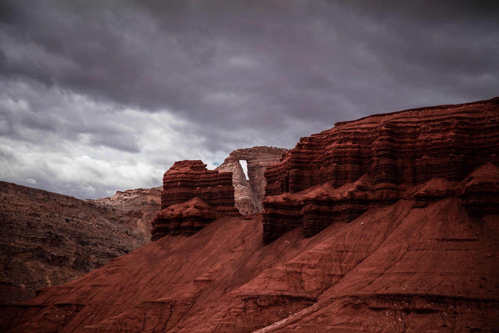
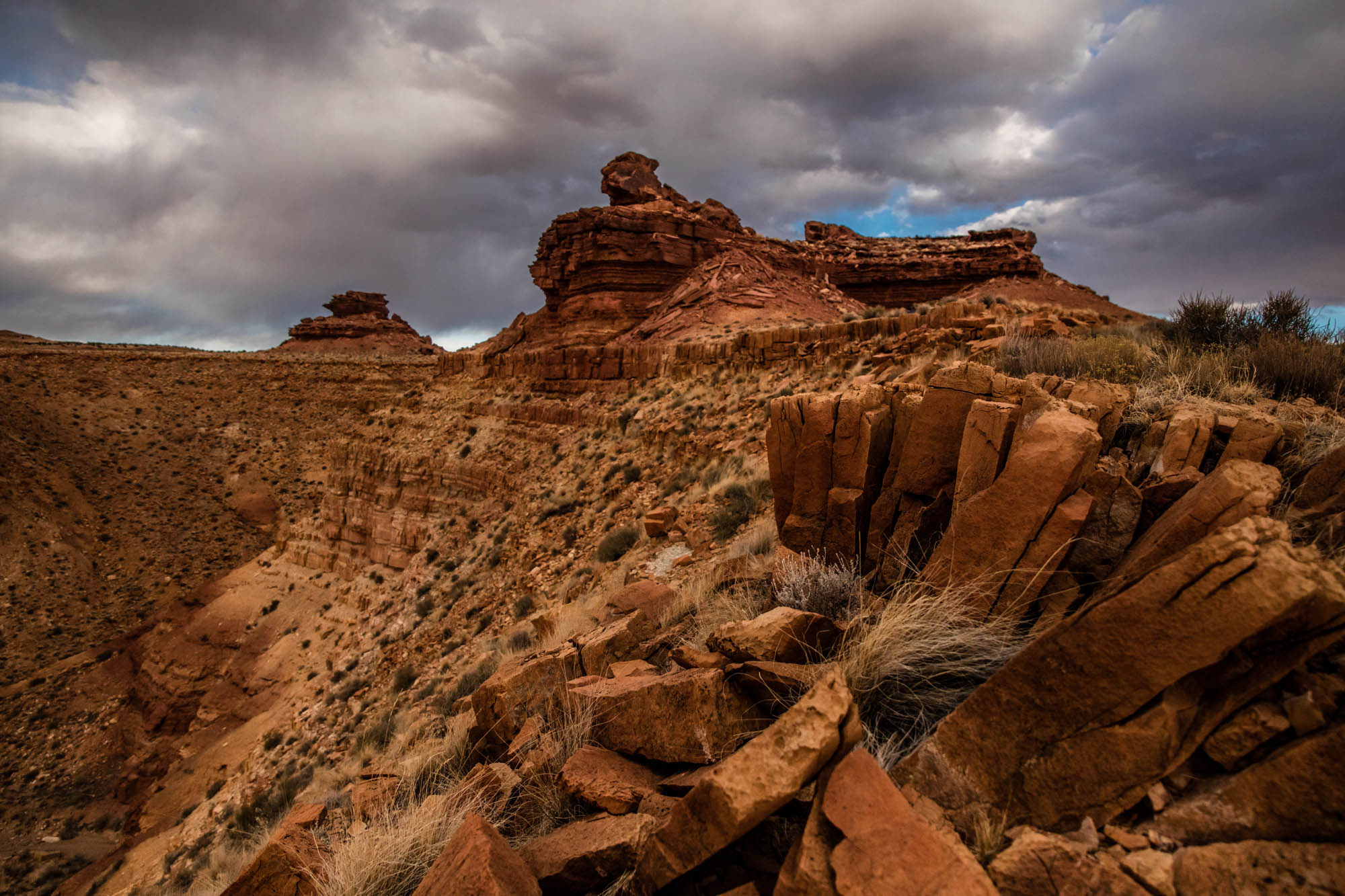
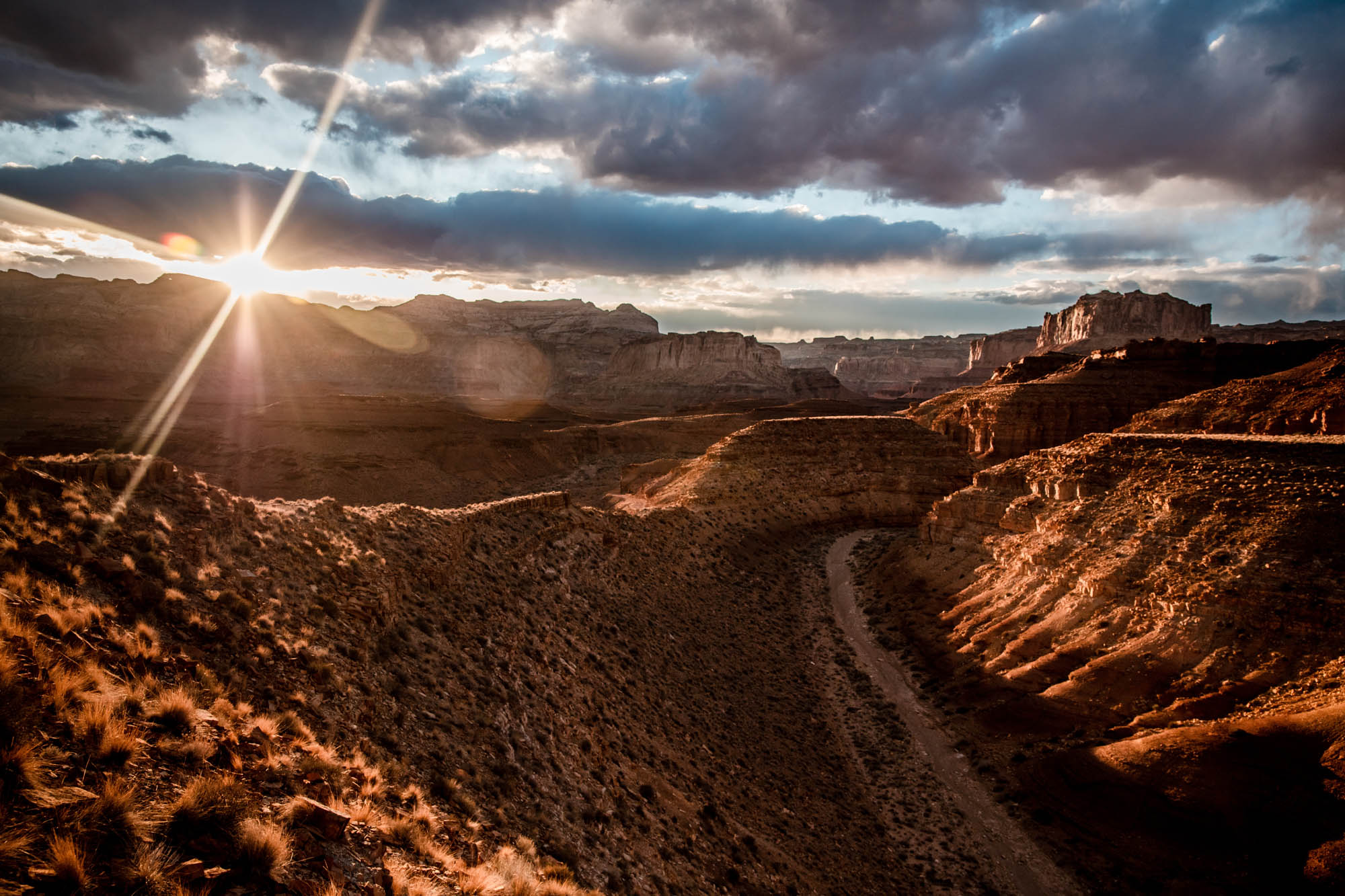
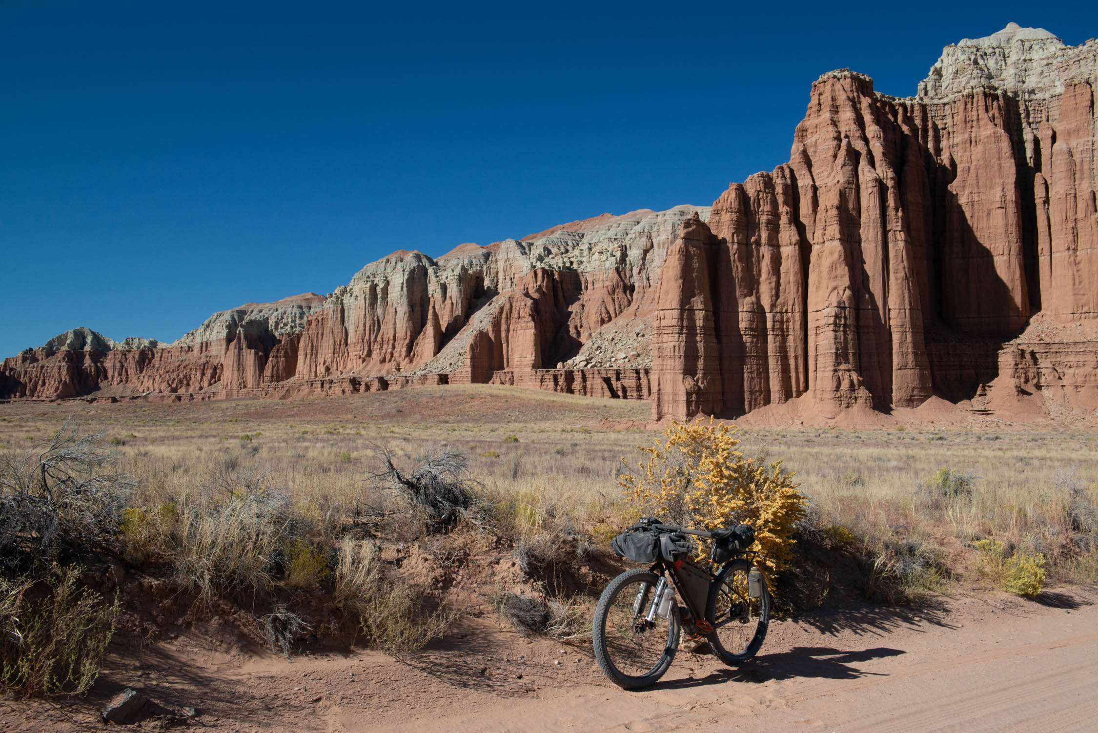
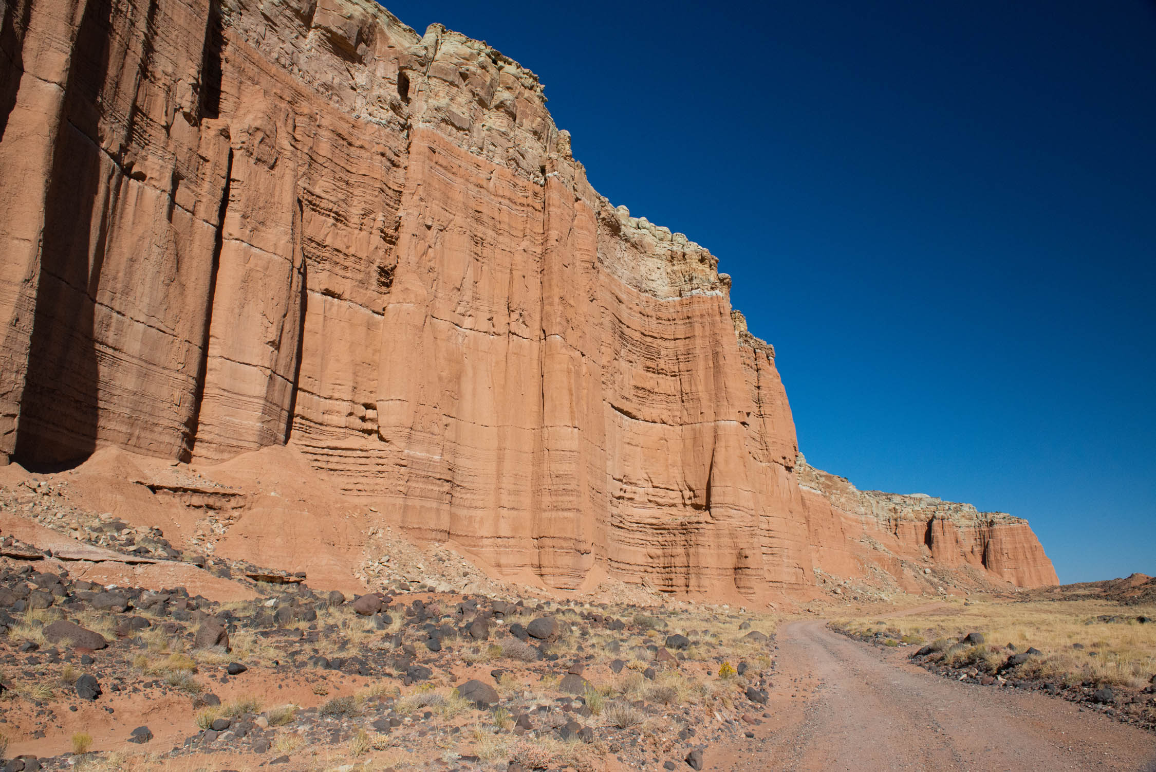
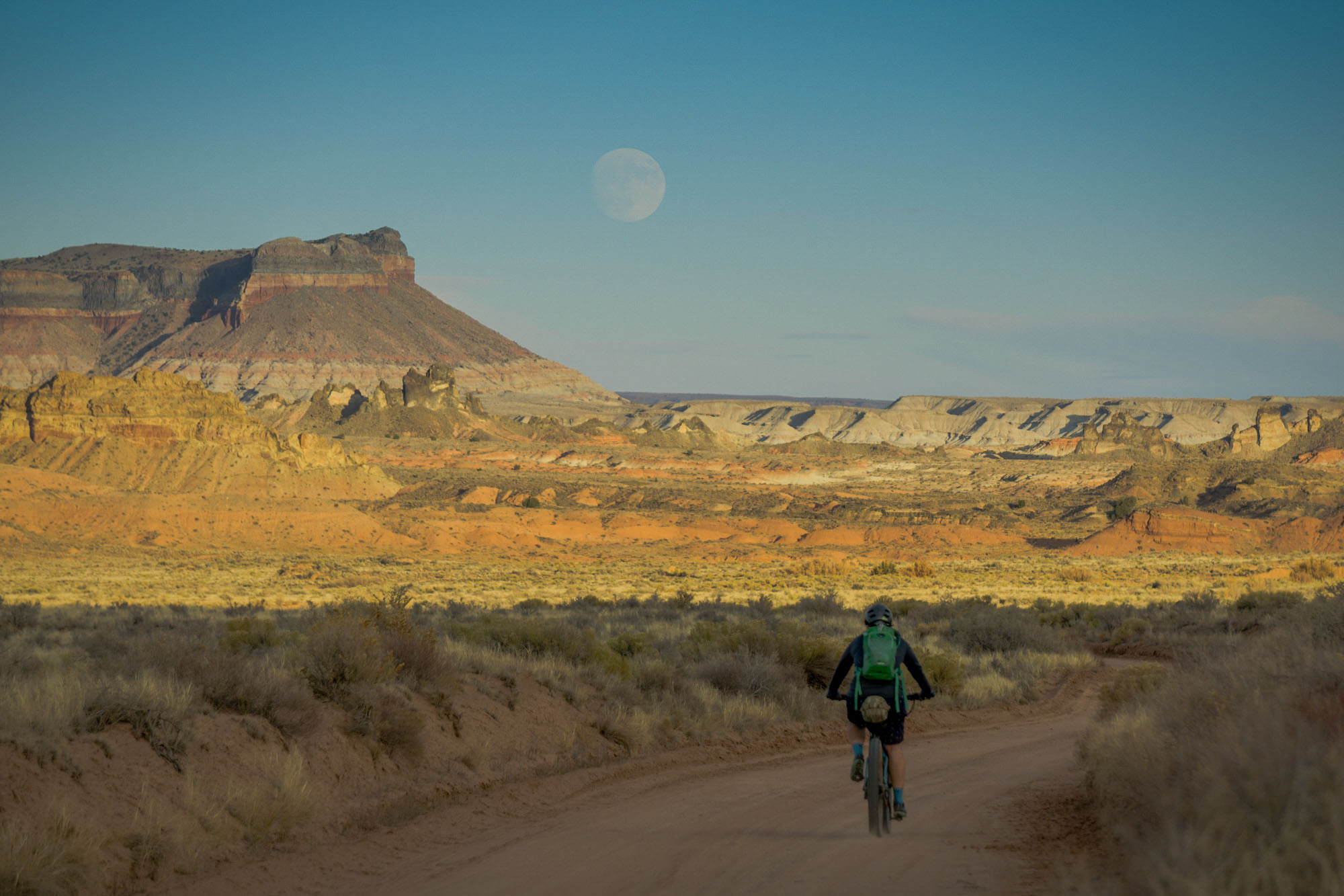
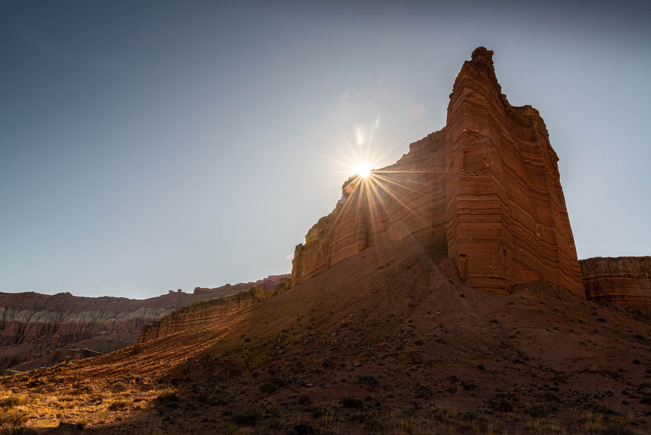
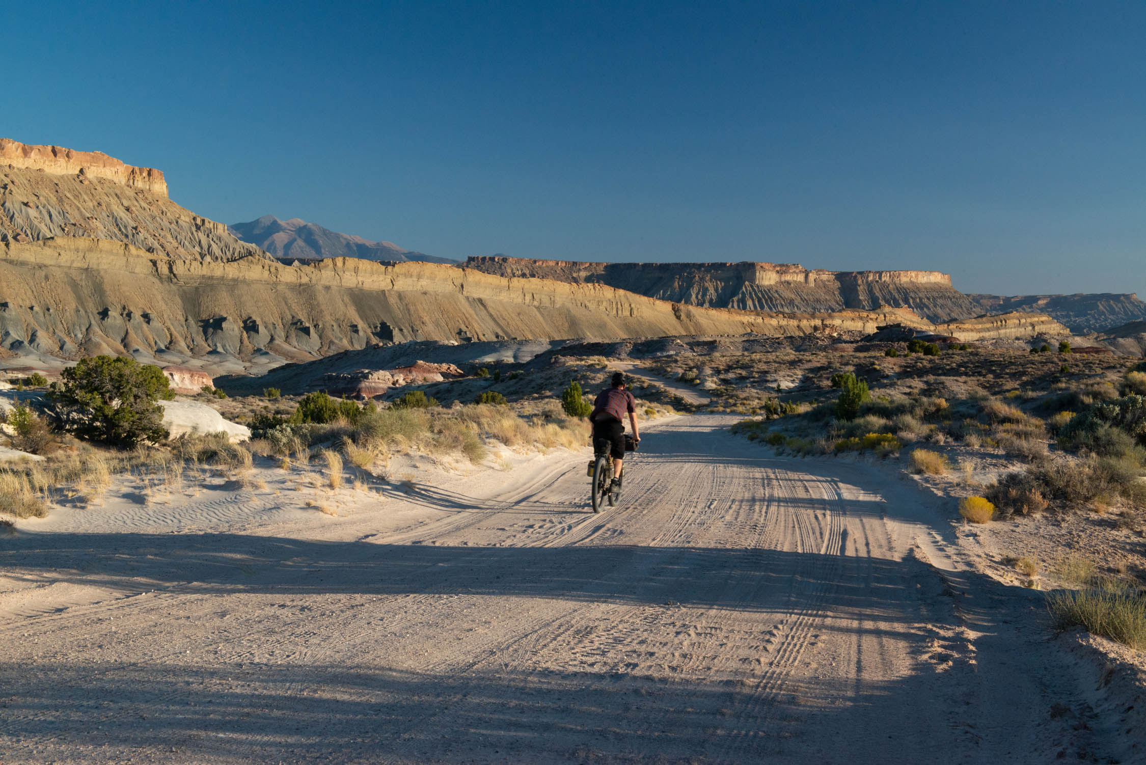
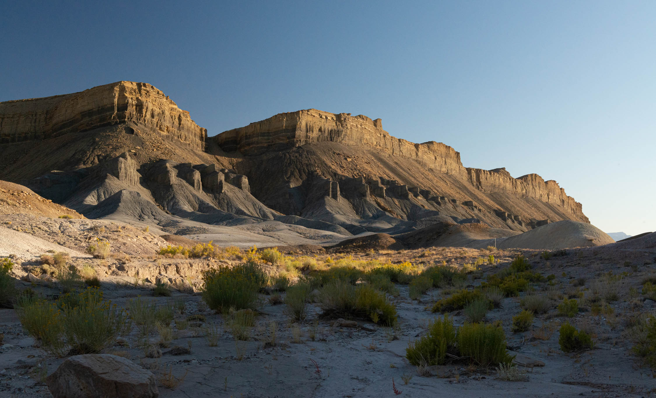
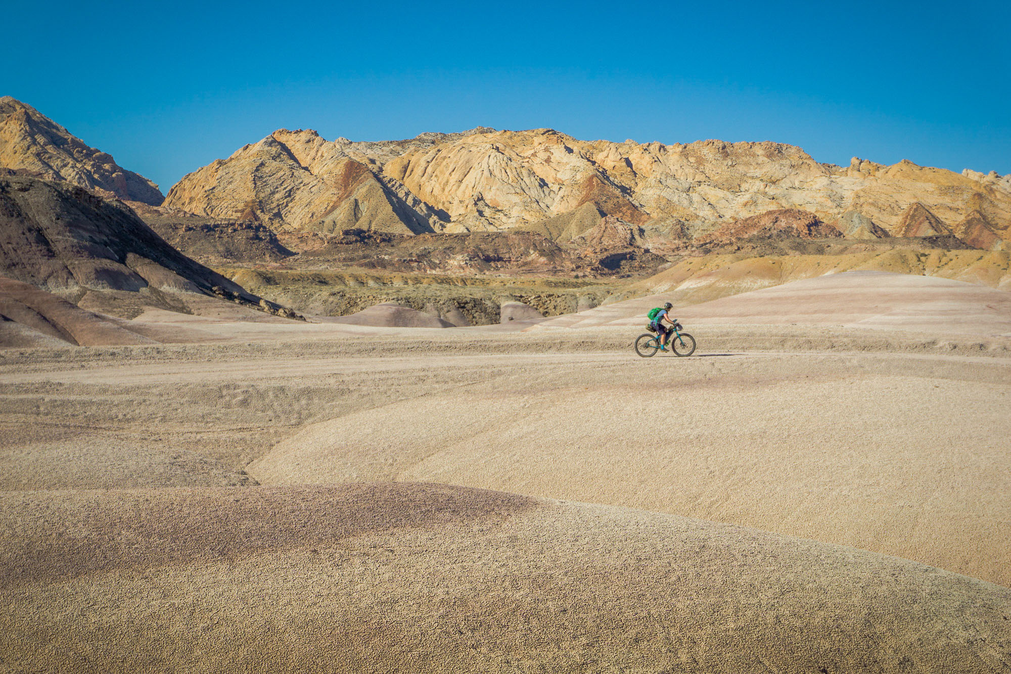
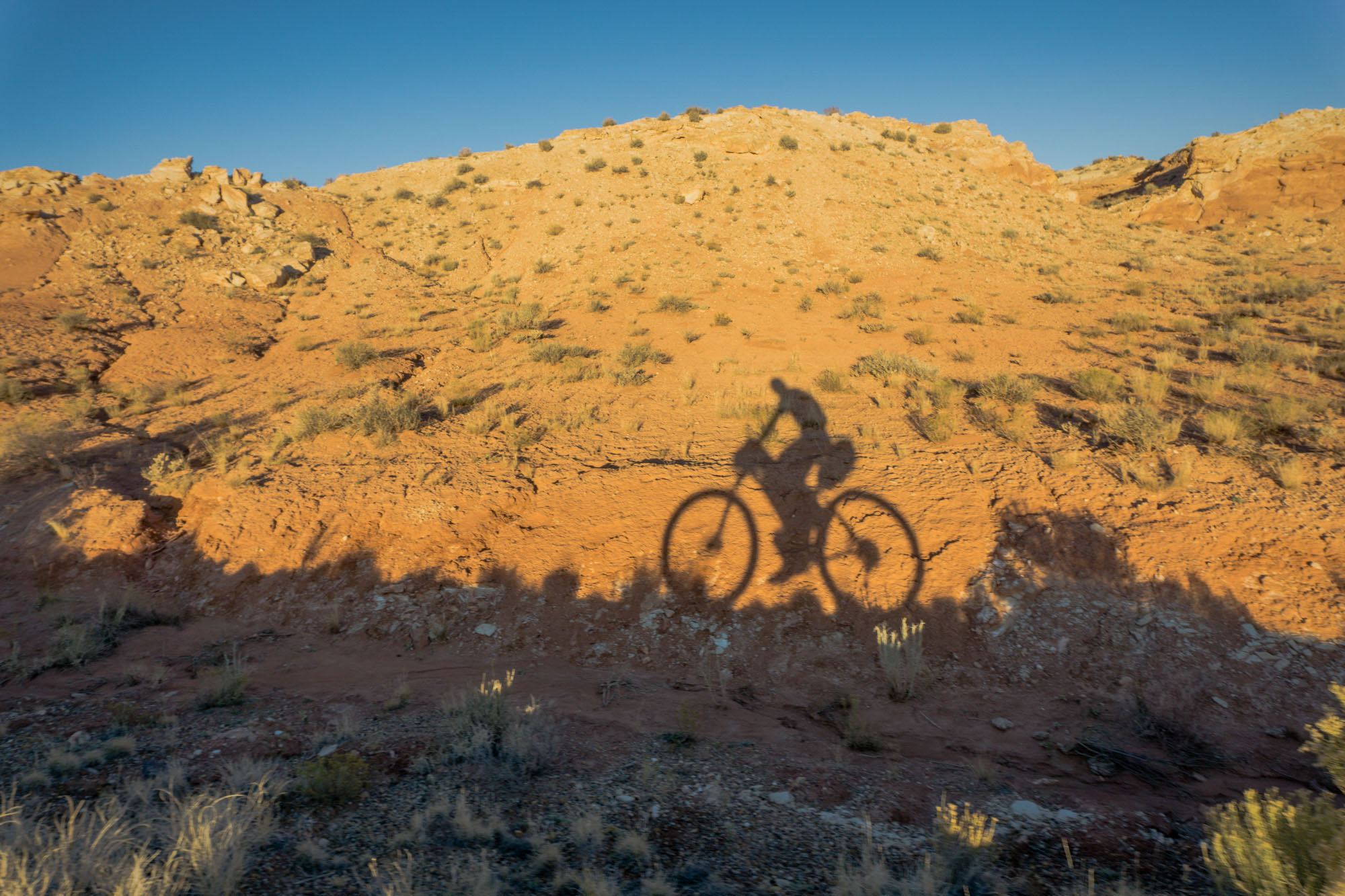
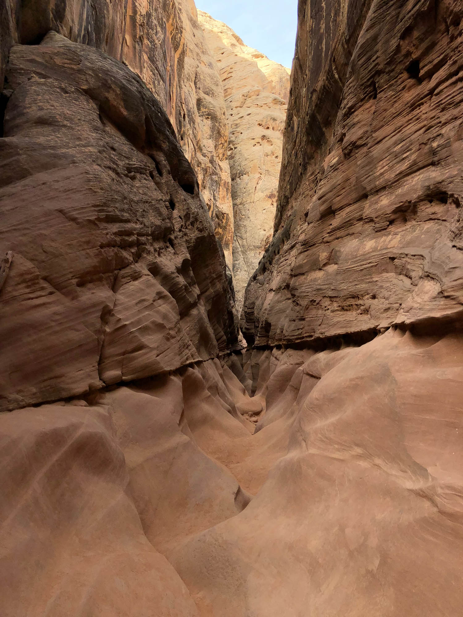
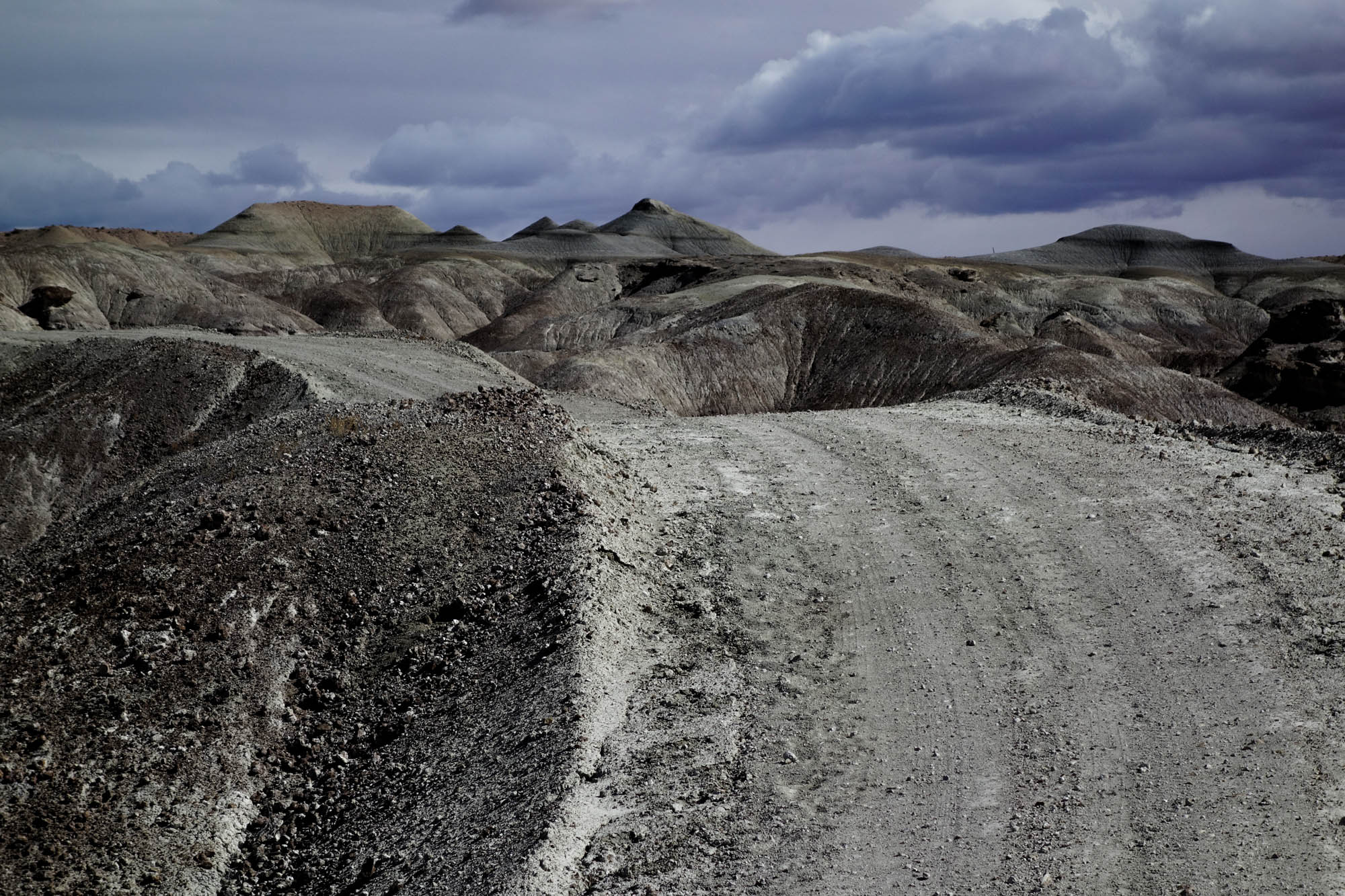
The San Rafael Swell region’s unique landscape is almost indescribable. In some sections, it is a wide-open, rolling country with colorful badlands, dry washes, towering mesas, buttes, and pinnacles. In other areas, it’s a rugged alien world characterized by steep cliffs, rocky benches, and slickrock domes cut in all directions by slot canyons or deep river gorges. The perimeter of the San Rafael Swell is a borderland of folded and tilted rocks referred to as the San Rafael Reef that marks the transition zone between the low-lying desert and uplifted slopes in the interior of the Swell. The result is a visually imposing wall of strange rock formations rising from the desert plains that indigenous people are reported to have referred to as “Sau-auger-towip” (Stone House Lands), from which this route derives its name.
Route Development
The Stone House Lands Loop was serendipitously born out of necessity. In March of 2019, Congress passed into law the John D. Dingell, Jr. Conservation, Management, and Recreation Act – the most wide-reaching package of conservation bills enacted since the 1970s that enshrined protection for some 2.5 million acres of public lands. While generally regarded as a boon for outdoor enthusiasts, a portion of our previously published route in the region – A (San Rafael) Swell Night Out – became encapsulated within the newly established Muddy Creek Wilderness Area, thus closing off mountain bike access and forcing a revision of its southern section. In order to accommodate the land use changes, the overnight route was revised in January of 2020 to include an expanded version of the original northern loop (now the sole overnight route), while also establishing this new multi-day bikepacking traverse.
The Stone House Lands Loop includes all but five miles of the pair of overnight routes originally reported by Patrick Hendry and Seth Kruckenberg in 2018, overlapping with the revised overnight route in the interior of the Swell and merging with a track through the western San Rafael that was originally scouted by Neil and Lindsay Beltchenko and reported on bikepacker.com in 2017. The result is a collaboration that establishes an incredible bikepacking traverse through the remote high desert of central Utah, spanning over 200 miles, the vast majority of which is on public lands managed by the BLM.
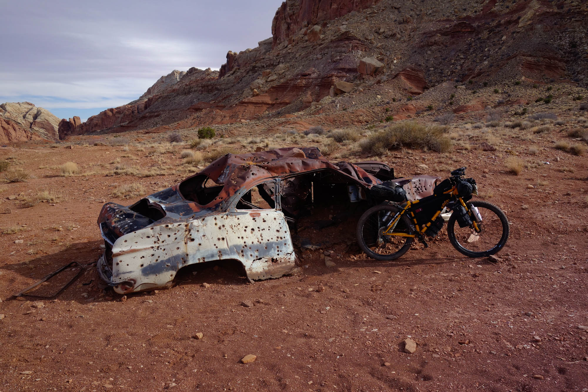
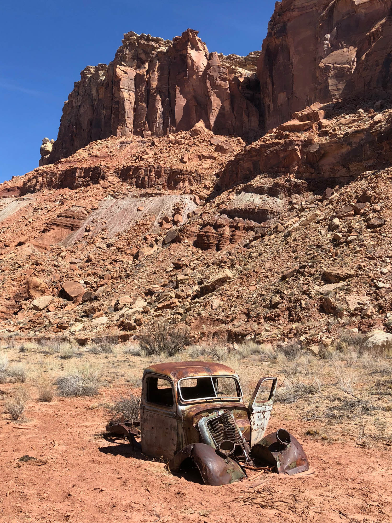
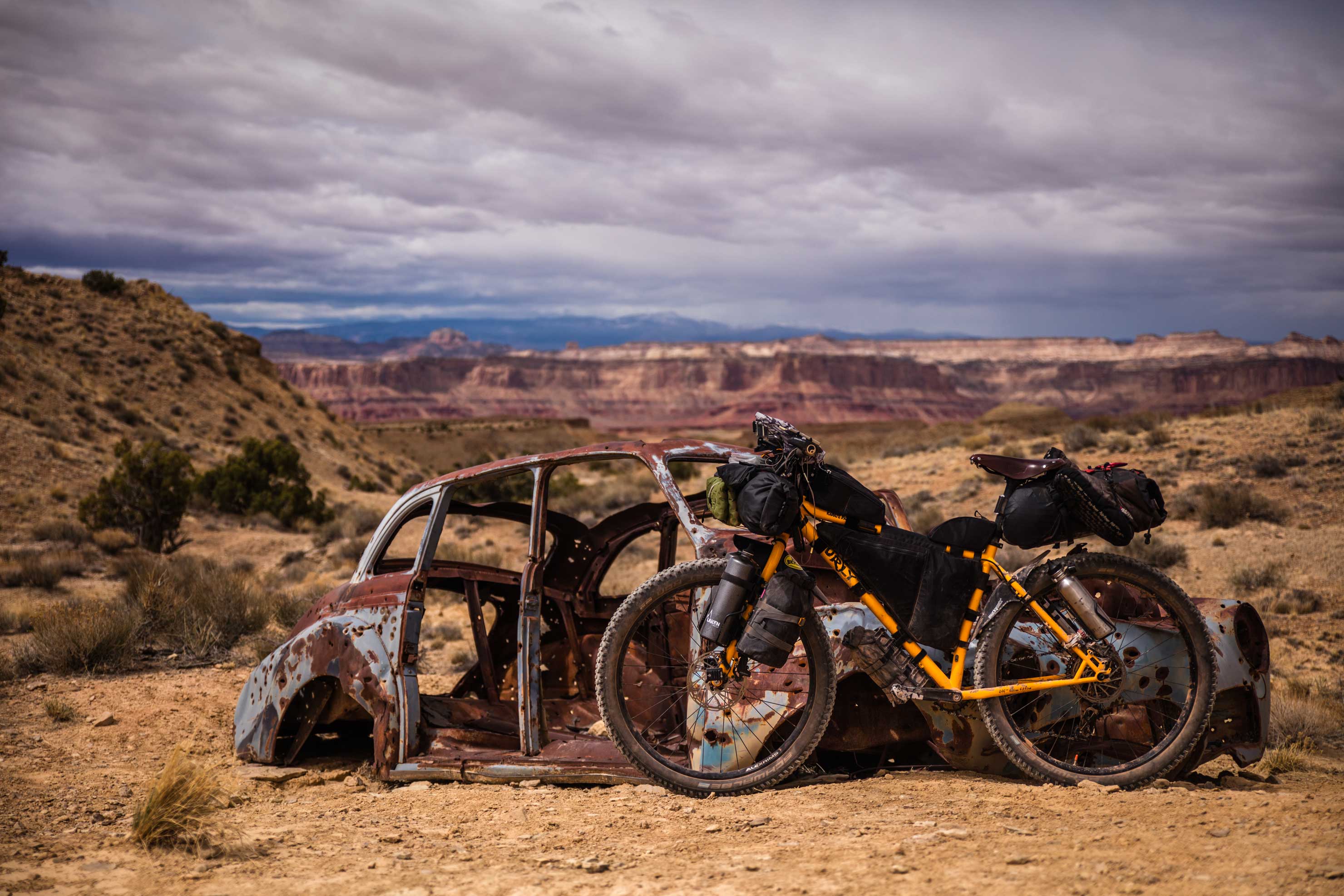
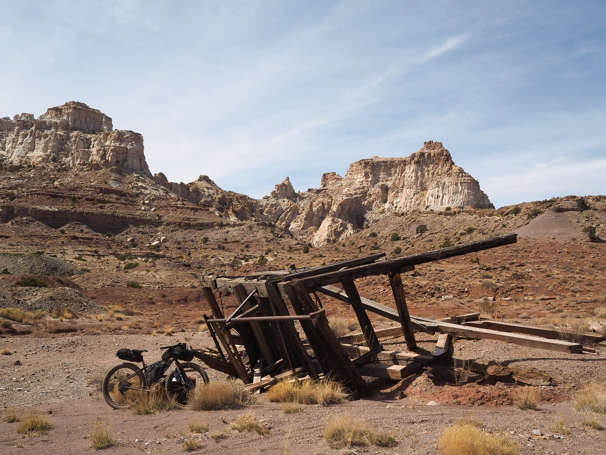
While the San Rafael Swell is notable for its stark and dramatic scenery, the Swell is also home to a number of excellently preserved Native American petroglyphs and pictographs, some of which are over 2,000 years old, attesting to the long history of indigenous peoples in the Swell. Also scattered throughout the Swell’s interior are the signatures of uranium and vanadium mining efforts that peaked in the region during the boom years following World War II. There are ruins, equipment, and vehicles left behind from this period of resource extraction along the route that seemingly transport you back in time to a bygone era. As one of the largest blocks of undeveloped land in Utah, the San Rafael Swell is also home to a variety of wildlife that you are likely to encounter on your travels, including wild horses, mountain goats, and bighorn sheep. Moreover, it is an area of high plant endemism, with many native plants that occur nowhere else in the world.
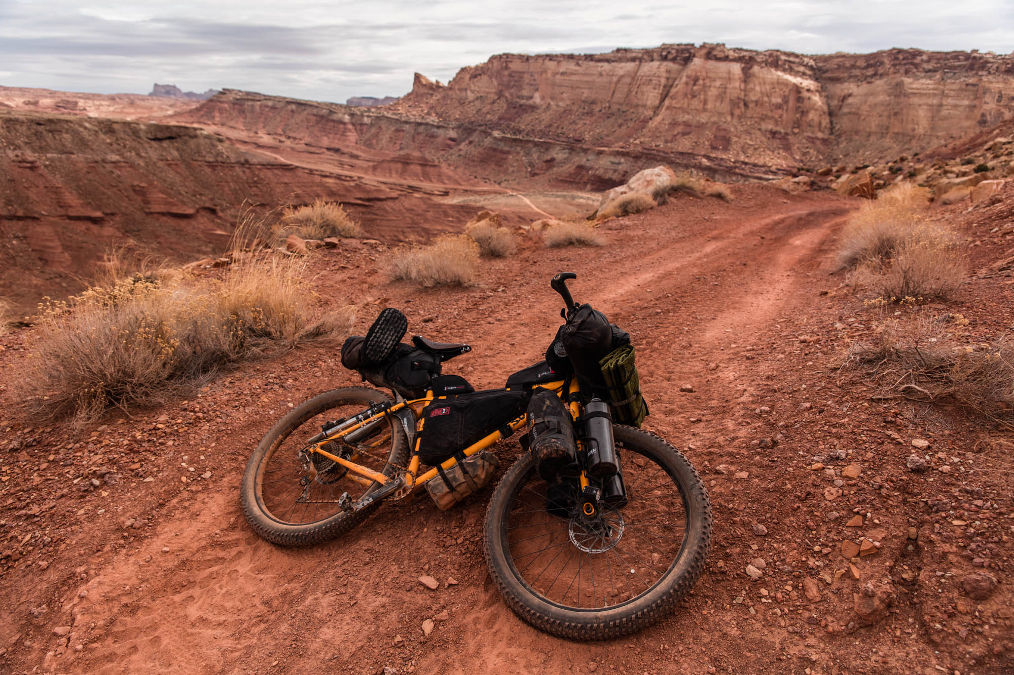
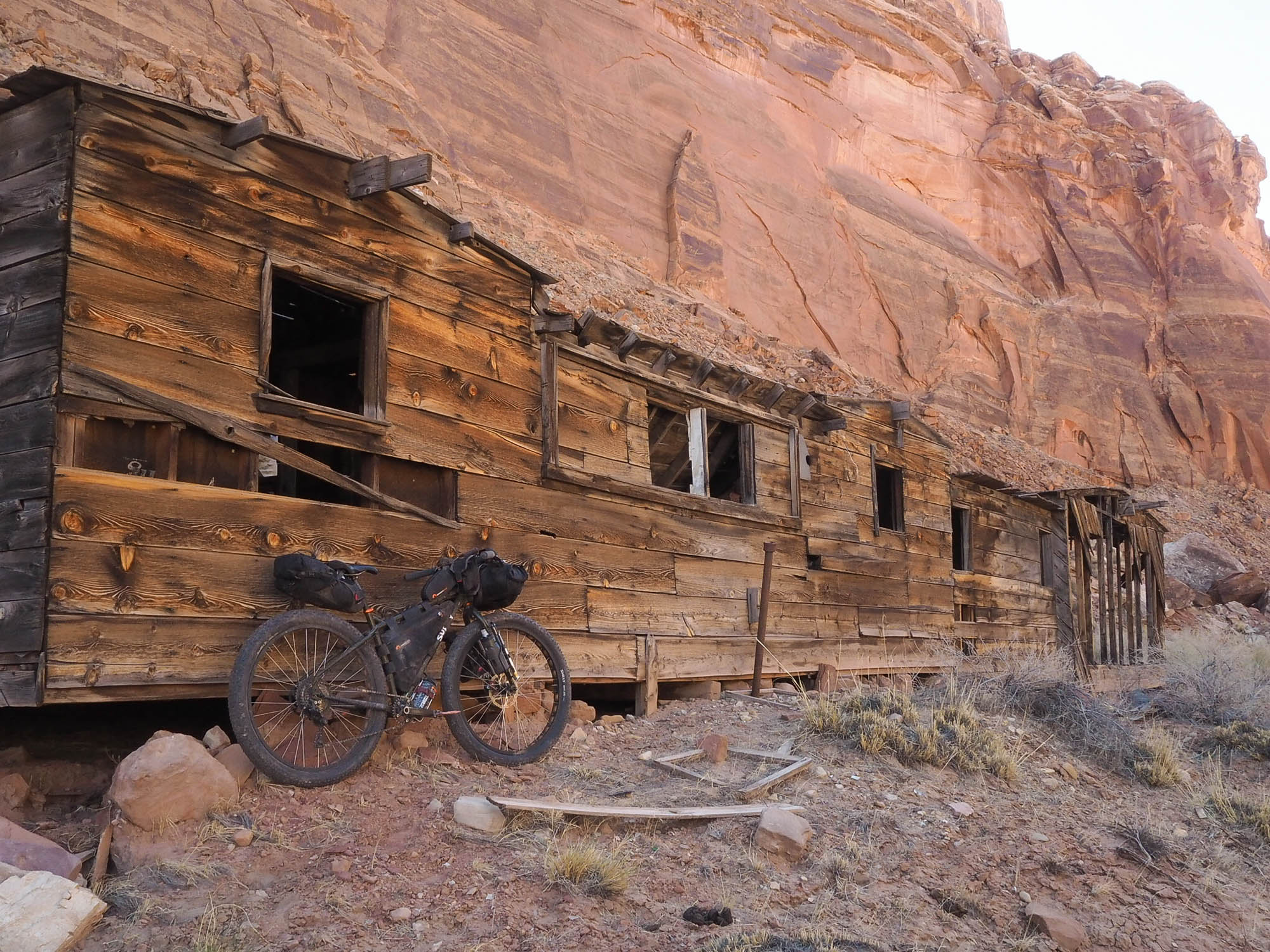
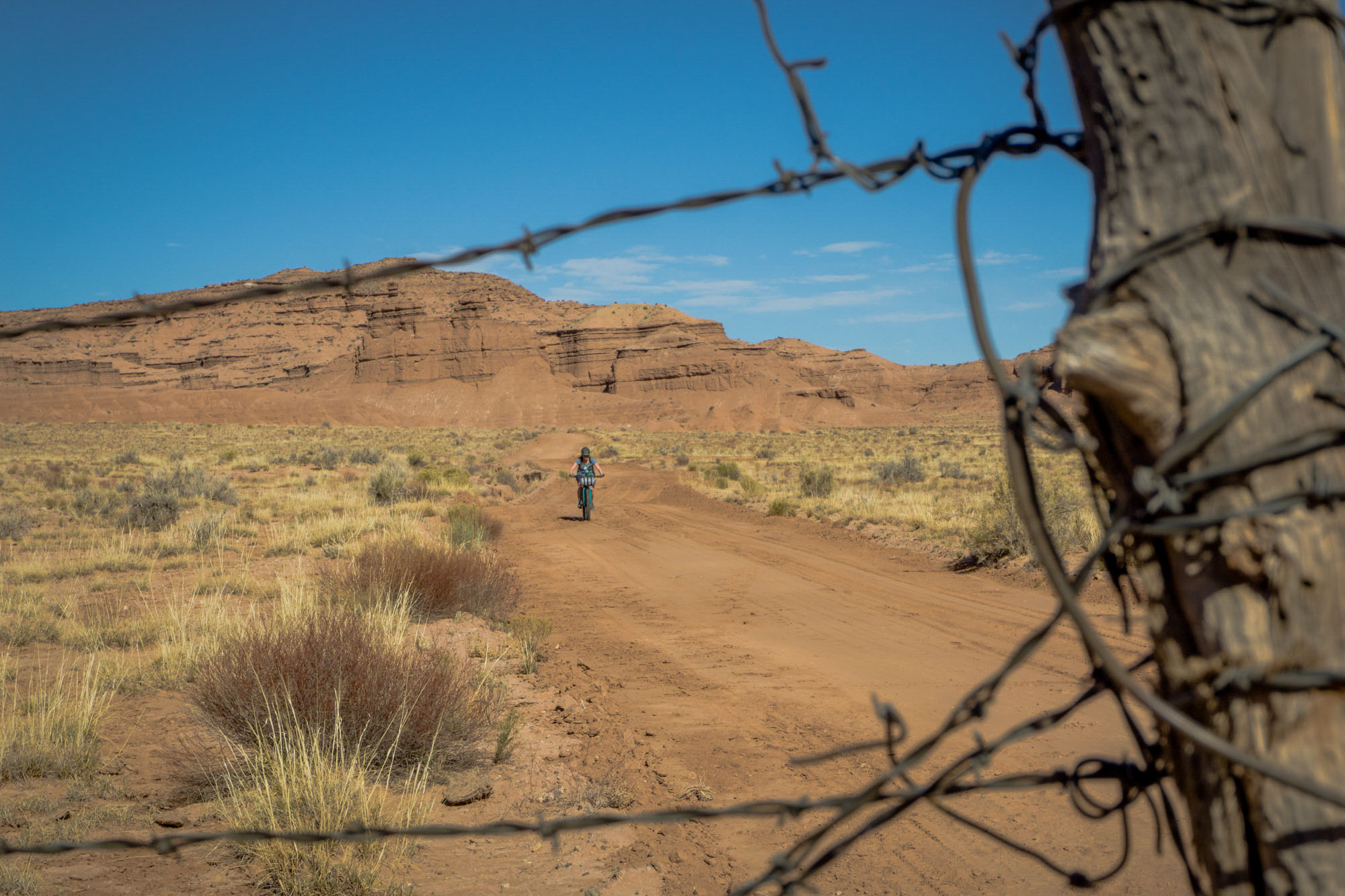
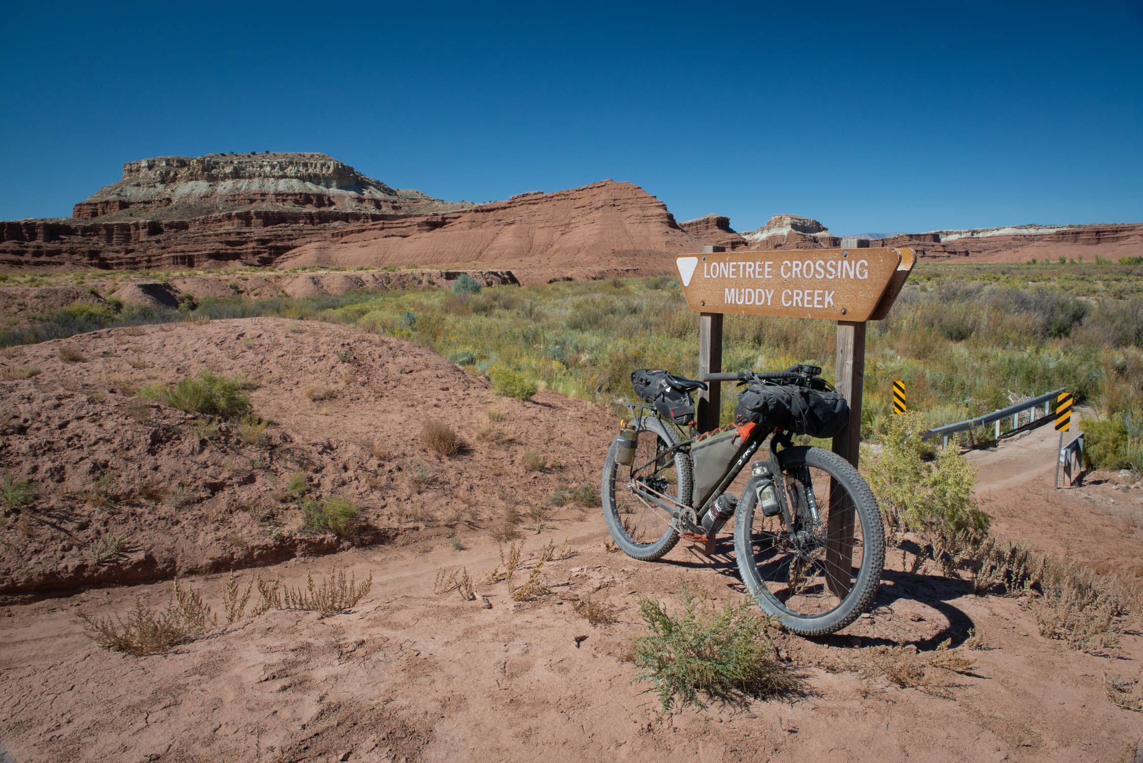
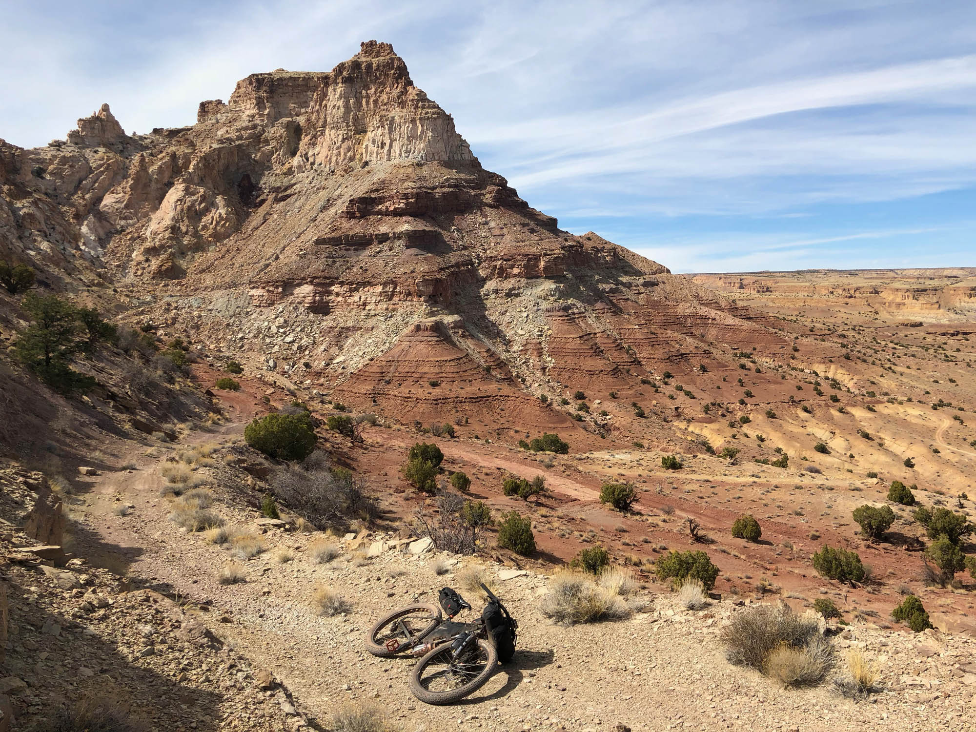
The Stone House Lands Loop was motivated by a desire to create a sustainable and accessible multi-day bikepacking route that pays homage to the diversity of geological, biological, ecological, and cultural riches that the San Rafael has on display. Your journey into this beautiful, rugged, and remote landscape begins near Temple Mountain, north of Goblin Valley State Park, traversing the backside of the San Rafael Reef along the immensely beautiful and rugged Behind the Reef Road. The route takes you counterclockwise through the San Rafael Swell uplift toward the Bunkhouse at Hidden Splendor near Muddy Creek (the only naturally occurring source of water en route) and into Hondu Country where you will encounter notable landmarks such as the Hondu Arch and Swasey Cabin.
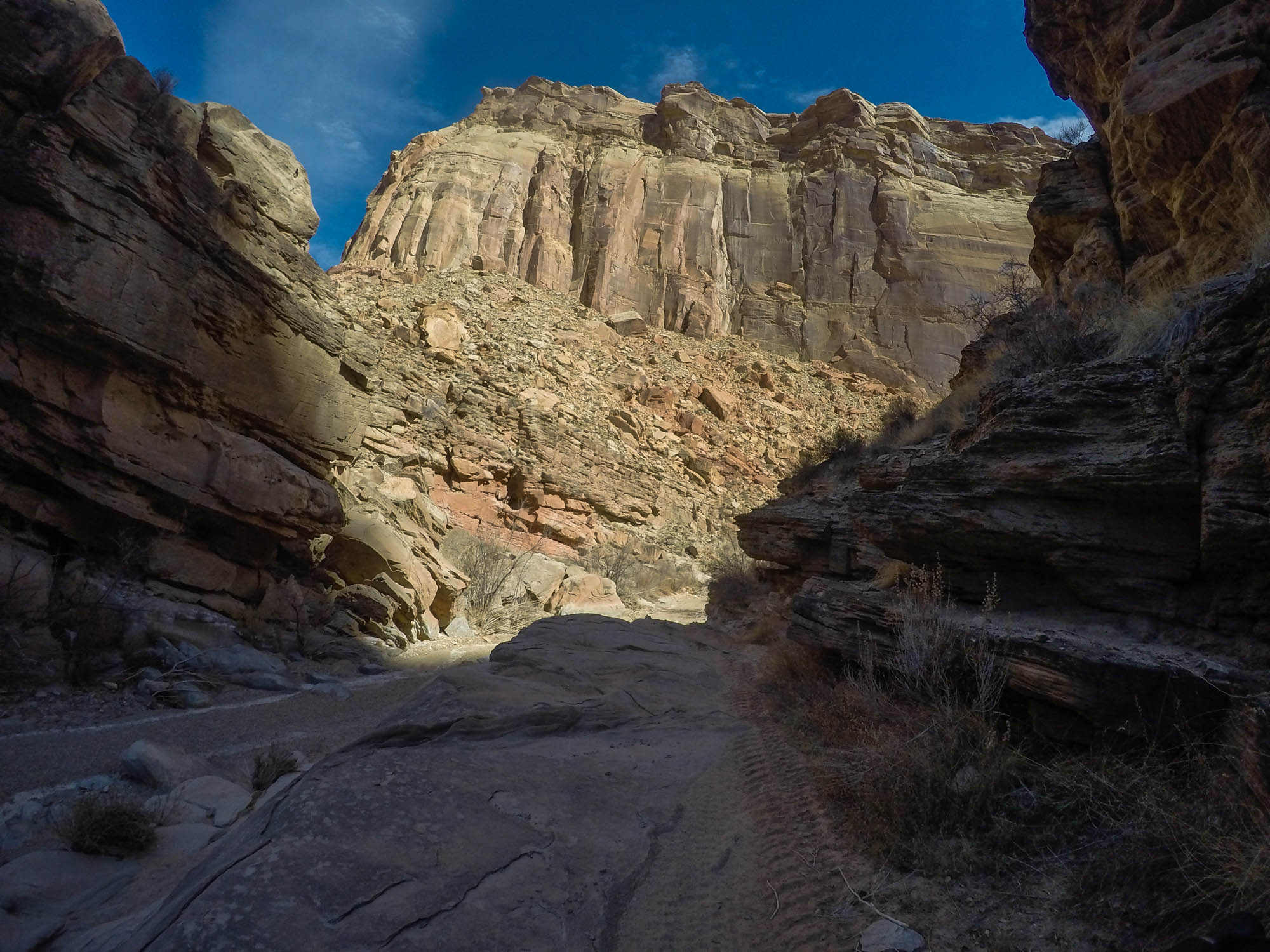
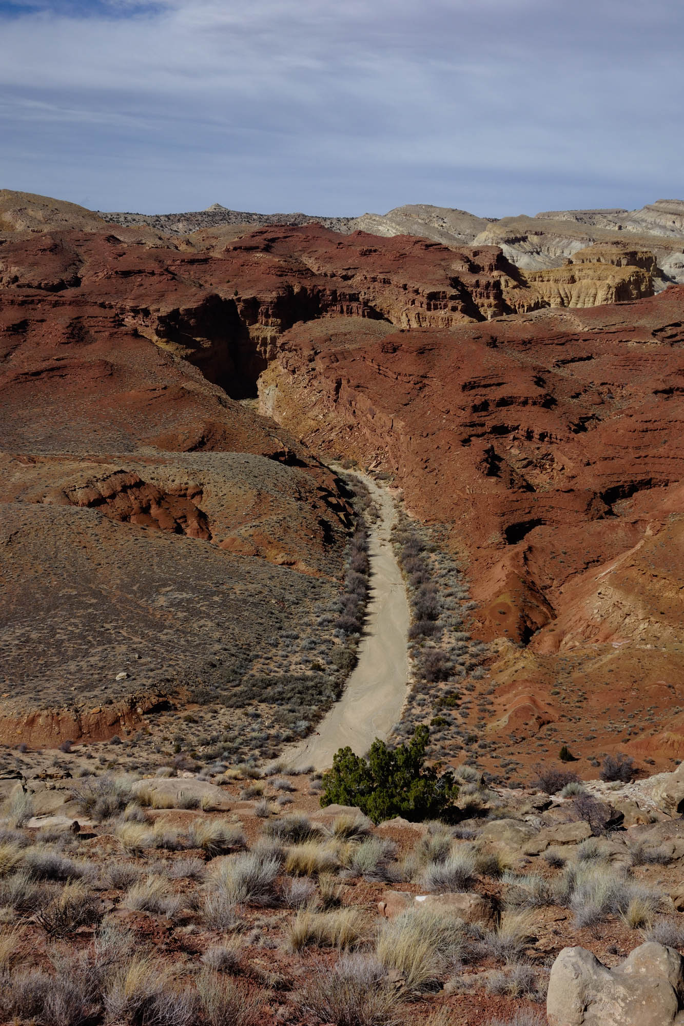
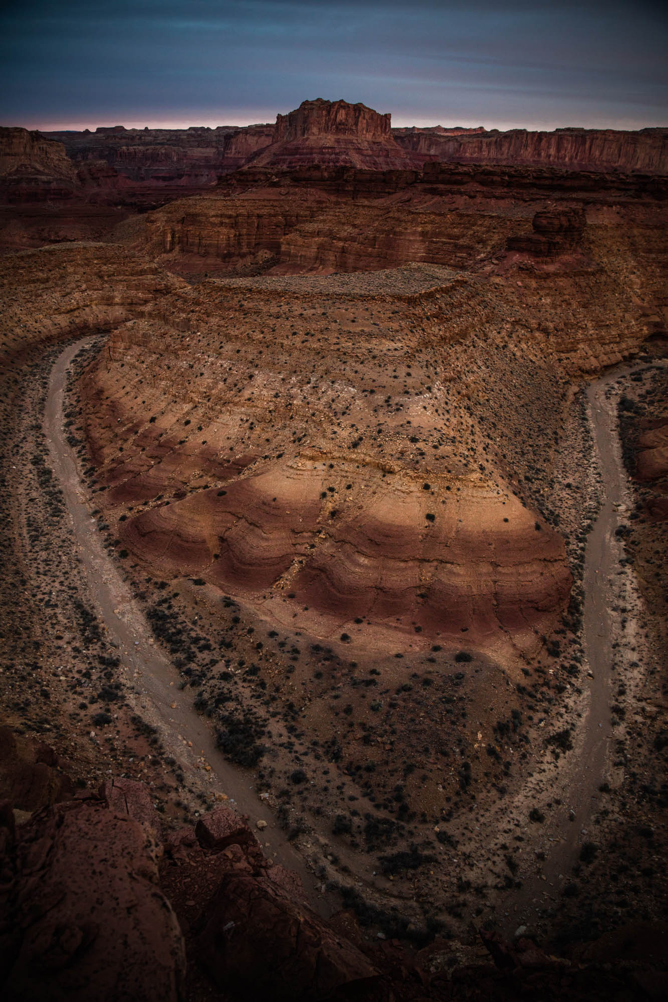
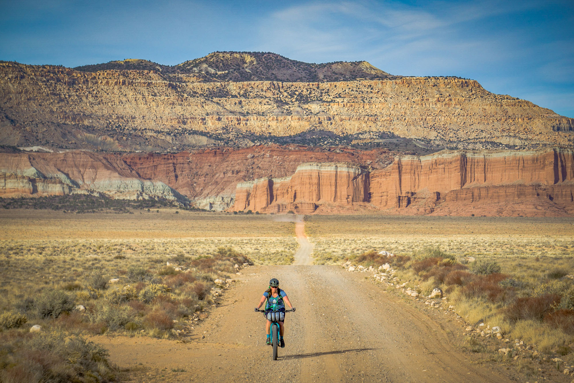
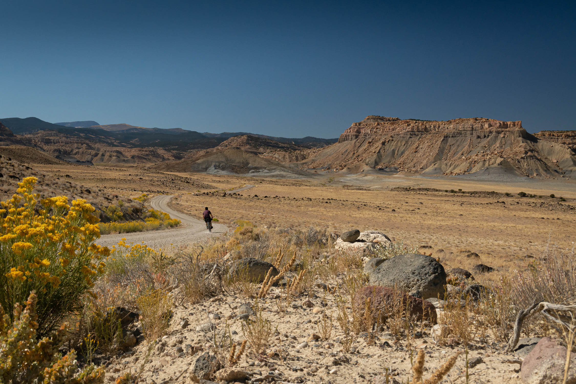
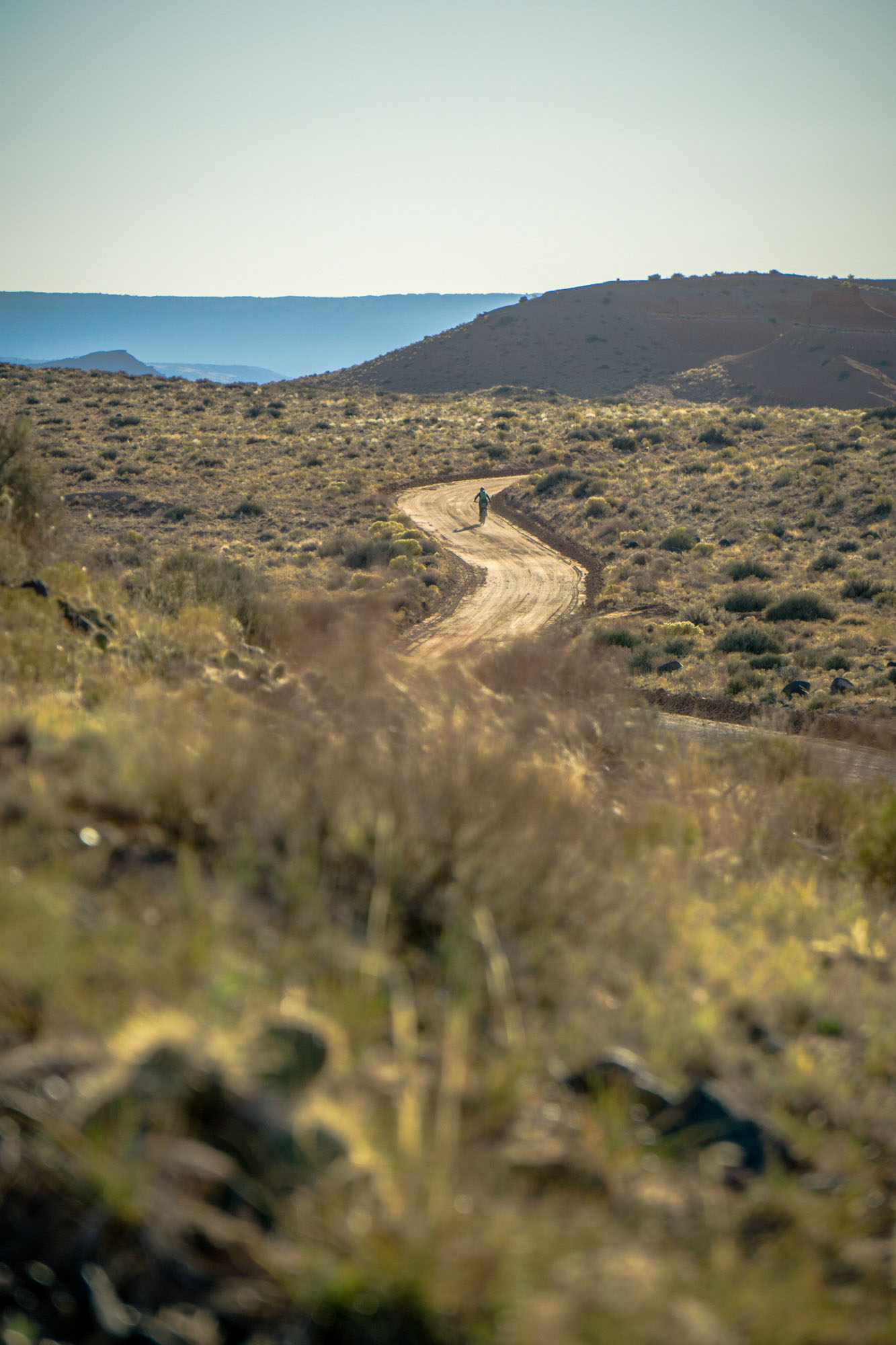
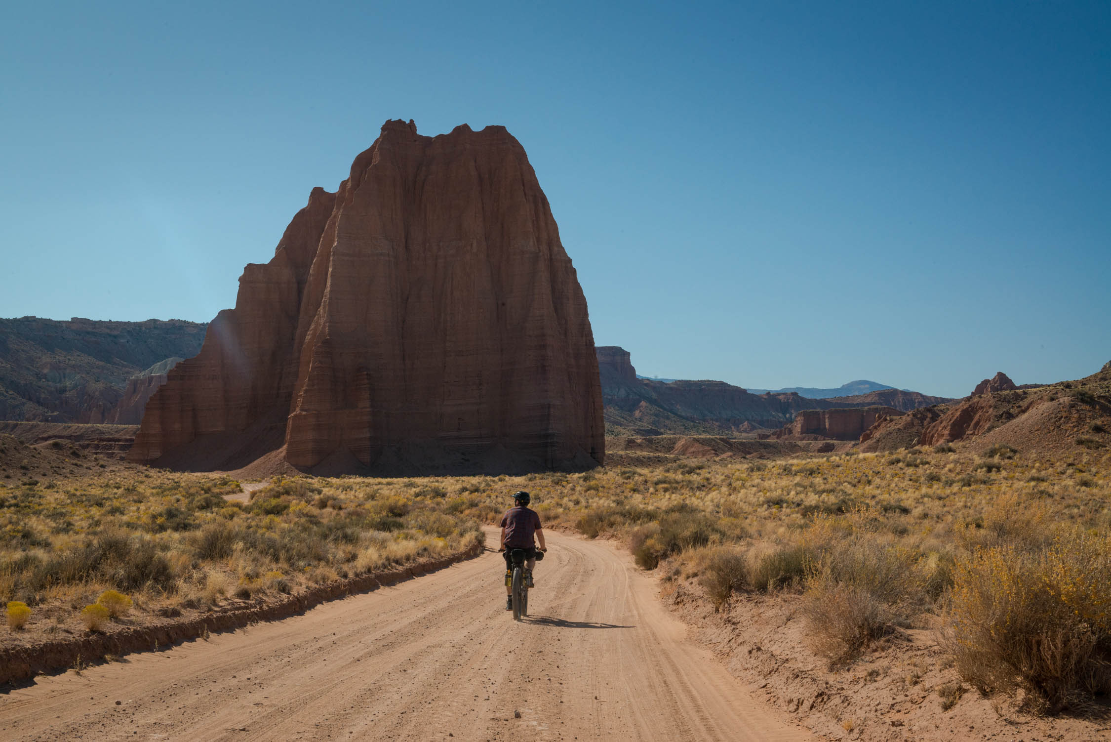
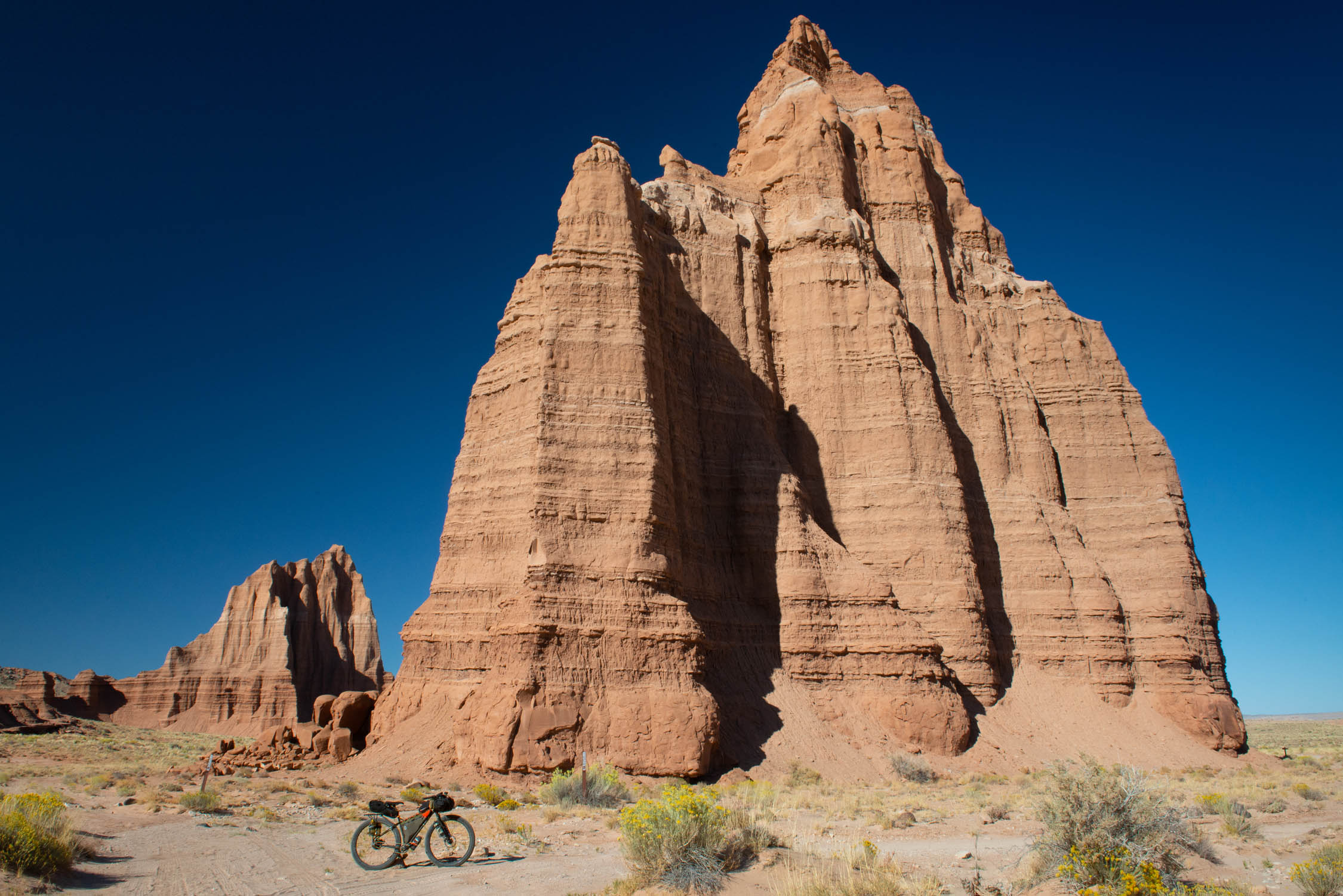
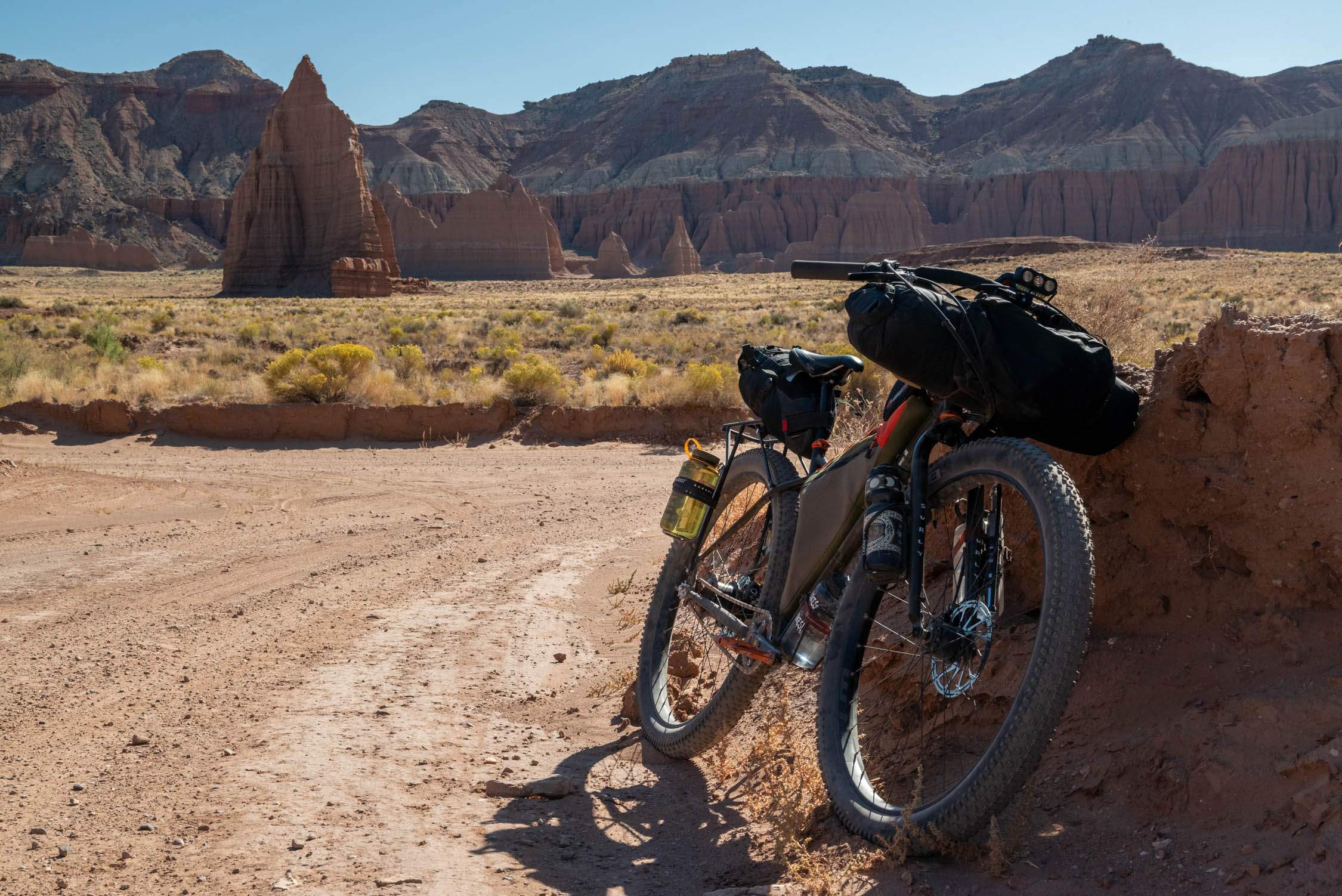
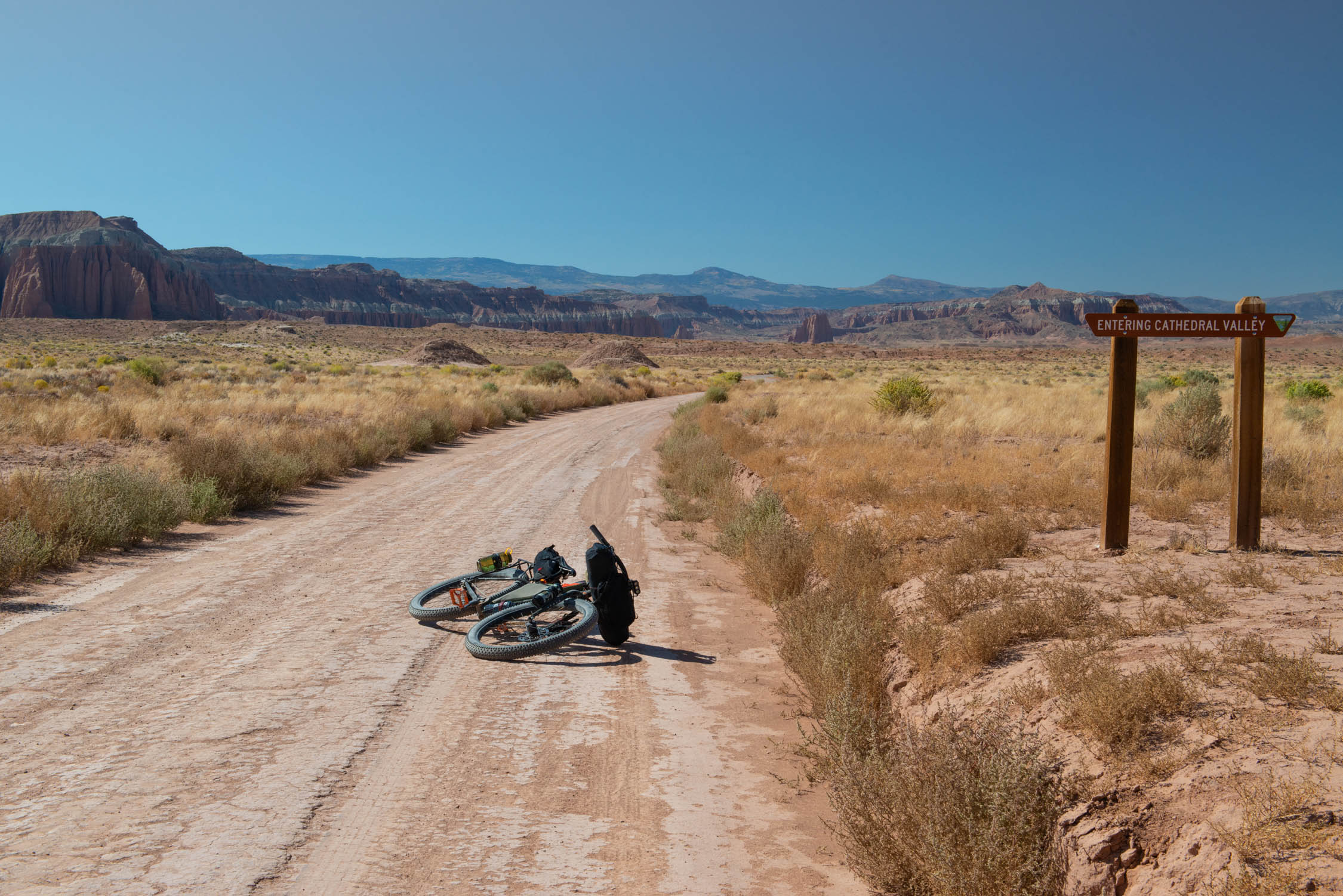
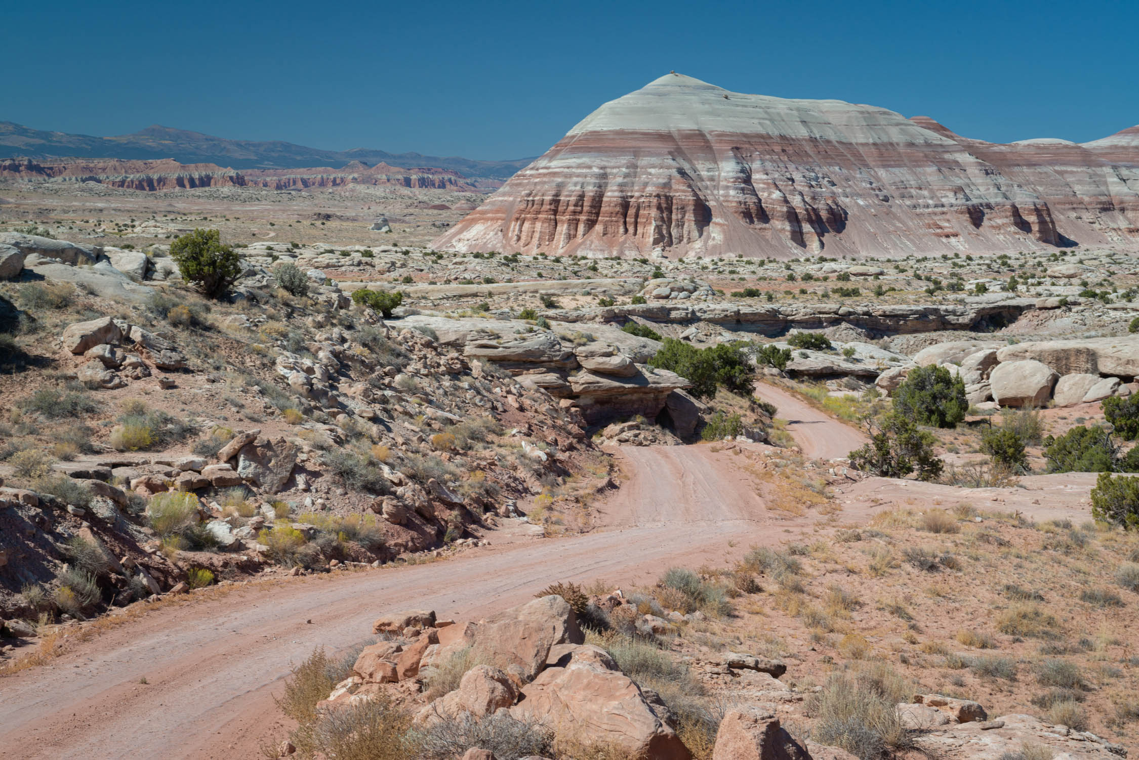
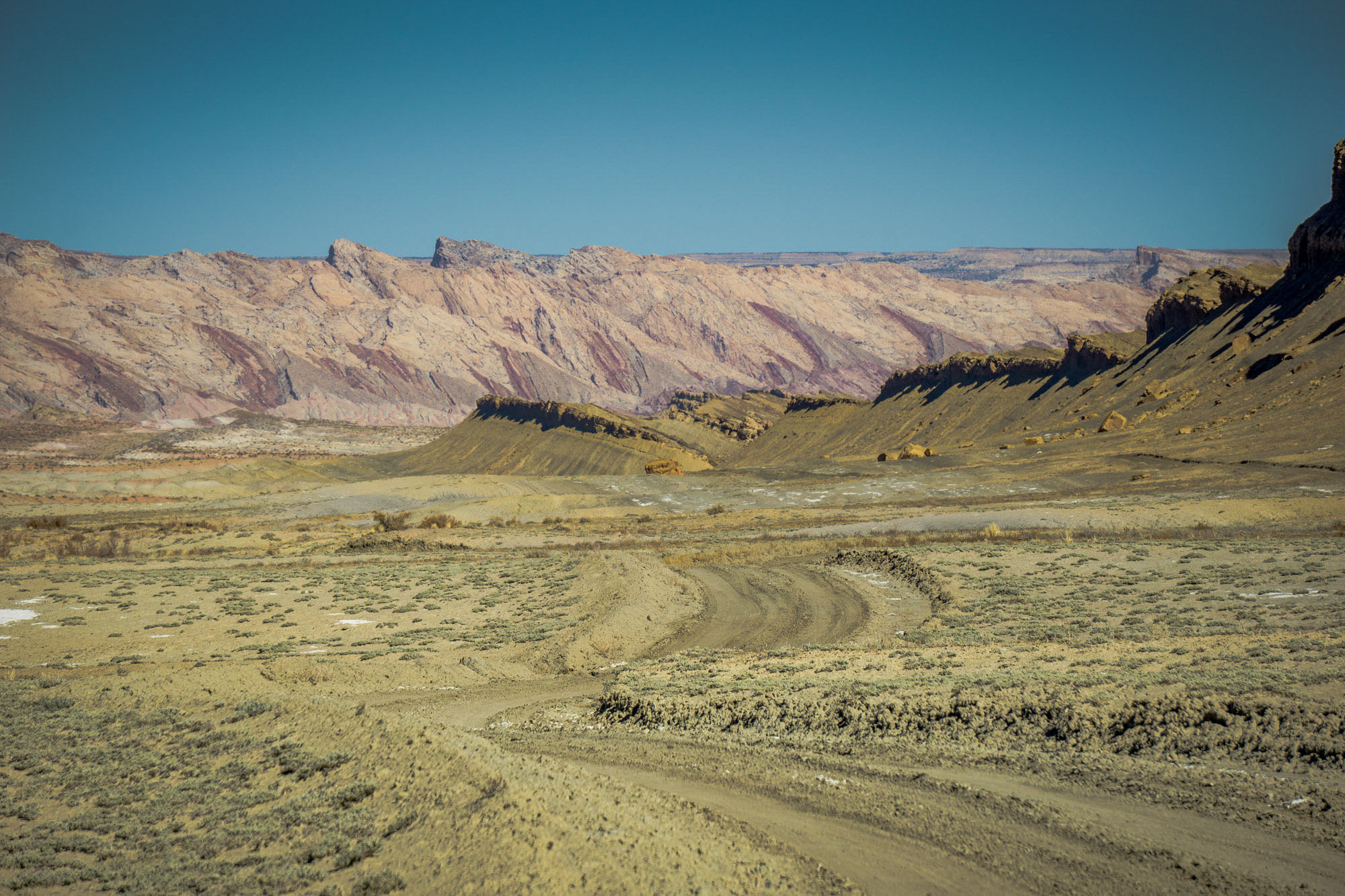
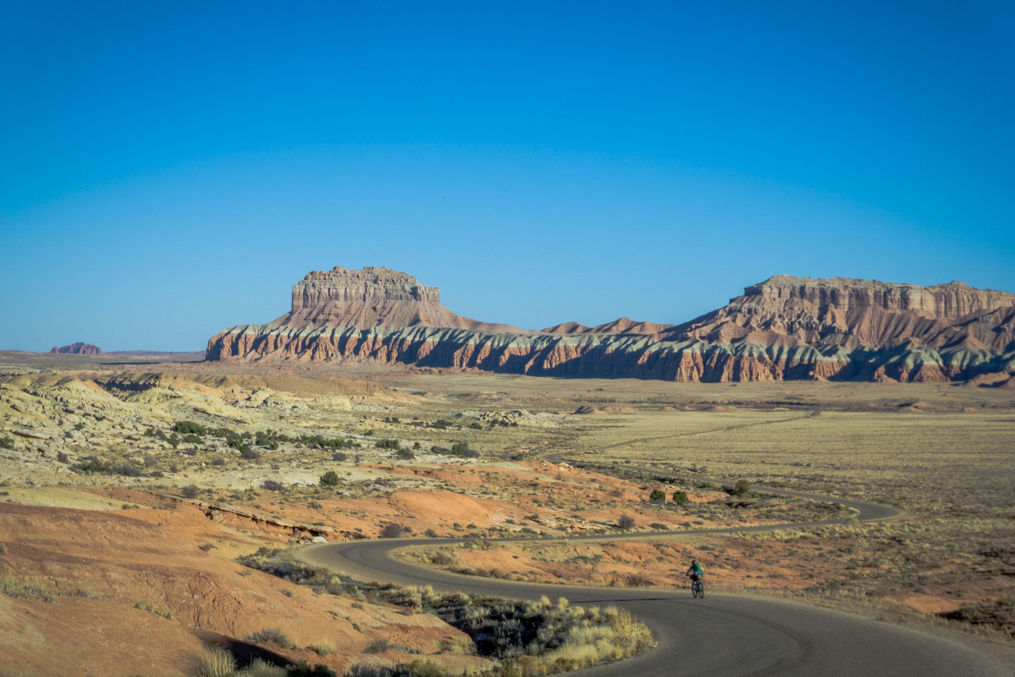
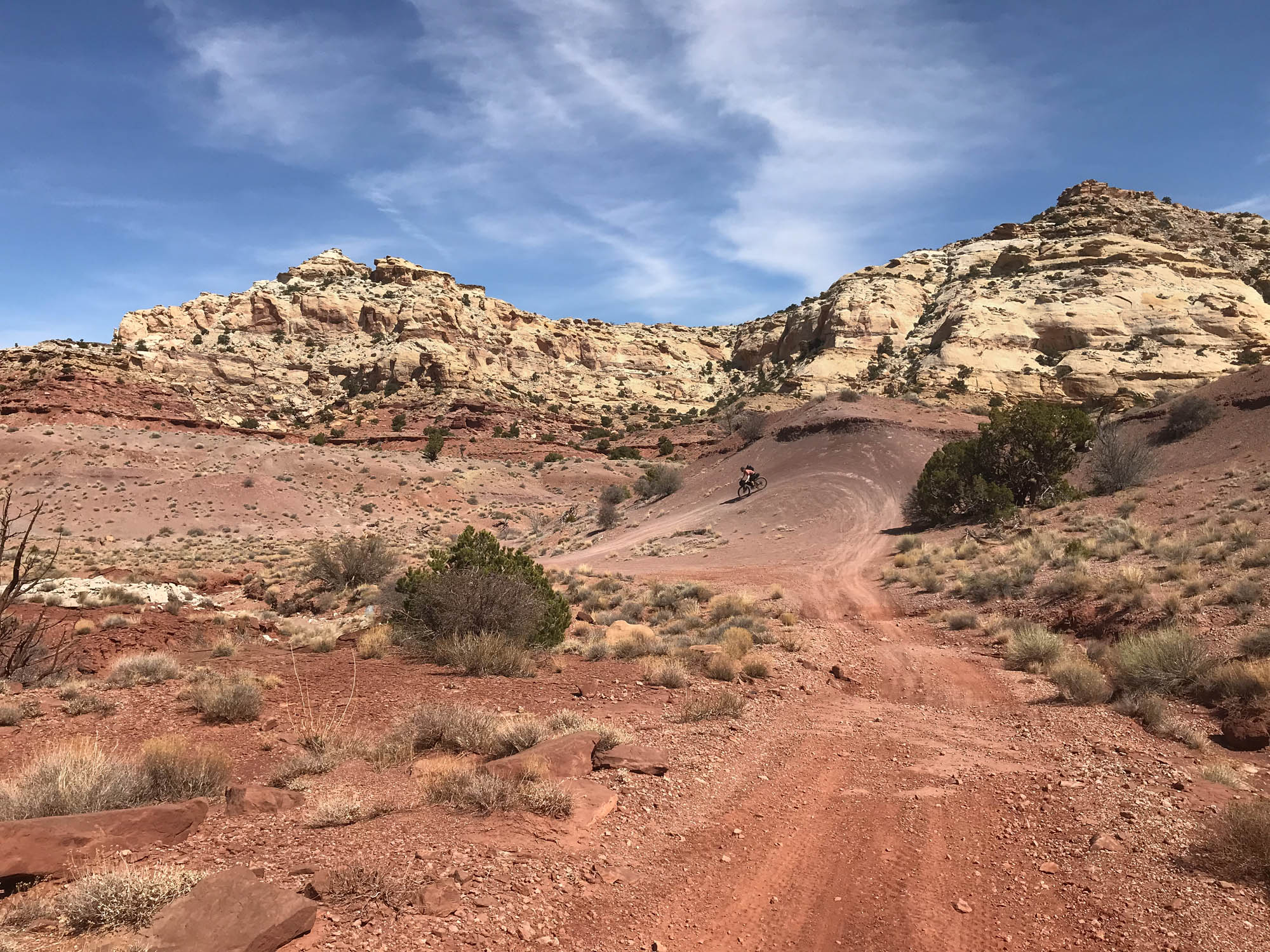
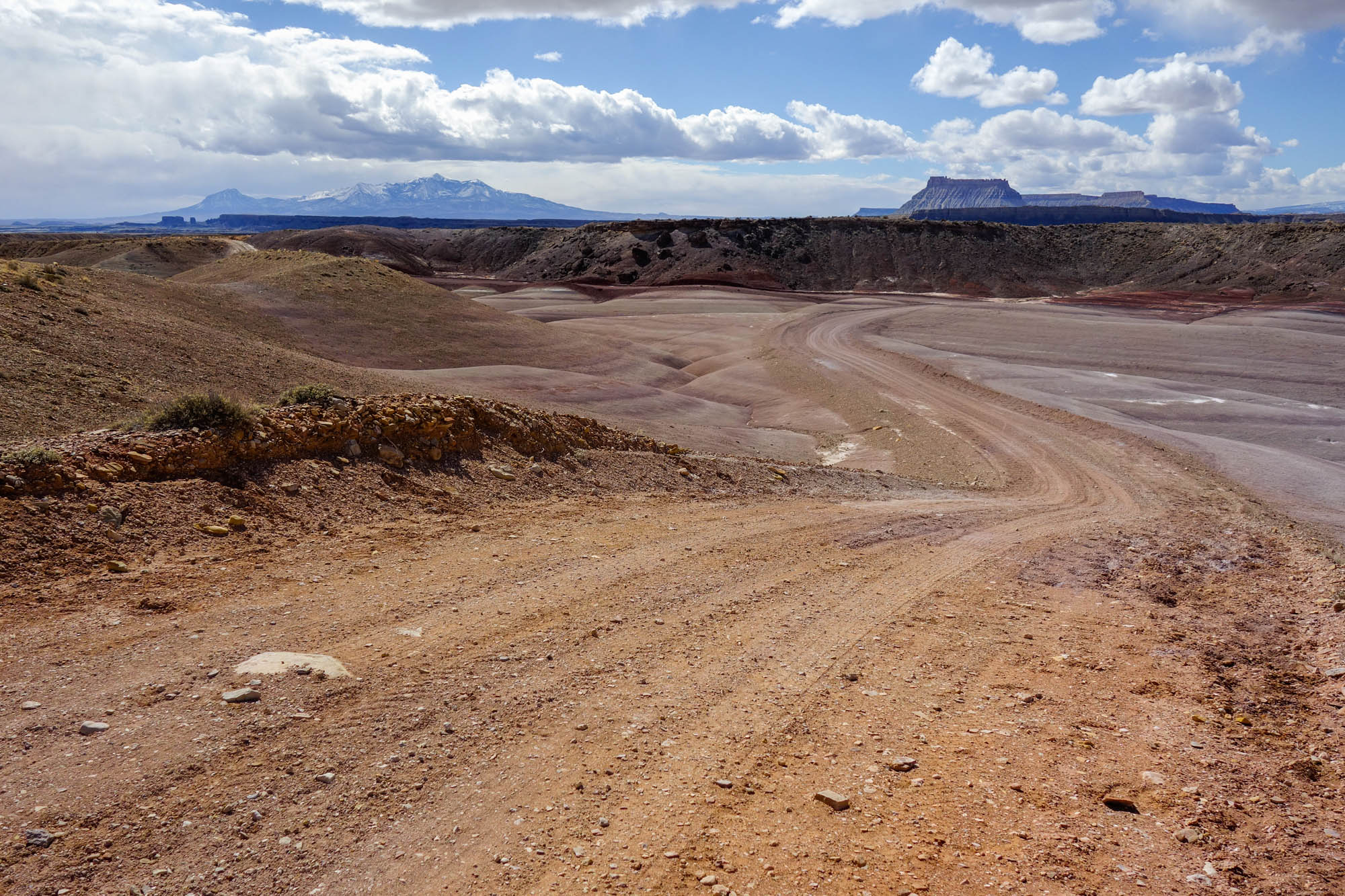
After passing through Eagle Canyon and Cat Canyon in the northern reaches of the Swell, the route follows gravel roads that climb and descend through a rolling landscape with stunning vistas. After descending through a series of dry washes, you emerge into a wide-open country in the western reaches of the San Rafael. The landscape here is stark but beautiful, stretching between towering mesas, buttes, and pinnacles rising from flat desert floors. After passing through a small section of Cathedral Valley at the southern end of the loop, the route turns northward, passing colorful and delicate rock formations near Factory Butte en route once again to Muddy Creek, where it emerges through the San Rafael Reef on the opposite side of a dramatic gorge first encountered near the Bunkhouse at Hidden Splendor.
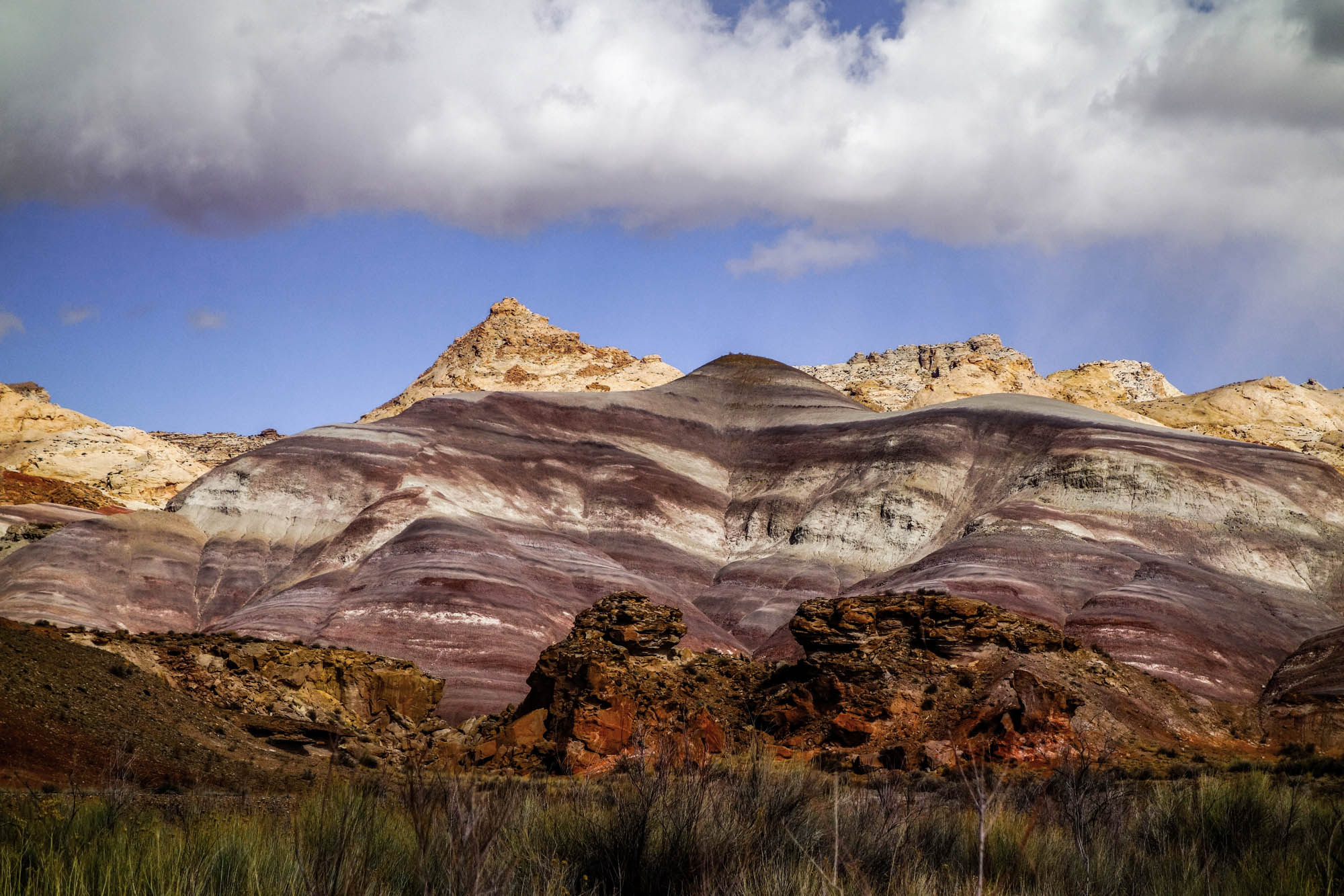
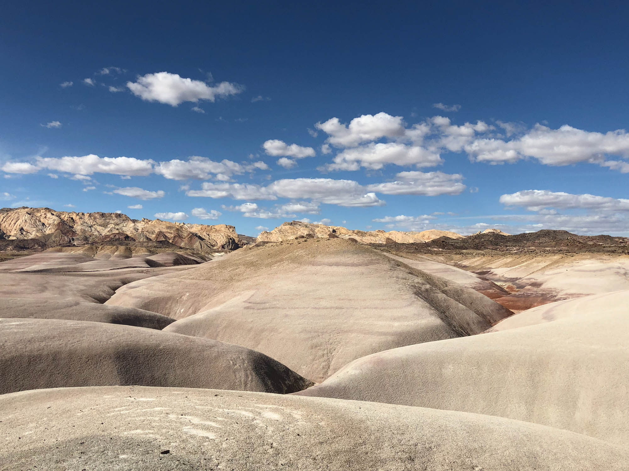
From Muddy Creek you will ride through an otherworldly, moonlike landscape characterized by multi-colored badlands nestled beneath the picturesque cliffs of titled stata that define the San Rafael Reef. Passing through Goblin Valley State Park, you will encounter the only section of paved road along the entire route (~11 miles) as you make your way back toward the start where the route ultimately culminates with a climb up Temple Mountain to explore numerous remnants of a bygone era of uranium and vanadium mining in the region.
The Stone House Lands Loop either passes through or runs adjacent to a number of areas classified as Areas of Critical Environmental Concern (ACEC) by the Bureau of Land Management. While ACECs are generally established to protect specific flora or fauna, several in and around the San Rafael Swell also protect cultural resources such as rock art sites from the Fremont and Ute people, as well as pioneer homesteads. Please remember that while no area the San Rafael Swell has a legal designation as a Native American Traditional Cultural Property, virtually every part of the Swell is culturally significant to one or more groups of people, as is discussed further in the resources section.
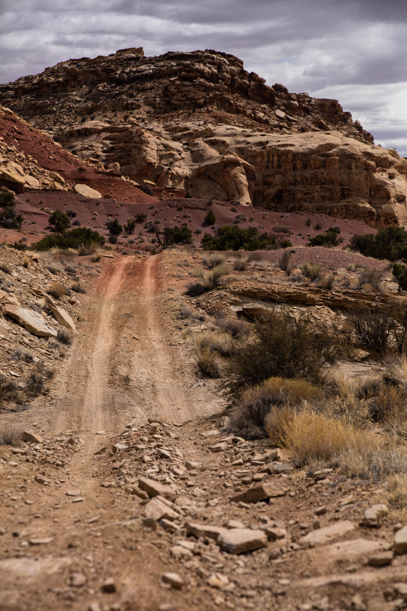
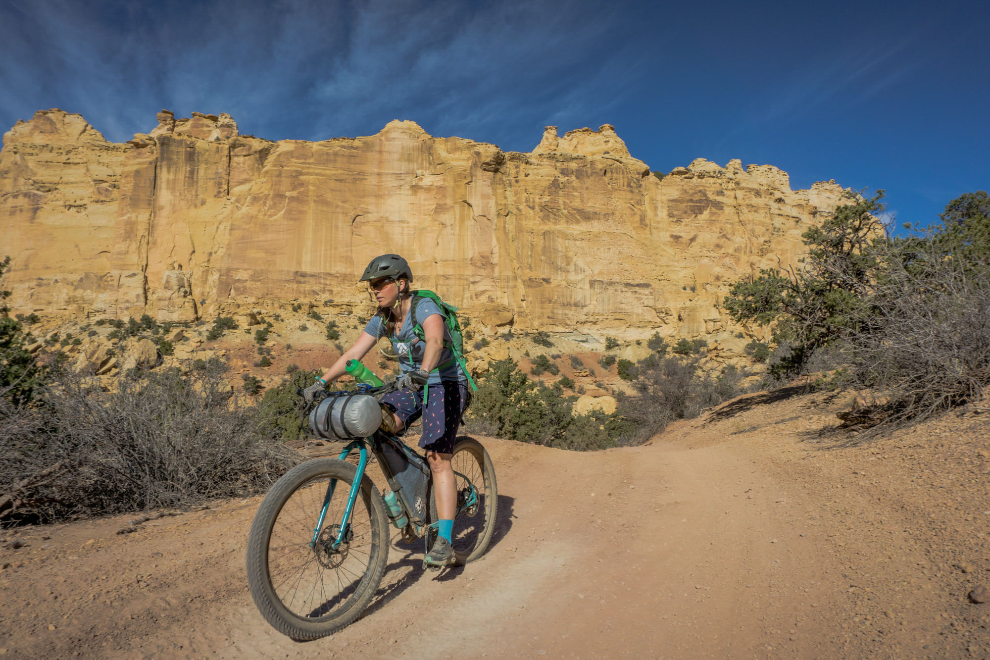
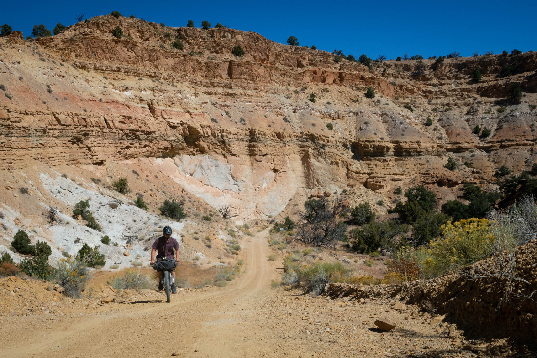
Difficulty: The Stone House Lands Loop has been assigned a difficulty of 6.5 out of 10. This rating is based largely on the remote nature of riding in the region, which has limited access to water (caching H2O is recommended), next to no cell phone service, and no resupply points. While the majority of riding along the route is non-technical, roads can be sandy in places and are extremely rocky at times. For this reason, mountain bikes with high volume tires or plus bikes are recommended. Finishing the route in four days requires an average of 50 miles and 3500-6000 ft of climbing per day.


Submit Route Alert
As the leading creator and publisher of bikepacking routes, BIKEPACKING.com endeavors to maintain, improve, and advocate for our growing network of bikepacking routes all over the world. As such, our editorial team, route creators, and Route Stewards serve as mediators for route improvements and opportunities for connectivity, conservation, and community growth around these routes. To facilitate these efforts, we rely on our Bikepacking Collective and the greater bikepacking community to call attention to critical issues and opportunities that are discovered while riding these routes. If you have a vital issue or opportunity regarding this route that pertains to one of the subjects below, please let us know:
Highlights
Must Know
Camping
Food/H2O
Trail Notes
Resources
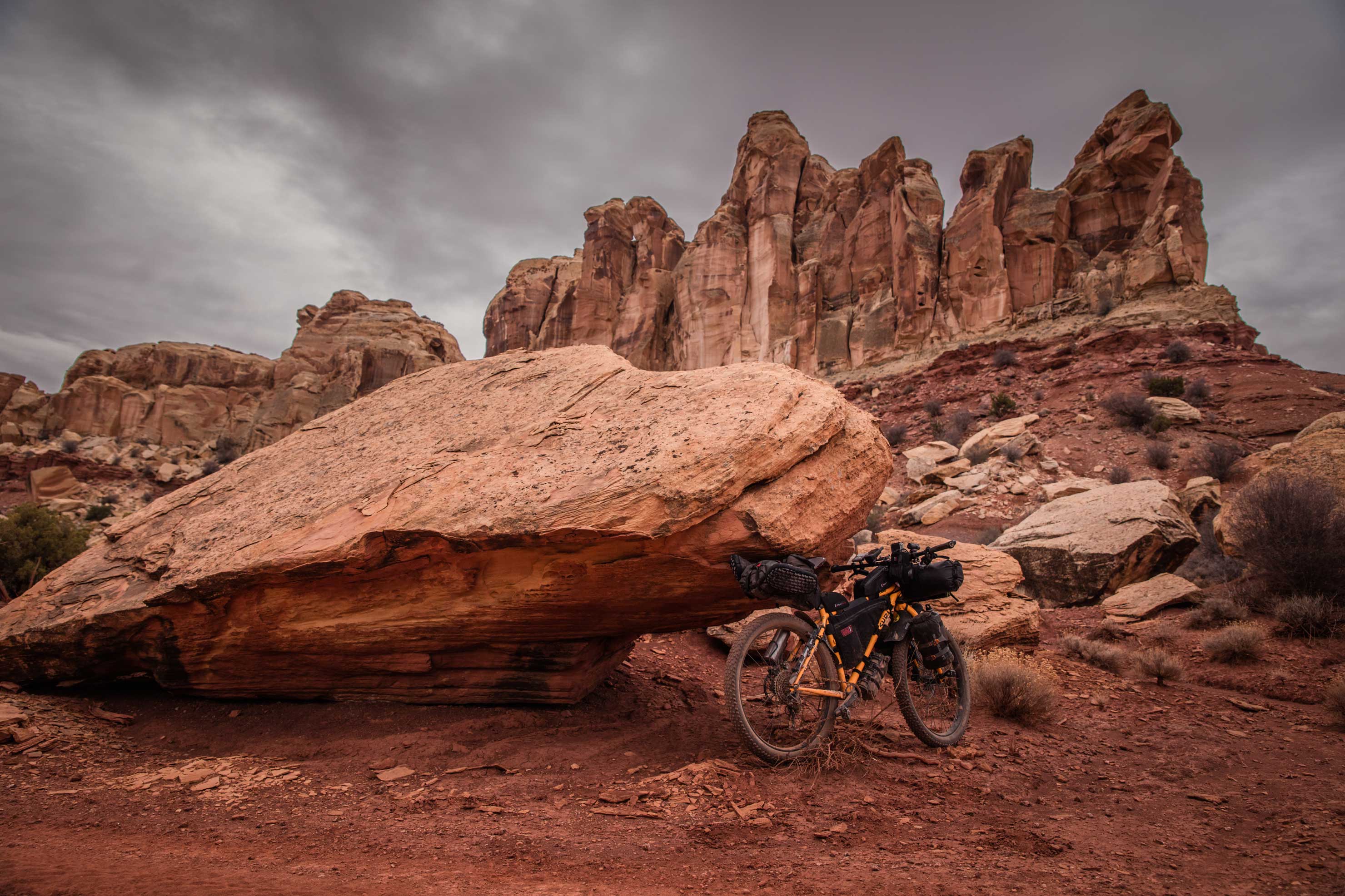
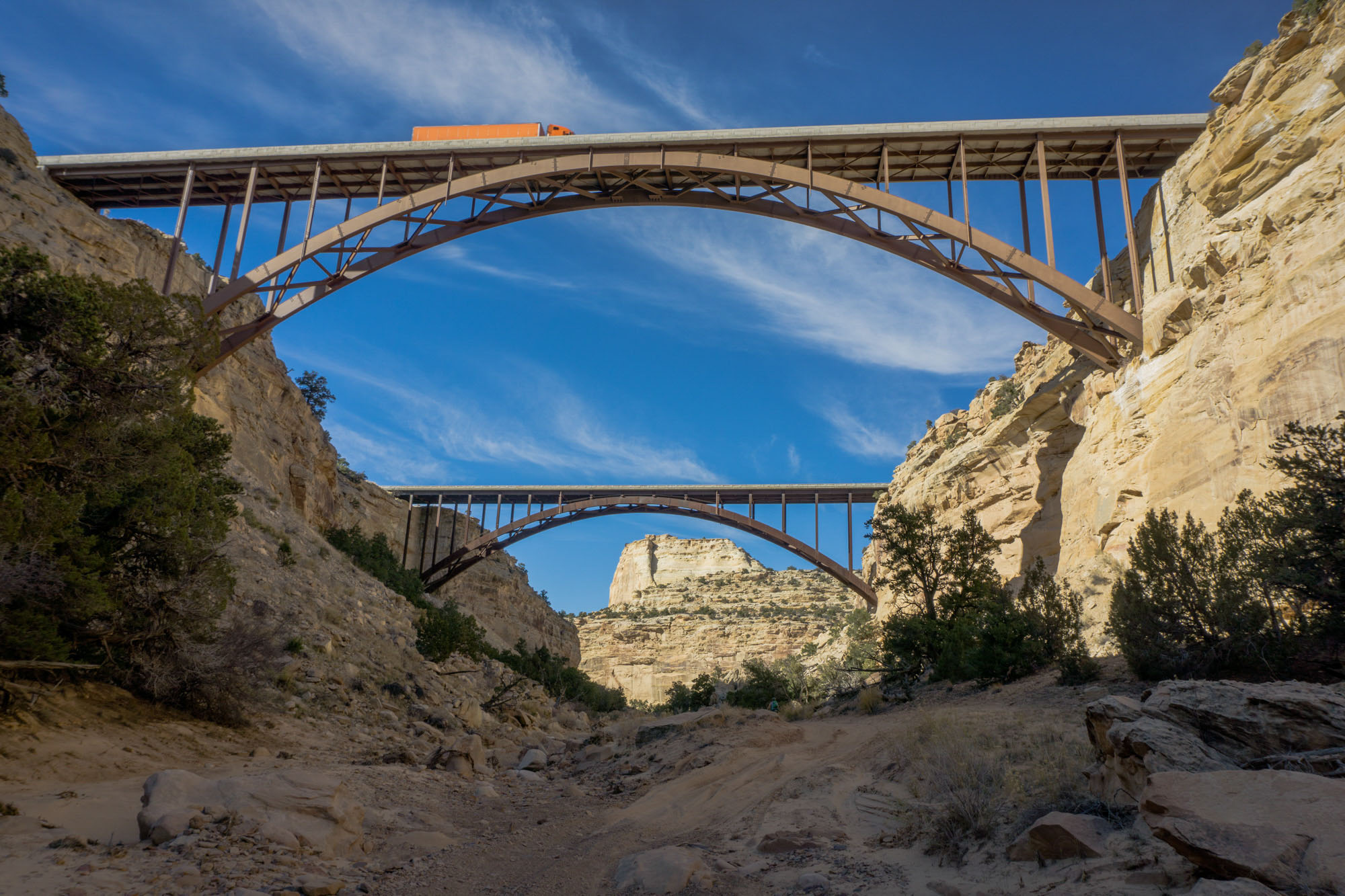
- Riding and camping beneath the strange rock formations, cliffs, and pinnacles comprising the San Rafael Reef that are experienced along the immensely beautiful (and rugged) Behind the Reef Road en route to Muddy Creek.
- The picturesque Bunkhouse at Hidden Splendor perched at the mouth of a dramatic gorge carved by Muddy Creek through tilted layers of Navajo Sandstone, Kayenta Formation, and Wingate Sandstone within the San Rafael Reef.
- Traversing through a desolate, high desert environment on rough doubletracks and gravel roads that meander over and through numerous canyons and dry washes, or beneath dramatic bluffs, wherein you are certain to encounter unexpected ruins, homesteads, and pictographs or petroglyphs left behind by past inhabitants of the Swell.
- Encountering the Temple of the Sun and Moon and the Gypsum Sinkhole in Cathedral Valley.
- Wild Horse Road, which takes you through an moonlike landscape of endlessly changing color and form forged by the uplift, tilting, and erosion of diverse sedimentary layers along the front of the San Rafael Reef between Muddy Creek and Goblin Valley State Park.
- While they are easy to bypass, the remnants of mining efforts atop Temple Mountain are not to be missed. Not only is the climb up Temple Mountain invigorating, but the views from this prominent feature overlook the San Rafael Reef at the start of the route, offering a perfect culmination to your multi-day sojourn through the Swell.
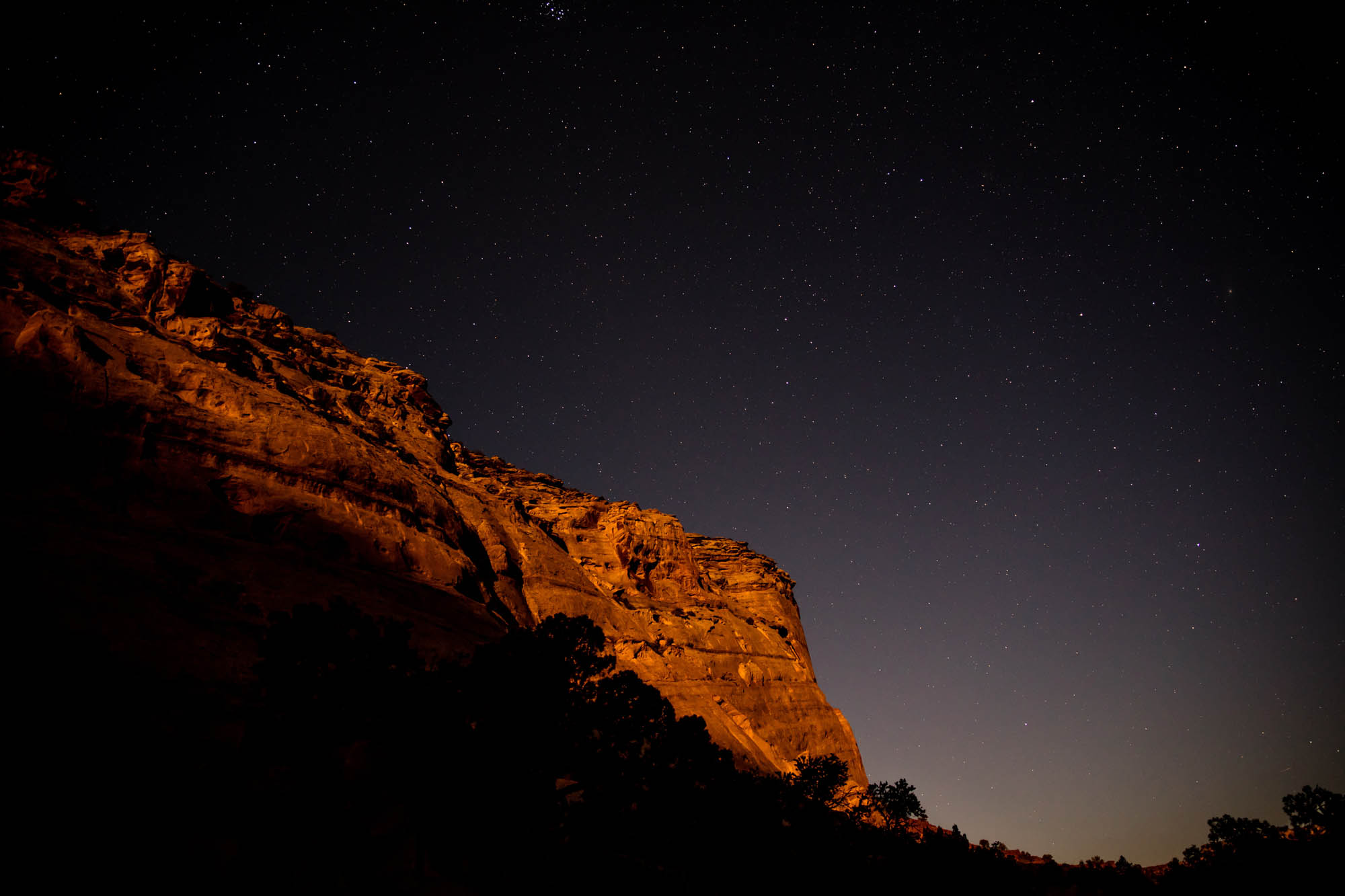
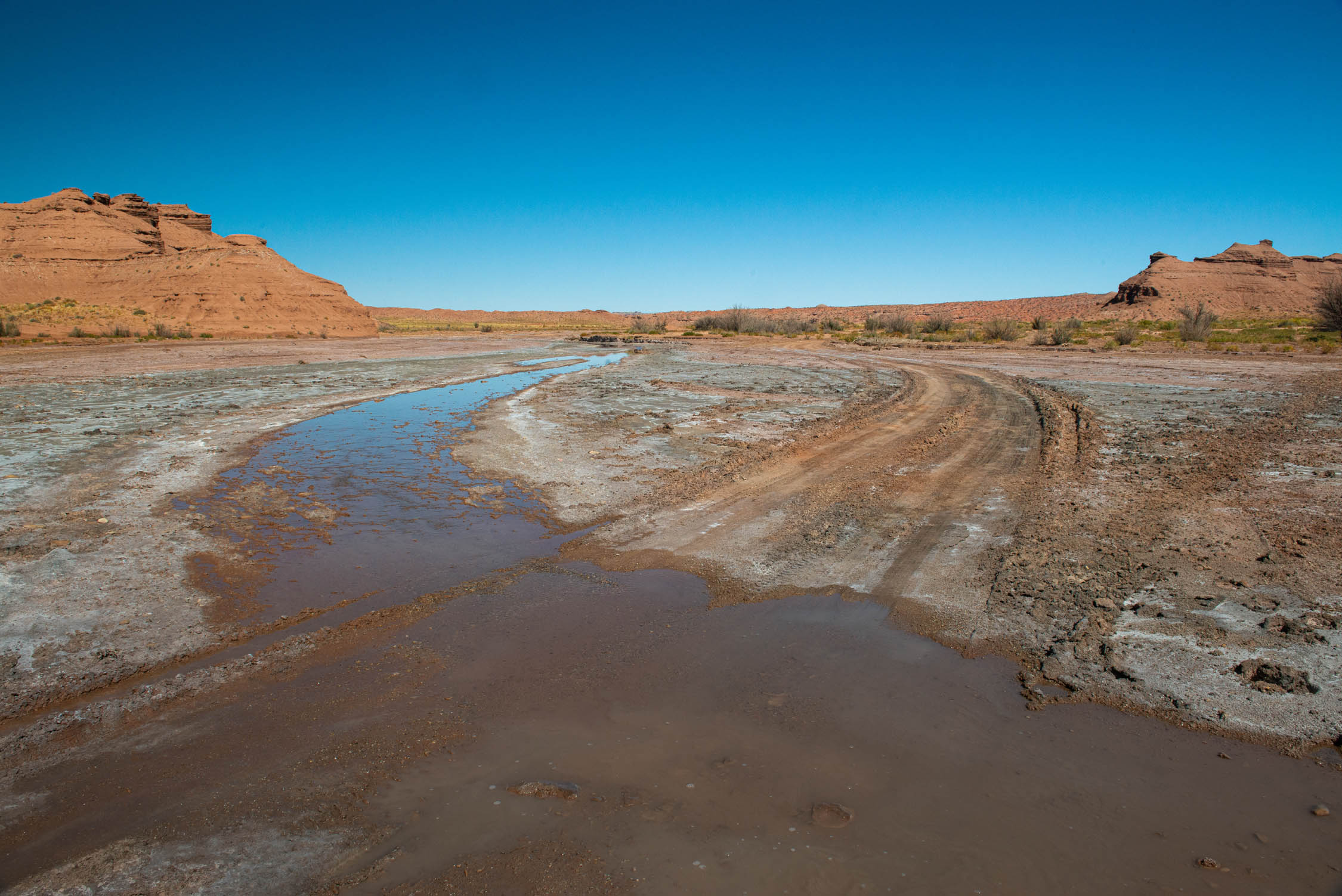
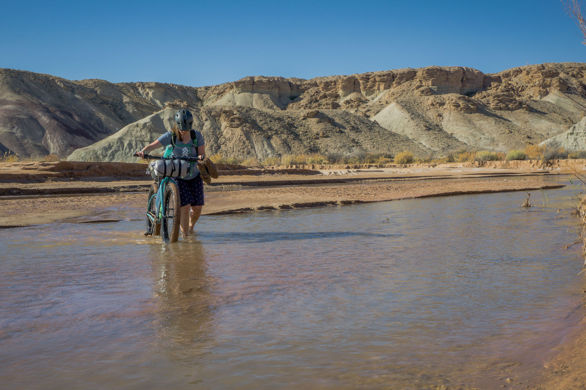
- This route is best ridden in the spring and fall. Sections of Muddy Creek and Mulligan Wash that must be crossed on the route may become impassable in the late spring to early summer when creek levels reach flood stage, particularly after heavy rains. Similarly, the summer months should be avoided due to the potential for extreme heat.
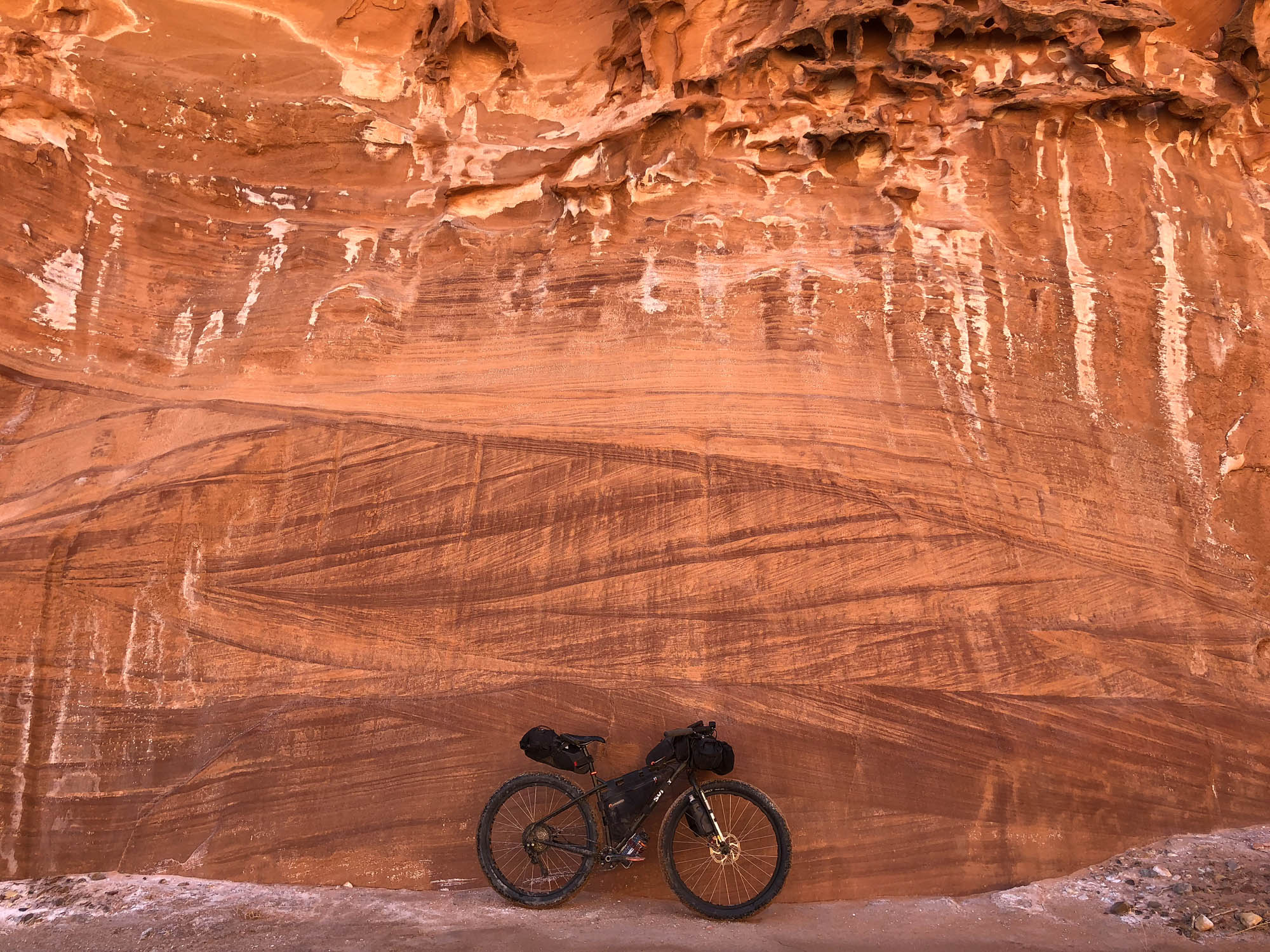
- Due to significant sections of the trail containing loose rock, sand and/or occasional mud, the route should not be attempted on anything less than a mountain bike. The authors completed development of the route on plus bikes with 3 inch tires and a 29er mountain bike. Fatbikes would be equally suitable for the entirety of this route, save perhaps the few miles of pavement in the southern portion of the route near Goblin Valley State Park.
- The route follows rough doubletrack and gravel roads with sections of bentonitic clay that would make passage or travel by bike extremely difficult (if not impossible) following or during heavy rain.
- Given the extremely remote nature of the riding in this region, and the potential for flash flooding, it is highly recommended that riders have a realistic assessment of their abilities and that they pay close attention to changing weather conditions, including those far upstream that can rapidly affect water levels at river crossings. Similarly, due to the risk of flash flooding, do not camp along Muddy Creek or within Mulligan Wash.
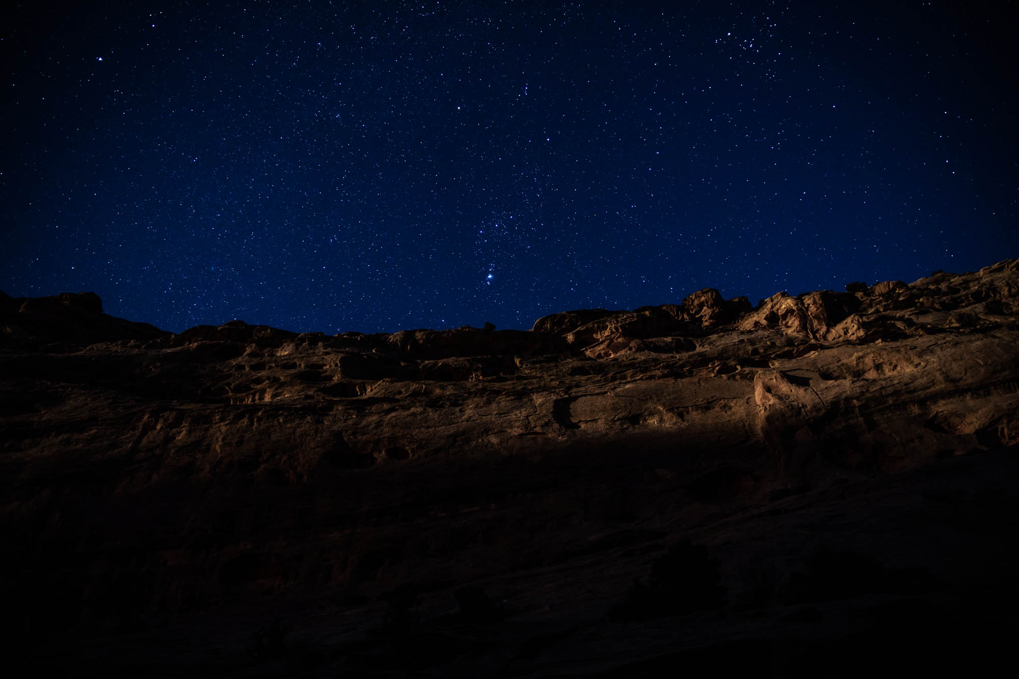
- Cell phone service is almost entirely non-existent along the length of both routes. Satellite communicators (e.g., Garmin inReach) or SPOT devices are strongly recommended.
- Rock art and historic sites are fragile, non-renewable cultural resources that, once damaged, can never be replaced. Avoid touching or disturbing any petroglyphs, pictographs, or artifacts encountered on your travels.
- With the exception of land belonging to Cathedral Valley and Goblin Valley State Park, the majority of the Stone House Lands Loop is on land managed by the BLM with abundant, excellent opportunities for free remote backcountry camping.
- The alignment of the route passes through or runs adjacent to established Wilderness Areas (e.g., Muddy Creek, Wild Horse Mesa, and Hondo Country Wilderness Areas) and a number of regions classified as Areas of Critical Environmental Concern (ACEC) by the Bureau of Land Management. As always, use minimal impact camping practices and avoid disturbance to sensitive areas, such as cultural sites or regions of cryptobiotic soil.
- A number of primitive campgrounds with pit toilets are present along Temple Mountain road that make ideal starting locations for the route. Note, however, that none of the free camping locations in the San Rafael Swell have water. The only exceptions to this are paid campgrounds or yurts within Goblin Valley State Park proper, wherein there is also access to flush toilets and showers (see Resources).
- Muddy Creek is the only “reliable” source of water along the route. However, due to its high mineral content, it is not recommended as a primary water source unless you really enjoy filtering extremely silty water and backflushing your purifier repeatedly. Therefore, it is recommended that you cache water in at least one, if not two, locations along the route. Depending on your strategy, there are a number of logical places to cache water, including near I-70 at the north of the route, or at the southernmost point of the route just north of Caineville. See the annotated GPX tracks for specific location recommendations.
- Green River is the nearest “large” town for food and supplies, though Hanksville (approximately 25 miles to the South on Hwy 24) also has a number of small restaurants, gas stations, and a market that will have limited food choices. Riders coming from Fruita, CO, or Moab, UT, will have abundant options for food and gear supply in those localities.
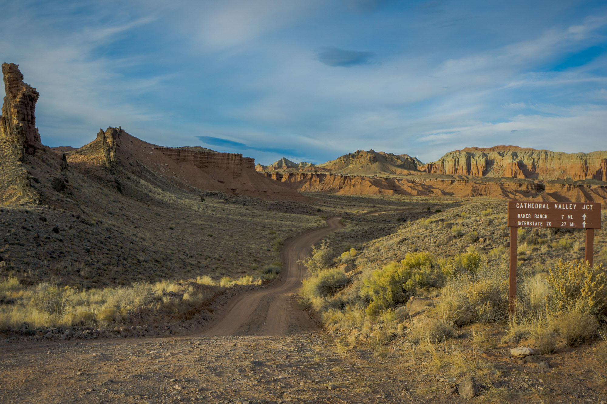
- There are a number of logical starting points for the route, which are indicated on the GPX file, but it is generally advised that riders begin the route either in the north of the route just off of Devils Canyon Road south of I-70 at Exit 116 or near one of the free campsites off of Temple Mountain Road, as these locations also offer numerous good options for leaving a vehicle overnight. Starting near Temple Mountain offers an additional benefit in that should riders intending to complete the multi-day traverse find that they are unable to continue, either due to changing conditions or planning-related issues early in the ride, this provides an option to return to Temple Mountain via our previously published overnight route – A (San Rafael) Swell Night Out.
- While it is possible to ride the route in either direction, riding counter-clockwise is highly recommended as this direction provides for a more natural riding flow, numerous sweeping vistas, and some incredible descents in the western sections of the route.
- If beginning in the north, or after crossing through Eagle Canyon in the north near I-70 if beginning at Temple Mountain, the multi-day route becomes MUCH more remote for the ~100 miles it takes through the western San Rafael Swell, so plan accordingly. Caching water beforehand is highly recommended (see Food/H20).
- The dramatic gorge carved by Muddy Creek through the San Rafael monocline is truly stunning. This region is now encapsulated within the Muddy Creek Wilderness area and thus mountain biking in the gorge is not allowed. However, should you want to explore it further during your ride, it is most easily accessed via a short hike from The Bunkhouse at Hidden Splendor after the route turns south from the Behind the Reef Road toward Muddy Creek.
- For folks who are newer to bikepacking, or who are still gauging their level of comfort in remote exploration, we suggest looking at our previously published overnight loop A (San Rafael) Swell Night Out that follows a similar track through the interior of the Swell, or the recently published Cathedral Valley Loop, an abutting overnight option that shares a portion of this multi-day route through Cathedral Valley.
Indigenous Perspective
The first people to arrive in the area were hunter-gatherers who settled in the San Rafael Desert and San Rafael Swell during the Paleoindian Period (11,400 – 7,000 B.C.). Archaic Period (7,000 B.C. – A.D. 500) peoples continued to inhabit the region and practice a hunter-gatherer subsistence lifestyle until near the end of the Archaic Period when maize was introduced into Utah. It was during the Formative Period (A.D. 500 – 1,300) that native peoples, particularly the Fremont people in the San Rafael area, began to rely more on maize cultivation and focus less on hunting and gathering. It was during this time that Fremont people produced many of the masonry buildings and widespread rock art still preserved throughout the San Rafael Swell. Many of the Fremont people migrated south in approximately A.D. 1,054, and it was during this time that Numic-speaking peoples such as the Paiute, Shoshone, and Ute began migrating into Utah, with the Ute settling the San Rafael area. These indigenous peoples were still around when Spanish explorers entered modern-day Utah during the 18th century.
In order to provide an indigenous perspective of the lands through which this route passes—for the rider to be mindful of on their travels—we consulted with Terry Morgart, Cultural Preservation Officer of the Hopi Tribe (descendants of the Fremont People), who offered the following:
Puebloan people believe that our ancestral sites remain spiritually occupied. These sites were ritually retired as a part of migrations. Hopi migration is intimately associated with a sacred Covenant between the Hopi people and Màasaw, the Earth Guardian, in which the Hopi people made a solemn promise to protect the land by serving as stewards of the Earth. In accordance with this Covenant, ancestral Hopi clans traveled through and settled on the lands in and around the Southwest during their long migration to Tuuwanasavi, the Earth Center on the Hopi Mesas.
This land is a testament of Hopi stewardship through thousands of years, manifested by the “footprints” of Hopi ancestors: ancient villages, sacred springs, shrines, migration routes, pilgrimage trails, artifacts, petroglyphs, and the physical remains of buried Hisatsinom, all of which were intentionally left to mark the land as proof that the Hopi people have fulfilled their Covenant with Màasaw. This landscape is steeped in cultural values and maintained through oral traditions, songs, ceremonial dances, pilgrimages, and stewardship, and as a cultural landscape, the archaeological sites and physical terrain situates the Hopi people in time and space, providing a geographical conception of history and religion that connects the past, present and future.
As you move through this incredibly wild, beautiful, and precious landscape, please be mindful of its rich cultural history and treat this area with respect.
Terry Morgart (Hopi Tribe Cultural Preservation Officer), William Brant (Archaeologist, BLM Price Field Office), and Tiffani Baker (Lead Museum Specialist, Museum of the San Rafael) are gratefully acknowledged for their time, words, and contributions to the indigenous history of the San Rafael region.
Additional Resources
- Goblin Valley State Park (Information for camping, mountain biking, hiking, and current conditions): https://stateparks.utah.gov/parks/goblin-valley/
- Cathedral Valley, Capitol Reef National Park: https://www.nps.gov/care/planyourvisit/cathedralvalley.htm
- Bureau of Land Management Price Field Office (Regional information): https://www.blm.gov/office/price-field-office
- Wilderness Areas of the United States by Wilderness Connect (Information as to the land use designations surrounding the Stone House Lands Loop in the San Rafael Swell): https://bit.ly/2FQaLQM


Terms of Use: As with each bikepacking route guide published on BIKEPACKING.com, should you choose to cycle this route, do so at your own risk. Prior to setting out check current local weather, conditions, and land/road closures. While riding, obey all public and private land use restrictions and rules, carry proper safety and navigational equipment, and of course, follow the #leavenotrace guidelines. The information found herein is simply a planning resource to be used as a point of inspiration in conjunction with your own due-diligence. In spite of the fact that this route, associated GPS track (GPX and maps), and all route guidelines were prepared under diligent research by the specified contributor and/or contributors, the accuracy of such and judgement of the author is not guaranteed. BIKEPACKING.com LLC, its partners, associates, and contributors are in no way liable for personal injury, damage to personal property, or any other such situation that might happen to individual riders cycling or following this route.
Please keep the conversation civil, constructive, and inclusive, or your comment will be removed.