


Ojos de Tehuacan (TCBR, Norte)
Distance
115 Mi.
(185 KM)Days
3
% Unpaved
80%
% Singletrack
4%
% Rideable (time)
100%
Total Ascent
11,795'
(3,595 M)High Point
7,324'
(2,232 M)Difficulty (1-10)
5?
- 7Climbing Scale Strenuous103 FT/MI (19 M/KM)
- 5Technical Difficulty Moderate
- 6Physical Demand Moderate
- 4Resupply & Logistics Fair
Contributed By

Cass Gilbert
Contributing Editor
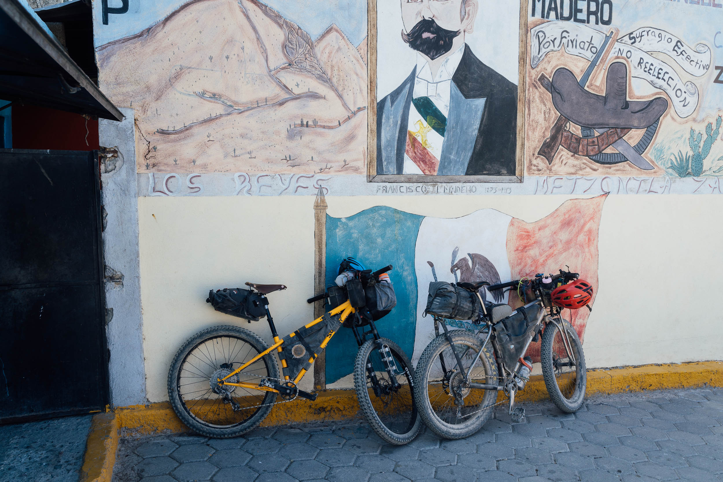
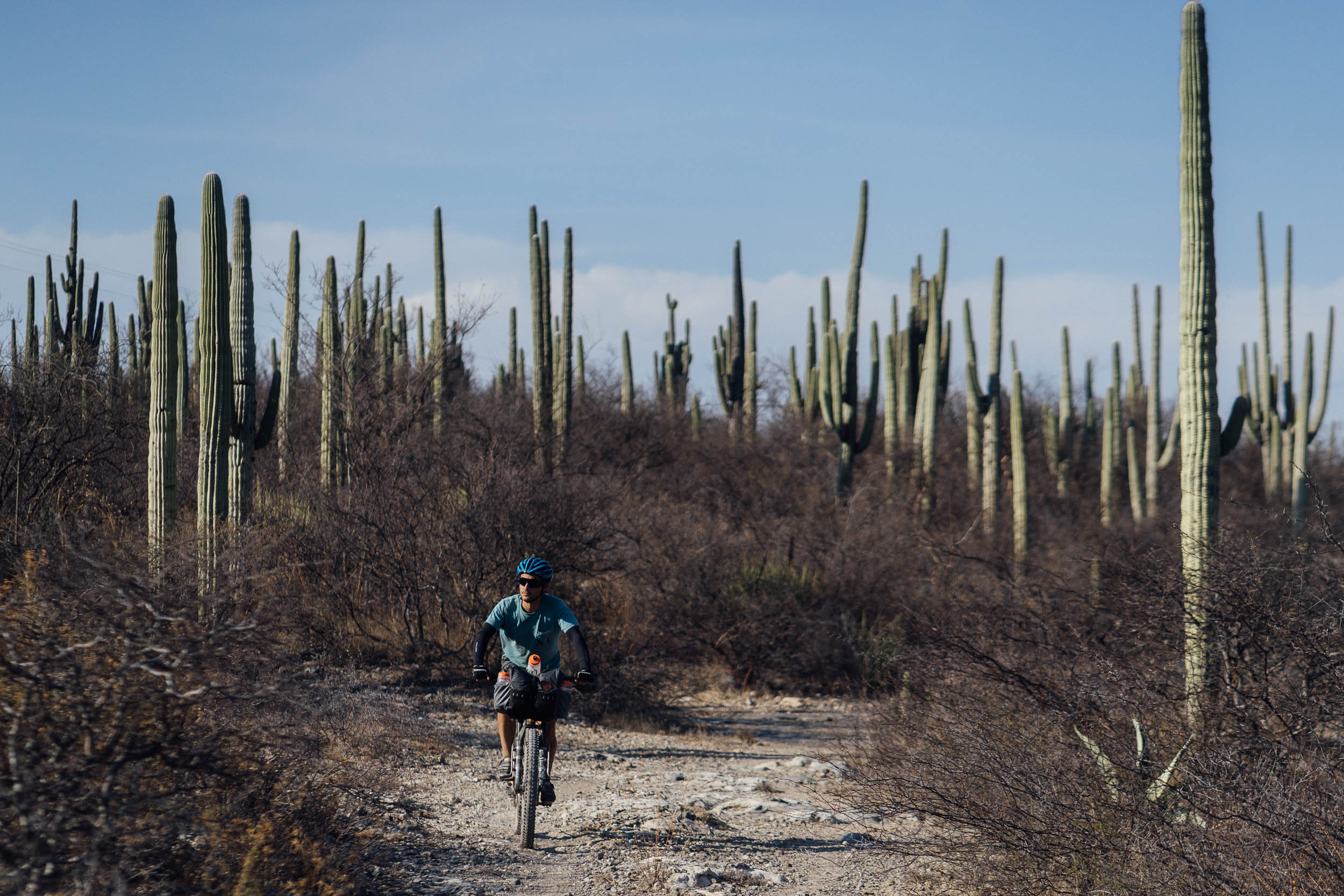
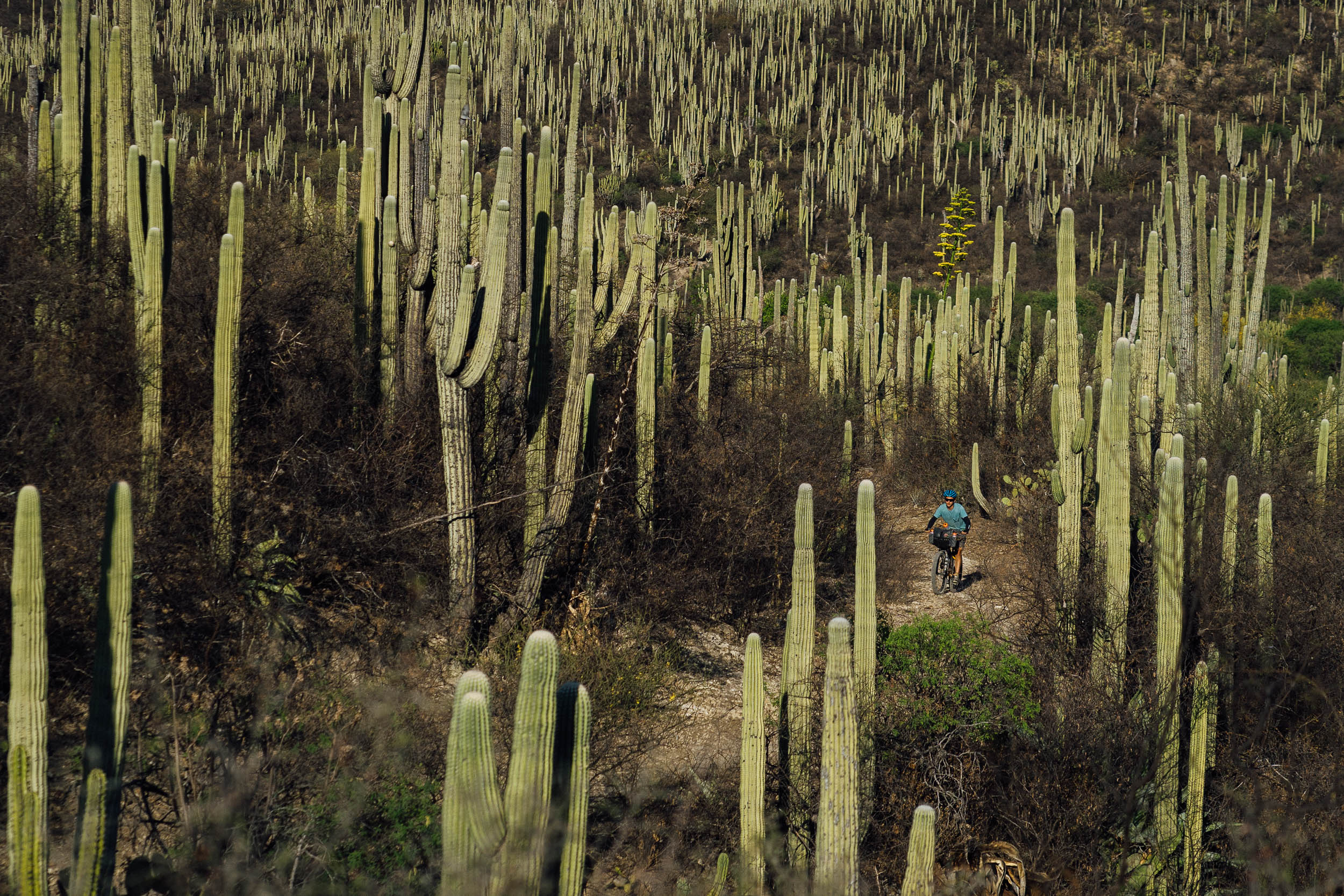
Updated/re-scouted 2024: this route has been updated for 2024 to travel in a clockwise direction, which makes for a better overall riding experience. Another notable update to the route is the addition of the ‘Cactus Loop,’ a half-day ride starting from Zapotitlán Salinas. This exhilarating loop mirrors the annual local race, Reto de Los Cactus, and brings a dynamic singletrack experience to the desert landscape. Riders can expect flowy cross-country trails winding through towering columnar cacti and a challenging arroyo crossing. This loop is a standout feature of biking in the biosphere, and it’s highly recommended not to skip. Note that it can be ridden loaded as part of the route or separately as a day ride—camp at the Jardín Botánico Helia Bravo and make an extra day of it.
The Tehuacán-Cuicatlán Biosphere Reserve is a vast area that straddles both the southeastern portion of the state of Puebla and the northeast portion of the Oaxaca – hence our two distinctive loops (find details of the South Loop here). The reserves cover 490,186 hectares, including both a protected core zone and a more general buffer ring.
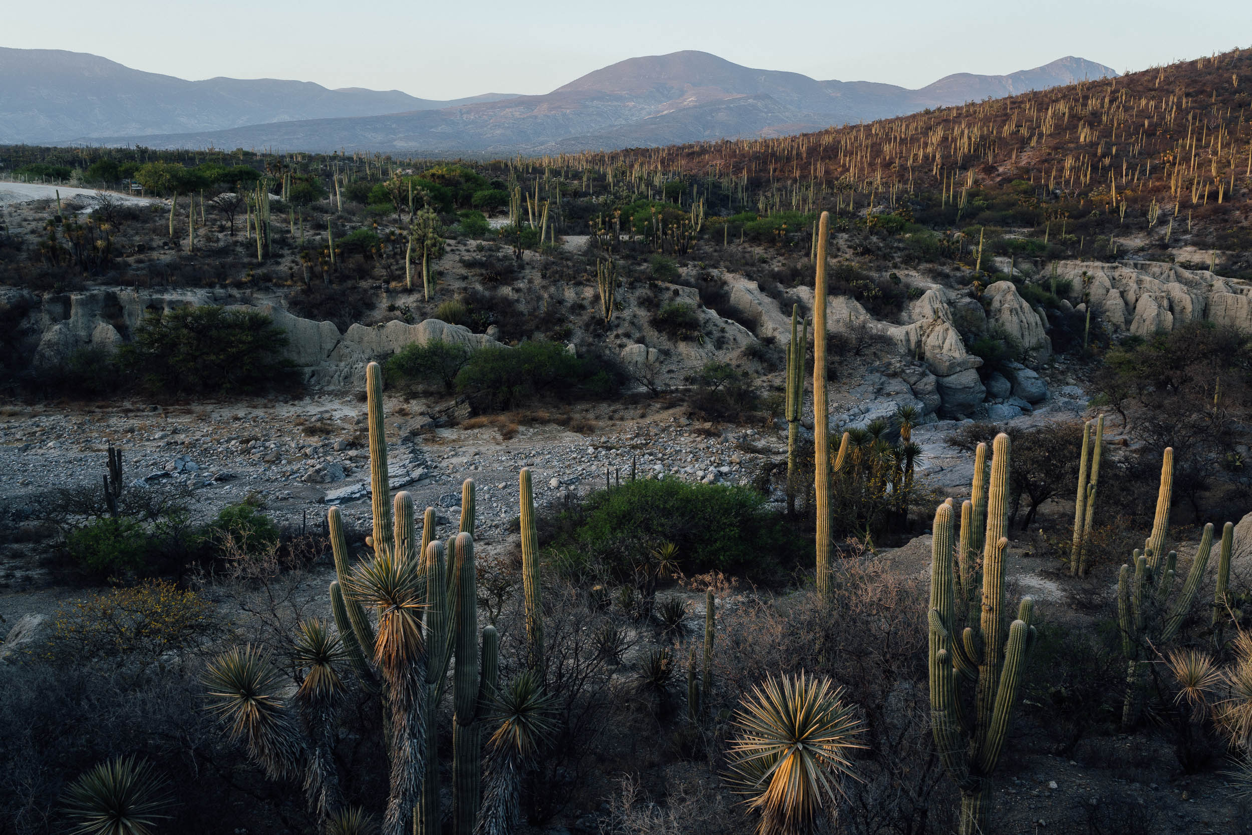
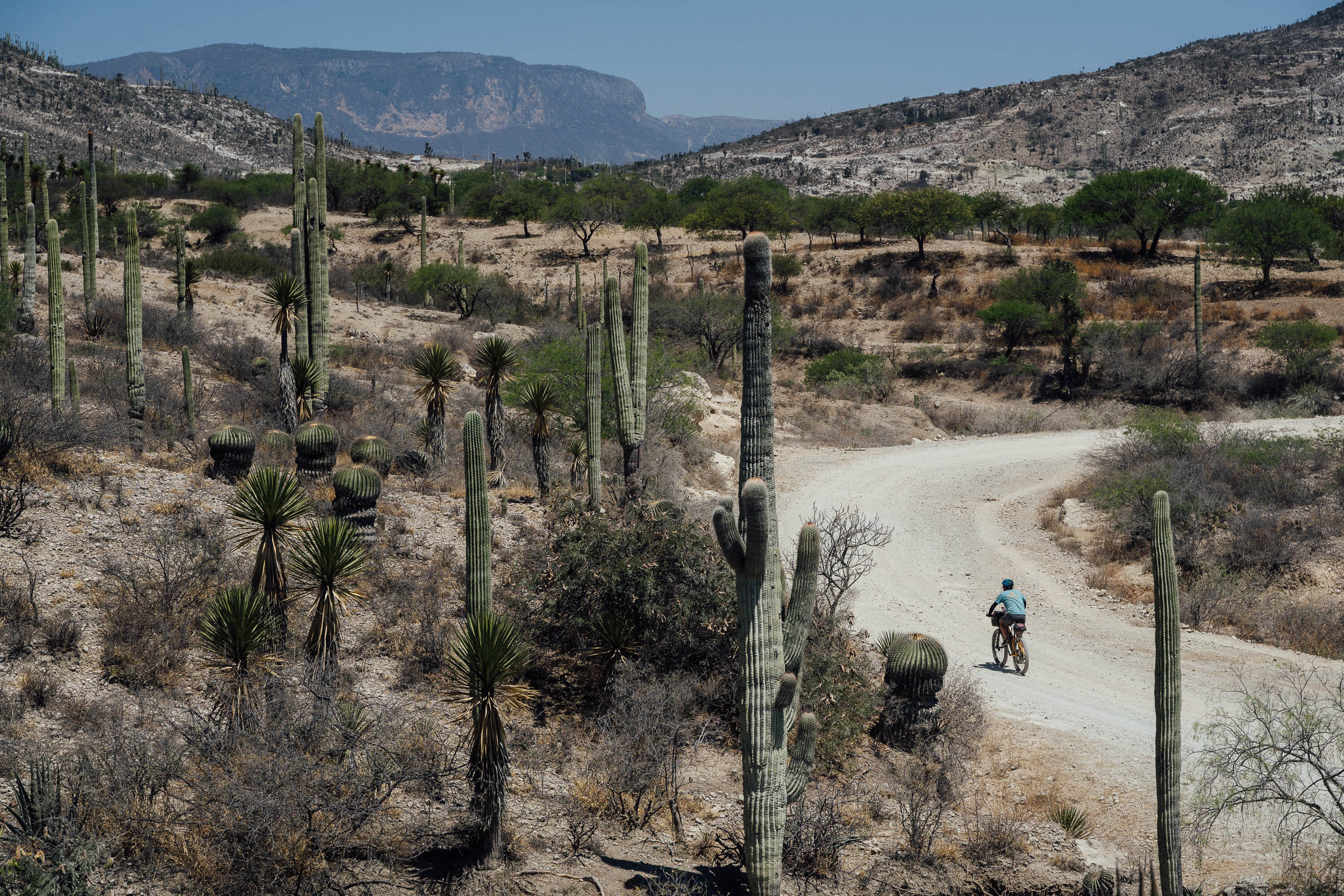
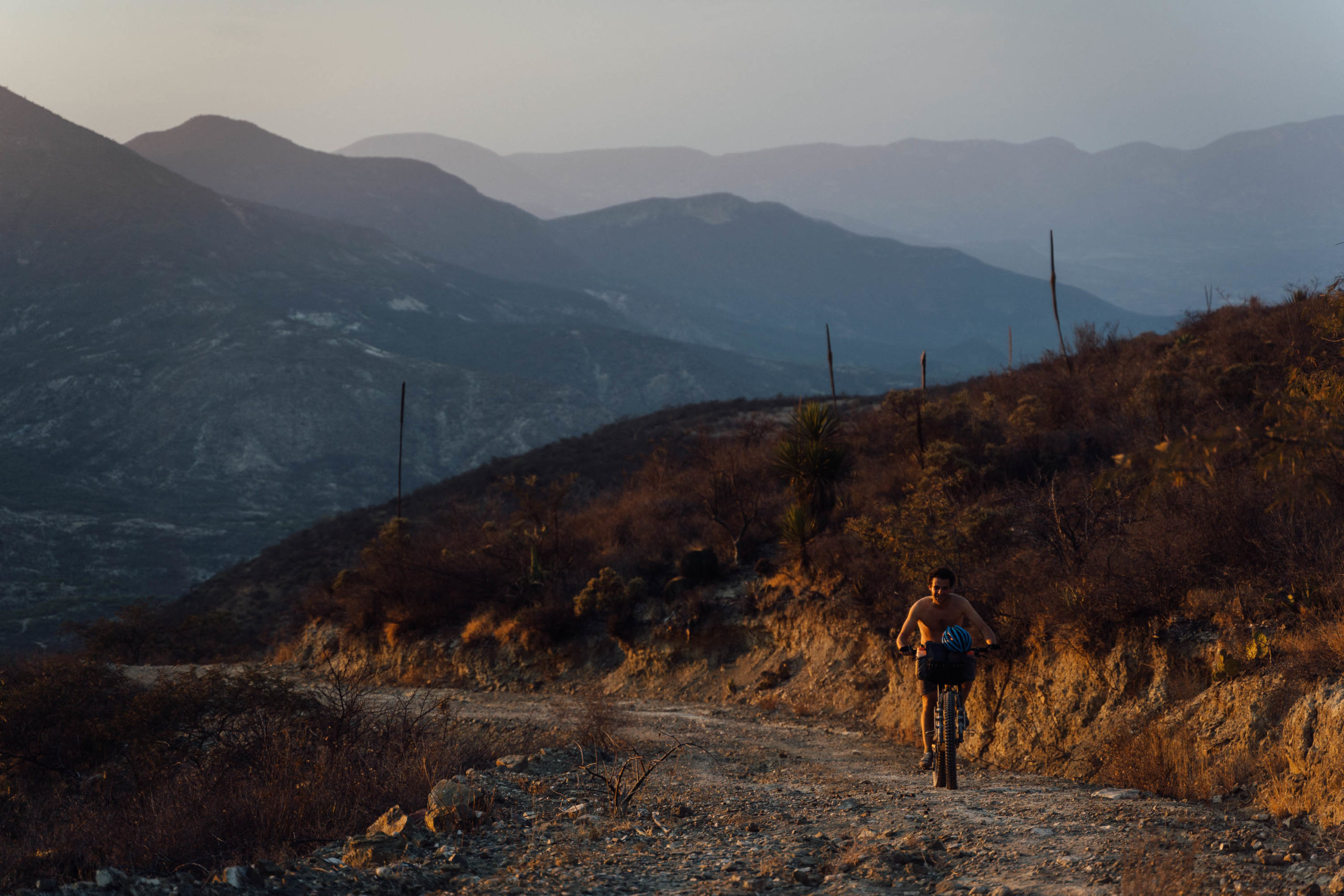
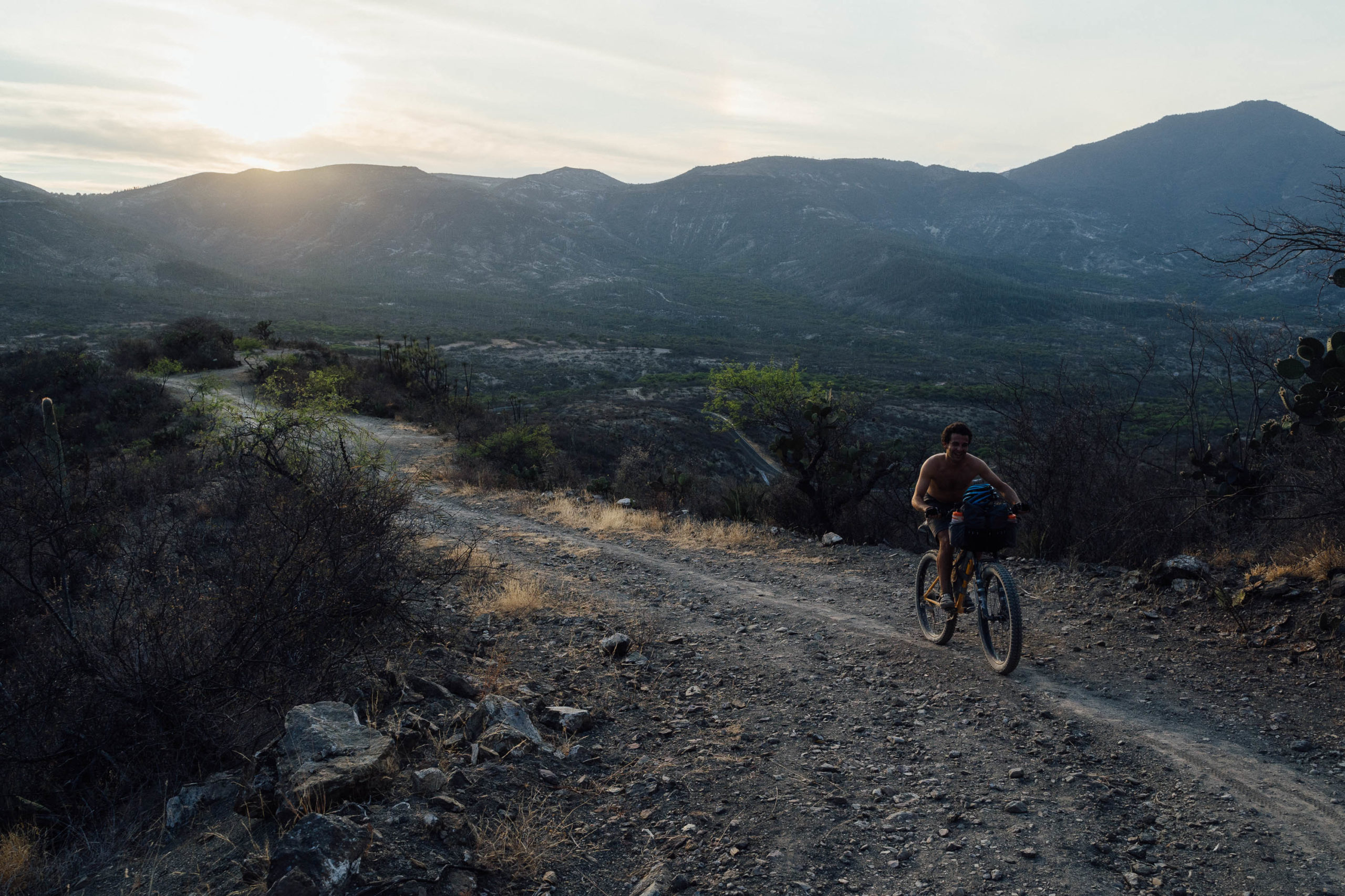
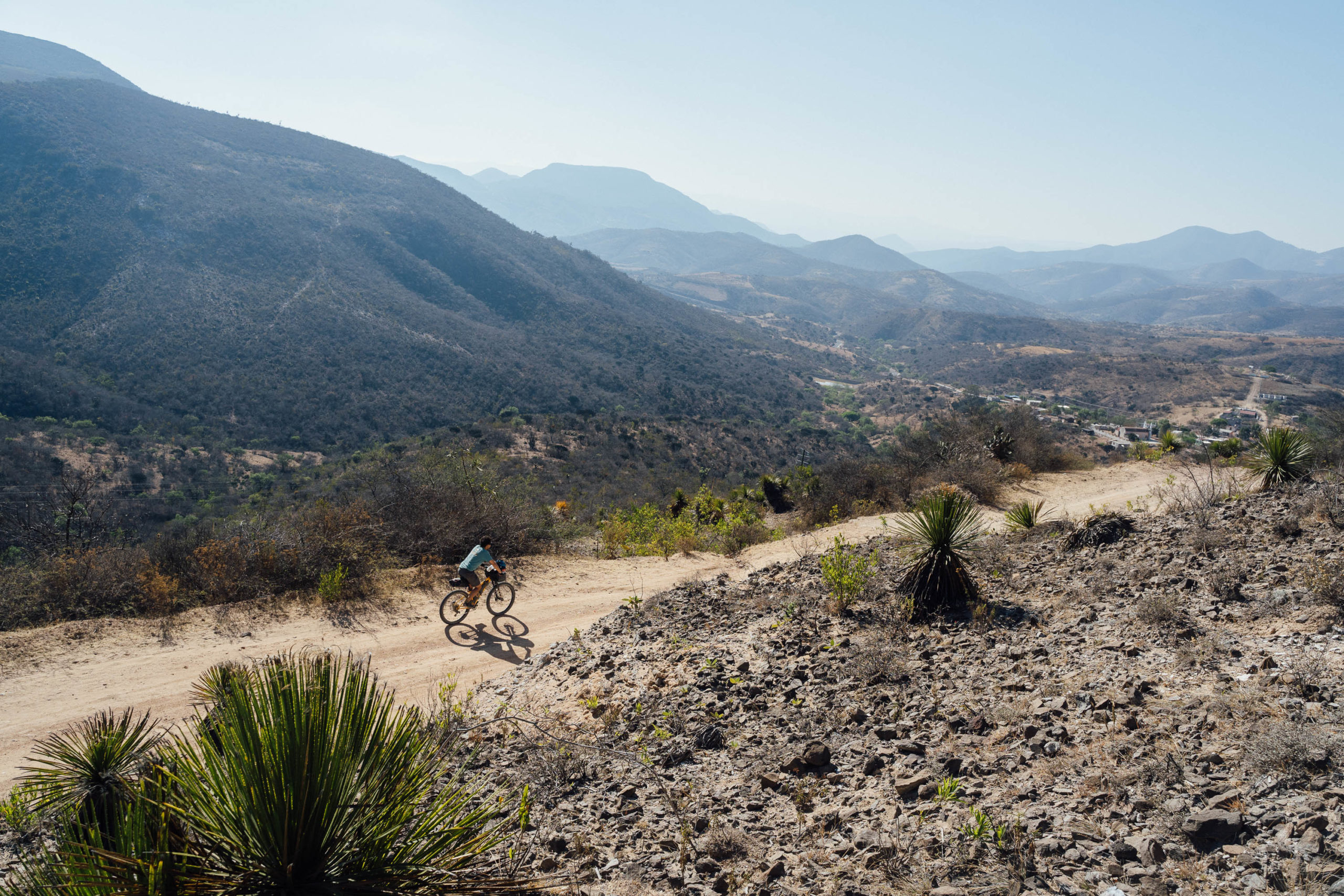
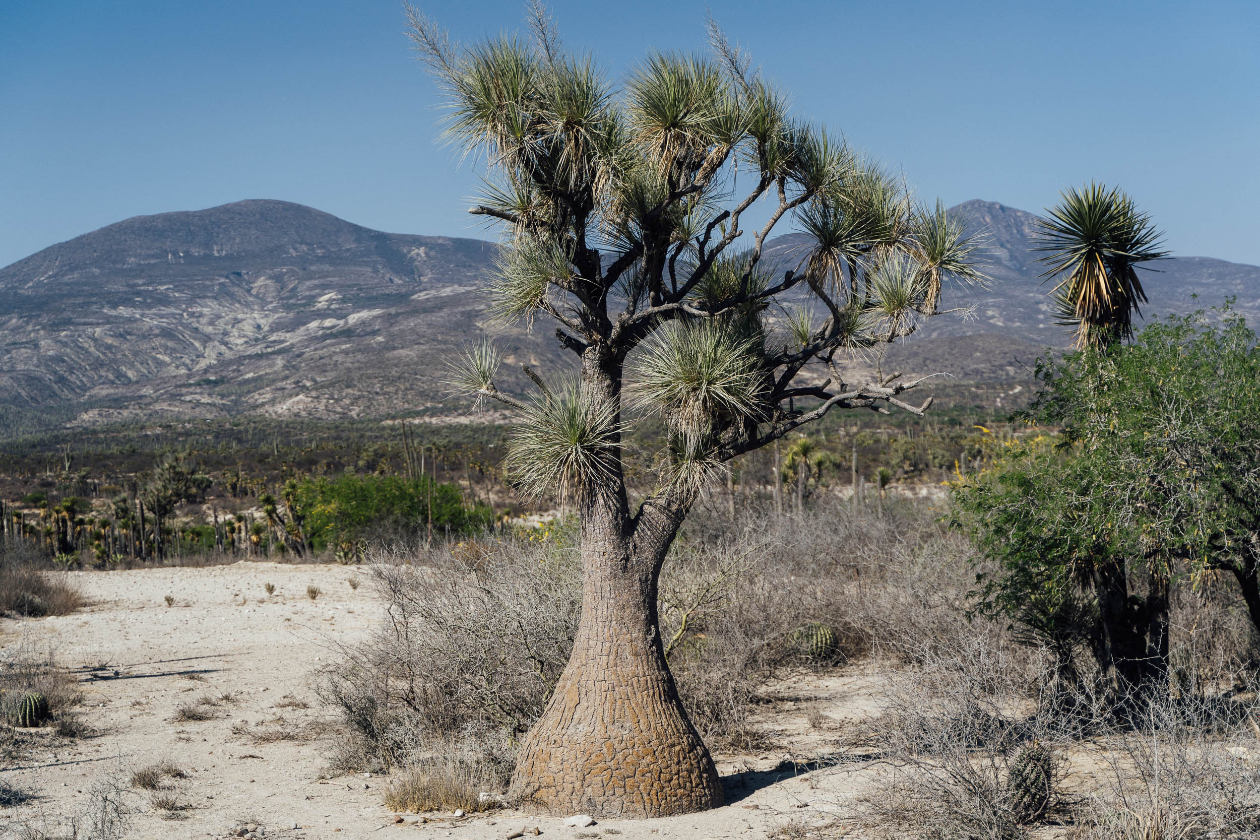
This is rugged mountain country, bound as it is by the Sierra Zongolica in the north, the Mazatec Sierra in the middle, and the Sierra de Juarez in the south. Cut by deep canyons and set across a range of elevations – the area is laced with dirt roads that vary between 500m and 2,500m in altitude – expect tropical deciduous forests, pine forest, cloud forest, pine-oak, and remote desert, making this swathe of land remarkably biodiverse.

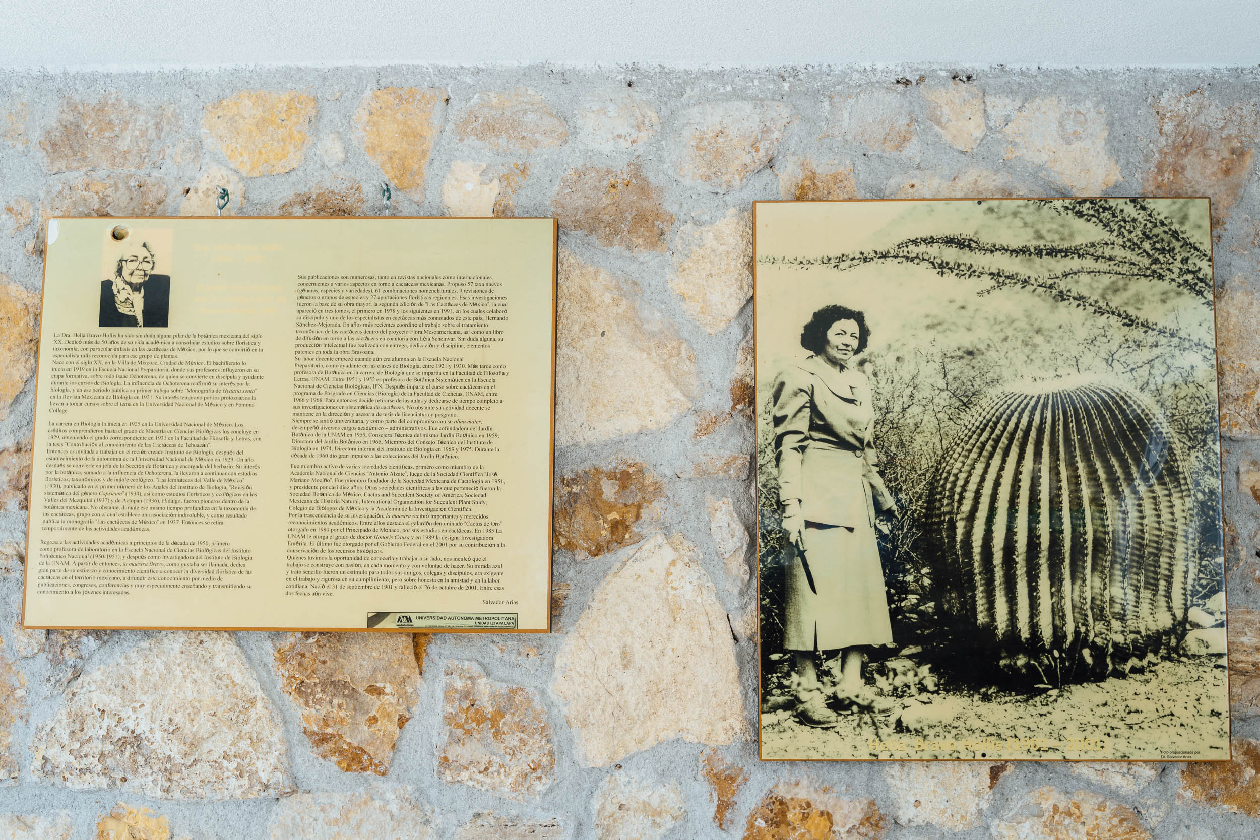
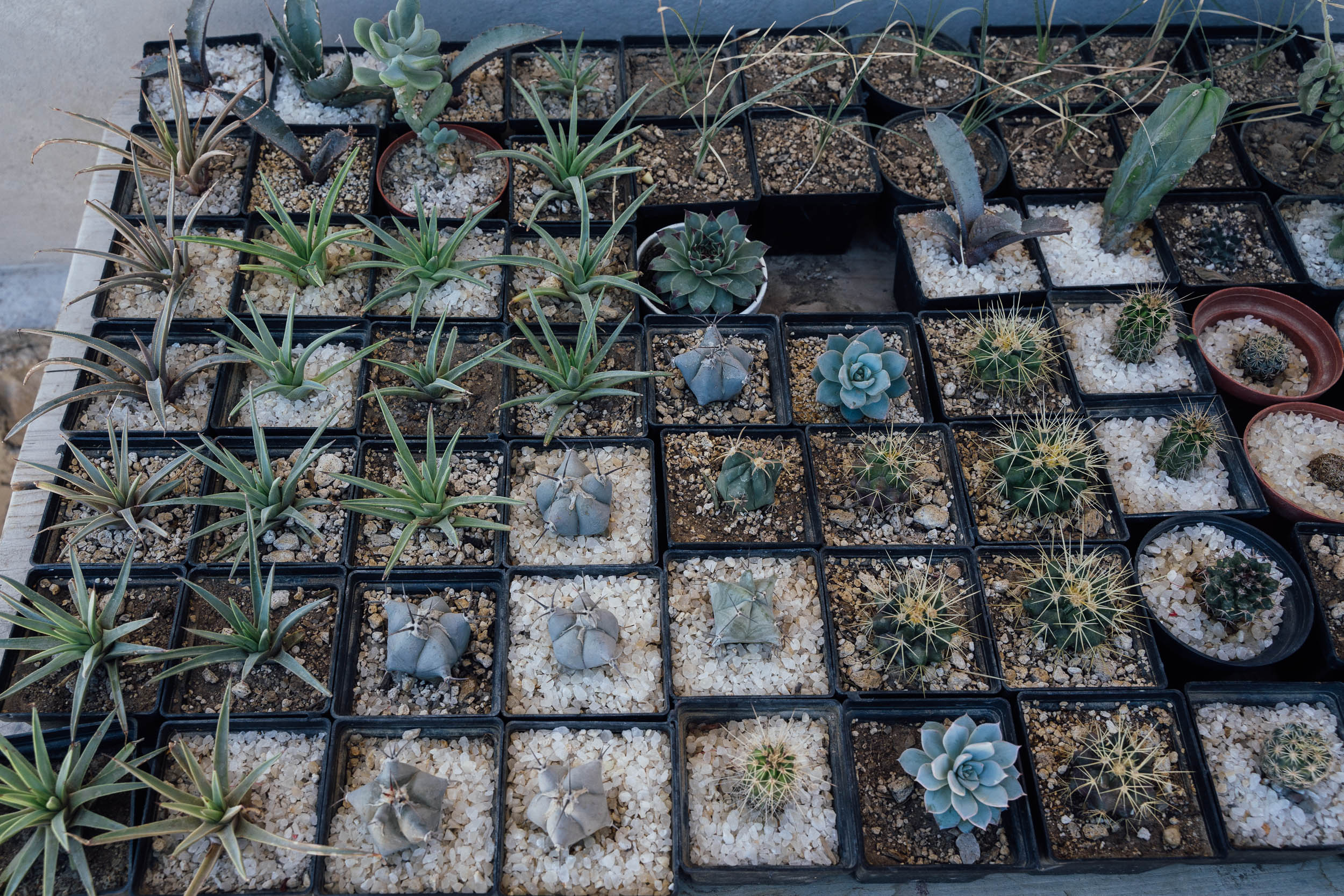
The northern loop, as detailed here, is based out of Zapotitlán and typified by a rich variety of desert flora, which can best appreciated by an initial visit to the Jardín Botánico Helia Bravo. This impressive garden is named after the acclaimed botanist Helia Bravo, co-founder of the Mexican Cactus Society in 1918, and renowned for her botanical research and extensive fieldwork.
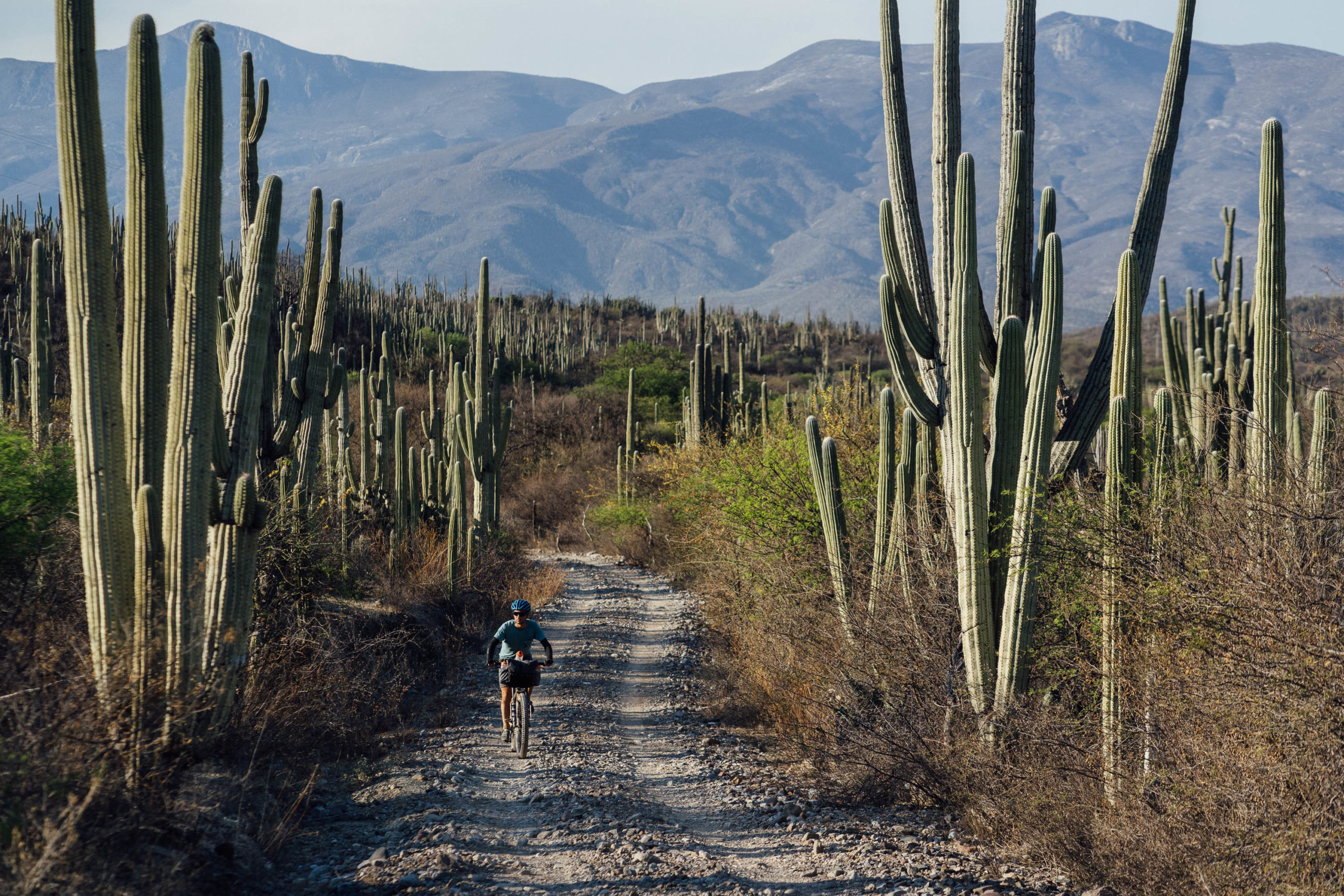
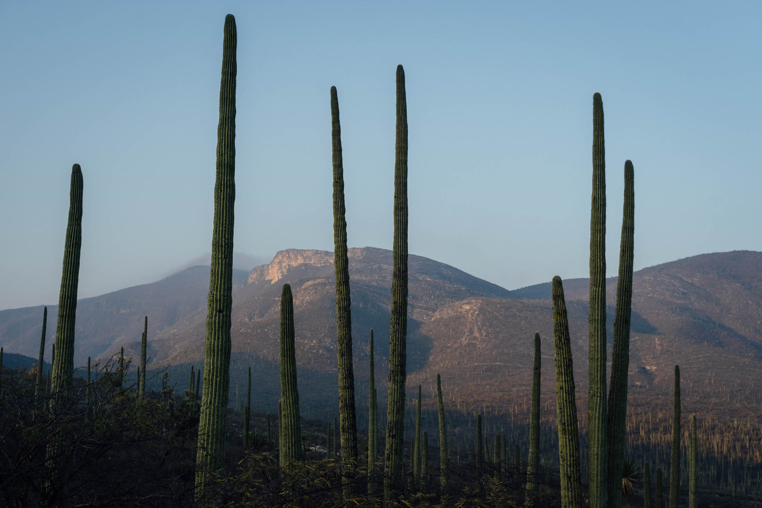
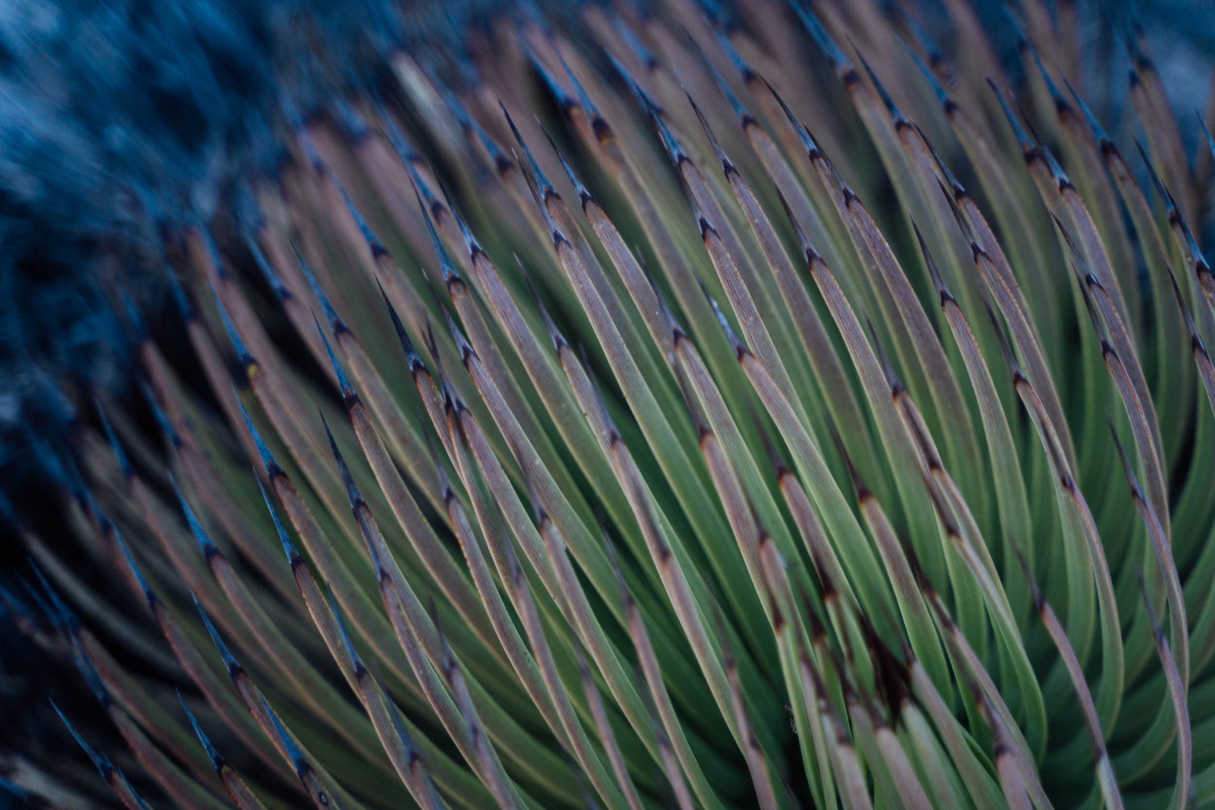
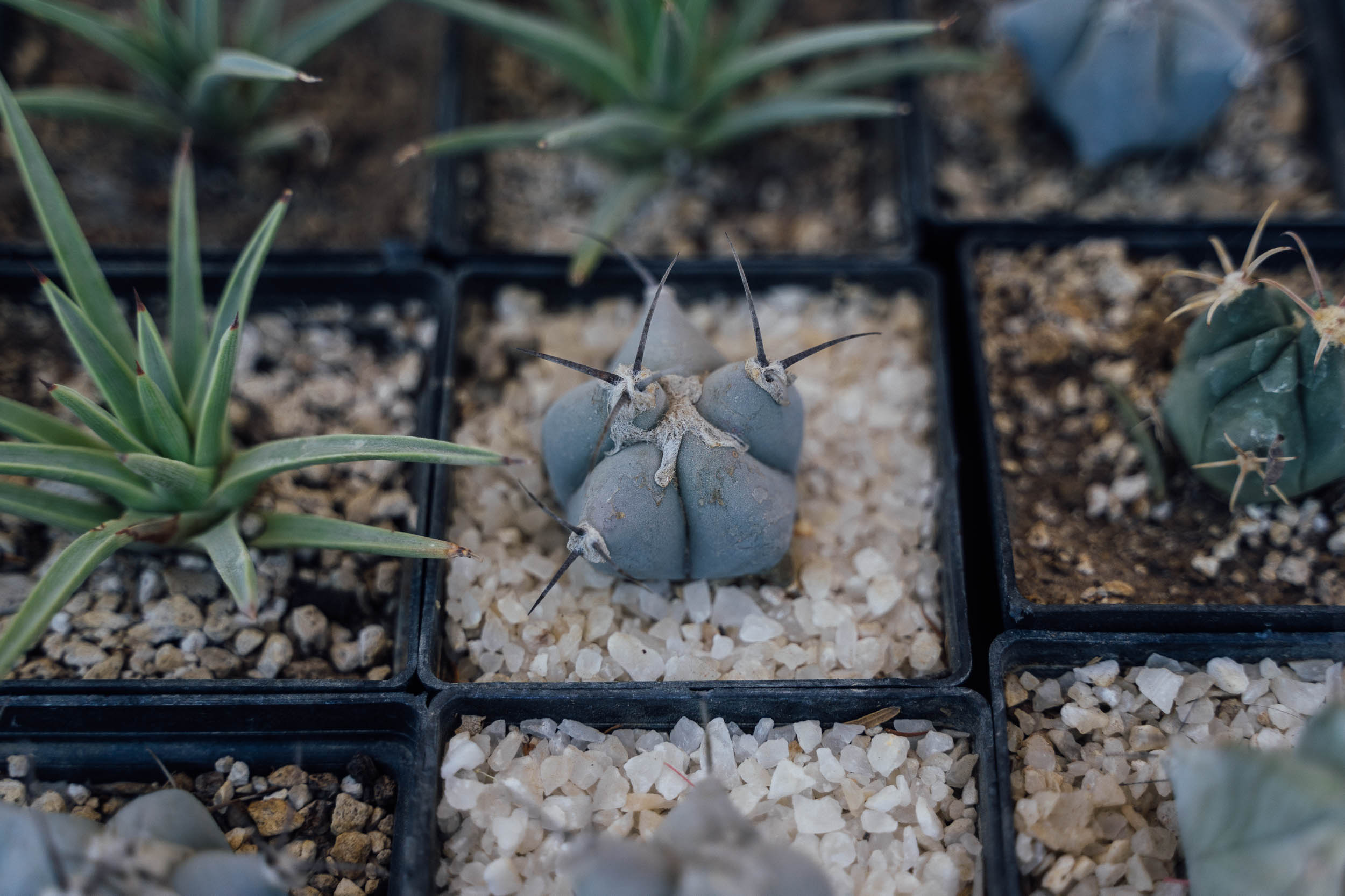
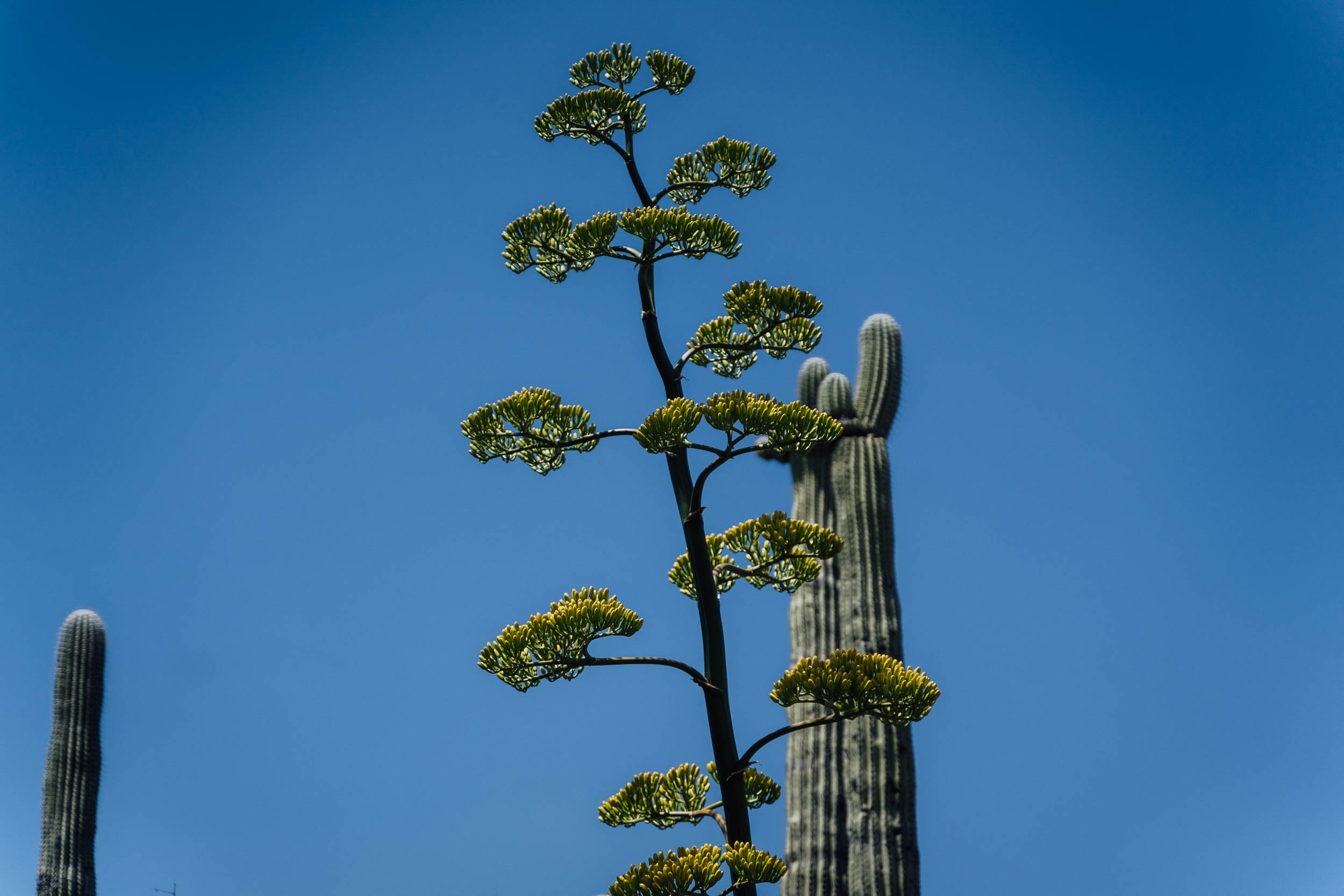
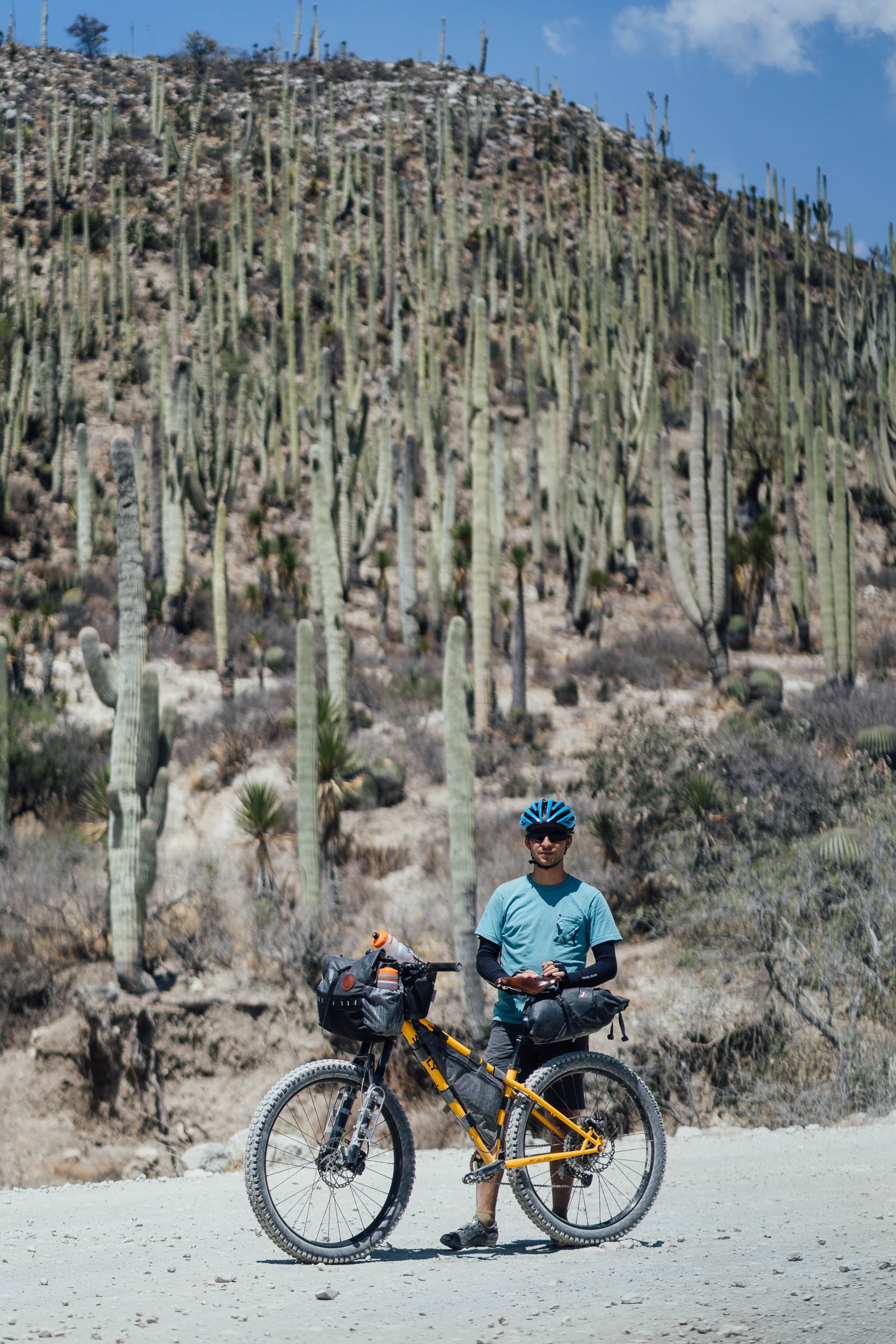
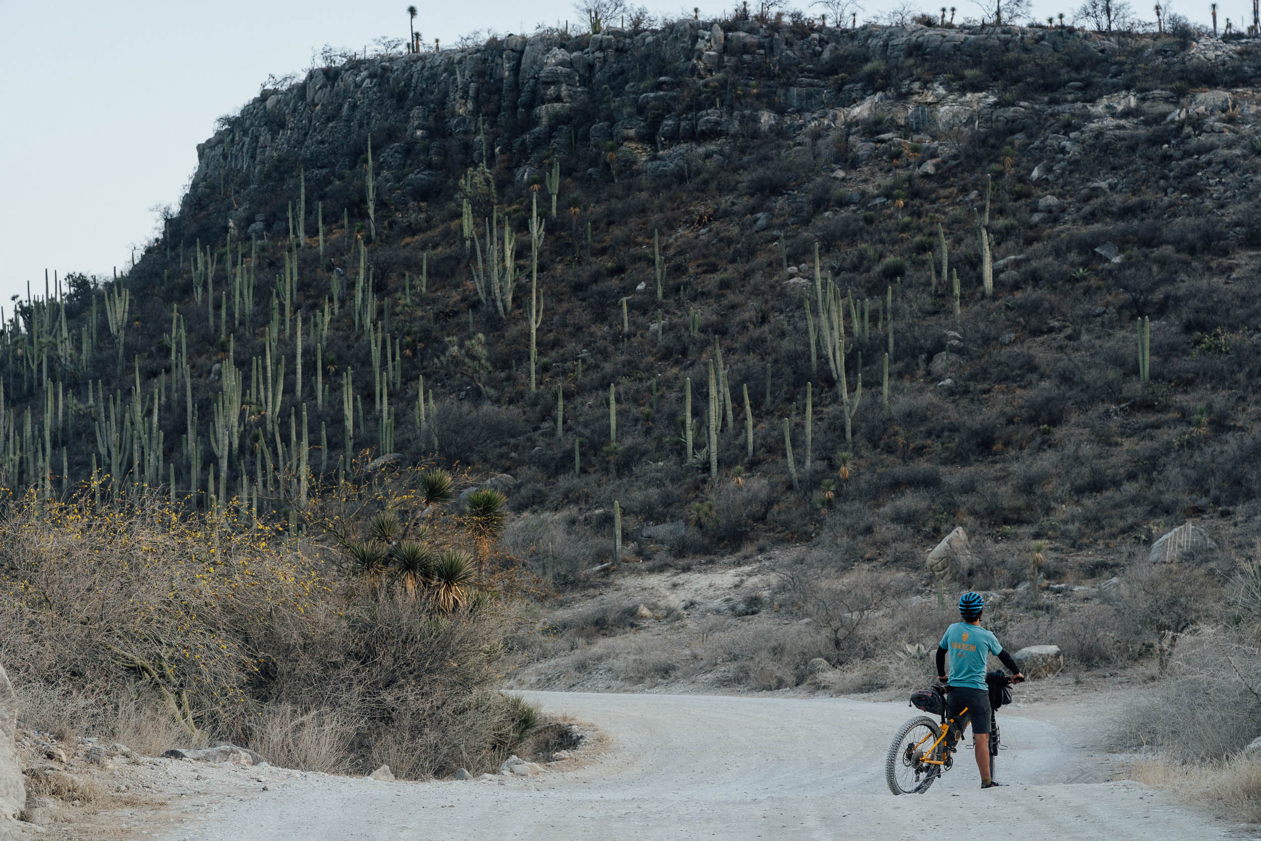
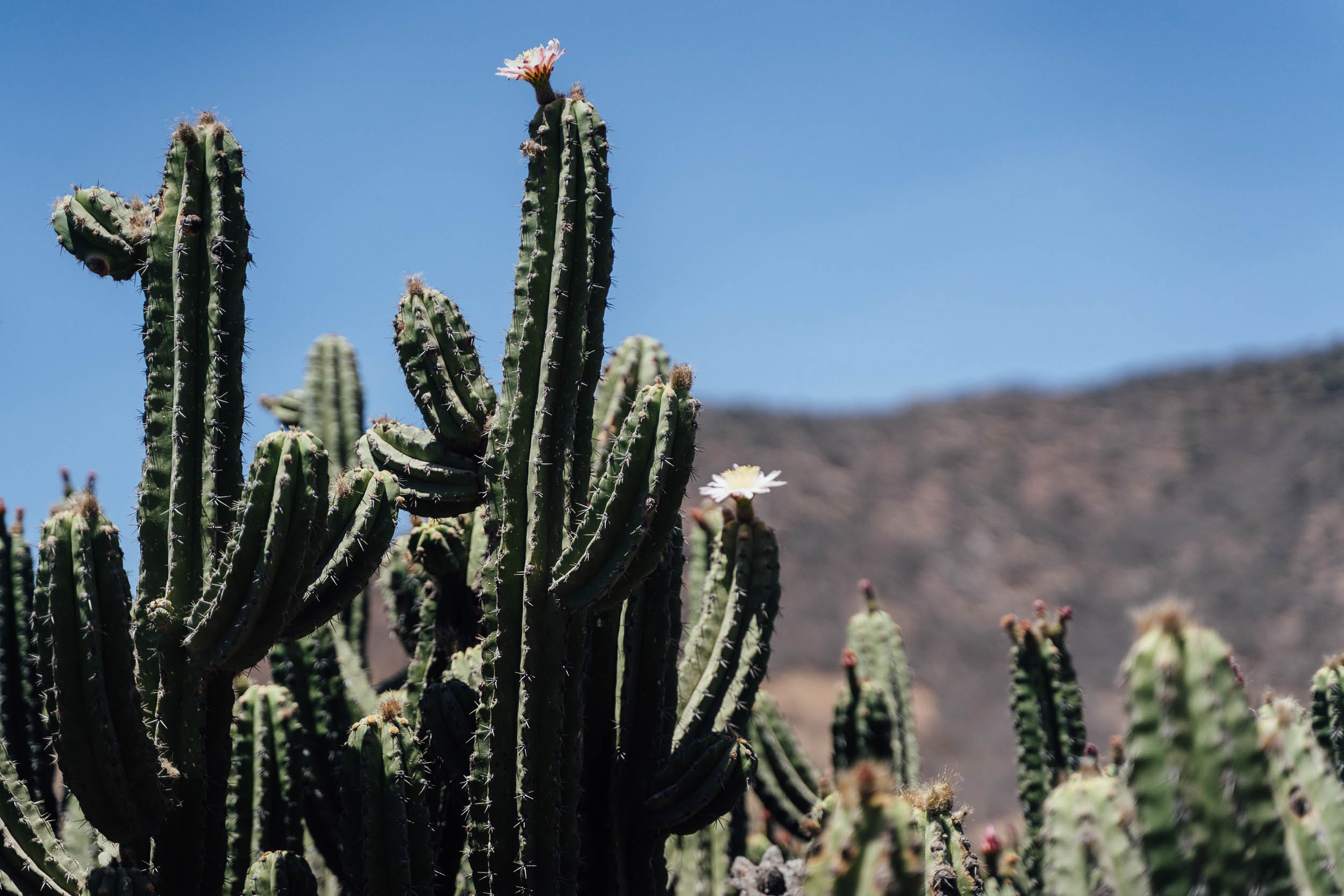
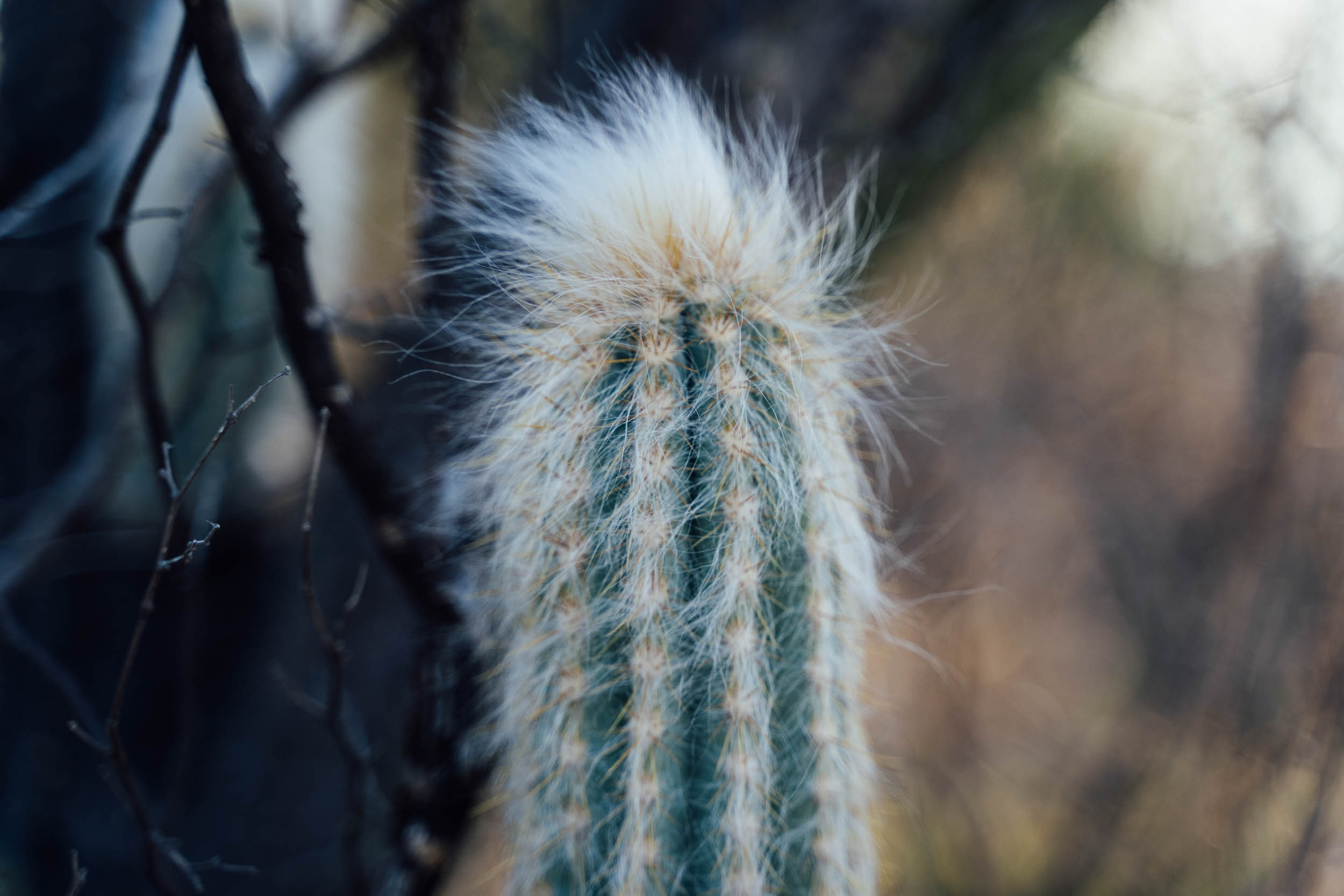
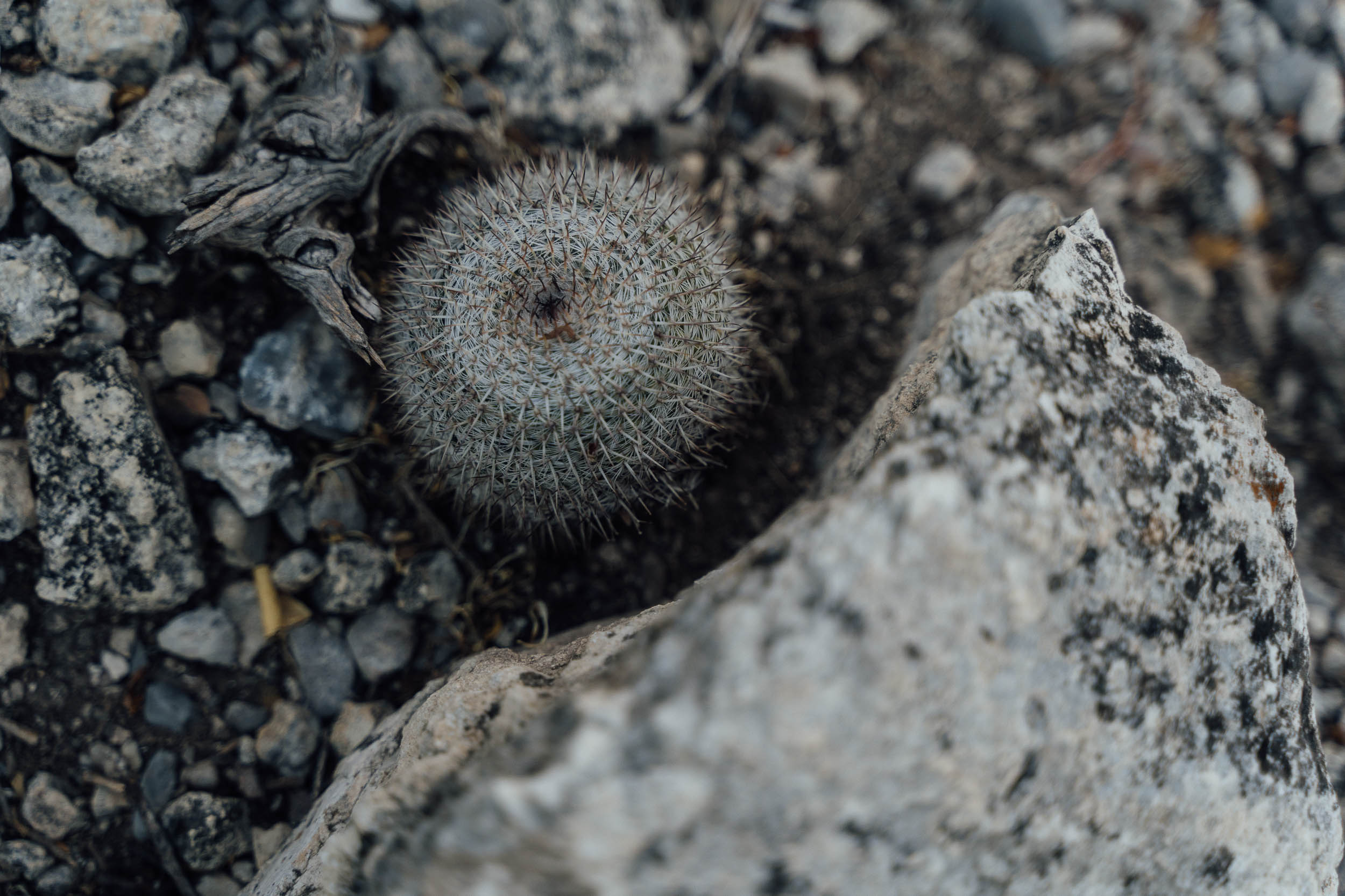
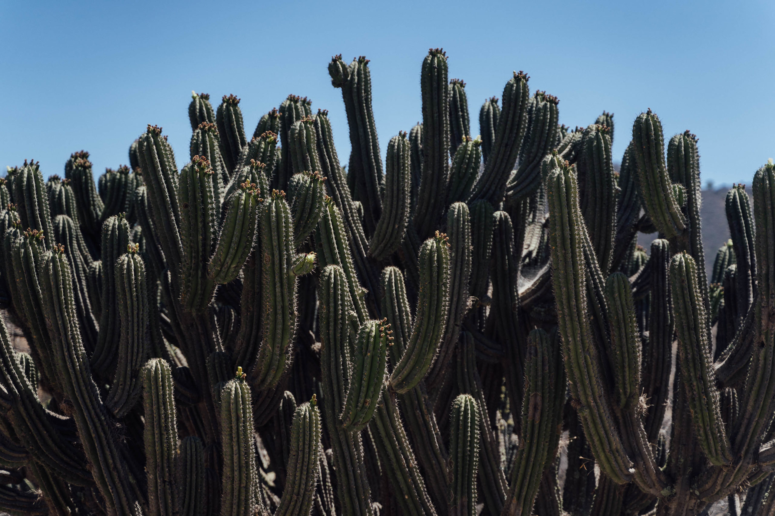
The biosphere is home to some 300 different bird species – including horned owls, golden eagles, and macaws (found in the south) – and 85 different reptile species. But it’s most known for harbouring one of the densest concentrations of columnar cacti in the world. This includes an Organ cacti that grow as many as 60 arms apiece, and, carpeting much of the hillside, forests of periscope-like ‘viejitos’. These old men, so-called on account of their wispy, beard-like tips, are endemic to this area and very much emblematic of this part of the reserve. A limbless cactus, they grow as tall as 10m high and for the botanical enthusiasts amongst you, are a type of Cephalocereus Hoppenstedtii.
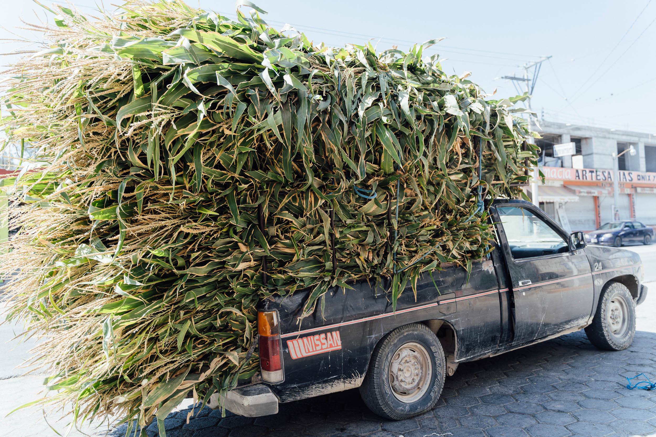
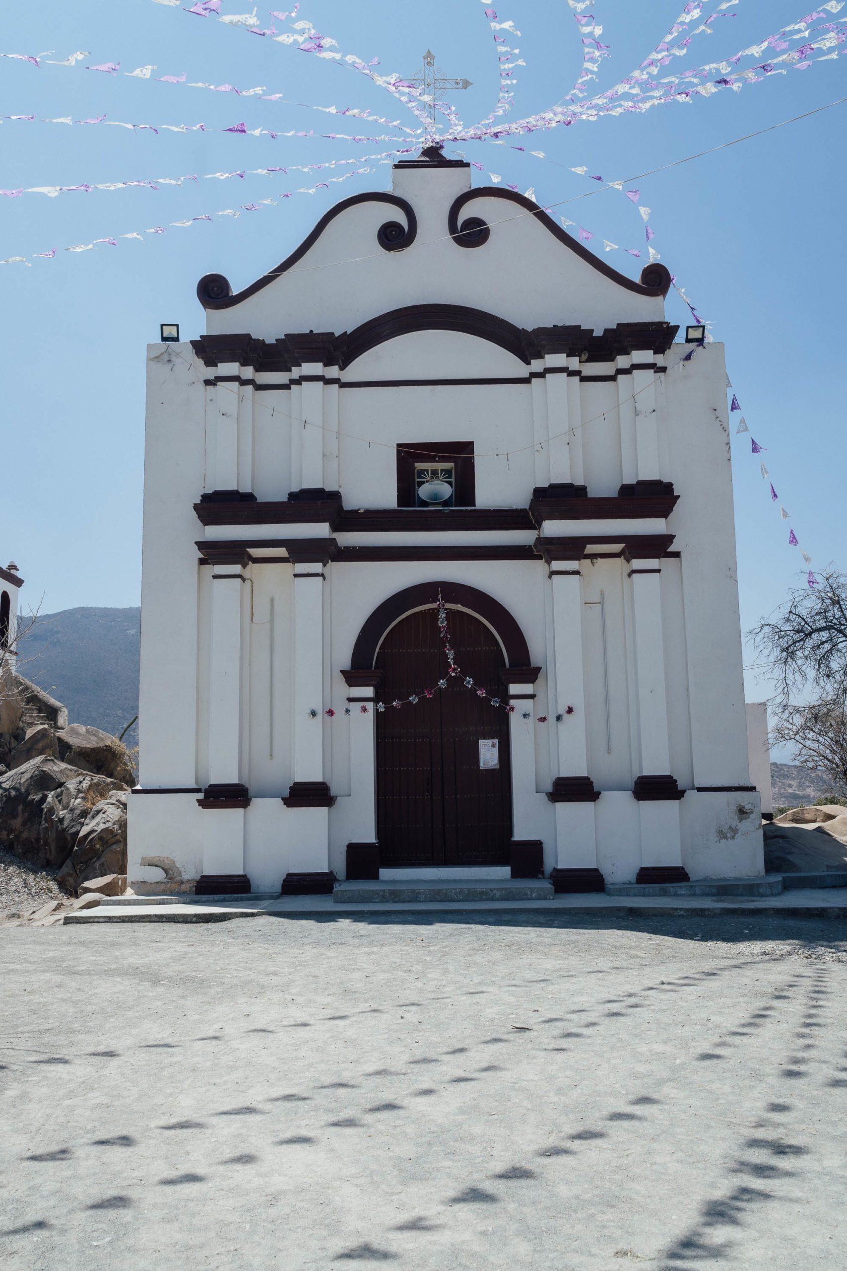
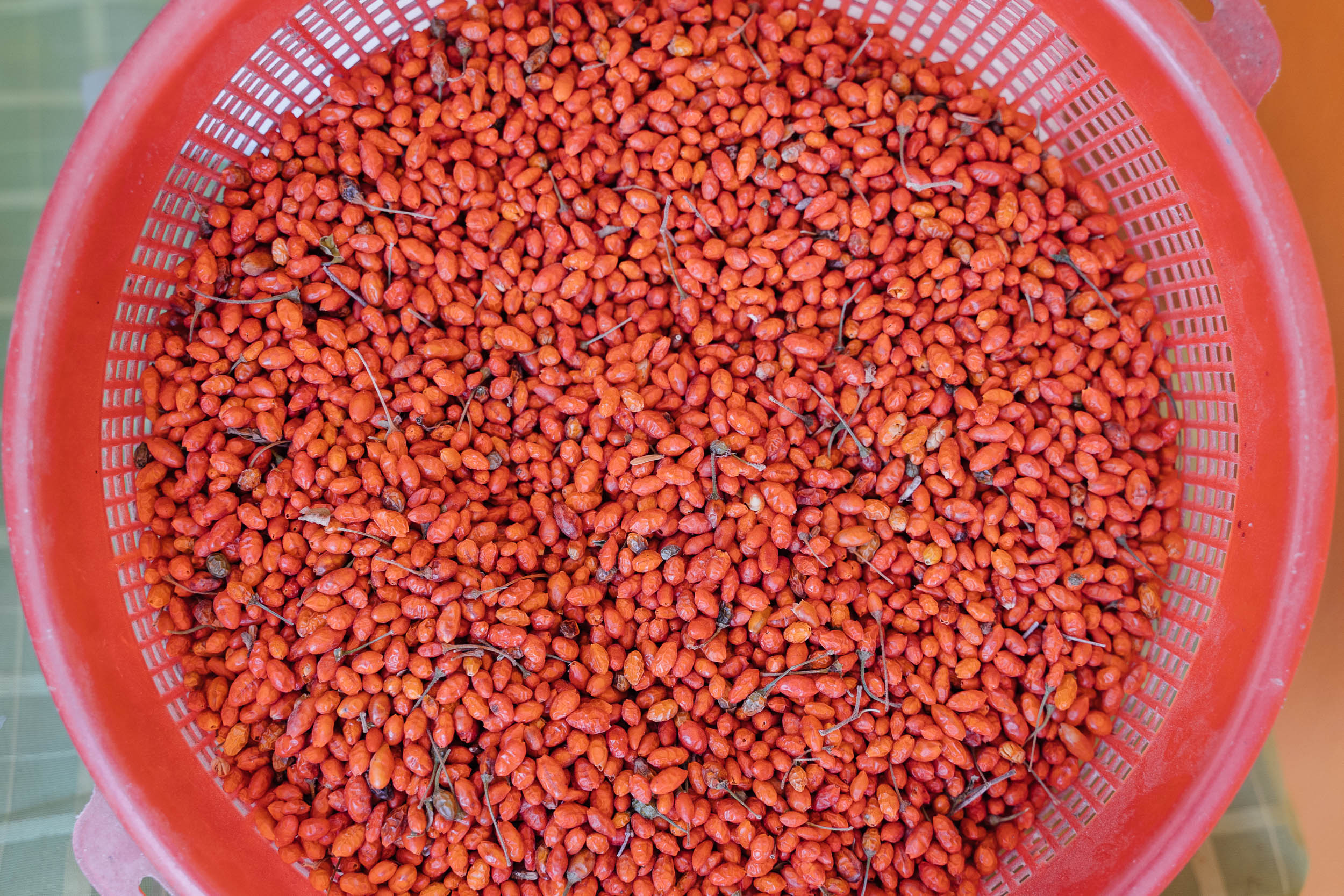
Culturally, the Tehuacán–Cuicatlán valley is considered to be one of the origins of agriculture in Mesoamerica and is a showcase for the domestication of different species such as maize, pepper, and amaranth. The biosphere reserve has a total population of 35,700 people, including eight different indigenous groups. Nowadays, the extraction of onyx is an important side business, whilst the distilling of mezcal from agave continues to be an important part of its cultural identity. Salt production in Zapotitlán, evident today, dates back to pre-Hispanic times, when the Popolocas inhabiting the Tehuacán Valley paid it as tribute to the Aztecs.
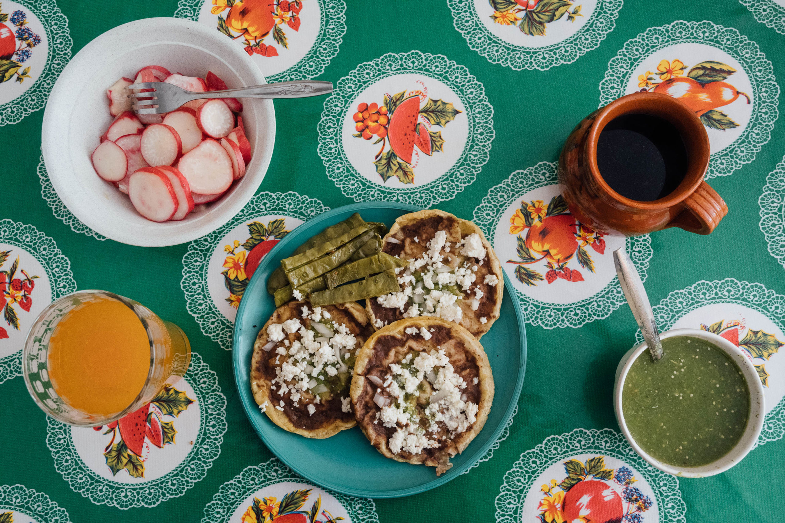
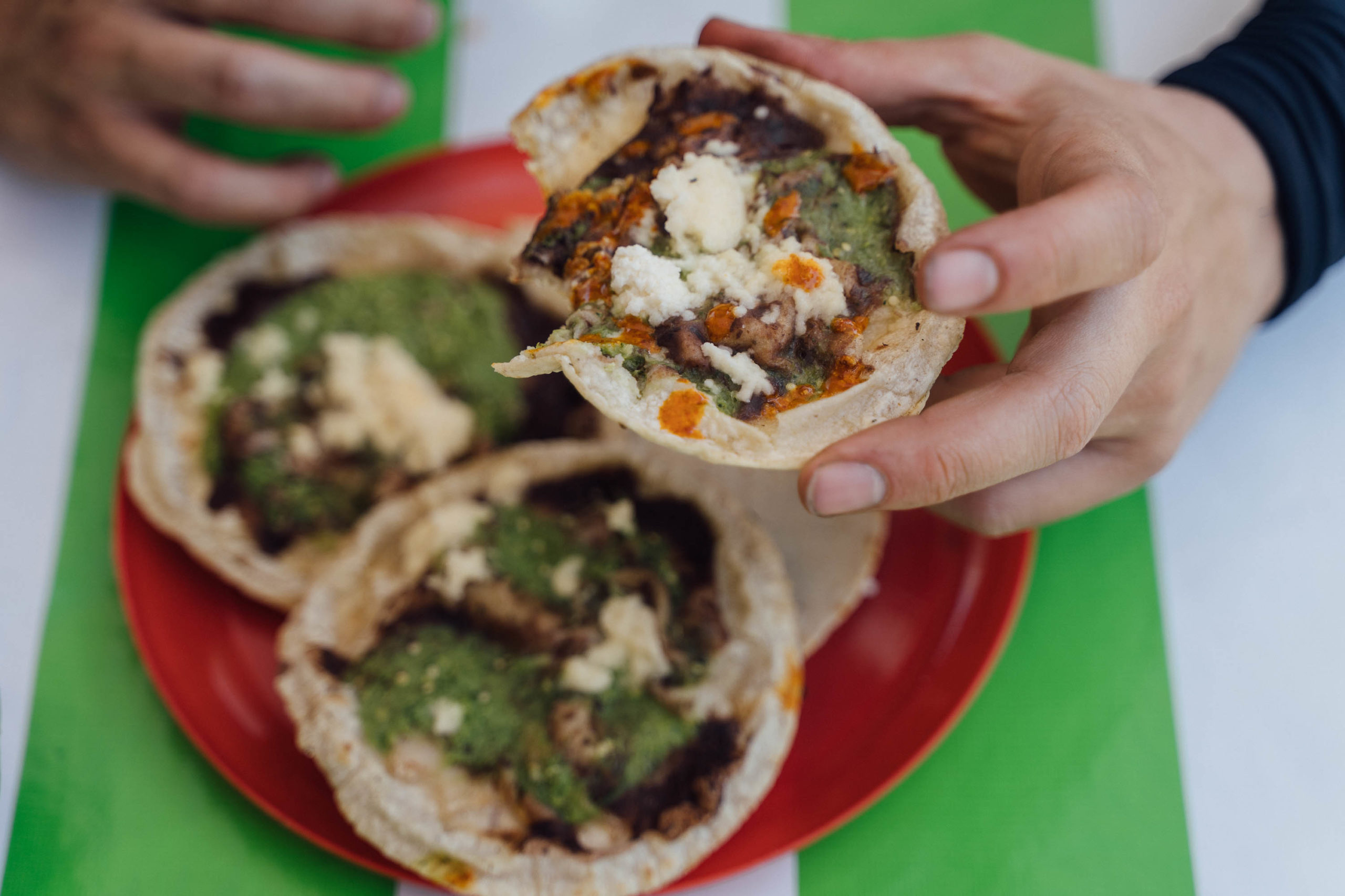
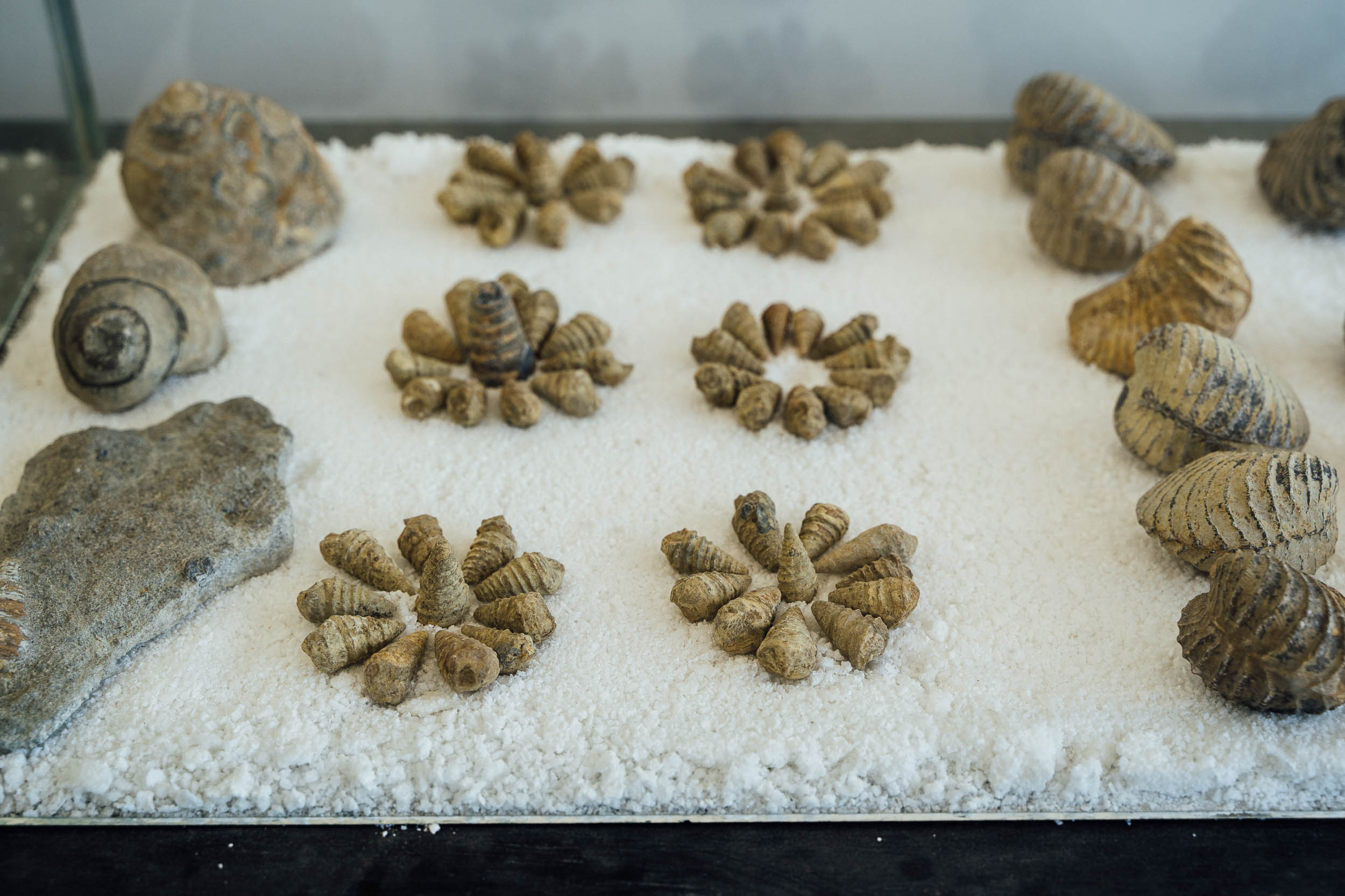
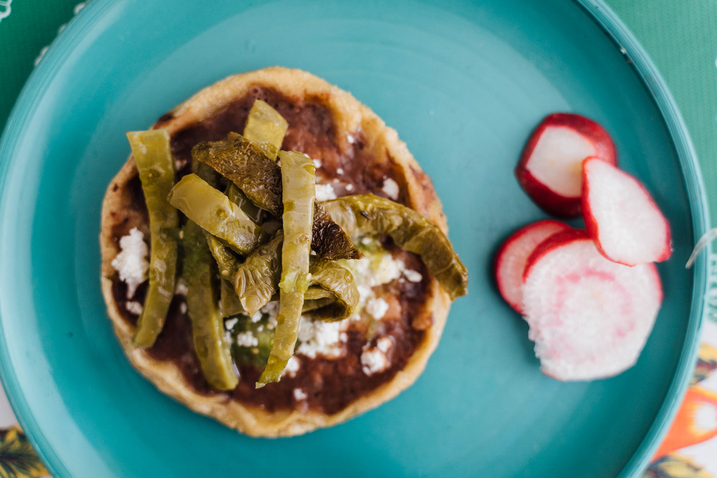
Being a reserve, we’re also focused on sharing projects of an educational or an eco-touristic persuasion, or anything that helps create reserve-related employment in the area, especially if this helps visitors further understand and appreciate the region’s rich geographical and cultural flavours. In the small settlement of San Juan Reyes, for instance, bikepackers can enjoy a number of visits on foot or by bicycle to see dinosaur prints, fossils, and cave paintings, by visiting the community-run tourist centre. You could easily spend half a day here exploring. Meanwhile, the abundant use of cacti and corn fungi – huitlacoche – in local dishes is good evidence of its connection with its culinary roots.
Route Development
Thanks to Nicolas Legoretta for the initial inspiration to visit this region. We drew it out and recced it together, based on local information and on-the-ground route exploration. We’d love to develop more bikepacking routes in the area and promote local initiatives, so if you have information to share, do get in touch.
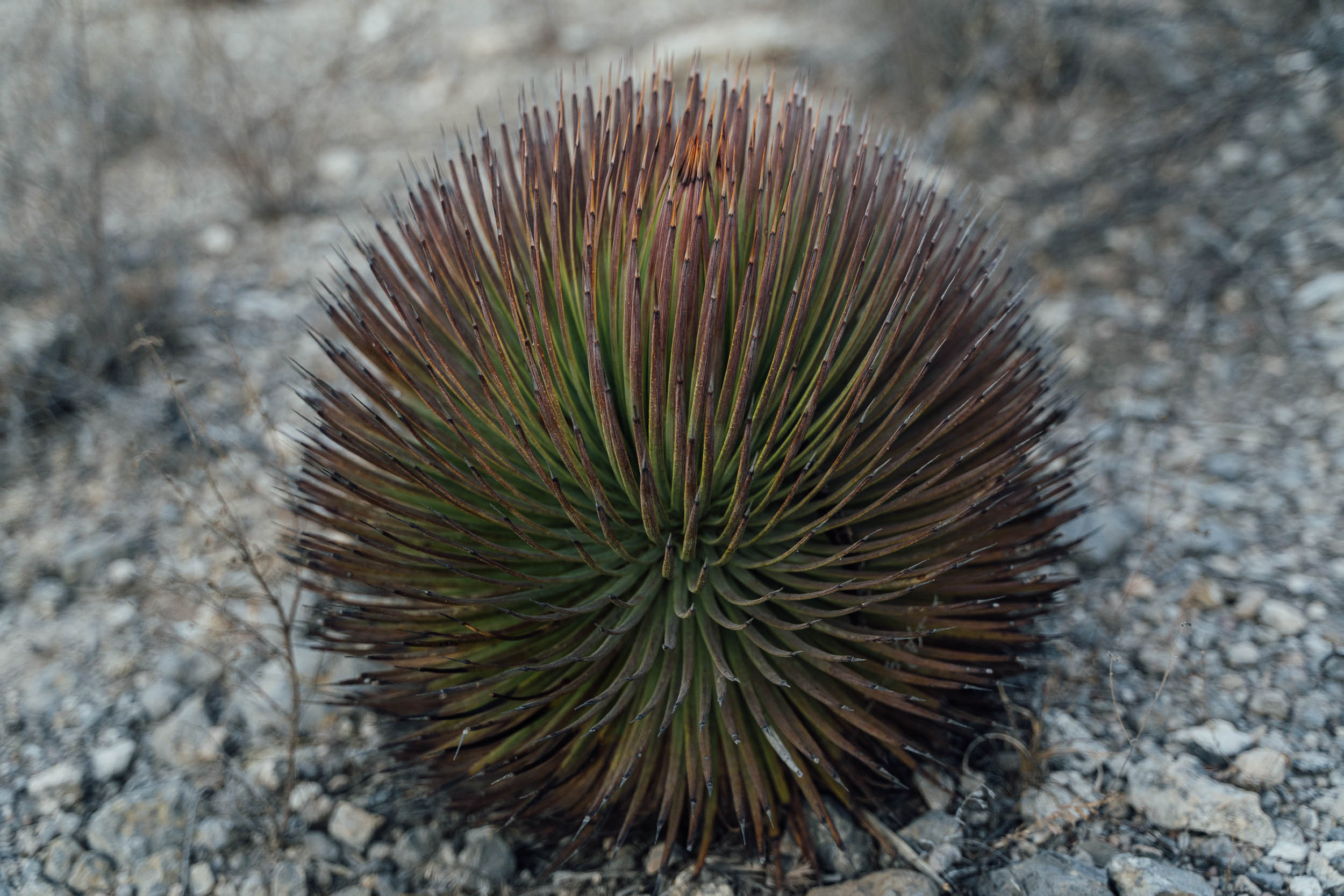
Unfortunately, a project to financially integrate local communities into the maintenance of the reserve – info panels can be seen throughout the area, under the acronym PSA, or Pago Por Servicios Ambientes – has met with mixed success. As mentioned, the nucleus for each part of the reserve is fenced off and very well kept, but elsewhere, trash can sometimes blight the roadside. The illegal trafficking of cacti has also stripped parts of the park of its most distinctive sights, its Elephant Feet – or Pata de Elefante – named after the patterns and shapes of this plant’s distinctive ‘feet’.
As a route, this northern loop makes a very achievable introduction to bikepacking for those living in Mexico City, Puebla, or Oaxaca, or of course visitors to Mexico from abroad. Add in the South Loop for a deeper appreciation of the reserve. We’d love to see bikepackers help to fuel positive change in the biosphere so as ever, be sure to leave no trace and abide by local restrictions.
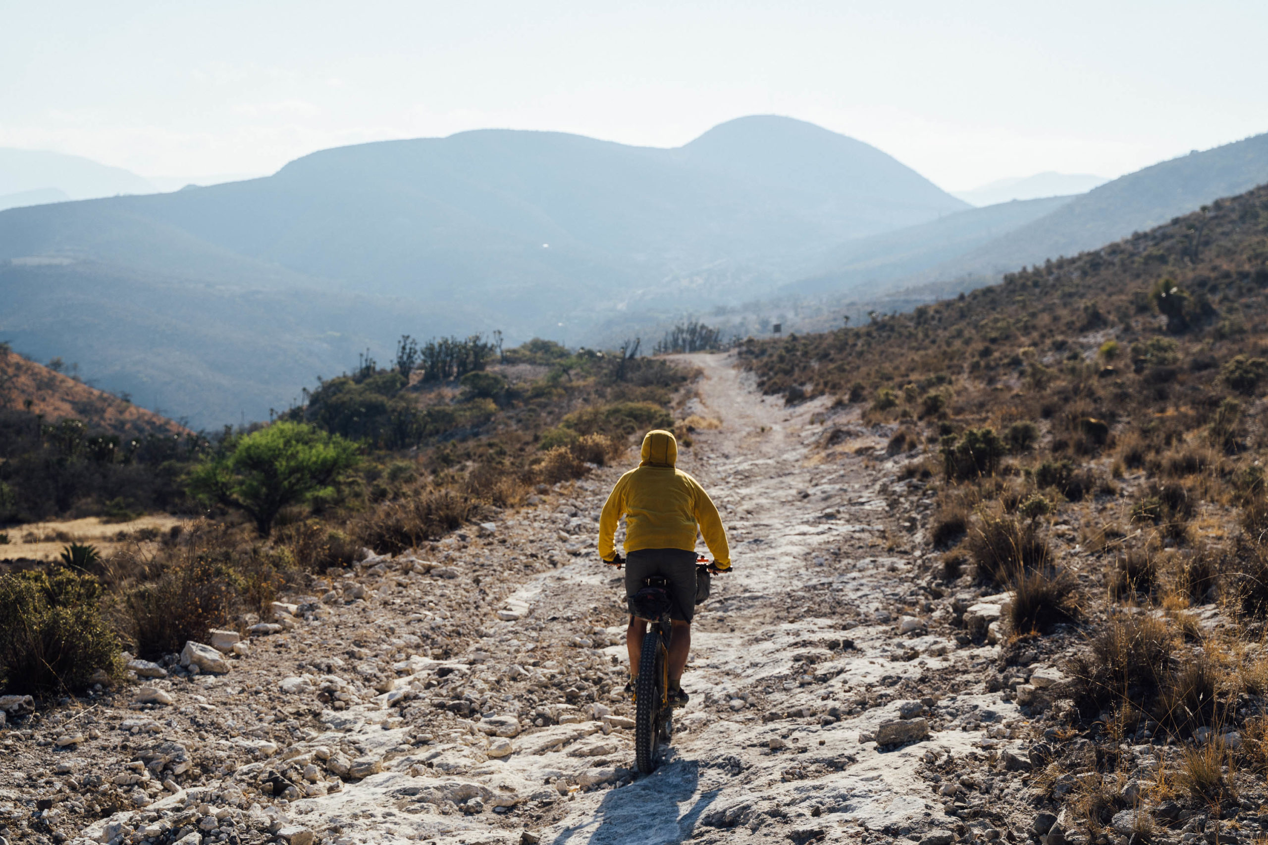
Difficulty: Aside from high temperatures in the summer, dry seasons months, this route is relatively straightforward. Road conditions are generally good – with occasional rocky stretches – and resupply options are abundant, which means you can enjoy sampling local food every day, and carry less on your bike. Aside from the pavement stint between Zapotitlán and San Luis Atopoltitlán, which sees some traffic, the loop is mostly vehicle-free.


Submit Route Alert
As the leading creator and publisher of bikepacking routes, BIKEPACKING.com endeavors to maintain, improve, and advocate for our growing network of bikepacking routes all over the world. As such, our editorial team, route creators, and Route Stewards serve as mediators for route improvements and opportunities for connectivity, conservation, and community growth around these routes. To facilitate these efforts, we rely on our Bikepacking Collective and the greater bikepacking community to call attention to critical issues and opportunities that are discovered while riding these routes. If you have a vital issue or opportunity regarding this route that pertains to one of the subjects below, please let us know:
Highlights
Must Know
Camping
Food/H2O
Resources
- Jardín Botánico Helia Bravo: a must-visit pre-ride educational tour to gain an understanding of the rich variety of desert flora
- Riding through some of the densest forests of columnar cacti in the world
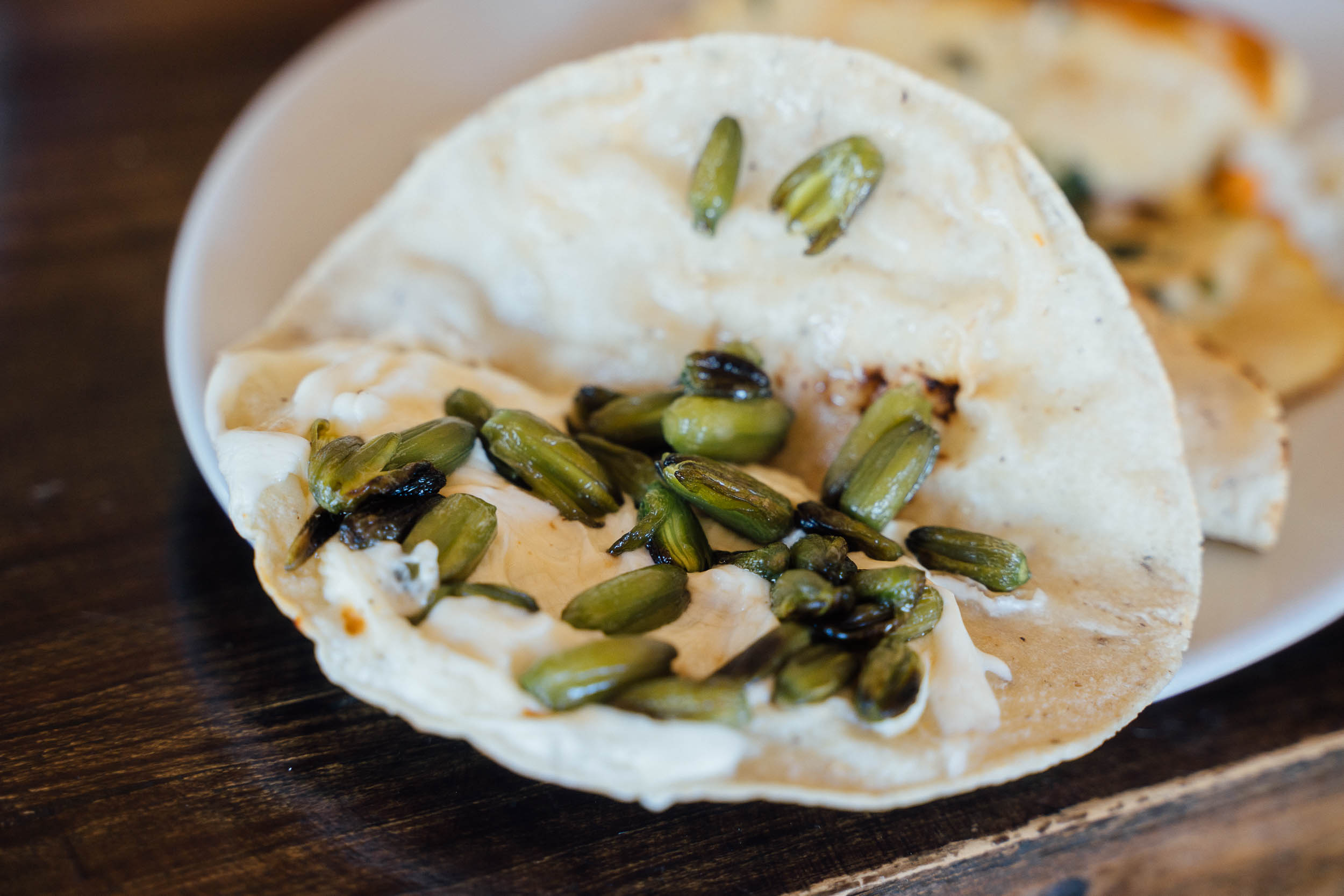
- Dining on open-top ‘memelas’, a variation on the tortilla theme, often laced with nopales, huitlacoche, fresh cheese, and black beans.
- Sampling delicious, smoky mezcal distilled locally.
- Seeking out some of the remaining ‘elephant feet’ plants for which the area is known.
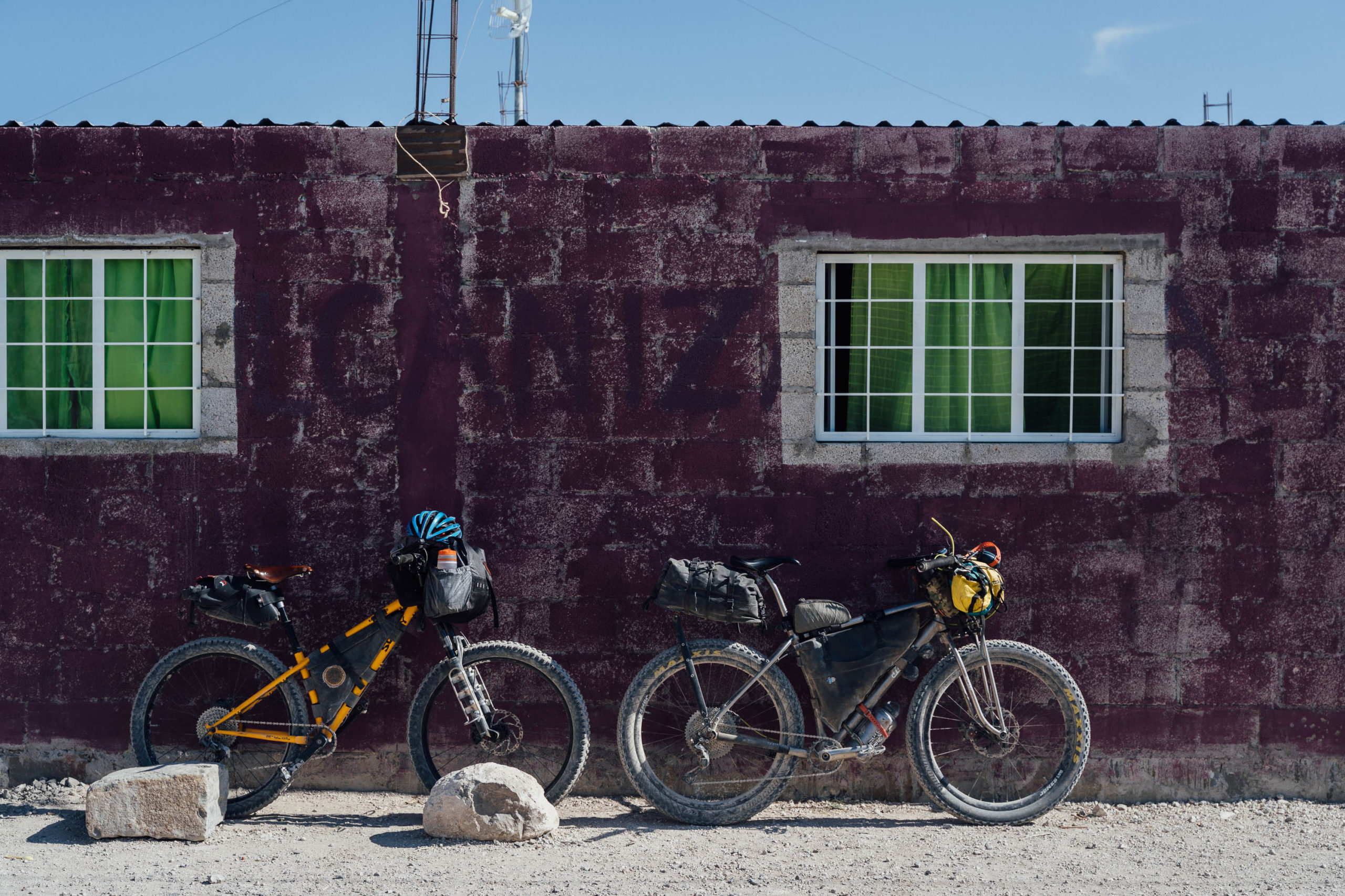
- Although the route can be ridden on a gravel bike shod with wide tyres (40mm+), there are some rough stretches so it will be most enjoyed, especially by beginners, on a mountain bike.
- Getting there: Tehucan can be reached from Mexico City (4 hours) or Oaxaca City (3 hours), though the latter has a less regular service. ADO offers good service and generally has room for bikes; try and book a relatively empty bus online if you can. The ADO service tends to stop less than the AU one, though they’re the same company.
- From Tehuacan, it’s a 13km paved road ride (no shoulder) to the closest point of the route, San Antonio Texcala, so you might be best served by hopping on local transportation to the larger hub of Zapotitlán, which is 25km away. Or, try this dirt road connector, or this one, that intersect with the route.
- The best time of year to visit the reserve is outside of the main summer months of April and May. Cacti will flower most abundantly in the rainy season; locals say the dirt roads remain passable for the most part.
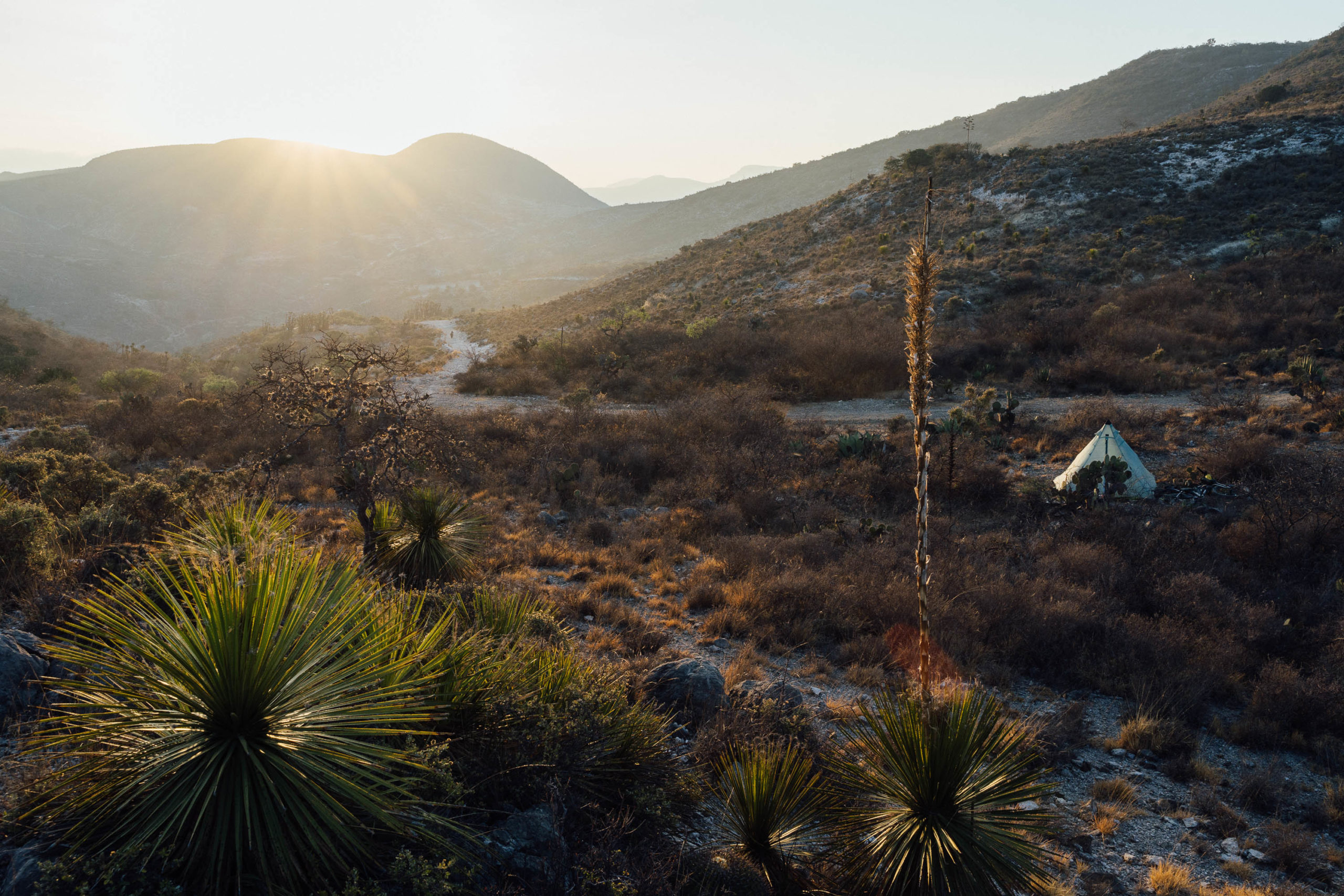
- Even in the dry season, a basic tarp is useful. On the nights we didn’t use ours, we awoke to soaked sleeping bags. At lower elevations there are mosquitos and sand flies, so an inner tent can be useful. We managed without one.
- Be sure to visit the Helia Bravo Hollis Botanical Garden in Zapotitlán. Entry and guided tours are 25 pesos person, plus tip. Details can be found here.
- San Juan Reyes is a great base and has a community-run visitor centre, which can arrange short and affordable tours in the area, visiting various flora and geological features. Please use this organisation rather than visiting independently to support the local community. There’s a handicraft co-op too. You could easily spend half a day exploring this area… and it’s something we’d recommend!
- Cash: there are no ATMs on the route. Carry cash, small bills if possible.
- Affordable accommodation is available in Zapotitlán, if you want to base yourself there before an early start and there are camping options too. See map for recommendations.
- You can also camp or stay in cabanas at the Botanical Garden in Zapotitlán.
- We’ve marked a recommended campsite on the map, in the tourist-friendly community of San Jan Raya. It makes a good base for that area and is 52km into the route.
- Wild camping is possible in the buffer zones. Be sure to practise LeaveNoTrace and ask local ejidos for permission when you can.
- There are a number of small villages along the way, so sourcing affordable and delicious cooked food is rarely an issue. Wherever there is a village, there will be one or two small tiendas, at the minimum.
- Splurge on great local fare at Restaurant Itandehui in Zapotitlán.
- We carried around three litres of water at a time, as water can be sourced from restaurants as you go; it’s courteous to offer a few pesos to fill your bottles. The capacity to carry up to five litres can be useful if you’re wild camping.
Additional Resources
- Although published some time ago, this link provides an in-depth evaluation of the flora and fauna to be found in the reserve, its history, and the challenges it faces.
- For more information on the reserve’s flora, see this Spanish-language pdf on the Vegetation of the Valley of Tehuacan-Cuitaclan.


Terms of Use: As with each bikepacking route guide published on BIKEPACKING.com, should you choose to cycle this route, do so at your own risk. Prior to setting out check current local weather, conditions, and land/road closures. While riding, obey all public and private land use restrictions and rules, carry proper safety and navigational equipment, and of course, follow the #leavenotrace guidelines. The information found herein is simply a planning resource to be used as a point of inspiration in conjunction with your own due-diligence. In spite of the fact that this route, associated GPS track (GPX and maps), and all route guidelines were prepared under diligent research by the specified contributor and/or contributors, the accuracy of such and judgement of the author is not guaranteed. BIKEPACKING.com LLC, its partners, associates, and contributors are in no way liable for personal injury, damage to personal property, or any other such situation that might happen to individual riders cycling or following this route.
Please keep the conversation civil, constructive, and inclusive, or your comment will be removed.