


The Celestial Divide
Distance
663 Mi.
(1,067 KM)Days
20
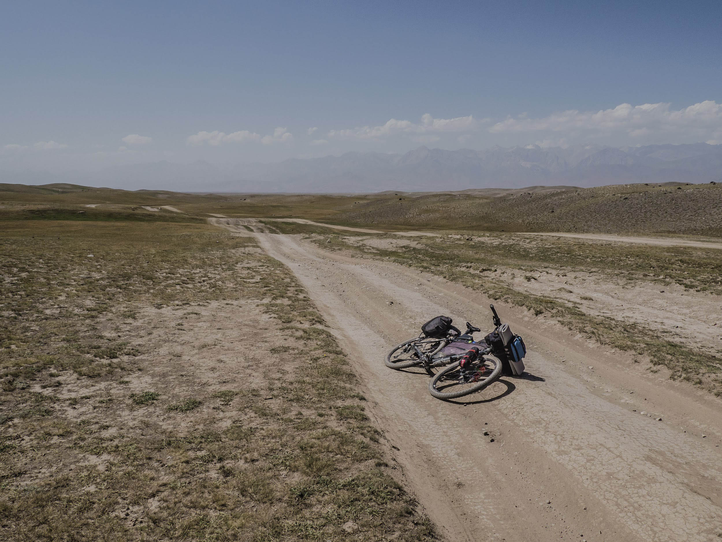
% Unpaved
70%
% Singletrack
1%
% Rideable (time)
95%
Total Ascent
66,390'
(20,236 M)High Point
12,420'
(3,786 M)Difficulty (1-10)
7?
- 7Climbing Scale Strenuous100 FT/MI (19 M/KM)
- 6Technical Difficulty Moderate
- 7Physical Demand Difficult
- 5Resupply & Logistics Moderate
Contributed By

Malik Alymkulov
Guest Contributor
Malik is a photographer, bikepacking enthusiast and tour guide, and founder of bikepackingkyrgyzstan.cc. Based in Bishkek, he documents the wild beauty and cultural heritage of his homeland through long-distance rides and analog photography. His project The Last Nomad Republic captures the vanishing rhythms of nomadic life in the high mountains, and his route work helps others experience Kyrgyzstan’s vast landscapes by bike.
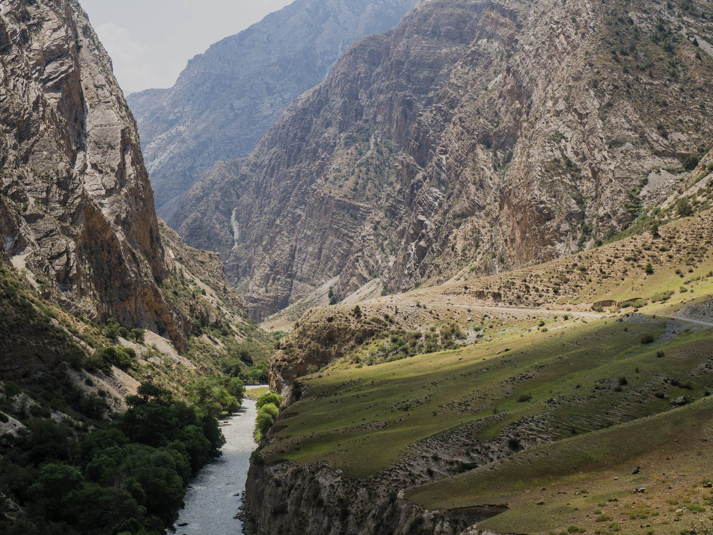
The longest and highest ridges of Kyrgyzstan’s Celestial Mountains extend along the geographical latitudes, and massive valleys stretch out along with them. Chui Valley, the country’s largest and most densely populated valley, is located in the north, and the other is in the south, the Fergana Valley. Both are punctuated by Kyrgyzstan’s two biggest cities: Bishkek and Osh. As such, most of the roads between the valleys run along meridians. The same applies to roads that lead to high mountain pastures.
The mountains divide the country into north and south, and this has influenced localized cultural peculiarities that have existed since ancient times. Many people in the country have to journey from north to south or back when traveling around the country, and these connections always involve crossing high mountain passes. There is one asphalt road from Bishkek south to Osh, Pamir, and Batken. Some bicycle travelers use it to move from north to south.
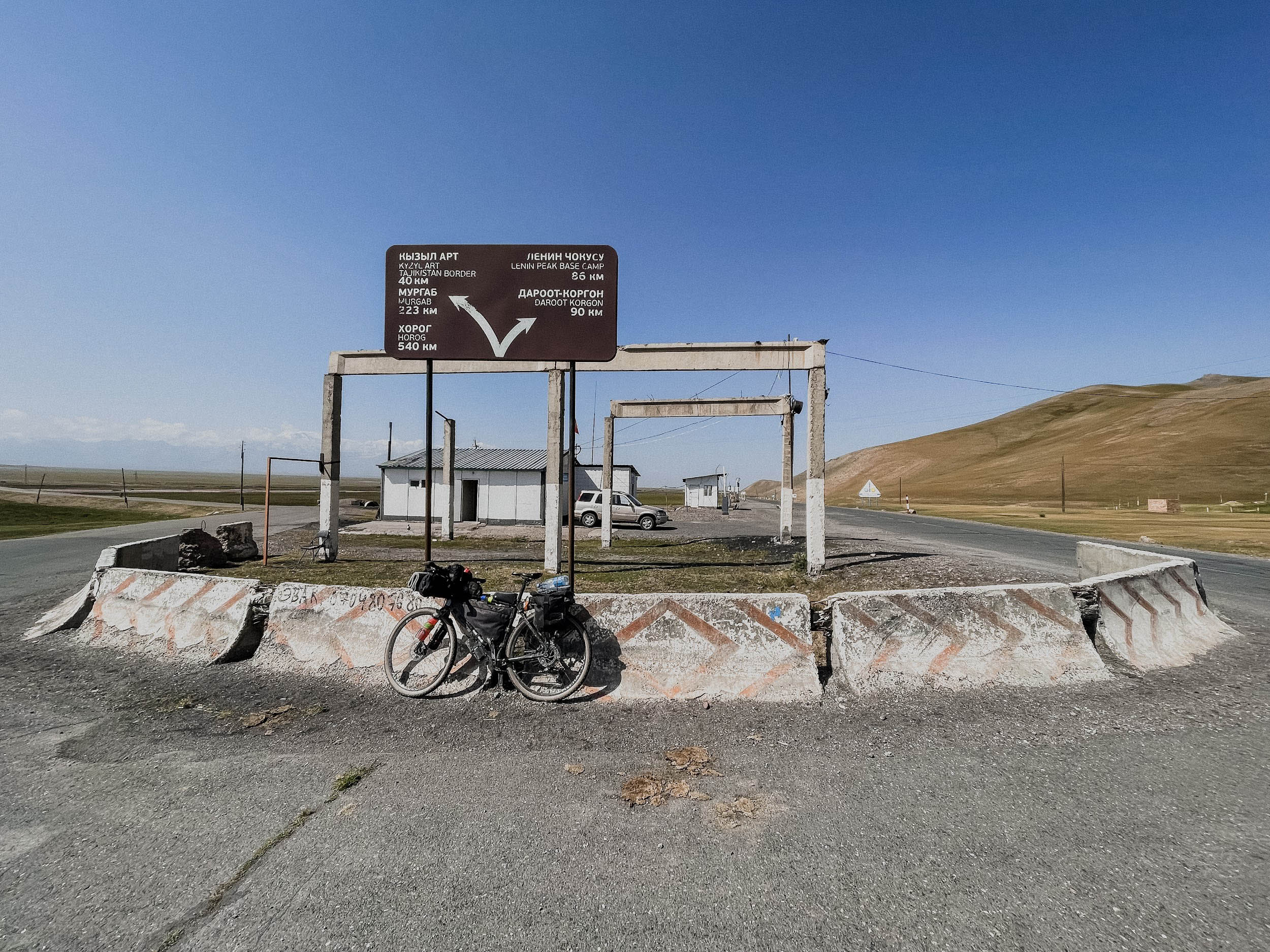
Conversely, the Celestial Divide uses mainly dirt roads, and runs along the internal routes used by local people for their household needs and economic activities. The route begins in Bishkek, and the final significant point is at the Base Camp of Lenin Peak and Tulpar-Kul Lake, although the actual finish is in Sarytash, the beginning of the Bartang Valley route through Tajikistan.


Why Celestial? Celestial is an English transcript of Tengri. Tengri represents the Heavenly Father or the eternal blue sky, symbolizing divine power, the source of life, and a connection between humanity, nature, and eternity. Tengri is the god for many nomads of Eurasia, Turkic, and Mongolian people. Tengri Tagh (Tau) is the original ancient name of the Mountains of Heaven.
Route Difficulty
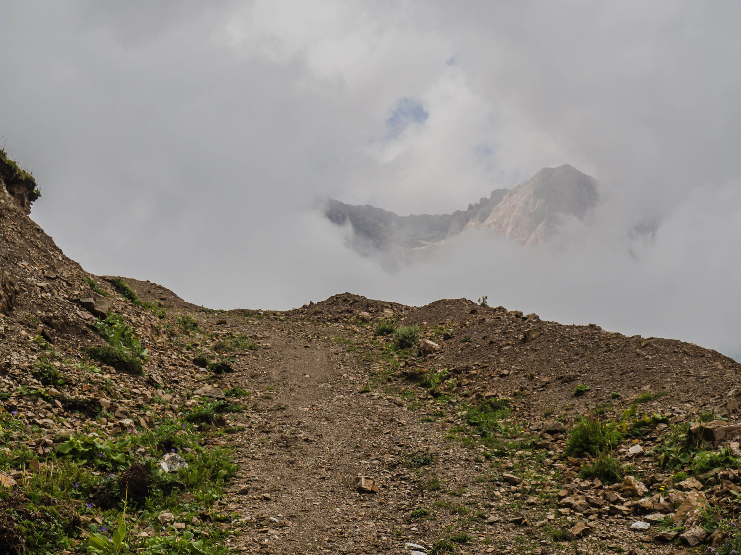
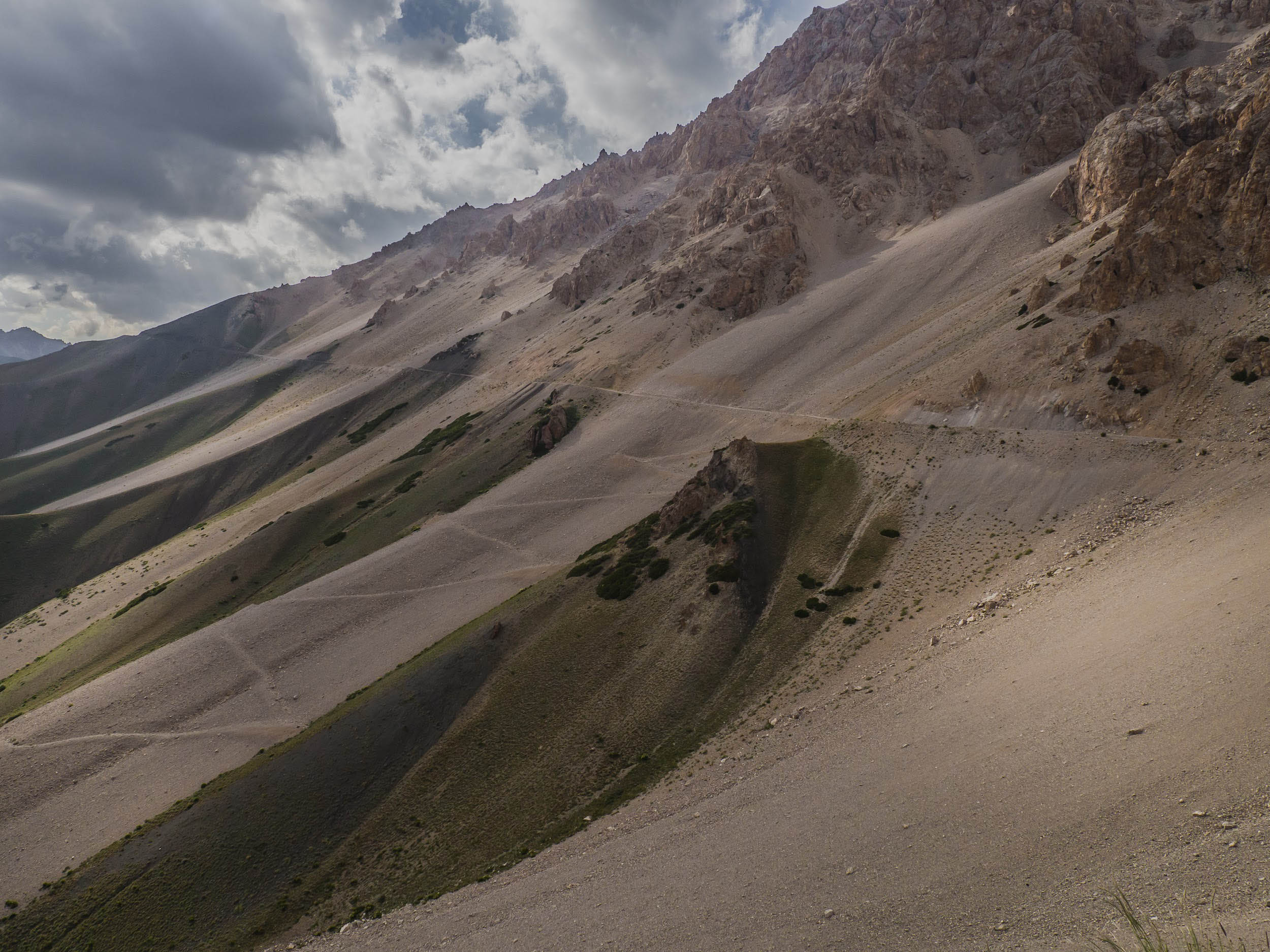
The difficulty benchmark of this route is about 7/10 overall. The route is not technically difficult. Aside from the Shyldyrak Pass, where the doubletrack road on the switchbacks is almost unused, eroded, overgrown with grass, and covered with stones, the other 3,000-meter passes offer fairly good road conditions. Kegeti Pass is the most challenging of them.
Route Development
The route idea and this beautiful name came to me in the summer of 2023. The Celestial Divide is my biggest route-building project to date. After careful planning, I cycled solo and scouted the entire route in August 2024. It is a natural extension of two world-famous cycling routes in Kyrgyzstan: The Tian-Shan Traverse and the Pamir Highway. I envisioned the Celestial Divide as a route that would connect these renowned trails, starting in Bishkek and culminating at the Base Camp of Lenin Peak and Tulpar-Kul Lake near Sarytash. This extension aimed to provide cyclists with a comprehensive journey through Kyrgyzstan’s diverse landscapes, from its capital to the high-altitude regions in the south.
The route is built based on several segments of underlying, accessible, and proven routes, such as the Tian Shan Traverse, Expedition Alay, and pieces of the SRMR (2021, 2022 editions). There were several segments left to chart out, with very little information about them and even fewer photos. Scouting them was one of the major tasks of the 2024 expedition.


Submit Route Alert
As the leading creator and publisher of bikepacking routes, BIKEPACKING.com endeavors to maintain, improve, and advocate for our growing network of bikepacking routes all over the world. As such, our editorial team, route creators, and Route Stewards serve as mediators for route improvements and opportunities for connectivity, conservation, and community growth around these routes. To facilitate these efforts, we rely on our Bikepacking Collective and the greater bikepacking community to call attention to critical issues and opportunities that are discovered while riding these routes. If you have a vital issue or opportunity regarding this route that pertains to one of the subjects below, please let us know:
Highlights
Must Know
Camping
Food/H2O
Trail Notes
- Kegeti Pass – 3,765 meters, known for its breathtaking landscapes. The pass sits in the Celestial Mountain range and offers spectacular views of rugged peaks, lush green valleys, and crystal-clear rivers. The surrounding terrain is rich with alpine meadows, dense forests, and dramatic cliffs, creating an almost surreal atmosphere.
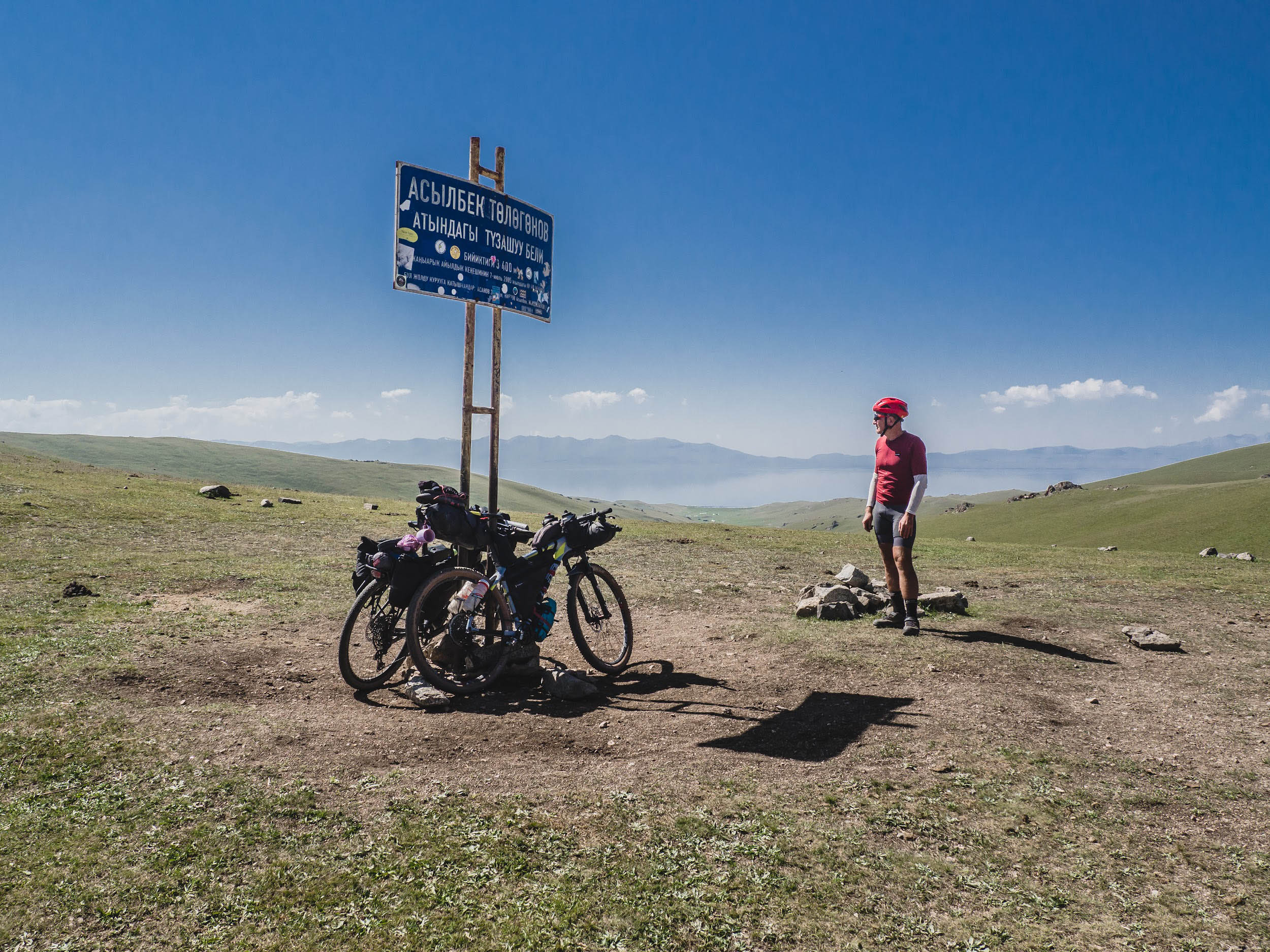
- A singletrack trail winds between Kyzart Pass and Tuz-Ashuu Pass, where navigation devices can easily lead you astray. Don’t worry—what awaits is a rewarding ride with stunning views and flowing singletrack. Just be sure to download our original Celestial Divide GPX to stay on course.
- Panoramic views of Son-Kul Lake from the rocky cliffs of the northwest shore are scenic and exceptional.
- A trek up the Kokomeren River leading to the Kyrk-Kyz Pass. Following giant columns of high voltage grid. It’s long and tiring but captivating.
- Endless climbs and thrilling descents define the rugged stretch from Toluk to Torkent, offering a relentless yet rewarding ride through raw, untamed landscapes.
- Shyldyrak Pass – 3,044 meters, which connects Ketmet-Tube Valley with its man made Toktogul water reservoir with the Fergana Valley. Tough climb on both sides. The doubletrack is mostly broken and not maintained. The gorge to the south is very beautiful with a huge amount of walnut forest. Very unique.
- Ancient minaret and mausoleum complex in the town of Uzgen, dating back to the 11th–12th centuries during the Karakhanid Dynasty. The Uzgen Minaret is one of the best-preserved examples of medieval Islamic architecture in Central Asia. The nearby mausoleums, built from ornate brickwork, housed the remains of Karakhanid rulers and reflect the city’s importance as a regional capital during that era.
- Immerse yourself in the vibrant life of three major cities in southern Kyrgyzstan, the most densely populated region of the country: Osh, Kyzyl-Kiya, and Uch-Korgon. Osh is the second-largest city in the country and marks the beginning of the Pamir Highway. Kyzyl-Kiya is where the first industry of Kyrgyzstan emerged in the early 20th century, with its coal mines. Uch-Korgon is a small town on the border with Uzbekistan, surrounded by picturesque peach orchards. From here, the road leads to the Koy-Jolu Pass and onward to the Chon-Alaï Valley.
- Spectacular views of the Kok-Jangak hills and the vast Ferghana Valley. As you explore the area, you’ll pass hayfields, dense walnut groves, and partially abandoned coal mines—once bustling industrial sites now quietly worked by locals using traditional methods.
- A journey through the desert along the right bank of the Aravan-Sai River, following the scenic road from Osh to Kyzyl-Kiya.
- Koi-Jolu Pass – 3,811 meters, one of the highest among those with doubletrack gravel roads leading to the pass. I call this pass the “Pass of Several Summits” as each switchback on the southern slope looks like an independent summit. The terrain is very picturesque as you observe multicolor slopes and panoramic views of the Kyrgyz Pamirs to the south.
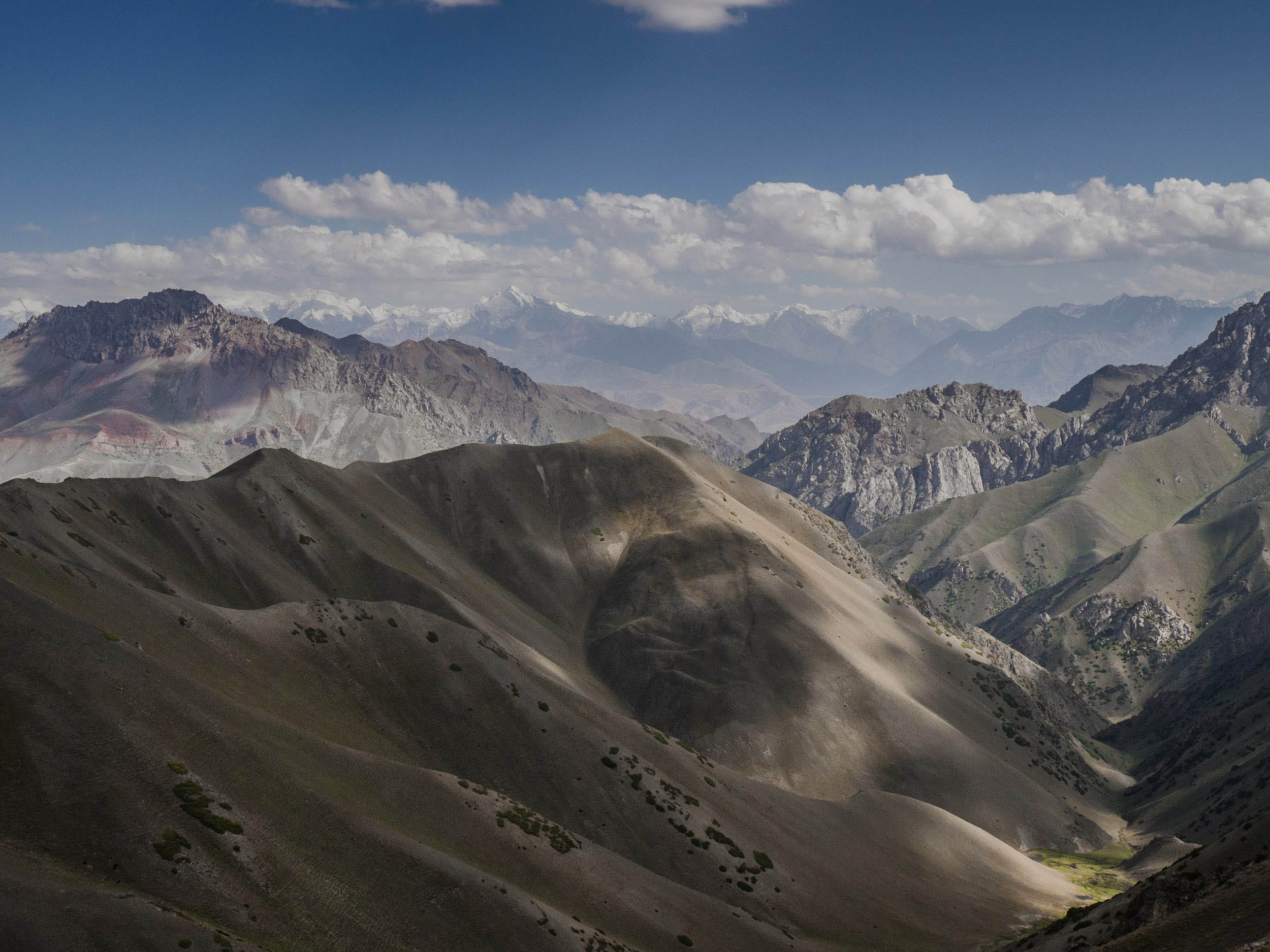
- A traverse of the Chon-Alai Valley, followed by an ascent and descent to Achyk-Tash little plateau and the mountaineering camps. The vast, dry, windswept Chon-Alai Valley lies between the Celestial Mountains and Pamirs, offering mesmerizing views of the massive ice formations cascading down the northern slopes of the Kyrgyz Pamirs.
- Tulpar-Kul Lake, nestled amidst hundreds of smaller lakes, lies scattered across the Achyk-Tash Plateau in the Kyrgyz Pamirs.
- Before Departure: Obtain a permit to visit border areas. The Achyk-Tash Valley, home to the base camps for climbers of Lenin Peak and the nearby Tulpar Lake, is within a border zone that requires special authorization for entry.
- Highway Precautions: Exercise caution when traveling on the highway from Torkent to Üch-Terek (Sargata), as it is busy with traffic. It is recommended to ride on the shoulder. Alternatively, consider hitching a ride from Torkent to Üch-Terek (Sargata) to avoid the congested stretch. The same goes for the route between Uzgen and Osh. I rode along the roadside. The main road itself is extremely busy and noisy. There is also a detour from the village of Sadyrbay through Madaniyat; you might prefer that option to avoid the loud and heavily trafficked main highway.
- Surmatash Reserve: Passing through the gate of the Surmatash Reserve in the Isfayramsy River Gorge is free. Visitors are typically only asked to record their name and entry time upon passing through.
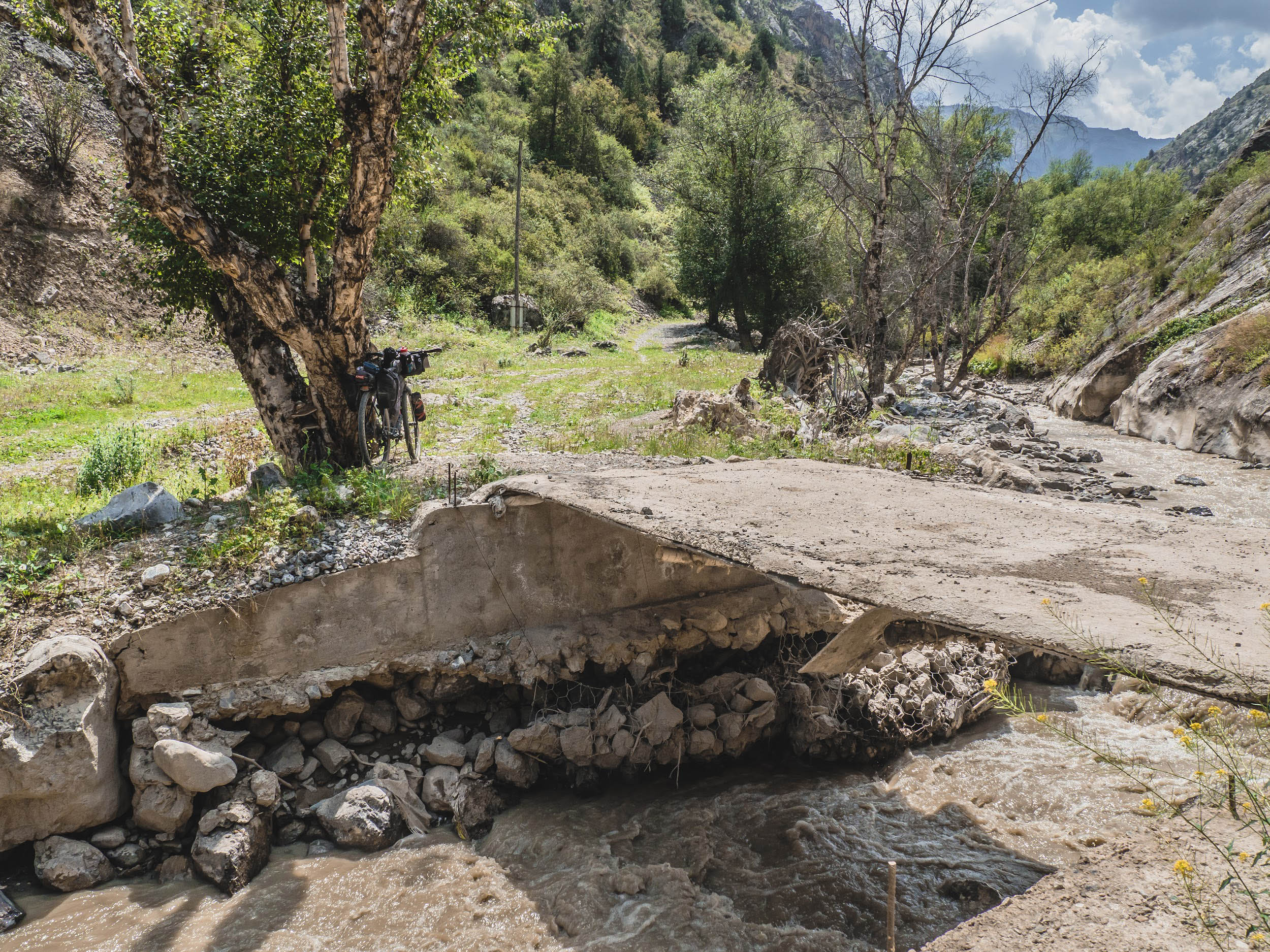
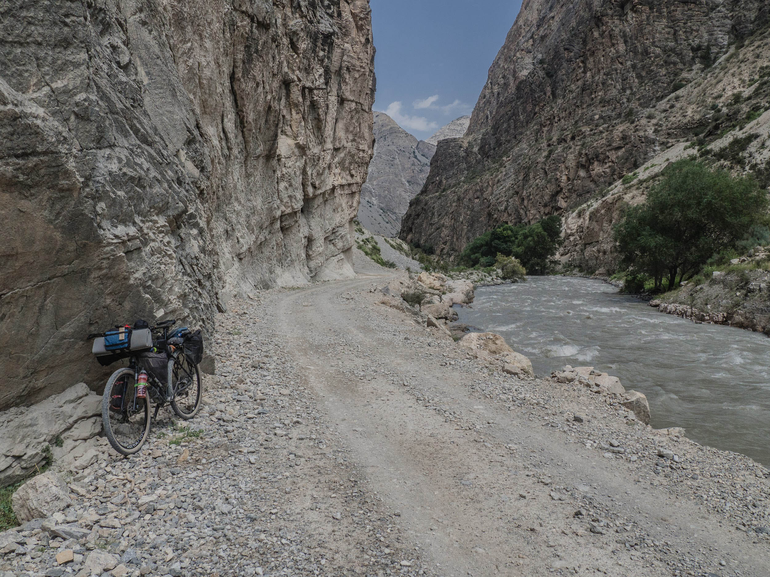
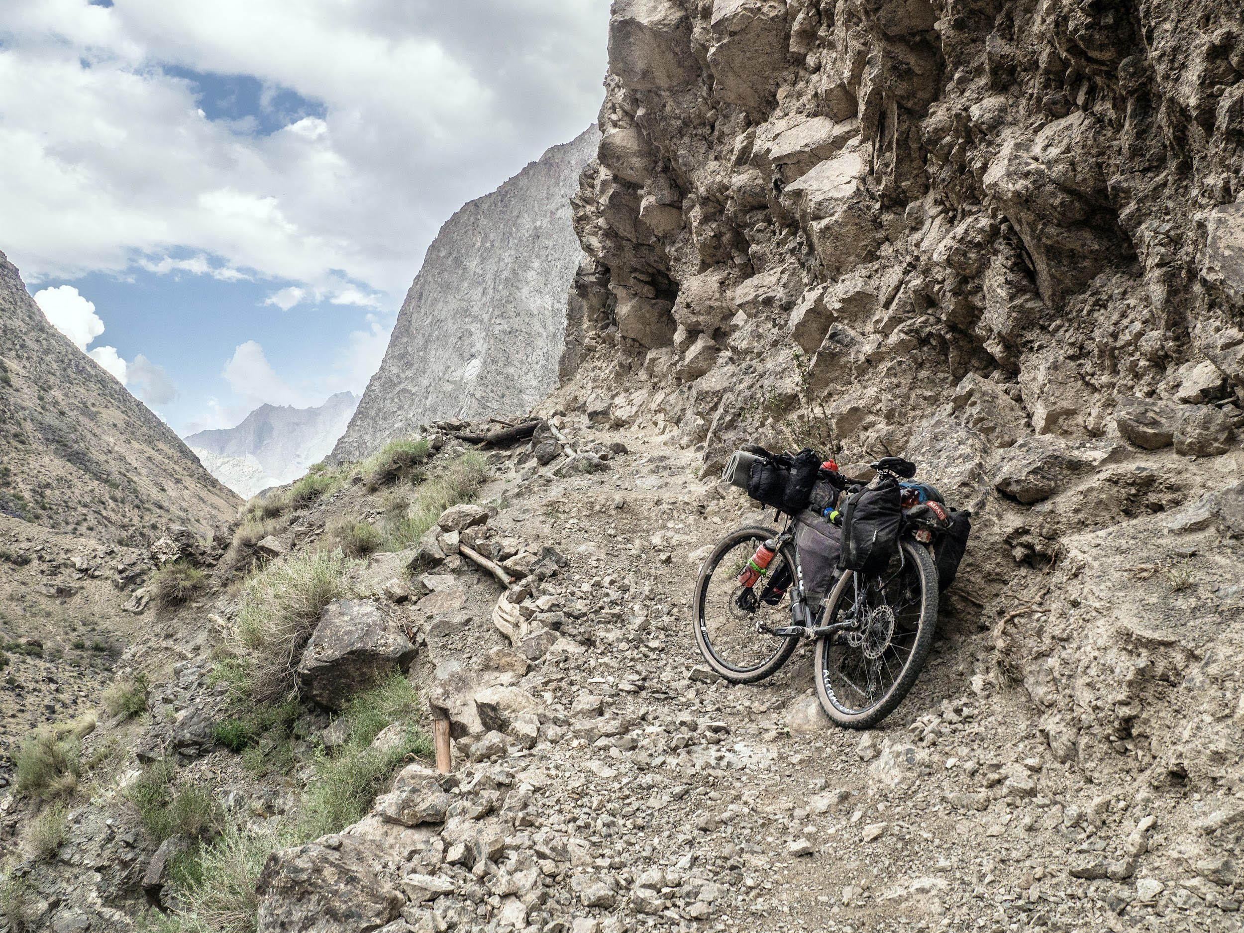
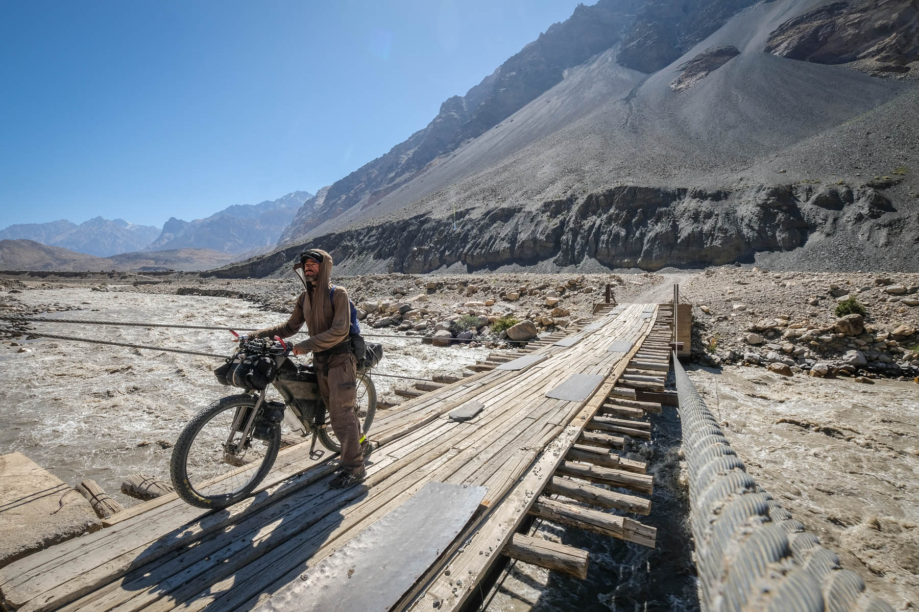
- Damaged Bridge: A bridge in the Isfayramsy Gorge was destroyed by a landslide in March 2024. To bypass this section, take the higher trail on the right slope (about a kilometer of hike-a-bike). The slope is steep, and the trail is narrow, so proceed with caution.
- For Kyrgyzstan, I would always recommend an MTB, especially if you plan to travel on gravel roads and unpaved passes, with tires no narrower than 2.2 inches. A gravel bike will also be a great choice for this route, with tires around 50mm.
- The best times to ride are July to mid-September.
- Major city along the route with the option to depart in any direction: Osh. Mid-sized cities: Kyzyl-Kiya, with the possibility to travel toward Osh, Batken, and Fergana (Uzbekistan); Uzgen with travel direction to Osh; Djalal-Abad with the travel directions to Osh and Bishkek; Small towns: Kochkor – direct road routes to Bishkek, Chaek – direct road routes to Kochkor and Bishkek, Torkent and Uch-Terek – direct road routes to Osh and Bishkek, Bazar-Korgon – direct road routes to Bishkek, Osh, and Jalal-Abad, Daroot-Korgon – road connection to Osh.
- Kyrgyzstan has a visa-free agreement with most countries in Europe, North America, and Asia. For citizens of other countries, a simplified visa-on-arrival procedure is available at Manas Airport in Bishkek.
- Currency can be easily exchanged at any bank branch or at small private exchange offices. In cities and both large and small towns, shops generally accept Visa and Mastercard for payment.
- The Route ends in Sarytash. During my last scouting trip, I returned to Osh by hitchhiking and then by plane to Bishkek during the primary scouting trip.
- Most segments of the route are well-documented by fellow cyclists, with camping spots listed on Google Maps, Komoot, and RWGPS. However, I’ll highlight my personal camping experiences. Of the 16 nights I spent on the journey, three were indoors, two were in yurts on the jailoo (summer pasture), and the rest were wild camping. Find all my camping spots noted on the GPX file.
- During three tent-camping nights, I encountered swarms of mosquitoes: Once on the seventh night by a spring above the village of Sargata, as well as the last two nights in the Chon-Alai Valley. I was grateful for the inner tent, which provided much-needed insect protection.
- In Uch-Korgon, there are no hotels or guesthouses—information is not available on Google or other apps. Locals informed me that any mosque could offer overnight shelter, though I didn’t use this option.
- The areas around Kyzyl-Kiya and Uch-Korgon are densely populated, so finding a suitable camping spot can take time. I was invited to stay at a local family’s house after meeting them at the shop.
- After descending from the highest point of the Koi-Jolu Pass, I had enough food to skip the detour to Doroot-Korgon, the largest village in the Chon-Alai Valley and the administrative center. There are a couple of hotels in Doroot-Korgon, and I have stayed in one before, but not this time. I camped for two nights in the valley and completed my journey on the 17th day in the village of Sary-Tash.
- On the way to Kegeti Pass: The route to Kegeti Pass passes through several villages, offering convenient opportunities to resupply. Plan for an overnight camp before the pass, as the climb is demanding. Once over the top, you should reach the next village by early afternoon the following day.
- Descending from Kegeti Pass: The descent brings you into the broad Kochkor Valley, where the route to Kyzart Pass follows a paved road through four villages. Each offers opportunities to resupply, with Kyzyl-Dobo and Mantysh standing out for their well-stocked shops and a wide variety of food options.
- From Kochkor Valley to Jumgal Valley via Lake Son-Kul: This remote section demands careful preparation, as there are no shops between Kyzyl-Döbö and Kuiruchuk Village. Be sure to stock up in Kyzyl-Döbö, which has a couple of reliable stores. The next opportunity to resupply comes only after descending from Chilbel Pass and leaving the Son-Kul region behind.
- Chaek: This well-equipped village features numerous shops, as well as banks and ATMs, making it an ideal place to resupply. Be prepared for at least two nights of camping ahead, as the route crosses three mountain passes with limited access to stores in the smaller villages along the way.
- Torkent to Üch-Terek: Don’t linger too long in Torkent—press on toward Üch-Terek, where you’ll find a good selection of shops and cafés. This is a key resupply point before tackling the Kargysh and Shyldyrak Passes. Afterward, you’ll descend toward the walnut forests near Kyzyl-Ürkur Village, which also offers a few small shops for basic provisions.
- Jalal-Abad Foothills: Shops are limited in the foothill villages south of the mountain range, so plan ahead. Be sure to stock up thoroughly in Kyzyl-Ukur Village.
- In Osh, I would recommend two places for resupply: Globus and Osh Market (mini store).
- After Osh: The route from Mangyt to Sarykandy (about 25 kilometers) runs through hilly, arid terrain resembling a desert. Be sure to stock up on water in Mangyt.
- Resupply After Sarykandy: After Sarykandy, the route continues through several villages with small shops, offering steady resupply opportunities. Before tackling the final climb over Koi-Jolu Pass, make sure to stock up in Kyzyl-Kiya or Üch-Korgon. Both towns have a wide range of stores and enough provisions to carry you through the next two days.
- Isfairamsy River Gorge: The river itself was my primary source of drinking water. Make sure to filter water from the river.
- Kyzyl-Eshme: There are two shops with limited resupply options in Kyzyl-Eshme, so it may be worth continuing to Doroot-Korgon for better options. I had enough food to camp near Kuzul-Eshme on the main road and make a final push toward Lenin Peak Base Camp and Lake Tulpar.
- Coordinates for spring locations along the route can be found on the map.
Deciding on how many days you’d like to take to ride this route will depend on your fitness, but here is the itinerary of my last scouting trip, which took 17 days from start to finish.
Day 1-2
During the first four days, I rode with Oleg Sobko. We caught up near Yuryevka Village at the Bolshoy Chuysky Canal. Oleg was coming from Kemin town, and I rode from Bishkek along a gravel road by the canal. We stopped for lunch at a small shop in Rot-Front village. We climbed up the Kegeti Gorge for the rest of the day. At one point, I noticed the silhouette of a cyclist riding ahead of us. Our first overnight camp was set up within the forested zone.
In the morning of the second day, while climbing a serpentine road, I discovered that I had lost one of the straps I was using to secure a bottle to my fork. Since the strap was borrowed, I regretted the loss. Later, we caught up with a group of bikepackers ahead of us—three Brits on gravel bikes. Slowly, they pulled away and reached the pass before us.
On the descent, by the banks of the Karakol River, we were caught in the rain that had been chasing us throughout the way until we reached the first village of Dön-Alysh. Between this village and the next one, Kyzyl-Döbö, a new asphalt road was shining, reflecting the sun when we started cycling our evening ride before our second overnight coming close. The rare passing cars, the reappearance of the sun, and thoughts of an imminent camping spot and rest made the afternoon ride the most pleasant part of the second day. We set up our second camp near a farm, where the asphalt road began its ascent to Kyzart Pass.
Day 3
In the morning, we climbed Kyzart Pass on an empty asphalt road. We had fried fish for lunch in a small roadside cabin at the pass and then headed toward the first minor pass of the third day. Both of us were traveling this section for the first time, following a pre-planned route that was automatically generated on Komoot.
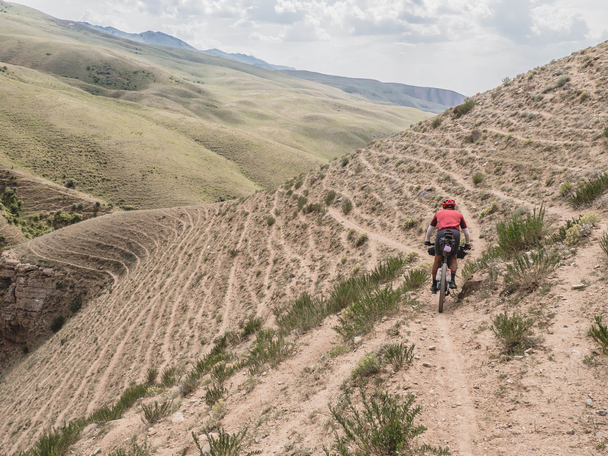
On the descent, we ended up in a gorge with no exit. The trek seemed more suitable for hiking, but carrying a bike up the hill was unrealistic, and there was no way out below in the gorge either. We had to return back, fortunately not far from the starting point of the descent. There was a yurt nearby. The shepherds pointed us in the right direction. It turned out to be a singletrack, which was really fun to ride, relatively easy, and fairly fast.
This detour cost us several hours and left us exhausted, but we were thrilled to find our way. As soon as we began the ascent toward Tuz-Ashuu Pass, a rainstorm hit us heavely. We set up camp at the foot of the climb, near a spring with a view of the Son-Kul Mountain ridge, from where the path to the pass was clearly visible.
Day 4
We crossed two passes (Tuz-Ashuu and Chil-Bel), traversing along the northwestern shore of Song-Kul Lake within a day. From there, we descended into the wide and long Jumgal Valley, stopping in the village of Kuiruchuk. Being accustomed to guesthouses of varying standards, we spent some time searching and deciding on one. In 2024, Kuiruchuk Village had limited options for guest accommodations. We decided on Nico B&B
Day 5
After descending from Son-Kul, our paths diverged. In the morning, Oleg headed home to Kemin while I continued my Celestial Ride along. By midday, I reached Chaek. Had one stop at a tire repair shop to pump up my tires. Each morning, I’ve had to inflate both tires—they lose some air over the day, though not significantly. So whenever I saw a tire shop, I made a point to stop and pump them up.
In Chaek, I had lunch before setting out. Stocked up on food for the long stretch to Torkent—two nights and three days. I passed through the Kökömeren River Gorge without any difficulties under the strong sun, reaching the village of Kyzyl-Oi in the afternoon. Slowly, and often hiking with my bike, I ascended to the Kyrk-Kyz Pass by evening. These were familiar places around, and the good weather made the climb enjoyable so far, so I felt no stress during the ascent.
Just right after the sunset, I crossed the pass and asked local shepherds for a place to spend the night. Thunderclouds were rising from the gorge below, and heavy rain fell during the night. I stayed in a shepherd’s utility tent, so I didn’t need to unpack my own gear.
Day 6-7
I spent two days reaching Torkent. On the first day, after overnight at Kyrk Kyz Pass, I rolled through two areas with summer pastures. The first was Tört Jailoo, which ended with a descent into the village of Toluk, followed by a tedious stretch under the blazing sun to the next area, Zhamanbel Jailoo. There, on a small plateau scattered with livestock camps, I set up camp just before Zhamanbel Pass after sunset. The day had been hot and exhausting.
The next day, I reached Torkent. It was just as hot as the day before. I rode through familiar places, recalling 2021 when I first traveled through this region (in the opposite direction) as a participant of the SRMR. I had a long stop in Torkent and lingered for a while, cooking on the porch of a shop where I left my electronics to charge. Taking advantage of the time, I rested in the cool shade.
By 4 PM, I made it to Uch-Terek and Sargata Village. At this point, I was in no rush, having Kargysh Pass rising ahead, which I planned to tackle the next day. These areas were entirely unknown to me. Beyond Kargysh was Shyldyrak Pass, and I wasn’t sure what to expect and how it would go. I decided to spend the night somewhere on the outskirts of Sargata. I stopped at a tire repair shop, stocked up on supplies for two nights and three days, and set up camp in a fortunate spot next to a stream. It was in the middle of a dry, waterless steppe near a spring, a small oasis surrounded by small gardens and fields belonging to two nearby households.
At sunset, four children came to the spring for water—two teenage girls and a younger boy and girl. They were curious and talkative. After some time, they returned and invited me to their home, which was located in the middle of the orchard. I agreed, packed up my tent, and followed them. It turned out that an elderly couple lived there, and their children and families had come to celebrate a birthday.
The men were busy butchering a sheep and chatting as the women were sorting gifts and presents. By then, it was getting dark, and the elderly men had been affected with vodka and were in high spirits. For all of them, however, the evening was just at the beginning. Then I realized, as is customary on such occasions, it could stretch deep into the night until the meat cooked and everyone had their fill of conversation.
Looking around, I noticed there was no convenient place for me to spend the night. As an outsider, there wasn’t a room available for me. So, before it got too late, I decided to return to my original campsite. And that turned out to be the right decision.
The evening was warm and cloudless. Swarms of mosquitoes buzzed around; I only set up the inner part of my tent. I fell asleep under the night sky, gazing at the stars and lost in my thoughts.
Day 8
The climb to Kargysh Pass was not particularly high but felt long and demanding. The ascent followed a doubletrack road with poor, rocky surface, made worse by the heat. The descent was just as unappealing—it didn’t even feel worth rolling down.
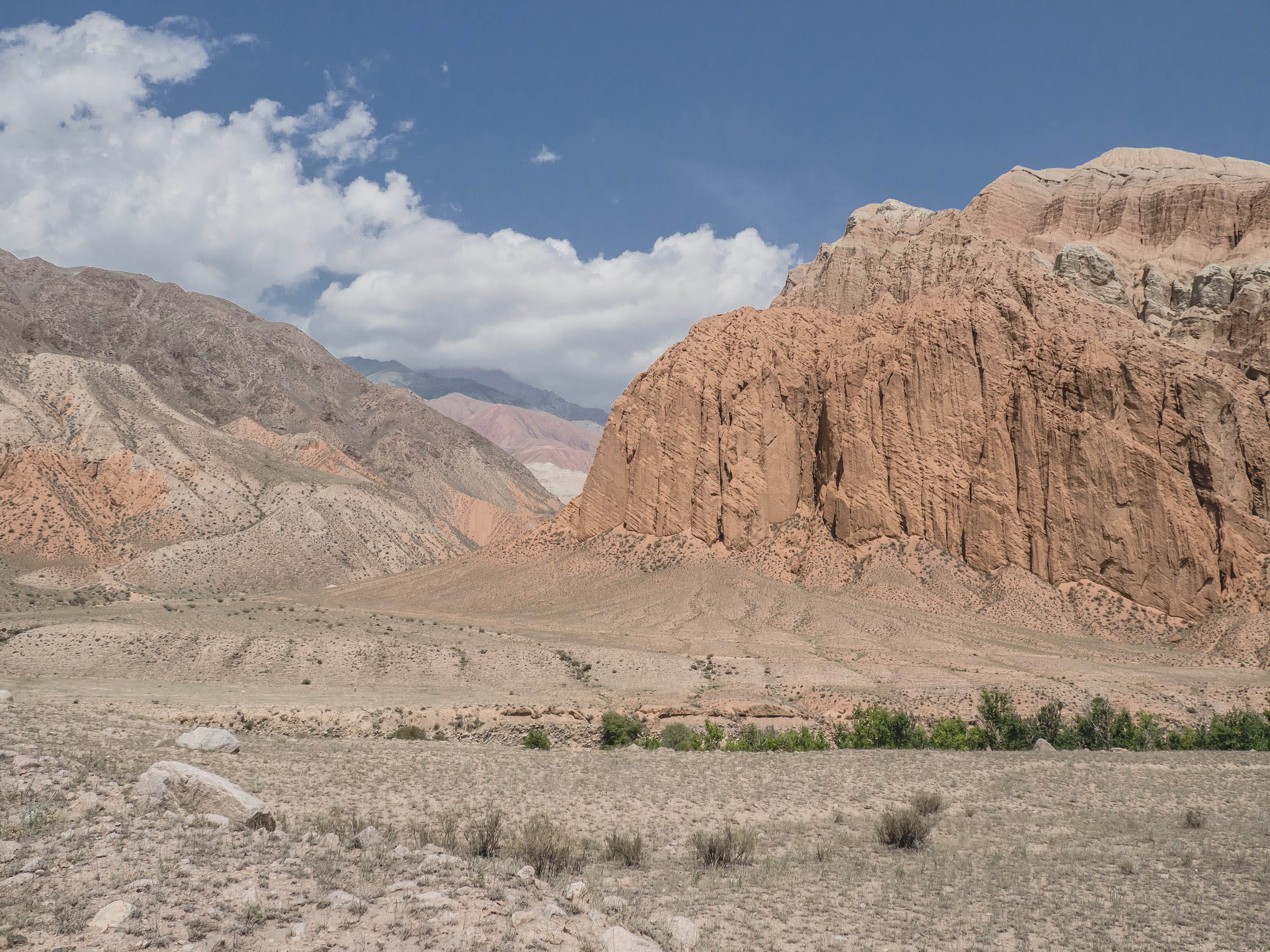
At the bottom, near the bridge over the Kara-Suu River, there was a small High Voltage Grid Substation and the bridge itself, where I stopped for lunch. From there, a long, winding incline led around the mountain to the Shyldyrak River Gorge. A double-track road ran through the gorge, extending to an abandoned serpentine. However, crossing the river was necessary, as the bridge had been destroyed by a mudslide.
A family of shepherds living in a nearby yurt told me about the missing bridge. This spot also served as the parking area for other shepherds who spent their summers around the Shyldyrak Pass.
It was only about 4 PM, but I decided to stay overnight here.
Day 9
I spent the entire day climbing Shyldyrak Pass, mostly hike-a-bike. Along the way, I encountered a shepherd out for a walk; his yurt appeared higher up among the rocks. From his yurt, a long zigzagging path stretched up to the summit of the pass. The incline wasn’t steep, so it was possible to slowly ride a bike, but I mostly walked.
The road on the descent from Shyldyrak Pass was in poor condition: littered with stones, overgrown with grass, and heavily eroded in many places. I had to walk down until the road became visible again.
In the middle section of the gorge, the river flowed through a broad, rocky bed, forcing me to ford it. The landscape made it clear that the river frequently changes course across the width of the gorge. Beyond that point, an excellent gravel road led to the village of Kyzyl-Ünkür.
Closer to the valley, the road passed by a waterfall that thundered in the distance. This area was covered in dense walnut forests, which blanketed the slopes on both sides of the gorge. As I descended, rain clouds gathered overhead. Although the rain held off, streams of water cascaded onto the road from beneath the forest as if emerging from nowhere. The overcast sky, misty weather, and rushing streams gave the forest the appearance of a lush, tropical jungle.
For the night, I stayed at a homestay recommended by CBT Arslanbob, a local community-based tourism company. That night, a torrential downpour began—the heaviest rain I’d ever seen.
Day 10-11
Two scorching days lay ahead as I traveled from Kyzyl-Ünkür to Osh. The heat was intense, but I was familiar with the route from a previous bike trip in 2022 (racing SRMR). The road was smooth and obstacle-free, so I kept moving, stopping only a few times to rest under the shade of trees or shop canopies.
Even during the hottest part of the day, I pressed on, ascending toward the hills around Kok-Zhangak. The heights of the area near the town were beautiful, and climbing them at sunset, when the heat had finally subsided, felt incredibly pleasant. Along the way, I came across a large spring right by the road. There was a lush green meadow nearby, perfect for camping, with a couple of small houses tucked among low trees, a beekeeping site, and a panoramic view of the Fergana Valley all made this place as perfect as can be imagined. I decided to camp there for the night.
A couple passing by on a vehicle stopped by trying to dissuade me, warning of jackals in the area, but I didn’t take their concerns too seriously—especially in a populated area. The night passed peacefully. I heard some noises, which I believe were jackal cries, but they didn’t bother me.
In the morning, I quickly reached the village of Markai. From there, I enjoyed a leisurely ride on a new asphalt road that wound through several villages. Afterward, a hilly dirt road led me over a small pass and down to the village of Zhiide. From there, it was a steady descent all the way to Uzgen.
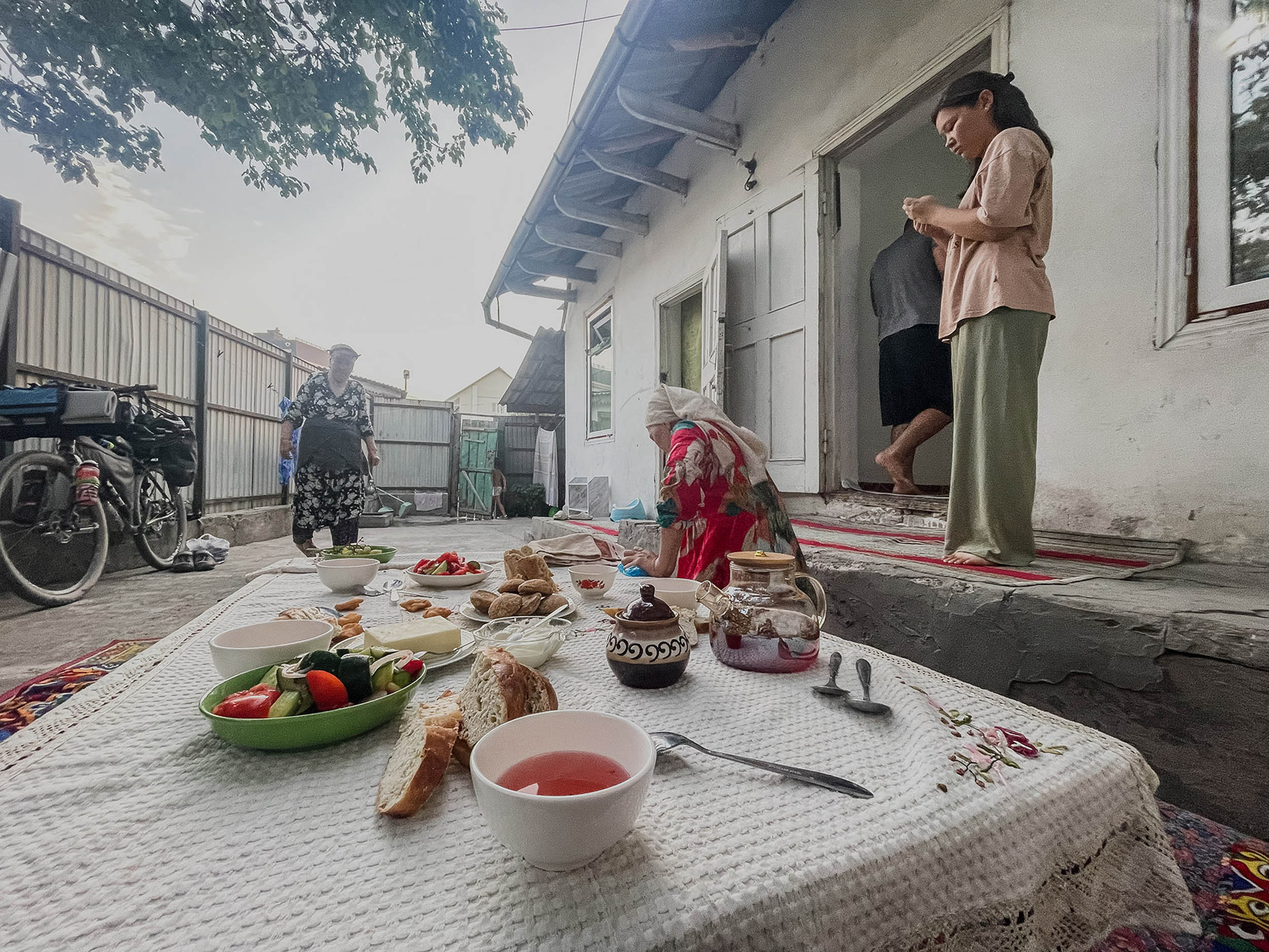
On the way, I stopped to visit an old friend and colleague from the time of my hard-working office life. She and her kids were spending the summer with her mother in the village of Kara-Dyykan. The family had recently built a new, comfy house. I took the opportunity to relax, take a warm shower, eat, and even have a beer.
At around 5 PM, I set off for Osh, carefully navigating through the bustling streets of Uzgen. I rode slowly and cautiously, sticking to the roadside along a busy road, and eventually reached Osh in darkness.
I stayed in Osh for two nights, giving myself a full day to rest and recharge.
Day 12
Full days of rest in Osh
Day 13
I left Osh at a leisurely pace, taking the western outskirts of the city through cozy villages surrounded by orchards and small fields. After passing the last village, Mangyt, I turned south. From a nearby hilltop, I could see the town of Aravan, with the vast Fergana Valley stretching endlessly beyond it.
The next part of the journey took me through arid landscapes all the way to the outskirts of Kyzyl-Kiya, which I reached after lunch. Along the way, I passed abandoned mines—remnants of the country’s first industrial enterprises dating back to the early 20th century. Approaching the city, I took a detour through foothill villages to avoid heavy traffic and enjoy the quieter roads.
Not stopping in Kyzyl-Kiya, I continued toward Üch-Korgon town, where I started planning my overnight stay. Google showed no hotels or guesthouses in the area. I asked some young men passing by if they knew of any accommodations, but they confirmed that there weren’t any in town. However, they suggested I try staying at any of the local mosques.
I decided to keep going toward the gorge, hoping to find a camping spot outside the city. On the way, I stopped by a store where I struck up a conversation with a man and his wife, who were returning home in their small truck. They kindly invited me to stay at their home, and I immediately accepted their offer.
Their house had a traditional topchan (a raised platform for sitting and sleeping), a singing canary perched above it, and a small garden filled with exotic fruits unfamiliar to me—all hallmarks of southern Kyrgyzstan’s charm.
Day 14
After breakfast at Azimjon-aka’s home, I set off at an easy pace toward the Isfayramsy Gorge, heading south in the direction of Chong-Alay. Just outside Üch-Korgon, I couldn’t resist stopping at a tandyr bakery for a cup of tea and some fresh, hot samsa. Along the way, I passed the checkpoint for the Surmatash Nature Reserve, where I logged my passage time and signed the visitor registry.
As I continued, I met shepherds living in the area with their families. They informed me that one of the bridges ahead had been destroyed and that I would need to take a detour via a narrow trail. When I reached the spot, I had to stop and assess the surroundings and walk part of the trail on foot before attempting to proceed with my bike. The slope was steep, the trail narrow, and in places, my feet slipped on loose rock.
By the time I was navigating the trail, storm clouds had rolled in, and evening was approaching. Surrounded by cliffs, I couldn’t spot a suitable place to pitch my tent. Nearing the road again, I came across three young herders with a flock of sheep. They mentioned a good campsite about 500 meters ahead. I hurried toward it and was relieved to arrive just in time to set up my tent before the rain began.
However, I soon discovered that my tent had started leaking, as the seam sealing tape on its seams had come undone in several places. Fortunately, the rain didn’t last long, giving me enough time to organize myself and prepare for the night. Though the day had its challenges, I was grateful to end it in relative comfort, reflecting on the resilience such journeys demand.
Day 15-16-17
On Day 15, I made a navigational mistake on a short switchback in the gorge. Instead of sticking to the road, I decided to cut across one of the loops since I could see the road ahead. However, the path I chose veered off and eventually disappeared, forcing me to climb up a steep slope to get back on track. After that, I navigated a couple more switchbacks before entering the Tenizbay Valley, where the road was in excellent condition.
I caught up to a young man riding a donkey, heading further into the pastures. I parted ways with him as I turned toward the switchbacks leading up to the Koy-Jolu Pass. The climb was steep, but the road’s 14 well-laid switchbacks made it manageable. Both the ascent and descent were on well-maintained gravel, and the downhill ride was a calming, enjoyable experience. By evening, I reached Kyzyl-Eshme village. Since there were no guesthouses, I camped near the river along the road.
The next night, my second in the Chong-Alay Valley, was spent on a mown field. I now know this area is swarming with mosquitoes—they were relentless.
On Day 16, I continued my journey toward the base camp of Lenin Peak. The weather was clear, hot, and windless, making the ride smooth, enjoyable, yet exhausting. After reaching the Base Camp, I returned the same day to the village of Sary-Mogol, where I set up camp in a field for the final night of my expedition.
Day 17 marked the conclusion of my journey. The morning ride to Sary-Tash was straightforward along a quiet asphalt road. After reaching Sary-Tash, I waited for a couple of hours before hitchhiking to Osh in a low-bed truck loaded with coal. It was a fitting end to an expedition full of challenges, stunning landscapes, and unforgettable encounters.


Terms of Use: As with each bikepacking route guide published on BIKEPACKING.com, should you choose to cycle this route, do so at your own risk. Prior to setting out check current local weather, conditions, and land/road closures. While riding, obey all public and private land use restrictions and rules, carry proper safety and navigational equipment, and of course, follow the #leavenotrace guidelines. The information found herein is simply a planning resource to be used as a point of inspiration in conjunction with your own due-diligence. In spite of the fact that this route, associated GPS track (GPX and maps), and all route guidelines were prepared under diligent research by the specified contributor and/or contributors, the accuracy of such and judgement of the author is not guaranteed. BIKEPACKING.com LLC, its partners, associates, and contributors are in no way liable for personal injury, damage to personal property, or any other such situation that might happen to individual riders cycling or following this route.
Further Riding and Reading
Here are some connected/nearby routes and related reports...
Please keep the conversation civil, constructive, and inclusive, or your comment will be removed.