


Trans-Mexico Bikepacking Route (Norte)
Distance
1,468 Mi.
(2,363 KM)Days
40
% Unpaved
50%
% Singletrack
1%
% Rideable (time)
99%
Total Ascent
173,048'
(52,745 M)High Point
13,780'
(4,200 M)Difficulty (1-10)
7?
- 8Climbing Scale Strenuous118 FT/MI (22 M/KM)
- -Technical Difficulty
- -Physical Demand
- -Resupply & Logistics
Contributed By
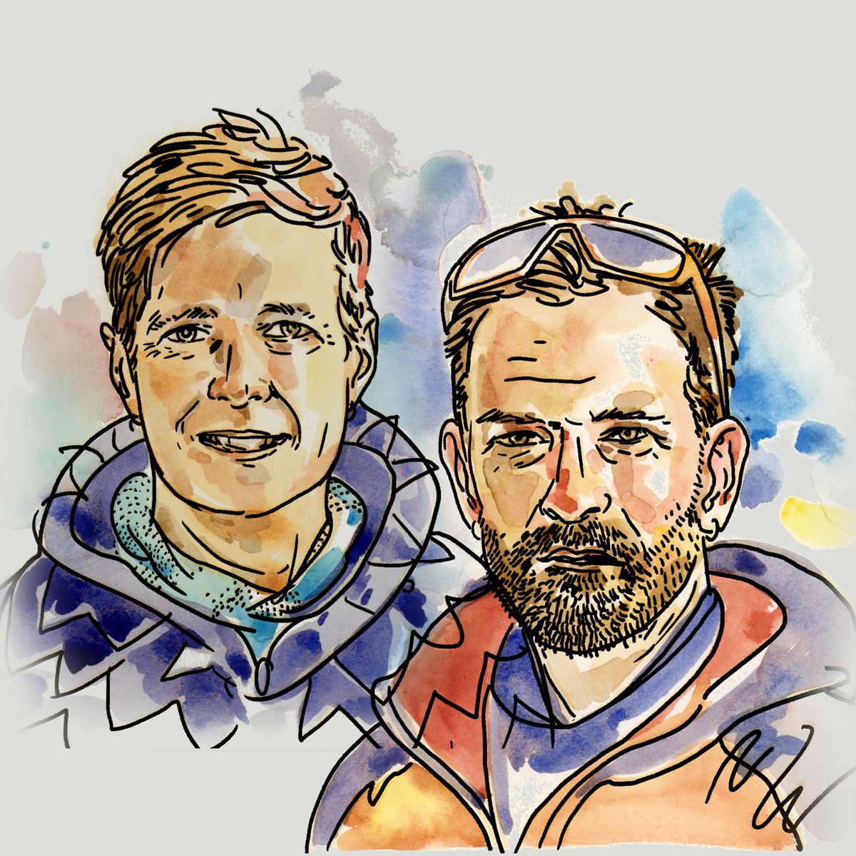
Mark and Hana
Highluxphoto / BeingHana
The Trans-Mexico route was born from two southbound cyclists’ desire to experience the diversity of Mexico’s culture, cities, and landscapes following a dirt-based route that crosses rural and backcountry regions where possible, while still including some of the country’s most interesting cities and sights. The Norte segment links the cobbled streets of some of Mexico’s most famous colonial cities to some of its poorest pueblitos with dirt backroads, quiet pavement, and horse trails. Riders will experience a broad spectrum of both Mexican society and its many landscapes. Combined with its shorter and more technical southern section (Trans-Mexico Sur), the Trans-Mexico makes a nearly 3,500-kilometer traverse of the country.
What to expect
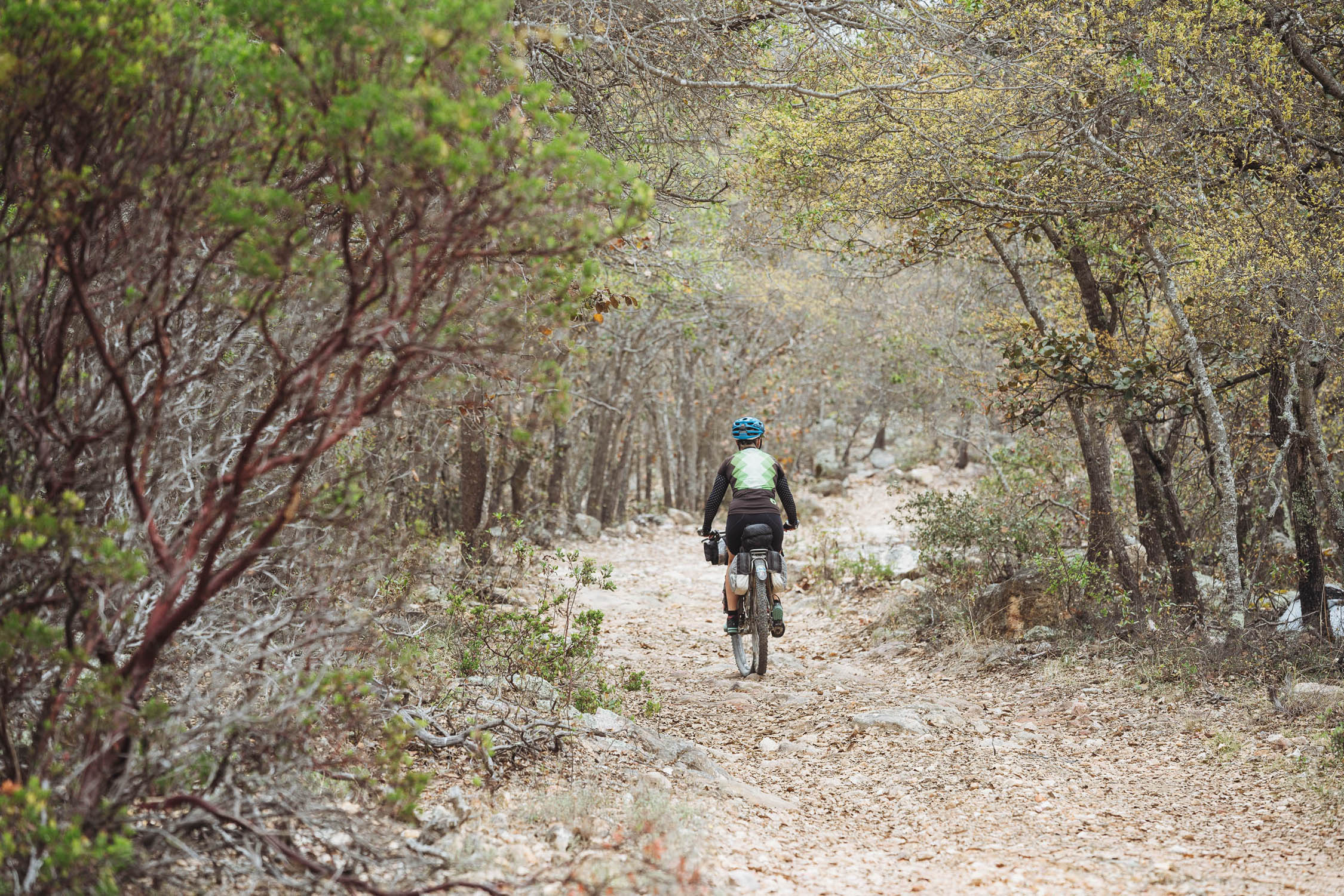
It’s important to consider that the Trans-Mexico isn’t a “pure” bikepacking route like the Baja Divide or the Colorado Trail. It’s more of a long-distance touring route with an emphasis on dirt, but not a total obsession for it. It’s designed for bikepackers to take in the greatest hits of amazing dirt rides through Mexico with necessary pavement connections that are curated to meet the preferences and needs of the touring bikepacker, including low traffic volumes, quality scenery, and cultural opportunities. Where the route follows dirt sections, they are almost invariably remote. It’s a high-value experience, pavement included. See Route Development for more details.
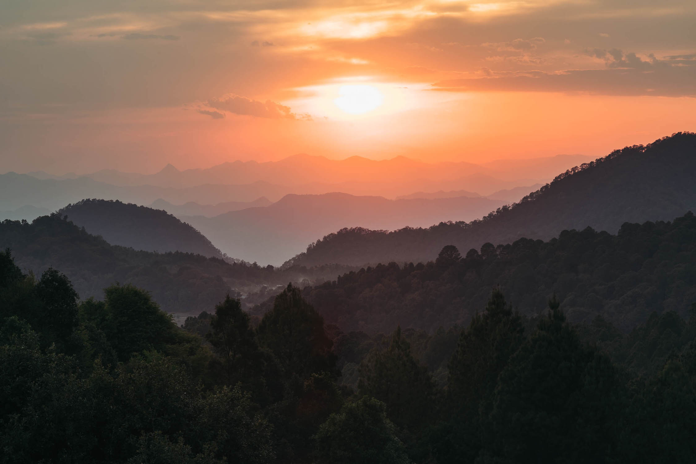
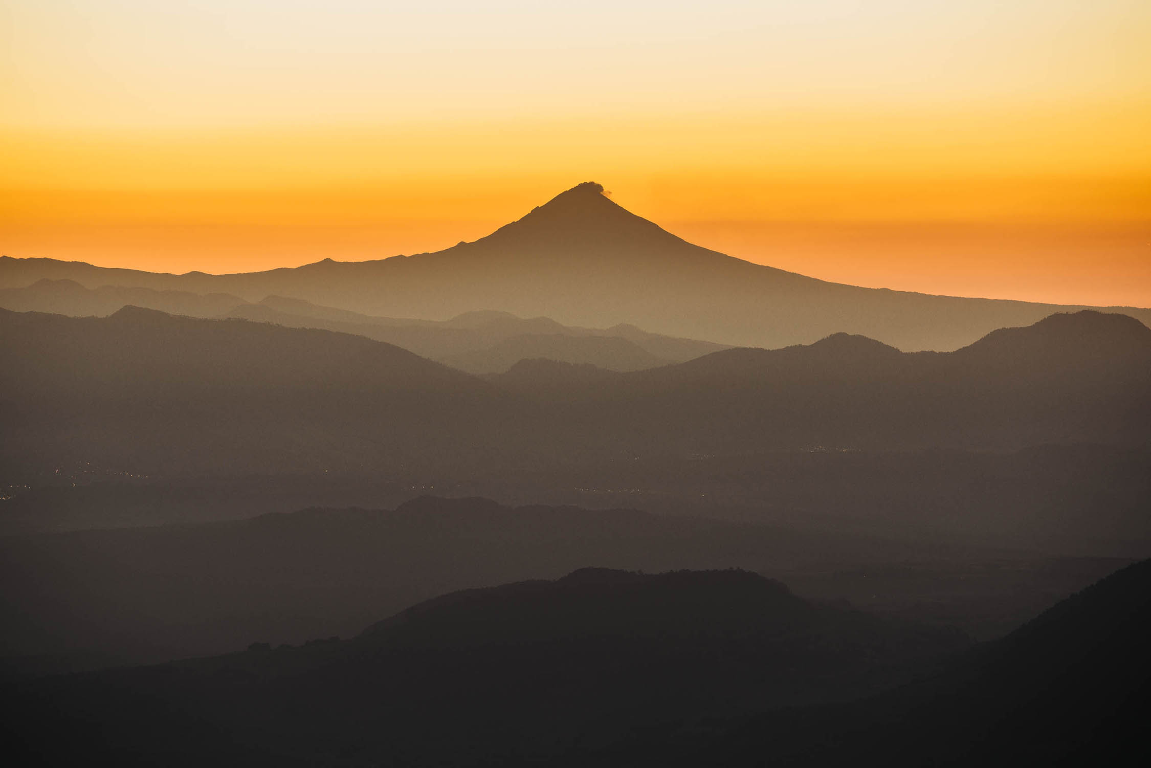
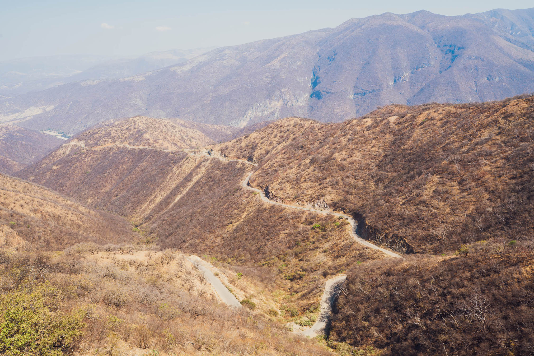
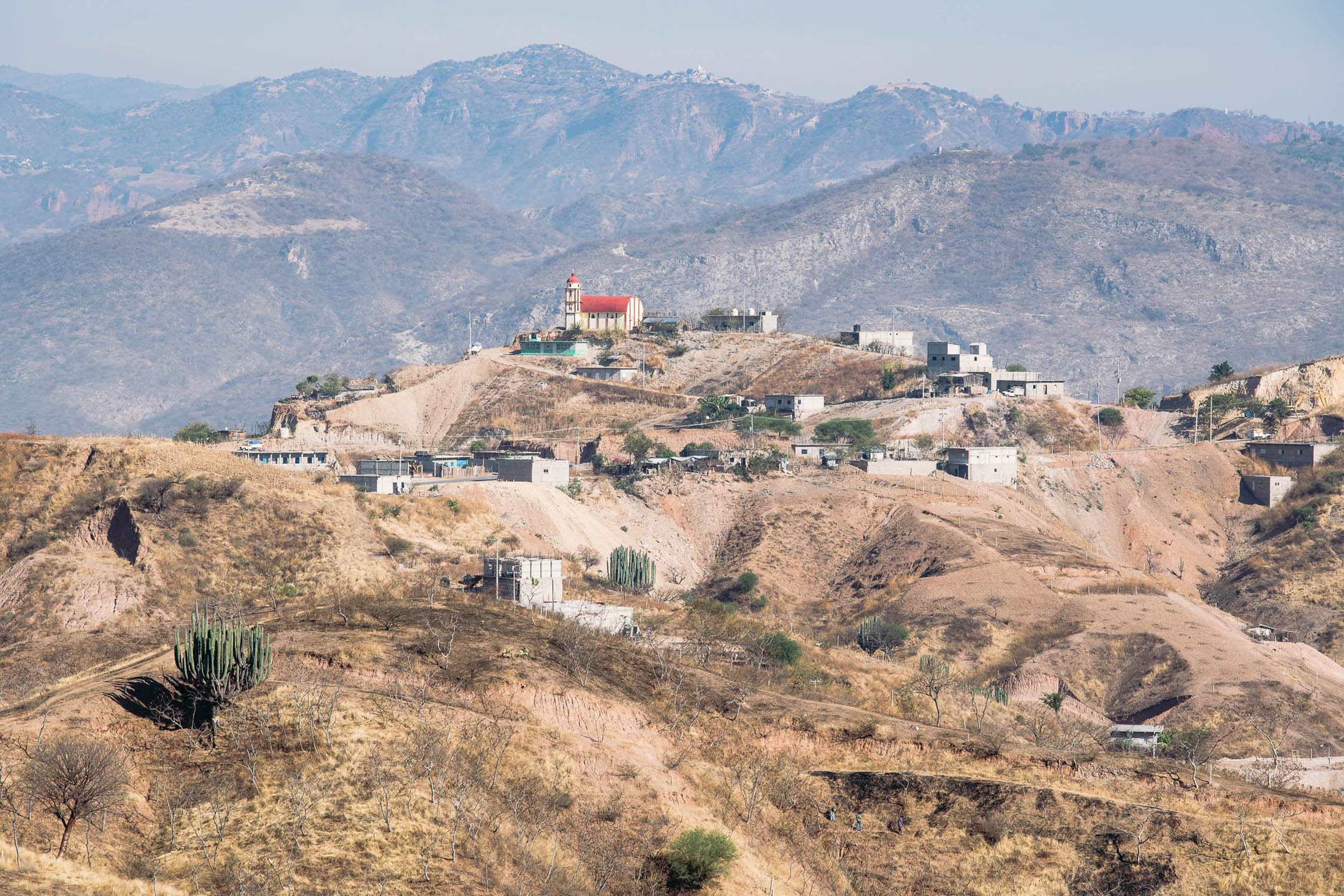
Simplistically, Mexico’s topography is defined by the occidental and oriental cordilleras of the Sierra Madre mountain range, between which lies a high plateau—the Altiplano Mexicano (high plain), the average elevation of which lies just below 2000m. The Trans-Mexico Bikepacking Route, once it has climbed from the subtropical coast of Mazatlan through the Sierra Madre to the altiplano, then roughly follows the continental divide of the country, crossing the Central Volcanic Belt en route as it makes its way to Oaxaca in the Valles Centrales.
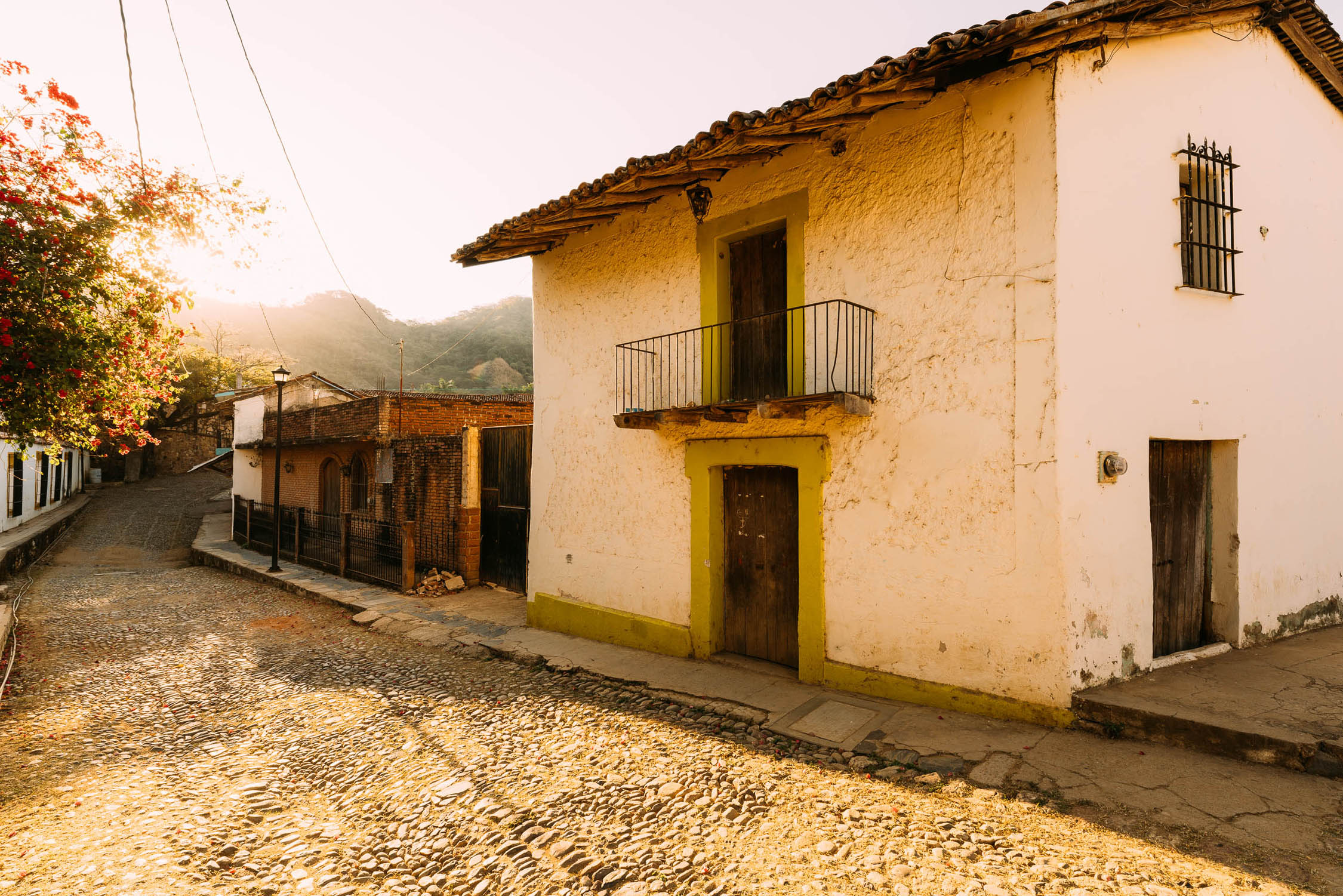
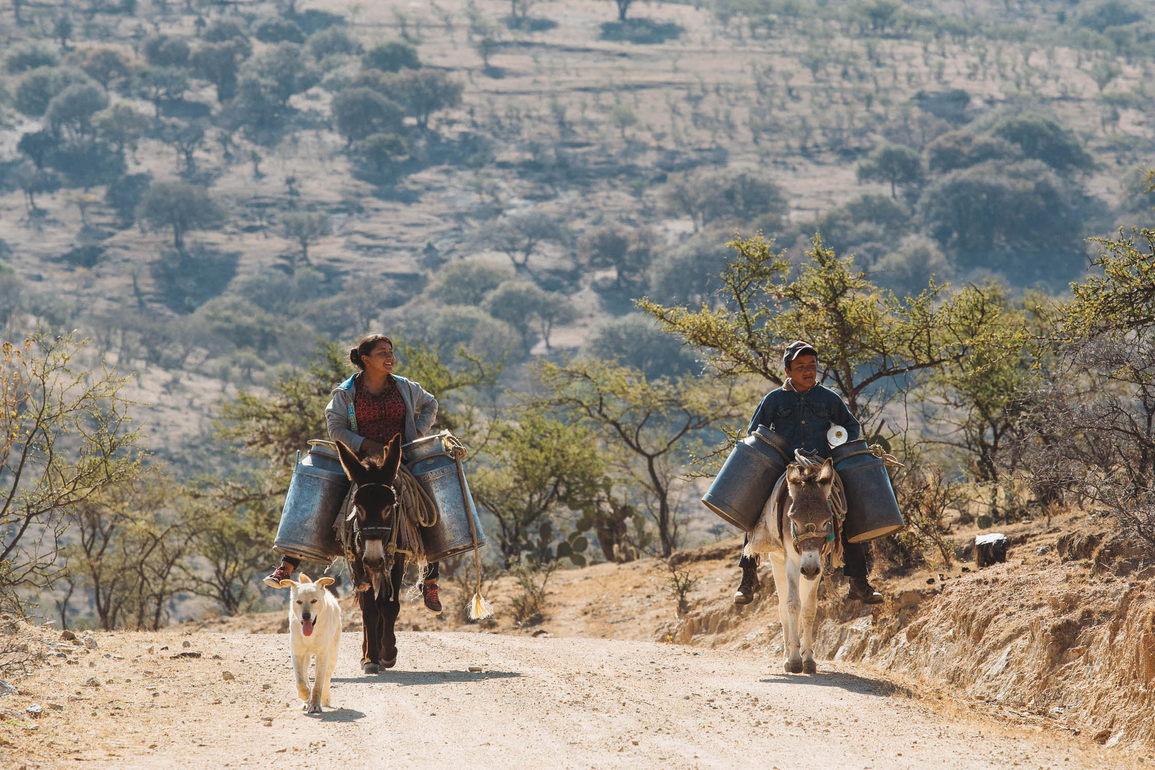
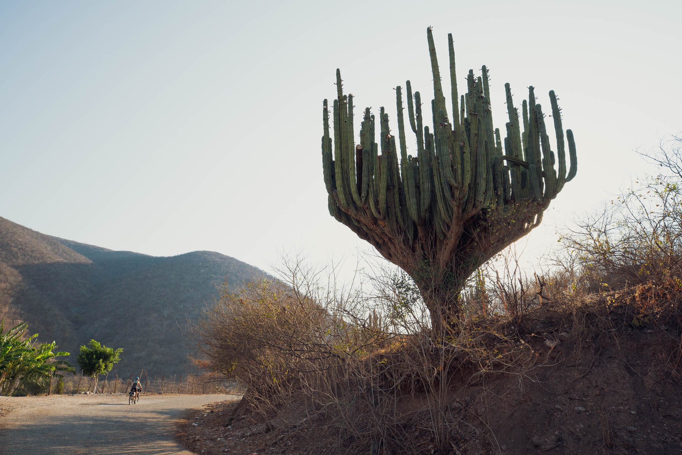
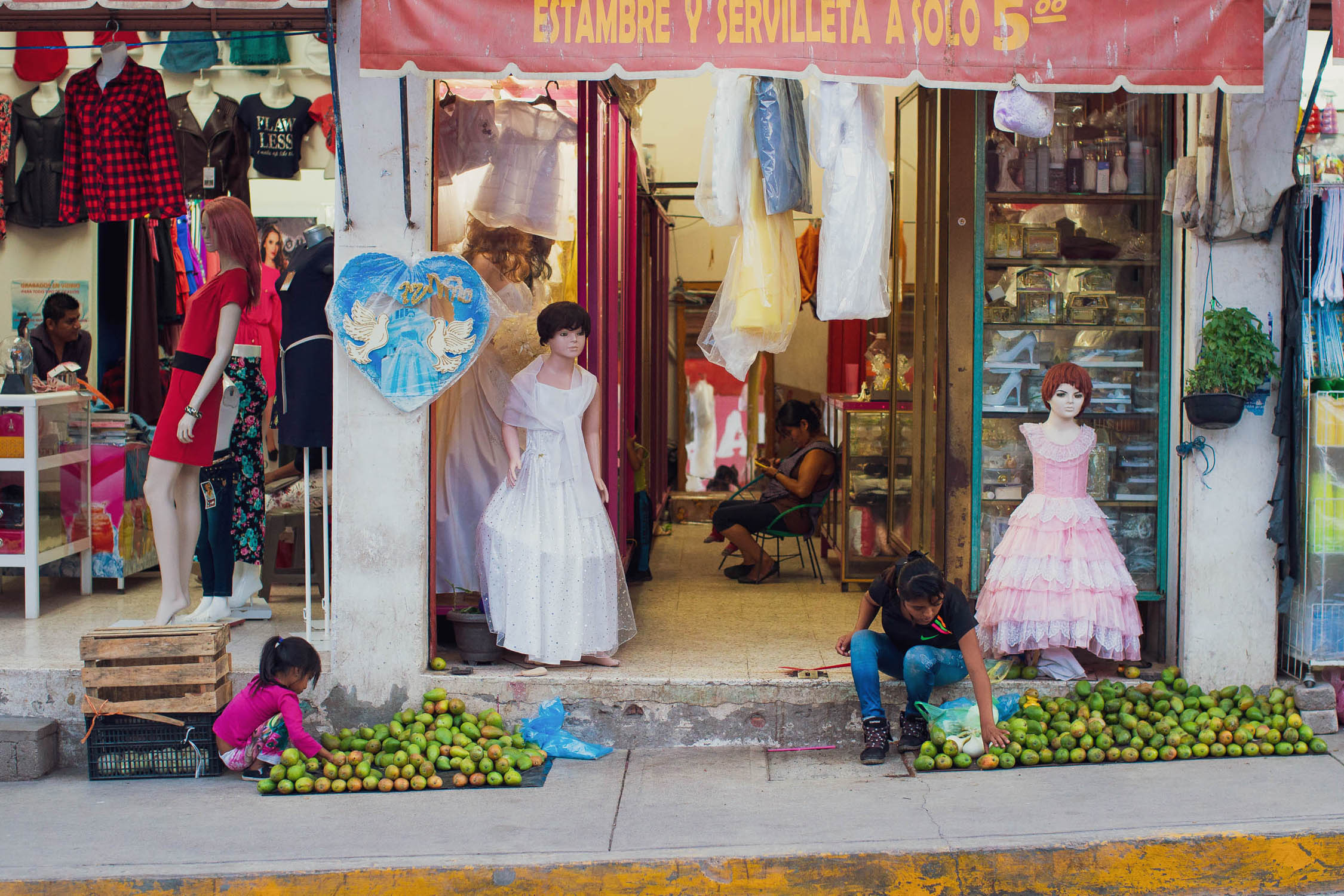
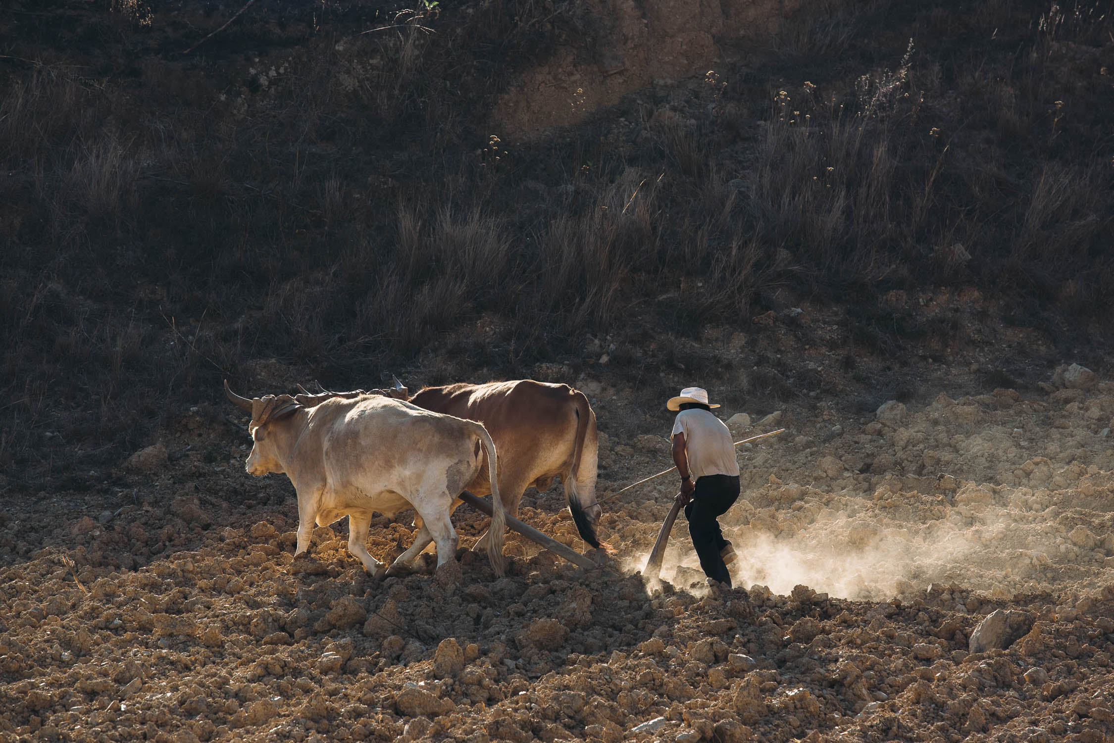
In doing so, it traces a circuitous route through tropical dry forest, arid cactus covered uplands, and pine and oak covered ranges, punctuated by stops and resupplies in places as diverse as the colonial splendor of the city of Zacatecas, through to small, predominantly indigenous villages. But despite these transitions, a constant will be the welcoming nature and hospitality of the Mexican people, combined with an insight into an incredibly rich blend of culture and tradition that is very much Mexico’s own—a hybrid cultivated since the arrival of Europeans nearly 500 years ago.
Highlights are many, but most notably include the Espinazo del Diablo (spine of the devil) highway that makes an, at times, precipitous traverse of the Sierra Madre; the arid expanses of rolling altiplano country, typified by nopale cactus, agave, and friendly remote communities; the rich cities of Durango, Zacatecas, Guanajuato, and Oaxaca, the skylines of which are defined by cathedral spires and terracotta tiles and the streets by cosy restaurants, cheap and filling comida corrida meals, and the occasional cerveza artesanal; the sight of millions of monarch butterflies (if your timing is right); the expansive view from the crater rim of Nevado Toluca; the pre-Columbian ruins of the states of Mexico and Oaxaca; and the novelty of visiting towns and villages that are well off the gringo trail.
But, at times, personal highlights will come from the places you least expect it: the generosity of a rural family, the knowledge and understanding you gain from seeing the true Mexico, and the feeling of satisfaction, or achievement, that comes from a memorable stretch of dirt road riding.
Make sure to read the full Trail Notes below for an overall itinerary.
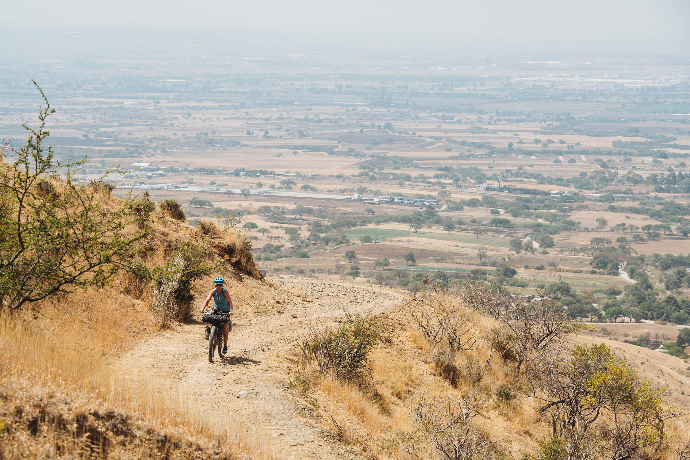
Difficulty: The vast majority of the Trans-Mexico Norte is on surfaces manageable on any bikepacking rig or sturdy touring bike that has gearing suitable for steep, prolonged climbs (see Need to Know for recommended tyre widths). However, there are sections that are either rough and steep, or have flood damage and large ruts. You will be required to push your bike at times and may need to carry or lift it to clear washouts. The worst of these sections are noted in the POIs on the map – please read them.
Route Development
Credit is due to other cyclists who have explored off-the-beaten-path routes in Mexico, notably Cass Gilbert and Scott Pauker who have documented their routes in the region, providing inspiration for sections of the route between Durango and Volcan Toluca (see Resources). André Baumgarten provided significant route edits and POI updates for the October 2022 update.
The Trans-Mexico does not claim to be the ultimate bikepacking route across Mexico, it is simply ‘one way’ to traverse the country. Some of the pavement could be eliminated and individual riders may have different priorities concerning sights they want to see. While the corridor and intent are well buttoned up, we welcome suggestions for route improvement and condition updates.


Submit Route Alert
As the leading creator and publisher of bikepacking routes, BIKEPACKING.com endeavors to maintain, improve, and advocate for our growing network of bikepacking routes all over the world. As such, our editorial team, route creators, and Route Stewards serve as mediators for route improvements and opportunities for connectivity, conservation, and community growth around these routes. To facilitate these efforts, we rely on our Bikepacking Collective and the greater bikepacking community to call attention to critical issues and opportunities that are discovered while riding these routes. If you have a vital issue or opportunity regarding this route that pertains to one of the subjects below, please let us know:
Highlights
Must Know
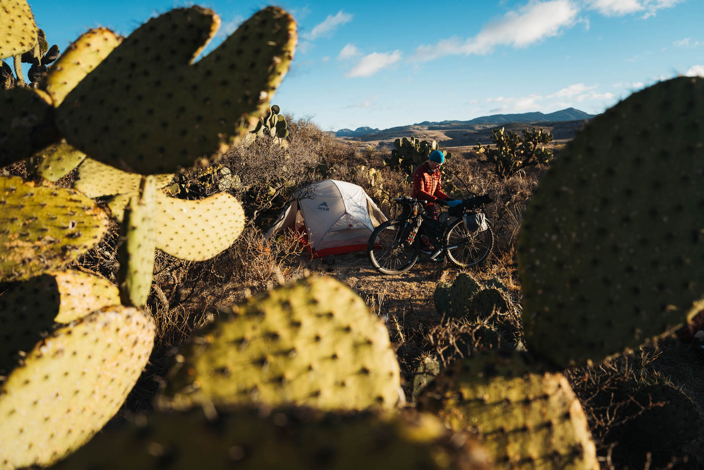
Camping
Food/H2O
Trail Notes
Resources
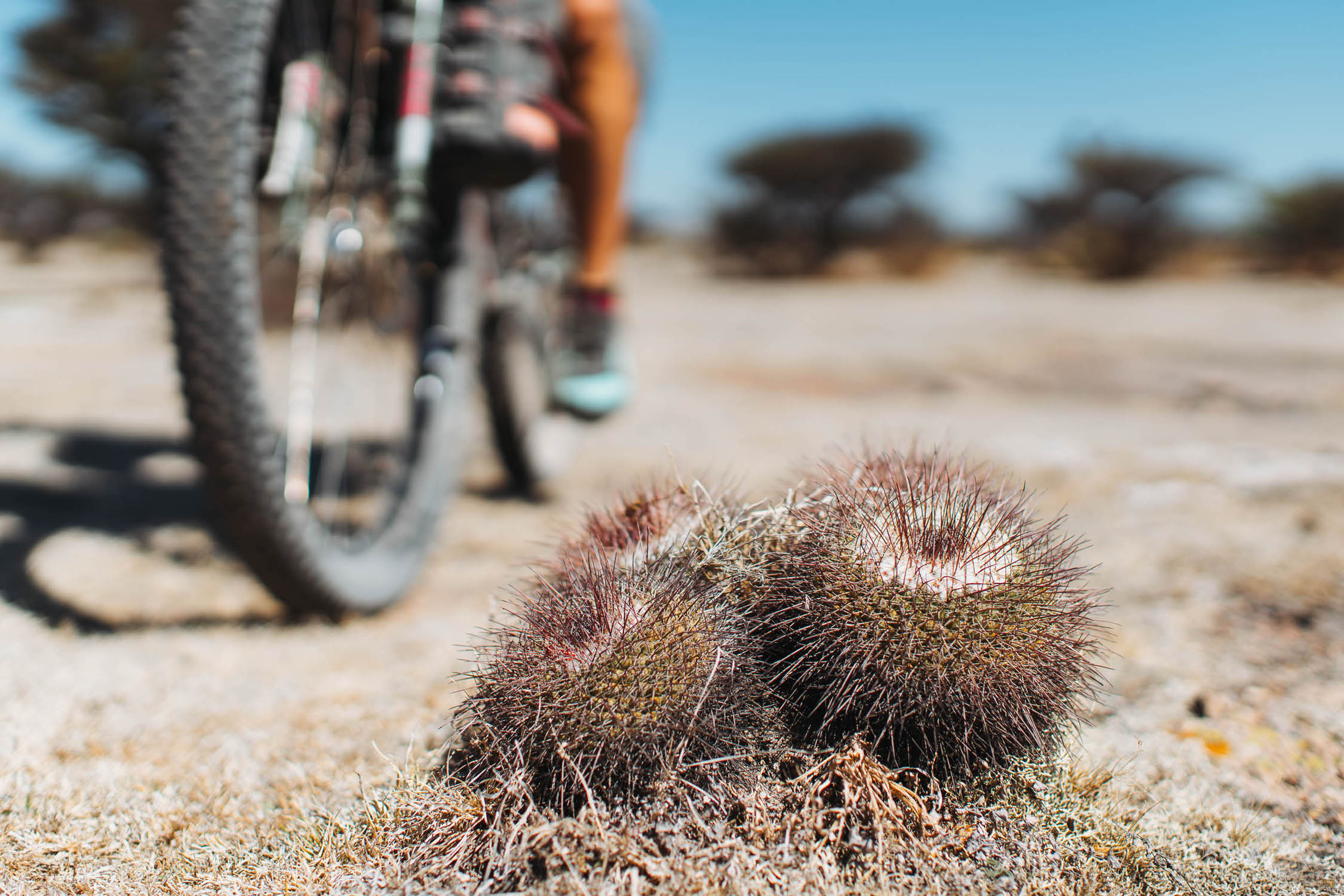
- Experience a diverse range of landscapes from sub tropical coastal plain to the arid altiplano, the native pine and oak of the Sierra Madre and pockets of cloud forest.
- Riding the Espinazo del Diablo, or Ruta 666. This road is very popular with cycle tourists for good reason. Although it’s pavement it has very little traffic, and is a very scenic way to climb the Sierra Madre mountains up to the altiplano.
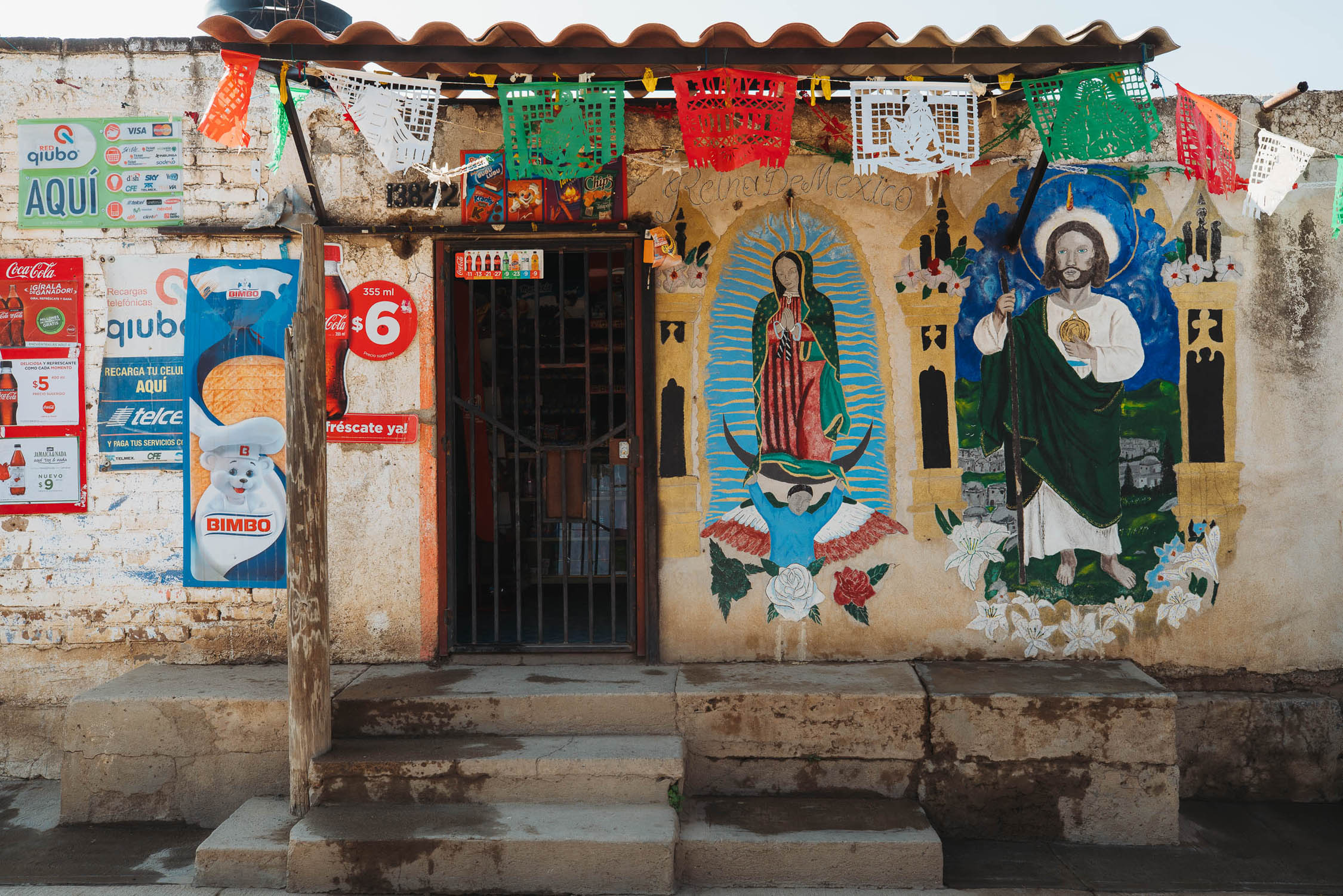
- Experiencing rich culture and encounters with both Mestizo and indigenous people in remote communities in areas that see few foreign visitors.
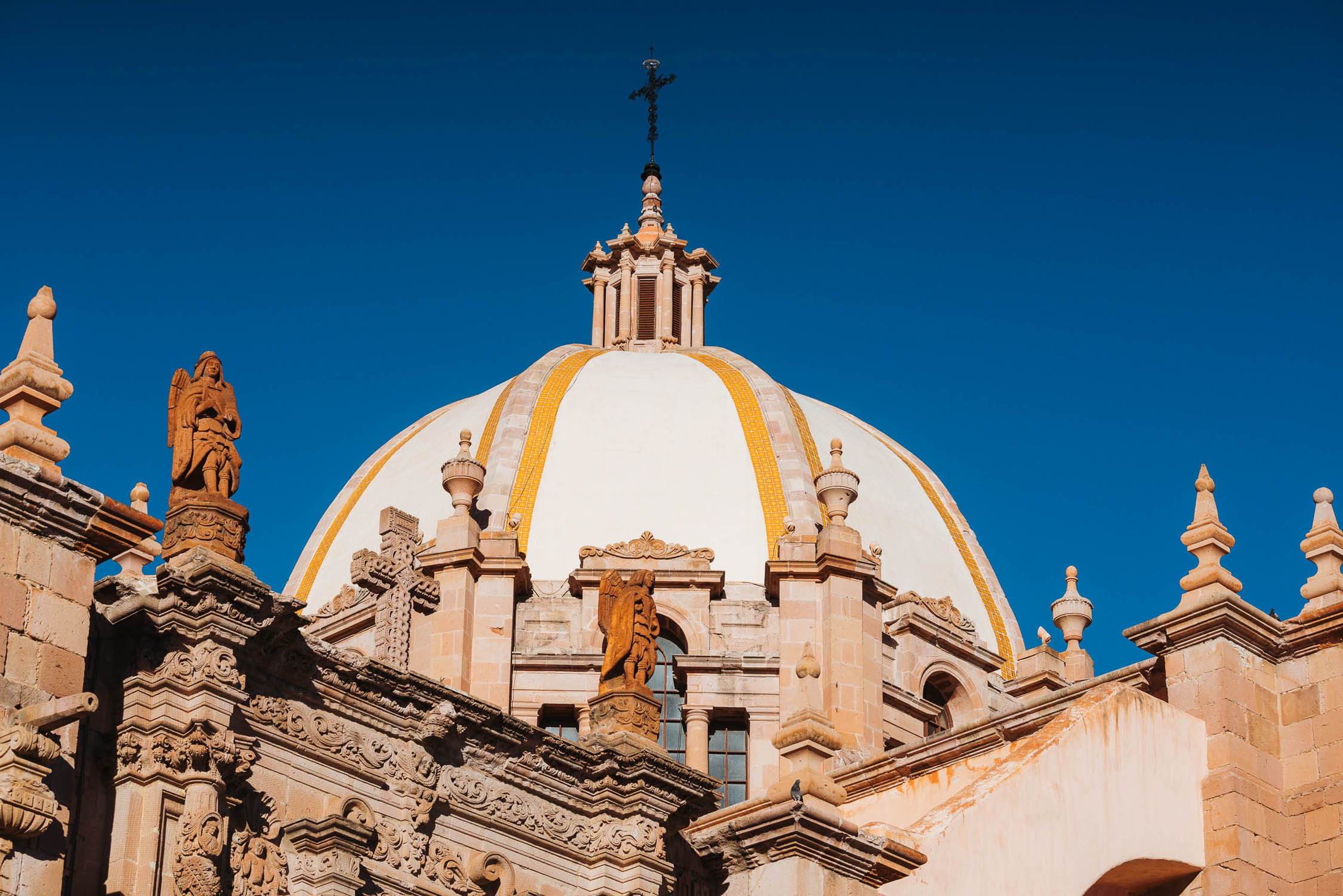
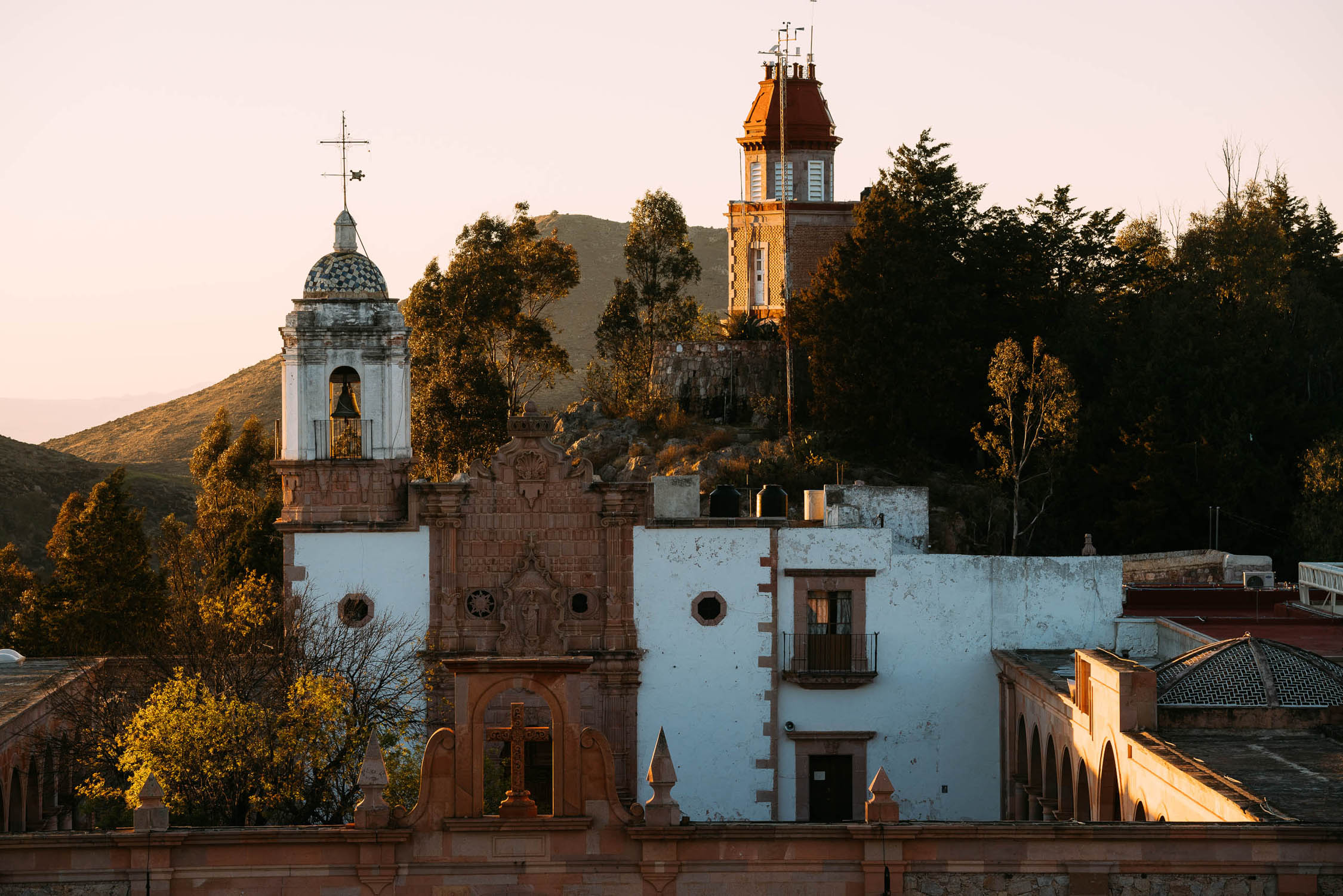
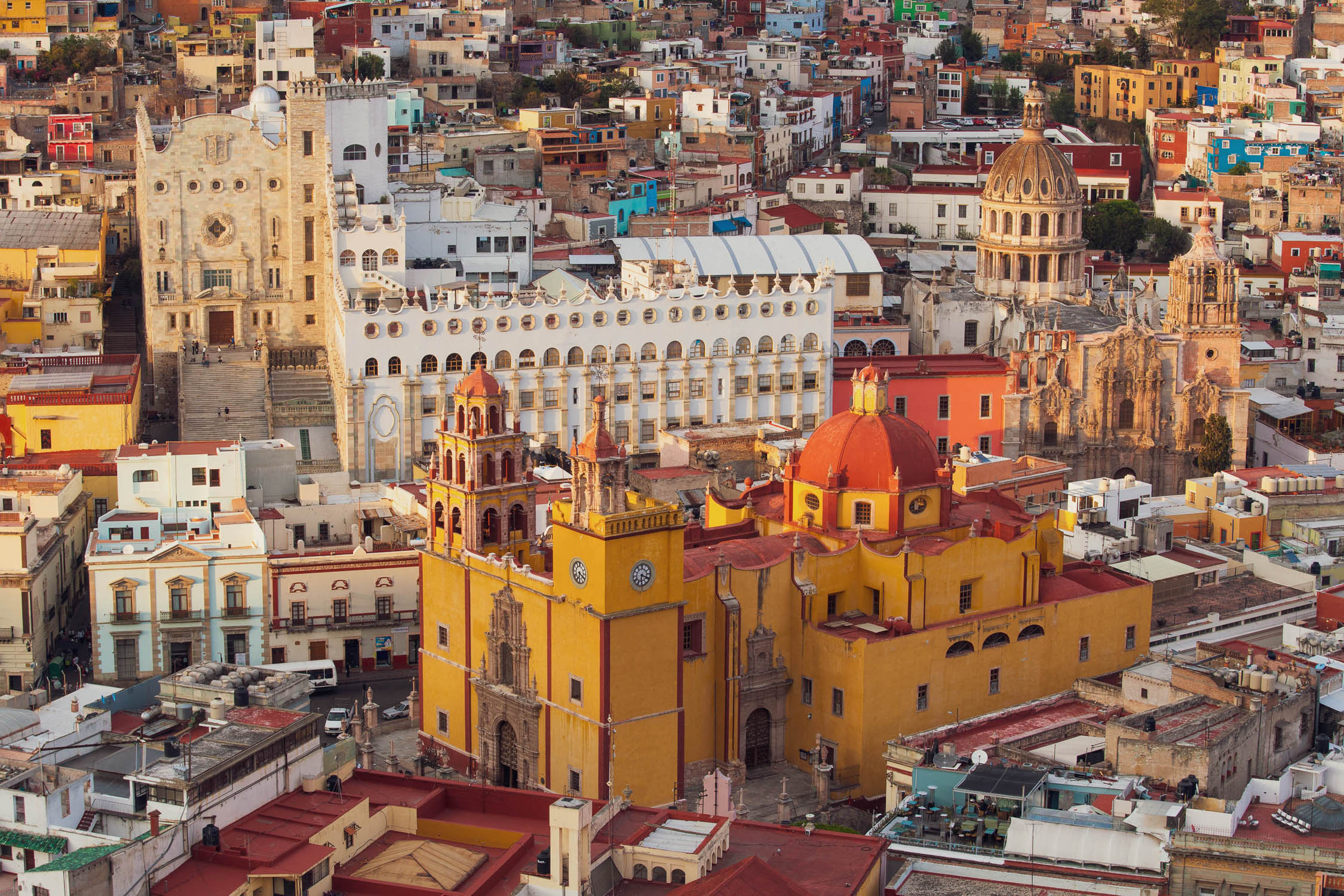
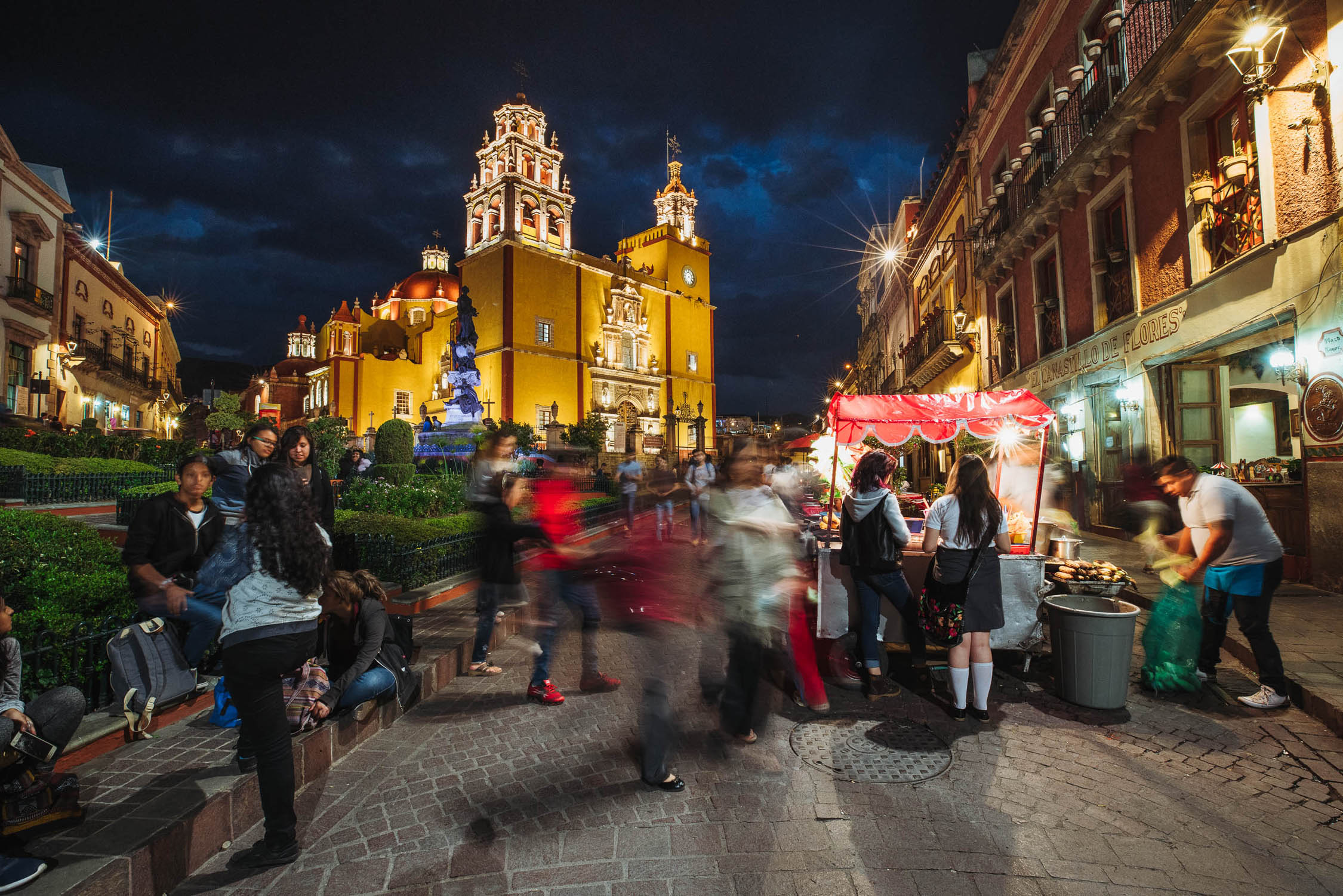
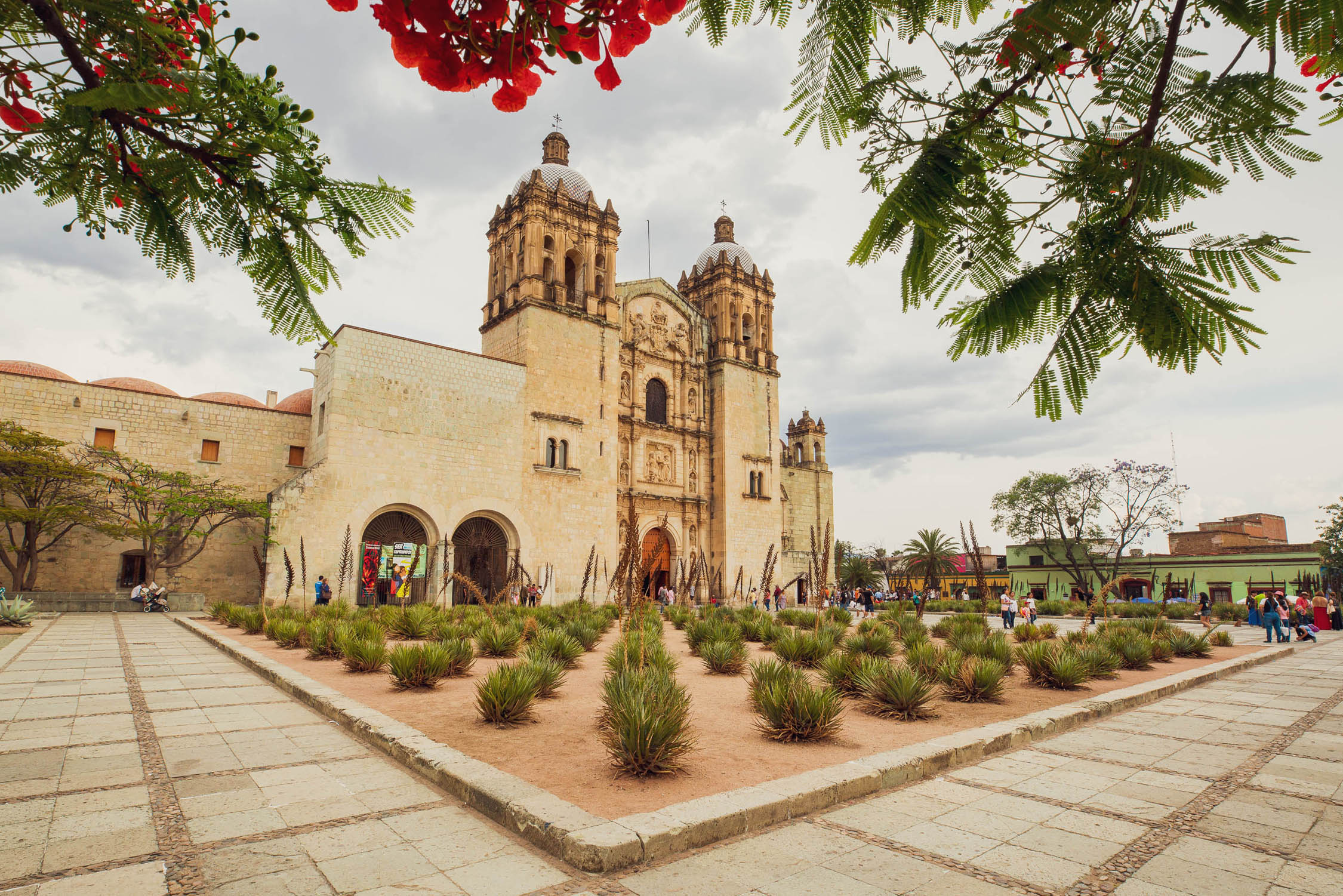
- Exploring the stunning architecture and history of some of Mexico’s finest colonial cities. Zacatecas, Guanajuato, San Miguel de Allende and Oaxaca are all UNESCO World Heritage Sites, with several more very close to the route.
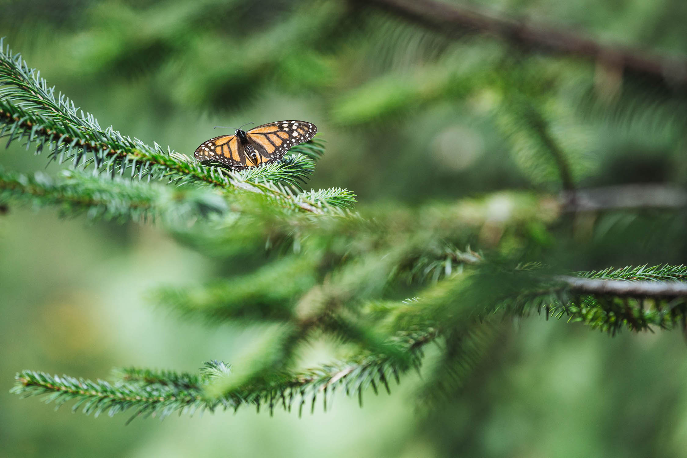
- Monarch Butterfly Biosphere Reserve. This UNESCO World Heritage Site is where most of North America’s monarch butterflies migrate for winter. The season is October to March.
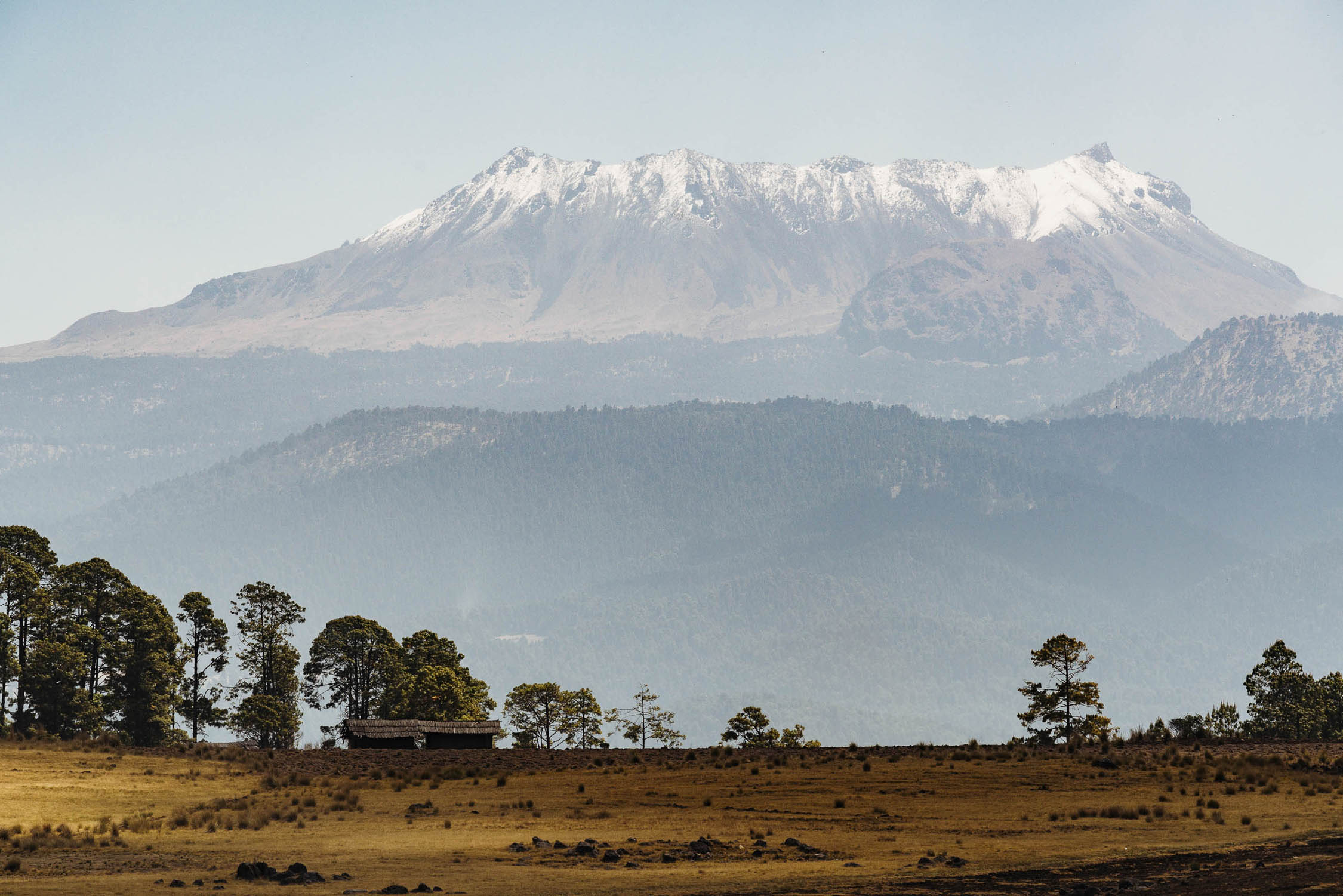
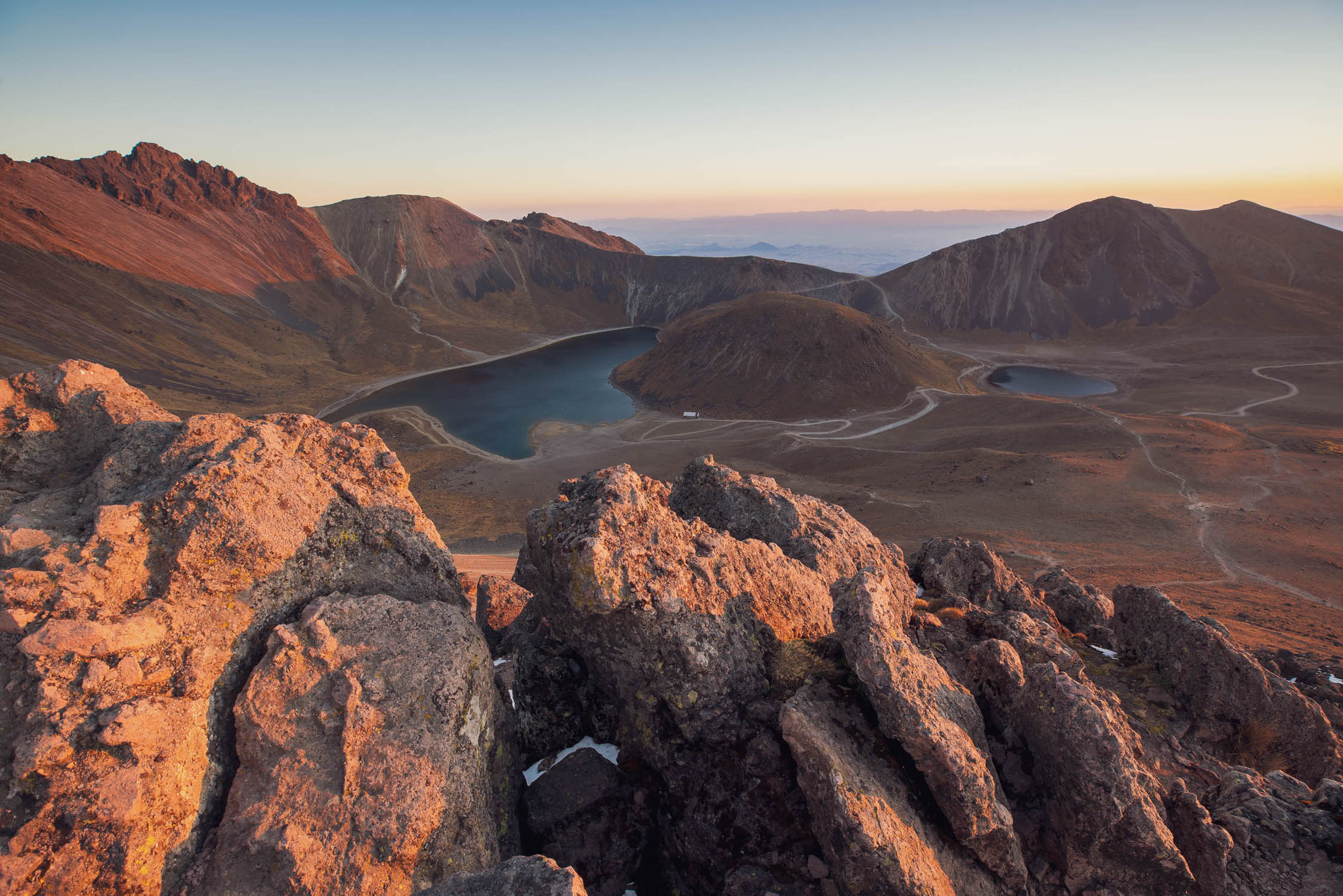
- Nevado Toluca is the highpoint of the route as you cross the Trans-Mexican Volcanic Belt. There are fantastic views to be had from Mexico’s fourth highest mountain. Climbing to the summit (15350ft/4680m) can easily be organised from Raices or Toluca.
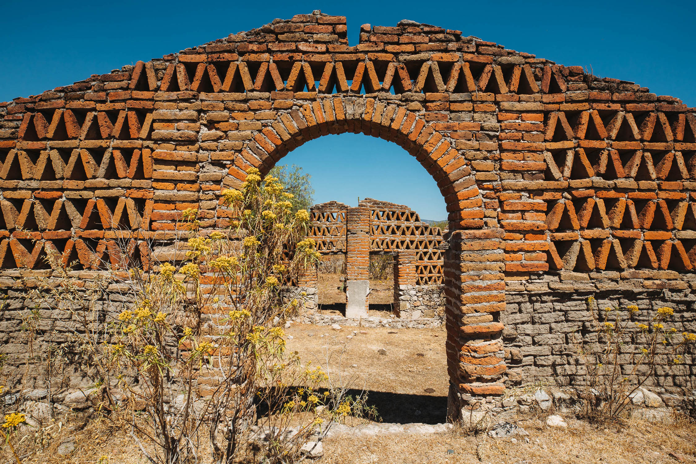
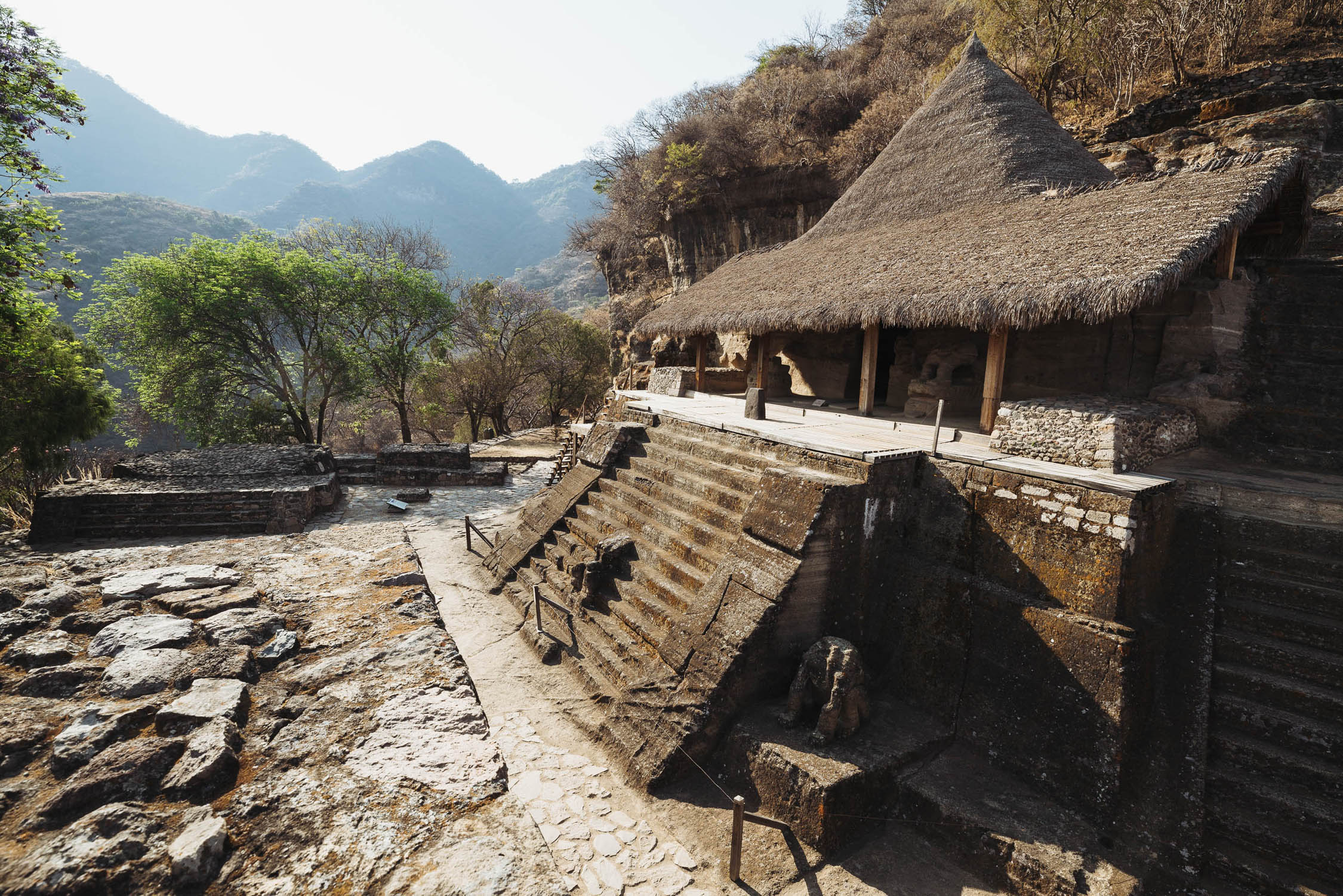
- Exploring fascinating Aztec and Zapotec ruins: most notably a small but interesting site at Malinalco and the much larger Monte Alban — one of Latin America’s oldest and most impressive Pre-Columbian archaeological sites.
- Oaxaca — Mexico’s culinary centre. Like Zacatecas and Guanajuato, this beautiful city has successfully preserved its historical centre and has lots to explore. It is worth spending a few days here to visit the many museums, plazas, churches and world class restaurants.
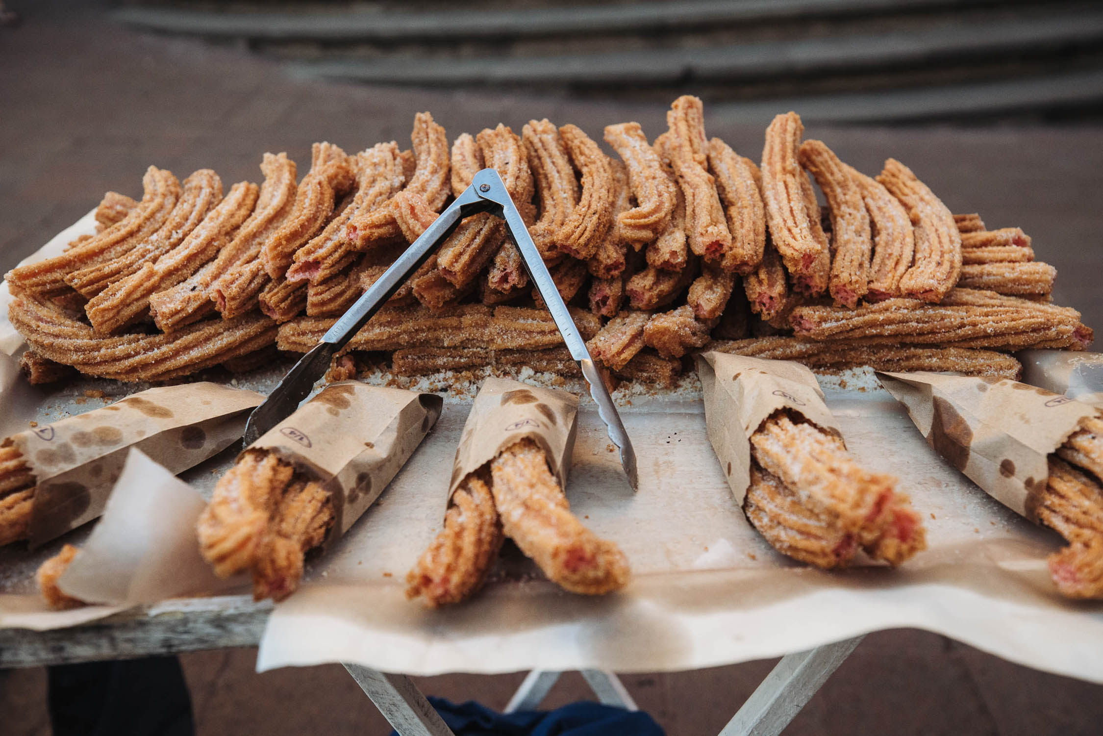
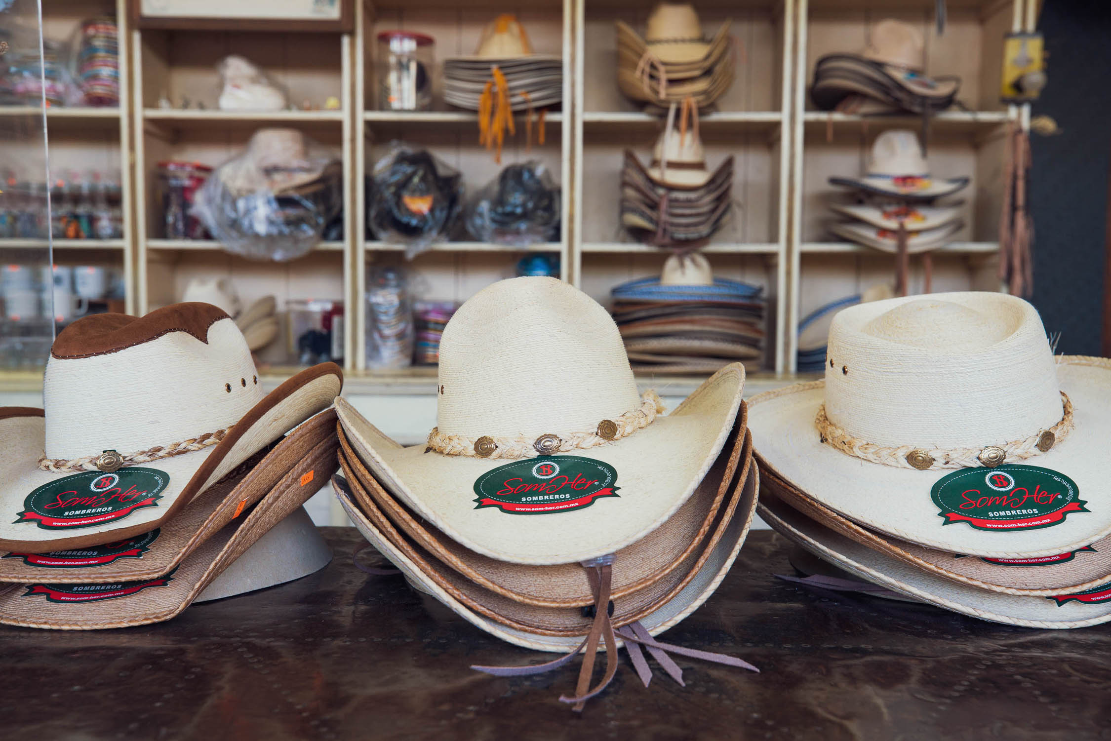
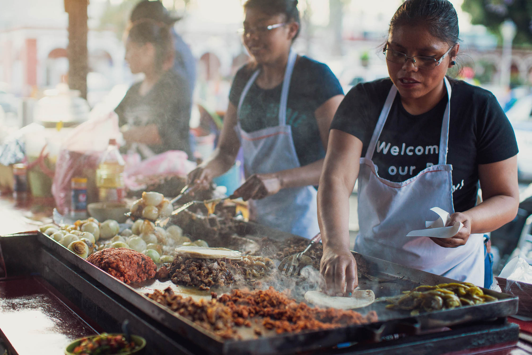
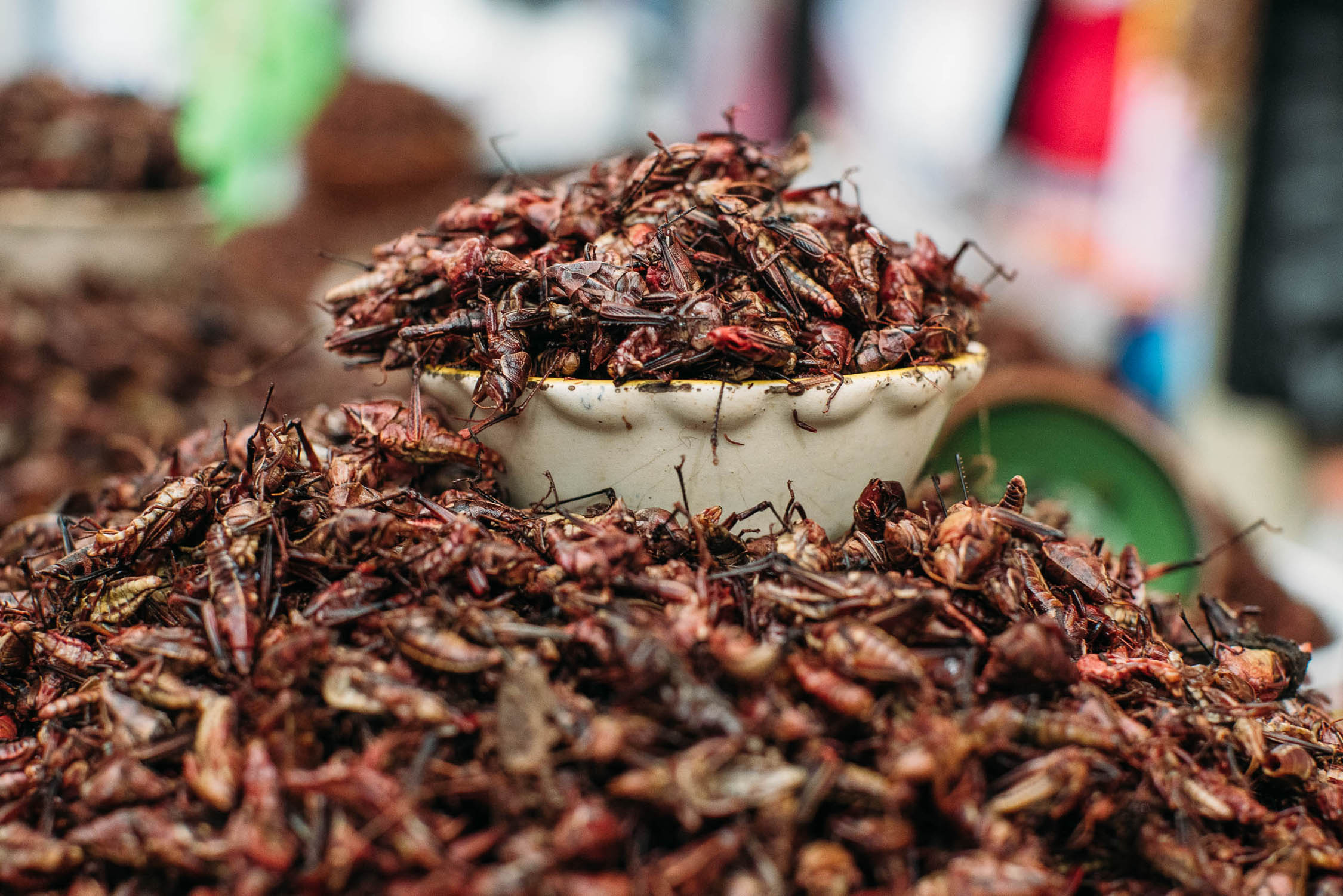
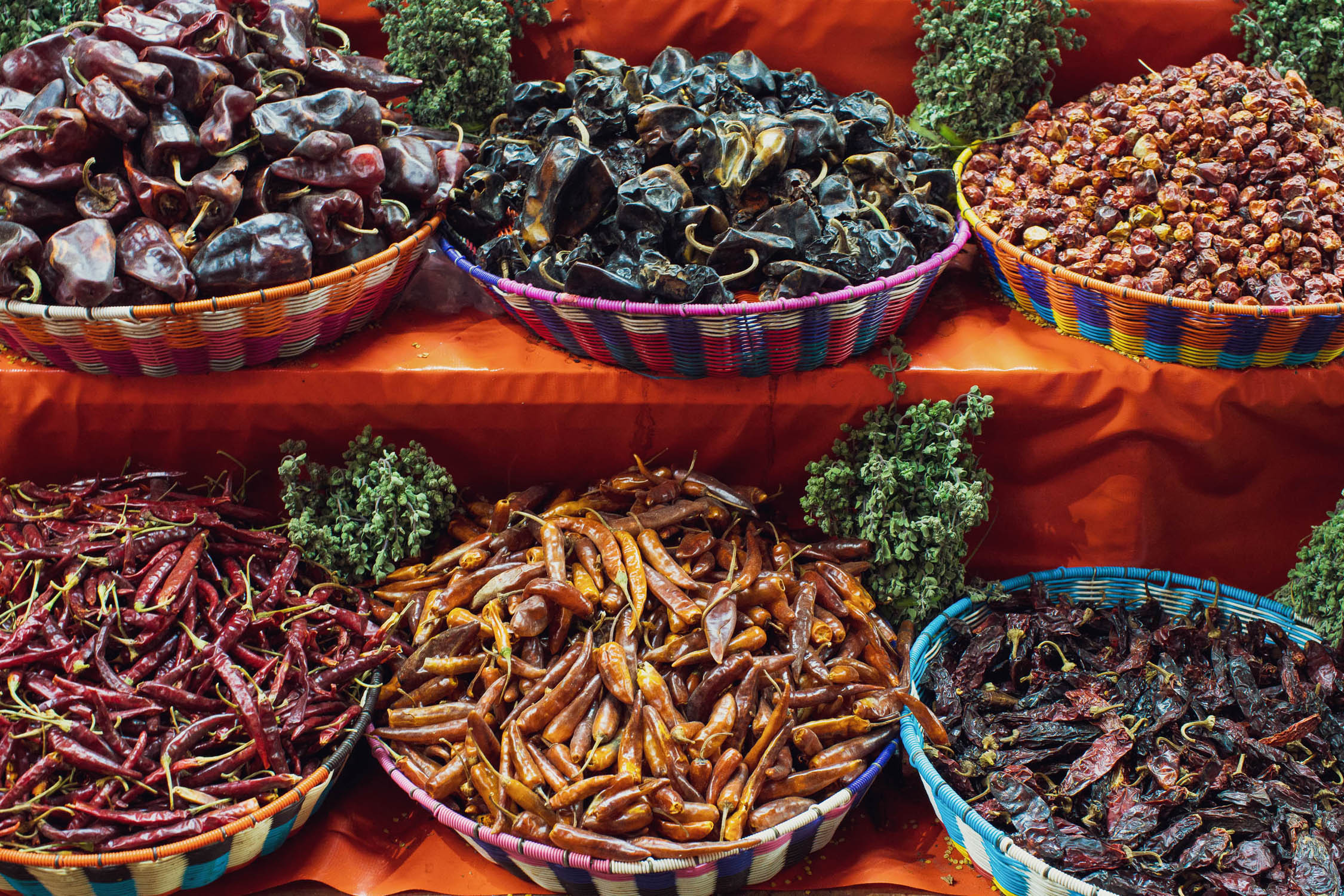
- Mexican cuisine. From tacos to tequila, gorditas to grasshoppers, mole to mezcal and ceviche to chilaquiles. Make the most of the offerings in the cities and bigger towns as you may well find that in between it can be hard to find much beyond beans, eggs and tortillas.
- Safety: Indeed, Mexico has a reputation for violence, particularly in the border regions, but this is largely gang or drug related and rarely involves tourists. If you use the usual common sense it’s highly unlikely you’ll encounter any problems. Maintain a heightened awareness of safety by being careful with your property and taking care where you ride or walk in cities, particularly at night. Check for specific updates before and during your trip. As of May 9, 2026, it is NOT recommended to cycle this route between Mazatlán and Durango.
- Two main precautions to consider are camping and travel after dark. Be very cautious about where you choose to wild camp. Generally it is best to be well hidden and discrete, or to ask at a farmhouse or village. We do not recommend lighting fires at wild camps if there is any chance of local people seeing them, because you might provoke unwanted attention.
- Travel after dark, including cycling or driving, is not recommended. This is not just because there is a higher risk of running into trouble, but also because roads can have unmarked damage, drivers may not have lights, and there might be animals on the road. Countless Mexicans warned us not to travel after dark.
- There is a hard closure of the road through Nevado de Toluco due. Some riders have reported being able to convince police to let them through but this should not be expected. Camping is definitely not allowed at this time. There are reports that the park will reopen with new rules in December, 2026. We do not have a verified alternative around this park at this time. Follow Área de Protección de Flora y Fauna Nevado de Toluca on Facebook for more information.
- The best time to ride is between December and April, when there is virtually no rain. The coolest months are between December and February, with pleasant daytime temperatures. You might experience frosts at night on the northern and highest parts of the route. The hottest month is April, with temperatures up to 90°F (32°C). The wet season begins in May and lasts until October. Over such a long distance there is climatic variation so be prepared for all conditions: not only does the route climb to over 4000m on Volcan Toluca, it also passes through one of Mexico’s hottest and driest regions in Guerrero.
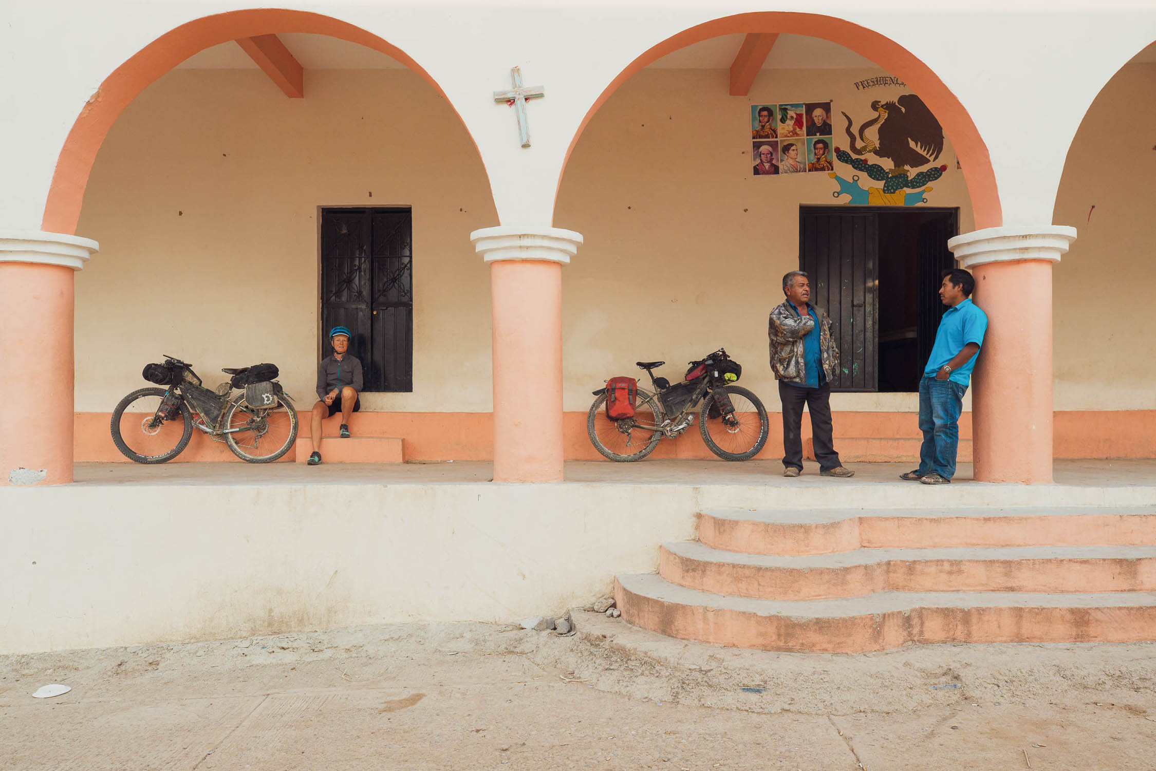
- Very few people in this region speak English, and for many people outside of the cities Spanish is their second language. Some basic Spanish is essential to be able to find food, accommodation and places to camp. Locals are generally friendly and helpful, though they may seem reserved at first. A few words of Spanish will help break the ice. It’s more polite and customary to greet strangers with buenas dias or buenas tardes than hola.
- You will only be able to withdraw cash from Cajero Automaticos (ATMs) in the bigger towns or cities. Credit cards are usually only accepted in these places too. Always carry enough effectivo (cash) with you to get to the next city. Some gas stations on main highways have ATMs.
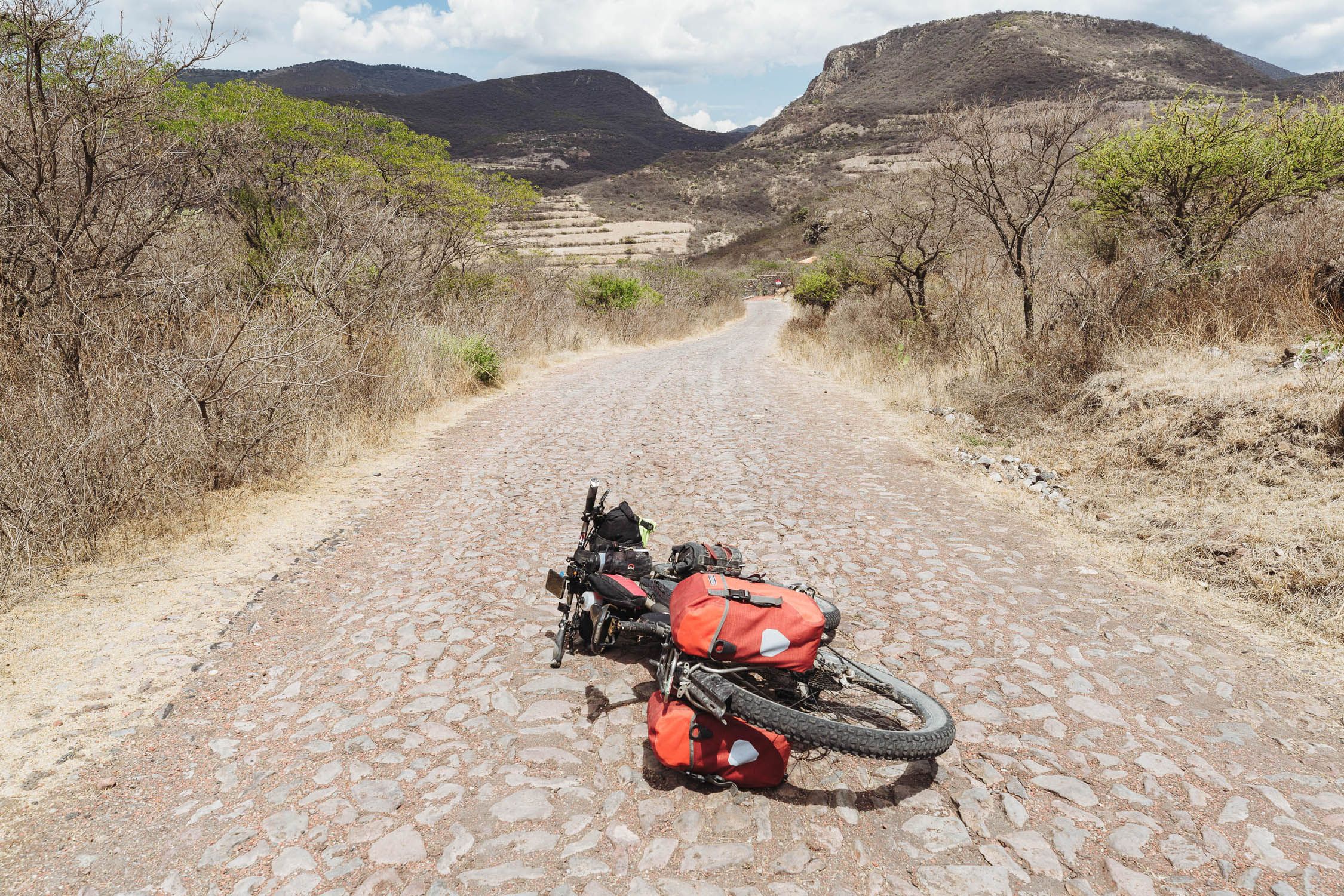
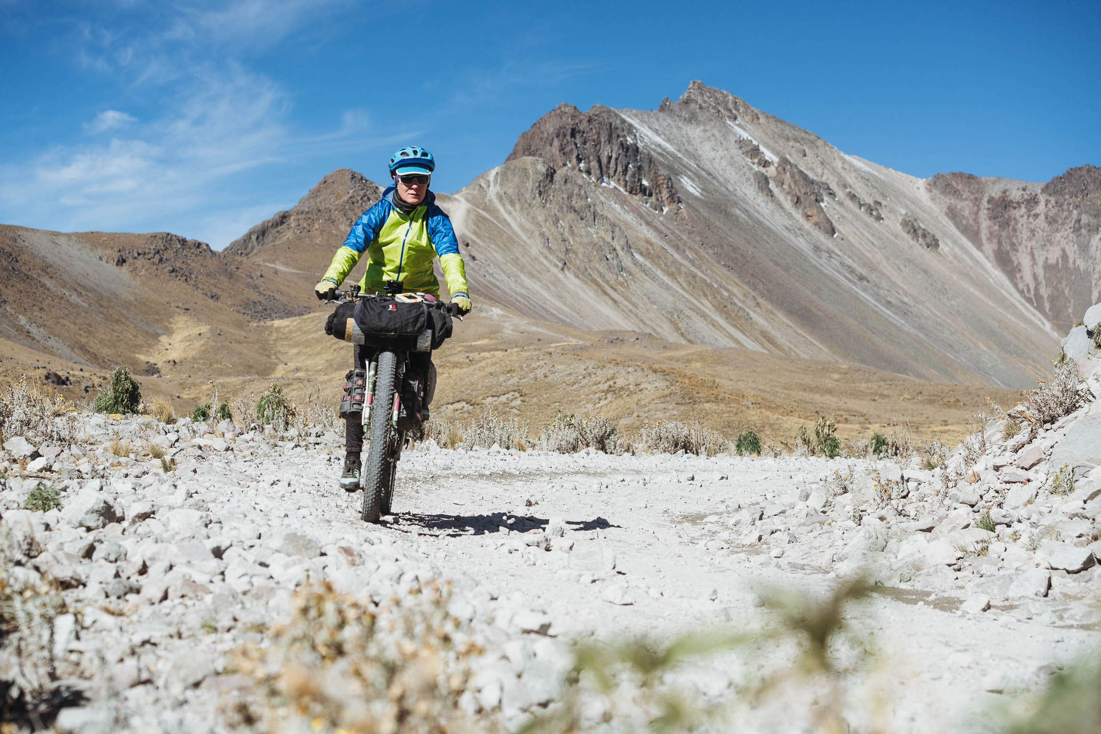
- While this route can be cycled on any touring set up capable of riding dirt roads, we recommend tires that are 2.35” or greater. A plus bike will give you more control and comfort on the roughest stuff, while not being too slow on the many sections of pavement.
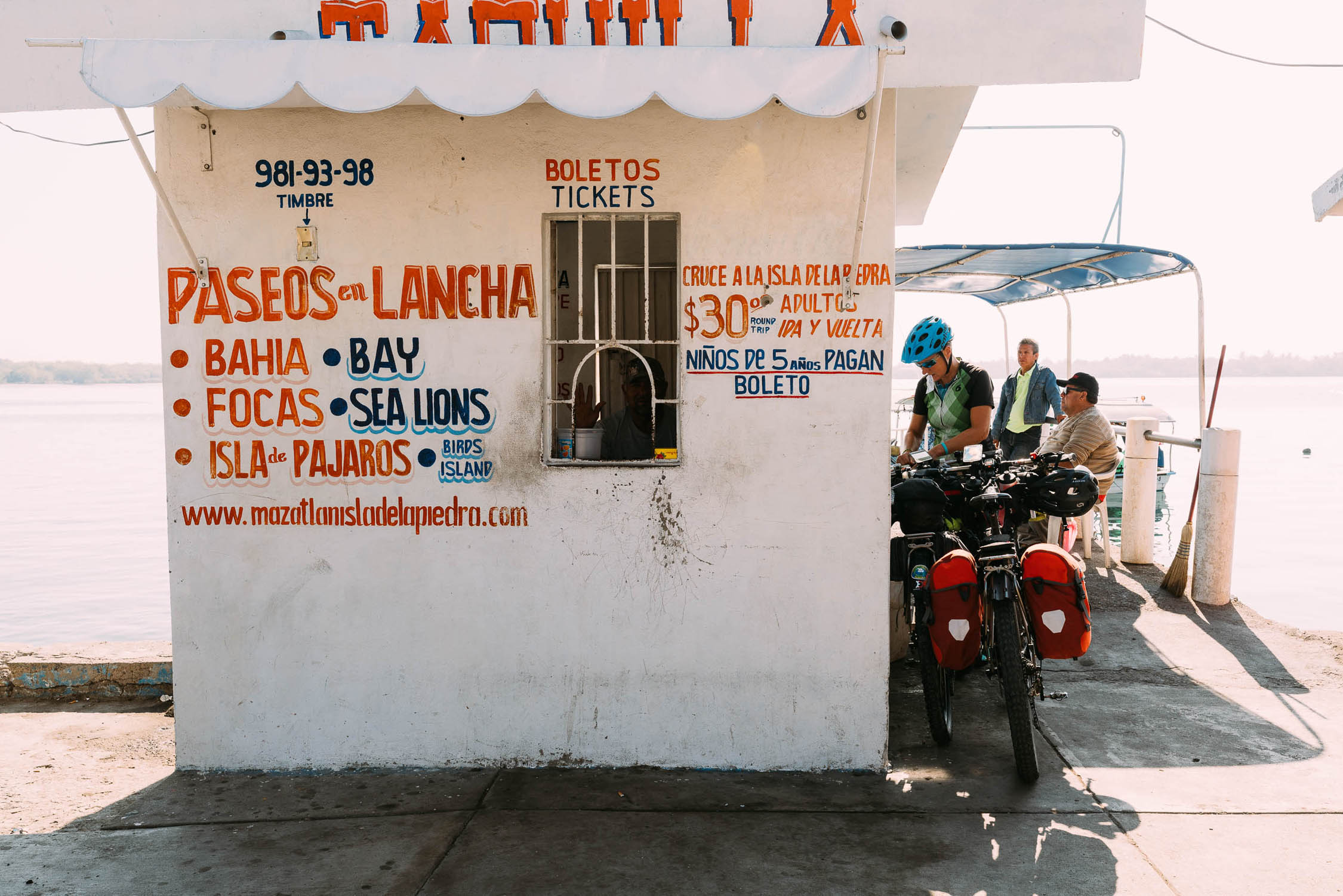
- Getting there/away: Trans-continental riders heading south or north can link this route up with the beautiful Baja Divide, or into the Trans-Mexico’s more technical southern section. If this is your first time to Mexico don’t miss Mexico City. It’s only about 80 km off route, or would be a good place to spend a few days before flying home. Mazatlan and Oaxaca both have international airports.
Land Disputes
There have been reports of land disputes involving violence between villages or departments in three places on the route (all marked with POIs on the map):
- Guerrero: KM 2147–KM 2150. Between San Martin and Oaxaca state border
- Oaxaca: KM 2257–KM 2260. Between the municipalities of San Juan Mixtepec and San Isidro Yosoñama
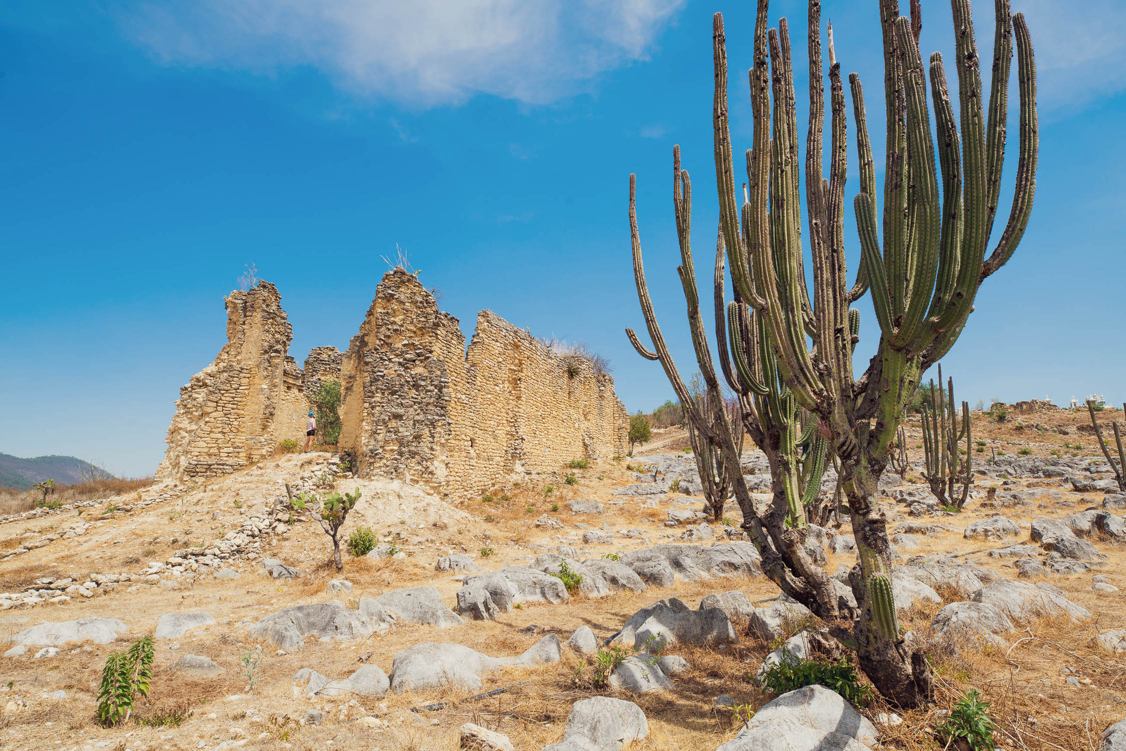
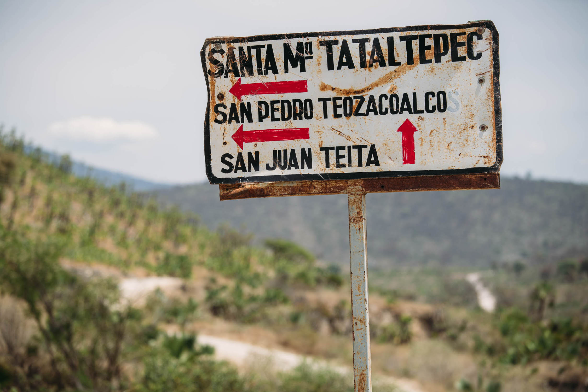
- Oaxaca: KM 2328–KM2350. Between Santa Maria Talaltepec and Yutanduchi de Guerrero
In these locations some cyclists have encountered warnings from locals either to not travel through, or not to travel at night and not to camp. Others have reported no such warnings and have passed through with no trouble at all. These are fluid situations that require current advice – so before you travel through these sections check in with the locals and ask. Detours are possible around all three and these are described in the route comments.
- There are plenty of opportunities to camp, but be respectful of people’s property if within sight of houses or the road as land may be either community owned or privately farmed. It is always better to ask if you are not sure.
- When wild camping, be very discrete: you are never far from people in Mexico. People living in remote areas are not used to tourists so your presence will be noticed. There has been one report (2022) of warning shots being fired at cyclists who were wild camping and had lit a fire. This was in the valley NE of Coicoyan de las Flores, Guerrero (see POI). Do not invite unwanted attention.
- Basic hotels (or hotelitos) are available in many of the towns.
- On the occasions when there was not we asked the village council (Comisario) or shop and restaurant owners for a place to sleep. We were always looked after, either given a room or a safe place to camp.
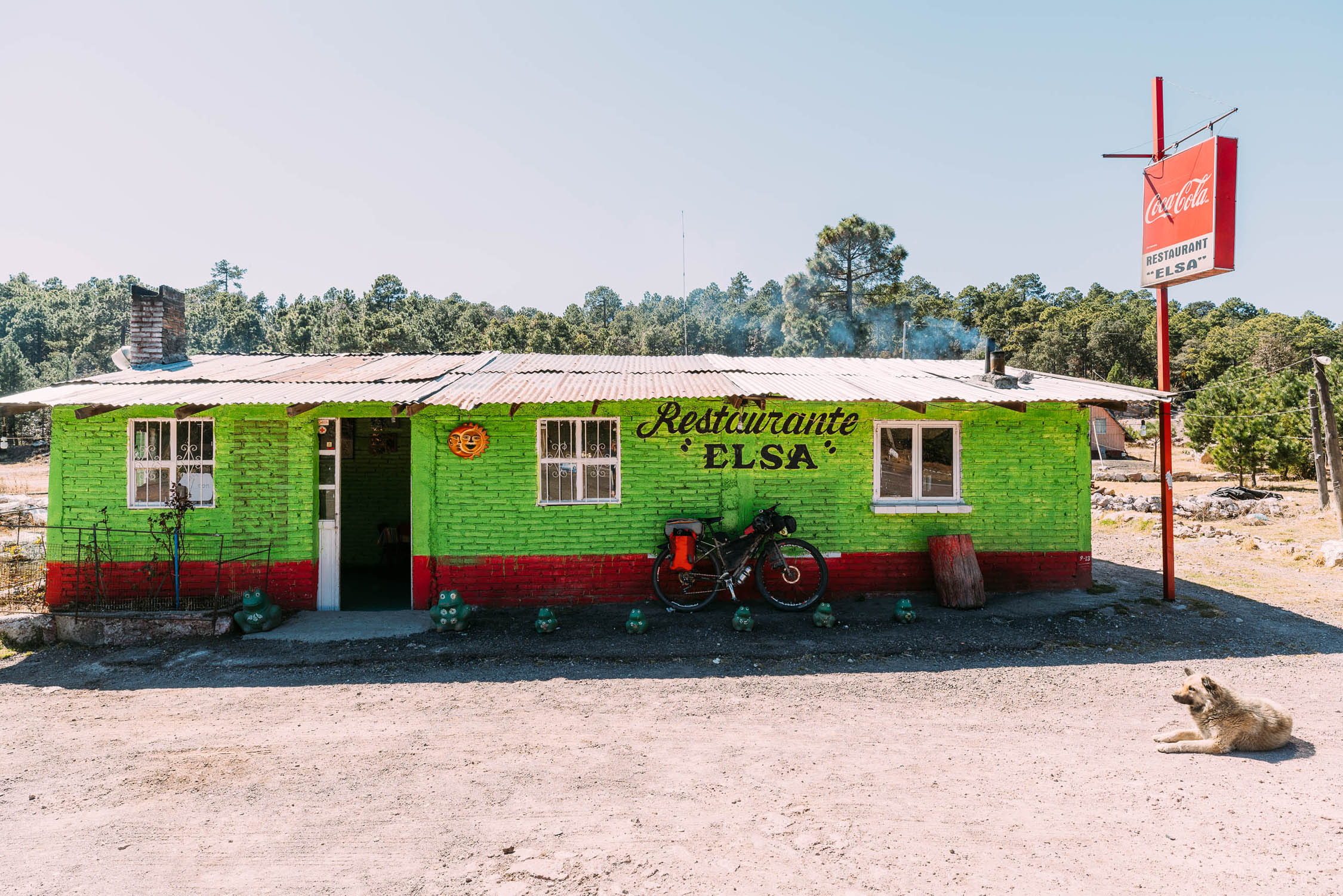
- Tiendas (small shops) selling food and drinks are found in most towns.
- Supplies can be very limited in the smallest towns and remotest areas; expect only basics such as rice, pasta, tortillas, crackers, tuna, a few vegetables, soft drinks and snacks.
- Restaurants or the smaller comedors are not always obvious so you may need to ask someone where you can eat, or if someone can prepare you a meal.
- Be prepared to eat a lot of chicken, beans, eggs and tortillas.
- People are usually happy to fill water bottles, either with purified water from a garrafon, or from a tap which you may need to treat. Settlements and houses always have a water supply or will be able to direct you to one.
- There are occasional ground water sources to fill bottles if you have a Steripen or filter.
- We carried about two liters each most of the time, and had the capacity to carry five liters each when we suspected there may be no water, or for dry camps.
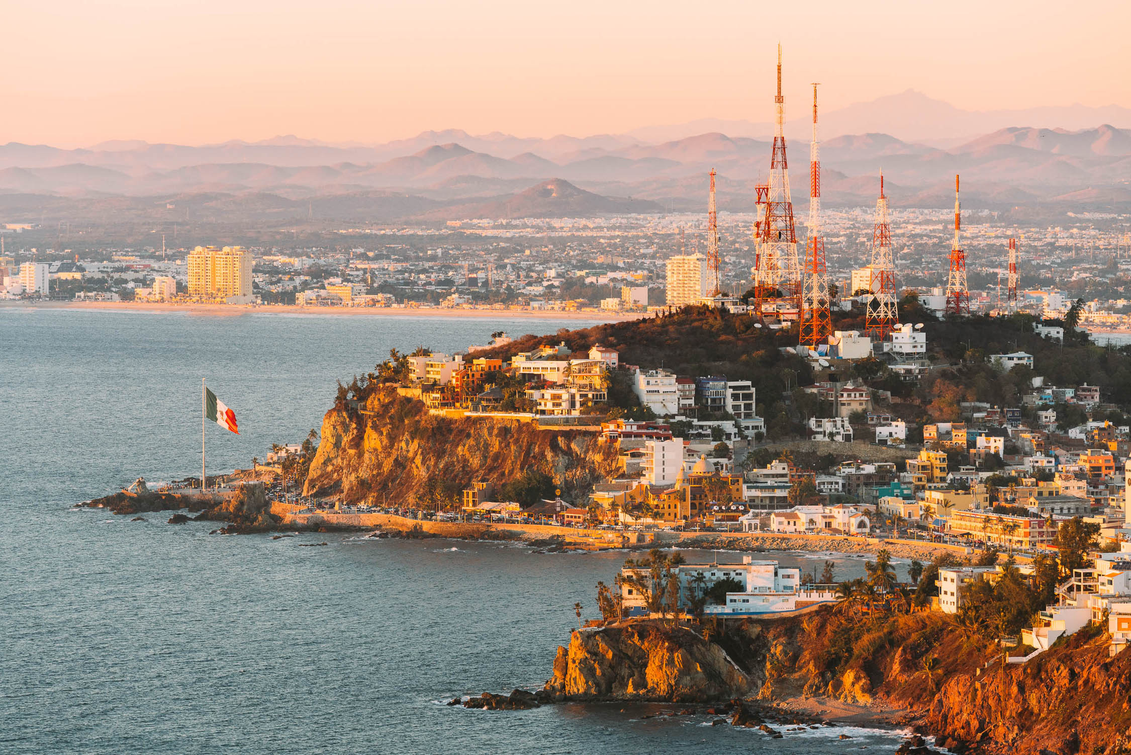
Mazatlan–Durango
As of May 9, 2026, we have received reports of active militia fighting in the area of Copala. Copala is all-but-abandoned and the mountain road between Copala and Palmito is deemed impassable. At this time we DO NOT recommend cycling this route between Mazatlán and Durango. There are numerous buses between the two towns on a daily basis. Although we have been unable to confirm that bicycles can be transported on individual bus lines, traveling by bus with an unboxed bicycle in the cargo area is very common. You can search for buses at Busbud.
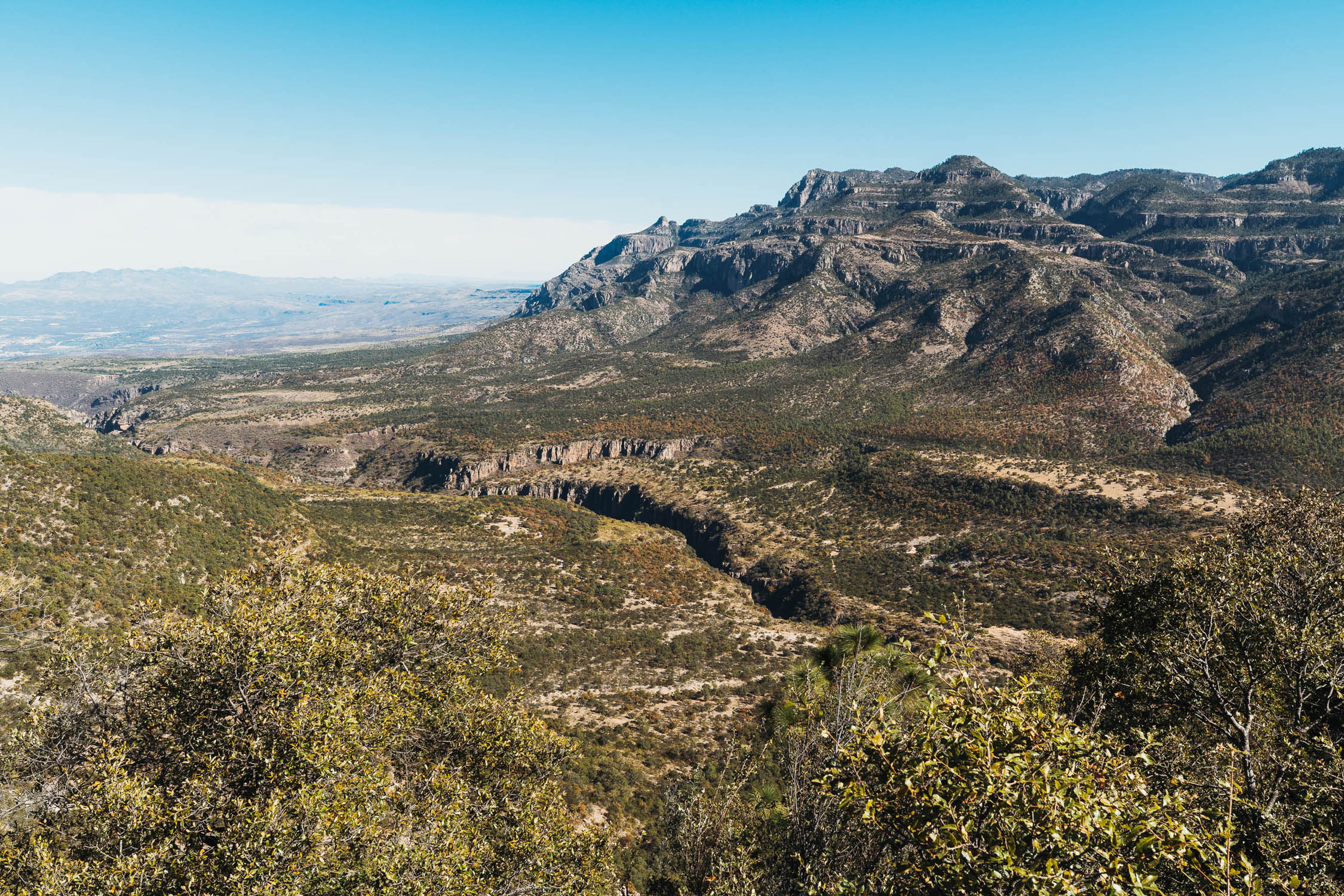
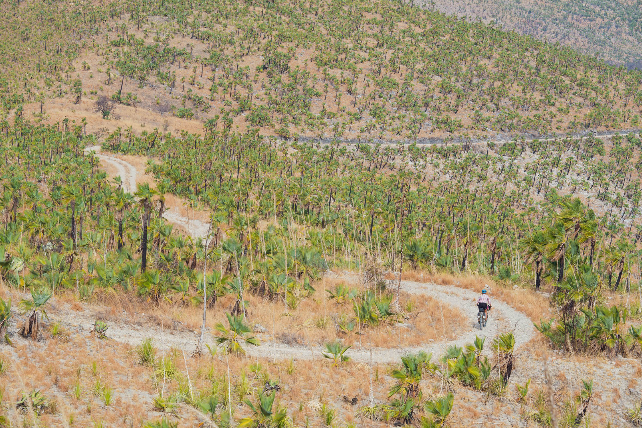
Over this section of riding you will experience the greatest change in environment and climate of the route, as you climb from the humid subtropical coast of Mazatlan, through dry tropical forest and cloud forest to the pine and oak that edges the altiplano. As the route takes you closer to Durango this transforms again to more arid surrounds of cactus, agave and scrubland. This region of the altiplano experiences frosts at night and cold mornings so be prepared.
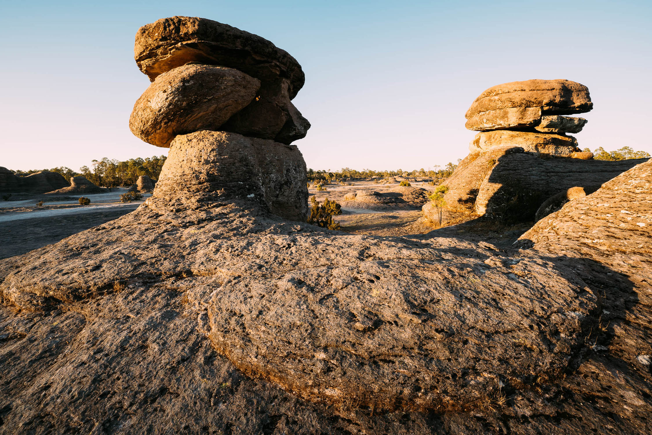
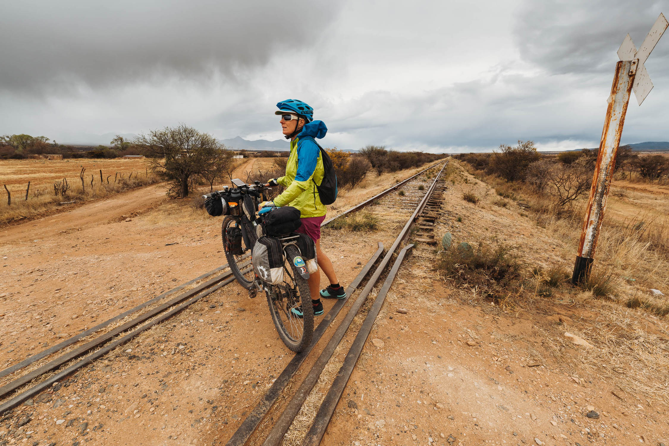
Although this long section is mostly paved, much of it follows a now almost deserted road, the Espinazo del Diablo, which has been superseded by a modern highway. Shortly after this road starts you’ll pass the pretty colonial mining village of Copala, which is well worth a look, or an overnight stop. The Espinazo del Diablo has spectacular views of the interior of the Sierra Madre mountains and your ride will be punctuated by the occasional tienda or restaurant, as well as a couple of small towns and several villages. Don’t miss Parque Natural Mexiquillo, outside of La Ciudad; this park has some extraordinary rock formations, good camping and beautiful scenery. It is also here at this park that the route picks up an abandoned railway, which it follows periodically towards Llano Grande. Durango is an interesting city, founded on its mineral wealth, and there are areas to explore as day trips from this city, notably Tres Molinos Canyon.
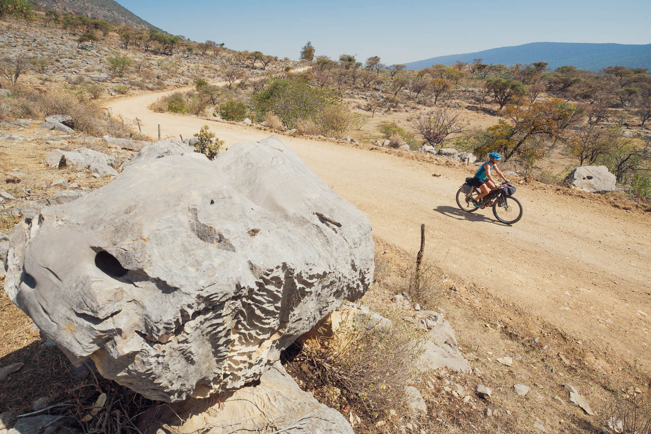
Durango–Guanajuato
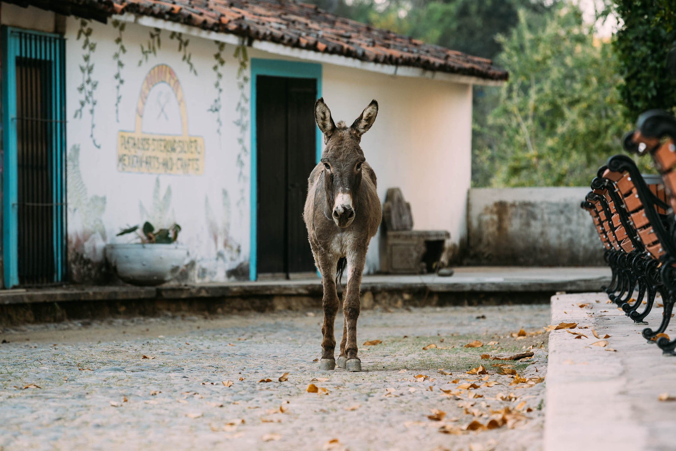
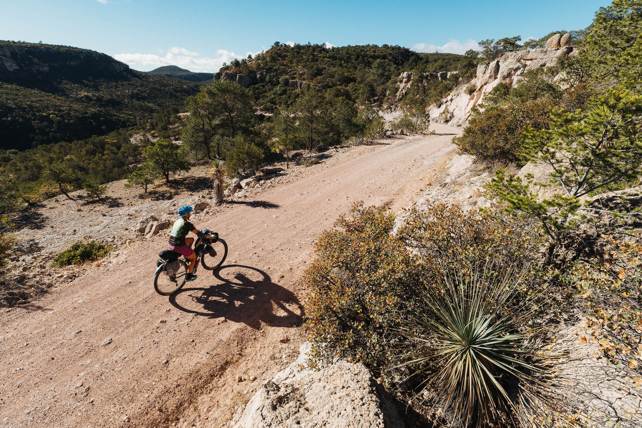
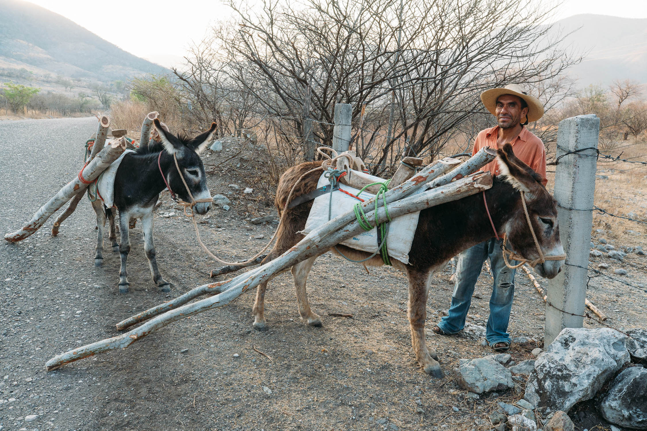
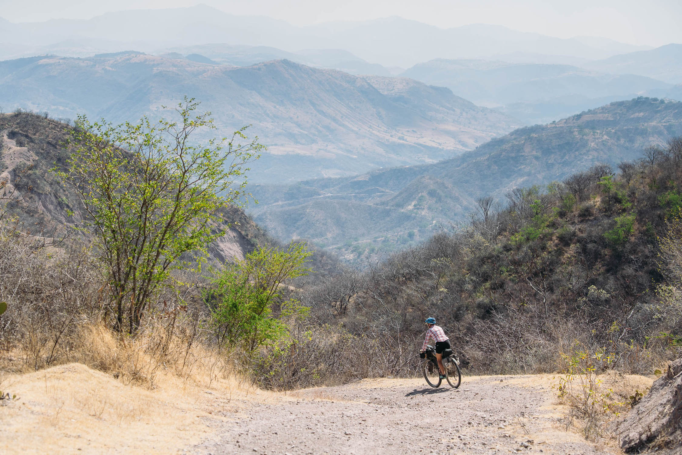
This long section is defined by the arid surrounds of the altiplano, isolated villages of adobe buildings, bright sunshine, the braying of donkeys and the odd burst of singletrack or technical riding. The route flits between fast and flat sections on generally good roads and one-to-two day stretches crossing small mountain ranges such as the La Michilia Reserve, mountains behind San Jose de Mesillas (nice camping) and the Sierra de Lobos, all the while linking numerous small farming communities with a network of quiet pavement, narrow dirt roads and tracks. The stunning city of Zacatecas is the perfect spot for a day (or three) off after the relatively uninterrupted back road riding from Durango. Some fun riding awaits soon after the city, as you ride through canyon country around San Jose de Gracia. With the tough section of the Sierra de Lobos behind you, a very steep climb to the summit of Cerro Cubilete provides epic views and gives you a chance to reflect on the mountain country you’ve traversed before a short run into the beguiling, culturally rich, city of Guanajuato, where you’re bound to get lost, at least twice.
Guanajuato–Malinalco
From Guanajuato south your surroundings begin to turn greener and more forested. One long day out of Guanajuato the beautiful town of San Miguel de Allende is an initial highlight, along with the dirt road riding you will have done to get there. Beyond San Miguel the route follows a network of tertiary roads, avoiding populated areas, to reach the compact Sierra de Puruagua. After dropping from this range a section of fast pavement will deliver you to the Reserva de la Biosfera Mariposa Monarca which makes a worthwhile way to ride whether the butterflies are in season or not. Tours to the butterflies are available at Macheros. The playground of Mexico City’s rich kids, Valle de Bravo is the gateway for Volcan Toluca (4680m) over which the route boldly passes. Camping (with discretion) in the 4200m crater is a guaranteed highlight of the tour. Unfortunately, there is a hard closure of the road through Nevado de Toluco as of late 2025. Some riders have reported being able to convince police to let them through but this should not be expected. Camping is definitely not allowed at this time. There are reports that the park will reopen with new rules in December, 2026. We do not have a verified alternative around this park at this time. Follow Área de Protección de Flora y Fauna Nevado de Toluca on Facebook for more information. After the long grind up the volcano the long, long descent will be welcome and the pleasant colonial village of Malinalco, site of an Aztec ruin, makes a great rest stop after the rarefied air.
Malinalco–Juxtlahuaca
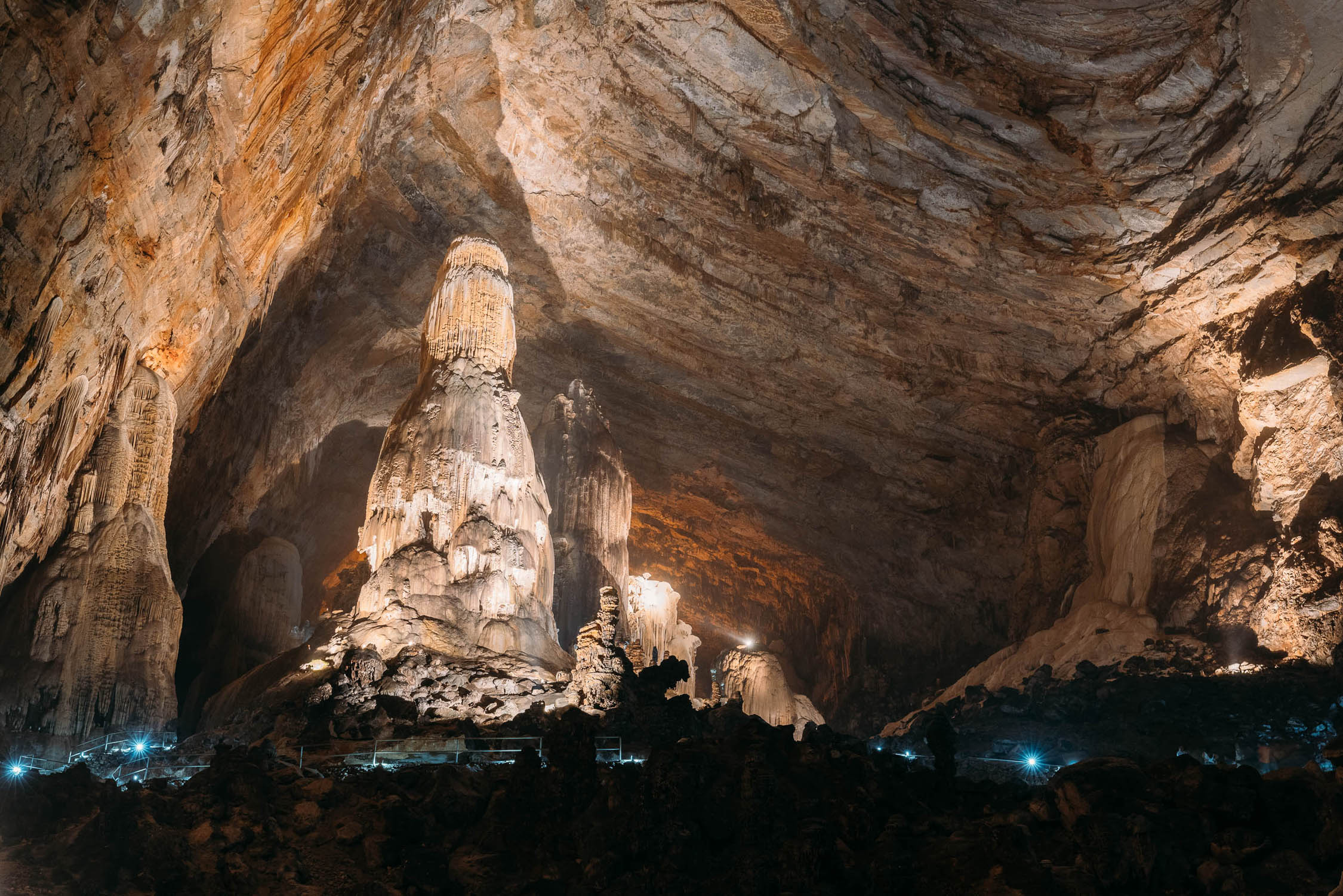
From Malinalco the route makes for La Montaña, the sparsely populated mountain country of Guerrero that makes up the Sierra Madre del Sur, passing the impressive caves of Grutas de Cacahuamilpa National Park on the way. A series of double tracks and quiet pavement connect through this very hot region of dry tropical forest to reach the lowest point you’ll have been at since leaving Mazatlan, at the Rio Atoyac. But the reward for dropping right to 600m is the swimming pools near Papalutla (cabins & camping also). Appreciate the cooling off because what follows is a long and sweaty paved climb right back to 1800m.
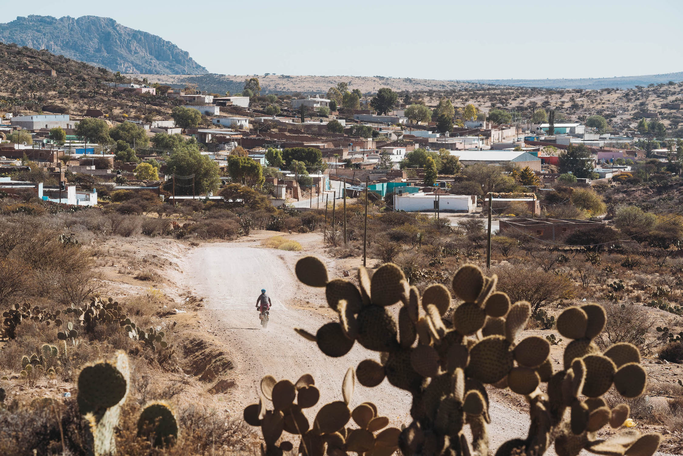
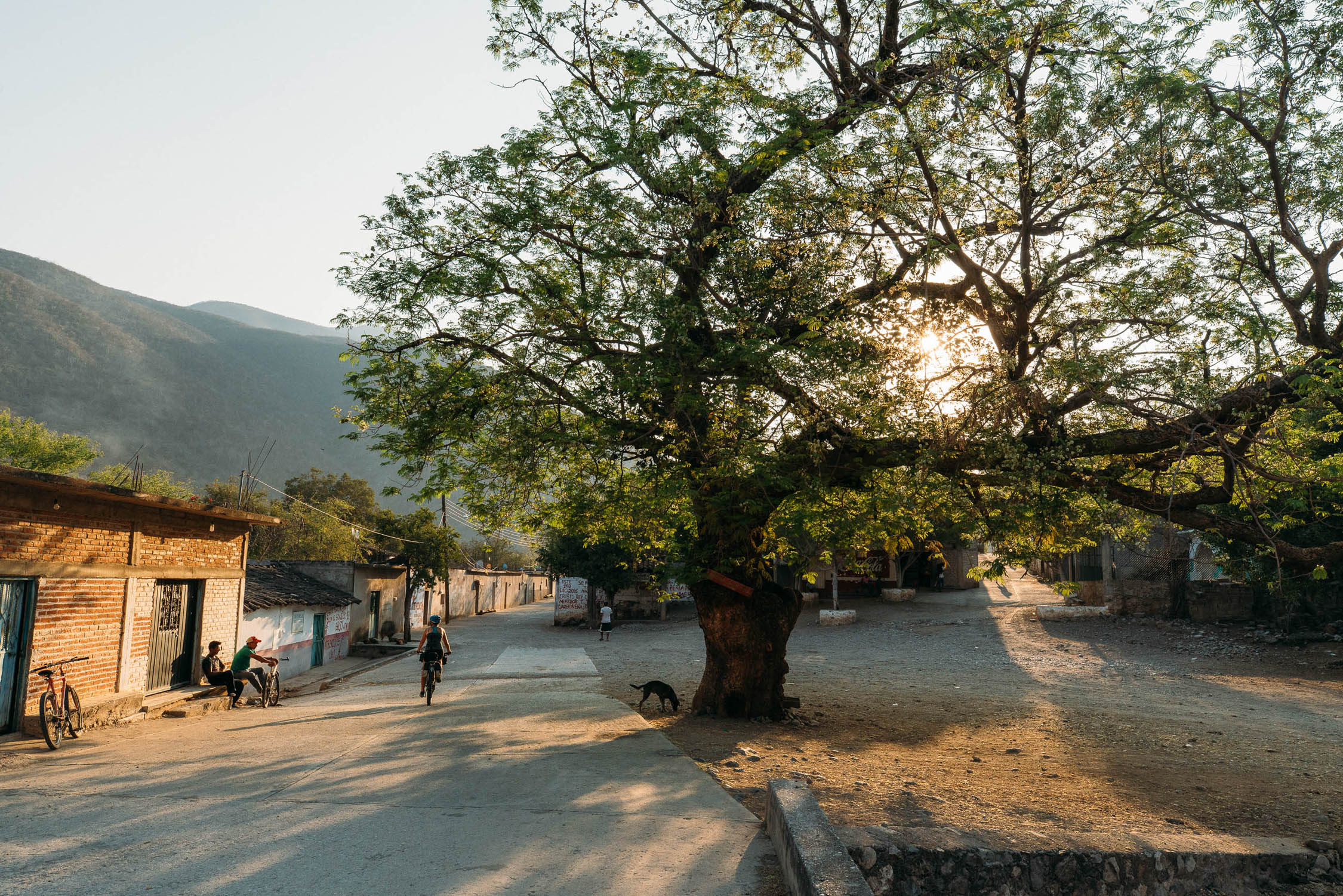
Towns don’t come much more unpretentious than the rural and remote Olinala, and you’ll find hearty food and cheap accommodation here. Beyond Olinala the route enters predominantly indigenous territory for the first time. You might hear the unfamiliar sounds of Mixtec being spoken and see signs of the syncretic religions that have morphed from Christianity and traditional beliefs. After the scruffy, busy, valley city of Tlapa de Comonfort the route climbs into the mountains once more and enters its remotest region yet, where the roads are poor quality and the poverty rate high, but it’s a rewarding place to ride and sees very few foreign visitors. You’ll be seen as a curiosity so be sure to be polite and leave a good impression. Some big climbing days end in friendly Juxtlahuaca where you can catch some good R&R and excellent street tacos.
Juxtlahuaca–Oaxaca
The final haul over to Oaxaca is a tough one, and along with the previous section from Olinala forms the crux of the route. Back to back days with lots of climbing on dirt roads will make the small villages this route passes through feel very welcome. The scenery becomes better and better, and incredibly diverse as you cross range after range in the mountains that form the western edge of the Valles Centrales. A very long descent will bring you, dusty and dirty, to Oaxaca city where abundant culture and cuisine awaits.
Additional Resources
- Our Blog: Mazatlan-Durango, Durango-Zacatecas, Zacatecas-Guanajuato, Guanajuato-Malinalco, Malinalco-Juxtlahuaca, Juxtlahuaca-Oaxaca
- Spoke and Words (Scott Paulker): #Mexico, The Route
- While Out Riding (Cass Gilbert): Durango to Zacatecas
- The Baja Divide Bikepacking Route
- 121 Magical Pueblos
- Mexican touring cyclist support group: Red de Apoyo Cicloviajero
- Trans Mexico Bikepacking Route North and South Facebook Group


Terms of Use: As with each bikepacking route guide published on BIKEPACKING.com, should you choose to cycle this route, do so at your own risk. Prior to setting out check current local weather, conditions, and land/road closures. While riding, obey all public and private land use restrictions and rules, carry proper safety and navigational equipment, and of course, follow the #leavenotrace guidelines. The information found herein is simply a planning resource to be used as a point of inspiration in conjunction with your own due-diligence. In spite of the fact that this route, associated GPS track (GPX and maps), and all route guidelines were prepared under diligent research by the specified contributor and/or contributors, the accuracy of such and judgement of the author is not guaranteed. BIKEPACKING.com LLC, its partners, associates, and contributors are in no way liable for personal injury, damage to personal property, or any other such situation that might happen to individual riders cycling or following this route.
Please keep the conversation civil, constructive, and inclusive, or your comment will be removed.