


Two Gorges Gravel (S24O)
Distance
75 Mi.
(121 KM)Days
1
% Unpaved
55%
% Singletrack
0%
% Rideable (time)
100%
Total Ascent
6,272'
(1,912 M)High Point
3,450'
(1,052 M)Difficulty (1-10)
4?
- 5Climbing Scale Moderate84 FT/MI (16 M/KM)
- -Technical Difficulty
- -Physical Demand
- -Resupply & Logistics
Contributed By

Logan Watts
Founding Editor
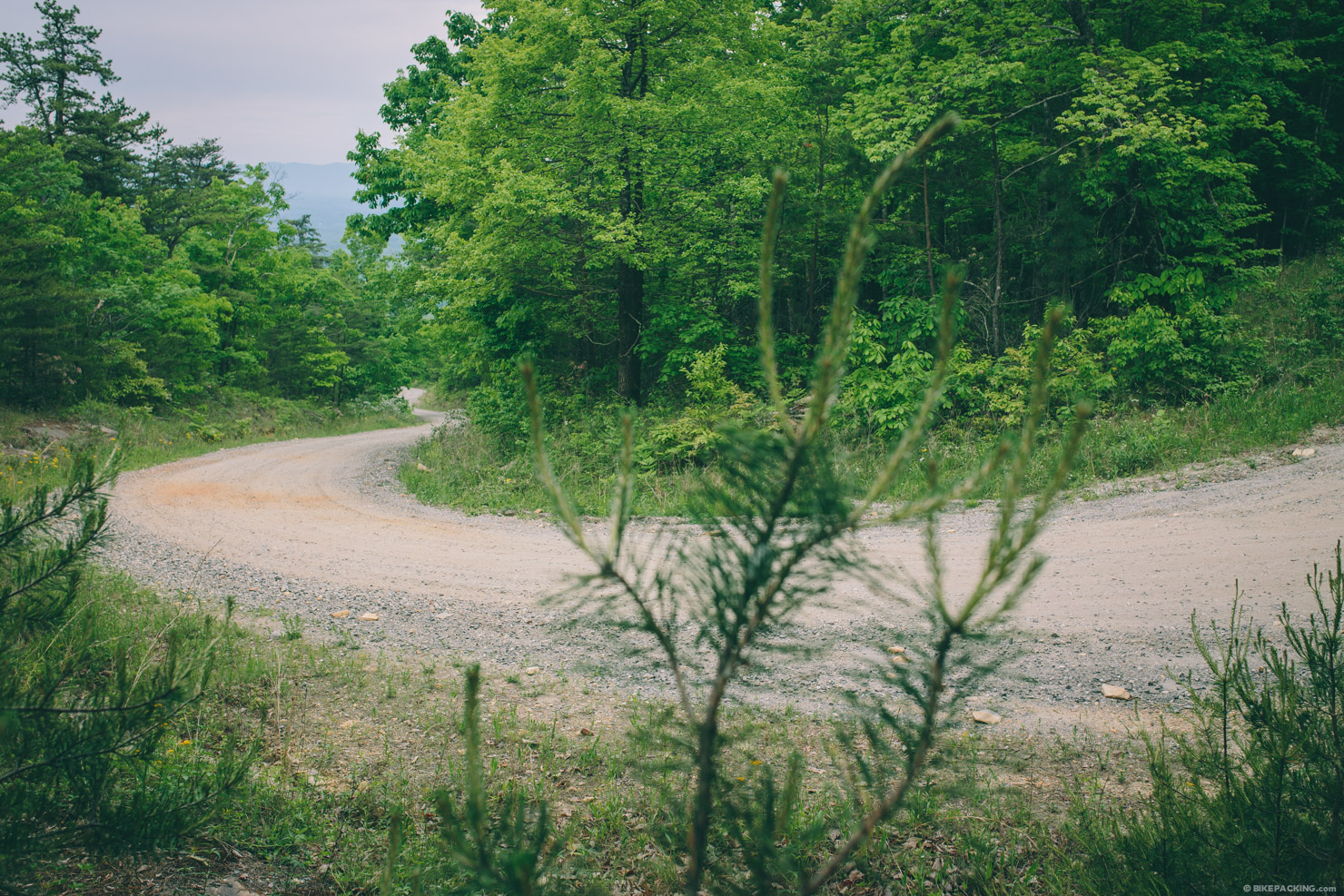
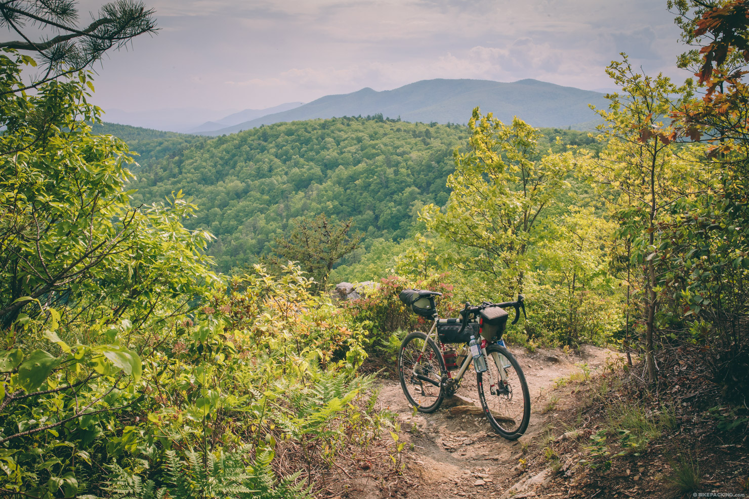
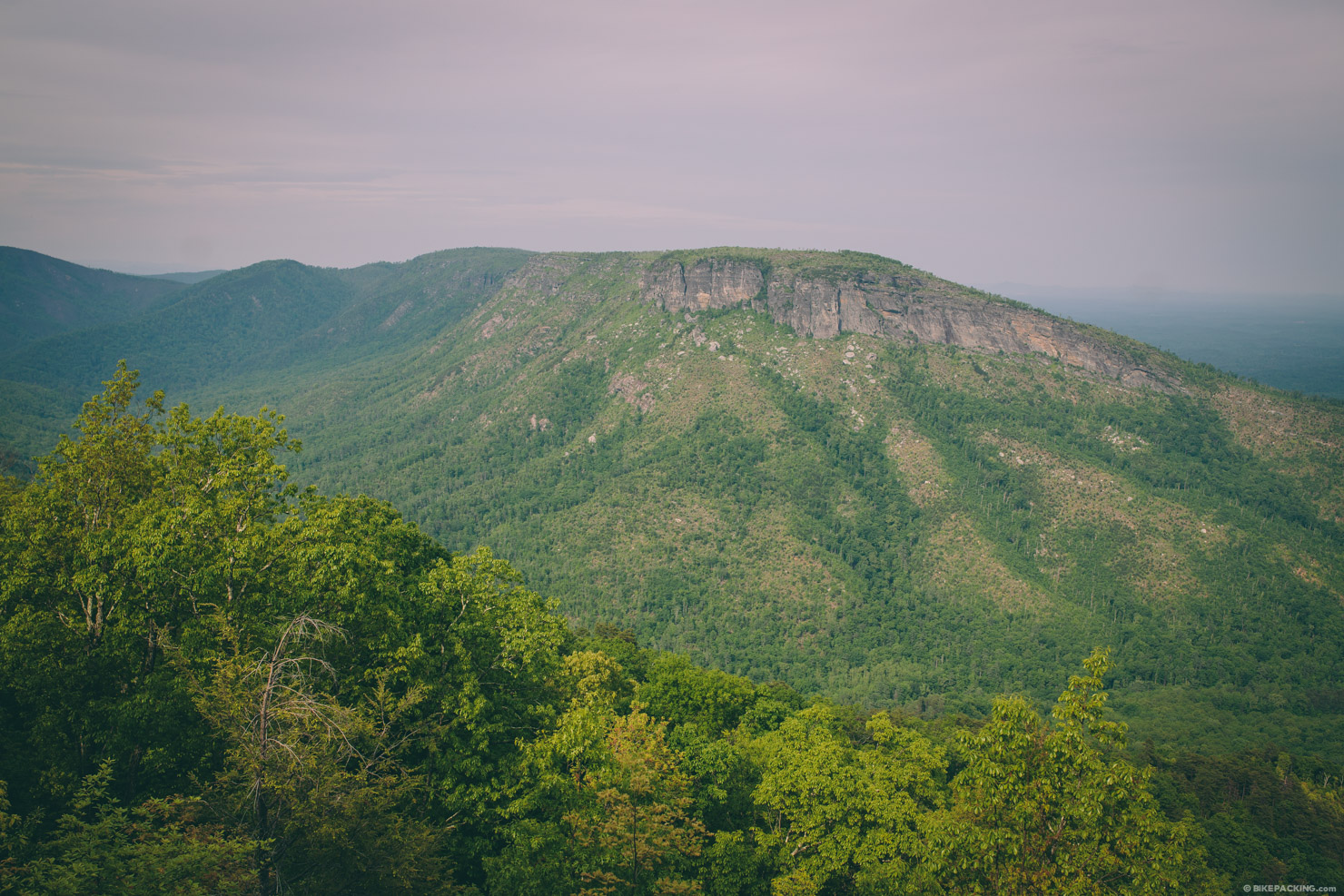
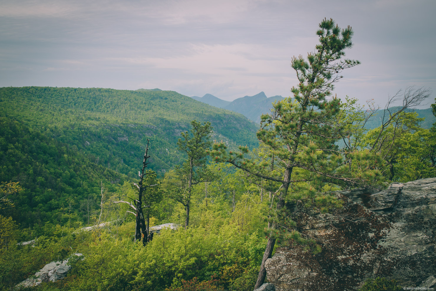
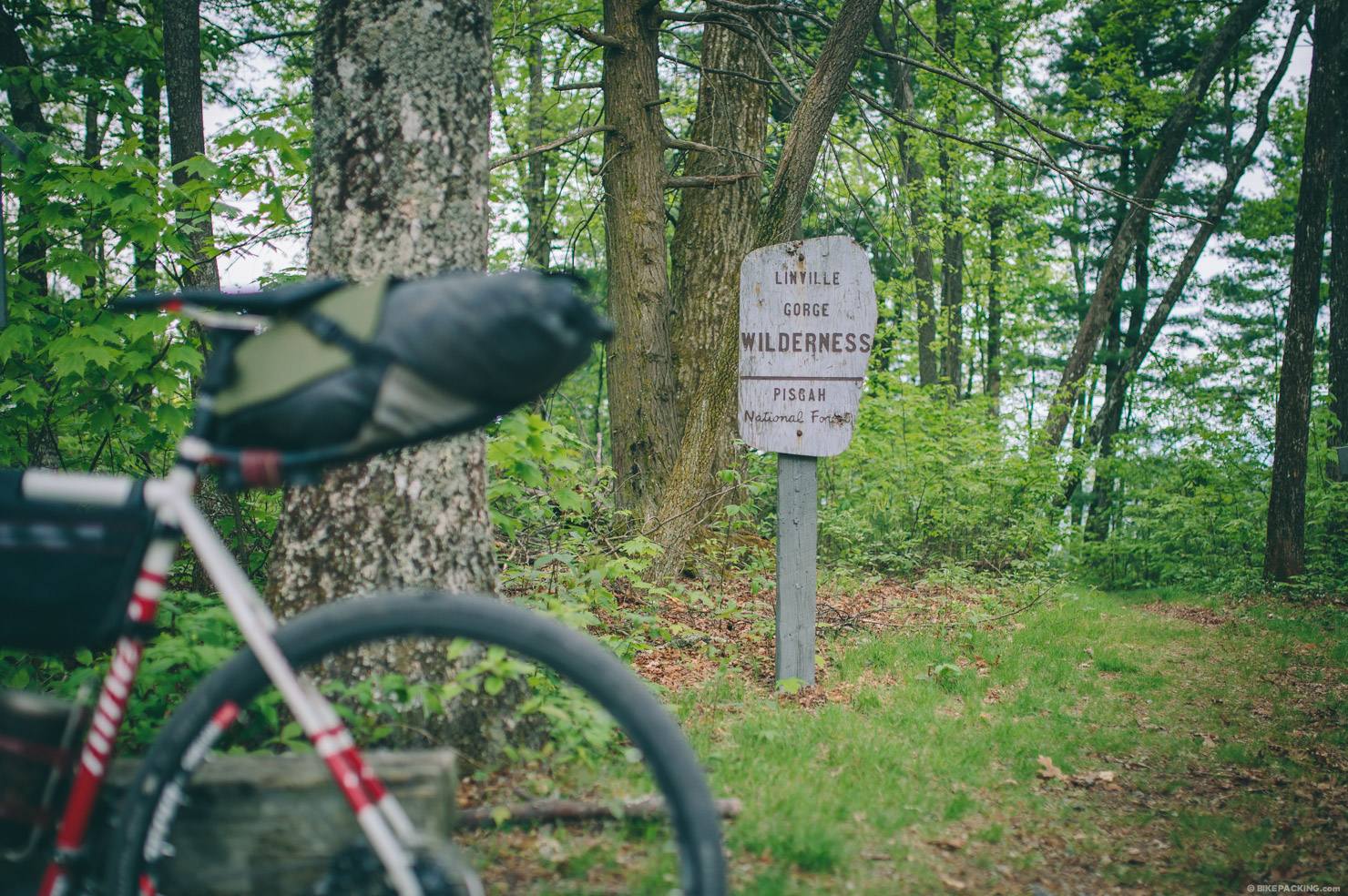
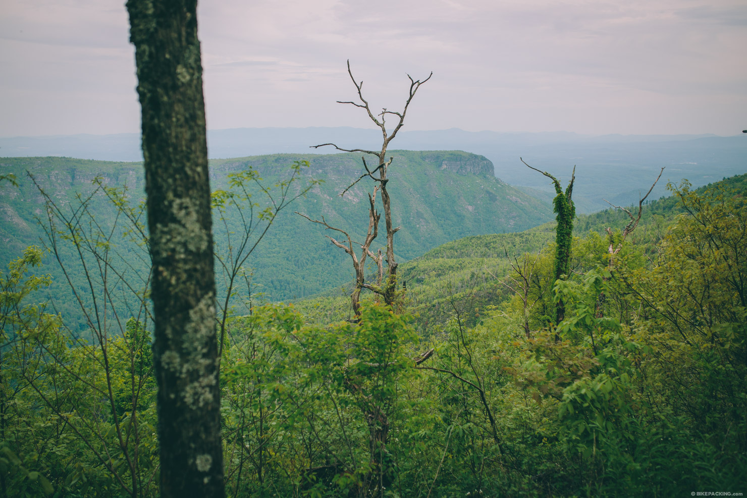
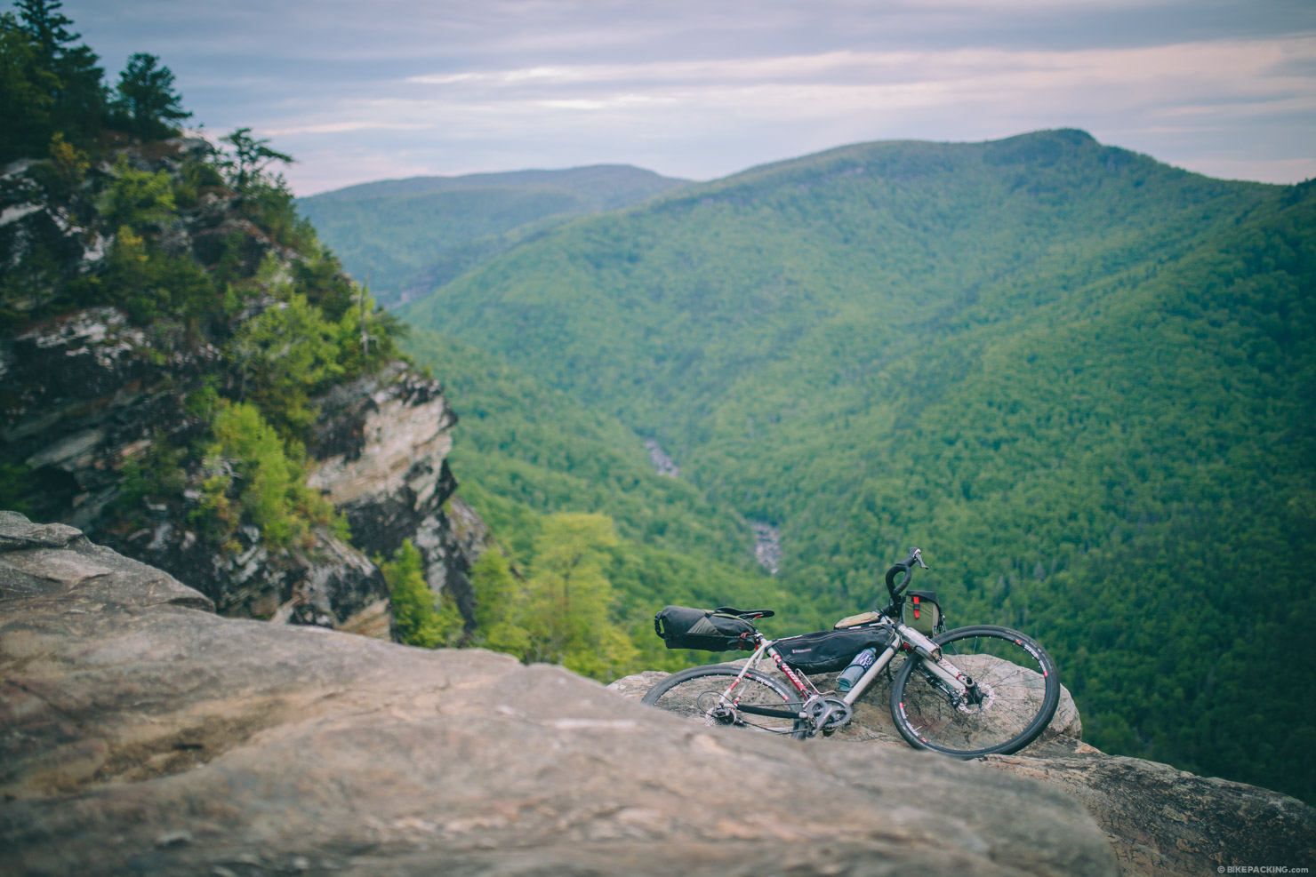
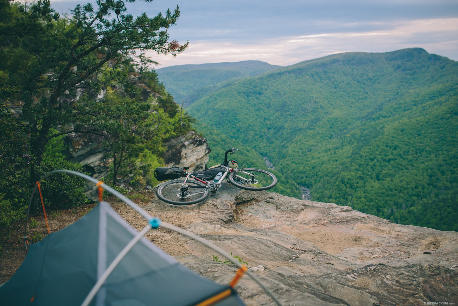
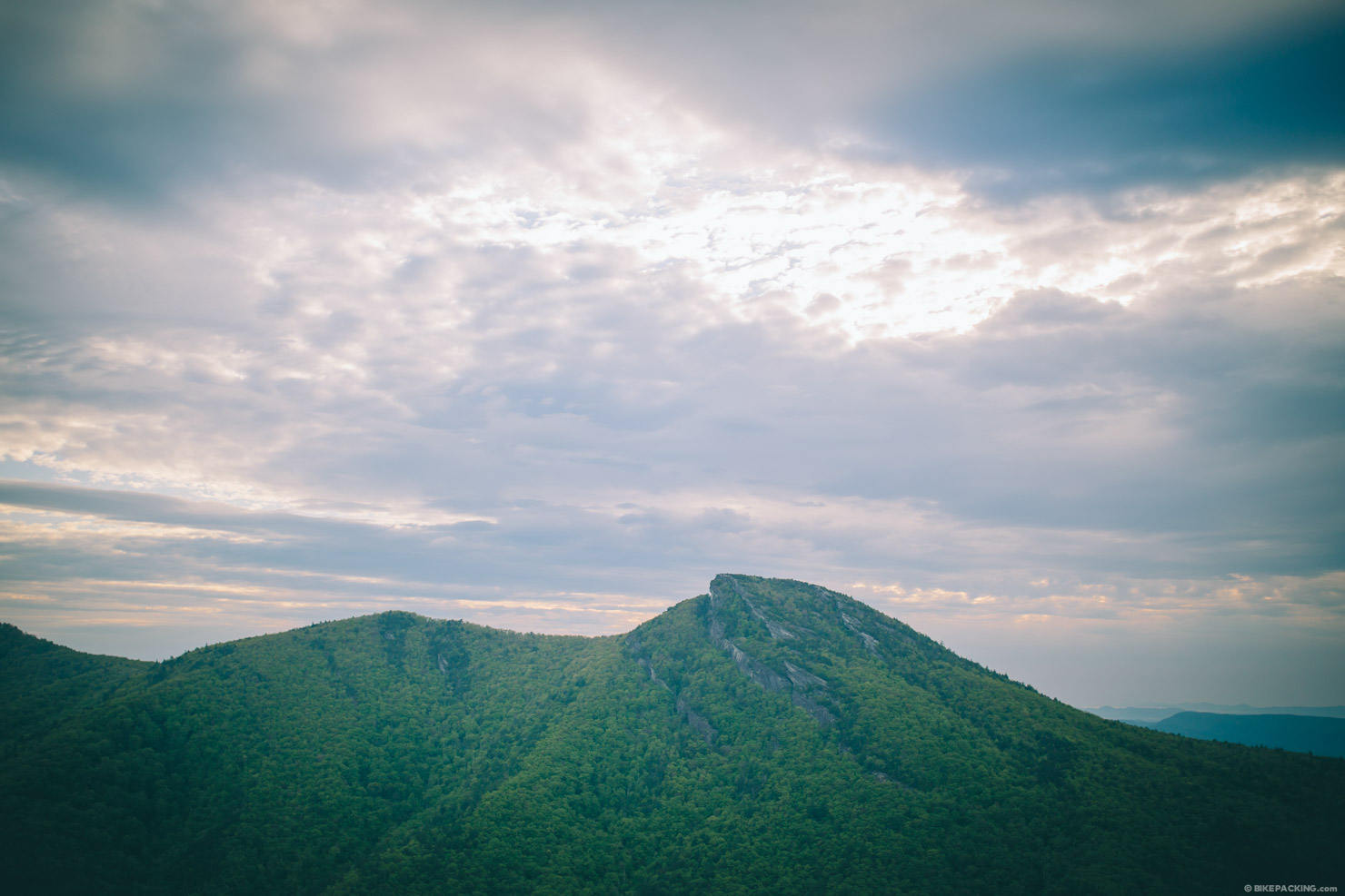
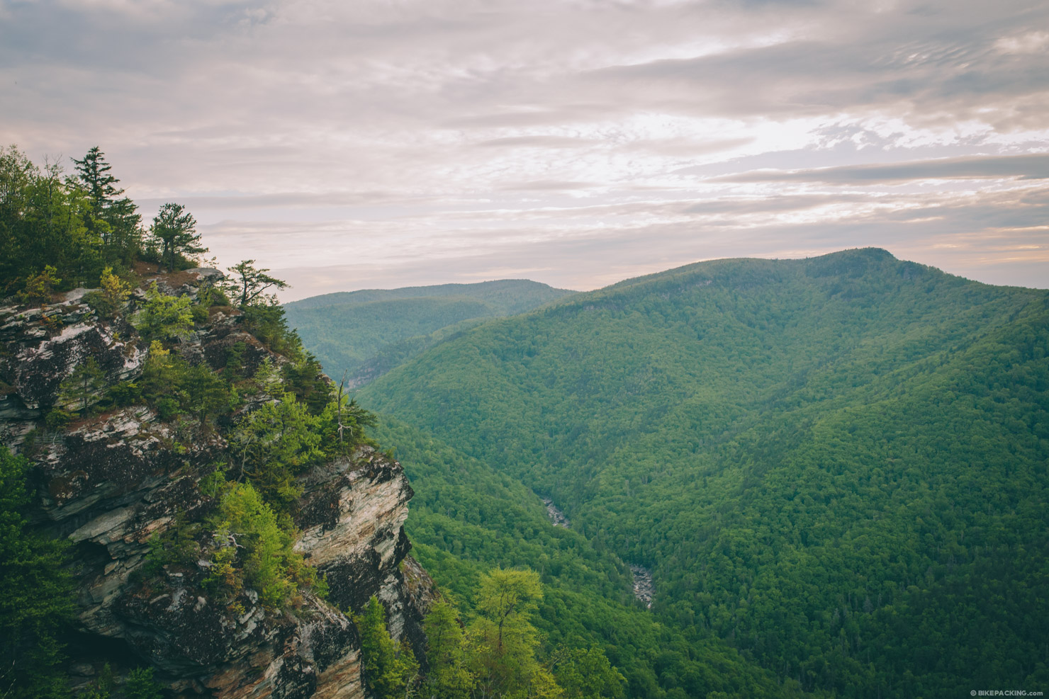
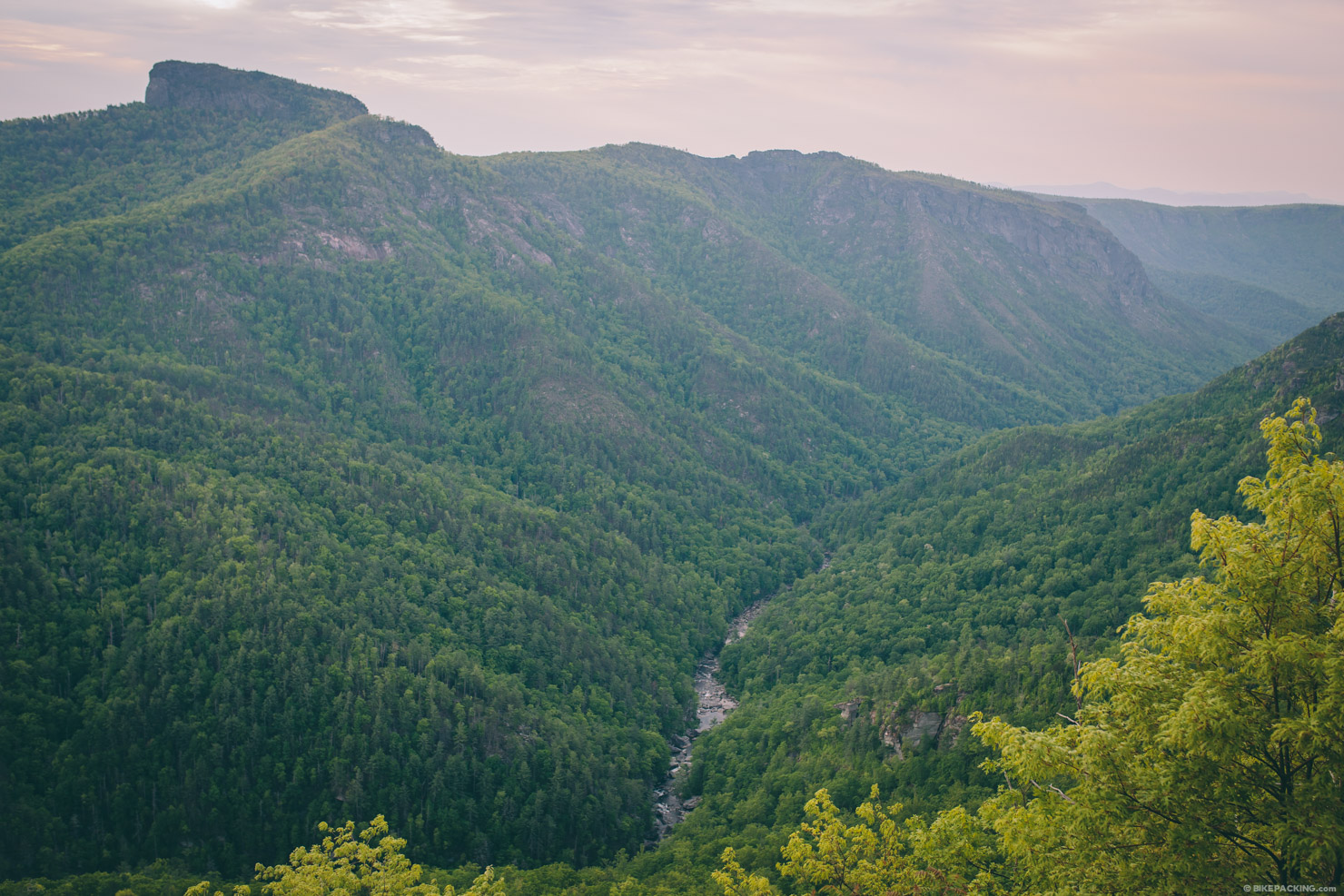
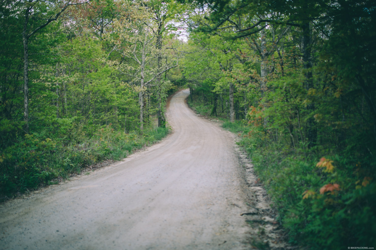
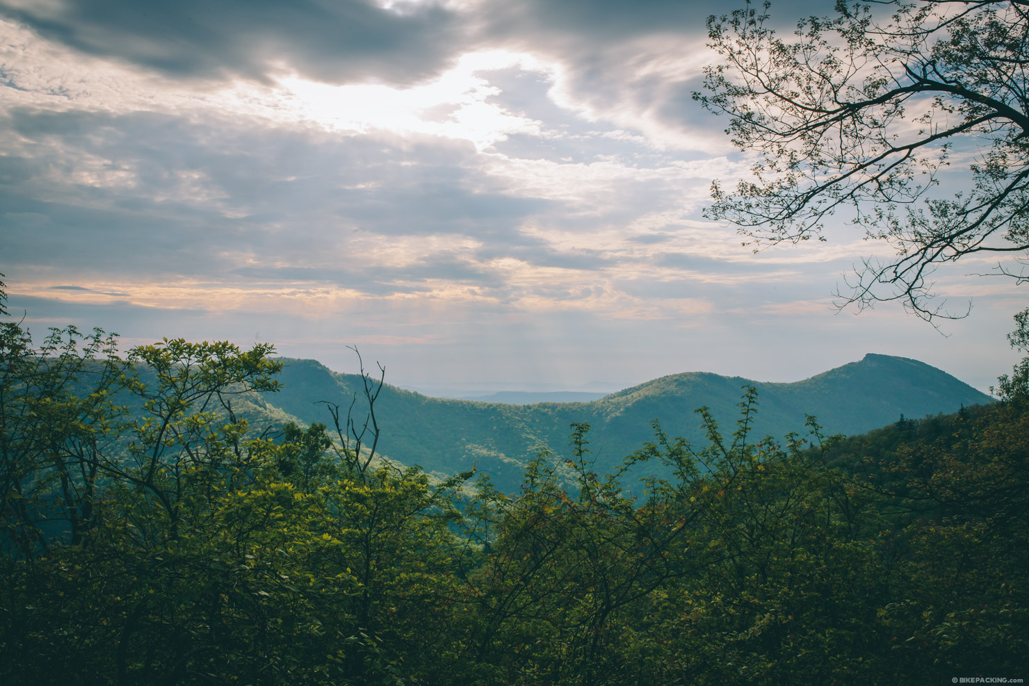
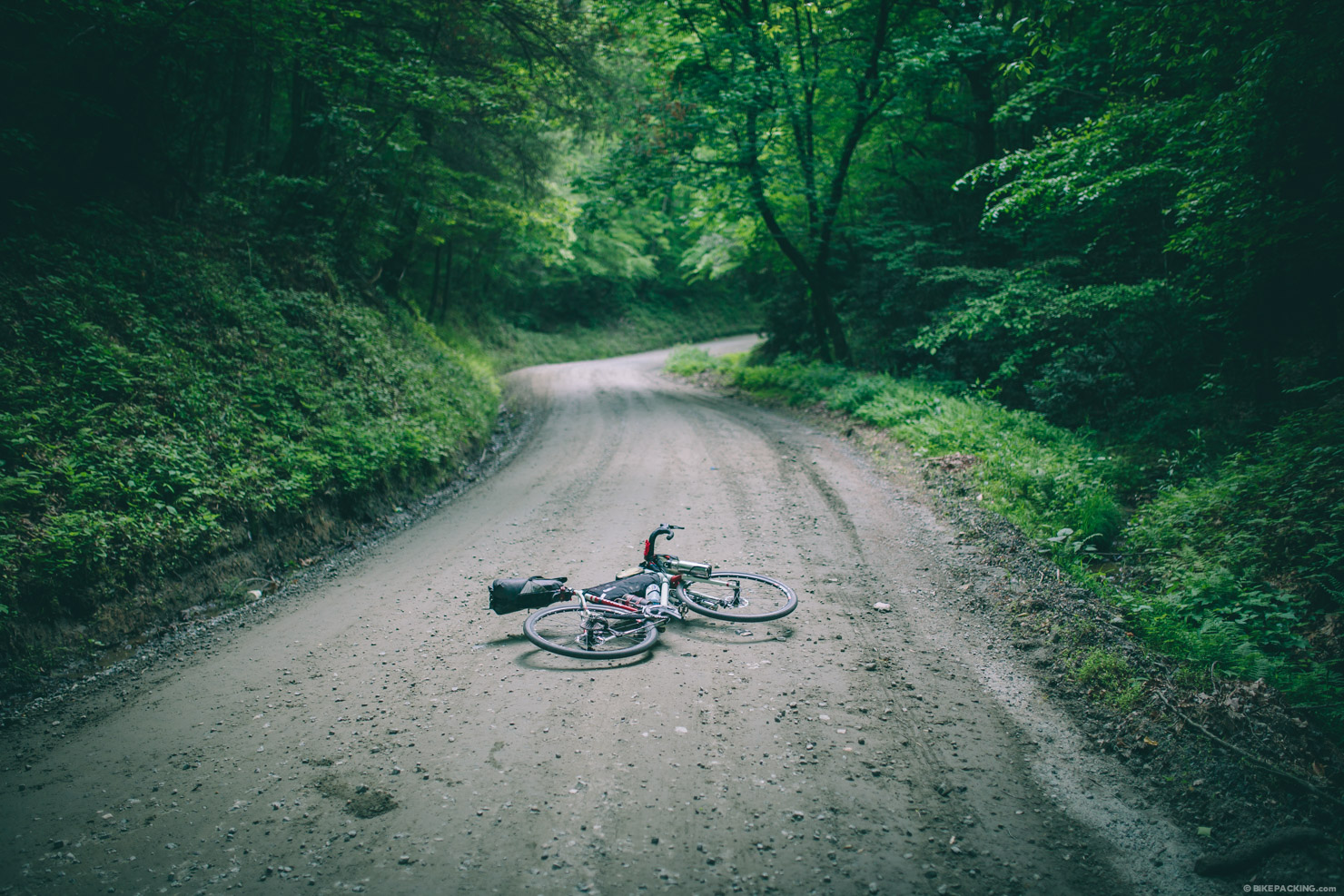
This grinder of a route was designed with three stretches of gravel in mind. After leaving the small town of Morganton around the fringes of Lake James, the roads quickly turn lonely before mounting the assault on Old Hwy 105, a steep and remote gravel road that ascends the western rim of Linville Gorge. This is a grunt of a climb so bring your extra granny gear, or your good hiking shoes. But the rewards are plentiful. The steep walls of the Grand Canyon of North Carolina enclose the Linville River for 12 miles forming one of the most scenic and rugged gorges in the eastern US. There are several viewpoints along the way including The Pinnacle and Wiseman’s View. Both worth the extra off-route effort. Old Hwy 105 traverses the third largest wilderness area in North Carolina, Linville Gorge Wilderness.
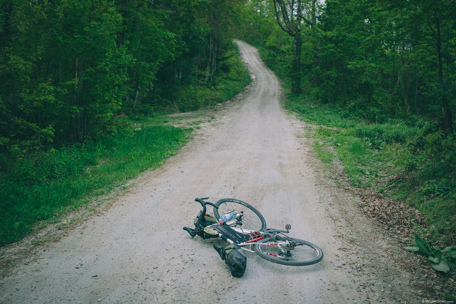
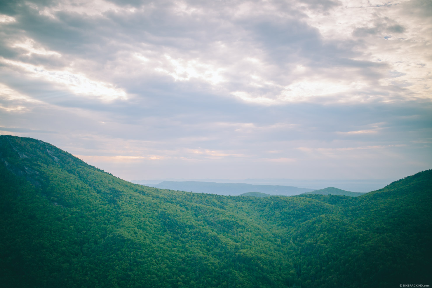
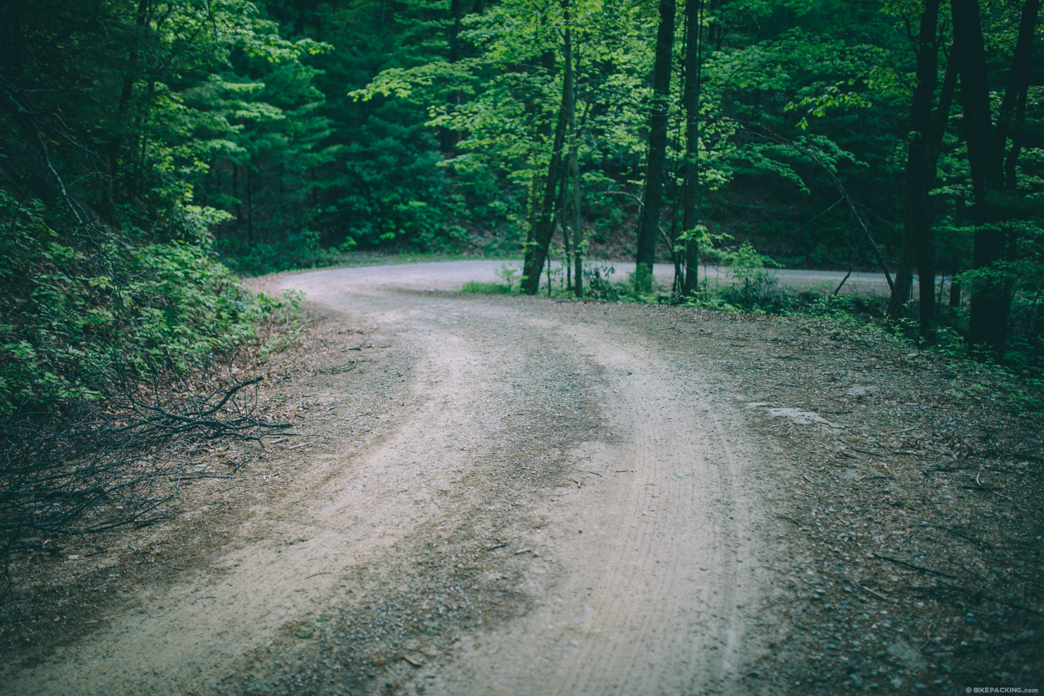
The second stretch of gravel worth noting is Pineola Road, or FS 464, a forested windy track which descends almost 1,500 feet over 10 miles through the Lost Cove Wilderness Study Area. The route then follows Edgemont road for a couple miles before joining the third notable stretch of gravel, Brown Mountain Beach Road. Also known as SR 1328, this stretch drops another 500 feet over 10 miles along the Wild and Scenic Wilson Creek which eventually forms the magnificent Wilson Creek Gorge.
Before reentering Morganton from the northeast, the route continues on more gravel, Playmore Beach Road, and then follows a series of country roads before the final stretch on the Catawba River Greenway, back to the the starting point. Note that the route is all rideable, and if it wasn’t for the amount of climbing and steep sections along Old 105, it would be considered fairly easy.


Submit Route Alert
As the leading creator and publisher of bikepacking routes, BIKEPACKING.com endeavors to maintain, improve, and advocate for our growing network of bikepacking routes all over the world. As such, our editorial team, route creators, and Route Stewards serve as mediators for route improvements and opportunities for connectivity, conservation, and community growth around these routes. To facilitate these efforts, we rely on our Bikepacking Collective and the greater bikepacking community to call attention to critical issues and opportunities that are discovered while riding these routes. If you have a vital issue or opportunity regarding this route that pertains to one of the subjects below, please let us know:
Highlights
Must Know
Camping
Food/H2O
- The incredible views of Linville Gorge along Old Hwy 105.
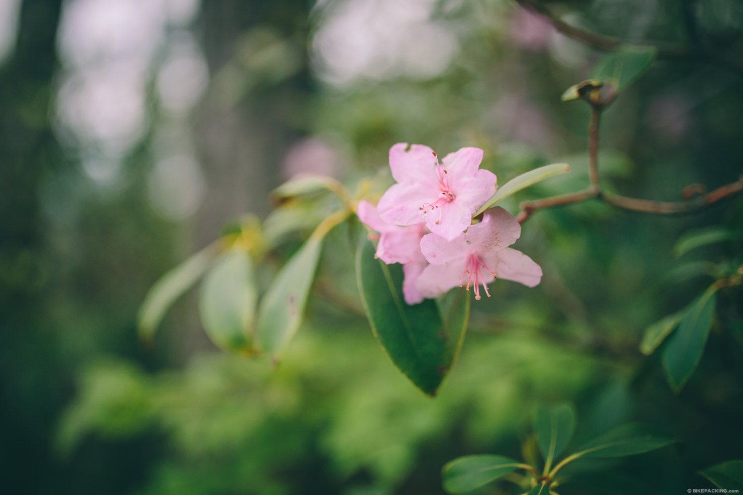
- Catching the rhododendron in bloom.
- The 20 mile descent over nothing but gravel.
- Leaving town and quickly being in remote wilderness surrounded by forested mountains.
- Wilson Creek is a ‘Wild and Scenic River’ and always offers amazing scenery.
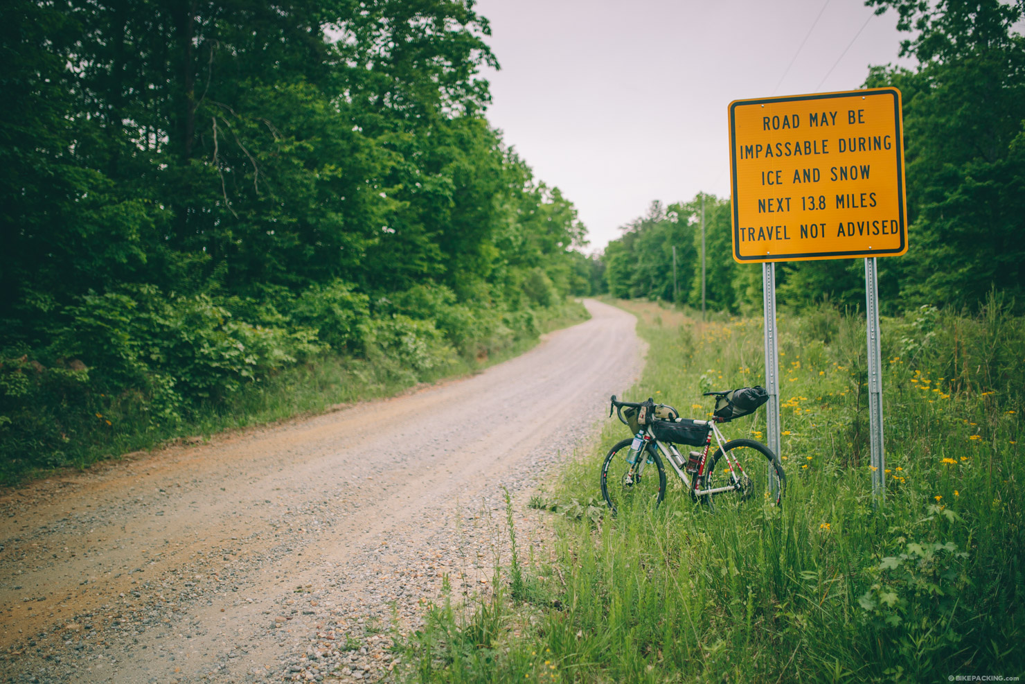
- Old Hwy 105 is steep and shouldn’t be underestimated. Big gradients call for granny gears and seasoned legs.
- While this route is doable any time of the year, watch the forecast for snow and ice from November through April.
- Parking is available at the route start, which is greenway public parking; however, I opted to park at the nearby Ingles supermarket.
- Beware of a few dogs en route; I got chased by a couple on the paved section of Old 105, before the ascent.
- Most of these roads are devoid of traffic, but there are a couple areas where there may be a fair amount of cars, including the route start along US 70.
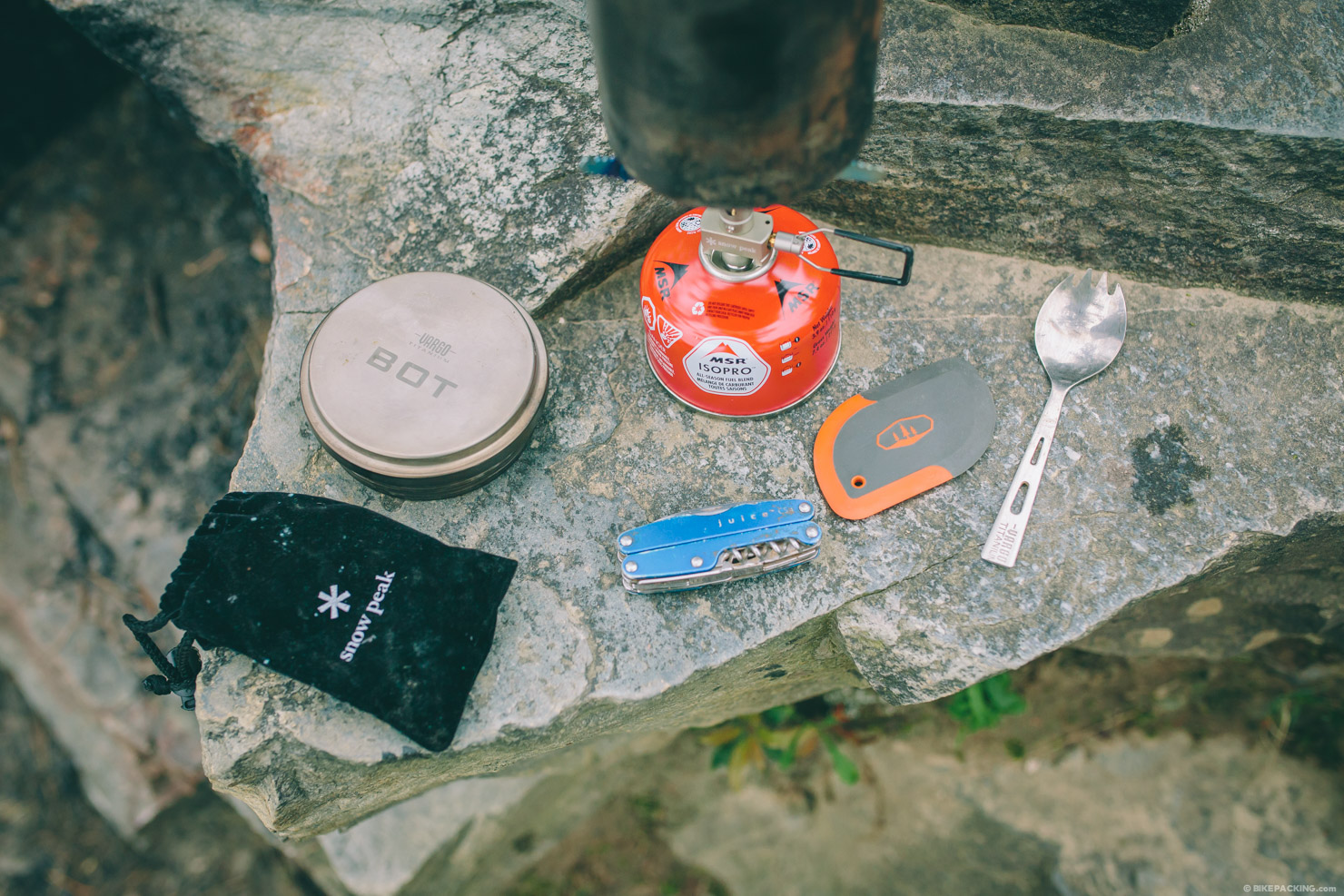
- This route was designed for a cross-style gravel bike. I rode the Niner RLT 9 Steel.
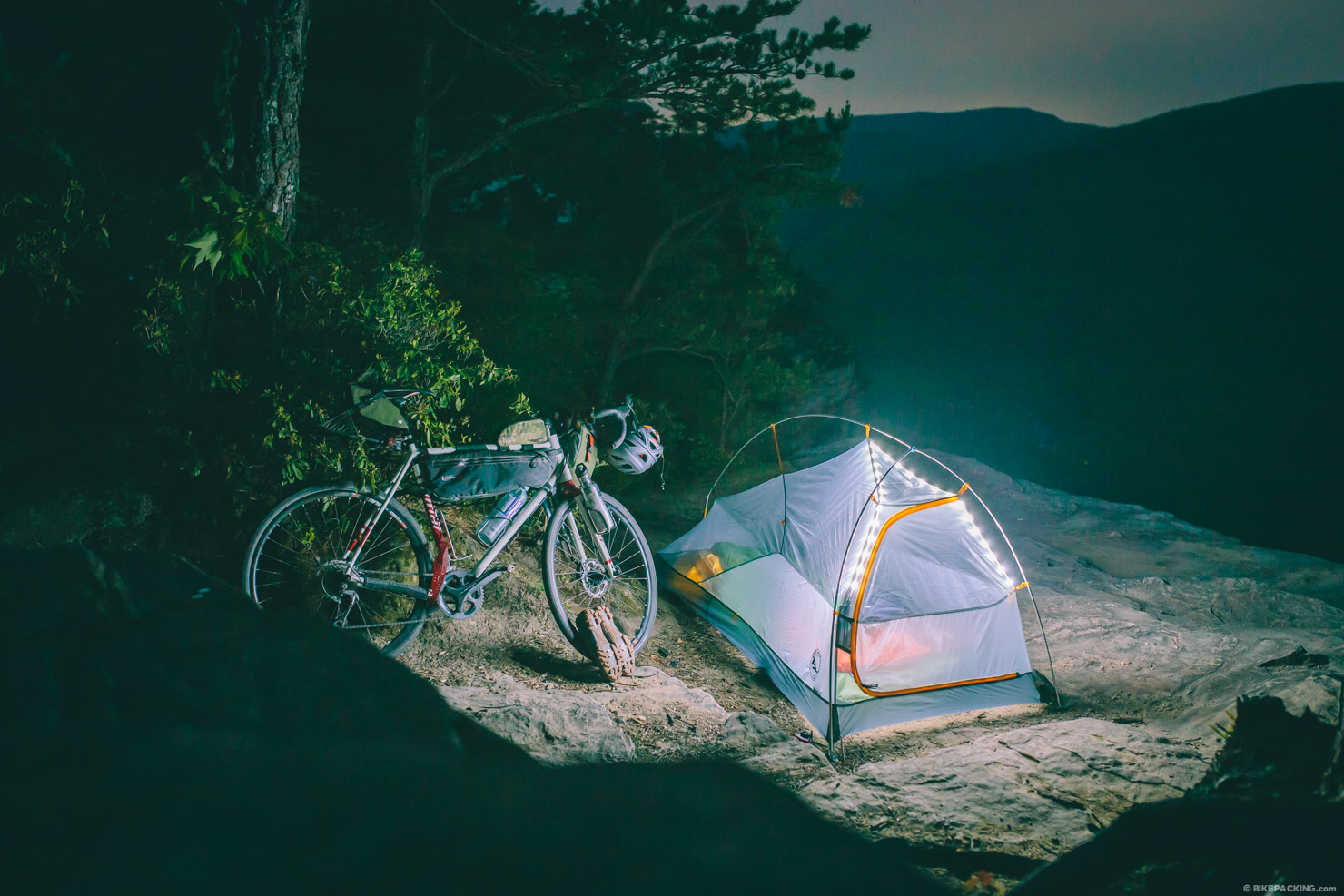
- There’s plenty of roadside camping along Old 105 between mile 19 and 29; there’s also a good roadside spot at mile 38 on Pineola Road.
- Camping at Wiseman’s View seems to be permitted; there are several cleared sites around the view area. However, I would recommend not being there on a summer weekend or high tourist season.
- For more adventurous folks there is a camping option at Little Lost Cove Cliffs; however, this is a Wilderness Study Area, so bikes are not permitted on the short trail to the campsite. See The Yancey Ridge S24O for more details on that camp spot.
- There are no water options on Old 105; if you plan to camp along the gorge rim, bring water for drinking, cooking, and the next morning.
- There are springs along Pineola Road, but we still recommend filtration.
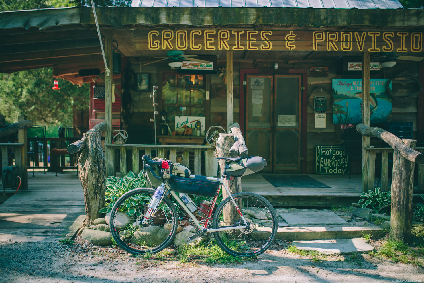
- Mortimer offers the first resupply, but bring cash as they don’t accept cards.


Terms of Use: As with each bikepacking route guide published on BIKEPACKING.com, should you choose to cycle this route, do so at your own risk. Prior to setting out check current local weather, conditions, and land/road closures. While riding, obey all public and private land use restrictions and rules, carry proper safety and navigational equipment, and of course, follow the #leavenotrace guidelines. The information found herein is simply a planning resource to be used as a point of inspiration in conjunction with your own due-diligence. In spite of the fact that this route, associated GPS track (GPX and maps), and all route guidelines were prepared under diligent research by the specified contributor and/or contributors, the accuracy of such and judgement of the author is not guaranteed. BIKEPACKING.com LLC, its partners, associates, and contributors are in no way liable for personal injury, damage to personal property, or any other such situation that might happen to individual riders cycling or following this route.
Please keep the conversation civil, constructive, and inclusive, or your comment will be removed.