


The Veneto Divide
Distance
245 Mi.
(394 KM)Days
7-8
% Unpaved
53%
% Singletrack
11%
% Rideable (time)
97%
Total Ascent
43,486'
(13,255 M)High Point
6,305'
(1,922 M)Difficulty (1-10)
7?
- 10Climbing Scale Very Strenuous177 FT/MI (34 M/KM)
- 7Technical Difficulty Difficult
- 8Physical Demand Difficult
- 6Resupply & Logistics Moderate
Contributed By

Andrea Securo
Guest Contributor
Andrea Securo is a glaciologist with a strong passion for mountain biking and the outdoors. He has been the main organizer of the Veneto Trail from 2017 to 2023. His interests in mapping and landscape photography often lead him to seek out less-beaten paths, especially in the nearby Dolomites. Find Andrea on Instagram @andreasecuro.
This route received a major update in June 2026 to avoid some land use restrictions and improve the rider experience.
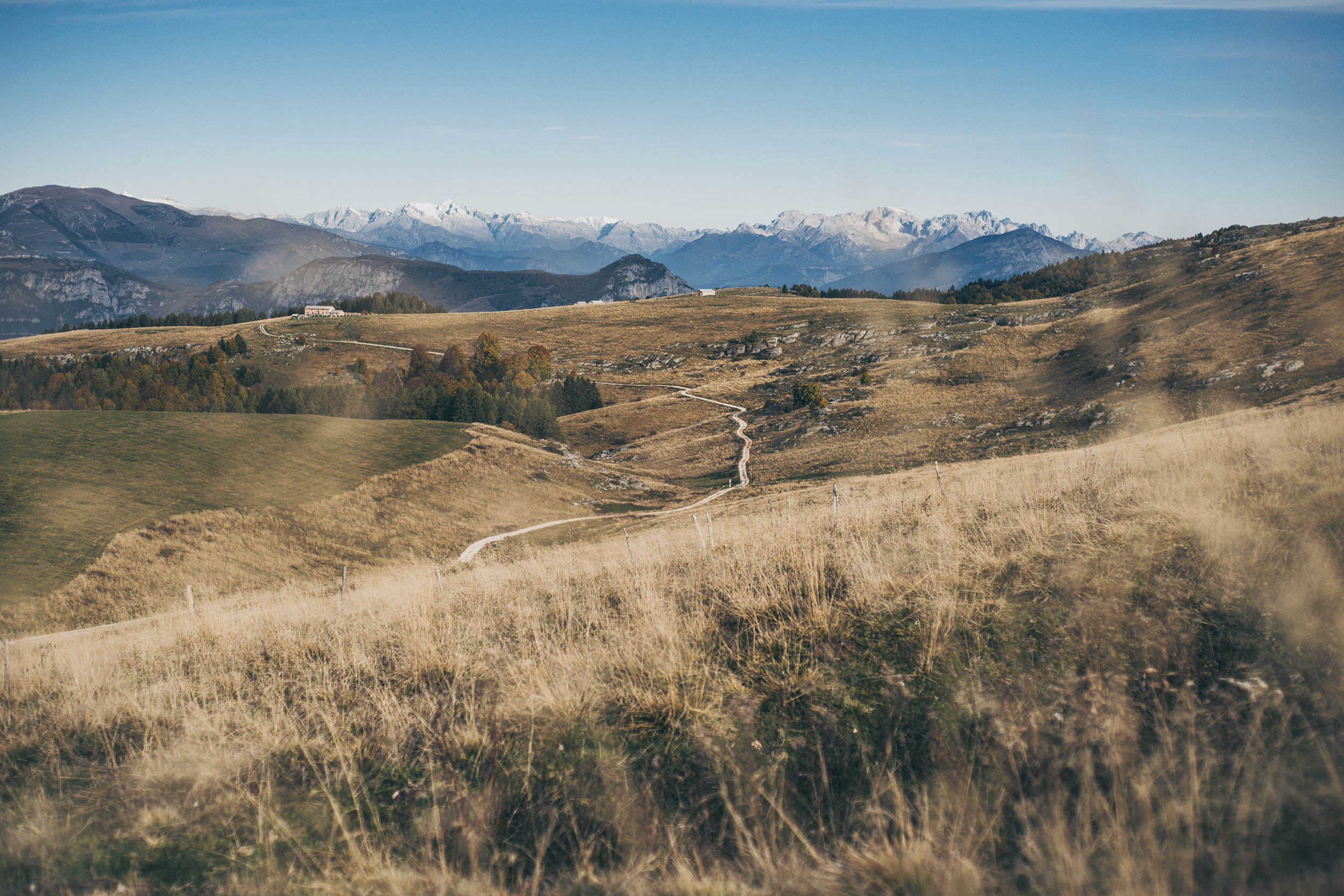
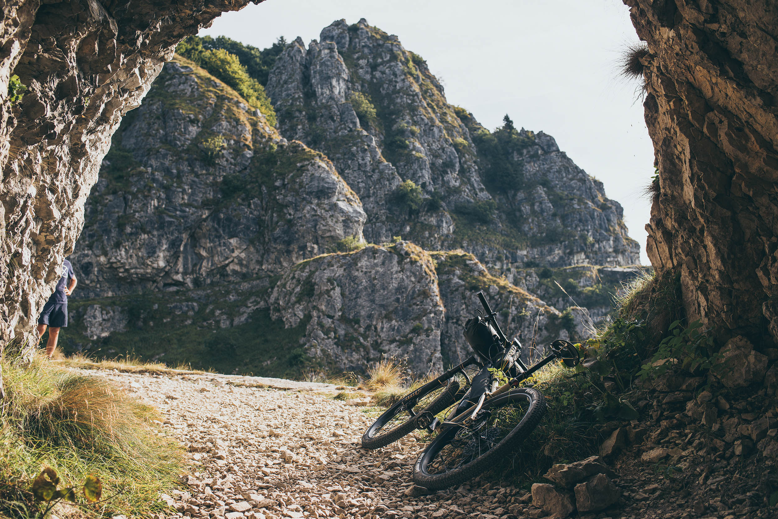
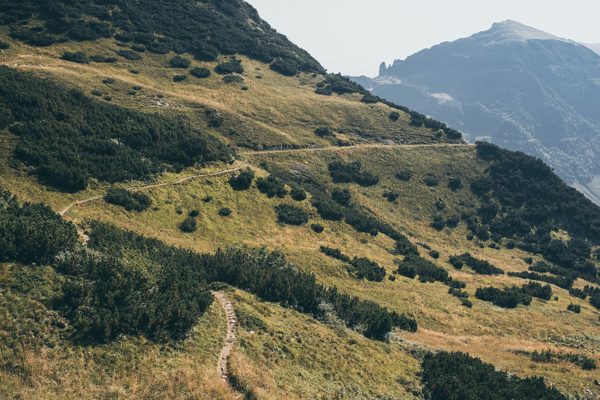
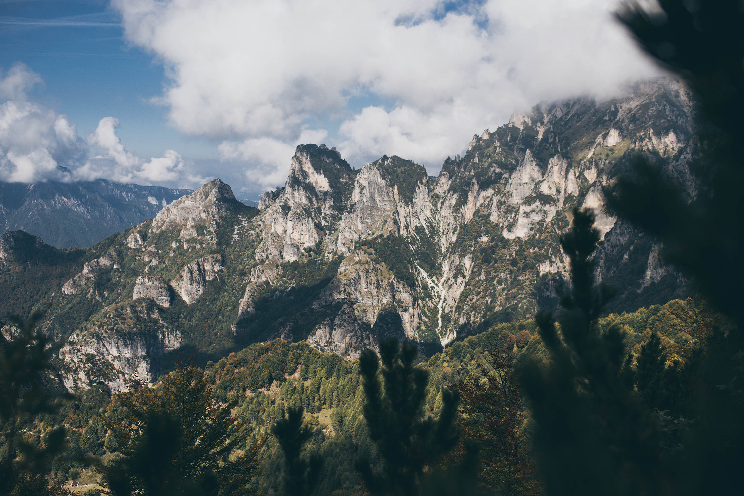
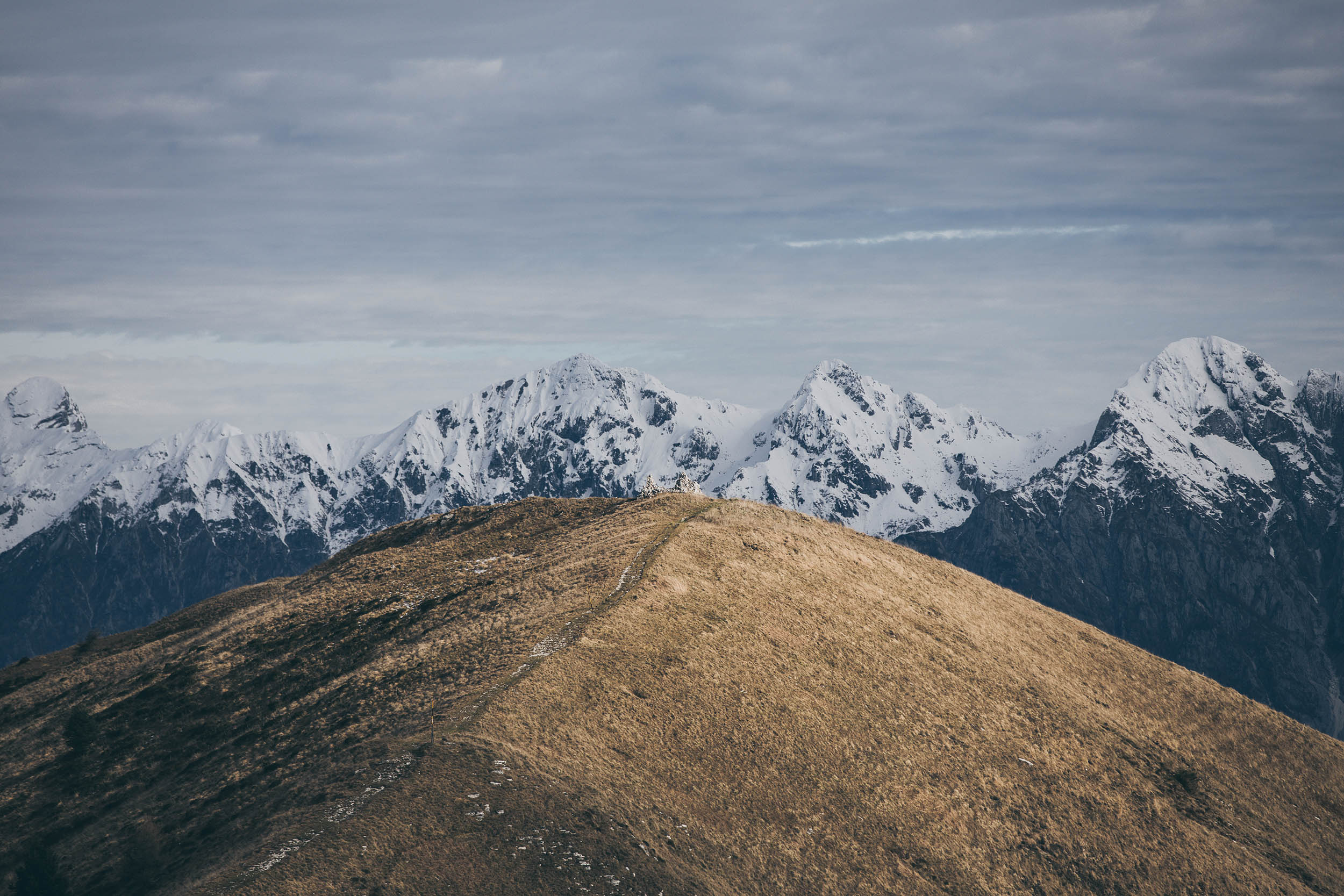
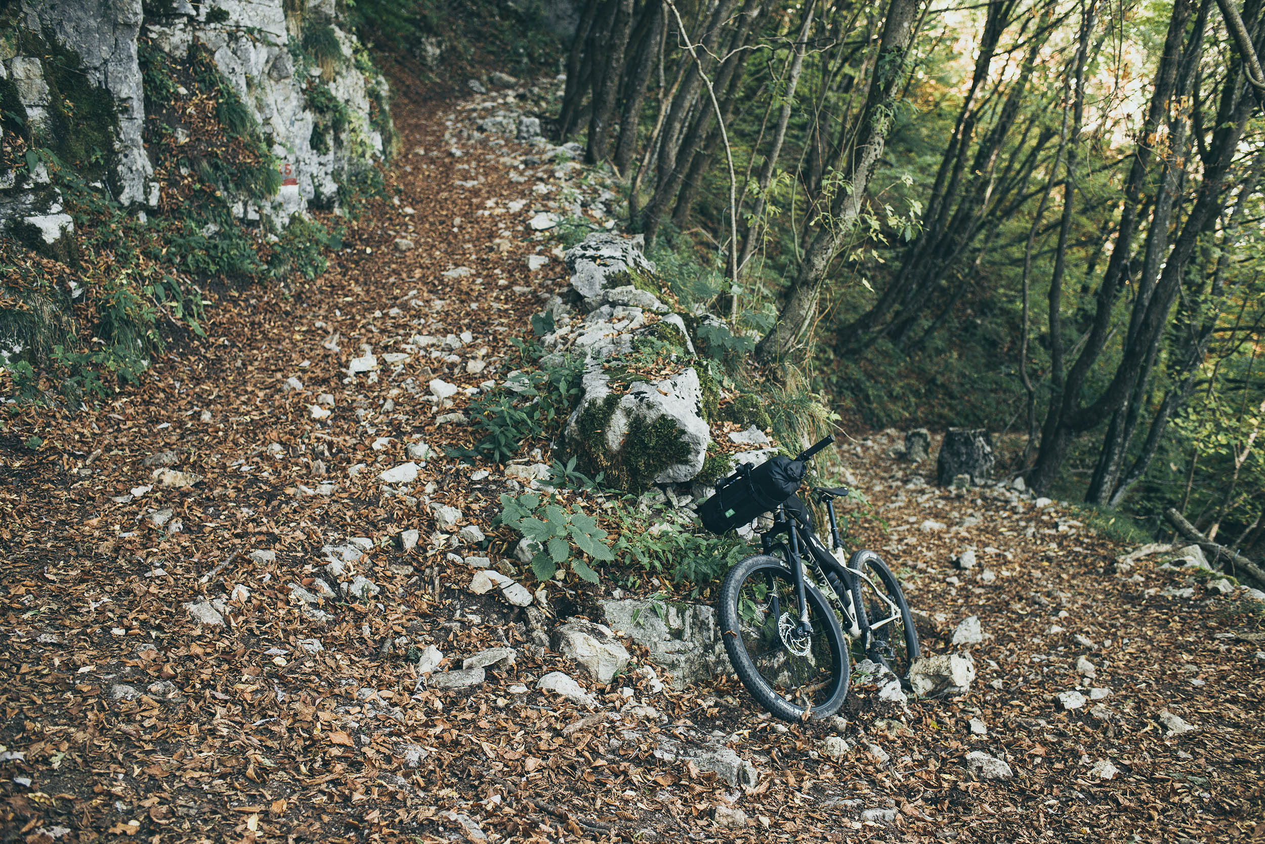
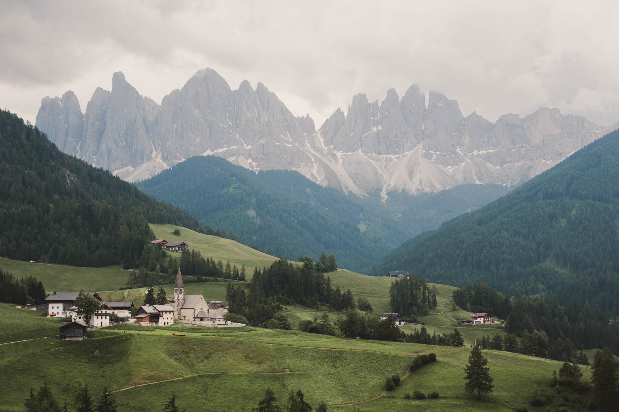
Almost everyone considering bikepacking in northeastern Italy inevitably stumbles upon the magnificent towers and vertiginous walls of the Dolomites. However, it’s worth pointing out that the Venetian Prealps—a mountain range in the southeastern part of the Alps—can also reward you with an incredible blend of history, scenery, and rough off-road trails for an equally beautiful (and perhaps even more unexpected) experience.
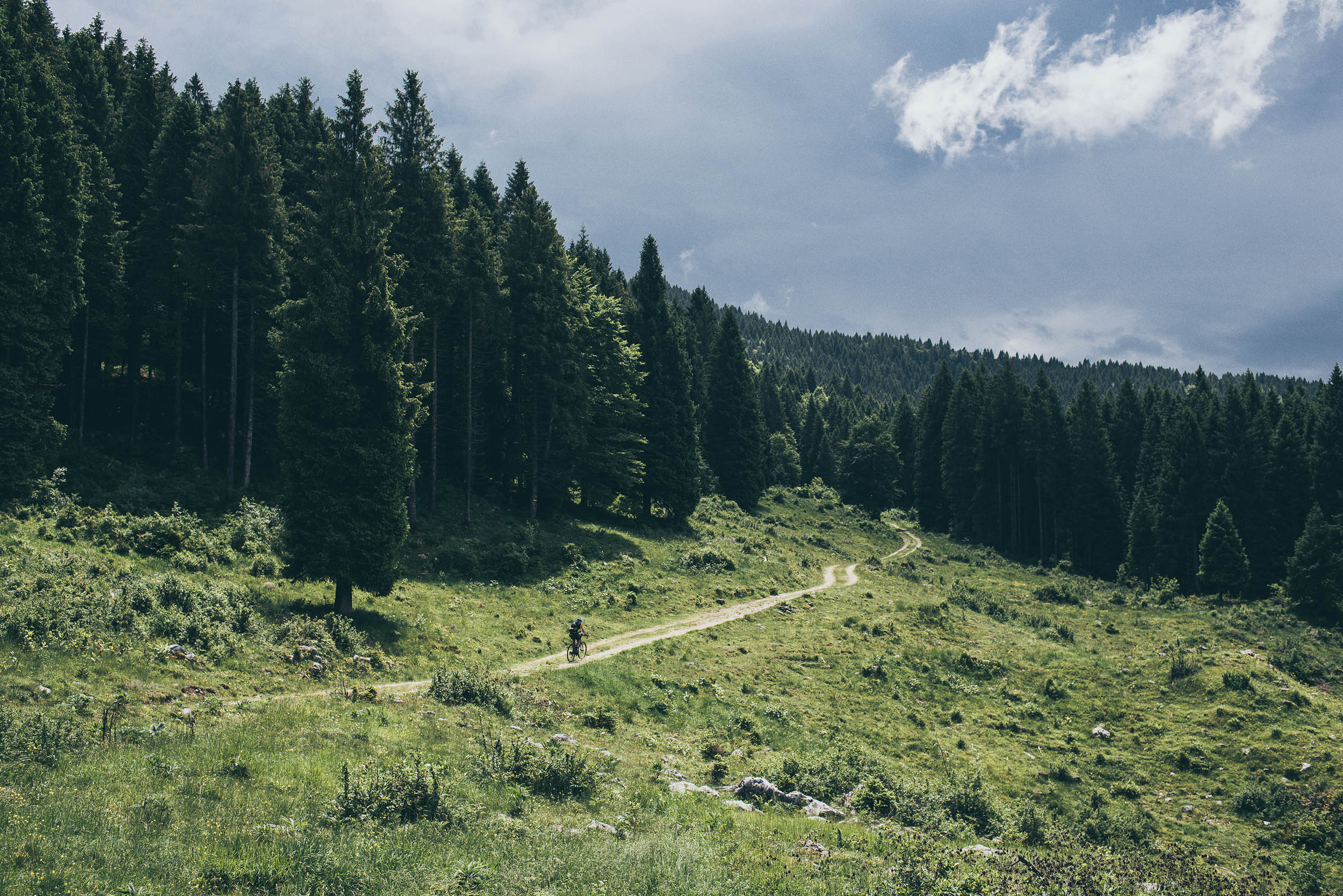
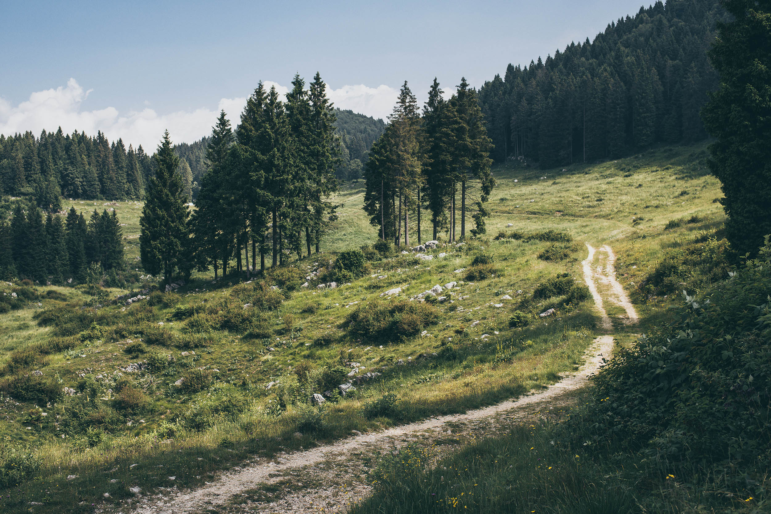
The Veneto Divide is a nearly 400-kilometer bikepacking traverse of the Venetian Prealps. The route will take you from Lake Garda east to Lake Santa Croce, at the border with Friuli Venezia Giulia. It’s a mixed-terrain adventure made of doubletracks and gravel roads built during the First World Rar, rough singletrack trails, meadows, pastures, and some paved secondary roads here and there, always above the busy Po Valley below. The route can be easily divided into two shorter traverses, splitting in Bassano del Grappa, or can be linked with the Asiago Loop since they share a few dozen kilometers.
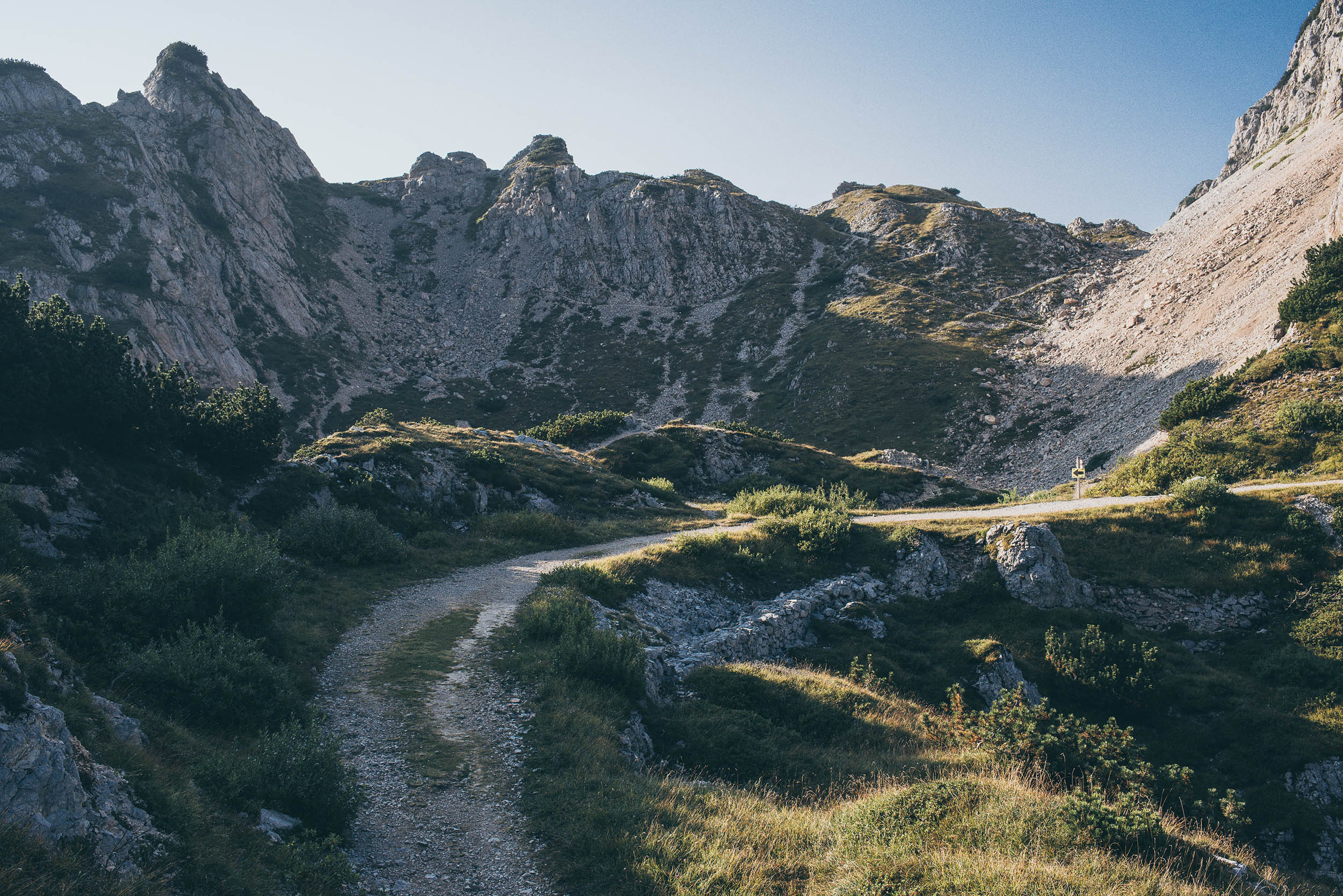
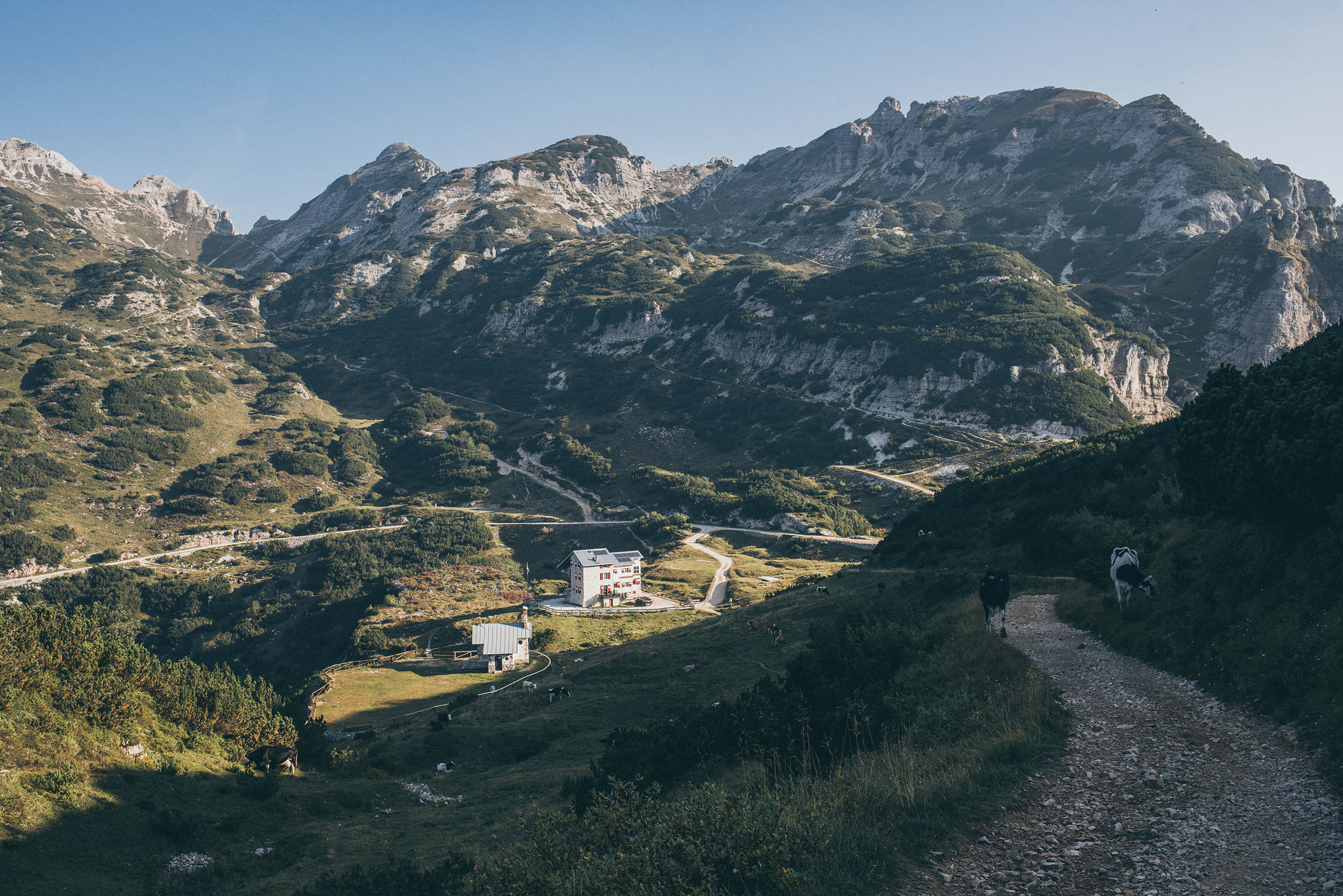
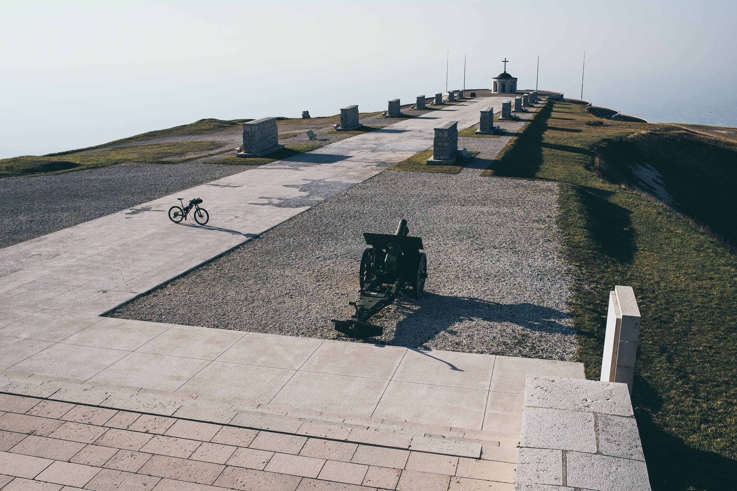
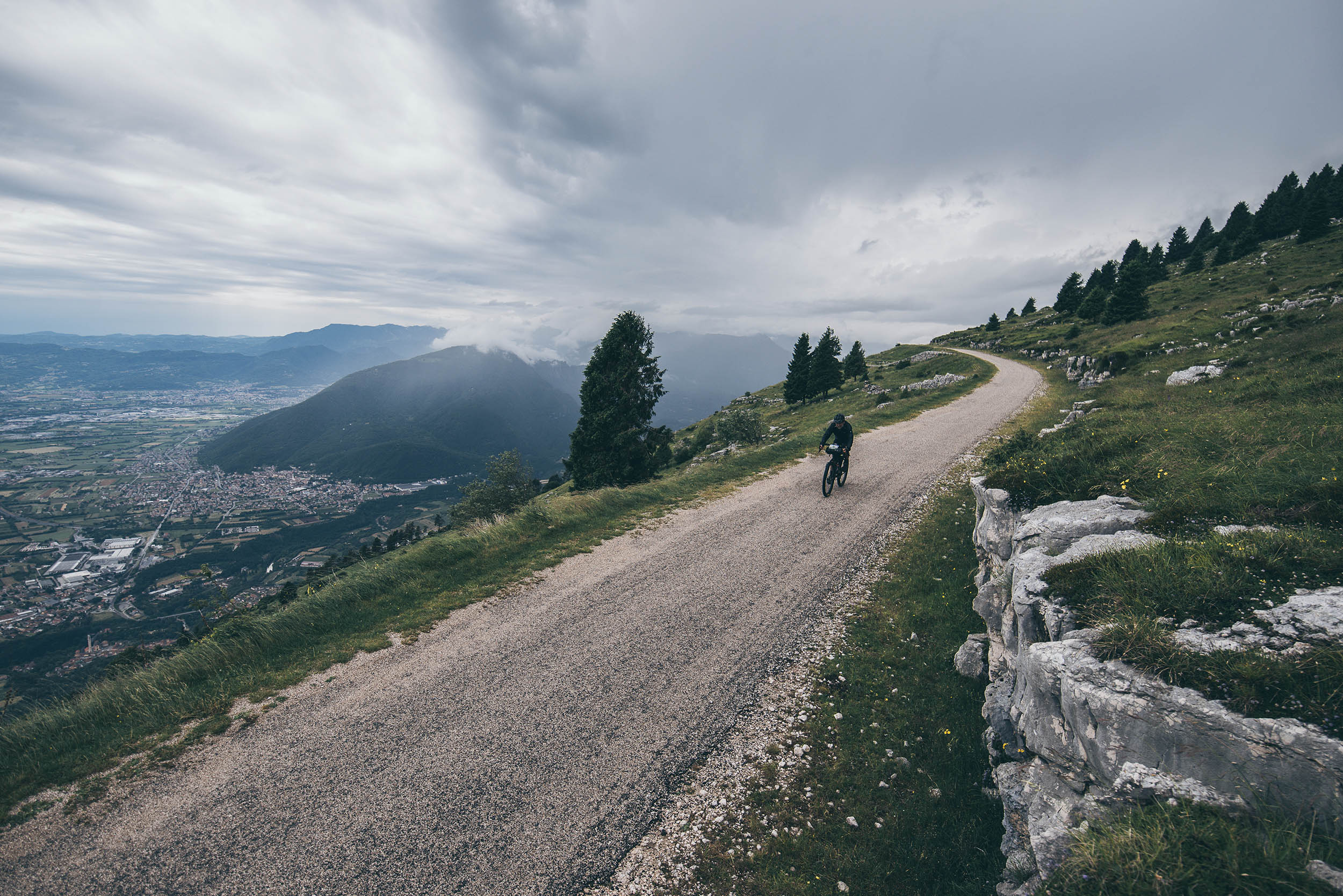
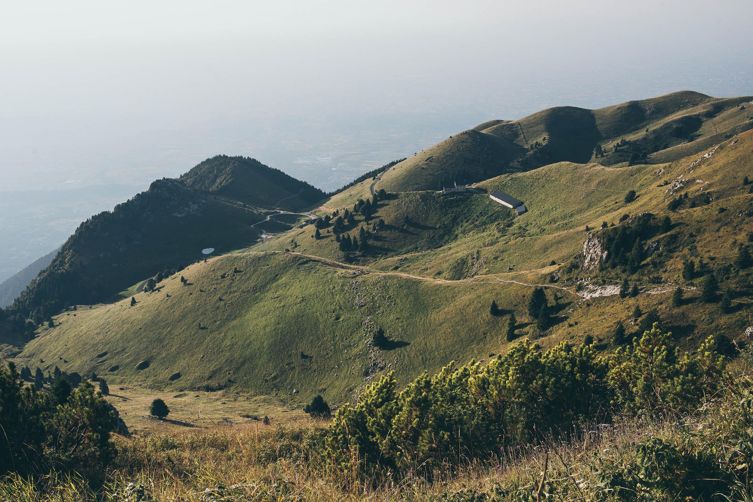
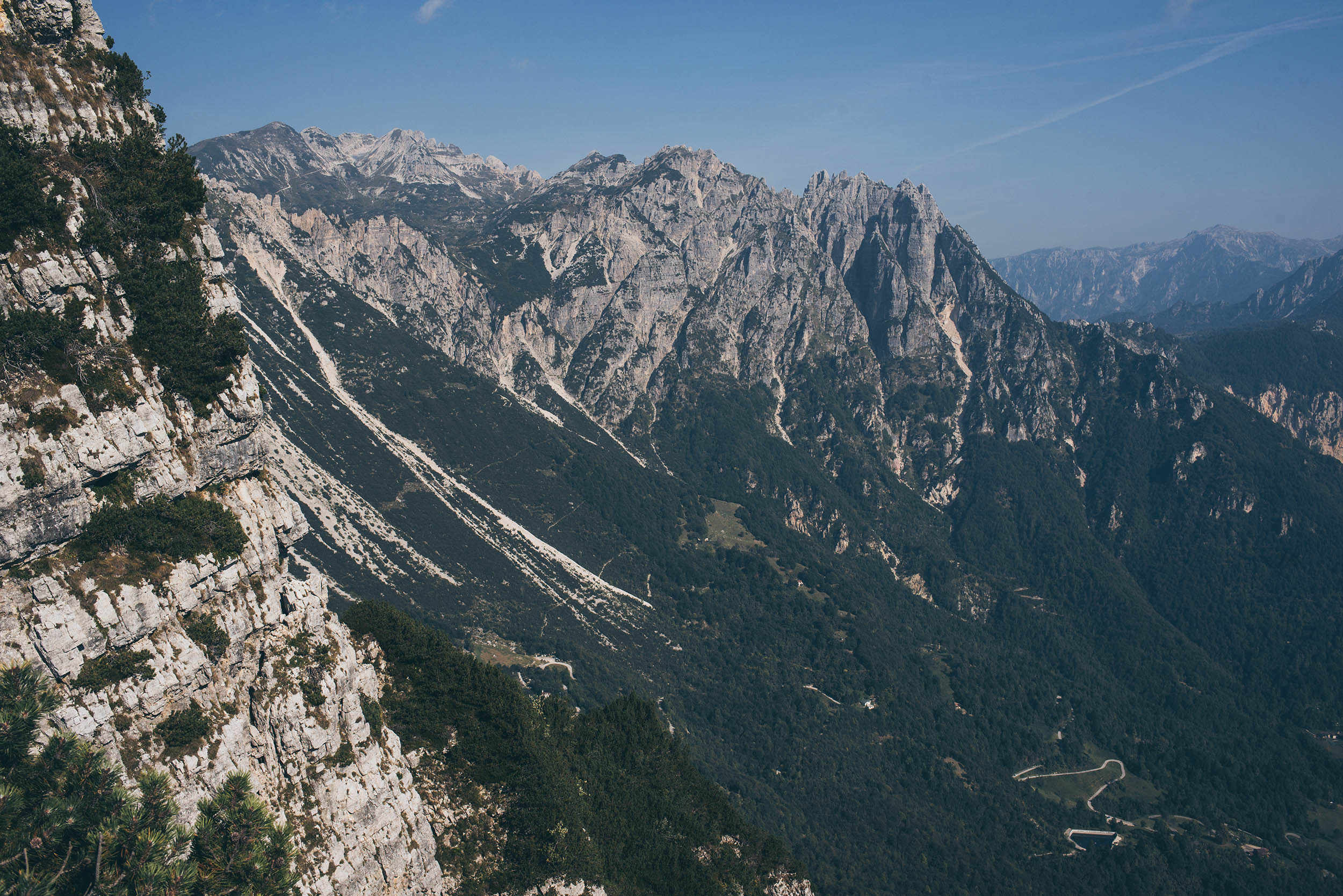
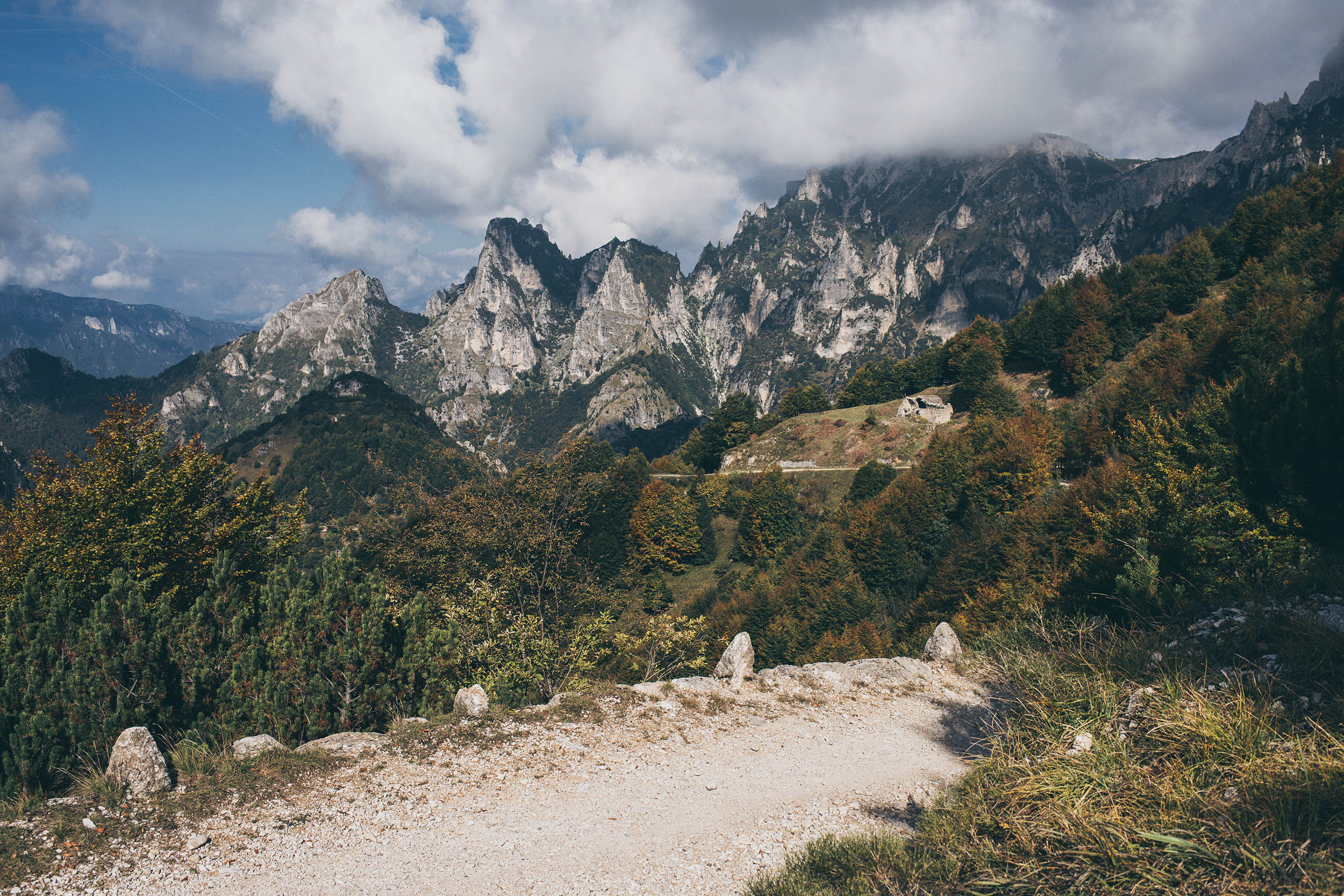
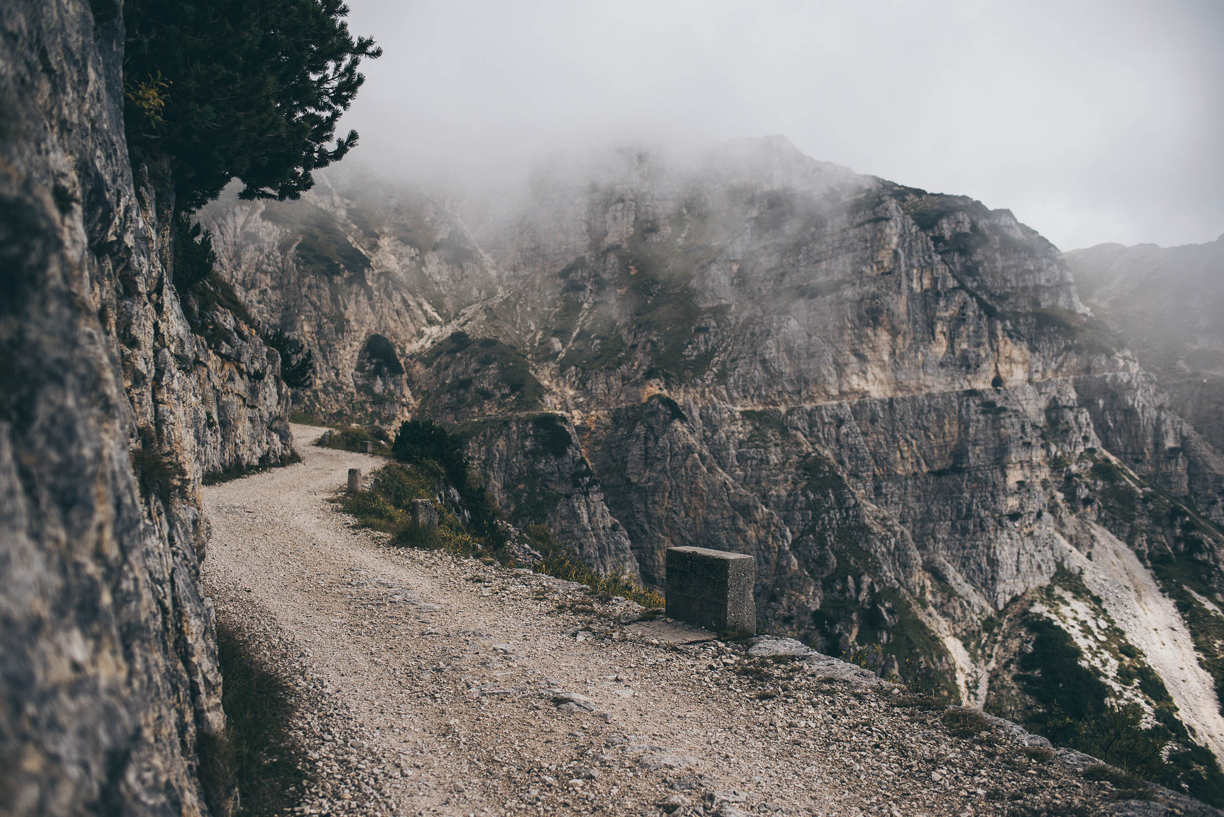
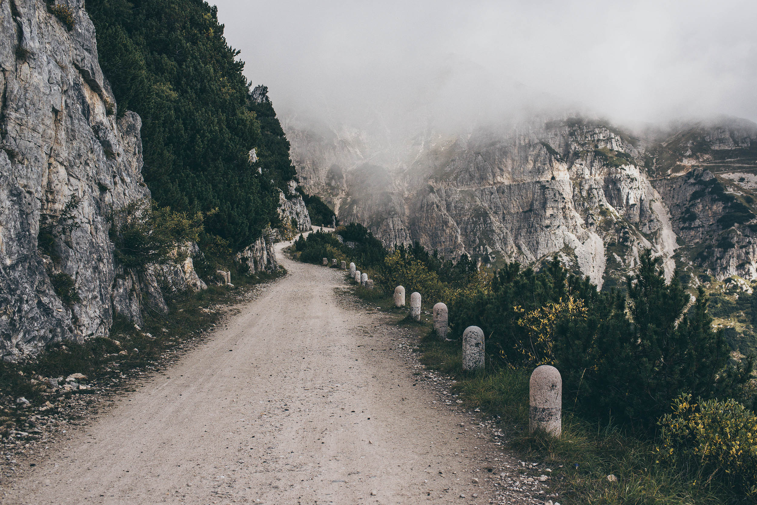
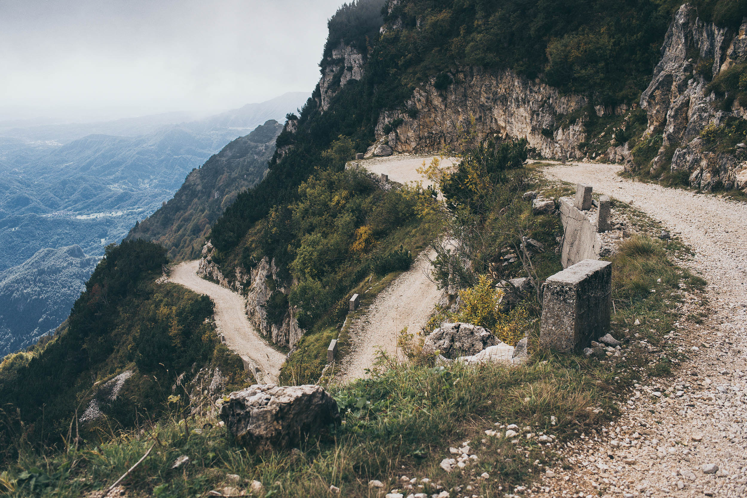
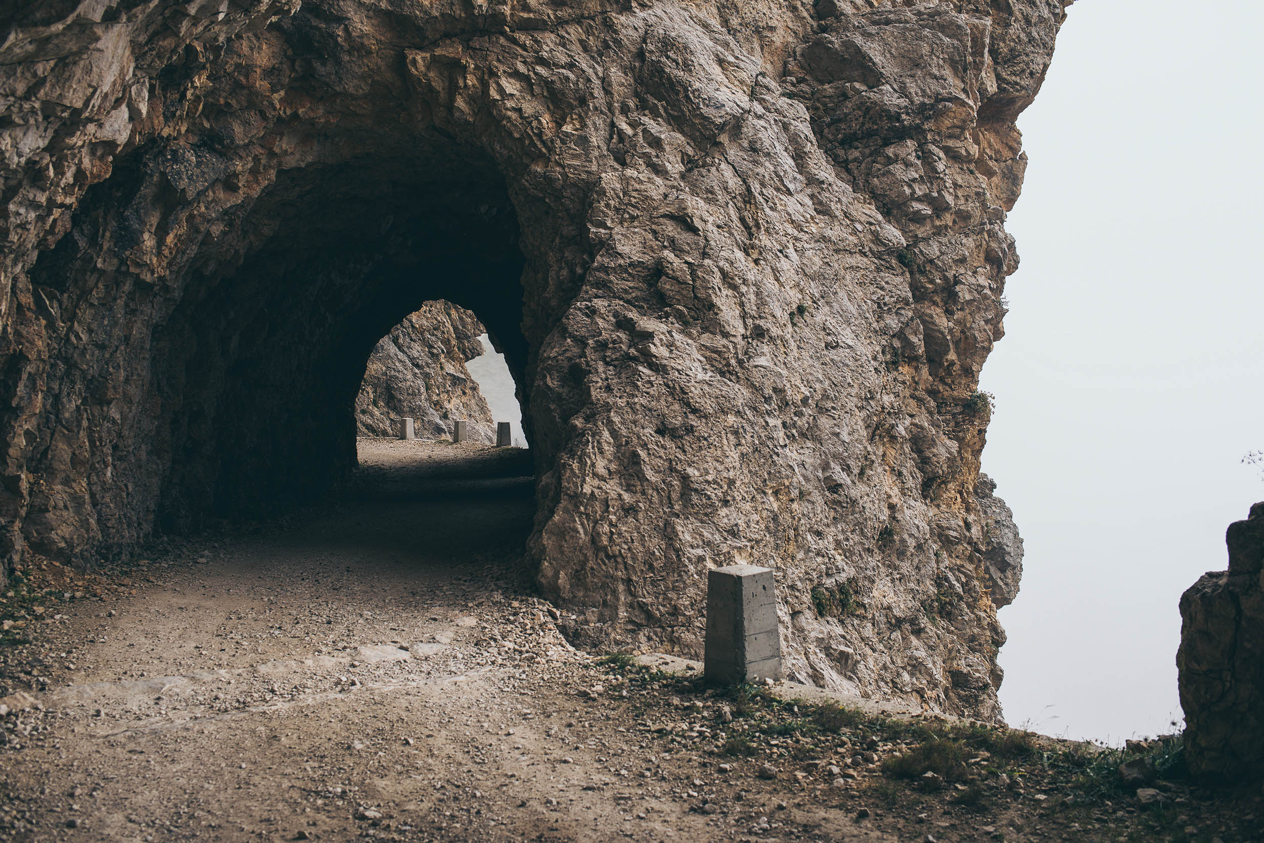
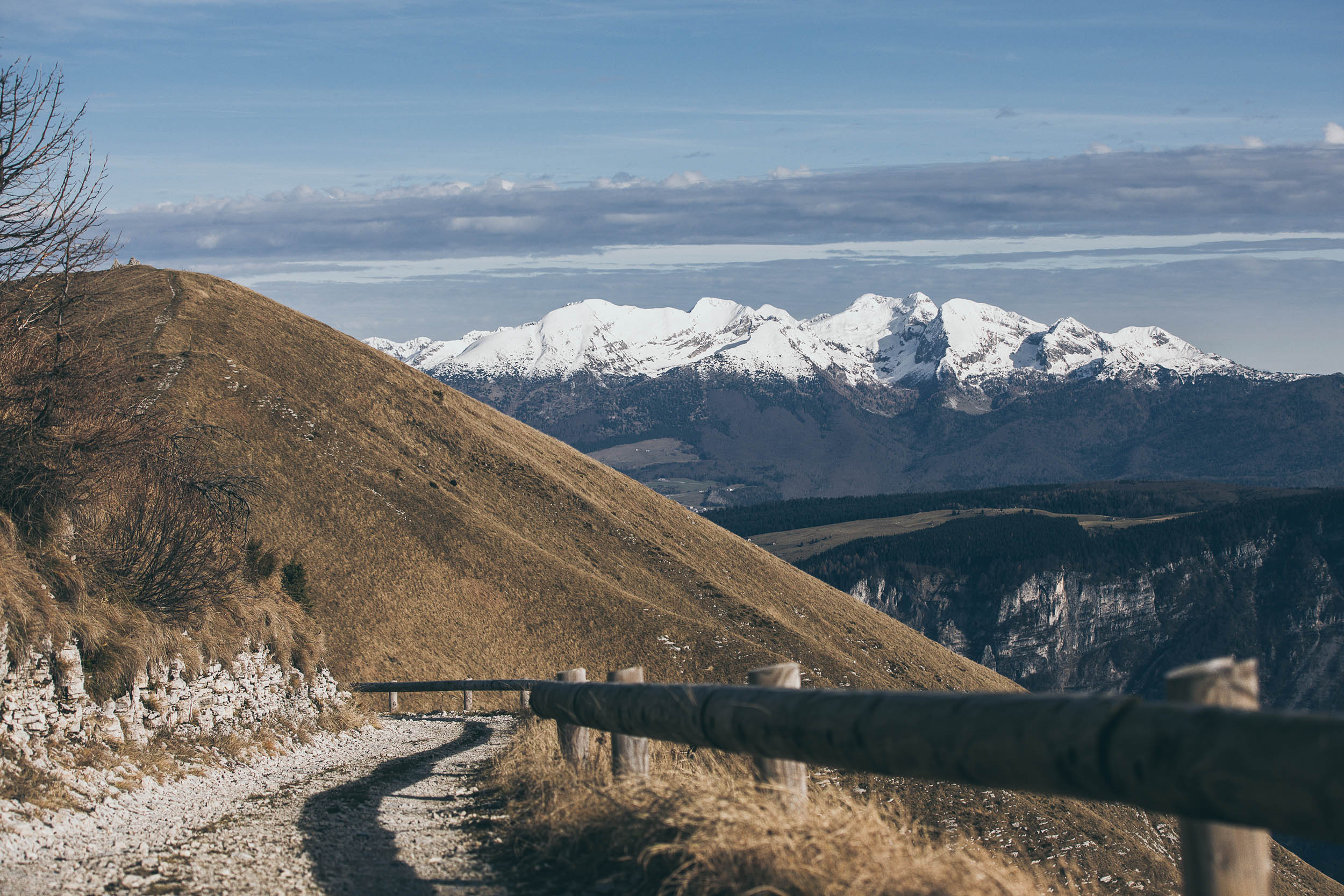
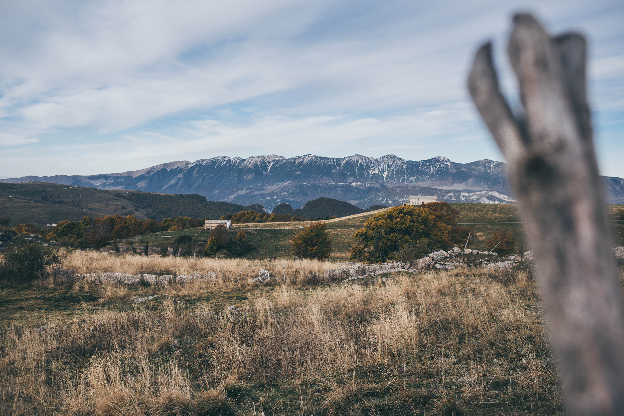
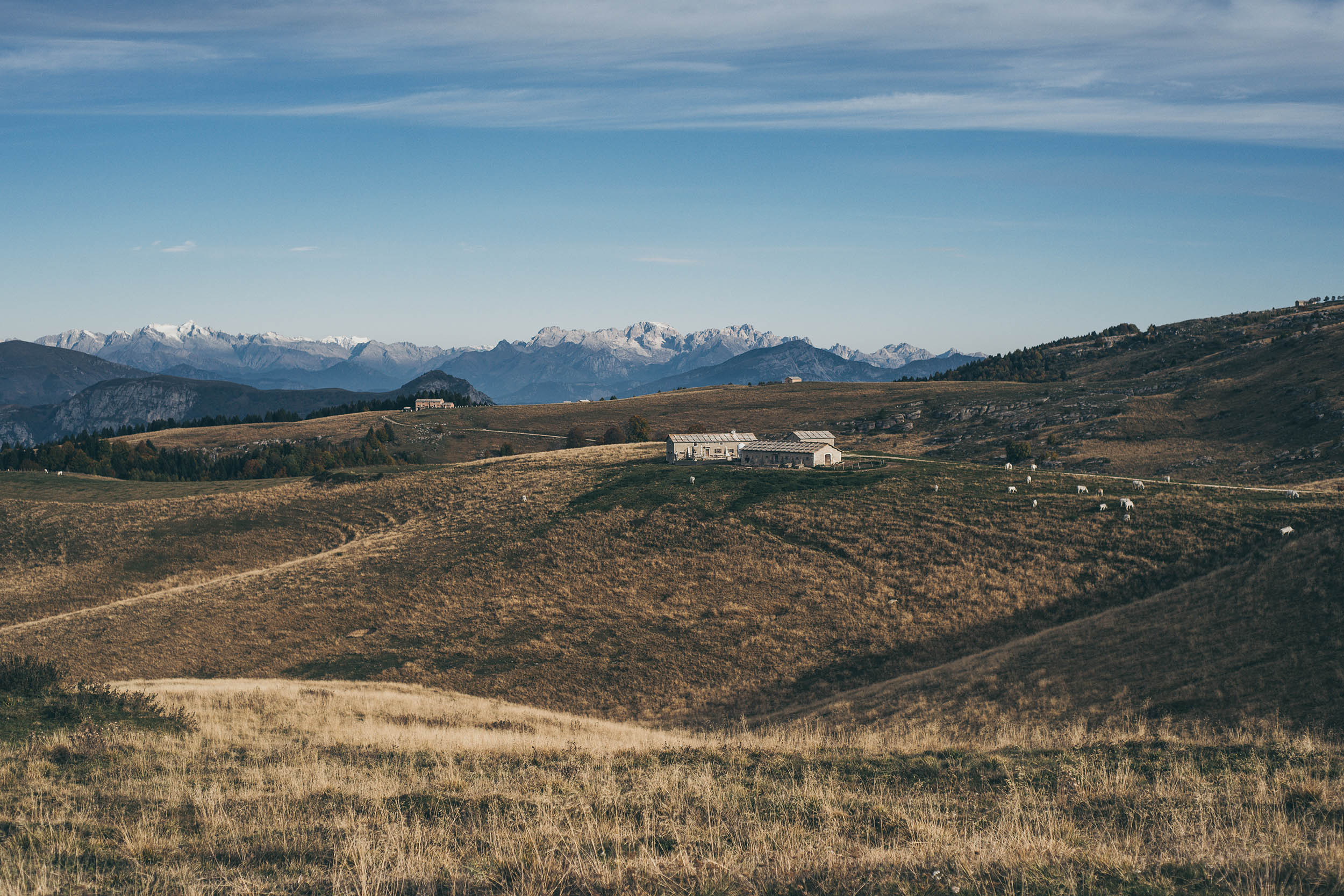
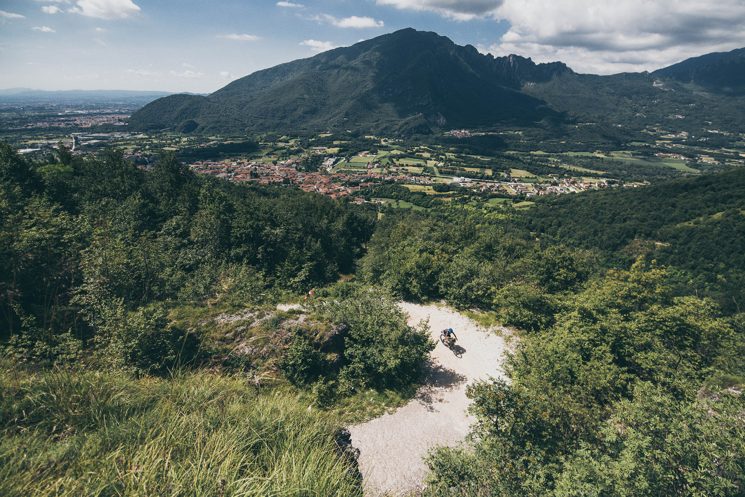
The route takes in a wide swath of the Venetian Prealps in the Veneto region between Verona, Vicenza, Treviso, and Belluno provinces, with smaller sections in Trentino and Friuli-Venezia Giulia regions. The mountains the Veneto Divide crosses are bounded by Monte Baldo and the rift in the Adige’s glacial valley to the west and the Cansiglio Plateau to the east. The landscape, which is characterized by limestones formations alternating with patches of forest and farmland, offers open views as far as the sea to the south and to the magnificent Dolomites to the north. Almost the entire territory that the route encompasses is the home to one of the greatest artifacts of the first World War, including trenches, forts, paths, artifacts, and memorials. Time permitting, consider visiting and learning about the history of these places to get an idea of the grandeur of some of these marvels of military engineering and what it meant to be at the front in those difficult days.
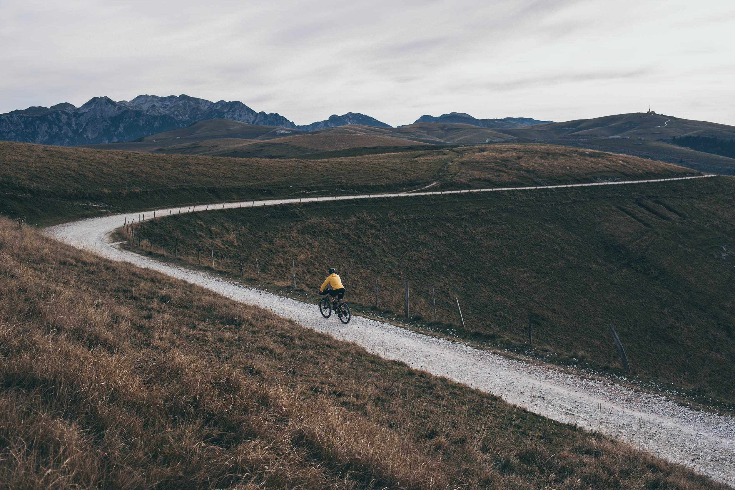
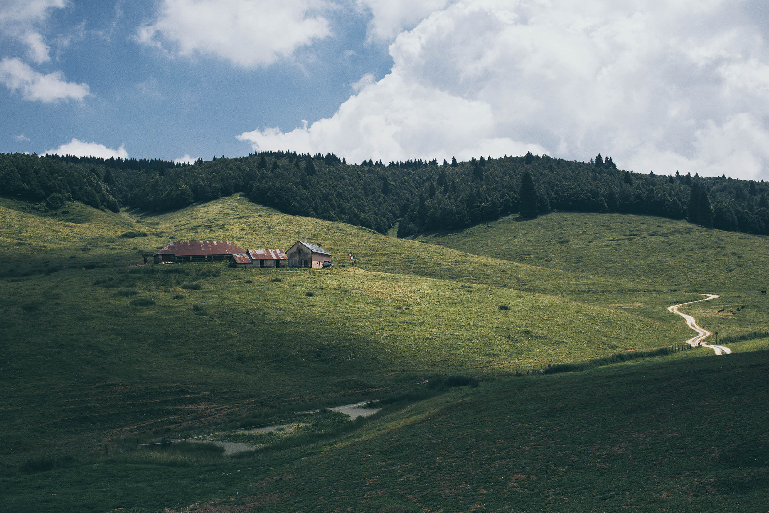
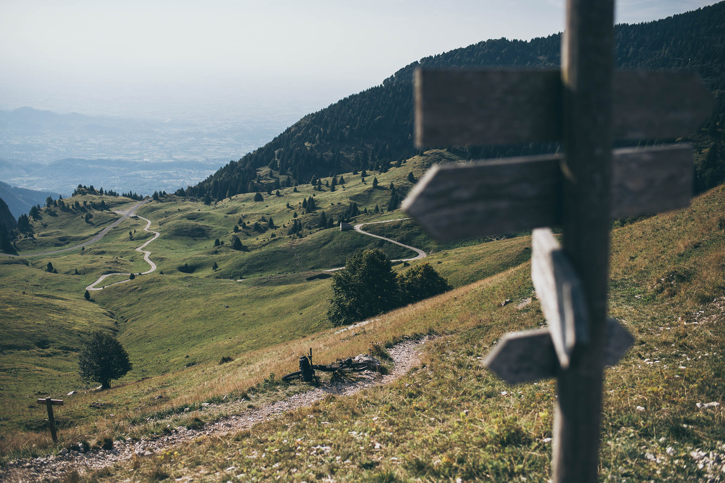
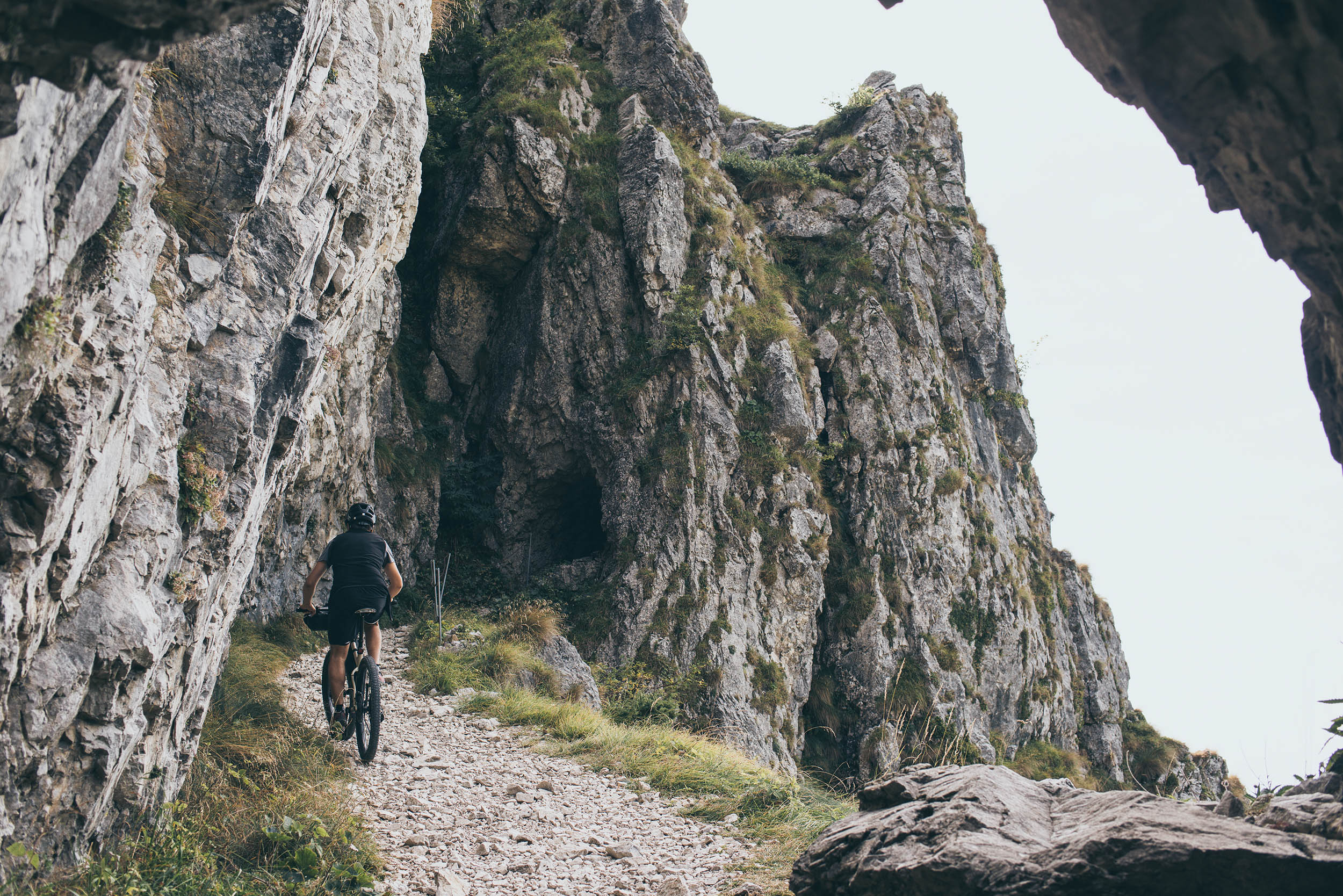
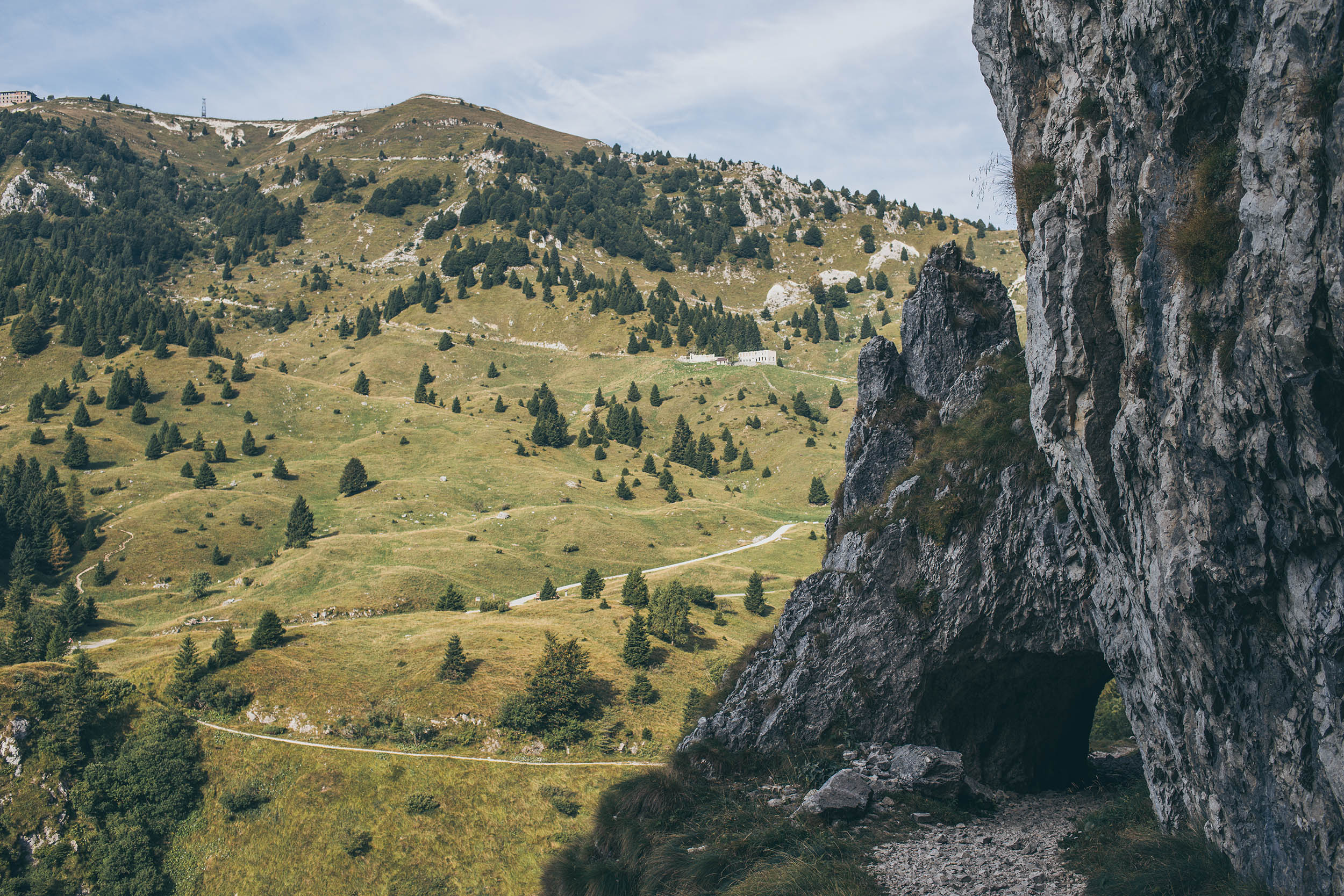
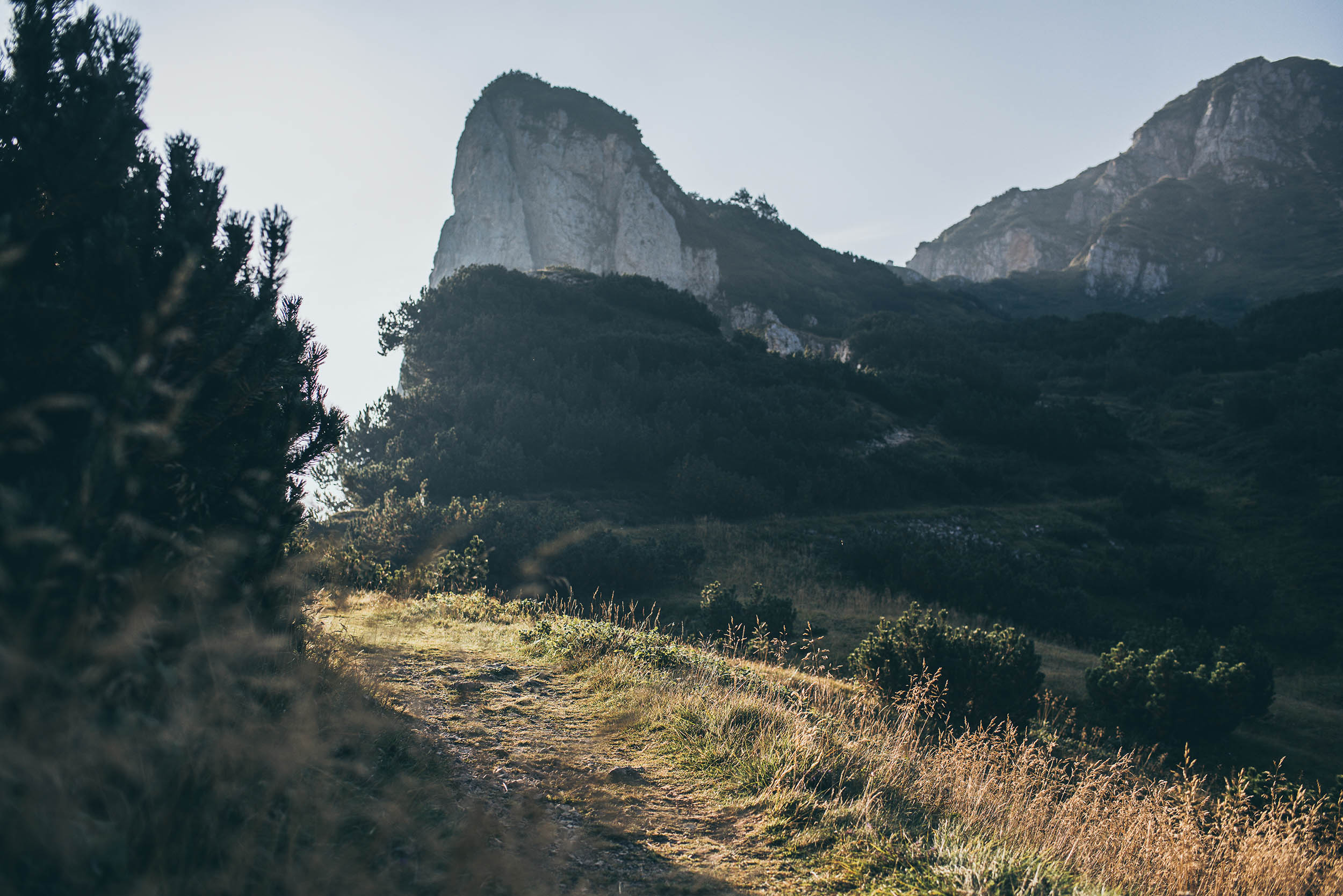
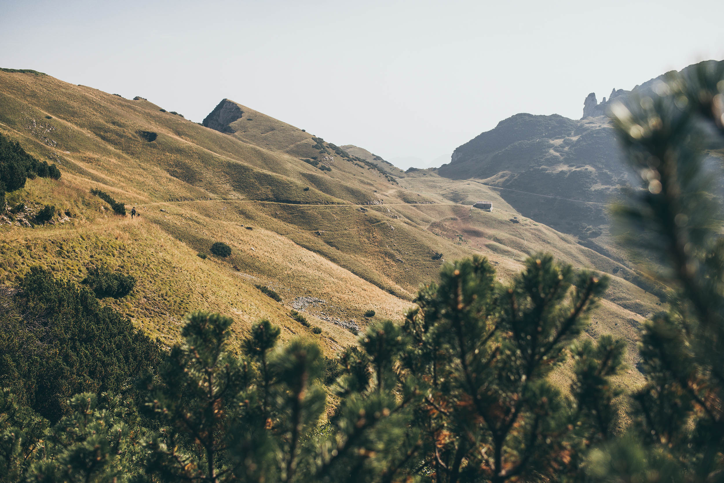
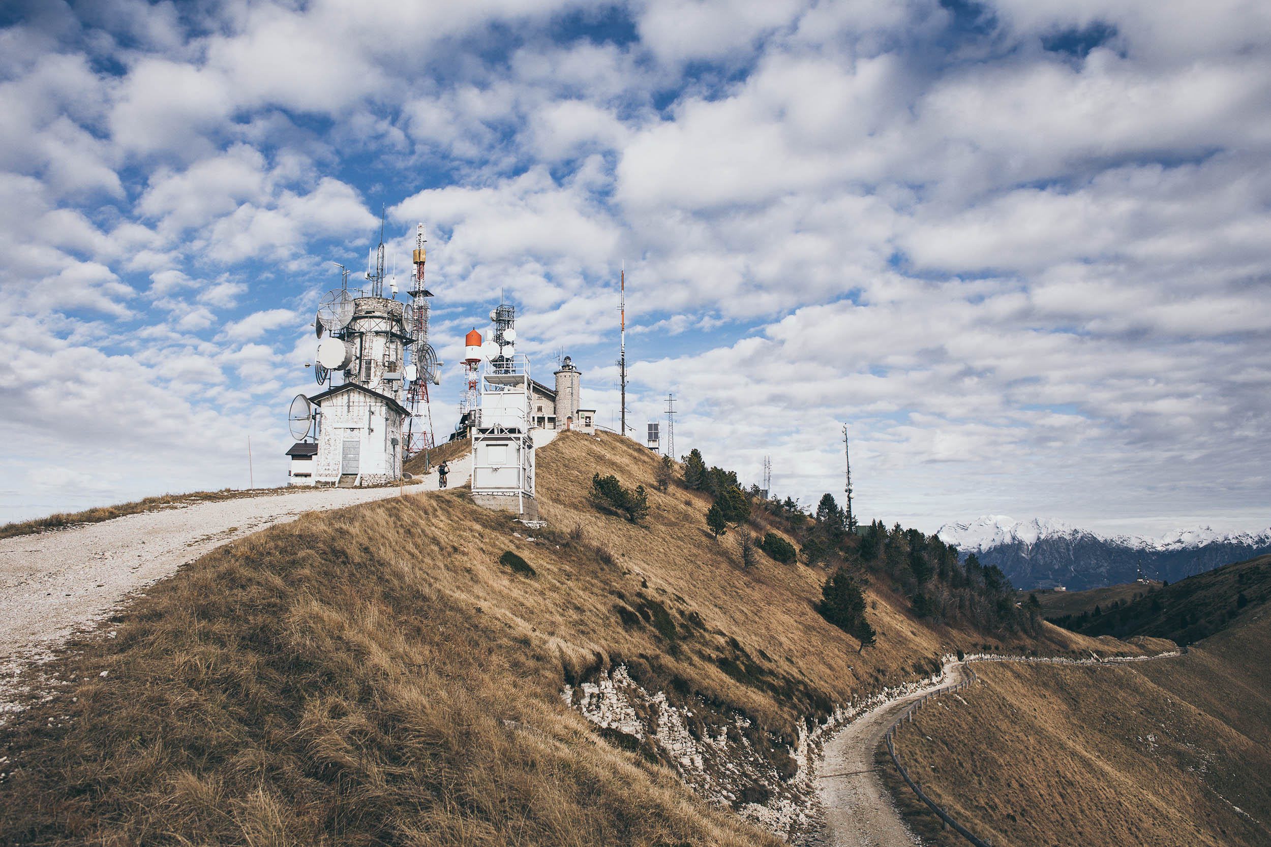
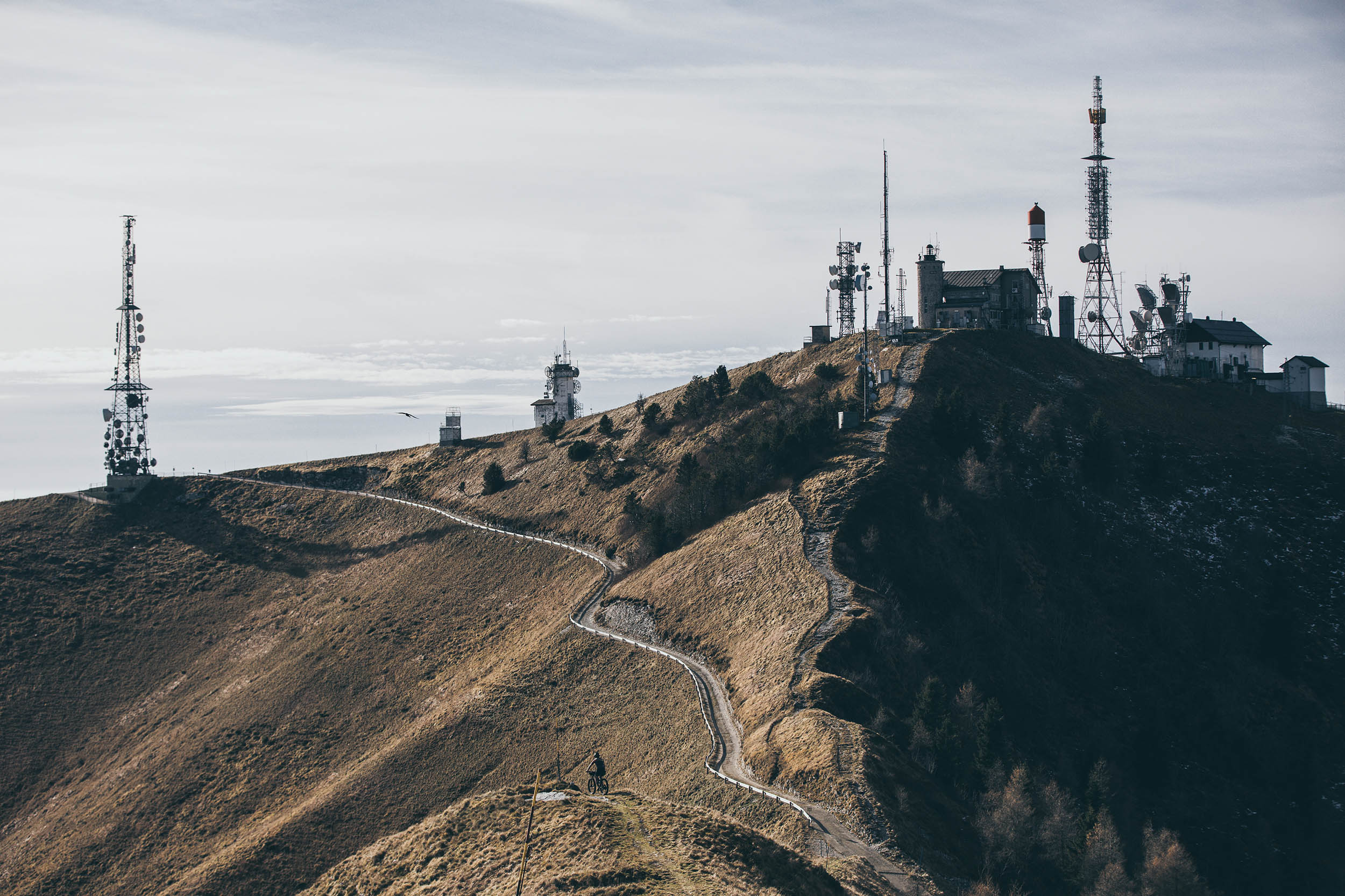
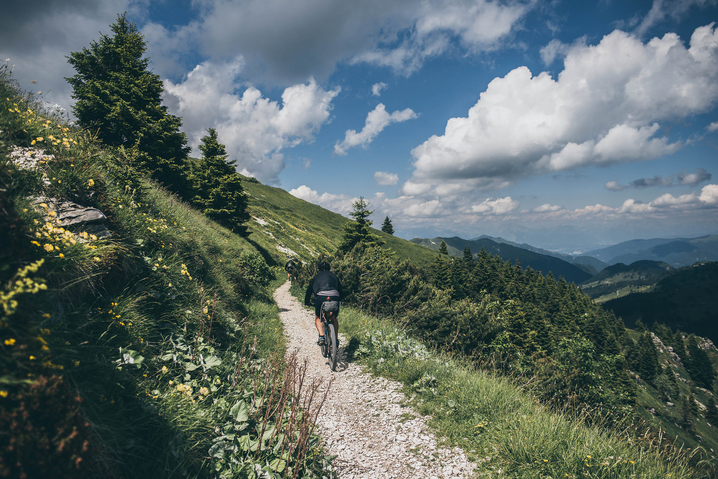
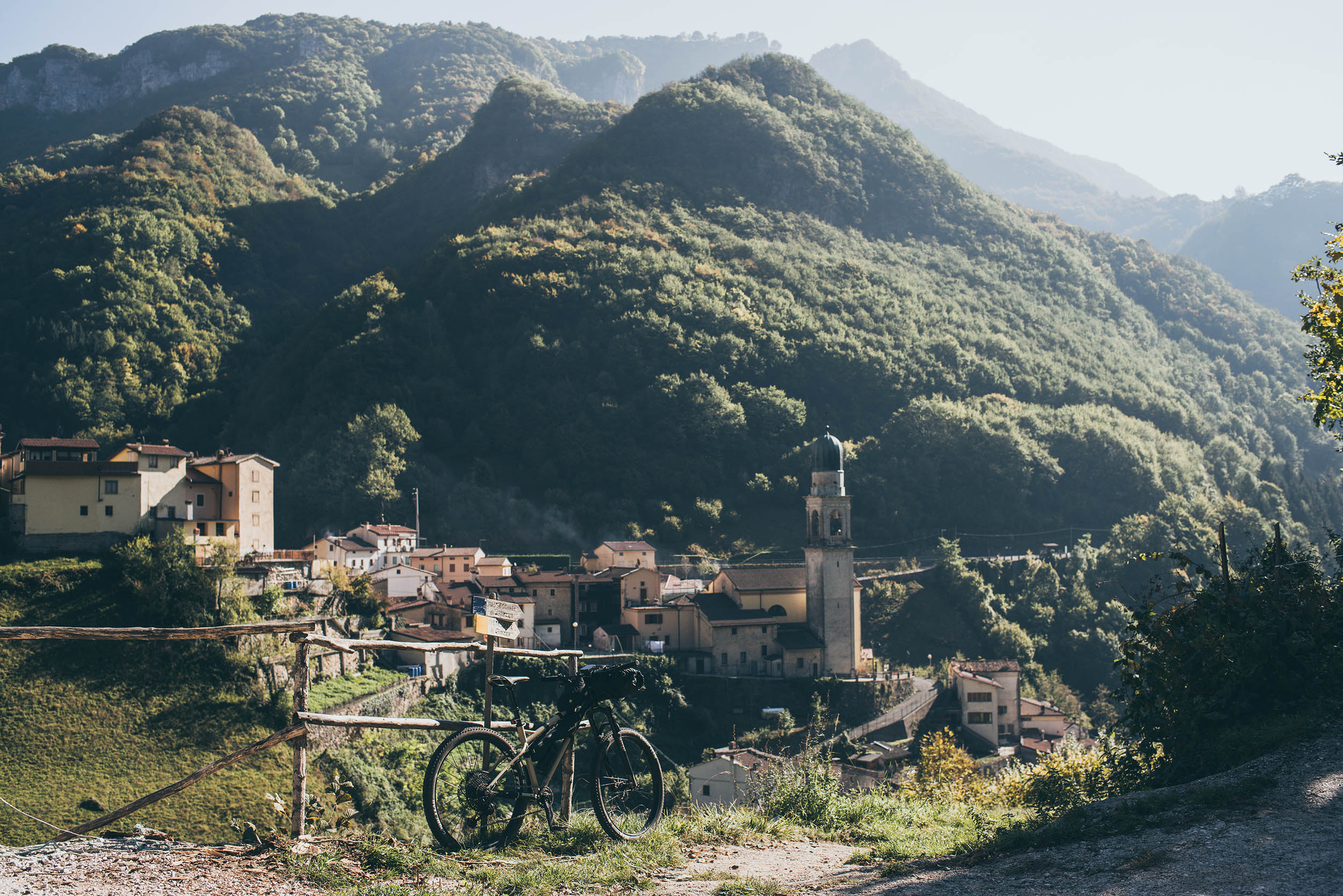
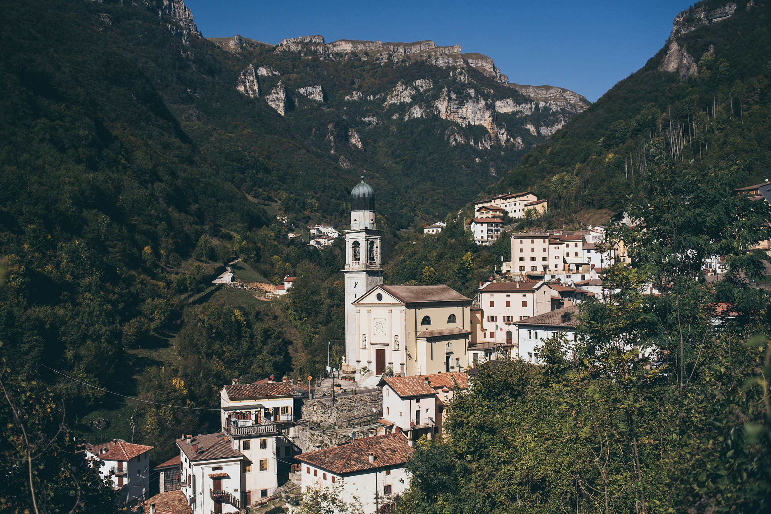
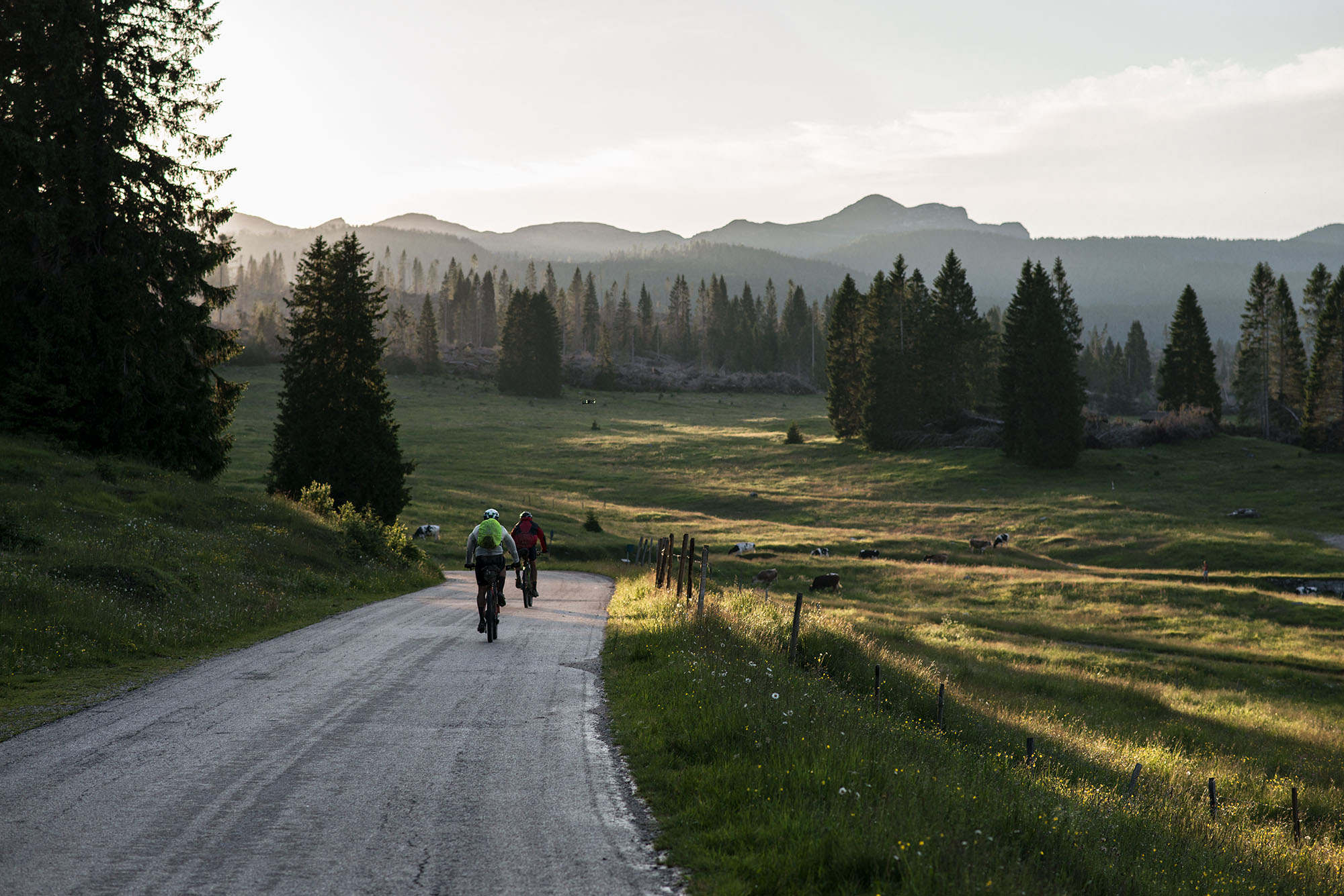
The route starts on the shores of Lake Garda, in the pretty town of Lazise, which is great for a day of relaxation before departure. From Lazise, through vineyards and some paved roads, the route climbs its way toward Lessinia. This entire first 60-kilometer section is perfect for gravel bikes. After crossing the upper Lessinia, there’s a switch to rougher terrain with the descent to the village of Giazza. From Giazza, more climbing up the slopes of Monte Splitz on a mix of pavement, dirt tracks and some hidden singletrack through the so-called Little Dolomites leads to Recoaro. It’s now time to climb up to the Campogrosso Pass and pedal toward Monte Pasubio, where the magnificent Heroes Road (Strada degli Eroi) leads up to Rifugio Papa, the highest point of the route. Here you’ll pass through some WWI military observatorios. The descent along Scarubbi Road and Posina takes riders to lower elevations where a nice off-road climb makes it possible to regain altitude and reach the Asiago Plateau. A stretch in common with the southern portion of the Asiago Loop begins here until a diversion splits the two routes leading to Bassano del Grappa. Bassano is an ideal town both break the itinerary in two or have a nice rest day.
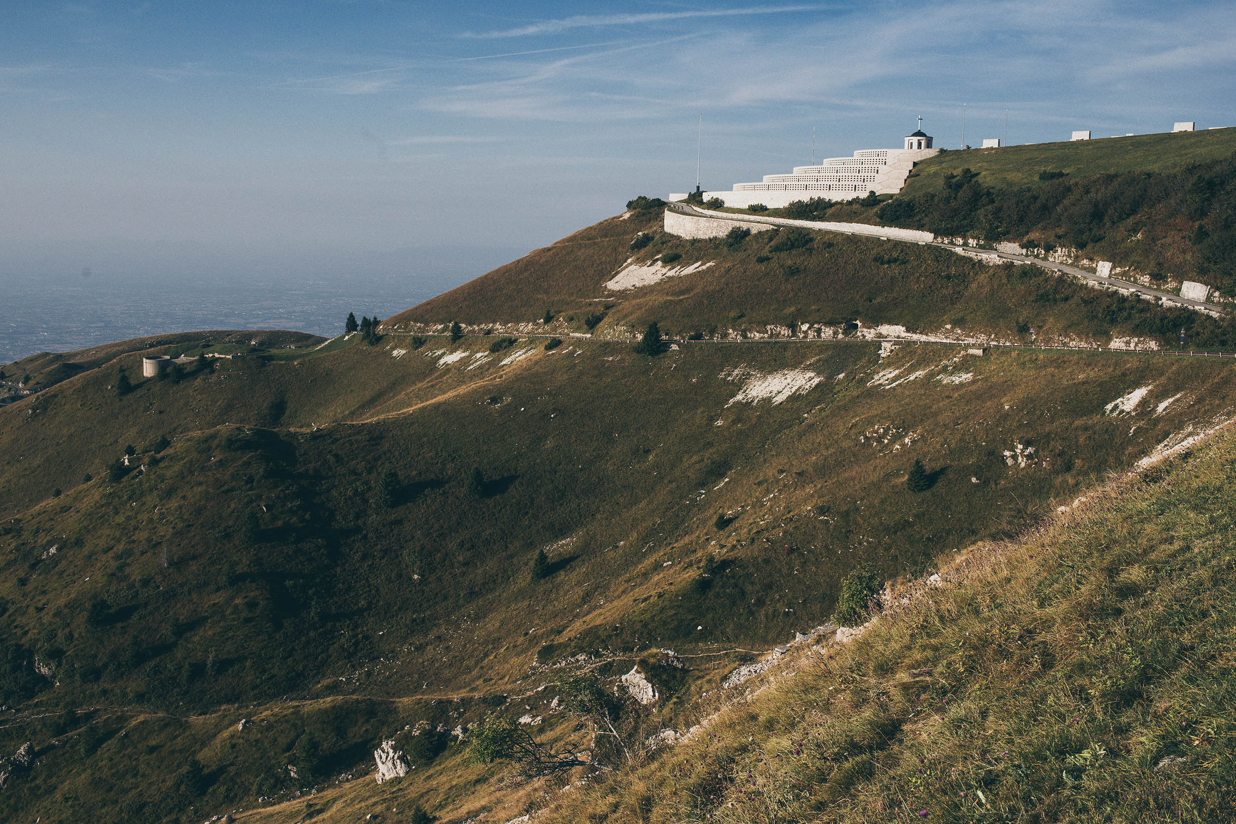
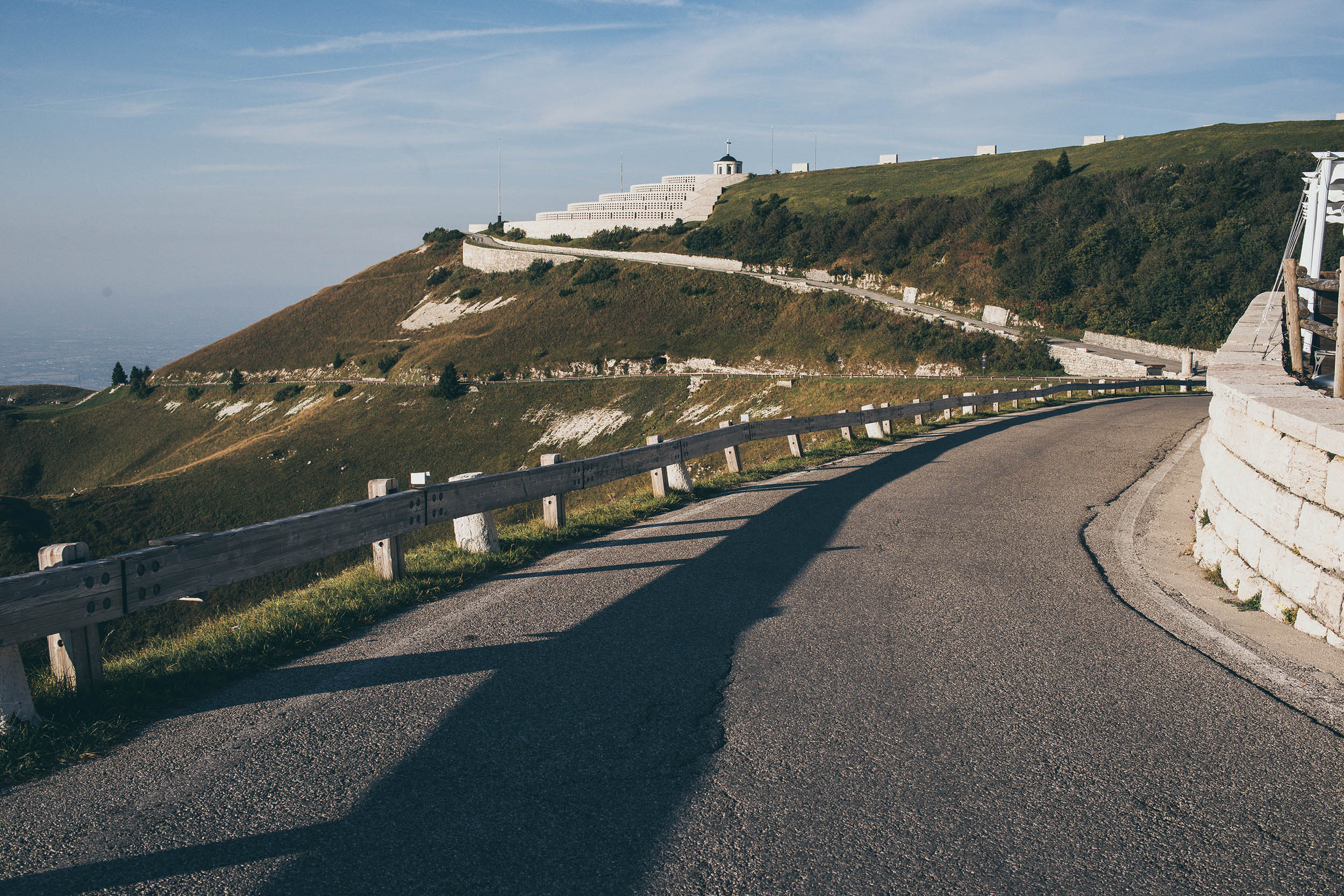
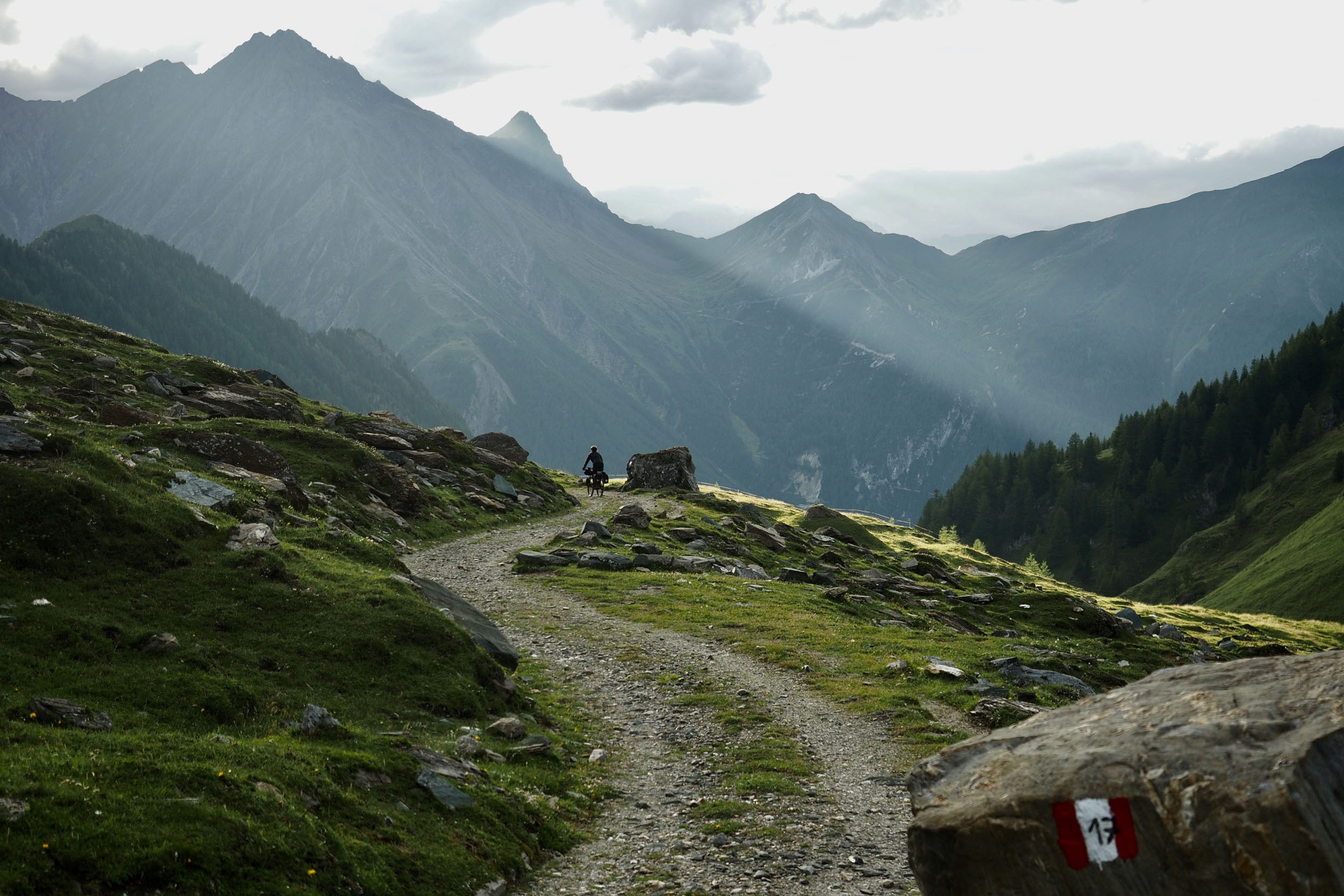
From Bassano, the Veneto Divide continues following the Brenta River for a few kilometers and then turns eastward toward Monte Grappa. A long and hard climb via path 95 leads to Rifugio Bassano and the famous military memorial of Monte Grappa, where remains of Italian, Austrian, and Hungarian soldiers who fought and died on the Grappa during WWI are kept. It is now time to descend slowly toward the Belluno Prealps via the Meatte Trail and Monte Palon. Once across the Piave River at the bottom of the valley, another climb begins toward Monte Cesen. From here, steady ups and downs across the ridges of the Treviso/Belluno Prealps lead to the summit of Col Visentin. Lastly, it’s time to have a nice downhill before the Veneto Divide is done, arriving at Lake Santa Croce.
Route difficulty
The route is very heterogeneous in terms of terrain crossed. Its difficulty is mainly based on the amount of climbing and the absence of “relaxing” sections. Based on an 8-day itinerary, riders must be comfortable riding a little over 5,500′ per day (1676m). There are some long climbs that when faced with a fully loaded bike could certainly be considered a tough challenge. For those who are used to mountain biking in a mountainous environment there should be no particular technical difficulties on the downhills. On a gravel bike, of course, everything gets more challenging. Resupply options can be found quite often, always in the valleys or in mountain huts. There are a few pushing sections that have no particular difficulties or dangers. Some sections require riders to carry more water than usual, being karstic (e.g. Asiago Plateau, Mt. Grappa) especially during hot summers.
Route Development: The idea of this route was born while planning previous editions of the Veneto Trail and considering the geography of the broader region. Looking at the map, I figured riding the physical border between the Alps and the Po Valley would be a rewarding experience, even more so than a north-south traverse, as the Po Valley isn’t too exciting when it comes to mountain biking. The initial idea was to make it a gravel route, but some rough sections were inevitable to connect it all together. So, it became a mixed-terrain route. A special thanks must be said to the guys who helped me design the route: Samuele Nichele (@sam_nichele), Manuel Gatto, Manuele Simionato, and Antonio Securo. Without their help, this route would still be under development.


Submit Route Alert
As the leading creator and publisher of bikepacking routes, BIKEPACKING.com endeavors to maintain, improve, and advocate for our growing network of bikepacking routes all over the world. As such, our editorial team, route creators, and Route Stewards serve as mediators for route improvements and opportunities for connectivity, conservation, and community growth around these routes. To facilitate these efforts, we rely on our Bikepacking Collective and the greater bikepacking community to call attention to critical issues and opportunities that are discovered while riding these routes. If you have a vital issue or opportunity regarding this route that pertains to one of the subjects below, please let us know:
Highlights
Must Know
Camping
Food/H2O
Trail Notes
Resources
- WWI artifacts: military roads such as Strada degli Eroi, monuments such as the military memorial of Monte Grappa (accessible only on foot), forts, and cemeteries are everywhere on this route. You’ll be often riding in the vicinity of the former Italian/Austro-Hungarian front line.
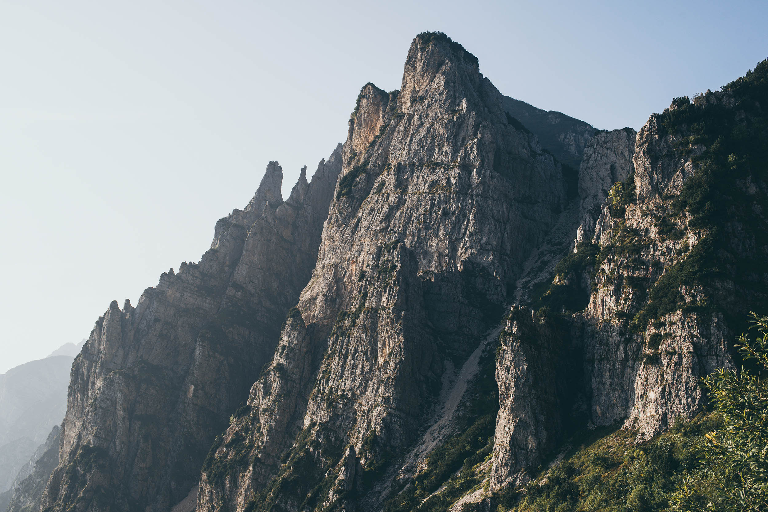
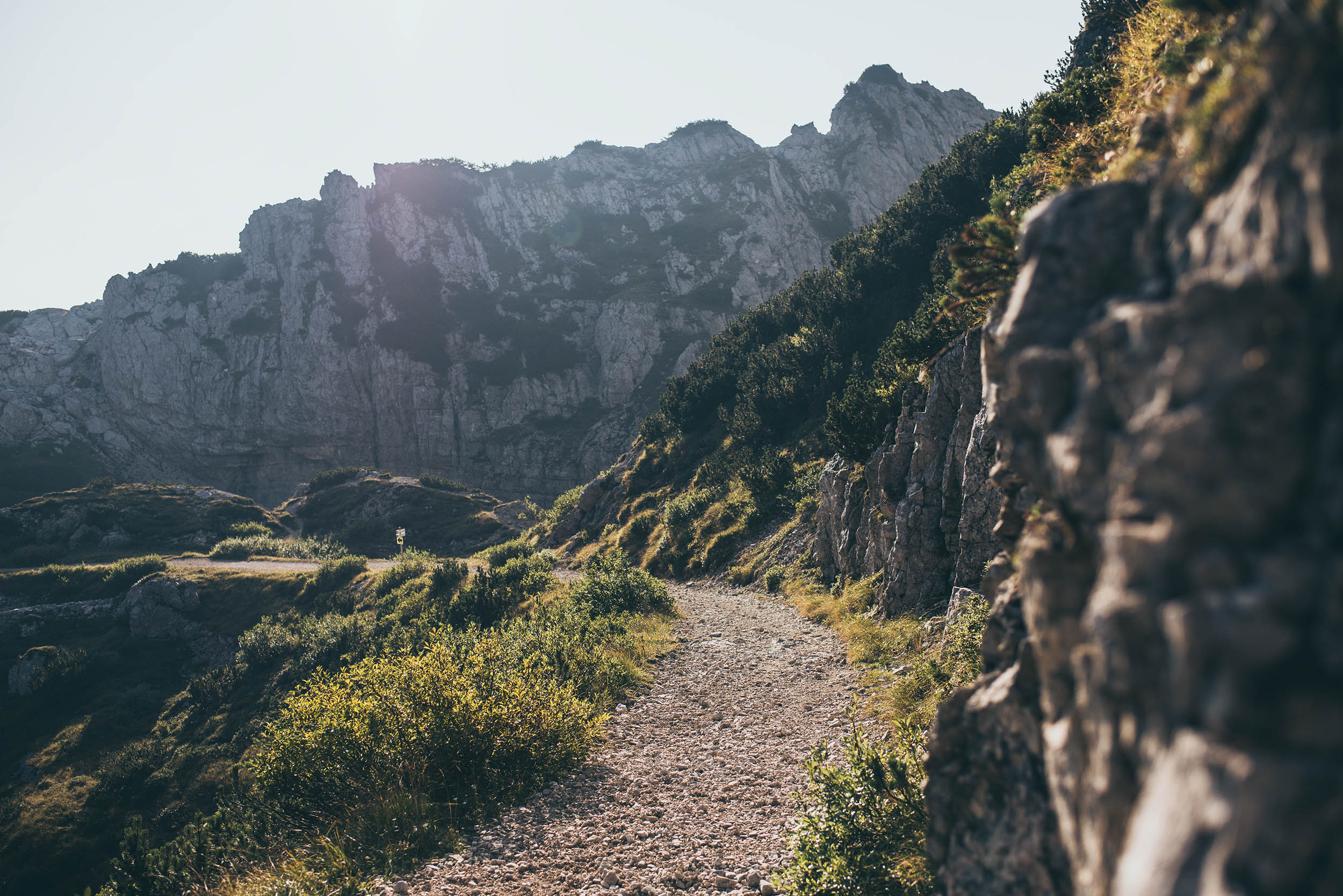
- The Little Dolomites: this small area in the Venetian Prealps is often overshadowed but offers an extraordinary range and variety of natural phenomena: dizzyingly steep vertical walls, deep canyons, crevasses, and soaring sharp spires.
- Lakes: the route starts from the largest and most famous lakes in Italy, Lake Garda. It attracts thousands of tourists every year, which is why you’ll only see it at the start of the route, though it’s well worth seeing. At the finish, Lake Santa Croce doesn’t disappoint, either.
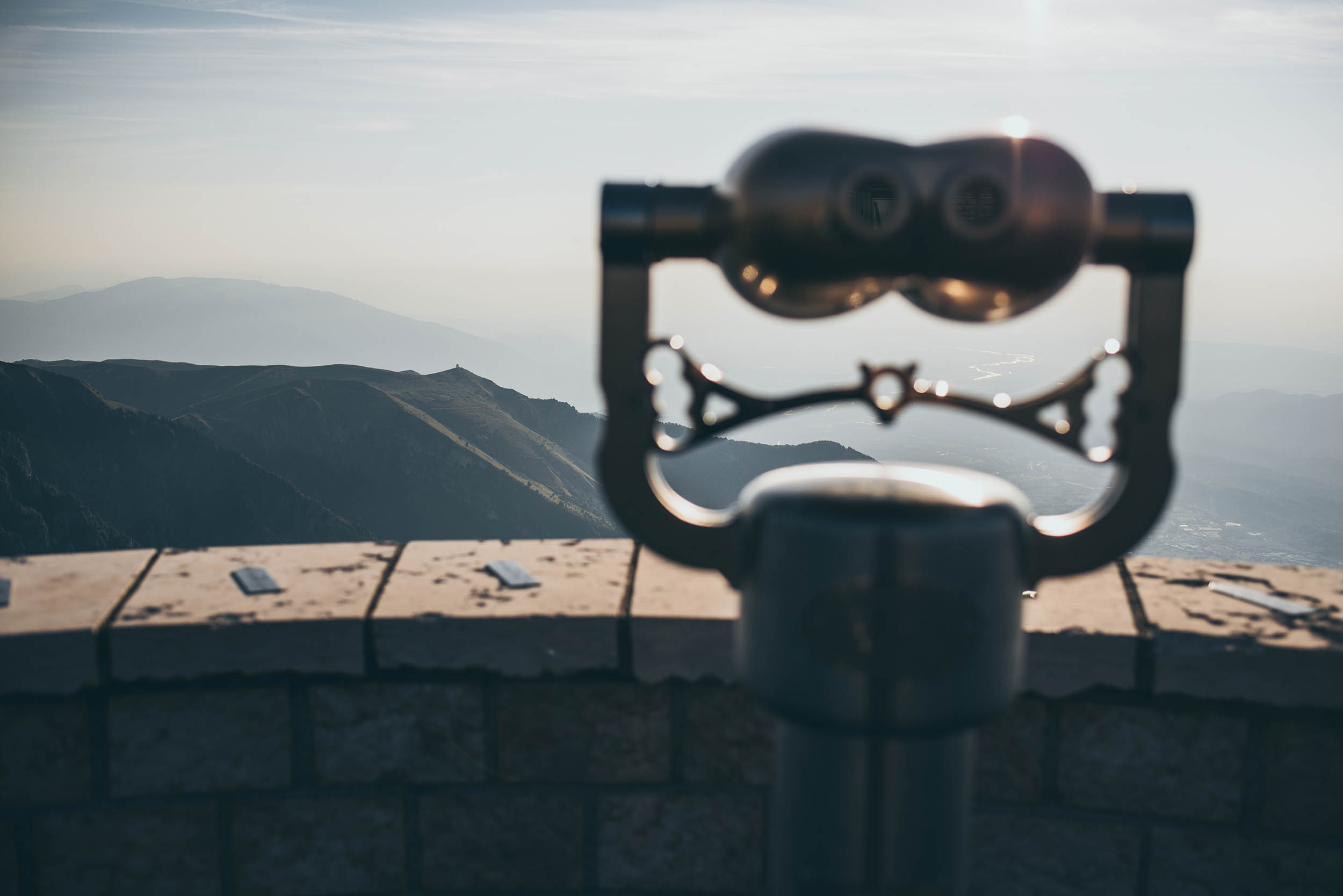
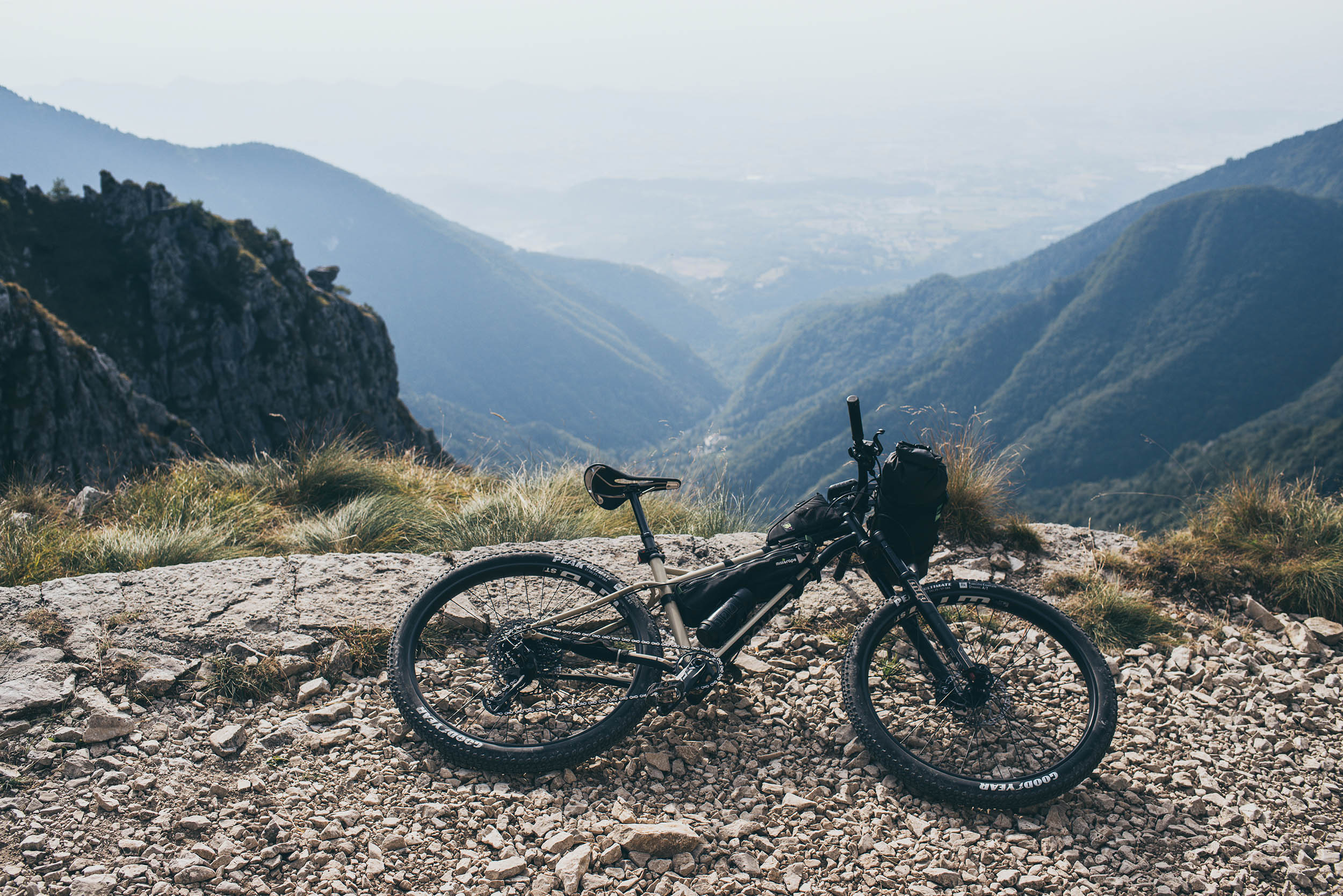
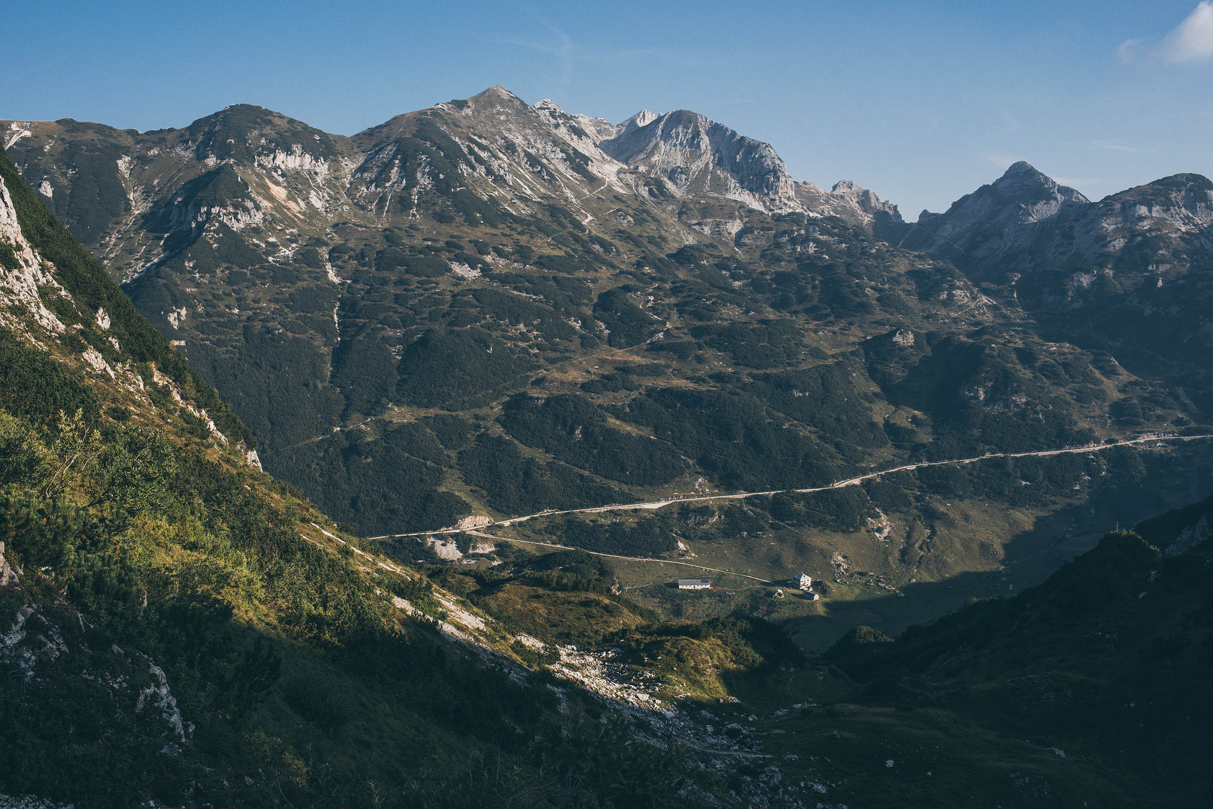
- Endless views: open views of the Po Valley that can even reach Venice on a clear day are scattered all over this route. The Dolomites are visible as well.
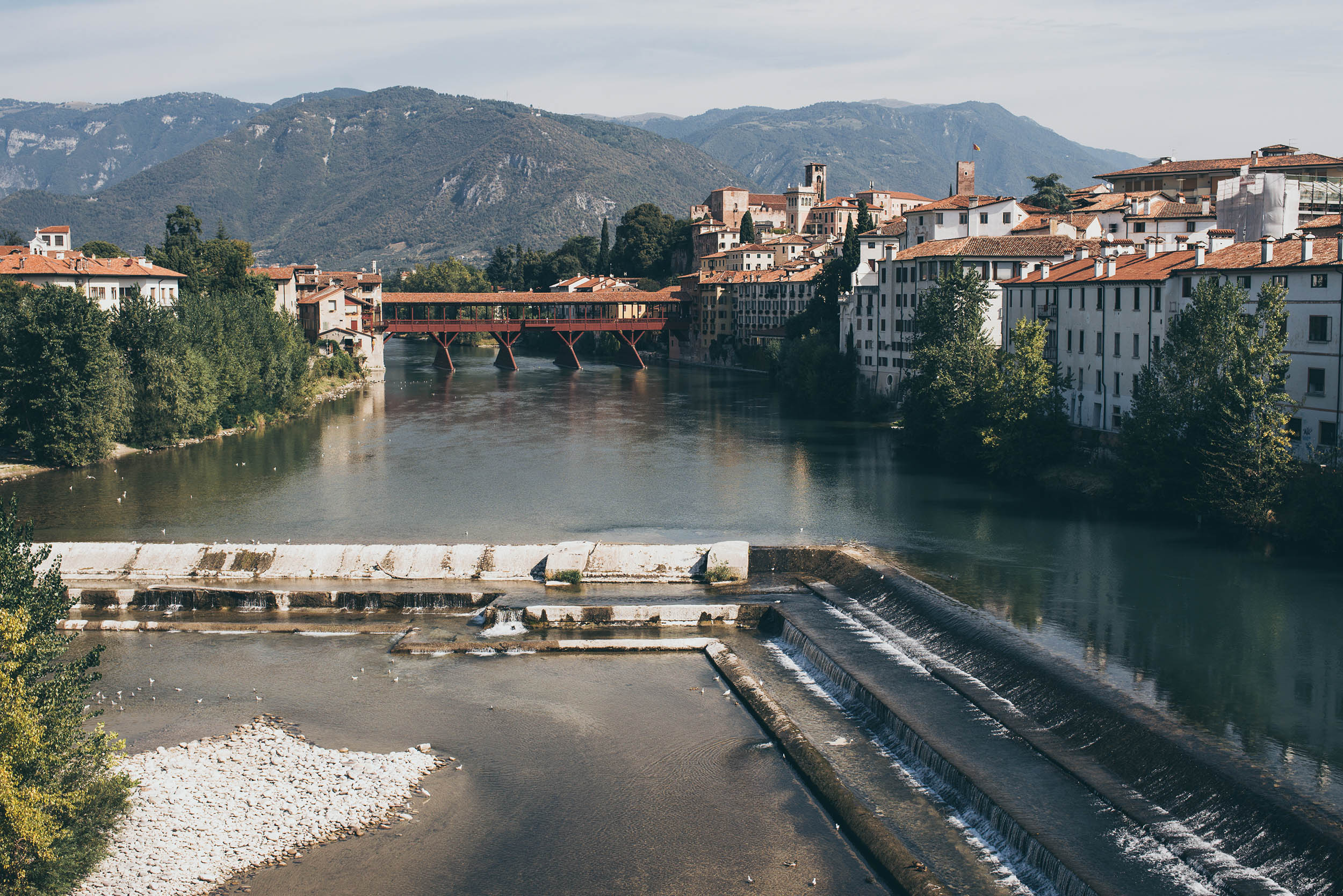
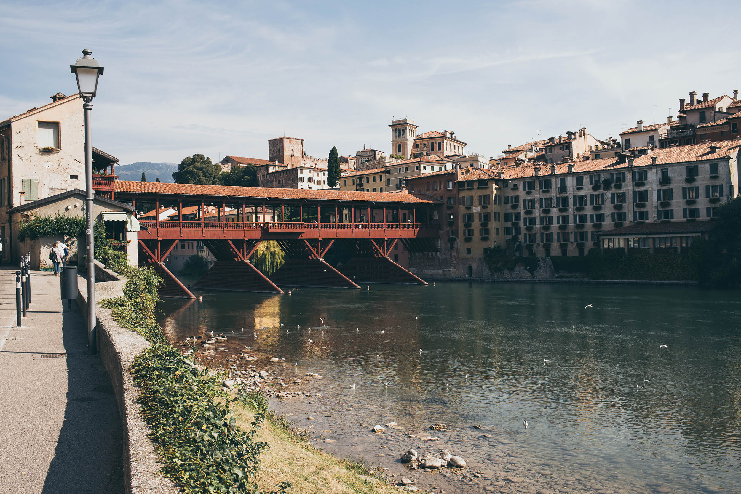
- Grappa: drink some of this fragrant grape-based pomace brandy made from the discarded skins, pulp, seeds, and stems from wine-making. This world-famous spirit was officially born in Bassano del Grappa thanks to Bortolo Nardini, back in the late 18th century. You should taste one (or more) at Grapperia Nardini, on the wonderful Ponte degli Alpini (also known as Old Bridge). Bassano itself is worth a visit.
- The Veneto Divide is a mixed-terrain route, and even if a good portion of it can easily be ridden with a gravel bike, I strongly suggest riding it with a hardtail MTB or similar as there are some tough descents and technical sections. Of course, if you don’t mind a bit of extra hike-a-bike you can ride it with a gravel bike, but remember to have gears suitable for tough slopes.
- The route was designed to be ridden eastward from Lake Garda, so if you’re thinking of doing it in the opposite direction, be aware that some sections will become very hard and not rideable uphill.
- If you don’t have enough time or training, the route can be divided into two shorter (3-4 days) rides: from Lake Garda to Bassano del Grappa and/or from Bassano del Grappa to Lake Santa Croce.
- The times to ride the loop are June and September, as the best places won’t be too crowded. There are many mountain huts along the way but not all of them are always open. Remember to check in advance. If you are riding in summer, pay attention to the heat in the lower elevation sections (it can reach 35°C/95°F) and possible thunderstorms.
- There are a few pushing sections that have no particular difficulties or dangers. Just pay attention on Meatte, after Monte Grappa summit.
- If you need to get back to Lazise from the end of the route using public transport, there are several alternatives on regional trains that allow the transportation of bikes with an extra fee. Note that it can be a bit time-consuming as you have to pass through Venezia Mestre Train station or change trains more than two times. The nearest train station to Lake Santa Croce is Vittorio Veneto (18 km) or Belluno (19 km). The nearest train station to Lazise is Peschiera del Garda (10 km).
- At the national level in Italy, there are no rules that regulate overnight stays in tents. In the entire Veneto region, wild camping is prohibited outside the equipped areas, but as “wild camping” in Italy is defined as camping in a tent for over 24 hours in a place, there are some exceptions that you can easily take advantage of without breaking any rules. It is possible to set up a tent for a shorter period and in places other than campsites. If you camp right before sunset and leave at dawn or shortly after (“bivacco notturno” in Italian) you will have no problem. Please avoid areas next to Alpine huts (“Rifugi”), very touristic locations, as well as monumental areas, of course. Remember to leave no trace.
- A reasonable alternative to camping are the mountain huts (Rifugi in Italian) along the way. They offer basic accommodation and traditional meals but require some planning ahead. You’ll also often pass through villages with hotels and B&Bs. The only major town is Bassano del Grappa, where you can find everything you need.
- Water: can be an issue, especially during the long climbs like Monte Grappa or Costo Vecchio (Asiago Plateau), where you can refill your water bottle only in bars or malgas, and you won’t find water during the climb. Remember to plan some stops or bring more water than you usually do. In general, the valleys abound in water fountains, as is typical with limestone mountain ranges.
- Supermarkets: you will find supermarkets every time you go down to the valleys, so food supplies won’t be a real problem if you plan everything ahead.
- Eat local: if you want to eat local and traditional food you should go to a malga or a rifugio. There are plenty of them along the way but not all are always open and some of them aren’t open at all for the public.
The Veneto divide in one week
- Day 1 (Lessinia): Lake Garda – Giazza (71 km x 2370 m D+)
- Day 2 (Little Dolomites): Giazza – Recoaro Terme (37 km x 1590 m D+)
- Day 3 (Mt. Pasubio): Recoardo Terme – Arsiero (51 km x 1760 m D+)
- Day 4 (Asiago Plateau): Arsiero – Bassano del Grappa (80 km x 2340 m D+)
- Day 5 (Mt. Grappa): Bassano del Grappa – Fener/Alano di Piave (56 km x 1980 m D+)
- Day 6 (Belluno Prealps): Fener – San Boldo (51 km x 2070 m D+)
- Day 7 (Belluno Prealps): San Boldo – Lake Santa Croce (46 km x 1450 m D+)
Detours and Options
- If you need to take a shortcut for any reason, the Po Valley and trains/buses are never too far. Nevertheless, some areas are rather isolated considering their relatively minimal distance to the flatland, and care must be taken especially in case of bad weather.
- As the trail shares a portion with the southern section of the Asiago Loop, if you want or if you are planning to stop in Bassano del Grappa, you can consider riding part of that route too (the Asiago Loop can be ridden in both directions). The ideal type of bike and terrain involved are similar.


Terms of Use: As with each bikepacking route guide published on BIKEPACKING.com, should you choose to cycle this route, do so at your own risk. Prior to setting out check current local weather, conditions, and land/road closures. While riding, obey all public and private land use restrictions and rules, carry proper safety and navigational equipment, and of course, follow the #leavenotrace guidelines. The information found herein is simply a planning resource to be used as a point of inspiration in conjunction with your own due-diligence. In spite of the fact that this route, associated GPS track (GPX and maps), and all route guidelines were prepared under diligent research by the specified contributor and/or contributors, the accuracy of such and judgement of the author is not guaranteed. BIKEPACKING.com LLC, its partners, associates, and contributors are in no way liable for personal injury, damage to personal property, or any other such situation that might happen to individual riders cycling or following this route.
Further Riding and Reading
Here are some connected/nearby routes and related reports...
Please keep the conversation civil, constructive, and inclusive, or your comment will be removed.