


Yellow River Loop
Distance
90 Mi.
(145 KM)Days
2
% Unpaved
90%
% Singletrack
0%
% Rideable (time)
100%
Total Ascent
4,165'
(1,269 M)High Point
1,215'
(370 M)Difficulty (1-10)
2?
- 3Climbing Scale Fair46 FT/MI (9 M/KM)
- -Technical Difficulty
- -Physical Demand
- -Resupply & Logistics
Contributed By

Levi Bridges
Guest Contributor
Levi is a small town Iowa kid who fell in love with cycling as a way to escape life’s stresses. After a few years of cycling, he entered his first gravel race, The Filthy 50 in Minnesota, and got hooked. Soon after, he combined his two passions, cycling and camping. He currently helps run a local cycling club called The Cedar Valley Gravel Riders and tries to spend as much time on the bike as possible with a growing family. Follow Levi on Instagram @norse_cycle.
Photos by Levi Bridges and Matthew Skeens
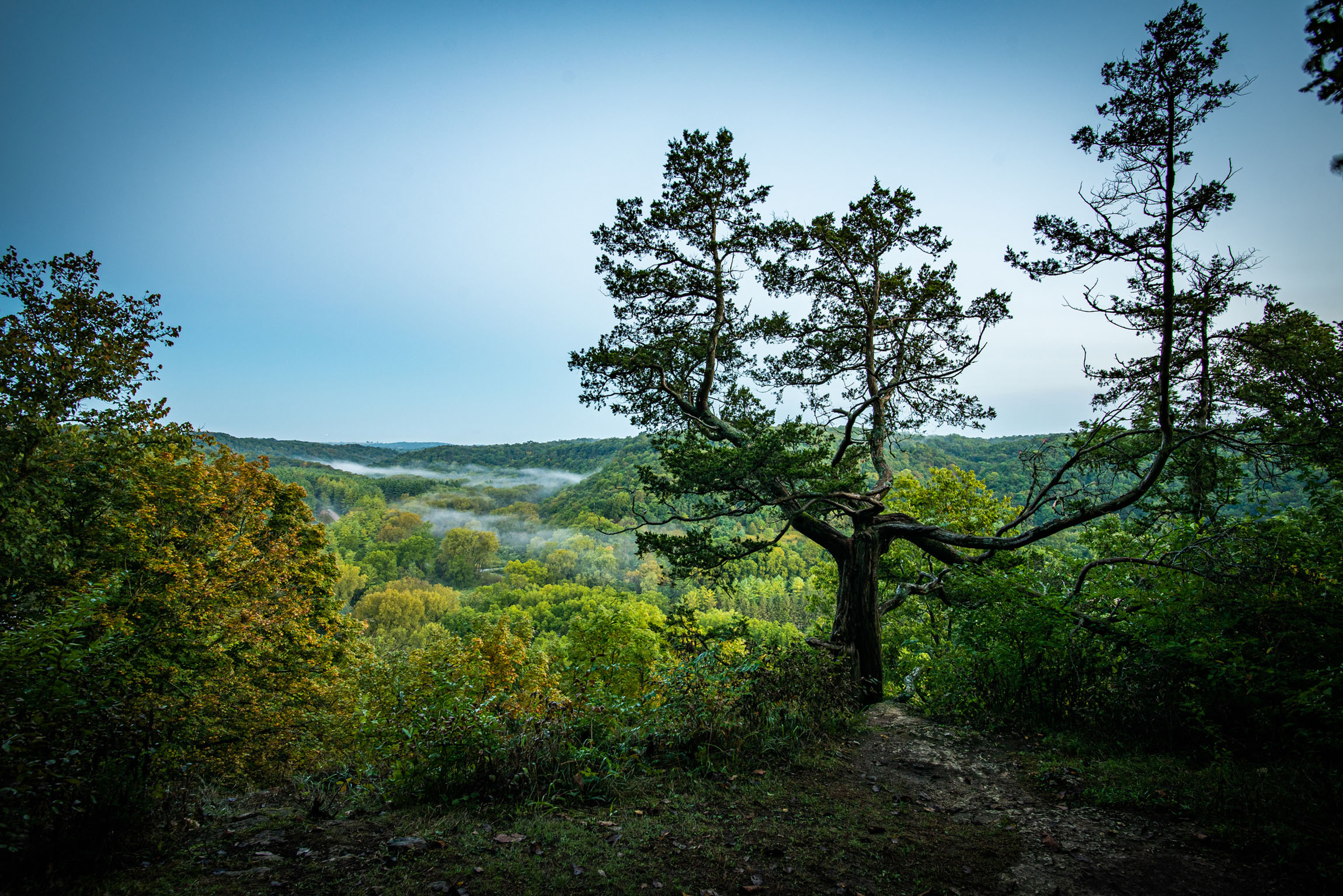
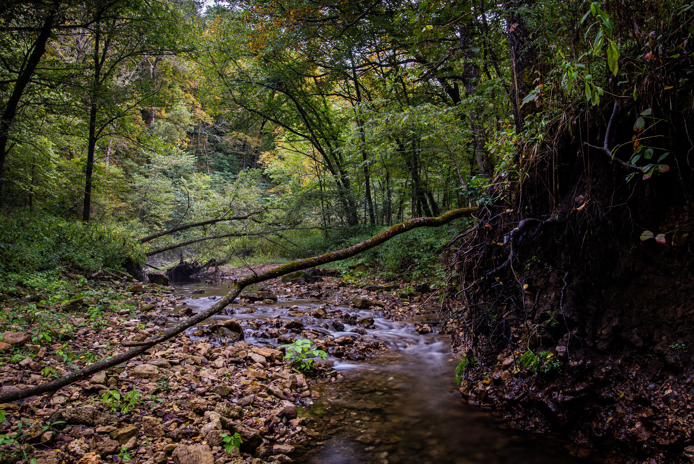
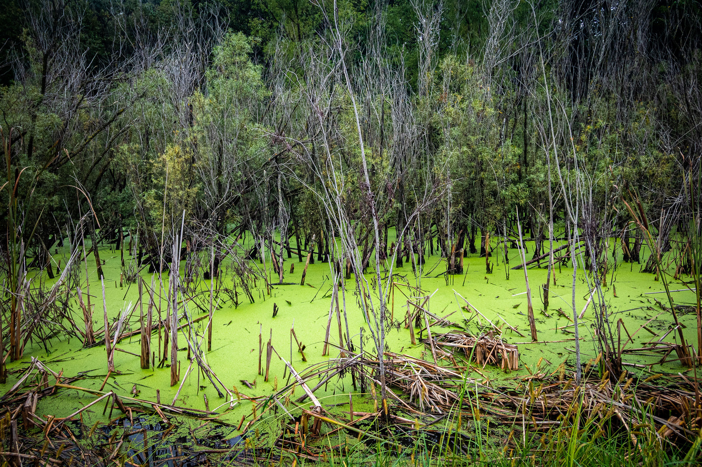
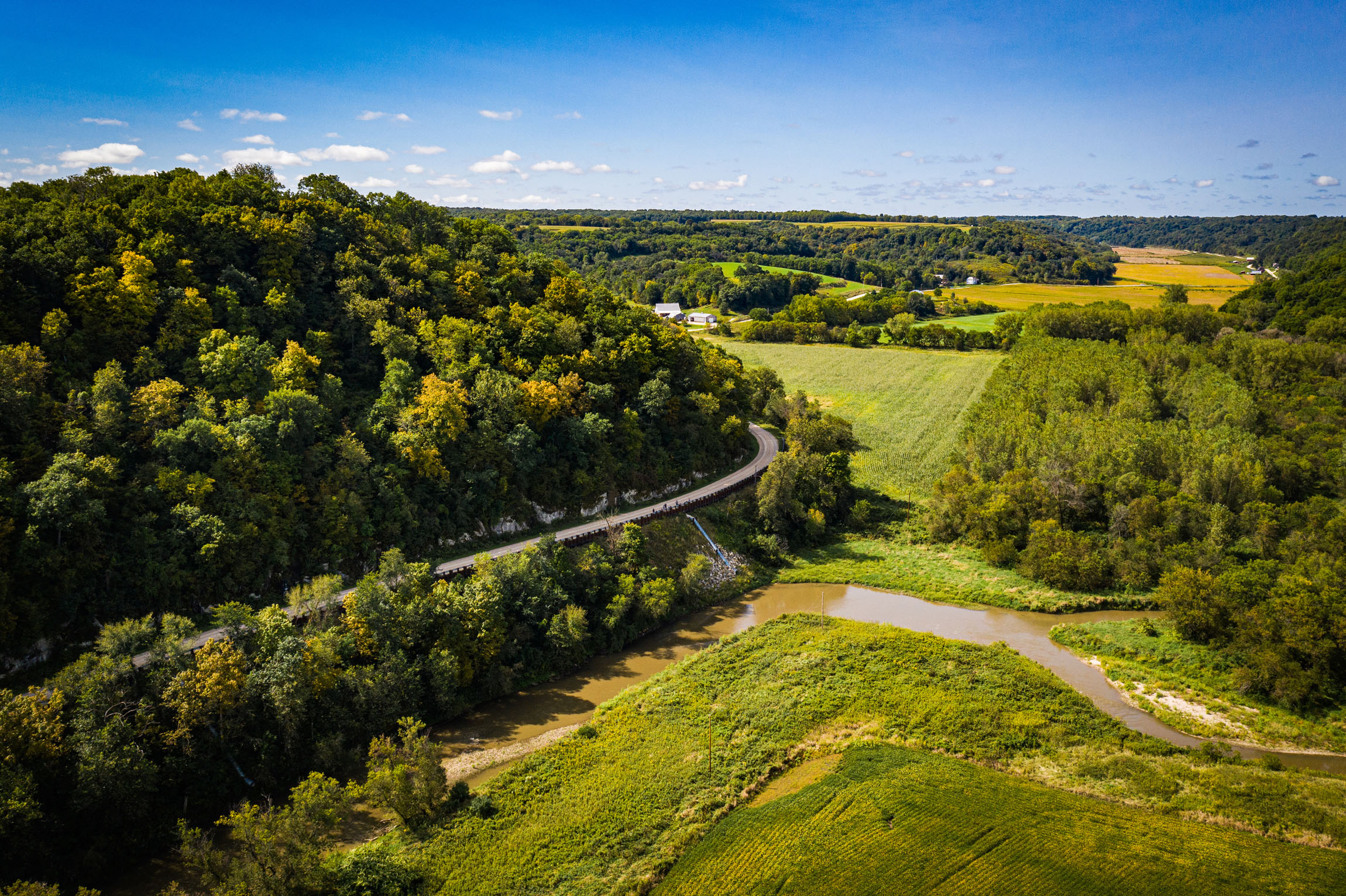
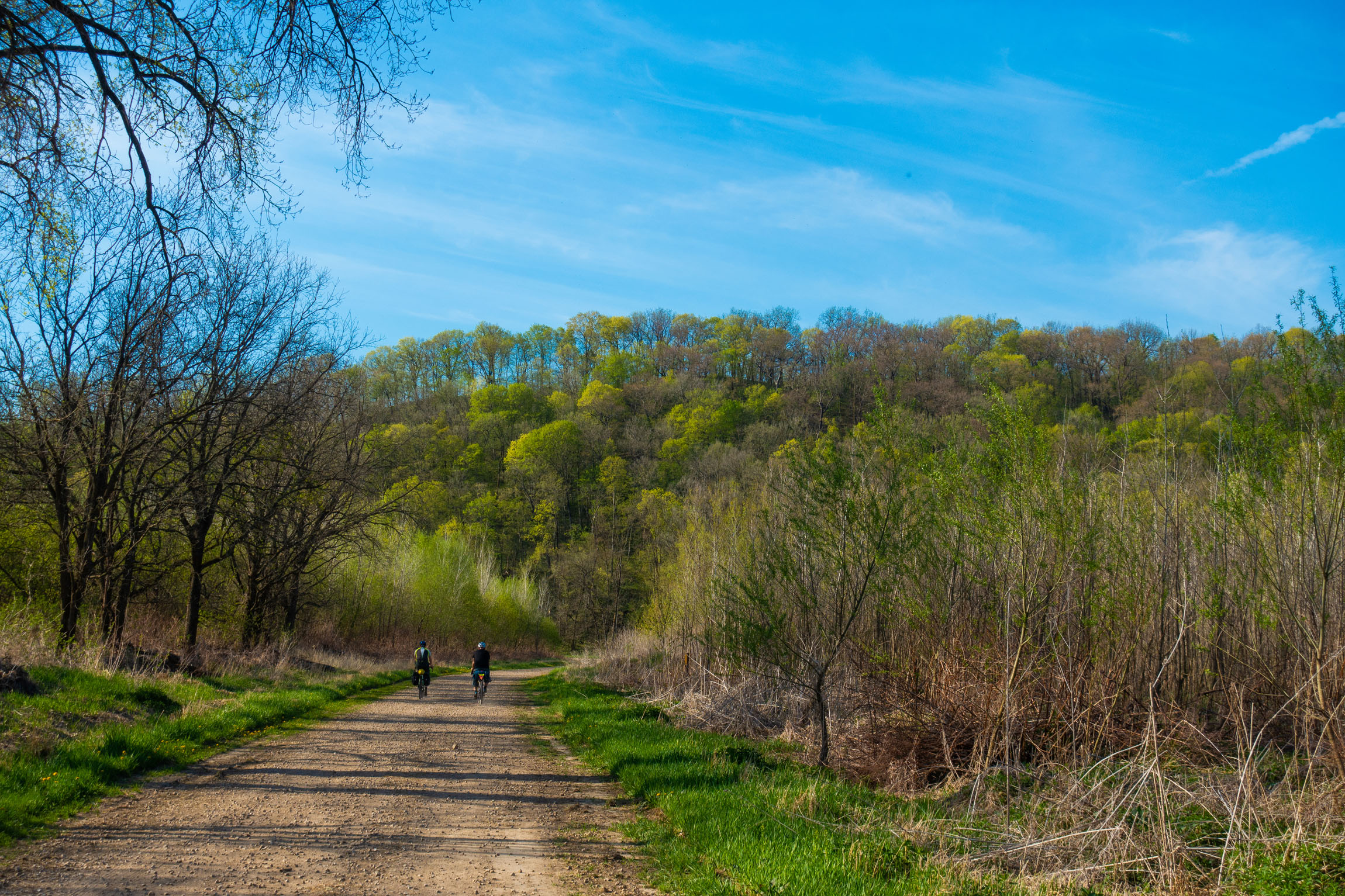
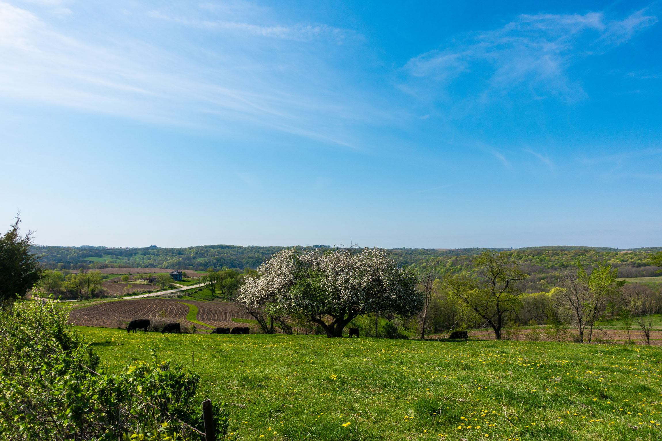
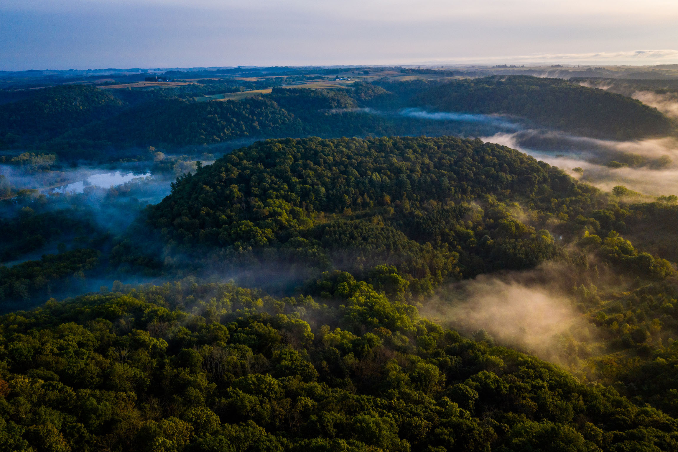
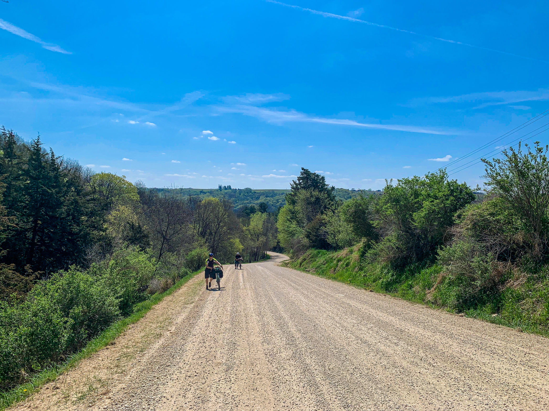
Northeast Iowa is part of the Driftless Area, a beautiful region that includes parts of Minnesota, Wisconsin, Illinois, and Iowa. The region escaped the flattening effects of glaciation during the last ice age and is consequently characterized by steep, forested ridges, deep river valleys, and karst geology characterized by spring-fed waterfalls and cold-water trout streams. So, when looking to get away for a quick weekend bikepacking trip, it’s easy to plan it in this area, as it has some of the best scenery Iowa has to offer.
Yellow River State Forest is the only state forest land in this region and the only one in Iowa. It’s broken up into six different units that combine for a total of over 8,900 acres of public forest land. It offers trout fishing, primitive and non-primitive camping, hiking, kayaking, and mountain biking.
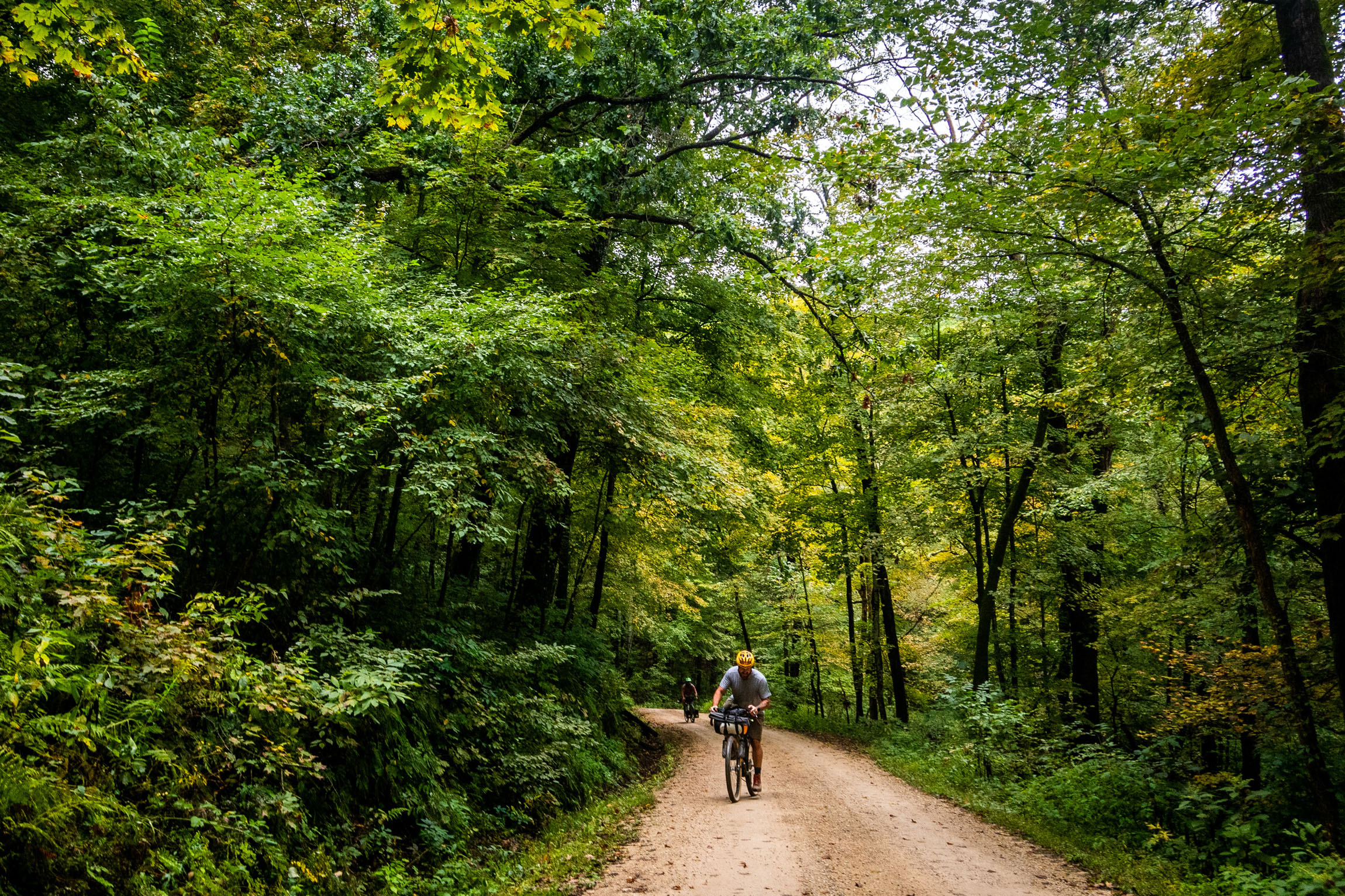
The Yellow River Loop starts and ends in Clermont, a quant Iowan town, and follows a network of gravel roads to loop riders through the Yellow River State Forest. Read the full itinerary under the Trail Notes tab below.
Route Development
As a group of friends, we were talking about where our next overnighter trip should be. I knew right away that we needed to develop a route that incorporates some of Iowa’s best features. I suggested that we create a route that utilized the primitive camp options in Yellow River State Forest. If you live in Iowa, you know that finding places to practice your primitive camping skills is hard as there is a lot of privately owned land developed for rural farming.
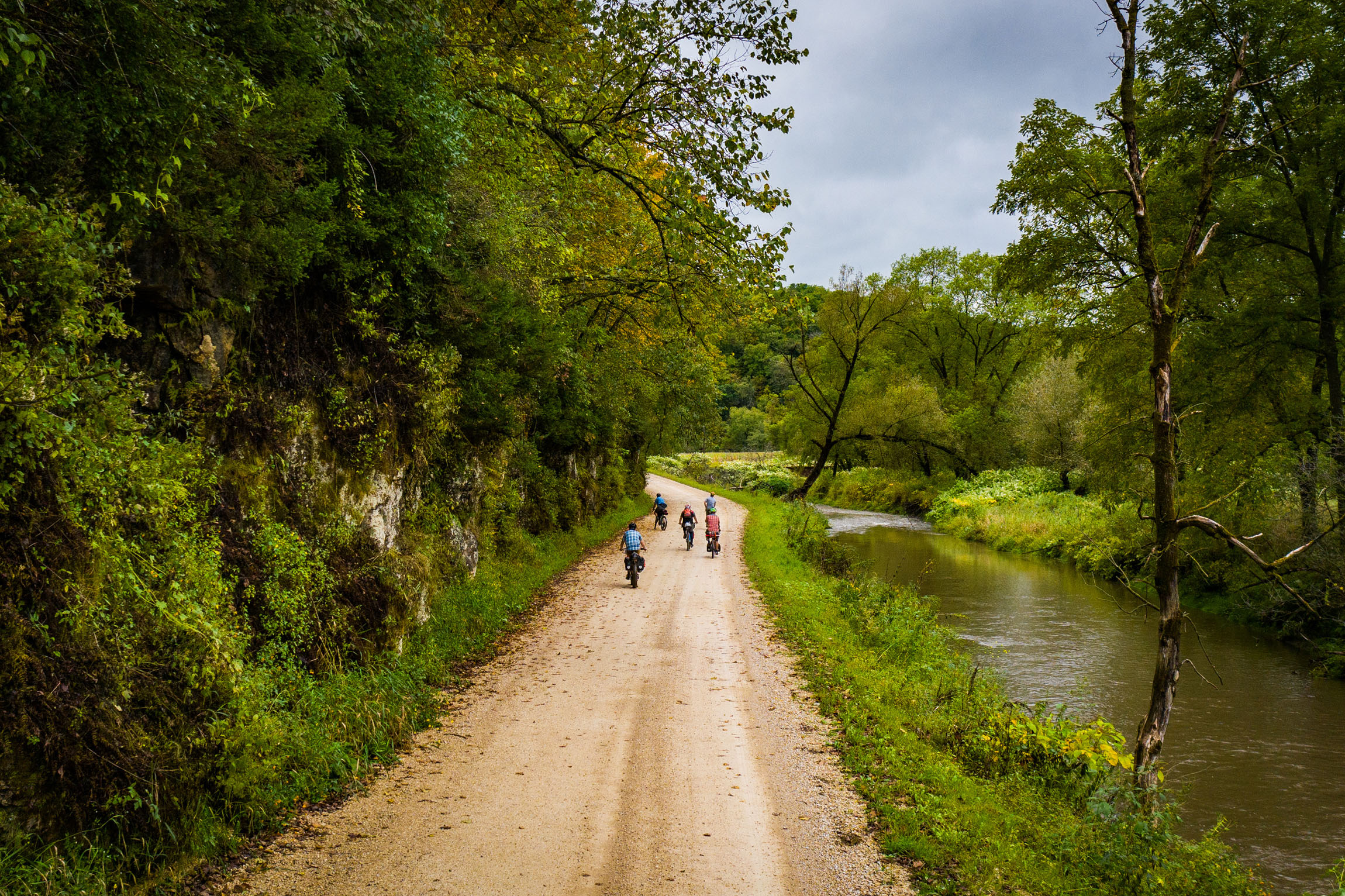
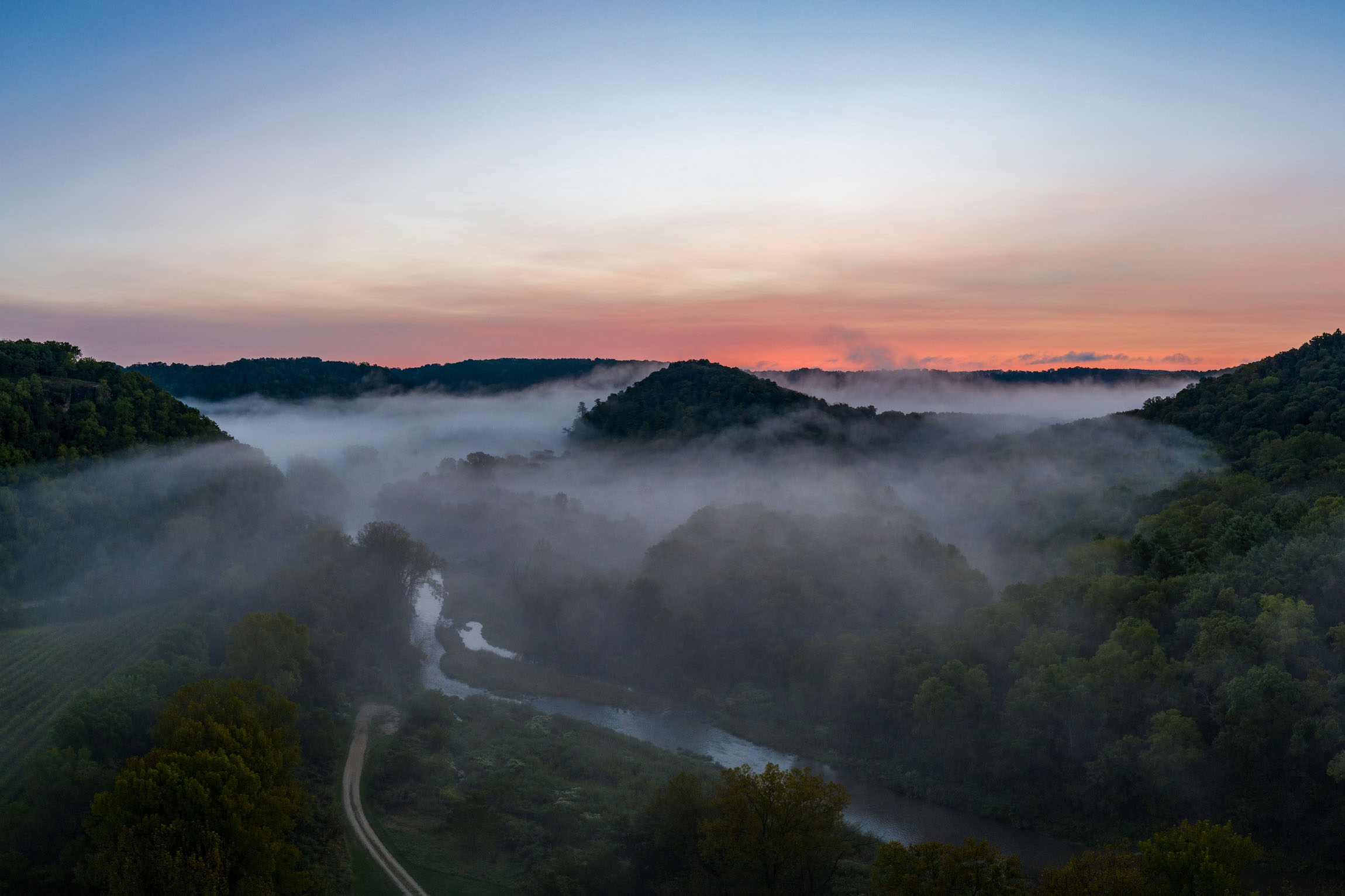
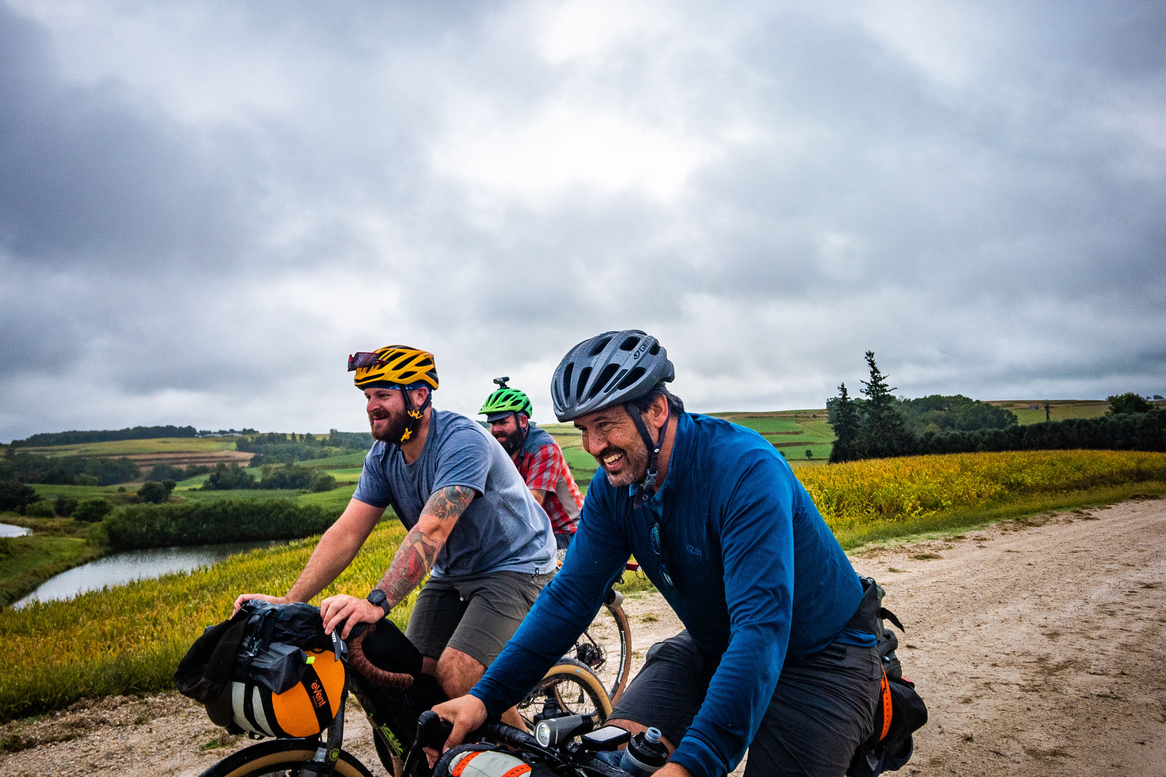
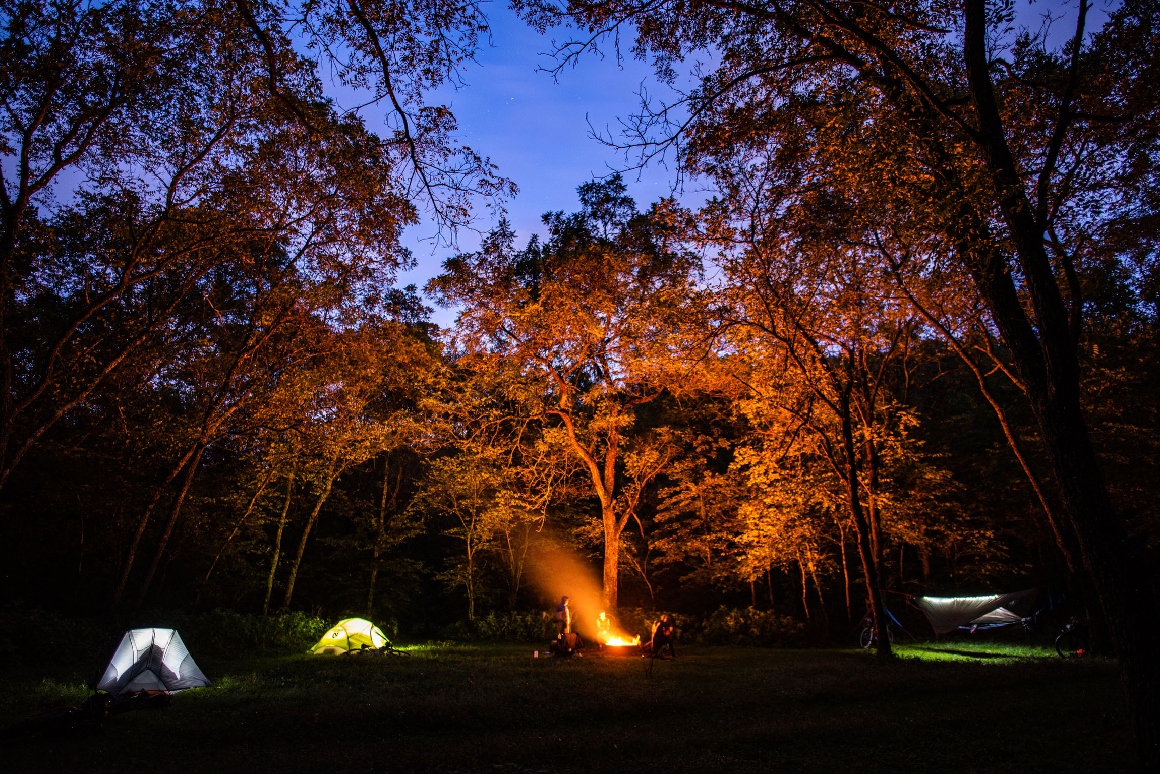
After some pre-scouting of gravel roads, I created the first edition of this route and we set off in the early fall to check it out. We wanted to see how we liked the route and reference food stops, fishing spots, and begin taking some photos. We were delighted with some early rain on day one that made for some beautiful and unique riding with fog settling over the bluffs and rolling hills in Northeast Iowa. The next morning we had an abundance of moisture, which made for some amazing drone shots during sunrise showing off some of the landscapes you can expect while riding in the Driftless Area.
After the first edition, I did some more route scouting to adjust the route to its final form and add in some more flowing valley riding. We escaped the next spring to check out this edition. After riding this time, I knew this had to be uploaded onto the site for others to enjoy. We all had smiles on our faces the entire ride. Yes, even the hard hills were fun with our limited winter fitness.
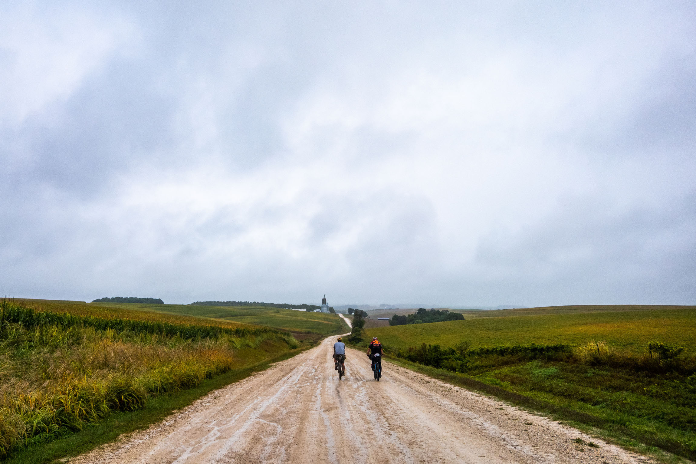
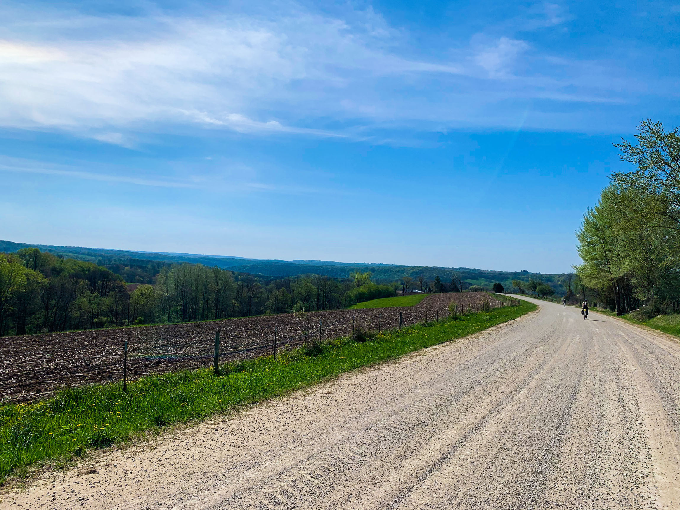
Route Difficulty: This route has a difficulty rating of 2 out of 10. When thinking of other routes that we’ve done in the Midwest, this is a very comparable route. The nice thing about riding here is that there’s no shortage of convenience stores to resupply food or water. While there’s some elevation to this route, you’re riding on well-maintained gravel roads. There are no technical climbs or rough sections. Lastly, the distance makes it perfect for beginner and experienced riders to get out for a quick overnight ride.


Submit Route Alert
As the leading creator and publisher of bikepacking routes, BIKEPACKING.com endeavors to maintain, improve, and advocate for our growing network of bikepacking routes all over the world. As such, our editorial team, route creators, and Route Stewards serve as mediators for route improvements and opportunities for connectivity, conservation, and community growth around these routes. To facilitate these efforts, we rely on our Bikepacking Collective and the greater bikepacking community to call attention to critical issues and opportunities that are discovered while riding these routes. If you have a vital issue or opportunity regarding this route that pertains to one of the subjects below, please let us know:
Highlights
Must Know
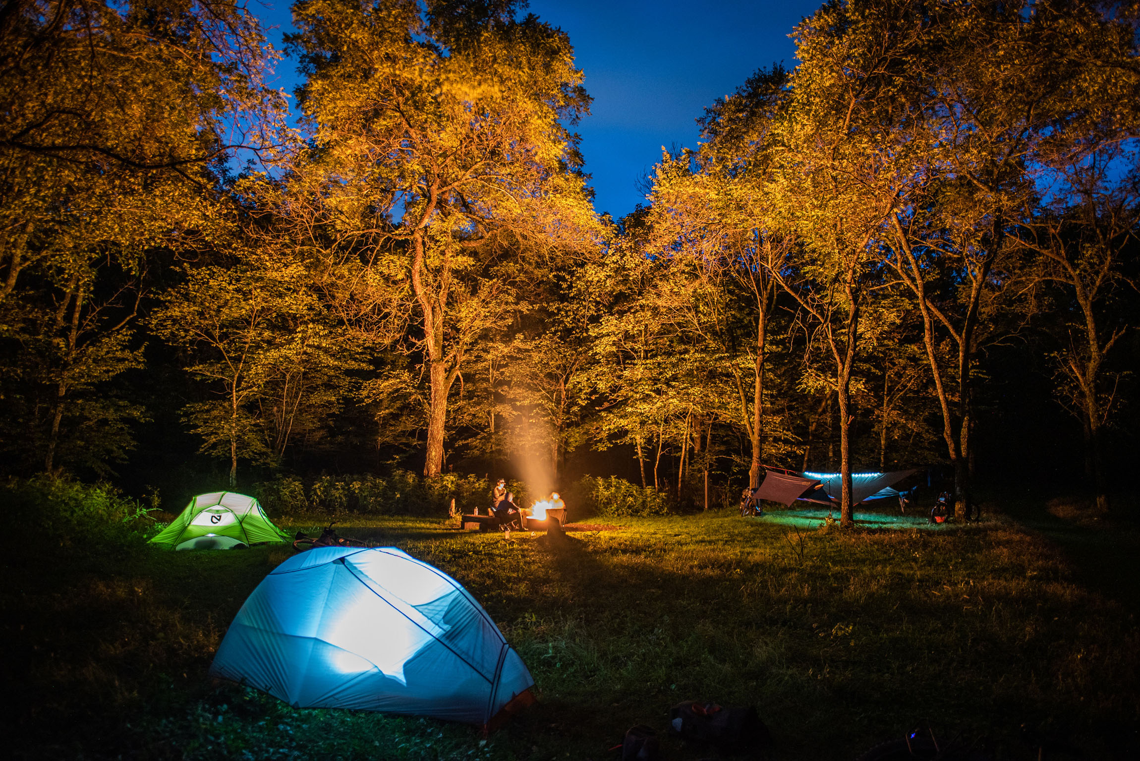
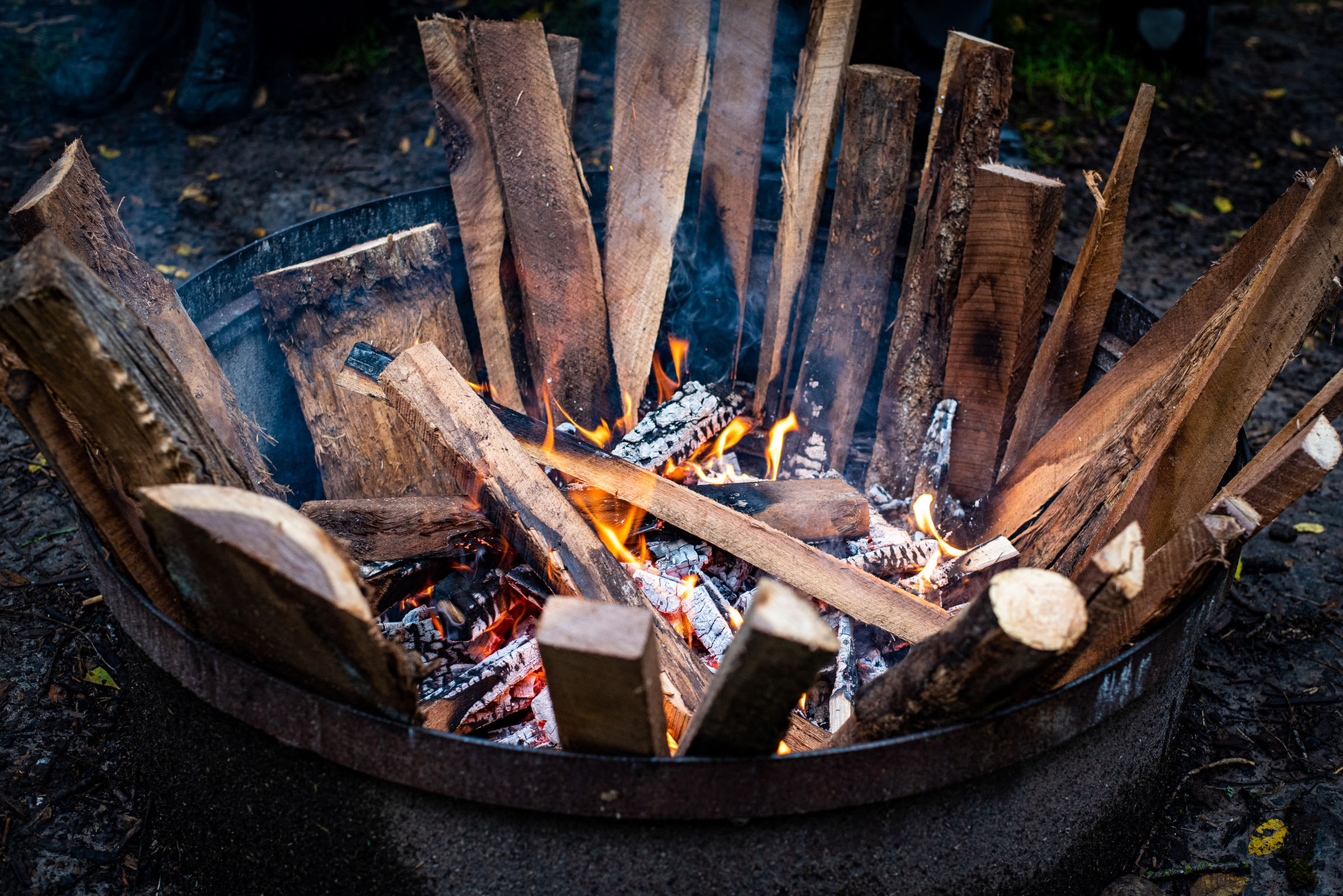
Camping
Food/H2O
Trail Notes
Resources
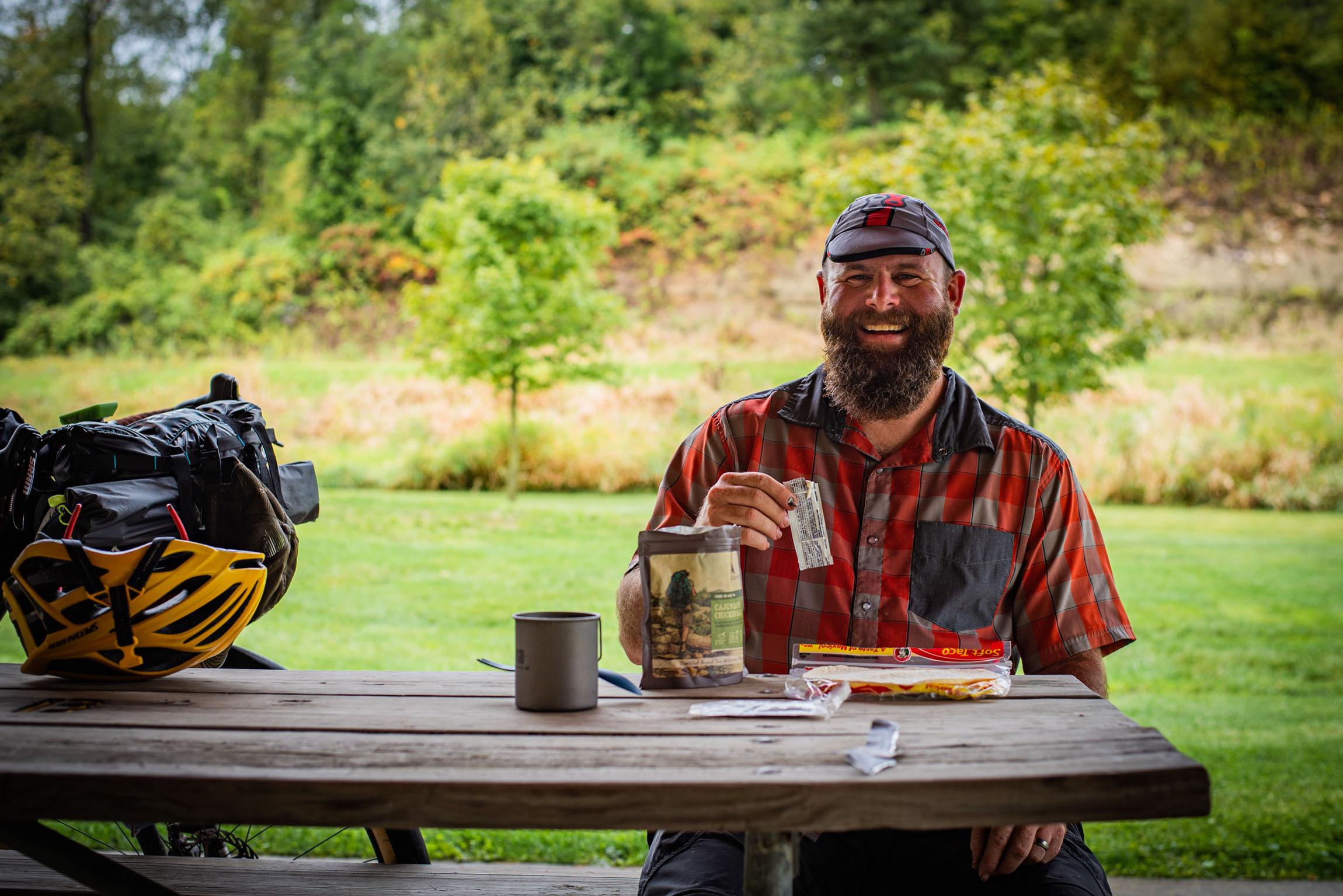
- There’s a nice shelter at mile 22 on the right side of road to stop for lunch right next to the Yellow River, and also a historical site with an informational sign to read about the area.
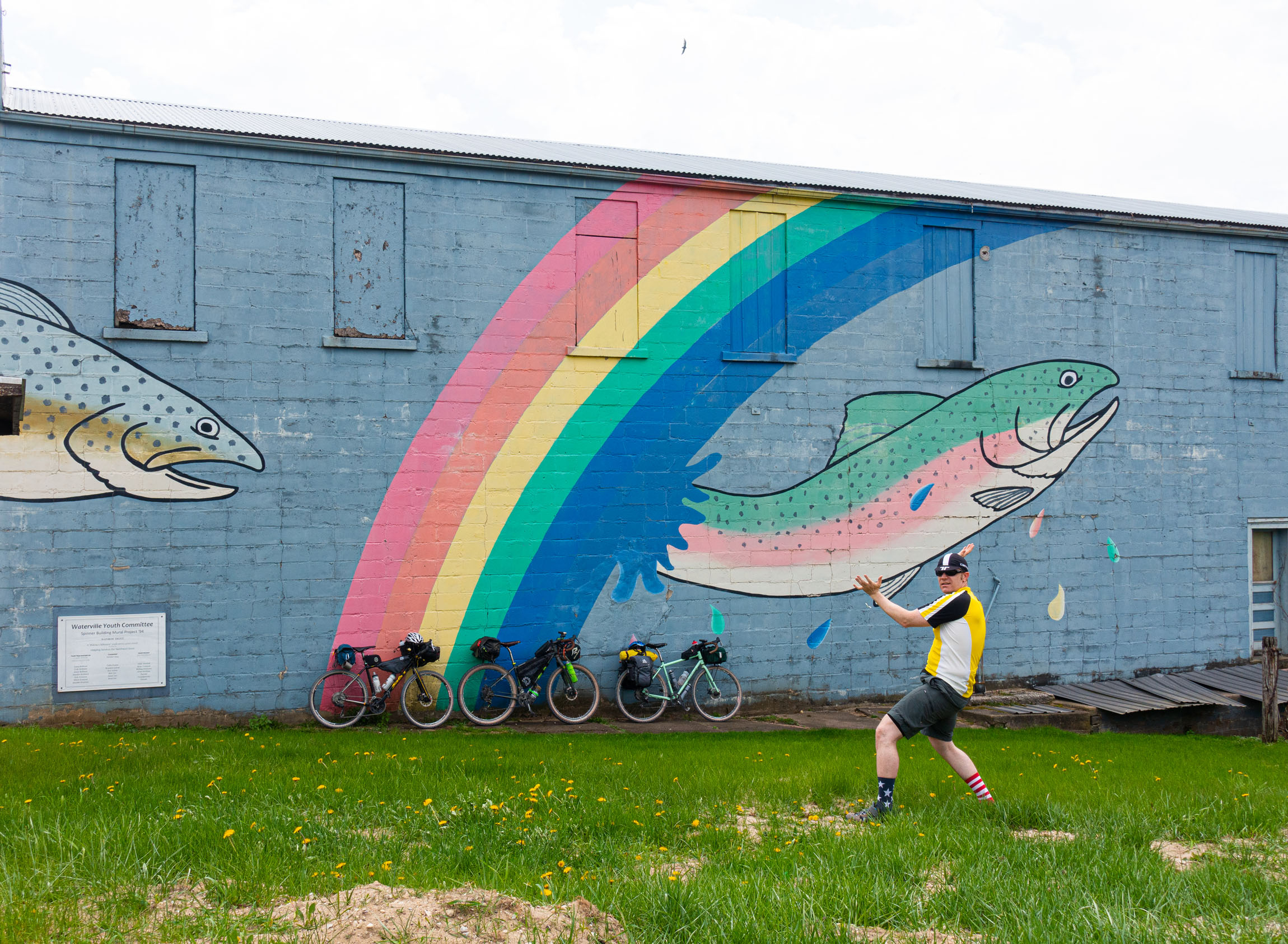
- Waterville’s Rainbow Trout mural. You’ll start following Paint Creek after this town. This is a great place to break out the fly rod or Tenkara to do a little trout fishing.
- An abundance of great trout fishing in Paint Creek and Yellow River. You can find Rainbow, Brook, and Brown Trout in both waterways.
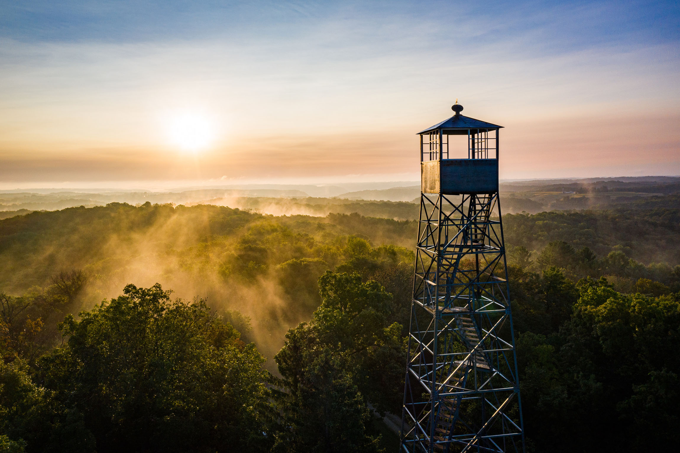
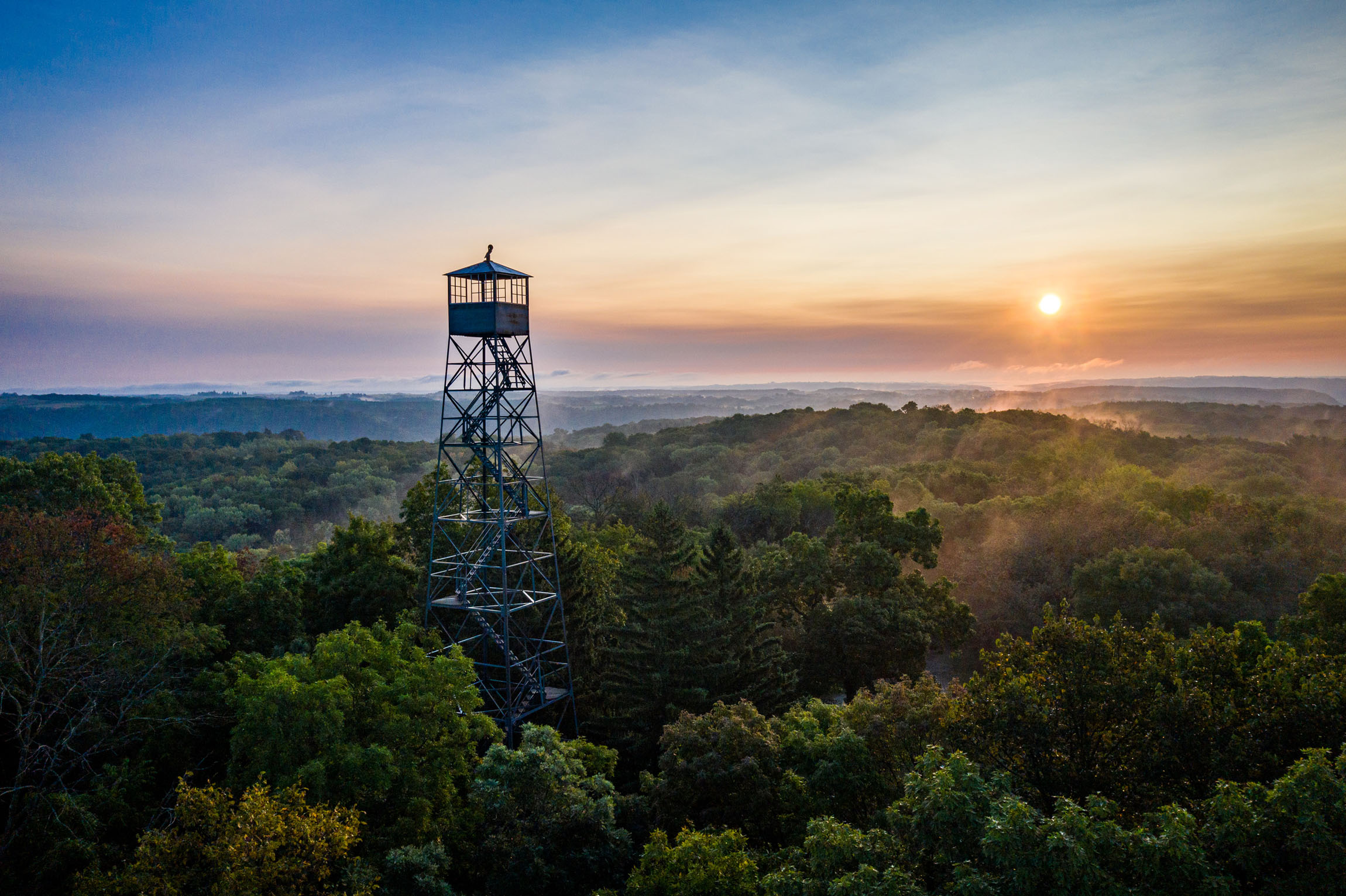
- Yellow river State Forest has multiple overlooks you can ride to if you still have the legs to check them out. One spot to see is the old firetower in the park. You can’t climb up to the top for safety reasons, but it’s a rewarding experience to climb the road to get to it and see the area.
- This loop can technically be completed year-round. However, I would suggest going between March and November.
- Make sure to bring some cash if you are going to camp at the reservable campgrounds as there is no person to check in with and pay. There is a small kiosk at the entrances to the campground that you slide your payment into along with the info of where you are camping.
- Since raccoons are used to people camping in Iowa they can get a little close at times and are very good at stealing your food. Make sure to keep a clean camp and all your scented items picked up. It wouldn’t hurt to take a small dry bag to throw your food over a branch to keep them out.
- There’s easy access to the starting town of Clermont. Small rural Iowa backroads will get you in and out from most directions.
- The route is rideable 100% of the time unless there are bridges out or roads being worked on as part of normal construction or updates.
- With an abundance of gravel roads in Iowa, you can make many alterations to this route if desired. I tried to follow ridgelines and river/creek valleys to give the best scenery in the area.
- For backcountry sites, you will need to register your group where you decide to camp in the park at the ranger station. Exact milage to each backcountry site will vary depending on what site you choose.
- If the backcountry sites are full you can stay at Little Paint and Big Paint campgrounds. These campgrounds have pit toilets and no electricity. They also require payment of $12 and can be reserved ahead if you want to secure a site.
- If you decide to primitive camp, there are four sites to choose from. Look at the map and do some research to figure out where you want to camp.
- There isn’t much filterable water in Iowa as there is an abundance of pesticides from farming. However, there are a couple of convenience stores to stop at for food and refreshments along the way.
- Note that the only fresh water in Yellow River State Forest is the spigot on the south side of the ranger station in the park. Make sure to fill up when getting into the park and before leaving for the ride home.
Clermont-Waterville
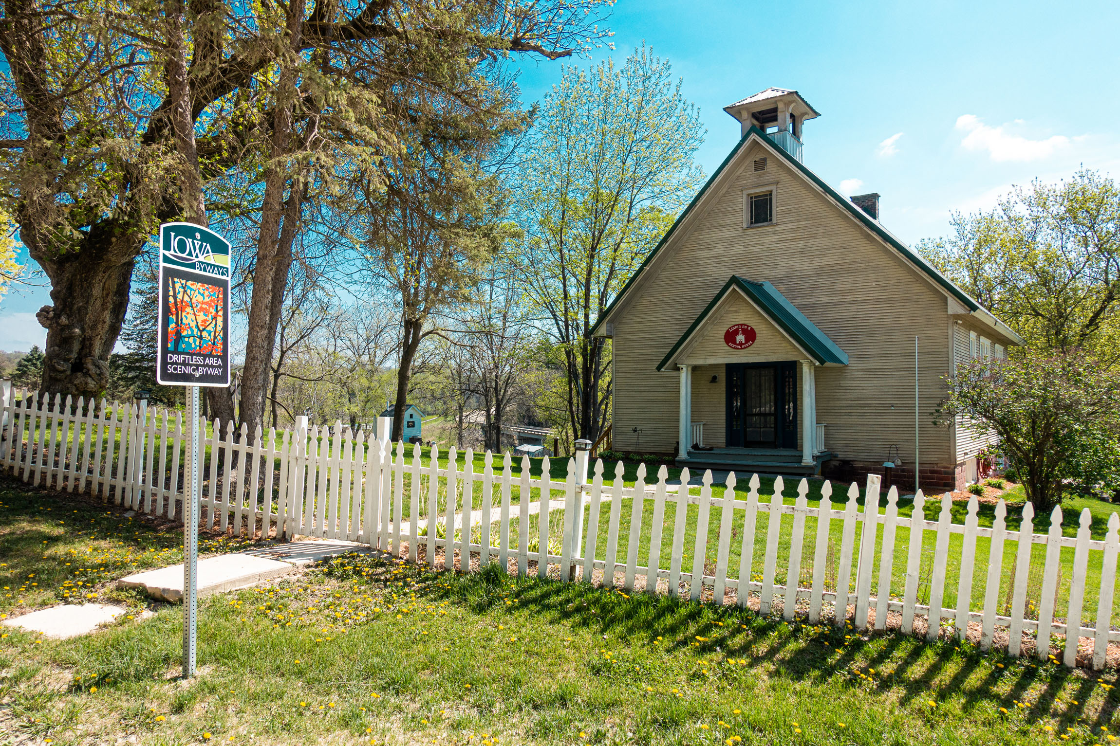
The route starts in Clermont, a quaint Iowa town. There is a local convenience store (Casey’s General Store) to load up on some late breakfast or lunch when you arrive. This is also a great place to grab some last-minute snacks or drinks for the ride. There is no generic public parking in this small town. We took advantage of the public library to park and leave our car overnight. From here, the route will take you north out of town into a small valley followed by rolling farm hills. After leaving Clermont you will not see another town until mile 38. At that point you will go through the small town of Waterville. There is no convenience store in this town so make sure you pack all your necessary food for the first day and breakfast the next morning.
Waterville-Yellow River State Forest
When leaving Waterville, you’ll follow the Paint Creek trout stream until you get into the Yellow River State Forest. At this point you hop onto pavement in the park for a short distance. After riding on the paved road for about half a mile you will go by the ranger station on your right. There is a spigot for water on the south side of the ranger station. This is the only drinking water in the park, so fill up before getting to camp. You will need to register your group for where you decide to camp in the park at the ranger station for the backcountry sites. If the backcountry sites are full you can stay at Little Paint and Big Paint campgrounds. These campgrounds have pit toilets and no electricity. They also require payment of $12 and can be reserved ahead if you want to secure a site. If you decide to primitive camp, there are four sites to choose from. Look at the map and do some research to figure out where you want to head. Make sure to head back to the ranger station before leaving the park in the morning, as this is the only place to get water for the next 33 miles your second day.
Postville-Clermont
The next place to refuel with food and water is in Postville. There’s a Dollar General as you enter town, or a Kwik Star (convenience store). From Postville, it’s mainly a downhill coast back into the river valley and back into Clermont.
Additional Resources
- IOWA DNR to buy a fishing license and trout stamp
- Yellow River State Forest
- The town of Clermont: clermontia.org


Terms of Use: As with each bikepacking route guide published on BIKEPACKING.com, should you choose to cycle this route, do so at your own risk. Prior to setting out check current local weather, conditions, and land/road closures. While riding, obey all public and private land use restrictions and rules, carry proper safety and navigational equipment, and of course, follow the #leavenotrace guidelines. The information found herein is simply a planning resource to be used as a point of inspiration in conjunction with your own due-diligence. In spite of the fact that this route, associated GPS track (GPX and maps), and all route guidelines were prepared under diligent research by the specified contributor and/or contributors, the accuracy of such and judgement of the author is not guaranteed. BIKEPACKING.com LLC, its partners, associates, and contributors are in no way liable for personal injury, damage to personal property, or any other such situation that might happen to individual riders cycling or following this route.
Please keep the conversation civil, constructive, and inclusive, or your comment will be removed.