


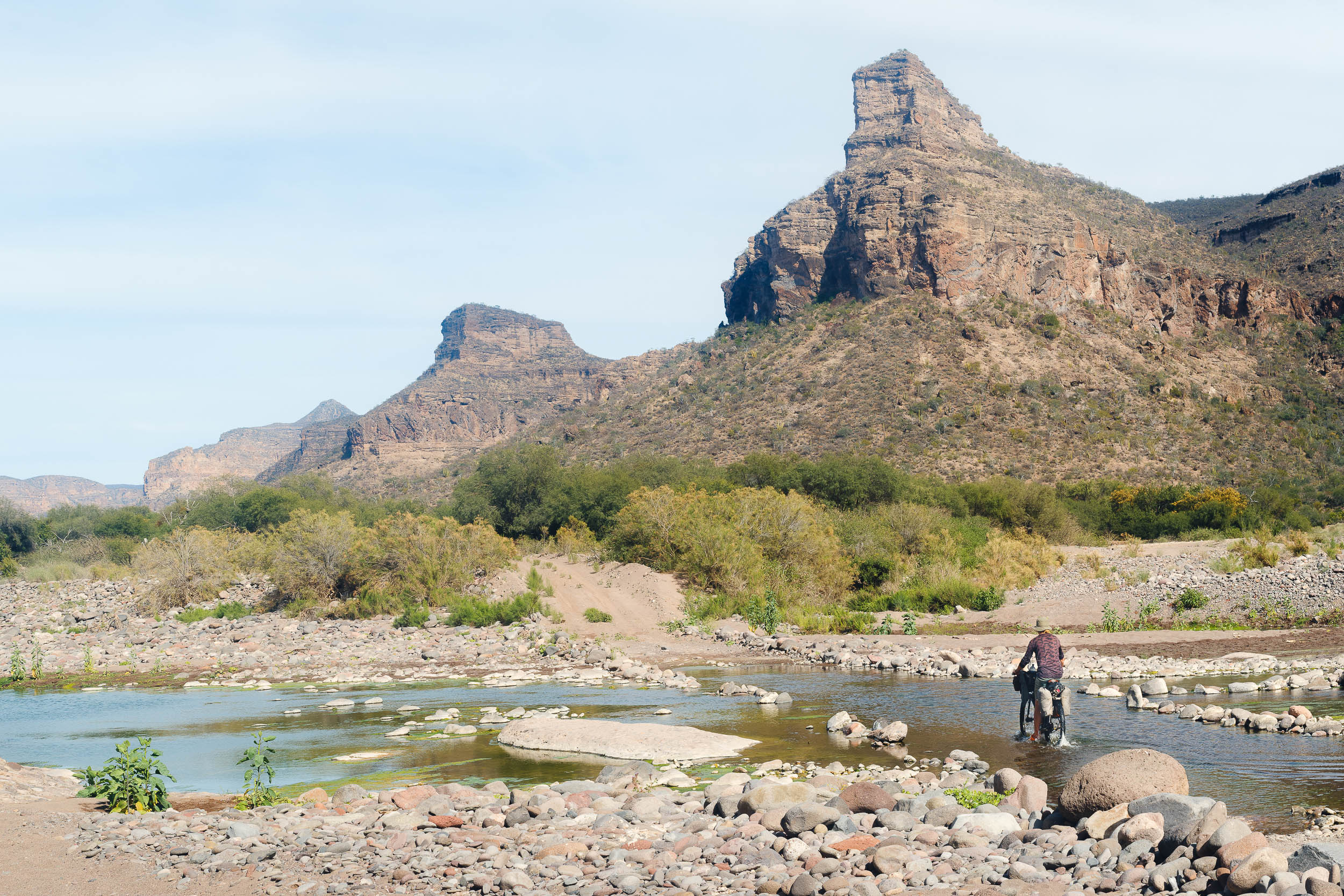
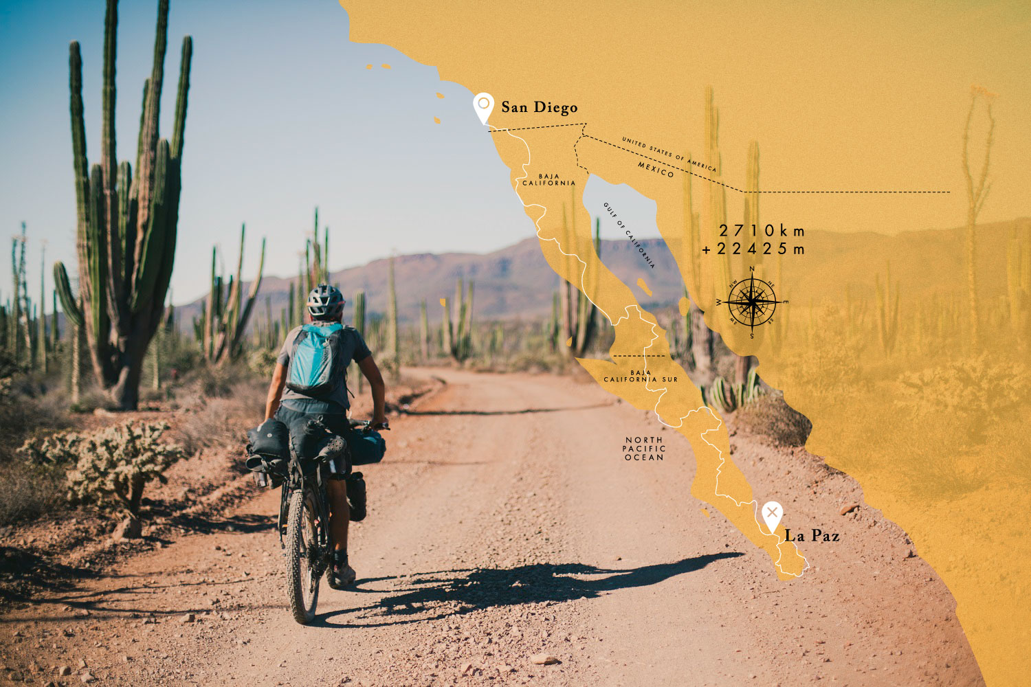
The Baja Divide
Distance
1,730 Mi.
(2,784 KM)Days
42
% Unpaved
95%
% Singletrack
1%
% Rideable (time)
99%
Total Ascent
96,349'
(29,367 M)High Point
4,675'
(1,425 M)Difficulty (1-10)
7?
- 4Climbing Scale Fair56 FT/MI (11 M/KM)
- 6Technical Difficulty Moderate
- 7Physical Demand Difficult
- 7Resupply & Logistics Strenuous
Contributed By
Nicholas Carman
Gypsy by Trade
The Baja Divide route guide was originally written in 2016 and last updated in October 2024 with insight from Pat Boyle, Evan Christenson, and Logan Watts. Photos by Evan, Logan, Tales on Tyres, and Tom Norman throughout; cover photo by Dan Stranahan from The Bikepacking Journal 05. The current route GPX contains an important route update that bypasses a closed section just north of Vicente Guerrero (via Pat Boyle from 2023) and a workaround south of Vicente Guerrero from 2024, as well as several POIs from our team.
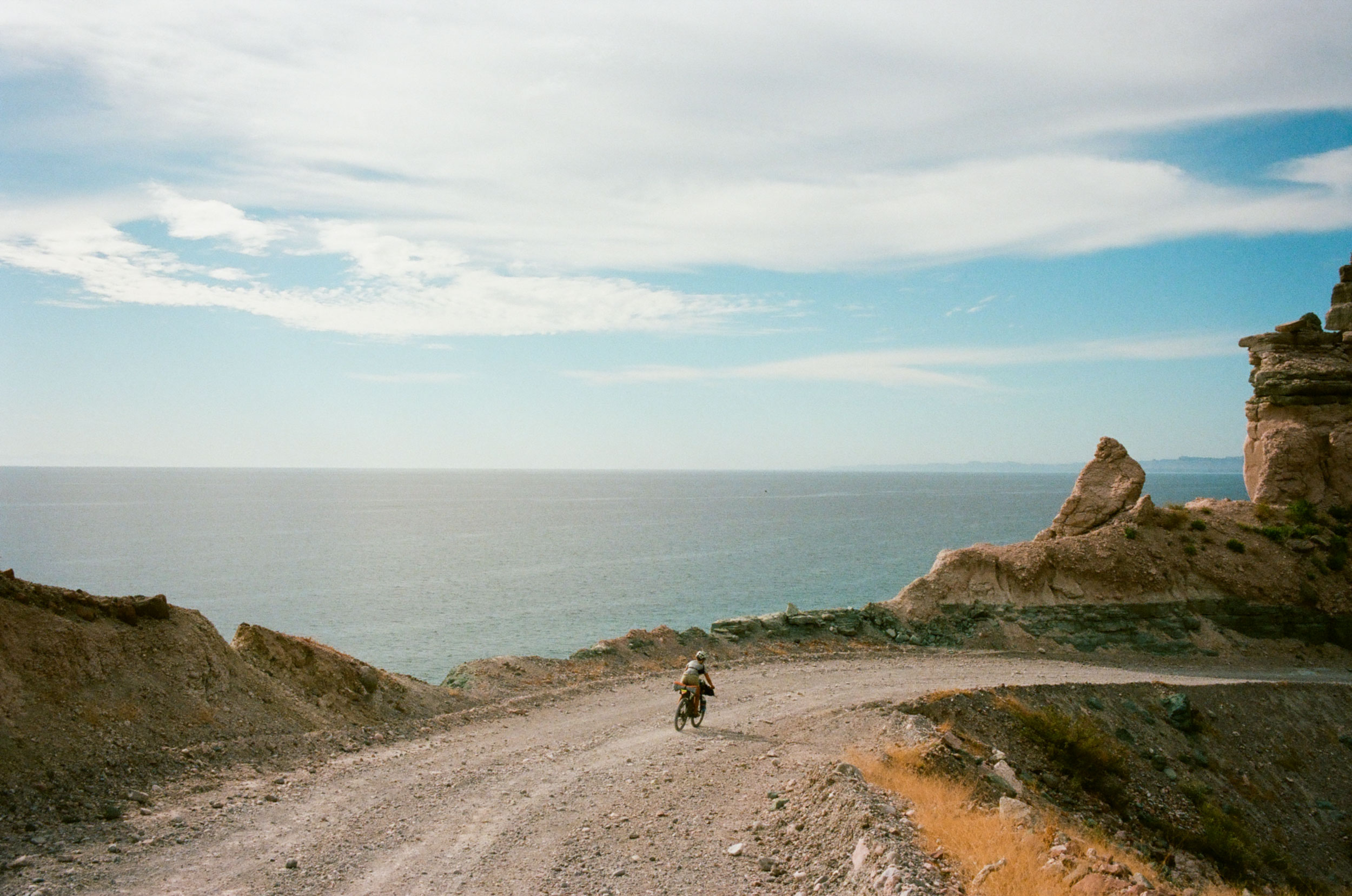
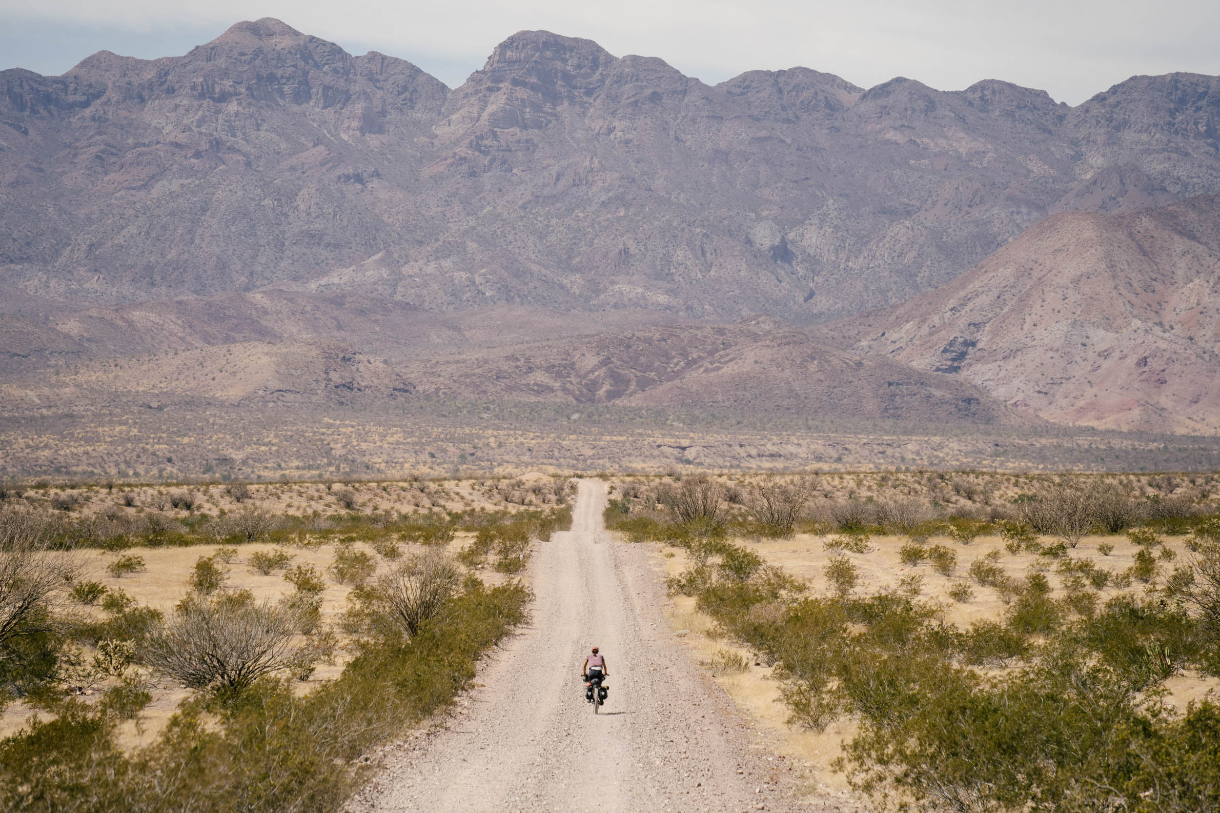
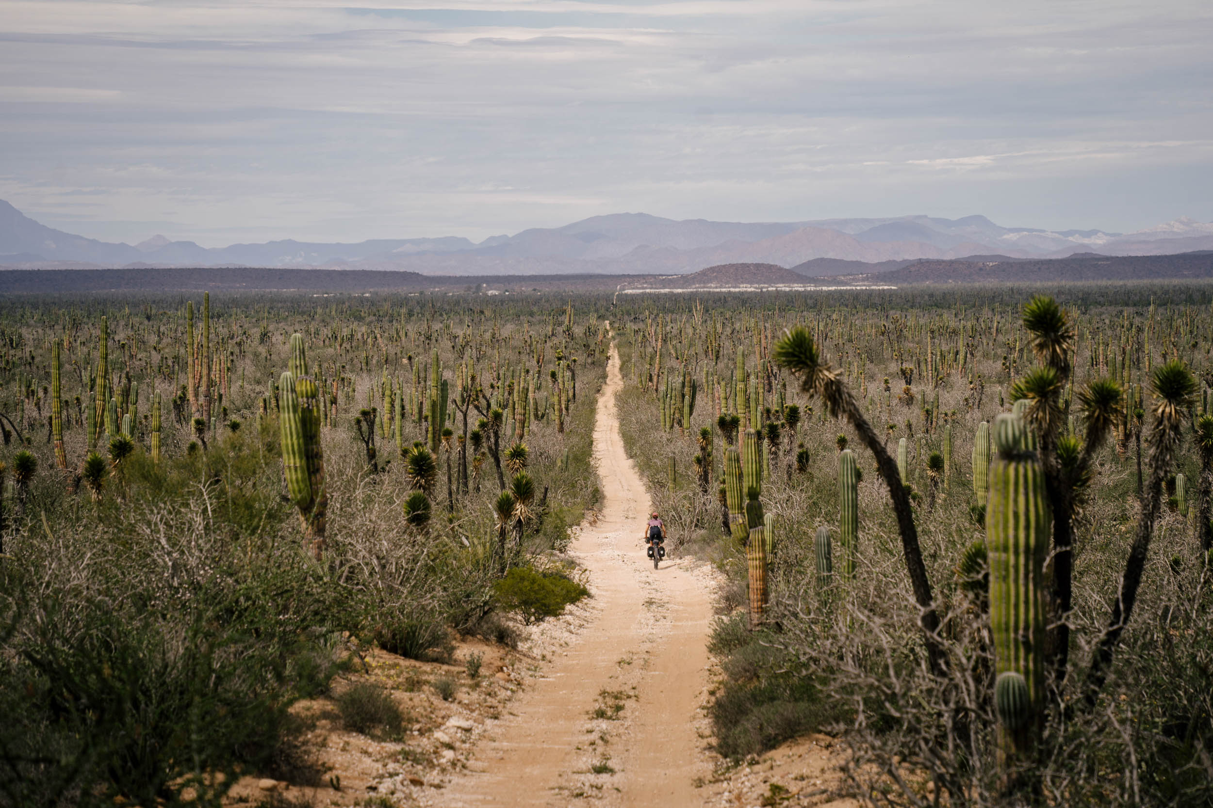
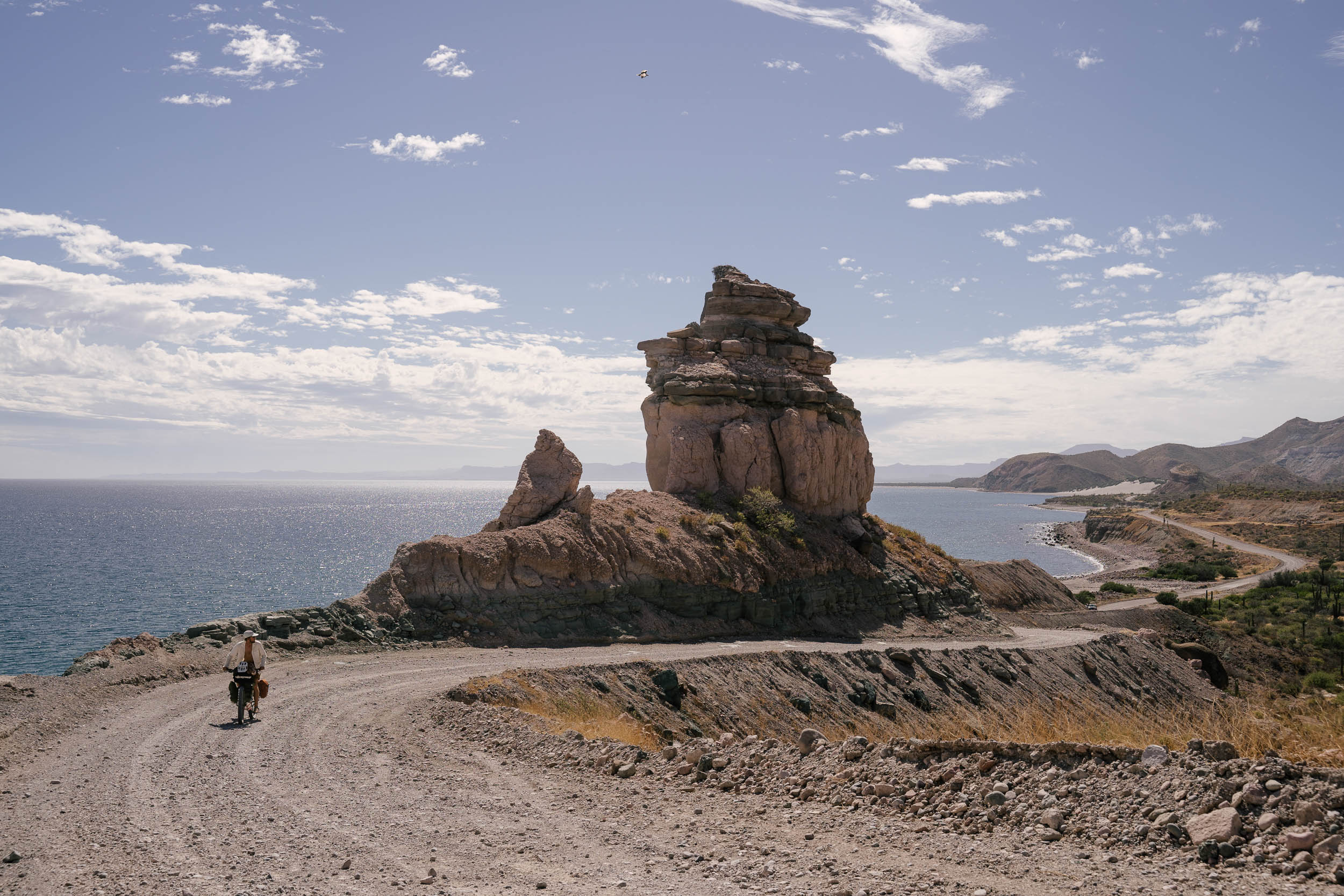
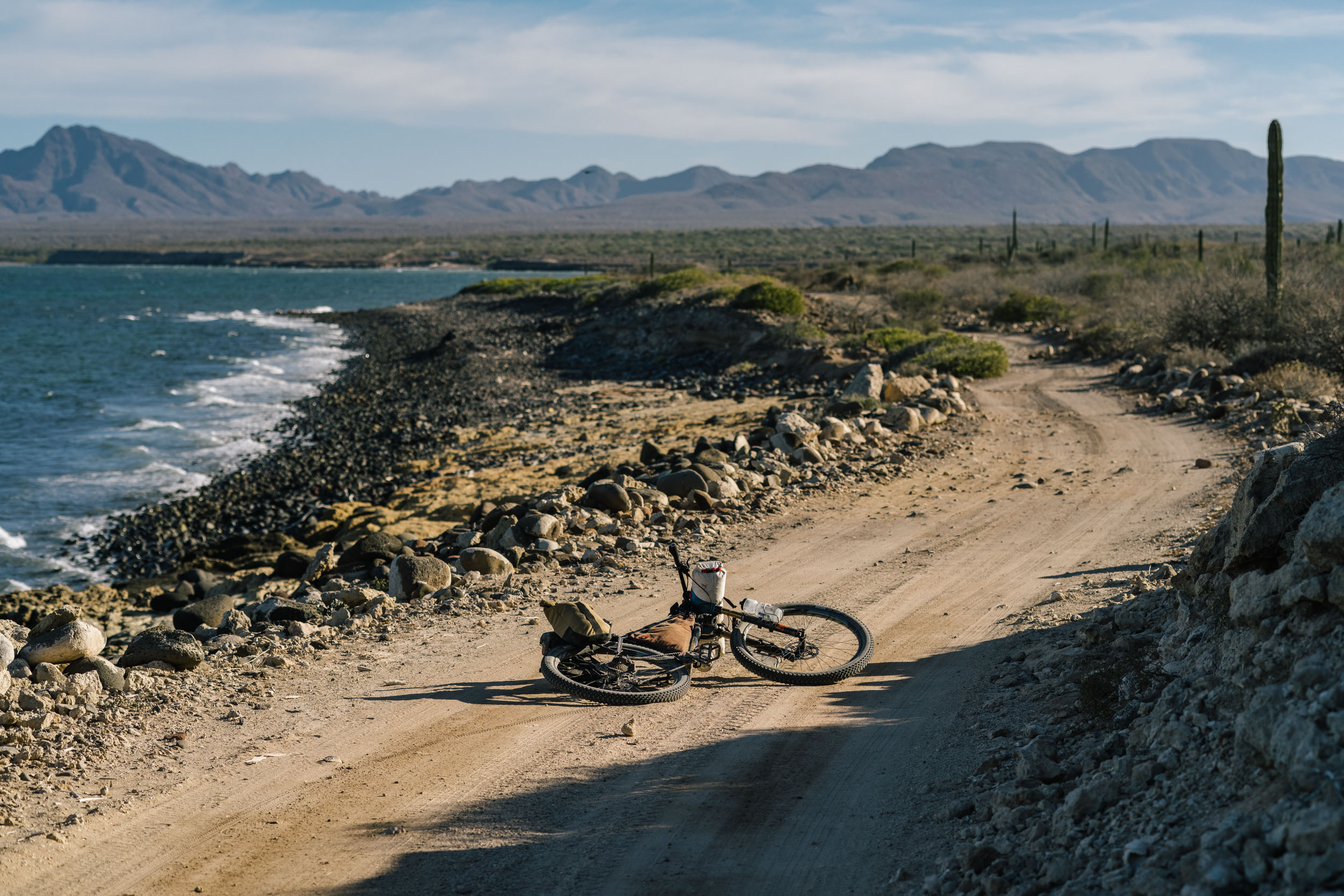
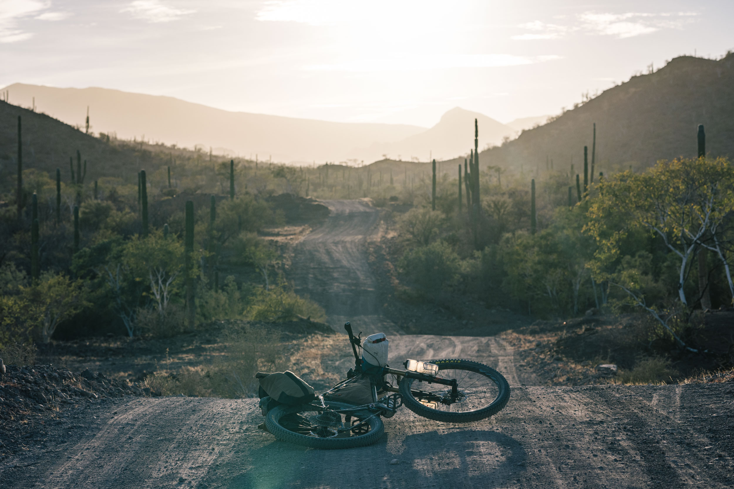
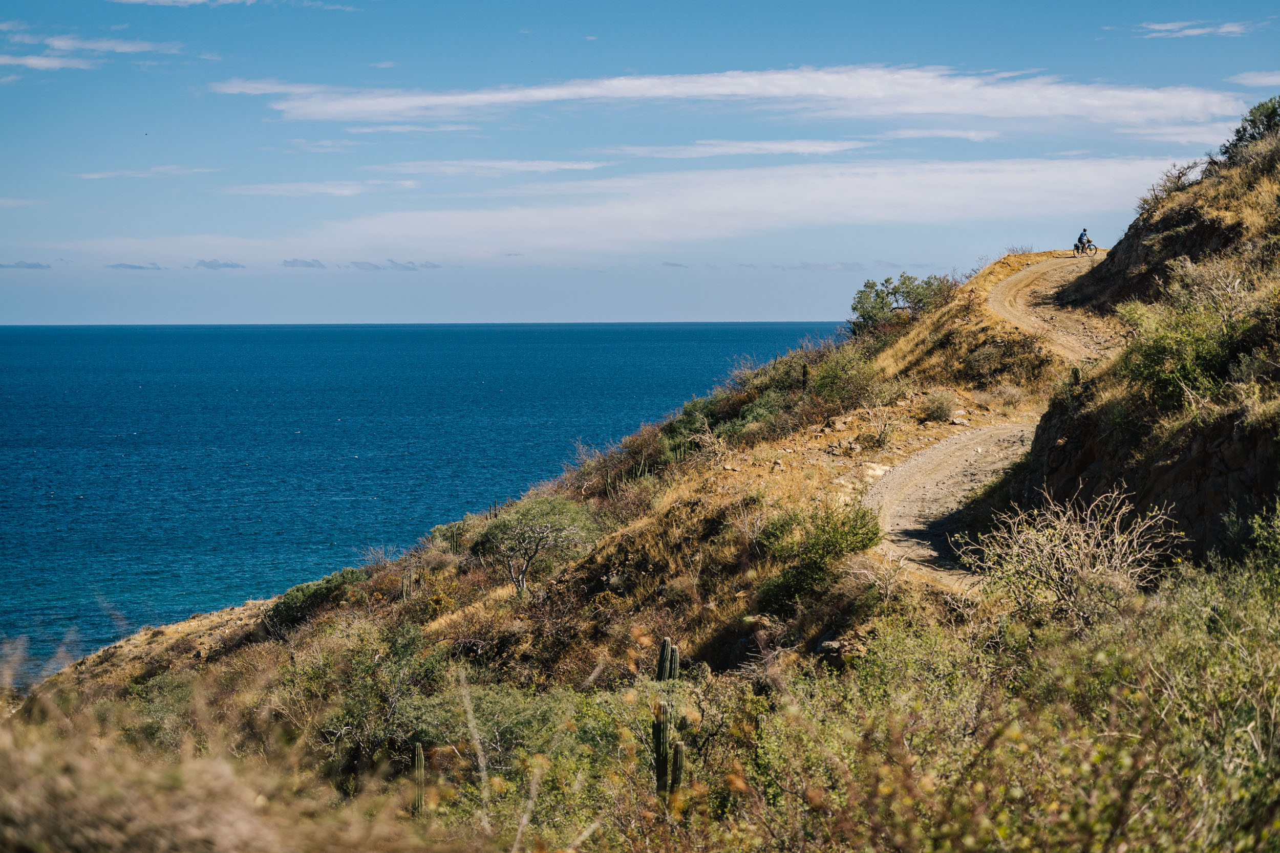
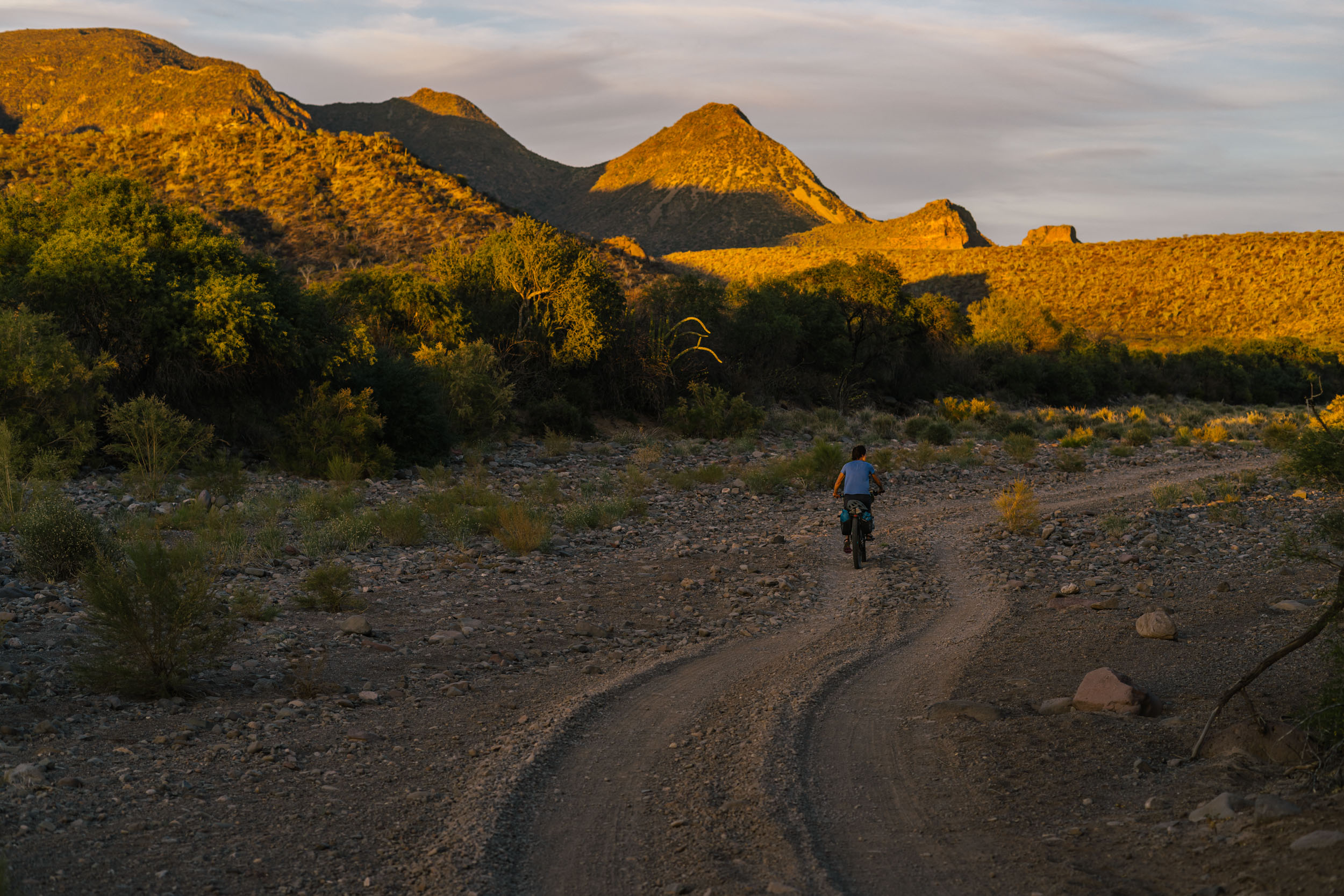
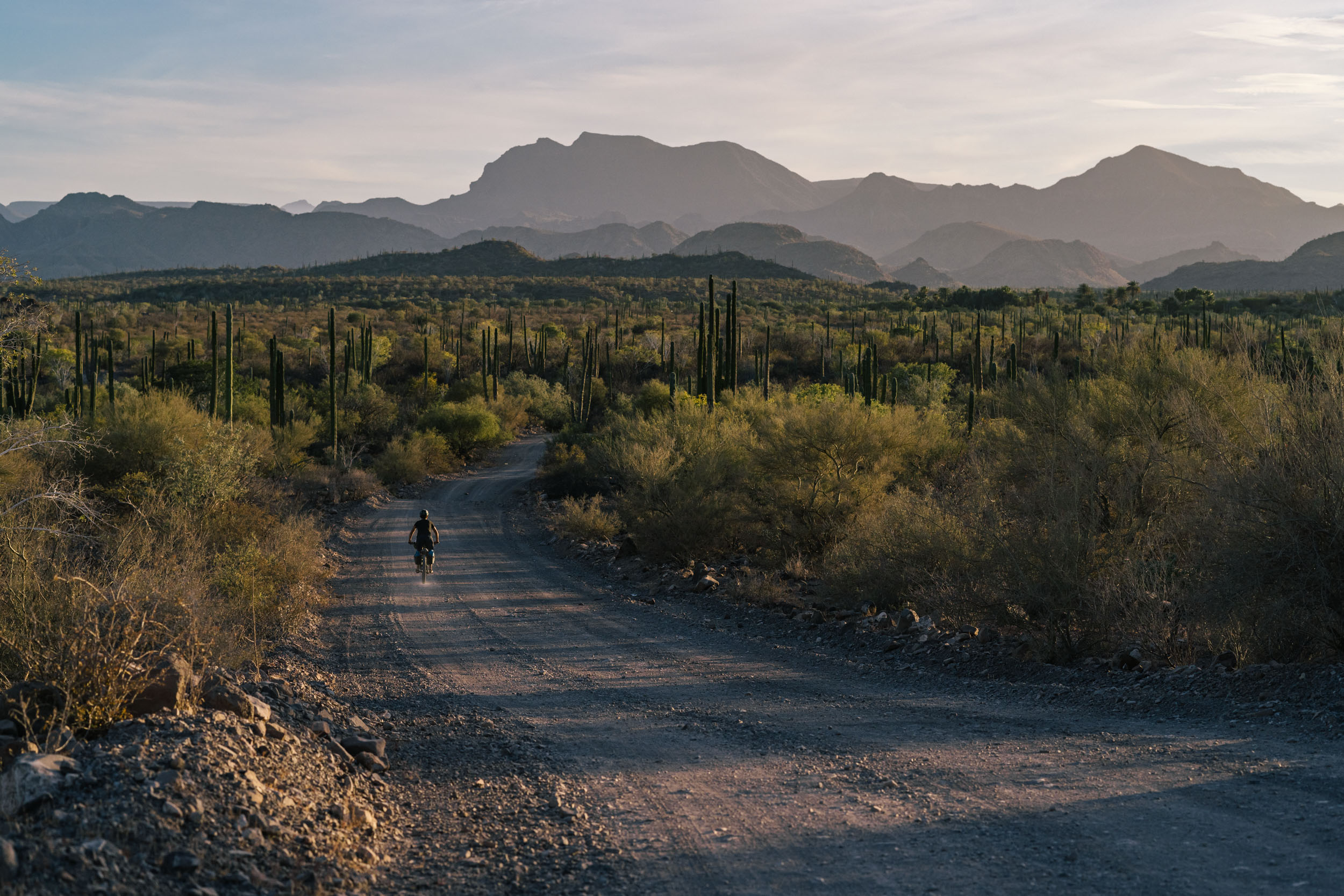
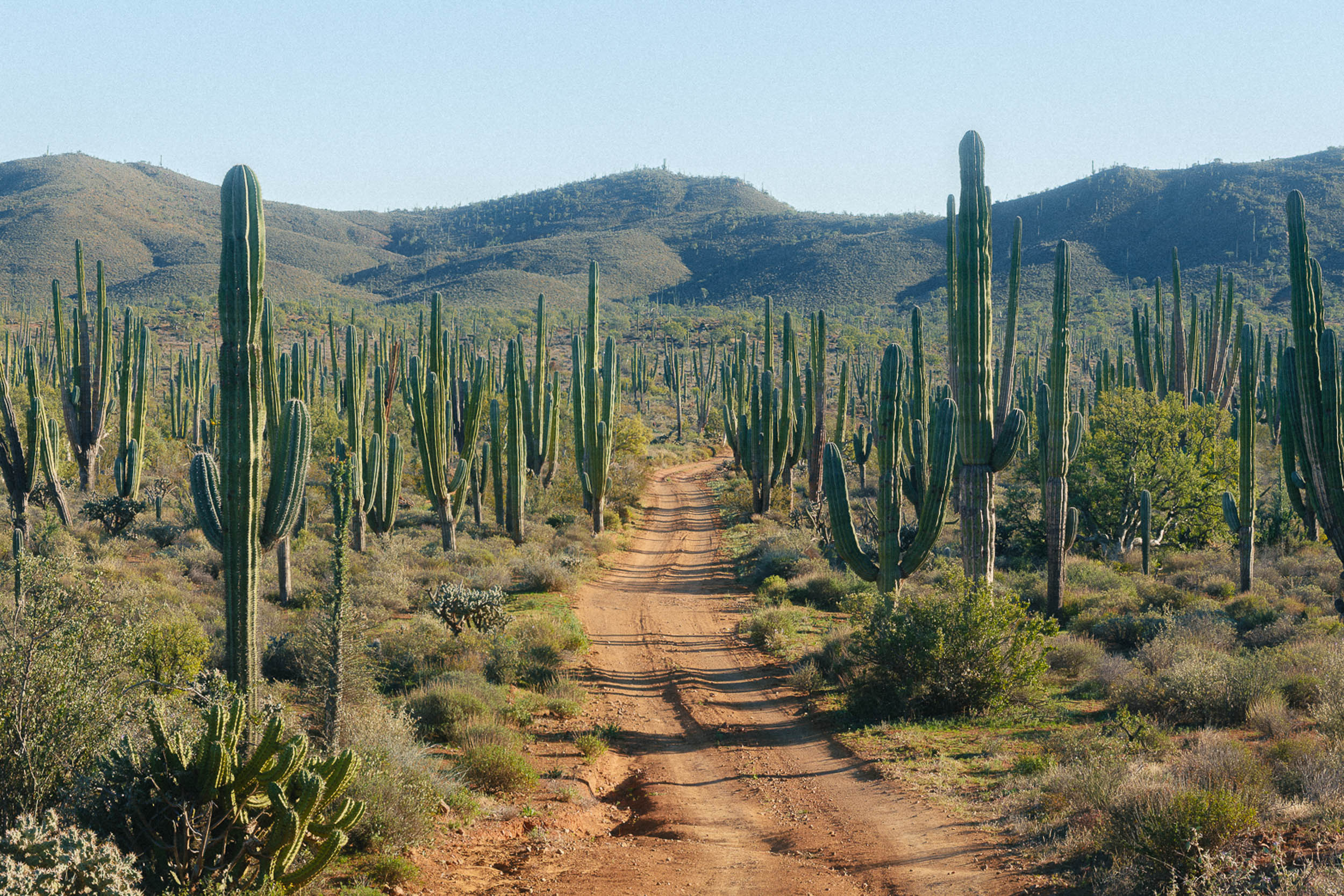
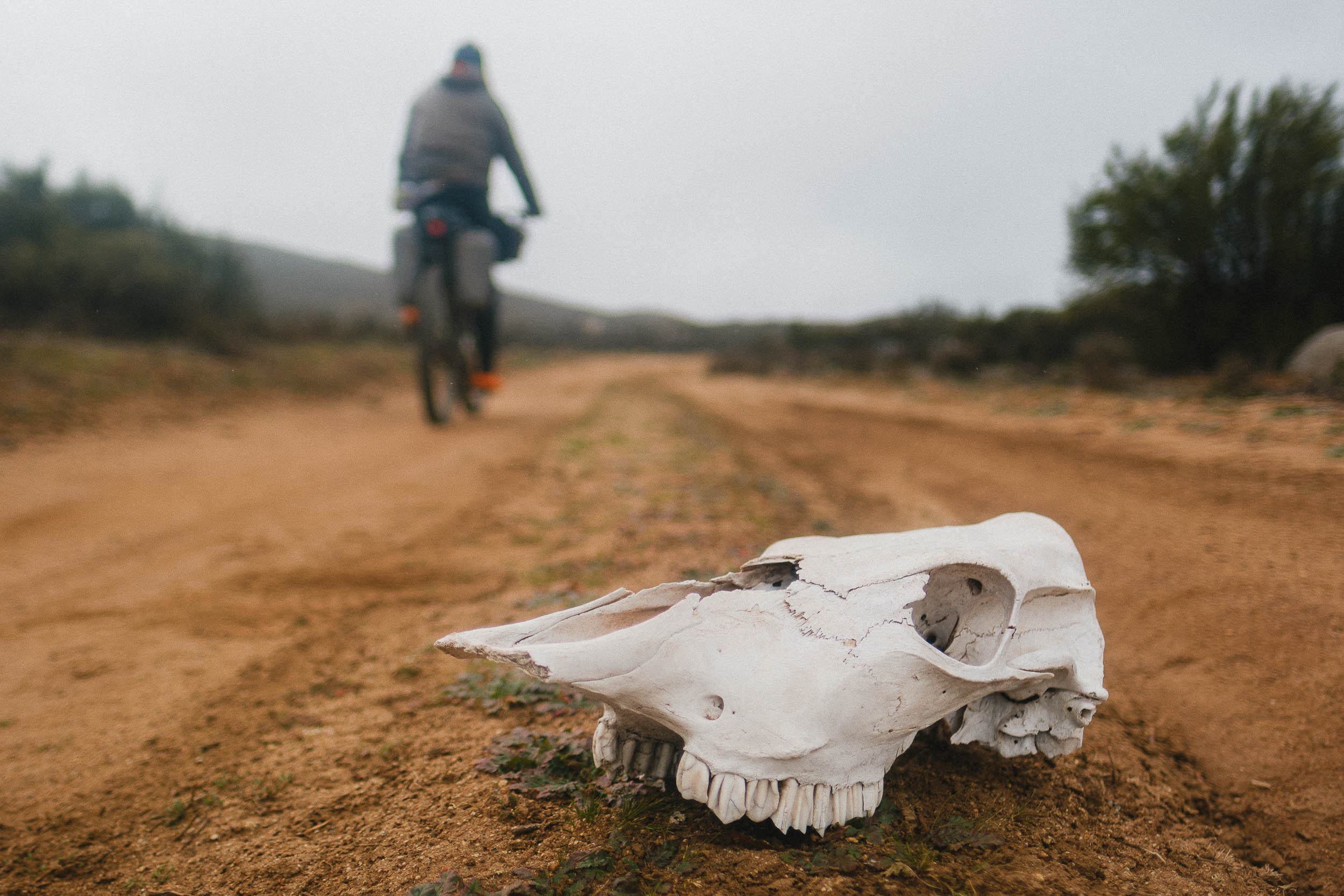
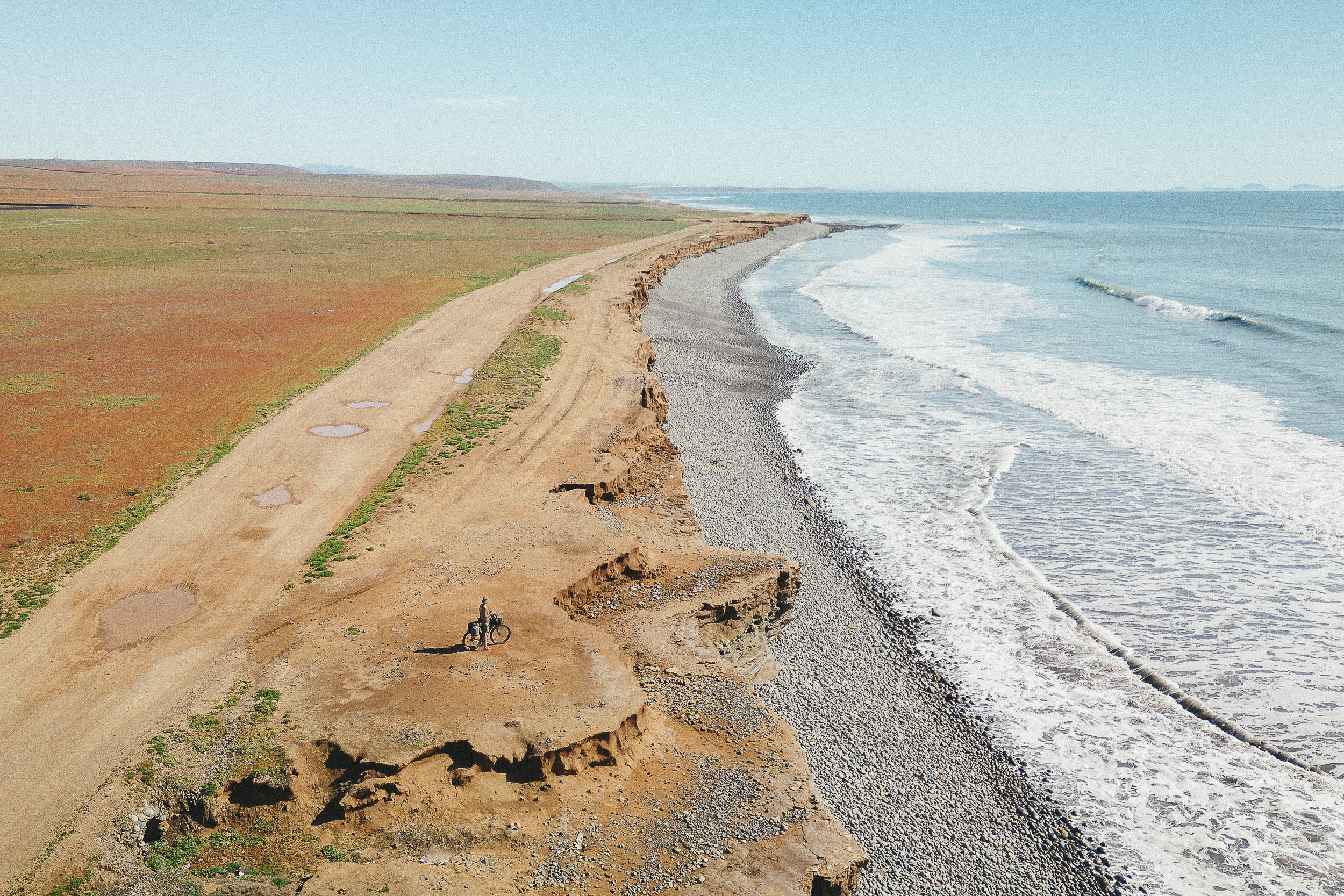
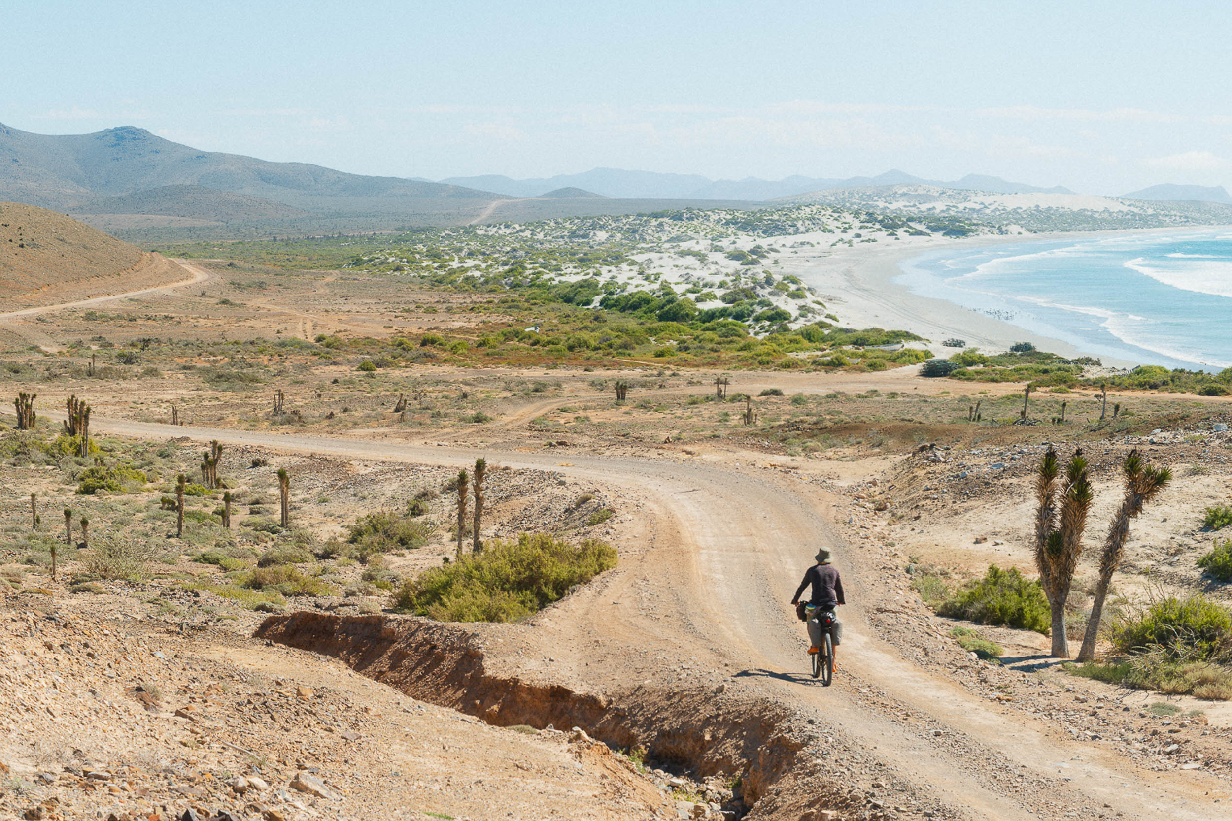
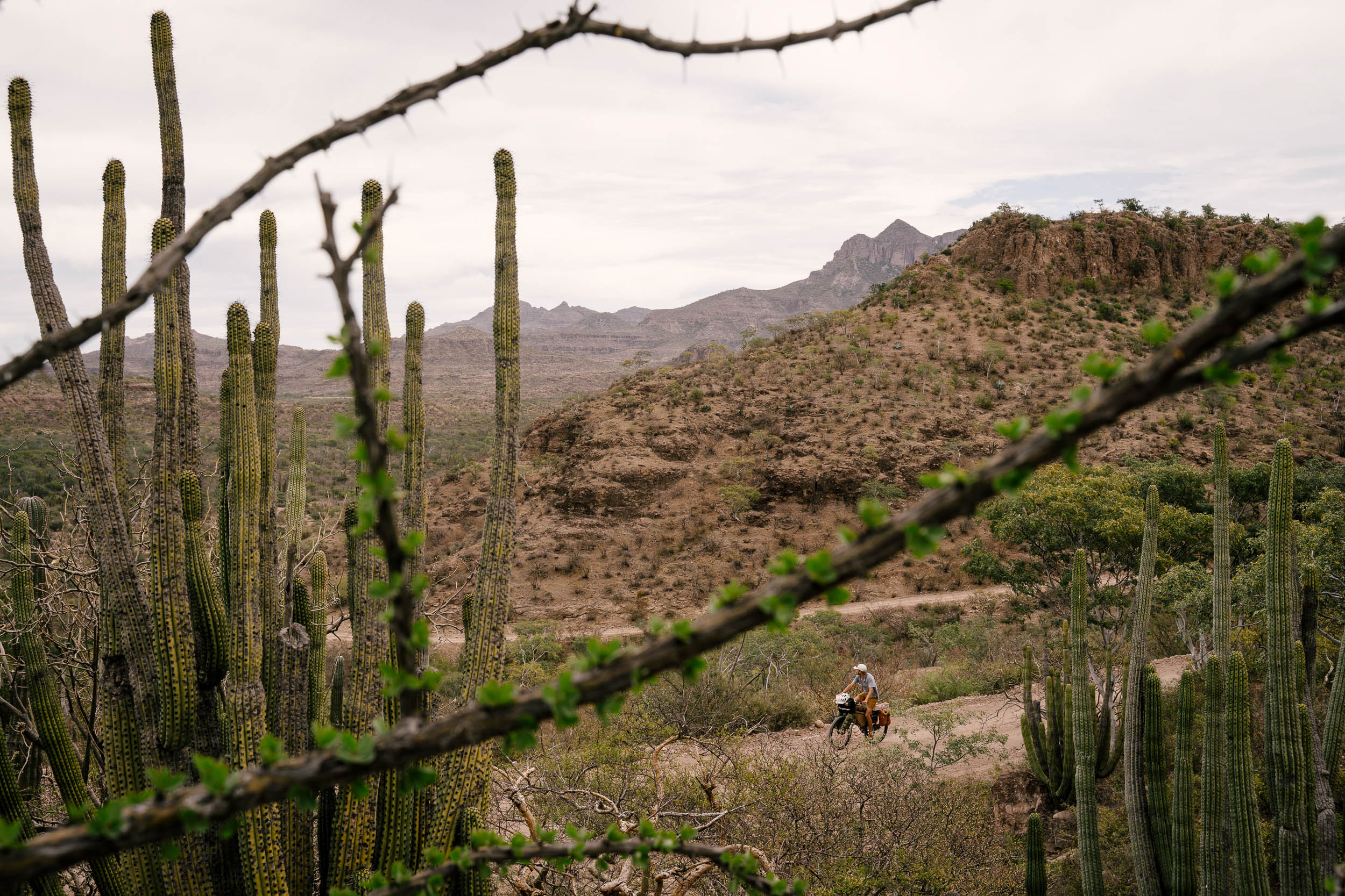
Baja California and the southern state of Baja California Sur are two of the least populated states in Mexico, especially if you exclude the sizable populations near the border in Tijuana and Mexicali. Wide-open deserts and rough-cut coastlines make Baja a challenging and delightful place to winter. Aside from the main paved Transpeninsular Highway, MEX1, there are few paved roads in Baja, and off-road motorists have been flocking here for decades. If you’ve ever looked at the California coastline in the USA and wished for some undeveloped routes along the water, just look a little further south: there are two undeveloped coastlines in Baja California.

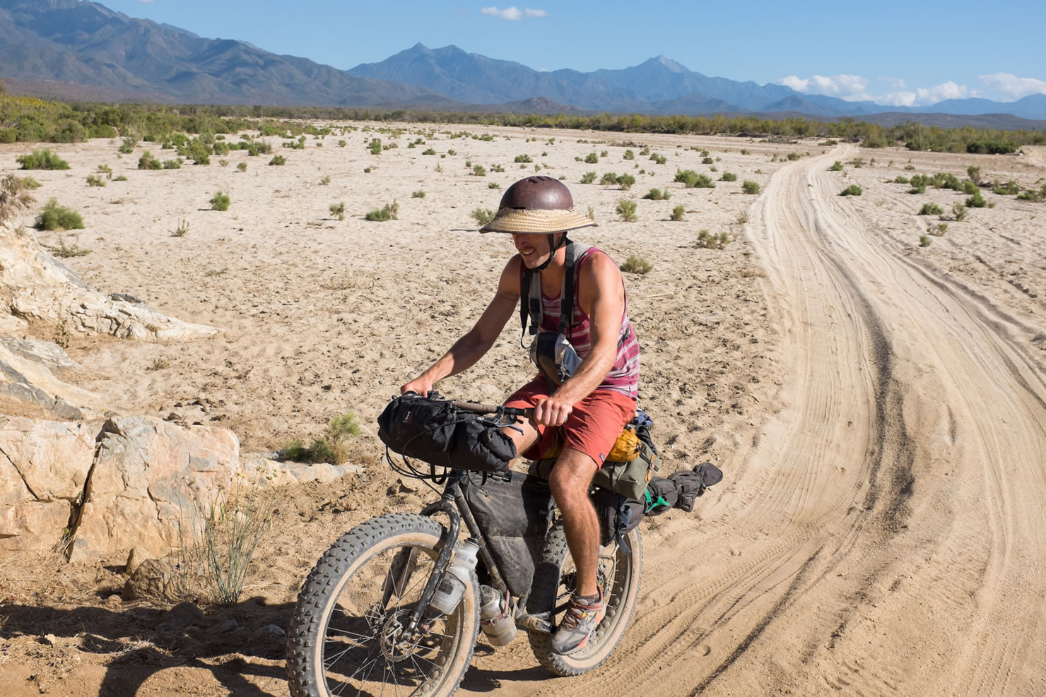

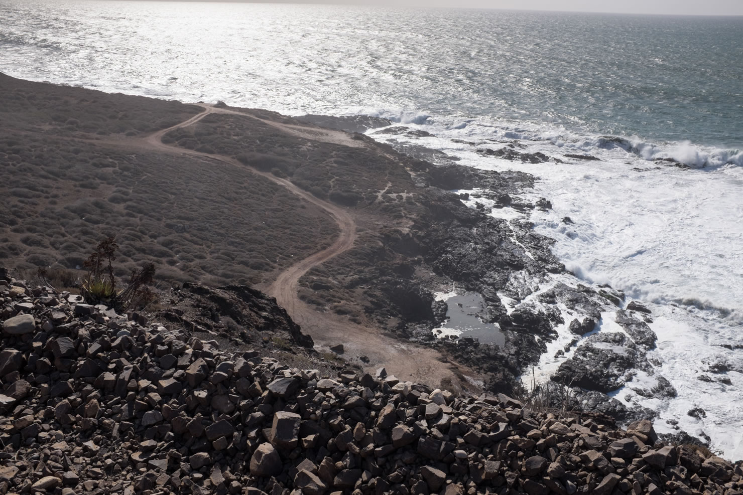
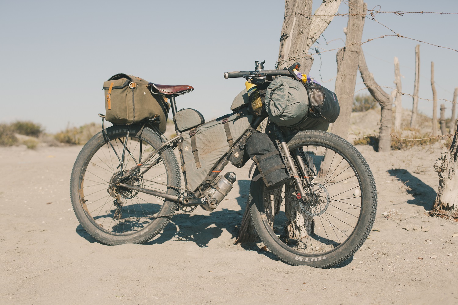
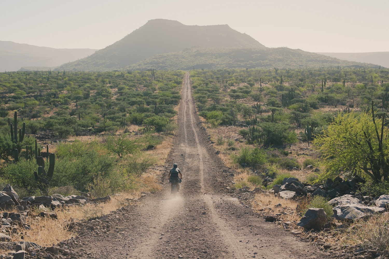
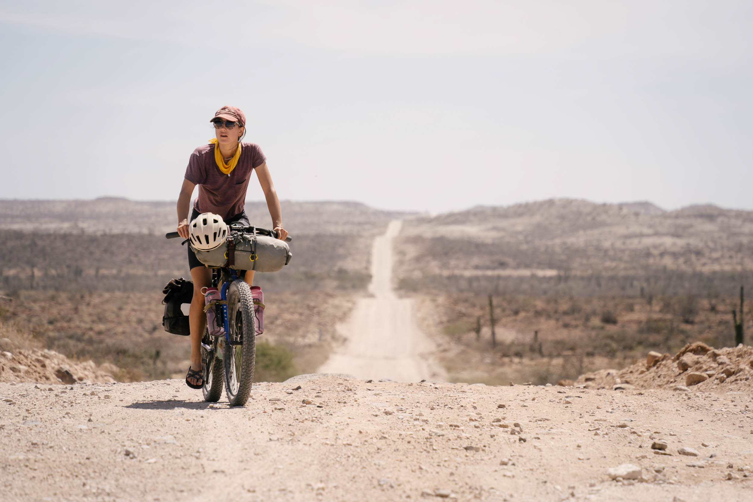
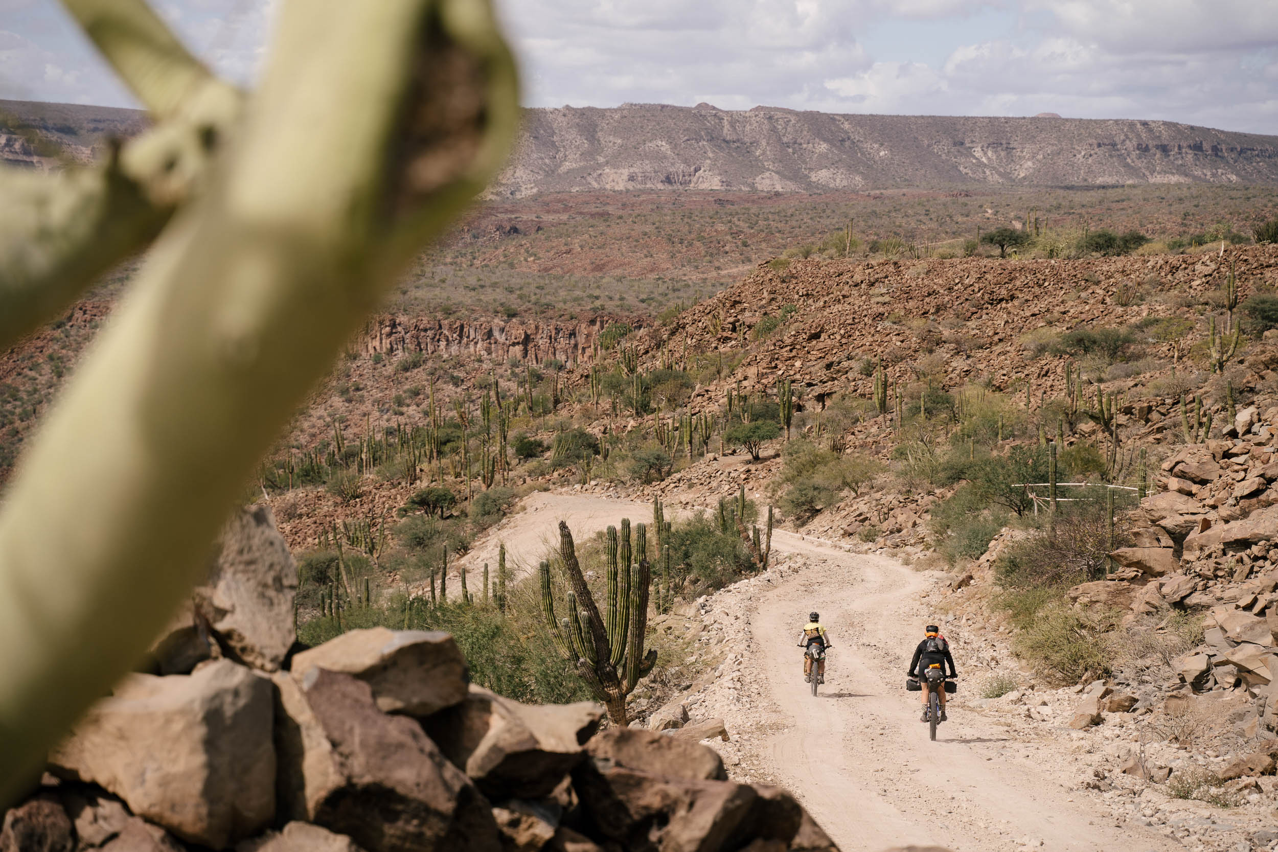
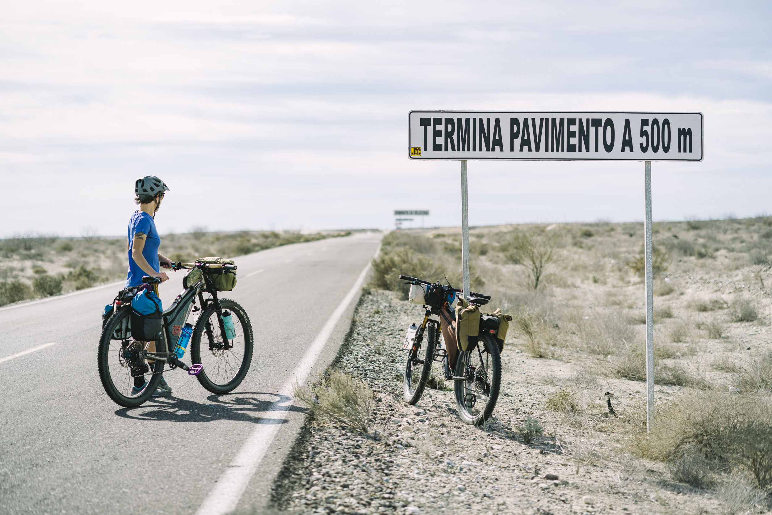
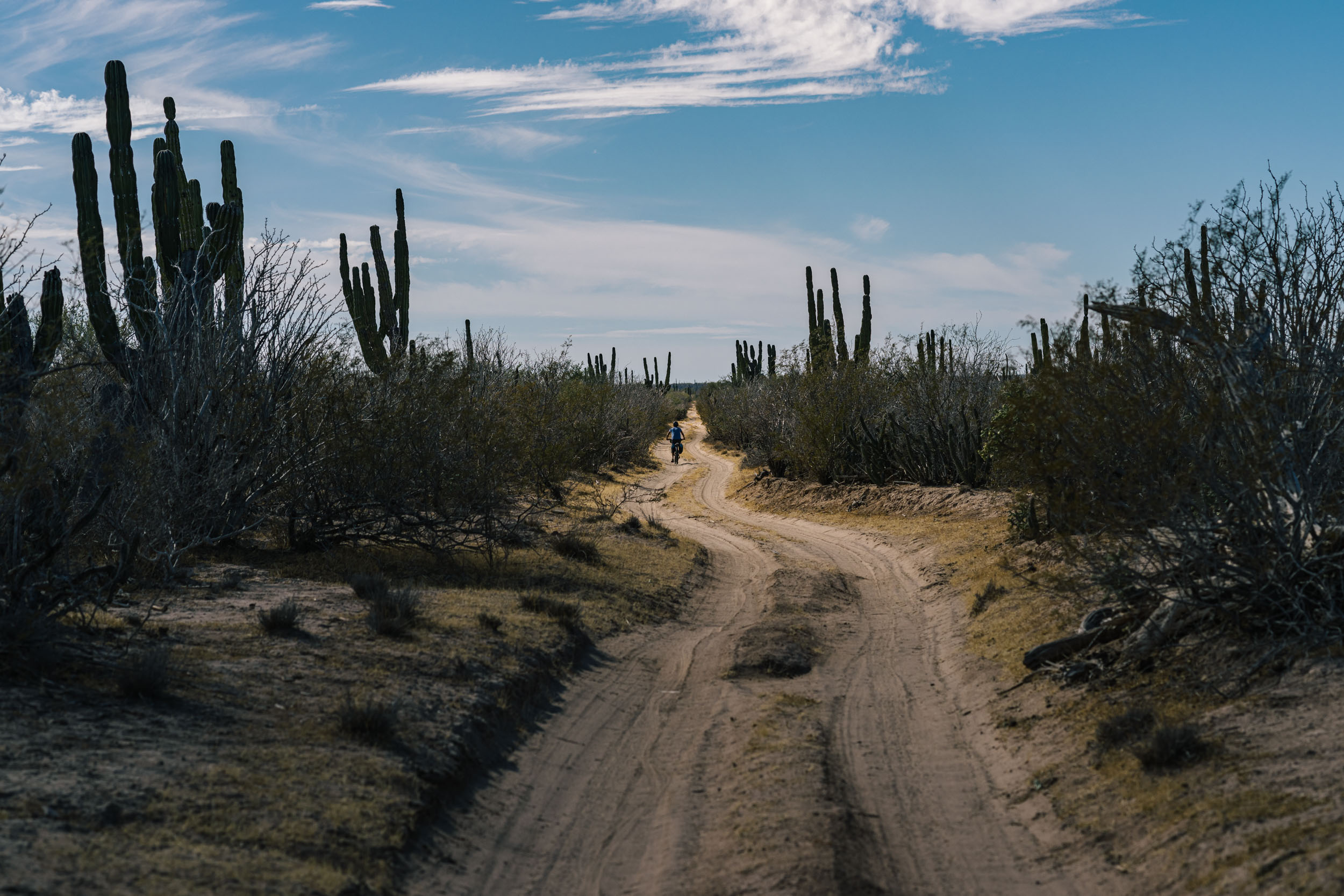
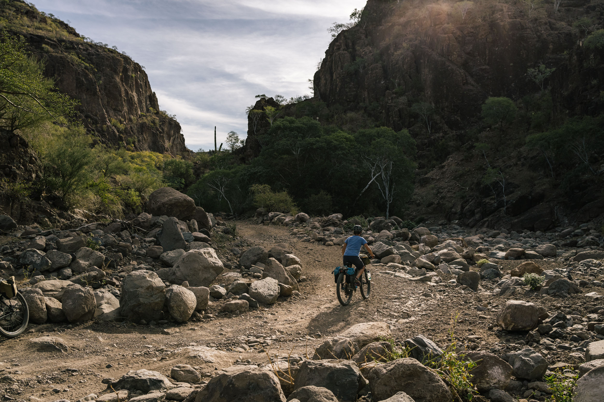
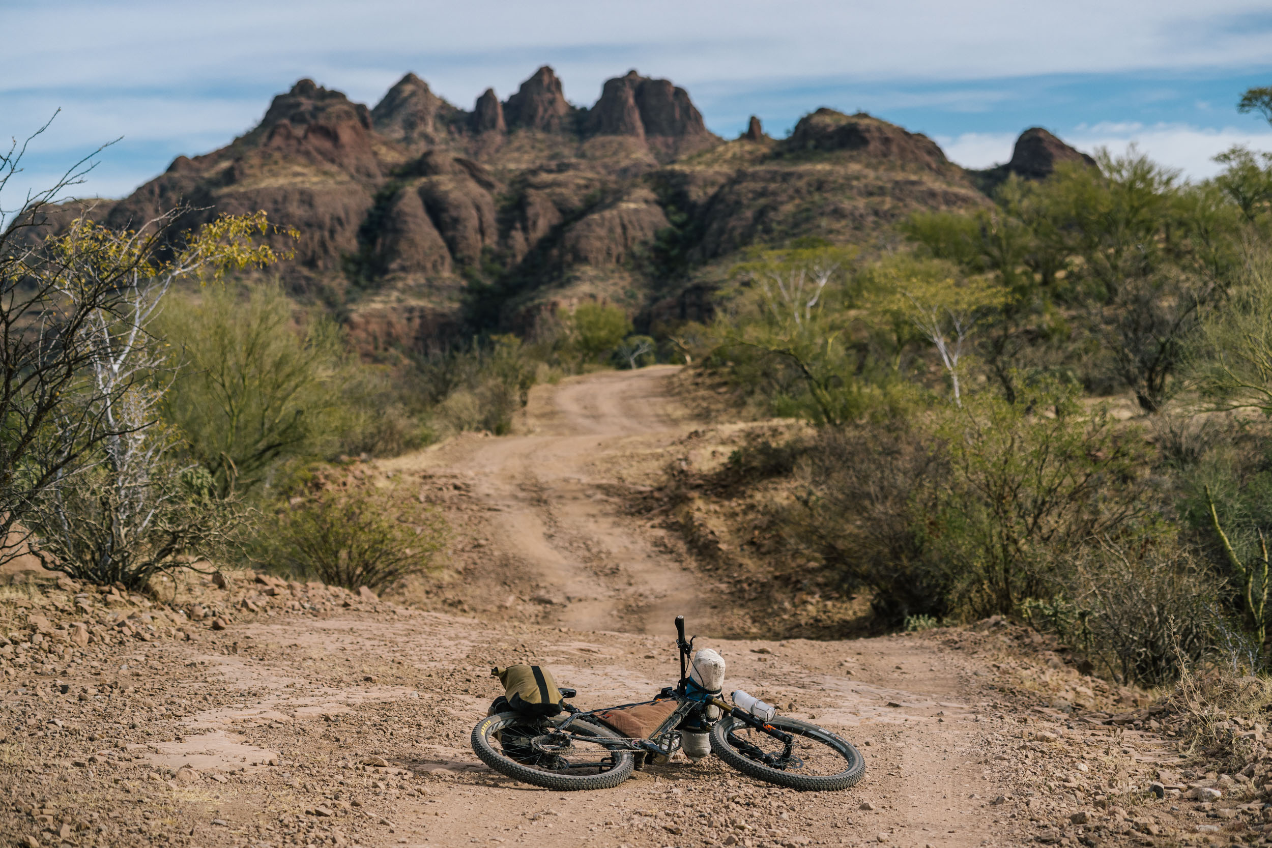
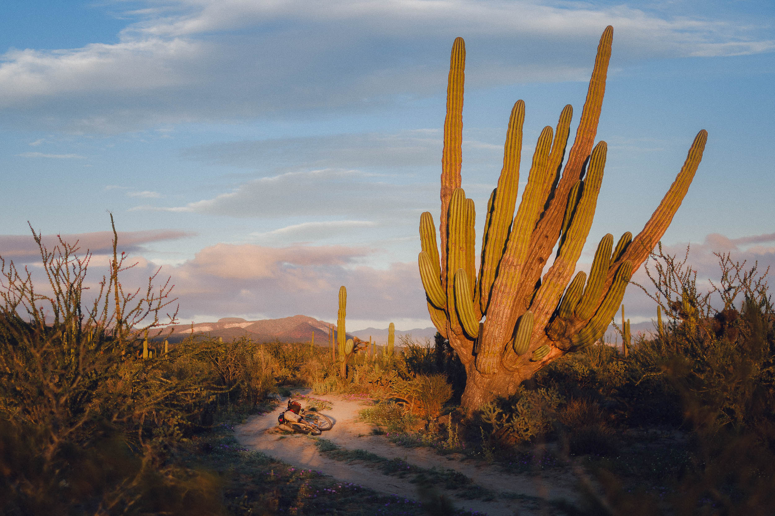
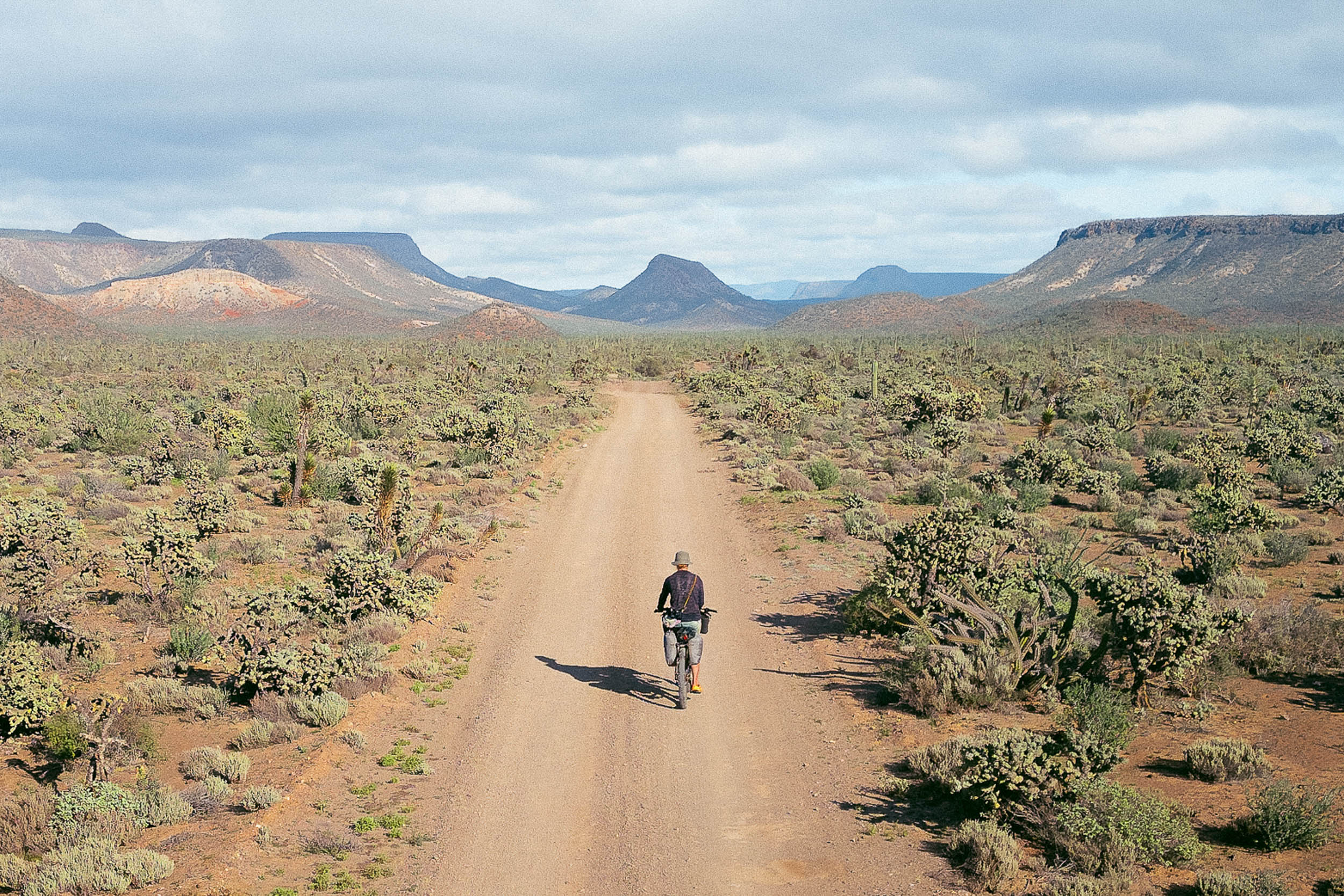
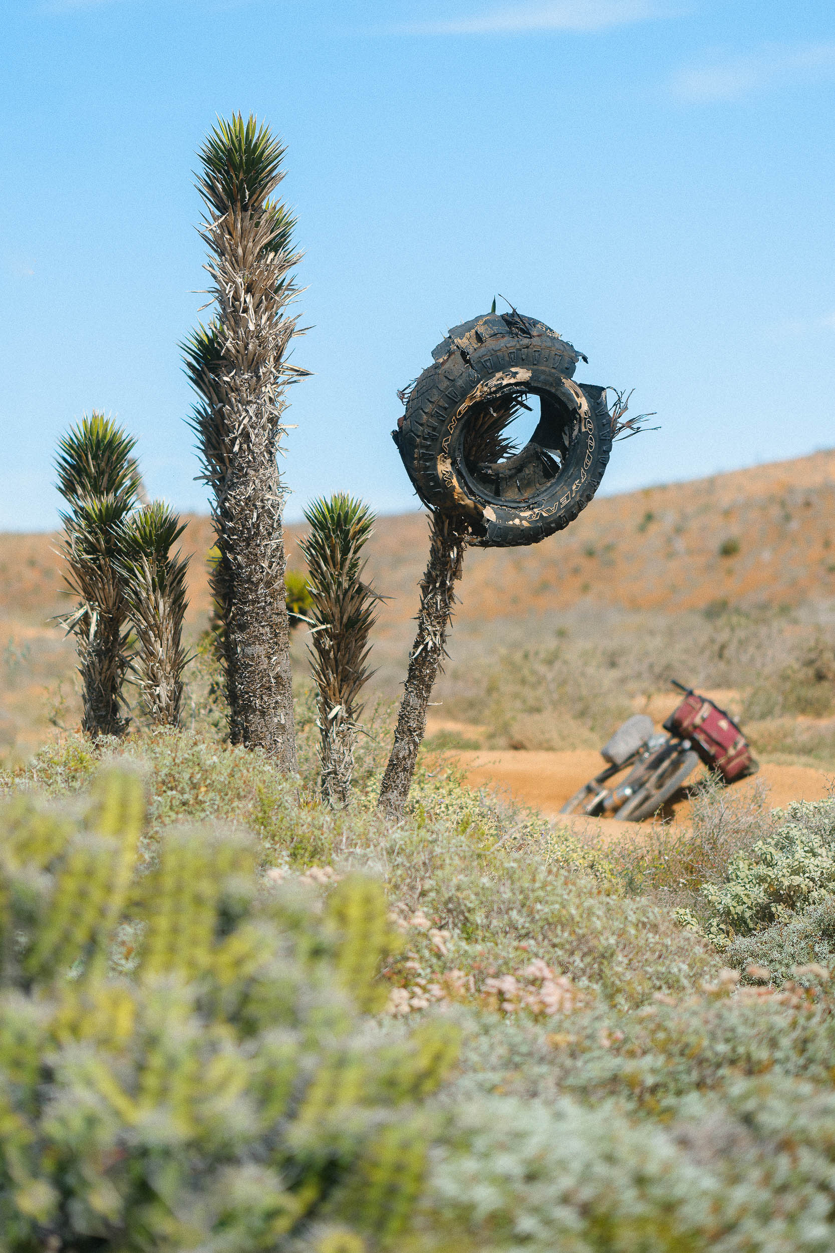
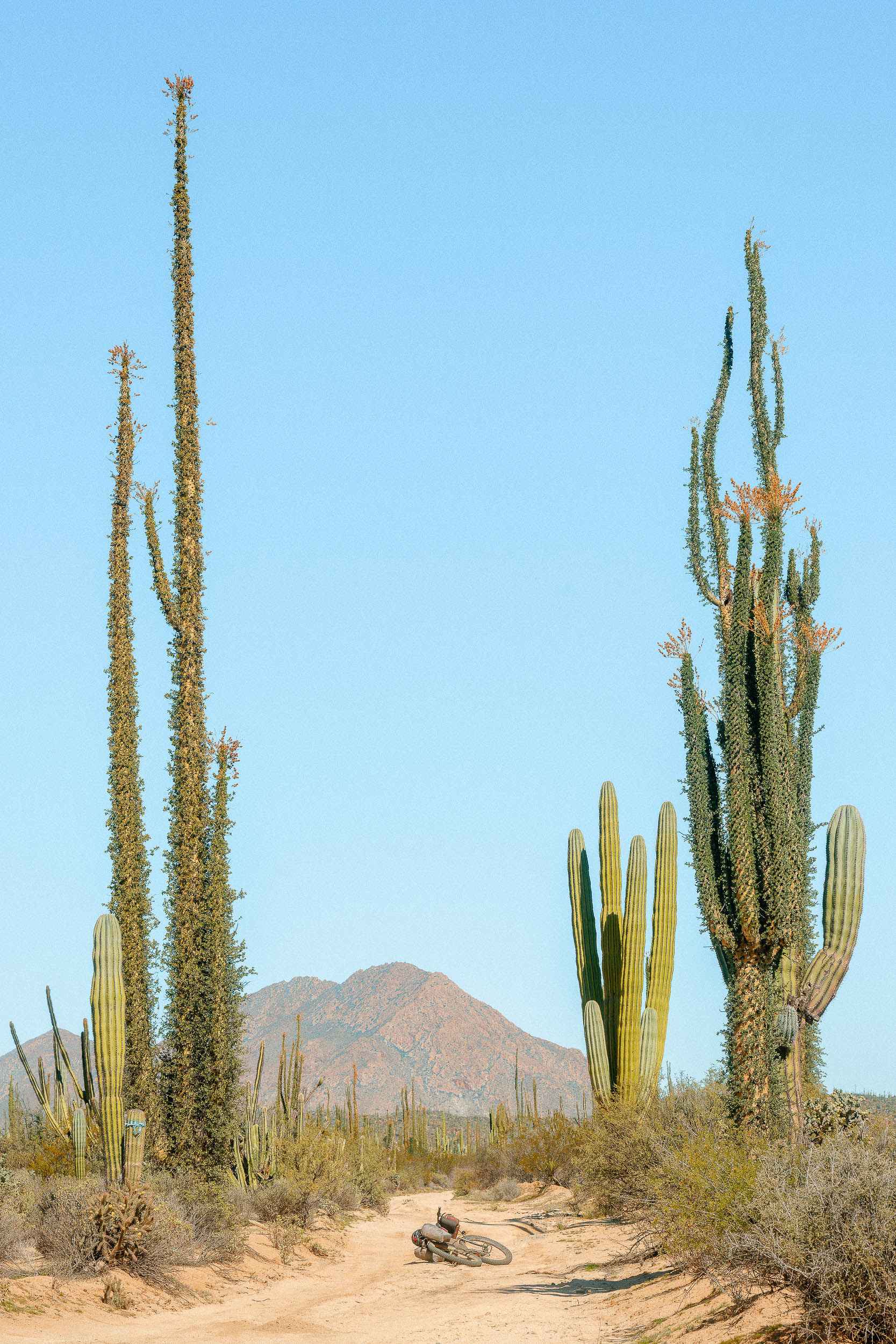
Graded dirt roads are common along well-traveled portions of the route and provide access to some rural fishing communities and ranches, but many parts of the Baja Divide receive infrequent maintenance and are routinely impacted by weather, while some tracks are passable only by a capable 4×4 vehicle, motorcycle, or bicycle. Rough mountain roads and sandy desert tracks are dealt in equal parts along the route. Plus bikes with 3.0” tires are recommended to stay afloat in soft sand, and frequent cactus thorns necessitate a tubeless wheel system.
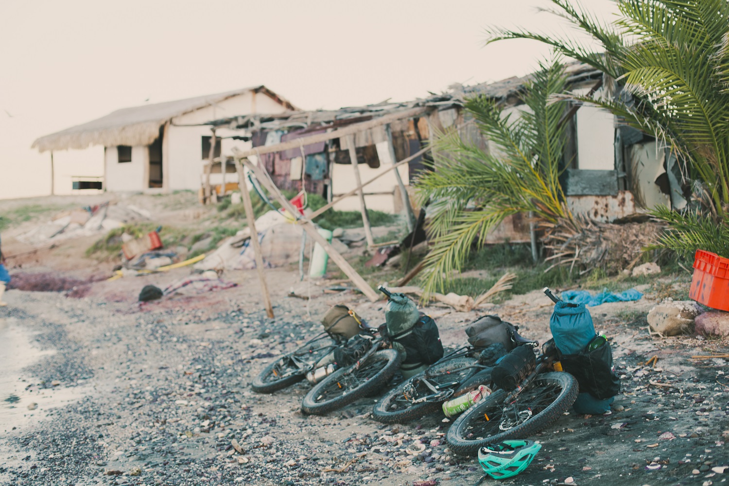
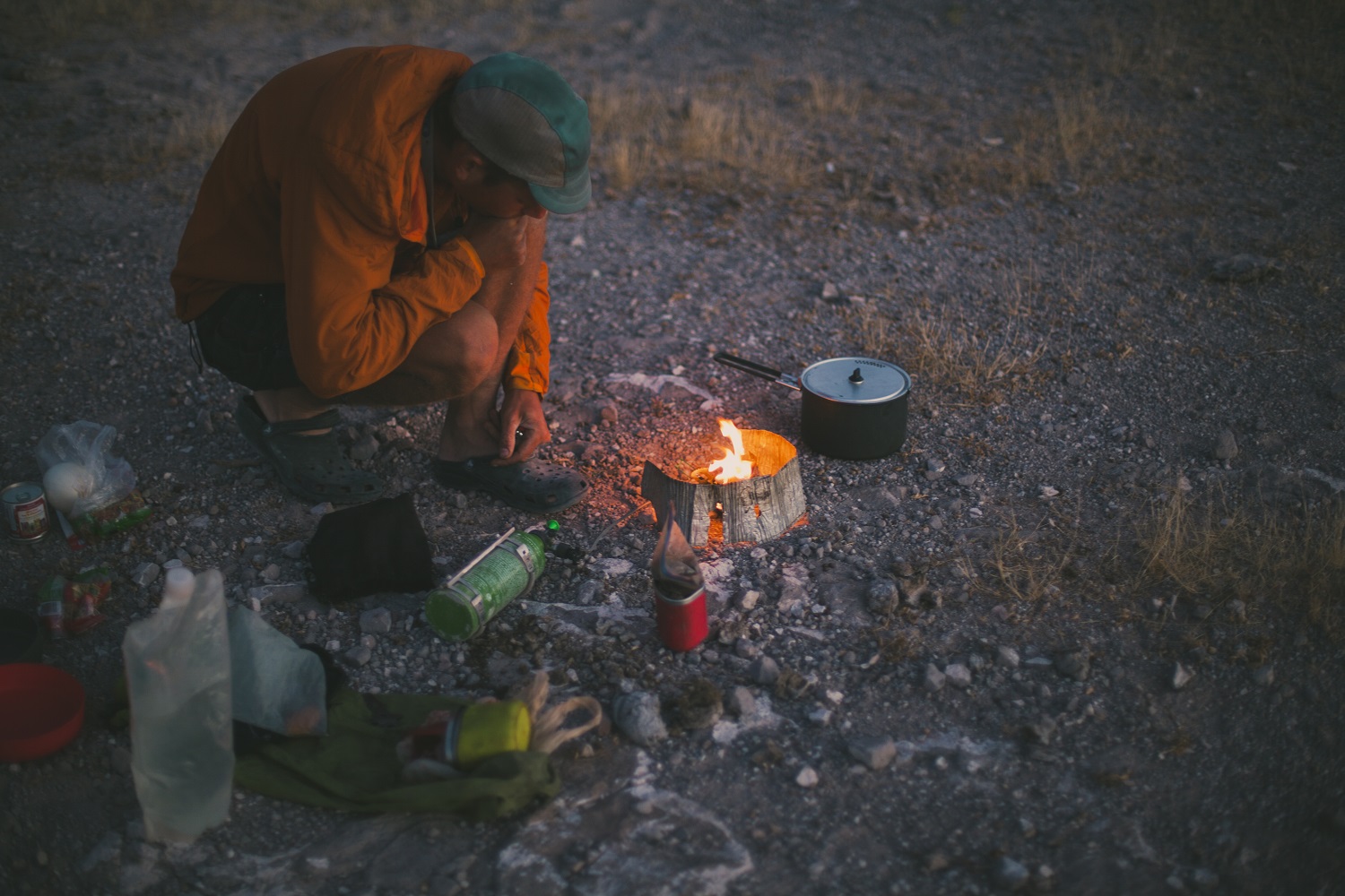
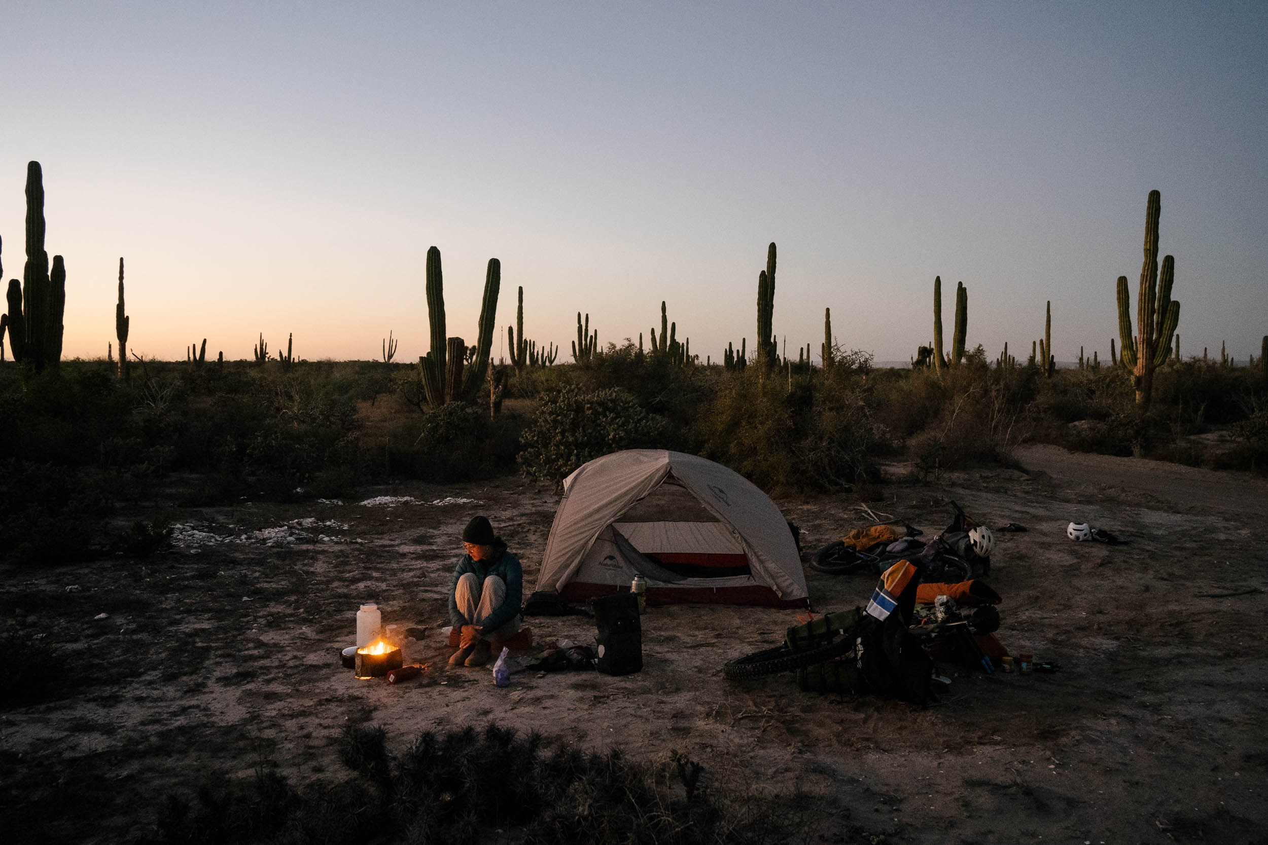
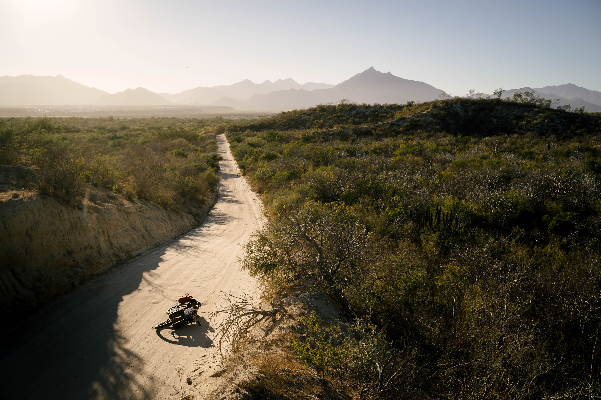
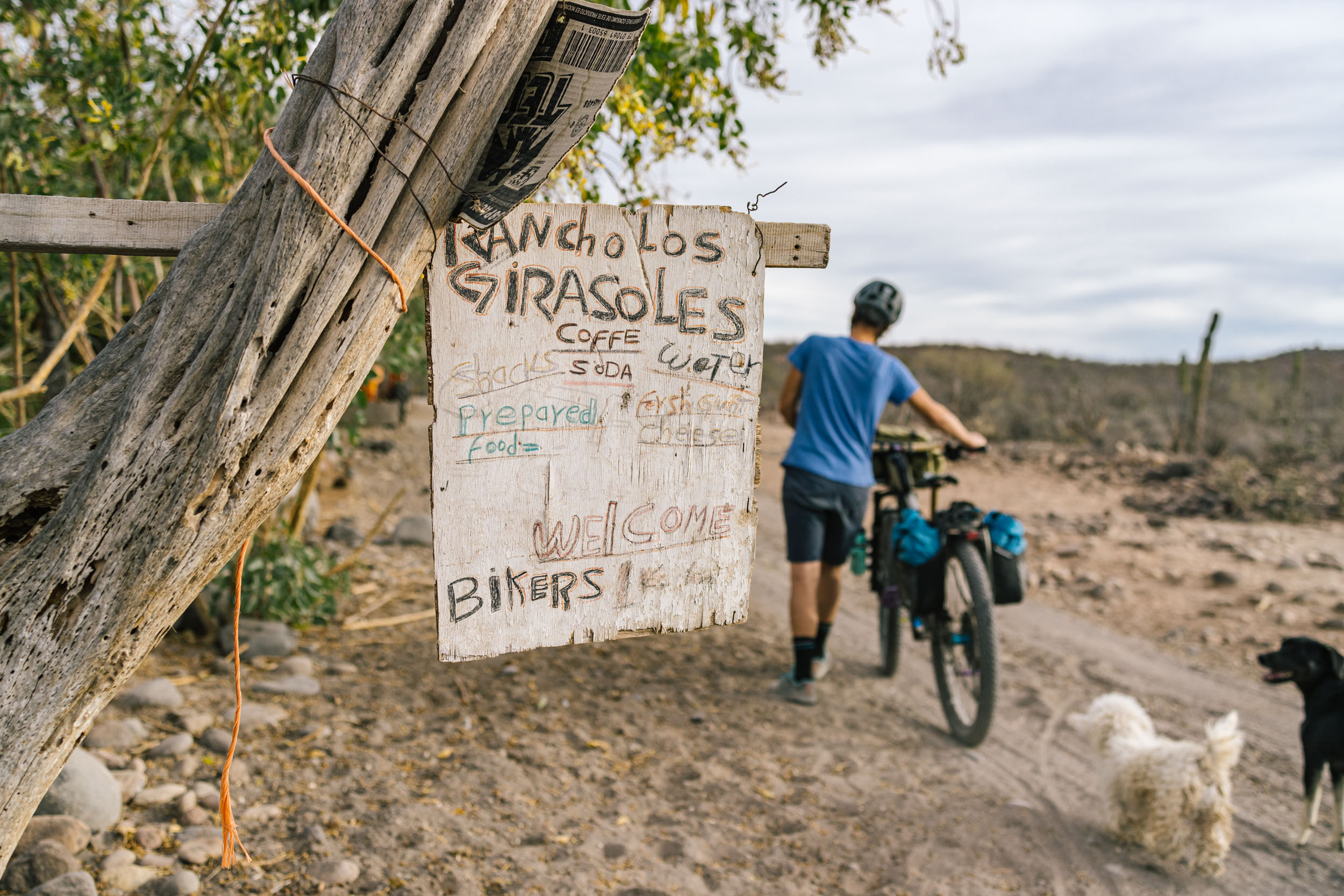
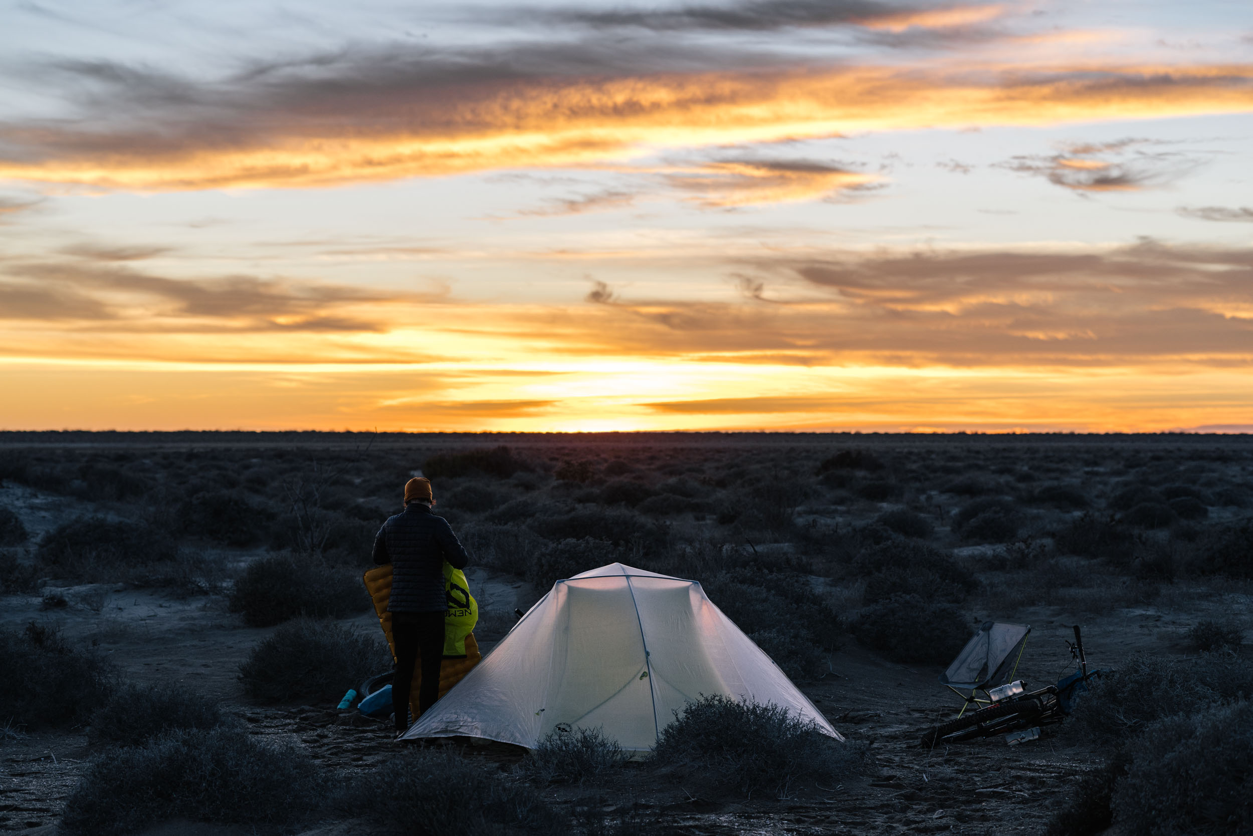
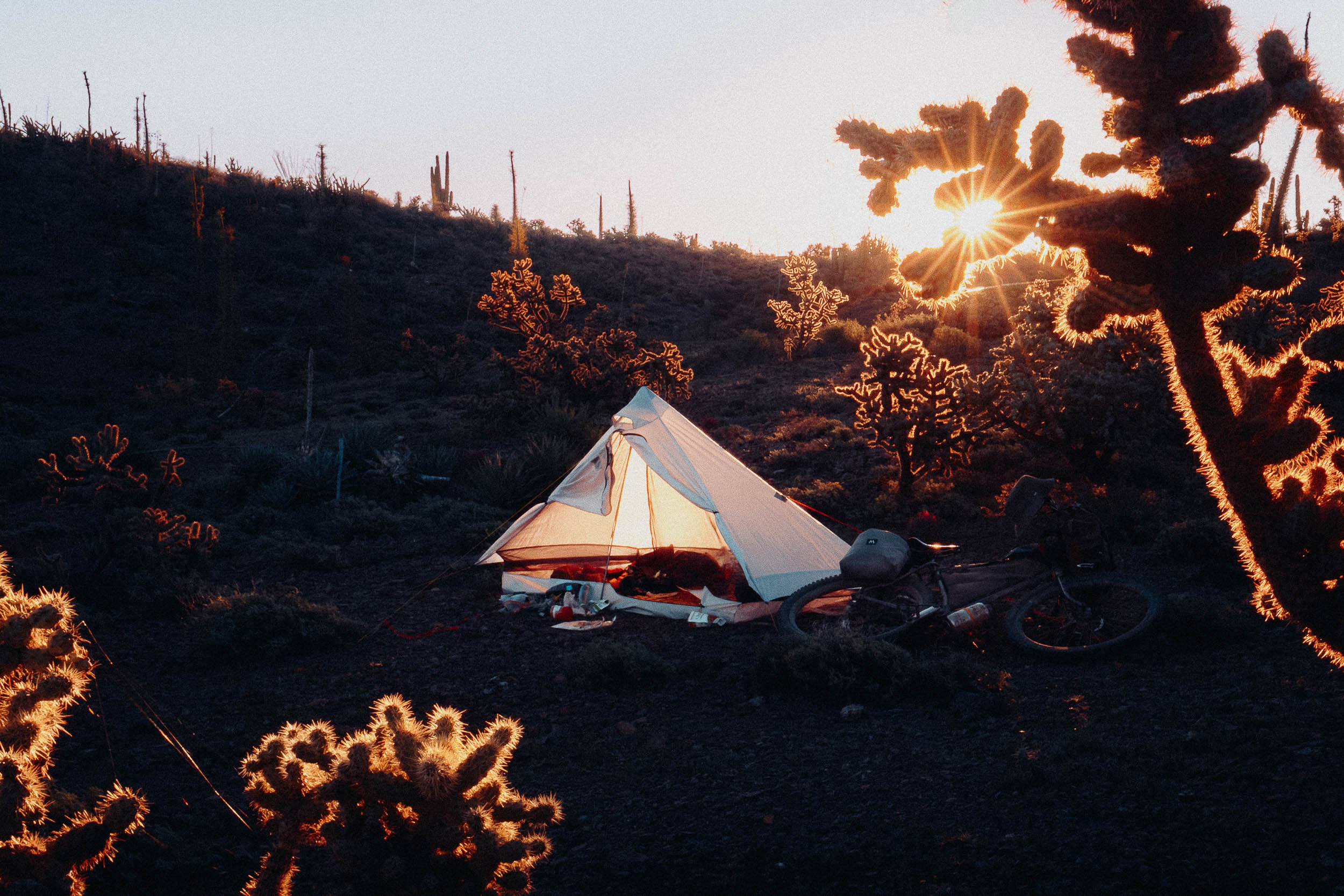
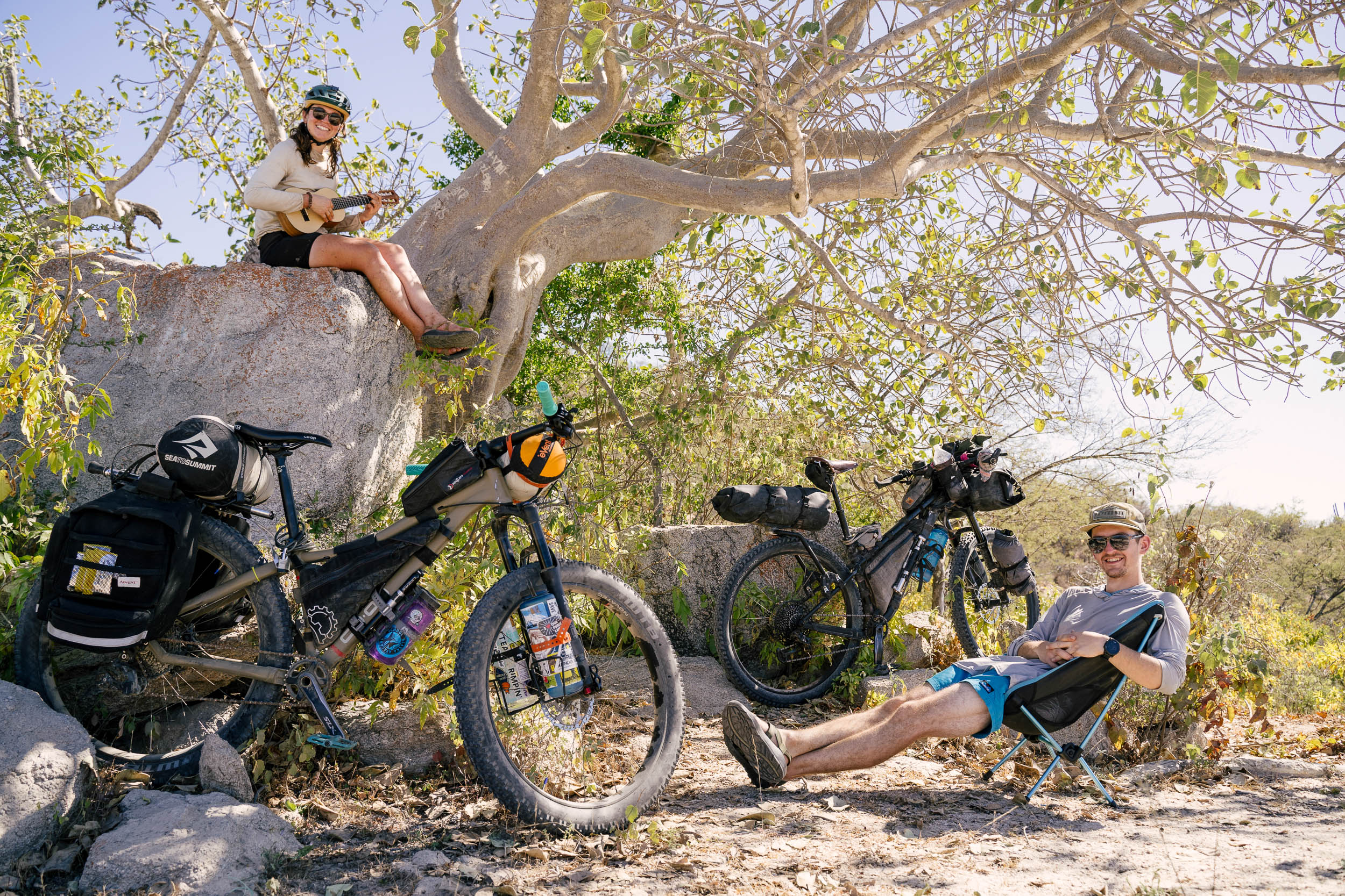
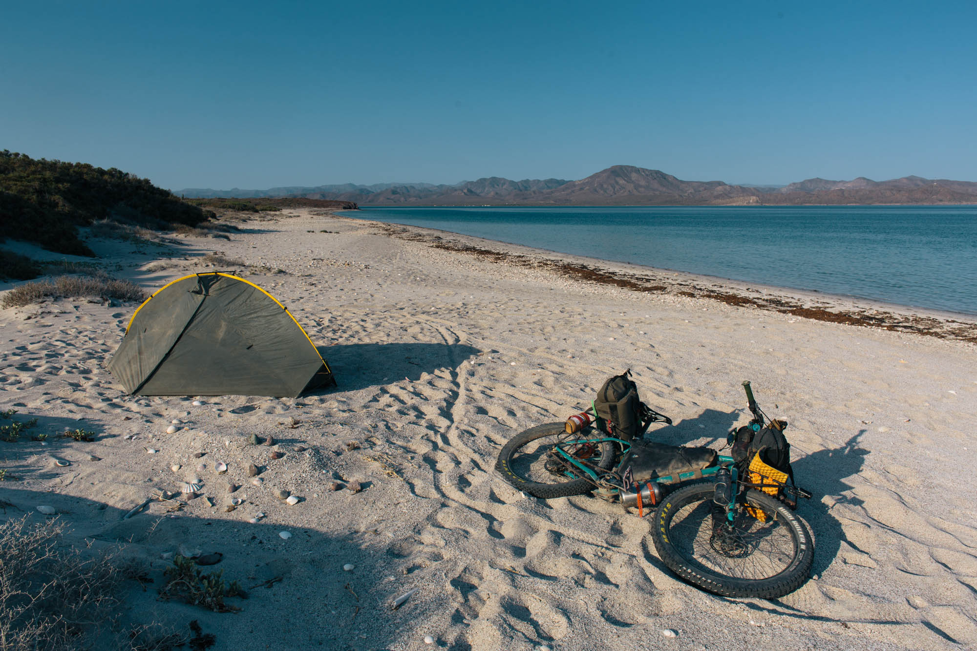
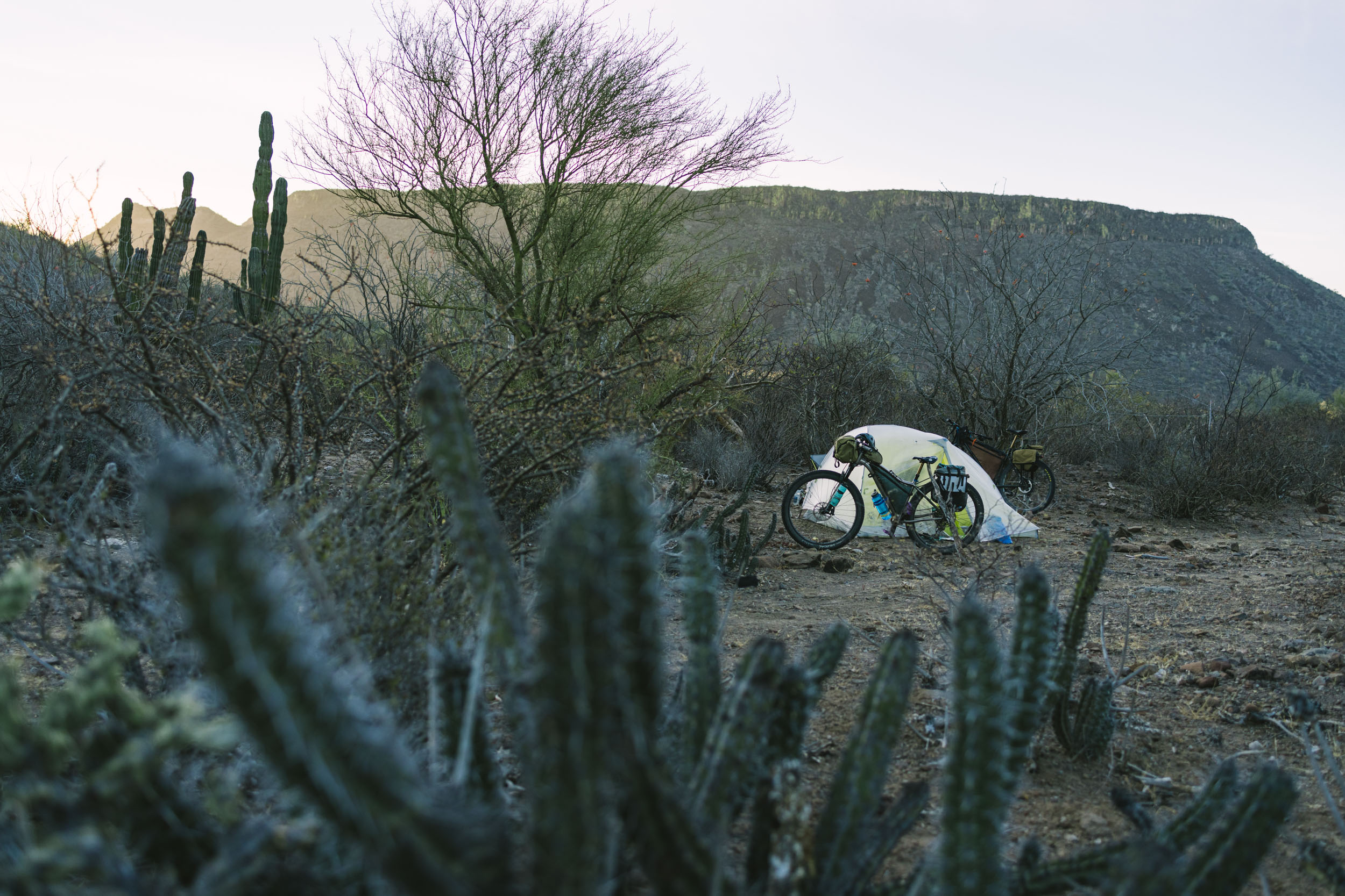
Life on the Baja Divide is defined by a rhythm of riding, camping, and resupply, and wild camping is one of the highlights of the route. Resources are limited, although the route is designed to encounter resupply frequently enough to make a self-supported tour possible. Riders may need to carry up to 2-3 days of food and 10-12 liters of water, although a warm, dry climate minimizes equipment needs. Pack light, and leave room for food and water on the bike.
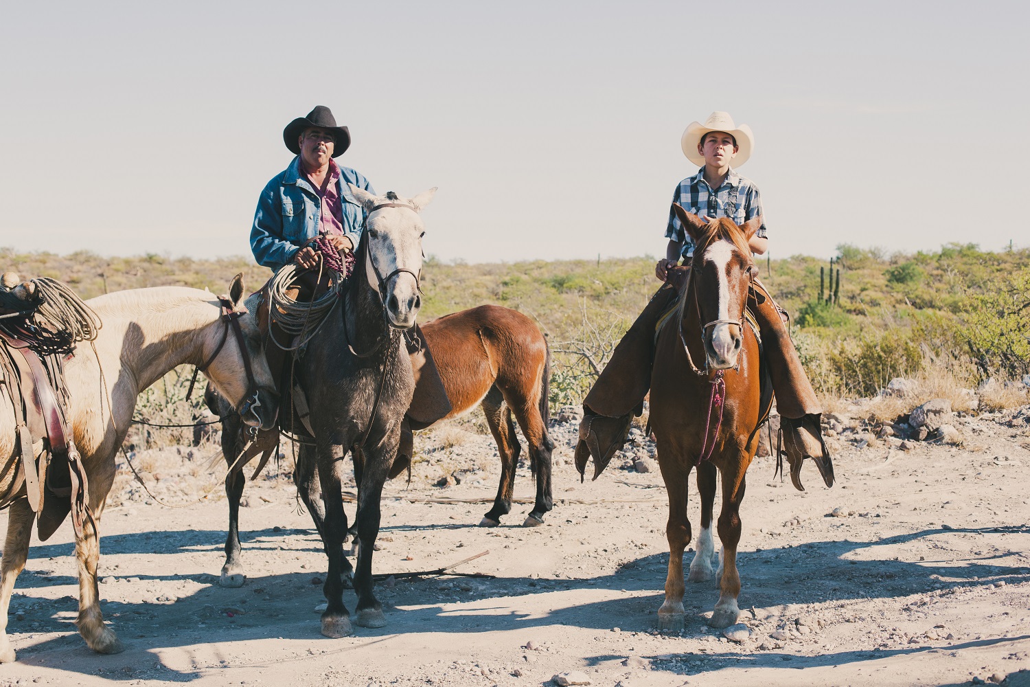
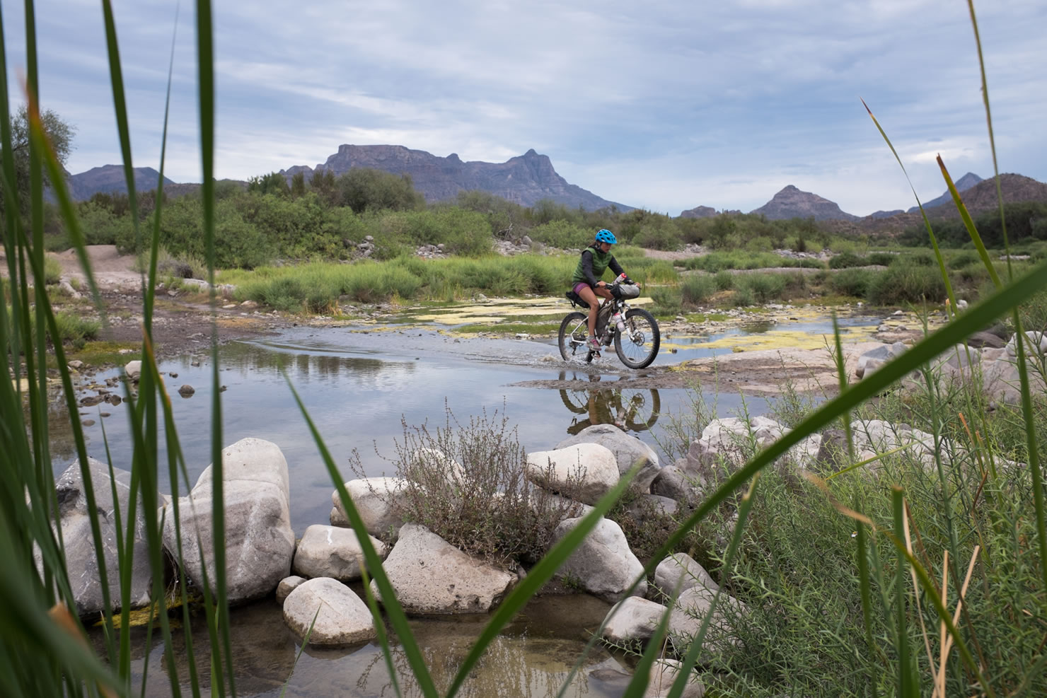
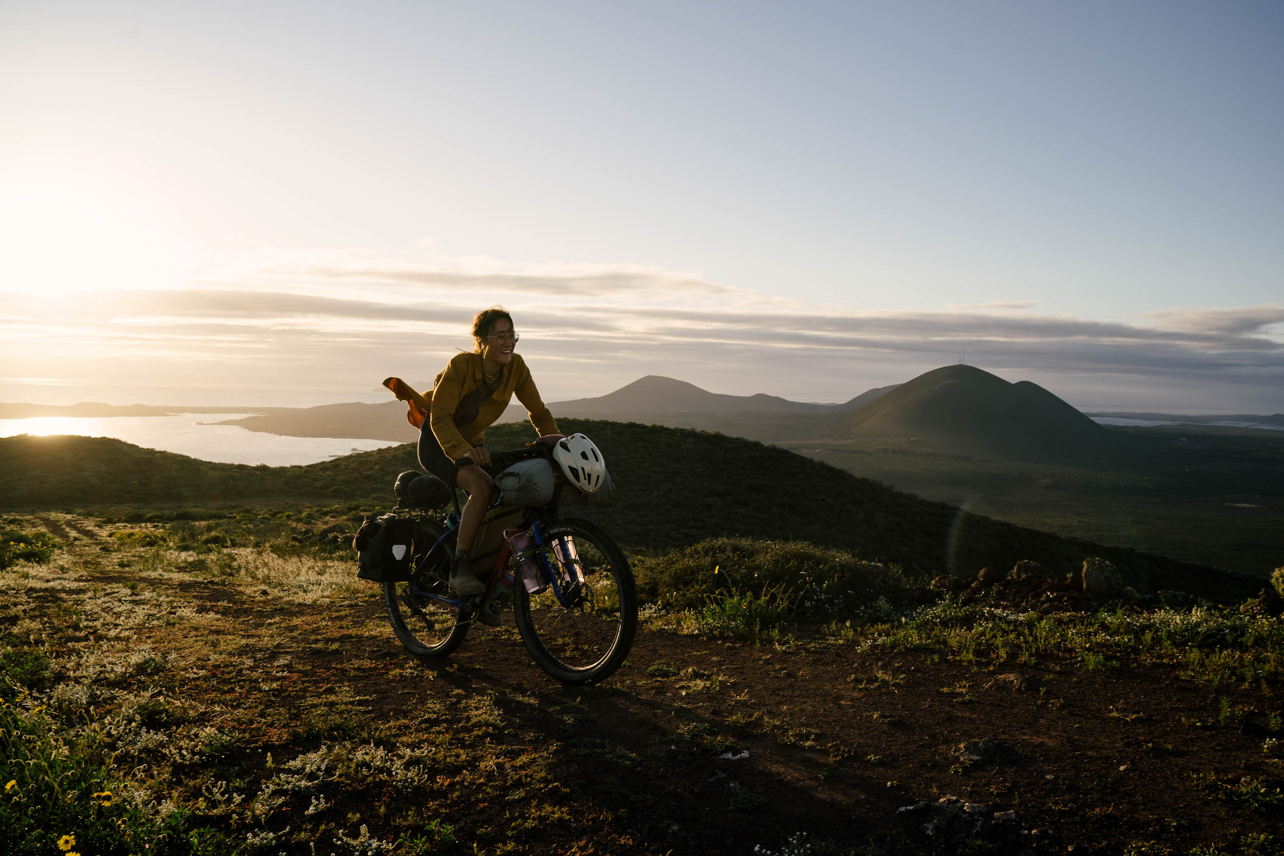
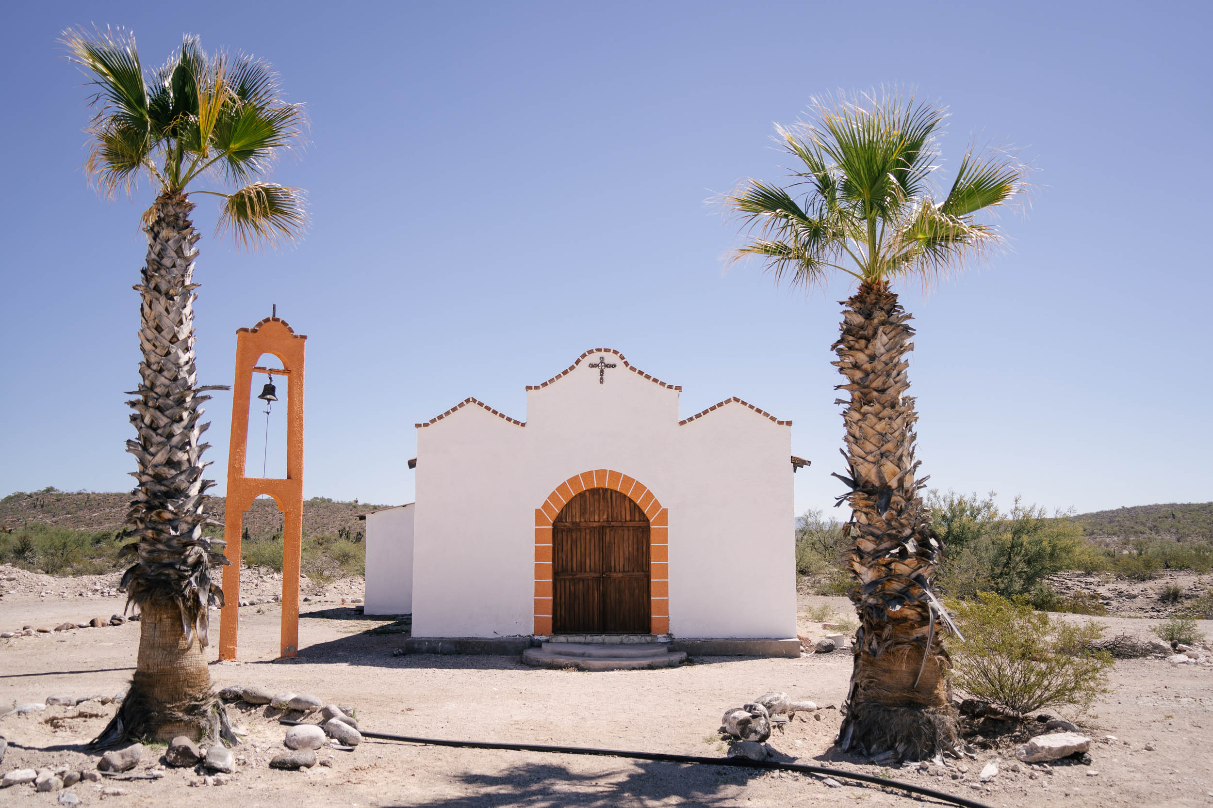
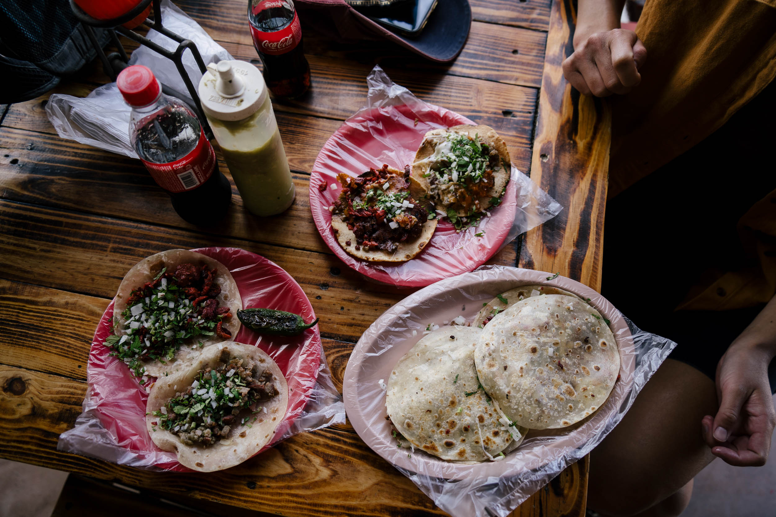
Baja California is a safe place to travel and has welcomed adventurers from around the world for decades. It is not essential that you speak Spanish to travel in Mexico, especially in Baja, although any effort to speak the language will enrich your experience in the country. The route passes a number of busy highway towns—including Colonet, Vincente Guerrero, Vizcaíno, and Ciudad Constitución—that are the best way to investigate modern Mexican life and find delicious tacos and pan dulce. The route also intersects a number of Spanish mission churches, almost always located nearby surface water and shady date palms. Beaches? There are more than a few of those, although some of the best beaches on the route are remote and would require hauling extra food and water if you plan to linger. You’ll be surprised to find cool clear water in some of the mountains, especially in the Sierra de la Giganta.
A GPS is required for navigation, as most of the roads and tracks along the route are unnamed and unmarked. Find more information in the sections below, as well as a thorough 20-section guide under the Trail Notes tab. The complete route is divided into 20 individual segments, defined by resupply points. Four larger segments—the Northern Sierra, Valle de los Cirios, Missions, and Cape Loop—provide suggestions for digestible portions of the route if time is limited.


Submit Route Alert
As the leading creator and publisher of bikepacking routes, BIKEPACKING.com endeavors to maintain, improve, and advocate for our growing network of bikepacking routes all over the world. As such, our editorial team, route creators, and Route Stewards serve as mediators for route improvements and opportunities for connectivity, conservation, and community growth around these routes. To facilitate these efforts, we rely on our Bikepacking Collective and the greater bikepacking community to call attention to critical issues and opportunities that are discovered while riding these routes. If you have a vital issue or opportunity regarding this route that pertains to one of the subjects below, please let us know:
Highlights
Must Know
Camping
Food/H2O
Trail Notes
Resources
- Miles and miles of beautiful backcountry tracks. Cirios trees, cardon cactus, mountains, canyons, and rugged coastlines.
- The stunning Sea of Cortez, where the desert and the mountains meets the sea.
- Bustling highway towns where tacos, ceviche, and fresh pastries are second only to a shower after a week in the desert.
- Spanish mission sites, situated in some of the most beautiful and habitable places on the peninsula.
- The singletrack trails at Cabo Pulmo and La Ventana/El Sargento (off route).
- Some of the best starry skies in the more remote areas of the route.
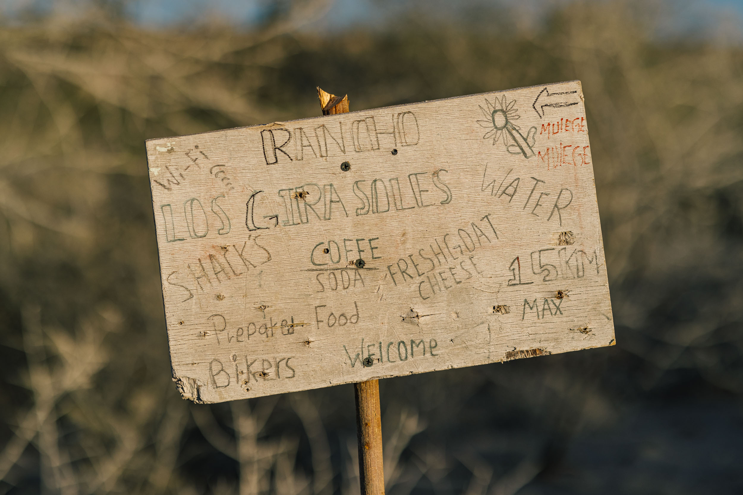
- Family-owned and operated businesses that have developed in some places along the route, providing some services such as camping, food and lodging, and more.
- The strong community of riders that has grown from the Baja Divide over the last decade.
When to Go
- Winter is the best time to ride in Baja, just as most off-pavement riding opportunities are closed for the season in North America and Europe. November to March is the best time to ride. Summers are extremely hot and late summer-fall is hurricane season.
- Nights in the desert can be cold, and northern mountains may even see snow during storms. Temperatures warm up as you travel further south, so plan accordingly.
- If a storm with rain is approaching, it’s best to find a sheltered spot and wait it out, as roads can quickly become impassable due to the clay road surfaces. Fortunately, they tend to dry out quickly once the sun returns.
Logistics
- Three airports serve Baja California Sur, in Loreto, La Paz, and San José del Cabo.
- Daily northbound and southbound bus service is available from most larger towns along MEX1, making a return to Tijuana uncomplicated.
- Several ferries are available from La Paz to the mainland, connecting to Topolobampo and Mazatlán.
- Citizens of the USA, Canada, Australia, the EU, and most South American countries are allowed visa-free access to Mexico for 180 days, although a small fee is required for visits longer than 7 days, paid at the border. This informal “tourist visa” is about $20.
- A passport and a $20 tourist permit is required at the Tecate border, payable in cash only (USD or Mexican pesos).
- Bank ATM dispense cash in most larger towns, although a few longer sections on the route require advance planning as cash is not available. Note, Cataviña, Bahía de los Ángeles, and San Ignacio do not have ATMs.
- A return route from San José del Cabo is offered for those that plan transport out of La Paz. Flights leave from La Paz and San José del Cabo, although ferries to Topolobampo and Mazatlán only leave from La Paz.
- Buses travel daily along the Baja peninsula in both directions, operated by Aguila and ABC. Both companies allow bikes on a space-available basis. It’s recommended to remove the front wheel and pack your bike as compactly as possible (we like using the bags as padding and plenty of Voile straps). If several riders are traveling, be prepared to stack bikes. Buses make stops at Tecate, Colonet, Vicente Guerrero, San Quintín, Cataviña (ask at Mision Hotel), Vizcaíno, San Ignacio, Mulegé, Ciudad Constitución, La Paz, Los Barriles, San José del Cabo, and Todos Santos.
- You can usually flag a bus in towns or at waypoints without official stops, and they’ll pick you up, accepting cash for payment. Local restaurants or shops can provide bus schedules. Buses can also drop you off at locations without official stations.
- The Baja Divide Facebook page is a great resource for research, updates, and conditions.
Navigation
- The route is only navigable by GPS; the map has been updated extensively as of October 2024 with the help of Pat Boyle; additions include a loop into La Ventana via singletrack south of town (about 16 miles); new singletrack at Cabo Pulmo (about 3 miles); new route from Vicente Guerrero to Nueva Odisea (about 30 miles). This section follows the roads west of the highway now, along the coast and around some small volcanoes. Salvador from FASS bikes scouted this route.
- Do your dudillegence before setting out. You can check Pat’s updates here.
- Resupply Legend: Use the following to decipher map POIs and guide in Trail Notes tab: F-large food store or town with multiple substantial stores, f-limited food resupply or shop with limited packaged snacks, W-Water, M-Motel, C-Campground, R-Restaurant, B-Bike shop, $-Bank ATM, Bus, Airport
Bike Choice
- Sandy tracks require bigger tires. We recommend a hardtail or rigid mountain bike with 2.6” tubeless tires or larger (3.0″ is ideal). Tubeless tires are absolutely required because of all the cactus spines.
- Logan and Virginia’s Baja Rig Checks have their full packlists and offer a little insight into why they chose the bikes they did.
- Wild camping is easy everywhere along the route, and is limited only between San Diego and Tecate. You can camp on the eastern side of Otay Mountain, before descending to Engineer Springs on the road.
- Motels are well-priced, especially as a shared expense ($15-35 is typical for a double occupancy room).
- It can be difficult to source fuel for alcohol stoves. Gasoline would be the most reliable fuel source, although we enjoyed fresh foods for the three months we spent in Baja while researching the route.
- Fires should be avoided in desert environments; animals and the desert ecosystem rely on the limited amount of dead cacti and wood. #leavenotrace
- Water is limited along most of the route, although the resupply guide and distance chart should allow you to plan ahead (see Trail Notes).
- Carry 8-12 liters on longer sections of the route, such as from Cataviña to El Cardón (to Santa Rosalillita).
- Water sources referenced in the guide and map can change and shouldn’t always be relied upon.
- There may be some natural surface water along the route, most are seasonal.
- Managing food on the Baja Divide is generally easier than water, though some smaller stops may have very limited supplies or could be unexpectedly closed.
- Mexican stores have great bikepacking foods, including bags of beans, hard cheeses, fresh tortillas, and vegetables. Nuts, packaged cookies, and fruits provide convenient snacks.
- Beef is common in Mexico, and ranching continues to play a role in the local economy. Beef tacos are popular fare around the highway towns.
- Even though towns like Vizcaíno and Ciudad Constitución aren’t on the water, their proximity to both coasts makes then a great place to try ceviche, fish tacos, or seafood cocteles.
- Dig into the map to find some of our favorites.
The original Baja Divide Route Guide was written and developed by Nicolas Carman in 2016 and divides the route in to 20 sections. This version was updated by Pat Boyle in 2024, which you can download as a PDF here. See the Must Know tab for resupply legend and other important details.
location 57.2 miles (92.1 km)
(1) San Diego to Tecate
Notes: mixed terrain urban routing out of San Diego, 3000′ Otay Mountain ascent, few wild camping opportunities, BMX Hall of Fame at the Olympic Training Center, stop at the historic Barrett Junction Cafe for one last American meal (now closed), bring $25 cash for tourist permit at USA/MX border crossing, for free camping after Tecate plan to ride to Cañon Manteca or stay in town at one of several hotels and campgrounds on route, most pavement of any route section
Warning: Camping is limited due to proximity of San Diego and the border.
Resupply: San Diego-FWMCRB$ BusAirport, Barrett Junction-WR, Tecate-FWMCRB$ Bus
The Baja Divide route begins at San Diego International Airport, several miles north of downtown San Diego. A variety of bike paths, on-street bike lanes, urban dirt paths, and singletrack lead out of the city to the base of Otay Mountain. The route passes a high density of suburban resources while leaving town including a Trader Joe’s, Sprouts and Home Depot. Just before dropping out of town onto a mellow singletrack system around Lower Otay Lake, the route passes the Olympic Training center in Chula Vista, which is also home to the BMX Hall of Fame and Museum, a worthwhile stop.
The climb over Otay Mountain is one of the single greatest climbs on the route, however the track follows a well graded dirt road up the mountain which begins very steeply from Otay Lakes Road. The view from the top of the mountain visually connects the city of San Diego and its many neighborhoods and harbors with the bustling city of Tijuana, Mexico, while the Rio Tijuana and the international border are visible from up high. To the east, rocky, folded mountains allude to the terrain along the route in the next few days south of the border. There is little camping on this section, although near the top of Otay there are some options and a possible campsite is found on the east side of Otay Mountain (BLM) in a grassy meadow just before descending to the paved road at Engineer Springs, whereafter the route passes a series of rural communities along dirt roads and irrigation ditches, descending to Barrett Junction via an old wagon road.
The Barrett Junction Cafe (now closed) is an historic establishment on Hwy 94 and is the only service in the valley. The cafe was especially popular during post-war years when San Diegans would drive out for the fried fish dinner and populate the dance hall on weekends– fish dinners were free, but patrons paid for their beers. The cafe was an informal museum of a bygone era and features vintage beer signage, B&W photos, and more than a few guns and animals on the walls, and still serves a classic American menu.
A paved climb and descent lead from Barrett Junction to Tecate, a city of approximately 65,000 people at 1775 feet. Traffic along Hwy 94 is moderate at times and is one of the busier parts of the route. A valid passport is required at the border. For extended travel in Baja California a tourist permit is also required, available for purchase at the border in US or MX currency for about $35, cash only (no cards). You must enter the immigration building on the right to fill out paperwork. The tourist visa is paid at the window outside where a receipt is provided. Once across the border, you will enjoy the energy of a small Mexican city. This, however, is the quietest and most pleasant border crossing between the US and Baja California.
The Sweetwater Summit Regional Park is about two miles off route at the edge of Chula Vista and offers camping. There is Thousand Trails private camping at the bottom of the Otay mountain climb. Recommended bike shops in San Diego include RIDE Cyclery (location in downtown SD) and Cal Coast Bicycles. The route also passes near several shops, including Hub and Spoke Cycleworks, Performance Bicycle, and the Trek Bicycle Superstore.
location 77.1 mi (124.1 km)
(2) Tecate to Ojos Negros
Notes: enter Mexico!, climb out of Tecate, good camping begins at Cañon Manteca, highest point on route is between Neji and Ojos Negros at 4700′
Resupply: Tecate-FWMCRB$ Bus including large supermarkets, San Francisco-fWR is last chance for resupply to Ejido Sierra Juarez-fWR, Ojos Negros-FWCR
Tecate is one of the largest and most cultural cities on the Baja Divide. From the border, the route passes through a large shaded plaza, a small commercial alley with two bike shops, the towering Tecate brewery, and a shopping center with an expansive modern supermarket and other resources. There are excellent taco restaurants in Tacate that are open late. Be sure to obtain cash, which won’t be available again until Vincente Guerrero and food, which will get you through to Ejido Sierra Juarez (53.1 mi). The route climbs through a series of neighborhoods, onto dirt streets and rejoins a two lane highway for the final miles out of town. Minor resupply is available along that road and the final point of resupply is a plaza including an OXXO convenience store in San Francisco immediately before turning onto dirt. This is the last water resupply until Ejido Sierra Juarez as well, although in wet seasons there may be two streams flowing along this section. Wild camping is possible several miles after leaving the paved highway south of Tecate, and free camping is abundant beyond this point along the rest of the route. Be respectful of the land and local residents.
Update (2020): A group of riders report being robbed by a local man on a bike while camped at the bottom of the first unpaved descent out of Tecate, at the waypoint marked Cañon Manteca. Presumably, he followed them from town. To avoid such risk, leave Tecate in the morning and ride at least several miles beyond this point, or more. To report any suspicious activity in the area please post on the Baja Divide Facebook Group, or contact local police.
From Cañon Manteca the route slowly climbs small dirt roads to join a larger dirt road at Neji where no official services are available. The route continues south ascending to 4700′, and passes several pine stands and sage meadows at elevation near the highest point on the route. The route mostly descends to Ejido Sierra Juarez and Ojos Negros from the high point. Ejido Sierra Juarez has a good store, a small restaurant and a tiny beer shack. Purified water is available at the store and there may be informal camping near town in the baseball field. Ojos Negros is a larger community just 3-4 miles down the road and has several stores, restaurants and is a popular checkpoint on the Baja 1000. There is a campground on the left as you ride into town. Stock up in Ojos Negros for a day ride to Ejido Uruapan and Santo Tomas, which should take 4-6 hours.
location 46.7 mi (75.2 km)
(3) Ojos Negros to Santo Tomás
Notes: view of the Pacific Ocean from the highpoint south of Tres Hermanos, huge descent to Ejido Uruapan is initially rough and eroded, but improves, hot springs in Ejido Uruapan, vineyards in Santo Tomás, Ensenada is about 25 miles from both Ojos Negros and Santo Tomás and has all services Warning: No water available between south end of Tecate and Ejido Sierra Juarez (63 miles).
Resupply: Ojos Negros-FWCR, Ejido Uruapan-FWC, Santo Tomás-FWCR
South of Ojos Negros the route crosses paved Highway 3, continuing along farm roads and eventually onto some well used Baja 1000 tracks. It passes a series of ranches and abandoned ranch sites ascending to a high point after Tres Hermanos with the first view of the Pacific Ocean since crossing into Mexico. From here the route descends all the way to Ejido Uruapan. The initial descent off the top of the mountain is very steep and rough and may require some walking. After several undulations, a prolonged descent leads to the valley floor. Erosion on parts of this descent requires caution.
There are a couple of small stores in Ejido Uruapan, and a hot springs is signed from town. Hotel Boutique Los Vinedos gets good rider reviews. There is an official campground at the junction with MEX1, and nearby a wine tasting room. The few miles of highway riding to Santo Tomás have a generous shoulder, which you lose in the final hundred yards. You’ll likely feel the wind of a passing vehicle as you leave the pavement, a reminder of what it would be like to pedal the length of the peninsula on the busy highway. Santo Tomás is not much more than several small stores along the highway, a restaurant, and a campground, and the area is known for its wine. After a steep climb out of town, camping is possible en route to the coast.
location 53.4 mi (85.9 km)
(4) Santo Tomás to Colonet
Notes: steep climb out of Santo Tomás, scenic dirt roads along the rocky Pacific Coast, Colonet is the first of many colorful MEX1 highway towns with fun food and resupply Warning: No bank or ATMs available at Colonet.
Resupply: Santo Tomás-FWMCR, Ejido EréndiraFWMC, Colonet FWMR Bus
A steep switchback climb leads out of Santo Tomás where after relatively little elevation change defines the rest of the route to Colonet. The road is wide and well traveled with a few rocky and sandy sections. This is the first wild coastline south of the border. It is a remarkable contrast to the developed coastline of Alta California, USA. Eréndira is a small fishing town with some tourism and several well stocked shops. South of Eréndira the route navigates farm fields, passes a unique rocky outcropping and eventually climbs away from the water. It follows some well used Baja 1000 tracks and eventually passes the Johnson Ranch before rejoining a graded dirt road to Colonet. Colonet is a bustling MEX1 town whereby the highway acts as a main street to the community. There are many loncherías, panaderías, taco stands and stores. This is the last major resupply until Vicente Guerrero.
location 70 mi (112.7 km)
(5) Colonet to Vincente Guerrero
Warning: Due to a land access issue, in 2022 the route was updated to avoid the original section between Rancho Melling and Vicente Guerrero. The route file linked through this guide includes the 2022 re-route. For more information contact Salvador at FASS Bike.
Notes: resupply in Colonet is essential, ride the sandy arroyo from Ejido Benito Juárez up to elevation, paid camping and rustic lodging at El Coyote and Rancho Meling, technical doubletrack after Rancho Meling, FASS Bike in Vicente Guerrero is the best shop on route.
Resupply: Colonet-FWMR$ Bus, Ejido Benito Juárez-FW, Rancho El Coyote-WMCR, Rancho Meling-WMR,Vincente Guerrero-FWMCRB$ Bus
Follow paved MEX1 for a half mile south of Colonet before turning left onto a wide, graded dirt road which serves a series of large farms. Ejido Benito Juárez, about ten miles from Colonet, features a small yet well-stocked store and is the final resupply before entering the backcountry. The route continues through a steep-sided valley, crossing a fresh water stream several times. The climb to Rancho El Coyote begins in a broad valley, then steeply up to elevation along a series of switchbacks to a high point providing your first big views of the Sierra San Pedro Mártir.
The route continues atop a series of ridges on rough roads before reaching a second high point at a place called Buenavista, very near Rancho El Coyote, which offers camping and lodging in a relaxed environment, along with prepared food, cold beer, and an unheated swimming pool with spectacular views. Rancho Meling is about five miles further along the route via a graded dirt road, at the intersection with the paved road which leads to the observatory and the highest peak in Baja. Rancho Meling is a backcountry touristic estate much like El Coyote, but with a more developed, upscale flavor. Both ranches are owned by members of the Meling family. El Coyote is less expensive, offers camping (including washrooms, wifi, pool), feels more remote, and is a very nice place to spend a night. Rancho Meling is larger with rooms, a swimming pool, a dining room, and camping. A few packaged foods may be available at each ranch, although you should plan to carry food from Colonet to Vicente Guerrero. Free camping is appropriate before El Coyote and several miles after Rancho Meling.
The route away from Rancho Meling utilizes little used 4×4 roads at the permission of the Meling family, so please be courteous when passing through the area. The bustling highway town of Vicente Guerrero features several motels, numerous grocery stores, banks, eateries, and the best bike shop between Ensenada and La Paz.
Any and all bike related things should be dealt with at FASS Bike. Salvador at FASS Bike is on Warmshowers.org and regularly assists cyclists. Stop in and say hi even if you don’t need anything specific. One of the nicest singletrack centers along the Baja Divide route is just east of town along a portion of the track.
location 44.6 mi (71.8km)
(6) Vincente Guerrero to Nueva Odisea
Notes: two singletrack MTB centers along this section, the best bike shop for miles in Vincente Guerrero (FASS Bike), riding the salt flats and beach from San Quintín to Nueva Odisea, resupply in Nueva Odisea is essential, get cash before leaving San Quintín
Resupply: Vincente Guerrero-FWMCRB$ Bus, San Quintín-FWMCRB$ Bus, Nueva Odisea-fWCR
San Quintín is the name used to describe the entire coastal plain between Vicente Guerrero and Nueva Odisea, which is a populated stretch of MEX1 extending for over 40 miles. Services are abundant in this region, and the best bike shop between Ensenada and La Paz is found in Vicente Guerrero, called FASS Bike. There are two singletrack centers along this section, one east of Vicente Guerrero and the other northeast of San Quintín. The trails near Vicente Guerrero have hosted large MTB championships, attracting riders from Tijuana and Ensenada. This area is a highly productive agricultural region, thanks to moisture from the sea and abundant sunshine. The riding from Vicente Guerrero toward San Quintín is exclusively along mellow dirt roads and shoreline trails. Some of this route is soft but it’s worthwhile (rerouted in 2024).
The route passes west of San Quintín, another bustling highway town that is good for resupply. The route continues loops around some low volcanoes following the shoreline of the peninsula, then up past a broad shallow bay. The Molina Viejo, a local landmark and tourist site, sits at the end of a short peninsula just off route where a touristic restaurant and a small store are available. The route continues along sandy doubletracks amidst salt marshes before continuing onto a broad beach for several miles and connecting with MEX1 at Nueva Odisea. Here you will find a couple of small stores, a restaurant, and an ice cream shop. Haul enough food to get to Cataviña as there are only minor resupply points on the highway at El Sacrificio, El Descanso, and San Agustin, which are mostly truck stops with limited supplies. Don’t count on much except at El Sacrificio. Haul enough water to get from Nueva Odisea to the highway at El Sacrificio (a nice roadside family restaurant, and possible camp spot). San Quintín is also the last place to withdraw cash from a bank ATM until Vizcaíno. There is no ATM in Cataviña or Bahía de Los Angeles.
location 120mi (193.1km)
(7) Nueva Odisea to Cataviña
Notes: climb from Nueva Odisea to remote backcountry valleys filled with towering curios trees and cardon cactus, no water from Nueva Odisea to El Descanso (purified water available), some technical tracks on the ride into the mountains from Nueva Odisea
Resupply: Nueva Odisea-fWCR, El Sacrificio-R, El Descanso-WR, San Agustín (¼ mile off route)-WR, Cataviña-FWMCR Bus (6 miles S on MEX1)
This section is characterized by remote backcountry, with very few ranches near the route. The ascent from the sea is punctuated by rough jeep tracks which gain access to remote valleys, providing the best example of the Valle de los Cirios Biosphere. Some soft sand is present in this section and no water is available until after you return to MEX1. El Sacrificio is a small roadside restaurant run by a family. El Descanso may not have resupply (2022). San Agustín has a restaurant with cold drinks (maybe). The route officially crosses MEX1 6 miles north of Cataviña, but resupply here is essential in preparation for the longest portion of the route without services. Cataviña to Santa Rosalillita is 120 miles. Rancho El Cardon at mile 100 used to have water but has been reported abandoned in 2022. There is a well-stocked grocery in Cataviña, as well as lodging and restaurants.
location 120 mi (193.1km)
(8) Cataviña to Santa Rosalillita
Notes: This is the longest section of the Baja Divide without resupply, unique ecosystems between Cataviña and the coast, remote fish camp at San José del Faro might sell fresh seafood, short steep hills in the first half of this section, the final miles to Santa Rosalillita tend to be washboarded, Cataviña is 6 miles off route on MEX1
Warning: This is the longest section of the Baja Divide without water. Pack 8-12 liters of water from Cataviña to get to Santa Rosalillita. Rancho El Cardon, over 100 miles away, may have water in a well, but has been reported abandoned (2022).
Resupply: Cataviña-FWMCR Bus, El Cardon-W look for water, Santa Rosalillita-fWM
Cataviña, six miles south of the route, is an essential resupply as there are no stores until Santa Rosalillita 126 miles away (120 miles once off pavement). Fill up to capacity in preparation for the most remote section of the Baja Divide and the best access to the wild Pacific Coast. Be prepared with 2-3 days of food and 8-12 liters of water. A morning start from Cataviña is recommended to reach El Cardon during the second day and Santa Rosalillita by the end of the second day. The area around Cataviña is characterized by large boulders. The road to the coast is used by fishermen in San José del Faro and the few ranchers in the region. It climbs and descends steeply over a series of ridges through a protected region featuring some of the highest plant density on the route, including some species which are unique to this section and thrive on coastal moisture.
About 25 miles from the highway is an ejido community center with a few picnic tables and trash cans which would make a good campsite if leaving Cataviña late in the afternoon. You reach the Pacific Ocean at the small fish camp of San José del Faro. This is the beginning of the third and longest section of the Baja Divide along the Pacific. Ask to buy lobster or crab in season. The track from San José del Faro is rocky and steep at first, but improves towards Bahía Blanco. The coastline is also famed for a series of surf breaks called the Seven Sisters. Raúl– a charismatic man in his 80’s who once crossed the USA by Harley Davidson– used to live at El Cardon and offered campsites on the beach for surfers. It was run by his daughter in 2019 but recent reports say it’s abandoned now and water is unavailable.
The road continuing to Santa Rosalillita is wider and washboarded at times. Santa Rosalillita, an active fishing village, has two small stores and four rooms for rent. The total distance between resupply is 126 miles and considering both food and water requirements it is best to move quickly to complete the section within two days. If more time is planned, adjust supplies accordingly.
location 76 (122.3km)
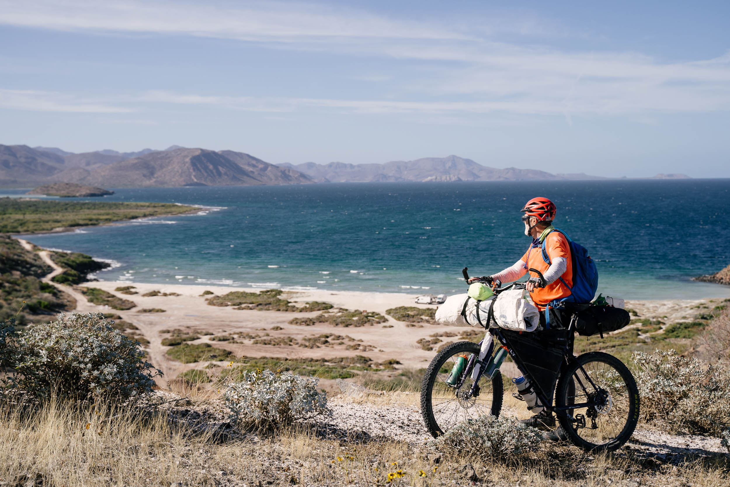
(9) Santa Rosalillita to Bahía de los Ángeles
Notes: some of the best coastal riding on the route is south of Santa Rosalillita, 6 miles of rough doubletrack leading away from the coast to MEX1, beautiful ride from Rosarito to Misión San Borja, 8 miles of pavement into BOLA on quiet paved road, the Sea of Cortez!
Resupply: Santa Rosalillita-fWM, Rosarito-fWMR, Misión San Borja-WC ask about hot springs, BOLA-FWMCR
This section is one of the most diverse on the route, contacting both the Pacific Ocean and the Sea of Cortez and including coastal riding, some rough doubletrack, and some high quality dirt roads to the small oasis at Misión San Borja. Leaving Santa Rosalillita the route travels some of the most pleasant coastal tracks of the entire route, although the track leaving the coast and connecting with a brief section of MEX1 is little used and both sandy and rocky. After a short northward jaunt on MEX1, there are several services near Rosarito. First, a truck stop with a motel and restaurant is a mile and a half south of town, while several small stores and a second motel are found in Rosarito. The track continues through Rosarito to Misión San Borja on a well-used and signed dirt road.
The mission church at San Borja is well-preserved and still in use, and the town plaza has shade and water, although only one or two families remain in the area. A water tap is found immediately to the south of the shade coverings in the public plaza. Ask locally about the hot springs and cave paintings, both of which are a short walk away. Leaving Misión San Borja the road climbs over a small pass and makes a long descent to the pavement. About 8 miles of pavement and a descent lead back to sea level at Bahía de los Àngeles. At last, you meet the Sea of Cortez! Bahía de Los Àngeles features several large grocery stores, restaurants, motels, and campgrounds. Wifi is available, although there is no bank in town, no bike shop, and no regular bus service. Hotels in BOLA are priced for tourists, so rates are higher than in most highway towns. Campo Archelon is a good option with a communal area and good coffee and sandwiches (2021).
location 136.8 mi (220.2 km)
(10) Bahía de los Ángeles to Vizcaíno
Notes: Sea of Cortez!, wide open desert and mostly high quality roads, limited services, very sandy track between El Arco and Vizcaíno for 10+ miles, 3” tires recommended, off-route trip to fishing community of El Barril
Resupply: BOLA-FWMCR, San Rafael-C beach camp, El Progresso-WMC rural touristic ranch with limited services, Piedra Blanca- fWM very limited snack stand, El Arco fW limited hours and very small snack stand,VizcaínoFWMCR$ Bus
Warning: Extremely sandy track between El Arco and Vizcaino, lower air pressure in tires. The route from Bahía de los Àngeles travels inland to return to the sea at San Rafael, a small commercial fishing access point. Pancho is the lone inhabitant at San Rafael (note – Pancho passed away). No services are officially available but the local fishermen have offered camping to bikers. There is a mild climb to El Progresso about 25 miles away, where Rancho Escondido provides lodging, on-site camping, water and meals. It is a beautiful setting and a nice family looking to develop ecotourism in the backcountry.
The route from Bahía de los Àngeles travels inland to return to the sea at San Rafael, a small commercial fishing access point. (note – Pancho, who used to live there passed away). No services are officially available but the local fishermen have offered camping to bikers. There is a mild climb to El Progresso about 25 miles away, where Rancho Escondido provides lodging, on-site camping, water and meals. It is a beautiful setting and a nice family looking to develop ecotourism in the backcountry.
The fishing community of El Barril is 8 miles away should you choose to take a day trip to the sea. There are no stores in El Barril, but if you asked around you may find someone selling packaged snacks, while fresh fish may be available during the week. A sandy road continues southwest of El Progresso toward a pass, whereafter a mostly hard road continues past Rancho Piedra Blanca to El Arco. Piedra Blanca is a working ecotourism ranch which offers rooms and meals and has a small snack stand on request. El Arco is a very small declining factory town. Ask politely for purified water. You may be able to purchase cold soda and chips from one of the families. Leaving El Arco the road quality diminishes to eventually become a purely sandy track traveling dead straight for 7- 10 miles (note that 2023 riders reported the road had been improved).
The road remains sandy for a couple miles past Ejido Guillermo Preto although the final miles into Vizcaíno are on hard packed roads among low hills. Vizcaíno is one of the best highway towns on the route with inexpensive motel rooms, great street food and ceviche. Even though it feels like you’re in the middle of the desert, Vizcaíno is within close proximity to both the Pacific Ocean and the Sea of Cortez. El Arco alternate: To avoid the sandy road to Vizcaíno there are some options: take the main graded dirt road southwest of El Arco to MEX1 and ride the remaining 30 miles to Vizcaíno on the highway (or follow the route and then take the road to MEX1 from Ejido Guillermo). This stretch of MEX1 is narrow and does not have a shoulder, though riders report it has been improved (2023).
location 66.4 mi (106.9 km)
(11) Vizcaíno to San Ignacio
Notes: some highway riding, some loose sandy sections near Rancho Guadalupe, rough and sandy track entering San Ignacio, oasis and mission at San Ignacio, La Casa del Ciclista in San Ignacio Warning: Short sections of deep sand on route. The final mile or two into San Ignacio are difficult to ride, but wind through freshwater lagoons and date palms.
Resupply: Vizcaíno-FWMCRB$ Bus, Colonia Nueva Esperanza-fW, El Caracol-fW, San Ignacio-FWMCR Bus, Bike Hostel
The route out of Vizcaíno manages to avoid busy MEX1 as much as possible– there are very few roads in this area and many are extremely sandy. Some paved riding is necessary, but mostly there is a small shoulder or rideable dirt tracks follow alongside the highway. Amidst the expansive desert the route encounters two large agricultural operations, El Caracol and Rancho Guadalupe. A series of little used tracks take you around Rancho Guadalupe and to a small paved road. Crossing the pavement toward San Ignacio, the route encounters a series of drainages originating from the Sierra de San Francisco to the north. Surface water is always present in the final drainage which passes San Ignacio. A deep, shaded pool is found amidst date palms in town.
San Ignacio is one of the two largest and most notable oases and Spanish mission sites in Baja California (the other is Mulegé). The mission church is well preserved and in regular use, sitting at the end of a shaded European style-plaza. 1.5 miles north of town at MEX1 there are several larger stores and other resources. There are two large campgrounds next to the lagoon, a gorgeous setting amidst date palms. A number of motels are found along MEX1.
location 71 mi (114.3 km)
(12) San Ignacio to El Dátil
Notes: quiet paved road from San Ignacio to the lagoon, Laguna San Ignacio whale watching excursions Jan-April, flat fast hard packed dirt roads on dry lake beds between La Laguna and El Dàtil
Resupply: San Ignacio-FWMCRB Bus, Bike Hostel, San Zacarías-fW, La Laguna-fW, Ejido Luis Echeverría Alvarez-fW limited, El Dàtil-fW limited.
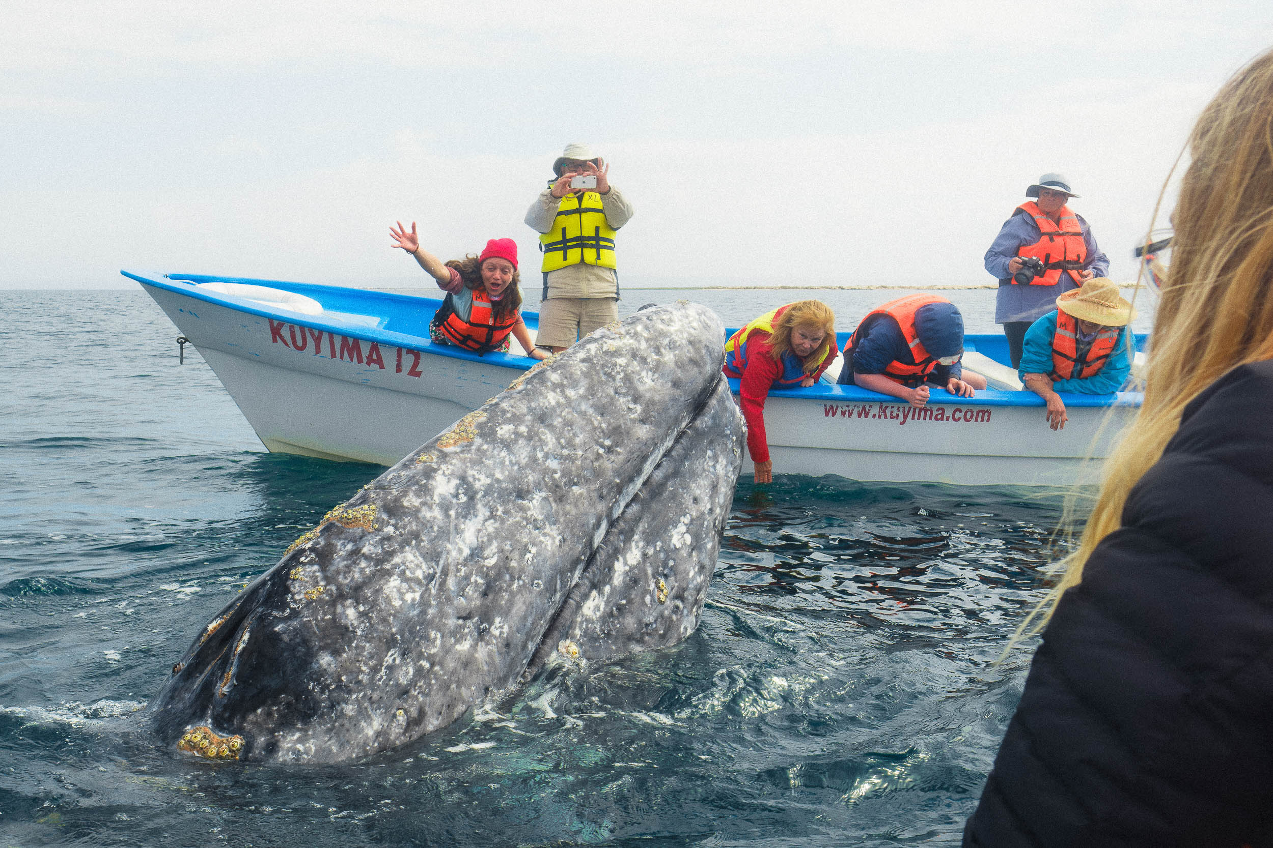
San Ignacio is one of the two largest and most notable oases and Spanish mission sites in Baja California. The historic European style town harbors one of the most stunning mission churches on the peninsula, and features a tranquility uncommon in many modern Mexican communities. With abundant fresh water and services, San Ignacio is one of the better places to take a rest day on the route. Leave town to the south along a minor paved road which leads to Laguna San Ignacio, a popular whale-watching destination between January and April.
The community of San Zacarías is about 10 miles south of San Ignacio and has a very well-stocked store. The route turns to dirt passing La Laguna and Ejido Luis Echeverría Alvarez, where it follows fast hardpacked dirt tracks across dry lake beds and with luck, prevailing winds will propel you across this unique landscape with little effort. There are many tracks through these lake beds, and they may change annually in the event of flooding. However, between the GPX track provided and some common sense, navigation is relatively simple. Follow the most used track. El Dàtil is a real fishing community, and various seafoods may be informally available for purchase. There are a couple well stocked stores and a few houses that offer camping. Arrive before dark and ask around.
location 90.3 mi (145.3 km)
(13) El Dátil to Mulegé
Notes: the most challenging ride on the Baja Divide is from La Ballena to San Miguel due to storm damaged roads, 3” tires recommended, resupply in El Dàtil for the ride to Mulegé, reliable surface water from La Ballena to San Miguel, big descent from San Miguel toward Mulegé, mission and oasis at Mulegé
Warning: the ride from La Ballena to San Miguel is very strenuous
Resupply: El Dàtil-fW limited, Mulegé-FWMCR$ Bus
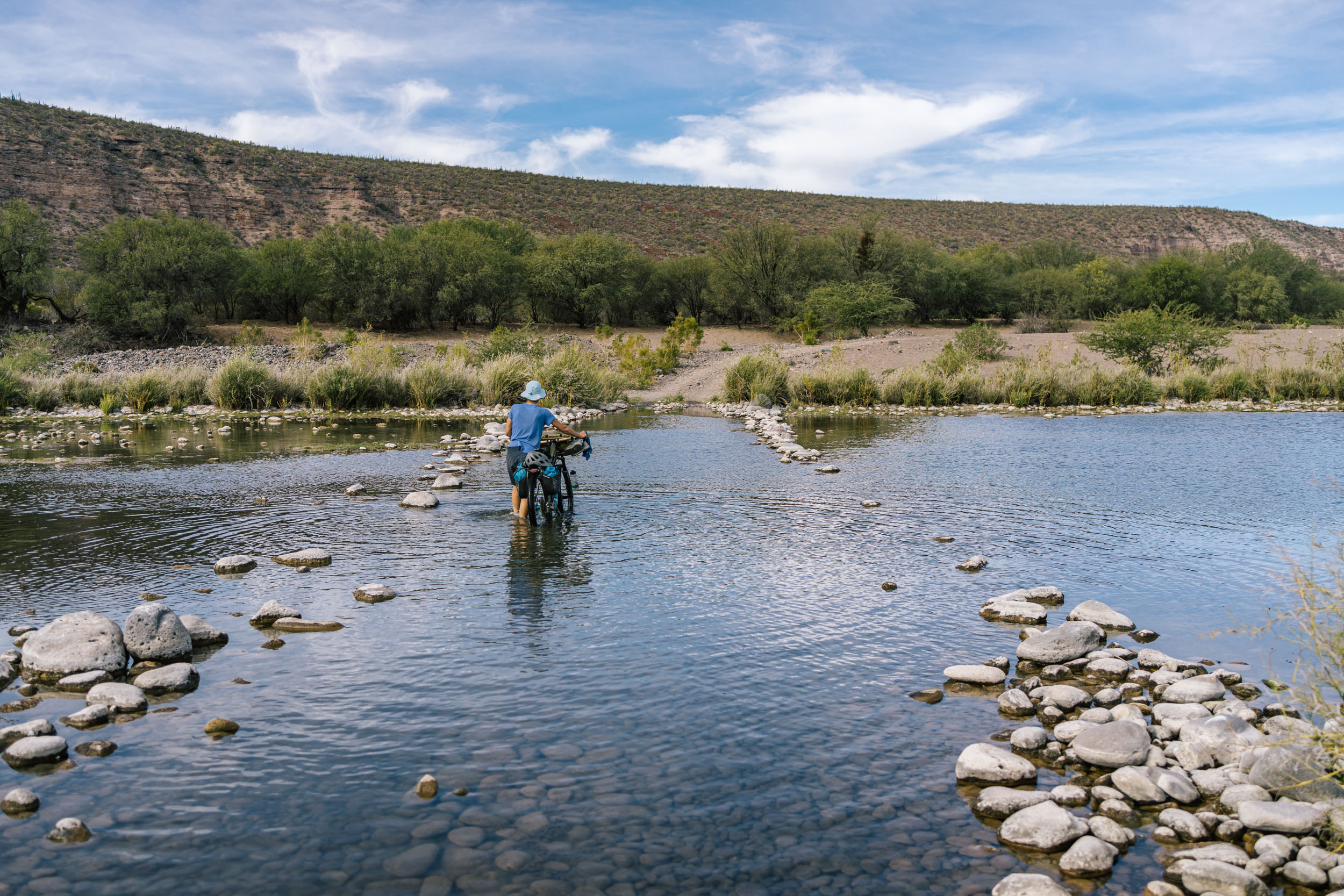
Crossing from coast to coast in Baja California always ensures a diverse range of experiences, terrain, and communities. The route continues away from El Dàtil on dry lake beds for ten miles, climbing just a few hundred feet to rejoin the main dirt road. Turn upstream at La Ballena toward San Miguel. The road through this valley was damaged in dramatic floods in 2013-2015 but improved in 2023. There are some water crossings. The two major redeeming qualities of this section aside from the important connection it makes, are the canyon scenery and persistent surface water, thus reducing the burden required by the rider. La Ballena to San Miguel will take most of the day. If you select to skip this segment and Bahía Concepción, continue south on the main road towards San Juanico, turn back into the mountains towards La Purísima and rejoin the route at San Isidro. The road beyond San Miguel is firm, once you climb out of the main drainage. After a few short hills to a final pass, a very steep road descends the Sierra de la Giganta toward the Sea of Cortez.
After a roller coaster descent from San Miguel, the final miles into Mulegé are mostly flat and unremarkable until you are very near town, where you encounter several large farms, and eventually, the shaded oasis of Mulegé, and the large estuary leading out to the lighthouse and the Sea of Cortez.
Mulegé is another great place to relax for a day, and features abundant resupply, restaurants, cheap motels, and places to swim. The mission church and the lighthouse are worthy diversions. The freshwater flowing into the estuary, crossed by a low concrete bridge, is warm although not quite hot. Two routing options exist south of Mulegé. The main route, requiring a boat ride across the bay, accesses a challenging and unique coastal route. However, a number of variables may impede that crossing and a simple alternate is offered. The highway south of Mulegé traces the western edge of Bahía Concepción, famed for it’s incredible beaches. In combination with a small shoulder, this is the best section of MEX1. The alternate joins the Baja Divide at El Rosario, a truck stop and restaurant ten miles south of the bay.
location 60.9 mi (98 km)
(14) Mulegé to El Rosarito
Notes: arrange a boat ride from local fishermen across Bahía Concepción to Los Hornitos, the road on the east side of the bay is very seldom used and is extremely faint at the north end, 3” tires recommended, wild camping on the east side of Bahía Concepción, MEX1 is an easy alternative, no resupply at San Sebastián but San Nicolás has a small government store, El Rosarito is a busy roadside eatery and tiendita
Resupply: Mulegé-FWMCR$ Bus, San Nicolás-fW, El Rosarito-fWR
This section is one of the most unique opportunities on the Baja Divide, but is only accessible with some work and luck. When mapping the route in the spring of 2016, we couldn’t help but notice the road listed on our map on the far side of Bahía Concepción. We inquired: “Does it exist? Is it a hard surface?” The answers we got were inspiration enough to hire a local fisherman to take three riders and three bikes across the bay– a distance of about 8 miles– to try to ride the road on the other side. What we found was a faint wandering track by the sea, often intersecting the gravelly highwater mark on the beach, but the track improved and widened as we went south. By the time we reached the south end of Bahía Concepción, we’d passed several seasonal fish camps and the road was good and hard. So, if you are willing to negotiate a ride with a fisherman in the local fleet, to pay to get across the water, and haul a bunch of food and water on a faint track by the sea, the ride on the other side of the bay is something few bikes have traveled. The views and the camping are supreme.
The details of catching a ride are as follows: Go to the fisherman’s beach by continuing south out of Mulegé on MEX1 until you reach a small collection of businesses on the right, and a neighborhood with a church on the left. Turn left and continue past the church down to the water, turn right along the water to the collection of fiberglass boats, known as pangas. Fishermen tend to go out early in the morning, return late morning or early afternoon, and in some cases they go out again in the late afternoon or early evening. Daily winds tend to be strongest after noon, around 1-2PM. Consistent winds may keep fishermen off the water for days. Additionally, there is no fixed rate for such a ride and the concept may still confuse some people. If the fishing is good, you should expect that some fishermen will be unwilling to take you across, especially if your request doesn’t coincide with their schedule. In which case, arrive early in the day, be clear that you want to cross to the other side of Bahía Concepción to a place called Los Hornitos. Expect to pay about $30-$50 (2023) per person and consider organizing several people to cross together (prices and discounts vary).
There are no services on the other side until you reach San Nicolás (very limited), which is possible in one day if you start very early. Otherwise, be sure to load up on extra water if crossing in the evening. You will likely be dropped off near “Los Hornitos”, at the sandy beach in a bay just south of a fish camp near the point.
If you walk/ride south along the beach there is a sandy wash which looks like it might be a track and may not show signs of use. At the north end of the peninsula, it is ATV width and very sandy. Low tire pressure will be required for this section. Continuing south for about 0.5mi, turn left up a wash and stay to the right side. As you near the base of the mountains there is a rough track leading out of the wash to the south. Climb out of the wash onto a rough, but more clearly defined track. A track will be apparent from this point onward, although it may lead onto the beach at times, and will remain soft for the next 10 miles. Further south, you will see several fish camps which may or may not be in use. At the south end of the bay, a road leads over to the coast to a collection of upscale homes at San Sebastián. No resources are available here. Instead, amidst the palm trees of the farm before the beach, turn up a steep doubletrack to ride along the coast for about 5 miles to San Nicolás. There, a small store is open with limited hours.
Another ten mile ride returns to MEX1 at El Rosarito where an active restaurant, particularly popular with truckers and long distance travelers, is open from early until late, serving food, beer, and some packaged snacks to go. While there are relatively frequent resupply points between Mulegé and Ciudad Constitución, most are small shops with limited supply and variety. Mulegé is the last place to get specialty goods before Constitución.
Bahía Concepción alternate: An alternate route follows MEX1 down the west side of Bahía Concepción, which we consider to be the best section of the entire highway, passing sandy white beaches and even a few small resources. Rejoin the route about 10 miles south of Bahía Concepción at the small roadside restaurant/truck stop El Rosarito.
location 165.7 mi (266.7 km)
(15) El Rosarito to Ciudad Constitución
Notes: challenging and rewarding mountain riding with Spanish missions, minor resupply in El Rosarito, larger stores off-route in San Isidro, storm damaged road between San Isidro and San José de Comondú is rough but a great ride, awesome descent into San José de Comondú and other canyons. Warning: Stock up in Mulegé, limited resupply points along the route
Resupply: El Rosarito-fWR limited, Carambuche-fW limited 0.5mi off route, San Isidro-fWR 2.5mi off route, San José de Comondú-fW, San Miguel de Comondú-fWM 1.5mi off route, Loreto-FWMCRB$ Bus Airport 20mi off route with big descent, San Javier-fWR limited snacks and drinks, Ley Federal de Aguas Numero 1-fWR, Ciudad Constitución-FWMCR$ Bus
This segment connects a series of mission sites in the Sierra de la Giganta, each harboring freshwater streams and the shade of palm groves. Resupply is limited, although there are a number of communities, stores are very small. The riding is challenging, mountainous, yet rewarding. Some of the canyons in the Sierra de la Giganta feature persistent surface water, which means you don’t have to carry as much on the bike. There are no developed water resources between towns. Load up on food when available. San Isidro and the Comondús have small stores, whereas El Rosarito and San Javier feature small restaurants with limited packaged snacks to go.
Ley Federal de Aguas Numero 1 is a federally funded agricultural community and Ciudad Constitución serves as the commercial hub for the area and provides all the things you’ll be seeking after a few days in the backcountry including tacos, panadería, coffee shops with wifi, motels and supermarkets.
Climbing from El Rosarito over a low pass to San Isidro the road shows signs of storm damage, but is well traveled and easily passable. South from San Isidro to San José de Comondú and San Javier you cross a series of drainages, some are deep canyons, on roads further damaged by recent weather events which are now only passable by high clearance vehicles.
San Javier is one of the most frequently visited mission sites outside a major city in Baja California, although resources are limited due to its proximity to Loreto. Continuing south from San Javier a well-traveled road gives way to a lesser used backcountry route to connect to Ley Federal #1, some of which has been recently damaged by storms, resulting in some rough tracks and sand. The connection to Ley Federal #1 however avoids the paved roads in the main valley further west. The route from Ley Federal #1 to Ciudad Constitución winds through citrus groves en route to the big city, a pleasant ride showcasing more of the economy which sustains Baja California.
Ciudad Constitución is like several other towns on the route, a great place to connect with modern frontcountry Mexican culture. It is worth finding a motel for the night to walk the streets and enjoy tacos, music, and a few hours out of the sun. Most evening activity happens just after sunset and most eateries close by 9PM.
location 167.2 mi (269.1 km)
(16) Ciudad Constitución to La Paz
Notes: the steaming burning dump outside of Ciudad Constitucion is unavoidable, historic mission at San Luis Gonzaga, the scenery improves as you near the sea, be sure to stop in San Evaristo for resupply about a mile off route if needed, the final 30 miles into La Paz are on a quiet paved road
Warning: Resupply between Ciudad Constitución and San Juan de la Costa is extremely limited
Resupply: Ciudad Constitución-FWMCR$ Bus, San Luis Gonzaga-fW very limited water and snacks, The following have limited food and limited hours (Las Animas, Las Tunitas/Soledad, Primer Agua) San Evaristo-fW 1 mile N of route, Punta Coyote-f limited snack stand, San Juan de la Costa-fW, El Centenario-FWMCR$, La Paz-FWMCR$ Bus Airport
This segment links two large commercial hubs in Baja California Sur, Ciudad Constitución, an agricultural highway town, and La Paz, a bustling cosmopolitan city by the sea. That connection is made by a long rambling route which takes its time leaving the sun-baked low country outside of Ciudad Constitución, before finally settling into a series of deep drainages, finishing in a series of spectacular canyons. You exit that final drainage by climbing to a pass in a nature preserve, providing views of the Sea of Cortez and a 2000′ descent. At sea level, a 1.5 mile detour to the north takes you to San Evaristo, a nice, small friendly fishing village with food and water. Riders are reporting good luck finding places to stay and cooked food. The next reliable resupply is 45 miles away in San Juan de la Costa, although there is a snack stand in Punta Coyote, 15 miles away.
The ride from San Evaristo to San Juan de la Costa includes some of the most brilliant geology of the route, on display as you descend through a colorful layer cake of rock in several places. The tall mountains just a few miles west represent the watershed divide between the Sea of Cortez, and the Pacific, thus explaining the long ascent from Ciudad Constitución, and the quick descent to the sea.
The road ride into La Paz is generally quiet, save for buses which transport workers to the mine. You first reach El Centenario, where all resupply is available. Continue about 6 miles into La Paz for the full experience. You arrive in town along the Malecón– the pedestrian and bike friendly waterfront– and continue into the heart of the city where shopping, daily markets, and taco stands crowd the streets in a city which is simultaneously historic and modern.
La Paz is as much a touristic destination for Mexicans as foreigners, so enjoy mixing with locals in town. There are some excellent food establishments in town if you take the time to find them. Go to Ressel Bikes for most modern parts and repairs, the Specialized dealer in town; Valenzuela has good service for more conventional repairs; there are a host of other smaller repair shops around town for minor parts or service. Hotel Pension California is a favorite among backpacking types and has been around for decades in a converted convent. Rooms are inexpensive for the central mid-town location, there is lots of outdoor social space (including a rooftop), the colors and décor are brilliant. The staff is friendly, wifi is intermittent, showers are mostly cold, and the rooms are a little tired and dingy, but this is a good place to trade stories with other riders. Pension California is only three blocks from the Malecón and around the corner from a busy daily market and many other shops. There are many other hotels in town, but this is our headquarters in La Paz.
location 90.9 mi (146.3 km)
(17) La Paz to La Ribera
Notes: a necessary 15 miles of pavement out of La Paz, the view from the pass above Los Divisaderos, the coast road east of San Juan de los Planes is nearly free of vehicles, beautiful beaches
Resupply: La Paz-FWMCR$ Bus Airport, Los Divisaderos-fW, San Juan de los Planes-FWR, El Cardonal-FWMCR, Punta Pescadero-M, Los BarrilesFWMCRB$ Bus, La Ribera-FWMR
La Paz and the surrounding area presented the greatest challenges to off-pavement routing in the entire peninsula, which was a reminder of how open the people and the land are in the rest of Baja California. Thus and while there are a few local off-pavement segments– we’ve routed up the paved road out of town making the climb to 2000′ just a bit easier. Once at elevation, you turn onto a gorgeous dirt road leading down to to Los Divisaderos. From there, you finally climb over the ridge to spectacular views of San Juan de los Planes and the Sea of Cortez, and you may see the winding dirt road that climbs over the distant ridge to the sea. Descending to the valley, a series of sandy tracks lead back to the paved road for a few easy miles into San Juan de los Planes.
A paved road leads north to La Ventana and El Sargento, world famous for water-based wind sports, and also featuring some of the best singletrack in the cape region. The Baja Divide route makes use of these trails to avoid the pavement and loop into La Ventana and back to San Juan de los Planes. These trails are all maintained by LaVESTA (https://www.facebook.com/groups/lavesta.bcs/), a local trail association that maintain a set of flowy mellow trails south of town and more steeper and technical trails north of town in El Sargento. See trailforks.com for maps of the extensive trails (https://www.trailforks.com/region/la-ventana–el-sargento-area/). Be sure to check these out, in particular the very cool Punta Gorda trail that contours along the coast north of El Sargento.
There are many food, hotel and camping options in the La Ventana/El Sargento area and it’s a lively scene in the winter. The campgrounds can be crowded, but riders can still stay if they are full. There is an active community of Americans and Canadians down for the winter, many of whom spend their days windsurfing, winging and kiting on the water. Gear and lessons are available. Bike repairs can be done at La Ventana Windsport, Tatehuari Experience and Rancho Cacachilas.
Resupply in La Ventana or San Juan de los Planes and continue west onto a rough dirt road over the low mountain ridge to the sea. The next 15 miles are some of the most scenic rocky coastal roads of the Sea of Cortez coastline on the Baja Divide. Resupply is available in El Cardonal, and especially in Los Barriles and La Ribera. Arriving in Los Barriles, the riding is mostly flat all the way down the coast to Cabo Pulmo. Little is available in Cabo Pulmo, save for two restaurants, so load up in Los Barriles and La Ribera. Both communities are greatly supported by seasonal tourism, and you are likely to find a range of American groceries alongside Mexican fare in Los Barriles. Turn up the main street in town to find the best local supermarket.
location 57.7 mi (92.9 km)
(18) La Ribera to San José del Cabo
Notes: Cabo Pulmo MTB singletrack and snorkeling, the road from Los Frailes to Mt. Trinidad is sandy for the first 800′ of climbing, a long descent from the mountain to San Jose del Cabo
Resupply: La Ribera-FWMR, Cabo Pulmo-fWMR limited food resupply, El Palo Escopeta-fW, San José del CaboFWMCRB$ Bus Aiport Stock up in Los Barriles which is larger, or La Ribera which is 8 miles further south.
Cabo Pulmo does not have a store, despite a steady tourist trade, but the singletrack trails are some of our favorite in Baja. As of 2024, the route does a short loop up the Backside Trail and down the Bench trail to drop into Cabo Pulmo town.
After, there are no resources until Palo Escopeta which has a tiny store with limited hours, although San José del Cabo is only 10 miles further. The first part of the route rides down the coast, although mostly is is away from the beach, so look down a side track for beach access. Nearing, Cabo Pulmo, divert back to the main road, which is steadily being paved, to avoid a large private land tract near the airstrip.
From here all the way to Cabo San Lucas at the southern tip of the peninsula, private property signs and fences increasingly protect coastal estates, which is part of the reason why our route turns back into the mountains south of Cabo Pulmo. South of Los Frailes, the climb away from the sea is sandy for 4 miles, until you climb past 800′ in elevation, whereafter the road is firm and continues to climb with a few rapid descents as it crosses several steep drainages. Topping out with big views of Mt. Trinidad and the Sierra de la Laguna, the route turns southward and begins the long descent back to civilization, passing the small community of Palo Escopeta before arriving at the northern end of San José del Cabo, about a mile from the airport. Especially for those considering a flight in or out of San José, the Cactus Inn is a mile and half from the airport, a few blocks off the main road.
The historic center of San José is about 8 miles south of here, and the city provides almost anything you could need, including tons of great places to eat. There is a small bicycle repair shop on this main road, but don’t expect much for parts. At the very south end of town, near the fancy hotels, there is a well stocked high-end bike shop. They are a Specialized dealer and speak some English. There are public beaches along the southern shore of San José del Cabo. Cabo San Lucas, about 20 miles down the road, is an upscale resort town. The Baja Divide returns to the mountains.
location 55.7 mi (89.6 km)
(19) San José del Cabo to Todos Santos
Notes: a world of resupply in San José del Cabo, easy access to the airport 1 miles south of the route, Cactus Inn is about the nearest reasonably priced hotel to the airport (they might be able to provide a shuttle), the Sierra de la Laguna and the descent down the east side of the mountains
Resupply: San José del Cabo-FWMCRB$ Bus Airport, Todos Santos-FWMCR$ Bus
This classic ride connects the east and west cape by one of the only roads through the Sierra de la Laguna, locally referred to as Las Naranjas road. The road climbs over a low pass, descends, and climbs to a higher second pass with views of the Pacific Ocean. The descent down the other side is loads of fun, finishing with a long undulating ride to Todos Santos. The small city of Todos Santos is a favorite of snowbirds from the north, with a slightly greater sense of community than some of the east cape towns that are popular. In either case, it is a good place to resupply and check the internet before moving on.
location 79.1 mi (127.3 km)
(20) Todos Santos to La Paz
Notes: sandy tracks and rough roads in Sierra de la Laguna NP, seasonal water in drainages, 1.5 mile detour to El Triunfo for resupply, 6 miles of pavement out of El Triunfo, Los Divisaderos road is scenic, finish with 15 miles downhill to La Paz
Resupply: Todos Santos-FWMCR$ Bus, El Rosario-fW, El Triunfo- fWR 1.5 miles off route, Los Divisaderos-fW,La Paz-FWMCR$ Bus Airport
The ride from Todos Santos to El Triunfo traces the western edge of the Sierra de la Laguna, passing through the edges of the national park and crossing a lot of drainages in its path (almost none have water). Leaving Todos Santos on the main paved road to the north, you cross the main highway and turn onto a series of dusty farm roads. Be sure to close all cattle gates. You slowly reach the mountains, climbing into and out of a series of small drainages, entering an area with more trees. Sandy tracks, even while climbing in a few places, will make you work. Eventually, the track links to an old road bed which now rides more like a singletrack trail, descending into a drainage which may have water and some great campsites. A steep jeep road climbs out of this drainage and crests a pass, descending toward Valle Perdido, El Rosario, and El Triunfo. There is no food or water along this route until El Rosario, just a few miles before the pavement.
El Triunfo, 1.5 miles east of the route, is an old mining town enjoying a small restoration effort, supported in part by American philanthropist Christy Walton. The town is worth a visit, including the mining structure in the hills behind town. El Triunfo is an important resupply stop. There are several small stores in town and two modern sitdown eateries. The route continues west on the highway for 6 miles, turn north on the Los Divisaderos road. This road slowly climbs to a high point near the north end where it connects with the paved road to La Paz.
La Paz is the colorful capital of Baja California Sur, our favorite city on the peninsula and a great place to rest. A further discussion for resources in La Paz is listed in the section from Ciudad Constitución to La Paz.
We have a wealth of resources and articles pertaining to the Baja Divide from the last decade of riders tackling this monumental route. Find them listed below, separated by category:
Trip Reports and Tips
- Evan Christenson’s 4-part series sheds some valuable insight and inspiration about the route based on his three rides along the full route: PT.1: Tales from the Cape Loop, PT.2: Lessons From The Cacti, PT.3: The Desert Surrounds, PT.4: Tracing Lines
- Cass’s Reflection on the Missions Section offers some nice tips and insights.
- Dan Stranahan’s DIY Guide to Surfpacking provides some valuable tips for a different way of riding the Cape Loop.
- Logan and Virginia’s Baja Rig Checks have their full packlists and offer a little insight into why they chose the bikes they did.
- Brendan Collier’s Baja Divide Video Preparation Series is a great resource for those planning a trip on the Baja Divide.
- Logan and Virginia’s Road to Mulege reflection
- Confessions from the Baja Divide offers some honest insight into the challenges this route can dish out.
More Photos and Videos
- Miron Golfman set a new FKT on the Baja Divide in 2022, finishing the route in 10 days, 13 hours, and 24 minutes; watch his video about the effort here.
- The Tales on Tyres Baja Divide Film is a classic; click here to watch.
- The Ebb and Flow of the Baja Divide, by Tom Norman
- A Mind-bending Baja Divide, by Gabriel Amadeus
- Julia Vallera’s Baja Divide Artwork and Disposable Camera Creations is a great Rider’s Lens feature.
- Salvador from FASS Bike, Savior of the Baja Divide!
Worthwhile Resources
- Our Guide to Desert Bikepacking is an oldie, but worth revisiting before you set out on the Baja Divide.
- Tubeless Tires are a must on the Baja Divide. Be sure to dig into our Tubeless Field Guide.
- Ways to Attach Water Bottles and Add Cage Mounts to Your Bike is a good guide if you need some insight on carrying extra water.


Terms of Use: As with each bikepacking route guide published on BIKEPACKING.com, should you choose to cycle this route, do so at your own risk. Prior to setting out check current local weather, conditions, and land/road closures. While riding, obey all public and private land use restrictions and rules, carry proper safety and navigational equipment, and of course, follow the #leavenotrace guidelines. The information found herein is simply a planning resource to be used as a point of inspiration in conjunction with your own due-diligence. In spite of the fact that this route, associated GPS track (GPX and maps), and all route guidelines were prepared under diligent research by the specified contributor and/or contributors, the accuracy of such and judgement of the author is not guaranteed. BIKEPACKING.com LLC, its partners, associates, and contributors are in no way liable for personal injury, damage to personal property, or any other such situation that might happen to individual riders cycling or following this route.
Further Riding and Reading
Here are some connected/nearby routes and related reports...
Please keep the conversation civil, constructive, and inclusive, or your comment will be removed.