


The Bosnian Highline
Distance
244 Mi.
(393 KM)Days
7
% Unpaved
54%
% Singletrack
5%
% Rideable (time)
90%
Total Ascent
27,244'
(8,304 M)High Point
6,219'
(1,896 M)Difficulty (1-10)
7?
- 7Climbing Scale Strenuous112 FT/MI (21 M/KM)
- 6Technical Difficulty Moderate
- 7Physical Demand Difficult
- 4Resupply & Logistics Fair
Contributed By
Michael O'Dwyer
Bikepacking Sweden
The Federation of Bosnia and Herzegovina – commonly known as Bosnia – is a small country located in the Balkans with a long and complex history. While a part of Europe and within a two-hour flight from most European capitals, the country you’ll see on this route often feels far more remote and distant.
Through its history, Bosnia has been part of the Ottoman Empire, the Austro-Hungarian Empire, the Kingdom of Yugoslavia, and finally communist Yugoslavia before gaining its independence in the 1990s. All of these periods and cultures have left their mark. The religious demographics of the country, with its mix of Muslim, Catholic, and Orthodox Christian populations, creates a feeling unlike anything else in Europe.
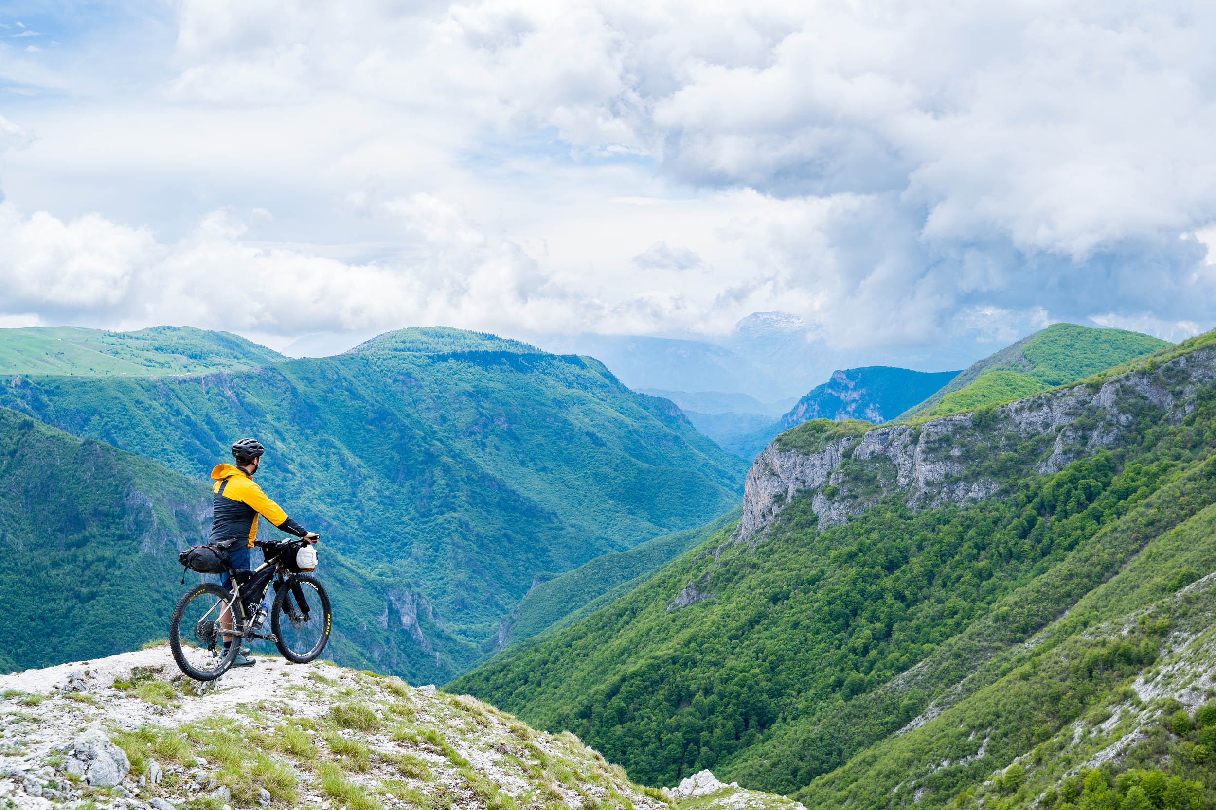
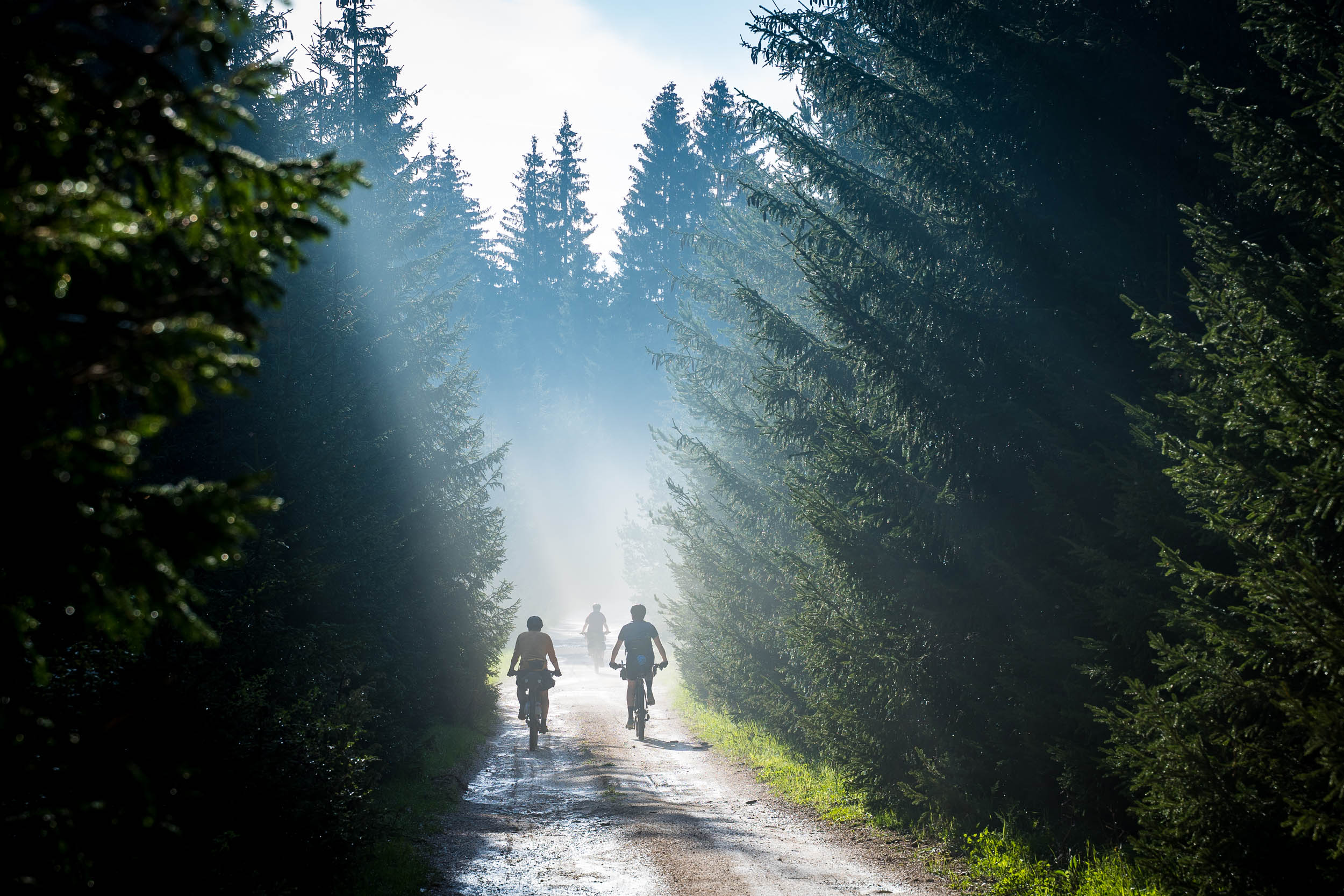
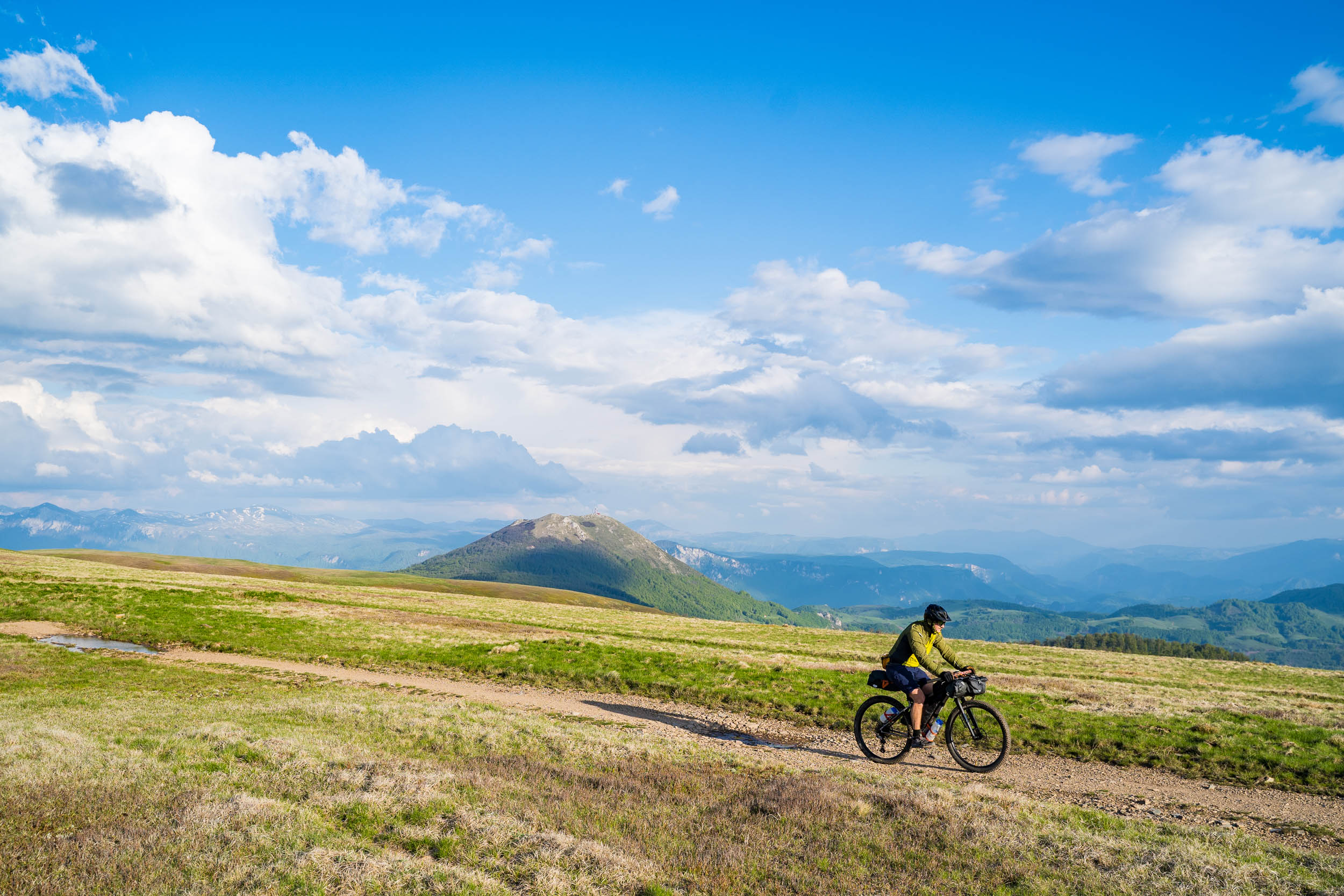
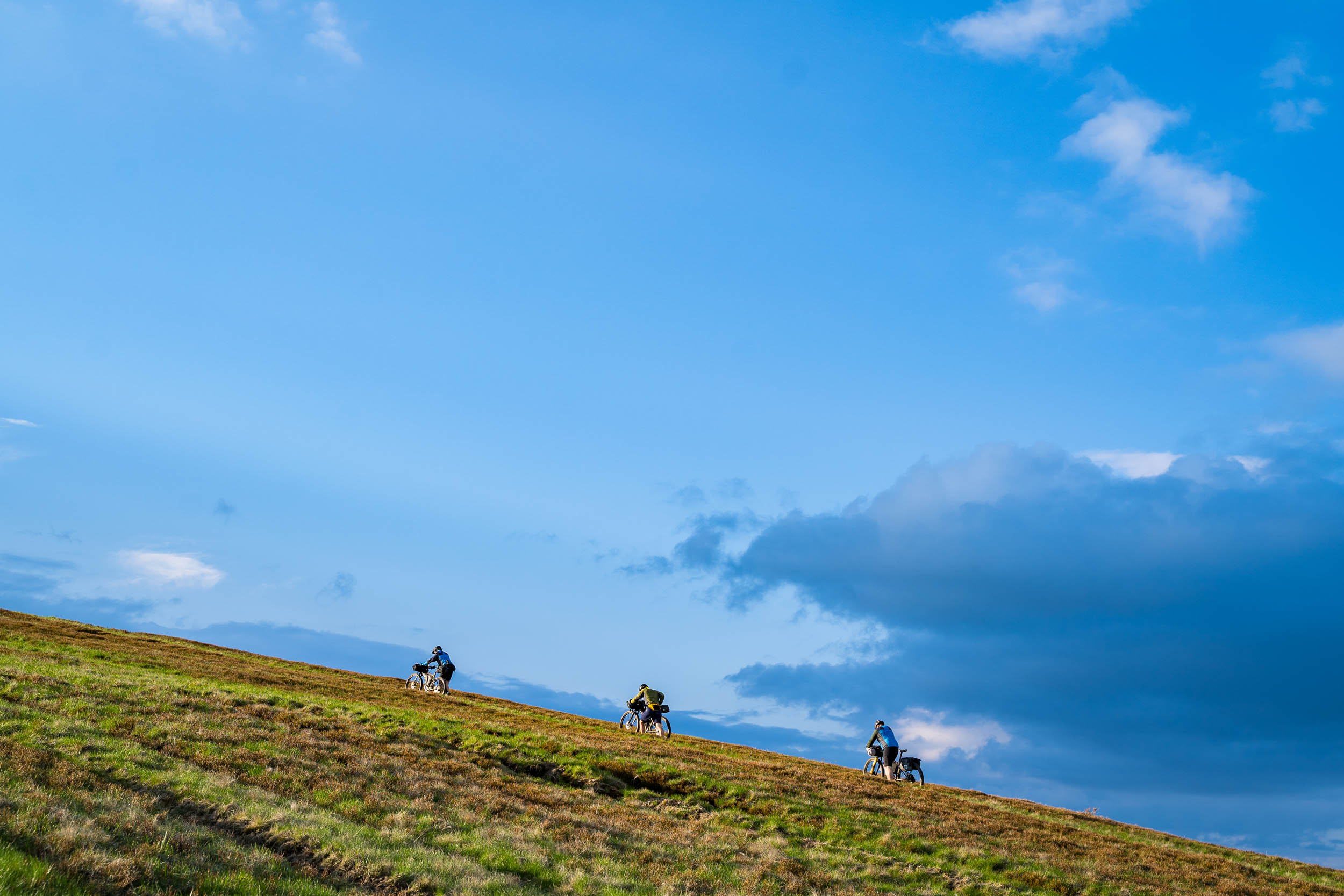
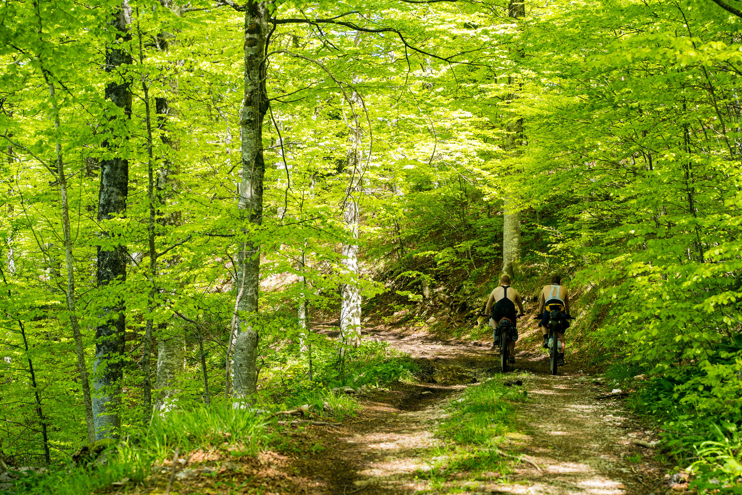
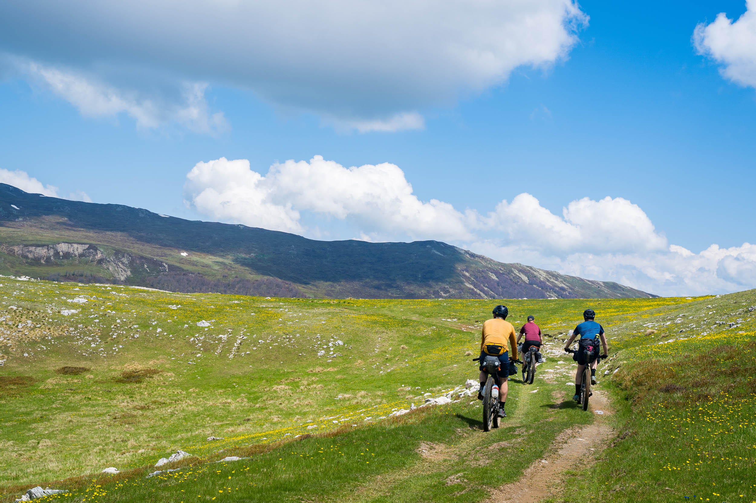
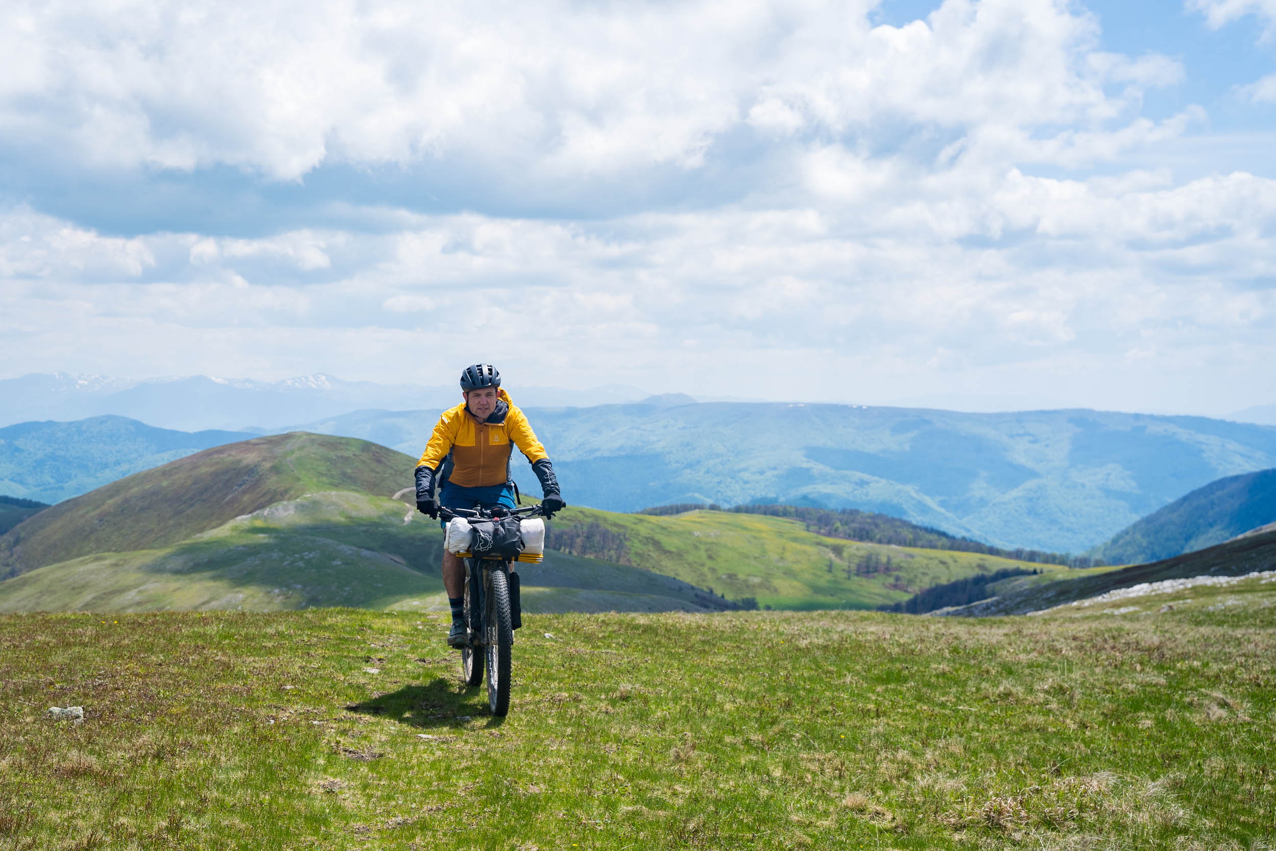
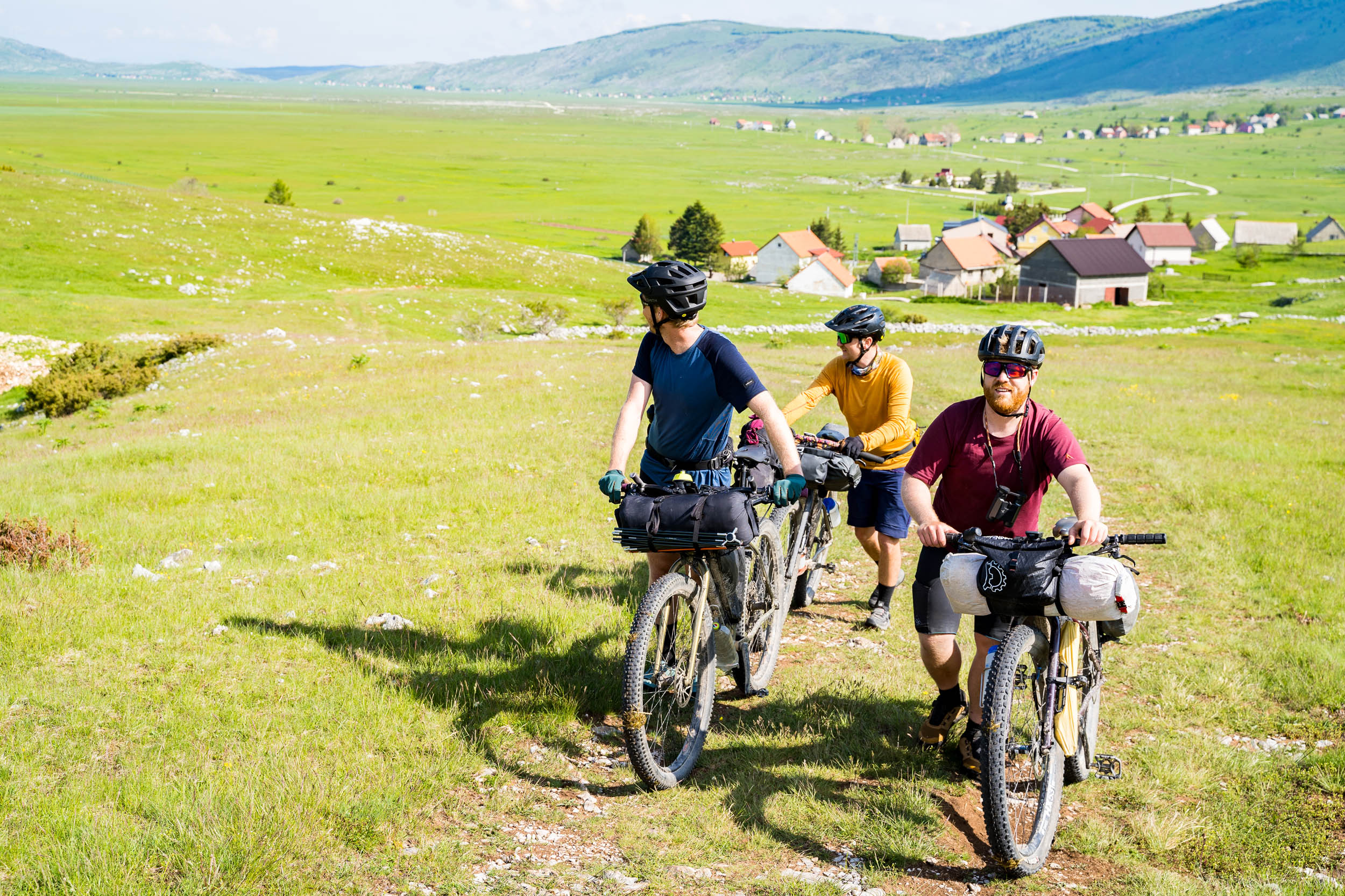
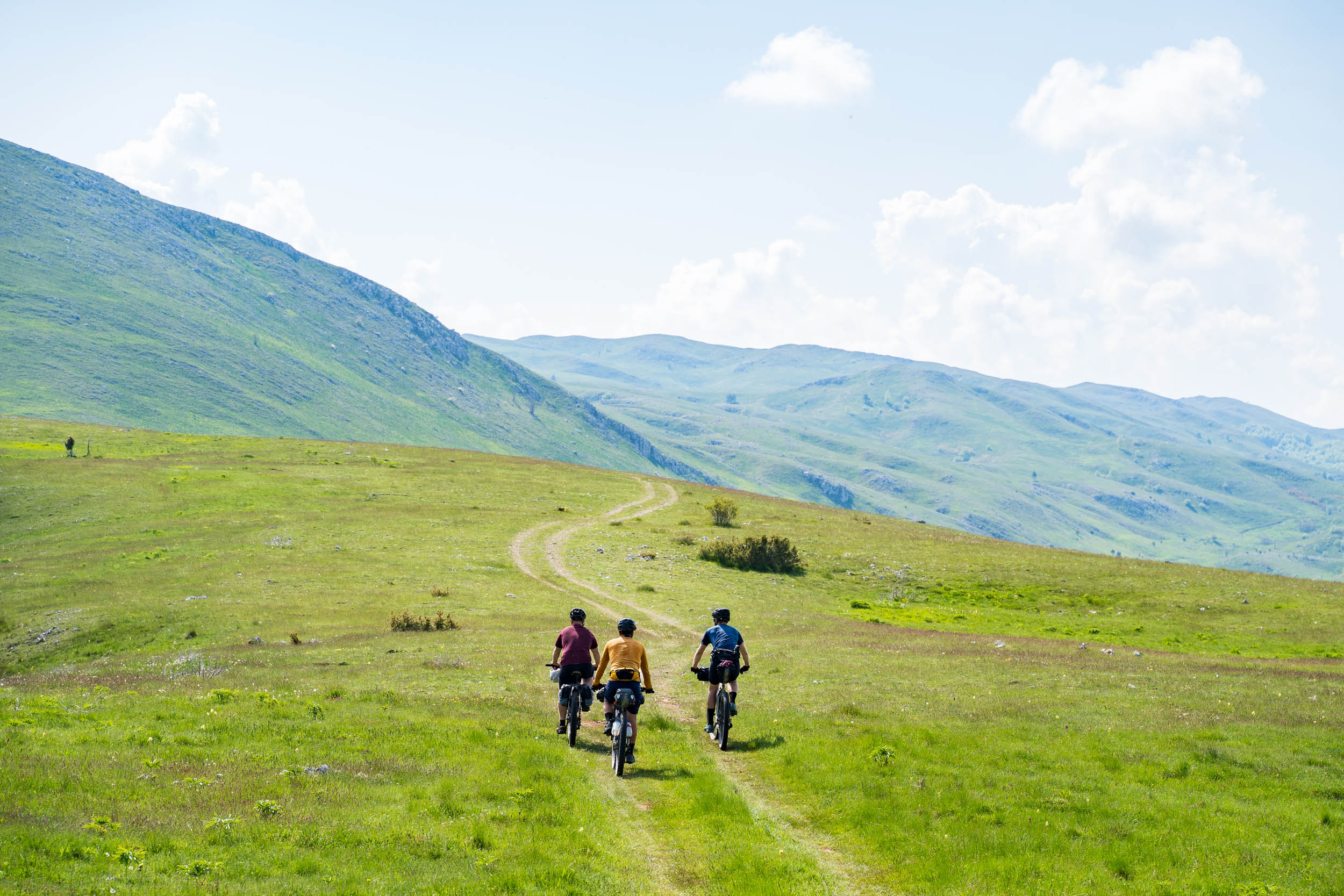
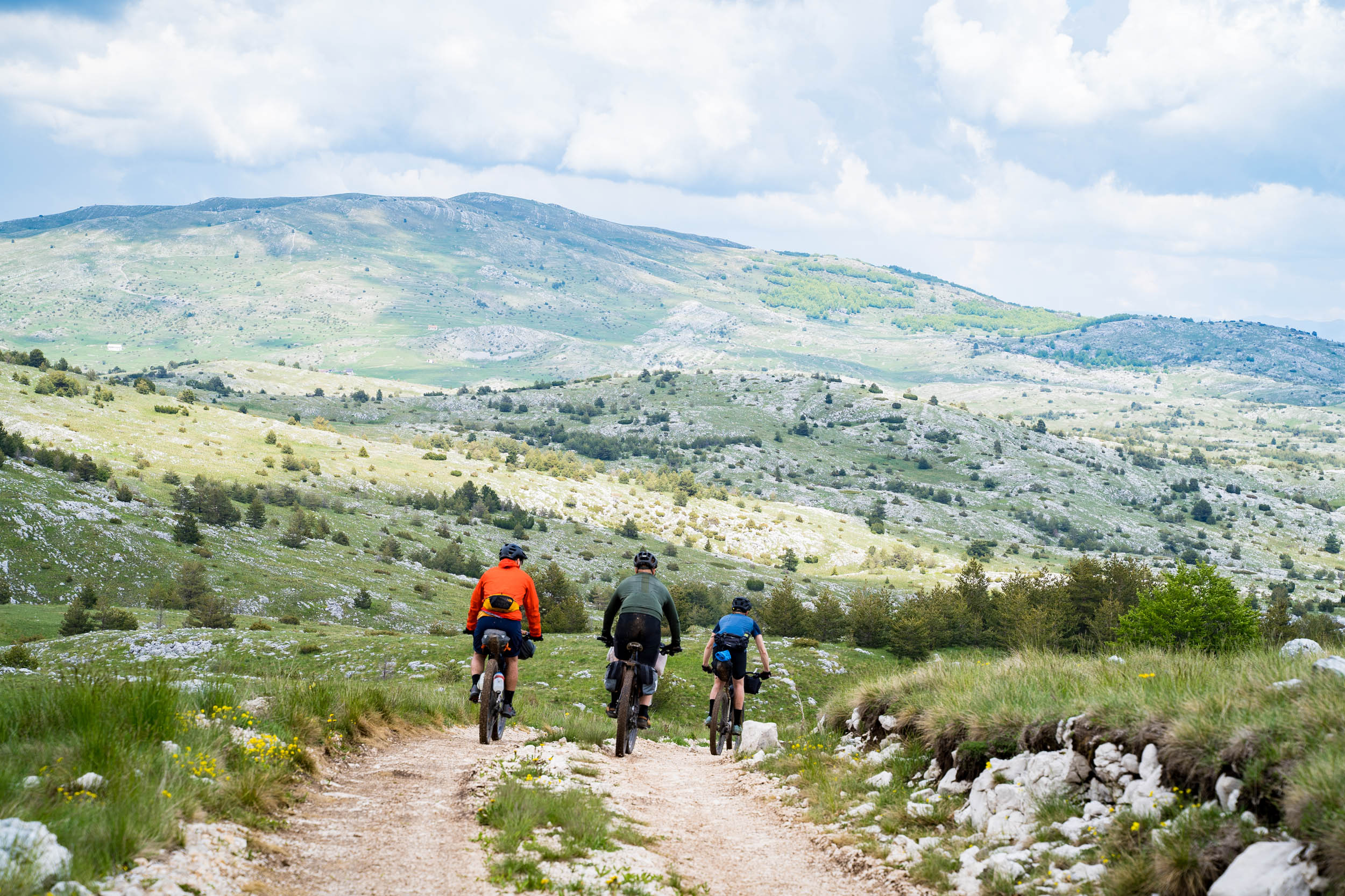
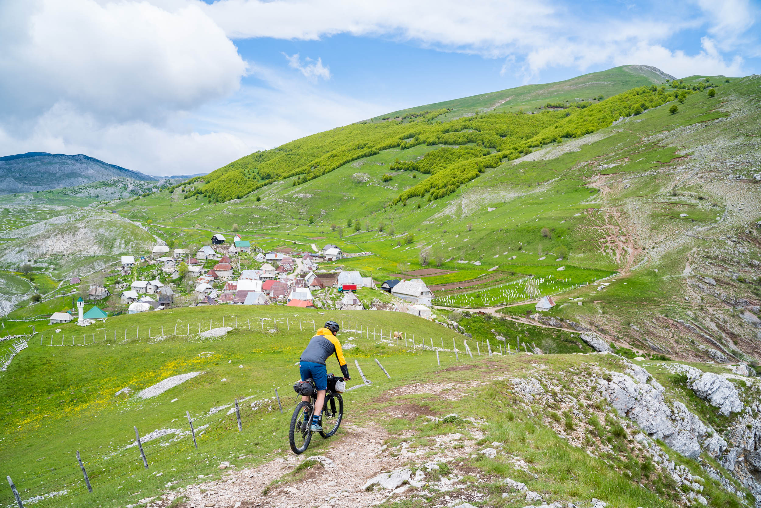
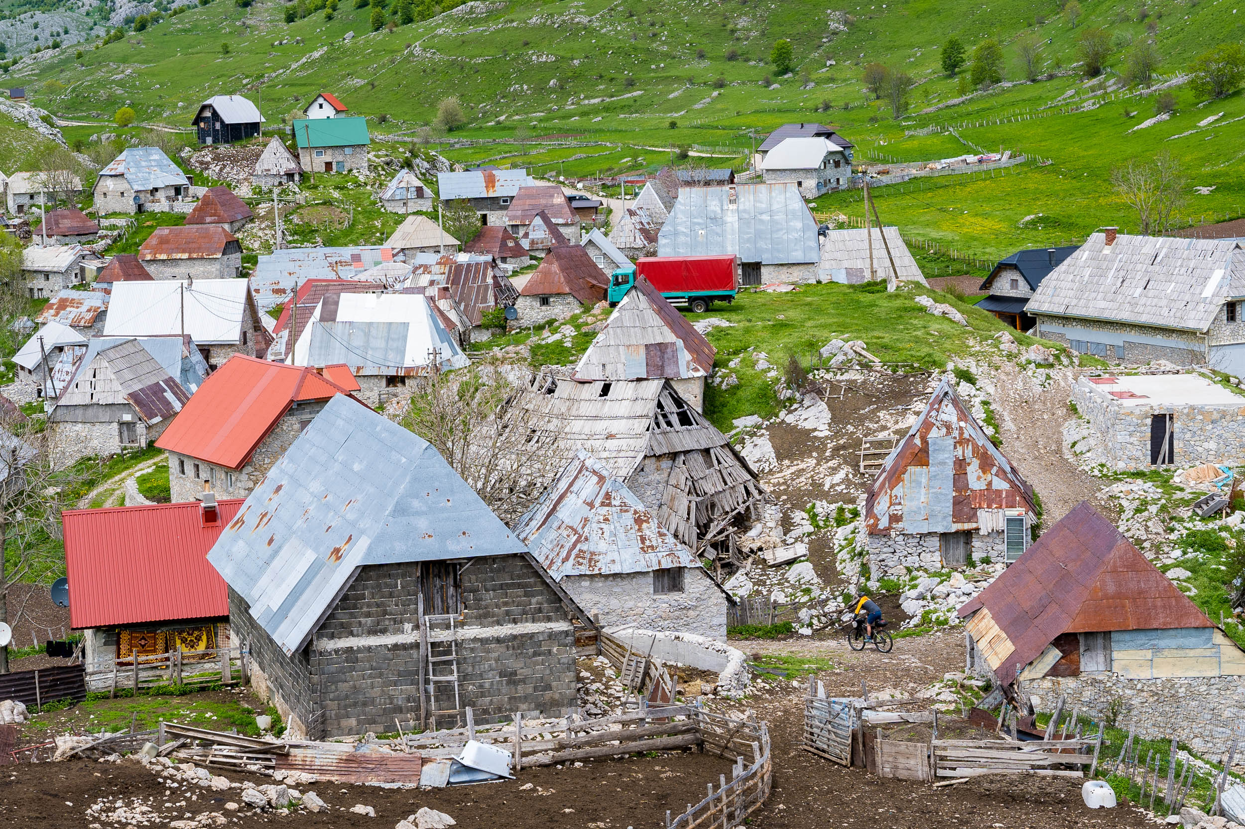
Starting in Sarajevo, this route explores the heart of the Dinaric Alps, one of the steepest and most rugged mountain ranges in Europe. The land is heavily forested on the lush valley floors. From there, steep mountain walls rise up to the treeline and then keep on rising to the barren mountain tops typical of the region.
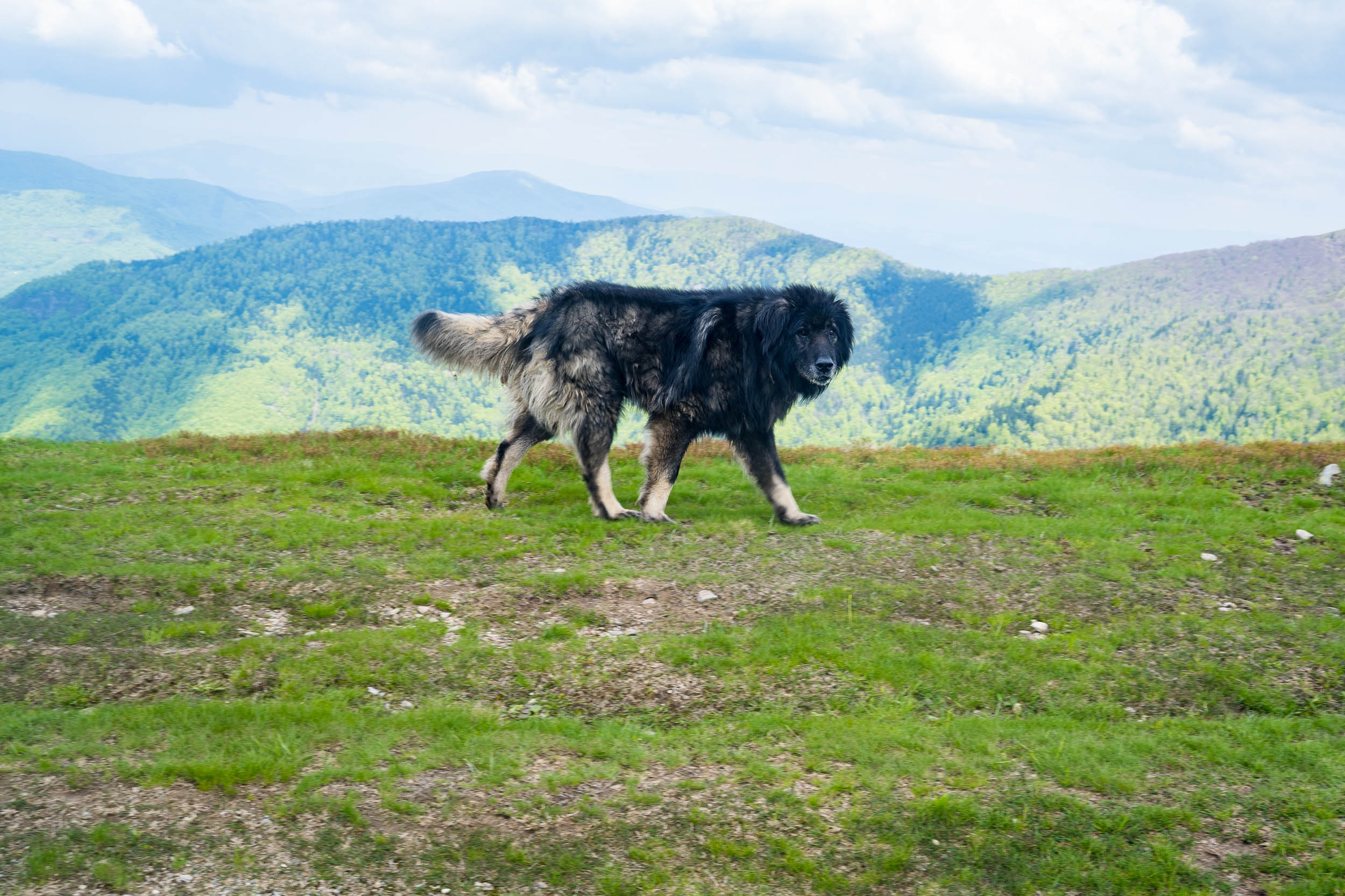
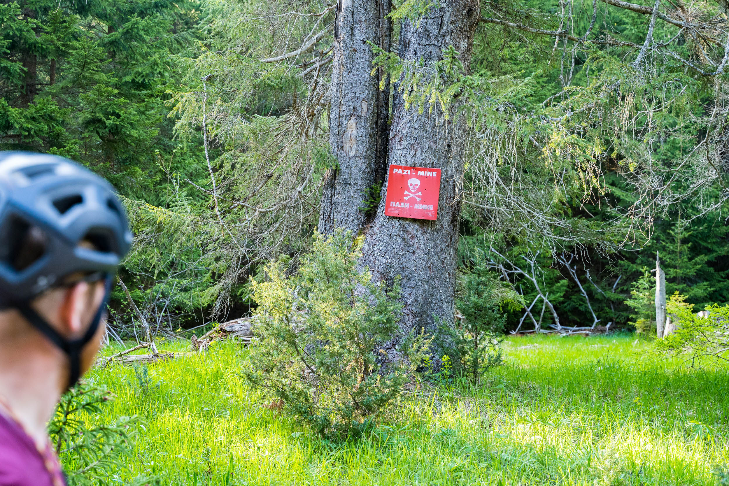
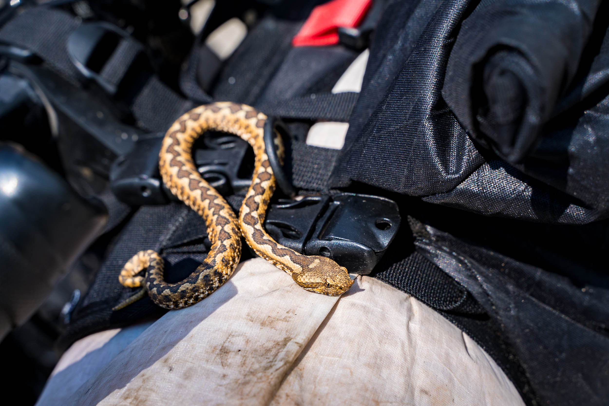
The woods are home to wolves, bears, and Europe’s most deadly viper. And if that wasn’t enough, there are the landmines to deal with too – one of the many visible scars of the Bosnia War that ended in 1995. But the country is beautiful, largely undisturbed – and with tourism is its infancy, relatively affordable compared to its neighbors.
This route is a demanding weeklong adventure, giving you unbelievable views, grueling climbs, and unforgettable descents into the cultural melting pots of the valleys below. The people of Bosnia are warm and welcoming and the landscape is harsh, high, and beautiful. One thing is for sure about this tour: it won’t be the last time you’ll want to visit this country. There are so many more regions of the country to experience, and this is just a taste.
Route Difficulty
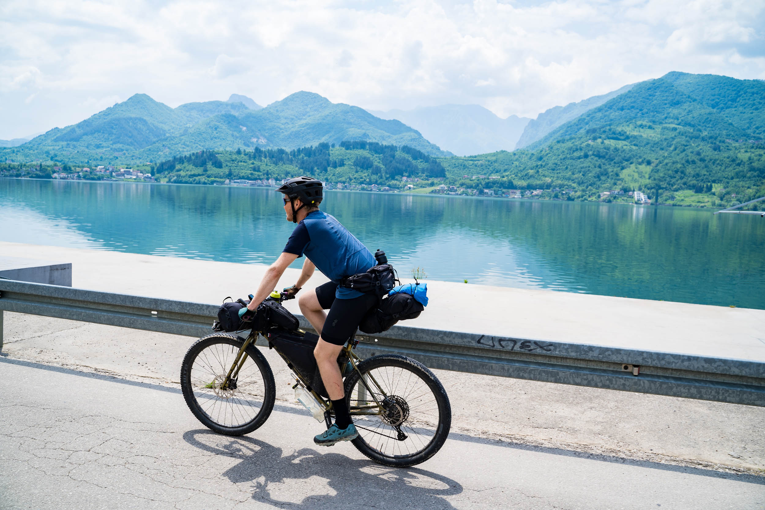
Central Bosnia is very mountainous with snow all year round in places, and although the overall height gain of this tour is not huge, the climbing is steep. Expect the ascents onto the plateaus and ridge lines to have chunky gravel in parts and a 10-14% gradient for several kilometers at a time. Although the trail often feels remote, you’re never more than a few hours away from the nearest settlement, and mobile 4G signal is generally excellent across the entire region.
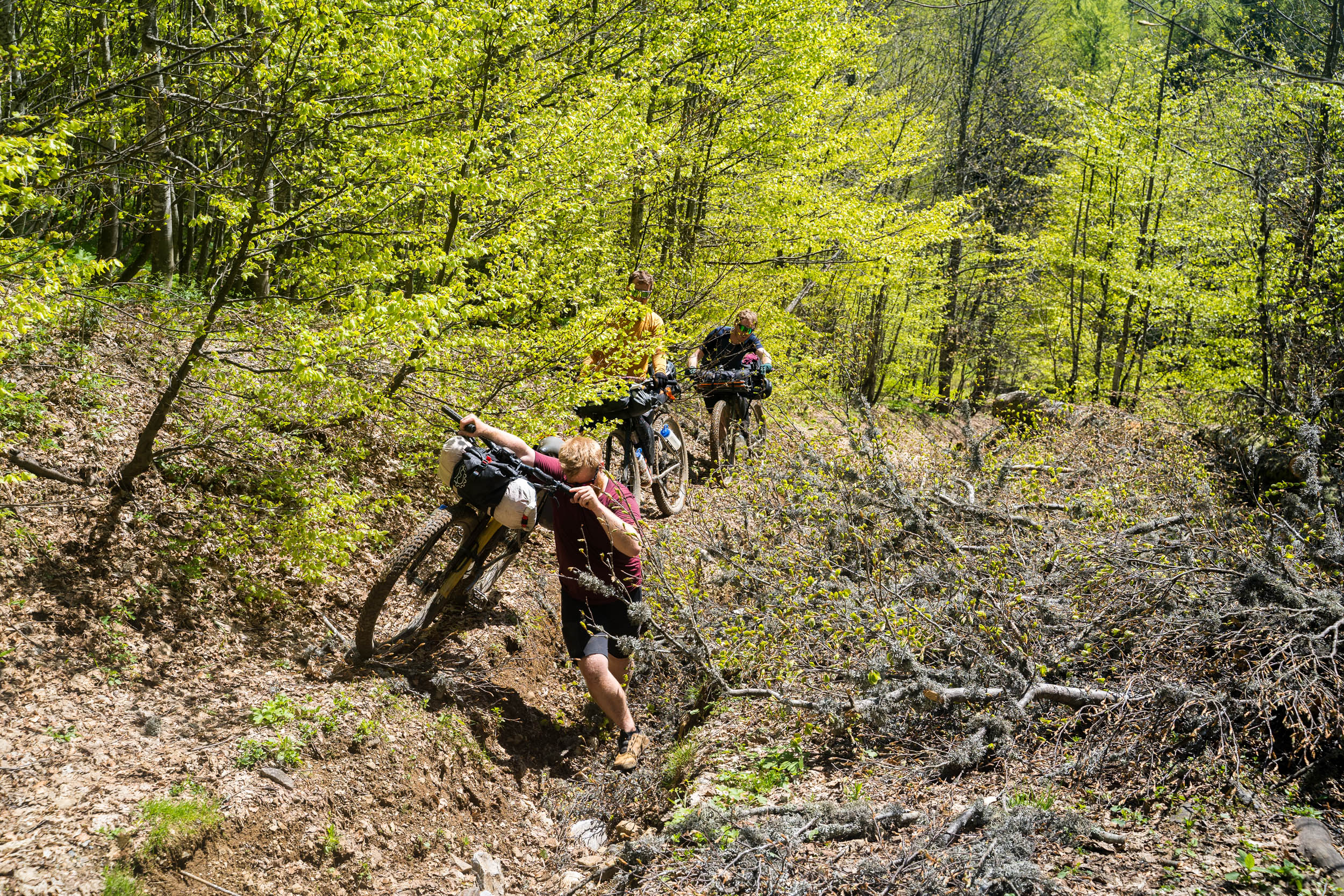
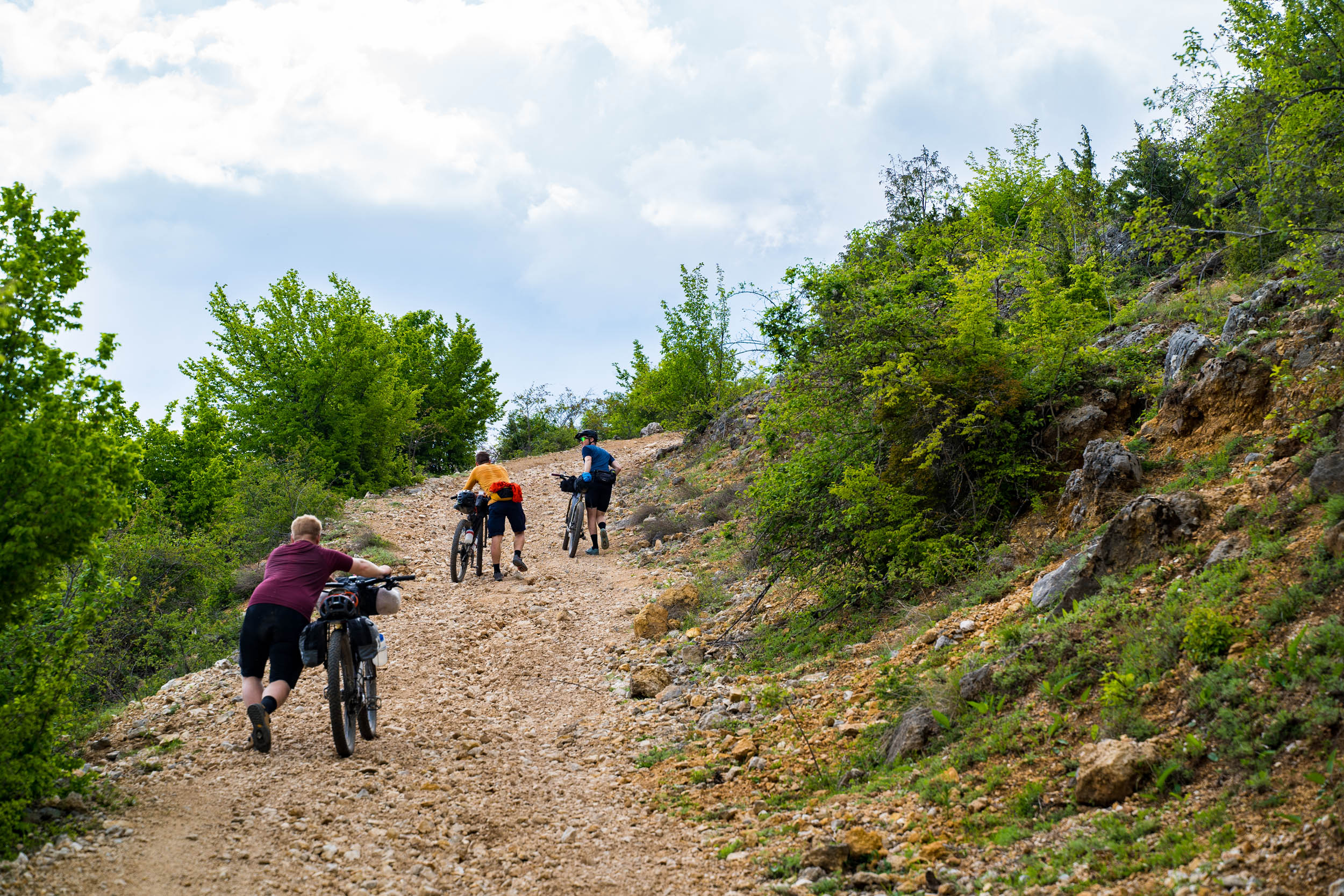
There was very little technical riding on this trip aside from some singletrack on the high plateaus. The most challenging part is the descent off of Bitovnje Plateau on the second stage. This could be rated a 7 or 8 and you have to walk at times. Most of the route is a 4 out of 10 in technical difficulty.
As I’ve learned from my cycling adventures in other parts of the world, when the geography of the area is steep, there tends to be only one road through the valleys, and these roads will have an asphalt surface. This is the case in Bosnia and the reason why the road percentage is so high. Don’t let this put you off. The route feels very much like a long off-road experience. Based solely on access to food, security, and route finding, a difficulty grade of 4 out of 10 would be applied. But with the steepness of the climbing and physical exertion needed, the route should be considered a hard 7 out of 10.
Route Development: Pre COVID-19, I met Cale and Melissa Wenthur, an American couple, who were finishing their European bikepacking tour with a last ride in Sweden. They had just ridden my Swedish Safari tour. I asked them where their favourite place to ride in Europe was, and without a moment’s thought, they said Bosnia and shared their GPX files with me. They had received a tip from another American about the Via Dinarica hiking trail, which they had also ridden in part. With these bits of information, I designed this loop, which uses parts of this trail. The rest of the route was created by linking the best of the region and getting back to the city within the allotted time frame. There is only one direct flight a week from Stockholm to Sarajevo, so I knew we needed to ride whichever route we were going to do within six days. In hindsight, eight days would be a more enjoyable time span to ride this tour. Additional thanks to Revelate Designs and Haglöfs for their support in helping make this trip possible.


Submit Route Alert
As the leading creator and publisher of bikepacking routes, BIKEPACKING.com endeavors to maintain, improve, and advocate for our growing network of bikepacking routes all over the world. As such, our editorial team, route creators, and Route Stewards serve as mediators for route improvements and opportunities for connectivity, conservation, and community growth around these routes. To facilitate these efforts, we rely on our Bikepacking Collective and the greater bikepacking community to call attention to critical issues and opportunities that are discovered while riding these routes. If you have a vital issue or opportunity regarding this route that pertains to one of the subjects below, please let us know:
Highlights
Must Know
Camping
Food/H2O
Trail Notes
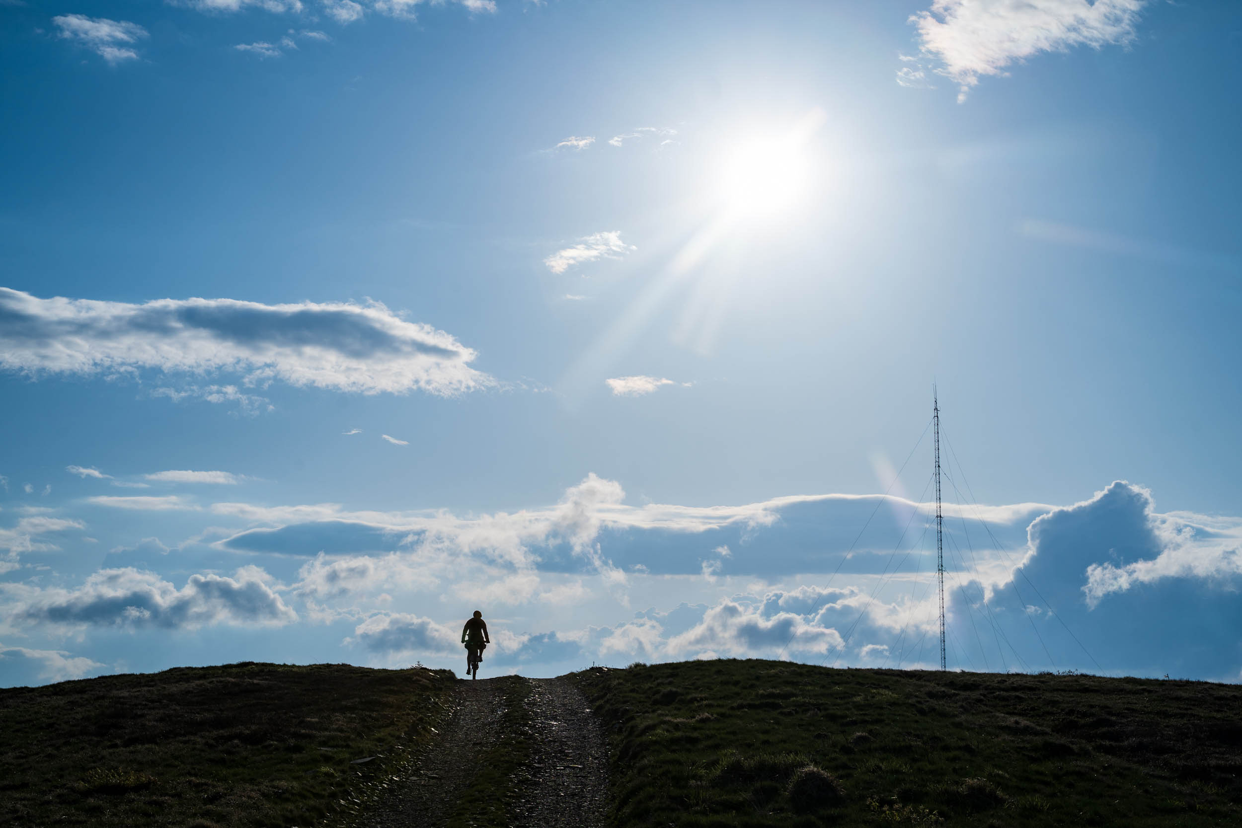
- Riding above the treeline over the Bitovnja plateau, the Sikira ridge line, the Tropolje steppe, and the Bjelašnica plateau and valleys. All are mesmerizing and will leave you with memories of a lifetime.
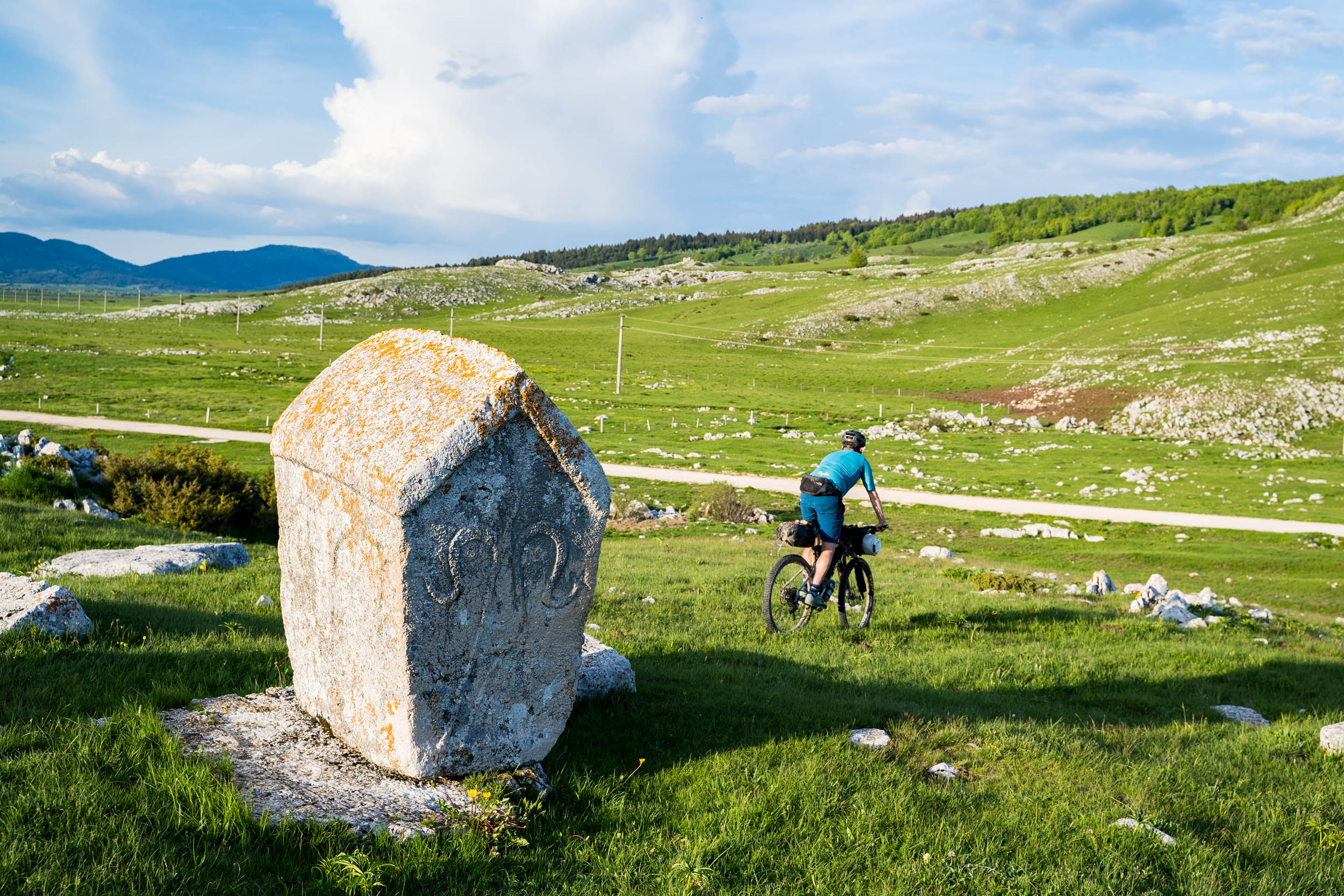
- Exploring the UNESCO necropolis sites that are spread across the country, especially at Ravanjska Vrati and at Dugo Polje.
- Experiencing the mix of cultures and religions in this now peaceful country. The Balkans have always been a place where many cultures mix. This is most strongly portrayed in Sarajevo when the call to prayer can be heard at the same time as the ringing of church bells.
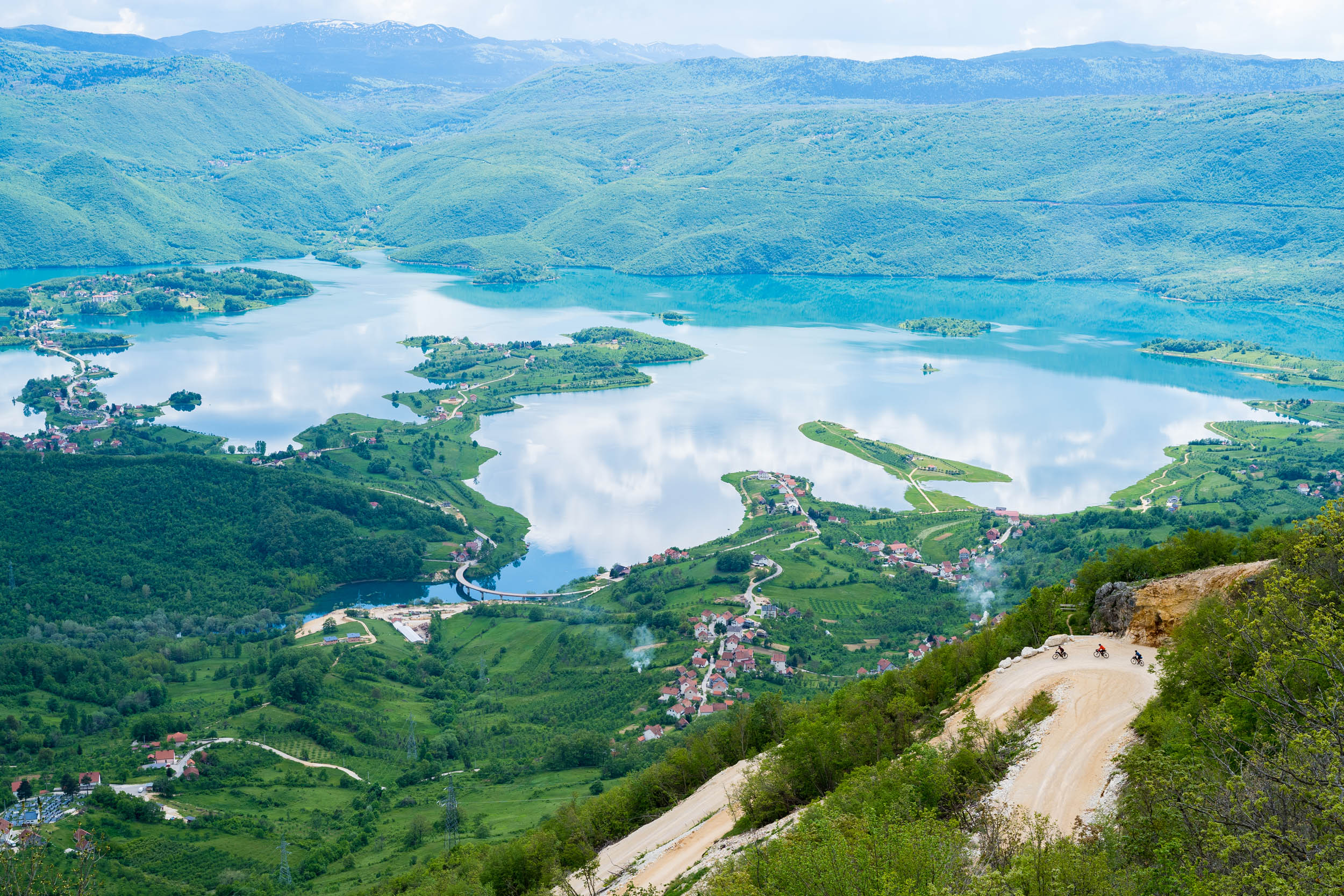
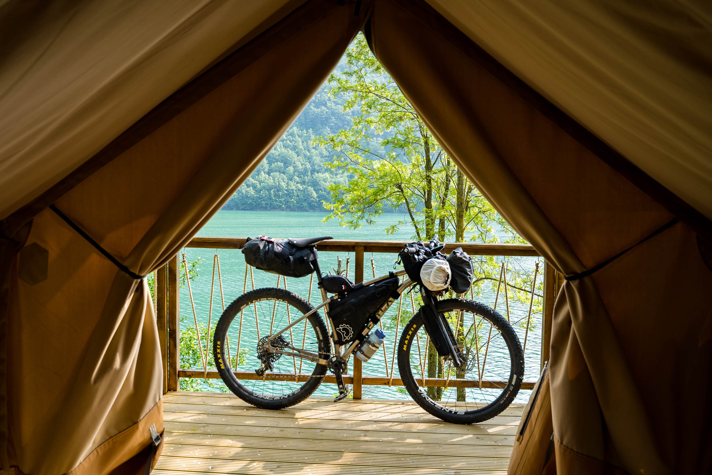
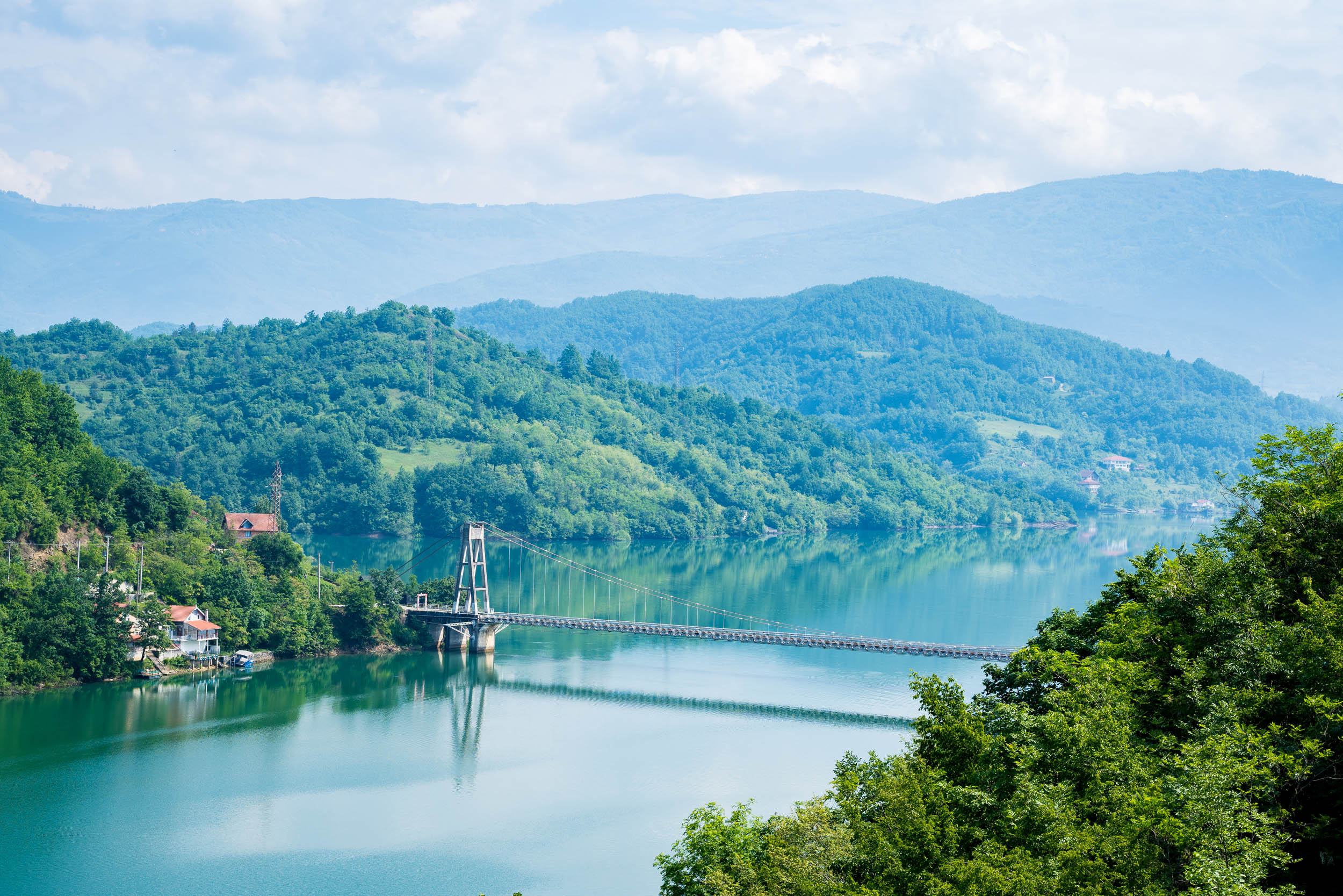
- Riding around the turquoise waters of Jablaničko lake. If the same ride was in the French Alps or Switzerland, it would be lauded as one of the most spectacular rides in the world.
- Downhilling the long gravel descents. What goes up must come down, and with all the climbing you do, you are rewarded with epic gravel descents.
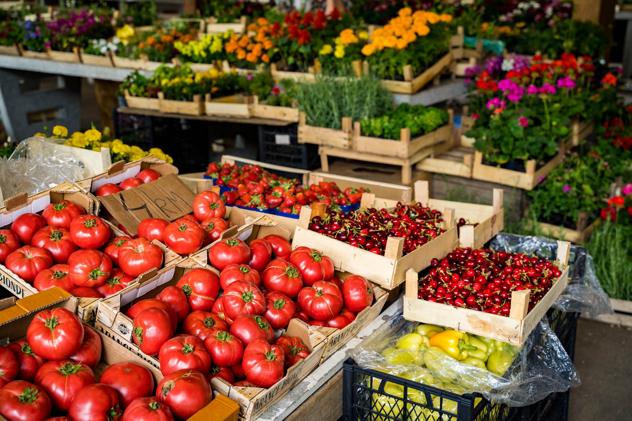
- Enjoying the cheap but delicious local breads and cheese. It’s not the easiest country to travel in if you’re a vegetarian, but the local bread and cheeses definitely make up for it.
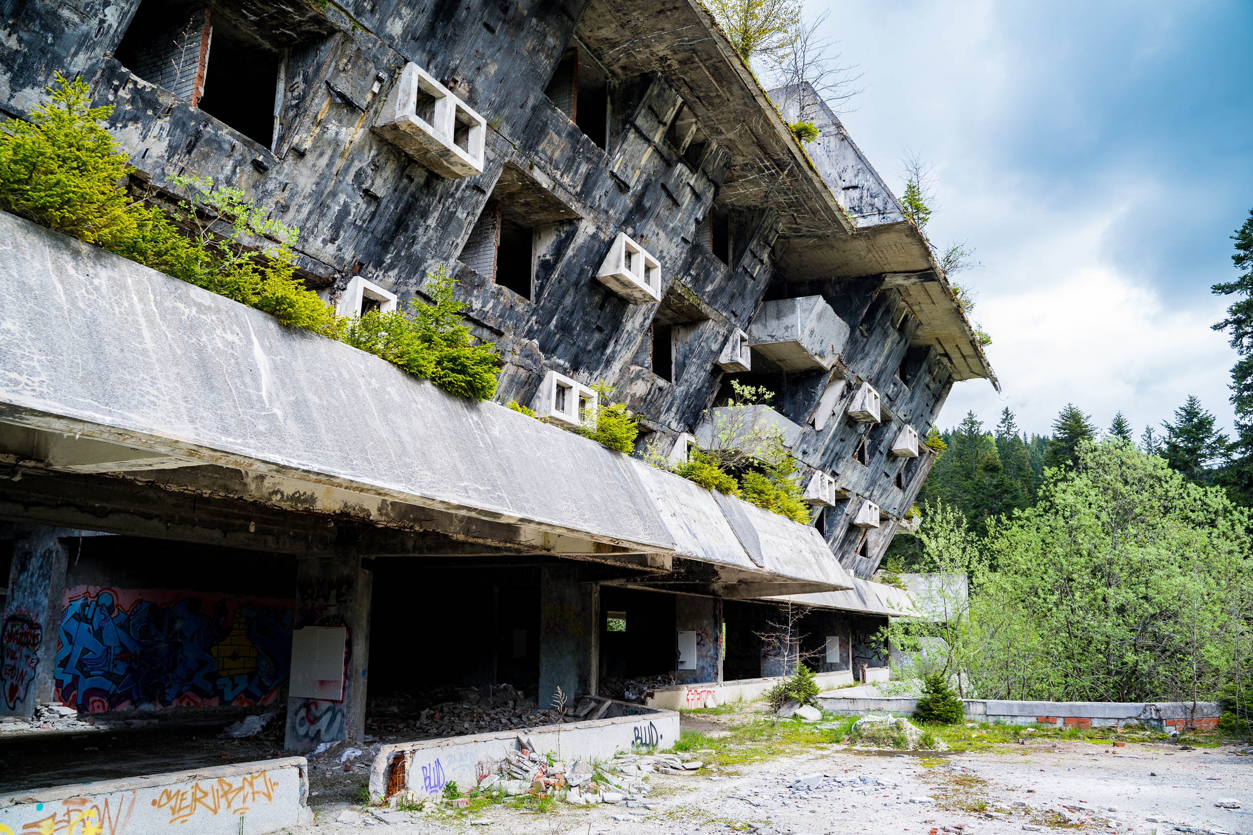
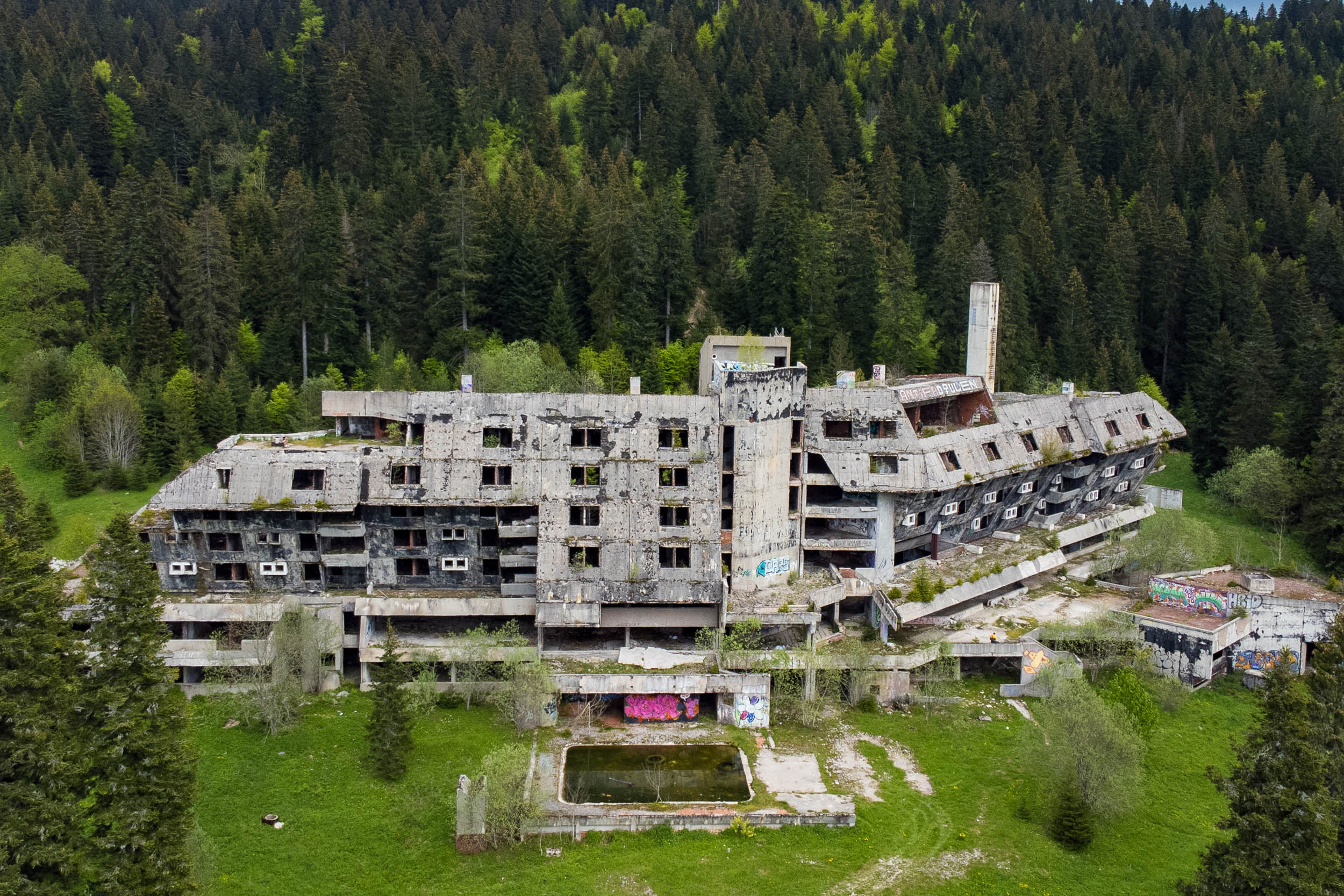
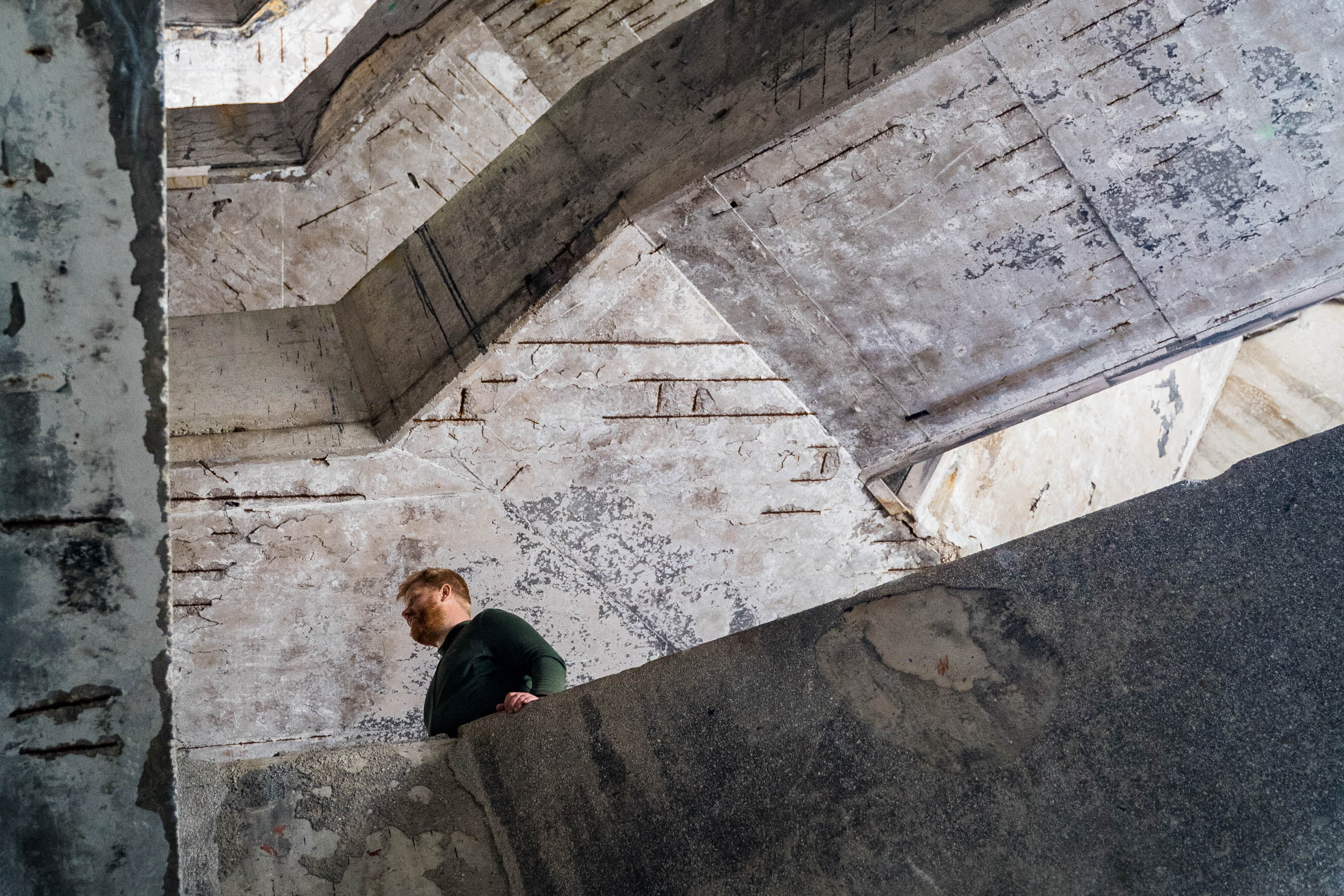
- Exploring the abandoned Hotel Igman. Built for the 1984 Winter Olympics, the hotel suffered a major fire in the 1993 Bosnia war. This large concrete shell has been abandoned and left in disrepair. A must visit location even if you’re not actually looking for zombies!
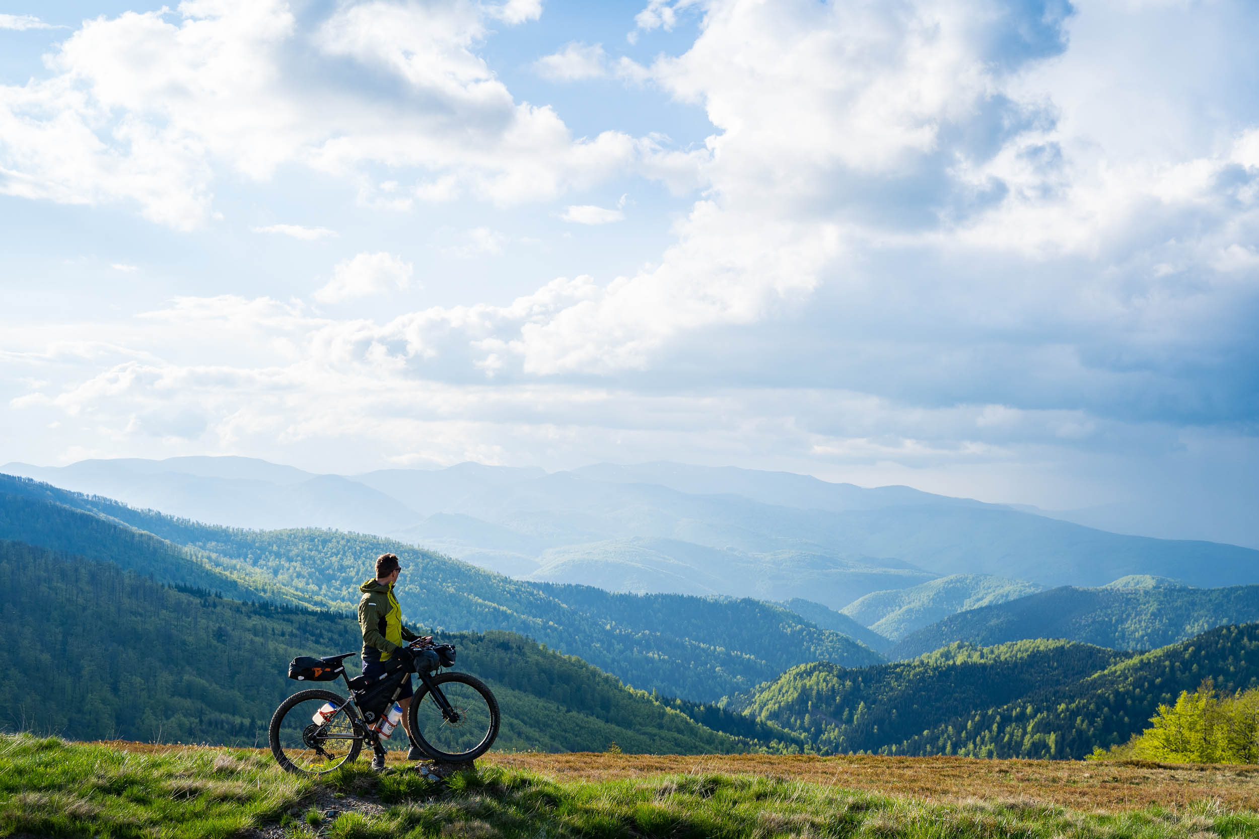
- Gazing out over the epic viewpoints. One such highlight is the view from the end of Lukomir village over what is locally known as the Bosnian Grand Canyon.
- Wandering the old town of Sarajevo. The old market district of Baščaršija is a perfect blend of coffee shops, restaurants, and old world stores, and it deserves at least an afternoon of exploring.
- The best time to ride this route is in May to June after the snow has melted, or in September before the winter returns.
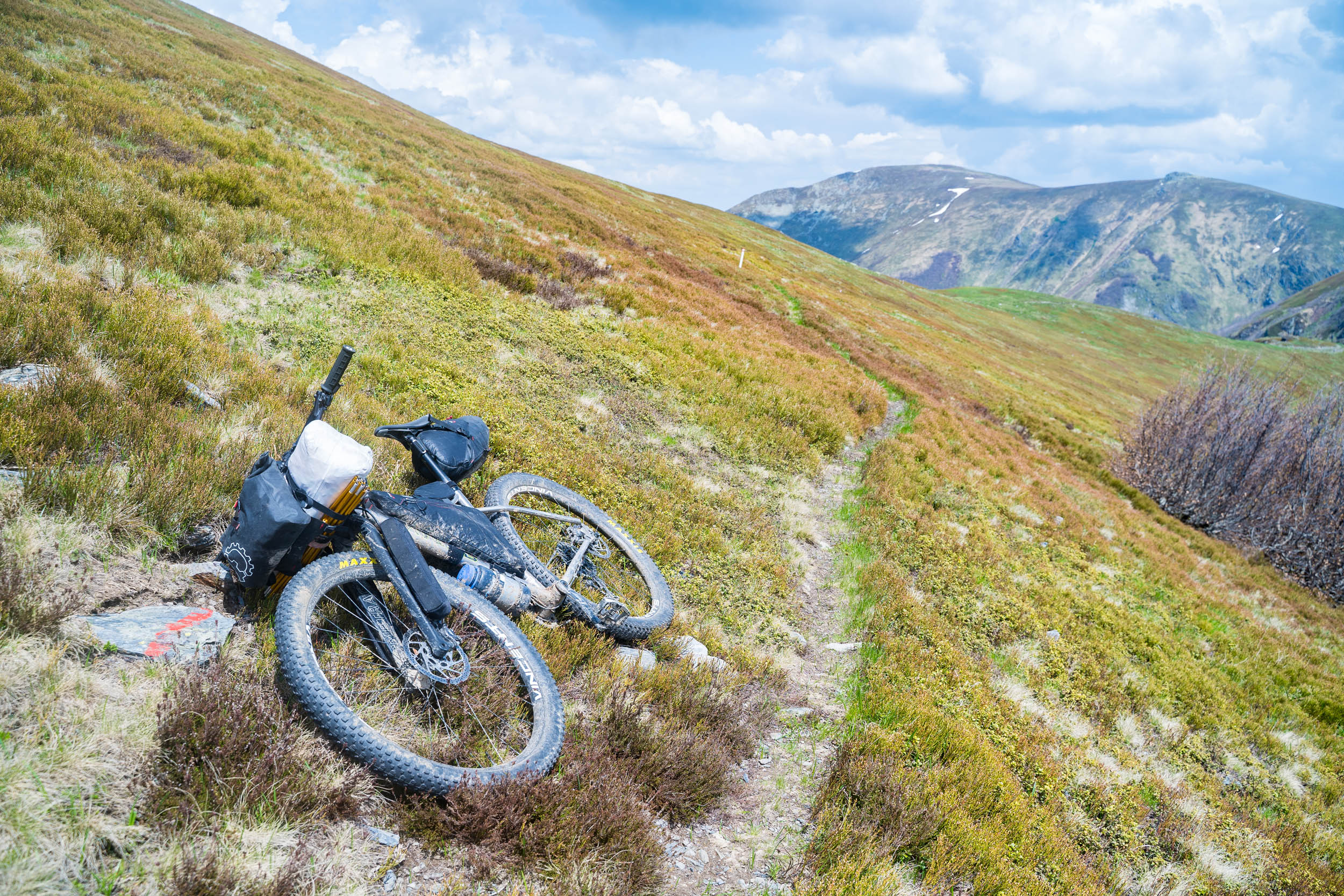
- The route has some challenging hike-a-bike sections, so good flexible shoes for these ascents are essential.
- The downhills are long and fast, so fresh break pads and wide enough tires are a must, and 2.6” tires are recommended.
- For most passport holders a visa is not required for a 30-day visit, but check before you go to make sure your country is on the list.
- Some English is spoken in large towns and is widely spoken in Sarajevo. German seems to be on a par with English, with many locals asking if we spoke German instead. Bosnia gets lots of German and Austrian tourists. Finding English speakers is more more difficult in smaller towns, but everyone you meet wants to interact, and they’ll find a way to communicate. Bosnians are very open and friendly.
- The local currency is the BNM aka “marks,” but the Euro is liked by many too. Although, if paying in Euro, expect to be a little over charged via the local exchange rate.
- Parts of this route runs parallel with the Via Dinarica trail.
- With regard to the mines in Bosnia, there are many apps available to help you know where the main fields are, but I’m told that these aren’t up to date. The best option is to download the “BH Mine” app, which works offline, or by talking to locals.
- We all rode on rigid mountain bikes with 2.6″ tyres. These were the perfect types considering the fast and sometimes chunky descents. A gravel bike with slimmer tyres might be a little too light for this adventure.
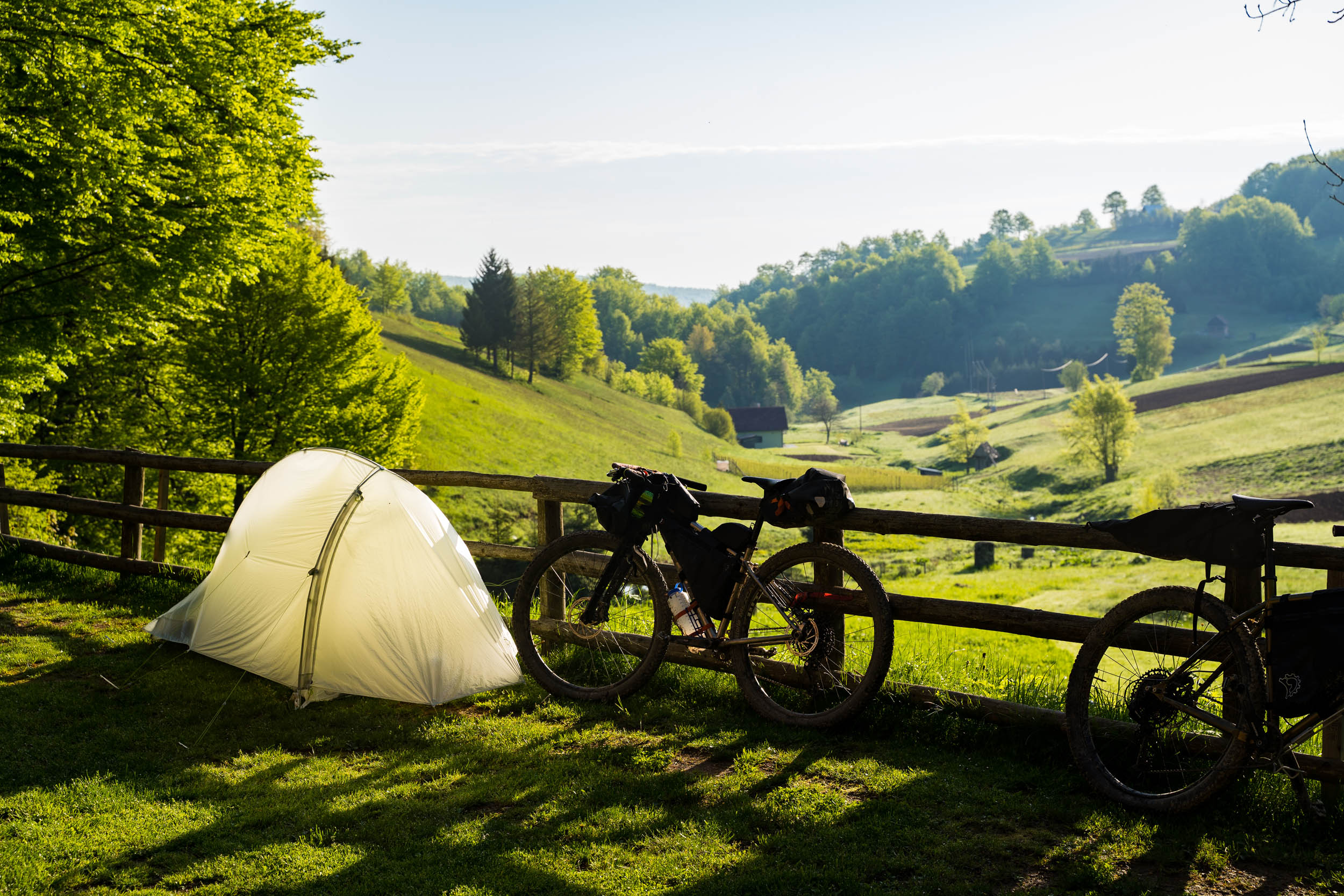
The camping in Bosnia can be broken down into three categories.
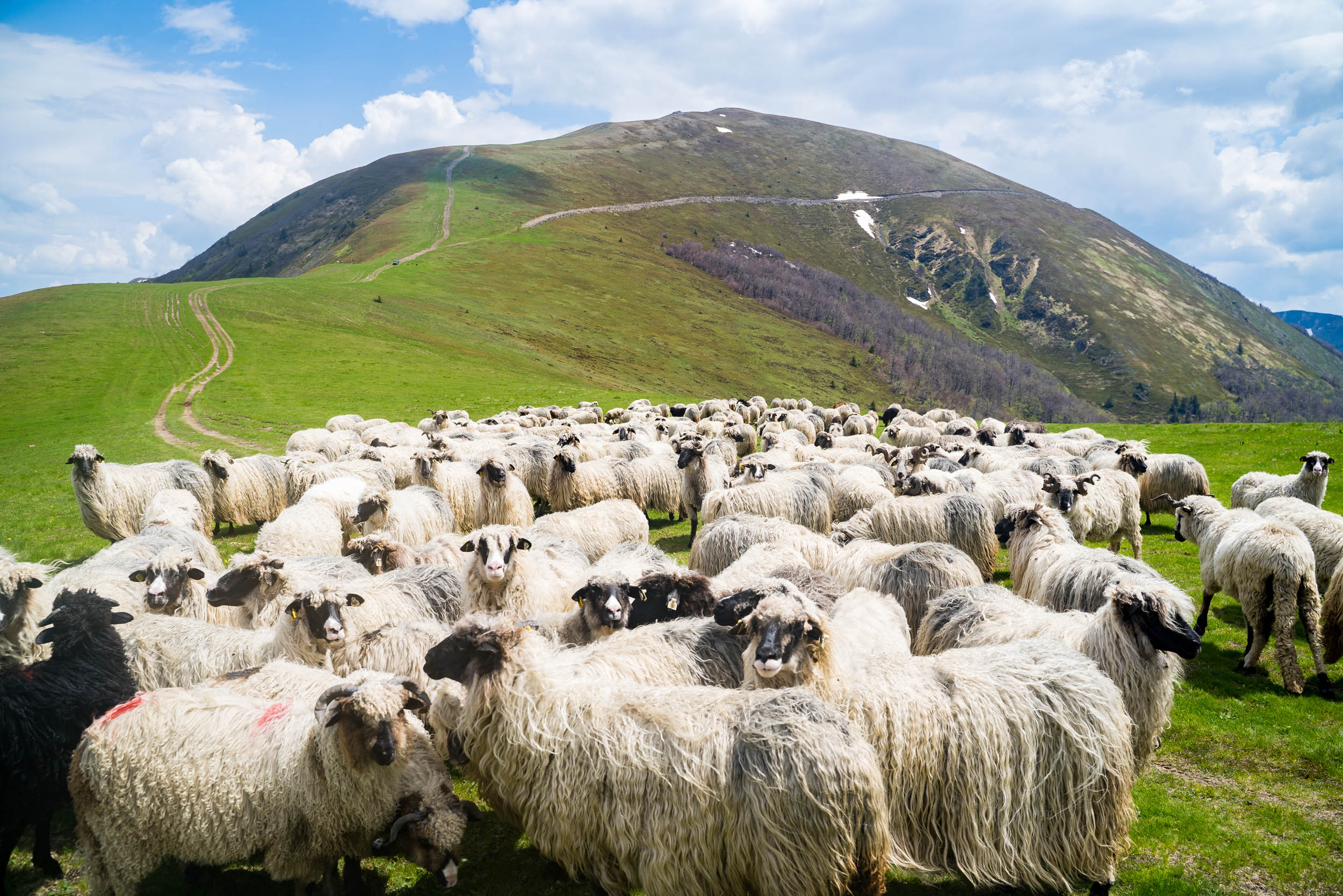
- Above the treeline. The is the easiest place to wild camp and is popular amongst Bosnians too. Expect to meet local city dwellers enjoying nature straight from their cars or on a hike, especially on sunny weekends and in the high summer. You should also consider stormy weather conditions as the highlands can be exposed to violent thunderstorms and winds.
- The valley walls. The mountains in Bosnia are very steep, so it can be difficult to find level ground. It is not advised to go wandering in the forests as there are still lots of unexploded landmines left from the war. Always stick to the established trails.
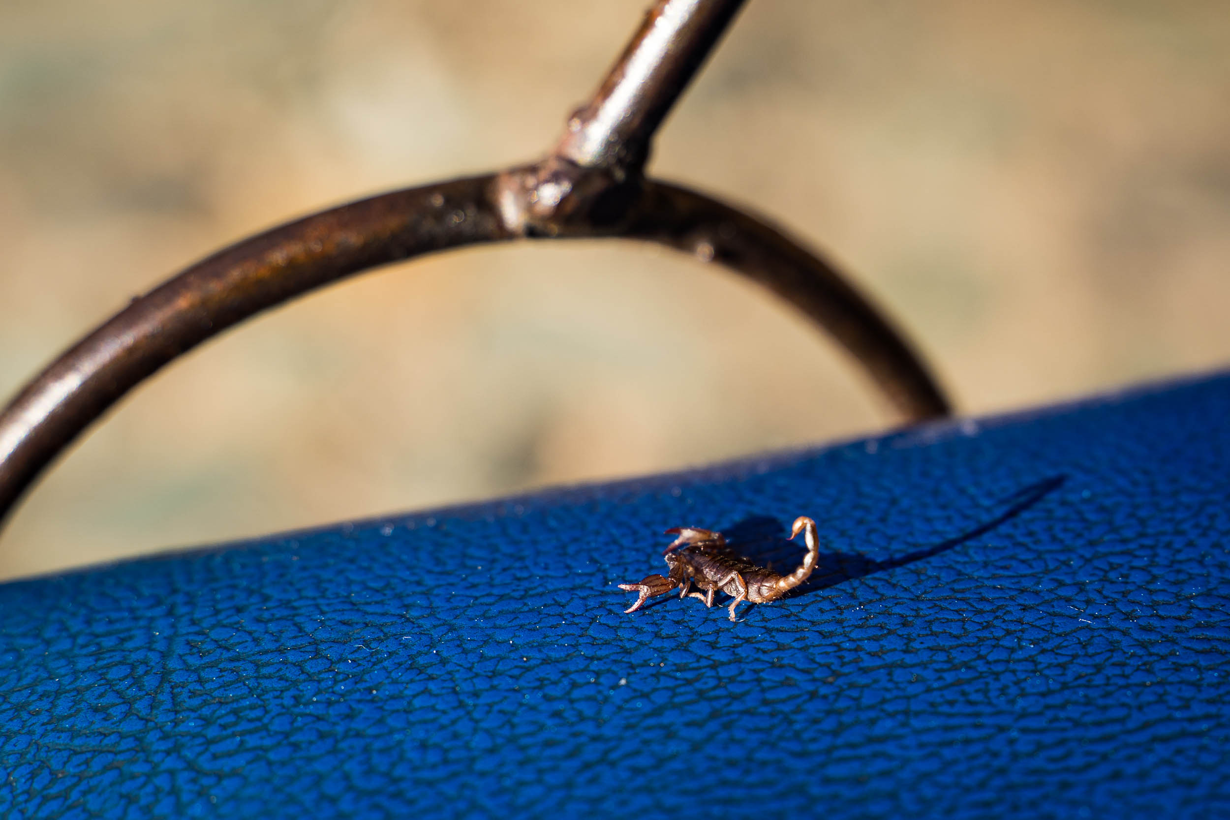
- The valley floor. These areas can also be difficult as the valleys are generally narrow and populated with many small farming plots. Apart from having to watch out for landmines, there are also snakes and scorpions. Snakes hunt in long grass for their food; as a result, you’ll notice that a popular sport amongst the Bosnians is cutting their grass!
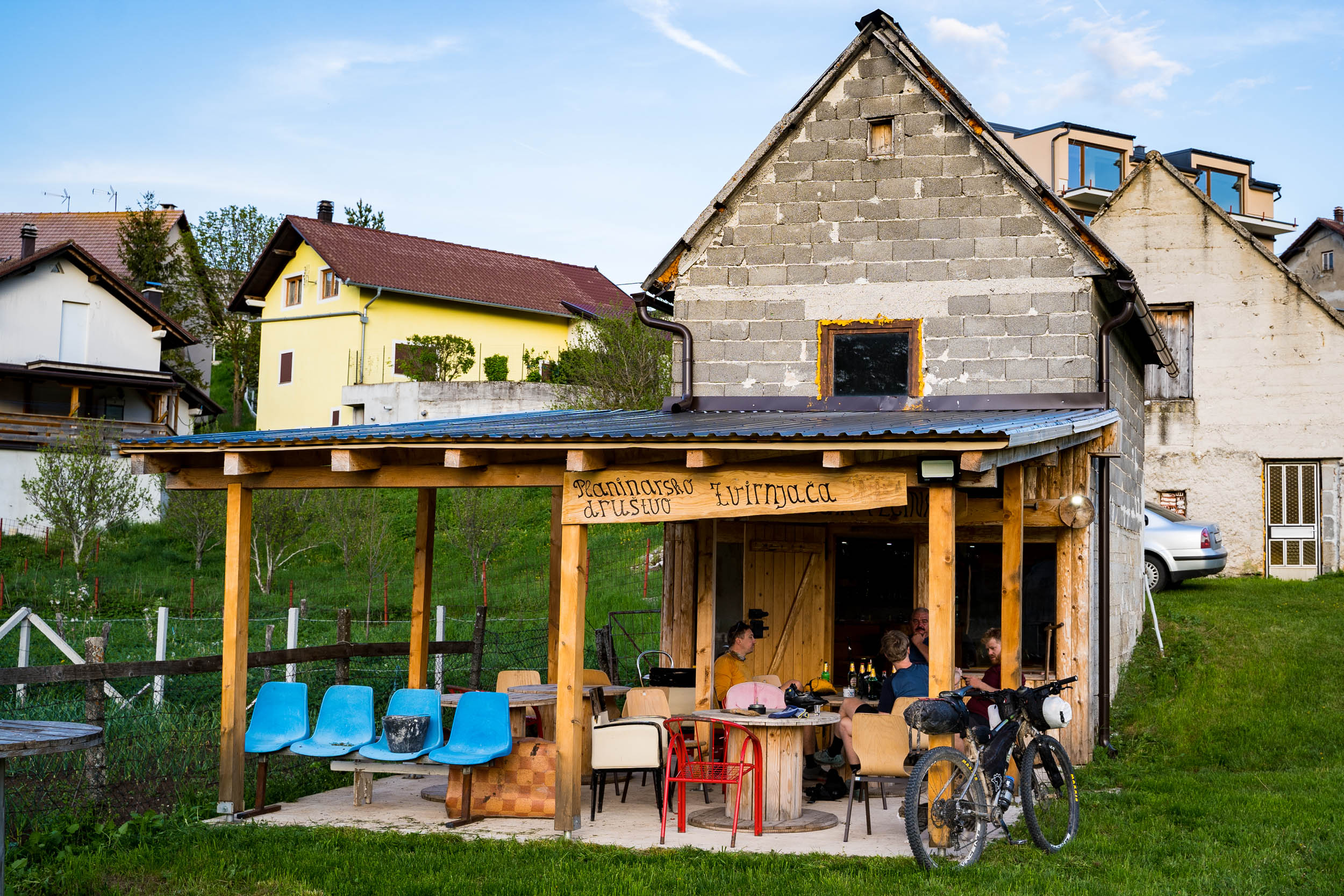
In the lower parts of the valleys, we found it easy to find camping in the gardens of local restaurants or white water centers, where the owners will often let you camp for free or charge as little as $5 a night including the use of their showers and toilet facilities. Indoor accommodation is also inexpensive, so pay the money, have a good night’s sleep, and help the local economy.
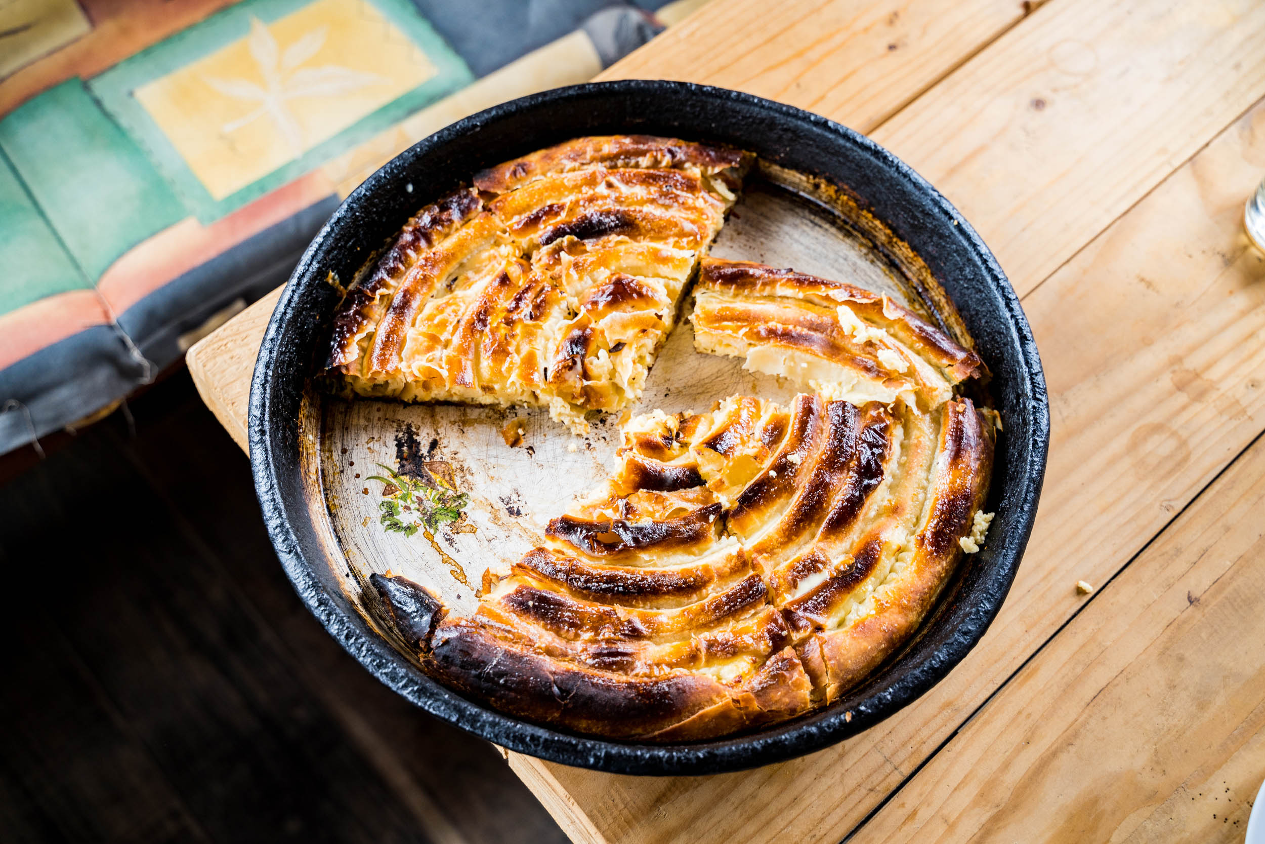
- As Bosnia is a developing country with a low average income, expect the food to be simple.
- Nearly 50% of the population is Muslim, so the majority of the meat on offer is lamb.
- Meat, bread, and cheese is the staple diet of the locals, so don’t expect a large selection of fruit or vegetables.
- It is still legal to smoke indoors in Bosnia, and the locals take full advantage. We looked for outdoor seating or sought out the quiet corners in the eateries we visited.
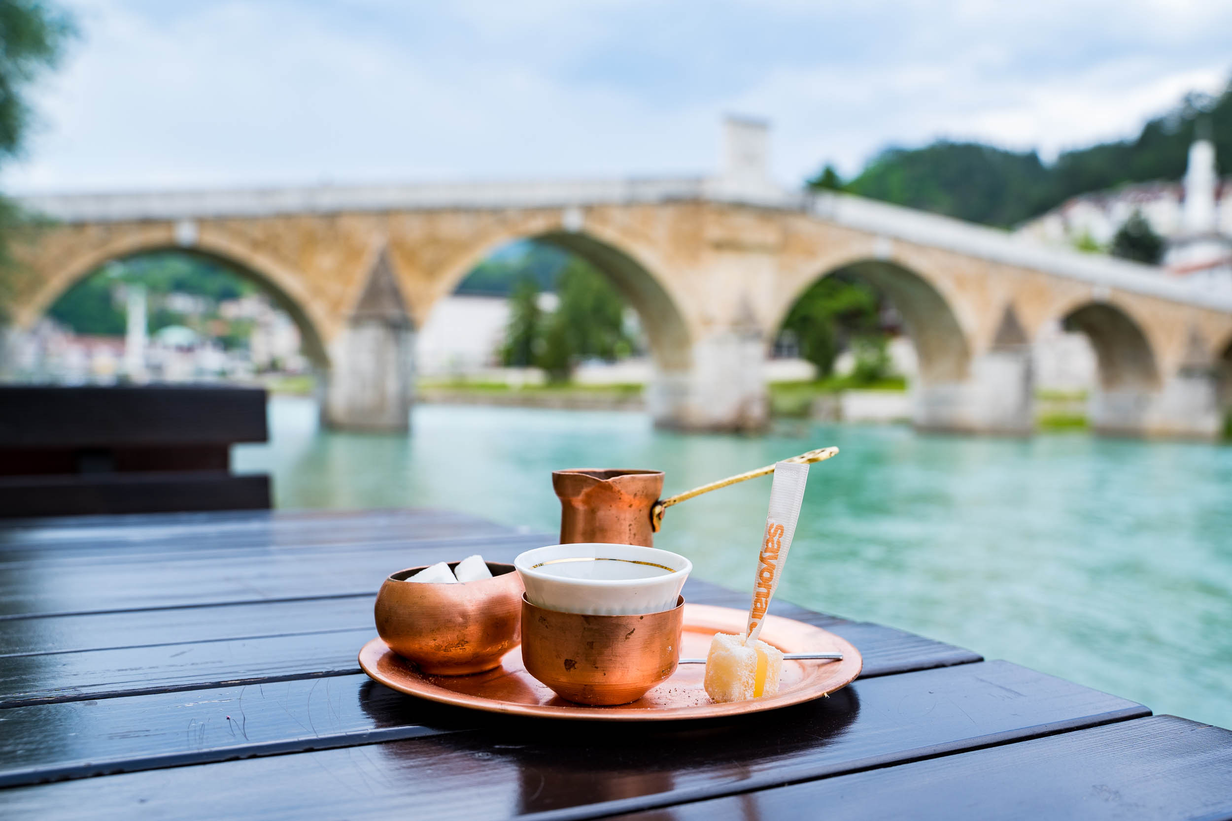
- Bosnians are very proud of the water quality in their country, and when asked, they will announce that they have the cleanest water in the world. This might well be true as population density is low and there is almost no commercial farming in the region we cycled, so there’s nothing to pollute the water.
- In the valleys and through the forests, there are water fountains everywhere. When above the treeline, it was only the Bjelašnica plateau between Lukomir and the Bjelašnica ski station that had fountains.
- For the other high regions, make sure to carry enough water. We never filtered the water from the fountains or high up streams, and none of us had any problems.
locationSarajevo-Ivan Seldo War Monument
Stage 1 (47.5km 800m climbing)
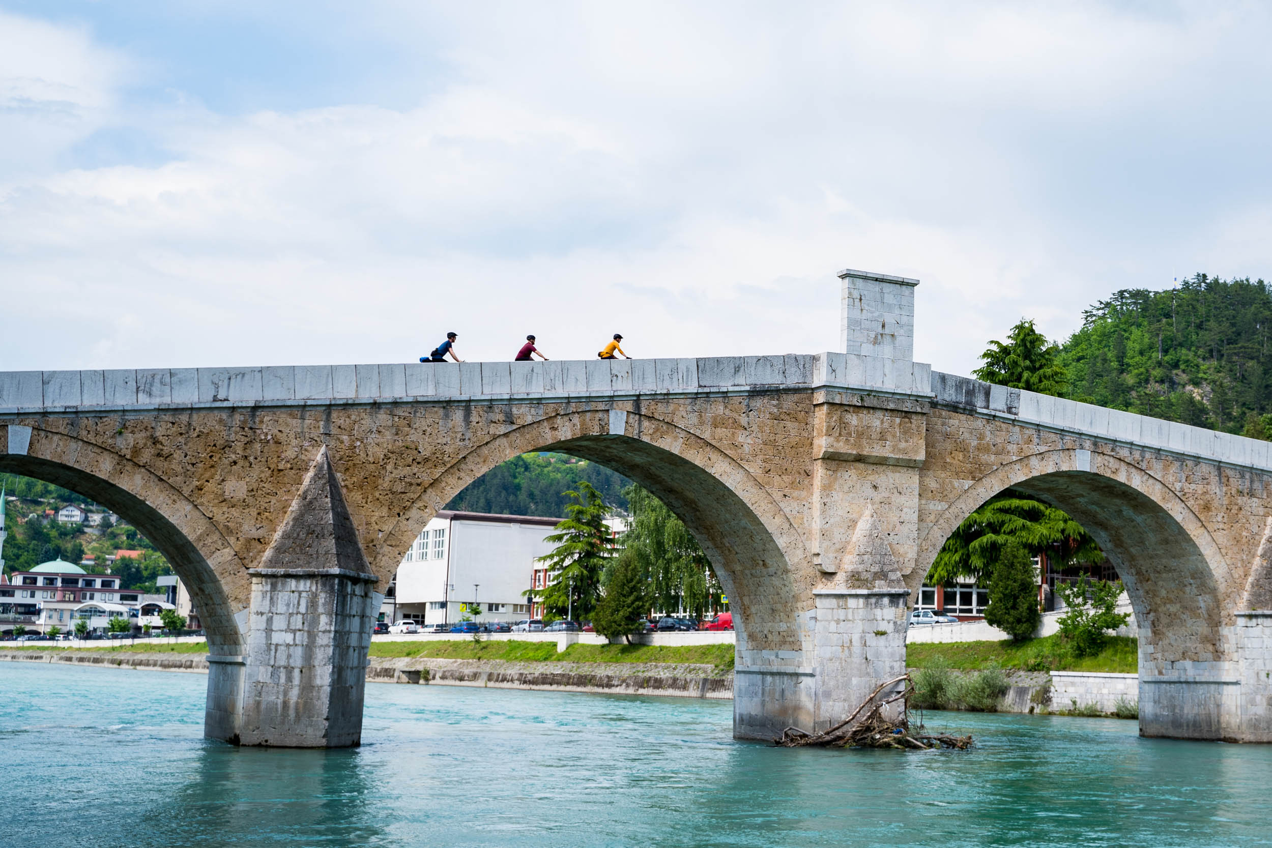
Starting from Sarajevo old town, follow the northern side of the Miljacka River as best you can until you reach the Ilidza town center. From here, follow the minor busy road where you’ll get to turn off the asphalt for some hundreds of meters and ride over a pretty cobbled Roman stone bridge. Although the bridge was built in the 16th century, it was constructed using the stones of an older Roman period bridge.
Shortly after rejoining the road, make sure to take the lower road at the small industrial area. This quiet back road eventually leads you along a small river before you head into the small satellite town of Hadžići. After passing through its urban area, you get to start climbing the first hill of the trip. Consider it a warm-up for what’s to come.
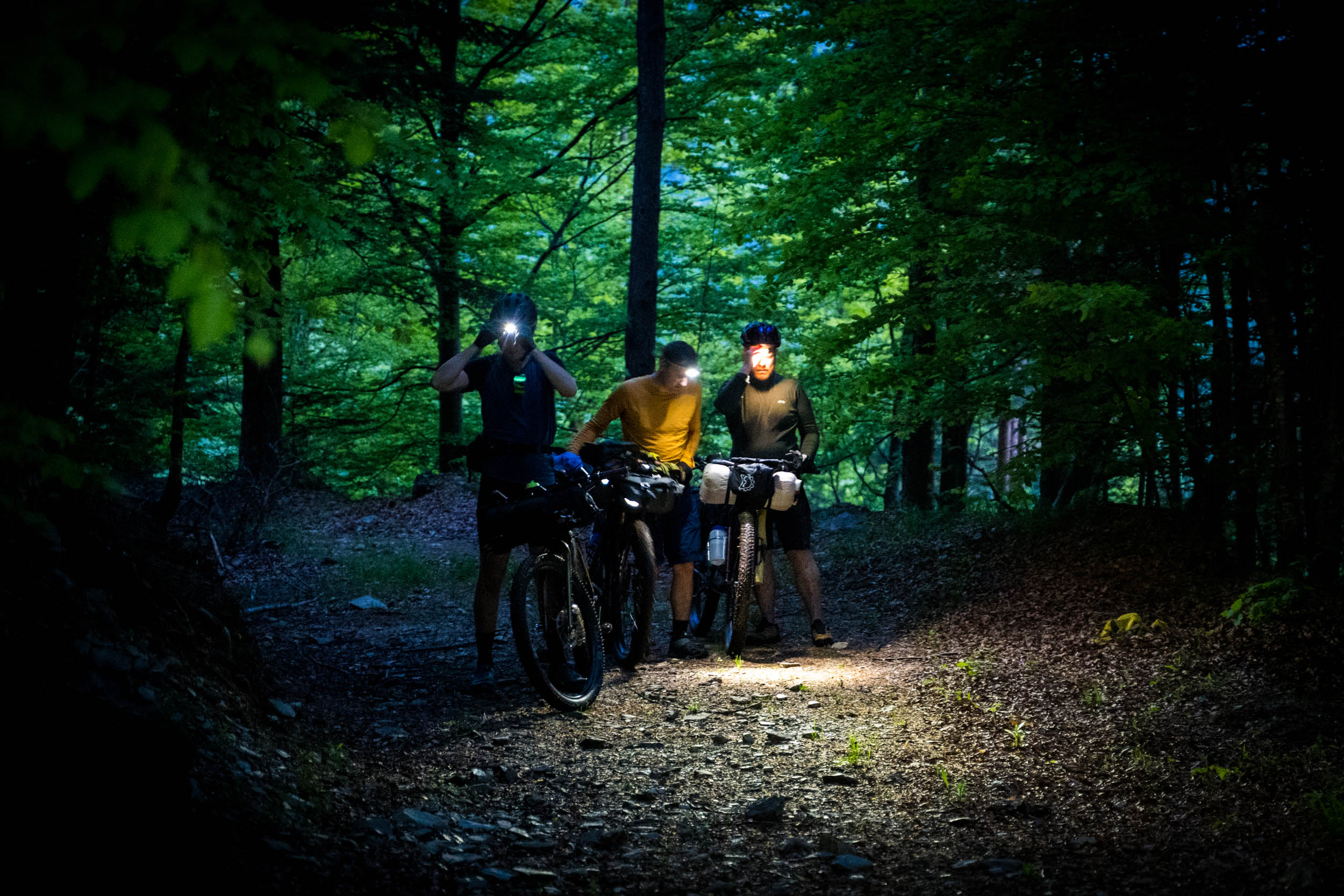
When the steep road turns into a small plateau, you’ll need to pay attention to find the next part of the trail. The road will lead to a four-way junction where you turn right and climb steeply uphill and towards a dead end. When the road begins to level out and just before it turns into a farmer’s lane, look for a sharp left turn on a small singletrack. You’ll almost double back on yourself, but the singletrack straightens out as you glide across a sloped meadow towards the thick forest. Rough gravel might force you to do your first hike-a-bike of the tour, but before long, you’ll reach the top of the pass.
The road ahead is not what the official maps say it should be – a common occurrence in Bosnia – but by taking the right turn, you get to ride downhill on grassy tracks through farmland and then back onto an asphalt road. Fast riding has you back to the valley, where there is a great traditional restaurant to enjoy your first lunch on the road. A mix of urban and countryside riding brings you to the Tarcin Forest Resort, where the road suddenly ends. But, by taking the obvious but small gravel road straight ahead, you’ll descend yet again to the valley floor. The small town of Tarcin is the last food stop for some time, so stock up if you need.
Follow the old main road out of the town and start climbing up into the mountain. The first stage of the tour ends when you reach the Ivan Seldo meteorological station, where you’ll find a small grassy area ideal for camping with fresh water at the station as well as a war memorial statue.
locationIvan Seldo Meteorological Station-Pogorelica Mountain lodge
Stage 2 (27km 1000m)
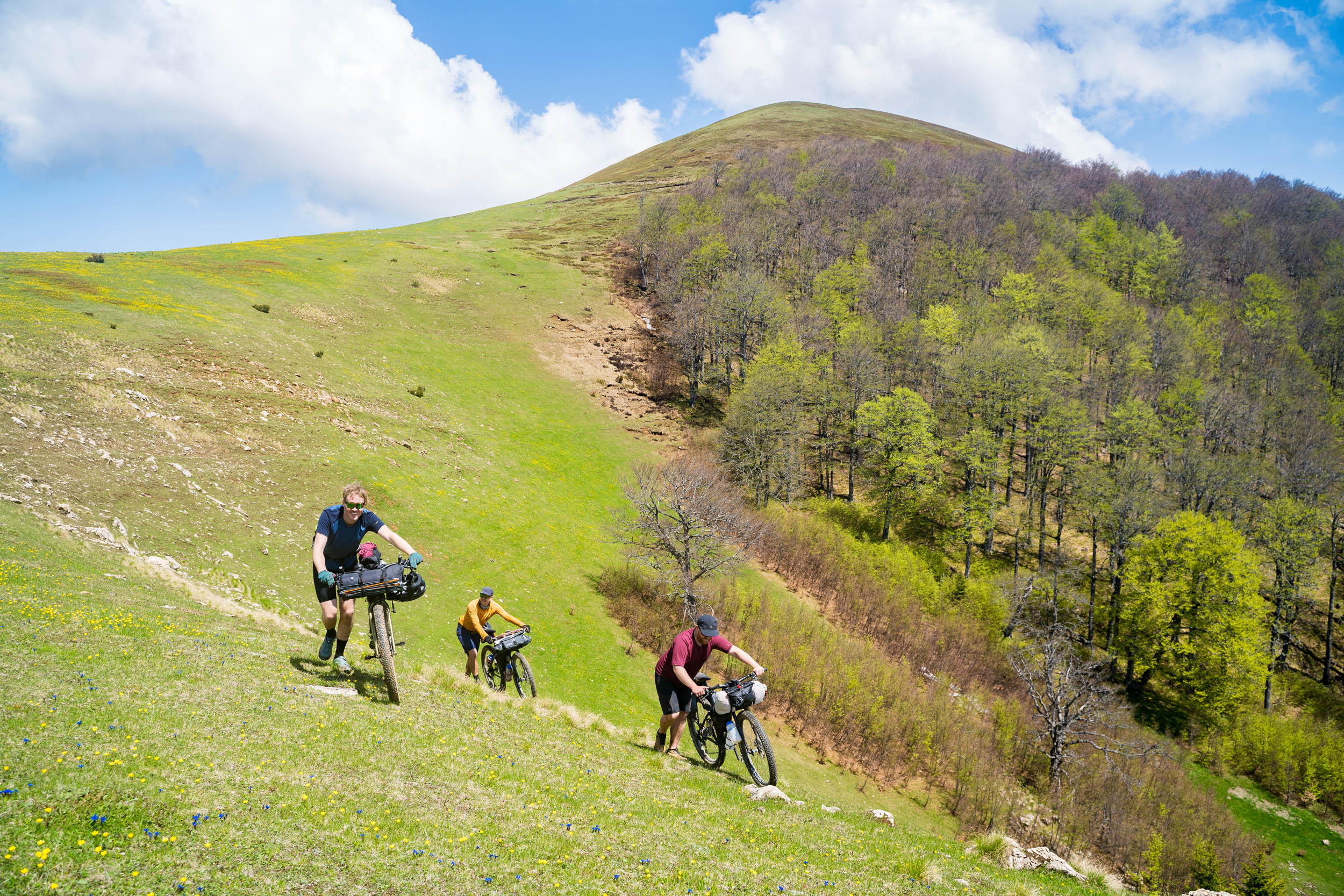
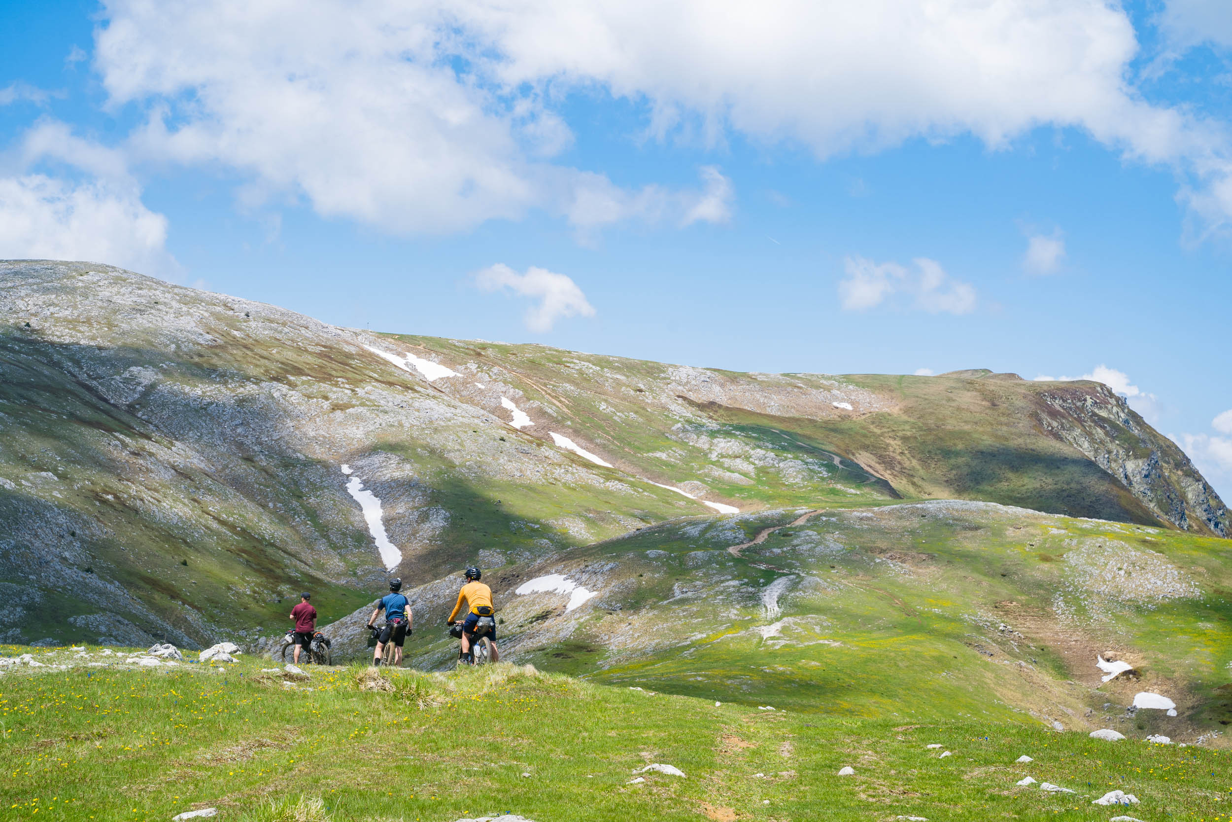
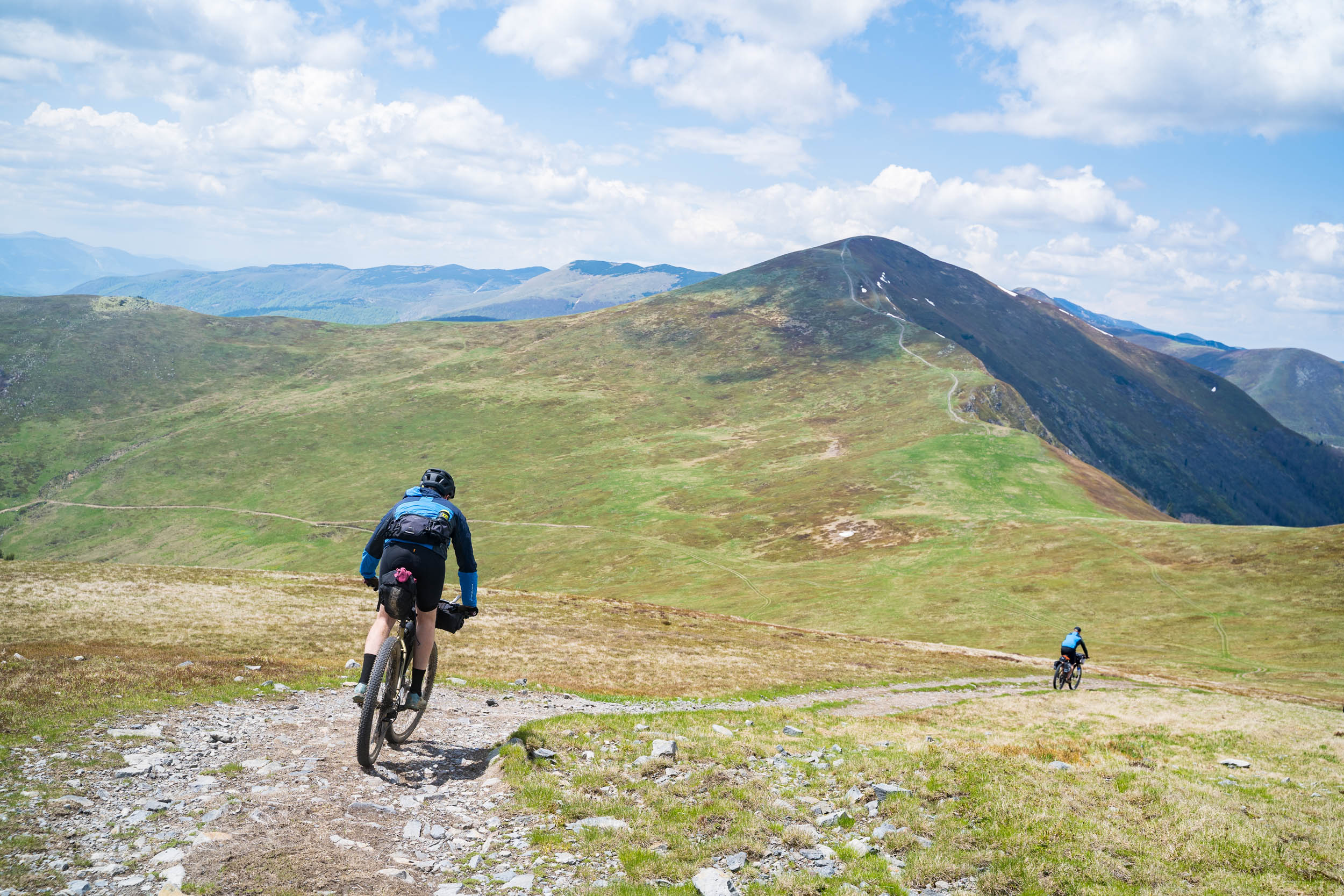
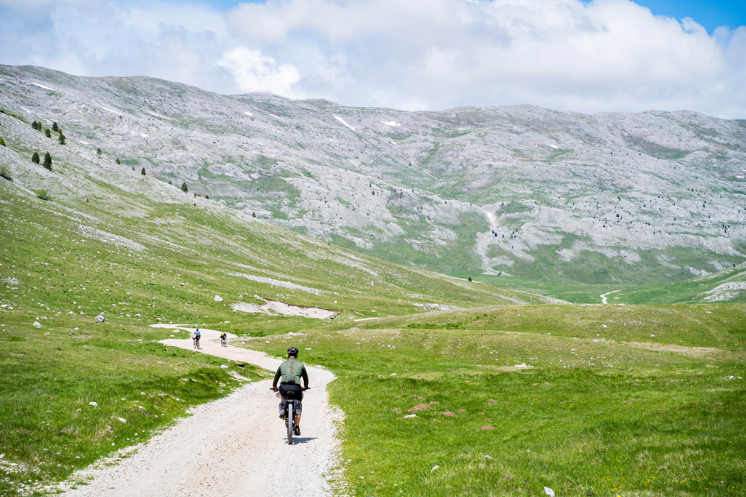
From the meteorological station, start the long climb to the open landscape of the Bitovnje plateau. Here, 820 meters are gained over 16 kilometers, with the first half of the climb being steeper than the second. As you approach the higher elevations of the forest, there are a number of gravel roads heading off in different directions. Some are old and some more freshly cut, but most are not on any map. We followed the GPX directions and made it to the open ground by using some of the older roads. There were no problems, but there could be an easier way.
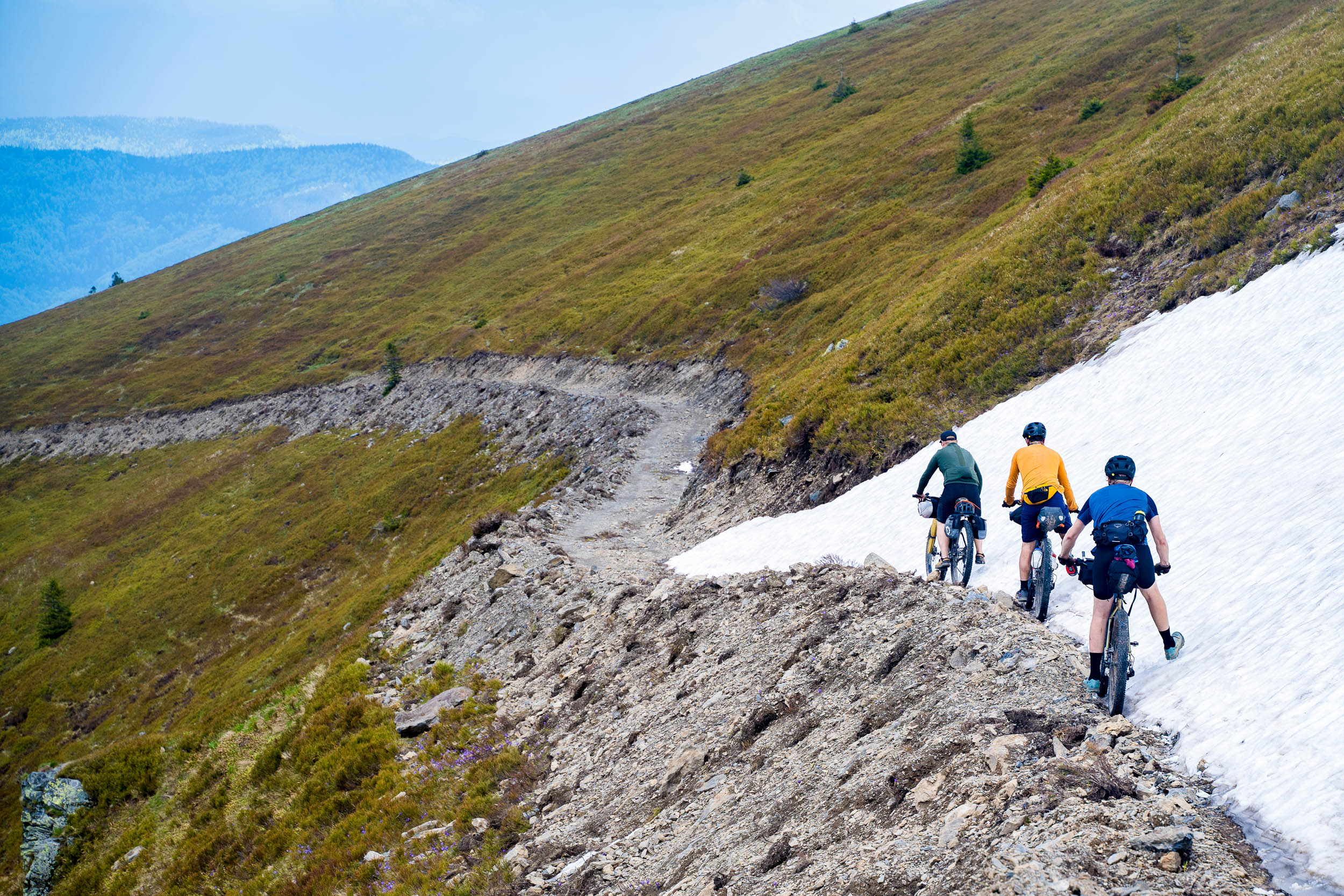
Once above the treeline, enjoy the magnificent views over the surrounding landscape, including Blidinje National Park to the south. After passing by a few false summits, you finally get to descend from the mountain tops via the Via Dinarica hiking trail. The trail is marked by a red circle with a white dot in the center. The descent is steep and travels down some old and very rutted trails, which some might choose to walk instead of risking it.
Just like on the ascent of the mountain, there are gravel roads heading in every which direction. When researching the route, I could find no maps showing any of the roads from the mountain to the Pogorelica Mountain Lodge, so we relied exclusively on the GPX tracks from the Via Dinarica website. At first, we were constantly slightly off the breadcrumb trail but on good gravel roads. Lower down the mountain, it got a little more difficult to follow with the roads leading us away from the tracks. There was even a short hike-a-bike up an old steep and overgrown gravel track to get back on the trail. Note: keep an eye on the Via Dinarica website for updated GPX files from this section.
The last few kilometers to Pogorelica Mountain Lodge were much easier riding. Pogorelica Mountain Lodge was closed when we passed by, but it would make a perfect camping spot or even take lodging inside the huge wooden structure.
locationPogorelica Mountain lodge-Etno Mountain Resort
Stage 3 (45km 1280m)
From the mountain lodge, don’t follow the Via Dinarica trail from its garden, but instead, head back up to the road and descend to gain the easy gravel tracks heading up onto the Sikira Mountains. Beautiful forest riding on easy but occasionally steep gravel takes you to a junction in the trail. From here, the easier option is to follow the Via Dinarica trail directly down to Etno village (see the Via Dinarica website for more.) It’s described as a great ride and mostly avoids the exposed highlands. Or, as we did, take the highline to ride one of the most spectacular parts of the entire tour. We called this the Sikira ridgeline. To reach the ridgeline, you must put in the hard work. From the junction, there’s a steep and sometimes very challenging hike-a-bike in a straight line to reach the forest edge. Around 200 meters of climbing in a kilometer! Again, maybe there’s an easier way to reach the ridgeline, but with the limited local mapping, we just went with our original plan.
This ridgeline should only be attempted in good weather. It is very exposed and will take you to nearly 2,000 meters above sea level. If the weather is bad, take the Via Dinarica trail.
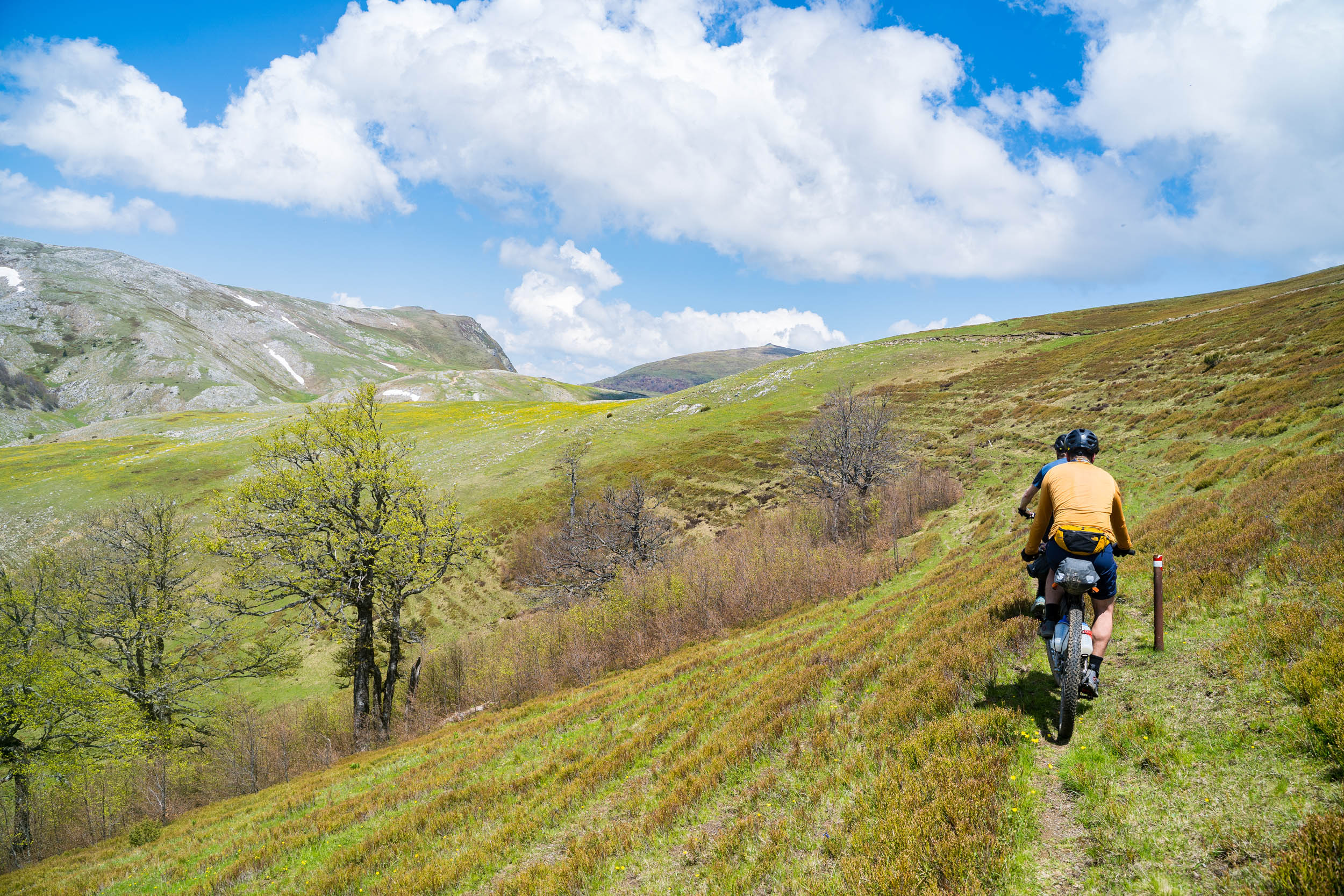
Once above the treeline, you follow a mix of old gravel tracks, hiking trails, and sometimes just open grasslands to reach the Sikira pass. The track doesn’t take you over any summits but instead uses the shoulders and natural contours of the landscape. Once at the pass, the gravel road becomes more stable and defined. If you are on the ridgeline and encounter bad weather, there are several places where you can descend down to shepherd huts and small seasonal villages.
After crossing the last of the small valleys, you’ll reach an even better gravel track, and you can begin the long descent off of the mountain massif. Allow at least five hours from the Pogorelica Mountain Lodge to get to this point. You don’t have to end the highline adventure just yet if you want more, as a right turn here offers a chance to visit the popular mountain village at Prokoško lake.
If you take the option to descend, as we did, be prepared for 16.5 kilometers of downhilling on great tracks, passing through incredible landscapes and quaint Bosnian villages. By the time you reach the village of Voljevac, you will have lost 1,075 meters of height. In the valley, there are plenty of cafes, bars, and shops but no restaurants. We were struggling to find a place to camp, so we headed up the valley to the Etno Resort Village (not as big or touristy as it sounds) to stay in a cabin overnight and visit their restaurant.
locationEtno Village Resort-Zvirnjača
Stage 4 (65km 1460m)
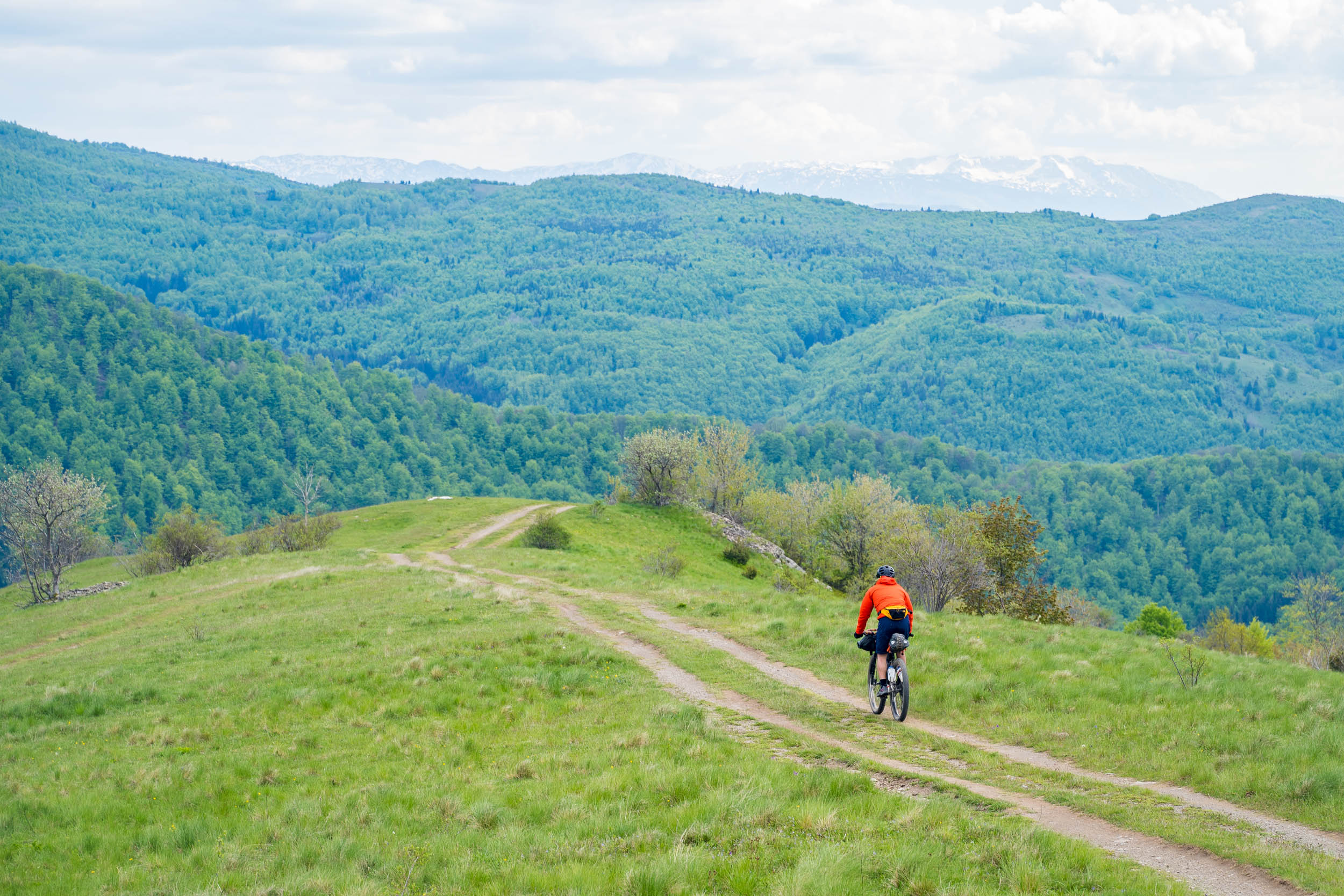
From the Etno village, you are presented with a choice for the morning’s ride. You can either backtrack down the valley to ride remote gravel roads over the local mountain following the Via Dinarica trail (this involves 540 meters of climbing over 5.4 kilometers on loose gravel) or, as we did, follow the asphalt around the same mountain to meet up with the trail on the other side. The asphalt ride is actually a lot more impressive than it sounds. There are breathtaking views on the 15-kilometer ride, which can be completed in about an hour. The trails join back together at the Kod babe Janje restaurant, which is a great stopping point after topping out on the asphalt climb and before the next gravel section.
After nine kilometers of great riding with particularly scenic views over Rama Lake and its turquoise waters, you are presented with another decision. Follow the Via Dinarica over Idovac mountain (about 800 meters of climbing) or take the zigzag descent towards Rama Lake and climb 300 meters back up to the highlands. We opted for the descending zigzags due to bad weather coming through and avoiding the extra climbing for the day. I’m sure the views from the top of Idovac are amazing, but we wouldn’t have seen much that day. Having said that, we did have a three-kilometer hike-a-bike on rough gravel to climb up to Zahum.
We refueled at the Zaum restaurant before riding one of the easiest but most enjoyable sections of the entire trip. From the restaurant, there is a short climb, and then the next 27 kilometers are flat or slightly downhill. This part of the ride starts off with beautiful rugged steppe-like scenery followed by a ride through a mined forest, before visiting necroptosis stones, and finally, an interesting ride through a long village on flat terrain.
About the mines: they’re actually not as scary as you would think. The forest is well-marked, and the track safe to ride. In fact, since nobody has entered the forest, let alone cut any of the trees in nearly 30 years, it would actually be quite difficult to move through its very thick growth. We just photographed the signs and moved on.
The last part of this stage is riding to the village of Zvirnjača before climbing up onto the extensive steppe terrain. There is no official campsite in the village, but we did manage to camp in the garden of the only bar in town in exchange for buying large amounts of beer.
locationZvirnjača-Jablanica
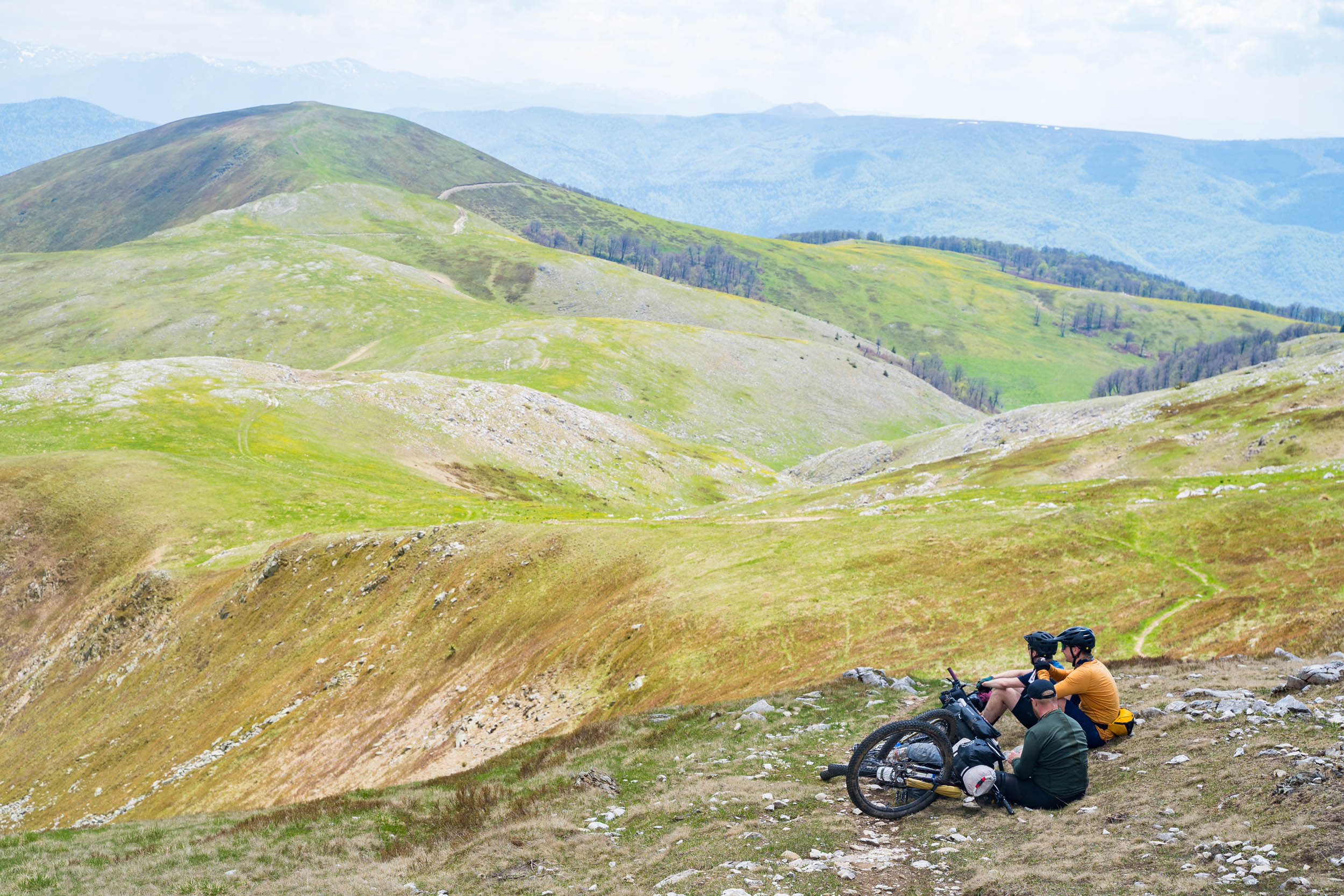
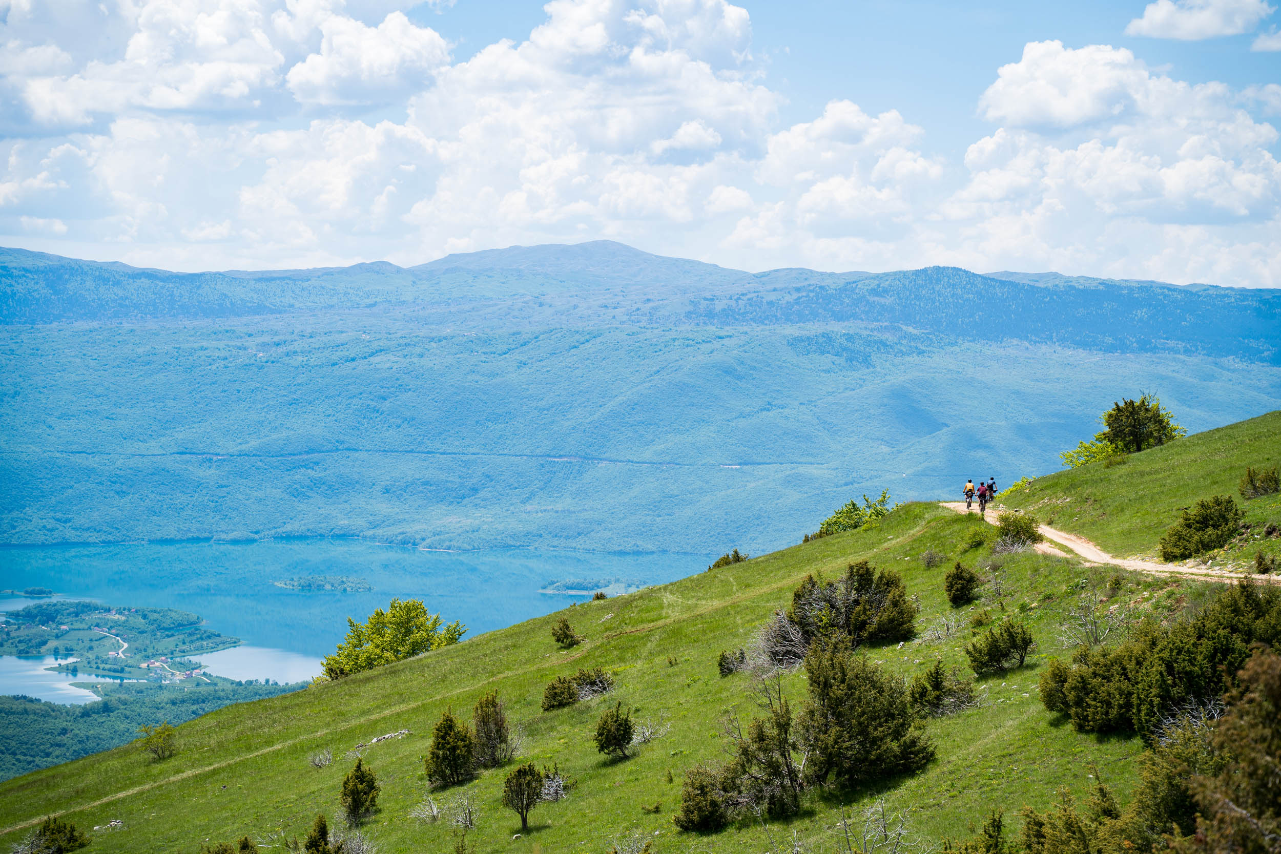
Stage 5 (71km 940m)
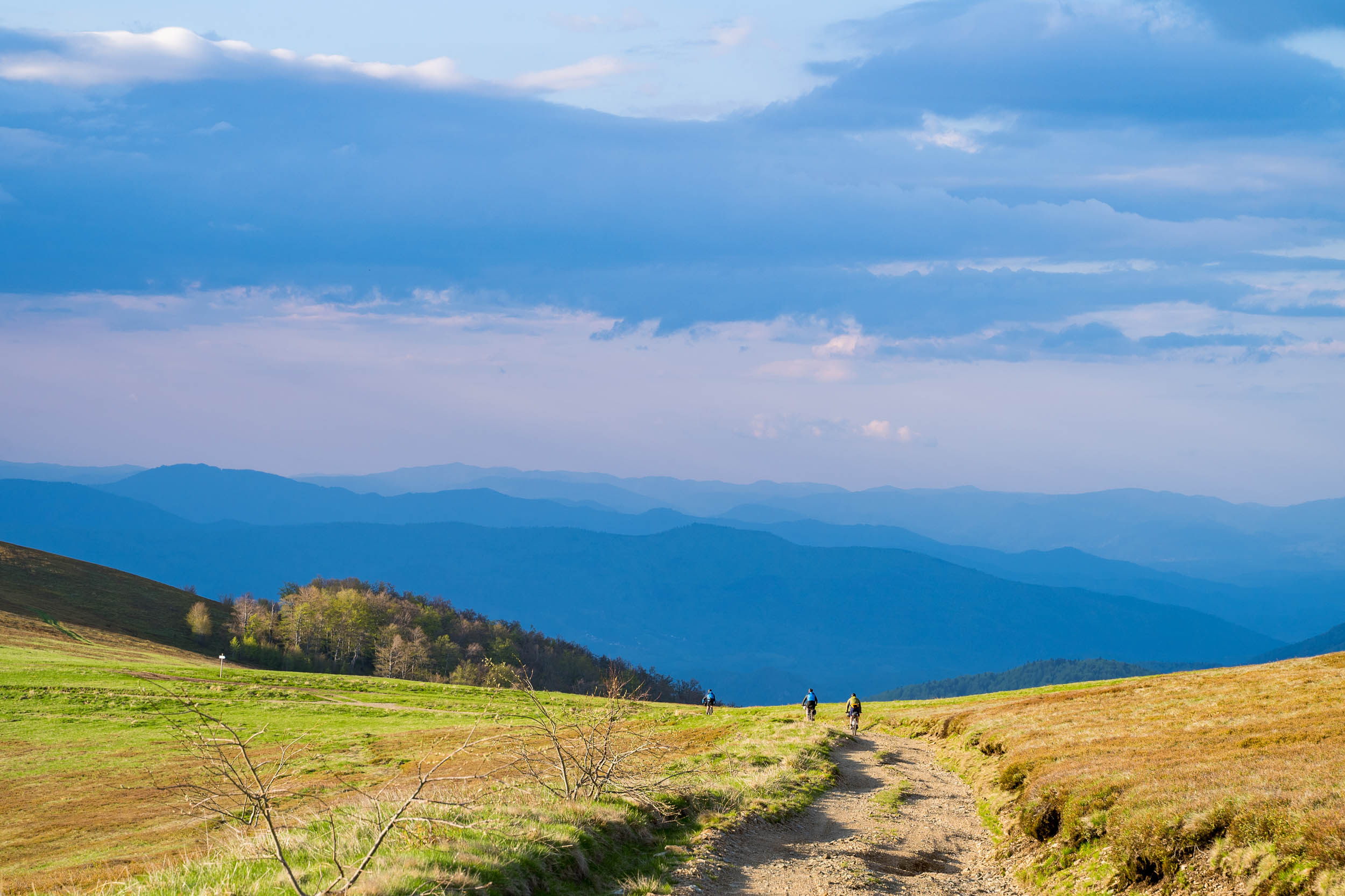
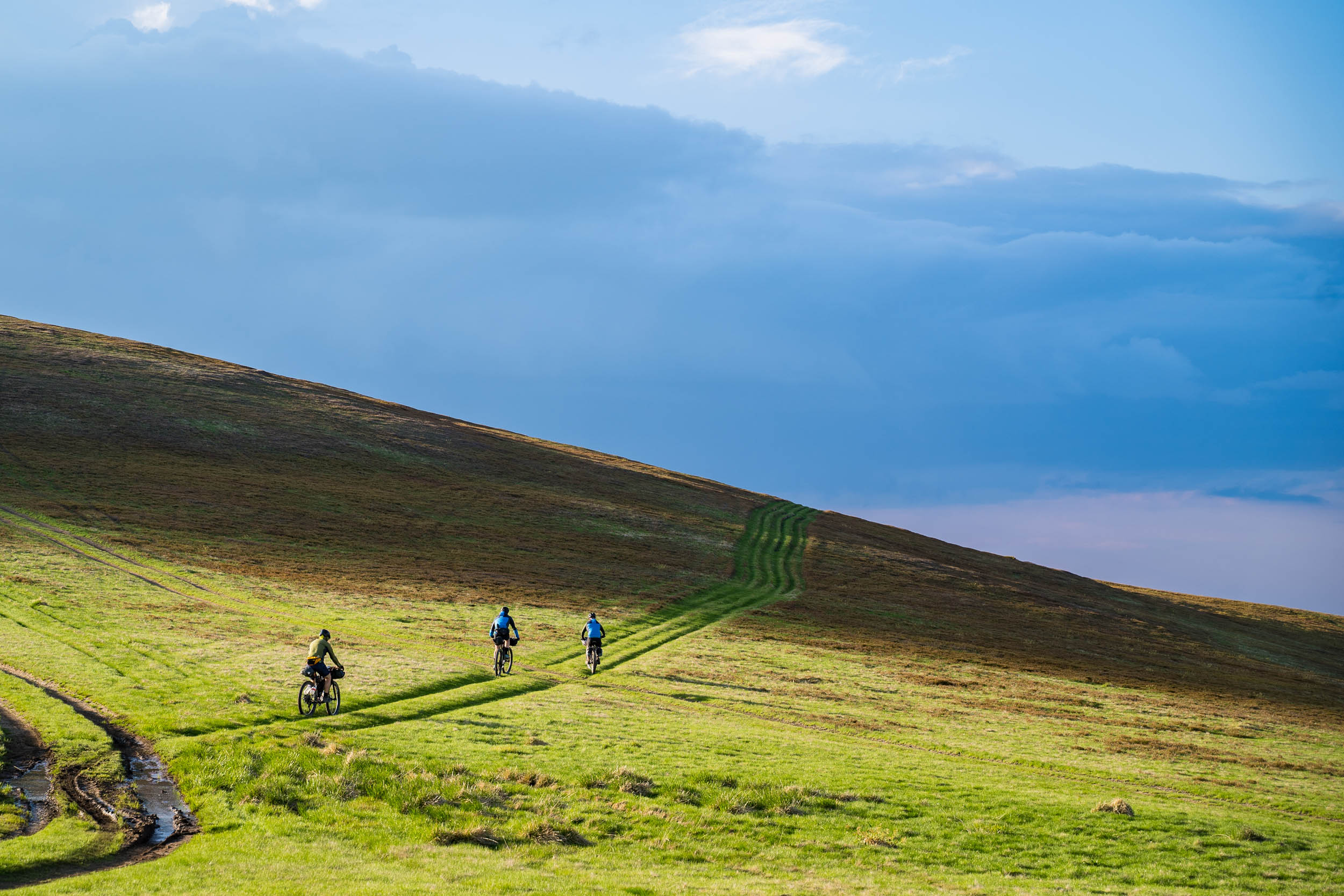
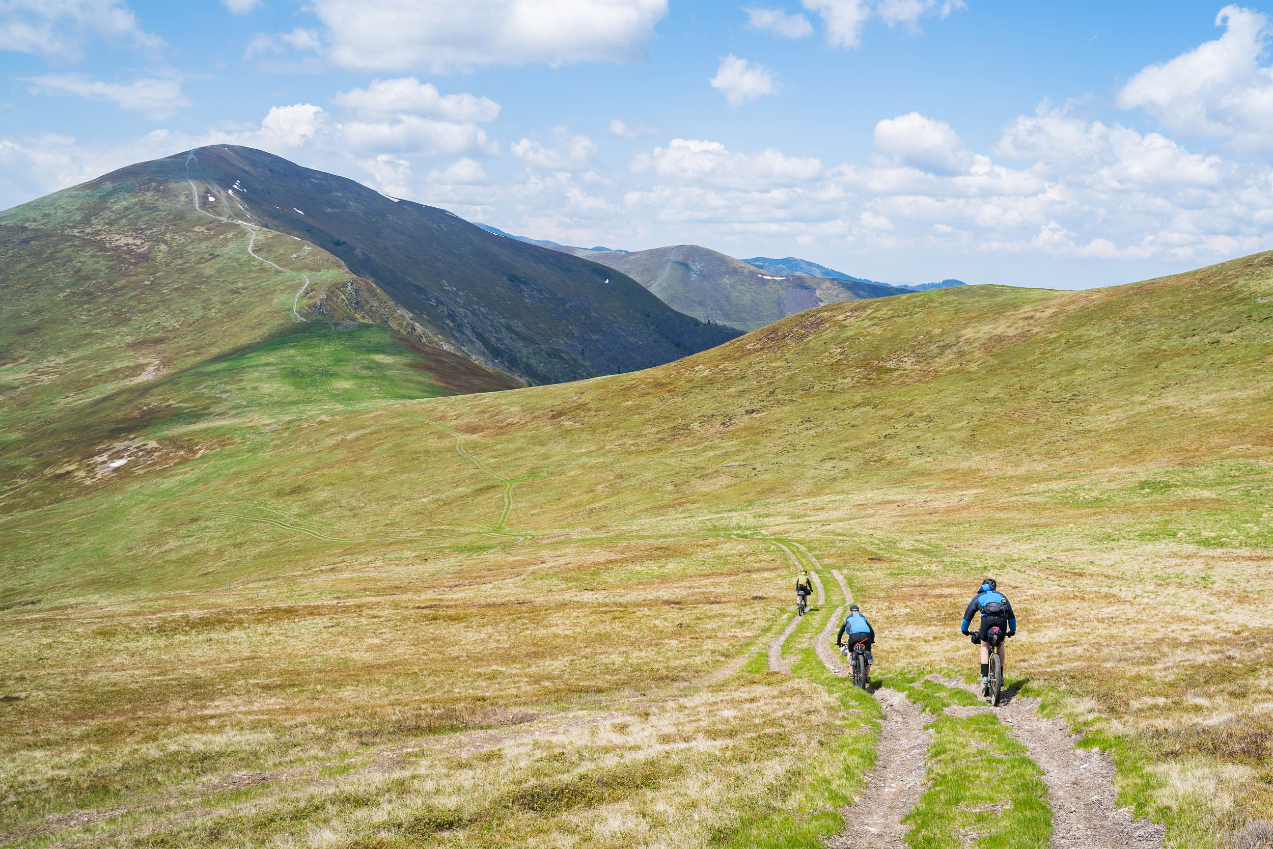
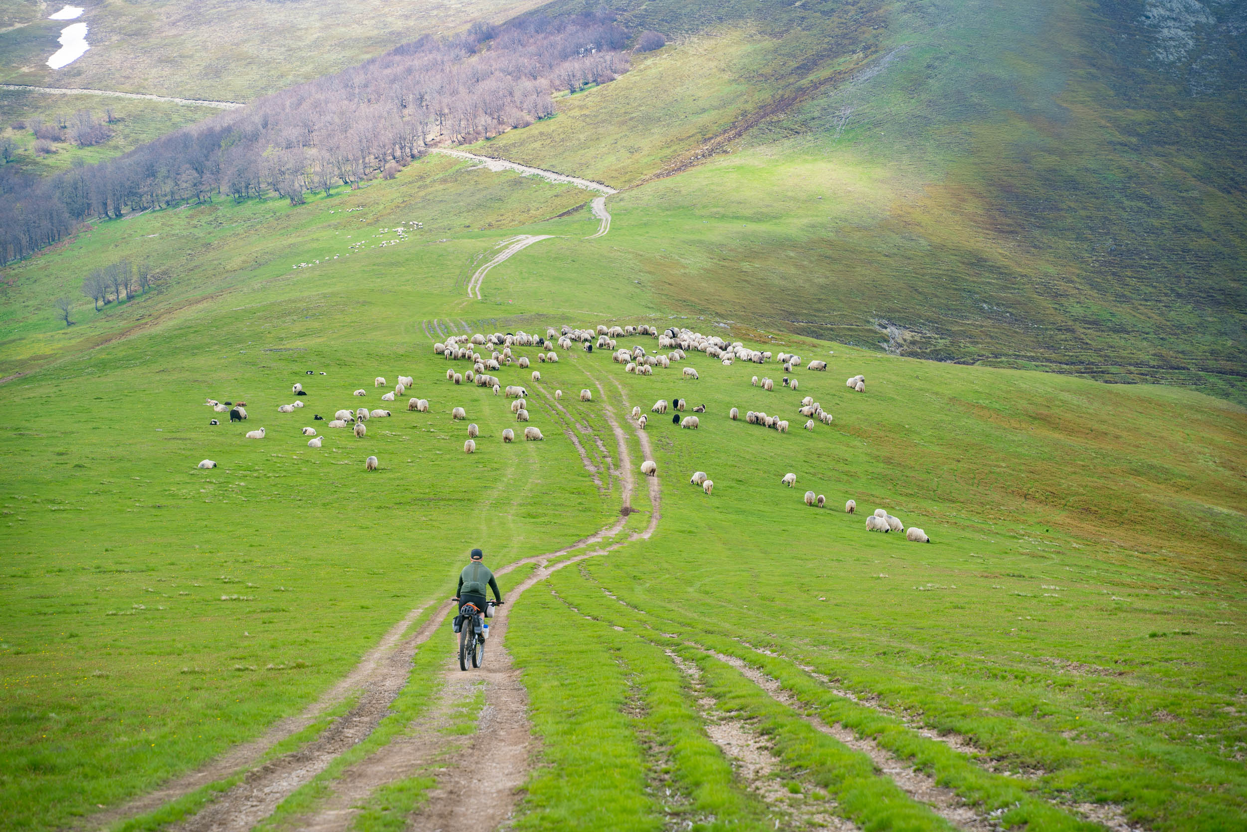
This stage begins with a steep climb up onto the steppe. After the first climb, the gradient eases off, and you get great riding before the tracks become fainter and the rolling hills get tighter and slow you down. Continue in a southerly direction, heading towards a better gravel road, and when the track disappears, trust the GPX file. Around the corner, you’ll find the trail again. It’s seven kilometers from the village to the better gravel in the center of the steppe. It takes about two hours to cross this first section. The next third of the steppe is about traversing the higher mountains with more fantastic views. The last third of the steppe has a more picturesque and rolling landscape. Judging by all the wooden signs of local places, this area is popular with summer hikers. Allow five hours to get from the village of Zvirnjača to the far end of the steppe.
After traversing around more perfectly flat grazing land, climb on wide gravel through the forest to access the fast descent down to the Blidinje plateau and the most impressive carved necroptosis stones we came across. On this plateau, there is also the Blidinje ski resort, and although we didn’t detour to the village, it looks like there is a choice of cafes and restaurants at the foot of the slopes.
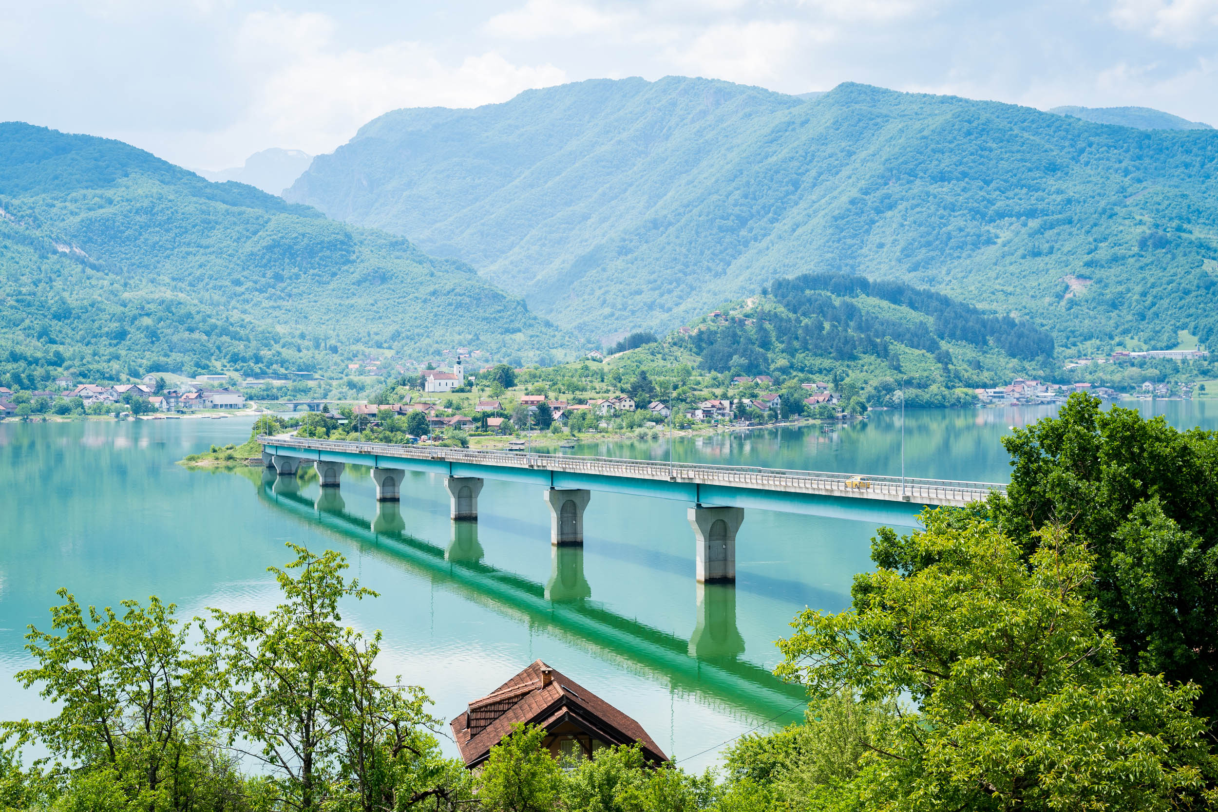
It’s asphalt for the rest of this stage, but the riding is about as good as it gets. After a short climb out off the plateau, you begin a 25-kilometer descent through scenic country. As you drop down nearly 1,100 meters, the air thickens, and the surrounding trees become lush like a tropical forest. When you arrive in Jablanica, don’t forget to visit the collapsed railway bridge and the WWII memorial complex for the “Battle of the Neretva.”
Although the stage ends here, we cycled further on through the first tunnel and stayed at a Glamping Bagrem on the Neretva River.
locationJablanica-Džajići
Stage 6 (46km 770m)
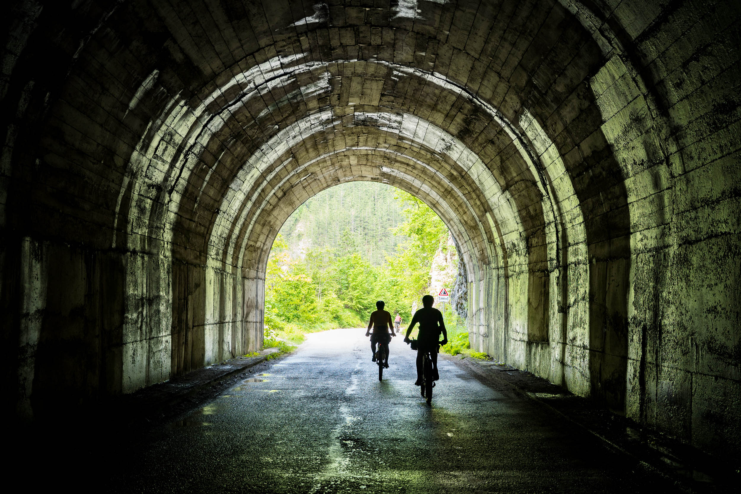
From Jablanica, you need to follow the busy E73 road up to the first of a series of tunnels. The first tunnel is the longest and most scary to travel through. We actually walked through the tunnel on the footpath with our bikes rolling on the road. If there is a large vehicle coming, you can step into one of the alcoves in the sidewall of the tunnel. For the next six kilometers, it will be a mix of cycling around the tunnels and passing through them. Despite being told that Bosnian drivers are dangerous, we found them to be very courteous and considerate towards cyclists, and we never had a problem on the entire trip.
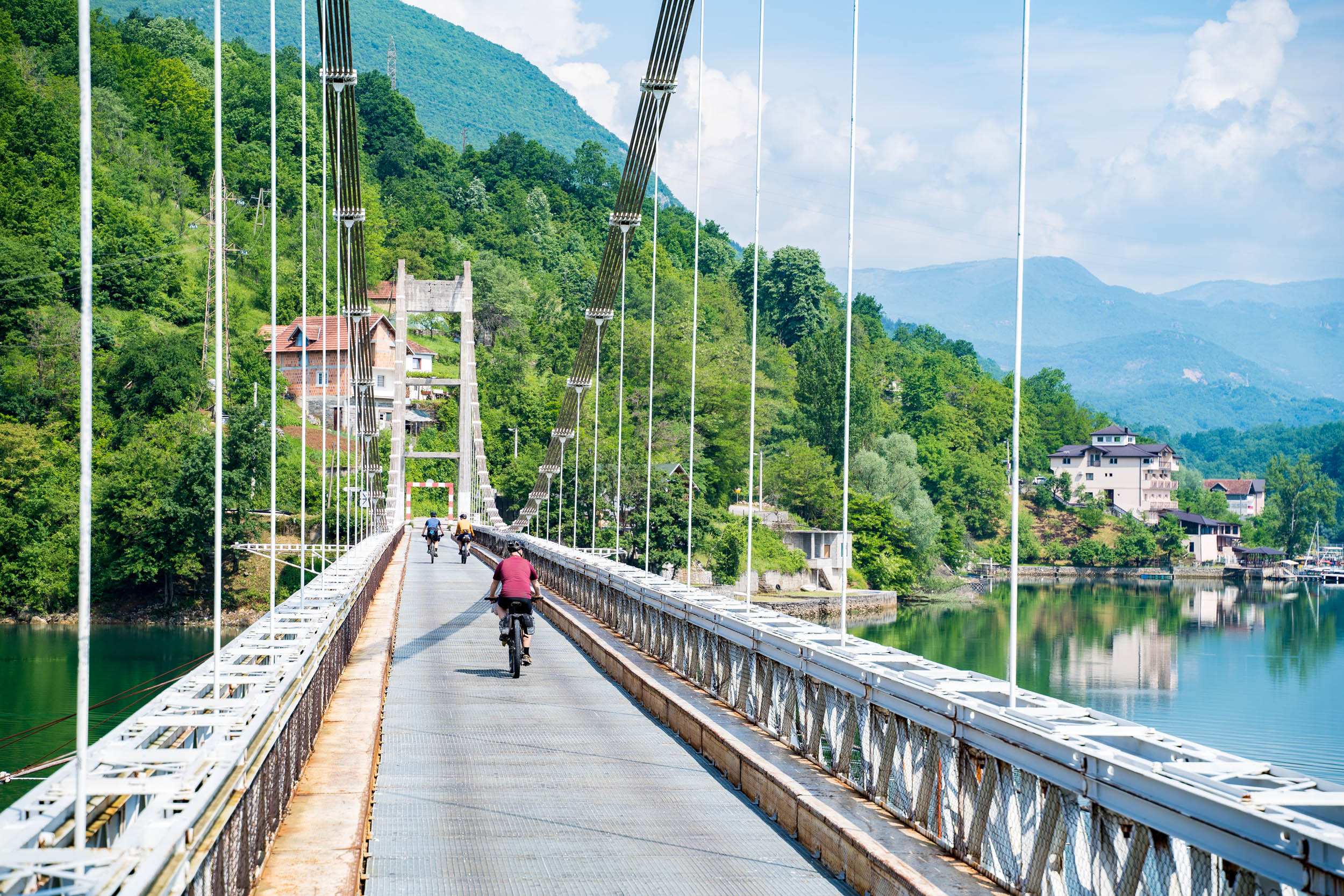
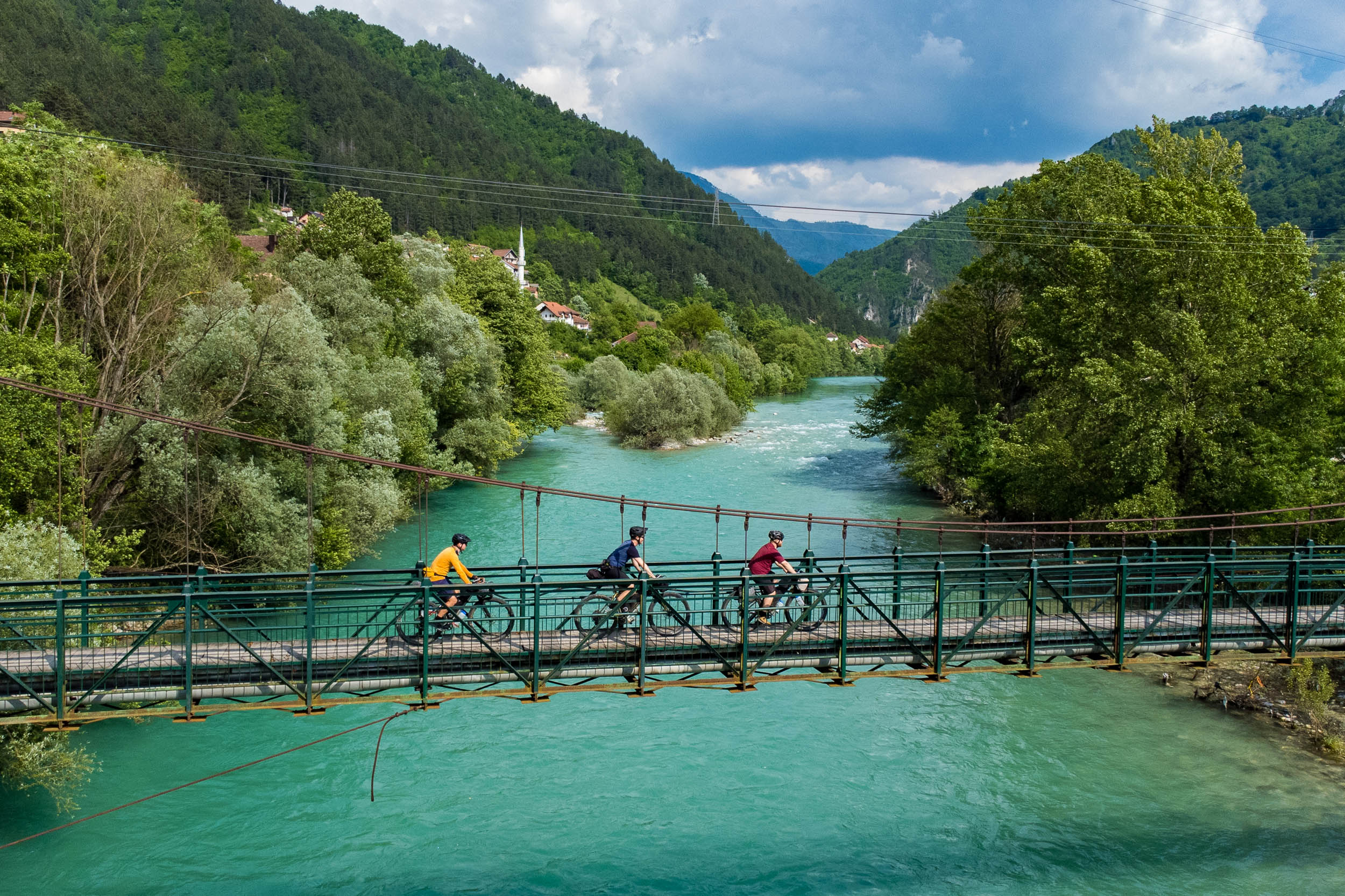
Cross the Viseći bridge and enjoy the few hours it takes to cycle into Konjic. This magnificent stretch of quiet road with a short section of gravel is another highlight of the tour. You’ll enjoy million-dollar views as you ride past abandoned and derelict houses.
There’s a morning fruit and flower market in Konjic and a picturesque bridge to take your selfies on, and that’s about it. On leaving the town, start off on the north side of the river before you cross a foot suspension bridge to continue on the south side towards Spiljanski bridge via a long dark tunnel. It’s a quiet stretch of road, so cars shouldn’t be an issue. Once at the Spiljanski bridge, you can cross it and turn left to visit Tito’s Bunker complex or right to continue up to the Spiljanski village and onto the next stage of the tour.
We stayed on the south side of the river and camped at the “Noina arka” kayak center at Džajići (yes, the house does look like a boat). It is not an official campsite, but they were happy to let us camp in their garden for a small price. They also sell beer.
locationDžajići-Lukomir
Stage 7 (38km 1567m)
Roll back down to the Spiljanski bridge and prepare to climb up to the Bjelašnice plateau and mountain. Climbing 920 meters in 13 kilometers is quite an ask, but the rewards are well worth it. Open steppe greets you, and there’s a chance to admire more necropolis stones before a final push to the high point of the stage. From here, an easy road to the fantastically positioned Lukomir village. Before you stop in one of the touristy restaurants, make sure you head out to the viewpoint and gaze over the Rakitnica River and what the locals call the Bosnian Grand Canyon.
locationLukomir-Sarajevo
Stage 8 (63km 598m)
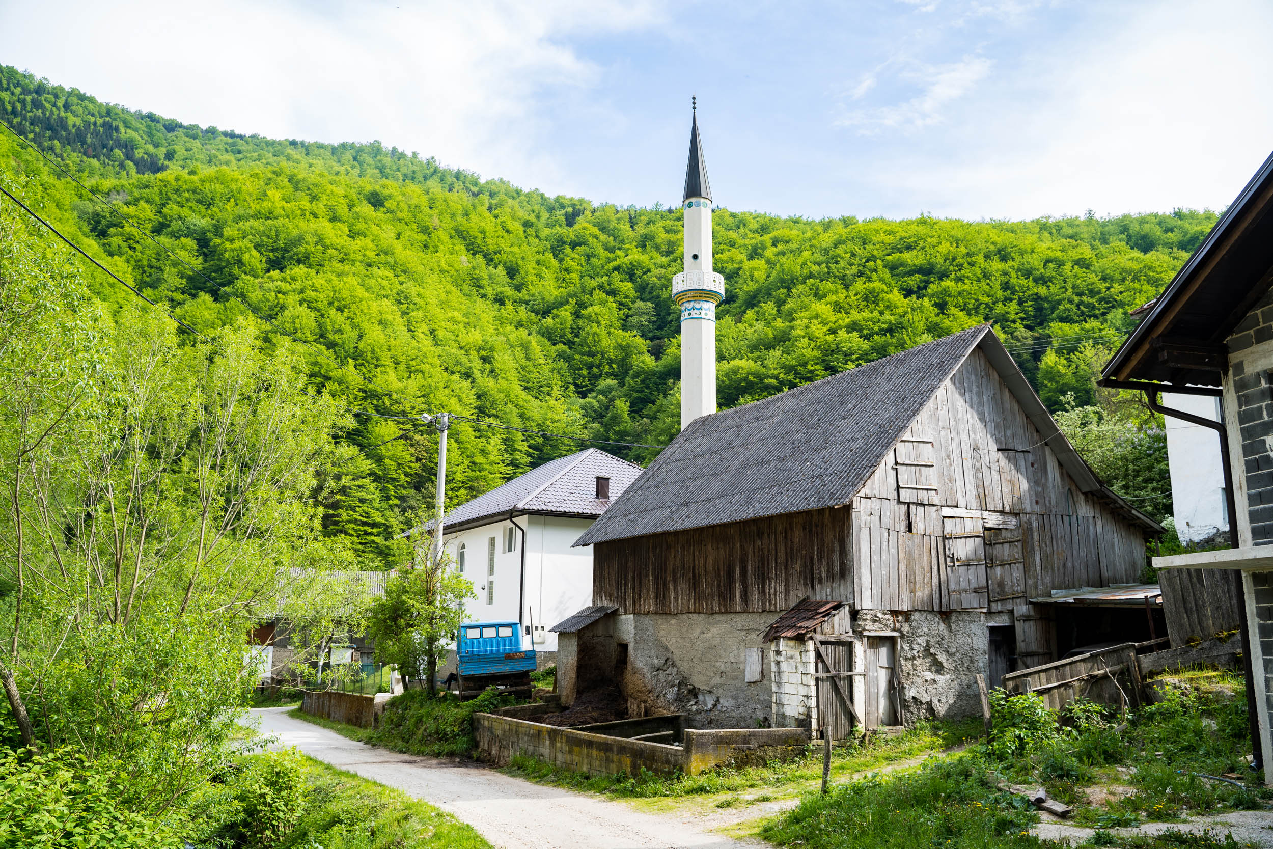
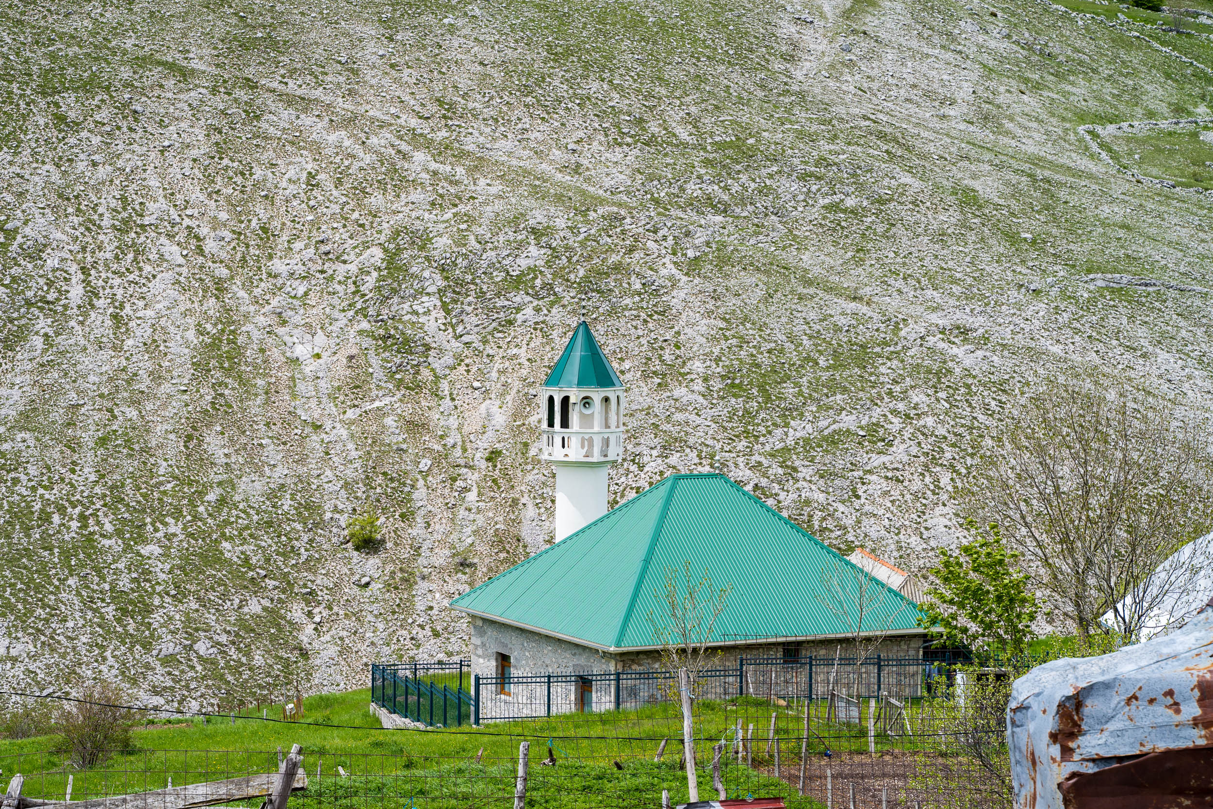
Backtrack out of Lukomir and ride through some more spectacular scenery. Some small passes need to be surmounted before you begin an epic descent down into Sarajevo. This starts with fast gravel through woodlands before you suddenly arrive at the freshly built Bjelašnica ski village. From here, ride the asphalt making sure you allow plenty of time to look for zombies in the abandoned Hotel Igman. Some last gravel needs to be climbed until you reach the wooden Igman mosque, but from there, the fun begins again. You lose 840 meters of height over the following 16 kilometers as you drop down to the edge of Sarajevo, a fitting way to end the tour.


Terms of Use: As with each bikepacking route guide published on BIKEPACKING.com, should you choose to cycle this route, do so at your own risk. Prior to setting out check current local weather, conditions, and land/road closures. While riding, obey all public and private land use restrictions and rules, carry proper safety and navigational equipment, and of course, follow the #leavenotrace guidelines. The information found herein is simply a planning resource to be used as a point of inspiration in conjunction with your own due-diligence. In spite of the fact that this route, associated GPS track (GPX and maps), and all route guidelines were prepared under diligent research by the specified contributor and/or contributors, the accuracy of such and judgement of the author is not guaranteed. BIKEPACKING.com LLC, its partners, associates, and contributors are in no way liable for personal injury, damage to personal property, or any other such situation that might happen to individual riders cycling or following this route.
Please keep the conversation civil, constructive, and inclusive, or your comment will be removed.