


Ikara Outback
Distance
177 Mi.
(285 KM)Days
4
% Unpaved
71%
% Singletrack
0%
% Rideable (time)
100%
Total Ascent
7,673'
(2,339 M)High Point
2,234'
(681 M)Difficulty (1-10)
5?
- 3Climbing Scale Fair43 FT/MI (8 M/KM)
- 5Technical Difficulty Moderate
- 6Physical Demand Moderate
- 5Resupply & Logistics Moderate
Contributed By

Ty Domin
Guest Contributor
Ty Domin has been a semi-regular contributor to BIKEPACKING.com over the years, sharing his experiences racing, long-term bikepacking, alpine hut hunting, and running his own bike bag and clothing brand. After several years away travelling and residing in Canada, he now calls Canberra, Australia, home. Find more of Ty’s photos and stories on Instagram @tydomin.
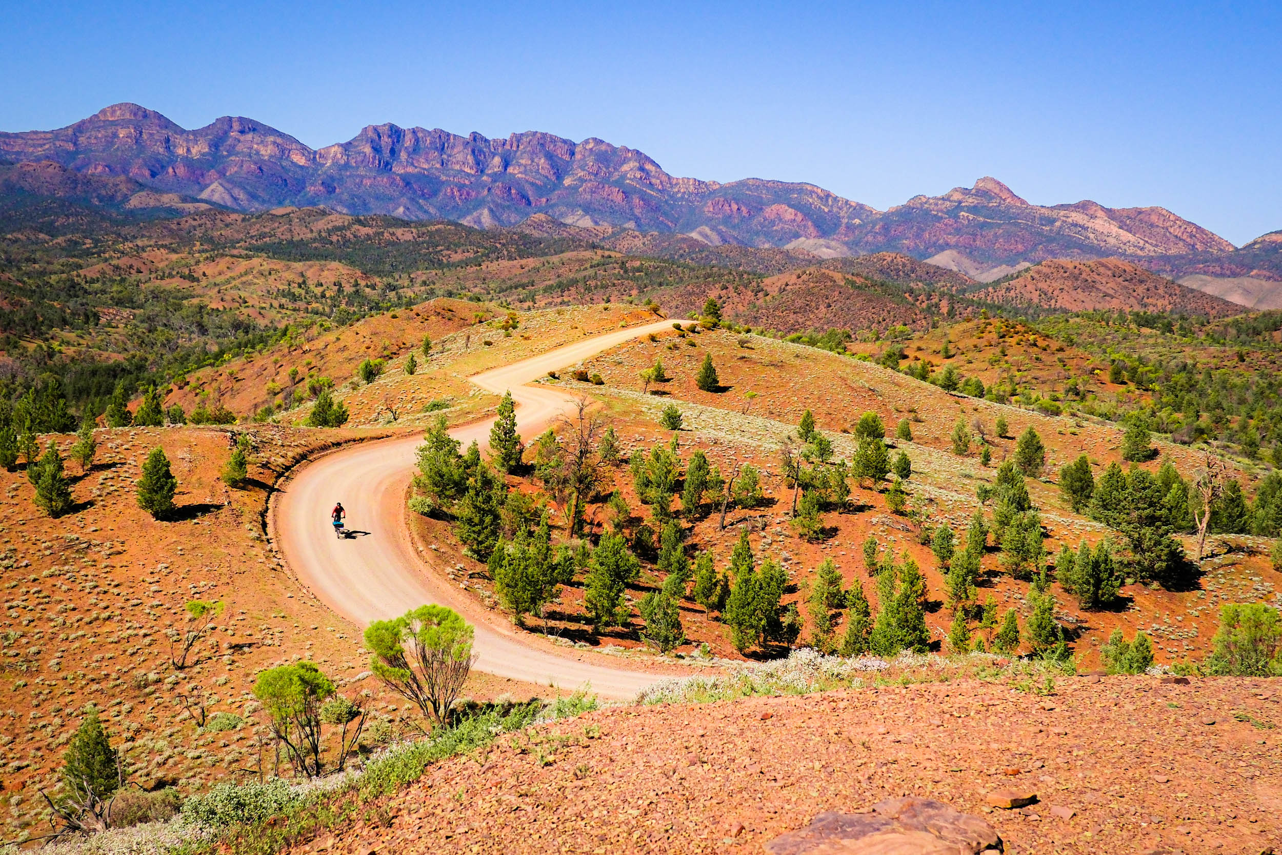
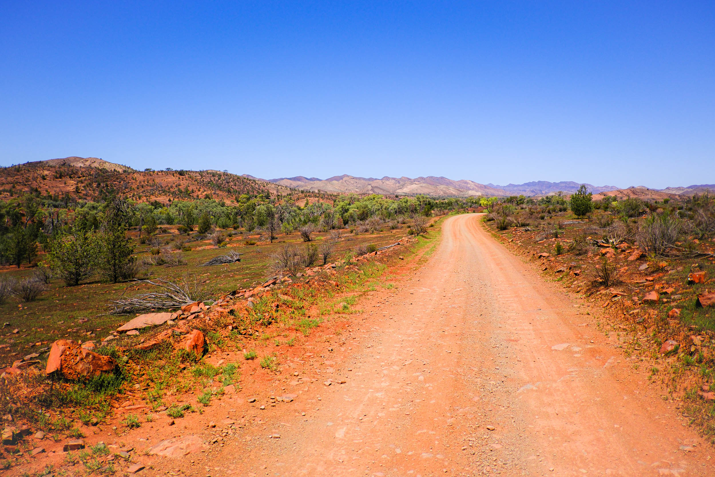
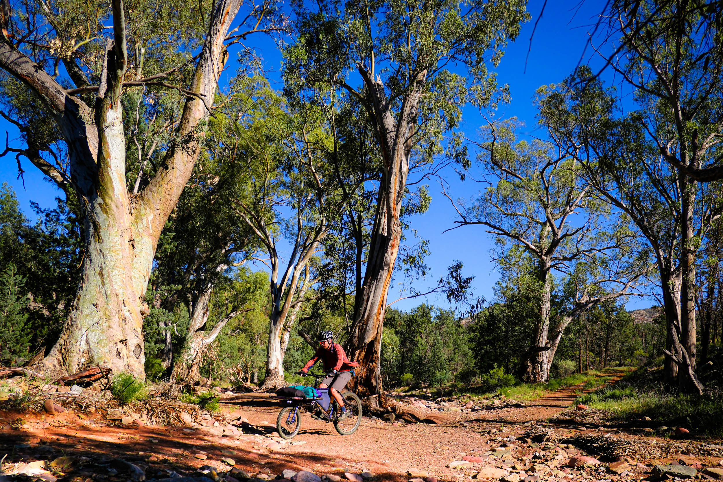
Set roughly 400 kilometres north of Adelaide, this route delivers red-rock gorges, mountain vistas, open pastoral country, and long stretches of silence broken only by wind and the crunch of tyres on gravel. It’s a demanding ride in places, but one that rewards patience with constant beauty and a strong sense of remoteness.
The Ikara Flinders Ranges NP is part of the Flinders Ranges geological successions (visible layering, in layman’s terms), where abundant and diverse arrays of fossils show how animal life began on Earth over a period of 350 million years. For millennia, the Adnyamathanha people have inhabited the Flinders Ranges, and in 2016, the park was renamed to include the Adnyamathanha word Ikara, meaning “meeting place.” The word refers to the traditional name for Wilpena Pound, the park’s most characteristic landmark, a feature jutting out of the ground and visible from great distances in every direction.
While the national park itself is compact, it is surrounded by working pastoral stations and public land that extend the riding well beyond park boundaries, creating opportunities for long, immersive journeys through varied terrain.
Few places in Australia offer this combination of open access, deep time, and living culture stitched together into a coherent, rideable loop. In the space of a few days, you pass ancient geological corridors, Indigenous meeting places, working pastoral stations, and near-empty highways where the silence is almost deafening.
Route Difficulty
This is a ride that rewards patience more than brute strength and is best suited to intermediate and advanced riders, depending on pace and experience with remote travel. Although we rate the overall difficulty as a 5, there are some really challenging sections that push that rating to the limit.
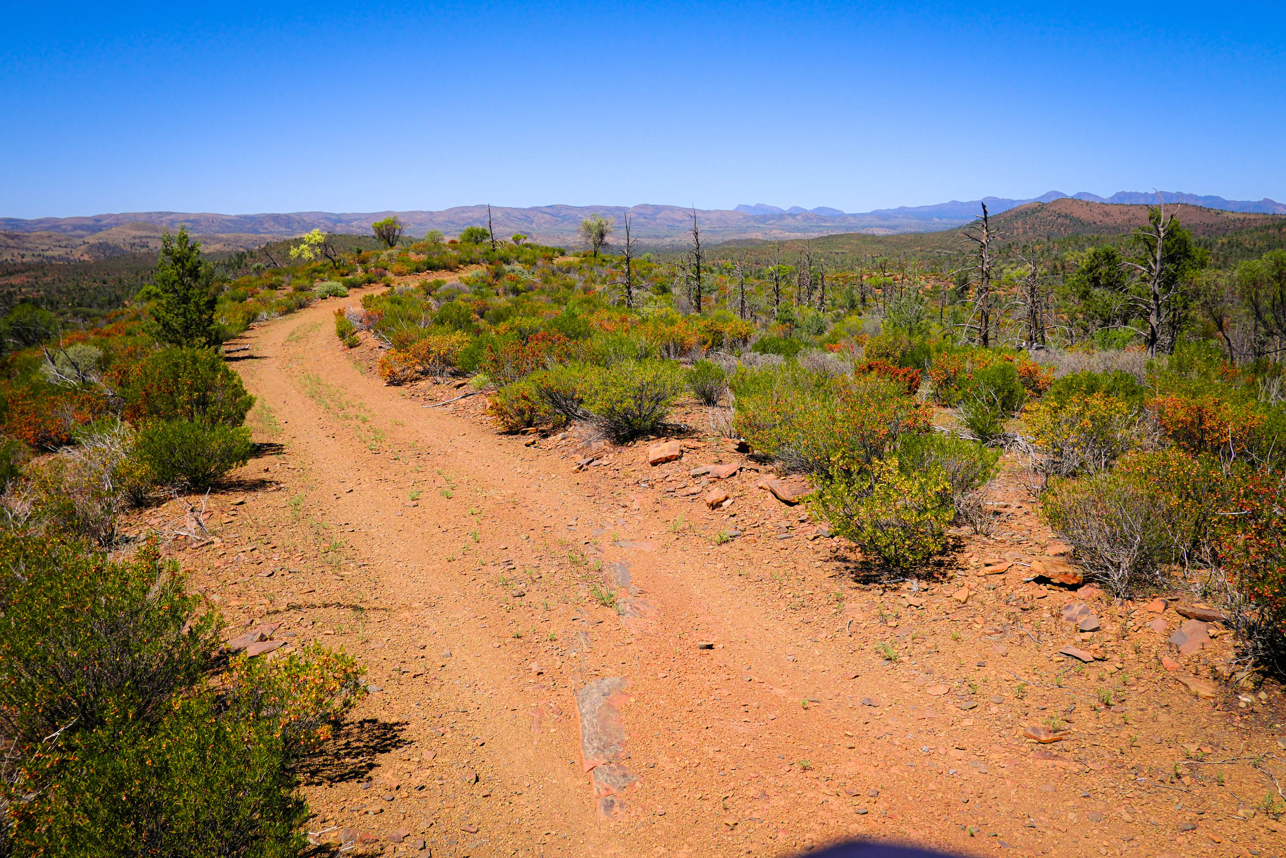
Technical Difficulty: One reason the route is such a joy is that the terrain varies quite a bit. This also means there are rocky and sandy sections that require some bike-handling skill. Some rougher sections can be walked if required, but a few medium-difficulty sections are quite long. Be prepared for extended sections of rocky or loose terrain that will feel more like a 6-7 on the difficulty scale.
Physical Demand: Distances often take longer than anticipated, particularly on the northern loop and within the national park. The undulating, loose, rocky, and sandy surfaces on most trails and roads lead some people to underestimate how long it will take to cover distances in the Flinders Ranges. While the daily vertical gain isn’t huge, it is not easy climbing and is mostly gained in short, sharp, and rough sections.
Ressuply and Logistics: Even though there are a number of resupply options on route, you need to carry a good level of supplies just in case, and the slower you move, the more you need to carry.
Route Development: Having recently returned to Australia from a year-long bikepacking expedition and a couple of years living in Canada’s Great White North, a few days in the Aussie Outback was just what I needed to reconnect and find my feet again in the Great Southern Land. Spring weather is somewhat unpredictable in the Outback, so I decided to put together a route I could undertake with a moment’s notice, between rain and heat waves, with no required access permissions. Read more about the route development in the Trail Notes.


Submit Route Alert
As the leading creator and publisher of bikepacking routes, BIKEPACKING.com endeavors to maintain, improve, and advocate for our growing network of bikepacking routes all over the world. As such, our editorial team, route creators, and Route Stewards serve as mediators for route improvements and opportunities for connectivity, conservation, and community growth around these routes. To facilitate these efforts, we rely on our Bikepacking Collective and the greater bikepacking community to call attention to critical issues and opportunities that are discovered while riding these routes. If you have a vital issue or opportunity regarding this route that pertains to one of the subjects below, please let us know:
Highlights
Must Know
Camping
Food/H2O
Trail Notes
- The Artimore Ruins, remnants of an 1850s sheep station. Haunting, to say the least.
- Owanegan Gap on Moolooloo Station steals the show on the northern loop. Remote, silent, and rarely visited, they are a reminder of how vast this place really is. I met the station owner in the gap, who offered water and free Wi-Fi if needed, proof that kindness still thrives in unlikely corners.
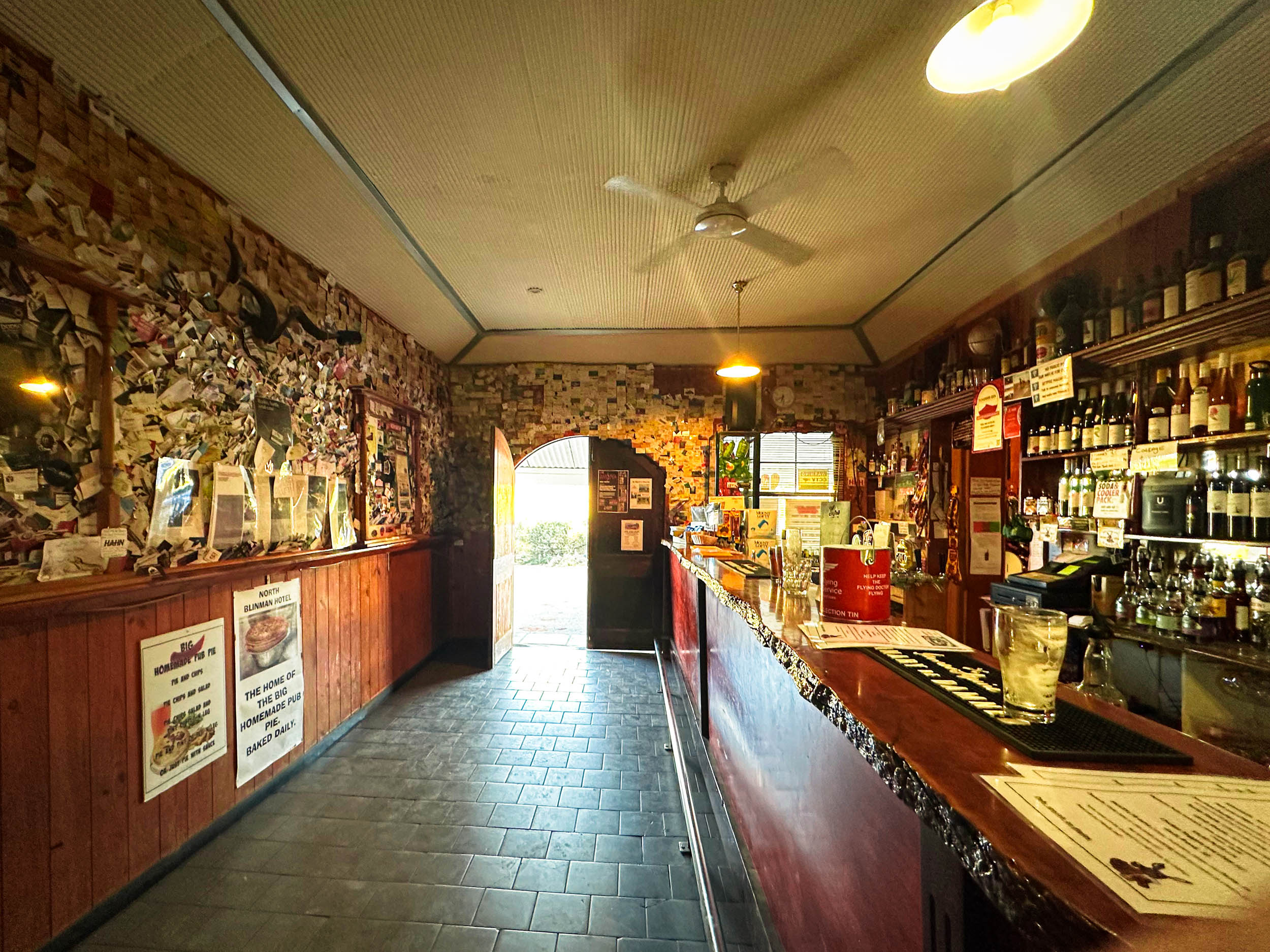
- The availability of a pub or cafe, depending on your arrival time back in Blinman, is a real bonus before you head south over the rolling hills toward the national park.
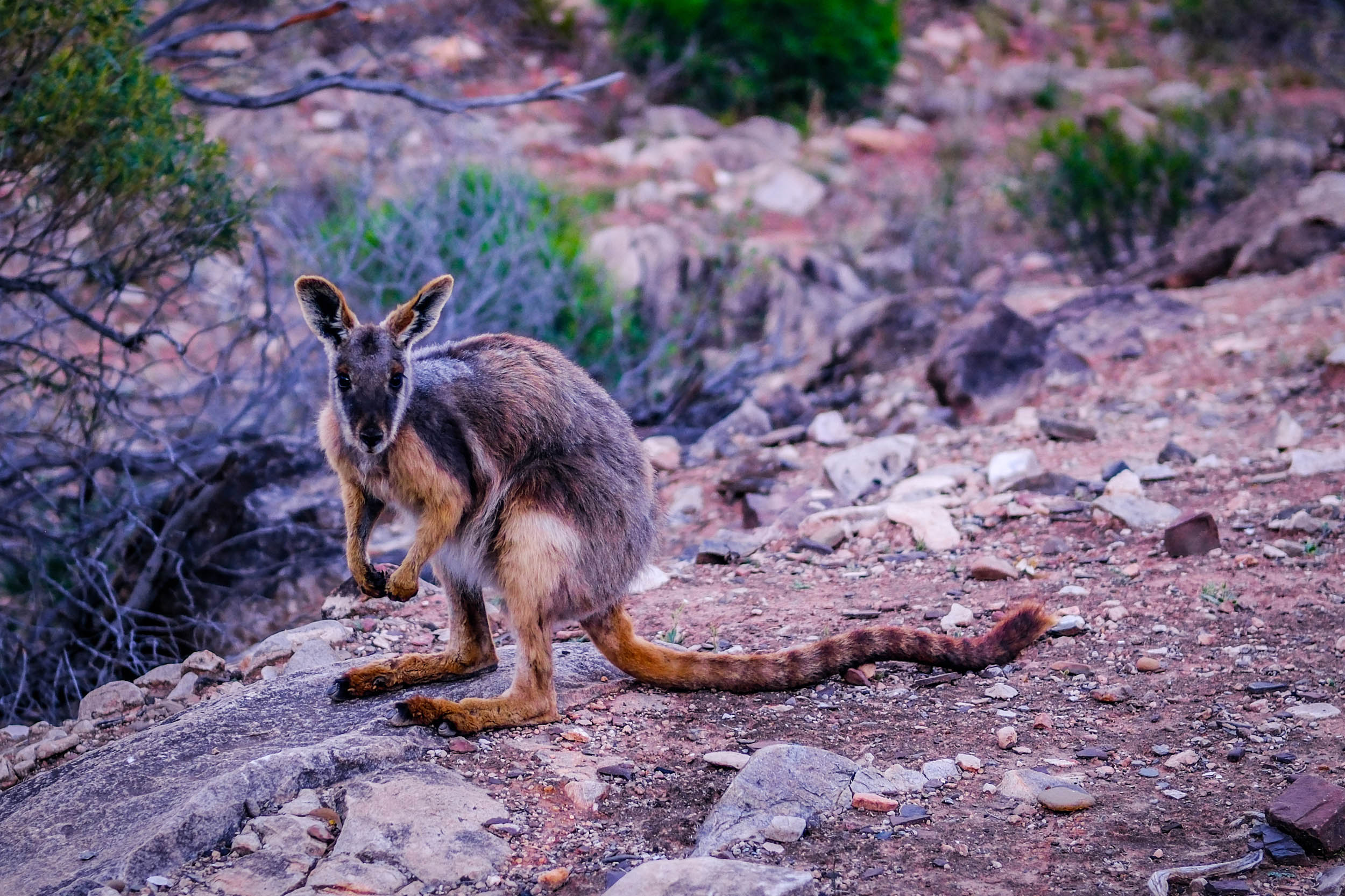
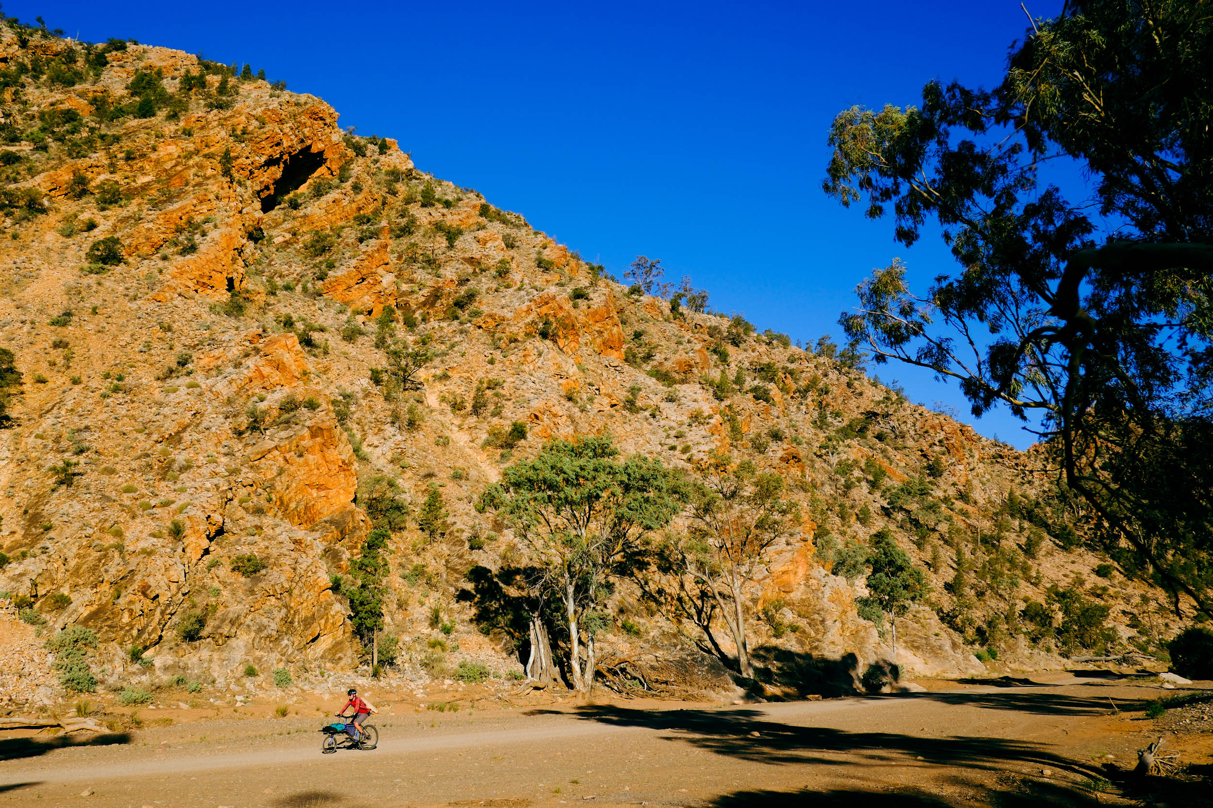
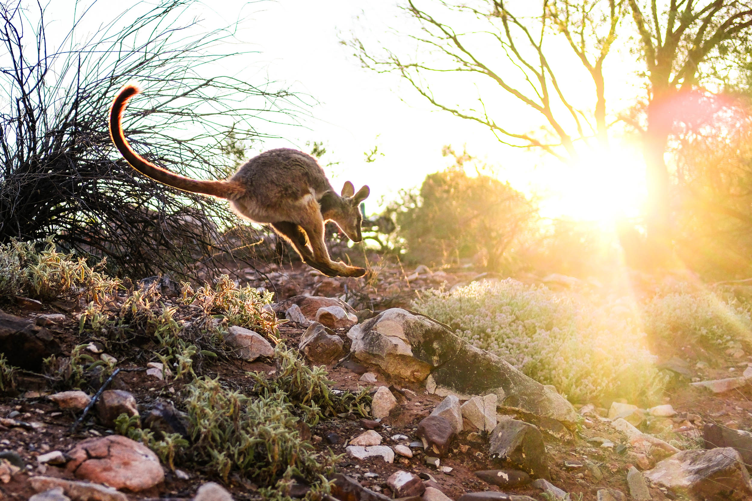
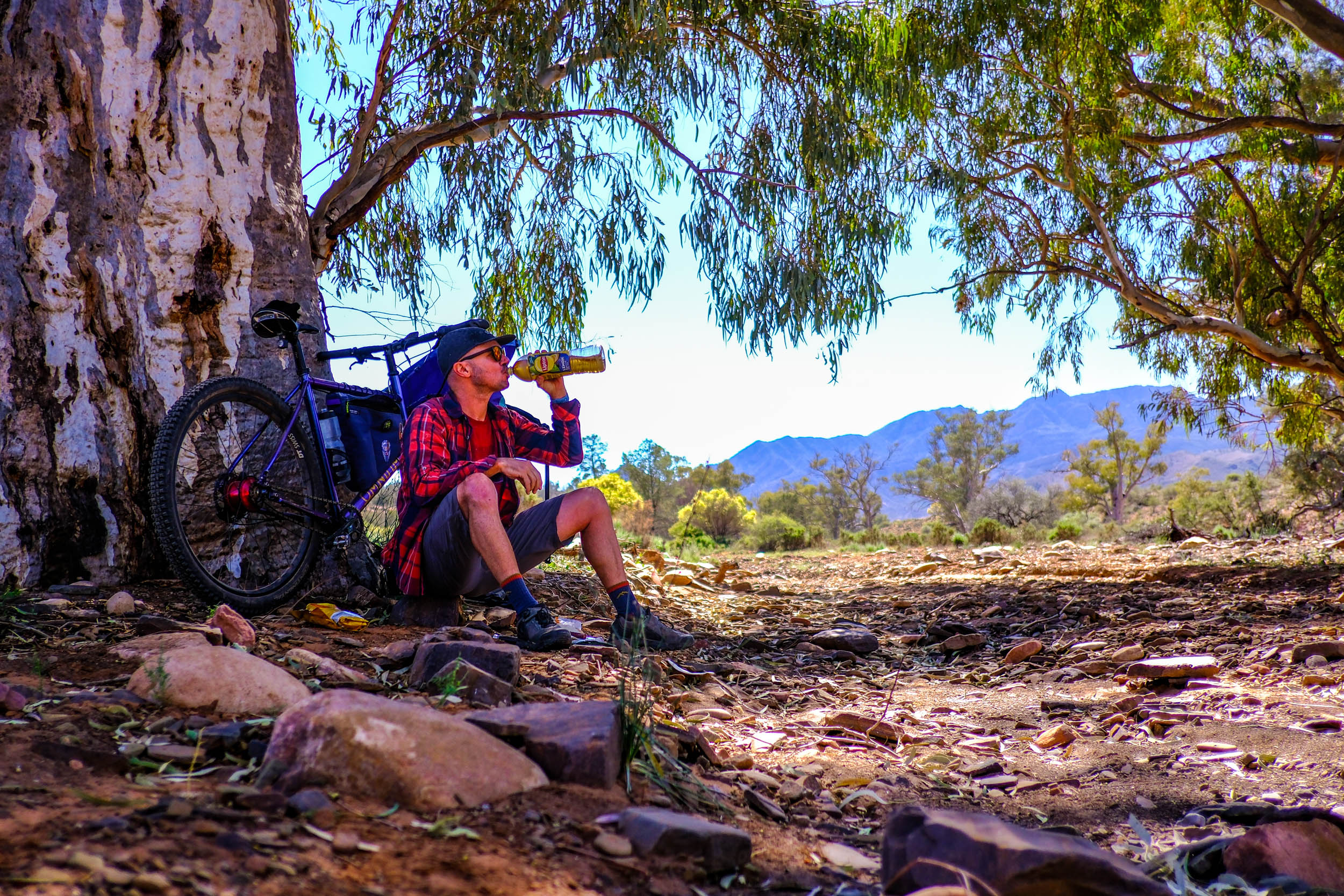
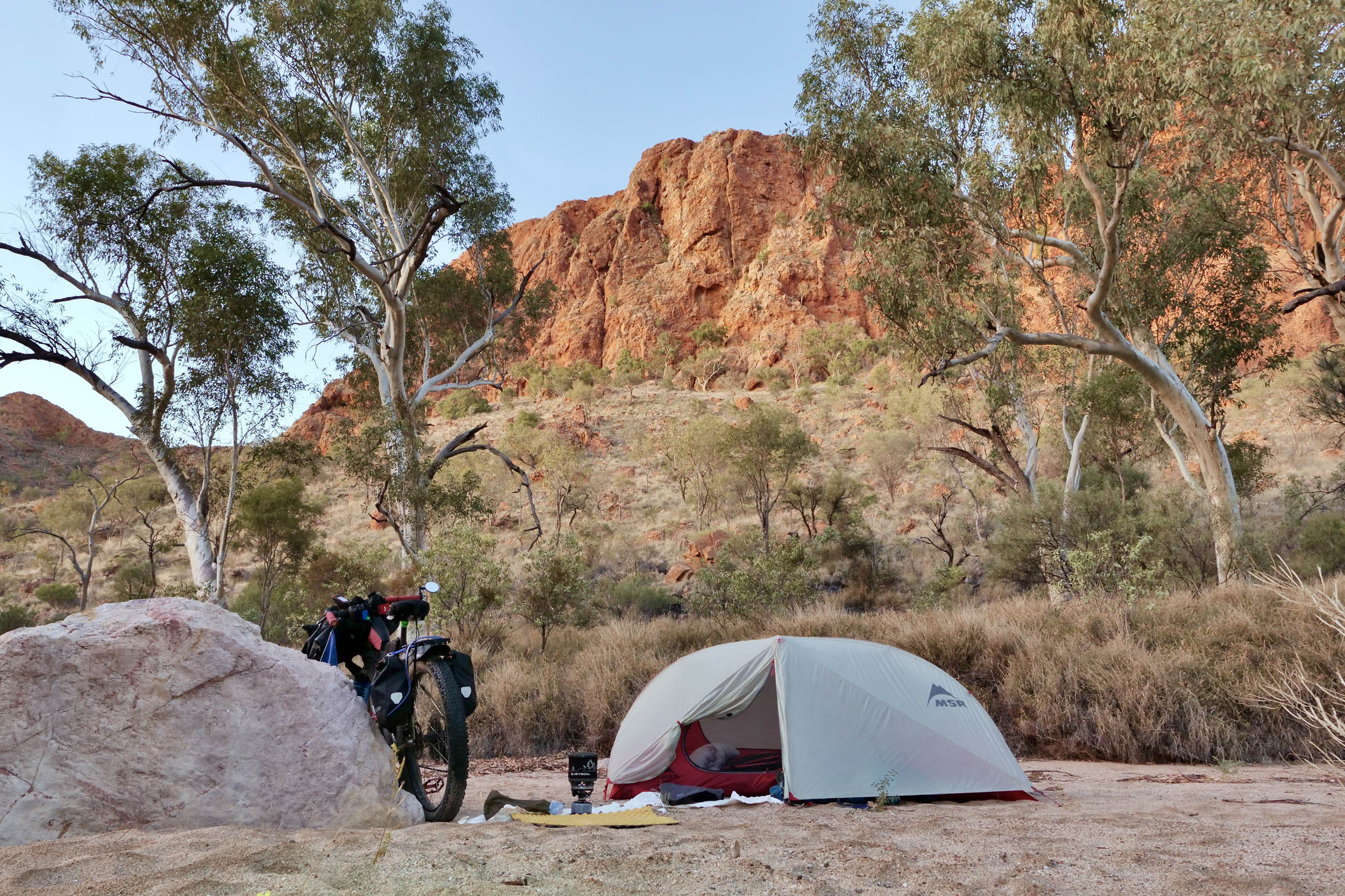
- Following Brachina Gorge at sunset. Surrounded by cliffs for 8 kilometres, you have a choice of established campsites, the only downside being the amazingly cute yellow-footed rock wallabies making a racket all night long, bounding around the gorge doing whatever they do at night.
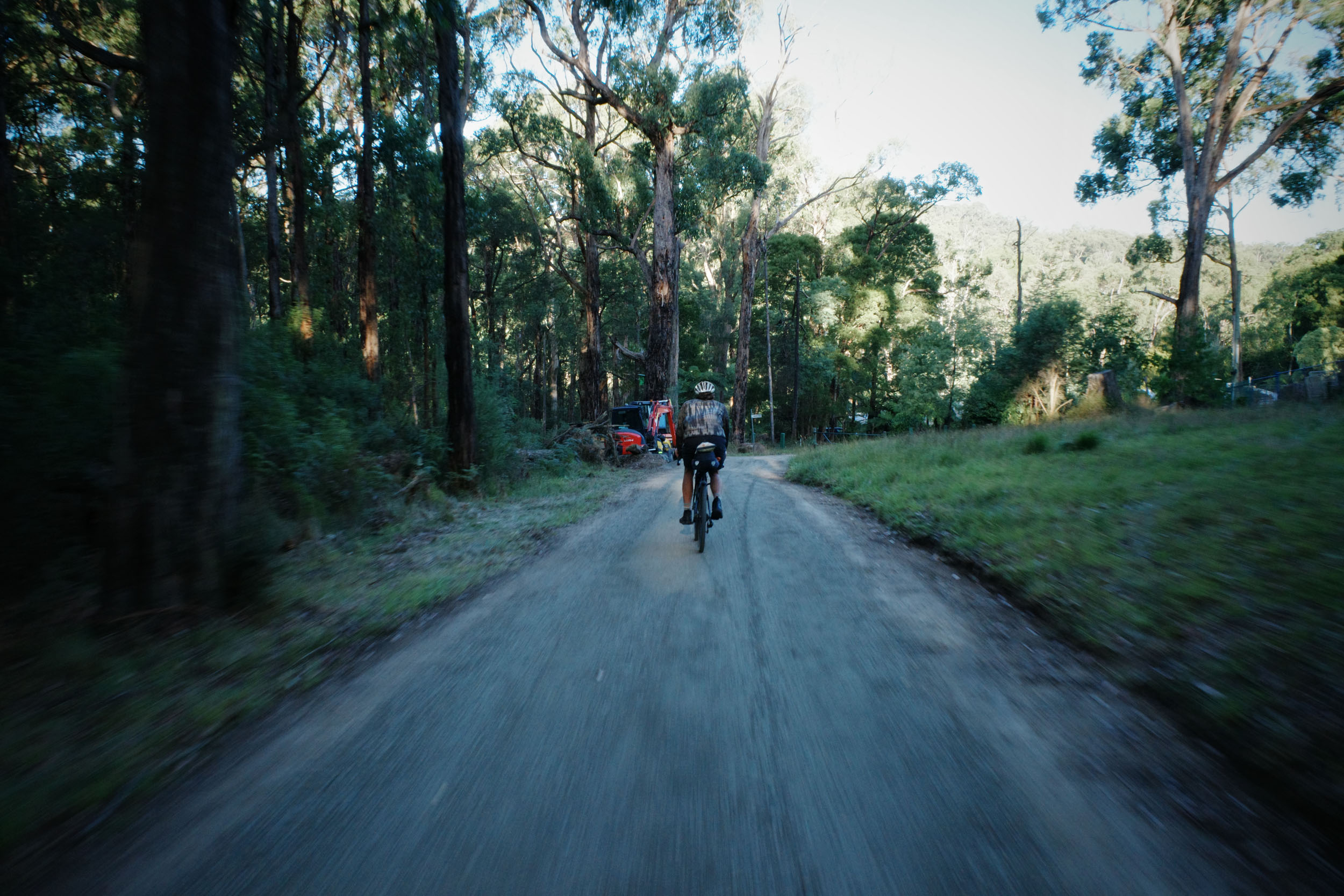
- The Outback Highway. To the well-seasoned local, this section may seem like an afterthought, or a mere commute south to rejoin the Mawson Trail at the southern end of the national park, but it is quite the opposite. It provides a real insight into what you might discover if you head far further north into the red centre of Australia; it is eerily quiet, and I had fewer than 10 vehicles pass me in almost an hour at peak tourist season. The riding is steady, meditative, and quite a respite after the relentless rough surfaces and undulations of the route so far.
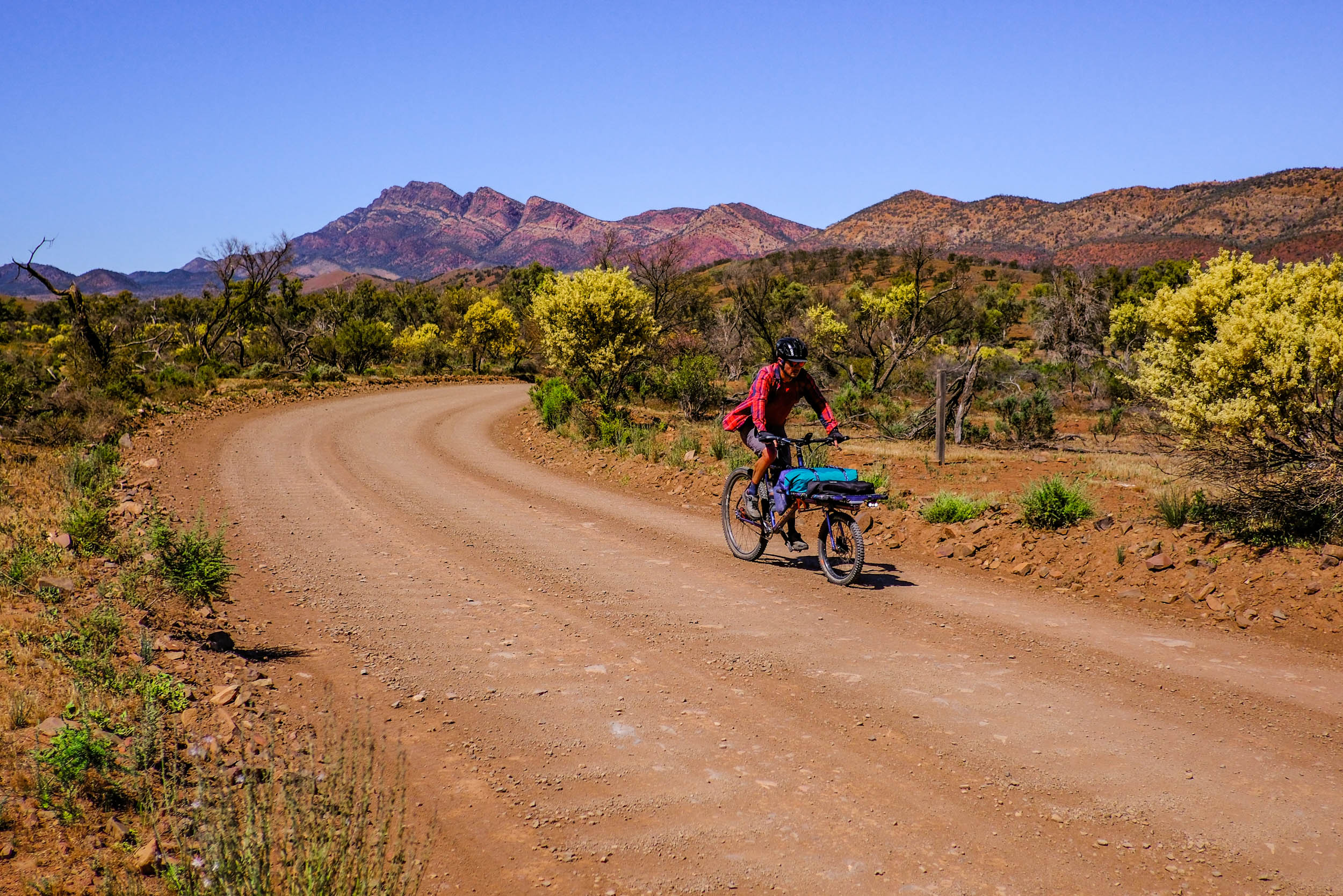
- Rawnsley Park Station. Leaving the highway to rejoin the Mawson Trail, the gravel smooths and the colours sharpen as the outline of Wilpena Pound slowly grows on the horizon. Hours later, Rawnsley Park’s store feels like stumbling into an oasis, cold drinks, snacks and the ping of mobile reception.
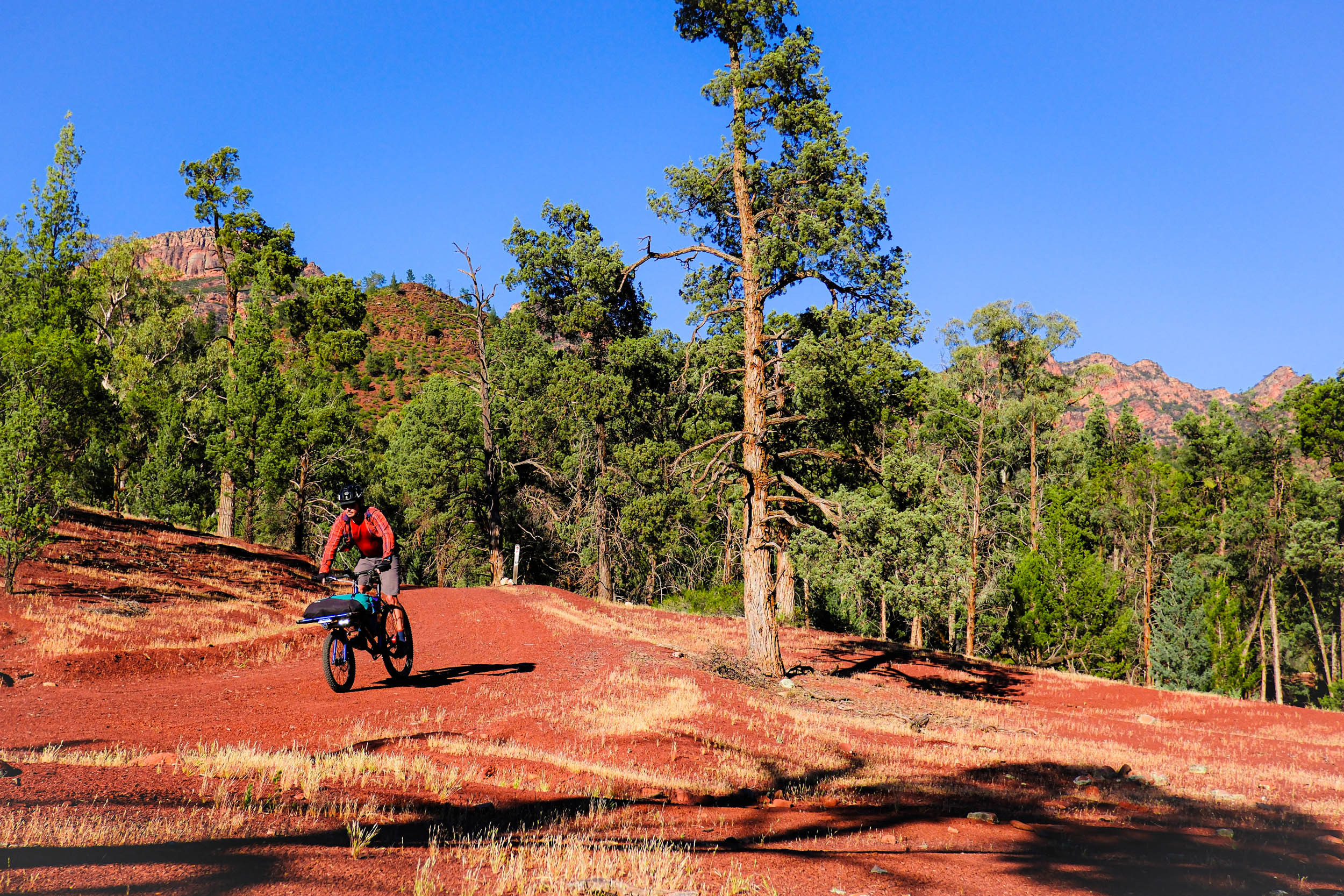
- The Mawson Trail. The final leg of the route follows the Mawson Trail and feels like a greatest-hits reel of the Flinders; scree slopes, lonely huts tucked into silent folds of hills, twisting gorges, and the iconic Razorback Lookout.
- Although the route is remote, it is not complex, and the roads and trails are well signposted and established.
- Cellular reception is limited to Blinman, Rawnsley Park, and Wilpena. Satellite communication was flawless due to the ability to achieve open skies at any point along the route.
- Shelter is not essential, depending on the rain forecast. I slept in the open every night, the insects left me alone, and dew wasn’t a problem.
- Tubeless tyres are essential due to the famed three corner jacks (a three-pronged thorn found in parts of Australia).
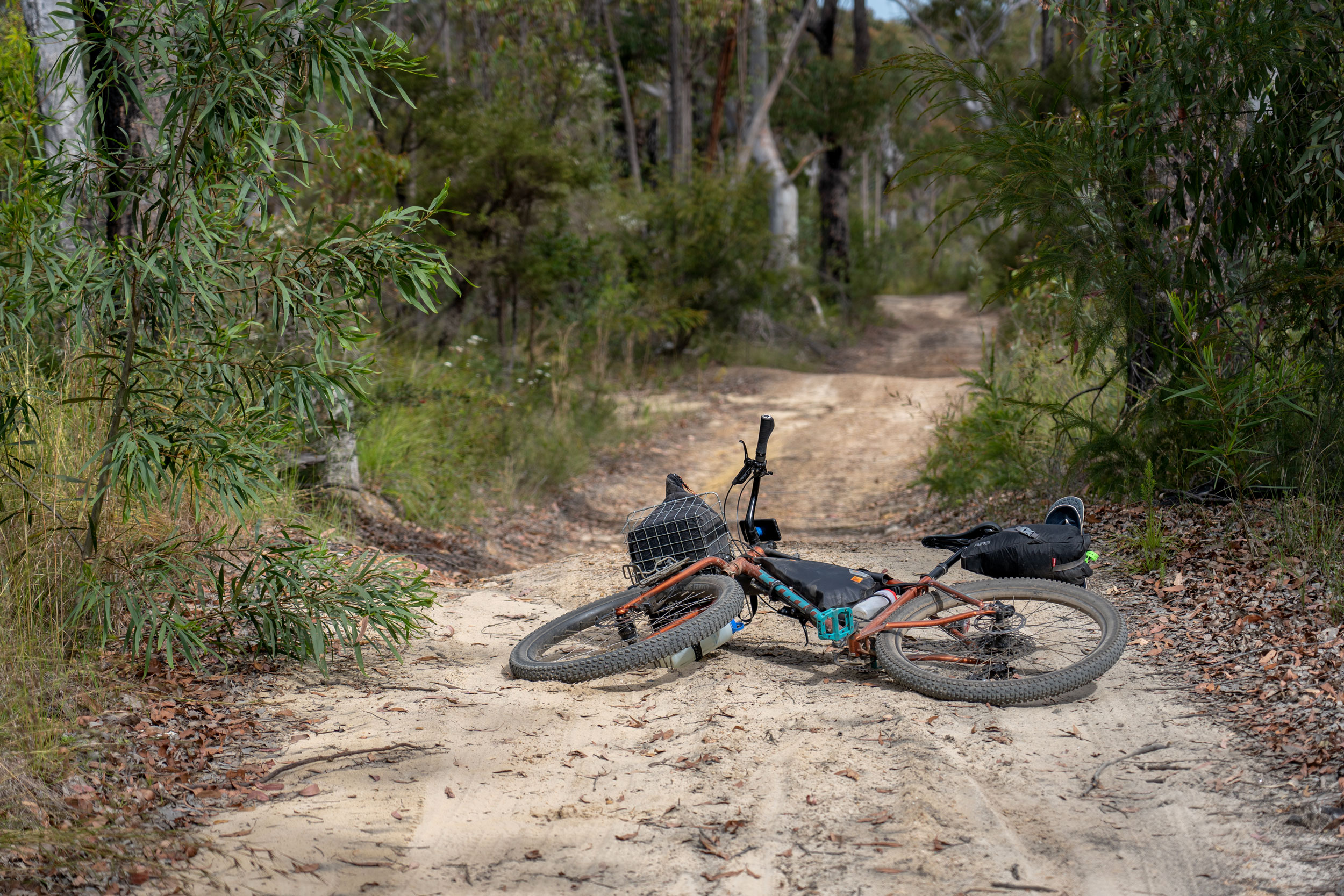
- Aim for a bike with tyres at least 2.3″ wide. A hardtail mountain bike would be great, but a rigid mountain bike with bigger tires is ideal. I would advise against a gravel bike due to the rockiness and sandiness of a few sections, but of course, experience level will dictate what you find tolerable by the end of each day. My cargo bike wasn’t light, but with aggressive tyre choice, it handled like a mountain bike and was very stable fully loaded, so I had no issues whatsoever, apart from the weight.
- The route begins and ends in Blinman (pop. ~43), a former mining town and the highest settlement in South Australia. Blinman offers a pub, cafe, limited resupply, accommodation, and nearby camping, making it an ideal staging point.
- Starting in Blinman provides an opportunity to complete the 65-kilometre northern loop without carrying all of your supplies. You could travel light and load up as you pass back through to head south into the national park.
- There are a few bus services from Adelaide that can drop you at Blinman, but only by arrangement. The closest scheduled bus route to and from Adelaide services Pt Augusta, 140 kilometres from the route.
- I camped and paid a very small fee to leave my car at Onya Eco-Camping, a short ride from Blinman, mainly to do the right thing by the local community by not cluttering their tiny main street.
- Much of the route is not passable if wet, and flash flooding is common, which can not only be dangerous but could trap you for extended periods.
- Extreme heat is common from November through to February.
- Within Ikara–Flinders Ranges National Park, the route passes by six bookable campsites (online booking required) and multiple hiker-only campsites (no booking, first-come, first-served basis). Campsites within the national park can be viewed and booked on the National Parks and Wildlife South Australia website, but keep in mind that you will need to book prior to losing reception at Blinman.
- Additional paid caravan park and resort style accommodation is available at Blinman, Rawnsley Park Station, and Wilpena Pound Resort.
- The route travels through two stations (Aussie version of ranches) that offer accommodation only through prior arrangement. Although this departs from the route’s original intent, it will make extending the timeframe possible and will no doubt add to the experience. For instance, the 80-kilometre western section of the route from Brachina Gorge south to Rawnsley Park Station has no official campsites, however, with some forethought, there is an option of paid accommodation at Edeowie Station. Likewise, at Moolooloo Station on the northern loop.
- It’s important to keep in mind that while there are numerous trails zig-zagging the stations and national park, most routes are not open to bicycles, including the Heysen Trail hiking route. Some maps designate trails as “MTB” but are only accessible through paid tours or packages, so research is vital if you plan to deviate from the Ikara Outback route.
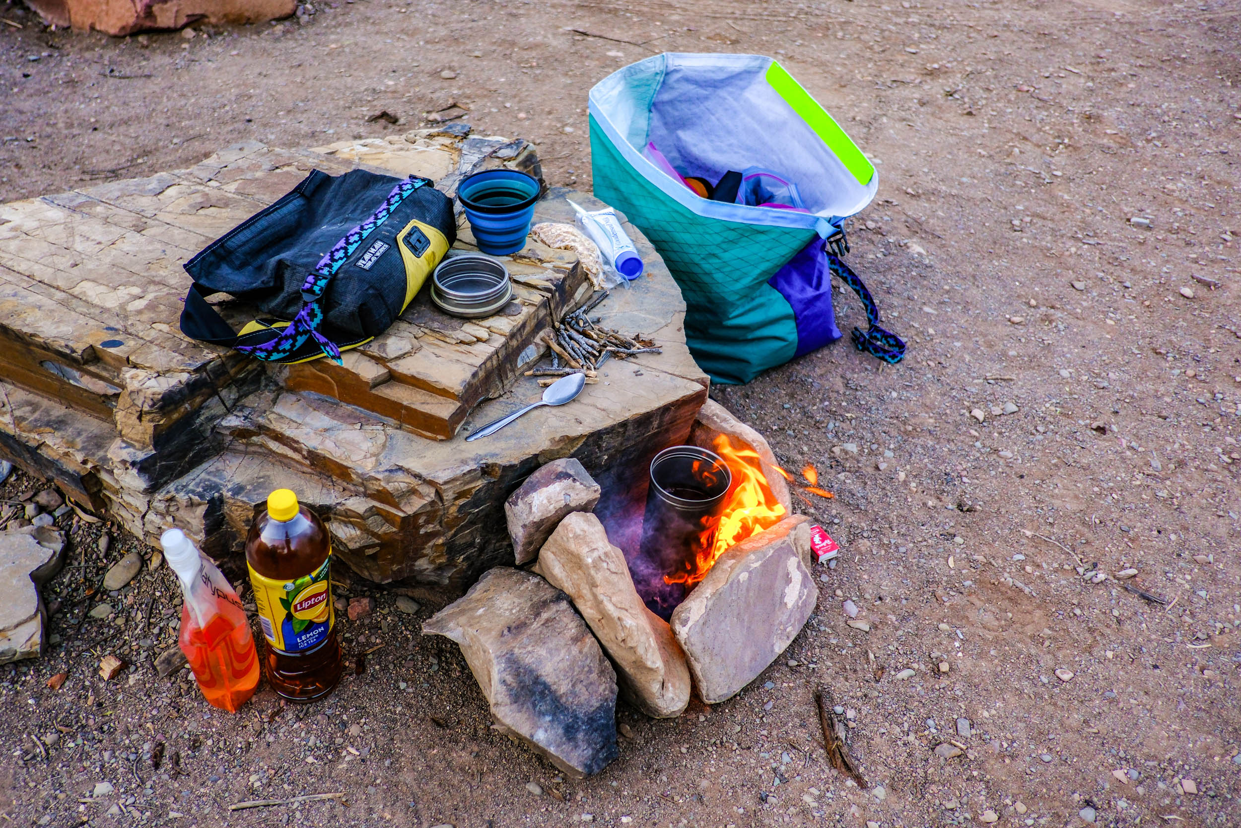
- All campsites have toilets and rainwater tanks, though water availability cannot be guaranteed, and water should always be treated. From a basic visible assessment, the quality of tank water varied from cloudy and brown to containing wrigglies. A simple gravity filter sufficed, although flavour was hit and miss. Some water tank levels can be checked using the Friends of the Heysen Trail website; however, I found every tank to be full on my trip.
- Resupply is available at Blinman, Rawnsley Station and Wilpena. Wilpena has the best-stocked store.
- Pub style food is available in Blinman and Wilpena.
Additional Information
The jewel in the crown of both the Mawson Trail (a 900-kilometre cycling route established in 1990) and Karnu Rally race route (1200 kilometres) has to be the sections of each route that take you through the Ikara Flinders Ranges National Park, the first real taste of the Aussie outback for many travellers heading north from Adelaide in South Australia.
Unfortunately, a few factors hold people back from trips to the region. Firstly, a sprinkling of rain renders large sections impassable, and the “wet season” extends between April and September. This leaves a couple of months before the daily temperatures then skyrocket and average well over 30°C from December to March. If you do the math, you’ll quickly understand why there is a very short opportunity for semi-reliable travel planning.
The second consideration is access. Much of the surrounding land is privately owned, and while permission is often possible, it can limit flexibility and spontaneity. This route was designed specifically to avoid that issue by utilising national park roads and trails, Public Access Routes (PARs) through stations, public roads, and campsites easily bookable online or free. This all means that you can wait for a break in the weather and jump on the bike at a moment’s notice; just as I did scouting this route and undertaking the ride on three glorious blue sky twenty degree celsius days between a rainy Sunday and a 35-degree Thursday.
Even comparatively crowded caravan parks, pubs, and cafes play their part. A pie, a schnitty, or a beer never tasted better than after hours of dust and sun.
Below is a suggested 3-day itinerary to take it all in:
locationBlinman to Teamsters Camp
Day 1 (110km +1,250m)
The ride begins with a little-known 65-kilometre, four-wheel-drive loop north of Blinman, following PARs through private stations. The loop is slow and demanding. On rough, rolling terrain, my average speed barely reached 15 kilometres per hour. Returning to Blinman, the cafe felt like a reward well earned.
The route follows the Flinders Ranges Way, then just before the national park sign, you’ll head off to the west, following the Mawson Trail signage for a few kilometres before the roughest section of route cuts across Red Hill to Aroona. There may be some very short hikeabike sections, but all will be rewarded with the best views so far and smooth gravel that will drop you into Brachina Gorge. Surrounded by cliffs for 8 kilometres, you have a choice of established campsites.
locationTeamsters Camp to Wilcolo Campground (Hikers only camp)
Day 2 (115km +1,050m)
The next morning, the landscape shifts dramatically from being hemmed in by rocks and mountain ranges to open expanses. The only downside to this open section is that you are not permitted to camp anywhere on the 80 kilometres between Teamsters Campsite and Rawsley Park Station. Luckily, this is the least challenging section of the route, and there is an option for paid accommodation at Edeowie Station.
Still outside of the national park, you leave the highway and rejoin the Mawson Trail, onto the first resupply since Blinman, at Rawnsley Park’s store.
The section of the Mawson Trail heading north from the station is well known for being impassable after rain, and even in the dry, you can underestimate the speed with which you expect to reach Wilpena and an extensively stocked store.
This will be the last resupply until Blinman, but it’s only 6 kilometres to the hiker-only campsite (no booking required), so you can spoil yourself and load up for a big dinner and breakfast, or even drop into the pub for a burger and a sunset ride to camp.
locationWilcolo Campground to Blinman
Day 3 (60km +850m)
The final leg follows the Mawson Trail and is popular for a reason. It is beautiful and varied, and you’re likely to meet other riders and day-trippers along the way. Exhausted and well in need of refreshment in Blinman it’s an unavoidable 15-kilometre backtrack on the Flinders Way, although it’s less of a chore and more of a chance to reflect on everything the past days have thrown at you.


Terms of Use: As with each bikepacking route guide published on BIKEPACKING.com, should you choose to cycle this route, do so at your own risk. Prior to setting out check current local weather, conditions, and land/road closures. While riding, obey all public and private land use restrictions and rules, carry proper safety and navigational equipment, and of course, follow the #leavenotrace guidelines. The information found herein is simply a planning resource to be used as a point of inspiration in conjunction with your own due-diligence. In spite of the fact that this route, associated GPS track (GPX and maps), and all route guidelines were prepared under diligent research by the specified contributor and/or contributors, the accuracy of such and judgement of the author is not guaranteed. BIKEPACKING.com LLC, its partners, associates, and contributors are in no way liable for personal injury, damage to personal property, or any other such situation that might happen to individual riders cycling or following this route.
Further Riding and Reading
Here are some connected/nearby routes and related reports...

Please keep the conversation civil, constructive, and inclusive, or your comment will be removed.