


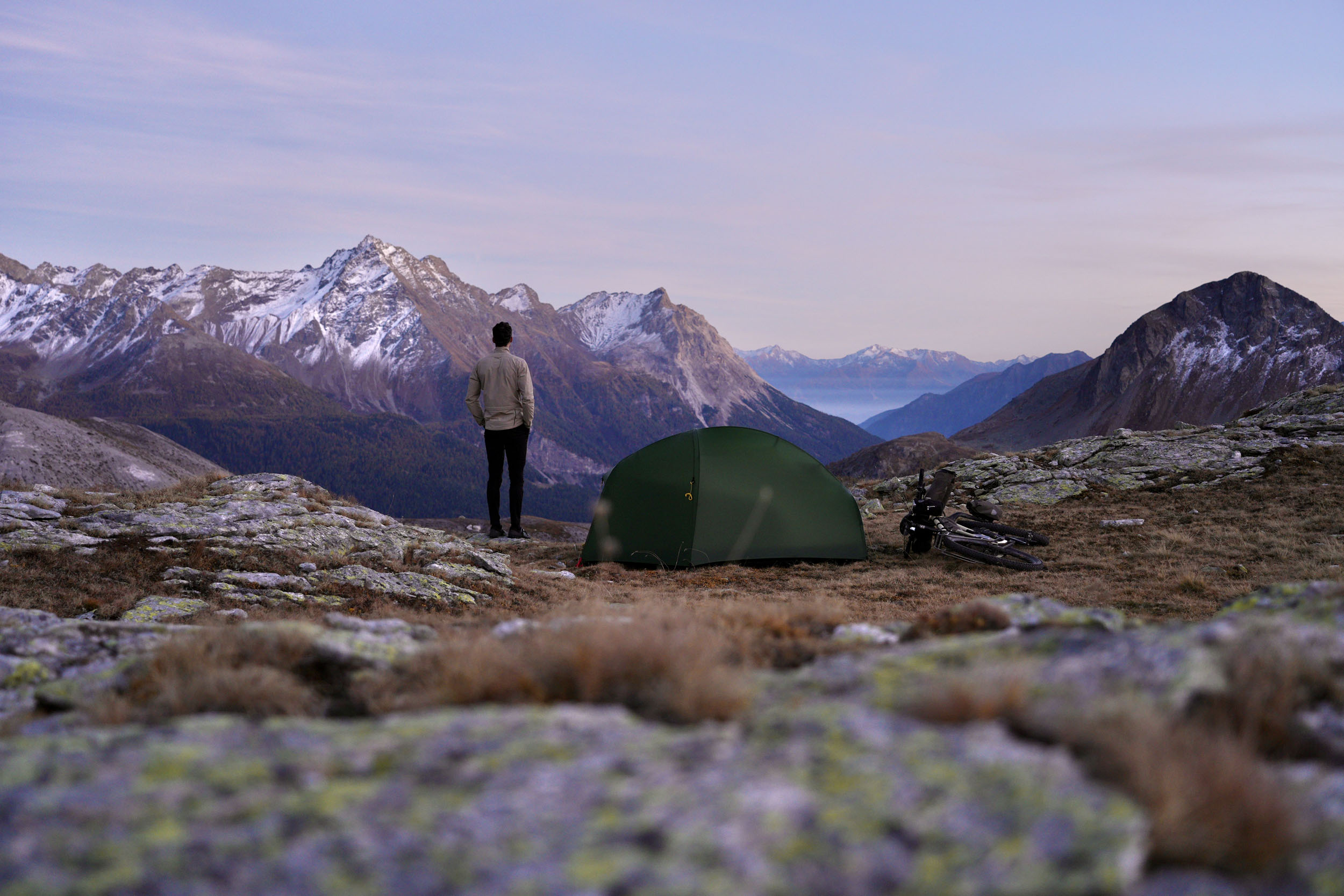
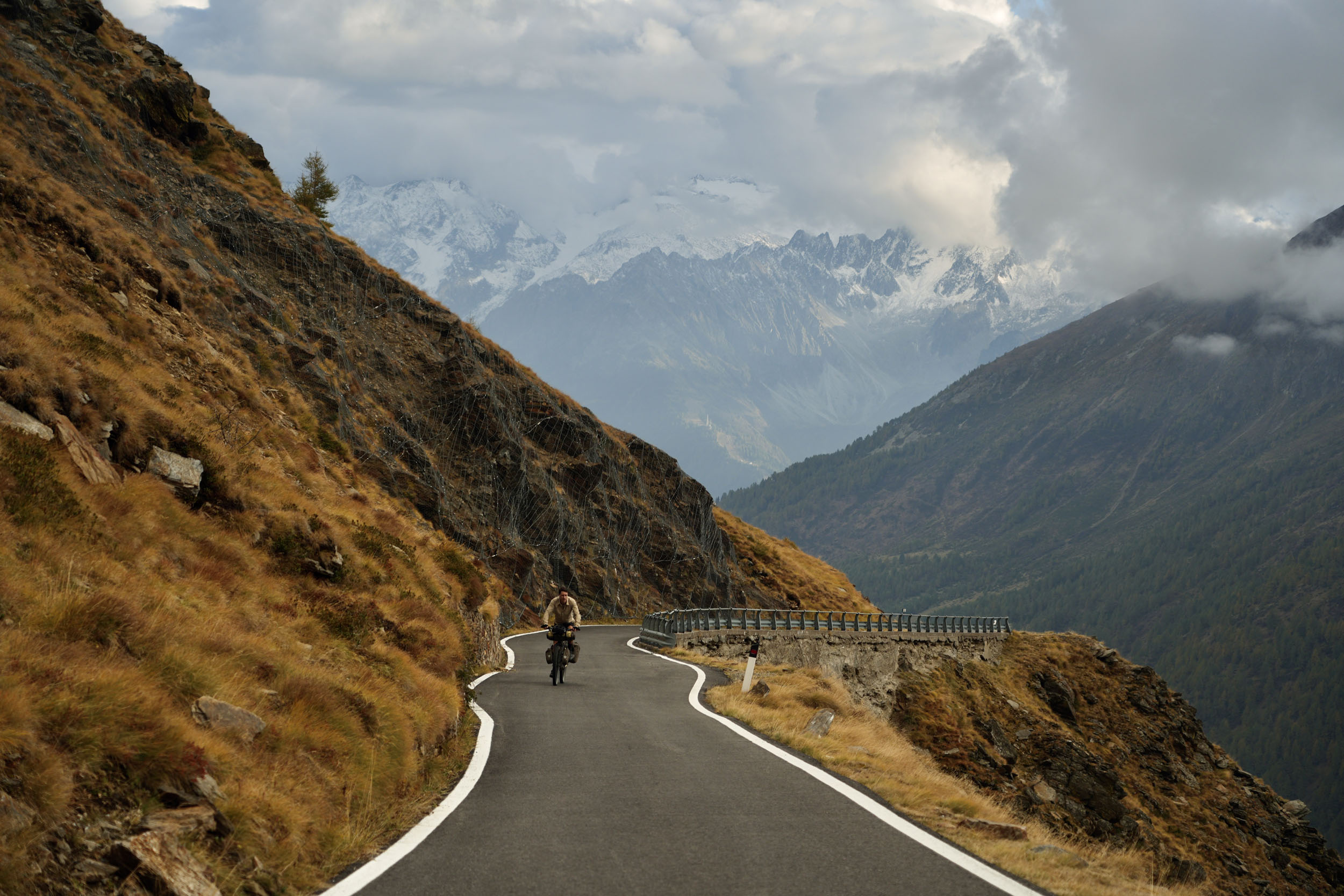
The Livigno Loop
Distance
144 Mi.
(232 KM)Days
6
% Unpaved
58%
% Singletrack
2%
% Rideable (time)
97%
Total Ascent
25,951'
(7,910 M)High Point
8,700'
(2,652 M)Difficulty (1-10)
7?
- 10Climbing Scale Very Strenuous180 FT/MI (34 M/KM)
- 5Technical Difficulty Moderate
- 8Physical Demand Difficult
- 3Resupply & Logistics Fair
Contributed By
Tristan Bogaard
The Livigno Loop serves a unique purpose. Depending on late or early snow, it can be ridden all spring, summer, and fall to experience a classic alpine bikepacking journey. Jagged peaks surround its chosen tracks, and rifugios serve as waypoints between climbs, offering shelter from inclement weather. Of course, with so much high-altitude riding, some may conclude that a summer escape is the most fitting approach. But for those keen to discover a side of the Alps that’s displayed just once every year, autumn is the perfect time to go.
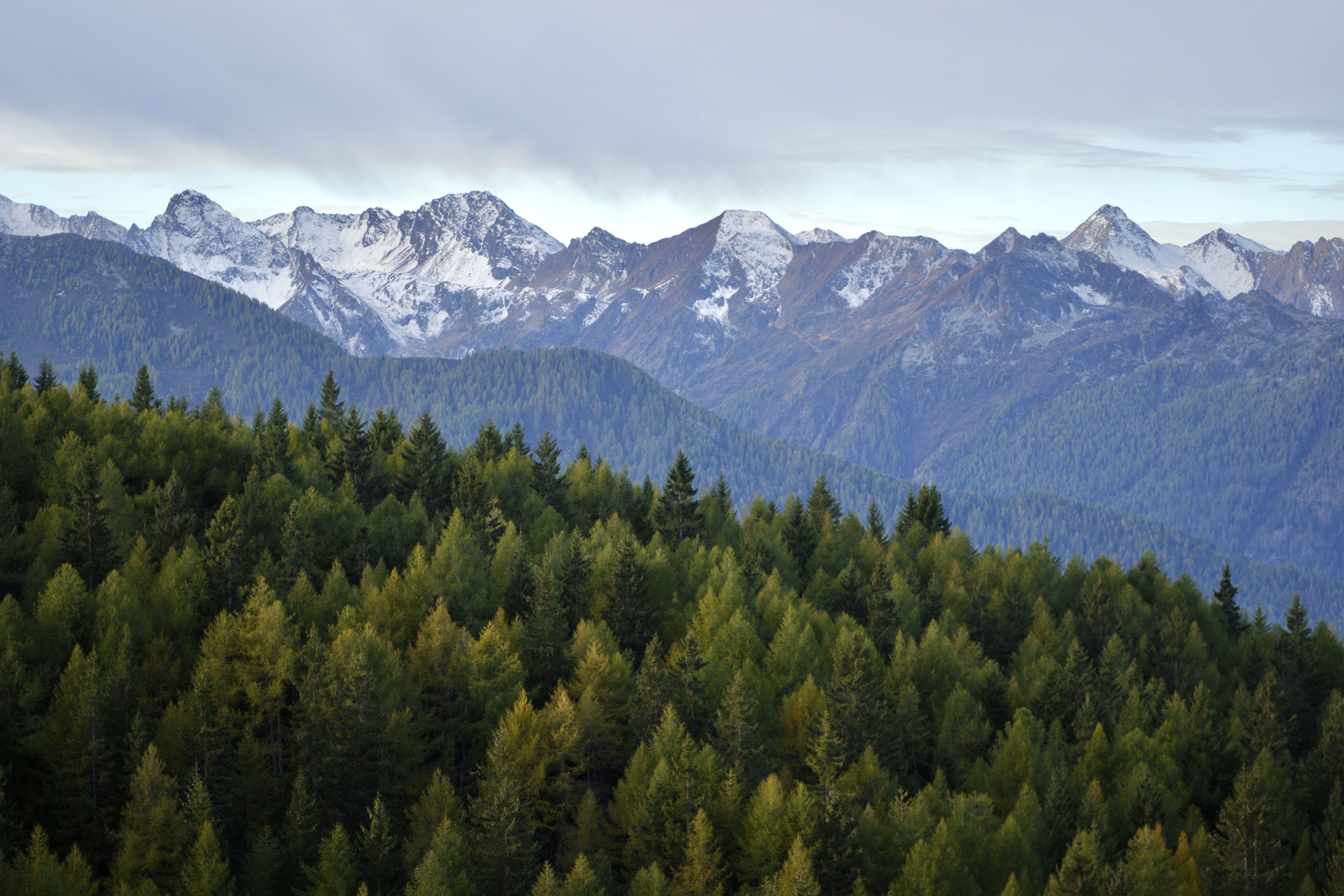
Once the heat slowly seeps out of these high valleys and the last summer visitors retreat to the cities far beyond the furthest peaks, a slow and steady transformation takes place. As though an internal clock awakens, summer euphoria makes way for the melancholy of fall, and with it, the rhythm of villagers, businesses, wild animals, trees, and the last surviving flowers changes. Mushrooms sprout, and as if entire fields and forests turn chameleonic, a wave of changing colors emerges. The mountains hum with a soft, peaceful silence under their first coating of virgin snow.


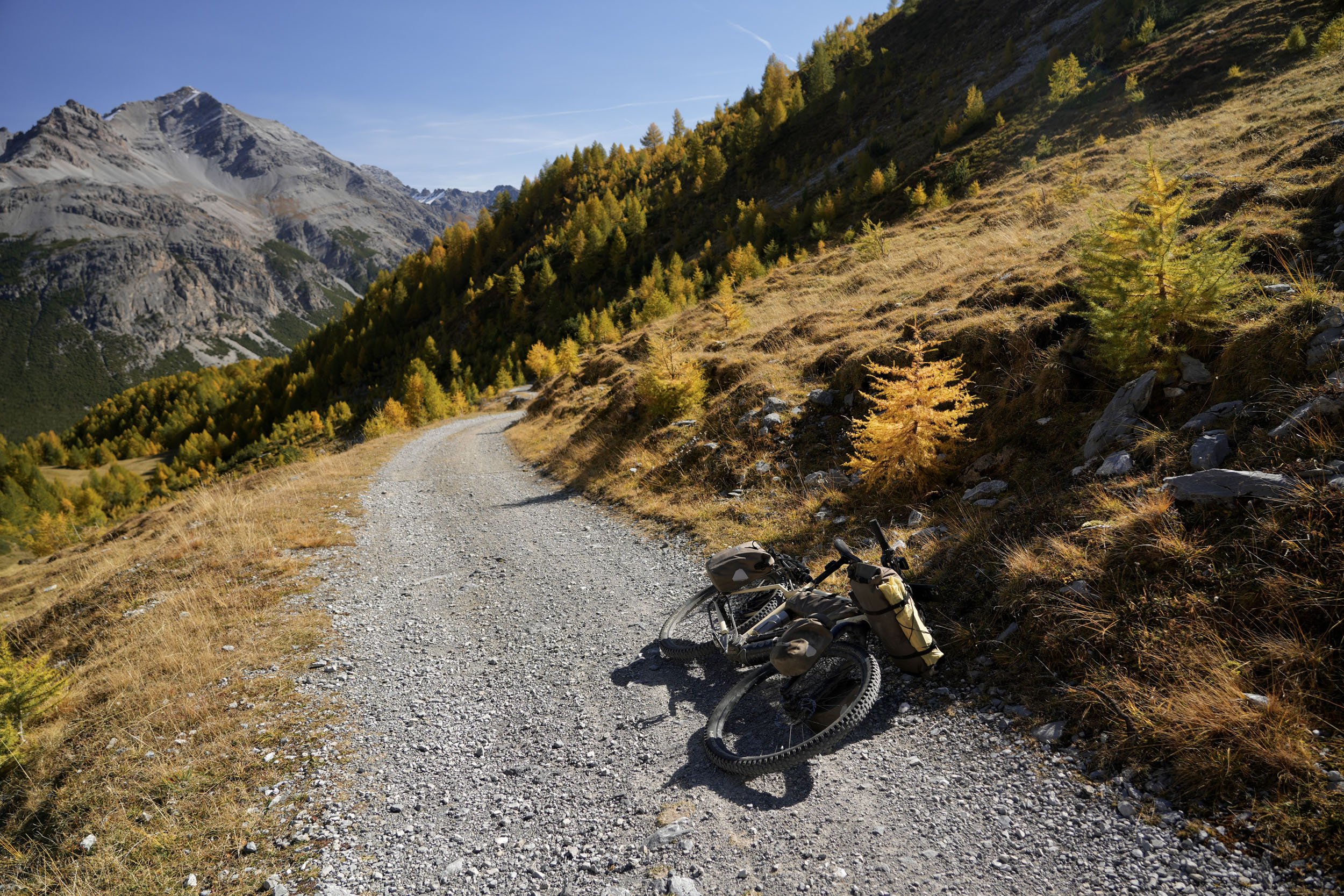
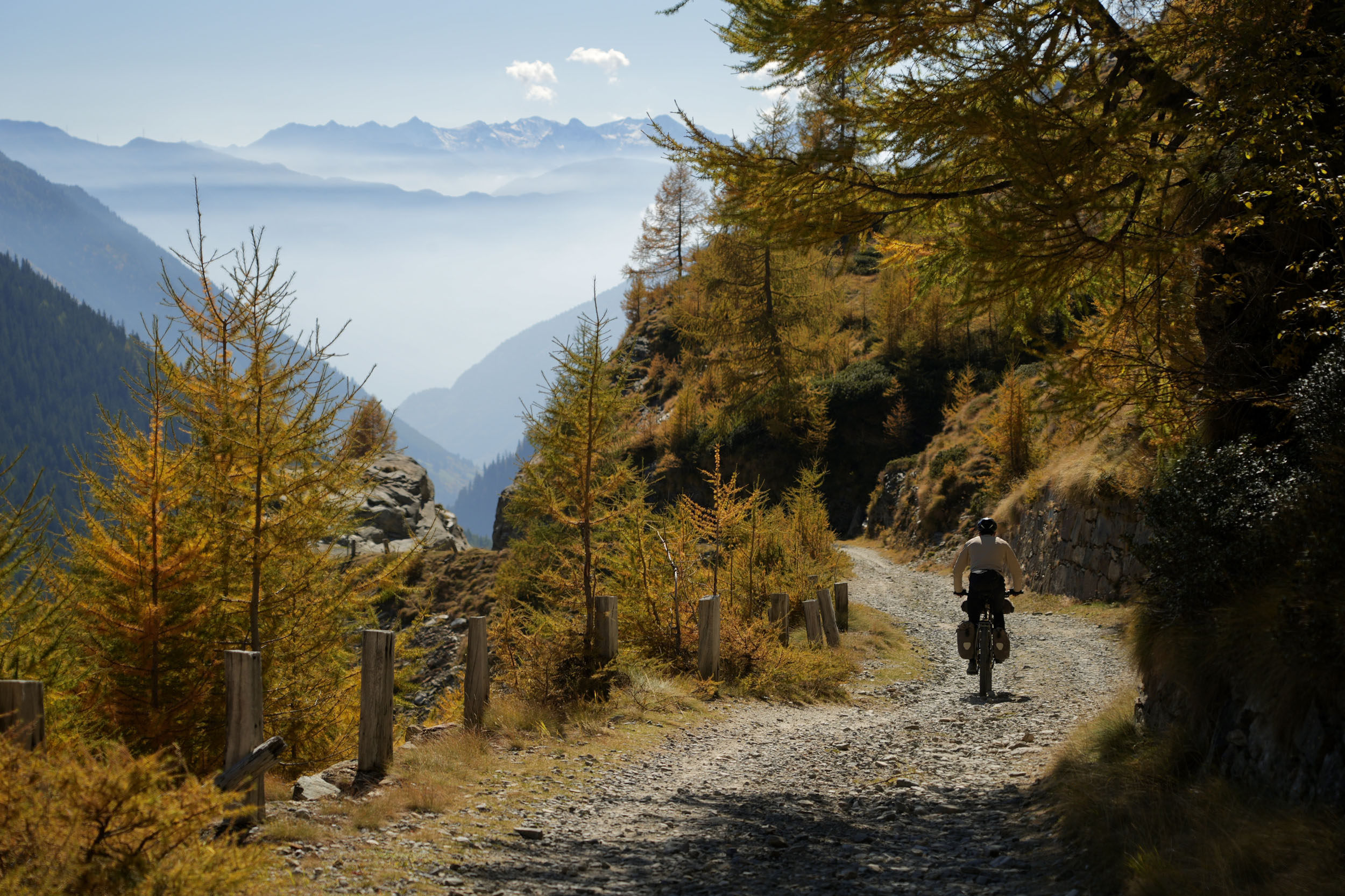
It is during the first weeks of October that the Livigno Loop takes on this cloak of its own. Thanks to the European larch and its needles that turn yellow only for a brief moment before they fall to the ground, those lucky enough to find themselves on a bicycle in this nook of the Alps will witness a natural spectacle like no other. It’s a silent theatrical play, slowly conducted, never asking for attention. If experienced at this exact moment of the year, the Livigno Loop will give you the type of visual memories that leave behind a sweet aftertaste.
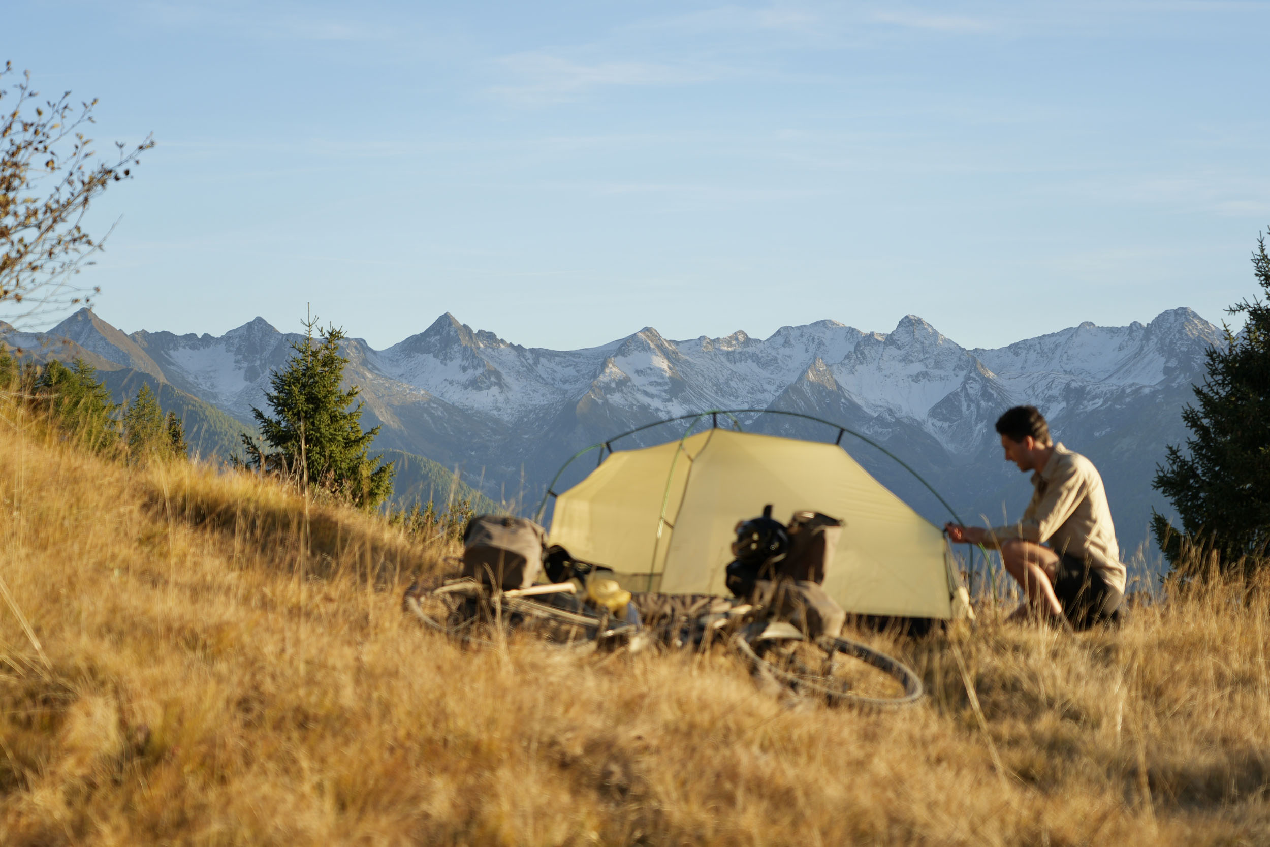
I’ve built the loop in such a way that it treats riders to challenging daily climbs, small outcrops of alpine civilization, steaming bars and cafes, mountain rifugios to retreat from the elements, gorgeous wild camping possibilities, unusual border crossings, and pockets of solitude only to be found by bicycle.
Route Difficulty
While technically lighthearted and logistically relaxed, the Livigno Loop is a route that requires considerable physical effort due to its high elevation gain. With over 1,000 meters climbed each day when riding the loop in under a week, the focus of its rating is exactly that. It contains around 58 percent unpaved surfaces, with a few challenging sections you may prefer to walk rather than ride. Resupply is plentiful, as the route often passes through villages with several options. The marked POIs will help you plan your days among these magnificent mountains, if you so desire.
Route Development: The Livigno Loop was born as an idea several years ago, when Belén, my riding partner at the time, and I discovered the allure of the Italian Alps and planned an experimental loop to ride with her brother. After deciding it would be a little much for a beginner cyclist like him, we did not scout the loop, instead leaving it for a later stage. In late 2025, I returned to Italy on my own and decided to take advantage of a radiant weather window. With blue skies above me, surrounded by the color-changing larch trees found around the greater Livigno area, Indian summer had never looked or smelled more prolific. As with all good scouting trips, I became aware of the rhythm I was looking for in this loop and listened closely to my body’s needs as I climbed and descended the intense elevation profile, ultimately cutting out two major climbs. The loop felt exceptionally well-rounded, with a striking balance between suffering and reward, and remote enough to be considered adventurous—in a European sense of the word.


Submit Route Alert
As the leading creator and publisher of bikepacking routes, BIKEPACKING.com endeavors to maintain, improve, and advocate for our growing network of bikepacking routes all over the world. As such, our editorial team, route creators, and Route Stewards serve as mediators for route improvements and opportunities for connectivity, conservation, and community growth around these routes. To facilitate these efforts, we rely on our Bikepacking Collective and the greater bikepacking community to call attention to critical issues and opportunities that are discovered while riding these routes. If you have a vital issue or opportunity regarding this route that pertains to one of the subjects below, please let us know:
Highlights
Must Know
Camping
Food/H2O
Trail Notes
- A unique opportunity to witness Indian summer in a part of the Italian Alps that contains the European larch (Larix decidua) that turns yellow during fall.
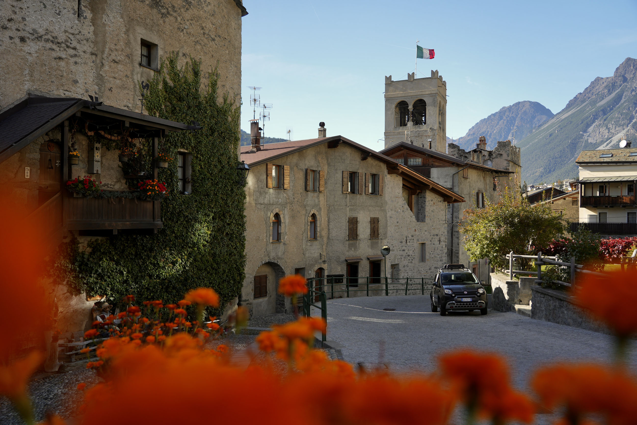
- Instant Italian mountain culture from the start line in beautiful Tirano. The air breathes differently up here!
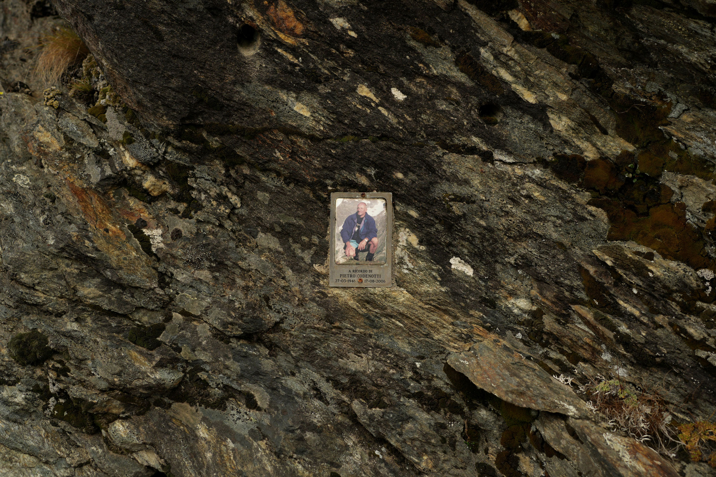
- The awe and mystery of Passo Gavia’s long climb, its hidden memorial and the beauty and silence of its upper plateau.
- A morning coffee and cake at Rifugio Ristoro Solena, by Lago di Cancano, or potentially a cozy night’s stay!
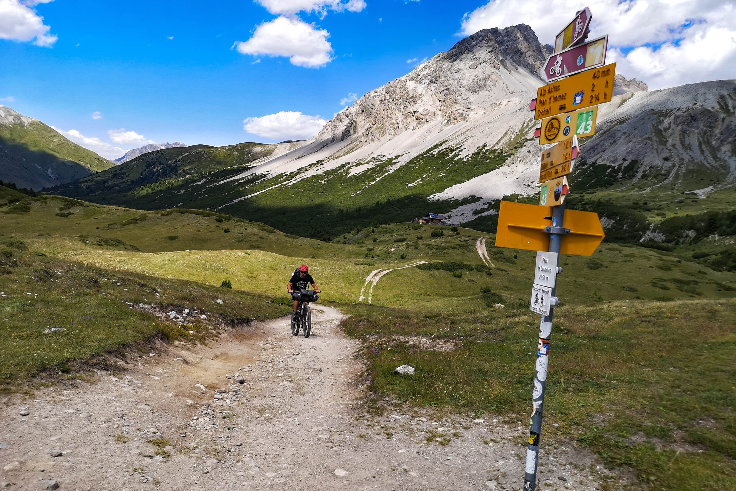
- The winding gravel climb after Lago di San Giacomo and subsequent reveal of the Passo di Valle Alpisella at the top.
- Entering Switzerland through a little-known hiking trail up to the crystalline Lej Minor.
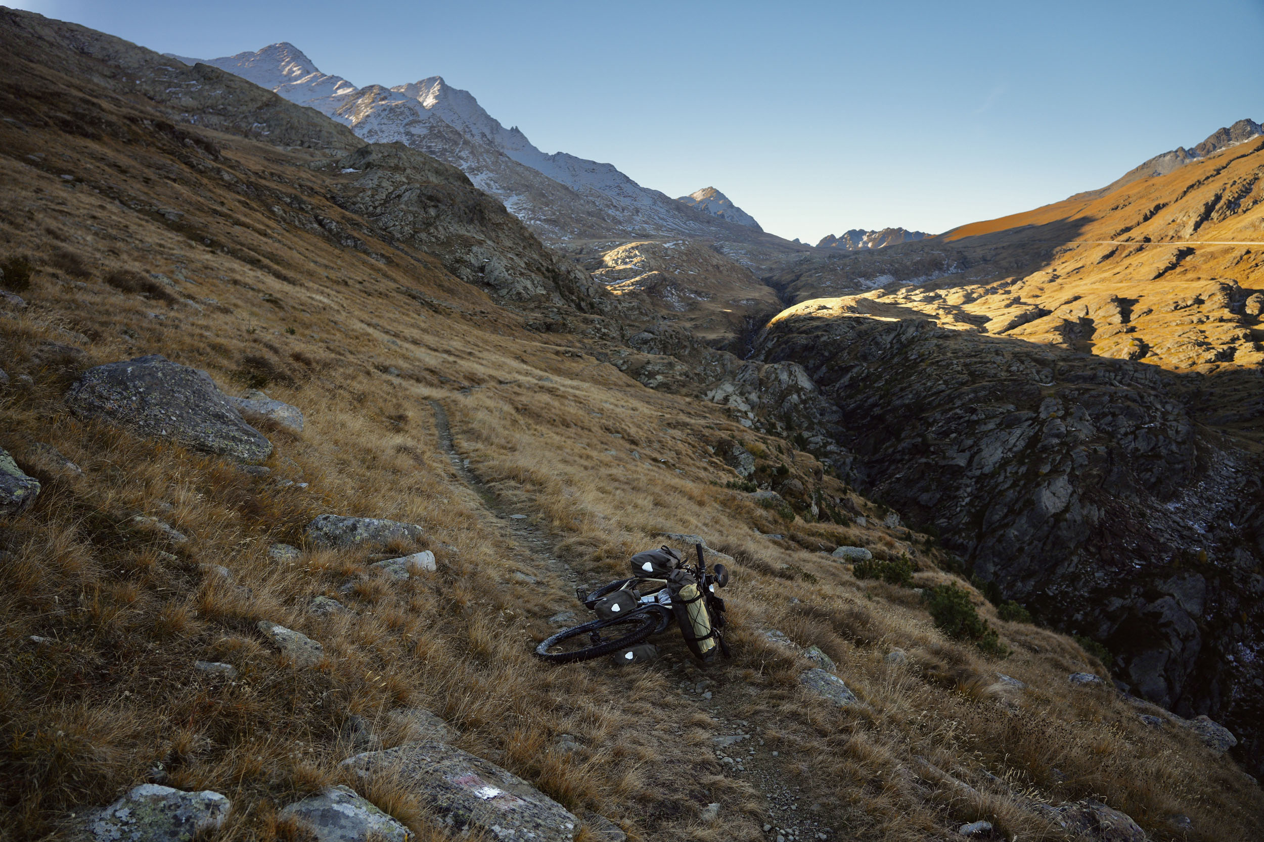
- The possibility to wild camp in complete solitude, under a sky full of stars, surrounded by nothing but mountain peaks.
- Following the Bernina Express train tracks, to see the moving postcard of this famous red train in person.
- If your wallet allows for it, a picturesque lunch stop, or night’s stay, at the Belvedere (Alp Grüm) rifugio, overlooking a gorgeous and typically Swiss mountain view.
- Slowing down at Lagh da Val Viola to admire the serene nature of this place. Take a stroll along the shore if you can, to see the mirrored image of all that surrounds the lake.
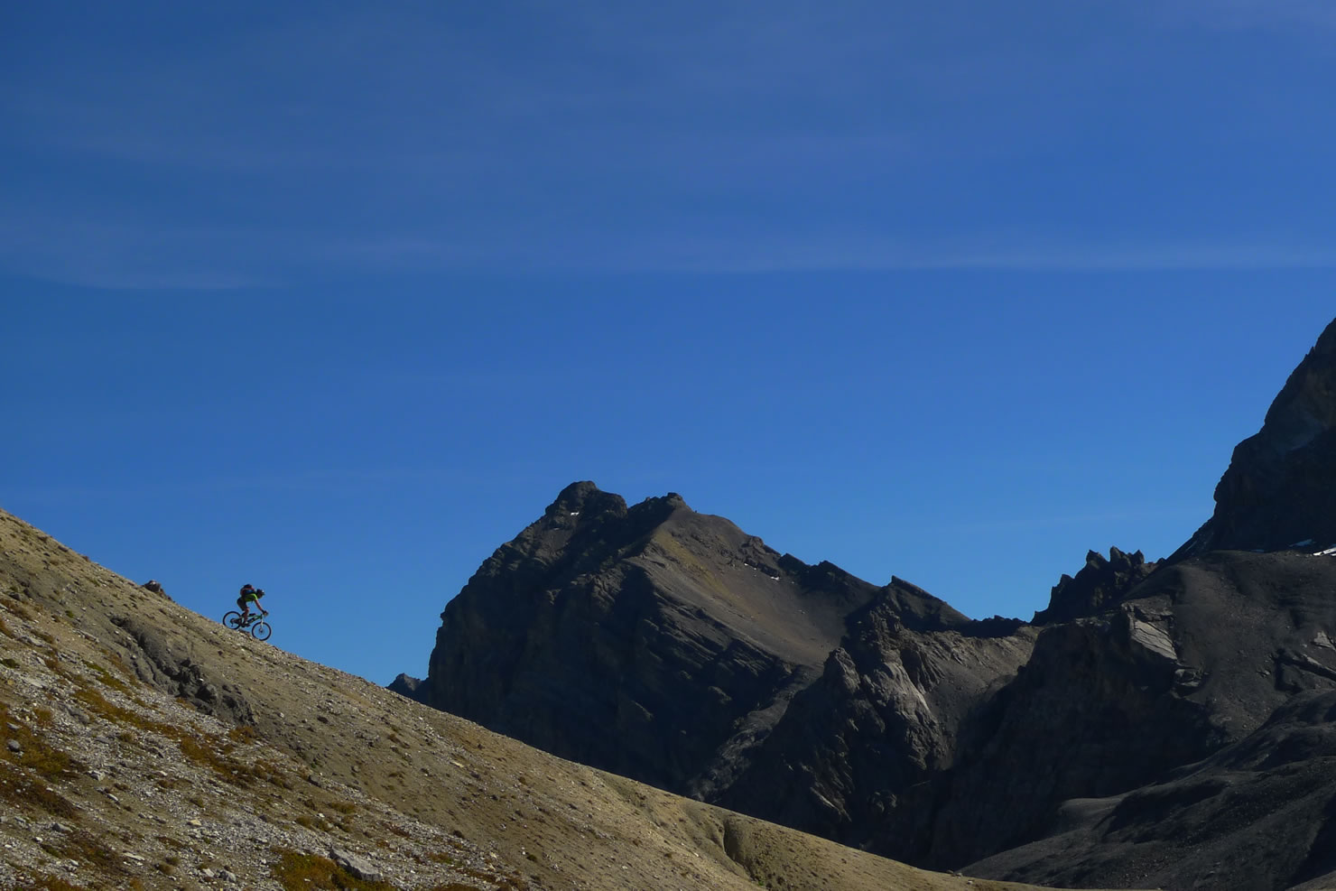
- Summiting the Val Viola Pass via hike-a-bike and taking in the wide panorama at the top.
- The ultimate reward for completing the loop, a smashing descend on forest gravel and smooth, safe bike lanes all the way back to Tirano!
- When to go: this loop can be ridden as soon as the high passes are clear of snow, generally between May and October, depending on the weather. However, I can highly recommend reserving this route for the first or second week of October, with fall in full force and an abundance of color being displayed in an almost theatrical performance by Mother Nature. The European larch that grow this route displays a striking yellow transformation that’s not to be missed. Find a handy local weather webcam here.
- What bike: climbing is your main focus, so bring plenty of gears. Surface-wise, a rigid mountain bike with tubeless tires, or any sort of suspension option from there on, will set you up very well for the terrain.
- Travel basics: Milano Centrale train station serves as the best way to the Livigno Loop because of the frequent Trenord regional trains to and from Tirano. Bikes are transported free of charge on this trajectory. Flying into one of Milano’s airports and connecting to this train is by far the easiest way of making it there, although you may consider arriving entirely by train if traveling from within Europe.
- Cooking: the easiest way to cook on this loop would be to bring a gas stove and purchase a large canister at a Decathlon in Milano. You’ll likely have enough gas for the entire trip this way, without the need to refill/repurchase.
- Weather conditions: the Alps can be quite unpredictable at times, especially in late summer with frequent showers and thunderstorms as heat gets trapped in the Po Basin. However, if you follow my recommendation to ride this loop in the fall and can plan for a sunny weather window, you’re in for a treat.
- Steepness Hike-a-Bike: the loop contains a few sections you’ll probably walk, and has a steep overall elevation profile. Gavia’s downhill segment is an MTB trail that you’d really only ride with years of downhill experience. The segment up to Lago di Cancano is very steep. The way up to and through Val Minor is mostly unridable, and the hike-a-bike to Val Viola Pass is tough!
- Dangers: some trails are dangerous in how narrow they are, requiring confident riding or walking so as not to slip on their steep slopes. Namely, the forest singletrack segments after kilometers 17.4 and 28.6 require extra attention.
- Annoyances: a minor annoyance is that after the 10th of October, until early May or in some cases June, most mountain huts along the loop are closed. But wild camping will be easier because of this.
- Sfazù – Alp Camp PostBus service
- Wild camping: although not officially allowed in most of Europe, at high elevation in the Alps during the off-season, you likely won’t have any trouble finding a quiet pitch for the night. In fact, I lived some of my most spectacular camp nights in Italy on this loop. Practice LNT principles, refrain from making fires, and never leave anything behind.
- Lodging: there are several lodging options available in the form of mountain rifugios or hotels on the passes or in the valley towns. I didn’t use any, but I’ve marked a few I would’ve liked to stay at on the route map.
- Bars: I love Italian gastronomy, and much of it is available in these mountains, albeit a bit more basic. Each morning, I found a bar (all marked on the map) that served a sweet breakfast and flavorful coffee, with the occasional savory options. Pizzerias in Tirano and Livigno are worthy stopping points. Mountain huts along the way serve heartier dishes, often meat-based, and when combined with lodging, can reduce or completely eliminate the need for cooking or camping.
- Water: is plentiful in the Alps all year-round, to be found in every town and along many trails. I’ve marked the ones I found on the map.
- Resupply: the supermarket in Livigno is a great midpoint resupply.
This loop is best ridden with ease of climbing in mind. The many meters of elevation gain can prove an enormous challenge, as can the average steep gradient of each climb. Therefore, I recommend the following itinerary to guarantee both better camp spots (or rifugio stays) and a feeling of accomplishment every day:
location Tirano – Motti del Laghetto
Day 1 (10 mi +4,771 ft)
Assuming arrival in Tirano by regional train from Milano, utilize the afternoon by having a pizza lunch in town before scaling the 1,500-meter climb that awaits you right outside of town. Pitch your tent somewhere at the top and wave the mountains goodnight.
location Motti del Laghetto – Lago Bianco
Day 2 (33 mi +6,960 ft)
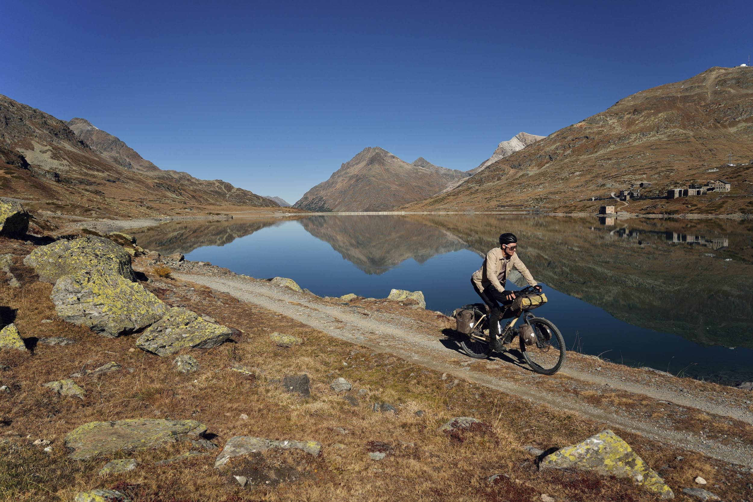
You’ll have to push your bike up and down some sketchy singletrack this morning, in particular the forest trail down to Monno, but breakfast awaits you at La Taverna del Gatto Nero. Then starts the long climb to Passo Gavia, with the steeper bits commencing beyond Ponte di Legno. If you manage to complete the ±1,700-meter climb this day, you’ll be rewarded with either a stay at Rifugio Bonetta or a pitch somewhere along the trail curving around beautiful Lago Bianco.
location Lago Bianco – Rifugio Solena
Day 3 (23 mi +3,272 ft)
With either a breakfast at Rifugio Bonetta or something self-made in your tummy, set in for a long trajectory of trail riding down the hiking track from Lago Bianco. This’ll be steep in many places, likely forcing you to hike your bike a lot, so take your time. Once you ride into Santa Catarina, make sure to stop at Bar Centro along the river and try one of their delicious Paninis. Following the track heading west, descend to Bormio and climb the steep trajectory to Rifugio Solena, to stay the night. If camping, you may be able to find a pitch in the area ahead of the rifugio to guarantee yourself coffee and cake the following morning.
location Rifugio Solena – Piz Lagalb
Day 4 (24 mi +3,241 ft)
Start it with coffee and cake at Rifugio Solena! Then ride along the two lakes, climb over Passo di Valle Alpisella, and descend into Livigno for a pizza lunch. Depending on how much time this takes, you’ll have a chance at riding up Forcola di Livigno Pass, where you may cross into Switzerland following the hiking trail from the road. A little bit of hike-a-biking later, you’ll find yourself overlooking a magnificent spectacle of mountains marking the Italian-Swiss border, and can pitch your tent above 2,400 meters for a chilly night under the stars. If you’re planning for accommodation, your best bet is to continue the hike-a-bike around Piz Lagalb, take a left when reaching the road, and climb up to Hotel Bernina Hospiz.
location Piz Lagalb – Ristoro Alpe Campo
Day 5 (23 mi +3,662 ft)
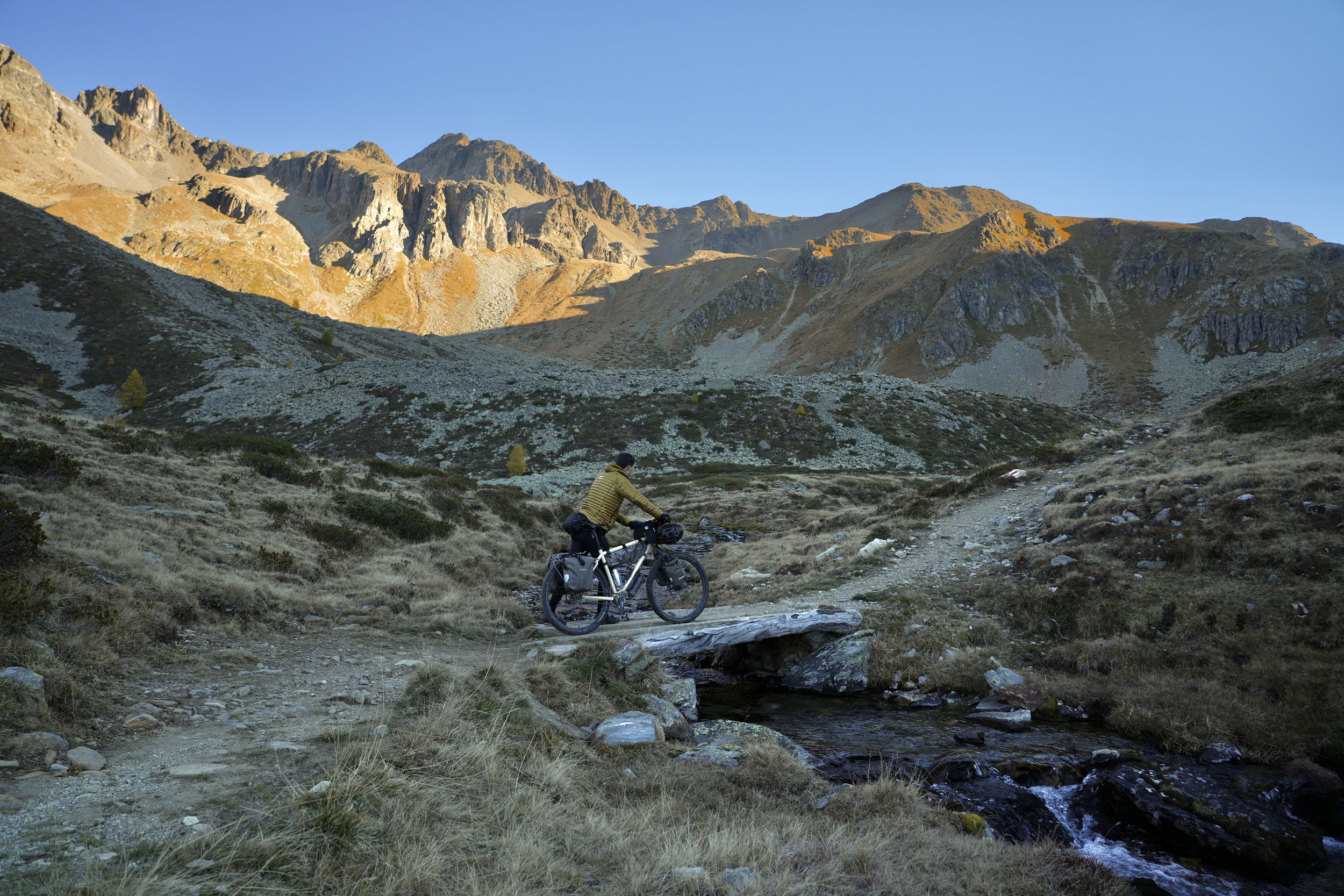
Hike-a-biking your way over the trail around Piz Lagalb, you’ll find the famous Bernina Express rail alongside a selection of trails leading you to the southside of Lago Bianco, followed by a fantastic descend that goes by Belvedere (Alp Grüm) rifugio (a pricy but lovely lunch spot) and down to San Carlo. Here starts the last rough climb, about 1,350 meters, up to the border with Italy at Passo Val Viola. From Sfazù, you can reserve a local van with your bike on the Swiss PostBus service to Val Camp and skip this 330-meter climb, but I found it way easier than expected and would encourage you to ride it. You could sleep at Ristoro Alpe Campo, or continue to Lagh da Val Viola to find a quiet pitch.
location Ristoro Alpe Campo – Tirano
Day 6 (31 mi +2,707 ft)
A tough hike-a-bike up to Passo Val Viola awaits, and will likely take you a few hours. But the top promises a sweet descent before climbing over Passo di Verva as your last ascent on the route. From here on out, you’ll be descending a total of about 1,850 meters back down to Tirano, comprising flowing forest doubletrack, smooth roads, fun bits of trail, town labyrinths, and an excellent final bike lane into town. Treat yourself to another pizza if you’re in time for lunch, or hop on the next train back to civilization!
Route alternatives
If you can’t squeeze the entire loop into your planning, you could use the road between Bormio and Arnoga as a shortcut to stay within Italy and shorten the route by a few days, never seeing Livigno. When coming from Switzerland, you could start and end at the Bernina Pass at Lago Bianco and use the same Arnoga-Bormio shortcut, staying on the northern side of the route that passes through Livigno instead.


Terms of Use: As with each bikepacking route guide published on BIKEPACKING.com, should you choose to cycle this route, do so at your own risk. Prior to setting out check current local weather, conditions, and land/road closures. While riding, obey all public and private land use restrictions and rules, carry proper safety and navigational equipment, and of course, follow the #leavenotrace guidelines. The information found herein is simply a planning resource to be used as a point of inspiration in conjunction with your own due-diligence. In spite of the fact that this route, associated GPS track (GPX and maps), and all route guidelines were prepared under diligent research by the specified contributor and/or contributors, the accuracy of such and judgement of the author is not guaranteed. BIKEPACKING.com LLC, its partners, associates, and contributors are in no way liable for personal injury, damage to personal property, or any other such situation that might happen to individual riders cycling or following this route.
Further Riding and Reading
Here are some connected/nearby routes and related reports...
Please keep the conversation civil, constructive, and inclusive, or your comment will be removed.