


Northern Cordillera Blanca Bikepacking Loop, Peru
Distance
234 Mi.
(377 KM)Days
7
% Unpaved
90%
% Singletrack
0%
Total Ascent
28,654'
(8,734 M)High Point
15,415'
(4,698 M)Difficulty (1-10)
6?
- 8Climbing Scale Strenuous122 FT/MI (23 M/KM)
- -Technical Difficulty
- -Physical Demand
- -Resupply & Logistics
Contributed By
The Pikes
The Andes by Bike
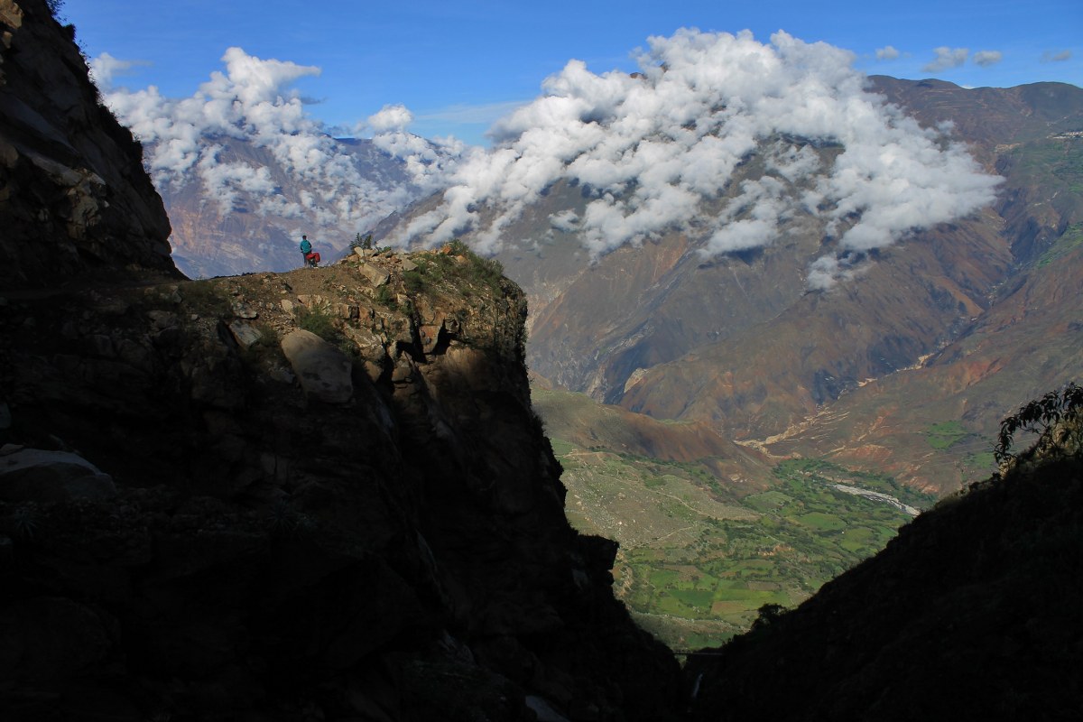
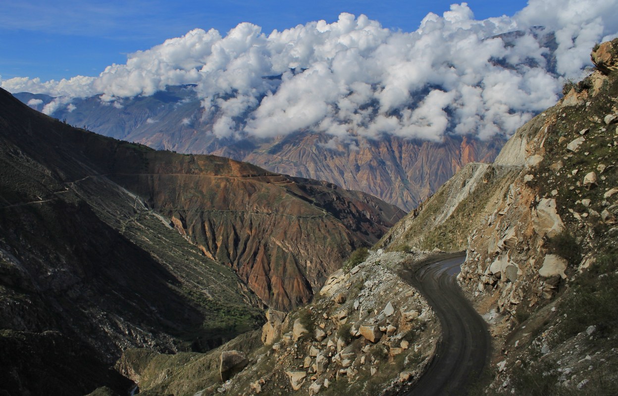
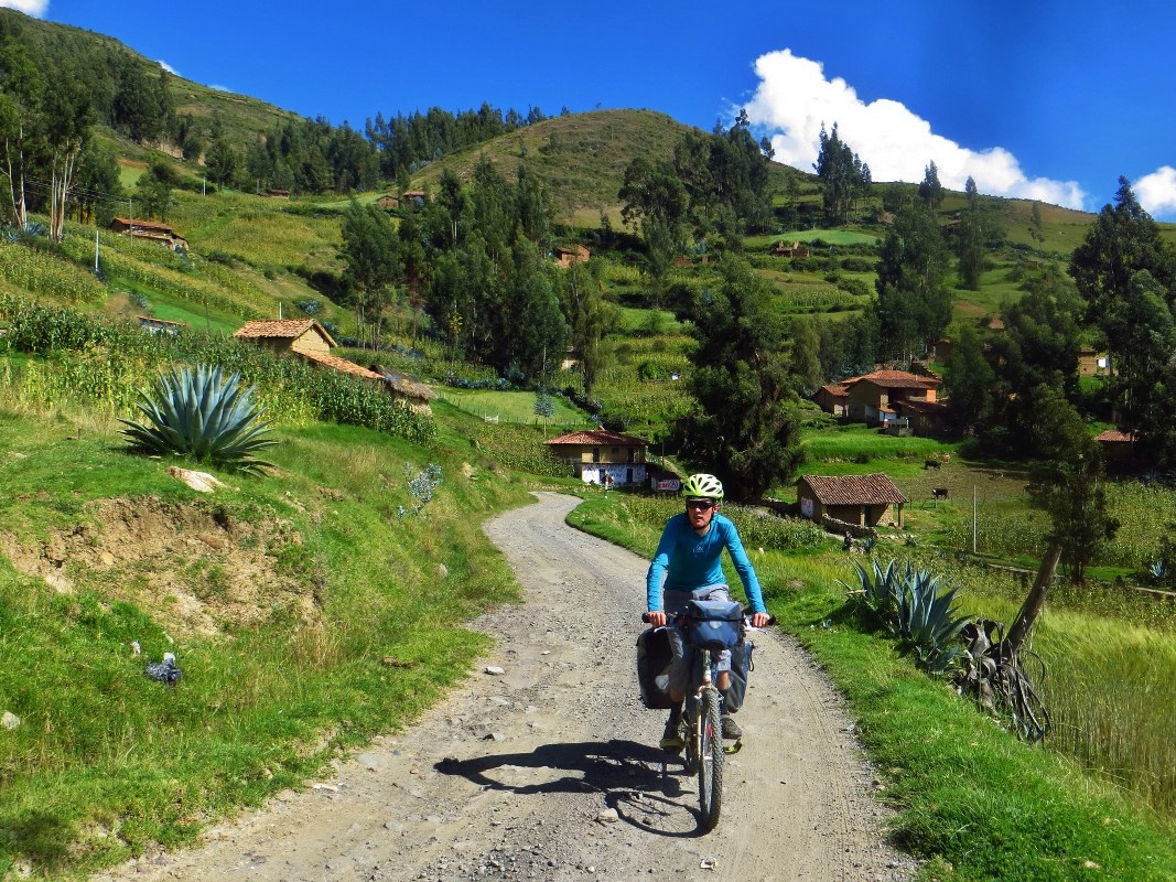
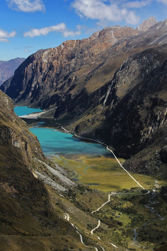
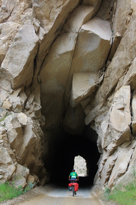
This route zigzags up to a pass surrounded by peaks and glaciers, then winds through traditional villages where time stands still, before crossing a second 4000m pass and plummeting down 3000m into the depths of the Rio Santa Valley. Complete the loop by climbing back up through the bottomless Cañón del Pato’s numerous tunnels to your start point in Yungay.
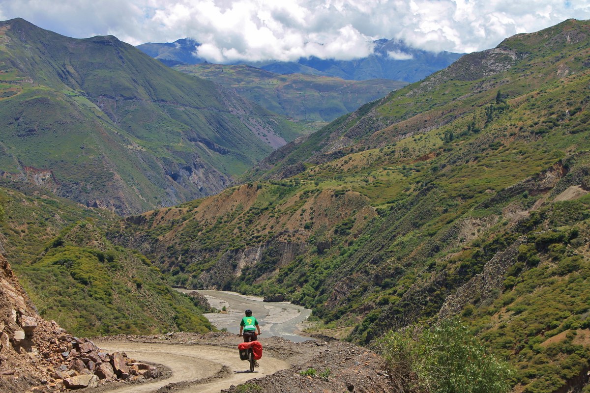
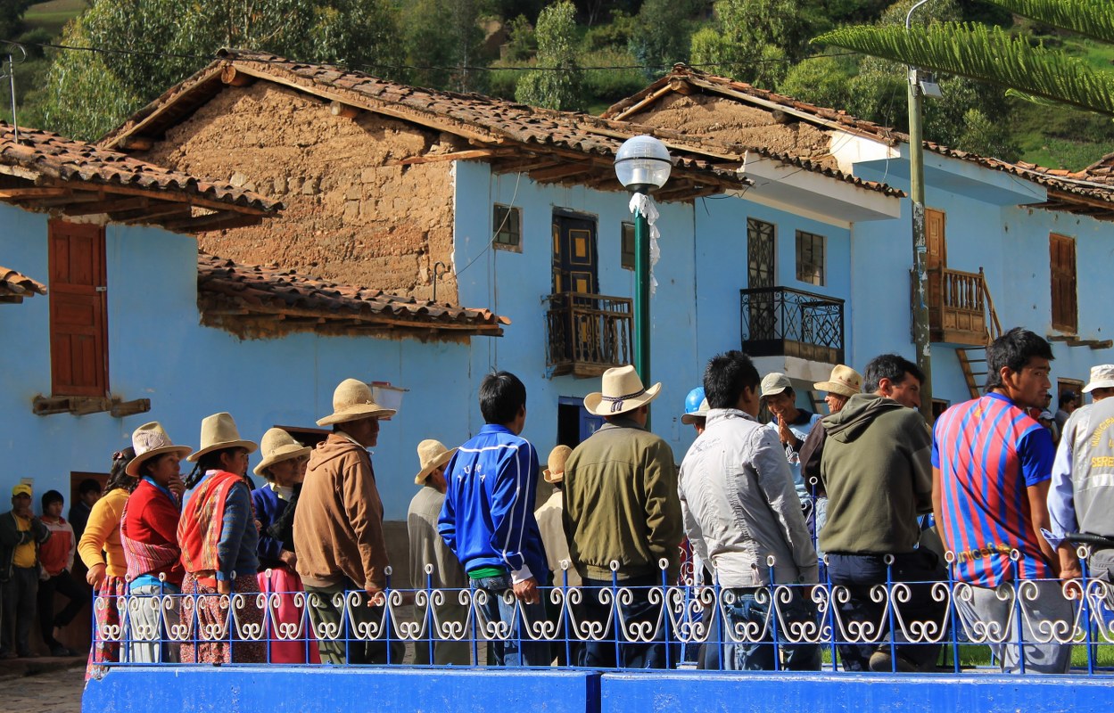
There is a huge variety of scenery: gnarled trunks of the polylepis forest and steep cultivated patchwork hillsides, roaring ice falls and glistening turquoise lakes, arid canyons and vertical granite cliffs. Local people are friendly, and by swotting up on your Spanish (or Quechua) beforehand there’ll be plenty of opportunities to interact.


Submit Route Alert
As the leading creator and publisher of bikepacking routes, BIKEPACKING.com endeavors to maintain, improve, and advocate for our growing network of bikepacking routes all over the world. As such, our editorial team, route creators, and Route Stewards serve as mediators for route improvements and opportunities for connectivity, conservation, and community growth around these routes. To facilitate these efforts, we rely on our Bikepacking Collective and the greater bikepacking community to call attention to critical issues and opportunities that are discovered while riding these routes. If you have a vital issue or opportunity regarding this route that pertains to one of the subjects below, please let us know:
Highlights
Must Know
Camping
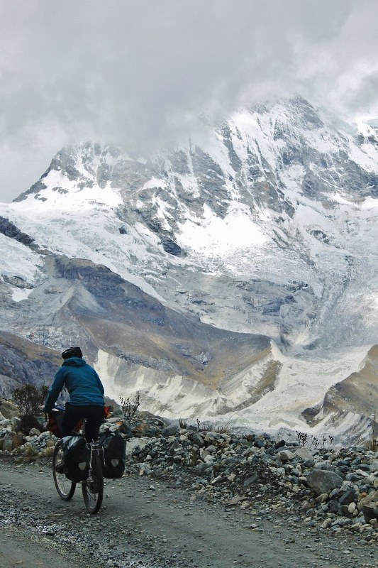
- Scenic highlights such as the lakes, peaks and glaciers on show near Portachuelo de Llanganuco.
- The huge freewheel down into the Rio Santa Valley.
- The unlikely road cut through the sheer Cañón del Pato.
- Lots of climbing on decent unpaved surfaces.
- The circuit will take acclimatized riders about a week – it begins and ends in Yungay, near Huaraz, which is an 8 hour bus ride north of Lima. The road over Portachuelo de Llanganuco passes through Parque Nacional Huascaran – you can buy a ticket as you enter. Bring good lights, as the tunnels in Cañón del Pato are unlit and on a section of road with some traffic.
- May to September, the dry season in the Peruvian mountains, is the best time to do the ride.
- Most nights it’s possible to stay in basic village accommodation.
- But unless you’re superhuman you’ll need to camp at least once.
- This isn’t really a hardship, unless you have an aversion to idyllic campsites in valleys towered over by giant peaks.


Terms of Use: As with each bikepacking route guide published on BIKEPACKING.com, should you choose to cycle this route, do so at your own risk. Prior to setting out check current local weather, conditions, and land/road closures. While riding, obey all public and private land use restrictions and rules, carry proper safety and navigational equipment, and of course, follow the #leavenotrace guidelines. The information found herein is simply a planning resource to be used as a point of inspiration in conjunction with your own due-diligence. In spite of the fact that this route, associated GPS track (GPX and maps), and all route guidelines were prepared under diligent research by the specified contributor and/or contributors, the accuracy of such and judgement of the author is not guaranteed. BIKEPACKING.com LLC, its partners, associates, and contributors are in no way liable for personal injury, damage to personal property, or any other such situation that might happen to individual riders cycling or following this route.
Please keep the conversation civil, constructive, and inclusive, or your comment will be removed.