


Peaks & Plateaus
Distance
169 Mi.
(272 KM)Days
3-4
% Unpaved
70%
% Singletrack
0%
% Rideable (time)
90%
Total Ascent
11,545'
(3,519 M)High Point
7,000'
(2,134 M)Difficulty (1-10)
6?
- 4Climbing Scale Fair68 FT/MI (13 M/KM)
- -Technical Difficulty
- -Physical Demand
- -Resupply & Logistics
Contributed By
Neil Beltchenko
Associate Editor & YouTube Host
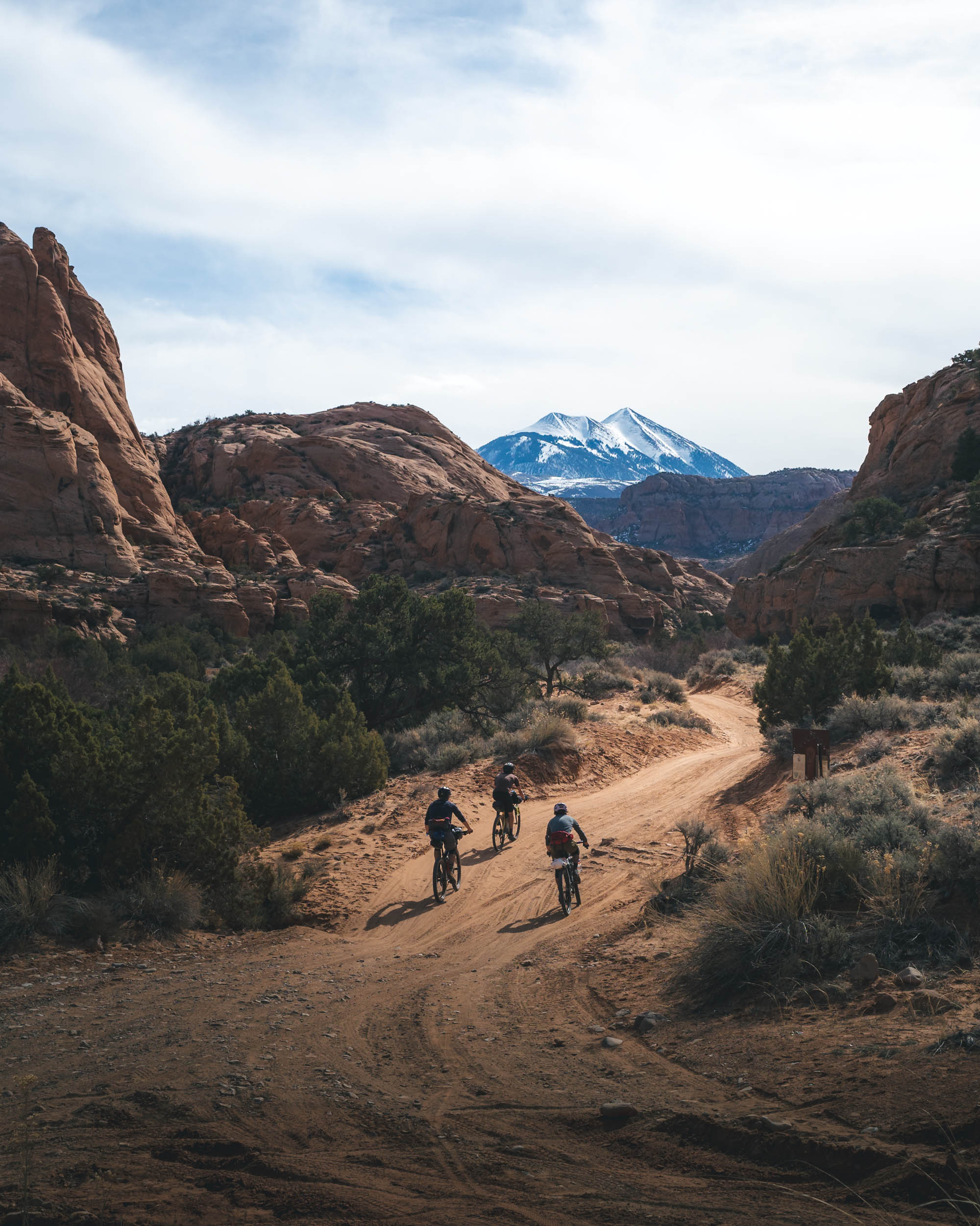
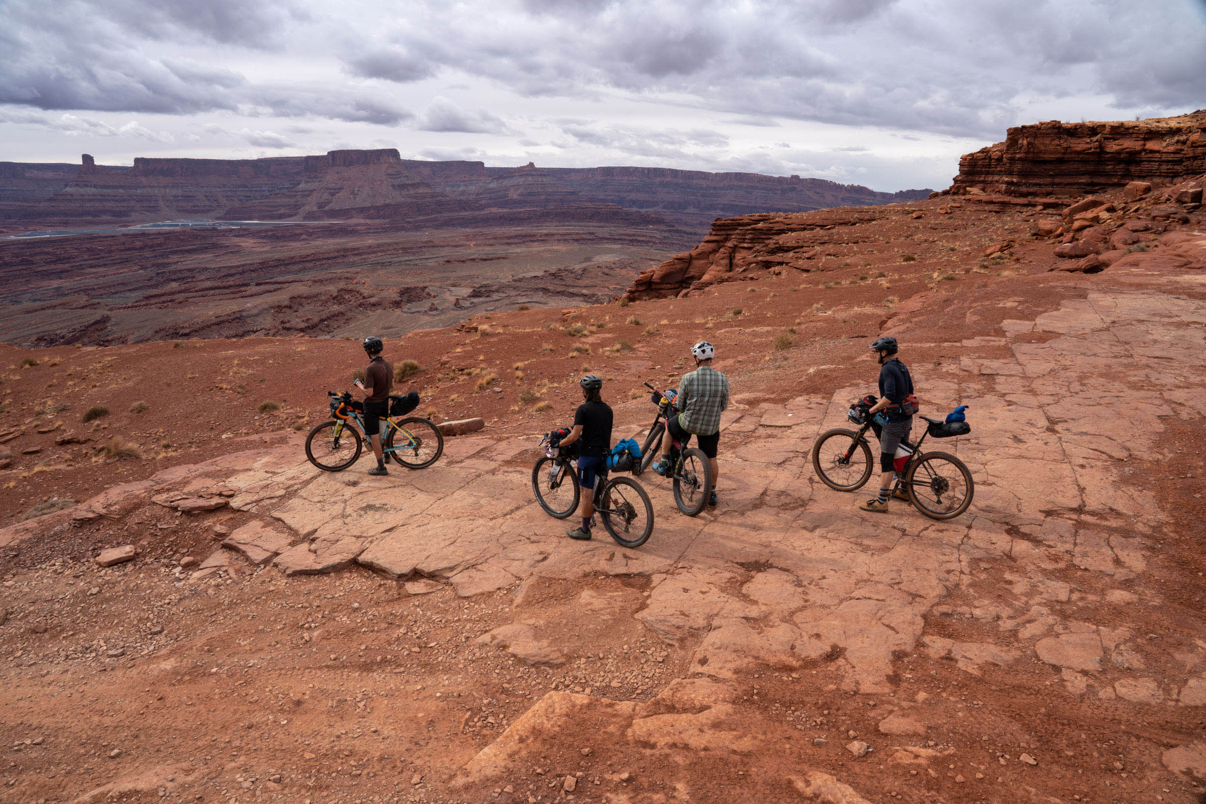
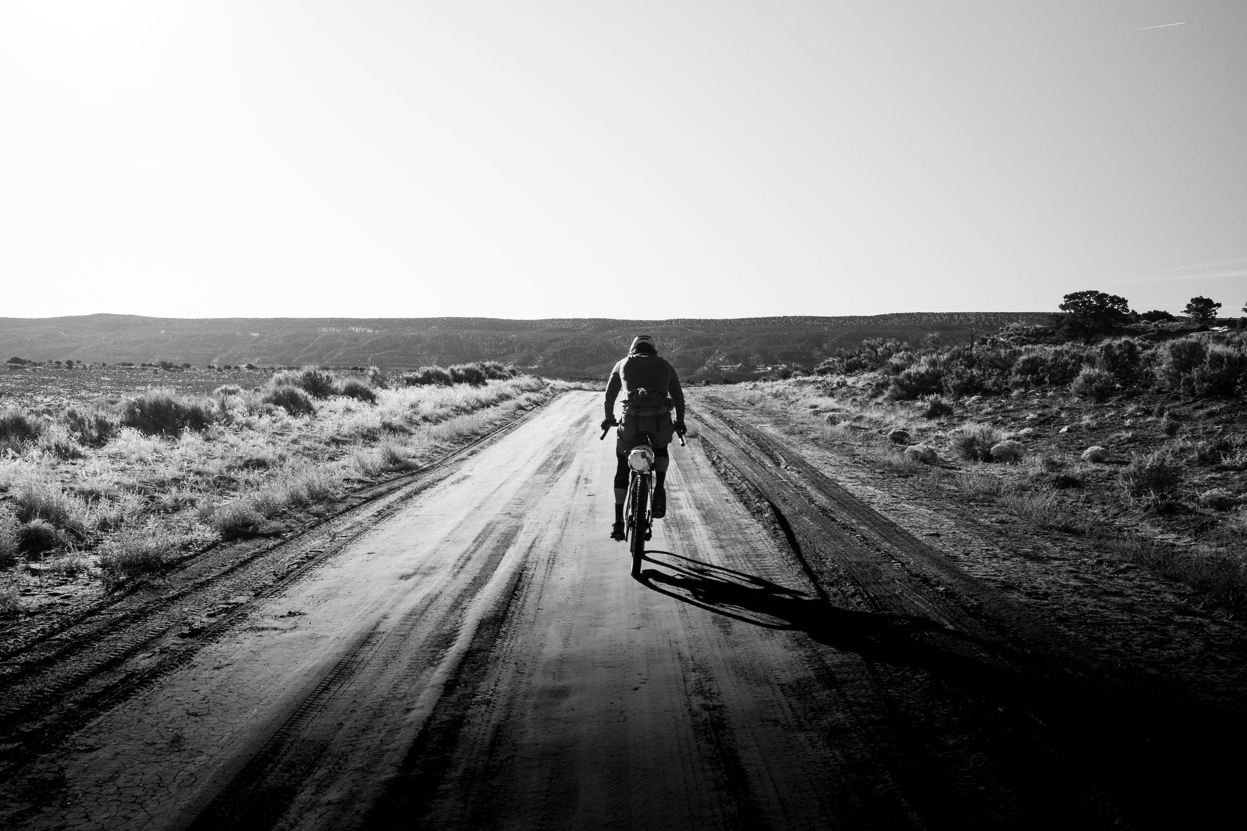
Like many cycling destinations, Moab’s draw is its robust trail networks, beautiful views, and great town atmosphere. And, because of its popularity, finding a good time to go to avoid crowds is always a hurdle, especially with the uptick in recreationists in recent years. But what the surrounding area may lack in trail networks and burger joints, it more than makes up for in its bikepacking possibilities. Peaks and Plateaus provides a sampler of the wonders to be found a little further off the beaten path, hitting Moab for a resupply stop in the process.
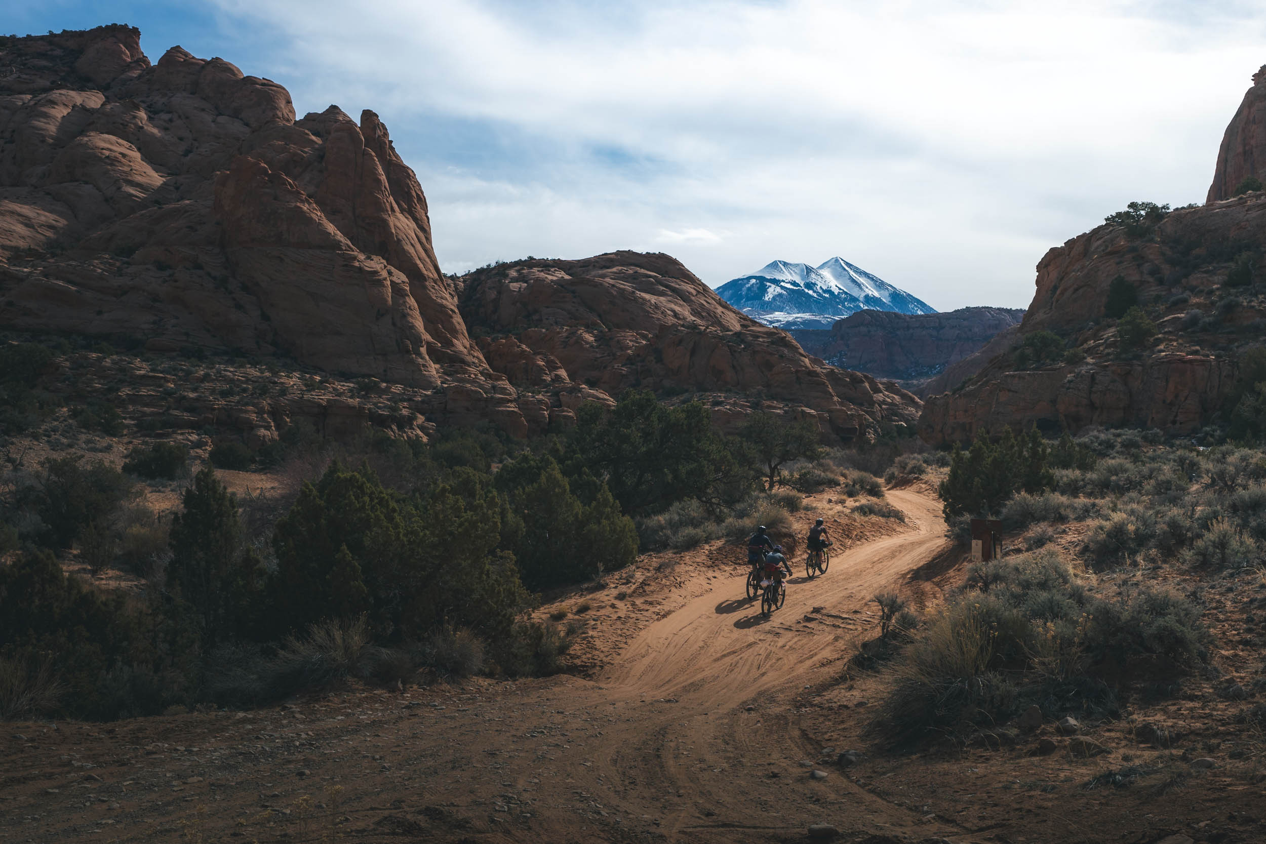
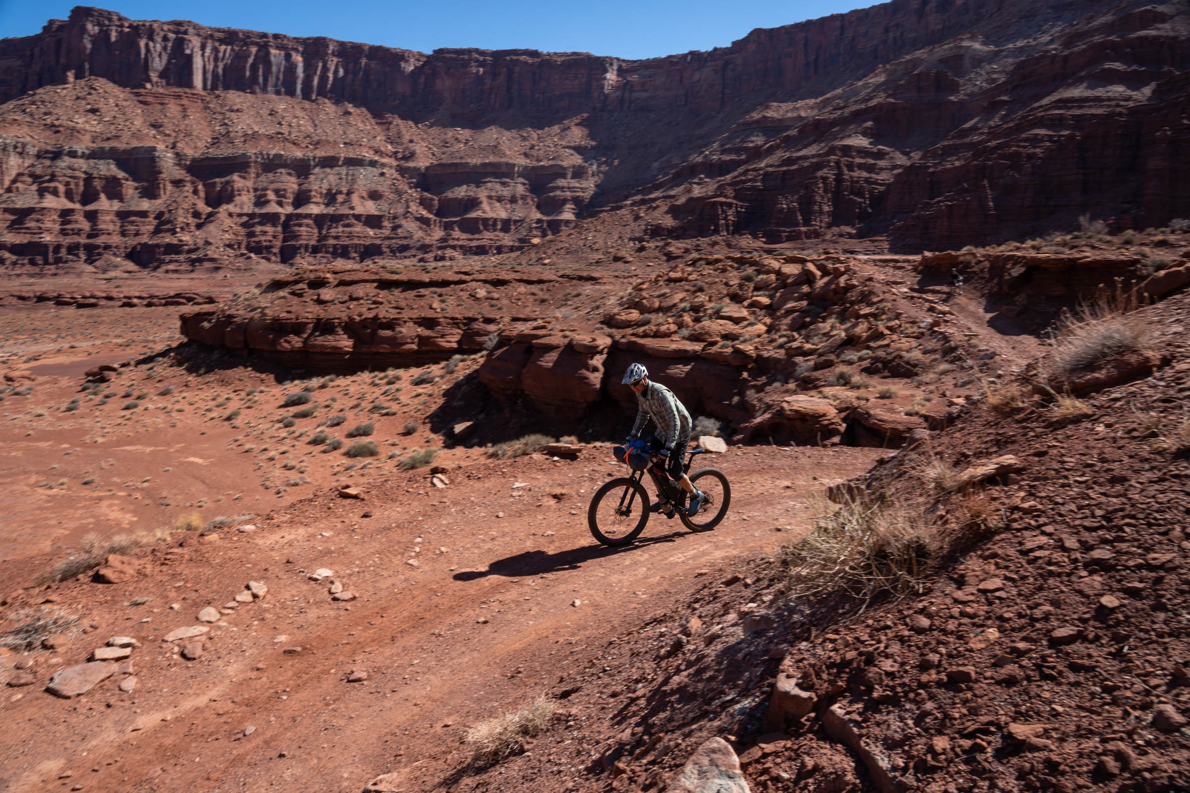
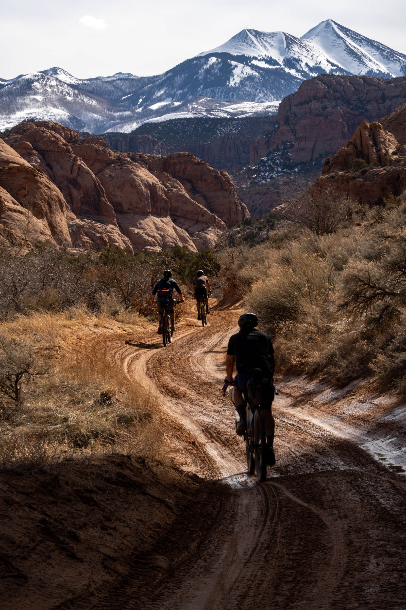
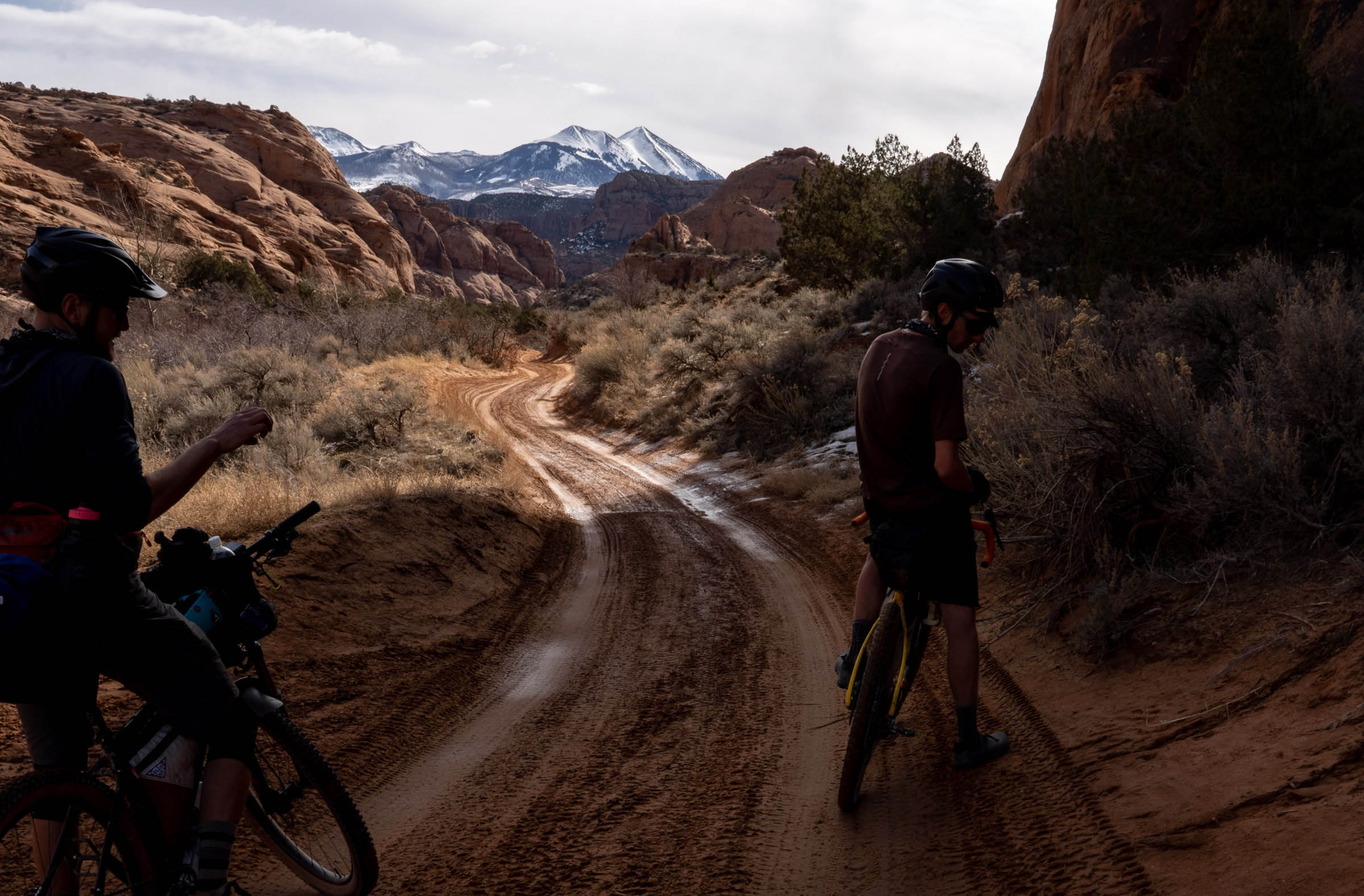
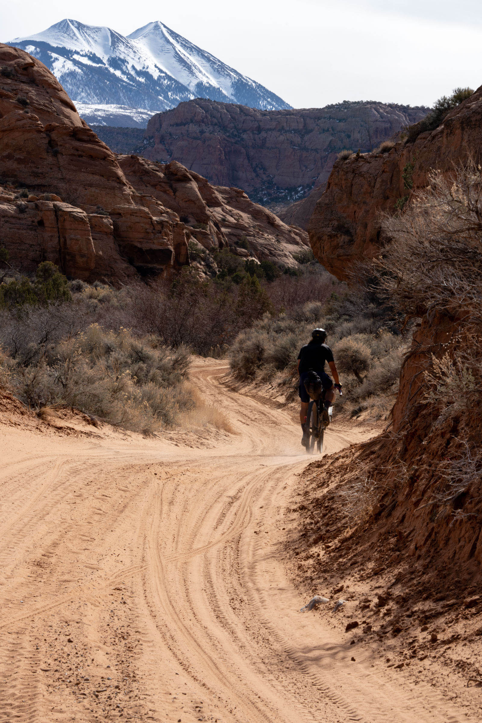
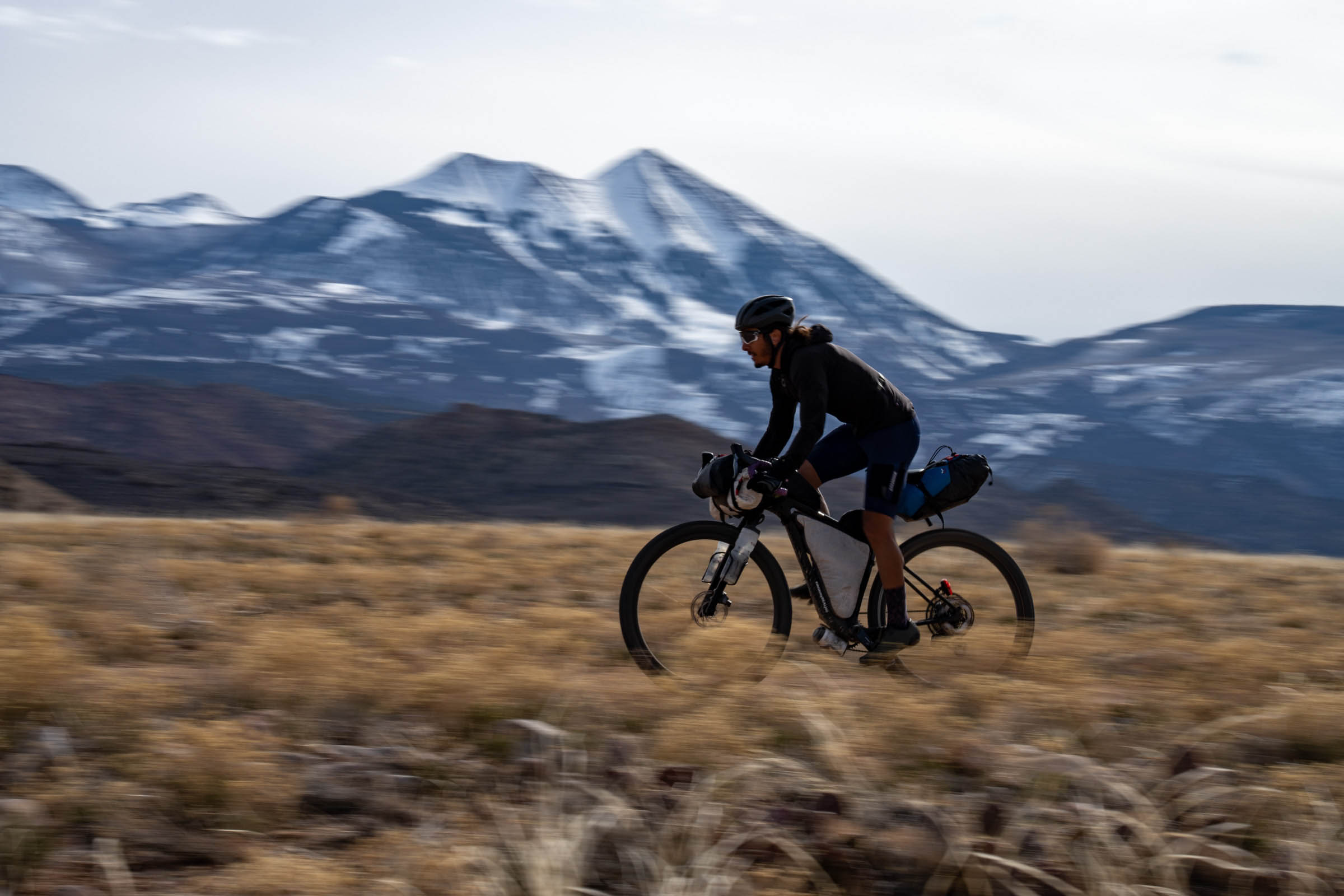
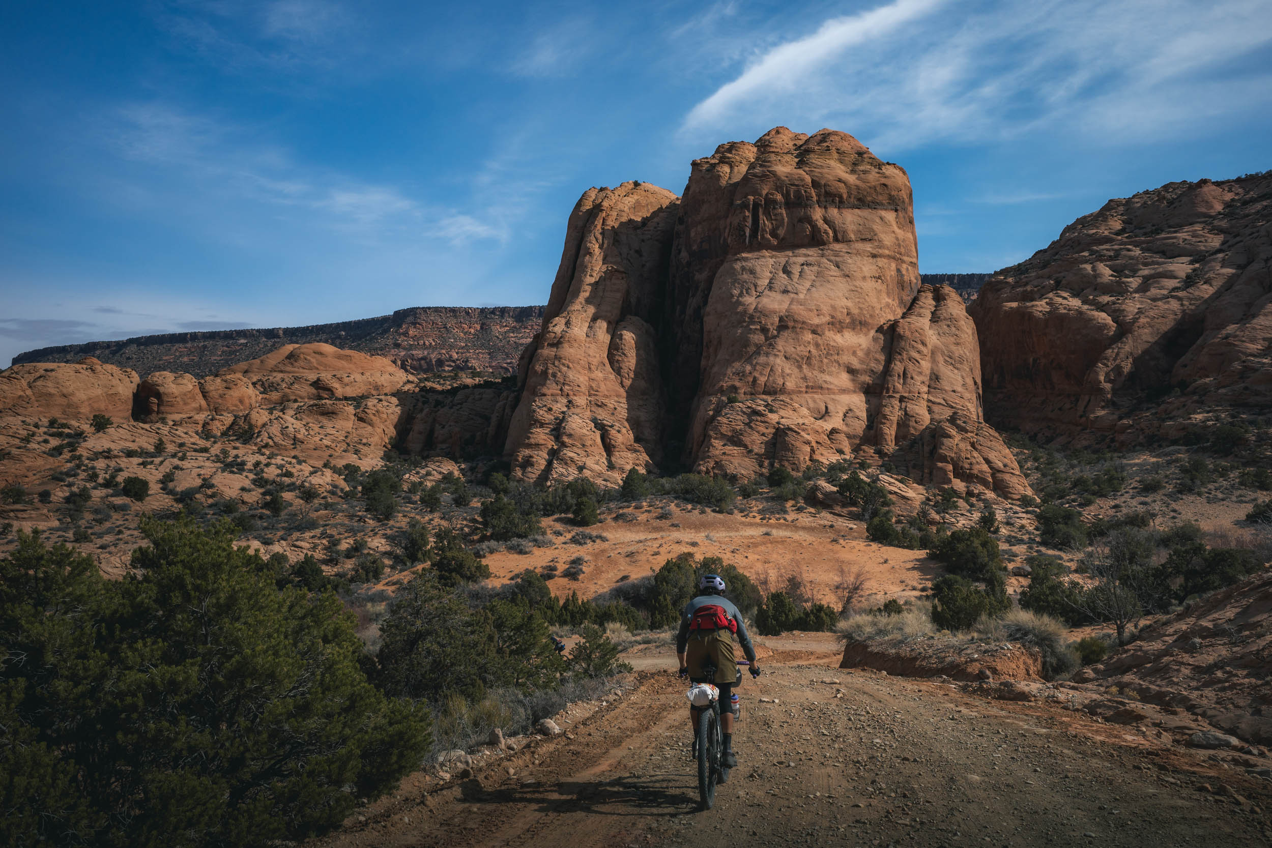
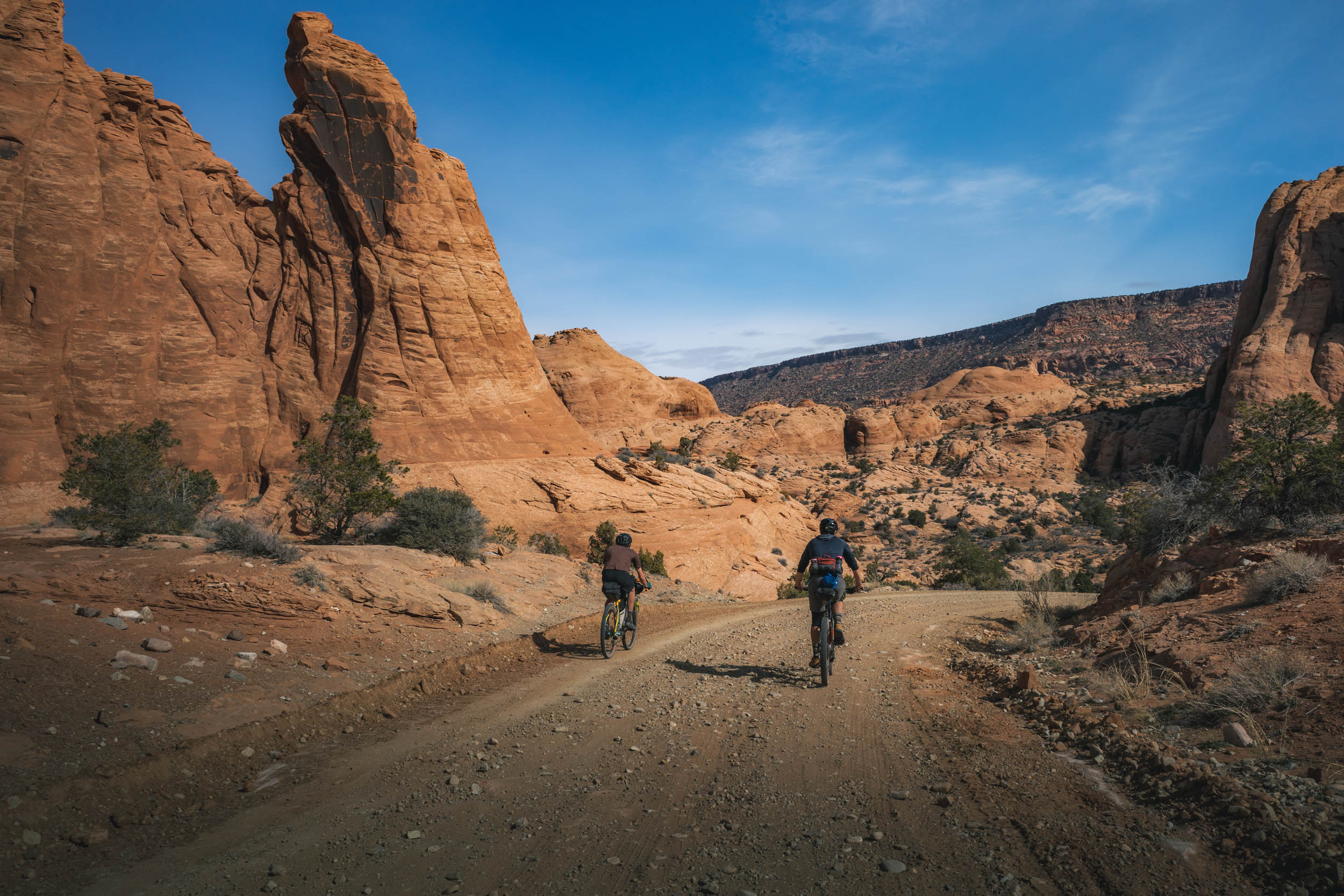
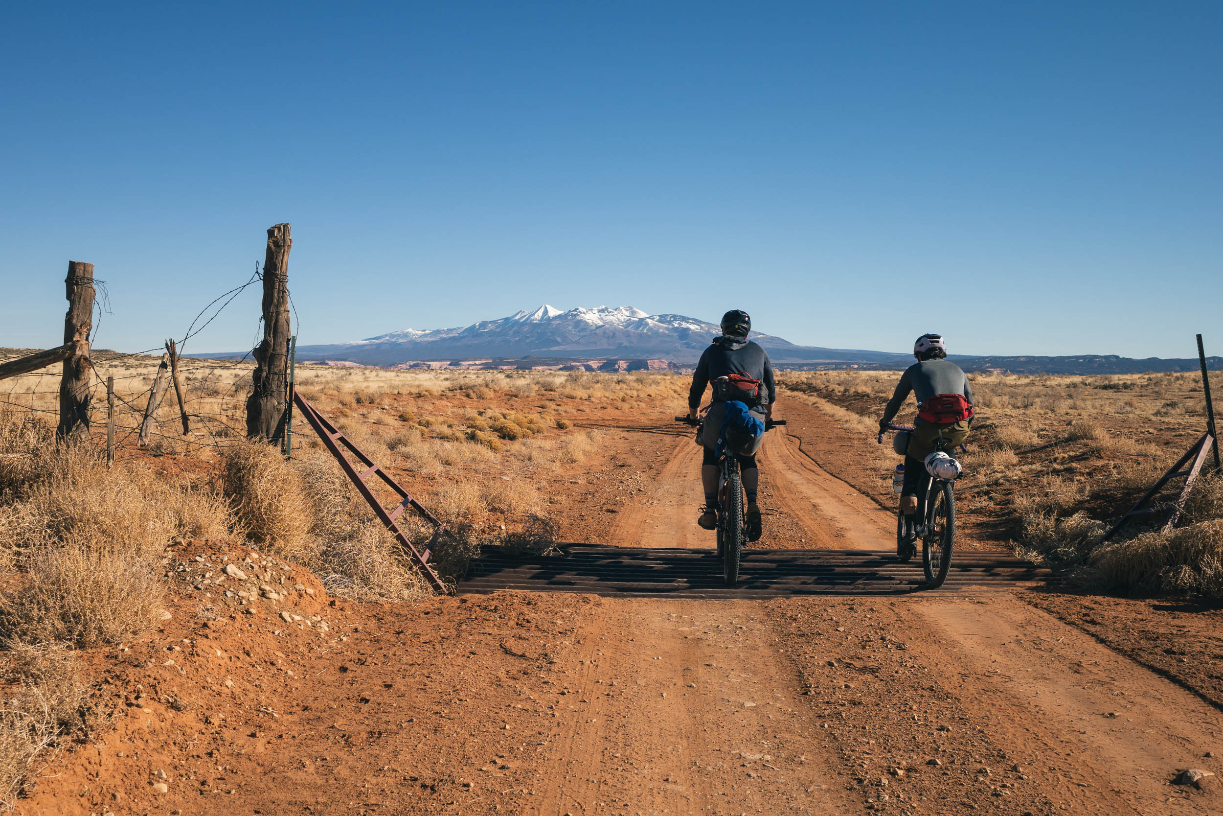
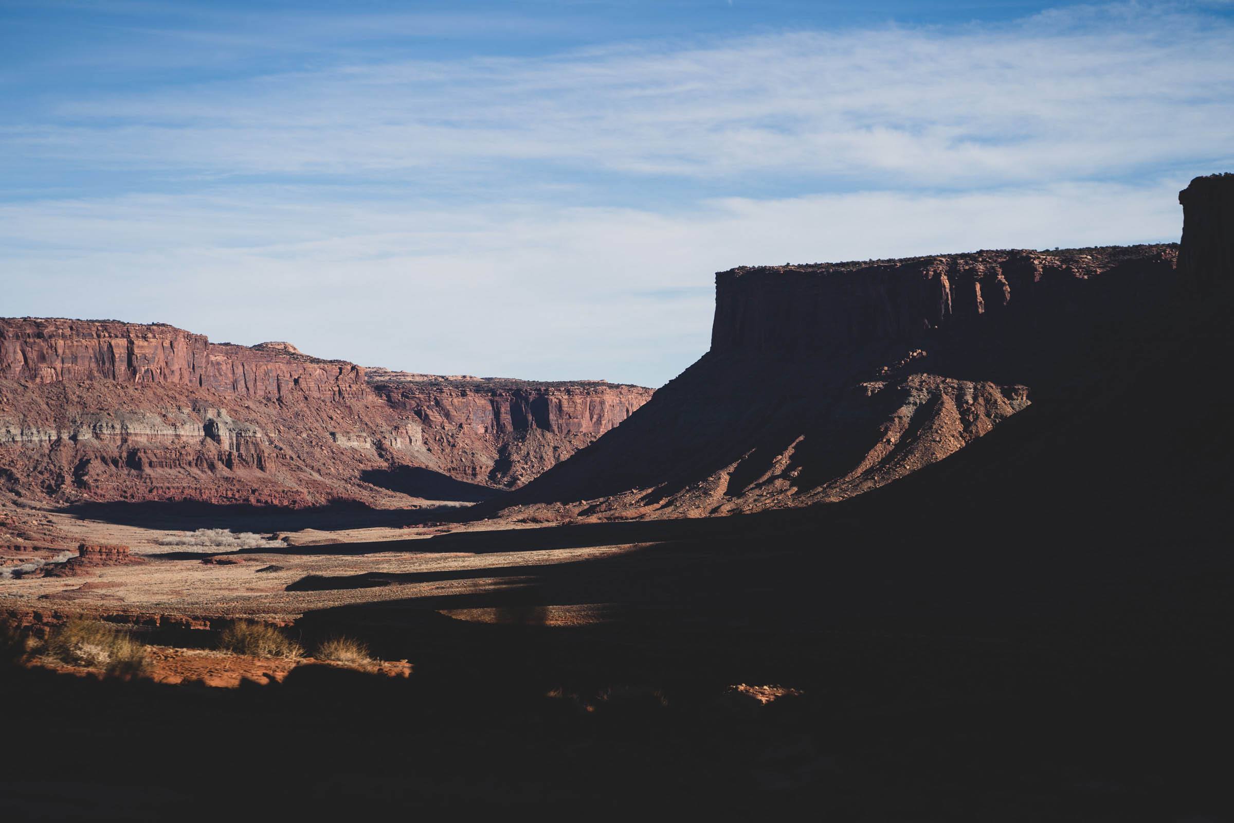
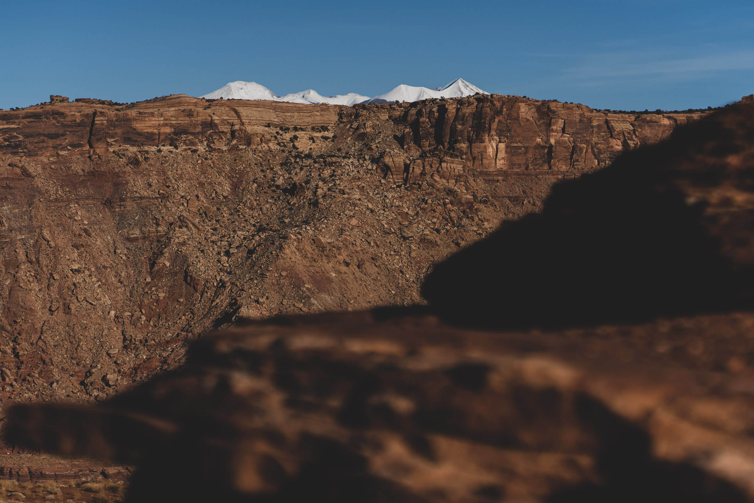
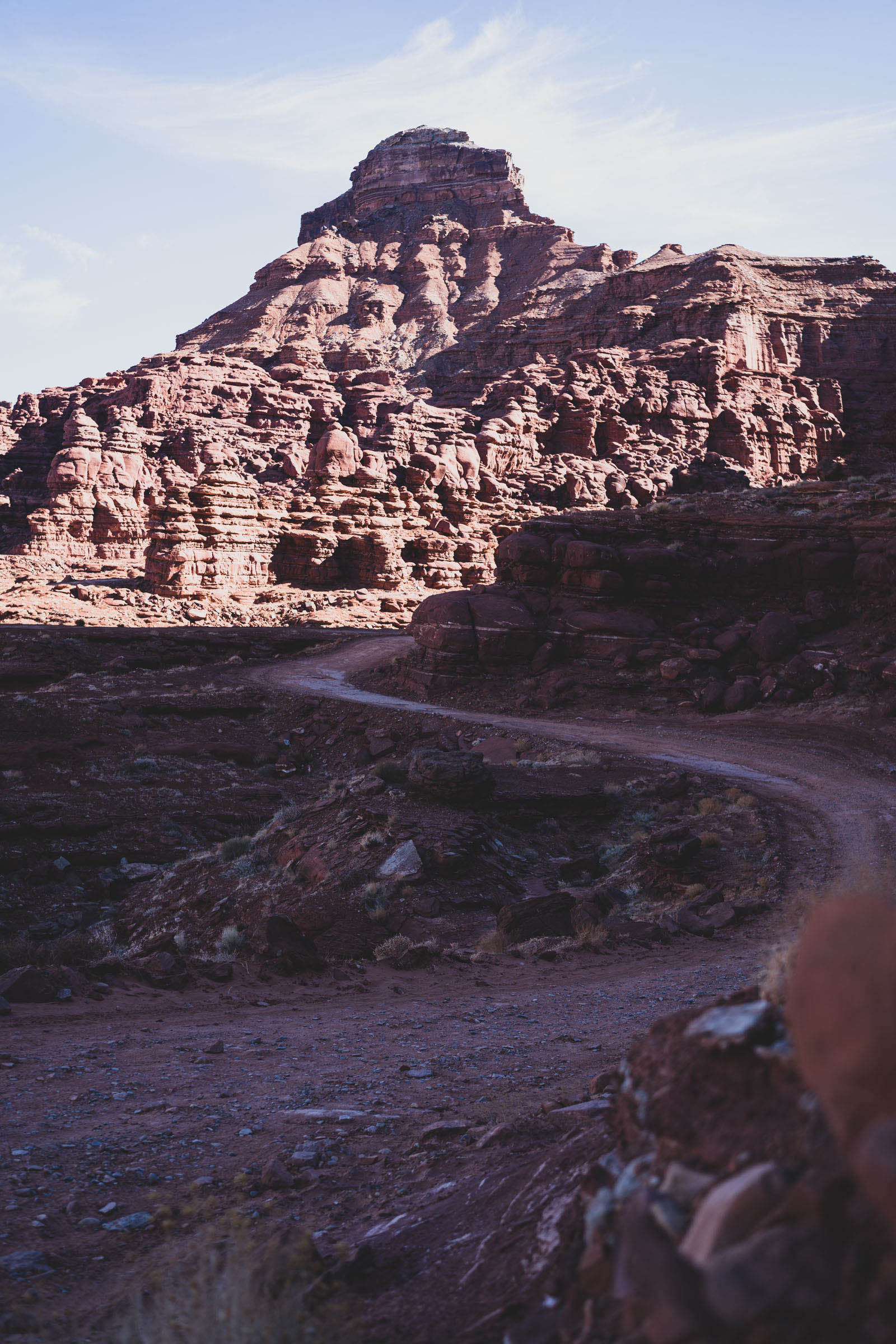
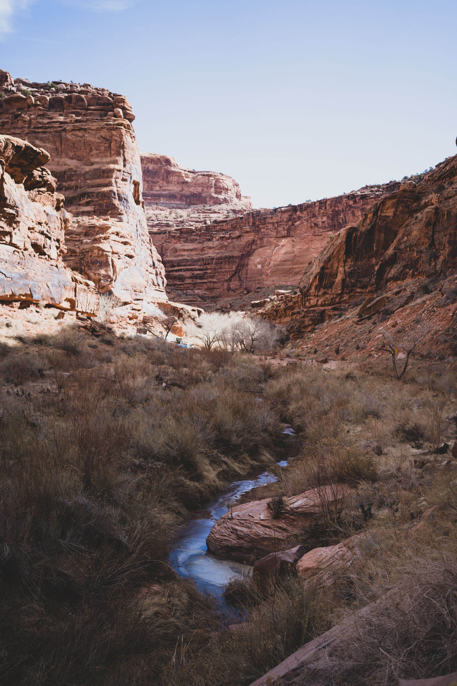
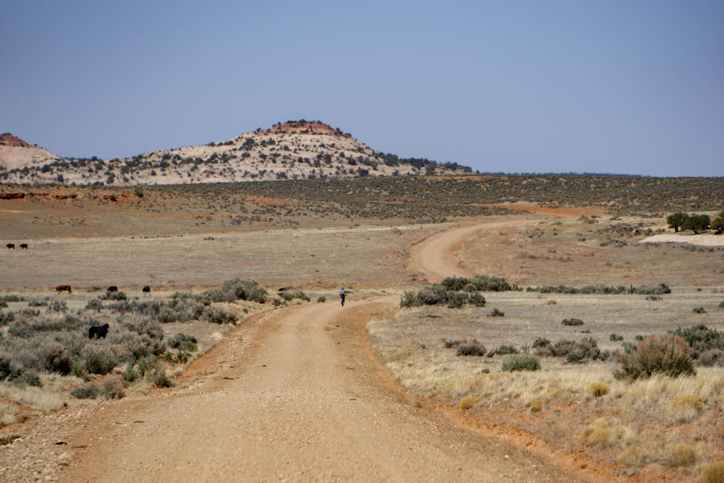
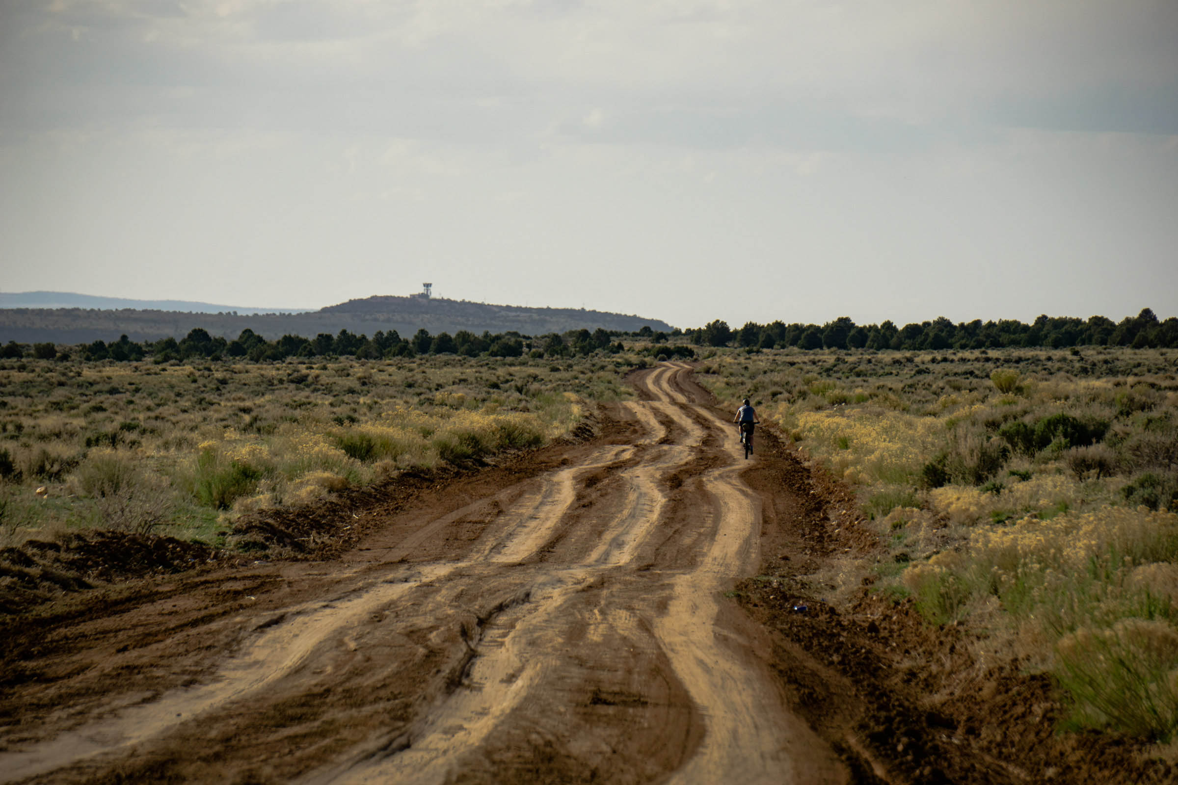
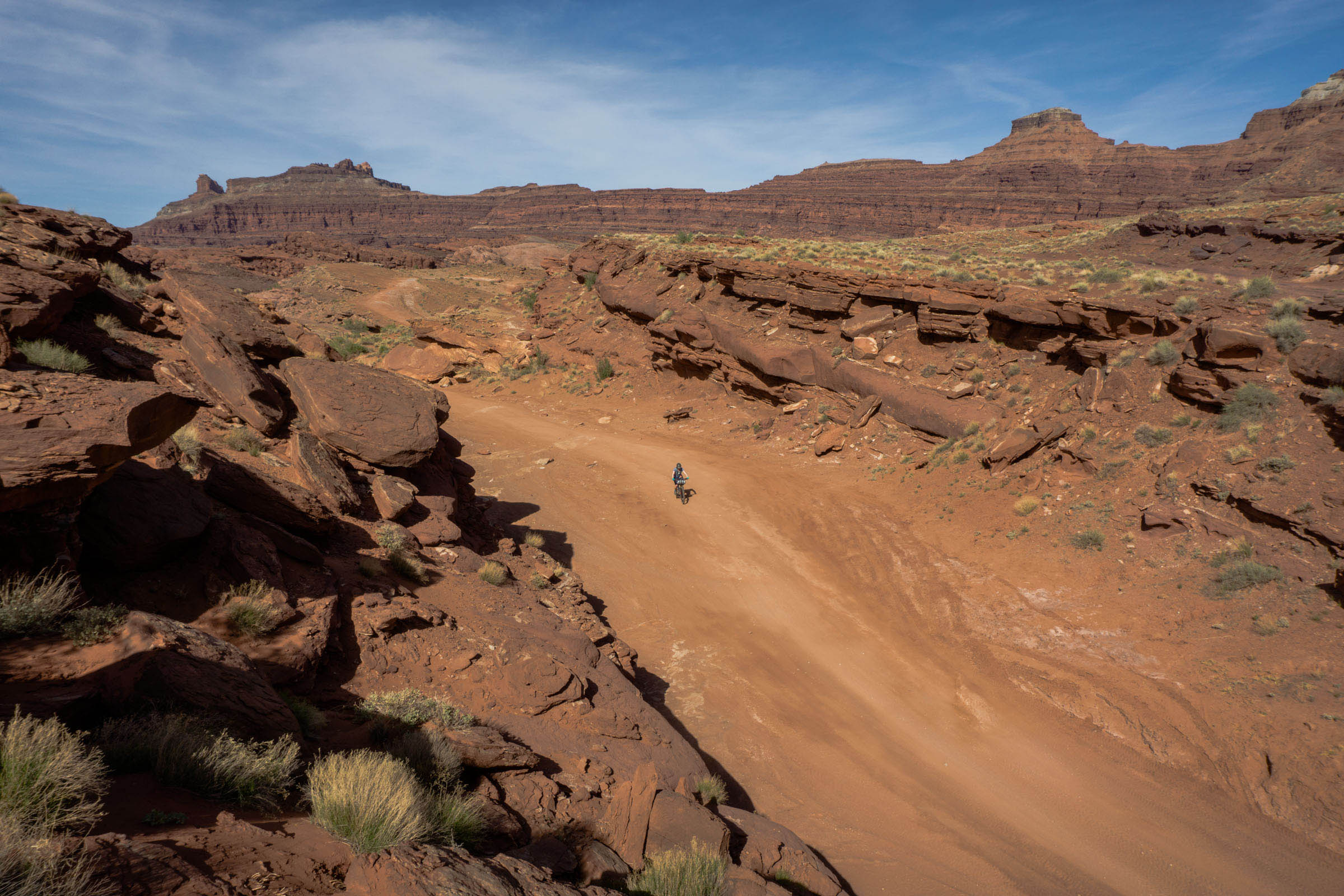
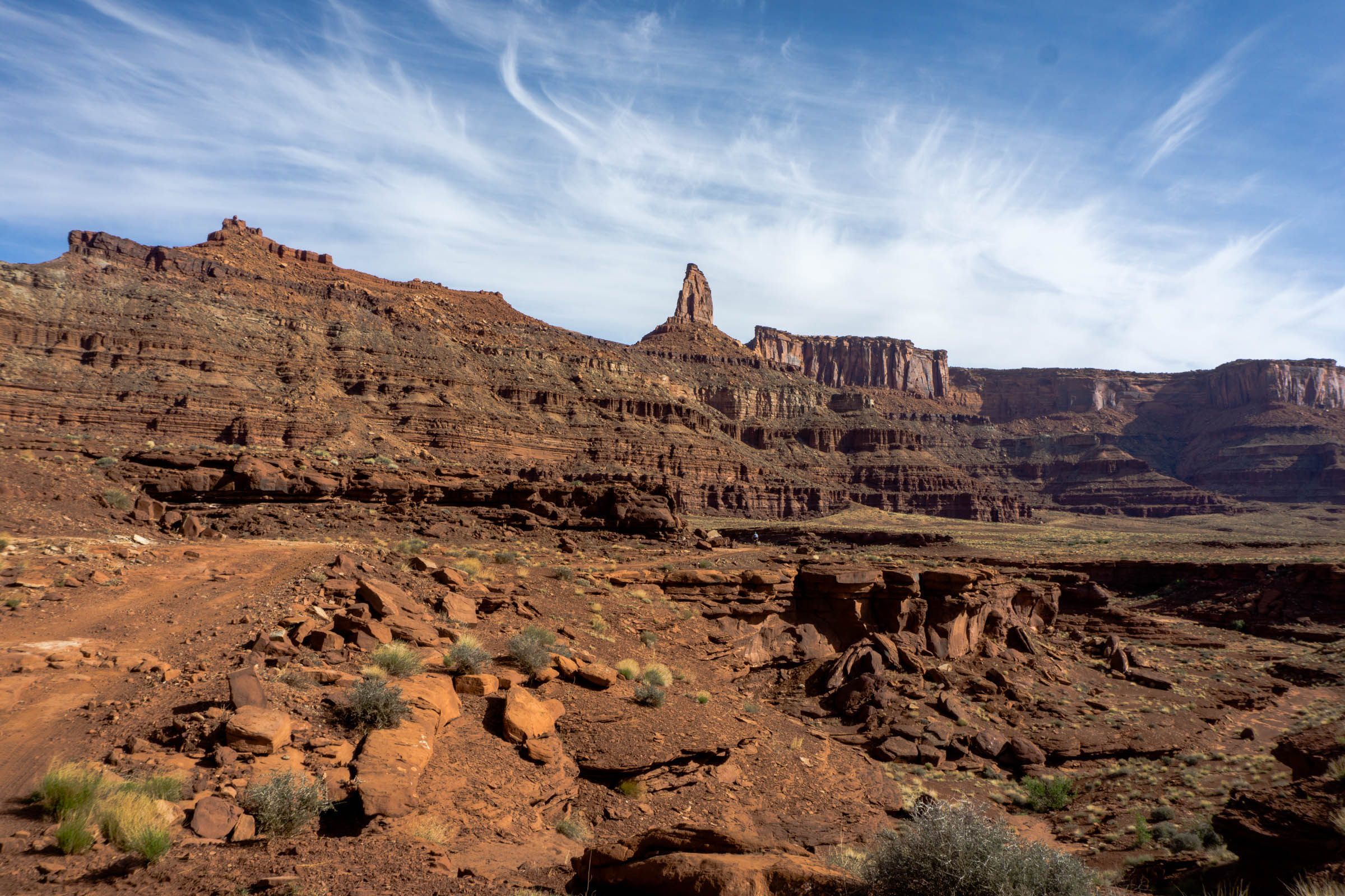
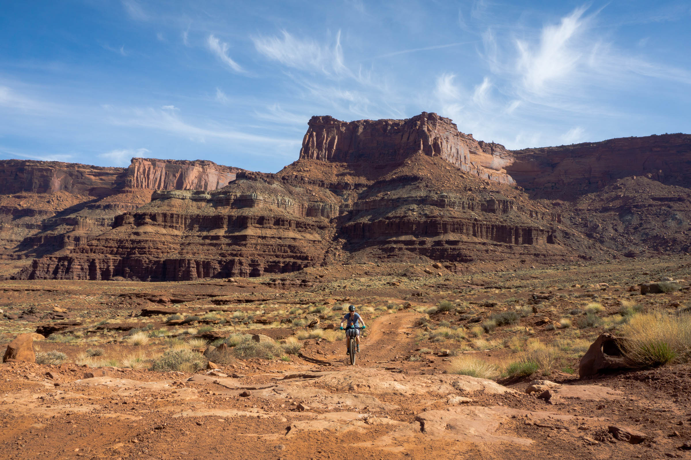
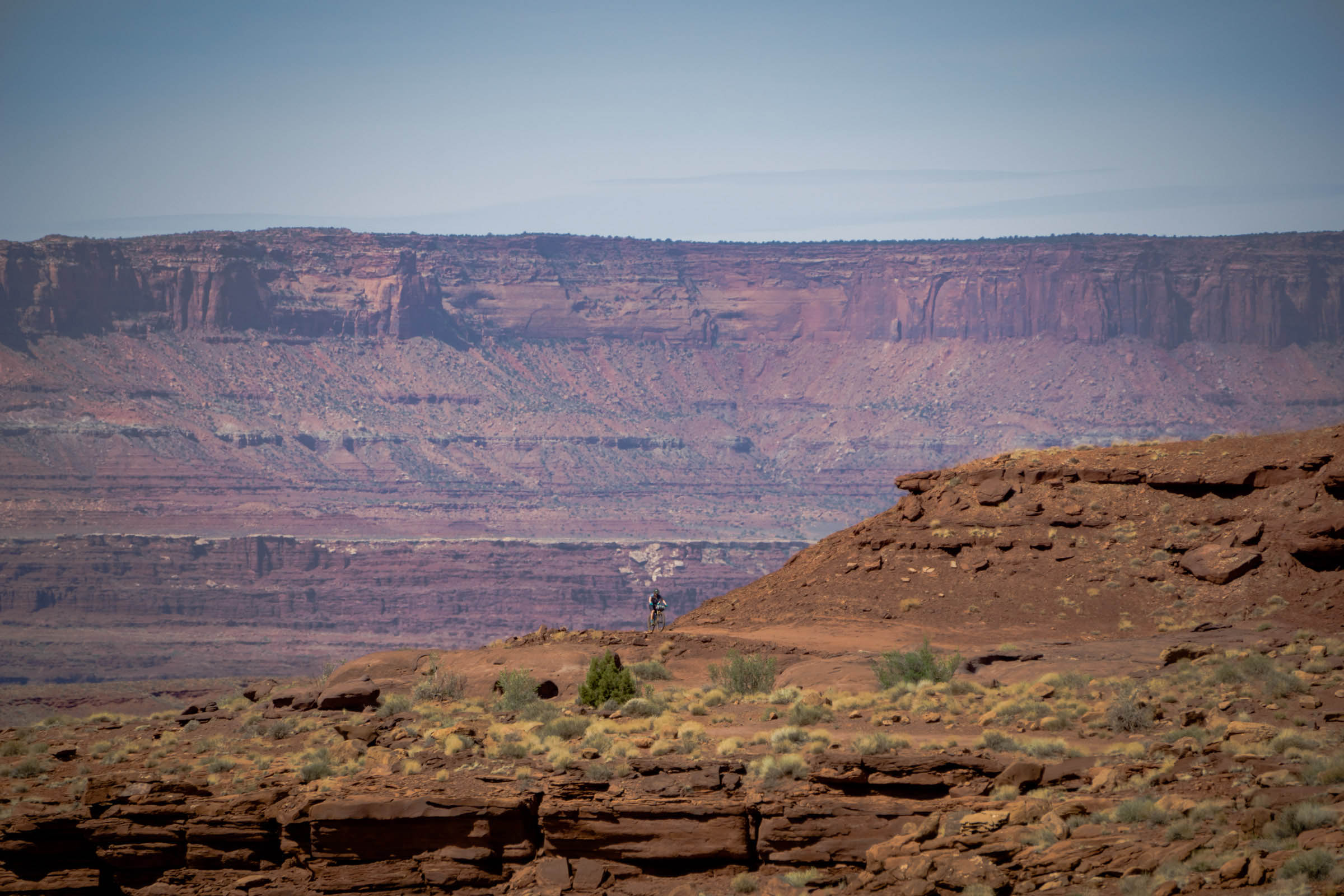
The route varies in elevation from around 7,000 feet down to just under 4,000 feet, providing an exceptionally diverse array of changing landscapes and experiences along the way. The higher elevations are filled with big views of snow-capped mountain ranges, juniper trees, and sage-lined roads. As you travel to the lower elevations, you’ll start to notice more sandstone walls, cacti and succulents, sand, and tiny little reptiles soaking in the sun. It’s not uncommon to experience 15-20 degree temperature swings between elevations. Much of this land is within Bears Ears National Monument, a spectacular 1,351,849 acre piece of land in southwest Utah that is co-managed by the US Forest Service and Bureau of Land Management.
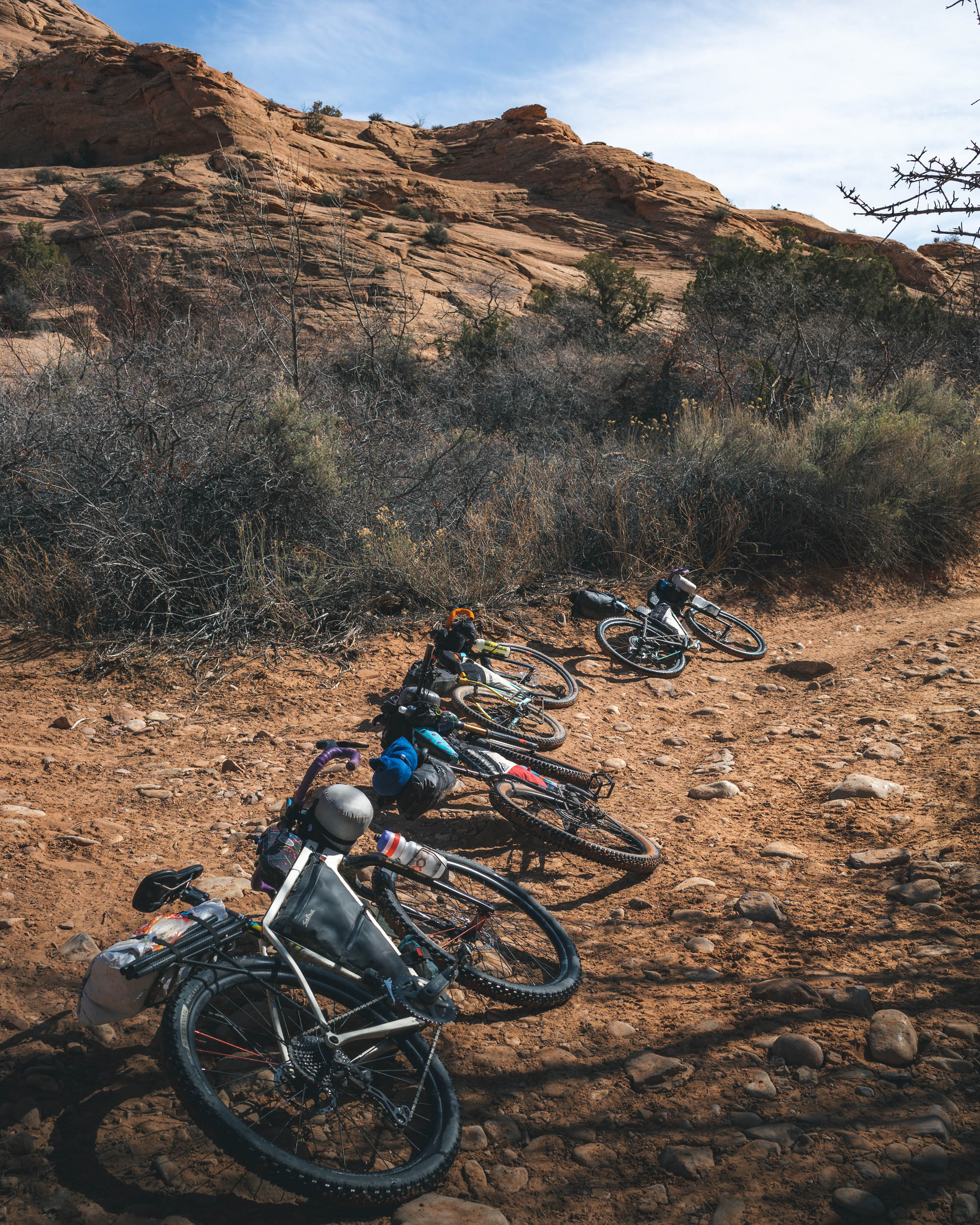
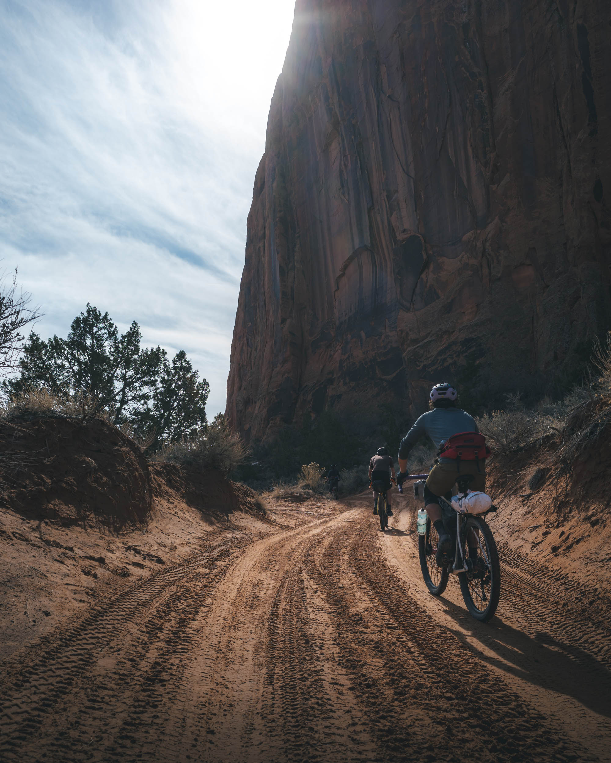
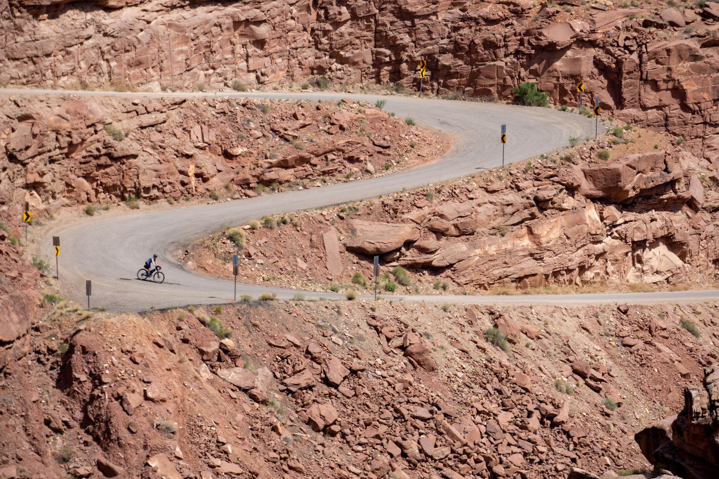
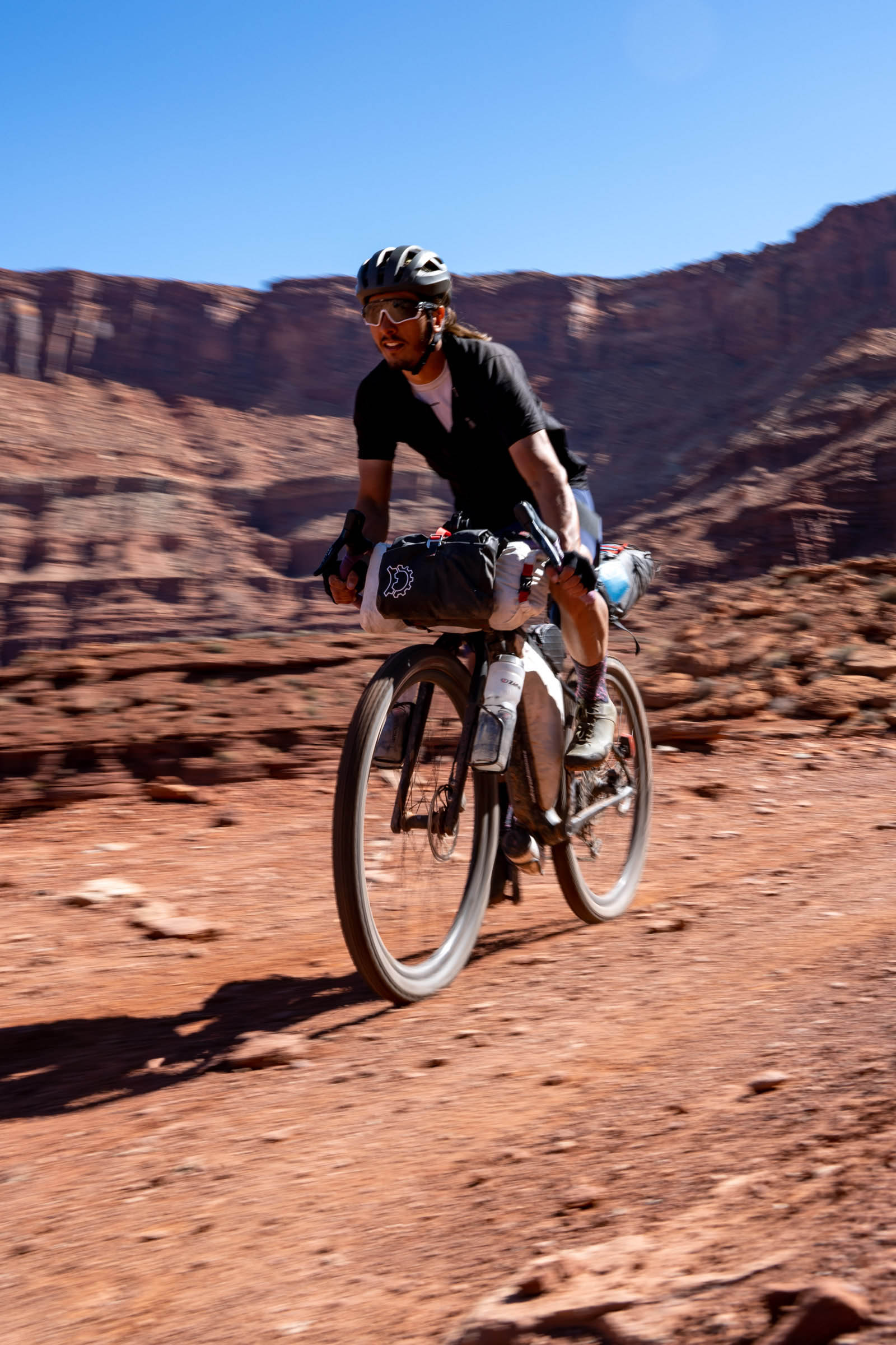
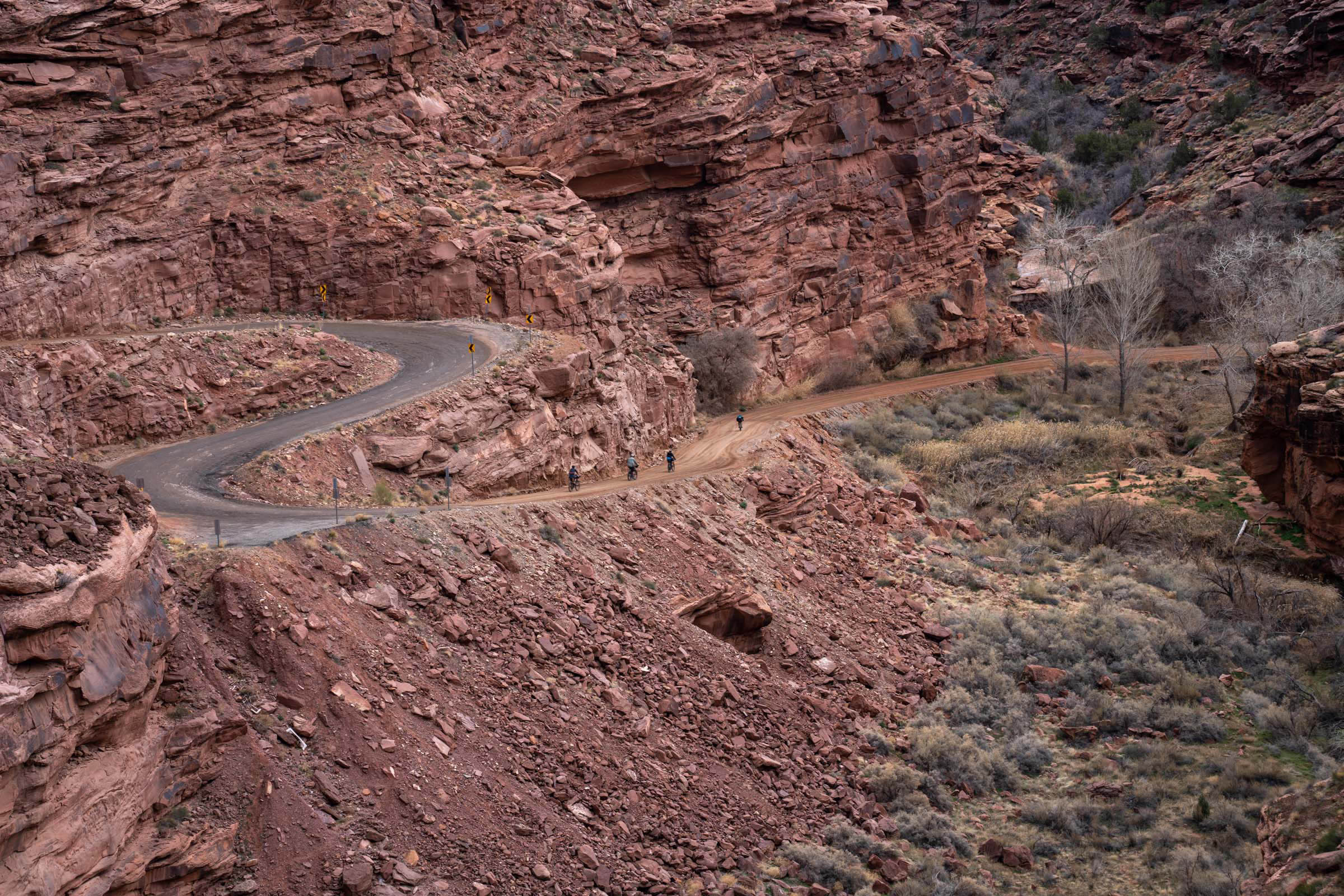
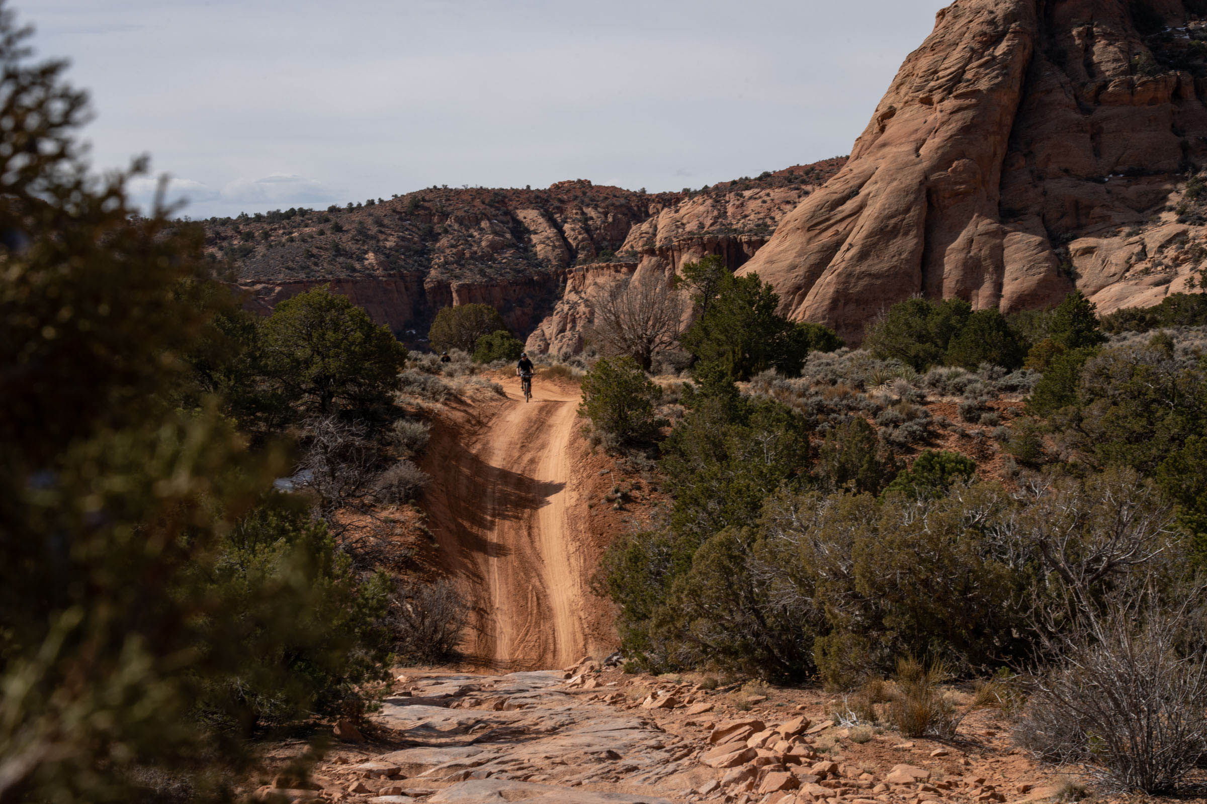
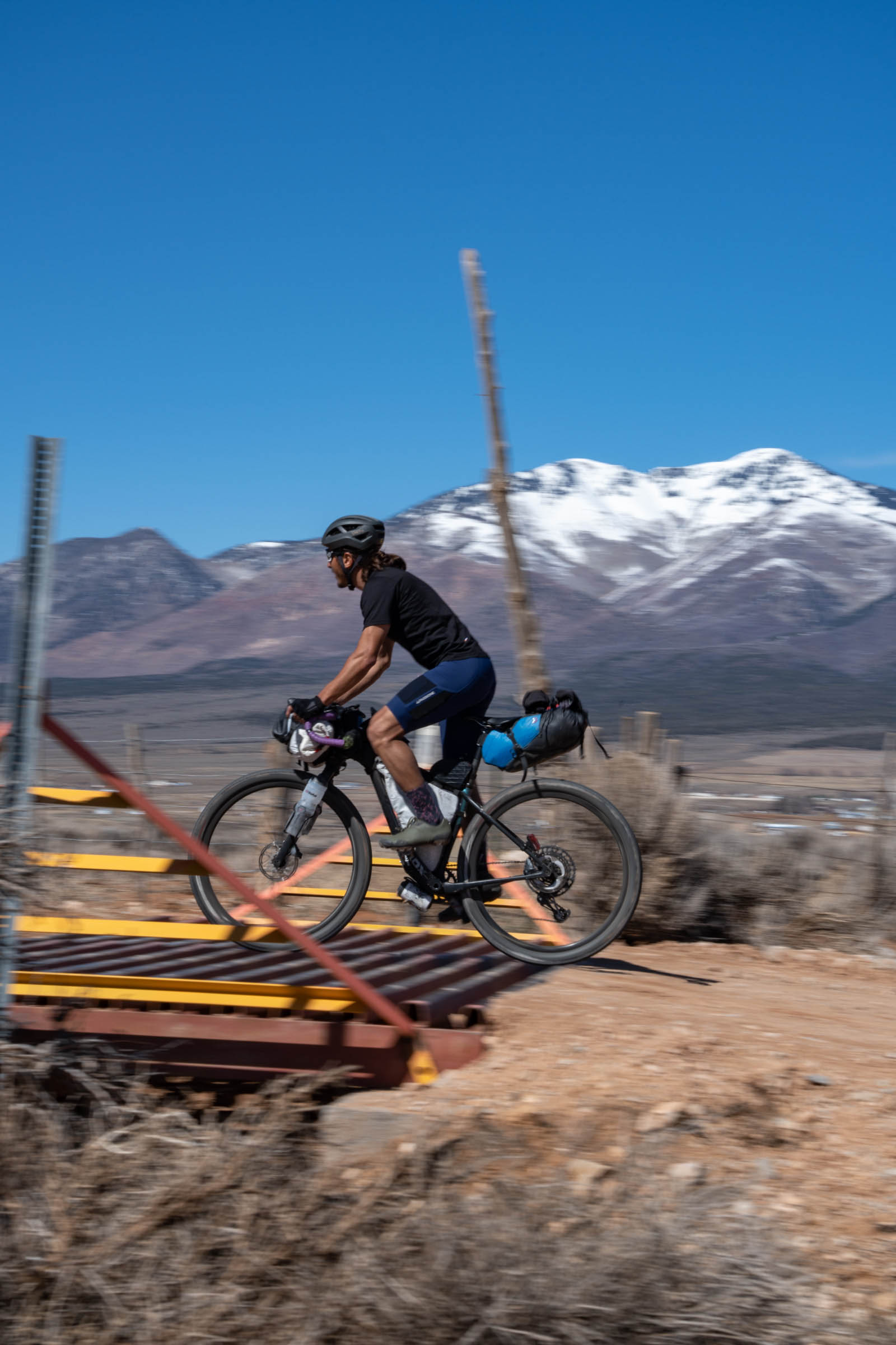
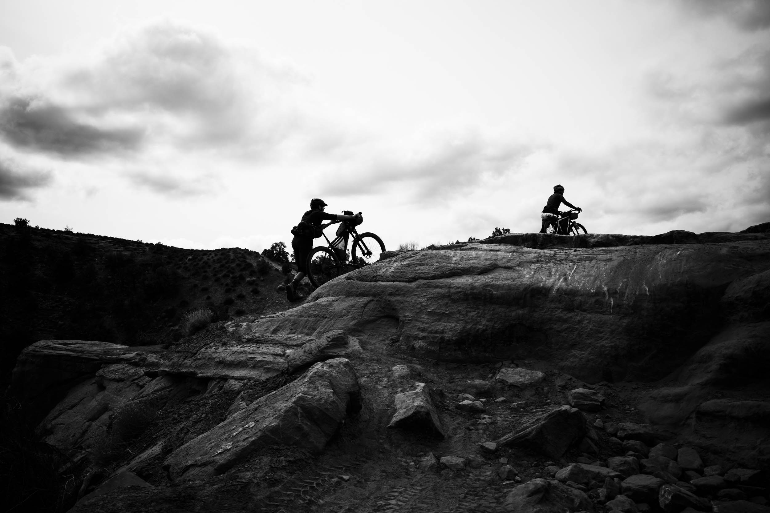
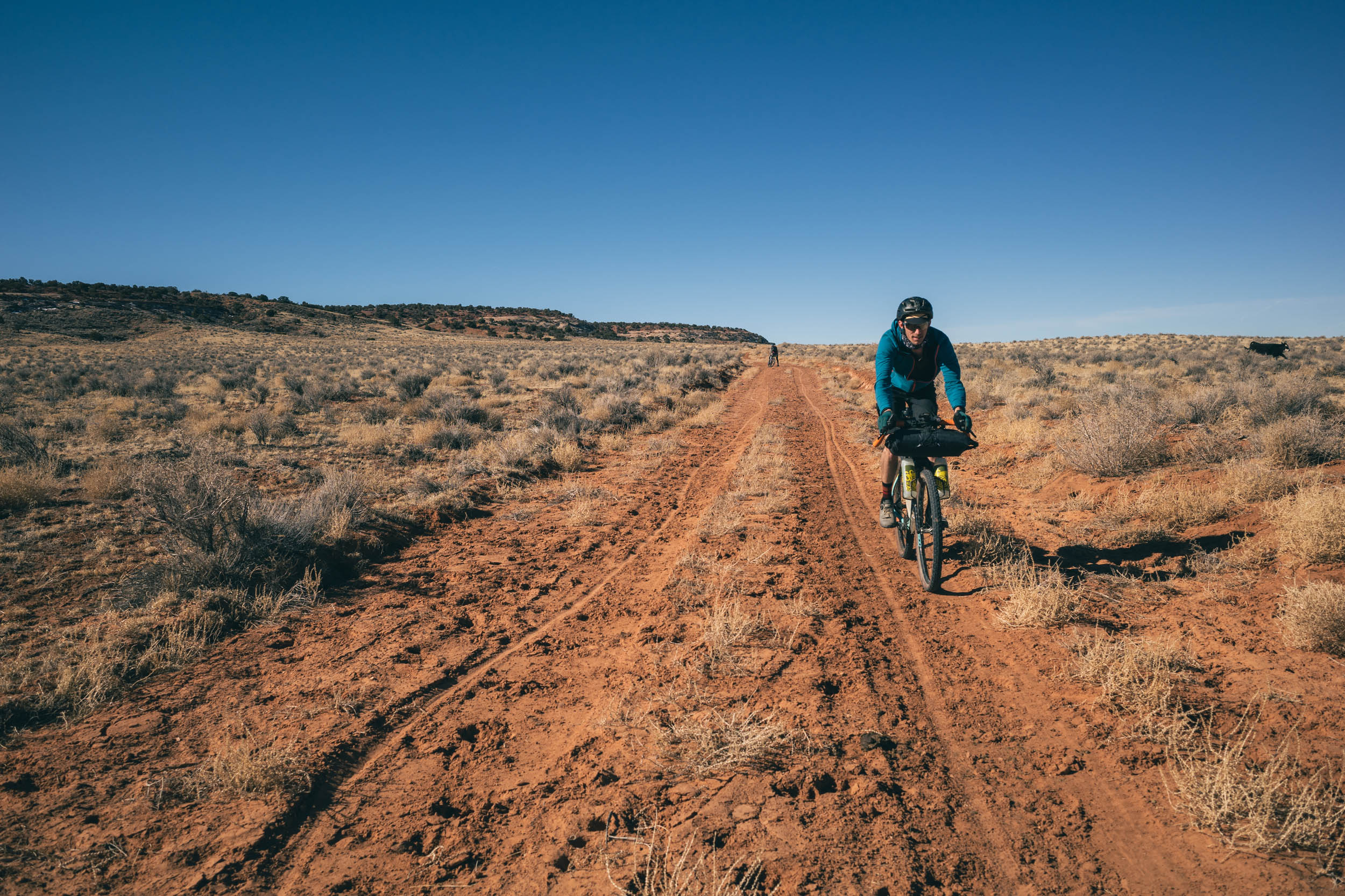
As you travel along the route, you’ll encounter an incredible variety of roads, from well-maintained paved roads to forgotten paved stretches and from well-graded gravel roads to abandoned two-track. Much of the route consists of extremely rough and rocky jeep roads, where you can experience loose baby head rocks, ledges, slick rock, and plenty of sand. You will most certainly find yourself hiking next to your bike because of some combination of these.
This route can be completed on a drop-bar mountain bike, and it could also be quite fun to roll a short-travel full-suspension mountain bike. Ultimately, a hardtail with a suspension fork is likely the most efficient bike for it. Regardless of what you ride, be sure to pair it with some decent storage for water as there are some very long stretches without water resupply.
While this route could easily be ridden in either direction, riding the higher elevations on warmer days and warmer elevations on the cooler days will make for a more enjoyable experience. Weather on the Colorado Plateau is volatile—one day could be sunny and in the 70s, the next cloudy, windy, and in the 40s. Because of this, there’s no real answer as to what you can expect, but generally speaking, summers are too warm for this route and winters too cold. April and May or September and October are the safest bets.
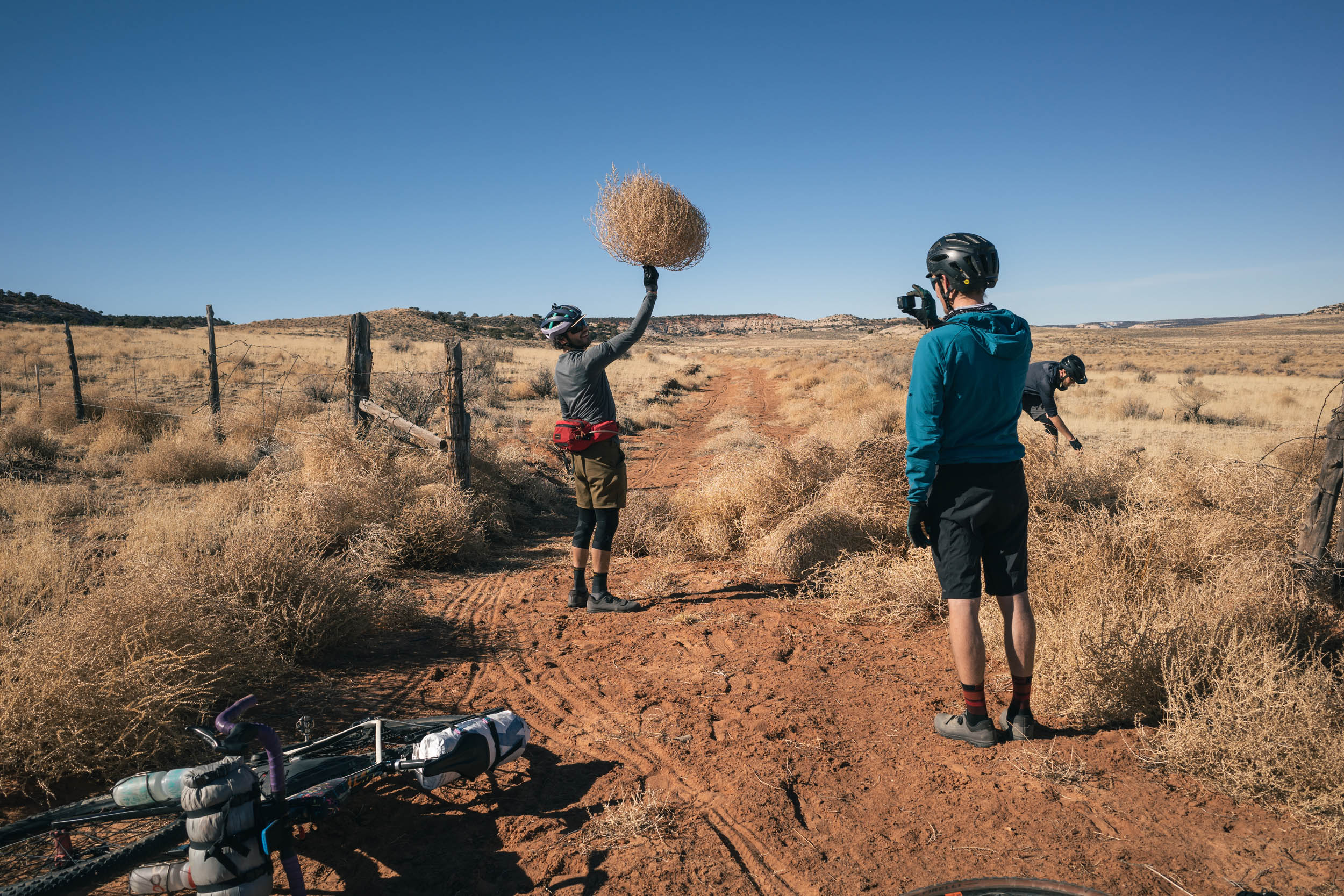
As a whole, Peaks and Plateaus has a distinctly remote feeling, despite the fact that it’s very occasionally busy with tourists in and around the route, but it’s also entirely possible that you won’t see anyone at all for a full day. One thing is certain: its diverse surroundings make it an extremely rewarding bikepacking journey.
Route Difficulty
This route consists of paved roads, 4×4 tracks, and everything in between. The 4×4 jeep roads in the area function like singletrack, as there’s often only one line and it typically meanders. You will no doubt get off your bike and hike a number of times. That being said, there are also some fast dirt road stretches and even a little bit of pavement, including one short (and unavoidable) stretch of highway.The other big factor in this region is the lack of water on parts of the route. It’s a desert, so making sure you’re well prepared is key. The western portion of the route is also quite remote, and most of the route has little reliable cell coverage. If you don’t feel comfortable riding without seeing other people for a full day, this route might not be for you. Navigation is mostly straightforward, but taking a wrong turn could lead to a dangerous situation. Most of the climbs are rather short-lived, excluding the one climb out of Indian Creek. Overall, the logistics are easy considering it’s a loop. Based on those factors, and based on other routes I have traveled on, this route difficulty is rated a 6 out of 10.
Route Development: My first trip to Moab was back in 2012 when I was just getting into mountain biking. Getting shuttled up to the top of the “Whole Enchilada” trail was maybe not the brightest idea for a noob, but my buddy and I had a blast, and the seed was planted for an annual or bi-annual trip to the area… Read full Route Development description and watch the new video under the Trail Notes tab below.


Submit Route Alert
As the leading creator and publisher of bikepacking routes, BIKEPACKING.com endeavors to maintain, improve, and advocate for our growing network of bikepacking routes all over the world. As such, our editorial team, route creators, and Route Stewards serve as mediators for route improvements and opportunities for connectivity, conservation, and community growth around these routes. To facilitate these efforts, we rely on our Bikepacking Collective and the greater bikepacking community to call attention to critical issues and opportunities that are discovered while riding these routes. If you have a vital issue or opportunity regarding this route that pertains to one of the subjects below, please let us know:
Highlights
Must Know
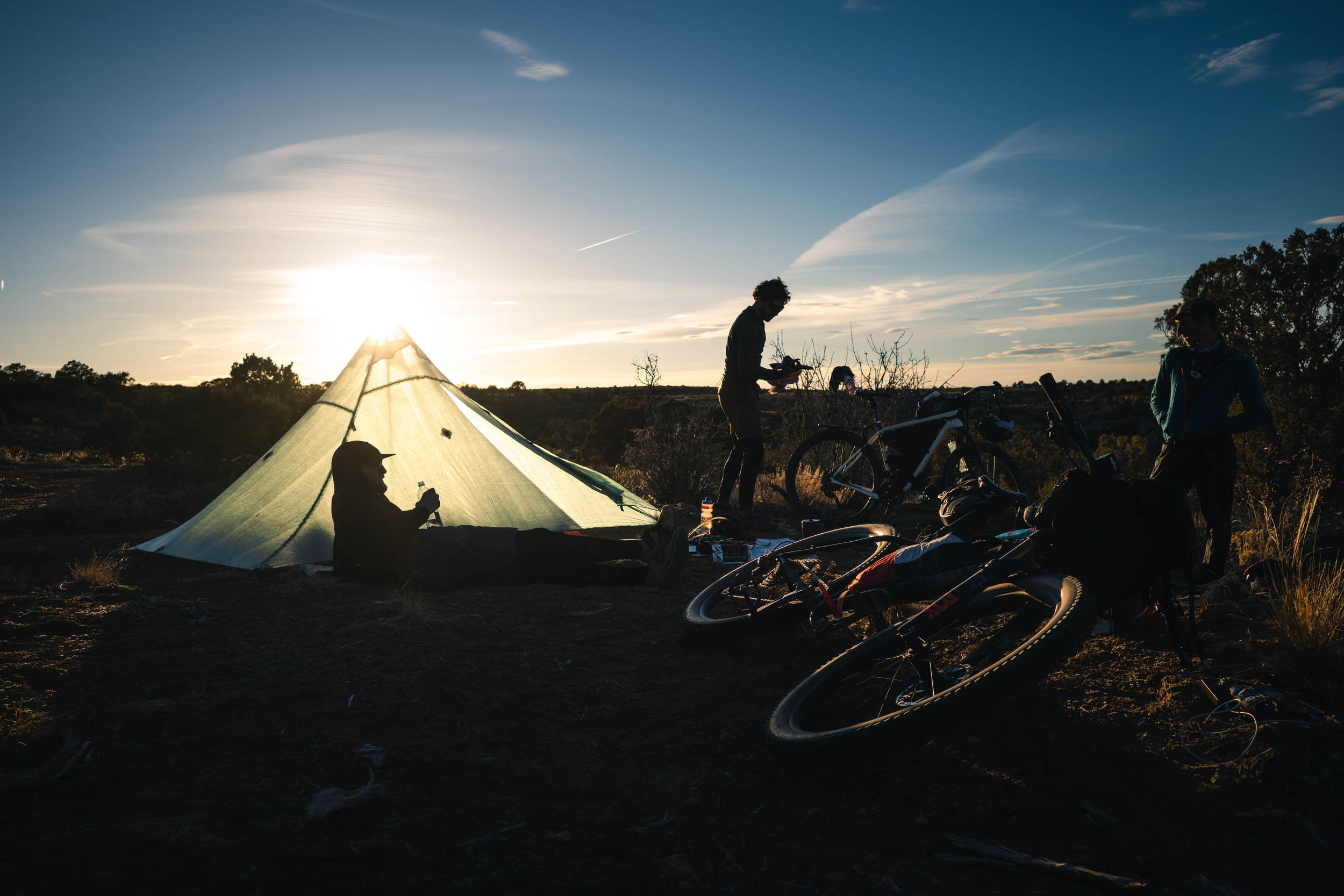
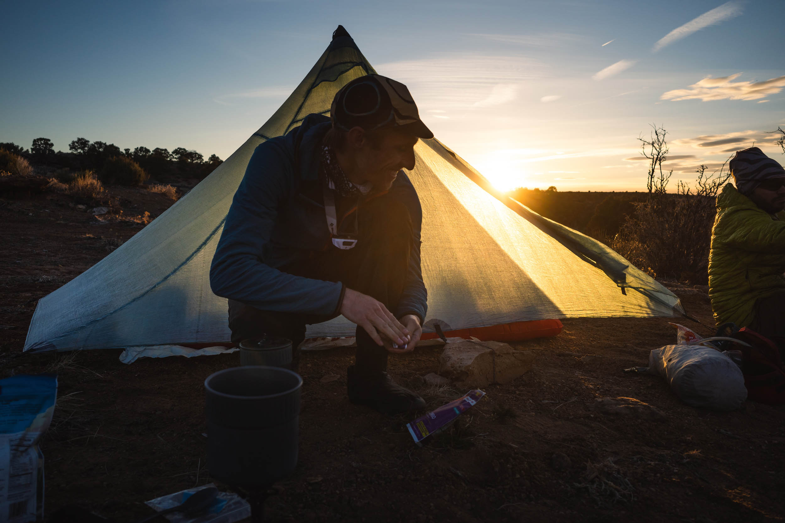
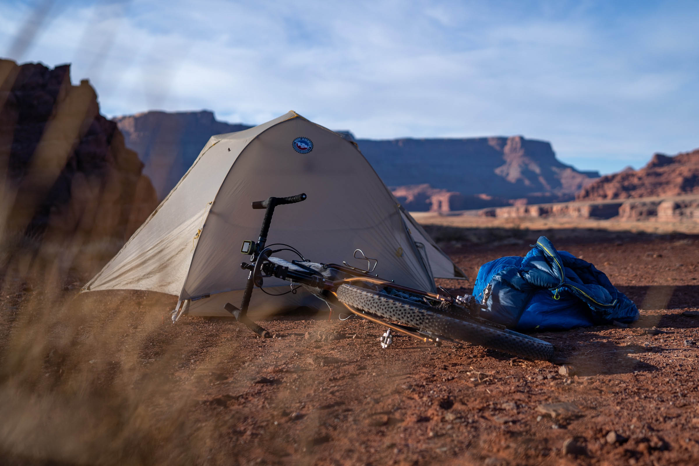
Camping
Food/H2O
Trail Notes
Resources
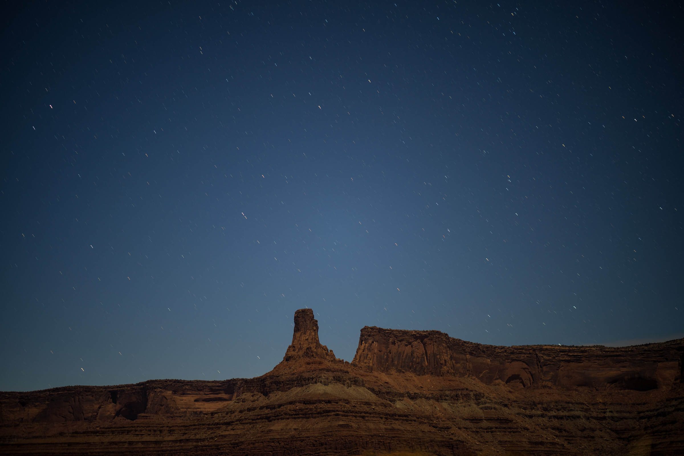
- Big views of 10,000-14,000 foot snow-capped peaks of the La Sal, Abajos, and San Juans Mountains.
- Black Ridge offers nice camping with great views.
- Flat Pass, where the canyons meet the mountains.
- Milts Stop and Eat is always a treat.
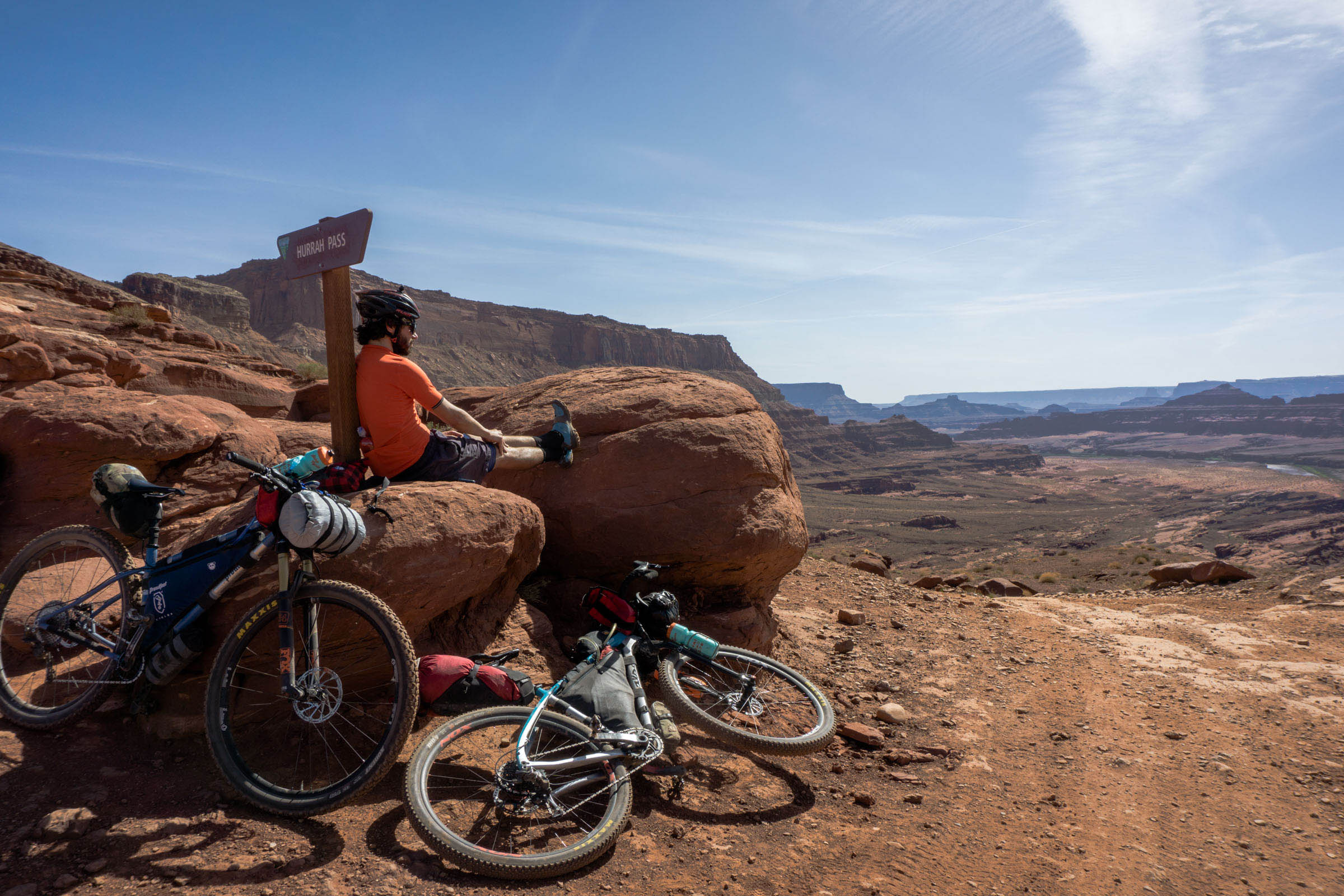
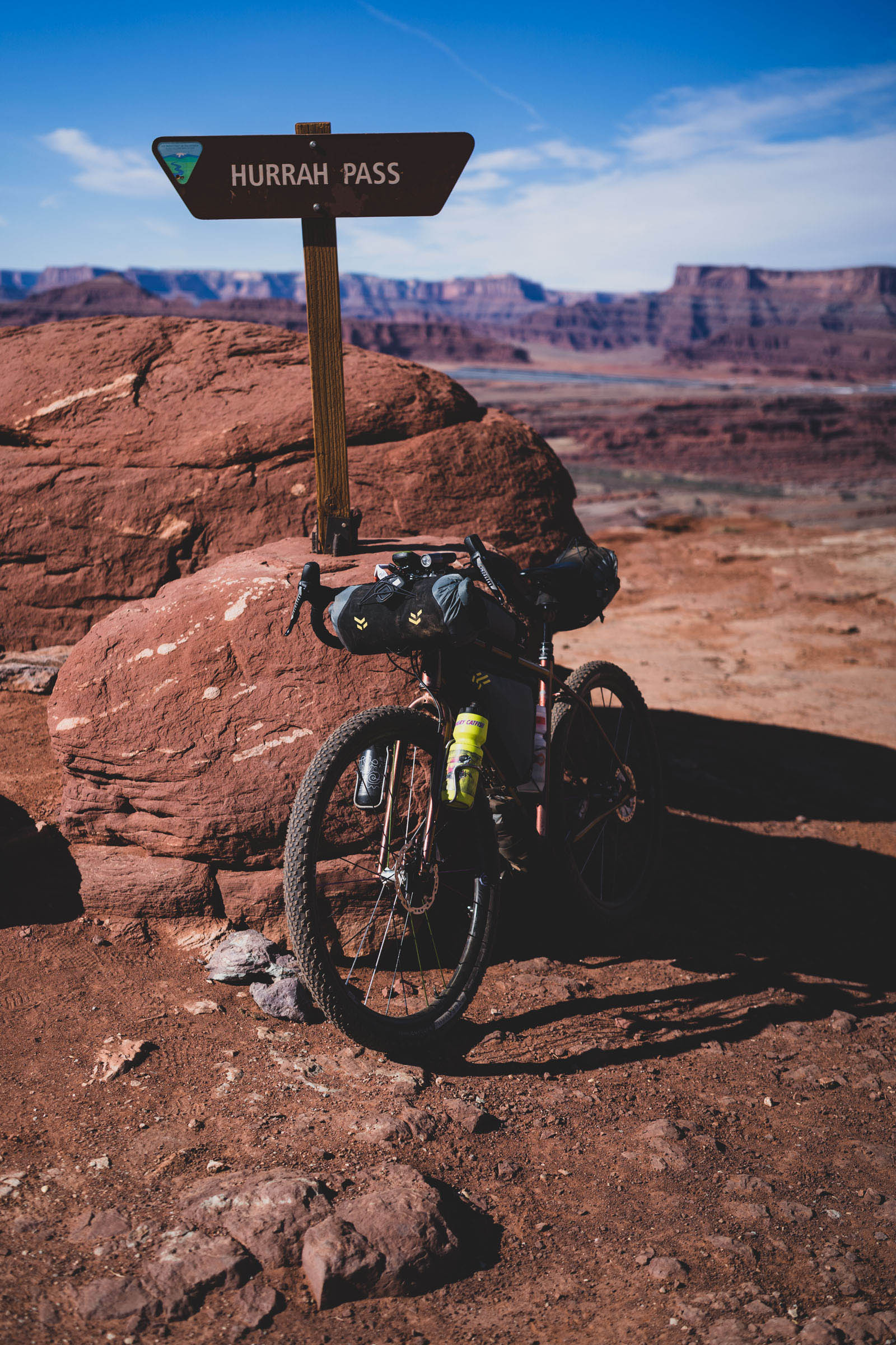
- Hurrah Pass offers views of Canyonlands National Park.
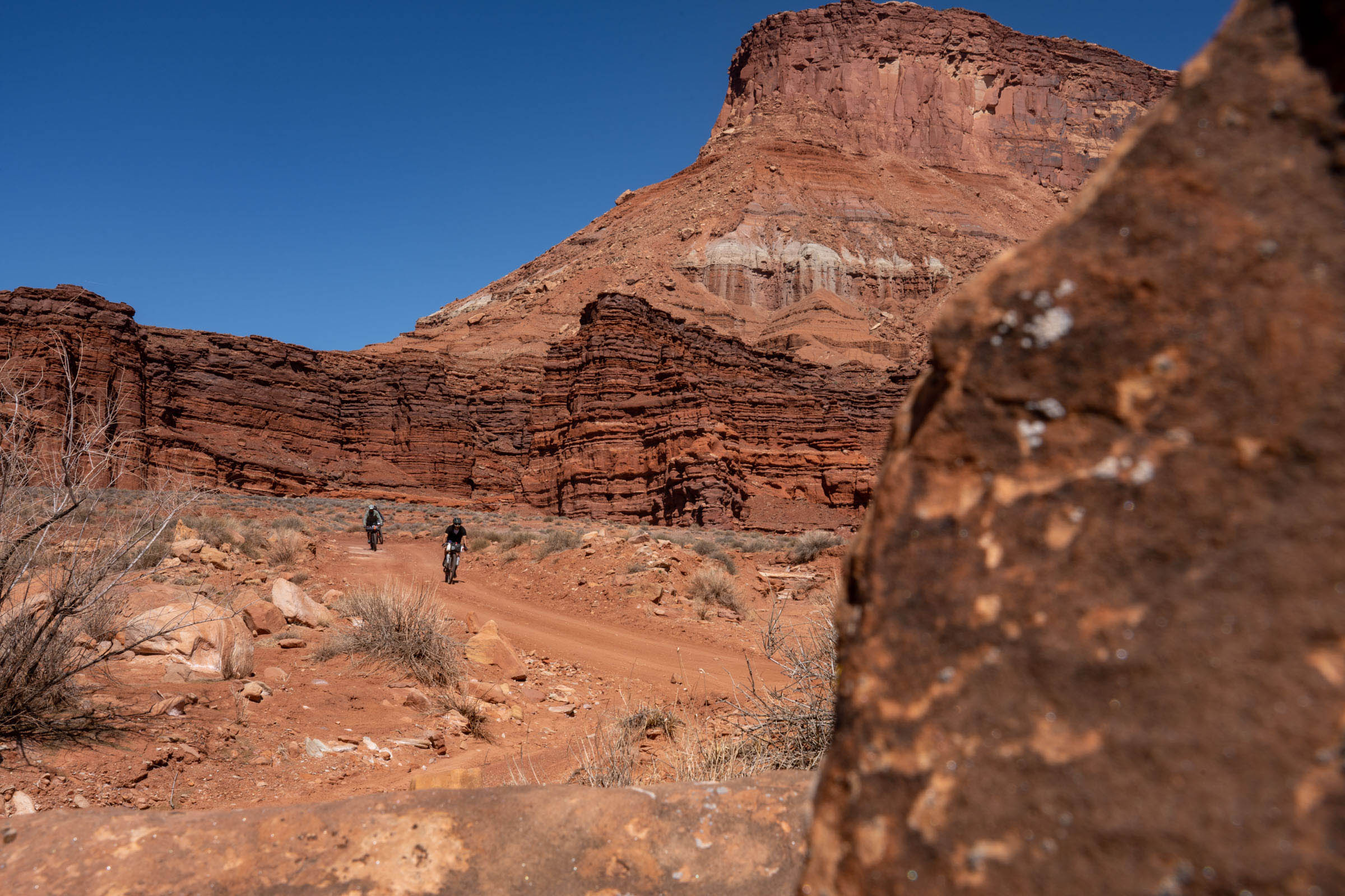
- Traveling next to huge sandstone walls in Bears Ears National Monument.
- Lockhart Basin is stunning and very remote feeling.
- The Indian Creek area is really special, with views of the Six Shooters.
- This is a challenging route as far as timing goes. You will want to make sure that the snow is melted on the southeastern portion of the route (see Resources tab), and you’ll also want to keep an eye on the heat. One of the beautiful parts of this route is that the prime riding season is during times of transition. In the spring you will be greeted with wildflowers and new growth on bushes and trees, while riding the the fall will showcase the start of seasonal decay with bright yellow cottonwood leaves.
- Be prepared for hot days and cold nights, all within the same 24-hour period. Study the weather and know what you’re getting into.
- The best bike for this route is a hardtail mountain bike.
- Hunting season is quite popular in the southeastern portion of the route during the fall, so keep that in mind.
- Be prepared for long stretches without water. Study the map and know what you’re getting into.
- You must pack out your poop. Moab is a highly-visited area and the area’s desert soil is not conducive to decomposition. Moab’s tourism authority clearly states on their website, “When developed facilities are not available, all solid waste should be packed out in approved waste bags.” Learn how here.
- Desert LNT rules apply: Since there is no organic soil in arid lands, the moisture and organisms that usually break down human waste in catholes are not present. In these situations, it is best to pack out human waste along with your other garbage. If you do make catholes, they rely on the heat of the sun to help break down the waste so the holes should not be too deep. Also, toilet paper should be packed out rather than covered in the cathole. Locating catholes on south-facing slopes, well away from trail, camp, and waterways (even if currently dry) will maximize decomposition and minimize impact.
- Monticello is a great town to stay in before the start or to get things for your trip.
- Moab is also a good option if you’re coming to the area from the north.
- There are no toilets at the start, and limited parking, but there are a handful of primitive camping spots on Hart Point Road (137).
- If you don’t think you can carry enough water between Moab and the finish, you should consider a water drop in or near Lockhart Basin.
- Make sure to stay alert on paved stretches and bring bright clothing and/or lights.
- There are many primitive camping options on the route, and you should not have a hard time finding camping. I noted a few spots on the map where I have either camped or seen a good flat spot to pitch a tent.
- Monticello has hotels that you can stay in before you start your trip.
- Heed “no camping” signs; there are a few areas where it is not allowed, such as around Harrah Pass.
- The closest paid camp spots are Hamburger Rock and Wind Whistle Campgrounds. Both have pit toilets.
- Some established campgrounds either require reservations or are first come, first served. Keep this in mind during your planning process.
- Cryptobiotic crust is an extremely fragile, living community of organisms found in the desert. It retains moisture and provides protection against erosion, giving other plantlife a foothold. DO NOT ride or camp in these areas. Camp in pre-established dispersed campgrounds.
- La Sal store has everything you need, including a microwave to heat up some frozen food they sell. Also a bathroom.
- Moab has bike shops, grocery stores, and plenty of restaurants. Milt’s is on the route, and Dave’s convenience store is right next to it.
- No water source in this area should be relied upon, but there are a few options marked on the map, namely Mill Creek, Kane Springs Creek, and Indian Creek.
- Accessing the Colorado River is not only dangerous but very challenging, especially with the overgrowth of invasive Tamarisk.
After scrolling through photos of a Lockhart Basin bikepacking trip that Nicholas Carman and Lael Wilcox did in 2013, I was determined to make a loop that included that stunning stretch. But the challenge here is actually connecting roads that don’t dead-end as many do in the Canyonlands area. After a number of bikepacking trips in this region over the past decade, and finally coming up with a loop that I thought would work, my partner and I pedaled a version of this route in 2017. It was a stunning experience that made me want to come back and improve upon it.
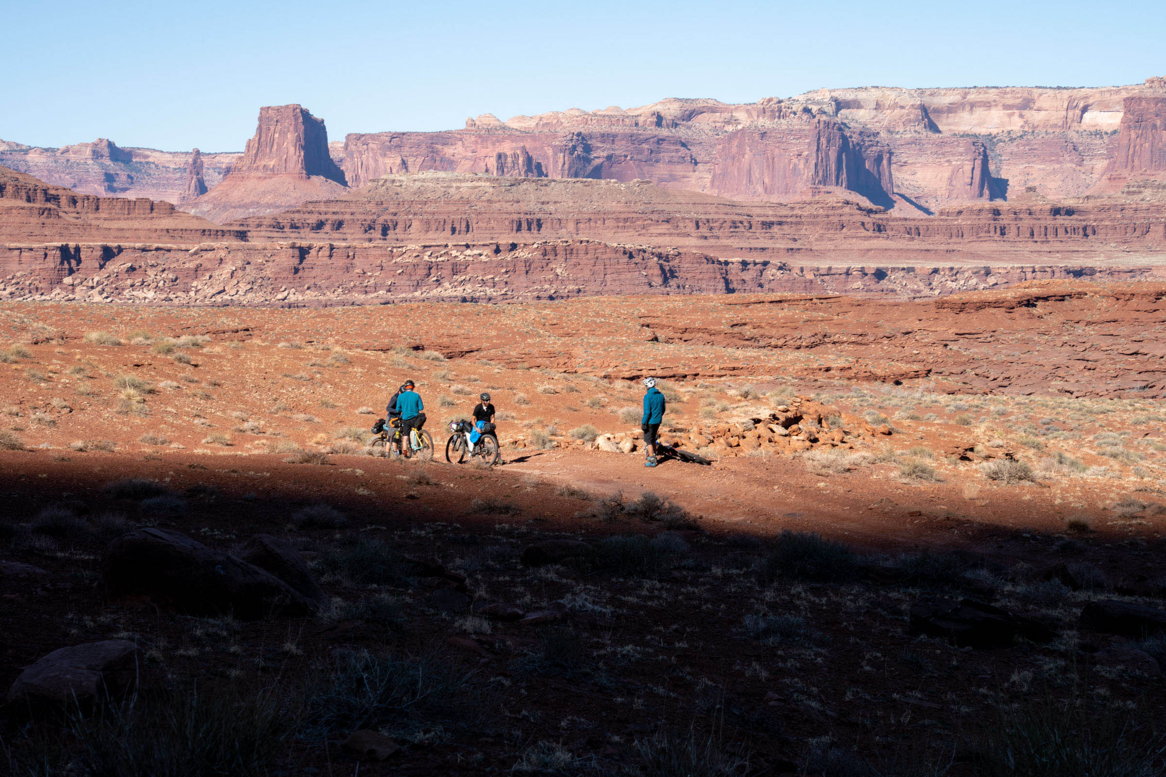
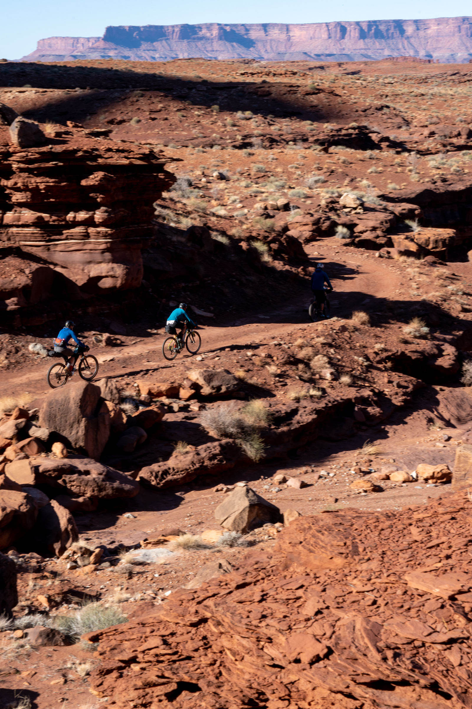
Last year, I was set to do just that in late February, but I was turned away due to snow. Moab has a rather short weather window for enjoyable riding. While the summers are hot and dry, the winters are typically cold and wet. I had to delay that trip to this year, and after asking friends who live in Moab, looking at U-dot webcams, checking Open Snow snowpack data, and generally keeping an eye on the weather in the area, I determined the route was good to go. Four friends and I were there the next day to scout this new version, taking in everything I found on previous trips and linking together as much dirt as possible and offering a range of perspectives of the La Sal Mountains, Abajos Mountains, Uncompahgre Plateau, and even the mighty San Juans mountains.
Additional Resources
- All Access Open Snow App for weather resources: opensnow.com
- Utah DOT webcams. I look at the two between Moab and Monticello (I waited to go on the trip until after all the snow melted on all 4 cameras): udottraffic.utah.gov
- La Sal, UT Weather – Typically one of the coldest parts on the route: weather.gov
- Moab, UT Weather – Typically one of the warmest parts on the route: weather.gov
- LNT for bikepacking: bikepacking.com
- LNT in the arid climates: leavenotracedude.com


Terms of Use: As with each bikepacking route guide published on BIKEPACKING.com, should you choose to cycle this route, do so at your own risk. Prior to setting out check current local weather, conditions, and land/road closures. While riding, obey all public and private land use restrictions and rules, carry proper safety and navigational equipment, and of course, follow the #leavenotrace guidelines. The information found herein is simply a planning resource to be used as a point of inspiration in conjunction with your own due-diligence. In spite of the fact that this route, associated GPS track (GPX and maps), and all route guidelines were prepared under diligent research by the specified contributor and/or contributors, the accuracy of such and judgement of the author is not guaranteed. BIKEPACKING.com LLC, its partners, associates, and contributors are in no way liable for personal injury, damage to personal property, or any other such situation that might happen to individual riders cycling or following this route.
Please keep the conversation civil, constructive, and inclusive, or your comment will be removed.