


Shasta Siskiyou Loop
Distance
84 Mi.
(135 KM)Days
2-3
% Unpaved
65%
% Singletrack
16%
% Rideable (time)
99%
Total Ascent
6,264'
(1,909 M)High Point
6,015'
(1,833 M)Difficulty (1-10)
6?
- 5Climbing Scale Moderate75 FT/MI (14 M/KM)
- 6Technical Difficulty Moderate
- 7Physical Demand Difficult
- 4Resupply & Logistics Fair
Contributed By

Dallas Mignano
Guest Contributor
Dallas grew up in Redding, California, central to the Shasta Cascade region. Since then, he has lived in various places across Northern California and Oregon. He loves exploring the PNW and surrounding areas, sharing his experiences, and getting others out there. Dallas currently works as a design lead in the solar industry. Follow @dallasrm on Instagram and subscribe to the @BikeCampChill channel on YouTube.
Co-contributed with Dominic Zuckswert; Dominic lives in Redding, California, and was key in helping document and plan this route. He also captured many great photos along the way!
May 29th, 2025 Update: To bypass the road closures on Forest Road 31, riders can take Ski Park Hwy to McCloud. From there, you can take Forest Roads 13 & 19 to connect with Military Pass Road. You can also refer to various heat maps for other road options.
Growing up in Redding, California, central to the Shasta Cascade region, I’ve always enjoyed visiting Mount Shasta and its peaceful surroundings. The recreational options are endless, and the landscapes are awe-inspiring. Summers in Redding can be brutal, but an hour’s drive north offers an escape, with highlights like Castle Crags, the towns of Dunsmuir and Mount Shasta, and the great mountain itself.
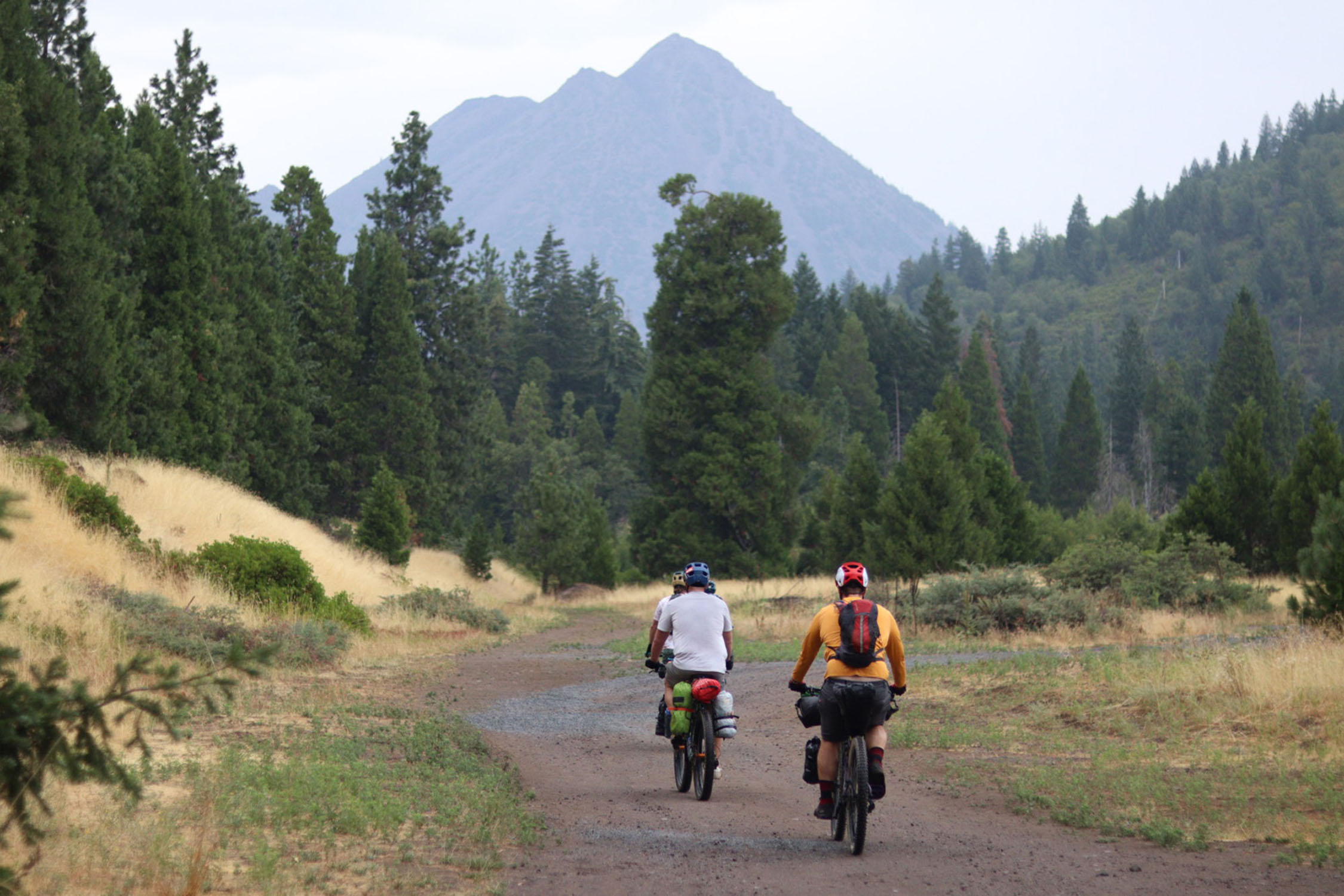
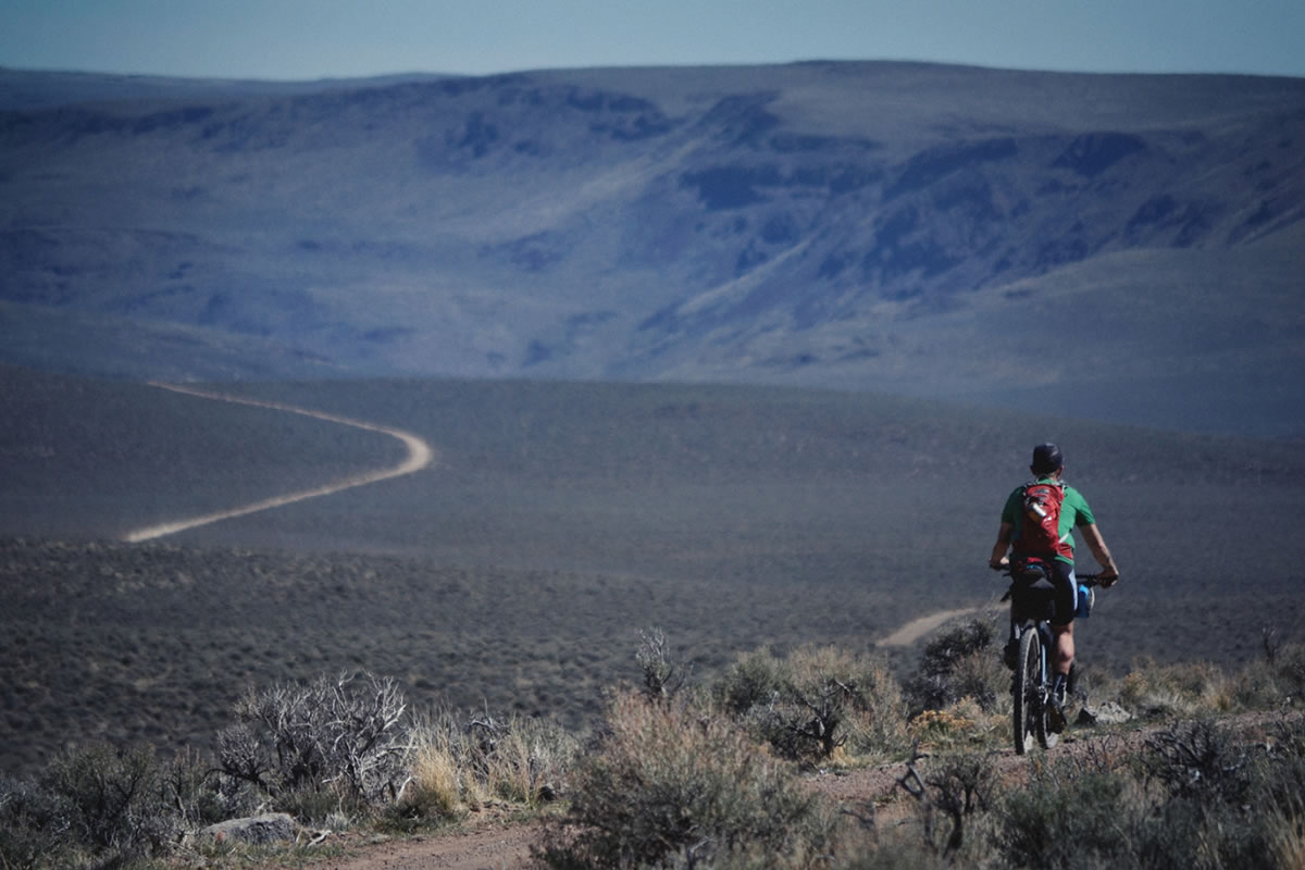
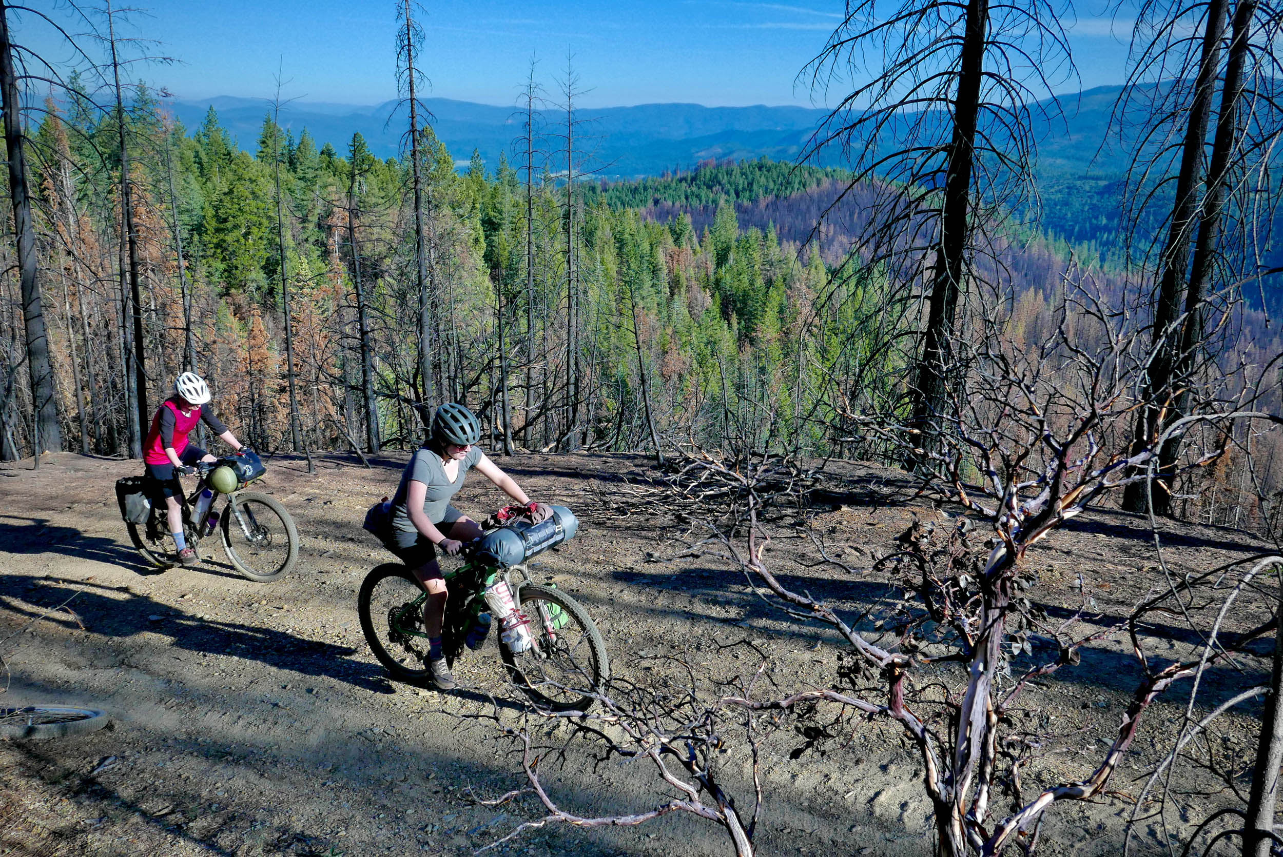
The Shasta Siskiyou Loop circumnavigates the base of Mount Shasta, a highlight of the Shasta Cascade region. On the first night, riders camp on the mountain’s backside with a stunning view, and the second night is spent alongside Lake Siskiyou. The Shasta-Trinity National Forest, with its volcanic landscapes, pristine lakes, and many backcountry trails, includes many natural gems of Upstate California.
Most of this route is based off of The Mount Shasta Loop, a classic mountain bike route in the area, from the book, “Mountain Biking Northern California’s Best 100 Trails” by Delaine Fragnoli and Robin Stuart, incorporating the Gateway Trail network near Mount Shasta and a detour through Weed to reach Lake Siskiyou. It is fun to find past routes from books like this when most mountain biking was done on old roads before most trail systems and other options even existed in these areas. Although it’s doable as an aggressive overnighter, we rode this route in three days. Be sure to see the full day-by-day description under the Trail Notes tab.
This route offers diverse terrain and is rideable from June to October, though the summer heat and sun exposure can be extreme. Other times of year outside of that can be extremely cold and snowy. We rode it in early August. I recommend carrying four to five liters of water, especially since parts of the route, such as the railroad sections, can be challenging. I rode a fully rigid bike with 2.2″ tires, and others had plus-sized tires and suspension. The railroad sections are particularly rough, but some riders have completed it on 47mm gravel tires. Prepare for varying conditions.
Route Difficulty
Water availability is very limited on the first night and part of the following day. Water may be more available at certain times of the year, but there are creeks and springs that should flow year-round. Packing extra water capacity is strongly recommended. There are sandy, washed-out sections as well as chunky railroad shoulders. There can be a lot of direct sun and heat in the summer months and chilly, cold winds during other times of the year. Be aware and come prepared.
Route Development: This route connects sections of trails that are maintained by Mount Shasta Trail Association (MSTA) and land managed by the USFS (Shasta-Trinity National Forest Office). I’d also like to give a special shout-out to Deadwood Supply Co, the local bike shop/pub, where the owner let us pull up maps of the route on their big screen over drinks the night before we started.


Submit Route Alert
As the leading creator and publisher of bikepacking routes, BIKEPACKING.com endeavors to maintain, improve, and advocate for our growing network of bikepacking routes all over the world. As such, our editorial team, route creators, and Route Stewards serve as mediators for route improvements and opportunities for connectivity, conservation, and community growth around these routes. To facilitate these efforts, we rely on our Bikepacking Collective and the greater bikepacking community to call attention to critical issues and opportunities that are discovered while riding these routes. If you have a vital issue or opportunity regarding this route that pertains to one of the subjects below, please let us know:
Highlights
Must Know
Camping
Food/H2O
Trail Notes
- Stunning views of Mount Shasta the entire time!
- Deadwood Supply Co (friendly mountain bike shop and pub)
- Headwaters Spring (fresh spring water right off the mountain)
- Gateway Trail System (local multi-use trails)
- Town of Weed & Mt. Shasta Brewery (great re-supply point)
- Lake Siskiyou (many camping options and swimming spots)
- This route should be mostly rideable from June-October, but the summers can get brutally hot and you can be greatly exposed to the sun at times. There will usually be snow and rain leading into the late fall and winter months. It may take a while for snow to fully melt away in spots in the spring. Earlier than June may be possible, but it really depends.
- The City of Mount Shasta provides public parking for up to 72 hours on the east side of the train tracks on the corner of E Alma Street. Signs are posted there.
- Tire width recommended at 2.2” or above. Some have done it with 47mm tires though. There are alternative route options, especially if you bypass the chunky railroad shoulder section. You will still hit sections of washed-out road and sandy spots.
- There are many free, primitive camping options along this route. Most of it is on Shasta-Trinity National Forest land. Please follow local laws and regulations accordingly.
- Find relevant trail information at Mount Shasta Trail Alliance.
- For forest service information, check out the Mt. Shasta Recreation Report.
- Primitive camping on Military Pass Road
- Lodging available in Mount Shasta, Weed, and at Lake Siskiyou
- Primitive camping or designated campground at Lake Siskiyou
- Lake Siskiyou Camp Resort
- There are many great eateries on your way in and out of Mount Shasta.
- Water and food is very limited on the north side of the mountain. Be prepared to be fully self-sufficient and pack accordingly!
- If you are interested in having very good Indian food, then I highly recommend a visit to Hari Om Shri Ram while in Mount Shasta. They offer homestyle meals with a cozy atmosphere.
- And although it isn’t on the exact route, The Wheelhouse in Dunsmuir is worth stopping by if you are passing it on the way to or from Mount Shasta. They have a good selection of bar food and international beers.
location Mount Chasta-Military Pass Road
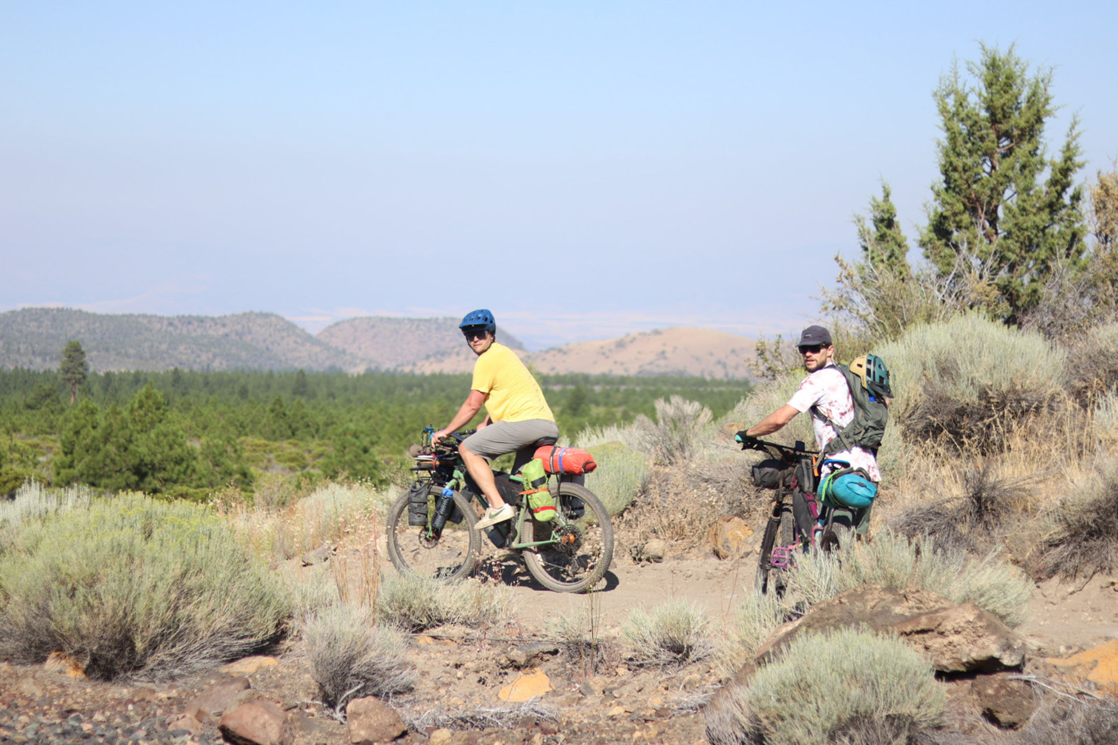
Day 1 (36 mi +4,300 ft)
Leave the City of Mount Shasta as you pass the Headwaters Spring and get to the Gateway Trails. Once you hit Forest Road 31 via the trails, you will follow it all the way to Military Pass Road. This is where you will find a place to camp with a nice view of the mountain and night sky.
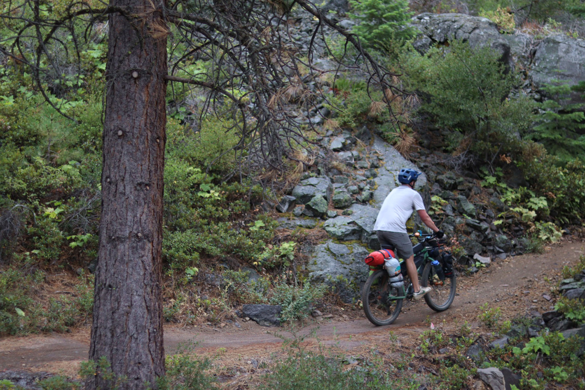
The ride begins in the town of Mount Shasta to the Headwaters Spring and the Gateway Trails. This section features a mix of singletrack and dirt roads, eventually merging onto Forest Road 31. You’ll find fresh spring water here before the road transitions to gravel, becoming increasingly rugged soon after it passes the ski park entrance.
The road gets chunky and washed-out in places with sandy sections and occasional hike-a-biking to cross creeks. The area’s glacial melt creates visible erosion, particularly around Mud Creek, where caution is needed to safely cross. As the name implies, the water may be unsuitable for filtration due to lots of sediment. As we passed Pilgrim Creek, we refilled water and could have camped, but we chose to press on.
After crossing Ash Creek, we camped along Military Pass Road near mile 36, with a breathtaking view of the mountain. Surprise Lake is nearby and could be an alternative camping spot, though it looked to be a challenging climb. At this point, Ash Creek was our last reliable water source until the next day. I recommend carrying enough water for the night and half of the next day, as we didn’t find more until we reached Weed.
location Military Pass Road-Lake Siskiyou
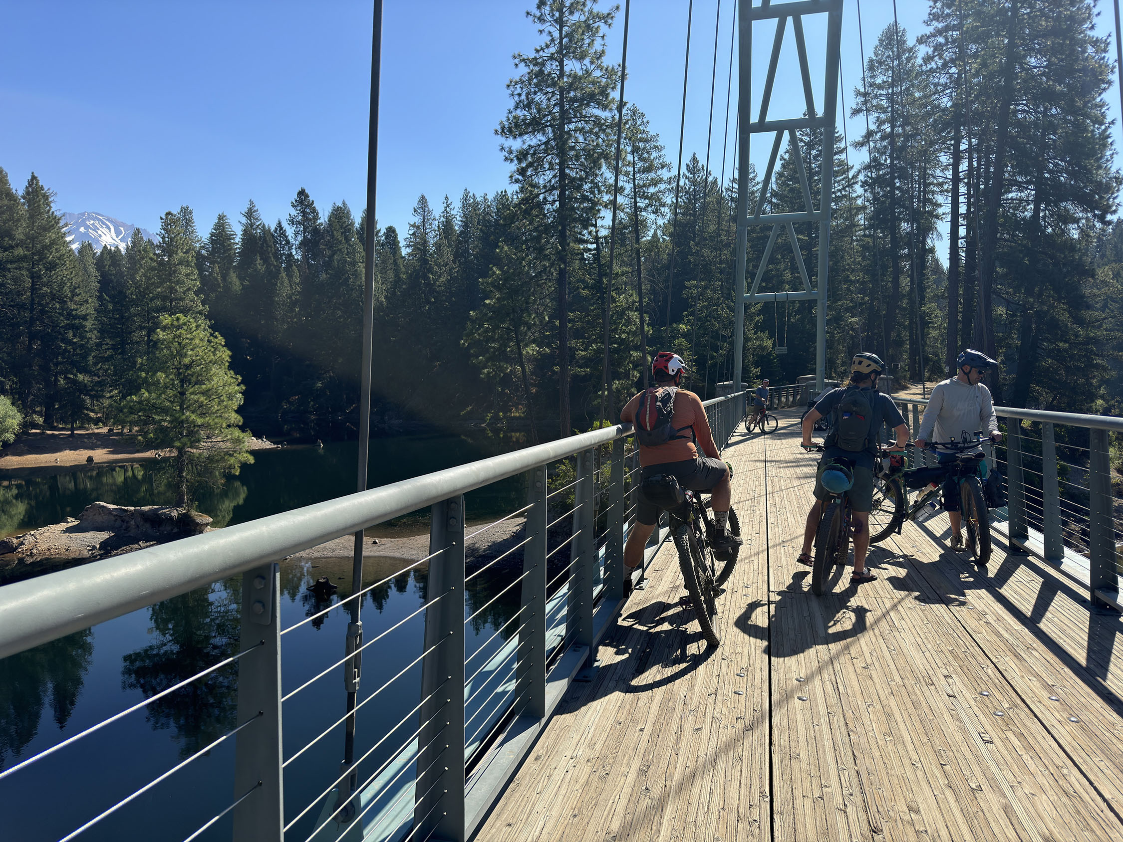
Day 2 (44 mi +1,600 ft)
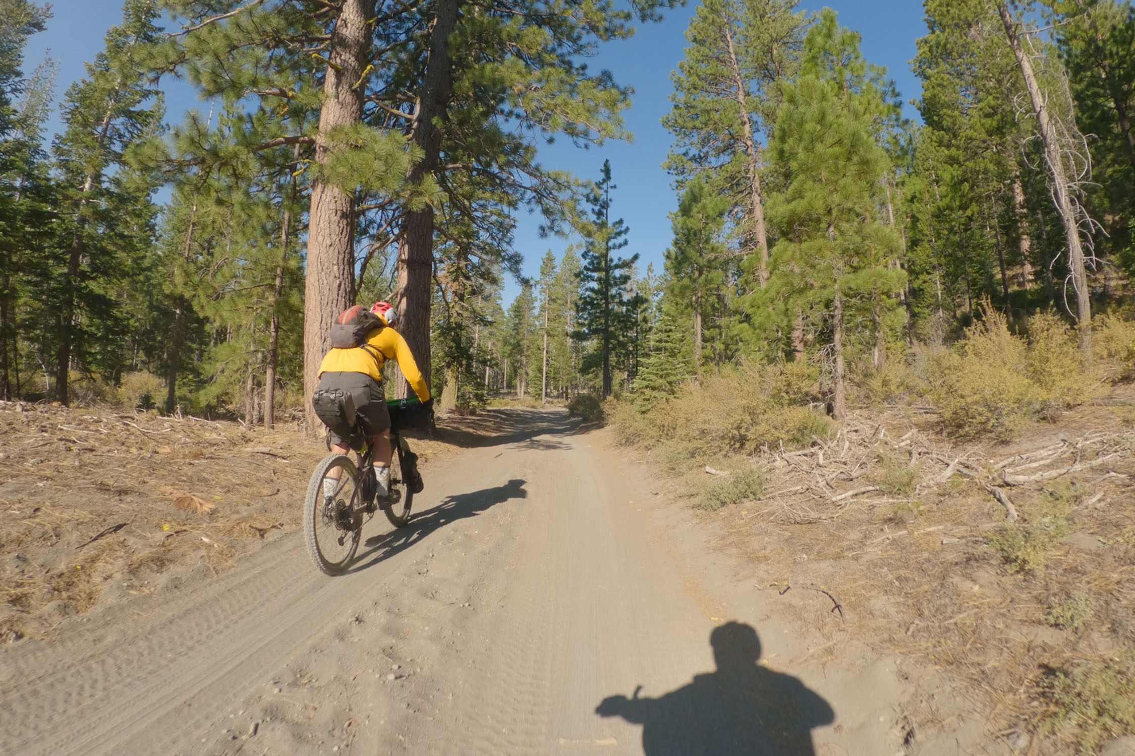
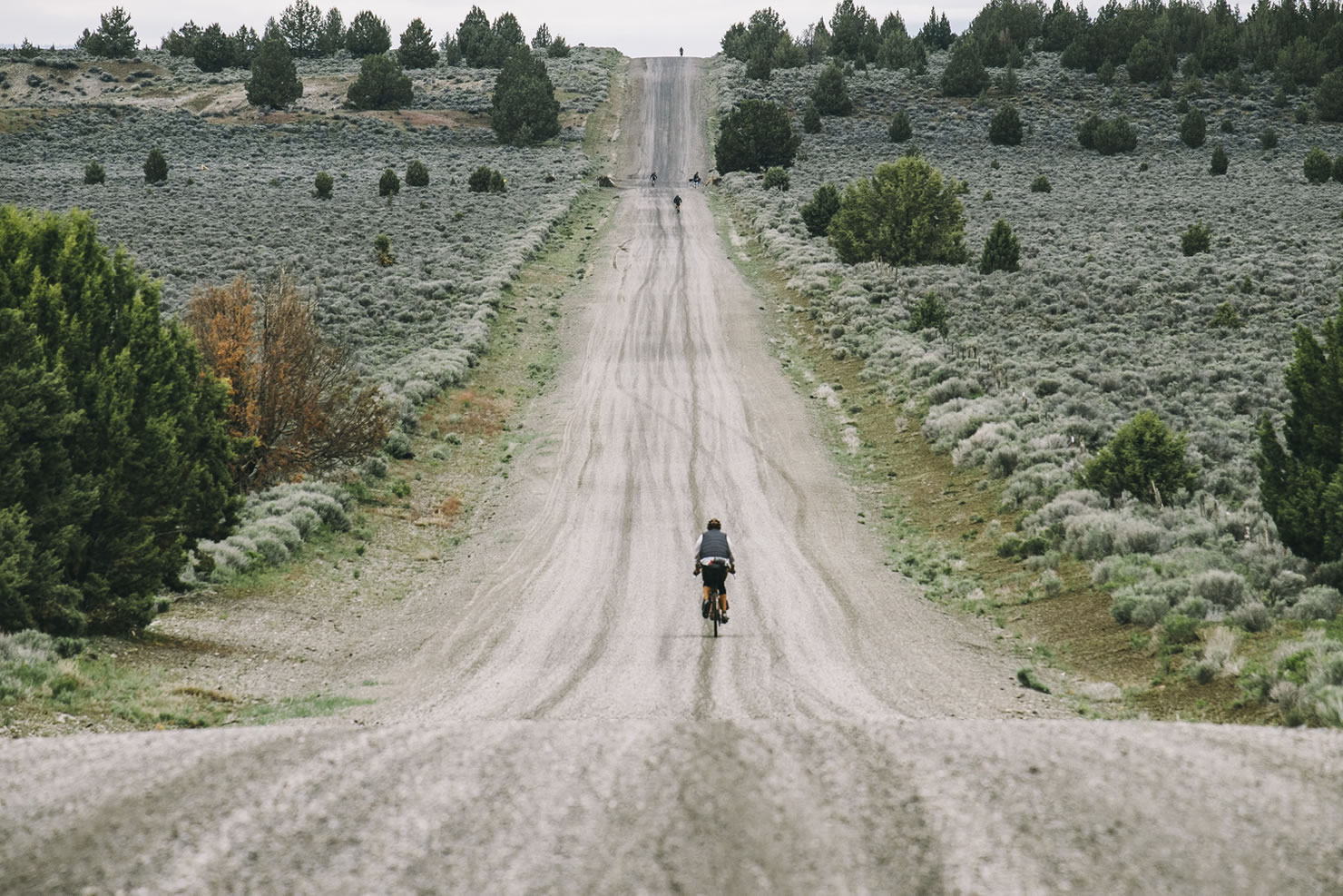
Start the ride along a sandy gravel road that eventually hits the railroad or bypass option to Highway 97. There are chunky railroad shoulders and sandy side roads here. I was surprised that this was a part of the classic route, but many have traversed it this way. You’ll get to the town of Weed for a resupply and then follow scenic paved roads until you get to the gravel road and dirt trails alongside Lake Siskiyou to find camp. There is a general store and restaurant there as well.
You’ll encounter sandy sections of forest road after leaving camp and before reaching the railroad. The railroad section was the most challenging part of the ride. I could see the conditions varying greatly depending on the current weather and recent track maintenance. Expect a solid mix of chunky railroad shoulders and sandy side roads. If you prefer, you can bypass this section by taking forest roads to Highway 97, though this option does involve pavement and traffic.
As far as I know, the railroad section is open to the public, as it’s a known route that overlaps with forest roads. However, keep in mind that it is an active railway and use extreme caution. I’ve seen intel from other riders, like Kurstin Graham, who found this section rideable on 47mm tires when he did it. Originally, I planned this alternative route to cut through Weed and climb to Deadfall Lake, then descend the black-diamond Sisson Callahan Trail back to town. But ended up rerouting due to heat and sun exposure.
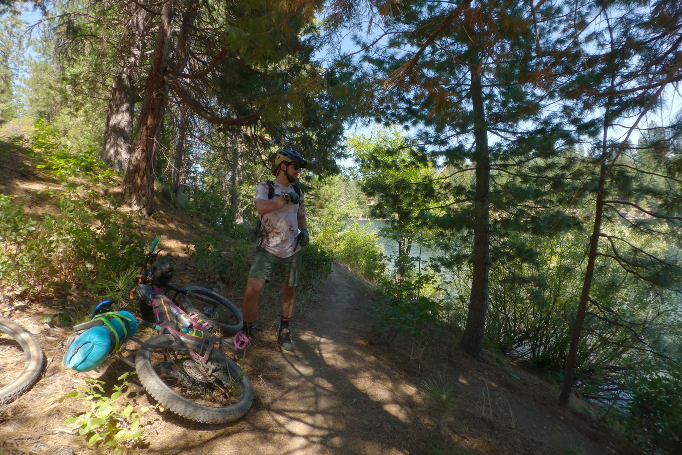
We opted for a more relaxed option, following N Old Stage Road to Lake Siskiyou. A rideable dirt trail runs around much of the lake. Once you get there, camping options are abundant. We camped near the Siskiyou Delta, where the Sacramento River begins. You can look at maps to see where the National Forest boundaries are in the area. If you continue along the shore trail, you’ll find a full campground with a general store, bar, and grill. After setting up camp and swimming, we enjoyed a meal and drinks to end the night.
Day #3
location Lake Siskiyou-Mount Shasta
Day 3 (6 mi +600 ft)
Short ride back into Mount Shasta.
The ride back to town is short. We parked at a friend’s home, but I confirmed with the local ranger station that public parking is available down the street from them for up to 72 hours. You can call the ranger station or police station for further details.


Terms of Use: As with each bikepacking route guide published on BIKEPACKING.com, should you choose to cycle this route, do so at your own risk. Prior to setting out check current local weather, conditions, and land/road closures. While riding, obey all public and private land use restrictions and rules, carry proper safety and navigational equipment, and of course, follow the #leavenotrace guidelines. The information found herein is simply a planning resource to be used as a point of inspiration in conjunction with your own due-diligence. In spite of the fact that this route, associated GPS track (GPX and maps), and all route guidelines were prepared under diligent research by the specified contributor and/or contributors, the accuracy of such and judgement of the author is not guaranteed. BIKEPACKING.com LLC, its partners, associates, and contributors are in no way liable for personal injury, damage to personal property, or any other such situation that might happen to individual riders cycling or following this route.
Further Riding and Reading
Here are some connected/nearby routes and related reports...
Please keep the conversation civil, constructive, and inclusive, or your comment will be removed.