


Ten Peaks Trail
Distance
242 Mi.
(389 KM)Days
7
% Unpaved
72%
% Singletrack
17%
% Rideable (time)
80%
Total Ascent
27,915'
(8,508 M)High Point
3,438'
(1,048 M)Difficulty (1-10)
7.5?
- 8Climbing Scale Strenuous115 FT/MI (22 M/KM)
- 6Technical Difficulty Moderate
- 8Physical Demand Difficult
- 8Resupply & Logistics Strenuous
Contributed By
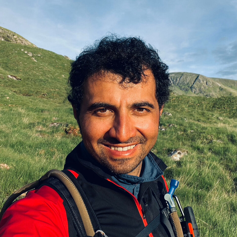
Nima Khorshidi
Guest Contributor
Nima is a bike mechanic and a cycle trainer in Glasgow. He started cycling and going on long day trips at a very young age in Iran, and it soon became his passion. In Scotland, Nima has cycled most of the established bikepacking routes and is now enjoying exploring new routes and sharing them with fellow bikepackers. Follow Nima’s rides on Instagram at @milesandwheels.
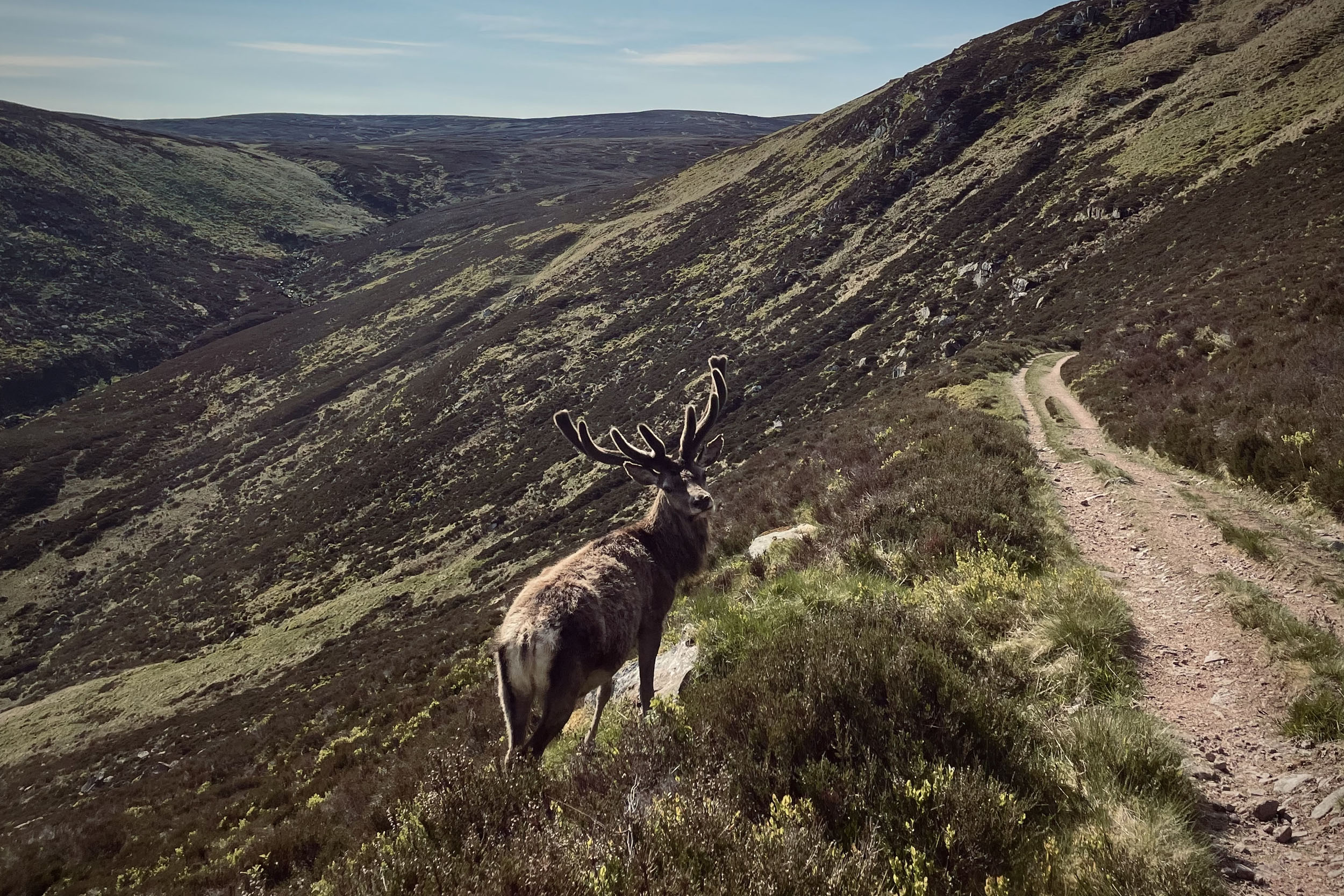
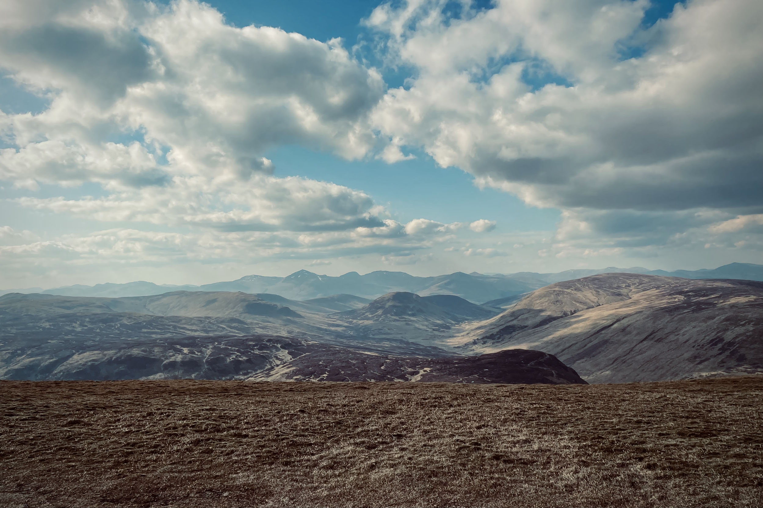
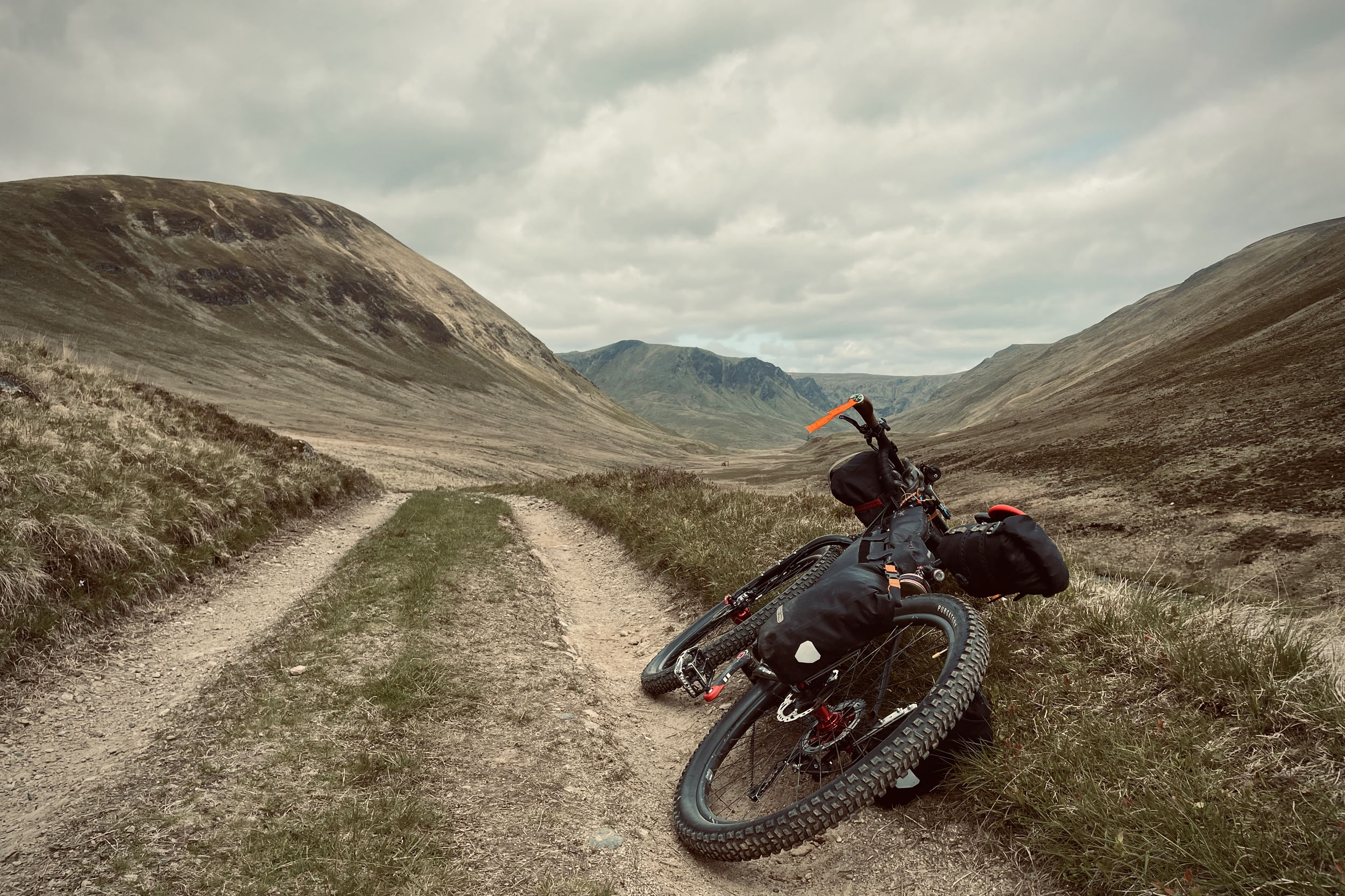
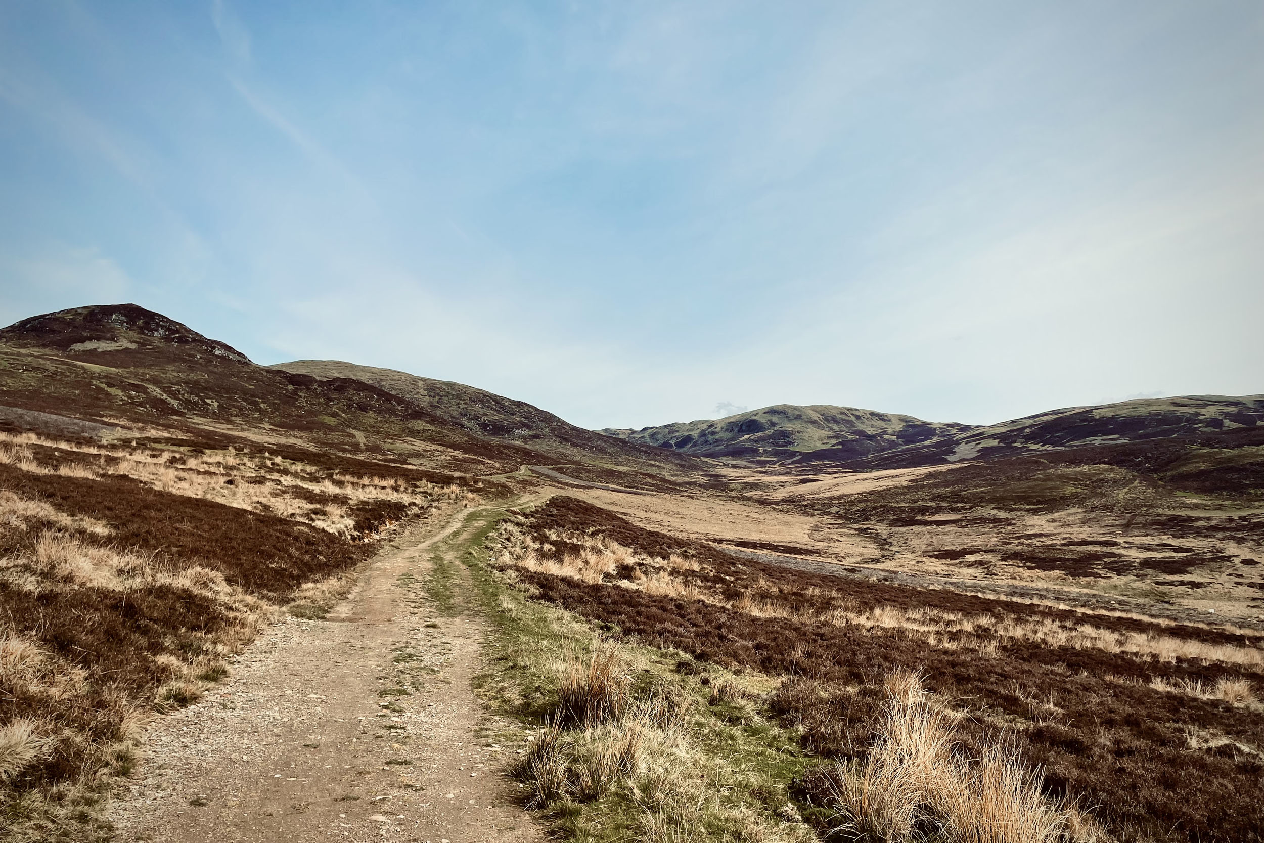
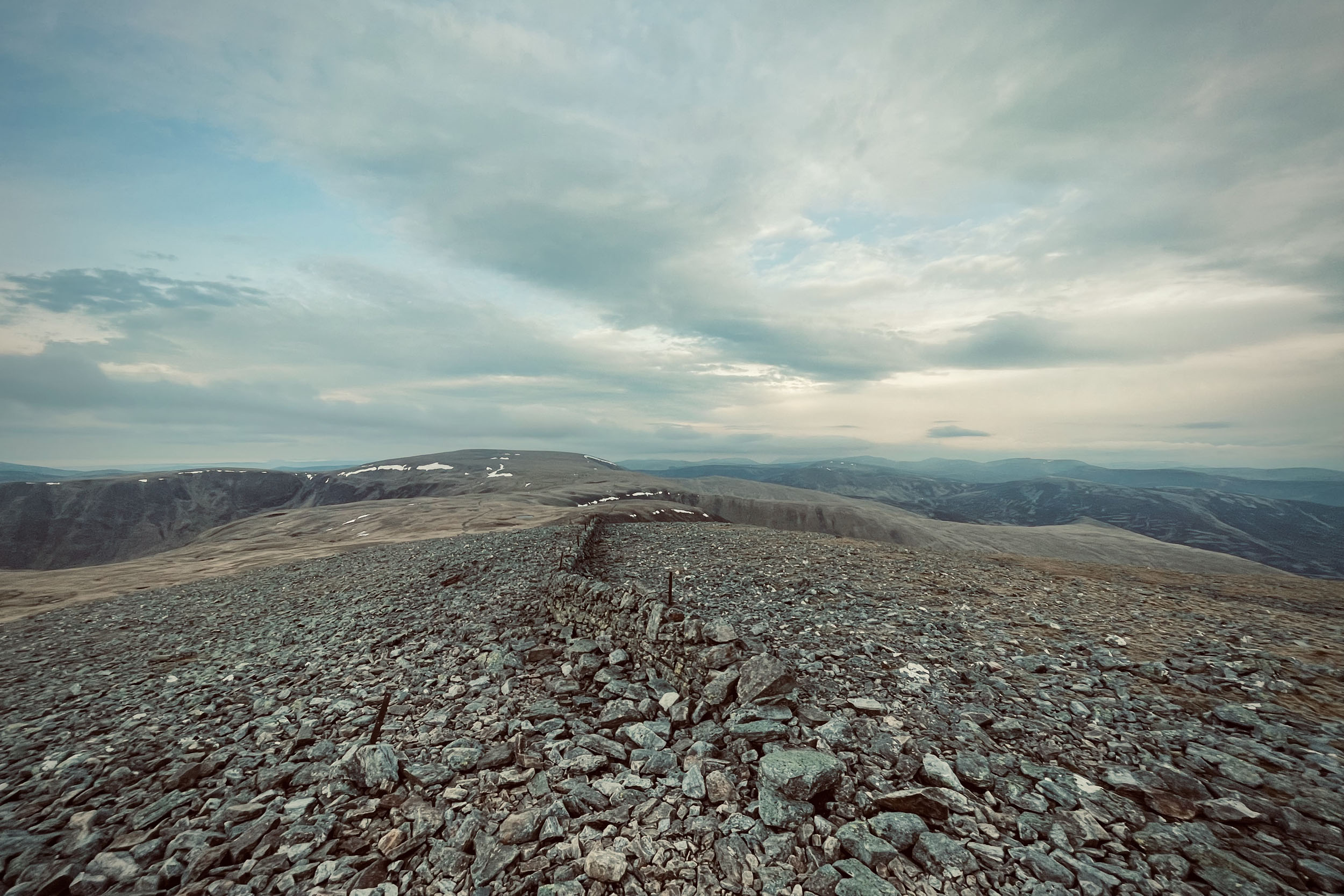
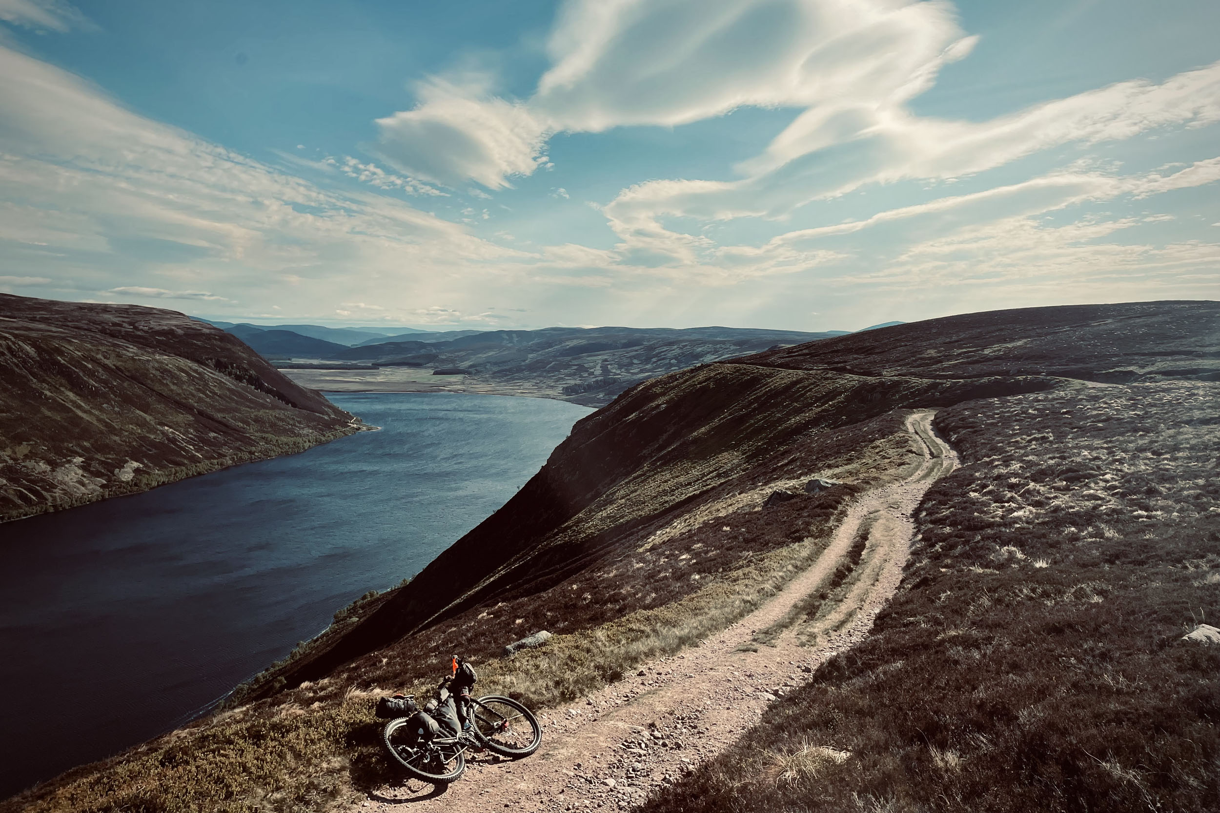
The hills, mountains, and glens of Scotland offer some of the world’s most excellent bikepacking locations. The Highlands of Scotland, with thousands of kilometres of gravel roads and singletrack trails over their stunning hills, through their magnificent glens and around their famous lochs, are a world-class destination for exploring and pushing boundaries. The Ten Peaks Trail is a 242-mile (390-kilometre) mixed-surface route with a high point of around 3,490 feet (1,064 metres) and a total elevation of 27,913 feet (8,508 metres). Ben Chonzie, Cairn of Claise, Tolmount, Cairn Bannoch, and Broad Cairn are the five Munros, mountains in Scotland with a height over 3,000 feet (914.4 metres) that this trail travels over. The other high points on the way include Carleatheran, Sron a’ Chaoineidh, Little Glas Maol, Fafernie and Mona Gowan.
With all these high points en route, riders will be in for for some heavy climbing, which makes the Ten Peaks Trail a great physical challenge. The Highlands of Scotland have the reputation of having unpredictable weather; cycling this trail requires riders to be ready for extreme weather conditions all around the year, especially in high altitudes. The trail is mostly on gravel roads with some long sections of paved roads and singletrack. The route is around 80% rideable (time-wise), however, it also includes stretches of hike-a-bike.
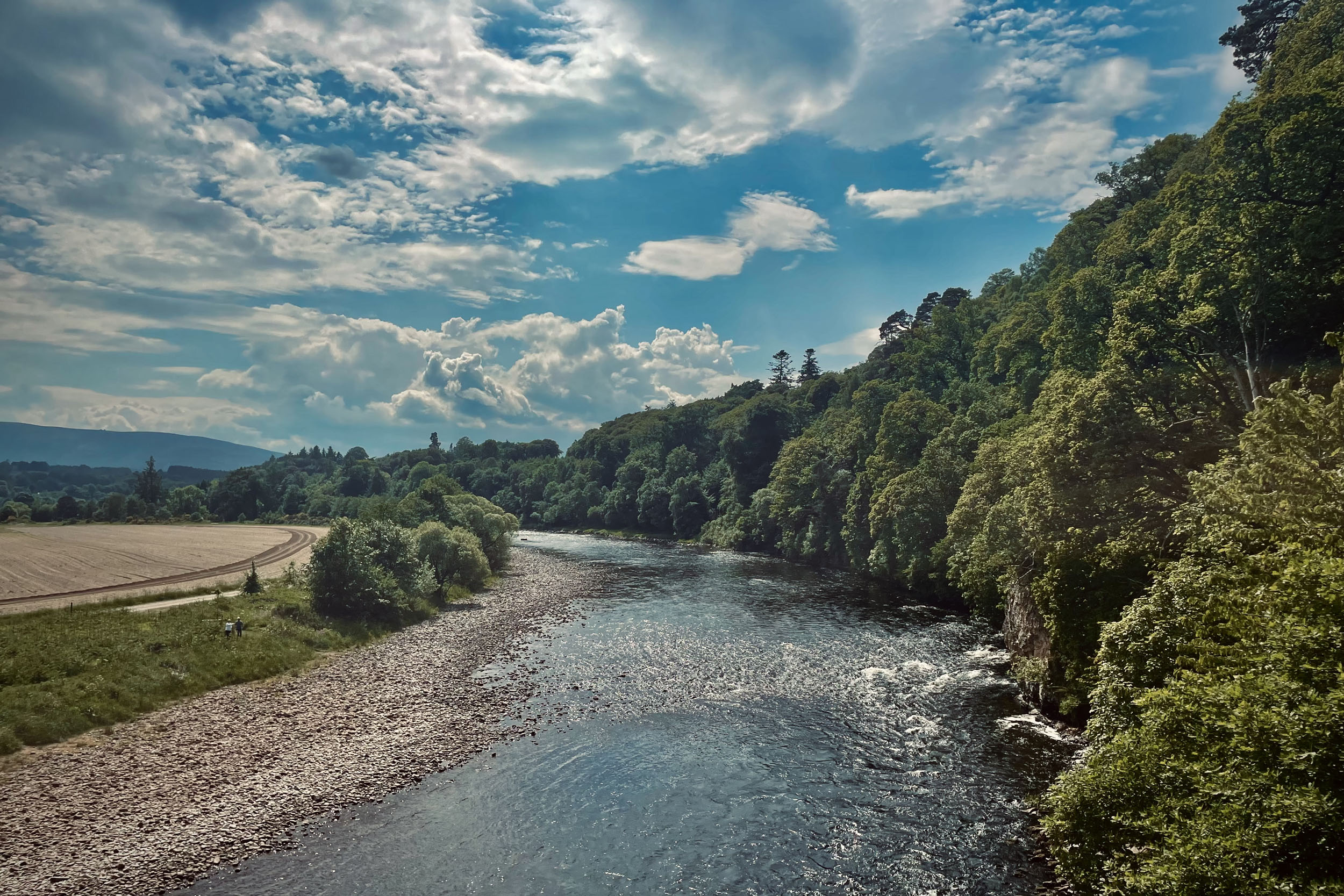
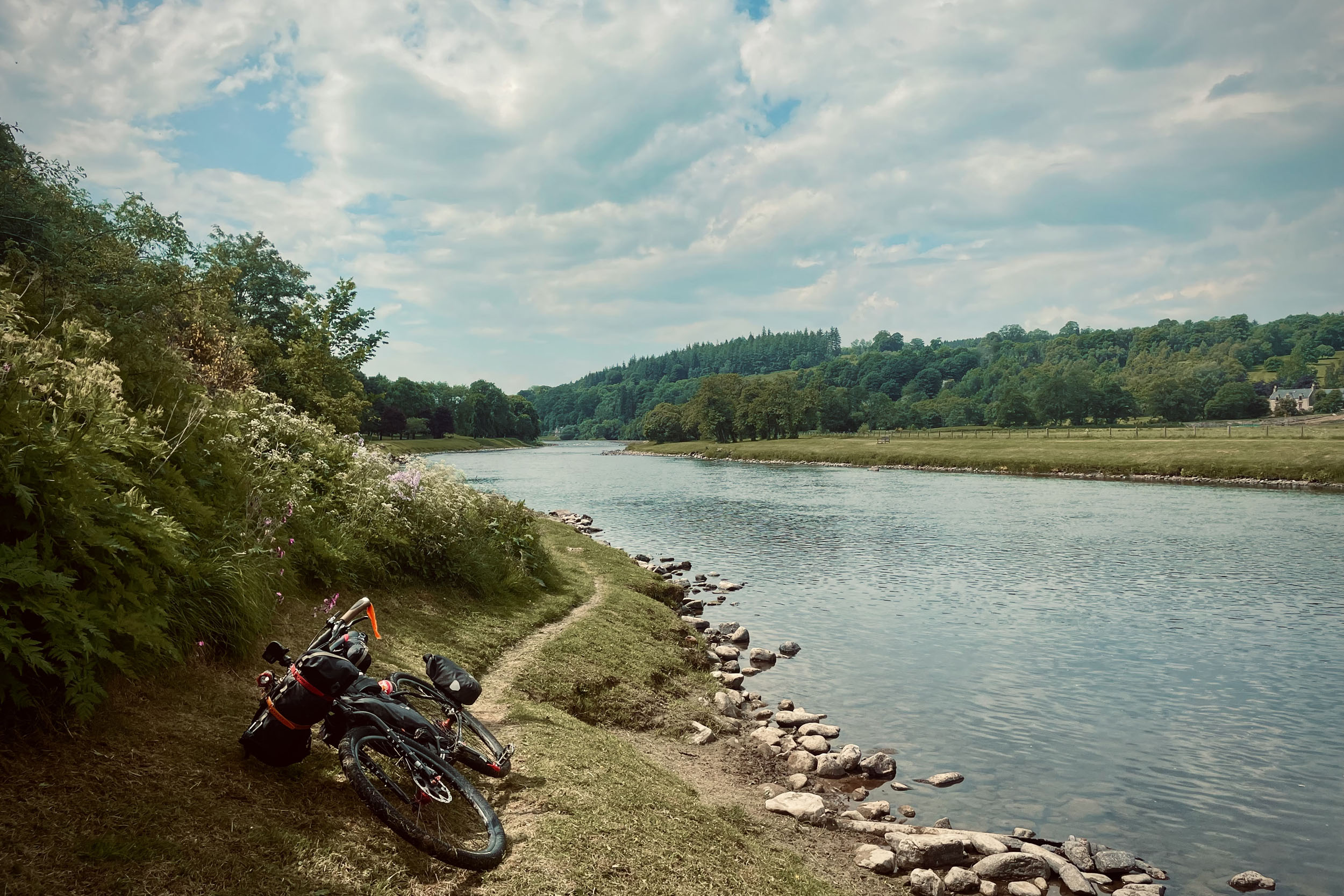
As well as reaching these peaks, the trail passes through several glens, such as Glen Almond, Glen Shee, Glen Isla, and Glen Etive. Among the many notable viewpoints on the way are Tak Ma Doon Road, Bracklinn Waterfalls and Falls of Moness. The Ten Peaks Trail offers riders a variety of landscapes, from narrow gorges to high-altitude panoramic views. The trail passes through many wooded areas and travels on the banks of several rivers, such as River Teith, River Tay, and River Spey.
Cycling the Ten Peaks Trail also gives riders the opportunity to explore Scotland’s rich history and culture. Glasgow, at the start of the route, is the largest city in Scotland with regular train services from all over the country. There are several museums and landmarks in the city that are worth visiting if you can spare some time. Other cultural attractions en route include Doune Castle in Perthshire (of Monty Python, Game of Thrones, and Outlander fame) and the impressive Craigellachie Bridge in Moray.
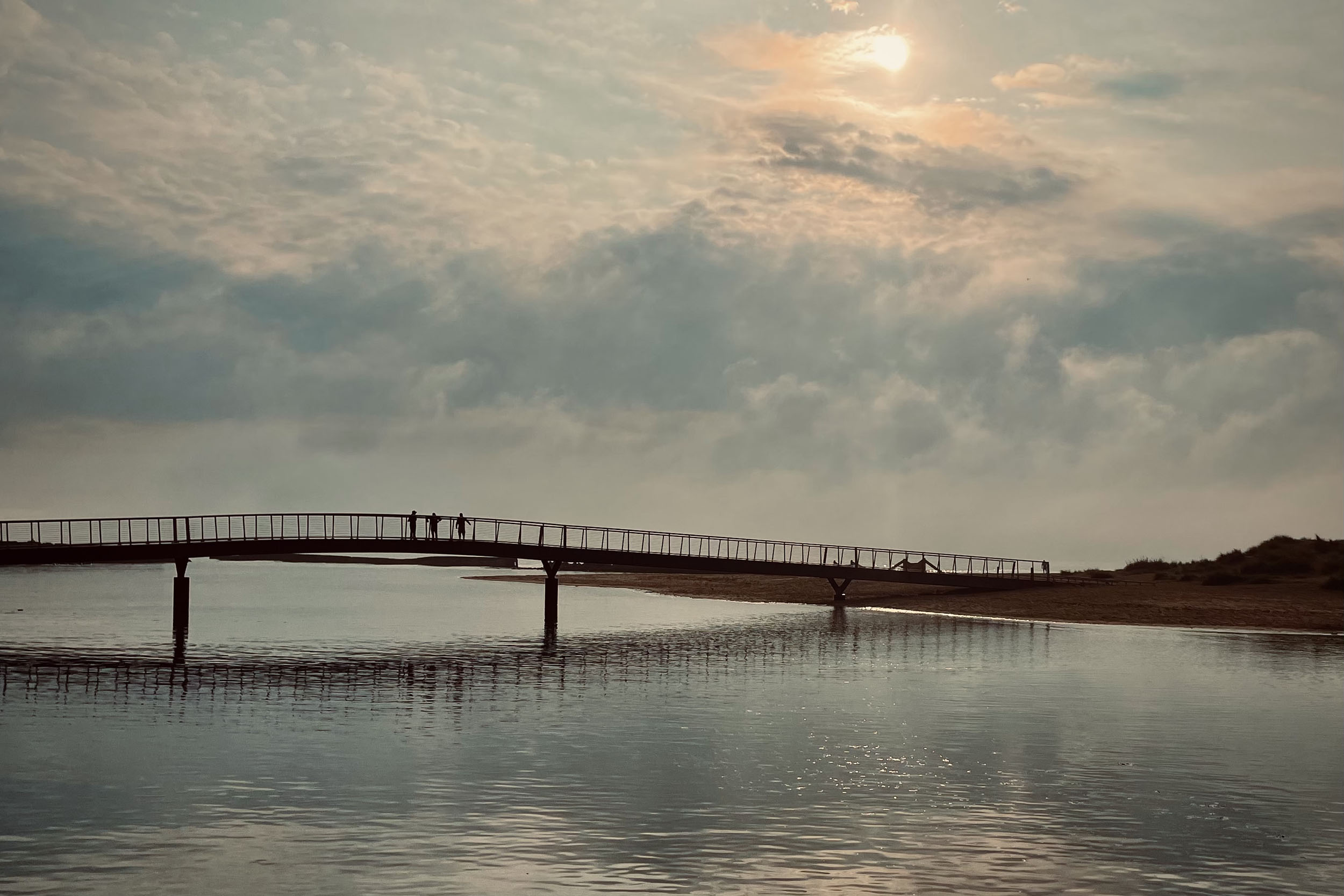
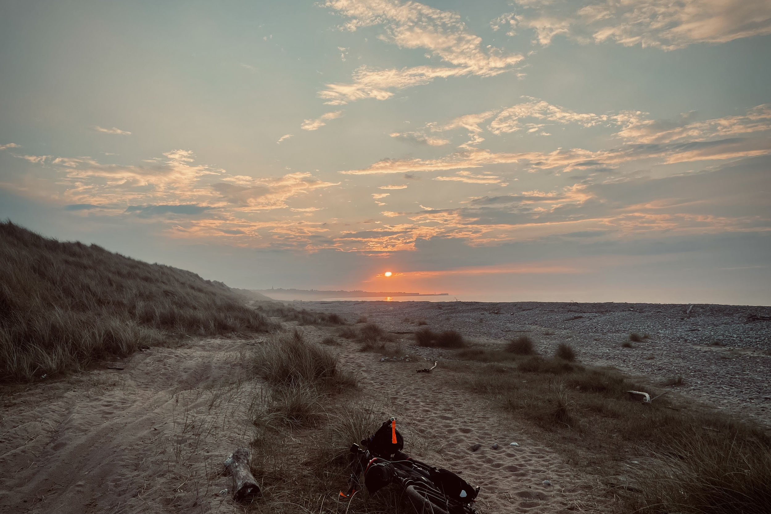
The trail also passes through some of Scotland’s iconic villages and small towns with many amenities. Pitlochry, at 105 miles (170 kilometres) with regular train service, gives you the chance to split the route to two main stages and do it in two goes if that suits you better. Doune, Comrie, Aberfeldy, and Ballater are the other places on the way with many tourist attractions. There are hotels, campsites, B&Bs, shops, and other amenities in each of these places. A stretch of beautiful coastline awaits you at the end of the trail as you reach Lossiemouth, a small coastal town known as the “jewel of the Moray Firth.” You’ll find all the amenities you should need here and will only be 3.7 miles (6 kilometres) away from a train station in Elgin.
The Ten Peaks Trail is a challenging but incredibly rewarding ride that takes riders up, down, and through some of Scotland’s most beautiful and dramatic scenery, from its cultural capital to its north eastern coastline.
Route Difficulty
This route has the overall difficulty of 7.5 out of 10. Physical Demand (8): With max gradient of 23.4%, this route has 27,913 feet (8,508 metres) of climbing over 242 miles (390 kilometres), which means approximately 147 feet (45 metres) per kilometre. A large portion of these climbs are over very rough surfaces in high altitude and are very exposed to the elements. Technical Difficulty (6): Singletrack trails are manageable, and most of the downhills are over wide doubletracks. Resupply & Logistics (8): Although there are many resupply points on the way, this route takes you to very remote locations on the tops of high hills/mountains and through long glens, miles away from any towns or villages.
Route Development: As someone who lives in Glasgow, I have the opportunity to visit the Highlands for regular bikepacking trips, but I’ve always been interested in exploring routes that either start or end in Glasgow. Scotland, being a small and very well-travelled country, makes the development of any long and original bikepacking routes difficult. The Ten Peaks Trail is the result of hours of research and many trips to various locations. I have ridden the whole trail several times and have explored every possible option in order to bring these link-ups together in the best possible way. At sections, Ten Peaks Trail overlaps with previously established bikepacking routes such as The Deeside Trail.


Submit Route Alert
As the leading creator and publisher of bikepacking routes, BIKEPACKING.com endeavors to maintain, improve, and advocate for our growing network of bikepacking routes all over the world. As such, our editorial team, route creators, and Route Stewards serve as mediators for route improvements and opportunities for connectivity, conservation, and community growth around these routes. To facilitate these efforts, we rely on our Bikepacking Collective and the greater bikepacking community to call attention to critical issues and opportunities that are discovered while riding these routes. If you have a vital issue or opportunity regarding this route that pertains to one of the subjects below, please let us know:
Highlights
Must Know
Camping
Food/H2O
Trail Notes
Resources
- The most notable highlights of this trail are its ten peaks. Each of these peaks has a breathtaking view.
- Glasgow, where the trail starts, is the largest city in Scotland and has been named the “culture and creative capital of the UK,” making it a great place to spend some time before you start or after you finish the trail.
- The 14th-century courtyard castle in Doune, with a striking 100-foot-high gatehouse and one of the best preserved great halls in Scotland, is well worth a stop. Doune Castle was used as a film location for Monty Python and the Holy Grail, as well as being used for Winterfell in the pilot of the TV series Game of Thrones and as Castle Leoch in Outlander.
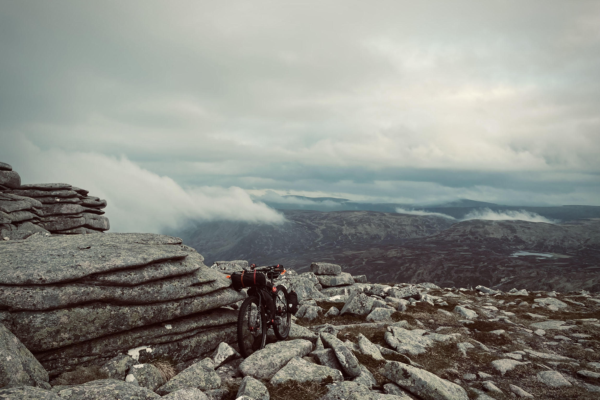
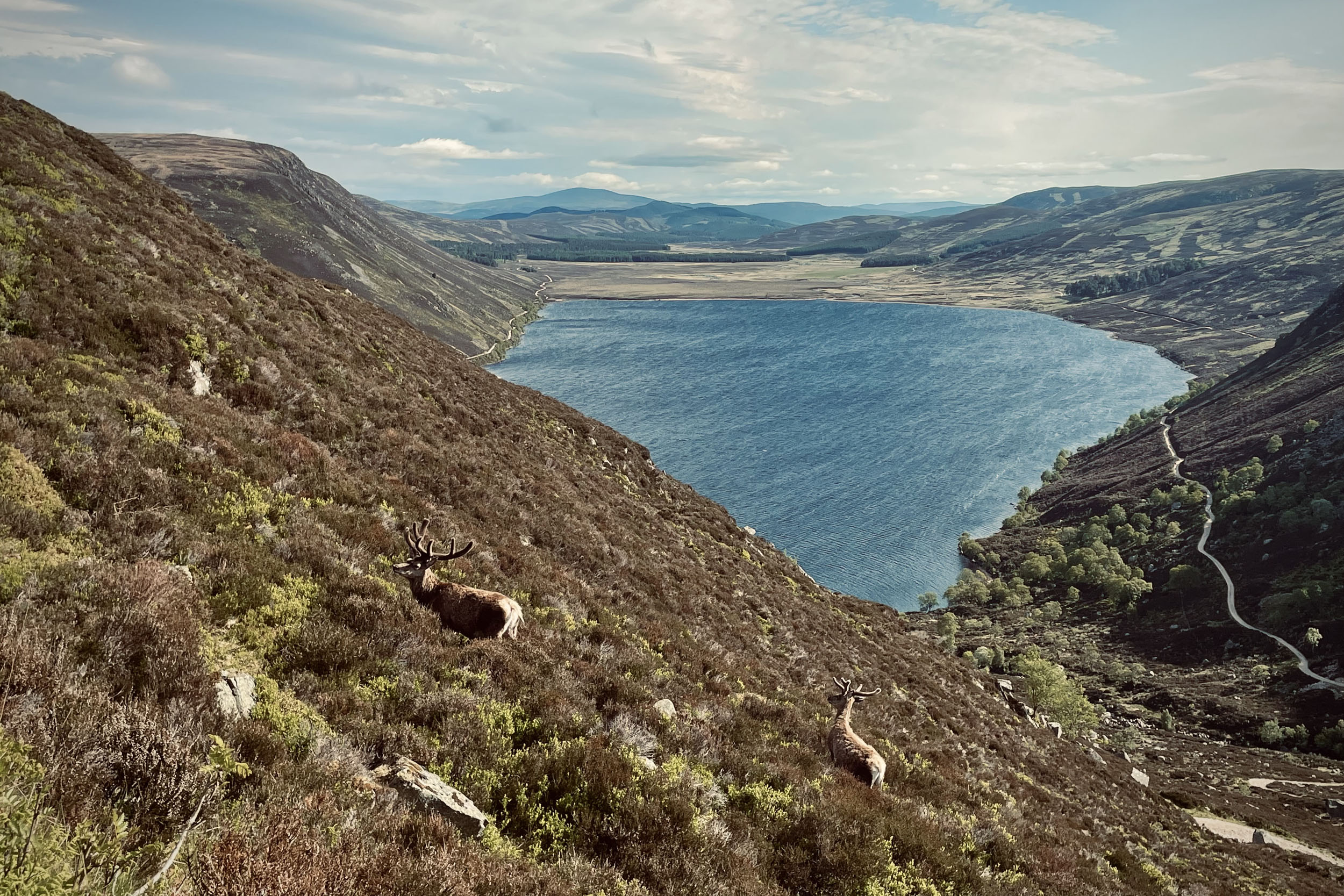
- The ride from Broad Cairn to Loch Muick is one of the most beautiful sections of the trail. This descent starts with a push to come off a boulder field, and you will then enjoy the emerging views of the surrounding hills, and later the loch, as you ride the doubletrack down along the edge of the mountain. The last section is a short zig-zag down to the loch side. There are beautiful camp spots by Loch Muick.
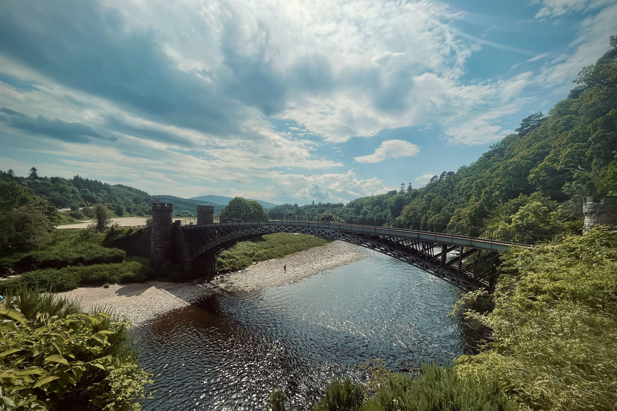
- The Craigellachie Bridge, which spans the River Spey at the village of Craigellachie, is the oldest cast iron bridge in Scotland. The famous engineer Thomas Telford built the bridge between 1812 and 1814. It features two sets of mock-Medieval turrets, standing 15 feet high on each side of the river. It’s possible to cross the bridge on foot, but the best views are from the walkway of the modern replacement.
- Lossiemouth is a treat waiting for you at the end of this route; a picturesque town on the Moray Firth Coast, nestled between two long sandy beaches. The trail ends on the beach on its eastern side (on the western side, you will find the Covesea Lighthouse, which is worth a visit if you have time to explore the area). There are a number of pubs and restaurants in Lossiemouth where you can relax and celebrate finishing the trail with a pint or a wee dram!
- When to Go: April to September is the recommended time for riding the Ten Peaks Trail. Outside of this period, you are likely to face extreme conditions and should consider taking a fatbike.
- Deer Management: Stalking and fencing are the main deer management methods currently used in Scotland. Red deer stag (male) stalking currently takes place between July 1st and October 20th, with increasing activity from August. The first three weeks of October are the busiest time of the stag stalking season and a key period of the year to achieve reductions in deer numbers. Red deer hind (female) stalking takes place from October 21st to February 15th, with the end of the season often being a key period when deer managers work hard to achieve their cull targets. General advice for visiting the hills during this period is to plan ahead and pay close attention to signage on arrival and throughout your visit and use established roads and tracks. The Ten Peaks Trail only uses established routes.
- Logistics: If you are travelling from abroad, VisitScotland is a good website for gathering information about your visit to Scotland.
- Glasgow has train links to and from everywhere in the UK. It also has an international airport with flights from all around the world. Lossiemouth, at the end of the trail, is 3.7 miles (6 kilometres) away from Elgin, which has a train station. There are regular train services from Elgin to Inverness and Aberdeen and from there to all over the UK. There are also international airports in both Inverness and Aberdeen.
- Weather and emergency plan: Scotland’s weather can change very quickly. As the trail takes you to high altitudes and keeps you up there for a while before heading down again, it is necessary to have the right kit and strategy. As sections of the trail are off-grid in remote locations, having a satellite communicator is essential in case of an emergency.
- Locked Gates: You might come across some locked gates along the trail. The reason landowners lock gates is usually to prevent access for quad/dirt bikes. If you come across a locked gate, you will need to lift your bike over it.
- Scottish Outdoor Access Code: “Use a gate where one has been provided and leave it as you find it. Do not climb over gates, fences, dykes, or hedges unless there is no reasonable alternative nearby. If you have to climb over a fence, avoid causing any damage by doing so near to a post. Climb a gate at the hinge end.”
- “Access rights extend to cycling. Cycling on hard surfaces, such as wide paths and tracks, causes few problems. On narrow routes, cycling may cause problems for other people, such as walkers and horse riders. If this occurs, dismount and walk until the path becomes suitable again.”
- Bike type: The Ten Peaks Trail is a MTB route. Hardtail, full-suspension, or rigid mountain bikes with tire widths of 2.4 to 2.8 inches and with the gears set up for steep climbs are the recommended bikes for this trail. Going with the wrong bike is likely to significantly add to the amount of pushing you will need to do on the trail.
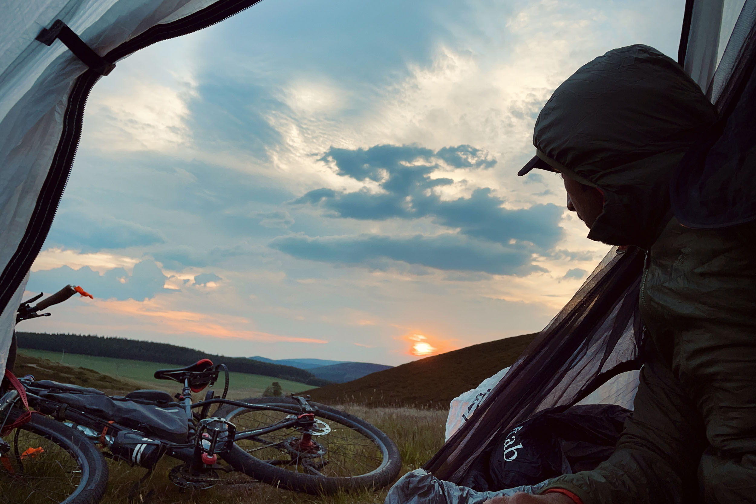
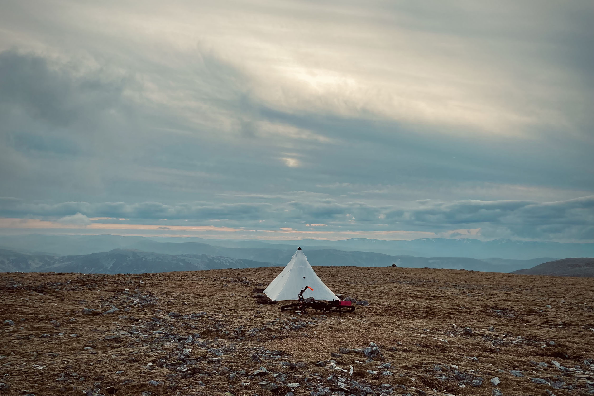
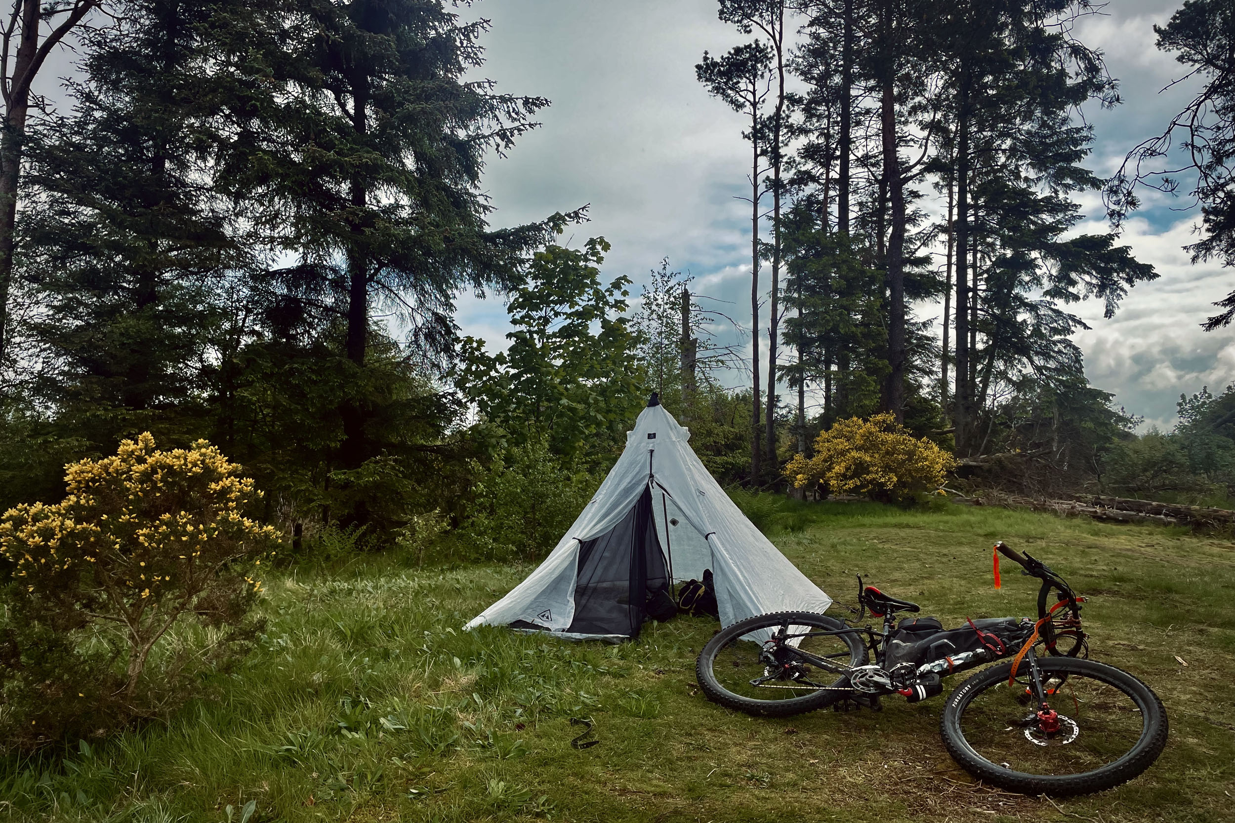
- There is no shortage of good camp spots on the way. I have marked the ones I recommend on the map. The Right to Roam in Scotland means that wild camping is legal on most unenclosed land.
- All of the villages and small towns that the trail passes through offer a variety of lodging, including hostels, hotels, Airbnbs, and traditional B&Bs.
- The following caravan parks on the way offer camping spots and warm showers: Ashmill Caravan Site in Doune, Aberfeldy Caravan Park, Ballater Caravan Park, Speyside Gardens Caravan Park , and Silver Sand Holiday Park in Lossiemouth
- Bothies: There are three bothies on the way, all marked on the map. These are: Upper Lunch Hut, and Glas Allt Shiel. Glas Allt Shiel needs you to take a diversion to reach the bothy. Learn more about Scottish bothies and the bothy code on The Mountain Bothies Association website.
- Emergency Shelters: On the map, I have marked several shelters that can be used as emergency shelters. These are no more than a roof over your head.
- There are many resupply points on the trail; you’ll find shops in the villages and small towns that you pass through. Most of these also have cafes/restaurants.
- In Pitlochry and Ballater, there are outdoor equipment stores that sell camping food as well.
- There is plenty of fresh water in Scotland; you’ll find hundreds of streams and burns that you can refill your bottles from throughout the trail with some of the purest water in the world.
- It is a good idea to pack water purification filters and tablets in case you come across a dodgy stream as your only source of water in sections of the trail.
- I have marked some points on the map where you can refill your bottles.
- In summer, when streams tend to dry out, make sure to fill your bottles before heading up to high altitudes as there is less water up there.
- On the plateau, shortly before reaching the highest point of the trail on Cairn of Claise, I have come across a stream (marked on the map) that flows as late as mid-June. Don’t count on this, however, as it may also disappear.
The Ten Peaks Trail can be divided into two sections: Glasgow to Pitlochry and Pitlochry to Lossiemouth. As Pitlochry has regular train services, you can choose to split the trail and do it in two separate trips if you prefer not to do it all at once (see stage 3 below). These trail notes give a guide of the whole route, split into five stages. These stages do not reflect suggested days but split the route into sections of 75-80 km.
location Glasgow to Keltie Bridge
Stage 1 (80 km)
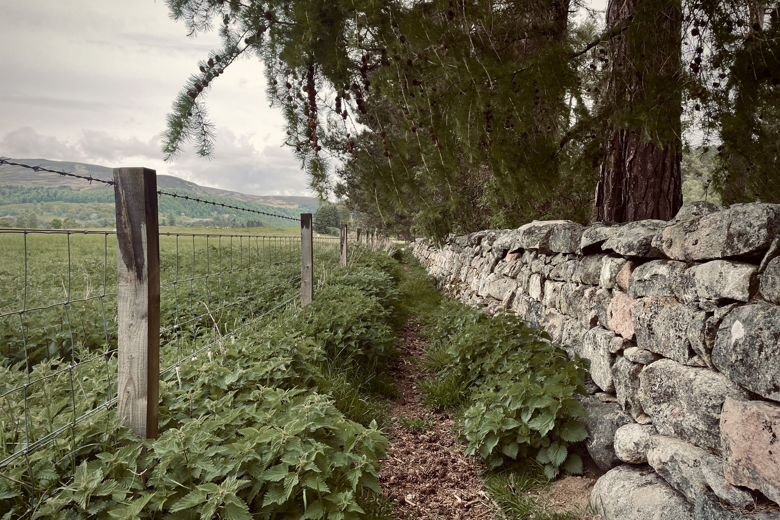
The trail starts in George Square in the centre of Glasgow (outside Queen Street Train Station). From here, you’ll join the Forth and Clyde Canal on a mix of hard-packed gravel and paved tracks (mostly bikeways), which will lead you out of the city towards Kilsythe. Out of Kilsythe, turn into Craigstone Wood and join Take Ma Doon Road. After 4.3 kilometres on paved road, you will turn into a doubletrack gravel path that passes roughly alongside the southside of the Carron Valley Reservoir. After crossing the B818, head up Cringate Law through Earlsburn Wind Farm on a gravel doubletrack. At the other end of the wind farm, you will come to a singletrack and shortly after, reach your first peak of the trail, Carleatheran (485 metres). After 2.9 kilometres of singletrack, you’ll then be rewarded with a zig-zagging downhill into Gargunnock. From here, cycle 5 kilometres on paved roads to Smiddy Farm Shop (a good place to stock up if you need to). From there, turn right into The Blair Drummond Caravan Park road and then join a mix of trails on the bank of the River Teith before reaching Doune. From Doune, you will be on a singletrack on the other side of River Teith to Old Kilmadock cemetery. There are good camp spots around here. After the cemetery, the trails follow mostly quiet paved roads for 8.6 km to Keltie Bridge.
location Keltie Bridge to Aberfeldy
Stage 2 (77 km)
From Keltie Bridge, you will join local paths that take you to Bracklinn Falls and Bridge. After the bridge and a short section of singletrack, you will come to a gravel road that takes you all the way to Comrie through Glen Artney (expect some rough and boggy tracks for a few kilometres of this section before coming to Comrie). Comrie is another place to have a meal and resupply. From Comrie, you will enter Glen Lednock. You will start here by riding on singletracks that lead you to Laggan Woods passing Caldorn Waterfalls. Farther up, after cycling through a farm, you will join Monument Road, which takes you to Invergeldie Estate, the starting point of your climb to the second peak of the trail and your first Munro, Ben Chonzie (931 metres). There is a 70% rideable, 7-kilometre double/singletrack with an overall gradient of 20% that takes you up Ben Chonzie, with some pushing involved. In case the climbing of Ben Chonzie feels too strenuous, there is a 4-kilometre gravel shortcut around the hill that you can take. You can find the route for the shortcut via this link. From the top, follow the line given on the GPX file for a kilometre, which leads you to a rough gravel road that goes all the way down to Glen Almond. After a mile in Glen Almond, you take a left and follow a 70% rideable, 6.8-kilometre gravel track with overall gradient of 22% to the top of your third peak, Sron a’ Chaoineidh (865 metres). From this peak, head down to Glen Quaich and cross River Quaich, then up and over a hill, which will take you to Green Bothy and Aberfeldy (another good spot for a meal, rest, or resupply).
location Aberfeldy to Glen Isla
Stage 3 (75 km)
Out of Aberfeldy, after 1.2 kilometres on the A827, you will join the Rob Roy Way, a singletrack on the bank of River Tay all the way to Grandtully. After this, cross River Tay and continue on the Rob Roy Way up the hill through the woods of Strathtay village to reach Pitlochry. There are very good amenities in Pitlochry, including train services. This is where you can split the route, if you decide to do it in two trips. From here, you will be on Perth Rd (A924) for 1.7 kilometres before turning onto quiet rural paved roads for a further 8.5 kilometres. After this break on paved roads, you’ll join a mix of gravel and boggy singletrack that takes you all the way over the hills of Achnahosher to Kirkmichael. On the way, you will find good camp spots by Lochan Oisinneach Mor. Kirkmichael has a village shop with food and snacks. From here, you will be on the mixed surface of the Cateran Trail, which takes you to the Spittal of Glenshee through Calamanach Wood passing Upper Lunch Hut. After the hut, there is a section of pushing your bike before heading down the hill over a singletrack to Glenshee. From here, you will carry on riding The Cateran Trail over singletrack trails for a further 9.2 kilometres before joining the B951 and turning into Glen Isla. Now cycle for 9 kilometres over a mix of paved and gravel tracks. You might want to call it a day here, find a camp spot, get a good night’s sleep, and get ready for a big day tomorrow.
location Glen Isla to Glen Livet
Stage 4 (80 km)
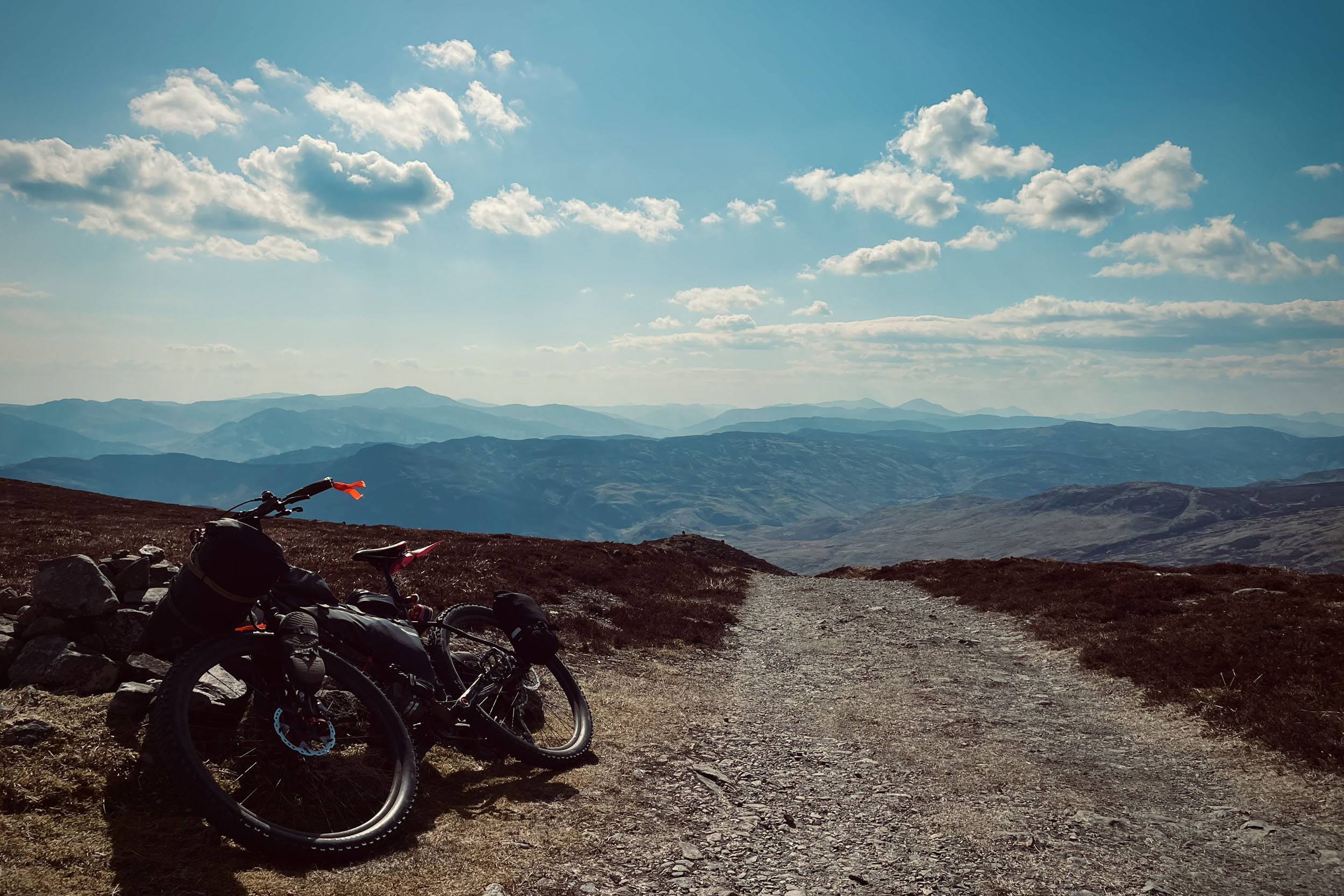
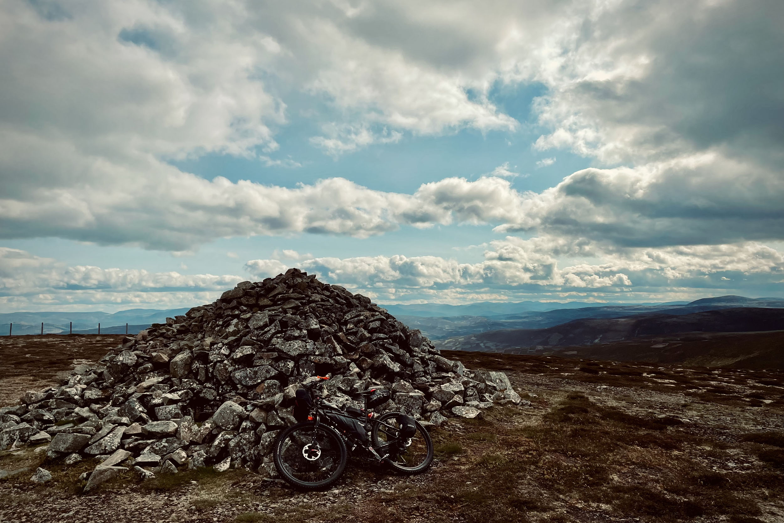
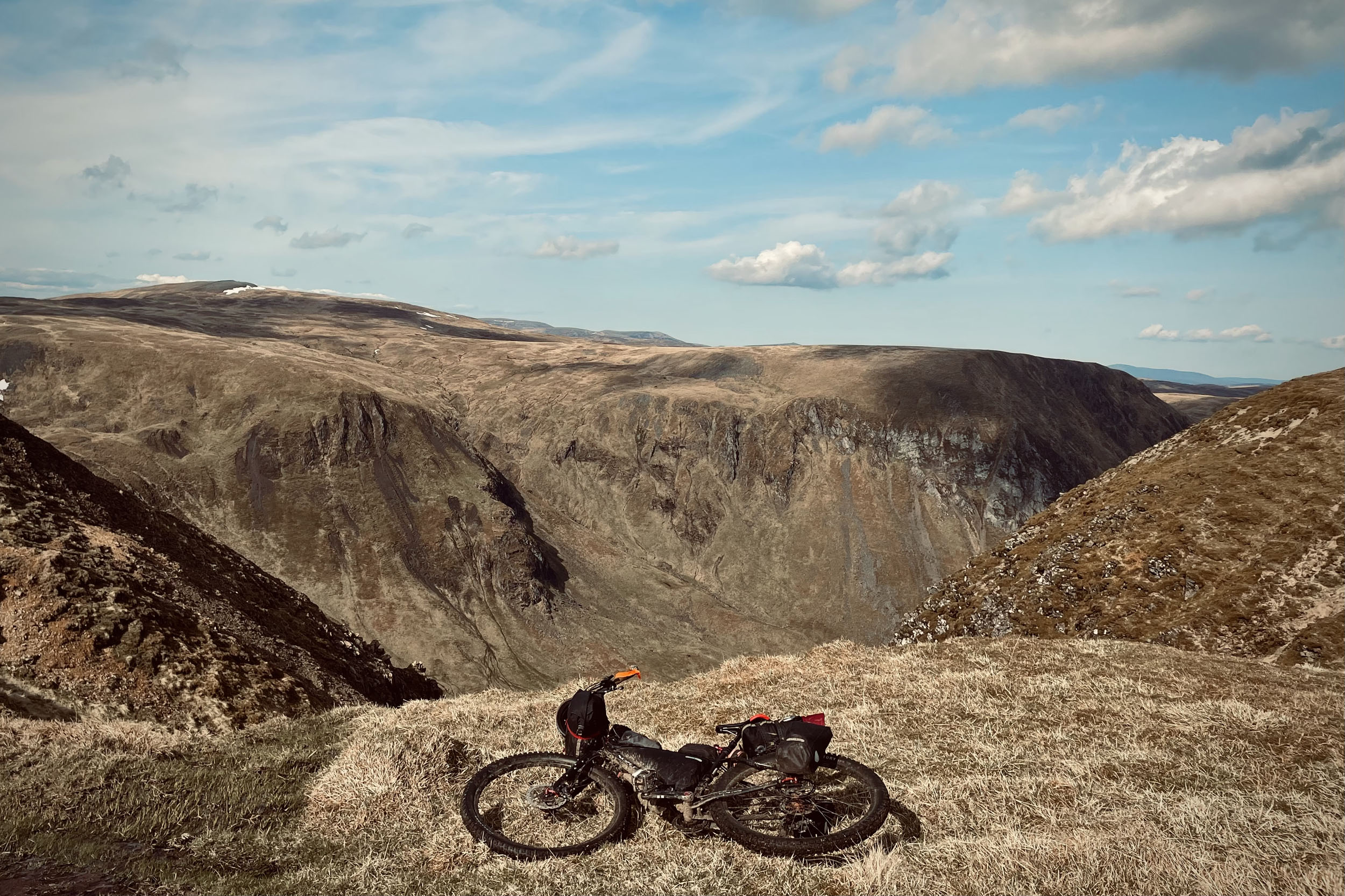
This is the most physically demanding section of Ten Peaks Trail. This section starts by a climb up The Monega Pass. There are two options for this climb. Option 1 is to follow the line that map shows you and climb up a 60% rideable, 5.5-kilometre rough gravel road with 18% gradient to the top of your forth peak, Little Glas Maol (970 metres). Option 2 is to cycle 1.2 kilometres further through the Glen Isla. After crossing Glas Burn, take the left and push up the hill through a 10% rideable, 3.7-kilometre singletrack trail with a 25% gradient to reach the top. You will find the route for option 2 via this link. On the top, you are on a plateau and will be riding a 70% rideable singletrack surrounded by breathtaking views before heading down. After 4.5 kilometres, you will crest the second Munro and stand on the highest point of Ten Peaks Trail, Cairn of Claise (1,064 metres), which is very exposed to the elements.
In case of deteriorating weather conditions and the need for a faster descent from the plateau to safety, you have the option of riding on a doubletrack for 6.5 kilometres to an open bothy (Callater Stable Bothy) and avoiding rest of the peaks. If you happen to come down the plateau taking this line, going back up the hill to rejoin the trail will be very brave. However, from this bothy you can also carry on to Braemar on Jock’s Road and from there to Ballater to rejoin the Ten Peaks Trail. The whole line from the top to Ballater is 40 kilometres and almost 100% rideable with 46% paved road. This is the map link to this rescue line.
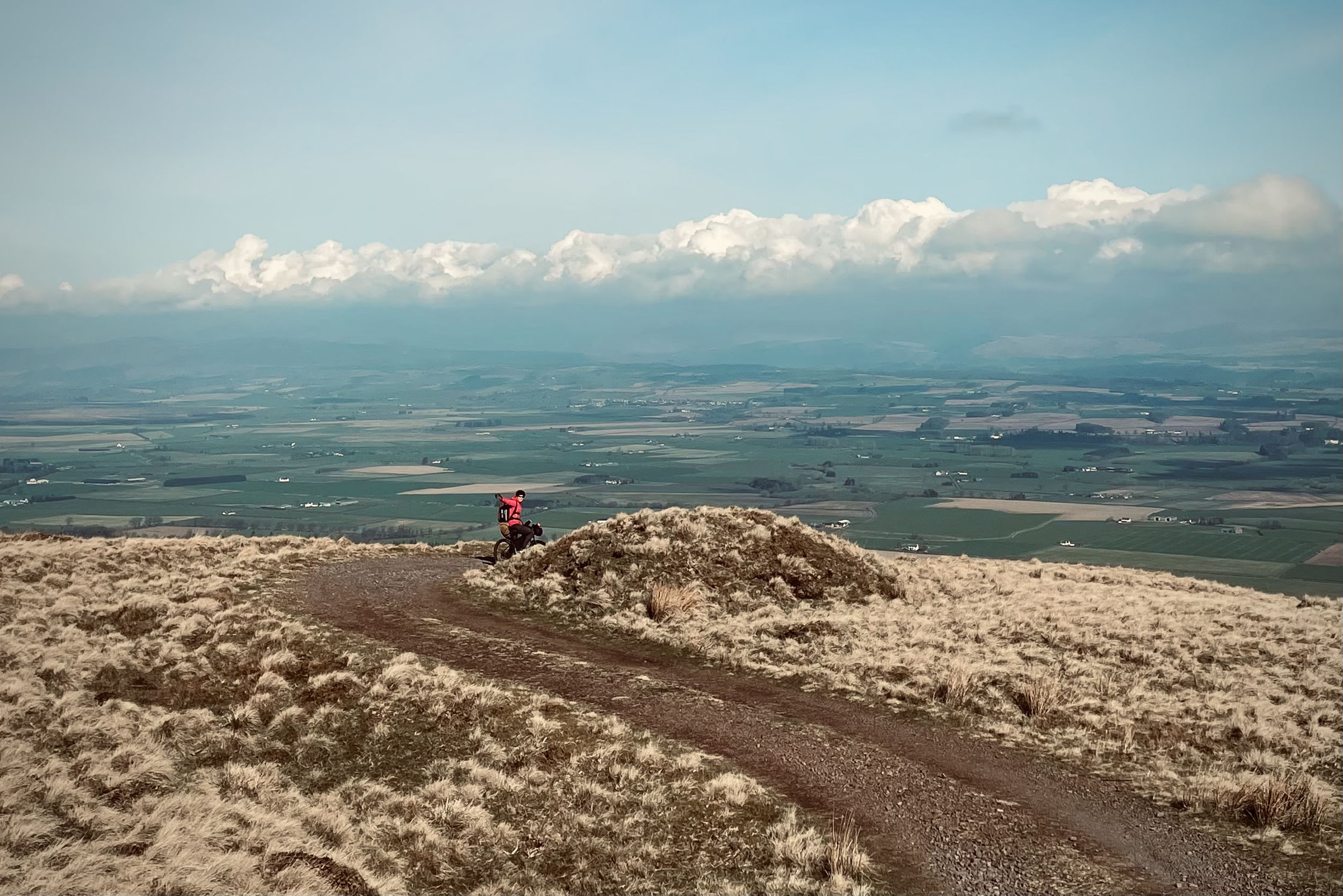
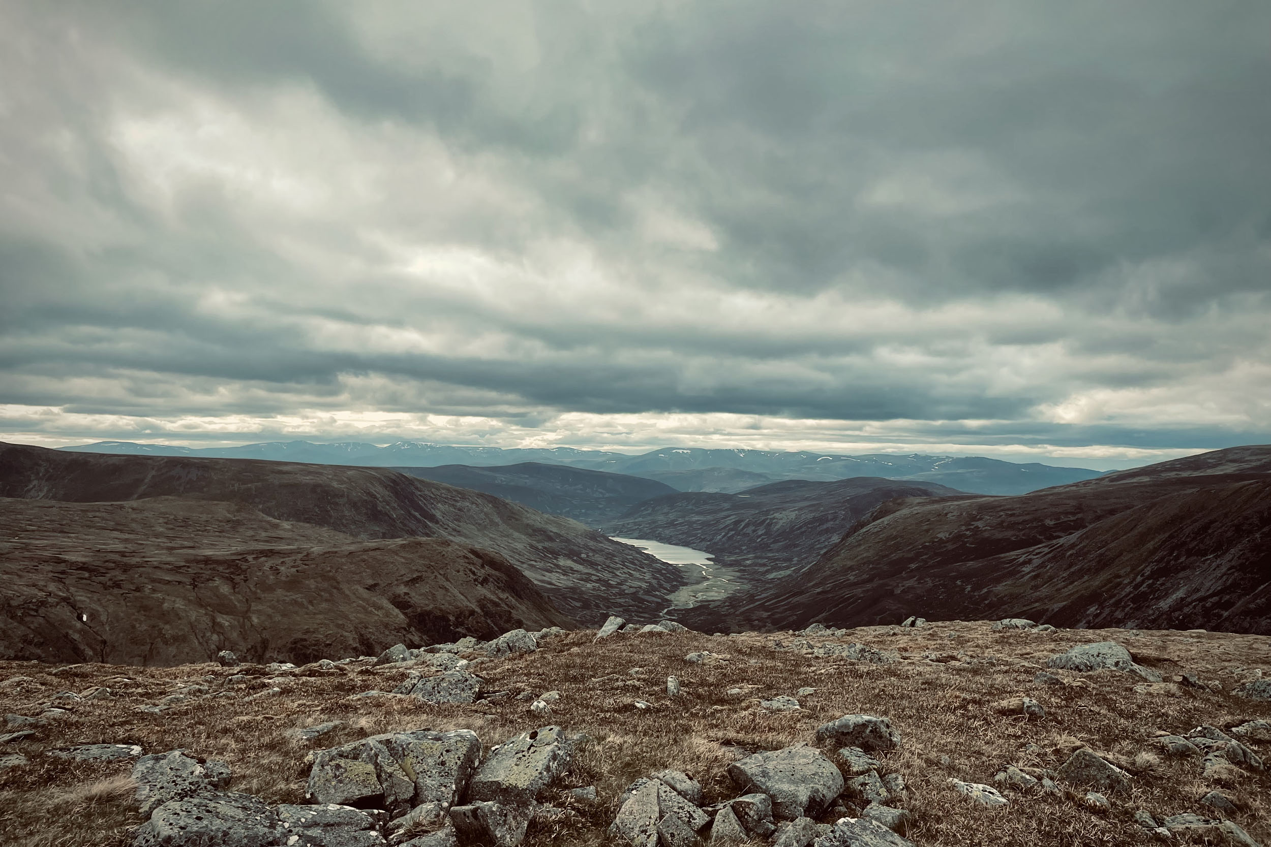
From Cairn of Claise, carry on for 3 kilometres on the singletrack (with some boggy sections to negotiate) to reach the sixth peak and your third Munro, Tolmount (958 metres). After 2.7 kilometres, you are on your seventh peak, Faferine (997 metres) and shortly after, you will scale your eight peak and the fourth Munro, Cairn Bannoch (1,010 metres). From this peak, you will ride and push for 2.2 kilometres to reach the top of your ninth peak and the last Munro of the trail, Broad Cairn (998 metres). To come off this top, there is a short section of boulder field (0.4 kilometres) that you need to negotiate by going around it before heading down the hill to Glen Muick. Shortly after coming off the boulder field, you will be rewarded by a well-maintained and fairly technical singletrack trail that leads you to a gravel road. This gravel, which later crosses to the other side of the glen on the beach of Loch Muick, will take you all the way to Ballater and overlaps with the Deeside Trail for a short section. On the way, make sure to look back and check the magnitude of the hills you have just scaled. Ballater offers all kinds of amenities, including a bike shop. Make sure to stock up here as the next shops are 66 kilometres away.
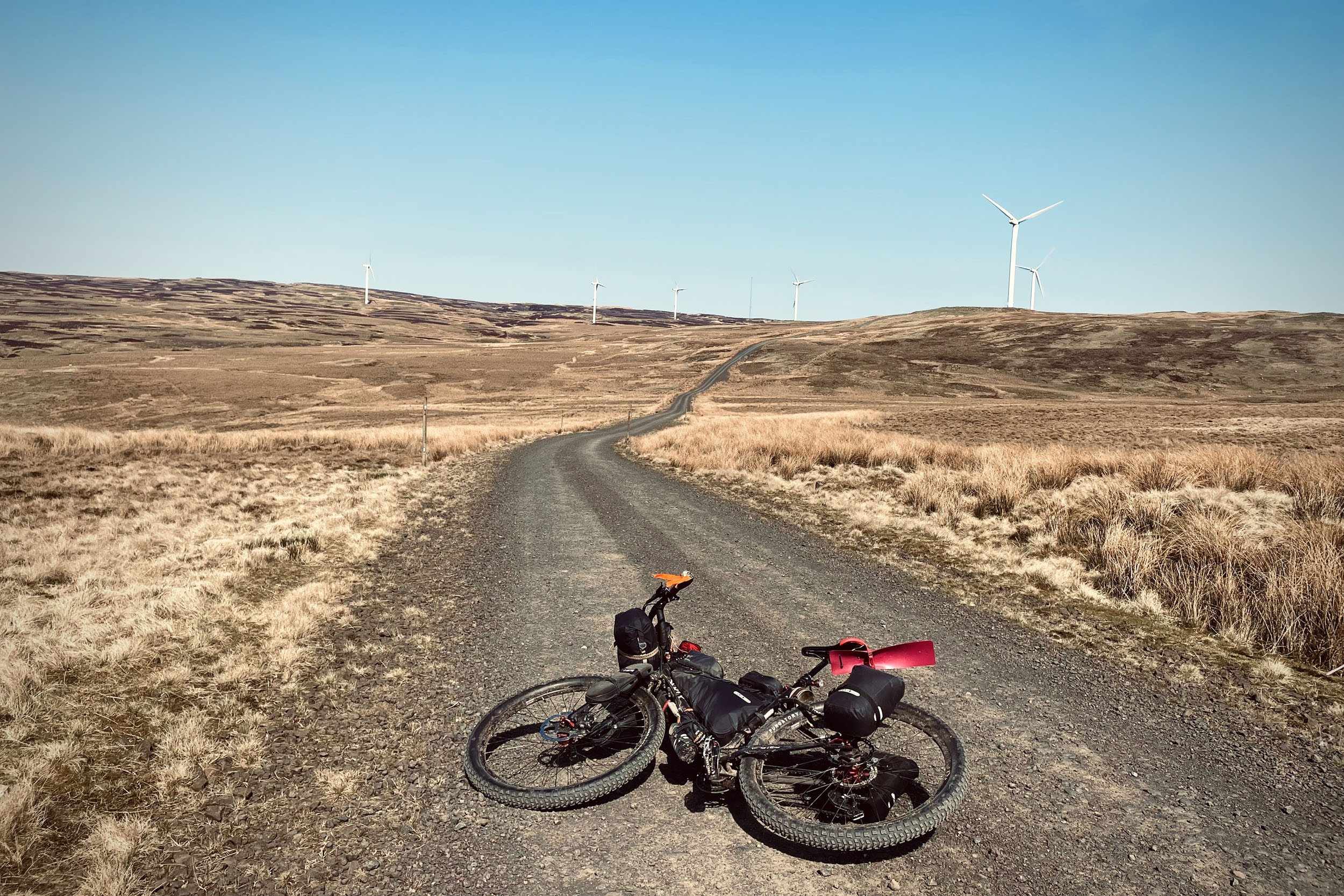
From Ballater, you will ride on Braemar Rd (A93) for 1.5 kilometres before turning into a gravel road that takes you around the hills of Candacraig and over Peter’s Hill. After crossing Morven Burn and passing Morven Lodge, you will start climbing for the last peak of the trail, The Mona Gowan (749 metres). The last 700-metre stretch of this climb is on a bushy singletrack that takes you to the top of this hill with an impressive view and a huge cairn. From the top, you will enjoy a downhill gravel track that will later cross River Don and the A944 to enter Glen Ernan. Through this glen, you have 95% rideable gravel road for 11.5 kilometres before reaching a left turn into the Ladder Rd. After this turn, you will push your bike up a hill for 1 kilometre before reaching the top and crossing Aberdeenshire to Moray county. From the top, you have a bushy singletrack down the hill before arriving at an ideal camp spot marked on the map in Glen Livet.
location Glen Livet to Lossiemouth
Stage 5 (76.5 km)
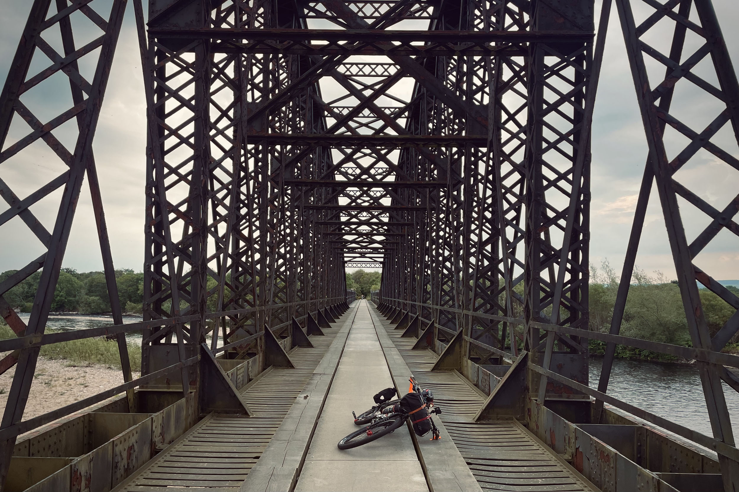
The last stage of the Ten Peaks Trail starts on gravel roads through Glens Livet and Suie. After 4.8km through this stage, you have the crossing of River Livet. Further up, you will start climbing up Corryhabbie Hill on Morton’s Way. From the top of this climb, you will head down to Glen Rinnes on gravel for 4.5 kilometres and join a paved road which will later cross B9009 and goes to Aberlour, passing the Glenallachie Distillery. A short singletrack and bikeway on the bank of the River Spey will take you to Craigellachie Bridge. After the bridge, you are on a paved road for 4 kilometres before turning onto a gravel road and through the Woods of Arndilly and Knockmore. After crossing the B0103, you will ride a paved road through the Woods of Cairnty for 8 kilometres and get to Fochabers (there is an award-winning fish and chip shop marked on the map here). From here, you are on the gravel Speyside Way for 5.6 kilometres before reaching the Spey Viaduct, an old railway bridge that crosses the iconic Spey River. After crossing over the bridge, you will come to Kingston on Spey. From here, you are on an 11-kilometre home stretch of the Ten Peaks Trail. This section is a mix of trails over both hard and soft grounds. You will cycle through the remnants of WW2 anti-tank blocks and pillboxes. The last few kilometres of the trail is on Lossie Beach. This is a beautiful stretch of sandy beach that will bring you to the finishing line.
Additional Resources
- Scottish Outdoor Access Code
- Walking Highlands
- Visit Scotland
- Met Office (weather forecast)


Terms of Use: As with each bikepacking route guide published on BIKEPACKING.com, should you choose to cycle this route, do so at your own risk. Prior to setting out check current local weather, conditions, and land/road closures. While riding, obey all public and private land use restrictions and rules, carry proper safety and navigational equipment, and of course, follow the #leavenotrace guidelines. The information found herein is simply a planning resource to be used as a point of inspiration in conjunction with your own due-diligence. In spite of the fact that this route, associated GPS track (GPX and maps), and all route guidelines were prepared under diligent research by the specified contributor and/or contributors, the accuracy of such and judgement of the author is not guaranteed. BIKEPACKING.com LLC, its partners, associates, and contributors are in no way liable for personal injury, damage to personal property, or any other such situation that might happen to individual riders cycling or following this route.
Please keep the conversation civil, constructive, and inclusive, or your comment will be removed.