


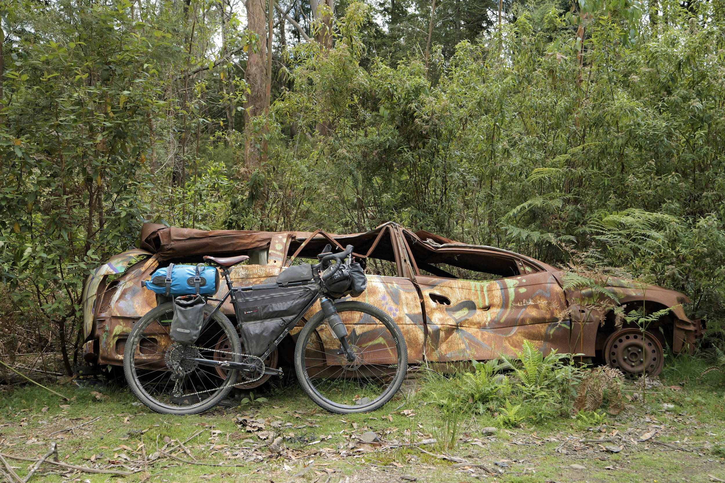
The Tassie Traverse
Distance
593 Mi.
(954 KM)Days
14
% Unpaved
66%
% Singletrack
1%
% Rideable (time)
99%
Total Ascent
48,848'
(14,889 M)High Point
4,740'
(1,445 M)Difficulty (1-10)
5?
- 5Climbing Scale Moderate82 FT/MI (16 M/KM)
- 4Technical Difficulty Fair
- 6Physical Demand Moderate
- 4Resupply & Logistics Fair
Contributed By

Mick Turnbull
Guest Contributor
Mick Turnbull is based in Hobart, Tasmania, a wee little island often left off maps of Australia. He loves to combine travel, movement, nature, and stories and started bikepacking with his partner Danielle in 2016 after looking for a new “travel sport” to replace rock climbing. You can follow Mick on Instagram @mick.turnbull or check out his YouTube channel.
The 955-kilometre Tassie Traverse starts in Launceston and winds its way south to Nipaluna (Hobart). Tassie may be small, but it punches well above its weight. The route takes you through some of the island’s best-known spots (at least those reachable by bike), including national parks and mountain biking towns. You can speed through it, but we’d recommend stopping along the way for a day or two to ride some of the trails and see the sights in the national parks. The route is designed to pass through plenty of small towns and villages to top up supplies, so most riders will only need to carry enough food for a day or two at a time.
You will ride through the lands of the Palawa or Pakana peoples, who have cared for and lived with this island for more than 35,000 years, and continue to do so. Their ancestors moved across these same valleys, coasts, and highlands that the Tassie Traverse now follows.
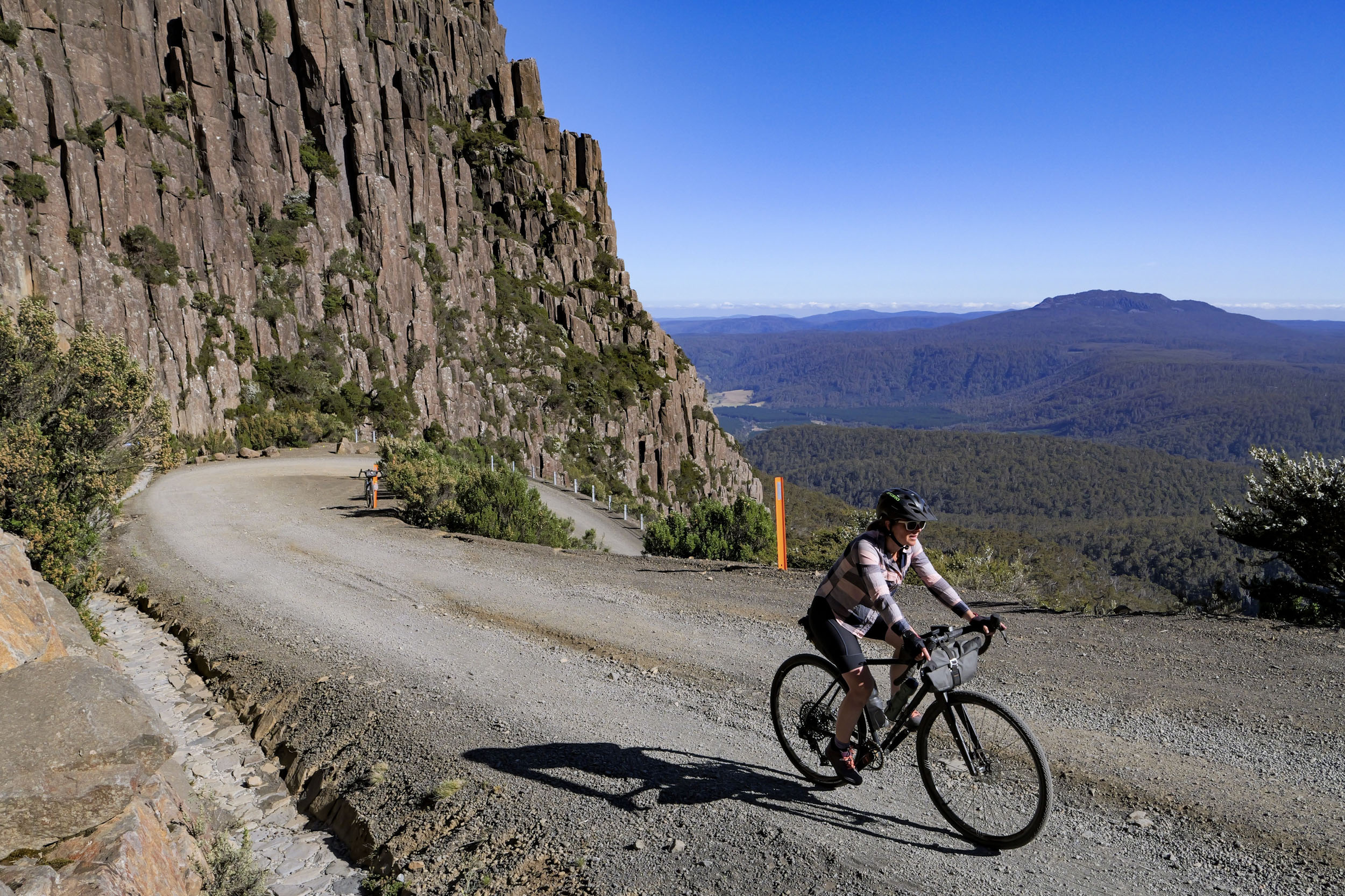
The first major climb of the route is through Ben Lomond National Park, where you’ll ride the switchbacks of Jacobs Ladder to the Ben Lomond ski village at 1,460 metres, arguably one of Australia’s best gravel climbs. The road begins in dry stringybark forest before opening out beneath dolerite columns and scree slope. Some will enjoy the steep switchbacks, others less so. Expect to see low alpine shrubs, tussock grasses, and wildflowers in spring and summer. For riders with the legs and the time, a detour to the alpine plateau of Mount Barrow, another dolerite massif, offers another just-as-stunning set of views across the valley and through to Launceston.
You’ll pass through some of the mountain biking areas that have made Tassie famous: Derby, St Helens, and (within 12 kilometres of) Maydena. It’s worth spending a bit of extra time in Derby and/or St Helens—think flow trails through rainforest and good trail-town vibes. For those with a penchant for a gravity-fuelled descents, Maydena Bike Park offers the Southern Hemisphere’s biggest vertical descent and has twice hosted Red Bull Hardline.
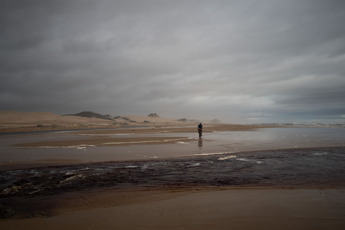
The east coast of Lutruwita (Tasmania) is known for its white beaches, clear water, and granite boulders splashed with orange lichen. Highlights of this part of the route include the beaches at the Bay of Fires Conservation Area and Freycinet National Park, with its pink granite peaks, quiet bays, and wildlife. The famous Wineglass Bay beneath the Hazards with its absurdly white sand is well worth a rest-day walk.


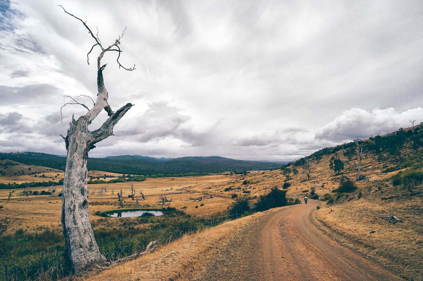
As you climb towards the Central Highlands, you’ll be struck by the eerie beauty of the lakes and surrounding alpine and semi-alpine vegetation. The plateau sits at an average altitude of 900 metres, so prepare for cooler weather, even in the middle of summer. Here, you’ll ride on quiet gravel roads and camp on the shores of several lakes. The Highlands are a hub for fly-fishing, so if that’s your thing, come prepared.
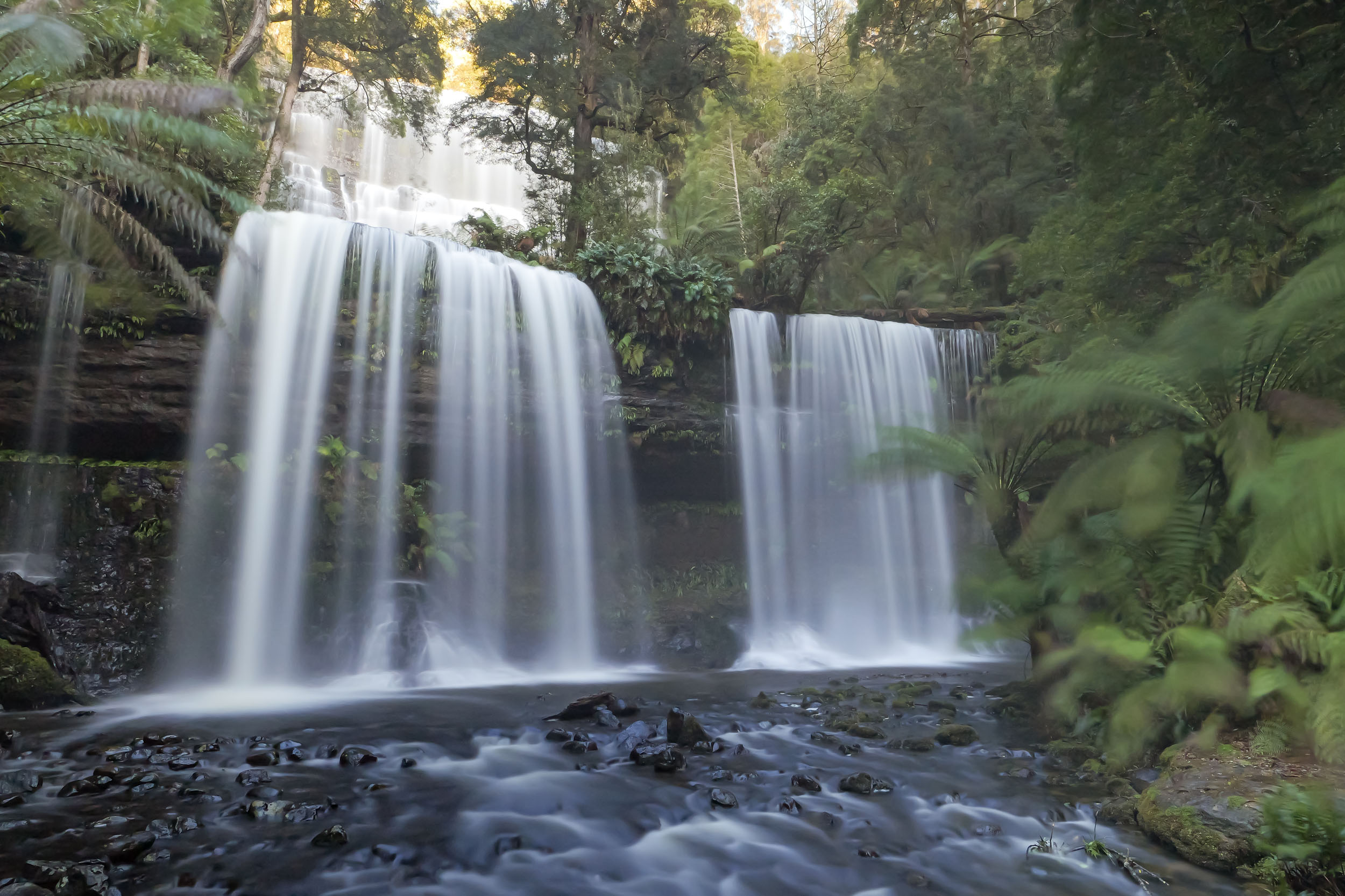
After descending from the Central Highlands, you’ll detour to Mt Field National Park, which has some beautiful alpine hiking. If you don’t have the legs, there are still several shorter hikes worth visiting, including to Russell Falls and Tall Trees Track. Take the time to look for platypus in the streams near camp.
Approaching the finish in Hobart, it’s only a 13-kilometre (with 840 metres of climbing) detour to the summit of Kunanyi (Mount Wellington) for panoramic views of the city, harbour, and surrounding wilderness. The ride proper finishes on Hobart’s historic waterfront, a great place to explore its heritage and architecture or check out other attractions, including MONA (Museum of Old and New Art).
You will not go hungry or thirsty. Tasmania is known for its fresh, high-quality food and drink. Think seafood, fruit, vegetables, and dairy. Cool-climate wines, craft beers, and small distilleries producing top-quality whisky, gin, and beer also abound.
Route Development: While there has always been plenty of good gravel riding in Tassie, there has never been a line on the map that links the island’s best places to visit. It’s something that has been on many people’s lists for many years. Scouting (and plenty of re-scouting) for this version began in late 2024 and wrapped up by October 2025. The biggest challenges were narrowing down the options and avoiding too many busy roads when linking sections. This route is far from a solo effort. Many knowledgeable locals contributed their time, insights, and feedback, including Danielle O’Hara, Emma Flukes, Scott Mattern, Robb Clifton, Kim Gontie, and Steve Chapman. A big thanks to everyone who helped bring it to life!


Submit Route Alert
As the leading creator and publisher of bikepacking routes, BIKEPACKING.com endeavors to maintain, improve, and advocate for our growing network of bikepacking routes all over the world. As such, our editorial team, route creators, and Route Stewards serve as mediators for route improvements and opportunities for connectivity, conservation, and community growth around these routes. To facilitate these efforts, we rely on our Bikepacking Collective and the greater bikepacking community to call attention to critical issues and opportunities that are discovered while riding these routes. If you have a vital issue or opportunity regarding this route that pertains to one of the subjects below, please let us know:
Highlights
Must Know
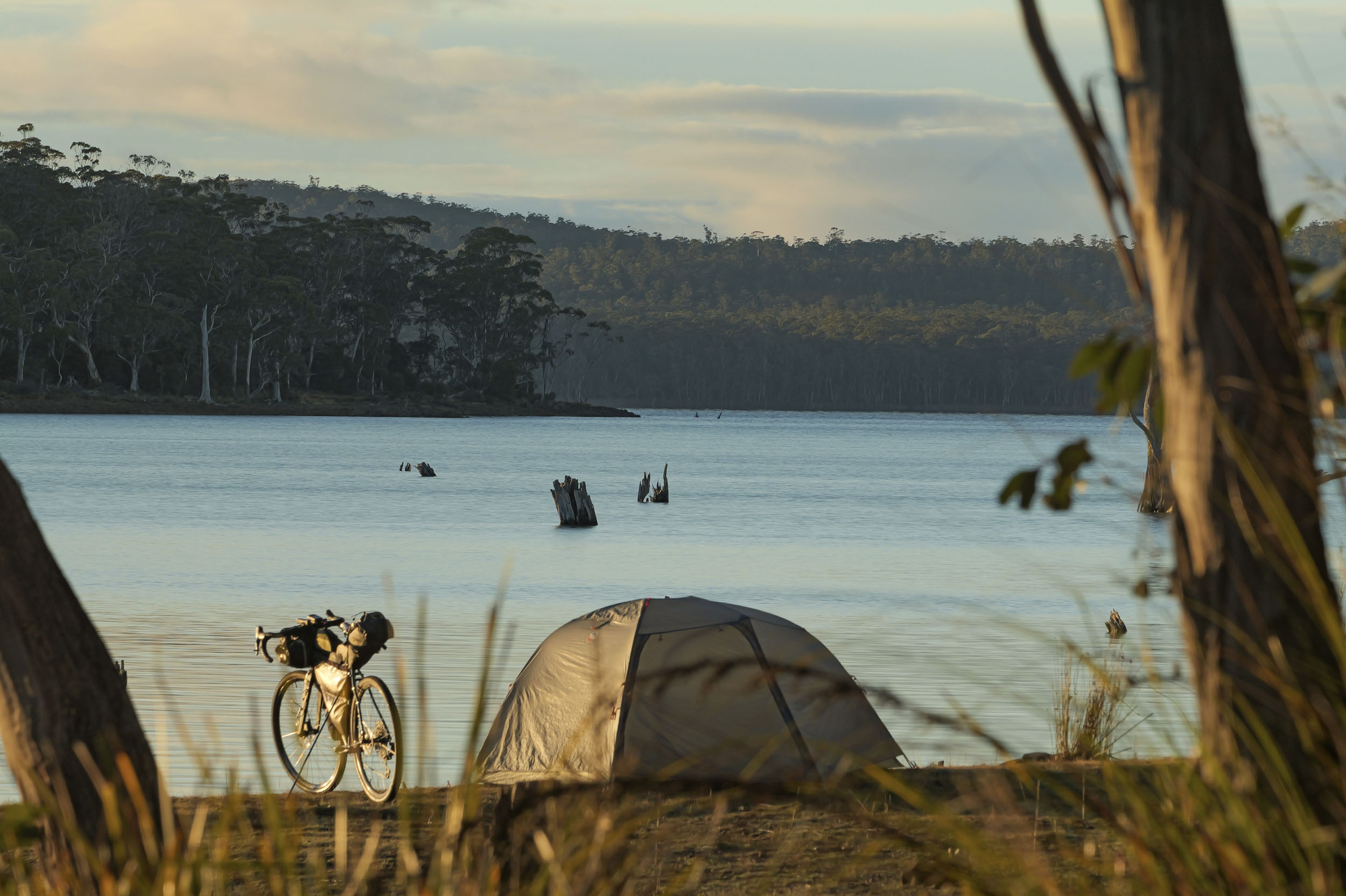
Camping
Food/H2O
Trail Notes
Resources
- Riding the mountain bike trails of Derby, St Helens, and Maydena.
- Hiking to Wineglass Bay or The Hazards in Freycinet National Park on a rest day.
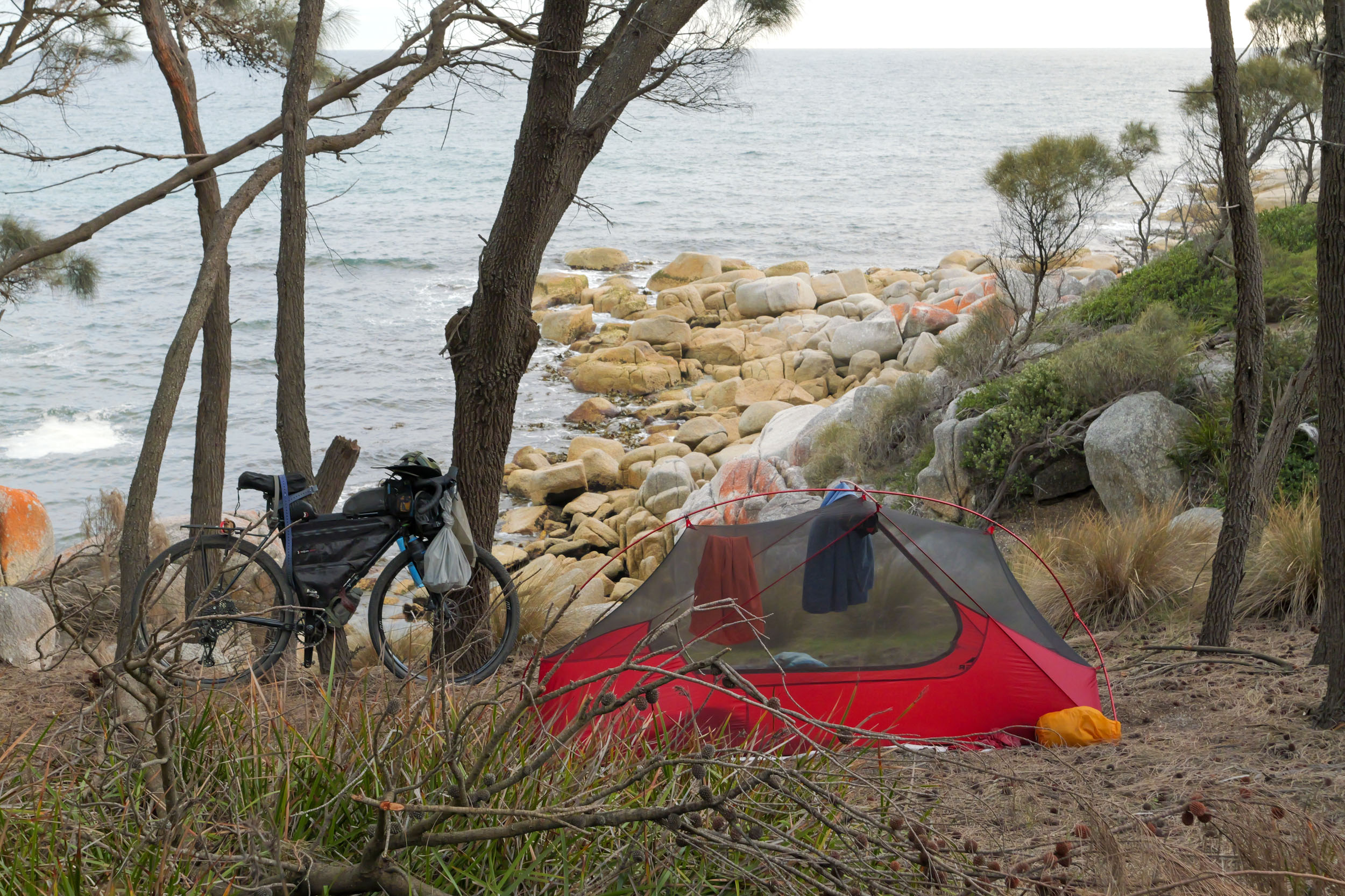
- Camping at Bay of Fires Conservation Area with its white beaches and orange-lichen-covered granite rocks.
- Riding up Ben Lomond and the switchbacks of Jacobs Ladder (and the detour up Mount Barrow if you have the time and legs).
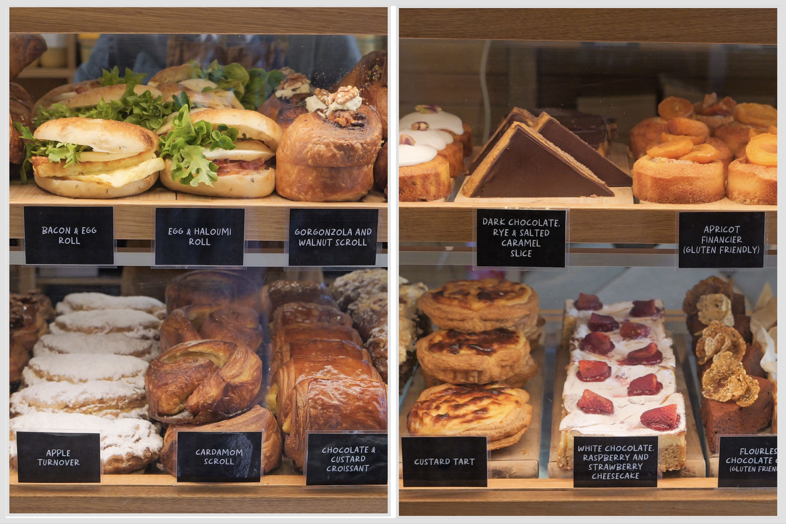
- Summer Kitchen Bakery in Ranelagh and Dalila’s Patisserie in Swansea—the best!
- Solitude and camping by lakes in the Central Highlands.
- Getting a meal and drink from some of the iconic pubs on the way, including Pub in the Paddock, Welborough, Great Lake Hotel, Fern Tree Tavern, and Longley International Hotel.
- The fresh food: seafood, dairy, fruit, cheese, wine, beer, and spirits.
- The detour to the summit of Mt Wellington on Hobart’s doorstep for views of Greater Hobart and the SW wilderness.
- Waterfalls, plants, and glaciated lakes of Mt Field National Park
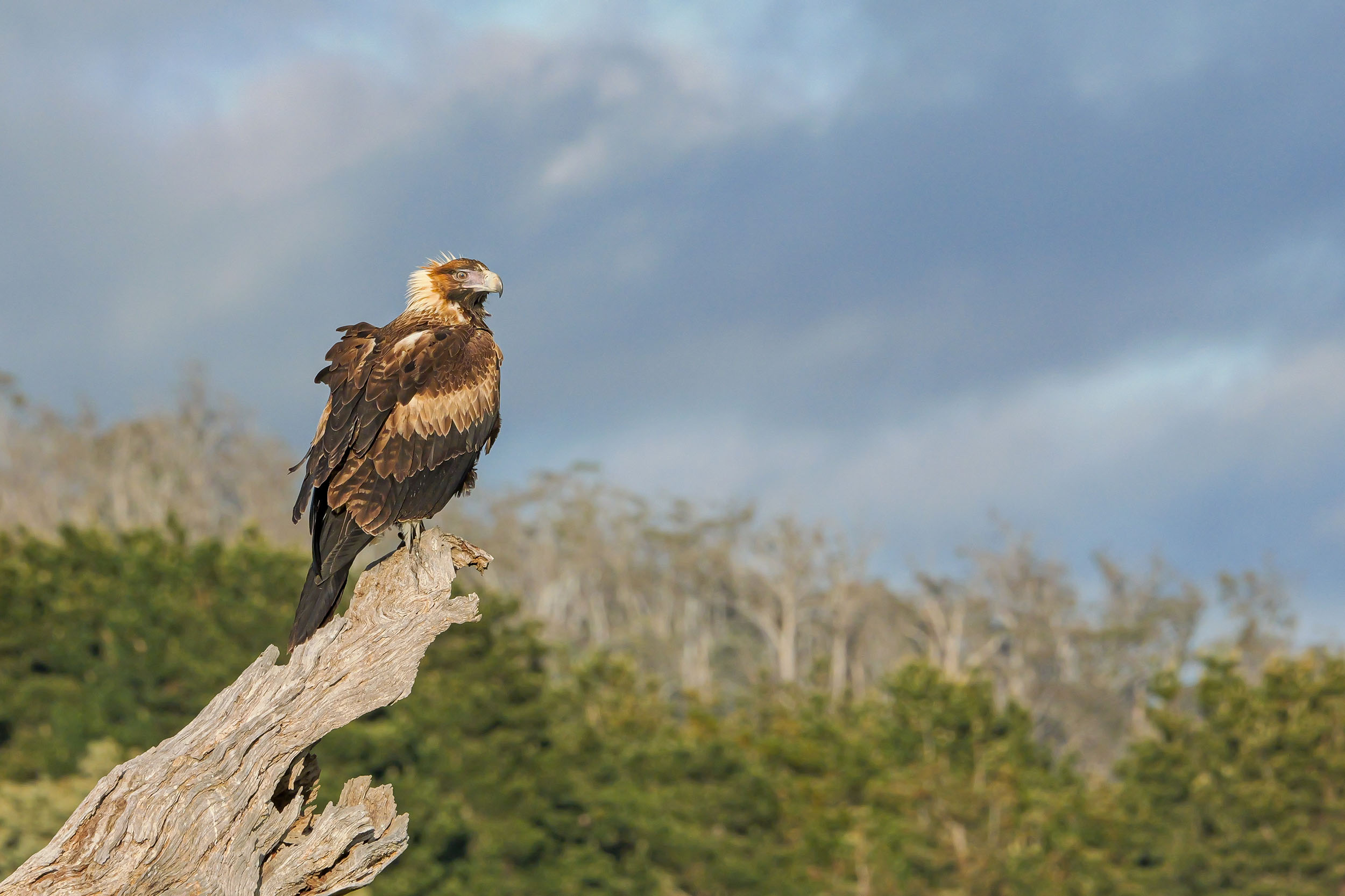
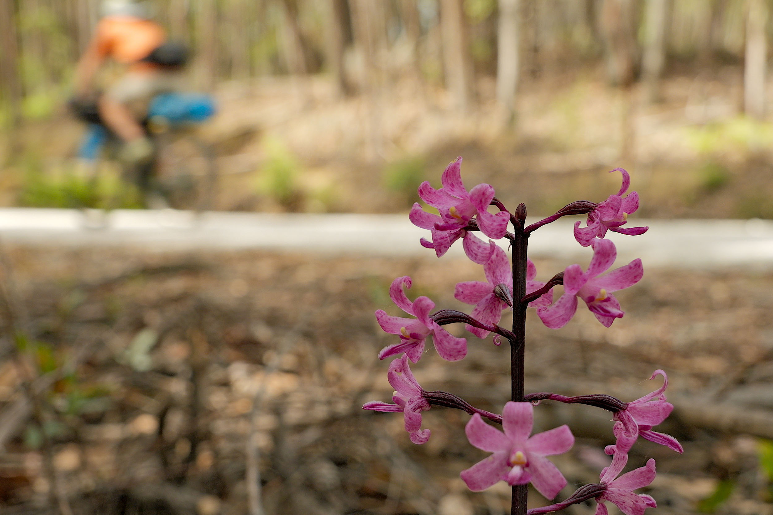
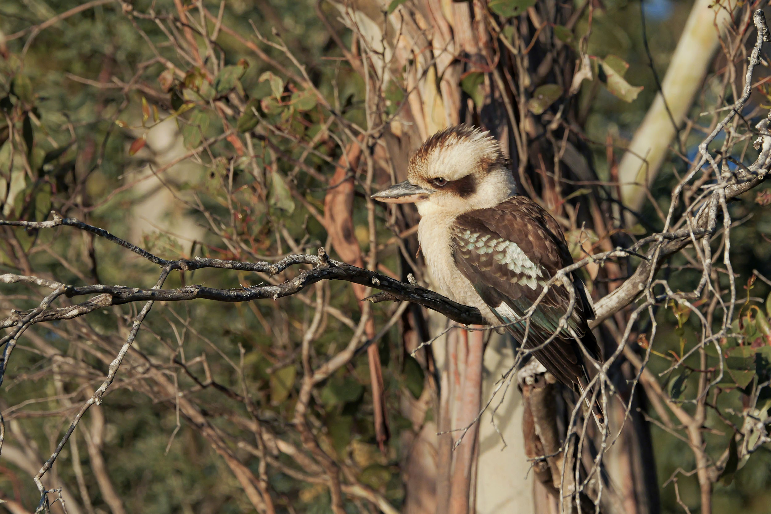
- The wildlife: wedge-tailed eagles, echidna, Tasmanian devils, wombats, platypus, and so many wallabies and potaroos.
- Best time is November to mid-April, with January to March providing the most stable weather.
Many areas require a National Parks Pass. The Holiday Pass option gives access to all Tasmanian National Parks for up to two months. - There are several sections on Tasmania’s version of a highway; although traffic is not constant, bring a light and/or wear visible clothing.
- There are several river crossings which can rise quickly in heavy rains. Most are at higher elevations and drop quickly. Assess the risk before you cross and wait if you’re unsure, as they are often very cold and fast.
- You’ll encounter logging trucks on some roads near forestry areas. Give them plenty of space and pull off to the side of the road if needed.
- You will see snakes on this route in the warmer months. Give them space to move and brush up on your first aid so you know what to do if bitten (very unlikely). Bring a snake bandage.
- Hobart and Launceston both have airports and Kinetic runs a regular bus service connecting the cities (bikes need to be booked over the phone). There are plenty of bike shops in both cities if you need any last-minute items or bike boxes.
- If you’re coming from Victoria on the ferry, Bicycle Network Tasmania have developed this relatively safe and scenic route to get you from Devonport to Launceston.
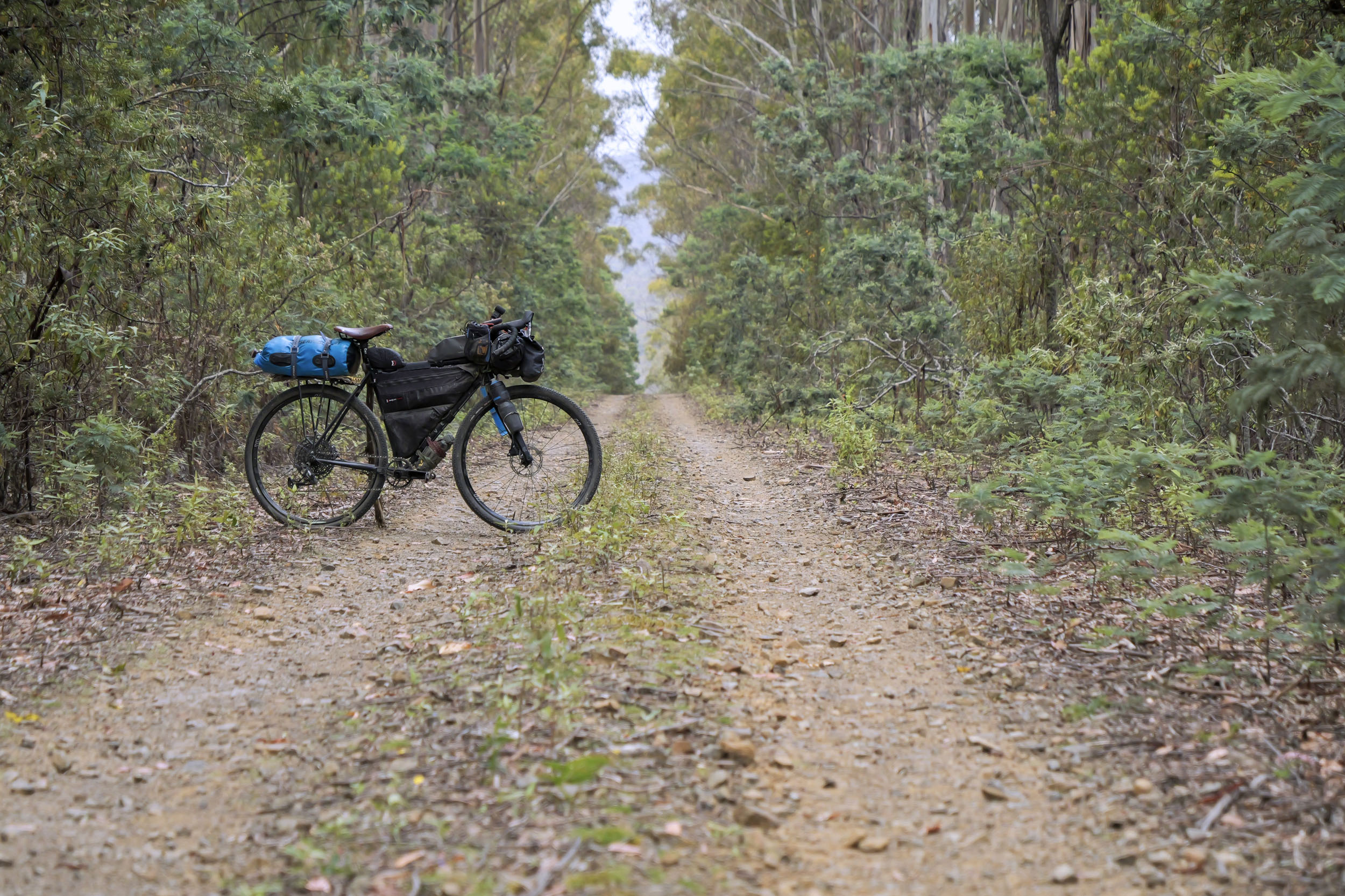
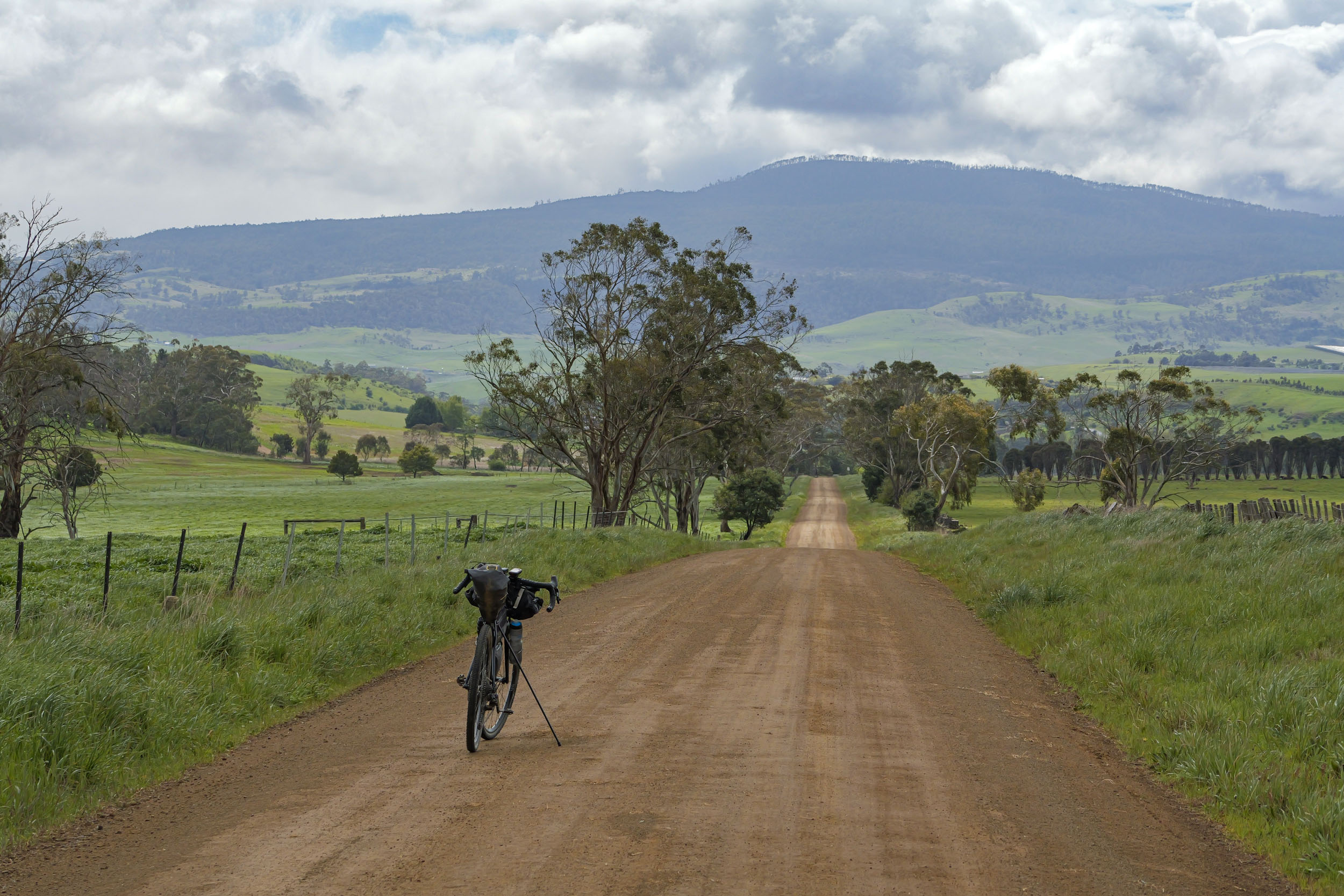
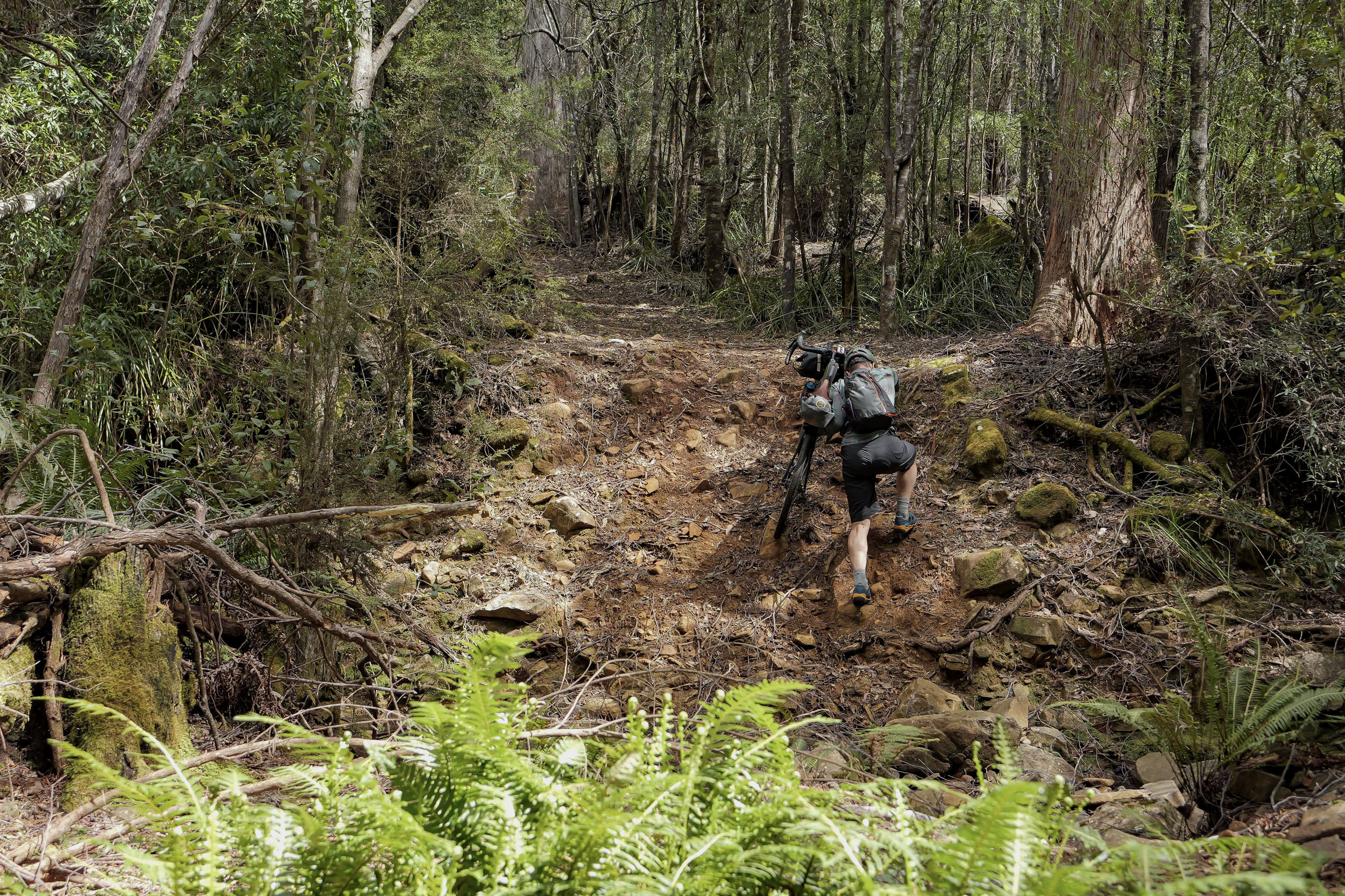
- This route was designed to be ridden on a gravel bike. However, don’t expect buttery smooth gravel the whole way—far from it! There are many rough, loose, and rocky sections and the occasional hike-a-bike. They don’t typically last for very long, but they will slow you down. Wider tyres will always make the rough sections more fun. The whole route has been ridden on 44mm tyres, but the sweet spot would be 48 to 56mm.
- For all the latest on Tasmania’s weather and warnings, go to bom.gov.au/tas.
- There are many camping options along the route. Any camping in National Parks requires a valid parks pass ($47.75 for two months). Camping in Freycinet National Park needs to be pre-booked, which can be difficult when arriving by bike. Back-up options include visiting the park’s office to see if any no-shows or asking to pitch your tent on the site of an understanding camper. The climber’s campground at nearby Blue Stone Bay will usually have space for a tent (and is located at some of the best sea-cliff rock climbing in Tasmania), but it’s a bit farther from the city.
- Several of the camping areas require gold coins ($2) to use the hot showers (Derby, Pyengana, St Marys, Pumphouse Bay, and Mt Field).
- The campsites in the Bay of Fires Conservation Area that are in proximity to toilets are generally easier to find a place to pitch your tent.
- Most of the towns that you pass through have a range of accommodation options for those who are looking for a bed. Swansea does not have any camping available.
- Keep it clean. If you camp in an area without a toilet, bury all your waste well away from the camping area and water sources. Follow the leave-no-trace principles wherever you go.
- Many larger towns have well-stocked supermarkets, including Launceston, Scottsdale, St Helens, Scamander, St Marys, Coles Bay, Swansea, Oatlands, Ouse, Huonville, and Hobart. Other stores marked on the map may have a limited range of supplies, but you can often get snacks and enough for a basic meal.
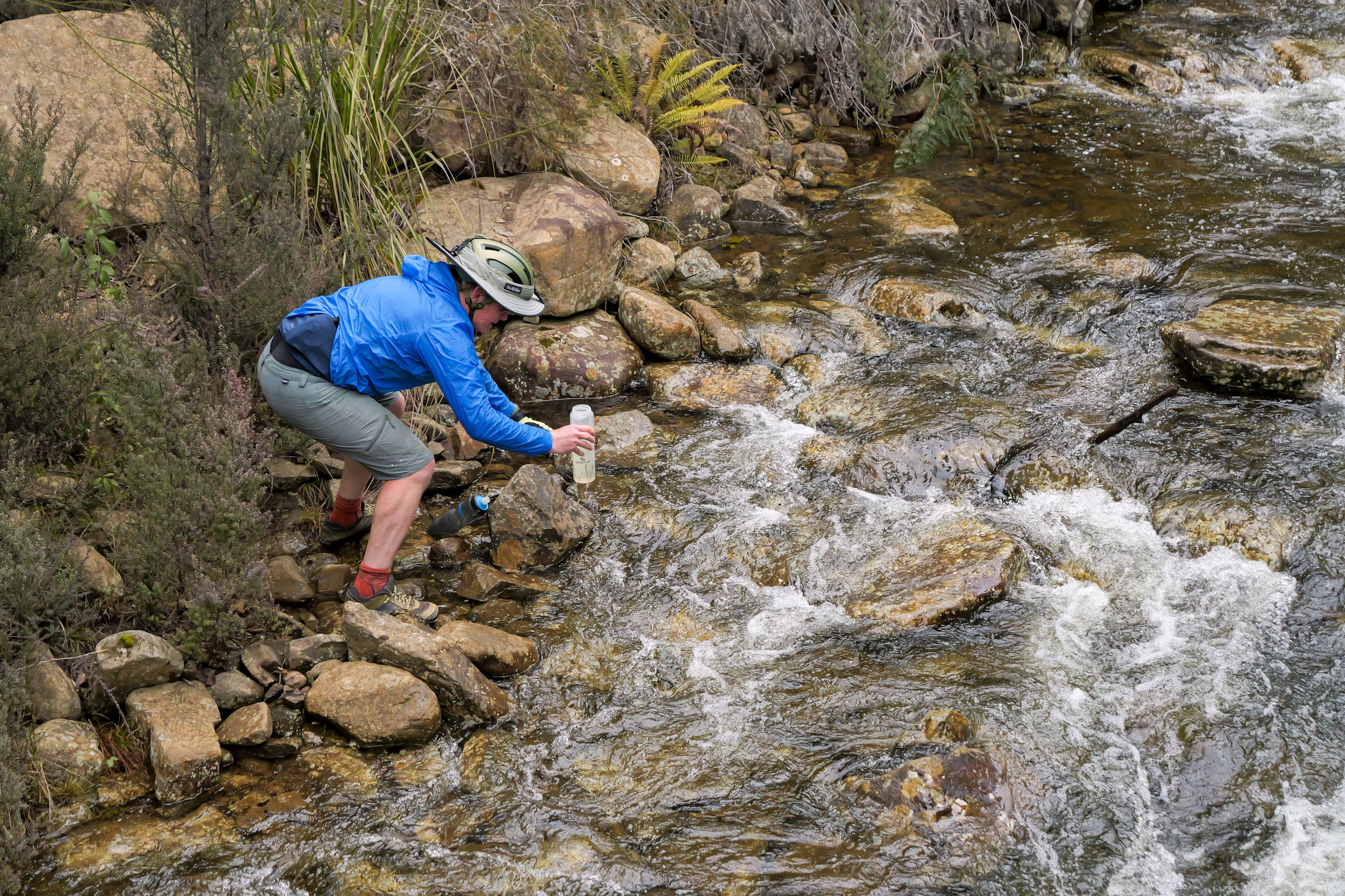
- Any water you collect from rivers or streams should be filtered or treated.
- Bay of Fires Conservation Area has no water at any of the campgrounds, so if you are coming from the north, fill up at the river marked at the 258-kilometre mark. If not, there are many campers there, so politely ask someone to fill up a couple of bottles.
14-day Itinerary
location Launceston to Ben Lomond Campground
Day 1 (69 km +1700 m)
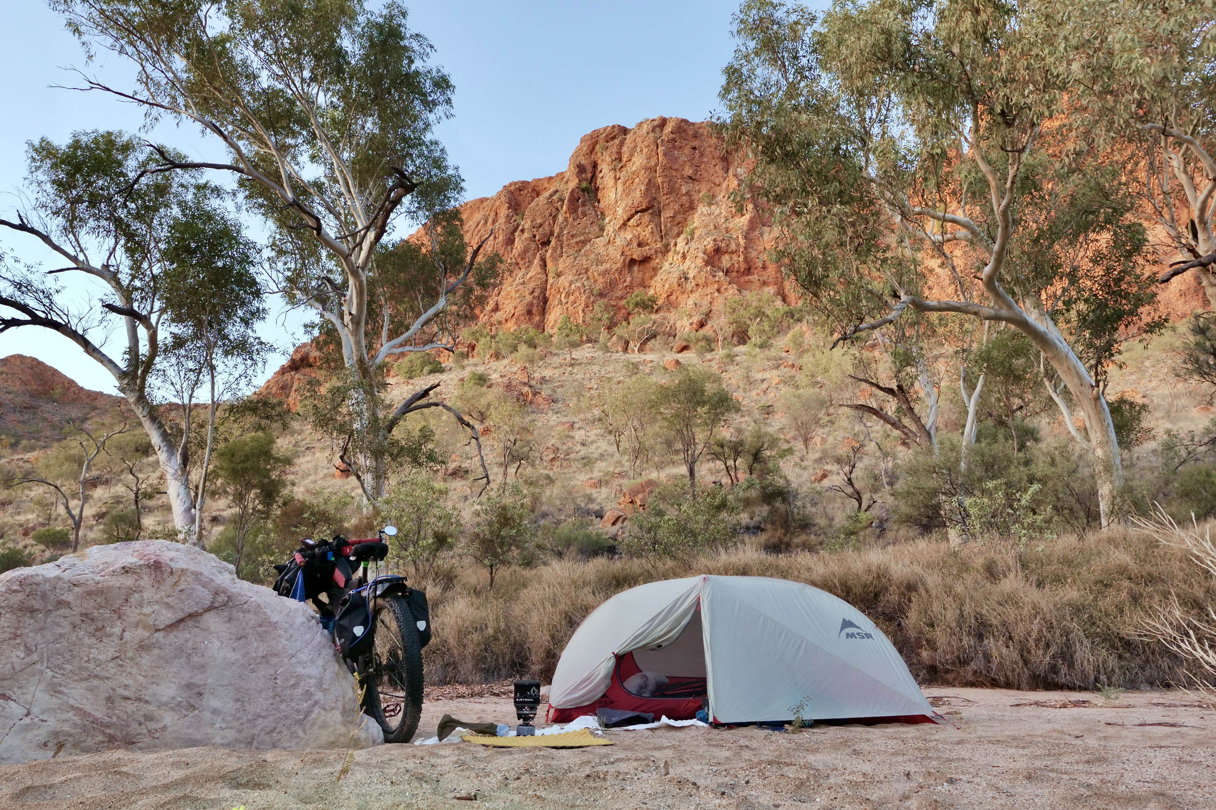
Leaving Launceston via bike paths, ride around the back of the city, and climb towards White Hills. Hit the gravel and navigate a quick, slightly washed-out descent before stopping in the historical town of Evandale. Follow sealed and gravel roads through a mix of farmland and forest, then stop for water and fuel at Ben Lomond Base before starting the climb to camp. It’s one of the highest roads in Tasmania, with an average grade of six percent. You’ll pass into Ben Lomond National Park at the eight-kilometre mark, seeing glimpses of the dolerite columns. The campground only has six sites, but there is usually a place to pitch a tent.
location Ben Lomond (inc. climb to summit) to Scottsdale
Day 2 (82 km +1250 m)
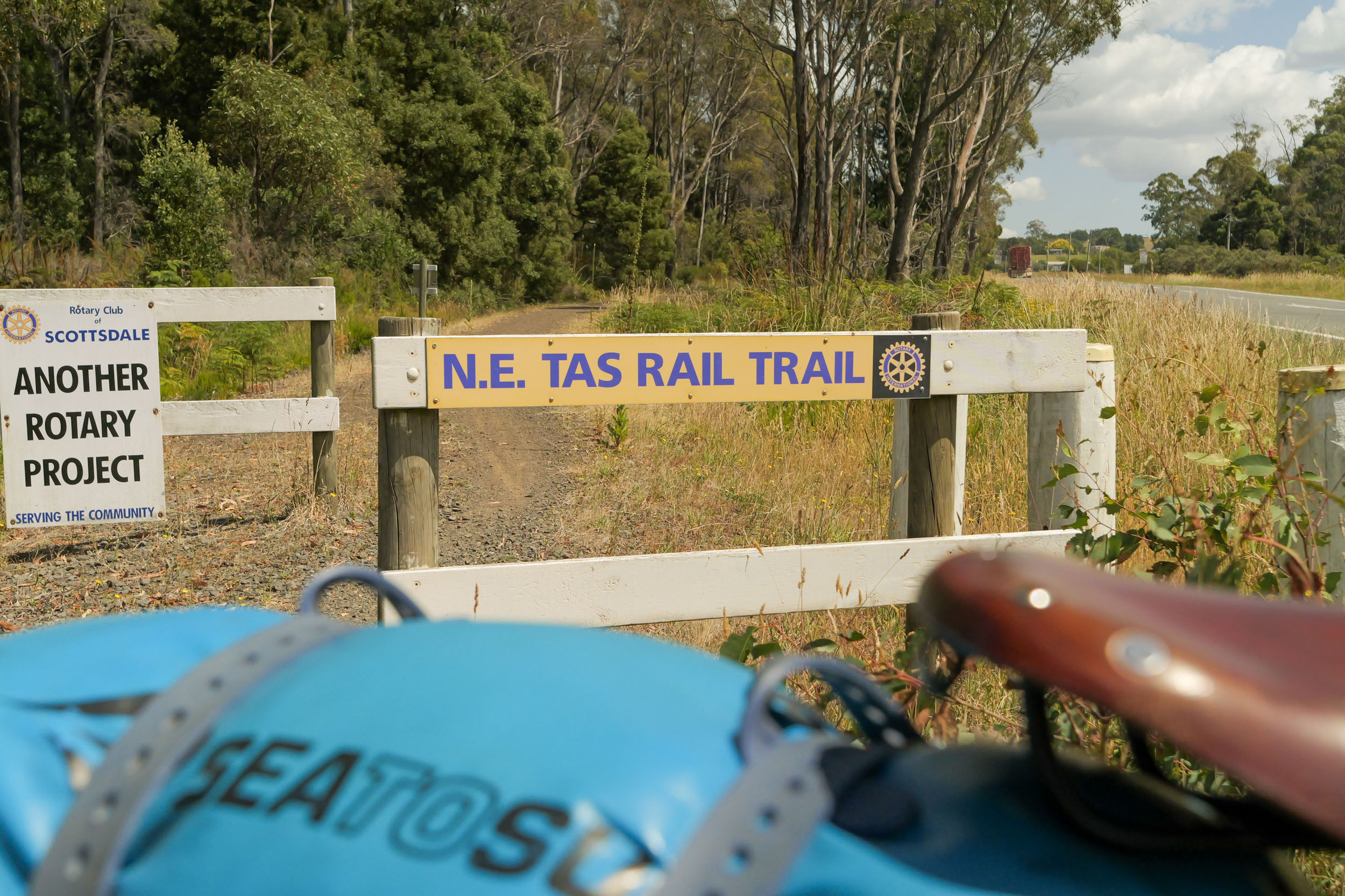
Leave your gear in your tent to make the climb easier. As you ascend towards Jacob’s Ladder, you’ll be rewarded on a clear day with views across the plateau. The series of switchbacks leads you onto the plateau and the ski field, where the café is usually open on summer weekends. Descend back to camp, then continue on fast, good-quality gravel roads through the forest. Heading towards Scottsdale, those with the legs and the time can take a worthwhile but punchy detour up Mount Barrow for panoramic views. Closer to Scottsdale, the forest gives way to farmland, and the final stretch into town follows a rail trail. Scottsdale services the surrounding farming region and offers a brewery and several cafés.
location Scottsdale to Pyengana
Day 3 (79 km +1345 m)
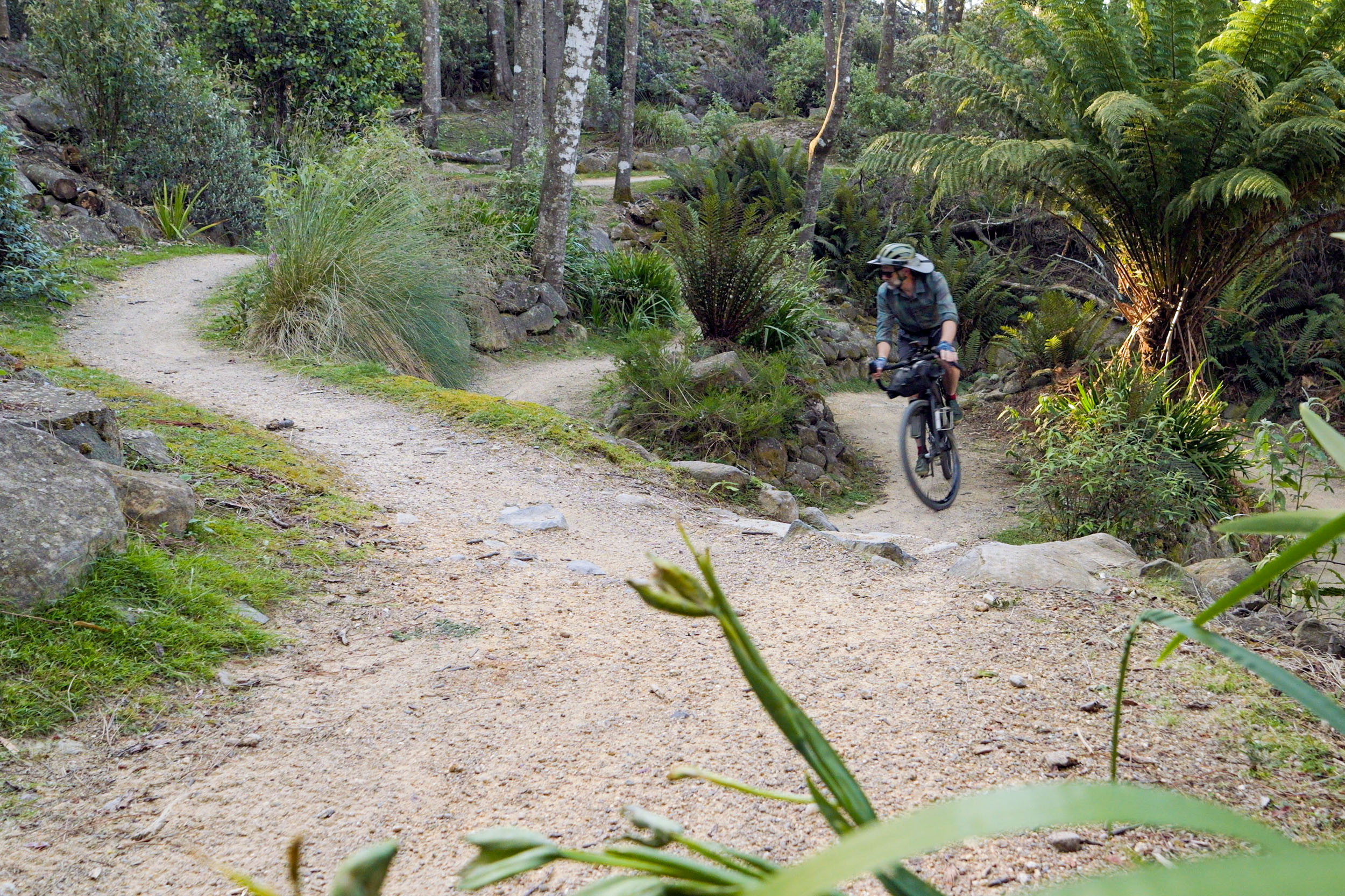
A short section on a sealed road leads to the North-East Rail Trail, which winds through quiet forests with plenty of wildlife and birdlife. After crossing the Tasman Highway, follow Crockers Road on gravel through forestry and farmland before it turns to a sealed road into Branxholm, where you can top up supplies. From there, enjoy eight kilometres of fun singletrack into Derby, passing the Valley Ponds. Once a tin mining town, Derby is now an iconic MTB destination with over 125 kilometres of trails, great food, and good coffee—well worth staying and/or exploring if you have time. Leaving Derby, follow quality gravel roads through the forest to the Weldborough Hotel, another quality pub. A short, sealed climb follows before the gravel begins again. You’ll pass the Blue Tier Big Tree Walk on the descent to Pyengana, which is worth a visit. The Pub in the Paddock and Pyengana Café are both recommended stops, too—just check opening hours. Camp is a quiet site behind the sports field.
location Pyengana to Bay of Fires
Day 4 (61 km +920 m)
Leaving Pyengana, the route climbs through farmland as the gravel becomes rougher and the landscape shifts to dry eucalypt forest and coastal scrub. A fast descent on good gravel leads to a short section on the Tasman Highway, which carries little traffic. Turning onto Hodges Road, you’ll cross a river, which is your last reliable water source before Bay of Fires, as none is available at camp. Pass through a usually open gate and follow the 4WD track to Ansons Bay Road. You’ll pass the turn-off for the one-way Bay of Fires MTB trail, a worthwhile option if singletrack is your thing. Otherwise, continue on good-quality gravel roads to the coast, where you’ll enjoy views over Taylors Beach. As you head south, there are plenty of camping options.
location Bay of Fires to St Marys
Day 5 (60 km +1110 m)
Heading towards St Helens on a sealed road, you’ll briefly leave the coast before rejoining it around Moulting Bay for a flat ride into town. St Helens has a couple of bike shops for repairs, great singletrack worth extending your trip for, and excellent fish and chips at several local spots. Leaving town, a short section of sealed road leads to good-quality gravel riding towards Scamander, with its beaches and ocean views. Follow the Scamander River for a while before turning south and climbing through bushland, then enjoy a fast descent into St Marys. The town has a few places to eat, a couple of supermarkets, and a campground just out of town—bring a $2 coin for a hot shower.
location St Marys to Freycinet National Park
Day 6 (94 km +1200 m)
Get an early start, as the first part of the day has some of the roughest gravel of the trip. Leaving St Marys on sealed road, turn onto Dakins Road and follow the gravel to the end. Cross a small creek on McKays Road, where the faint trail marks the start of the most remote section of the route. You’re unlikely to see another vehicle until the next sealed section. For about five kilometres, the track feels more like grass than gravel, with a couple of creek crossings where bridges have been removed. The road then joins a forestry track, gradually improving but still featuring short stretches of chunky gravel and the occasional fallen tree as it skirts Douglas-Apsley National Park. Several shallow, slow-flowing river crossings follow. If time allows, take the short walk to Harding Falls and refill your water bottles. As you descend, watch for a one-kilometre section of loose, rocky gravel before joining the L Road, which is well-graded. After a brief one-kilometre stretch on the highway, turn left onto Coles Bay Road. The final 31 kilometres to Coles Bay are sealed, fast, and mostly flat, with views of the Hazards as you approach town. It’s well worth walking to the Wineglass Bay Lookout (or all the way to the bay if you have time).
location Freycinet National Park to Swansea Backpackers
Day 7 (63 km +520 m)
The first 31 kilometres retraces the fast, flat sealed road from Coles Bay. Turn left onto the highway and follow it for 30 kilometres to Swansea. Although it’s called a highway, traffic is light, with several minutes between cars. Stop for ice cream at The Pondering Frog along the way. Many tourists drive this road in summer and may be unfamiliar with it, so wear bright colours or use a light. You’ll enjoy views of the Hazards and pass through farmland and the occasional vineyard. Turn left at Cranbrook for a two-kilometre detour to avoid part of the highway. After rejoining the highway, there is a narrow section until Swansea. The backpackers or a cabin at the Holiday Park are your best options.
location Swansea to Tooms Lake
Day 8 (45 km +940 m)
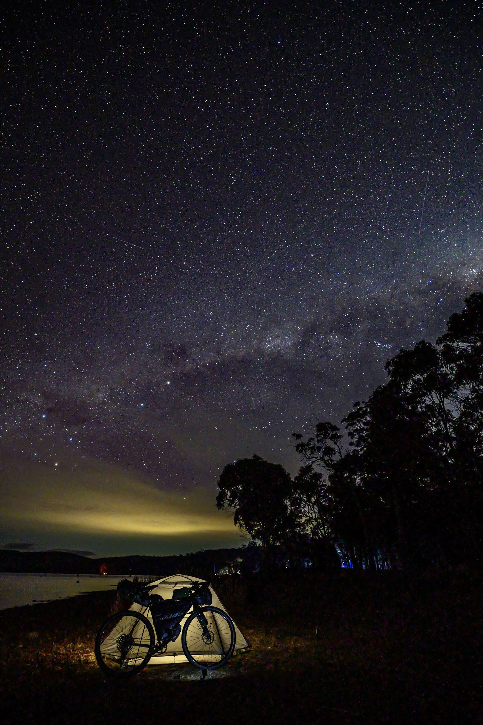
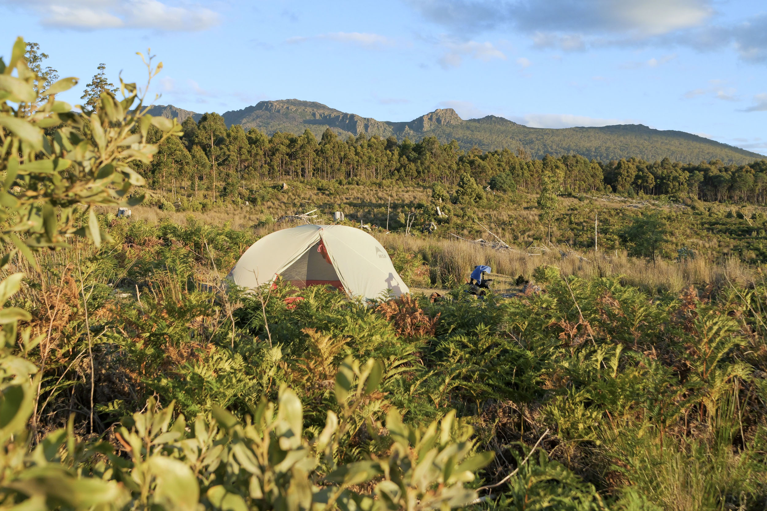
After leaving Swansea, turn left onto McNeills Road, a well-graded gravel road that climbs gradually towards the Central Highlands. After about eight kilometres, the surface becomes rougher, with a few short hike-a-bike sections. After another five kilometres or so, the road improves again. As you gain altitude, the vegetation changes, and you’ll pass several conservation areas. Turn left onto McKays Road, a well-graded logging road. The track to Tooms Lake has recently been cleared, and a 4WD track winds its way to the lake, offering expansive views and, on a clear night, a sky full of stars.
location Tooms Lake to Lake Sorell (Dargo Point)
Day 9 (79 km +1280 m)
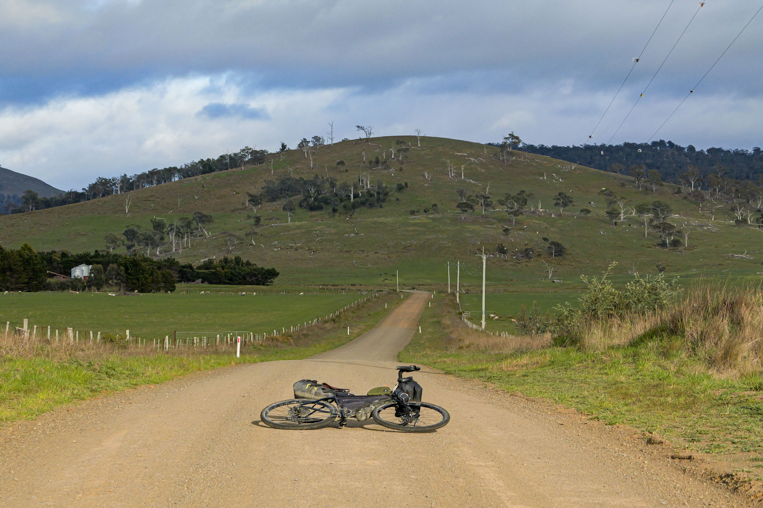
Today’s gravel roads are mostly fast and well-graded. Leaving Tooms Lake on Tooms Lake Road, you’ll descend for about 25 kilometres through forest before the landscape opens into farmland. Two short, sealed sections follow before a gravel bike path leads you around Lake Dulverton and into Oatlands, which has several good cafés and a distillery. Leaving town, cross the highway and begin climbing towards the Central Highlands. The first 12 kilometres of newly sealed road pass through farmland, then transition into subalpine forest as you gain elevation. Traffic is very light on this stretch. Camp among the trees near the edge of Lake Sorell.
location Lake Sorell to Little Pine Lagoon Campsite
Day 10 (73 km +1050 m)
After leaving Lake Sorell, there is a bit more climbing on good-quality gravel roads in the sub-alpine vegetation. Turning right just before the sealed road down an old logging road that sees infrequent traffic to Arthurs Lake Road, which is now sealed. After reaching Arthurs Lake, you pass through the shack community of Wilburville. The road is sealed until Arthurs Flume Road, where you can get a meal, snacks, or pick up fly-fishing equipment at the roadhouse. Just before turning onto Arthurs Flume Road, you’ll pass Pumphouse Bay, where the Tasmanian Trail joins this route. Skirting a locked gate, you reach the highest riding section in the Central Highlands, which leads out to Tods Corner with views north along the Great Lake. A flat, well-graded gravel road then connects you to the highway passing through Miena. The Great Lake Hotel is worth a stop for a meal and a fireside rest if it’s cold or wet, and the village store has a minimal range of supplies. A short descent on good gravel brings you to Little Pine Lagoon, a quiet spot even at peak times.
location Little Pine Lagoon to Ouse
Day 11 (77 km +790 m)
Today is a faster day, with lots of descending, from just over 1,000 metres to about 100 metres above sea level. Leaving the open, fire-affected vegetation, you’ll descend quickly to Bronte Pak Store for lunch and snacks. As you continue, the vegetation becomes taller and denser, and temperatures should rise. On reaching the Lyell Highway, you’ll pass the Geographical Centre of Tasmania. Continuing downhill, you’ll skirt several lakes and cross the dam wall at Dee Lagoon. The landscape then opens to farmland, with Victoria Falls nearby for a short detour. The ride into Ouse follows a section of the Tassie Gift route with views towards Mt Field. Ouse offers a pub, a store, and a campground just outside town.
location Ouse to Mt Field
Day 12 (45 km +830 m)
After leaving Ouse, head briefly north on the highway before turning onto Lake Repulse Road, passing through farmland and crossing the River Derwent near Repulse Power Station. The gravel is fast and high-quality as you skirt the river’s edge. Upon reaching a sealed road, enjoy a short climb followed by a quick descent into Ellendale, where the post office (open Monday to Friday) offers snacks and coffee. Another short climb leads to a descent towards Westerway, and a worthwhile stop at the Raspberry Farm during fruiting season. Following the Tyenna River, patient riders may spot a platypus as you approach Mt Field National Park, crossing the railway line several times. At Mt Field, the visitor centre has a café, and shorter walks to Russell Falls (where platypus can also be seen) or the Tall Trees are recommended. If time allows, ride up Lake Dobson Road to the ski field for views and watch the vegetation transition from cool rainforest to alpine.
location Mt Field to Judbury
Day 13 (68 km +1230 m)
Follow the sealed road along the Tyenna River back to Westerway, then continue on Gordon River Road through hop fields and farmland to Bushy Park. Turn onto the gravel road and begin a climb on good-quality gravel, starting in farmland and quickly entering forest. There are a few creeks and rivers along the way to refill water if needed. A fast descent then leads to the Huon River and Judbury. A short detour on a sealed road takes you to the campground at the cricket grounds, with a brief walk down to the river for those who want a very fresh swim. Markets are held here every second Sunday.
location Judbury to Hobart
Day 14 (58 km +1050 m)
After leaving Judbury campground, enjoy a relatively flat, fast ride on good gravel to Ranelagh. Stop at Summer Kitchen Bakery for pastries, pies, and coffee. Continuing, sealed roads pass orchards and occasional vineyards, before a short scenic gravel section past Lucaston, then more orchards. Join the Huon Highway for three kilometres, a climbing section with limited shoulder, not the most fun, but over quickly. Turn off at Lower Longley and ride past the Longley International Hotel, a good spot for a meal if you have time. The quiet road leads to Neika, where you join the Pipeline Track to Ferntree Tavern, another worthwhile stop. For those with the legs, detour to Kunyani (Mt Wellington). From here, it’s all downhill, following Strickland Ave, bike trails, and paths into the city. Use the bike lanes to reach Hobart’s waterfront, where plenty of spots await for a well-earned cold drink.
Route Alternatives
If you have the time, there are several options indicated on the map to extend the ride. Three of these are climbs up mountains, one detour along singletrack (one way) to the Bay of Fires, and one detour to the stunning Maria Island National Park.


Terms of Use: As with each bikepacking route guide published on BIKEPACKING.com, should you choose to cycle this route, do so at your own risk. Prior to setting out check current local weather, conditions, and land/road closures. While riding, obey all public and private land use restrictions and rules, carry proper safety and navigational equipment, and of course, follow the #leavenotrace guidelines. The information found herein is simply a planning resource to be used as a point of inspiration in conjunction with your own due-diligence. In spite of the fact that this route, associated GPS track (GPX and maps), and all route guidelines were prepared under diligent research by the specified contributor and/or contributors, the accuracy of such and judgement of the author is not guaranteed. BIKEPACKING.com LLC, its partners, associates, and contributors are in no way liable for personal injury, damage to personal property, or any other such situation that might happen to individual riders cycling or following this route.
Further Riding and Reading
Here are some connected/nearby routes and related reports...
Please keep the conversation civil, constructive, and inclusive, or your comment will be removed.