


Trans-Dolomiti, Italy
Distance
163 Mi.
(262 KM)Days
5-6
% Unpaved
56%
% Singletrack
9%
% Rideable (time)
97%
Total Ascent
31,264'
(9,529 M)High Point
7,945'
(2,422 M)Difficulty (1-10)
7?
- 10Climbing Scale Very Strenuous192 FT/MI (36 M/KM)
- 7Technical Difficulty Difficult
- 8Physical Demand Difficult
- 3Resupply & Logistics Fair
Contributed By
Tales On Tyres
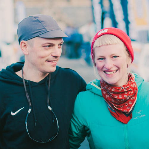
Franzi and Jona
First published in 2018, Trans-Dolomiti received a refresh in June 2026 to incorporate some new trails and avoid some unfortunate closures.
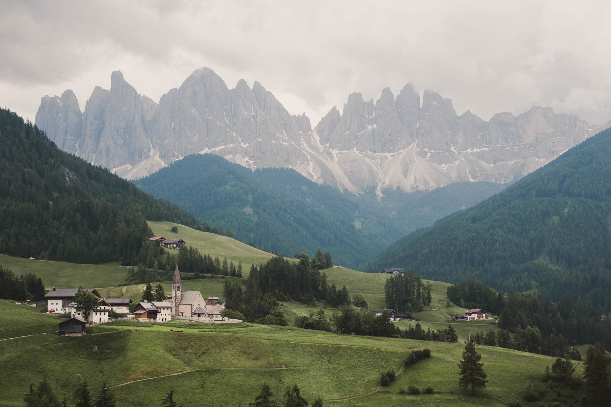
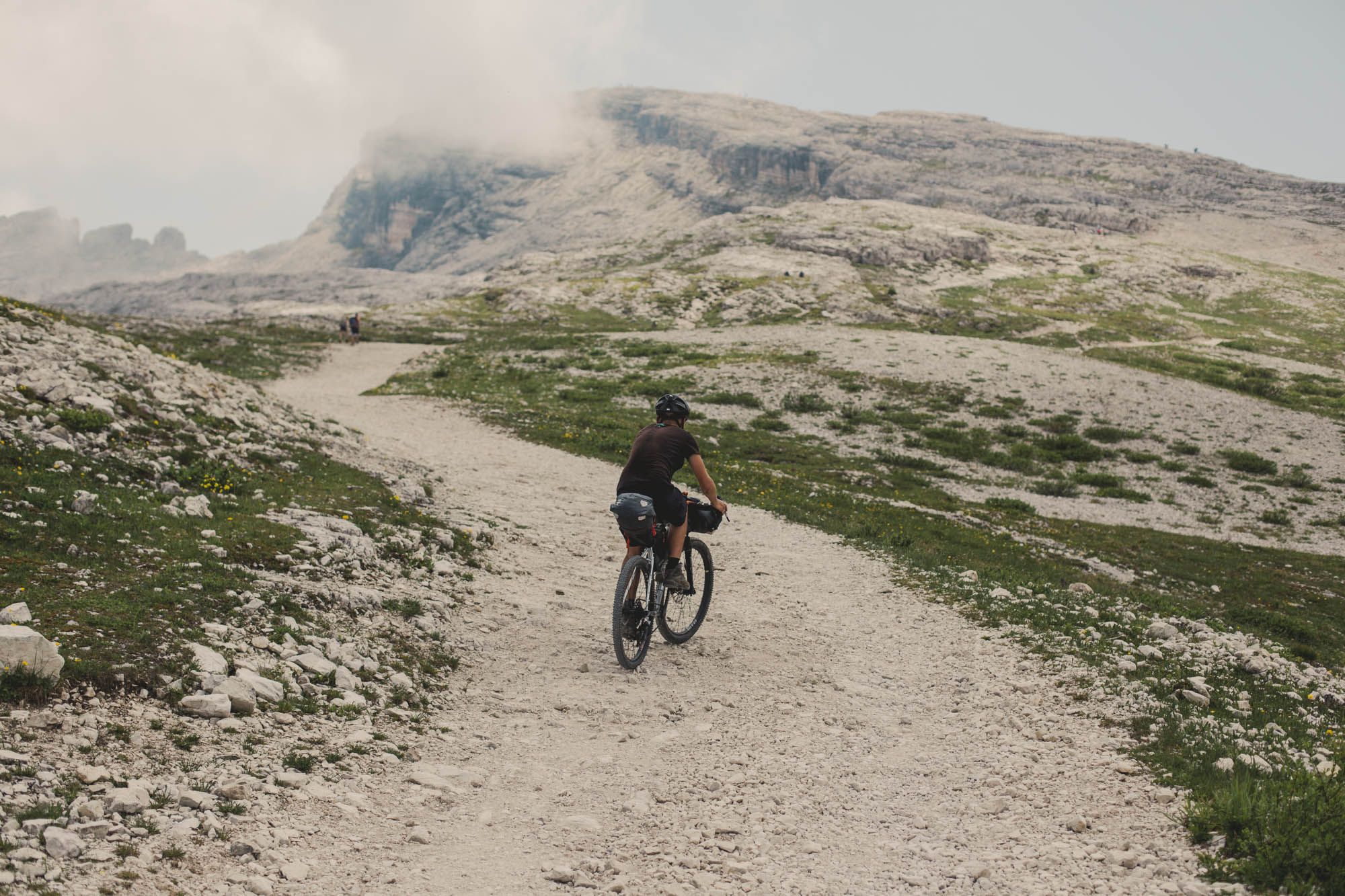
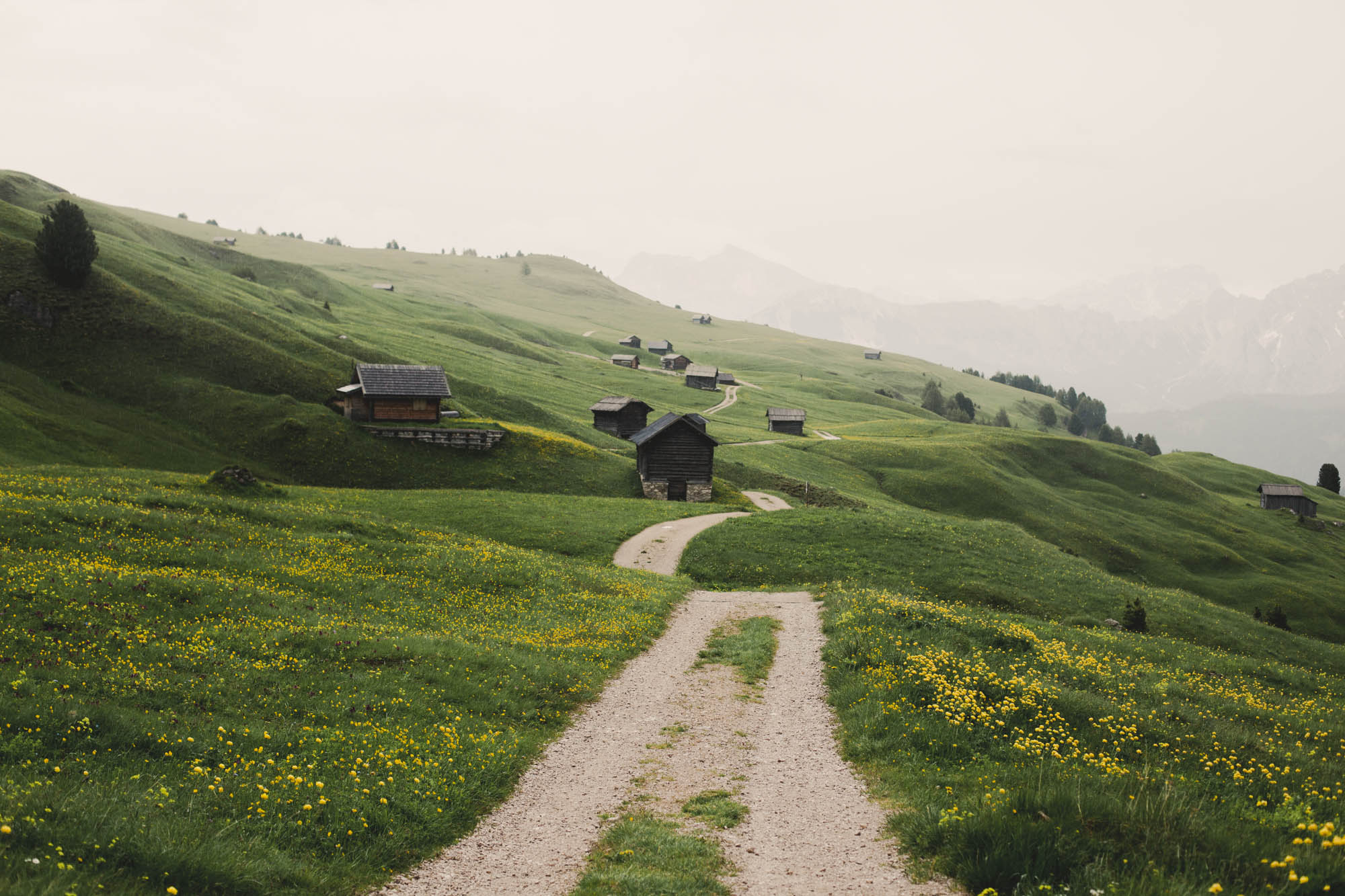
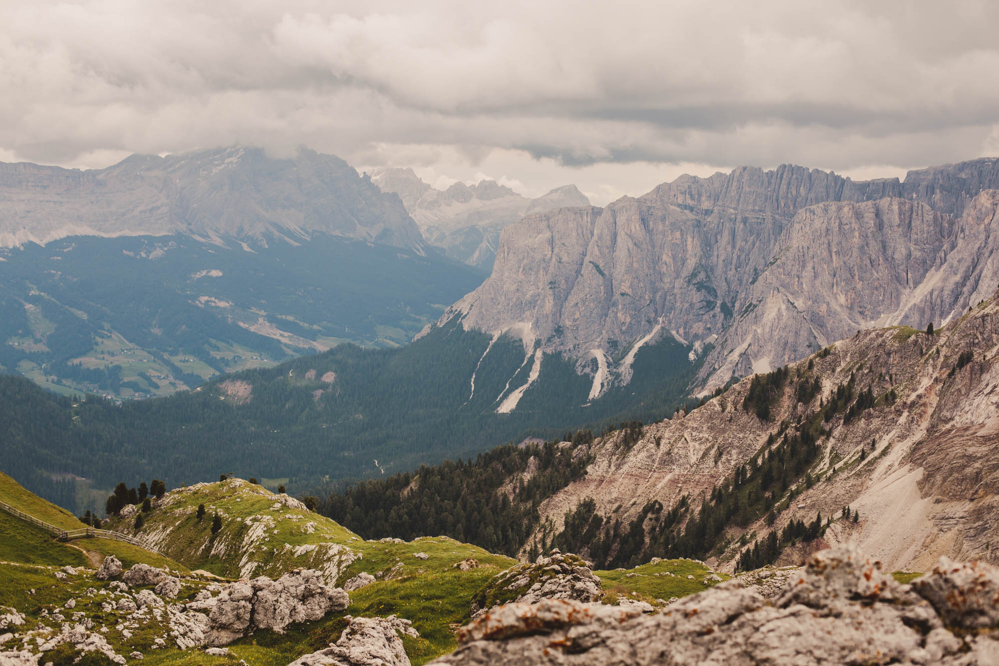
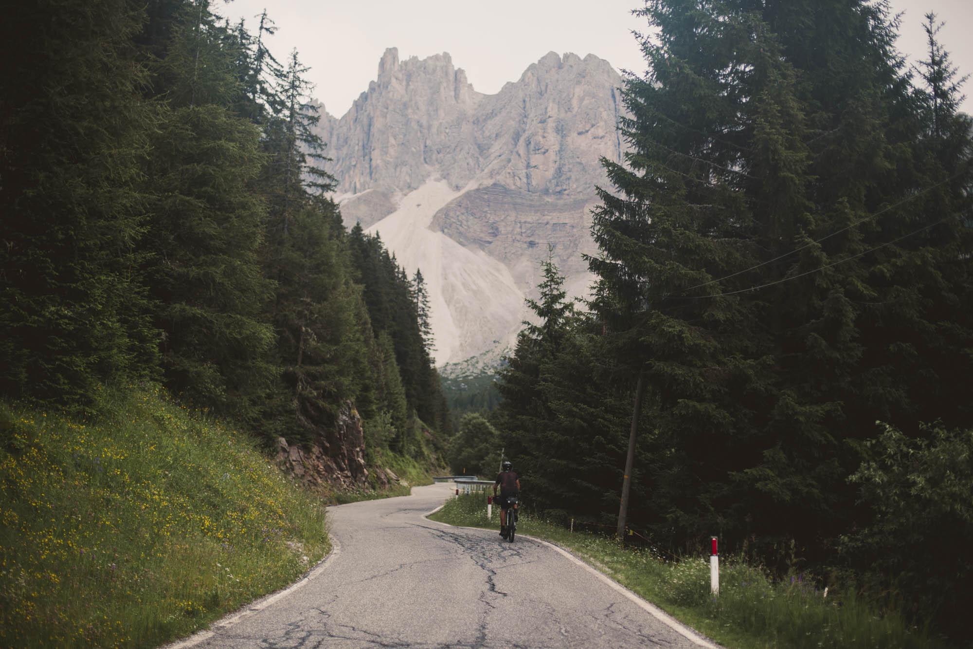
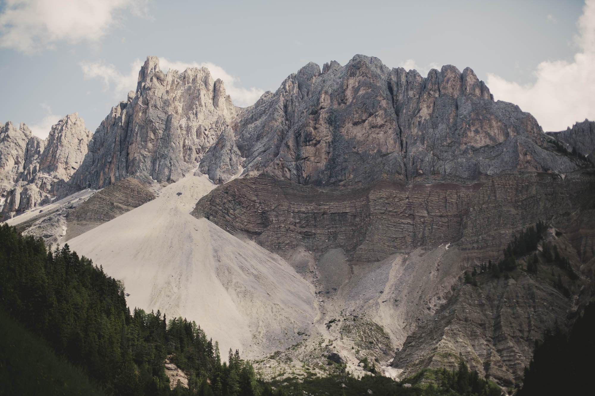
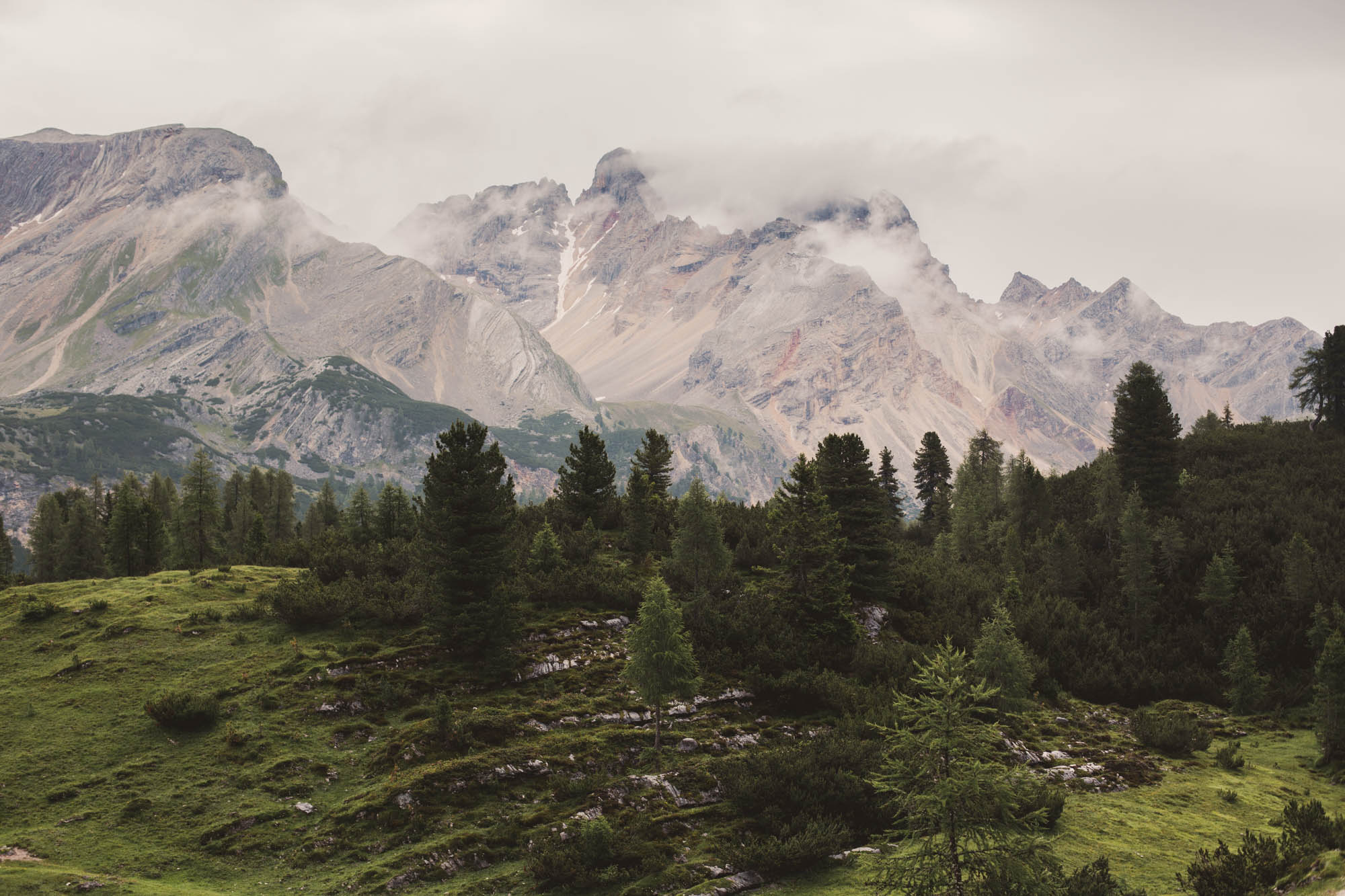
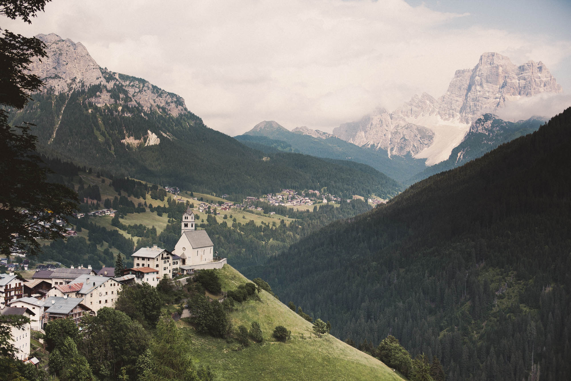
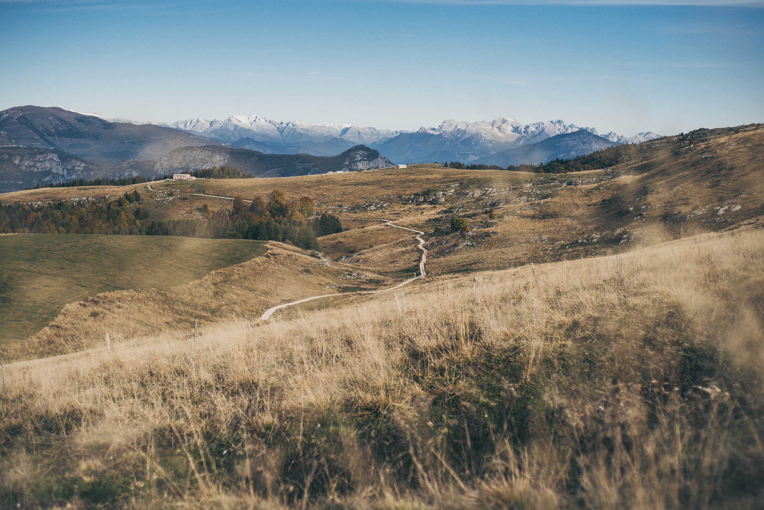
The mountains and valleys of the Dolomites, named after the French geologist Déodat de Dolomieu, are made of contrasts, in which craggy and rocky pillars tower over gentle slopes.
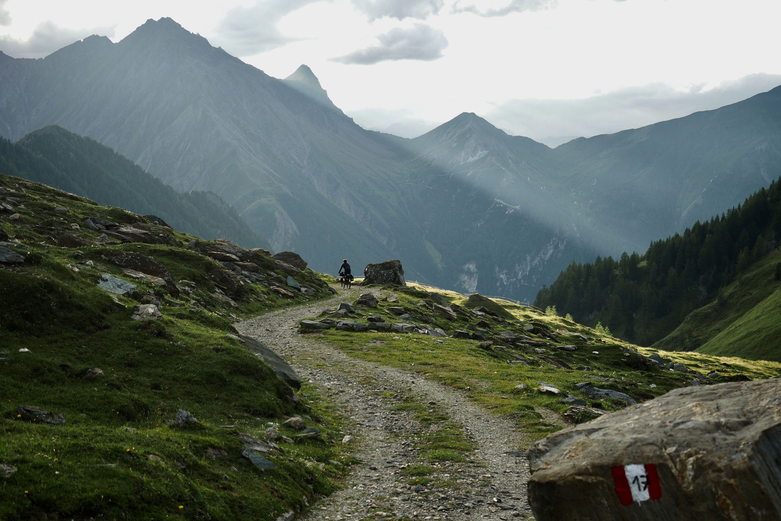
The history of this Unesco World Heritage area, however, isn’t as idyllic as it might appear today, with its old-fashioned Italian espresso bars and carefully kept holiday homes. During the First World War, the front line between the Italian and Hungarian forces ran through its mountains, and you can still find relics of this bitter and often merciless battle along the route today. The Trans-Dolomiti follows some of those history-laden old military roads and in some parts, you’ll likely wonder how they have managed to transport all their equipment up those steep serpentines back in years gone by.
Sisters In The Wild
Neža and Franzi rode part of this route earlier in 2018, which made the setting for Sisters in the Wild, a feature story in issue 01 of The Bikepacking Journal.
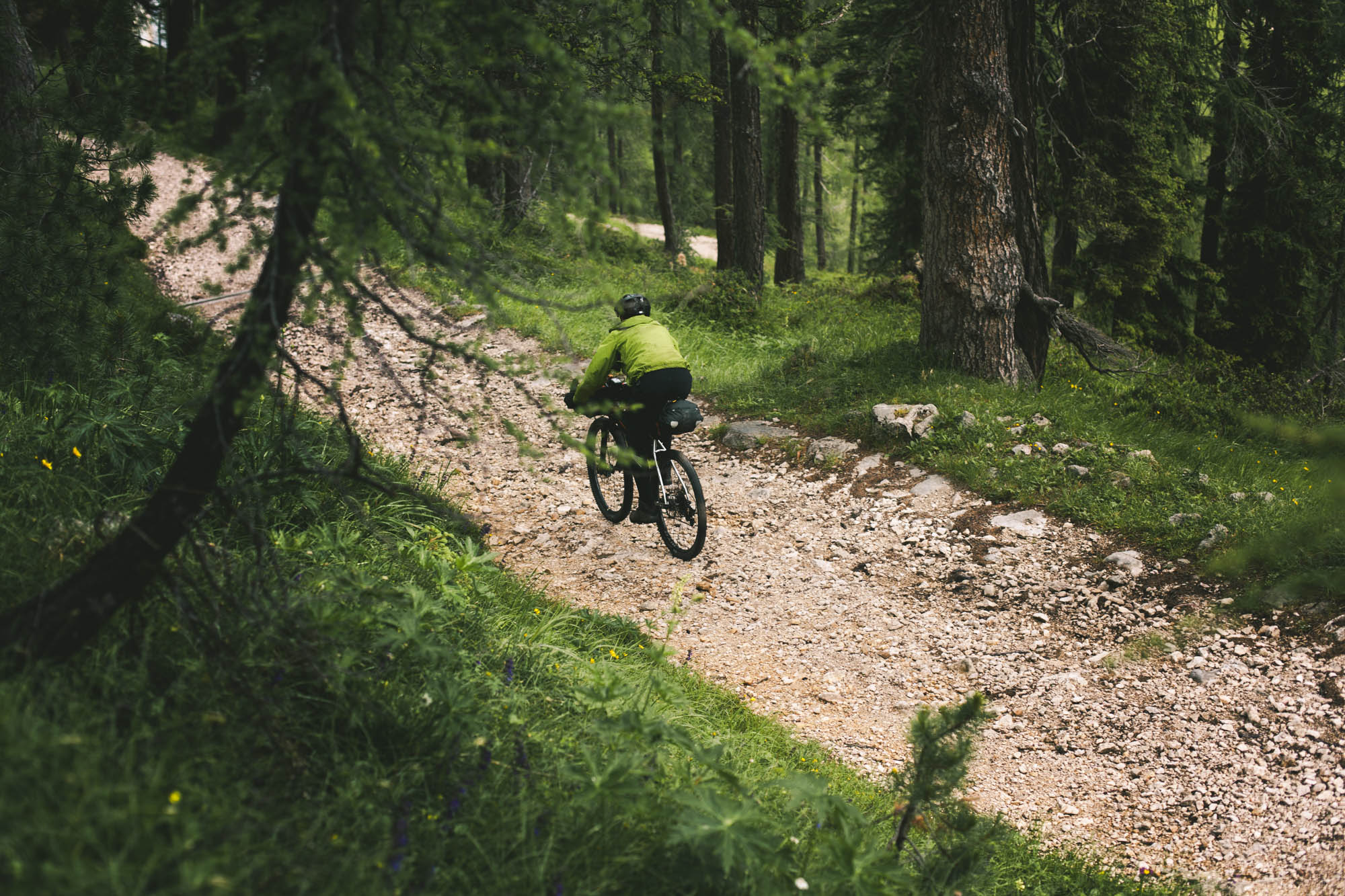
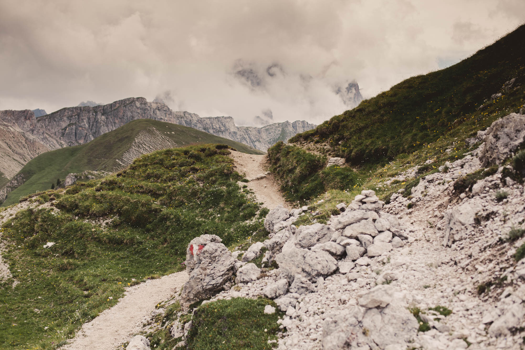
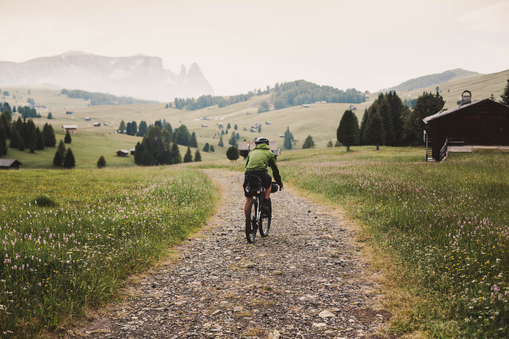
Although your loaded bike might feel heavy at the start, the views will soon embrace you while you cycling over mountain passes, besides alpine meadows, and through lush forest, stopping to resupply in typical Italian towns on your way.
This route is based on a semi-official, non-signposted route found online. It’s relatively popular as a hut to hut route but hasn’t been bikepacked previously, to our knowledge.
Difficulty
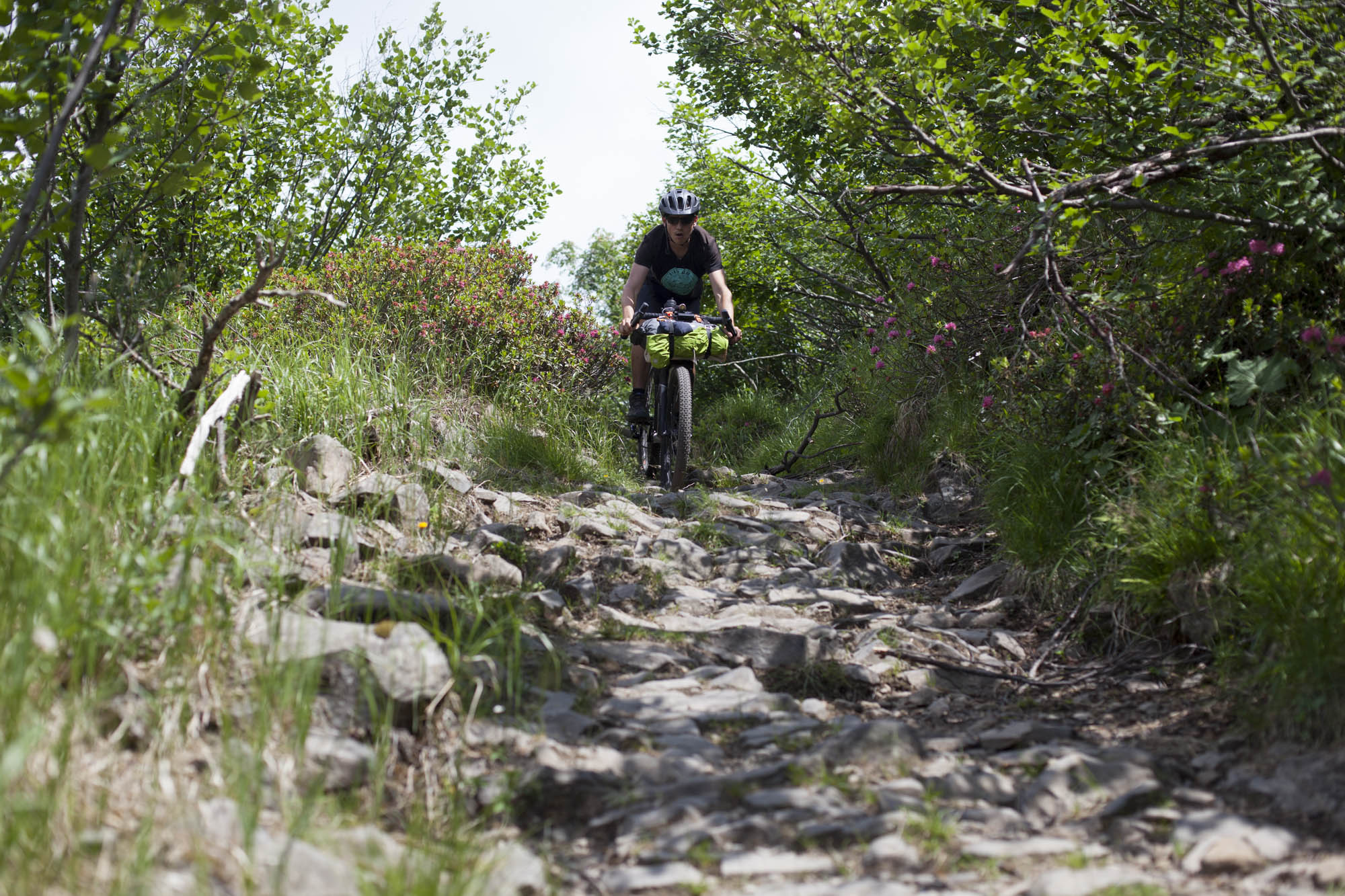
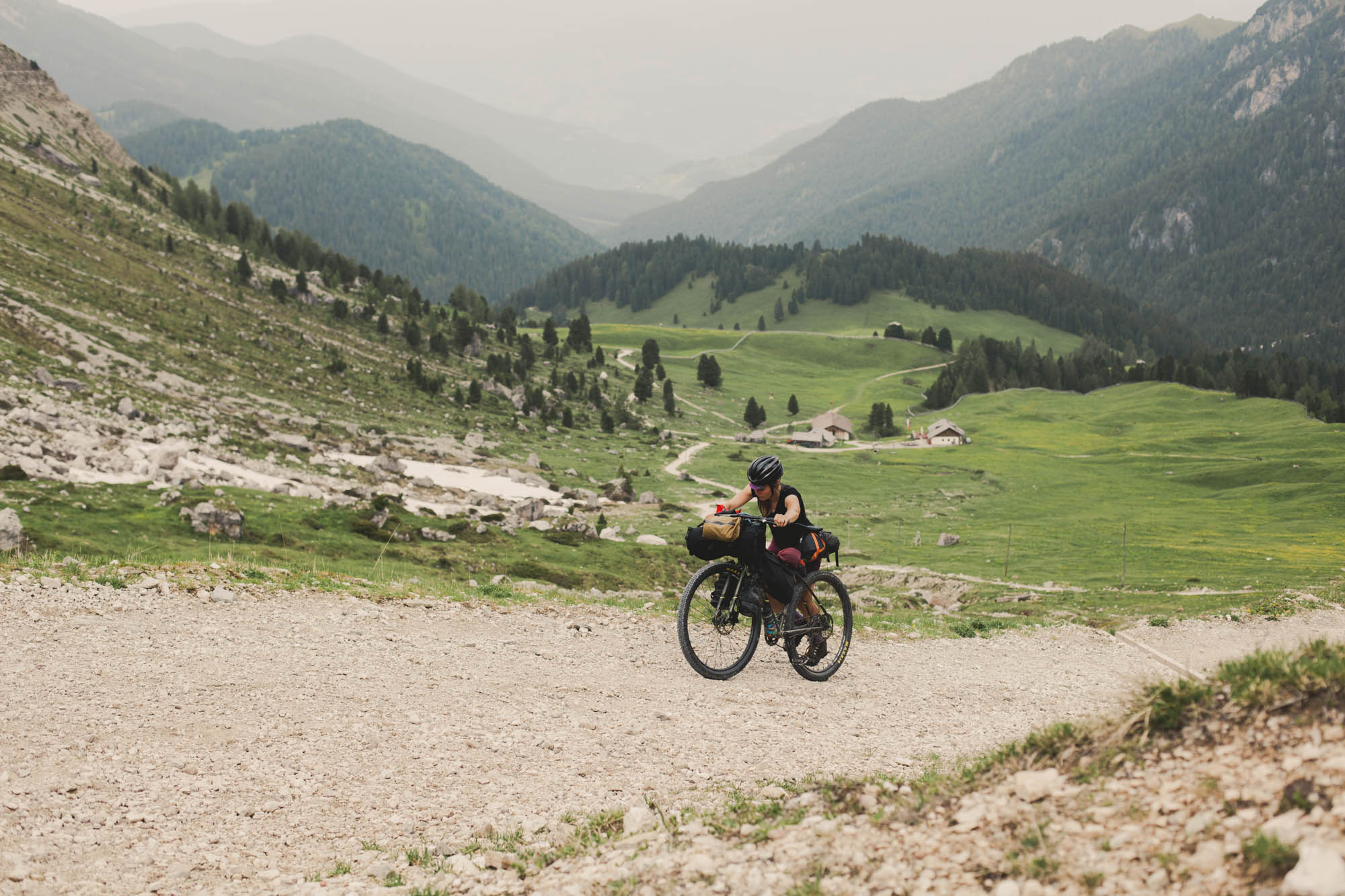
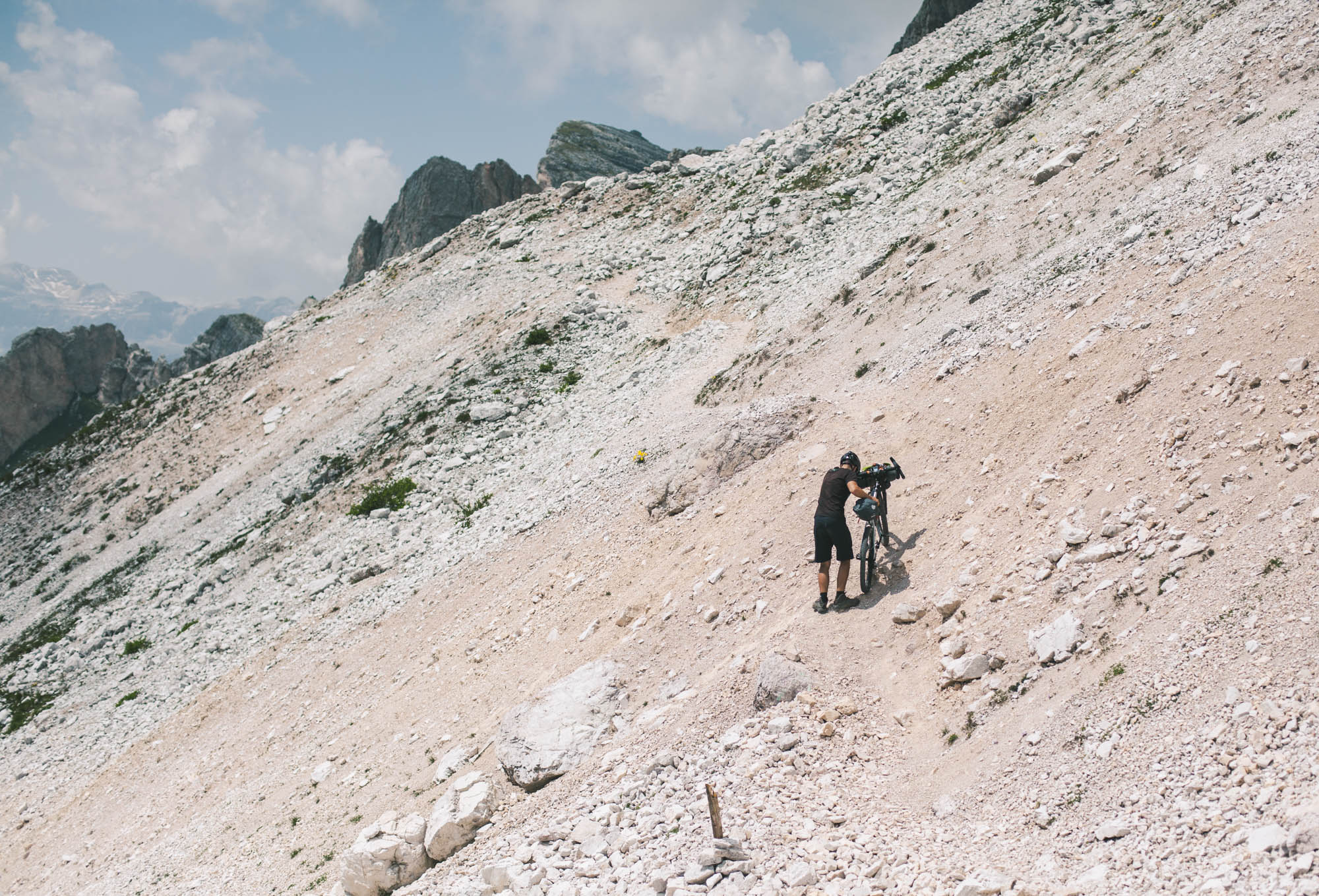
The Trans-Dolomiti has a difficult rating of 7 mainly because of the sheer amount of climbing and the sometimes steep roads leading up to mountain passes along the way. Depending on your skill level, the weight of your bike, and your strength, expect to push the last meters to crest some of them. Descents can feature steps, hairpins, steep to very steep sections, and stony tracks, all of which require the mastering of at least basic mountain bike skills.


Submit Route Alert
As the leading creator and publisher of bikepacking routes, BIKEPACKING.com endeavors to maintain, improve, and advocate for our growing network of bikepacking routes all over the world. As such, our editorial team, route creators, and Route Stewards serve as mediators for route improvements and opportunities for connectivity, conservation, and community growth around these routes. To facilitate these efforts, we rely on our Bikepacking Collective and the greater bikepacking community to call attention to critical issues and opportunities that are discovered while riding these routes. If you have a vital issue or opportunity regarding this route that pertains to one of the subjects below, please let us know:
Highlights
Must Know
Camping
Food/H2O
Resources
- Passing through the unique landscape of the Dolomites, in which you can expect stunning views around every bend
- Drinking an Espresso in a traditional coffee bar is definitely a must-do along the route. And at a Euro each, they’re cheap too!
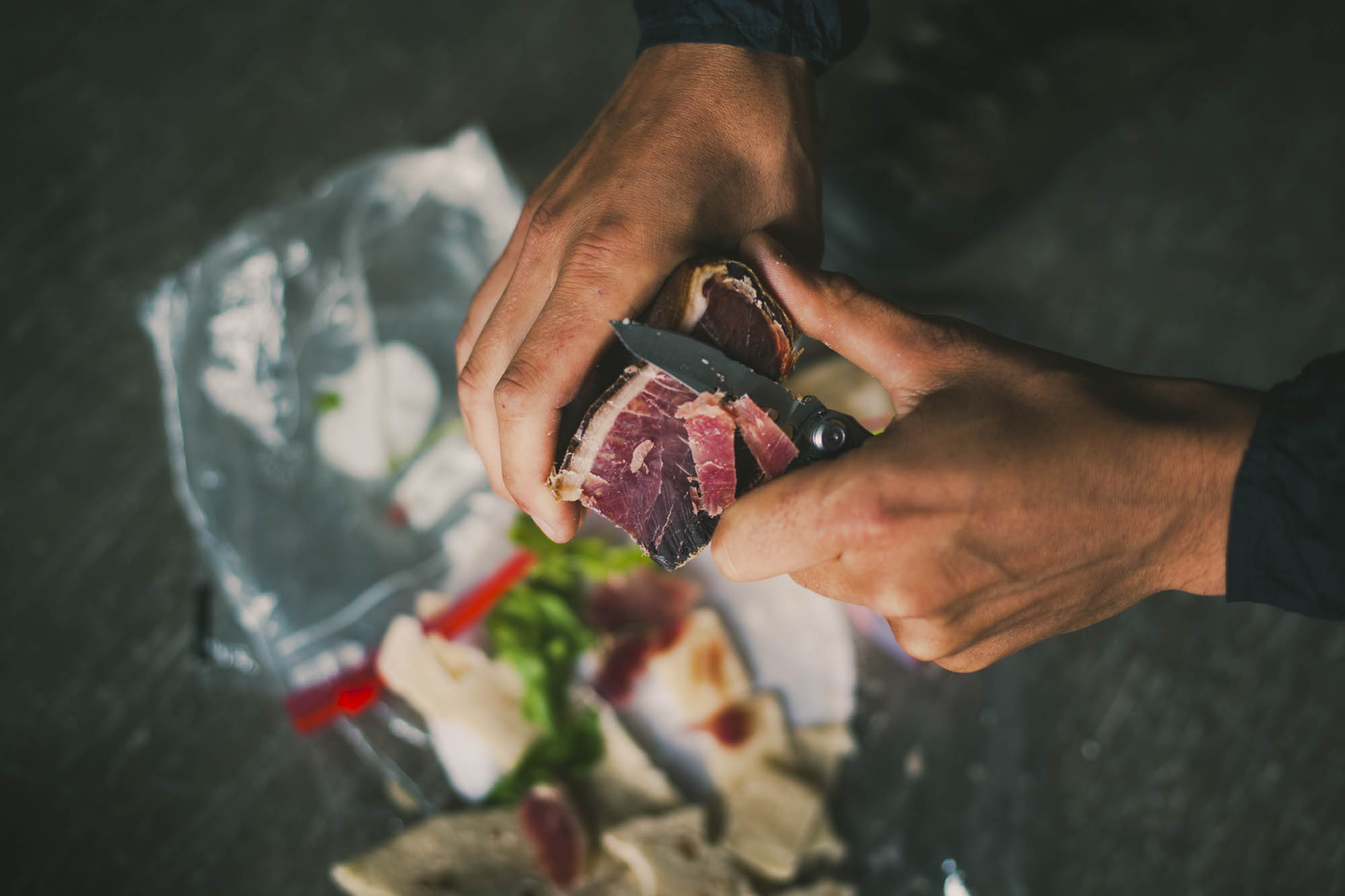
- Italian food has a reputation for a reason; along the route you’ll find plenty of opportunities to sample its original flavours, like freshly-made pasta dishes and dry-cured prosciutto.
- Experiencing this beautiful landscape from a different perspective, by following old military roads and learning about the dramatic history of the Dolomites during the First World War.
- Sampling the world class singletrack near Arabba and Passo Gardena.
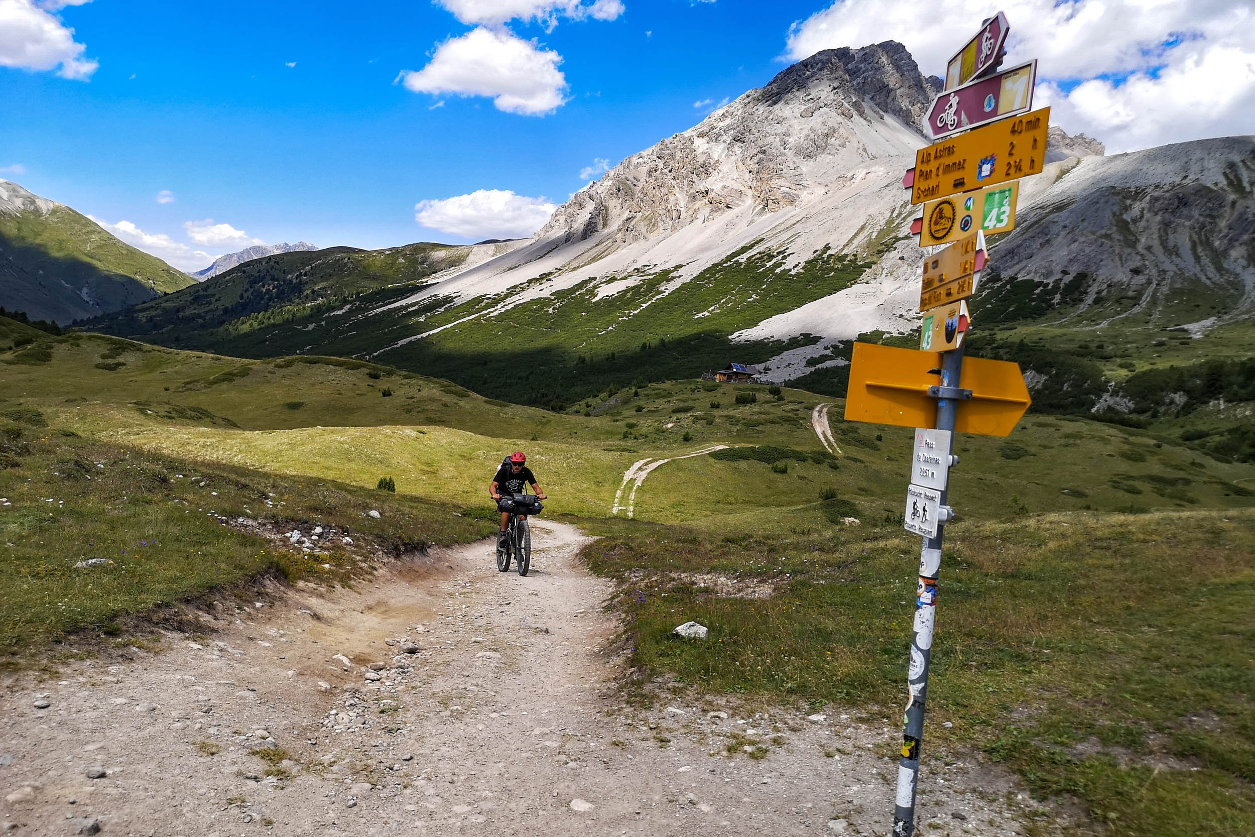
- The route should be ridden clockwise, as the climbs are easier this way. You can jump on the track wherever you want, although Brixen might be the most convenient starting point as it not only has a train station but also all services. In Italy, bikes travel on trains for a small fee. Space is rarely an issue but reservations are recommended. Note that Frecciarossa high-speed trains only accept bikes in boxes or bags as luggage.
- The best season to ride around the Dolomites is during the high season from June through to the end of August. September and October can be still relatively nice and the trails are less busy.
- The Dolomites are very touristy and often busy with hikers and mountain bikers, especially during the summer months. You will very likely have to share the trails and vistas with others. Give way to hikers and expect oncoming traffic at all times.
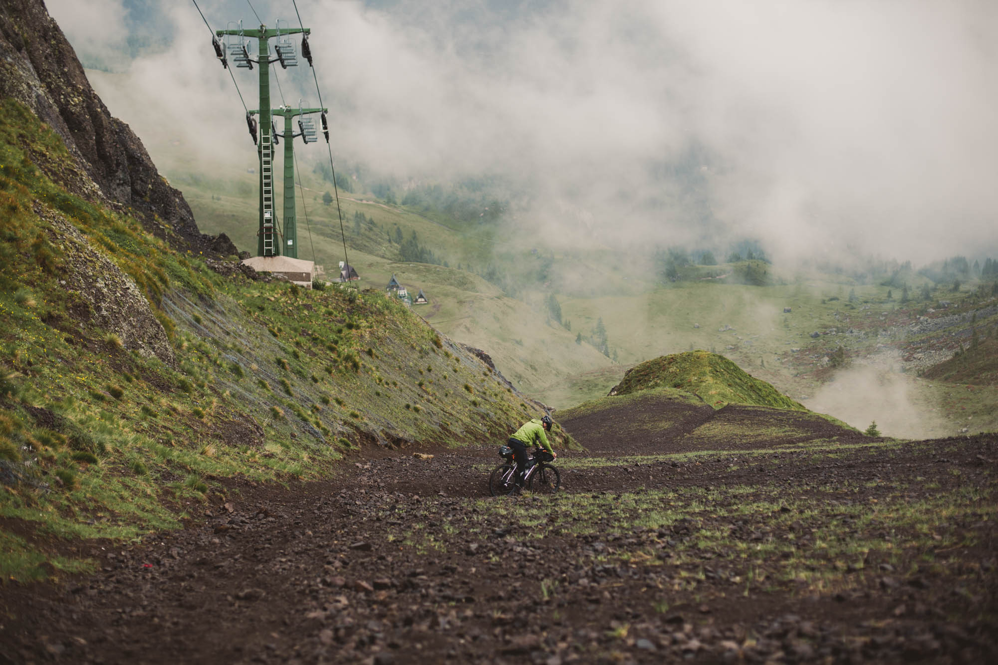
- One mountain pass along the route requires you to take the gondola up with your bike. It’s very simple and many downhill mountain bikers use this service. The lift runs from mid June through the end of September. A one-way ticket with your bike included costs €18 (as of June 2026).
- At km 164 you can opt to take the Padon chairlift if is open. This will save you about 3km of pavement, a simple HAB, and 655m of climbing. Your bike will probably be placed in a chair, rather than a bike rack so you may want to remove your computer or bulky bags. This lift typically begins operations around the first of July.
- Despite the percentage of gravel and forest roads on this route, a mountain bike with front suspension or a lightweight full-suspension rig is recommended, due to the often rocky nature of the route’s long descents. A rigid bike with plus-sized tires would also work, depending on your preferences. The route isn’t suited to gravel bikes.
- Wild camping isn’t officially allowed in the Dolomites, so pitch after sunset, leave before sunrise, and keep a low profile. Just be sure to #leavenotrace. If you camp, stay clear of protected and delicate areas.
- A reasonable alternative to camping is the Mountain Refugios along the Trans-Dolomiti. They offer basic accommodation and traditional meals but require some planning ahead as they are often booked up in the main season. A combination of minimal bivouacking and using these refugios is likely a great way to go. There is no one website that details them all; the names and locations difficulty in the GPX file. Different accommodation options are available; dorm rooms are typically around 18 Euros, with discounts sometimes available if you’re the member of a climbing club. Bring a sleeping bag or a sleeping bag liner.
- There are also several developed campgrounds on route offering everything from a basic pitch to cabins.
- There is no need to carry much food, as you’ll be able to pass at least one supermarket or small store each day.
- If you want to go really light, a stove isn’t a necessity on this trip, as there’s plenty of opportunities to find warm, affordable meals and coffee along the way, thanks to all the mountain Italian. Bread, meats, cheeses, fruit, and nuts found in supermarkets will tide you through.
- Supermarkets are closed during the lunch hours, exact times might vary but generally, that means from 12.00pm-15.00pm. Expect all Supermarkets to be closed on Sundays, even in the bigger towns.
- Water isn’t an issue, as you regularly come across small towns and villages where you can refill your water bottles in public fountains. We recommend carrying at least 2L of drinking water on your bike.
Additional Resources
- Check out the anti-clockwise Sellaronda MTB Tour for more information on the lifts and trails near Arabba, Colfosco, and Val Gardena.
- Check the status of the Padon lift here if you would like to utilize that option.


Terms of Use: As with each bikepacking route guide published on BIKEPACKING.com, should you choose to cycle this route, do so at your own risk. Prior to setting out check current local weather, conditions, and land/road closures. While riding, obey all public and private land use restrictions and rules, carry proper safety and navigational equipment, and of course, follow the #leavenotrace guidelines. The information found herein is simply a planning resource to be used as a point of inspiration in conjunction with your own due-diligence. In spite of the fact that this route, associated GPS track (GPX and maps), and all route guidelines were prepared under diligent research by the specified contributor and/or contributors, the accuracy of such and judgement of the author is not guaranteed. BIKEPACKING.com LLC, its partners, associates, and contributors are in no way liable for personal injury, damage to personal property, or any other such situation that might happen to individual riders cycling or following this route.
Further Riding and Reading
Here are some connected/nearby routes and related reports...
Please keep the conversation civil, constructive, and inclusive, or your comment will be removed.