


Vastmanland Overnighter
Distance
80 Mi.
(129 KM)Days
2
% Unpaved
84%
% Singletrack
2%
% Rideable (time)
99%
Total Ascent
2,609'
(795 M)High Point
512'
(156 M)Difficulty (1-10)
4?
- 2Climbing Scale Easy33 FT/MI (6 M/KM)
- 4Technical Difficulty Fair
- 4Physical Demand Fair
- 3Resupply & Logistics Fair
Contributed By
Michael O'Dwyer
Bikepacking Sweden
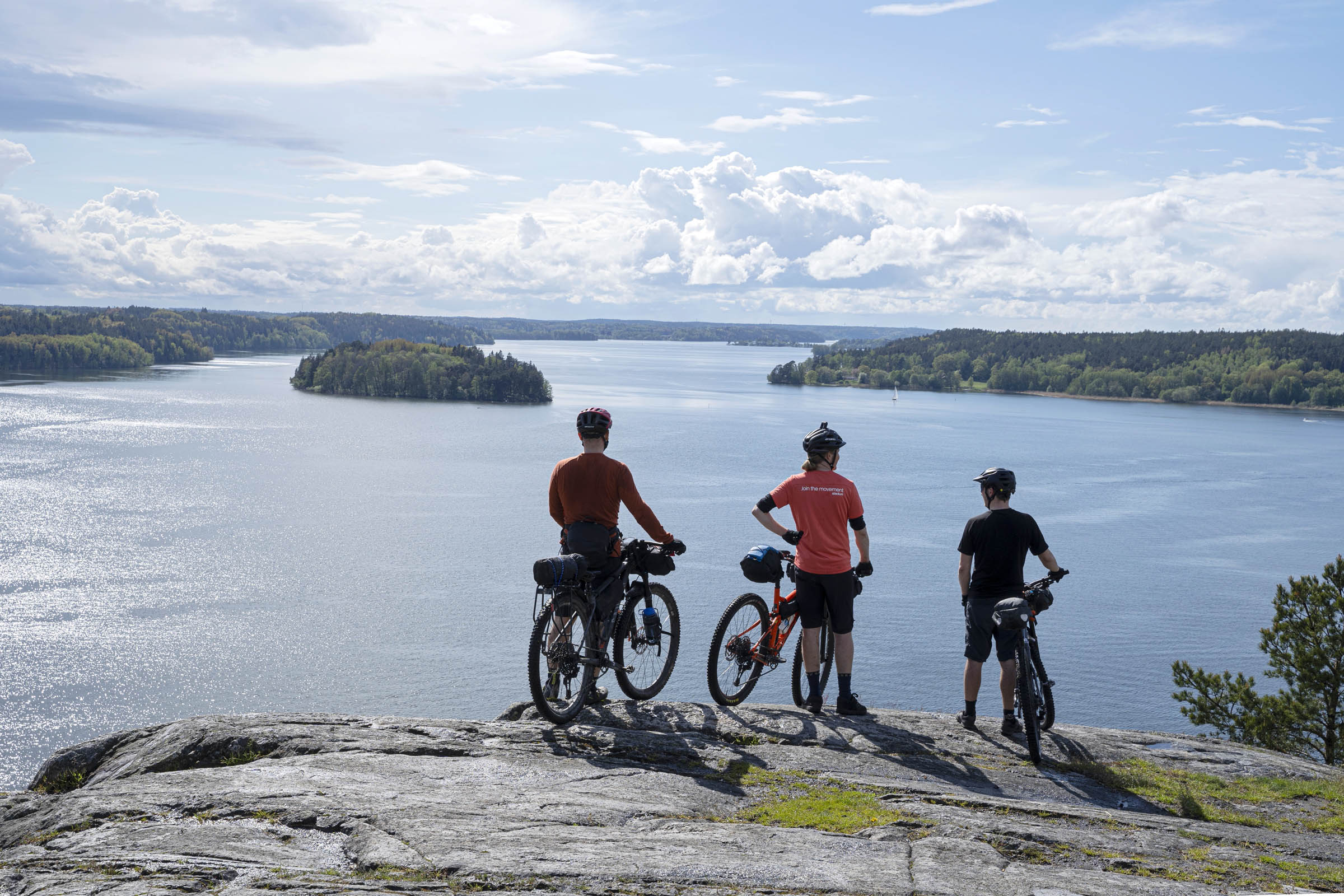
Västmanland is a sleepy region in central Sweden. Once you leave the shores of Lake Mälaren, the only specks of civilization are old, nearly forgotten industrial-era villages surrounded by miles and miles of forest. There is a beauty to this type of wilderness. Think endless gravel tracks though sweeping forests where, once you find a village, there may not even be a shop, and where rush-hour traffic consists of a handful of cars rolling down its main street. This is the perfect place for an autumn overnight bikepacking trip.
The theme of this ride is a mix of gravel road riding in deep forest but with a fascinating history intertwined throughout the tour. In the most unlikely of places, you will find evidence of industrial-era constructions and relics. Some are in ruins, and some are still fully functional. This region is part of the old Berglags region featured in the six-day Miner’s Trail bikepacking route here called Bergslagsleden.


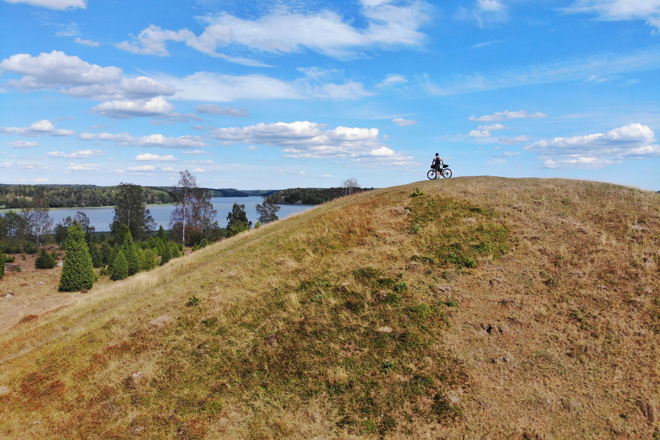
Even with all the wilderness and history found on the tour, the highlight has to be riding through Hälleskogsbrännans Naturreservat. This 6,240-hectare nature reserve was the scene of one of Sweden’s largest-ever forest fires. The 2014 burn left a major scar on the landscape, but the regeneration of the forest gives us wonderful views and colours when riding through the gravel roads today. A sight not to be missed.
With easy access and easy-rolling gravel roads, this tour can be for everyone. It’s the perfect introduction to gravel riding bikepacking. To top it all off, you might even get to stay in the most picturesque free and open hut in all of Västmanland!
Route Difficulty
The riding is very straightforward on this trip, with 99 percent of the trail being rideable. The only hike-a-bike section is the 200 metres after the Trehörningen Hut. The best bike for this tour would be a gravel bike with at least 42mm tyres, but all widths would work. Resupplying is easy and you are never very remote whilst riding through the forests. For these reasons, a maximum difficulty rating of 4 out of 10 should be applied.


Submit Route Alert
As the leading creator and publisher of bikepacking routes, BIKEPACKING.com endeavors to maintain, improve, and advocate for our growing network of bikepacking routes all over the world. As such, our editorial team, route creators, and Route Stewards serve as mediators for route improvements and opportunities for connectivity, conservation, and community growth around these routes. To facilitate these efforts, we rely on our Bikepacking Collective and the greater bikepacking community to call attention to critical issues and opportunities that are discovered while riding these routes. If you have a vital issue or opportunity regarding this route that pertains to one of the subjects below, please let us know:
Highlights
Must Know
Camping
Food/H2O
Trail Notes
- Cycling through Hälleskogsbrännans Naturreservat. This location has a tragic history, stark beauty, and hope for the rapidly growing forest. It is a part of Sweden that should not be missed.
- Staying in the Trehörningen Hut. This simple structure is in a perfect location and is in great condition. The hut is easy to cycle to but is remote enough to make a visit feel like a great adventure.
- Visiting the Trummelsberg village. Once known as the Klondike of Sweden, Trummelsberg is today very small, and nearly all evidence of the iron ore rush of the 17th and 18th centuries has been reclaimed by nature. The Ekomuseum Bergslagen map located in the village gives you a sense of the extent of the mining industry in Sweden. The free-standing pillars of the Trummelsberg bruk are worth the steep climb up to view them.
- Seeing the beautiful mansions of the industrial age. These include the herrgårds (Swedish for mansions) at Surahammar, Ramnäs, Virsbo and Färna. Many of these are luxury hotels today.
- Peering down the long lakes, rivers, and waterways. Spectacular views can be seen in many locations as you ride past several bodies of water. A favourite is the view out from Trummelsberg.
- Foraging for mushrooms and berries in the Swedish forest. The bikepacking trip shouldn’t be just about cycling. For those with foraging knowledge, take the time to explore the forest for its natural treats, including wild berries in the summer and mushrooms in the autumn.
- Exploring the history of the region. At first glance, there doesn’t seem to be much in this part of Sweden. But once you begin to research its history, the region comes alive. Although the landscape is mostly forest today, the scars of its mining past can be seen throughout the ride. Dammed rivers, long canals, and giant mansions offer a mere glimpse into this region’s industrial past.
When to Go
- To see the amazing colours in the trees of Hälleskogsbrännans Nature Reserve, the best time to ride is September until the end of October.
- It’s possible to ride this route from May until the snow arrives, normally late November.
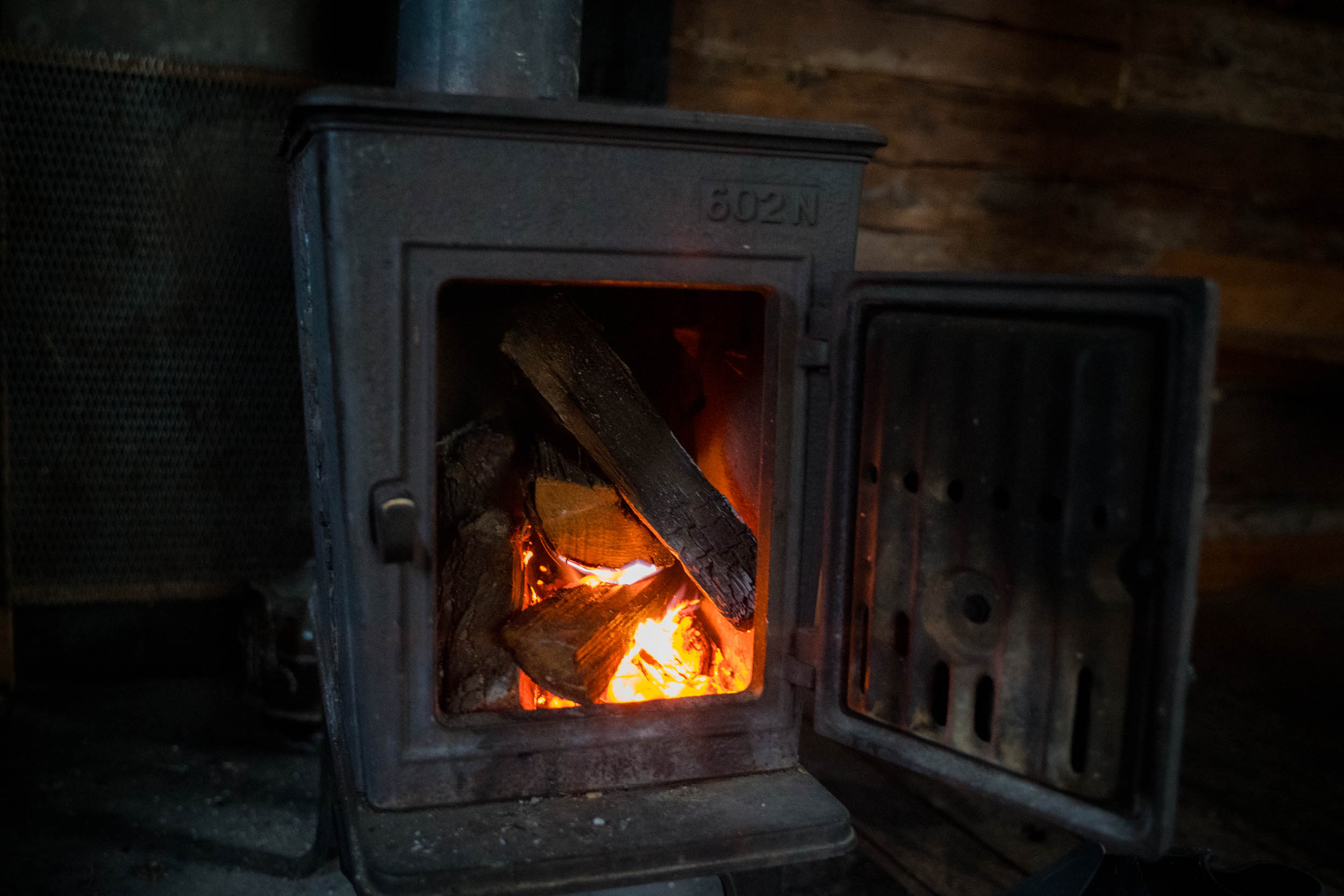
- The Stora Trehorningen Hut is available on a first-come, first-served basis. There is no booking system. It is a free and open hut. There’s an outdoor toilet but no running water or electricity. There is a wood-burning stove inside the hut. Between the benches on the lower level and the large mezzanine level, there is enough room for 10 to sleep inside the hut.
Getting there
- The nearest big city to Surahammar is Västerås. Trains from Västerås to Surahammar station leave every hour. You are allowed to take a bicycle on the train, but space is limited, and it’s first-come, first-served. Prams and wheelchairs have priority. The rail time is just 23 minutes.
- If you’re coming from Stockholm, the easiest way to get to Västerås with a bike is on the Mälartåget via Eskilstuna.
Danger and Annoyances
- The 55 road just before Virsbo can be a very busy road. Care should be taken here.
- Mosquitoes can be a nuisance during wet summer months.
- There is evidence of wolves in the region. That being said, wolves in Sweden are extremely shy, and you would be lucky to spot one.
- We stayed at the Stora Trehörningen Hut which sleeps up to 10. There was also a lot of room for tents outside the hut.
- A second option is by the lake at Trummelsberg, where there is a shelter with a firepit.
- Sweden’s famous “allemansrätt” is a group of bylaws that cumulatively allow you to roam freely through the Swedish countryside. They also facilitate wild camping for up to two nights in the same location. It’s not quite a free-for-all, and you should familiarize yourself with the rules, but in general, you can camp where you please. For more information, go to VisitSweden.com.
- There is a Willys and Coop store in Surahammar. It’s not located in the town centre!
- Färna has a pizza shack, which sells some groceries. Virsbo has an ICA supermarket.
- There are plenty of lakes and rivers on this tour, and although the environment is pristine, it’s always best to filter the water.
Trail Description
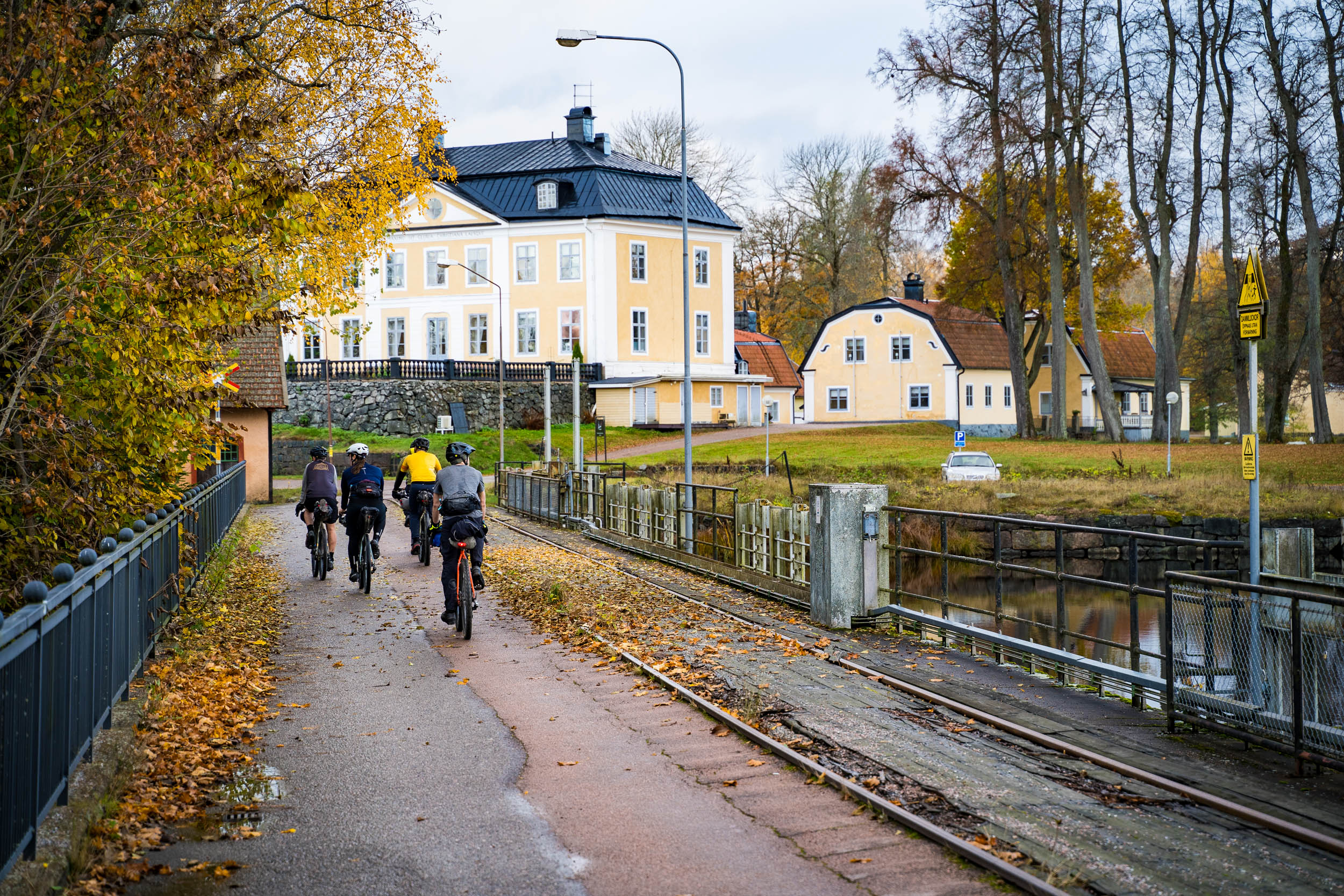
This gentle and historical overnight tour starts in the small town of Surahammar, one of the many mill towns on the Kolbacksån River. Surahammar is an old village. It’s not known exactly when its mill began operations, but there is evidence that it was before 1651. The industrial area, or bruk in Swedish, originally became famous for producing railway wheels and axles, which it still does today. In later years, it became known for producing Sweden’s first-ever internal combustion engine car, built in 1897. The manufacturer was Vagnfabriks Aktiebolaget i Södertelge (Vabis), better known today as Scania. For many years, the Vabis text was visible alongside the crowned Griffin eagle on the company’s logo.
When heading west out of the village, you cross over the Kolbacksån River along with the famous Strömsholm canal, which it interlinks. This canal was built between 1772 and 1795 and has 26 locks over the 100 kilometres of its length. The canal was originally built to transport lumber from the mountainous Dalarna region and finished milled products from the industrial villages in the region down to the larger city of Västerås and then out to Stockholm for onward transportation.
Once you cross the river, the adventure and forest wilderness begin. An old abandoned railway line leads you to beautiful forests, taking you through mostly flat lands up to the village of Färna. While riding along the gravel, don’t forget to jump off your bike and take a short walk through the picturesque forest. Embrace the deafening silence. One ideal location is at the ekopark by the forestry company, Sveaskog, located just before Färna.
After Färna, more remote riding will eventually lead you to a picturesque cabin on the shores of Stora Trehorningen Lake. The open and free hut here is a perfect place to stay overnight. As part of allemansrätt, Sweden’s right to roam laws, you are allowed to stay here for a maximum of two nights. Be kind to the next guest, and clean the hut before you leave.
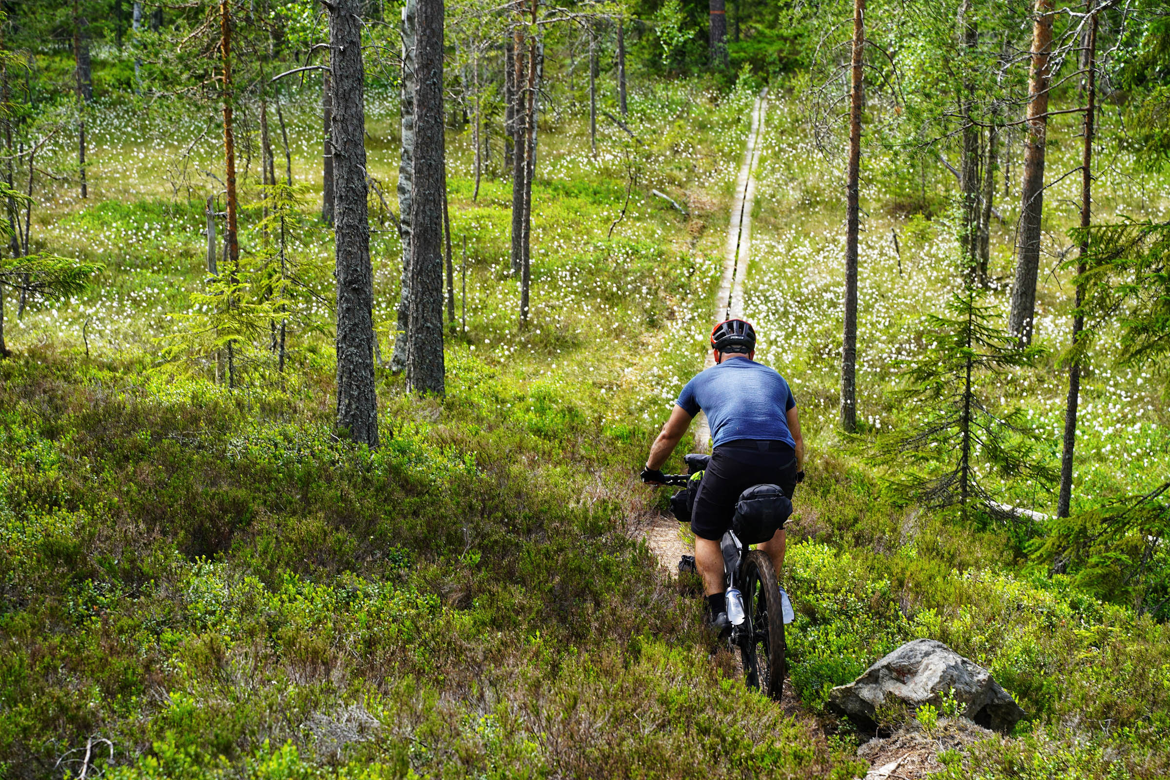
After the hut, there is a rocky 200-metre hike-a-bike that’s part of the Bruksleden hiking trail. There is no lifting of your bike, however, and what waits at the end of this singletrack section is more glorious gravel riding. These roads will bring you down to the next historical site on the tour, Trummelsberg. This location was once home to part of the mining and foundry network of the region, but nature has reclaimed nearly all evidence of this except the collection of stone pillars located up the hill away from the lake. It’s an unusual site worth seeing. For those who didn’t stay at the Stora Trehorningen Hut, there’s a shelter and fire pit located down by the lake at Trummelsberg.
Get back on the gravel and keep riding south. There are signs indicating private roads, but these are meant for cars, and allemansrätt gives you the right to use these gravel lanes. Unfortunately, before long, you need to ride along the busy 66 asphalt road. Busy in this region means some cars might pass you by as you scoot the two kilometres down to Virsbo. Child cyclists should be well monitored along this stretch. Virsbo is another sleepy village located on the Strömsholm Canal, where tere there is an ICA supermarket and a pizza shack. After this quiet village, you arrive at one of the highlights of the entire tour, the Hälleskogsbrännans Naturreservat.
This nature reserve was created as a result of the huge forest fire that ripped through this part of Sweden in 2014. The most awe-inspiring part of this burnt forest is how the region is regenerating itself after the disaster. On Thursday, the 31st of July, 2014, a forestry machine caught fire. As a result, some 13,800 hectares of forest were consumed by flames. It took until the 11th of August to get the fire under control, and it wasn’t officially declared extinguished until the 11th of September, 2014.
This was an ecological disaster, but new life emerged from the charred remains of the wood. First to arrive were the insects and larvae feeding on the burnt wood. Then the birds came, most notably the three-toed woodpecker, rarely seen in this region before. When the young bushes and trees began to grow, it brought back deer and moose to the region, and they, in turn, brought the wolves. In all, it will take the forest a hundred years to fully recover, but from the rejuvenation, we will gain a diverse and healthy woodland that will become Sweden’s largest uninterrupted deciduous forest. Today, the burnt area is managed as a nature reserve by Västmanland Länsstyrelsen and by the private forestry company Sveaskog in the form of an ekopark located at Öjesjön.
Apart from the amazing colours to be seen whilst riding through the region on an autumn’s day, the highlight of the nature reserve is the Grävlingsberget lookout tower—a must-do detour whilst cycling through on the gravel roads. There are toilets, a shelter, and picnic spots at the tower. From here, as you ride deeper into the young forest, the gravel roads get narrower, such that during the summer months, in some parts, you’ll be riding down a tunnel of green trees.
Once you leave the nature reserve and head towards Ramnäs, history returns to the landscape. You don’t ride directly into the village straight away. Instead, take the road closer to the river, where you get to cycle past the beautiful Schenströmska mansion. Here, Hans von Kantzow lived until 1971. He is famous for inventing the Kanthal alloy. This metal wire is able to resist high temperatures, is very flexible, and is found in many household items. It could be said that Hans was the godfather of the toaster and hairdryer, as without his invention, they wouldn’t exist today.
Shortly after is the Ramnäs foundry, which has been in existence since the year 1591 and began producing sea-worthy chain in the late 19th century. It still does to this day. After passing by the sleepy village, it’s time to enjoy the views over Kolbacksån as you switch between asphalt and gravel whilst rolling the last kilometres back into Surahammar.


Terms of Use: As with each bikepacking route guide published on BIKEPACKING.com, should you choose to cycle this route, do so at your own risk. Prior to setting out check current local weather, conditions, and land/road closures. While riding, obey all public and private land use restrictions and rules, carry proper safety and navigational equipment, and of course, follow the #leavenotrace guidelines. The information found herein is simply a planning resource to be used as a point of inspiration in conjunction with your own due-diligence. In spite of the fact that this route, associated GPS track (GPX and maps), and all route guidelines were prepared under diligent research by the specified contributor and/or contributors, the accuracy of such and judgement of the author is not guaranteed. BIKEPACKING.com LLC, its partners, associates, and contributors are in no way liable for personal injury, damage to personal property, or any other such situation that might happen to individual riders cycling or following this route.
Further Riding and Reading
Here are some connected/nearby routes and related reports...
Please keep the conversation civil, constructive, and inclusive, or your comment will be removed.