


At-Bashi Circuit
Distance
240 Mi.
(386 KM)Days
7
% Unpaved
85%
% Singletrack
10%
% Rideable (time)
95%
Total Ascent
16,469'
(5,020 M)High Point
13,205'
(4,025 M)Difficulty (1-10)
7?
- 4Climbing Scale Fair69 FT/MI (13 M/KM)
- 7Technical Difficulty Difficult
- 8Physical Demand Difficult
- 7Resupply & Logistics Strenuous
Contributed By

Tristan Bogaard and Johan Wahl
Guest Contributor
Tristan & Johan are bikepacking photographers, route designers and avid adventure cyclists from the Netherlands and South Africa, respectively. They have submitted many exceptional routes and inspirational content over the years. You can view, follow, and learn more about Tristan here and Johan here.
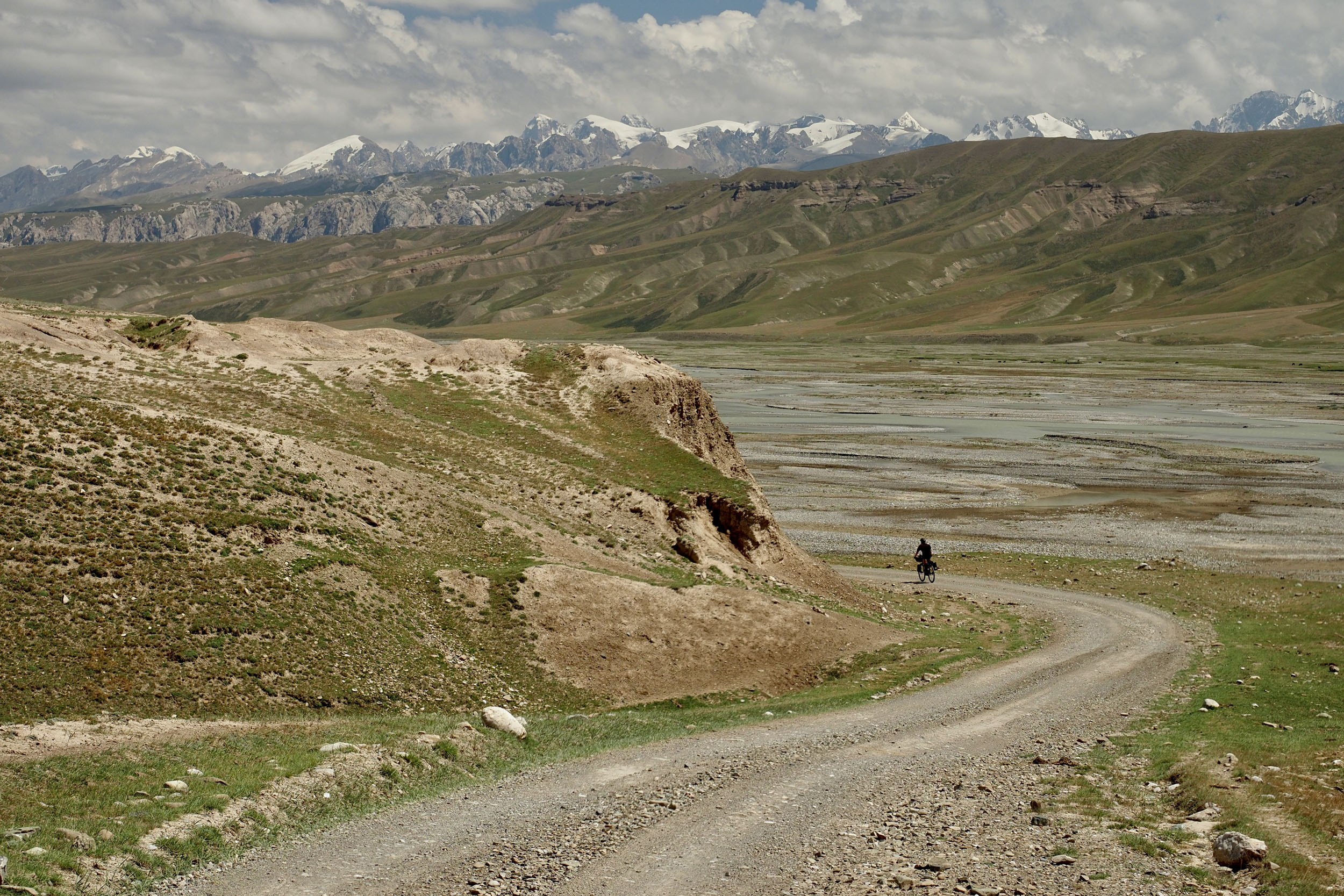
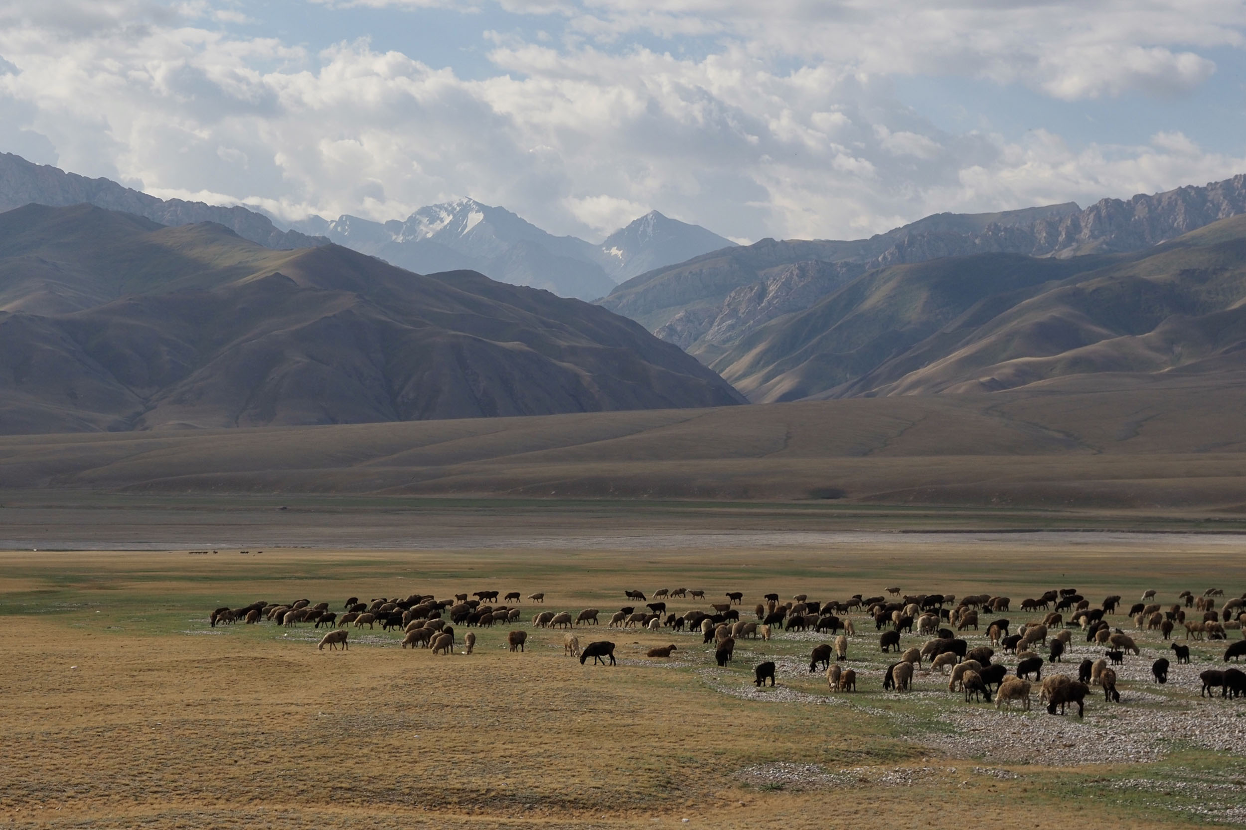
Of all the mountain ranges in Kyrgyzstan, At-Bashi isn’t one that rings a bell for many, but it’s a fierce little range that boasts tall peaks and incredible beauty. It also guards some of the country’s most important sights including the 15th-century stone caravanserai at Tash Rabat and Chatyr-Kul lake, the country’s third largest lake.
The range is situated between the city of Naryn and the Kyrgyz-Chinese border, and, by convention, is typically circumnavigated by combining the paved highway on the west and the rough border gravel road that passes the hidden, but ultra-famous Kel-Suu valley and lake in the east. Some of these parts are familiar territory for anyone who’s ridden a Silk Road Mountain Race, as most editions have included stretches in this area, such as the Old Soviet Road, the Chinese border gravel track and all the many river crossings or the dusty roads linking small villages here. Equally, the Tian Shan Traverse links into a small section on the northern end and the Tash Rabat ruins, before heading further up to Baetov.


The At-Bashi Circuit, as described here, attempts to savor the region’s many unique and special sights, but in a style that favours off-road riding and prioritises smaller, remote tracks through the mountains without ever coming into contact with the truck-frequented western highway. It also offers a healthy dose of adventure, particularly with the inclusion of Panda pass, which involves a strenuous hike-a-bike right through the heart of the range, passing an altitude of just over 4000 meters, which is high even by Kyrgyz standards!
The loop is a tough one, no doubt requiring perseverance and resilience on many levels, but its rewards will make it unforgettable for anyone who embraces the challenge.
Route Difficulty
We’ve rated this route a 7 overall. Some seriously challenging parts really exceed this rating but there is a lot of flow to be found in the riding. Riding in Kyrgyzstan is always a challenge, between the logistics of resupply, dealing with the track surfaces and weather conditions as well as communication with locals and getting used to basic amenities. But with the right mindset and motivation, the ever-impressive landscape will more than make up for the difficulty.
Route Development: Tristan has spent multiple seasons exploring Kyrgyzstan and has already contributed to numerous other bikepacking route guides for the country including Expedition Alay. He first came up with the concept of the At-Bashi Circuit together with Belén Castelló, in an attempt to offer a shorter alternative to some of the country’s more popular expedition-length routes. The original circuit involved circling around the At-Bashi mountains via the paved highway to Torugart, but this version lacked some of the ‘punch’ of what we consider makes a good bikepacking route—and what Kyrgyzstan really has to offer. At Tristan’s suggestion, Johan agreed to undertake the Panda pass and Chatyr-Kul plain crossing on his 2025 trip, which proved a massive success. Incorporating these sections into Tristan’s original circuit concept, the route now offers the perfect mix of surfaces, challenges and sights.


Submit Route Alert
As the leading creator and publisher of bikepacking routes, BIKEPACKING.com endeavors to maintain, improve, and advocate for our growing network of bikepacking routes all over the world. As such, our editorial team, route creators, and Route Stewards serve as mediators for route improvements and opportunities for connectivity, conservation, and community growth around these routes. To facilitate these efforts, we rely on our Bikepacking Collective and the greater bikepacking community to call attention to critical issues and opportunities that are discovered while riding these routes. If you have a vital issue or opportunity regarding this route that pertains to one of the subjects below, please let us know:
Highlights
Must Know
Camping
Food/H2O
Trail Notes
Resources
- A first view of the imposing At-Bashi mountains while tipping over the paved climb out of Naryn.
- Absorbing the luxuries of Naryn’s city life above 2000 meters in altitude.
- Total immersion in the rural side of Kyrgyzstan as soon as you hit the first dirt track. Life here moves differently, is built on a history tied deeply into the former Soviet Union with relics of nomadic civilizations preceding that, and so there’s lots to be explored in your communication with locals.
- Scaling Panda Pass, unlocking the breathtaking view over Chatyr-Kul and the southern Chinese mountains from the summit.
- A challenging, yet adventurous ride over the seldomly traversed northern shores of Chatyr-Kul.
- Discovering your physical and mental limits in a surreal setting of uninhabited landscapes, high-altitude passages, expanding glacial rivers and the rising crest of the At-Bashi mountain range.
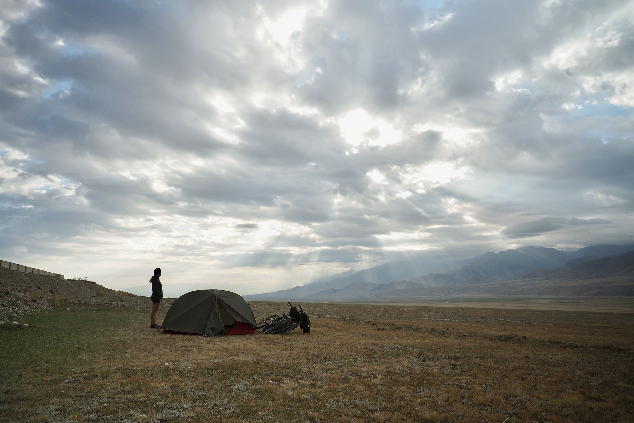
- Pitching your tent among giant mountains, in complete solitude, with likely zero cell-service.
- Watching a million stars at night above camp, with near-zero light pollution exposing the milky way brightly to the naked eye.
- Indulging in newfound luxuries in the Kel-Suu valley as yurt camps have developed at an immense pace here in recent years. Meals, actual bedrooms, even showers are on offer!
- Making the journey out to Kel-Suu Lake either by bike, on foot or on horseback.
- Scaling the Old Soviet Road, gaining unique and breathtaking views over the Kel-Suu valley below.
- Enjoying the winding switchbacks of the gravel road beyond the last 3400m pass and military checkpoint.
- Unwinding in Naryn upon your return. You deserve a thorough pampering!
When to go
- The optimal months to enjoy Kyrgyzstan are July and August, although you could get lucky with the weather conditions in June and September as well.
Travel Basics
- It is best to fly into Bishkek, where you have full access to everything you need to prepare your trip and get used to the country’s food, culture and people. SIM cards are sold at arrivals, and accommodation can be easily booked online these days.
- Kyrgyzstan has a very friendly visa-free arrangement for many nationalities for 60 days, you can check yours here.
- To ride this circuit, it is mandatory to obtain a Border Zone Permit. You can order it online, either via the Ountravela site using this link or by using the CBT Naryn tourism office WhatsApp at +996504558445. Either way, make sure you do this in advance as both options can take more than a week.
What Bike and Gear
- You’ll be better off with at least a rigid mountain bike and tires wider than 2.25”.
- This route doesn’t have many resupply points, so you’ll likely be cooking many of your own meals. The CBT tourism office in Naryn sells gas canisters (albeit at double the price of shops in Bishkek) and you’ll be able to find shops in town (Globus being the biggest) to get non-perishables and other snacks/products you may deem suitable for a long undertaking. Bringing some special treats from your home country can add some creature comforts when the going gets tough, as food options outside of major cities get basic, fast. You can refer to the map to see the POIs marking possible resupply.
Dangers and Annoyances
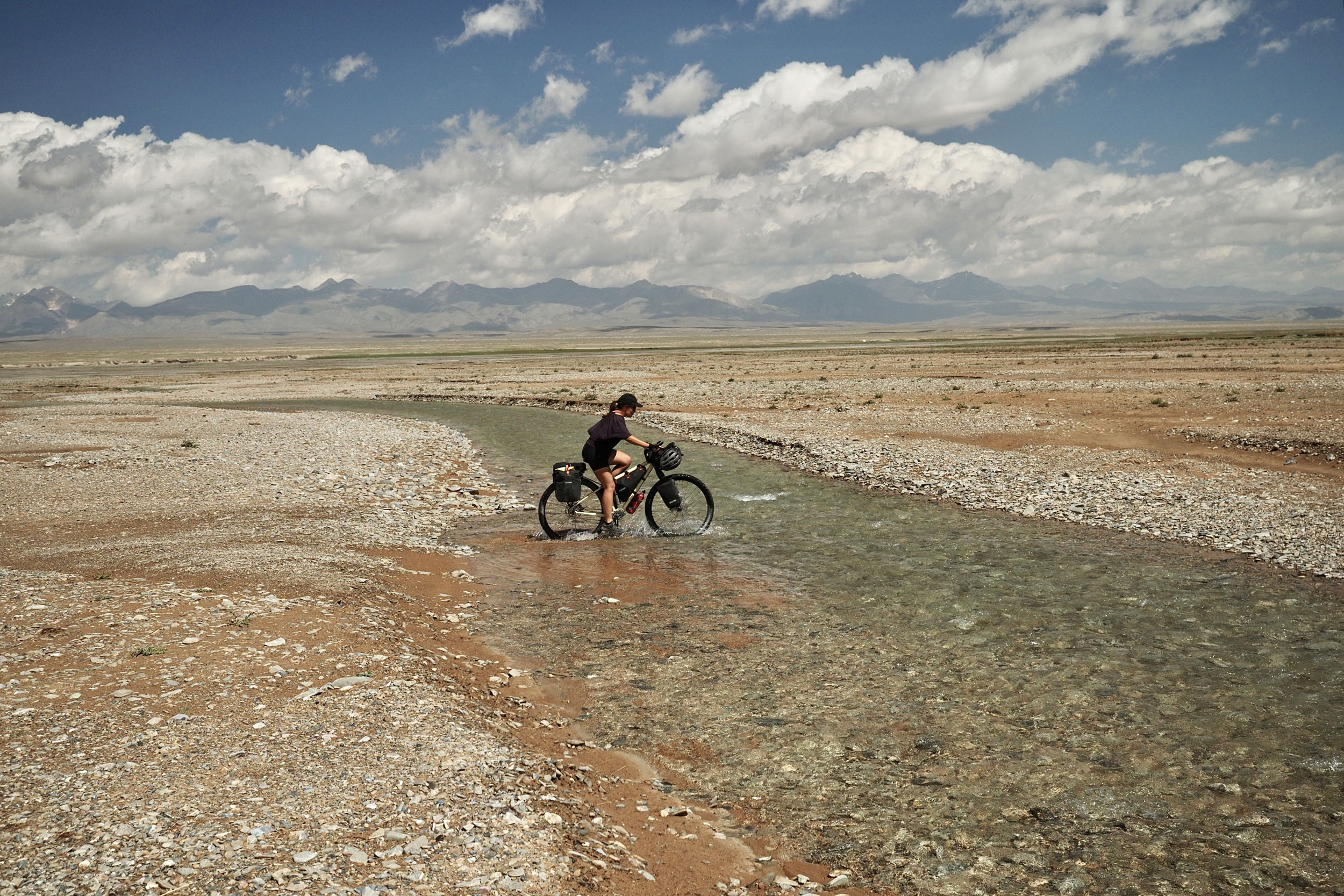
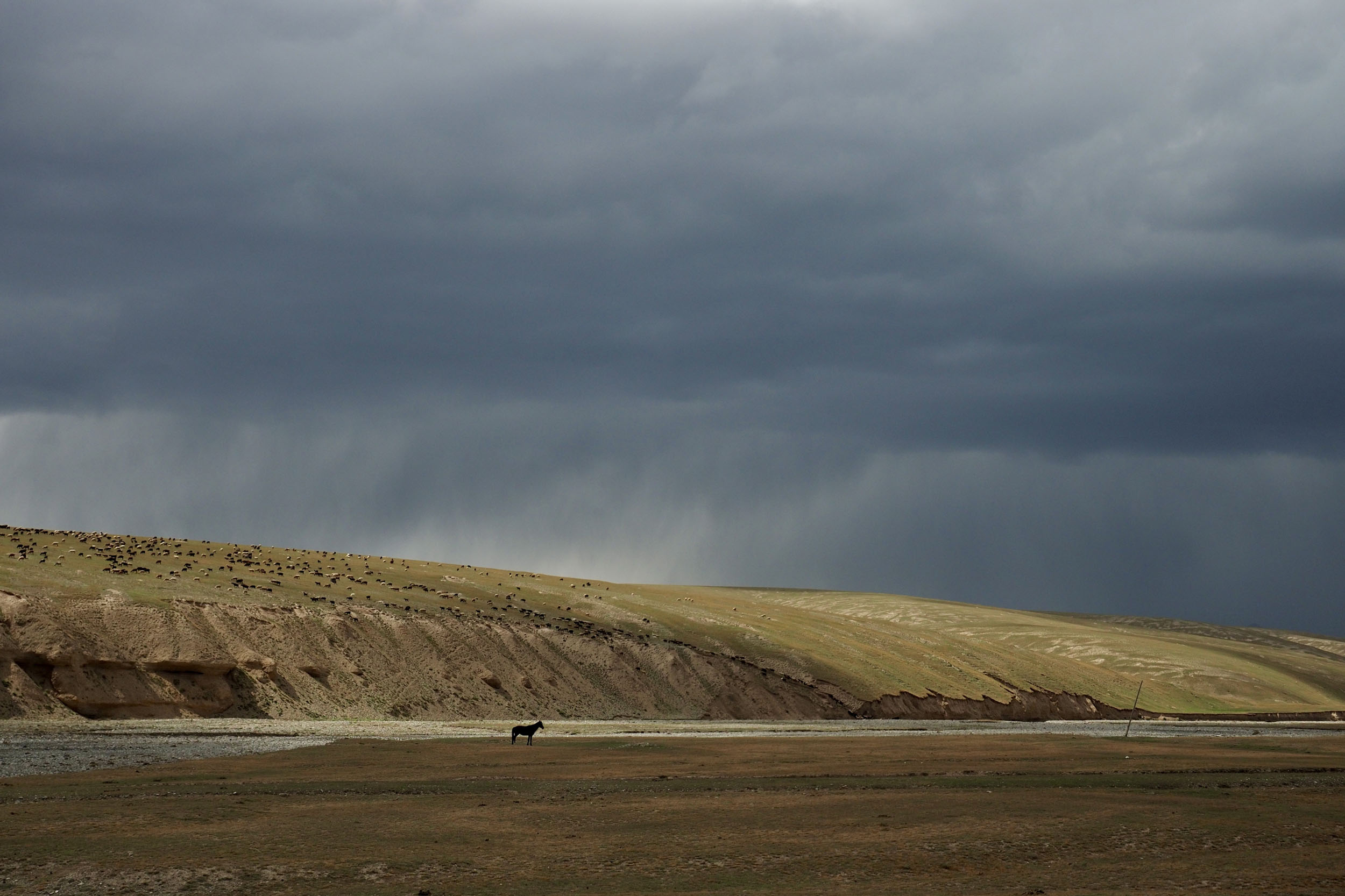
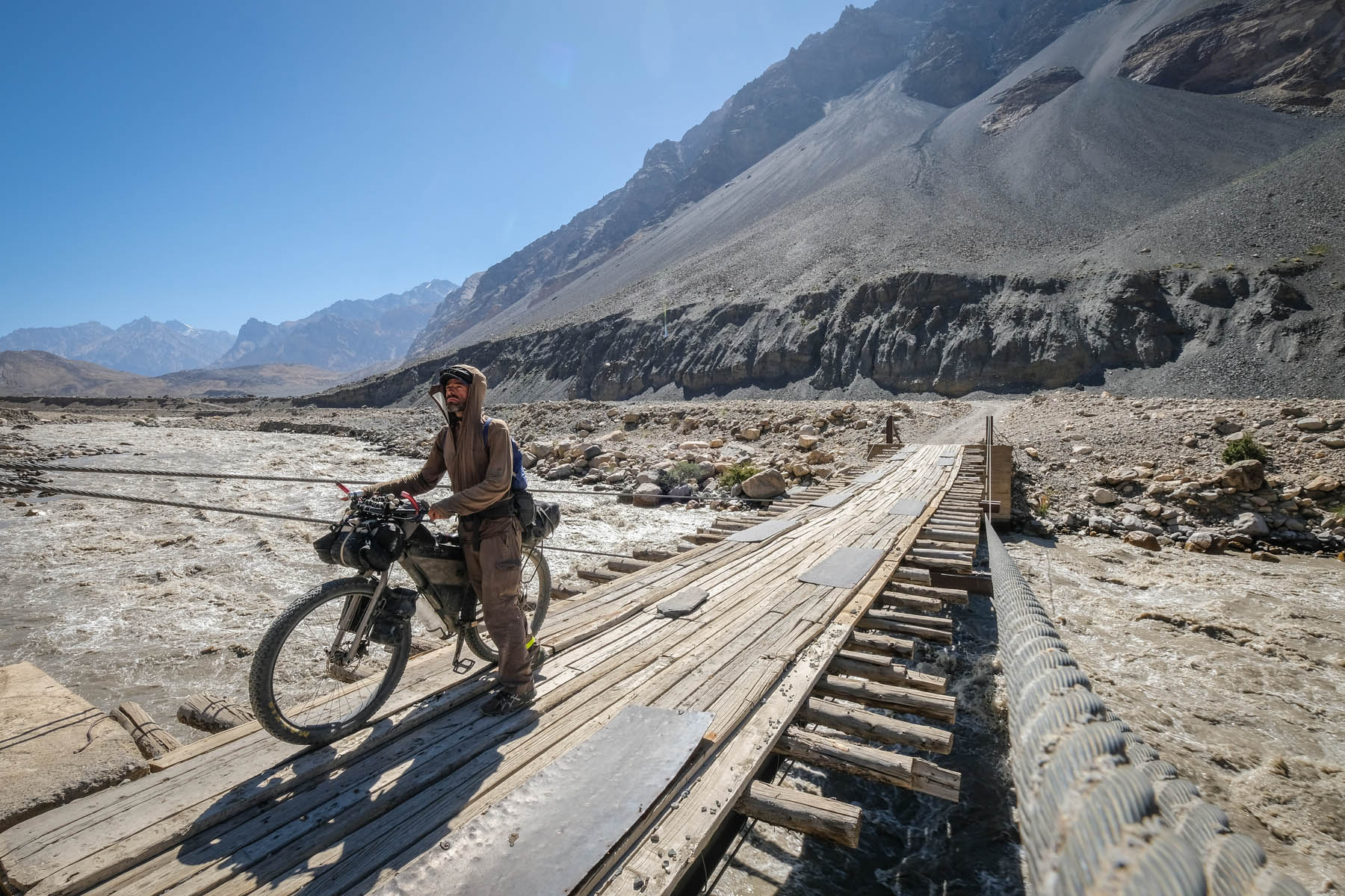
- The number one danger on this route, aside from obvious weather cautions, is river crossings. The route goes through countless small rivers as well as some larger ones. Do not take these crossings lightly and never go beyond your comfort zone. If possible, partner up with other riders to assist each other through the deeper crossings.
- You’ll encounter two particularly steep sections on this route where you’ll have to hike your bike. The first section is on the way up to Panda Pass after Tash Rabat, and down its southern slope. This one is particularly steep, so stay alert. The second big push is out of the Kel-Suu valley on the Old Soviet Road. This overgrown track has some barbed wire laying around here and there and is extremely steep, but an overall short gain of altitude.
- Always be aware that in the Kyrgyz mountains weather can change extremely rapidly and drastically. There are many microclimates, and temperatures can swing quickly, bringing sunny mornings, afternoon downpours or even random snowstorms in July and August. Pack multiple protective layers for heat, cold and rain and make sure to have a plan of where you could stay in case you get stranded outside of what you originally planned.
- Big river crossing: at KM204 you’ll find one of the biggest river crossings of the route. Our route here is but a suggestion from previous experience, so take extra care here.
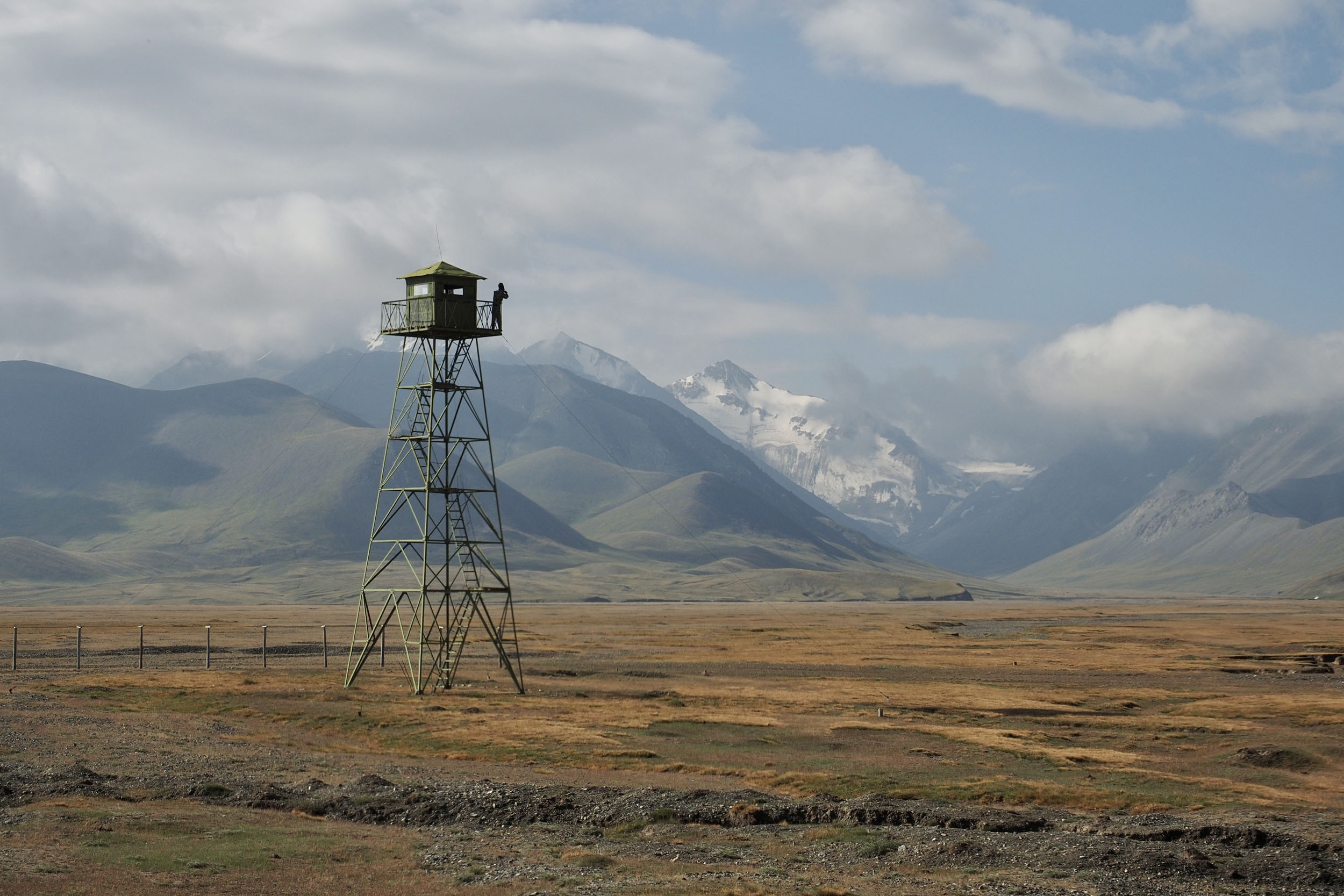
- Military checkpoints: there’s two military checkpoints in this region, where border permits are checked. By crossing over Panda Pass, you skip the border zone entry check point, but you will be checked on your way out, and failure to present a permit can land you in big trouble.
- Trucks in and out of Naryn: unfortunately, the only route in and out of Naryn is a smooth, yet busy highway. If you’re unlucky, there’ll be lots of trucks passing you, and you’ll have to stay cautious while climbing either side.
Tourism Development
- Over the years, Kyrgyzstan’s tourism industry has expanded massively. Just between Belén and Tristan’s 2022 reconnaissance trip and Johan’s subsequent 2025 exploration, the country has undergone significant development in its tourism infrastructure. This means that, while the At-Bashi Circuit crosses some extremely remote areas, it is also more connected to civilization than ever before. Likewise, with the presence of many SRMR riders in recent years due to the routes almost always passing the Chinese border road, Kel-Suu and the Old Soviet Road, locals are far more aware of the particular needs of cyclists.
Kyrgyzstan is a wild camping paradise. Because of its nomadic history, camping is respected and widely practiced, and so far the tourism boom isn’t doing that any harm. You should absolutely bring your tent, enjoy many nights under the stars and do so without leaving a trace of your visit.
- Lodging tips: Naryn city offers several options for comfortable stays. I highly recommend staying at the old Khan-Tengri hotel. You may have to reserve a room online in the high season. Their on-site restaurant was a personal highlight of mine during an SRMR attempt and I encourage you to spoil yourself with their menu options, too!
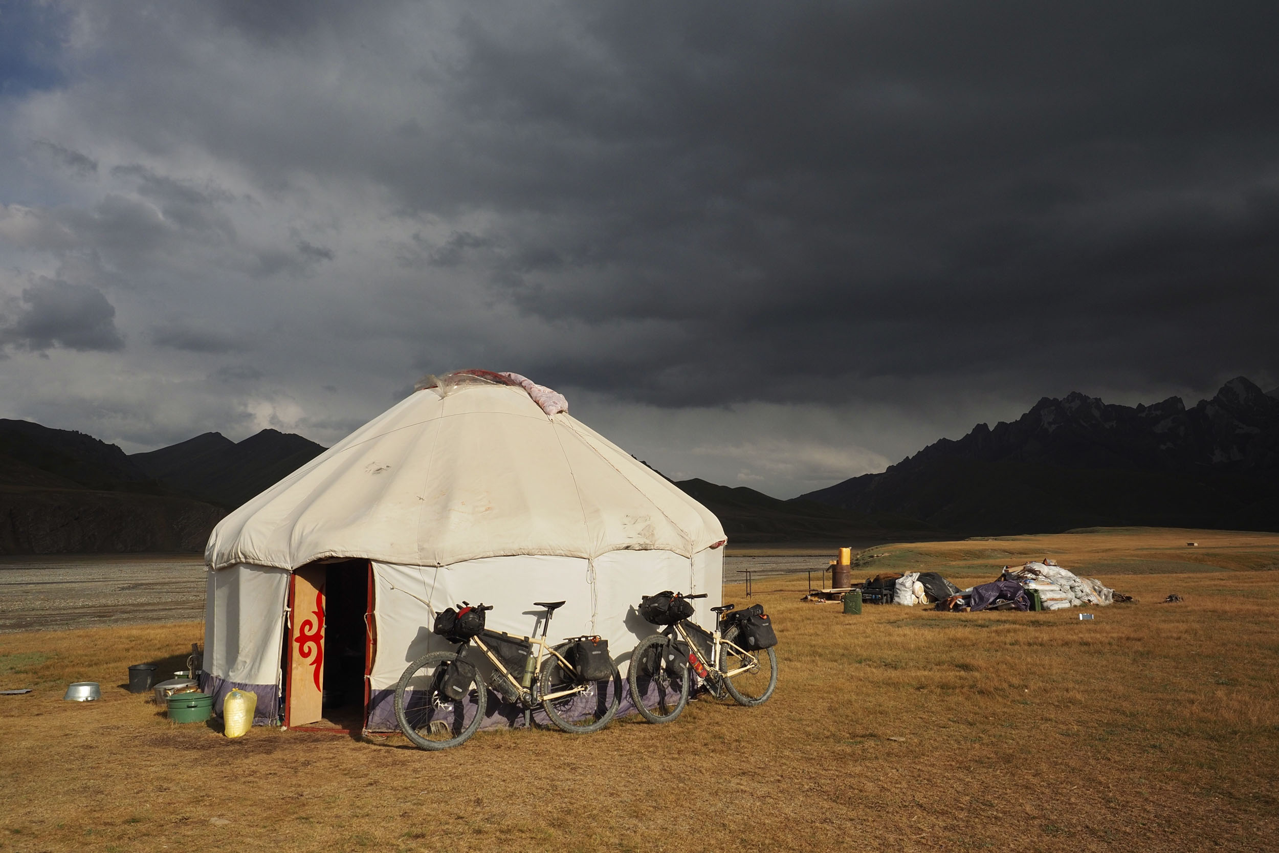
- Budget Options and Yurt Camps. Hostels are common in Naryn, and finding a shared room is no trouble and relatively affordable. Further along the route you’ll find yurt camps at the following places: Tash-Rabat; at the southern foot of Panda Pass; and in the Kel-Suu valley. The latter has quite a few on offer, including new permanent restaurants.
- Wild camping is a blessing in Kyrgyzstan and it is the only way to consistently find a place to sleep.
Kyrgyzstan’s gastronomy is always developing according to tourist’s preferences in its cities, but in the countryside things quickly get really basic. In small shops you’ll sometimes find bread, vegetables, fruits, and legumes, but it’ll mostly come down to soft drinks, candy, and ice cream.
- Restaurants: In Naryn city and in some of the larger villages on the At-Bashy strip, you can still find restaurants. After that your only options for paid-for meals are at tourist yurt camps.
- Water: Water is rarely in short supply in Kyrgyzstan. While the water from mountain streams is likely very clean, it’s recommended to always use a filter when filling up from them.
- Resupply: Riding out of Naryn, your options for resupply will diminish quickly and become only basic essentials. Make sure to have at least a few days of food packed; non-perishables and lots of snacks will do the job. After Tash-Rabat, your next resupply chance is Kel-Suu valley.
The below details four distinct sections of the route, but are not intended to be used as a day-to-day itinerary.
location Naryn to Tash Rabat
123 km +1,743 m
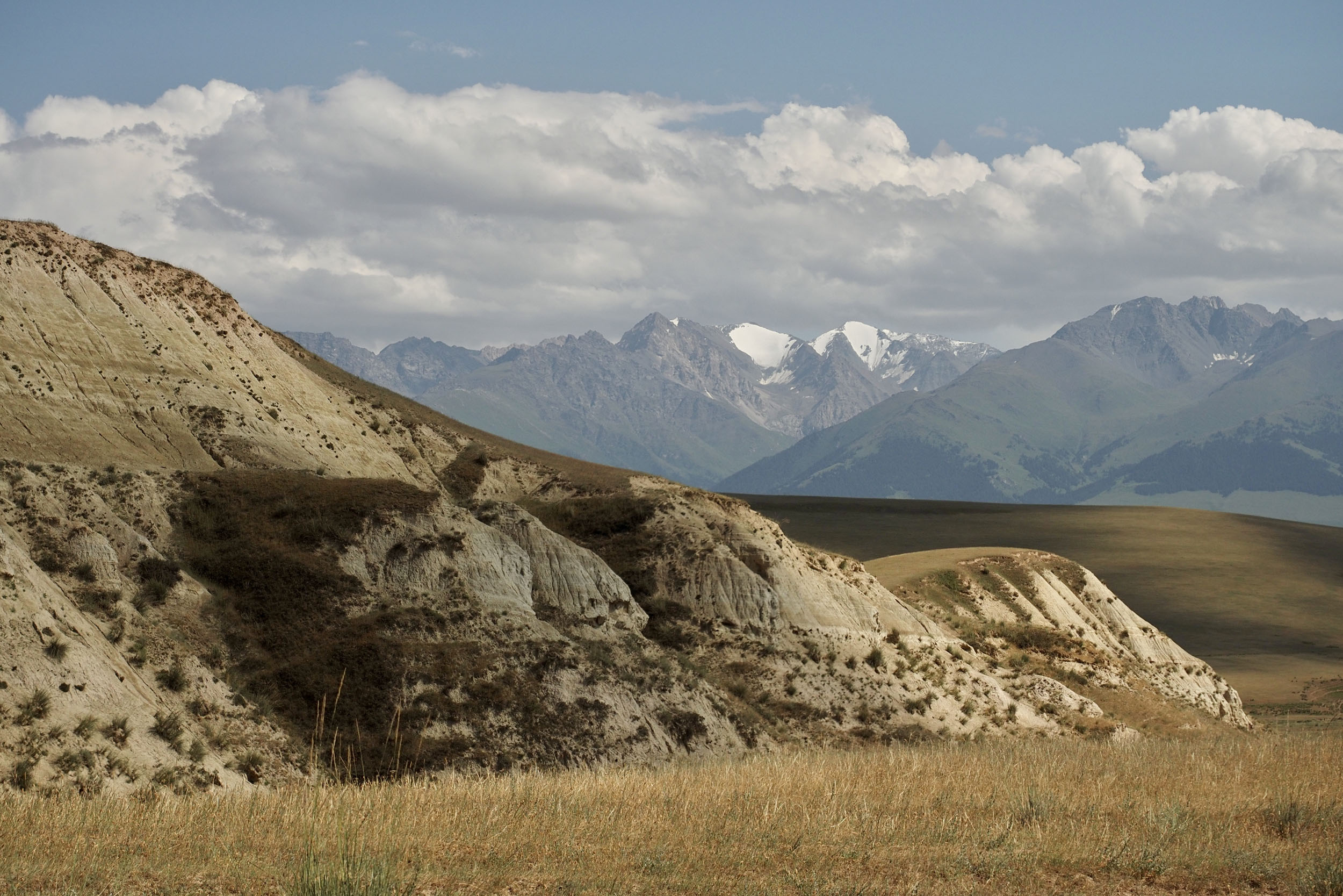
The route starts by exiting Naryn on the main road to At-Bashi village and, right off the bat, goes into a 2618m pass before hitting the dusty tracks of the high plateau. Small roads lead between villages here, with a few more possibilities for resupply. Get into the groove of rural Kyrgyzstan here—chat with some locals and find a camp spot to admire the mountains towering on the south. Afternoon storms or dramatic sunsets may create quite the natural theater here. Passing Kazybek village, an unmarked dirt track connects with the road to Tash Rabat.
location Tash Rabat to the Chinese Border Road
49.3 km +1,065 m
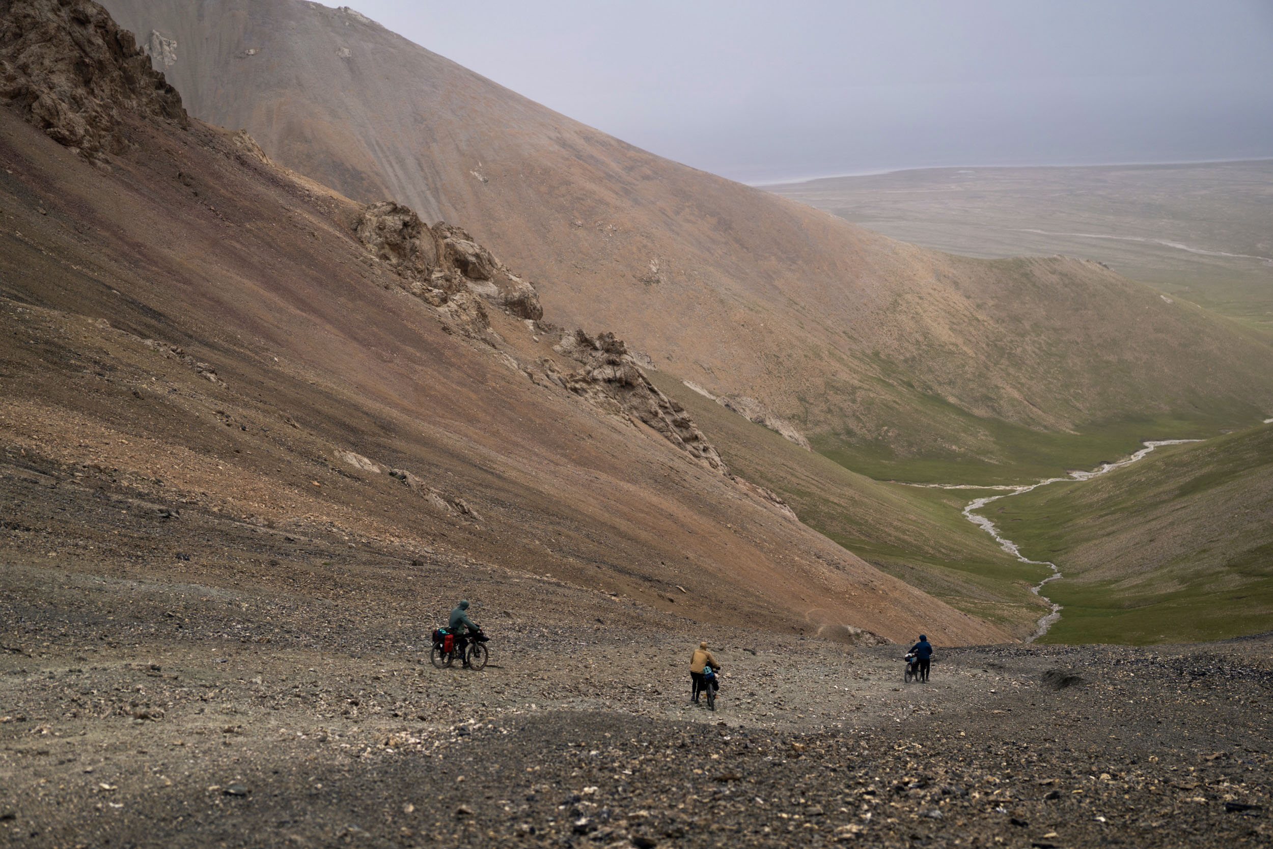
Tash Rabat is connected to the shores of Chatyr-Kul and the Chinese border road via the 4025m Panda pass. The trail from Tash Rabat to the summit of the pass is a popular day trip for tourists on horseback and thus does see regular traffic. However, it’s still very steep and rugged, making for a strenuous hike-a-bike. The first five-or-so kilometers out of the Tash Rabat compound is relatively easy, following a mix of singletrack and double-track trails alongside the Tash Rabat river. With the exception of a few river crossings and boggy bits, most of it is ridable.
The split in the valley, at around the 5km mark from Tash Rabat, marks the end of the easy bit and the start of the hike-a-bike. Here, the trail starts to climb steeply up a scree slope in an almost direct line to the summit. Views along this stretch are breathtaking with panoramic mountain views throughout. At the crest of the pass, there’s an optional trail that can take you to Patamushta peak, roughly 4250m. If being that high means something to you, then definitely check it out. The descend on Chatyr-Kul side (south) is extremely steep and consists of loose scree with no trail to follow. Presumably, most horse-tourists travel up to the top of the pass only, without descending down this side. Coming up from this side would be treacherous, and cannot be recommended, though it’s probably not impossible.
At the foot of the southern side you’ll find a small yurt camp set against a backdrop of rock formations and caves. This is one of the few inhabited places on this side of the mountain, so stopping for a meal and a night’s sleep is highly recommended. The next 35-odd kilometers are on extremely remote terrain, following seldom traveled double-tracks that skirt around the marshy plains surrounding Chatyr-Kul lake. Weather conditions will make all the difference here. If it’s wet, expect slow progress, with tons of little river crossings and rough muddy roads. In drier conditions, presumably, this stretch should be pretty straight forward.
location Chinese Border Road to Kel-Suu
83.5 km +412 m
Once on the main Chinese road, it’s an ever-so-slightly downhill battle against hoards of river crossings, some of them significant. In deeper waters, it is highly recommended to walk the crossing first, marking a clear path, before attempting to cross with your bike. Common tactics include walking back and forth, first with gear and then the bike. Bringing sandals for these crossings can be a lifesaver—nobody likes wet shoes. Water levels fluctuate wildly, depending on the day, so you may well get lucky with fairly shallow crossings, but if too deep for your comfort then don’t risk it.
At the end of the Chinese road, a well-travelled pass (roughly 3600 m high) carries you into the Kel-Suu valley. where a swooping dirt road descends into a truly stunning scene. Slowing down and unwinding here comes as an obvious recommendation, possibly swapping bike time for a hike to Kel-Suu lake, situated south of the many yurt camps adorning the valley. For some extra adventure, the singletrack trails between the camps and the lake also makes for some fun riding. Tourism is growing rapidly here, so there’s plenty of choice in accommodation and food.
location Kel-Suu to Naryn
130.9km +1,292 m
From Kel-Suu it’s a gruelingly steep, but relatively short, climb back out of the valley. This climb has been made famous as a regular feature on the SRMR, often referred to as the Old Soviet Road. Once this steep ascend has been conquered, a 3400 meter mountain pass and military checkpoint mark the return back to Naryn via the dusty 4×4 road.
Route Alternatives
- Highway to China: If you’re not up for the Panda Pass hike-a-bike, you can ride the asphalt highway from just before Tash Rabat, almost all the way to the Chinese border. Along it you’ll find a military checkpoint where they’ll check your border permit. The Torugart settlement is where you’d be able to link back to the route on the dirt track along the old border fence. This option is potentially much easier and more manageable for less experienced riders, but can also be a wise alternative to tackling Panda Pass in unfavorable weather conditions.


Terms of Use: As with each bikepacking route guide published on BIKEPACKING.com, should you choose to cycle this route, do so at your own risk. Prior to setting out check current local weather, conditions, and land/road closures. While riding, obey all public and private land use restrictions and rules, carry proper safety and navigational equipment, and of course, follow the #leavenotrace guidelines. The information found herein is simply a planning resource to be used as a point of inspiration in conjunction with your own due-diligence. In spite of the fact that this route, associated GPS track (GPX and maps), and all route guidelines were prepared under diligent research by the specified contributor and/or contributors, the accuracy of such and judgement of the author is not guaranteed. BIKEPACKING.com LLC, its partners, associates, and contributors are in no way liable for personal injury, damage to personal property, or any other such situation that might happen to individual riders cycling or following this route.
Further Riding and Reading
Here are some connected/nearby routes and related reports...

Please keep the conversation civil, constructive, and inclusive, or your comment will be removed.