Basin and Batholith
Distance
89 Mi.
(143 KM)Days
2-3
% Unpaved
79%
% Singletrack
10%
% Rideable (time)
90%
Total Ascent
7,110'
(2,167 M)High Point
9,167'
(2,794 M)Difficulty (1-10)
6.5?
- 5Climbing Scale Moderate80 FT/MI (15 M/KM)
- 4Technical Difficulty Fair
- 7Physical Demand Difficult
- 4Resupply & Logistics Fair
Contributed By

Colton Johnson
Guest Contributor
Colton grew up in the Sierra and has continuously returned to these granite peaks to climb, hike, and bask in their splendor. Following their heart, Colton relocated to the Eastern Sierra and now spends every free moment exploring by bike and foot. Colton invites everyone to share their love for the area, aiming to foster a sense of community and acceptance for both new and seasoned riders.
Photos by Jake Stern and Colton Johnson
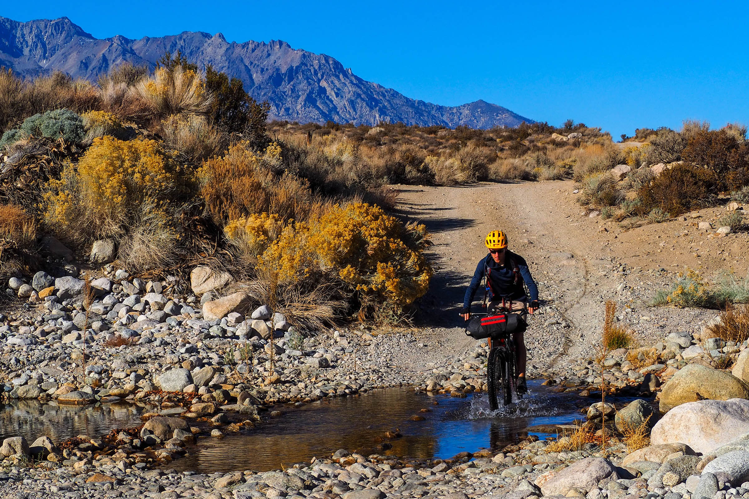
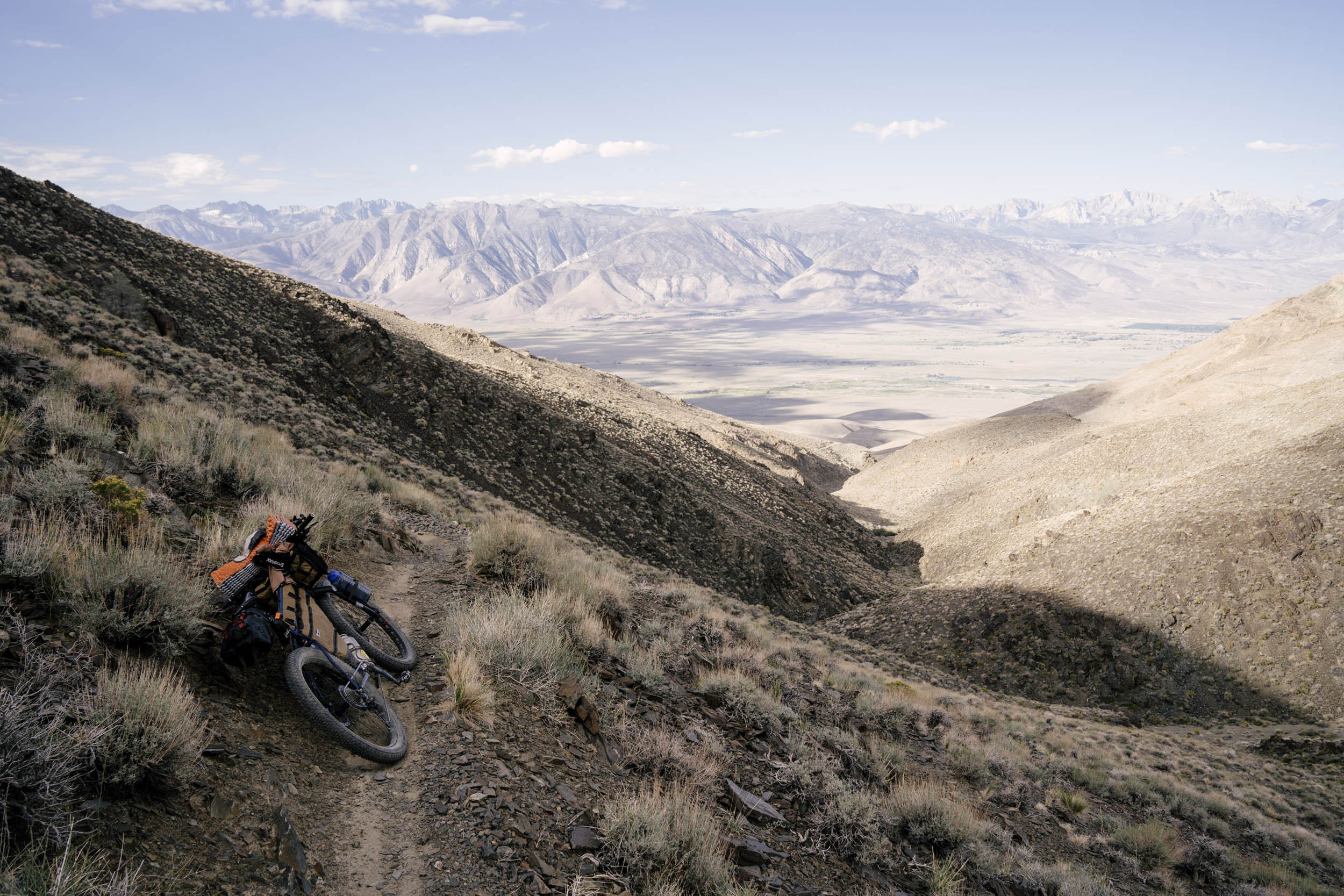
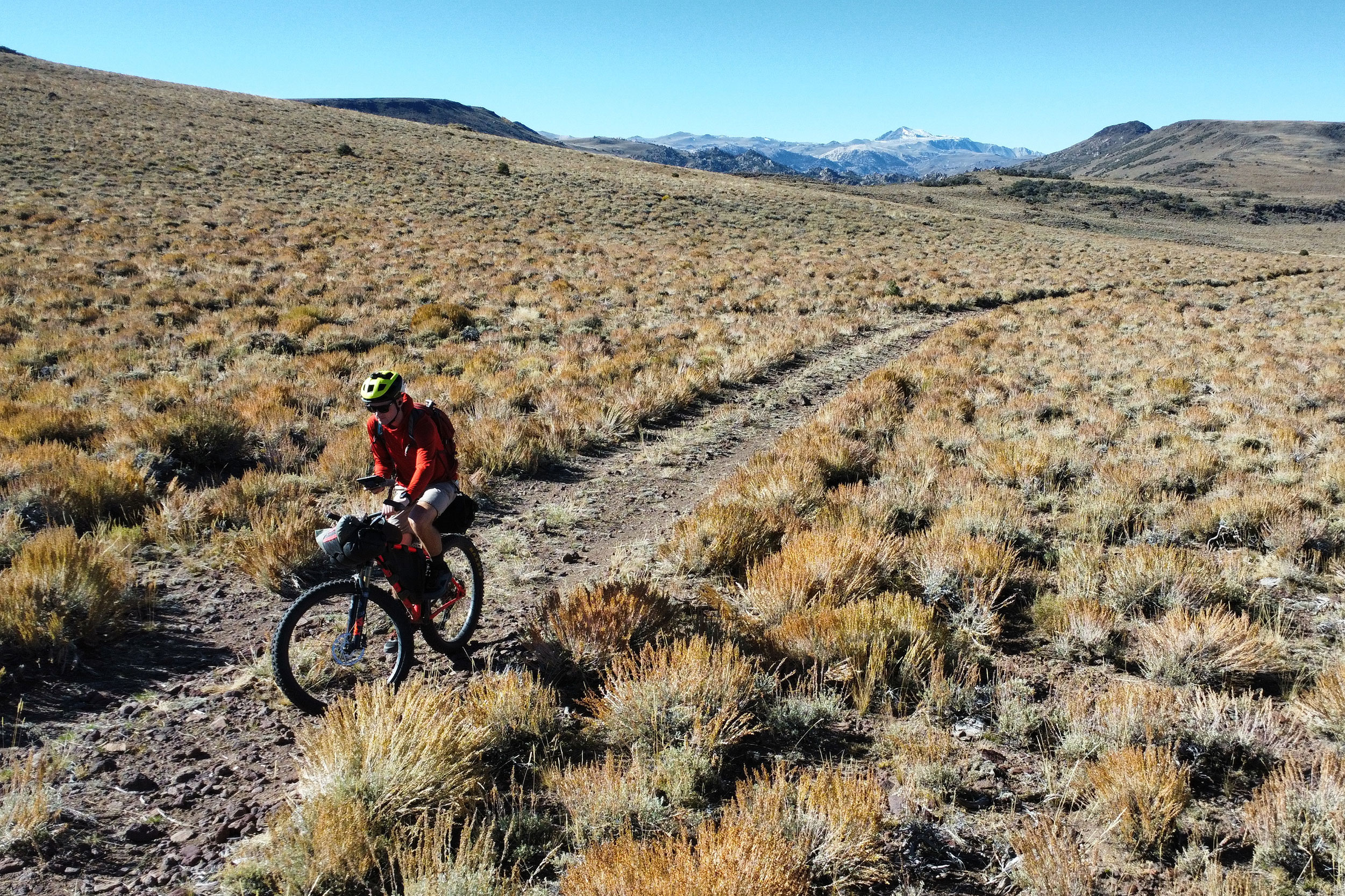
The Basin and Batholith is a 90-mile loop that indulges riders in varied non-technical terrain with grand views and geologic wonders. The route is located near Mammoth Lakes in the heart of the Eastern Sierra Nevada. It winds its way through pine forests and sagebrush expanses. Primarily utilizing forest service roads, doubletrack, and some singletrack trails, the route is accessible to most bikes with larger tires. With two resupplies along the route, it is a great excuse to go light, take your time, and experience the region’s natural splendor. You will travel through ancient and recent geologic history and encounter historical landmarks that have shaped the valley and its people. Find a full turn-by-turn description of the route under the Trail Notes tab.
Route Difficulty
The Basin and Batholith has the potential to be a semi challenging overnighter if you aren’t accustomed to varied riding conditions or the eastern sierra rugged nature.. Due to the high sun exposure, variable weather, long mileage and occasional sandy segments. The sand here is deep and difficult to ride through. Do not underestimate it! The route offers many reroute variations and multiple bail out options should riders need. Plenty of opportunities for wild camping or staying at developed campgrounds.
Resupply and logistics for the Basin and Batholith overnighter revolve around the two main towns, Mammoth Lakes and June Lake. Both towns provide food and shelter, though availability may vary due to seasonal tourism. Mammoth Lakes is particularly well-equipped, offering access to multiple bike shops and outdoor stores for any equipment needs or repairs. Along the route, filterable water is available at several spots, and the longest stretch without water resupply options is about 25 miles if you begin the route with a full supply. Navigation can be managed with GPS, but the overabundance of doubletracks and forest service roads intersecting the route can make it confusing at times. Given the track’s remote nature, carrying a satellite beacon is highly recommended. While hitchhiking or assistance from fellow tourists might be possible, it can’t be guaranteed.

The route presents a mix of technical challenges. Some sections are notably sandy and unpredictable and can slow progress to a crawl, challenging both physical and mental stamina. You will likely have to walk your bike at times. Winter snowpack can leave drifts in forested areas, adding to the difficulty. Due to the high density of intersecting forest service roads, navigation can be tricky, so carrying both paper and digital maps is essential to help navigate the complex network of trails and roads.
The Basin and Batholith Overnighter demands significant physical endurance, primarily due to extensive sun exposure, with long stretches in direct sunlight posing a major hazard. Additionally, the route’s elevation, starting at 8,200 feet and descending to 6,300 feet, can add difficulty, particularly for those coming from sea level. Patience and proper acclimatization are essential to handle the elevation and sandy terrain effectively.
 This route is part of the Local Overnighter Project, which was created to expand our growing list of worldwide bikepacking routes—the first and largest of its kind—and create an independent map and catalog of great bikepacking overnighters, curated by you, from your own backyard. Our goal is to have accessible routes from every town and city in the world. Learn More
Submit Route Alert
As the leading creator and publisher of bikepacking routes, BIKEPACKING.com endeavors to maintain, improve, and advocate for our growing network of bikepacking routes all over the world. As such, our editorial team, route creators, and Route Stewards serve as mediators for route improvements and opportunities for connectivity, conservation, and community growth around these routes. To facilitate these efforts, we rely on our Bikepacking Collective and the greater bikepacking community to call attention to critical issues and opportunities that are discovered while riding these routes. If you have a vital issue or opportunity regarding this route that pertains to one of the subjects below, please let us know:
Highlights
Must Know
Camping
Food/H2O
Trail Notes
- Visiting the Obsidian Dome and Inyo craters.
- Climbing singletrack to the Minaret Vista leading to the iconic view of the Sierra Nevada.
- Visiting Schat’s Bakery in Mammoth and getting some jalapeno cheesy pull-apart bread.
- Riding alongside Hot Creek, a stream that is fed by geothermal vents and hotsprings, all below the towering Eastern Sierra skyline.
- Soaking in Shepherd Hot Springs.
- Encountering the grinding holes at Big Springs Campground.
- Visiting the tufa towers at Mono Lake.
- Riding through North America’s youngest mountains, the Mono-Inyo Craters.
- Swimming in June Lake after riding through the Mono Basin.
- Grabbing a beer at June Lake Brewing.
When to go
- Late spring to early fall are the best times to ride this route. Summer can get hot in the Long Valley Area by Hot Creek, so try to time your ride for the shoulder seasons or cooler days if possible.
- Weather can be highly variable at altitude. Be mindful of afternoon thunderstorms if riding in the summer.
Logistics
- This route is intended to be ridden in a counter-clockwise direction to time resupplies and soaking in the hot springs with the end of day one. The route can be ridden in either direction.
- The route begins and ends at Obsidian Dome, where you can leave your car overnight. Wild camping is readily available on national forest lands. See route GPS for possible campsites.
- Plenty of sand can be found on long sections of the route, particularly between South Tufa and June Lake. The ideal bike would be a Rigid MTB/ATB with at least 2.4″ tires.
- Big Springs Campground is the halfway point of the route and only six miles from your car should you need to bail.
- Bring maps, as there are a lot of intersecting forest service roads, and it can be easy to get turned around or off route.
Dangers and Annoyances
- THIS ROUTE HAS LOTS OF DEEP SAND! Sections marked on the route in blue are sandy. Reroutes are easy and abundant if you tire of sand.
- Sun exposure and variable weather can pose risks to riders along the route; bring sunscreen and layers!
- There is plenty of sand along the route. Wide tires are recommended. Go slow on descents
- Spend a night at altitude if possible before starting the route, otherwise you will likely feel the effects of elevation.
- DON’T FEED THE BEARS/ WILDLIFE: The Eastern Sierra is bear country. Use caution and store food appropriately.
Travel basics
- The route is near two towns. Mammoth Lakes and June Lake are both approximately 10 minutes from the start of the route.
- The route is located approximately six hours from Los Angeles, seven hours from San Diego, five Hours from Sacramento, and three hours from Reno.
- Mammoth Lakes is the nearest town with bike shops or outdoor equipment.
- Wild Camping is available near Obsidian Dome, the starting point of the route.
- Camping is available at Big Springs Campground. Camping is free, but a donation is suggested.
- Wild camping is permitted at various points along the route while within national forest or BLM boundaries. Follow local regulations and signs indicating camping closures.
- Filtered water is available along Mammoth Creek, Owens River, and various lakes encountered along the route.
- While water is available along the route, it’s absent throughout long portions. Fill up at Big Springs as the next water is 20 miles away through very exposed terrain.
- Food/water is available in Mammoth Lakes and June Lake at various stores.
- Schat’s Bakery in Mammoth lakes is a must.
- June Lake Brewing is another must.
You’ll leave your car at Obsidian Dome and begin your journey through geologic time. Starting by riding the perimeter of Obsidian Dome, you will be introduced to the volcanic history that shaped Mono Basin, Long Valley, and Mammoth Lakes. The first 10 miles begin with minimal climbing before you begin a long singletrack climb on the Mountain View trail. There is a lot of OHV activity in the area. Be cautious and keep your ears open for them. In addition to the OHV crowd, there’s quite a bit of sandy doubletrack here. Go slow and stay (to the best of your ability) on the harder pack. The Mountain View trail will lead you to the outstanding Minaret Vista. This phenomenal view is well worth the climb. Take a breather and get ready for some flowy singletrack that will drop you in the heart of Mammoth Lakes. Grab some breakfast and some lunch to go and enjoy the mellow descent out of town. Don’t forget to fill up on water as you pass Mammoth Creek; it’s about to get hot.
Moving out of Mammoth Lakes, you will follow some doubletrack into Long Valley with phenomenal views of the White Mountains, which help frame the outstanding Owens Valley. This doubletrack will dump you onto Hot Creek Rd., a wide, graded dirt road with no shade. Make your way east until you come upon the Hot Creek Geologic site. Take some time to enjoy your lunch and explore the features. Follow local guidelines and remember to look back to where you came from. Hot Creek is a natural wonder that is complemented by the mountains that surround it. Hot Creek has a pit toilet and is fairly close to some wonderful hot springs. Shepard and Crabcooker are both a short 10 minute ride from here. If you choose to camp here, plenty of dispersed camping options are nearby.
Leaving the warmth of the hot springs, you’ll find yourself on Owens River Rd., a long dirt road with some good views. After another 10 miles, you will find yourself entering the shelter of the pines once again. Stop at Big Springs Campground to resupply on water. This campground offers another great option and is the halfway point for the route. Soak your feet in the ice-cold water, fill your bottles, and get mentally prepared for some climbing the next day. It’s worth noting if you need to bail, you can continue on Owens River Rd., which is paved the rest of the way to Hwy 395. The keen-eyed may even spot some grinding holes here.
Climbing through the sandy Mono Craters will eventually be rewarded by some great views of the valley you just left. Dodge some downed trees along the road, and you’ll have some mellow miles before some sandy descending into the Mono Basin proper. This will take you to one of California’s most unique geologic features. Mono Lake and its famous tufa towers. The South Tufa area has a pit toilet. You cannot ride your bike in the park, so hop off and walk your bike through the tufa. Learn about how Los Angeles plays a role in the height of the lake and the health of the fragile ecosystem. As you walk through the park, you will see the historical markers of where the lake used to be and how the water diversions that LA keeps are drawing the lake down. Now is a great time for a little break; you are about to embark on the most sun-exposed portion of the route.
Climb your way up toward Panum Crater. Take some time to stand in wonder as you become surrounded by 20-foot-tall obsidian monoliths and boulders. The same rule applies to Panum Crater as in South Tufa: walk your bike. From Panum Crater, you turn south and begin another sandy ride through some sage steppe. The sun will blaze overhead, and eventually, you will cross over Hwy 395 before making your way to June Lake. This slog is well rewarded with a dip in the frigid waters. Before leaving town, stop in for a beverage at June Lake Brewing and hopefully have some late lunch before your final push to your car.
Terms of Use: As with each bikepacking route guide published on BIKEPACKING.com, should you choose to cycle this route, do so at your own risk. Prior to setting out check current local weather, conditions, and land/road closures. While riding, obey all public and private land use restrictions and rules, carry proper safety and navigational equipment, and of course, follow the #leavenotrace guidelines. The information found herein is simply a planning resource to be used as a point of inspiration in conjunction with your own due-diligence. In spite of the fact that this route, associated GPS track (GPX and maps), and all route guidelines were prepared under diligent research by the specified contributor and/or contributors, the accuracy of such and judgement of the author is not guaranteed. BIKEPACKING.com LLC, its partners, associates, and contributors are in no way liable for personal injury, damage to personal property, or any other such situation that might happen to individual riders cycling or following this route.
Further Riding and Reading
Here are some connected/nearby routes and related reports...
Please keep the conversation civil, constructive, and inclusive, or your comment will be removed.


