


Peru’s Great Divide: A Select Bikepacking Route
Distance
213 Mi.
(343 KM)Days
6
% Unpaved
94%
% Singletrack
2%
Total Ascent
29,160'
(8,888 M)High Point
16,270'
(4,959 M)Difficulty (1-10)
8?
- 9Climbing Scale Very Strenuous137 FT/MI (26 M/KM)
- -Technical Difficulty
- -Physical Demand
- -Resupply & Logistics
Contributed By
The Pikes
The Andes by Bike
(for the full version of the Peru Great Divide route, see here)
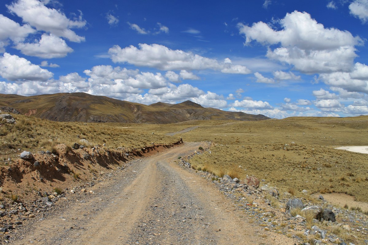
As long as you love vertical terrain, this linking-up of mine roads and 4×4 tracks through small villages provides a wonderful alternative for travelling down Peru to the monotony of the coastal Panamericana, or the traffic on the country’s main ‘Mountain Route’.
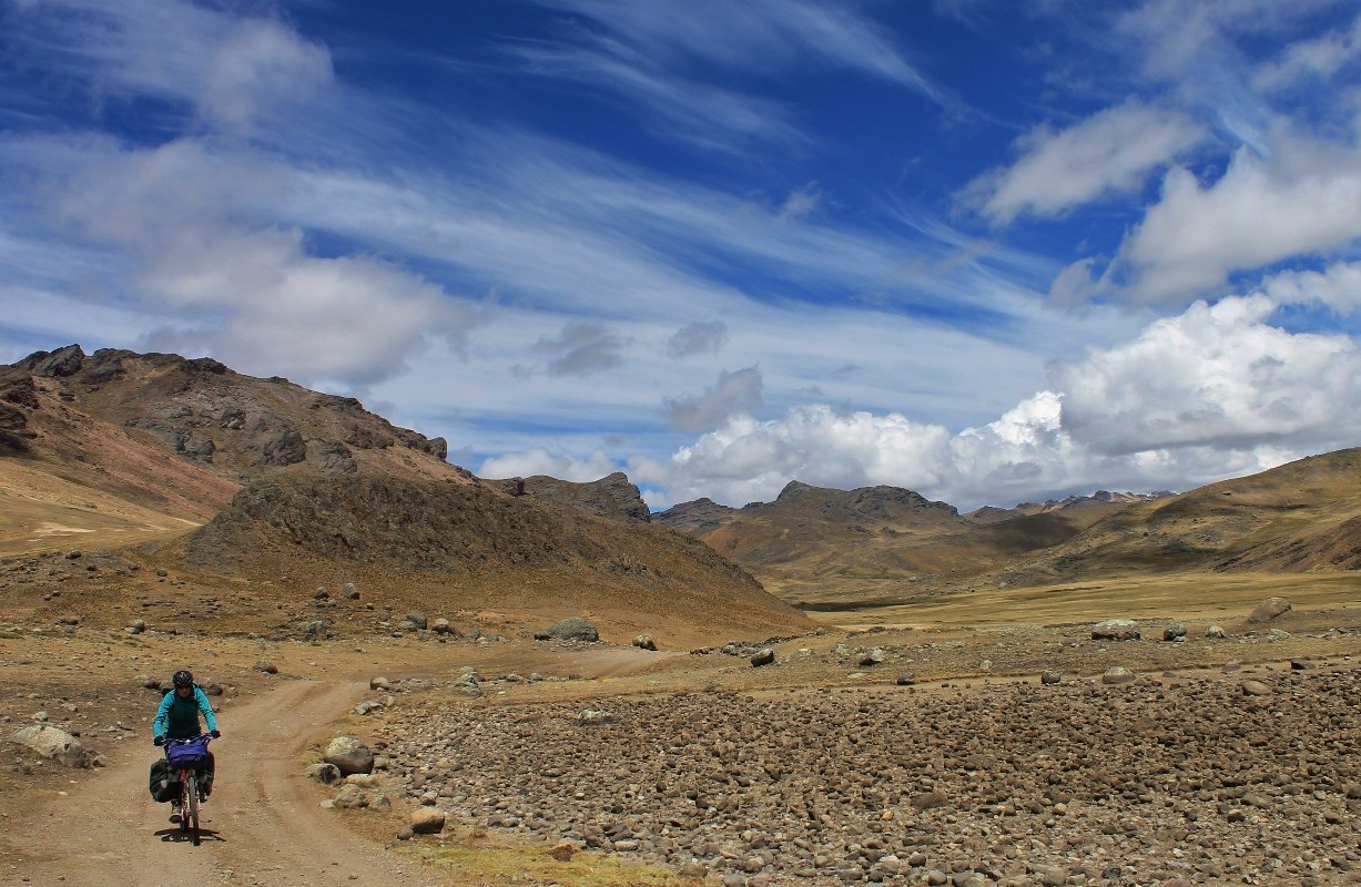
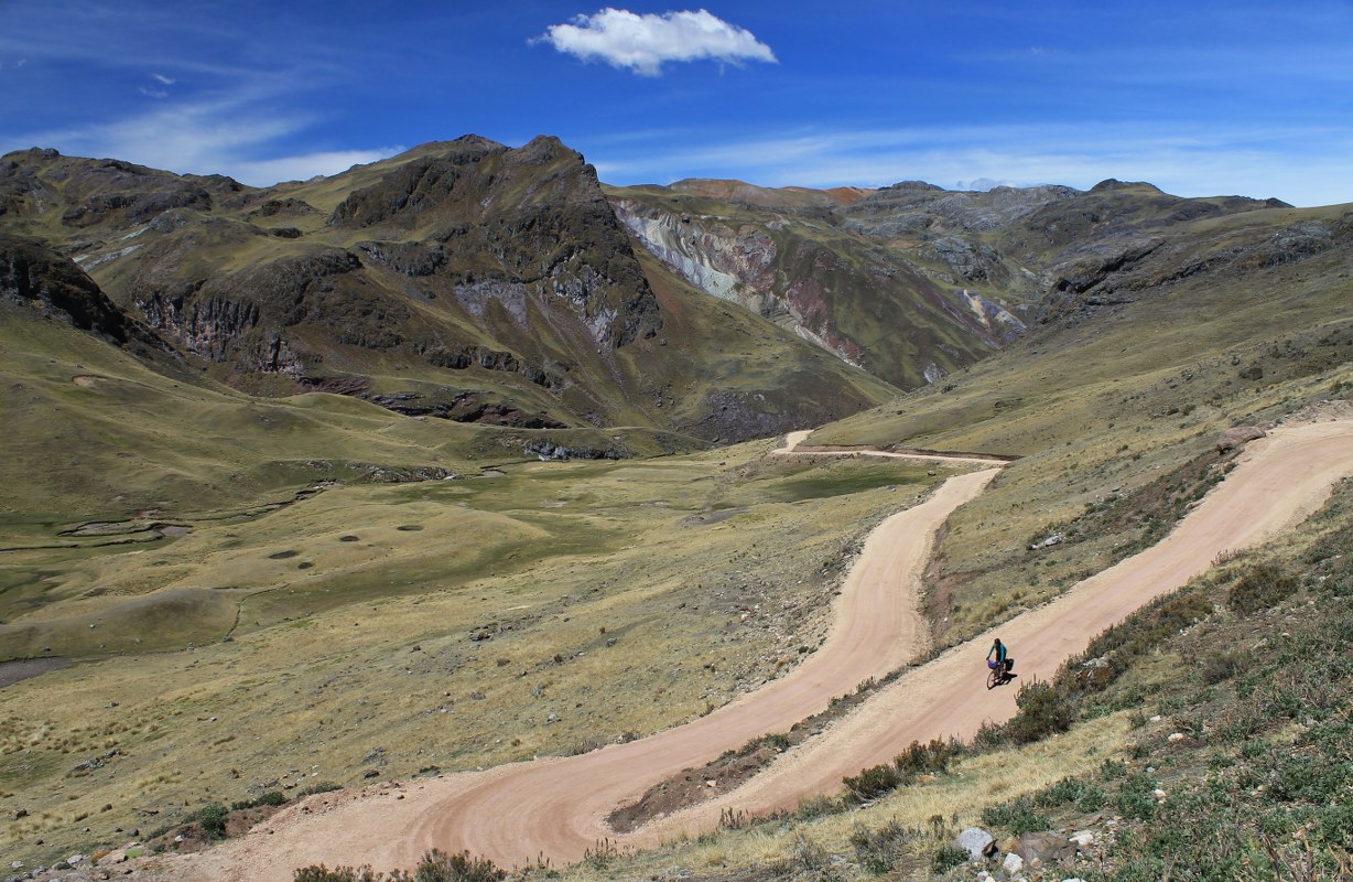
But it doesn’t come easy: to travel the length of the country this way entails crossing upwards of 50 4000m passes as you climb up and over, then down and into enormous valleys, canyons and ravines. The small section described here alone features seven high passes, the loftiest of which tops out at nearly 5000m. If you find this kind of vertical challenge enticing rather than off-putting, get yourself onto Peru’s Great Divide!


Submit Route Alert
As the leading creator and publisher of bikepacking routes, BIKEPACKING.com endeavors to maintain, improve, and advocate for our growing network of bikepacking routes all over the world. As such, our editorial team, route creators, and Route Stewards serve as mediators for route improvements and opportunities for connectivity, conservation, and community growth around these routes. To facilitate these efforts, we rely on our Bikepacking Collective and the greater bikepacking community to call attention to critical issues and opportunities that are discovered while riding these routes. If you have a vital issue or opportunity regarding this route that pertains to one of the subjects below, please let us know:
Highlights
Must Know
Camping
Trail Notes
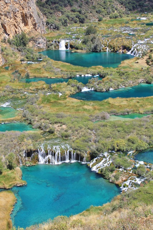
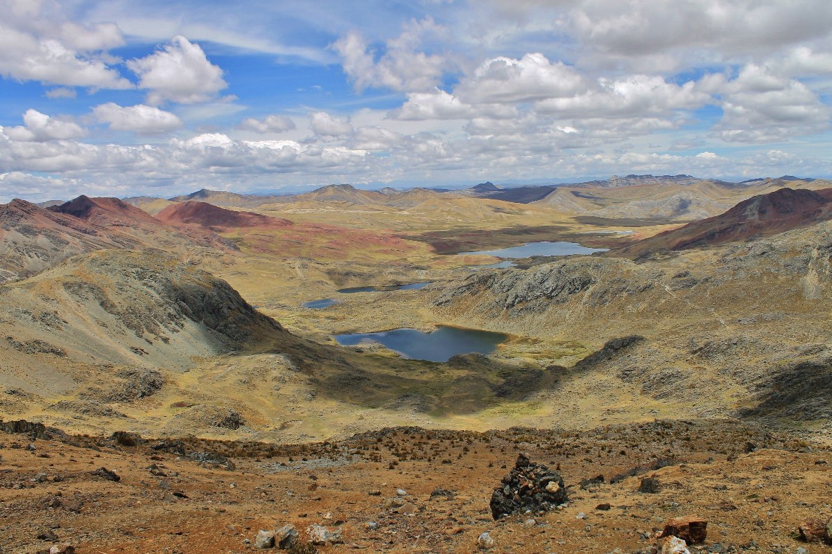
- The ride along the Cañete valley, above a river which is a long series of blue lakes linked by small waterfalls, is spectacular.
- Most of the small villages on the route are still very traditional, and there is little traffic.
- It’s common however to encounter alpaca and llama traffic jams!
- Lots of climbing and some challenging unpaved surfaces.
- This section of Peru’s Great Divide route begins on the Carretera Central (the main road from Lima to the cities in the mountains) and ends at the pleasant provincial (and cyclist-proclaimed cake) capital of Huancavelica; it takes at least six days to ride.
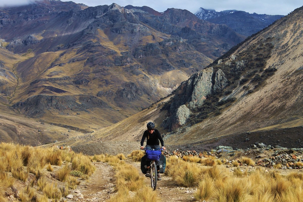
- A number of roads from the coast to the largest mountain cities bisect the route, so it’s possible to join at different points. As with most routes in the Peruvian Cordillera, much of it is at high altitude and there is a lot of climbing, so it’s much easier with a good level of fitness and acclimatization.
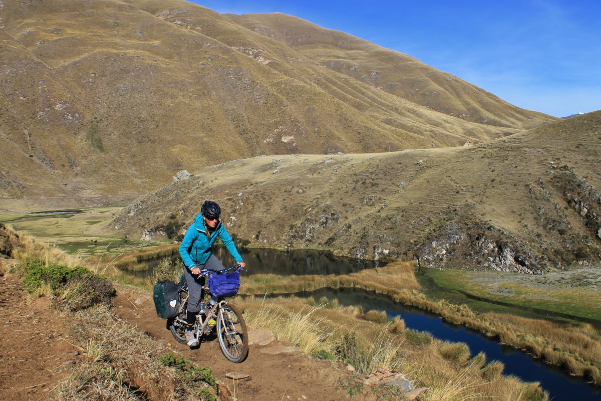
- The only singletrack section of the route – 5 miles of wonderful trail linking Tanta and Vilca – may well soon be replaced by a motorable track.
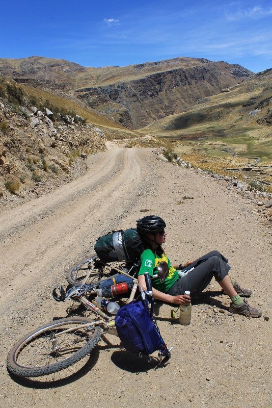
- A few villages on the route offer basic accommodation, but camping equipment is needed for the more remote sections.
- On many parts of the ride, beautiful wild-camping spots abound.
- Paper maps covering all of Peru are of little use for finding dirt roads – download PDFs (by region) from the Peruvian Ministry of Transport and Communications website: MTC.GOB
- More detailed info on Andes by Bike at: Andes By Bikes


Terms of Use: As with each bikepacking route guide published on BIKEPACKING.com, should you choose to cycle this route, do so at your own risk. Prior to setting out check current local weather, conditions, and land/road closures. While riding, obey all public and private land use restrictions and rules, carry proper safety and navigational equipment, and of course, follow the #leavenotrace guidelines. The information found herein is simply a planning resource to be used as a point of inspiration in conjunction with your own due-diligence. In spite of the fact that this route, associated GPS track (GPX and maps), and all route guidelines were prepared under diligent research by the specified contributor and/or contributors, the accuracy of such and judgement of the author is not guaranteed. BIKEPACKING.com LLC, its partners, associates, and contributors are in no way liable for personal injury, damage to personal property, or any other such situation that might happen to individual riders cycling or following this route.
Please keep the conversation civil, constructive, and inclusive, or your comment will be removed.