


Peru Great Divide
Distance
997 Mi.
(1,605 KM)Days
32
% Unpaved
87%
% Singletrack
0%
% Rideable (time)
99%
Total Ascent
125,000'
(38,100 M)High Point
16,372'
(4,990 M)Difficulty (1-10)
8?
- 8Climbing Scale Strenuous125 FT/MI (24 M/KM)
- 6Technical Difficulty Moderate
- 9Physical Demand Very Difficult
- 6Resupply & Logistics Moderate
Contributed By

Cass Gilbert
Contributing Editor
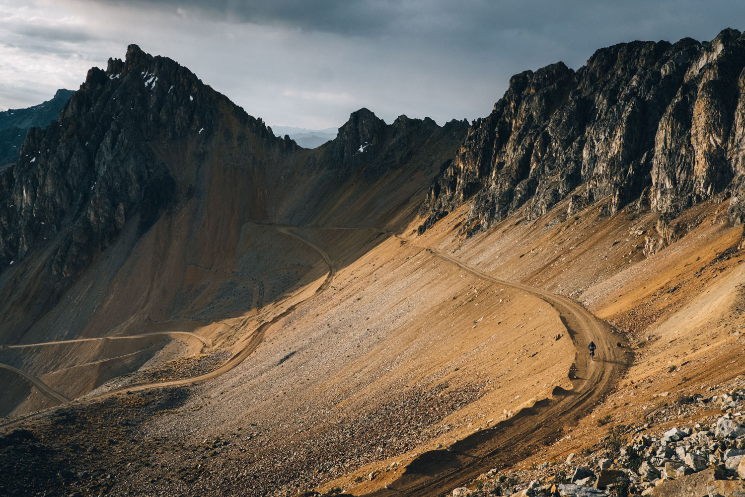
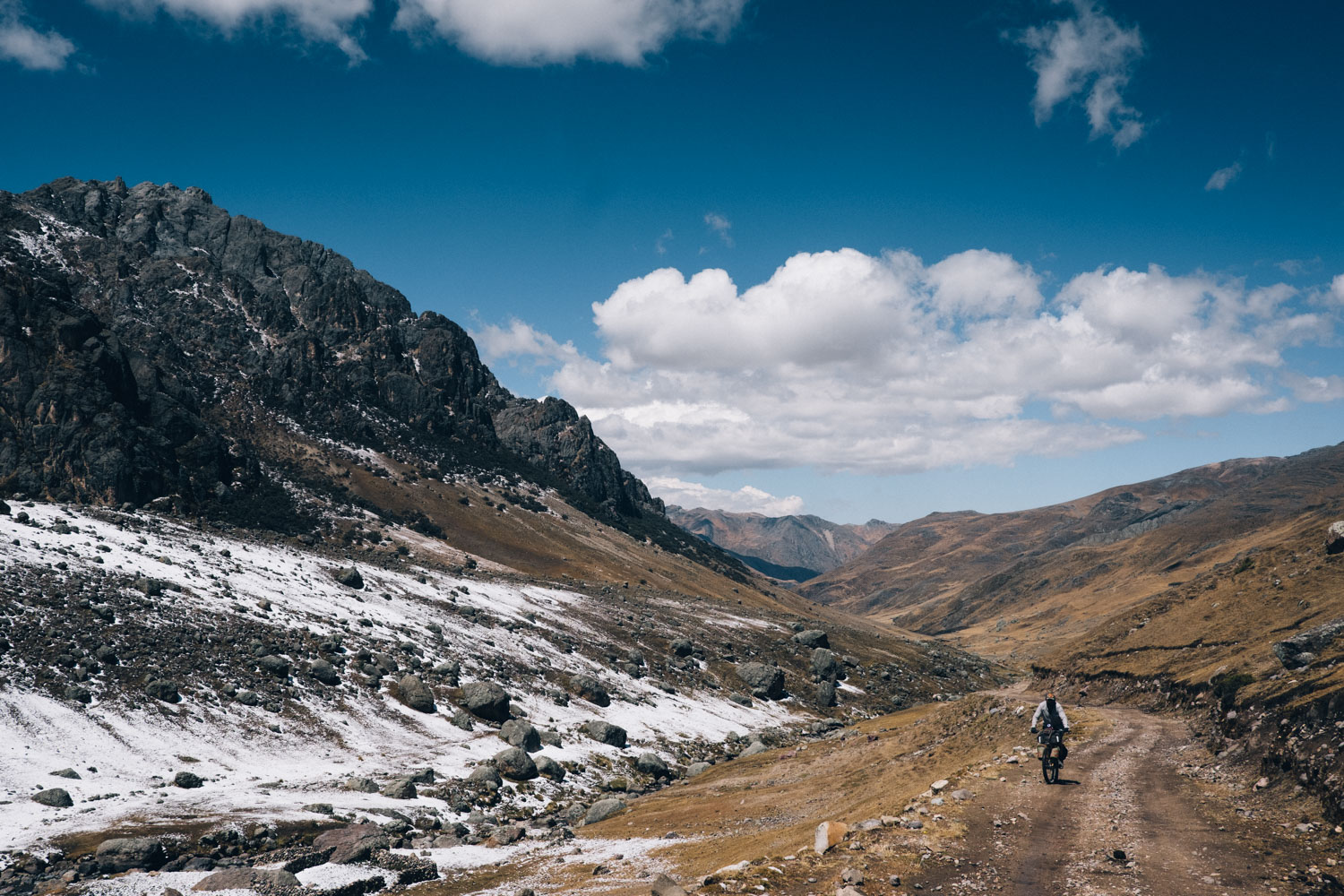
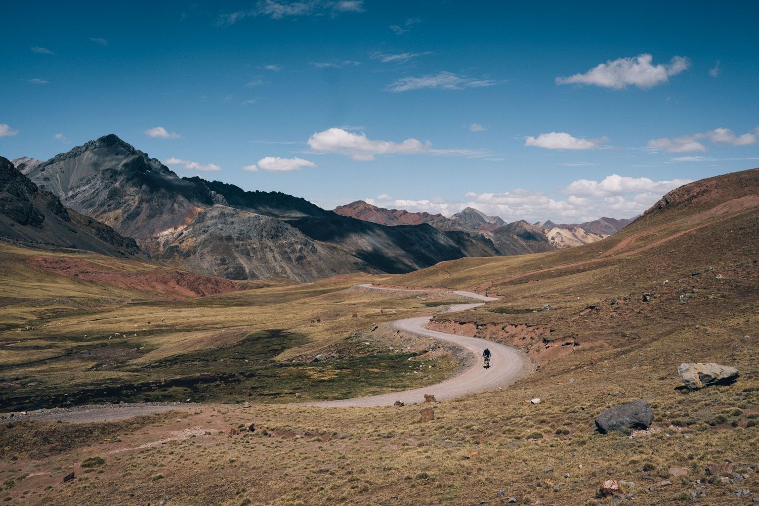
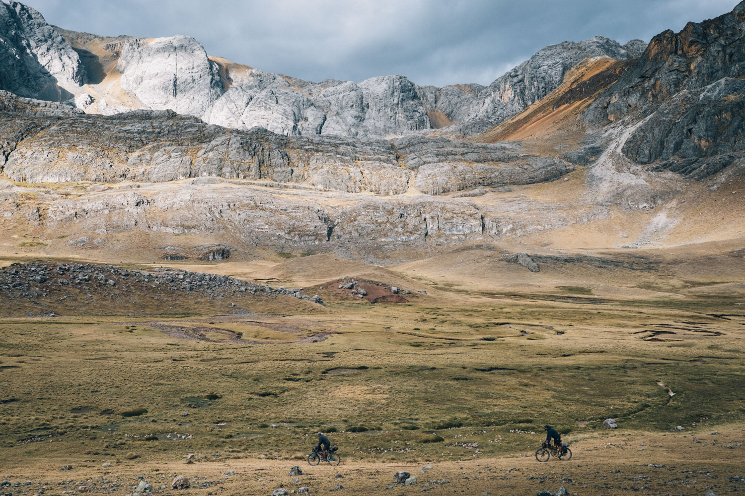
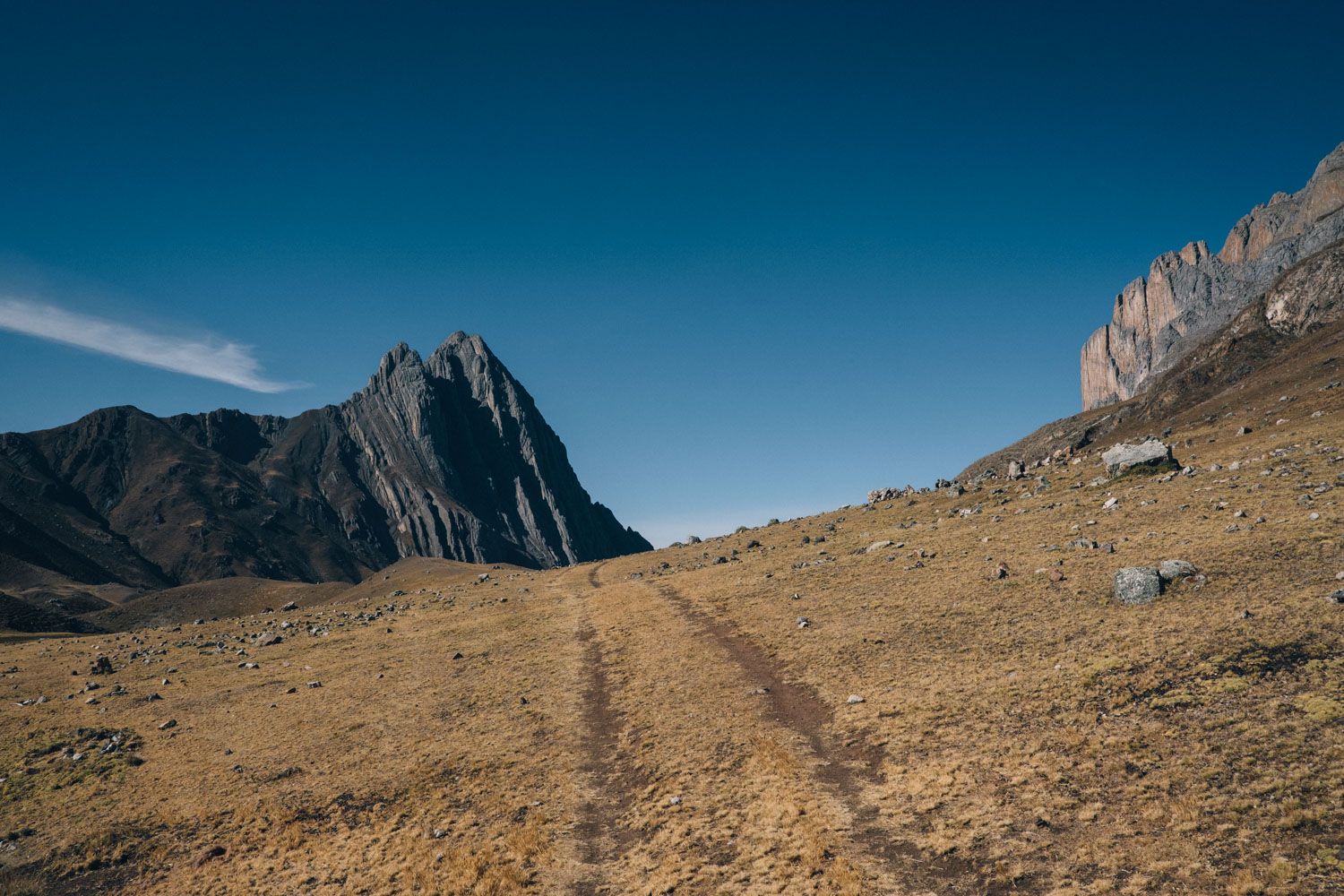
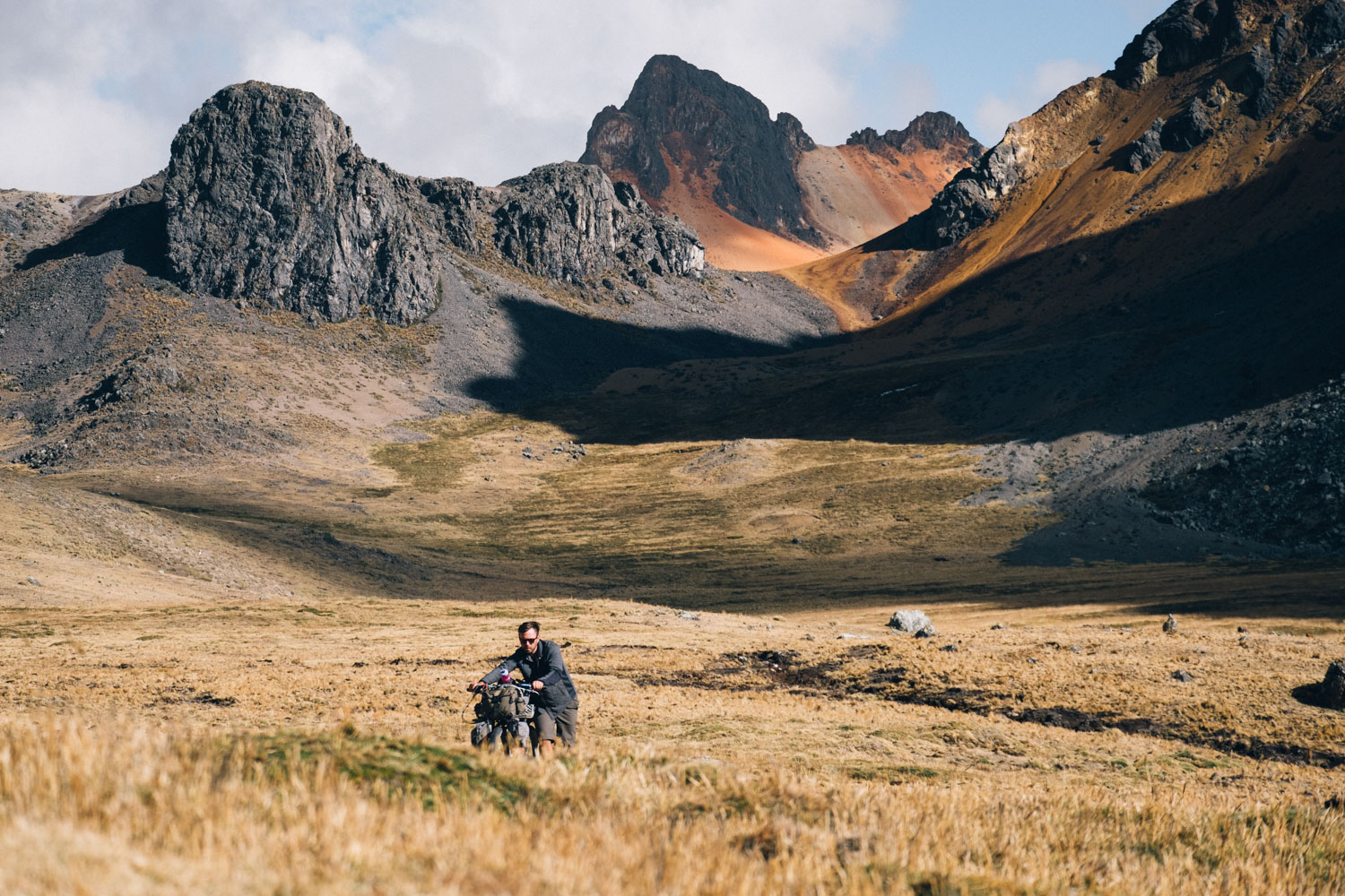
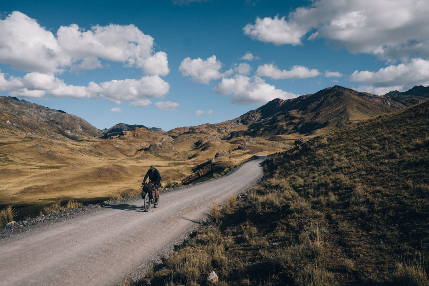
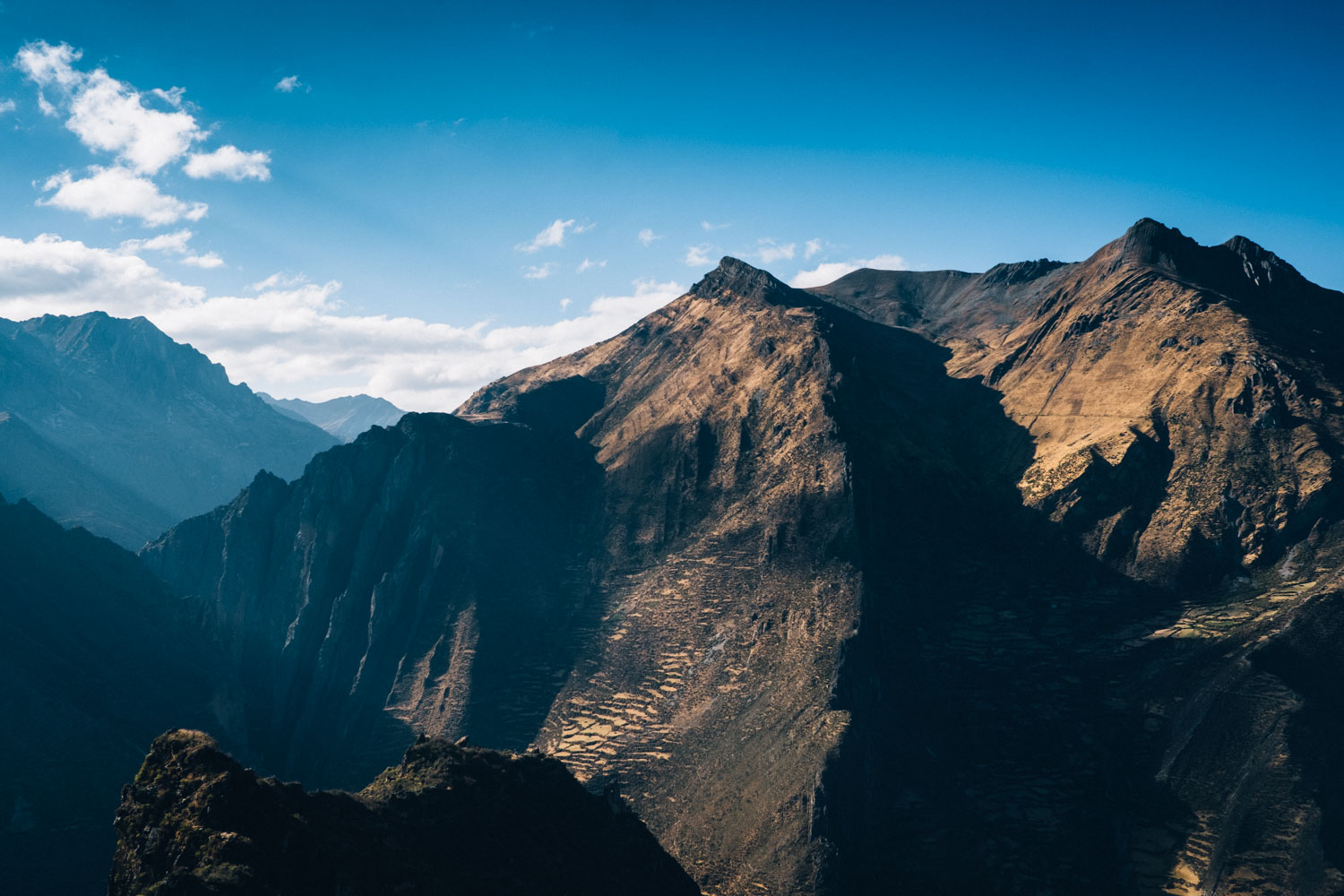
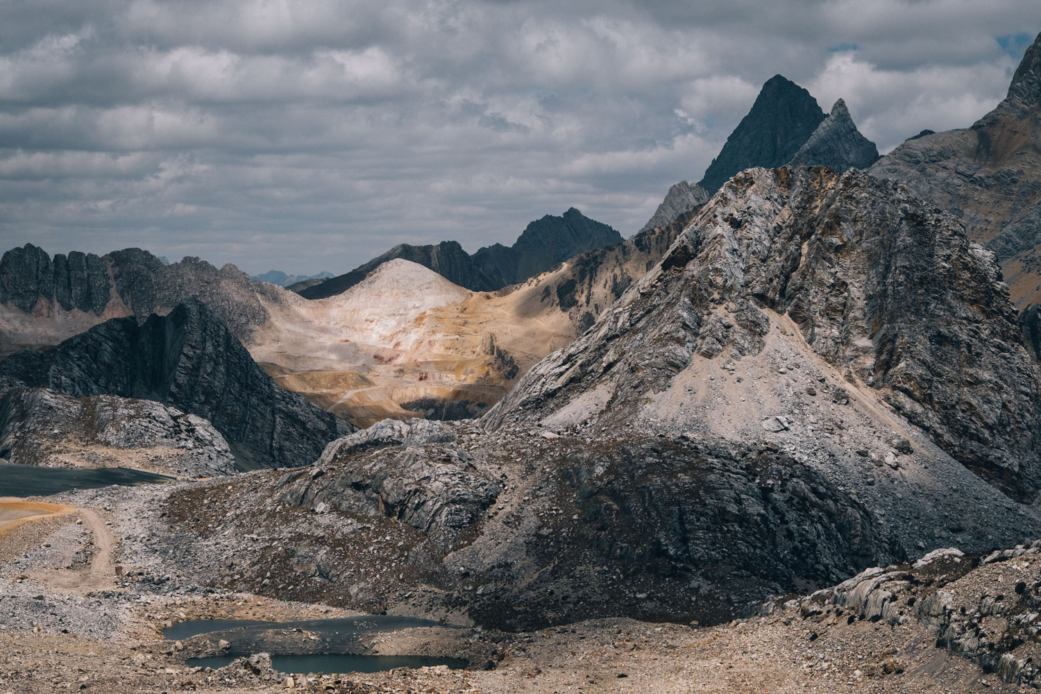
As the name suggests, the Peru Great Divide straddles the mountainous boundary that forms the watershed between the Pacific, to the west, and the jungly sprawl of the Amazon and the Atlantic, to the east.
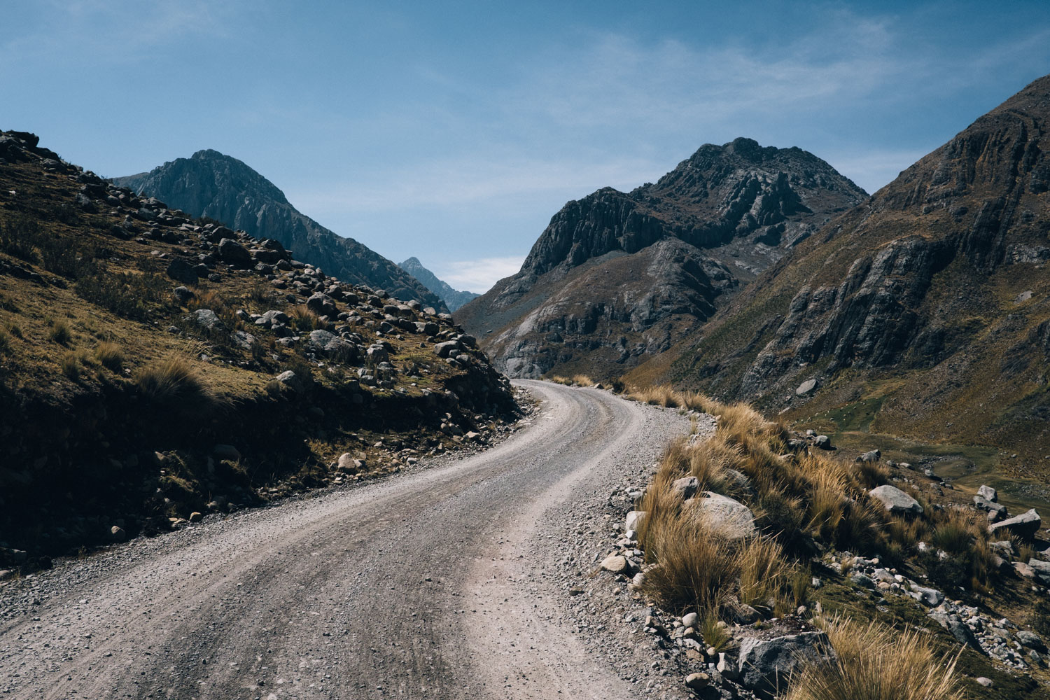
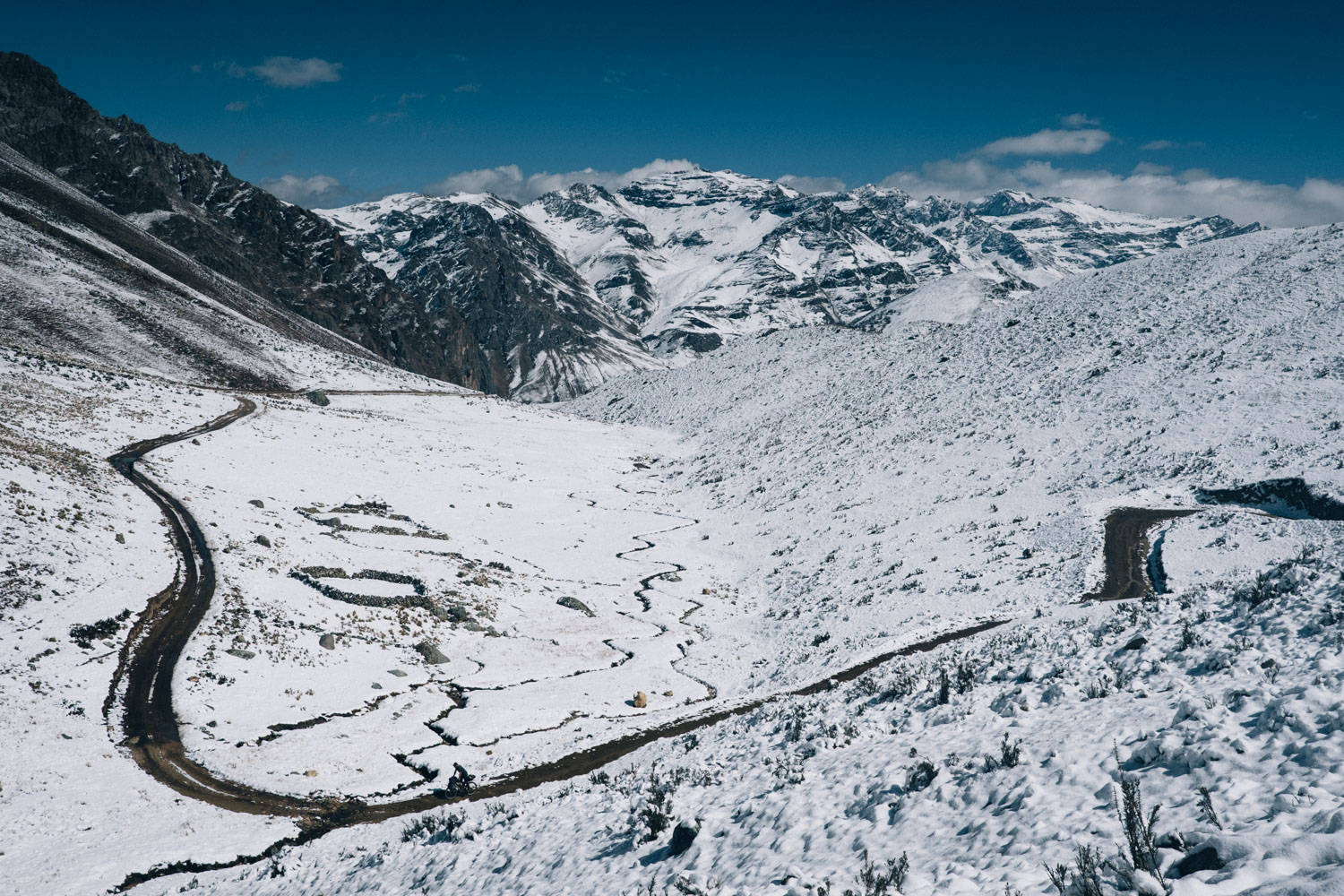
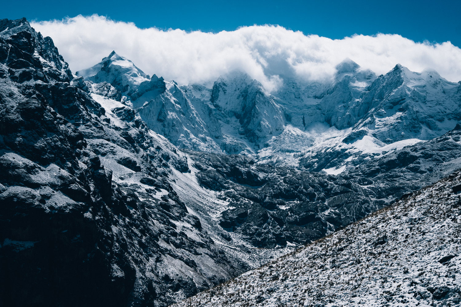
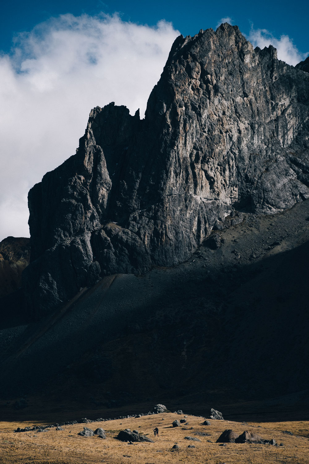
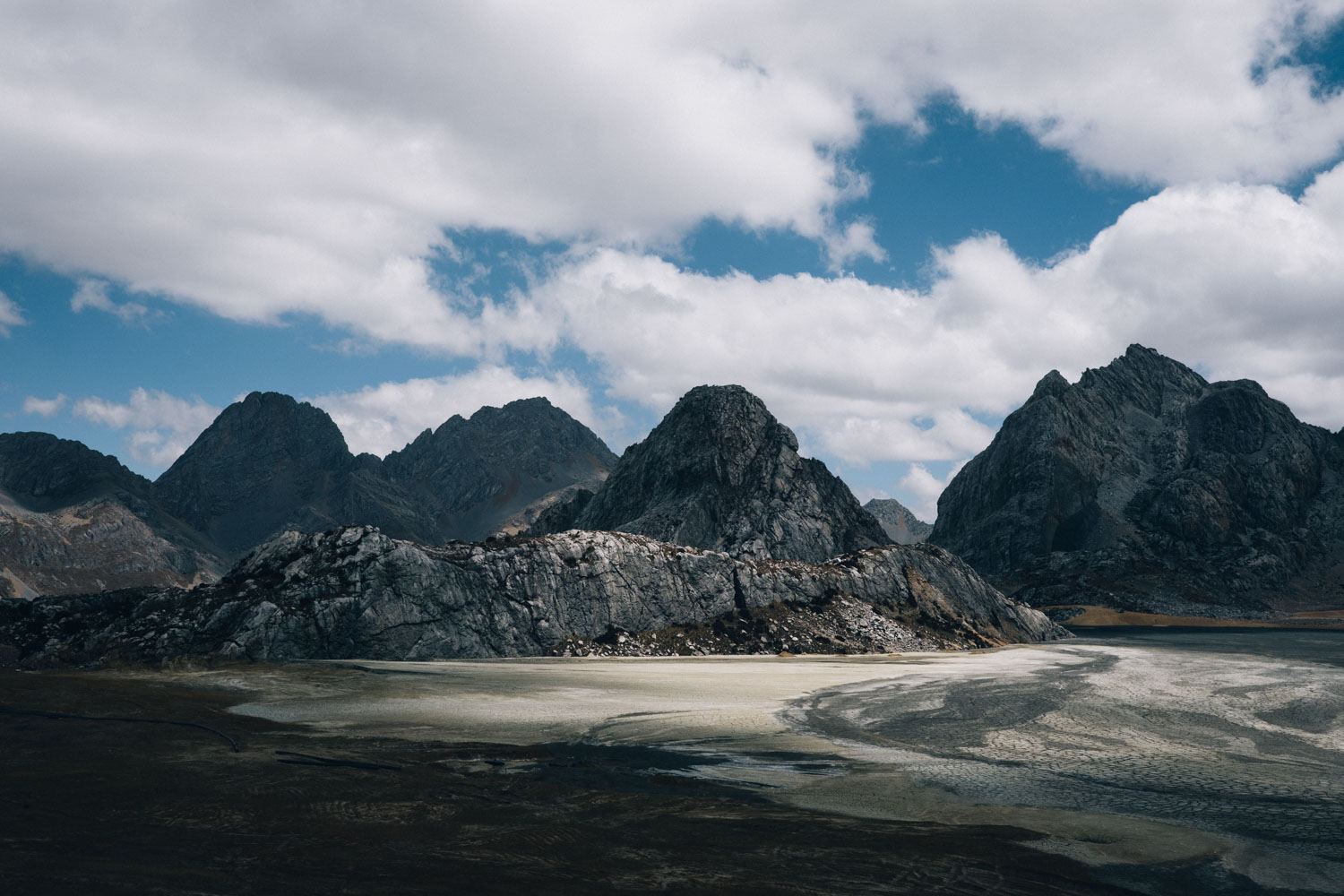
To do so, the Peru Great Divide connects a rich network of active and abandoned mining roads that crisscross the Peruvian Andes. This is for better or for worse, given both the heartbreakingly beautiful mountain scenery they reveal to intrepid cyclists, and the undeniable harm such activity wreaks on the area, its communities, and its groundwater.
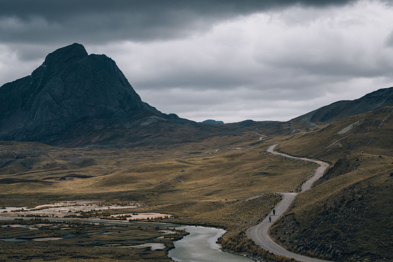
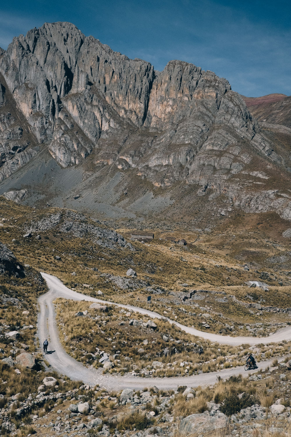
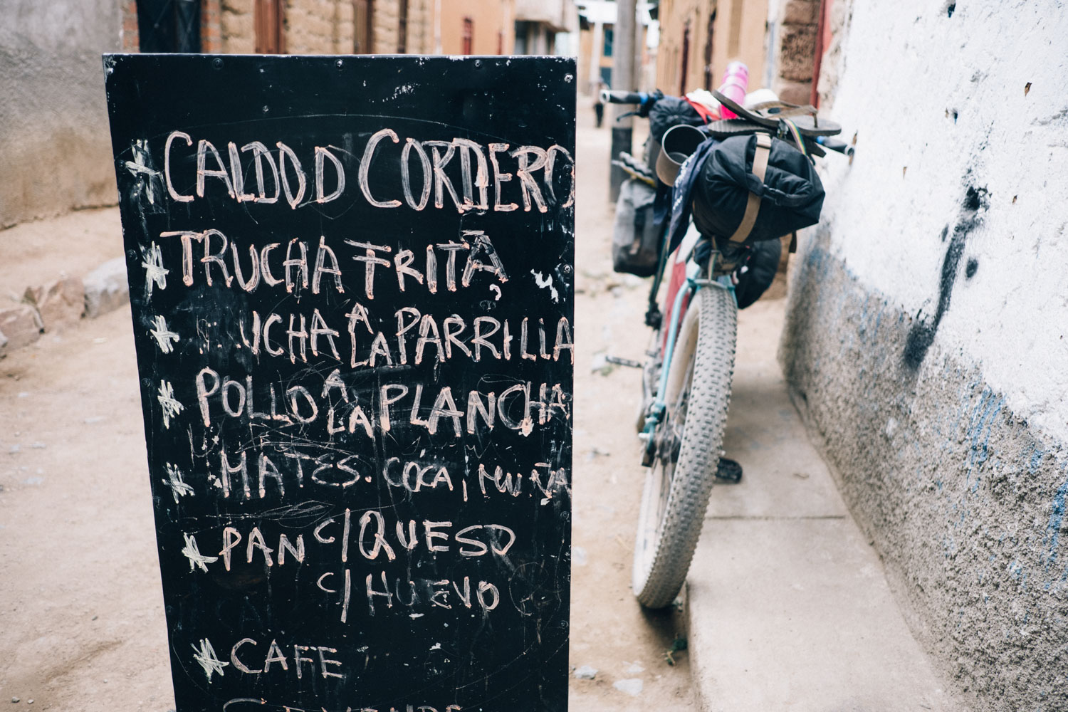
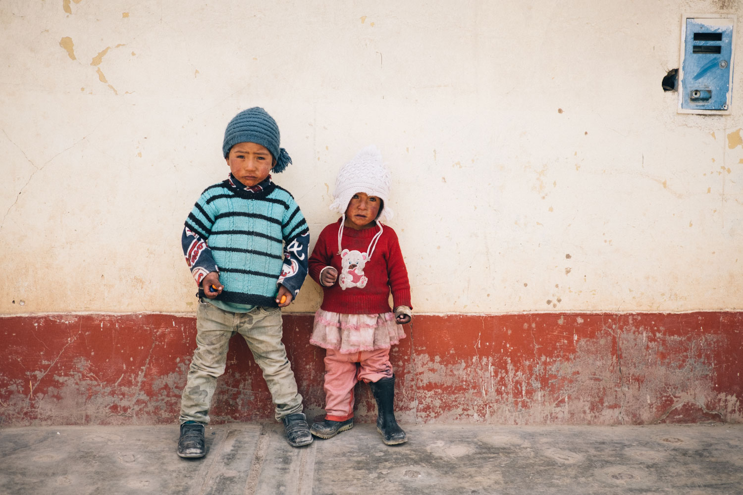
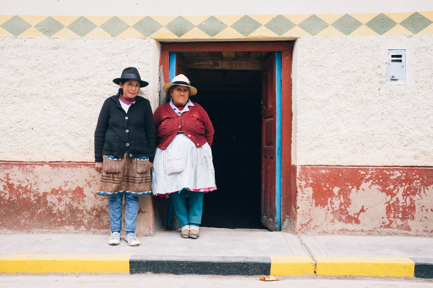
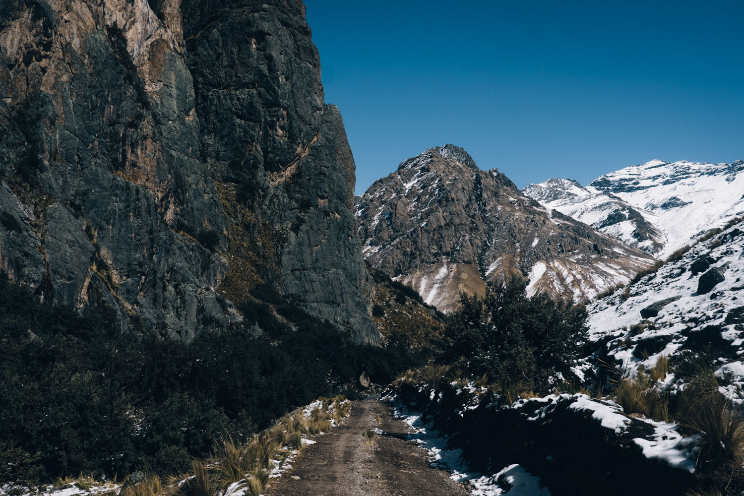
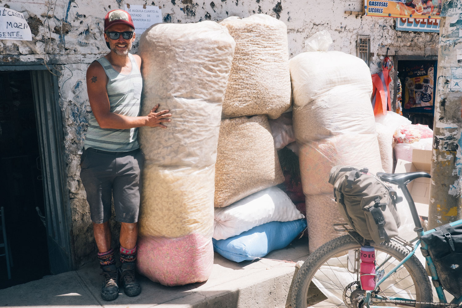
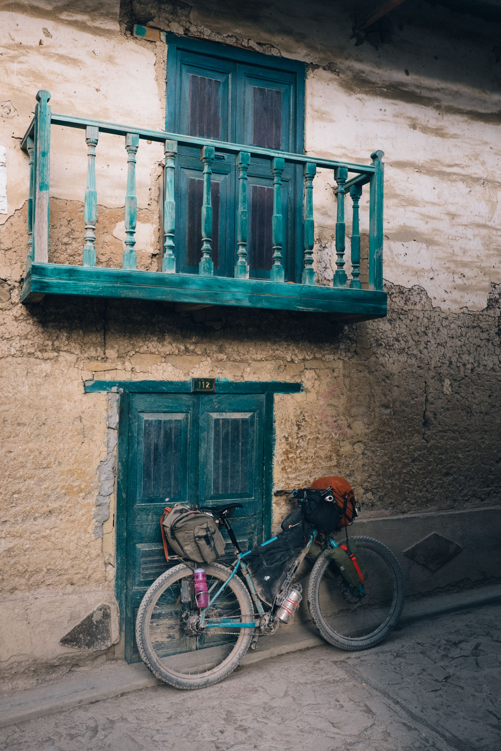
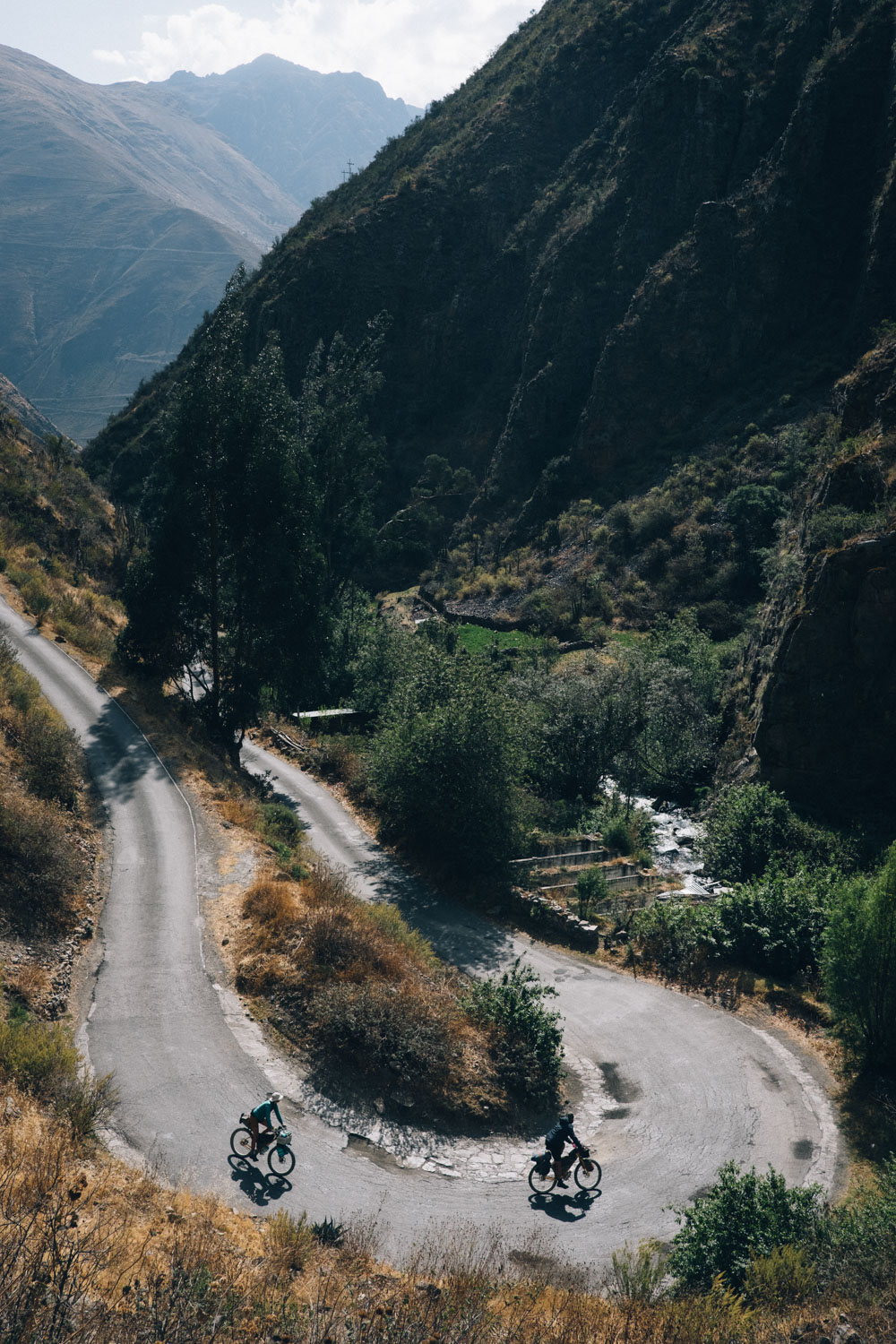
Mining traffic aside, it’s a journey that’s shared with few – for the most part, mountain companions are more likely to be herds of wiry llamas and fluffy alpacas, and the occasional intrepid and dilapidated bus, bouncing by with a serenade of its horn. Aside from a few more sizeable towns, settlements are small and sporadic – often, they’re little more than the most minuscule of pueblecitos, home to a collection of stone houses, a well-kept plaza, and a small church. The women here wear fresh garlands of flowers in their sombreros – procured from the warmer lowlands – offset with quintessential, technicoloured bundles of produce. These remote and high elevation villages are linked by the merest scraps of road and footpaths, painstakingly chiselled into the sheerest and most stark of mountainsides.
The complete Peru Divide runs for some 1600km (1000 miles) in length. This includes beginning the route in the climbing and hiking hub of Huaraz, to the north, and a final paved connector to finish up in Abancay, to the south, both of which offer overnight bus rides to Lima. But there are plenty of ways to shorten the route, too.
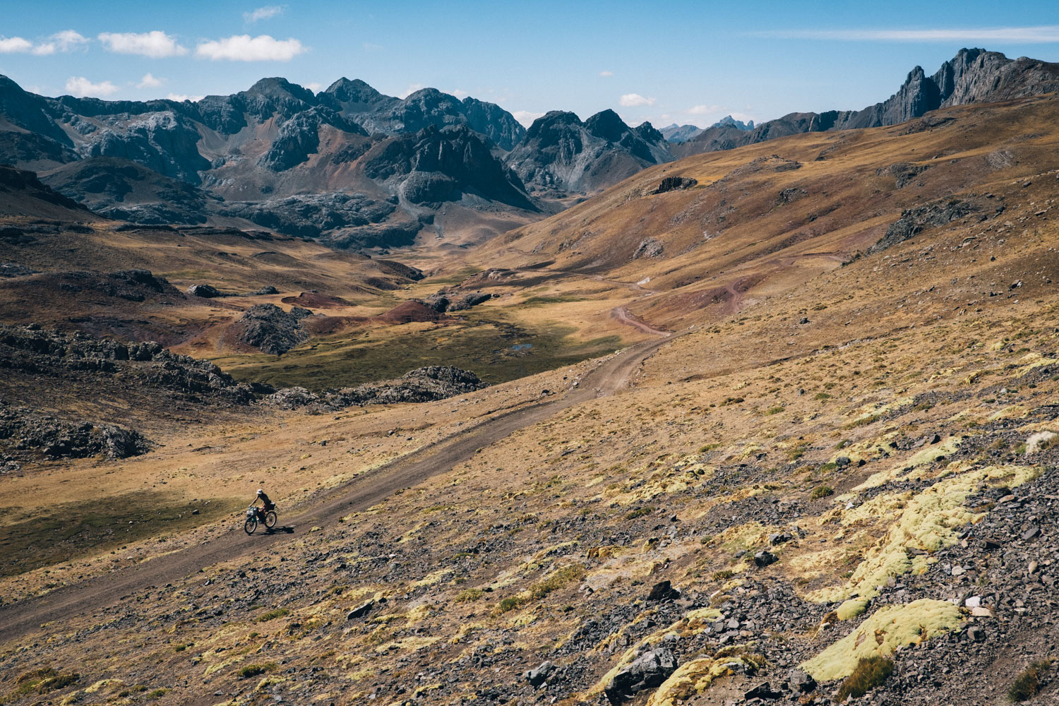
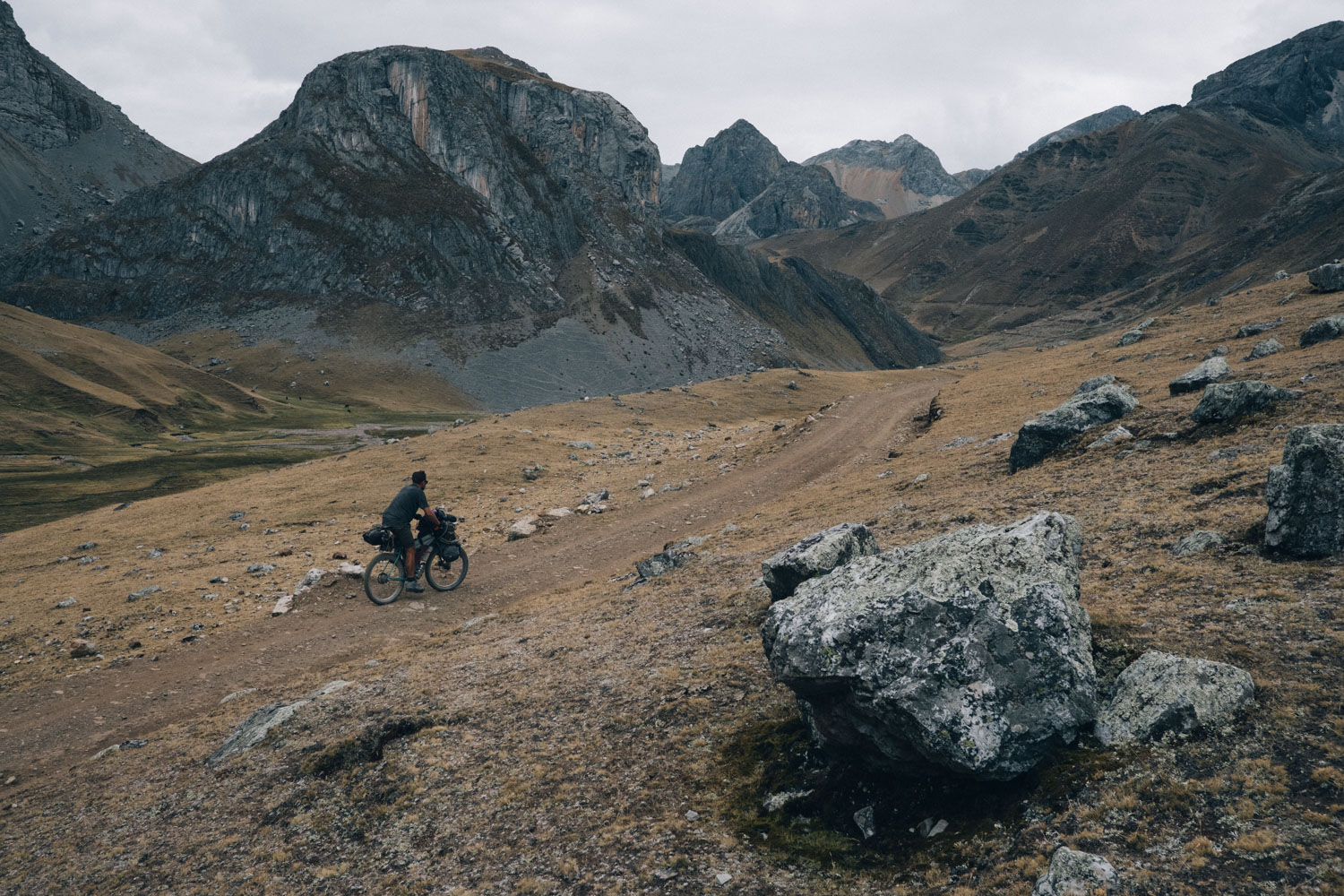
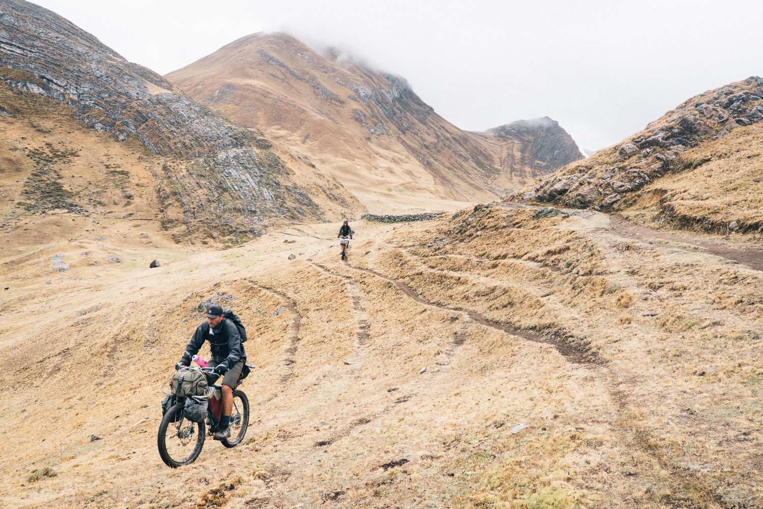
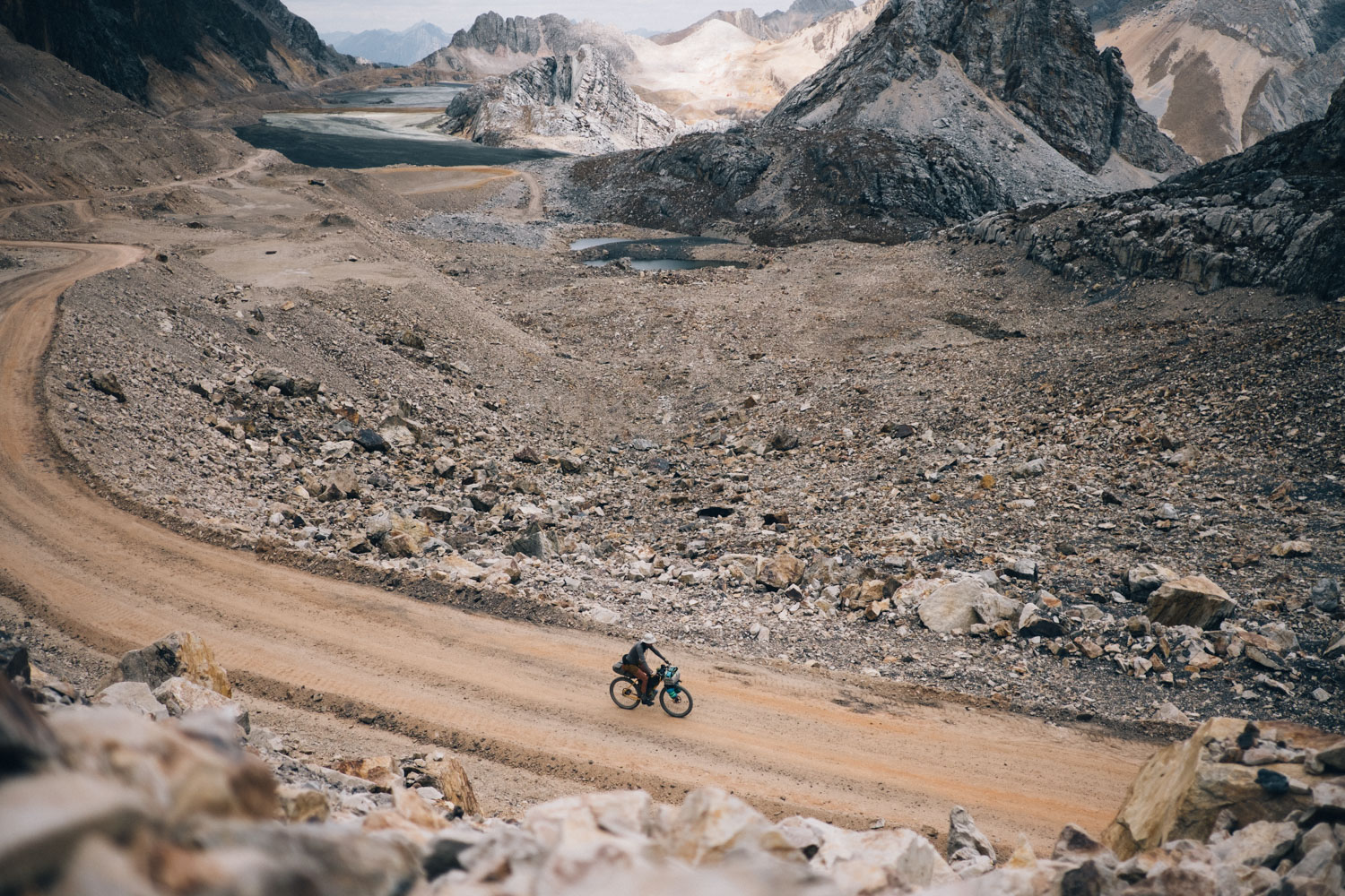
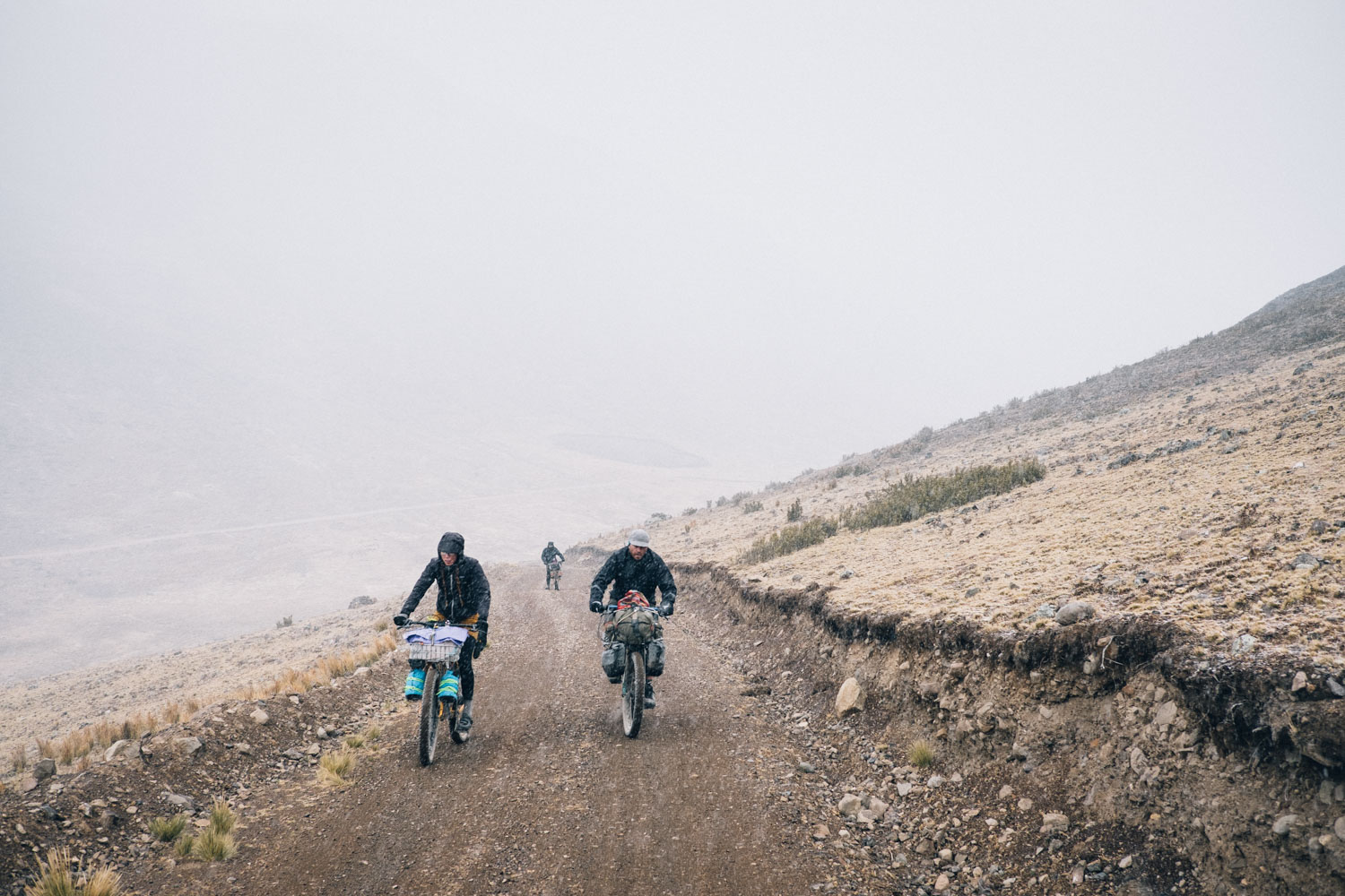
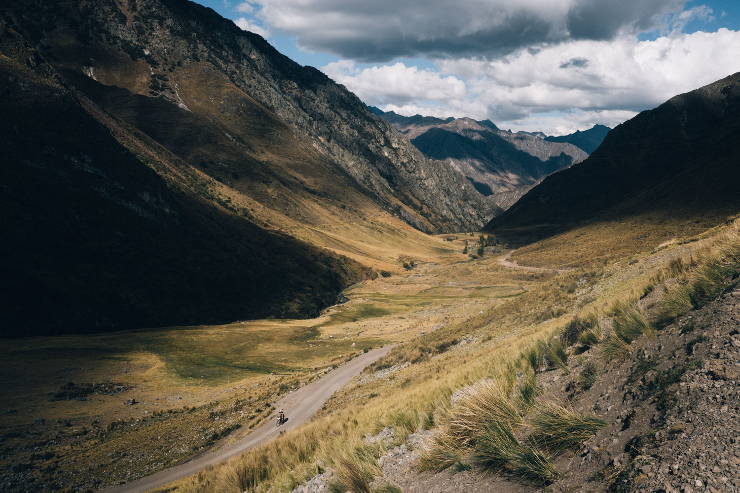
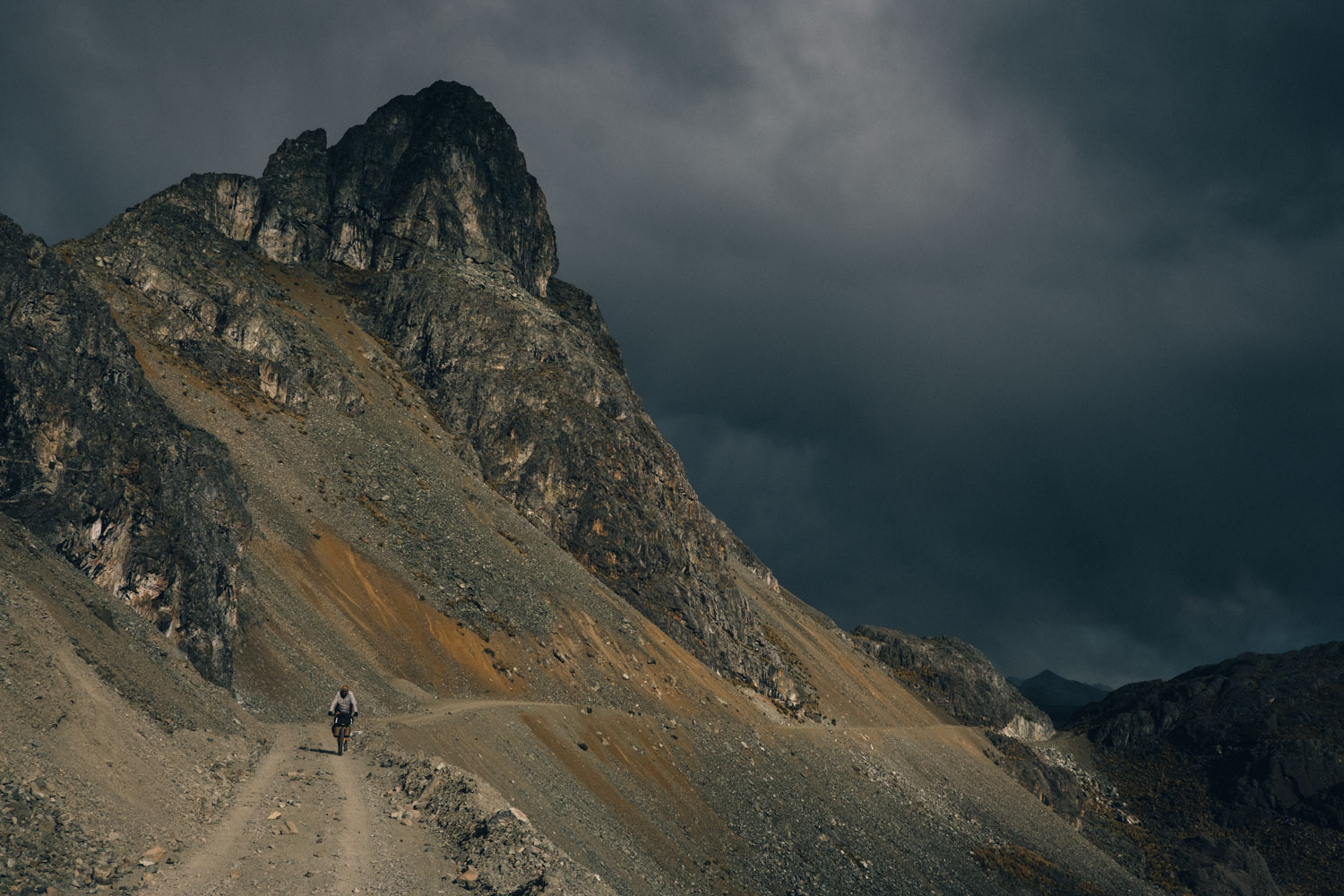
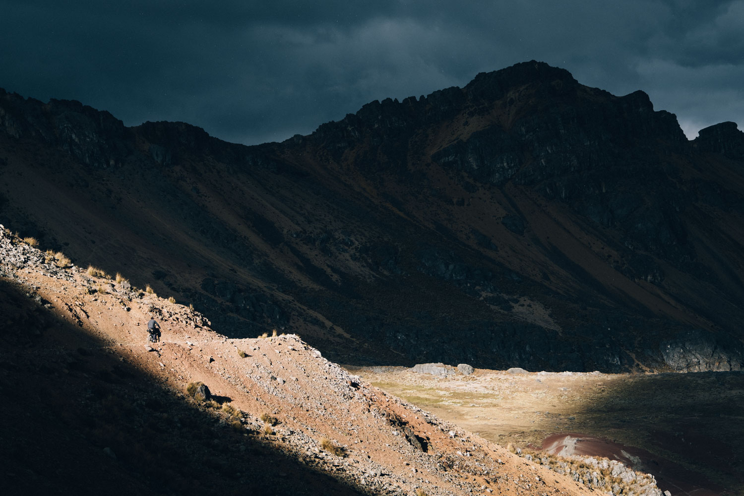
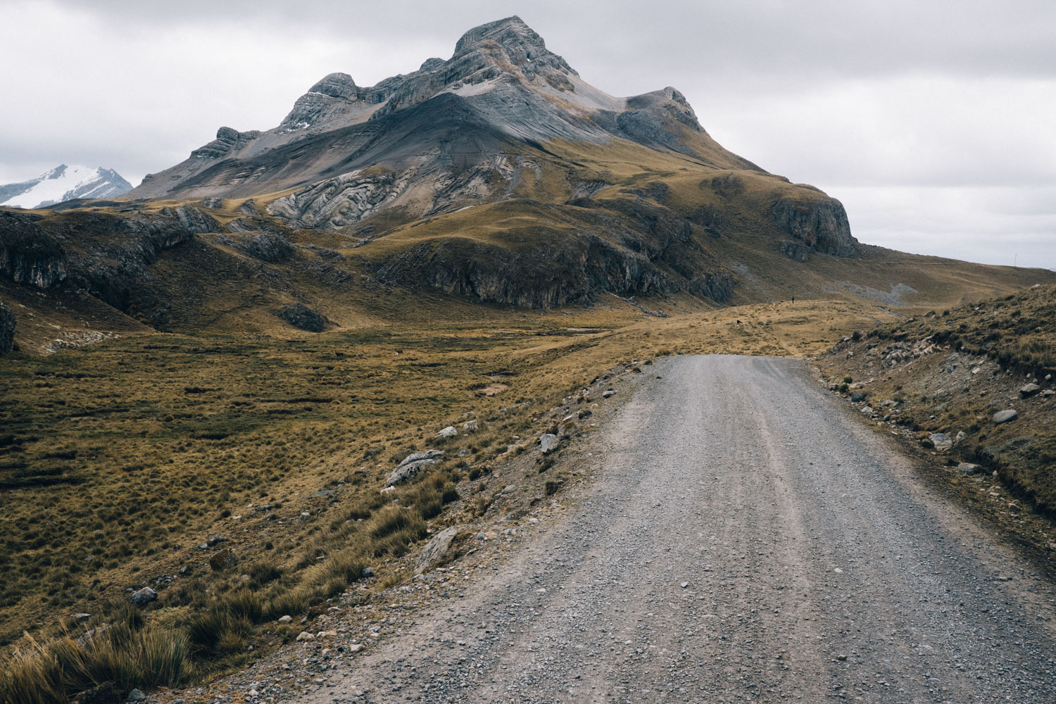
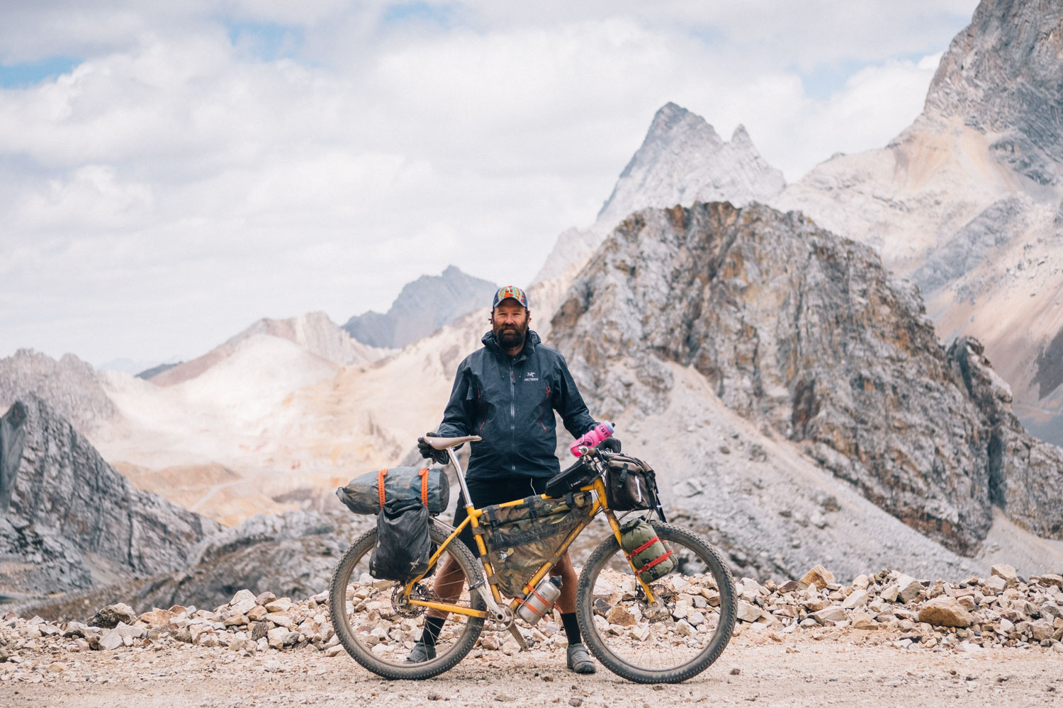
It’s hard to convey the sheer density of ruggedly beautiful, mineral-streaked scenery that lies in between. Yet as recommended as it is, it’s certainly not a journey to be undertaken lightly. Expect extremely mixed terrain, 1200-1500m of high elevation climbing per day, and a rapid onslaught of challenging passes that teeter at 4800m—and higher. Although rideable on almost any kind of touring bike, road conditions vary from compacted gravel to rough, rock-strewn jeep tracks – with gloopy mud probable after heavy rainfall – so choosing a reliable steed and appropriate gearing is key.
Rest assured though. The inevitable toils involved in scaling one Andean pass after another are never less than worth it. Acclimatise before you leave, pack light, harden your belly for mountain fodder, and prepare yourself for the vagaries of Peru’s mountain weather… because you’re in for one of South America’s most magical, dirt road touring rides!
See the Trail Notes tab for route alternatives, time frames, and ways of linking the Peru Great Divide with other dirt road routes in the region.
Route Development
The now-classic Peru Great Divide was devised by Neil and Harriet Pike in 2013. In the ensuing years, it’s become a deserved favourite amongst those travelling the length of the Americas.
The legendary Pikes have also established many other fabulous routes in the Andes – see Andes by Bike and Pikes on Bikes for more on their riding, hiking, and South American explorations. This intrepid couple from the UK has also authored the excellent Trailblazer publication, Peru’s Cordillera Blanca and Huayhuash – a Hiking and Biking guide, a must for anyone wishing to spend more time in the area both on foot and on two wheels.
Help us update the RWGPS track with up to date info! If you’ve ridden the route recently, let us know your favourite spots along the way – and if there are any changes we can make to the gpx file.
![]()
The Peru Great Divide is part of the greater Andes Traverse, an ongoing project to build a long distance bikepacking route that runs along the spine of the Andes, between Colombia and Chile.


The current gpx file was updated mid-2022, so be sure to have surrounding maps downloaded too. Please let us know about any changes.
Submit Route Alert
As the leading creator and publisher of bikepacking routes, BIKEPACKING.com endeavors to maintain, improve, and advocate for our growing network of bikepacking routes all over the world. As such, our editorial team, route creators, and Route Stewards serve as mediators for route improvements and opportunities for connectivity, conservation, and community growth around these routes. To facilitate these efforts, we rely on our Bikepacking Collective and the greater bikepacking community to call attention to critical issues and opportunities that are discovered while riding these routes. If you have a vital issue or opportunity regarding this route that pertains to one of the subjects below, please let us know:
Highlights
Must Know
Camping
Food/H2O
Trail Notes
Resources
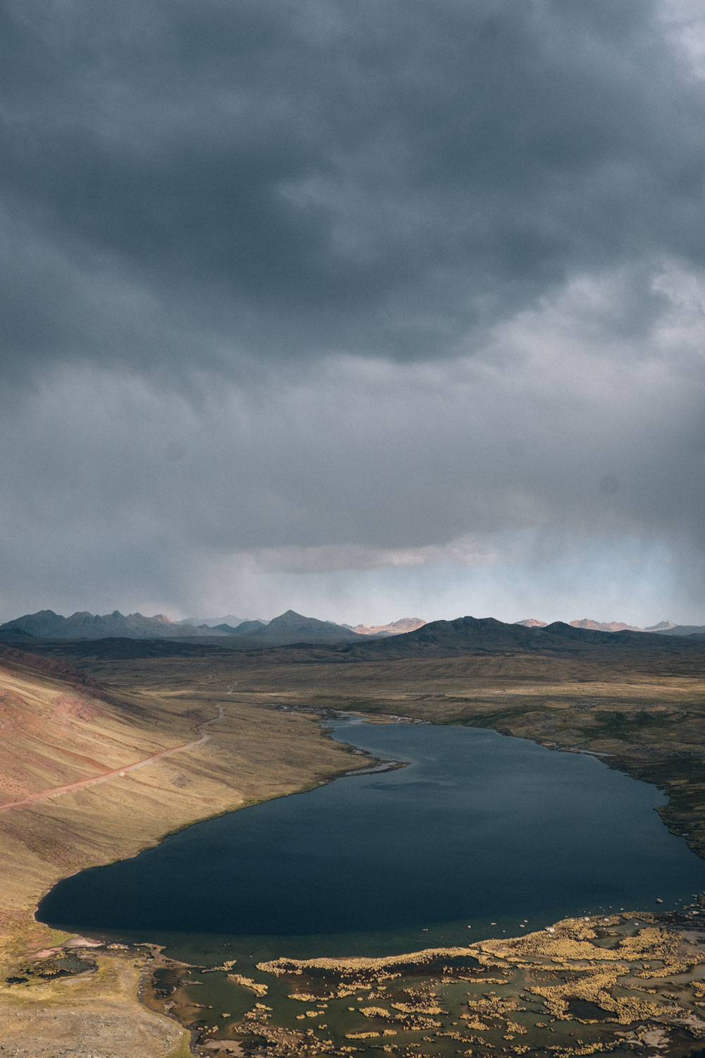
- Rugged Andean scenery, including a vivid palette of mineral deposits in the mountainscapes.
- Fabulously grand roller coaster climbs and descents! There is no ‘flat’ in the Peruvian mountains…
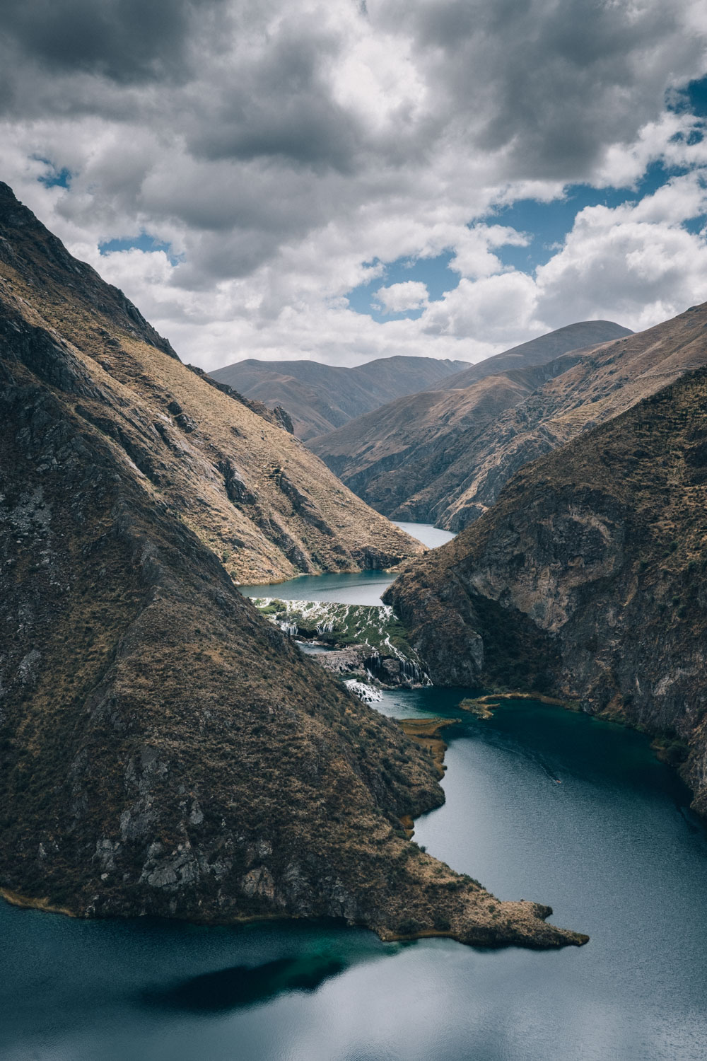
- The ride along the Cañete valley – above a long series of blue lakes linked by small waterfalls – is particularly spectacular.
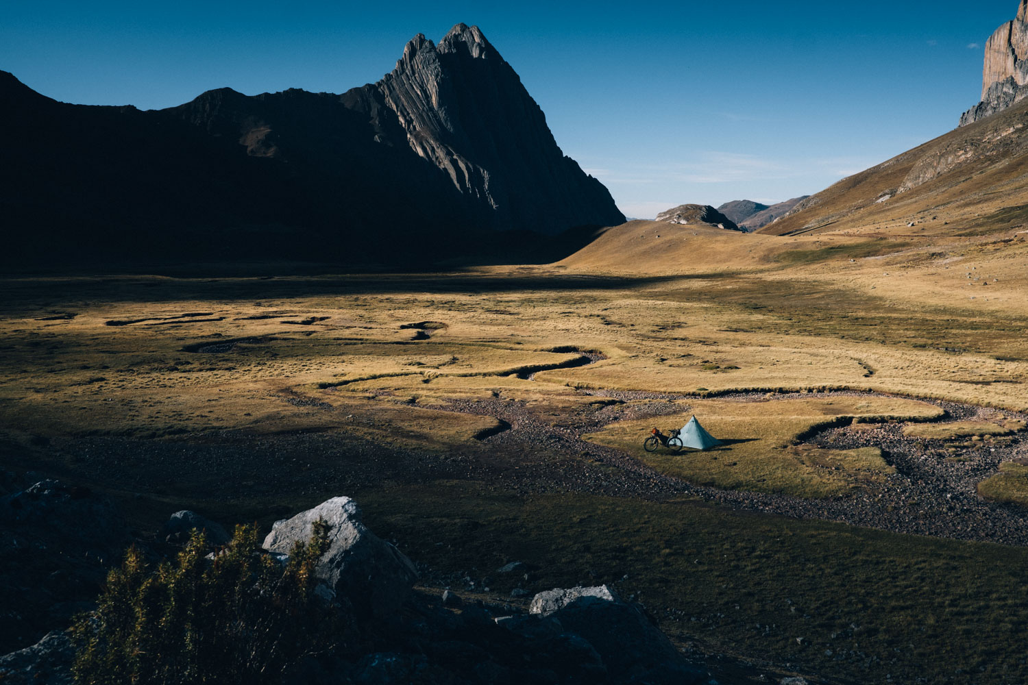
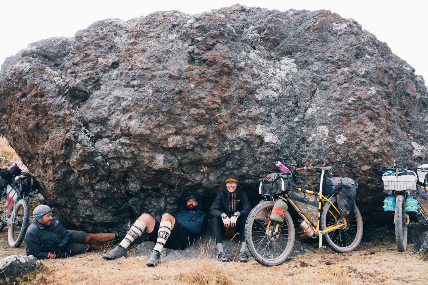
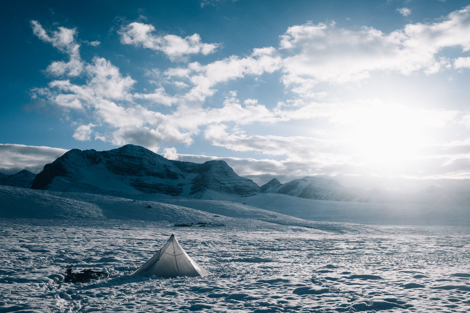
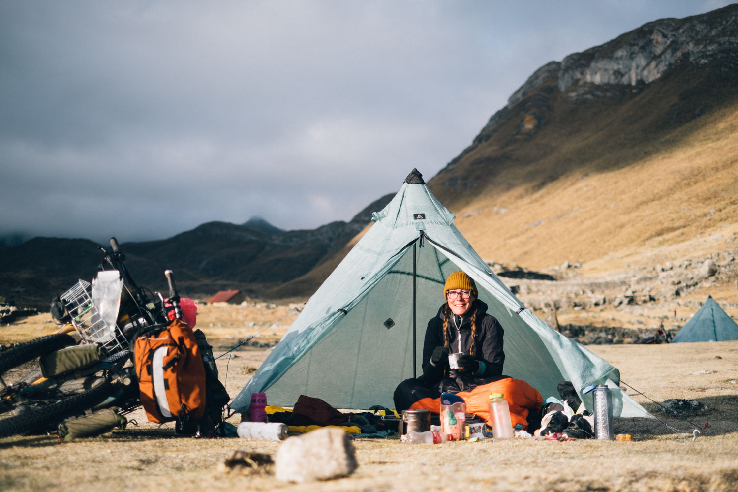
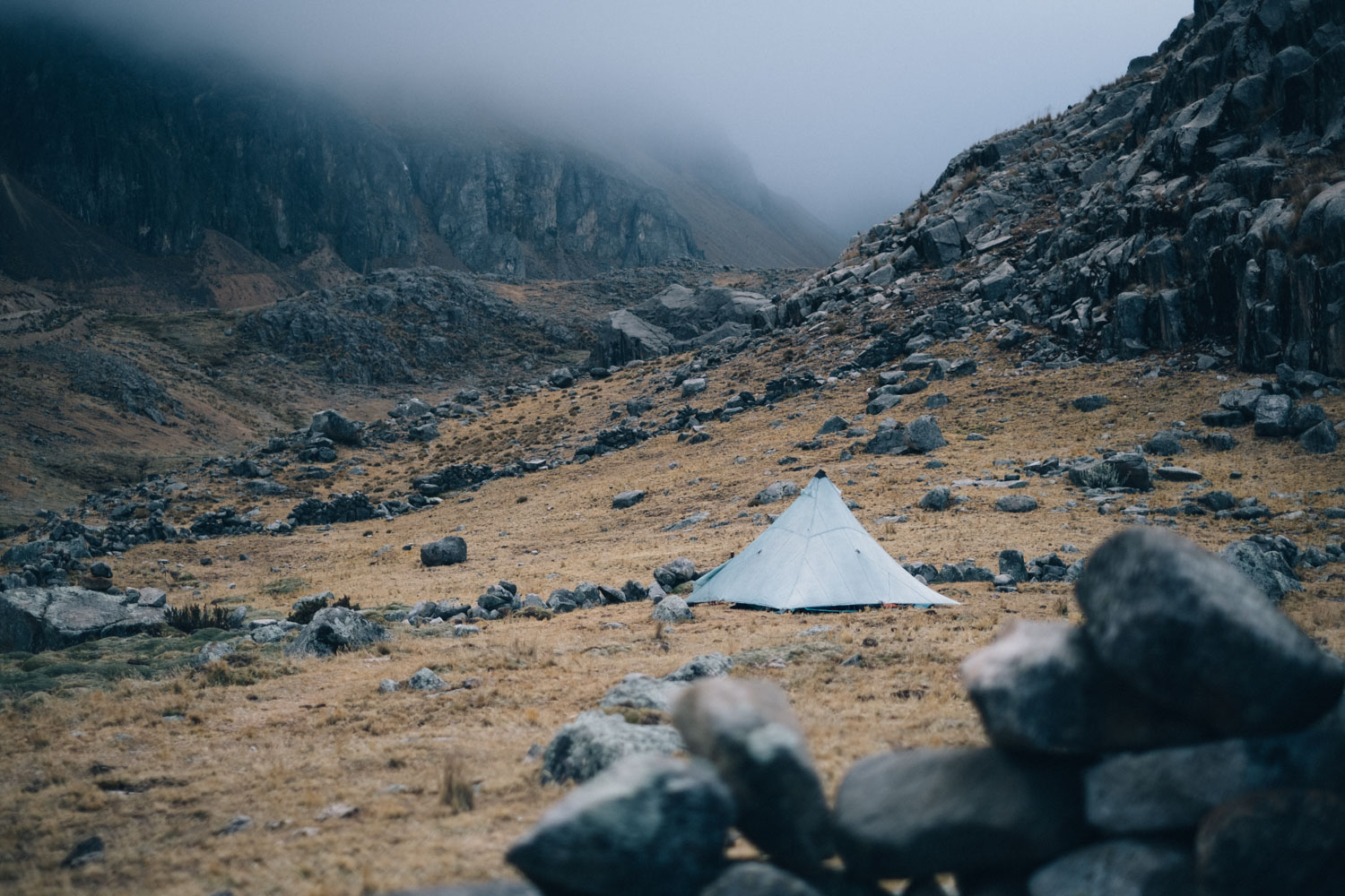
- Camping heaven! The Peru Great Divide offers a string of idyllic, high elevation camping spots.
- Largely traffic-free riding. It’s common, however, to encounter alpaca and llama traffic jams!
- Best bike: this route can be ridden on a traditional touring bike but large volume tyres (2.4in-2.6in or more) will make it a much more comfortable experience, and reduce daily fatigue as well. Most importantly, run low gearing—similar to that of an mtb rather than a typical gravel bike—and pack as light as you can, as a slimline setup will pay dividends, especially given the amount of daily, high elevation climbing.
- As with most routes in the Peruvian Cordilleras, much of the Peru Great Divide is at high altitude. Given the daily climbing (1200m+) you can expect, the it will be more manageable with a good level of base fitness and after several days to acclimatize. There are upwards of 50 4,000m+ passes, so bring your mountain legs! See Trail Notes for possible timeframes and route alternates.
- Time to spare? An exploration of the Cordillera Blanca is a great way of testing body and gear alike, and enjoying a magnificent overview of this stunning mountain range.
- Short on time? A number of bisecting roads to the coast along the way—almost of which will be plied by buses to Lima—so it’s possible to join the Peru Great Divide and leave at different points. The highlight of the ride is probably from Huaraz to Huancavelica. See Trail Notes for more ideas.
- Bikepackers tend to ride the route north to south, but both directions work well. Either way, expect big climbs!
- Be sure to acclimatise beforehand for several days at least – Huaraz and its abundance of riding, hiking, and fine dining make a good base for this.
- Bbring appropriate, mountain-worthy gear. Pack a good waterproof jacked and warm gloves suitable to both cold temperatures and rain. Waterproof trousers are likely to come in useful too – and for keeping warm around camp. Local woollen hats can be picked up in Huaraz or en route!
- ATMs aren’t to be relied on en route, except in Huancavalica, even if there are a number of them along the way. Your best bet is to take cash with you, broken up in small denominations. Fortunately, touring in the Peruvian high country is very affordable – there’s very little to spend your money on but food! Note that the Banco de la Nación/Multired ATMs don’t have a service fee, but are limited to S/400 per withdrawal. You can generally pull out money twice in a day, though.
- Best time ride: this ride is best undertaken from April/May to September, when rainfall is less likely and weather patterns are most stable. Avoid the rainy season (October/November to March) as it brings intense afternoon storms that will likely have you hunkering down off the bike for a number of hours a day. The shoulder seasons can be hit or miss, too, so be sure to pack your waterproofs.
- A sleeping bag rated to -5c should tide you through and allow camping at high elevation—the best, least populated spots—when teamed with warm cloathing. During the days, especially on climbs, it can be warm, t-shirt weather, but temperatures can be frigid before sunrise and after sunset. A foam sit mat can be a welcome addition for around camp, and to place under your hips at night.
- These days, there’s an increasing amount of wifi along the route. Consider picking up a Claro SIM or signing up with an e-SIM service to keep in touch, though it’s best not to rely on cell service much of the time. The likes of an Inreach Mini 2 can be useful too, as they allow weather updates as part of their plans.
- Cruz del Sur is a safe, reliable bus company that runs from Lima to Huaraz as an overnight service (8 hours). Likewise, you can take the same company back to Lima from Abancay, if you’re riding the whole route. There is often an additional fee for a bike, based on its weight, which is typically around S/30. Once weighed, this fee is paid at the main desk. Bikes can be bagged/boxed or you can often just remove the wheels, though some Cruz del Sur offices may ask you to wrap the bike, which can generally be done at the bus station, such as the one at their Javier Prado depot. Tickets can be booked online.
- Wild camping is possible most nights, if you so wish. A few possible spots are marked on the map, or check the iOverlander and Rolling Around Apps for up-to-date options.
- Most settlements will have a basic hospedaje of sorts for as little as S/15 – even if it’s as simple as a dorm bed if the weather is looking stormy.
- Larger towns offer a greater selection of accommodation with wifi. Both Oyón, Huancaya, and Huancavelica are good places to rest up en route, if you’re planning time off the saddle. In Huaraz, El Tambo is a great place to meet fellow bikepackers, while Hotel Los Andes is another fantastic cyclist’s hub in Oyón.
- For those running denatured alcohol stoves, ask for ron de quemar, alcohol industrial, or alcohol pura. It’s available in all larger settlements, but may take some hunting around to find.
- Beautiful, high elevation, wild-camping spots abound across the length of this route. They are definitely a highlight of riding the Peru Great Divide, so savour them! Aim to camp out of sight of the road and if in any doubt, check in with local communities or shepherds first. If you’re camping close to settlements or even in bedding down in cheap hospedaje’s, an eyemask and ear plugs are recommended for barking dogs and ambient lights.
>
- Basic resupplies are fairly regular but still, plan on carrying up 2-3 days of food at times. Snacks – chocolates and biscuits – can almost always be picked up along the way but the likes of fruit and vegetables can be harder to find outside of larger settlements.
- Bring speciality food with you from home, like spices to add to pasta and dried coconut powder to add to rolled oats—great for added fats—or a couple of dehydrated meals to get you out of trouble.
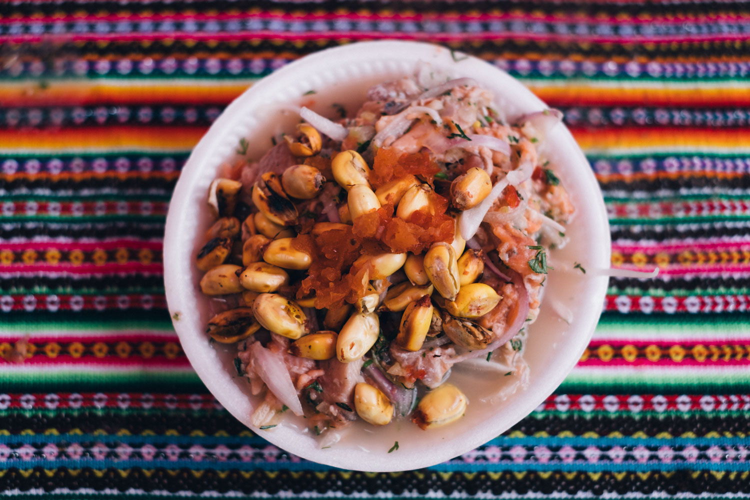
- My go-to shopping list, available in better stocked stores, includes pasta, onion, garlic, local mature cheese, avocado, and tomatoes. As mentioned, packaged cookies are easy to find in any store, but I prefer local bags of sweet “canchas” and kiwicha, energy balls made from quinoa and amaranth. Those with wobbly teeth, however, should steer clear of the latter.
- Options can be limited in smaller settlements, so eat to your fill well whenever you hit a town! For great value and a full belly, look out for ‘menus’, which include a soup, a main course, and a hot drink. Fresh trout makes a welcome change from fried eggs and rice or chicken claw soup, both of which are classic Peruvian mountain staples.
- Bring a water filter and don’t forget to store it in your tent at night, as most can be damaged at temperatures below freezing. There is mining activity in the area,so take care in choosing the water source you purify from.
- Huancavelica, two-thirds of the way through the route, makes a great spot to rest up for a day, if only because of the quality of its cakes!
This route can be ridden in month or so, assuming you are acclimatised, aboard an appropriate bike with a light setup, and are physically prepared for day in, day out climbing. It can also be slimmed down to its highlight, Huaraz to Huancavelica, which can be covered in around 16-18 riding days. Given the inherent challenges of this route, these timeframes are based on covering approximately 50-60km per day with elevation gains of around 1200-1500m, along with a couple of longer days when logistics require it. Note you’ll likely want to add at least a few rest days to your itinerary to let your body recover, and the distances you can cover may vary depending on the season and the weather… as well how much you like to linger in so many stunning campsites!
Allow at least a few days at the beginning for acclimatisation purposes—a perfect excuse to explore the Cordillera Blanca, whether by bike or by foot. See the Pikes’ Trailblazer guidebook for ideas, or try one of their other routes on the site. The 5-day Huascarán Circuit is a classic loop in its own right and a great way of preparing yourself—and checking over your gear—before beginning this challenging journey.
There are several variations on joining the Peru Great Divide, too. Consider working in a traverse to Pastoruri from Huaraz to marvel at the Puya Raymondii , or a more testing crossing of the Huayhuash—both of which are described in Cónexion Oyón, which you can find here. Note that riding the Huayhuash Trek is better suited to a more minimal setup than the rest of the Peru Great Divide and will suit riders who are both confident mountain bikers and happy to push their bikes for extended periods!
As for exits, there are a number of main arterial routes dropping down to the coast along the route, all of which offer direct and indirect buses into Lima.
Aside from being a wonderful standalone route, the Peru Great Divide can also be tackled as part of a longer South American journey. It plugs in neatly to Cones and Canyons and in turn, the Camino del Puma (via Arequipa). Or, riders can head to the Incan capital of Cuzco (see here for a RWGPS suggestion) and then connect with the Ruta de las Las Tres Cordilleras on their way to Bolivia. Possibilities abound!
We’ve already featured a number of Peru Great Divide content here on the site. See these links for more inspiration:
- El Silencio – the film, the ride, and the bikes.
- In the Footsteps of The Chaskis – the Peru Great Divide on gravel bikes, in 18 days, starting in Cuzco. You can find the route and connector here.
- Admissions of an Amateur Bikepacker – a first solo adventure!
- For the Pikes’ original route post that hones in on 343km of the route – and their photos – see here.


Terms of Use: As with each bikepacking route guide published on BIKEPACKING.com, should you choose to cycle this route, do so at your own risk. Prior to setting out check current local weather, conditions, and land/road closures. While riding, obey all public and private land use restrictions and rules, carry proper safety and navigational equipment, and of course, follow the #leavenotrace guidelines. The information found herein is simply a planning resource to be used as a point of inspiration in conjunction with your own due-diligence. In spite of the fact that this route, associated GPS track (GPX and maps), and all route guidelines were prepared under diligent research by the specified contributor and/or contributors, the accuracy of such and judgement of the author is not guaranteed. BIKEPACKING.com LLC, its partners, associates, and contributors are in no way liable for personal injury, damage to personal property, or any other such situation that might happen to individual riders cycling or following this route.
Please keep the conversation civil, constructive, and inclusive, or your comment will be removed.