


Hydra (A Trail Through the Baltics)
Distance
1,128 Mi.
(1,815 KM)Days
14
% Unpaved
85%
% Singletrack
45%
% Rideable (time)
95%
Total Ascent
43,291'
(13,195 M)High Point
911'
(278 M)Difficulty (1-10)
6?
- 2Climbing Scale Easy38 FT/MI (7 M/KM)
- 7Technical Difficulty Difficult
- 6Physical Demand Moderate
- 3Resupply & Logistics Fair
Contributed By
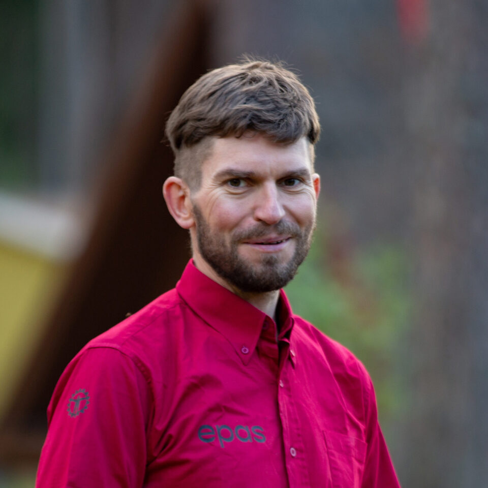
Paulius Bakutis
Guest Contributor
Paulius is a long-time bikepacking enthusiast who has been deeply involved in Lithuania’s bikepacking community since its early days. He works closely with EuroVelo, is the founder of “Epas” bikepacking events, and serves as president of the Lithuanian Cyclists’ Association. Paulius is also a key figure in the development of cycling infrastructure across Lithuania.
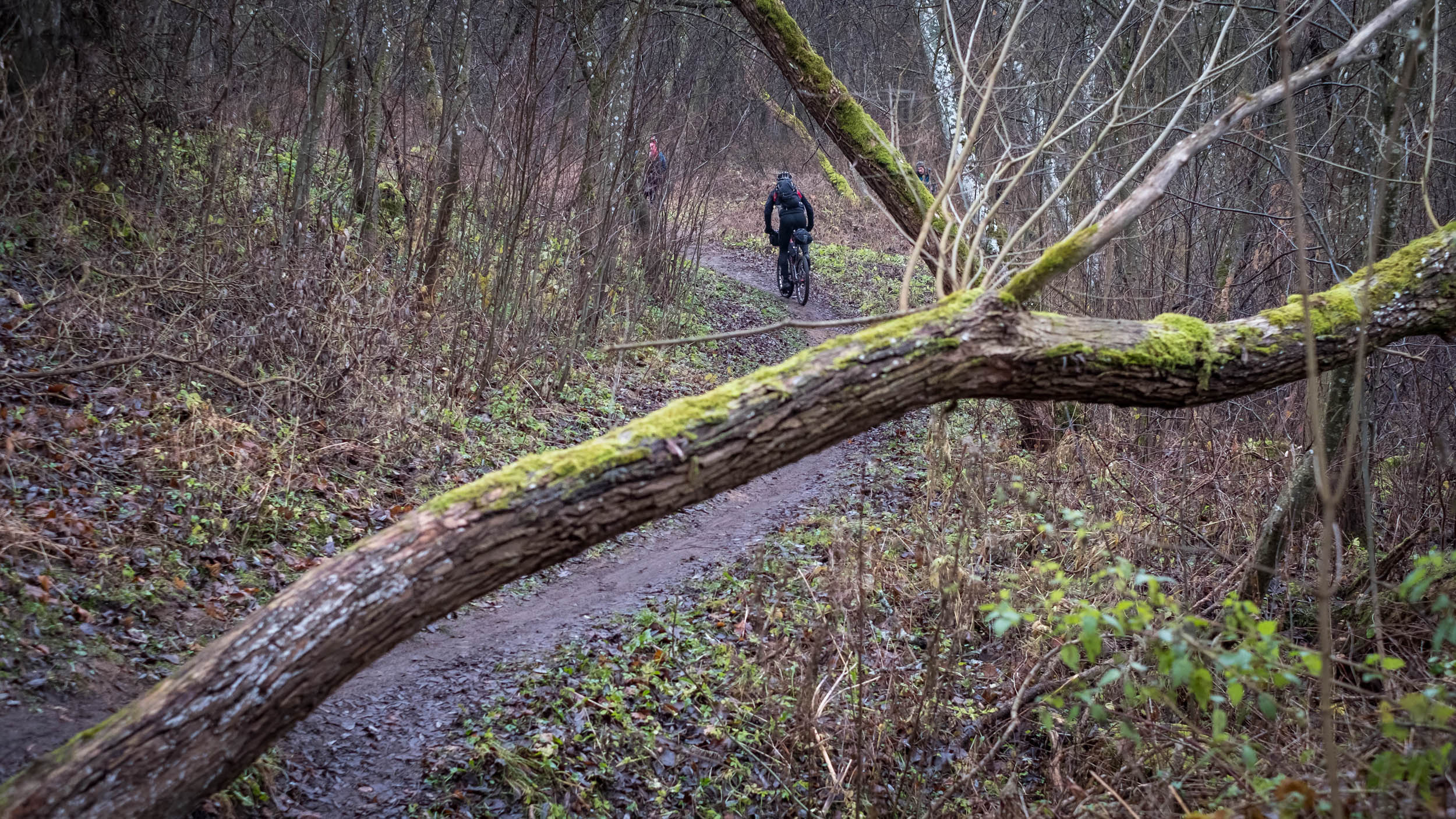
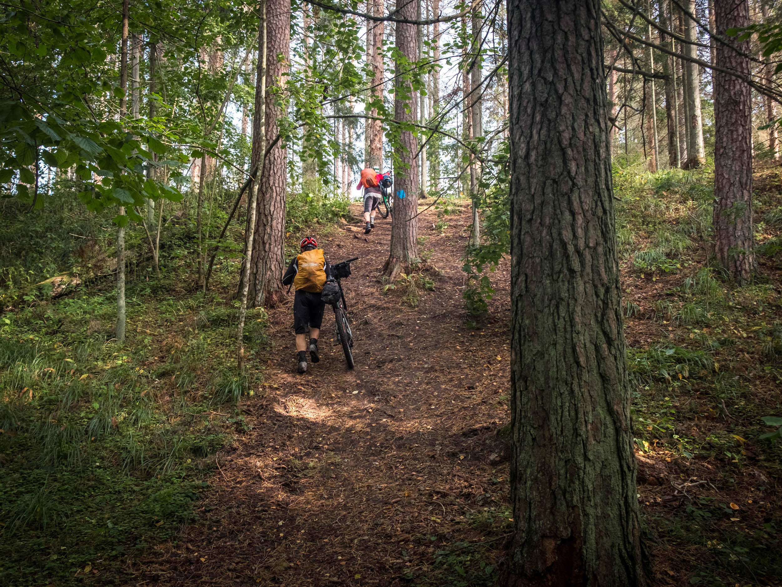
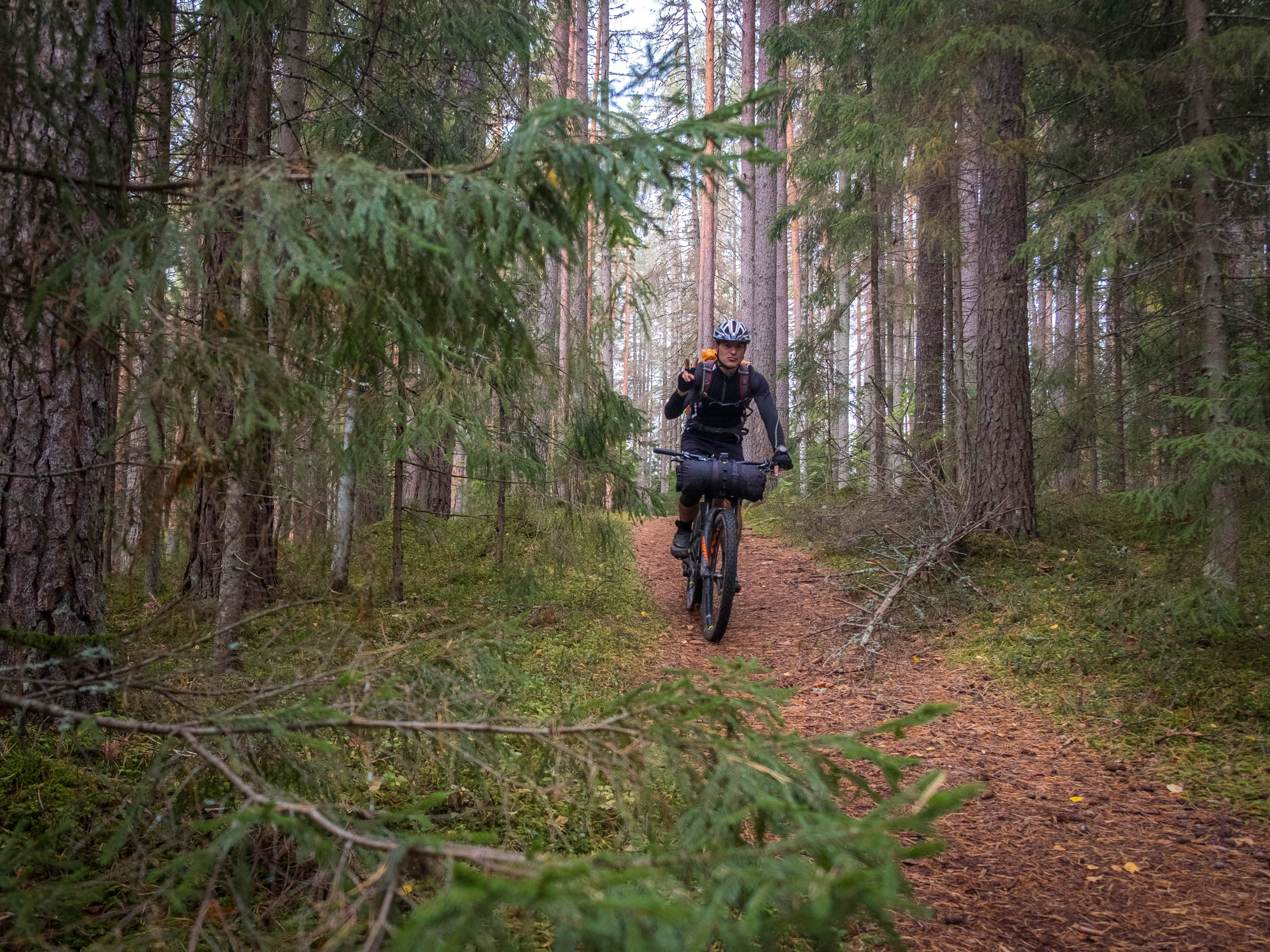
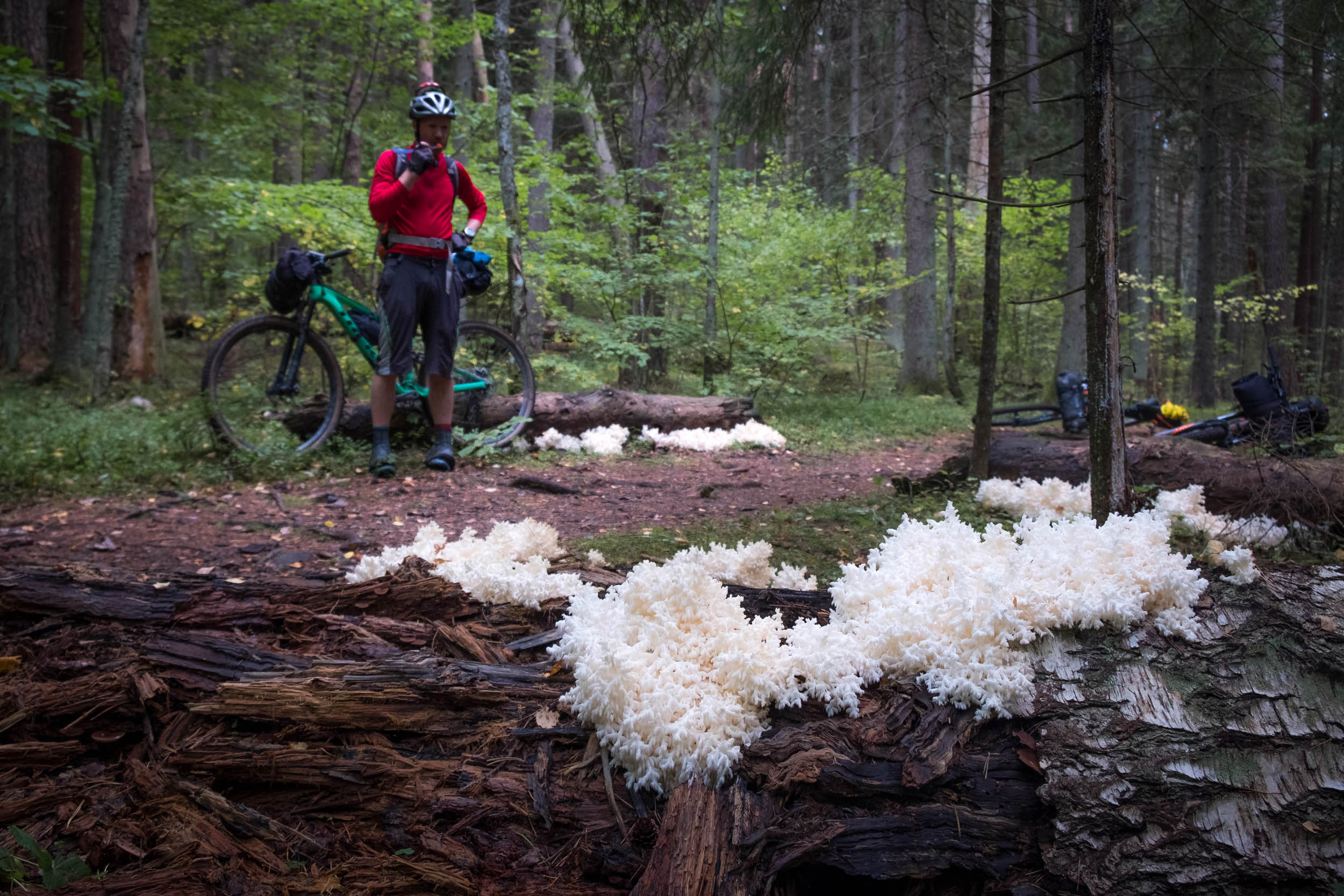
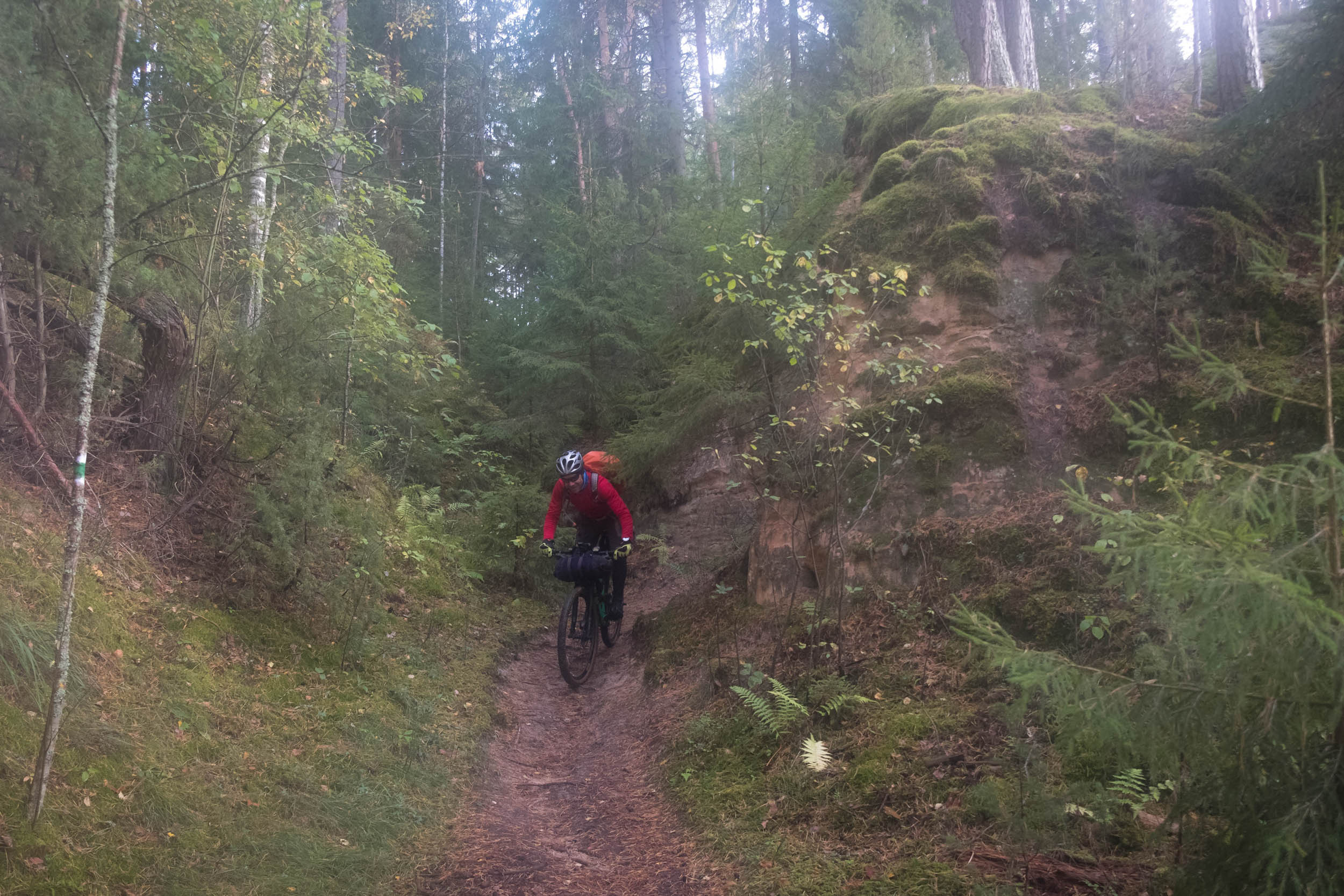
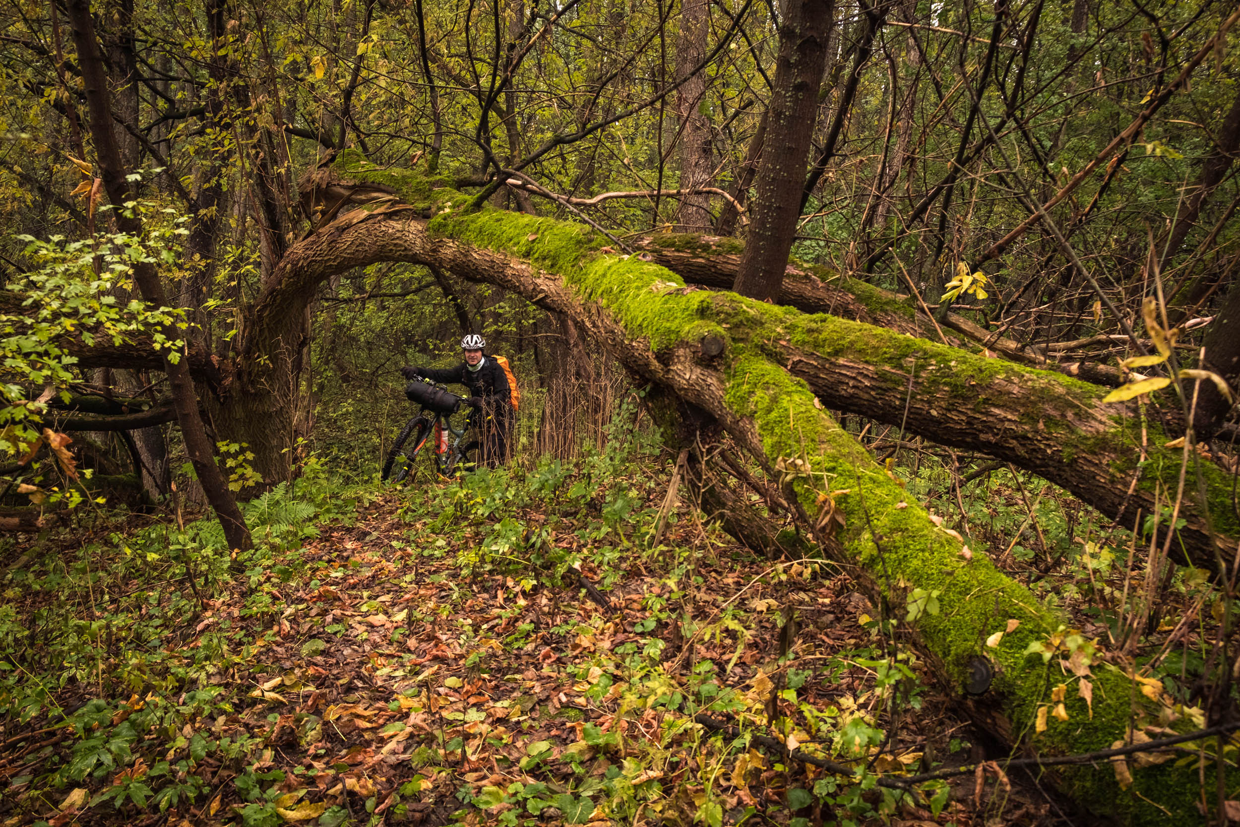
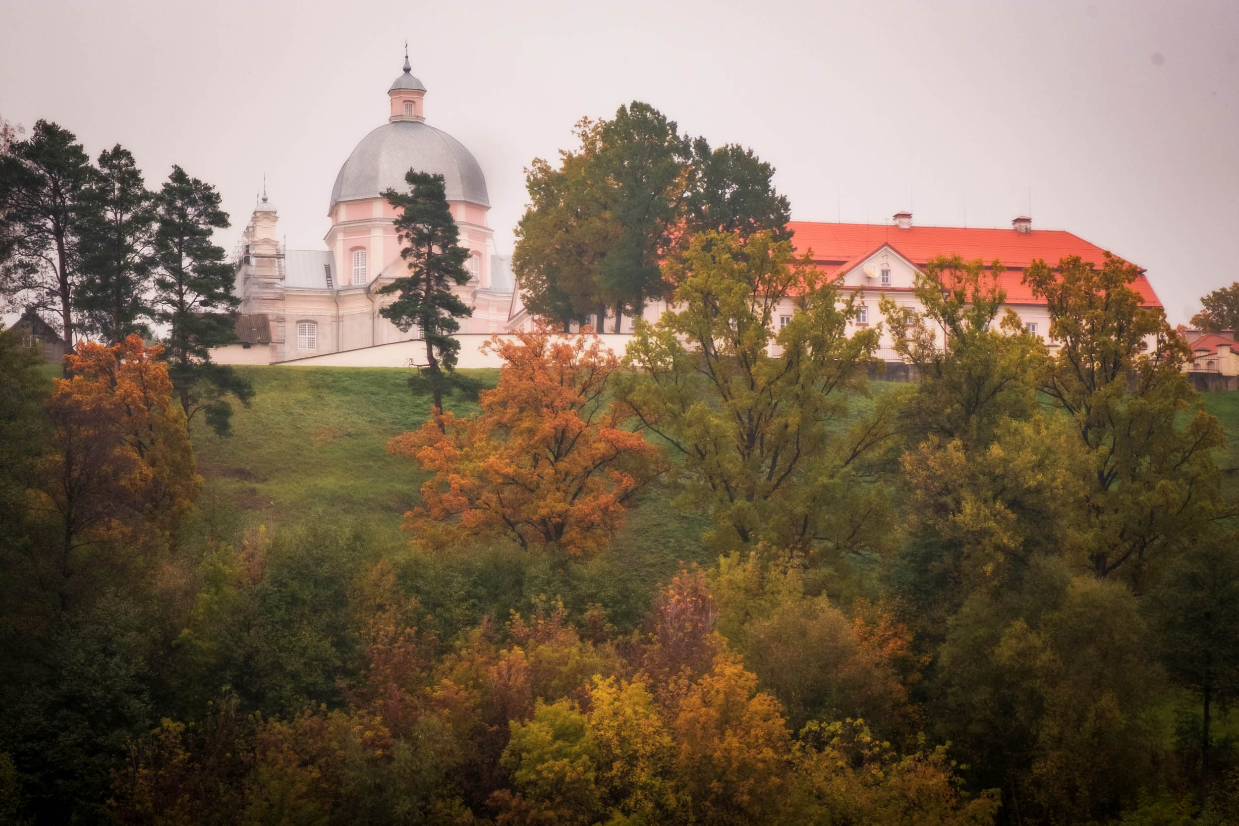
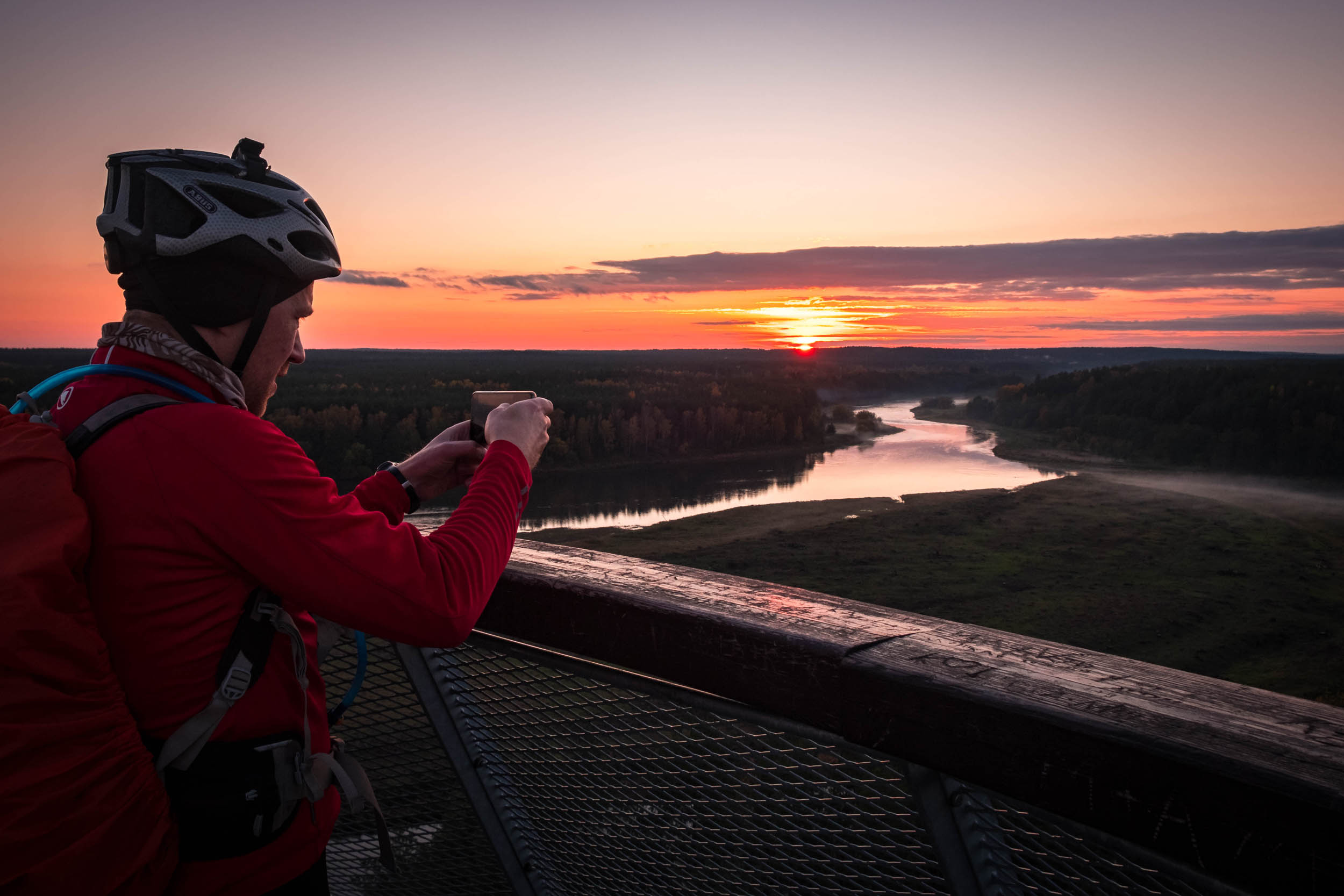
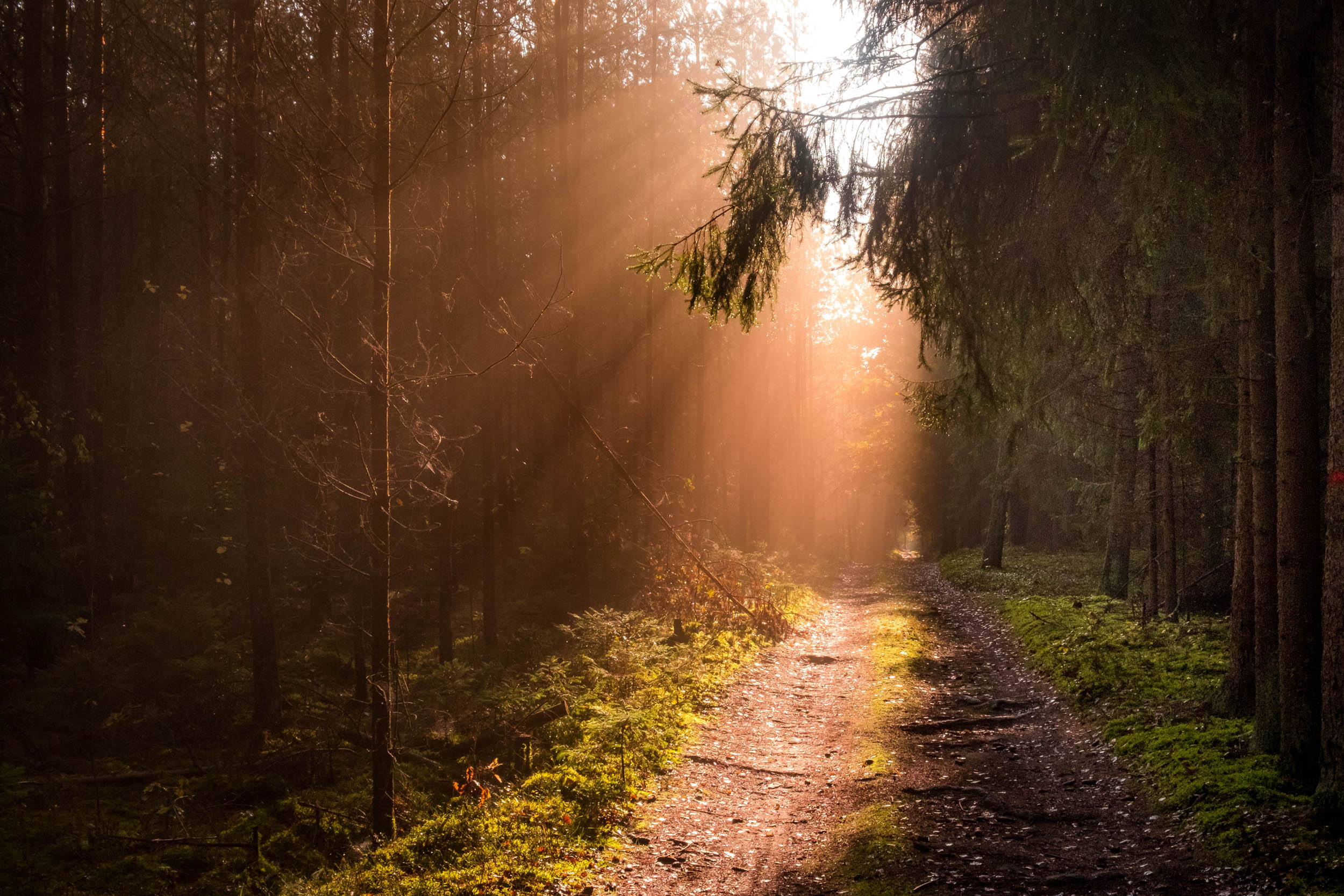
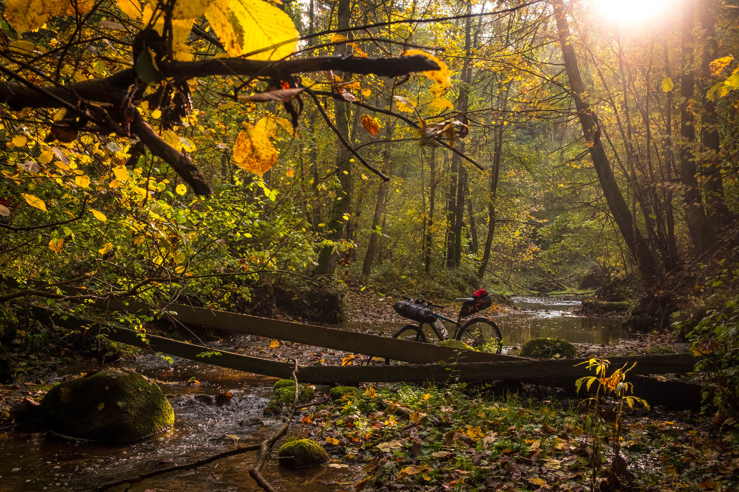
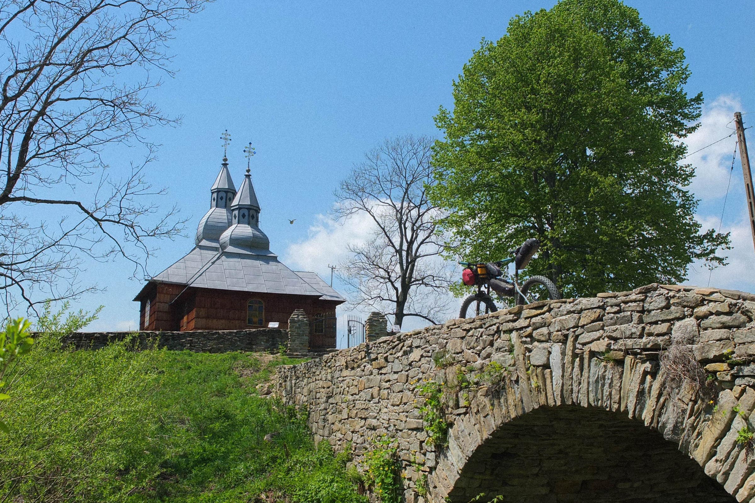
Starting in the small Polish town of Suwałki in the east, Hydra immediately introduces riders to an area known for its stunning natural beauty. The nearby Wigry National Park allows bikepackers to immerse themselves in untouched nature and get a real sense of the journey ahead. Here, riders can expect a mix of smooth gravel paths and root-laden trails amid a serene and quiet environment.
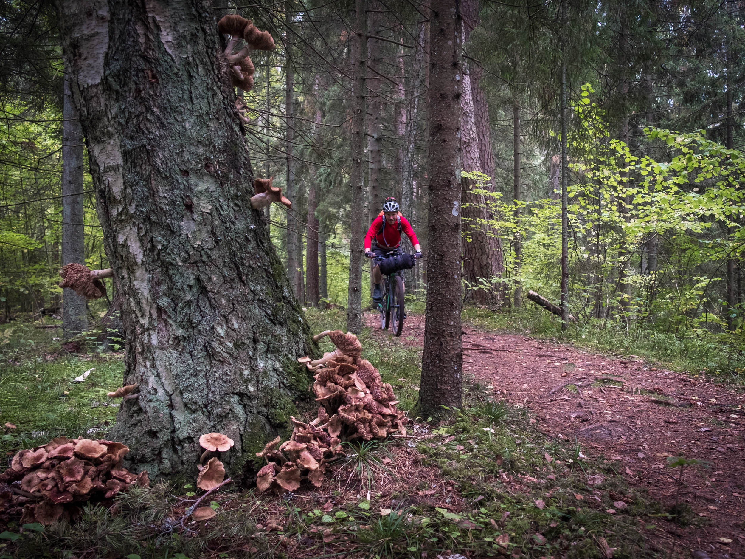
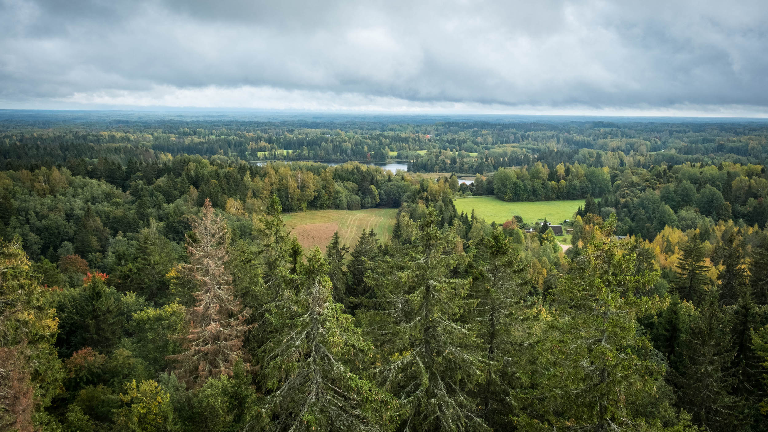
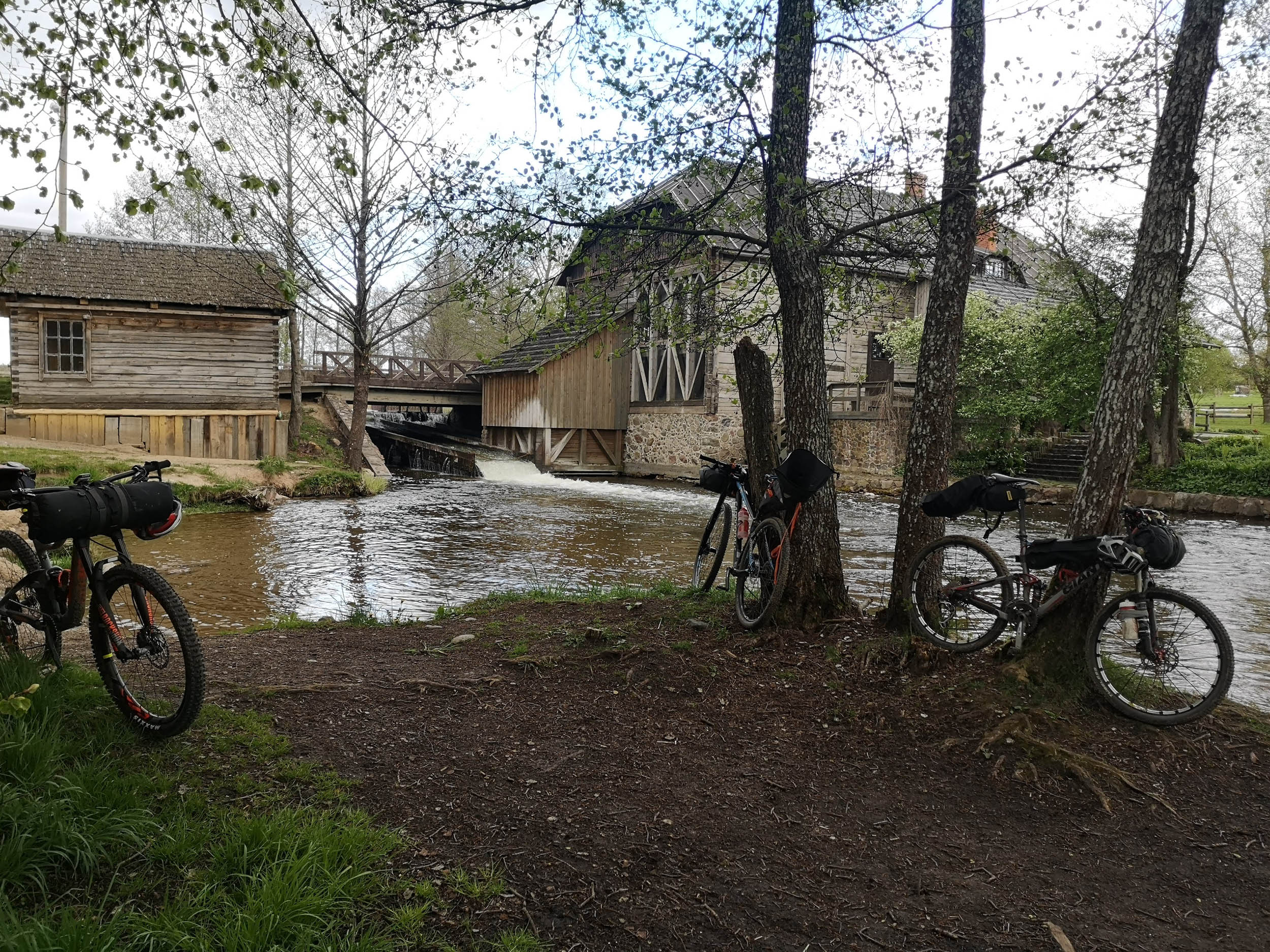
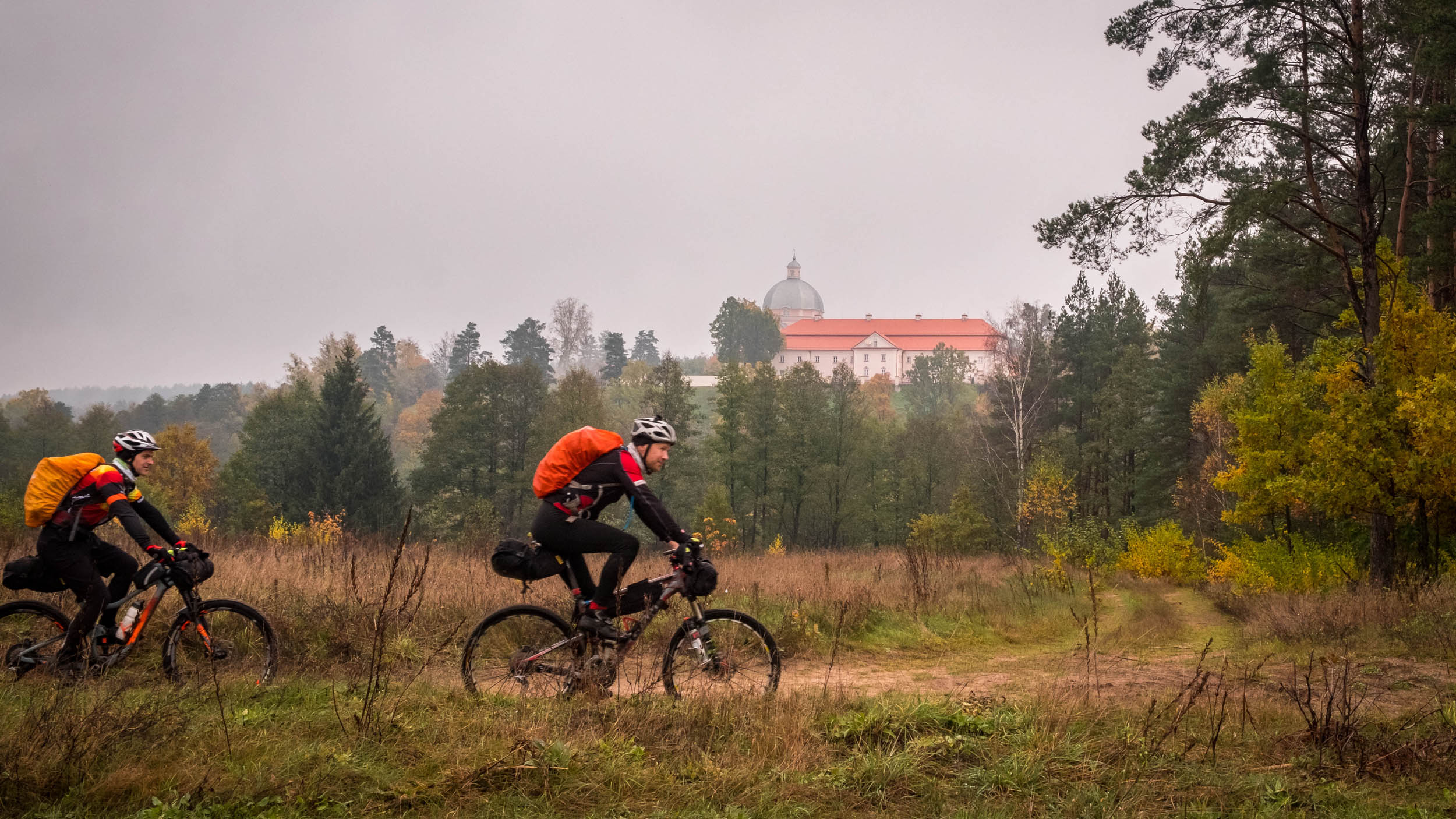
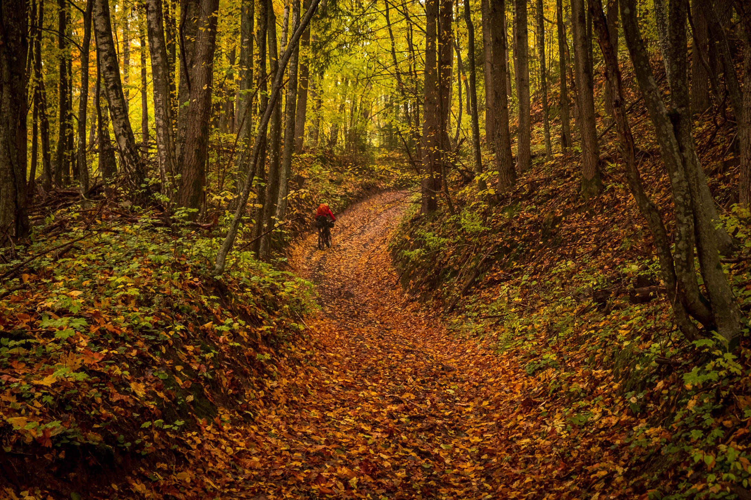
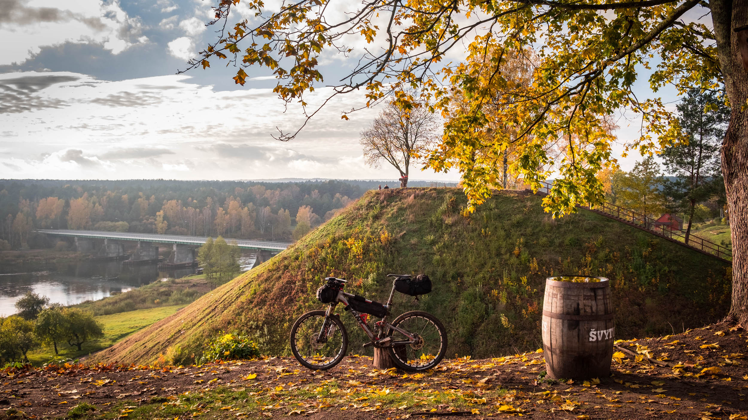
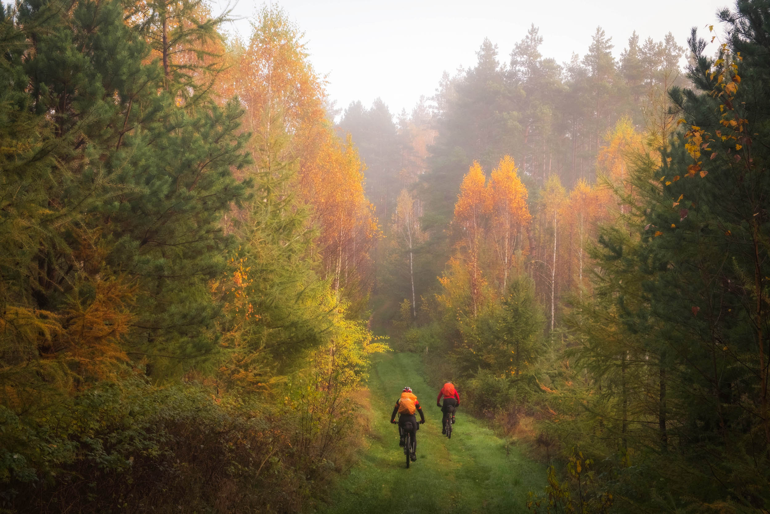
As the route leads northeast, it crosses into Lithuania, where the terrain becomes slightly more challenging. Rich in dense forests, Lithuania is marked by an undulating landscape that creates a ride through ever-changing scenery. Some sections of the route will have you navigating through small villages on gravel roads, while others will challenge you with rooty pine tree trails. Later, the trail leads through the famous Labanoras and Gražutė National Parks, ending at the Lithuanian-Latvian border crossing.
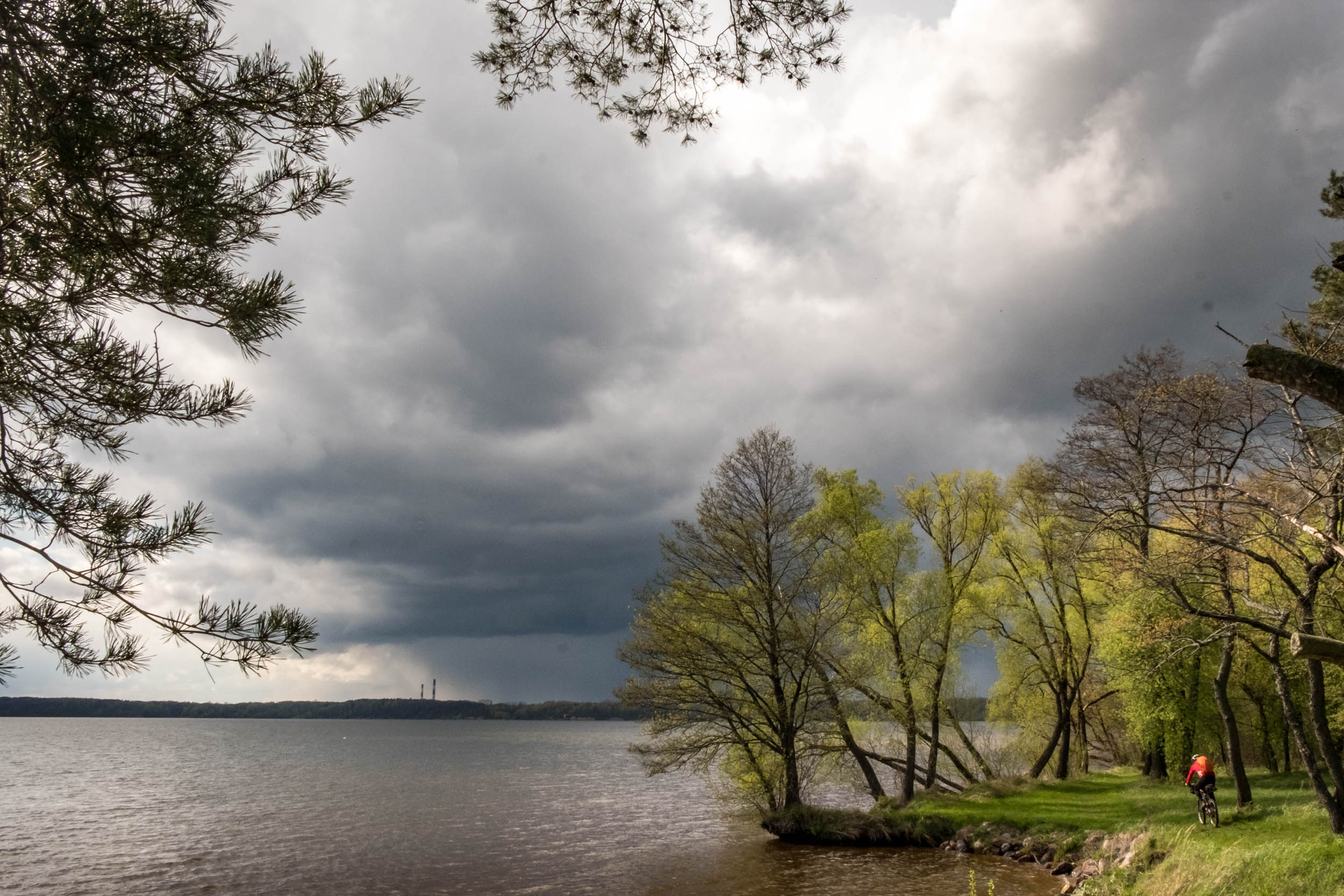
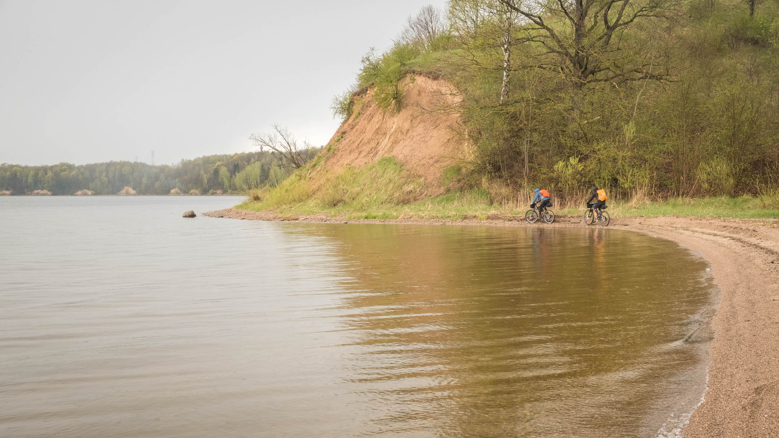
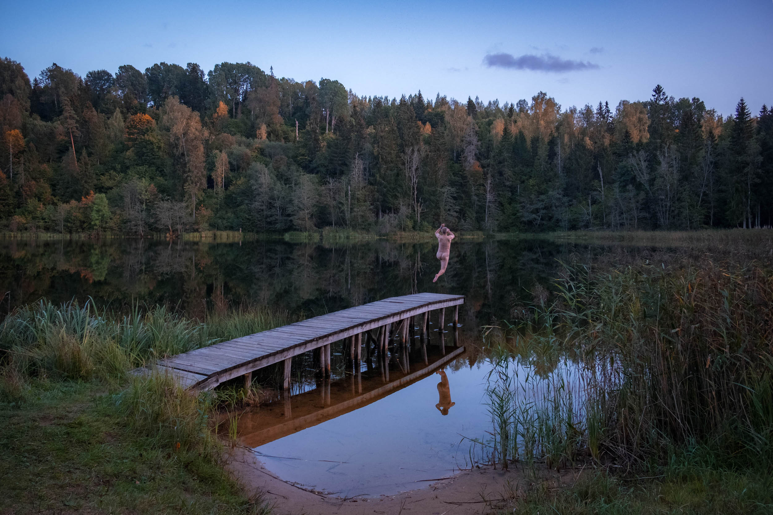
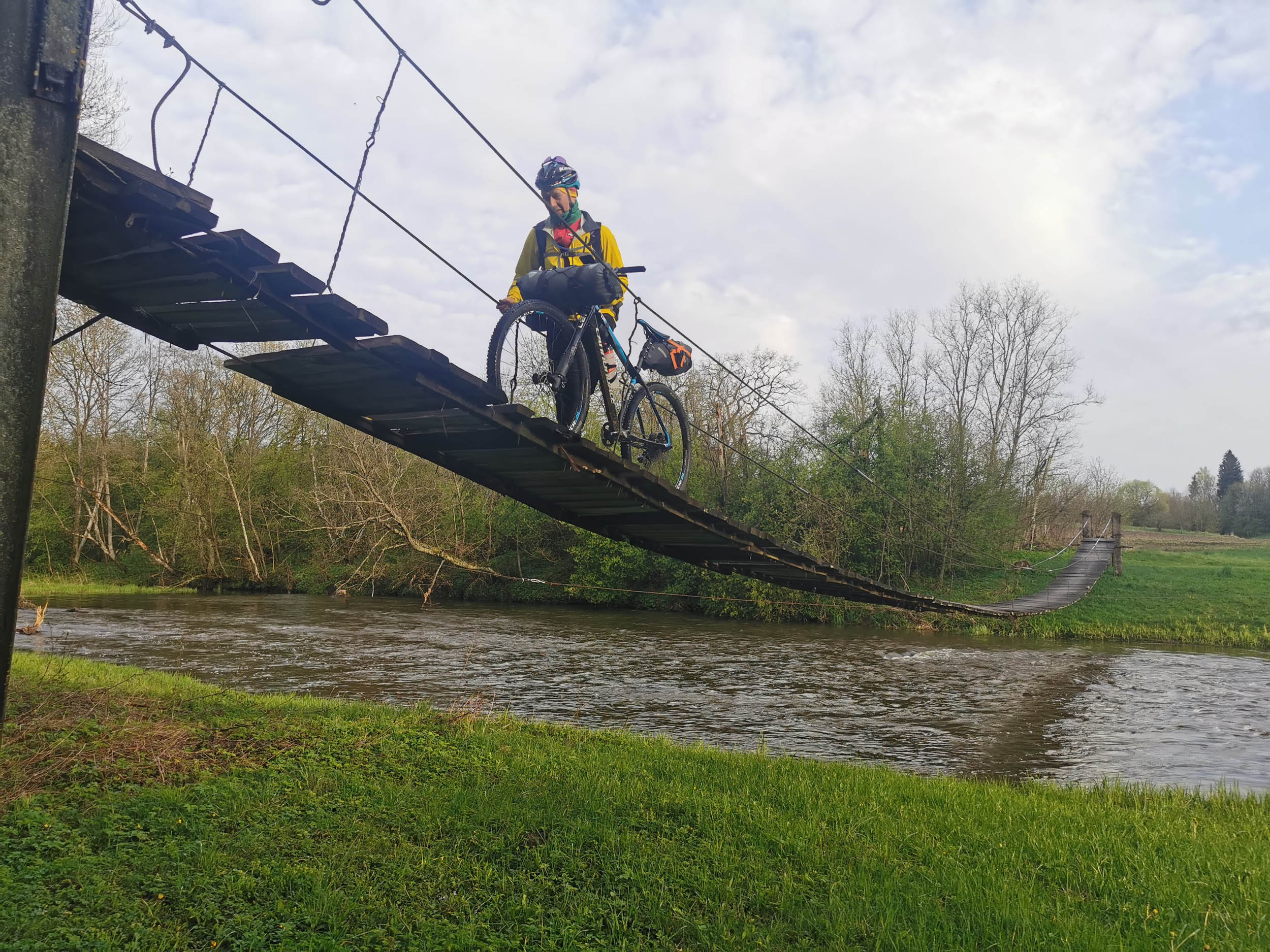
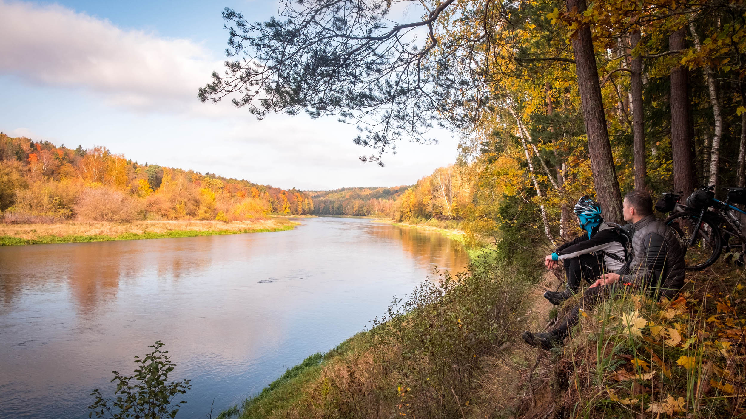
The ride continues in Latvia, where the landscape opens up to more expansive vistas dotted with numerous rivers. While Latvia offers smoother gravel sections, some moments still demand focus, especially in the green, forested canyons where roots and tight switchbacks will test every bikepacker. The route also passes through Riga, the capital of Latvia, where riders can stock up on food supplies or visit professional bike mechanics if needed.
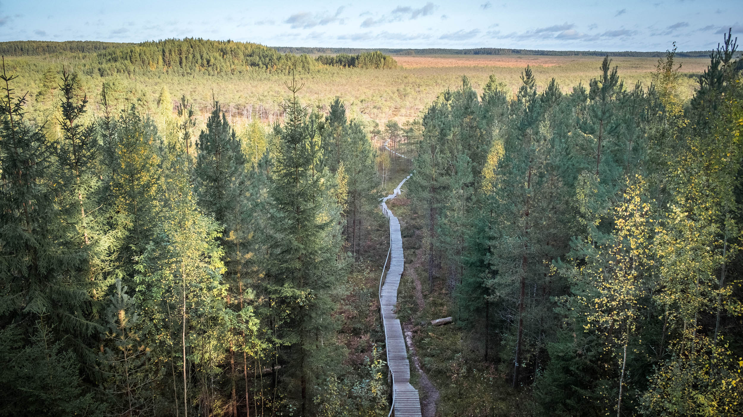
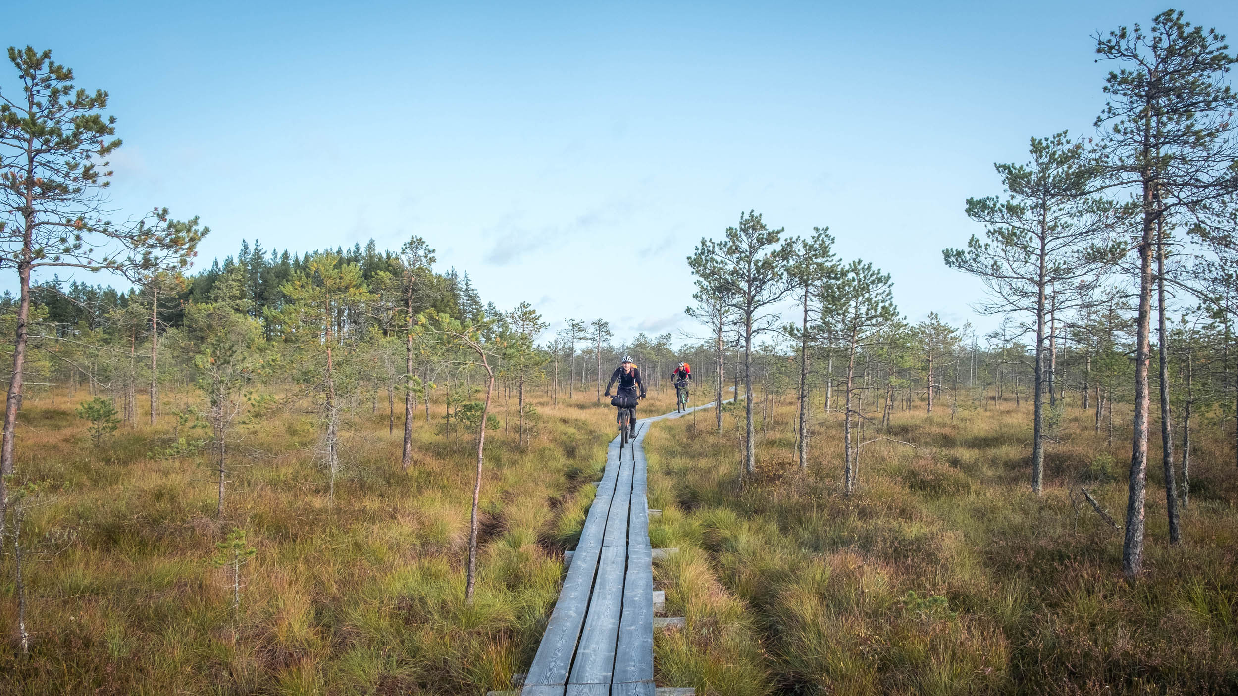
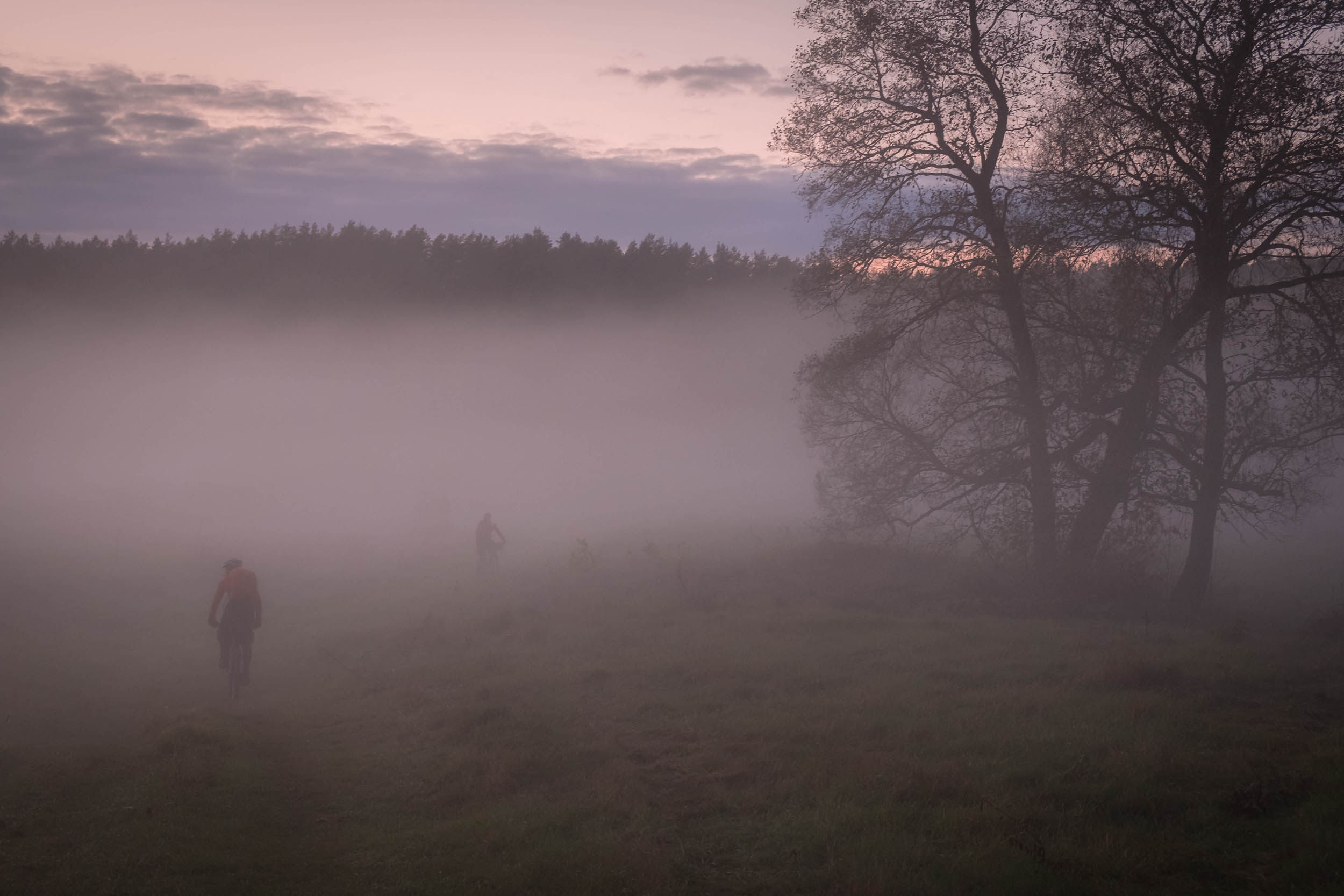
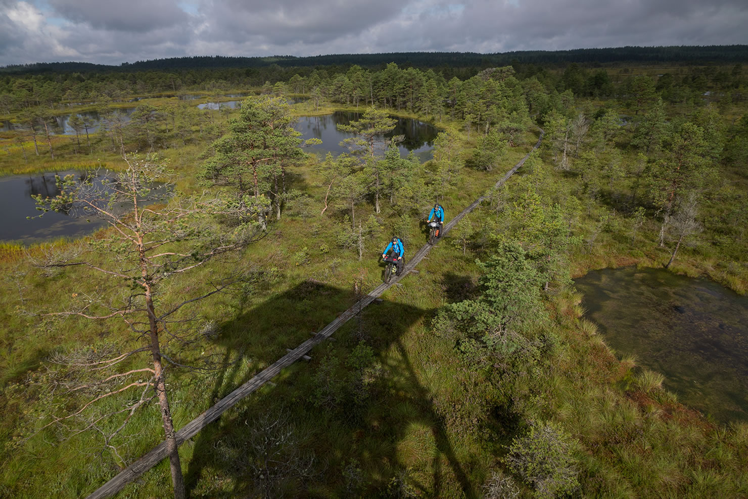
The route’s final stretch takes riders into Estonia, where the terrain shifts once again. Due to its glacial history and landscape, Estonia is known for having a higher density of lakes, rivers, and wetlands than the other countries along the route. Bikepackers may find themselves navigating through slippery ground and, depending on the weather, a few swamp crossings.
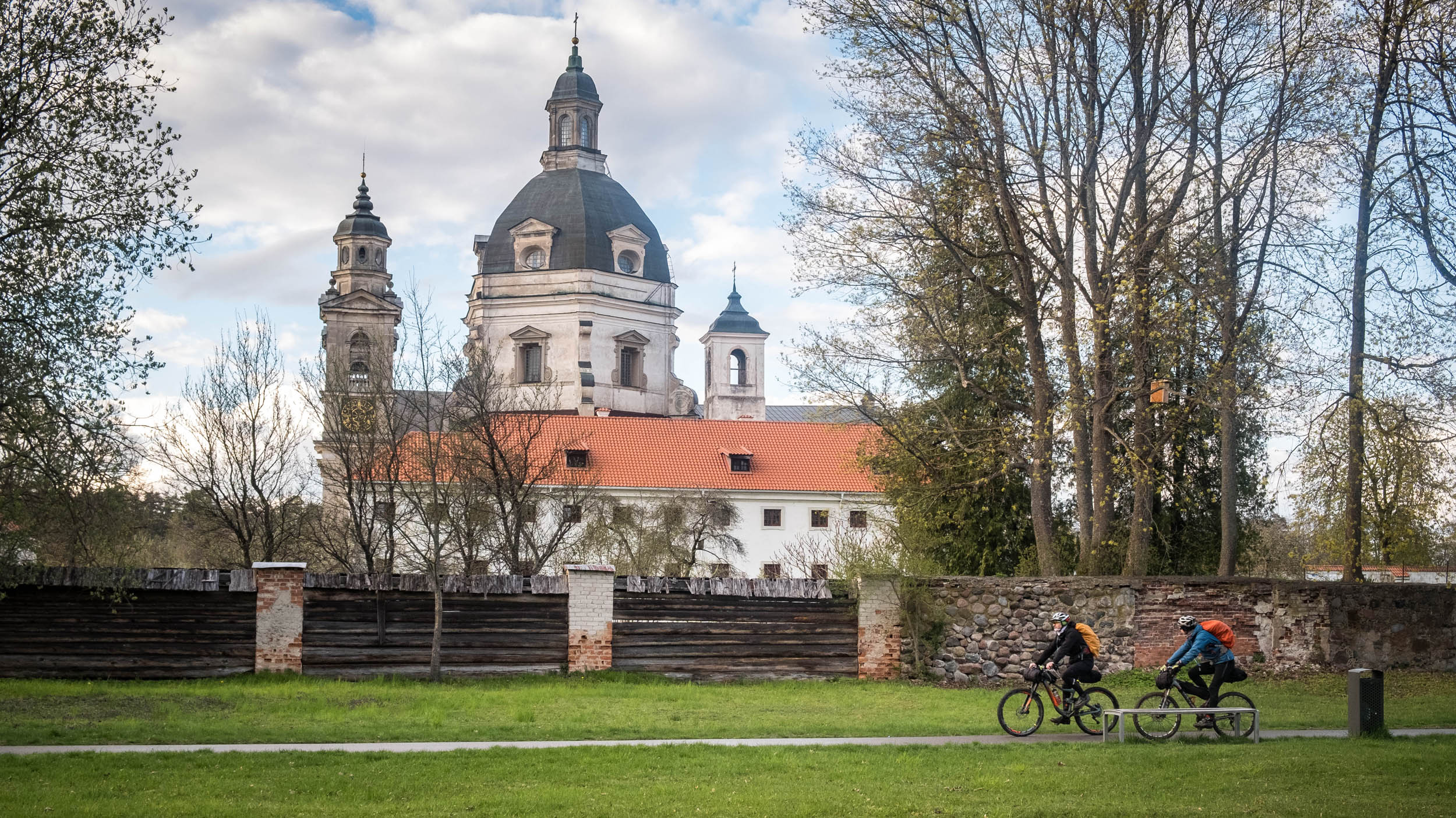
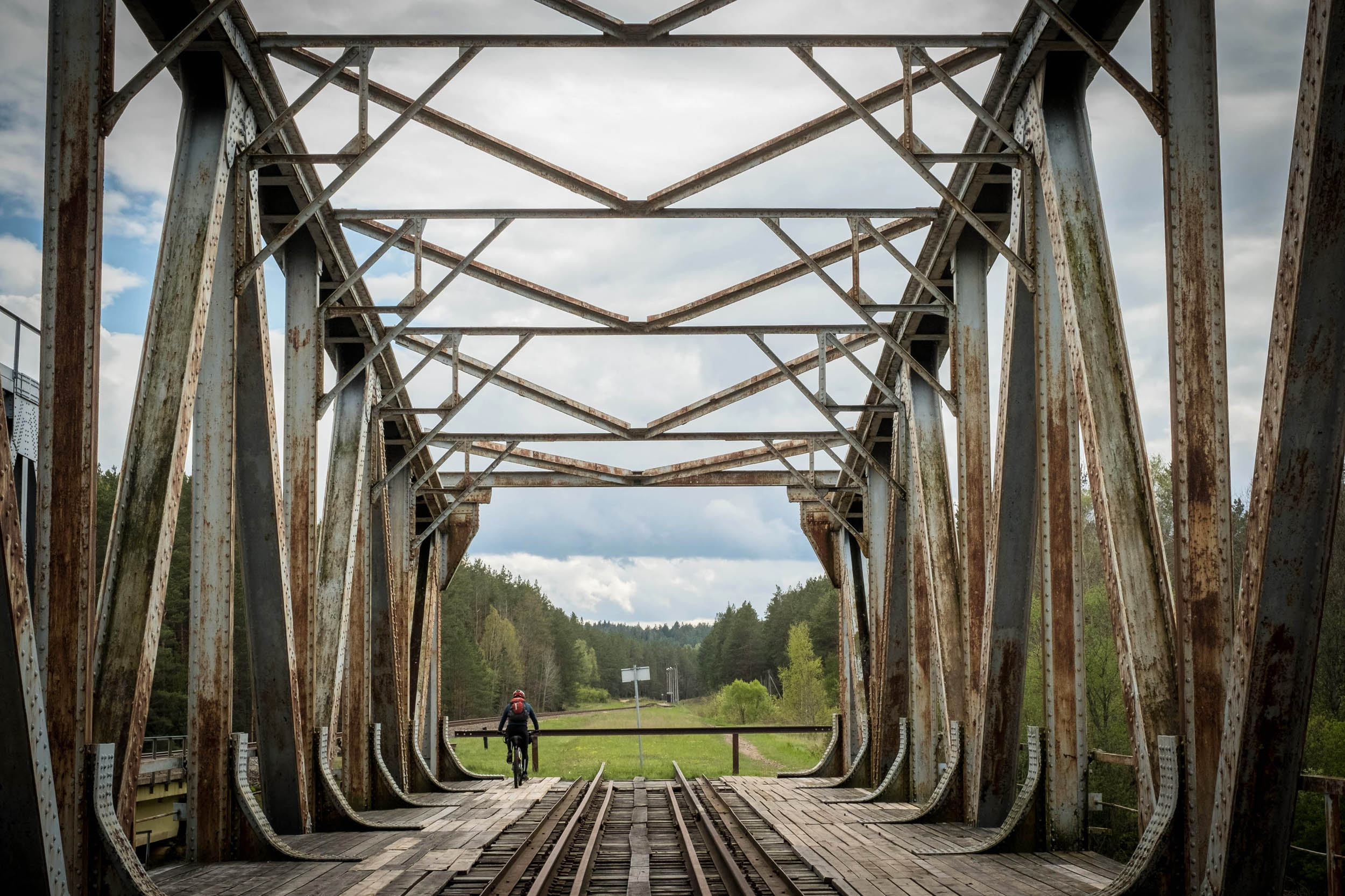
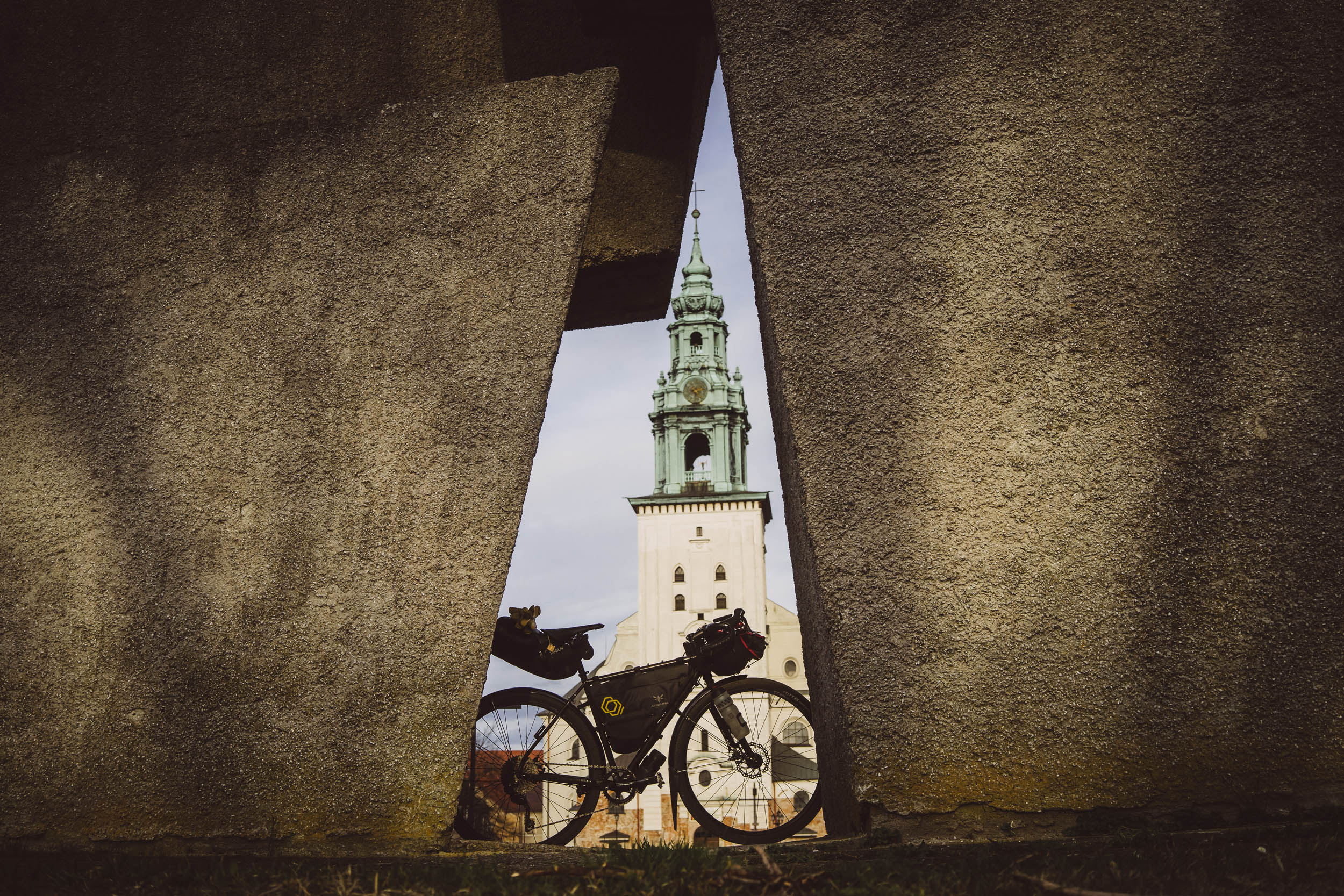
Ultimately, Hydra is a complete bikepacking Baltic experience. It challenges riders to adapt to ever-changing conditions, from smooth gravel to muddy paths and tight switchbacks to singletrack. Along the way, cyclists will encounter a stunning diversity of landscapes: lush forests, rolling hills, and quaint Baltic villages. Well-researched bike trails also lead through larger cities via green parks, including Kaunas, Vilnius, Zarasai, Riga, Cēsis, and Valmiera. The sense of isolation and the beauty of the surroundings provides an immersive backdrop for those looking to take on a true bikepacking challenge. It’s a route that rewards endurance and allows riders to experience the incredible beauty of the Baltic countries.
Route Difficulty
The route is rated a 6 in terms of difficulty. While the terrain is generally manageable, some sections require bikepackers to stay mentally focused, especially when navigating challenging stretches or dealing with occasional pushing and water crossings, which may vary depending on the weather. Riders should have a moderate level of physical fitness, but those who wish to take longer breaks or ride at a slower pace can still manage if their conditioning is slightly below average. Resupply points are plentiful along the route, with many shops available for restocking, so logistical concerns are minimal. Public buses connect most towns along the way, and both the start and finish are easily accessible. If riders need to cut their journey short, finding a bus back from any of the towns is straightforward.
Route Development
The Hydra trail is the result of 16 years of exploration, trial, and error. It was created by a group of cyclists passionate about showcasing the Baltic States’ diverse landscapes. Over the years, the route has been refined through numerous scouting trips, flat tires, and detours, with ongoing updates each year during the Hydra race. This process involves race organizers, local bikepacking communities, and partners, ensuring the trail remains challenging and fresh for all riders.


Submit Route Alert
As the leading creator and publisher of bikepacking routes, BIKEPACKING.com endeavors to maintain, improve, and advocate for our growing network of bikepacking routes all over the world. As such, our editorial team, route creators, and Route Stewards serve as mediators for route improvements and opportunities for connectivity, conservation, and community growth around these routes. To facilitate these efforts, we rely on our Bikepacking Collective and the greater bikepacking community to call attention to critical issues and opportunities that are discovered while riding these routes. If you have a vital issue or opportunity regarding this route that pertains to one of the subjects below, please let us know:
Highlights
Must Know
Camping
Food/H2O
Resources
- Unique Terrain: The route stretches through the diverse landscapes of the Baltic States, including forests, rivers, lakes, and small villages—no mountains, but challenging terrain for any rider.
- Historical and Cultural Significance: Crosses through significant towns like Kaunas, Riga, and Druskininkai, rich in history, local culture, and architecture.
- Challenging Weather: The Baltic weather is notoriously unpredictable. Prepare for sudden temperature shifts, rain, and wind, especially during the summer.
- Rivers and Lakes: The route is bordered by several major rivers like the Nemunas, Neris, and Gauja and passes near serene lakes—perfect for quiet moments in nature. Just remember to filter natural water sources.
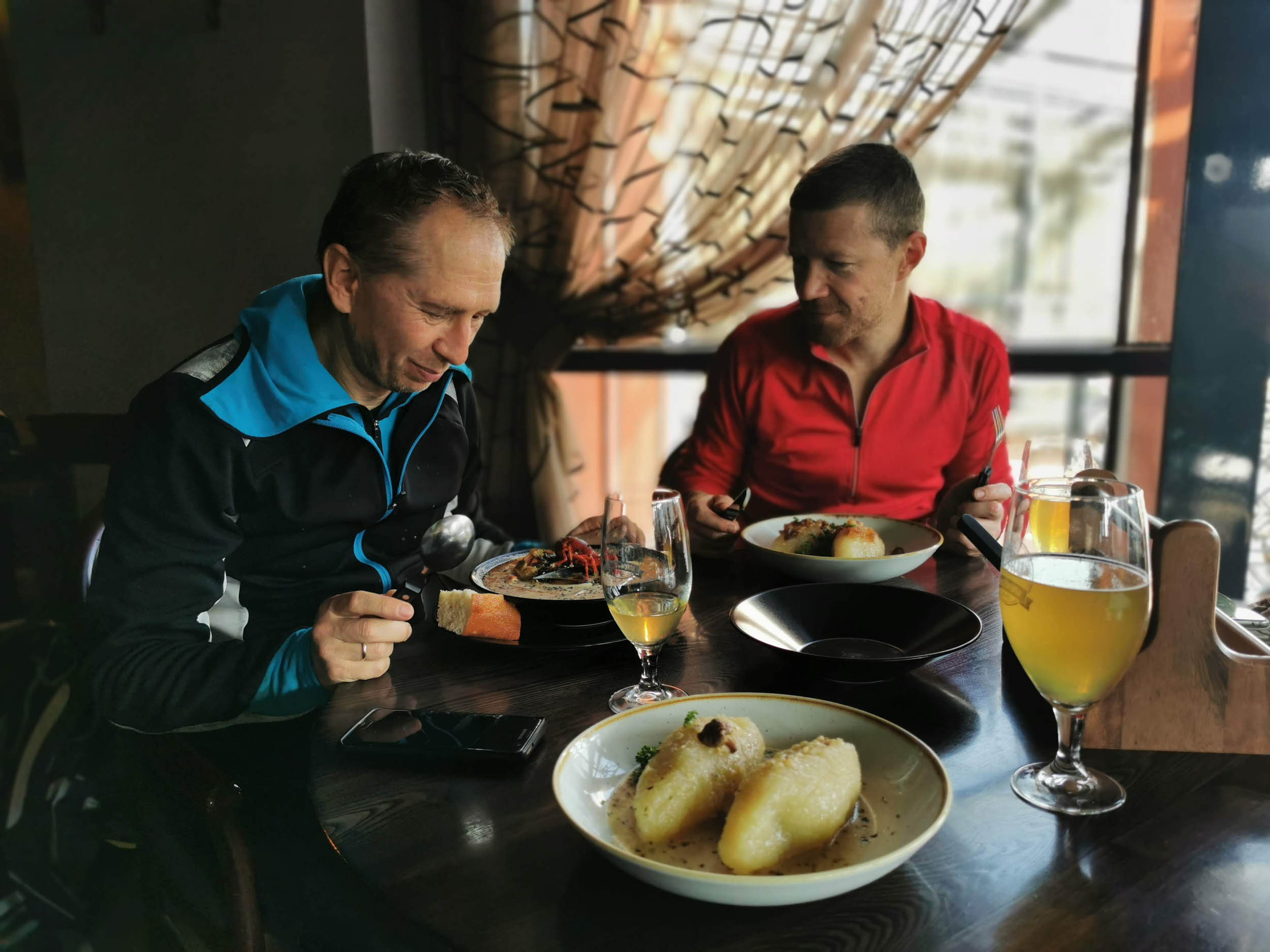
- Local Cuisine: Try local specialties like cepelinai (potato dumplings) in Lithuania, pierogi in Poland, sklandrausis (rye pastry) in Latvia, and kama (flour mix with buttermilk) in Estonia.
- Environmental Diversity: The route traverses protected natural monuments, wetlands, forests, and riverbanks, making it an eco-conscious adventure. Always respect nature and stay aware of environmental zones.
- Private Land Awareness: The route crosses private properties at times, so be respectful and polite to locals. Many landowners are notified in advance, but you should always act responsibly.
- Checkpoints with Local Flavor: Key checkpoints are strategically placed in Zarasai, Valga, Riga, and Kaunas, where you’ll have the chance to refuel and interact with the local bikepacking community.
- Epic Views: The route offers stunning views of dense forests and river valleys, perfect for photographs and brief rest stops.
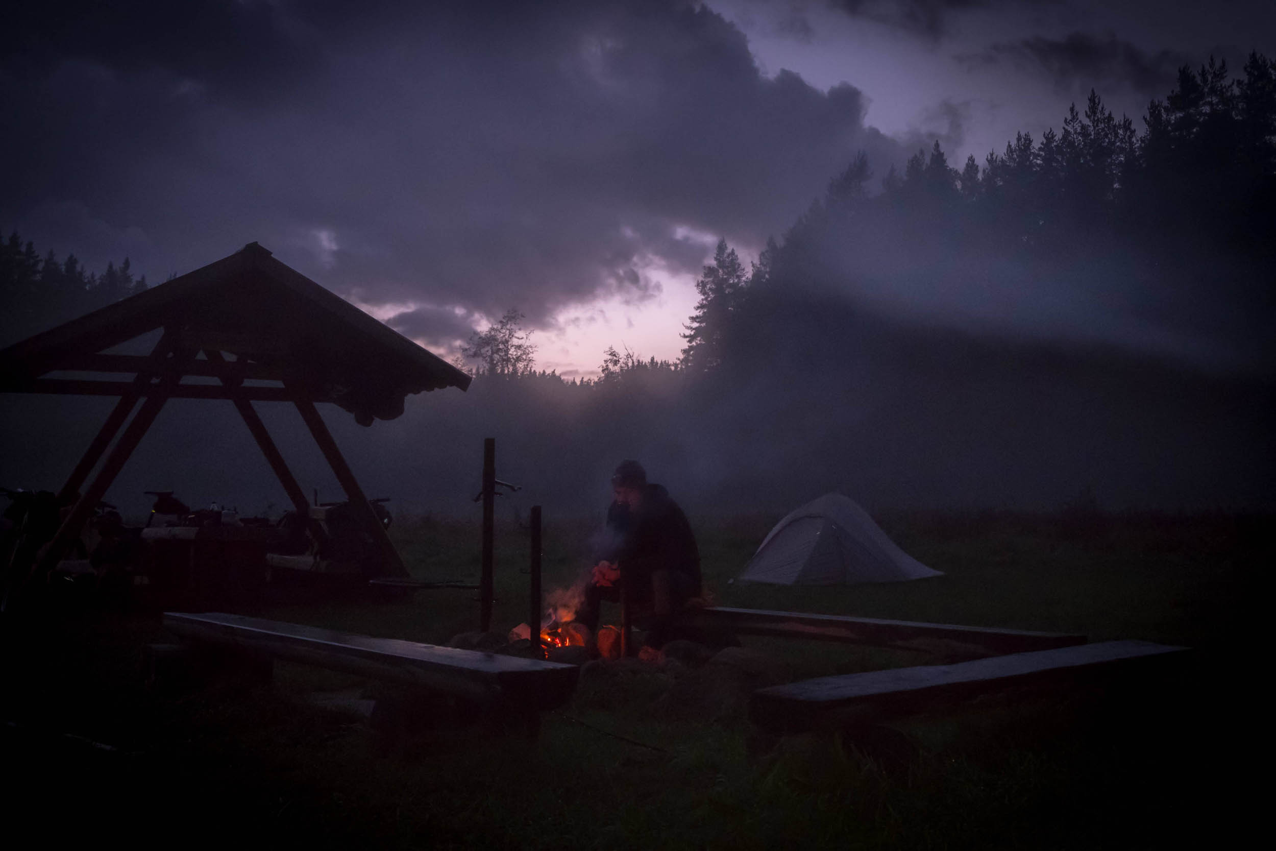
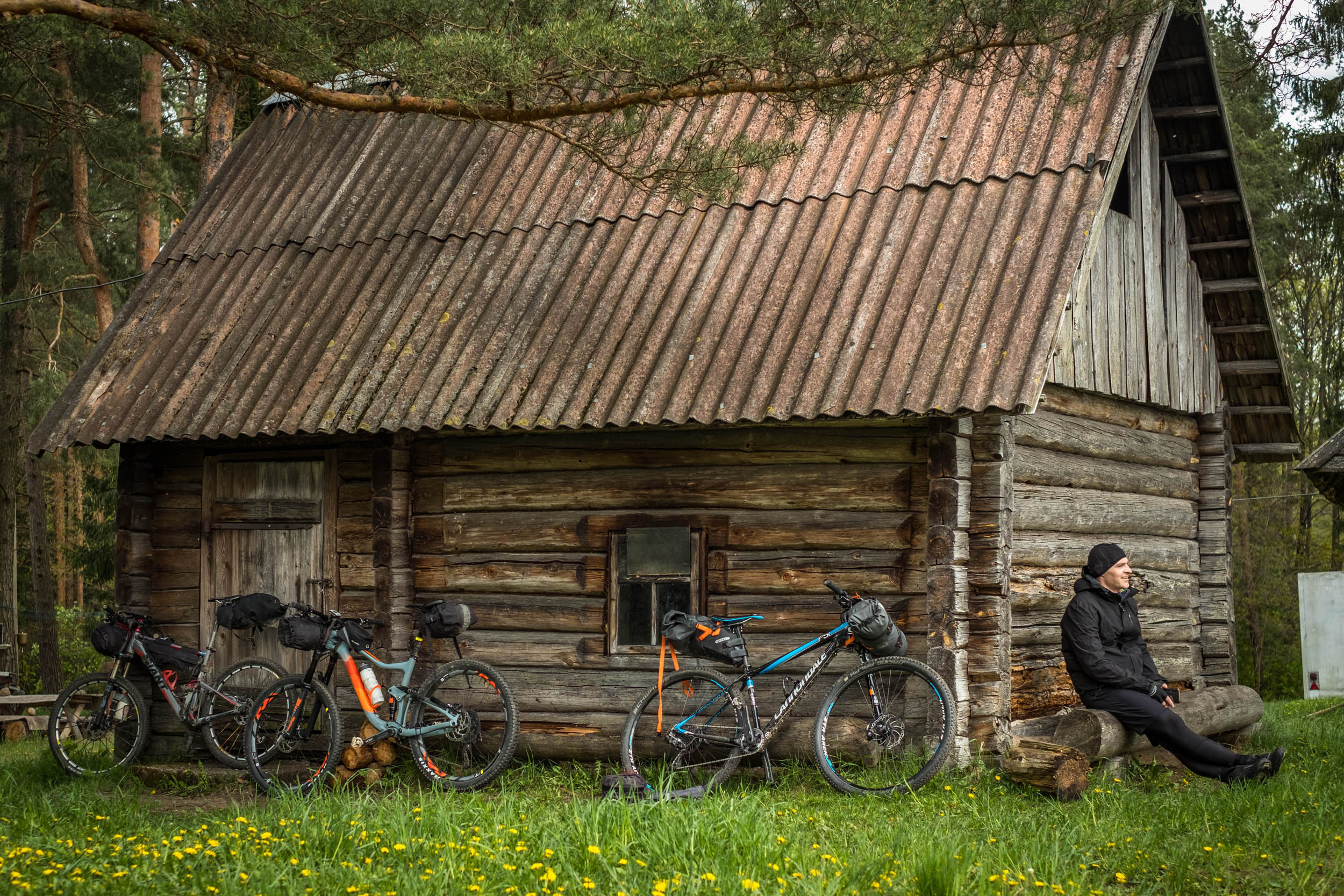
- Wild Camping Opportunities: You’ll find several wild camping spots and traditional shelters (palapės) along the route, offering a genuine bikepacking experience under the stars.
- Long-Distance Adventure: With the main route stretching over 1,700 kilometers, this challenge tests both your physical and mental endurance. The multi-day experience offers valuable lessons in survival, bikepacking strategy, and resilience.
- Safer Terrain: The region is generally safe, with low crime rates, making it an ideal location for bikepacking. However, be prepared for unforeseen events and always have a plan in case of emergency.
- Accessible Public Transport: The route is easily accessible by train, bus, or even air (via Tallinn), and there are well-connected transportation hubs in all countries along the route.
- The Local Cycling Community: The Baltics have a growing bikepacking community, making it easy to find support or advice through online forums like Facebook groups and Warmshowers for accommodation.
- Wildlife: While encountering wildlife is rare, the region is home to diverse animals like moose, wolves, and snakes (though the risk of harm is minimal). Be cautious of ticks; it’s recommended to get vaccinated for tick-borne diseases.
When to Go
- The best time to tackle this route is between May and early October. During these months, you’ll enjoy milder temperatures, longer days, and generally favorable weather conditions for bikepacking.
Logistics
- Getting to the start and back from the finish of this bikepacking route is easy thanks to convenient transport options across Poland, Lithuania, Latvia, and Estonia. Here’s how you can get there and back:
Getting to the Start (Suwałki, Poland)
- Own Transport: Drive directly to Suwałki, Poland.
- Cycle: Ride to the start from nearby towns or cities.
- Bus: Kautra buses run from Kaunas (Lithuania) to Riga (Latvia), with connections to other major cities. LuxExpress and FlixBus also offer routes connecting Riga, Valga, and Tartu.
- Train: Take a train to Suwałki via the Polish rail network. From there, you may need to use local transport to reach the exact start point.
- Fly: Fly into Warsaw, Kaunas, or Vilnius, then take a bus or train to Suwałki.
Getting Back from the Finish
- From Valga (Finish Point): Trains run frequently from Valga to Tallinn. Book tickets at elron.ee.
- From Zarasai: Take a Kautra bus to Kaunas or cycle to Turmantas (20 km) for a train to Vilnius.
- From Druskininkai: Kautra buses head to Kaunas, or you can cycle 30 km to Marcinkonys and catch a train to Vilnius (tickets at ltglink.lt).
Additional Tips
- Buses: Most buses (e.g., Kautra, FlixBus, LuxExpress) accept bikes, but they may need to be packed, depending on the driver’s requirements. Be prepared and check ahead.
- Consider connecting with other riders via the Facebook group: EPAS Facebook Group for more information.
International Bus Services
- Lithuania to Latvia: autobusubilietai.lt
- Latvia to Estonia: bezrindas.lv, luxexpress.eu, flixbus.com
Travel basics
- The route is located within the EU, so for most travelers, no visa is required. However, it’s important to double-check the visa requirements based on your nationality before you go. Major transportation hubs like Warsaw, Vilnius, Riga, and Tallinn are well-connected by train, bus, and air, making it easy to access the start and finish points of the route.
What bike
- A mountain bike is ideal for this route, offering the stability and control needed for mixed terrain. Gravel bikes are an option, but larger 650B tires are preferred for better grip and comfort on rougher sections.
- A bikepacking setup is recommended, as panniers can be cumbersome on the singletrack sections. Consider a compact setup for greater maneuverability.
- As for suspension, a rigid bike works well, as the route was researched with one, but a full-suspension bike will definitely add comfort on the rougher patches.
- Minimum tire size: 40mm or larger.
- Gearing: Wide-range gears for varying terrain.
- Brakes: Disc brakes for reliable stopping power in all weather conditions.
Accommodation is generally plentiful, but wild camping requires some awareness of local rules and environmental impact. Using iOverlander or Warmshowers can enhance your experience and connect you with a helpful cycling community along the way.
- Wild Camping: There are plenty of opportunities for wild camping along the route, with spots such as fireplaces and traditional shelters. Always check with locals and read regulations before setting up camp.
- Accommodation: The route passes through larger towns, so you’ll find a range of accommodations, including Airbnb, Booking.com, and local guesthouses.
- iOverlander: The iOverlander app is widely used in the region, offering information on campgrounds, wild camping spots, and affordable places to stay.
- Warmshowers: A great option for cyclists, Warmshowers connects you with fellow cyclists who offer a place to stay, a shower, or even a warm meal.
- Environmental Awareness: Respect private land and environmentally sensitive areas. Avoid camping in restricted zones, and always clean up after yourself.
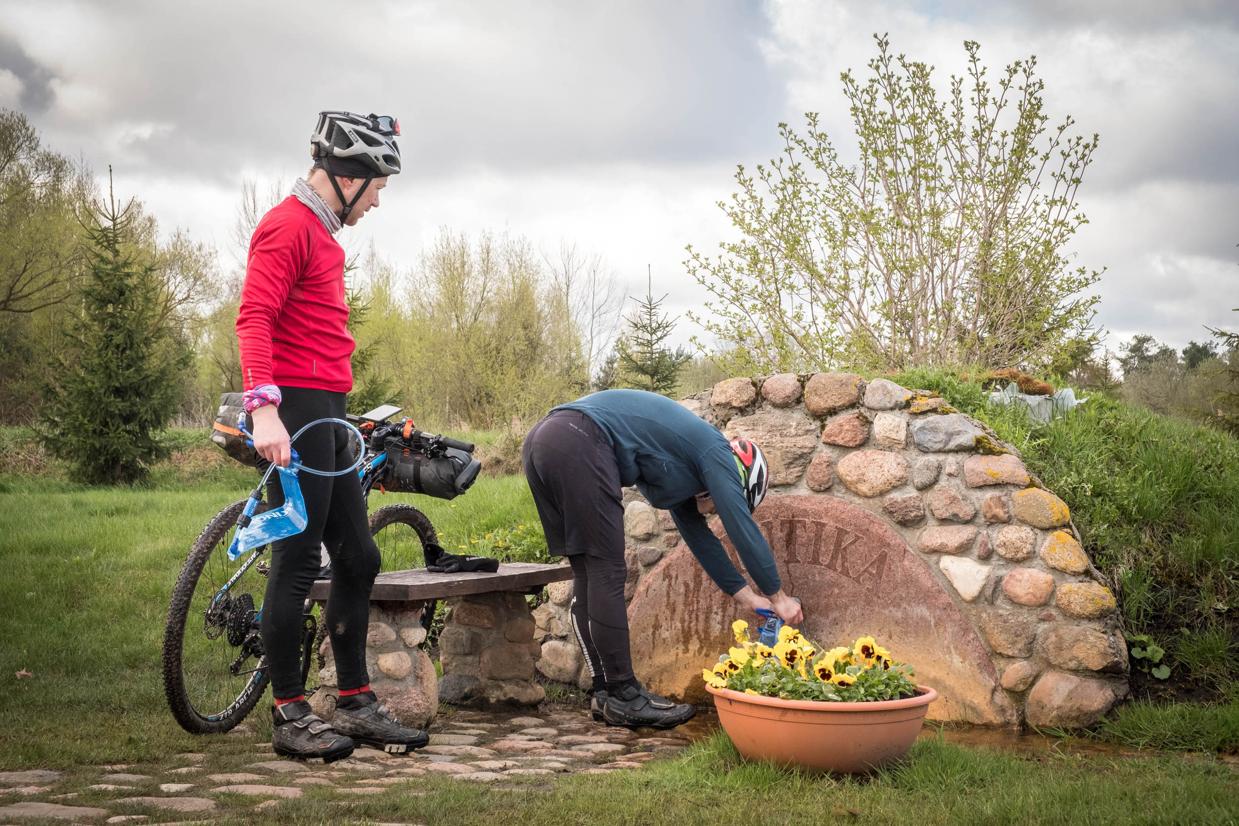
Water and Food Availability Along the Route
- Water: Fresh water is generally easy to find along the route. There are many small local shops where you can refill, and rivers and lakes provide natural water sources (but always filter the water if sourced from nature). Locals are friendly and often willing to refill your water bottles if you ask.
- Food: You’ll pass through several towns with local shops, restaurants, and cafes, offering good opportunities for food resupply. Be aware that more remote sections might have fewer options, so plan accordingly.
- Restaurants and Bars: Many towns have cozy local restaurants and bars, perfect for refueling after a long ride. Some notable spots can be found via iOverlander or local recommendations from fellow cyclists.
Must-Visit Eateries
- Lithuania: Try cepelinai (potato dumplings filled with meat or cheese) and šaltibarščiai (cold beetroot soup).
- Poland: Don’t miss pierogi (dumplings), especially with meat, cheese, or mushrooms.
- Latvia: Rye bread and sklandrausis (sweet rye pastry) are must-try local specialties.
- Estonia: Enjoy a traditional kama (a flour mix, often eaten with buttermilk) and smoked fish.
Additional Resources
The Hydra landing page features an introductory video of the Hydra Trail, giving viewers a clear sense of what to expect.


Terms of Use: As with each bikepacking route guide published on BIKEPACKING.com, should you choose to cycle this route, do so at your own risk. Prior to setting out check current local weather, conditions, and land/road closures. While riding, obey all public and private land use restrictions and rules, carry proper safety and navigational equipment, and of course, follow the #leavenotrace guidelines. The information found herein is simply a planning resource to be used as a point of inspiration in conjunction with your own due-diligence. In spite of the fact that this route, associated GPS track (GPX and maps), and all route guidelines were prepared under diligent research by the specified contributor and/or contributors, the accuracy of such and judgement of the author is not guaranteed. BIKEPACKING.com LLC, its partners, associates, and contributors are in no way liable for personal injury, damage to personal property, or any other such situation that might happen to individual riders cycling or following this route.
Further Riding and Reading
Here are some connected/nearby routes and related reports...
Please keep the conversation civil, constructive, and inclusive, or your comment will be removed.