


Lagunas y Salares
Distance
456 Mi.
(734 KM)Days
15
% Unpaved
89%
% Singletrack
0%
% Rideable (time)
99%
Total Ascent
19,927'
(6,074 M)High Point
16,126'
(4,915 M)Difficulty (1-10)
6?
- 3Climbing Scale Fair44 FT/MI (8 M/KM)
- 5Technical Difficulty Moderate
- 7Physical Demand Difficult
- 5Resupply & Logistics Moderate
Contributed By

Ryan and Ilse
Guest Contributor
Ryan, originally from Pittsburgh, sold everything at the age of 26 to live more adventurously. He’s traveled the world on foot and bike and called a minivan home for five years. In 2021, he met his wife, Ilse, on the Pacific Crest Trail and they continue to explore the world’s backyard. Find more of their journey on YouTube @ryankodakbrown
Bolivia has long-been at the top of the list for adventures of all types seeking out of this world landscapes, unique culture, and high-altitude isolation like nowhere else. Bike tourers and overlanders frequent the Bolivian Altiplano and have helped solidify routes like La Ruta de las Lagunas in the classic lore of South American adventure. This route guide lays out details for crossing La Ruta by bicycle, but continues north across the Salar de Uyuni and Salar de Coipasa—Bolivia’s two larges salt flats—through a desolate scene of island hopping across dry land. By combining these classic routes, Lagunas y Salares makes a critical connection point between our Ruta de los Seis Miles Norte and Ruta de las Vicuñas. Combined, this link creates a curated 2,337-kilometer route crossing parts of Argentina, Chile, and Bolivia. We’ve described the two sections separately to differentiate between the classic Ruta de las Lagunas and the traverse across the salares to reach Coipasa and routes further north.
La Ruta de las Lagunas
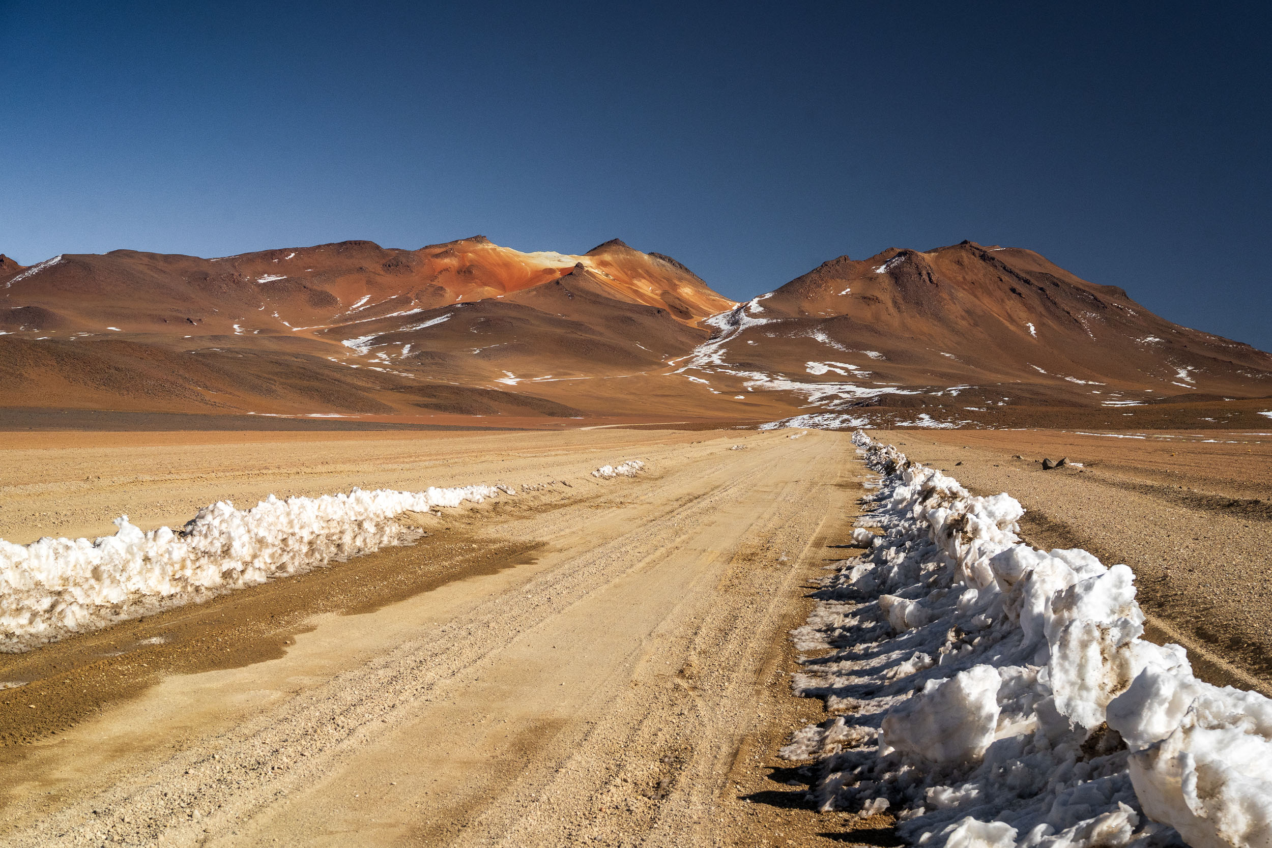
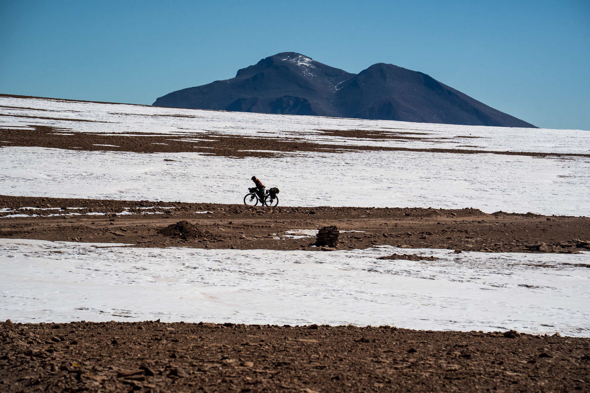
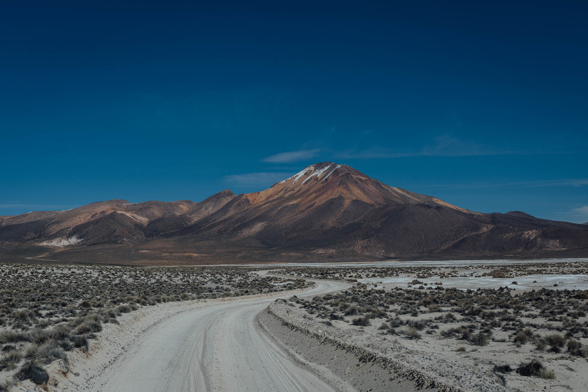
Connecting the towns of Uyuni, Bolivia and San Pedro de Atacama, Chile, the Lagunas Route is a spiderweb of sandy tracks across the Bolivian Altiplano. Tucked in the Southwest corner of Bolivia, Los Lipez, the second highest plateau of the world, boasts volcanic landscapes, ancient rock forests, and colorful lagoons. The entire route climbs well above 3,900 meters, peaking at a grueling 5,059 meters. At this altitude, self sufficiency and resilience are key. Cycling this high can slow your pace significantly, as time seems to stand still in this part of the world.
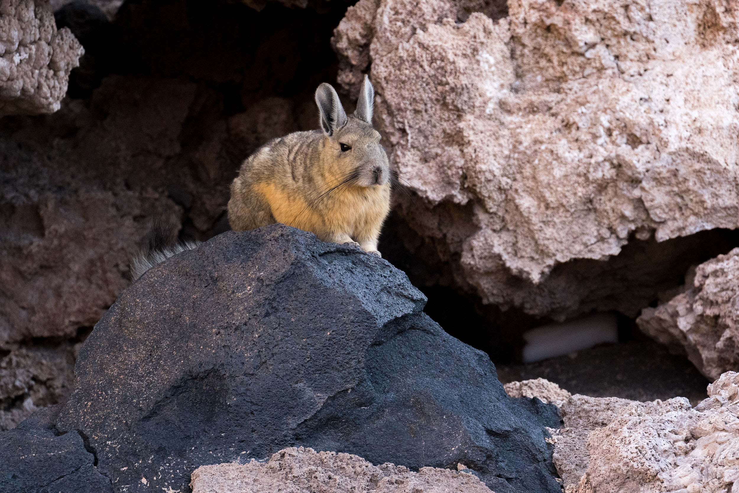
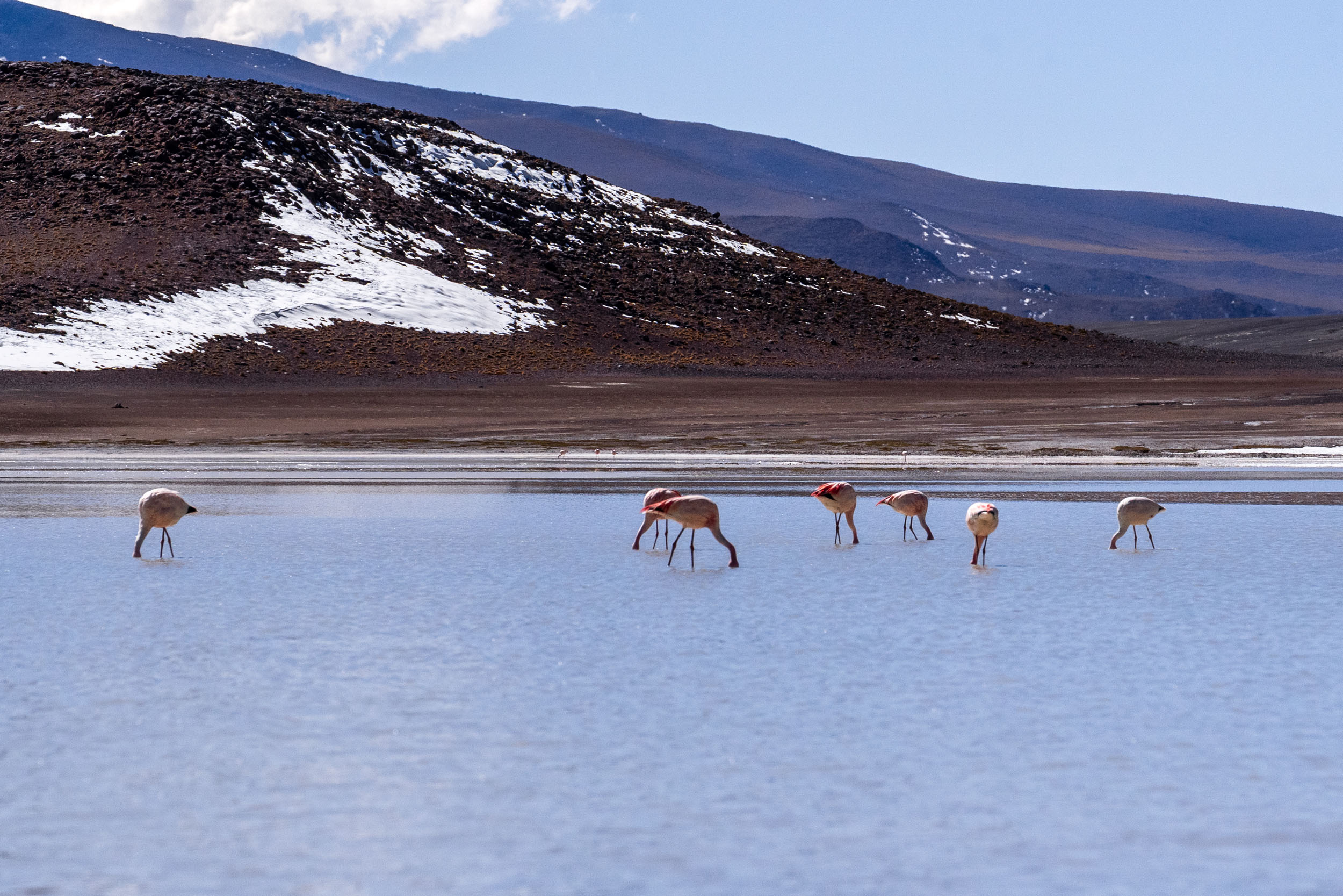
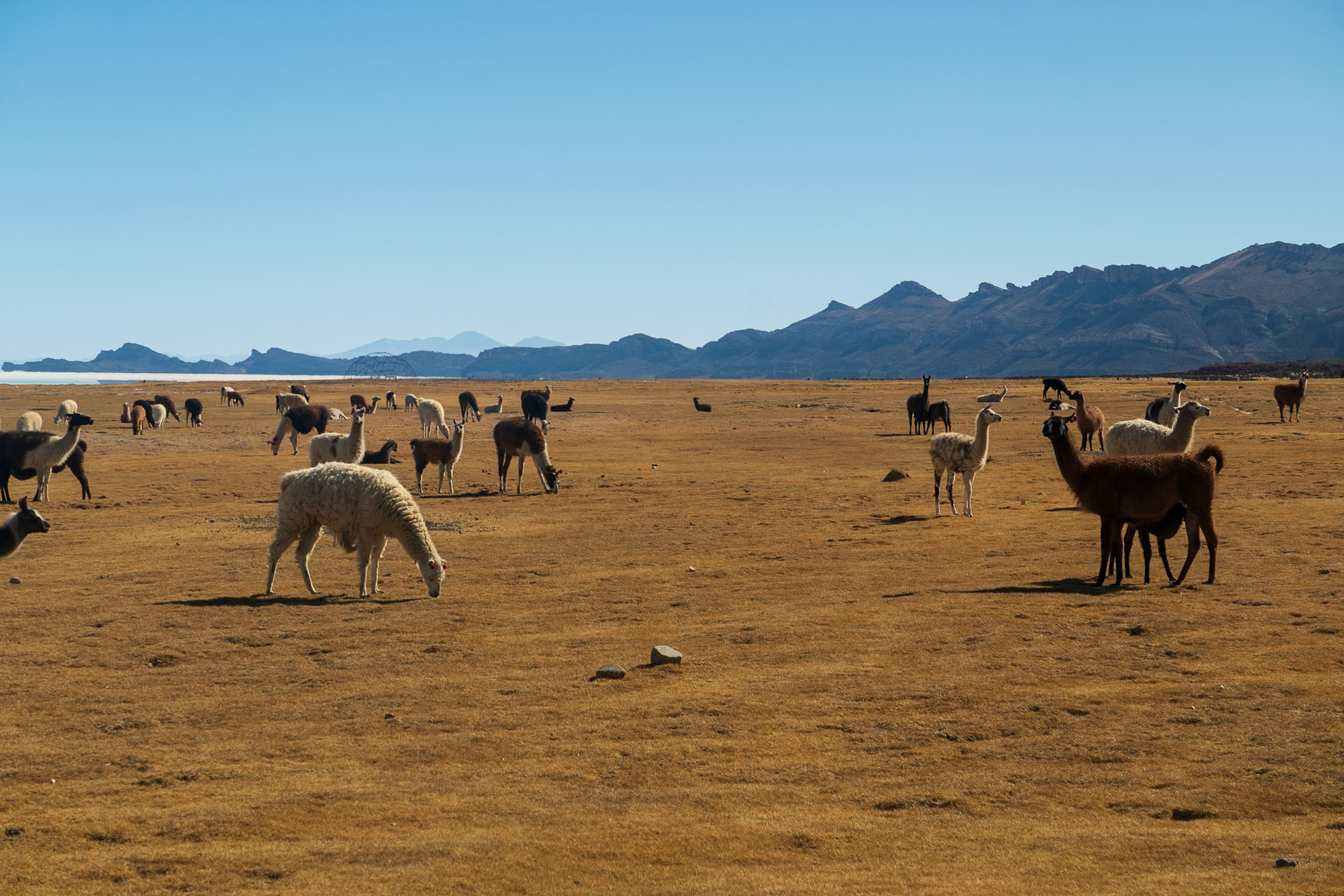
Of course, as the name suggests, the volcanic lagoons are the real draw of this route. These saline lakes are shallow, yet carry enough plankton to feed the few animal species thriving in this special ecosystem. Expect to see flocks of flamingos (more specifically, the Andean, Chilean and James’ Flamingo) as well as the flightless lesser Rhea, vicuñas and lots of viscachas.


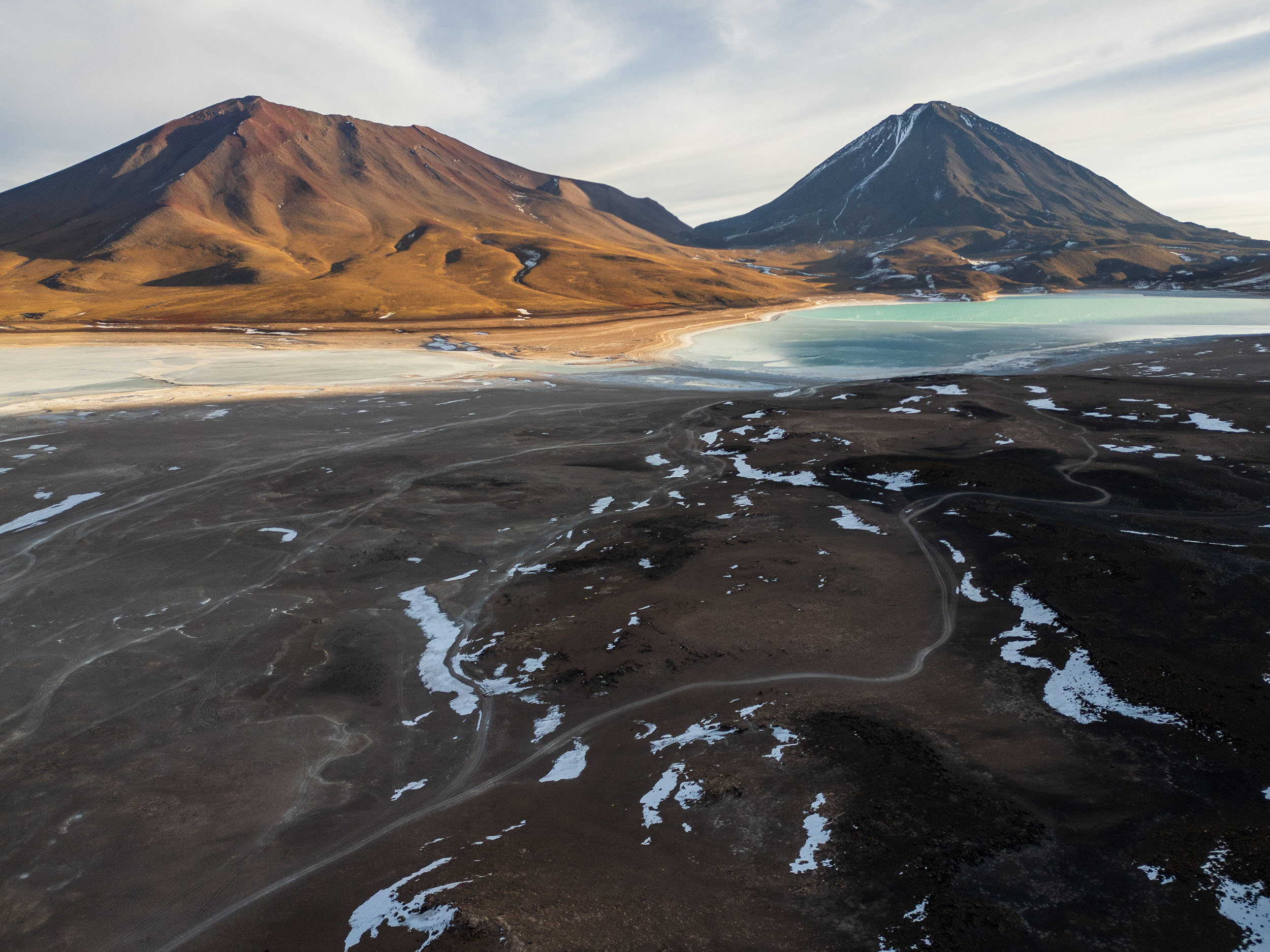
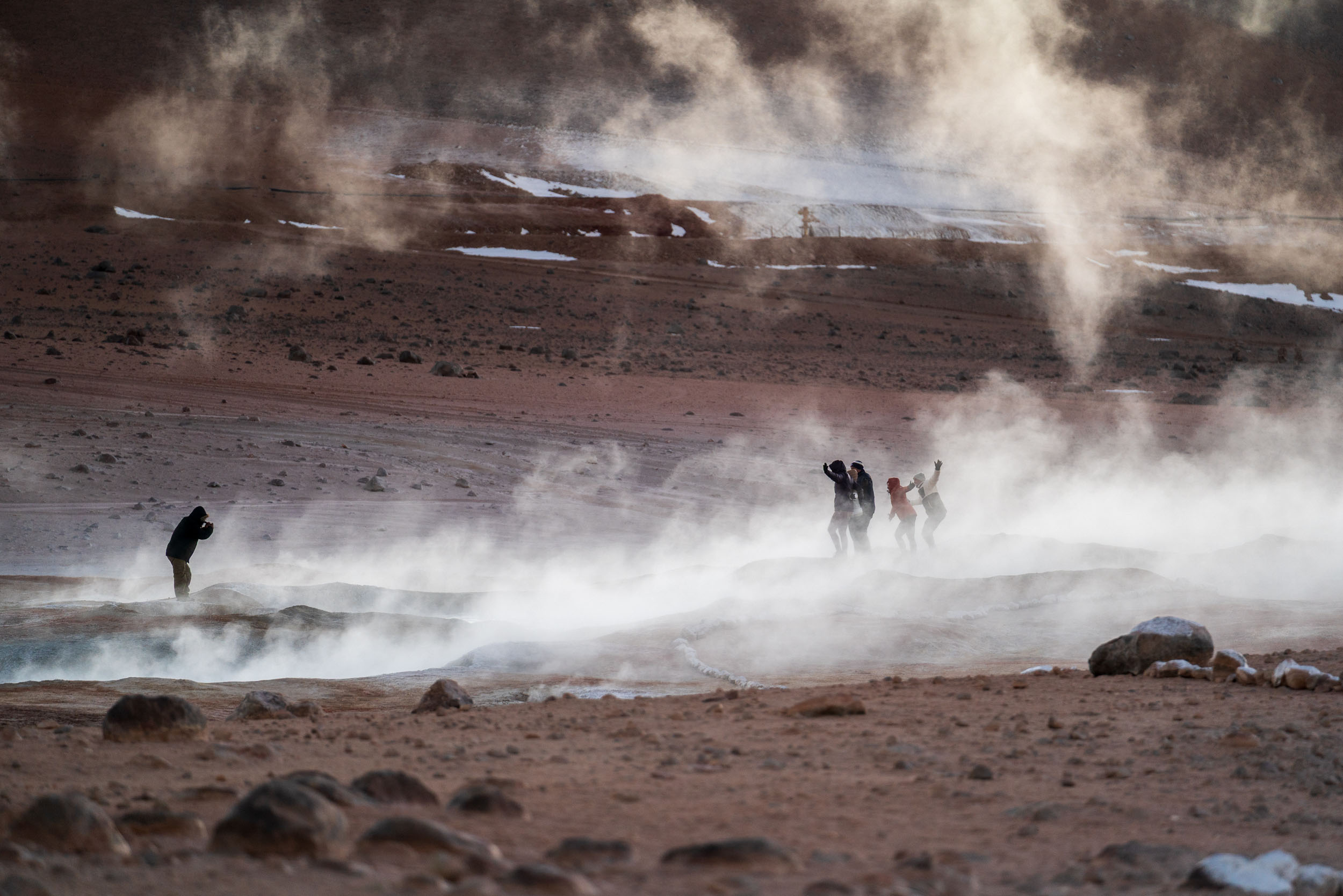
Laguna Colorado might be the most popular lake of all, thanks to its bright red color and photogenicity. Legend has it, the lagoon was once touched by the devil and as a result, drinking its water causes instant death. Other stories claim the waters are the blood of ancient gods. A more scientific explanation is that its red color is produced by the red sediments and the microscopic algae and plankton that thrive in the mineral-rich water. Contrasted with the white islands of borax on the surface of the lake, it’s quite the spectacle. But the other lakes like Laguna Verde, Laguna Hedondias and Laguna Cañapa too deserve an honorable mention. Aside from mineral-rich lagoons, the area offers interesting side quests to the bubbling mud pots and geysers of Sol de Mañana, steep volcano peaks and the formidable Dali desert.
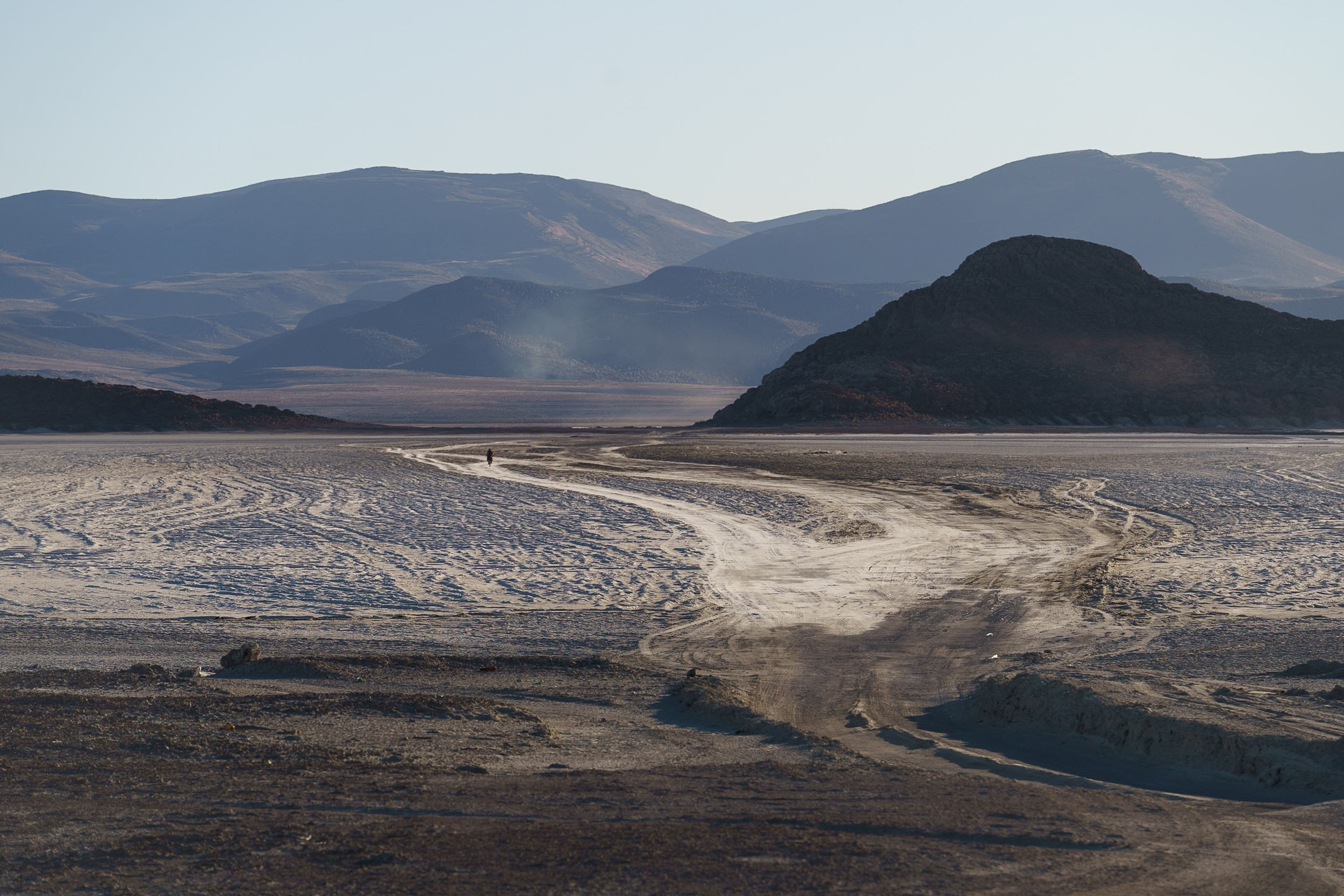
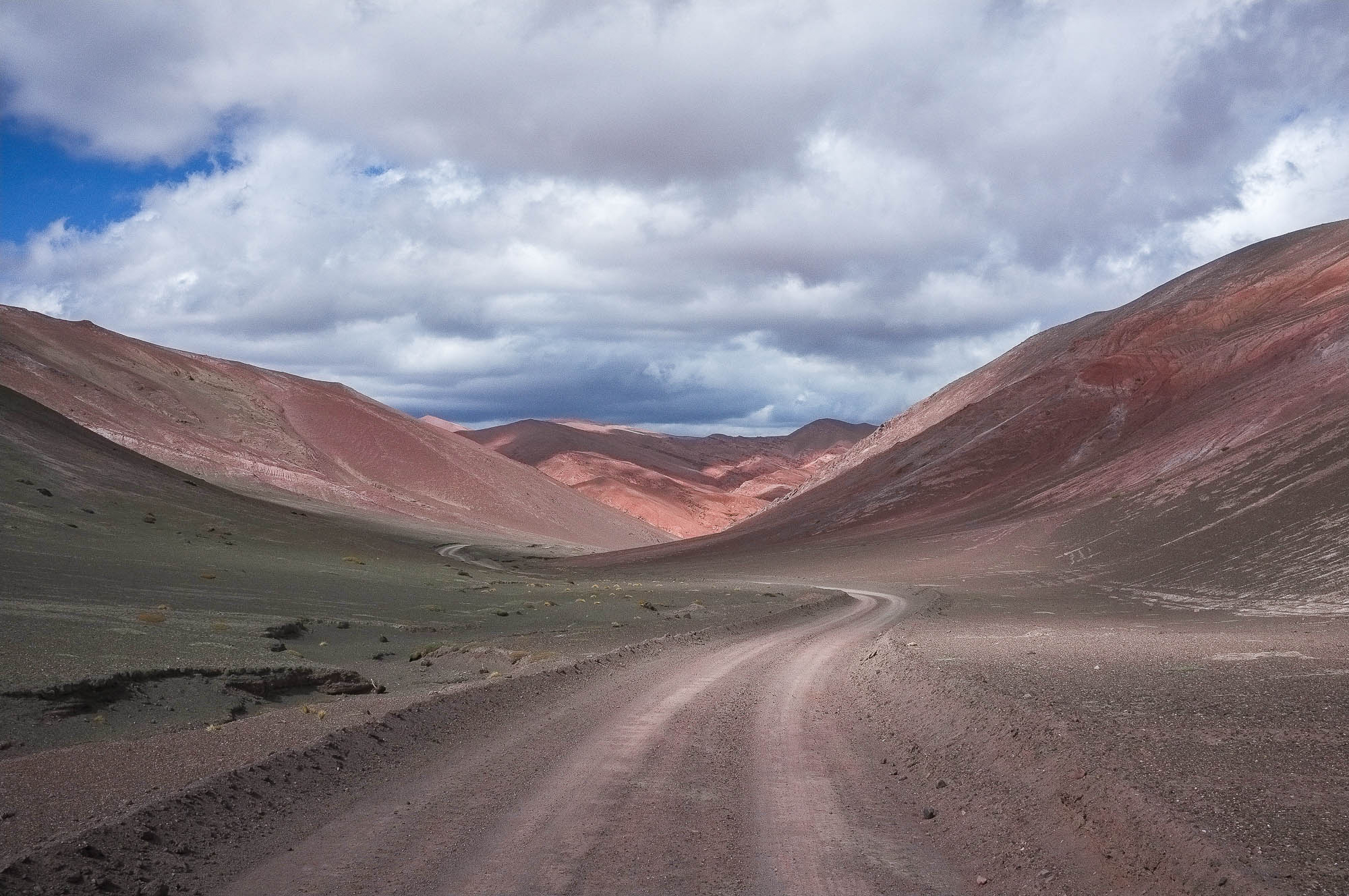
Apart from streams of overlanders, touring jeep or motorbike, there’s plenty of solitude to be found here. Viscachas, llamas and flamingos will be your constant companionship. The first two are an important source of food for the Indigenous people living in the Andean regions. Homes, built from the same earth and mud of these high-plateau deserts, are basic shelters that cater to adventurous tourists and wanderers. The vastness of the land ensures that there is no single continuous route, but rather a network of tracks, varying from severe ripio to rocky gravel. You’ll inevitably see some tour jeeps pass you by, cheering you on or offering some water or snacks.


Due to the increase in tourism these last few decades, more and more lodging options pop up in the Bolivian Altiplano. Nevertheless, the authentic character of these Indigenous communities remains strong. Their livelihood largely depends on selling llama meat and wool, although the mining industry is quickly gaining ground. Spanish serves as the lingua franca, but the indigenous languages of Quechua and Aymara are widely spoken amongst Bolivians.
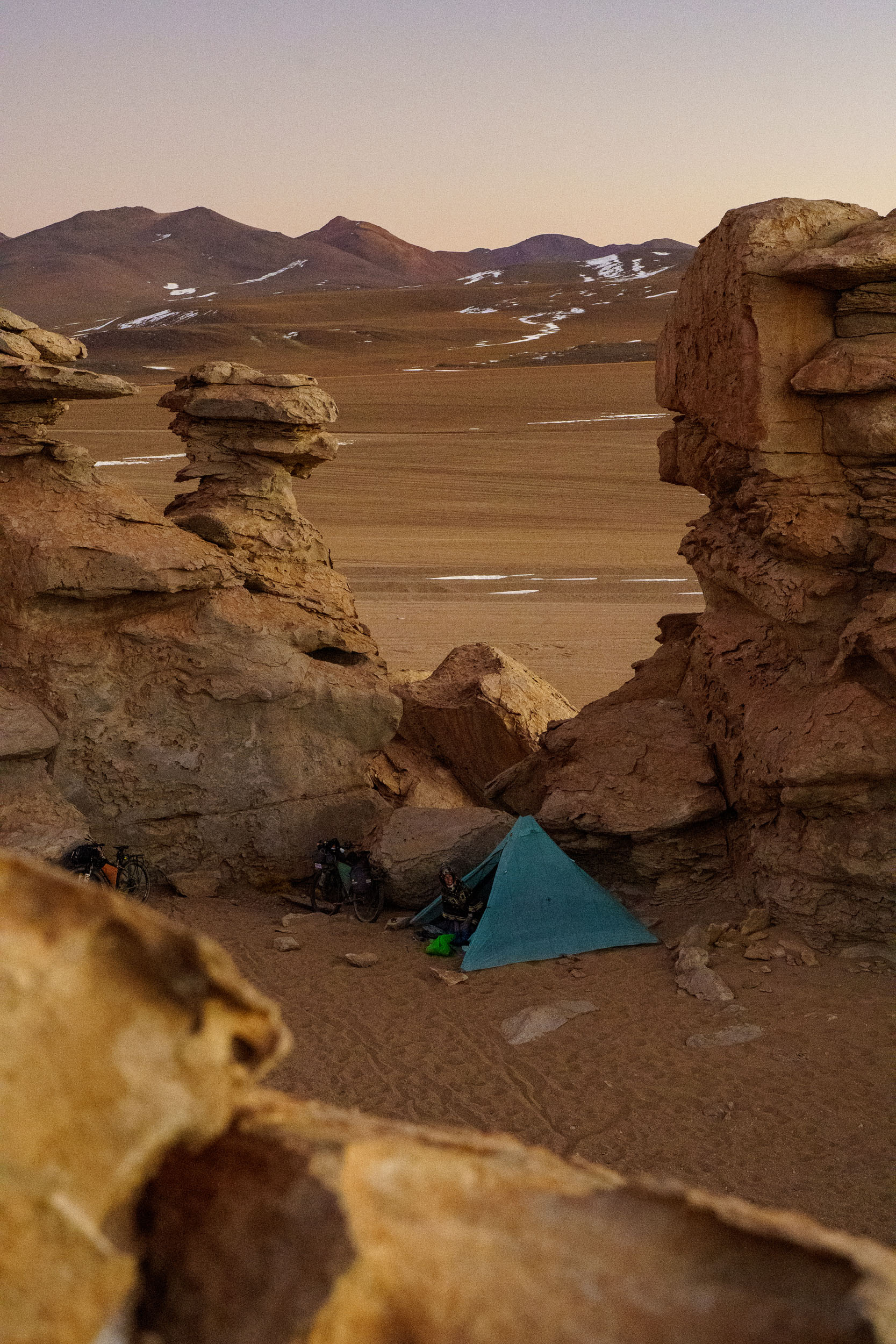
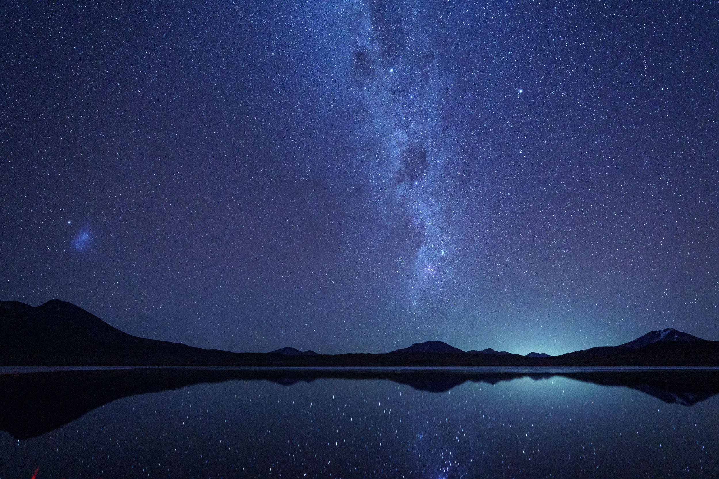
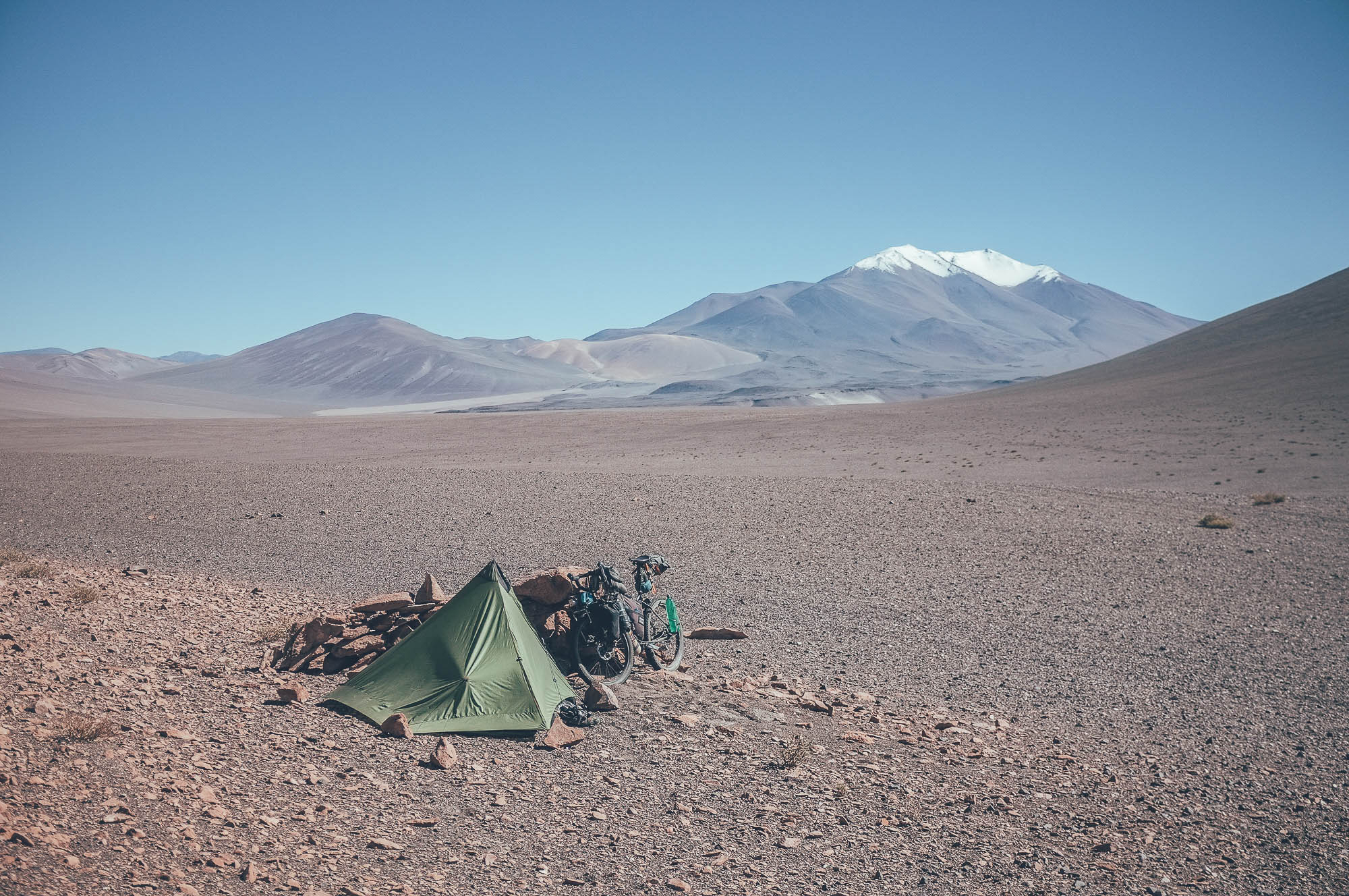
This route isn’t for the faint of heart. Most travelers choose to explore this region with a guide and tour jeep, and for good reason. You really are quite on your own out here, responsible for your own safety and well-being. The high altitude, challenging terrain, fierce afternoon winds and near-constant ups and downs on corrugated, sandy tracks ensure some type-2, if not type-3 fun. On top of that, you’ll be carrying a week-long supply of food and sleep won’t come easy with night temps well below freezing (we shivered our way through 5F). But, in our opinion, the incredible vistas, solitude, and starriest skies make up for most of the suffering.
Salares Traverse
Presenting a landscape of desolate yet ethereal beauty, the Salares Traverse is immensely popular amongst bike tourers. By crossing Bolivia’s two largest salt flats, this route effectively links the challenging Lagunas Route with the Vicuñas Route. The immense size of these salars, collectively spanning almost 8,000 square kilometers, create an illusion of infinity that blurs the line between earth and sky.
Starting in Uyuni at 3,700 meters, you are in the gateway to the famous Salar de Uyuni. Born out of a 19th-century railroad junction, the dusty town is not exactly picturesque or glamorous, but has been reborn as a tourist hub and is therefore the perfect start or end point of the Salares Traverse. This might not be the best standalone route due to its remoteness. However, if this is the start of your cycling trip, the easiest way to get here is by flying into La Paz and then take a bus to Uyuni. Acclimatization is key before you start pedaling.

If you didn’t visit on the way into town from La Ruta de Las Lagunas, the first stop is Uyuni’s Train Cemetery, a photogenic place with a fascinating history at the edge of town. Once upon a time, these trains connected the remote Potosi province to the Atacama Desert in Chile, carrying passengers and minerals. Now, all that’s left are abandoned trains and rusty tracks that lead nowhere. But while train traffic has disappeared, minerals such as borax, potassium, and lithium remain. Riding from Uyuni to the salt flats, you can spot traces of the salt and mining industry. With nearly 70% of the world’s lithium reserves buried beneath the flats, and our insatiable desire for smartphones and cameras, it makes you wonder why Bolivia is so rich in resources but poor in capital. Signs and posters of local indigenous communities along the road indicate concerns about the impact of mining on the region’s ecosystem, including the increasing dryness of the salar.
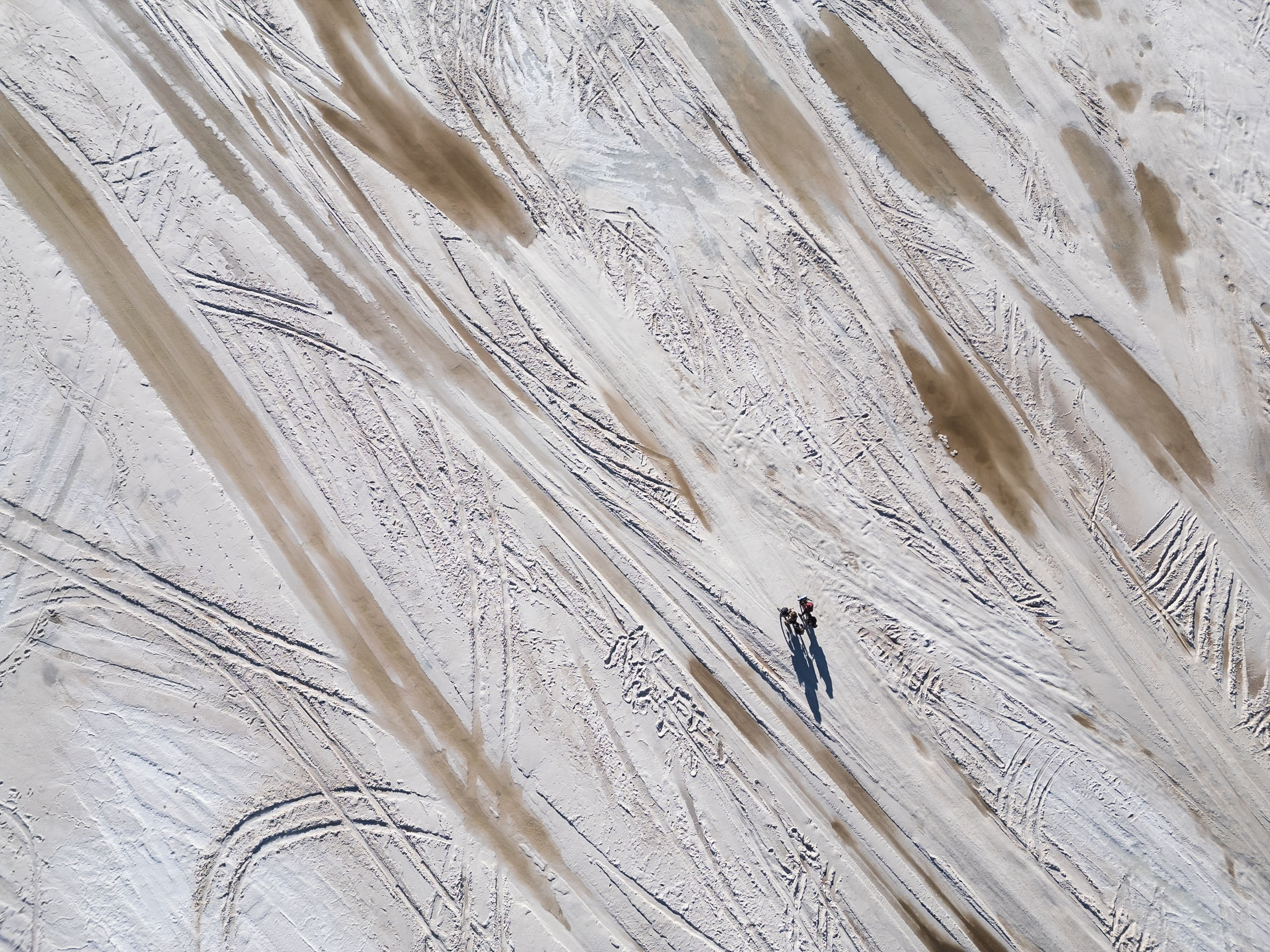
Turn left in Colchane, your last town stop before entering the Salar de Uyuni. As the pavement turns into white salt, you’ll notice many different jeep tracks. Some are more rippled and rough than others, some offer dry and smooth sailing (with the occasional pothole). But with very little elevation change and Martian landscape as far as the horizon, crossing the Salar is an unforgettable cycling experience. Make your own way across as you’re the captain of the ship, but don’t forget to keep an eye on your GPS—the serious lack of landmarks can be quite disorienting. Another must-do is to wear your sunglasses at all times. Cyclists have been (temporarily) blinded by the reflective sunlight shining on the salt.


Continuing west for about 64 kilometers, the contours of “Isla Incahuasi” will appear on the horizon. This small coral “island” is the perfect stopover to rest your eyes and refill on water and snacks. A sunrise or sunset hike to the top of the hill is well-worth the effort, as it gives you an unreal perspective of the salt flats. Camping on the island is possible, but make sure to pay the small entrance fee and ask permission from the local community. Locals have shown great kindness to cyclists before–let’s keep it that way.
Leaving the island, you have a choice to make: continue across the salt flats or turn north to the mainland. There, you can follow the gravel road that circles the Salar. The latter offers a chance to sleep in a salt hotel and enjoy a home-cooked meal. You can also explore historical sites, like mummies half-buried in rock piles and ancient churches, or climb the legendary Tunupa volcano that looms north of the Salar. If you’re pressed for time and want to reach Llica fast, you can stay on the salt flats and make a beeline for it.
Llica is the best place to restock and get some rest before crossing the second salt flat, Salar de Coipasa. Be prepared for a sandy, slow-going 45 kilometers to get there. Wider tires aren’t necessarily a must, but a huge advantage nonetheless. Along the way, wild camping is fairly easy since the villages are mostly abandoned and tourists don’t venture this far. There’s a water tap in Hizo, but filtering is recommended.
Before you cross, check with locals about the conditions of Salar de Coipasa—it can be quite watery and tricky to cross. There are several ways to get across: either stay close to the mainland and head directly to Pisiga, or cut straight through the middle toward Coipasa. Your decision will likely depend on the weather and the conditions of the salt flats. Unlike Uyuni, this area sees few tourists. Your only company will be grazing vicuñas and a scattering of abandoned cars. When you arrive in Coipasa, you can link up with La Ruta de las Vicuñas and continue north towards Peru. There is also a bus station in Colchane (the first town after Coipasa) should you need to end your journey.
Route Development
Lagunas y Salares is a part of the greater Andes Traverse, an ongoing project to build a long distance route that runs along the spine of the Andes, between Colombia and Chile. Born out of a desire to connect the High Andes and extend the Ruta de Los Seis Miles, Norte in the South with the Ruta de las Vicuñas in the north, this route documents and highlights the most popular and classic routes to cross Southern Bolivia by bicycle. Originally used by locals for transporting goods between Andean villages, the Lagunas Route was Bolivia’s best-kept secret. Around the 1890s, however, mining companies started using the route for silver, salt and zinc transportation into Chile. Even today, it’s possible to come across a handful of brave and hardy truckers traveling the deep, sandy tracks to-and-from Chile. The route is a classic amongst overlanders, motorcyclists, and bike tourers in South America. Be prepared to share the road(s) with other travelers. Across the salares, it’s a fun mix of riding salt, gravel, sand and a bit of remote pavement in some of the most out of this world landscapes you can imagine.
Route Difficulty
This route has a grading of 6. From a technical point of view, the riding consists mostly of wide, sandy jeep tracks with some stretches of rocky gravel. Patches of deep sand can mean a fair bit of walking with skinny tires. Resupply is limited though hostels with dinner and breakfast are an option every few days or so. The biggest challenges of the route are altitude and the forces of nature. Riding in Bolivia’s winter should mean relatively dry tracks but extreme cold at night (-15C is common) and strong afternoon winds can grind progress to a halt. As with any mountain route, snow is possible any time of year. Six feet of snow fell days before we began, forcing the rescue of dozens of people and closing the border for ten days.


Submit Route Alert
As the leading creator and publisher of bikepacking routes, BIKEPACKING.com endeavors to maintain, improve, and advocate for our growing network of bikepacking routes all over the world. As such, our editorial team, route creators, and Route Stewards serve as mediators for route improvements and opportunities for connectivity, conservation, and community growth around these routes. To facilitate these efforts, we rely on our Bikepacking Collective and the greater bikepacking community to call attention to critical issues and opportunities that are discovered while riding these routes. If you have a vital issue or opportunity regarding this route that pertains to one of the subjects below, please let us know:
Highlights
Must Know
Camping
Food/H2O
Trail Notes
Resources
- Cycling through the Eduardo Avaroa National Reserve of Andean Fauna. Created in 1973 to aid conservation of vulnerable Andean species such as the James’ Flamingo, Vicuñas and Yareta plant, the entry fee is 150 BOB (around $20).
- Encircle the majestic Volcano Licancabur. According to local folklore, Licancabur decapitated his brother, volcano Juriques, in a fit of jealousy over their shared love for Mount Quimal.
- Watch flocks of flamingoes live their best lives at Laguna.
- Colorado, a saline lake with a famously red-pinkish hue.
- Get a passport stamp at Fronteriza Hito Cajon, one of the highest border crossings in the world at 4,549 meters.
- Marvel at the several mineral-rich lagoons of Laguna Blanca, Laguna Verde, Laguna Chalviri, Laguna Ramaditas, Laguna Char Khiota, Laguna Hedionda, Laguna Cañapa, and more.
- Relax your painful muscles in the incredible Termas de Polques, usually free of charge for cyclists. No crowds in the late afternoon.
- Watch the sunrise at Sol de Mañana, a geothermal paradise with bubbling mod puts and several geysers. Don’t stay longer than 30 minutes because of the heavy sulfur fumes.
- Feast on the complimentary breakfast buffet in Eco-Hotel Tayka del Desierto (about $25 USD/night), one of the highest hotels in the world. The hotel uses mainly solar energy and is built of Tayka sandstone and volcanic materials.
- Visit the Salvador Dali desert, where wind-swept and surreal “Dali-like” rock formations rule the landscape.
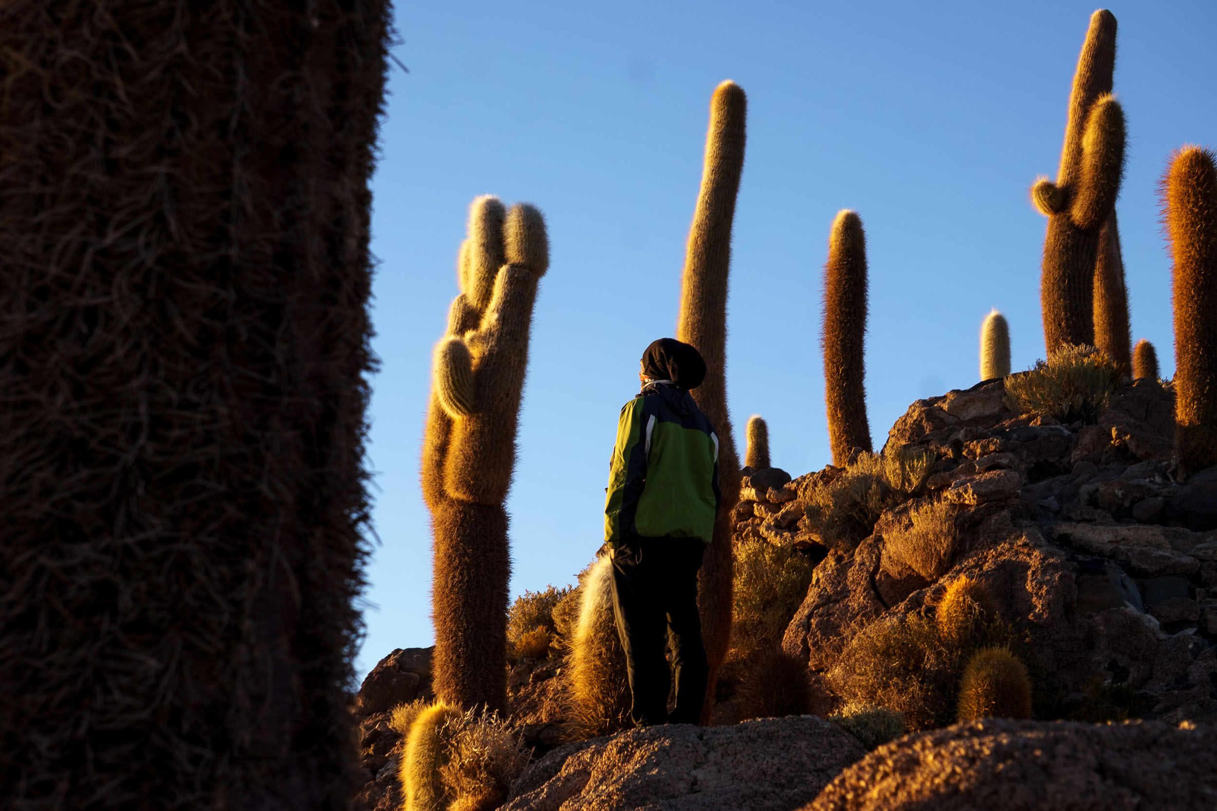
- Climb and boulder in the Rock Forest. Its most popular rock is “Arbol de Piedra,” which is indeed photogenic, but we find the other rocks to be just as cool!
- Follow in the tracks of thousands of bike tourers and make your own way across the famed Salar de Uyuni.
- Famous for its towering cacti, a visit to Isla Incahuasi is definitely worth it. For a small fee, you can visit the local folklore museum, sleep at the island’s tiny campground and watch the sun rise from up the hill.
- Just before entering/leaving Uyuni, follow the train tracks and find yourself at the Train Cemetery, a haunting testimony of Uyuni’s once-thriving railway heritage.
- Spot wild herds of vicuñas and abandoned car wrecks at the solitary Salar de Coipasa.
- Unparalleled stargazing experience at night. With barely any light pollution, this area provides a near-unobstructed view of the Milky Way.
- Climb the iconic Volcan Tunupa at 5,425 meters and visit the pre-Columbian mummies on the way to the top. You can leave your bike in the town of Tahua.
- Visit the Cueva de Chiquini and Ojos del Sal at the edge of Salar de Uyuni. Word is, there are mummies stowed away in some of the rock piles.
- Bonus: Salar de Uyuni was a filming location for “The Last Jedi.”
When to go
- Time of year: Winter & early spring are dry season on the Altiplano and therefore the preferred season for riding the route. In the Southern Hemisphere, this encompasses the months May to October. The weather is more predictable and dry, but temperatures (especially at night) can drop well below zero, sometimes down to -5F. Multiple layers of clothes and warm sleeping systems are a must. On the salares, here may be some puddles of water left, but they are generally easy to avoid. Beware of sun and wind exposure and make sure to wear sunglasses on the salar. If there should occur rainfall, the gravel roads could turn into impassable mud and the salt flats into a salt lake. Not recommended!
- Wind: Ride early in the day. The wind is always quite fierce on the Altiplano, but particularly bad during the afternoon and evening. Apps like “Windy” are great for reliable weather predictions.
- Altitude: 95% of this route is above 3,650 meters. The Lagunas Route especially is a lot of up-and-down, but stays mostly above 4,265 meters. We definitely suffered some mild altitude sickness, so watch out for symptoms (headache, lack of sleep, dizziness), drink lots of water and allow yourself some time to acclimatize. Pedal slowly to keep your heartbeat down. Furthermore, the altitude might impact your riding time — we averaged around 32 km/day. Tip: Coca leaves and tea are the local’s preferred medicine for dealing with altitude and helped us get through as well.
Logistics
- Getting to the start: To reach San Pedro de Atacama, you can fly into Calama, Santiago or Antofagasta and then take a bus to town. Uyuni has buses to La Paz. When you arrive in Coipasa, you can link up with La Ruta de las Vicuñas and continue north towards Peru. There is also a bus station in Colchane (the first town after Coipasa) should you need to end your journey.
- San Pedro de Atacama and Uyuni are small and relatively safe towns, mainly focused on tourism and travelers.
- Visa: Many countries require a visa to enter Bolivia — including U.S. citizens as well as some countries in Asia, Africa and the Middle East. Ryan visited the Bolivian consulate in Salta, Argentina and paid around $160 for a 90-day visa. Most EU countries, as well as Canada and Australia are visa-exempt.
- Currency: Cash is king in this remote region of Bolivia. Paying by card is not possible anywhere on the route, so make sure to bring or exchange bolivianos before getting started.
- Language: There are a few guides who can speak a handful of English, but Spanish, Aymara and Quechua are prevalent in these parts of Bolivia.
Dangers & Annoyances
- Cell service is mostly non-existent throughout the route and WiFi can be hard to find in the small villages. We seemed to have some luck with Entel simcards.
- Tourist jeeps: often travel in packs, and so during certain times of the day, depending on where you are of course, you might get some speedy company. There’s a whole network of roads, however, so at least they can keep their distance and you don’t get dusted. The countless tracks look like scars on the land, but have one advantage as a cyclist: You can choose the least-corrugated track.
- Bring more food and water than you think you’ll need.
What bike?
- Gravel bikes or mountain bikes with wide tires are preferred for this route. While it is possible, and has been done on standard touring tires, 2.4”, wider tires are recommended due to sections of deep sand and washboard.
- Any mechanical issues will be the rider’s responsibility to fix. If necessary, you might get lucky and find a hitch with a jeep or trucker who can take you to a larger town. Beware that bike stores are not common, so bring all the right gear to fix minor issues yourself.
- Road conditions on the salt flats are mostly flat and straightforward, but the gravel roads between can really slow down your pace. Some double track can be quite sandy and rocky at times. With hardly any elevation gain or loss, a prevalent headwind and the high altitude might be the hardest parts to overcome.
Route Direction
- The route can be ridden in either direction. Northbound the most difficult riding is at the beginning. Southbound riders may enjoy more tailwinds than northbound riders.
- Wild camping is possible throughout the entire route. Check iOverlander for wind-protected campsites and abandoned shelters or houses. Camping on the salares is an incredible experience, albeit a freezing cold one. Most tourist jeeps disappear after sunset. The “Plaza de las Banderas” and the Dakar Monument are another option to set up a tent, plus pretty impressive sights to behold.
- Tourism is common on the altiplano, so expect to find lodging options every two or three nights. Hospedajes can be found at the Bolivian border and in the vicinity of the Lagunas (in the pueblos of Puripica and Huayajara). Both San Pedro de Atacama and Uyuni are quite tourism focused and have plenty of lodging available throughout the year.
- Uyuni has a plethora of accommodation options. There are a few basic accommodation options in Tahua, Llica and Coipasa or Pisiga. You can find a private room for as cheap as $5-$10 per person.
- Feeling fancy? Spend the night in one of the many salt hotels nearby Salar de Uyuni. Breakfast and dinner can be included or negotiated.
- The Lagunas Route is a lot of things, but by no means is it a culinary experience. Finding a decent resupply along the way can be tricky, as the small communities along the way hardly have any tiendas (small shops). Therefore it’s highly recommended to go shopping in San Pedro de Atacama, San Cristobal, Uyuni, Llica or Pisiga! On the Lagunas section, bring enough food for one week minimum, perhaps more. We found (limited) snack supplies in hostal Efames (yellow building across the “Termas de Polques”), a small store/ snackbar in Huayajara and in Villa Alota — but these are not exactly reliable resupply points. On the Salares route, you only need a day or two worth of food. Some hotels offer breakfast and dinner. Restaurants usually have a very limited menu: Rice and chicken.
- When you decide to treat yourself to a night inside four walls, many hotels & refugios offer complimentary breakfast and dinner, sometimes for an additional few bobs. If you’re feeling mighty hungry, the extensive breakfast buffet in hotel Tayka del Desierto is something to look forward to!
- Hotels and military bases usually have a water supply to share with cyclists. Bear in mind that potable water is quite scarce across the altiplano, and there are as good as no natural water sources along the road. Better to bring a water filter and fill up at every opportunity. We usually carried about six liters each on the Lagunas section, and used it very sparingly. You can get by with three on the Salares section. If you’re in trouble, don’t be shy to flag a jeep down: most tour guides and tourists will happily share their water with you.
- Across the Salares, the few ghost towns between Llica and Pisiga/Coipasa are without resupply or shelter, so riders must be self-sufficient for at least two days. Bring enough water to stay hydrated on higher altitudes, at least 3 to 4 liters per person. In case of bad luck, flag down a tourist jeep and ask if they will share some water.
- Tip:Tip: Charqui, which contains of dried llama meat, is a popular Bolivian snack and a good source of protein!
This is a proposed 15-day itinerary:
location San Pedro de Atacama – Border Crossing
Day 1 (35 km +1,798 m)
If you decide to ride south to north, starting your ride from San Pedro de Atacama is an absolute uphill battle. You pretty much go up — all day long. The highway’s paved, which does make for easy climbing, and has a decent shoulder for you to grind on. Take precautions with the sun beating down on you and the altitude — try to drink lots of water. There’s some possibility for wildcamping along most of the way. At mile 15, there’s an alpaca farm whose owners allow you to set up your tent on their lands, sheltered from the wind.
location Border Crossing – Laguna Blanca
Day 2 (32 km +641 m)
This section is where you check out of Chile (a relatively fast and easy process) and come into the Bolivian Altiplano… which is quite an interesting border crossing. In the first building you come across, officers could be asleep. Ring the doorbell to wake them up. As a U.S. citizen, make sure to have your visa ready. The second government building is where you declare goods or cash money, and opposite that you find the building of the Andean Fauna reserve where you pay the entry fee (150 BOB, cash only). Having climbed more than 1,800 meters, you might feel the altitude kicking in — top up your water in the refúgio before you go. They also sell almuerzo, a small variety of snacks and offer lodging. On the north side of Laguna Blanca, there are hot springs and abandoned stone ruins, ideal to pitch a tent. Note: bathers here are reporting symptoms of swimmer’s itch.
location Laguna Blanca – Salar de Chalviri
Day 3 (35 km +396 m)
Headwinds can be pretty brutal in this section. Many touring jeeps in the early morning hours, so we waited until 10 AM to start riding. It is straight forward riding until you start the climb around Cerro Laguna Verde and Cerro Nelly. On the descent down to the pueblo of Puripica, it’s only a small detour to the Dali desert. There are a few accommodations in Puripica, ranging from 50 to 120 BOB/night. During low season, options are limited. A visit to the “Termas de Polques” overlooking the Salar de Chalviri is a must! Usually, cyclists can visit the hot springs for free. In the afternoon and evening, the baths are less busy than usual. Some snacks available in the yellow building across.
location Salar de Chalviri – Huayajara
Day 4 (48 km +640 m)
Leaving Salar de Chalviri, this stretch leads you above +4,875 meters, the high point of this route (that is if you’re not detouring to any volcanoes). Depending on whether you’re enjoying some tailwinds or suffering from headwinds, it’s a slow and steady grind upwards. After six km, the road splits and the Lagunas Route continues left. If you’ve had enough of the washboard at this point and decide to bail, turn right and make a straight line to Alota. The Sol de Manaña Geysers are the highlight of the day and well worth the visit. After that, it’s mostly downhill on rather rough terrain to the tiny village of Huayajara, where there are multiple hostels and at least 1 store with a few supplies.
location Huayajara – Arbol de Piedra
Day 5 (31 km +365 m)
You’ll be likely to see quite a few jeeps today, as the highlight of the Lagunas Route lies just a few kilometers outside Huayajara: Laguna Colorado. The viewpoints are worthy of a detour and the reddish color seems to be most photogenic during the early morning. Military base and Indigenous community west of the lake with possibility of buying some supplies and filling up water. Leaving the Andean Fauna Reserve, you’re thrown into the desert on a slow ascent towards Cerro Chico and Cerro La Apacheta. This is a very exposed area, but a sheltered camp is possible amongst the large rock formations of which Arbol de Piedra is the most famous one.
location Arbol de Piedra – Hotel Tayka del Desierto
Day 6 (31 km +198 m)
This is a shorter day, but since you’re pretty high up and very exposed, strong winds are almost a certainty. Barely any climbing today, since the route leads pretty much straight forward on flats. But the last few kilometers in the Siloli Desert are strenuous and slowgoing — think of deep sand hugging your tires, followed by severe ripio and large rocks. So when you see the Eco Hotel Tayka del Desierto show up in the distance, salvation is near. And so is a hot shower, a warm bed, and a hearty breakfast. Yum.
location Hotel Tayka del Desierto – Lago Cañapa
Day 7 (48 km +304 m)
Once you’ve cycled across the Siloli Desert, most of the climbing is over! It’s (nearly) all downhill from here, but not when it comes to highlights — the most beautiful lagoons are the ones you pass by today: Laguna Ramaditas, Hedionda, Char Khota, and Cañapa. There are a couple of hotels around these lakes where you can find lodging, a restaurant and water. At the fork in the road, you can choose to go left or right — either option spits you out on the same highway.
location Laguna Cañapa – Alota
Day 8 (58 km +536 m)
The route slowly climbs from Laguna Cañapa before descending to the main road. Jeep traffic can be heavy as it’s the main starting point for the route. Once on the highway, the road is hardback dirt that feels as good as pavement after the sandy tracks of the main route. You’ll pass a few a comedors along the way but, until Alota, there isn’t much in the way of food or accommodation. Camping options are plentiful. As you descend from the point down to Alota, the road turns to pavement. Before this, you’ll pass some construction as they intend to pave the entire way. In Alota, expect to find a handful of hospedajes and one restaurant / tienda that serves the Bolivian staple of chicken and rice.
location Alota – San Cristóbal
Day 9 (58 km +247 m)
The road here is mostly paved. If you’re tired, enjoy it now for tomorrow conditions will turn. You’ll pass through a few small villages with old churches and, if your timing is fortunate, some comedors for lunch. Signs of the San Cristóbal mine start to appear, one of the largest open pit mines in the world and a top producer of Silver and Zinc. It’s not without its problems, of course. You’ll find almost anything you need in San Cristóbal, along with a very old and interesting church.
location San Cristóbal – Uyuni
Day 10 (88 km +209 m)
Leaving San Cristóbal, the road climbs on pavement for roughly 6kms. Just before the high point, the road turns to a hard-pack mix of dirt and salt. Expect many large potholes and a lot of truck traffic from the mines and jeep tours. For an alternate, should you tire from the traffic, the old road zigs and zags most of the way along the route. Often, a road runs on both sides of the main road so you can avoid the truck-blown dust. The road slowly descends over the next 50km or so and you’ll get your first glimpses of the Salar de Uyuni. Winds can be brutal, as always in this part of the world, so plan accordingly. It can be slow going should you face the full onslaught of winds. In Uyuni, expect to find mostly anything you could want. The town has a few small bike shops, restaurants galore — including a couple high-end options — and an endless choice of hostels. If you’re cold and looking to warm up, know that heated rooms are a rarity in Bolivia. Search reviews and book accordingly! Also, don’t miss the historic Train Cemetery on the edge of town.
location Uyuni — Isla de Banderas
Day 11 (32 km +89 m)
Leave the hustle and bustle of Uyuni behind and head to the touristy Train Cemetery first for some photos, if you haven’t already. After that, simply follow the paved highway north for a good bit. The shoulder’s decent, but be prepared for some dust and wind. After a couple of hours, turn left at Colchani. This little town is your last chance to buy snacks and water before the Salar. Follow the roundabout and the tourist jeeps onto the Salar de Uyuni. There are some bumps and puddles at first, but eventually you should find a smooth, westward track. Within an hour, you’ll start seeing the contours of the impressive Dakar Monument and the Plaza de Las Banderas. Of course you have to snap an obligatory photo with your national flag… Setting up camp is possible behind the restaurant—if you see the owners, ask permission first, but they are very supportive of cyclists. Bundle up and enjoy a beautiful night camping right on the Salar.
location Isla de banderas — Isla Incahuasi
Day 12 (65 km +50 m)
Today is a straight beeline towards Isla Incahuasi. There are no landmarks, water sources, or anything to note but the endless amount of salt. Follow your GPS precisely, and somewhere in the afternoon, you should see Isla Incahuasi slowly emerge on the horizon. Pay the entrance fee of 30 BOB, ask permission to camp overnight, and watch the stars appear among the giant cacti. If you are prepared to get up early, a sunrise hike to the top of the island is well worth it. The island has a tiny shop run by the local family, clean bathrooms, and picnic tables. Oh, and there’s a very cuddly island cat.
location Isla Incahuasi — Tahua
Day 13 (40 km +70 m)
Follow the (somewhat rougher) tracks up north if you want to visit the historical ruins surrounding Tahua and get an up-close view of Volcan Tunupa. This lonely two-hour ride is also the perfect opportunity to get the obligatory nude photos on your bike. In Tahua, the small tourist office at the main square has extensive information on visiting the volcano and the local mummies. The town is surrounded by llama herds and fascinating historical ruins. The view over the Salar is simply stunning. A pristine spot to take a break off the bike and watch life go by. You can choose to wild camp just outside of town or stay in a salt hostel. Check iOverlander for options and accurate prices.
location Tahua — Llica
Day 14 (75 km +150 m)
Today, you can either follow the gravel road circling the Salar, or, for a more direct ride, head west across the salt flats toward Llica. While the Salar route is straightforward, you’ll miss the historical sights on the mainland. Making a detour is possible, but remember that distances on the salt flats are deceiving—something that looks close could be a three-hour ride away. On the Salar itself, you’ll pass by a handful of coral islands, salt mining sites, and interesting water puddles. In Llica, there are very few accommodation options, but several stores to resupply from. Residencial Castro is open 24/7, but don’t expect a lot of comfort (or hot showers).
location Llica — Coipasa/Pisiga
Day 15 (72-88 km +350 m)
The last day is rather long, so feel free to split it up if necessary. Wild camping is easy here since the area is so remote. The day starts with some deep sand on the double tracks, which at times feels more like a llama path. You’ll pass a handful of abandoned towns with just a few farming families. There’s a water tap in Hizo in case you need it, but filtering is advised. After half a day of gravel and sand riding, you’ll reach the second salt flats: Salar de Coipasa. Be cautious as it’s often wet and watery, even in the dry season. As you well know, nothing eats away at a bike faster than salt water. Tourism is also very limited here, so you might see no one for the entire day. Depending on the conditions, you’ll end your ride in either Coipasa or Pisiga.
Additional Resources
- For visual stimulation, our video on the Lagunas Section and the Salares Section
- Another great article + video about the crossing:
- Our favorite adventure couple of all times wrote an excellent article about their crossing.

Terms of Use: As with each bikepacking route guide published on BIKEPACKING.com, should you choose to cycle this route, do so at your own risk. Prior to setting out check current local weather, conditions, and land/road closures. While riding, obey all public and private land use restrictions and rules, carry proper safety and navigational equipment, and of course, follow the #leavenotrace guidelines. The information found herein is simply a planning resource to be used as a point of inspiration in conjunction with your own due-diligence. In spite of the fact that this route, associated GPS track (GPX and maps), and all route guidelines were prepared under diligent research by the specified contributor and/or contributors, the accuracy of such and judgement of the author is not guaranteed. BIKEPACKING.com LLC, its partners, associates, and contributors are in no way liable for personal injury, damage to personal property, or any other such situation that might happen to individual riders cycling or following this route.
Further Riding and Reading
Here are some connected/nearby routes and related reports...
Please keep the conversation civil, constructive, and inclusive, or your comment will be removed.