


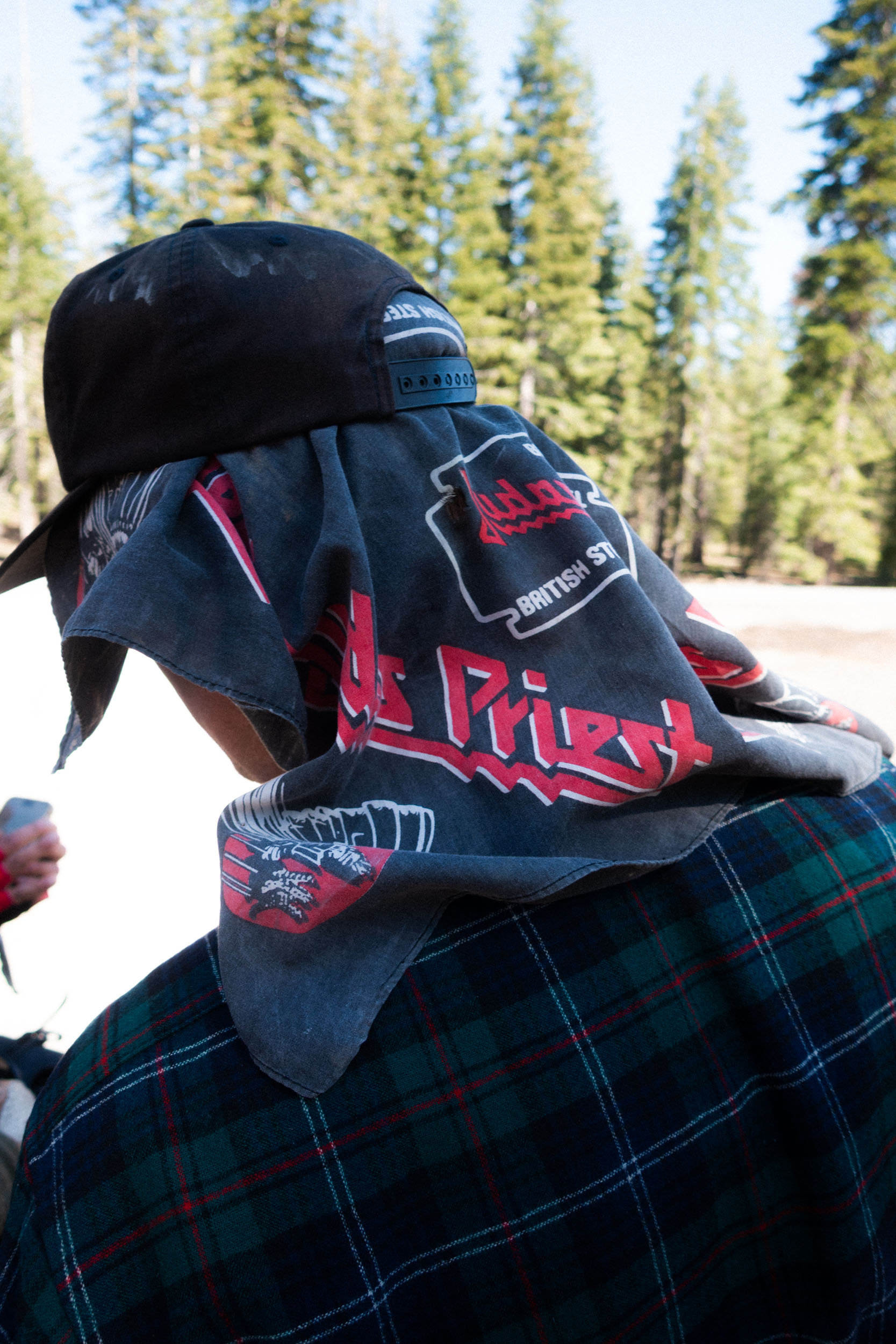
Norcal Outback
Distance
319 Mi.
(513 KM)Days
6
% Unpaved
52%
% Singletrack
0%
% Rideable (time)
100%
Total Ascent
16,271'
(4,959 M)High Point
6,901'
(2,103 M)Difficulty (1-10)
5?
- 3Climbing Scale Fair51 FT/MI (10 M/KM)
- 3Technical Difficulty Fair
- 6Physical Demand Moderate
- 4Resupply & Logistics Fair
Contributed By

Eric Marshall
Guest Contributor
Eric spends most of his time riding bikes alone or with friends on obscure dirt roads in Northern/Central California. He is an ardent fan of heavy metal and enjoys drawing demonic imagery in the spirit of the old masters. These two interests coalesce into the publication of @lowpressurezine.
While bikepacking routes in California are surprisingly sparsely documented—save for the most popular and heavily trafficked guides—this isn’t indicative of the potential for exceptional routing, nor of the firsthand experience of discovery that comes from venturing into new and lesser-documented terrain. If anything, one might interpret the abundance of publicly accessible unpaved riding surfaces weaving through a vast landscape as the very reason it remains untapped, representing a stockpile of route-making material so plentiful it has scarcely been drawn from until now. If heat map activity is the raw ore from which we forge our GPS route, then upon these silicon cartographers’ work we traced the faintest of hues, straining and at times doubting the fidelity of our eyes to interpret the paths of those who may—or may not—have uploaded ancient files before us.
The primary goal of this route is to utilize remote fire roads and highways to traverse some of the least populous counties in California, while using mass transit to access the start and return home from the finish. In doing so, you’ll experience a rapid transition from Cascadian volcanic geology to the Sierra Nevada uplift that dominates much of the state. This change in landscape, occurring approximately midway through the ride, represents a threshold after which your senses are treated to a refreshing and starkly different buffet of observation, offering an adventure with dual rewards.


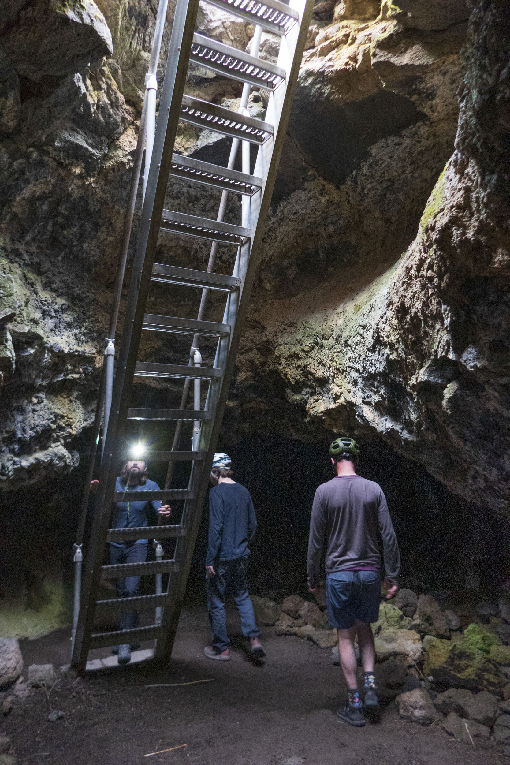
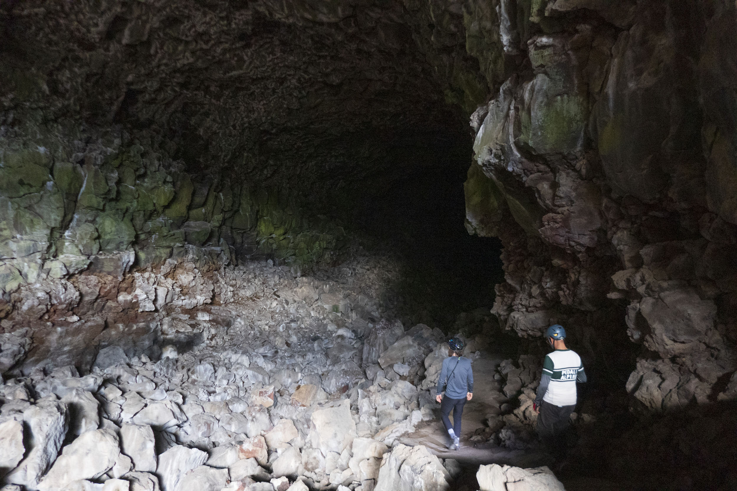
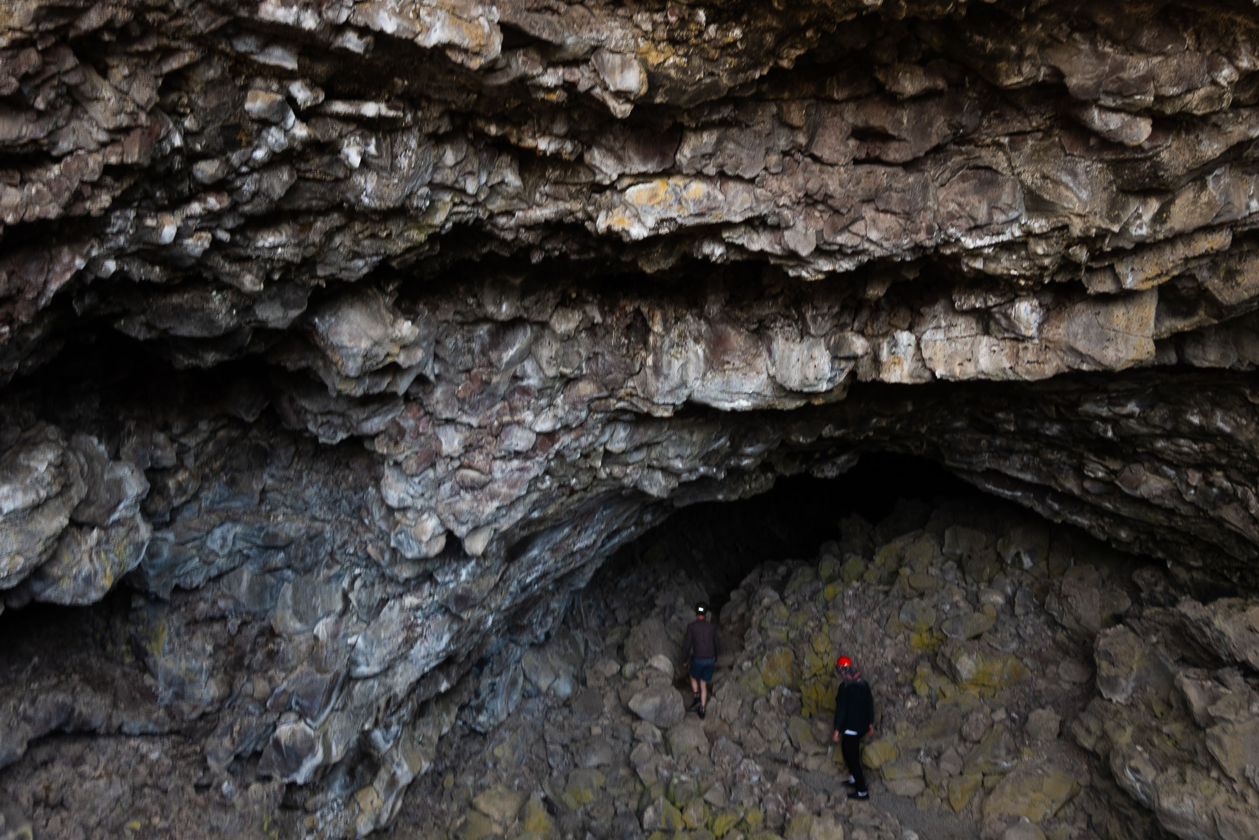
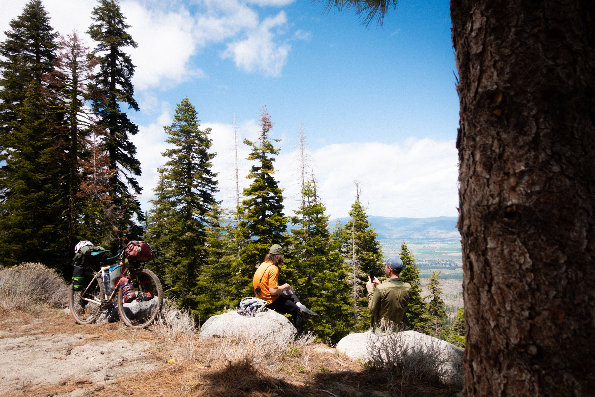
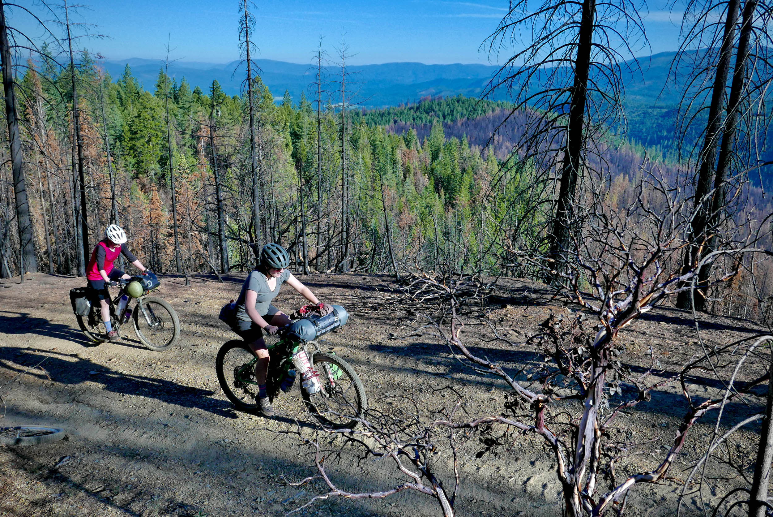
Soon after departing Klamath Falls and crossing the Oregon–California border, the flat, grassy farmland is interrupted by volcanic features ranging from basalt outcroppings to prominent buttes, culminating in the defining feature of the first day: lava tubes. Given the shorter, flatter profile of the day, you are presented with an opportunity to explore Lava Beds National Monument, including massive underground caverns and cramped, snaking passages accessed by descending ladders through cracks in the rocky desert surface.
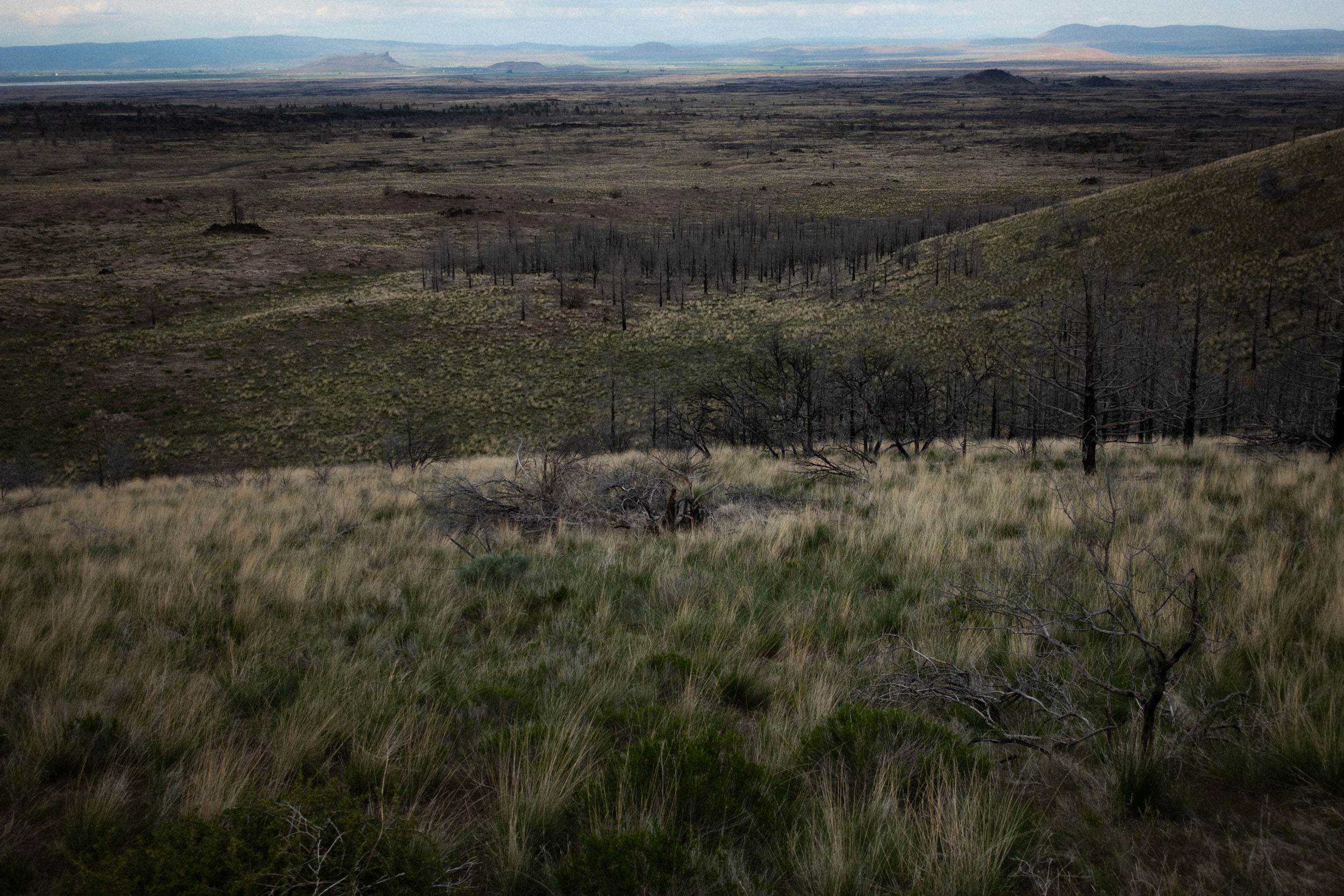
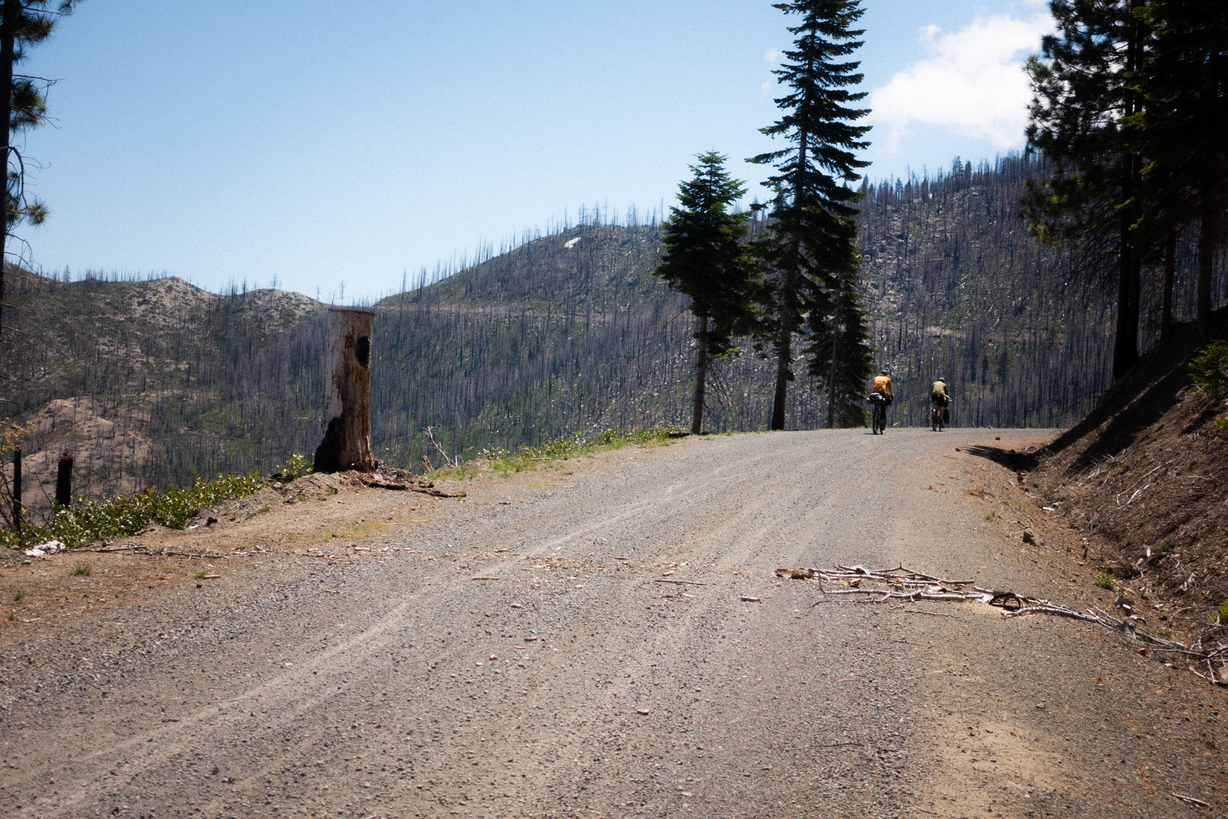
Despite a mellow elevation profile continuing south past the Lava Beds, with views of Lassen and Mount Shasta, the difficulty of this section is heightened by loose volcanic soil and plentiful deadfall, scattered with shards of obsidian (though they pose little threat to your tires). Eventually, firmer ground provides a more forgiving surface on which to pedal, and the biosphere transforms from scrubby bushes, juniper, and lodgepole pine to forests sustaining larger Douglas firs. The population center of MacArthur makes for a convenient resupply point, complete with pizza to feast upon while surveying small-town life.
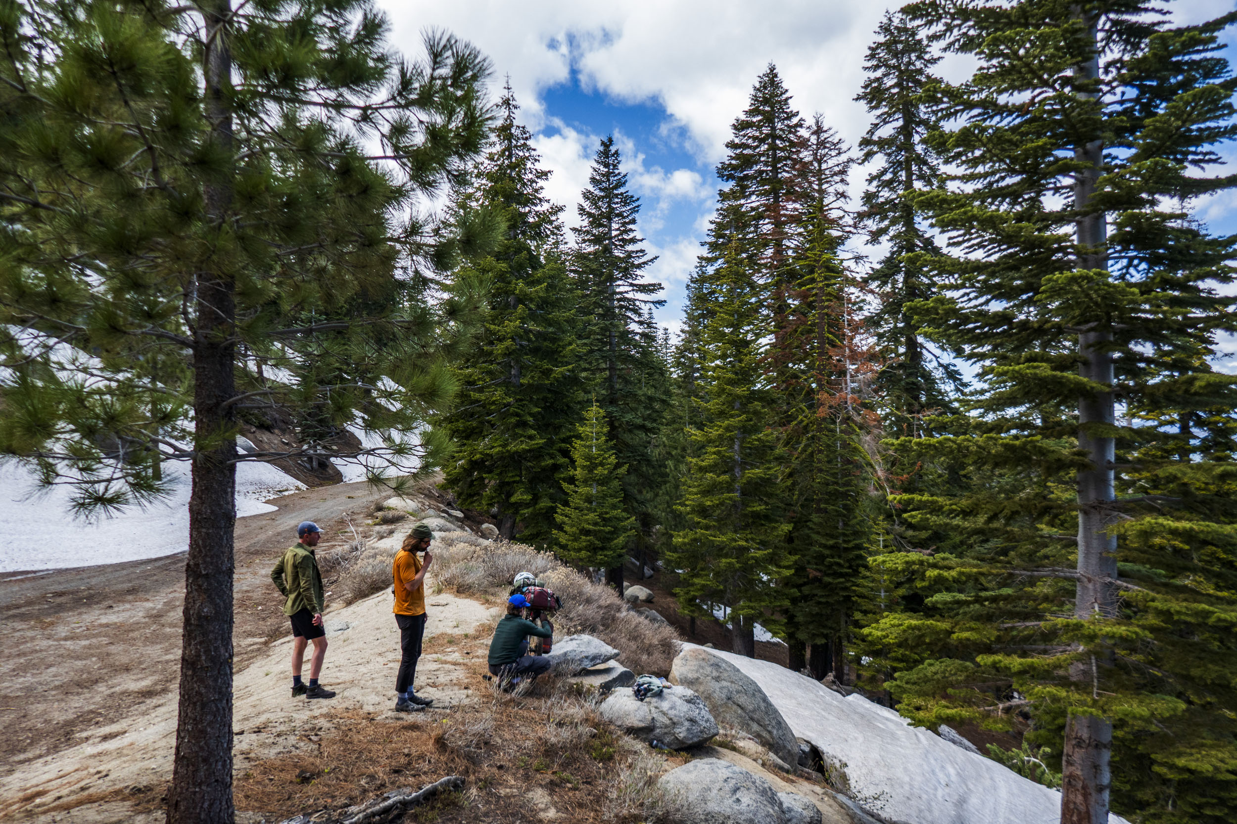
Thus begins the first sustained climb of the tour, albeit a gently sloped one of crushed stone and dirt. Orchestrate your day around the hours of pleasant riding ahead, weaving in and out of the pines, perhaps stopping in the shade of one for a leisurely meal. As the grade levels and turns into a subtle descent, you pick up speed and join the legendary Bizz Johnson Trail, which hosts a convenient primitive campground. This makes an excellent stopping point—removed from the densely spaced penitentiaries of Susanville yet close enough for an early-morning conclusion to the Bizz, delivering you to one of several hot breakfast establishments.

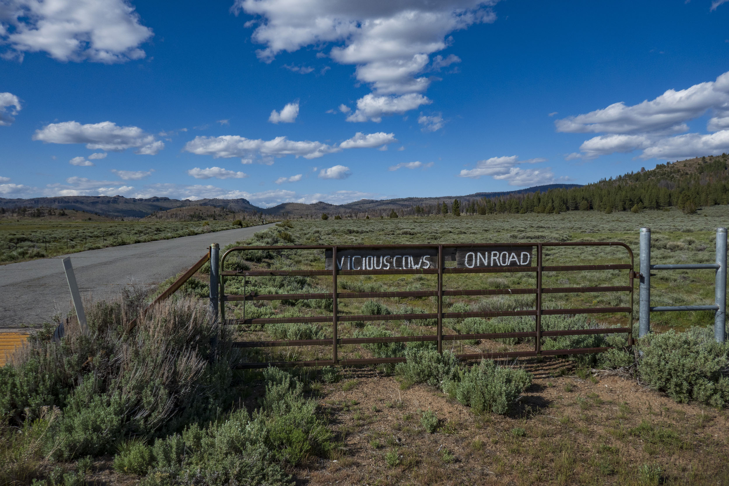
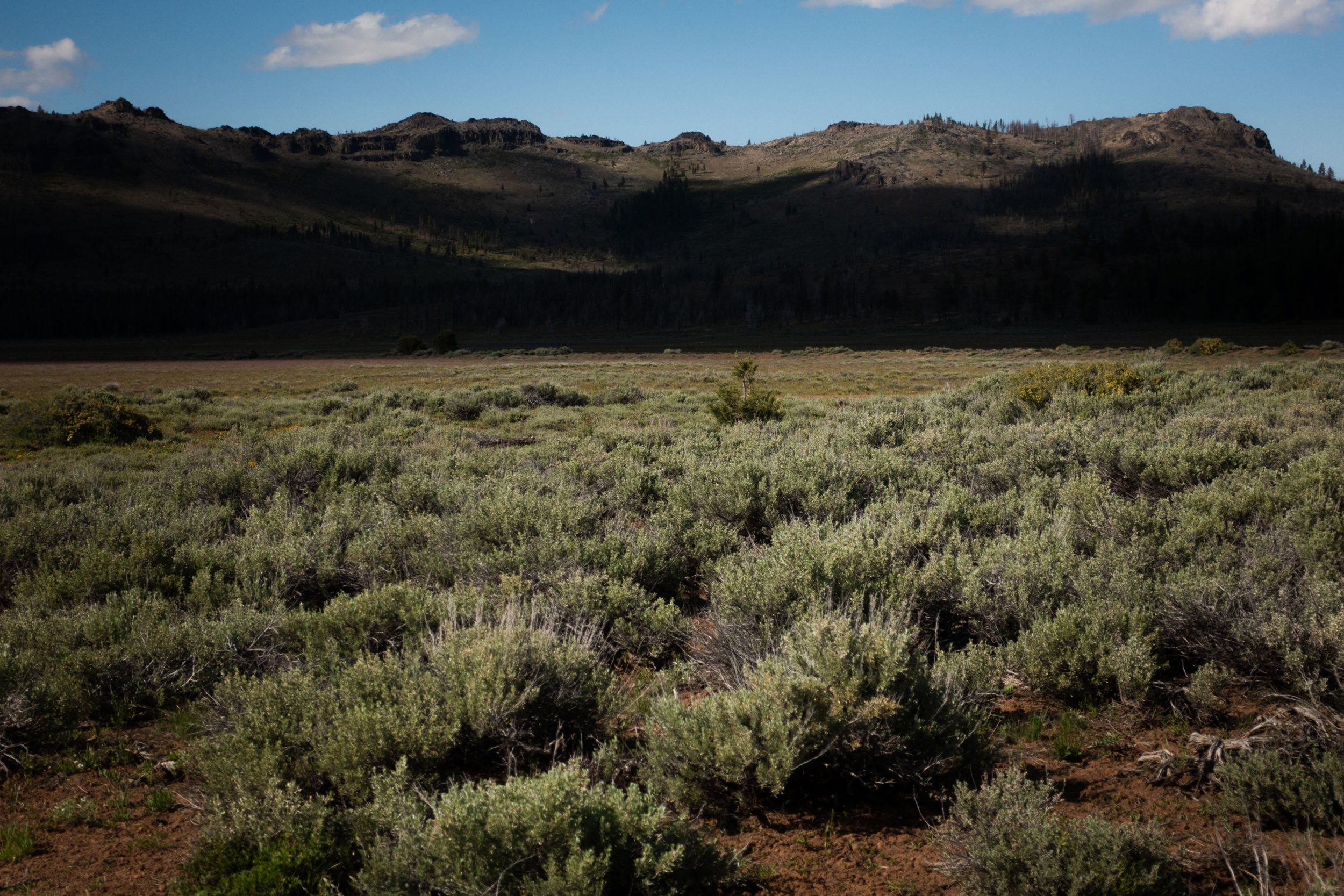
A caloric bounty be thy friend, as your departure from Susanville marks a formidable farewell to the last of the Cascadian terrain bound within the Golden State. Perhaps you will note a shift in your inner relationship to the land as you transcend this physical boundary—whether you feel more or less assured of your existence and identity as you inch away from the geologically youthful lava beds toward 100-million-year-old igneous intrusions. The valley below Papoose Peak competes for a place among the most stunning sections of the ride. Should you choose to take this stretch at a brisk pace, forging ahead past camping opportunities toward the day’s final resupply point in Loyalton, you’ll be rewarded with fresh contents for your stove pot and many liquid ounces of refreshment.
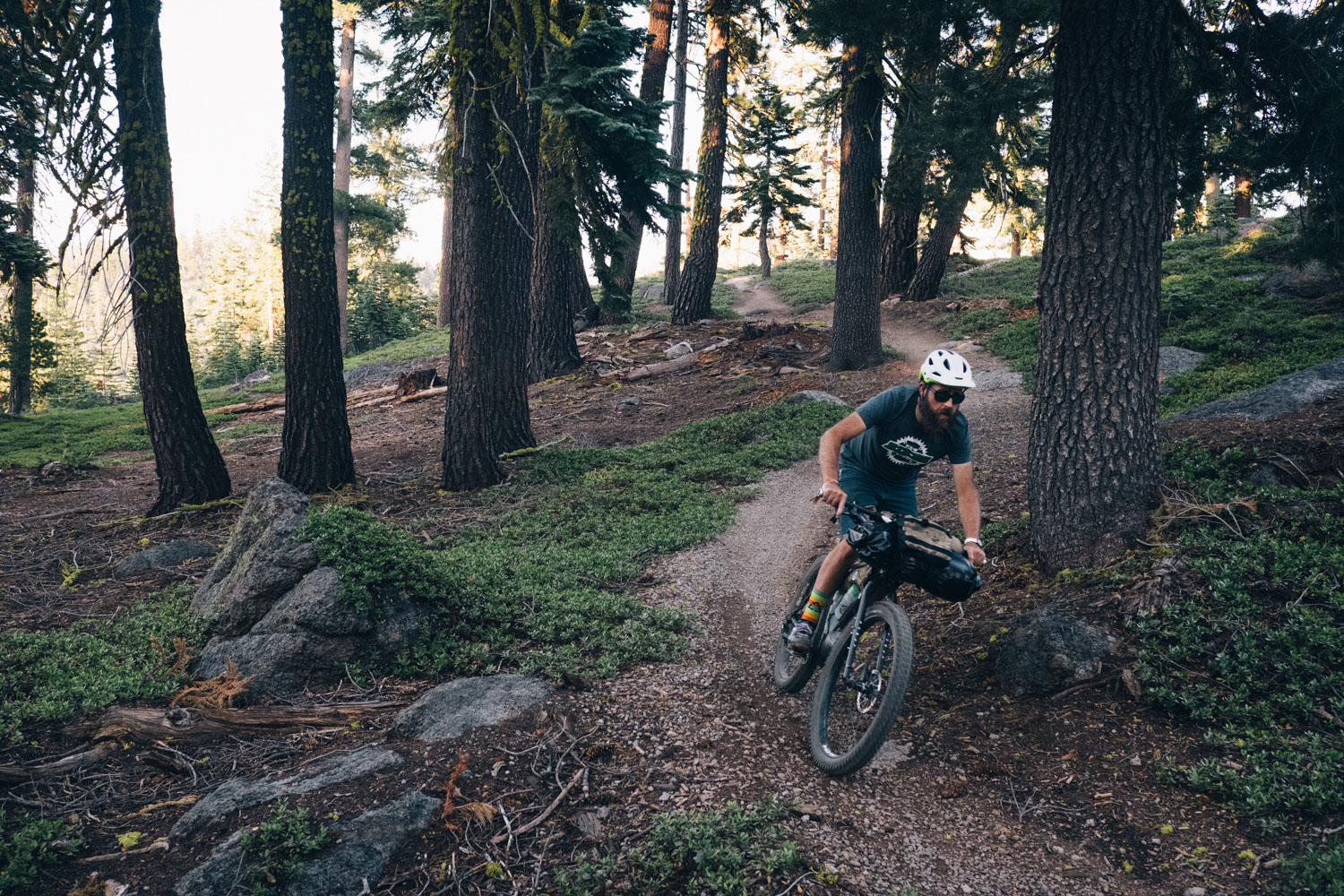
Some of the finest sections of the route—imbued with the character of distinctly Tahoe-esque riding—carry you to the very edges of the urban sprawl of Reno. Let your senses savor these concluding moments: the climb to Verdi Peak and the descent of Dog Valley Road. They will echo within your soul with alpine tenor and verdant bliss in the weeks and months to come.
Route Development
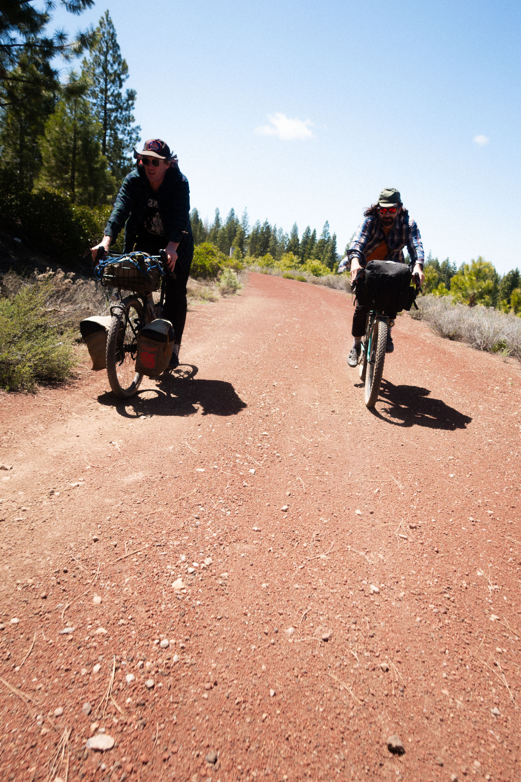
Our friend Esther published a route like this to her RideWithGPS account. It was almost 100 percent unpaved. We thought, “there’s no way someone could actually do this.” But then the idea of connecting Reno to Klamath took root and I started trying to make a route that seemed plausible. The idea of being able to take Amtrak on either side of the ride made it especially appealing. Our friend Coach confirmed that he had done some of the Northern sections of the route before. The rest of the route was researched using heat map activity, a paper atlas, and common sense. The main consideration designing the route was balance: I wanted to take as much dirt as possible, while not having to climb tens of thousands of feet. It is also intended to have a balance between the feeling of being truly out there, while still having a decent amount of resupply points.
Route Difficulty
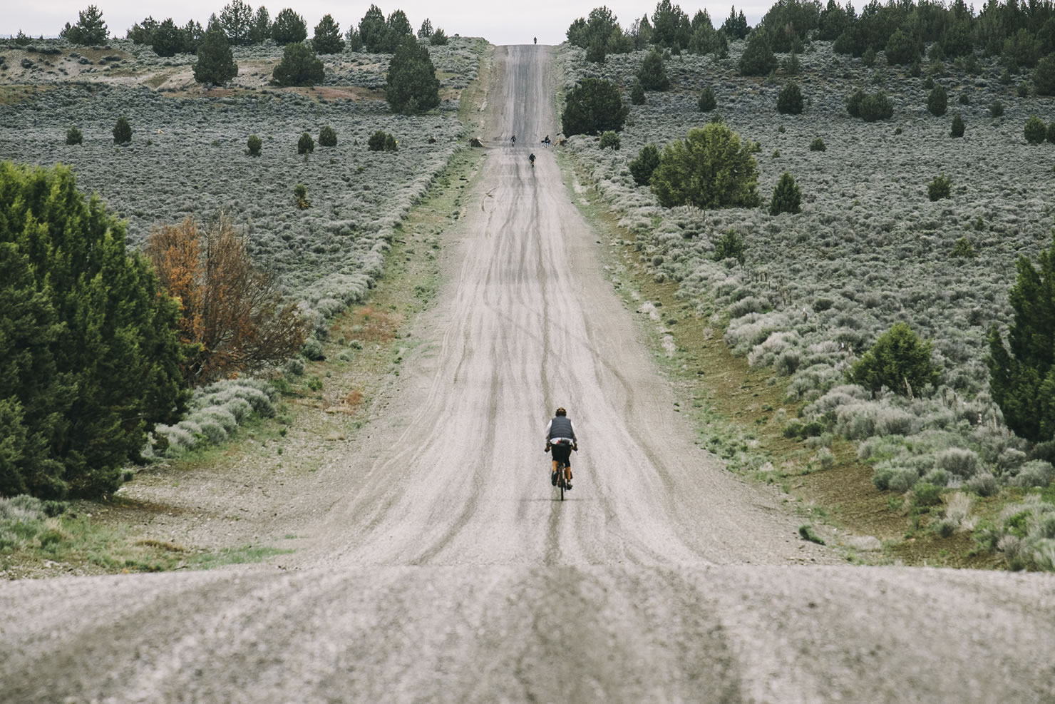
This route gets assigned a 5 because the recommended daily breakdown ends up making for pretty big days on average. One can split the route into smaller days, but resupply points then become less frequent, meaning you are carrying more stuff. Due to the remote areas one travels through on this route, it would be easy to wild camp at many places along the route, but the recommended version assumes one is staying at official campgrounds, and those are spaced infrequently. The dirt on the route is mostly standard fire roads that are easily doable on 42mm tires. Some sections are a bit rockier, a bit looser but nothing a gravel bike isn’t made for. Each day has at least one major resupply point, and following the route should be pretty straightforward.


Submit Route Alert
As the leading creator and publisher of bikepacking routes, BIKEPACKING.com endeavors to maintain, improve, and advocate for our growing network of bikepacking routes all over the world. As such, our editorial team, route creators, and Route Stewards serve as mediators for route improvements and opportunities for connectivity, conservation, and community growth around these routes. To facilitate these efforts, we rely on our Bikepacking Collective and the greater bikepacking community to call attention to critical issues and opportunities that are discovered while riding these routes. If you have a vital issue or opportunity regarding this route that pertains to one of the subjects below, please let us know:
Highlights
Must Know
Camping
Food/H2O
Trail Notes
Resources
- Lava Beds National Monument is located on the Medicine Lake shield volcano, which is the largest volcano by volume in the Cascade Range at 144 cubic miles.
- As a point to point trip, this route takes advantage of Amtrak transportation from the Bay Area or PNW, and a plethora of transit opportunities leaving Reno.
- Sparsely populated and seldom visited part of California
- Bizz Johnson Trail
- Huge meadow full of flowers between Papoose Peak and ‘Vicious cows’
- Dog Valley Road is exceedingly beautiful
- Lesser known national monument/geologically interesting place
- Route travels through three states
- Terrain is everything from flat asphalt to dirt with ~18% grades
- Travels through Modoc, Lassen, Plumas, Tahoe and Humboldt-Toiyabe National Forests
- Transition from the Cascade Mountains to Sierra Nevada
- Convenient resupplies and breakfast
- Great route to link to the Oregon Outback or OCVA for an extra long trip
- Giant cinnamon rolls in Klamath Falls at Starv’n Marv’n’s
- It has been said that “Modoc is where the pavement ends and the West begins”
When to go
- We did it in late late spring/early summer which felt ideal, but it could also be pleasant during anytime but the hottest hots and coldest colds
- Köppen Classification: (Dsb) Cool continental/dry summer.
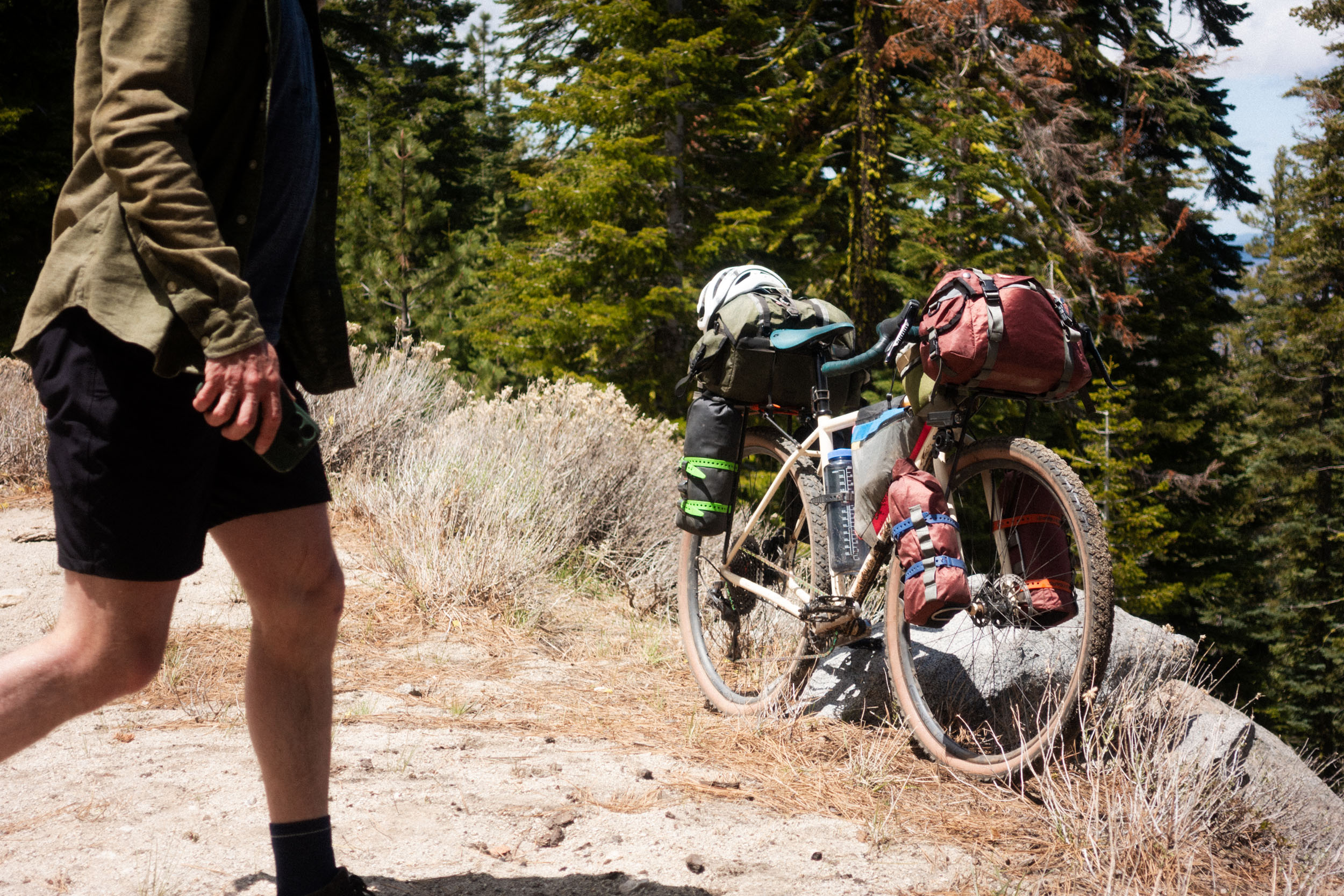
What Bike and Gear
- Bike: anything from a 32c rim brake road bike to flat bar/rigid/hardtail will work. But we found 45/50c drop bar to be optimal, with most of our group in the 1x gearing range of 36-40t x 10-50 cassette due to prolonged strenuous climbs.
- Amtrak tire width regulations are inconsistent and enforced at the discretion of the baggage handler. While all of our bikes were accepted, they may reject bikes with tires wider than 50c
Logistics
- To get to the start, you can begin anywhere that the Coast Starlight train route stops. The train arrives in Klamath Falls at night if coming from the north, and in the morning coming from the south
- Reno offers flights, rental cars, trains etc., any imaginable transit and bike shops to box up if needed
- It costs $15 for a bicycle to enter Lava Beds National Monument
- Indian Wells Campground in Lava Beds is located right near the caves, making it easy to set up camp and then go walk around for a while.
- Inter Mountain RV Park in McArthur is a very minimal camp spot, pretty much just a lawn, but there’s really any other official camping options around there. One can opt to stay at the Lassen RV Park Campground and get a cabin though.
- Fall River Hotel is cheap and is located in a quaint little town.
- Goumaz Campground is a primitive spot located on the Bizz Johnson Trail. One can filter water from the stream here too.
- Hotels available in Susanville.
- Crocker Guard Station outside Lake Davis would make an awesome place to camp. It’s an old log cabin that’s available for reservations.
- The Gilded Drifter Inn in Loyalton is relatively affordable.
- Bear Valley Campground is a nice campground not too far from the finish.
- Sierra Hot Springs is not far from the route, for those willing to make a detour for a soak.
- There is access to several rivers and creeks throughout the route for filtering water, but there are some sections where you should be prepared to carry extra water due to seasonal variation of water availability.
- Starv’n Marv’n’s in Klamath Falls has amazing breakfast. Huge cinnamon rolls.
- Old Merc’s in McArthur has great food and beer.
- Ray’s in Fall River Mills is a full service grocery store.
- Susanville has many options for restaurants and grocery stores.
- Leonard’s in Loyalton is a medium sized market with a decent selection of food and drinks.
Here is a sample 5-day itinerary:
location Klamath Falls to Indian Wells
Day 1 (48.8 mi +1,470′)
Roll out from the Klamath Falls Amtrak Station. Head south of quiet paved farm roads as you cross over the Oregon-California border. Tule Lake appears on the left as the landscape becomes increasingly volcanic. Pay $15 to enter Lava Beds National Monument at the entrance kiosk. Stop and check out some of the signs that teach you about the geology of the area and the native Modoc people. There are volcanic chimneys near the side of the road that are worth checking out too. Camp at Indian Wells Campground and spend the evening visiting nearby caves. The Golden Dome Cave is especially awe-inspiring. Don’t forget to bring a helmet, especially if you are tall!
location Indian Wells to McArthur
Day 2 (64 mi +1,955′)
Leaving Lava Beds, you enter the Modoc National Forest via forest service roads. There is almost nothing out here save for volcanic rock and trees. Prepare to be alone in the almost eerily quiet forest for several hours, steadily making your way on seemingly endless dirt roads. There are no streams and lakes for a long time, so bring extra water for this section. Suddenly the forest opens up to a massive view of the valley below. Farms and cattle surround you and now the dirt is a deep rust color, as ‘red sauce’ as it gets. Soon you are back on pavement and eventually connect with Highway 299 for a short segment. This takes you to McArthur, where you can stock up on supplies, hit up Old Merc’s for sandwiches and beers, and then set up camp at Inter Mountain RV Park. It’s far from a glamorous camp spot, but there’s showers and a place to set up tents.
location McArthur to Goumaz Campground
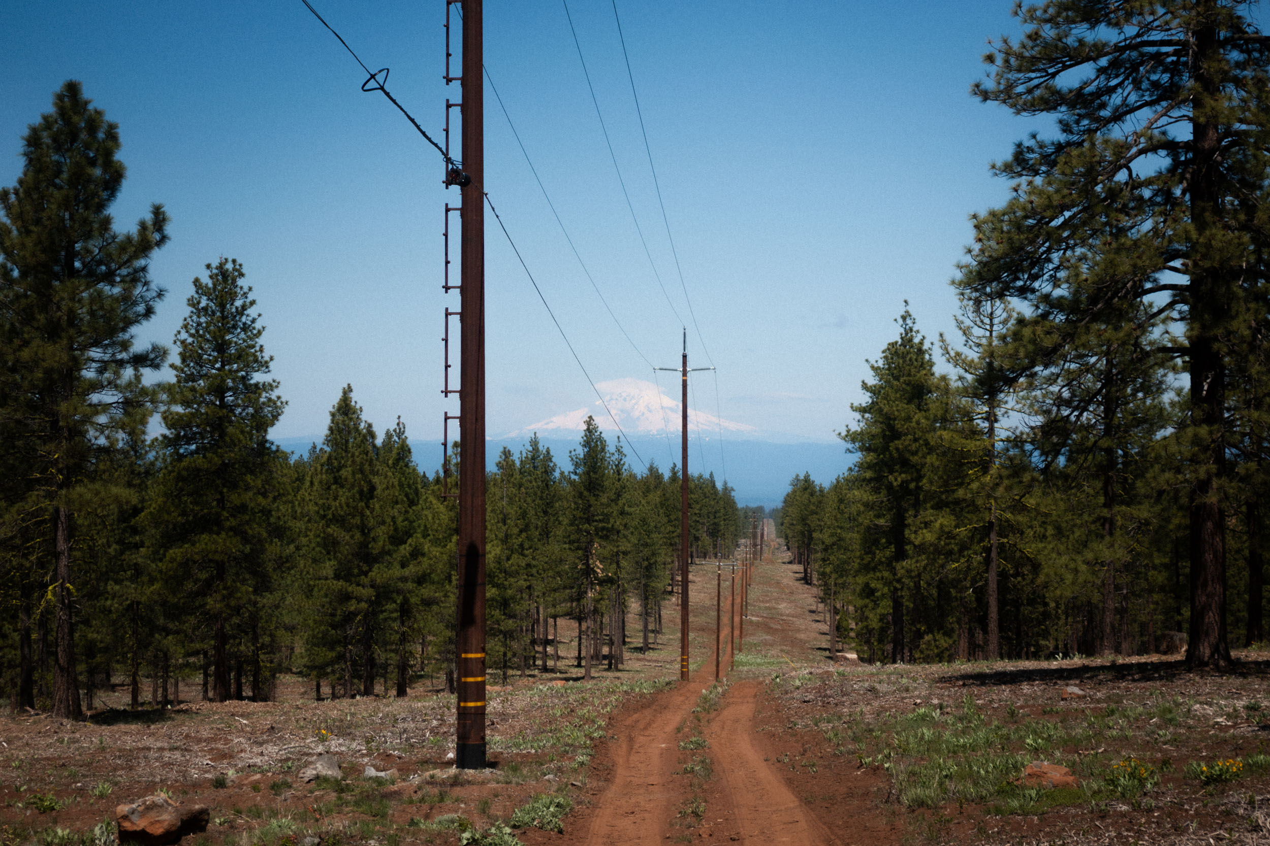
Day 3 (69 mi +4,021′)
After leaving McArthur and passing the small town of Fall River Mills, a short paved section brings you to the start of a forest service road that will carry you through 30 miles of remote forest on a ridge line. Small streams and lakes abound on either side of you, while in the distance one can see the snowy peaks of Shasta and Lassen, amongst others. You briefly cross over the busy Highway 44 and are once again surrounded by immense forest. Forest service roads lead to a brief paved stint on Mooney Road and then once again resume unpaved form, leading to the Bizz Johnson Trail, an old railroad line that has been converted to a multi-use path. 5 miles into the trail is Goumaz Campground, a primitive site that has stream access and a pit toilet, but not much else. What else do you need anyway?
location Goumaz Campground to Loyalton
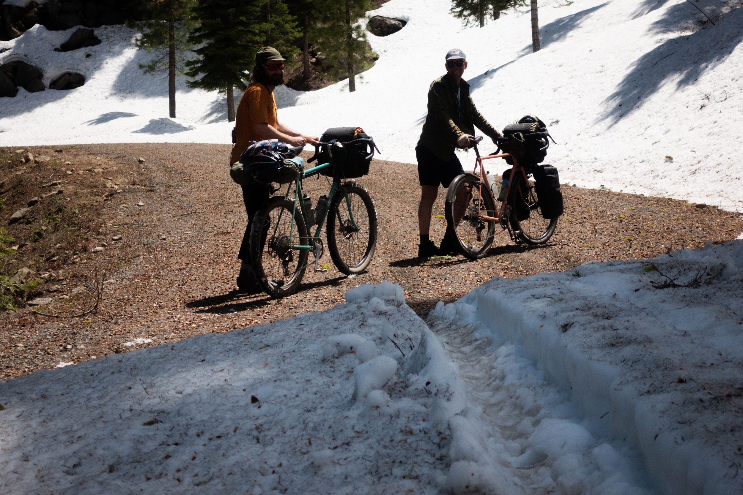
Day 4 (107.6 mi +7,600′)
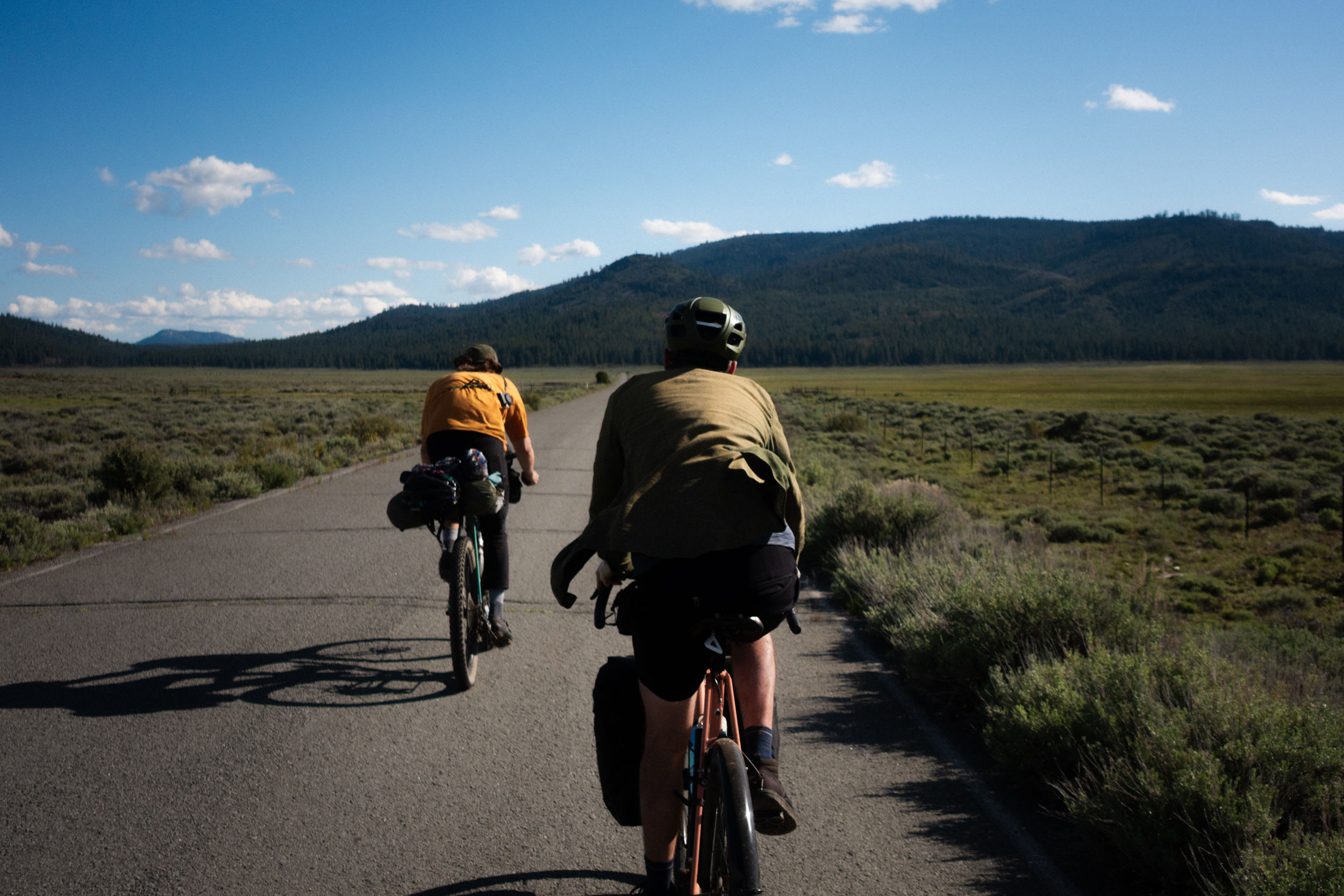
Start the day by continuing the gradual descent down to Susanville on the Bizz. Passing through 2 old train tunnels first thing in the morning is pretty fun and a pleasant way to start the day. Susanville has many good options for breakfast, including the Courthouse Cafe. Make sure to resupply at the grocery store, as you have many more miles before another resupply point. A steep grade up Diamond Mountain begins after leaving town. Apparently the side of the road has good morrell mushroom foraging spots. As you make your way further and further up, the trees thin out and expose the valley below. If you time your trip right you’ll probably be hitting this section when there’s still a light dusting of snow at the very top. A little bit of walking through the snow is worth the many waterfalls on the side of the road created by the snowmelt. A fast dirt descent takes you down to Antelope Lake and a short paved section around the lake, but soon you are back on dirt again after doing a small paved climb. You travel several miles through a gorgeous meadow. This is one of the most beautiful sections of the ride. The ride becomes paved again, although it seems as though nobody ever drives out here. One can opt to camp here at Crocker Campground for a more reasonable 74 mile day, or decide to push on towards Loyalton. There’s several miles of open country, continuing the day’s theme of big views and large-scale grandeur. This section might be windy though, so prepare to take a little extra time to get to Loyalton. Here you can get some supplies at Leonard’s Market before you do yet another climb up to Bear Valley Campground for the night. If you want a less challenging, albeit unofficial camp destination, the Loyalton Rotary Park is close to town, has a bathroom, and is right next to a creek.
location Loyalton to Reno
Day 5 (30.3 mi +1,288′)
As you head out of camp on more forest service roads, the alternating views of dense forest and green meadows again enchant the rider for the duration of the day. Dog Valley Road skirts Stampede Reservoir and takes you up to the top of Henness Pass. The descent down to Verdi is rough and rocky. Stop at Sasquatch Tavern for lunch and then make the final jaunt into Reno on a mixture of bike paths and paved roads. The airport has several options for rental cars and the Amtrak station is downtown.
Additional Resources


Terms of Use: As with each bikepacking route guide published on BIKEPACKING.com, should you choose to cycle this route, do so at your own risk. Prior to setting out check current local weather, conditions, and land/road closures. While riding, obey all public and private land use restrictions and rules, carry proper safety and navigational equipment, and of course, follow the #leavenotrace guidelines. The information found herein is simply a planning resource to be used as a point of inspiration in conjunction with your own due-diligence. In spite of the fact that this route, associated GPS track (GPX and maps), and all route guidelines were prepared under diligent research by the specified contributor and/or contributors, the accuracy of such and judgement of the author is not guaranteed. BIKEPACKING.com LLC, its partners, associates, and contributors are in no way liable for personal injury, damage to personal property, or any other such situation that might happen to individual riders cycling or following this route.
Further Riding and Reading
Here are some connected/nearby routes and related reports...

Please keep the conversation civil, constructive, and inclusive, or your comment will be removed.