


Salmon River Solitude
Distance
160 Mi.
(257 KM)Days
4
% Unpaved
90%
% Singletrack
2%
% Rideable (time)
100%
Total Ascent
16,443'
(5,012 M)High Point
8,663'
(2,640 M)Difficulty (1-10)
6?
- 7Climbing Scale Strenuous103 FT/MI (19 M/KM)
- 4Technical Difficulty Fair
- 7Physical Demand Difficult
- 5Resupply & Logistics Moderate
Contributed By

Cody Heiner
Guest Contributor
Cody grew up BMX and mountain biking in small-town eastern Utah, where there wasn’t much else to do. He got into bikepacking in 2015 after moving to Boise and finding some like-minded friends also looking for more adventure in their middle age. He now helps his wife, Laura, run Idaho Women’s Bikepacking, including planning routes and publishing beginner guides here. Find more of his photos on Instagram @heavy_braker.
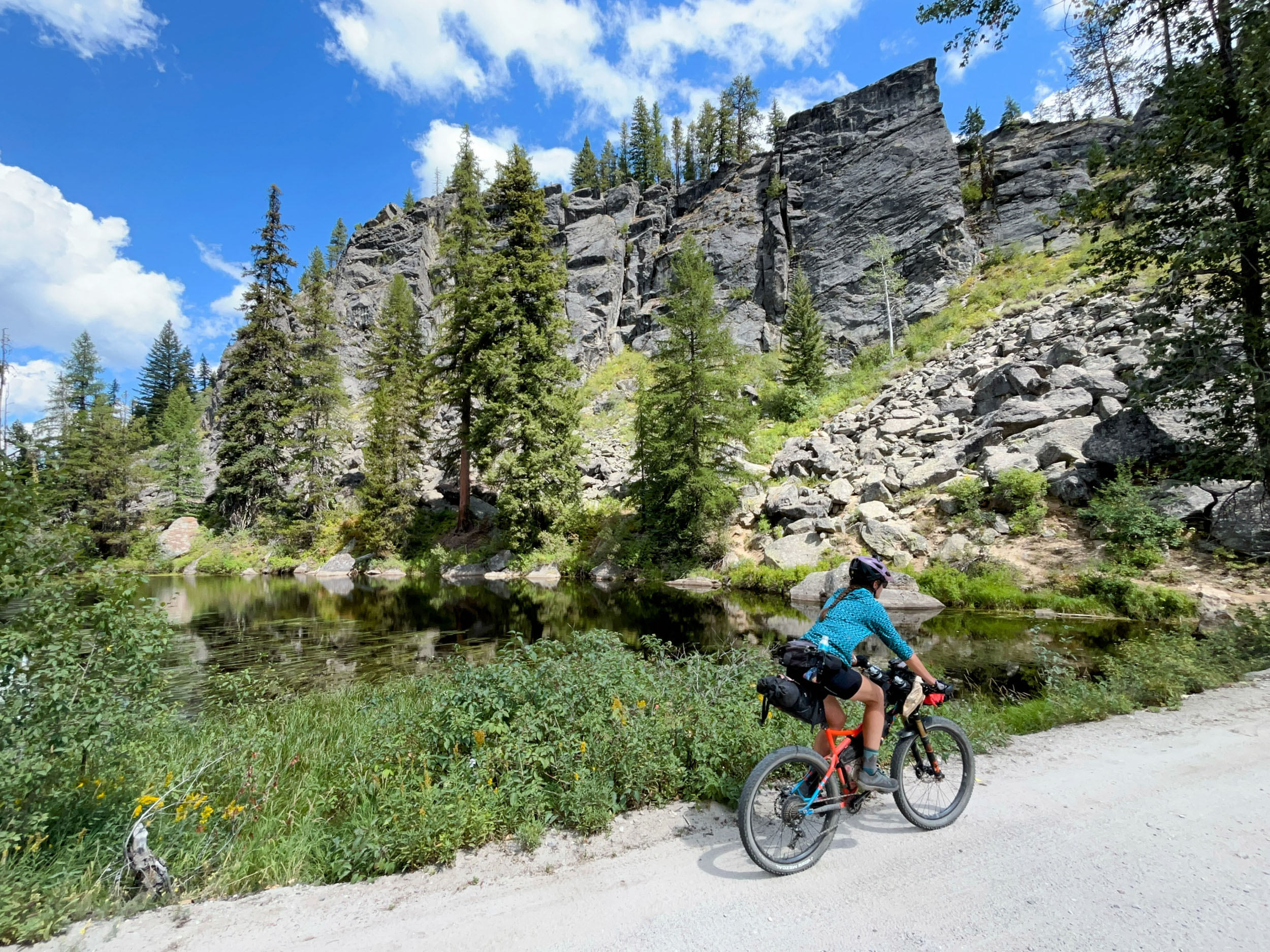
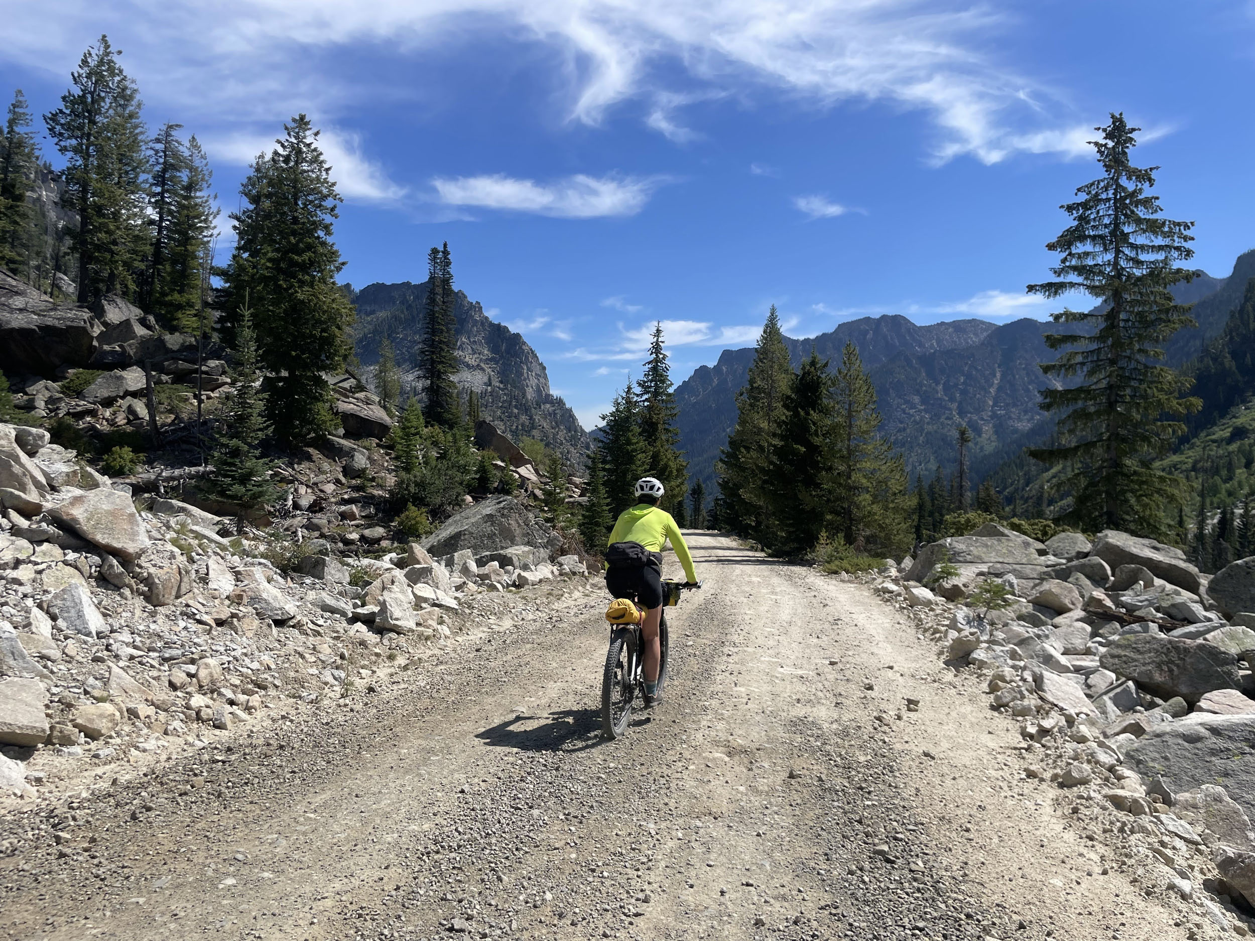
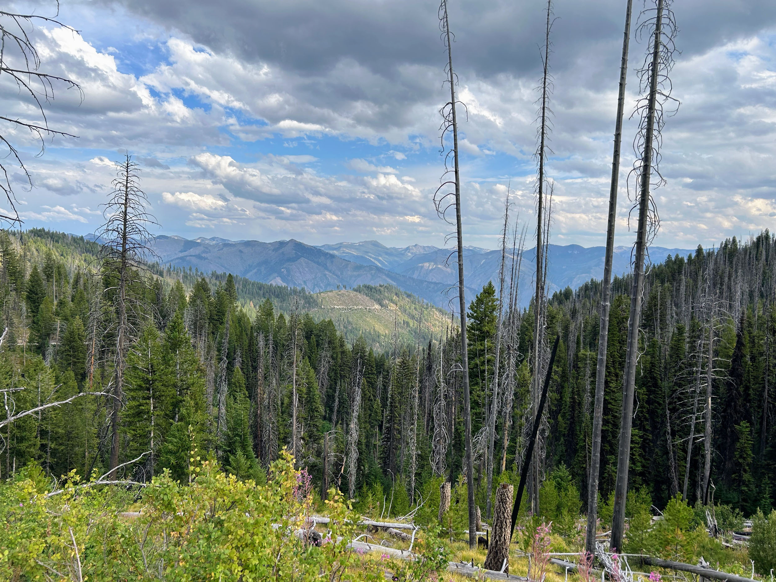
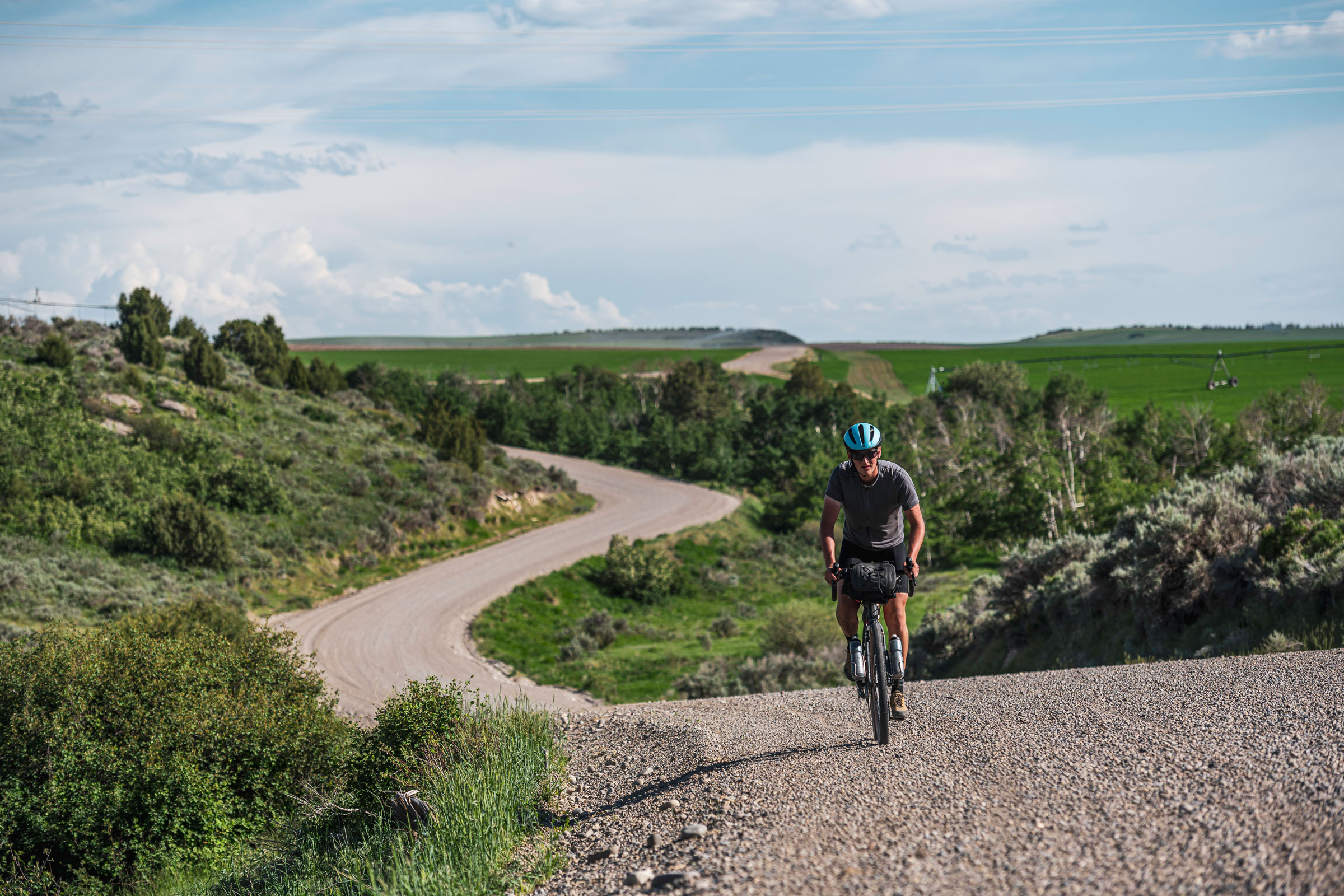
Deep in central Idaho, the Salmon River Mountain Range offers a rugged and remote playground for bikepackers seeking challenge, escape, and breathtaking scenery. Start from the charming mountain town of McCall, then wind through the Payette National Forest, skirting the edges of the Frank Church River of No Return Wilderness. From the first pedal stroke, riders are greeted by sweeping ridgelines, rushing rivers, and dense forests. It’s a landscape that feels wild and untamed.
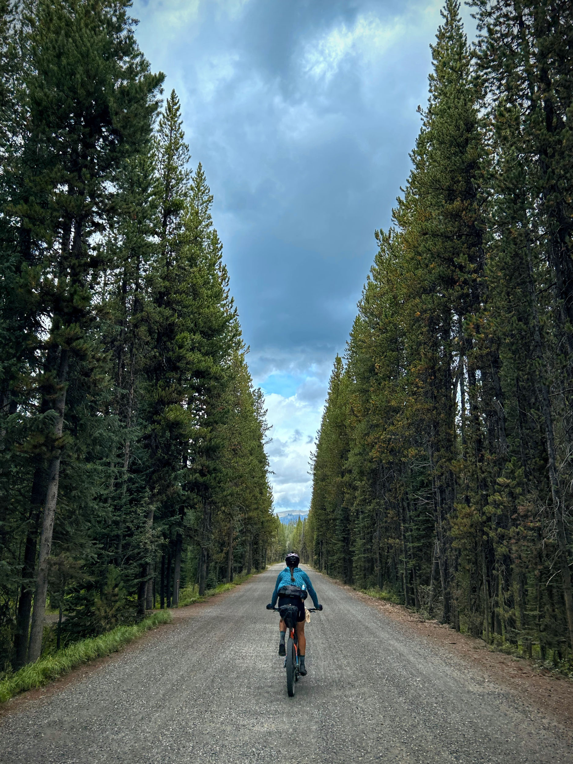
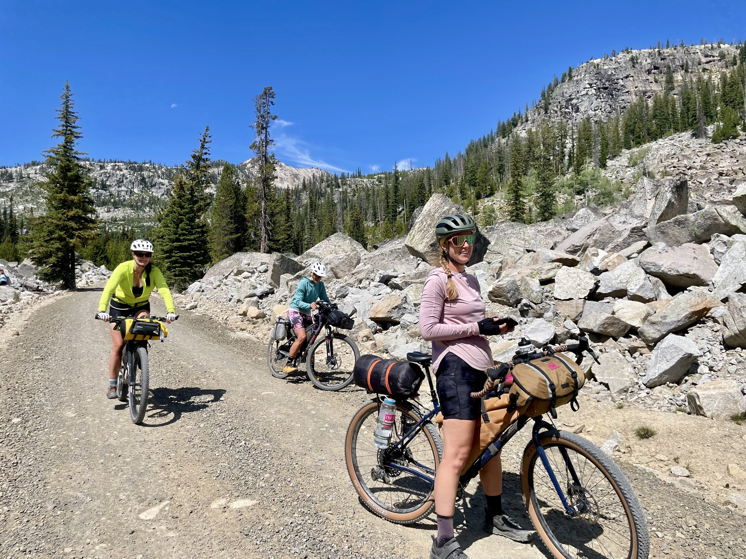
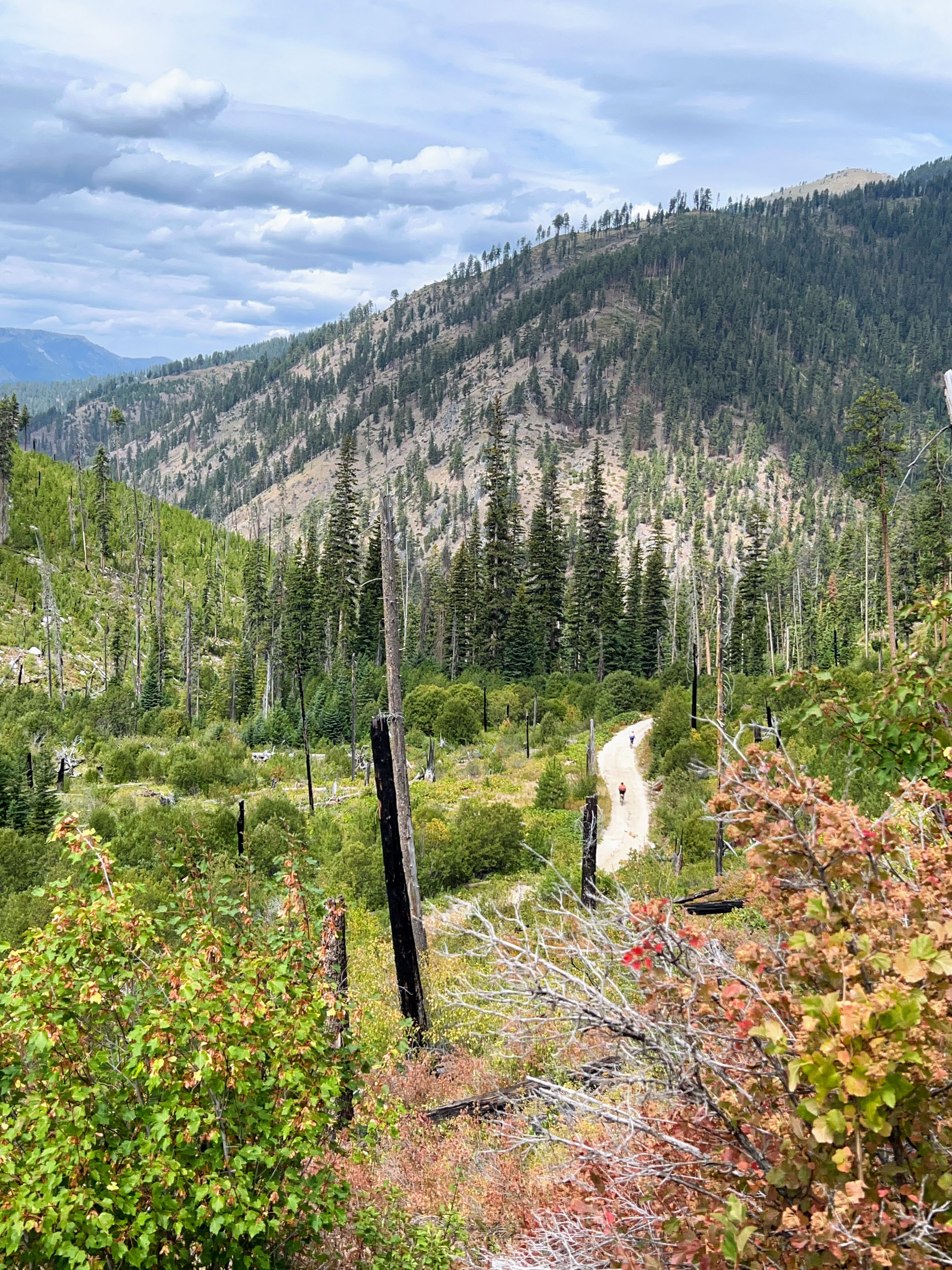
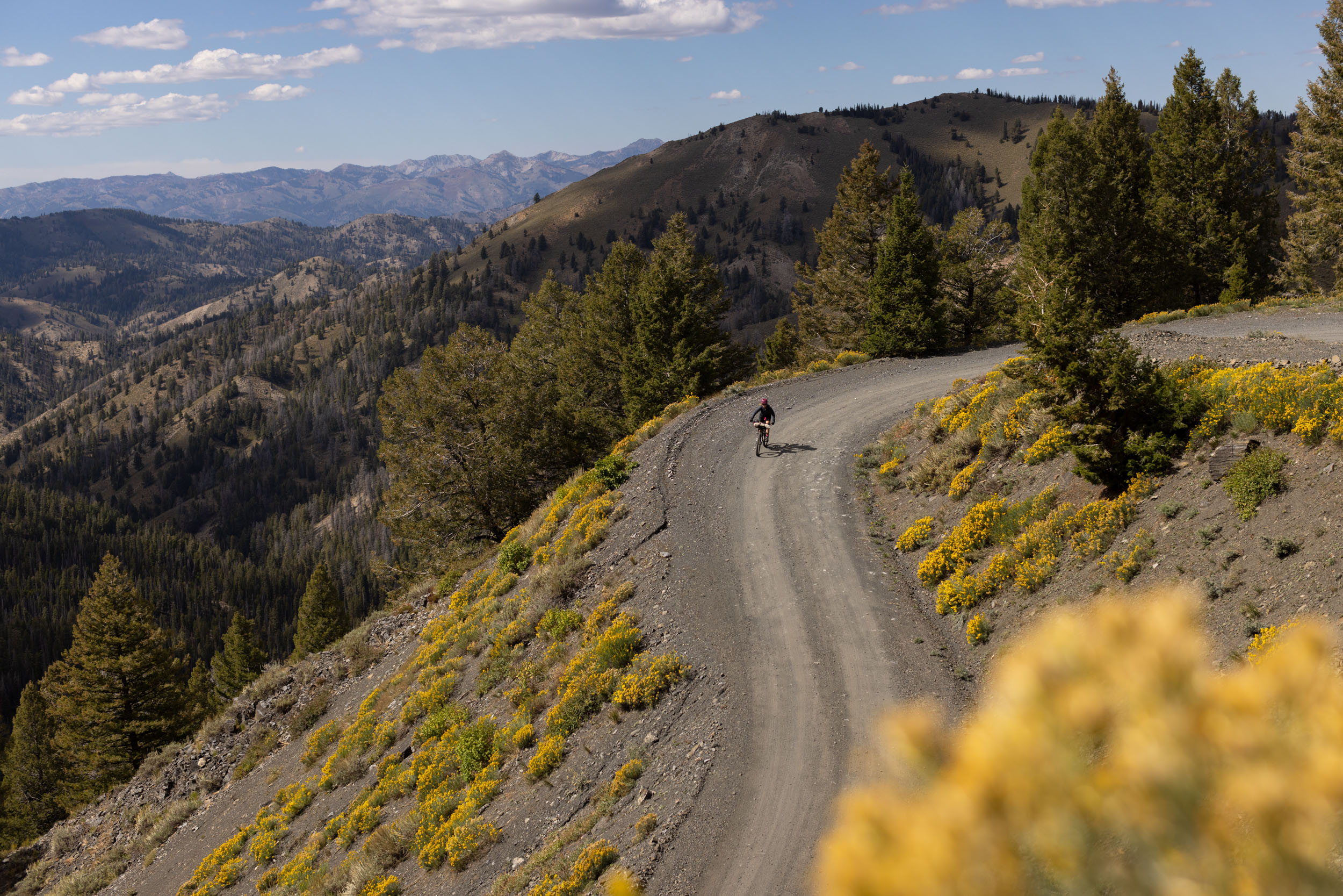
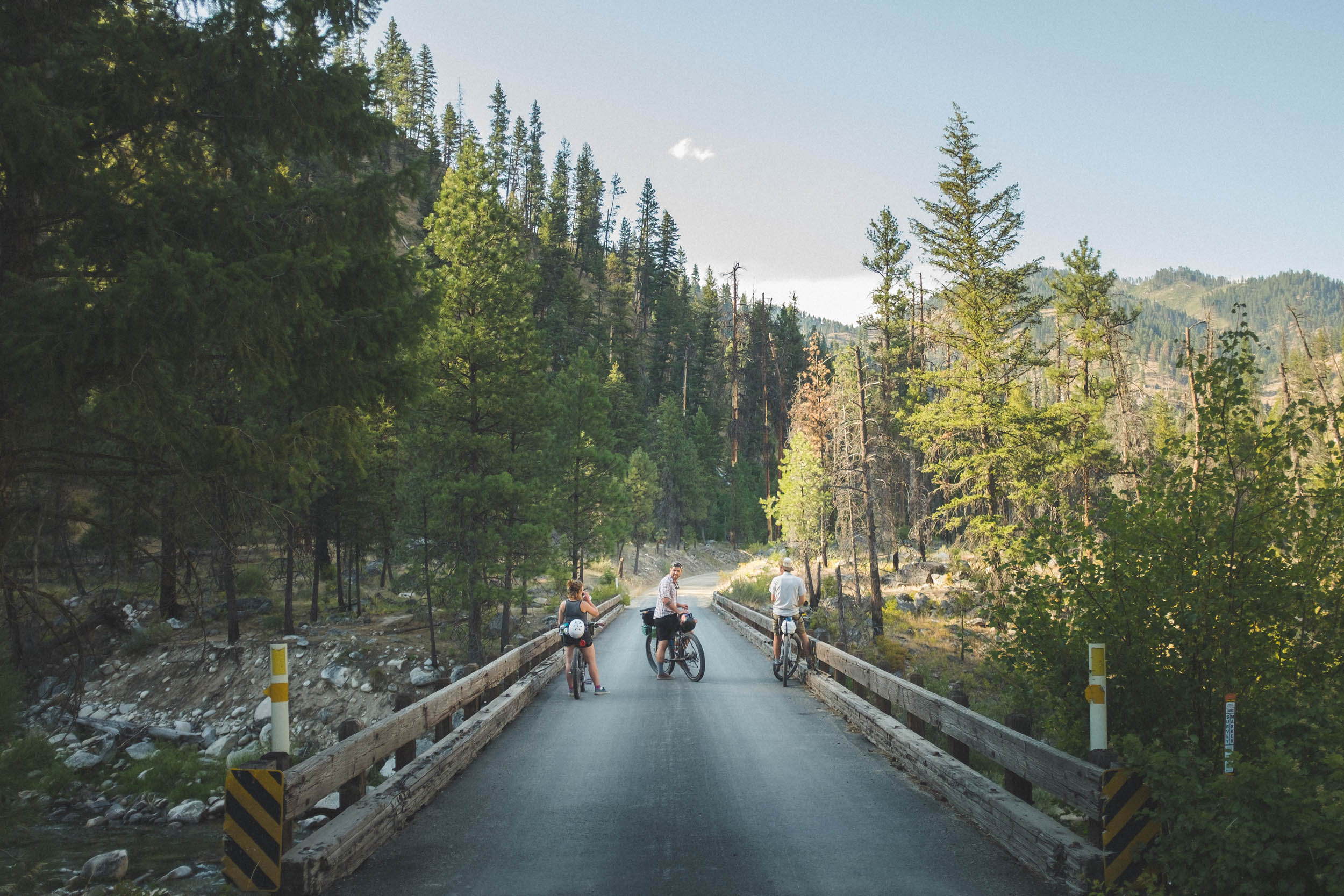
The route blends gravel and dirt roads with short sections of two-track and minimal singletrack. Four main climbs—Lick Creek, Profile Pass, Elk Creek, and Warren Summit—test endurance, while panoramic summit views and long descents provide exhilarating relief. The ride alternates between quiet stretches along rivers and exposed summits where the scale of the mountains is humbling. Historic mining roads and near-ghost towns—remnants of Idaho’s gold and stibnite rushes—add character and a glimpse into early 20th-century life in the mountains.

One of the best aspects of this route is its remoteness. Turn your GPS on and your cell phone off. Much of the loop sees few travelers beyond wildlife and occasional motorcycles or ATVs. This isolation heightens the rewards of unspoiled views, clear streams, and the freedom to pedal through the landscape largely uninterrupted.
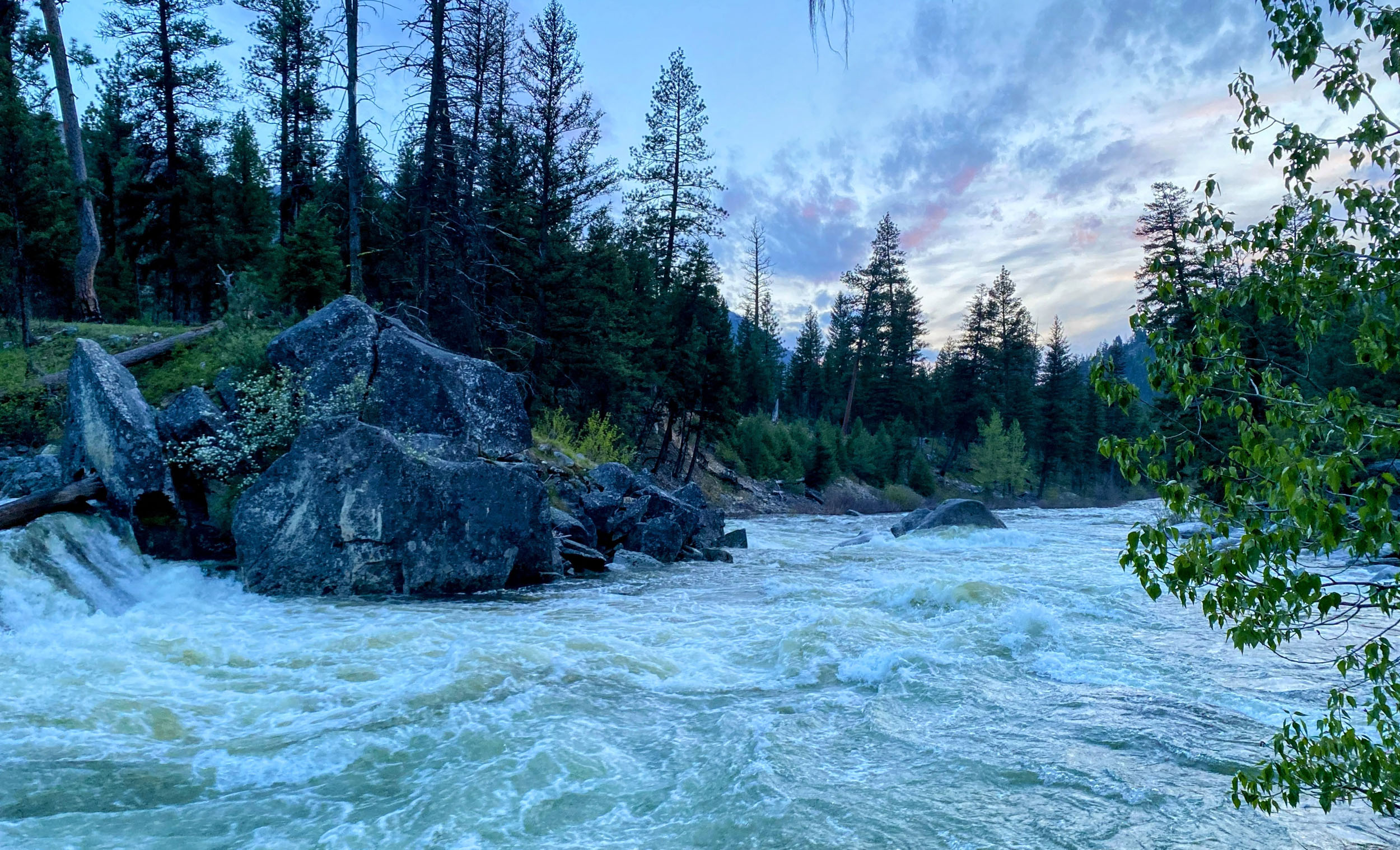
The ecology of the Salmon River Mountains is striking. Lodgepole pine, Douglas fir, and ponderosa dominate lower elevations, while alpine meadows emerge near summits, dotted with wildflowers in summer. Wildlife is abundant; mule deer and elk graze forest edges, black bears and cougars inhabit deep valleys, and raptors patrol the skies. Rivers and creeks teem with trout, making the loop especially appealing to anglers. With luck, you may even witness Chinook salmon on their upstream migration, having come all the way from the Columbia River Gorge.
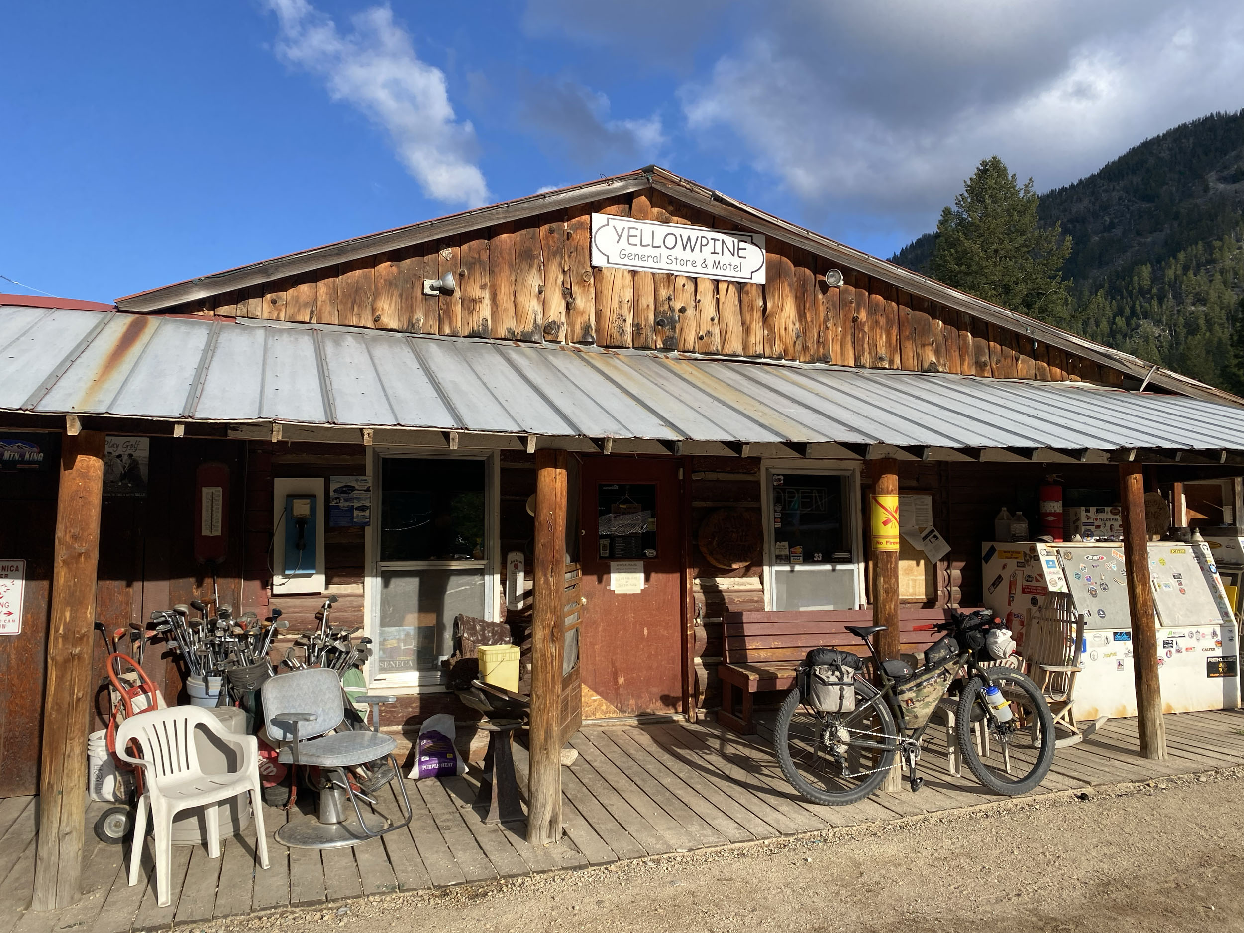
Cultural and historical context enriches the journey. Yellow Pine and Warren, once bustling mining towns, now have just a handful of year-round residents. But the paucity of remaining historic structures and residents is more than made up for in character and hospitality.

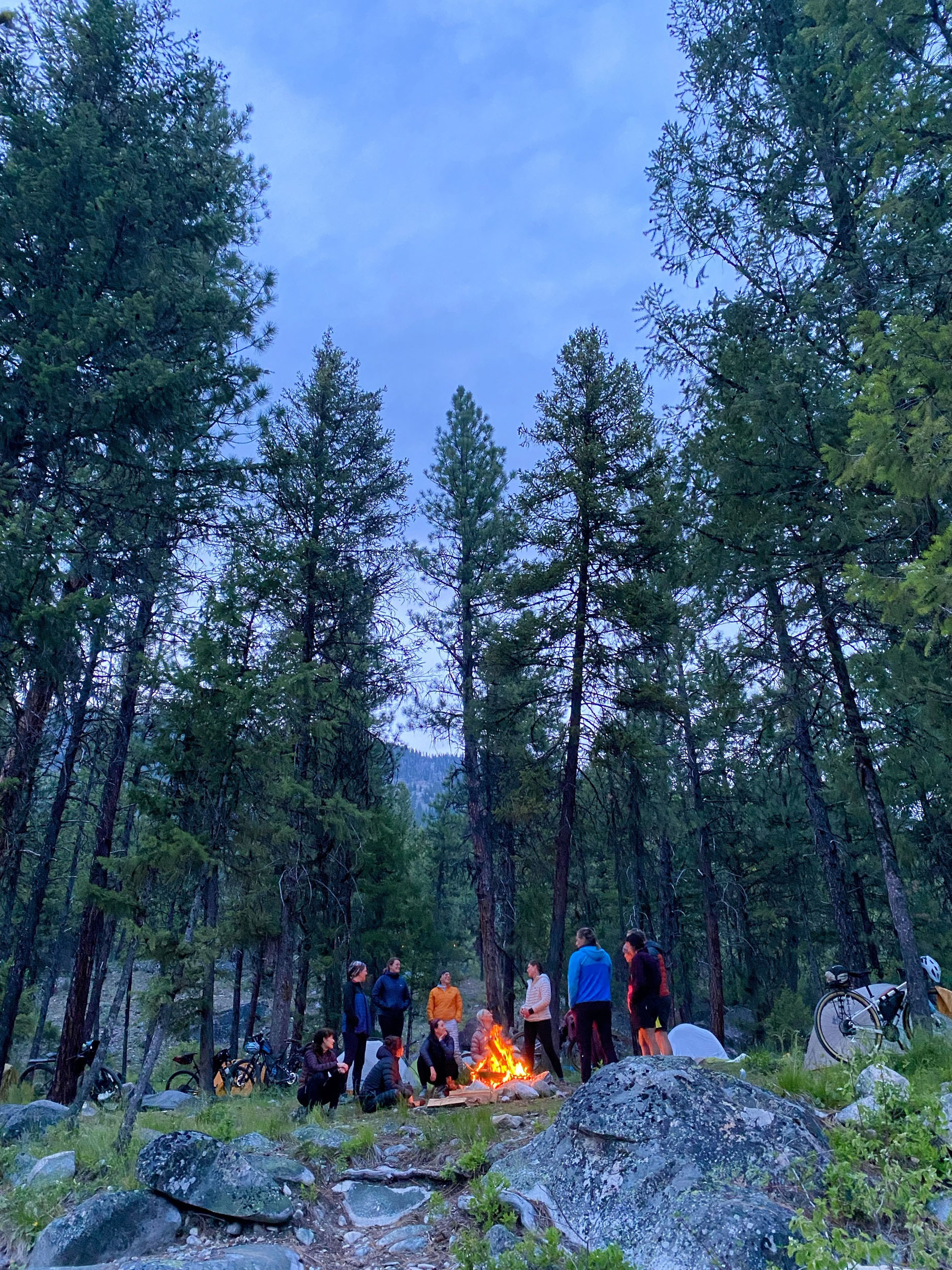
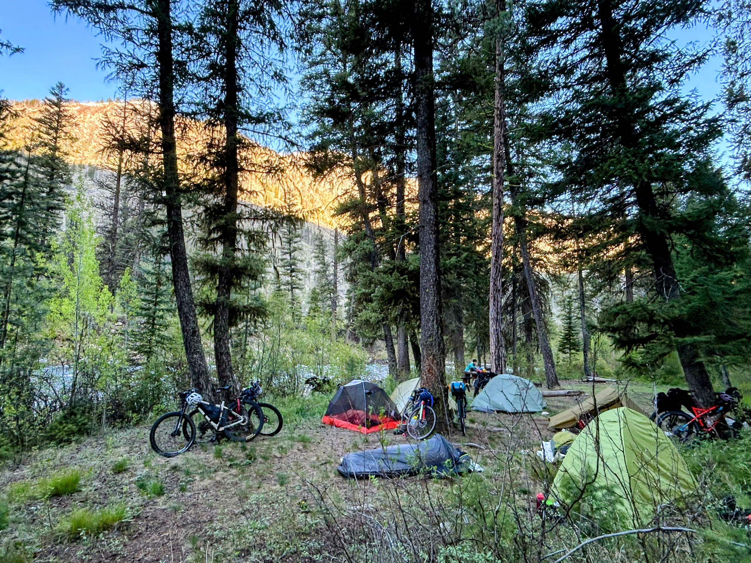
Salmon River Solitude is an immersive adventure deep into the mountains and rivers of central Idaho. Long days in the saddle are balanced by quiet evenings beside rivers or chatting with locals at the bar and grill. The result is a ride that is both demanding and meditative. For those seeking deep seclusion and the best of Idaho’s backcountry, this loop delivers an unforgettable experience.
Route Development
Cody is married to the founder of Idaho Women’s Bikepacking and does most of the route-planning for the group. Over the years, it has gotten harder to find fresh adventures for the group that haven’t been ridden over and over. This route was designed to be new and different, and it was planned through hours of studying Forest Service maps, motorcycle and snowmobile routes, and biking heatmaps. It was first scouted and photographed by a small group of IWBP riders in August of 2025.
A very similar route was published in 2023 by Don Keller on his Dark Sky Bikepacking website. Cody was unaware of Don’s route when he studied, planned, and documented the Salmon River Solitaire route.
Route Difficulty
The route presents a moderate level of difficulty best suited for intermediate to advanced riders. With an average of 105 feet of elevation gain per mile, prepare for tough climbs and significant elevation changes throughout. While the technical challenges are relatively minimal, some rough and loose stretches, extended descents (including one 5,800-foot continuous downhill), and brief stretches of singletrack add variety and require attention.
Logistically, the looped route is manageable, but it includes remote sections and unpredictable resupply points, so carrying several meals is necessary. Water is abundant, and navigation is straightforward for most of the route, with only minimal route-finding needed near the finish.


Submit Route Alert
As the leading creator and publisher of bikepacking routes, BIKEPACKING.com endeavors to maintain, improve, and advocate for our growing network of bikepacking routes all over the world. As such, our editorial team, route creators, and Route Stewards serve as mediators for route improvements and opportunities for connectivity, conservation, and community growth around these routes. To facilitate these efforts, we rely on our Bikepacking Collective and the greater bikepacking community to call attention to critical issues and opportunities that are discovered while riding these routes. If you have a vital issue or opportunity regarding this route that pertains to one of the subjects below, please let us know:
Highlights
Must Know
Camping
Food/H2O
Trail Notes
Resources
- McCall, one of Idaho’s most iconic mountain towns, makes for a great base to launch your adventure.
- Rugged and remote, with breathtaking scenery.
- Flexibility to dispersed camp nearly anywhere on the route, which is almost entirely within the Payette National Forest. There are also several established Forest Service campgrounds.
- Dozens of rivers and creeks, teeming with trout. Bring your fishing rod!
- Watch for Chinook salmon near the end of their 1,000+ mile upstream migration from Astoria, Oregon. Big Creek is a top spot to witness this amazing sight.
- Historic mining near-ghost towns add character and a glimpse into early 20th-century life in the mountains.
- Yellow Pine’s 18-hole forest golf course, where “elk have the right of way on the un-fairways.” It’s free, including clubs to borrow at the General Store.
- Unique backcountry airstrip and the nearby Big Creek Lodge, beautifully restored after fire destroyed the original in 2008.
- Optional 10-mile Loon Lake Loop add-on for some fun singletrack and a B-23 bomber crash site.
- Stop for a soak or a stay at Burgdorf Hot Springs (private), two miles off the route.
When to go
- Snow in the higher areas can linger well into the early summer.
- Rideable months are July through October, with August or September being ideal.
Logistics
- Boise Airport is two hours away.
- McCall offers all services, including bike shops. The staff at Gravity Sports includes avid bikepackers who know the sport and region well.
- Free overnight parking is available in McCall. We recommend the gravel lot behind City Hall (no trailers). Other options can be found here.
What Bike and Gear
- This route is suitable for mountain or gravel bikes. If you have the choice, a suspension fork or stem would make for a more enjoyable time.
- Recommended tire width is 2.2+ inches for an MTB or 45+ mm for gravel tires.
Dangers and Annoyances
- You will be deep in cougar, wolf, and black bear country. Food should be stored accordingly.
- Wear extra bright colors if riding during hunting season.
- Yellow Pine and its nearby campgrounds can get very busy during the annual Harmonica Festival.
- The Brush Creek Road area “side quest” will require a very short stretch of route-finding, but is well worth it! The road will seem to fade to next to nothing just before crossing Brush Creek at mile 145. Follow the faint trail and soon you’ll be on a narrow non-motorized only trail through lush forest.
- There is no bridge at Brush Creek; if it is running too high to cross safely (very unlikely by late summer to fall), double back to take Warren Wagon Road to Eastside Drive.
- Nearly all the route is within the Payette National Forest, so opportunities for informal dispersed camping are plentiful.
- Several formal campgrounds are available as well and are noted in the downloadable GPX file.
- Lodging may be available in Yellow Pine, Big Creek, and Secesh.
- Meals and limited resupply may be available in Yellow Pine, Big Creek, Warren, and Secesh.
- Small business hours of operation can be unpredictable. Call ahead to verify, particularly if you will be relying on them for meals.
- There is frequent access to water for filtering throughout the route.
- The Warren Summit climb is steep and exposed and will be the longest stretch without water.
- Bring 3-4 liters of carrying capacity, but 1-2 liters at a time may be sufficient for most of the route.
Three-day Itinerary
location McCall to Big Creek
Day 1 (70 mi +6,200′)
Begin heading east out of McCall, passing Little Payette Lake, and climbing to Lick Creek Summit. Descend to the confluence of the east and south forks of the Salmon River, then enjoy the pleasant stretch along the East Fork to the tiny historic town of Yellow Pine (mile 50).
Leave Yellow Pine on Stibnite Road, still following the East Fork. A few miles out of town, turn north along Profile Creek to ascend Profile Pass. Then descend about 10 miles to Big Creek/Edwardsburg, where there are a few good camp options.
location Big Creek to Warren
Day 2 (45 mi +8,000′)
Start right off with a stiff climb along Government Creek to Elk Summit, the highest point of the route. Then enjoy the massive 5800-foot uninterrupted descent down Elk Creek to rejoin the South Fork of the Salmon River (mile 100). Rest, eat, and refill water at the river (there is also a spring 1/4 mile past the bridge.
The climb to Warren Summit is the most challenging part of the route. The first two-thirds are mostly exposed, and there may be little to no water by late summer, so start with plenty to drink. Watch and listen for trickles of streams starting at about mile 8 of the climb.
Enjoy Warren Summit, then roll down a few more miles to the near-ghost mining town of Warren. If the Baum Shelter Bar and Grill is open, they have excellent food and hospitality! There are a few good camp options in the Warren area.
location Warren to McCall
Day 3 (45 mi +2,700′)
After the first two grueling days, this one will be a pleasant and relatively easy return to McCall for some well-earned burgers and drinks. Or consider adding on the 10-mile Loon Lake Loop for some fun singletrack and a B-23 bomber crash site. You can grab the GPX file here. Note that the singletrack route will take you near the lake, but you will need to choose whether you go around the lake clockwise or counter-clockwise to reach the site.
Enjoy scenic riding along Steamboat Creek, the Secesh River, Summit Creek, Upper Payette Lake, and finally finishing along the quiet east side of Payette Lake.
Four-day Itinerary
Here is a suggested itinerary if you want to relax, explore, or fish a bit more along the way.
- Day 1: McCall to Yellow Pine (50 miles +3,500’).
- Day 2: Yellow Pine to S. Fork of the Salmon River (50 miles +6,500’).
- Day 3: S. Fork to Chinook Campground (24 miles +5,000’).
- Day 4: Chinook Campground to McCall (38 miles +2,000’).
Additional Resources
- Yellow Pine’s newsletter is posted weekly, and is especially helpful for road/snowmelt intel.
- Big Creek Lodge is just off the route and offers higher-end lodging and meals (reservation required).
- Don’t miss the historic walking (or biking) tour in Warren.


Terms of Use: As with each bikepacking route guide published on BIKEPACKING.com, should you choose to cycle this route, do so at your own risk. Prior to setting out check current local weather, conditions, and land/road closures. While riding, obey all public and private land use restrictions and rules, carry proper safety and navigational equipment, and of course, follow the #leavenotrace guidelines. The information found herein is simply a planning resource to be used as a point of inspiration in conjunction with your own due-diligence. In spite of the fact that this route, associated GPS track (GPX and maps), and all route guidelines were prepared under diligent research by the specified contributor and/or contributors, the accuracy of such and judgement of the author is not guaranteed. BIKEPACKING.com LLC, its partners, associates, and contributors are in no way liable for personal injury, damage to personal property, or any other such situation that might happen to individual riders cycling or following this route.
Further Riding and Reading
Here are some connected/nearby routes and related reports...

Please keep the conversation civil, constructive, and inclusive, or your comment will be removed.