


SAND: Segment 4 – Namib
Distance
745 Mi.
(1,199 KM)Days
15
% Unpaved
95%
% Singletrack
1%
% Rideable (time)
99%
Total Ascent
22,618'
(6,894 M)High Point
5,377'
(1,639 M)Difficulty (1-10)
6?
- 2Climbing Scale Easy30 FT/MI (6 M/KM)
- 4Technical Difficulty Fair
- 6Physical Demand Moderate
- 7Resupply & Logistics Strenuous
Contributed By

Johan Wahl
A Whale Away
Let’s not sugarcoat it: The south of Namibia, particularly those parts within or adjacent to the Namib Desert, are painfully inaccessible for bikepacking when the focus is on travelling well off-road and away from the main routes. The reality is that alternative tracks and trails are few and far between, they’re often fragmented over vast areas and rarely open to the public. Private land is increasingly being restricted in the interest of luxury tourism, parks are restricted for conservation, and what remains of the desert is mostly restricted on behalf of mining and prospecting. Indeed, for how vast the desert is, an awful lot of it is off limits. National roads and highways, it seems, are practically the only roads in the region that are free to explore.
Interestingly, this is not the case throughout the country. The northern areas—such as Damaraland and the Koakoveld—offer vastly more options for freely travelling off-road. Up there, unrestricted four-by-four tracks and trails in open conservancies and community land are abundant, and, accordingly, those tracks become the staple for the remainder of the SAND route through Namibia (see SAND Segment 5). But there are still thousands upon thousands of square kilometres of mesmerizingly beautiful desert terrain encapsulated in the south, not including some of them in the SAND route would be a travesty.
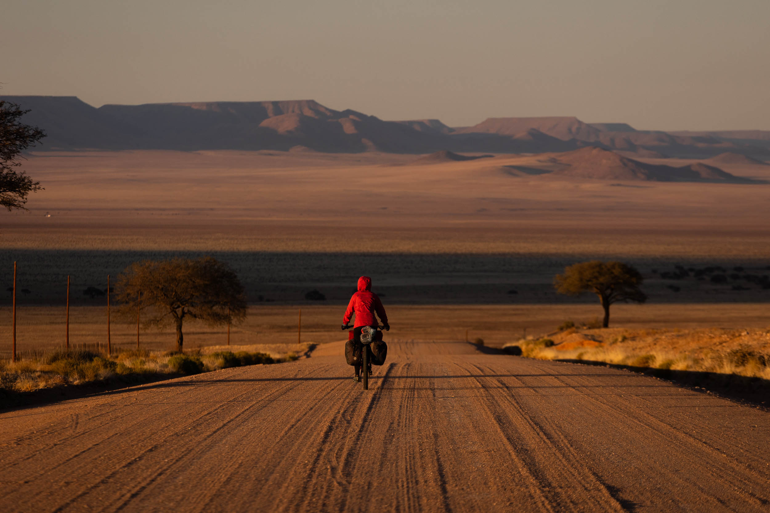
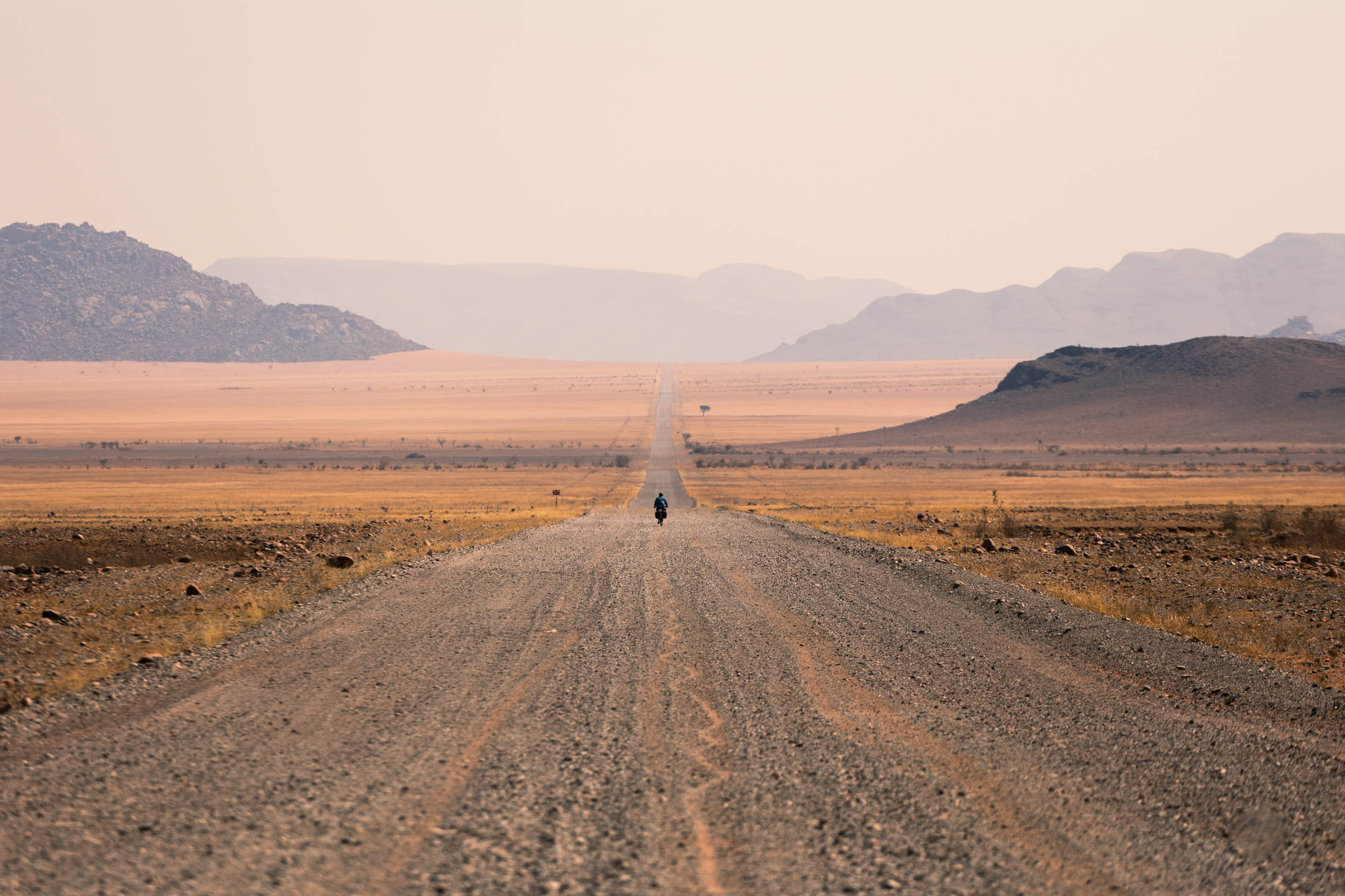
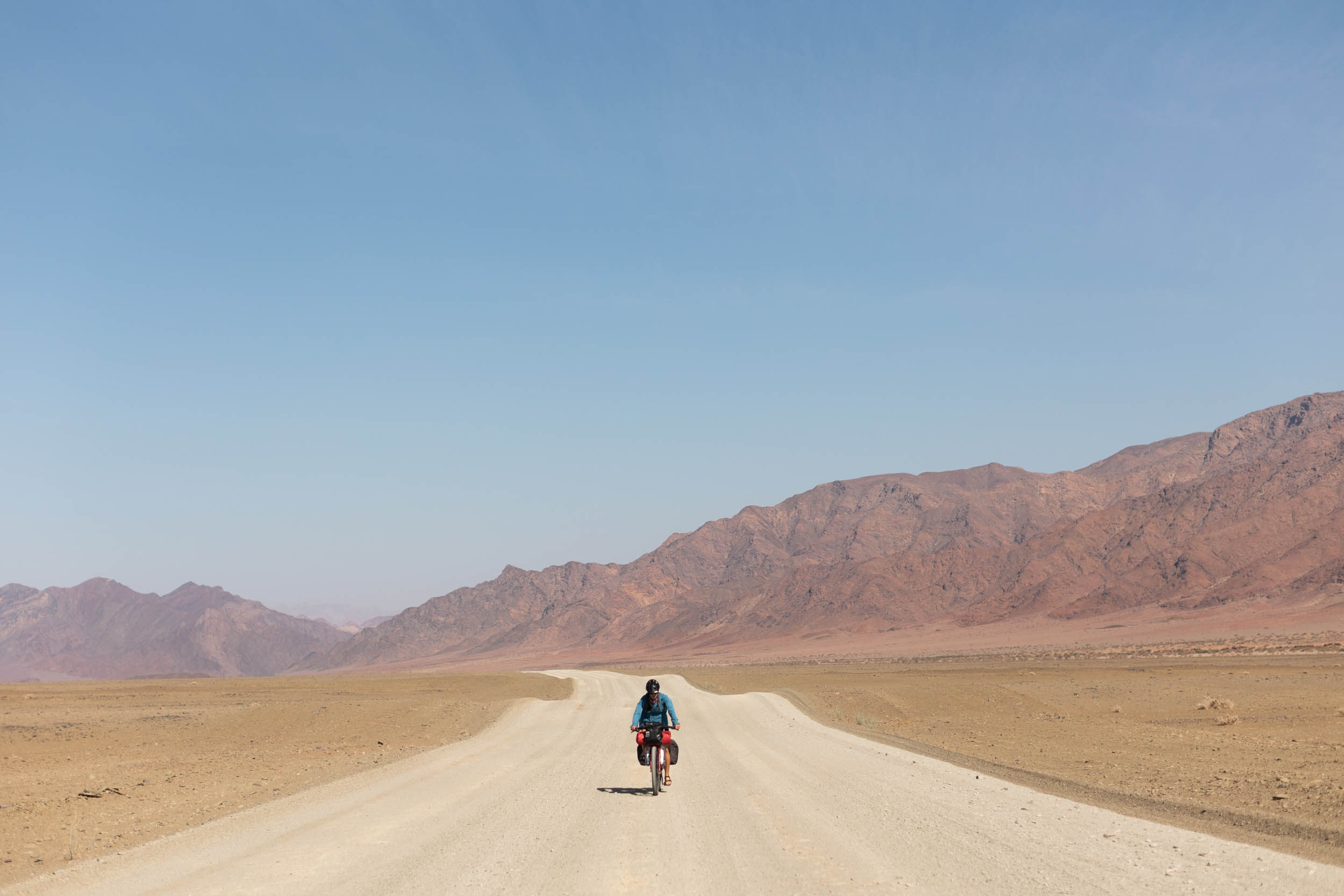
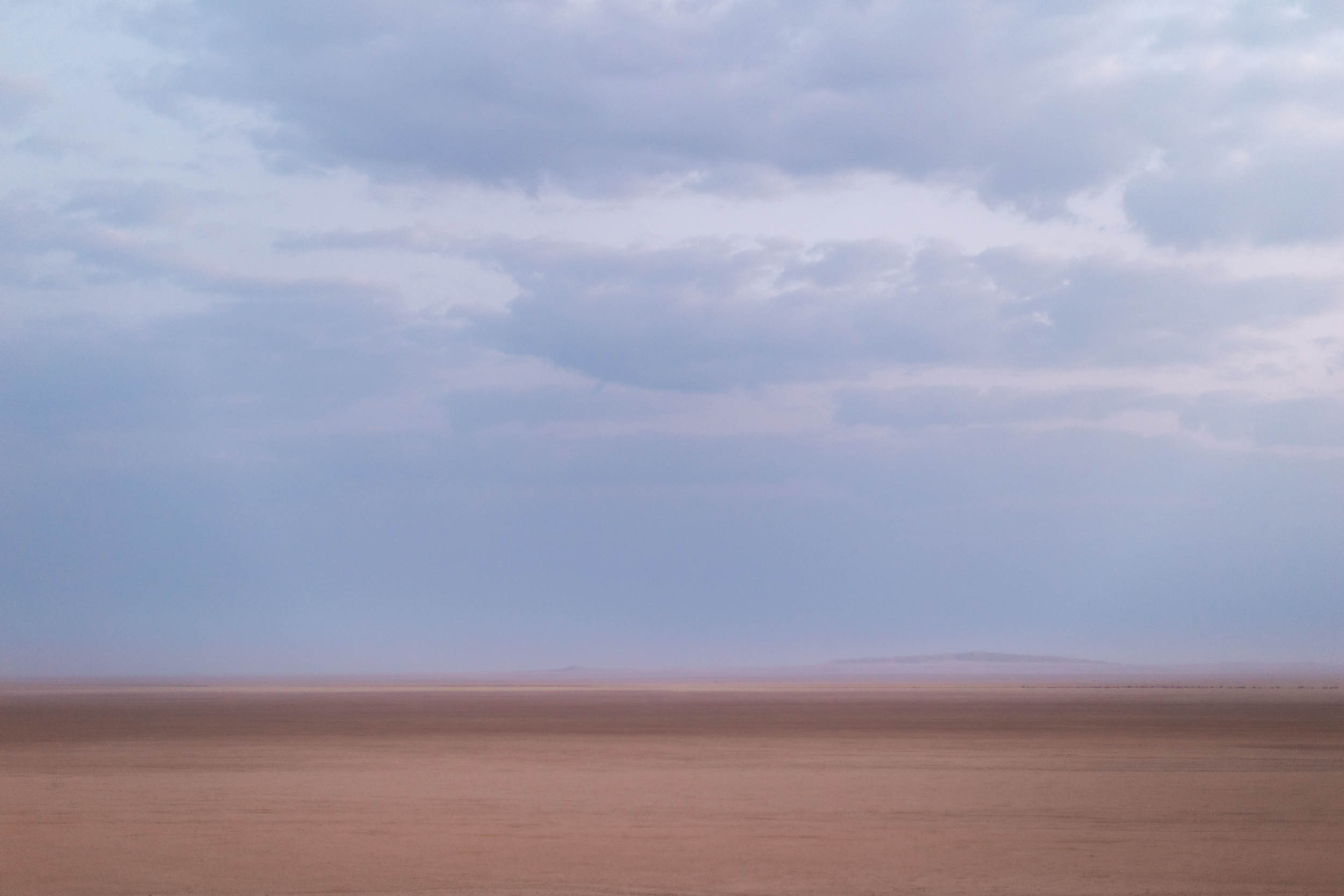
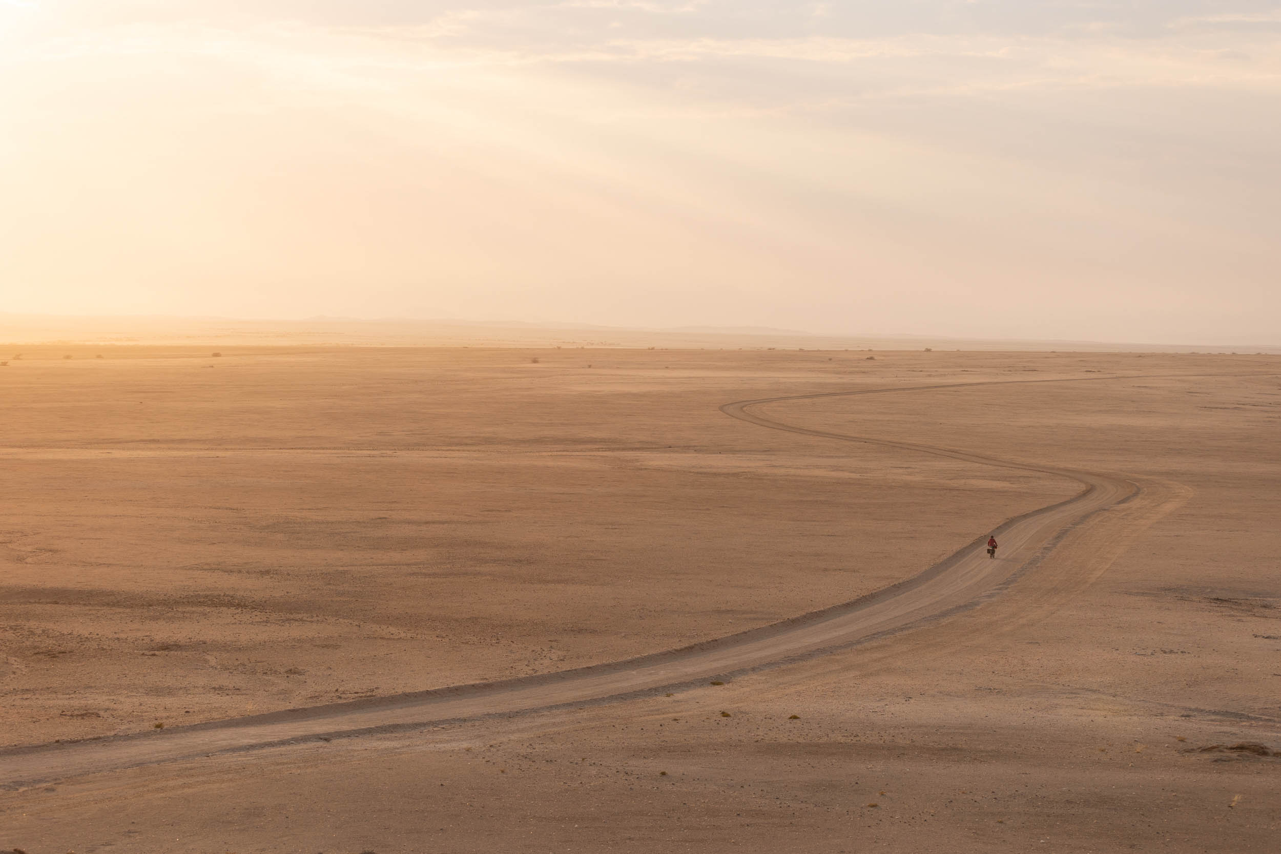
The good news is that the public road network through the Namib, even when accounting for the larger roads and highways, is not all lacklustre. Indeed, it turns out, you hardly have to leave the highways to have a decently immersive bikepacking experience. For one, nearly all roads are unpaved, and, in fact, some of them are rather burly considering their national road status. Additionally, most of them are dead quiet in terms of traffic and cover terrain that’s stunning and exceedingly remote. All things considered, these desert roads make for some surprisingly fine riding. This segment takes full advantage of it with a strong focus to seek out the quietest roads, avoiding pavement, and maximising the number of sights and attractions along the way.
The route follows a relatively straightforward course, starting with a crossing of the Namibian Richtersvel. It then travels up, east of the Fish River Canyon to the edge of the Namib Naukluft Park and skirts the park boundary, travelling right through the heart of the Namib until it crosses the Kuiseb River Canyon. Thereafter, it turns coastwards and follows the dry Kuiseb all the way down to Walvis Bay and, finally, Swakopmund.
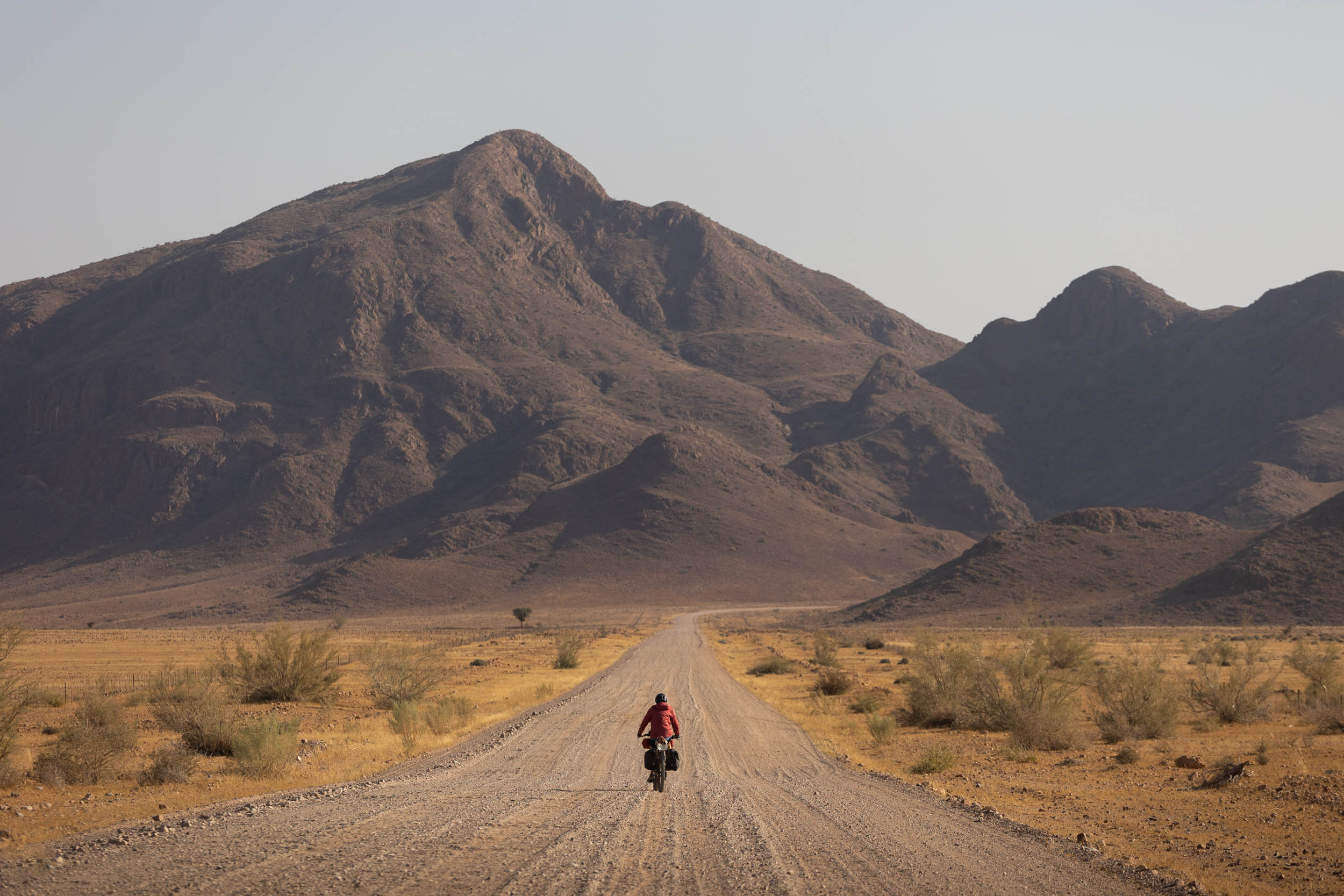
Naturally, it takes on a vastly different feel to some of the SAND route’s other segments. It’s more of a gravel grind and lacks most of the technical challenges and off-road shenanigans that otherwise characterise the route. However, it’s by no means less of an adventure and certainly doesn’t lack any of the beauty or immersion that’s key to the route overall.
Route Difficulty
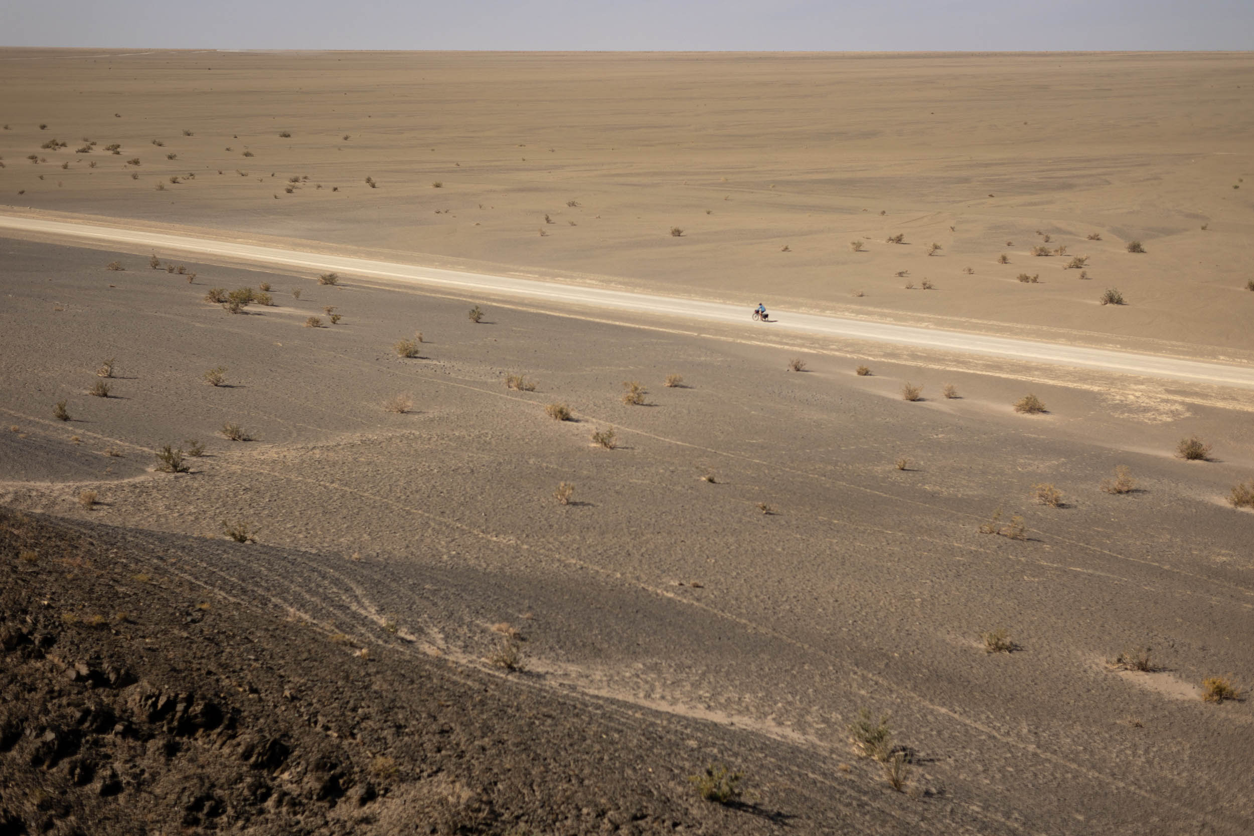
Strong winds, heat, and long distances between resupplies are the main challenges here. Technically, and otherwise, the segment’s riding is very straightforward.
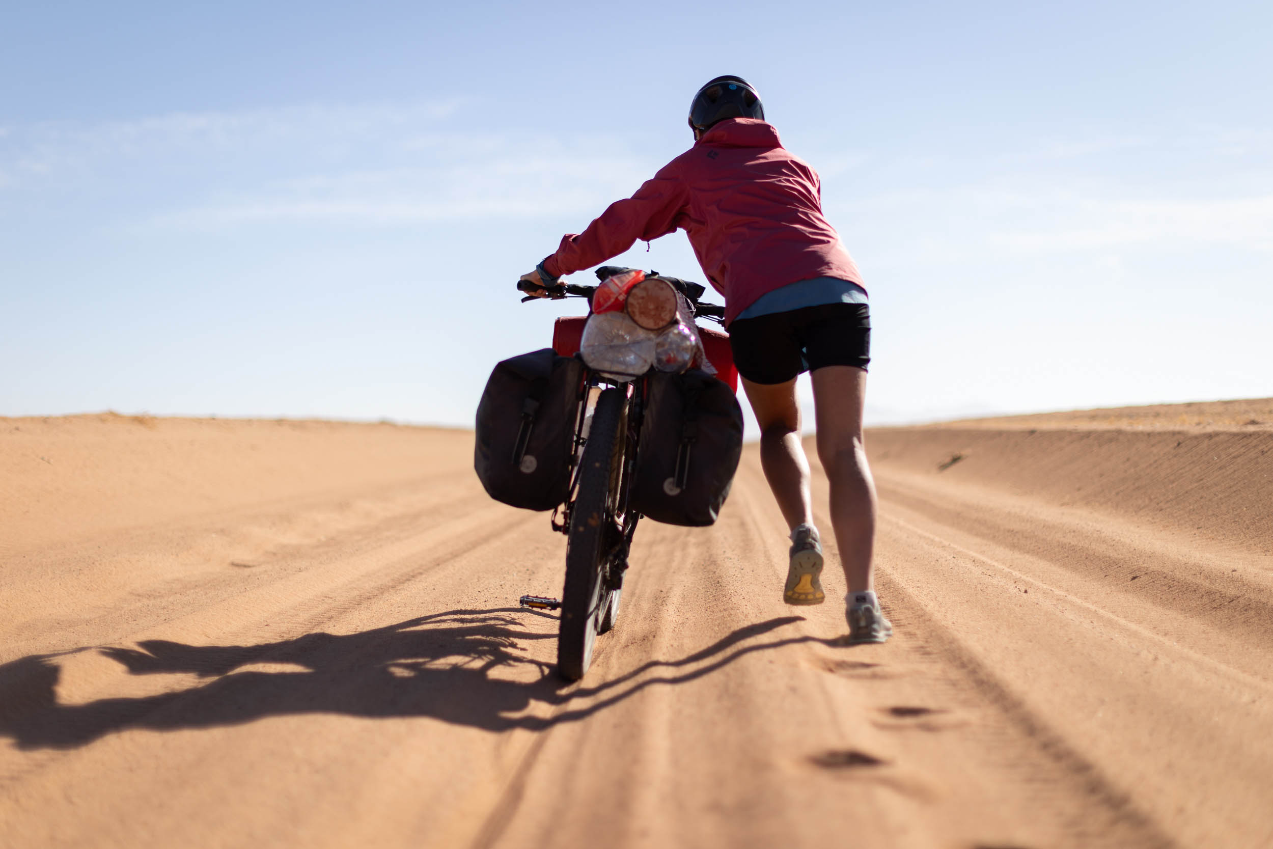
Technical difficulty (4/10): The majority of the segment is on non-technical gravel roads. Their state can fluctuate, but at worst, expect long stretches of deep corrugations and occasional soft sand where you might have to get off and walk a few kilometres.
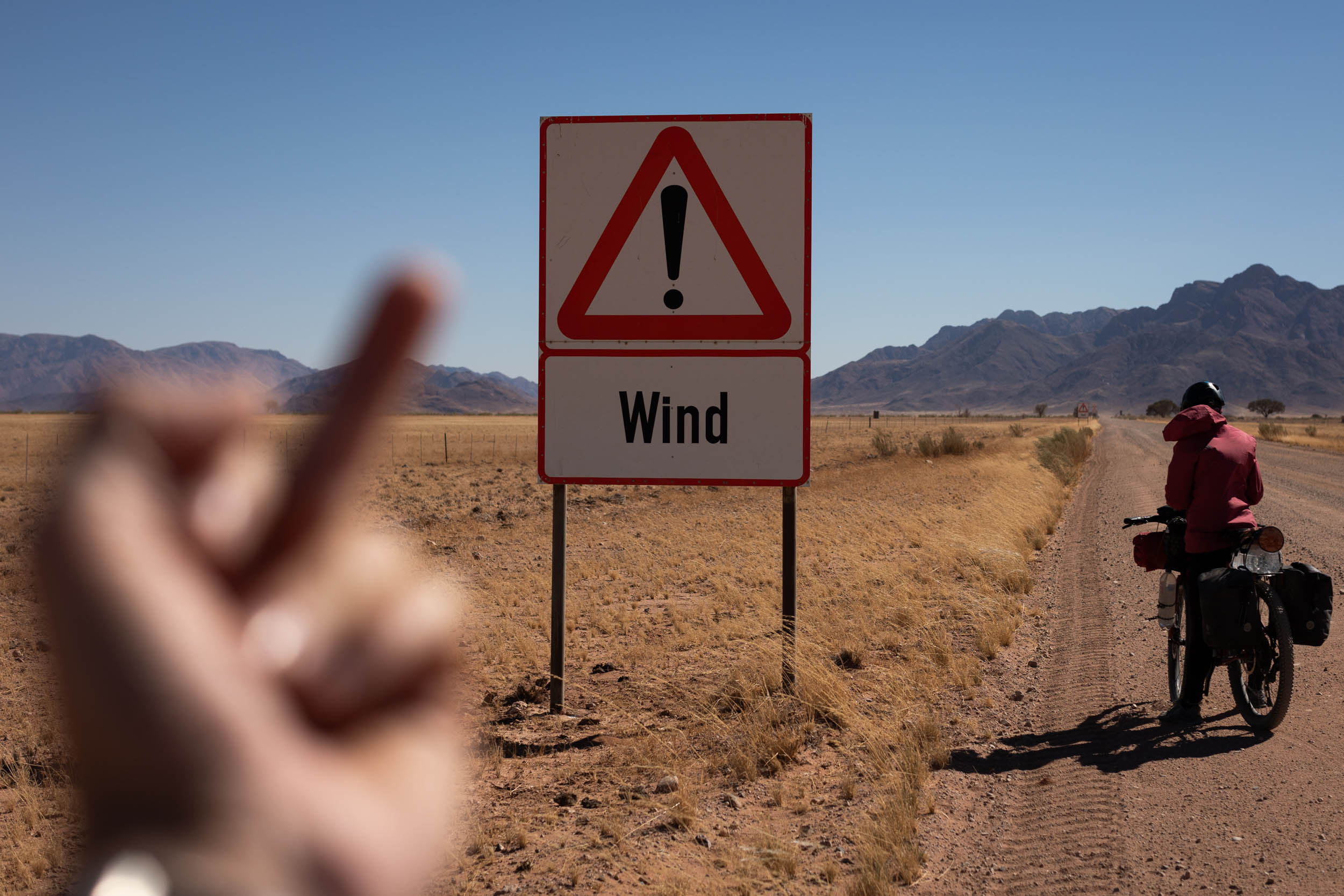
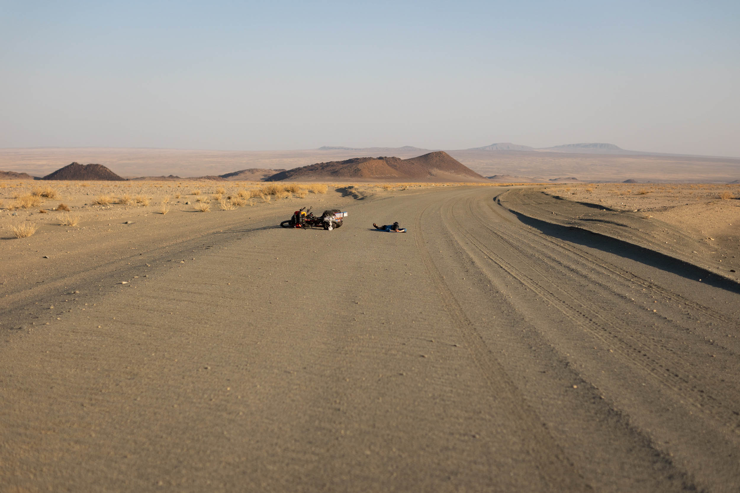
Physical demand (6/10): The elevation gain on this segment is minimal, but it remains challenging, primarily due to prevailing conditions, wind being the biggest factor. The Namib is notorious for wind. It’s not uncommon, on those long straight sections, to battle headwinds for days on end. The additional burden of carrying large amounts of water also adds to the difficulty.
Resupply and Logistics (7/10): Towns and shops are extremely far apart in the Namib, often more than 200 kilometres from one to the next, with not much in between. Additionally, many of the few available resupply points are mere tourist curio shops offering sweet treats and junk food only, no real substance. It goes without saying that water and meal planning is critical and must not be taken lightly. One big respite is the voluntary support often provided by passing vehicles, especially locals.
Route Development
The SAND Bikepacking route was developed by South African bikepacker and photographer Johan Wahl and his partner Jana. They first attempted the route in 2021, intriguing us with inspiring images as they rode, but it wasn’t until recently that Johan fine-tuned his ideas from that initial journey into a structured route that could be repeated and published here. Private property and land access were major obstacles during that initial journey, and it took in-depth consultation with locals and landowners and several return trips to resolve. He also exchanged ideas with several prominent bikepacking-minded members of the local cycling community to ensure that the route would be well received. Longevity was one of the key considerations in planning this route, and the belief is that with this route now accessible to all, the future is bright for bikepacking in Southern Africa. Use these links to dig into Segment 1, Segment 2, and Segment 3, and stay tuned for Segment 5 of this incredible 5,500+ kilometer route.
Submit Route Alert
As the leading creator and publisher of bikepacking routes, BIKEPACKING.com endeavors to maintain, improve, and advocate for our growing network of bikepacking routes all over the world. As such, our editorial team, route creators, and Route Stewards serve as mediators for route improvements and opportunities for connectivity, conservation, and community growth around these routes. To facilitate these efforts, we rely on our Bikepacking Collective and the greater bikepacking community to call attention to critical issues and opportunities that are discovered while riding these routes. If you have a vital issue or opportunity regarding this route that pertains to one of the subjects below, please let us know:
Highlights
Must Know
Camping
Food/H2O
Trail Notes
Resources
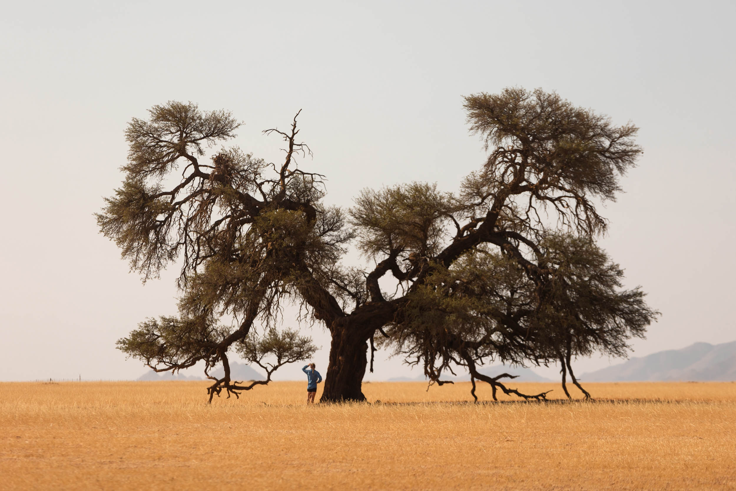
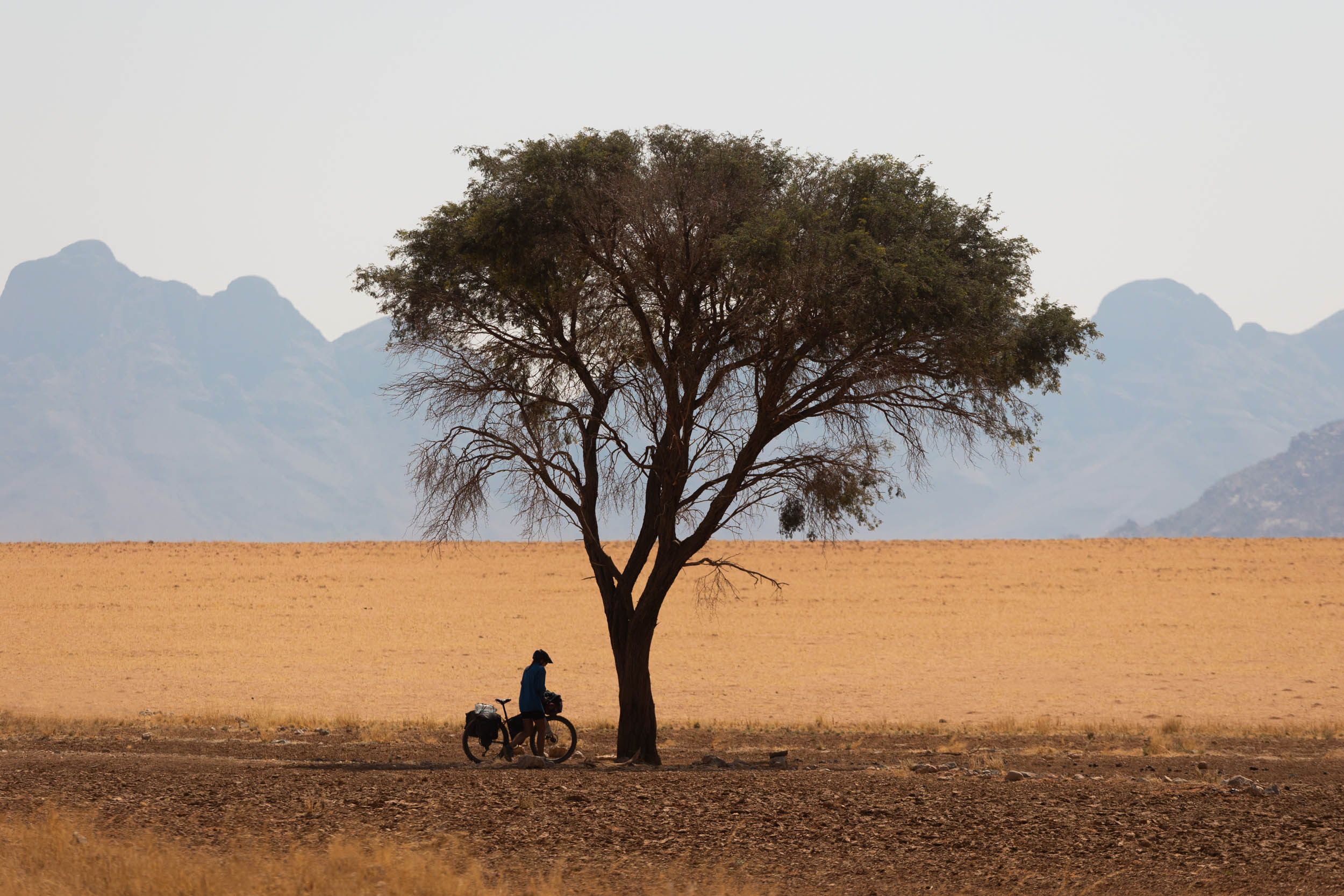
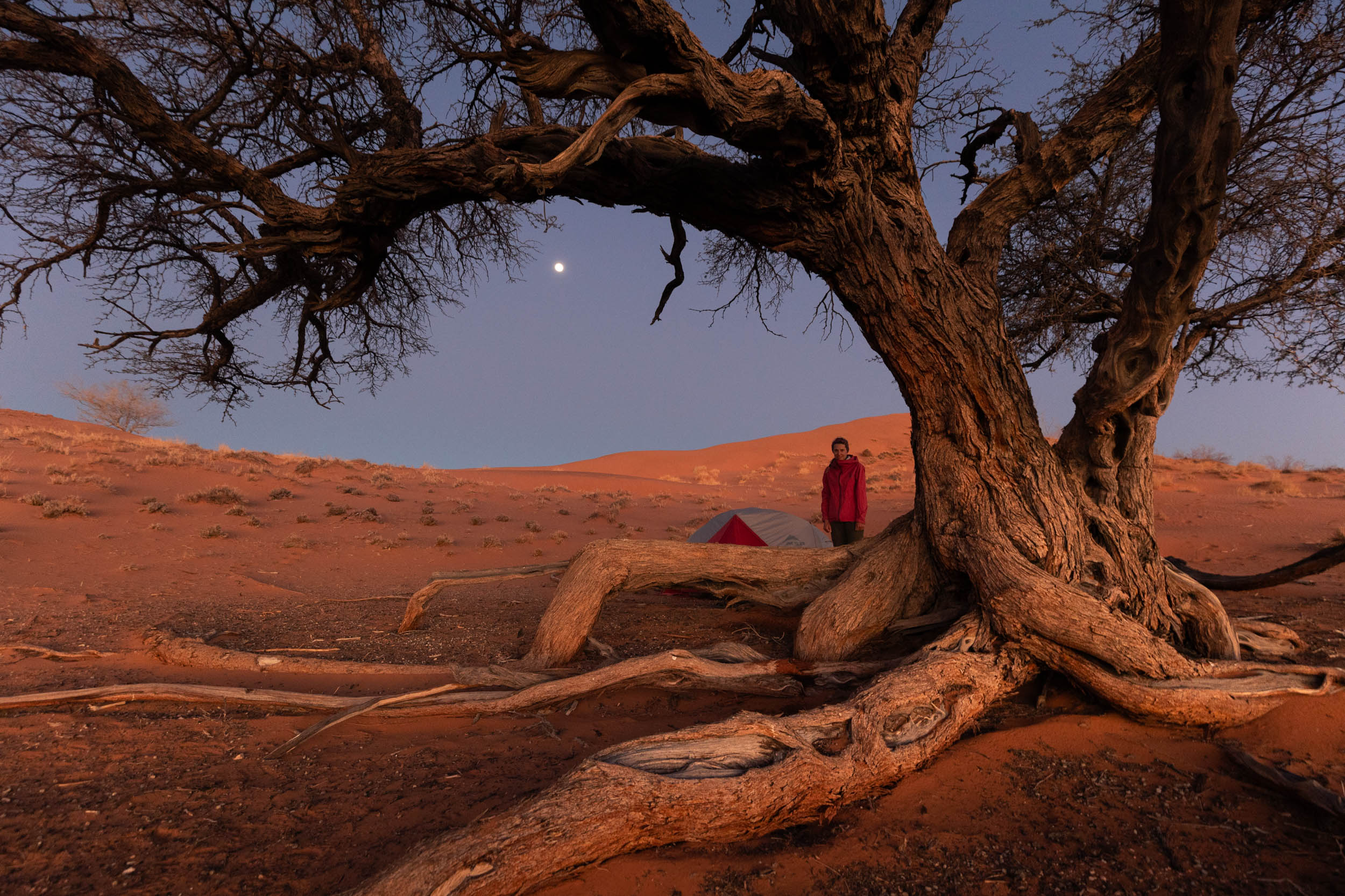
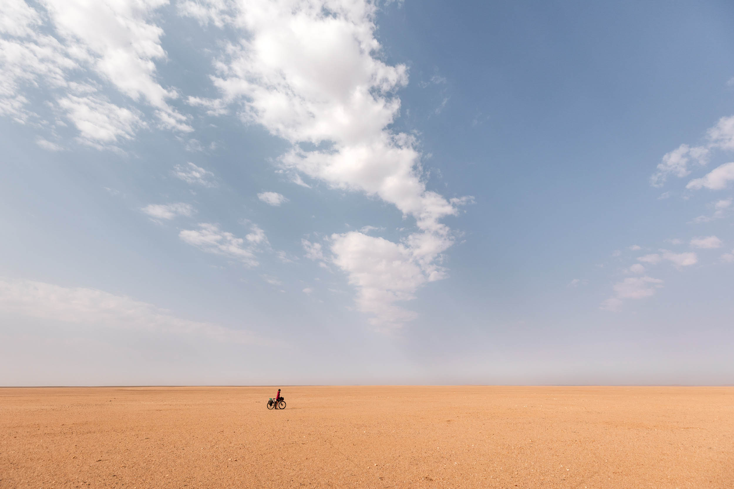
- Absolute Solitude: Empty roads and vast, barren desertscapes for miles and miles.
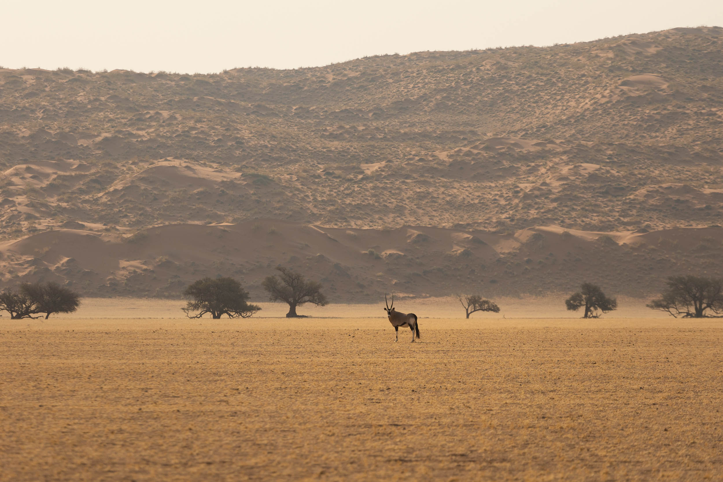
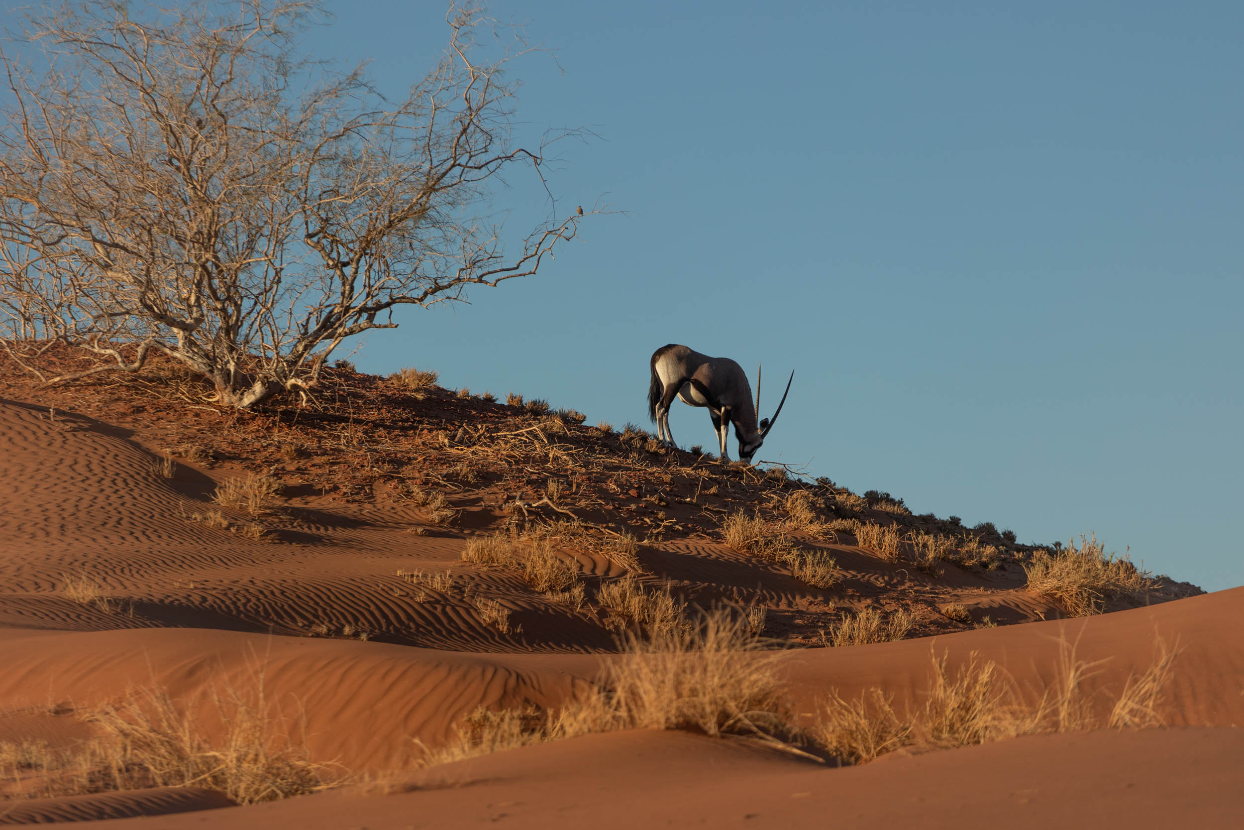
- Wildlife: No Namib scene is complete without an oryx or zebra in the distance. These and other game species are plentiful in the region.
- Stargazing: With virtually zero air pollution, the night sky in the Namib is exceptional.
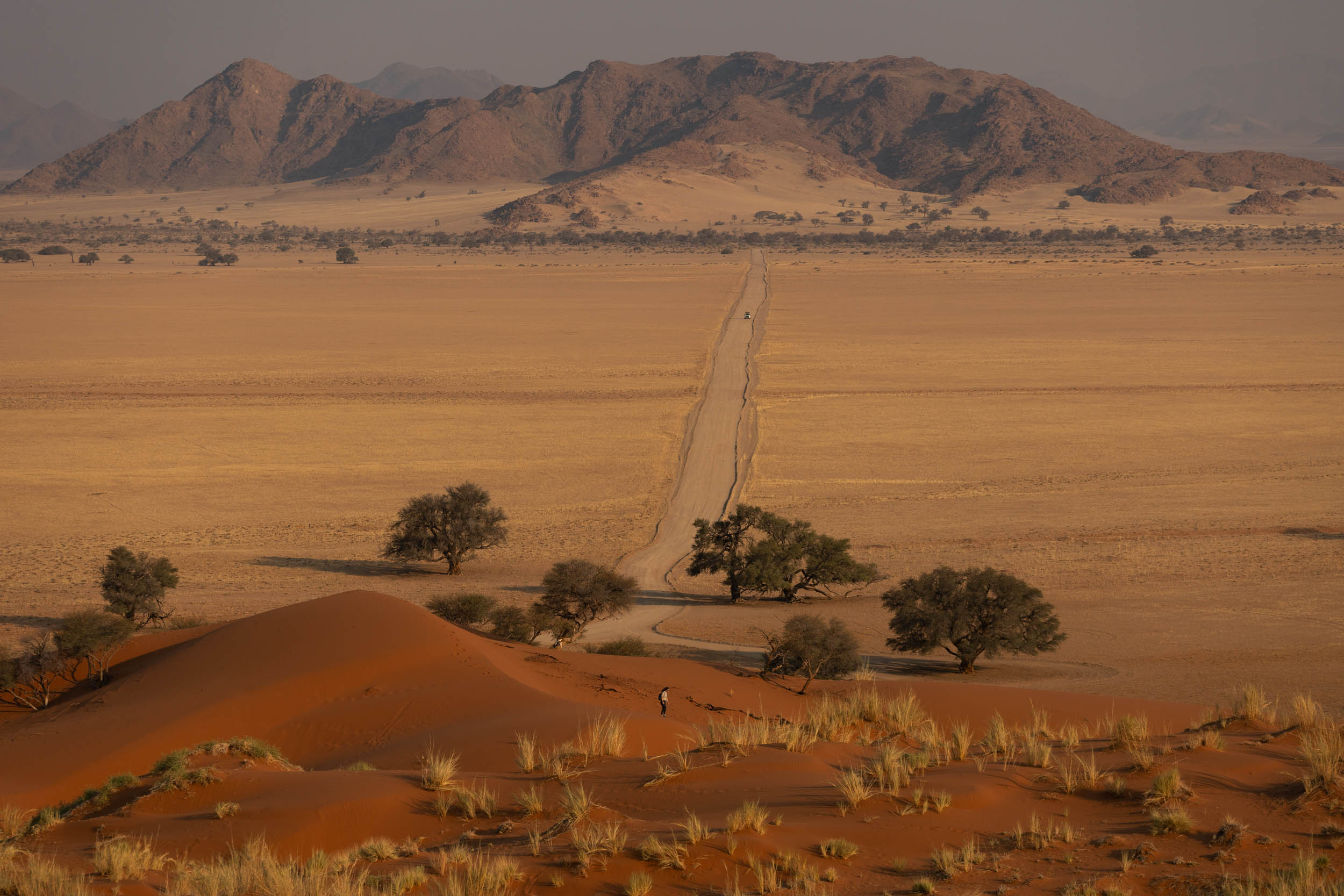
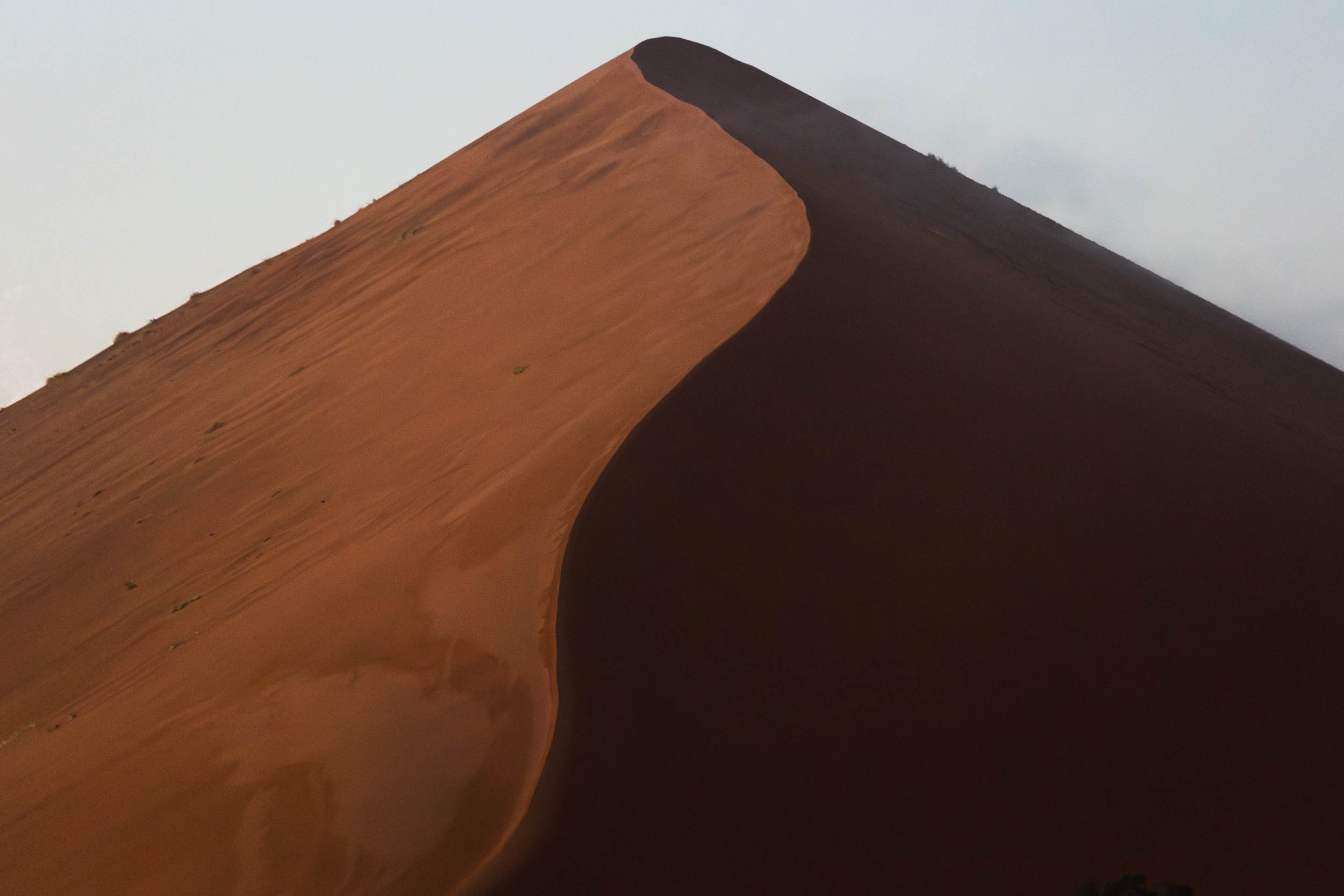
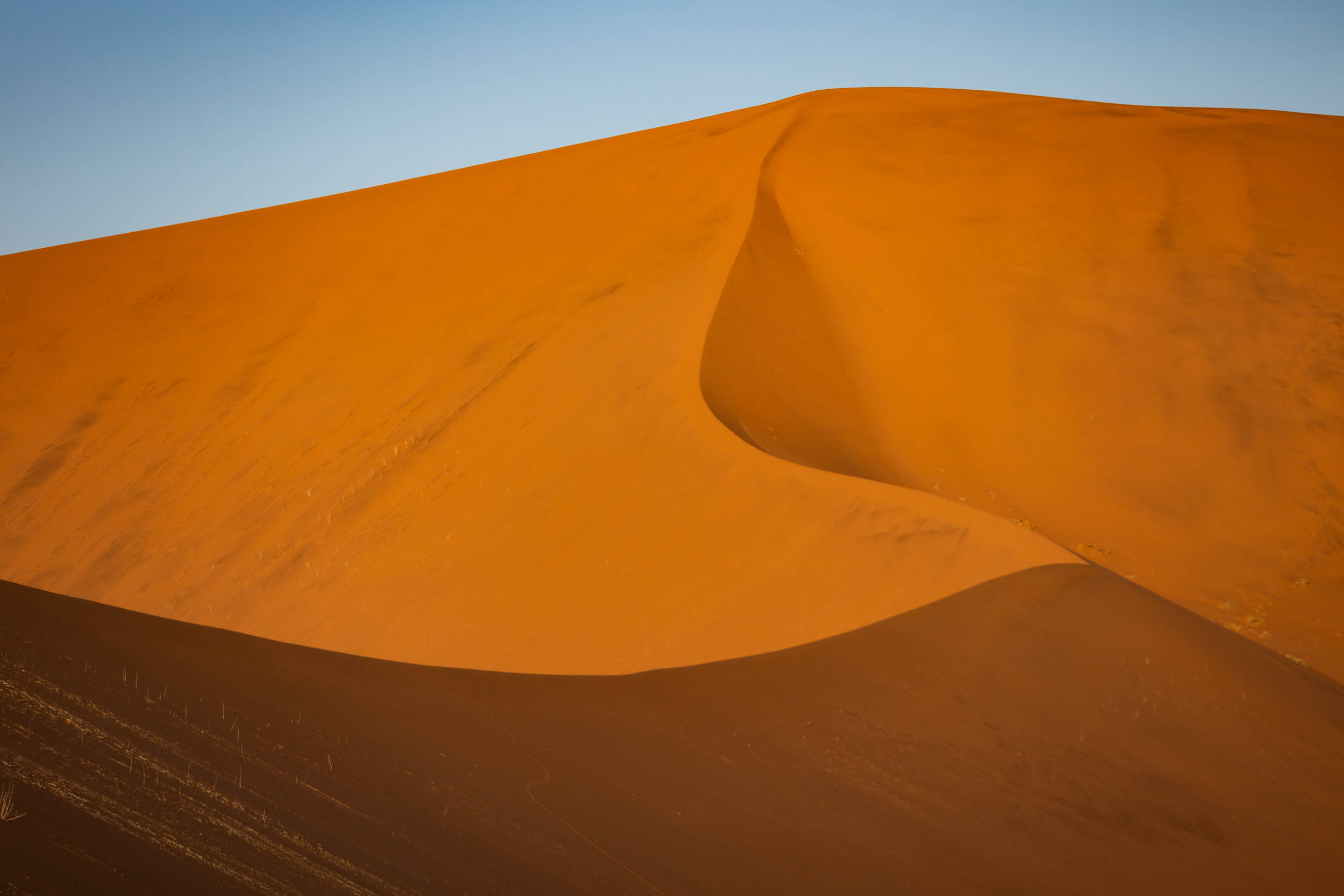
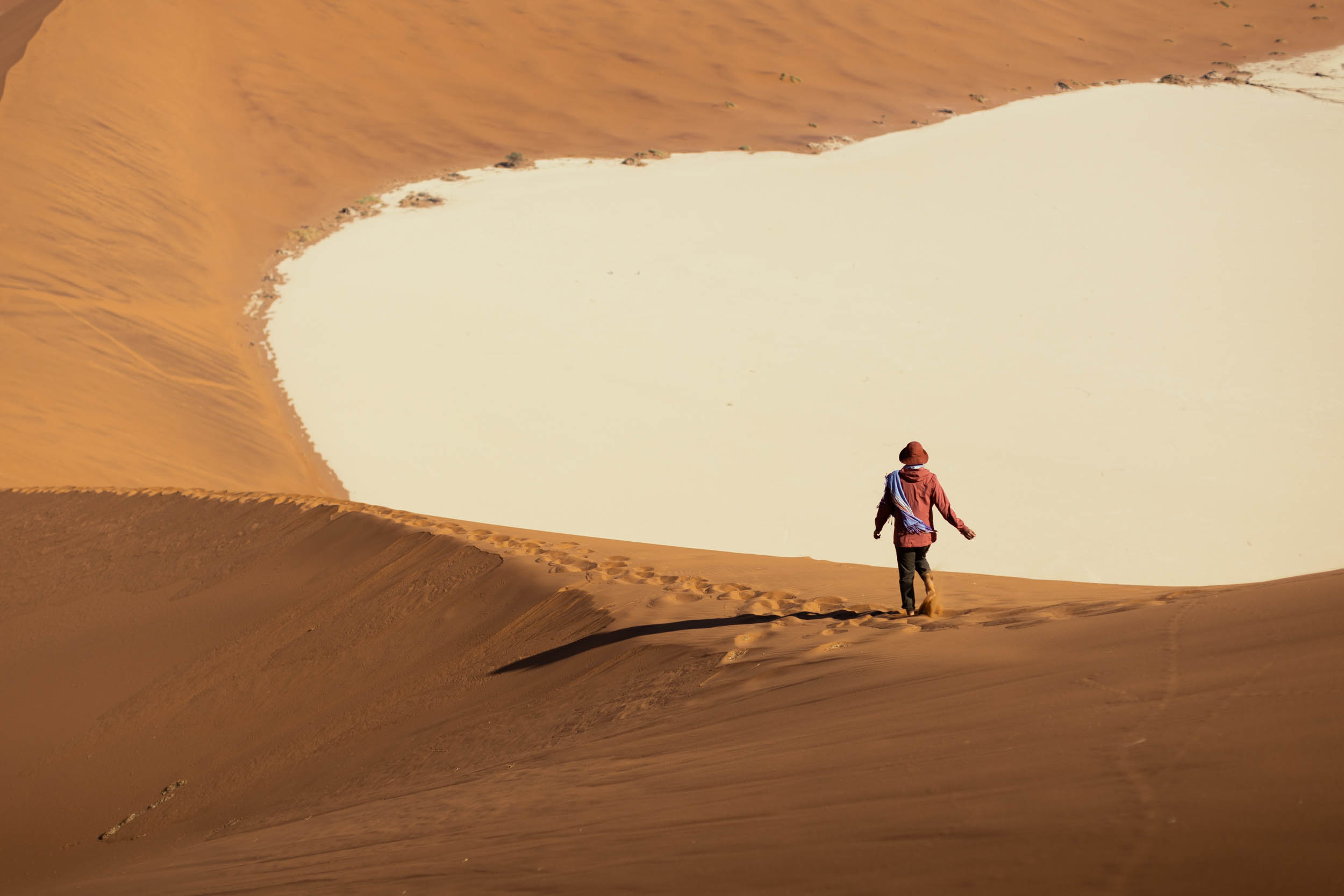
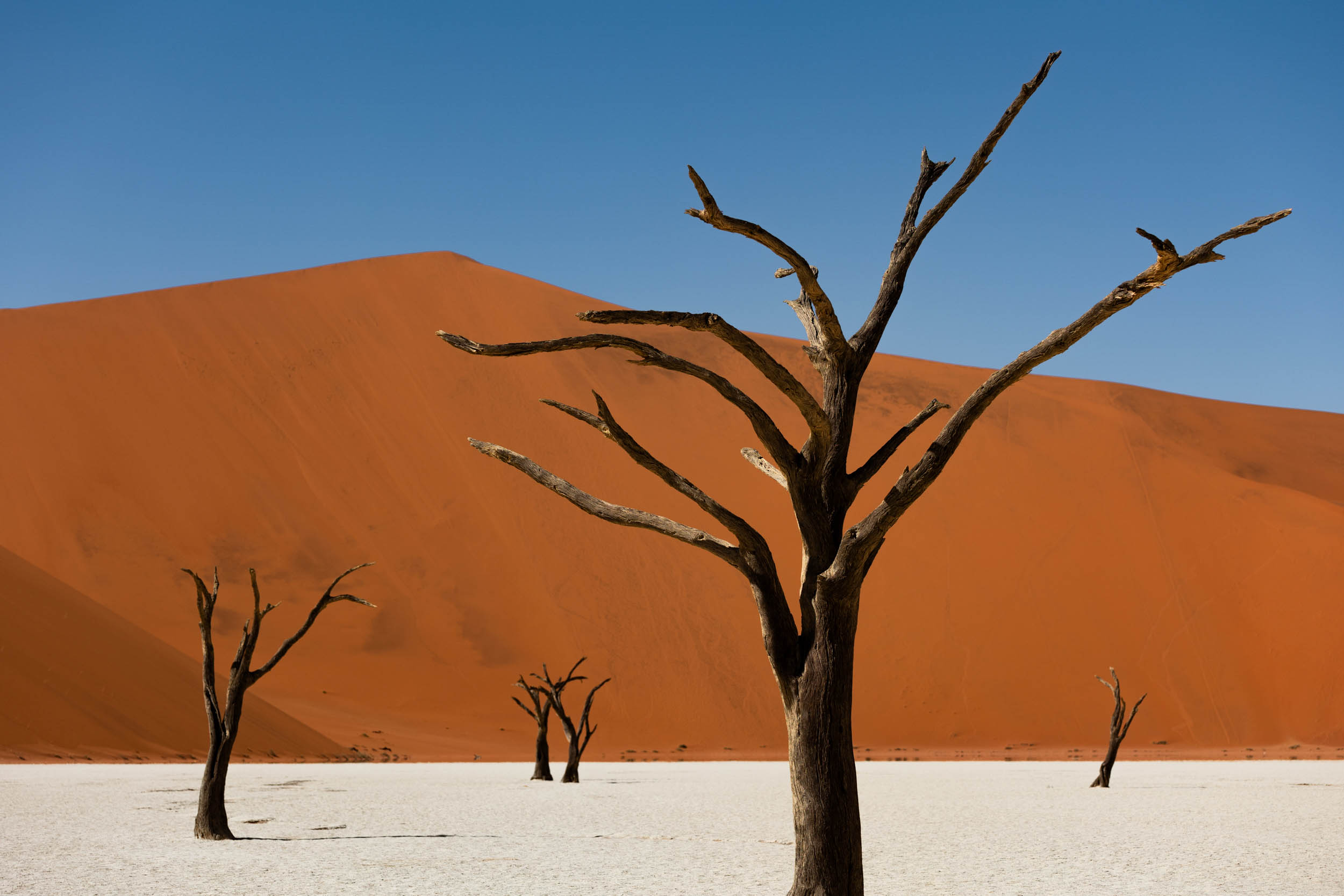
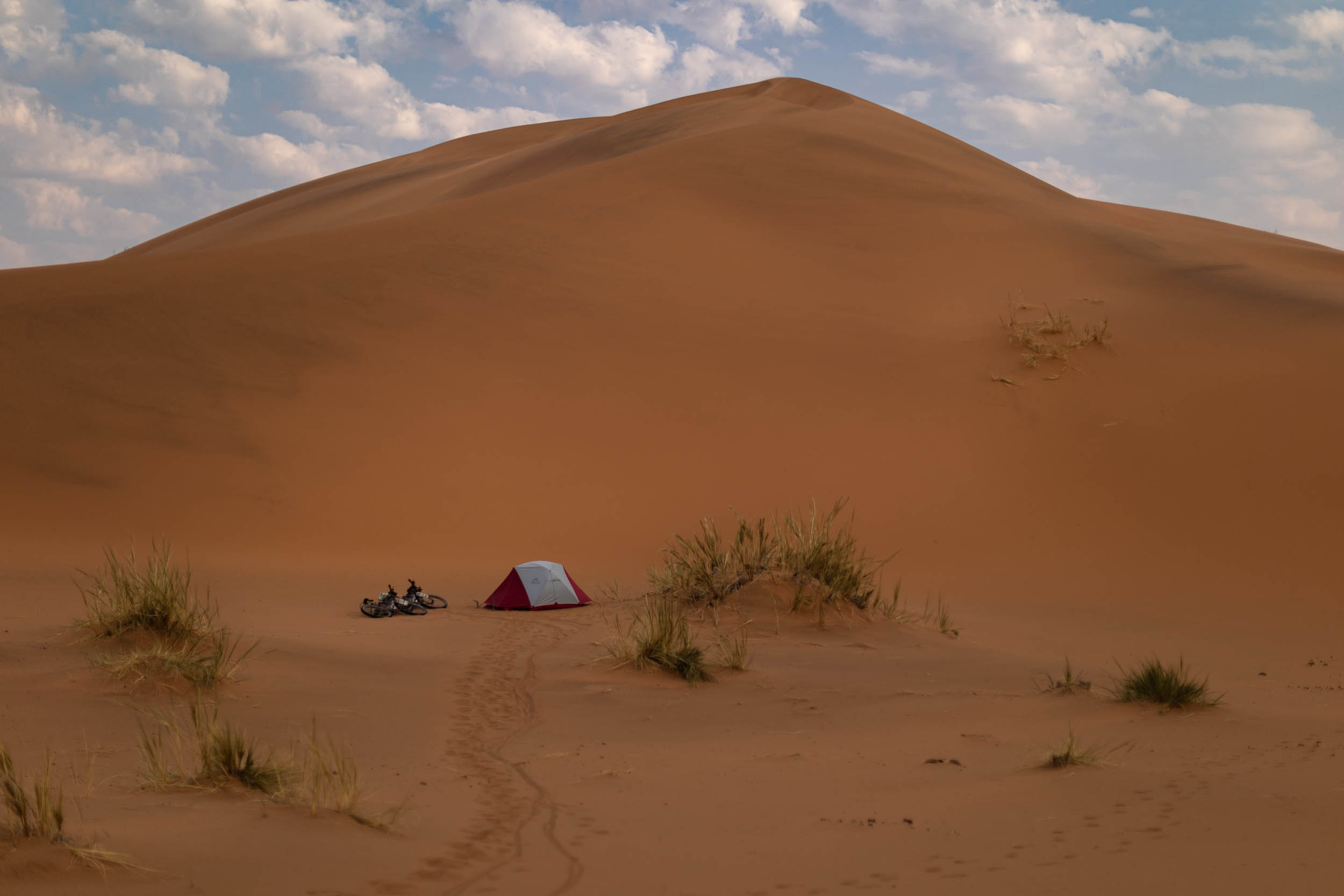
- The Namib Sand Sea: The spectacular red dunes of the coastal desert. A UNESCO World Heritage Site.
- Sossusvlei and the Namib-Naukluft National Park: Massive sand dunes and jaw dropping desertscapes.
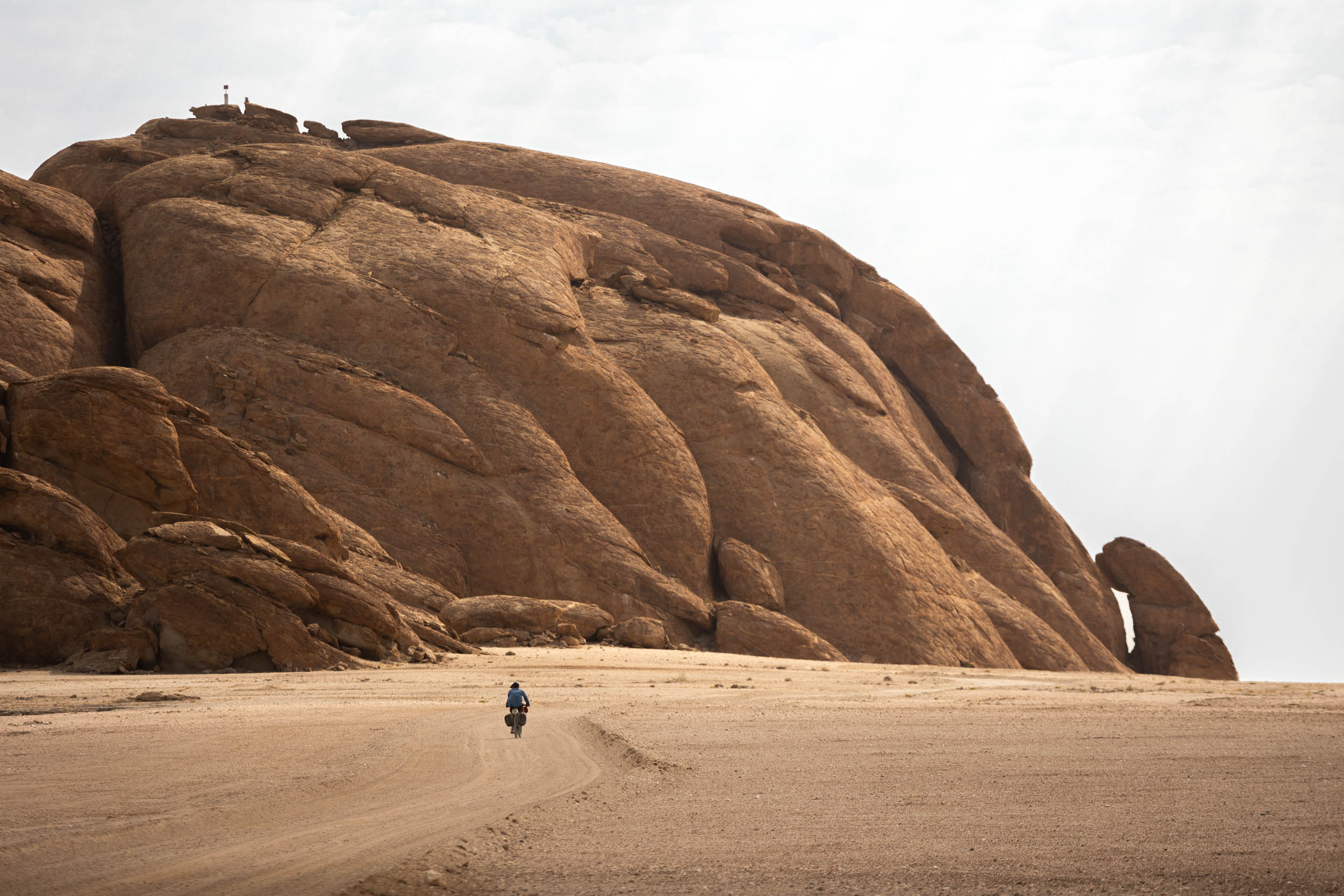
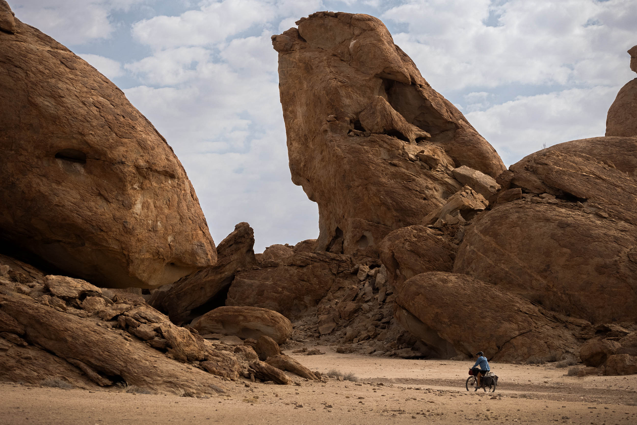
- Mirabib: An often-overlooked yet profoundly striking rock formation that emerges from the otherwise barren desert.
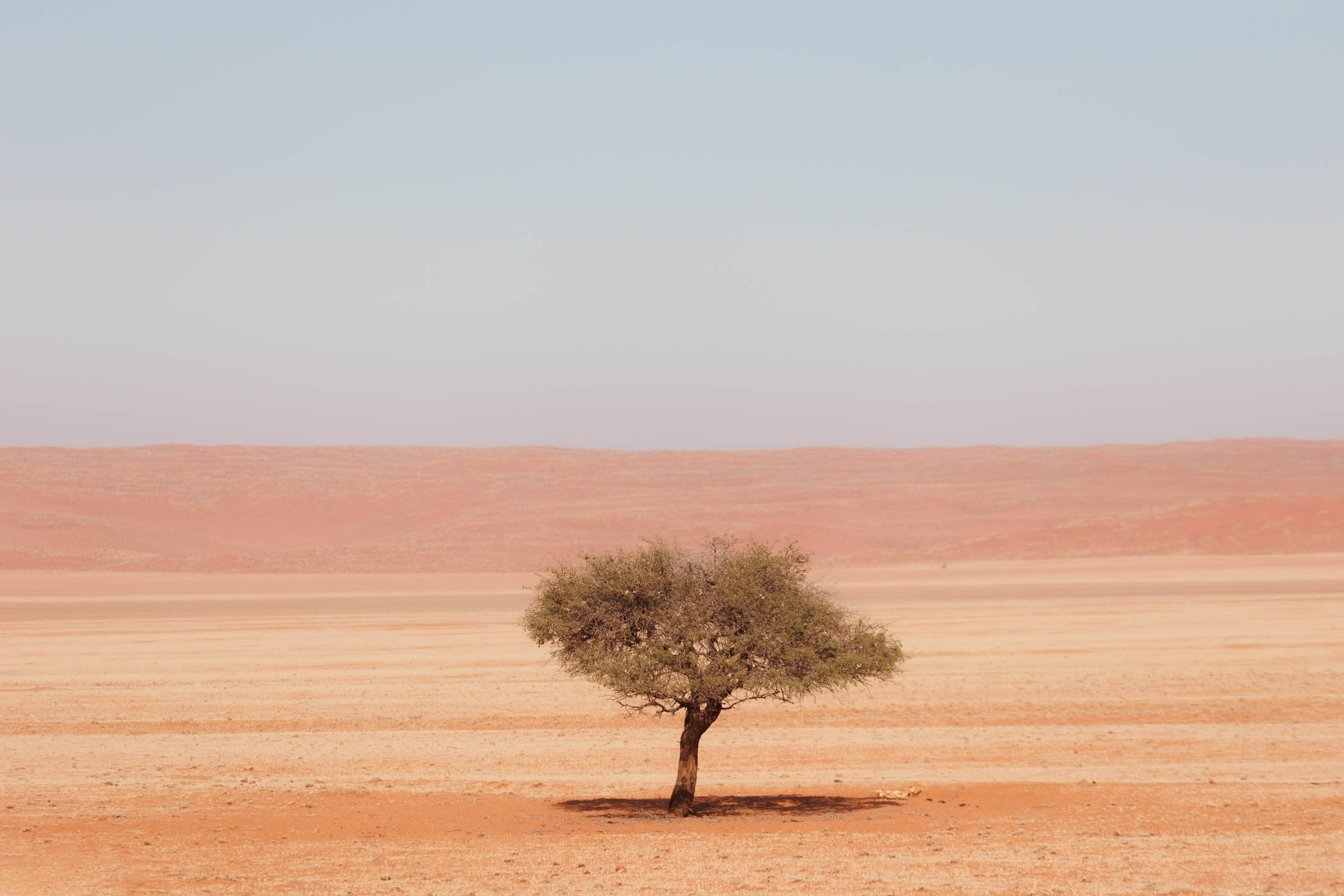
- Kuiseb River: The ephemeral river that forms the stark boundary between the two zones of the Namib, the red sand sea to the south and the featureless gravel desert to the north. The river itself is an oasis of breathtaking native trees and wildlife in a truly striking setting.
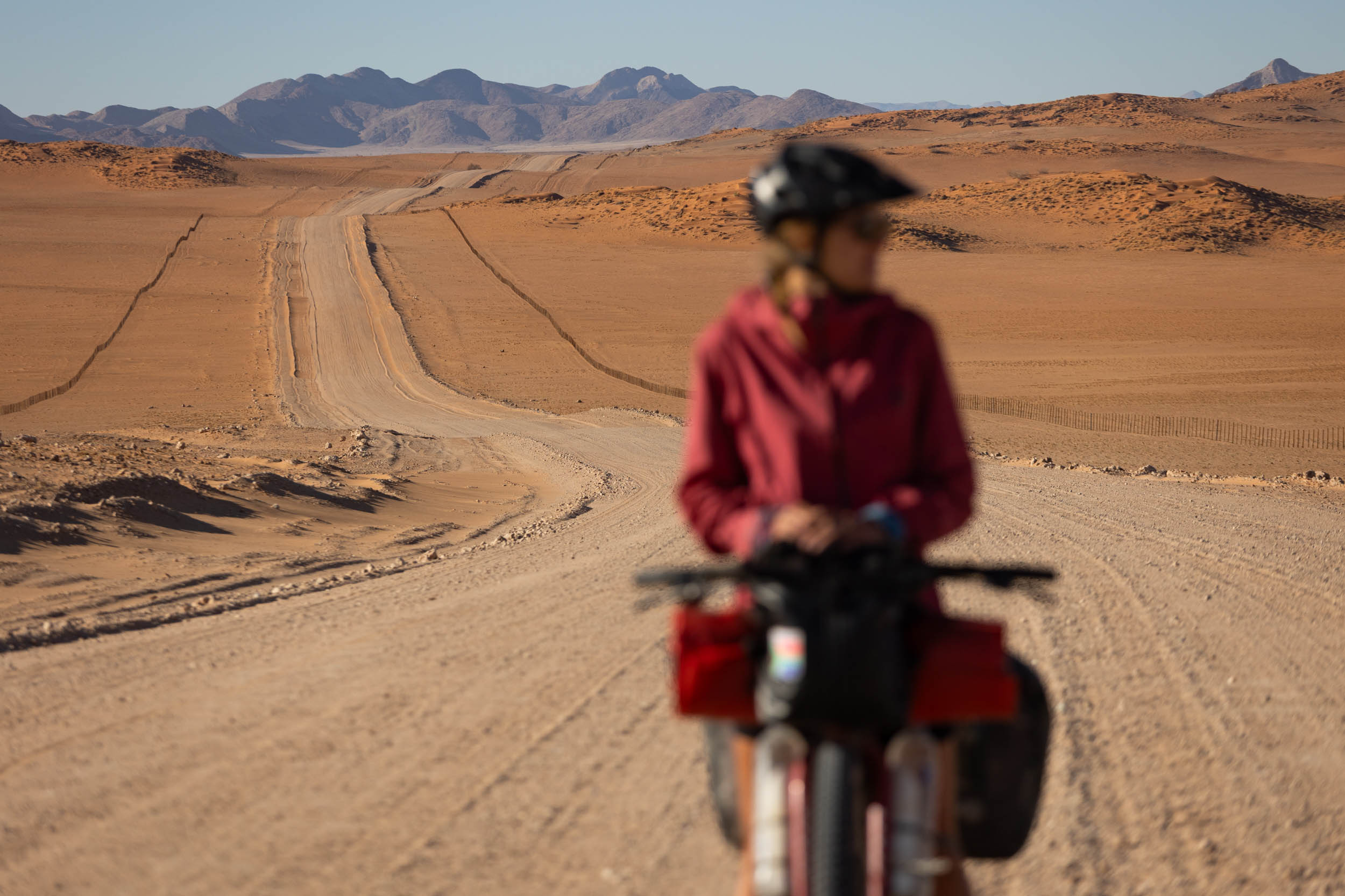
- The D707, perhaps Namibia’s most iconic gravel road, famous for its unspoilt desert scenery.
- The Namibian Richtersveld: Rugged mountainscapes, wild desert scenery, and remarkable plant life.
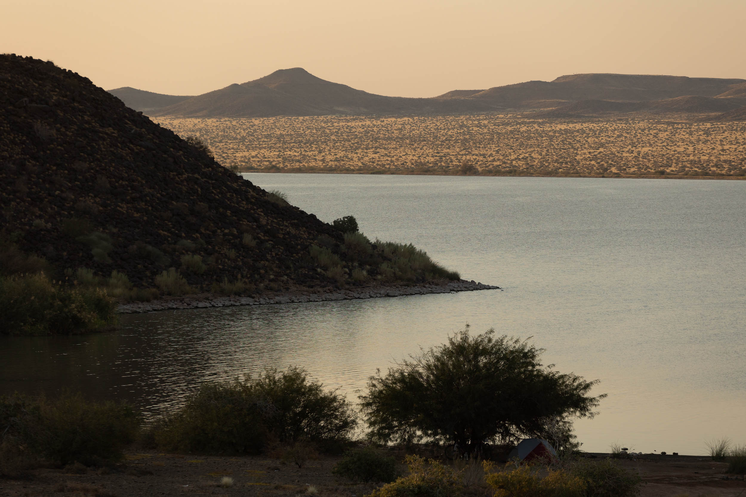
- The Orange River: The only perennial river in this segment. Enjoy its cool waters and immaculate wild camping opportunities.
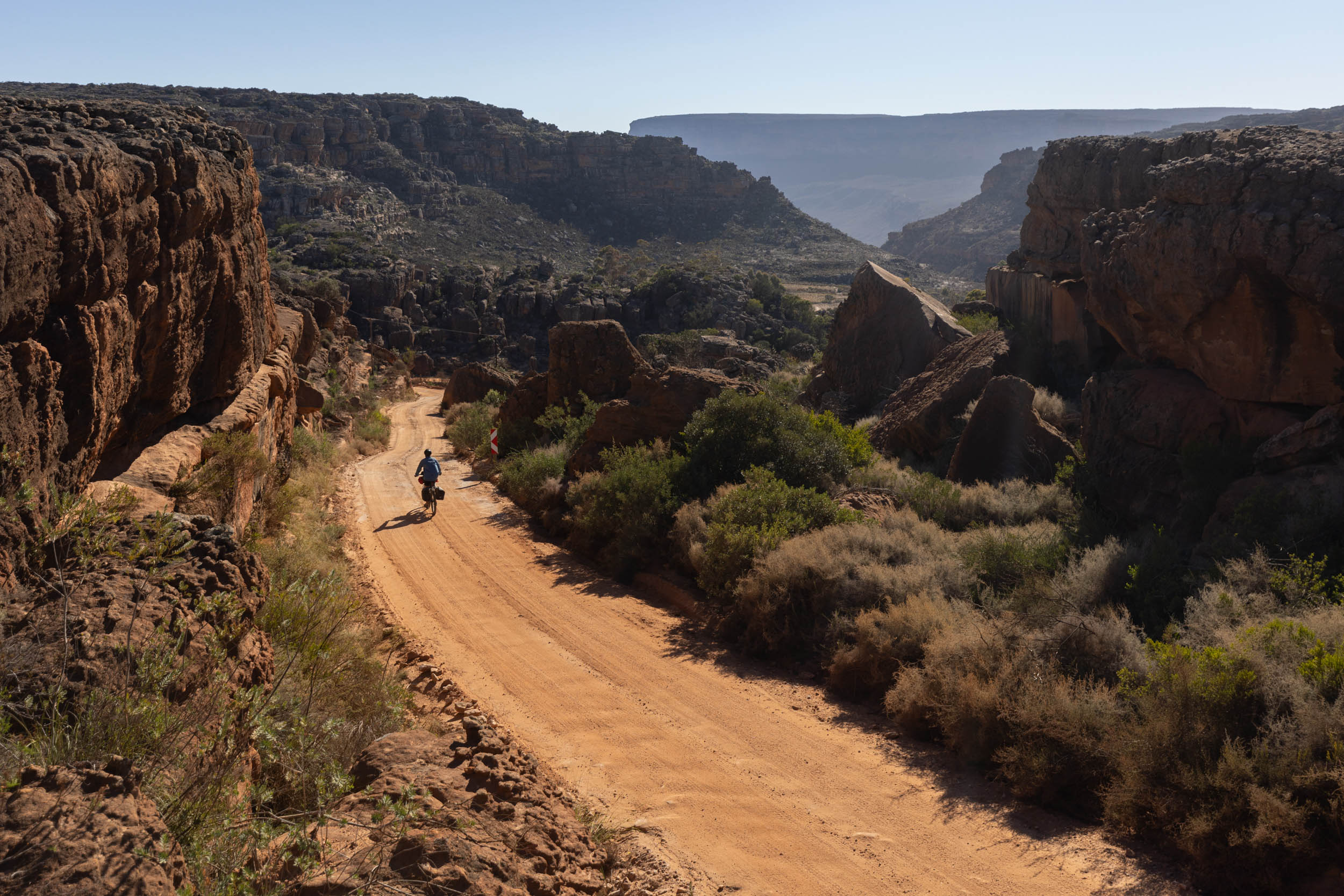
- The Kamchab River Trail: The only real stretch of off-road riding on this segment. It offers a true feeling of wilderness and impressive Richtersveld scenery.
- The Fish River Canyon: Though not technically on the route—it’s a short detour away—views of the canyon are incredible.
When to go
- Winter and shoulder seasons are recommended for pleasant temperatures.
- This is the one segment of the SAND route that can be done year round. While summer temperatures reach up to 40 degrees Celsius, the riding is straightforward enough to make attempting it, even in the sweltering heat, quite feasible. Water haulage and planning will, of course, just require extra attention.
Logistics
- The segment starts at the Sendelingsdrift border station, right where Segment 3 ends. It’s a small and remote border post serving mostly park visitors, and there’s no real transportation services to/from it. It’s a logical start or end point for riders linking this segment with Segment 3 (the South African Richtersveld segment), but it could prove logistically complex to riders doing this one as a standalone segment.
- In the case of the latter, consider starting/ending at Noordoever instead. Noordoewer, 100 kilometres upriver from Sendelingsdrif, is more easily accessible by bus and is fully serviced with shops and accommodation.
- The segment ends in Swakopmund. It’s a large coastal town next to the city of Walvis Bay. The two blend into each other almost seamlessly. “Swakop” represents, perhaps, the first real city, or metropolis, since leaving Stellenbosch, more than 4,000 kilometres prior! Swakop and Walvis have everything a bikepacker could ever ask for, from shopping malls to bike shops and plenty of accommodation options. There are also regular buses and other transport services to and from Windhoek, Namibia’s capital.
Park fees and permits
The region covered in this segment teems with parks, reserves, and private conservancies. Permits are required for the following parks and nature reserves:
- Richtersveld/Ai-Ais Transfrontier Park: The Richtersveld Park extends from South Africa well into Namibia, all the way north of the Fish River Canyon. However, unlike on the South African side, where access is strictly controlled, and rather pricey, it’s possible to pass through the park freely on the Namibian side. It’s only if you decide to enter the gated facilities at Hobas that you’ll have to purchase permits.
- Gondwana Canyon Reserve (Private). The route goes through the reserve, but on a public road. Access is not restricted and no permit is required. However, there is a sign that warns against unauthorised camping.
- Namibrand Nature Reserve (Private). The route takes in a 50-kilometre stretch through the Namibrand Reserve. Again, access is not restricted, but overnighting in the reserve is prohibited.
- Namib-Naukluft National Park: You’ll spend quite a bit of time riding in and around this park, but permits are required only for the following two sections: Sossusvlei (optional, but highly recommended) and the D2186 (the small road to Mirabib and the Kuiseb Canyon). Permits (at time of test-riding the route) were 150 NAD per person per day and had to be purchased in advance at the park office in Sesriem (Sossusvlei entrance gate).
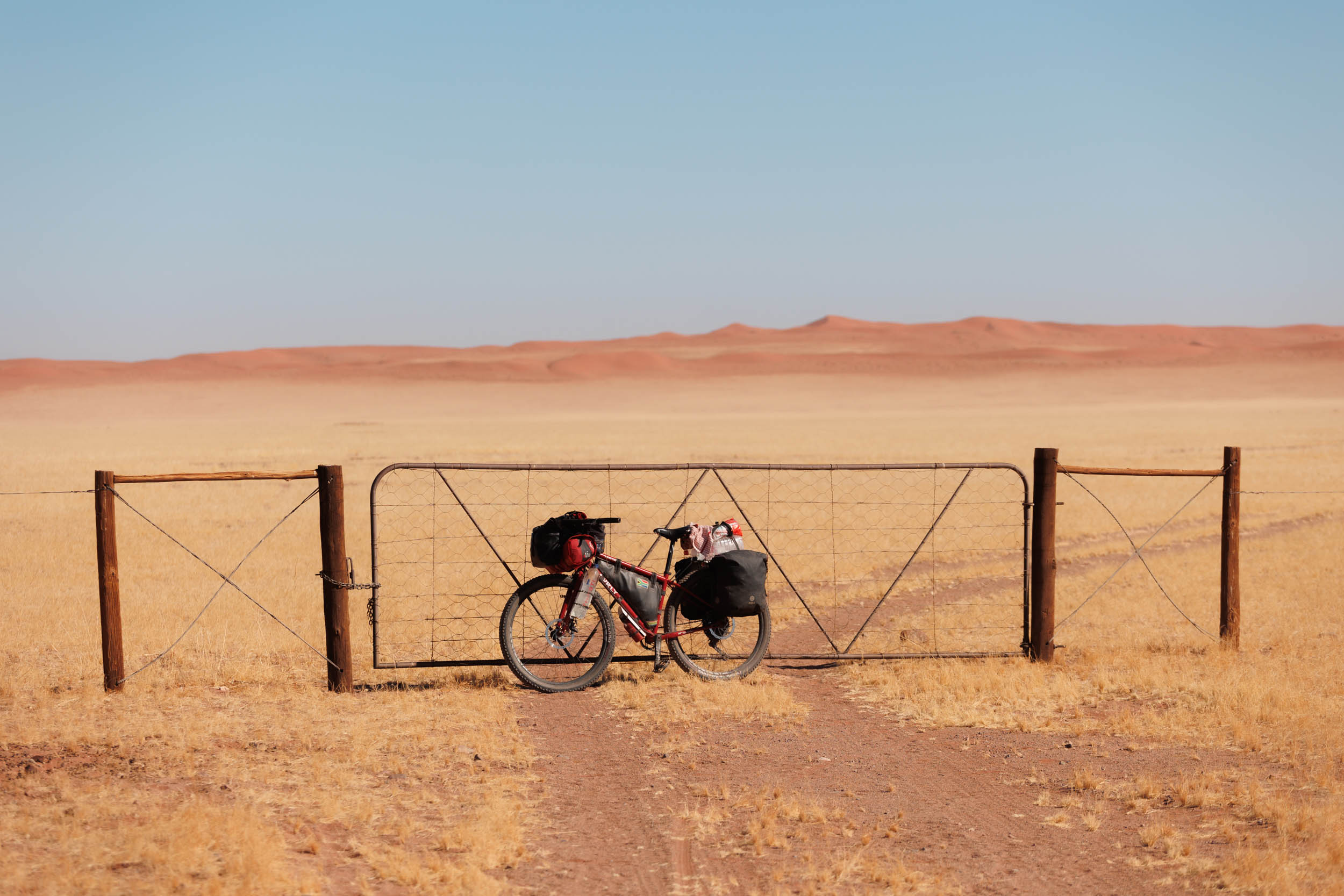
Farm Gates
- Where the route does pass through working farms and private property, it does so on public roads.
- All gates on such roads are supposed to be kept unlocked. If you do encounter a locked gate, try to get permission before continuing. Please report locked gates to us. And as usual, close all gates that were found closed and leave open those that were found open.
Riding direction
- On its own, the segment can be done in any direction, with no real disadvantage either way other than potentially being on the wrong side of the wind, but I’ve heard of equally many cases of headwinds from both directions, even, confusingly, from different riders who rode at the same time.
- If riding this segment back-to-back with Segment 3 and coming from South Africa’s side, it’s worth noting that food resupply on the South African side would already have been spread thinly and you could face entering Namibia with almost no food left over and without any notable shops to look forward to for a long way. In this case, it would be wise to do a quick detour, either to Rosh Pinah or to Aussenkehr, both of which have big supermarkets. Rosh Pinah is about 20 kilometres off-route, and Aussenkehr a mere 5 kilometres.
- Similarly, in the other direction, it might also be worth stocking up before entering South Africa’s Richtersveld. There’s a relatively good shop in Sendelingsdrif on SA’s side of the river, but it’s not always fully stocked.
Dangers and Annoyances
- Safety: Namibia is generally very safe, and due to the extremely low population density in these parts, chances of experiencing any crime are low. However, the usual words of caution apply: keep your wits about you and don’t flaunt valuables, especially in larger towns and busy campsites.
- Flood Risk: Rain is rare in the Namib, but when it does rain, most roads become flooded and virtually unusable for weeks.
- Midges and flies: Horse flies are particularly annoying. Known for their cheeky persistence, they trail in your slipstream, closing in for a bite frequently enough to irritate but never long enough to be caught.
- Dust. Much of the route gets extremely dusty. Carry plenty of chain lube and a rag for cleaning.
- Thorns. The Namib has some gnarly thorns, especially in and near river beds. Make sure to have plenty of sealant in your tyres!
Dangerous Animals
Namibia teems with wild animals. Animal sightings are almost certain on a daily basis. However, the animals inhabiting the Namib region are generally not as dangerous as those further north (see Segment 5). For example, you are unlikely to encounter elephants or lions here. However, you can expect to see plenty of other game, such as a variety of antelope species, zebras, wildebees, and perhaps giraffes. All of these animals are wild and should obviously not be disturbed. However, they should not pose any real threat to passing bikepackers. Enjoy the wildlife watching as you ride along!
Notwithstanding the above, do look out for the following animals:
- Baboons. Encounters with baboons are quite common and usually without incident. However, they are territorial and dangerous and should not be toyed with or fed.
- Jackals. They’re super cute, but should never be petted.
- Hyenas. Hyenas are quite rare here, but they do roam around the river beds. For example, we saw plenty of Hyena tracks in a river bed on the D707 one night.
- Creepers, crawlers, and snakes. Look out for scorpions at night. Check your sleeping gear and the inside of your shoes.
- Of the snakes you can encounter here, the puff adder and the Cape cobra are probably the most dangerous, both of which are fairly common.
- Other fatally venomous snakes found here, although not very common, include the Black Mamba (very rare) and Boomlslang.
Travel basics
- Language: Afrikaans is the most commonly spoken language, but both English and German are usually well understood.
- Nama, the region’s native language, is also widely spoken here.
- Cultural Insight: The Namib, alongside Namaqualand in neighbouring South Africa, is the ancestral home of the Nama people. The Nama people are the largest remaining ethnic group descending from the Khoekhoe (pronounced “koi-koi”), Southern Africa’s earliest pastoralist tribe.
- Of special interest to this segment are the Topnaar people. They’re a Nama tribe that live chiefly on the banks of the Kuiseb River, an area the route passes straight through. Riders of this segment will have ample chance to interact with and learn more of their livelihood and culture.
- Money: Namibia’s currency is the Namibian Dollar (NAD). Its value is fixed to the value of the South African Rand (ZAR). One NAD is always worth exactly one ZAR and, in Namibia, the two are completely interchangeable.
- Most smaller shops take cash only (NAD or ZAR). Be sure to carry enough. Cards (Visa or Mastercard) are only accepted at larger supermarkets, of which there really aren’t many on the route.
- Cellphone: MTC seems to be the region’s most trusted mobile network, but, generally, there’s little-to-no connectivity outside of larger towns. You may have to rely, for the most part, on wifi at campsites and farms.
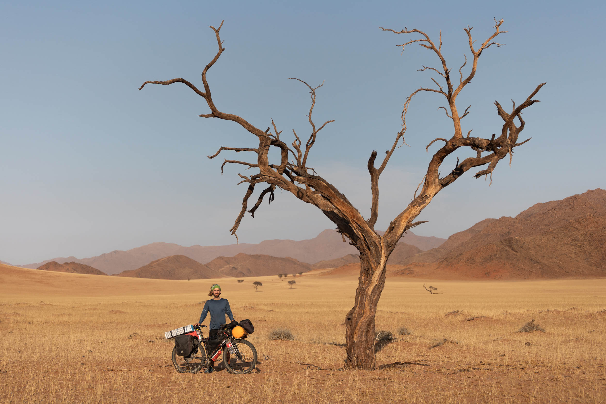
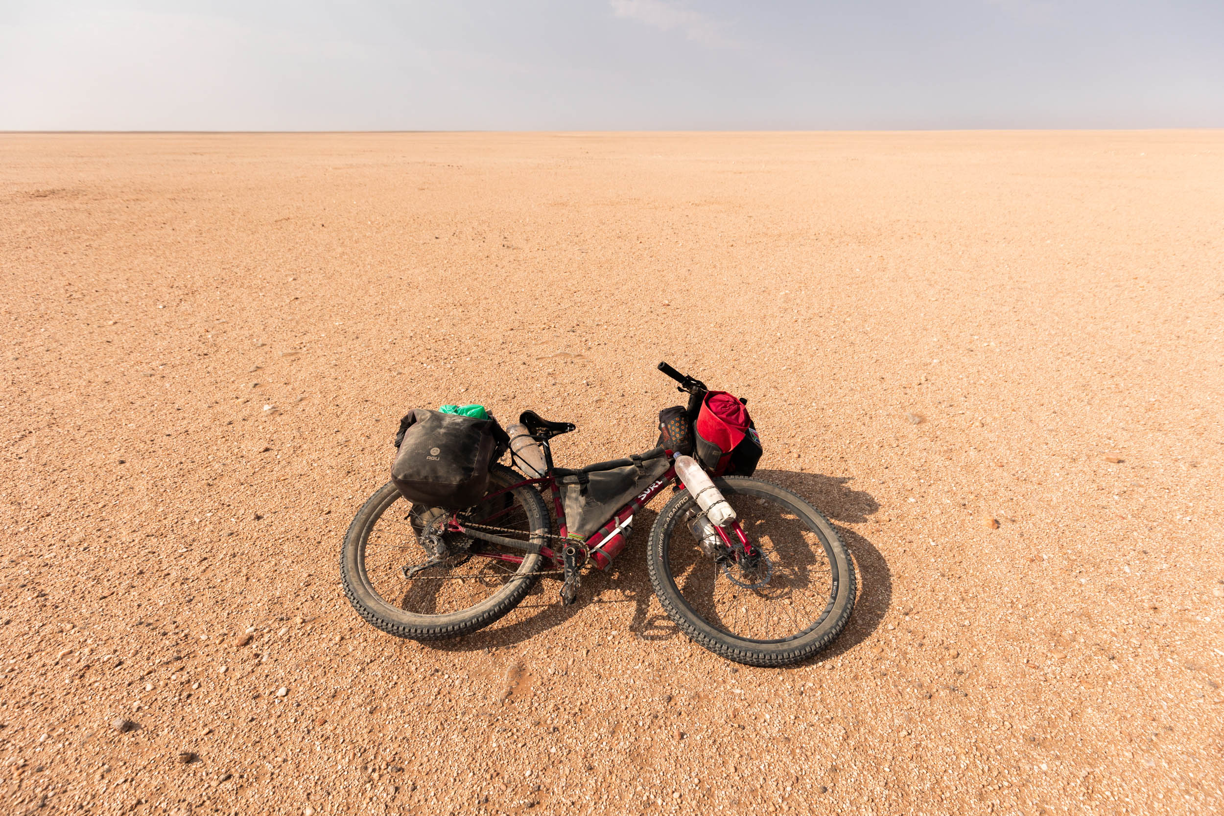
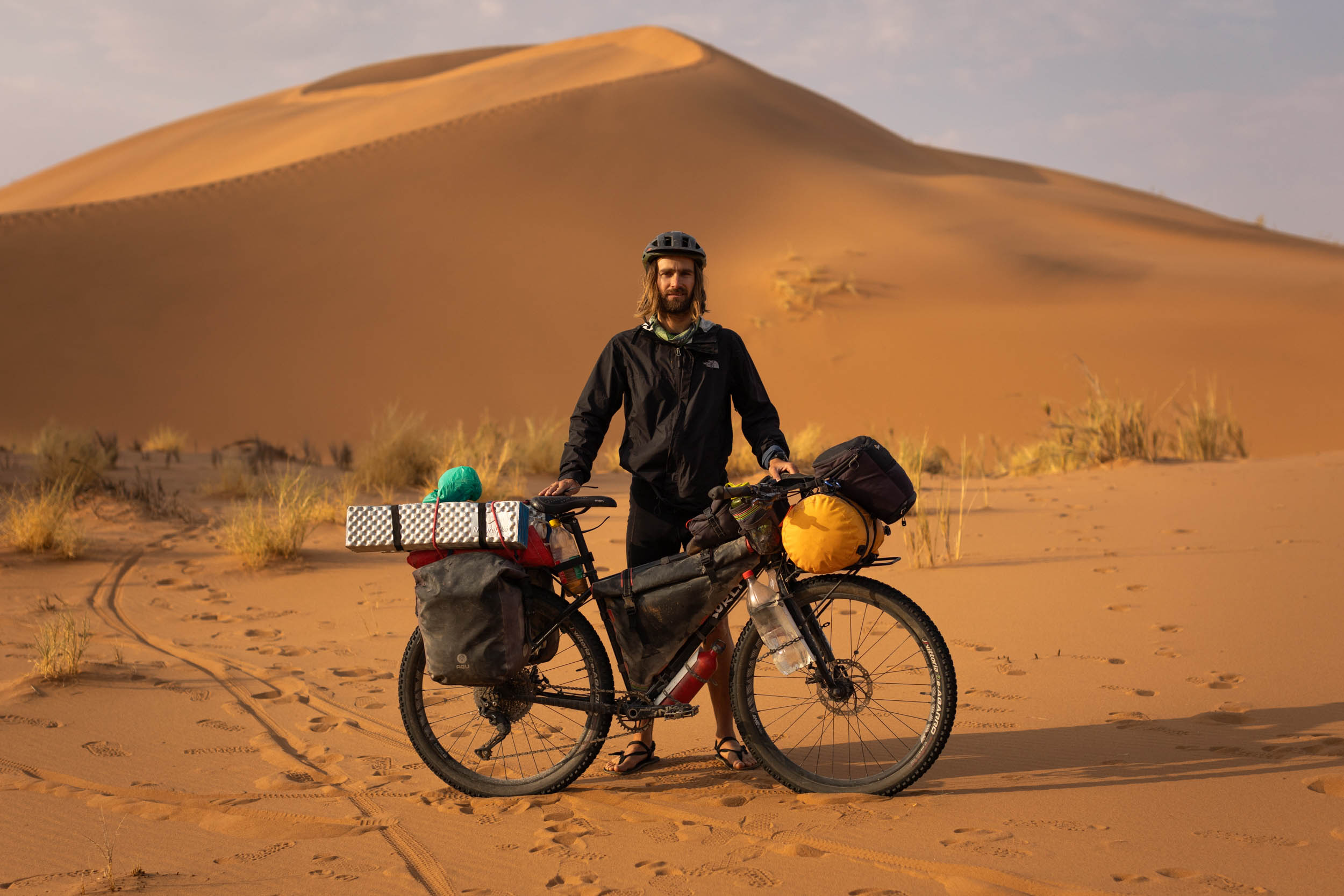
What bike?
- Unlike most other segments on the SAND route, this one’s doable on virtually any bike capable of hauling enough water, including a gravel bike. Something a bit extra like a MTB or ATB with wider tyres will probably be very advantageous. However, being on the popular Cairo to Cape Town route, hundreds of touring cyclists have already proved that even the toughest of these roads can be tackled without suspension or chunky wheels.
- Nonetheless, for anyone planning to pair this segment with Segment 5 to the north or Segment 3 to the south—both of them significantly more technical—an ATB, or MTB with generous tire volume is absolutely essential.
- Bike Shops: Bike shops are only available in Walvis Bay/Swakopmund. Manie’s Bike Mecca in Swakop comes highly recommended.
Although remote and secluded, accommodation is relatively plentiful on this segment. Tourism is a big deal in the Namib. Here’s what you can expect:
- Boutique lodges and luxury private camps: For those who can splurge, but usually require pre-booking.
- Overlander-style campsite: Self-drive desert tours are very popular here, and the mode of choice is usually a 4WD bakkie (pickup-truck) with a rooftop tent. Accordingly, campsites that cater specifically for these travellers are plentiful. They’re especially prevalent near petrol stations and places of interest. They’re often quite utilitarian in their design but useful if you need a shower or shelter from the wind.
- Smaller-scale farm campsites: Some local farmers also offer camping on a smaller scale. These are often nicer but may also require pre-booking.
- Camping prices usually range from 150 NAD to 350 NAD per person per night.
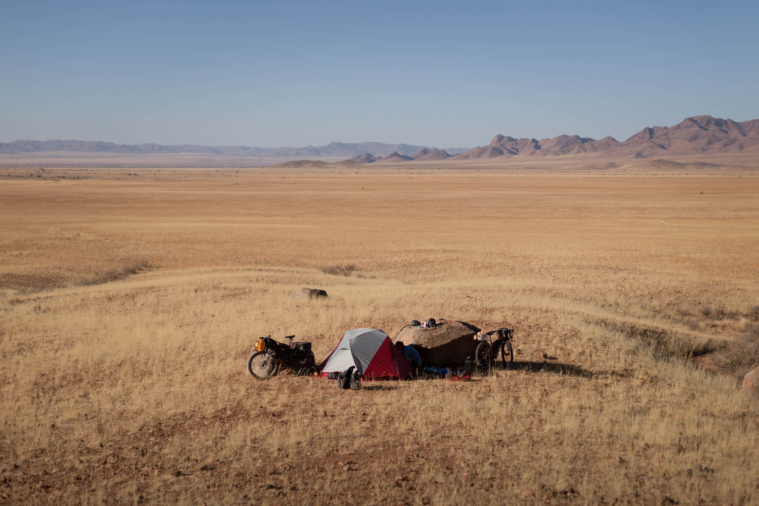
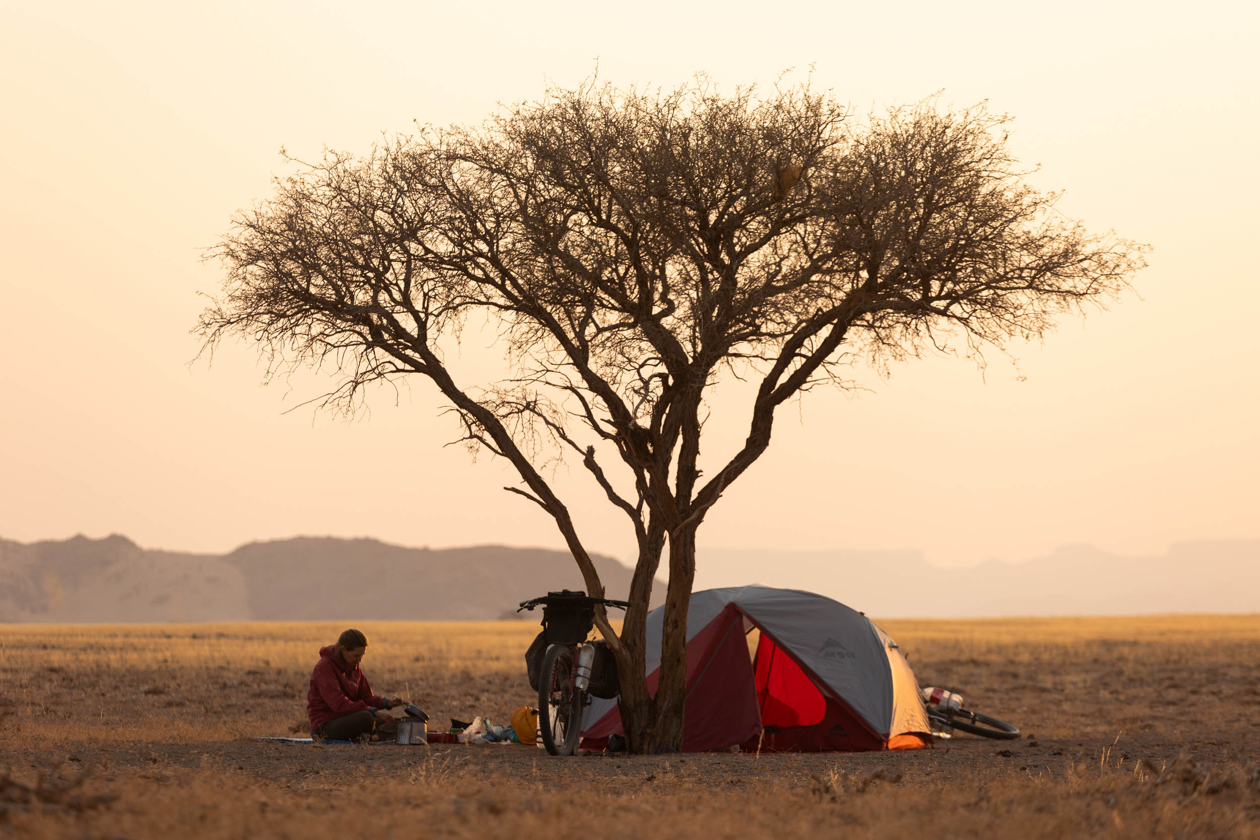
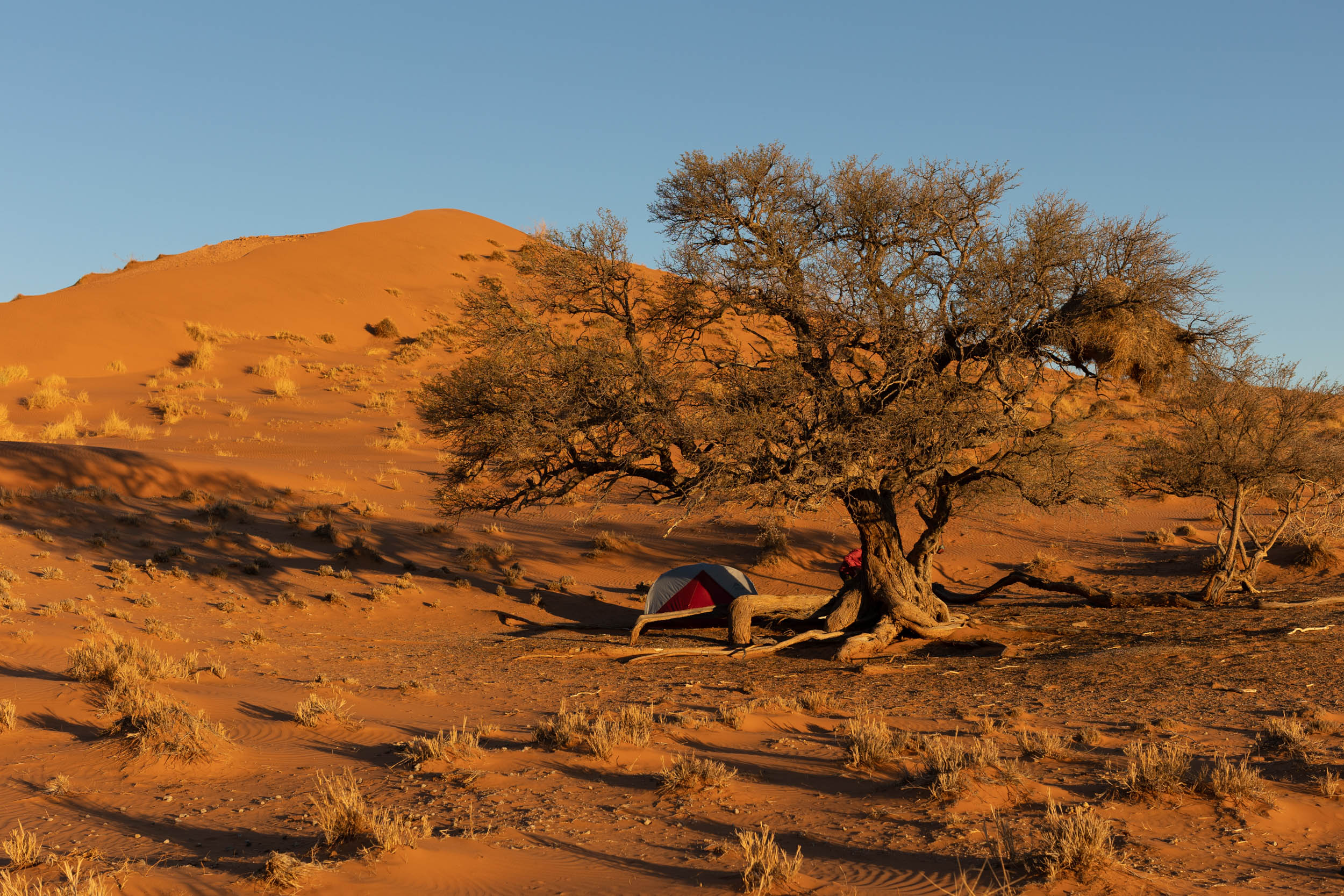
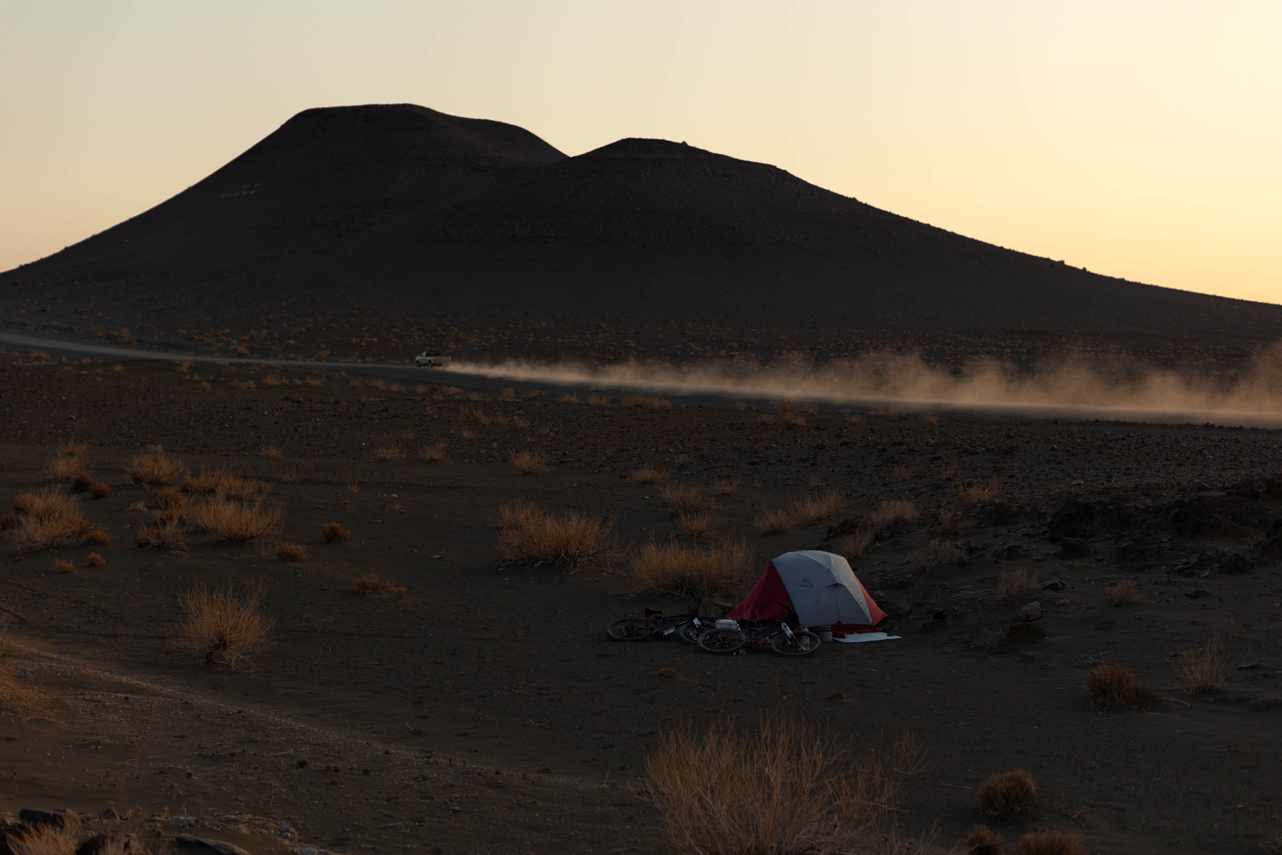
- Wild camping: Arguably the best way to experience the desert is wild camping. Finding a good spot is sometimes a bit like finding a needle in a haystack, and those who know will know that wild camping is a fine art, but the camping in the Namib truly is exquisite and worth every bit of extra effort. On the flip side, even if you can’t find that “million-dollar camp,” most roads are so quiet that you can literally stop and camp wherever you are, in the road reserve, and it will still be better than most of the bakkie campsites. The only problem with wild camping is the additional water haulage it requires. Plan accordingly.
Water
With frequent sections of 100 kilometres or more without anything, it goes without saying that water planning and management is critical. Guidelines:
- Recommended carrying capacity of at least 10 litres.
- Critical refill opportunities are indicated on the GPX.
- Fill up at every possible opportunity.
- The Orange River is the only perennial river on this segment. The chance of any other surface water is highly unlikely.
- Stop cars if needed. Most drivers carry a bottle or two and will be happy to help. Tip: Vehicles with local plates (B, K, KA, M, MA, etc.) are more likely to stop. Rental drivers (W or GP plates) tend to be more shy.
- The groundwater from local farms often has a strong mineral taste. Adding some juice mix to it can improve the taste.
Food
For the sake of managing expectations, it would be cruel to suggest that this segment offers a culinary feast. Food sources—mostly just tourist shops and campsite convenience stores—are few and far between and seldom offer more than small snacks or sweets.
- Critical food resupply points are marked on the GPX. Study these carefully. Additional food stops, off-route, but within reasonable distance, are also marked. Don’t hesitate to venture off-route for food if needed.
Richtersveld: Sendelingsdrift to Aussenkehr
The opening stretch follows the river from Sendelingsdrif to Aussenkehr. It’s a beautiful stretch, and the river is never too far away. It has some lovely wild camping opportunities and stunning scenery, much the same as the Richtersveld scenery of Segment 3.
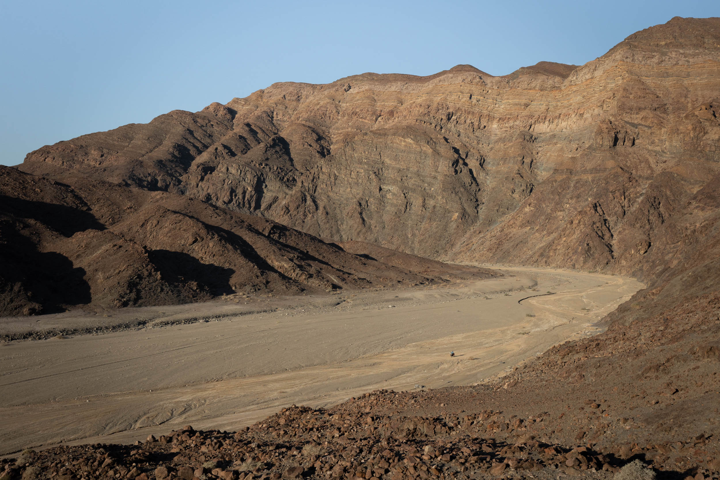
The riding is straightforward with one exception: Roughly 10 kilometres before reaching Aussenkehr, a small track leads off into the mountains along a dry riverbed. This is the Kamchab River Trail. It’s highly recommended, as it’s the only true off-road section on this whole segment and has a lovely wild feel. But it comes with two little snags. One, the riding is more technical than the rest of the segment. It’s sandy in the canyon and perhaps not suited for narrower tyres. Two, it bypasses Aussenkehr, which could be an important food stop, depending on your situation.
Fish River Canyon: Aussenkehr to Hobas
On this section, you’ll get your first taste of truly Namibian landscapes and its characteristic long, secluded gravel roads.
The only real places of interest on this stretch are Ai-Ais and Hobas. Getting to Ai-Ais, a resort and campsite at the bottom of the Fish River Canyon, involves a stiff detour (10 kilometres one way), but it’s a nice spot to relax for a night or two. There’s a campsite, hot springs, a good restaurant, and a small shop.
A note about the shop at Ai-Ais: It’s a good shop, but don’t rely on it too heavily. It’s not always fully stocked. We found nothing but canned wieners when we were there. The restaurant, however, is usually fully operational and serves decent food.
Some 55 kilometres to the north is Hobas. This is where the park’s offices are located (Namibia’s side of the Richtersveld-Ai-Ai’s Transfrontier Park). There’s also a campsite and a small shop. Hobas is a great place to get views of the Fish River Canyon (breathtaking!), although it’s 12 kilometres out to get to the canyon rim.
Look out for wildlife on the road between Ai-Ais and Hobas. It’s plentiful.
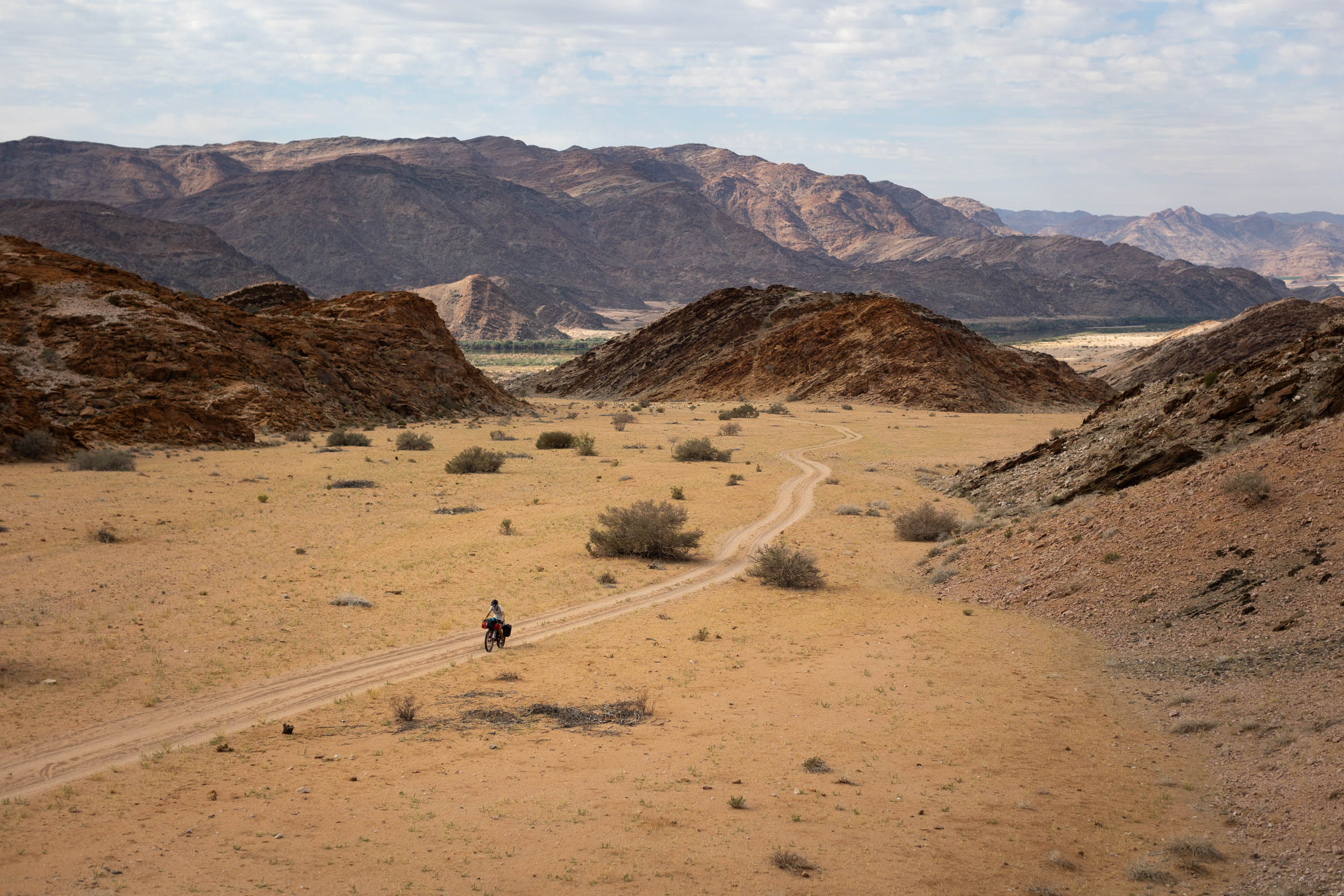
Karas: Hobas to D707
From Hobas, the route continues north through Karas Province on a series of long and straight gravel roads. Beware of strong headwinds on this section!
About 110 kilometres north of Hobas, the route briefly joins the B4 highway before exiting off onto smaller gravel roads again. Take care here; this stretch of road is frequented by large, speeding mining trucks that transport ore between Keetmans and Luderitz.
An important place of interest in this section is the town of Bathanie. If you’ve been riding the route from south to north and stayed true to it until here, without diverging, Bethanie would be the first real inhabited settlement since entering the country, more than 400 kilometres prior! It’s still a small town, and sleepy, but it has a decent-sized grocery shop. Take full advantage of it.
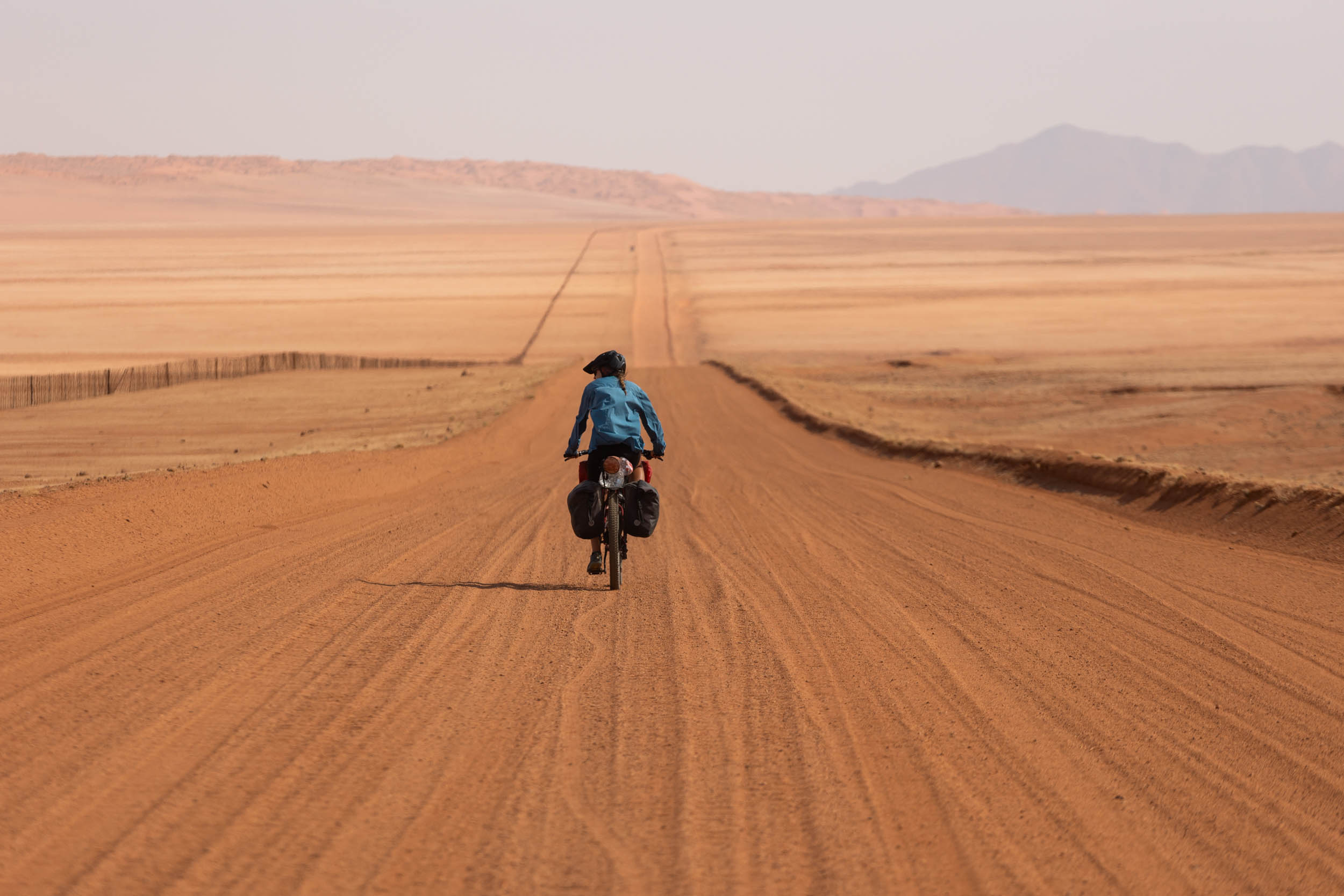
The final stretch through Karas Province is on the D707, a real highlight! This road is often dubbed the “most scenic road in Namibia.” It curves right through the heart of the desert and offers pristine scenery while also packing a bit of a punch (It tends to get quite sandy and corrugated at times).
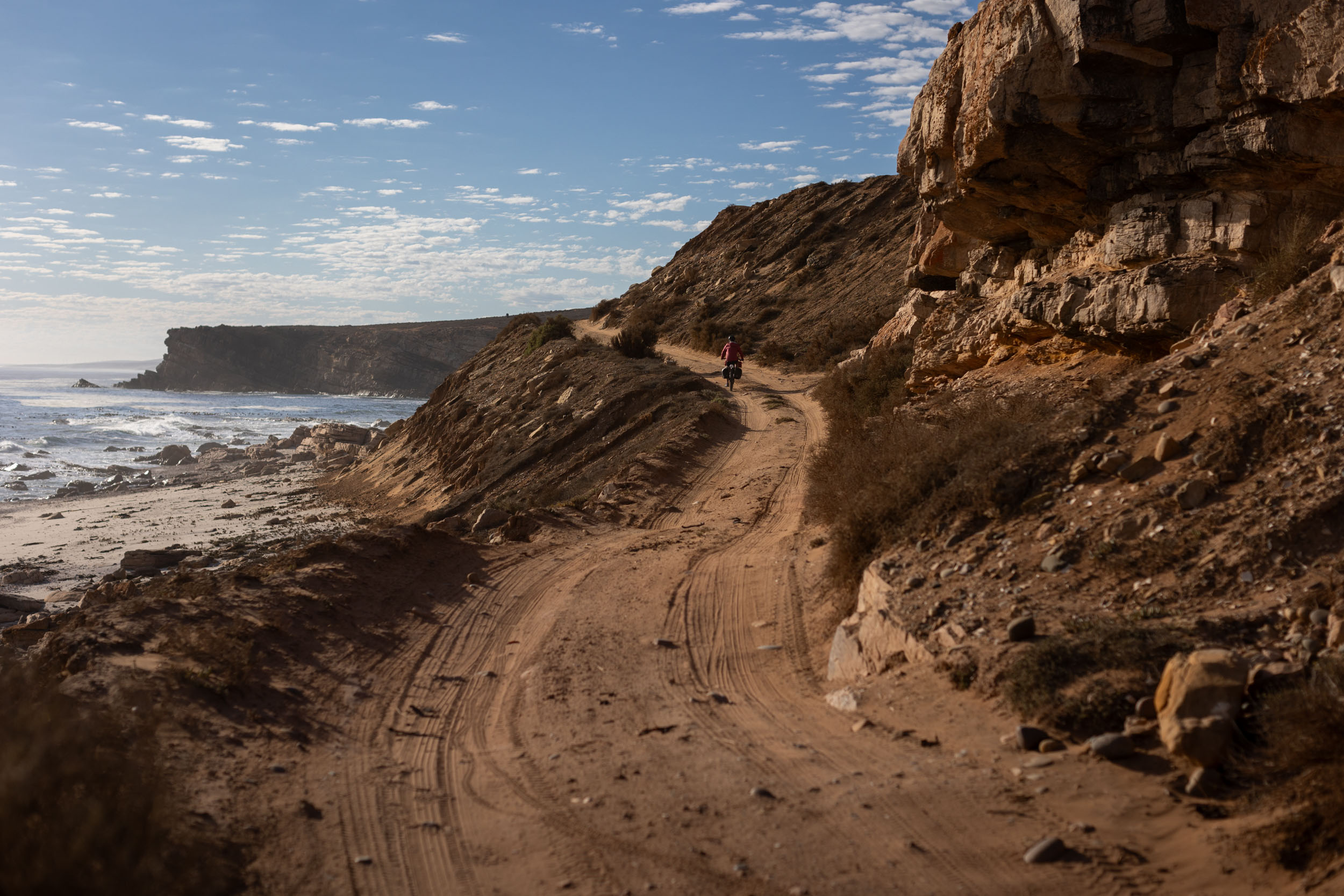
The Kuiseb: D707 to Swakopmund
Shortly after emerging from the D707, the route crosses through a private nature reserve called Namibrand. It’s still on a public road, so access is open, but wild camping is prohibited inside. Most riders should be able to get in and out on the same day—it’s only about 65 kilometres— but it’s common to get caught inside, especially when the road’s in bad shape. The park ranger sometimes allows cyclists to sleep in a cottage at her residence, but this must be arranged in advance. See GPX waypoint for contact details.
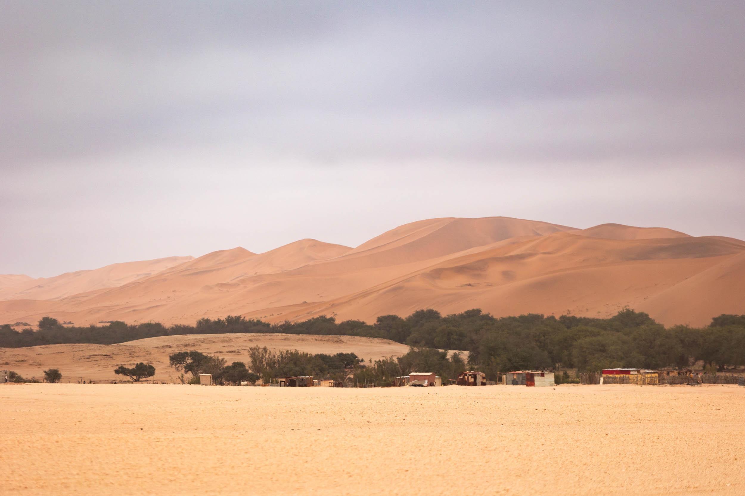
The next real place of interest is Sesriem, which is important for two reasons. One, there’s a petrol station with an excellent shop that sells everything from pastries to cold beers to fresh fruits and veggies. Sesriem is also the gateway to Sossusvlei, one of the most popular sights in all of Namibia. This park section is stunning: surreal desertscapes, sand dunes that stand more than 300 metres tall, and abundant wildlife. You need a permit to enter, but it’s highly recommended to do so and even to take a day or three off to explore inside the park. Cycling is permitted inside, but only during the daytime.
A word of caution: the stretch of road just south of Sesriem, roughly the last 25 to 50 kilometres, tends to be in bad shape.
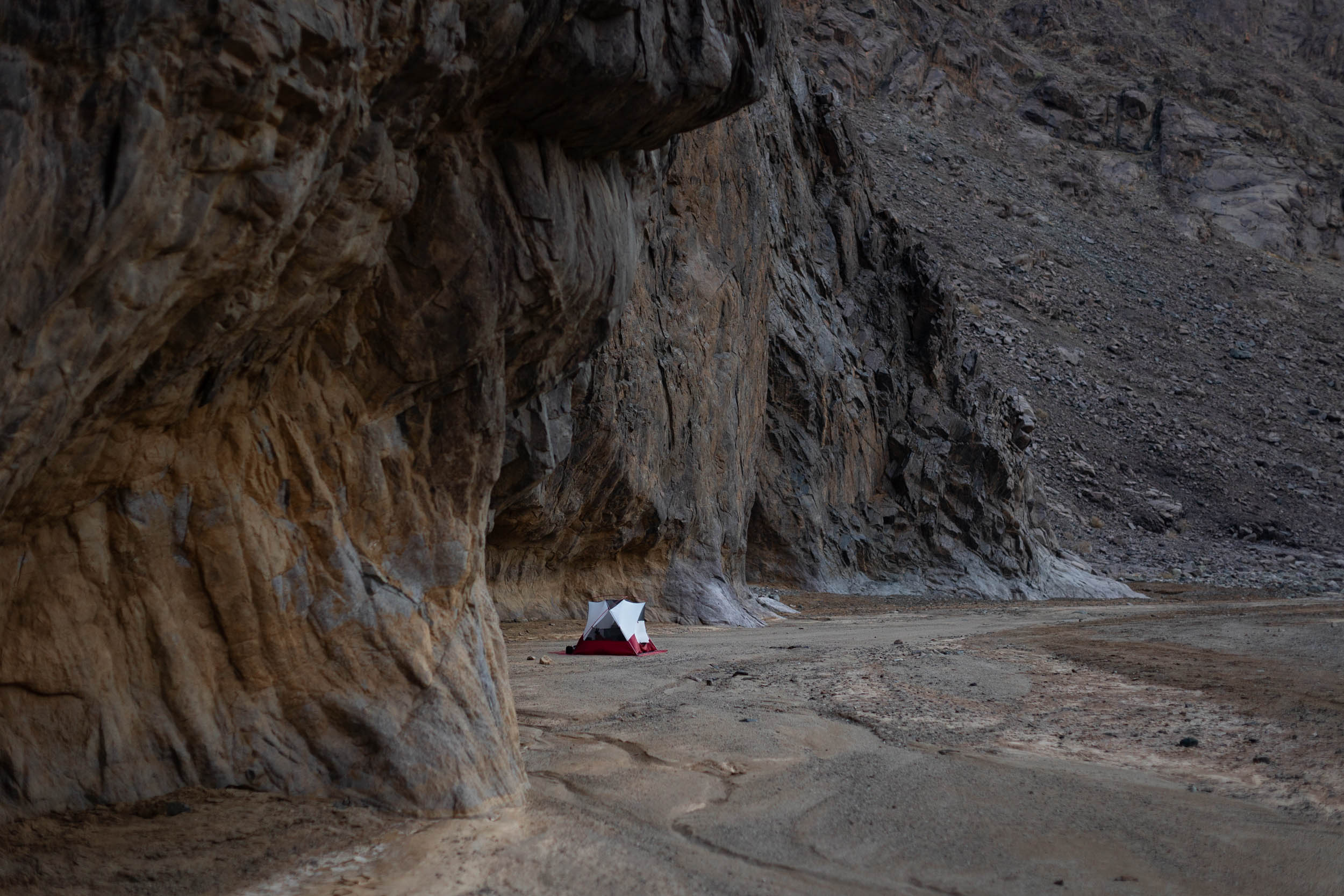
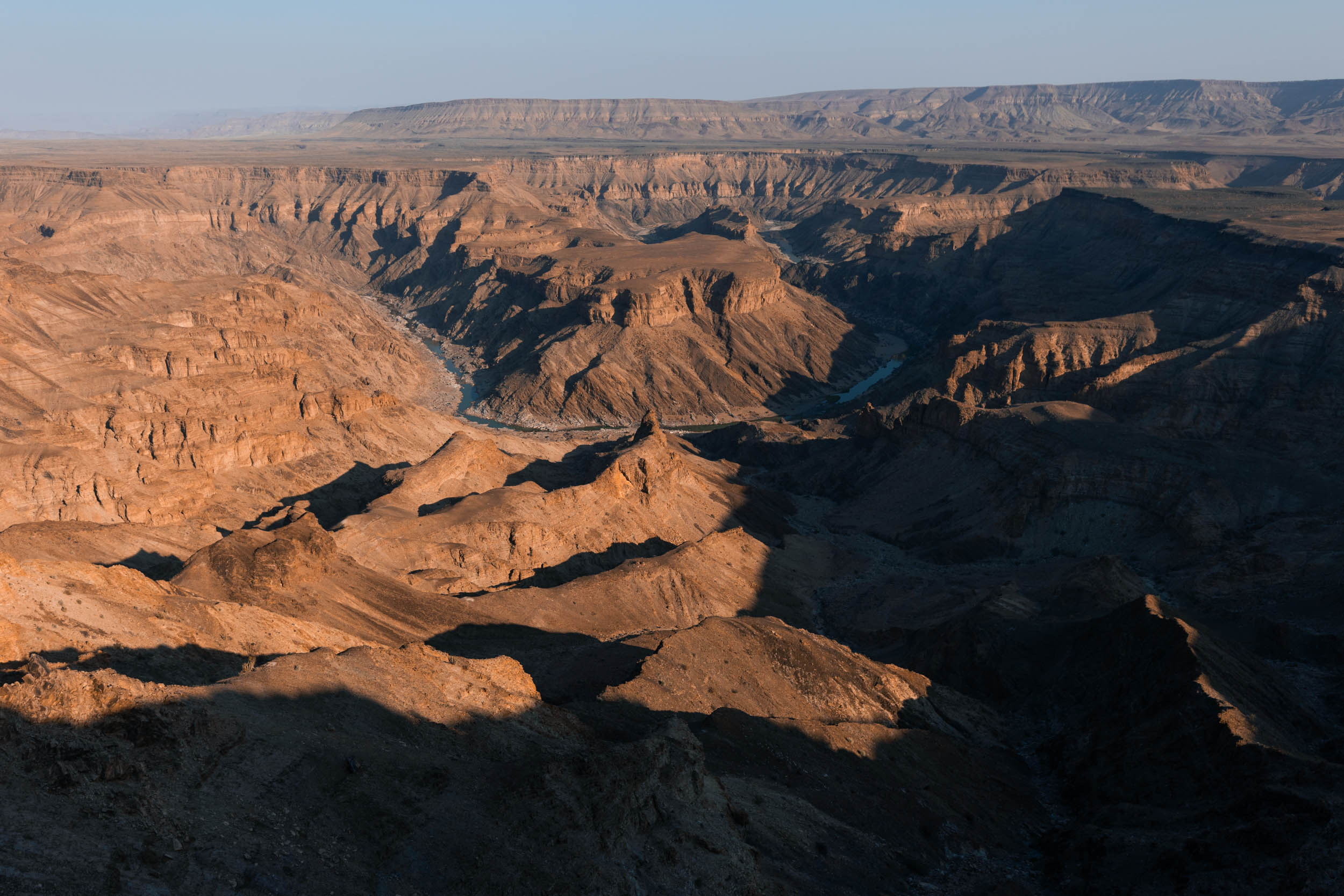
From Sesriem, the route continues north on a series of prominent national roads (still all gravel) that eventually cross the Kuiseb River Canyon. Once through the canyon, the landscape changes. Light grey gravel starts to replace the sea of red sand that dominates the landscapes south of the canyon. In this new landscape of bareness and gravel, the route enters the park once more and heads down the often poorly maintained D2186, back in the direction of the Kuiseb River. On this stretch, you’ll pass Mirabib, a large, striking rock formation with excellent camping (no water). It’s another key highlight of this segment.
After Mirabib, the road starts skirting the Kuiseb River. This is where the gravel desert is separated from the sea of dunes. The contrast is incredible to behold, and the vegetation inside the river bed is marvellous. This is also the home of the Topnaar people, making this stretch one of the more culturally important parts of the segment.
The penultimate stretch, approaching Walvis Bay on the D1983, has a fair amount of mining activity and industry. Consequently, there’s some heavy vehicle traffic. Take care.
Lastly, the home stretch from Walvis to Swakopmund is on a busy paved highway. Again, take care.
Additional Resources
- I-overlander: A popular app used by all sorts of overland travellers to share information about roads, amenities, campsites, etc. It’s particularly useful in these parts of Namibia as it contains loads of suggestions for wild camping spots.
- Tracks4Africa has some of the better maps out therefor Namibia.


Terms of Use: As with each bikepacking route guide published on BIKEPACKING.com, should you choose to cycle this route, do so at your own risk. Prior to setting out check current local weather, conditions, and land/road closures. While riding, obey all public and private land use restrictions and rules, carry proper safety and navigational equipment, and of course, follow the #leavenotrace guidelines. The information found herein is simply a planning resource to be used as a point of inspiration in conjunction with your own due-diligence. In spite of the fact that this route, associated GPS track (GPX and maps), and all route guidelines were prepared under diligent research by the specified contributor and/or contributors, the accuracy of such and judgement of the author is not guaranteed. BIKEPACKING.com LLC, its partners, associates, and contributors are in no way liable for personal injury, damage to personal property, or any other such situation that might happen to individual riders cycling or following this route.
Further Riding and Reading
Here are some connected/nearby routes and related reports...
Please keep the conversation civil, constructive, and inclusive, or your comment will be removed.